

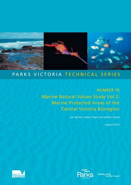
parks victoria technical series marine natural values study vol 2 ...
parks victoria technical series marine natural values study vol 2 ...
parks victoria technical series marine natural values study vol 2 ...

Create successful ePaper yourself
Turn your PDF publications into a flip-book with our unique Google optimized e-Paper software.
<strong>parks</strong> <strong>victoria</strong> <strong>technical</strong> <strong>series</strong><br />
Number 76<br />
Marine Natural Values Study Vol 2:<br />
Marine Protected Areas of the<br />
Central Victoria Bioregion<br />
Jan Barton, Adam Pope and Steffan Howe<br />
August 2012
© Parks Victoria<br />
All rights reserved. This document is subject to the Copyright Act 1968, no part of this publication<br />
may be reproduced, stored in a retrieval system, or transmitted in any form, or by any means,<br />
electronic, mechanical, photocopying or otherwise without the prior permission of the publisher.<br />
First published 2012<br />
Published by Parks Victoria<br />
Level 10, 535 Bourke Street, Melbourne Victoria 3000<br />
Opinions expressed by the Authors of this publication are not necessarily those of Parks Victoria,<br />
unless expressly stated. Parks Victoria and all persons in<strong>vol</strong>ved in the preparation and distribution<br />
of this publication do not accept any responsibility for the accuracy of any of the opinions or<br />
information contained in the publication.<br />
Authors:<br />
Jan Barton – Research Fellow, Deakin University<br />
Adam Pope – Research Fellow, Deakin University<br />
Steffan Howe – Marine Science Manager, Parks Victoria<br />
National Library of Australia<br />
Cataloguing-in-publication data<br />
Includes bibliography<br />
ISSN 1448-4935<br />
Citation<br />
Barton, J., Pope, A. and S. Howe (2012) Marine Natural Values Study Vol 2: Marine Protected<br />
Areas of the Central Victoria Bioregion. Parks Victoria Technical Series No. 76. Parks Victoria,<br />
Melbourne.<br />
Printed on environmentally friendly paper
Parks Victoria Technical Paper Series No. 76<br />
Marine Natural Values Study (Vol 2)<br />
Marine Protected Areas of the Central<br />
Victoria Bioregion<br />
Jan Barton, Adam Pope and Steffan Howe*<br />
School of Life & Environmental Sciences<br />
Deakin University<br />
*Parks Victoria<br />
August 2012
Parks Victoria Technical Series No. 76<br />
Central Victoria Bioregion Marine Natural Values Study<br />
EXECUTIVE SUMMARY<br />
Along Victoria’s coastline there are 30 Marine Protected Areas (MPAs) that have been<br />
established to protect the state’s significant <strong>marine</strong> environmental and cultural <strong>values</strong>. These<br />
MPAs include 13 Marine National Parks (MNPs), 11 Marine Sanctuaries (MSs), 3 Marine and<br />
Coastal Parks, 2 Marine Parks, and a Marine Reserve, and together these account for 11.7%<br />
of the Victorian <strong>marine</strong> environment. The highly protected Marine National Park System,<br />
which is made up of the MNPs and MSs, covers 5.3% of Victorian waters and was<br />
proclaimed in November 2002. This system has been designed to be representative of the<br />
diversity of Victoria’s <strong>marine</strong> environment and aims to conserve and protect ecological<br />
processes, habitats, and associated flora and fauna. The Marine National Park System is<br />
spread across Victoria’s five <strong>marine</strong> bioregions with multiple MNPs and MSs in each<br />
bioregion, with the exception of Flinders bioregion which has one MNP. All MNPs and<br />
MSs are “no-take” areas and are managed under the National Parks Act (1975) - Schedules<br />
7 and 8 respectively.<br />
This report updates the first Marine Natural Values Study (Plummer et al. 2003) for the MPAs<br />
in the Central Victoria bioregion on the central coast of Victoria and is one of a <strong>series</strong> of five<br />
reports covering Victoria’s Marine National Park System. It uses the numerous monitoring<br />
and research programs that have increased our knowledge since declaration and aims to<br />
give a comprehensive overview of the important <strong>natural</strong> <strong>values</strong> of each MNP and MS.<br />
The Central Victorian Bioregion extends along the open coast from Apollo Bay to Cape<br />
Liptrap and out to the limit of Victorian State waters in Bass Strait. It contains two MNPs,<br />
Point Addis and Bunurong, and five small MSs, Marengo Reefs, Eagle Rock, Point Danger,<br />
Barwon Bluff and Mushroom Reef. It has a temperate climate, a shore characterised by cliffs<br />
and sandy beaches and a steep sea bed. It is relatively exposed to swells and weather from<br />
the south-west. Its biota is a diverse mixture of species from all of the adjacent<br />
biogeographical provinces – western, eastern and southern temperate species – in addition<br />
to cosmopolitan southern Australian species. Ship wrecks occur within all the MPAs except<br />
Eagle Rock and Mushroom reef.<br />
High resolution bathymetry mapping has increased our understanding of habitats in the<br />
shallow waters of all the MPAs, and for the whole of Point Addis MNP. All the MPAs in the<br />
Central Victoria bioregion have intertidal rocky reef and some shallow subtidal reef. The<br />
shallow subtidal rocky reefs in Bunurong MNP are extensive. Only Point Addis and Bunurong<br />
MNPs have deep subtidal reef. The reefs in the MPAs are predominately limestone or<br />
sandstone, with some basalt in Eagle Rock, Barwon Bluff and Mushroom Reef MSs. All,<br />
except Marengo Reefs MS, have intertidal soft sediment habitat or beaches interspersed<br />
amongst rocky headlands. Wrack material in this habitat contributes to the detrital cycle and<br />
is a significant source of food for many invertebrates and shore birds. All the MPAs have<br />
some subtidal soft sediment habitat, which can have very high numbers of invertebrate<br />
species living on and in it. Subtidal soft sediment and open water are the dominant habitat<br />
types in Point Addis and Bunurong MNPs, but intertidal and shallow subtidal rocky reef are<br />
the dominant habitat in the five MSs.<br />
On the intertidal reefs the dominant habitat is the brown alga Neptune’s necklace Hormosira<br />
banksii. Algal turf, coralline algae, sea lettuce Ulva sp. and the mussel Limnoperna pulex can<br />
also form intertidal habitats. In Bunurong MNP, and Eagle Rock and Point Danger MSs sand<br />
can cover the intertidal reef. Bull kelp Durvillaea potatorum grows on the intertidal reef edge<br />
in Point Addis MNP, and Marengo Reefs, Eagle Rock, Barwon Bluff and Mushroom Reef<br />
MSs. The mobile intertidal reef fauna in the MPAs is dominated by molluscs. The striped<br />
conniwink Bembicium nanum and pulmonate limpet Siphonaria spp. are abundant along with<br />
various other limpet species. The top shell Austrocochlea constricta is particularly abundant<br />
in all the MSs. In the two MNPs and Barwon Bluff MS the periwinkles Nodolittorina acutispira<br />
and N. unifasciata are abundant. The black nerite Nerita atramentos is abundant amongst<br />
ii
the basalt boulders in Eagle Rock and Mushroom Reef MSs. Mushroom Reef MS has one of<br />
the most diverse rocky reef assemblages in Victoria, the Bunurong coast has a very high<br />
diversity of chitons, but little is known about the intertidal biota of Marengo Reefs MS.<br />
On the shallow subtidal reef of the MPAs the algae canopy can be mixed brown algae,<br />
crayweed Phyllospora comosa, kelp Ecklonia radiata or giant kelp Macrocystis pyrifera. The<br />
algal assemblage of Ingoldsby Reef in Point Addis MNP is particularly diverse. Bunurong<br />
MNP algal assemblage is unusual with a high diversity of red and brown algae species and a<br />
low abundance or absence of the large browns such as P. comosa and E. radiata. The<br />
understorey at both Marengo Reefs and Eagle Rock MSs has very few species and a low<br />
cover of red and green algae. P. comosa does not grow in Point Danger MS.<br />
Abundant blacklip abalone Haliotis rubra characterise the invertebrate assemblage of the<br />
MPAs subtidal reefs. The warrener Turbo undulatus and a diverse variety of sea stars are<br />
abundant in Point Addis and Bunurong MNPs. The elephant snail Scutus antipodes, T.<br />
undulatus and cartrut whelk Dicathais orbita are common in Barwon Bluff MS. Marengo<br />
Reefs MS is characterised by a low abundance of the purple urchin Heliocidaris<br />
erythrogramma, and Eagle Rock MS by low numbers of all invertebrates other than H. rubra.<br />
Point Danger MS has a high diversity of invertebrates, and particularly opisthobranchs (sea<br />
slugs). The black- and white- gastric-brooding seastar Smilasterias multipara is an important<br />
<strong>natural</strong> value of Mushroom Reef MS.<br />
The subtidal reef fish assemblage has not been described for Point Danger or Mushroom<br />
Reef MSs. In the other MPAs the blue-throated wrasse Notolabrus tetricus is common, as<br />
are the Victorian scalyfin Parma <strong>victoria</strong>e, yellow striped leather jacket Meuschenia<br />
fla<strong>vol</strong>ineata and sea sweep Scorpis aequipinnis, except in Marengo Reefs MS. Herring cale<br />
Odax cyanomelas is abundant in all these MPAs but not in Point Addis MNP. The purple<br />
wrasse N. fucicola is abundant in Point Addis and Bunurong MNPs, and particularly<br />
abundant in Marengo Reefs MS. Other fish species such as the senator wrasse Pictilabrus<br />
laticlavius, horseshoe leatherjacket M. hippocrepis magpie morwong Cheliodactylus nigripes<br />
and zebra fish Girella zebra occur in all the MPAs but in varying abundances.<br />
The seagrass Amphibolis antarctica grows subtidally in all MPAs except Marengo Reefs and<br />
Eagle Rock MSs. It also grows in intertidal rock pools in Bunurong MNP, Barwon Bluff and<br />
Mushroom Reef MSs. Its stems and fronds support sessile invertebrates, including large<br />
colonies of bryozoans and hydroids. The seagrass Heterozostera nigricaulis grows in sparse<br />
beds on shallow sandy sediment beyond the surf zone in the west of Point Addis MNP. In<br />
Mushroom Reef MS Zostera sp. grows on the subtidal soft sediment.<br />
Deep water soft sediments in Point Addis MNP have unique assemblages of sponges,<br />
bryozoans, ascidians and hydroids. Its rhodolith beds have a high diversity of algal,<br />
invertebrate and fish species. In Bunurong MNP the deep reefs are dominated by sponges,<br />
stalked ascidians and bryozoans.<br />
All the MPAs support species of high conservation significance. The MPAs and their<br />
surrounds provide important feeding and roosting habitat for many threatened shore and sea<br />
birds, from 13 species in Marengo Reefs MS and up to 31 in Bunurong MNP. The<br />
endangered hooded plover Thinornis rubricollis has been recorded from both Point Danger<br />
and Barwon Bluff MSs but is not known to breed in either MS. The MPAs are also important<br />
for many migratory birds, with 6 species in Marengo Reefs MS to 18 in Barwon Bluff MS.<br />
Numerous <strong>marine</strong> species are found at the limit of their distribution range within individual<br />
MPAs, from over 37 species in Mushroom Reef MS to none in Barwon Bluff MS. Three<br />
crustaceans are believed to be endemic to Mushroom Reef MS.<br />
The two MNPs have large amounts of open water which is habitat for conservation listed<br />
<strong>marine</strong> mammals such as southern right whales Eubalaena australis. Blue whales<br />
iii
Balaenoptera musculus have been sighted in Point Addis MNP and humpback whales<br />
Megaptera novaeangliae in Bunurong MNP. Other <strong>marine</strong> mammals sighted in both Point<br />
Addis and Bunurong MNP are the bottlenose dolphin Tursiops spp., Australian fur seal<br />
Arctocephalus pusillus doriferus and leopard seal Hydrurga leptonyx. In addition the longfinned<br />
pilot whale Globicephala melas and killer whale Orcinus orca have been sighted in<br />
Point Addis MNP, and the common dolphin Delphinus delphis in Bunurong MNP. The smaller<br />
shallower MSs provide important habitat for small <strong>marine</strong> mammals. Marengo Reefs MS is a<br />
protected haul out for the Australian fur seals A. pusillus doriferus and Eagle Rock MS<br />
intertidal platforms are used as occasional haul-out areas. The endangered warm water<br />
vagrant sea turtle the pacific or olive ridley Lepidochelys olivacea has been sighted in or near<br />
Point Addis MNP and probably occurs offshore in Bunurong MNP too.<br />
The introduction of foreign species or <strong>marine</strong> pests, by recreational or commercial vessels,<br />
threatens the integrity of <strong>marine</strong> biodiversity. It is presumed that the introduced green shore<br />
crab Carcinus maenas occurs on the intertidal reefs of all the MPAs. Abalone viral<br />
ganglioneuritus has been slowly spreading, killing a large percentage of abalone in infected<br />
areas from Discovery Bay MNP to Cape Otway. It could have serious ecological<br />
consequences for subtidal reef communities if it spreads into the Central Victoria bioregion.<br />
Recreational boating has also been identified as posing a threat to seagrass beds, soft<br />
sediments and shallow subtidal reefs through propeller and anchor scour. Disturbance of<br />
wildlife, shore birds by vehicles, people or dogs; or hauled out seals by boats are also a<br />
threat in the MPAs. Poaching of abalone or fish is also a threat to subtidal reefs. Commercial<br />
vessels pose a threat due to the risk of oil spills. Damage through trampling and illegal<br />
collection also poses threats to the highly accessible intertidal reefs in the MPAs. Water<br />
quality in the MPAs may be threatened by increased nutrients and sediments from land use<br />
or waste discharge.<br />
Climate change represents a serious threat to <strong>marine</strong> ecosystems but the specific ecological<br />
consequences are not well understood in temperate <strong>marine</strong> systems. Increased sea levels,<br />
water and air temperature, cloud cover, ultraviolet light exposure and frequency of extreme<br />
weather events are predicted. Changes in the chemical composition, circulation and<br />
productivity of the seas are also predicted. These predicted changes have the potential to<br />
impact all <strong>marine</strong> habitats, causing loss of habitats, decreases in productivity and<br />
reproduction and distribution of species. A number of species are at the limit of their<br />
distributional range in the bioregion and such species would be particularly vulnerable to<br />
climate change.<br />
Parks Victoria has established extensive <strong>marine</strong> monitoring and research programs for the<br />
MPAs that address important management challenges, focussing both on improving baseline<br />
knowledge of the MPAs as well as applied management questions not being addressed by<br />
others. This knowledge will continue to enhance Parks Victoria’s capacity to implement<br />
evidence-based management through addressing critical knowledge gaps. The research and<br />
monitoring programs have been guided by the research themes outlined as part of Parks<br />
Victoria’s Research Partners Panel (RPP) program, a Marine Research and Monitoring<br />
Strategy 2007-2012 and Marine National Park and Marine Sanctuary Monitoring Plan 2007-<br />
2012 (Power and Boxshall 2007). Much of the research has been undertaken as part of the<br />
RPP program in<strong>vol</strong>ving collaboration with various research institutions. Subtidal reef<br />
monitoring occurs in Point Addis and Bunurong MNPs, and Marengo Reefs and Eagle Rock<br />
MSs. Intertidal monitoring is conducted in all the MPAs in the bioregion, except Marengo<br />
Reefs and Eagle Rock MSs. Other statewide projects are currently underway to photograph<br />
and document their <strong>marine</strong> <strong>natural</strong> <strong>values</strong>, and also to determine which MPAs are most at<br />
risk from introduced species and to detect poaching.<br />
Since declaration considerable advancement has been made in identifying and<br />
understanding the <strong>marine</strong> <strong>natural</strong> <strong>values</strong> of the Central Victoria bioregion. There are still<br />
iv
major gaps in our knowledge. Comprehensive knowledge of basic habitats, their distribution<br />
and extent, is limited to shallow waters except in Point Addis. Monitoring changes in flora and<br />
fauna over time is limited to intertidal and shallow subtidal reef habitats. There is limited<br />
knowledge of the intertidal and subtidal soft sediment and open waters. Whilst general and<br />
individual threats to the MPAs have been identified we have limited knowledge of how those<br />
threats will affect <strong>marine</strong> <strong>natural</strong> <strong>values</strong>.<br />
v
ACKNOWLEDGEMENTS<br />
This project was undertaken for Parks Victoria and principally managed by Steffan Howe. We<br />
would also like to thank Tony Varcoe for his project management. Thank you to Parks<br />
Victoria’s research partners who implemented many of the research projects cited in this<br />
report. Thank you to Anthony Boxshall who managed many of the earlier research partner<br />
projects cited in the report. Thank you to Richard Zavalas for creating the maps, Jacquomo<br />
Monk and Alex Rattray for GIS assistance and Margie Morrice for her fine editing. Thank you<br />
to all that generously made their photos available for this report.<br />
vi
CONTENTS<br />
EXECUTIVE SUMMARY ....................................................................................................... ii<br />
ACKNOWLEDGEMENTS .................................................................................................... vi<br />
CONTENTS ........................................................................................................................ vii<br />
INDEX OF FIGURES AND TABLES ................................................................................... iix<br />
FIGURES .......................................................................................................................... iix<br />
TABLES ......................................................................................................................... xiv<br />
ACRONYMS ...................................................................................................................... xvi<br />
1 Introduction ..................................................................................................................... 1<br />
1.1 Victoria’s Marine Protected Areas ............................................................................ 1<br />
1.2 Purpose of Report.................................................................................................... 2<br />
1.3 Structure .................................................................................................................. 2<br />
1.4 Methods ................................................................................................................... 2<br />
1.5 Central Victorian Bioregion ...................................................................................... 4<br />
1.6 Other Victorian Bioregions ....................................................................................... 5<br />
2 Marine National Parks .................................................................................................... 7<br />
2.1 Point Addis Marine National Park ............................................................................ 7<br />
2.1.1 PHYSICAL PARAMETERS & PROCESSES ....................................................... 9<br />
2.1.2 MARINE HABITAT DISTRIBUTION .................................................................. 11<br />
2.1.3 MARINE ECOLOGICAL COMMUNITIES .......................................................... 16<br />
2.1.4 SPECIES OF CONSERVATION SIGNIFICANCE ............................................. 27<br />
2.1.5 MAJOR THREATS ............................................................................................ 30<br />
2.1.6 CURRENT RESEARCH AND MONITORING ................................................... 32<br />
2.1.7 KNOWLEDGE GAPS ........................................................................................ 35<br />
2.2 Bunurong Marine National Park ............................................................................. 36<br />
2.2.1 PHYSICAL PARAMETERS & PROCESSES ..................................................... 37<br />
2.2.2 MARINE HABITAT DISTRIBUTION .................................................................. 41<br />
2.2.3 MARINE ECOLOGICAL COMMUNITIES .......................................................... 43<br />
2.2.4 SPECIES OF CONSERVATION SIGNIFICANCE ............................................. 51<br />
2.2.5 MAJOR THREATS ............................................................................................ 56<br />
2.2.6 CURRENT RESEARCH AND MONITORING ................................................... 58<br />
2.2.7 KNOWLEDGE GAPS ........................................................................................ 60<br />
3 Marine Sanctuaries ....................................................................................................... 61<br />
3.1 Marengo Reefs Marine Sanctuary ......................................................................... 61<br />
3.1.1 PHYSICAL PARAMETERS & PROCESSES ..................................................... 62<br />
3.1.2 MARINE HABITAT DISTRIBUTION .................................................................. 63<br />
3.1.3 MARINE ECOLOGICAL COMMUNITIES .......................................................... 68<br />
3.1.4 SPECIES OF CONSERVATION SIGNIFICANCE ............................................. 72<br />
3.1.5 MAJOR THREATS ............................................................................................ 76<br />
3.1.6 CURRENT RESEARCH AND MONITORING ................................................... 77<br />
3.1.7 KNOWLEDGE GAPS ........................................................................................ 80<br />
vii
3.2 Eagle Rock Marine Sanctuary ............................................................................... 81<br />
3.2.1 PHYSICAL PARAMETERS & PROCESSES ..................................................... 82<br />
3.2.2 MARINE HABITAT DISTRIBUTION .................................................................. 83<br />
3.2.3 MARINE ECOLOGICAL COMMUNITIES .......................................................... 89<br />
3.2.4 SPECIES OF CONSERVATION SIGNIFICANCE ............................................. 96<br />
3.2.5 MAJOR THREATS ............................................................................................ 98<br />
3.2.6 CURRENT RESEARCH AND MONITORING ................................................... 99<br />
3.2.7 KNOWLEDGE GAPS ...................................................................................... 102<br />
3.3 Point Danger Marine Sanctuary ........................................................................... 103<br />
3.3.1 PHYSICAL PARAMETERS & PROCESSES ................................................... 104<br />
3.3.2 MARINE HABITAT DISTRIBUTION ................................................................ 104<br />
3.3.3 MARINE ECOLOGICAL COMMUNITIES ........................................................ 110<br />
3.3.4 SPECIES OF CONSERVATION SIGNIFICANCE ........................................... 114<br />
3.3.5 MAJOR THREATS .......................................................................................... 116<br />
3.3.6 CURRENT RESEARCH AND MONITORING ................................................. 118<br />
3.3.7 KNOWLEDGE GAPS ...................................................................................... 120<br />
3.4 Barwon Bluff Marine Sanctuary............................................................................ 121<br />
3.4.1 PHYSICAL PARAMETERS & PROCESSES ................................................... 122<br />
3.4.2 MARINE HABITAT DISTRIBUTION ................................................................ 123<br />
3.4.3 MARINE ECOLOGICAL COMMUNITIES ........................................................ 129<br />
3.4.4 SPECIES OF CONSERVATION SIGNIFICANCE ........................................... 136<br />
3.4.5 MAJOR THREATS .......................................................................................... 139<br />
3.4.6 CURRENT RESEARCH AND MONITORING ................................................. 140<br />
3.4.7 KNOWLEDGE GAPS ...................................................................................... 142<br />
3.5 Mushroom Reef Marine Sanctuary ...................................................................... 144<br />
3.5.1 PHYSICAL PARAMETERS & PROCESSES ................................................... 145<br />
3.5.2 MARINE HABITAT DISTRIBUTION ................................................................ 146<br />
3.5.3 MARINE ECOLOGICAL COMMUNITIES ........................................................ 152<br />
3.5.4 SPECIES OF CONSERVATION SIGNIFICANCE ........................................... 158<br />
3.5.5 MAJOR THREATS .......................................................................................... 161<br />
3.5.6 CURRENT RESEARCH AND MONITORING ................................................. 163<br />
3.5.7 KNOWLEDGE GAPS ...................................................................................... 165<br />
Summary .......................................................................................................................... 166<br />
References ....................................................................................................................... 171<br />
Appendix 1 ....................................................................................................................... 177<br />
Appendix 2 ....................................................................................................................... 198<br />
viii
INDEX OF FIGURES AND TABLES<br />
FIGURES<br />
Figure 1. Locations of IMCRA mesoscale (i.e. 100-1000km) bioregions (IMCRA<br />
2006 v4) ........................................................................................................................... 1<br />
Figure 2. Central Victoria with IMCRA mesoscale bioregions, Marine National<br />
Parks and Marine Sanctuaries. ........................................................................................ 4<br />
Figure 3. Rock pool on the intertidal reef in Point Addis Marine National Park.<br />
Photo by Jan Barton, Deakin University. .......................................................................... 8<br />
Figure 4. Location map of Point Addis Marine National Park with high resolution<br />
and 1:250,000 bathymetry. ............................................................................................ 10<br />
Figure 5. Aerial photo of the coast of Point Addis Marine National Park (QASCO<br />
27/8/02). Figure from Ball and Blake (2007)................................................................... 11<br />
Figure 6. Intertidal reef platform in Point Addis Marine National Park. Photo by<br />
AME. .............................................................................................................................. 12<br />
Figure 7. Substrate types and sites of geological significance in and near the<br />
Point Addis Marine National Park. .................................................................................. 13<br />
Figure 8. Detailed habitat mapping of the a) east and b) west shallow habitats of<br />
Point Addis Marine National Park from Ball and Blake (2007). A = Amphibolis<br />
antarctica, B = bare substrate, ba = mixed brown algae, D = Durvillaea<br />
potatorum, E = Ecklonia radiata, H = Hormosira banksii, M = Macrocystis<br />
pyrifera, ma = mixed algae and P = Phyllospora comosa. .............................................. 14<br />
Figure 9. Biota mapped in and near the Point Addis Marine National Park. No<br />
significant biota sites were recorded in the extent of this map. Note the<br />
Rodolith beds in amongst the algae and sessile invertebrates. ...................................... 15<br />
Figure 10. Macroalgae on a beach in Point Addis Marine National Park. Photo by<br />
Jan Barton, Deakin University. ....................................................................................... 17<br />
Figure 11. Intertidal reef platform dominated by the brown algae Neptune’s<br />
necklace Hormosira banksii in Point Addis Marine National Park. Photo by<br />
Jan Barton, Deakin University. ....................................................................................... 18<br />
Figure 12. Black mussels Limnoperna pulex on the intertidal reef in Point Addis<br />
Marine National Park.Photo by Jan Barton, Deakin University. ...................................... 19<br />
Figure 13. Limpets Siphonaria diemenensis and Patelloida alticostata and bluegreen<br />
algae Rivularia sp. on an intertidal boulder in Point Addis Marine<br />
National Park. Photo by Jan Barton, Deakin University. ................................................. 19<br />
Figure 14. The predatory cartrut welk Dicathius orbita in a rock pool in Point<br />
Addis Marine National Park.Photo by Jan Barton, Deakin University. ............................ 20<br />
Figure 15. Black nerite Nerita atramentosa on the intertidal reef in Point Addis<br />
Marine National Park. Photo by Jan Barton, Deakin University. ..................................... 20<br />
Figure 16. Rhodolith bed on deep soft sediments in Point Addis Marine National<br />
Park ............................................................................................................................... 22<br />
Figure 17. Rodoliths in Point Addis Marine National Park. ................................................... 22<br />
Figure 18. A typical shallow reef in Point Addis Marine National Park dominated<br />
by various brown algae species. .................................................................................... 23<br />
Figure 19. Seagrass Amphibolis antarctica growing in a rock pool in Point Addis<br />
Marine National Park. Photo by Jan Barton, Deakin University. ..................................... 24<br />
Figure 20. Sponges on deep subtidal reef Point Addis Marine National Park. ..................... 25<br />
Figure 21. Cuttlefish in Point Addis Marine National Park. ................................................... 26<br />
Figure 22. Point Addis Marine National Park. Photo by Jan Barton, Deakin<br />
University. ...................................................................................................................... 27<br />
Figure 23. Six-spined leatherjacket Meuschenia freycineti in Point Addis Marine<br />
National Park. ................................................................................................................ 32<br />
Figure 24. A sponge garden on deep subtidal reef in Point Addis Marine National<br />
Park. .............................................................................................................................. 34<br />
Figure 25. Sessile invertebrates on deep subtial reef in Point Addis Marine<br />
National Park. ................................................................................................................ 35<br />
ix
Figure 26. Shack Bay looking across to Eagles Nest in Bunurong Marine National<br />
Park. Photo by Jan Barton, Deakin University. ............................................................... 37<br />
Figure 27. Intertidal reef at Twin Reef, Bunurong Marine National Park. Photo by<br />
Jan Barton, Deakin University ........................................................................................ 38<br />
Figure 28. Location map of Bunurong Marine National Park with high resolution<br />
and 1:250,000 bathymetry. Intertidal and subtidal reef monitoring sites inside<br />
and outside the MNP are shown. ................................................................................... 39<br />
Figure 29. Detail of the near shore high resolution and 1:250,000 bathymetry in<br />
Bunurong Marine National Park. Intertidal and subtidal reef monitoring sites<br />
inside the MNP are shown. ............................................................................................ 40<br />
Figure 30. The limpet Cellana tramoserica on intertidal reef at Bunurong Marine<br />
National Park. Photo by AME. ........................................................................................ 41<br />
Figure 31 Substrate mapping of Bunurong Marine National Park showing sites of<br />
geological and biological significance. ............................................................................ 42<br />
Figure 32. Intertidal soft sediment at The Oaks in Bunurong MNP. Photo by Jan<br />
Barton, Deakin University. .............................................................................................. 44<br />
Figure 33. Striped-mouth conniwink Bembicium nanum on the intertidal reef of<br />
Bunurong Marine National Park. Photo taken by AME. .................................................. 46<br />
Figure 34. Limpets Siphonaria diemenensis (left) and Cellana tramoserica (right)<br />
and the flea mussel Limnoperna pulex on intertidal reef in Bunurong Marine<br />
National Park. Photo taken by AME ............................................................................... 46<br />
Figure 35. Toadfish Tetractenos glaber in rockpool in Bunurong Marine National<br />
Park. Photo by Jan Barton, Deakin University. ............................................................... 47<br />
Figure 36. The draughtboard shark Cephaloscyllium laticeps over subtidal reef in<br />
Bunurong Marine National Park. Photo by AME. ............................................................ 48<br />
Figure 37. Subtidal reefs in Bunurong Marine National Park have a diverse algal<br />
community: a) Sonders red forkweed Rhodymenia sonderi, rosy coralline<br />
Haliptilon roseum and radiate coralline Metagoniolithon radiatum; b)<br />
congested mopweed Areschougia congesta and Muller's fern caulpera<br />
Caulerpa flexilis var. muelleri; c) bristled crayweed Seirococcus axillaris long<br />
filament caulerpa Caulerpa longifolia; and d) flat-lobed cystophora Cystophora<br />
platylobium. Photos by AME. ......................................................................................... 50<br />
Figure 38. Zebra fish Girella zebra over macroalgae covered subtidal reef in<br />
Bunurong Marine National Park. Photo by AME. ............................................................ 51<br />
Figure 39. The Australian fur seal Arctocephalus pusillus doriferus in Bunurong<br />
Marine National Park. Photo by AME. ............................................................................ 52<br />
Figure 40. Intertidal reef at Eagles Nest in Bunurong Marine National Park. Photo<br />
by AME. ......................................................................................................................... 54<br />
Figure 41. Encrusting ruffled orange sponge on the subtidal reef in Bunurong<br />
Marine National Park. Photo by AME. ............................................................................ 57<br />
Figure 42. Intertidal reef at Twin Reef in Bunurong Marine National Park. Photo<br />
by Jan Barton, Deakin University. .................................................................................. 60<br />
Figure 43. Australian fur seals Arctocephalus pusillus doriferus over subtidal reef<br />
in Marengo Reefs Marine Sanctuary. ............................................................................. 64<br />
Figure 44. Location map of Marengo Reefs Marine Sanctuary with bathymetry.<br />
Subtidal reef monitoring sites inside and outside the MS are shown, there are<br />
no intertidal monitoring sites. ......................................................................................... 65<br />
Figure 45. Detailed bathymetry of Marengo Reefs Marine Sanctuary. The subtidal<br />
reef monitoring site shown is actually inside the MS, there are no intertidal<br />
monitoring sites .............................................................................................................. 66<br />
Figure 46. Aerial view of Marengo Reefs Marine Sanctuary (Department of<br />
Sustainability and Environment, 1/11/04). From Ball and Blake (2007). ......................... 66<br />
Figure 47 Coarse substrate mapping of Marengo Reefs Marine Sanctuary and<br />
surrounds, showing sites of geological and biotic significance. ...................................... 67<br />
x
Figure 48. Detailed habitat mapping of Marengo Reefs Marine Sanctuary from<br />
Ball and Blake 2007. Dominant biota categories on the map ba = mixed<br />
brown algae, D = Durvillea potatorum, and P = Phyllospora comosa. ............................ 68<br />
Figure 49. The cartrut welk Dicathais orbita on subtidal reef in Marengo Reefs<br />
Marine Sanctuary. .......................................................................................................... 70<br />
Figure 50. Blacklip abalone Haliotis rubra on subtidal reef in Marengo Reefs<br />
Marine Sanctuary. .......................................................................................................... 71<br />
Figure 51. Pike over subtidal reef kelp beds in Marengo Reefs Marine Sanctuary. .............. 72<br />
Figure 52. Wrasse over subtidal reef kelp beds in Marengo Reefs Marine<br />
Sanctuary. ..................................................................................................................... 75<br />
Figure 53. Southern rocklobster Janus edwardsii under a ledge in Marengo Reefs<br />
Marine Sanctuary. .......................................................................................................... 78<br />
Figure 54. Colonial clavelinid ascidians on subtidal reef in Marengo Reefs Marine<br />
Sanctuary. ..................................................................................................................... 80<br />
Figure 55. Eagle Rock Marine Sanctuary with Eagle Rock with Table Rock on the<br />
far right. Photo by Jan Barton, Deakin University. .......................................................... 82<br />
Figure 56. Basalt boulders on the intertidal reef below the Split Point lighthouse<br />
cliffs in Eagle Rock Marine Sanctuary. Photo by Jan Barton, Deakin<br />
University. ...................................................................................................................... 84<br />
Figure 57. Location map of Eagle Rock Marine Sanctuary with bathymetry.<br />
Subtidal reef monitoring sites inside and outside the MS are shown, there are<br />
no intertidal reef monitoring sites. .................................................................................. 85<br />
Figure 58. Aerial photograph of Eagle Rock Marine Sanctuary (Geomatic<br />
Technology 13/12/2003). From Ball and Blake 2007. ..................................................... 86<br />
Figure 59 Coarse substrate mapping of Eagle Rock Marine Sanctuary and<br />
surrounds, showing sites of geological and biotic significance. ...................................... 87<br />
Figure 60. Intertidal soft sediment and reef in Eagle Rock Marine Sanctuary.<br />
Photo by Jan Barton, Deakin University. ........................................................................ 87<br />
Figure 61. Detailed substrate mapping of Eagle Rock Marine Sanctuary from Ball<br />
and Blake 2007. Dominant biota categories on the map B = bare reef or<br />
sediment, ba = mixed brown algae, D = Durvillea potatorum, H = Hormosira<br />
banksii and P = Phyllospora comosa ............................................................................. 88<br />
Figure 62. Intertidal reef dominated by the brown algae Neptune’s necklace<br />
Hormosira banksii in Eagle Rock Marine Sanctuary. Photo by Jan Barton,<br />
Deakin University. .......................................................................................................... 90<br />
Figure 63. Barnacles Tetraclitella purpurescens growing on the intertidal reef in<br />
Eagle Rock Marine Sanctuary. Photo Jan Barton, Deakin University. ............................ 91<br />
Figure 64. Mussels Austromytilus rostratus growing on the intertidal reef in Eagle<br />
Rock Marine Sanctuary. Photo by Jan Barton, Deakin University. ................................. 91<br />
Figure 65. Sessile tube worm Galeolaria caespitosa, barnacles and mobile<br />
gastropods black nerite Nerita atramentosa and limpet Cellana tramoserica<br />
on an intertidal boulder in Eagle Rock Marine Sanctuary. Photo by Jan<br />
Barton, Deakin University. .............................................................................................. 92<br />
Figure 66. The pulmonate gastropod Onchidella patelloides on the intertidal reef<br />
in Eagle Rock Marine Sanctuary. ................................................................................... 93<br />
Figure 67. The seagrass Amphibolis antarctica growing in a rockpool in Eagle<br />
Rock Marine Sanctuary. Photo by Jan Barton, Deakin University. ................................. 94<br />
Figure 68. The subtidal brown algae bull kelp Durvillaea potatorum in Eagle Rock<br />
Marine Sanctuary. Photo by Jan Barton, Deakin University. .......................................... 95<br />
Figure 69. Beach washed plastic, macroalgae and leatherjacket in Eagle Rock<br />
Marine Sanctuary. Photo by Jan Barton, Deakin University. .......................................... 97<br />
Figure 70. Intertidal reef in Eagle Rock Marine Sanctuary. Photo by Jan Barton,<br />
Deakin University. ........................................................................................................ 101<br />
Figure 71. Table Rock in Eagle Rock Marine Sanctuary. Photo by Jan Barton,<br />
Deakin University. ........................................................................................................ 102<br />
xi
Figure 72. Intertidal reef in Point Danger Marine Sanctuary. Photo by Mark<br />
Rodrigue, Parks Victoria. ............................................................................................. 105<br />
Figure 73. Location map of Point Danger Marine Sanctuary with bathymetry.<br />
Intertidal reef monitoring sites inside and outside the MS are shown, there are<br />
no subtidal monitoring sites. ......................................................................................... 106<br />
Figure 74. Aerial view of Point Danger Marine Sanctuary (Geomatic Technology,<br />
13/12/03). From Ball and Blake (2007)......................................................................... 107<br />
Figure 75 Coarse substrate mapping of Point Danger Marine Sanctuary and<br />
surrounds, showing sites of geological and biotic significance. .................................... 108<br />
Figure 76. Intertidal reef platform Point Danger Marine Sanctuary. Photo by Mark<br />
Rodrigue, Parks Victoria. ............................................................................................. 108<br />
Figure 77. Detailed substrate mapping of Point Danger Marine Sanctuary from<br />
Ball and Blake 2007. Dominant biota categories on the map A = Amphibolis<br />
antarctica B = bare reef or sediment, ba = mixed brown algae, H = Hormosira<br />
banksii, ma = mixed algae and U = Ulva ...................................................................... 109<br />
Figure 78. The brown algae Neptune's necklace Hormosira banksii on the<br />
intertidal reef in Point Danger. Photo by Mark Rodrigue, Parks Victoria. ...................... 111<br />
Figure 79. Flat backed crab (Family Hymenosomatidae) on the intertidal reef of<br />
Point Danger. Photo by Mark Rodrigue, Parks Victoria. .............................................. 112<br />
Figure 80. Egg urchin Holopneustes sp. in an intertidal pool in Point Danger<br />
Marine Sanctuary. Photo by Mark Rodrigue, Parks Victoria. ........................................ 113<br />
Figure 81. Intertidal reef and rock pool in Point Danger Marine Sanctuary. Photo<br />
by Mark Rodrigue, Parks Victoria. ................................................................................ 117<br />
Figure 82. Green algae Ulva sp. dominated intertidal reef in Point Danger Marine<br />
Sanctuary. Photo by Mark Rodrigue, Parks Victoria. .................................................... 119<br />
Figure 83. Intertidal rock pool with a spotted seastar Nectria ocellata in Point<br />
Danger Marine Sanctuary. Photo by Mark Rodrigue, Parks Victoria. ........................... 120<br />
Figure 84. Intertidal reef in Barwon Bluff Marine Sanctuary. Photo by Mark<br />
Rodrigue, Parks Victoria. ............................................................................................. 122<br />
Figure 85. Southern rocklobster Jasus edwardsii on the subtidal reef of Barwon<br />
Bluff Marine Sanctuary. Photo by Mark Rodrigue, Parks Victoria. ................................ 124<br />
Figure 86. Location map of Barwon Bluff Marine Sanctuary with bathymetry.<br />
Intertidal reef monitoring sites inside and outside the MS are shown, there are<br />
no subtidal monitoring sites. ......................................................................................... 125<br />
Figure 87. Aerial view of Barwon Bluff Marine Sanctuary (Fugro 3/12/04). From<br />
Ball and Blake (2007)................................................................................................... 126<br />
Figure 88 Coarse substrate mapping of Barwon Bluff Marine Sanctuary and<br />
surrounds, showing sites of geological and biotic significance. .................................... 127<br />
Figure 89. The common limpet Cellana tramoserica on intertidal reef in Barwon<br />
Bluff Marine Sanctuary. Photo by Mark Rodrigue, Parks Victoria. ................................ 127<br />
Figure 90. Detailed habitat mapping of Barwon Bluff Marine Sanctuary from Ball<br />
and Blake 2007. Dominant biota categories on the map B = bare reef or<br />
sediment, ba = mixed brown algae, D = Durvillea potatorum, E = Ecklonia<br />
radiata H = Hormosira banksii, M = Macrocystis pyrifera, ma = mixed algae<br />
and P = Phyllospora comosa ....................................................................................... 128<br />
Figure 91. Intertidal reef in Barwon Bluff Marine Sanctuary dominated by the<br />
brown algae Neptune's necklace Hormosira banksii. In the foreground the<br />
reef is inundated by sand. Photo by AME. ................................................................... 130<br />
Figure 92. Submerged intertidal reef dominated by Neptune’s necklace<br />
Hormosira banksii in Barwon Bluff Marine Sanctuary. Photo by Mark<br />
Rodrigue, Parks Victoria. ............................................................................................. 131<br />
Figure 93. The limpets Siphonaria spp. (centre) and Notoacmea mayi on the<br />
intertidal reef in Barwon Bluff Marine Sanctuary. Photo by AME. ................................. 132<br />
Figure 94. The gastropods Cominella lineolata (top) and Dicathais orbita and the<br />
brown algae Hormosira banksii on the intertidal reef in Barwon Bluff Marine<br />
Sanctuary. Photo by AME. ........................................................................................... 132<br />
xii
Figure 95. A western blue groper Achoerodus gouldii over subtidal sediment near<br />
reef in Barwon Bluff Marine Sanctuary. Photo by Mark Rodrigue, Parks<br />
Victoria. ........................................................................................................................ 133<br />
Figure 96. Bull kelp Durvillaea potatorum covered subtidal reef in Barwon Bluff<br />
Marine Sanctuary. Photo by Mark Rodrigue, Parks Victoria. ........................................ 134<br />
Figure 97. Blacklip abalone Haliotis rubra on subtidal reef in Barwon Bluff Marine<br />
Sanctuary. Photo by Mark Rodrigue, Parks Victoria. .................................................... 135<br />
Figure 98. Scalyfin Parma <strong>victoria</strong>e under a ledge in Barwon Bluff Marine<br />
Sanctuary. Photo by Mark Rodrigue, Parks Victoria. .................................................... 136<br />
Figure 99. Old wife Enoplosus armatus on subtidal reef in Barwon Bluff Marine<br />
Sanctuary. Photo by Mark Rodrigue, Parks Victoria. .................................................... 138<br />
Figure 100. Subtidal reef in Barwon Bluff Marine Sanctuary. Photo by Mark<br />
Rodrigue, Parks Victoria. ............................................................................................. 141<br />
Figure 101. Port Jackson shark Heterodontus portusjacksoni in Barwon Bluff<br />
Marine Sanctuary. Photo by Mark Rodrigue, Parks Victoria ......................................... 143<br />
Figure 102. Intertidal reef and cobble causeway in Mushroom Reef Marine<br />
Sanctuary. Photo by AME. ........................................................................................... 145<br />
Figure 103. Intertidal reef and rockpools in Mushroom Reef Marine Sanctuary.<br />
Photo by Mark Norman, Museum of Victoria. ............................................................... 147<br />
Figure 104. Location map of Mushroom Reef Marine Sanctuary with bathymetry.<br />
Intertidal reef monitoring sites inside and outside the MS are shown, there are<br />
no subtidal monitoring sites. ......................................................................................... 148<br />
Figure 105. Aerial view of Mushroom Reef Marine Sanctuary (QASCO 28/3/04).<br />
From Ball and Blake 2007. ........................................................................................... 149<br />
Figure 106 Substrate mapping of Mushroom Reef Marine Sanctuary and<br />
surrounds, showing sites of geological and biotic significance. .................................... 150<br />
Figure 107. Detailed substrate and habitat mapping of Mushroom Reef Marine<br />
Sanctuary from Ball and Blake 2007. Dominant biota categories on the map A<br />
= Amphibolis antarctica B = bare reef or sediment, ba = mixed brown algae, C<br />
= Cystophora spp., E = Ecklonia radiata H = Hormosira banksii, P =<br />
Phyllospora comosa and Z = Zostera spp. ................................................................... 151<br />
Figure 108. Intertidal reef in Mushroom Reef Marine Sanctuary. Photo by AME. ............... 153<br />
Figure 109. Sessile intertidal reef intvertebrates in Mushroom Reef Marine<br />
Sanctuary: a) beaked mussel Austromytilus rostratus and barnacle<br />
Catomerus polymerus; b) tube worm Galeolaria caespitosa; c) sea squirt<br />
colony Botrylloides leachii and d) red waratah anemone Actinia tenebrosa.<br />
Photos by Mark Norman, Museum of Victoria. ............................................................. 154<br />
Figure 110. Mobile intertidal gastropod fauna in Mushroom Reef Marine<br />
Sanctuary: a) cartrut whelk Dicathais orbita; b) pulmonate limpet Siphonaria<br />
diemenesis; c) ocean slug Onchidella patelloides; d) ribbed top shell<br />
Austrocochlea constricta; e) top shell Calliostoma armillata; and f) striped<br />
periwinkle Bembicium nanum. Photo by Mark Norman, Museum of Victoria. ............... 155<br />
Figure 111. Mobile intertidal invertebrates in Mushroom Reef Marine Sanctuary:<br />
a) purple shore crab Cyclograpsus granulosus; b) shore crab Paragrapsus<br />
quadridentus; c) sea star Nectria ocellata; d) sea star Meridiaster gunni.<br />
Photos by Mark Norman, Museum of Victoria. ............................................................. 156<br />
Figure 112. Black and white gastric-brooding seastar Smilasterias multipara in<br />
Mushroom Reef Marine Sanctuary. Photo by Mark Norman, Museum of<br />
Victoria. ........................................................................................................................ 157<br />
Figure 113. Anenome Phyctenanthus australis in Mushroom Reef Marine<br />
Sanctuary. Photo by Mark Norman. ............................................................................. 159<br />
Figure 114. Intertidal reef and rock pool in Mushroom Reef Marine Sanctuary.<br />
Photo by Mark Norman, Museum of Victoria. ............................................................... 163<br />
Figure 115. Intertidal reef in Mushroom Reef Marine Sanctuary. Photo by AME. ............... 165<br />
Figure 116. Australian fur seal Arctocephalus pusillus doriferus over subtidal reef<br />
in Marengo Reefs Marine Sanctuary. ........................................................................... 170<br />
xiii
TABLES<br />
Table 1. Physical attributes of the Point Addis Marine National Park. .................................... 9<br />
Table 2. Summary of the number of species in major biotic groups from surveys<br />
in Point Addis Marine National Park. .............................................................................. 16<br />
Table 3. Conservation listed shorebird and seabird records from Point Addis<br />
Marine National Park and surrounds. ............................................................................. 28<br />
Table 4. Conservation listed <strong>marine</strong> mammal records from Point Addis Marine<br />
National Park and surrounds. ......................................................................................... 29<br />
Table 5. Biota with distributional limits located at or near the Point Addis Marine<br />
National Park (O'Hara and Barmby 2000; O'Hara 2002a). ............................................. 29<br />
Table 6. Regionally uncommon species for the Surf Coast region found on the<br />
rocky shores of Point Addis Marine National Park (Porter and Wescott 2010). .............. 29<br />
Table 7. Ongoing Research Partner Panel (and RPP-like) research projects and<br />
monitoring programs implemented in partnership with, or commissioned by,<br />
Parks Victoria relevant to Point Addis Marine National Park. ......................................... 33<br />
Table 8. Physical attributes of the Bunurong Marine National Park. ..................................... 38<br />
Table 9. Summary of the number of species in major biotic groups from surveys<br />
in Bunurong Marine National Park. ................................................................................ 43<br />
Table 10. Conservation listed shorebird and seabird records from Bunurong<br />
Marine National Park and surrounds. ............................................................................. 53<br />
Table 11. Conservation listed <strong>marine</strong> mammal records from Bunurong Marine<br />
National Park and surrounds. ......................................................................................... 54<br />
Table 12. Biota with distributional limits located at or near the Bunurong Marine<br />
National Park (O'Hara 2002a; (O'Hara and Barmby 2000). (RE – recorded to<br />
be at eastern limit, PW – presumed to be at or near western limit, PE –<br />
presumed to be at or near eastern limit in MNP). ........................................................... 55<br />
Table 13. Ongoing Research Partner Panel (and RPP-like) research projects and<br />
monitoring programs implemented in partnership with, or commissioned by,<br />
Parks Victoria relevant to Bunurong Marine National Park. ............................................ 59<br />
Table 14. Physical attributes of the Marengo Reefs Marine Sanctuary. ............................... 63<br />
Table 15. Summary of the number of species in major biotic groups from surveys<br />
in Marengo Reefs Marine Sanctuary. ............................................................................. 69<br />
Table 16. Conservation listed shorebird and seabird records from Marengo Reefs<br />
Marine Sanctuary and surrounds. .................................................................................. 73<br />
Table 17. Conservation listed <strong>marine</strong> mammal records from Marengo Reefs<br />
Marine Sanctuary and surrounds. .................................................................................. 74<br />
Table 18. Marine species at their distribution limits in Marengo Reefs Marine<br />
Sanctuary (O'Hara and Barmby 2000; O'Hara 2002a). .................................................. 74<br />
Table 19. Reef fishes of conservation concern recorded in Marengo Reefs<br />
Marine Sanctuary and Apollo Bay (Colton and Swearer, 2009; 2010). Species<br />
in bold are targeted through fishing outside MPAs. ........................................................ 75<br />
Table 20. Ongoing Research Partner Panel (and RPP-like) research projects and<br />
monitoring programs implemented in partnership with, or commissioned by,<br />
Parks Victoria relevant to Marengo Reefs Marine Sanctuary. ........................................ 79<br />
Table 21. Physical attributes of the Eagle Rock Marine Sanctuary. ..................................... 83<br />
Table 22. Summary of the number of species in major biotic groups from surveys<br />
in Eagle Rock Marine Sanctuary. ................................................................................... 89<br />
Table 23. Conservation listed shorebird and seabird records from Eagle Rock<br />
Marine Sanctuary and surrounds. .................................................................................. 96<br />
Table 24. Marine species at their distribution limits in Eagle Rock Marine<br />
Sanctuary (O'Hara and Barmby 2000; O’Hara and Poore 2000; O'Hara<br />
2002a). .......................................................................................................................... 97<br />
Table 25. Ongoing Research Partner Panel (and RPP-like) research projects and<br />
monitoring programs implemented in partnership with, or commissioned by,<br />
Parks Victoria relevant to Eagle Rock Marine Sanctuary. ............................................. 100<br />
Table 26. Physical attributes of the Point Danger Marine Sanctuary. ................................. 104<br />
xiv
Table 27. Summary of the number of species in major biotic groups from surveys<br />
in Point Danger Marine Sanctuary. .............................................................................. 110<br />
Table 28. Conservation listed shorebird and seabird records from Point Danger<br />
Marine Sanctuary and surrounds. ................................................................................ 115<br />
Table 29. Marine species at their distribution limits in Point Danger MS (O'Hara<br />
and Barmby 2000; O’Hara and Poore 2000; O'Hara 2002a). ....................................... 115<br />
Table 30. Ongoing Research Partner Panel (and RPP-like) research projects and<br />
monitoring programs implemented in partnership with, or commissioned by,<br />
Parks Victoria relevant to Point Danger Marine Sanctuary. .......................................... 118<br />
Table 31. Physical attributes of the Barwon Bluff Marine Sanctuary. ................................. 123<br />
Table 32. Summary of the number of species in major biotic groups from surveys<br />
in Barwon Bluff Marine Sanctuary. ............................................................................... 129<br />
Table 33. Conservation listed shorebird and seabird records from Barwon Bluff<br />
Marine Sanctuary and surrounds. ................................................................................ 137<br />
Table 34. Ongoing Research Partner Panel (and RPP-like) research projects and<br />
monitoring programs implemented in partnership with, or commissioned by,<br />
Parks Victoria relevant to Barwon Bluff Marine Sanctuary. ........................................... 142<br />
Table 35. Physical attributes of the Mushroom Reef Marine Sanctuary. ............................ 146<br />
Table 36. Summary of the number of species in major biotic groups from surveys<br />
in Mushroom Reef Marine Sanctuary. .......................................................................... 152<br />
Table 37. Conservation listed shorebird and seabird records from Mushroom<br />
Reef Marine Sanctuary and surrounds. ........................................................................ 158<br />
Table 38. Endemic fauna in Mushroom Reef MS (O'Hara and Barmby 2000;<br />
O’Hara and Poore 2000; O'Hara 2002a). ..................................................................... 159<br />
Table 39. Marine species at their distribution limits in Mushroom Reef Marine<br />
Sanctuary (O'Hara and Barmby 2000; O’Hara and Poore 2000; O'Hara<br />
2002a). ........................................................................................................................ 160<br />
Table 40. Ongoing Research Partner Panel (and RPP-like) research projects and<br />
monitoring programs implemented in partnership with, or commissioned by,<br />
Parks Victoria relevant to Mushroom Reef Marine Sanctuary. ..................................... 164<br />
xv
ACRONYMS<br />
AME - Australian Marine Ecology<br />
AMSA – Australian Maritime Safety Authority<br />
C - listed under CAMBA<br />
CAMBA - Chinese Australia Migratory Bird Agreement<br />
CR - Critically Endangered<br />
CSIRO - Commonwealth Scientific and Industrial Research Organisation<br />
DPI - Department of Primary Industries<br />
DSE - Department of Sustainability & Environment<br />
EAC - East Australian Current<br />
ECC – Environment Conservation Council<br />
EN - Endangered<br />
EPBC - Environment Protection Biodiversity Conservation Act 1999<br />
FFG - Flora and Fauna Guarantee Act 1988<br />
GIS - Geographic Information System<br />
J - listed under JAMBA<br />
JAMBA - Japan Australia Migratory Bird Agreement<br />
IMCRA - Integrated Marine and Coastal Regionalisation of Australia<br />
IRMP - Intertidal Reef Monitoring Program<br />
IUCN - International Union for Conservation of Nature<br />
L - listed under FFG<br />
LCC - Land Conservation Council<br />
LiDAR - Light Detection And Ranging<br />
MAFRI - Marine & Freshwater Research Institute,<br />
MAVRIC - Monitoring and Assessment of Victoria’s Rocky Intertidal reefs<br />
MNP - Marine National Park<br />
MNVS - Marine Natural Values Study<br />
MPA - Marine Protected Area<br />
MS - Marine Sanctuary<br />
MV - Museum Victoria<br />
NT - Near Threatened<br />
PE – presumed to be at or near eastern limit in MPA<br />
PIRVic - Primary Industries Research Victoria<br />
PN – presumed to be at or near northern limit in MPA<br />
PW – presumed to be at or near western limit in MPA<br />
PV Parks Victoria<br />
RE – recorded to be at eastern limit in MPA<br />
RPP – Research Partners Panel<br />
RW – recorded to be at western limit in MPA<br />
ROV - remote operated vehicle<br />
SPA – Special Protection Area<br />
SRMP - Subtidal Reef Monitoring Program<br />
VCC – Victorian Coastal Council<br />
VU - Vulnerable<br />
VROTS - Victorian Rare or Threatened Species<br />
xvi
Parks Victoria Technical Series No. 76<br />
Central Victoria Bioregion Marine Natural Values Study<br />
1 Introduction<br />
1.1 Victoria’s Marine Protected Areas<br />
Victoria’s <strong>marine</strong> environment has been classified into five bioregions (Otway, Central<br />
Victoria, Flinders, Twofold Shelf and Victorian Embayments (Figure 1; IMCRA 2006). Within<br />
each <strong>marine</strong> bioregion there is a variety of distinct and unique habitats and biological<br />
communities, structured by a combination of physical, chemical and biological processes<br />
(Parks Victoria 2003). These bioregions reflect how physical processes in particular have<br />
influenced the distribution of ecosystems and biodiversity over scales of 100–1000 km<br />
(mesoscales). General habitats include intertidal rocky reefs, shallow rocky reefs, deep rocky<br />
reefs, pelagic waters, intertidal sandy (beaches) and muddy (mudflats) soft sediments and<br />
subtidal sandy and muddy soft sediments. Habitats are also formed by certain types of plant<br />
and animal species. Biological habitats include kelp forests on shallow rocky reefs, sponge<br />
and coral gardens on deep rocky reefs, seagrass on sandy sediments and rocky reefs, and<br />
mangrove and saltmarsh on sheltered intertidal sediments. The flora and fauna is generally<br />
quite different between these habitat types. The types of species and their abundances in<br />
any particular habitat can vary along more subtle environmental gradients, particularly<br />
gradients in wave exposure, depth and light availability (Parks Victoria 2003).<br />
Figure 1. Locations of IMCRA mesoscale (i.e. 100-1000km) bioregions (IMCRA 2006)<br />
Victoria’s system of Marine National Parks (MNPs) and Marine Sanctuaries (MSs) was<br />
established under the National Parks Act (1975) and gazetted in November 2002 (Power and<br />
Boxshall 2007). It was established to conserve and protect the diversity of Victoria’s <strong>marine</strong><br />
environment, its ecological processes, habitats and associated flora and fauna (Parks<br />
Victoria 2003).<br />
Sites for the Marine Protected Areas (MPAs) were chosen to be representative of the<br />
diversity of Victoria’s <strong>marine</strong> environment (ECC 2000) and the 24 <strong>parks</strong> are spread across<br />
Victoria’s five <strong>marine</strong> bioregions (Figure 1). More than one park and/or sanctuary was usually<br />
selected within each bioregion, to reflect as far as possible the range of habitats and<br />
biological communities within each, to incorporate the variability within habitats, and to insure<br />
against loss due to unforeseen or future catastrophic events (Parks Victoria 2003). These<br />
<strong>parks</strong> and sanctuaries now protect 5.3% of Victoria's coastal waters, incorporating important<br />
<strong>marine</strong> habitats and species, significant <strong>natural</strong> features, cultural heritage and aesthetic<br />
<strong>values</strong> (Parks Victoria 2003). The MPAs are highly protected areas where no fishing,<br />
extractive or damaging activities are allowed but to which access is unrestricted. Recreation,<br />
tourism, education and research are encouraged and properly managed (Power and<br />
Boxshall 2007). Marine Sanctuaries are much smaller than MNPs. MPAs are generally<br />
classified Category II (MNP) and III (MS) under the International Union for Conservation of<br />
1
Nature (IUCN) classification (Power and Boxshall 2007); the exceptions are Point Cooke,<br />
Ricketts Point and Beware Reef MSs which are all IUCN Category II. There are also Marine<br />
Parks, Marine Reserves, and Marine and Coastal Parks which have the primary objective of<br />
conservation but allow a larger range of ecologically sustainable uses than MNPs or MSs<br />
(Parks Victoria 2003).<br />
1.2 Purpose of Report<br />
Since declaration of Victoria’s system of MPAs and release of the first Marine Natural Values<br />
Study (MNVS) in September 2003 (Plummer et al. 2003) there have been ongoing<br />
monitoring and research programs aiming to increase our knowledge about the MPAs.<br />
Programs commissioned by Parks Victoria include habitat mapping, intertidal and subtidal<br />
reef monitoring, statewide and individual MPA risk assessment as well as various research<br />
projects (reports from which are available online at http://www.parkweb.vic.gov.au). These<br />
programs have considerably increased our knowledge of the habitats, and flora and fauna of<br />
Victoria’s 13 MNPs and 11 MSs. The primary aim of this report is to add this new knowledge<br />
to the identification and description of the <strong>natural</strong> <strong>values</strong> associated with Victoria’s MPAs.<br />
Natural <strong>values</strong> are defined as the parts of the environment valued by people and are<br />
considered to be a proxy for biodiversity and <strong>natural</strong> processes. They are also the basis of<br />
Parks Victoria’s Adaptive Management Framework (Power and Boxshall 2007). The <strong>natural</strong><br />
<strong>values</strong> of Victoria’s MPA system incorporate qualities such as distinct physical environments<br />
and processes, the diversity and arrangement of <strong>marine</strong> habitats, ecological communities<br />
(including their diversity, richness and important biological processes) as well as species of<br />
particular conservation significance (Power and Boxshall 2007).<br />
This report updates the first MNVS (Plummer et al. 2003) for Central Victoria bioregion and is<br />
one of a <strong>series</strong> of four reports covering Victoria’s MPAs. It aims to give a comprehensive<br />
overview of the important <strong>natural</strong> <strong>values</strong> of each MPA that will assist in park management<br />
within the region. The report will also provide a resource for education and public recognition<br />
of the <strong>natural</strong> <strong>values</strong> of the MPAs in the Central Victoria bioregion.<br />
1.3 Structure<br />
This report firstly describes the Central Victoria bioregion and the MPAs within that bioregion.<br />
This report then identifies and describes the specific <strong>natural</strong> <strong>values</strong> on a park by park basis,<br />
including maps of the available spatial data. Research undertaken within each MPA is<br />
identified and the findings of that research in relation to the <strong>parks</strong>’ <strong>natural</strong> <strong>values</strong> are<br />
discussed. The report also discusses the major threats to the <strong>natural</strong> <strong>values</strong> as identified by<br />
a comprehensive risk assessment conducted by Carey et al. (2007a; 2007b). Knowledge<br />
gaps for each MPA are identified and highlighted. Marine Parks, Reserves and Marine and<br />
Coastal Parksare not specifically addressed in this report.<br />
1.4 Methods<br />
The information within the original MNVS (Plummer et al. 2003) was used as a starting point<br />
and guide for this report. Bioregional scale physical, habitat and biota assemblage<br />
characteristics were derived from mostly pre-declaration sources (i.e. LCC 1993; ECC 2000;<br />
Ferns and Hough 2000; IMCRA 2006). Technical reports and papers from the Parks Victoria<br />
MPA monitoring and research programs and other research conducted since the first <strong>natural</strong><br />
<strong>values</strong> report were reviewed and incorporated. The aim was to achieve consistency in the<br />
basic level of information presented for each MPA and to highlight knowledge gaps.<br />
2
This report used existing spatial data in a geographic information system (GIS) format to<br />
assist in determining the physical and biological characteristics of <strong>natural</strong> <strong>values</strong> for each<br />
MPA. The available spatial layers included:<br />
• MNP and MS boundary (for calculating areas of MPAs; Parks Victoria, PV).<br />
• Victorian Coastline at 1:25,000 (for calculating shoreline lengths; Department of<br />
Sustainability & Environment, DSE).<br />
• Marine substrata for Victoria’s open coast (derived from Landsat imagery and hydroacoustic<br />
mapping, Marine & Freshwater Research Institute, MAFRI and CSIRO).<br />
• Marine substrata for shallow <strong>marine</strong> habitats (derived from aerial photography and<br />
Landsat imagery and video ground truthing; Primary Industries Research Victoria,<br />
PIRVic for PV)<br />
• Marine substrata and habitats in Victoria MNPs (from hydro-acoustic mapping, video<br />
ground truthing and modelling as part of a joint venture between Parks Victoria and<br />
the Coastal CRC; in<strong>vol</strong>ving the University of Western Australia, Fugro Pty Ltd and<br />
Deakin University)<br />
• Bathymetry for Bass Strait (1:250,000) and bays and inlets (1:25,000) (MAFRI<br />
database and sourced from Victorian Channel Authority and Australian Hydrographic<br />
Office databases).<br />
• Detailed bathymetry for shallow waters from Light Detection And Ranging (LiDAR)<br />
(DSE)<br />
• Shoreline coastal type (Oil Spill Response Atlas – MAFRI)<br />
• Vicmap watercourse 1:25000 (used to identify fresh water sources; metadata at<br />
http://www.giconnections.vic.gov.au/content/vicgdd/record/ANZVI0803002490.htm)<br />
• Shorebird habitats and roosts (Oil Spill Response Atlas and DSE)<br />
• Victorian Threatened Fauna database point records (DSE)<br />
• Atlas of Victorian Wildlife point records (DSE)<br />
• Sites of Geological and Geomorphological Sites of Significance (Minerals and<br />
Petroleum Victoria)<br />
In addition to these spatial databases, a number of digital datasets provided quantitative and<br />
descriptive information about habitats and species in and around the MNPs and MSs. The<br />
primary datasets used in this <strong>study</strong>:<br />
• Intertidal and Subtidal Reef Marine Monitoring Programs (IRMP and SRMP,<br />
Australian Marine Ecology for PV).<br />
• Sea Search Community Based Monitoring Program (PV)<br />
• Monitoring and Assessment of Victoria’s Rocky Reefs (Monitoring and Assessment of<br />
Victoria’s Rocky Intertidal reefs, MAVRIC, Museum Victoria)<br />
The assessment of <strong>marine</strong> habitat distribution included new shallow (< 10 m) and deeper<br />
subtidal mapping of bathymetry, substrates and biota as well as previous mapping. Not all<br />
MPAs had the same data from monitoring, survey or research so a tiered approach was<br />
taken, especially with the substrate and habitat descriptions and maps. All MPAs have broad<br />
level (i.e. 1:250,000 scale) bathymetry and substrate mapping. All MPAs also have high<br />
resolution bathymetric mapping in shallow waters derived from aerial LiDAR surveys. Some<br />
MPAs have high resolution hydroacoustic mapping that, with video ground truthing, allows<br />
the bathymetry and substrate to be mapped and modelled respectivelyat finer scales. This<br />
substrate mapping and modelling can be extended to broad habitat mapping for some MPAs.<br />
Descriptions of <strong>marine</strong> ecological communities were derived from new monitoring and<br />
mapping reports as these generally had a greater level of detail and more sites than previous<br />
research.<br />
Species of conservation significance, particularly species distribution information, were<br />
derived from new research, monitoring and mapping reports. Species from the Atlas of<br />
Victorian Wildlife recorded near and within MPAs were included in the lists of species of<br />
conservation significance for each MPA. Constraints were made on the database searches<br />
3
to ensure all records were for animals in the <strong>marine</strong> habitats in or near (i.e. within 5 km)<br />
individual MPAs. All animals not found below the high water limit were excluded. Records of<br />
dead animals were not included in this report.<br />
Threats to <strong>natural</strong> <strong>values</strong> were derived from lists of hazards and associated risks in Carey et<br />
al. (2007b). These were the result of a statewide consultative process to identify threats to<br />
MPAs. Through public and agency workshops, the <strong>natural</strong> <strong>values</strong> in individual MPAs and the<br />
threats that could affect them over the next 10 years were identified. This list of hazards was<br />
then ranked (low, medium, high and extreme) by the risk posed by each hazard (Carey et al.<br />
2007b). The threats listed in this report are the hazards identified as having an extreme risk.<br />
The outputs from the workshops have informed Parks Victoria in their management planning<br />
process and prioritisation of research gaps and on ground works.<br />
Data gaps were identified for each MPA as existing information was reviewed.<br />
Results from Parks Victoria monitoring and research programs and other databases were<br />
used to produce a non-comprehensive checklist of species known to be part of the intertidal<br />
and subtidal flora and fauna in MPAs of Central Victoria bioregion (Appendix 1).<br />
1.5 Central Victorian Bioregion<br />
Figure 2. Central Victoria with IMCRA mesoscale bioregions, Marine National Parks and Marine<br />
Sanctuaries.<br />
The Central Victoria bioregion extends from Apollo Bay to Cape Liptrap and out to the limit of<br />
Victorian State waters (i.e. 3 nm; Figure 2). It does not include Port Phillip Bay and Western<br />
Port, which are included in the Victorian Embayments Bioregion (IMCRA 2006). Within the<br />
Central Victoria Bioregion, there are two MNPs, Point Addis and Bunurong, and five MSs,<br />
Marengo Reef, Eagle Rock, Point Danger, Barwon Bluff and Mushroom Reef. In addition,<br />
there is the Bunurong Marine Park.<br />
4
This Bioregion has a temperate climate with moist winters and warm summers. The shore is<br />
characterised by cliffs with sandy beaches and has the western-most occurrence of granites<br />
in its eastern region. Offshore gradients are steep in the east to very steep in the west<br />
(IMCRA 2006). It is relatively exposed to swells and weather from the south-west, but less so<br />
than the Otway Bioregion (Parks Victoria 2003). Sea surface temperatures are<br />
representative of Bass Strait waters (mean annual sea-surface 15 o ), and wave energy is<br />
moderate (IMCRA 2006). Tides change from twice to four times a day from west to east<br />
(IMCRA 2006).<br />
The habitats in this Bioregion include shallow near-shore reefs and sandy beaches along<br />
with large areas of subtidal sandy sediment and patchy, low profile subtidal reef. Reefs can<br />
be limestone, basalt, granite or mudstone (Parks Victoria 2003). The limestone reefs are<br />
usually offshore from a surf beach and readily erode to provide a complex habitat for a<br />
diverse array of macroalgae, sponges, bryozoans, corals and ascidians as well as mobile<br />
crevice dwellers (Parks Victoria 2003). The dominant biota of this region consists of a diverse<br />
mixture of species from all of the adjacent biogeographical provinces – western, eastern and<br />
southern temperate species – in addition to cosmopolitan southern Australian species (Parks<br />
Victoria 2003).<br />
Sheltered rock platforms and shallow subtidal reefs have a mixed algal assemblage including<br />
various green, brown and red algae (IMCRA 2006). The more exposed coasts are fringed<br />
with Durvillaea with mixed Phyllospora and Ecklonia assemblages on subtidal reefs. Small<br />
beds of seagrass Amphibolis antarctica on reefs trap sand and provide habitat in sheltered<br />
locations. Many western species have their eastern distribution limit within central Victoria<br />
particularly on the eastern edge of the bioregion between Bunurong MNP (Central Victoria)<br />
and Wilsons Promontory (Flinders) MNPs (O'Hara 2000b; O'Hara 2002a; IMCRA 2006).<br />
1.6 Other Victorian Bioregions<br />
The Otway Marine bioregion extends from Cape Jaffa in South Australia to Apollo Bay and<br />
the western Bass Strait islands such as King Island (Figure 1; IMCRA 2006). In Victoria it<br />
contains two MNPs, Discovery Bay and Twelve Apostles, and two MSs, Merri and The<br />
Arches. It has a cool temperate climate and waters, with localised coastal upwellings in the<br />
west. The sea temperature is generally 2 – 3°C lower than in the other Victorian bioregions<br />
(Parks Victoria 2003). The tidal range is microtidal (0.8 to 1.2 m). It is subject to the greatest<br />
wave action in Victoria, being nearly continuously subjected to large predominantly southwest<br />
swells generated in the Southern Ocean (Parks Victoria 2003). Its high energy coastline<br />
has headlands of <strong>vol</strong>canic outcrops and limestone cliffs. Sandy beaches and dunes are<br />
common in the western region and cliffed shorelines are common elsewhere (IMCRA 2006).<br />
Marine habitats also include rocky rubble, steep drop-offs at the base of cliffs, sandy soft<br />
sediments and extensive offshore reefs (Parks Victoria 2003). Seagrass beds occur in the<br />
lee of reefs (IMCRA 2006). The biota of this region consists predominantly of cosmopolitan,<br />
southern temperate and western temperate species that are well adapted to the colder,<br />
rough water conditions (Parks Victoria 2003). For many macroalgal communities, this region<br />
forms the westward limit of a number of species (IMCRA 2006). Plant species diversity is<br />
very high, particularly among the red algae. Fish and plant species-richness are both high<br />
compared to other South Australian, Victorian and Tasmanian regions (IMCRA 2006).<br />
The Victorian Embayment bioregion is a discontinuous region that contains the major<br />
embayments, inlets and some of the major estuaries along the Victorian coast (Figure 1;<br />
IMCRA 2006). Within the bioregion, there are five MNPs, Port Phillip Heads in Port Phillip<br />
Bay, Yaringa, French Island, Churchill Island in Western Port, and Corner Inlet. Port Phillip<br />
Heads MNP is discontinuous and consists of six sites in the southern region of Port Phillip<br />
Bay. Three MSs, Point Cooke, Jawbone and Ricketts Point in Port Phillip Bay, also occur in<br />
the bioregion. The climate is moist temperate, with a pronounced west to east variation in<br />
5
catchment run off and seasonality. Variations in salinity and temperature are much higher<br />
than on the open coast (Parks Victoria 2003). The embayments have a variety of forms from<br />
drowned river valleys to impounded drainage behind dune barrier systems, their maximum<br />
depth is generally less than 20 m. They have low energy coastlines with large tides,<br />
influencing the extensive areas of subtidal and intertidal sediments. Rock outcrops are<br />
limited mainly to the margins (IMCRA 2006). Some shallow reef areas are present in Port<br />
Phillip and Western Port (Parks Victoria 2003). The biota of the Victorian embayments<br />
include a diverse range of biotic assemblages found in estuarine and open coast<br />
environments depending on their morphological and hydrological characteristics (Parks<br />
Victoria 2003; IMCRA 2006). Port Phillip Bay is a <strong>marine</strong> embayment fringed by seagrass<br />
beds, rocky reefs and sandy beaches. The benthic assemblages in the muddy central region<br />
are distinct from those in the sand to the west and east. Western Port Bay and Corner Inlet<br />
are large muddy estuaries with extensive mudflats, mangroves, saltmarshes and seagrass<br />
beds (IMCRA 2006).<br />
The Flinders Bioregion encompasses Wilsons Promontory and the eastern Bass Strait<br />
islands of the Furneaux Group in Tasmania (Figure 1; IMCRA 2006). In Victoria, it contains<br />
one MNP, Wilsons Promontory, and no Marine Sanctuaries. It has a cold temperate climate.<br />
It has less exposure to swells compared with the other bioregions (Parks Victoria 2003).<br />
However, this region is subject to high current flows and high winds, with some influences<br />
from local and regional upwellings and current boundaries (e.g. East Australian Current,<br />
EAC). The winds can create substantial surface waves, affect local currents and cause<br />
turbidity (Parks Victoria 2003). Wave exposure is moderate but higher on the western side of<br />
Wilsons Promontory than on the eastern side. The tidal range is macrotidal. The coastline is<br />
predominantly granite headlands and promontories with long sandy beaches in between.<br />
Shores plunge steeply onto a sandy sea floor (IMCRA 2006). The reefs consist of a variety of<br />
forms: smooth, featureless reef; deep vertical walls; fissures and pinnacles; boulder fields<br />
(with boulders ranging from 1 to 5 m in size) creating extensive overhang and cavern spaces;<br />
and rubble beds (0.1 – 1 m cobble and boulders; Parks Victoria 2003). There are extensive<br />
deepwater and shallow sandy beds. The biota is cool temperate with low numbers of warmtemperate<br />
species that are commonly found in New South Wales (IMCRA 2006). Although<br />
the dominant biota of this region consists of a mixture of species from all of the adjacent<br />
biogeographical provinces, the eastern and southern provincial species appear to be more<br />
prevalent than the western province species (Parks Victoria 2003).<br />
The Twofold Shelf Bioregion extends east of Wilsons Promontory (including the Kent Group<br />
Islands in Tasmania) to Tathra in southern New South Wales (Figure 1; IMCRA 2006). Within<br />
Victorian waters there are three MNPs, Ninety Mile Beach, Point Hicks and Cape Howe, and<br />
one MS, Beware Reef. Its climate is moist cool temperate. Water temperatures are generally<br />
warmer than elsewhere on the Victorian open coast due to the influence of the EAC (Parks<br />
Victoria 2003). These waters are also seasonally and periodically influenced by the boundary<br />
of the EAC with the more southern subtropical convergence (Harris et al. 1987). The<br />
continental slope is quite close to the far eastern Victorian shore and cold-water upwellings<br />
are frequent (Parks Victoria 2003). These upwellings provide nutrients to inshore<br />
ecosystems, contributing to higher productivity. Wave energy is relatively low. The coastline<br />
is dominated by dunes and sandy shorelines, with granite outcrops (IMCRA 2006). There are<br />
extensive areas of inshore and offshore sandy soft sediments. This region also has<br />
occasional strips of low-relief calcarenite reef immediately behind the surf zone (7 – 25 m<br />
deep) (Parks Victoria 2003). The continental shelf becomes broader and shallower in the<br />
west. Reefs are generally dominated by warm temperate species. The fauna is characterised<br />
by distinctive assemblages of reef fish, echinoderms, gastropods and bivalves. Southern<br />
NSW species occur in Victorian waters. In particular the large sea urchin Centrostephanus<br />
rodgersii, which removes macroalgae from shallow reefs creating a coralline algal encrusted<br />
habitat, occurs on the reefs in the east (IMCRA 2006).<br />
6
2 Marine National Parks<br />
2.1 Point Addis Marine National Park<br />
Point Addis MNP is about 25 km south-west of Geelong. It is 4420 hectares and extends<br />
from high water mark to three nautical miles (~5 km) offshore within the continental shelf. It<br />
extends along nine km of coastline east of Anglesea to Bells Beach abutting the Great Otway<br />
National Park (Figure 3). Point Addis is a prominent headland in the middle of the park. Point<br />
Addis, Southside and Bells Beach are major access points to the MNP.<br />
Aboriginal tradition indicates that Point Addis MNP area is part of the Country of the<br />
Wathaurung people who maintain a long association with this region (Parks Victoria 2005).<br />
Important <strong>natural</strong> <strong>values</strong> of Point Addis MNP are its sandy beaches, with their high waveenergy<br />
shoreline socially valued for surfing, especially at Bells Beach (Carey et al. 2007b).<br />
Other <strong>natural</strong> <strong>values</strong> are the intertidal rocky limestone reefs with abundant rockpools and<br />
associated biota. Subtidal reefs are recognised for their diverse and abundant fish and<br />
macrophyte biota, in particular Ingoldsby Reef which includes the iconic and protected weedy<br />
sea-dragon Phyllopteryx taeniolatus (ECC 2000; Carey et al. 2007b). Seagrass beds of<br />
Amphibolis antarctica, and the soft sediment habitats have abundant epibenthos providing<br />
shelter for fish (Carey et al. 2007b). Subtidal rhodolith beds with their high diversity of algal,<br />
invertebrate and fish species are an important <strong>natural</strong> value of Point Addis MNP (Parks<br />
Victoria 2005). Deep water (40 to 50 m) soft sediments have been recognized for their<br />
unique assemblages of sponges, bryozoans, ascidians and hydroids (LCC 1996).<br />
Point Addis MNP provides important feeding and roosting habitat for several threatened bird<br />
species such as the fairy tern Sternula nereis, which is listed under the Flora and Fauna<br />
Guarantee (FFG) Act (1998) and regarded as endangered in Victoria. The MS protects<br />
feeding areas for 11 internationally important migrant species protected under the Australia<br />
Migratory Bird Agreement with either China (CAMBA) or Japan (JAMBA). Three crustaceans<br />
are endemic to the MS. The presence of Australian fur seals Arctocephalus pusillus doriferus<br />
and bottlenose dolphin Tursiops spp. are also important <strong>natural</strong> <strong>values</strong> of Point Addis MNP,<br />
they are protected under the Environment Protection Biodiversity Conservation (EPBC) Act<br />
(1999) and the Wildlife Act (1975). Two species of <strong>marine</strong> flora believed to be at their<br />
distributional limits within the MNP. Point Addis limestone outcropping at Point Addis is a<br />
geological feature of statewide significance.<br />
Coastal areas such as the Point Addis MNP are subject to many external influences and<br />
potential threats. Lack of ecological knowledge, invasive <strong>marine</strong> pests, illegal fishing,<br />
trampling, physical damage from recreational boats, freshwater discharges, litter, oil spills,<br />
disturbance of birds and seals and climate change all pose serious threats to the integrity of<br />
Point Addis MNP (Carey et al. 2007b). Measures to address or minimise these threats form<br />
part of the management plan for Point Addis MNP (Parks Victoria 2006b).<br />
7
Figure 3. Rock pool on the intertidal reef in Point Addis Marine National Park. Photo by Jan Barton,<br />
Deakin University.<br />
8
2.1.1 PHYSICAL PARAMETERS & PROCESSES<br />
Point Addis MNP is 4420 hectares in size which makes it the third largest of the 24 Marine<br />
National Parks or Sanctuaries in Victoria (Figure 4). Shoreline geology is Anglesea<br />
sandstone cliffs, containing two outcrops of the geologically significant Point Addis limestone.<br />
The bases of the cliffs have sandy beaches that are inundated at high tide, with intertidal<br />
platforms where the Point Addis limestone outcrops (Bird 1993). For a list of key physical<br />
attributes see Table 1.<br />
Point Addis MNP has steep sloping bathymetry with a maximum depth of 58 metres (data<br />
from Holmes et al. 2007a; Figure 4). Bathymetry data collected as a part of the habitat<br />
mapping program indicates the presence of old coastal landforms on the sea floor of the<br />
park, including an old river course, a lake and old shore lines (Holmes et al. 2007a). Tides<br />
are microtidal (< 2 m) and the climate has a distinct cold wet winter. Both the coastal<br />
exposure and wave energy is high. The Leeuwin current is the most prominent influence on<br />
water movement, causing a northeasterly current through the park and sanctuaries towards<br />
Port Phillip Heads (Parks Victoria 2005). Subtidal reefs in Point Addis MNP are<br />
predominantly sandstone and limestone (Crozier et al. 2007). Bells Beach is a steep, sandy,<br />
south-east facing beach behind a bouldery shore (Bird 1993). At Bells Beach the<br />
predominate south-westerly swell is refracted, and remains high and steep over the shelving<br />
sea floor and breaks from west to east (Bird 1993). No major estuaries run directly into the<br />
park, with 8 small intermittent streams discharging within the park boundaries (Table 1). The<br />
catchment that drains into these streams is predominately agricultural with some<br />
urbanization. The Great Otway National Park borders the MNP, with two large reserves<br />
extending inland, Eumeralla Flora Reserve and Iron Bark Basin Reserve.<br />
Table 1. Physical attributes of the Point Addis Marine National Park.<br />
Park Name<br />
Point Addis<br />
Conservation status<br />
Marine National Park<br />
Biophysical Region<br />
Central Victoria<br />
Size 4420 ha (ranked 3 rd of 24)<br />
Length of coastline<br />
~ 9 km<br />
Shoreline geology<br />
Sandstone & limestone<br />
Area with depth:<br />
Less than 10m 568 ha<br />
Comprising:
Figure 4. Location map of Point Addis Marine National Park with high resolution and 1:250,000<br />
bathymetry.<br />
10
Figure 5. Aerial photo of the coast of Point Addis Marine National Park (QASCO 27/8/02). Figure from<br />
Ball and Blake (2007b).<br />
2.1.2 MARINE HABITAT DISTRIBUTION<br />
Mapping of habitats is important for understanding and communicating the distribution of<br />
<strong>natural</strong> <strong>values</strong> within Marine National Parks and Sanctuaries, particularly as the <strong>marine</strong><br />
environment is not as easily visualised as the terrestrial environment (Parks Victoria 2003).<br />
For management purposes, knowledge of the distribution and extent of habitats is required to<br />
effectively target management activities, including emergency response, monitoring and<br />
research. Mapping of <strong>marine</strong> habitats provides a baseline inventory, allows the identification<br />
of suitable monitoring sites and possible tracking of environmental change, as well as<br />
identifying areas vulnerable to particular threats or suitable for recreational activities. The<br />
main habitats present in Point Addis MNP include intertidal soft sediment and reef (Figure 6),<br />
extensive subtidal soft sediment and reef, and open ocean (Figure 7).<br />
LiDAR mapping of the coastline has been done but it is limited by depth to shallow habitats<br />
(Figure 4). The majority of the intertidal and subtidal habitat of the Point Addis MNP has been<br />
mapped by remote sensing and detailed acoustic surveys. The intertidal and shallow subtidal<br />
(to 22m) habitats were mapped from 2002 and 2004 aerial photography (Figure 5, Figure 8)<br />
and satellite imagery (Ball and Blake 2007b). The subtidal area was ground truthed in 2004<br />
with underwater video. The intertidal area was ground truthed in 2005 with shore visits.<br />
Descriptions of the intertidal and subtidal reef habitats were also made as part of the<br />
monitoring programs of Stewart et al. (2007b) and Crozier et al. (2007). In 2004 the deep<br />
(>15 m) subtidal substrate and biota was surveyed (Figure 7, Figure 9) and mapped<br />
acoustically by Holmes et al. (2007a). Underwater video transects allowed the substrate and<br />
biota to be predictively modeled for the areas not surveyed.<br />
The intertidal zone is primarily sand beach, with some large areas of rock platform at Point<br />
Addis, Addiscot Beach, Jarosite Headland and Bells Beach (Figure 4; Ball and Blake 2007b).<br />
The main intertidal reef at Point Addis is a large and undulating intertidal platform that<br />
extends east from the base of cliffs (Stewart et al. 2007b). The platform is relatively low and<br />
large areas of the reef remain inundated during some tidal cycles. It is relatively exposed to<br />
wave action (Stewart et al. 2007b).<br />
11
West of Point Addis the inshore subtidal substratum is generally bare sediment (Figure 4;<br />
Ball and Blake 2007b). Subtidal reefs in Point Addis MNP are predominantly sandstone and<br />
limestone (Crozier et al. 2007). Near the western border of the park at approximately 250 m<br />
offshore, a band of patchy low profile reef formed by emergent coal runs parallel with the<br />
shore at depths of between 3.5 – 8.5 m. Mobile sand in this area regularly buries and<br />
uncovers the reef. Beyond this, there are extensive areas of patchy low profile reef and<br />
rubble, ranging in depth from approximately 7 – 13 m (Ball and Blake 2007b). Approximately<br />
1.3 km offshore, the reef becomes high profile and broken around Ingoldsby Reef. Ingoldsby<br />
Reef rises from 10 m deep sea floor approximately two kilometres from the shoreline and is<br />
240 m long and 40 m wide and contains both intertidal and subtidal reef (Beanland 1985).<br />
High profile broken reef occurs directly south of Point Addis, and is comprised of large<br />
boulders close to shore. Further offshore the depth drops away relatively quickly leading to<br />
continuous low profile broken reef. Towards Addiscot Beach, the inshore reef is low profile<br />
and continuous. Offshore in the centre of the bay at depths of 5–7 m the reef becomes<br />
broken and patchy. East of Addiscot Beach there is extensive low profile, continuous, solid<br />
reef running from depths of approximately 2 m down to 15 m (Ball and Blake 2007b). The<br />
reef in the vicinity of Bells Beach is shallower, patchy, having a broken and rubbly texture.<br />
Based on surveys and predictive modelling, in deep waters (> 15 m) soft sediment covers 22<br />
sq. km of the MNP, reef 6 sq. km, and mixed reef and sediment an additional 11 sq. km<br />
(Holmes et al. 2007a; Figures 4 and 5). Reef is concentrated in the inshore region,<br />
dominating the substrate to approximately 2.5 km from the shoreline. It varies from high<br />
relief, including overhangs and vertical surfaces, to flat pavement structure. The majority is<br />
solid or continuous reef dominated by common kelp (Ecklonia; Figure 9). At approximately 3<br />
km from shore and 35 m water depth, soft sediment becomes dominant, with outcrops of low<br />
profile reef (Figure 7). The deeper water sediment is predominantly coarse grained, with<br />
coarse-scale ripples. In the southwest, there is a large area of sediment with fine-scale<br />
ripples (Holmes et al. 2007a; Holmes et al. 2008).<br />
Figure 6. Intertidal reef platform in Point Addis Marine National Park. Photo by AME.<br />
12
Figure 7. Substrate types and sites of geological significance in and near the Point Addis Marine<br />
National Park.<br />
13
a)<br />
b)<br />
Figure 8. Detailed habitat mapping of the a) east and b) west shallow habitats of Point Addis Marine<br />
National Park from Ball and Blake (2007b). A = Amphibolis antarctica, B = bare substrate, ba = mixed<br />
brown algae, D = Durvillaea potatorum, E = Ecklonia radiata, H = Hormosira banksii, M = Macrocystis<br />
pyrifera, ma = mixed algae and P = Phyllospora comosa.<br />
14
Figure 9. Biota mapped in and near the Point Addis Marine National Park. No significant biota sites<br />
were recorded in the extent of this map. Note the Rhodolith beds in amongst the algae and sessile<br />
invertebrates.<br />
15
2.1.3 MARINE ECOLOGICAL COMMUNITIES<br />
General<br />
Since the first <strong>natural</strong> <strong>values</strong> report by Plummer et al. (2003) there have been several<br />
intertidal and subtidal reef monitoring and habitat mapping surveys conducted in the MNP<br />
(Ball and Blake 2007b; Crozier et al. 2007; Gilmour and Edmunds 2007; Holmes et al.<br />
2007a; Stewart et al. 2007b; Holmes et al. 2008; Edmunds et al. 2010; Porter and Wescott<br />
2010). Red algae dominate the diversity of macroalgae, gastropods the invertebrates and<br />
birds the vertebrates from recorded number of species in Point Addis MNP (Table 2,<br />
Appendix 1). No surveys exist for sandy beaches, the open water habitat, with little data on<br />
fish abundances, distributions or interactions except in shallow subtidal reef habitats.<br />
Table 2. Summary of the number of species in major biotic groups from surveys in Point Addis Marine<br />
National Park.<br />
Biotic group<br />
Number of species<br />
Macrophytes 194<br />
Blue-green algae 1<br />
Green algae 26<br />
Brown algae 67<br />
Red algae 98<br />
Lichens 1<br />
Seagrasses 1<br />
Invertebrates 69<br />
Cnidaria 6<br />
Polychaetes 2<br />
Barnacles 5<br />
Decapod crustaceans 1<br />
Chitons 3<br />
Gastropods 46<br />
Bivalves 5<br />
Sea slugs 1<br />
Vertebrates 97<br />
Fish 33<br />
Birds 54<br />
Reptiles 2<br />
Mammals 8<br />
Intertidal<br />
Soft sediment<br />
Sandy beaches are important intertidal soft sediment habitat. Flora is restricted to<br />
macroalgae drift and macroalgal epiphytes (Figure 10). Beach-washed materials in sandy<br />
beach habitats are a significant source of food for scavenging birds, and contribute to the<br />
detrital cycle that nourishes many of the invertebrates, such as bivalves, living in the sand.<br />
The intertidal soft sediment is an important feeding and roosting habitat for shorebirds.<br />
16
Figure 10. Macroalgae on a beach in Point Addis Marine National Park. Photo by Jan Barton, Deakin<br />
University.<br />
Reef<br />
Rocky intertidal reefs, also called rocky reefs or intertidal platforms, are generally found in<br />
Victoria on and near headlands with stretches of sandy beaches either side. Along with<br />
beaches, intertidal reefs are one of the most accessible components of the <strong>marine</strong><br />
environment as they are the interface between the ocean and the land (Power and Boxshall<br />
2007). As such they are valued as important habitats by people and tend to be visited more<br />
than other sections of the coast (Carey et al. 2007a; Carey et al. 2007b). This means they<br />
are often subjected to human pressures like harvesting, fossicking and trampling as well as<br />
pressures from pollution sources on land and in the sea (Power and Boxshall 2007).<br />
Intertidal reef biota is exposed to large changes in physical conditions such as temperature,<br />
water cover and wave exposure. Intertidal rocky reefs in the MNP are generally steep<br />
boulder-fields. There is great spatial and temporal variability in the life histories of the<br />
organisms and the environmental processes in intertidal reef habitats (Underwood and<br />
Chapman 2004). The recruitment of new biota onto the reef, from the plankton, strongly<br />
influences the ecological patterns for individual species and assemblages. Interactions<br />
between biota on the reef also influence biota distribution. Some mobile species of animals,<br />
particularly chitons, brittlestars, opisthobranchs and gastropods are predominately found<br />
under boulders (Underwood and Chapman 2004). Space on which to live and food are often<br />
resources in short supply on intertidal reefs (Underwood and Chapman 2004). There is is an<br />
intertidal reef monitoring program in Point Addis MNP.<br />
17
Figure 11. Intertidal reef platform dominated by the brown algae Neptune’s necklace Hormosira<br />
banksii in Point Addis Marine National Park. Photo by Jan Barton, Deakin University.<br />
Macroalgae and Aggregating Sessile Invertebrates<br />
The intertidal reefs in Point Addis MNP are mainly covered by foliose and filamentous algae<br />
(Gilmour and Edmunds 2007; Stewart et al. 2007b; Edmunds et al. 2010; Porter and Wescott<br />
2010). The predominant cover is the brown alga Neptune’s necklace Hormosira banksii,<br />
which can cover up to 60 % of the intertidal platform (Stewart et al. 2007b; Porter and<br />
Wescott 2010; Figure 11). Several green algae also grow on the intertidal reef including Ulva<br />
spp and Enteromorpha spp (Gilmour and Edmunds 2007). Algal turf can be common with<br />
coverage of up to 12 % (Stewart et al. 2007b). There is a relatively high species richness of<br />
other seaweeds although in very low abundances (< 1 % cover; Stewart et al. 2007b). The<br />
epiphytic brown algae Nothea anomala can be found on H. banksii (Gilmour and Edmunds<br />
2007).<br />
The predominant species of aggregating sessile invertebrates is the tube worm Galeolaria<br />
caespitosa which formed small patches in the mid to high shore region (Gilmour and<br />
Edmunds 2007; Stewart et al. 2007b; Edmunds et al. 2010). The mat forming mussels<br />
Limnoperna pulex and Austromytilus rostratus also grow on the reef (Gilmour and Edmunds<br />
2007; Figure 12).<br />
Mobile Invertebrates<br />
Fourty-five species of invertebrates have been found on the intertidal reefs in Point Addis<br />
MNP, molluscs are by far the most diverse with 35 species (Costa et al. 2010; O'Hara et al.<br />
2010; Figures 14 and 15). Grazers and deposit feeders are typical of reefs that have<br />
extensive areas of rubble, cobbles and boulders (Porter and Wescott 2010). The limpets<br />
Siphonaria spp, Patelloida alticostata, Notoacmea mayi and Clypidina rugosa (Figure 13),<br />
the periwinkles Nodolittorina acutispira and N. unifasciata and the conniwink Bembicium<br />
nanum are common at Point Addis MNP (Gilmour and Edmunds 2007, Stewart et al. 2007b,<br />
Edmunds et al. 2010). Gastropods common at other intertidal reefs in the Central bioregion,<br />
such as Austrocochlea constricta and Cellana tramoserica, are recorded at low densities at<br />
Point Addis MNP (Gilmour and Edmunds 2007). The beach slug Onchidella patelloides,<br />
which usually shelters during daylight, can be common across the shore (Gilmour and<br />
Edmunds 2007).<br />
Fish<br />
Intertidal fish communities have not been surveyed at Point Addis MNP.<br />
18
Figure 12. Black mussels Limnoperna pulex on the intertidal reef in Point Addis Marine National<br />
Park.Photo by Jan Barton, Deakin University.<br />
Figure 13. Limpets Siphonaria diemenensis and Patelloida alticostata and blue-green algae Rivularia<br />
sp. on an intertidal boulder in Point Addis Marine National Park. Photo by Jan Barton, Deakin<br />
University.<br />
19
Figure 14. The predatory cartrut welk Dicathius orbita in a rock pool in Point Addis Marine National<br />
Park. Photo by Jan Barton, Deakin University.<br />
Figure 15. Black nerite Nerita atramentosa on the intertidal reef in Point Addis Marine National Park.<br />
Photo by Jan Barton, Deakin University.<br />
20
Subtidal<br />
Subtidally there have been over 90 algal, two seagrass, 35 invertebrate and 34 fish species<br />
recorded in Point Addis MNP (Beanland 1985; O'Hara 2000a; Ball and Blake 2007b; Crozier<br />
et al. 2007; Holmes et al. 2007a).<br />
Soft sediment<br />
Flora<br />
In the western region of the park patches of very sparse seagrass Heterozostera nigricaulis,<br />
grow on shallow sandy sediment, beyond the surf zone, at a depth of approximately 8 m (Ball<br />
and Blake 2007b).<br />
Some deep soft sediments have major rhodolith beds (Figures 16 and 17), which are hard,<br />
ball like structures formed by red coralline algae. These beds cover several square<br />
kilometres in depths ranging from 25 to 45 m (Figure 9), with the most extensive beds in 26<br />
to 39 m depths (Holmes et al. 2007a; Holmes et al. 2008).<br />
Invertebrate fauna<br />
Over much of the deep soft sediment (Figure 7, Figure 9) there are sessile invertebrates<br />
such as ascidians, soft corals, sponges and gorgonians in low densities (Holmes et al.<br />
2007a). Large dense clumps of sponges, hydroids, ascidians and bryozoans have been<br />
observed on coarse sand in 50 m depth (Parks Victoria 2003). These clumps of sessile<br />
invertebrates are approximately 0.5 m high and 2 m across, and provide habitat for fishes<br />
and other animals (Parks Victoria 2003).<br />
Benthic infauna in the deep soft sediments includes polychaetes, molluscs, crustaceans,<br />
cnidarians, pycnogonids and echinoderms (Heislers and Parry 2007). Crustaceans dominate<br />
the taxa for all depths, representing more than half (i.e. 11 – 14) of the twenty most abundant<br />
families (Heislers and Parry 2007). The majority of crustaceans were amphipods and<br />
cumaceans, while isopods and ostracods were also common. Polychaetes represented the<br />
bulk (i.e. 5 – 9) of the remaining families while molluscs were poorly represented (i.e. 0 - 1<br />
families). Nine families are common in all depth classes, including four amphipod families<br />
(Phoxocephalidae, Caprellidae, Urohaustoriidae and Ampeliscidae), three polychaete<br />
families (Spionidae, Syllidae and Paraonidae) and two cumacean families (Gynodiastylidae<br />
and Diastylidae) (Heislers and Parry 2007). Proboscis worms (Nemertea) are common to all<br />
depth classes. The total number of species per site increases with depth with more species<br />
at 20 m than at 10 m (Heislers and Parry 2007).<br />
Fish<br />
No surveys have been conducted of deep soft sediment fish fauna. Video surveys have<br />
shown Ling (possibly Genypterus tigerinus) at a depth of 49 m on a coarse sand flat bottom<br />
in a clump of sessile invertebrates composed of sponges, with some hydroid, ascidians and<br />
bryozoans (Plummer et al. 2003).<br />
21
Figure 16. Rhodolith bed on deep soft sediments in Point Addis Marine National Park<br />
Figure 17. Rhodoliths in Point Addis Marine National Park.<br />
22
Reef<br />
Subtidal reefs and the assemblages associated with them are strongly influenced by the<br />
position of the reef, its orientation, slope, depth, exposure and topography (Connell 2007).<br />
These physical parameters influence key physical processes such as light, water flow and<br />
sedimentation, and biological processes such as foraging and recruitment (Connell 2007).<br />
Biotic assemblages of algae and sessile invertebrates can form habitat and food sources for<br />
invertebrates and fish. Shallow subtidal reefs are known for their high biological complexity,<br />
species diversity and productivity and in addition they have significant economic value<br />
through commercial and recreational fishing (outside of MPAs), diving and other tourism<br />
activities (Power and Boxshall 2007). Shallow subtidal reefs are often dominated by canopy<br />
forming algae. Deep reefs, where light penetration is limited, are often dominated by large<br />
sessile invertebrates such as massive sponges, whip corals, soft corals and colonial<br />
ascidians. Biotic assemblages can form habitat and food sources for invertebrates and fish.<br />
Flora<br />
The low profile shallow reef in 7 – 13 m depth west of Point Addis is generally dominated by<br />
mixed algae and the kelp Ecklonia radiata (Ball and Blake 2007b; Figure 18). The reef close<br />
to shore off Point Addis is dominated by the bull kelp Durvillaea potatorum (Ball and Blake<br />
2007b). Further offshore in deeper waters the reef is dominated by mixed algae and E.<br />
radiata. Towards Addiscot Beach, the inshore reef is dominated by D. potatorum and mixed<br />
algae. Towards the centre of the bay at depths of 5 – 7 m crayweed Phyllospora comosa<br />
dominates the solid reef areas. East of Addiscot Beach in 2 m to 15 m depth the low profile<br />
reef was dominated by mixed brown algae, with giant kelp Macrocystis pyrifera, P. comosa,<br />
D. potatorum and E. radiata all present (Ball and Blake 2007b).<br />
Figure 18. A typical shallow reef in Point Addis Marine National Park dominated by various brown<br />
algae species.<br />
23
The canopy of the subtidal reef sites at Ingoldsby and The Olives are dominated by kelp E.<br />
radiata and/or Seirococcus axillaris and Acrocarpia paniculata (Crozier et al. 2007). There is<br />
relatively low cover of other brown algal species, which included Cystophora retroflexa and<br />
Sargassum species. Understorey species include up to seven species of the green Caulerpa<br />
spp. (Crozier et al. 2007). Understorey species also include the red coralline alga Haliptilon<br />
roseum and smaller fleshy red algae Ballia callitricha, Areschougia congesta and Plocamium<br />
spp (Crozier et al. 2007). One <strong>study</strong> of Ingoldsby Reef found 114 species of algae (Beanland<br />
1985).<br />
Monospecific beds of the seagrass Amphibolis antarctica (Figure 19) grow in 11.5 m in areas<br />
of rubble reef in the west of the park and in 5-7 m on broken reef in the bay off Addiscot<br />
Beach (Ball and Blake 2007b). Mixed A. antarctica and algae dominate the offshore reef east<br />
of Point Addis towards Addiscot Beach and around Bells Beach. O’Hara (2000a) observed<br />
large brown, green and red algae interspersed amongst the A. antarctica, including<br />
Cystophora, Sargassum and Caulerpa species. The seagrass also supported over 10 algal<br />
epiphytes, including Dictyopteris muelleri, Mychodea hamata, other red algae and corallines<br />
(O'Hara 2000a). Holmes et al. (2007a, 2008) found the deep reef within 2.5 km of the coast<br />
was dominated by common kelp E. radiata (Figure 9).<br />
Figure 19. Seagrass Amphibolis antarctica growing in a rock pool in Point Addis Marine National Park.<br />
Photo by Jan Barton, Deakin University.<br />
Invertebrate fauna<br />
The invertebrate community of the subtidal reefs at Ingoldsby and The Olives largely consists<br />
of blacklip abalone Haliotis rubra, warrener Turbo undulatus and a variety of sea stars<br />
(Crozier et al. 2007). Point Addis MNP has a relatively diverse assemblage of echinoderms<br />
including Nectria macrobrachia, N. multispina, Nepanthia troughtoni and Holopneustes<br />
porosissimus, with N. macrobrachia the most common (Crozier et al. 2007). The invertebrate<br />
24
species richness and diversity is higher at Point Addis than Eagle Rock and the Marengo<br />
Reef MS (Crozier et al. 2007; Figure 21).<br />
The overhangs at Ingoldsby Reef are dominated by ascidians, gorgonians, hydroids and<br />
sponges whilst eroded, low profile reefs support a diverse range of sponges (Figures 2, 24<br />
and 25), with some bryozoans, colonial ascidians, green lipped Haliotis laevigata and black<br />
lipped H. rubra abalone and rock lobster Jasus edwardsii.<br />
O’Hara (2000a) found A. antarctica stems and fronds support sessile invertebrates, including<br />
large colonies of Amathia woodsii (bryozoan), Stereotheca elongata, and Amphisbetia<br />
minima (hydroids). The bryozoan Electra flagellum, which is obligate on A. antarctica stems,<br />
is common, while Electra pilosa was present on the tips of Cystophora fronds. Sponges and<br />
ascidians are not common. The mobile epiphytic invertebrates are numerically dominated by<br />
micro-molluscs, including Stenochiton cymodocealis and Asteracmea stowae which are<br />
restricted to A. antarctica seagrass. There are four species of pycnogonids (sea spiders).<br />
The A. antarctica seagrass beds have relatively few species of polychaetes, echinoderms or<br />
crustaceans. Small majid (decorator) crabs are common amongst the bryozoans.<br />
In deeper areas, the reef was dominated by sessile invertebrates, particularly sponges<br />
(Figure 5; Holmes et al. 2007a).<br />
Figure 20. Sponges on deep subtidal reef Point Addis Marine National Park.<br />
Fish<br />
Fish species richness on Ingoldsby and The Olives subtidal reefs varied from between seven<br />
and 19 species (Crozier et al. 2007; Figure 23). The common fish species includes bluethroated<br />
wrasse Notolabrus tetricus, purple wrasse N. fucicola, sea sweep Scorpis<br />
aequipinnis yellow tailed leatherjacket Meuschenia fla<strong>vol</strong>ineata and horseshoe leatherjacket<br />
25
M. hippocrepis (Crozier et al. 2007). Herring cale Odax cyanomelas is present in low<br />
abundance (Crozier et al. 2007). Ingoldsby Reef has high fish species diversity (Crozier et al.<br />
2007). Schools of short-finned pike Sphyraena novaehollandiae were observed during<br />
benthic mapping (Ball and Blake 2007b). As reported in Plummer et al. (2003) many other<br />
species pass through the park, including yellowtail kingfish Seriola lalandi and species of<br />
salmon.<br />
No surveys have been conducted of deep reef fish fauna.<br />
Figure 21. Cuttlefish in Point Addis Marine National Park.<br />
Water column<br />
The water column as a whole is the largest habitat in the MNP and is important in different<br />
ways for many organisms including for transit or as a permanent home for particular stages<br />
of their life cycle. Organisms that use the water column environment can be broadly grouped<br />
into two categories based on mode of movement: either pelagic (actively swimming) or<br />
planktonic (drifting with the current). Larger species are often planktonic during early life<br />
stages before becoming pelagic as they grow. Smaller species tend to be planktonic but can<br />
influence their movement to some extent by controlling their height in the water column.<br />
Organisms that make their permanent home in the water column include sea jellies, salps,<br />
many fish, and both phytoplankton and zooplankton. Planktonic organisms play an important<br />
role in nutrient cycling, dispersal of species and providing food for larger animals, both within<br />
the MNP and more broadly in the <strong>marine</strong> environment. The water column is also used by<br />
fish, invertebrates and algae for transport and food (and other resources like oxygen). Parks<br />
Victoria does not currently monitor the water column as a habitat (Power and Boxshall 2007).<br />
As described in the following section a wide variety of shorebirds, seabirds, mammals and<br />
reptiles of conservation significance are found in the waters of Point Addis MNP (Figure 22).<br />
26
Figure 22. Point Addis Marine National Park. Photo by Jan Barton, Deakin University.<br />
2.1.4 SPECIES OF CONSERVATION SIGNIFICANCE<br />
The approach of managing MPAs for their <strong>marine</strong> ecological communities, rather than<br />
threatened species, is also likely to protect and enhance threatened species populations<br />
(Power and Boxshall 2007). Whole-of-habitat management may also result in the protection<br />
of species not yet identified because of their rarity or cryptic nature (Power and Boxshall<br />
2007).<br />
Flora<br />
No threatened <strong>marine</strong> flora has been recorded in Point Addis MNP (Parks Victoria 2005).<br />
Fish<br />
No conservation listed fish have been recorded in the Point Addis MNP.<br />
Birds<br />
Twenty-six conservation listed shore and sea birds have been sighted in or in the immediate<br />
surrounds of Point Addis MNP (Table 3). Ten birds are recognized as threatened in Victoria,<br />
listed under the Flora and Fauna Guarantee (FFG) Act 1988 or the Victorian Rare or<br />
Threatened Species (VROTS) list. Seven birds are listed as threatened at both the state and<br />
national level and one at the national level EPBC Act 1999. Eleven birds are recognized<br />
internationally under the Australia Migratory Bird Agreement with either China (CAMBA) or<br />
Japan (JAMBA). An area of state significant shorebird habitat is present along the shore at<br />
this Marine National Park, running from Anglesea River to Bones Road, Winki Pop (Figure<br />
9).<br />
Marine mammals and reptiles<br />
The blue whale Balaenoptera musculus and the southern right whale Eubalaena australis,<br />
have been recorded in or near the Point Addis MNP (Table 4). Both are listed as critically<br />
endangered in Victorian waters and endangered nationally. Both are listed under the Bonn<br />
convention as migratory species and have been observed to pass through the park, are not<br />
known to feed or calve in the park. Killer whale Orcinus orca, also a Bonn convention listed<br />
migratory species has also been reported in the MNP. There has been one recorded sighting<br />
of the endangered warm water vagrant sea turtle the pacific or olive ridley Lepidochelys<br />
olivacea (EPBC Act 1999) in or near the Point Addis MNP. The long-finned pilot whale<br />
Globicephala melas, bottlenose dolphin Tursiops spp., Australian fur seal Arctocephalus<br />
pusillus doriferus and leopard seal Hydrurga leptonyx have been observed in the waters in<br />
and around the MNP.<br />
27
Table 3. Conservation listed shorebird and seabird records from Point Addis Marine National Park and<br />
surrounds.<br />
Victorian National International treaty<br />
listing listing<br />
Common name Scientific name FFG VROTS EPBC CAMBA JAMBA<br />
fairy tern Sternula nereis L EN<br />
little egret Egretta garzetta L EN<br />
caspian tern<br />
Hydroprogne<br />
L NT C J<br />
caspia<br />
hooded plover Thinornis rubricollis L VU<br />
royal spoonbill Platalea regia VU<br />
white-faced stormpetrel<br />
Pelagodroma<br />
VU<br />
marina<br />
black-faced cormorant Phalacrocorax<br />
NT<br />
fuscescens<br />
pacific gull Larus pacificus<br />
NT<br />
pacificus<br />
pied cormorant Phalacrocorax<br />
NT<br />
varius<br />
pectoral sandpiper Calidris melanotos NT J<br />
southern giant-petrel Macronectes<br />
L VU EN<br />
giganteus<br />
wandering albatross Diomedea exulans L EN VU J<br />
shy albatross Thalassarche cauta L VU VU<br />
yellow-nosed<br />
Thalassarche L VU VU<br />
albatross<br />
chlororhynchos<br />
black-browed<br />
Thalassarche<br />
VU VU<br />
albatross<br />
melanophris<br />
fairy prion Pachyptila turtur VU VU<br />
sooty albatross Phoebetria fusca L VU<br />
blue petrel<br />
Halobaena<br />
VU<br />
caerulea<br />
common tern Sterna hirundo C J<br />
po<strong>marine</strong> jaeger Stercorarius<br />
C J<br />
pomarinus<br />
red-necked stint Calidris ruficollis C J<br />
ruddy turnstone Arenaria interpres C J<br />
sharp-tailed sandpiper Calidris acuminata C J<br />
arctic jaeger<br />
Stercorarius<br />
J<br />
parasiticus<br />
short-tailed<br />
Ardenna<br />
J<br />
shearwater<br />
tenuirostris<br />
Wilson's storm-petrel Oceanites<br />
J<br />
oceanicus<br />
L= FFG listed, NT = Near Threatened, VU = Vulnerable, EN = Endangered, C = listed under the<br />
CAMBA treaty, J = listed under the JAMBA treaty<br />
28
Table 4. Conservation listed <strong>marine</strong> mammal records from Point Addis Marine National Park and<br />
surrounds.<br />
Victorian<br />
listing<br />
National<br />
listing<br />
International<br />
convention<br />
Common name Scientific name FFG VROTS EPBC Bonn<br />
blue whale<br />
Balaenoptera<br />
L CR EN L<br />
musculus<br />
southern right whale Eubalaena australis L CR EN L<br />
killer whale Orcinus orca L L<br />
Australian fur seals Arctocephalus pusillus<br />
doriferus<br />
L = listed, EN = endangered, CR = critically endangered<br />
Species at distributional limit<br />
Two red algae are thought to be near their distributional limits in Point Addis MNP (Table 5).<br />
Porter and Wescott (2010) found thirteen regionally uncommon taxa on the intertidal reef of<br />
Point Addis<br />
Table 5. Biota with distributional limits located at or near the Point Addis Marine National Park (O'Hara<br />
and Barmby 2000; O'Hara 2002a).<br />
Common Category<br />
Order Family Species<br />
name<br />
Rhodymeniales Rhodymeniaceae Rhodymenia verrucosa red algae PE<br />
Webervanbossea<br />
PW<br />
Rhodymeniales Rhodymeniaceae<br />
red algae<br />
splachnoides<br />
PW = presumed to be at or near western limit, PE = presumed to be at or near eastern limit<br />
Table 6. Regionally uncommon species for the Surf Coast region found on the rocky shores of Point<br />
Addis Marine National Park (Porter and Wescott 2010).<br />
General<br />
name<br />
chiton<br />
Invertebrates<br />
Algae<br />
General<br />
Scientific name name Scientific name<br />
Ischnochiton<br />
veriegatus green algae Caulerpa cactoides<br />
Cladostephus<br />
spongiosis<br />
chiton Ischnochiton versicolor green algae<br />
crustacea Halicarcinus green algae Codium pomoides<br />
crustacea Tesseropora rosea brown algae Colpomenia sinuosa<br />
echinoderm Holopneustes sp brown algae Cystophora grevillei<br />
echinoderm Tosia australis brown algae Splancidium rugosum<br />
gastropod Clanculus sp<br />
gastropod Haliotis sp<br />
L<br />
29
2.1.5 MAJOR THREATS<br />
Threats to <strong>natural</strong> <strong>values</strong> were derived from lists of hazards and associated risks in Carey et<br />
al. (2007b). These were the result of a statewide consultative process to identify threats to<br />
MPAs. Through public and agency workshops, the <strong>natural</strong> <strong>values</strong> in individual MPAs and the<br />
threats that could affect them over the next 10 years, were considered and ranked. This list<br />
of hazards was then ranked (low, medium, high and extreme) by the risk posed by each<br />
hazard (Carey et al. 2007b). Sixteen hazards, with the potential to be extreme were identified<br />
in Point Addis MNP (Carey et al. 2007b). They are listed in rank order and the habitat or area<br />
at risk within the park is indicated in brackets:<br />
1. Lack of ecological knowledge about hydrology, habitats, population dynamics<br />
including recruitment, geomorphology and sand movement, and fisheries<br />
management leading to less effective management of communities and habitats (all<br />
park)<br />
2. New and emerging <strong>marine</strong> pests, including pathogens, displacing local species and<br />
causing ecological change (potentially all park)<br />
3. Illegal harvesting (organised poaching) of abalone and other molluscs (particularly<br />
those considered a delicacy in some cultures) leading to decreased population<br />
viability and flow-on effects to other organisms (shallow subtidal reefs)<br />
4. Increased nutrients and heavy metals from sewage outfall causing any loss of<br />
seagrass or reef (biota) (Anglesea outfall to west of park)<br />
5. Trampling and disturbance to intertidal platforms causing greater than <strong>natural</strong><br />
variability in communities and change in species assemblages e.g. composition and<br />
cover (intertidal reef)<br />
6. Increased shore-based development leading to increases in small boating activity<br />
which may cause physical damage to habitats and communities greater than that<br />
caused <strong>natural</strong>ly (shallow subtidal soft sediment and reef).<br />
7. Man-made discharges of freshwater/stormwater (freshwater component only) from<br />
outfalls and estuaries (the latter due to increased mechanical opening) leading to<br />
changes in subtidal communities greater than <strong>natural</strong> variation (shallow subtidal soft<br />
sediment and reef on the western and eastern borders of the MNP)<br />
8. Increased shore-based development leading to increased cost of management and<br />
consequent effects on park communities and habitats (all park).<br />
9. Plastic and other litter from sea or land leading to injury or death of resident or<br />
transient organisms and thus reduced community viability (all park)<br />
10. Moderate (i.e. not major spill from ship) oil pollution from sea, either deliberate or<br />
accidental, having sublethal effects on biota in more than 5% of a park (intertidal soft<br />
sediment and reef, shore and sea birds, <strong>marine</strong> mammals and reptiles)<br />
11. Dogs, horses and vehicles reducing viability of populations of birds and seals<br />
(intertidal soft sediment and reef)<br />
12. Physical damage, pollution or cleanup impacts of a ship accidents sufficient to invoke<br />
an AMSA response (intertidal soft sediment and reef, shore and sea birds, <strong>marine</strong><br />
mammals and reptiles)<br />
Porter and Wescott (2010) conducted research on the <strong>values</strong>, uses and impacts on intertidal<br />
reefs in the Surf Coast Shire, including Point Addis MNP. Point Addis intertidal reef had the<br />
lowest use of the surveyed reefs. Use was high where intertidal reefs were used to access<br />
surf breaks and highest during holiday periods. Collecting of intertidal biota was observed for<br />
all shores within the <strong>study</strong> area including MPAs, and spearfishing was observed at Point<br />
Addis intertidal reef. The gastropod species at risk from collecting pressure, Turbo undulatus,<br />
Austrocochlea constricta, and Dicathais orbita, had a smaller mean size on high use shores.<br />
Foot traffic, through trampling, is impacting on plant cover, and hence community structure,<br />
of high use shores on the Surf Coast.<br />
30
The introduction of <strong>marine</strong> pests threatens the integrity of <strong>marine</strong> biodiversity and may<br />
reduce the social and economic benefits derived from the <strong>marine</strong> environment (Parks<br />
Victoria 2003). Most <strong>marine</strong> pests known from Victorian waters are limited to Port Phillip Bay<br />
(Parks Victoria 2003). At present there have been no recordings of <strong>marine</strong> pests in the park<br />
although it is thought that the introduced green shore crab Carcinus maenas is probably<br />
within the MNP. To the east, within Central Victoria bioregion, the Northern Pacific seastar<br />
Asterias amurensis was found in Anderson Inlet and may have been eradicated in a broadbased<br />
community effort in 2004 – 05, led by DSE (Parks Victoria 2006a). Further east in the<br />
Twofold bioregion the introduced screw shell Maoricolpus roseus has been recorded in high<br />
densities (Holmes et al. 2007b). This species is regarded as a serious threat to the high<br />
diversity of infauna that is characteristic of much of Bass Strait (Patil et al. 2004, Heislers and<br />
Parry 2007). Japanese kelp Undaria pinnatifida has been recently found in Apollo Bay and<br />
there are grave concerns about its spread. Other species of particular concern include the<br />
<strong>marine</strong> fanworm Sabella spallanzaniiand broccoli weed Codium fragile (subsp. fragile) (Parks<br />
Victoria 2003).<br />
A virus affecting abalone, called abalone viral ganglioneuritus, has been slowly spreading<br />
east along Victoria’s west coast. This virus can kill a large percentage of abalone in an area<br />
and has been confirmed from Discovery Bay MNP to near Cape Otway, approximately 72 km<br />
to the west (DPI 2009). It is not in the Point Addis MNP but its spread into the park could<br />
have serious long term ecological consequences for rocky reef communities (DPI 2009).<br />
Climate change represents a serious threat to <strong>marine</strong> ecosystems (McLeod et al. 2009) but<br />
specific ecological consequences of accelerating climate change are not well understood in<br />
<strong>marine</strong> systems, particularly in temperate systems. Climate change is predicted to increase<br />
water temperature, alter chemical composition (salinity, acidity and carbonate saturation),<br />
change circulation and productivity, increase frequencies of extreme weather events and<br />
exposure to damaging ultraviolet light (UVB), and increase air temperature, cloud cover and<br />
sea levels (conservatively 80 cm by 2100; CSIRO-BoM 2007; Fine and Franklin 2007; VCC<br />
2008; McLeod et al. 2009). A combined increase in cloud cover and sea level could result in<br />
decreased light availability potentially changing benthic flora. Increased storm surges and<br />
ocean current changes also have the potential to change the distribution of fauna and flora<br />
and could result in loss of habitats (CSIRO-BoM 2007). Intertidal communities will face<br />
increased desiccation, storm wave exposure and habitat shift. Changes in the relationship<br />
between climate and annual life-history events may force major change in functional groups<br />
and consequent ecosystem function (Fine and Franklin 2007). Climate change is also<br />
anticipated to modify species recruitment and habitat connectivity, species interactions and<br />
disturbance regimes in the <strong>marine</strong> environment (CSIRO-BoM 2007; Fine and Franklin 2007).<br />
Two species of algae are at the eastern or western limit of their distributional range at Point<br />
Addis MNP and such species would be particularly vulnerable to climate change.<br />
The outputs from the workshops have informed Parks Victoria in their management planning<br />
process and prioritization of research gaps (Parks Victoria 2005). Measures to address or<br />
minimise these threats form part of the management plan for Point Addis MNP (Parks<br />
Victoria 2006b). For example research has targeted <strong>marine</strong> pest species, water quality<br />
issues and intertidal reef use which may impact on park <strong>values</strong>. Parks Victoria has also<br />
undertaken a strategic climate change risk assessment to identify the risks and stressors to<br />
<strong>natural</strong> <strong>values</strong> in the MPAs through assessment at the habitat level for <strong>parks</strong> in each <strong>marine</strong><br />
bioregion. Parks Victoria will use an adaptive management approach to develop responses<br />
and actions that focus on priority climate change issues such as extreme weather events and<br />
existing risks that will likely be exacerbated by climate change.<br />
31
Figure 23. Six-spined leatherjacket Meuschenia freycineti in Point Addis Marine National Park.<br />
2.1.6 CURRENT RESEARCH AND MONITORING<br />
Parks Victoria has established extensive <strong>marine</strong> monitoring and research programs for the<br />
MPAs that address important management challenges, focussing both on improving baseline<br />
knowledge of the MPAs as well as applied management questions not being addressed by<br />
others. This knowledge will continue to enhance Parks Victoria’s capacity to implement<br />
evidence-based management through addressing critical knowledge gaps. The research and<br />
monitoring programs have been guided by the research themes outlined as part of Parks<br />
Victoria’s Research Partners Panel (RPP) program, a Marine Research and Monitoring<br />
Strategy 2007 - 2012 and Marine National Park and Marine Sanctuary Monitoring Plan 2007-<br />
2012 (Power and Boxshall 2007). Much of the research has been undertaken as part of the<br />
RPP program in<strong>vol</strong>ving collaboration with various research institutions. The research relevant<br />
to Point Addis MNP has been published in Parks Victoria’s Technical Series available on<br />
Parks Victoria’s website (http://www.parkweb.vic.gov.au). As most research in the MNP has<br />
been carried out under permits issued by DSE, the permit database was also used to identify<br />
relevant projects for this report (see Table 7 and Appendix 2).<br />
Point Addis MNP has an ongoing intertidal reef monitoring program (IRMP). The IRMP in and<br />
around the Point Addis MS began in 2004 with the explicit aim to track changes in<br />
invertebrates and macro-algae abundances due to human use, trampling and fossicking, of<br />
the platforms (Power and Boxshall 2007). A site in the MNP and reference site outside of the<br />
MNP (Figure 4) have been surveyed over four census events (Edmunds et al. 2004; Gilmour<br />
and Edmunds 2007; Stewart et al. 2007b; Edmunds et al. 2010). The monitoring in<strong>vol</strong>ves<br />
surveying a single reef during a single low tide, targeting the predominant substratum type at<br />
each intertidal reef (Hart and Edmunds 2005). The survey is conducted along transects<br />
running from the high to the low shore. The density of non-sessile invertebrates and the<br />
percentage cover of macroalgae and aggregated sessile invertebrates are surveyed within<br />
quadrats along the transects (Hart and Edmunds 2005).<br />
Keough and Carnell’s (2009) preliminary analysis of the IRMP data from two census events<br />
up to 2006 was done at the Central Victoria bioregion level, including Mushroom Reef, Point<br />
32
Danger and Barwon Bluff MSs and, Point Addis MNP. The analysis compared sites within<br />
MPAs to reference sites outside the MPAs post declaration. They found there was no<br />
significant difference in species richness and number of species between MPA and reference<br />
sites (Keough and Carnell 2009). Limitations of Keough and Carnell’s (2009) analysis include<br />
no pre-declaration sampling, the relatively short time since declaration and the corresponding<br />
small data set (Keough and Carnell 2009). A targeted analysis of IRMP monitoring data in<br />
relation to conservation outcomes for the park and review of the monitoring design will be<br />
done by 2013.<br />
The shallow subtidal reef monitoring program (SRMP; Edmunds and Hart 2003) in and<br />
around the Point Addis MNP began in 2003. Since that time two shallow offshore reefs,<br />
Ingoldsby and The Olive, in the MNP and two reference sites, Anglesea and Phyco’s reef,<br />
outside of the MNP (Figure 4) have been surveyed over three census events (Hart et al.<br />
2004; Hart et al. 2005a; Crozier et al. 2007). The monitoring in<strong>vol</strong>ves standardised<br />
underwater diver-mediated visual survey methods of macroalgae, invertebrates and fish,<br />
generally in a depth < 10 m (Edmunds and Hart 2003). The SRMP monitors a specific suite<br />
of fish associated with reefs in shallow waters and is not designed to assess non-reef<br />
associated shallow water fish nor is it designed to assess the suite of species found in<br />
deeper water.<br />
Table 7. Ongoing Research Partner Panel (and RPP-like) research projects and monitoring programs<br />
implemented in partnership with, or commissioned by, Parks Victoria relevant to Point Addis Marine<br />
National Park.<br />
Ongoing RPP (and RPP-like) Projects<br />
University of Melbourne: Kim Millers, Jan Carey, Mick McCarthy<br />
Optimising the allocation of resources for defending Marine Protected Areas against invasive<br />
species.<br />
Multiple Research Partners: Marine Monitoring and Marine Natural Values<br />
University of Melbourne: Mick Keough, Paul Carnell<br />
Ecological performance measures for Victorian Marine Protected Areas: Review of the<br />
existing biological sampling data.<br />
Deakin University: Jan Barton, Adam Pope, Gerry Quinn<br />
Marine Natural Values Reports for the Marine National Parks and Sanctuaries – Version 2.<br />
University of Melbourne: Jan Carey<br />
Developing Report Cards for the Marine National Parks.<br />
Museum Victoria: Mark Norman, Julian Finn Parks Victoria: Roger Fenwick<br />
Under the Lens - Natural History of Victoria’s Marine National Park System.<br />
University of Melbourne: Prue Addison, Jan Carey<br />
New statistical methods for the analysis of <strong>marine</strong> monitoring data.<br />
University of Melbourne: Tarek Murshed, Jan Carey, Jacqui Pocklington<br />
Conceptual model development for <strong>marine</strong> habitats.<br />
Ongoing Habitat Mapping Projects<br />
DSE / DPI / Worley Parsons/ Deakin University*<br />
LiDAR Mapping Project, mapping of bathymetry and <strong>marine</strong> habitats along the Victorian coast<br />
Active Monitoring Programs<br />
Contracted Monitoring<br />
Subtidal Reef Monitoring Program<br />
Intertidal Reef Monitoring Program<br />
Community Based Monitoring<br />
ReefWatch - Great Victorian Fish Count<br />
* led by DSE and includes sections of the Marine National Parks and Sanctuaries.<br />
Keough and Carnell’s (2009) preliminary analysis of the SRMP data from the two census<br />
events up to 2006 was done at the Central Victoria bioregion level, including Point Addis<br />
MNP, Eagle Rock and Marengo Reefs MS. The analysis compared sites within MPAs to<br />
reference sites outside the MPAs. They found there was no significant difference in species<br />
33
ichness and number of species between MPA and reference sites for the Central Victoria<br />
bioregion (Keough and Carnell 2009). The abundances of algae inside and outside the<br />
various MPAs showed a complex set of results. Haliptilon roseum displayed greater<br />
percentage cover overall at the MPA sites, which seemed primarily driven by greater<br />
abundances at Eagle Rock and Marengo MS. Halopteris spp. displayed a greater percentage<br />
cover in MPA sites at both Eagle Rock and Point Addis, but the opposite pattern at Marengo.<br />
Algal species Acrocarpia paniculata, Ballia callitricha, Ecklonia radiate, Gelidium asperum,<br />
Phacelocarpus peperocarpus, Plocamium angustum P. dilatatum and Rhodymenia australis<br />
all tended to show a pattern of significantly greater abundance at the reference sites<br />
compared to the Eagle Rock and Marengo MS sites but not for Point Addis MNP. A similar<br />
pattern occurs for herring cale Odax cyanomelas and the predatory dogwelk Dicathais orbita.<br />
Blacklip abalone Haliotis rubra and warrener Turbo undulatus showed no statistical effect of<br />
the MPAs, but displayed greater mean abundances at Eagle Rock MS and Point Addis MNP<br />
(Keough and Carnell 2009).<br />
A clear MPA effect is unlikely to be detected until sometime after declaration. Nationally and<br />
internationally it has taken well over a decade since declaration to detect changes in fauna<br />
size classes and abundance in MPAs (Edgar et al. 2009; Edgar and Stuart-Smith 2009). A<br />
major benefit of declaration is to ensure protection of the MNP area against future threats to<br />
biodiversity and <strong>natural</strong> processes.<br />
Figure 24. A sponge garden on deep subtidal reef in Point Addis Marine National Park.<br />
A targeted analysis of SRMP monitoring data in relation to conservation outcomes for the<br />
park will be done by 2013. The major directions for monitoring include implementing an<br />
expanded and improved monitoring program following a review of the major findings taking<br />
into account knowledge generated since park declaration (Keough et al. 2007; Power and<br />
34
Boxshall 2007; Keough and Carnell 2009). Point Addis SRMP will now be monitored on a<br />
five year cycle with two consecutive annual surveys (Power and Boxshall 2007).<br />
Statewide, the Museum of Victoria is collecting additional data on the <strong>marine</strong> <strong>natural</strong> <strong>values</strong><br />
of Victoria’s MPAs. They are gathering information about <strong>natural</strong> history through video and<br />
photos, and using semi-quantitative methods to determine spatial and temporal changes<br />
across the system in response to threats, including <strong>marine</strong> pests and climate change. Jan<br />
Carey (University of Melbourne) is conducting research focussing on <strong>marine</strong> pest species<br />
which may impact on park <strong>values</strong>, and the MPAs which are most at risk of invasion. This will<br />
help prioritise Parks Victoria surveillance monitoring efforts to MPAs where there is greatest<br />
potential for successful management.<br />
2.1.7 KNOWLEDGE GAPS<br />
There is little quantitative information on the ecological communities for many habitats. For<br />
example, little is known about the intertidal soft sediment communities, or fish in intertidal<br />
reefs, subtidal soft sediment and deep subtidal reefs. By <strong>vol</strong>ume the majority of Point Addis<br />
MNP is contained in pelagic habitat of which nothing is known. While species diversity is an<br />
important indicator of community richness and health, only intertidal and shallow subtidal<br />
reefs have relatively comprehensive species lists. Major threats have been identified for<br />
Point Addis MNP but we have limited knowledge of the effect on <strong>natural</strong> <strong>values</strong>, particularly<br />
ecological communities.<br />
Figure 25. Sessile invertebrates on deep subtial reef in Point Addis Marine National Park.<br />
35
2.2 Bunurong Marine National Park<br />
Bunurong MNP is located six kilometres south-west of Inverloch in South Gippsland. It<br />
extends from the high water mark to three nautical miles (~ 5 km) offshore, along 6 km of<br />
coastline east of Cape Patterson to just east of Eagles Nest (Figures 26 - 29). It is contained<br />
within the continental shelf and is 2046 hectares in size which makes it the tenth largest of<br />
the 24 Marine National Parks or Sanctuaries in Victoria (Figure 28). It abuts the Bunurong<br />
Coastal Reserve along its full length and on either side of it is the Bunurong Marine Park.<br />
Access points to the MNP are The Oaks, Twin Reefs, Shack Bay and Eagles Nest (Figure<br />
28).<br />
Aboriginal tradition indicates that the Bunurong MNP is part of the Country of the Boon<br />
Wurrung people, who are traditionally and culturally associated with the planning area (Parks<br />
Victoria 2006a). Several groups assert traditional ownership of the area (Parks Victoria<br />
2006a).<br />
The <strong>marine</strong> life in the Bunurong MNP is regarded as special, due to the unusual set of<br />
environmental conditions that occur in the MNP (O'Hara 2002b). Important <strong>natural</strong> <strong>values</strong><br />
include the extensive intertidal sandstone rock platforms and shallow subtidal rocky reefs<br />
which extend several kilometres from shore (Carey et al. 2007b). This is different to much of<br />
the Victorian coastline, which is either characterised by a very narrow strip of rocky reef or<br />
flanked by offshore reefs composed of boulders, cobbles or low limestone ridges (O'Hara<br />
2002b). Bunurong MNP rocky reefs have a diverse brown algal assemblage (Edmunds et al.<br />
2003). The algal asemblages that occupy the shallow subtidal reefs are rich in species,<br />
particularly species of red and brown algae (O'Hara 2002b; Parks Victoria 2006a; Stewart et<br />
al. 2007a). They also have the highest diversity of intertidal and shallow subtidal invertebrate<br />
fauna for eastern Victoria (Carey et al. 2007b). Common invertebrate fauna are the blacklip<br />
abalone Halitiotis rubra, the warrener Turbo undulatus and a variety of seastars (Edmunds et<br />
al. 2003). The common fish assemblages include blue-throated wrasse Notolabrus tetricus,<br />
purple wrasse Notolabrus fucicola, senator wrasse Pictilabrus laticlavius and sea sweep<br />
Scorpis aequipinnis (Edmunds et al. 2003). The habitat forming beds of seagrass Amphibolis<br />
antarctica on rocky reefs are another important <strong>natural</strong> value. The presence of <strong>marine</strong><br />
mammals such as humpback whales Megaptera novaeangliae, southern right whales<br />
Eubalaena australis and the subantartic fur seals Arctocephalis troplicalis are also<br />
considered important due to their threatened status under the commonwealth Environment<br />
Protection Biodiversity Conservation (EPBC) Act 1999, and whales are also listed as<br />
threatened under the Flora and Fauna Guarantee (FFG) Act 1988.<br />
In addition, a number of <strong>marine</strong> flora and fauna species have only been recorded from the<br />
Bunurong area, or reach their eastern distributional limits within the park, and are regarded<br />
as important <strong>natural</strong> <strong>values</strong> in the Bunurong MNP Management Plan (Parks Victoria 2006a).<br />
The sponge, stalked ascidians and bryozoan communities on the deep subtidal reefs have<br />
also been identified as important <strong>natural</strong> <strong>values</strong> for the Bunurong MNP (LCC 1996; Parks<br />
Victoria 2003).<br />
Coastal areas such as the Bunurong MNP are subject to many external influences and<br />
potential threats. Invasive <strong>marine</strong> pests, disturbance of shorebirds, inadequate resources,<br />
trampling, reduced water quality, illegal fishing and climate change all pose serious threats to<br />
the integrity of Bunurong MNP (Carey et al. 2007b) Measures to address or minimise these<br />
threats form part of the management plan for Bunurong MNP (Parks Victoria 2006a).<br />
36
Figure 26. Shack Bay looking across to Eagles Nest in Bunurong Marine National Park. Photo by Jan<br />
Barton, Deakin University.<br />
2.2.1 PHYSICAL PARAMETERS & PROCESSES<br />
Bunurong MNP’s shoreline geology is sandstone and mudstone (Bird 1993; Figure 27). It has<br />
a gently sloping bathymetry with the intertidal and subtidal rock platforms extending out to<br />
sea as a sloping rocky plain (Leach et al. 2002; O'Hara 2002b; Stewart et al. 2007a). The<br />
MNP has a maximum depth of 56 m (data from Leach et al. 2002; Figure 28, Figure 29).<br />
Unlike most of Victoria’s adjoining coast, the Bunurong MNP coast is protected from the<br />
storm waves of the Southern Ocean (O'Hara 2002b). The tidal and wave currents are<br />
relatively small along the coast (ASR 2008).<br />
No major estuaries run directly into the park, with one small intermittent stream discharging<br />
within the park boundaries (Figure 28, Figure 29, Table 8). Substantial springs and seepage<br />
of water occur at the base of the cliffs along the whole of the Bunurong coast (Stewart et al.<br />
2007a). The discharge from the Powlett River and Western Port Bay, west of Cape Paterson,<br />
and Anderson Inlet, east of the Bunurong coast can influence the water quality in the park<br />
(Stewart et al. 2007a). Freshwater inputs to the Bunurong region generally cause reduced<br />
visibility conditions through particulates, colouration or triggering plankton blooms through<br />
nutrient influx (Stewart et al. 2007a). The catchment of Bunurong MNP is predominately<br />
agricultural with some urbanization.<br />
37
Table 8. Physical attributes of the Bunurong Marine National Park.<br />
Park Name<br />
Bunurong<br />
Conservation status<br />
Marine National Park<br />
Biophysical Region<br />
Central Victoria<br />
Size 2050 ha (ranked 10 th of 24)<br />
Length of coastline<br />
~5.72 km<br />
Shoreline geology<br />
Sandstone/mudstone<br />
Area with depth:<br />
Less than 10m 116 ha<br />
Comprising:
Figure 28. Location map of Bunurong Marine National Park with high resolution and 1:250,000<br />
bathymetry. Intertidal and subtidal reef monitoring sites inside and outside the MNP are shown.<br />
39
Parks Victoria Technical Series No. 76<br />
Central Victoria Bioregion Marine Natural Values Study<br />
Figure 29. Detail of the near shore high resolution and 1:250,000 bathymetry in Bunurong Marine National Park. Intertidal and subtidal reef monitoring sites<br />
inside the MNP are shown.
Parks Victoria Technical Series No. 76<br />
Central Victoria Bioregion Marine Natural Values Study<br />
2.2.2 MARINE HABITAT DISTRIBUTION<br />
Mapping of habitats is important for understanding and communicating the distribution of<br />
<strong>natural</strong> <strong>values</strong> within Marine National Parks and Sanctuaries, particularly as the <strong>marine</strong><br />
environment is not as easily visualised as the terrestrial environment (Parks Victoria 2003).<br />
For management purposes, knowledge of the distribution and extent of habitats is required to<br />
target management activities, including emergency response, monitoring and research<br />
effectively. Mapping of <strong>marine</strong> habitats provides a baseline inventory, allows the identification<br />
of suitable monitoring sites and possible tracking of environmental change, as well as<br />
identifying areas vulnerable to particular threats or suitable for recreational activities. The<br />
main habitats present in Bunurong MNP include some intertidal soft sediment and extensive<br />
intertidal reef (Figure 30), subtidal soft sediment and reef, and open ocean. The distribution<br />
of habitats in Bunurong MNP was mapped and reported in a report edited by Ferns and<br />
Hough (2002). The intertidal and shallow subtidal areas were mapped from satellite and<br />
aerial photo by Ferns et al. (2002). Deep subtidal substrate was mapped hydroacoustically<br />
by (Leach et al. 2002) with substrate mapping confirmed with video transects by Roob and<br />
Ferns (2002).<br />
Much of the inshore reef is flat with a lot of mobile sand patches in between (slightly) higher<br />
sections (Edmunds et al. 2003). There is a variety of exposed and sheltered habitats and<br />
exposure decreases from west to east (Edmunds et al. 2003). In the shallow subtidal region<br />
the seafloor of the Bunurong coast slopes gradually seaward (Leach et al. 2002). Locally<br />
prominent topographic features such as ridges are evident and form seaward extensions off<br />
Eagles Nest (Leach et al. 2002). Beds of the seagrass Amphibolis antarctica occur in Shacks<br />
Bay and Eagle Rock (O'Hara 2000a).<br />
In the deep subtidal (> 10 m) low profile reef covered with sheets of sand dominate the<br />
waters at 15 - 20 m depth (Roob and Ferns 2002). This low profile reef then grades to high<br />
profile reef at approximately 20 m which eventually grades back to low profile reef at<br />
approximately 30 - 35 m (Figure 31). The high-profile reef has ledges, some extending for<br />
many tens of metres, and deep gullies that are often filled with sand (Leach et al. 2002). In<br />
deeper water (> 35 m), low profile reef eventually grades or breaks up into mosaic patches of<br />
large cobbles, pebbles, granules and sand. Throughout the deeper waters, varying mixtures<br />
of cobbles, pebbles, granules and sand predominate. In the south-central section of the<br />
survey area, large beds dominated by fine to medium sand occur. These sandy beds lack<br />
significant quantities of cobbles, pebbles or granules (Leach et al. 2002; Roob and Ferns<br />
2002).<br />
Figure 30. The limpet Cellana tramoserica on intertidal reef at Bunurong Marine National Park. Photo<br />
by AME.<br />
41
Figure 31. Substrate mapping of Bunurong Marine National Park showing sites of geological and<br />
biological significance.<br />
42
2.2.3 MARINE ECOLOGICAL COMMUNITIES<br />
General<br />
Since the first <strong>natural</strong> <strong>values</strong> report by Plummer et al. (2003) there have been several<br />
intertidal and subtidal reef monitoring and habitat mapping surveys conducted in the<br />
Bunurong MNP (Hart and Edmunds 2005; Gilmour and Edmunds 2007; Stewart et al. 2007a;<br />
Stewart et al. 2007b). Brown and red algae dominate the diversity of macrophytes,<br />
gastropods the invertebrates and fish and birds the vertebrate species recorded in Bunurong<br />
MNP (Table 9, Appendix 1). No new surveys exist for the ecological communities of sandy<br />
beaches, intertidal soft sediments, with little new data on fish abundances, distributions or<br />
interactions except in shallow subtidal reef habitats. No information exists at present for<br />
water column assemblages.<br />
Table 9. Summary of the number of species in major biotic groups from surveys in Bunurong Marine<br />
National Park.<br />
Biotic group<br />
Number of species<br />
Macrophytes 166<br />
Blue-green algae 4<br />
Green algae 33<br />
Brown algae 73<br />
Red algae 85<br />
Seagrasses 3<br />
Invertebrates 114<br />
Cnidaria 6<br />
Polychaetes 3<br />
Barnacles 7<br />
Decapod crustaceans 8<br />
Chitons 7<br />
Gastropods 64<br />
Bivalves 5<br />
Cephalopods 1<br />
Echinoderms 13<br />
Vertebrates 103<br />
Ascidian 1<br />
Fish 51<br />
Birds 44<br />
Mammals 7<br />
Intertidal<br />
Soft sediment<br />
Flora is restricted to macroalgae drift and macroalgal epiphytes (Figure 32). Beach-washed<br />
materials in sandy beach habitats are a significant source of food for scavenging birds, and<br />
contribute to the detrital cycle that nourishes many of the invertebrates, such as bivalves,<br />
living in the sand. Infaunal zonation is unpredictable and temporally variable but some<br />
generalisations can be made (Haynes and Quinn 1995). Dipteran insects are confined to the<br />
upper beach zone and polychaetes are confined to the lower beach zone with crustacean<br />
species spanning the entire beach. The most common infauna species is the dipteran<br />
Chaetocoelopa sydneyensis. Other common species include the coleopteron Sphargeris<br />
physodes, the isopods Pseudolana cocinna and Actaecia thomsoni, the amphipods<br />
Talorchestia cf novaehollandiae and Exoediceroides maculosus, and the polychaetes<br />
43
Magelona sp. and Scolelepis lamellicincta. The intertidal soft sediment is an important<br />
feeding and roosting habitat for shorebirds.<br />
Figure 32. Intertidal soft sediment at The Oaks in Bunurong MNP. Photo by Jan Barton, Deakin<br />
University.<br />
Reef<br />
Rocky intertidal reefs, also called rocky reefs or intertidal platforms, are generally found in<br />
Victoria on and near headlands with stretches of sandy beaches either side. Along with<br />
beaches, intertidal reefs are one of the most accessible components of the <strong>marine</strong><br />
environment as they are the interface between the ocean and the land (Power and Boxshall<br />
2007). As such they are valued as important habitats by people and tend to be visited more<br />
than other sections of the coast (Carey et al. 2007a; Carey et al. 2007b). This means they<br />
are often subjected to human pressures like harvesting, fossicking and trampling as well as<br />
pressures from pollution sources on land and in the sea (Power and Boxshall 2007).<br />
Intertidal reef biota is exposed to large changes in physical conditions such as temperature,<br />
water cover and wave exposure. Intertidal rocky reefs in the MNP are generally steep<br />
boulder-fields. There is great spatial and temporal variability in the life histories of the<br />
organisms and the environmental processes in intertidal reef habitats (Underwood and<br />
Chapman 2004). The recruitment of new biota onto the reef, from the plankton, strongly<br />
influences the ecological patterns for individual species and assemblages. Interactions<br />
between biota on the reef also influence biota distribution. Some mobile species of animals,<br />
particularly chitons, brittlestars, opisthobranchs and gastropods are predominately found<br />
under boulders (Underwood and Chapman 2004). Space on which to live and food are often<br />
resources in short supply on intertidal reefs (Underwood and Chapman 2004). There is is an<br />
intertidal reef monitoring program in Bunurong MNP.<br />
44
Macroalgae and Aggregating Sessile Invertebrates<br />
One species of seagrass, Amphibolis antarctica, and 30 species of algae, including 17<br />
species of brown algae have been recorded from the intertidal reefs of Bunurong MNP<br />
(Costa et al. 2010; O'Hara et al. 2010). Macroalgal cover site is dominated by a low cover of<br />
Neptune’s necklace Hormosira banksii (Gilmour and Edmunds 2007; Pritchard et al. 2011b).<br />
Small patchily distributed algal turf and the blue-green algae Symploca sp. are also present.<br />
The green algae Enteromorpha compressa, brown algae Nothea anomala and branched<br />
coralline red algae Corallina officinalis also occur in low abundance. The desiccation tolerant<br />
Gelidium pusillum can form dense mats of flattened tangled growth on the seaward edge of<br />
exposed rocks and boulders (Plummer et al. 2003). Various other genera of brown algae<br />
including Ectocarpus spp., Caulocystis spp. and Padina spp., the green algae Chaetomorpha<br />
darwinii, Codium spp and Caulerpa spp and encrusting coralline red algae can also be<br />
present on the intertidal reef (Plummer et al. 2003). Patches of the mat forming flea mussel<br />
Limnoperna pulex are common on the reef. Sand inundation of the intertidal reef varies over<br />
time.<br />
Mobile Invertebrates<br />
Fifty-eight species of invertebrates have been recorded from the intertidal reef in Bunurong<br />
MNP, molluscs being by far the most diverse with 41 species (Costa et al. 2010; O'Hara et al.<br />
2010). The periwinkle Nodilittorina unifasciata is the most common species at the Eagles<br />
Nest site with a density of 598 m 2 (Gilmour and Edmunds 2007). This species is more<br />
common at the high shore end and often co-occurs with a similar but smaller species<br />
Nodilittorina acutispira. The striped conniwink Bembicium nanum (Figure 33) is another<br />
abundant species which occurs across the shore in high densities. Less dense is the<br />
pulmonate limpet Siphonaria spp (Figure 34), which occurs across the shoreline (Gilmour<br />
and Edmunds 2007; Pritchard et al. 2011b). The predatory gastropods Dicathais orbita,<br />
Cominella lineolate, and Lepsiella vinosa are present but in low densities. The seastar<br />
Pateriella exigua can also be found on the intertidal reef (Gilmour and Edmunds 2007;<br />
Pritchard et al. 2011b). There is a wide array of other fauna, including anemones, barnacles,<br />
crabs, sea squirts, urchins and blue ring octopus found on the intertidal reef (Appendix 1). A<br />
considerable diversity of isopods are recorded from the area (Plummer et al. 2003). The<br />
Bunurong coast has a very high diversity of chitons including endemic species (O'Hara<br />
2002a).<br />
Fish<br />
The most common fish species inhabiting large intertidal rock pools are the toadfish<br />
Tetractenos glaber (Figure 35) and the small and cryptic horned blenny Parablennius<br />
tasmanianus and dragonet Bovichtus angustifrons (Plummer et al. 2003).<br />
45
Figure 33. Striped-mouth conniwink Bembicium nanum on the intertidal reef of Bunurong Marine<br />
National Park. Photo taken by AME.<br />
Figure 34. Limpets Siphonaria diemenensis (left) and Cellana tramoserica (right) and the flea mussel<br />
Limnoperna pulex on intertidal reef in Bunurong Marine National Park. Photo taken by AME.<br />
46
Figure 35. Toadfish Tetractenos glaber in rockpool in Bunurong Marine National Park. Photo by Jan<br />
Barton, Deakin University.<br />
47
Subtidal<br />
Soft sediment<br />
There are some shallow and extensive deep sandy beds within the Bunurong MNP and<br />
these are predominantly inhabited by infauna (small crustaceans and worms that burrow into<br />
the sand) and bottom-dwelling skates and rays (Parks Victoria 2003). Depth and sediment<br />
affect the distribution of benthic fauna along the Victorian coast. Coleman et al. (2007) found<br />
that species richness was greater at 40 metres compared to 10 or 20 metres depth, and<br />
greater in medium to coarse sands compared to fine sands. Their coastal survey of benthic<br />
fauna did not include the benthos of Bunurong MNP but included one grab sample off Cape<br />
Patterson in 40 metres depth. A 0.1 m 2 grab sample contained 115 individuals and 55<br />
species consisting mainly of polychaetes and crustaceans (Coleman et al. 2007).<br />
Fish such as mullets, hardyheads and salmon Australian Arripis trutta are offshore of sandy<br />
beaches and are usually transient (Plummer et al. 2003). The seagrass Amphibolis<br />
antarctica is considered an important habitat for some fish species, including pike Sphyraena<br />
novaehollandiae and King George whiting Sillaginodes punctata (Parks Victoria 2003).<br />
Seagrass beds support a variety of fish species including goatfish Upeneichthys vlamingii,<br />
silver belly Parequula melbournensis, pipefishes Stigmatopora nigra, S. argus,<br />
Siphonognathus attenuatus, blue-throated wrasse Notolabrus tetricus, goby Nesogobius<br />
spp., weedfishes Heteroclinus spp., Cristiceps spp., and toothbrush leatherjacket<br />
Acanthaluteres vittiger. Several species of mullet, flathead and snapper Chrysophrys<br />
auratus, tailor Pomatomus saltator and barracouta Thyrsites atun are also common in the<br />
area (Plummer et al. 2003). Numerous sharks (Figure 36), including gummy Mustelus<br />
antarcticus, school Galeorhinus australis, common saw Pristiophorus cirratus, southern saw<br />
P. nudipinnis, angel Squatina australis and elephant Callorhynchus milii are likely to occur in<br />
the Bunurong MNP (Plummer et al. 2003).<br />
Figure 36. The draughtboard shark Cephaloscyllium laticeps over subtidal reef in Bunurong Marine<br />
National Park. Photo by AME.<br />
48
Reef<br />
Subtidal reefs and the assemblages associated with them are strongly influenced by the<br />
position of the reef, its orientation, slope, depth, exposure and topography (Connell 2007).<br />
These physical parameters influence key physical processes such as light, water flow and<br />
sedimentation, and biological processes such as foraging and recruitment (Connell 2007).<br />
Biotic assemblages of algae and sessile invertebrates can form habitat and food sources for<br />
invertebrates and fish. Shallow subtidal reefs are known for their high biological complexity,<br />
species diversity and productivity and in addition they have significant economic value<br />
through commercial and recreational fishing (outside of MPAs), diving and other tourism<br />
activities (Power and Boxshall 2007). Shallow subtidal reefs are often dominated by canopy<br />
forming algae. Deep reefs, where light penetration is limited, are often dominated by large<br />
sessile invertebrates such as massive sponges (Figure 41), whip corals, soft corals and<br />
colonial ascidians. Biotic assemblages can form habitat and food sources for invertebrates<br />
and fish.<br />
Flora<br />
The underwater reefs of the Bunurong are different from elsewhere in Victoria. The algal<br />
communities that occupy the shallow subtidal reefs are rich in species, particularly species of<br />
red and brown algae (O'Hara 2002b; Stewart et al. 2007a; Pritchard et al. 2011a; Figure 37).<br />
This is mainly due to the low abundance or absence of the large kelps such as Ecklonia<br />
radiata and Phyllospora comosa that occupy most other inshore reefs in Victoria, which has<br />
allowed a variety of smaller species to thrive without competition from large kelps for space<br />
and light (O'Hara 2002b). Medium-sized brown algal species such as Seirococcus axillaris,<br />
Cystophora species, Sargassum species and Acrocarpia paniculata predominate (O'Hara<br />
2002b; Stewart et al. 2007a; Pritchard et al. 2011a). A major decrease in the giant kelp<br />
Macrocystis pyrifera has been observed in the Bunurong MNP and surrounding area, a trend<br />
reflected at many other subtidal reefs along the south east Australian coast (Stewart et al.<br />
2007a; Pritchard et al. 2011a). Possible causes of this decline include a rapid succession of<br />
El Niño events in the late 1980s and early 1990s (affecting water temperature and nutrient<br />
levels), a long-term increase in average sea temperature (1°C over the last 40 years) and<br />
changes to coastal nutrient inputs (Stewart et al. 2007a).<br />
The predominant green algae are Caulerpa brownii and C. flexilis, however these species<br />
are relatively low in abundance. Other predominant components of the algal assemblages<br />
include the seagrass Amphibolis antarctica, coralline algae such as Haliptilon roseum and<br />
Metagoniolithon radiatum, and the red algae Areschougia congesta, Plocamium angustum<br />
and Phacelocarpus peperocarpus (Pritchard et al. 2011a). The seagrass A. antarctica<br />
inhabits shallow (< 7 m depth) moderately exposed reef which has a low profile and is<br />
adjacent to sand (Parks Victoria 2003). A. antarctica beds can support numerous epiphytes<br />
including Lobospira bicuspidata, Dicranema re<strong>vol</strong>utum and other red algae (O'Hara 2000a).<br />
The abundance of most algal species can be variable through time, considerably large<br />
fluctuations have been observed for A. antarctica and Cystophora species (Pritchard et al.<br />
2011a).<br />
Invertebrate fauna<br />
Over 250 species of invertebrates are identified from the Bunurong MPA, but the final count<br />
is likely to be at least 10 times higher (O'Hara 2002b). Bunurong is not noted for its large<br />
abundances of rock lobster or sea-urchins (O'Hara 2002b), however a significant rock lobster<br />
population has been observed during subtidal reef monitoring surveys. Subtidal reef<br />
invertebrate community is largely composed of the blacklip abalone Halitiotis rubra, the<br />
warrner Turbo undulatus and a variety of sea stars, particularly Patiriella brevispina, Nectria<br />
ocellata and Tosia australia (Pritchard et al. 2011a). Other commonly encountered species<br />
include greenlip abalone H. laevigata and the cartrut whelk Dicathais orbita (Pritchard et al.<br />
2011a). The tufting algae provides shelter to numerous small worms, snails, sea spiders, pill<br />
bugs, hoppers, shrimps and crabs (O'Hara 2002b). As with most of the Bunurong coast,<br />
chitons can be numerous and diverse on subtidal reefs (O'Hara 2000a). At 40 m deep the<br />
49
a) b)<br />
c) d)<br />
Figure 37. Subtidal reefs in Bunurong Marine National Park have a diverse algal community: a)<br />
Sonders red forkweed Rhodymenia sonderi, rosy coralline Haliptilon roseum and radiate coralline<br />
Metagoniolithon radiatum; b) congested mopweed Areschougia congesta and Muller's fern caulpera<br />
Caulerpa flexilis var. muelleri; c) bristled crayweed Seirococcus axillaris long filament caulerpa<br />
Caulerpa longifolia; and d) flat-lobed cystophora Cystophora platylobium. Photos by AME.<br />
reefs of Bunurong MNP have a sparse cover of sponges and stalked ascidians Pyura<br />
spinifera (Parks Victoria 2003).<br />
Fish<br />
Nearly 90 different species of fish are reported from the Bunurong area, including<br />
seadragons and well-camouflaged weed-fish that hide amongst the algal fronds (O'Hara<br />
2002b). The subtidal reef fish assemblage primarily consists of blue-throated wrasse<br />
Notolabrus tetricus, purple wrasse Notolabrus fucicola, senator wrasse Pictilabrus laticlavius<br />
and sea sweep Scorpis aequipinnis (Pritchard et al. 2011a). Other common species include<br />
the scaly fin Parma <strong>victoria</strong>e, magpie perch Cheilodactylus nigripes, herring cale Odax<br />
cyanomelas, zebra fish Girella zebra (Figure 38) and a variety of leatherjackets (Pritchard et<br />
al. 2011a). The draughtboard shark Cephaloscyllium laticeps (Figure 36) occurs in the MNP<br />
(Pritchard et al. 2011a).<br />
Water column<br />
The water column as a whole is the largest habitat in the MNP and is important in different<br />
ways for many organisms for, transit, some stages of their life cycles or as a permanent<br />
home. Organisms that use the water column environment can be broadly grouped into two<br />
categories based on mode of movement; either pelagic (actively swimming) or planktonic<br />
(drifting with the current). Larger species are often planktonic during early life stages before<br />
becoming pelagic as they grow. Smaller species tend to be planktonic but can influence their<br />
50
movement to some extent by controlling their height in the water column. Organisms that<br />
make their permanent home in the water column include sea jellies, salps, many fish, and<br />
much plankton, both animals and algae. Others, including mammals, birds, fish,<br />
invertebrates and algae live on and near hard surfaces but use the water column for<br />
transport and food (and other resources like oxygen). Planktonic organisms play an<br />
important role in nutrient cycling, dispersal of species and providing food for larger animals,<br />
both within the MNP and more broadly in the <strong>marine</strong> environment. Parks Victoria does not<br />
currently monitor the water column as a habitat (Power and Boxshall 2007).<br />
Figure 38. Zebra fish Girella zebra over macroalgae covered subtidal reef in Bunurong Marine<br />
National Park. Photo by AME.<br />
2.2.4 SPECIES OF CONSERVATION SIGNIFICANCE<br />
The approach of managing <strong>marine</strong> ecological communities within the MNP, rather than<br />
threatened species, is also likely to protect and enhance threatened species populations<br />
(Power and Boxshall 2007). Whole-of-habitat management may also result in the protection<br />
of species not yet identified because of their rarity or cryptic nature (Power and Boxshall<br />
2007).<br />
Flora<br />
No conservation listed <strong>marine</strong> flora have been recorded in the Bunurong MNP (Parks Victoria<br />
2006a).<br />
Invertebrates<br />
The sea cucumber Pentocnus bursatus (Echinodermata) is FFG listed in Victoria, known<br />
from only around Cape Patterson (O'Hara 2002a). It is a benthic suspension feeder found in<br />
amongst algal tufts on shallow rock platforms and broods its young (O'Hara 2002a).<br />
Fish<br />
No conservation listed fish have been recorded in the Bunurong MMNP.<br />
51
Birds<br />
Thirty-one conservation listed shore or sea birds have been sighted in or in the immediate<br />
surrounds of Bunurong MNP (Table 10). Fifteen are recognized as threatened in Victoria,<br />
listed under the FFG Act 1988 or the Victorian Rare or Threatened Species (VROTS) list.<br />
Seven birds are listed at both the state and national level, one at the national level EPBC Act<br />
1999. Fourteen birds are recognized internationally under the Australia Migratory Bird<br />
Agreement with either China (CAMBA) or Japan (JAMBA). The hooded plover has been<br />
recorded as breeding on the beaches of the MNP, at The Oaks (Figure 8, Plummer et al.<br />
2003). Two other shorebirds, the red-capped plover Charadrius ruficapillus and the whitefronted<br />
chat Epthianura albifrons, are recorded as breeding in the Bunurong MNP or its<br />
immediate surrounds, neither bird is listed as threatened.<br />
Marine mammals and reptiles<br />
The southern right whale Eubalaena australis and humpback whale Megaptera novaeangliae<br />
have been recorded in or near the Bunurong MNP. The southern right whale is listed as<br />
critically endangered in Victorian waters and endangered nationally. The humpback whale is<br />
listed as vulnerable at the state and national level (Table 11). Both are listed as migratory<br />
species under the Bonn convention, they have been observed to pass through the park and<br />
are not known to feed or calf there. The nationally vulnerable subantarctic fur seal<br />
Arctophoca tropicalis has also been recorded in the MNP. The bottlenose dolphin Tursiops<br />
truncates, common dolphin Delphinus delphis, Australian fur seal Arctocephalus pusillus<br />
doriferus (Figure 39) and leopard seal Hydrurga leptonyx have been observed in the waters<br />
in and around the park.<br />
Figure 39. The Australian fur seal Arctocephalus pusillus doriferus in Bunurong Marine National Park.<br />
Photo by AME.<br />
52
Table 10. Conservation listed shorebird and seabird records from Bunurong Marine National Park and<br />
surrounds.<br />
Victorian listing National<br />
listing<br />
International<br />
treaty<br />
Common name Scientific name FFG VROTS EPBC CAMBA JAMBA<br />
black-faced cormorant<br />
Phalacrocorax<br />
fuscescens<br />
common diving-petrel Pelecanoides urinatrix NT<br />
pacific gull Larus pacificus pacificus NT<br />
pied cormorant Phalacrocorax varius NT<br />
sooty oystercatcher Haematopus fuliginosus NT<br />
white-fronted tern Sterna striata NT<br />
hardhead Aythya australis VU<br />
royal spoonbill Platalea regia VU<br />
white-faced storm-petrel Pelagodroma marina VU<br />
Numenius<br />
eastern curlew<br />
madagascariensis NT C J<br />
grey plover Pluvialis squatarola NT C J<br />
Latham's snipe Gallinago hardwickii NT C J<br />
white-bellied sea-eagle Haliaeetus leucogaster VU C<br />
hooded plover Thinornis rubricollis L VU<br />
little tern Sternula albifrons L VU C J<br />
wandering albatross Diomedea exulans L EN VU J<br />
shy albatross Thalassarche cauta L VU VU<br />
Thalassarche<br />
yellow-nosed albatross chlororhynchos L VU VU<br />
southern giant-petrel Macronectes giganteus VU EN<br />
northern giant-petrel Macronectes halli NT VU<br />
Thalassarche<br />
black-browed albatross melanophris VU VU<br />
fairy prion Pachyptila turtur VU VU<br />
blue petrel Halobaena caerulea VU<br />
common tern Sterna hirundo C J<br />
curlew sandpiper Calidris ferruginea C J<br />
po<strong>marine</strong> jaeger Stercorarius pomarinus C J<br />
red-necked stint Calidris ruficollis C J<br />
ruddy turnstone Arenaria interpres C J<br />
sharp-tailed sandpiper Calidris acuminata C J<br />
arctic jaeger Stercorarius parasiticus J<br />
short-tailed shearwater Ardenna tenuirostris J<br />
L= listed, NT = Near Threatened, VU = Vulnerable, EN = Endangered, C = listed under the CAMBA<br />
treaty, J = listed under the JAMBA treaty<br />
NT<br />
53
Table 11. Conservation listed <strong>marine</strong> mammal records from Bunurong Marine National Park and<br />
surrounds.<br />
Victorian listing National<br />
listing<br />
International<br />
convention<br />
Common name Scientific name FFG VROTS EPBC Bonn<br />
humpback whale Megaptera novaeangliae L VU VU L<br />
southern right whale Eubalaena australis L CR EN L<br />
subantarctic fur seal Arctophoca tropicalis VU<br />
Australian fur seals<br />
Arctocephalus pusillus<br />
doriferus<br />
L<br />
L = FFG listed, VU = vulnerable, EN = endangered, CR = critically endangered<br />
Figure 40. Intertidal reef at Eagles Nest in Bunurong Marine National Park. Photo by AME.<br />
54
Species distribution information<br />
A new species of the brown algae Zonaria has been collected during subtidal monitoring but<br />
unfortunately, the specimen appears to be sterile, limiting the taxonomic description (Stewart<br />
et al. 2007a). The brown algae Myriodesma tuberosa has been recorded in MNP<br />
representing a range extension or an anomalous individual (Stewart et al. 2007a). The<br />
known range for Myriodesma tuberosa is Israelite Bay, WA, to Port Elliot, SA, and it is<br />
apparently rare (Womersley 1987).<br />
Assessment of distribution, endemism and rarity of biota across the state (O'Hara and<br />
Barmby 2000; O'Hara 2002a) found that Bunurong MNP had twenty-one biota recorded or<br />
presumed to be at their distributional limit (Table 12). Fourteen species including brown<br />
algae, green algae, sea cucumbers, a seastar, a chiton and crabs have been recorded as<br />
being at their easterly limit of their distribution in Bunurong MNP plus an additional eight<br />
species are presumed to be at their eastern limit of distribution, and one the crab<br />
Wollastoniella mucranata is presumed to be at it western limit of its distribution.<br />
Table 12. Biota with distributional limits located at or near the Bunurong Marine National Park (O'Hara<br />
2002a; (O'Hara and Barmby 2000). (RE – recorded to be at eastern limit, PW – presumed to be at or<br />
near western limit, PE – presumed to be at or near eastern limit in MNP).<br />
.<br />
Order Family Species<br />
Common<br />
name Category<br />
Derbesiales Derbesiaceae Pedobesia clavaeformis<br />
Green<br />
algae<br />
RE<br />
Brachyura Leucosiidae Phlyixia dentifrons Crab RE<br />
Brachyura Pilumnidae Pilumnus monilifer Crab RE<br />
Asteroidea Oreasteridae Nectria saoria Seastar RE<br />
Holothuroidea Chiridotidae Taeniogyrus roebucki<br />
Sea<br />
Cucumber<br />
RE<br />
Holothuroidea Cucumariidae Neocnus bimarsupiis<br />
Sea<br />
Cucumber<br />
RE<br />
Holothuroidea Cucumariidae Pentocnus bursatus<br />
Sea<br />
Cucumber<br />
RE<br />
Holothuroidea Cucumariidae Squamocnus aureoruber<br />
Sea<br />
Cucumber<br />
RE<br />
Polyplacophora Ischnochitonidae<br />
Ischnochiton (Haploplax)<br />
thomasi<br />
Chiton RE<br />
Fucales Sargassaceae Sargassum heteromorphum<br />
Brown<br />
algae<br />
RE<br />
Corallinales Corallinaceae Jania pusilla Red algae RE<br />
Gigartinales Areschougiaceae Erythroclonium angustatum Red algae RE<br />
Gigartinales Areschougiaceae Erythroclonium muelleri Red algae RE<br />
Caulerpales Udoteaceae Rhipiliopsis peltata<br />
Green<br />
algae<br />
PE<br />
Brachyura Majidae Naxia spinosa Crab PE<br />
Ophiuroidea Ophiacanthidae Ophiacantha shepherdi Brittle star PE<br />
Polyplacophora Chitonidae Chiton (Rhyssoplax) oruktus Chiton PE<br />
Ceramiales Ceramiaceae Hirsutithallia mucronata Red algae PE<br />
Ceramiales Ceramiaceae Wollastoniella mucranata Red algae PE<br />
Gigartinales Dicranemataceae Tylotus obtusatus Red algae PE<br />
Brachyura Majidae Tumulosternum wardi Crab PW<br />
55
2.2.5 MAJOR THREATS<br />
Threats to <strong>natural</strong> <strong>values</strong> were derived from lists of hazards and associated risks in Carey et<br />
al. (2007b). These were the result of a statewide consultative process to identify threats to<br />
MPAs. Through public and agency workshops, the <strong>natural</strong> <strong>values</strong> in individual MPAs and the<br />
threats that could affect them over the next 10 years were considered and ranked. This list of<br />
hazards was then ranked (low, medium, high and extreme) by the risk posed by each hazard<br />
(Carey et al. 2007b). Eleven hazards with the potential to be extreme were identified by<br />
Carey et al (2007b). They are listed in rank order and the habitat or area at risk within the<br />
park is indicated in brackets:<br />
1. Introduction and establishment of new or existing exotic species, leading to<br />
competition with or predation on native species (potentially all park);<br />
2. Dogs off-lead disturbing hooded plovers, resulting in decreased plover<br />
populations (intertidal soft sediment);<br />
3. Lack of political commitment resulting in insufficient resources (money & staff) for<br />
Parks Victoria to effectively manage the park (i.e. to monitor, manage and<br />
implement actions) (potentially all park);<br />
4. Inappropriate coastal development (strip development on existing farm land)<br />
adjacent to the park leading to increased trampling in intertidal areas (intertidal<br />
reef and soft sediment);<br />
5. Increased residential development in the broader catchment, leading to increased<br />
trampling of intertidal biota, causing disruption to the food chain (intertidal reef<br />
(Figure 40) and soft sediment);<br />
6. Inappropriate coastal development, strip development on existing farm land,<br />
adjacent to the park leading to reduced water quality (intertidal reef and soft<br />
sediment, shallow subtidal);<br />
7. Lack of effective (i.e. well-resourced) and broadly-based education (i.e.<br />
ecosystem focused) of park and agency staff, the general community and park<br />
visitors (potentially whole park);<br />
8. Increased nutrients from agricultural runoff in the Bunurong coastal plains<br />
catchment, resulting in altered ecosystem function in subtidal reef communities<br />
(intertidal and shallow subtidal habitats);<br />
9. Increased residential development in the broader catchment, leading to increased<br />
urban storm water runoff, and thus reduced water quality relative to background<br />
(intertidal and shallow subtidal habitats);<br />
10. Insufficient resourcing of relevant agencies for enforcement (e.g. no-take zones,<br />
bag limits) leading to altered ecosystem functioning (via changes to community<br />
structure etc) (intertidal reef, shallow subtidal reef and open water); and<br />
11. Poaching of abalone, rock lobster or aquarium species resulting in decreased<br />
populations of the target species (shallow subtidal reef).<br />
The introduction of <strong>marine</strong> pests threatens the integrity of <strong>marine</strong> biodiversity and may<br />
reduce the social and economic benefits derived from the <strong>marine</strong> environment (Parks<br />
Victoria 2003). Most <strong>marine</strong> pests known from Victorian waters are limited to Port Phillip<br />
(Parks Victoria 2003). At present there have been no recordings of <strong>marine</strong> pests in the MNP<br />
although it is thought that the introduced green shore crab Carcinus maenas is probably<br />
within the MNP. Immediately to the east, in Flinders bioregion, the Northern Pacific seastar<br />
Asterias amurensis was found at Point Norman and Anderson Inlet and may have been<br />
eradicated in a broad-based community effort in 2004 – 05, led by DSE (Parks Victoria<br />
2006a), and has also recently been found at San Remo jetty. Further east in the Twofold<br />
bioregion the introduced screw shell Maoricolpus roseus has been recorded in high densities<br />
(Holmes et al. 2007b). This species is regarded as a serious threat to the high diversity of<br />
infauna that is characteristic of much of Bass Strait (Patil et al. 2004; Heislers and Parry<br />
2007). Other species of particular concern include the <strong>marine</strong> fanworm Sabella spallanzanii,<br />
56
Japanese kelp Undaria pinnatifida and broccoli weed Codium fragile (subsp. fragile) (Parks<br />
Victoria 2003).<br />
Climate change represents a serious threat to <strong>marine</strong> ecosystems (McLeod et al. 2009) but<br />
specific ecological consequences of accelerating climate change are not well understood in<br />
<strong>marine</strong> systems, particularly in temperate systems. Climate change is predicted to increase<br />
water temperature, alter chemical composition (salinity, acidity and carbonate saturation),<br />
change circulation and productivity, increase frequencies of extreme weather events and<br />
exposure to damaging ultraviolet light (UVB), and increase air temperature, cloud cover and<br />
sea levels (conservatively 80 cm by 2100; CSIRO-BoM 2007; Fine and Franklin 2007; VCC<br />
2008; McLeod et al. 2009). A combined increase in cloud cover and sea level could result in<br />
decreased light availability potentially changing benthic flora. Increased storm surges and<br />
ocean current changes also have the potential to change the distribution of fauna and flora<br />
and could result in loss of habitats (CSIRO-BoM 2007). Intertidal communities will face<br />
increased dessication, storm wave exposure and habitat shift. Changes in the relationship<br />
between climate and annual life-history events may force major change in functional groups<br />
and consequent ecosystem function (Fine and Franklin 2007). Climate change is also<br />
anticipated to modify species recruitment and habitat connectivity, species interactions and<br />
disturbance regimes in the <strong>marine</strong> environment (CSIRO-BoM 2007; Fine and Franklin 2007).<br />
A large number of species are at the eastern limit of their distributional range at Bunurong<br />
MNP and such species would be particularly vulnerable to climate change. In contrast, the<br />
urchin Centrostephanus rodgersii, which is found in Wilsons Promontory MNP, has increased<br />
its range down the east coast of Australia to Tasmania and that increase is thought to be<br />
linked to climate change with the EAC extending further south (Banks et al. 2010).<br />
Measures to address or minimise these hazards form part of the management plan for<br />
Bunurong MS (Parks Victoria 2006a). For example research is being conducted into <strong>marine</strong><br />
pest species, which may impact on park <strong>natural</strong> <strong>values</strong>. Studies of visitor traffic to the<br />
Bunurong area and found the intertidal reefs at Eagles Nest had the highest visitation rates<br />
(Gilmour and Edmunds 2007). Parks Victoria has also undertaken a strategic climate change<br />
risk assessment to identify the risks and stressors to <strong>natural</strong> <strong>values</strong> in the MPAs through<br />
assessment at the habitat level for <strong>parks</strong> in each <strong>marine</strong> bioregion. Parks Victoria will use an<br />
adaptive management approach to develop responses and actions that focus on priority<br />
climate change issues such as extreme weather events and existing risks that will likely be<br />
exacerbated by climate change.<br />
Figure 41. Encrusting ruffled orange sponge on the subtidal reef in Bunurong Marine National Park.<br />
Photo by AME.<br />
57
2.2.6 CURRENT RESEARCH AND MONITORING<br />
Parks Victoria has established extensive <strong>marine</strong> monitoring and research programs for the<br />
MPAs that address important management challenges, focussing both on improving baseline<br />
knowledge of the MPAs as well as applied management questions not being addressed by<br />
others. This knowledge will continue to enhance Parks Victoria’s capacity to implement<br />
evidence-based management through addressing critical knowledge gaps. The research and<br />
monitoring programs have been guided by the research themes outlined as part of Parks<br />
Victoria’s Research Partners Panel (RPP) program, a Marine Research and Monitoring<br />
Strategy 2007-2012 and Marine National Park and Marine Sanctuary Monitoring Plan 2007-<br />
2012 (Power and Boxshall 2007). Much of the research has been undertaken as part of the<br />
RPP program in<strong>vol</strong>ving collaboration with various research institutions. The research relevant<br />
to Bunurong MNP has been published in Parks Victoria’s Technical Series available on<br />
Parks Victoria’s website (http://www.parkweb.vic.gov.au). As most research in the MNP has<br />
been carried out under permits issued by DSE, the permit database was also used to identify<br />
relevant projects for this report (see Table 13 and Appendix 2).<br />
Bunurong MNP has an ongoing intertidal reef monitoring program (IRMP). The IRMP in and<br />
around the Bunurong MNP began in 2005 with the explicit aim to track changes in<br />
invertebrates and macro-algae abundances due to human use, including trampling and<br />
fossicking, of the platforms (Power and Boxshall 2007). A site in the MNP and reference site<br />
outside of the MNP (Figure 28) have been surveyed over five census events (Edmunds et al.<br />
2004; Gilmour and Edmunds 2007; Stewart et al. 2007b; Edmunds et al. 2010; Pritchard et<br />
al. 2011b). The monitoring in<strong>vol</strong>ves surveying a single reef during a single low tide, targeting<br />
the predominant substratum type at each intertidal reef (Hart and Edmunds 2005). The<br />
survey is conducted along transects running from the high to the low shore. The density of<br />
non-sessile invertebrates and the percentage cover of macroalgae and aggregated sessile<br />
invertebrates are surveyed within quadrats along the transects (Hart and Edmunds 2005).<br />
Bunurong IRMP data was not part of Keough and Carnell’s (2009) preliminary analysis of the<br />
IRMP data.<br />
The shallow subtidal reef monitoring program (SRMP, Edmunds and Hart 2003) in and<br />
around the Bunurong MNP began in 1999. Since that time 6 sites in the MNP and 6<br />
reference sites outside of the MNP (Figure 28) have been surveyed over 11 census events<br />
(Edmunds et al. 2003; Stewart et al. 2007a; Pritchard et al. 2011a). The monitoring in<strong>vol</strong>ves<br />
standardised underwater diver-mediated visual survey methods of macroalgae, invertebrates<br />
and fish, generally in a depth less than 10 metres (Edmunds and Hart 2003). The SRMP<br />
monitors a specific suite of fish associated with reefs in shallow waters and is not designed to<br />
assess non-reef associated shallow water fish nor is it designed to assess the suite of<br />
species found in deeper water.<br />
Preliminary analysis of the SRMP subtidal reef monitoring data to 2006 by Keough and<br />
Carnell (2009) has assessed changes in the park since declaration by comparing subtidal<br />
reef MNP sites to reference sites outside of the MNP (Figure 28). Preliminary analysis found<br />
there were no significant differences in overall species richness and abundance between<br />
MNP and reference sites post-declaration of the MNP (Keough and Carnell 2009).<br />
Limitations to the preliminary analysis were the relatively short time since declaration (four<br />
years) and the corresponding small data set (Keough and Carnell 2009). Bunurong region<br />
has a long history of <strong>marine</strong> protection and limited differences between the MNP and<br />
reference sites would be expected.<br />
58
Table 13. Ongoing Research Partner Panel (and RPP-like) research projects and monitoring<br />
programs implemented in partnership with, or commissioned by, Parks Victoria relevant to Bunurong<br />
Marine National Park.<br />
Ongoing RPP (and RPP-like) Projects<br />
University of Melbourne: Kim Millers, Jan Carey, Mick McCarthy<br />
Optimising the allocation of resources for defending Marine Protected Areas against invasive<br />
species.<br />
Multiple Research Partners: Marine Monitoring and Marine Natural Values<br />
University of Melbourne: Mick Keough, Paul Carnell<br />
Ecological performance measures for Victorian Marine Protected Areas: Review of the<br />
existing biological sampling data.<br />
Deakin University: Jan Barton, Adam Pope, Gerry Quinn<br />
Marine Natural Values Reports for the Marine National Parks and Sanctuaries – Version 2.<br />
University of Melbourne: Jan Carey<br />
Developing Report Cards for the Marine National Parks.<br />
Museum Victoria: Mark Norman, Julian Finn Parks Victoria: Roger Fenwick<br />
Under the Lens - Natural History of Victoria’s Marine National Park System.<br />
University of Melbourne: Prue Addison, Jan Carey<br />
New statistical methods for the analysis of <strong>marine</strong> monitoring data.<br />
University of Melbourne: Tarek Murshed, Jan Carey, Jacqui Pocklington<br />
Conceptual model development for <strong>marine</strong> habitats.<br />
University of Tasmania: Graham Edgar (+ other university and industry partners).<br />
Biotic connectivity within the temperate Australian <strong>marine</strong> protected area network at three levels<br />
of biodiversity - communities, populations and genes.<br />
Ongoing Habitat Mapping Projects<br />
DSE / DPI / Worley Parsons/ Deakin University*<br />
LiDAR Mapping Project - Mapping of bathymetry and <strong>marine</strong> habitats along the Victorian coast<br />
Active Monitoring Programs<br />
Contracted Monitoring<br />
Subtidal Reef Monitoring Program<br />
Intertidal Reef Monitoring Program<br />
* led by DSE and includes sections of the Marine National Parks and Sanctuaries.<br />
A clear MPA effect is unlikely to be detected until sometime after declaration. Nationally and<br />
internationally it has taken well over a decade since declaration to detect changes in fauna<br />
size classes and abundance in MPAs (Edgar et al. 2009; Edgar and Stuart-Smith 2009). A<br />
major benefit of declaration is to ensure protection of the MNP area against future threats to<br />
biodiversity and <strong>natural</strong> processes.<br />
A targeted analysis of monitoring data in relation to conservation outcomes for the park will<br />
be done by 2013. The major directions for monitoring include implementing an expanded and<br />
improved monitoring program following a review of the major findings taking into account<br />
knowledge generated since park declaration (Keough et al. 2007; Power and Boxshall 2007;<br />
Keough and Carnell 2009). Bunurong MNP will now be monitored in two consecutive years<br />
followed by a three year gap until the next surveys.<br />
Statewide, the Museum of Victoria is collecting additional data on the <strong>marine</strong> <strong>natural</strong> <strong>values</strong><br />
of Victoria’s MPAs. They are gathering information about <strong>natural</strong> history through video and<br />
photos, and using semi-quantitative methods to determine spatial and temporal changes<br />
across the system in response to threats, including <strong>marine</strong> pests and climate change. Jan<br />
Carey (University of Melbourne) is conducting research focussing on <strong>marine</strong> pest species<br />
which may impact on park <strong>values</strong>, and the MPAs which are most at risk of invasion. This will<br />
help prioritise Parks Victoria surveillance monitoring efforts to MPAs where there is greatest<br />
potential for successful management.<br />
59
2.2.7 KNOWLEDGE GAPS<br />
There is good substrate mapping for Bunurong MNP but there is little quantitative data on<br />
<strong>marine</strong> habitat distribution. Likewise there is no quantitative information on the ecological<br />
communities for many habitats. Nothing is known of the water column communities, with little<br />
known about fish in intertidal soft sediment and reef (Figure 42), subtidal soft sediment, and<br />
deep subtidal reef habitats.<br />
Major threats have been identified for Bunurong MNP but we have limited knowledge of the<br />
effect on the <strong>natural</strong> <strong>values</strong>, particularly ecological communities.<br />
Figure 42. Intertidal reef at Twin Reef in Bunurong Marine National Park. Photo by Jan Barton, Deakin<br />
University.<br />
60
3 Marine Sanctuaries<br />
3.1 Marengo Reefs Marine Sanctuary<br />
Marengo Reefs MS is the one of five Marine Sanctuaries in the Central Victoria Bioregion,<br />
which also contains Point Addis, and Bunurong Marine National Parks. It is approximately<br />
220 km south-west of Melbourne, 2.5 km south-west of Apollo Bay, and 80 m offshore from<br />
Haley Point, Marengo. Marengo Reefs MS covers 12.5 hectares and surrounds and includes<br />
a reef system known as Little Henty Reef. Two sections of the reef, known as the Inner Reef<br />
and the Outer Reef, are usually exposed, and separated by a narrow channel known as ‘The<br />
Gap’ (Parks Victoria 2007b). Marengo Reefs MS is accessible by boat from Apollo Bay, sea<br />
kayak, swimming or, occasionally at very low tide, walking to the Inner Reef (Parks Victoria<br />
2007b).<br />
Aboriginal tradition indicates that the Marengo Reefs MS is part of Country of Gadubanud<br />
people. Other Aboriginal communities, including the Kirrae Wurrung, Framlingham Aboriginal<br />
Trust, Wathaurung Aboriginal Cooperative and the Southern Otways Indigenous Group have<br />
an association with the coastal region of this area (Parks Victoria 2007b).<br />
Important <strong>natural</strong> <strong>values</strong> of Marengo Reefs MS are its intertidal and subtidal rocky reefs with<br />
many microhabitats and a high diversity of algal, invertebrate and fish species (Carey et al.<br />
2007b). Subtidal reef habitat contains bull kelp Durvillaea potatorum, many other seaweeds,<br />
and a rich community of invertebrates including sea urchins, soft corals and sponges (ECC<br />
2000; Carey et al. 2007b). Subtidal soft sediment and associated communities make up a<br />
small but important part of the MS around the Inner Reef (Carey et al. 2007b). The Outer<br />
Reef is a significant haul out area for the Australian fur seal Arctocephalus pusillus doriferus<br />
(Figure 43). As such it is a listed site of state biotic significance and Special Protection Area<br />
(SPA) with restricted access to limit disturbance to seals (Figure 47).<br />
Bull kelp D. potatorum is the dominant algae around the edge of the intertidal reef with some<br />
Phyllospora comosa (Plummer et al. 2003; Ball and Blake 2007b). Over 108 intertidal<br />
invertebrates, including 9 seastar, 5 barnacles, 7 crab and 52 mollusc species, have been<br />
recorded in Marengo Reefs MS (Plummer et al. 2003). Subtidal soft sandy sediment<br />
surrounds the Inner Reef within the MS but there is no specific information on its biota<br />
(Plummer et al. 2003; Ball and Blake 2007b).<br />
The canopy forming subtidal reef algae at Marengo Reefs MS is generally crayweed<br />
Phyllospora comosa changing to bull kelp Durvillaea potatorum in shallower waters (Ball and<br />
Blake 2007b; Crozier et al. 2007). There is also a relatively diverse assemblage of smaller<br />
brown algal species including Cystophora retorta, C. moniliformis, and Acrocarpia paniculata<br />
(Crozier et al. 2007). The understorey has very few species and a very low cover of red and<br />
green algae, contributing to its low diversity of algal species overall (Crozier et al. 2007).<br />
Subtidal reef invertebrate assemblages have high abundance of the blacklip abalone Haliotis<br />
rubra and low abundance of the purple urchin Heliocidaris erythrogramma (Crozier et al.<br />
2007). Like the algal community the invertebrate community in the MS is similar to Eagle<br />
Rock MS and less diverse than that found at Point Addis (Crozier et al. 2007).<br />
Common fish at Marengo Reefs MS are blue-throated wrasse Notolabrus tetricus and purple<br />
wrasse N. fucicola, the latter is more abundant at Marengo Reefs MS than in other Central<br />
Victoria bioregion MPAs (Crozier et al. 2007). Other fish species include herring cale Odax<br />
cyanomelas, magpie morwong Cheliodactylus nigripes, and in low abundance the horseshoe<br />
leatherjacket Meuschenia hippocrepis (Crozier et al. 2007). The Victorian scalyfin Parma<br />
<strong>victoria</strong>e, yellow striped leather jacket Meuschenia fla<strong>vol</strong>ineata and sea sweep Scorpis<br />
aequipinnis are found on other reefs in the Central Victoria bioregion but are absent from<br />
recent surveys at Marengo Reefs MS (Crozier et al. 2007; Keough and Carnell 2009).<br />
61
Marengo Reefs MS provides limited feeding and roosting habitat for several threatened bird<br />
species such as the eastern great egret Ardea modesta, which is listed under the Flora and<br />
Fauna Guarantee (FFG) Act (1998) and regarded as vulnerable in Victoria. The MS protects<br />
feeding and roosting areas for species of national environmental significance under the<br />
Commonwealth Environment Protection and Biodiversity Conservation (EPBC) Act (1999)<br />
and species that are listed under the Japan–Australia Migratory Bird Agreement (JAMBA)<br />
and the China–Australia Migratory Bird Agreement (CAMBA, Parks Victoria 2007b). Nine<br />
species of <strong>marine</strong> flora and fauna are believed to be at their eastern or western distributional<br />
limits within the MS.<br />
The 1858 wreck of the wooden barque international trader Grange, and the 1923 wreck of<br />
the wooden ketch coastal trader Wollomai occur in the MS. Remains of the Grange hull and<br />
Wollomai windlass and some decking can been seen underwater (Parks Victoria 2007b).<br />
Small coastal areas such as the Marengo Reefs MS are subject to many external influences<br />
and potential threats. Illegal fishing, disturbance of birds and seals, increasing sediment and<br />
nutrients from the increasing coastal population, invasive <strong>marine</strong> pests, lack of ecological<br />
knowledge and climate change all pose serious threats to the integrity of Marengo Reefs MS.<br />
Measures to address or minimise these threats form part of the management plan for<br />
Marengo Reefs MS (Parks Victoria 2007b).<br />
3.1.1 PHYSICAL PARAMETERS & PROCESSES<br />
Marengo Reefs MS is 12.5 hectares in size which makes it the smallest of the 24 Marine<br />
National Parks or Sanctuaries in Victoria (Table 14, Figure 43, 45 and 46). Marengo Reefs<br />
MS lies within Mounts Bay, a small bay with a sandy beach facing east. The seafloor of MS<br />
is predominately < 15 metres deep (Ball and Blake 2007b). The reefs are the sandstone<br />
remnant of islands which have been planed off by <strong>marine</strong> erosion (Bird 1993). The Inner<br />
Reef is usually submerged at high tide but the Outer Reef is only occasionally inundated by<br />
high tides and large seas (Parks Victoria 2007b). It is a high wave energy location with large<br />
south-westerly swells crashing into the Outer Reef (Parks Victoria 2007b). Offshore currents<br />
predominantly carry water from the south-west towards the Outer Reef while the Inner Reef<br />
is also influenced by inshore processes within Mounts Bay (Parks Victoria 2007b). Tidal<br />
variation is 1.7 metres for spring tides and 0.9 metres for neap tides (Plummer et al. 2003).<br />
Currents, tides and wave energy produce complex local hydrodynamics, contributing to a<br />
high diversity of habitats within a small area (Parks Victoria 2007b). Surface water<br />
temperatures average 17° C in the summer and 13.5° C in the winter. The Barham River<br />
estuary discharges into Mounts Bay 2 km north-east of the sanctuary (Table 14). The<br />
Marengo STP outfall discharges waste water from Apollo Bay, Skenes Creek and Marengo<br />
immediately to the west of the sanctuary (Parks Victoria 2007b).<br />
There are no declared sites of geological or geomorphological significance in the MS (Figure<br />
47). The mouth of the Barham River to the east of the MS is of state geomorphological<br />
significance as the oldest outcrop unit of the Lower Cretaceous.<br />
62
Table 14. Physical attributes of the Marengo Reefs Marine Sanctuary.<br />
Park Name<br />
Marengo Reefs<br />
Conservation status<br />
Marine Sanctuary<br />
Biophysical Region<br />
Central Victoria<br />
Size 12.5 ha (ranked 24 th of 24)<br />
Length of coastline<br />
0 km<br />
Shoreline geology<br />
sandstone<br />
Area with depth:<br />
Intertidal 5.01 ha<br />
Intertidal-2 m 1.83 ha<br />
2-4 m 3.31 ha<br />
4-6 m 1.79 ha<br />
6-8 m 0.34 ha<br />
8-10 m 0.20 ha<br />
10-12 m 0.01 ha<br />
Mean tidal variation - spring 1.7 m<br />
Mean tidal variation - neap 0.9 m<br />
Mean water temp - summer 17°C<br />
Mean water temp - winter 13.5°C<br />
Adjacent catchment<br />
N/A<br />
Discharges into MNP Marengo STP west<br />
Nearest major estuary Barham 2 km east<br />
(distance & direction)<br />
3.1.2 MARINE HABITAT DISTRIBUTION<br />
Mapping of habitats is important for understanding and communicating the distribution of<br />
<strong>natural</strong> <strong>values</strong> within Marine National Parks and Sanctuaries, particularly as the <strong>marine</strong><br />
environment is not as easily visualised as the terrestrial environment (Parks Victoria 2003).<br />
For management purposes, knowledge of the distribution and extent of habitats is required to<br />
target management activities, including emergency response, monitoring and research<br />
effectively. Mapping of <strong>marine</strong> habitats provides a baseline inventory, allows the identification<br />
of suitable monitoring sites and possible tracking of environmental change, as well as<br />
identifying areas vulnerable to particular threats or suitable for recreational activities. The<br />
main habitats present in Marengo Reefs MS include intertidal and subtidal reef, limited<br />
subtidal soft sediment, and the water column. The subtidal habitat of the Marengo Reefs MS<br />
(Figure 47) has been mapped from aerial photography and underwater video survey in 2004<br />
(Ball and Blake 2007b).<br />
Both the Inner and Outer Reef in Marengo Reefs MS are steep sided. The Inner Reef<br />
protrudes upward from the surrounding sand with a narrow band of reef around the base<br />
(Figure 47). A zonation pattern extends across from the edge and up the sides of the reef<br />
(Ball and Blake 2007b). The outer edge of the reef is low profile and dominated by mixed<br />
brown and green algae (Ball and Blake 2007b). It then becomes high profile and solid in<br />
texture and dominated by dense beds of crayweed Phyllospora comosa. Up towards the<br />
intertidal zone the P. comosa is replaced by extensive beds of bull kelp Durvillea potatorum<br />
(Ball and Blake 2007b).<br />
The rocky reef at the base of the Outer Reef (Figure 47) is more extensive than the Inner<br />
Reef but has a similar zonation pattern to the Inner Reef along its south-eastern shore (Ball<br />
and Blake 2007b). Along its east shore the Outer Reef is high profile reef, becoming more<br />
broken in texture, with overhangs and ledges becoming more prominent (Figure 47). P.<br />
comosa and D. potatorum are the dominant canopy algae (Ball and Blake 2007b). Along the<br />
northern shore of the Outer Reef P. comosa was the dominant biota on predominantly low<br />
profile solid reef. Areas of higher profile broken reef were also present and dominated by D.<br />
potatorum (Ball and Blake 2007b).<br />
63
Figure 43. Australian fur seals Arctocephalus pusillus doriferus over subtidal reef in Marengo Reefs<br />
Marine Sanctuary.<br />
64
Figure 44. Location map of Marengo Reefs Marine Sanctuary with bathymetry. Subtidal reef<br />
monitoring sites inside and outside the MS are shown, there are no intertidal monitoring sites.<br />
65
Figure 45. Detailed bathymetry of Marengo Reefs Marine Sanctuary. The subtidal reef monitoring site<br />
shown is actually inside the MS, there are no intertidal monitoring sites<br />
Figure 46. Aerial view of Marengo Reefs Marine Sanctuary (Department of Sustainability and<br />
Environment, 1/11/04). From Ball and Blake (2007).<br />
66
Figure 47. Coarse substrate mapping of Marengo Reefs Marine Sanctuary and surrounds, showing<br />
sites of geological and biotic significance.<br />
67
Figure 48. Detailed habitat mapping of Marengo Reefs Marine Sanctuary from Ball and Blake 2007.<br />
Dominant biota categories on the map ba = mixed brown algae, D = Durvillea potatorum, and P =<br />
Phyllospora comosa.<br />
3.1.3 MARINE ECOLOGICAL COMMUNITIES<br />
General<br />
Since the first <strong>natural</strong> <strong>values</strong> report by Plummer et al. (2003) Parks Victoria has invested in<br />
monitoring and mapping surveys in Marengo Reefs MS. This includes detailed mapping<br />
(Figure 44, Figure 48) of the MS (Ball and Blake 2007b). There have been five SRMP<br />
surveys of the shallow subtidal reef biota of Marengo Reefs MS (Hart et al. 2004; Hart et al.<br />
2005b; Crozier et al. 2007). Brown algae dominate the diversity of macrophytes, birds and<br />
fish the vertebrates in species recorded in Marengo Reefs MS (Table 15, Appendix 1). There<br />
have been no further surveys of the biota of intertidal reef or the pelagic habitats. Important<br />
nearby locations for some birds are shown in Figure 47. The Outer Reef is a recognised<br />
state significant biota site for Australian fur seals Arctocephalus pusillus doriferus.<br />
68
Table 15. Summary of the number of species in major biotic groups from surveys in Marengo Reefs<br />
Marine Sanctuary.<br />
Biotic group<br />
Number of species<br />
Macrophytes 42<br />
Green algae 4<br />
Brown algae 23<br />
Red algae 15<br />
Invertebrates 3<br />
Chitons 1<br />
Gastropods 1<br />
Echinoderms 1<br />
Vertebrates 48<br />
Fish 17<br />
Birds 24<br />
Mammals 7<br />
Intertidal<br />
Soft sediment<br />
There is no intertidal soft sediment habitat in Marengo Reefs MS.<br />
Reef<br />
Rocky intertidal reefs, also called rocky reefs or intertidal platforms, are generally found in<br />
Victoria on and near headlands with stretches of sandy beaches either side. Along with<br />
beaches, intertidal reefs are one of the most accessible components of the <strong>marine</strong><br />
environment as they are the interface between the ocean and the land (Power and Boxshall<br />
2007). As such they are valued as important habitats by people and tend to be visited more<br />
than other sections of the coast (Carey et al. 2007a; Carey et al. 2007b). This means they<br />
are often subjected to human pressures like harvesting, fossicking and trampling as well as<br />
pressures from pollution sources on land and in the sea (Power and Boxshall 2007).<br />
Intertidal reef biota is exposed to large changes in physical conditions such as temperature<br />
and desiccation. There is great spatial and temporal variability in the life histories of the<br />
organisms and the environmental processes in reef habitats (Underwood and Chapman<br />
2004). The recruitment of new biota onto the reef, largely from plankton, strongly influences<br />
the ecological patterns for individual species and assemblages. Interactions between biota<br />
on the reef also influence biota distribution. Resources which are often in short supply on<br />
intertidal reefs are space on which to live and food (Underwood and Chapman 2004).<br />
Macroalgae and aggregating invertebrates<br />
Bull kelp Durvillaea potatorum is the dominant algae around the edge of the intertidal reef<br />
with some Phyllospora comosa (Plummer et al. 2003; Ball and Blake 2007b).<br />
Mobile invertebrates<br />
Over 108 intertidal invertebrates, including nine seastar, five barnacles, seven crab and 52<br />
mollusc species, have been recorded on Marengo Reefs MS (Plummer et al. 2003). No new<br />
surveys or research on intertidal invertebrates have been conducted other than that reported<br />
in Plummer et al. (2003).<br />
Fish<br />
No new surveys or research on intertidal fish have been conducted (Plummer et al. 2003).<br />
69
Subtidal<br />
Soft sediment<br />
Subtidal soft sandy sediment surrounds the Inner Reef within the MS (Ball and Blake 2007b).<br />
No biological surveys have been undertaken of this community within the sanctuary to date<br />
(Plummer et al. 2003).<br />
Reef<br />
Subtidal reefs and their assemblages are strongly influenced by the position of the reef, its<br />
orientation, slope, depth, exposure and topography (Connell 2007). These physical<br />
parameters influence key physical processes such as light, water flow and sedimentation,<br />
and biological processes such as foraging and recruitment (Connell 2007). Biotic<br />
assemblages of algae and sessile invertebrates (Figure 54) can form habitat and food<br />
sources for invertebrates and fish. Shallow (< 15 m) subtidal reefs are known for their high<br />
biological complexity, species diversity and productivity and in addition they have significant<br />
economic value through commercial and recreational fishing (outside of MPAs), diving and<br />
other tourism activities (Power and Boxshall 2007). Shallow subtidal reefs are often<br />
dominated by canopy forming algae.<br />
Flora<br />
Seaweeds provide important habitat structure for other organisms on the reef. This habitat<br />
structure varies considerably, depending on the type of seaweed species present. The major<br />
canopy species of the shallow reef at Marengo Reefs MS are bull kelp D. potatorum and<br />
crayweed P. comosa (Ball and Blake 2007b; Crozier et al. 2007). These species have large,<br />
stalk-like stipes and form a canopy 0.5-2 m above the rocky substratum. There is a relatively<br />
diverse assemblage of smaller brown algal species including Cystophora retorta, C.<br />
moniliformis, Acrocarpia paniculata (Crozier et al. 2007). Understorey communities have very<br />
few species and a very low cover of red and green algae (Crozier et al. 2007). Marengo<br />
Reefs MS have the lowest algal species richness of the monitored subtidal Central Victoria<br />
bioregion reefs (Crozier et al. 2007). The algal community on the subtidal reef in Marengo<br />
Reefs MS is similar to that of Eagle Rock MS with similar species present but in different<br />
abundances (Crozier et al. 2007). It is different from the monitored reference site at Barnham<br />
Black which is deeper (Crozier et al. 2007).<br />
Figure 49. The cartrut welk Dicathais orbita on subtidal reef in Marengo Reefs Marine Sanctuary.<br />
70
Invertebrate fauna<br />
Common grazing subtidal invertebrates found in Marengo Reefs MS include the the blacklip<br />
abalone Haliotis rubra (Figure 50) and the warrener Turbo undulatus. The abundance of H.<br />
rubra is particularly high at the MS (Crozier et al. 2007). The predatory cartrut welk Dicathais<br />
orbita (Figure 49), tulip shell Pleuroploca australasia, triton Cabestana spengleri, red rock<br />
crab Plagusia chabrus and a variety of sea stars including Tosia australis, Patiriella<br />
brevispina are also found on the reef (Crozier et al. 2007). The purple urchin Heliocidaris<br />
erythrogramma also occurs in low abundance (Crozier et al. 2007). Like the algal community,<br />
the invertebrate community in the MS is similar to Eagle Rock MS and less diverse than that<br />
found at Point Addis (Crozier et al. 2007).<br />
Figure 50. Blacklip abalone Haliotis rubra on subtidal reef in Marengo Reefs Marine Sanctuary.<br />
Fish<br />
Over 17 fish species have been recorded on the subtidal reefs of the MS (Hart et al. 2004;<br />
Hart et al. 2005a; Crozier et al. 2007; Figure 51). Fish species richness and diversity varies<br />
quite a lot over time (Hart et al. 2004; Crozier et al. 2007). Blue-throated wrasse Notolabrus<br />
tetricus (Figure 52), particularly the smaller females, are generally the most abundant<br />
species in the MS, similar to other reefs in the Central Victoria bioregion (Crozier et al. 2007).<br />
The purple wrasse Notolabrus fucicola occurs in higher desntieis at Marengo Reefs MS<br />
survey site than in other Central Victoria bioregion MPAs (Crozier et al. 2007; Keough and<br />
Carnell 2009). Other fish found on the subtidal reefs in the MS include herring cale Odax<br />
cyanomelas, magpie morwong Cheliodactylus nigripes, and in low abundance the horseshoe<br />
leatherjacket Meuschenia hippocrepis (Crozier et al. 2007). The Victorian scalyfin Parma<br />
<strong>victoria</strong>e, yellow striped leather jacket Meuschenia fla<strong>vol</strong>ineata and sea sweep Scorpis<br />
aequipinnis are found on other reefs in the Central Victoria bioregion but are absent from<br />
recent surveys at Marengo Reefs MS (Crozier et al. 2007; Keough and Carnell 2009).<br />
71
Water column<br />
The water column in the MS is an important habitat in different ways for many organisms<br />
including for transit or as a permanent home for particular stages of their life cycle.<br />
Organisms that use the water column environment can be broadly grouped into two<br />
categories based on mode of movement: either pelagic (actively swimming) or planktonic<br />
(drifting with the current). Larger species are often planktonic during early life stages before<br />
becoming pelagic as they grow. Smaller species tend to be planktonic but can influence their<br />
movement to some extent by controlling their height in the water column. Organisms that<br />
make their permanent home in the water column include sea jellies, salps, many fish, and<br />
both phytoplankton and zooplankton. Planktonic organisms play an important role in nutrient<br />
cycling, dispersal of species and providing food for larger animals, both within the MS and<br />
more broadly in the <strong>marine</strong> environment. The water column is also used by fish,<br />
invertebrates and algae for transport and food (and other resources like oxygen). Parks<br />
Victoria does not currently monitor the water column as a habitat (Power and Boxshall 2007).<br />
As described in the following section a variety of shorebirds, seabirds, and mammals of<br />
conservation significance are found in the waters of Marengo Reefs MS.<br />
Figure 51. Pike over subtidal reef kelp beds in Marengo Reefs Marine Sanctuary.<br />
3.1.4 SPECIES OF CONSERVATION SIGNIFICANCE<br />
The approach of managing MPAs for their <strong>marine</strong> ecological communities, rather than<br />
threatened species, is also likely to protect and enhance threatened species populations<br />
(Power and Boxshall 2007). Whole-of-habitat management may also result in the protection<br />
of species not yet identified because of their rarity or cryptic nature (Power and Boxshall<br />
2007).<br />
Flora<br />
No threatened <strong>marine</strong> flora has been recorded in Marengo Reefs MS.<br />
Fish<br />
No conservation listed fish have been recorded in the Marengo Reefs MS.<br />
72
Birds<br />
Thirteen conservation listed shore or sea birds have been sighted in or in the immediate<br />
surrounds of Marengo Reefs MS (Table 16). Four are recognized as threatened in Victoria,<br />
listed under the FFG Act 1988 or the Victorian Rare or Threatened Species (VROTS) list.<br />
One of these, the Australasian bittern Botaurus poiciloptilus, is listed as endangered and<br />
probably uses the wetlands of the Barham River rather than the MS itself. The Shy Albatross<br />
Thallassarche cauta, is listed as vulnerable nationally under the EPBC Act (1999). It is more<br />
associated with the open ocean than the near shore. Six birds are recognized internationally<br />
under either CAMBA or JAMBA.<br />
In the immediate surrounds of Marengo Reefs MS there are three state significant biotic sites<br />
(Figure 47). Hooded plovers Thinornis rubricollis nest on Haleys Point directly to the west of<br />
the MS and on the beach at Mounts Bay to the north of the MS. Barham River estuary and<br />
associated wetlands provide habitat for waders and waterfowl.<br />
Table 16. Conservation listed shorebird and seabird records from Marengo Reefs Marine Sanctuary<br />
and surrounds.<br />
Victorian<br />
listing<br />
National<br />
listing<br />
International<br />
treaty<br />
Common name Scientific name FFG VROTS EPBC CAMBA JAMBA<br />
shy albatross Thalassarche cauta L VU VU J<br />
eastern great egret Ardea modesta L VU C J<br />
Australasian bittern Botaurus poiciloptilus L EN<br />
hooded plover Thinornis rubricollis L VU<br />
common sandpiper Actitis hypoleucos VU C J<br />
ruddy turnstone Arenaria interpres C J<br />
po<strong>marine</strong> jaeger Stercorarius pomarinus C J<br />
short-tailed<br />
Ardenna tenuirostris<br />
J<br />
shearwater<br />
Pacific gull Larus pacificus NT<br />
sooty oystercatcher Haematopus fuliginosus NT<br />
pied cormorant Phalacrocorax varius NT<br />
black-faced Phalacrocorax<br />
NT<br />
cormorant<br />
fuscescens<br />
white-fronted tern Sterna striata NT<br />
L= listed under FFG, NT = Near Threatened, VU = Vulnerable, EN = Endangered, C = Listed under<br />
the CAMBA treaty, J = Listed under the JAMBA treaty<br />
Marine mammals and reptiles<br />
The Australian fur seal Arctocephalus pusillus doriferus is a listed <strong>marine</strong> species under the<br />
EPBC Act (1999) and its haul out on Outer Reef is a declared a Special Protection Area<br />
(SPA) and state significant biotic site (Figure 47). Disturbance to the seals is minimized by<br />
restricting visitor access onto the Outer Reef and no anchoring, landing or launching of boats<br />
within 20 m of the Outer Reef (Parks Victoria 2007b). The SPA covers approximately 3 ha, or<br />
25% of the MS (Parks Victoria 2007b). The Outer Reef supports a haul out area for<br />
approximately 200 fur seals which is relatively small in comparison to other Victorian<br />
colonies. Pupping has occurred here although it is not an established breeding site (Parks<br />
Victoria 2007b). The nationally vulnerable southern elephant seal Mirounga leonina has been<br />
recorded in or near the Marengo Reefs MS (Table 17).<br />
73
Table 17. Conservation listed <strong>marine</strong> mammal records from Marengo Reefs Marine Sanctuary and<br />
surrounds.<br />
Common name Scientific name FFG EPBC<br />
southern elephant seal Mirounga leonina VU<br />
Australian fur seal Arctocephalus pusillus doriferus L<br />
L = listed <strong>marine</strong> under EPBC, VU = Vulnerable<br />
Species distribution information<br />
An assessment of distribution, endemism and rarity of biota across the state found that no<br />
endemic or rare fauna or flora have been recorded in Marengo Reefs MS (O'Hara and<br />
Barmby 2000; O’Hara and Poore 2000; O'Hara 2002a).<br />
Nine biota (Table 18) have been recorded or presumed to be at their distributional limit in<br />
Marengo Reefs MS (O'Hara and Barmby 2000; O’Hara and Poore 2000). Two red algae<br />
have been recorded and one gastropod is presumed to be at the easterly limit of their<br />
distribution in the MS (Table 18). One brown and one red algae are recorded as being at the<br />
western limit of their distribution with a further two algae, a chiton and one sea cucumber are<br />
presumed to be at the western limit of their distribution (O'Hara and Barmby 2000; O’Hara<br />
and Poore 2000). The distributional limits of the biota listed in Table 18 may reflect collection<br />
effort in this area rather than actual Victorian distributions. Many areas of the Victorian coast<br />
have never been sampled and therefore biota ranges may be much greater than those<br />
suggested.<br />
Table 18. Marine species at their distribution limits in Marengo Reefs Marine Sanctuary (O'Hara and<br />
Barmby 2000; O'Hara 2002a).<br />
Order Family Species Common Category<br />
name<br />
Chordiales Scytothamnaceae Scytothamnus australis brown algae RW<br />
Fucales Cystoseiraceae Cystophora torulosa brown algae PW<br />
Ceramiales Ceramiaceae Ceramium lenticulare red algae RE<br />
Ceramiales Ceramiaceae Trithamnion aculeatum red algae RE<br />
Corallinales Corallinaceae Spongites tunicatus red algae PW<br />
Hildenbrandiales Hildenbrandiaceae Hildenbrandia expansa red algae RW<br />
Polyplacophora Acanthochitonidae Acanthochitona retrojectus chiton PW<br />
Holothuroidea Cucumariidae Apsolidium densum sea<br />
PW<br />
cucumber<br />
Gastropoda Volutidae Noto<strong>vol</strong>uta kreuslerae <strong>marine</strong> snail PE<br />
PE = presumed eastern limit, PW = presumed western limit, RE = recorded eastern limit, RW =<br />
recorded western limit.<br />
In a <strong>study</strong> assessing the conservation of reef fishes in Victoria, Colton and Swearer (2009;<br />
2010) observed 56 species of fish found around Marengo Reefs MS and Apollo Bay. They<br />
regard six as species of concern as they were numerically and spatially rare at the state level<br />
(Table 19). Barracuda Sphyraena novaehollandiae, common gurnard perch Neosebastes<br />
scorpaenoides and dusky morwong Dactylophora nigricans are targeted by fishermen<br />
outside the MPAs (Colton and Swearer 2010).<br />
74
Table 19. Reef fishes of conservation concern recorded in Marengo Reefs Marine Sanctuary and<br />
Apollo Bay (Colton and Swearer, 2009; 2010). Species in bold are targeted through fishing outside<br />
MPAs.<br />
Family Species at risk common name<br />
Cheilodactylidae Dactylophora nigricans dusky morwong<br />
Monacanthidae Thamnoconus degeni Degens leatherjacket<br />
Moridae Eeyorius hutchinsi Tasmanian codling<br />
Neosebastidae Neosebastes scorpaenoides common gurnard perch<br />
Odacidae Haletta semifasciata blue weed whiting<br />
Sphyraenidae Sphyraena novaehollandiae barracuda<br />
Figure 52. Wrasse over subtidal reef kelp beds in Marengo Reefs Marine Sanctuary.<br />
75
3.1.5 MAJOR THREATS<br />
Threats to <strong>natural</strong> <strong>values</strong> were derived from lists of hazards and associated risks in Carey et<br />
al. (2007b). These were the result of a statewide consultative process to identify threats to<br />
MPAs. Through public and agency workshops, the <strong>natural</strong> <strong>values</strong> in individual MPAs and the<br />
threats that could affect them over the next 10 years, were considered and ranked to identify<br />
hazards. This list of hazards was then ranked (low, medium, high and extreme) by the risk<br />
posed by each hazard (Carey et al 2007b). Twelve hazards with the potential to be of<br />
extreme risk were identified by Carey et al. (2007b). They are listed in rank order and the<br />
habitat or area at risk within the park is indicated in brackets:<br />
1. Divers or snorkelers illegally taking edible species such as abalone, crayfish (Figure<br />
53) and resident fish and thereby affecting the size distribution of these species within<br />
the sanctuary (subtidal reef).<br />
2. Commercial tour groups or other organised groups of human visitors on or around the<br />
reef disturbing seals (intertidal reef).<br />
3. Coastal infrastructure development causing increased sedimentation or turbidity in<br />
the sanctuary and thus affecting benthos, filter feeders or algae in the sanctuary (all<br />
habitats in MS).<br />
4. Nutrient increase in the sanctuary as a result of increased human population causing<br />
changes in community composition in the sanctuary (intertidal and subtidal reef).<br />
5. Fishing in areas surrounding the sanctuary resulting in reduced populations of fin fish<br />
in the sanctuary (subtidal reef).<br />
6. Lack of clear boundary marks resulting in damage to or disturbance of sanctuary flora<br />
and fauna (all habitats in MS).<br />
7. Increased quantity of sediment resulting from land practices around the estuary and<br />
discharged via the river affecting algae and filter feeders in the sanctuary (all habitats<br />
in MS).<br />
8. Small size of the sanctuary affecting management decisions and resourcing, with flow<br />
on effects to habitats and communities in the sanctuary (all habitats in MS).<br />
9. Lack of ecological knowledge leading to inappropriate/ineffective management and<br />
consequently affecting sanctuary species and communities (all habitats in MS).<br />
10. Establishment of <strong>marine</strong> pests disrupting (e.g. by competition, predation) ecological<br />
processes in the sanctuary (intertidal and subtidal reef, subtidal soft sediment).<br />
11. Lack of public awareness of the existence of a <strong>marine</strong> sanctuary leading to damage<br />
to or disturbance of sanctuary flora and fauna (intertidal and subtidal reef, subtidal<br />
soft sediment).<br />
12. Small boat operation in the Gap (between the high points of Little Henty Reef) or<br />
personal water craft disturbing or damaging birds, seals, fish, intertidal algae and<br />
invertebrates (intertidal and subtidal reef).<br />
Barwon Water’s Marengo STP outfall discharges waste water from Apollo Bay, Skenes<br />
Creek and Marengo immediately to the west of the sanctuary. Barwon Water is required to<br />
comply with Environment Protection Authority license requirements and to undertake a<br />
monitoring program to assess the impact of the outfall on <strong>marine</strong> <strong>values</strong>. The close proximity<br />
of this outfall is cause for concern (Parks Victoria 2007b).<br />
The introduction of invasive <strong>marine</strong> species threatens the integrity of <strong>marine</strong> biodiversity and<br />
may reduce the social and economic benefits derived from the <strong>marine</strong> environment (Parks<br />
Victoria 2003). Most invasive <strong>marine</strong> species known from Victorian waters are limited to Port<br />
Phillip Bay (Parks Victoria 2003). No invasive species have been recorded from Marengo<br />
Reefs MS (Parks Victoria 2007b). It is thought that the introduced green shore crab Carcinus<br />
maenas is found within the MS. To the east in the Flinders Bioregion the Northern Pacific<br />
seastar Asterias amurensis was found in Anderson Inlet and may have been eradicated in a<br />
broad-based community effort in 2004–05, led by DSE (Parks Victoria 2006a). Further east<br />
in the Twofold bioregion the introduced screw shell Maoricolpus roseus has been recorded in<br />
76
high densities (Holmes et al. 2007b). This species is regarded as a serious threat to the high<br />
diversity of infauna that is characteristic of much of Bass Strait (Patil et al. 2004; Heislers and<br />
Parry 2007). Grateloupia turuturu, Caulerpa racemosa var. cylindracea and Codium fragile<br />
ssp. fragile were also recorded in Portland harbor in 2010 (John Lewis pers. comm.). Another<br />
species of particular concern is the <strong>marine</strong> fanworm Sabella spallanzanii (Parks Victoria<br />
2003). Japanese kelp Undaria pinnatifida has recently been found in Apollo Bay harbour,<br />
which is 2.5 km to the north of Marengo Reefs MS, and there are grave concerns about its<br />
spread to the sanctuary. The harbour is used by a finfish, crayfish and abalone fishing fleet<br />
as well as charter boats and recreational craft (Parks Victoria 2007b). Both commercial and<br />
recreational boats can be vectors for invasive <strong>marine</strong> species. Prevention of the introduction<br />
of invasive <strong>marine</strong> species is the most effective management option (Parks Victoria 2007b).<br />
State guidelines for boat hull cleaning and maintenance have been developed (Parks Victoria<br />
2007b).<br />
A virus affecting abalone called abalone viral ganglioneuritus has been slowly spreading east<br />
along Victoria’s west coast. This virus can kill a large percentage of abalone in an area and<br />
has been confirmed from Discovery Bay MNP to Cape Otway (DPI 2009). It is not currently in<br />
the Marengo Reefs MS but its spread into the park could have serious long term ecological<br />
consequences for rocky reef communities (DPI 2009).<br />
Climate Change<br />
Climate change represents a serious threat to <strong>marine</strong> ecosystems (McLeod et al. 2009) but<br />
specific ecological consequences of accelerating climate change are not well understood in<br />
<strong>marine</strong> systems, particularly in temperate systems. Climate change is predicted to increase<br />
water temperature, alter chemical composition (salinity, acidity and carbonate saturation),<br />
change circulation and productivity, increase frequencies of extreme weather events and<br />
exposure to damaging ultraviolet light (UVB), and increase air temperature, cloud cover and<br />
sea levels (conservatively 80 cm by 2100; CSIRO-BoM 2007; Fine and Franklin 2007; VCC<br />
2008; McLeod et al. 2009). A combined increase in cloud cover and sea level could result in<br />
decreased light availability potentially changing benthic flora. Increased storm surges and<br />
ocean current changes also have the potential to change the distribution of fauna and flora<br />
and could result in loss of habitats (CSIRO-BoM 2007). Intertidal communities will face<br />
increased desiccation, storm wave exposure and habitat shift. Changes in the relationship<br />
between climate and annual life-history events may force major change in functional groups<br />
and consequent ecosystem function (Fine and Franklin 2007). Climate change is also<br />
anticipated to modify species recruitment and habitat connectivity, species interactions and<br />
disturbance regimes in the <strong>marine</strong> environment (CSIRO-BoM 2007; Fine and Franklin 2007).<br />
A number of species are at the eastern or western limit of their distributional range at<br />
Marengo Reefs MS and such species would be particularly vulnerable to climate change.<br />
Measures to address or minimise these threats form part of the management plan for<br />
Marengo Reefs MS (Parks Victoria 2007b). For example research is being conducted into<br />
<strong>marine</strong> pest species and several Japanese kelp surveys have been conducted in and around<br />
Apollo Bay harbour, Marengo Reefs MS and the Otway coast. There has also been some<br />
research investigating water quality issues which may impact on park <strong>natural</strong> <strong>values</strong>.<br />
Management actions have been implemented to try to minimise these threats (Parks Victoria<br />
2007b). Ongoing subtidal reef monitoring, and specific research aims to increase ecological<br />
knowledge about the <strong>natural</strong> <strong>values</strong> of, and threats to Marengo Reefs MS.<br />
3.1.6 CURRENT RESEARCH AND MONITORING<br />
Parks Victoria has established extensive <strong>marine</strong> monitoring and research programs for the<br />
MPAs that address important management challenges, focussing both on improving baseline<br />
knowledge of the MPAs as well as applied management questions not being addressed by<br />
others. This knowledge will continue to enhance Parks Victoria’s capacity to implement<br />
77
evidence-based management through addressing critical knowledge gaps. The research and<br />
monitoring programs have been guided by the research themes outlined as part of Parks<br />
Victoria’s Research Partners Panel (RPP) program, a Marine Research and Monitoring<br />
Strategy 2007-2012 and Marine National Park and Marine Sanctuary Monitoring Plan 2007-<br />
2012 (Power and Boxshall 2007). Much of the research has been undertaken as part of the<br />
RPP program in<strong>vol</strong>ving collaboration with various research institutions. The research relevant<br />
to Marengo Reefs MS has been published in Parks Victoria’s Technical Series available on<br />
Parks Victoria’s website (http://www.parkweb.vic.gov.au). As most research in the MS has<br />
been carried out under permits issued by DSE, the permit database was also used to identify<br />
relevant projects for this report (see Table 20 and Appendix 2).<br />
Marengo Reefs MS does not have an ongoing intertidal reef monitoring program. The<br />
shallow subtidal reef monitoring program (SRMP; Edmunds and Hart 2003) in and around<br />
the Marengo Reefs MS began in January 2004. Since that time a monitoring and reference<br />
site at nearby Barham reef off Bunbury Point outside of the MNP (Figure 43) have been<br />
surveyed over five census events (Hart et al. 2004; Hart et al. 2005a; Crozier et al. 2007).<br />
The monitoring in<strong>vol</strong>ves standardised underwater diver-mediated visual survey methods of<br />
macroalgae, invertebrates and fish, generally in a depth less than 10 metres (Edmunds and<br />
Hart 2003). The SRMP monitors a specific suite of fish associated with reefs in shallow<br />
waters and is not designed to assess non-reef associated shallow water fish nor is it<br />
designed to assess the suite of species found in deeper water.<br />
Figure 53. Southern rocklobster Janus edwardsii under a ledge in Marengo Reefs Marine Sanctuary.<br />
78
Table 20. Ongoing Research Partner Panel (and RPP-like) research projects and monitoring<br />
programs implemented in partnership with, or commissioned by, Parks Victoria relevant to Marengo<br />
Reefs Marine Sanctuary.<br />
Ongoing RPP (and RPP-like) Projects<br />
University of Melbourne: Kim Millers, Jan Carey, Mick McCarthy<br />
Optimising the allocation of resources for defending Marine Protected Areas against invasive<br />
species.<br />
Multiple Research Partners: Marine Monitoring and Marine Natural Values<br />
University of Melbourne: Mick Keough, Paul Carnell<br />
Ecological performance measures for Victorian Marine Protected Areas: Review of the<br />
existing biological sampling data.<br />
Deakin University: Jan Barton, Adam Pope, Gerry Quinn<br />
Marine Natural Values Reports for the Marine National Parks and Sanctuaries – Version 2.<br />
Museum Victoria: Mark Norman, Julian Finn. Parks Victoria: Roger Fenwick<br />
Under the Lens - Natural History of Victoria’s Marine National Park System.<br />
University of Melbourne: Prue Addison, Jan Carey<br />
New statistical methods for the analysis of <strong>marine</strong> monitoring data.<br />
University of Melbourne: Tarek Murshed, Jan Carey, Jacqui Pocklington<br />
Conceptual model development for <strong>marine</strong> habitats.<br />
Ongoing Habitat Mapping Projects<br />
DSE / DPI / Worley Parsons/ Deakin University*<br />
LiDAR Mapping Project. Mapping of bathymetry and <strong>marine</strong> habitats along the Victorian coast<br />
Active Monitoring Programs<br />
Contracted Monitoring<br />
Subtidal Reef Monitoring Program<br />
Japanese Kelp (Undaria) surveys<br />
*The project is being led by DSE and includes sections of Marine National Parks and Sanctuaries.<br />
Keough and Carnell’s (2009) preliminary analysis of the SRMP data from the two census<br />
events up to 2006 was done at the Central Victoria bioregion level, including Point Addis<br />
MNP, Eagle Rock and Marengo Reefs MS. The analysis compared sites within MPAs to<br />
reference sites outside the MPAs. They found there was no significant difference in species<br />
richness and number of species between MPA and reference sites for the Central Victoria<br />
bioregion (Keough and Carnell 2009). The abundances of algae inside and outside the<br />
various MPAs showed a complex set of results. Haliptilon roseum displayed greater<br />
percentage cover overall at the MPA sites, which seemed primarily driven by greater<br />
abundances at Eagle Rock and Marengo Reefs MS. Halopteris spp. displayed a greater<br />
percentage cover in MPA sites at both Eagle Rock and Point Addis, but the opposite pattern<br />
at Marengo Reefs. Algal species Acrocarpia paniculata, Ballia callitricha, Ecklonia radiata,<br />
Gelidium asperum, Phacelocarpus peperocarpus, Plocamium angustum Plocamium<br />
dilatatum and Rhodymenia australis all tended to show a pattern of significantly greater<br />
abundance at the reference sites compared to the Eagle Rock and Marengo Reefs MS sites<br />
but not for Point Addis MNP. A similar pattern occurs for herring cale Odax cyanomelas and<br />
the predatory dogwelk Dicathais orbita. Blacklip abalone Haliotis rubra and warrener Turbo<br />
undulatus showed no statistical effect of the MPAs, but displayed greater mean abundances<br />
at Eagle Rock MS and Point Addis MNP (Keough and Carnell 2009).<br />
Limitations to this work include the relatively short time since declaration and the<br />
corresponding small data set (Keough and Carnell 2009). A clear MPA effect is unlikely to be<br />
detected until sometime after declaration. Nationally and internationally it has taken well over<br />
a decade since declaration to detect changes in fauna size classes and abundance in MPAs<br />
(Edgar et al. 2009; Edgar and Stuart-Smith 2009). A major benefit of declaration is to ensure<br />
protection of the MS area against future threats to biodiversity and <strong>natural</strong> processes<br />
79
A targeted analysis of monitoring data in relation to conservation outcomes for the park will<br />
be done by 2013. Marengo Reefs is now be surveyed every second year as part of the<br />
SRMP.<br />
Statewide, the Museum of Victoria is collecting additional data on the <strong>marine</strong> <strong>natural</strong> <strong>values</strong><br />
of Victoria’s MPAs. They are gathering information about <strong>natural</strong> history through video and<br />
photos, and using semi-quantitative methods to determine spatial and temporal changes<br />
across the system in response to threats, including <strong>marine</strong> pests and climate change. Jan<br />
Carey (University of Melbourne) is conducting research focussing on <strong>marine</strong> pest species<br />
which may impact on park <strong>values</strong>, and the MPAs which are most at risk of invasion. This will<br />
help prioritise Parks Victoria surveillance monitoring efforts to MPAs where there is greatest<br />
potential for successful management.<br />
3.1.7 KNOWLEDGE GAPS<br />
No new surveys exist for the ecological communities of intertidal reef habitat or subtidal soft<br />
sediments. There is little new data on fish abundances, distributions or interactions except in<br />
the shallow subtidal reef habitat. No information exists at present for the subtidal soft<br />
sediment or water column assemblages. Major threats have been identified for Marengo<br />
Reefs MS but we have limited knowledge of the affect on the <strong>natural</strong> <strong>values</strong>, particularly<br />
ecological communities.<br />
Figure 54. Colonial clavelinid ascidians on subtidal reef in Marengo Reefs Marine Sanctuary.<br />
80
3.2 Eagle Rock Marine Sanctuary<br />
Eagle Rock MS (Figure 55) is the one of five Marine Sanctuaries in the Central Victoria<br />
Bioregion, which also contains Point Addis, and Bunurong Marine National Parks. Eagle<br />
Rock MS is approximately 125 km west of Melbourne and 48 km south-west of Geelong in<br />
the township of Aireys Inlet. The MS covers 17.9 hectares. It extends from high water mark<br />
around the base of Split Point between Castle Rock and Sentinel Rock. It extends offshore<br />
for about 300 metres and includes the 20 m high Eagle Rock and Table Rock (Figure 57 and<br />
58). Eagle Rock MS is accessible down stairs from Split Point lighthouse visitors’ car park<br />
onto Step Beach, or from the Painkalac Creek car park by walking past the creek mouth.<br />
Aboriginal tradition indicates that the Eagle Rock MS is part of the Country of the<br />
Wathaurung people (Parks Victoria 2005). Other Aboriginal communities, including<br />
Wathaurong Aboriginal Cooperative and the Southern Otways Indigenous Group have an<br />
association with the coastal region of this area (Parks Victoria 2005).<br />
Important <strong>natural</strong> <strong>values</strong> of Eagle Rock MS are its intertidal (Figure 56) and subtidal<br />
sandstone and basalt reef (Figure 57), subtidal soft sediment, and open water that provide<br />
habitat for a diversity of <strong>marine</strong> flora and fauna species (ECC 2000; Carey et al. 2007b). The<br />
shoreline has a mixture of sandy beach and rocky reef. Its varied sandstone and basalt<br />
geology forms platforms, pools, fissures and boulder fields (Carey et al. 2007b).<br />
Adjacent to Eagle Rock MS, the cliffs of Split Point are of state geological significance as a<br />
formation of Oligocene basalt together with pyroclastic and associated terriginous sediments.<br />
Aireys Inlet estuary to the west of the MS is regarded as geomorphically significant.<br />
The brown algae Neptune’s necklace Hormosira banksii is a key habitat forming plant on<br />
intertidal sandstone rocky reef (Ball and Blake 2007b; Porter and Wescott 2010). Twenty-five<br />
species of intertidal algae occur in the MS, of which fifteen are brown algae species (Porter<br />
and Wescott 2010). Over 48 species of intertidal invertebrates have been recorded including<br />
36 species of mollusc (Costa et al. 2010; O'Hara et al. 2010). Grazers and deposit feeders<br />
are dominant on the basalt boulders (Porter and Wescott 2010). The variegated limpet<br />
Cellana tramoserica, siphon limpet Siphonaria diemenensis and the predatory cartrut whelk<br />
Dicathais orbita are abundant in the MS (Bathgate 2010; Porter and Wescott 2010). Stands<br />
of bull kelp Durvillaea potatorum grow on the intertidal reef edge (Ball and Blake 2007b;<br />
Porter and Wescott 2010).<br />
Over 45 species of algae have been recorded on the subtidal reefs in Eagle Rock MS (Hart<br />
et al. 2004; Hart et al. 2005a; Crozier et al. 2007). Canopy forming algae is the large brown<br />
crayweed Phyllospora comosa (Ball and Blake 2007b; Crozier et al. 2007). The assemblage<br />
of smaller brown algae is relatively diverse, including Cystophora retroflexa and Acrocarpia<br />
paniculata (Crozier et al. 2007). Red and green understorey algae is not abundant or diverse<br />
in the MS (Crozier et al. 2007). The subtidal invertebrate community at Eagle Rock MS is<br />
dominated by the high abundance of the warrener Turbo undulatus, with low numbers of<br />
other invertebrates (Crozier et al. 2007). Twenty-five species of fish have been recorded in<br />
the subtidal reef region of the MS (Crozier et al. 2007). The most abundant species are the<br />
blue-throated wrasse Notolabrus tetricus, herring cale Odax cyanomelas, Scalyfin Parma<br />
<strong>victoria</strong>e and the yellow-striped leatherjacket Meuschenia fla<strong>vol</strong>ineata (Crozier et al. 2007).<br />
Eagle Rock MS provides important feeding and roosting habitat for several threatened bird<br />
species such as the white-bellied sea-eagle, Haliaeetus leucogaster, which is listed under<br />
the Flora and Fauna Guarantee (FFG) Act (1998) and regarded as vulnerable in Victoria.<br />
The MS protects feeding areas for four internationally important migrant species protected<br />
under the Australia Migratory Bird Agreement with either China (CAMBA) or Japan (JAMBA).<br />
The intertidal reef of Table and Eagle rock provides an occasional haul-out area for<br />
81
Australian fur seals Arctocephalus pusillus doriferus. Seven species of <strong>marine</strong> flora and<br />
fauna are believed to be at their eastern or western distributional limits within the MS.<br />
Serious threats to the MS include limited ecological knowledge of important processes.<br />
Invasive <strong>marine</strong> pests, illegal fishing, increased nutrients from the land, trampling of the<br />
intertidal areas, disturbance of birds and seals, possible oil spills and climate change all pose<br />
serious threats to the integrity of Eagle Rock MS. Measures to address or minimise these<br />
threats form part of the management plan for Eagle Rock MS (Parks Victoria 2005). Ongoing<br />
subtidal reef monitoring, and specific research aims to increase ecological knowledge about<br />
the <strong>natural</strong> <strong>values</strong> of, and threats to Eagle Rock MS.<br />
Figure 55. Eagle Rock Marine Sanctuary with Eagle Rock with Table Rock on the far right. Photo by<br />
Jan Barton, Deakin University.<br />
3.2.1 PHYSICAL PARAMETERS & PROCESSES<br />
Eagle Rock MS is 17.9 hectares in size which makes it the third smallest of the 24 Marine<br />
National Parks or Sanctuaries in Victoria (Table 21, Figure 57). The reef is either sandstone<br />
or a mix of basalt and sandstone rising from a gently sloping sandy sea floor (Ball and Blake<br />
2007b; Porter and Wescott 2010). The MS is predominately > 10 metres deep (Ball and<br />
Blake 2007b). Prevailing winds and swells are generally from the south-west in winter and<br />
south-east in spring/summer (Parks Victoria 2005). The sanctuary is influenced by highenergy<br />
waves and the associated movement of sand (Parks Victoria 2005). Tidal variation is<br />
1.7 metres for spring tides and 0.9 metres for neap tides (Plummer et al. 2003). Surface<br />
water temperatures average 17.5° C in the summer and 13.5° C in the winter. Painkalac<br />
Creek discharges adjacent to Eagle Rock MS and Sandy Gully Creek discharges 0.8 km<br />
east of the MS (Table 21).<br />
82
There are no declared sites of biotic significance in the MS (Figure 59). Spilt Point is<br />
geologically significant because of its Oligocene basalt together with pyroclastic and<br />
associated terriginous sediments of the Angahook Member. To the west of the MS Aireys<br />
Inlet at the mouth of Painkalac Creek is also regarded as a significant geological feature.<br />
Table 21. Physical attributes of the Eagle Rock Marine Sanctuary.<br />
Park Name<br />
Eagle Rock<br />
Conservation status<br />
Marine Sanctuary<br />
Biophysical Region<br />
Central Victoria<br />
Size 17.9 ha (ranked 22 th of 24)<br />
Length of coastline<br />
~709 m<br />
Shoreline geology<br />
Sandstone and basalt<br />
Area with depth:<br />
0-10 m (low res)* 0.34 ha<br />
Intertidal 2.90 ha<br />
Intertidal-2 m 3.69 ha<br />
2-4 m 5.25 ha<br />
4-6 m 4.72 ha<br />
6-8 m 0.96 ha<br />
8-10 m 0.01 ha<br />
Mean tidal variation - spring 1.7 m<br />
Mean tidal variation - neap 0.9 m<br />
Mean water temp - summer 17.5°C<br />
Mean water temp - winter 13°C<br />
Adjacent catchment<br />
Urban, Agricultural<br />
Discharges into MNP None<br />
Nearest major estuary<br />
(distance & direction)<br />
Painkalac Creek discharges<br />
immediately west<br />
Sandy Gully Creek discharges 0.8<br />
km east<br />
* artefact of combining two different resolutions of bathymetric mapping, coarse mapping<br />
could not be separated into smaller depth categories<br />
3.2.2 MARINE HABITAT DISTRIBUTION<br />
Mapping of habitats (Figure 59) is important for understanding and communicating the<br />
distribution of <strong>natural</strong> <strong>values</strong> within Marine National Parks and Sanctuaries, particularly as<br />
the <strong>marine</strong> environment is not as easily visualised as the terrestrial environment (Parks<br />
Victoria 2003). For management purposes, knowledge of the distribution and extent of<br />
habitats is required to target management activities, including emergency response,<br />
monitoring and research effectively. Mapping of <strong>marine</strong> habitats provides a baseline<br />
inventory, allows the identification of suitable monitoring sites and possible tracking of<br />
environmental change, as well as identifying areas vulnerable to particular threats or suitable<br />
for recreational activities. The main habitats present in Eagle Rock MS include intertidal and<br />
subtidal reef, soft sediment, and the water column. Eagle Rock MS has detailed bathymetry<br />
(Figure 57) and its habitat has been mapped with aerial survey, underwater video and<br />
ground truthing (Figure 58, Figure 59 & Figure 61) in 2004 (Ball and Blake 2007b).<br />
The intertidal reef (Figure 60) in the west of the MS is a 60 to 90 m wide high-profile<br />
sandstone and basalt rock platform dominated by basalt boulders, with grazer or deposit<br />
feeding invertebrates. In the east of the MS a narrower, low profile sandstone platform<br />
dominated by the brown algae Neptune’s necklace Hormosira banksii extends from the base<br />
of Eagle Rock (Ball and Blake 2007b; Porter and Wescott 2010). A small dynamic sand<br />
beach separates the two intertidal rock platforms (Ball and Blake 2007b).<br />
83
Figure 56. Basalt boulders on the intertidal reef below the Split Point lighthouse cliffs in Eagle Rock<br />
Marine Sanctuary. Photo by Jan Barton, Deakin University.<br />
The inshore subtidal environment is a mix of bare sandy sediment, high and low profile<br />
patchy broken basalt and sandstone reef with a canopy of bull kelp Durvillea potatorum (Ball<br />
and Blake 2007b; Crozier et al. 2007). Further offshore the reef becomes low profile, less<br />
patchy and more solid, particularly in the north of the MS (Ball and Blake 2007b). The<br />
inshore beds of D. potatorum give way to a band of mixed brown algae, then extensive beds<br />
of Phyllospora comosa extending out to the seaward boundary (Ball and Blake 2007b). High<br />
profile broken reef is also present offshore (Ball and Blake 2007b). The MS has extensive<br />
areas of bare sand along its western edge and at its centre between Table and Eagle Rocks.<br />
The MS has a maximum depth of approximately 10 m (Ball and Blake 2007b).<br />
84
Parks Victoria Technical Series No. 76<br />
Central Victoria Bioregion Marine Natural Values Study<br />
Figure 57. Location map of Eagle Rock Marine Sanctuary with bathymetry. Subtidal reef monitoring sites inside and outside the MS<br />
are shown, there are no intertidal reef monitoring sites.
Parks Victoria Technical Series No. 76<br />
Central Victoria Bioregion Marine Natural Values Study<br />
Figure 58. Aerial photograph of Eagle Rock Marine Sanctuary (Geomatic Technology 13/12/2003). From Ball and Blake 2007.
Parks Victoria Technical Series No. 76<br />
Central Victoria Bioregion Marine Natural Values Study<br />
Figure 59. Coarse substrate mapping of Eagle Rock Marine Sanctuary and surrounds, showing sites<br />
of geological and biotic significance.<br />
Figure 60. Intertidal soft sediment and reef in Eagle Rock Marine Sanctuary. Photo by Jan Barton,<br />
Deakin University.<br />
87
Parks Victoria Technical Series No. 76<br />
Central Victoria Bioregion Marine Natural Values Study<br />
Figure 61. Detailed substrate mapping of Eagle Rock Marine Sanctuary from Ball and Blake 2007. Dominant biota categories on the map B = bare reef or<br />
sediment, ba = mixed brown algae, D = Durvillea potatorum, H = Hormosira banksii and P = Phyllospora comosa
Parks Victoria Technical Series No. 76<br />
Central Victoria Bioregion Marine Natural Values Study<br />
3.2.3 MARINE ECOLOGICAL COMMUNITIES<br />
General<br />
Since the first <strong>natural</strong> <strong>values</strong> report by Plummer et al. (2003) Parks Victoria has invested in<br />
monitoring and mapping surveys in Eagle Rock MS. This includes detailed bathymetric and<br />
habitat mapping of the MS (Ball and Blake 2007b). The intertidal biota has been surveyed as<br />
part of studies on human impacts on intertidal reefs (Costa et al. 2010; O'Hara et al. 2010;<br />
Porter and Wescott 2010) and gastropod recruitment (Bathgate 2010). There have been 5<br />
SRMP surveys of the subtidal reef biota of Eagle Rock MS (Hart et al. 2004; Hart et al.<br />
2005a; Crozier et al. 2007). Surveys conducted in the MS found that brown algae and red<br />
algae dominate the diversity of macrophytes, gastropods the invertebrates and birds and fish<br />
the vertebrates in Eagle Rock MS (Table 22, Appendix 1). There have been no surveys of<br />
the biota of the intertidal soft sediment nor pelagic habitats. There are no state significant<br />
biotic sites in the MS (Figure 59).<br />
Table 22. Summary of the number of species in major biotic groups from surveys in Eagle Rock<br />
Marine Sanctuary.<br />
Biotic group<br />
Number of species<br />
Macrophytes 62<br />
Green algae 8<br />
Brown algae 30<br />
Red algae 24<br />
Invertebrates 46<br />
Cnidaria 3<br />
Polychaetes 1<br />
Barnacles 4<br />
Decapod crustaceans 1<br />
Chitons 3<br />
Gastropods 32<br />
Bivalves 2<br />
Vertebrates 52<br />
Ascidian 1<br />
Fish 25<br />
Birds 22<br />
Mammals 4<br />
Intertidal<br />
Soft sediment<br />
Flora is restricted to macroalgae drift and macroalgal epiphytes. The fauna of the intertidal<br />
soft sediment habitat in Eagle Rock MS has not been surveyed. Beach-washed materials in<br />
sandy beach habitats are a significant source of food for scavenging birds, and contribute to<br />
the detrital cycle that nourishes many of the invertebrates, such as bivalves, living in the<br />
sand. The intertidal soft sediment is an important feeding and roosting habitat for shorebirds.<br />
Reef<br />
Rocky intertidal reefs, also called rocky reefs or intertidal platforms, are generally found in<br />
Victoria on and near headlands with stretches of sandy beaches either side. Along with<br />
beaches, intertidal reefs are one of the most accessible components of the <strong>marine</strong><br />
environment as they are the interface between the ocean and the land (Power and Boxshall<br />
2007). As such they are valued as important habitats by people and tend to be visited more<br />
than other sections of the coast (Carey et al. 2007a; Carey et al. 2007b). This means they<br />
89
Parks Victoria Technical Series No. 76<br />
Central Victoria Bioregion Marine Natural Values Study<br />
are often subjected to human pressures like harvesting, fossicking and trampling as well as<br />
pressures from pollution sources on land and in the sea (Power and Boxshall 2007).<br />
Intertidal reef biota is exposed to large changes in physical conditions such as temperature<br />
and desiccation. There is great spatial and temporal variability in the life histories of the<br />
organisms and the environmental processes in reef habitats (Underwood and Chapman<br />
2004; Figure 67). The recruitment of new biota onto the reef, largely from plankton, strongly<br />
influences the ecological patterns for individual species and assemblages. Interactions<br />
between biota on the reef also influence biota distribution. Resources which are often in short<br />
supply on intertidal reefs are space on which to live and food (Underwood and Chapman<br />
2004).<br />
Figure 62. Intertidal reef dominated by the brown algae Neptune’s necklace Hormosira banksii in<br />
Eagle Rock Marine Sanctuary. Photo by Jan Barton, Deakin University.<br />
Macroalgae and aggregating invertebrates<br />
Twenty-five species of algae have been recorded in the MS, including fifteen brown algae<br />
species (Porter and Wescott 2010; Figure 68). The brown algae Neptune’s necklace<br />
Hormosira banksii is a key habitat forming plant on the intertidal sandstone rocky reef (Ball<br />
and Blake 2007b; Porter and Wescott 2010; Figure 62). Hormosira mats provide shelter for a<br />
range of organisms, including gastropods, small crustaceans, polychaete worms, small<br />
foliose algae and articulating coralline algae. Mussel beds (Figure 64), coralline algae mats<br />
and barnacles (Figure 63) are generally sparse (Porter and Wescott 2010). Mixed brown and<br />
red algae, and the green algae Caulerpa grow in the intertidal rock pools (Porter and Wescott<br />
2010). Articulating corallines form a dense cover at the extreme low tide mark and in rock<br />
pools (Porter and Wescott 2010).<br />
90
Parks Victoria Technical Series No. 76<br />
Central Victoria Bioregion Marine Natural Values Study<br />
Figure 63. Barnacles Tetraclitella purpurescens growing on the intertidal reef in Eagle Rock Marine<br />
Sanctuary. Photo Jan Barton, Deakin University.<br />
Figure 64. Mussels Austromytilus rostratus growing on the intertidal reef in Eagle Rock Marine<br />
Sanctuary. Photo by Jan Barton, Deakin University.<br />
91
Parks Victoria Technical Series No. 76<br />
Central Victoria Bioregion Marine Natural Values Study<br />
Mobile invertebrates<br />
Over 48 species of intertidal invertebrates have been recorded in the MS including 36<br />
species of mollusc (Costa et al. 2010; O'Hara et al. 2010; Figures 65 and 66). Grazers and<br />
deposit feeders, such as the black nerite Nerita atramentosa, are dominant in the basalt<br />
boulders (Porter and Wescott 2010). The scavenger chequerboard snail Cominella lineolata<br />
is more abundant in the rock rubble habitat (Porter and Wescott 2010). Eagle Rock MS, like<br />
Point Addis MNP and Point Danger MS, has a higher intertidal invertebrate species richness<br />
than other nearby intertidal reefs (Porter and Wescott 2010). Abundances of gastropods<br />
including the warrener Turbo undulatus, siphon limpet Siphonaria diemenensis, stripedmouth<br />
conniwink Bembicium nanum, variegated limpet Cellana tramoserica and ribbed top<br />
shell Austrocochlea constricta are significantly higher in the MPAs compared to other reefs<br />
(Porter and Wescott 2010). In Eagle Rock MS the micrograzers, the variegated limpet C.<br />
tramoserica and siphon limpet S. diemenensis, and the predatory cartrut whelk Dicathais<br />
orbita are more abundant compared to other Central Victoria MPAs (Bathgate 2010). Five<br />
regionally uncommon intertidal invertebrates were found in Eagle Rock MS (Porter and<br />
Wescott 2010). They included three crabs, the shore Cyclograpsis granulosis, spider<br />
Notomitrax sp and red swimmer Nectocarcinus turberculosus; the flame limpet Notoacmea<br />
flammea and green algae Codium pomoides (Porter and Wescott 2010).<br />
Fish<br />
No specific information on the fish species on intertidal reefs has been found for Eagle Rock<br />
MS (Plummer et al. 2003).<br />
Figure 65. Sessile tube worm Galeolaria caespitosa, barnacles and mobile gastropods black nerite<br />
Nerita atramentosa and limpet Cellana tramoserica on an intertidal boulder in Eagle Rock Marine<br />
Sanctuary. Photo by Jan Barton, Deakin University.<br />
92
Parks Victoria Technical Series No. 76<br />
Central Victoria Bioregion Marine Natural Values Study<br />
Figure 66. The pulmonate gastropod Onchidella patelloides on the intertidal reef in Eagle Rock<br />
Marine Sanctuary.<br />
Subtidal<br />
Soft sediment<br />
No biological surveys have been undertaken of this community (Plummer et al. 2003).<br />
Reef<br />
Subtidal reefs and their assemblages are strongly influenced by the position of the reef, its<br />
orientation, slope, depth, exposure and topography (Connell 2007). These physical<br />
parameters influence key physical processes such as light, water flow and sedimentation,<br />
and biological processes such as foraging and recruitment (Connell 2007). Biotic<br />
assemblages of algae and sessile invertebrates can form habitat and food sources for<br />
invertebrates and fish. Shallow (< 15 m) subtidal reefs are known for their high biological<br />
complexity, species diversity and productivity and in addition they have significant economic<br />
value through commercial and recreational fishing (outside of MPAs), diving and other<br />
tourism activities (Power and Boxshall 2007). Shallow subtidal reefs are often dominated by<br />
canopy forming algae.<br />
Flora<br />
Seaweeds provide important habitat structure for other organisms on the reef. This habitat<br />
structure varies considerably, depending on the type of seaweed species present. Canopy<br />
forming algae in Eagle Rock MS is the large brown crayweed Phyllospora comosa (Crozier<br />
et al. 2007). The assemblage of smaller brown algae is relatively diverse, including<br />
Seirococcus axillaris, Cystophora retroflexa and Acrocarpia paniculata (Crozier et al. 2007).<br />
There are very few species and a very low cover of red and green understorey algae in the<br />
MS especially compared to Point Addis MNP (Crozier et al. 2007). Encrusting coralline algae<br />
has a low cover (Crozier et al. 2007). Over 45 species of algae have been recorded on the<br />
subtidal reefs in Eagle Rock MS. Similar algal species are present in Marengo Reefs MS, but<br />
93
Parks Victoria Technical Series No. 76<br />
Central Victoria Bioregion Marine Natural Values Study<br />
occur in different abundances to produce different community structures (Crozier et al. 2007).<br />
Sand coverage of the reef is high in Eagle Rock MS and influences the algal species<br />
composition (Crozier et al. 2007).<br />
Invertebrate fauna<br />
The subtidal invertebrate community at Eagle Rock MS is dominated by the high abundance<br />
of the warrener Turbo undulatus, with low numbers of other invertebrates (Crozier et al.<br />
2007). This includes the blacklip abalone Haliotis rubra and a variety of sea stars, including<br />
biscuit Tosia australis and Pentagonaster dubeni, eleven armed Coscinasterias muricata and<br />
the many-pored Fromia polypore seastars (Crozier et al. 2007). Like the algal community the<br />
invertebrate community does not have as many species as Point Addis MNP and is more<br />
similar to Marengo Reefs MS (Crozier et al. 2007).<br />
Fish<br />
Twenty-five species of fish have been recorded on the subtidal reef in the MS (Crozier et al.<br />
2007). The most abundant species are the blue-throated wrasse Notolabrus tetricus, herring<br />
cale Odax cyanomelas, scalyfin Parma <strong>victoria</strong>e and the yellow-striped leatherjacket<br />
Meuschenia fla<strong>vol</strong>ineata (Crozier et al. 2007). Other fish species include the horseshoe<br />
leatherjacket Meuschenia hippocrepis, sea sweep Scorpis aequipinnis and low abundances<br />
of magpie morwong Cheliodactylus nigripes. Sharks and rays such as the Port Jackson<br />
shark Heterodontus portusjacksoni, necklace carpetshark Parascyllium variolatum and<br />
sparsely-spotted stingaree Urolophus paucimaculatus have also been recorded on the<br />
subtidal reef.<br />
Figure 67. The seagrass Amphibolis antarctica growing in a rockpool in Eagle Rock Marine<br />
Sanctuary. Photo by Jan Barton, Deakin University.<br />
94
Parks Victoria Technical Series No. 76<br />
Central Victoria Bioregion Marine Natural Values Study<br />
Water column<br />
The water column is a large habitat in the MS. It is important in different ways for many<br />
organisms including for transit or as a permanent home for particular stages of their life<br />
cycle. Organisms that use the water column environment can be broadly grouped into two<br />
categories based on mode of movement: either pelagic (actively swimming) or planktonic<br />
(drifting with the current). Larger species are often planktonic during early life stages before<br />
becoming pelagic as they grow. Smaller species tend to be planktonic but can influence their<br />
movement to some extent by controlling their height in the water column. Organisms that<br />
make their permanent home in the water column include sea jellies, salps, many fish, and<br />
both phytoplankton and zooplankton. Planktonic organisms play an important role in nutrient<br />
cycling, dispersal of species and providing food for larger animals, both within the MS and<br />
more broadly in the <strong>marine</strong> environment. The water column is also used by fish,<br />
invertebrates and algae for transport and food (and other resources like oxygen). Parks<br />
Victoria does not currently monitor the water column as a habitat (Power and Boxshall 2007).<br />
As described in the following section a wide variety of shorebirds, seabirds and mammals of<br />
conservation significance are found in the relatively shallow waters of Eagle Rock MS.<br />
Figure 68. The subtidal brown algae bull kelp Durvillaea potatorum in Eagle Rock Marine Sanctuary.<br />
Photo by Jan Barton, Deakin University.<br />
95
Parks Victoria Technical Series No. 76<br />
Central Victoria Bioregion Marine Natural Values Study<br />
3.2.4 SPECIES OF CONSERVATION SIGNIFICANCE<br />
The approach of managing MPAs for their <strong>marine</strong> ecological communities, rather than<br />
threatened species, is also likely to protect and enhance threatened species populations<br />
(Power and Boxshall 2007). Whole-of-habitat management may also result in the protection<br />
of species not yet identified because of their rarity or cryptic nature (Power and Boxshall<br />
2007).<br />
Flora<br />
No conservation listed <strong>marine</strong> flora has been recorded in Eagle Rock MS.<br />
Fish<br />
There a no recorded conservation listed fish in Eagle Rock MS.<br />
Birds<br />
Seven conservation listed shore or sea birds have been sighted in or in the immediate<br />
surrounds of Eagle Rock MS (Table 16). Five are recognized as threatened in Victoria, listed<br />
under the FFG Act 1988 or the Victorian Rare or Threatened Species (VROTS) list. The<br />
white-bellied sea-eagle, Haliaeetus leucogaster is regarded as vulnerable, and the others as<br />
near threatened. No birds listed as threatened at the national level have been recorded in the<br />
MS. Four birds are recognized internationally under either CAMBA or JAMBA.<br />
Table 23. Conservation listed shorebird and seabird records from Eagle Rock Marine Sanctuary and<br />
surrounds.<br />
Victorian listing International<br />
treaty<br />
Common name Scientific name FFG VROTS CAMBA JAMBA<br />
Caspian tern Hydroprogne caspia L NT C J<br />
white-bellied sea-eagle Haliaeetus leucogaster L VU C<br />
sooty shearwater Ardenna grisea C J<br />
short-tailed shearwater Ardenna tenuirostris J<br />
Pacific gull Larus pacificus NT<br />
black-faced cormorant Phalacrocorax<br />
NT<br />
fuscescens<br />
common diving-petrel Pelecanoides urinatrix NT<br />
L= listed under FFG, NT = Near Threatened, VU = Vulnerable, C = Listed under the CAMBA treaty, J<br />
= Listed under the JAMBA treaty<br />
Marine mammals and reptiles<br />
The intertidal reef of Table and Eagle rocks provides an occasional haul-out area for EPBC<br />
Act (1999) listed Australian fur seals Arctocephalus pusillus doriferus.<br />
Species distribution information<br />
An assessment of distribution, endemism and rarity of biota across the state found that no<br />
endemic or rare fauna or flora have been recorded in Eagle Rock MS (O'Hara and Barmby<br />
2000; O’Hara and Poore 2000; O'Hara 2002a).<br />
Seven biota (Table 24) are presumed to be at their distributional limit in Eagle Rock MS<br />
(O'Hara and Barmby 2000; O’Hara and Poore 2000). Five red algae are presumed to be at<br />
the easterly limit of their distribution (Table 24). One crab and one <strong>marine</strong> snail are presumed<br />
to be at their western limit of distribution (O'Hara and Barmby 2000; O’Hara and Poore<br />
2000). The distributional limits of the biota listed in Table 24 may reflect collection effort in<br />
this area rather than actual Victorian distributions. Many areas of the Victorian coast have<br />
never been sampled and therefore biota ranges may be much greater than those suggested.<br />
96
Parks Victoria Technical Series No. 76<br />
Central Victoria Bioregion Marine Natural Values Study<br />
Table 24. Marine species at their distribution limits in Eagle Rock Marine Sanctuary (O'Hara and<br />
Barmby 2000; O’Hara and Poore 2000; O'Hara 2002a).<br />
Order Family Species Common Category<br />
name<br />
Ceramiales Ceramiaceae Muellerana wattsii red algae PE<br />
Ceramiales Ceramiaceae Psilothallia siliculosa red algae PE<br />
Corallinales Corallinaceae Lesueuria mindeniana red algae PE<br />
Gigartinales Phyllophoraceae Ahnfeltiopsis humilis red algae PE<br />
Gigartinales Polyidaceae Rhodopeltis australis red algae PE<br />
Brachyura Hymenosomatidae Amarinus paralacustris crab PW<br />
Gastropoda Olividae Belloliva leucozona <strong>marine</strong> snail PW<br />
PE = presumed eastern limit, PW = presumed western limit.<br />
Figure 69. Beach washed plastic, macroalgae and leatherjacket in Eagle Rock Marine Sanctuary.<br />
Photo by Jan Barton, Deakin University.<br />
97
Parks Victoria Technical Series No. 76<br />
Central Victoria Bioregion Marine Natural Values Study<br />
3.2.5 MAJOR THREATS<br />
Threats to <strong>natural</strong> <strong>values</strong> were derived from lists of hazards and associated risks in Carey et<br />
al. (2007b). These were the result of a statewide consultative process to identify threats to<br />
MPAs. Through public and agency workshops, the <strong>natural</strong> <strong>values</strong> in individual MPAs and the<br />
threats that could affect them over the next 10 years, were considered and ranked to identify<br />
hazards. This list of hazards was then ranked (low, medium, high and extreme) by the risk<br />
posed by each hazard (Carey et al. 2007b). Sixteen hazards with the potential to be of<br />
extreme risk were identified by Carey et al. (2007b). They are listed in rank order and the<br />
habitat or area at risk within the park is indicated in brackets:<br />
1. Lack of ecological knowledge about hydrology, habitats, population dynamics<br />
including recruitment, geomorphology and sand movement, and fisheries<br />
management leading to less effective management of communities and habitats (all<br />
habitats in MS);<br />
2. New and emerging <strong>marine</strong> pests, including pathogens, displacing local species and<br />
causing ecological change (intertidal and subtidal reef and soft sediment);<br />
3. Illegal harvesting (organised poaching) of abalone leading to decreased population<br />
viability and flow-on effects to other organisms (subtidal reef);<br />
4. Increased nutrients and heavy metals from sewage outfall causing any loss of<br />
seagrass or reef biota (intertidal and subtidal reef and soft sediment);<br />
5. Trampling and disturbance to intertidal platforms causing greater than <strong>natural</strong><br />
variability in communities (intertidal reef);<br />
6. Increased shore-based development leading to increases in small boating activity<br />
which may cause physical damage to habitats and communities greater than that<br />
caused <strong>natural</strong>ly (intertidal and subtidal reef and soft sediment);<br />
7. Man-made discharges of freshwater/stormwater from outfalls and estuaries (the latter<br />
due to increased mechanical opening) leading to changes in subtidal communities<br />
greater than <strong>natural</strong> variation (intertidal and subtidal reef and soft sediment);<br />
8. Increased shore-based development leading to increased cost of management and<br />
consequent effects on park communities and habitats (intertidal and subtidal reef and<br />
soft sediment);<br />
9. Plastic and other litter from sea or land leading to injury or death of resident or<br />
transient organisms and thus reduced community viability (all habitats in MS; Figure<br />
69);<br />
10. Moderate (i.e. not major spill from shipwreck) oil pollution from sea, either deliberate<br />
or accidental, having sublethal effects on biota in more than 5% of a park (all habitats<br />
in MS);<br />
11. Dogs, horses and vehicles reducing viability of populations of birds and seals; and<br />
12. Physical damage, pollution or cleanup impacts of a shipwreck sufficient to invoke an<br />
AMSA response, and resulting in any impacts on the <strong>parks</strong> (all habitats in MS).<br />
Human visitation to Central Victoria bioregion intertidal reefs is highest during summer,<br />
coinciding with very low tides in the middle of the day potentially creating greatest impact at<br />
this time (Porter and Wescott 2010). Harvesting is prohibited in MPAs but trampling can<br />
reduce the cover of algae, particularly Neptune’s necklace Hormosira banksii and impact the<br />
intertidal community (Porter and Wescott 2010). Smaller Turbo undulatus, Austrocochlea<br />
constricta, and Dicathais orbita are found on high use shores outside the MPAs (Porter and<br />
Wescott 2010).<br />
The introduction of <strong>marine</strong> pests threatens the integrity of <strong>marine</strong> biodiversity and may<br />
reduce the social and economic benefits derived from the <strong>marine</strong> environment (Parks<br />
Victoria 2003). Most <strong>marine</strong> pests known from Victorian waters are limited to Port Phillip Bay<br />
(Parks Victoria 2003). No introduced species or <strong>marine</strong> pest has been recorded from Eagle<br />
Rock MS. It is thought that the introduced green shore crab Carcinus maenas is found within<br />
the MS. Species of particular concern from Port Phillip Bay include the <strong>marine</strong> fanworm<br />
98
Parks Victoria Technical Series No. 76<br />
Central Victoria Bioregion Marine Natural Values Study<br />
Sabella spallanzanii, Japanese kelp Undaria pinnatifida, Northern Pacific Seastar Asterias<br />
amurensis and broccoli weed Codium fragile (subsp. fragile) (Parks Victoria 2003). Undaria<br />
pinnatifida has also recently been found in Apollo Bay harbour.<br />
A virus affecting abalone called abalone viral ganglioneuritus has been slowly spreading east<br />
along Victoria’s west coast. This virus can kill a large percentage of abalone in an area and<br />
has been confirmed from Discovery Bay MNP to Cape Otway (DPI 2009). It is not in the<br />
Eagle Rock MS but its spread into the park could have serious long term ecological<br />
consequences for rocky reef communities (DPI 2009).<br />
Climate Change<br />
Climate change represents a serious threat to <strong>marine</strong> ecosystems (McLeod et al. 2009) but<br />
specific ecological consequences of accelerating climate change are not well understood in<br />
<strong>marine</strong> systems, particularly in temperate systems. Climate change is predicted to increase<br />
water temperature, alter chemical composition (salinity, acidity and carbonate saturation),<br />
change circulation and productivity, increase frequencies of extreme weather events and<br />
exposure to damaging ultraviolet light (UVB), and increase air temperature, cloud cover and<br />
sea levels (conservatively 80 cm by 2100; CSIRO-BoM 2007; Fine and Franklin 2007; VCC<br />
2008; McLeod et al. 2009). A combined increase in cloud cover and sea level could result in<br />
decreased light availability potentially changing benthic flora. Increased storm surges and<br />
ocean current changes also have the potential to change the distribution of fauna and flora<br />
and could result in loss of habitats (CSIRO-BoM 2007). Intertidal communities will face<br />
increased desiccation, storm wave exposure and habitat shift. Changes in the relationship<br />
between climate and annual life-history events may force major change in functional groups<br />
and consequent ecosystem function (Fine and Franklin 2007). Climate change is also<br />
anticipated to modify species recruitment and habitat connectivity, species interactions and<br />
disturbance regimes in the <strong>marine</strong> environment (CSIRO-BoM 2007; Fine and Franklin 2007).<br />
Some species are at the eastern or western limit of their distributional range in Eagle Rock<br />
MS and such species would be particularly vulnerable to climate change. In contrast, the<br />
urchin Centrostephanus rodgersii, which is found in Flinders and Twofold Shelf bioregions,<br />
has increased its range down the east coast of Australia to Tasmania and that increase is<br />
thought to be linked to climate change with the EAC extending further south (Banks et al.<br />
2010).<br />
Measures to address or minimise these threats form part of the management plan for Eagle<br />
Rock MS (Parks Victoria 2005). For example research is being conducted into <strong>marine</strong> pest<br />
species, and investigations into water quality issues which may impact on park <strong>natural</strong> <strong>values</strong><br />
have also been undertaken. Parks Victoria has also undertaken a strategic climate change<br />
risk assessment to identify the risks and stressors to <strong>natural</strong> <strong>values</strong> in the MPAs through<br />
assessment at the habitat level for <strong>parks</strong> in each <strong>marine</strong> bioregion. Parks Victoria will use an<br />
adaptive management approach to develop responses and actions that focus on priority<br />
climate change issues such as extreme weather events and existing risks that will likely be<br />
exacerbated by climate change.<br />
3.2.6 CURRENT RESEARCH AND MONITORING<br />
Parks Victoria has established extensive <strong>marine</strong> monitoring and research programs for the<br />
MPAs that address important management challenges, focussing both on improving baseline<br />
knowledge of the MPAs as well as applied management questions not being addressed by<br />
others. This knowledge will continue to enhance Parks Victoria’s capacity to implement<br />
evidence-based management through addressing critical knowledge gaps. The research and<br />
monitoring programs have been guided by the research themes outlined as part of Parks<br />
Victoria’s Research Partners Panel (RPP) program, a Marine Research and Monitoring<br />
Strategy 2007-2012 and Marine National Park and Marine Sanctuary Monitoring Plan 2007-<br />
2012 (Power and Boxshall 2007). Much of the research has been undertaken as part of the<br />
RPP program in<strong>vol</strong>ving collaboration with various research institutions. The research relevant<br />
99
Parks Victoria Technical Series No. 76<br />
Central Victoria Bioregion Marine Natural Values Study<br />
to Eagle Rock MS has been published in Parks Victoria’s Technical Series available on<br />
Parks Victoria’s website (http://www.parkweb.vic.gov.au). As most research in the MS has<br />
been carried out under permits issued by DSE, the permit database was also used to identify<br />
relevant projects for this report (see Table 25 and Appendix 2).<br />
Table 25. Ongoing Research Partner Panel (and RPP-like) research projects and monitoring<br />
programs implemented in partnership with, or commissioned by, Parks Victoria relevant to Eagle Rock<br />
Marine Sanctuary.<br />
Ongoing RPP (and RPP-like) Projects<br />
University of Melbourne: Kim Millers, Jan Carey, Mick McCarthy<br />
Optimising the allocation of resources for defending Marine Protected Areas against invasive<br />
species.<br />
Multiple Research Partners: Marine Monitoring and Marine Natural Values<br />
University of Melbourne: Mick Keough, Paul Carnell<br />
Ecological performance measures for Victorian Marine Protected Areas: Review of the<br />
existing biological sampling data.<br />
Deakin University: Jan Barton, Adam Pope, Gerry Quinn<br />
Marine Natural Values Reports for the Marine National Parks and Sanctuaries – Version 2.<br />
Museum Victoria: Mark Norman, Julian Finn. Parks Victoria: Roger Fenwick<br />
Under the Lens - Natural History of Victoria’s Marine National Park System.<br />
University of Melbourne: Prue Addison, Jan Carey<br />
New statistical methods for the analysis of <strong>marine</strong> monitoring data.<br />
University of Melbourne: Tarek Murshed, Jan Carey, Jacqui Pocklington<br />
Conceptual model development for <strong>marine</strong> habitats.<br />
Ongoing Habitat Mapping Projects<br />
DSE / DPI / Worley Parsons/ Deakin University*<br />
LiDAR Mapping Project. Mapping of bathymetry and <strong>marine</strong> habitats along the Victorian coast<br />
Active Monitoring Programs<br />
Contracted Monitoring<br />
Subtidal Reef Monitoring Program<br />
*The project is being led by DSE and includes sections of Marine National Parks and Sanctuaries.<br />
Eagle Rock MS does not have an ongoing intertidal reef monitoring program. The shallow<br />
subtidal reef monitoring program (SRMP, Edmunds and Hart 2003) in and around the Eagle<br />
Rock MS began in December 2003. Since that time an MPA site and reference site outside<br />
of the MS (Figure 57) have been surveyed over five census events (Hart et al. 2004; Hart et<br />
al. 2005a; Crozier et al. 2007). The monitoring in<strong>vol</strong>ves standardised underwater divermediated<br />
visual survey methods of macroalgae, invertebrates and fish, generally in a depth<br />
less than 10 metres (Edmunds and Hart 2003). The SRMP monitors a specific suite of fish<br />
associated with reefs in shallow waters and is not designed to assess non-reef associated<br />
shallow water fish nor is it designed to assess the suite of species found in deeper water.<br />
Keough and Carnell’s (2009) preliminary analysis of the SRMP data from the two census<br />
events up to 2006 was done at the Central Victoria bioregion level, including Point Addis<br />
MNP, Eagle Rock and Marengo Reefs MS. The analysis compared sites within MPAs to<br />
reference sites outside the MPAs. They found there was no significant difference in species<br />
richness and number of species between MPA and reference sites for the Central Victoria<br />
bioregion (Keough and Carnell 2009). The abundances of algae inside and outside the<br />
various MPAs showed a complex set of results. Haliptilon roseum displayed greater<br />
percentage cover overall at the MPA sites, which seemed primarily driven by greater<br />
abundances at Eagle Rock and Marengo Reefs MS. Halopteris spp. displayed a greater<br />
percentage cover in MPA sites at both Eagle Rock and Point Addis, but the opposite pattern<br />
at Marengo Reefs. Algal species Acrocarpia paniculata, Ballia callitricha, Ecklonia radiate,<br />
Gelidium asperum, Phacelocarpus peperocarpus, Plocamium angustum, Plocamium<br />
dilatatum and Rhodymenia australis all tended to show a pattern of significantly greater<br />
abundance at the reference sites compared to the Eagle Rock and Marengo Reefs MS sites<br />
100
Parks Victoria Technical Series No. 76<br />
Central Victoria Bioregion Marine Natural Values Study<br />
but not for Point Addis MNP. A similar pattern occurs for herring cale Odax cyanomelas and<br />
the predatory dogwelk Dicathais orbita. Blacklip abalone Haliotis rubra and warrener Turbo<br />
undulatus showed no statistical effect of the MPAs, but displayed greater mean abundances<br />
at Eagle Rock MS and Point Addis MNP (Keough and Carnell 2009).<br />
A clear MPA effect is unlikely to be detected until sometime after declaration. Nationally and<br />
internationally it has taken well over a decade since declaration to detect changes in fauna<br />
size classes and abundance in MPAs (Edgar et al. 2009; Edgar and Stuart-Smith 2009). A<br />
major benefit of declaration is to ensure protection of the MS area against future threats to<br />
biodiversity and <strong>natural</strong> processes.<br />
A targeted analysis of monitoring data in relation to conservation outcomes for the park will<br />
be done by 2013. The major directions for monitoring include implementing an expanded and<br />
improved monitoring program following a review of the major findings taking into account<br />
knowledge generated since park declaration (Power and Boxshall 2007; Keough and Carnell<br />
2009). Eagle Rock is now surveyed every two years.<br />
Statewide, the Museum of Victoria is collecting additional data on the <strong>marine</strong> <strong>natural</strong> <strong>values</strong><br />
of Victoria’s MPAs. They are gathering information about <strong>natural</strong> history through video and<br />
photos, and using semi-quantitative methods to determine spatial and temporal changes<br />
across the system in response to threats, including <strong>marine</strong> pests and climate change. Jan<br />
Carey (University of Melbourne) is conducting research focussing on <strong>marine</strong> pest species<br />
which may impact on park <strong>values</strong>, and the MPAs which are most at risk of invasion. This will<br />
help prioritise Parks Victoria surveillance monitoring efforts to MPAs where there is greatest<br />
potential for successful management.<br />
Figure 70. Intertidal reef in Eagle Rock Marine Sanctuary. Photo by Jan Barton, Deakin University.<br />
101
Parks Victoria Technical Series No. 76<br />
Central Victoria Bioregion Marine Natural Values Study<br />
3.2.7 KNOWLEDGE GAPS<br />
No new surveys exist for the ecological communities of intertidal soft sediments. There is<br />
data on fish abundances, distributions or interactions in the shallow subtidal reef habitat, but<br />
little new data for other habitats in the sanctuary. No information exists at present for subtidal<br />
soft sediment or water column assemblages. Major threats have been identified for Eagle<br />
Rock MS but we have limited knowledge of the effect on the <strong>natural</strong> <strong>values</strong>, particularly<br />
ecological communities.<br />
Figure 71. Table Rock in Eagle Rock Marine Sanctuary. Photo by Jan Barton, Deakin University.<br />
102
Parks Victoria Technical Series No. 76<br />
Central Victoria Bioregion Marine Natural Values Study<br />
3.3 Point Danger Marine Sanctuary<br />
Point Danger MS is the one of five Marine Sanctuaries in the Central Victoria Bioregion,<br />
which also contains Point Addis, and Bunurong Marine National Parks. Point Danger MS is<br />
approximately 100 km west of Melbourne, 20 km south-west of Geelong close to the<br />
township of Torquay and nearby Jan Juc. The MS covers 21.7 hectares. It extends from the<br />
high water mark of the prominent limestone headland of Point Danger offshore for<br />
approximately 600 metres east and 400 metres south, encompassing an offshore limestone<br />
rock platform (Figure 73 & Figure 74). Point Danger MS is accessible from the Point Danger<br />
car park and viewing area or from adjacent beaches.<br />
Aboriginal tradition indicates that Barwon Bluff Marine Sanctuary is part of Country of the<br />
Wathaurung people, who continue to have a close relationship with the sanctuary (Parks<br />
Victoria 2005).<br />
Important <strong>natural</strong> <strong>values</strong> of Point Danger MS are its limestone intertidal (Figure 73 and 75)<br />
and subtidal reef, subtidal soft sand sediment and water column. It has a high invertebrate<br />
diversity, and is particularly recognised for its diverse opisthobranch (sea slug) fauna (ECC<br />
2000; Carey et al. 2007b). Ninety-six species are found in the MS and many are endemic.<br />
An extensive low profile limestone platform extends eastward from Point Danger into low<br />
profile subtidal reef (Ball and Blake 2007b). The reef platform has a high proportion of broken<br />
reef, rubble and cobbles interspersed with sand (Edmunds et al. 2004; Porter and Wescott<br />
2010). The intertidal and subtidal reef is buried or exposed by mobile sand under the<br />
influence of strong wave energy (Ball and Blake 2007b; Edmunds et al. 2010). The algae on<br />
the platform is dominated by Neptune’s necklace Hormosira banksii and mixed brown algae<br />
subtidally (Ball and Blake 2007b). Extensive areas of the seagrass Amphibolis antarctica<br />
mixed with algae grow over reef and sediment in the more sheltered north-eastern region of<br />
the MS (Ball and Blake 2007b). Patches of small coralline and filamentous turfing species,<br />
sea lettuce Ulva sp. and the mat-forming mussel Limnoperna pulex, are common on the<br />
intertidal platform (Ball and Blake 2007b; Edmunds et al. 2010). The mobile invertebrate<br />
fauna is dominated by molluscs (Edmunds et al. 2010; Porter and Wescott 2010). The<br />
pulmonate limpet Siphonaria spp., striped conniwink Bembicium nanum and rugose slit<br />
limpet Clypidina rugosa are the most abundant (Bathgate 2010; Edmunds et al. 2010). The<br />
snails Dicathais orbita, Lepsiella vinosa, Turbo undulates and limpet Patelloida alticostata<br />
occur at lower densities (Edmunds et al. 2010). The subtidal reef and soft sediment<br />
invertebrate and fish fauna have not been surveyed for Point Danger MS.<br />
Point Danger MS provides important feeding and roosting habitat for several threatened bird<br />
species such as the fairy tern Sternula nereis, which is listed under the Flora and Fauna<br />
Guarantee (FFG) Act (1998) and regarded as endangered in Victoria. The MS protects<br />
feeding areas for 12 internationally important migrant species protected under the Australia<br />
Migratory Bird Agreement with either China (CAMBA) or Japan (JAMBA). Two species of<br />
<strong>marine</strong> flora and fauna are believed to be at their western distributional limits within the MS.<br />
The MS is popular for kite surfing, sailboarding, surfing and sea kayaking (Parks Victoria<br />
2005). This is recognised in a 10 ha special management overlay the Point Danger Marine<br />
Sanctuary Sail-powered Only Area, for sailboards and kite boarding. There is one known<br />
shipwreck in Point Danger MS, the 1891 North American wooden cargo sailing ship Joseph<br />
H. Scammell (Parks Victoria 2005).<br />
Serious threats to the MS include limited ecological knowledge of important processes.<br />
Additionally, invasive <strong>marine</strong> pests, illegal fising, trampling and disturbance from rambling<br />
and boating, discharge from the land, possible oil spills and climate change all pose serious<br />
threats to the integrity of Point Danger MS (Carey et al. 2007b). Measures to address or<br />
minimise these threats form part of the management plan for Point Danger MS (Parks<br />
103
Parks Victoria Technical Series No. 76<br />
Central Victoria Bioregion Marine Natural Values Study<br />
Victoria 2005). Ongoing intertidal reef monitoring, and specific research aims to increase<br />
ecological knowledge about the <strong>natural</strong> <strong>values</strong> of, and threats to, Point Danger MS.<br />
3.3.1 PHYSICAL PARAMETERS & PROCESSES<br />
Point Danger MS is 21.7 hectares in size which makes it the 4th smallest of the 24 Marine<br />
National Parks or Sanctuaries in Victoria (Table 26, Figure 73). It consists mainly of a large,<br />
flat limestone reef that is only exposed at low tides less than 0.5 m (Bird 1993; Porter and<br />
Wescott 2010). The MS is predominately < 7 m deep (Ball and Blake 2007b). Point Danger<br />
MS is exposed to strong winds, large swell and currents that are typical of open coastal<br />
locations (Edmunds et al. 2004; Ball and Blake 2007b). Prevailing winds and swells are<br />
generally from the south and south-west (Edmunds et al. 2004). Its intertidal platform is<br />
influenced by easterly sand movement along the open coastline (Edmunds et al. 2004). The<br />
tidal variation is 2.1 metres for spring tides and 0.7 metres for neap tides (Plummer et al.<br />
2003). Surface water temperatures average 17.5° C in the summer and 13.5° C in the winter.<br />
Spring Creek discharges 1 km to the west of Point Danger MS and Barwon River 20 km to<br />
the east (Table 26).<br />
There are no declared sites of geological or geomorphological or biotic significance in the MS<br />
(Figure 75). To the west near the mouth of Spring Creek there is the geologically significant<br />
Jan Juc (Rocky) Point. Significant because of its Zeally limestone, a member of the Puebla<br />
formation containing fossils, bryozoal calcarenite with thin beds of calcirodite.<br />
Table 26. Physical attributes of the Point Danger Marine Sanctuary.<br />
Park Name<br />
Point Danger<br />
Conservation status<br />
Marine Sanctuary<br />
Biophysical Region<br />
Central Victoria<br />
Size 21.7 ha (ranked 21 st of 24)<br />
Length of coastline<br />
~139 m<br />
Shoreline geology<br />
limestone<br />
Area with depth:<br />
Intertidal 9.19 ha<br />
Intertidal-2 m 3.57 ha<br />
2-4 m 4.50 ha<br />
4-6 m 2.63 ha<br />
6-8 m 1.82 ha<br />
Mean tidal variation - spring 2.1 m<br />
Mean tidal variation - neap 0.7 m<br />
Mean water temp - summer 17.5°C<br />
Mean water temp - winter 13.5°C<br />
Adjacent catchment<br />
Urban, Agricultural<br />
Discharges into MNP None<br />
Nearest major estuary<br />
(distance & direction)<br />
Spring Creek 1 km west<br />
Barwon River 30 km east<br />
3.3.2 MARINE HABITAT DISTRIBUTION<br />
Mapping of habitats is important for understanding and communicating the distribution of<br />
<strong>natural</strong> <strong>values</strong> within Marine National Parks and Sanctuaries, particularly as the <strong>marine</strong><br />
environment is not as easily visualised as the terrestrial environment (Parks Victoria 2003).<br />
For management purposes, knowledge of the distribution and extent of habitats is required to<br />
target management activities, including emergency response, monitoring and research<br />
effectively. Mapping of <strong>marine</strong> habitats provides a baseline inventory, allows the identification<br />
of suitable monitoring sites and possible tracking of environmental change, as well as<br />
identifying areas vulnerable to particular threats or suitable for recreational activities.<br />
104
Parks Victoria Technical Series No. 76<br />
Central Victoria Bioregion Marine Natural Values Study<br />
Shallow habitats up to depths of about 7 m were mapped in Point Danger (Figure 77) from<br />
1999 and 2004 aerial photography (Ball and Blake 2007b). Site visits and underwater video<br />
ground-truthed habitat types and identified dominant macroalgae and seagrasses. The main<br />
habitats present in Point Danger MS are intertidal and subtidal limestone reef with extensive<br />
low profile rock platform extending eastward from Point Danger into low profile subtidal reef<br />
(Ball and Blake 2007b). The reef platform has a high proportion of broken reef, rubble and<br />
cobbles interspersed with sand (Edmunds et al. 2004; Porter and Wescott 2010). Its surface<br />
has been eroded to make it rugose, with a relief of 10-15 cm and it quickly drains or floods<br />
with the tide (Edmunds et al. 2004).<br />
The biota on the platform is dominated by Neptune’s necklace Hormosira banksii changing to<br />
mixed brown algae on the edge of the platform and subtidally (Ball and Blake 2007b).<br />
Rockpools have a sand seabed with brown algae and seagrass Amphibolis antarctica.<br />
Extensive areas of the A.antarctica mixed with algae grows amongst patchy and broken low<br />
profile reef in the north-eastern region of the MS (Ball and Blake 2007b). Only small patches<br />
of seagrass grow in the more exposed south (Ball and Blake 2007b). Intertidal soft sediment<br />
consists of a sandy beach around Point Danger and a low profile sandy platform in the north<br />
of the MS. The rocky intertidal platform is continually buried or exposed by mobile sand<br />
under the influence of strong wave energy, sand cover varies from 2 – 30 % (Ball and Blake<br />
2007b; Edmunds et al. 2010).<br />
Figure 72. Intertidal reef in Point Danger Marine Sanctuary. Photo by Mark Rodrigue, Parks Victoria.<br />
105
Parks Victoria Technical Series No. 76<br />
Central Victoria Bioregion Marine Natural Values Study<br />
Figure 73. Location map of Point Danger Marine Sanctuary with bathymetry. Intertidal reef monitoring sites inside and outside the MS are shown, there<br />
are no subtidal monitoring sites.
Parks Victoria Technical Series No. 76<br />
Central Victoria Bioregion Marine Natural Values Study<br />
Figure 74. Aerial view of Point Danger Marine Sanctuary (Geomatic Technology, 13/12/03). From Ball and Blake (2007).
Parks Victoria Technical Series No. 76<br />
Central Victoria Bioregion Marine Natural Values Study<br />
Figure 75. Coarse substrate mapping of Point Danger Marine Sanctuary and surrounds, showing<br />
sites of geological and biotic significance.<br />
Figure 76. Intertidal reef platform Point Danger Marine Sanctuary. Photo by Mark Rodrigue, Parks<br />
Victoria.<br />
108
Parks Victoria Technical Series No. 76<br />
Central Victoria Bioregion Marine Natural Values Study<br />
Figure 77. Detailed substrate mapping of Point Danger Marine Sanctuary from Ball and Blake 2007. Dominant biota categories on the map A = Amphibolis<br />
antarctica B = bare reef or sediment, ba = mixed brown algae, H = Hormosira banksii, ma = mixed algae and U = Ulva
Parks Victoria Technical Series No. 76<br />
Central Victoria Bioregion Marine Natural Values Study<br />
3.3.3 MARINE ECOLOGICAL COMMUNITIES<br />
General<br />
Since the first <strong>natural</strong> <strong>values</strong> report by Plummer et al. (2003) Parks Victoria has invested in<br />
monitoring and mapping surveys in Point Danger MS. This includes detailed habitat mapping<br />
of the MS (Ball and Blake 2007b). The intertidal biota has been surveyed as part of a <strong>study</strong><br />
on human impacts on intertidal reefs (Porter and Wescott 2010) and gastropod recruitment<br />
(Bathgate 2010). There have been six intertidal reef monitoring program (IRMP) surveys of<br />
the intertidal reef biota of Point Danger MS (Edmunds et al. 2004; Gilmour and Edmunds<br />
2007; Stewart et al. 2007b; Edmunds et al. 2010). Surveys in the MS have found that<br />
gastropods dominate the diversity invertebrates and birds the vertebrates in Point Danger<br />
MS (Table 27, Appendix 1).There have still been no surveys of the biota of soft sediments,<br />
subtidal reef or the pelagic habitats. There are no recognised state significant biota sites in<br />
the MS (Figure 75).<br />
Table 27. Summary of the number of species in major biotic groups from surveys in Point Danger<br />
Marine Sanctuary.<br />
Biotic group<br />
Number of species<br />
Macrophytes 9<br />
Blue-green algae 1<br />
Green algae 3<br />
Brown algae 2<br />
Red algae 3<br />
Invertebrates 25<br />
Cnidaria 3<br />
Polychaetes 1<br />
Barnacles 1<br />
Decapod crustaceans 1<br />
Chitons 1<br />
Gastropods 16<br />
Bivalves 2<br />
Vertebrates 43<br />
Birds 38<br />
Mammals 5<br />
Intertidal<br />
Soft sediment<br />
Flora is restricted to macroalgae drift and macroalgal epiphytes. Beach-washed materials in<br />
sandy beach habitats are a significant source of food for scavenging birds, and contribute to<br />
the detrital cycle that nourishes many of the invertebrates, such as bivalves, living in the<br />
sand. The intertidal soft sediment is an important feeding and roosting habitat for shorebirds.<br />
No surveys are known of the biota of the intertidal soft sediment habitat in Point Danger MS.<br />
Reef<br />
Rocky intertidal reefs (Figure 81), also called rocky reefs or intertidal platforms, are generally<br />
found in Victoria on and near headlands with stretches of sandy beaches either side. Along<br />
with beaches, intertidal reefs are one of the most accessible components of the <strong>marine</strong><br />
environment as they are the interface between the ocean and the land (Power and Boxshall<br />
2007). As such they are valued as important habitats by people and tend to be visited more<br />
than other sections of the coast (Carey et al. 2007a; Carey et al. 2007b). This means they<br />
are often subjected to human pressures like harvesting, including fossicking and trampling,<br />
110
Parks Victoria Technical Series No. 76<br />
Central Victoria Bioregion Marine Natural Values Study<br />
as well as pressures from pollution sources on land and in the sea (Power and Boxshall<br />
2007).<br />
Intertidal reef biota is exposed to large changes in physical conditions such as temperature<br />
and desiccation. There is great spatial and temporal variability in the life histories of the<br />
organisms and the environmental processes in reef habitats (Underwood and Chapman<br />
2004). The recruitment of new biota onto the reef, largely from plankton, strongly influences<br />
the ecological patterns for individual species and assemblages. Interactions between biota<br />
on the reef also influence biota distribution. Resources which are often in short supply on<br />
intertidal reefs are space on which to live and food (Underwood and Chapman 2004).<br />
Figure 78. The brown algae Neptune's necklace Hormosira banksii on the intertidal reef in Point<br />
Danger. Photo by Mark Rodrigue, Parks Victoria.<br />
Macroalgae and aggregating invertebrates<br />
Twenty-six species of plants have been recorded intertidally in the MS, including fifteen<br />
brown algae species (Porter and Wescott 2010). The brown algae Neptune’s necklace<br />
Hormosira banksii (Figure 78) is a key habitat forming plant on the intertidal limestone rocky<br />
reef (Ball and Blake 2007b; Edmunds et al. 2010; Porter and Wescott 2010). Assemblages of<br />
mixed brown algae include Cystophora moniliformis, C. Retorata, C. Subfarcinata, Notheia<br />
anomala and Sargassum spp. (Porter and Wescott 2010). Patches of small coralline and<br />
filamentous turfing species, sea lettuce Ulva sp (Figure 82) and the mat-forming mussel<br />
Limnoperna pulex are also common (Ball and Blake 2007b; Edmunds et al. 2010).<br />
Mobile invertebrates<br />
Over 44 species of intertidal invertebrates (Figures 79, 80 and 83) have been recorded in<br />
Point Danger MS including 25 species of mollusc (Edmunds et al. 2010; Porter and Wescott<br />
2010). Animals are usually found under rather than on top of the rocks (Porter and Wescott<br />
2010). The pulmonate limpet Siphonaria spp., striped conniwink Bembicium nanum and<br />
111
Parks Victoria Technical Series No. 76<br />
Central Victoria Bioregion Marine Natural Values Study<br />
rugose slit limpet Clypidina rugosa are the most abundant mobile intertidal invertebrates in<br />
Point Danger MS (Bathgate 2010; Edmunds et al. 2010). The snails Dicathais orbita,<br />
Lepsiella vinosa, Turbo undulates and limpet Patelloida alticostata occur at lower densities<br />
(Edmunds et al. 2010). The predatory gastropods Lepsiella vinosa and Dicathais orbita are<br />
often associated with Limnoperna pulex mussel beds (Edmunds et al. 2010; Porter and<br />
Wescott 2010). The top shell Chlorodiloma adelaidae can be abundant at Point Danger MS,<br />
hidden amongst rubble and under stones (Porter and Wescott 2010). Point Danger MS is<br />
particularly recognised for its diverse opisthobranch (sea slug) fauna found on both intertidal<br />
and subtidal reefs (ECC 2000; Carey et al. 2007b). Ninety-six species are found in the MS<br />
and many are endemic.<br />
Fish<br />
No specific information on the fish species on intertidal reefs has been found for Point<br />
Danger MS (Plummer et al. 2003).<br />
Figure 79. Flat backed crab (Family Hymenosomatidae) on the intertidal reef of Point Danger. Photo<br />
by Mark Rodrigue, Parks Victoria.<br />
Subtidal<br />
Soft sediment<br />
Subtidal soft sandy sediment occurs near the north and south shores within the MS (Figure<br />
77). No comprehensive biological surveys have been undertaken of this community within<br />
the MS. The seagrass Amphibolis antarctica grows over reef and sediment at the more<br />
sheltered areas of Point Danger MS (Ball and Blake 2007b).<br />
112
Parks Victoria Technical Series No. 76<br />
Central Victoria Bioregion Marine Natural Values Study<br />
Reef<br />
Subtidal reefs and their assemblages are strongly influenced by the position of the reef, its<br />
orientation, slope, depth, exposure and topography (Connell 2007). These physical<br />
parameters influence key physical processes such as light, water flow and sedimentation,<br />
and biological processes such as foraging and recruitment (Connell 2007). Biotic<br />
assemblages of algae and sessile invertebrates can form habitat and food sources for<br />
invertebrates and fish. Shallow (< 15 m) subtidal reefs are known for their high biological<br />
complexity, species diversity and productivity and in addition they have significant economic<br />
value through commercial and recreational fishing (outside of MPAs), diving and other<br />
tourism activities (Power and Boxshall 2007). Shallow subtidal reefs are often dominated by<br />
canopy forming algae.<br />
Flora<br />
Seaweeds provide important habitat structure for other organisms on the subtidal reef. There<br />
is no single dominant subtidal canopy species in Point Danger MS, with the shallow subtidal<br />
reefs having a mix of brown algae (Ball and Blake 2007b). Extensive areas of the seagrass<br />
Amphibolis antarctica mixed with algae grows amongst patchy and broken low profile<br />
subtidal reef in the north-eastern region of the Point Danger MS, small seagrass patches<br />
also grow in the south (Ball and Blake 2007b). Crayweed Phyllospora comosa does not grow<br />
in the MS (Ball and Blake 2007b).<br />
Invertebrate fauna<br />
The invertebrate fauna on subtidal reefs has not been surveyed for Point Danger MS. Ninetysix<br />
species of opisthobranch (sea slug) are found on the intertidal and subtidal reef the MS<br />
and many are endemic (ECC 2000; Carey et al. 2007b).<br />
Fish<br />
The fish assemblages on subtidal reefs has not been surveyed for Point Danger MS.<br />
Figure 80. Egg urchin Holopneustes sp. in an intertidal pool in Point Danger Marine Sanctuary. Photo<br />
by Mark Rodrigue, Parks Victoria.<br />
113
Parks Victoria Technical Series No. 76<br />
Central Victoria Bioregion Marine Natural Values Study<br />
Water column<br />
The water column as a whole is the largest habitat in the MNP and is important in different<br />
ways for many organisms including for transit or as a permanent home for particular stages<br />
of their life cycle. Organisms that use the water column environment can be broadly grouped<br />
into two categories based on mode of movement: either pelagic (actively swimming) or<br />
planktonic (drifting with the current). Larger species are often planktonic during early life<br />
stages before becoming pelagic as they grow. Smaller species tend to be planktonic but can<br />
influence their movement to some extent by controlling their height in the water column.<br />
Organisms that make their permanent home in the water column include sea jellies, salps,<br />
many fish, and both phytoplankton and zooplankton. Planktonic organisms play an important<br />
role in nutrient cycling, dispersal of species and providing food for larger animals, both within<br />
the MNP and more broadly in the <strong>marine</strong> environment. The water column is also used by<br />
fish, invertebrates and algae for transport and food (and other resources like oxygen). Parks<br />
Victoria does not currently monitor the water column as a habitat (Power and Boxshall 2007).<br />
As described in the following section a variety of shorebirds and seabirds of conservation<br />
significance are found in the relatively shallow waters of Point Danger MS.<br />
3.3.4 SPECIES OF CONSERVATION SIGNIFICANCE<br />
The approach of managing MPAs for their <strong>marine</strong> ecological communities, rather than<br />
threatened species, is also likely to protect and enhance threatened species populations<br />
(Power and Boxshall 2007). Whole-of-habitat management may also result in the protection<br />
of species not yet identified because of their rarity or cryptic nature (Power and Boxshall<br />
2007).<br />
Flora<br />
No threatened <strong>marine</strong> flora has been recorded in Point Danger MS.<br />
Fish<br />
No conservation listed fish have been recorded in Point Danger MS.<br />
Birds<br />
Eighteen conservation listed shore or sea birds have been sighted in or in the immediate<br />
surrounds of Point Danger MS (Table 28). Twelve are recognized as threatened in Victoria,<br />
listed under the FFG Act 1988 or the Victorian Rare or Threatened Species (VROTS) list.<br />
Two, the fairy tern Sternula nereis and wandering albatross Diomedea exulans are regarded<br />
as endangered. Three birds are listed as vulnerable at both the state and national level,<br />
including D. exulans, the shy Thalassarche cauta and black-browed albatross Thalassarche<br />
melanophris, however albatross are open ocean birds and would not be closely associated<br />
with Point Danger MS. Twelve birds are recognized internationally under CAMBA or JAMBA.<br />
Marine mammals and reptiles<br />
No conservation listed mammals or reptiles have been recorded in Point Danger MS.<br />
114
Parks Victoria Technical Series No. 76<br />
Central Victoria Bioregion Marine Natural Values Study<br />
Table 28. Conservation listed shorebird and seabird records from Point Danger Marine Sanctuary and<br />
surrounds.<br />
Victorian National International treaty<br />
listing listing<br />
Common name Scientific name FFG VROTS EPBC CAMBA JAMBA<br />
wandering albatross Diomedea exulans L EN VU J<br />
shy albatross Thalassarche cauta L VU VU J<br />
black-browed Thalassarche<br />
VU VU J<br />
albatross<br />
melanophris<br />
eastern great egret Ardea modesta L VU C J<br />
Caspian tern Hydroprogne caspia L NT C J<br />
fairy tern Sternula nereis L EN<br />
hooded plover Thinornis rubricollis L VU<br />
Latham's snipe Gallinago hardwickii NT C J<br />
red-necked stint Calidris ruficollis C J<br />
cattle egret Ardea ibis C J<br />
sharp-tailed Calidris acuminata C J<br />
sandpiper<br />
sooty shearwater Ardenna grisea C J<br />
short-tailed<br />
Ardenna tenuirostris<br />
J<br />
shearwater<br />
Arctic jaeger Stercorarius<br />
J<br />
parasiticus<br />
royal spoonbill Platalea regia VU<br />
Pacific gull Larus pacificus NT<br />
pied cormorant Phalacrocorax<br />
NT<br />
varius<br />
common divingpetrel<br />
Pelecanoides<br />
NT<br />
urinatrix<br />
L= listed under FFG, NT = Near Threatened, VU = Vulnerable, EN = Endangered, C = Listed under<br />
the CAMBA treaty, J = Listed under the JAMBA treaty<br />
Species distribution information<br />
An assessment of distribution, endemism and rarity of biota across the state found that no<br />
endemic or rare fauna or flora have been recorded in Point Danger MS (O'Hara and Barmby<br />
2000; O’Hara and Poore 2000; O'Hara 2002a).<br />
Two biota, a crab and a <strong>marine</strong> snail (Table 29) are presumed to be at their western<br />
distributional limit in Point Danger MS (O'Hara and Barmby 2000; O’Hara and Poore 2000;<br />
O'Hara 2002a). The distributional limits of the biota listed in Table 18 may reflect collection<br />
effort in this area rather than actual Victorian distributions. Many areas of the Victorian coast<br />
have never been sampled and therefore biota ranges may be much greater than those<br />
suggested.<br />
Table 29. Marine species at their distribution limits in Point Danger MS (O'Hara and Barmby 2000;<br />
O’Hara and Poore 2000; O'Hara 2002a).<br />
Order Family Species Common Category<br />
name<br />
Brachyura Goneplacidae Hexapus granuliferus Crab PW<br />
Gastropoda Cerithiopsidae Tubercliopsis septapila Marine snail PW<br />
PW = presumed western limit<br />
115
Parks Victoria Technical Series No. 76<br />
Central Victoria Bioregion Marine Natural Values Study<br />
3.3.5 MAJOR THREATS<br />
Threats to <strong>natural</strong> <strong>values</strong> were derived from lists of hazards and associated risks in Carey et<br />
al. (2007b). These were the result of a statewide consultative process to identify threats to<br />
MPAs. Through public and agency workshops, the <strong>natural</strong> <strong>values</strong> in individual MPAs and the<br />
threats that could affect them over the next 10 years, were considered and ranked to identify<br />
hazards. This list of hazards was then ranked (low, medium, high and extreme) by the risk<br />
posed by each hazard (Carey et al. 2007b). Ten hazards with the potential to be of extreme<br />
risk were identified by Carey et al. (2007b). They are listed in rank order and the habitat or<br />
area at risk within the park is indicated in brackets:<br />
1. Lack of ecological knowledge about hydrology, habitats, population dynamics<br />
including recruitment, geomorphology and sand movement, and fisheries<br />
management leading to less effective management of communities and habitats (all<br />
habitats in MS);<br />
2. New and emerging <strong>marine</strong> pests, including pathogens, displacing local species and<br />
causing ecological change (intertidal and subtidal soft sediment and reef);<br />
3. Illegal harvesting (organised poaching) of abalone leading to decreased population<br />
viability and flow-on effects to other organisms (subtidal reef);<br />
4. Trampling and disturbance to intertidal platforms causing greater than <strong>natural</strong><br />
variability in communities (intertidal reef);<br />
5. Increased shore-based development leading to increases in small boating activity<br />
which may cause physical damage to habitats and communities greater than that<br />
caused <strong>natural</strong>ly (intertidal and subtidal soft sediments and reef);<br />
6. Man-made discharges of freshwater/stormwater from outfalls and estuaries (the latter<br />
due to increased mechanical opening) leading to changes in subtidal communities<br />
greater than <strong>natural</strong> variation (intertidal and subtidal soft sediments and reef);<br />
7. Increased shore-based development leading to increased cost of management and<br />
consequent effects on park communities and habitats (all habitats in MS);<br />
8. Plastic and other litter from sea or land leading to injury or death of resident or<br />
transient organisms and thus reduced community viability (all habitats in MS);<br />
9. Moderate (i.e. not major spill from shipwreck) oil pollution from sea, either deliberate<br />
or accidental, having sublethal effects on biota in more than 5% of a park (all habitats<br />
in MS); and<br />
10. Physical damage, pollution or cleanup impacts of a shipwreck sufficient to invoke an<br />
AMSA response, and resulting in any impacts on the <strong>parks</strong> (all habitats in MS).<br />
The introduction of <strong>marine</strong> pests threatens the integrity of <strong>marine</strong> biodiversity and may<br />
reduce the social and economic benefits derived from the <strong>marine</strong> environment (Parks<br />
Victoria 2003). No introduced species or <strong>marine</strong> pest has been recorded from Point Danger<br />
MS, althoughit is thought that the introduced green shore crab Carcinus maenas is found<br />
within the MS. Most <strong>marine</strong> pests known from Victorian waters are limited to Port Phillip Bay<br />
(Parks Victoria 2003) which have the potential to spread to Point Danger Marine Sanctuary.<br />
Some of the most invasive <strong>marine</strong> pests in PPB include the Japanese kelp Undaria<br />
pinnatifida, Northern Pacific Seastar Asterias amurensis and European fanworm Sabella<br />
spallanzanii Another species of concern in PPB is the broccoli weed Codium fragile (subsp.<br />
fragile) (Parks Victoria 2003). Japanese kelp Undaria pinnatifida has been recently found in<br />
Apollo Bay and there are grave concerns about its spread. Prevention of <strong>marine</strong> pest<br />
invasions is the most effective management option (Parks Victoria 2005). Both commercial<br />
and recreational boats can be vectors for introducing <strong>marine</strong> pests. State guidelines for boat<br />
hull cleaning and maintenance have been developed (Parks Victoria 2005).<br />
A virus affecting abalone called abalone viral ganglioneuritus has been slowly spreading east<br />
along Victoria’s west coast. This virus can kill a large percentage of abalone in an area and<br />
has been confirmed from Discovery Bay MNP to Cape Otway (DPI 2009). It is not in the<br />
116
Parks Victoria Technical Series No. 76<br />
Central Victoria Bioregion Marine Natural Values Study<br />
Point Danger MS but its spread into the park could have serious long term ecological<br />
consequences for rocky reef communities (DPI 2009).<br />
Climate Change<br />
Climate change represents a serious threat to <strong>marine</strong> ecosystems (McLeod et al. 2009) but<br />
specific ecological consequences of accelerating climate change are not well understood in<br />
<strong>marine</strong> systems, particularly in temperate systems. Climate change is predicted to increase<br />
water temperature, alter chemical composition (salinity, acidity and carbonate saturation),<br />
change circulation and productivity, increase frequencies of extreme weather events and<br />
exposure to damaging ultraviolet light (UVB), and increase air temperature, cloud cover and<br />
sea levels (conservatively 80 cm by 2100; CSIRO-BoM 2007; Fine and Franklin 2007; VCC<br />
2008; McLeod et al. 2009). A combined increase in cloud cover and sea level could result in<br />
decreased light availability potentially changing benthic flora. Increased storm surges and<br />
ocean current changes also have the potential to change the distribution of fauna and flora<br />
and could result in loss of habitats (CSIRO-BoM 2007). Intertidal communities will face<br />
increased desiccation, storm wave exposure and habitat shift. Changes in the relationship<br />
between climate and annual life-history events may force major change in functional groups<br />
and consequent ecosystem function (Fine and Franklin 2007). Climate change is also<br />
anticipated to modify species recruitment and habitat connectivity, species interactions and<br />
disturbance regimes in the <strong>marine</strong> environment (CSIRO-BoM 2007; Fine and Franklin 2007).<br />
Measures to address or minimise these threats form part of the management plan for Point<br />
Danger MS (Parks Victoria 2005). For example research is being conducted into <strong>marine</strong> pest<br />
species, and research investigating water quality issues which may impact on park <strong>natural</strong><br />
<strong>values</strong> has also been completed. Parks Victoria has also undertaken a strategic climate<br />
change risk assessment to identify the risks and stressors to <strong>natural</strong> <strong>values</strong> in the MPAs<br />
through assessment at the habitat level for <strong>parks</strong> in each <strong>marine</strong> bioregion. Parks Victoria will<br />
use an adaptive management approach to develop responses and actions that focus on<br />
priority climate change issues such as extreme weather events and existing risks that will<br />
likely be exacerbated by climate change.<br />
Figure 81. Intertidal reef and rock pool in Point Danger Marine Sanctuary. Photo by Mark Rodrigue,<br />
Parks Victoria.<br />
117
Parks Victoria Technical Series No. 76<br />
Central Victoria Bioregion Marine Natural Values Study<br />
3.3.6 CURRENT RESEARCH AND MONITORING<br />
Parks Victoria has established extensive <strong>marine</strong> monitoring and research programs for the<br />
MPAs that address important management challenges, focussing both on improving baseline<br />
knowledge of the MPAs as well as applied management questions not being addressed by<br />
others. This knowledge will continue to enhance Parks Victoria’s capacity to implement<br />
evidence-based management through addressing critical knowledge gaps. The research and<br />
monitoring programs have been guided by the research themes outlined as part of Parks<br />
Victoria’s Research Partners Panel (RPP) program, a Marine Research and Monitoring<br />
Strategy 2007 - 2012 and Marine National Park and Marine Sanctuary Monitoring Plan 2007<br />
- 2012 (Power and Boxshall 2007). Much of the research has been undertaken as part of the<br />
RPP program in<strong>vol</strong>ving collaboration with various research institutions. The research relevant<br />
to Point Danger MS has been published in Parks Victoria’s Technical Series available on<br />
Parks Victoria’s website (http://www.parkweb.vic.gov.au). As most research in the MS has<br />
been carried out under permits issued by DSE, the permit database was also used to identify<br />
relevant projects for this report (see Table 30 and Appendix 2).<br />
Table 30. Ongoing Research Partner Panel (and RPP-like) research projects and monitoring<br />
programs implemented in partnership with, or commissioned by, Parks Victoria relevant to Point<br />
Danger Marine Sanctuary.<br />
Ongoing RPP (and RPP-like) Projects<br />
University of Melbourne: Kim Millers, Jan Carey, Mick McCarthy<br />
Optimising the allocation of resources for defending Marine Protected Areas against invasive<br />
species.<br />
Multiple Research Partners: Marine Monitoring and Marine Natural Values<br />
University of Melbourne: Mick Keough, Paul Carnell<br />
Ecological performance measures for Victorian Marine Protected Areas: Review of the<br />
existing biological sampling data.<br />
Deakin University: Jan Barton, Adam Pope, Gerry Quinn<br />
Marine Natural Values Reports for the Marine National Parks and Sanctuaries – Version 2.<br />
Museum Victoria: Mark Norman, Julian Finn. Parks Victoria: Roger Fenwick<br />
Under the Lens - Natural History of Victoria’s Marine National Park System.<br />
University of Melbourne: Prue Addison, Jan Carey<br />
New statistical methods for the analysis of <strong>marine</strong> monitoring data.<br />
University of Melbourne: Tarek Murshed, Jan Carey, Jacqui Pocklington<br />
Conceptual model development for <strong>marine</strong> habitats.<br />
Ongoing Habitat Mapping Projects<br />
DSE / DPI / Worley Parsons/ Deakin University*<br />
LiDAR Mapping Project. Mapping of bathymetry and <strong>marine</strong> habitats along the Victorian coast<br />
Active Monitoring Programs<br />
Contracted Monitoring<br />
Intertidal Reef Monitoring Program<br />
* led by DSE and includes sections of the Marine National Parks and Sanctuaries.<br />
Point Danger MS has an ongoing intertidal reef monitoring program (IRMP) but it does not<br />
have a shallow subtidal reef monitoring program (SRMP). The IRMP in and around the Point<br />
Danger MS began in 2003 with the explicit aim to track changes in invertebrates and macroalgae<br />
abundances due to human use, trampling and fossicking, of the platforms (Power and<br />
Boxshall 2007). A site in the MS and reference site outside of the MS (Figure 73) have been<br />
surveyed over five census events (Edmunds et al. 2004; Gilmour and Edmunds 2007;<br />
Stewart et al. 2007b; Edmunds et al. 2010). The monitoring in<strong>vol</strong>ves surveying a single reef<br />
during a single low tide, targeting the predominant substratum type at each intertidal reef<br />
(Hart and Edmunds 2005). The survey is conducted along transects running from the high to<br />
the low shore. The density of non-sessile invertebrates and the percentage cover of<br />
macroalgae and aggregated sessile invertebrates are surveyed within quadrats along the<br />
transects (Hart and Edmunds 2005).<br />
118
Parks Victoria Technical Series No. 76<br />
Central Victoria Bioregion Marine Natural Values Study<br />
Keough and Carnell’s (2009) preliminary analysis of the IRMP data from two census events<br />
up to 2006 was done at the Central Victoria bioregion level, including Mushroom Reef, Point<br />
Danger and Barwon Bluff MSs and, Point Addis MNP. The analysis compared sites within<br />
MPAs to reference sites outside the MPAs post declaration. They found there was no<br />
significant difference in species richness and number of species between MPA and reference<br />
sites (Keough and Carnell 2009). Austrocochlea constricta, had greater abundances in MPAs<br />
and compared to reference sites, with this pattern consistent between the three MSs, Point<br />
Danger, Marengo Reefs and Barwon Bluff, for which it could be analysed (Keough and<br />
Carnell 2009). This result needs to be interpreted cautiously as the difference may have<br />
been present before declaration of the MPAs (Keough and Carnell 2009).<br />
Limitations of Keough and Carnell’s (2009) analysis include no pre-declaration sampling, the<br />
relatively short time since declaration and the corresponding small data set (Keough and<br />
Carnell 2009). A clear MPA effect is also unlikely to be detected until sometime after<br />
declaration. Nationally and internationally it has taken well over a decade since declaration to<br />
detect changes in fauna size classes and abundance in MPAs (Edgar et al. 2009; Edgar and<br />
Stuart-Smith 2009). A major benefit of declaration is to ensure protection of the MS area<br />
against future threats to biodiversity and <strong>natural</strong> processes. A targeted analysis of IRMP<br />
monitoring data in relation to conservation outcomes for the park and review of the<br />
monitoring design will be done by 2013.<br />
Statewide, the Museum of Victoria is collecting additional data on the <strong>marine</strong> <strong>natural</strong> <strong>values</strong><br />
of Victoria’s MPAs (Table 30). They are gathering information about <strong>natural</strong> history through<br />
video and photos, and using semi-quantitative methods to determine spatial and temporal<br />
changes across the system in response to threats, including <strong>marine</strong> pests and climate<br />
change. Jan Carey (University of Melbourne) is conducting research focussing on <strong>marine</strong><br />
pest species which may impact on park <strong>values</strong>, and the MPAs which are most at risk of<br />
invasion. This will help prioritise Parks Victoria surveillance monitoring efforts to MPAs where<br />
there is greatest potential for successful management..<br />
Figure 82. Green algae Ulva sp. dominated intertidal reef in Point Danger Marine Sanctuary. Photo by<br />
Mark Rodrigue, Parks Victoria.<br />
119
Parks Victoria Technical Series No. 76<br />
Central Victoria Bioregion Marine Natural Values Study<br />
3.3.7 KNOWLEDGE GAPS<br />
No new surveys exist for the ecological communities of intertidal or subtidal soft sediments.<br />
Limited information exists for the shallow subtidal reef habitat. No information exists at<br />
present for water column assemblages. Major threats have been identified for Point Danger<br />
MS but we have limited knowledge of the effect on the <strong>natural</strong> <strong>values</strong>, particularly ecological<br />
communities.<br />
Figure 83. Intertidal rock pool with a spotted seastar Nectria ocellata in Point Danger Marine<br />
Sanctuary. Photo by Mark Rodrigue, Parks Victoria.<br />
120
Parks Victoria Technical Series No. 76<br />
Central Victoria Bioregion Marine Natural Values Study<br />
3.4 Barwon Bluff Marine Sanctuary<br />
Barwon Bluff MS is the one of five Marine Sanctuaries in the Central Victoria Bioregion,<br />
which also contains Point Addis, and Bunurong Marine National Parks. Barwon Bluff MS is<br />
approximately 100 km west of Melbourne, and 25 km west of Geelong. It is offshore from the<br />
Crown land of Barwon Heads Park in the township of Barwon Heads. The MS covers 15.7<br />
hectares of the shallow near shore (< 7 m, Figure 86 & Figure 87). It incorporates 610 metres<br />
of the coastline surrounding the base of ‘The Bluff’, the headland at Point Flinders at the<br />
mouth of the Barwon River. It includes basalt and sandstone (calcarenite) reefs, riverbank<br />
and ocean beaches, and the waters extending 400 metres to the east and south of the<br />
headland (Parks Victoria 2007a). Barwon Bluff MS is accessible from the shore through the<br />
Barwon Heads township or from The Bluff via stairways (Parks Victoria 2007a).<br />
Aboriginal tradition indicates that Barwon Bluff Marine Sanctuary is part of Country of the<br />
Wathaurung people, who continue to have a close relationship with the sanctuary (Parks<br />
Victoria 2007a).<br />
Important <strong>natural</strong> <strong>values</strong> of Barwon Bluff MS are its intertidal (Figure 84) and subtidal (Figure<br />
86) sandstone and basalt reefs with thick patches of giant Macrocystis pyrifera and bull kelp<br />
Durvillaea potatorum (Carey et al. 2007b). It has spectacular subtidal sandstone arches and<br />
gutters (Carey et al. 2007b; Parks Victoria 2007a). There are also extensive sandflats<br />
between basalt boulders in the east (Parks Victoria 2007a). Its intertidal sandy beaches are<br />
important foraging and roosting sites for shore birds, including the endangered hooded<br />
plover Thinornis rubricollis (Carey et al. 2007b). Its intertidal shore platforms with a diversity<br />
of <strong>marine</strong> life are used extensively for <strong>marine</strong> education (ECC 2000; Carey et al. 2007b). The<br />
1853 wreck of the Earl of Charlemont is located around the eastern boundary of the<br />
sanctuary (Parks Victoria 2007a).<br />
The brown algae Neptune’s necklace Hormosira banksii is a key habitat forming plant on the<br />
western intertidal sandstone rocky reef (Ball and Blake 2007b; Edmunds et al. 2010).<br />
Patches of small coralline and filamentous turfing species, and mat forming mussel<br />
Limnoperna pulex occur in low abundance (Ball and Blake 2007b; Edmunds et al. 2010). The<br />
mobile invertebrate assemblages in Barwon Bluff MS are dominated by the gastropod snails<br />
Bembicium nanum, Nodilittorina acutispira and N. unifasciata and the limpets Clypidina<br />
rugosa, Notoacmea mayi, Cellana tramoserica and Siphonaria spp (Koss et al. 2005a;<br />
Bathgate 2010; Edmunds et al. 2010; Figure 89). Plants growing in the rock pools include H.<br />
banksii, mixed brown algae and seagrass Amphibolis antarctica (Ball and Blake 2007b). On<br />
the seaward edge of the intertidal platform bull kelp D. potatorum forms a narrow band<br />
approximately 10–15 m wide (Ball and Blake 2007b).<br />
On low profile reef that gets inundated with sand, the canopy is formed by a mix of brown<br />
algae species; whereas on higher profile reef it is formed by the crayweed Phyllospora<br />
comosa (Ball and Blake 2007b). Beds of M. pyrifera are found in the deeper southern corner<br />
of the MS (Ball and Blake 2007b). Common molluscan species include the black lip abalone<br />
Haliotis rubra, warrener Turbo undulatus, elephant snail Scutus antipodes and cartrut whelk<br />
Dicathais orbita (Plummer et al. 2003). The subtidal reef fish includes species common in the<br />
Central Victoria bioregion such as blue-throated wrasse Notolabrus tetricus, herring cale<br />
Odax cyanomelas, scalyfin Parma <strong>victoria</strong>e, sea sweep Scorpis aequipinnis, magpie<br />
morwong Cheliodactylus nigripes and various leatherjackets (Colton and Swearer 2009;<br />
Colton and Swearer 2010).<br />
Barwon Bluff MS provides important feeding and roosting habitat for several threatened bird<br />
species such as the fairy tern Sternula nereis, which is listed under the Flora and Fauna<br />
Guarantee (FFG) Act (1998) and regarded as endangered in Victoria. The MS protects<br />
feeding areas for 18 internationally important migrant species protected under the Australia<br />
121
Parks Victoria Technical Series No. 76<br />
Central Victoria Bioregion Marine Natural Values Study<br />
Migratory Bird Agreement with either China (CAMBA) or Japan (JAMBA). No species of<br />
<strong>marine</strong> flora and fauna are believed to be at their distributional limits within the MS.<br />
Serious threats to the Barwon Bluff MS include limited ecological knowledge of important<br />
processes. Illegal fishing, trampling and disturbance, lack of baseline information and<br />
inadequate monitoring, invasive <strong>marine</strong> pests, increased nutrients from shore, <strong>marine</strong><br />
pollution and climate change all pose serious threats to the integrity of the MS (Carey et al.<br />
2007b). Measures to address or minimise these threats form part of the management plan<br />
for Barwon Bluff MS (Parks Victoria 2007a). Ongoing subtidal reef monitoring, and specific<br />
research aims to increase ecological knowledge about the <strong>natural</strong> <strong>values</strong> of, and threats to<br />
Barwon Bluff MS.<br />
Figure 84. Intertidal reef in Barwon Bluff Marine Sanctuary. Photo by Mark Rodrigue, Parks Victoria.<br />
3.4.1 PHYSICAL PARAMETERS & PROCESSES<br />
Barwon Bluff MS is 15.7 hectares in size which makes it the 2nd smallest of the 24 Marine<br />
National Parks or Sanctuaries in Victoria (Table 31, Figure 86). Geological and<br />
geomorphological processes, including tectonic movement, lava flows, dune accretion and<br />
erosion and deposition from the Barwon River, have shaped the MS’s environment (Bird<br />
1993). It includes basalt and sandstone (calcarenite) reefs rising from a shallow (< 7m) sandy<br />
sea floor (Ball and Blake 2007b). East of Point Flinders, the MS shores within the Barwon<br />
River are relatively calm, influenced predominantly by tidal currents and the flow of water<br />
from Barwon River (Parks Victoria 2007a). West of Point Flinders the intertidal platforms and<br />
beach are exposed to persistent high-energy south-westerly swells in Bass Strait (Parks<br />
Victoria 2007a). Wind and wave action influence the beaches, affecting grain size, deposition<br />
and erosion. Natural hydrodynamic events such as storm surges displace seaweed and kelp<br />
communities, erode beaches and deposit sand over the reefs (Parks Victoria 2007a). Tides<br />
in the area are strongly diurnal with two high and two low tides each day, the heights of the<br />
subsequent high or low tides are usually different. Tidal variation is 2.1 metres for spring<br />
122
Parks Victoria Technical Series No. 76<br />
Central Victoria Bioregion Marine Natural Values Study<br />
tides and 0.7 metres for neap tides (Plummer et al. 2003). Surface water temperatures<br />
average 17.5° C in the summer and 13.5° C in the winter. The Barwon River estuary runs<br />
into Bass Strait 600 m north of the MS (Table 31, Figure 86).<br />
Barwon Heads is geologically significant as it is a coastal bluff in Pleistocene dune<br />
calcarenite with interbedded palaeosoils, resting upon basalt.<br />
Table 31. Physical attributes of the Barwon Bluff Marine Sanctuary.<br />
Park Name<br />
Barwon Bluff<br />
Conservation status<br />
Marine Sanctuary<br />
Biophysical Region<br />
Central Victoria<br />
Size 15.7 ha (ranked 23 rd of 24)<br />
Length of coastline<br />
~614 m<br />
Shoreline geology<br />
Basalt and sandstone<br />
Area with depth:<br />
0-10 m (low res)* 2.12 ha<br />
Terrestrial 0.20 ha<br />
Intertidal 3.89 ha<br />
Intertidal-2 m 1.71 ha<br />
2-4 m 4.66 ha<br />
4-6 m 2.98 ha<br />
6-8 m 0.13 ha<br />
Mean tidal variation - spring 2.1 m<br />
Mean tidal variation - neap 0.7 m<br />
Mean water temp - summer 17.5°C<br />
Mean water temp - winter 13.5°C<br />
Adjacent catchment<br />
Agricultural, Urban<br />
Discharges into MNP Barwon River<br />
Nearest major estuary<br />
(distance & direction)<br />
Barwon River 0.6 km to<br />
east<br />
* artefact of combining two different resolutions of bathymetric mapping, coarse mapping<br />
could not be separated into smaller depth categories<br />
3.4.2 MARINE HABITAT DISTRIBUTION<br />
Mapping of habitats is important for understanding and communicating the distribution of<br />
<strong>natural</strong> <strong>values</strong> within Marine National Parks and Sanctuaries, particularly as the <strong>marine</strong><br />
environment is not as easily visualised as the terrestrial environment (Parks Victoria 2003).<br />
For management purposes, knowledge of the distribution and extent of habitats is required to<br />
more effectively target management activities, including emergency response, monitoring<br />
and research. Mapping of <strong>marine</strong> habitats provides a baseline inventory, allows the<br />
identification of suitable monitoring sites and possible tracking of environmental change, as<br />
well as identifying areas vulnerable to particular threats or suitable for recreational activities.<br />
Bluff MS (Figure 88 & Figure 90) is a mixed rocky platform/boulder shoreline extending into<br />
high and low profile shallow reef (Ball and Blake 2007b). The intertidal zone is a rock<br />
platform extending from the base of The Bluff. The rock platform can be divided into two<br />
distinct habitats. The platform to the east is characterised by black basalt with overlying<br />
boulders in places (Ball and Blake 2007b; Edmunds et al. 2010). A small sand beach<br />
separates the platform to the west, which is a low profile sandstone platform covered with<br />
dense beds of the brown algae Neptune’s necklace Hormosira banksii, becoming bare near<br />
the western MS boundary (Ball and Blake 2007b). This rock platform is more exposed to<br />
large swells and sand inundation (Edmunds et al. 2010). Rock pools have H. banksii, mixed<br />
brown algae and the seagrass Amphibolis antarctica (Ball and Blake 2007b).<br />
123
Parks Victoria Technical Series No. 76<br />
Central Victoria Bioregion Marine Natural Values Study<br />
The majority of the subtidal region at the Barwon Bluff MS (Figure 88) is reef at depths
Parks Victoria Technical Series No. 76<br />
Central Victoria Bioregion Marine Natural Values Study<br />
Figure 86. Location map of Barwon Bluff Marine Sanctuary with bathymetry. Intertidal reef monitoring sites inside and outside the MS are shown, there<br />
are no subtidal monitoring sites.
Parks Victoria Technical Series No. 76<br />
Central Victoria Bioregion Marine Natural Values Study<br />
Figure 87. Aerial view of Barwon Bluff Marine Sanctuary (Fugro 3/12/04). From Ball and Blake (2007).
Parks Victoria Technical Series No. 76<br />
Central Victoria Bioregion Marine Natural Values Study<br />
Figure 88. Coarse substrate mapping of Barwon Bluff Marine Sanctuary and surrounds, showing sites<br />
of geological and biotic significance.<br />
Figure 89. The common limpet Cellana tramoserica on intertidal reef in Barwon Bluff Marine<br />
Sanctuary. Photo by Mark Rodrigue, Parks Victoria.<br />
127
Parks Victoria Technical Series No. 76<br />
Central Victoria Bioregion Marine Natural Values Study<br />
Figure 90. Detailed habitat mapping of Barwon Bluff Marine Sanctuary from Ball and Blake 2007. Dominant biota categories on the map B = bare reef or<br />
sediment, ba = mixed brown algae, D = Durvillea potatorum, E = Ecklonia radiata H = Hormosira banksii, M = Macrocystis pyrifera, ma = mixed algae and P =<br />
Phyllospora comosa
Parks Victoria Technical Series No. 76<br />
Central Victoria Bioregion Marine Natural Values Study<br />
3.4.3 MARINE ECOLOGICAL COMMUNITIES<br />
General<br />
Since the first <strong>natural</strong> <strong>values</strong> report by Plummer et al. (2003) Parks Victoria has invested in<br />
monitoring and mapping surveys in Barwon Bluff MS. This includes habitat mapping of the<br />
MS (Ball and Blake 2007b). The intertidal biota has been surveyed as part of studies on<br />
human impacts on intertidal reefs (Costa et al. 2010; O'Hara et al. 2010), gastropod<br />
recruitment (Bathgate 2010) and the efficiency of community monitoring through Sea Search<br />
(Koss et al. 2005a; Koss et al. 2005b). There have been at least six IRMP surveys of the<br />
intertidal reef biota of Barwon Bluff MS (Edmunds et al. 2004; Gilmour and Edmunds 2007;<br />
Stewart et al. 2007b; Edmunds et al. 2010). Surveys in the MS have found brown algae<br />
dominate the diversity of macrophytes, gastropods the invertebrates and birds the<br />
vertebrates in Barwon Bluff MS (Table 32, Appendix 1). The subtidal reef fish in the MS has<br />
been assessed as part of statewide research into their conservation (Colton and Swearer<br />
2009; Colton and Swearer 2010). There have been no surveys of the biota of soft sediments<br />
or the pelagic habitats. Important locations for some birds is shown in Figure 47, but there<br />
are no recognised significant biota sites in the MS. West of the MS (Figure 47) Thirteenth<br />
Beach is biologically significant due to hooded plovers nesting there (Carey et al. 2007b). On<br />
the east shore of the Barwon River, Sandy Point is a significant bird roosting site.<br />
Table 32. Summary of the number of species in major biotic groups from surveys in Barwon Bluff<br />
Marine Sanctuary.<br />
Biotic group<br />
Number of species<br />
Macrophytes 29<br />
Blue-green algae 2<br />
Green algae 5<br />
Brown algae 13<br />
Red algae 9<br />
Invertebrates 79<br />
Cnidaria 8<br />
Polychaetes 3<br />
Barnacles 6<br />
Decapod crustaceans 1<br />
Chitons 3<br />
Gastropods 54<br />
Bivalves 3<br />
Sea slugs 1<br />
Vertebrates 65<br />
Ascidian 1<br />
Birds 57<br />
Mammals 7<br />
Intertidal<br />
Soft sediment<br />
The fauna of the intertidal soft sediment habitat in Barwon Bluff MS has not been surveyed.<br />
Flora is restricted to macroalgae drift and macroalgal epiphytes. Beach-washed materials in<br />
sandy beach habitats are a significant source of food for scavenging birds, and contribute to<br />
the detrital cycle that nourishes many of the invertebrates, such as bivalves, living in the<br />
sand. The intertidal soft sediment is an important feeding and roosting habitat for shorebirds.<br />
129
Parks Victoria Technical Series No. 76<br />
Central Victoria Bioregion Marine Natural Values Study<br />
Figure 91. Intertidal reef in Barwon Bluff Marine Sanctuary dominated by the brown algae Neptune's<br />
necklace Hormosira banksii. In the foreground the reef is inundated by sand. Photo by AME.<br />
Reef<br />
Rocky intertidal reefs (Figure 91), also called rocky reefs or intertidal platforms, are generally<br />
found in Victoria on and near headlands with stretches of sandy beaches either side. Along<br />
with beaches, intertidal reefs are one of the most accessible components of the <strong>marine</strong><br />
environment as they are the interface between the ocean and the land (Power and Boxshall<br />
2007). As such they are valued as important habitats by people and tend to be visited more<br />
than other sections of the coast (Carey et al. 2007a; Carey et al. 2007b). This means they<br />
are often subjected to human pressures like harvesting, fossicking and trampling as well as<br />
pressures from pollution sources on land and in the sea (Power and Boxshall 2007).<br />
Intertidal reef biota is exposed to large changes in physical conditions such as temperature<br />
and desiccation. There is great spatial and temporal variability in the life histories of the<br />
organisms and the environmental processes in reef habitats (Underwood and Chapman<br />
2004). The recruitment of new biota onto the reef, largely from plankton, strongly influences<br />
the ecological patterns for individual species and assemblages. Interactions between biota<br />
on the reef also influence biota distribution. Resources which are often in short supply on<br />
intertidal reefs are space on which to live and food (Underwood and Chapman 2004).<br />
Macroalgae and aggregating invertebrates<br />
The brown algae Neptune’s necklace Hormosira banksii is a key habitat forming plant on the<br />
intertidal sandstone rocky reef (Ball and Blake 2007b; Edmunds et al. 2010; Figure 92).<br />
Other brown algae growing on the intertidal platform include Cystophora retorata and C.<br />
retroflexa (Edmunds et al. 2010). Patches of small coralline and filamentous turfing species,<br />
and mat forming mussel Limnoperna pulex occur in low abundance (Ball and Blake 2007b;<br />
Edmunds et al. 2010). Patches of the red turfing algae Capreolia implexa can have very high<br />
cover<br />
130
Parks Victoria Technical Series No. 76<br />
Central Victoria Bioregion Marine Natural Values Study<br />
Figure 92. Submerged intertidal reef dominated by Neptune’s necklace Hormosira banksii in Barwon<br />
Bluff Marine Sanctuary. Photo by Mark Rodrigue, Parks Victoria.<br />
(Koss et al. 2005a). In the upper tidal zone rosette Tetraclitella purpurascens and six-plated<br />
Chthamalus antennatus barnacles can be found (Plummer et al. 2003; Edmunds et al. 2010).<br />
Plants growing in the rock pools on the intertidal platform include H. banksii, mixed brown<br />
algae and seagrass Amphibolis antarctica (Ball and Blake 2007b). Anemones including<br />
Oulactis spp. and Aulactinia veratra, and the waratah Actinia tenebrosa can be found in rock<br />
pools (Plummer et al. 2003; Edmunds et al. 2010). At very low tide a rim of cunjevoi Pyura<br />
stolonifera are uncovered on the perimeter of the reef (Plummer et al. 2003).<br />
Mobile invertebrates<br />
Over 35 species of intertidal invertebrates have been recorded in Barwon Bluff MS including<br />
26 species of mollusc (Costa et al. 2010; Edmunds et al. 2010; O'Hara et al. 2010). The<br />
mobile invertebrate assemblages in Barwon Bluff MS are dominated by the gastropod snails<br />
Bembicium nanum, Nodilittorina acutispira and N. unifasciata and the limpets Clypidina<br />
rugosa, Notoacmea mayi, Cellana tramoserica and Siphonaria spp (Koss et al. 2005a;<br />
Bathgate 2010; Edmunds et al. 2010; Figure 93). The periwinkle Nodilittorina acutispira and<br />
the limpet Notoacmea mayi can be present in particularly high densities in the mid to low<br />
region of the intertidal platforms (Edmunds et al. 2010). The abundance of N. acutispira, C.<br />
rugosa and Siphonaria spp. can be quite variable (Edmunds et al. 2010). The predatory<br />
gastropods Cominella lineolata (Figure 94) and Dicathais orbita occur in low abundance<br />
(Bathgate 2010; Edmunds et al. 2010). The sea hare Aplysia gigantean can be found in rock<br />
pools along with many other mobile mollusc species that are found on the intertidal platform<br />
(Plummer et al. 2003; Edmunds et al. 2010).Two seastars Patiriella calcar and P. exigua are<br />
common and shore crabs including Cyclograpsus spp. and Paragrapsus spp. are often found<br />
under rocks and in rock pools towards the low tide mark (Plummer et al. 2003).<br />
131
Parks Victoria Technical Series No. 76<br />
Central Victoria Bioregion Marine Natural Values Study<br />
Figure 93. The limpets Siphonaria spp. (centre) and Notoacmea mayi on the intertidal reef in Barwon<br />
Bluff Marine Sanctuary. Photo by AME.<br />
Figure 94. The gastropods Cominella lineolata (top) and Dicathais orbita and the brown algae<br />
Hormosira banksii on the intertidal reef in Barwon Bluff Marine Sanctuary. Photo by AME.<br />
132
Parks Victoria Technical Series No. 76<br />
Central Victoria Bioregion Marine Natural Values Study<br />
Fish<br />
The most common fish on the Barwon Heads intertidal platform are the Tasmanian blenny<br />
Parablennius tasmanianus and the southern crested weedfish Cristiceps australis (Plummer<br />
et al. 2003).<br />
Subtidal<br />
Soft sediment<br />
The ecological communities on the subtidal soft sediment in Barwon Bluff MS have not been<br />
described.<br />
Figure 95. A western blue groper Achoerodus gouldii over subtidal sediment near reef in Barwon Bluff<br />
Marine Sanctuary. Photo by Mark Rodrigue, Parks Victoria.<br />
Reef<br />
Subtidal reefs (Figures 100 and 101) and the assemblages associated with them are strongly<br />
influenced by the position of the reef, its orientation, slope, depth, exposure and topography<br />
(Connell 2007). These physical parameters influence key physical processes such as light,<br />
water flow and sedimentation, and biological processes such as foraging and recruitment<br />
(Connell 2007). Biotic assemblages of algae and sessile invertebrates can form habitat and<br />
food sources for invertebrates and fish. Shallow subtidal reefs are known for their high<br />
biological complexity, species diversity and productivity and in addition they have significant<br />
economic value through commercial and recreational fishing (outside of MPAs), diving and<br />
other tourism activities (Power and Boxshall 2007).<br />
133
Parks Victoria Technical Series No. 76<br />
Central Victoria Bioregion Marine Natural Values Study<br />
Figure 96. Bull kelp Durvillaea potatorum covered subtidal reef in Barwon Bluff Marine Sanctuary.<br />
Photo by Mark Rodrigue, Parks Victoria.<br />
Flora<br />
Shallow subtidal reefs are often dominated by canopy forming algae. On low profile reef that<br />
gets inundated with sand the canopy is formed by a mix of brown algae species (Ball and<br />
Blake 2007b). On higher profile reef the canopy is formed by the crayweed Phyllospora<br />
comosa (Ball and Blake 2007b). On the seaward edge of the intertidal platform bull kelp<br />
Durvillaea potatorum (Figure 96) forms a narrow band approximately 10–15 m wide (Ball and<br />
Blake 2007b). Beds of giant kelp Macrocystis pyrifera are found in the deeper southern<br />
corner of the MS (Ball and Blake 2007b).<br />
Invertebrate fauna<br />
Common molluscan species include the black lip abalone Haliotis rubra (Figure 97), warrener<br />
Turbo undulatus, elephant snail Scutus antipodes and cartrut whelk Dicathais orbita<br />
(Plummer et al. 2003). The echinoderm fauna is diverse and includes eleven-armed seastar<br />
Coscinasterias calamaria, biscuit stars Tosia australis, Uniophora granifera, Nectria sp.<br />
Patiriella brevispina and Echinaster varicolour (Plummer et al. 2003). Also present are sea<br />
tulip Pyura gibbosa and red bait crab Plagusia chabrus (Plummer et al. 2003).<br />
The eastern tip of the MS supports many filter-feeding invertebrates such as feather-stars<br />
which rely on fast currents to bring food (Plummer et al. 2003). Sponges are common<br />
beneath small bommies and ledges and opisthobranchs can be found on the reef sides<br />
(Plummer et al. 2003)<br />
134
Parks Victoria Technical Series No. 76<br />
Central Victoria Bioregion Marine Natural Values Study<br />
Figure 97. Blacklip abalone Haliotis rubra on subtidal reef in Barwon Bluff Marine Sanctuary. Photo by<br />
Mark Rodrigue, Parks Victoria.<br />
Fish<br />
Fourty-nine species of fish have been recorded on the subtidal reefs of Barwon Bluff MS and<br />
Barwon Heads (Colton and Swearer 2009; Colton and Swearer 2010; Figure 95 and 99).<br />
They include reef fish common in the Central Victoria bioregion such as blue-throated wrasse<br />
Notolabrus tetricus, herring cale Odax cyanomelas, scalyfin Parma <strong>victoria</strong>e (Figure 98), sea<br />
sweep Scorpis aequipinnis, magpie morwong Cheliodactylus nigripes and various<br />
leatherjackets including the yellow-striped Meuschenia fla<strong>vol</strong>ineata, and horseshoe<br />
Meuschenia hippocrepis. Sharks and rays such as the Port Jackson shark Heterodontus<br />
portusjacksoni (Figure 101), southern eagle ray Myliobatis australis and smooth stingray<br />
Dasyatis brevicaudata have also been recorded on the subtidal reef (Colton and Swearer<br />
2009; Colton and Swearer 2010).<br />
Water column<br />
The water column is a large habitat in the MS. It is important in different ways for many<br />
organisms including for transit or as a permanent home for particular stages of their life<br />
cycle. Organisms that use the water column environment can be broadly grouped into two<br />
categories based on mode of movement: either pelagic (actively swimming) or planktonic<br />
(drifting with the current). Larger species are often planktonic during early life stages before<br />
becoming pelagic as they grow. Smaller species tend to be planktonic but can influence their<br />
movement to some extent by controlling their height in the water column. Organisms that<br />
make their permanent home in the water column include sea jellies, salps, many fish, and<br />
both phytoplankton and zooplankton. Planktonic organisms play an important role in nutrient<br />
cycling, dispersal of species and providing food for larger animals, both within the MS and<br />
more broadly in the <strong>marine</strong> environment. The water column is also used by fish,<br />
invertebrates and algae for transport and food (and other resources like oxygen). Parks<br />
Victoria does not currently monitor the water column as a habitat (Power and Boxshall 2007).<br />
As described in the following section a variety of fish, shorebirds and seabirds of<br />
conservation significance are found in the waters of Barwon Bluff MS.<br />
135
Parks Victoria Technical Series No. 76<br />
Central Victoria Bioregion Marine Natural Values Study<br />
Figure 98. Scalyfin Parma <strong>victoria</strong>e under a ledge in Barwon Bluff Marine Sanctuary. Photo by Mark<br />
Rodrigue, Parks Victoria.<br />
3.4.4 SPECIES OF CONSERVATION SIGNIFICANCE<br />
The approach of managing <strong>marine</strong> ecological communities within the MS, rather than<br />
threatened species, is also likely to protect and enhance threatened species populations<br />
(Power and Boxshall 2007). Whole-of-habitat management may also result in the protection<br />
of species not yet identified because of their rarity or cryptic nature (Power and Boxshall<br />
2007).<br />
Flora<br />
No threatened <strong>marine</strong> flora has been recorded in Barwon Bluff MS.<br />
Fish<br />
In a <strong>study</strong> assessing the conservation of reef fishes in Victoria, Colton and Swearer (2009;<br />
2010) observed 52 species of fish at Barwon Heads and Barwon Bluff MS. They regarded<br />
two of the observed fish species to be at risk of declining as they are numerically and<br />
spatially rare at the state level. The dusky morwong, Pentaceropsis recurvirostris is thought<br />
to be declining due to spearfishing and gill netting outside MPAs but the cause of the decline<br />
of the longsnout boarfish, Pentaceropsis recurvirostris, is unknown (Colton and Swearer<br />
2010).<br />
Birds<br />
Twenty-seven conservation listed shore or sea birds have been sighted in or in the<br />
immediate surrounds of Barwon Bluff MS (Table 33). Twenty-one are recognized as<br />
threatened in Victoria, listed under the FFG Act 1988 or the Victorian Rare or Threatened<br />
Species (VROTS) list. Three, the great knot Calidris tenuirostris, Australasian bittern<br />
Botaurus poiciloptilus and fairy tern Sternula nereis, are regarded as endangered. Four birds<br />
are listed as threatened at both the state and national level, but would be more typically<br />
136
Parks Victoria Technical Series No. 76<br />
Central Victoria Bioregion Marine Natural Values Study<br />
found in the open ocean than the nearshore of Barwon Heads MS. Eighteen birds are<br />
recognized internationally under the Australia Migratory Bird Agreement with either China<br />
(CAMBA) or Japan (JAMBA).<br />
Table 33. Conservation listed shorebird and seabird records from Barwon Bluff Marine Sanctuary and<br />
surrounds.<br />
Victorian<br />
listing<br />
National<br />
listing<br />
International<br />
treaty<br />
Common name Scientific name FFG VROTS EPBC CAMBA JAMBA<br />
southern giantpetrel<br />
Macronectes<br />
L VU EN<br />
giganteus<br />
shy albatross Thalassarche cauta L VU VU J<br />
fairy prion Pachyptila turtur VU VU J<br />
blue petrel Halobaena caerulea VU J<br />
great knot Calidris tenuirostris L EN C J<br />
eastern great egret Ardea modesta L VU C J<br />
little tern Sternula albifrons L VU C J<br />
Caspian tern Hydroprogne caspia L NT C J<br />
white-bellied seaeagle<br />
Haliaeetus leucogaster L VU C<br />
Australasian bittern Botaurus poiciloptilus L EN<br />
fairy tern Sternula nereis L EN<br />
hooded plover Thinornis rubricollis L VU<br />
common sandpiper Actitis hypoleucos VU C J<br />
whimbrel Numenius phaeopus VU C J<br />
eastern curlew Numenius<br />
NT C J<br />
madagascariensis<br />
Pacific golden Pluvialis fulva NT C J<br />
plover<br />
sanderling Calidris alba NT C J<br />
cattle egret Ardea ibis C J<br />
curlew sandpiper Calidris ferruginea C J<br />
red-necked stint Calidris ruficollis C J<br />
ruddy turnstone Arenaria interpres C J<br />
sharp-tailed Calidris acuminata C J<br />
sandpiper<br />
royal spoonbill Platalea regia VU<br />
Pacific gull Larus pacificus NT<br />
pied cormorant Phalacrocorax varius NT<br />
sooty oystercatcher Haematopus<br />
NT<br />
fuliginosus<br />
white-fronted tern Sterna striata NT<br />
L= listed, NT = Near Threatened, VU = Vulnerable, EN = Endangered, C = Listed under the CAMBA<br />
treaty, J = Listed under the JAMBA treaty<br />
The sanctuary includes important feeding, roosting and nesting sites for shorebirds and<br />
seabirds that complement those within the nearby Barwon River Estuary and Lake<br />
Connewarre — parts of the Port Phillip Bay (Western Shoreline) and Bellarine Peninsula<br />
Ramsar site (Parks Victoria 2007a). The beaches within the sanctuary are used as feeding<br />
areas by threatened shorebirds and seabirds, including the hooded plover Thinornis<br />
rubricollis (Parks Victoria 2007a). West of the MS (Figure 88) Thirteenth Beach is biologically<br />
significant due to hooded plovers nesting there (Carey et al. 2007b). On the east shore of the<br />
Barwon River, Sandy Point is a significant bird roosting site.<br />
137
Parks Victoria Technical Series No. 76<br />
Central Victoria Bioregion Marine Natural Values Study<br />
Marine mammals and reptiles<br />
There are no records of <strong>marine</strong> mammals and reptiles from Barwon Heads MS.<br />
Species distribution information<br />
An assessment of distribution, endemism and rarity of biota across the state found that no<br />
endemic or rare fauna or flora have been recorded in Barwon Bluff MS (O'Hara and Barmby<br />
2000; O’Hara and Poore 2000; O'Hara 2002a).<br />
No biota have been recorded or presumed to be at their distributional limit in Barwon Bluff<br />
MS (O'Hara and Barmby 2000; O’Hara and Poore 2000; Plummer et al. 2003). The known<br />
distributional limits of the biota may reflect collection effort in this area rather than actual<br />
Victorian distributions. Many areas of the Victorian coast have never been sampled and<br />
therefore biota ranges may be much greater than those suggested.<br />
Figure 99. Old wife Enoplosus armatus on subtidal reef in Barwon Bluff Marine Sanctuary. Photo by<br />
Mark Rodrigue, Parks Victoria.<br />
138
Parks Victoria Technical Series No. 76<br />
Central Victoria Bioregion Marine Natural Values Study<br />
3.4.5 MAJOR THREATS<br />
Threats to <strong>natural</strong> <strong>values</strong> were derived from lists of hazards and associated risks in Carey et<br />
al. (2007b). These were the result of a statewide consultative process to identify threats to<br />
MPAs. Through public and agency workshops, the <strong>natural</strong> <strong>values</strong> in individual MPAs and the<br />
threats that could affect them over the next 10 years, were considered and ranked to identify<br />
hazards. This list of hazards was then ranked (low, medium, high and extreme) by the risk<br />
posed by each hazard (Carey et al. 2007b). Twelve hazards with the potential to be of<br />
extreme risk were identified by Carey et al. (2007b). They are listed in rank order and the<br />
habitat or area at risk within the park is indicated in brackets:<br />
1. Poaching or other forms of extraction, and vandalism, resulting in reduced<br />
abundances of organisms (intertidal and subtidal reef);<br />
2. Lack of resourcing resulting in insufficient management (research, enforcement and<br />
education) and thus changes in species composition (all habitats in MS);<br />
3. Trampling in intertidal zone resulting in decreased abundance and diversity of<br />
organisms (intertidal reef);<br />
4. Increasing human population and thus increasing pressure on the intertidal<br />
community resulting in a change in ecological condition (intertidal reef);<br />
5. Water-based recreational activities (snorkelling, diving, surfing, jetskiing, etc) resulting<br />
in disturbance to wildlife (intertidal and subtidal reef, intertidal soft sediment);<br />
6. Lack of accurate baseline data leading to uninformed management and thus<br />
threatening the maintenance of biodiversity (all habitats in MS);<br />
7. Increasing numbers of organised education groups resulting in increased removal<br />
and trampling and thus decreased biodiversity (intertidal reef);<br />
8. Introduced species outcompeting indigenous species (all habitats in MS);<br />
9. Failure to document ecological change affecting intertidal and subtidal communities<br />
(intertidal and subtidal soft sediment and reef);<br />
10. Increasing nutrients from the Barwon River resulting in changes to ecological<br />
processes (all habitats in MS);<br />
11. Lack of appreciation of <strong>natural</strong> <strong>values</strong> leading to damage to habitats or organisms<br />
(intertidal and subtidal soft sediment and reef); and<br />
12. Marine pollution from commercial shipping (e.g. bilge water, domestic effluent)<br />
resulting in damage to plant and animal communities (all habitats in MS).<br />
The impact of the discharge of waste water from the Black Rock Ocean Outfall near<br />
Breamlea which is managed by Barwon Water is considered to be minimal and is monitored<br />
(Parks Victoria 2007a).<br />
The introduction of <strong>marine</strong> pests threatens the integrity of <strong>marine</strong> biodiversity and may<br />
reduce the social and economic benefits derived from the <strong>marine</strong> environment (Parks<br />
Victoria 2003). No introduced species or <strong>marine</strong> pest has been recorded from Barwon Bluff<br />
MS. It is thought that the introduced green shore crab Carcinus maenas is found within the<br />
MS. A number of introduced <strong>marine</strong> pests have the potential to colonise within the sanctuary,<br />
from nearby waters in Port Phillip Bay and the ocean waters of Bass Strait (Parks Victoria<br />
2007a). Species of particular concern include the <strong>marine</strong> fanworm Sabella spallanzanii,<br />
Japanese kelp Undaria pinnatifida, Northern Pacific Seastar Asterias amurensis and broccoli<br />
weed Codium fragile (subsp. fragile) (Parks Victoria 2003). This species is regarded as a<br />
serious threat to the high diversity of infauna that is characteristic of much of Bass Strait<br />
(Patil et al. 2004; Heislers and Parry 2007). Marine pests can be transported into the<br />
sanctuary on contaminated vessels, through ballast water and on diving and snorkeling<br />
equipment (Parks Victoria 2007a). Preventing <strong>marine</strong> pest invasions is the most effective<br />
management option (Parks Victoria 2007a). Prevention in<strong>vol</strong>ves reducing the risk that a pest<br />
will be introduced to the sanctuary (Parks Victoria 2007a).<br />
139
Parks Victoria Technical Series No. 76<br />
Central Victoria Bioregion Marine Natural Values Study<br />
A virus affecting abalone called abalone viral ganglioneuritus has been slowly spreading east<br />
along Victoria’s west coast. This virus can kill a large percentage of abalone in an area and<br />
has been confirmed from Discovery Bay MNP to Cape Otway (DPI 2009). It is not currently in<br />
the Barwon Bluff MS but its spread into the park could have serious long term ecological<br />
consequences for rocky reef communities (DPI 2009).<br />
Climate Change<br />
Climate change represents a serious threat to <strong>marine</strong> ecosystems (McLeod et al. 2009) but<br />
specific ecological consequences of accelerating climate change are not well understood in<br />
<strong>marine</strong> systems, particularly in temperate systems. Climate change is predicted to increase<br />
water temperature, alter chemical composition (salinity, acidity and carbonate saturation),<br />
change circulation and productivity, increase frequencies of extreme weather events and<br />
exposure to damaging ultraviolet light (UVB), and increase air temperature, cloud cover and<br />
sea levels (conservatively 80 cm by 2100; CSIRO-BoM 2007; Fine and Franklin 2007; VCC<br />
2008; McLeod et al. 2009). A combined increase in cloud cover and sea level could result in<br />
decreased light availability potentially changing benthic flora. Increased storm surges and<br />
ocean current changes also have the potential to change the distribution of fauna and flora<br />
and could result in loss of habitats (CSIRO-BoM 2007). Intertidal communities will face<br />
increased desiccation, storm wave exposure and habitat shift. Changes in the relationship<br />
between climate and annual life-history events may force major change in functional groups<br />
and consequent ecosystem function (Fine and Franklin 2007). Climate change is also<br />
anticipated to modify species recruitment and habitat connectivity, species interactions and<br />
disturbance regimes in the <strong>marine</strong> environment (CSIRO-BoM 2007; Fine and Franklin 2007).<br />
Measures to address or minimise these threats form part of the management plan for<br />
Barwon Bluff MS (Parks Victoria 2007a). Parks Victoria has also undertaken a strategic<br />
climate change risk assessment to identify the risks and stressors to <strong>natural</strong> <strong>values</strong> in the<br />
MPAs through assessment at the habitat level for <strong>parks</strong> in each <strong>marine</strong> bioregion. Parks<br />
Victoria will use an adaptive management approach to develop responses and actions that<br />
focus on priority climate change issues such as extreme weather events and existing risks<br />
that will likely be exacerbated by climate change.<br />
3.4.6 CURRENT RESEARCH AND MONITORING<br />
Parks Victoria has established extensive <strong>marine</strong> monitoring and research programs for the<br />
MPAs that address important management challenges, focussing both on improving baseline<br />
knowledge of the MPAs as well as applied management questions not being addressed by<br />
others. This knowledge will continue to enhance Parks Victoria’s capacity to implement<br />
evidence-based management through addressing critical knowledge gaps. The research and<br />
monitoring programs have been guided by the research themes outlined as part of Parks<br />
Victoria’s Research Partners Panel (RPP) program, a Marine Research and Monitoring<br />
Strategy 2007-2012 and Marine National Park and Marine Sanctuary Monitoring Plan 2007-<br />
2012 (Power and Boxshall 2007). Much of the research has been undertaken as part of the<br />
RPP program in<strong>vol</strong>ving collaboration with various research institutions. The research relevant<br />
to Barwon Bluff MS has been published in Parks Victoria’s Technical Series available on<br />
Parks Victoria’s website (http://www.parkweb.vic.gov.au). As most research in the MS has<br />
been carried out under permits issued by DSE, the permit database was also used to identify<br />
relevant projects for this report (see Table 34 and Appendix 2).<br />
140
Parks Victoria Technical Series No. 76<br />
Central Victoria Bioregion Marine Natural Values Study<br />
Figure 100. Subtidal reef in Barwon Bluff Marine Sanctuary. Photo by Mark Rodrigue, Parks Victoria.<br />
Barwon Bluff MS has an ongoing intertidal reef monitoring program (IRMP) but it does not<br />
have a shallow subtidal reef monitoring program (SRMP). The IRMP in and around the<br />
Barwon Bluff MS began in 2003 with the explicit aim to track changes in invertebrates and<br />
macro-algae abundances due to human use, trampling and fossicking, of the platforms<br />
(Power and Boxshall 2007). The MPA site on the western sandstone intertidal reef and<br />
reference site outside of the MS (Figure 86) have been surveyed over six census events<br />
(Edmunds et al. 2004; Gilmour and Edmunds 2007; Stewart et al. 2007b; Edmunds et al.<br />
2010). The monitoring in<strong>vol</strong>ves surveying a single reef during a single low tide, targeting the<br />
predominant substratum type at each intertidal reef (Hart and Edmunds 2005). The survey is<br />
conducted along transects running from the high to the low shore. The density of non-sessile<br />
invertebrates and the percentage cover of macroalgae and aggregated sessile invertebrates<br />
are surveyed within quadrats along the transects (Hart and Edmunds 2005).<br />
Keough and Carnell’s (2009) preliminary analysis of the IRMP data from two census events<br />
up to 2006 was done at the Central Victoria bioregion level, including Mushroom Reef, Point<br />
Danger and Barwon Bluff MSs and Point Addis MNP. The analysis compared sites within<br />
MPAs to reference sites outside the MPAs post declaration. They found there was no<br />
significant difference in species richness and number of species between MPA and reference<br />
sites (Keough and Carnell 2009). Austrocochlea constricta, had greater abundances in MPAs<br />
and compared to reference sites, with this pattern consistent between the three MSs, Point<br />
Danger, Marengo Reefs and Barwon Bluff, for which it could be analysed (Keough and<br />
Carnell 2009). This result needs to be interpreted cautiously as the difference may have<br />
been present before declaration of the MPAs (Keough and Carnell 2009).<br />
Limitations of Keough and Carnell’s (2009) analysis include no pre-declaration sampling, the<br />
relatively short time since declaration and the corresponding small data set (Keough and<br />
Carnell 2009). A clear MPA effect is unlikely to be detected until sometime after declaration.<br />
141
Parks Victoria Technical Series No. 76<br />
Central Victoria Bioregion Marine Natural Values Study<br />
Nationally and internationally it has taken well over a decade since declaration to detect<br />
changes in fauna size classes and abundance in MPAs (Edgar et al. 2009; Edgar and Stuart-<br />
Smith 2009). A major benefit of declaration is to ensure protection of the MS area against<br />
future threats to biodiversity and <strong>natural</strong> processes. A targeted analysis of IRMP monitoring<br />
data in relation to conservation outcomes for the park and review of the monitoring design<br />
will be done by 2013.<br />
Table 34. Ongoing Research Partner Panel (and RPP-like) research projects and monitoring<br />
programs implemented in partnership with, or commissioned by, Parks Victoria relevant to Barwon<br />
Bluff Marine Sanctuary.<br />
Ongoing RPP (and RPP-like) Projects<br />
University of Melbourne: Kim Millers, Jan Carey, Mick McCarthy<br />
Optimising the allocation of resources for defending Marine Protected Areas against invasive<br />
species.<br />
Multiple Research Partners: Marine Monitoring and Marine Natural Values<br />
University of Melbourne: Mick Keough, Paul Carnell<br />
Ecological performance measures for Victorian Marine Protected Areas: Review of the<br />
existing biological sampling data.<br />
Deakin University: Jan Barton, Adam Pope, Gerry Quinn<br />
Marine Natural Values Reports for the Marine National Parks and Sanctuaries – Version 2.<br />
Museum Victoria: Mark Norman, Julian Finn. Parks Victoria: Roger Fenwick<br />
Under the Lens - Natural History of Victoria’s Marine National Park System.<br />
University of Melbourne: Prue Addison, Jan Carey<br />
New statistical methods for the analysis of <strong>marine</strong> monitoring data.<br />
University of Melbourne: Tarek Murshed, Jan Carey, Jacqui Pocklington<br />
Conceptual model development for <strong>marine</strong> habitats.<br />
Ongoing Habitat Mapping Projects<br />
DSE / DPI / Worley Parsons/ Deakin University<br />
LiDAR Mapping Project. Mapping of bathymetry and <strong>marine</strong> habitats along the Victorian coast<br />
Active Monitoring Programs<br />
Contracted Monitoring<br />
Intertidal Reef Monitoring Program<br />
Community Based Monitoring<br />
Sea Search - Intertidal Reefs<br />
ReefWatch - Great Victorian Fish Count<br />
*led by DSE and includes sections of the Marine National Parks and Sanctuaries.<br />
Statewide, the Museum of Victoria is collecting additional data on the <strong>marine</strong> <strong>natural</strong> <strong>values</strong><br />
of Victoria’s MPAs (Table 34). They are gathering information about <strong>natural</strong> history through<br />
video and photos, and using semi-quantitative methods to determine spatial and temporal<br />
changes across the system in response to threats, including <strong>marine</strong> pests and climate<br />
change. Jan Carey (University of Melbourne) is conducting research focussing on <strong>marine</strong><br />
pest species which may impact on park <strong>values</strong>, and the MPAs which are most at risk of<br />
invasion. This will help prioritise Parks Victoria surveillance monitoring efforts to MPAs where<br />
there is greatest potential for successful management.<br />
The community group, the Friends of The Bluff have developed ‘Living on the Edge’, an<br />
interactive inventory CD and website that interprets the <strong>natural</strong> and cultural <strong>values</strong> of the<br />
sanctuary (Parks Victoria 2007a). They monitor the intertidal reef biota through Sea Search<br />
and subtidal reef fish through the ReefWatch Great Victorian Fish Count.<br />
3.4.7 KNOWLEDGE GAPS<br />
No quantitative surveys have been done on the ecological communities of intertidal or<br />
subtidal soft sediments, flora and invertebrate fauna of the subtidal reef. There is little new<br />
142
Parks Victoria Technical Series No. 76<br />
Central Victoria Bioregion Marine Natural Values Study<br />
data on fish abundances, distributions or interactions except on shallow subtidal reef<br />
habitats. No information exists at present for water column assemblages. Major threats have<br />
been identified for Barwon Bluff MS but we have limited knowledge of the effect on the<br />
<strong>natural</strong> <strong>values</strong>, particularly ecological communities.<br />
Figure 101. Port Jackson shark Heterodontus portusjacksoni in Barwon Bluff Marine Sanctuary. Photo<br />
by Mark Rodrigue, Parks Victoria<br />
143
Parks Victoria Technical Series No. 76<br />
Central Victoria Bioregion Marine Natural Values Study<br />
3.5 Mushroom Reef Marine Sanctuary<br />
Mushroom Reef MS is the one of five Marine Sanctuaries in the Central Victoria Bioregion,<br />
which also contains Point Addis, and Bunurong Marine National Parks. Mushroom Reef MS<br />
is on the Bass Strait coast 1 km from Flinders near the western entrance to Western Port,<br />
approximately 90 km south of Melbourne (Figure 102 & Figure 103). It abuts the Mornington<br />
Peninsula National Park and extends from the high water mark to approximately 1 km<br />
offshore (Parks Victoria 2007c). The MS covers 56.7 hectares and extends 702 m along the<br />
Flinders Ocean Beach from 300 m east of Kings Street to 500 m west of West Head car park<br />
(Parks Victoria 2007c). Bismarck Reef, which is commercially fished for abalone, is outside<br />
the sanctuary, approximately 100 metres seaward of the southern boundary (Parks Victoria<br />
2007c)<br />
Mushroom Reef - Aboriginal tradition indicates that the sanctuary is part of Country of Boon<br />
Wurrung, who continue to have a close relationship with the sanctuary (Parks Victoria<br />
2007c).<br />
Important <strong>natural</strong> <strong>values</strong> of Mushroom Reef MS are its highly complex intertidal basalt reef<br />
providing a rich variety of microhabitats supporting a highly diverse reef community (ECC<br />
2000; Carey et al. 2007b; Figures 102 and 103). It is considered one of most diverse<br />
intertidal rocky reef communities in Victoria (Carey et al. 2007b). Sandy bottoms in sheltered<br />
intertidal pools support beds of seagrass Amphibolis antarctica (Carey et al. 2007b; Parks<br />
Victoria 2007c). Its abalone population and black and white gastric-brooding seastar<br />
Smilasterias multipara are considered important <strong>natural</strong> <strong>values</strong> (Carey et al. 2007b).<br />
The intertidal soft sediment is an important feeding and roosting habitat for shorebirds.<br />
Macroalgal cover on the intertidal basalt reefs is relatively low and variable, Neptune’s<br />
necklace Hormosira banksii and crustose coralline algae are the dominant species<br />
(Edmunds et al. 2010). Bull kelp Durvillaea potatorum grows on the edges of the platforms.<br />
The mobile invertebrate community at Mushroom Reef MS is species rich and highly diverse<br />
(Edmunds et al. 2010). The top shell Austrocochlea constricta is the most abundant species<br />
occurring in dense patches across the shoreline (Edmunds et al. 2010). The striped<br />
conniwink Bembicium nanum, black nerite Nerita atrimentosa and the pulmonate limpet<br />
Siphonaria spp. are also present in high densities (Edmunds et al. 2010).<br />
The stands of subtidal canopy forming algae at Mushroom Reef MS are crayweed<br />
Phyllospora comosa and mixed brown algae, and deeper waters are dominated by kelp<br />
Ecklonia radiata (Ball and Blake 2007a). The seagrass Amphibolis antarctica grow on<br />
sediment covered reef and in rock pools (Ball and Blake 2007a). Zostera sp. grows on<br />
subtidal soft sediment (Ball and Blake 2007a). Subtidal invertebrate and fish assemblages<br />
have not been described for Mushroom Reef MS.<br />
Mushroom Reef MS provides important feeding and roosting habitat for several threatened<br />
bird species such as the grey-tailed tattler Heteroscelus brevipes, which is listed under the<br />
Flora and Fauna Guarantee (FFG) Act (1998) and regarded as critically endangered in<br />
Victoria. The MS protects feeding areas for 11 internationally important migrant species<br />
protected under the Australia Migratory Bird Agreement with either China (CAMBA) or Japan<br />
(JAMBA). Three crustaceans are endemic to the MS. Thirty-seven species of <strong>marine</strong> flora<br />
and fauna are believed to be at their distributional limits within the MS.<br />
Serious threats to the Mushroom Reef MS include limited ecological knowledge of important<br />
processes. Freshwater, nutrients and sediments from discharges, illegal fishing, trampling,<br />
disturbance of birds, invasive <strong>marine</strong> pests, inadequate monitoring and climate change all<br />
pose serious threats to the integrity of the MS (Carey et al. 2007b). Measures to address or<br />
minimise these threats form part of the management plan for Mushroom Reef MS (Parks<br />
144
Parks Victoria Technical Series No. 76<br />
Central Victoria Bioregion Marine Natural Values Study<br />
Victoria 2007c). Ongoing intertidal reef monitoring, and specific research aims to increase<br />
ecological knowledge about the <strong>natural</strong> <strong>values</strong> of, and threats to Mushroom Reef MS.<br />
3.5.1 PHYSICAL PARAMETERS & PROCESSES<br />
Mushroom Reef MS is 56.7 hectares in size which makes it the eighth smallest of the 24<br />
Marine National Parks or Sanctuaries in Victoria (Table 35, Figure 104). The MS consists of<br />
three intertidal and subtidal basalt reefs rising from a shallow (
Parks Victoria Technical Series No. 76<br />
Central Victoria Bioregion Marine Natural Values Study<br />
Table 35. Physical attributes of the Mushroom Reef Marine Sanctuary.<br />
Park Name<br />
Mushroom Reef<br />
Conservation status<br />
Marine Sanctuary<br />
Biophysical Region<br />
Central Victoria<br />
Size 56.7 ha (ranked 17 th of 24)<br />
Length of coastline<br />
~702 m<br />
Shoreline geology<br />
basalt<br />
Area with depth:<br />
0-10 m (low res)* 1.67 ha<br />
Supratidal 0.36 ha<br />
Intertidal 30.61 ha<br />
Intertidal-2 m 0.41 ha<br />
2-4 m 14.06 ha<br />
4-6 m 5.12 ha<br />
6-8 m 3.27 ha<br />
8-10 m 1.14 ha<br />
10-12m 0.03 ha<br />
Mean tidal variation - spring 2.1 m<br />
Mean tidal variation - neap 0.7 m<br />
Mean water temp - summer 17.5°C<br />
Mean water temp - winter 13°C<br />
Adjacent catchment<br />
Agricultural, Urban<br />
Discharges into MNP Double Creek 0.5km west<br />
Nearest major estuary<br />
(distance & direction)<br />
Merricks Creek 8 km north<br />
east<br />
* artefact of combining two different resolutions of bathymetric mapping, coarse mapping could not<br />
be separated into smaller depth categories<br />
3.5.2 MARINE HABITAT DISTRIBUTION<br />
Mapping of habitats is important for understanding and communicating the distribution of<br />
<strong>natural</strong> <strong>values</strong> within Marine National Parks and Sanctuaries, particularly as the <strong>marine</strong><br />
environment is not as easily visualised as the terrestrial environment (Parks Victoria 2003).<br />
For management purposes, knowledge of the distribution and extent of habitats is required to<br />
target management activities, including emergency response, monitoring and research<br />
effectively. Mapping of <strong>marine</strong> habitats provides a baseline inventory, allows the identification<br />
of suitable monitoring sites and possible tracking of environmental change, as well as<br />
identifying areas vulnerable to particular threats or suitable for recreational activities.<br />
Mushroom Reef MS habitat was mapped from two sets of aerial photography flown in 1998<br />
and 2004, and ground-truthed in 2004 by site visits and underwater video (Ball and Blake<br />
2007a).<br />
The intertidal soft sediment is a narrow sand beach fronting a small dune system at the base<br />
of a steep slope extending down from the Flinders golf course (Ball and Blake 2007a).<br />
Mushroom Reef itself is the dominant intertidal feature and consists of a large expanse of low<br />
profile platform with some pebbles and boulders (Ball and Blake 2007a; Edmunds et al.<br />
2010). The platform is connected to the shore by a narrow shallow isthmus of bare cobble<br />
(Ball and Blake 2007a). The centre of Mushroom Reef is mostly bare with some scattered<br />
brown algae, Hormosira banksii (Ball and Blake 2007a). The outer platform is dominated by<br />
H. banksii and platform edges by bull kelp Durvillaea potatorum (Ball and Blake 2007a). To<br />
the west of Mushroom Reef, two smaller mostly bare intertidal platforms extend seaward<br />
directly from the sand beach and have areas of higher profile than Mushroom Reef (Ball and<br />
Blake 2007a). On the outer edges of the basalt platforms are almost perfectly rounded<br />
rockpools, formed by the grinding of loose cobbles or boulders by waves at high tide (Parks<br />
Victoria 2007c).<br />
146
Parks Victoria Technical Series No. 76<br />
Central Victoria Bioregion Marine Natural Values Study<br />
Subtidally the reef profile varies from low cobble and rubble reef to high profile broken reef<br />
with overhanging ledges, boulders, bommies and gutters. Maximum depth is approximately 9<br />
m, with the majority less than 6 m (Ball and Blake 2007a). The shallow (0 – 4 m) north west<br />
corner of the MS is primarily a mixture of low profile cobble and rubble reef dominated by<br />
Amphibolis antarctica and mixed algae (Ball and Blake 2007a). Further south and into the<br />
small bay, the substratum is sand and is dominated in areas by monospecific beds of A.<br />
antarctica and Zostera sp. (Ball and Blake 2007a). The south west tip of Mushroom Reef<br />
itself is low profile solid reef dominated by mixed brown algae and crayweed Phyllospora<br />
comosa (Ball and Blake 2007a). South of Mushroom Reef the reef changes to patchy low<br />
profile broken reef dominated by a mixture of A. antarctica and mixed algae (Ball and Blake<br />
2007a). The shallow bay to the north east of Mushroom Reef is dominated by a mixture of A.<br />
antarctica and mixed algae over low profile reef (Ball and Blake 2007a). South in deeper<br />
water (4 – 9 m) and around the offshore island the substratum becomes high profile and<br />
broken in texture, dominated by P. comosa and Ecklonia radiata (Ball and Blake 2007a).<br />
The inshore region of Mushroom Reef MS is protected from waves and the sandy sediment<br />
has been colonised by Zostera sp. in places (Ball and Blake 2007a). The more exposed<br />
inshore areas support A. antarctica growing on sediment and patches of reef (Ball and Blake<br />
2007a).<br />
Figure 103. Intertidal reef and rockpools in Mushroom Reef Marine Sanctuary. Photo by Mark<br />
Norman, Museum of Victoria.<br />
147
Parks Victoria Technical Series No. 76<br />
Central Victoria Bioregion Marine Natural Values Study<br />
Figure 104. Location map of Mushroom Reef Marine Sanctuary with bathymetry. Intertidal reef monitoring sites inside and outside the MS are shown,<br />
there are no subtidal monitoring sites.
Parks Victoria Technical Series No. 76<br />
Central Victoria Bioregion Marine Natural Values Study<br />
Figure 105. Aerial view of Mushroom Reef Marine Sanctuary (QASCO 28/3/04). From Ball and Blake 2007.
Parks Victoria Technical Series No. 76<br />
Central Victoria Bioregion Marine Natural Values Study<br />
Figure 106. Substrate mapping of Mushroom Reef Marine Sanctuary and surrounds, showing sites of geological and biotic<br />
significance.
Parks Victoria Technical Series No. 76<br />
Central Victoria Bioregion Marine Natural Values Study<br />
Figure 107. Detailed substrate and habitat mapping of Mushroom Reef Marine Sanctuary from Ball and Blake 2007. Dominant biota categories on the map A<br />
= Amphibolis antarctica B = bare reef or sediment, ba = mixed brown algae, C = Cystophora spp., E = Ecklonia radiata H = Hormosira banksii, P =<br />
Phyllospora comosa and Z = Zostera spp.
Parks Victoria Technical Series No. 76<br />
Central Victoria Bioregion Marine Natural Values Study<br />
3.5.3 MARINE ECOLOGICAL COMMUNITIES<br />
General<br />
Since the first <strong>natural</strong> <strong>values</strong> report by Plummer et al. (2003) Parks Victoria has invested in<br />
monitoring and mapping surveys in Mushroom Reef MS. This includes detailed habitat<br />
mapping of the MS (Ball and Blake 2007a; Figure 107). There have been seven IRMP<br />
surveys of the intertidal reef biota of Mushroom Reef MS (McArthur et al. in prep). Surveys in<br />
the MS have found brown and red algae dominate the diversity of macrophytes, gastropods<br />
the invertebrates and birds the vertebrates in Mushroom Reef MS (Table 36, Appendix 1).<br />
There have been no new surveys of the biota of the soft sediments, subtidal reef or the<br />
pelagic habitats. Important locations for some birds is shown in Figure 47, but there are no<br />
recognised significant biota sites in the MS.<br />
Table 36. Summary of the number of species in major biotic groups from surveys in Mushroom Reef<br />
Marine Sanctuary.<br />
Biotic group<br />
Number of species<br />
Macrophytes 72<br />
Blue-green algae 3<br />
Green algae 9<br />
Brown algae 20<br />
Red algae 37<br />
Seagrasses 3<br />
Invertebrates 142<br />
Cnidaria 5<br />
Flatworms 1<br />
Polychaetes 3<br />
Barnacles 11<br />
Decapod crustaceans 10<br />
Chitons 10<br />
Gastropods 76<br />
Bivalves 7<br />
Sea slugs 2<br />
Echinoderms 17<br />
Vertebrates 40<br />
Birds 33<br />
Mammals 7<br />
Intertidal<br />
Soft sediment<br />
Flora is restricted to macroalgae drift and macroalgal epiphytes. The fauna of the intertidal<br />
soft sediment habitat in Mushroom Reef MS has not been surveyed. Beach-washed<br />
materials in sandy beach habitats are a significant source of food for scavenging birds, and<br />
contribute to the detrital cycle that nourishes many of the invertebrates, such as bivalves,<br />
living in the sand. The intertidal soft sediment is an important feeding and roosting habitat for<br />
shorebirds. Sooty oystercatchers Haematopus fuliginosus feed and roost on the beach<br />
(Parks Victoria 2007c). Flocks of curlew sandpipers Calidris ferruginea and red-necked stints<br />
Calidris ruficollis are commonly observed feeding on the shore between August and May,<br />
before migrating to Siberia to breed (Parks Victoria 2007c). Ruddy turnstones Arenaria<br />
interpres feed and roost in the sanctuary, but numbers have decreased in the last decade<br />
(Parks Victoria 2007c). The hooded plover Thinornis rubricollis has been recorded in the MS<br />
(Parks Victoria 2007c).<br />
152
Parks Victoria Technical Series No. 76<br />
Central Victoria Bioregion Marine Natural Values Study<br />
Figure 108. Intertidal reef in Mushroom Reef Marine Sanctuary. Photo by AME.<br />
Reef<br />
Rocky intertidal reefs (Figure 108), also called rocky reefs or intertidal platforms, are<br />
generally found in Victoria on and near headlands with stretches of sandy beaches either<br />
side. Along with beaches, intertidal reefs are one of the most accessible components of the<br />
<strong>marine</strong> environment as they are the interface between the ocean and the land (Power and<br />
Boxshall 2007). As such they are valued as important habitats by people and tend to be<br />
visited more than other sections of the coast (Carey et al. 2007a; Carey et al. 2007b). This<br />
means they are often subjected to human pressures like harvesting, fossicking and trampling<br />
as well as pressures from pollution sources on land and in the sea (Power and Boxshall<br />
2007).<br />
Intertidal reef biota (Figure 109, 112 and 113) is exposed to large changes in physical<br />
conditions such as temperature and desiccation. There is great spatial and temporal<br />
variability in the life histories of the organisms and the environmental processes in reef<br />
habitats (Underwood and Chapman 2004). The recruitment of new biota onto the reef, from<br />
the plankton, strongly influences the ecological patterns for individual species and<br />
assemblages. Interactions between biota on the reef also influence biota distribution.<br />
Resources which are often in short supply on intertidal reefs are space on which to live and<br />
food (Underwood and Chapman 2004).<br />
Macroalgae and aggregating invertebrates<br />
Two species of seagrass Amphibolis antarctica and Halophila ovalis, and 16 species of<br />
algae, including 10 species of brown algae, have been found on the intertidal reefs of<br />
153
Parks Victoria Technical Series No. 76<br />
Central Victoria Bioregion Marine Natural Values Study<br />
Mushroom Reef MS (Costa et al. 2010; O'Hara et al. 2010). Macroalgal cover at Mushroom<br />
Reef is relatively low and variable, Neptune’s necklace Hormosira banksii and crustose<br />
coralline algae are the dominant species (Edmunds et al. 2010). The centre of Mushroom<br />
Reef is mostly bare with some scattered brown algae, Hormosira banksii, black lichen and<br />
some beds of small mussels Limnoperna pulex (Ball and Blake 2007a; Edmunds et al. 2010).<br />
Enteromorpha spp., sea lettuce Ulva spp. and erect coralline algae occur in low densities<br />
across the reef (Koss et al. 2005a; Edmunds et al. 2010). The outer platform is dominated by<br />
H. banksii and edges dominated by bull kelp Durvillaea potatorum (Ball and Blake 2007a).<br />
White coralline algae, green algae, mixed brown algae and A. antarctica grow in the rock<br />
pools (Ball and Blake 2007a). The two smaller intertidal platforms are mostly bare (Ball and<br />
Blake 2007a).<br />
a) b)<br />
c) d)<br />
Figure 109. Sessile intertidal reef intvertebrates in Mushroom Reef Marine Sanctuary: a) beaked<br />
mussel Austromytilus rostratus and barnacle Catomerus polymerus; b) tube worm Galeolaria<br />
caespitosa; c) sea squirt colony Botrylloides leachii and d) red waratah anemone Actinia tenebrosa.<br />
Photos by Mark Norman, Museum of Victoria.<br />
Mobile invertebrates<br />
The mobile invertebrate community (Figures 110 and 111) at Mushroom Reef MS is species<br />
rich and highly diverse (Edmunds et al. 2010). Sixty-one species of invertebrates, including<br />
42 species of molluscs have been found on the intertidal reefs of the MS (Costa et al. 2010;<br />
O'Hara et al. 2010). The top shell Austrocochlea constricta is the most abundant species<br />
occurring in dense patches across the shoreline (Edmunds et al. 2010). The striped<br />
conniwink Bembicium nanum, black nerite Nerita atrimentosa and the pulmonate limpet<br />
Siphonaria spp. are also present in high densities (Edmunds et al. 2010). The purple shore<br />
crab Cyclograpsus granulosus has been recorded in cobble microhabitat (Koss et al. 2005a;<br />
Edmunds et al. 2010). The little green seastar Parvulastra exigua was common in rock pools<br />
along with the red waratah Actinia tenebrosa and green/brown anenomes Aulactinia veratra<br />
(Koss et al. 2005a; Edmunds et al. 2010).<br />
154
Parks Victoria Technical Series No. 76<br />
Central Victoria Bioregion Marine Natural Values Study<br />
a) b)<br />
c) d)<br />
e) f)<br />
Figure 110. Mobile intertidal gastropod fauna in Mushroom Reef Marine Sanctuary: a) cartrut whelk<br />
Dicathais orbita; b) pulmonate limpet Siphonaria diemenesis; c) ocean slug Onchidella patelloides; d)<br />
ribbed top shell Austrocochlea constricta; e) top shell Calliostoma armillata; and f) striped periwinkle<br />
Bembicium nanum. Photo by Mark Norman, Museum of Victoria.<br />
Fish<br />
No information is known for the fish species of the intertidal reef (Plummer et al. 2003).<br />
155
Parks Victoria Technical Series No. 76<br />
Central Victoria Bioregion Marine Natural Values Study<br />
a) b)<br />
c) d)<br />
Figure 111. Mobile intertidal invertebrates in Mushroom Reef Marine Sanctuary: a) purple shore crab<br />
Cyclograpsus granulosus; b) shore crab Paragrapsus quadridentus; c) sea star Nectria ocellata; d)<br />
sea star Meridiaster gunni. Photos by Mark Norman, Museum of Victoria.<br />
Subtidal<br />
Soft sediment<br />
The inshore region of Mushroom Reef MS is protected from waves and the sandy sediment<br />
has been colonised by Zostera sp. in places (Ball and Blake 2007a). The more exposed<br />
inshore areas support A. antarctica growing on sediment and patches of reef (Ball and Blake<br />
2007a). South and into the small sandy bay monospecific beds of A. antarctica and Zostera<br />
sp. grow (Ball and Blake 2007a). No faunal surveys have been undertaken of this community<br />
within the sanctuary to date.<br />
Reef<br />
Subtidal reefs and the assemblages associated with them are strongly influenced by the<br />
position of the reef, its orientation, slope, depth, exposure and topography (Connell 2007).<br />
These physical parameters influence key physical processes such as light, water flow and<br />
sedimentation, and biological processes such as foraging and recruitment (Connell 2007).<br />
Biotic assemblages of algae and sessile invertebrates can form habitat and food sources for<br />
invertebrates and fish. Shallow subtidal reefs are known for their high biological complexity,<br />
species diversity and productivity, and in addition they have significant economic value<br />
through commercial and recreational fishing (outside of MPAs), diving and other tourism<br />
activities (Power and Boxshall 2007). Shallow subtidal reefs are often dominated by canopy<br />
forming algae.<br />
Flora<br />
Seaweeds provide important habitat structure for other organisms on the reef. This habitat<br />
structure varies considerably, depending on the type of seaweed species present. The<br />
subtidal reef is dominated by the seagrass A. antarctica and mixed algae in the shallow north<br />
and south (Ball and Blake 2007a). Mixed brown algae and Phyllospora comosa dominate the<br />
south west tip of Mushroom Reef itself, and bull kelp D. potatorum its platform edges (Ball<br />
156
Parks Victoria Technical Series No. 76<br />
Central Victoria Bioregion Marine Natural Values Study<br />
and Blake 2007a). In the south of the MS, in deeper water the reef is dominated by P.<br />
comosa and E. radiata (Ball and Blake 2007a). Cystophora spp. are also present (Ball and<br />
Blake 2007a).<br />
Invertebrate fauna<br />
No specific information on the invertebrate species on subtidal reefs has been found for<br />
Mushroom Reef MS (Plummer et al. 2003).<br />
Fish<br />
No specific information on the fish species on subtidal reefs has been found for Mushroom<br />
Reef MS (Plummer et al. 2003).<br />
Water column<br />
The water column is a large habitat in the MS. It is important in different ways for many<br />
organisms including for transit or as a permanent home for particular stages of their life<br />
cycle. Organisms that use the water column environment can be broadly grouped into two<br />
categories based on mode of movement: either pelagic (actively swimming) or planktonic<br />
(drifting with the current). Larger species are often planktonic during early life stages before<br />
becoming pelagic as they grow. Smaller species tend to be planktonic but can influence their<br />
movement to some extent by controlling their height in the water column. Organisms that<br />
make their permanent home in the water column include sea jellies, salps, many fish, and<br />
both phytoplankton and zooplankton. Planktonic organisms play an important role in nutrient<br />
cycling, dispersal of species and providing food for larger animals, both within the MS and<br />
more broadly in the <strong>marine</strong> environment. The water column is also used by fish,<br />
invertebrates and algae for transport and food (and other resources like oxygen). Parks<br />
Victoria does not currently monitor the water column as a habitat (Power and Boxshall 2007).<br />
As described in the following section a variety of shorebirds and seabirds of conservation<br />
significance are found in the waters of Mushroom Reef MS.<br />
Figure 112. Black and white gastric-brooding seastar Smilasterias multipara in Mushroom Reef<br />
Marine Sanctuary. Photo by Mark Norman, Museum of Victoria.<br />
157
Parks Victoria Technical Series No. 76<br />
Central Victoria Bioregion Marine Natural Values Study<br />
3.5.4 SPECIES OF CONSERVATION SIGNIFICANCE<br />
The approach of managing MPAs for their <strong>marine</strong> ecological communities, rather than<br />
threatened species, is also likely to protect and enhance threatened species populations<br />
(Power and Boxshall 2007). Whole-of-habitat management may also result in the protection<br />
of species not yet identified because of their rarity or cryptic nature (Power and Boxshall<br />
2007).<br />
Flora<br />
No threatened <strong>marine</strong> flora has been recorded in Mushroom Reef MS (Parks Victoria 2007c).<br />
Invertebrates<br />
One species of invertebrate, a sea cucumber Apsolidium densum, found in Mushroom Reef<br />
MS is listed under the FFG Act 1988.<br />
Fish<br />
No conservation listed fish species have been recorded in Mushroom Reef MS.<br />
Birds<br />
Fifteen conservation listed shore or sea birds have been sighted in or in the immediate<br />
surrounds of Mushroom Reef MS. Eleven are recognized as threatened in Victoria, listed<br />
under the FFG Act 1988 or the Victorian Rare or Threatened Species (VROTS) list. One, the<br />
grey-tailed tattler Heteroscelus brevipes is regarded as critically endangered. Three birds are<br />
listed as vulnerable at both the state and national level, including the fairy prion Pachyptila<br />
turtur, shy Thalassarche cauta and black-browed T. melanophris albatross. Eleven birds are<br />
recognized internationally under the Australia Migratory Bird Agreement with either China<br />
(CAMBA) or Japan (JAMBA).<br />
Table 37. Conservation listed shorebird and seabird records from Mushroom Reef Marine Sanctuary<br />
and surrounds.<br />
Victorian<br />
listing<br />
National<br />
listing<br />
International<br />
treaty<br />
Common name Scientific name FFG VROTS EPBC CAMBA JAMBA<br />
shy albatross Thalassarche cauta L VU VU J<br />
fairy prion Pachyptila turtur VU VU J<br />
black-browed<br />
albatross<br />
Thalassarche<br />
melanophris VU VU J<br />
grey-tailed tattler Heteroscelus brevipes L CE C J<br />
white-bellied seaeagle<br />
Haliaeetus leucogaster L VU C<br />
Pacific golden plover Pluvialis fulva NT C J<br />
eastern curlew<br />
Numenius<br />
madagascariensis NT C J<br />
ruddy turnstone Arenaria interpres C J<br />
red-necked stint Calidris ruficollis C J<br />
short-tailed<br />
shearwater Ardenna tenuirostris J<br />
Arctic jaeger Stercorarius parasiticus J<br />
Pacific gull Larus pacificus NT<br />
sooty oystercatcher Haematopus fuliginosus NT<br />
pied cormorant Phalacrocorax varius NT<br />
black-faced cormorant<br />
Phalacrocorax<br />
fuscescens<br />
NT<br />
L= listed, NT = Near Threatened, VU = Vulnerable, EN = Endangered, CE = Critically Endangered, C<br />
= Listed under the CAMBA treaty, J = Listed under the JAMBA treaty<br />
158
Parks Victoria Technical Series No. 76<br />
Central Victoria Bioregion Marine Natural Values Study<br />
Marine mammals and reptiles<br />
Mushroom Reef MS is shallow and dominated by intertidal and subtidal reefs. It does not<br />
provide habitat for large <strong>marine</strong> mammals. The Australian fur seal Arctocephalus pusillus<br />
doriferus is EPBC listed and has been sighted near the MS (Plummer et al. 2003)<br />
Species distribution information<br />
An assessment of distribution, endemism and rarity of biota across the state found that<br />
Mushroom Reef MS (Table 38) has two known endemic crustacean and one presumed to be<br />
endemic (O'Hara and Barmby 2000; O’Hara and Poore 2000; O'Hara 2002a).<br />
Table 38. Endemic fauna in Mushroom Reef MS (O'Hara and Barmby 2000; O’Hara and Poore 2000;<br />
O'Hara 2002a).<br />
Phylum Order Family Species<br />
Crustacea Brachyura Cucumaridae Apsolidium densum*<br />
Crustacea Caridea Acanthochitonidae Bassethullia glypta*<br />
Crustacea Thalassinidea Pyramidellidae Syrnola jonesiana<br />
* Recorded endemic, other presumed<br />
Figure 113. Anenome Phyctenanthus australis in Mushroom Reef Marine Sanctuary. Photo by Mark<br />
Norman.<br />
159
Parks Victoria Technical Series No. 76<br />
Central Victoria Bioregion Marine Natural Values Study<br />
Thirty-seven biota (Table 39) have been recorded or are presumed to be at their<br />
distributional limit in Mushroom Reef MS (O'Hara and Barmby 2000; O’Hara and Poore 2000;<br />
Plummer et al. 2003). Seven red and one brown algae, a shrimp and a sea cucumber have<br />
been recorded to be at their eastern limit of their distribution in the Mushroom Reef MS<br />
(O'Hara and Barmby 2000; O’Hara and Poore 2000). Twenty-two red algae, a crab, a shrimp<br />
and a sea cucumber are presumed as being at the easterly limit of their distribution at<br />
Mushroom Reef MS. One <strong>marine</strong> snail has been recorded, and two crabs and another<br />
<strong>marine</strong> snail are presumed to be, at their western limit of distribution. The distributional limits<br />
of the biota listed in Table 39 may reflect collection effort in this area rather than actual<br />
Victorian distributions. Many areas of the Victorian coast have never been sampled and<br />
therefore biota ranges may be much greater than those suggested.<br />
Table 39. Marine species at their distribution limits in Mushroom Reef Marine Sanctuary (O'Hara and<br />
Barmby 2000; O’Hara and Poore 2000; O'Hara 2002a).<br />
Order Family Species Common Category<br />
name<br />
Dictyotales Dictyotaceae Dictyopteris nigricans Brown algae RE<br />
Ceramiales Ceramiaceae Ceramium tasmanicum Red algae PE<br />
Ceramiaceae Heterothamnion episiliquosum Red algae PE<br />
Ceramiaceae Lamathamnion epicodii Red algae PE<br />
Ceramiaceae Radiathamnion speleiotis Red algae RE<br />
Ceramiaceae Spermothamnion pinnatum Red algae PE<br />
Ceramiaceae Spongoclonium brownianum Red algae RE<br />
Ceramiaceae Wrangelia abietina Red algae PE<br />
Ceramiaceae Wrangelia velutina Red algae PE<br />
Corallinales Corallinaceae Austrolithon intumescens Red algae PE<br />
Corallinaceae Mesophyllum printzianum Red algae PE<br />
Corallinaceae Pneophyllum submersiporum Red algae PE<br />
Gigartinales Areschougiaceae Rhabdonia clavigera Red algae PE<br />
Cystocloniaceae Craspedocarpus<br />
Red algae PE<br />
blepharicarpus<br />
Dumontiaceae Dudresnaya australis Red algae PE<br />
Halymeniaceae Carpopeltis phyllophora Red algae PE<br />
Kallymeniaceae Kallymenia cribosa Red algae RE<br />
Kallymeniaceae Polycoelia laciniata Red algae PE<br />
Peyssonneliaceae Peyssonnelia splendens Red algae RE<br />
Mychodeaceae Mychodea gracilaria Red algae PE<br />
Nemastomataceae Platoma foliosa Red algae PE<br />
Nemastomataceae Tsengia comosa Red algae PE<br />
Halymeniaceae Zymurgia chondriopsidea Red algae RE<br />
Hildenbrandiales Hildenbrandiaceae Hildenbrandia expansa Red algae PE<br />
160
Parks Victoria Technical Series No. 76<br />
Central Victoria Bioregion Marine Natural Values Study<br />
Rhodymeniales Rhodymeniaceae Rhodymenia stenoglossa Red algae PE<br />
Lomentariaceae Lomentaria pyramidalis Red algae RE<br />
Rhodymeniaceae Leptosomia rosea Red algae RE<br />
Brachyura Majidae Huenia australis Crab PE<br />
Grapsidae Pachygrapsus transversus Crab PW<br />
Majidae Pseudomicippe maccullochi Crab PW<br />
Caridea Hippolytidae Tozeuma kimberi Shrimp RE<br />
Thalassinidea Strahlaxiidae Strahlaxius plectrorhynchus Slow shrimp PE<br />
Polyplacophora Ischnochitonidae Ischnochiton virgatus Chiton PE<br />
Holothuroidea Cucumariidae Apsolidium handrecki Sea Cucumber PE<br />
Cucumariidae Apsolidium densum Sea Cucumber RE<br />
Gastropoda Triphoridae Cheirodonta labiata Marine snail PW<br />
Anabathridae Pisinna olivacea olivacea Marine snail RW<br />
PE = presumed eastern limit, PW = presumed western limit, PN = presumed northern limit, RE =<br />
recorded eastern limit, RW = recorded western limit.<br />
3.5.5 MAJOR THREATS<br />
Threats to <strong>natural</strong> <strong>values</strong> were derived from lists of hazards and associated risks in Carey et<br />
al. (2007b). These were the result of a statewide consultative process to identify threats to<br />
MPAs. Through public and agency workshops, the <strong>natural</strong> <strong>values</strong> in individual MPAs and the<br />
threats that could affect them over the next ten years, were considered and ranked to identify<br />
hazards. This list of hazards was then ranked (low, medium, high and extreme) by the risk<br />
posed by each hazard (Carey et al. 2007b). Ten hazards with the potential to be of extreme<br />
risk were identified by Carey et al. (2007b). They are listed in rank order and the habitat or<br />
area at risk within the park is indicated in brackets:<br />
1. Freshwater in plume from Boags Rocks affecting algal species composition (intertidal<br />
and subtidal soft sediment and reef);<br />
2. Individual/recreational fossicking effects on intertidal reef communities (intertidal reef)<br />
3. Shellfish poaching (abalone, sea urchins and crabs) leading to decreased populations<br />
of those species (intertidal and subtidal reef);<br />
4. Impact of trampling on intertidal reef communities (intertidal reef);<br />
5. Disturbance from fossicking, trampling and dogs affecting wading birds (intertidal reef<br />
and soft sediment);<br />
6. New releases or translocations of exotic <strong>marine</strong> species affecting <strong>marine</strong><br />
communities (intertidal and subtidal soft sediment and reef);<br />
7. Educational collecting affecting subtidal and intertidal communities (intertidal reef);<br />
8. Failure to document ecological change affecting <strong>marine</strong> habitats and communities (all<br />
habitats in MS);<br />
9. Nutrients from sewage or fertilizers (golf course, farming) affecting <strong>marine</strong><br />
communities (intertidal and subtidal soft sediment and reef); and<br />
10. Turbid plume from channel dredging in Port Phillip Bay affecting seagrass<br />
(Amphibolis) (intertidal and subtidal soft sediment and reef).<br />
The introduction of <strong>marine</strong> pests threatens the integrity of <strong>marine</strong> biodiversity and may<br />
reduce the social and economic benefits derived from the <strong>marine</strong> environment (Parks<br />
Victoria 2003). Most <strong>marine</strong> pests known from Victorian waters are limited to Port Phillip Bay<br />
161
Parks Victoria Technical Series No. 76<br />
Central Victoria Bioregion Marine Natural Values Study<br />
with particularly invasive species including Japanese kelp Undaria pinnatifida, Northern<br />
Pacific Seastar Asterias amurensis and Eurpoean fanworm Sabella spallanzanii (Parks<br />
Victoria 2003). Invasive Japanese kelp Undaria pinnatifida was successfully removed from<br />
near Flinders pier and is not known to be in the MS (Parry and Cohen 2001). To the east in<br />
Flinders Bioregion the Northern Pacific seastar Asterias amurensis was found in Anderson<br />
Inlet and may have been eradicated in a broad-based community effort in 2004–05, led by<br />
DSE (Parks Victoria 2006a). The introduced green shore crab Carcinus maenas is found<br />
within Mushroom Reef MS (Plummer et al. 2003). Another species of particular concern is<br />
the broccoli weed Codium fragile (subsp. fragile) (Parks Victoria 2003).<br />
A virus affecting abalone called abalone viral ganglioneuritus has been slowly spreading east<br />
along Victoria’s west coast. This virus can kill a large percentage of abalone in an area and<br />
has been confirmed from Discovery Bay MNP to Cape Otway (DPI 2009). It is not in the<br />
Mushroom Reef MS but its spread into the park could have serious long term ecological<br />
consequences for rocky reef communities (DPI 2009).<br />
Climate Change<br />
Climate change represents a serious threat to <strong>marine</strong> ecosystems (McLeod et al. 2009) but<br />
specific ecological consequences of accelerating climate change are not well understood in<br />
<strong>marine</strong> systems, particularly in temperate systems. Climate change is predicted to increase<br />
water temperature, alter chemical composition (salinity, acidity and carbonate saturation),<br />
change circulation and productivity), increase frequencies of extreme weather events and<br />
exposure to damaging ultraviolet light (UVB), and increase air temperature, cloud cover and<br />
sea levels (conservatively 80 cm by 2100; CSIRO-BoM 2007; Fine and Franklin 2007; VCC<br />
2008; McLeod et al. 2009). A combined increase in cloud cover and sea level could result in<br />
decreased light availability potentially changing benthic flora. Increased storm surges and<br />
ocean current changes also have the potential to change the distribution of fauna and flora<br />
and could result in loss of habitats (CSIRO-BoM 2007). Intertidal communities will face<br />
increased desiccation, storm wave exposure and habitat shift. Changes in the relationship<br />
between climate and annual life-history events may force major change in functional groups<br />
and consequent ecosystem function (Fine and Franklin 2007). Climate change is also<br />
anticipated to modify species recruitment and habitat connectivity, species interactions and<br />
disturbance regimes in the <strong>marine</strong> environment (CSIRO-BoM 2007; Fine and Franklin 2007).<br />
A large number of species are at the eastern or western limit of their distributional range at<br />
Mushroom Reef MS and such species would be particularly vulnerable to climate change. In<br />
contrast, the urchin Centrostephanus rodgersii, which is found in the adjacent Flinders<br />
bioregion, has increased its range down the east coast of Australia to Tasmania and that<br />
increase is thought to be linked to climate change with the EAC extending further south<br />
(Banks et al. 2010).<br />
Measures to address or minimise these hazards form part of the management plan for<br />
Mushroom Reef MS (Parks Victoria 2007c). For example, research is being conducted into<br />
<strong>marine</strong> pest species, and water quality issues which may impact on park <strong>natural</strong> <strong>values</strong>.<br />
Management actions have been implemented to minimise these disruptions (Parks Victoria<br />
2007c). Parks Victoria has also undertaken a strategic climate change risk assessment to<br />
identify the risks and stressors to <strong>natural</strong> <strong>values</strong> in the MPAs through assessment at the<br />
habitat level for <strong>parks</strong> in each <strong>marine</strong> bioregion. Parks Victoria will use an adaptive<br />
management approach to develop responses and actions that focus on priority climate<br />
change issues such as extreme weather events and existing risks that will likely be<br />
exacerbated by climate change.<br />
162
Parks Victoria Technical Series No. 76<br />
Central Victoria Bioregion Marine Natural Values Study<br />
Figure 114. Intertidal reef and rock pool in Mushroom Reef Marine Sanctuary. Photo by Mark<br />
Norman, Museum of Victoria.<br />
3.5.6 CURRENT RESEARCH AND MONITORING<br />
Parks Victoria has established extensive <strong>marine</strong> monitoring and research programs for the<br />
MPAs that address important management challenges, focussing both on improving baseline<br />
knowledge of the MPAs as well as applied management questions not being addressed by<br />
others. This knowledge will continue to enhance Parks Victoria’s capacity to implement<br />
evidence-based management through addressing critical knowledge gaps. The research and<br />
monitoring programs have been guided by the research themes outlined as part of Parks<br />
Victoria’s Research Partners Panel (RPP) program, a Marine Research and Monitoring<br />
Strategy 2007 - 2012 and Marine National Park and Marine Sanctuary Monitoring Plan 2007<br />
- 2012 (Power and Boxshall 2007). Much of the research has been undertaken as part of the<br />
RPP program in<strong>vol</strong>ving collaboration with various research institutions. The research relevant<br />
to Mushroom MS has been published in Parks Victoria’s Technical Series available on Parks<br />
Victoria’s website (http://www.parkweb.vic.gov.au). As most research in the MS has been<br />
carried out under permits issued by DSE, the permit database was also used to identify<br />
relevant projects for this report (see Table 40 and Appendix 2).<br />
163
Parks Victoria Technical Series No. 76<br />
Central Victoria Bioregion Marine Natural Values Study<br />
Table 40. Ongoing Research Partner Panel (and RPP-like) research projects and monitoring<br />
programs implemented in partnership with, or commissioned by, Parks Victoria relevant to Mushroom<br />
Reef Marine Sanctuary.<br />
Ongoing RPP (and RPP-like) Projects<br />
University of Melbourne: Kim Millers, Jan Carey, Mick McCarthy<br />
Optimising the allocation of resources for defending Marine Protected Areas against invasive<br />
species.<br />
Multiple Research Partners: Marine Monitoring and Marine Natural Values<br />
University of Melbourne: Mick Keough, Paul Carnell<br />
Ecological performance measures for Victorian Marine Protected Areas: Review of the<br />
existing biological sampling data.<br />
Deakin University: Jan Barton, Adam Pope Gerry Quinn<br />
Marine Natural Values Reports for the Marine National Parks and Sanctuaries – Version 2.<br />
Museum Victoria: Mark Norman, Julian Finn. Parks Victoria: Roger Fenwick<br />
Under the Lens - Natural History of Victoria’s Marine National Park System.<br />
University of Melbourne: Prue Addison, Jan Carey<br />
New statistical methods for the analysis of <strong>marine</strong> monitoring data.<br />
University of Melbourne: Tarek Murshed, Jan Carey, Jacqui Pocklington<br />
Conceptual model development for <strong>marine</strong> habitats.<br />
Ongoing Habitat Mapping Projects<br />
DSE / DPI / Worley Parsons/ Deakin University*<br />
LiDAR Mapping Project. Mapping of bathymetry and <strong>marine</strong> habitats along the Victorian coast<br />
Active Monitoring Programs<br />
Contracted Monitoring<br />
Intertidal Reef Monitoring Program<br />
Community Based Monitoring<br />
Sea Search - Intertidal Reefs<br />
*led by DSE and includes sections of the Marine National Parks and Sanctuaries.<br />
Mushroom Reef MS has an ongoing intertidal reef monitoring program (IRMP; Figures 114<br />
and 115), it does not have a shallow subtidal reef monitoring program (SRMP). The IRMP in<br />
and around the Mushroom Reef MS began in 2003 with the explicit aim to track changes in<br />
invertebrates and macro-algae abundances due to human use, such as trampling and<br />
fossicking, of the platforms (Power and Boxshall 2007). The MPA site on Mushroom Reef<br />
and reference site outside of the MS (Figure 104) have been surveyed over six census<br />
events (Edmunds et al. 2004; Gilmour and Edmunds 2007; Stewart et al. 2007b; Edmunds et<br />
al. 2010). The monitoring in<strong>vol</strong>ves surveying a single reef during a single low tide, targeting<br />
the predominant substratum type at each intertidal reef (Hart and Edmunds 2005). The<br />
survey is conducted along transects running from the high to the low shore. The density of<br />
non-sessile invertebrates and the percentage cover of macroalgae and aggregated sessile<br />
invertebrates are surveyed within quadrats along the transects (Hart and Edmunds 2005).<br />
Keough and Carnell’s (2009) preliminary analysis of the IRMP data from two census events<br />
up to 2006 was done at the Central Victoria bioregion level, including Mushroom Reef, Point<br />
Danger and Barwon Bluff MSs and, Point Addis MNP. The analysis compared sites within<br />
MPAs to reference sites outside the MPAs post declaration. They found there was no<br />
significant difference in species richness and number of species between MPA and reference<br />
sites (Keough and Carnell 2009).<br />
Limitations of Keough and Carnell’s (2009) analysis include no pre-declaration sampling, the<br />
relatively short time since declaration and the corresponding small data set (Keough and<br />
Carnell 2009). A clear MPA effect is unlikely to be detected until sometime after declaration.<br />
Nationally and internationally it has taken well over a decade since declaration to detect<br />
changes in fauna size classes and abundance in MPAs (Edgar et al. 2009; Edgar and Stuart-<br />
Smith 2009). A major benefit of declaration is to ensure protection of the MS area against<br />
164
Parks Victoria Technical Series No. 76<br />
Central Victoria Bioregion Marine Natural Values Study<br />
future threats to biodiversity and <strong>natural</strong> processes. A targeted analysis of IRMP monitoring<br />
data in relation to conservation outcomes for the park and review of the monitoring design<br />
will be done by 2013.<br />
Community based monitoring of the intertidal reef, under Sea Search is being conducted by<br />
Mushroom Reef Friends group (Koss et al. 2005b). Other groups that have a close<br />
association with the sanctuary include the Friends of Flinders Coastline, the Victorian Wader<br />
Study Group and Reef Watch (Parks Victoria 2007c).<br />
Statewide, the Museum of Victoria is collecting additional data on the <strong>marine</strong> <strong>natural</strong> <strong>values</strong><br />
of Victoria’s MPAs. They are gathering information about <strong>natural</strong> history through video and<br />
photos, and using semi-quantitative methods to determine spatial and temporal changes<br />
across the system in response to threats, including <strong>marine</strong> pests and climate change. Jan<br />
Carey (University of Melbourne) is conducting research focussing on <strong>marine</strong> pest species<br />
which may impact on park <strong>values</strong>, and the MPAs which are most at risk of invasion. This will<br />
help prioritise Parks Victoria surveillance monitoring efforts to MPAs where there is greatest<br />
potential for successful management.<br />
3.5.7 KNOWLEDGE GAPS<br />
No surveys have been conducted on the ecological communities of intertidal or subtidal soft<br />
sediments, other than bird surveys and habitat mapping. The understorey flora, and fish and<br />
invertebrates on the subtidal reefs are poorly known. No information exists at present for<br />
water column assemblages. Major threats have been identified for Mushroom Reef MS but<br />
we have limited knowledge of the effect on the <strong>natural</strong> <strong>values</strong>, particularly ecological<br />
communities.<br />
Figure 115. Intertidal reef in Mushroom Reef Marine Sanctuary. Photo by AME.<br />
165
Parks Victoria Technical Series No. 76<br />
Central Victoria Bioregion Marine Natural Values Study<br />
Summary<br />
Along Victoria’s coastline there are 30 Marine Protected Areas (MPAs) that have been<br />
established to protect the state’s significant <strong>marine</strong> environmental and cultural <strong>values</strong>. These<br />
MPAs include 13 Marine National Parks (MNPs), 11 Marine Sanctuaries (MSs), 3 Marine and<br />
Coastal Parks, 2 Marine Parks, and a Marine Reserve, and together these account for 11.7%<br />
of the Victorian <strong>marine</strong> environment. The highly protected Marine National Park System,<br />
which is made up of the MNPs and MSs, covers 5.3% of Victorian waters and was<br />
proclaimed in November 2002. This system has been designed to be representative of the<br />
diversity of Victoria’s <strong>marine</strong> environment and aims to conserve and protect ecological<br />
processes, habitats, and associated flora and fauna. The Marine National Park System is<br />
spread across Victoria’s five <strong>marine</strong> bioregions with multiple MNPs and MSs in each<br />
bioregion, with the exception of Flinders bioregion which has one MNP. All MNPs and<br />
MSs are “no-take” areas and are managed under the National Parks Act (1975) - Schedules<br />
7 and 8 respectively.<br />
This report updates the first Marine Natural Values Study (Plummer et al. 2003) for the MPAs<br />
in the Central Victoria bioregion on the central coast of Victoria and is one of a <strong>series</strong> of five<br />
reports covering Victoria’s Marine National Park System. It uses the numerous monitoring<br />
and research programs that have increased our knowledge since declaration and aims to<br />
give a comprehensive overview of the important <strong>natural</strong> <strong>values</strong> of each MNP and MS.<br />
The Central Victorian bioregion extends from Apollo Bay to Cape Liptrap and out to the limit<br />
of Victorian State waters in Bass Strait. It does not include Port Phillip Bay and Western Port,<br />
which are in the Victorian Embayments bioregion (IMCRA 2006). It has a temperate climate,<br />
a shore characterised by cliffs and sandy beaches and a sea bed that increases from steep<br />
to very steep from east to west. It is relatively exposed to swells and weather from the southwest,<br />
with moderate wave energy. Its biota is a diverse mixture of species from all of the<br />
adjacent biogeographical provinces – western, eastern and southern temperate species – in<br />
addition to cosmopolitan southern Australian species.<br />
Within the Central Victoria bioregion, there are two MNPs, Point Addis and Bunurong, and<br />
five MSs, Marengo Reefs, Eagle Rock, Point Danger, Barwon Bluff and Mushroom Reef. In<br />
addition, there is the Bunurong Marine Park on either side of Bunurong MNP. All MPAs<br />
adjoin the coast, except Marengo Reefs MS which is approximately 80 m offshore. Point<br />
Addis and Bunurong MNPs extend to the state water limit (~5 km offshore). They are 4418<br />
and 2047 hectares respectively, making them the third and tenth largest Victorian MPAs.<br />
Point Danger, Eagle Rock, Barwon Bluff and Marengo Reefs MSs do not extend more than<br />
500m offshore and are all under 26 hectares making them the smallest of Victoria’s 24<br />
MPAs. Mushroom Reef MS is 57 hectares in size. All the MPAs are relatively accessible from<br />
Victoria’s major population centres of Melbourne and Geelong. Two of the MPAs abut<br />
terrestrial National Parks, Point Addis MNP abuts the Great Otway National Park and<br />
Mushroom Reef MS abuts the Mornington Peninsula National Park. Bunurong MNP abuts<br />
the Bunurong Coastal Reserve.<br />
Aboriginal tradition indicates that the Marengo Reefs MS is part of Country of Gadubanud<br />
people. Point Addis MNP and Eagle Rock, Point Danger and Barwon Bluff MSs are part of<br />
the Country of the Wathaurung people. Bunurong MNP and Mushroom Reef MS are part of<br />
the Country of the Country of the Boon Wurrung people.<br />
In Point Danger MS a special management overlay covers 40% of the MS for use by sail and<br />
kite boards. Marengo Reefs MS seal haul out is a Special Protection Area with restricted<br />
access to limit disturbance to seals. Ship wrecks occur within the Marengo Reefs, Barwon<br />
Bluff and Point Danger MSs, and Point Addis and Bunurong MNPs.<br />
166
Parks Victoria Technical Series No. 76<br />
Central Victoria Bioregion Marine Natural Values Study<br />
Knowledge of the distribution and extent of habitats is required to effectively target<br />
management activities, including emergency response, monitoring and research. Mapping of<br />
<strong>marine</strong> habitats provides a baseline inventory, allows the identification of suitable monitoring<br />
sites and possible tracking of environmental change, as well as identifying areas vulnerable<br />
to particular threats or suitable for recreational activities. High resolution bathymetry mapping<br />
has increased our understanding of habitats in the shallow waters of all the MPAs, and<br />
extends to the whole MPA for Point Addis MNP. All the MPAs have intertidal rocky reef. All<br />
the MPAs have some shallow subtidal reef although little is known about this habitat in Point<br />
Danger, Barwon Bluff and Mushroom Reef MSs. Point Addis and Bunurong MNP have deep<br />
(> 15 m) subtidal reef. The reefs in the MPAs are predominately limestone or sandstone, with<br />
some basalt reef in Eagle Rock, Barwon Bluff and Mushroom Reef MSs. The shallow<br />
subtidal rocky reefs in Bunurong MNP extend several kilometres from shore. All, except for<br />
Marengo Reefs, have intertidal soft sediment habitat or beaches interspersed amongst rocky<br />
headlands. Flora in this habitat is restricted to macroalgae drift which, with other wrack<br />
material, contributes to the detrital cycle and is a significant source of food for many shore<br />
birds and invertebrates. All the MPAs have some subtidal soft sediment habitat, which can<br />
have very high numbers of invertebrate species living on and in this habitat. Subtidal soft<br />
sediment and open water are the dominant habitat types in Point Addis and Bunurong, but<br />
intertidal and shallow subtidal rocky reef are the dominant habitat in the five MSs.<br />
The main habitat forming algae on the intertidal reefs in the MPAs is the brown alga<br />
Neptune’s necklace Hormosira banksii. Algal turf is also abundant at Point Addis MNP, Point<br />
Danger and Barwon Bluff MSs. Patches of coralline algae also provide habitat on the reefs at<br />
Point Danger, Barwon Bluff and Mushroom Reef MSs. The sea lettuce Ulva sp. can be quite<br />
abundant in Point Danger MS. Patches of the mat forming mussel Limnoperna pulex are<br />
found in Point Addis and Bunurong MNPs, and Point Danger and Barwon Bluff MSs. In Point<br />
Addis MNP the predominant aggregating sessile invertebrate is the tube worm Galeolaria<br />
caespitosa. The seagrass Amphibolis antarctica grows in rock pools on the intertidal reef of<br />
Bunurong MNP, Barwon Bluff and Mushroom Reef MSs. It also grows subtidally in these<br />
MPAs and forms extensive beds in Point Addis and Bunurong MNP, and Point Danger MS.<br />
The stems and fronds of A. antarctica support sessile invertebrates, including large colonies<br />
of bryozoans and hydroids. Stands of bull kelp Durvillaea potatorum grow on the intertidal<br />
reef edge in the shallow subtidal in Point Addis MNP, and Marengo Reefs, Eagle Rock,<br />
Barwon Bluff and Mushroom Reef MSs. Sand inundates the intertidal reef in Bunurong MNP,<br />
and Eagle Rock and Point Danger MSs.<br />
The mobile intertidal invertebrate fauna on the reefs of the MPAs is dominated by molluscs.<br />
The basalt reef at Mushroom Reef MS is considered one of most diverse intertidal rocky reef<br />
assemblages in Victoria. The Bunurong coast has a very high diversity of chitons including<br />
endemic species. Little is known about the intertidal flora and fauna of Marengo Reefs MS.<br />
The striped conniwink Bembicium nanum and pulmonate limpet Siphonaria spp. are some of<br />
the most abundant mobile invertebrates on the intertidal reefs in all the MPAs. Various other<br />
limpet species are abundant across the MPAs. The periwinkles Nodolittorina acutispira and<br />
N. unifasciata are also abundant at the two MNPs and Barwon Bluff MS. The top shell<br />
Austrocochlea constricta is particularly abundant in all the MSs. The black nerite Nerita<br />
atramentos is abundant amongst the basalt boulders in Eagle Rock and Mushroom Reef<br />
MSs.<br />
On the shallow subtidal reef in Point Addis MNP the algae canopy varies from bull kelp<br />
Durvillaea potatorum in shallower waters to mixed algae, crayweed Phyllospora comosa,<br />
kelp Ecklonia radiata and giant kelp Macrocystis pyrifera. The algal assemblage of Ingoldsby<br />
Reef is particularly diverse. In Bunurong MNP medium-sized brown algal species such as<br />
Seirococcus axillaris, Cystophora species, Sargassum spp., and Acrocarpia paniculata form<br />
the canopy. Its algal assemblage is unusual with a high diversity of red and brown algae<br />
species and low abundance or absence of the large browns such as E. radiata and P.<br />
comosa. The canopy forming subtidal reef algae at both Marengo Reefs and Eagle Rock<br />
167
Parks Victoria Technical Series No. 76<br />
Central Victoria Bioregion Marine Natural Values Study<br />
MSs is generally P. comosa changing to D. potatorum in shallower waters, with a diverse<br />
assemblage of smaller brown algal species. The understorey in both these MSs has very few<br />
species and a low cover of red and green algae. There is no single dominant subtidal canopy<br />
species in Point Danger MS, with the shallow subtidal reefs having a mix of brown algae;<br />
notably P. comosa does not grow in the MS. In Barwon Bluff MS on sand inundated reef the<br />
canopy is formed by a mix of brown algae species, on higher profile reef it is formed by P.<br />
comosa and in the deeper waters M. pyrifera. In Mushroom Reef MS the canopy is P.<br />
comosa and mixed brown algae, and in deeper waters E. radiata. The seagrass<br />
Heterozostera nigricaulis grows in sparse beds on shallow sandy sediment beyond the surf<br />
zone in the west of Point Addis MNP and in Mushroom Reef MS Zostera sp. grows on the<br />
subtidal soft sediment.<br />
The invertebrate assemblage of the subtidal reefs in the MPAs of the Central bioregion is<br />
characterised by abundant blacklip abalone Haliotis rubra. In Point Addis and Bunurong MNP<br />
the warrener Turbo undulatus and a diverse variety of sea stars are also abundant. In<br />
Barwon Bluff MS T. undulatus, elephant snail Scutus antipodes and cartrut whelk Dicathais<br />
orbita are common. Marengo Reefs MS assemblage is characterised by a low abundance of<br />
the purple urchin Heliocidaris erythrogramma, and Eagle Rock MS by low numbers of all<br />
invertebrates other than H. rubra. The subtidal invertebrate species richness and diversity is<br />
lower at both Eagle Rock and Marengo Reefs MSs than at Point Addis MNP. Point Danger<br />
MS has a high diversity of invertebrates, and is particularly recognised for its diverse<br />
opisthobranch (sea slug) fauna. The black- and white- gastric-brooding seastar Smilasterias<br />
multipara is an important <strong>natural</strong> value of Mushroom Reef MS.<br />
The subtidal reef fish assemblage has not been described for Point Danger or Mushroom<br />
Reef MSs. In the other MPAs the blue-throated wrasse Notolabrus tetricus is common. As<br />
are the Victorian scalyfin Parma <strong>victoria</strong>e, yellow striped leather jacket Meuschenia<br />
fla<strong>vol</strong>ineata and sea sweep Scorpis aequipinnis, except in Marengo Reefs MS. Herring cale<br />
Odax cyanomelas is abundant in all these MPAs but not in Point Addis MNP. The purple<br />
wrasse N. fucicola is abundant in Point Addis and Bunurong MNPs, and particularly<br />
abundant in Marengo Reefs MS. Other fish species such as the senator wrasse Pictilabrus<br />
laticlavius, horseshoe leatherjacket M. hippocrepis magpie morwong Cheliodactylus nigripes<br />
and zebra fish Girella zebra occur in all the MPAs but in varying abundances.<br />
Deep water soft sediments in Point Addis MNP have unique assemblages of sponges,<br />
bryozoans, ascidians and hydroids. Its rhodolith beds have a high diversity of algal,<br />
invertebrate and fish species. In Bunurong MNP the deep reefs are dominated by sponges,<br />
stalked ascidians and bryozoans.<br />
All the MPAs support species of high conservation significance. The MPAs and their<br />
surrounds provide important feeding and roosting habitat for many threatened shore and sea<br />
birds, from 13 species in Marengo Reefs MS and up to 31 in Bunurong MNP. The<br />
endangered hooded plover Thinornis rubricollis has been recorded from both Point Danger<br />
and Barwon Bluff MSs but is not known to breed in either MS. The MPAs are also important<br />
for many migratory birds, from six species in Marengo Reefs MS to 18 in Barwon Bluff MS.<br />
Numerous <strong>marine</strong> species are found at the limit of their distribution range within individual<br />
MPAs. In Mushroom Reef over 37 species, including algae and invertebrates are believed to<br />
be at the edge of their distributional range, whilst none are known from Barwon Bluff MS.<br />
Twenty-one are believed to be at the edge of their range in Bunurong MNP, nine in Marengo<br />
Reefs MS, seven in Eagle Rock MS and two in both Point Addis MNP and Point Danger MS.<br />
Three crustaceans are believed to be endemic to Mushroom Reef MS.<br />
The two large MNPs cover a large amount of open water, which is habitat to conservation<br />
listed <strong>marine</strong> mammals such as southern right whales Eubalaena australis. Blue whales<br />
Balaenoptera musculus have been sighted in Point Addis MNP and humpback whales<br />
Megaptera novaeangliae in Bunurong MNP; both whales are conservation listed. Other<br />
168
Parks Victoria Technical Series No. 76<br />
Central Victoria Bioregion Marine Natural Values Study<br />
<strong>marine</strong> mammals sighted in both Point Addis and Bunurong MNP are the bottlenose dolphin<br />
Tursiops spp., Australian fur seal Arctocephalus pusillus doriferus (Figure 116) and leopard<br />
seal Hydrurga leptonyx. In addition the long-finned pilot whale Globicephala melas and killer<br />
whale Orcinus orca have been sighted in Point Addis MNP, and the common dolphin<br />
Delphinus delphis in Bunurong MNP. Large whales are not found within the smaller<br />
shallower MSs, but they still provide important habitat for smaller <strong>marine</strong> mammals. Marengo<br />
Reefs MS is an important haul out for Australian fur seals A. pusillus doriferus, which is also<br />
known to use intertidal platforms in Eagle Rock MS as occasional haul-out areas. The<br />
endangered warm water vagrant sea turtle the pacific or olive ridley Lepidochelys olivacea<br />
has been sighted in or near Point Addis MNP and probably occurs in Bunurong MNP too.<br />
The introduction of foreign species or <strong>marine</strong> pests, by recreational or commercial vessels,<br />
threatens the integrity of <strong>marine</strong> biodiversity and may reduce the social and economic<br />
benefits derived from the <strong>marine</strong> environment. It is presumed that the introduced green<br />
meany or green shore crab Carcinus maenas occurs on the intertidal reefs of all the MPAs.<br />
Other species of particular concern include the New Zealand screw shell Maoricolpus<br />
roseus, Northern Pacific seastar Asterias amurensis, <strong>marine</strong> fanworm Sabella spallanzanii,<br />
Japanese kelp Undaria pinnatifida and broccoli weed Codium fragile (subsp fragile).<br />
Abalone viral ganglioneuritus has been slowly spreading killing a large percentage of<br />
abalone in infected areas from Discovery Bay MNP to Cape Otway. It is not in the Central<br />
bioregion but could have serious long term ecological consequences for subtidal reef<br />
communities if it spreads into the bioregion. Recreational and commercial boats and diving<br />
can be a vector for this virus.<br />
Specific threats to individual MPAs have been identified. Generally recreational boating, as<br />
well as being a vector for introduced species and diseases, has been identified as posing a<br />
threat to seagrass beds, soft sediments and shallow subtidal reefs through propeller scour or<br />
anchors. Disturbance of wildlife is also a threat, e.g. shore birds by vehicles, people or dogs;<br />
or hauled out seals by boats in Marengo Reefs MS. Damage through trampling and illegal<br />
collection pose threats to the highly accessible intertidal reefs in the MPAs. Poaching of<br />
abalone or fish is a threat within the MPAs. Commercial vessels that pass near or through<br />
the waters of the MPAs also pose a threat due to the risk of oil spills. Increased nutrients and<br />
sediments through land use or waste discharge pose a threat to water quality in the MPAs.<br />
Measures to address or minimise these threats form part of the management plans for the<br />
MPAs.<br />
Climate change represents a serious threat to <strong>marine</strong> ecosystems but the specific ecological<br />
consequences are not well understood in <strong>marine</strong> systems. Increased sea levels, water and<br />
air temperature, cloud cover, ultraviolet light exposure and frequency of extreme weather<br />
events are predicted. Changes in the chemical composition (salinity, acidity and carbonate<br />
saturation), circulation and productivity of the seas are also predicted. These predicted<br />
changes have the potential to impact all <strong>marine</strong> habitats, causing loss of habitats, decreases<br />
in productivity and reproduction and distribution of species. A number of species are at the<br />
limit of their distributional range in the bioregion and such species would be particularly<br />
vulnerable to climate change. Parks Victoria has also undertaken a strategic climate change<br />
risk assessment to identify the risks and stressors to <strong>natural</strong> <strong>values</strong> in the MPAs through<br />
assessment at the habitat level for <strong>parks</strong> in each <strong>marine</strong> bioregion. Parks Victoria will use an<br />
adaptive management approach to develop responses and actions that focus on priority<br />
climate change issues such as extreme weather events and existing risks that will likely be<br />
exacerbated by climate change.<br />
Parks Victoria has established extensive <strong>marine</strong> monitoring and research programs for the<br />
MPAs that address important management challenges, focussing both on improving baseline<br />
knowledge of the MPAs as well as applied management questions not being addressed by<br />
others. This knowledge will continue to enhance Parks Victoria’s capacity to implement<br />
169
Parks Victoria Technical Series No. 76<br />
Central Victoria Bioregion Marine Natural Values Study<br />
evidence-based management through addressing critical knowledge gaps. The research and<br />
monitoring programs have been guided by the research themes outlined as part of Parks<br />
Victoria’s Research Partners Panel (RPP) program, a Marine Research and Monitoring<br />
Strategy 2007 - 2012 and Marine National Park and Marine Sanctuary Monitoring Plan 2007<br />
- 2012 (Power and Boxshall 2007). Much of the research has been undertaken as part of the<br />
RPP program in<strong>vol</strong>ving collaboration with various research institutions. Subtidal reef<br />
monitoring occurs in Point Addis and Bunurong MNPs, and Marengo Reefs and Eagle Rock<br />
MSs. Intertidal reef monitoring is conducted in all the MPAs in the bioregion, except Marengo<br />
Reefs and Eagle Rock MSs. Statewide projects are currently underway to photograph and<br />
document their <strong>marine</strong> <strong>natural</strong> <strong>values</strong>, to determine which MPAs are most at risk from<br />
introduced species and to detect poaching.<br />
Detailed bathymetry mapping and substrate mapping has been done for shallow waters in all<br />
MPAs, and the bathymetry and substrates for all of Point Addis MNP have been mapped.<br />
Mapping in Point Addis MNP has also allowed predictive modelling of the distribution and<br />
extent of habitats for the entire MPA. For Bunurong MNP our knowledge of its basic habitats,<br />
their distribution and extent, is limited. Most of our detailed knowledge about the flora and<br />
fauna of the MPAs is from the intertidal and shallow reef subtidal <strong>marine</strong> monitoring<br />
programs. For MSs without subtidal reef monitoring we have a limited understanding of their<br />
subtidal <strong>natural</strong> <strong>values</strong>. Technological improvements have increased our ability to explore<br />
and describe deep habitats, as has been done for soft sediments and reefs in Point Addis<br />
MNP. A large hole in our understanding of the <strong>natural</strong> <strong>values</strong> of Central bioregion MPAs is<br />
the intertidal soft sediment and open waters. Whilst threats to the MPAs have been identified<br />
we have limited knowledge of the effect of those threats on the <strong>natural</strong> <strong>values</strong>.<br />
Figure 116. Australian fur seal Arctocephalus pusillus doriferus over subtidal reef in Marengo Reefs<br />
Marine Sanctuary.<br />
170
Parks Victoria Technical Series No. 76<br />
Central Victoria Bioregion Marine Natural Values Study<br />
References<br />
ASR (2008). Description of the Bass Straight Physical and Geological Marine Environment<br />
Technical Appendix 19. Victorian Desaliniation Project Environmental Effects Statement,<br />
Department of Sustainability and Environment, Melbourne.<br />
Ball, D. and Blake, S. (2007a). Shallow habitat mapping in Victorian Marine National Parks<br />
and Sanctuaries, Volume 2: Eastern Victoria. Parks Victoria Technical Series No. 37. Parks<br />
Victoria, Melbourne.<br />
Ball, D. and Blake, S. (2007b). Shallow water habitat mapping at Victorian Marine National<br />
Parks and Marine Sanctuaries, Volume 1: Western Victoria. Parks Victoria Technical Series<br />
No.36. Parks Victoria, Melbourne.<br />
Banks, S. C., Ling, S. D., Johnson, C. R., Piggott, M. P., Williamson, J. E. and Beheregaray,<br />
L. B. (2010). Genetic structure of a recent climate change-driven range extension. Molecular<br />
Ecology 19: 2011–2024.<br />
Bathgate, R. (2010). Ecological processes and connectivity of gastropod populations in a<br />
system of Marine Protected Areas. PhD dissertation. Department of Zoology, Melbourne<br />
University, Melbourne.<br />
Beanland, W. R. (1985). Studies on the <strong>marine</strong> benthic algal communities at Ingoldsby reef<br />
Anglesea, Victoria. Master of Science Thesis. La Trobe University, Bundoora.<br />
Bird, E. C. F. (1993). The coast of Victoria: The shaping of scenery. Melbourne University<br />
Press, Melbourne.<br />
Carey, J. M., Boxshall, A., Burgman, M. A., Beilin, R. and Flander, L. (2007a). State-wide<br />
synthesis of threats to <strong>natural</strong> <strong>values</strong> in Victoria’s Marine National Parks and Marine<br />
Sanctuaries. Parks Victoria Technical Series No. 34. Parks Victoria, Melbourne.<br />
Carey, J. M., Burgman, M. A., Boxshall, A., Beilin, R., Flander, L., Pegler, P. and White, A. K.<br />
(2007b). Identification of threats to <strong>natural</strong> <strong>values</strong> in Victoria’s Marine National Parks and<br />
Marine Sanctuaries. Parks Victoria Technical Series No.33. Parks Victoria, Melbourne.<br />
Coleman, N., Cuff, W., Moverley, J., Gason, A. S. H. and Heislers, S. (2007). Depth,<br />
sediment type, biogeography and high species richness in shallow-water benthos. Marine<br />
and Freshwater Research 58: 293-305.<br />
Colton, M. A. and Swearer, S. E. (2009). The conservation status of reef fish communities in<br />
Victorian waters: Final project report, Regional Catchment Investment Plan. University of<br />
Melbourne, to the Port Phillip and Western Port Catchment Management Authority,<br />
Melbourne.<br />
Colton, M. A. and Swearer, S. E. (2010). A comparison of two survey methods: differences<br />
between underwater visual census and baited remote underwater video. Marine Ecological<br />
Progress Series 400: 19-36.<br />
Connell, S. D. (2007). Subtidal temperate rocky habitats: Habitat heterogeneity at local to<br />
continental scales. In S. D. Connell and B. M. Gillanders (eds.) Marine Ecology. Oxford<br />
University Press, Sydney, pp 378-401.<br />
Costa, T. L., O’Hara, T. D. and Keough, M. J. (2010). Measures of taxonomic distinctness do<br />
not reliably assess anthropogenic impacts on intertidal mollusc communities. Marine<br />
Ecological Progress Series 413: 81-93.<br />
171
Parks Victoria Technical Series No. 76<br />
Central Victoria Bioregion Marine Natural Values Study<br />
Crozier, J., Edmunds, M., Stewart, K. and Gilmour, P. (2007). Victorian Subtidal Reef<br />
Monitoring Program: Western Victorian Coast - Survey 3, Volume 3. Parks Victoria Technical<br />
Series No. 47 Parks Victoria, Melbourne.<br />
CSIRO-BoM (2007). Climate Change in Australia - Technical Report 2007. H. P. Pearce K,<br />
Hopkins M, Bouma W, Whetton P, Hennessy K, Power S. (eds.) CSIRO Publishing,<br />
Canberra.<br />
DPI (2009). Abalone Viral Gangioneuritus Information Sheet April 2009. Department of<br />
Primary Industries, Melbourne.<br />
ECC (2000). Marine, coastal and estuarine investigation. Environment Conservation Council,<br />
East Melbourne..<br />
Edgar, G. J. and Stuart-Smith, R. D. (2009). Ecological effects of <strong>marine</strong> protected areas on<br />
rocky reef communities - a continental-scale analysis. Marine Ecological Progress Series<br />
388: 51-62.<br />
Edgar, G. J., Barrett, N. S. and Stuart-Smith, R. D. (2009). Exploited reefs protected from<br />
fishing transform over decades into conservation features otherwise absent from seascapes.<br />
Ecological Applications 19: 1967-1974.<br />
Edmunds, M. and Hart, S. (2003). Parks Victoria Standard Operating Procedure: Biological<br />
Monitoring of Subtidal Reefs. Parks Victoria Technical Series No. 9. . Parks Victoria,<br />
Melbourne.<br />
Edmunds, M., Hart, S., Elias, J. and Power, B. (2003). Victorian Subtidal Reef Monitoring<br />
Program - The Reef Biota at Bunurong Marine National Park and Surrounding Coast. Parks<br />
Victoria Technical Series No. 3. Parks Victoria, Melbourne.<br />
Edmunds, M., Hart, S. P., Elias, J. and Power, B. (2004). Victorian Intertidal Reef Monitoring<br />
Program: The reef biota in Central Victoria and Port Phillip Bay Marine Sanctuaries. Parks<br />
Victoria Technical Series No. 11. Parks Victoria, Melbourne.<br />
Edmunds, M., Stewart, K., Pritchard, K. and Zavalas, R. (2010). Victorian Intertidal Reef<br />
Monitoring Program: The reef biota of central Victoria’s <strong>marine</strong> protected areas. Volume 3.<br />
Parks Victoria Technical Series No.61. Parks Victoria, Melbourne.<br />
Ferns, L. W. and Hough, D. (2000). Environmental inventory of Victoria's <strong>marine</strong> ecosystems<br />
Stage 3 (2 nd edition) - Understanding biodiversity representativeness of Victoria's rocky reefs.<br />
Parks, Flora and Fauna Division, Department of Natural Resources and Environment, East<br />
Melbourne, Australia.<br />
Ferns, L. W. and Hough, D. (2002). High Resolution Marine Habitat Mapping of the<br />
Bunurong Coast (Victoria) – Including the Bunurong Marine and Coastal Park. Parks, Flora<br />
and Fauna Division, Department of Natural Resources and Environment, East Melbourne,<br />
Australia.<br />
Ferns, L. W., Hough, D. and Catlin, J. (2002). Remote sensing - Satellite imagery and aerial<br />
photography. High Resolution Marine Habitat Mapping of the Bunurong Coast (Victoria) -<br />
Including the Bunurong Marine and Coastal Park. Department of Natural Resources and<br />
Environment, East Melbourne, Australia, pp 26-36.<br />
Fine, M. and Franklin, L. A. (2007). Climate change in <strong>marine</strong> ecosystems. In S. D. Connell<br />
and B. M. Gillanders (eds.) Marine Ecology. Oxford University Press, Sydney, pp 295-608.<br />
172
Parks Victoria Technical Series No. 76<br />
Central Victoria Bioregion Marine Natural Values Study<br />
Gilmour, P. and Edmunds, M. (2007). Victorian intertidal reef monitoring program: the<br />
intertidal reef biota of central Victoria’s <strong>marine</strong> protected areas (Volume 2). Parks Victoria<br />
Technical Series No.46. Parks Victoria, Melbourne.<br />
Harris, G., Nilsson, C., Clementson, L. and Thomas, D. (1987). The water masses of the east<br />
coast of Tasmania: Seasonal and interannual variability and the influence on phytoplankton<br />
biomass and productivity Marine & Freshwater Research 38: 569-590.<br />
Hart, S. P. and Edmunds, M. (2005). Parks Victoria Standard Operating Procedure:<br />
Biological Monitoring of Intertidal Reefs. Parks Victoria Technical Series No. 21. Parks<br />
Victoria, Melbourne.<br />
Hart, S. P., Edmunds, M., Elias, J. and Ingwersen, C. (2005a). Victorian Subtidal Reef<br />
Monitoring Program: The Reef Biota on the Western Victorian Coast. Volume 2. Parks<br />
Victoria Technical Series No. 25. Parks Victoria, Melbourne.<br />
Hart, S. P., Edmunds, M., Ingwersen, C. and Elias, J. (2004). Victorian Subtidal Reef<br />
Monitoring Program: The reef biota on the Western Victorian Coast. Parks Victoria Technical<br />
Series No. 14. Parks Victoria, Melbourne.<br />
Hart, S. P., Edmunds, M., Ingwersen, C. and Lindsay, M. (2005b). Victorian Intertidal Reef<br />
Monitoring Program: The Intertidal Reef Biota of Northern Port Phillip Bay Marine<br />
Sanctuaries. Parks Victoria Technical Series No. 24. Parks Victoria, Melbourne.<br />
Haynes, D. and Quinn, G. P. (1995). Temporal and spatial variability in community structure<br />
of a sandy intertidal beach, Cape Paterson, Victoria, Australia. Marine and Freshwater<br />
Research 46: 931-942.<br />
Heislers, S. and Parry, G. D. (2007). Species diversity and composition of benthic infaunal<br />
communities found in Marine National Parks along the outer Victorian coast. Parks Victoria<br />
Technical Paper Series No. 53. Fisheries Victoria (Fisheries Research Branch), DPI,<br />
Queenscliff.<br />
Holmes, K. W., Grove, S. L., Van Niel, K. P. and Kendrick, G. A. (2007a). Mapping the<br />
benthos in Victoria’s Marine National Parks. Volume 3: Point Addis Marine National Park.<br />
Parks Victoria Technical Series No. 42. Parks Victoria, Melbourne.<br />
Holmes, K. W., Radford, B., Van Niel, K. P., Kendrick, G. A. and Grove, S. L. (2007b).<br />
Mapping the Benthos in Victoria’s Marine National Parks, Volume 2: Point Hicks. Parks<br />
Victoria Technical Series No. 41. Parks Victoria, Melbourne.<br />
Holmes, K. W., Van Niel, K. P., Radford, B., Kendrick, G. A. and Grove, S. L. (2008).<br />
Modelling distribution of <strong>marine</strong> benthos from hydroacoustics and underwater video.<br />
Continental Shelf Research 28: 1800-1810.<br />
IMCRA (2006). Integrated Marine and Coastal Regionalisation of Australia: an ecosystembased<br />
classification for <strong>marine</strong> and coastal environments. Version 4. Environment Australia,<br />
Commonwealth Department of the Environment, Canberra.<br />
Keough, M. J. and Carnell, P. E. (2009). Ecological performance measures for Victorian<br />
Marine Protected Areas: Review of the existing biological sampling data. Department of<br />
Zoology, University of Melbourne for Parks Victoria, Melbourne.<br />
173
Parks Victoria Technical Series No. 76<br />
Central Victoria Bioregion Marine Natural Values Study<br />
Keough, M. J., Ross, D. J. and Knott, N. A. (2007). Ecological performance measures for<br />
Victorian Marine Protected Areas: Review of existing biological sampling program. Parks<br />
Victoria Technical Series No.51. Parks Victoria, Melbourne.<br />
Koss, R., Gilmour, P., Miller, K., Bellgrove, A., McBurnie, J., Wescott, G. and Bunce, A.<br />
(2005a). Community - Based Monitoring of Victoria’s Marine National Parks and Marine<br />
Sanctuaries. Parks Victoria Technical Series No. 19. Parks Victoria, Melbourne.<br />
Koss, R., Gilmour, P., Wescott, G., Bunce, A. and Miller, K. (2005b). Sea Search:<br />
Community- Based Monitoring of Victoria’s Marine National Parks and Marine Sanctuaries:<br />
Intertidal Monitoring. Parks Victoria Technical Series No. 17. Parks Victoria, Melbourne.<br />
LCC (1993). Marine and Coastal Special Investigation Descriptive Report. Land<br />
Conservation Council, Melbourne. 354.<br />
LCC (1996). Marine and coastal special investigation. Draft final recommendations. Land<br />
Conservation Council, Melbourne. 138.<br />
Leach, J., McGoldrick, M., Williams, I. and Roob, R. (2002). Remote sensing - Hydroacoustic<br />
imaging. In L. W. Ferns and D. Hough. (eds) High Resolution Marine Habitat<br />
Mapping of the Bunurong Coast (Victoria) - Including the Bunurong Marine and Coastal Park.<br />
Department of Natural Resources and Environment, East Melbourne, Australia, pp 26-36.<br />
McLeod, E., Salm, R., Green, A. and Almany, J. (2009). Designing <strong>marine</strong> protected area<br />
networks to address the impacts of climate change. Frontiers in Ecology and the<br />
Environment 7: 362-370.<br />
O'Hara, T. (2000a). Habitats as surrogates for faunal and floral assemblages associated with<br />
rocky reefs along the Victorian coast. Environmental inventory of Victoria's <strong>marine</strong><br />
ecosystems Stage 3 (2 nd edition) - Understanding biodiversity representativeness of<br />
Victoria's rocky reefs. L. W. Ferns and D. Hough. East Melbourne, Australia, Parks, Flora<br />
and Fauna Division, Department of Natural Resources and Environment.<br />
O'Hara, T. (2000b). Patterns of temperate <strong>marine</strong> species diversity at the continental scale.<br />
L. W. Ferns and D. Hough (eds) Environmental inventory of Victoria's <strong>marine</strong> ecosystems<br />
Stage 3 (2 nd edition) - Understanding biodiversity representativeness of Victoria's rocky reefs.<br />
Parks, Flora and Fauna Division, Department of Natural Resources and Environment, East<br />
Melbourne, Australia.<br />
O'Hara, T. (2002a). Endemism, rarity and vulnerability of <strong>marine</strong> species along a temperate<br />
coastline. Invertebrate Systematics 16: 671-684.<br />
O'Hara, T. (2002b). Preface - The Bunurong Coast. L. W. Ferns and D. Hough (eds) High<br />
Resolution Marine Habitat Mapping of the Bunurong Coast (Victoria) - Including the<br />
Bunurong Marine and Coastal Park. Department of Natural Resources and Environment,<br />
East Melbourne, Australia, pp 6-7.<br />
O'Hara, T. D., Addison, P. F. E., Gazzard, R., Costa, T. L. and Pocklington, J. B. (2010). A<br />
rapid biodiversity assessment methodology tested on intertidal rocky shores. Aquatic<br />
Conservation: Marine and Freshwater Ecosystems 20: 452-463.<br />
O'Hara, T. D. and Barmby, V. (2000). Victorian Marine Species of Conservation Concern:<br />
Molluscs, Echinoderms and Decapod Crustaceans. Parks, Flora and Fauna Division,<br />
Department of Natural Resources and Environment, East Melbourne, Australia.<br />
174
Parks Victoria Technical Series No. 76<br />
Central Victoria Bioregion Marine Natural Values Study<br />
O’Hara, T. D. and Poore, G. C. B. (2000). Patterns of distribution for southern Australian<br />
<strong>marine</strong> echinoderms and decapods. Journal of Biogeography 27: 1321-1335.<br />
Parks Victoria (2003). Victoria’s System of Marine National Parks and Marine Sanctuaries.<br />
Management Strategy 2003 - 2010. Parks Victoria and the Department of Sustainability and<br />
Environment, Melbourne..<br />
Parks Victoria (2005). Point Addis Marine National Park, Point Danger Marine Sanctuary and<br />
Eagle Rock Marine Sanctuary Management Plan. Parks Victoria, Melbourne.<br />
Parks Victoria (2006a). Bunurong Marine National Park, Bunurong Marine Park, Bunurong<br />
Coastal Reserve and Kilcunda-Harmers, Haven Coastal Reserve management plan. Parks<br />
Victoria, Melbourne.<br />
Parks Victoria (2006b). Wilsons Promontory Marine National Park and Wilsons Promontory<br />
Marine Park Management Plan. Parks Victoria, Melbourne.<br />
Parks Victoria (2007a). Barwon Bluff Marine Sanctuary Management Plan. Parks Victoria,<br />
Melbourne.<br />
Parks Victoria (2007b). Marengo Reefs Marine Sanctuary Management Plan. Parks Victoria,<br />
Melbourne.<br />
Parks Victoria (2007c). Mushroom Reef Marine Sanctuary Management Plan. Parks Victoria,<br />
Melbourne.<br />
Parry, G. D. and Cohen, B. F. (2001). Exotic species established in Western Port, including<br />
an assessment of the status of the exotic species Corbula gibba, Alexandrium spp,<br />
Gymnodinium spp and Undaria pinnatifida. Marine and Freshwater Resources Institute,<br />
Queenscliff.<br />
Patil, J., Gunaserkera, R., McEnnulty, F. and Bax, N. (2004). Development of genetic probes<br />
for rapid assessment of the impacts of <strong>marine</strong> invasive species on native biodiversity -<br />
Maoricolpus roseus. CSIRO Marine Research, Hobart.<br />
Plummer, A., Morris, L., Blake, S. and Ball, D. (2003). Marine Natural Values Study, Victorian<br />
Marine National Parks and Sanctuaries. Parks Victoria Technical Series No. 1. Parks<br />
Victoria, Melbourne.<br />
Porter, C. and Wescott, G. (2010). Rocky Shores of Marine National Parks and Sanctuaries<br />
on the Surf Coast: Values, Uses and Impacts. Parks Victoria Technical Series No. 22. Parks<br />
Victoria, Melbourne.<br />
Power, B. and Boxshall, A. (2007). Marine National Park and Sanctuary Monitoring Plan<br />
2007-2012. Parks Victoria Technical Series No. 54. Parks Victoria, Melbourne.<br />
Pritchard, K., Edmunds, M., Stewart, K. and Davis, S. (2011a). Victorian Subtidal Reef<br />
Monitoring Program: the reef biota at Bunurong Marine National Park. Parks Victoria<br />
Technical Series No. 69. Parks Victoria, Melbourne.<br />
Pritchard, K., Edmunds, M., Stewart, K., Davis, S., Dickens, L. and Donnelly, D. (2011b).<br />
Victorian intertidal reef monitoring program: the intertidal reef biota of central Victoria’s<br />
<strong>marine</strong> protected areas. Parks Victoria Technical Series No. 70. Parks Victoria, Melbourne.<br />
Roob, R. and Ferns, L. W. (2002). Direct observations using underwater videography. In L.<br />
W. Ferns and D. Hough (eds.) High Resolution Marine Habitat Mapping of the Bunurong<br />
175
Parks Victoria Technical Series No. 76<br />
Central Victoria Bioregion Marine Natural Values Study<br />
Coast (Victoria) - Including the Bunurong Marine and Coastal Park. Department of Natural<br />
Resources and Environment, East Melbourne, Australia, pp 37-40.<br />
Stewart, K., Crozier, J., Gilmour, P. and Edmunds, M. (2007a). Victorian Subtidal Reef<br />
Monitoring Program: The Reef Biota at Bunurong Marine National Park. Parks Victoria<br />
Technical Series No. 48. Parks Victoria, Melbourne.<br />
Stewart, K., Judd, A. and Edmunds, M. (2007b). Victorian intertidal reef monitoring program:<br />
the intertidal reef biota of Victoria’s <strong>marine</strong> protected areas. Parks Victoria Technical Series<br />
No. 52. Parks Victoria, Melbourne.<br />
Underwood, A. J. and Chapman, G. A. (2004). Intertidal temperate rocky shores. In S. D.<br />
Connell and B. M. Gillanders (eds.) Marine Ecology. Oxford University Press, Sydney, pp<br />
402-427.<br />
VCC (2008). Victorian Coastal Strategy 2008. Victorian Coastal Council, Melbourne.<br />
Womersley, H. B. S. (1987). The Marine Benthic Flora of Southern Australia. Part II<br />
Adelaide, South Australian Government Printer.<br />
176
Parks Victoria Technical Series No. 76<br />
Central Victoria Bioregion Marine Natural Values Study<br />
Appendix 1<br />
Compilation of species from databases from:<br />
• Beanland (1985), (MSc – Point Addis only)<br />
• the Atlas of Victorian Wildlife (Fauna 100, records within 5km of all MPAs, excluding terrestrial areas)<br />
• the first Marine Natural Values reports; (MAFRI MNV v1, all MPAs except Barwon Bluff MS);<br />
• MAVRIC (Monitoring and Assessment of Victoria’s Rocky Intertidal Coast – all except Marengo Reefs MS and Point Danger MS);<br />
• PV intertidal reef monitoring program (IRMP 02-04, all except Marengo Reefs MS and Eagle Rock MS);<br />
• PV subtidal reef monitoring program (SRMP_All, all MPAs except Point Danger MS, Barwon Bluff MS and Mushroom Reef MS); and<br />
• The Sea Search <strong>vol</strong>unteer monitoring program (Barwon Bluff MS, Mushroom Reef MS and Bunurong MNP).<br />
Number of records by MPA<br />
Source Habitat(s) MaR ER PA PD BB MuR Bun<br />
Beanland Benthic algae 78<br />
Fauna100_5kmSea All 31 26 65 43 64 41 52<br />
MAFRI distribution MNV v1 All 9 7 2 2 38 21<br />
MAFRI endemic MNV v1 All 3 1<br />
MAVRIC Rocky Intertidal 59 55 45 79 89<br />
IRMP 02-04 Rocky Intertidal 43 32 46 47 41<br />
SRMP_All Rocky Subtidal 53 71 117 190<br />
Seasearch Rocky Intertidal 18 46 21<br />
A “1” in the respective column indicates a record from that MPA. Some species listed in the body of the report above were not included in these<br />
datasets at the time of compilation. MaR – Marengo Reefs MS; ER – Eagle Rock MS; PA – Point Addis MNP; BB – Barwon Bluff MS; MuR –<br />
Mushroom Reff MS; Bun – Bunurong MNP.<br />
177
Parks Victoria Technical Series No. 76<br />
Central Victoria Bioregion Marine Natural Values Study<br />
Biotic group Family Species Common Name MaR ER PA PD BB MuR Bun<br />
Blue-green algae Phormidiaceae Symploca sp. Blue-green alga 1 1 1<br />
Rivularaceae Rivularia firma Blue-green alga 1 1<br />
Rivularia sp. Blue-green alga 1 1 1 1 1<br />
Total blue-green algae 0 0 1 1 2 3 3<br />
Green algae Caulerpaceae Caulerpa annulata Green alga 1 1<br />
Caulerpa brownii Green alga 1 1 1 1 1 1<br />
Caulerpa cactoides Green alga 1 1 1<br />
Caulerpa flexilis Green alga 1 1<br />
Caulerpa flexilis var. muelleri Green alga 1 1 1<br />
Caulerpa geminata Bubbled Caulerpa 1 1 1<br />
Caulerpa longifolia Green alga 1 1<br />
Caulerpa resiculifera Green alga 1<br />
Caulerpa scalpelliformis Green alga 1 1 1<br />
Caulerpa simpliciuscula Green alga 1 1 1<br />
Caulerpa vesiculifera Green alga 1 1<br />
Cladophoraceae Abjohnia laetevirens Green alga 1 1<br />
Apjohnia laetevirens Green alga 1<br />
Chaetomorpha coliformis Green alga 1<br />
Chaetomorpha sp. Green alga 1 1<br />
Cladophora feredayi Green alga 1<br />
Cladophora rugulosa Green alga 1 1 1<br />
Codiaceae Codium duthieae Green alga 1<br />
Codium fragile Dead man's fingers 1 1<br />
Codium lucasii Green alga 1<br />
Codium mamillosum Green alga 1<br />
Codium pomoides Green alga 1 1 1 1<br />
Codium sp. Green alga 1<br />
Codium spongiosum Green alga 1<br />
Derbesiaceae Pedobesia clavaeformis Green alga 1<br />
Green algae Siphonocladaceae Dictyosphaeria sericea Green alga 1 1<br />
178
Parks Victoria Technical Series No. 76<br />
Central Victoria Bioregion Marine Natural Values Study<br />
Biotic group Family Species Common Name MaR ER PA PD BB MuR Bun<br />
Udoteaceae Rhipiliopsis peltata Green alga 1<br />
Ulvaceae Enteromorpha compressa Green alga 1<br />
Enteromorpha intestinalis Green alga 1 1 1<br />
Enteromorpha sp. Green alga 1 1 1 1<br />
Ulva sp. Sea lettuce 1 1 1 1 1 1<br />
Unidentified filamentous green<br />
UnknownFamily algae Green alga 1 1<br />
Unidentified Green Algae Green alga 1 1<br />
Total green algae 4 7 21 3 4 8 26<br />
Brown algae Alariaceae Ecklonia radiata Common kelp 1 1 1<br />
Cladostephaceae Cladostephus spongiosus Brown alga 1 1 1 1 1<br />
Cystoseiraceae Acrocarpia paniculata Brown alga 1 1 1 1<br />
Carpoglossum confluens Brown alga 1 1<br />
Caulocystis cephalornithos Brown alga 1<br />
Caulocystis uvifera Brown alga 1<br />
Cystophora monilifera Brown alga 1 1 1<br />
Cystophora moniliformis Brown alga 1 1 1 1<br />
Cystophora pectinata Brown alga 1<br />
Cystophora platylobium Brown alga 1 1<br />
Cystophora retorta Brown alga 1 1 1 1 1<br />
Cystophora retroflexa Brown alga 1 1 1 1<br />
Cystophora siliquosa Brown alga 1 1 1<br />
Cystophora sp. Brown alga 1 1<br />
Cystophora subfarcinata Brown alga 1 1 1 1 1<br />
Cystophora torulosa Brown alga 1 1 1 1<br />
Cystoseira trinodis Brown alga 1<br />
Myriodesma tuberosum Brown alga 1<br />
Scaberia agardhii Brown alga 1<br />
Brown algae Dictyotaceae Chlanidophora microphylla Brown alga 1 1 1<br />
Dictyopteris acrostichoides Brown alga 1<br />
179
Parks Victoria Technical Series No. 76<br />
Central Victoria Bioregion Marine Natural Values Study<br />
Biotic group Family Species Common Name MaR ER PA PD BB MuR Bun<br />
Dictyopteris muelleri Brown alga 1 1 1<br />
Dictyopteris nigricans Brown alga 1<br />
Dictyota dichotoma Brown alga 1 1 1<br />
Dilophus marginatus Brown alga 1<br />
Dilophus robustus Brown alga 1<br />
Distromium sp. Brown alga 1<br />
Glossophora nigricans Red alga 1<br />
Homeostrichus sinclairii Brown alga 1 1<br />
Lobophora variegata Brown alga 1<br />
Lobospira bicuspidata Brown alga 1 1 1 1<br />
Pachydictyon paniculatum Brown alga 1<br />
Pachydictyon polycladum Brown alga 1<br />
Padina fraseri Brown alga 1 1 1 1<br />
Zonaria angustata Brown alga 1 1 1<br />
Zonaria apiralis Brown alga 1<br />
Zonaria crenata Brown alga 1<br />
Zonaria sp. Brown alga 1 1<br />
Zonaria spiralis Brown alga 1<br />
Zonaria turneriana Brown alga 1 1 1 1<br />
Durvillaeaceae Durvillaea potatorum Bull kelp 1 1 1<br />
Ectocarpaceae Asteronema ferruginea Brown alga 1<br />
Ectocarpus sp. Brown alga 1<br />
Fucaceae Xiphophora chondrophylla Brown alga 1 1 1 1<br />
Hormosiraceae Hormosira banksii Neptune's necklace 1 1 1 1 1 1<br />
Leathesiaceae Leathesia difformis Sea potato 1<br />
Lessoniaceae Macrocystis pyrifera Kelp 1<br />
Notheiaceae Notheia anomala Brown alga 1 1 1 1 1<br />
Brown algae Sargassaceae Sargassum bracteolosum Brown alga 1<br />
Sargassum decipiens Brown alga 1 1<br />
Sargassum fallax Brown alga 1<br />
180
Parks Victoria Technical Series No. 76<br />
Central Victoria Bioregion Marine Natural Values Study<br />
Biotic group Family Species Common Name MaR ER PA PD BB MuR Bun<br />
Brown algae<br />
Sargassum heteromorphum Brown alga 1<br />
Sargassum sonderi Brown alga 1 1 1<br />
Sargassum sp. Brown alga 1 1 1 1 1<br />
Sargassum spinuligerum Brown alga 1 1 1 1<br />
Sargassum varians Brown alga 1 1<br />
Sargassum verruculosum Brown alga 1 1 1<br />
Sargassum vestitum Brown alga 1 1 1 1<br />
Scytosiphonaceae Colpomenia peregrina Brown alga 1<br />
Colpomenia sinuosa Globe algae 1 1 1<br />
Colpomenia sp. Brown alga 1<br />
Scytothamnus australis Brown alga 1<br />
Seirococcaceae Phyllospora comosa Brown alga 1 1 1 1<br />
Scytosiphon lomentaria Brown alga 1 1 1<br />
Seirococcus axillaris Brown alga 1 1<br />
Splachnidiaceae Splachnidium rugosum Sausage weed 1 1<br />
Sporochnaceae Bellotia eriophorum Brown alga 1<br />
Carpomitra costata Brown alga 1 1<br />
Encyothalia cliftoni Brown alga 1<br />
Perithalia caudata Brown alga 1 1<br />
Stypocaulaceae Halopteris gracilescens Brown alga 1<br />
Halopteris paniculata Brown alga 1<br />
Halopteris pseudospicta Brown alga 1<br />
Halopteris sp. Brown alga 1 1 1 1<br />
Phloiocaulon foecundum Brown alga 1<br />
UnknownFamily Unidentified brown algae Brown alga 1 1 1 1 1 1<br />
Unidentified brown turfing<br />
algae Brown alga 1 1<br />
Unidentified filamentous brown<br />
algae Brown alga 1 1 1<br />
Valoniaceae Dictyota apiculata Brown alga 1<br />
181
Parks Victoria Technical Series No. 76<br />
Central Victoria Bioregion Marine Natural Values Study<br />
Biotic group Family Species Common Name MaR ER PA PD BB MuR Bun<br />
Dictyota sp. (fine) Brown alga 1<br />
Total brown algae 23 28 47 2 8 15 61<br />
Red algae Areschougiaceae Acrotylus australis Red alga 1<br />
Areschougia congesta Red alga 1 1<br />
Areschougia sp. Red alga 1<br />
Callophycus laxus Red alga 1 1<br />
Erythroclonium angustatum Red alga 1<br />
Erythroclonium muelleri Red alga 1<br />
Erythroclonium sonderi Red alga 1 1<br />
Erythroclonium sp. Red alga 1 1<br />
Rhabdonia clavigera Red alga 1<br />
Rhabdonia verticillata Red alga 1<br />
Bonnemaisoniaceae Asparagopsis armata Red alga 1 1<br />
Asparagopsis taxiformis Red alga 1<br />
Delisea plumosa Red alga 1<br />
Delisea pulchra Red alga 1 1<br />
Ptilonia australasica Red alga 1 1<br />
Ceramiaceae Ballia callitricha Red alga 1 1 1<br />
Ceramium lenticulare Red alga 1<br />
Ceramium tasmanicum Red alga 1<br />
Dasyphila preissii Red alga 1<br />
Euptilota articulata Red alga 1 1 1<br />
Griffithsia sp. Red alga 1<br />
Heterothamnion episiliquosum Red alga 1<br />
Hirsutithallia mucronata Red alga 1<br />
Red algae Lamathamnion epicodii Red alga 1<br />
Muellerana wattsii Red alga 1<br />
Psilothallia siliculosa Red alga 1<br />
Radiathamnion speleiotis Red alga 1<br />
Spermothamnion pinnatum Red alga 1<br />
182
Parks Victoria Technical Series No. 76<br />
Central Victoria Bioregion Marine Natural Values Study<br />
Biotic group Family Species Common Name MaR ER PA PD BB MuR Bun<br />
Spongoclonium brownianum Red alga 1<br />
Trithamnion aculeatum Red alga 1<br />
Wollastoniella mucranata Red alga 1<br />
Wrangelia abietina Red alga 1<br />
Wrangelia velutina Red alga 1<br />
Champiaceae Champia affinis Red alga 1<br />
Champia sp. Red alga 1<br />
Champia viridis Red alga 1<br />
Corallinaceae Amphiroa anceps Red alga 1 1 1 1<br />
Amphiroa gracilis Red alga 1<br />
Arthrocardia wardii Red alga 1 1 1<br />
Austrolithon intumescens Red alga 1<br />
Cheilosporium elegans Red alga 1<br />
Cheilosporum sagittatum Red alga 1 1 1 1<br />
Corallina officinalis Red alga 1 1 1 1<br />
Haliptilon curvieri Red alga 1<br />
Haliptilon roseum Red alga 1 1 1 1<br />
Jania pusilla Red alga 1<br />
Jania sp. Red alga 1<br />
Lesueuria mindeniana Red alga 1<br />
Lithophyllum cystoseirae Red alga 1<br />
Mesophyllum printzianum Red alga 1<br />
Metagoniolithon radiatum Red alga 1 1 1<br />
Metamastophora flabellata Red alga 1 1<br />
Red algae Phymatolithon sp. Red alga 1<br />
Pneophyllum submersiporum Red alga 1<br />
Spongites tunicatus Red alga 1<br />
Unidentified coralline algae Red alga 1 1 1 1 1<br />
Unidentified encrusting<br />
corallines Red alga 1 1 1 1 1 1 1<br />
183
Parks Victoria Technical Series No. 76<br />
Central Victoria Bioregion Marine Natural Values Study<br />
Biotic group Family Species Common Name MaR ER PA PD BB MuR Bun<br />
Unidentified erect corallines Red alga 1 1<br />
Cystocloniaceae Craspedocarpus blepharicarpus Red alga 1<br />
Dasyaceae Dasya clavigera Red alga 1 1<br />
Dasya villosa Red alga 1<br />
Heterosiphonia gunniana Red alga 1<br />
Delesseriaceae Hemineura frondosa Red alga 1<br />
Nitophyllum pulchellum Red alga 1<br />
Dicranemataceae Tylotus obtusatus Red alga 1<br />
Diogenidae Diplocladia patersonis Red alga 1 1 1<br />
Dumontiaceae Dudresnaya australis Red alga 1<br />
Gelidiaceae Capreolia implexa Red alga 1 1 1 1<br />
Gelidium asperum Red alga 1 1 1 1<br />
Gelidium australe Red alga 1 1 1 1<br />
Gelidium ceramoides Red alga 1<br />
Gelidium pusilllum Red alga 1<br />
Gelidium sp. Red alga 1<br />
Pterocladia capillacea Red alga 1<br />
Pterocladia lucida Red alga 1 1<br />
Gracilariaceae Curdiea sp. Red alga 1<br />
Gracilaria secundata Red alga 1<br />
Melanthalia abscissa Red alga 1 1 1<br />
Melanthalia fastigiata Red alga 1<br />
Melanthalia obtusata Red alga 1 1<br />
Red algae Halymeniaceae Carpopeltis phyllophora Red alga 1<br />
Halymenia plana Red alga 1<br />
Polyopes constrictus Red alga 1 1<br />
Thamnoclonium dichotomum Red alga 1<br />
Zymurgia chondriopsidea Red alga 1<br />
Hildenbrandiaceae Hildenbrandia expansa Red alga 1 1<br />
Hildenbrandtia sp. Red alga 1<br />
184
Parks Victoria Technical Series No. 76<br />
Central Victoria Bioregion Marine Natural Values Study<br />
Biotic group Family Species Common Name MaR ER PA PD BB MuR Bun<br />
Hydrocharitaceae Haloplegma preissii Red alga 1<br />
Hypneaceae Hypnea ramentacea Red alga 1 1<br />
Hypnea sp. Red alga 1<br />
Kallymeniaceae Callophyllis rangiferina Red alga 1 1<br />
Kallymenia cribosa Red alga 1<br />
Polycoelia laciniata Red alga 1<br />
Lomentariaceae Lomentaria pyramidalis Red alga 1<br />
Mychodeaceae Mychodea gracilaria Red alga 1<br />
Nemastomataceae Platoma foliosa Red alga 1<br />
Tsengia comosa Red alga 1<br />
Nizymeniaceae Nizymenia australis Red alga 1 1<br />
Peyssonneliaceae Peyssonnelia novae-hollandiae Red alga 1<br />
Peyssonnelia splendens Red alga 1<br />
Sonderopelta coriacea Red alga 1 1<br />
Sonderophycus australis Red alga 1<br />
Phacelocarpaceae Phacelocarpus alatus Red alga 1 1<br />
Phacelocarpus peperocarpos Red alga 1 1 1<br />
Phyllophoraceae Ahnfeltiopsis humilis Red alga 1<br />
Plocamiaceae Plocamium angustum Red alga 1 1 1 1<br />
Plocamium cartilagineum Red alga 1 1 1<br />
Plocamium costatum Red alga 1 1<br />
Plocamium dilatatum Red alga 1 1 1<br />
Red algae Plocamium leptophyllum Red alga 1 1<br />
Plocamium mertensii Red alga 1 1<br />
Plocamium patagiatum Red alga 1<br />
Plocamium preissianum Red alga 1 1<br />
Polyidaceae Rhodopeltis australis Red alga 1 1 1<br />
Rhodophyllis gunni Red alga 1<br />
Rhodomelaceae Dictymenia harveyana Red alga 1<br />
Dictymenia tridens Red alga 1<br />
185
Parks Victoria Technical Series No. 76<br />
Central Victoria Bioregion Marine Natural Values Study<br />
Biotic group Family Species Common Name MaR ER PA PD BB MuR Bun<br />
Echinothamnion hystrix Red alga 1 1 1<br />
Echinothamnion sp. Red alga 1<br />
Laurencia botryoides Red alga 1<br />
Laurencia clavata Red alga 1<br />
Laurencia elata Red alga 1 1<br />
Laurencia filiformis Red alga 1 1<br />
Laurencia heteroclada Red alga 1<br />
Laurencia shepherdi Red alga 1<br />
Laurencia sp. Red alga 1<br />
Lenormandia marginata Red alga 1 1<br />
Polysiphonia decipiens Red alga 1<br />
Rhodymeniaceae Botryocladia obovata Red alga 1<br />
Cordylecladia furcellata Red alga 1 1<br />
Epymenia wilsonis Red alga 1<br />
Erythrymenia minuta Red alga 1<br />
Hymenocladia chondricola Red alga 1<br />
Leptosomia rosea Red alga 1<br />
Rhodymenia australis Red alga 1 1 1<br />
Rhodymenia obtusa Red alga 1 1<br />
Rhodymenia prolificans Red alga 1 1<br />
Rhodymenia sp. Red alga 1 1<br />
Red algae Rhodymenia stenoglossa Red alga 1<br />
Solieriaceae Solieria robusta Red alga 1<br />
Unidentified filamentous red<br />
UnknownFamily algae Red alga 1 1 1 1 1<br />
Unidentified red turfing algae Red alga 1 1 1 1 1<br />
Unidentified thallose red algae Red alga 1 1 1 1 1 1<br />
Total red algae 15 24 82 3 9 35 76<br />
Lichens UnknownFamily Lichen species Lichen 1<br />
Total lichens 0 0 1 0 0 0 0<br />
186
Parks Victoria Technical Series No. 76<br />
Central Victoria Bioregion Marine Natural Values Study<br />
Biotic group Family Species Common Name MaR ER PA PD BB MuR Bun<br />
Seagrasses Cymodoceaceae Amphibolis antarctica Seagrass 1 1 1<br />
Hydrocharitaceae Halophila ovalis Seagrass 1<br />
Zosteraceae Zostera muelleri Seagrass 1<br />
Total seagrasses 0 0 1 0 0 2 2<br />
Cnidaria Actiniidae Actinia tenebrosa Anemone 1 1 1 1 1 1<br />
Aulactinia veratra Anemone 1 1 1 1 1 1<br />
Oulactis muscosa Anemone 1 1 1 1 1<br />
Sagartiidae Anthothoe albocincta Anemone 1 1 1<br />
Total cnidarians 0 3 4 3 4 2 4<br />
Flatworms Turbellaria Notoplana australis Flatworm 1<br />
Total flatworms 0 0 0 0 0 1 0<br />
Polychaetes Serpulidae Galeolaria caespitosa Tubeworm 1 1 1 1 1 1<br />
Total polychaetes 0 1 1 1 1 1 1<br />
Barnacles Balanidae Austromegabalanus nigrescens Acorn barnacle 1<br />
Catophragmidae Catomerus polymerus Surf barnacle 1 1 1 1<br />
Chthamalidae Chamaesipho tasmanica Honeycomb barnacle 1 1 1 1 1<br />
Chthamalus antennatus Acorn barnacle 1 1 1 1 1 1<br />
Iblidae Ibla quadrivalvis Goose barnacle 1<br />
Tetraclitidae Tesseropora rosea Acorn barnacle 1 1<br />
Tetraclitidae Tetraclitella purpurascens Acorn barnacle 1 1 1 1 1<br />
Barnacles UnknownFamily Unidentified barnacle Barnacle 1<br />
Total barnacles 0 4 4 1 5 6 5<br />
Decapod<br />
crustaceans Callianassidae Biffarius ceramicus Ceramic ghost shrimp 1<br />
Goneplacidae Hexapus granuliferus Crab 1<br />
Grapsidae Cyclograpsus granulosus Shore crab 1 1 1<br />
Leptograpsus variegatus Swift-footed shore crab 1<br />
Pachygrapsus transversus Shore crab 1<br />
Paragrapsus gaimardii Shore crab 1 1<br />
Hippolytidae Tozeuma kimberi Hippolytid shrimp 1<br />
187
Parks Victoria Technical Series No. 76<br />
Central Victoria Bioregion Marine Natural Values Study<br />
Biotic group Family Species Common Name MaR ER PA PD BB MuR Bun<br />
Hymenosomatidae Amarinus paralacustris Spider crab 1<br />
Halicarcinus rostratus Beaked spider crab 1<br />
Leucosiidae Phlyixia dentifrons Pebble crab 1<br />
Majidae Huenia australis Spider crab 1<br />
Naxia spinosa Spiny seaweed crab 1<br />
Pseudomicippe maccullochi Spider crab 1<br />
Tumulosternum wardi Spider crab 1<br />
Pilumnidae Pilumnus monilifer Beaded hairy-crab 1<br />
Strahlaxiidae Strahlaxius plectrorhynchus Slow shrimp 1<br />
UnknownFamily Unidentified crab Crab 1 1<br />
Total decapod crustaceans 0 1 1 1 1 9 8<br />
Chitons Acanthochitonidae Acanthochitona granostriatus Chiton 1<br />
Acanthochitona retrojectus Chiton 1 1 1<br />
Bassethullia glypta Chiton 1<br />
Chitonidae Chiton (Rhyssoplax) oruktus Chiton 1<br />
Ischnochitonidae Ischnochiton australis Chiton 1 1 1<br />
Ischnochiton elongatus Chiton 1 1 1<br />
Ischnochiton lineolatus Chiton 1<br />
Ischnochiton thomasi Chiton 1<br />
Chitons Ischnochiton variegatus Chiton 1 1<br />
Ischnochiton versicolor Chiton 1<br />
Ischnochiton virgatus Chiton 1<br />
Mopaliidae Plaxiphora albida Chiton 1 1 1 1<br />
UnknownFamily Unidentified chiton Chiton 1 1 1 1<br />
Total chitons 1 3 3 1 2 9 7<br />
Gastropods Anabathridae Pisinna olivacea Sea snail 1<br />
Buccinidae Cominella eburnea Whelk 1<br />
Cominella lineolata Whelk 1 1 1 1 1 1<br />
Cerithiopsidae Tubercliopsis septapila Gastropod 1<br />
188
Parks Victoria Technical Series No. 76<br />
Central Victoria Bioregion Marine Natural Values Study<br />
Biotic group Family Species Common Name MaR ER PA PD BB MuR Bun<br />
Columbellidae Mitrella austrina Dove shell 1<br />
Mitrella pulla Dove shell 1<br />
Mitrella semiconvexa Dove shell 1<br />
Conidae Conus anemone Gastropod 1<br />
Cymatiidae Cabestana spengleri Triton (Trumpet shell) 1<br />
Fissurellidae Clypidina rugosa Keyhole limpet 1 1 1 1 1 1<br />
Notomella candida Keyhole limpet 1 1 1 1<br />
Scutus antipodes Keyhole limpet 1 1<br />
Hipponicidae Sabia conica Bonnet limpet 1 1 1<br />
Littorinidae Afrolittorina praetermissa Periwinkle 1 1 1 1 1<br />
Austrolittorina unifasciata Periwinkle 1 1 1 1 1<br />
Bembicium melanostoma Periwinkle 1 1 1 1 1<br />
Bembicium nanum Periwinkle 1 1 1 1 1 1<br />
Nodilittorina acutispira Periwinkle 1 1 1<br />
Nodilittorina unifasciata Periwinkle 1 1 1 1 1<br />
Lottiidae Lottia mixta Limpet 1 1 1<br />
Notoacmea alta Limpet 1 1 1 1<br />
Notoacmea flammea Limpet 1 1 1 1 1<br />
Notoacmea mayi Limpet 1 1 1 1 1 1<br />
Gastropods Notoacmea petterdi Limpet 1 1 1 1<br />
Patelloida alticostata Limpet 1 1 1 1 1 1<br />
Patelloida insignis Limpet 1 1 1 1<br />
Patelloida latistrigata Limpet 1 1 1 1 1<br />
Muricidae Dicathais orbita Gastropod 1 1 1 1 1 1<br />
Lepsiella reticulata Gastropod 1 1<br />
Muricidae Lepsiella vinosa Gastropod 1 1 1 1 1 1<br />
Nacellidae Cellana solida Limpet 1<br />
Cellana tramoserica Limpet 1 1 1 1 1 1<br />
Neritidae Nerita atramentosa Nerite 1 1 1 1 1<br />
Nerita morio Nerite 1<br />
189
Parks Victoria Technical Series No. 76<br />
Central Victoria Bioregion Marine Natural Values Study<br />
Biotic group Family Species Common Name MaR ER PA PD BB MuR Bun<br />
Olividae Belloliva leucozona Gastropod 1<br />
Onchidiidae Onchidella nigricans Pulmonate sea slug 1<br />
Onchidella patelloides Pulmonate sea slug 1 1 1 1 1 1<br />
Patellidae Patella chapmanii Patellid limpet 1<br />
Patella peronii Patellid limpet 1 1 1<br />
Scutellastra peronii Scaly limpet 1<br />
Pyramidellidae Syrnola jonesiana Gastropod 1<br />
Rissoidae Rissoina variegata Variegated Rissoina 1<br />
Siphonariidae Siphonaria diemenensis Pulmonate limpet 1 1 1 1 1<br />
Siphonaria funiculata Pulmonate limpet 1 1 1 1 1<br />
Siphonaria sp. Pulmonate limpet 1 1 1 1 1<br />
Siphonaria tasmanica Pulmonate limpet 1<br />
Siphonaria zelandica Pulmonate limpet 1 1 1 1 1<br />
Triphoridae Cheirodonta labiata Gastropods 1<br />
Trochidae Austrocochlea constricta Ribbed top shell 1 1 1 1 1 1<br />
Austrocochlea porcata Top shell 1 1 1<br />
Calliostoma armillata Top shell 1 1<br />
Cantharidus pulcherrimus Top shell 1<br />
Gastropods Chlorodiloma adelaidae Top shell 1 1 1 1 1<br />
Chlorodiloma odontis Top shell 1 1 1 1 1 1<br />
Clanculus flagellatus Top shell 1<br />
Clanculus plebejus Top shell 1 1<br />
Diloma concamerata Wavy top shell 1 1 1 1<br />
Phasianotrochus eximius Top shell 1 1<br />
Prothalotia lehmanni Top shell 1<br />
Thalotia conica Top shell 1 1 1<br />
Turbinidae Astralium aureum Turban shell 1 1<br />
Common warrener (Turban<br />
Turbo undulatus<br />
shell) 1 1 1 1 1 1<br />
UnknownFamily Unidentified limpet Limpet 1<br />
190
Parks Victoria Technical Series No. 76<br />
Central Victoria Bioregion Marine Natural Values Study<br />
Biotic group Family Species Common Name MaR ER PA PD BB MuR Bun<br />
Velutinidae Lamellaria ophione Gastropod 1<br />
Volutidae Noto<strong>vol</strong>uta kreuslerae Volutes 1<br />
Total gastropods 1 32 35 16 34 48 40<br />
Bivalves Galeommatidae Lasaea australis Bivalve 1 1<br />
Mytilidae Austromytilus rostratus Beaked mussel 1 1 1 1 1 1<br />
Limnoperna pulex Mussels 1 1 1 1 1 1<br />
Total bivalves 0 2 3 2 2 3 2<br />
Sea slugs Aplysiidae Aplysia gigantea Sea slug 1<br />
Aplysia parvula Sea slug 1<br />
Dorididae Neogoniolithon finitium Sea slug 1<br />
Total sea slugs 0 0 1 0 1 1 0<br />
Cephalopods UnknownFamily Unidentified Squid Squid 1<br />
Total<br />
cephalopods 0 0 0 0 0 0 1<br />
Echinoderms Asteriidae Allostichaster polyplax Sea Star 1<br />
Coscinasterias muricata Eleven-armed Sea Star 1<br />
Smilasterias multipara Sea Star 1<br />
Echinoderms Asterinidae Parvulastra exigua Sea Star 1 1<br />
Patiriella calcar Sea Star 1 1<br />
Patiriella exigua Sea Star 1 1 1<br />
Chiridotidae Taeniogyrus roebucki Sea Cucumber 1<br />
Cucumaridae Pentocnus bursatus Sea Cucumber 1<br />
Apsolidium densum Sea Cucumber 1 1<br />
Apsolidium handrecki Sea Cucumber 1<br />
Neocnus bimarsupiis Sea Cucumber 1<br />
Squamocnus aureoruber Sea Cucumber 1<br />
Echinometridae Heliocidaris erythrogramma Sea Star 1<br />
Goniasteridae Tosia australis Sea Star 1<br />
Ophiacanthidae Ophiacantha shepherdi Brittle Star 1<br />
Ophionereididae Ophionereis schayeri Brittle Star 1<br />
191
Parks Victoria Technical Series No. 76<br />
Central Victoria Bioregion Marine Natural Values Study<br />
Biotic group Family Species Common Name MaR ER PA PD BB MuR Bun<br />
Oreasteridae Nectria ocellata Sea Star 1 1<br />
Nectria saoria Sea Star 1<br />
Phyllophoridae Lipotrapeza ventripes Sea Cucumber 1<br />
Lipotrapeza vestiens Sea Cucumber 1<br />
Total<br />
echinoderms 1 3 0 0 0 12 10<br />
Ascidian Pyuridae Pyura stolonifera Cunjevoi 1 1 1<br />
Total ascidians 0 1 0 0 1 0 1<br />
Fish Aplodactylidae Aplodactylus arctidens Marblefish 1 1 1<br />
Aracanidae Aracana aurita Shaw's Cowfish 1 1<br />
Aracana ornata Ornate Cowfish 1<br />
Callionymidae Callopeltis phyllophora Fish 1<br />
Carangidae Pseudocaranx dentex White Trevally 1<br />
Trachurus declivis Common Jack Mackerel 1<br />
Centrolophidae Seriolella brama Black Trevally 1<br />
Cheilodactylidae Cheilodactylus nigripes Magpie Perch 1 1 1 1<br />
Fish Cheilodactylus spectabilis Banded Morwong 1 1<br />
Dactylophora nigricans Dusky Morwong 1 1 1<br />
Unidentified weedfish<br />
Clinidae<br />
Heteroclinus sp.<br />
species 1<br />
Dasyatididae Dasyatis brevicaudata Smooth Stingray 1<br />
Dinolestidae Dinolestes lewini Longfin Pike 1 1 1 1<br />
Diodon nichthemerus Globefish 1 1<br />
Enoplosidae Enoplosus armatus Old Wife 1 1 1<br />
Galaxiidae Galaxias truttaceus Spotted Galaxias 1<br />
Gastropteridae Sagaminopteron ornatum Nudibranch 1<br />
Gempylidae Thyristes atun Barracouta 1<br />
Girellidae Girella tricuspidata Luderick 1<br />
Girella zebra Zebrafish 1 1 1 1<br />
Gnathanacanthidae Gnathanacanthus goetzeei Red Velvetfish 1<br />
192
Parks Victoria Technical Series No. 76<br />
Central Victoria Bioregion Marine Natural Values Study<br />
Biotic group Family Species Common Name MaR ER PA PD BB MuR Bun<br />
Heterodontidae Heterodontus portusjacksoni Port Jackson Shark 1 1<br />
Labridae Dotalabrus aurantiacus Castelnau's Wrasse 1 1 1 1<br />
Notolabrus fucicola Purple Wrasse 1 1 1 1<br />
Notolabrus Blue-throated Wrasse 1 1 1 1<br />
Ophthalmolepis lineolata Maori Wrasse 1<br />
Pictilabrus laticlavius Senator Wrasse 1 1 1 1<br />
Pseudolabrus psittaculus Rosy Wrasse 1 1<br />
Latridae Latridopsis forsteri Bastard Trumpeter 1<br />
Monacanthidae Acanthaluteres vittiger Toothbrush Leatherjacket 1 1 1<br />
Eubalichthys gunnii Gunn's Leatherjacket 1<br />
Eubalichthys mosaicus Mosaic Leatherjacket 1<br />
Meuschenia australis Brownstriped Leatherjacket 1<br />
Meuschenia fla<strong>vol</strong>ineata Yellowstriped Leatherjacket 1 1 1<br />
Meuschenia freycineti Sixspine leather jacket 1 1 1<br />
Meuschenia galii Bluelined Leatherjacket 1 1<br />
Fish Meuschenia hippocrepis Horseshoe Leatherjacket 1 1 1 1<br />
Scobinichthys granulatus Rough Leatherjacket 1<br />
Mullidae Upeneichthys vlamingii Bluespotted Goatfish 1 1 1 1<br />
Odacidae Haletta semifasciata Blue Weed-whiting 1<br />
Odax acroptilus Rainbow Cale 1 1 1 1<br />
Odax cyanomelas Herring Cale 1 1 1 1<br />
Siphonognathus attenuatus Slender Weed Whiting 1<br />
Orectolobidae Orectolobus ornatus Banded Wobbegong 1<br />
Parascyllidae Parascyllium variolatum Varied Carpetshark 1 1<br />
Pemperididae Pempheris multiradiata Bigscale Bullseye 1 1 1<br />
Pentacerotidae Parequula melbournensis Silverbelly 1<br />
Plesiopidae Trachinops caudimaculatus Southern Hulafish 1<br />
Pomacentridae Parma microlepis White-ear 1<br />
Parma <strong>victoria</strong>e Scalyfin 1 1 1<br />
Scorpididae Atypichthys strigatus Mado 1<br />
193
Parks Victoria Technical Series No. 76<br />
Central Victoria Bioregion Marine Natural Values Study<br />
Biotic group Family Species Common Name MaR ER PA PD BB MuR Bun<br />
Scorpis aequipinnis Sea Sweep 1 1 1<br />
Scorpis lineolata Silver Sweep 1 1 1<br />
Tilodon sexfasciatus Moonlighter 1 1 1 1<br />
Scyliorhinidae Cephaloscyllium laticeps Draughtboard Shark 1<br />
Sepiidae Sepia apama Giant Cuttlefish 1<br />
Sparidae Pagrus auratus Snapper 1<br />
Sphyraenidae Sphyraena novaehollandiae Snook 1<br />
Tetraodontidae Tetractenos glaber Smooth Toadfish 1 1<br />
Urolophidae Urolophus gigas Spotted Stingaree 1<br />
Urolophus paucimaculatus Sparsely-spotted Stingaree 1 1<br />
Total fish 17 25 33 0 0 0 51<br />
Birds Accipitridae Haliaeetus leucogaster White-bellied Sea-Eagle 1 1 1<br />
Anatidae Cygnus atratus Black Swan 1 1 1<br />
Ardeidae Ardea ibis Cattle Egret 1 1 1 1<br />
Birds Ardea intermedia Intermediate Egret 1<br />
Ardea modesta Eastern Great Egret 1 1 1 1<br />
Ardea pacifica White-necked Heron 1 1 1<br />
Botaurus poiciloptilus Australasian Bittern 1 1<br />
Nycticorax caledonicus Nankeen Night Heron 1<br />
Charadriidae Charadrius bicinctus Double-banded Plover 1 1 1 1<br />
Charadrius ruficapillus Red-capped Plover 1 1 1 1 1 1<br />
Elseyornis melanops Black-fronted Dotterel 1 1 1<br />
Pluvialis fulva Pacific Golden Plover 1 1<br />
Pluvialis squatarola Grey Plover 1<br />
Thinornis rubricollis Hooded Plover 1 1 1 1 1<br />
Vanellus miles Masked Lapwing 1 1 1 1 1 1 1<br />
Ciconiiformes Egretta garzetta Little Egret 1<br />
Egretta novaehollandiae White-faced Heron 1 1 1 1 1 1 1<br />
Diomedeidae Diomedea exulans Wandering Albatross 1 1 1<br />
194
Parks Victoria Technical Series No. 76<br />
Central Victoria Bioregion Marine Natural Values Study<br />
Biotic group Family Species Common Name MaR ER PA PD BB MuR Bun<br />
Thalassarche cauta Shy Albatross 1 1 1 1 1 1<br />
Thalassarche chlororhynchos Yellow-nosed Albatross 1 1<br />
Thalassarche melanophris Black-browed Albatross 1 1 1 1<br />
Haematopodidae Haematopus fuliginosus Sooty Oystercatcher 1 1 1 1<br />
Haematopus longirostris Pied Oystercatcher 1 1<br />
Hydrobatidae Oceanites oceanicus Wilson's Storm Petrel 1<br />
Pelagodroma marina White-faced Storm-Petrel 1 1<br />
Laridae<br />
Chroicocephalus<br />
novaehollandiae Silver Gull 1 1 1 1 1 1 1<br />
Hydroprogne caspia Caspian Tern 1 1 1 1<br />
Larus dominicanus Kelp Gull 1 1 1<br />
Larus pacificus Pacific Gull 1 1 1 1 1 1 1<br />
Sterna bergii Crested Tern 1 1 1 1 1 1 1<br />
Sterna hirundo Common Tern 1<br />
Birds Sterna paradisaea Arctic Tern 1<br />
Sterna striata White-fronted Tern 1 1 1<br />
Sternula albifrons Little Tern 1 1<br />
Sternula nereis Fairy Tern 1 1 1<br />
Meliphagidae Epthianura albifrons White fronted Chat 1 1 1 1 1 1<br />
Pelecanidae Pelecanus conspicillatus Australian Pelican 1 1 1<br />
Phalacrocoracidae Microcarbo melanoleucos Little Pied Cormorant 1 1 1 1 1 1 1<br />
Phalacrocorax carbo Great Cormorant 1 1 1 1 1 1 1<br />
Phalacrocorax fuscescens Black-faced Cormorant 1 1 1 1 1<br />
Phalacrocorax sulcirostris Little Black Cormorant 1 1 1 1 1 1<br />
Phalacrocorax varius Pied Cormorant 1 1 1 1 1<br />
Podicipedidae Podiceps cristatus Grest Crested Grebe 1<br />
Poliocephalus poliocephalus Hoary-headed Grebe 1 1 1<br />
Procellariidae Ardenna grisea Sooty Shearwater 1 1<br />
Ardenna tenuirostris Short-tailed Shearwater 1 1 1 1 1 1<br />
Daption capense Cape Petrel 1 1<br />
195
Parks Victoria Technical Series No. 76<br />
Central Victoria Bioregion Marine Natural Values Study<br />
Biotic group Family Species Common Name MaR ER PA PD BB MuR Bun<br />
Fulmarus glacialoides Southern Fulmar 1<br />
Halobaena caerulea Blue Petrel 1 1<br />
Macronectes giganteus SouthernGiant-Petrel 1 1 1<br />
Macronectes halli Northern Giant Petrel 1<br />
Pachyptila belcheri Slender-billed Prion 1 1 1<br />
Pachyptila desolata Antarctic Prion 1<br />
Pachyptila turtur Fairy Prion 1 1 1 1<br />
Pelecanoides urinatrix Common Diving-petrel 1 1 1<br />
Procellaria cinerea Grey Petrel 1 1<br />
Pterodroma macroptera Great-winged Petrel 1<br />
Pterodroma nigripennis Black-winged Petrel 1<br />
Puffinus gavia Fluttering Shearwater 1 1 1 1 1<br />
Puffinus huttoni Hutton's Shearwater 1<br />
Birds Psittacidae Neophema chrysostoma Blue-winged Parrot 1 1 1 1<br />
Rallidae Fulica atra Eurasian Coot 1 1 1<br />
Gallinula ventralis Black-tailed native hen 1<br />
Gallirallus philippensis Buff-banded Rail 1 1<br />
Porzana fluminea Australian Spotted Crake 1<br />
Recurvirostridae Himantopus himantopus Black-winged Stilt 1<br />
Scolopacidae Actitis hypoleucos Common Sandpiper 1 1 1<br />
Arenaria interpres Ruddy Turnstone 1 1 1 1 1<br />
Calidris acuminata Sharp-tailed Sandpiper 1 1<br />
Calidris alba Sanderling 1<br />
Calidris ferruginea Curlew Sandpiper 1<br />
Calidris minuta Little Stint 1<br />
Calidris ruficollis Red-necked Stint 1 1 1 1 1<br />
Calidris tenuirostris Great Knot 1<br />
Gallinago hardwickii Latham's snipe 1 1<br />
Heteroscelus brevipes Grey-tailed Tattler 1<br />
Numenius madagascariensis Eastern Curlew 1 1<br />
196
Parks Victoria Technical Series No. 76<br />
Central Victoria Bioregion Marine Natural Values Study<br />
Biotic group Family Species Common Name MaR ER PA PD BB MuR Bun<br />
Numenius phaeopus Whimbrel 1<br />
Tringa flavipes Lesser Yellowlegs 1<br />
Spheniscidae Eudyptula minor Little Penguin 1 1 1 1 1 1 1<br />
Stercorcariidae Stercorarius parasiticus Arctic Jaeger 1 1 1 1<br />
Stercorarius pomarinus Po<strong>marine</strong> Jaeger 1 1 1<br />
Stercorarius skua Great Skua 1 1<br />
Sulidae Morus serrator Australasian Gannet 1 1 1 1 1 1 1<br />
Threskiornithidae Platalea regia Royal Spoonbill 1 1 1<br />
Plegadis falcinellus Glossy Ibis 1<br />
Threskiornis molucca White Ibis 1 1 1 1 1 1<br />
Total birds 24 22 54 38 56 33 44<br />
Reptiles Cheloniidae Lepidochelys olivacea Pacific (Olive) Ridley 1<br />
Hydrophiidae Pelamis platurus Yellow-bellied Sea Snake 1<br />
Total reptiles 0 0 2 0 0 0 0<br />
Mammals Balaenidae Eubalaena australis Southern Right Whale 1 1 1 1 1 1 1<br />
Balaenopteridae Balaenoptera musculus Blue Whale 1 1<br />
Megaptera novaeangliae Humpback Whale 1 1<br />
Delphinidae Delphinus delphis Common Dolphin 1 1 1 1 1<br />
Globicephala melas Long-finned Pilot Whale 1 1 1<br />
Orcinus orca Killer Whale 1 1 1 1 1<br />
Tursiops truncatus Bottlenose Dolphin 1 1 1 1 1 1 1<br />
Otariidae Arctocephalus pusillus doriferus Australian Fur-seal 1 1 1 1 1 1<br />
Arctophocatropicalis Subantarctic Fur-seal 1<br />
Phocidae Hydrurga leptonyx Leopard Seal 1 1 1 1 1 1<br />
Mirounga leonina Southern Elephant Seal 1<br />
Total mammals 7 4 8 5 7 7 7<br />
197
Parks Victoria Technical Series No. 76<br />
Central Victoria Bioregion Marine Natural Values Study<br />
Appendix 2<br />
Completed research, mapping and monitoring projects carried out under National Parks Act 1975<br />
research permits in or relevant to Central Victoria bioregion with associated reports. Research Partner<br />
Panel (and RPP-like) research projects, mapping projects and monitoring surveys were implemented<br />
in partnership with, or commissioned by, Parks Victoria. Several other research projects were also<br />
carried out independently under National Parks Act 1975 permits.<br />
1. Point Addis MNP<br />
Completed RPP (and RPP-like) Projects and Associated Reports<br />
Department of Primary Industries: Anthony Plummer, Liz Morris, Sean Blake, David Ball<br />
Marine Natural Values Study. Victorian Marine National Parks and Sanctuaries.<br />
Plummer, A., Morris, L., Blake, S. and Ball, D. (2003). Marine Natural Values Study, Victorian<br />
Marine National Parks and Sanctuaries. Parks Victoria Technical Series No. 1, Parks<br />
Victoria, Melbourne.<br />
Deakin University: Christine Porter, Geoff Wescott<br />
Rocky Shores of Marine National Parks and Sanctuaries on the Surf Coast Shire: Values, uses<br />
and impacts.<br />
Porter, C. and Wescott, G. (2010). Rocky Shores of Marine National Parks and Sanctuaries<br />
on the Surf Coast: Values, Uses and Impacts prior to protection. Parks Victoria Technical<br />
Series No. 22. Parks Victoria, Melbourne.<br />
University of Melbourne: Jan Carey, Mark Burgman<br />
Risk Assessment for Marine National Parks and Sanctuaries.<br />
Carey, J.M., Burgman, M.A., Boxshall, A., Beilin, R., Flander, L., Pegler, P. and White, A.K.<br />
(2007). Identification of threats to <strong>natural</strong> <strong>values</strong> in Victoria’s Marine National Parks and<br />
Marine Sanctuaries. Parks Victoria Technical Series No.33. Parks Victoria, Melbourne.<br />
Carey, J.M., Boxshall, A., Burgman, M.A., Beilin, R. and Flander, L. (2007) State-wide<br />
synthesis of threats to <strong>natural</strong> <strong>values</strong> in Victoria’s Marine National Parks and Marine<br />
Sanctuaries. Parks Victoria Technical Series No. 34. Parks Victoria, Melbourne.<br />
Carey, J.M., Beilin, R., Boxshall, A. Burgman, M.A. and Flander, L. (2007). Risk-Based<br />
Approaches to Deal with Uncertainty in a Data-Poor System: Stakeholder In<strong>vol</strong>vement in<br />
Hazard Identification for Marine National Parks and Marine Sanctuaries in Victoria, Australia.<br />
Risk Analysis 27(1), 271-281.<br />
Carey, J.M. and Burgman, A. (2008) Linguistic Uncertainty in Qualitative Risk Analysis and<br />
How to Minimize It. Annals of the New York Academy of Sciences 1128: 13–17.<br />
University of Melbourne: Rachael Bathgate, Mick Keough, Stephen Swearer<br />
Population Connectivity in Marine Protected Areas.<br />
Bathgate, R.S. (2010). Ecological Processes and Connectivity of Gastropod Populations in a<br />
System of Marine Protected Areas. Ph.D. Thesis. Department of Zoology, University of<br />
Melbourne.<br />
Department of Primary Industries: Simon Heislers, Greg Parry<br />
Species diversity and composition of benthic infaunal communities found in Marine National<br />
Parks along the outer Victorian coast.<br />
Heislers, S. and Parry, G.D. (2007). Species diversity and composition of benthic infaunal<br />
communities found in Marine National Parks along the outer Victorian coast. Parks Victoria<br />
Technical Paper Series No. 53. Parks Victoria, Melbourne.<br />
University of Melbourne: Kate York, Belinda Appleton, Ary Hoffman<br />
Genetics and Recruitment of Invertebrates in MPAs.<br />
York, K. (2008). Taxonomy, biogeography and population genetic structure of the southern<br />
Australian intertidal barnacle fauna. Ph.D. Thesis. Department of Genetics, University of<br />
Melbourne.<br />
York, K.L., Blacket, M.J. and Appleton, B.R. (2008). The Bassian Isthmus and the major<br />
ocean currents of southeast Australia influence the phylogeography and population structure<br />
198
Parks Victoria Technical Series No. 76<br />
Central Victoria Bioregion Marine Natural Values Study<br />
of a southern Australian intertidal barnacle Catomerus polymerus (Darwin). Molecular<br />
Ecology 17: 1948–1961.<br />
University of Melbourne: Jessica Taylor, Jan Carey<br />
Impacts on Intertidal Platforms - an adaptive experimental management program in Victoria's<br />
Marine National Parks and Marine Sanctuaries.<br />
Taylor, J. (2007). Monitoring the outcomes of an adaptive experimental management<br />
program in Victoria’s Marine National Parks and Marine Sanctuaries. Honours Thesis.<br />
School of Botany, University of Melbourne.<br />
University of Melbourne: Mick Keough, Jeff Ross, Nathan A. Knott<br />
Ecological performance measures for Victorian Marine Protected Areas: Review of the existing<br />
biological sampling program.<br />
Keough, M.J., Ross, D.J. and Knott, N.A. (2007). Ecological performance measures for<br />
Victorian Marine Protected Areas: Review of existing biological sampling program. Parks<br />
Victoria Technical Series No. 51. Parks Victoria, Melbourne.<br />
University of Melbourne: Masters students from Industry Project in Science program<br />
Investigation and assessment of Water Quality Issues affecting Natural Values in the Parks<br />
Victoria Managed Estuaries and Marine Protected Areas.<br />
Colautti, A., Errey, J., Chi Lam, M., Lewis, M., Michael, M. and Wright, M. (2010).<br />
Investigation and Assessment of Water Quality Issues Affecting Natural Values in the Parks<br />
Victoria Managed Estuaries and Marine Protected Areas. University of Melbourne MSc<br />
Industry Project.<br />
Completed Habitat Mapping Projects and Associated Reports<br />
Department of Primary Industries: David Ball, Sean Blake<br />
Shallow Water Habitat Mapping at Victorian Marine National Parks and Sanctuaries.<br />
Ball, D. and Blake, S. (2007). Shallow water habitat mapping at Victorian Marine National<br />
Parks and Marine Sanctuaries, Volume 1: Western Victoria. Parks Victoria Technical Series<br />
No.36. Parks Victoria, Melbourne.<br />
Ball, D., Blake, S. and Plummer, A. (2006). Review of Marine Habitat Classification Systems.<br />
Parks Victoria Technical Series No. 26. Parks Victoria, Melbourne.<br />
University of Western Australia / Fugro / Deakin University / Department of Primary<br />
Industries:<br />
Karen Holmes, Ben Radford, Kimberly Van Niel, Gary Kendrick, Simon Grove, Brenton Chatfield<br />
Mapping the Benthos in Victoria’s Marine National Parks (Deep Water Mapping).<br />
Holmes, K.W., Grove, S.L., Van Niel, K.P. and Kendrick, G.A. (2007) Mapping the benthos in<br />
Victoria’s Marine National Parks. Volume 3: Point Addis Marine National Park. Parks Victoria<br />
Technical Series No. 42. Parks Victoria, Melbourne.<br />
Holmes, K.W., Van Niel, K.P., Radford, B., Kendrick, G.A. and Grove, S.L. (2008). Modelling<br />
distribution of <strong>marine</strong> benthos from hydroacoustics and underwater video. Continental Shelf<br />
Research 28: 1800-1810.<br />
Completed Monitoring Surveys and Associated Reports<br />
Subtidal and Intertidal Reef Monitoring Programs<br />
Crozier, J., Edmunds, M., Stewart, K. and Gilmour, P. (2007). Victorian Subtidal Reef<br />
Monitoring Program: Western Victorian Coast – Survey 3, (Volume 3). Parks Victoria<br />
Technical Series No. 47 Parks Victoria, Melbourne.<br />
Edmunds, M. and Hart, S. (2003). Parks Victoria Standard Operating Procedure: Biological<br />
Monitoring of Subtidal Reefs. Parks Victoria Technical Series No. 9. Parks Victoria,<br />
Melbourne.<br />
Edmunds, M., Hart, S.P., Elias, J. and Power, B. (2004). Victorian Intertidal Reef Monitoring<br />
Program: The reef biota in Central Victoria and Port Phillip Bay Marine Sanctuaries. Parks<br />
Victoria Technical Series No. 11. Parks Victoria, Melbourne.<br />
Edmunds, M., Stewart, K., Pritchard, K., and Zavalas, R. (2010). Victorian Intertidal Reef<br />
Monitoring Program: The reef biota of central Victoria’s <strong>marine</strong> protected areas. Volume 3.<br />
199
Parks Victoria Technical Series No. 76<br />
Central Victoria Bioregion Marine Natural Values Study<br />
Parks Victoria Technical Series No.61. Parks Victoria, Melbourne.<br />
Gilmour, P. and Edmunds, M. (2007). Victorian intertidal reef monitoring program: the<br />
intertidal reef biota of central Victoria’s <strong>marine</strong> protected areas (Volume 2). Parks Victoria<br />
Technical Series No.46. Parks Victoria, Melbourne.<br />
Hart, S.P. and Edmunds, M. (2005). Parks Victoria Standard Operating Procedure: Biological<br />
Monitoring of Intertidal Reefs. Parks Victoria Technical Series No. 21. Parks Victoria,<br />
Melbourne.<br />
Hart, S.P., Edmunds, M., Elias, J. and Ingwersen, C. (2005). Victorian Subtidal Reef<br />
Monitoring Program: The Reef Biota on the Western Victorian Coast. Volume 2. Parks<br />
Victoria Technical Series No. 25. Parks Victoria, Melbourne.<br />
Hart, S.P., Edmunds, M., Ingwersen, C. and Elias, J. (2004). Victorian Subtidal Reef<br />
Monitoring Program: The reef biota on the Western Victorian Coast. Parks Victoria Technical<br />
Series No. 14. Parks Victoria, Melbourne.<br />
Power, B. and Boxshall, A. (2007). Marine National Park and Sanctuary Monitoring Plan<br />
2007-2012. Parks Victoria Technical Series No. 54. Parks Victoria, Melbourne.<br />
Pritchard, K., Edmunds, M., Stewart, K., Davis, S., Dickens, L. and Donnelly, D. (2011).<br />
Victorian intertidal reef monitoring program: the intertidal reef biota of central Victoria’s<br />
<strong>marine</strong> protected areas. Parks Victoria Technical Series No. 70. Parks Victoria, Melbourne.<br />
Stewart, K., Judd, A. and Edmunds, M. (2007). Victorian intertidal reef monitoring program:<br />
the intertidal reef biota of Victoria’s <strong>marine</strong> protected areas. Parks Victoria Technical Series<br />
No. 52. Parks Victoria, Melbourne.<br />
Other reports produced for other research under National Parks Act 1975 permits<br />
O’Hara, T.D. (2005). Monitoring and Assessment of Victoria's Rocky Intertidal Coast. Museum<br />
Victoria. Report for DSE Research Permit under the National Parks Act 1975.<br />
O’Hara, T. (2006). Monitoring and Assessment of Victoria's Rocky Intertidal Coast. Museum<br />
Victoria. Report for DSE Research Permit under the National Parks Act 1975.<br />
O’Hara, T.D., Addison, P.F.E., Gazzard, R., Costa, T.L. and Pocklington, J.B. (2010). A rapid<br />
biodiversity assessment methodology tested on intertidal rocky shores. Aquatic Conservation:<br />
Marine and Freshwater Ecosystems 20: 452-463.<br />
200
Parks Victoria Technical Series No. 76<br />
Central Victoria Bioregion Marine Natural Values Study<br />
2. Bunurong MNP<br />
Completed RPP (and RPP-like) Projects and Associated Reports<br />
Department of Primary Industries: Anthony Plummer, Liz Morris, Sean Blake, David Ball<br />
Marine Natural Values Study. Victorian Marine National Parks and Sanctuaries.<br />
Plummer, A., Morris, L., Blake, S. and Ball, D. (2003). Marine Natural Values Study, Victorian<br />
Marine National Parks and Sanctuaries. Parks Victoria Technical Series No. 1, Parks<br />
Victoria, Melbourne.<br />
University of Melbourne: Jan Carey, Mark Burgman<br />
Risk Assessment for Marine National Parks and Sanctuaries.<br />
Carey, J.M., Burgman, M.A., Boxshall, A., Beilin, R., Flander, L., Pegler, P. and White, A.K.<br />
(2007). Identification of threats to <strong>natural</strong> <strong>values</strong> in Victoria’s Marine National Parks and<br />
Marine Sanctuaries. Parks Victoria Technical Series No.33. Parks Victoria, Melbourne.<br />
Carey, J.M., Boxshall, A., Burgman, M.A., Beilin, R. and Flander, L. (2007) State-wide<br />
synthesis of threats to <strong>natural</strong> <strong>values</strong> in Victoria’s Marine National Parks and Marine<br />
Sanctuaries. Parks Victoria Technical Series No. 34. Parks Victoria, Melbourne.<br />
Carey, J.M., Beilin, R., Boxshall, A. Burgman, M.A. and Flander, L. (2007). Risk-Based<br />
Approaches to Deal with Uncertainty in a Data-Poor System: Stakeholder In<strong>vol</strong>vement in<br />
Hazard Identification for Marine National Parks and Marine Sanctuaries in Victoria, Australia.<br />
Risk Analysis 27(1), 271-281.<br />
Carey, J.M. and Burgman, A. (2008) Linguistic Uncertainty in Qualitative Risk Analysis and<br />
How to Minimize It. Annals of the New York Academy of Sciences 1128: 13–17.<br />
University of Melbourne: Jessica Taylor, Jan Carey<br />
Impacts on Intertidal Platforms - an adaptive experimental management program in Victoria's<br />
Marine National Parks and Marine Sanctuaries.<br />
Taylor, J. (2007). Monitoring the outcomes of an adaptive experimental management<br />
program in Victoria’s Marine National Parks and Marine Sanctuaries. Honours Thesis.<br />
School of Botany, University of Melbourne.<br />
University of Melbourne: Mick Keough, Jeff Ross, Nathan A. Knott<br />
Ecological performance measures for Victorian Marine Protected Areas: Review of the existing<br />
biological sampling program.<br />
Keough, M.J., Ross, D.J. and Knott, N.A. (2007). Ecological performance measures for<br />
Victorian Marine Protected Areas: Review of existing biological sampling program. Parks<br />
Victoria Technical Series No. 51. Parks Victoria, Melbourne.<br />
University of Melbourne: Masters students from Industry Project in Science program<br />
Investigation and assessment of Water Quality Issues affecting Natural Values in the Parks<br />
Victoria Managed Estuaries and Marine Protected Areas.<br />
Colautti, A., Errey, J., Chi Lam, M., Lewis, M., Michael, M. and Wright, M. (2010).<br />
Investigation and Assessment of Water Quality Issues Affecting Natural Values in the Parks<br />
Victoria Managed Estuaries and Marine Protected Areas. University of Melbourne MSc<br />
Industry Project.<br />
Habitat Mapping Projects and Associated Reports<br />
Department of Primary Industries: David Ball, Sean Blake<br />
Shallow Water Habitat Mapping at Victorian Marine National Parks and Sanctuaries.<br />
Ball, D., Blake, S. and Plummer, A. (2006). Review of Marine Habitat Classification Systems.<br />
Parks Victoria Technical Series No. 26. Parks Victoria, Melbourne.<br />
Completed Monitoring Surveys and Associated Reports<br />
Subtidal and Intertidal Reef Monitoring Programs<br />
Edmunds, M. and Hart, S. (2003). Parks Victoria Standard Operating Procedure: Biological<br />
Monitoring of Subtidal Reefs. Parks Victoria Technical Series No. 9, Parks Victoria,<br />
Melbourne.<br />
Edmunds, M., Hart, S., Elias, J and Power, B. (2003) Victorian Subtidal Reef Monitoring<br />
Program – The Reef Biota at Bunurong Marine National Park and Surrounding Coast. Parks<br />
201
Parks Victoria Technical Series No. 76<br />
Central Victoria Bioregion Marine Natural Values Study<br />
Victoria Technical Series No. 3. Parks Victoria, Melbourne.<br />
Edmunds, M., Stewart, K., Pritchard, K., and Zavalas, R. (2010). Victorian Intertidal Reef<br />
Monitoring Program: The reef biota of central Victoria’s <strong>marine</strong> protected areas. Volume 3.<br />
Parks Victoria Technical Series No.61. Parks Victoria, Melbourne.<br />
Gilmour, P. and Edmunds, M. (2007). Victorian intertidal reef monitoring program: the<br />
intertidal reef biota of central Victoria’s <strong>marine</strong> protected areas (Volume 2). Parks Victoria<br />
Technical Series No. 46. Parks Victoria, Melbourne.<br />
Hart, S.P. and Edmunds, M. (2005). Parks Victoria Standard Operating Procedure: Biological<br />
Monitoring of Intertidal Reefs. Parks Victoria Technical Series No. 21. Parks Victoria,<br />
Melbourne.<br />
Power, B. and Boxshall, A. (2007). Marine National Park and Sanctuary Monitoring Plan<br />
2007-2012. Parks Victoria Technical Series No. 54. Parks Victoria, Melbourne.<br />
Pritchard, K., Edmunds, M., Stewart, K. and Davis, S. (2011). Victorian Subtidal Reef<br />
Monitoring Program: the reef biota at Bunurong Marine National Park. Parks Victoria<br />
Technical Series No. 69. Parks Victoria, Melbourne.<br />
Pritchard, K., Edmunds, M., Stewart, K., Davis, S., Dickens, L. and Donnelly, D. (2011).<br />
Victorian intertidal reef monitoring program: the intertidal reef biota of central Victoria’s<br />
<strong>marine</strong> protected areas. Parks Victoria Technical Series No. 70. Parks Victoria, Melbourne.<br />
Stewart, K., Crozier, J., Gilmour, P. and Edmunds, M. (2007) Victorian Subtidal Reef<br />
Monitoring Program: The Reef Biota at Bunurong Marine National Park. Parks Victoria<br />
Technical Series No. 48. Parks Victoria, Melbourne.<br />
Stewart, K., Judd, A. and Edmunds, M. (2007). Victorian intertidal reef monitoring program:<br />
the intertidal reef biota of Victoria’s <strong>marine</strong> protected areas. Parks Victoria Technical Series<br />
No. 52. Parks Victoria, Melbourne.<br />
Other reports produced for other research under National Parks Act 1975 permits<br />
FNCV (2009). Report of activities by the Marine Research Group of the Field Naturalists Club of<br />
Victoria.<br />
Hidas, E.Z. (2007). The Patterns of Abundance and Demography of rocky intertidal <strong>marine</strong><br />
invertebrates indicate that recruitment can set geographical range limits. MSc Research Thesis.<br />
School of Biological Sciences and Institute for Conservation Biology. University of Wollongong.<br />
Hidas, E.Z., Costa, T.L., Ayre, D.J. and Minchinton T.E. (2007). Is the species composition of<br />
rocky intertidal invertebrates across a biogeographic barrier in south-eastern Australia related to<br />
their potential for dispersal? Marine and Freshwater Research 58: 835-842.<br />
O’Hara, T.D. (2005). Monitoring and Assessment of Victoria's Rocky Intertidal Coast. Museum<br />
Victoria. Report for DSE Research Permit under the National Parks Act 1975.<br />
O’Hara, T.D. (2006). Monitoring and Assessment of Victoria's Rocky Intertidal Coast. Museum<br />
Victoria. Report for DSE Research Permit under the National Parks Act 1975.<br />
O’Hara, T.D., Addison, P.F.E., Gazzard, R., Costa, T.L. and Pocklington, J.B. (2010). A rapid<br />
biodiversity assessment methodology tested on intertidal rocky shores. Aquatic Conservation:<br />
Marine and Freshwater Ecosystems 20: 452-463.<br />
FNCV (2009). Report of activities by the Marine Research Group of the Field Naturalists Club of<br />
Victoria.<br />
202
Parks Victoria Technical Series No. 76<br />
Central Victoria Bioregion Marine Natural Values Study<br />
3. Marengo Reefs MS<br />
Completed RPP (and RPP-like) Projects and Associated Reports<br />
Department of Primary Industries: Anthony Plummer, Liz Morris, Sean Blake, David Ball<br />
Marine Natural Values Study. Victorian Marine National Parks and Sanctuaries.<br />
Plummer, A., Morris, L., Blake, S. and Ball, D. (2003). Marine Natural Values Study, Victorian<br />
Marine National Parks and Sanctuaries. Parks Victoria Technical Series No. 1, Parks<br />
Victoria, Melbourne.<br />
University of Melbourne: Madhavi Colton, Stephen Swearer<br />
The Conservation Status of Reef Fish Communities in Victorian Waters.<br />
Colton, M.A. (2011). Patterns in the Distribution and Abundance of Reef Fishes in South<br />
Eastern Australia. Ph.D. Thesis. Department of Zoology, University of Melbourne.<br />
Colton, M.A. and Swearer, S. E. (2009). The Conservation Status of Reef Fish Communities<br />
in Victorian Waters. Final Project Report, Regional Catchment Investment Plan. Submitted to<br />
Port Phillip and Western Port Catchment Management Authority, Frankston, Vic, Australia by<br />
the University of Melbourne, Australia.<br />
Colton, M.A. and Swearer, S. E. (2010). A comparison of two survey methods: differences<br />
between underwater visual census and baited remote underwater video. Marine Ecology<br />
Progress Series. 400: 19-36.<br />
University of Melbourne: Jan Carey, Mark Burgman<br />
Risk Assessment for Marine National Parks and Sanctuaries.<br />
Carey, J.M., Burgman, M.A., Boxshall, A., Beilin, R., Flander, L., Pegler, P. and White, A.K.<br />
(2007). Identification of threats to <strong>natural</strong> <strong>values</strong> in Victoria’s Marine National Parks and<br />
Marine Sanctuaries. Parks Victoria Technical Series No.33. Parks Victoria, Melbourne.<br />
Carey, J.M., Boxshall, A., Burgman, M.A., Beilin, R. and Flander, L. (2007) State-wide<br />
synthesis of threats to <strong>natural</strong> <strong>values</strong> in Victoria’s Marine National Parks and Marine<br />
Sanctuaries. Parks Victoria Technical Series No. 34. Parks Victoria, Melbourne.<br />
Carey, J.M., Beilin, R., Boxshall, A. Burgman, M.A. and Flander, L. (2007). Risk-Based<br />
Approaches to Deal with Uncertainty in a Data-Poor System: Stakeholder In<strong>vol</strong>vement in<br />
Hazard Identification for Marine National Parks and Marine Sanctuaries in Victoria, Australia.<br />
Risk Analysis 27(1), 271-281.<br />
Carey, J.M. and Burgman, A. (2008) Linguistic Uncertainty in Qualitative Risk Analysis and<br />
How to Minimize It. Annals of the New York Academy of Sciences 1128: 13–17.<br />
Department of Primary Industries: Simon Heislers, Greg Parry<br />
Species diversity and composition of benthic infaunal communities found in Marine National<br />
Parks along the outer Victorian coast.<br />
Heislers, S. and Parry, G.D. (2007). Species diversity and composition of benthic infaunal<br />
communities found in Marine National Parks along the outer Victorian coast. Parks Victoria<br />
Technical Paper Series No. 53. Parks Victoria, Melbourne.<br />
University of Melbourne: Mick Keough, Jeff Ross, Nathan A. Knott<br />
Ecological performance measures for Victorian Marine Protected Areas: Review of the existing<br />
biological sampling program.<br />
Keough, M.J., Ross, D.J. and Knott, N.A. (2007). Ecological performance measures for<br />
Victorian Marine Protected Areas: Review of existing biological sampling program. Parks<br />
Victoria Technical Series No. 51. Parks Victoria, Melbourne.<br />
University of Melbourne: Masters students from Industry Project in Science program<br />
Investigation and assessment of Water Quality Issues affecting Natural Values in the Parks<br />
Victoria Managed Estuaries and Marine Protected Areas.<br />
Colautti, A., Errey, J., Chi Lam, M., Lewis, M., Michael, M. and Wright, M. (2010).<br />
Investigation and Assessment of Water Quality Issues Affecting Natural Values in the Parks<br />
Victoria Managed Estuaries and Marine Protected Areas. University of Melbourne MSc<br />
Industry Project.<br />
Completed Habitat Mapping Projects and Associated Reports<br />
203
Parks Victoria Technical Series No. 76<br />
Central Victoria Bioregion Marine Natural Values Study<br />
Department of Primary Industries: David Ball, Sean Blake<br />
Shallow Water Habitat Mapping at Victorian Marine National Parks and Sanctuaries.<br />
Ball, D. and Blake, S. (2007). Shallow water habitat mapping at Victorian Marine National<br />
Parks and Marine Sanctuaries, Volume 1: Western Victoria. Parks Victoria Technical Series<br />
No.36. Parks Victoria, Melbourne.<br />
Ball, D., Blake, S. and Plummer, A. (2006). Review of Marine Habitat Classification Systems.<br />
Parks Victoria Technical Series No. 26. Parks Victoria, Melbourne.<br />
Completed Monitoring Surveys and Associated Reports<br />
Subtidal Reef Monitoring Program<br />
Crozier, J., Edmunds, M., Stewart, K. and Gilmour, P. (2007). Victorian Subtidal Reef<br />
Monitoring Program: Western Victorian Coast – Survey 3, (Volume 3). Parks Victoria<br />
Technical Series No. 47 Parks Victoria, Melbourne.<br />
Edmunds, M. and Hart, S. (2003). Parks Victoria Standard Operating Procedure: Biological<br />
Monitoring of Subtidal Reefs. Parks Victoria Technical Series No. 9. Parks Victoria,<br />
Melbourne.<br />
Hart, S.P., Edmunds, M., Elias, J. and Ingwersen, C. (2005). Victorian Subtidal Reef<br />
Monitoring Program: The Reef Biota on the Western Victorian Coast. Volume 2. Parks<br />
Victoria Technical Series No. 25. Parks Victoria, Melbourne.<br />
Hart, S.P., Edmunds, M., Ingwersen, C. and Elias, J. (2004). Victorian Subtidal Reef<br />
Monitoring Program: The reef biota on the Western Victorian Coast. Parks Victoria Technical<br />
Series No. 14. Parks Victoria, Melbourne.<br />
Power, B. and Boxshall, A. (2007). Marine National Park and Sanctuary Monitoring Plan<br />
2007-2012. Parks Victoria Technical Series No. 54. Parks Victoria, Melbourne.<br />
204
Parks Victoria Technical Series No. 76<br />
Central Victoria Bioregion Marine Natural Values Study<br />
4. Eagle Rock MS<br />
Completed RPP (and RPP-like) Projects and Associated Reports<br />
Department of Primary Industries: Anthony Plummer, Liz Morris, Sean Blake, David Ball<br />
Marine Natural Values Study. Victorian Marine National Parks and Sanctuaries.<br />
Plummer, A., Morris, L., Blake, S. and Ball, D. (2003). Marine Natural Values Study, Victorian<br />
Marine National Parks and Sanctuaries. Parks Victoria Technical Series No. 1, Parks<br />
Victoria, Melbourne.<br />
Deakin University: Christine Porter, Geoff Wescott<br />
Rocky Shores of Marine National Parks and Sanctuaries on the Surf Coast Shire: Values, uses<br />
and impacts.<br />
Porter, C. and Wescott, G. (2010). Rocky Shores of Marine National Parks and Sanctuaries<br />
on the Surf Coast: Values, Uses and Impacts prior to protection. Parks Victoria Technical<br />
Series No. 22. Parks Victoria, Melbourne.<br />
University of Melbourne: Jan Carey, Mark Burgman<br />
Risk Assessment for Marine National Parks and Sanctuaries.<br />
Carey, J.M., Burgman, M.A., Boxshall, A., Beilin, R., Flander, L., Pegler, P. and White, A.K.<br />
(2007). Identification of threats to <strong>natural</strong> <strong>values</strong> in Victoria’s Marine National Parks and<br />
Marine Sanctuaries. Parks Victoria Technical Series No.33. Parks Victoria, Melbourne.<br />
Carey, J.M., Boxshall, A., Burgman, M.A., Beilin, R. and Flander, L. (2007) State-wide<br />
synthesis of threats to <strong>natural</strong> <strong>values</strong> in Victoria’s Marine National Parks and Marine<br />
Sanctuaries. Parks Victoria Technical Series No. 34. Parks Victoria, Melbourne.<br />
Carey, J.M., Beilin, R., Boxshall, A. Burgman, M.A. and Flander, L. (2007). Risk-Based<br />
Approaches to Deal with Uncertainty in a Data-Poor System: Stakeholder In<strong>vol</strong>vement in<br />
Hazard Identification for Marine National Parks and Marine Sanctuaries in Victoria, Australia.<br />
Risk Analysis 27(1), 271-281.<br />
Carey, J.M. and Burgman, A. (2008) Linguistic Uncertainty in Qualitative Risk Analysis and<br />
How to Minimize It. Annals of the New York Academy of Sciences 1128: 13–17.<br />
University of Melbourne: Rachael Bathgate, Mick Keough, Stephen Swearer<br />
Population Connectivity in Marine Protected Areas.<br />
Bathgate, R.S. (2010). Ecological Processes and Connectivity of Gastropod Populations in a<br />
System of Marine Protected Areas. Ph.D. Thesis. Department of Zoology, University of<br />
Melbourne.<br />
University of Melbourne: Kate York, Belinda Appleton, Ary Hoffman<br />
Genetics and Recruitment of Invertebrates in MPAs.<br />
York, K. (2008). Taxonomy, biogeography and population genetic structure of the southern<br />
Australian intertidal barnacle fauna. Ph.D. Thesis. Department of Genetics, University of<br />
Melbourne.<br />
York, K.L., Blacket, M.J. and Appleton, B.R. (2008). The Bassian Isthmus and the major<br />
ocean currents of southeast Australia influence the phylogeography and population structure<br />
of a southern Australian intertidal barnacle Catomerus polymerus (Darwin). Molecular<br />
Ecology 17: 1948–1961.<br />
University of Melbourne: Jessica Taylor, Jan Carey<br />
Impacts on Intertidal Platforms - an adaptive experimental management program in Victoria's<br />
Marine National Parks and Marine Sanctuaries.<br />
Taylor, J. (2007). Monitoring the outcomes of an adaptive experimental management<br />
program in Victoria’s Marine National Parks and Marine Sanctuaries. Honours Thesis.<br />
School of Botany, University of Melbourne.<br />
University of Melbourne: Mick Keough, Jeff Ross, Nathan A. Knott<br />
Ecological performance measures for Victorian Marine Protected Areas: Review of the existing<br />
biological sampling program.<br />
Keough, M.J., Ross, D.J. and Knott, N.A. (2007). Ecological performance measures for<br />
Victorian Marine Protected Areas: Review of existing biological sampling program. Parks<br />
205
Parks Victoria Technical Series No. 76<br />
Central Victoria Bioregion Marine Natural Values Study<br />
Victoria Technical Series No. 51. Parks Victoria, Melbourne.<br />
University of Melbourne: Masters students from Industry Project in Science program<br />
Investigation and assessment of Water Quality Issues affecting Natural Values in the Parks<br />
Victoria Managed Estuaries and Marine Protected Areas.<br />
Colautti, A., Errey, J., Chi Lam, M., Lewis, M., Michael, M. and Wright, M. (2010).<br />
Investigation and Assessment of Water Quality Issues Affecting Natural Values in the Parks<br />
Victoria Managed Estuaries and Marine Protected Areas. University of Melbourne MSc<br />
Industry Project.<br />
Completed Habitat Mapping Projects and Associated Reports<br />
Department of Primary Industries: David Ball, Sean Blake<br />
Shallow Water Habitat Mapping at Victorian Marine National Parks and Sanctuaries.<br />
Ball, D. and Blake, S. (2007). Shallow water habitat mapping at Victorian Marine National<br />
Parks and Marine Sanctuaries, Volume 1: Western Victoria. Parks Victoria Technical Series<br />
No.36. Parks Victoria, Melbourne.<br />
Ball, D., Blake, S. and Plummer, A. (2006). Review of Marine Habitat Classification Systems.<br />
Parks Victoria Technical Series No. 26. Parks Victoria, Melbourne.<br />
Completed Monitoring Surveys and Associated Reports<br />
Subtidal Reef Monitoring Program<br />
Crozier, J., Edmunds, M., Stewart, K. and Gilmour, P. (2007). Victorian Subtidal Reef<br />
Monitoring Program: Western Victorian Coast – Survey 3, (Volume 3). Parks Victoria<br />
Technical Series No. 47 Parks Victoria, Melbourne.<br />
Edmunds, M. and Hart, S. (2003). Parks Victoria Standard Operating Procedure: Biological<br />
Monitoring of Subtidal Reefs. Parks Victoria Technical Series No. 9. Parks Victoria,<br />
Melbourne.<br />
Hart, S.P., Edmunds, M., Ingwersen, C. and Elias, J. (2004). Victorian Subtidal Reef<br />
Monitoring Program: The reef biota on the Western Victorian Coast. Parks Victoria Technical<br />
Series No. 14. Parks Victoria, Melbourne.<br />
Hart, S.P., Edmunds, M., Elias, J. and Ingwersen, C. (2005). Victorian Subtidal Reef<br />
Monitoring Program: The Reef Biota on the Western Victorian Coast. Volume 2. Parks<br />
Victoria Technical Series No. 25. Parks Victoria, Melbourne.<br />
Power, B. and Boxshall, A. (2007). Marine National Park and Sanctuary Monitoring Plan<br />
2007-2012. Parks Victoria Technical Series No. 54. Parks Victoria, Melbourne.<br />
Other reports produced for other research under National Parks Act 1975 permits<br />
O’Hara, T.D. (2005). Monitoring and Assessment of Victoria's Rocky Intertidal Coast. Museum<br />
Victoria. Report for DSE Research Permit under the National Parks Act 1975.<br />
O’Hara, T.D., Addison, P.F.E., Gazzard, R., Costa, T.L. and Pocklington, J.B. (2010). A rapid<br />
biodiversity assessment methodology tested on intertidal rocky shores. Aquatic Conservation:<br />
Marine and Freshwater Ecosystems 20: 452-463.<br />
206
Parks Victoria Technical Series No. 76<br />
Central Victoria Bioregion Marine Natural Values Study<br />
5. Point Danger MS<br />
Completed RPP (and RPP-like) Projects and Associated Reports<br />
Department of Primary Industries: Anthony Plummer, Liz Morris, Sean Blake, David Ball<br />
Marine Natural Values Study. Victorian Marine National Parks and Sanctuaries.<br />
Plummer, A., Morris, L., Blake, S. and Ball, D. (2003). Marine Natural Values Study, Victorian<br />
Marine National Parks and Sanctuaries. Parks Victoria Technical Series No. 1, Parks<br />
Victoria, Melbourne.<br />
Deakin University: Christine Porter, Geoff Wescott<br />
Rocky Shores of Marine National Parks and Sanctuaries on the Surf Coast Shire: Values, uses<br />
and impacts.<br />
Porter, C. and Wescott, G. (2010). Rocky Shores of Marine National Parks and Sanctuaries<br />
on the Surf Coast: Values, Uses and Impacts prior to protection. Parks Victoria Technical<br />
Series No. 22. Parks Victoria, Melbourne.<br />
University of Melbourne: Jan Carey, Mark Burgman<br />
Risk Assessment for Marine National Parks and Sanctuaries.<br />
Carey, J.M., Burgman, M.A., Boxshall, A., Beilin, R., Flander, L., Pegler, P. and White, A.K.<br />
(2007). Identification of threats to <strong>natural</strong> <strong>values</strong> in Victoria’s Marine National Parks and<br />
Marine Sanctuaries. Parks Victoria Technical Series No.33. Parks Victoria, Melbourne.<br />
Carey, J.M., Boxshall, A., Burgman, M.A., Beilin, R. and Flander, L. (2007) State-wide<br />
synthesis of threats to <strong>natural</strong> <strong>values</strong> in Victoria’s Marine National Parks and Marine<br />
Sanctuaries. Parks Victoria Technical Series No. 34. Parks Victoria, Melbourne.<br />
Carey, J.M., Beilin, R., Boxshall, A. Burgman, M.A. and Flander, L. (2007). Risk-Based<br />
Approaches to Deal with Uncertainty in a Data-Poor System: Stakeholder In<strong>vol</strong>vement in<br />
Hazard Identification for Marine National Parks and Marine Sanctuaries in Victoria, Australia.<br />
Risk Analysis 27(1), 271-281.<br />
Carey, J.M. and Burgman, A. (2008) Linguistic Uncertainty in Qualitative Risk Analysis and<br />
How to Minimize It. Annals of the New York Academy of Sciences 1128: 13–17.<br />
University of Melbourne: Rachael Bathgate, Mick Keough, Stephen Swearer<br />
Population Connectivity in Marine Protected Areas.<br />
Bathgate, R.S. (2010). Ecological Processes and Connectivity of Gastropod Populations in a<br />
System of Marine Protected Areas. Ph.D. Thesis. Department of Zoology, University of<br />
Melbourne.<br />
University of Melbourne: Kate York, Belinda Appleton, Ary Hoffman<br />
Genetics and Recruitment of Invertebrates in MPAs.<br />
York, K. (2008). Taxonomy, biogeography and population genetic structure of the southern<br />
Australian intertidal barnacle fauna. Ph.D. Thesis. Department of Genetics, University of<br />
Melbourne.<br />
York, K.L., Blacket, M.J. and Appleton, B.R. (2008). The Bassian Isthmus and the major<br />
ocean currents of southeast Australia influence the phylogeography and population structure<br />
of a southern Australian intertidal barnacle Catomerus polymerus (Darwin). Molecular<br />
Ecology 17: 1948–1961.<br />
University of Melbourne: Jessica Taylor, Jan Carey<br />
Impacts on Intertidal Platforms - an adaptive experimental management program in Victoria's<br />
Marine National Parks and Marine Sanctuaries.<br />
Taylor, J. (2007). Monitoring the outcomes of an adaptive experimental management<br />
program in Victoria’s Marine National Parks and Marine Sanctuaries. Honours Thesis.<br />
School of Botany, University of Melbourne.<br />
University of Melbourne: Mick Keough, Jeff Ross, Nathan A. Knott<br />
Ecological performance measures for Victorian Marine Protected Areas: Review of the existing<br />
biological sampling program.<br />
Keough, M.J., Ross, D.J. and Knott, N.A. (2007). Ecological performance measures for<br />
Victorian Marine Protected Areas: Review of existing biological sampling program. Parks<br />
207
Parks Victoria Technical Series No. 76<br />
Central Victoria Bioregion Marine Natural Values Study<br />
Victoria Technical Series No. 51. Parks Victoria, Melbourne.<br />
University of Melbourne: Masters students from Industry Project in Science program<br />
Investigation and assessment of Water Quality Issues affecting Natural Values in the Parks<br />
Victoria Managed Estuaries and Marine Protected Areas.<br />
Colautti, A., Errey, J., Chi Lam, M., Lewis, M., Michael, M. and Wright, M. (2010).<br />
Investigation and Assessment of Water Quality Issues Affecting Natural Values in the Parks<br />
Victoria Managed Estuaries and Marine Protected Areas. University of Melbourne MSc<br />
Industry Project.<br />
Completed Habitat Mapping Projects and Associated Reports<br />
Department of Primary Industries: David Ball, Sean Blake<br />
Shallow Water Habitat Mapping at Victorian Marine National Parks and Sanctuaries.<br />
Ball, D. and Blake, S. (2007). Shallow water habitat mapping at Victorian Marine National<br />
Parks and Marine Sanctuaries, Volume 1: Western Victoria. Parks Victoria Technical Series<br />
No.36. Parks Victoria, Melbourne.<br />
Ball, D., Blake, S. and Plummer, A. (2006). Review of Marine Habitat Classification Systems.<br />
Parks Victoria Technical Series No. 26. Parks Victoria, Melbourne.<br />
Completed Monitoring Surveys and Associated Reports<br />
Intertidal Reef Monitoring Program<br />
Edmunds, M., Hart, S.P., Elias, J. and Power, B. (2004). Victorian Intertidal Reef Monitoring<br />
Program: The reef biota in Central Victoria and Port Phillip Bay Marine Sanctuaries. Parks<br />
Victoria Technical Series No. 11. Parks Victoria, Melbourne.<br />
Edmunds, M., Stewart, K., Pritchard, K., and Zavalas, R. (2010). Victorian Intertidal Reef<br />
Monitoring Program: The reef biota of central Victoria’s <strong>marine</strong> protected areas. Volume 3.<br />
Parks Victoria Technical Series No. 61. Parks Victoria, Melbourne.<br />
Gilmour, P. and Edmunds, M. (2007). Victorian intertidal reef monitoring program: the<br />
intertidal reef biota of central Victoria’s <strong>marine</strong> protected areas (Volume 2). Parks Victoria<br />
Technical Series No.46. Parks Victoria, Melbourne.<br />
Hart, S.P. and Edmunds, M. (2005). Parks Victoria Standard Operating Procedure: Biological<br />
Monitoring of Intertidal Reefs. Parks Victoria Technical Series No. 21. Parks Victoria,<br />
Melbourne.<br />
Power, B. and Boxshall, A. (2007). Marine National Park and Sanctuary Monitoring Plan<br />
2007-2012. Parks Victoria Technical Series No. 54. Parks Victoria, Melbourne.<br />
Pritchard, K., Edmunds, M., Stewart, K., Davis, S., Dickens, L. and Donnelly, D. (2011).<br />
Victorian intertidal reef monitoring program: the intertidal reef biota of central Victoria’s<br />
<strong>marine</strong> protected areas. Parks Victoria Technical Series No. 70. Parks Victoria, Melbourne.<br />
Stewart, K., Judd, A. and Edmunds, M. (2007). Victorian intertidal reef monitoring program:<br />
the intertidal reef biota of Victoria’s <strong>marine</strong> protected areas. Parks Victoria Technical Series<br />
No. 52. Parks Victoria, Melbourne.<br />
Other reports produced for other research under National Parks Act 1975 permits<br />
O’Hara, T.D., Addison, P.F.E., Gazzard, R., Costa, T.L. and Pocklington, J.B. (2010). A rapid<br />
biodiversity assessment methodology tested on intertidal rocky shores. Aquatic Conservation:<br />
Marine and Freshwater Ecosystems 20: 452-463.<br />
208
Parks Victoria Technical Series No. 76<br />
Central Victoria Bioregion Marine Natural Values Study<br />
6. Barwon Bluff MS<br />
Completed RPP (and RPP-like) Projects and Associated Reports<br />
Department of Primary Industries: Anthony Plummer, Liz Morris, Sean Blake, David Ball<br />
Marine Natural Values Study. Victorian Marine National Parks and Sanctuaries.<br />
Plummer, A., Morris, L., Blake, S. and Ball, D. (2003). Marine Natural Values Study, Victorian<br />
Marine National Parks and Sanctuaries. Parks Victoria Technical Series No. 1, Parks<br />
Victoria, Melbourne.<br />
Monash University: David Hurst, Sharron Pfueller.<br />
Engaging communities in monitoring park <strong>values</strong> and threats.<br />
Hurst, D. (2007). The Community in Monitoring. Exploring the Concept of Social Capital.<br />
Honours Thesis. School of Geography and Environmental Science, Monash University.<br />
Deakin University: Milyika Scales, Ashley Bunce, Geoff Wescott, Kelly Miller.<br />
Sea Search: Community-based monitoring of Marine Protected Areas (MPAs) in Victoria<br />
(Honours).<br />
Scales, M. (2006). Training and experience in community-based monitoring: value-adding for<br />
MPA management. Honours Thesis. School of Life Sciences, Deakin University.<br />
Deakin University: Rebecca Koss, Ashley Bunce, Geoff Wescott, Kelly Miller.<br />
Sea Search: Community-based monitoring of Victorian Marine Protected Areas (MPAs) (Post<br />
Graduate).<br />
Koss, R. (2010). The Role of Environmental Stewardship in Nature Conservation. Ph.D.<br />
Thesis. School of Life and Environmental Sciences, Deakin University.<br />
Koss, R., Gilmour, P., Miller, K., Bellgrove, A., McBurnie, J., Wescott, G. and Bunce, A.<br />
(2005). Community - Based Monitoring of Victoria’s Marine National Parks and Marine<br />
Sanctuaries. Parks Victoria Technical Series No. 19. Parks Victoria, Melbourne.<br />
Koss, R., Gilmour, P., Wescott, G., Bunce, A., and Miller, K. (2005). Sea Search: Community<br />
- Based Monitoring of Victoria’s Marine National Parks and Marine Sanctuaries: Intertidal<br />
Monitoring. Parks Victoria Technical Series No. 17. Parks Victoria, Melbourne.<br />
Koss, R.S. and Kingsley, J.Y. (2010). Volunteer health and emotional wellbeing in <strong>marine</strong><br />
protected areas. Ocean and Coastal Management 53: 447-453.<br />
Koss, R. S., Miller, K., Wescott, G., Bellgrove, A., Boxshall, A., McBurnie, J., Bunce, A.,<br />
Gilmour, P. and Ierodiaconou, D. (2009). An evaluation of Sea Search as a citizen science<br />
programme in Marine Protected Areas. Pacific Conservation Biology 15: 116–127.<br />
University of Melbourne: Jan Carey, Mark Burgman<br />
Risk Assessment for Marine National Parks and Sanctuaries.<br />
Carey, J.M., Burgman, M.A., Boxshall, A., Beilin, R., Flander, L., Pegler, P. and White, A.K.<br />
(2007). Identification of threats to <strong>natural</strong> <strong>values</strong> in Victoria’s Marine National Parks and<br />
Marine Sanctuaries. Parks Victoria Technical Series No.33. Parks Victoria, Melbourne.<br />
Carey, J.M., Boxshall, A., Burgman, M.A., Beilin, R. and Flander, L. (2007) State-wide<br />
synthesis of threats to <strong>natural</strong> <strong>values</strong> in Victoria’s Marine National Parks and Marine<br />
Sanctuaries. Parks Victoria Technical Series No. 34. Parks Victoria, Melbourne.<br />
Carey, J.M., Beilin, R., Boxshall, A. Burgman, M.A. and Flander, L. (2007). Risk-Based<br />
Approaches to Deal with Uncertainty in a Data-Poor System: Stakeholder In<strong>vol</strong>vement in<br />
Hazard Identification for Marine National Parks and Marine Sanctuaries in Victoria, Australia.<br />
Risk Analysis 27(1), 271-281.<br />
Carey, J.M. and Burgman, A. (2008) Linguistic Uncertainty in Qualitative Risk Analysis and<br />
How to Minimize It. Annals of the New York Academy of Sciences 1128: 13–17.<br />
University of Melbourne: Rachael Bathgate, Mick Keough, Stephen Swearer<br />
Population Connectivity in Marine Protected Areas.<br />
Bathgate, R.S. (2010). Ecological Processes and Connectivity of Gastropod Populations in a<br />
System of Marine Protected Areas. Ph.D. Thesis. Department of Zoology, University of<br />
Melbourne.<br />
209
Parks Victoria Technical Series No. 76<br />
Central Victoria Bioregion Marine Natural Values Study<br />
University of Melbourne: Jessica Taylor, Jan Carey<br />
Impacts on Intertidal Platforms - an adaptive experimental management program in Victoria's<br />
Marine National Parks and Marine Sanctuaries.<br />
Taylor, J. (2007). Monitoring the outcomes of an adaptive experimental management<br />
program in Victoria’s Marine National Parks and Marine Sanctuaries. Honours Thesis.<br />
School of Botany, University of Melbourne.<br />
University of Melbourne: Mick Keough, Jeff Ross, Nathan A. Knott<br />
Ecological performance measures for Victorian Marine Protected Areas: Review of the existing<br />
biological sampling program.<br />
Keough, M.J., Ross, D.J. and Knott, N.A. (2007). Ecological performance measures for<br />
Victorian Marine Protected Areas: Review of existing biological sampling program. Parks<br />
Victoria Technical Series No. 51. Parks Victoria, Melbourne.<br />
University of Melbourne: Madhavi Colton, Stephen Swearer<br />
The Conservation Status of Reef Fish Communities in Victorian Waters.<br />
Colton, M.A. (2011). Patterns in the Distribution and Abundance of Reef Fishes in South<br />
Eastern Australia. Ph.D. Thesis. Department of Zoology, University of Melbourne.<br />
Colton, M.A. and Swearer, S. E. (2009). The Conservation Status of Reef Fish Communities<br />
in Victorian Waters. Final Project Report, Regional Catchment Investment Plan. Submitted to<br />
Port Phillip and Western Port Catchment Management Authority, Frankston, Vic, Australia by<br />
the University of Melbourne, Australia.<br />
Colton, M.A. and Swearer, S. E. (2010). A comparison of two survey methods: differences<br />
between underwater visual census and baited remote underwater video. Marine Ecology<br />
Progress Series. 400: 19-36.<br />
University of Melbourne: Masters students from Industry Project in Science program<br />
Investigation and assessment of Water Quality Issues affecting Natural Values in the Parks<br />
Victoria Managed Estuaries and Marine Protected Areas.<br />
Colautti, A., Errey, J., Chi Lam, M., Lewis, M., Michael, M. and Wright, M. (2010).<br />
Investigation and Assessment of Water Quality Issues Affecting Natural Values in the Parks<br />
Victoria Managed Estuaries and Marine Protected Areas. University of Melbourne MSc<br />
Industry Project.<br />
Completed Habitat Mapping Projects and Associated Reports<br />
Department of Primary Industries: David Ball, Sean Blake<br />
Shallow Water Habitat Mapping at Victorian Marine National Parks and Sanctuaries.<br />
Ball, D. and Blake, S. (2007). Shallow water habitat mapping at Victorian Marine National<br />
Parks and Marine Sanctuaries, Volume 1: Western Victoria. Parks Victoria Technical Series<br />
No.36. Parks Victoria, Melbourne.<br />
Ball, D., Blake, S. and Plummer, A. (2006). Review of Marine Habitat Classification Systems.<br />
Parks Victoria Technical Series No. 26. Parks Victoria, Melbourne.<br />
Completed Monitoring Surveys and Associated Reports<br />
Intertidal Reef Monitoring Program<br />
Edmunds, M., Hart, S.P., Elias, J. and Power, B. (2004). Victorian Intertidal Reef Monitoring<br />
Program: The reef biota in Central Victoria and Port Phillip Bay Marine Sanctuaries. Parks<br />
Victoria Technical Series No. 11. Parks Victoria, Melbourne.<br />
Edmunds, M., Stewart, K., Pritchard, K., and Zavalas, R. (2010). Victorian Intertidal Reef<br />
Monitoring Program: The reef biota of central Victoria’s <strong>marine</strong> protected areas. Volume 3.<br />
Parks Victoria Technical Series No.61. Parks Victoria, Melbourne.<br />
Gilmour, P. and Edmunds, M. (2007). Victorian intertidal reef monitoring program: the<br />
intertidal reef biota of central Victoria’s <strong>marine</strong> protected areas (Volume 2). Parks Victoria<br />
Technical Series No. 46. Parks Victoria, Melbourne.<br />
Hart, S.P. and Edmunds, M. (2005). Parks Victoria Standard Operating Procedure: Biological<br />
Monitoring of Intertidal Reefs. Parks Victoria Technical Series No. 21. Parks Victoria,<br />
Melbourne.<br />
210
Parks Victoria Technical Series No. 76<br />
Central Victoria Bioregion Marine Natural Values Study<br />
Power, B. and Boxshall, A. (2007). Marine National Park and Sanctuary Monitoring Plan<br />
2007-2012. Parks Victoria Technical Series No. 54. Parks Victoria, Melbourne.<br />
Pritchard, K., Edmunds, M., Stewart, K., Davis, S., Dickens, L. and Donnelly, D. (2011).<br />
Victorian intertidal reef monitoring program: the intertidal reef biota of central Victoria’s<br />
<strong>marine</strong> protected areas. Parks Victoria Technical Series No. 70. Parks Victoria, Melbourne.<br />
Stewart, K., Judd, A. and Edmunds, M. (2007). Victorian intertidal reef monitoring program:<br />
the intertidal reef biota of Victoria’s <strong>marine</strong> protected areas. Parks Victoria Technical Series<br />
No. 52. Parks Victoria, Melbourne.<br />
Other reports produced for other research under National Parks Act 1975 permits<br />
FNCV (2009). Report of activities by the Marine Research Group of the Field Naturalists Club of<br />
Victoria.<br />
O’Hara, T. D. (2005). Monitoring and Assessment of Victoria's Rocky Intertidal Coast. Museum<br />
Victoria. Report for DSE Research Permit under the National Parks Act 1975.<br />
O’Hara, T. D. (2006). Monitoring and Assessment of Victoria's Rocky Intertidal Coast. Museum<br />
Victoria. Report for DSE Research Permit under the National Parks Act 1975.<br />
O’Hara, T.D., Addison, P.F.E., Gazzard, R., Costa, T.L. and Pocklington, J.B. (2010). A rapid<br />
biodiversity assessment methodology tested on intertidal rocky shores. Aquatic Conservation:<br />
Marine and Freshwater Ecosystems 20: 452-463.<br />
Costa, T. L., O’Hara, T.D. and Keough, M.J. (2010). "Measures of taxonomic distinctness do not<br />
reliably assess anthropogenic impacts on intertidal mollusc communities." Marine Ecological<br />
Progress Series 413: 81-93.<br />
211
Parks Victoria Technical Series No. 76<br />
Central Victoria Bioregion Marine Natural Values Study<br />
7. Mushroom Reef MS<br />
Completed RPP (and RPP-like) Projects and Associated Reports<br />
Department of Primary Industries: Anthony Plummer, Liz Morris, Sean Blake, David Ball<br />
Marine Natural Values Study. Victorian Marine National Parks and Sanctuaries.<br />
Plummer, A., Morris, L., Blake, S. and Ball, D. (2003). Marine Natural Values Study, Victorian<br />
Marine National Parks and Sanctuaries. Parks Victoria Technical Series No. 1, Parks<br />
Victoria, Melbourne.<br />
Monash University: David Hurst, Sharron Pfueller.<br />
Engaging communities in monitoring park <strong>values</strong> and threats.<br />
Hurst, D. (2007). The Community in Monitoring. Exploring the Concept of Social Capital.<br />
Honours Thesis. School of Geography and Environmental Science, Monash University.<br />
Deakin University: Milyika Scales, Ashley Bunce, Geoff Wescott, Kelly Miller.<br />
Sea Search: Community-based monitoring of Marine Protected Areas (MPAs) in Victoria<br />
(Honours).<br />
Scales, M. (2006). Training and experience in community-based monitoring: value-adding for<br />
MPA management. Honours Thesis. School of Life Sciences, Deakin University.<br />
Deakin University: Rebecca Koss, Ashley Bunce, Geoff Wescott, Kelly Miller.<br />
Sea Search: Community-based monitoring of Victorian Marine Protected Areas (MPAs) (Post<br />
Graduate).<br />
Koss, R. (2010). The Role of Environmental Stewardship in Nature Conservation. Ph.D.<br />
Thesis. School of Life and Environmental Sciences, Deakin University.<br />
Koss, R., Gilmour, P., Miller, K., Bellgrove, A., McBurnie, J., Wescott, G. and Bunce, A.<br />
(2005). Community - Based Monitoring of Victoria’s Marine National Parks and Marine<br />
Sanctuaries. Parks Victoria Technical Series No. 19. Parks Victoria, Melbourne.<br />
Koss, R., Gilmour, P., Wescott, G., Bunce, A., and Miller, K. (2005). Sea Search: Community<br />
- Based Monitoring of Victoria’s Marine National Parks and Marine Sanctuaries: Intertidal<br />
Monitoring. Parks Victoria Technical Series No. 17. Parks Victoria, Melbourne.<br />
Koss, R.S. and Kingsley, J.Y. (2010). Volunteer health and emotional wellbeing in <strong>marine</strong><br />
protected areas. Ocean and Coastal Management 53: 447-453.<br />
Koss, R. S., Miller, K., Wescott, G., Bellgrove, A., Boxshall, A., McBurnie, J., Bunce, A.,<br />
Gilmour, P. and Ierodiaconou, D. (2009). An evaluation of Sea Search as a citizen science<br />
programme in Marine Protected Areas. Pacific Conservation Biology 15: 116–127.<br />
University of Melbourne: Jan Carey, Mark Burgman<br />
Risk Assessment for Marine National Parks and Sanctuaries.<br />
Carey, J.M., Burgman, M.A., Boxshall, A., Beilin, R., Flander, L., Pegler, P. and White, A.K.<br />
(2007). Identification of threats to <strong>natural</strong> <strong>values</strong> in Victoria’s Marine National Parks and<br />
Marine Sanctuaries. Parks Victoria Technical Series No.33. Parks Victoria, Melbourne.<br />
Carey, J.M., Boxshall, A., Burgman, M.A., Beilin, R. and Flander, L. (2007) State-wide<br />
synthesis of threats to <strong>natural</strong> <strong>values</strong> in Victoria’s Marine National Parks and Marine<br />
Sanctuaries. Parks Victoria Technical Series No. 34. Parks Victoria, Melbourne.<br />
Carey, J.M., Beilin, R., Boxshall, A. Burgman, M.A. and Flander, L. (2007). Risk-Based<br />
Approaches to Deal with Uncertainty in a Data-Poor System: Stakeholder In<strong>vol</strong>vement in<br />
Hazard Identification for Marine National Parks and Marine Sanctuaries in Victoria, Australia.<br />
Risk Analysis 27(1), 271-281.<br />
Carey, J.M. and Burgman, A. (2008) Linguistic Uncertainty in Qualitative Risk Analysis and<br />
How to Minimize It. Annals of the New York Academy of Sciences 1128: 13–17.<br />
University of Melbourne: Jessica Taylor, Jan Carey<br />
Impacts on Intertidal Platforms - an adaptive experimental management program in Victoria's<br />
Marine National Parks and Marine Sanctuaries.<br />
Taylor, J. (2007). Monitoring the outcomes of an adaptive experimental management<br />
program in Victoria’s Marine National Parks and Marine Sanctuaries. Honours Thesis.<br />
212
Parks Victoria Technical Series No. 76<br />
Central Victoria Bioregion Marine Natural Values Study<br />
School of Botany, University of Melbourne.<br />
University of Melbourne: Mick Keough, Jeff Ross, Nathan A. Knott<br />
Ecological performance measures for Victorian Marine Protected Areas: Review of the existing<br />
biological sampling program.<br />
Keough, M.J., Ross, D.J. and Knott, N.A. (2007). Ecological performance measures for<br />
Victorian Marine Protected Areas: Review of existing biological sampling program. Parks<br />
Victoria Technical Series No. 51. Parks Victoria, Melbourne.<br />
University of Melbourne: Masters students from Industry Project in Science program<br />
Investigation and assessment of Water Quality Issues affecting Natural Values in the Parks<br />
Victoria Managed Estuaries and Marine Protected Areas.<br />
Colautti, A., Errey, J., Chi Lam, M., Lewis, M., Michael, M. and Wright, M. (2010).<br />
Investigation and Assessment of Water Quality Issues Affecting Natural Values in the Parks<br />
Victoria Managed Estuaries and Marine Protected Areas. University of Melbourne MSc<br />
Industry Project.<br />
Completed Habitat Mapping Projects and Associated Reports<br />
Department of Primary Industries: David Ball, Sean Blake<br />
Shallow Water Habitat Mapping at Victorian Marine National Parks and Sanctuaries.<br />
Ball, D. and Blake, S. (2007). Shallow habitat mapping in Victorian Marine National Parks<br />
and Sanctuaries, Volume 2: Eastern Victoria. Parks Victoria Technical Series No. 37. Parks<br />
Victoria, Melbourne.<br />
Ball, D., Blake, S. and Plummer, A. (2006). Review of Marine Habitat Classification Systems.<br />
Parks Victoria Technical Series No. 26. Parks Victoria, Melbourne.<br />
Completed Monitoring Surveys and Associated Reports<br />
Intertidal Reef Monitoring Program<br />
Edmunds, M., Hart, S.P., Elias, J. and Power, B. (2004). Victorian Intertidal Reef Monitoring<br />
Program: The reef biota in Central Victoria and Port Phillip Bay Marine Sanctuaries. Parks<br />
Victoria Technical Series No. 11. Parks Victoria, Melbourne.<br />
Edmunds, M., Stewart, K., Pritchard, K., and Zavalas, R. (2010). Victorian Intertidal Reef<br />
Monitoring Program: The reef biota of central Victoria’s <strong>marine</strong> protected areas. Volume 3.<br />
Parks Victoria Technical Series No.61. Parks Victoria, Melbourne.<br />
Gilmour, P. and Edmunds, M. (2007). Victorian intertidal reef monitoring program: the<br />
intertidal reef biota of central Victoria’s <strong>marine</strong> protected areas (Volume 2). Parks Victoria<br />
Technical Series No.46. Parks Victoria, Melbourne.<br />
Hart, S.P. and Edmunds, M. (2005). Parks Victoria Standard Operating Procedure: Biological<br />
Monitoring of Intertidal Reefs. Parks Victoria Technical Series No. 21. Parks Victoria,<br />
Melbourne.<br />
Pritchard, K., Edmunds, M., Stewart, K., Davis, S., Dickens, L. and Donnelly, D. (2011).<br />
Victorian intertidal reef monitoring program: the intertidal reef biota of central Victoria’s<br />
<strong>marine</strong> protected areas. Parks Victoria Technical Series No. 70. Parks Victoria, Melbourne.<br />
Power, B. and Boxshall, A. (2007). Marine National Park and Sanctuary Monitoring Plan<br />
2007-2012. Parks Victoria Technical Series No. 54. Parks Victoria, Melbourne.<br />
Stewart, K., Judd, A. and Edmunds, M. (2007). Victorian intertidal reef monitoring program:<br />
the intertidal reef biota of Victoria’s <strong>marine</strong> protected areas. Parks Victoria Technical Series<br />
No. 52. Parks Victoria, Melbourne.<br />
Other reports produced for other research under National Parks Act 1975 permits<br />
FNCV (2009). Report of activities by the Marine Research Group of the Field Naturalists Club of<br />
Victoria.<br />
Hidas, E.Z. (2007). The Patterns of Abundance and Demography of rocky intertidal <strong>marine</strong><br />
invertebrates indicate that recruitment can set geographical range limits. MSc Research Thesis.<br />
School of Biological Sciences and Institute for Conservation Biology. University of Wollongong.<br />
Hidas, E.Z., Costa, T.L., Ayre, D.J. and Minchinton T.E. (2007). Is the species composition of<br />
rocky intertidal invertebrates across a biogeographic barrier in south-eastern Australia related to<br />
213
Parks Victoria Technical Series No. 76<br />
Central Victoria Bioregion Marine Natural Values Study<br />
their potential for dispersal? Marine and Freshwater Research 58: 835-842.<br />
O’Hara, T.D. (2005). Monitoring and Assessment of Victoria's Rocky Intertidal Coast. Museum<br />
Victoria. Report for DSE Research Permit under the National Parks Act 1975.<br />
O’Hara, T.D. (2006). Monitoring and Assessment of Victoria's Rocky Intertidal Coast. Museum<br />
Victoria. Report for DSE Research Permit under the National Parks Act 1975.<br />
O’Hara, T.D., Addison, P.F.E., Gazzard, R., Costa, T.L. and Pocklington, J.B. (2010). A rapid<br />
biodiversity assessment methodology tested on intertidal rocky shores. Aquatic Conservation:<br />
Marine and Freshwater Ecosystems 20: 452-463.<br />
214
Parks Victoria is responsible for managing the Victorian protected<br />
area network, which ranges from wilderness areas to metropolitan<br />
<strong>parks</strong> and includes both <strong>marine</strong> and terrestrial components.<br />
Our role is to protect the <strong>natural</strong> and cultural <strong>values</strong> of the <strong>parks</strong><br />
and other assets we manage, while providing a great range of<br />
outdoor opportunities for all Victorians and visitors.<br />
A broad range of environmental research and monitoring activities<br />
supported by Parks Victoria provides information to enhance park<br />
management decisions. This Technical Series highlights some of<br />
the environmental research and monitoring activities done within<br />
Victoria’s protected area network.<br />
Healthy Parks Healthy People<br />
For more information contact the Parks Victoria Information Centre<br />
on 13 1963, or visit www.parkweb.vic.gov.au


