Chapter 3 Reading the Rocks - Saudi Aramco
Chapter 3 Reading the Rocks - Saudi Aramco
Chapter 3 Reading the Rocks - Saudi Aramco

You also want an ePaper? Increase the reach of your titles
YUMPU automatically turns print PDFs into web optimized ePapers that Google loves.
58 energy to <strong>the</strong> world : Volume one<br />
reading <strong>the</strong> rocks 59<br />
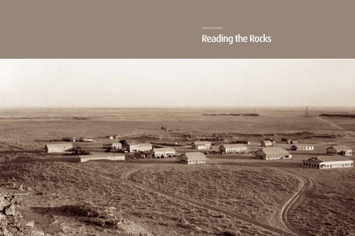
chapter three<br />
<strong>Reading</strong> <strong>the</strong> <strong>Rocks</strong><br />
Dhahran, 1936.
60 energy to <strong>the</strong> world : Volume one<br />
reading <strong>the</strong> rocks 61<br />
With an agreement to explore for Arabian oil<br />
finally in hand, <strong>the</strong> California oil company executives<br />
wasted no time preparing to explore<br />
<strong>the</strong> vast concession. Even before negotiations<br />
for <strong>the</strong> concession began, Socal officials scrambled<br />
to put in place <strong>the</strong> men and materiel<br />
necessary to quickly establish a presence in<br />
<strong>Saudi</strong> Arabia.<br />
A geologist points to a geologic<br />
fault in <strong>Saudi</strong> Arabia in 1939. Such<br />
faults may trap oil as it flows<br />
through sedimentary formations.<br />
In 1932, Robert P. “Bert” Miller, a company geologist who would later be in charge of geological<br />
fieldwork in <strong>the</strong> Kingdom, joined Socal’s operation in Bahrain. As an internal history<br />
of Socal’s early years in <strong>Saudi</strong> Arabia noted, “While he had definite assignments in Bahrain,<br />
<strong>the</strong> primary object of sending him at that time had been to make him available in <strong>the</strong> event<br />
an exploration contract should be obtained from <strong>the</strong> <strong>Saudi</strong> [Arabian] Government.”<br />
Why <strong>the</strong> rush? For one thing, <strong>the</strong> concession agreement stipulated that Socal should<br />
begin work in <strong>Saudi</strong> Arabia by <strong>the</strong> end of September 1933. Second, fortunes were at stake at<br />
a time when Socal was in no position to squander <strong>the</strong>m. Its initial payment of £30,000 to <strong>the</strong><br />
<strong>Saudi</strong> government was to be followed by a second payment of £20,000 18 months after <strong>the</strong><br />
signing of <strong>the</strong> concession. Socal wanted to find out as much as it could about <strong>the</strong> concession<br />
area in <strong>the</strong> meantime.<br />
In <strong>the</strong> worst-case scenario, Socal’s initial exploration could determine <strong>the</strong>re were no<br />
promising oil prospects in al-Hasa, and <strong>the</strong> company might find it fiscally prudent to terminate<br />
operations before having to make <strong>the</strong> second payment. But in <strong>the</strong> “glass half-full/glass halfempty”<br />
world of oil exploration, few decisions are simple. Yes, <strong>the</strong> company would save £20,000,<br />
but it would also be forced to forfeit its continuing exploration and development rights in <strong>the</strong><br />
concession area.<br />
The first Socal geologists to head in-country—Miller and Schuyler B. “Krug” Henry—took<br />
a boat from Bahrain to <strong>Saudi</strong> Arabia, arriving at <strong>the</strong> small port town of Jubail <strong>the</strong> morning<br />
of September 23, 1933. With <strong>the</strong>m was Karl Twitchell, <strong>the</strong> mining engineer who had helped<br />
Socal negotiate <strong>the</strong> concession and whom <strong>the</strong> company had retained to help outfit <strong>the</strong> geologists.<br />
Using two cars Twitchell had rented in Jiddah and driven in a cross-country caravan<br />
to <strong>the</strong> Gulf, <strong>the</strong> party found itself stuck in <strong>the</strong> sand its first day in <strong>the</strong> country. Miller and<br />
Henry were forced instead to ride on camels, watched by bemused residents of <strong>the</strong> area who<br />
had flocked to Jubail to witness <strong>the</strong>ir arrival. For an enterprise that would be—even in ideal<br />
circumstances—an extraordinary challenge, this was a less than auspicious start.
62 energy to <strong>the</strong> world : Volume one<br />
reading <strong>the</strong> rocks 63<br />
Simply getting from point A to point B also proved difficult. Early vehicles, especially<br />
heavy trucks with standard-issue tires, often got stuck in <strong>the</strong> deep sand. When Socal geologists<br />
Thomas W. Koch and Art B. Brown and four <strong>Saudi</strong>s arrived from Bahrain on November 10,<br />
1933, to conduct a trial run through <strong>the</strong> sandy country between al-‘Uqayr and Hofuf, <strong>the</strong> trucks<br />
quickly sank in sand up to <strong>the</strong>ir axles, and <strong>the</strong> geologists were forced to leave <strong>the</strong>m in storage at<br />
al-‘Uqayr. Quickly evaluating <strong>the</strong>ir situation, <strong>the</strong> geologists embraced <strong>the</strong> millennia-old custom<br />
of using camels to carry loads across <strong>the</strong> desert. The Al-Gosaibis, <strong>the</strong>ir landlords, helped <strong>the</strong>m<br />
locate camels to rent.<br />
Casoc Is Born While <strong>the</strong> geologists were working in <strong>the</strong> desert in early November 1933, Socal<br />
directors voted to create a corporate entity that would include all of <strong>the</strong> company’s <strong>Saudi</strong> Arabian<br />
assets. The directors decided that it would be best to separate <strong>the</strong> operations in <strong>Saudi</strong> Arabia from<br />
those already under way in Bahrain. After mulling over several names for <strong>the</strong> new unit, Lombardi’s<br />
choice—conveying <strong>the</strong> parent company’s identity and <strong>the</strong> new base of operations—prevailed. It<br />
was named <strong>the</strong> California Arabian Standard Oil Company, or Casoc for short. The new company<br />
was incorporated in Delaware on November 8, 1933, and Socal promptly assigned its rights<br />
under <strong>the</strong> concession agreement to Casoc. On an operating basis, Casoc continued to function<br />
as a division of Socal.<br />
Showing respect for local customs<br />
by wearing traditional <strong>Saudi</strong> attire,<br />
Casoc personnel pose in front of<br />
<strong>the</strong>ir Jubail headquarters in <strong>the</strong> latter<br />
part of 1934. From left to right are<br />
Thomas W. Koch, J. W. “Soak” Hoover,<br />
Richard C. “Dick” Kerr, Robert P. “Bert”<br />
Miller, Hugh L. Burchfiel, Schuyler<br />
B. “Krug” Henry, Felix W. Dreyfus,<br />
Charles Rocheville, Allen C. White<br />
and Art B. Brown. The photo was<br />
taken by geologist Max Steineke.<br />
Three days after first arriving in<br />
Jubail in <strong>Saudi</strong> Arabia on September<br />
23, 1933, American geologists<br />
Robert P. “Bert” Miller and Schuyler<br />
B. “Krug” Henry transfer from a dhow<br />
to donkeys for <strong>the</strong> final stretch of a<br />
trip to Darin, a small community on<br />
Tarut Island. From <strong>the</strong>re, <strong>the</strong>y traveled<br />
to <strong>the</strong> nearby date palm oasis<br />
of Qatif as part of <strong>the</strong>ir efforts to<br />
survey possible bases of operations.<br />
The geologists subsequently visited Hofuf and Qatif, a smaller oasis town on <strong>the</strong> coast south<br />
of Jubail. They decided to keep an office in Hofuf, which had been <strong>the</strong> <strong>Saudi</strong> government’s recommendation,<br />
but to base <strong>the</strong> exploration teams in a roughly 10,000-square-meter compound in<br />
Jubail provided by <strong>the</strong> Al-Gosaibi family, wealthy traders with close ties to King ‘Abd al-‘Aziz. Jubail<br />
was free of <strong>the</strong> canals that snaked through <strong>the</strong> al-Hasa oasis, which provided water to <strong>the</strong> date<br />
palm groves while also serving as first-class breeding grounds for malaria-carrying mosquitoes.<br />
On September 28, 1933, Henry and Miller made a cursory examination of <strong>the</strong> geological<br />
dome that Fred Davies had observed from Bahrain in 1930 and marked it for additional study.<br />
Henry and J. W. “Soak” Hoover, a fellow geologist, began a detailed survey of <strong>the</strong> dome immediately<br />
after Hoover’s arrival on October 22 and named it <strong>the</strong> Dammam Dome after <strong>the</strong> small<br />
fishing village north of <strong>the</strong> structure. They also marked mean high tide a few kilometers south<br />
of Dammam to use as <strong>the</strong> base elevation for maps of <strong>the</strong> region.<br />
The initial progress, first in geological surveying and <strong>the</strong>n in drilling, gave way to delays<br />
and was agonizingly slow. The Dammam Dome appeared to be an anomaly. Few o<strong>the</strong>r likely<br />
prospects were found in <strong>the</strong> concession area. Despite small amounts of oil initially found on <strong>the</strong><br />
dome, additional drilling proved frustrating. This sense of frustration was compounded by <strong>the</strong><br />
evolving relations among <strong>the</strong> American oilmen, <strong>Saudi</strong> government and <strong>Saudi</strong> workers, which<br />
enjoyed some progress and endured some setbacks as each group adapted to a different way<br />
of life.
64 energy to <strong>the</strong> world : Volume one<br />
reading <strong>the</strong> rocks 65<br />
After living in <strong>the</strong> field for about one month, Henry and Hoover packed up <strong>the</strong>ir tent camp<br />
at <strong>the</strong> Dammam Dome and relocated to <strong>the</strong> newly designated headquarters in Jubail, arriving<br />
<strong>the</strong>re on December 7, 1933. Hoover described <strong>the</strong> Jubail move in a December 10 diary entry<br />
that painted a picture of <strong>the</strong> compound as <strong>the</strong> lap of luxury compared to tent life: “The home<br />
is big enough, covers a city block easily, each bed room [with] its own crude bath room and a<br />
balcony on <strong>the</strong> roof—enormous servants quarters, etc.” There, <strong>the</strong> men were joined by Hugh<br />
L. Burchfiel, <strong>the</strong> sixth geologist to arrive in <strong>Saudi</strong> Arabia that first season. Meanwhile Allen C.<br />
White, an engineer who had surveyed <strong>the</strong> entire Bahrain concession and had <strong>the</strong> most detailed<br />
knowledge of Arab culture among <strong>the</strong> group, arrived from Bahrain with an interpreter originally<br />
from Peshawar, Ajab Khan, a cook and three pickup trucks.<br />
J. W. “Soak” Hoover, Schuyler<br />
B. “Krug” Henry and o<strong>the</strong>r members<br />
of <strong>the</strong>ir field party pose for a<br />
photograph outside <strong>the</strong>ir walled<br />
compound in Jubail in <strong>the</strong> fall of 1934.<br />
Hoover and Henry were on <strong>the</strong>ir<br />
way to conduct a detailed geological<br />
survey of <strong>the</strong> Dammam Dome.<br />
On December 23, Miller took a boat to Bahrain to meet Dr. Jorgen “Doc” Nomland, chief<br />
geologist from Socal headquarters, who had arrived to review <strong>the</strong> geologists’ progress. Miller<br />
returned to Jubail on January 2, 1934, with Nomland and Felix W. Dreyfus, a mechanic. Dreyfus’s<br />
job was to set up shop in Jubail for repair work on <strong>the</strong> motorized equipment and to train local<br />
<strong>Saudi</strong>s as his assistants. Dreyfus was a welcome addition to <strong>the</strong> crew, which had been making<br />
stop-gap repairs to machines and equipment so <strong>the</strong>y would not lose days or weeks while waiting<br />
for crucial replacement parts.<br />
Nomland remained with <strong>the</strong> Casoc team in al-Hasa Province for roughly a month before<br />
he continued on to Jiddah to meet with William Lenahan, <strong>the</strong> company’s liaison with <strong>the</strong><br />
<strong>Saudi</strong> government, about whe<strong>the</strong>r Socal should compete with IPC for ano<strong>the</strong>r concession in<br />
western Arabia.<br />
Until <strong>the</strong> first pier was completed<br />
at al-Khobar in <strong>the</strong> spring of 1935,<br />
many of Casoc’s supplies entered<br />
<strong>Saudi</strong> Arabia through <strong>the</strong> ancient<br />
port of al-‘Uqayr. Camels or trucks<br />
<strong>the</strong>n brought <strong>the</strong> shipments 80<br />
kilometers northwest to Dhahran.
66 energy to <strong>the</strong> world : Volume one<br />
reading <strong>the</strong> rocks 67<br />
Miller used <strong>the</strong> car odometers and Brunton compasses to plot findings and directions so<br />
geological reconnaissance maps could be created. He devised a larger than usual sketch board<br />
for <strong>the</strong> geologists to use in <strong>the</strong> cars. It held drafting paper on rollers so that continuous mapping<br />
could be done. According to an internal company review of <strong>the</strong> fieldwork in <strong>the</strong> initial years of<br />
<strong>the</strong> concession, “Several of <strong>the</strong> sketch boards were made up in Bahrain and <strong>the</strong>ir use during <strong>the</strong><br />
first two years in Arabia made for remarkable accuracy.”<br />
Hoover described <strong>the</strong> geologists’ routine that first season, recalling years later <strong>the</strong> first trip<br />
he and Henry took after moving off <strong>the</strong> Dammam Dome in November:<br />
Krug and I started operating on <strong>the</strong> East Coast and we sketched and worked out as<br />
far as a little town named Hinna [85 kilometers due west of Jubail] on our sketchboards,<br />
taking a Brunton compass for our direction and our speedometer registering<br />
in kilometers for our distance. We had two chronometers. My chore was to wind<br />
<strong>the</strong>m up every night just at sunset so we could know what <strong>the</strong> time was in London,<br />
because when we started shooting <strong>the</strong> stars and getting our latitude and longitude<br />
we wanted to be right on <strong>the</strong> money. We took what we called <strong>the</strong> mean sea level<br />
and went on out as far as Hinna and made a supply depot <strong>the</strong>re.<br />
Field Parties<br />
A well-equipped field party during <strong>the</strong> first few years of exploration typically consisted<br />
of <strong>the</strong> items below:<br />
Workers at Jubail carry cargo<br />
through shallow waters from<br />
dhows to <strong>the</strong> shore, circa 1934.<br />
Personnel:<br />
Geologists 2<br />
Interpreter 1<br />
Cook 1<br />
Cook’s helper 1<br />
Houseboy 1<br />
Mechanic 1<br />
Mechanic’s 1<br />
helper<br />
Driver 1<br />
Soldiers 15–30<br />
Camel drivers 3<br />
food:<br />
Bran<br />
Cranberry sauce<br />
Rolled oats<br />
Pancake flour<br />
Grape-Nuts<br />
Spices: cinnamon,<br />
cloves, curry, paprika,<br />
pepper<br />
Dried fruit: apricots,<br />
peaches, apples, pears<br />
Canned peaches<br />
Raisins<br />
Asparagus tips<br />
Sliced beets<br />
Carrots<br />
Clam chowder<br />
Canned corn,<br />
mixed vegetables<br />
Canned olives<br />
Canned oysters<br />
Sweet potatoes<br />
Succotash<br />
Spinach<br />
Heading for <strong>the</strong> Rub‘ al-Khali in<br />
January 1938 are, left to right,<br />
Jerry Harriss, geologist; Shauby<br />
and Ibrahim, drivers; Muhammad<br />
ibn ‘Abd al-Latif, houseboy; Salih,<br />
cook; Husain, soldier; Khamis<br />
ibn Rimthan, guide; Muhammad<br />
ibn Sulayman, soldier; and<br />
Tom Barger, geologist.<br />
The first exploration camp was established<br />
amid <strong>the</strong> jabals of <strong>the</strong> Dammam<br />
Dome in late October 1933. Geologists<br />
named <strong>the</strong> site Dhahran after <strong>the</strong><br />
nearby jabals. By June 1934, <strong>the</strong> year<br />
this photo was taken, <strong>the</strong> detailing of<br />
<strong>the</strong> Dammam Dome was complete.<br />
Equipment:<br />
Ford V-8 touring car 1<br />
Ford V-8 half-ton 1<br />
pickup<br />
Collapsing tables, 2<br />
chairs and cots<br />
Short-wave radio set 1<br />
misc. Equipment:<br />
Food supplies for<br />
all but <strong>the</strong> soldiers<br />
Cooking utensils<br />
Ford V-8 2¾-ton 1<br />
Express body truck<br />
(where possible to<br />
use trucks)<br />
Baggage camels 12<br />
carrying 400 pounds<br />
each<br />
10 foot by 20 foot 3<br />
native tents with<br />
grass mat floors<br />
16 foot by 8 foot 1<br />
silk tent<br />
Chronometer 1<br />
Transit (a surveying 1<br />
instrument)<br />
Sketch board for 1<br />
use in <strong>the</strong> car<br />
Brunton compasses 2<br />
6-gallon water cans 8<br />
Water skins holding 6<br />
6–10 gallons each<br />
Water bags 3<br />
Gasoline stoves<br />
and lamps<br />
Gasoline and oil<br />
for <strong>the</strong> cars (usually<br />
carried to first camp<br />
by extra camels)<br />
Drafting equipment<br />
Tools and spare parts<br />
for car repair
68 energy to <strong>the</strong> world : Volume one<br />
reading <strong>the</strong> rocks 69<br />
While <strong>the</strong>ir headquarters in Jubail were relatively comfortable, life in <strong>the</strong> field could be<br />
harsh. Sand got into everything, no matter what precautions <strong>the</strong>y took. The <strong>the</strong>rmometer could<br />
top 37 degrees Celsius on any given day from early spring through late fall, and in midsummer<br />
it could reach 50 degrees. Prickly heat was a constant irritation, and working during <strong>the</strong> middle<br />
of <strong>the</strong> day in <strong>the</strong> summer was all but impossible and dangerous to one’s health without plenty<br />
of water on hand. In <strong>the</strong> winter, cold winds whistled through <strong>the</strong> tents and <strong>the</strong> woolen blankets<br />
tucked into <strong>the</strong> army-style canvas cots—and, of course, <strong>the</strong> sand continued to blow. In February<br />
1934, Hoover and Henry suffered through an ice storm in <strong>the</strong> desert, though <strong>the</strong> temperature<br />
soared to 18 degrees <strong>the</strong> following afternoon.<br />
An Aerial View Even though <strong>the</strong> geologists were covering a fair amount of ground with <strong>the</strong>ir<br />
sketch boards, it became obvious to everyone that, given <strong>the</strong> enormous size of <strong>the</strong> concession,<br />
a total survey by land would take much too long. The right to use airplanes to prospect for oil<br />
in <strong>Saudi</strong> Arabia was one of <strong>the</strong> agreements proposed by Socal’s attorney, Lloyd Hamilton, and<br />
approved by <strong>the</strong> <strong>Saudi</strong> government. While <strong>the</strong> teams of geologists were getting settled in <strong>Saudi</strong><br />
Arabia in <strong>the</strong> fall of 1933, talks were already under way in San Francisco to send an airplane for<br />
aerial surveys, a technique Socal had been using successfully in California.<br />
“Do You Remember My Uncle?”<br />
Supplies were stockpiled in<br />
temporary depots around <strong>the</strong><br />
concession area in <strong>the</strong> mid-1930s<br />
so geologists could continue<br />
prospecting without returning to<br />
Jubail or Dhahran for fresh stores.<br />
The geologists had only limited contact with <strong>the</strong> local population during <strong>the</strong>ir first year in<br />
<strong>the</strong> field. In nearly every instance, Bedouins or villagers were curious about <strong>the</strong>ir equipment,<br />
especially cars and trucks. The geologists remained friendly and respectful of local customs,<br />
and especially enjoyed interacting with <strong>the</strong> wide-eyed children who seemed to be peering<br />
around every tent flap or mud wall. Soak Hoover recalled one such encounter years later:<br />
We hired a man to watch our stockpile of equipment at Hinna; it had gasoline,<br />
food and everything. We would send our camel men in to pick it up. We’d come by<br />
every once in a while and often when we did <strong>the</strong> man that watched it had his little son<br />
with him. I thought it was his son. He turned out to be his nephew. He would come<br />
and ask us what we were doing and so on and I’d talk to him and play with him.<br />
In October 1965 I was out at Chevron Geophysical [Hoover formed and headed<br />
<strong>the</strong> subsidiary based in Houston, Texas] at my desk, working hard, and <strong>the</strong> telephone<br />
rang. It was San Francisco, our main office. I thought it was some boss going to raise<br />
hell with me. A man started talking to me in Arabic. I could tell he was a real Arab.<br />
He said, “Do you remember setting up a supply dump in Hinna?” I said, “Yes.” He<br />
said, “Do you remember my uncle? I was <strong>the</strong> little boy that you used to come and<br />
talk to and play with. Do you remember that you told my uncle that he should send<br />
me to a school and give me an education?… He sent me to school and I got a good<br />
education and now I’m back and I’m working in Dhahran for <strong>the</strong> Company in <strong>the</strong><br />
Accounting Department.” His name was Ahmed Abdullah Qurishi.<br />
G. Clark Gester contracted with Richard C. “Dick” Kerr, who held a graduate degree in<br />
geology from <strong>the</strong> University of California at Berkeley and was performing aerial surveying for<br />
Socal in California, to perform <strong>the</strong> same duties on a contract basis in <strong>Saudi</strong> Arabia. Kerr and his<br />
partner, Walter English, proposed that <strong>the</strong> company use a small plane to better navigate around<br />
<strong>the</strong> dunes <strong>the</strong>y assumed covered <strong>the</strong> entire country. Socal ordered a customized Fairchild 71 from<br />
<strong>the</strong> Hagerstown, Maryland, plant of Kreider-Reisoner. The plane was built with an opening in <strong>the</strong><br />
bottom and removable windows for taking photographs. It was also fitted with an oversized gas<br />
tank, giving <strong>the</strong> plane a cruising radius of 560 kilometers, and oversized tires to manage takeoffs<br />
and landings in sand.<br />
Aviation fuel and o<strong>the</strong>r supplies were shipped to Bahrain on <strong>the</strong> Socal tanker El Segundo. The<br />
plane was loaded onto <strong>the</strong> deck of <strong>the</strong> SS Exochorda and transported from New York to Alexandria,<br />
Egypt. Kerr and his copilot, Charley Rocheville, after a few weeks of navigating <strong>the</strong> minutiae of<br />
Egyptian bureaucracy, flew <strong>the</strong> plane to Cairo, Gaza, Palestine and on to Baghdad. From <strong>the</strong>re,<br />
<strong>the</strong>y took <strong>the</strong> plane down <strong>the</strong> Tigris river valley to Basra and made <strong>the</strong> final short hop to Jubail on<br />
March 8, 1934. There was just one problem: They did not have a permit to land <strong>the</strong> plane.<br />
The <strong>Saudi</strong> government tried to have <strong>the</strong> plane held in Basra, but it had already taken off by <strong>the</strong><br />
time <strong>the</strong> government telegram was received by <strong>the</strong> authorities in <strong>the</strong> sou<strong>the</strong>rn Iraqi city. This was<br />
a particularly sensitive issue at <strong>the</strong> time, because <strong>Saudi</strong> Arabia and Yemen were at war over <strong>the</strong>ir<br />
disputed border. <strong>Saudi</strong> officials were concerned that planes might be used for military purposes.<br />
Regional government officials were waiting at <strong>the</strong> Jubail landing strip when <strong>the</strong> plane<br />
landed and promptly took it and <strong>the</strong> two pilots into custody. A series of profuse apologies from<br />
Casoc for <strong>the</strong> scheduling oversight followed, as did reminders that <strong>the</strong> company was allowed to<br />
use a plane under <strong>the</strong> terms of <strong>the</strong> concession agreement. The plane was eventually returned to<br />
its pilots and prepared for aerial reconnaissance.<br />
The plane was put into service March 30, 1934. Miller rode with Kerr and Rocheville on all<br />
<strong>the</strong> flights during <strong>the</strong> first season, and Burchfiel went on many of <strong>the</strong>m. The plan was to divide<br />
<strong>the</strong> country into 10-kilometer strips. Geologists highlighted <strong>the</strong> visible geology and terrain of<br />
<strong>the</strong> five kilometers on ei<strong>the</strong>r side of <strong>the</strong> plane in flight. They located water holes, camel trails and<br />
settlements as well as surface structures. After each flight, a traverse map was drawn indicating<br />
<strong>the</strong> plane’s route. Especially interesting features were noted and later photographed to be included<br />
in mosaic maps.<br />
Its wings folded and secured for<br />
shipping, a customized Fairchild 71<br />
airplane is loaded onto a barge at<br />
<strong>the</strong> site of today’s LaGuardia Airport<br />
in New York in early 1934, bound,<br />
eventually, for <strong>Saudi</strong> Arabia.
70 energy to <strong>the</strong> world : Volume one<br />
reading <strong>the</strong> rocks 71<br />
A Casoc pickup truck tows <strong>the</strong><br />
Fairchild 71 into position for takeoff<br />
on a makeshift runway near Jubail<br />
in 1934. The aircraft enabled Casoc<br />
to map <strong>the</strong> massive concession area<br />
much faster and to supply remote<br />
exploration camps, where geologists<br />
often stayed for months at a time.<br />
The plane crew accomplished in a single season what would have taken years on <strong>the</strong><br />
ground. Company records state that “by June of 1934, <strong>the</strong> aerial crew had photographed and<br />
mapped a wide territory which included <strong>the</strong> entire coastal strip from Ras Safania to below<br />
Salwah. A reconnaissance was also made from Jabrin north and west to Es Safa. All of <strong>the</strong><br />
country between <strong>the</strong>se far points was tied in. Miller plotted <strong>the</strong> assignments of most of <strong>the</strong><br />
next year’s geological field parties on <strong>the</strong> findings made on <strong>the</strong>se April and May flights. All<br />
of <strong>the</strong> production areas that <strong>the</strong> company would bring in during its first 10 years in existence<br />
were seen and noted by <strong>the</strong> plane party during <strong>the</strong> spring of 1934.”<br />
These efforts, however, did not leave <strong>the</strong> aerial team especially optimistic about <strong>the</strong><br />
prospects for oil in <strong>Saudi</strong> Arabia beyond <strong>the</strong> Dammam Dome. As Hoover confided in his diary<br />
on April 21, 1934, from <strong>the</strong> field, “Dick Kerr and Chas. Rocheville flew back to Jubail. They<br />
will bring out a load of gas tomorrow and <strong>the</strong> plane will work from this camp for a few days.<br />
Hugh [Burchfiel] at least is most pessimistic about structural conditions in Arabia. They have<br />
flown most of <strong>the</strong> concession without seeing anything at all interesting except Dammam.”<br />
Henry and Miller returned to <strong>the</strong>ir work on <strong>the</strong> Dammam Dome by <strong>the</strong> middle of May<br />
1934. The original wooden triangulation markers <strong>the</strong>y had placed on <strong>the</strong> dome had been<br />
removed by Bedouins, apparently for firewood. Using metal markers with triangulation flags,<br />
Henry and Miller resumed <strong>the</strong>ir mapping with an instrument called a plane table. They tied<br />
toge<strong>the</strong>r elevations around <strong>the</strong> structure and mapped fossil types that corresponded with<br />
key geologic periods, indicating <strong>the</strong> dome mirrored an underground structure suitable for<br />
containing oil.<br />
The continuity of <strong>the</strong> fossil evidence gave <strong>the</strong> Casoc geologists <strong>the</strong> confidence <strong>the</strong>y needed<br />
that <strong>the</strong> dome might very well reflect a similar structure in <strong>the</strong> sedimentary rock capable of<br />
trapping oil and gas hundreds of meters below ground. Hoover added: “We placed <strong>the</strong> well<br />
location right up <strong>the</strong>re by <strong>the</strong> Jebel, which was Um Er Rus [Umm al-Rus], which means mo<strong>the</strong>r<br />
of heads. … There are three or four little peaks right up <strong>the</strong>re in <strong>the</strong> top where <strong>the</strong> Bedu used to<br />
go and look for what was going on around. … Khamis, our guide, helped me build a little ‘rijm,’<br />
a pile of rocks, to say this was <strong>the</strong> proposed location for Well No. 1.” (Their guide, Khamis ibn<br />
Rimthan, played an increasingly large role in <strong>the</strong> life of <strong>the</strong> geologists as <strong>the</strong>ir work progressed.<br />
He was widely known as Khamis—or Khumayyis—by Casoc employees.)<br />
In May, on his way back from <strong>the</strong> Hijaz, where he had inspected <strong>the</strong> concession area that<br />
was later awarded to IPC, Nomland stopped in Jubail for his second visit, to discuss with Miller<br />
<strong>the</strong> idea of moving most of <strong>the</strong> crew to a summer location with a more pleasant climate. Not only<br />
would it help <strong>the</strong>m avoid heatstroke, but it would enable <strong>the</strong>m to work toge<strong>the</strong>r on <strong>the</strong> reports<br />
describing <strong>the</strong> first season’s work, which would <strong>the</strong>n be sent to San Francisco. They agreed Miller<br />
would go ahead of <strong>the</strong> group to Beirut, Lebanon, scout out possibilities in <strong>the</strong> hills above <strong>the</strong> city<br />
and <strong>the</strong>n continue to London to meet with company officials and suppliers. By <strong>the</strong> middle of July<br />
1934, <strong>the</strong> crew had relocated to Dhour El Choueir 30 kilometers outside Beirut. Left behind were<br />
Felix Dreyfus and Allen White, who were manning <strong>the</strong> Jubail office but took staggered vacations<br />
so that at least one Casoc man was on-site throughout <strong>the</strong> summer.<br />
As <strong>the</strong> geologists reunited in <strong>Saudi</strong> Arabia that September for <strong>the</strong> start of <strong>the</strong> fall season,<br />
<strong>the</strong> first of many new faces joined <strong>the</strong> ranks. One of <strong>the</strong> most significant new arrivals was a
72 energy to <strong>the</strong> world : Volume one<br />
reading <strong>the</strong> rocks 73<br />
golden corridor<br />
More than 60 percent of <strong>the</strong> world’s<br />
proven crude oil reserves and 40 percent<br />
of proven natural gas reserves lie in a<br />
2,700-kilometer-long swath of <strong>the</strong> Middle<br />
East, which runs from eastern Turkey<br />
down through <strong>the</strong> Arabian Gulf to <strong>the</strong><br />
Arabian Sea.<br />
senior Socal geologist, Max Steineke. Steineke, who had graduated from Stanford University in<br />
1921 and had spent <strong>the</strong> previous 13 years working for Socal in a variety of remote locations, had<br />
asked to be transferred to <strong>the</strong> new operation in <strong>Saudi</strong> Arabia. He joined <strong>the</strong> o<strong>the</strong>r geologists in<br />
Bahrain, where <strong>the</strong>y met to be ferried over to Jubail. Steineke was to lead a new third team of<br />
geologists in <strong>the</strong> field.<br />
Steineke’s colleagues soon recognized his acumen in understanding <strong>the</strong> sort of big-picture geology<br />
that was called for in exploring <strong>the</strong> huge concession. He was also a natural outdoorsman and expert<br />
marksman, which helped him earn <strong>the</strong> respect of <strong>the</strong> Bedouin soldiers and guides who accompanied<br />
<strong>the</strong> geological parties in <strong>the</strong> field. He was a rough-and-tumble “man’s man” with a face as wea<strong>the</strong>red<br />
as a limestone outcropping, and hardly a stickler for details or a fancier of civilized ways.<br />
Steineke doggedly pursued evidence of a geological trend that might as well have been<br />
invisible as far as many of <strong>the</strong> geologists were concerned. Philip McConnell, who joined <strong>the</strong><br />
production crews in <strong>Saudi</strong> Arabia in 1938, recalled that “Steineke knew <strong>the</strong> outlines of <strong>the</strong> great<br />
[al-Na‘lah or En Nala, as it was listed in geological records] anticline (<strong>the</strong> ‘Ghawar’ field) very early,<br />
and knew it might be one of <strong>the</strong> mightiest oil traps in <strong>the</strong> world. But he had a lot of German<br />
caution, almost to a fault—refused to commit himself in judgment until pushed.”<br />
Indeed, as early as <strong>the</strong> end of his first season in <strong>the</strong> field (spring 1935), Steineke and his<br />
partner, Tom Koch, had seen tantalizing hints in <strong>the</strong> heart of <strong>the</strong> concession area of what turned<br />
out to be <strong>the</strong> biggest oil field ever discovered—not just in <strong>Saudi</strong> Arabia but anywhere. “They<br />
described four o<strong>the</strong>r … highlands areas, at least one of which was definitely domed,” Casoc<br />
company records state, on which <strong>the</strong>y said fur<strong>the</strong>r work would be justified, but only if drilling<br />
on <strong>the</strong> Dammam Dome found oil in commercial quantities.<br />
mediterranean<br />
sea<br />
jordan<br />
iraq<br />
caspian<br />
sea<br />
While <strong>the</strong>ir recommendations for continued work in <strong>the</strong> region zeroed in on areas and<br />
structures that eventually were recognized as overlying <strong>the</strong> giant oil fields of Abqaiq, Qatif and<br />
Ghawar, marking a structure as worthy of study is far from finding firm evidence of oil. It took at<br />
least 15 years before company geologists fully appreciated <strong>the</strong> underground structures hinted at<br />
by <strong>the</strong> surface features Steineke and Koch identified and marked for fur<strong>the</strong>r study in <strong>the</strong> spring<br />
of 1935 on <strong>the</strong>ir “to-do” list:<br />
1. Drill a test on <strong>the</strong> El ‘Alat Dome.<br />
2. Map Edh Duraiya, el Abqaiq and Qurain in detail.<br />
3. Drill core holes or carry a seismograph survey across Tarut Island.<br />
4. Investigate <strong>the</strong> highland southwest of Abqaiq.<br />
5. Follow <strong>the</strong> En Nala monoclinal fold, lying west of Hofuf to <strong>the</strong> south and northwest<br />
to determine its origin.<br />
6. Investigate <strong>the</strong> Ghawar area, lying west of Hofuf.<br />
7. Introduce subsurface means of investigation to give geological information beneath<br />
<strong>the</strong> sand areas and <strong>the</strong> overlapping Miocene in certain localities.<br />
Casoc geologists Max Steineke and<br />
Bert Miller, drilling foreman Guy<br />
“Slim” Williams, construction foreman<br />
Walt Haenggi, left to right, and three<br />
unidentified colleagues pause as<br />
<strong>the</strong>y look for <strong>the</strong> best site for <strong>the</strong> first<br />
well on <strong>the</strong> Dammam Dome. The well<br />
was “spudded” on April 30, 1935.<br />
key<br />
golden corridor<br />
Gas field<br />
oil field<br />
r e d s e a<br />
kuwait<br />
saudi arabia<br />
yemen<br />
united arab<br />
emirates<br />
a r a b<br />
g u l f o f o m a n<br />
oman<br />
i a n s e a<br />
Focusing on Dammam With geologists in <strong>the</strong> field and at headquarters in San Francisco agreeing<br />
that <strong>the</strong> Dammam Dome was <strong>the</strong> most promising site for drilling, plans for moving drilling<br />
materials and crews into <strong>Saudi</strong> Arabia began by late September 1934. With some pride, company<br />
officials noted <strong>the</strong> date <strong>the</strong>y formally notified King ‘Abd al-‘Aziz of <strong>the</strong>ir drilling plans—only one<br />
year to <strong>the</strong> day after <strong>the</strong> first geologists had splashed ashore in <strong>Saudi</strong> Arabia.<br />
Mobilizing for <strong>the</strong> drilling program was not just a question of floating a rig across <strong>the</strong> Gulf<br />
from Bahrain and <strong>the</strong>n hauling it through <strong>the</strong> sand and salt flats to <strong>the</strong> Dammam Dome site, as<br />
formidable as those challenges proved to be. Fred Davies, acting foreman of Bapco operations in<br />
Bahrain at <strong>the</strong> time, argued that <strong>the</strong> isolation of <strong>the</strong> site and <strong>the</strong> extreme summer heat required<br />
that <strong>the</strong> company undertake a dramatic housing program—a small town in <strong>the</strong> desert—far<br />
more elaborate than <strong>the</strong> bare minimum that might be <strong>the</strong> norm for such camp facilities. The<br />
initial community was to consist of living quarters, a cookhouse, a mess hall and a recreation<br />
room. In addition to <strong>the</strong>se living and recreational quarters, an adequate number of offices and<br />
a geological laboratory were required. Finally, Casoc would also have to drill water wells, install<br />
its own plumbing system and build a power plant.
74 energy to <strong>the</strong> world : Volume one<br />
reading <strong>the</strong> rocks 75<br />
“The Origin of Oil”<br />
A broad Middle Eastern corridor running roughly 2,735 kilometers from eastern Turkey down<br />
<strong>the</strong> Tigris and Euphrates river valleys and through <strong>the</strong> Arabian Gulf region contains more of<br />
<strong>the</strong> world’s proven oil reserves—about 60 percent—than any o<strong>the</strong>r place on Earth. It is not a<br />
coincidence. The combination of abundant marine life eons ago, giant tectonic plates deep in<br />
<strong>the</strong> Earth grinding into each o<strong>the</strong>r and subsequent faults and shifts in <strong>the</strong> Earth’s crust in <strong>the</strong><br />
region has createed near-perfect conditions for forming and trapping crude oil and natural gas.<br />
Who better to tell <strong>the</strong> first chapter of this story than Chief Geologist Max Steineke?<br />
Writing in <strong>the</strong> October 21, 1945, issue of Oily Bird, as <strong>the</strong> company’s employee newspaper<br />
was called at <strong>the</strong> time, Steineke provided a primer on sedimentary geology<br />
titled “The Origin of Oil”:<br />
In almost all cases, <strong>the</strong> exact origin of oil is indeterminate, but where positive<br />
data is available on <strong>the</strong> subject, <strong>the</strong>y invariably indicate a marine source, that is,<br />
close association with sediments that were originally deposited in <strong>the</strong> sea but later<br />
hardened into rocks. Fur<strong>the</strong>rmore, <strong>the</strong> scientists have found that <strong>the</strong> rocks producing<br />
petroleum are composed of a high percentage of small marine shells most of which<br />
are microscopic in size. Also, <strong>the</strong>y have found that in many cases organisms similar<br />
to those occurring in rocks that have generated oil are now living in <strong>the</strong> sea and that<br />
<strong>the</strong>se organisms living today contain minute globules of fatty substances from which<br />
petroleum-like material can be made in <strong>the</strong> laboratory.<br />
We have good evidence that <strong>the</strong> organisms found in <strong>the</strong> rocks that generated<br />
<strong>the</strong> Arabian oil lived approximately 150 million years ago. They evidently lived in<br />
a quiet sea or a somewhat enclosed basin vaguely similar to <strong>the</strong> Persian Gulf of<br />
today except that it was very much larger. As <strong>the</strong> organisms died <strong>the</strong>y sank to <strong>the</strong><br />
bottom forming layer upon layer until <strong>the</strong>y formed a deposit hundreds of feet<br />
thick. These layers in turn were covered by thick deposits of mud, sand and shell<br />
beds, attaining a thickness of many thousands of feet. As <strong>the</strong> deposits were laid<br />
down, <strong>the</strong> sea bottom gradually subsided due to earth movements, which allowed<br />
a great accumulation of sediments with comparatively little change in <strong>the</strong> depth<br />
and character of <strong>the</strong> sea. As <strong>the</strong> overburden of later sediments mounted, <strong>the</strong> deeply<br />
buried ones near <strong>the</strong> bottom were naturally compressed, and <strong>the</strong>y were also heated<br />
to hundreds of degrees in temperature due to <strong>the</strong> great depth. Because of <strong>the</strong><br />
great pressure and heat applied to <strong>the</strong> sediments over a period of many millions of<br />
years <strong>the</strong> greater mass of deposits were hardened into rocks. During this change in<br />
<strong>the</strong> character of <strong>the</strong> deposits <strong>the</strong> fatty matter in <strong>the</strong> micro-organisms comprising<br />
a substantial portion of <strong>the</strong> sediments were changed by chemical processes<br />
into petroleum products of various types. Intensely salty water, and often brines,<br />
with which <strong>the</strong> sediments were saturated, may also have aided in <strong>the</strong> chemical reaction<br />
whereby <strong>the</strong> fatty globules in <strong>the</strong> minute organisms were changed to petroleum<br />
products. …<br />
If a porous rock formation containing water and oil is tilted, <strong>the</strong> oil will move<br />
up <strong>the</strong> incline. In <strong>the</strong> event <strong>the</strong> inclined bed is exposed at <strong>the</strong> surface due to earth<br />
movements and erosion <strong>the</strong>re is nothing to stop <strong>the</strong> oil and gas from escaping to <strong>the</strong><br />
surface and being lost by reaction with <strong>the</strong> atmospheric action throughout geological<br />
time. However, if this oil stratum is covered by dense impervious beds and<br />
is folded into wrinkles, <strong>the</strong> oil will migrate into <strong>the</strong> highest elevation possible in<br />
<strong>the</strong> bed originally containing <strong>the</strong> oil, but it will be stopped or trapped under <strong>the</strong><br />
impervious layers. This trapped oil will stay in this position for countless millions<br />
of years.<br />
Since Steineke’s time, scientists have developed a much more detailed understanding of <strong>the</strong><br />
forces that caused <strong>the</strong>se thick layers of oil-bearing sediment to fold into wrinkles. Movements<br />
among giant, slowly shifting tectonic plates deep beneath <strong>the</strong> Earth’s crust have helped form<br />
today’s continents, and many large surface features such as mountain ranges often mark <strong>the</strong><br />
edges along which one tectonic plate slips below or past ano<strong>the</strong>r. About 90 million years ago,<br />
<strong>the</strong> Arabian tectonic plate collided with, and slowly began slipping under, <strong>the</strong> larger Eurasian<br />
plate to its north and east. That collision created <strong>the</strong> Zagros Mountains in Iran and <strong>the</strong> depression,<br />
hundreds of kilometers wide, lying parallel to <strong>the</strong> mountains to <strong>the</strong> west, which eventually<br />
filled in with <strong>the</strong> waters of <strong>the</strong> Arabian Gulf. Tension in <strong>the</strong> rocks created by <strong>the</strong> collision<br />
of two plates, as well as later shifting among rock layers underlying <strong>the</strong> region, led portions of<br />
<strong>the</strong> sedimentary layers to buckle upward, creating what are known as anticlinal folds that, if<br />
capped by impervious layers of rock, serve to trap hydrocarbons.<br />
Today’s Red Sea fills in a depression caused when a rift opened up in <strong>the</strong> Earth’s crust<br />
between Africa and Arabia about 36 million years ago. During <strong>the</strong> rift, <strong>the</strong> western side of<br />
<strong>the</strong> Arabian Peninsula was tilted upward and rose to almost three kilometers in elevation.<br />
It eroded down, over millions of years, into so-called “basement rocks” of igneous and<br />
metamorphic origin, which date back to <strong>the</strong> Precambrian era and range from 2 billion to 550<br />
million years old. These rocks, forming what is known as <strong>the</strong> Arabian Shield, bulge eastward<br />
at <strong>the</strong> shield’s midriff and occupy about one-third of <strong>the</strong> peninsula. More recent lava flows<br />
in some areas have spread across <strong>the</strong>se older shield rocks. The shield slopes gradually<br />
eastward and is covered in <strong>the</strong> eastern two-thirds of <strong>the</strong> country by younger sedimentary<br />
rocks called <strong>the</strong> Arabian Shelf. These are <strong>the</strong> rocks Steineke described as forming beneath<br />
ancient shallow seas during <strong>the</strong> late Jurassic Period, when dinosaurs roamed <strong>the</strong> Earth.<br />
Chief Geologist Max Steineke<br />
stands in Wadi Nisab atop<br />
exposed limestone dating from<br />
<strong>the</strong> Eocene geologic period. In <strong>the</strong><br />
Eastern Province, <strong>the</strong>n known as<br />
<strong>the</strong> al-Hasa region, Eocene rock is<br />
typically buried beneath hundreds<br />
of feet of relatively younger<br />
sedimentary layers. When found<br />
on <strong>the</strong> surface, it may indicate <strong>the</strong><br />
presence of subterranean folds in<br />
<strong>the</strong> rock capable of trapping oil.
76 energy to <strong>the</strong> world : Volume one<br />
reading <strong>the</strong> rocks 77<br />
This challenging construction project became <strong>the</strong> responsibility of one man, Walter Haenggi.<br />
By November 1934, Haenggi, a burly construction foreman who had overseen construction of<br />
Bapco housing in Bahrain, was striding around <strong>the</strong> flat area near <strong>the</strong> Dammam Dome, scouting<br />
out a location for <strong>the</strong> first permanent structures to be built on <strong>the</strong> site. As <strong>the</strong> only American<br />
detailed for construction, Haenggi knew his first priority was to teach <strong>Saudi</strong>s <strong>the</strong> skills necessary<br />
to do <strong>the</strong> bulk of <strong>the</strong> building.<br />
Haenggi and Guy “Slim” Williams, <strong>the</strong> drilling foreman, also scouted suggested pier locations<br />
on <strong>the</strong> nearby coastline. They determined that a rock shelf extending into <strong>the</strong> Gulf near <strong>the</strong> village<br />
of Dammam made that location a poor choice. Instead, <strong>the</strong>y focused on a deep channel that swung<br />
in relatively close to shore near <strong>the</strong> village of al-Khobar, about 10 kilometers from <strong>the</strong> camp and<br />
located on a small salt flat (sabkhah) near a narrow and descending coastal plain. Floyd Ohliger, a<br />
petroleum engineer and later <strong>the</strong> resident manager of <strong>the</strong> camp, supervised <strong>the</strong> construction of<br />
<strong>the</strong> first pier. It was built out of furush, a shell-like rock collected offshore at low tide, and cemented<br />
with gutch, local gypsum. The same materials were used for <strong>the</strong> initial buildings at <strong>the</strong> drilling site.<br />
The First <strong>Saudi</strong> Employees<br />
With <strong>the</strong> exception of a handful of <strong>Saudi</strong>s in key support positions such as guides, drivers and<br />
translators, <strong>the</strong> oil company had few <strong>Saudi</strong> employees in its first year of operation. It was not until<br />
Casoc decided to build its first pier in late 1934 that <strong>Saudi</strong>s were hired in significant numbers.<br />
Floyd Ohliger hired 400 to 500 local laborers to help build <strong>the</strong> pier, carrying <strong>the</strong> furush rock at low<br />
tide from dhows to <strong>the</strong> shore, where <strong>the</strong> rocks were carted by tractor to <strong>the</strong> construction site.<br />
Casoc resident manager Floyd<br />
Ohliger, shown wearing a checked<br />
jacket, oversees a delivery of furush<br />
rock in 1935 that was used to<br />
build <strong>the</strong> al-Khobar pier. To his left<br />
is Ahmad ”Mussolini“ Al-Somali.<br />
above This photograph, from <strong>the</strong><br />
winter of 1937, shows Dammam Wells<br />
No. 1, right, and No. 7. The drilling<br />
of No. 7 was plagued with difficulties,<br />
and on <strong>the</strong> last day of <strong>the</strong> year, at<br />
1,382 meters, <strong>the</strong> well blew out,<br />
causing fur<strong>the</strong>r delays.<br />
right Guy “Slim” Williams, drilling<br />
foreman and later first superintendent<br />
of <strong>the</strong> Dhahran camp, meets<br />
with <strong>Saudi</strong> workers in al-Khobar in<br />
1935. By early 1935, <strong>the</strong> Dhahran site<br />
employed more than 240 <strong>Saudi</strong>s on<br />
camp construction projects and<br />
drilling teams.<br />
spudding in On April 30, 1935, Slim Williams and his crew of wildcat drillers “spudded,” or<br />
started, Well No. 1 on <strong>the</strong> Dammam Dome—<strong>the</strong> first in all of <strong>Saudi</strong> Arabia. Within approximately<br />
six weeks, <strong>the</strong> geologists were forced to call it quits for <strong>the</strong> summer and retreat to cooler climes<br />
to write <strong>the</strong>ir reports. Not so <strong>the</strong> wildcatters, who included William Eltiste, Jack Schloesslin and<br />
Ernest Smith. Once drilling started, it took more than hot wea<strong>the</strong>r to shut it down. The operation<br />
was expensive and <strong>the</strong> process of stopping and restarting was so time-consuming that it was not<br />
a decision made lightly. Once drilling began, it continued until it reached its target zone.<br />
The Dammam Dome drilling program got off to a good start. In August 1935, as Williams’s<br />
team approached <strong>the</strong> depth of <strong>the</strong> oil-bearing strata in Bahrain (about 610 meters), oil started<br />
showing up in <strong>the</strong> Dammam well—not <strong>the</strong> commercial-quantity rates <strong>the</strong>y were hoping for by<br />
any means (roughly 2,000 barrels per day, or bpd), but clearly oil was present. A test of <strong>the</strong> well<br />
in September at about 590 meters showed oil flowing at a rate of nearly 100 bpd. The crew<br />
drilled deeper and sometimes <strong>the</strong> well flowed at a slightly brisker pace, but not enough oil was<br />
found to justify commercial production.<br />
Well No. 1 did yield natural gas in significant amounts, but it was commercially useless to<br />
Casoc until <strong>the</strong> company had <strong>the</strong> means to store and transport <strong>the</strong> gas. Engineers temporarily<br />
plugged <strong>the</strong> well after reaching a depth of 725 meters in January 1936. It was eventually deepened<br />
and used as a gas well.<br />
One of <strong>the</strong> best known among <strong>the</strong> early <strong>Saudi</strong> construction workers was Ahmad<br />
Hussain Al-Somali. His nickname among <strong>the</strong> Americans was “Mussolini,” due to <strong>the</strong> ease with<br />
which he spoke Italian. Al-Somali worked side by side with Ohliger on <strong>the</strong> pier at al-Khobar<br />
and in 1939 was assigned to <strong>the</strong> Transportation Department. One of his first jobs was to drive<br />
company officials on <strong>the</strong> arduous, five- to seven-day journey between Jiddah and Dhahran—<br />
a trip undertaken at <strong>the</strong> time without <strong>the</strong> benefit of graded roads or radios with which to<br />
summon help if needed. He joined Government Relations in 1943 and was involved in<br />
handling passports and customs clearance for arriving company employees at Dhahran<br />
Airport and <strong>the</strong> al-Khobar pier until his retirement in 1984.<br />
The success of <strong>the</strong> pier project, completed in <strong>the</strong> spring of 1935, encouraged Casoc<br />
managers to hire <strong>Saudi</strong> workers in greater numbers and slowly train <strong>the</strong>m for skilled work.<br />
Even before <strong>the</strong> pier was completed, <strong>Saudi</strong>s were also being hired by <strong>the</strong> hundreds to work<br />
at <strong>the</strong> Dhahran campsite. More than 240 <strong>Saudi</strong> men were employed on <strong>the</strong> site as of early<br />
1935, and <strong>the</strong>ir numbers swelled nearly tenfold by <strong>the</strong> end of <strong>the</strong> decade. Concurrent with<br />
<strong>the</strong> construction of buildings for <strong>the</strong> American employees on Dammam Dome, crews built<br />
palm frond–covered barastis for <strong>Saudi</strong>s as well, with several workers living in each dwelling.<br />
The team was learning as it went. Well No. 2 was spudded on February 8, 1936. It showed<br />
more promise, and in June, at a depth of about 660 meters, a test showed oil flowing at <strong>the</strong><br />
equivalent of more than 3,800 bpd before being temporarily plugged: Casoc did not have enough<br />
tanks ready to store that amount of oil.<br />
That was all company directors in San Francisco needed to hear. Approval was quickly given<br />
for drilling at al-Alat, a site 32 kilometers west of <strong>the</strong> Dammam Dome that had looked promising<br />
to geologists during <strong>the</strong> 1934–35 season, and approval was also given for Well Nos. 3 through<br />
6 to test <strong>the</strong> oil-bearing potential of <strong>the</strong> structure at Dammam Dome.
78 energy to <strong>the</strong> world : Volume one<br />
reading <strong>the</strong> rocks 79<br />
The two operations were a natural fit. A series of stock- and asset-transfer transactions in<br />
July 1936 led to <strong>the</strong> transfer of The Texas Company’s eastern marketing operations to a jointly<br />
owned, newly created subsidiary of Bapco called <strong>the</strong> California Texas Oil Company, Ltd., or Caltex.<br />
In December 1936, Socal and The Texas Company grew closer toge<strong>the</strong>r when The Texas Company<br />
bought one-half interest in Casoc for $3 million in cash and $18 million to be paid out of The Texas<br />
Company’s share of future oil sales.<br />
IPC Establishes a Foothold In mid-1936, while Socal was focusing on Bahrain and its transactions<br />
with The Texas Company, <strong>the</strong> <strong>Saudi</strong> government was finalizing terms under which it would<br />
grant a second concession for <strong>the</strong> right to explore for oil on <strong>the</strong> opposite side of <strong>Saudi</strong> Arabia.<br />
This concession covered a strip 100 kilometers wide along <strong>the</strong> Red Sea coast from <strong>the</strong> nor<strong>the</strong>rn<br />
border with Transjordan down to <strong>the</strong> Yemeni border and including <strong>the</strong> Farasan Islands in <strong>the</strong> Red<br />
Sea near <strong>the</strong> coastal town of Jaizan. In 1912, while <strong>the</strong> Jaizan region was under <strong>the</strong> rule of <strong>the</strong><br />
Idrisi dynasty, Shell Oil had managed to acquire a concession to drill for oil on and around <strong>the</strong><br />
Farasan Islands, where sailors had been aware of oil seeps for centuries. After drilling in several<br />
locations, however, Shell failed to find oil and abandoned <strong>the</strong> project.<br />
Petroleum Concessions Ltd., a subsidiary of IPC, signed an agreement with <strong>the</strong> <strong>Saudi</strong> government<br />
on July 9, 1936, for <strong>the</strong> right to explore in <strong>the</strong> western concession area. It agreed to make a<br />
onetime payment of £30,000 and an annual rental fee of £7,500 for an initial four-year exploration<br />
period. Rental fees and o<strong>the</strong>r advances against royalties would kick in during a subsequent 10-year<br />
drilling program. None o<strong>the</strong>r than Stephen Longrigg, who had sailed out of Jiddah three years<br />
At <strong>the</strong> Dhahran camp in <strong>the</strong> 1930s<br />
and early ’40s, nearly all <strong>Saudi</strong><br />
workers lived in barastis, made of<br />
woven palm fronds. The mosque,<br />
which was built mainly by workers<br />
from today’s Yemen and was known<br />
as <strong>the</strong> Mosque of <strong>the</strong> Adenese, was<br />
a gift from King ‘Abd al-‘Aziz.<br />
The word cautious could hardly be applied to <strong>the</strong> “combined frame of mind of Casoc officers,”<br />
once Well No. 2 showed substantial amounts of oil, as an internal company history later noted. The<br />
history continued: “Regardless of admonitions from <strong>the</strong> field, expansion was already a reality. Besides<br />
<strong>the</strong> five wells authorized in June, a deep test, Dammam Number 7, was decided upon in July. Davies<br />
was told to secure all possible materials from <strong>the</strong> Bahrein Petroleum Company, <strong>the</strong>n to advise San<br />
Francisco of his needs. Such employees as could be spared were to be transferred from Bahrein and<br />
o<strong>the</strong>rs sent out from <strong>the</strong> United States to fill office, construction and oil field positions.”<br />
Giant sinkholes along <strong>the</strong> Tuwaiq<br />
Escarpment and o<strong>the</strong>r limestone cliffs<br />
near Riyadh expose millions of years<br />
of sedimentary rock. Evidence of an<br />
anhydrite layer here in Dahl Hit may<br />
have led geologist Max Steineke to<br />
surmise that <strong>the</strong> same rock extended<br />
beneath <strong>the</strong> surface of much of <strong>the</strong><br />
al-Hasa region. If so, <strong>the</strong> impermeable<br />
anhydrite would act as a seal<br />
or cap for petroleum reservoirs.<br />
Too Good to Be True Soon, cautious optimism gave way to despair. The early promise of drilling<br />
on <strong>the</strong> Dammam Dome did not lead to much oil production in <strong>the</strong> first year. One by one, <strong>the</strong> wells<br />
that had been spudded with such enthusiasm sputtered when it came to delivering oil. Even yields<br />
from Well No. 2, which had prompted much optimism, fell off dramatically as it was drilled deeper,<br />
settling back to a few hundred bpd. Well No. 4 went to 710 meters and did not produce a drop<br />
of oil—<strong>the</strong> first dry hole.<br />
While failing to produce commercial quantities of oil on <strong>the</strong> Dammam Dome, by <strong>the</strong> fall of 1936,<br />
Socal was having issues of ano<strong>the</strong>r sort with its operation in Bahrain. Bapco wells had an estimated<br />
production potential of 30,000 bpd, and <strong>the</strong> company had built a small refinery in Bahrain with a<br />
capacity of 10,000 bpd. Shipping facilities with submarine lines leading out to deep-water moorings<br />
were in place. However, Socal’s Bapco had no marketing capacity to sell oil east of <strong>the</strong> Suez Canal<br />
or in Europe. Building such capacity would be an expensive and time-consuming challenge.<br />
The Texas Company, headquartered in New York City at <strong>the</strong> time, was faced with <strong>the</strong> opposite<br />
problem. It had <strong>the</strong> marketing infrastructure, directly and through agents from Europe, Africa,<br />
Australia, <strong>the</strong> Far East and China. However, to sell through <strong>the</strong>se agents, <strong>the</strong> company had to ship<br />
oil from <strong>the</strong> United States, mostly from its namesake state, because it did not have any production<br />
in <strong>the</strong> Eastern Hemisphere.<br />
earlier complaining that his parsimonious directors had missed a chance at <strong>the</strong> al-Hasa concession,<br />
personally signed <strong>the</strong> western concession agreement. (Socal had sent Nomland to investigate <strong>the</strong><br />
possible concession, but <strong>the</strong> available evidence made finding oil seem a long shot. Considering <strong>the</strong><br />
<strong>Saudi</strong> terms too onerous, <strong>the</strong> company declined to bid.)<br />
If IPC felt a sense of accomplishment at finally getting a foothold on <strong>the</strong> peninsula, it proved<br />
to be short-lived. It began geological work in November 1936 and, by <strong>the</strong> end of <strong>the</strong> summer of<br />
1937, had determined that <strong>the</strong> greater portion of its concession lacked <strong>the</strong> potential for producing<br />
oil. IPC confined its exploration to drilling a number of wells in <strong>the</strong> Farasan Islands until 1939,<br />
when work ceased altoge<strong>the</strong>r due to a lack of results.
80 energy to <strong>the</strong> world : Volume one<br />
reading <strong>the</strong> rocks 81<br />
Laundry workers in Bahrain wash<br />
clothing in a spring-fed creek in <strong>the</strong><br />
1940s. The numbering system used<br />
to track laundry was adopted by<br />
<strong>Aramco</strong> as <strong>the</strong> basis for its employee<br />
badge numbers. The 1940s-era<br />
badges of Frank Tracy and Yousef<br />
Al-Koheji are shown below.<br />
The Dark Days By <strong>the</strong> early fall of 1936, <strong>the</strong> Casoc geologists sensed trouble. The rock strata<br />
under <strong>the</strong> Dammam Dome at a depth where oil had been found on Bahrain were not producing as<br />
expected. Rumors spread that officials in San Francisco were beginning to have second thoughts<br />
and were trying to cut back on expenses wherever <strong>the</strong>y could. Davies later recalled this period<br />
as <strong>the</strong> “dark days” when “<strong>the</strong>re was a lot of apprehension felt that maybe <strong>Saudi</strong> Arabia had not<br />
been a good gamble after all.”<br />
“What’s Your Number?”<br />
Today every <strong>Saudi</strong> <strong>Aramco</strong> employee has an identification badge with an employee number.<br />
However, this has not always been <strong>the</strong> case.<br />
While some geologists began to second-guess <strong>the</strong>mselves, Steineke stood firm. Not only<br />
did Steineke avoid becoming distracted by <strong>the</strong> drilling problems in 1936, but he was using what<br />
Davies described as his rare “ability to tie toge<strong>the</strong>r obscure and isolated bits of information that<br />
most men and even most geologists would miss completely.” Steineke, who was named chief<br />
geologist in 1936, was in <strong>the</strong> process of identifying what Davies described as “certainly, <strong>the</strong><br />
outstanding monument to Max’s unusual abilities in <strong>Saudi</strong> Arabia.”<br />
Davies recalled suffering through one particularly hot and hazy day in <strong>the</strong> latter part of 1936:<br />
Max came to me and said, ”Fred, I want to take you out and show you <strong>the</strong> next<br />
<strong>Saudi</strong> Arabian oil field.“ That sounded good to me. All we had was Dammam, so we<br />
drove out southwest in <strong>the</strong> direction of where Abqaiq is now. … Max got out just like<br />
a bird dog, started out through those sand dunes. Every one looked exactly alike to me,<br />
and we finally landed up in a little cup between <strong>the</strong> sand dunes … in which <strong>the</strong>re was an<br />
outcrop of Eocene limestone. Max bent over and knocked off a hunk of rock, held it up<br />
with great pride and said, ”See that, Fred, that’s Eocene limestone. …“ He pointed out<br />
a distance of five miles [eight kilometers]—and I couldn’t see a quarter of a mile [400<br />
meters]. ”That’s Jebel Dam.“ And <strong>the</strong>n he pointed out, ”See, that’s Jebel [Ghuraymil],“<br />
which was 10 miles [16 kilometers] away. … Oil, he said, in both <strong>the</strong>se places had to be<br />
below <strong>the</strong> ground. ”So, <strong>the</strong>refore, we have a structure <strong>the</strong>re and we ought to drill it.”<br />
I looked at him in astonishment, and I wouldn’t dare contradict him—”Certainly<br />
you may be right, but I can’t even see what you are pointing at.“ But his enthusiasm<br />
was such that in a short time we drilled right at that location and we found this big<br />
Abqaiq field.<br />
Casoc’s original operations were small enough that all record keeping was done using<br />
employees’ last names. The only real confusion occurred when laundry was shipped weekly<br />
to an Indian cleaning service in Bahrain, where <strong>the</strong> clo<strong>the</strong>s were washed in what became<br />
known as Button Creek, <strong>the</strong> runoff from an artesian spring. Clo<strong>the</strong>s were mixed up when <strong>the</strong>y<br />
were washed, and employees often received <strong>the</strong> wrong garments. The later influx of workers<br />
exacerbated <strong>the</strong> problem. To address this concern, in 1938 <strong>the</strong> company started assigning<br />
numbers that employees could use to label <strong>the</strong>ir laundry. These numbers were generally<br />
assigned chronologically in order of employment with <strong>the</strong> company. Vacated numbers were<br />
reassigned to new employees when <strong>the</strong>y arrived.<br />
The number system worked so well for laundry that it was gradually used for o<strong>the</strong>r<br />
purposes. Bahrain store owners, for example, started accepting chits with employee laundry<br />
numbers on <strong>the</strong>m instead of having employees haul bags of coins. Charles Rodstrom, Casoc’s<br />
agent in Bahrain, redeemed <strong>the</strong> chits from merchants and forwarded <strong>the</strong>m to Dhahran<br />
where <strong>the</strong>y would be deducted from employees’ “field allotments.” In 1944, <strong>the</strong> company<br />
started using <strong>the</strong> laundry numbers to keep track of employees in all personnel systems. Floyd<br />
Anderson, who was in charge of laundry at <strong>the</strong> time, assigned himself No. 1, but typically<br />
<strong>the</strong> lower I.D. numbers corresponded to <strong>the</strong> earliest employees. For example, ‘Abd al-‘Aziz<br />
Al-Shalfan, <strong>Aramco</strong>’s longest-serving employee when he died in 1983, was No. 4. Over <strong>the</strong><br />
past six decades, <strong>the</strong> I.D. numbers have become longer and <strong>the</strong> badges more intricate—<strong>the</strong><br />
numbers are now supplemented with bar codes, and holograms ensure <strong>the</strong> au<strong>the</strong>nticity<br />
of <strong>the</strong> badges—but <strong>the</strong>y remain <strong>the</strong> primary means of administrative identification.<br />
With <strong>the</strong> help of observations from his teams, Steineke had been able to deduce a considerable<br />
amount of information from surface indications, including <strong>the</strong> probable location of <strong>the</strong><br />
Abqaiq field, which was confirmed by exploratory drilling a few years later.<br />
Yet <strong>the</strong> geologists still lacked a comprehensive understanding of <strong>the</strong> sedimentary rock<br />
strata underlying <strong>the</strong> huge concession. To help fill in <strong>the</strong> massive gaps in <strong>the</strong>ir knowledge, a<br />
team led by Henry began a program of structure drilling in November 1936. Structure drilling,<br />
a technique adapted by Steineke in response to <strong>the</strong> challenges posed by <strong>the</strong> sprawling <strong>Saudi</strong><br />
concession, involved drilling a number of relatively shallow wells of about 300 to 610 meters to<br />
acquire samples of <strong>the</strong> underlying rocks. (Many of <strong>the</strong>se wells were later turned into water wells<br />
for <strong>the</strong> Bedouin tribes.) The samples from areas hundreds of kilometers apart were compared<br />
to check, for example, for continuity of a particular layer of limestone at a given depth. It took<br />
months, however, for <strong>the</strong> teams to begin comparing results and drawing conclusions.<br />
Dahl Hit In late March and early April 1937, while <strong>the</strong> structure-drilling program was continuing,<br />
Steineke made what many Socal geologists later realized was a historic trip. He led a large party,<br />
including Lloyd Hamilton and Fred Davies from <strong>the</strong> Dhahran camp, to Riyadh and <strong>the</strong>n on to<br />
Jiddah, where Hamilton caught a steamer back to Socal’s London office and Davies continued<br />
on to San Francisco.<br />
On <strong>the</strong> return trip, Steineke, accompanied by chief mechanic Floyd Meeker, significantly<br />
expanded his understanding of Arabian geology. The region <strong>the</strong>y passed through west of Riyadh<br />
marks <strong>the</strong> boundary between <strong>the</strong> ancient basement rock of <strong>the</strong> Arabian Shield and <strong>the</strong> sedimentary<br />
layers of <strong>the</strong> Arabian Shelf. In many places along this interface, giant escarpments (or cliffs, <strong>the</strong><br />
most prominent being <strong>the</strong> Tuwaiq Escarpment) and deep wells or collapsed depressions reveal<br />
hundreds of millions of years’ worth of sedimentary layering.<br />
Just what Steineke observed on this trip and what conclusions he reached remain a matter<br />
of conjecture. His journal notations do not provide absolute evidence. A veteran <strong>Saudi</strong> <strong>Aramco</strong><br />
geologist, Tom Keith, later pored over Steineke’s field books for a history of company geologists<br />
and offered his insights about <strong>the</strong> return trip:
82 energy to <strong>the</strong> world : Volume one<br />
reading <strong>the</strong> rocks 83<br />
On <strong>the</strong> “stabbing board” about<br />
6 meters above <strong>the</strong> derrick floor,<br />
veteran drilling foreman Les Hilyard,<br />
left, and two unidentified members<br />
of <strong>the</strong> drilling crew prepare a spiralcable<br />
drill bit for service. The success<br />
of <strong>the</strong> Arabian oil enterprise<br />
rested in <strong>the</strong> hands of <strong>the</strong> teams<br />
drilling Well No. 7, <strong>the</strong> only active<br />
drilling project as of late 1937.<br />
He took his time coming back and used <strong>the</strong> opportunity to study <strong>the</strong> geology,<br />
especially <strong>the</strong> outcrops around Riyadh where <strong>the</strong> carbonates [limestone layers] of<br />
<strong>the</strong> Jurassic Arab Formation are exposed. He visited and photographed “Dahl Hit,”<br />
a collapse feature [sinkhole] exposing <strong>the</strong> contact between <strong>the</strong> anhydrite and <strong>the</strong><br />
porous Arab carbonates. This was significant because anhydrite makes an excellent<br />
cap or seal for oil reservoirs. However, Steineke could not put two and two toge<strong>the</strong>r<br />
yet. When No. 7 began to return anhydrite drill cuttings on November 10 at 4,190 feet,<br />
a light bulb must have gone off in Steineke’s head. If this was <strong>the</strong> same anhydrite he<br />
had seen hundreds of kilometers away near Riyadh, <strong>the</strong>n it meant that this perfect<br />
sealing rock extended all across <strong>the</strong> peninsula. His defense of continued deepening<br />
of Dammam #7 to <strong>the</strong> oil-bearing rock strata must have drawn on this insight.<br />
Putting All <strong>the</strong> Money on No. 7 Meanwhile, <strong>the</strong> deep-drilling program at Well No. 7 offered<br />
little hope. By July 1937, <strong>the</strong> well was barely past <strong>the</strong> Bahrain zone at about 730 meters. Five<br />
months later, in October, <strong>the</strong> well was only at one kilometer, still shy of <strong>the</strong> target zone. Based on<br />
<strong>the</strong> evidence <strong>the</strong> geologists had been accumulating, Steineke, Skinner (now back in San Francisco)<br />
and Davies (who replaced Skinner as general manager in Dhahran) all agreed on <strong>the</strong> depth <strong>the</strong>y<br />
should be shooting for. Skinner wired Ohliger in Dhahran on November 10, 1937, and ordered<br />
drilling halted on all o<strong>the</strong>r wells “because we prefer to await fur<strong>the</strong>r results” on Well No. 7.<br />
Dhahran Domesticity<br />
A very welcome distraction during <strong>the</strong> tense months of 1937, as everyone monitored <strong>the</strong><br />
progress of <strong>the</strong> deep-drilling test on Well No. 7, was <strong>the</strong> arrival of <strong>the</strong> first expatriate wives<br />
and children in Dhahran. During <strong>the</strong> geologists’ first summer in Lebanon, Krug Henry met and<br />
married a young woman of Egyptian and French heritage, Annette Rabil. In April 1937, with<br />
appropriate housing now in place, Mrs. Henry (with <strong>the</strong> Henrys’ daughter, Mitzi, in tow) and<br />
Nellie Carpenter were <strong>the</strong> first family members to join <strong>the</strong>ir husbands in <strong>the</strong> new village in<br />
<strong>the</strong> desert. They and <strong>the</strong>ir husbands lived in two of <strong>the</strong> six portable cottages that had been<br />
delivered <strong>the</strong> previous year, complete with air conditioning. Several air-conditioned bachelor<br />
bunkhouses had been delivered as well. In September, after <strong>the</strong> worst of <strong>the</strong> Arabian summer<br />
had passed, Edna Brown; Erma Wi<strong>the</strong>rspoon and her daughter, Marilyn; Patsy Jones; and<br />
Florence Steineke and her daughters, Maxine and Marian, also arrived at <strong>the</strong> camp.<br />
The first Western wives and<br />
children of oil company workers<br />
to set foot in <strong>the</strong> Eastern Province<br />
were welcome arrivals in 1937. The<br />
children in <strong>the</strong> front row, from left<br />
to right, are Mitzi Henry, Marian<br />
Steineke and Maxine Steineke.<br />
Teenaged Marilyn Wi<strong>the</strong>rspoon is<br />
second from <strong>the</strong> left in <strong>the</strong> back row.<br />
Florence Steineke stands directly<br />
behind her daughter Maxine.<br />
The women and children drew <strong>the</strong> attention of <strong>the</strong> roustabouts and drill crewmen <strong>the</strong><br />
way magnets attract iron shavings. Gifts were delivered to <strong>the</strong>ir doors, and <strong>the</strong> children were<br />
showered with pets. Burly men delivered cuddly baby animals, including gazelle and saluki<br />
pups, knowing <strong>the</strong>y would bring joy to <strong>the</strong> newly arrived children.<br />
Maxine Steineke, nearly 7 years old when she arrived in Dhahran, particularly impressed<br />
<strong>the</strong> men with her jaw-dropping command of cribbage. She was invited to join in a friendly<br />
game a few of <strong>the</strong> men were having and within a few weeks dominated <strong>the</strong> board. Years later,<br />
Maxine recalled that <strong>the</strong> men enjoyed convincing an unsuspecting newcomer to give Maxine<br />
a game. The oil field worker would assume he would have to go easy on <strong>the</strong> precocious child,<br />
only to sit dumbfounded as Maxine nearly always trounced all comers.<br />
Maxine and her younger sister, Marian, who were homeschooled by <strong>the</strong>ir<br />
mo<strong>the</strong>r during <strong>the</strong> week, anxiously waited for Fridays, <strong>the</strong>ir fa<strong>the</strong>r’s day off. They often<br />
went swimming in <strong>the</strong> shallow waters of <strong>the</strong> Gulf, mindful that sharks were regularly seen<br />
patrolling far<strong>the</strong>r out. At o<strong>the</strong>r times <strong>the</strong>y followed in <strong>the</strong>ir geologist fa<strong>the</strong>r’s footsteps<br />
and searched for shark teeth on <strong>the</strong> jabals behind <strong>the</strong> small camp. Ano<strong>the</strong>r favorite activity<br />
was dune driving. Max would drive up <strong>the</strong> gradually sloping back of a dune and <strong>the</strong>n drive<br />
over <strong>the</strong> crest of <strong>the</strong> steep face of <strong>the</strong> dune. The girls screamed with delight as <strong>the</strong> sand<br />
face of <strong>the</strong> dune beneath <strong>the</strong> vehicle broke away and slid with <strong>the</strong> car to <strong>the</strong> dune’s base.
84 energy to <strong>the</strong> world : Volume one<br />
reading <strong>the</strong> rocks 85<br />
Simply put, this dictum left all of Socal’s money riding on one well. Lester Hilyard, a veteran<br />
drilling foreman, was transferred from Bahrain to <strong>Saudi</strong> Arabia in February 1937 specifically to<br />
work on this project. Drilling often ground to a halt as <strong>the</strong> crew awaited spare parts or for drill<br />
bits to be repaired in <strong>the</strong> machine shop in Bahrain. Hilyard vividly recalled <strong>the</strong> sense of unease<br />
around <strong>the</strong> camp as <strong>the</strong> months passed amid mounting rumors that <strong>the</strong> entire enterprise was<br />
riding on <strong>the</strong> success of Well No. 7: “Although in <strong>the</strong> beginning each day of drilling seemed to be<br />
more discouraging than <strong>the</strong> day before, <strong>the</strong> company continued a certain amount of building in<br />
progress throughout 1937, maybe to demonstrate to <strong>the</strong> King that it wasn’t ready to give up. It<br />
had been rumored for some time that, not only <strong>the</strong> King of <strong>Saudi</strong> Arabia, but some of <strong>the</strong> chiefs<br />
back on <strong>the</strong> reservation (Socal in San Francisco) were getting restless.”<br />
Barger quickly realized how fortunate he was to be working with a geologist as insightful<br />
and intuitive as Steineke and with Khamis, <strong>the</strong> gifted guide. The three men spent many weeks<br />
over <strong>the</strong> next few years working elbow to elbow during <strong>the</strong> day, mapping elevations and searching<br />
for geological outcroppings or o<strong>the</strong>r signposts. At night <strong>the</strong>y swapped stories about jinn (or<br />
genies, supernatural spirits), and cowboys and Indians, around <strong>the</strong> campfire. Barger recognized<br />
<strong>the</strong> kindred spirit his two compatriots shared and in <strong>the</strong> process revealed his own uncanny skills<br />
at acknowledging an individual’s abilities, regardless of background. It was a characteristic that<br />
served him well throughout his career with <strong>the</strong> company:<br />
I am still amazed that in a month’s time I met and became good friends with perhaps<br />
<strong>the</strong> two most remarkable men I was ever to encounter in my life. Max Steineke and<br />
Khamis ibn Rimthan, though born on opposite ends of <strong>the</strong> earth and as physically<br />
different as <strong>the</strong>y could be—<strong>the</strong> one, big and boisterous; <strong>the</strong> o<strong>the</strong>r, a rangy and slightly<br />
self-effacing man of medium height—were effectively cut from <strong>the</strong> same cloth. Energetic,<br />
intelligent men, when subjected to physical hardships, stinging winds, poor food and<br />
worse water, <strong>the</strong>y never mentioned it unless it was an occasion for a good joke.<br />
On <strong>the</strong> desert, Khamis was never lost. For in addition to his sixth sense, a sort of infallible,<br />
built-in compass, he had an extraordinary memory that could recall a bush that he<br />
had passed as a young man or <strong>the</strong> directions to a well that someone had told him about<br />
10 years before.<br />
Under <strong>the</strong> desert, among <strong>the</strong> strata of rocks and sediment that are <strong>the</strong> geologist’s<br />
domain, Max was much <strong>the</strong> same as Khamis, able to relate an outcropping he might<br />
find on <strong>the</strong> coast to a paragraph in a thick geological report that he had read years earlier.<br />
Figuratively as well as literally, <strong>the</strong>y both seemed always to know where <strong>the</strong>y were and<br />
where <strong>the</strong>y were going next.<br />
Global Positioning<br />
The American geologists arriving in <strong>Saudi</strong> Arabia in <strong>the</strong> 1930s took great pains to track <strong>the</strong>ir<br />
position—using <strong>the</strong>odolites and o<strong>the</strong>r instruments to calculate latitude, getting <strong>the</strong> precise<br />
time from radio signals to mark longitude, and calibrating car odometers to help plot <strong>the</strong>ir<br />
progress across kilometer after kilometer of what often seemed a wasteland of sand, gravel<br />
and salt flat. Khamis ibn Rimthan and o<strong>the</strong>r Bedouins who worked with <strong>the</strong> oilmen had no<br />
need for such aids. For <strong>the</strong>m, <strong>the</strong> desert features in all directions were nearly as easy to read<br />
by day as <strong>the</strong> free road maps that were popular handouts at U.S. gasoline stations. By night,<br />
Bedouins followed illuminated signs—provided gratis by <strong>the</strong> stars and planets.<br />
Of <strong>the</strong> many Bedouins who worked closely with <strong>the</strong> Casoc geologists in <strong>the</strong> early years<br />
of exploring <strong>the</strong> concession, Khamis’s outgoing nature and extraordinary guiding skills made<br />
him a natural favorite. A member of <strong>the</strong> ‘Ujman tribe, which had rebelled against <strong>the</strong> King<br />
when he was unifying Arabia’s diverse tribes and regions under his control, Khamis had<br />
migrated with many of his tribesmen from al-Hasa to <strong>the</strong> sou<strong>the</strong>rn reaches of present-day Iraq<br />
in <strong>the</strong> 1920s in search of safer grazing lands. In an indication of <strong>the</strong> importance that King ‘Abd<br />
al-‘Aziz put on <strong>the</strong> success of <strong>the</strong> exploration venture—and of Khamis’s renowned abilities—<br />
<strong>the</strong> governor of al-Hasa, who was also <strong>the</strong> King’s cousin, personally sent for Khamis to return<br />
to his native region to help <strong>the</strong> geologists find <strong>the</strong>ir way across <strong>the</strong> poorly mapped expanses.<br />
Khamis quickly bonded with American geologists, such as Tom Barger and Max Steineke, and<br />
left <strong>the</strong>m in awe over his navigational and survival techniques. He worked with <strong>the</strong> oil company<br />
until his death from cancer in 1959. However, his legacy did not end <strong>the</strong>re. The company<br />
named <strong>the</strong> Rimthan field in honor of him after it was discovered 95 kilometers east of<br />
Qaisumah in 1974.<br />
Geologists Tom Barger, Walt Hoag,<br />
Max Steineke and Jerry Harriss, left<br />
to right, pause during surveying near<br />
Salwah in 1937. Barger, a future CEO<br />
of <strong>the</strong> oil company, quickly caught <strong>the</strong><br />
attention of Chief Geologist Steineke.<br />
remarkable relationship On December 14, 1937, with all <strong>the</strong> attention focused on a visit of<br />
Crown Prince and future King Sa‘ud ibn ‘Abd al-‘Aziz to <strong>the</strong> area, it was not likely that too many<br />
people noticed ano<strong>the</strong>r arrival that afternoon: a bespectacled, lovesick young geologist named<br />
Tom Barger. Barger, who rose through <strong>the</strong> ranks to become one of <strong>the</strong> most influential CEOs<br />
in <strong>the</strong> oil company’s history, had secretly married less than a month before in North Dakota<br />
and left his young bride, Kathleen, to live with her parents while he joined Casoc’s exploration<br />
effort in <strong>Saudi</strong> Arabia.<br />
Legendary Bedouin guide<br />
Khamis ibn Rimthan, right, and<br />
his fellow guide Muhammed ‘Ali<br />
Al-Kathiri, shown in April 1935,<br />
played crucial roles in helping<br />
early geologists navigate both<br />
<strong>the</strong> deserts and local customs.
86 energy to <strong>the</strong> world : Volume one<br />
reading <strong>the</strong> rocks 87<br />
Philip McConnell arrived in <strong>Saudi</strong><br />
Arabia in 1938 and served as Casoc’s<br />
chief petroleum engineer during<br />
<strong>the</strong> war years. He later wrote a<br />
book, titled The Hundred Men,<br />
based on his wartime experiences.<br />
Foreign Correspondents<br />
Letters to family and friends from oil company geologists and engineers in <strong>Saudi</strong> Arabia during<br />
<strong>the</strong> 1930s and ’40s provided unique ”snapshots” of life in <strong>the</strong> oil camp and on <strong>the</strong> still largely<br />
untamed and exotic deserts of Arabia. Nestor John Sander was a young paleontologist in 1938<br />
and one of hundreds of new Casoc hires following <strong>the</strong> successful drilling of Dammam Well No. 7.<br />
Sander worked for Socal for a few months in California before being sent to <strong>Saudi</strong> Arabia<br />
in November 1938. He and two geologists embarked on a monthlong odyssey across <strong>the</strong> United<br />
States, Europe and <strong>the</strong> Near East en route to Dhahran, an adventure typical of <strong>the</strong> journeys undertaken<br />
by <strong>the</strong> next generation of oilmen to be summoned to <strong>the</strong> desert to build upon <strong>the</strong> promise<br />
unleashed by <strong>the</strong> discovery of Well No. 7. Sander later recalled his first days in camp:<br />
At that moment Dhahran, as I saw it, was a ra<strong>the</strong>r broad street, unpaved;<br />
on one side <strong>the</strong>re was a dining hall and <strong>the</strong> drillers’ quarters, which was a twostory<br />
gutch-coated building, while <strong>the</strong> dining hall next to it was but one story.<br />
On <strong>the</strong> o<strong>the</strong>r side of <strong>the</strong> street was <strong>the</strong> little paleo lab, a tin-roofed shack that<br />
also housed <strong>the</strong> telephone exchange and a number of o<strong>the</strong>r buildings. And on <strong>the</strong><br />
hill at <strong>the</strong> north end of <strong>the</strong> street were a few tanks.<br />
I imagine most of <strong>the</strong>m were for water, because<br />
<strong>the</strong>re really wasn’t any significant production at<br />
that moment. …<br />
… I slept for <strong>the</strong> first month or two or three in<br />
<strong>the</strong> hallway of <strong>the</strong> driller’s hotel or whatever you<br />
want to call it. There was a series of rooms on <strong>the</strong><br />
two floors, and each driller had his own room and<br />
in that room was a window air-conditioner. Central<br />
air conditioning was installed later, but it was not<br />
available at that time. They slept cool but in January,<br />
February and March <strong>the</strong> temperature is bearable.<br />
But my main problem was that <strong>the</strong> drillers changed<br />
shifts at midnight, so <strong>the</strong>re I was on my cot in <strong>the</strong><br />
hallway, and <strong>the</strong>se people were going by, which<br />
didn’t help much.<br />
After three or four months <strong>the</strong>y constructed<br />
a series of green metal cabins under a palm-thatched<br />
roof. And <strong>the</strong>y were air-conditioned, so I was very<br />
happy when that happened. For <strong>the</strong> first three<br />
weeks I remember that I didn’t know if I wanted<br />
to be <strong>the</strong>re or not. A tinge of homesickness and<br />
loneliness.<br />
In <strong>the</strong> early years of <strong>the</strong> concession, <strong>the</strong> geologists and Khamis developed a relationship that<br />
was more <strong>the</strong> exception than <strong>the</strong> rule. Khamis was hired specifically for his specialized skill and<br />
worked with highly trained, well-educated men who valued his abilities and unique personality.<br />
Most <strong>Saudi</strong>s during this period were hired as unskilled construction, transportation or drilling crew<br />
workers. They had to be taught almost everything <strong>the</strong>y needed to know on <strong>the</strong> work site. Their<br />
histories were not as well recorded by <strong>the</strong> American oilmen as Khamis’s, yet <strong>the</strong>ir contributions<br />
were vital to <strong>the</strong> success of <strong>the</strong> industry <strong>the</strong>y were helping to build.<br />
Barger made a unique contribution to chronicling <strong>the</strong> early history of <strong>the</strong> company through<br />
his letters home, collected by his son Tim and later released in <strong>the</strong> book Out in <strong>the</strong> Blue in 2000.<br />
The letters provide a snapshot of oil camp life in <strong>the</strong> late 1930s and early 1940s, years that marked<br />
a turning point in <strong>the</strong> development of <strong>the</strong> concession in <strong>Saudi</strong> Arabia. The initial period of exploring<br />
untamed spaces and carving a drilling site out of <strong>the</strong> unmarked desert was drawing to an end.<br />
New Era By <strong>the</strong> early spring of 1938, after almost five years of grinding effort, multiple false<br />
starts and dashed hopes only to be followed by new intimations of success, Dammam Well No.<br />
7’s ultimate fate—indeed <strong>the</strong> fate of <strong>the</strong> entire Arabian enterprise—was being debated by Socal<br />
department heads in San Francisco. One question was on everyone’s mind as <strong>the</strong>y pondered<br />
what to do about Well No. 7: “What does Max Steineke think?”<br />
below The October 16, 1936, issue of<br />
<strong>the</strong> New York World Telegram carries<br />
optimistic news of Socal’s prospects<br />
for finding oil in <strong>Saudi</strong> Arabia.<br />
Pat Doyle, a gifted young draftsman<br />
as well as geologist, illustrated his<br />
letters home with drawings of<br />
Arabian landscapes, wildlife and<br />
people.<br />
left An unidentified well in Dhahran<br />
blows traces of oil in early 1938. A test<br />
of Well No. 7 on March 3, 1938, signaled<br />
<strong>the</strong> beginning of a new era: <strong>Saudi</strong> Arabia<br />
had joined <strong>the</strong> ranks of oil-producing<br />
nations.
88 energy to <strong>the</strong> world : Volume one<br />
reading <strong>the</strong> rocks 89<br />
With hundreds of American and <strong>Saudi</strong> workers now on <strong>the</strong> payroll, Socal had already<br />
invested millions of dollars exploring and drilling in <strong>the</strong> region. Yet to this point, <strong>the</strong> company had<br />
not produced enough oil to sustain <strong>the</strong> enterprise. The lack of commercial viability was keeping<br />
a lot of people awake at night.<br />
Socal had pulled <strong>the</strong> plug on foreign drilling ventures before. Maybe it was time to stop<br />
throwing good money after bad, particularly at a time when <strong>the</strong> U.S. economy had slipped into<br />
what became known as <strong>the</strong> “Roosevelt Recession” at <strong>the</strong> beginning of <strong>the</strong> U.S. president’s<br />
second term in office in 1937. Oil demand was declining.<br />
Everyone in <strong>the</strong> oil business knew that drilling for oil was risky enough under <strong>the</strong> best of<br />
circumstances, and at this moment, lonely Well No. 7 seemed a long way from becoming <strong>the</strong><br />
first commercially viable well in <strong>Saudi</strong> Arabia. The issue of what to do in al-Hasa prompted Clark<br />
Gester, one of <strong>the</strong> company’s chief geologists, to recall Steineke to San Francisco for consultation.<br />
It was time for headquarters to hear directly from <strong>the</strong> senior geologist in <strong>Saudi</strong> Arabia.<br />
Steineke had a reputation for astounding intuition when it came to piecing toge<strong>the</strong>r farflung<br />
geological clues and extreme caution when it came to drawing conclusions from <strong>the</strong>m. His<br />
natural inclination was to make one more survey to be sure, but time had run out. Drawing on <strong>the</strong><br />
years of fieldwork he and <strong>the</strong> Casoc teams of geologists had conducted in <strong>the</strong> <strong>Saudi</strong> desert,<br />
<strong>the</strong> scores of reports <strong>the</strong>y had produced and his own encyclopedic knowledge, Steineke knew<br />
<strong>the</strong>re was only one valid message to convey: Keep drilling.<br />
While Socal’s leaders tossed and turned in <strong>the</strong>ir beds pondering <strong>the</strong> fate of <strong>the</strong>ir vast and<br />
seemingly beleaguered <strong>Saudi</strong> Arabian venture, oil field employees half a world away were dancing<br />
in <strong>the</strong>ir work boots. A telegram dated March 4, 1938, arrived in San Francisco announcing that<br />
Dammam No. 7 was producing at a rate of 1,585 bpd at a depth of nearly 1½ kilometers in what<br />
would become known as <strong>the</strong> Arab Zone of porous limestone.<br />
The initial camp at Ras Tanura, a<br />
sand spit 64 kilometers north of<br />
Dhahran, was composed of portable<br />
bunkhouses, shown here in 1939.<br />
A temporary tent city, home to<br />
King ‘Abd al-‘Aziz and nearly 2,000<br />
people, bloomed in <strong>the</strong> desert north<br />
of Dhahran near Abu Hadriya where<br />
Casoc had a wildcat exploration<br />
camp. The King made his first visit<br />
to Casoc facilities in <strong>the</strong> spring of<br />
1939 to celebrate <strong>the</strong> loading of<br />
<strong>the</strong> first tanker with <strong>Saudi</strong> oil.
90 energy to <strong>the</strong> world : Volume one<br />
reading <strong>the</strong> rocks 91<br />
News of <strong>the</strong> oil find spread across Arabia by telegram as rapidly as it did to <strong>the</strong> company<br />
boardroom in San Francisco. Government ministers in Jiddah excitedly clamored for more information<br />
about when commercial production might start and oil revenues would begin to flow into<br />
government coffers. Casoc’s government representative William J. “Bill” Lenahan did his best to<br />
keep <strong>Saudi</strong> expectations under control.<br />
Testing continued over subsequent days—No. 7 reached 3,690 bpd on March 7—until <strong>the</strong><br />
well had produced more than 100,000 barrels. In short order, Well Nos. 2 and 4 were deepened<br />
to <strong>the</strong> same zone and also hit oil. By this point <strong>the</strong>re was no question that oil existed in commercial<br />
quantities in <strong>Saudi</strong> Arabia, even though <strong>the</strong> official announcement was not made until October.<br />
Meanwhile, a race began to build facilities to get <strong>the</strong> newly discovered oil to market. Ga<strong>the</strong>ring<br />
tanks, pipelines and a small terminal at al-Khobar were completed in a matter of months, and<br />
<strong>the</strong> company began shipping oil by barge to <strong>the</strong> Bapco refinery in Bahrain by September 1938.<br />
Casoc formally declared to <strong>the</strong> <strong>Saudi</strong> government that it had achieved commercial production<br />
on October 16, 1938.<br />
While <strong>the</strong> facilities at al-Khobar were still being finished, work had already begun on ano<strong>the</strong>r<br />
collection and distribution system to transport oil through a 25-centimeter-diameter pipeline to <strong>the</strong><br />
sand spit known as Ras Tanura, about 65 kilometers north of Dhahran. There, submarine loading<br />
lines leading to deep-water moorings enabled tankers to pull within roughly one kilometer of <strong>the</strong><br />
shore and take on oil. Casoc surveyors and o<strong>the</strong>r employees also worked closely with <strong>the</strong> British<br />
Admiralty’s Hydrographic Department to update charts, with new channel soundings providing<br />
tanker captains and harbor pilots with a clear and safe path to <strong>the</strong> Ras Tanura terminal moorings.<br />
On May 1, 1939, King ‘Abd al-‘Aziz, to celebrate <strong>the</strong> loading of <strong>the</strong> first oil tanker at Ras<br />
Tanura, personally opened <strong>the</strong> valve that enabled oil to flow into <strong>the</strong> Socal tanker D. G. Scofield.<br />
The celebration was a major event and also included <strong>the</strong> leading princes and o<strong>the</strong>r male members<br />
of <strong>the</strong> royal family; o<strong>the</strong>r prominent government officials, with Minister of Finance Al-Sulayman<br />
in <strong>the</strong> fore; and merchants, attendants, friends and servants. The royal companions and guests<br />
numbered nearly 2,000 people, who arrived in more than 400 cars from Makkah, Jiddah and<br />
Riyadh. The guests lived in a city of 350 tents near Dhahran for several days of events, tours,<br />
dinners and speeches.<br />
As he turned <strong>the</strong> valve to start <strong>the</strong> flow of oil, King ‘Abd al-‘Aziz literally and figuratively<br />
connected his underdeveloped nation with <strong>the</strong> industrialized world. He and <strong>the</strong> oil company<br />
executives present had every reason to think that <strong>Saudi</strong> oil would quickly bring wealth and a better<br />
way of life for <strong>the</strong> <strong>Saudi</strong> people. They had no way of knowing that world events were about to<br />
intrude on <strong>the</strong>ir plans. Already, geopolitical fissures presaging <strong>the</strong> outbreak of World War II in<br />
Europe were heightening diplomatic tensions in <strong>Saudi</strong> Arabia. The ensuing global conflagration<br />
set back oil exploration and production in <strong>Saudi</strong> Arabia for years to come.<br />
King ‘Abd al-‘Aziz, shown at center<br />
left wearing a red-checked ghutra,<br />
prepares to turn <strong>the</strong> valve that will<br />
send <strong>Saudi</strong> crude oil to <strong>the</strong> waiting<br />
tanker D. G. Scofield on May 1, 1939.