Tropical deep convection and tropical tropopause - Academia Sinica
Tropical deep convection and tropical tropopause - Academia Sinica
Tropical deep convection and tropical tropopause - Academia Sinica

You also want an ePaper? Increase the reach of your titles
YUMPU automatically turns print PDFs into web optimized ePapers that Google loves.
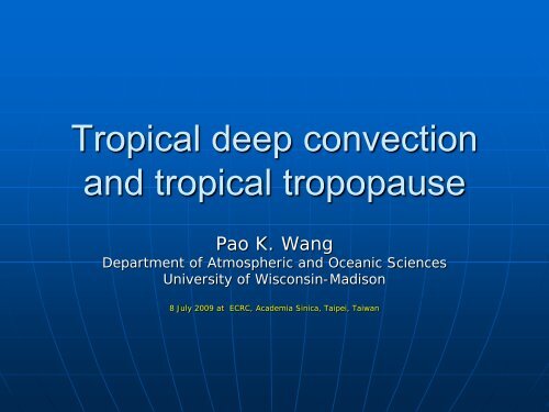
<strong>Tropical</strong> <strong>deep</strong> <strong>convection</strong><br />
<strong>and</strong> <strong>tropical</strong> <strong>tropopause</strong><br />
Pao K. Wang<br />
Department of Atmospheric <strong>and</strong> Oceanic Sciences<br />
University of Wisconsin-Madison<br />
8 July 2009 at ECRC, <strong>Academia</strong> <strong>Sinica</strong>, Taipei, Taiwan
<strong>Tropical</strong> <strong>deep</strong> convective clouds<br />
• Deep convective clouds play important<br />
roles in many atmospheric processes<br />
• <strong>Tropical</strong> <strong>deep</strong> <strong>convection</strong> plays pivotal role<br />
in the transport of momentum <strong>and</strong> many<br />
major trace chemicals.<br />
• This talk concerns the <strong>tropical</strong> <strong>deep</strong><br />
<strong>convection</strong>s that penetrate through the<br />
<strong>tropopause</strong> <strong>and</strong> enter the stratosphere.<br />
• But we will use midlatitude cases to<br />
illustrate the penetrative <strong>convection</strong> first.
Deep <strong>convection</strong> in the atmosphere<br />
• Horizontal velocity in the<br />
atmosphere<br />
• Large scale – ~ 10 m/s<br />
• Mesoscale – > 50 m/s<br />
• Vertical velocity in the<br />
atmosphere<br />
• Large scale – w ~ a few<br />
cm/s.<br />
• Shallow <strong>convection</strong>s –<br />
w max ~ a few m/s<br />
• Deep <strong>convection</strong>s – w max<br />
~ 30 - 60 m/s, even more<br />
in some extreme cases<br />
• Deep <strong>convection</strong>s usually<br />
organize into a few narrow<br />
belts (such as ITCZ <strong>and</strong><br />
frontal b<strong>and</strong>s)
Vertical Temperature Profile<br />
• The scale height H<br />
(= kT/mg) of the<br />
earth’s atmosphere<br />
is ~ 8 km<br />
• A <strong>convection</strong> is<br />
considered <strong>deep</strong> if<br />
its vertical scale is<br />
comparable to the<br />
scale height.
Deep convective storms
Traditional view of <strong>deep</strong> convective storms<br />
<strong>tropopause</strong>
A conceptual global water vapor<br />
transport model (Holton et al.,1995)
Satellite observation of middle<br />
latitude <strong>deep</strong> convective storms<br />
plume<br />
Anvil<br />
Storms over Balearic Isl<strong>and</strong>s
GOES visible images—nearly every<br />
active cell is associated with plumes
Penetrative <strong>convection</strong><br />
• “Penetration” here does<br />
not merely mean that<br />
the cloud top height<br />
exceeds the local<br />
<strong>tropopause</strong> level.<br />
Irreversible mass<br />
transfer is required<br />
• The mere presence of<br />
an overshooting top<br />
does not necessarily<br />
qualify a storm as a<br />
penetrative one<br />
because it may just<br />
distort the <strong>tropopause</strong><br />
temporarily but causes<br />
no irreversible<br />
transport of materials.
Instability <strong>and</strong> Wave Breaking<br />
• Convection-induced instability <strong>and</strong> gravity wave breaking at<br />
the storm top send H 2 O through the <strong>tropopause</strong> to enter the<br />
stratosphere.<br />
Overshooting top plumes<br />
Anvil wave breaking<br />
Wang (2007)
Fujita (1982, 1989) observed jumping cirrus above<br />
severe storms – they are also due to wave breaking<br />
Similar shape, size, orientation <strong>and</strong> occur at similar relative location<br />
jumping cirrus<br />
jumping cirrus<br />
Overshooting top<br />
Overshooting top<br />
Photo courtesy of Martin Setvak<br />
Modeled CCOPE storm cloud top<br />
From: Wang (2004, GRL)
Jumping cirrus taken by webcam in Zurich<br />
(courtesy of Willi Schmid, ETH, Zurich)<br />
wind
Some recent observations of the <strong>tropopause</strong><br />
• So according to recent observations <strong>and</strong><br />
numerical modeling, midlatitude <strong>deep</strong> convective<br />
storms can penetrate the <strong>tropopause</strong> <strong>and</strong> inject<br />
water substance into the stratosphere.<br />
• On the other h<strong>and</strong>, Highwood <strong>and</strong> Hoskins (1998)<br />
stated that few of <strong>tropical</strong> “hot towers” are<br />
observed to be taller than 14 km. there are even<br />
observations indicating sinking motion in the<br />
layer above the top of these hot towers (loosely<br />
called the <strong>tropical</strong> <strong>tropopause</strong> layer, or TTL).<br />
• This implies that the <strong>deep</strong> convective clouds may<br />
not be the water vapor source in the tropics.
• Some suggest that the <strong>tropical</strong> cross<strong>tropopause</strong><br />
transport of H2O is performed<br />
by large scale ascent (e.g., Küpper et al.,<br />
2004). But there is no observations to<br />
substantiate this claim.<br />
• If even the layer above the strong<br />
<strong>convection</strong> contains sinking motion, how<br />
can we expect rising motion in large scale?
These questions cast doubts on the<br />
global cycle chart<br />
? ? ?<br />
? ? ?
Modified Holton chart<br />
do you see the differences?<br />
NCAR-ACD
Wind shear environment in midlatitudes <strong>and</strong><br />
tropics<br />
• In the tropics, wind shears are<br />
usually weaker<br />
• Can <strong>deep</strong> <strong>convection</strong> penetrate the<br />
<strong>tropopause</strong> in a weak shear<br />
environment?<br />
• So we performed a model study on<br />
the cloud top behavior of a <strong>deep</strong><br />
convective storm in the absence of<br />
wind shear.
Simulated CCOPE supercell without wind shear<br />
<strong>and</strong> winds. The results are pretty much the same.
CCOPE supercell without wind shear-central cross-section
CCOPE supercell without wind shear –cloud top view
A pancake cloud above a Cb over<br />
Taiwan<br />
(courtesy of Po-Hsiung Lin)
Satellite observation<br />
(courtesy of Martin Setvak)
Oscillatory TTL
Weak wind shear – cold ring as seen in satellite IR<br />
images– so the model is able to reproduce<br />
observed cloud top features.
<strong>Tropical</strong> <strong>tropopause</strong> height <strong>and</strong><br />
<strong>deep</strong> convective clouds<br />
• However, in real tropics, the <strong>tropopause</strong> is<br />
higher. It is usually taken to be ~ 17 km.<br />
• <strong>Tropical</strong> <strong>tropopause</strong> is thought to be<br />
approximately maintained by convectiveradiative<br />
equilibrium<br />
• Yet few of <strong>tropical</strong> “hot towers” are<br />
observed to be taller than 14 km<br />
(Highwood <strong>and</strong> Hoskins, 1998)<br />
• So how can the <strong>tropical</strong> <strong>tropopause</strong> be<br />
maintained at 17 km level?<br />
• Also, would H2O go thru the <strong>tropopause</strong>?
A <strong>tropical</strong> case (Tiwi Isl<strong>and</strong>s, Australia)<br />
30000<br />
30000<br />
25000<br />
25000<br />
20000<br />
20000<br />
Height (m)<br />
15000<br />
Height (m)<br />
15000<br />
10000<br />
10000<br />
5000<br />
5000<br />
0<br />
-5 0 5 10 15 20<br />
0<br />
250 450 650 850 1050<br />
qv (g/kg)<br />
Theta (K)<br />
Slightly modified so that the cold point<br />
<strong>tropopause</strong> is at 17 km. The level of<br />
neutral buoyancy (LNB) is ~ 10-15 km<br />
depending on where the parcel starts.<br />
Lane <strong>and</strong> Reed, 2001
Formation of vertically segmented convective<br />
clouds
Such segmented clouds have been observed<br />
(a <strong>deep</strong> convective cloud in New Mexico)<br />
Courtesy of Ken Bowman
Effect of cloud top gravity waves<br />
(orientation of anvils tends to line up with waves)
3-D renderings showing the multiple anvil structure
A maritime Cb near Taiwan
Oscillating TTL
General behavior of the cloud<br />
• The updraft causes the cloud top layer to<br />
become unstable<br />
• A patch of the cloud material breaks off<br />
<strong>and</strong> penetrates into the stratosphere due<br />
to cloud top instability. It gradually<br />
spreads out <strong>and</strong> probably eventually<br />
dissipates.<br />
• The remaining cloud body “shrinks” back<br />
to the troposphere <strong>and</strong> oscillates about<br />
the LNB (~ 14-15 km).<br />
• The 14-17 km TTL layer also oscillates<br />
vertically. This oscillatory behavior has<br />
been observed before (e.g., Danielsen,<br />
1993).
One possible explanation<br />
• <strong>Tropical</strong> <strong>deep</strong> <strong>convection</strong>s may have<br />
adequate energy to reach ~17 km, but<br />
the LNB is often at ~ 14 km due to<br />
humidity structure.<br />
• The LNB cloud tops are more stable <strong>and</strong><br />
are the ones most often observed. On the<br />
other h<strong>and</strong>, the clouds in the TTL (14-17<br />
km) tend to be more disorganized <strong>and</strong><br />
probably thinner, hence are not often<br />
observed.<br />
• Thus we observe <strong>tropical</strong> <strong>deep</strong> convective<br />
clouds often reaching ~ 14 km but the<br />
actual <strong>tropopause</strong> height is at ~ 17 km.
Another revision?<br />
? ? ?
Conclusions<br />
• <strong>Tropical</strong> <strong>deep</strong> convective storms can penetrate through the<br />
<strong>tropopause</strong> <strong>and</strong> transport water into the stratosphere.<br />
• This transport is due to the gravity wave breaking <strong>and</strong><br />
instability at the cloud top. The forms of such transport<br />
may look different in midlatitudes <strong>and</strong> tropics due to<br />
different wind shear structure.<br />
• The stable cloud top layer is ~ 14-15 km. The vertical<br />
motions in the TTL are oscillatory <strong>and</strong> generate gravity<br />
waves.<br />
• Both the H 2 O <strong>and</strong> momentum transported vertically into the<br />
stratosphere may have implications on the global climate<br />
<strong>and</strong> chemical processes. They may be related to QBO as<br />
well.<br />
• But many questions remain to be answered (e.g., the H2O-<br />
QBO-wind shear connection).
The End<br />
Thank you