Fountain Property - City of Moscow
Fountain Property - City of Moscow
Fountain Property - City of Moscow

You also want an ePaper? Increase the reach of your titles
YUMPU automatically turns print PDFs into web optimized ePapers that Google loves.
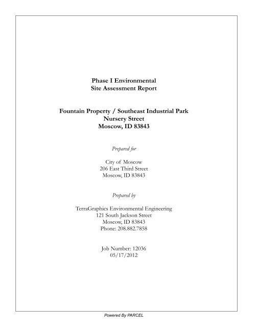
Phase I Environmental<br />
Site Assessment Report<br />
<strong>Fountain</strong> <strong>Property</strong> / Southeast Industrial Park<br />
Nursery Street<br />
<strong>Moscow</strong>, ID 83843<br />
Prepared for<br />
<strong>City</strong> <strong>of</strong> <strong>Moscow</strong><br />
206 East Third Street<br />
<strong>Moscow</strong>, ID 83843<br />
Prepared by<br />
TerraGraphics Environmental Engineering<br />
121 South Jackson Street<br />
<strong>Moscow</strong>, ID 83843<br />
Phone: 208.882.7858<br />
Job Number: 12036<br />
05/17/2012<br />
Powered By PARCEL
Table <strong>of</strong> Contents<br />
Acronyms & Abbreviations..................................................................................................................................................<br />
1<br />
Glossary................................................................................................................................................................................<br />
4<br />
Executive Summary............................................................................................................................................................<br />
15<br />
Executive Summary.......................................................................................................................................................<br />
16<br />
Findings, Opinions & Recommendations.................................................................................................................<br />
16<br />
Findings.............................................................................................................................................................<br />
16<br />
Opinions............................................................................................................................................................<br />
17<br />
Recommendations............................................................................................................................................<br />
18<br />
Environmental Report Summary.............................................................................................................................<br />
18<br />
Detail Report.......................................................................................................................................................................<br />
20<br />
General Information........................................................................................................................................................<br />
21<br />
1.0 Introduction..............................................................................................................................................................<br />
22<br />
1.1 Purpose.............................................................................................................................................................<br />
22<br />
1.2 Detailed Scope <strong>of</strong> Services................................................................................................................................<br />
22<br />
1.3 Significant Assumptions.....................................................................................................................................<br />
22<br />
1.4 Limitations and Exceptions................................................................................................................................<br />
22<br />
1.5 Special Terms and Conditions...........................................................................................................................<br />
23<br />
1.6 User Reliance....................................................................................................................................................<br />
23<br />
2.0 Site Description........................................................................................................................................................<br />
24<br />
2.1 Location and Site Description............................................................................................................................<br />
24<br />
2.2 Site and Vicinity General Characteristics...........................................................................................................<br />
24<br />
2.3 Current Use <strong>of</strong> the <strong>Property</strong>...............................................................................................................................<br />
24<br />
2.4 Description <strong>of</strong> Structures, Roads, Other Improvements on the Site..................................................................<br />
24<br />
2.5 Current Uses <strong>of</strong> the Adjoining Properties..........................................................................................................<br />
25<br />
3.0 User Provided Information........................................................................................................................................<br />
26<br />
3.1 Title Records......................................................................................................................................................<br />
26<br />
3.2 Environmental Liens or Activity and Use Limitations.........................................................................................<br />
26<br />
3.3 Specialized Knowledge......................................................................................................................................<br />
26<br />
3.4 Commonly Known or Reasonably Ascertainable Information............................................................................<br />
26<br />
3.5 Valuation Reduction for Environmental Issues...................................................................................................<br />
26<br />
3.6 Reason For Performing Phase I.........................................................................................................................<br />
26<br />
3.7 Owner, <strong>Property</strong> Manager, and Occupant Information......................................................................................<br />
26<br />
3.8 Other..................................................................................................................................................................<br />
26<br />
4.0 Records Review.......................................................................................................................................................<br />
27<br />
4.1 Standard Environmental Records Sources........................................................................................................<br />
27<br />
4.2 Additional Environmental Record Sources........................................................................................................<br />
28<br />
4.2.1 <strong>City</strong> Directories.........................................................................................................................................<br />
28<br />
4.2.2 Physical Setting Source(s) ....................................................................................................................... 29<br />
4.2.3 Aerial Photographs...................................................................................................................................<br />
29<br />
4.2.4 Previous Environmental Assessment Reports.........................................................................................<br />
30<br />
4.3 Historical Use Information on the <strong>Property</strong>........................................................................................................<br />
30<br />
4.4 Historical Use Information on Adjoining Properties...........................................................................................<br />
30<br />
5.0 Site Reconnaissance...............................................................................................................................................<br />
31<br />
5.1 Methodology and Limiting Conditions................................................................................................................<br />
31<br />
5.2 General Site Setting...........................................................................................................................................<br />
31<br />
5.2.1 Hazardous Substances............................................................................................................................<br />
31<br />
5.2.2 Unidentified Containers............................................................................................................................<br />
31<br />
5.2.3 Staining....................................................................................................................................................<br />
32<br />
5.2.4 Stressed Vegetation.................................................................................................................................<br />
32
Table <strong>of</strong> Contents<br />
5.2.5 Aboveground Storage Tanks (ASTs)........................................................................................................<br />
32<br />
5.2.6 Lack <strong>of</strong> Secondary Containment..............................................................................................................<br />
32<br />
5.2.7 Underground Storage Tanks (USTs)........................................................................................................<br />
32<br />
5.2.8 Pits, Ponds, And Lagoons........................................................................................................................<br />
32<br />
5.2.9 PCB Containing Equipment......................................................................................................................<br />
32<br />
5.2.10 Solid Waste Disposal..............................................................................................................................<br />
32<br />
5.2.11 Wetlands.................................................................................................................................................<br />
32<br />
5.2.12 Septic System with On-Site Drainfield....................................................................................................<br />
32<br />
5.2.13 Oil/Water Separator................................................................................................................................<br />
33<br />
5.2.14 Dry Wells or Injection Wells....................................................................................................................<br />
33<br />
5.2.15 Contamination <strong>of</strong> Soil.............................................................................................................................<br />
33<br />
5.2.16 Contamination <strong>of</strong> Groundwater..............................................................................................................<br />
33<br />
5.2.17 Vapor Intrusion.......................................................................................................................................<br />
33<br />
5.2.18 Use <strong>of</strong> Pesticides on Site........................................................................................................................<br />
33<br />
5.2.19 Other Concerns......................................................................................................................................<br />
33<br />
5.3 Exterior Observations........................................................................................................................................<br />
34<br />
5.4 Interior Observations.........................................................................................................................................<br />
35<br />
6.0 Interviews.................................................................................................................................................................<br />
36<br />
7.0 Findings....................................................................................................................................................................<br />
38<br />
8.0 Opinions...................................................................................................................................................................<br />
40<br />
9.0 Recommendations...................................................................................................................................................<br />
41<br />
10.0 Deviations...............................................................................................................................................................<br />
42<br />
11.0 Additional Services.................................................................................................................................................<br />
43<br />
12.0 References / Information Sources..........................................................................................................................<br />
44<br />
Appendices<br />
Appendix A Figures.............................................................................................................................................................<br />
45<br />
Appendix B Title Records....................................................................................................................................................<br />
47<br />
Appendix C Regulatory Records Documentation................................................................................................................<br />
88<br />
Appendix D Site Survey Form...........................................................................................................................................<br />
177<br />
Appendix E Site Photographs............................................................................................................................................<br />
181<br />
Appendix F Additional Environmental Reports..................................................................................................................<br />
185
Acronyms and Abbreviations<br />
AEC<br />
AIG<br />
AQCR<br />
ARAR<br />
AST<br />
ASTM<br />
BOD<br />
BTU<br />
BTEX<br />
ο<br />
Atomic Energy Commission<br />
American International Group<br />
Air quality control regions<br />
Applicable or relevant and appropriate requirement ARP Accidental Release Program<br />
Aboveground storage tank<br />
American Society for Testing and Materials<br />
Biochemical oxygen demand<br />
British thermal unit<br />
Benzene-toluene-ethylbenzene-xylene<br />
C<br />
Degrees Celsius<br />
CA<br />
California<br />
CAA<br />
(Federal) Clean Air Act<br />
CCME<br />
Canadian Council <strong>of</strong> Ministers <strong>of</strong> the Environment<br />
CDEP<br />
Connecticut Department <strong>of</strong> Environmental Protection<br />
CEPA<br />
Canadian Environmental Protection Act<br />
CERCLA (Federal) Comprehensive Environmental Response Compensation and Liability Act <strong>of</strong> 1980<br />
CFC<br />
Chlor<strong>of</strong>luorocarbon<br />
C.F.R.<br />
Code <strong>of</strong> Federal Regulations<br />
CLP<br />
(EPA) Contract Laboratory Program<br />
CMHC<br />
Canada Mortgage and Housing Corporation<br />
CO<br />
Carbon monoxide<br />
CZMA<br />
(Federal) Coastal Zone Management Act<br />
DDT<br />
Dichloro diphenyl trichloro ethane<br />
DEC<br />
Department <strong>of</strong> Environmental Conversation (New York State)<br />
DEP<br />
Department for Environmental Protection (Florida; Massachusetts; New Jersey)<br />
DEPE<br />
Department <strong>of</strong> Environmental Protection and Energy (New Jersey)<br />
DEQ<br />
Department <strong>of</strong> Environmental Quality (Louisiana)<br />
DER<br />
Department <strong>of</strong> Environmental Resources (Pennsylvania)<br />
DMR<br />
Discharge Monitoring Report DI Deionized<br />
DNR<br />
Department <strong>of</strong> Natural Resources (Michigan)<br />
DOE<br />
(U.S.) Department <strong>of</strong> Energy<br />
DOH<br />
Department <strong>of</strong> Health (New York State)<br />
DOI<br />
(U.S.) Department <strong>of</strong> Interior<br />
DOL<br />
(U.S.) Department <strong>of</strong> Labor<br />
DOT<br />
(U.S.) Department <strong>of</strong> Transportation<br />
EIS<br />
Environmental Impact Statement<br />
EM<br />
Electromagnetic<br />
EP<br />
Extraction procedure<br />
EPA<br />
(U.S.) Environmental Protection Agency<br />
ο<br />
F<br />
f/cc<br />
Fed.Reg.<br />
FID<br />
FOIA<br />
FWPCA<br />
GC<br />
GC/MS<br />
gal<br />
Degrees Fahrenheit<br />
fibers per cubic centimeter<br />
Federal Register<br />
Flame ionization detector<br />
(Federal) Freedom <strong>of</strong> Information Act<br />
Federal Water Pollution Control Act<br />
Gas chromatograph<br />
Gas chromatography/mass spectrometry<br />
gallon
gph<br />
gallons per hour<br />
GPR<br />
Ground-penetrating radar<br />
H2S<br />
Hydrogen sulfide<br />
HA<br />
Halogenated aromatics<br />
HAP<br />
Hazardous air pollutant<br />
HCFC<br />
Hydrochlor<strong>of</strong>luorocarbons<br />
HCS<br />
(OHSA) Hazard Communication Standard<br />
HREC<br />
Historical Recognized Environmental Condition<br />
HRS<br />
Hazard Ranking System<br />
HSWA (Federal) Hazardous and Solid Waste Amendments <strong>of</strong> 1984<br />
HWM<br />
Hazardous waste management (facilities)<br />
kPa<br />
kilopascal<br />
L<br />
liter<br />
LAER<br />
Lowest achievable emission rate<br />
LEL<br />
Lower explosive limit<br />
LNG<br />
Liquid natural gas<br />
LSP<br />
Licensed site pr<strong>of</strong>essionals (Massachusetts)<br />
LUST<br />
Fund Leaking underground storage tank (petroleum)<br />
m3<br />
cubic meter<br />
MCL<br />
Maximum contaminant level<br />
MCLG<br />
Maximum contaminant level goal<br />
MCP<br />
Massachusetts Contingency Plan<br />
MeV<br />
Million electron volts<br />
mg/l<br />
miligrams per liter<br />
ml<br />
milliliter<br />
MMS<br />
Minerals Management Service<br />
MS<br />
Mass spectrometry<br />
MSDS<br />
Material safety data sheet<br />
NFA<br />
No Further Action (letter)<br />
NGWA National Ground Water Association<br />
N02<br />
Nitrogen dioxide<br />
Nox<br />
Nitrogen oxides<br />
NPDES National Pollutant Discharge Elimination System<br />
NPL<br />
National Priorities List<br />
NRC<br />
Nuclear Regulatory Commission<br />
O2<br />
Oxygen<br />
O3<br />
Ozone<br />
O&M<br />
Operating and maintenance<br />
ODCs<br />
Other direct costs<br />
OSHA<br />
Occupational Safety and Health Act<br />
OVA<br />
Organic vapor analyzer<br />
PCB<br />
Polychlorinated biphenyl<br />
PCi/l<br />
Picocuries per liter<br />
PEL<br />
Permissible airborne exposure level<br />
PID<br />
Photoionization detector<br />
POTW<br />
Publicly owned treatment works<br />
ppb<br />
parts per billion<br />
ppm<br />
parts per million<br />
PRPs<br />
Potentially responsible parties<br />
PSD<br />
Prevention <strong>of</strong> significant deterioration<br />
psi<br />
pounds per square inch
PVC<br />
Polyvinyl chloride<br />
QA<br />
Quality assurance<br />
QC<br />
Quality control<br />
R.A.<br />
Regional Administrator<br />
R&D<br />
Research and development<br />
RAP<br />
Remedial Assessment Plan<br />
RCP<br />
Response Claims Procedure<br />
RCRA<br />
(Federal) Resource Conservation and Recovery Act<br />
REC<br />
Recognized Environmental Condition<br />
rem<br />
Roentgen equivalent man [a measure <strong>of</strong> radiation]<br />
RI/FS<br />
Remedial Investigation & Feasibility Study<br />
RMP<br />
Risk management plan<br />
RMPP<br />
Risk Management and Prevention Programs<br />
ROD<br />
Record <strong>of</strong> Decision<br />
RQ<br />
Reportable quantity<br />
RUST<br />
Repair <strong>of</strong> Underground Storage Tank Program<br />
SARA (Federal) Superfund Amendments and Reauthorization Act <strong>of</strong> 1986<br />
SDWA<br />
(Federal) Safe Drinking Water Act<br />
SEC<br />
Securities and Exchange Commission<br />
SOW<br />
Scope <strong>of</strong> work<br />
SPCC<br />
Plan Spill Prevention Control and Countermeasure Plan<br />
SPDES State Pollutant Discharge Elimination System (New York)<br />
SQG<br />
Small quantity generator<br />
SWDA (Federal) Solid Waste Disposal Act <strong>of</strong> 1965<br />
SWMA Solid Waste Management Act (New Jersey)<br />
SWMU Solid waste management unit<br />
T<br />
Temperature<br />
TAT<br />
Turn-around time<br />
TBC<br />
To-be-considered (material)<br />
TCLP<br />
Toxicity characteristic leaching procedure<br />
TOC<br />
Total organic carbon<br />
TSCA<br />
(Federal) Toxic Substance Control Act<br />
UEL<br />
Upper explosive limit<br />
USGS<br />
United States Geological Survey<br />
UST<br />
Underground storage tank<br />
UV<br />
Ultraviolet<br />
vs.<br />
versus<br />
VCP<br />
Voluntary Cleanup<br />
VOA<br />
Volatile organic analyses<br />
VOC<br />
Volatile organic compound<br />
WQA<br />
(Federal) Water Quality Act
Glossary
Glossary<br />
Action-specific ARARS<br />
Alpha particle<br />
Annual aggregate financial ability<br />
Area <strong>of</strong> concern<br />
As-Is Site Plan<br />
Barrier remediation<br />
Becquerel<br />
Beta particle<br />
Caveat emptor<br />
Certification (laboratories)<br />
usually technology-or activity-based requirements or limitations<br />
on actions or conditions involving specific substances.<br />
a positively charged nuclear particle, consisting <strong>of</strong> two neutrons<br />
and two I protons, emitted with high energy (3 to 8 Me V) during<br />
some nuclear I transformations.<br />
the amount <strong>of</strong> money that would be required to pay for accidental<br />
releases that may occur within 12 months.<br />
a term defined in (New Jersey's) Industrial Site Reclamation Act<br />
referring to any location where hazardous substances or wastes<br />
are or may be present.<br />
drawing <strong>of</strong> the existing site layout, shows property boundaries,<br />
streets bordering the site, and building locations and<br />
configurations, other site features, and includes an accurate<br />
scale and the north direction.<br />
prevents radon from entering the enclosure.<br />
international unit <strong>of</strong> measurement for the rate <strong>of</strong> nuclear<br />
transformations (per second).<br />
an electrically-charged particle [either positive (positron) or<br />
negative (electron)], ejected from the nucleus <strong>of</strong> an atom during<br />
radioactive decay; has the mass <strong>of</strong> an electron, can penetrate<br />
skin, up to about 1/4 inch.<br />
meaning "let the buyer beware;" without a warranty the buyer<br />
takes the risk <strong>of</strong> quality upon himsel£<br />
granted by some states to certain laboratories; ensures that<br />
laboratories meet certain minimum standards.<br />
Chemical-specific ARARs<br />
Composite sample<br />
Conventional pollutant<br />
usually health-or risk-based values or methodologies used to<br />
determine acceptable concentrations <strong>of</strong> chemicals that may be<br />
found in, or discharged to, the environment. Maximum<br />
contaminant levels (MCLs) or other water quality criteria are<br />
examples <strong>of</strong> chemical-specific ARARs.<br />
a single composite sample is made up <strong>of</strong> a combination <strong>of</strong><br />
samples.<br />
EP A has identified five; biochemical oxygen demand, total<br />
suspended solids, pH, fecal coliform, and grease.
Criterial pollutant<br />
Curie<br />
Dilution ventilation<br />
Direct discharge<br />
Discharge <strong>of</strong> dredged material<br />
Discharge <strong>of</strong> a pollutant<br />
Due diligence<br />
Duplicate samples<br />
Eminent domain<br />
Environmental due diligence process<br />
Environmental pr<strong>of</strong>essional<br />
a pollutant for which EP A has established, under the Clean Air<br />
Act, a national standard.<br />
unit <strong>of</strong> measurement <strong>of</strong> the rate <strong>of</strong> nuclear transformations (per<br />
second), approximately equal to the radiation from one gram <strong>of</strong><br />
radium.<br />
a method <strong>of</strong> radon remediation; increases the frequency <strong>of</strong> air<br />
exchange in a enclosure.<br />
one that is released into the 'waters <strong>of</strong> the United States.'<br />
generally means any addition <strong>of</strong> reintroduction <strong>of</strong> the material,<br />
either directly or indirectly, including 'run<strong>of</strong>f or overflow from a<br />
contained land or water disposal area.'<br />
CW A defines this as any addition <strong>of</strong> a pollutant to receiving<br />
waters. Dredged material material excavated or dredged from<br />
water bodies.<br />
identifying and evaluating environmental liabilities and risks is<br />
also known as performing due diligence.<br />
provide information about the precision <strong>of</strong> a laboratory's results<br />
by providing a check to determine if the correct sampling<br />
technique or method was used; may be a mandatory requirement<br />
<strong>of</strong> some regulatory agencies. Duplicate samples should be<br />
collected at locations where suspected contaminant levels are<br />
believed to be at their highest concentrations.<br />
the inherent right <strong>of</strong> the state or its designated agents to<br />
appropriate or take private property provided that the property<br />
owner receives just compensation for the taking and there has<br />
been a determination that a valid public necessity exists for the<br />
taking.<br />
the process used to investigate a commercial or industrial<br />
property (usually prior to completion <strong>of</strong> a real estate transaction)<br />
for contamination by hazardous wastes or hazardous<br />
substances.<br />
ASTM standards terminology used to describe a person<br />
possessing the necessary training and experience to conduct all<br />
aspects <strong>of</strong> the ESA and also the ability to develop valid<br />
conclusions regarding the presence <strong>of</strong> recognized environmental<br />
conditions. The terms is typically interchangeable with consultant,<br />
assessor, environmental assessor, engineering consultant,<br />
geologist, hydrogeologist, or certified engineering geologist.
Existing source<br />
Exposed<br />
Exposure assessment<br />
Field blanks<br />
Field-constructed tanks<br />
Fill material<br />
First encountered ground water<br />
Friable asbestos material<br />
Gamma rays<br />
General permit<br />
Geophysical techniques<br />
Giga<br />
Grab samples<br />
Harmful quantities <strong>of</strong> oil discharge<br />
Hazard assessment<br />
is one, the construction <strong>of</strong> which commenced before publication<br />
<strong>of</strong> an applicable proposed regulation setting NSPSs for that<br />
category.<br />
(to radiation) the individual is subjected to airborne concentration<br />
<strong>of</strong> radio nuclides with no allowance for the use <strong>of</strong> protective<br />
clothing, equipment or particle size.<br />
the defining <strong>of</strong> exposure pathways and the calculation <strong>of</strong> the<br />
potential magnitude <strong>of</strong> exposure.<br />
extra field samples that help to ensure "quality control" (QC).<br />
vertical cylinders with a capacity <strong>of</strong> greater than 50,000 gallons.<br />
Field duplicates<br />
any material used primarily for either 'replacing an aquatic area<br />
with dry land' or raising the bottom elevation <strong>of</strong> water body.<br />
the most-shallow ground water aquifer. Such an aquifer is the<br />
one most likely to be affected if surface discharges <strong>of</strong> waste have<br />
occurred.<br />
any material that contains more than one percent asbestos by<br />
weight, and can be crumbled, pulverized, or reduced to powder<br />
by hand pressure.<br />
electromagnetic radiation (similar to X-rays but higher in<br />
frequency spectrum) emitted by a radioactive substance. This<br />
radiation has no charge and is the most penetrating <strong>of</strong> the<br />
radiation forms.<br />
authorizes a type <strong>of</strong> activity as long as it meets certain standards<br />
or conditions described in the permit.<br />
tests (including magnetometer surveys, ground penetrating radar,<br />
electrical resistivity, and seismic refraction) used to locate buried<br />
metallic objects, such as USTs and to map groundwater<br />
pathways.<br />
a billion<br />
uncomposited samples (usually taken for water).<br />
any discharge that violates a water quality standard, or causes a<br />
film or sheen upon the surface <strong>of</strong> the water.<br />
helps to define the potential adverse health or environmental<br />
effects associated with chemicals onsite, the potential magnitude<br />
<strong>of</strong> exposure, and the frequency <strong>of</strong> exposure.
Hazard identification<br />
Highest and best use<br />
Indemnification agreement<br />
Indirect point source discharges<br />
Individual permit<br />
Joint and several liability<br />
Just compensation<br />
Laboratory blanks<br />
Laboratory duplicates<br />
Location-specific ARARs<br />
Matrix spikes<br />
Maximum holding times<br />
Method blank<br />
Micro<br />
the identification <strong>of</strong> those chemicals that may pose a threat to<br />
human health or the environment.<br />
the most pr<strong>of</strong>itable likely use to which a property can be put.<br />
a written promise by one party that it will not hold another party<br />
liable; also called a "hold harmless clause."<br />
discharges by industries <strong>of</strong> pollutants indirectly into U.S. waters<br />
through publicly-owned treatment works (POTWs).<br />
authorizes a specific individual or entity to conduct a specific<br />
activity.<br />
imposed in cases where the harm caused is indivisible-where<br />
there are multiple parties who are potentially responsible for the<br />
harm, but it cannot be determined with any degree <strong>of</strong> certainty<br />
which parties or defendants are responsible for which aspects <strong>of</strong><br />
the damage.<br />
the market value <strong>of</strong> the property in its highest and best use in<br />
cash as <strong>of</strong> the<br />
laboratory-grade samples that re analyzed in the same way as<br />
field samples.<br />
unmarked samples whose results help to ensure QC.<br />
restrict actions or contaminant concentrations in certain<br />
environmentally sensitive areas. Examples <strong>of</strong> areas regulated<br />
under various federal and state laws include floodplains,<br />
wetlands, and locations where endangered species or historically<br />
significant cultural resources are present<br />
duplicate field samples that are spiked in the laboratory with<br />
measured quantities <strong>of</strong> contaminant; the volume <strong>of</strong> contamination<br />
in a matrix spike can then be subtracted from the overall quantity<br />
<strong>of</strong> contaminant in the pure sample to determine the<br />
contamination level in the original soil sample.<br />
the total time a sample can be retained under proper storage<br />
conditions before analytical results are considered legally invalid.<br />
used to calibrate the instrument chosen to test a sample. For<br />
example, in spectrometry, a method blank containing deionized<br />
water is used to obtain a base reading; this reading is then<br />
deducted from the readings obtained from the samples.<br />
one millionth
Negative declaration<br />
New source<br />
New underground storage tanks (New USTs)<br />
No Further Action letter<br />
Opportunity costs<br />
Per occurrence financial ability<br />
Permeability<br />
Pesticide<br />
Phase I (ESA)<br />
Phase II (investigation)<br />
Phase III<br />
Pico<br />
Pits<br />
Point source discharges<br />
a term defined in (New Jersey's) Industrial Site Reclamation Act.<br />
one for which construction began after publication <strong>of</strong> an<br />
applicable proposed regulation settings NSPS for that category.<br />
tanks used to contain regulated substances, and installed after<br />
December 22, 1988.<br />
a term defined in (New Jersey's) Industrial Site Reclamation Act.<br />
those costs associated with the loss <strong>of</strong> use <strong>of</strong> the property due to<br />
remedial activies.<br />
refers to the amount <strong>of</strong> money that must be available to pay the<br />
cost <strong>of</strong> one accidental release.<br />
the ability <strong>of</strong> liquid or gas to pass through; in this case, defined as<br />
the ability <strong>of</strong> a rock formation to transmit water.<br />
any substance or mixture <strong>of</strong> substances intended to prevent,<br />
destroy, repel, or mitigate pests.<br />
non-intrusive research conducted to evaluate the potential for<br />
significant onsite impacts.<br />
an intrusive study <strong>of</strong> at the site's soil and ground water to<br />
evaluate the location and extent <strong>of</strong> impacts from historical uses.<br />
a framework for identifying remediation approaches so that a<br />
cleanup strategy can be developed.<br />
one trillionth<br />
floor drains that may be used to discharge hazardous wastes;<br />
also called "trenches."<br />
any discernible, confined and discrete conveyance, including but<br />
not limited to any pipe, ditch, channel, tunnel, conduit, well,<br />
discrete fissure, container, rolling stock, concentrated animal<br />
feed operation, or vessel or other floating craft, from which<br />
pollutants are or may be discharged into waters.
Pollutant<br />
Portable organic vapor analyzer<br />
Potential to emit<br />
Primary standards (for airborne pollutants)<br />
Pristine sites<br />
Pr<strong>of</strong>iling<br />
Proportional allocation method<br />
Pumping and treatment<br />
Quad map<br />
Quality assurance (QA)<br />
Quality control (QC) programs<br />
Radioactive material<br />
Radiation<br />
according to CW A, dredged spoil, solid waste, incinerator<br />
residue, sewage, garbage, sewage sludge, munitions, chemical<br />
wastes, biological materials, radioactive materials, heating<br />
wrecked or discharged equipment, rock, sand, cellar dirt and<br />
industrial, municipal, and agricultural waste discharged into<br />
water. See a/so conventional, non-conventional and toxic<br />
pollutants.<br />
used to screen volatile organic compounds, the most common<br />
contaminant present on commercial and industrial properties.<br />
calculated using the major stationary source's maximum design<br />
capacity (continuous year-round operation) following application<br />
<strong>of</strong> pollution controls.<br />
EPA's standards which are designed to protect human health<br />
with an adequate margin <strong>of</strong> safety.<br />
sites unaffected by any negative impact from man or nature<br />
defining the subsurface features. This is used t define the lateral<br />
extent <strong>of</strong> a feature, such as a waste site, with little or no data on<br />
depth.<br />
involves allocating liability according to the percentage <strong>of</strong> total<br />
wastes found at the site that is clearly attributable to each<br />
potentially responsible party (pRP).<br />
a man-made system for extracting contaminated ground water<br />
and ~ treating it to remove contaminants; typically there is no reinjection<br />
<strong>of</strong> the water.<br />
a topographic map with an approximate scale <strong>of</strong> one inch to<br />
2,000 feet; shows physical features such as wetlands, water<br />
bodies, roadways, mines, and buildings.<br />
a firm-wide program that establishes project policies, procedures,<br />
standards, and guidelines designed to produce an acceptable<br />
level <strong>of</strong> pr<strong>of</strong>essional quality.<br />
establish project activities that apply the policies, procedures,<br />
standards, and guidelines designed to produce an acceptable<br />
level <strong>of</strong> pr<strong>of</strong>essional quality.<br />
any material which emits, by spontaneous nuclear distergr4ation,<br />
corpuscle or electromagnetic emanations.<br />
includes alpha rays, beta rays, and gamma rays. Alpha and beta<br />
rays are corpuscle (particle) emanations; gamma rays are<br />
electromagnetic emanations.
Radiation area<br />
Radon<br />
Real estate value<br />
Recharge<br />
Regulated substances<br />
Releases<br />
Rem<br />
Remedial action<br />
Restricted area<br />
Restricted-use pesticides<br />
any area accessible to personnel, in which radiation exposure<br />
could exceed 5 millirems in one hour, or 100 millirems in any five<br />
consecutive days.<br />
a chemical element fomled by the disintegration <strong>of</strong> radium, is a<br />
heavy, colorless, odorless, and radioactive gas.<br />
cost approach to value involves the estimation <strong>of</strong> the<br />
replacement cost <strong>of</strong> the utility <strong>of</strong> the improvements, from which is<br />
subtracted the estimated depreciation, to which is added to the<br />
value <strong>of</strong> the land. The land value is nomlally obtained from the<br />
market approach to value. income approach is applicable in<br />
estimating the value <strong>of</strong> real estate that is purchased primarily for<br />
its income-producing potential. Market data approach is an<br />
appraisal process in which the estimated market value <strong>of</strong> a<br />
property is based upon prices paid in actual market transactions,<br />
or upon current <strong>of</strong>fering prices for similar real estate. Selected<br />
properties are compared to that under appraisal in order to arrive<br />
at an indicated value <strong>of</strong> the subject. The various features <strong>of</strong> the<br />
comparables are considered with respect to their absence,<br />
presence, and quality in the subject and adjustments are made to<br />
the unit sale price <strong>of</strong> the comparable property for these major<br />
differences.<br />
water management systems designed to inject water collected by<br />
surface systems back into ground water aquifers.<br />
"The teml regulated substances means (1) any substance<br />
defined [as hazardous substance under CERCLA]...(but not<br />
including any substance regulated as hazardous waste under<br />
[RCRA]), and (2) petroleum."<br />
defined by federal and most state laws as any spilling, leaking,<br />
pouring, dumping, emitting, discharging, injecting, escaping,<br />
leaching, or disposing <strong>of</strong> hazardous waste or hazardous waste<br />
constituents into the environment.<br />
(roentgen equivalent man) a measure <strong>of</strong> ionizing radiation<br />
dosage with the same biological effect as a roentgen <strong>of</strong> X- or<br />
gamma rays.<br />
a teml defined in (New Jersey's) Industrial Site Reclamation Act.<br />
any area where access is controlled by the employer for the<br />
purpose <strong>of</strong> limiting employee exposure to radiation or radioactive<br />
materials.<br />
pesticides that must be applied under the supervision <strong>of</strong> a<br />
certified applicator.
Risk characterization<br />
Roentgen<br />
Sample price<br />
Sampling round<br />
Secondary standards (for airborne pollutants)<br />
Small quantity generators (SQGs)<br />
Soil and ground water analyses<br />
Soil vapor surveys<br />
Sophisticated surface water sampling program<br />
Sounding<br />
Spikes<br />
Strict liability<br />
combines information on the potential magnitude <strong>of</strong> exposure to<br />
chemicals from the site with dose-response information derived<br />
from the "hazard assessment." The result is a description <strong>of</strong> the<br />
potential nature and magnitude <strong>of</strong> health or environmental risk<br />
associated with each chemical onsite.<br />
the international unit <strong>of</strong> measurement for X-radiation or gamma<br />
radiation<br />
the total price for all samples including samples necessary to test<br />
for QA.<br />
a consultant's visit to the site to gather samples.<br />
EPA's standards designed to protect against environmental<br />
damage, such as damage to soils, crops, wildlife, weather,<br />
climate, and personal comfort.<br />
defined as facilities producing less than 1,000 kilograms <strong>of</strong><br />
hazardous waste per calendar month (kilograms per month),<br />
which is the equivalent <strong>of</strong> about 300 gallons or about five 55-<br />
gallon drums; note, however, some states define SQGs more<br />
narrowly.<br />
tests used to determine the presence <strong>of</strong> surficial or subsurface<br />
contamination and concentration levels; may involve soil borings<br />
and installations <strong>of</strong> test pits and/or observation wells.<br />
surveys using gas chromatography equipment to map potential<br />
soil and groundwater contamination.<br />
consists <strong>of</strong> more samples taken at several different depths and<br />
tests <strong>of</strong> such physical parameters as pH, conductivity, presence<br />
<strong>of</strong> dissolved oxygen, and temperature.<br />
a radar technique used to determine the depth <strong>of</strong> a buried object<br />
at a specific location.<br />
samples that have been fixed with a preservative.<br />
indicates that fault is not a prerequisite to determining<br />
responsibility under the statue. The purchaser may be liable for<br />
cleanup costs even if the property was contaminated prior to his<br />
or her purchase. The original owner may also be held<br />
accountable for all or part <strong>of</strong> a property's cleanup costs despite<br />
compliance with all regulations in effect att he time <strong>of</strong> property<br />
transfer.
Suction piping<br />
Super lien law<br />
Tank testing<br />
Tax Assessor's Map<br />
Technology-based limits<br />
Thief<br />
Title search<br />
To-be-considered materials<br />
Transportation-related release<br />
Transported (radioactive materials)<br />
Travel blanks<br />
Trenches<br />
Trier<br />
piping which does not require leak detection if it has the following<br />
two main characteristics Below-grade piping is sloped so that the<br />
contents will drain back into the storage tank if the suction is<br />
released. Each suction line has only one check valve which is<br />
located directly below the suction pump.<br />
provides states the authority to impose a lien on any property<br />
requiring cleanup that involves state expense. The super lien law<br />
takes precedence over all other encumbrances, including first<br />
mortgage.<br />
used to identify leaks in USTs.<br />
provides legal description, property boundaries, locations, types<br />
<strong>of</strong> easement (if any), and the locations <strong>of</strong> properties bordering the<br />
subject site.<br />
the minimum level <strong>of</strong> water pollution control technology that a<br />
discharger must apply, regardless <strong>of</strong> which water body receives<br />
the effluent discharge.<br />
a long, hollow, outer tube with evenly-spaced openings along its<br />
length and an inner tube <strong>of</strong> the same configuration. It is used for<br />
collecting samples by aligning the openings after inserting it into<br />
the material to be samples.<br />
a process used to confirm legal ownership (<strong>of</strong> property).<br />
defined by EP A as "non-promulgated advisories or guidance<br />
used by federal or state government that are not legally binding<br />
and do not have the status <strong>of</strong> potential ARARs. In many<br />
cleanups, TBCs will be considered along with ARARs in<br />
determining the necessary level <strong>of</strong> cleanup.<br />
a release <strong>of</strong> a hazardous substance during transportation or<br />
storage if the stored substance is moved under manifest and has<br />
not reached its designated destination.<br />
not defined in OSHA regulations, but these are interpreted to<br />
mean moved from one location to another on a property, or from<br />
a restricted area to an unrestricted area.<br />
containers filled with deionized (DI) water that should accompany<br />
each container or sample.<br />
floor drains which may be used to discharge hazardous wastes;<br />
also called "pits."<br />
a hollow rod that will produce a core sample when thrust into<br />
unconsolidated, moist materials.
Underground storage tanks (USTs) tanks that store regulated substances and have at least 10<br />
percent <strong>of</strong> their volume, including the contents <strong>of</strong> connected<br />
pipes, underground.<br />
User<br />
Vadose<br />
Warranty<br />
Waste management units<br />
Waters <strong>of</strong> the United States<br />
Water quality-limited requirements<br />
Well-casing volume<br />
Wellhead protection areas<br />
Wetlands<br />
ASTM terminology for the person [usually the client] responsible<br />
for providing this data to the environmental pr<strong>of</strong>essional.<br />
unsaturated zone.<br />
a pledge that a certain matter is true. For example, a seller may<br />
warrant that the facility has obtained all federal and state<br />
environmental permits required for continued operation.<br />
physical areas <strong>of</strong> the site where hazardous wastes are<br />
generated, used, stored, or treated.<br />
(i) navigable waters; waters <strong>of</strong> the u.s. subject to tidal action<br />
shore-ward to the mean high water mark and are presently used<br />
or may be used to transport interstate or foreign transport. The<br />
term includes coastal and inland waters, lakes, rivers, and<br />
streams that are navigable and the oceans;<br />
(ii) tributaries <strong>of</strong> navigable waters<br />
(iii) wetlands, including those adjacent to waters <strong>of</strong> the United<br />
States.<br />
the pollution controls that dischargers in selected locations must<br />
apply to ensure their discharges do not cause violations <strong>of</strong> the<br />
water quality standards set for that receiving body.<br />
determined by multiplying the total depth <strong>of</strong> the well from ground<br />
surface to the bottom <strong>of</strong> the water column by the cross-sectional<br />
area.<br />
surface and sub-surface areas surroundIng water wells or well<br />
fields supplying public water systems<br />
definition varies by state, generally one or more <strong>of</strong> the following<br />
criteria apply<br />
. Whether or not the area is permanently wet during most <strong>of</strong> the<br />
year.<br />
. Whether or not wetlands-related submergent and emergent<br />
plants are present. . Whether or not characteristic soil types are<br />
present.
Executive Summary
Phase I Environmental Site Assessment Report<br />
<strong>Fountain</strong> <strong>Property</strong> / Southeast Industrial Park<br />
EXECUTIVE SUMMARY<br />
Findings, Opinions & Recommendations<br />
Findings<br />
May 17, 2012<br />
TerraGraphics has performed a Phase I Environmental Site Assessment (ESA) in conformance with the<br />
scope and limitations <strong>of</strong> ASTM Practice E 1527-05 for the subject property located at the south end <strong>of</strong><br />
Nursery Street and west <strong>of</strong> Paradise Ridge Road, <strong>Moscow</strong>, Idaho in accordance with the agreement dated<br />
April 19, 2012 in accordance with the specifications set forth in the <strong>City</strong> <strong>of</strong> <strong>Moscow</strong> Task Order.<br />
The Phase I ESA uncovered the following findings which identify known or suspect recognized<br />
environmental conditions, and historical recognized environmental conditions, and de minimis conditions:<br />
Historical Use <strong>of</strong> the Subject <strong>Property</strong><br />
Prior to 1946 the subject property was not documented, but was likely agricultural. From 1946 to the early<br />
1970s an approximately 1,600-foot northwest-southeast trending runway was built that had its northwest end<br />
on the northern portion <strong>of</strong> the property. The runway was later extended to the southeast to the existing airport<br />
located, southeast <strong>of</strong> the subject property. A footprint <strong>of</strong> this runway can be seen extending from the current<br />
airport operations (southeast end), through the field, across the existing gravel runway, and along the fence<br />
on the north side <strong>of</strong> the property (northwest end). This runway was not used after after the current gravel<br />
runway was constructed in the 1970s.<br />
An east-west gravel runway was build in the early 1970s and is used today.<br />
A grassy runway was built in the 1980s and is still currently used (although infrequently) that extends from the<br />
current runway toward the northwest.<br />
A children's figure-8 motorcross is located on the northwest portion <strong>of</strong> the subject property.<br />
An old <strong>of</strong>fice building constructed in 1960 is located on the northern portion <strong>of</strong> the property and is not<br />
currently used.<br />
Current Use and Historical Use <strong>of</strong> the Adjoining Properties<br />
The property located at 1975 Paradise Ridge Road (southeast adjoining property) has been the location <strong>of</strong><br />
<strong>Fountain</strong> Flying Service, Inc. since 1946. The airport has been used for agricultural spraying (crop dusting)<br />
operations. The chemicals that were used and currently are used include 2,4-D, in particular, and an<br />
amalgam <strong>of</strong> 50 different fertilizers, herbicides, and insecticides. These chemicals have been and currently are<br />
stored on site. Airplane fuel has also been and currently is stored on site as well. The historical and current<br />
runways are mainly used for private purposes.<br />
The property located at 215 Palouse River Drive (northwest adjoining property) has been used as an auto<br />
body shop.<br />
The property located at 263 Palouse River Drive (north adjoining property at approximately the mid-point <strong>of</strong><br />
the north subject property boundary) has been used as an auto service shop.<br />
Use <strong>of</strong> Pesticides Onsite<br />
There were no obvious signs <strong>of</strong> pesticide mixing or synthesis on the subject property at the time <strong>of</strong> the site<br />
reconnaissance. Pesticides and/or herbicides may be used on the property based on its agricultural use.<br />
Since 1946, there has been an airport located southeast <strong>of</strong> the subject property. This airport is the base <strong>of</strong> a<br />
spray operation for pesticides, herbicides, and fertilizers. At the beginning <strong>of</strong> the operation, a 1,600-foot<br />
northwest-southeast trending runway with the northwest end at the northern property boundary. The runway<br />
was later extended southeast to the existing airport. A footprint <strong>of</strong> this runway appears to be seen on aerial<br />
photographs extending from the current airport operations located <strong>of</strong>f the subject property (southeast end),<br />
through the field, across the existing gravel runway, and along the fence on the north side <strong>of</strong> the property<br />
(northwest end). This runway was not used after the early 1970s after the current runway was constructed. A<br />
grassy runway was built in the 1980s and is currently used (although infrequently) that runs from the current<br />
runway as the southeast end toward the northwest. Based on the chemicals used for the spray operation and<br />
the historical and current runways that run through the subject property, this is a recognized environmental<br />
condition.<br />
16
Phase I Environmental Site Assessment Report<br />
<strong>Fountain</strong> <strong>Property</strong> / Southeast Industrial Park<br />
Findings (continued)<br />
May 17, 2012<br />
Asbestos<br />
Based on the 1960s construction date <strong>of</strong> the subject property building, the presence <strong>of</strong> asbestos-containing<br />
materials appears likely.<br />
Lead-based Paint<br />
Based on the 1960 construction date <strong>of</strong> the subject property building, the presence <strong>of</strong> lead-based paint<br />
appears likely.<br />
Radon<br />
Latah County, Idaho is classified in Zone 1 (high potential), which indicates a predicted level greater than 4<br />
picoCuries per liter <strong>of</strong> air (pCi/L). The US Environmental Protection Agency (USEPA) "Action Level" is 4<br />
pCi/L.<br />
Opinions<br />
The following includes TerraGraphics' opinions <strong>of</strong> the impact <strong>of</strong> the findings on the subject property:<br />
Historical Use <strong>of</strong> the Subject <strong>Property</strong><br />
Three runways were used on the subject property over the years for the adjoining spray operation airport that<br />
lies to the east. These include:<br />
*Historical runway (1946 to early 1970s)<br />
*Gravel runway (1970s to current)<br />
*Grassy runway (1980s to current)<br />
Therefore, this is a recognized environmental condition.<br />
Current Use and Historical Use <strong>of</strong> the Adjoining Properties<br />
At the spray operation airport east <strong>of</strong> the subject property historical and current use has storage <strong>of</strong><br />
chemicals, fuel storage tank(s), and the southeast section <strong>of</strong> the abandoned runway; therefore, this is a<br />
recognized environmental condition because the probability is likely that chemical or petroleum releases may<br />
have impacted the airport and the subject property.<br />
The property located at 215 Palouse River Drive (an auto body shop) does not have a file in the Idaho<br />
Department <strong>of</strong> Environmental Quality (IDEQ) underground storage tank (UST) - leaking underground storage<br />
tank (LUST) Database Search or other databases searached; therefore, this property is not likely a<br />
recognized environmental condition.<br />
The property located at 263 Palouse River Drive (an auto service shop) does not have any violations<br />
recorded in USEPA's Federal Registry System; this system also stated that this is currently an inactive site.<br />
Therefore, it is unlikely to negatively impact the subject property and is not a recognized environmental<br />
condition.<br />
Use <strong>of</strong> Pesticides Onsite<br />
Pesticides and/or herbicides may be used on the property based on its agricultural use; however, this is<br />
considered to be de minimis in nature.<br />
Based on the chemicals used for the spray operation and the runways that run through the subject property,<br />
this is likely a recognized environmental condition.<br />
Asbestos<br />
The site inspector was not able to visibly inspect all areas <strong>of</strong> the site. However, the building is not currently<br />
used for public use; therefore, this does not appear to be a recognized environmental condition.<br />
Lead-based Paint<br />
The painted surfaces observed appeared to be in poor condition.<br />
Radon<br />
Based on the agricultural and industrial nature <strong>of</strong> the property and the lack <strong>of</strong> subsurface areas, radon does<br />
not appear to be a concern. However, testing is required to determine site-specific radon levels.<br />
17
Phase I Environmental Site Assessment Report<br />
<strong>Fountain</strong> <strong>Property</strong> / Southeast Industrial Park<br />
Recommendations<br />
May 17, 2012<br />
TerraGraphics has performed a Phase I ESA in conformance with the scope and limitations <strong>of</strong> ASTM Practice<br />
E 1527-05 <strong>of</strong> the property located at the south end <strong>of</strong> Nursery Street and west <strong>of</strong> Paradise Ridge Road in<br />
accordance with the agreement dated April 19, 2012. Any exceptions to, or deletions from, this practice are<br />
described in Sections 10.0 and 11.0 <strong>of</strong> this report. This assessment has revealed no evidence <strong>of</strong> recognized<br />
environmental conditions in connection with the property except for the following along with TerraGraphics'<br />
recommendations.<br />
The historical and current use <strong>of</strong> the pesticide/herbicide spray operation airport may have impacted the<br />
subject property. TerraGraphics recommends a Phase II ESA to confirm or negate the presence <strong>of</strong> pesticides,<br />
herbicides, and/or petroleum products on the subject property.<br />
TerraGraphics also recommends the following for the onsite building:<br />
• Should renovations or construction activities take place that would potentially impact any suspect<br />
asbestos-containing materials, Asbestos Hazard Emergency Response Act (AHERA) asbestos inspection<br />
should be conducted following the local, state, and federal rules/guidelines to confirm<br />
renovation/construction activities do not result in a release. Should asbestos samples return positive<br />
(greater than 1% asbestos), the National Emission Standards for Hazardous Air Pollutants (NESHAP)<br />
provides regulatory requirements and guidance for asbestos abatement. In lieu <strong>of</strong> applicable air clearance<br />
standards for this project, the AHERA clearance standard <strong>of</strong> 0.01 fibers per cubic centimeter <strong>of</strong> air using<br />
phase contrast microscopy (PCM) will be used to determine if an abatement work area may be reoccupied<br />
by untrained personnel. Occupational Safety and Health Administration (OSHA) regulations for asbestos<br />
abatement will be strictly adhered to (1926.1101).<br />
• Should renovations or construction activities take place that would potentially impact any suspect<br />
asbestos-containing materials or lead-based paint, an inspection should be conducted following the local,<br />
state, and federal rules/guidelines to confirm renovation/construction activities do not result in release.<br />
Contractors and/or workers working on the site during demolition or large-scale remodeling should follow<br />
the Code <strong>of</strong> Federal Regulations Chapter 29 Part 1926.62 and use lead safe work practices. The federal<br />
OSHA Lead in Construction Standard (29 CFR 1926.62) outlines worker exposure limits, personal<br />
protection requirements and employer responsibility for exposure assessment, training, housekeeping, and<br />
record keeping. OSHA's lead standard applies to all work where employees may be exposed to lead in<br />
construction, alteration, or repair activities. This includes demolition and/or renovation <strong>of</strong> structures where<br />
lead-containing materials are present.<br />
Environmental Report Summary<br />
TerraGraphics Environmental Engineering, Inc. (TerraGraphics) has performed a Phase I Environmental Site<br />
Assessment (ESA) <strong>of</strong> the above referenced property. Any exceptions to, or deletions from, this practice are<br />
described in Sections 1.4 and 1.5 <strong>of</strong> this report. A summary <strong>of</strong> the report is provided in the table below and<br />
further described in Sections 7.0 and 8.0 <strong>of</strong> this report.<br />
Report Section Results Recommendations Cost Estimate<br />
Range<br />
5.2.1 Hazardous Substances Not Applicable None<br />
5.2.2 Unidentified Containers Not Applicable None<br />
5.2.3 Staining Not Applicable None<br />
5.2.4 Stressed Vegetation Not Applicable None<br />
5.2.5 Aboveground Storage Not Applicable None<br />
Tanks (ASTs)<br />
5.2.6 Lack <strong>of</strong> Secondary<br />
Not Applicable None<br />
Containment<br />
5.2.7 Underground Storage Tanks Not Applicable None<br />
(USTs)<br />
5.2.9 PCB Containing Equipment Not Applicable None<br />
5.2.10 Solid Waste Disposal Not Applicable None<br />
5.2.11 Wetlands Not Applicable None<br />
5.2.12 Septic System with On-Site Not Applicable None<br />
Drainfield<br />
5.2.13 Oil/Water Separator Not Applicable None<br />
18
Phase I Environmental Site Assessment Report<br />
<strong>Fountain</strong> <strong>Property</strong> / Southeast Industrial Park<br />
Environmental Report Summary (continued)<br />
May 17, 2012<br />
Report Section Results Recommendations Cost Estimate<br />
Range<br />
5.2.14 Dry Wells or Injection Wells Not Applicable None<br />
5.2.15 Contamination <strong>of</strong> Soil Not Applicable None<br />
5.2.16 Contamination <strong>of</strong><br />
Not Applicable None<br />
Groundwater<br />
5.2.17 Vapor Intrusion Not Applicable None<br />
5.2.18 Use <strong>of</strong> Pesticides on Site Potentially Sig. Risk Phase II<br />
5.19.1 Asbestos Low-Risk None<br />
5.19.2 Lead Low-Risk None<br />
5.19.3 Radon Low-Risk None<br />
5.19.4 Lead in Drinking Water Not Applicable None<br />
5.19.5 Mold Not Applicable None<br />
5.3 Exterior Observations No Risk None<br />
5.4 Interior Observations No Risk None<br />
19
Detail Report
Phase I Environmental Site Assessment Report<br />
<strong>Fountain</strong> <strong>Property</strong> / Southeast Industrial Park<br />
GENERAL INFORMATION<br />
May 17, 2012<br />
Project Information:<br />
<strong>Fountain</strong> <strong>Property</strong> / Southeast Industrial Park<br />
Project Number:<br />
12036<br />
Consultant Information:<br />
TerraGraphics Environmental Engineering<br />
121 South Jackson Street<br />
<strong>Moscow</strong>, ID 83843<br />
Phone: 208.882.7858<br />
Fax:<br />
E-mail Address:<br />
Inspection Date: 05/01/2012<br />
Report Date: 05/17/2012<br />
Site Information:<br />
<strong>Fountain</strong> <strong>Property</strong> / Southeast Industrial Park<br />
Nursery Street<br />
<strong>Moscow</strong>, ID 83843<br />
County: Latah<br />
Latitude, Longitude: 46.712800, -116.998200<br />
Site Access Contact: Jeffrey Jones<br />
Client Information:<br />
<strong>City</strong> <strong>of</strong> <strong>Moscow</strong><br />
Jeffrey Jones<br />
206 East Third Street<br />
<strong>Moscow</strong>, ID 83843<br />
Site Assessor:<br />
Dr. Robin Elizabeth . Nimmer<br />
Hydrogeologist<br />
Senior Reviewer:<br />
Jon Munkers<br />
Boise General Manager<br />
21
Phase I Environmental Site Assessment Report<br />
<strong>Fountain</strong> <strong>Property</strong> / Southeast Industrial Park<br />
1.0 INTRODUCTION<br />
May 17, 2012<br />
The area <strong>of</strong> interest is the <strong>Fountain</strong> <strong>Property</strong> / Southeast Industrial Park (hereinafter referred to as the:<br />
"subject property," "target property," or "site") located in <strong>Moscow</strong>, Latah County, Idaho. There<br />
is one building located on the site. Constructed in 1960, the building was originally located on the<br />
Pullman/<strong>Moscow</strong> Airport; however, it was moved to the subject property about 5 to 10 years ago. The<br />
remnants <strong>of</strong> a historically used runway can be seen on the northwestern portion <strong>of</strong> the property. This runway<br />
ceased to be used in the early 1970s. A gravel runway, constructed in the early 1970s, transects the north<br />
portion <strong>of</strong> the subject property. The remainder <strong>of</strong> the property is used for agriculture.<br />
1.1 Purpose<br />
The following conditions apply to the completion <strong>of</strong> this Phase I Environmental Site Assessment (ESA):<br />
• The purpose <strong>of</strong> this report is to identify recognized environmental conditions associated with the subject<br />
property and/or potential for impact from adjacent sites in conjunction with the ASTM E 1527-05 Standard<br />
Practice for Environmental Site Assessments.<br />
• A recognized environmental condition is defined under the ASTM Standard as the presence or likely<br />
presence <strong>of</strong> any hazardous substances or petroleum products on a property under conditions that indicate<br />
an existing release, a past release, or a material threat <strong>of</strong> a release <strong>of</strong> any hazardous substances or<br />
petroleum products into structures on the property or into the ground, groundwater, or surface water <strong>of</strong> the<br />
property.<br />
• The ASTM E 1527-05 standard practice is designed to define good commercial and customary practice in<br />
the United States <strong>of</strong> America for conducting an environmental site assessment <strong>of</strong> a parcel <strong>of</strong> commercial<br />
real estate with respect to the range <strong>of</strong> contaminants within the scope <strong>of</strong> Comprehensive Environmental<br />
Response, Compensation and Liability Act (CERCLA) and petroleum products.<br />
• This ASTM standard practice is intended to constitute "all appropriate inquiry into the previous ownership<br />
and uses <strong>of</strong> the property consistent with good commercial or customary practice" (42 USC § 9601 (35)(B)).<br />
1.2 Detailed Scope <strong>of</strong> Services<br />
The scope <strong>of</strong> services used in the completion <strong>of</strong> this report is specified under the Task Order developed<br />
with the <strong>City</strong> <strong>of</strong> <strong>Moscow</strong> dated April 19, 2012. The Phase I ESA conducted at the Subject <strong>Property</strong> was in<br />
general accordance with ASTM Standard E 1527-05 and included the following:<br />
• Review <strong>of</strong> previous environmental site assessments;<br />
• Records review;<br />
• Interviews with regulatory <strong>of</strong>ficials and personnel associated with the subject and adjoining properties;<br />
• A site visit; and<br />
• Evaluation <strong>of</strong> information and preparation <strong>of</strong> the report provided herein.<br />
Typically, a Phase I ESA does not include sampling or testing <strong>of</strong> air, soil, groundwater, surface water, or<br />
building materials. These activities would be carried out in a Phase II ESA, if required. For this Phase I ESA,<br />
no additions to the ASTM E 1527-05 standard were made with the exception <strong>of</strong> the following: None.<br />
1.3 Significant Assumptions<br />
During the course <strong>of</strong> this Phase I ESA, no significant assumptions were made.<br />
1.4 Limitations and Exceptions<br />
Along with all <strong>of</strong> the limitations set forth in various sections <strong>of</strong> the ASTM E 1527-05 protocol, the accuracy<br />
and completeness <strong>of</strong> this report may be limited by the following:<br />
• Access Limitations - The interior <strong>of</strong> the site building was not accessed during the site visit; however, the<br />
interior was viewed through the windows.<br />
• Physical Obstructions to Observations - None.<br />
• Outstanding Information Requests - <strong>City</strong> <strong>of</strong> <strong>Moscow</strong> Fire Department.<br />
• Historical Data Source Failure - Prior to subject property's first developed use in 1946.<br />
• Other - None.<br />
22
Phase I Environmental Site Assessment Report<br />
<strong>Fountain</strong> <strong>Property</strong> / Southeast Industrial Park<br />
1.4 Limitations and Exceptions (continued)<br />
May 17, 2012<br />
It should be noted that this assessment did not include a review or audit <strong>of</strong> operational environmental<br />
compliance issues, or <strong>of</strong> any environmental management systems (EMS) that may exist on the property.<br />
Where required, the documents listed in Appendices A through F were used as reference material for the<br />
completion <strong>of</strong> the Phase I ESA. Some <strong>of</strong> the information presented in this report was provided through<br />
existing documents and interviews. Although attempts were made, whenever possible, to obtain a minimum<br />
<strong>of</strong> two confirmatory sources <strong>of</strong> information, in certain instances TerraGraphics has been required to assume<br />
that the information provided is accurate.<br />
The information and conclusions contained in this report are based upon work undertaken by trained<br />
pr<strong>of</strong>essional and technical staff in accordance with generally accepted engineering and scientific practices<br />
current at the time the work was performed. The conclusions and recommendations presented represent the<br />
best judgment <strong>of</strong> TerraGraphics based on the data obtained from the work. Due to the nature <strong>of</strong> investigation<br />
and the limited data available, TerraGraphics cannot warrant against undiscovered environmental liabilities<br />
that are beyond the scope <strong>of</strong> a Phase I ESA. A Phase I ESA is not an all encompassing investigation. It a<br />
pr<strong>of</strong>essional investigation with a limited scope based on reasonably obtainable information that an<br />
experienced pr<strong>of</strong>essional practicing due care could be expected to obtain or observe and evaluate.<br />
Conclusions and recommendations presented in this report should not be construed as legal advice.<br />
Should additional information become available which differs significantly from our understanding <strong>of</strong><br />
conditions presented in this report, we request that this information be brought to our attention so that we may<br />
reassess the conclusions provided herein.<br />
1.5 Special Terms and Conditions<br />
No special terms and conditions were defined.<br />
1.6 User Reliance<br />
The information in this report was accurate to the best <strong>of</strong> TerraGraphics' knowledge on May 16, 2012. This<br />
report has been prepared for the sole benefit <strong>of</strong> the client. The report may not be relied upon by any other<br />
person or entity without the express written consent <strong>of</strong> TerraGraphics Environmental Engineering, Inc.<br />
23
Phase I Environmental Site Assessment Report<br />
<strong>Fountain</strong> <strong>Property</strong> / Southeast Industrial Park<br />
2.0 SITE DESCRIPTION<br />
2.1 Location and Site Description<br />
May 17, 2012<br />
The approximate central point <strong>of</strong> the subject property is located at latitude 46.7128 North and longitude<br />
116.9982 West in township 39N, range 5W, section 20. The property can be accessed from Paradise Ridge<br />
Road which runs north-south and is located east <strong>of</strong> the subject property. The site is approximately<br />
16.78 acres (see Figure 1 in Appendix A) but is located within two parcels: RP39N05W203725 and<br />
RP39N05W203735. The remains <strong>of</strong> an historical runway runs northwest-southwest through the<br />
property. South <strong>of</strong> the north end <strong>of</strong> this runway is a children's figure 8 motocross dirt track. There is one<br />
building located along the north property boundary just west <strong>of</strong> the end <strong>of</strong> Nursery Street (Photo 1 in<br />
Appendix E). It was constructed in 1960 and was originally located at the Pullman/<strong>Moscow</strong> Airport. It was<br />
moved to the property about 5 to 10 years ago. The building is currently empty and has never been occupied.<br />
A gravel runway transects the north portion <strong>of</strong> the property (Figure 1 in Appendix A, Photos 5 through 9 in<br />
Appendix E). The remainder <strong>of</strong> the property is used for agriculture.<br />
2.2 Site and Vicinity General Characteristics<br />
Site topography has been determined from United States Geological Survey (USGS) 7.5' Digital Elevation<br />
Models. The elevation <strong>of</strong> the subject property is approximately 2,553 feet above mean sea level (amsl). The<br />
subject property remains mostly flat while the surrounding properties slope generally to the south southwest.<br />
One-half mile north <strong>of</strong> the site, the elevation raises to 2,665 feet amsl but then lowers to 2,568 feet amsl<br />
about one mile north <strong>of</strong> the site. The elevation raises to 2,709 feet amsl about one mile south <strong>of</strong> the site. The<br />
elevation slightly lowers to 2,539 feet amsl approximately one mile west <strong>of</strong> the site and the elevation slightly<br />
raises to 2,567 feet amsl about one mile east. The site is not reported to be in the Federal Emergency<br />
Management Agency (FEMA) 500-year flood zone. However, the southeast and northwest corners <strong>of</strong> the site<br />
are located within the 100-year flood zone as shown in Figure 1. The target property is listed to be within a<br />
1-mile radius <strong>of</strong> National Wetland Inventory site. It is located west northwest <strong>of</strong> the subject property. Specific<br />
groundwater flow direction for this site is best determined using site-specific information; however, the EDR<br />
Radius Map Report (see Appendix C) did not provide such information. Groundwater flow direction was<br />
determined based on the south southwest dipping topography and under the assumption that sedimentary<br />
stratigraphy is laterally continuous.<br />
The dominant soil composition at the site is named Westlake (as reported in the EDR Radius Report,<br />
Appendix C) and described as a silt loam from 0 inches to 59 inches below ground surface. The soil is listed<br />
as Class D, which has a very slow infiltration rate. Additional information regarding the soils surrounding the<br />
subject property can be seen in the EDR Radius Map Report in Appendix C.<br />
The EDR Radius Map Report revealed that Latah County is designated by the US Environmental Protection<br />
Agency (USEPA) Map <strong>of</strong> Radon Zones as "Zone 1" which is defined as having a radon measurement greater<br />
than 4 pico Curies per liter <strong>of</strong> air (pCi/L). Zone designation reflects the average short-term radon<br />
measurement that can be expected to be measured in a building without the implementation <strong>of</strong> radon control<br />
methods. If more details concerning radon are desired, site-specific radon monitoring should be conducted at<br />
the site.<br />
Fifty-one (51) wells were identified on the EDR physical setting source map within a 1-mile radius <strong>of</strong> the target<br />
property. A more detailed list <strong>of</strong> wells in the vicinity <strong>of</strong> the site can be found in the EDR Radius Map Report<br />
provided in Appendix C.<br />
2.3 Current Use <strong>of</strong> the <strong>Property</strong><br />
The site is currently partially used as an agricultural field and undeveloped property; it also has a gravel<br />
runway that runs west-east through the northern portion <strong>of</strong> the property, a grassy airstrip that runs northwest<br />
from the gravel runway, and a children's figure-8 motorcross.<br />
2.4 Description <strong>of</strong> Structures, Roads, Other Improvements on the Site<br />
The subject property is located in a residential and commercial/industrial business neighborhood. The subject<br />
property contains one building constructed on a slab on grade concrete foundation. The building was<br />
reportedly constructed in 1960 at the Pullman/<strong>Moscow</strong> Airport. The building was reportedly moved to the<br />
subject property about 5 to 10 years ago. A historical dirt/grass-strip runway runs northwest-southwest<br />
24
Phase I Environmental Site Assessment Report<br />
<strong>Fountain</strong> <strong>Property</strong> / Southeast Industrial Park<br />
2.4 Description <strong>of</strong> Structures, Roads, Other Improvements on the Site (continued)<br />
May 17, 2012<br />
through the property. South <strong>of</strong> the north end <strong>of</strong> the runway is a children's figure-8 dirt track. The remainder <strong>of</strong><br />
the subject property consists <strong>of</strong> an agricultural field.<br />
See Appendix A for site figures and Appendix E for site photographs.<br />
2.5 Current Uses <strong>of</strong> the Adjoining Properties<br />
The subject property is bordered to the north, northeast, and west by a number <strong>of</strong> warehouses for various<br />
unmarked businesses. At the south end <strong>of</strong> Nursery Street is Blue Mountain Agri-support. At the south end <strong>of</strong><br />
the on-site runway, near the southeast property border, is a spray operation base. South <strong>of</strong> the subject<br />
property are agricultural fields and the South Fork <strong>of</strong> the Palouse River.<br />
25
Phase I Environmental Site Assessment Report<br />
<strong>Fountain</strong> <strong>Property</strong> / Southeast Industrial Park<br />
3.0 USER PROVIDED INFORMATION<br />
3.1 Title Records<br />
May 17, 2012<br />
Mr. <strong>Fountain</strong>, one <strong>of</strong> the property owners, stated that the title records are stored at the county court house. He<br />
said his family began purchasing the property in 1946. After this time, the <strong>Fountain</strong>s purchased at least 11<br />
pieces <strong>of</strong> the property. Prior to the <strong>Fountain</strong>s' acquisition <strong>of</strong> the subject property, it was used for agriculture<br />
(based on historical aerial photographs and topographic maps in Appendix B).<br />
3.2 Environmental Liens or Activity and Use Limitations<br />
The Latah County Auditor was contacted and did not find any environmental liens for the subject property.<br />
3.3 Specialized Knowledge<br />
The user did not report any specialized knowledge or experience that suggests an environmental concern or<br />
recognized environmental conditions in connection with the subject property.<br />
3.4 Commonly Known or Reasonably Ascertainable Information<br />
The Idaho Department <strong>of</strong> Environmental Quality (IDEQ) underground storage tank (UST) / leaking<br />
underground storage tank (LUST) Database Search was accessed for information on the subject property.<br />
There was no commonly known or reasonably ascertainable information found for this site listed in this on-line<br />
database.<br />
A public records request was submitted to IDEQ on May 4, 2012. IDEQ responded on May 10, 2012 stating<br />
they had no records on file for the property.<br />
3.5 Valuation Reduction for Environmental Issues<br />
According to the Latah County Assessor's <strong>of</strong>fice, the value <strong>of</strong> the property has not significantly lowered or<br />
raised in the past 10 years.<br />
3.6 Reason For Performing Phase I<br />
In August 2010, the <strong>City</strong> <strong>of</strong> <strong>Moscow</strong> was awarded an Environmental Protection Agency Brownfields<br />
Assessment Coalition Grant. The <strong>City</strong> <strong>of</strong> <strong>Moscow</strong> is using the grant funds to conduct ESAs and cleanup<br />
planning for multiple Brownfield properties along a former railroad/industrial corridor and future industrial park<br />
property. The primary goal <strong>of</strong> this project is to expedite redevelopment <strong>of</strong> critically distressed properties to<br />
improve environmental, economic, and social conditions for the greater <strong>Moscow</strong> community. The purpose <strong>of</strong><br />
this Phase I ESA was to determine the likely presence <strong>of</strong> recognized environmental conditions associated<br />
with the property and/or potential for impact from adjacent properties.<br />
3.7 Owner, <strong>Property</strong> Manager, and Occupant Information<br />
The subject property is currently owned by Ronald <strong>Fountain</strong> and the <strong>Fountain</strong> Living Trust. There are no<br />
occupants living at the site.<br />
3.8 Other<br />
No other information was provided.<br />
26
Phase I Environmental Site Assessment Report<br />
<strong>Fountain</strong> <strong>Property</strong> / Southeast Industrial Park<br />
4.0 RECORDS REVIEW<br />
4.1 Standard Environmental Records Sources<br />
May 17, 2012<br />
An ASTM-compliant government records radial database report was obtained for this assessment from<br />
Environmental Data Resources (EDR). The following standard Federal database listings were searched if<br />
available: National Priorities List (NPL), Proposed National Priority List (Proposed NPL), National Priority List<br />
Deletions (Delisted NPL), Federal Superfund Liens (NPL Recovery),Comprehensive Environmental<br />
Response, Compensation, and Liability Information System (CERCLIS and CERCLIS-NFRAP), Resource<br />
Conservation and Recovery Information System/Treatment, Storage, and Disposal Facilities (RCRIS-TSD),<br />
RCRIS/Large and Small Quantity Generators (RCRIS-Generator), RCRIS Corrective Action Data<br />
(CORRACTS), RCRIS Notifiers (NOTIFIERS) and Emergency Response Notification System (ERNS), RCRA<br />
Information (RCRAInfo), Hazardous Materials Information Reporting System (HMIRS), US Engineering and<br />
Institutional Controls Lists, Department <strong>of</strong> Defense Sites (DOD), Formerly Used Defense Sites (FUDS), US<br />
Brownfields Sites, Superfund Consent Decrees (CONSENT), Records <strong>of</strong> Decision (ROD), Uranium Mill<br />
Tailings Sites (UMTRA), Open Dump Inventory (ODI), Toxic Chemical Release Inventory System (TRIS)<br />
Toxic Substances Control Act (TSCA), Federal Insecticide, Fungicide, & Rodenticide Act/Toxic Substances<br />
Control Act Tracking System (FTTS), Section 7 Tracking Systems (SSTS), Integrated Compliance Information<br />
System (ICIS), PCB Activity Database System (PADS), Material Licensing Tracking System (MLTS), Mines<br />
Master Index File (MINES), Facility Index System/Facility Registration System (FINDS), RCRA Administrative<br />
Action Tracking System (RAATS). Criteria for being listed on each database and specific facility information<br />
are reviewed within the database report (see Appendix C). There were two Federal facility listings <strong>of</strong><br />
significance in the regulatory review.<br />
The following standard State databases were searched if available: State Priorities List (SPL), State<br />
Hazardous Waste Site Voluntary Cleanup Program (VCP), Confirmed or Suspected Contaminated Site List<br />
(CSCSL and CSCSL-NFA), Permitted Solid Waste Facilities/Landfill (SWF/LF) List, Remediation Database<br />
(ALLSITES), Aboveground Storage Tanks (AST), Leaking Underground Storage Tank (LUST) List, and the<br />
Registered Underground Storage Tank (UST) List, Reported Spills (SPILLS), Drycleaner List<br />
(DRYCLEANERS), Inactive Drycleaners, Brownfields Sites (BROWNFIELDS), Clandestine Drug Lab<br />
Contaminated Site List (CDL), Water Quality Permit Data System (NPDES), Emissions Data System (EMI),<br />
Hazardous Sites List (HSL), Solid Waste Tire Facilities (SWTIRE), Hazardous waste manifest information<br />
(MANIFEST), Institutional Controls Lists (INST CONTROL), Independent Cleanup Reports list (ICR),<br />
Underground Injection Wells Database Listing (UIC). Criteria for being listed on each database and specific<br />
facility information are reviewed within the database report (see Appendix C). There were three State facility<br />
listings <strong>of</strong> significance in the regulatory review.<br />
Widmans Sport Center (ALLSITES) is located at 1906 South Main Street approximately 1,585 feet north<br />
northwest <strong>of</strong> the site at a higher elevation. According to the IDEQ UST-LUST Database Search, this property<br />
contained a 300-gallon regular gasoline UST; it was installed in 1979 and removed in 1988. There are no<br />
records <strong>of</strong> spills, leaks, or violations associated with this site and the UST; therefore, it is unlikely to negatively<br />
impact the subject property and is not a recognized environmental condition.<br />
<strong>Moscow</strong> MTCE Yard #B21200 (ALLSITES) is located at 709 West Palouse River Drive approximately 2,530<br />
feet west northwest <strong>of</strong> the site at a higher elevation. According to the IDEQ UST-LUST Database Search, this<br />
property contained three USTs: one 3,000-gallon diesel tank installed in 1982, one 1,500-gallon regular<br />
gasoline tank installed in 1967, and on 1,000-gallon tank installed in 1967. All tanks were removed in 1994.<br />
There are no records <strong>of</strong> spills, leaks, or violations associated with this site; therefore, it is unlikely to<br />
negatively impact the subject property and is not a recognized environmental condition.<br />
<strong>City</strong> North American Roger (ALLSITES) is located at 1420 South Main Street approximately 2,628 feet<br />
north northwest <strong>of</strong> the subject property at a higher elevation. According to the IDEQ UST-LUST Database<br />
Search, this property had one 1,000-gallon USTs installed in 1969 and removed in 1988. There are no<br />
records <strong>of</strong> spills, leaks, or violations associated with this site; therefore, it is unlikely to negatively impact the<br />
subject property and is not a recognized environmental condition.<br />
Fourteen (14) orphan sites, or those with inadequate address information to map, were identified. Further<br />
research into these indicated two are adjoining properties.<br />
Denys Auto Svs (RCRA-NonGen, FINDS) is a north adjoining property (at approximately the mid-point <strong>of</strong> the<br />
north subject property boundary) located at 263 Palouse River Drive. Further research into USEPA's Federal<br />
Registry System indicated this property had no violations and is currently an inactive site; therefore, it is<br />
27
Phase I Environmental Site Assessment Report<br />
<strong>Fountain</strong> <strong>Property</strong> / Southeast Industrial Park<br />
4.1 Standard Environmental Records Sources (continued)<br />
May 17, 2012<br />
unlikely to negatively impact the subject property and is not a recognized environmental condition. See<br />
Appendix F for a copy <strong>of</strong> the Facility Detail Report from USEPA.<br />
<strong>Fountain</strong> Airfield (CERC-NFRAP) is a southeast adjoining property located at 1975 Paradise Ridge Road. In<br />
1989 it was determined that this site does not qualify for the NPL based on research into the property. Further<br />
information about this site is located in Section 4.4. See Appendix F for a copy <strong>of</strong> the site information from the<br />
EDR Radius Map Report-Orphan Sites Attachment.<br />
The remaining 12 locations were all outside the minimum search distance required by the ASTM standard.<br />
4.2 Additional Environmental Record Sources<br />
A review <strong>of</strong> historic aerial photos, the Polk's <strong>City</strong> Directory, and topographical maps shows the subject<br />
property and surrounding properties. Sanborn Fire Insurance Maps were not available for this area. Details<br />
describing these environmental record sources are described in sections 4.2.1 through 4.2.4 and the<br />
environmental records can be found in Appendix B.<br />
4.2.1 <strong>City</strong> Directories<br />
A review <strong>of</strong> city directories was conducted by EDR. The information below describes the status <strong>of</strong> the subject<br />
property as well as the surrounding properties. A copy <strong>of</strong> the EDR city directory review is presented<br />
in Appendix B.<br />
Polk's <strong>City</strong> Directory<br />
Target <strong>Property</strong><br />
The target property does not have a recognized address.<br />
Adjoining Properties<br />
Nursery Street<br />
2220 Nursery St. - Farley's Mini Storage (1994, 2001); A A Farley Storage (2012)<br />
2221 Nursery St. - residential (1994, 2001); no current listing (2012)<br />
2223 Nursery St. - residential (1994, 2001); no current listing (2012)<br />
2275 Nursery St. - Taylor Metallurgical Laboratory (1994); Blue Mountain Agri Support farm equipment parts<br />
supplier (2001, 2012)<br />
East Palouse River Drive<br />
101 E Palouse River Dr. - New Life Bible Fellowship (1994); Waterman's Floor Covering, Inc. (1994, 2001);<br />
Palouse Country Sports motorcycles & motor scooters (2012)<br />
140 E Palouse River Dr. - Germer Construction excavation work & general contractors (2001, 2012)<br />
160 E Palouse River Dr. - Palouse Empire Inc mechanical control (1994, 2001)<br />
215 E Palouse River Dr. - Bieren Distributors (1994); Auto Body Super Center auto body shop/repair &<br />
painting (2001, 2012)<br />
225 E Palouse River Dr. - Palouse Rentals (1994); Art's Electric electrical contractor (2001); Care Connection<br />
Home Care LLC home health service / Gritman Adult Day Health nursing & convalescent homes (2012)<br />
233 E Palouse River Dr. - Northwest Management Inc foresters & consulting (1994, 2012)<br />
South Main Street<br />
1926 S Main St. - Jim's Auto Repair & Custom Towing (1966, 1972); <strong>Moscow</strong> Auto Service (1978, 1983,<br />
1994)<br />
2003 S Main St. - Stuff It Mini Storage (2001<br />
2006 S Main St. - Stoves Plus wood-burning fireplaces (2001); Circuit Solutions brake service (2012)<br />
2007 S Main St. - Fork Refrigeration (1978, 1983, 1994, 2001, 2012); Fork Distributing (1994); <strong>Moscow</strong><br />
Refrigeration (1994); <strong>Moscow</strong>-Pullman Refrigeration (1994, 2012)<br />
2008 S Main St. - Auto Lab general auto repair shop (1994, 2001<br />
2009 S Main St. - Northwest River Supply sports equipment (1983, 1994); NRS sporting & athletic goods<br />
(2012)<br />
2010 S Main St. - Chinese Village Restaurant (1983); Lis Garden restaurant (2012)<br />
2012 S Main St. - The Plantation tavern (1994, 2001, 2012)<br />
28
Phase I Environmental Site Assessment Report<br />
<strong>Fountain</strong> <strong>Property</strong> / Southeast Industrial Park<br />
4.2.1 <strong>City</strong> Directories (continued)<br />
May 17, 2012<br />
2013 S Main St. - residential (1994); not verified (2001)<br />
2016 S Main St. - residential (1994, 2001, 2012)<br />
2018 S Main St. - residential (1994, 2001)<br />
2020 S Main St. - residential (1994, 2012)<br />
2023 S Main St. - residential (1994, 2012)<br />
2113 S Main St. - residential (1994, 2012); R & R Office Equipment (2001)<br />
2121 S Main St. - residential (1994, 2001, 2012)<br />
2211 S Main St. - Dale's Boat Service (1994, 2001, 2012)<br />
2212 S Main St. - Penton Machine Co (1983); Adam's Custom Sheet Metal (1994); Lamoreaux Photography<br />
& Studio (1994, 2012); Largent Electric (1994)<br />
2214 S Main St. - Wonder Bread Baking Co (1994)<br />
2216 S Main St. - Diversivend (1994); Trev's Upholstery (1994); Andy's Cylinder Head Service (2001); Castle<br />
Carpet Cleaning (2001); Dean Upholstery (2001); Renovate general contractors (2012); Ultimak Inc small<br />
arms manufacturers (2012); Rathbun Communications (2012)<br />
4.2.2 Physical Setting Source(s)<br />
Topographical Maps<br />
A review <strong>of</strong> topographical maps was conducted by EDR. Available maps are from 1910, 1960, 1961, 1964,<br />
and 1975. The 1910 map is on such a large scale that it makes it difficult to see the subject property.<br />
Subject <strong>Property</strong><br />
The subject property appears to be outside <strong>of</strong> the city limits in all maps. In all maps there is a landing<br />
strip/airstrip for an airfield.<br />
Adjacent Properties<br />
North<br />
This area remained undeveloped from 1960 to 1975. A large building appeared in the 1975 map. The size <strong>of</strong><br />
the building suggests a commercial building.<br />
South<br />
This area remained undeveloped from 1960 to 1975. A building appeared in the 1975 map. The size <strong>of</strong> the<br />
building suggests a commercial building.<br />
East<br />
This area remains undeveloped in all maps.<br />
West<br />
This area remains undeveloped in all maps.<br />
4.2.3 Aerial Photographs<br />
A review <strong>of</strong> historical aerial photographs was conducted by EDR. The dates <strong>of</strong> the maps are 1947, 1975,<br />
1981, 1992, 1996, and 2006.<br />
Subject <strong>Property</strong><br />
1947, 1975: The subject property appears to have a grass airstrip that runs northwest-southeast.<br />
1981: The subject property has an east-west runway cuts through the historic airstrip. The south portion<br />
appears to be used for agriculture.<br />
1992, 1996, 2006: The subject property has the east-west runway but the historic airstrip is no longer visible<br />
and is agricultural land. A small building appears north <strong>of</strong> the east-west runway.<br />
Adjacent Properties<br />
North<br />
1947: The property appears to be parceled but undeveloped.<br />
1975 - 2006: The property is developed with several buildings that are most likely commercial.<br />
South<br />
1947 - 2006: The area appears to be undeveloped or used for agriculture.<br />
East<br />
1947, 1975: The property appears to be undeveloped or used for agriculture.<br />
1981 - 2006: The property is developed with several buildings that are most likely commercial.<br />
West<br />
29
Phase I Environmental Site Assessment Report<br />
<strong>Fountain</strong> <strong>Property</strong> / Southeast Industrial Park<br />
4.2.3 Aerial Photographs (continued)<br />
May 17, 2012<br />
1947: The property appears to be undeveloped.<br />
1975 - 2006: The property is developed with several buildings that are most likely commercial.<br />
The EDR aerial photographs are presented in Appendix B.<br />
4.2.4 Previous Environmental Assessment Reports<br />
A Public Records Request (PRR) was submitted to IDEQ on May 4, 2012 for the subject property. IDEQ<br />
responded on May 10, 2012 stating there were no records found for this property.<br />
4.3 Historical Use Information on the <strong>Property</strong><br />
The site owner, Mr. <strong>Fountain</strong>, said his family began purchasing the property in 1946. After this time, the<br />
<strong>Fountain</strong>s purchased at least 11 pieces <strong>of</strong> the property; however, for this report, the subject property is<br />
only a small portion <strong>of</strong> the overall owned property.<br />
When asked about the runways, Mr. <strong>Fountain</strong> stated there have been three runways at the property:<br />
• Abandoned runway: (1946 to early 1970s) A 1,600-foot northwest-southeast trending runway with the<br />
northwest end at the north end <strong>of</strong> the property. The runway was later extended southeast to the existing<br />
airport location. A footprint <strong>of</strong> this runway can be seen extending from the current airport operations<br />
(southeast end), through the field, across the existing gravel runway, and along the fence on the north side<br />
<strong>of</strong> the property (northwest end). This runway was not used after the early 1970s after the current runway<br />
was constructed.<br />
• Existing gravel runway: (Early 1970s to current) Constructed at its current location in the northern area <strong>of</strong><br />
the property running east-west. This runway is used by <strong>Fountain</strong> Flying Service, Inc. (southeast adjoining<br />
property located at 1975 Paradise Ridge Road).<br />
• Grassy runway: (1980s to current) Extends from the current east-west runway toward the northwest. This<br />
runway is occasionally used.<br />
When asked about the blue building located onsite, Mr. <strong>Fountain</strong> stated that the <strong>Fountain</strong> family has had a<br />
history with the Pullman/<strong>Moscow</strong> Regional Airport. The building was an <strong>of</strong>fice at the Pullman/<strong>Moscow</strong><br />
Regional Airport and moved to the subject property approximately 5 to 10 years ago.<br />
4.4 Historical Use Information on Adjoining Properties<br />
The subject property is located in the city <strong>of</strong> <strong>Moscow</strong>'s southeast industrial corridor. Based on historical<br />
records reviews (described in Section 4.2), it appears the surrounding properties were historically used as a<br />
mix between residential properties and commercial and/or industrial businesses.<br />
Adjacent Properties <strong>of</strong> Interest<br />
The property located at 1975 Paradise Ridge Road (southeast adjoining property) has been the location <strong>of</strong><br />
<strong>Fountain</strong> Flying Service, Inc. since 1946. The airport has been used for agricultural spraying (crop dusting)<br />
operations. The chemicals that were used and currently are used include 2, 4-D, in particular, and an<br />
amalgam <strong>of</strong> 50 different fertilizers, herbicides, and insecticides. These chemicals have been and currently are<br />
stored at the airport. Airplane fuel has also been and currently is stored at the airport. The historical and<br />
current runways are mainly used for private purposes. Based on the historical and current use <strong>of</strong> this property<br />
and that the first runway used on this airport ran through the subject property, this is a recognized<br />
environmental condition.<br />
The property located at 215 Palouse River Drive (northwest adjoining property) has been used as an auto<br />
body shop. The IDEQ UST-LUST Database Search does not have a file <strong>of</strong> this site; therefore, this property is<br />
not likely a recognized environmental condition.<br />
The property located at 263 Palouse River Drive (north adjoining property at approximately the mid-point <strong>of</strong><br />
the north subject property boundary). Further research into USEPA's Federal Registry System indicated this<br />
property had no violations and is currently an inactive site; therefore, it is unlikely to negatively impact the<br />
subject property and is not a recognized environmental condition.<br />
30
Phase I Environmental Site Assessment Report<br />
<strong>Fountain</strong> <strong>Property</strong> / Southeast Industrial Park<br />
5.0 SITE RECONNAISSANCE<br />
5.1 Methodology and Limiting Conditions<br />
May 17, 2012<br />
The site reconnaissance was conducted on May 1, 2012 by Dr. Robin Nimmer with TerraGraphics<br />
accompanied by the site owner, Mr. <strong>Fountain</strong>.<br />
The visual reconnaissance consisted <strong>of</strong> observing the boundaries <strong>of</strong> the property and systematically<br />
traversing the site to provide an overlapping field <strong>of</strong> view, wherever possible. The exterior <strong>of</strong> the property was<br />
observed from the ground. Photographs <strong>of</strong> pertinent site features identified during the site reconnaissance are<br />
included in Appendix E.<br />
It must be noted that a property assessment functions as a screening tool for use in assessing actual or<br />
potential environmental risks. It includes limited research, a review <strong>of</strong> specified and reasonably ascertainable<br />
listings, and a site reconnaissance to identify "recognized environmental conditions" in general accordance<br />
with industry standards. "Recognized environmental conditions" are defined under the ASTM standard as "the<br />
presence or likely presence <strong>of</strong> any hazardous substances or petroleum products on a site under conditions<br />
that indicate an existing release, a past release, or a material threat <strong>of</strong> release <strong>of</strong> any hazardous or petroleum<br />
products into structures on the property or into the ground, groundwater or surface water <strong>of</strong> the property." It is<br />
not intended to be conducted as a final site investigation and/or risk assessment. Additional information may<br />
affect the conclusions <strong>of</strong> this report.<br />
5.2 General Site Setting<br />
The area surrounding the site is an industrial park with some residential properties.<br />
Topography <strong>of</strong> the site remains relatively flat while the surrounding properties slope generally to the south<br />
southwest. The site is not reported to be in a FEMA 500-year flood zone, but the southeast and northwest<br />
corners <strong>of</strong> the subject property are within the 100-year flood zone as shown in Figure 1. The site is listed to<br />
be within a 1-mile radius <strong>of</strong> National Wetland Inventory sites according to the USFW Services website. It is<br />
located west northwest <strong>of</strong> the subject property within the 1-mile radius border.<br />
Specific groundwater flow direction for this site is best determined using site-specific information, the EDR<br />
Radius Map Report (see Appendix C) did not provide such information. Groundwater flow direction was<br />
determined based on the south southwestern dipping topography and under the assumption that sedimentary<br />
stratigraphy is laterally continuous.<br />
The dominant soil composition at and near the site is named Westlake, which is described in the EDR Radius<br />
Map Report as a silt loam with very slow infiltration rates.<br />
The EDR radius report revealed that Latah County is designated by the EPA Map <strong>of</strong> Radon Zones as "Zone<br />
1," which is defined as having a radon measurement greater than 4 pCi/L.<br />
Fifty-one (51) water wells were identified on the EDR physical setting source map. A more detailed list <strong>of</strong><br />
wells in the vicinity <strong>of</strong> the site can be found in the EDR Radius Map Report provided in Appendix C.<br />
5.2.1 Hazardous Substances<br />
No hazardous substances that constitute evidence <strong>of</strong> a recognized environmental condition were observed at<br />
the subject property at the time <strong>of</strong> the site reconnaissance.<br />
5.2.2 Unidentified Containers<br />
No unidentified containers that constitute evidence <strong>of</strong> a recognized environmental condition were observed at<br />
the subject property at the time <strong>of</strong> the site reconnaissance.<br />
31
Phase I Environmental Site Assessment Report<br />
<strong>Fountain</strong> <strong>Property</strong> / Southeast Industrial Park<br />
5.2.3 Staining<br />
May 17, 2012<br />
No unidentified staining that constitutes evidence <strong>of</strong> a recognized environmental condition was observed at<br />
the subject property at the time <strong>of</strong> the site reconnaissance.<br />
5.2.4 Stressed Vegetation<br />
No unidentified stressed vegetation that constitutes evidence <strong>of</strong> a recognized environmental condition was<br />
observed at the subject property at the time <strong>of</strong> the site reconnaissance.<br />
5.2.5 Aboveground Storage Tanks (ASTs)<br />
No aboveground storage tanks were observed on the subject property at the time <strong>of</strong> the site reconnaissance.<br />
5.2.6 Lack <strong>of</strong> Secondary Containment<br />
At the time <strong>of</strong> the site reconnaissance, there was no evidence <strong>of</strong> above ground storage tanks or drums <strong>of</strong><br />
materials in need <strong>of</strong> secondary containment constituting a recognized environmental condition.<br />
5.2.7 Underground Storage Tanks (USTs)<br />
Mr. <strong>Fountain</strong> stated to the best <strong>of</strong> his knowledge the subject property does not contain USTs. In addition, the<br />
regulatory records review did not indicate the current registration <strong>of</strong> USTs at the subject property, and no<br />
evidence <strong>of</strong> vent pipes, fill pipes, or access ways indicating USTs were discovered at the time <strong>of</strong> the site<br />
reconnaissance.<br />
5.2.8 Pits, Ponds, And Lagoons<br />
No pits, ponds or lagoons associated with onsite processes were observed at the subject property at the time<br />
<strong>of</strong> the site reconnaissance.<br />
5.2.9 PCB Containing Equipment<br />
No PCB-containing equipment was identified during the site reconnaissance.<br />
5.2.10 Solid Waste Disposal<br />
No indications <strong>of</strong> improper disposal <strong>of</strong> solid waste or burial activities were noted within the scope <strong>of</strong> this<br />
investigation.<br />
5.2.11 Wetlands<br />
A wetlands map for the subject property prepared by the United States Fish and Wildlife Service was<br />
reviewed online. No designated wetlands were identified on the subject property. In addition, no natural<br />
standing bodies <strong>of</strong> water or typically hydrophytic vegetation were observed on the subject property during the<br />
site reconnaissance.<br />
5.2.12 Septic System with On-Site Drainfield<br />
The subject property is not connected to the city <strong>of</strong> <strong>Moscow</strong> water and waste water system. There were no<br />
obvious indications <strong>of</strong> an on-site drainfield or septic system at the time <strong>of</strong> the site reconnaissance.<br />
32
Phase I Environmental Site Assessment Report<br />
<strong>Fountain</strong> <strong>Property</strong> / Southeast Industrial Park<br />
5.2.13 Oil/Water Separator<br />
May 17, 2012<br />
No oil/water separators were observed on the subject property.<br />
5.2.14 Dry Wells or Injection Wells<br />
No evidence <strong>of</strong> water supply or groundwater monitoring wells were observed on the subject property during<br />
the site reconnaissance.<br />
5.2.15 Contamination <strong>of</strong> Soil<br />
No staining or other visual indications <strong>of</strong> soil contamination were observed during the site reconnaissance.<br />
5.2.16 Contamination <strong>of</strong> Groundwater<br />
No groundwater contamination is suspected based on observations and other information obtained as part <strong>of</strong><br />
this assessment.<br />
5.2.17 Vapor Intrusion<br />
No evidence <strong>of</strong> contamination which would suggest the potential impact <strong>of</strong> vapor intrusion on the subject<br />
property was noted within the scope <strong>of</strong> this investigation.<br />
5.2.18 Use <strong>of</strong> Pesticides on Site<br />
There were no obvious signs <strong>of</strong> pesticide mixing or synthesis on the subject property at the time <strong>of</strong> the site<br />
reconnaissance. Pesticides and/or herbicides may be used on the property based on its agricultural use;<br />
however, this is considered to be de minimis in nature.<br />
Since 1946, there has been an airport located southeast <strong>of</strong> the subject property. This airport is the base <strong>of</strong> a<br />
spray operation for pesticides, herbicides, and fertilizers for the Palouse. At the beginning <strong>of</strong> the operation,<br />
a 1,600-foot northwest-southeast trending runway existed at the subject property. The northwest end was<br />
along the northern portion <strong>of</strong> the property. The runway was later extended southeast to the existing airport<br />
location. A footprint <strong>of</strong> this runway can be seen extending from the current airport operations (southeast end),<br />
through the field, across the existing gravel runway, and along the fence on the north side <strong>of</strong> the property<br />
(northwest end). This runway was not used after the early 1970s after the current runway was constructed. A<br />
grassy strip is also occasionally used as a runway since the 1980s. Based on the chemicals used for the<br />
spray operation and the runways that run through the subject property, this is likely a recognized<br />
environmental condition.<br />
5.2.19 Other Concerns<br />
5.19.1 Asbestos<br />
On July 12, 1989 under 54 FR 29460, USEPA issued a final rule under section 6 <strong>of</strong> the Toxic Substances<br />
Control Act (TSCA) that prohibited the manufacture, importation, processing, and distribution in commerce <strong>of</strong><br />
most asbestos-containing products in the three stages over seven years. Based on the 1960 construction<br />
date <strong>of</strong> the subject property building, the presence <strong>of</strong> asbestos-containing materials appears likely. A visual<br />
screening for suspect asbestos-containing materials was conducted at the time <strong>of</strong> the site reconnaissance. All<br />
<strong>of</strong> the materials observed appeared to be in good condition. However, the building is not currently used for<br />
public use; therefore, this does not appear to be a recognized environmental condition.<br />
Should renovations or construction activities take place that would potentially impact any suspect<br />
asbestos-containing materials, an inspection should be conducted following the local, state, and federal<br />
rules/guidelines to confirm renovation/construction activities do not result in a release. Should asbestos<br />
samples return positive (greater than 1% asbestos), the National Emission Standards for Hazardous Air<br />
Pollutants (NESHAP) provides regulatory requirements and guidance for asbestos abatement. In lieu <strong>of</strong><br />
applicable air clearance standards for this project, the Asbestos Hazard Emergency Response Act (AHERA)<br />
33
Phase I Environmental Site Assessment Report<br />
<strong>Fountain</strong> <strong>Property</strong> / Southeast Industrial Park<br />
5.19.1 Asbestos (continued)<br />
May 17, 2012<br />
clearance standard <strong>of</strong> 0.01 fibers per cubic centimeter <strong>of</strong> air using phase contrast microscopy (PCM) will be<br />
used to determine if an abatement work area may be reoccupied by untrained personnel. Occupational Safety<br />
and Health Administration (OSHA) regulations for asbestos abatement will be strictly adhered to (1926.1101).<br />
5.19.2 Lead<br />
A visual screening for lead-based paint was conducted at the time <strong>of</strong> the site reconnaissance. The painted<br />
surfaces observed appeared to be in poor condition. Under the "Residential Lead-Based Paint Hazard<br />
Reduction Act <strong>of</strong> 1992," also known as Title X (10), the USEPA established standards for lead-based paint<br />
hazards in most pre-1978 housing and child-occupied facilities. Based on the 1960 construction date <strong>of</strong> the<br />
subject property building, the presence <strong>of</strong> lead-based paint appears likely.<br />
Should renovations or construction activities take place that would potentially impact any suspect<br />
asbestos-containing materials or lead-based paint, an inspection should be conducted following the local,<br />
state, and federal rules/guidelines to confirm renovation/construction activities do not result in release.<br />
Contractors and/or workers working on the site during demolition or large-scale remodeling should follow the<br />
Code <strong>of</strong> Federal Regulations Chapter 29 Part 1926.62 and use lead safe work practices. The federal OSHA<br />
Lead in Construction Standard (29 CFR 1926.62) outlines worker exposure limits, personal protection<br />
requirements and employer responsibility for exposure assessment, training, housekeeping, and record<br />
keeping. OSHA's lead standard applies to all work where employees may be exposed to lead in construction,<br />
alteration, or repair activities. This includes demolition and/or renovation <strong>of</strong> structures where lead-containing<br />
materials are present.<br />
5.19.3 Radon<br />
The EPA has designated three zones <strong>of</strong> classification indicating the predicted average indoor screening level<br />
<strong>of</strong> radon per county. Latah County, Idaho is classified in Zone 1 (high potential), which indicates a predicted<br />
level greater than 4 pCi/L. The USEPA "Action Level" is 4 pCi/L. Based on the agriculture and industrial<br />
nature <strong>of</strong> the property and the lack <strong>of</strong> subsurface areas, radon does not appear to be a concern. However,<br />
testing is required to determine site-specific radon levels.<br />
5.19.4 Lead in Drinking Water<br />
Lead containing materials were banned from use in public water systems, including plumbing connection, in<br />
1986. The site is not connected to <strong>City</strong> water and does not contain any water source.<br />
5.19.5 Mold<br />
The site reconnaissance included a visual inspection for indications <strong>of</strong> water intrusions or the presence <strong>of</strong><br />
active mold growth on readily accessible interior and exterior surfaces. However, confirmation sampling is not<br />
included in the scope <strong>of</strong> work for the Phase I ESA. Readily accessible areas <strong>of</strong> the building were observed for<br />
visual or olfactory indications <strong>of</strong> mold, and for areas <strong>of</strong> water damage. No obvious evidence <strong>of</strong> mold in the<br />
building located on the subject property was observed during the site reconnaissance.<br />
5.3 Exterior Observations<br />
The exterior <strong>of</strong> the property was explored for vent pipes and other indications <strong>of</strong> potential environmental<br />
concerns. Overall, the site is relatively flat and is primarily used for agriculture. There is a children's figure-8<br />
motorcross, a grassy airstrip (which runs northwest-southeast) beginning in the 1980s, a gravel runway from<br />
the 1970s, and a historical runway that runs along a fence along the northern portion <strong>of</strong> the property and at<br />
one point extended to the current <strong>Fountain</strong> airport . The southeastern portion <strong>of</strong> the historical runway (south<br />
<strong>of</strong> the current gravel runway) is no longer visible and is currently used for agriculture. The gravel runway is<br />
used by private airplanes as well as crop dusters that are operated by <strong>Fountain</strong> Flying, a spray operation that<br />
is located on the southeast adjoining property.<br />
34
Phase I Environmental Site Assessment Report<br />
<strong>Fountain</strong> <strong>Property</strong> / Southeast Industrial Park<br />
5.3 Exterior Observations (continued)<br />
May 17, 2012<br />
There is one building located on the north portion <strong>of</strong> the property. This building was reportedly constructed in<br />
1960 for the Pullman/<strong>Moscow</strong> Regional Airport but was moved to the property in the late 2000s. During the<br />
site reconnaissance, the building appeared to be in disrepair; the ro<strong>of</strong> was not accessed.<br />
Photographs <strong>of</strong> the exterior <strong>of</strong> the buildings can be viewed in Appendix E.<br />
5.4 Interior Observations<br />
The interior <strong>of</strong> the building was viewed through the building windows. It appeared to be in fair condition. There<br />
are no other buildings located on the subject property.<br />
35
Phase I Environmental Site Assessment Report<br />
<strong>Fountain</strong> <strong>Property</strong> / Southeast Industrial Park<br />
6.0 INTERVIEWS<br />
May 17, 2012<br />
6.1 Interview with Owner<br />
The site owner, Mr. Ron <strong>Fountain</strong>, was interviewed by Dr. Robin Nimmer <strong>of</strong> TerraGraphics in person during<br />
the site reconnaissance and over the telephone on May 9, 2012. Mr. <strong>Fountain</strong> said that the property has been<br />
and currently is used for farmland and as a runway. He said his family began purchasing the property in<br />
1946. After this time, the <strong>Fountain</strong>s purchased at least 11 pieces <strong>of</strong> the property.<br />
When asked if the runways are for public or private use, Mr. <strong>Fountain</strong> replied that they are for private<br />
use. <strong>Fountain</strong> Flying Service, Inc. is owned by his brother, Craig, and they use it for their spray operation<br />
planes. Mr. <strong>Fountain</strong> stated there have been three runways at the property:<br />
• Abandoned runway: (1946 to early 1970s) A 1,600-foot northwest-southeast trending runway was built,<br />
with the northwest end at the north end <strong>of</strong> the property. The runway was later extended southeast to the<br />
existing airport location. A footprint <strong>of</strong> this runway can be seen extending from the current airport<br />
operations (southeast end), through the field, across the existing gravel runway, and along the fence on<br />
the north side <strong>of</strong> the property (northwest end). This runway was not used after the early 1970s after the<br />
current runway was constructed.<br />
• Existing gravel runway: (Early 1970s to current) Constructed at its current location and used by <strong>Fountain</strong><br />
Flying Service, Inc.<br />
• Grassy runway: (1980s to current) Constructed at its current location and is occasionally used.<br />
Although Mr. <strong>Fountain</strong> is not certain, pesticides and other toxic or poisonous materials may have been used<br />
as a part <strong>of</strong> the land's agricultural use. However, none <strong>of</strong> these chemicals were ever mixed, formulated,<br />
rinsed, or disposed <strong>of</strong> at the site. When asked if the airport to the southeast is used as a spray operation, Mr.<br />
<strong>Fountain</strong> replied that it is. When asked what chemicals were used at the airport, Mr. <strong>Fountain</strong> stated that the<br />
typical chemicals used on Palouse fields were used. One in particular was 2, 4-D. He stated maybe 50<br />
different fertilizers, herbicides, and insecticides were contained onsite and used in the spray operation<br />
beginning in the 1950s. He also said there are no wastes generated on his property and no large amounts <strong>of</strong><br />
petroleum stored on his property. When asked if airplane fuel was housed on the airport, Mr. <strong>Fountain</strong> replied<br />
that it was and it had been since the airport was operational.<br />
When asked about the blue building located onsite, Mr. <strong>Fountain</strong> stated that the <strong>Fountain</strong>s have had a history<br />
with the Pullman/<strong>Moscow</strong> Regional Airport. The building was an <strong>of</strong>fice at the Pullman/<strong>Moscow</strong> Regional<br />
Airport and moved 5 to 10 years ago.<br />
To the best <strong>of</strong> Mr. <strong>Fountain</strong>'s knowledge, there has never been an environmental assessment at the site.<br />
Additionally, to the best <strong>of</strong> his knowledge, he says the county, state, federal agency, or other group has not<br />
identified the property as being a potential hazardous waste site. Mr. <strong>Fountain</strong> stated that we could find the<br />
title records at the county court house. The property for this report is only a portion <strong>of</strong> their overall property.<br />
6.2 Interview with Occupants<br />
Currently, there are no occupants on the subject property.<br />
6.3 Interview with State Government Officials<br />
A public records request was submitted to IDEQ on May 4, 2012. IDEQ responded on May 10, 2012 stating<br />
there were no records on file for the subject property.<br />
6.4 Interview with Local Government Officials<br />
6.4.1 Latah County Auditor<br />
The auditor's <strong>of</strong>fice was contacted via telephone by Rachel Gibeault. A staff member looked up two names:<br />
Ron <strong>Fountain</strong> and <strong>Fountain</strong> Living Trust. Neither name had any liens.<br />
6.4.2 Latah County Assessor<br />
The assessor's <strong>of</strong>fice was contacted via telephone by Rachel Gibeault. Ms. Villable, a staff member, reported<br />
that the property with the parcel number RP39N05W203725 is owned by the <strong>Fountain</strong> Living Trust, is zoned<br />
for agriculture, and has no buildings. Parcel number RP39N05W203735 is half owned by the <strong>Fountain</strong> Living<br />
Trust, is zoned for agriculture, and has no buildings.<br />
6.4.3 <strong>City</strong> <strong>of</strong> <strong>Moscow</strong> Volunteer Fire Department<br />
The fire department was contacted via telephone by Dr. Robin Nimmer. A message was left for a return call.<br />
6.5 Interview with Others<br />
36
Phase I Environmental Site Assessment Report<br />
<strong>Fountain</strong> <strong>Property</strong> / Southeast Industrial Park<br />
6.0 INTERVIEWS (continued)<br />
May 17, 2012<br />
No others were interviewed during the site reconnaissance.<br />
37
Phase I Environmental Site Assessment Report<br />
<strong>Fountain</strong> <strong>Property</strong> / Southeast Industrial Park<br />
7.0 FINDINGS<br />
May 17, 2012<br />
TerraGraphics has performed a Phase I ESA in conformance with the scope and limitations <strong>of</strong> ASTM Practice<br />
E 1527-05 <strong>of</strong> the subject property located at the south end <strong>of</strong> Nursery Street and west <strong>of</strong> Paradise Ridge<br />
Road, <strong>Moscow</strong>, Idaho in accordance with the agreement dated April 19, 2012 in accordance with the<br />
specifications set forth in the <strong>City</strong> <strong>of</strong> <strong>Moscow</strong> Task Order.<br />
The Phase I ESA uncovered the following findings which identifies known or suspect recognized<br />
environmental conditions, and historical recognized environmental conditions, and de minimis conditions:<br />
Historical Use <strong>of</strong> the Subject <strong>Property</strong><br />
Prior to 1946 the subject property was undeveloped and may have been agricultural. From 1946 to the early<br />
1970s an approximately 1,600-foot northwest-southeast trending runway was built that had its northwest end<br />
on the northern portion <strong>of</strong> the property. The runway was later extended to the southeast to the existing airport<br />
located, southeast <strong>of</strong> the subject property. A footprint <strong>of</strong> this runway can be seen extending from the current<br />
airport operations (southeast end), through the field, across the existing gravel runway, and along the fence<br />
on the north side <strong>of</strong> the property (northwest end). This runway was not used after after the current gravel<br />
runway was constructed in the 1970s.<br />
An east-west gravel runway was build in the early 1970s and is used today.<br />
A grassy runway was built in the 1980s and is still currently used (although infrequently) that extends from the<br />
current runway toward the northwest.<br />
A children's figure-8 motorcross is located on the northwest portion <strong>of</strong> the subject property.<br />
An old <strong>of</strong>fice building constructed in 1960 is located on the northern portion <strong>of</strong> the property and is not<br />
currently used.<br />
Current Use and Historical Use <strong>of</strong> the Adjoining Properties<br />
The property located at 1975 Paradise Ridge Road (southeast adjoining property) has been the location <strong>of</strong><br />
<strong>Fountain</strong> Flying Service, Inc. since 1946. The airport has been used for agricultural spraying (crop dusting)<br />
operations. The chemicals that were used and currently are used include 2, 4-D, in particular, and an<br />
amalgam <strong>of</strong> 50 different fertilizers, herbicides, and insecticides. These chemicals have been and currently are<br />
stored at the airport. Airplane fuel has also been and currently is stored at the airport. The historical and<br />
current runways are mainly used for private purposes.<br />
The property located at 215 Palouse River Drive (northwest adjoining property) has been used as an auto<br />
body shop.<br />
The property located at 263 Palouse River Drive (north adjoining property at approximately the mid-point <strong>of</strong><br />
the north subject property boundary) has been used as an auto service shop.<br />
Use <strong>of</strong> Pesticides Onsite<br />
There were no obvious signs <strong>of</strong> pesticide mixing or synthesis on the subject property at the time <strong>of</strong> the site<br />
reconnaissance. Pesticides and/or herbicides may be used on the property based on its agricultural use.<br />
Since 1946, there has been an airport located southeast <strong>of</strong> the subject property. This airport is the base <strong>of</strong> a<br />
spray operation for pesticides, herbicides, and fertilizers for the Palouse Valley. At the beginning <strong>of</strong> the<br />
operation, a 1,600-foot northwest-southeast trending runway, with the northwest end located on the north end<br />
<strong>of</strong> the property. The runway was later extended southeast to the existing airport location. A footprint <strong>of</strong> this<br />
runway can be seen extending from the current airport operations (southeast end), through the field, across<br />
the existing gravel runway, and along the fence on the north side <strong>of</strong> the property (northwest end). This runway<br />
was not used after the early 1970s after the current runway was constructed. Based on the chemicals used<br />
for the spray operation and the historical runway that ran through the subject property, this is likely a<br />
recognized environmental condition.<br />
Asbestos<br />
Based on the 1960 construction date <strong>of</strong> the subject property building, the presence <strong>of</strong> asbestos-containing<br />
materials appears likely.<br />
38
Phase I Environmental Site Assessment Report<br />
<strong>Fountain</strong> <strong>Property</strong> / Southeast Industrial Park<br />
7.0 FINDINGS (continued)<br />
May 17, 2012<br />
Lead-based Paint<br />
Based on the 1960 construction date <strong>of</strong> the subject property building, the presence <strong>of</strong> lead-based paint<br />
appears likely.<br />
Radon<br />
Latah County, Idaho is classified in Zone 1 (high potential), which indicates a predicted level greater than 4<br />
pCi/L. The USEPA "Action Level" is 4 pCi/L.<br />
39
Phase I Environmental Site Assessment Report<br />
<strong>Fountain</strong> <strong>Property</strong> / Southeast Industrial Park<br />
8.0 OPINIONS<br />
May 17, 2012<br />
The following includes TerraGraphics' opinions <strong>of</strong> the impact <strong>of</strong> the findings on the subject property:<br />
Historical Use <strong>of</strong> the Subject <strong>Property</strong><br />
Since the first runway used for the adjoining spray operation airport ran through the subject property, this is a<br />
recognized environmental condition.<br />
Current Use and Historical Use <strong>of</strong> the Adjoining Properties<br />
Based on the historical and current use <strong>of</strong> the spray operation airport, the chemicals that have been and<br />
currently are stored onsite, the fuel storage tank that has been and currently is located onsite, and that the<br />
first runway used on this airport ran through the subject property, this is a recognized environmental condition<br />
because it is likely that chemical or petroleum releases may have impacted this property and the subject<br />
property.<br />
The property located at 215 Palouse River Drive (an auto body shop) does not have a file in the IDEQ<br />
UST-LUST Database Search; therefore, this property is not likely a recognized environmental condition.<br />
The property located at 263 Palouse River Drive (an auto service shop) does not have any violations<br />
recorded in USEPA's Federal Registry System; this system also stated that this is currently an inactive site.<br />
Therefore, it is unlikely to negatively impact the subject property and is not a recognized environmental<br />
condition.<br />
Use <strong>of</strong> Pesticides Onsite<br />
Pesticides and/or herbicides may be used on the property based on its agricultural use; however, this is<br />
considered to be de minimis in nature.<br />
Based on the chemicals used for the spray operation and the historical runway that ran through the subject<br />
property, this is likely a recognized environmental condition.<br />
Asbestos<br />
The site inspector was not able to get a good view. However, the building is not currently used for public use;<br />
therefore, this does not appear to be a recognized environmental condition.<br />
Lead-based Paint<br />
The painted surfaces observed appeared to be in poor condition.<br />
Radon<br />
Based on the agriculture and industrial nature <strong>of</strong> the property and the lack <strong>of</strong> subsurface areas, radon does<br />
not appear to be a concern. However, testing is required to determine site-specific radon levels.<br />
40
Phase I Environmental Site Assessment Report<br />
<strong>Fountain</strong> <strong>Property</strong> / Southeast Industrial Park<br />
9.0 RECOMMENDATIONS<br />
May 17, 2012<br />
TerraGraphics has performed a Phase I ESA in conformance with the scope and limitations <strong>of</strong> ASTM<br />
Practice E 1527-05 <strong>of</strong> the property located at the south end <strong>of</strong> Nursery Street and west <strong>of</strong> Paradise Ridge<br />
Road in accordance with the agreement dated April 19, 2012. Any exceptions to, or deletions from, this<br />
practice are described in Sections 10.0 and 11.0 <strong>of</strong> this report. This assessment has revealed no evidence<br />
<strong>of</strong> recognized environmental conditions in connection with the property except for the following along with<br />
TerraGraphics' recommendations.<br />
The historical and current use <strong>of</strong> the spray operation airport may have impacted the subject property.<br />
TerraGraphics recommends a Phase II ESA to confirm or negate the presence <strong>of</strong> pesticides, herbicides,<br />
and/or petroleum products on the subject property.<br />
TerraGraphics also recommends the following for the onsite building:<br />
• Should renovations or construction activities take place that would potentially impact any suspect<br />
asbestos-containing materials, an inspection should be conducted following the local, state, and federal<br />
rules/guidelines to confirm renovation/construction activities do not result in a release. Should asbestos<br />
samples return positive (greater than 1% asbestos), the National Emission Standards for Hazardous Air<br />
Pollutants (NESHAP) provides regulatory requirements and guidance for asbestos abatement. In lieu <strong>of</strong><br />
applicable air clearance standards for this project, the Asbestos Hazard Emergency Response Act<br />
(AHERA) clearance standard <strong>of</strong> 0.01 fibers per cubic centimeter <strong>of</strong> air using phase contrast microscopy<br />
(PCM) will be used to determine if an abatement work area may be reoccupied by untrained personnel.<br />
Occupational Safety and Health Administration (OSHA) regulations for asbestos abatement will be strictly<br />
adhered to (1926.1101).<br />
• Should renovations or construction activities take place that would potentially impact any suspect<br />
asbestos-containing materials or lead-based paint, an inspection should be conducted following the local,<br />
state, and federal rules/guidelines to confirm renovation/construction activities do not result in release.<br />
Contractors and/or workers working on the site during demolition or large-scale remodeling should follow<br />
the Code <strong>of</strong> Federal Regulations Chapter 29 Part 1926.62 and use lead safe work practices. The federal<br />
OSHA Lead in Construction Standard (29 CFR 1926.62) outlines worker exposure limits, personal<br />
protection requirements and employer responsibility for exposure assessment, training, housekeeping, and<br />
record keeping. OSHA's lead standard applies to all work where employees may be exposed to lead in<br />
construction, alteration, or repair activities. This includes demolition and/or renovation <strong>of</strong> structures where<br />
lead-containing materials are present.<br />
41
Phase I Environmental Site Assessment Report<br />
<strong>Fountain</strong> <strong>Property</strong> / Southeast Industrial Park<br />
10.0 DEVIATIONS<br />
May 17, 2012<br />
No deviations from the recommended scope <strong>of</strong> ASTM Standard E 1527-05 were performed as part <strong>of</strong> this<br />
Phase I ESA with the exception <strong>of</strong> any additions noted in Detailed Scope <strong>of</strong> Services and the following:<br />
The first developed site-use was documented back to 1946 when the site was developed as a runway. The<br />
site-use was not identified prior to 1946; however, this first developed use was likely agricultural. In<br />
TerraGraphics' opinion, this data gap does not affect the findings, opinions, or recommendations <strong>of</strong> this<br />
Phase I ESA.<br />
42
Phase I Environmental Site Assessment Report<br />
<strong>Fountain</strong> <strong>Property</strong> / Southeast Industrial Park<br />
11.0 ADDITIONAL SERVICES<br />
May 17, 2012<br />
No other areas <strong>of</strong> environmental concern were noted within the scope <strong>of</strong> this investigation.<br />
43
Phase I Environmental Site Assessment Report<br />
<strong>Fountain</strong> <strong>Property</strong> / Southeast Industrial Park<br />
12.0 REFERENCES / INFORMATION SOURCES<br />
May 17, 2012<br />
American Society for Testing and Materials (ASTM) E1527-05, Phase I Environmental Site Assessments.<br />
Environmental Data Resources, Inc (EDR). 2010. 440 Wheelers Farms Road Milford, Connecticut 06461.<br />
April 23, 24, and 25, 2012.<br />
<strong>Fountain</strong>, Ron (site owner), personal interview with Robin Nimmer, May 1, 2012.<br />
Idaho Department <strong>of</strong> Environmental Quality (IDEQ), UST-LUST Database Search.<br />
, accessed May 1, 2012.<br />
Latah County Auditor's <strong>of</strong>fice, telephone interview with Rachel Gibeault, May 8, 2012.<br />
Latah County, Idaho, Latah County Mapping/GIS. , accessed May 8, 2012.<br />
US Fish and Wildlife Service, National Wetlands Inventory: Wetlands Mapper.<br />
, accessed May 8, 2012.<br />
Villable, Cami (Latah County Assessor's <strong>of</strong>fice), telephone interview with Rachel Gibeault, May 8, 2012.<br />
44
Appendix A:<br />
Figures
Environmental<br />
Assessment<br />
Area<br />
! ! !<br />
Legend<br />
Boundary<br />
Assessment Area<br />
! ! ! !<br />
Floodplain<br />
! ! ! ! ! ! ! ! ! ! !<br />
! ! ! ! ! ! ! ! ! ! ! ! ! ! ! ! !! ! ! ! ! ! ! ! ! ! ! ! ! !<br />
! ! ! ! ! ! ! ! ! !<br />
³<br />
! ! ! !<br />
! ! ! ! ! ! !<br />
! ! ! ! ! !<br />
0 100 200<br />
Feet<br />
! ! ! ! ! ! ! ! ! ! !<br />
1 inch = 200 feet<br />
! ! ! ! ! ! ! ! ! !<br />
! ! ! ! ! ! ! ! ! !<br />
! ! ! ! ! ! ! ! ! ! ! !! ! ! ! ! ! ! ! ! ! ! !<br />
! ! ! ! ! ! ! ! ! ! ! ! ! ! ! ! ! ! ! ! ! ! ! ! ! ! ! !<br />
PALOUSE RIVER DR<br />
NURSERY ST<br />
16.78 Acres<br />
! ! ! ! ! ! ! ! ! ! ! ! ! ! ! ! ! ! !! ! ! ! ! ! ! ! ! ! ! ! !<br />
NELSON AVE<br />
! ! ! ! ! ! ! ! ! ! ! ! ! !<br />
! ! ! ! !! ! ! ! ! ! ! ! ! ! !<br />
! ! ! ! ! ! ! !<br />
! ! ! ! ! ! ! ! ! !<br />
! ! ! ! ! ! ! ! ! !<br />
! ! ! ! ! ! ! ! ! !<br />
! ! ! ! ! ! ! ! ! ! ! ! ! ! ! ! ! !! ! ! ! ! ! ! ! ! ! ! ! ! ! ! ! ! ! ! ! ! ! ! ! ! ! ! ! ! !<br />
! ! ! ! ! ! ! ! ! !<br />
PALOUSE RIVER DR<br />
MYRTLE ST<br />
! ! ! ! ! ! ! ! ! ! ! ! ! !<br />
! ! ! ! ! ! ! ! ! ! ! ! ! !<br />
! ! ! ! ! ! ! ! !<br />
! ! ! ! ! !<br />
! ! ! ! ! ! ! ! ! ! ! ! ! ! ! ! ! ! ! ! ! ! !<br />
! ! ! ! ! ! ! ! ! ! ! ! !<br />
! ! ! ! ! ! ! !<br />
! ! ! ! ! ! ! ! ! ! ! ! !<br />
! ! ! ! ! !<br />
! ! ! ! ! !<br />
! ! ! ! ! ! ! ! ! ! ! ! ! !<br />
! ! ! ! ! ! ! ! ! !<br />
! ! ! ! ! ! !<br />
! ! ! ! ! !<br />
! ! ! ! ! ! ! ! !<br />
! !<br />
! ! !<br />
! ! ! ! ! !<br />
! ! ! ! ! ! ! ! ! ! ! !<br />
! ! ! ! ! ! ! ! !<br />
! ! ! ! ! ! ! ! !<br />
! ! ! !<br />
! ! ! ! ! ! ! ! ! !<br />
! ! ! ! !<br />
! ! !
Appendix B:<br />
Title Records
<strong>Fountain</strong> <strong>Property</strong> / Southeast Industrial Park<br />
Nursery Street<br />
<strong>Moscow</strong>, ID 83843<br />
Inquiry Number: 3308710.3<br />
April 23, 2012<br />
Certified Sanborn® Map Report
Certified Sanborn® Map Report 4/23/12<br />
Site Name:<br />
<strong>Fountain</strong> <strong>Property</strong> / Southeast<br />
Nursery Street<br />
<strong>Moscow</strong>, ID 83843<br />
Client Name:<br />
Terra Graphics<br />
121 South Jackson<br />
<strong>Moscow</strong>, ID 83843<br />
EDR Inquiry # 3308710.3<br />
Contact:<br />
Rachel Gibeault<br />
The complete Sanborn Library collection has been searched by EDR, and fire insurance maps covering the target<br />
property location provided by Terra Graphics were identified for the years listed below. The certified Sanborn Library<br />
search results in this report can be authenticated by visiting www.edrnet.com/sanborn and entering the certification<br />
number. Only Environmental Data Resources Inc. (EDR) is authorized to grant rights for commercial reproduction <strong>of</strong><br />
maps by Sanborn Library LLC, the copyright holder for the collection.<br />
Certified Sanborn Results:<br />
Site Name: <strong>Fountain</strong> <strong>Property</strong> / Southeast Industrial Park<br />
Address: Nursery Street<br />
<strong>City</strong>, State, Zip: <strong>Moscow</strong>, ID 83843<br />
Cross Street:<br />
P.O. #<br />
NA<br />
Project: <strong>Fountain</strong> <strong>Property</strong><br />
Certification # A908-4F67-9608<br />
UNMAPPED PROPERTY<br />
This report certifies that the complete holdings <strong>of</strong> the Sanborn<br />
Library, LLC collection have been searched based on client<br />
supplied target property information, and fire insurance maps<br />
covering the target property were not found.<br />
Sanborn® Library search results<br />
Certification # A908-4F67-9608<br />
The Sanborn Library includes more than 1.2 million<br />
Sanborn fire insurance maps, which track historical<br />
property usage in approximately 12,000 American<br />
cities and towns. Collections searched:<br />
Library <strong>of</strong> Congress<br />
University Publications <strong>of</strong> America<br />
EDR Private Collection<br />
The Sanborn Library LLC Since 1866<br />
Limited Permission To Make Copies<br />
Terra Graphics (the client) is permitted to make up to THREE photocopies <strong>of</strong> this Sanborn Map transmittal and each fire insurance map<br />
accompanying this report solely for the limited use <strong>of</strong> its customer. No one other than the client is authorized to make copies. Upon request made<br />
directly to an EDR Account Executive, the client may be permitted to make a limited number <strong>of</strong> additional photocopies. This permission is<br />
conditioned upon compliance by the client, its customer and their agents with EDR's copyright policy; a copy <strong>of</strong> which is available upon request.<br />
Disclaimer - Copyright and Trademark notice<br />
This Report contains certain information obtained from a variety <strong>of</strong> public and other sources reasonably available to Environmental Data Resources, Inc. It cannot be<br />
concluded from this Report that coverage information for the target and surrounding properties does not exist from other sources. NO WARRANTY EXPRESSED OR<br />
IMPLIED, IS MADE WHATSOEVER IN CONNECTION WITH THIS REPORT. ENVIRONMENTAL DATA RESOURCES, INC. SPECIFICALLY DISCLAIMS THE<br />
MAKING OF ANY SUCH WARRANTIES, INCLUDING WITHOUT LIMITATION, MERCHANTABILITY OR FITNESS FOR A PARTICULAR USE OR PURPOSE. ALL<br />
RISK IS ASSUMED BY THE USER. IN NO EVENT SHALL ENVIRONMENTAL DATA RESOURCES, INC. BE LIABLE TO ANYONE, WHETHER ARISING OUT OF<br />
ERRORS OR OMISSIONS, NEGLIGENCE, ACCIDENT OR ANY OTHER CAUSE, FOR ANY LOSS OF DAMAGE, INCLUDING, WITHOUT LIMITATION, SPECIAL,<br />
INCIDENTAL CONSEQUENTIAL, OR EXEMPLARY DAMAGES. ANY LIABILITY ON THE PART OF ENVIRONMENTAL DATA RESOURCES, INC. IS STRICTLY<br />
LIMITED TO A REFUND OF THE AMOUNT PAID FOR THIS REPORT. Purchaser accepts this Report "AS IS". Any analyses, estimates, ratings, environmental risk<br />
levels or risk codes provided in this Report are provided for illustrative purposes only, and are not intended to provide, nor should they be interpreted as providing<br />
any facts regarding, or prediction or forecast <strong>of</strong>, any environmental risk for any property. Only a Phase I Environmental Site Assessment performed by an<br />
environmental pr<strong>of</strong>essional can provide information regarding the environmental risk for any property. Additionally, the information provided in this Report is not to be<br />
construed as legal advice.<br />
Copyright 2012 by Environmental Data Resources, Inc. All rights reserved. Reproduction in any media or format, in whole or in part, <strong>of</strong> any report or map <strong>of</strong><br />
Environmental Data Resources, Inc., or its affiliates, is prohibited without prior written permission.<br />
EDR and its logos (including Sanborn and Sanborn Map) are trademarks <strong>of</strong> Environmental Data Resources, Inc. or its affiliates. All other trademarks used herein are<br />
the property <strong>of</strong> their respective owners.<br />
3308710 - 3 page 2
<strong>Fountain</strong> <strong>Property</strong> / Southeast Industrial Park<br />
Nursery Street<br />
<strong>Moscow</strong>, ID 83843<br />
Inquiry Number: 3308710.4<br />
April 24, 2012<br />
EDR Historical Topographic Map Report
EDR Historical Topographic Map Report<br />
Environmental Data Resources, Inc.s (EDR) Historical Topographic Map Report is designed to assist pr<strong>of</strong>essionals in<br />
evaluating potential liability on a target property resulting from past activities. EDRs Historical Topographic Map Report<br />
includes a search <strong>of</strong> a collection <strong>of</strong> public and private color historical topographic maps, dating back to the early 1900s.<br />
Thank you for your business.<br />
Please contact EDR at 1-800-352-0050<br />
with any questions or comments.<br />
Disclaimer - Copyright and Trademark Notice<br />
This Report contains certain information obtained from a variety <strong>of</strong> public and other sources reasonably available to Environmental Data Resources, Inc.<br />
It cannot be concluded from this Report that coverage information for the target and surrounding properties does not exist from other sources. NO<br />
WARRANTY EXPRESSED OR IMPLIED, IS MADE WHATSOEVER IN CONNECTION WITH THIS REPORT. ENVIRONMENTAL DATA<br />
RESOURCES, INC. SPECIFICALLY DISCLAIMS THE MAKING OF ANY SUCH WARRANTIES, INCLUDING WITHOUT LIMITATION,<br />
MERCHANTABILITY OR FITNESS FOR A PARTICULAR USE OR PURPOSE. ALL RISK IS ASSUMED BY THE USER. IN NO EVENT SHALL<br />
ENVIRONMENTAL DATA RESOURCES, INC. BE LIABLE TO ANYONE, WHETHER ARISING OUT OF ERRORS OR OMISSIONS, NEGLIGENCE,<br />
ACCIDENT OR ANY OTHER CAUSE, FOR ANY LOSS OF DAMAGE, INCLUDING, WITHOUT LIMITATION, SPECIAL, INCIDENTAL,<br />
CONSEQUENTIAL, OR EXEMPLARY DAMAGES. ANY LIABILITY ON THE PART OF ENVIRONMENTAL DATA RESOURCES, INC. IS STRICTLY<br />
LIMITED TO A REFUND OF THE AMOUNT PAID FOR THIS REPORT. Purchaser accepts this Report AS IS. Any analyses, estimates, ratings,<br />
environmental risk levels or risk codes provided in this Report are provided for illustrative purposes only, and are not intended to provide, nor should they<br />
be interpreted as providing any facts regarding, or prediction or forecast <strong>of</strong>, any environmental risk for any property. Only a Phase I Environmental Site<br />
Assessment performed by an environmental pr<strong>of</strong>essional can provide information regarding the environmental risk for any property. Additionally, the<br />
information provided in this Report is not to be construed as legal advice.<br />
Copyright 2012 by Environmental Data Resources, Inc. All rights reserved. Reproduction in any media or format, in whole or in part, <strong>of</strong> any report or map<br />
<strong>of</strong> Environmental Data Resources, Inc., or its affiliates, is prohibited without prior written permission.<br />
EDR and its logos (including Sanborn and Sanborn Map) are trademarks <strong>of</strong> Environmental Data Resources, Inc. or its affiliates. All other trademarks<br />
used herein are the property <strong>of</strong> their respective owners.
Historical Topographic Map<br />
N<br />
→<br />
TARGET QUAD<br />
NAME: MOSCOW EAST<br />
MAP YEAR: 1960<br />
SERIES: 7.5<br />
SCALE: 1:24000<br />
SITE NAME: <strong>Fountain</strong> <strong>Property</strong> /<br />
Southeast Industrial<br />
ADDRESS: Nursery Street<br />
<strong>Moscow</strong>, ID 83843<br />
LAT/LONG: 46.7128 / -116.9982<br />
CLIENT: Terra Graphics<br />
CONTACT: Rachel Gibeault<br />
INQUIRY#: 3308710.4<br />
RESEARCH DATE: 04/24/2012
Historical Topographic Map<br />
N<br />
→<br />
TARGET QUAD<br />
NAME: MOSCOW<br />
MAP YEAR: 1961<br />
SERIES: 15<br />
SCALE: 1:62500<br />
SITE NAME: <strong>Fountain</strong> <strong>Property</strong> /<br />
Southeast Industrial<br />
ADDRESS: Nursery Street<br />
<strong>Moscow</strong>, ID 83843<br />
LAT/LONG: 46.7128 / -116.9982<br />
CLIENT: Terra Graphics<br />
CONTACT: Rachel Gibeault<br />
INQUIRY#: 3308710.4<br />
RESEARCH DATE: 04/24/2012
Historical Topographic Map<br />
N<br />
→<br />
TARGET QUAD<br />
NAME: MOSCOW EAST<br />
MAP YEAR: 1975<br />
PHOTOREVISED FROM :1960<br />
SERIES: 7.5<br />
SCALE: 1:24000<br />
SITE NAME: <strong>Fountain</strong> <strong>Property</strong> /<br />
Southeast Industrial<br />
ADDRESS: Nursery Street<br />
<strong>Moscow</strong>, ID 83843<br />
LAT/LONG: 46.7128 / -116.9982<br />
CLIENT: Terra Graphics<br />
CONTACT: Rachel Gibeault<br />
INQUIRY#: 3308710.4<br />
RESEARCH DATE: 04/24/2012
Historical Topographic Map<br />
N<br />
→<br />
ADJOINING QUAD<br />
NAME: PULLMAN<br />
MAP YEAR: 1910<br />
SERIES: 30<br />
SCALE: 1:125000<br />
SITE NAME: <strong>Fountain</strong> <strong>Property</strong> /<br />
Southeast Industrial<br />
ADDRESS: Nursery Street<br />
<strong>Moscow</strong>, ID 83843<br />
LAT/LONG: 46.7128 / -116.9982<br />
CLIENT: Terra Graphics<br />
CONTACT: Rachel Gibeault<br />
INQUIRY#: 3308710.4<br />
RESEARCH DATE: 04/24/2012
Historical Topographic Map<br />
N<br />
→<br />
ADJOINING QUAD<br />
NAME: MOSCOW WEST<br />
MAP YEAR: 1964<br />
SERIES: 7.5<br />
SCALE: 1:24000<br />
SITE NAME: <strong>Fountain</strong> <strong>Property</strong> /<br />
Southeast Industrial<br />
ADDRESS: Nursery Street<br />
<strong>Moscow</strong>, ID 83843<br />
LAT/LONG: 46.7128 / -116.9982<br />
CLIENT: Terra Graphics<br />
CONTACT: Rachel Gibeault<br />
INQUIRY#: 3308710.4<br />
RESEARCH DATE: 04/24/2012
Historical Topographic Map<br />
N<br />
→<br />
ADJOINING QUAD<br />
NAME: MOSCOW WEST<br />
MAP YEAR: 1975<br />
PHOTOREVISED FROM :1964<br />
SERIES: 7.5<br />
SCALE: 1:24000<br />
SITE NAME: <strong>Fountain</strong> <strong>Property</strong> /<br />
Southeast Industrial<br />
ADDRESS: Nursery Street<br />
<strong>Moscow</strong>, ID 83843<br />
LAT/LONG: 46.7128 / -116.9982<br />
CLIENT: Terra Graphics<br />
CONTACT: Rachel Gibeault<br />
INQUIRY#: 3308710.4<br />
RESEARCH DATE: 04/24/2012
<strong>Fountain</strong> <strong>Property</strong> / Southeast Industrial Park<br />
Nursery Street<br />
<strong>Moscow</strong>, ID 83843<br />
Inquiry Number: 3308710.6<br />
April 24, 2012<br />
The EDR-<strong>City</strong> Directory Image Report<br />
Environmental Data Resources Inc<br />
440 Wheelers Farms Road<br />
Milford, CT 06461<br />
800.352.0050<br />
www.edrnet.com
TABLE OF CONTENTS<br />
SECTION<br />
Executive Summary<br />
Findings<br />
<strong>City</strong> Directory Images<br />
Thank you for your business.<br />
Please contact EDR at 1-800-352-0050<br />
with any questions or comments.<br />
Disclaimer - Copyright and Trademark Notice<br />
This Report contains certain information obtained from a variety <strong>of</strong> public and other sources reasonably available to<br />
Environmental Data Resources, Inc. It cannot be concluded from this Report that coverage information for the target and<br />
surrounding properties does not exist from other sources. NO WARRANTY EXPRESSED OR IMPLIED, IS MADE<br />
WHATSOEVER IN CONNECTION WITH THIS REPORT. ENVIRONMENTAL DATA RESOURCES, INC. SPECIFICALLY<br />
DISCLAIMS THE MAKING OF ANY SUCH WARRANTIES, INCLUDING WITHOUT LIMITATION, MERCHANTABILITY<br />
OR FITNESS FOR A PARTICULAR USE OR PURPOSE. ALL RISK IS ASSUMED BY THE USER. IN NO EVENT SHALL<br />
ENVIRONMENTAL DATA RESOURCES, INC. BE LIABLE TO ANYONE, WHETHER ARISING OUT OF ERRORS OR<br />
OMISSIONS, NEGLIGENCE, ACCIDENT OR ANY OTHER CAUSE, FOR ANY LOSS OR DAMAGE, INCLUDING,<br />
WITHOUT LIMITATION, SPECIAL, INCIDENTAL, CONSEQUENTIAL, OR EXEMPLARY DAMAGES. ANY LIABILITY ON<br />
THE PART OF ENVIRONMENTAL DATA RESOURCES, INC. IS STRICTLY LIMITED TO A REFUND OF THE AMOUNT<br />
PAID FOR THIS REPORT. Purchaser accepts this Report "AS IS". Any analyses, estimates, ratings, environmental risk<br />
levels or risk codes provided in this Report are provided for illustrative purposes only, and are not intended to provide, nor<br />
should they be interpreted as providing any facts regarding, or prediction orforecast <strong>of</strong>, any environmental risk for any<br />
property. Only a Phase I Environmental Site Assessment performed by an environmental pr<strong>of</strong>essional can provide<br />
information regarding the environmental risk for any property. Additionally, the information provided in this Report is not to<br />
be construed as legal advice.<br />
Copyright 2012 by Environmental Data Resources, Inc. All rights reserved. Reproduction in any media or format, in whole or in<br />
part, <strong>of</strong> any report or map <strong>of</strong> Environmental Data Resources, Inc. or its affiliates is prohibited without prior written permission.<br />
EDR and its logos (including Sanborn and Sanborn Map) are trademarks <strong>of</strong> Environmental Data Resources, Inc. or its affiliates.<br />
All other trademarks used herein are the property <strong>of</strong> their respective owners.
EXECUTIVE SUMMARY<br />
DESCRIPTION<br />
Environmental Data Resources, Inc.’s (EDR) <strong>City</strong> Directory Report is a screening tool designed to assist<br />
environmental pr<strong>of</strong>essionals in evaluating potential liability on a target property resulting from past activities.<br />
EDR’s <strong>City</strong> Directory Report includes a search <strong>of</strong> available city directory data at 5 year intervals.<br />
RESEARCH SUMMARY<br />
The following research sources were consulted in the preparation <strong>of</strong> this report. A check mark indicates<br />
where information was identified in the source and provided in this report.<br />
Year Target Street Cross Street Source<br />
2012<br />
þ þ<br />
Polk's <strong>City</strong> Directory<br />
2001<br />
þ þ<br />
Polk's <strong>City</strong> Directory<br />
1994<br />
þ þ<br />
Polk's <strong>City</strong> Directory<br />
1983<br />
¨ þ<br />
Polk's <strong>City</strong> Directory<br />
1978<br />
¨ þ<br />
Polk's <strong>City</strong> Directory<br />
1972<br />
¨ þ<br />
Polk's <strong>City</strong> Directory<br />
1966<br />
¨ þ<br />
Polk's <strong>City</strong> Directory<br />
RECORD SOURCES<br />
EDR is licensed to reproduce certain <strong>City</strong> Directory works. Reproduction <strong>of</strong> <strong>City</strong> Directories without<br />
permission <strong>of</strong> the publisher may be a violation <strong>of</strong> copyright.<br />
3308710- 6 Page 1
FINDINGS<br />
TARGET PROPERTY STREET<br />
Nursery Street<br />
<strong>Moscow</strong>, ID 83843<br />
Year CD Image Source<br />
Nursery St<br />
2012 pg A1 Polk's <strong>City</strong> Directory<br />
2001 pg A2 Polk's <strong>City</strong> Directory<br />
1994 pg A3 Polk's <strong>City</strong> Directory<br />
1994 pg A4 Polk's <strong>City</strong> Directory<br />
1983 - Polk's <strong>City</strong> Directory Street not listed in Source<br />
1978 - Polk's <strong>City</strong> Directory Street not listed in Source<br />
1972 - Polk's <strong>City</strong> Directory Street not listed in Source<br />
1966 - Polk's <strong>City</strong> Directory Street not listed in Source<br />
3308710- 6 Page 2
FINDINGS<br />
CROSS STREETS<br />
Year CD Image Source<br />
E Palouse River Drive<br />
2012 pg. A5 Polk's <strong>City</strong> Directory<br />
2001 pg. A6 Polk's <strong>City</strong> Directory<br />
1994 pg. A7 Polk's <strong>City</strong> Directory<br />
1983 - Polk's <strong>City</strong> Directory Street not listed in Source<br />
1978 - Polk's <strong>City</strong> Directory Street not listed in Source<br />
1972 - Polk's <strong>City</strong> Directory Street not listed in Source<br />
1966 - Polk's <strong>City</strong> Directory Street not listed in Source<br />
S Main St<br />
2012 pg. A8 Polk's <strong>City</strong> Directory<br />
2012 pg. A9 Polk's <strong>City</strong> Directory<br />
2001 pg. A10 Polk's <strong>City</strong> Directory<br />
1994 pg. A11 Polk's <strong>City</strong> Directory<br />
1983 pg. A12 Polk's <strong>City</strong> Directory<br />
1978 pg. A13 Polk's <strong>City</strong> Directory<br />
1972 pg. A14 Polk's <strong>City</strong> Directory<br />
1966 pg. A15 Polk's <strong>City</strong> Directory<br />
3308710- 6 Page 3
<strong>City</strong> Directory Images
Target Street<br />
Cross Street<br />
-<br />
Source<br />
Polk's <strong>City</strong> Directory<br />
Nursery St<br />
2012<br />
3308710.6 Page: A1
Target Street<br />
Cross Street<br />
-<br />
Source<br />
Polk's <strong>City</strong> Directory<br />
Nursery St<br />
2001<br />
3308710.6 Page: A2
Target Street<br />
Cross Street<br />
-<br />
Source<br />
Polk's <strong>City</strong> Directory<br />
Nursery St<br />
1994<br />
3308710.6 Page: A3
Target Street<br />
Cross Street<br />
-<br />
Source<br />
Polk's <strong>City</strong> Directory<br />
Nursery St<br />
1994<br />
3308710.6 Page: A4
Target Street<br />
-<br />
Cross Street<br />
Source<br />
Polk's <strong>City</strong> Directory<br />
E Palouse River Drive<br />
2012<br />
3308710.6 Page: A5
Target Street<br />
-<br />
Cross Street<br />
Source<br />
Polk's <strong>City</strong> Directory<br />
E Palouse River Drive<br />
2001<br />
3308710.6 Page: A6
Target Street<br />
-<br />
Cross Street<br />
Source<br />
Polk's <strong>City</strong> Directory<br />
E Palouse River Drive<br />
1994<br />
3308710.6 Page: A7
Target Street<br />
-<br />
Cross Street<br />
Source<br />
Polk's <strong>City</strong> Directory<br />
S Main St<br />
2012<br />
3308710.6 Page: A8
Target Street<br />
-<br />
Cross Street<br />
Source<br />
Polk's <strong>City</strong> Directory<br />
S Main St<br />
2012<br />
3308710.6 Page: A9
Target Street<br />
-<br />
Cross Street<br />
Source<br />
Polk's <strong>City</strong> Directory<br />
S Main St<br />
2001<br />
3308710.6 Page: A10
Target Street<br />
-<br />
Cross Street<br />
Source<br />
Polk's <strong>City</strong> Directory<br />
S Main St<br />
1994<br />
3308710.6 Page: A11
Target Street<br />
-<br />
Cross Street<br />
Source<br />
Polk's <strong>City</strong> Directory<br />
S Main St<br />
1983<br />
3308710.6 Page: A12
Target Street<br />
-<br />
Cross Street<br />
Source<br />
Polk's <strong>City</strong> Directory<br />
S Main St<br />
1978<br />
3308710.6 Page: A13
Target Street<br />
-<br />
Cross Street<br />
Source<br />
Polk's <strong>City</strong> Directory<br />
S Main St<br />
1972<br />
3308710.6 Page: A14
Target Street<br />
-<br />
Cross Street<br />
Source<br />
Polk's <strong>City</strong> Directory<br />
S Main St<br />
1966<br />
3308710.6 Page: A15
<strong>Fountain</strong> <strong>Property</strong> / Southeast Industrial Park<br />
Nursery Street<br />
<strong>Moscow</strong>, ID 83843<br />
Inquiry Number: 3308710.5<br />
April 25, 2012<br />
The EDR Aerial Photo Decade Package
EDR Aerial Photo Decade Package<br />
Environmental Data Resources, Inc. (EDR) Aerial Photo Decade Package is a screening tool designed to assist<br />
environmental pr<strong>of</strong>essionals in evaluating potential liability on a target property resulting from past activities. EDR’s<br />
pr<strong>of</strong>essional researchers provide digitally reproduced historical aerial photographs, and when available, provide one photo<br />
per decade.<br />
When delivered electronically by EDR, the aerial photo images included with this report are for ONE TIME USE<br />
ONLY. Further reproduction <strong>of</strong> these aerial photo images is prohibited without permission from EDR. For more<br />
information contact your EDR Account Executive.<br />
Thank you for your business.<br />
Please contact EDR at 1-800-352-0050<br />
with any questions or comments.<br />
Disclaimer - Copyright and Trademark Notice<br />
This Report contains certain information obtained from a variety <strong>of</strong> public and other sources reasonably available to Environmental Data Resources, Inc.<br />
It cannot be concluded from this Report that coverage information for the target and surrounding properties does not exist from other sources. NO<br />
WARRANTY EXPRESSED OR IMPLIED, IS MADE WHATSOEVER IN CONNECTION WITH THIS REPORT. ENVIRONMENTAL DATA<br />
RESOURCES, INC. SPECIFICALLY DISCLAIMS THE MAKING OF ANY SUCH WARRANTIES, INCLUDING WITHOUT LIMITATION,<br />
MERCHANTABILITY OR FITNESS FOR A PARTICULAR USE OR PURPOSE. ALL RISK IS ASSUMED BY THE USER. IN NO EVENT SHALL<br />
ENVIRONMENTAL DATA RESOURCES, INC. BE LIABLE TO ANYONE, WHETHER ARISING OUT OF ERRORS OR OMISSIONS, NEGLIGENCE,<br />
ACCIDENT OR ANY OTHER CAUSE, FOR ANY LOSS OF DAMAGE, INCLUDING, WITHOUT LIMITATION, SPECIAL, INCIDENTAL,<br />
CONSEQUENTIAL, OR EXEMPLARY DAMAGES. ANY LIABILITY ON THE PART OF ENVIRONMENTAL DATA RESOURCES, INC. IS STRICTLY<br />
LIMITED TO A REFUND OF THE AMOUNT PAID FOR THIS REPORT. Purchaser accepts this Report AS IS. Any analyses, estimates, ratings,<br />
environmental risk levels or risk codes provided in this Report are provided for illustrative purposes only, and are not intended to provide, nor should they<br />
be interpreted as providing any facts regarding, or prediction or forecast <strong>of</strong>, any environmental risk for any property. Only a Phase I Environmental Site<br />
Assessment performed by an environmental pr<strong>of</strong>essional can provide information regarding the environmental risk for any property. Additionally, the<br />
information provided in this Report is not to be construed as legal advice.<br />
Copyright 2012 by Environmental Data Resources, Inc. All rights reserved. Reproduction in any media or format, in whole or in part, <strong>of</strong> any report or map<br />
<strong>of</strong> Environmental Data Resources, Inc., or its affiliates, is prohibited without prior written permission.<br />
EDR and its logos (including Sanborn and Sanborn Map) are trademarks <strong>of</strong> Environmental Data Resources, Inc. or its affiliates. All other trademarks<br />
used herein are the property <strong>of</strong> their respective owners.
Date EDR Searched Historical Sources:<br />
Aerial Photography April 25, 2012<br />
Target <strong>Property</strong>:<br />
Nursery Street<br />
<strong>Moscow</strong>, ID 83843<br />
Year Scale Details Source<br />
1947 Aerial Photograph. Scale: 1"=750' Panel #: 46116-F8, <strong>Moscow</strong> East, ID;/Flight Date: July 29, 1947 EDR<br />
1975 Aerial Photograph. Scale: 1"=1000' Panel #: 46116-F8, <strong>Moscow</strong> East, ID;/Flight Date: September 24,<br />
1975<br />
EDR<br />
1981 Aerial Photograph. Scale: 1"=1000' Panel #: 46116-F8, <strong>Moscow</strong> East, ID;/Flight Date: July 31, 1981 EDR<br />
1992 Aerial Photograph. Scale: 1"=750' Panel #: 46116-F8, <strong>Moscow</strong> East, ID;/Flight Date: May 22, 1992 EDR<br />
1992,1996 Aerial Photograph. Scale: 1"=500' Panel #: 46116-F8, <strong>Moscow</strong> East, ID;/Composite DOQQ -<br />
acquisition dates: May 22, 1992,July 11, 1996<br />
EDR<br />
2006 Aerial Photograph. Scale: 1"=500' Panel #: 46116-F8, <strong>Moscow</strong> East, ID;/Flight Year: 2006 EDR<br />
3308710.5<br />
2
INQUIRY #:<br />
3308710.5<br />
YEAR:<br />
1947<br />
= 750'
INQUIRY #:<br />
3308710.5<br />
YEAR:<br />
1975<br />
= 1000'
INQUIRY #:<br />
3308710.5<br />
YEAR:<br />
1981<br />
= 1000'
INQUIRY #:<br />
3308710.5<br />
YEAR:<br />
1992<br />
= 750'
INQUIRY #:<br />
3308710.5<br />
YEAR:<br />
1992,1996 (DOQQ)<br />
= 500'
INQUIRY #:<br />
3308710.5<br />
YEAR:<br />
2006<br />
= 500'
Appendix C:<br />
Regulatory Records Documentation
<strong>Fountain</strong> <strong>Property</strong> / Southeast Industrial Park<br />
Nursery Street<br />
<strong>Moscow</strong>, ID 83843<br />
Inquiry Number: 3308710.2s<br />
April 23, 2012<br />
The<br />
EDR Radius Map<br />
Report<br />
with GeoCheck®<br />
440 Wheelers Farms Road<br />
Milford, CT 06461<br />
Toll Free: 800.352.0050<br />
www.edrnet.com<br />
FORM-STD-AXA
TABLE OF CONTENTS<br />
SECTION<br />
PAGE<br />
Executive Summary<br />
ES1<br />
Overview Map 2<br />
Detail Map 3<br />
Map Findings Summary 4<br />
Map Findings 7<br />
Orphan Summary 11<br />
Government Records Searched/Data Currency Tracking<br />
GR-1<br />
GEOCHECK ADDENDUM<br />
Physical Setting Source Addendum A-1<br />
Physical Setting Source Summary A-2<br />
Physical Setting SSURGO Soil Map A-5<br />
Physical Setting Source Map A-10<br />
Physical Setting Source Map Findings A-12<br />
Physical Setting Source Records Searched A-49<br />
Thank you for your business.<br />
Please contact EDR at 1-800-352-0050<br />
with any questions or comments.<br />
Disclaimer - Copyright and Trademark Notice<br />
This Report contains certain information obtained from a variety <strong>of</strong> public and other sources reasonably available to Environmental Data<br />
Resources, Inc. It cannot be concluded from this Report that coverage information for the target and surrounding properties does not exist from<br />
other sources. NO WARRANTY EXPRESSED OR IMPLIED, IS MADE WHATSOEVER IN CONNECTION WITH THIS REPORT. ENVIRONMENTAL<br />
DATA RESOURCES, INC. SPECIFICALLY DISCLAIMS THE MAKING OF ANY SUCH WARRANTIES, INCLUDING WITHOUT LIMITATION,<br />
MERCHANTABILITY OR FITNESS FOR A PARTICULAR USE OR PURPOSE. ALL RISK IS ASSUMED BY THE USER. IN NO EVENT SHALL<br />
ENVIRONMENTAL DATA RESOURCES, INC. BE LIABLE TO ANYONE, WHETHER ARISING OUT OF ERRORS OR OMISSIONS, NEGLIGENCE,<br />
ACCIDENT OR ANY OTHER CAUSE, FOR ANY LOSS OF DAMAGE, INCLUDING, WITHOUT LIMITATION, SPECIAL, INCIDENTAL,<br />
CONSEQUENTIAL, OR EXEMPLARY DAMAGES. ANY LIABILITY ON THE PART OF ENVIRONMENTAL DATA RESOURCES, INC. IS STRICTLY<br />
LIMITED TO A REFUND OF THE AMOUNT PAID FOR THIS REPORT. Purchaser accepts this Report "AS IS". Any analyses, estimates, ratings,<br />
environmental risk levels or risk codes provided in this Report are provided for illustrative purposes only, and are not intended to provide, nor<br />
should they be interpreted as providing any facts regarding, or prediction or forecast <strong>of</strong>, any environmental risk for any property. Only a Phase I<br />
Environmental Site Assessment performed by an environmental pr<strong>of</strong>essional can provide information regarding the environmental risk for any<br />
property. Additionally, the information provided in this Report is not to be construed as legal advice.<br />
Copyright 2012 by Environmental Data Resources, Inc. All rights reserved. Reproduction in any media or format, in whole<br />
or in part, <strong>of</strong> any report or map <strong>of</strong> Environmental Data Resources, Inc., or its affiliates, is prohibited without prior written permission.<br />
EDR and its logos (including Sanborn and Sanborn Map) are trademarks <strong>of</strong> Environmental Data Resources, Inc. or its affiliates. All other<br />
trademarks used herein are the property <strong>of</strong> their respective owners.<br />
TC3308710.2s Page 1
EXECUTIVE SUMMARY<br />
A search <strong>of</strong> available environmental records was conducted by Environmental Data Resources, Inc (EDR).<br />
The report was designed to assist parties seeking to meet the search requirements <strong>of</strong> EPA’s Standards<br />
and Practices for All Appropriate Inquiries (40 CFR Part 312), the ASTM Standard Practice for<br />
Environmental Site Assessments (E 1527-05) or custom requirements developed for the evaluation <strong>of</strong><br />
environmental risk associated with a parcel <strong>of</strong> real estate.<br />
TARGET PROPERTY INFORMATION<br />
ADDRESS<br />
COORDINATES<br />
NURSERY STREET<br />
MOSCOW, ID 83843<br />
Latitude (North):<br />
46.7128000 - 46˚ 42’ 46.08’’<br />
Longitude (West):<br />
116.9982000 - 116˚ 59’ 53.52’’<br />
Universal Tranverse Mercator: Zone 11<br />
UTM X (Meters):<br />
500137.6<br />
UTM Y (Meters):<br />
5173031.0<br />
Elevation:<br />
2553 ft. above sea level<br />
USGS TOPOGRAPHIC MAP ASSOCIATED WITH TARGET PROPERTY<br />
Target <strong>Property</strong> Map:<br />
Most Recent Revision:<br />
West Map:<br />
Most Recent Revision:<br />
46116-F8 MOSCOW EAST, ID<br />
1975<br />
46117-F1 MOSCOW WEST, WA<br />
1975<br />
AERIAL PHOTOGRAPHY IN THIS REPORT<br />
Photo Year:<br />
Source:<br />
2009<br />
USDA<br />
TARGET PROPERTY SEARCH RESULTS<br />
The target property was not listed in any <strong>of</strong> the databases searched by EDR.<br />
DATABASES WITH NO MAPPED SITES<br />
No mapped sites were found in EDR’s search <strong>of</strong> available ("reasonably ascertainable ") government<br />
records either on the target property or within the search radius around the target property for the<br />
following databases:<br />
STANDARD ENVIRONMENTAL RECORDS<br />
Federal NPL site list<br />
NPL<br />
National Priority List<br />
TC3308710.2s EXECUTIVE SUMMARY 1
EXECUTIVE SUMMARY<br />
Proposed NPL<br />
NPL LIENS<br />
Proposed National Priority List Sites<br />
Federal Superfund Liens<br />
Federal Delisted NPL site list<br />
Delisted NPL<br />
National Priority List Deletions<br />
Federal CERCLIS list<br />
CERCLIS<br />
FEDERAL FACILITY<br />
Comprehensive Environmental Response, Compensation, and Liability Information System<br />
Federal Facility Site Information listing<br />
Federal CERCLIS NFRAP site List<br />
CERC-NFRAP<br />
CERCLIS No Further Remedial Action Planned<br />
Federal RCRA CORRACTS facilities list<br />
CORRACTS<br />
Corrective Action Report<br />
Federal RCRA non-CORRACTS TSD facilities list<br />
RCRA-TSDF<br />
RCRA - Treatment, Storage and Disposal<br />
Federal RCRA generators list<br />
RCRA-LQG<br />
RCRA - Large Quantity Generators<br />
RCRA-SQG<br />
RCRA - Small Quantity Generators<br />
Federal institutional controls / engineering controls registries<br />
US ENG CONTROLS Engineering Controls Sites List<br />
US INST CONTROL Sites with Institutional Controls<br />
Federal ERNS list<br />
ERNS<br />
Emergency Response Notification System<br />
State- and tribal - equivalent CERCLIS<br />
SHWS<br />
This state does not maintain a SHWS list. See the Federal CERCLIS list and Federal<br />
NPL list.<br />
State and tribal landfill and/or solid waste disposal site lists<br />
SWF/LF<br />
Solid Waste Landfills<br />
State and tribal leaking storage tank lists<br />
LUST<br />
Leaking Underground Storage Tank Sites<br />
LAST<br />
Leaking Aboveground Storage Tanks<br />
INDIAN LUST<br />
Leaking Underground Storage Tanks on Indian Land<br />
State and tribal registered storage tank lists<br />
UST<br />
Registered Underground Storage Tanks in Idaho<br />
TC3308710.2s EXECUTIVE SUMMARY 2
EXECUTIVE SUMMARY<br />
INDIAN UST<br />
FEMA UST<br />
Underground Storage Tanks on Indian Land<br />
Underground Storage Tank Listing<br />
State and tribal institutional control / engineering control registries<br />
INST CONTROL<br />
Sites with Institutional Controls Restricting Use<br />
State and tribal voluntary cleanup sites<br />
VCP<br />
Voluntary Cleanup Program Sites<br />
INDIAN VCP<br />
Voluntary Cleanup Priority Listing<br />
State and tribal Brownfields sites<br />
BROWNFIELDS<br />
Brownfields Inventory<br />
ADDITIONAL ENVIRONMENTAL RECORDS<br />
Local Brownfield lists<br />
US BROWNFIELDS<br />
A Listing <strong>of</strong> Brownfields Sites<br />
Local Lists <strong>of</strong> Landfill / Solid Waste Disposal Sites<br />
ODI<br />
Open Dump Inventory<br />
DEBRIS REGION 9 Torres Martinez Reservation Illegal Dump Site Locations<br />
SWTIRE<br />
Waste Tire Collection Sites<br />
HIST LF<br />
Idaho Historical Landfills<br />
INDIAN ODI<br />
Report on the Status <strong>of</strong> Open Dumps on Indian Lands<br />
Local Lists <strong>of</strong> Hazardous waste / Contaminated Sites<br />
US CDL<br />
Clandestine Drug Labs<br />
CDL<br />
Clandestine Drug Labs<br />
US HIST CDL<br />
National Clandestine Laboratory Register<br />
Local Land Records<br />
LIENS 2<br />
LUCIS<br />
CERCLA Lien Information<br />
Land Use Control Information System<br />
Records <strong>of</strong> Emergency Release Reports<br />
HMIRS<br />
Hazardous Materials Information Reporting System<br />
SPILLS<br />
Spills Data<br />
Other Ascertainable Records<br />
RCRA-NonGen<br />
RCRA - Non Generators<br />
DOT OPS<br />
Incident and Accident Data<br />
DOD<br />
Department <strong>of</strong> Defense Sites<br />
FUDS<br />
Formerly Used Defense Sites<br />
CONSENT<br />
Superfund (CERCLA) Consent Decrees<br />
ROD<br />
Records Of Decision<br />
TC3308710.2s EXECUTIVE SUMMARY 3
EXECUTIVE SUMMARY<br />
UMTRA<br />
MINES<br />
TRIS<br />
TSCA<br />
FTTS<br />
HIST FTTS<br />
SSTS<br />
ICIS<br />
PADS<br />
MLTS<br />
RADINFO<br />
FINDS<br />
RAATS<br />
UIC<br />
DRYCLEANERS<br />
AIRS<br />
TIER 2<br />
INDIAN RESERV<br />
SCRD DRYCLEANERS<br />
PCB TRANSFORMER<br />
COAL ASH EPA<br />
COAL ASH DOE<br />
FINANCIAL ASSURANCE<br />
Uranium Mill Tailings Sites<br />
Mines Master Index File<br />
Toxic Chemical Release Inventory System<br />
Toxic Substances Control Act<br />
FIFRA/ TSCA Tracking System - FIFRA (Federal Insecticide, Fungicide, & Rodenticide<br />
Act)/TSCA (Toxic Substances Control Act)<br />
FIFRA/TSCA Tracking System Administrative Case Listing<br />
Section 7 Tracking Systems<br />
Integrated Compliance Information System<br />
PCB Activity Database System<br />
Material Licensing Tracking System<br />
Radiation Information Database<br />
Facility Index System/Facility Registry System<br />
RCRA Administrative Action Tracking System<br />
Underground Injection Wells Database Listing<br />
Drycleaner Listing<br />
Permitted Sources & Emissions Listing<br />
Tier 2 Data Listing<br />
Indian Reservations<br />
State Coalition for Remediation <strong>of</strong> Drycleaners Listing<br />
PCB Transformer Registration Database<br />
Coal Combustion Residues Surface Impoundments List<br />
Sleam-Electric Plan Operation Data<br />
Financial Assurance Information Listing<br />
EDR PROPRIETARY RECORDS<br />
EDR Proprietary Records<br />
Manufactured Gas Plants<br />
EDR Proprietary Manufactured Gas Plants<br />
SURROUNDING SITES: SEARCH RESULTS<br />
Surrounding sites were identified in the following databases.<br />
Elevations have been determined from the USGS Digital Elevation Model and should be evaluated on<br />
a relative (not an absolute) basis. Relative elevation information between sites <strong>of</strong> close proximity<br />
should be field verified. Sites with an elevation equal to or higher than the target property have been<br />
differentiated below from sites with an elevation lower than the target property.<br />
Page numbers and map identification numbers refer to the EDR Radius Map report where detailed<br />
data on individual sites can be reviewed.<br />
Sites listed in bold italics are in multiple databases.<br />
Unmappable (orphan) sites are not considered in the foregoing analysis.<br />
STANDARD ENVIRONMENTAL RECORDS<br />
Federal RCRA generators list<br />
RCRA-CESQG: RCRAInfo is EPA’s comprehensive information system, providing access to data supporting<br />
the Resource Conservation and Recovery Act (RCRA) <strong>of</strong> 1976 and the Hazardous and Solid Waste Amendments (HSWA)<br />
<strong>of</strong> 1984. The database includes selective information on sites which generate, transport, store, treat and/or<br />
TC3308710.2s EXECUTIVE SUMMARY 4
EXECUTIVE SUMMARY<br />
dispose <strong>of</strong> hazardous waste as defined by the Resource Conservation and Recovery Act (RCRA). Conditionally<br />
exempt small quantity generators (CESQGs) generate less than 100 kg <strong>of</strong> hazardous waste, or less than 1 kg <strong>of</strong><br />
acutely hazardous waste per month.<br />
A review <strong>of</strong> the RCRA-CESQG list, as provided by EDR, and dated 11/10/2011 has revealed that there is<br />
1 RCRA-CESQG site within approximately 0.25 miles <strong>of</strong> the target property.<br />
____________________ Equal/Higher Elevation<br />
________ Address<br />
Direction ___________________ / Distance Map _____ ID Page _____<br />
GREENES BODY & PAINT SVC INC 435 E PALOUSE RIVER DR N 1/8 - 1/4 (0.133 mi.) 1 7<br />
ADDITIONAL ENVIRONMENTAL RECORDS<br />
Local Lists <strong>of</strong> Hazardous waste / Contaminated Sites<br />
ALLSITES: Idaho’s remediation database is a compilation <strong>of</strong> data on all the state and delegated<br />
federal remediation programs operated by the DEQ.<br />
A review <strong>of</strong> the ALLSITES list, as provided by EDR, and dated 06/20/2011 has revealed that there are 3<br />
ALLSITES sites within approximately 0.5 miles <strong>of</strong> the target property.<br />
____________________ Equal/Higher Elevation<br />
________ Address<br />
Direction ___________________ / Distance Map _____ ID Page _____<br />
WIDMANS SPORT CENTER 1906 S MAIN ST NNW 1/4 - 1/2 (0.300 mi.) 2 9<br />
MOSCOW MTCE YARD #B21200 709 W PALOUSE RIVER DR WNW 1/4 - 1/2 (0.479 mi.) 3 9<br />
CITY NORTH AMERICAN ROGER 1420 S MAIN ST NNW 1/4 - 1/2 (0.498 mi.) 4 10<br />
TC3308710.2s EXECUTIVE SUMMARY 5
EXECUTIVE SUMMARY<br />
Due to poor or inadequate address information, the following sites were not mapped. Count: 15 records.<br />
Site Name Database(s)<br />
____________ ____________<br />
GOODMAN OIL (A) ALLSITES<br />
PRIMELAND COOPERATIVE ALLSITES<br />
GRITMAN EXPANSION ALLSITES, SPILLS<br />
PRAIRIE LAND AND TIMBER ALLSITES, SPILLS<br />
LONE JACK DUMP CERC-NFRAP<br />
FOUNTAIN AIRFIELD CERC-NFRAP<br />
LATAH CO SAN LDFL CERC-NFRAP<br />
LATAH COUNTY LANDFILL SWF/LF, HIST LF<br />
LATAH SANITATION, INC SWF/LF<br />
GOODMAN OIL (A) UST, FINANCIAL ASSURANCE<br />
HARMON INDUSTRIES RCRA-NonGen, FINDS<br />
DENYS AUTO SVC RCRA-NonGen, FINDS<br />
DUTCH GIRL CLEANERS RCRA-NonGen, FINDS<br />
PULLMAN MOSCOW BULK PLANT RCRA-NonGen, FINDS<br />
UNIVERSITY CITY REALTY AND PROPERT FINDS<br />
TC3308710.2s EXECUTIVE SUMMARY 6
EDR Inc.<br />
7<br />
2<br />
2<br />
5<br />
2<br />
2 0<br />
2 5 6 0<br />
8 0<br />
6 0<br />
2<br />
7<br />
0<br />
2 0<br />
2<br />
6 4 0<br />
115 kV<br />
2 5<br />
6 0<br />
2<br />
6 0 0<br />
115 kV<br />
115 kV<br />
115 kV<br />
6 0 0<br />
2<br />
115 kV<br />
0<br />
2<br />
2 6<br />
6<br />
4 0<br />
8 0<br />
2<br />
7 20<br />
2 7 2 0<br />
2 6 8 0<br />
2 6<br />
2<br />
0 0<br />
5<br />
6 0<br />
2 5 60<br />
2<br />
6 0 0<br />
2 6<br />
0 0<br />
2 6<br />
8 0<br />
2 6 4<br />
4 0<br />
2 6<br />
2<br />
6 4 0<br />
8 0<br />
2 6<br />
2 0<br />
2 6<br />
8 0<br />
2<br />
6<br />
4 0<br />
2 7<br />
2 0<br />
2<br />
4 0<br />
0 0<br />
2 6<br />
2 6<br />
0 0<br />
2<br />
6 4 0<br />
2 6<br />
2<br />
6<br />
8 0<br />
8 0<br />
2 6<br />
2 6<br />
4 0<br />
0 0<br />
2 6 0 0<br />
2640<br />
2 6<br />
4 0<br />
2 6<br />
2 6<br />
8 0<br />
8 0<br />
2<br />
6<br />
2 6<br />
0 0<br />
2 5<br />
6 0<br />
2<br />
5<br />
6 0<br />
2<br />
6 4 0<br />
2 6 0 0<br />
2600<br />
2 6<br />
0 0<br />
2<br />
5<br />
6 0<br />
2 5<br />
2<br />
5 6 0<br />
2<br />
6 0 0<br />
2<br />
6<br />
0 0<br />
2<br />
6 4 0<br />
2 6<br />
0 0<br />
6 0<br />
2 6 0 0<br />
2 5<br />
2<br />
6 0<br />
6 4 0<br />
2<br />
6 0 0<br />
2<br />
6<br />
2 6<br />
4 0<br />
2 6<br />
0 0<br />
8 0<br />
0 0<br />
2 6<br />
2 6<br />
4 0<br />
4 0<br />
6 80<br />
6<br />
2<br />
2<br />
2<br />
7<br />
8<br />
6 0<br />
0 0<br />
2<br />
6<br />
8 0<br />
2<br />
2 7<br />
2 0<br />
8 0<br />
2 6<br />
4 0<br />
8 0<br />
2<br />
6<br />
2<br />
2<br />
7<br />
6 0<br />
2 7<br />
2<br />
7<br />
6 0<br />
2 0<br />
2 6<br />
4 0<br />
2 6<br />
7 2 0<br />
2 6<br />
2 0<br />
2<br />
4 0<br />
7 6 0<br />
2<br />
0 0<br />
2 8<br />
2<br />
7<br />
8<br />
6 4 0<br />
2<br />
8<br />
8<br />
0 0<br />
4 0<br />
8 0<br />
2<br />
2 760<br />
2 8 00<br />
2 8 8 0<br />
4 0<br />
8<br />
2<br />
2<br />
8 0<br />
2<br />
8<br />
0 0<br />
2<br />
8<br />
8 0<br />
2 9 6 0<br />
3 000<br />
2<br />
2 0<br />
9<br />
2 8<br />
8 0<br />
2<br />
8 4 0<br />
8<br />
2<br />
0 0<br />
7 6 0<br />
2<br />
2 0<br />
2 7<br />
6<br />
2 7<br />
2<br />
7<br />
6 0<br />
2<br />
7<br />
2<br />
8<br />
2 0<br />
0 0<br />
2<br />
7 20<br />
2<br />
7 6 0<br />
2 8<br />
0 0<br />
2 8 4 0<br />
2<br />
7<br />
6 0<br />
2 8<br />
4 0<br />
8<br />
2<br />
2<br />
9 2 0<br />
2<br />
9 2 0<br />
2 8 8 0<br />
8 4 0<br />
2
EDR Inc.<br />
2560<br />
2 6 8 0<br />
2560<br />
2 6<br />
4 0<br />
2<br />
5 6 0<br />
2600<br />
2560<br />
2560<br />
2600<br />
2600<br />
0
MAP FINDINGS SUMMARY<br />
Database<br />
Search<br />
Distance Target<br />
Total<br />
(Miles) <strong>Property</strong> < 1/8 1/8 - 1/4 1/4 - 1/2 1/2 - 1 > 1 Plotted<br />
STANDARD ENVIRONMENTAL RECORDS<br />
Federal NPL site list<br />
NPL<br />
Proposed NPL<br />
NPL LIENS<br />
1.000<br />
1.000<br />
TP<br />
0<br />
0<br />
NR<br />
0<br />
0<br />
NR<br />
0<br />
0<br />
NR<br />
0<br />
0<br />
NR<br />
NR<br />
NR<br />
NR<br />
0<br />
0<br />
0<br />
Federal Delisted NPL site list<br />
Delisted NPL<br />
1.000<br />
0<br />
0<br />
0<br />
0<br />
NR<br />
0<br />
Federal CERCLIS list<br />
CERCLIS<br />
FEDERAL FACILITY<br />
0.500<br />
1.000<br />
0<br />
0<br />
0<br />
0<br />
0<br />
0<br />
NR<br />
0<br />
NR<br />
NR<br />
0<br />
0<br />
Federal CERCLIS NFRAP site List<br />
CERC-NFRAP<br />
0.500<br />
0<br />
0<br />
0<br />
NR<br />
NR<br />
0<br />
Federal RCRA CORRACTS facilities list<br />
CORRACTS<br />
1.000<br />
0<br />
0<br />
0<br />
0<br />
NR<br />
0<br />
Federal RCRA non-CORRACTS TSD facilities list<br />
RCRA-TSDF<br />
0.500<br />
0<br />
0<br />
0<br />
NR<br />
NR<br />
0<br />
Federal RCRA generators list<br />
RCRA-LQG<br />
RCRA-SQG<br />
RCRA-CESQG<br />
0.250<br />
0.250<br />
0.250<br />
0<br />
0<br />
0<br />
0<br />
0<br />
1<br />
NR<br />
NR<br />
NR<br />
NR<br />
NR<br />
NR<br />
NR<br />
NR<br />
NR<br />
0<br />
0<br />
1<br />
Federal institutional controls /<br />
engineering controls registries<br />
US ENG CONTROLS<br />
US INST CONTROL<br />
0.500<br />
0.500<br />
0<br />
0<br />
0<br />
0<br />
0<br />
0<br />
NR<br />
NR<br />
NR<br />
NR<br />
0<br />
0<br />
Federal ERNS list<br />
ERNS<br />
TP<br />
NR<br />
NR<br />
NR<br />
NR<br />
NR<br />
0<br />
State- and tribal - equivalent CERCLIS<br />
SHWS<br />
N/A<br />
N/A<br />
N/A<br />
N/A<br />
N/A<br />
N/A<br />
N/A<br />
State and tribal landfill and/or<br />
solid waste disposal site lists<br />
SWF/LF<br />
0.500<br />
0<br />
0<br />
0<br />
NR<br />
NR<br />
0<br />
State and tribal leaking storage tank lists<br />
LUST<br />
LAST<br />
INDIAN LUST<br />
0.500<br />
0.500<br />
0.500<br />
0<br />
0<br />
0<br />
0<br />
0<br />
0<br />
0<br />
0<br />
0<br />
NR<br />
NR<br />
NR<br />
NR<br />
NR<br />
NR<br />
0<br />
0<br />
0<br />
State and tribal registered storage tank lists<br />
UST<br />
0.250<br />
0<br />
0<br />
NR<br />
NR<br />
NR<br />
0<br />
TC3308710.2s Page 4
MAP FINDINGS SUMMARY<br />
Database<br />
Search<br />
Distance Target<br />
Total<br />
(Miles) <strong>Property</strong> < 1/8 1/8 - 1/4 1/4 - 1/2 1/2 - 1 > 1 Plotted<br />
INDIAN UST<br />
FEMA UST<br />
0.250<br />
0.250<br />
0<br />
0<br />
0<br />
0<br />
NR<br />
NR<br />
NR<br />
NR<br />
NR<br />
NR<br />
0<br />
0<br />
State and tribal institutional<br />
control / engineering control registries<br />
INST CONTROL<br />
0.500<br />
0<br />
0<br />
0<br />
NR<br />
NR<br />
0<br />
State and tribal voluntary cleanup sites<br />
VCP<br />
INDIAN VCP<br />
0.500<br />
0.500<br />
0<br />
0<br />
0<br />
0<br />
0<br />
0<br />
NR<br />
NR<br />
NR<br />
NR<br />
0<br />
0<br />
State and tribal Brownfields sites<br />
BROWNFIELDS<br />
0.500<br />
0<br />
0<br />
0<br />
NR<br />
NR<br />
0<br />
ADDITIONAL ENVIRONMENTAL RECORDS<br />
Local Brownfield lists<br />
US BROWNFIELDS<br />
0.500<br />
0<br />
0<br />
0<br />
NR<br />
NR<br />
0<br />
Local Lists <strong>of</strong> Landfill / Solid<br />
Waste Disposal Sites<br />
ODI<br />
DEBRIS REGION 9<br />
SWTIRE<br />
HIST LF<br />
INDIAN ODI<br />
0.500<br />
0.500<br />
0.500<br />
0.500<br />
0.500<br />
0<br />
0<br />
0<br />
0<br />
0<br />
0<br />
0<br />
0<br />
0<br />
0<br />
0<br />
0<br />
0<br />
0<br />
0<br />
NR<br />
NR<br />
NR<br />
NR<br />
NR<br />
NR<br />
NR<br />
NR<br />
NR<br />
NR<br />
0<br />
0<br />
0<br />
0<br />
0<br />
Local Lists <strong>of</strong> Hazardous waste /<br />
Contaminated Sites<br />
US CDL<br />
ALLSITES<br />
CDL<br />
US HIST CDL<br />
TP<br />
0.500<br />
TP<br />
TP<br />
NR<br />
0<br />
NR<br />
NR<br />
NR<br />
0<br />
NR<br />
NR<br />
NR<br />
3<br />
NR<br />
NR<br />
NR<br />
NR<br />
NR<br />
NR<br />
NR<br />
NR<br />
NR<br />
NR<br />
0<br />
3<br />
0<br />
0<br />
Local Land Records<br />
LIENS 2<br />
LUCIS<br />
TP<br />
0.500<br />
NR<br />
0<br />
NR<br />
0<br />
NR<br />
0<br />
NR<br />
NR<br />
NR<br />
NR<br />
0<br />
0<br />
Records <strong>of</strong> Emergency Release Reports<br />
HMIRS<br />
SPILLS<br />
TP<br />
TP<br />
NR<br />
NR<br />
NR<br />
NR<br />
NR<br />
NR<br />
NR<br />
NR<br />
NR<br />
NR<br />
0<br />
0<br />
Other Ascertainable Records<br />
RCRA-NonGen<br />
DOT OPS<br />
DOD<br />
FUDS<br />
CONSENT<br />
ROD<br />
UMTRA<br />
0.250<br />
TP<br />
1.000<br />
1.000<br />
1.000<br />
1.000<br />
0.500<br />
0<br />
NR<br />
0<br />
0<br />
0<br />
0<br />
0<br />
0<br />
NR<br />
0<br />
0<br />
0<br />
0<br />
0<br />
NR<br />
NR<br />
0<br />
0<br />
0<br />
0<br />
0<br />
NR<br />
NR<br />
0<br />
0<br />
0<br />
0<br />
NR<br />
NR<br />
NR<br />
NR<br />
NR<br />
NR<br />
NR<br />
NR<br />
0<br />
0<br />
0<br />
0<br />
0<br />
0<br />
0<br />
TC3308710.2s Page 5
MAP FINDINGS SUMMARY<br />
Database<br />
Search<br />
Distance Target<br />
Total<br />
(Miles) <strong>Property</strong> < 1/8 1/8 - 1/4 1/4 - 1/2 1/2 - 1 > 1 Plotted<br />
MINES<br />
TRIS<br />
TSCA<br />
FTTS<br />
HIST FTTS<br />
SSTS<br />
ICIS<br />
PADS<br />
MLTS<br />
RADINFO<br />
FINDS<br />
RAATS<br />
UIC<br />
DRYCLEANERS<br />
AIRS<br />
TIER 2<br />
INDIAN RESERV<br />
SCRD DRYCLEANERS<br />
PCB TRANSFORMER<br />
COAL ASH EPA<br />
COAL ASH DOE<br />
FINANCIAL ASSURANCE<br />
0.250<br />
TP<br />
TP<br />
TP<br />
TP<br />
TP<br />
TP<br />
TP<br />
TP<br />
TP<br />
TP<br />
TP<br />
TP<br />
0.250<br />
TP<br />
TP<br />
1.000<br />
0.500<br />
TP<br />
0.500<br />
TP<br />
TP<br />
0<br />
NR<br />
NR<br />
NR<br />
NR<br />
NR<br />
NR<br />
NR<br />
NR<br />
NR<br />
NR<br />
NR<br />
NR<br />
0<br />
NR<br />
NR<br />
0<br />
0<br />
NR<br />
0<br />
NR<br />
NR<br />
0<br />
NR<br />
NR<br />
NR<br />
NR<br />
NR<br />
NR<br />
NR<br />
NR<br />
NR<br />
NR<br />
NR<br />
NR<br />
0<br />
NR<br />
NR<br />
0<br />
0<br />
NR<br />
0<br />
NR<br />
NR<br />
NR<br />
NR<br />
NR<br />
NR<br />
NR<br />
NR<br />
NR<br />
NR<br />
NR<br />
NR<br />
NR<br />
NR<br />
NR<br />
NR<br />
NR<br />
NR<br />
0<br />
0<br />
NR<br />
0<br />
NR<br />
NR<br />
NR<br />
NR<br />
NR<br />
NR<br />
NR<br />
NR<br />
NR<br />
NR<br />
NR<br />
NR<br />
NR<br />
NR<br />
NR<br />
NR<br />
NR<br />
NR<br />
0<br />
NR<br />
NR<br />
NR<br />
NR<br />
NR<br />
NR<br />
NR<br />
NR<br />
NR<br />
NR<br />
NR<br />
NR<br />
NR<br />
NR<br />
NR<br />
NR<br />
NR<br />
NR<br />
NR<br />
NR<br />
NR<br />
NR<br />
NR<br />
NR<br />
NR<br />
NR<br />
NR<br />
0<br />
0<br />
0<br />
0<br />
0<br />
0<br />
0<br />
0<br />
0<br />
0<br />
0<br />
0<br />
0<br />
0<br />
0<br />
0<br />
0<br />
0<br />
0<br />
0<br />
0<br />
0<br />
EDR PROPRIETARY RECORDS<br />
EDR Proprietary Records<br />
Manufactured Gas Plants<br />
1.000<br />
0<br />
0<br />
0<br />
0<br />
NR<br />
0<br />
NOTES:<br />
TP = Target <strong>Property</strong><br />
NR = Not Requested at this Search Distance<br />
Sites may be listed in more than one database<br />
N/A = This State does not maintain a SHWS list. See the Federal CERCLIS list.<br />
TC3308710.2s Page 6
Map ID<br />
Direction<br />
Distance<br />
Elevation<br />
Site<br />
MAP FINDINGS<br />
Database(s)<br />
EDR ID Number<br />
EPA ID Number<br />
1 GREENES BODY & PAINT SVC INC RCRA-CESQG 1004691965<br />
North 435 E PALOUSE RIVER DR FINDS IDD984674739<br />
1/8-1/4 MOSCOW, ID 83843<br />
0.133 mi.<br />
702 ft.<br />
Relative:<br />
Higher<br />
Actual:<br />
2558 ft.<br />
RCRA-CESQG:<br />
Date form received by agency:10/19/2005<br />
Facility name:<br />
GREENES BODY & PAINT SVC INC<br />
Facility address:<br />
435 E PALOUSE RIVER DR<br />
MOSCOW, ID 83843<br />
EPA ID:<br />
IDD984674739<br />
Mailing address:<br />
E PALOUSE RIVER DR<br />
MOSCOW, ID 83843<br />
Contact:<br />
BILL M GREENE<br />
Contact address:<br />
E PALOUSE RIVER DR<br />
MOSCOW, ID 83843<br />
Contact country:<br />
US<br />
Contact telephone:<br />
(208) 882-8535<br />
Contact email:<br />
Not reported<br />
EPA Region:<br />
10<br />
Classification:<br />
Conditionally Exempt Small Quantity Generator<br />
Description:<br />
Handler: generates 100 kg or less <strong>of</strong> hazardous waste per calendar<br />
month, and accumulates 1000 kg or less <strong>of</strong> hazardous waste at any time;<br />
or generates 1 kg or less <strong>of</strong> acutely hazardous waste per calendar<br />
month, and accumulates at any time: 1 kg or less <strong>of</strong> acutely hazardous<br />
waste; or 100 kg or less <strong>of</strong> any residue or contaminated soil, waste or<br />
other debris resulting from the cleanup <strong>of</strong> a spill, into or on any<br />
land or water, <strong>of</strong> acutely hazardous waste; or generates 100 kg or less<br />
<strong>of</strong> any residue or contaminated soil, waste or other debris resulting<br />
from the cleanup <strong>of</strong> a spill, into or on any land or water, <strong>of</strong> acutely<br />
hazardous waste during any calendar month, and accumulates at any<br />
time: 1 kg or less <strong>of</strong> acutely hazardous waste; or 100 kg or less <strong>of</strong><br />
any residue or contaminated soil, waste or other debris resulting from<br />
the cleanup <strong>of</strong> a spill, into or on any land or water, <strong>of</strong> acutely<br />
hazardous waste<br />
Owner/Operator Summary:<br />
Owner/operator name:<br />
Owner/operator address:<br />
Owner/operator country:<br />
Owner/operator telephone:<br />
Legal status:<br />
Owner/Operator Type:<br />
Owner/Op start date:<br />
Owner/Op end date:<br />
Owner/operator name:<br />
Owner/operator address:<br />
Owner/operator country:<br />
Owner/operator telephone:<br />
Legal status:<br />
Owner/Operator Type:<br />
Owner/Op start date:<br />
Owner/Op end date:<br />
GREENS BODY & PAINT<br />
Not reported<br />
ID<br />
US<br />
Not reported<br />
Private<br />
Operator<br />
03/04/1993<br />
Not reported<br />
WILLIAM M GREENE<br />
435 E PALOUSE RIVER DR<br />
MOSCOW, ID 83843<br />
Not reported<br />
(208) 882-8535<br />
Private<br />
Owner<br />
Not reported<br />
Not reported<br />
TC3308710.2s Page 7
Map ID<br />
Direction<br />
Distance<br />
Elevation<br />
Site<br />
MAP FINDINGS<br />
Database(s)<br />
EDR ID Number<br />
EPA ID Number<br />
GREENES BODY & PAINT SVC INC (Continued) 1004691965<br />
Handler Activities Summary:<br />
U.S. importer <strong>of</strong> hazardous waste:<br />
Mixed waste (haz. and radioactive):<br />
Recycler <strong>of</strong> hazardous waste:<br />
Transporter <strong>of</strong> hazardous waste:<br />
Treater, storer or disposer <strong>of</strong> HW:<br />
Underground injection activity:<br />
On-site burner exemption:<br />
Furnace exemption:<br />
Used oil fuel burner:<br />
Used oil processor:<br />
User oil refiner:<br />
Used oil fuel marketer to burner:<br />
Used oil Specification marketer:<br />
Used oil transfer facility:<br />
Used oil transporter:<br />
No<br />
No<br />
No<br />
No<br />
No<br />
No<br />
No<br />
No<br />
No<br />
No<br />
No<br />
No<br />
No<br />
No<br />
No<br />
Historical Generators:<br />
Date form received by agency:03/04/1993<br />
Facility name:<br />
GREENES BODY & PAINT SVC INC<br />
Classification:<br />
Conditionally Exempt Small Quantity Generator<br />
Hazardous Waste Summary:<br />
Waste code:<br />
Waste name:<br />
Waste code:<br />
Waste name:<br />
Waste code:<br />
Waste name:<br />
Violation Status:<br />
FINDS:<br />
D001<br />
IGNITABLE HAZARDOUS WASTES ARE THOSE WASTES WHICH HAVE A FLASHPOINT OF<br />
LESS THAN 140 DEGREES FAHRENHEIT AS DETERMINED BY A PENSKY-MARTENS<br />
CLOSED CUP FLASH POINT TESTER. ANOTHER METHOD OF DETERMINING THE<br />
FLASH POINT OF A WASTE IS TO REVIEW THE MATERIAL SAFETY DATA SHEET,<br />
WHICH CAN BE OBTAINED FROM THE MANUFACTURER OR DISTRIBUTOR OF THE<br />
MATERIAL. LACQUER THINNER IS AN EXAMPLE OF A COMMONLY USED SOLVENT<br />
WHICH WOULD BE CONSIDERED AS IGNITABLE HAZARDOUS WASTE.<br />
F003<br />
THE FOLLOWING SPENT NON-HALOGENATED SOLVENTS: XYLENE, ACETONE, ETHYL<br />
ACETATE, ETHYL BENZENE, ETHYL ETHER, METHYL ISOBUTYL KETONE, N-BUTYL<br />
ALCOHOL, CYCLOHEXANONE, AND METHANOL; ALL SPENT SOLVENT<br />
MIXTURES/BLENDS CONTAINING, BEFORE USE, ONLY THE ABOVE SPENT<br />
NON-HALOGENATED SOLVENTS; AND ALL SPENT SOLVENT MIXTURES/BLENDS<br />
CONTAINING, BEFORE USE, ONE OR MORE OF THE ABOVE NON-HALOGENATED<br />
SOLVENTS, AND, A TOTAL OF TEN PERCENT OR MORE (BY VOLUME) OF ONE OR<br />
MORE OF THOSE SOLVENTS LISTED IN F001, F002, F004, AND F005, AND STILL<br />
BOTTOMS FROM THE RECOVERY OF THESE SPENT SOLVENTS AND SPENT SOLVENT<br />
MIXTURES.<br />
F005<br />
THE FOLLOWING SPENT NON-HALOGENATED SOLVENTS: TOLUENE, METHYL ETHYL<br />
KETONE, CARBON DISULFIDE, ISOBUTANOL, PYRIDINE, BENZENE,<br />
2-ETHOXYETHANOL, AND 2-NITROPROPANE; ALL SPENT SOLVENT MIXTURES/BLENDS<br />
CONTAINING, BEFORE USE, A TOTAL OF TEN PERCENT OR MORE (BY VOLUME) OF<br />
ONE OR MORE OF THE ABOVE NON-HALOGENATED SOLVENTS OR THOSE SOLVENTS<br />
LISTED IN F001, F002, OR F004; AND STILL BOTTOMS FROM THE RECOVERY OF<br />
THESE SPENT SOLVENTS AND SPENT SOLVENT MIXTURES.<br />
No violations found<br />
TC3308710.2s Page 8
Map ID<br />
Direction<br />
Distance<br />
Elevation<br />
Site<br />
MAP FINDINGS<br />
Database(s)<br />
EDR ID Number<br />
EPA ID Number<br />
GREENES BODY & PAINT SVC INC (Continued) 1004691965<br />
Registry ID:<br />
110005789584<br />
Environmental Interest/Information System<br />
AFS (Aerometric Information Retrieval System (AIRS) Facility<br />
Subsystem) replaces the former Compliance Data System (CDS), the<br />
National Emission Data System (NEDS), and the Storage and Retrieval <strong>of</strong><br />
Aerometric Data (SAROAD). AIRS is the national repository for<br />
information concerning airborne pollution in the United States. AFS is<br />
used to track emissions and compliance data from industrial plants.<br />
AFS data are utilized by states to prepare State Implementation Plans<br />
to comply with regulatory programs and by EPA as an input for the<br />
estimation <strong>of</strong> total national emissions. AFS is undergoing a major<br />
redesign to support facility operating permits required under Title V<br />
<strong>of</strong> the Clean Air Act.<br />
RCRAInfo is a national information system that supports the Resource<br />
Conservation and Recovery Act (RCRA) program through the tracking <strong>of</strong><br />
events and activities related to facilities that generate, transport,<br />
and treat, store, or dispose <strong>of</strong> hazardous waste. RCRAInfo allows RCRA<br />
program staff to track the notification, permit, compliance, and<br />
corrective action activities required under RCRA.<br />
2 WIDMANS SPORT CENTER<br />
ALLSITES S108276395<br />
NNW 1906 S MAIN ST N/A<br />
1/4-1/2 MOSCOW, ID 83843<br />
0.300 mi.<br />
1585 ft.<br />
Relative:<br />
Higher<br />
Actual:<br />
2557 ft.<br />
ALLSITES:<br />
Facility Id:<br />
Alias:<br />
Owner Name:<br />
Tax Parcel Id:<br />
Latitude/Longitude:<br />
Deed Rest:<br />
Site ID:<br />
Incidents:<br />
673<br />
Not reported<br />
WIDMANS SPORT CENTER<br />
Not reported<br />
46.71687000 / -117.00192000<br />
No attached deeds.<br />
UST<br />
AMENDED PER EPAUST 2-4-98<br />
3 MOSCOW MTCE YARD #B21200<br />
ALLSITES S108275335<br />
WNW 709 W PALOUSE RIVER DR BOX 118 N/A<br />
1/4-1/2 MOSCOW, ID 83843<br />
0.479 mi.<br />
2530 ft.<br />
Relative:<br />
Higher<br />
Actual:<br />
2560 ft.<br />
ALLSITES:<br />
Facility Id:<br />
Alias:<br />
Owner Name:<br />
Tax Parcel Id:<br />
Latitude/Longitude:<br />
Deed Rest:<br />
Site ID:<br />
Incidents:<br />
652<br />
Not reported<br />
IDAHO TRANSPORTATION DEPARTMENT<br />
Not reported<br />
46.71456000 / -117.00969000<br />
No attached deeds.<br />
UST<br />
Facility Information<br />
TC3308710.2s Page 9
Map ID<br />
Direction<br />
Distance<br />
Elevation<br />
Site<br />
MAP FINDINGS<br />
Database(s)<br />
EDR ID Number<br />
EPA ID Number<br />
4 CITY NORTH AMERICAN ROGER<br />
ALLSITES S108273966<br />
NNW 1420 S MAIN ST N/A<br />
1/4-1/2 MOSCOW, ID 83843<br />
0.498 mi.<br />
2628 ft.<br />
Relative:<br />
Higher<br />
Actual:<br />
2601 ft.<br />
ALLSITES:<br />
Facility Id:<br />
Alias:<br />
Owner Name:<br />
Tax Parcel Id:<br />
Latitude/Longitude:<br />
Deed Rest:<br />
Site ID:<br />
Incidents:<br />
698<br />
Not reported<br />
ROGER T ROOT<br />
Not reported<br />
46.72111000 / -117.00054000<br />
No attached deeds.<br />
UST<br />
Facility Information<br />
TC3308710.2s Page 10
Count: 15 records.<br />
ORPHAN SUMMARY<br />
<strong>City</strong> EDR ID Site Name Site Address Zip Database(s)<br />
MOSCOW S107981056 GOODMAN OIL (A) RT 1 83843 ALLSITES<br />
MOSCOW U003724354 GOODMAN OIL (A) RT 1 83843 UST, FINANCIAL ASSURANCE<br />
MOSCOW 1004691956 HARMON INDUSTRIES 3347 HWY 8 EAST NO 7 83843 RCRA-NonGen, FINDS<br />
MOSCOW S107981315 PRIMELAND COOPERATIVE 4169 HWY 95 S 83843 ALLSITES<br />
MOSCOW S102688246 LATAH COUNTY LANDFILL 6 MI E OF MOSCOW ON 83843 SWF/LF, HIST LF<br />
MOSCOW 1014697780 UNIVERSITY CITY REALTY AND PROPERT 120 LINE ST 83843 FINDS<br />
MOSCOW S106528548 GRITMAN EXPANSION MAIN ST 83843 ALLSITES, SPILLS<br />
MOSCOW S109329853 LATAH SANITATION, INC 5 MILES E OF MOSCOW 83843 SWF/LF<br />
MOSCOW 1003880204 LONE JACK DUMP NELSON RD 5 MI W OF HWY 95 83843 CERC-NFRAP<br />
MOSCOW 1004691969 DENYS AUTO SVC 263 PALOUSE RIVER DR 83843 RCRA-NonGen, FINDS<br />
MOSCOW 1004691801 DUTCH GIRL CLEANERS 1970 PALOUSE MALL 83843 RCRA-NonGen, FINDS<br />
MOSCOW 1006806857 PULLMAN MOSCOW BULK PLANT PULLMAN-MOSCOW HWY 83843 RCRA-NonGen, FINDS<br />
MOSCOW 1003880208 FOUNTAIN AIRFIELD T39N R5W SEC 19,20 83843 CERC-NFRAP<br />
MOSCOW 1003880195 LATAH CO SAN LDFL TROY HWY 83843 CERC-NFRAP<br />
MOSCOW S106528268 PRAIRIE LAND AND TIMBER USHY 95 N 83843 ALLSITES, SPILLS<br />
TC3308710.2s Page 11
GOVERNMENT RECORDS SEARCHED / DATA CURRENCY TRACKING<br />
To maintain currency <strong>of</strong> the following federal and state databases, EDR contacts the appropriate governmental agency<br />
on a monthly or quarterly basis, as required.<br />
Number <strong>of</strong> Days to Update: Provides confirmation that EDR is reporting records that have been updated within 90 days<br />
from the date the government agency made the information available to the public.<br />
STANDARD ENVIRONMENTAL RECORDS<br />
Federal NPL site list<br />
NPL: National Priority List<br />
National Priorities List (Superfund). The NPL is a subset <strong>of</strong> CERCLIS and identifies over 1,200 sites for priority<br />
cleanup under the Superfund Program. NPL sites may encompass relatively large areas. As such, EDR provides polygon<br />
coverage for over 1,000 NPL site boundaries produced by EPA’s Environmental Photographic Interpretation Center<br />
(EPIC) and regional EPA <strong>of</strong>fices.<br />
Date <strong>of</strong> Government Version: 09/07/2011<br />
Date Data Arrived at EDR: 10/12/2011<br />
Date Made Active in Reports: 03/01/2012<br />
Number <strong>of</strong> Days to Update: 141<br />
Source: EPA<br />
Telephone: N/A<br />
Last EDR Contact: 04/05/2012<br />
Next Scheduled EDR Contact: 07/23/2012<br />
Data Release Frequency: Quarterly<br />
NPL Site Boundaries<br />
Sources:<br />
EPA’s Environmental Photographic Interpretation Center (EPIC)<br />
Telephone: 202-564-7333<br />
EPA Region 1 EPA Region 6<br />
Telephone 617-918-1143 Telephone: 214-655-6659<br />
EPA Region 3 EPA Region 7<br />
Telephone 215-814-5418 Telephone: 913-551-7247<br />
EPA Region 4 EPA Region 8<br />
Telephone 404-562-8033 Telephone: 303-312-6774<br />
EPA Region 5 EPA Region 9<br />
Telephone 312-886-6686 Telephone: 415-947-4246<br />
EPA Region 10<br />
Telephone 206-553-8665<br />
Proposed NPL: Proposed National Priority List Sites<br />
A site that has been proposed for listing on the National Priorities List through the issuance <strong>of</strong> a proposed rule<br />
in the Federal Register. EPA then accepts public comments on the site, responds to the comments, and places on<br />
the NPL those sites that continue to meet the requirements for listing.<br />
Date <strong>of</strong> Government Version: 09/07/2011<br />
Date Data Arrived at EDR: 10/12/2011<br />
Date Made Active in Reports: 03/01/2012<br />
Number <strong>of</strong> Days to Update: 141<br />
Source: EPA<br />
Telephone: N/A<br />
Last EDR Contact: 04/05/2012<br />
Next Scheduled EDR Contact: 07/23/2012<br />
Data Release Frequency: Quarterly<br />
NPL LIENS: Federal Superfund Liens<br />
Federal Superfund Liens. Under the authority granted the USEPA by CERCLA <strong>of</strong> 1980, the USEPA has the authority<br />
to file liens against real property in order to recover remedial action expenditures or when the property owner<br />
received notification <strong>of</strong> potential liability. USEPA compiles a listing <strong>of</strong> filed notices <strong>of</strong> Superfund Liens.<br />
Date <strong>of</strong> Government Version: 10/15/1991<br />
Date Data Arrived at EDR: 02/02/1994<br />
Date Made Active in Reports: 03/30/1994<br />
Number <strong>of</strong> Days to Update: 56<br />
Source: EPA<br />
Telephone: 202-564-4267<br />
Last EDR Contact: 08/15/2011<br />
Next Scheduled EDR Contact: 11/28/2011<br />
Data Release Frequency: No Update Planned<br />
TC3308710.2s<br />
Page GR-1
GOVERNMENT RECORDS SEARCHED / DATA CURRENCY TRACKING<br />
Federal Delisted NPL site list<br />
DELISTED NPL: National Priority List Deletions<br />
The National Oil and Hazardous Substances Pollution Contingency Plan (NCP) establishes the criteria that the<br />
EPA uses to delete sites from the NPL. In accordance with 40 CFR 300.425.(e), sites may be deleted from the<br />
NPL where no further response is appropriate.<br />
Date <strong>of</strong> Government Version: 09/07/2011<br />
Date Data Arrived at EDR: 10/12/2011<br />
Date Made Active in Reports: 03/01/2012<br />
Number <strong>of</strong> Days to Update: 141<br />
Source: EPA<br />
Telephone: N/A<br />
Last EDR Contact: 04/05/2012<br />
Next Scheduled EDR Contact: 07/23/2012<br />
Data Release Frequency: Quarterly<br />
Federal CERCLIS list<br />
CERCLIS: Comprehensive Environmental Response, Compensation, and Liability Information System<br />
CERCLIS contains data on potentially hazardous waste sites that have been reported to the USEPA by states, municipalities,<br />
private companies and private persons, pursuant to Section 103 <strong>of</strong> the Comprehensive Environmental Response, Compensation,<br />
and Liability Act (CERCLA). CERCLIS contains sites which are either proposed to or on the National Priorities<br />
List (NPL) and sites which are in the screening and assessment phase for possible inclusion on the NPL.<br />
Date <strong>of</strong> Government Version: 12/27/2011<br />
Date Data Arrived at EDR: 02/27/2012<br />
Date Made Active in Reports: 03/12/2012<br />
Number <strong>of</strong> Days to Update: 14<br />
Source: EPA<br />
Telephone: 703-412-9810<br />
Last EDR Contact: 04/05/2012<br />
Next Scheduled EDR Contact: 06/11/2012<br />
Data Release Frequency: Quarterly<br />
FEDERAL FACILITY: Federal Facility Site Information listing<br />
A listing <strong>of</strong> National Priority List (NPL) and Base Realignment and Closure (BRAC) sites found in the Comprehensive<br />
Environmental Response, Compensation and Liability Information System (CERCLIS) Database where EPA Federal Facilities<br />
Restoration and Reuse Office is involved in cleanup activities.<br />
Date <strong>of</strong> Government Version: 12/10/2010<br />
Date Data Arrived at EDR: 01/11/2011<br />
Date Made Active in Reports: 02/16/2011<br />
Number <strong>of</strong> Days to Update: 36<br />
Source: Environmental Protection Agency<br />
Telephone: 703-603-8704<br />
Last EDR Contact: 04/12/2012<br />
Next Scheduled EDR Contact: 07/23/2012<br />
Data Release Frequency: Varies<br />
Federal CERCLIS NFRAP site List<br />
CERCLIS-NFRAP: CERCLIS No Further Remedial Action Planned<br />
Archived sites are sites that have been removed and archived from the inventory <strong>of</strong> CERCLIS sites. Archived status<br />
indicates that, to the best <strong>of</strong> EPA’s knowledge, assessment at a site has been completed and that EPA has determined<br />
no further steps will be taken to list this site on the National Priorities List (NPL), unless information indicates<br />
this decision was not appropriate or other considerations require a recommendation for listing at a later time.<br />
This decision does not necessarily mean that there is no hazard associated with a given site; it only means that,<br />
based upon available information, the location is not judged to be a potential NPL site.<br />
Date <strong>of</strong> Government Version: 12/28/2011<br />
Date Data Arrived at EDR: 02/27/2012<br />
Date Made Active in Reports: 03/12/2012<br />
Number <strong>of</strong> Days to Update: 14<br />
Source: EPA<br />
Telephone: 703-412-9810<br />
Last EDR Contact: 04/05/2012<br />
Next Scheduled EDR Contact: 06/11/2012<br />
Data Release Frequency: Quarterly<br />
Federal RCRA CORRACTS facilities list<br />
CORRACTS: Corrective Action Report<br />
CORRACTS identifies hazardous waste handlers with RCRA corrective action activity.<br />
TC3308710.2s<br />
Page GR-2
GOVERNMENT RECORDS SEARCHED / DATA CURRENCY TRACKING<br />
Date <strong>of</strong> Government Version: 08/19/2011<br />
Date Data Arrived at EDR: 08/31/2011<br />
Date Made Active in Reports: 01/10/2012<br />
Number <strong>of</strong> Days to Update: 132<br />
Source: EPA<br />
Telephone: 800-424-9346<br />
Last EDR Contact: 02/13/2012<br />
Next Scheduled EDR Contact: 05/28/2012<br />
Data Release Frequency: Quarterly<br />
Federal RCRA non-CORRACTS TSD facilities list<br />
RCRA-TSDF: RCRA - Treatment, Storage and Disposal<br />
RCRAInfo is EPA’s comprehensive information system, providing access to data supporting the Resource Conservation<br />
and Recovery Act (RCRA) <strong>of</strong> 1976 and the Hazardous and Solid Waste Amendments (HSWA) <strong>of</strong> 1984. The database<br />
includes selective information on sites which generate, transport, store, treat and/or dispose <strong>of</strong> hazardous waste<br />
as defined by the Resource Conservation and Recovery Act (RCRA). Transporters are individuals or entities that<br />
move hazardous waste from the generator <strong>of</strong>fsite to a facility that can recycle, treat, store, or dispose <strong>of</strong> the<br />
waste. TSDFs treat, store, or dispose <strong>of</strong> the waste.<br />
Date <strong>of</strong> Government Version: 11/10/2011<br />
Date Data Arrived at EDR: 01/05/2012<br />
Date Made Active in Reports: 03/12/2012<br />
Number <strong>of</strong> Days to Update: 67<br />
Source: Environmental Protection Agency<br />
Telephone: (206) 553-1200<br />
Last EDR Contact: 04/04/2012<br />
Next Scheduled EDR Contact: 07/16/2012<br />
Data Release Frequency: Quarterly<br />
Federal RCRA generators list<br />
RCRA-LQG: RCRA - Large Quantity Generators<br />
RCRAInfo is EPA’s comprehensive information system, providing access to data supporting the Resource Conservation<br />
and Recovery Act (RCRA) <strong>of</strong> 1976 and the Hazardous and Solid Waste Amendments (HSWA) <strong>of</strong> 1984. The database<br />
includes selective information on sites which generate, transport, store, treat and/or dispose <strong>of</strong> hazardous waste<br />
as defined by the Resource Conservation and Recovery Act (RCRA). Large quantity generators (LQGs) generate<br />
over 1,000 kilograms (kg) <strong>of</strong> hazardous waste, or over 1 kg <strong>of</strong> acutely hazardous waste per month.<br />
Date <strong>of</strong> Government Version: 11/10/2011<br />
Date Data Arrived at EDR: 01/05/2012<br />
Date Made Active in Reports: 03/12/2012<br />
Number <strong>of</strong> Days to Update: 67<br />
Source: Environmental Protection Agency<br />
Telephone: (206) 553-1200<br />
Last EDR Contact: 04/04/2012<br />
Next Scheduled EDR Contact: 07/16/2012<br />
Data Release Frequency: Quarterly<br />
RCRA-SQG: RCRA - Small Quantity Generators<br />
RCRAInfo is EPA’s comprehensive information system, providing access to data supporting the Resource Conservation<br />
and Recovery Act (RCRA) <strong>of</strong> 1976 and the Hazardous and Solid Waste Amendments (HSWA) <strong>of</strong> 1984. The database<br />
includes selective information on sites which generate, transport, store, treat and/or dispose <strong>of</strong> hazardous waste<br />
as defined by the Resource Conservation and Recovery Act (RCRA). Small quantity generators (SQGs) generate<br />
between 100 kg and 1,000 kg <strong>of</strong> hazardous waste per month.<br />
Date <strong>of</strong> Government Version: 11/10/2011<br />
Date Data Arrived at EDR: 01/05/2012<br />
Date Made Active in Reports: 03/12/2012<br />
Number <strong>of</strong> Days to Update: 67<br />
Source: Environmental Protection Agency<br />
Telephone: (206) 553-1200<br />
Last EDR Contact: 04/04/2012<br />
Next Scheduled EDR Contact: 07/16/2012<br />
Data Release Frequency: Quarterly<br />
RCRA-CESQG: RCRA - Conditionally Exempt Small Quantity Generators<br />
RCRAInfo is EPA’s comprehensive information system, providing access to data supporting the Resource Conservation<br />
and Recovery Act (RCRA) <strong>of</strong> 1976 and the Hazardous and Solid Waste Amendments (HSWA) <strong>of</strong> 1984. The database<br />
includes selective information on sites which generate, transport, store, treat and/or dispose <strong>of</strong> hazardous waste<br />
as defined by the Resource Conservation and Recovery Act (RCRA). Conditionally exempt small quantity generators<br />
(CESQGs) generate less than 100 kg <strong>of</strong> hazardous waste, or less than 1 kg <strong>of</strong> acutely hazardous waste per month.<br />
Date <strong>of</strong> Government Version: 11/10/2011<br />
Date Data Arrived at EDR: 01/05/2012<br />
Date Made Active in Reports: 03/12/2012<br />
Number <strong>of</strong> Days to Update: 67<br />
Source: Environmental Protection Agency<br />
Telephone: (206) 553-1200<br />
Last EDR Contact: 04/04/2012<br />
Next Scheduled EDR Contact: 07/16/2012<br />
Data Release Frequency: Varies<br />
TC3308710.2s<br />
Page GR-3
GOVERNMENT RECORDS SEARCHED / DATA CURRENCY TRACKING<br />
Federal institutional controls / engineering controls registries<br />
US ENG CONTROLS: Engineering Controls Sites List<br />
A listing <strong>of</strong> sites with engineering controls in place. Engineering controls include various forms <strong>of</strong> caps, building<br />
foundations, liners, and treatment methods to create pathway elimination for regulated substances to enter environmental<br />
media or effect human health.<br />
Date <strong>of</strong> Government Version: 12/30/2011<br />
Date Data Arrived at EDR: 12/30/2011<br />
Date Made Active in Reports: 01/10/2012<br />
Number <strong>of</strong> Days to Update: 11<br />
Source: Environmental Protection Agency<br />
Telephone: 703-603-0695<br />
Last EDR Contact: 03/12/2012<br />
Next Scheduled EDR Contact: 06/25/2012<br />
Data Release Frequency: Varies<br />
US INST CONTROL: Sites with Institutional Controls<br />
A listing <strong>of</strong> sites with institutional controls in place. Institutional controls include administrative measures,<br />
such as groundwater use restrictions, construction restrictions, property use restrictions, and post remediation<br />
care requirements intended to prevent exposure to contaminants remaining on site. Deed restrictions are generally<br />
required as part <strong>of</strong> the institutional controls.<br />
Date <strong>of</strong> Government Version: 12/30/2011<br />
Date Data Arrived at EDR: 12/30/2011<br />
Date Made Active in Reports: 01/10/2012<br />
Number <strong>of</strong> Days to Update: 11<br />
Source: Environmental Protection Agency<br />
Telephone: 703-603-0695<br />
Last EDR Contact: 03/12/2012<br />
Next Scheduled EDR Contact: 06/25/2012<br />
Data Release Frequency: Varies<br />
Federal ERNS list<br />
ERNS: Emergency Response Notification System<br />
Emergency Response Notification System. ERNS records and stores information on reported releases <strong>of</strong> oil and hazardous<br />
substances.<br />
Date <strong>of</strong> Government Version: 10/03/2011<br />
Date Data Arrived at EDR: 10/04/2011<br />
Date Made Active in Reports: 11/11/2011<br />
Number <strong>of</strong> Days to Update: 38<br />
Source: National Response Center, United States Coast Guard<br />
Telephone: 202-267-2180<br />
Last EDR Contact: 04/03/2012<br />
Next Scheduled EDR Contact: 07/16/2012<br />
Data Release Frequency: Annually<br />
State- and tribal - equivalent CERCLIS<br />
SHWS: This state does not maintain a SHWS list. See the Federal CERCLIS list and Federal NPL list.<br />
State Hazardous Waste Sites. State hazardous waste site records are the states’ equivalent to CERCLIS. These sites<br />
may or may not already be listed on the federal CERCLIS list. Priority sites planned for cleanup using state funds<br />
(state equivalent <strong>of</strong> Superfund) are identified along with sites where cleanup will be paid for by potentially<br />
responsible parties. Available information varies by state.<br />
Date <strong>of</strong> Government Version: N/A<br />
Date Data Arrived at EDR: N/A<br />
Date Made Active in Reports: N/A<br />
Number <strong>of</strong> Days to Update: N/A<br />
Source: Department <strong>of</strong> Environmental Quality<br />
Telephone: 208-373-0502<br />
Last EDR Contact: 03/12/2012<br />
Next Scheduled EDR Contact: 06/25/2012<br />
Data Release Frequency: N/A<br />
State and tribal landfill and/or solid waste disposal site lists<br />
SWF/LF: Solid Waste Landfills<br />
Solid Waste Facilities/Landfill Sites. SWF/LF type records typically contain an inventory <strong>of</strong> solid waste disposal<br />
facilities or landfills in a particular state. Depending on the state, these may be active or inactive facilities<br />
or open dumps that failed to meet RCRA Subtitle D Section 4004 criteria for solid waste landfills or disposal<br />
sites.<br />
TC3308710.2s<br />
Page GR-4
GOVERNMENT RECORDS SEARCHED / DATA CURRENCY TRACKING<br />
Date <strong>of</strong> Government Version: 01/23/2012<br />
Date Data Arrived at EDR: 01/24/2012<br />
Date Made Active in Reports: 02/14/2012<br />
Number <strong>of</strong> Days to Update: 21<br />
Source: Department <strong>of</strong> Environmental Quality<br />
Telephone: 208-334-5860<br />
Last EDR Contact: 04/11/2012<br />
Next Scheduled EDR Contact: 07/30/2012<br />
Data Release Frequency: Annually<br />
State and tribal leaking storage tank lists<br />
LUST: Leaking Underground Storage Tank Sites<br />
Leaking Underground Storage Tank Incident Reports. LUST records contain an inventory <strong>of</strong> reported leaking underground<br />
storage tank incidents. Not all states maintain these records, and the information stored varies by state.<br />
Date <strong>of</strong> Government Version: 01/09/2012<br />
Date Data Arrived at EDR: 01/10/2012<br />
Date Made Active in Reports: 02/14/2012<br />
Number <strong>of</strong> Days to Update: 35<br />
Source: Department <strong>of</strong> Environmental Quality<br />
Telephone: 208-373-0130<br />
Last EDR Contact: 04/09/2012<br />
Next Scheduled EDR Contact: 04/23/2012<br />
Data Release Frequency: Quarterly<br />
LAST: Leaking Aboveground Storage Tanks<br />
A listing <strong>of</strong> leaking aboveground storage tank locations.<br />
Date <strong>of</strong> Government Version: 06/20/2011<br />
Date Data Arrived at EDR: 06/22/2011<br />
Date Made Active in Reports: 06/30/2011<br />
Number <strong>of</strong> Days to Update: 8<br />
Source: Department <strong>of</strong> Environmental Quality<br />
Telephone: 208-373-0347<br />
Last EDR Contact: 03/12/2012<br />
Next Scheduled EDR Contact: 06/25/2012<br />
Data Release Frequency: Quarterly<br />
INDIAN LUST R4: Leaking Underground Storage Tanks on Indian Land<br />
LUSTs on Indian land in Florida, Mississippi and North Carolina.<br />
Date <strong>of</strong> Government Version: 12/14/2011<br />
Date Data Arrived at EDR: 12/15/2011<br />
Date Made Active in Reports: 01/10/2012<br />
Number <strong>of</strong> Days to Update: 26<br />
Source: EPA Region 4<br />
Telephone: 404-562-8677<br />
Last EDR Contact: 01/30/2012<br />
Next Scheduled EDR Contact: 05/14/2012<br />
Data Release Frequency: Semi-Annually<br />
INDIAN LUST R8: Leaking Underground Storage Tanks on Indian Land<br />
LUSTs on Indian land in Colorado, Montana, North Dakota, South Dakota, Utah and Wyoming.<br />
Date <strong>of</strong> Government Version: 08/18/2011<br />
Date Data Arrived at EDR: 08/19/2011<br />
Date Made Active in Reports: 09/13/2011<br />
Number <strong>of</strong> Days to Update: 25<br />
Source: EPA Region 8<br />
Telephone: 303-312-6271<br />
Last EDR Contact: 01/30/2012<br />
Next Scheduled EDR Contact: 05/14/2012<br />
Data Release Frequency: Quarterly<br />
INDIAN LUST R9: Leaking Underground Storage Tanks on Indian Land<br />
LUSTs on Indian land in Arizona, California, New Mexico and Nevada<br />
Date <strong>of</strong> Government Version: 12/05/2011<br />
Date Data Arrived at EDR: 12/07/2011<br />
Date Made Active in Reports: 01/10/2012<br />
Number <strong>of</strong> Days to Update: 34<br />
Source: Environmental Protection Agency<br />
Telephone: 415-972-3372<br />
Last EDR Contact: 01/30/2012<br />
Next Scheduled EDR Contact: 05/14/2012<br />
Data Release Frequency: Quarterly<br />
INDIAN LUST R10: Leaking Underground Storage Tanks on Indian Land<br />
LUSTs on Indian land in Alaska, Idaho, Oregon and Washington.<br />
Date <strong>of</strong> Government Version: 11/02/2011<br />
Date Data Arrived at EDR: 11/04/2011<br />
Date Made Active in Reports: 11/11/2011<br />
Number <strong>of</strong> Days to Update: 7<br />
Source: EPA Region 10<br />
Telephone: 206-553-2857<br />
Last EDR Contact: 01/30/2012<br />
Next Scheduled EDR Contact: 05/14/2012<br />
Data Release Frequency: Quarterly<br />
TC3308710.2s<br />
Page GR-5
GOVERNMENT RECORDS SEARCHED / DATA CURRENCY TRACKING<br />
INDIAN LUST R1: Leaking Underground Storage Tanks on Indian Land<br />
A listing <strong>of</strong> leaking underground storage tank locations on Indian Land.<br />
Date <strong>of</strong> Government Version: 10/01/2011<br />
Date Data Arrived at EDR: 11/01/2011<br />
Date Made Active in Reports: 11/11/2011<br />
Number <strong>of</strong> Days to Update: 10<br />
Source: EPA Region 1<br />
Telephone: 617-918-1313<br />
Last EDR Contact: 02/03/2012<br />
Next Scheduled EDR Contact: 05/14/2012<br />
Data Release Frequency: Varies<br />
INDIAN LUST R6: Leaking Underground Storage Tanks on Indian Land<br />
LUSTs on Indian land in New Mexico and Oklahoma.<br />
Date <strong>of</strong> Government Version: 09/12/2011<br />
Date Data Arrived at EDR: 09/13/2011<br />
Date Made Active in Reports: 11/11/2011<br />
Number <strong>of</strong> Days to Update: 59<br />
Source: EPA Region 6<br />
Telephone: 214-665-6597<br />
Last EDR Contact: 04/23/2012<br />
Next Scheduled EDR Contact: 05/14/2012<br />
Data Release Frequency: Varies<br />
INDIAN LUST R7: Leaking Underground Storage Tanks on Indian Land<br />
LUSTs on Indian land in Iowa, Kansas, and Nebraska<br />
Date <strong>of</strong> Government Version: 11/01/2011<br />
Date Data Arrived at EDR: 11/21/2011<br />
Date Made Active in Reports: 01/10/2012<br />
Number <strong>of</strong> Days to Update: 50<br />
Source: EPA Region 7<br />
Telephone: 913-551-7003<br />
Last EDR Contact: 01/30/2012<br />
Next Scheduled EDR Contact: 05/14/2012<br />
Data Release Frequency: Varies<br />
State and tribal registered storage tank lists<br />
UST: Registered Underground Storage Tanks in Idaho<br />
Registered Underground Storage Tanks. UST’s are regulated under Subtitle I <strong>of</strong> the Resource Conservation and Recovery<br />
Act (RCRA) and must be registered with the state department responsible for administering the UST program. Available<br />
information varies by state program.<br />
Date <strong>of</strong> Government Version: 01/09/2012<br />
Date Data Arrived at EDR: 01/10/2012<br />
Date Made Active in Reports: 02/14/2012<br />
Number <strong>of</strong> Days to Update: 35<br />
Source: Department <strong>of</strong> Environmental Quality<br />
Telephone: 208-373-0130<br />
Last EDR Contact: 04/09/2012<br />
Next Scheduled EDR Contact: 07/23/2012<br />
Data Release Frequency: Quarterly<br />
INDIAN UST R1: Underground Storage Tanks on Indian Land<br />
The Indian Underground Storage Tank (UST) database provides information about underground storage tanks on Indian<br />
land in EPA Region 1 (Connecticut, Maine, Massachusetts, New Hampshire, Rhode Island, Vermont and ten Tribal<br />
Nations).<br />
Date <strong>of</strong> Government Version: 10/01/2011<br />
Date Data Arrived at EDR: 11/01/2011<br />
Date Made Active in Reports: 11/11/2011<br />
Number <strong>of</strong> Days to Update: 10<br />
Source: EPA, Region 1<br />
Telephone: 617-918-1313<br />
Last EDR Contact: 02/03/2012<br />
Next Scheduled EDR Contact: 05/14/2012<br />
Data Release Frequency: Varies<br />
INDIAN UST R10: Underground Storage Tanks on Indian Land<br />
The Indian Underground Storage Tank (UST) database provides information about underground storage tanks on Indian<br />
land in EPA Region 10 (Alaska, Idaho, Oregon, Washington, and Tribal Nations).<br />
Date <strong>of</strong> Government Version: 11/02/2011<br />
Date Data Arrived at EDR: 11/04/2011<br />
Date Made Active in Reports: 11/11/2011<br />
Number <strong>of</strong> Days to Update: 7<br />
Source: EPA Region 10<br />
Telephone: 206-553-2857<br />
Last EDR Contact: 01/30/2012<br />
Next Scheduled EDR Contact: 05/14/2012<br />
Data Release Frequency: Quarterly<br />
TC3308710.2s<br />
Page GR-6
GOVERNMENT RECORDS SEARCHED / DATA CURRENCY TRACKING<br />
INDIAN UST R7: Underground Storage Tanks on Indian Land<br />
The Indian Underground Storage Tank (UST) database provides information about underground storage tanks on Indian<br />
land in EPA Region 7 (Iowa, Kansas, Missouri, Nebraska, and 9 Tribal Nations).<br />
Date <strong>of</strong> Government Version: 11/01/2011<br />
Date Data Arrived at EDR: 11/21/2011<br />
Date Made Active in Reports: 01/10/2012<br />
Number <strong>of</strong> Days to Update: 50<br />
Source: EPA Region 7<br />
Telephone: 913-551-7003<br />
Last EDR Contact: 01/30/2012<br />
Next Scheduled EDR Contact: 05/14/2012<br />
Data Release Frequency: Varies<br />
INDIAN UST R8: Underground Storage Tanks on Indian Land<br />
The Indian Underground Storage Tank (UST) database provides information about underground storage tanks on Indian<br />
land in EPA Region 8 (Colorado, Montana, North Dakota, South Dakota, Utah, Wyoming and 27 Tribal Nations).<br />
Date <strong>of</strong> Government Version: 08/18/2011<br />
Date Data Arrived at EDR: 08/19/2011<br />
Date Made Active in Reports: 09/13/2011<br />
Number <strong>of</strong> Days to Update: 25<br />
Source: EPA Region 8<br />
Telephone: 303-312-6137<br />
Last EDR Contact: 01/30/2012<br />
Next Scheduled EDR Contact: 05/14/2012<br />
Data Release Frequency: Quarterly<br />
INDIAN UST R9: Underground Storage Tanks on Indian Land<br />
The Indian Underground Storage Tank (UST) database provides information about underground storage tanks on Indian<br />
land in EPA Region 9 (Arizona, California, Hawaii, Nevada, the Pacific Islands, and Tribal Nations).<br />
Date <strong>of</strong> Government Version: 11/28/2011<br />
Date Data Arrived at EDR: 11/29/2011<br />
Date Made Active in Reports: 01/10/2012<br />
Number <strong>of</strong> Days to Update: 42<br />
Source: EPA Region 9<br />
Telephone: 415-972-3368<br />
Last EDR Contact: 01/30/2012<br />
Next Scheduled EDR Contact: 05/14/2012<br />
Data Release Frequency: Quarterly<br />
INDIAN UST R4: Underground Storage Tanks on Indian Land<br />
The Indian Underground Storage Tank (UST) database provides information about underground storage tanks on Indian<br />
land in EPA Region 4 (Alabama, Florida, Georgia, Kentucky, Mississippi, North Carolina, South Carolina, Tennessee<br />
and Tribal Nations)<br />
Date <strong>of</strong> Government Version: 12/14/2011<br />
Date Data Arrived at EDR: 12/15/2011<br />
Date Made Active in Reports: 01/10/2012<br />
Number <strong>of</strong> Days to Update: 26<br />
Source: EPA Region 4<br />
Telephone: 404-562-9424<br />
Last EDR Contact: 01/30/2012<br />
Next Scheduled EDR Contact: 05/14/2012<br />
Data Release Frequency: Semi-Annually<br />
INDIAN UST R5: Underground Storage Tanks on Indian Land<br />
The Indian Underground Storage Tank (UST) database provides information about underground storage tanks on Indian<br />
land in EPA Region 5 (Michigan, Minnesota and Wisconsin and Tribal Nations).<br />
Date <strong>of</strong> Government Version: 07/01/2011<br />
Date Data Arrived at EDR: 08/26/2011<br />
Date Made Active in Reports: 09/13/2011<br />
Number <strong>of</strong> Days to Update: 18<br />
Source: EPA Region 5<br />
Telephone: 312-886-6136<br />
Last EDR Contact: 01/30/2012<br />
Next Scheduled EDR Contact: 05/14/2012<br />
Data Release Frequency: Varies<br />
INDIAN UST R6: Underground Storage Tanks on Indian Land<br />
The Indian Underground Storage Tank (UST) database provides information about underground storage tanks on Indian<br />
land in EPA Region 6 (Louisiana, Arkansas, Oklahoma, New Mexico, Texas and 65 Tribes).<br />
Date <strong>of</strong> Government Version: 05/10/2011<br />
Date Data Arrived at EDR: 05/11/2011<br />
Date Made Active in Reports: 06/14/2011<br />
Number <strong>of</strong> Days to Update: 34<br />
Source: EPA Region 6<br />
Telephone: 214-665-7591<br />
Last EDR Contact: 04/23/2012<br />
Next Scheduled EDR Contact: 05/14/2012<br />
Data Release Frequency: Semi-Annually<br />
TC3308710.2s<br />
Page GR-7
GOVERNMENT RECORDS SEARCHED / DATA CURRENCY TRACKING<br />
FEMA UST: Underground Storage Tank Listing<br />
A listing <strong>of</strong> all FEMA owned underground storage tanks.<br />
Date <strong>of</strong> Government Version: 01/01/2010<br />
Date Data Arrived at EDR: 02/16/2010<br />
Date Made Active in Reports: 04/12/2010<br />
Number <strong>of</strong> Days to Update: 55<br />
Source: FEMA<br />
Telephone: 202-646-5797<br />
Last EDR Contact: 04/10/2012<br />
Next Scheduled EDR Contact: 07/30/2012<br />
Data Release Frequency: Varies<br />
State and tribal institutional control / engineering control registries<br />
INST CONTROL: Sites with Institutional Controls Restricting Use<br />
Sites included in the Remediation Sites database that have institutional controls stricting use.<br />
Date <strong>of</strong> Government Version: 02/14/2012<br />
Date Data Arrived at EDR: 03/15/2012<br />
Date Made Active in Reports: 03/30/2012<br />
Number <strong>of</strong> Days to Update: 15<br />
Source: Department <strong>of</strong> Environmental Quality<br />
Telephone: 208-373-0347<br />
Last EDR Contact: 03/12/2012<br />
Next Scheduled EDR Contact: 06/25/2012<br />
Data Release Frequency: Quarterly<br />
State and tribal voluntary cleanup sites<br />
INDIAN VCP R7: Voluntary Cleanup Priority Lisitng<br />
A listing <strong>of</strong> voluntary cleanup priority sites located on Indian Land located in Region 7.<br />
Date <strong>of</strong> Government Version: 03/20/2008<br />
Date Data Arrived at EDR: 04/22/2008<br />
Date Made Active in Reports: 05/19/2008<br />
Number <strong>of</strong> Days to Update: 27<br />
Source: EPA, Region 7<br />
Telephone: 913-551-7365<br />
Last EDR Contact: 04/20/2009<br />
Next Scheduled EDR Contact: 07/20/2009<br />
Data Release Frequency: Varies<br />
VCP: Voluntary Cleanup Program Sites<br />
The Idaho Legislature created the Idaho land Remediation Act, DEQ’s Voluntary Cleanup Program, to encourage innovation<br />
and cooperation between the state, local communities and private parties working to revitalize properties with<br />
hazardous substance or petroleum contamination.<br />
Date <strong>of</strong> Government Version: 02/14/2012<br />
Date Data Arrived at EDR: 03/15/2012<br />
Date Made Active in Reports: 03/30/2012<br />
Number <strong>of</strong> Days to Update: 15<br />
Source: Department <strong>of</strong> Environmental Quality<br />
Telephone: 208-373-0495<br />
Last EDR Contact: 03/12/2012<br />
Next Scheduled EDR Contact: 06/25/2012<br />
Data Release Frequency: Varies<br />
INDIAN VCP R1: Voluntary Cleanup Priority Listing<br />
A listing <strong>of</strong> voluntary cleanup priority sites located on Indian Land located in Region 1.<br />
Date <strong>of</strong> Government Version: 08/04/2011<br />
Date Data Arrived at EDR: 10/04/2011<br />
Date Made Active in Reports: 11/11/2011<br />
Number <strong>of</strong> Days to Update: 38<br />
Source: EPA, Region 1<br />
Telephone: 617-918-1102<br />
Last EDR Contact: 04/03/2012<br />
Next Scheduled EDR Contact: 07/16/2012<br />
Data Release Frequency: Varies<br />
State and tribal Brownfields sites<br />
BROWNFIELDS: Brownfields Inventory<br />
Brownfields are abandoned or underutilized properties where the reuse is complicated by actual or perceived environmental<br />
contamination. With the help <strong>of</strong> Idaho Counties, Cities, Economic Development Districts, Urban Renewal Entities,<br />
developers and brokers, DEQ is developing a comprehensive, statewide inventory <strong>of</strong> Brownfields.<br />
Date <strong>of</strong> Government Version: 02/14/2012<br />
Date Data Arrived at EDR: 03/15/2012<br />
Date Made Active in Reports: 03/30/2012<br />
Number <strong>of</strong> Days to Update: 15<br />
Source: Department <strong>of</strong> Environmental Quality<br />
Telephone: 208-373-0495<br />
Last EDR Contact: 03/12/2012<br />
Next Scheduled EDR Contact: 06/25/2012<br />
Data Release Frequency: Quarterly<br />
TC3308710.2s<br />
Page GR-8
GOVERNMENT RECORDS SEARCHED / DATA CURRENCY TRACKING<br />
ADDITIONAL ENVIRONMENTAL RECORDS<br />
Local Brownfield lists<br />
US BROWNFIELDS: A Listing <strong>of</strong> Brownfields Sites<br />
Brownfields are real property, the expansion, redevelopment, or reuse <strong>of</strong> which may be complicated by the presence<br />
or potential presence <strong>of</strong> a hazardous substance, pollutant, or contaminant. Cleaning up and reinvesting in these<br />
properties takes development pressures <strong>of</strong>f <strong>of</strong> undeveloped, open land, and both improves and protects the environment.<br />
Assessment, Cleanup and Redevelopment Exchange System (ACRES) stores information reported by EPA Brownfields<br />
grant recipients on brownfields properties assessed or cleaned up with grant funding as well as information on<br />
Targeted Brownfields Assessments performed by EPA Regions. A listing <strong>of</strong> ACRES Brownfield sites is obtained from<br />
Cleanups in My Community. Cleanups in My Community provides information on Brownfields properties for which information<br />
is reported back to EPA, as well as areas served by Brownfields grant programs.<br />
Date <strong>of</strong> Government Version: 06/27/2011<br />
Date Data Arrived at EDR: 06/27/2011<br />
Date Made Active in Reports: 09/13/2011<br />
Number <strong>of</strong> Days to Update: 78<br />
Source: Environmental Protection Agency<br />
Telephone: 202-566-2777<br />
Last EDR Contact: 04/03/2012<br />
Next Scheduled EDR Contact: 07/09/2012<br />
Data Release Frequency: Semi-Annually<br />
Local Lists <strong>of</strong> Landfill / Solid Waste Disposal Sites<br />
ODI: Open Dump Inventory<br />
An open dump is defined as a disposal facility that does not comply with one or more <strong>of</strong> the Part 257 or Part 258<br />
Subtitle D Criteria.<br />
Date <strong>of</strong> Government Version: 06/30/1985<br />
Date Data Arrived at EDR: 08/09/2004<br />
Date Made Active in Reports: 09/17/2004<br />
Number <strong>of</strong> Days to Update: 39<br />
Source: Environmental Protection Agency<br />
Telephone: 800-424-9346<br />
Last EDR Contact: 06/09/2004<br />
Next Scheduled EDR Contact: N/A<br />
Data Release Frequency: No Update Planned<br />
DEBRIS REGION 9: Torres Martinez Reservation Illegal Dump Site Locations<br />
A listing <strong>of</strong> illegal dump sites location on the Torres Martinez Indian Reservation located in eastern Riverside<br />
County and northern Imperial County, California.<br />
Date <strong>of</strong> Government Version: 01/12/2009<br />
Date Data Arrived at EDR: 05/07/2009<br />
Date Made Active in Reports: 09/21/2009<br />
Number <strong>of</strong> Days to Update: 137<br />
Source: EPA, Region 9<br />
Telephone: 415-947-4219<br />
Last EDR Contact: 03/26/2012<br />
Next Scheduled EDR Contact: 07/09/2012<br />
Data Release Frequency: No Update Planned<br />
SWTIRE: Waste Tire Collection Sites<br />
A listing <strong>of</strong> registered waste tire collection sites.<br />
Date <strong>of</strong> Government Version: 03/15/2002<br />
Date Data Arrived at EDR: 09/16/2004<br />
Date Made Active in Reports: 11/02/2004<br />
Number <strong>of</strong> Days to Update: 47<br />
Source: Department <strong>of</strong> Environmental Quality<br />
Telephone: 208-373-0416<br />
Last EDR Contact: 02/20/2012<br />
Next Scheduled EDR Contact: 06/04/2012<br />
Data Release Frequency: No Update Planned<br />
HISTORICAL LANDFILL: Idaho Historical Landfills<br />
A listing <strong>of</strong> older landfills. The listing has not been updated since July 1997.<br />
Date <strong>of</strong> Government Version: 07/10/1997<br />
Date Data Arrived at EDR: 02/21/2002<br />
Date Made Active in Reports: 03/27/2002<br />
Number <strong>of</strong> Days to Update: 34<br />
Source: Department <strong>of</strong> Environmental Quality<br />
Telephone: 208-373-0502<br />
Last EDR Contact: 02/02/2009<br />
Next Scheduled EDR Contact: 05/04/2009<br />
Data Release Frequency: No Update Planned<br />
TC3308710.2s<br />
Page GR-9
GOVERNMENT RECORDS SEARCHED / DATA CURRENCY TRACKING<br />
INDIAN ODI: Report on the Status <strong>of</strong> Open Dumps on Indian Lands<br />
Location <strong>of</strong> open dumps on Indian land.<br />
Date <strong>of</strong> Government Version: 12/31/1998<br />
Date Data Arrived at EDR: 12/03/2007<br />
Date Made Active in Reports: 01/24/2008<br />
Number <strong>of</strong> Days to Update: 52<br />
Source: Environmental Protection Agency<br />
Telephone: 703-308-8245<br />
Last EDR Contact: 02/06/2012<br />
Next Scheduled EDR Contact: 05/21/2012<br />
Data Release Frequency: Varies<br />
Local Lists <strong>of</strong> Hazardous waste / Contaminated Sites<br />
US CDL: Clandestine Drug Labs<br />
A listing <strong>of</strong> clandestine drug lab locations. The U.S. Department <strong>of</strong> Justice ("the Department") provides this<br />
web site as a public service. It contains addresses <strong>of</strong> some locations where law enforcement agencies reported<br />
they found chemicals or other items that indicated the presence <strong>of</strong> either clandestine drug laboratories or dumpsites.<br />
In most cases, the source <strong>of</strong> the entries is not the Department, and the Department has not verified the entry<br />
and does not guarantee its accuracy. Members <strong>of</strong> the public must verify the accuracy <strong>of</strong> all entries by, for example,<br />
contacting local law enforcement and local health departments.<br />
Date <strong>of</strong> Government Version: 10/07/2011<br />
Date Data Arrived at EDR: 12/09/2011<br />
Date Made Active in Reports: 01/10/2012<br />
Number <strong>of</strong> Days to Update: 32<br />
Source: Drug Enforcement Administration<br />
Telephone: 202-307-1000<br />
Last EDR Contact: 03/06/2012<br />
Next Scheduled EDR Contact: 06/18/2012<br />
Data Release Frequency: Quarterly<br />
ALLSITES: Remediation Database<br />
Idaho’s remediation database is a compilation <strong>of</strong> data on all the state and delegated federal remediation programs<br />
operated by the DEQ. Programs included are AST, Brownfield, ER, General Remediation, LUST, Mining, Miscellaneous,<br />
RCRA, Solid Waste, UST and VCP.<br />
Date <strong>of</strong> Government Version: 06/20/2011<br />
Date Data Arrived at EDR: 06/22/2011<br />
Date Made Active in Reports: 06/30/2011<br />
Number <strong>of</strong> Days to Update: 8<br />
Source: Department <strong>of</strong> Environmental Quality<br />
Telephone: 208-373-0309<br />
Last EDR Contact: 03/12/2012<br />
Next Scheduled EDR Contact: 06/25/2012<br />
Data Release Frequency: Quarterly<br />
CDL: Clandestine Drug Labs<br />
These are labs in which the Idaho State Police have investigated.<br />
Date <strong>of</strong> Government Version: 07/22/2010<br />
Date Data Arrived at EDR: 10/01/2010<br />
Date Made Active in Reports: 10/29/2010<br />
Number <strong>of</strong> Days to Update: 28<br />
Source: Idaho State Police<br />
Telephone: 208-884-7000<br />
Last EDR Contact: 03/12/2012<br />
Next Scheduled EDR Contact: 06/25/2012<br />
Data Release Frequency: Varies<br />
CDL 2: Clandestine Drug (Meth) Laboratory Site <strong>Property</strong> List<br />
A listing <strong>of</strong> clandestine drug lab site locations.<br />
Date <strong>of</strong> Government Version: 02/01/2012<br />
Date Data Arrived at EDR: 03/13/2012<br />
Date Made Active in Reports: 03/30/2012<br />
Number <strong>of</strong> Days to Update: 17<br />
Source: Dept <strong>of</strong> Health & Welfare<br />
Telephone: 208-334-5500<br />
Last EDR Contact: 03/13/2012<br />
Next Scheduled EDR Contact: 06/25/2012<br />
Data Release Frequency: Varies<br />
US HIST CDL: National Clandestine Laboratory Register<br />
A listing <strong>of</strong> clandestine drug lab locations. The U.S. Department <strong>of</strong> Justice ("the Department") provides this<br />
web site as a public service. It contains addresses <strong>of</strong> some locations where law enforcement agencies reported<br />
they found chemicals or other items that indicated the presence <strong>of</strong> either clandestine drug laboratories or dumpsites.<br />
In most cases, the source <strong>of</strong> the entries is not the Department, and the Department has not verified the entry<br />
and does not guarantee its accuracy. Members <strong>of</strong> the public must verify the accuracy <strong>of</strong> all entries by, for example,<br />
contacting local law enforcement and local health departments.<br />
TC3308710.2s<br />
Page GR-10
GOVERNMENT RECORDS SEARCHED / DATA CURRENCY TRACKING<br />
Date <strong>of</strong> Government Version: 09/01/2007<br />
Date Data Arrived at EDR: 11/19/2008<br />
Date Made Active in Reports: 03/30/2009<br />
Number <strong>of</strong> Days to Update: 131<br />
Source: Drug Enforcement Administration<br />
Telephone: 202-307-1000<br />
Last EDR Contact: 03/23/2009<br />
Next Scheduled EDR Contact: 06/22/2009<br />
Data Release Frequency: No Update Planned<br />
Local Land Records<br />
LIENS 2: CERCLA Lien Information<br />
A Federal CERCLA (’Superfund’) lien can exist by operation <strong>of</strong> law at any site or property at which EPA has spent<br />
Superfund monies. These monies are spent to investigate and address releases and threatened releases <strong>of</strong> contamination.<br />
CERCLIS provides information as to the identity <strong>of</strong> these sites and properties.<br />
Date <strong>of</strong> Government Version: 09/09/2011<br />
Date Data Arrived at EDR: 09/16/2011<br />
Date Made Active in Reports: 09/29/2011<br />
Number <strong>of</strong> Days to Update: 13<br />
Source: Environmental Protection Agency<br />
Telephone: 202-564-6023<br />
Last EDR Contact: 01/30/2012<br />
Next Scheduled EDR Contact: 05/14/2012<br />
Data Release Frequency: Varies<br />
LUCIS: Land Use Control Information System<br />
LUCIS contains records <strong>of</strong> land use control information pertaining to the former Navy Base Realignment and Closure<br />
properties.<br />
Date <strong>of</strong> Government Version: 12/09/2005<br />
Date Data Arrived at EDR: 12/11/2006<br />
Date Made Active in Reports: 01/11/2007<br />
Number <strong>of</strong> Days to Update: 31<br />
Source: Department <strong>of</strong> the Navy<br />
Telephone: 843-820-7326<br />
Last EDR Contact: 04/03/2012<br />
Next Scheduled EDR Contact: 06/04/2012<br />
Data Release Frequency: Varies<br />
Records <strong>of</strong> Emergency Release Reports<br />
HMIRS: Hazardous Materials Information Reporting System<br />
Hazardous Materials Incident Report System. HMIRS contains hazardous material spill incidents reported to DOT.<br />
Date <strong>of</strong> Government Version: 10/04/2011<br />
Date Data Arrived at EDR: 10/04/2011<br />
Date Made Active in Reports: 11/11/2011<br />
Number <strong>of</strong> Days to Update: 38<br />
Source: U.S. Department <strong>of</strong> Transportation<br />
Telephone: 202-366-4555<br />
Last EDR Contact: 04/03/2012<br />
Next Scheduled EDR Contact: 07/16/2012<br />
Data Release Frequency: Annually<br />
SPILLS: Spills Data<br />
A listing <strong>of</strong> hazardous materials spills, releases or accidents as reported to the State <strong>of</strong> Idaho’s central Communications<br />
Center.<br />
Date <strong>of</strong> Government Version: 06/20/2011<br />
Date Data Arrived at EDR: 06/22/2011<br />
Date Made Active in Reports: 06/30/2011<br />
Number <strong>of</strong> Days to Update: 8<br />
Source: Department <strong>of</strong> Environmental Quality<br />
Telephone: 208-373-0502<br />
Last EDR Contact: 03/12/2012<br />
Next Scheduled EDR Contact: 06/25/2012<br />
Data Release Frequency: Varies<br />
Other Ascertainable Records<br />
RCRA-NonGen: RCRA - Non Generators<br />
RCRAInfo is EPA’s comprehensive information system, providing access to data supporting the Resource Conservation<br />
and Recovery Act (RCRA) <strong>of</strong> 1976 and the Hazardous and Solid Waste Amendments (HSWA) <strong>of</strong> 1984. The database<br />
includes selective information on sites which generate, transport, store, treat and/or dispose <strong>of</strong> hazardous waste<br />
as defined by the Resource Conservation and Recovery Act (RCRA). Non-Generators do not presently generate hazardous<br />
waste.<br />
TC3308710.2s<br />
Page GR-11
GOVERNMENT RECORDS SEARCHED / DATA CURRENCY TRACKING<br />
Date <strong>of</strong> Government Version: 11/10/2011<br />
Date Data Arrived at EDR: 01/05/2012<br />
Date Made Active in Reports: 03/12/2012<br />
Number <strong>of</strong> Days to Update: 67<br />
Source: Environmental Protection Agency<br />
Telephone: (206) 553-1200<br />
Last EDR Contact: 04/04/2012<br />
Next Scheduled EDR Contact: 07/16/2012<br />
Data Release Frequency: Varies<br />
DOT OPS: Incident and Accident Data<br />
Department <strong>of</strong> Transporation, Office <strong>of</strong> Pipeline Safety Incident and Accident data.<br />
Date <strong>of</strong> Government Version: 07/29/2011<br />
Date Data Arrived at EDR: 08/09/2011<br />
Date Made Active in Reports: 11/11/2011<br />
Number <strong>of</strong> Days to Update: 94<br />
Source: Department <strong>of</strong> Transporation, Office <strong>of</strong> Pipeline Safety<br />
Telephone: 202-366-4595<br />
Last EDR Contact: 02/07/2012<br />
Next Scheduled EDR Contact: 05/21/2012<br />
Data Release Frequency: Varies<br />
DOD: Department <strong>of</strong> Defense Sites<br />
This data set consists <strong>of</strong> federally owned or administered lands, administered by the Department <strong>of</strong> Defense, that<br />
have any area equal to or greater than 640 acres <strong>of</strong> the United States, Puerto Rico, and the U.S. Virgin Islands.<br />
Date <strong>of</strong> Government Version: 12/31/2005<br />
Date Data Arrived at EDR: 11/10/2006<br />
Date Made Active in Reports: 01/11/2007<br />
Number <strong>of</strong> Days to Update: 62<br />
Source: USGS<br />
Telephone: 888-275-8747<br />
Last EDR Contact: 04/16/2012<br />
Next Scheduled EDR Contact: 07/30/2012<br />
Data Release Frequency: Semi-Annually<br />
FUDS: Formerly Used Defense Sites<br />
The listing includes locations <strong>of</strong> Formerly Used Defense Sites properties where the US Army Corps <strong>of</strong> Engineers<br />
is actively working or will take necessary cleanup actions.<br />
Date <strong>of</strong> Government Version: 12/31/2009<br />
Date Data Arrived at EDR: 08/12/2010<br />
Date Made Active in Reports: 12/02/2010<br />
Number <strong>of</strong> Days to Update: 112<br />
Source: U.S. Army Corps <strong>of</strong> Engineers<br />
Telephone: 202-528-4285<br />
Last EDR Contact: 03/12/2012<br />
Next Scheduled EDR Contact: 06/25/2012<br />
Data Release Frequency: Varies<br />
CONSENT: Superfund (CERCLA) Consent Decrees<br />
Major legal settlements that establish responsibility and standards for cleanup at NPL (Superfund) sites. Released<br />
periodically by United States District Courts after settlement by parties to litigation matters.<br />
Date <strong>of</strong> Government Version: 12/01/2011<br />
Date Data Arrived at EDR: 01/25/2012<br />
Date Made Active in Reports: 03/01/2012<br />
Number <strong>of</strong> Days to Update: 36<br />
Source: Department <strong>of</strong> Justice, Consent Decree Library<br />
Telephone: Varies<br />
Last EDR Contact: 04/02/2012<br />
Next Scheduled EDR Contact: 07/16/2012<br />
Data Release Frequency: Varies<br />
ROD: Records Of Decision<br />
Record <strong>of</strong> Decision. ROD documents mandate a permanent remedy at an NPL (Superfund) site containing technical<br />
and health information to aid in the cleanup.<br />
Date <strong>of</strong> Government Version: 09/28/2011<br />
Date Data Arrived at EDR: 12/14/2011<br />
Date Made Active in Reports: 01/10/2012<br />
Number <strong>of</strong> Days to Update: 27<br />
Source: EPA<br />
Telephone: 703-416-0223<br />
Last EDR Contact: 03/14/2012<br />
Next Scheduled EDR Contact: 06/25/2012<br />
Data Release Frequency: Annually<br />
UMTRA: Uranium Mill Tailings Sites<br />
Uranium ore was mined by private companies for federal government use in national defense programs. When the mills<br />
shut down, large piles <strong>of</strong> the sand-like material (mill tailings) remain after uranium has been extracted from<br />
the ore. Levels <strong>of</strong> human exposure to radioactive materials from the piles are low; however, in some cases tailings<br />
were used as construction materials before the potential health hazards <strong>of</strong> the tailings were recognized.<br />
TC3308710.2s<br />
Page GR-12
GOVERNMENT RECORDS SEARCHED / DATA CURRENCY TRACKING<br />
Date <strong>of</strong> Government Version: 09/14/2010<br />
Date Data Arrived at EDR: 10/07/2011<br />
Date Made Active in Reports: 03/01/2012<br />
Number <strong>of</strong> Days to Update: 146<br />
Source: Department <strong>of</strong> Energy<br />
Telephone: 505-845-0011<br />
Last EDR Contact: 02/28/2012<br />
Next Scheduled EDR Contact: 06/11/2012<br />
Data Release Frequency: Varies<br />
MINES: Mines Master Index File<br />
Contains all mine identification numbers issued for mines active or opened since 1971. The data also includes<br />
violation information.<br />
Date <strong>of</strong> Government Version: 08/18/2011<br />
Date Data Arrived at EDR: 09/08/2011<br />
Date Made Active in Reports: 09/29/2011<br />
Number <strong>of</strong> Days to Update: 21<br />
Source: Department <strong>of</strong> Labor, Mine Safety and Health Administration<br />
Telephone: 303-231-5959<br />
Last EDR Contact: 03/07/2012<br />
Next Scheduled EDR Contact: 06/18/2012<br />
Data Release Frequency: Semi-Annually<br />
TRIS: Toxic Chemical Release Inventory System<br />
Toxic Release Inventory System. TRIS identifies facilities which release toxic chemicals to the air, water and<br />
land in reportable quantities under SARA Title III Section 313.<br />
Date <strong>of</strong> Government Version: 12/31/2009<br />
Date Data Arrived at EDR: 09/01/2011<br />
Date Made Active in Reports: 01/10/2012<br />
Number <strong>of</strong> Days to Update: 131<br />
Source: EPA<br />
Telephone: 202-566-0250<br />
Last EDR Contact: 02/28/2012<br />
Next Scheduled EDR Contact: 06/11/2012<br />
Data Release Frequency: Annually<br />
TSCA: Toxic Substances Control Act<br />
Toxic Substances Control Act. TSCA identifies manufacturers and importers <strong>of</strong> chemical substances included on the<br />
TSCA Chemical Substance Inventory list. It includes data on the production volume <strong>of</strong> these substances by plant<br />
site.<br />
Date <strong>of</strong> Government Version: 12/31/2006<br />
Date Data Arrived at EDR: 09/29/2010<br />
Date Made Active in Reports: 12/02/2010<br />
Number <strong>of</strong> Days to Update: 64<br />
Source: EPA<br />
Telephone: 202-260-5521<br />
Last EDR Contact: 03/28/2012<br />
Next Scheduled EDR Contact: 07/09/2012<br />
Data Release Frequency: Every 4 Years<br />
FTTS: FIFRA/ TSCA Tracking System - FIFRA (Federal Insecticide, Fungicide, & Rodenticide Act)/TSCA (Toxic Substances Control Act)<br />
FTTS tracks administrative cases and pesticide enforcement actions and compliance activities related to FIFRA,<br />
TSCA and EPCRA (Emergency Planning and Community Right-to-Know Act). To maintain currency, EDR contacts the<br />
Agency on a quarterly basis.<br />
Date <strong>of</strong> Government Version: 04/09/2009<br />
Date Data Arrived at EDR: 04/16/2009<br />
Date Made Active in Reports: 05/11/2009<br />
Number <strong>of</strong> Days to Update: 25<br />
Source: EPA/Office <strong>of</strong> Prevention, Pesticides and Toxic Substances<br />
Telephone: 202-566-1667<br />
Last EDR Contact: 02/27/2012<br />
Next Scheduled EDR Contact: 06/11/2012<br />
Data Release Frequency: Quarterly<br />
FTTS INSP: FIFRA/ TSCA Tracking System - FIFRA (Federal Insecticide, Fungicide, & Rodenticide Act)/TSCA (Toxic Substances Control Act)<br />
A listing <strong>of</strong> FIFRA/TSCA Tracking System (FTTS) inspections and enforcements.<br />
Date <strong>of</strong> Government Version: 04/09/2009<br />
Date Data Arrived at EDR: 04/16/2009<br />
Date Made Active in Reports: 05/11/2009<br />
Number <strong>of</strong> Days to Update: 25<br />
Source: EPA<br />
Telephone: 202-566-1667<br />
Last EDR Contact: 02/27/2012<br />
Next Scheduled EDR Contact: 06/11/2012<br />
Data Release Frequency: Quarterly<br />
HIST FTTS: FIFRA/TSCA Tracking System Administrative Case Listing<br />
A complete administrative case listing from the FIFRA/TSCA Tracking System (FTTS) for all ten EPA regions. The<br />
information was obtained from the National Compliance Database (NCDB). NCDB supports the implementation <strong>of</strong> FIFRA<br />
(Federal Insecticide, Fungicide, and Rodenticide Act) and TSCA (Toxic Substances Control Act). Some EPA regions<br />
are now closing out records. Because <strong>of</strong> that, and the fact that some EPA regions are not providing EPA Headquarters<br />
with updated records, it was decided to create a HIST FTTS database. It included records that may not be included<br />
in the newer FTTS database updates. This database is no longer updated.<br />
TC3308710.2s<br />
Page GR-13
GOVERNMENT RECORDS SEARCHED / DATA CURRENCY TRACKING<br />
Date <strong>of</strong> Government Version: 10/19/2006<br />
Date Data Arrived at EDR: 03/01/2007<br />
Date Made Active in Reports: 04/10/2007<br />
Number <strong>of</strong> Days to Update: 40<br />
Source: Environmental Protection Agency<br />
Telephone: 202-564-2501<br />
Last EDR Contact: 12/17/2007<br />
Next Scheduled EDR Contact: 03/17/2008<br />
Data Release Frequency: No Update Planned<br />
HIST FTTS INSP: FIFRA/TSCA Tracking System Inspection & Enforcement Case Listing<br />
A complete inspection and enforcement case listing from the FIFRA/TSCA Tracking System (FTTS) for all ten EPA<br />
regions. The information was obtained from the National Compliance Database (NCDB). NCDB supports the implementation<br />
<strong>of</strong> FIFRA (Federal Insecticide, Fungicide, and Rodenticide Act) and TSCA (Toxic Substances Control Act). Some<br />
EPA regions are now closing out records. Because <strong>of</strong> that, and the fact that some EPA regions are not providing<br />
EPA Headquarters with updated records, it was decided to create a HIST FTTS database. It included records that<br />
may not be included in the newer FTTS database updates. This database is no longer updated.<br />
Date <strong>of</strong> Government Version: 10/19/2006<br />
Date Data Arrived at EDR: 03/01/2007<br />
Date Made Active in Reports: 04/10/2007<br />
Number <strong>of</strong> Days to Update: 40<br />
Source: Environmental Protection Agency<br />
Telephone: 202-564-2501<br />
Last EDR Contact: 12/17/2008<br />
Next Scheduled EDR Contact: 03/17/2008<br />
Data Release Frequency: No Update Planned<br />
SSTS: Section 7 Tracking Systems<br />
Section 7 <strong>of</strong> the Federal Insecticide, Fungicide and Rodenticide Act, as amended (92 Stat. 829) requires all<br />
registered pesticide-producing establishments to submit a report to the Environmental Protection Agency by March<br />
1st each year. Each establishment must report the types and amounts <strong>of</strong> pesticides, active ingredients and devices<br />
being produced, and those having been produced and sold or distributed in the past year.<br />
Date <strong>of</strong> Government Version: 12/31/2009<br />
Date Data Arrived at EDR: 12/10/2010<br />
Date Made Active in Reports: 02/25/2011<br />
Number <strong>of</strong> Days to Update: 77<br />
Source: EPA<br />
Telephone: 202-564-4203<br />
Last EDR Contact: 01/30/2012<br />
Next Scheduled EDR Contact: 05/14/2012<br />
Data Release Frequency: Annually<br />
ICIS: Integrated Compliance Information System<br />
The Integrated Compliance Information System (ICIS) supports the information needs <strong>of</strong> the national enforcement<br />
and compliance program as well as the unique needs <strong>of</strong> the National Pollutant Discharge Elimination System (NPDES)<br />
program.<br />
Date <strong>of</strong> Government Version: 07/20/2011<br />
Date Data Arrived at EDR: 11/10/2011<br />
Date Made Active in Reports: 01/10/2012<br />
Number <strong>of</strong> Days to Update: 61<br />
Source: Environmental Protection Agency<br />
Telephone: 202-564-5088<br />
Last EDR Contact: 03/26/2012<br />
Next Scheduled EDR Contact: 07/09/2012<br />
Data Release Frequency: Quarterly<br />
PADS: PCB Activity Database System<br />
PCB Activity Database. PADS Identifies generators, transporters, commercial storers and/or brokers and disposers<br />
<strong>of</strong> PCB’s who are required to notify the EPA <strong>of</strong> such activities.<br />
Date <strong>of</strong> Government Version: 11/01/2010<br />
Date Data Arrived at EDR: 11/10/2010<br />
Date Made Active in Reports: 02/16/2011<br />
Number <strong>of</strong> Days to Update: 98<br />
Source: EPA<br />
Telephone: 202-566-0500<br />
Last EDR Contact: 04/17/2012<br />
Next Scheduled EDR Contact: 07/30/2012<br />
Data Release Frequency: Annually<br />
MLTS: Material Licensing Tracking System<br />
MLTS is maintained by the Nuclear Regulatory Commission and contains a list <strong>of</strong> approximately 8,100 sites which<br />
possess or use radioactive materials and which are subject to NRC licensing requirements. To maintain currency,<br />
EDR contacts the Agency on a quarterly basis.<br />
Date <strong>of</strong> Government Version: 06/21/2011<br />
Date Data Arrived at EDR: 07/15/2011<br />
Date Made Active in Reports: 09/13/2011<br />
Number <strong>of</strong> Days to Update: 60<br />
Source: Nuclear Regulatory Commission<br />
Telephone: 301-415-7169<br />
Last EDR Contact: 03/12/2012<br />
Next Scheduled EDR Contact: 06/25/2012<br />
Data Release Frequency: Quarterly<br />
TC3308710.2s<br />
Page GR-14
GOVERNMENT RECORDS SEARCHED / DATA CURRENCY TRACKING<br />
RADINFO: Radiation Information Database<br />
The Radiation Information Database (RADINFO) contains information about facilities that are regulated by U.S.<br />
Environmental Protection Agency (EPA) regulations for radiation and radioactivity.<br />
Date <strong>of</strong> Government Version: 01/10/2012<br />
Date Data Arrived at EDR: 01/12/2012<br />
Date Made Active in Reports: 03/01/2012<br />
Number <strong>of</strong> Days to Update: 49<br />
Source: Environmental Protection Agency<br />
Telephone: 202-343-9775<br />
Last EDR Contact: 04/10/2012<br />
Next Scheduled EDR Contact: 07/23/2012<br />
Data Release Frequency: Quarterly<br />
FINDS: Facility Index System/Facility Registry System<br />
Facility Index System. FINDS contains both facility information and ’pointers’ to other sources that contain more<br />
detail. EDR includes the following FINDS databases in this report: PCS (Permit Compliance System), AIRS (Aerometric<br />
Information Retrieval System), DOCKET (Enforcement Docket used to manage and track information on civil judicial<br />
enforcement cases for all environmental statutes), FURS (Federal Underground Injection Control), C-DOCKET (Criminal<br />
Docket System used to track criminal enforcement actions for all environmental statutes), FFIS (Federal Facilities<br />
Information System), STATE (State Environmental Laws and Statutes), and PADS (PCB Activity Data System).<br />
Date <strong>of</strong> Government Version: 10/23/2011<br />
Date Data Arrived at EDR: 12/13/2011<br />
Date Made Active in Reports: 03/01/2012<br />
Number <strong>of</strong> Days to Update: 79<br />
Source: EPA<br />
Telephone: (206) 553-1200<br />
Last EDR Contact: 03/13/2012<br />
Next Scheduled EDR Contact: 06/25/2012<br />
Data Release Frequency: Quarterly<br />
RAATS: RCRA Administrative Action Tracking System<br />
RCRA Administration Action Tracking System. RAATS contains records based on enforcement actions issued under RCRA<br />
pertaining to major violators and includes administrative and civil actions brought by the EPA. For administration<br />
actions after September 30, 1995, data entry in the RAATS database was discontinued. EPA will retain a copy <strong>of</strong><br />
the database for historical records. It was necessary to terminate RAATS because a decrease in agency resources<br />
made it impossible to continue to update the information contained in the database.<br />
Date <strong>of</strong> Government Version: 04/17/1995<br />
Date Data Arrived at EDR: 07/03/1995<br />
Date Made Active in Reports: 08/07/1995<br />
Number <strong>of</strong> Days to Update: 35<br />
Source: EPA<br />
Telephone: 202-564-4104<br />
Last EDR Contact: 06/02/2008<br />
Next Scheduled EDR Contact: 09/01/2008<br />
Data Release Frequency: No Update Planned<br />
BRS: Biennial Reporting System<br />
The Biennial Reporting System is a national system administered by the EPA that collects data on the generation<br />
and management <strong>of</strong> hazardous waste. BRS captures detailed data from two groups: Large Quantity Generators (LQG)<br />
and Treatment, Storage, and Disposal Facilities.<br />
Date <strong>of</strong> Government Version: 12/31/2009<br />
Date Data Arrived at EDR: 03/01/2011<br />
Date Made Active in Reports: 05/02/2011<br />
Number <strong>of</strong> Days to Update: 62<br />
Source: EPA/NTIS<br />
Telephone: 800-424-9346<br />
Last EDR Contact: 02/27/2012<br />
Next Scheduled EDR Contact: 06/11/2012<br />
Data Release Frequency: Biennially<br />
UIC: Underground Injection Wells Database Listing<br />
Deep and shallow underground injection wells locations.<br />
Date <strong>of</strong> Government Version: 02/02/2012<br />
Date Data Arrived at EDR: 02/03/2012<br />
Date Made Active in Reports: 03/14/2012<br />
Number <strong>of</strong> Days to Update: 40<br />
Source: Department <strong>of</strong> Water Resources<br />
Telephone: 208-287-4932<br />
Last EDR Contact: 01/30/2012<br />
Next Scheduled EDR Contact: 05/14/2012<br />
Data Release Frequency: Varies<br />
DRYCLEANERS: Drycleaner Listing<br />
A listing <strong>of</strong> drycleaner locations.<br />
TC3308710.2s<br />
Page GR-15
GOVERNMENT RECORDS SEARCHED / DATA CURRENCY TRACKING<br />
Date <strong>of</strong> Government Version: 07/06/2009<br />
Date Data Arrived at EDR: 07/13/2009<br />
Date Made Active in Reports: 07/28/2009<br />
Number <strong>of</strong> Days to Update: 15<br />
Source: Department <strong>of</strong> Environmental Quality<br />
Telephone: 208-373-0211<br />
Last EDR Contact: 03/19/2012<br />
Next Scheduled EDR Contact: 07/02/2012<br />
Data Release Frequency: Varies<br />
AIRS: Permitted Sources & Emissions Listing<br />
Permit and emissions inventory data.<br />
Date <strong>of</strong> Government Version: 12/31/2010<br />
Date Data Arrived at EDR: 04/14/2011<br />
Date Made Active in Reports: 04/29/2011<br />
Number <strong>of</strong> Days to Update: 15<br />
Source: Department <strong>of</strong> Environmental Quality<br />
Telephone: 208-373-0253<br />
Last EDR Contact: 04/02/2012<br />
Next Scheduled EDR Contact: 07/16/2012<br />
Data Release Frequency: Varies<br />
TIER 2: Tier 2 Data Listing<br />
A listing <strong>of</strong> facilities which store or manufacture hazardous materials and submit a chemical inventory report.<br />
Date <strong>of</strong> Government Version: 12/31/2010<br />
Date Data Arrived at EDR: 05/19/2011<br />
Date Made Active in Reports: 06/22/2011<br />
Number <strong>of</strong> Days to Update: 34<br />
Source: Bureau <strong>of</strong> Homeland Security<br />
Telephone: 208-422-3040<br />
Last EDR Contact: 01/30/2012<br />
Next Scheduled EDR Contact: 05/14/2012<br />
Data Release Frequency: Varies<br />
INDIAN RESERV: Indian Reservations<br />
This map layer portrays Indian administered lands <strong>of</strong> the United States that have any area equal to or greater<br />
than 640 acres.<br />
Date <strong>of</strong> Government Version: 12/31/2005<br />
Date Data Arrived at EDR: 12/08/2006<br />
Date Made Active in Reports: 01/11/2007<br />
Number <strong>of</strong> Days to Update: 34<br />
Source: USGS<br />
Telephone: 202-208-3710<br />
Last EDR Contact: 04/16/2012<br />
Next Scheduled EDR Contact: 07/30/2012<br />
Data Release Frequency: Semi-Annually<br />
SCRD DRYCLEANERS: State Coalition for Remediation <strong>of</strong> Drycleaners Listing<br />
The State Coalition for Remediation <strong>of</strong> Drycleaners was established in 1998, with support from the U.S. EPA Office<br />
<strong>of</strong> Superfund Remediation and Technology Innovation. It is comprised <strong>of</strong> representatives <strong>of</strong> states with established<br />
drycleaner remediation programs. Currently the member states are Alabama, Connecticut, Florida, Illinois, Kansas,<br />
Minnesota, Missouri, North Carolina, Oregon, South Carolina, Tennessee, Texas, and Wisconsin.<br />
Date <strong>of</strong> Government Version: 03/07/2011<br />
Date Data Arrived at EDR: 03/09/2011<br />
Date Made Active in Reports: 05/02/2011<br />
Number <strong>of</strong> Days to Update: 54<br />
Source: Environmental Protection Agency<br />
Telephone: 615-532-8599<br />
Last EDR Contact: 04/23/2012<br />
Next Scheduled EDR Contact: 08/06/2012<br />
Data Release Frequency: Varies<br />
FEDLAND: Federal and Indian Lands<br />
Federally and Indian administrated lands <strong>of</strong> the United States. Lands included are administrated by: Army Corps<br />
<strong>of</strong> Engineers, Bureau <strong>of</strong> Reclamation, National Wild and Scenic River, National Wildlife Refuge, Public Domain Land,<br />
Wilderness, Wilderness Study Area, Wildlife Management Area, Bureau <strong>of</strong> Indian Affairs, Bureau <strong>of</strong> Land Management,<br />
Department <strong>of</strong> Justice, Forest Service, Fish and Wildlife Service, National Park Service.<br />
Date <strong>of</strong> Government Version: 12/31/2005<br />
Date Data Arrived at EDR: 02/06/2006<br />
Date Made Active in Reports: 01/11/2007<br />
Number <strong>of</strong> Days to Update: 339<br />
Source: U.S. Geological Survey<br />
Telephone: 888-275-8747<br />
Last EDR Contact: 04/16/2012<br />
Next Scheduled EDR Contact: 07/30/2012<br />
Data Release Frequency: N/A<br />
PCB TRANSFORMER: PCB Transformer Registration Database<br />
The database <strong>of</strong> PCB transformer registrations that includes all PCB registration submittals.<br />
TC3308710.2s<br />
Page GR-16
GOVERNMENT RECORDS SEARCHED / DATA CURRENCY TRACKING<br />
Date <strong>of</strong> Government Version: 02/01/2011<br />
Date Data Arrived at EDR: 10/19/2011<br />
Date Made Active in Reports: 01/10/2012<br />
Number <strong>of</strong> Days to Update: 83<br />
Source: Environmental Protection Agency<br />
Telephone: 202-566-0517<br />
Last EDR Contact: 02/03/2012<br />
Next Scheduled EDR Contact: 05/14/2012<br />
Data Release Frequency: Varies<br />
FINANCIAL ASSURANCE 2: Financial Assurance Information Listing<br />
A listing <strong>of</strong> financial assurance information for underground storage tank facilities. Financial assurance is intended<br />
to ensure that resources are available to pay for the cost <strong>of</strong> closure, post-closure care, and corrective measures<br />
if the owner or operator <strong>of</strong> a regulated facility is unable or unwilling to pay.<br />
Date <strong>of</strong> Government Version: 01/09/2012<br />
Date Data Arrived at EDR: 01/10/2012<br />
Date Made Active in Reports: 02/14/2012<br />
Number <strong>of</strong> Days to Update: 35<br />
Source: Department <strong>of</strong> Environmental Quality<br />
Telephone: 208-373-0502<br />
Last EDR Contact: 04/09/2012<br />
Next Scheduled EDR Contact: 04/23/2012<br />
Data Release Frequency: Varies<br />
FINANCIAL ASSURANCE 1: Financial Assurance Information Listing<br />
Financial assurance is intended to ensure that resources are available to pay for the cost <strong>of</strong> closure, post-closure<br />
care, and corrective measures if the owner or operator <strong>of</strong> a regulated facility is unable or unwilling to pay<br />
Date <strong>of</strong> Government Version: 02/10/2012<br />
Date Data Arrived at EDR: 02/17/2012<br />
Date Made Active in Reports: 03/14/2012<br />
Number <strong>of</strong> Days to Update: 26<br />
Source: Department <strong>of</strong> Environmental Quality<br />
Telephone: 208-373-0502<br />
Last EDR Contact: 02/06/2012<br />
Next Scheduled EDR Contact: 05/21/2012<br />
Data Release Frequency: Varies<br />
COAL ASH DOE: Sleam-Electric Plan Operation Data<br />
A listing <strong>of</strong> power plants that store ash in surface ponds.<br />
Date <strong>of</strong> Government Version: 12/31/2005<br />
Date Data Arrived at EDR: 08/07/2009<br />
Date Made Active in Reports: 10/22/2009<br />
Number <strong>of</strong> Days to Update: 76<br />
Source: Department <strong>of</strong> Energy<br />
Telephone: 202-586-8719<br />
Last EDR Contact: 04/16/2012<br />
Next Scheduled EDR Contact: 07/30/2012<br />
Data Release Frequency: Varies<br />
COAL ASH EPA: Coal Combustion Residues Surface Impoundments List<br />
A listing <strong>of</strong> coal combustion residues surface impoundments with high hazard potential ratings.<br />
Date <strong>of</strong> Government Version: 08/17/2010<br />
Date Data Arrived at EDR: 01/03/2011<br />
Date Made Active in Reports: 03/21/2011<br />
Number <strong>of</strong> Days to Update: 77<br />
EDR PROPRIETARY RECORDS<br />
Source: Environmental Protection Agency<br />
Telephone: N/A<br />
Last EDR Contact: 03/16/2012<br />
Next Scheduled EDR Contact: 06/25/2012<br />
Data Release Frequency: Varies<br />
EDR Proprietary Records<br />
Manufactured Gas Plants: EDR Proprietary Manufactured Gas Plants<br />
The EDR Proprietary Manufactured Gas Plant Database includes records <strong>of</strong> coal gas plants (manufactured gas plants)<br />
compiled by EDR’s researchers. Manufactured gas sites were used in the United States from the 1800’s to 1950’s<br />
to produce a gas that could be distributed and used as fuel. These plants used whale oil, rosin, coal, or a mixture<br />
<strong>of</strong> coal, oil, and water that also produced a significant amount <strong>of</strong> waste. Many <strong>of</strong> the byproducts <strong>of</strong> the gas production,<br />
such as coal tar (oily waste containing volatile and non-volatile chemicals), sludges, oils and other compounds<br />
are potentially hazardous to human health and the environment. The byproduct from this process was frequently<br />
disposed <strong>of</strong> directly at the plant site and can remain or spread slowly, serving as a continuous source <strong>of</strong> soil<br />
and groundwater contamination.<br />
Date <strong>of</strong> Government Version: N/A<br />
Date Data Arrived at EDR: N/A<br />
Date Made Active in Reports: N/A<br />
Number <strong>of</strong> Days to Update: N/A<br />
Source: EDR, Inc.<br />
Telephone: N/A<br />
Last EDR Contact: N/A<br />
Next Scheduled EDR Contact: N/A<br />
Data Release Frequency: No Update Planned<br />
TC3308710.2s<br />
Page GR-17
GOVERNMENT RECORDS SEARCHED / DATA CURRENCY TRACKING<br />
OTHER DATABASE(S)<br />
Depending on the geographic area covered by this report, the data provided in these specialty databases may or may not be<br />
complete. For example, the existence <strong>of</strong> wetlands information data in a specific report does not mean that all wetlands in the<br />
area covered by the report are included. Moreover, the absence <strong>of</strong> any reported wetlands information does not necessarily<br />
mean that wetlands do not exist in the area covered by the report.<br />
NY MANIFEST: Facility and Manifest Data<br />
Manifest is a document that lists and tracks hazardous waste from the generator through transporters to a TSD<br />
facility.<br />
Date <strong>of</strong> Government Version: 01/10/2012<br />
Date Data Arrived at EDR: 02/09/2012<br />
Date Made Active in Reports: 03/09/2012<br />
Number <strong>of</strong> Days to Update: 29<br />
Source: Department <strong>of</strong> Environmental Conservation<br />
Telephone: 518-402-8651<br />
Last EDR Contact: 02/09/2012<br />
Next Scheduled EDR Contact: 05/21/2012<br />
Data Release Frequency: Annually<br />
Oil/Gas Pipelines: This data was obtained by EDR from the USGS in 1994. It is referred to by USGS as GeoData Digital Line Graphs<br />
from 1:100,000-Scale Maps. It was extracted from the transportation category including some oil, but primarily<br />
gas pipelines.<br />
Electric Power Transmission Line Data<br />
Source: Rextag Strategies Corp.<br />
Telephone: (281) 769-2247<br />
U.S. Electric Transmission and Power Plants Systems Digital GIS Data<br />
Sensitive Receptors: There are individuals deemed sensitive receptors due to their fragile immune systems and special sensitivity<br />
to environmental discharges. These sensitive receptors typically include the elderly, the sick, and children. While the location <strong>of</strong> all<br />
sensitive receptors cannot be determined, EDR indicates those buildings and facilities - schools, daycares, hospitals, medical centers,<br />
and nursing homes - where individuals who are sensitive receptors are likely to be located.<br />
AHA Hospitals:<br />
Source: American Hospital Association, Inc.<br />
Telephone: 312-280-5991<br />
The database includes a listing <strong>of</strong> hospitals based on the American Hospital Association’s annual survey <strong>of</strong> hospitals.<br />
Medical Centers: Provider <strong>of</strong> Services Listing<br />
Source: Centers for Medicare & Medicaid Services<br />
Telephone: 410-786-3000<br />
A listing <strong>of</strong> hospitals with Medicare provider number, produced by Centers <strong>of</strong> Medicare & Medicaid Services,<br />
a federal agency within the U.S. Department <strong>of</strong> Health and Human Services.<br />
Nursing Homes<br />
Source: National Institutes <strong>of</strong> Health<br />
Telephone: 301-594-6248<br />
Information on Medicare and Medicaid certified nursing homes in the United States.<br />
Public Schools<br />
Source: National Center for Education Statistics<br />
Telephone: 202-502-7300<br />
The National Center for Education Statistics’ primary database on elementary<br />
and secondary public education in the United States. It is a comprehensive, annual, national statistical<br />
database <strong>of</strong> all public elementary and secondary schools and school districts, which contains data that are<br />
comparable across all states.<br />
Private Schools<br />
Source: National Center for Education Statistics<br />
Telephone: 202-502-7300<br />
The National Center for Education Statistics’ primary database on private school locations in the United States.<br />
Daycare Centers: Day Care List<br />
Source: Department <strong>of</strong> Health and Welfare<br />
Telephone: 208-332-7205<br />
Flood Zone Data: This data, available in select counties across the country, was obtained by EDR in 2003 & 2011 from the Federal<br />
Emergency Management Agency (FEMA). Data depicts 100-year and 500-year flood zones as defined by FEMA.<br />
TC3308710.2s<br />
Page GR-18
GOVERNMENT RECORDS SEARCHED / DATA CURRENCY TRACKING<br />
NWI: National Wetlands Inventory. This data, available in select counties across the country, was obtained by EDR<br />
in 2002 and 2005 from the U.S. Fish and Wildlife Service.<br />
State Wetlands Data: Wetlands Inventory<br />
Source: Department <strong>of</strong> Water Resources<br />
Telephone: 208-287-4800<br />
Scanned Digital USGS 7.5’ Topographic Map (DRG)<br />
Source: United States Geologic Survey<br />
A digital raster graphic (DRG) is a scanned image <strong>of</strong> a U.S. Geological Survey topographic map. The map images<br />
are made by scanning published paper maps on high-resolution scanners. The raster image<br />
is georeferenced and fit to the Universal Transverse Mercator (UTM) projection.<br />
STREET AND ADDRESS INFORMATION<br />
© 2010 Tele Atlas North America, Inc. All rights reserved. This material is proprietary and the subject <strong>of</strong> copyright protection<br />
and other intellectual property rights owned by or licensed to Tele Atlas North America, Inc. The use <strong>of</strong> this material is subject<br />
to the terms <strong>of</strong> a license agreement. You will be held liable for any unauthorized copying or disclosure <strong>of</strong> this material.<br />
TC3308710.2s<br />
Page GR-19
GEOCHECK ® - PHYSICAL SETTING SOURCE ADDENDUM<br />
TARGET PROPERTY ADDRESS<br />
FOUNTAIN PROPERTY / SOUTHEAST INDUSTRIAL PARK<br />
NURSERY STREET<br />
MOSCOW, ID 83843<br />
TARGET PROPERTY COORDINATES<br />
Latitude (North):<br />
Longitude (West):<br />
Universal Tranverse Mercator:<br />
UTM X (Meters):<br />
UTM Y (Meters):<br />
Elevation:<br />
46.7128 - 46˚ 42’ 46.08’’<br />
116.9982 - 116˚ 59’ 53.52’’<br />
Zone 11<br />
500137.6<br />
5173031.0<br />
2553 ft. above sea level<br />
USGS TOPOGRAPHIC MAP<br />
Target <strong>Property</strong> Map:<br />
Most Recent Revision:<br />
West Map:<br />
Most Recent Revision:<br />
46116-F8 MOSCOW EAST, ID<br />
1975<br />
46117-F1 MOSCOW WEST, WA<br />
1975<br />
EDR’s GeoCheck Physical Setting Source Addendum is provided to assist the environmental pr<strong>of</strong>essional in<br />
forming an opinion about the impact <strong>of</strong> potential contaminant migration.<br />
Assessment <strong>of</strong> the impact <strong>of</strong> contaminant migration generally has two principal investigative components:<br />
1. Groundwater flow direction, and<br />
2. Groundwater flow velocity.<br />
Groundwater flow direction may be impacted by surface topography, hydrology, hydrogeology, characteristics<br />
<strong>of</strong> the soil, and nearby wells. Groundwater flow velocity is generally impacted by the nature <strong>of</strong> the<br />
geologic strata.<br />
TC3308710.2s Page A-1
GEOCHECK ® - PHYSICAL SETTING SOURCE SUMMARY<br />
GROUNDWATER FLOW DIRECTION INFORMATION<br />
Groundwater flow direction for a particular site is best determined by a qualified environmental pr<strong>of</strong>essional<br />
using site-specific well data. If such data is not reasonably ascertainable, it may be necessary to rely on other<br />
sources <strong>of</strong> information, such as surface topographic information, hydrologic information, hydrogeologic data<br />
collected on nearby properties, and regional groundwater flow information (from deep aquifers).<br />
TOPOGRAPHIC INFORMATION<br />
Surface topography may be indicative <strong>of</strong> the direction <strong>of</strong> surficial groundwater flow. This information can be used to<br />
assist the environmental pr<strong>of</strong>essional in forming an opinion about the impact <strong>of</strong> nearby contaminated properties or,<br />
should contamination exist on the target property, what downgradient sites might be impacted.<br />
TARGET PROPERTY TOPOGRAPHY<br />
General Topographic Gradient:<br />
General SSW<br />
SURROUNDING TOPOGRAPHY: ELEVATION PROFILES<br />
Elevation (ft)<br />
Elevation (ft)<br />
2568 2539<br />
2561<br />
North<br />
2539<br />
2601<br />
2539<br />
2639<br />
2540<br />
2665<br />
2541<br />
2647<br />
2542<br />
2578<br />
2545<br />
2558<br />
2548<br />
2553<br />
2550<br />
2553<br />
TP<br />
2553<br />
2553<br />
2558<br />
2553<br />
2561<br />
2567<br />
2559<br />
2659<br />
2557<br />
2683<br />
2561<br />
2692<br />
2561<br />
2705<br />
2561<br />
2706<br />
2708<br />
South<br />
2567<br />
2563<br />
West<br />
✩Target <strong>Property</strong> Elevation: 2553 ft.<br />
East<br />
TP<br />
0 1/2 1 Miles<br />
Source: Topography has been determined from the USGS 7.5’ Digital Elevation Model and should be evaluated<br />
on a relative (not an absolute) basis. Relative elevation information between sites <strong>of</strong> close proximity<br />
should be field verified.<br />
TC3308710.2s Page A-2
GEOCHECK ® - PHYSICAL SETTING SOURCE SUMMARY<br />
HYDROLOGIC INFORMATION<br />
Surface water can act as a hydrologic barrier to groundwater flow. Such hydrologic information can be used to assist<br />
the environmental pr<strong>of</strong>essional in forming an opinion about the impact <strong>of</strong> nearby contaminated properties or, should<br />
contamination exist on the target property, what downgradient sites might be impacted.<br />
Refer to the Physical Setting Source Map following this summary for hydrologic information (major waterways<br />
and bodies <strong>of</strong> water).<br />
FEMA FLOOD ZONE<br />
Target <strong>Property</strong> County<br />
LATAH, ID<br />
Flood Plain Panel at Target <strong>Property</strong>:<br />
Additional Panels in search area:<br />
NATIONAL WETLAND INVENTORY<br />
NWI Quad at Target <strong>Property</strong><br />
NOT AVAILABLE<br />
FEMA Flood<br />
Electronic Data<br />
Not Available<br />
Not Reported<br />
Not Reported<br />
NWI Electronic<br />
Data Coverage<br />
YES - refer to the Overview Map and Detail Map<br />
HYDROGEOLOGIC INFORMATION<br />
Hydrogeologic information obtained by installation <strong>of</strong> wells on a specific site can <strong>of</strong>ten be an indicator<br />
<strong>of</strong> groundwater flow direction in the immediate area. Such hydrogeologic information can be used to assist the<br />
environmental pr<strong>of</strong>essional in forming an opinion about the impact <strong>of</strong> nearby contaminated properties or, should<br />
contamination exist on the target property, what downgradient sites might be impacted.<br />
AQUIFLOW ®<br />
Search Radius: 1.000 Mile.<br />
EDR has developed the AQUIFLOW Information System to provide data on the general direction <strong>of</strong> groundwater<br />
flow at specific points. EDR has reviewed reports submitted by environmental pr<strong>of</strong>essionals to regulatory<br />
authorities at select sites and has extracted the date <strong>of</strong> the report, groundwater flow direction as determined<br />
hydrogeologically, and the depth to water table.<br />
MAP ID<br />
Not Reported<br />
LOCATION<br />
FROM TP<br />
GENERAL DIRECTION<br />
GROUNDWATER FLOW<br />
TC3308710.2s Page A-3
GEOCHECK ® - PHYSICAL SETTING SOURCE SUMMARY<br />
GROUNDWATER FLOW VELOCITY INFORMATION<br />
Groundwater flow velocity information for a particular site is best determined by a qualified environmental pr<strong>of</strong>essional<br />
using site specific geologic and soil strata data. If such data are not reasonably ascertainable, it may be necessary<br />
to rely on other sources <strong>of</strong> information, including geologic age identification, rock stratigraphic unit and soil<br />
characteristics data collected on nearby properties and regional soil information. In general, contaminant plumes<br />
move more quickly through sandy-gravelly types <strong>of</strong> soils than silty-clayey types <strong>of</strong> soils.<br />
GEOLOGIC INFORMATION IN GENERAL AREA OF TARGET PROPERTY<br />
Geologic information can be used by the environmental pr<strong>of</strong>essional in forming an opinion about the relative speed<br />
at which contaminant migration may be occurring.<br />
ROCK STRATIGRAPHIC UNIT<br />
GEOLOGIC AGE IDENTIFICATION<br />
Era:<br />
Mesozoic<br />
Category:<br />
System:<br />
Cretaceous<br />
Series:<br />
Cretaceous granitic rocks<br />
Code: Kg (decoded above as Era, System & Series)<br />
Plutonic and Intrusive Rocks<br />
Geologic Age and Rock Stratigraphic Unit Source: P.G. Schruben, R.E. Arndt and W.J. Bawiec, Geology<br />
<strong>of</strong> the Conterminous U.S. at 1:2,500,000 Scale - a digital representation <strong>of</strong> the 1974 P.B. King and H.M. Beikman<br />
Map, USGS Digital Data Series DDS - 11 (1994).<br />
TC3308710.2s Page A-4
EDR Inc.<br />
3<br />
2<br />
1<br />
4<br />
0 1/16 1/8 1/4 Miles
GEOCHECK ® - PHYSICAL SETTING SOURCE SUMMARY<br />
DOMINANT SOIL COMPOSITION IN GENERAL AREA OF TARGET PROPERTY<br />
The U.S. Department <strong>of</strong> Agriculture’s (USDA) Soil Conservation Service (SCS) leads the National Cooperative Soil<br />
Survey (NCSS) and is responsible for collecting, storing, maintaining and distributing soil survey information<br />
for privately owned lands in the United States. A soil map in a soil survey is a representation <strong>of</strong> soil patterns<br />
in a landscape. The following information is based on Soil Conservation Service SSURGO data.<br />
Soil Map ID: 1<br />
Soil Component Name:<br />
Soil Surface Texture:<br />
Hydrologic Group:<br />
Soil Drainage Class:<br />
Westlake<br />
silt loam<br />
Class D - Very slow infiltration rates. Soils are clayey, have a high<br />
water table, or are shallow to an impervious layer.<br />
Somewhat poorly drained<br />
Hydric Status: Partially hydric<br />
Corrosion Potential - Uncoated Steel:<br />
Depth to Bedrock Min:<br />
Depth to Watertable Min:<br />
High<br />
> 0 inches<br />
> 31 inches<br />
Soil Layer Information<br />
Saturated<br />
Boundary<br />
Classification<br />
hydraulic<br />
Layer Upper Lower Soil Texture Class AASHTO Group Unified Soil conductivity Soil Reaction<br />
micro m/sec (pH)<br />
1<br />
2<br />
0 inches<br />
33 inches<br />
33 inches<br />
59 inches<br />
silt loam<br />
silt loam<br />
Silt-Clay<br />
Materials (more<br />
than 35 pct.<br />
passing No.<br />
200), Clayey<br />
Soils.<br />
Silt-Clay<br />
Materials (more<br />
than 35 pct.<br />
passing No.<br />
200), Clayey<br />
Soils.<br />
FINE-GRAINED<br />
SOILS, Silts and<br />
Clays (liquid<br />
limit less than<br />
50%), Lean Clay<br />
FINE-GRAINED<br />
SOILS, Silts and<br />
Clays (liquid<br />
limit less than<br />
50%), Lean Clay<br />
Max: 4.23<br />
Min: 1.41<br />
Max: 4.23<br />
Min: 1.41<br />
Max: 7.3<br />
Min: 6.6<br />
Max: 7.3<br />
Min: 6.6<br />
Soil Map ID: 2<br />
Soil Component Name:<br />
Soil Surface Texture:<br />
Hydrologic Group:<br />
Soil Drainage Class:<br />
Palouse<br />
silt loam<br />
Class B - Moderate infiltration rates. Deep and moderately deep,<br />
moderately well and well drained soils with moderately coarse<br />
textures.<br />
Well drained<br />
TC3308710.2s Page A-6
GEOCHECK ® - PHYSICAL SETTING SOURCE SUMMARY<br />
Hydric Status: Not hydric<br />
Corrosion Potential - Uncoated Steel:<br />
Depth to Bedrock Min:<br />
Depth to Watertable Min:<br />
Moderate<br />
> 0 inches<br />
> 0 inches<br />
Soil Layer Information<br />
Saturated<br />
Boundary<br />
Classification<br />
hydraulic<br />
Layer Upper Lower Soil Texture Class AASHTO Group Unified Soil conductivity Soil Reaction<br />
micro m/sec (pH)<br />
1<br />
2<br />
0 inches<br />
14 inches<br />
14 inches<br />
59 inches<br />
silt loam<br />
silt loam<br />
Silt-Clay<br />
Materials (more<br />
than 35 pct.<br />
passing No.<br />
200), Clayey<br />
Soils.<br />
Silt-Clay<br />
Materials (more<br />
than 35 pct.<br />
passing No.<br />
200), Clayey<br />
Soils.<br />
FINE-GRAINED<br />
SOILS, Silts and<br />
Clays (liquid<br />
limit less than<br />
50%), Lean Clay<br />
FINE-GRAINED<br />
SOILS, Silts and<br />
Clays (liquid<br />
limit less than<br />
50%), Lean Clay<br />
Max: 14.11<br />
Min: 4<br />
Max: 14.11<br />
Min: 4<br />
Max: 7.8<br />
Min: 6.1<br />
Max: 7.8<br />
Min: 6.1<br />
Soil Map ID: 3<br />
Soil Component Name:<br />
Soil Surface Texture:<br />
Hydrologic Group:<br />
Soil Drainage Class:<br />
Naff<br />
silt loam<br />
Class B - Moderate infiltration rates. Deep and moderately deep,<br />
moderately well and well drained soils with moderately coarse<br />
textures.<br />
Well drained<br />
Hydric Status: Not hydric<br />
Corrosion Potential - Uncoated Steel:<br />
Depth to Bedrock Min:<br />
Depth to Watertable Min:<br />
Moderate<br />
> 0 inches<br />
> 0 inches<br />
TC3308710.2s Page A-7
GEOCHECK ® - PHYSICAL SETTING SOURCE SUMMARY<br />
Soil Layer Information<br />
Saturated<br />
Boundary<br />
Classification<br />
hydraulic<br />
Layer Upper Lower Soil Texture Class AASHTO Group Unified Soil conductivity Soil Reaction<br />
micro m/sec (pH)<br />
1<br />
2<br />
0 inches<br />
7 inches<br />
7 inches<br />
59 inches<br />
silt loam<br />
silty clay loam<br />
Silt-Clay<br />
Materials (more<br />
than 35 pct.<br />
passing No.<br />
200), Clayey<br />
Soils.<br />
Silt-Clay<br />
Materials (more<br />
than 35 pct.<br />
passing No.<br />
200), Clayey<br />
Soils.<br />
FINE-GRAINED<br />
SOILS, Silts and<br />
Clays (liquid<br />
limit less than<br />
50%), Lean Clay<br />
FINE-GRAINED<br />
SOILS, Silts and<br />
Clays (liquid<br />
limit less than<br />
50%), Lean Clay<br />
Max: 4.23<br />
Min: 1.41<br />
Max: 4.23<br />
Min: 1.41<br />
Max: 7.8<br />
Min: 6.6<br />
Max: 7.8<br />
Min: 6.6<br />
Soil Map ID: 4<br />
Soil Component Name:<br />
Soil Surface Texture:<br />
Hydrologic Group:<br />
Soil Drainage Class:<br />
Palouse<br />
silt loam<br />
Class B - Moderate infiltration rates. Deep and moderately deep,<br />
moderately well and well drained soils with moderately coarse<br />
textures.<br />
Well drained<br />
Hydric Status: Partially hydric<br />
Corrosion Potential - Uncoated Steel:<br />
Depth to Bedrock Min:<br />
Depth to Watertable Min:<br />
Moderate<br />
> 0 inches<br />
> 46 inches<br />
Soil Layer Information<br />
Saturated<br />
Boundary<br />
Classification<br />
hydraulic<br />
Layer Upper Lower Soil Texture Class AASHTO Group Unified Soil conductivity Soil Reaction<br />
micro m/sec (pH)<br />
1<br />
0 inches<br />
14 inches<br />
silt loam<br />
Silt-Clay<br />
Materials (more<br />
than 35 pct.<br />
passing No.<br />
200), Clayey<br />
Soils.<br />
FINE-GRAINED<br />
SOILS, Silts and<br />
Clays (liquid<br />
limit less than<br />
50%), Lean Clay<br />
Max: 14.11<br />
Min: 4<br />
Max: 7.8<br />
Min: 6.1<br />
TC3308710.2s Page A-8
GEOCHECK ® - PHYSICAL SETTING SOURCE SUMMARY<br />
Soil Layer Information<br />
Saturated<br />
Boundary<br />
Classification<br />
hydraulic<br />
Layer Upper Lower Soil Texture Class AASHTO Group Unified Soil conductivity Soil Reaction<br />
micro m/sec (pH)<br />
2<br />
14 inches<br />
59 inches<br />
silt loam<br />
Silt-Clay<br />
Materials (more<br />
than 35 pct.<br />
passing No.<br />
200), Clayey<br />
Soils.<br />
FINE-GRAINED<br />
SOILS, Silts and<br />
Clays (liquid<br />
limit less than<br />
50%), Lean Clay<br />
Max: 14.11<br />
Min: 4<br />
Max: 7.8<br />
Min: 6.1<br />
LOCAL / REGIONAL WATER AGENCY RECORDS<br />
EDR Local/Regional Water Agency records provide water well information to assist the environmental<br />
pr<strong>of</strong>essional in assessing sources that may impact ground water flow direction, and in forming an<br />
opinion about the impact <strong>of</strong> contaminant migration on nearby drinking water wells.<br />
WELL SEARCH DISTANCE INFORMATION<br />
DATABASE<br />
Federal USGS<br />
Federal FRDS PWS<br />
State Database<br />
SEARCH DISTANCE (miles)<br />
1.000<br />
Nearest PWS within 1 mile<br />
1.000<br />
FEDERAL USGS WELL INFORMATION<br />
MAP ID<br />
1<br />
2<br />
A3<br />
A4<br />
6<br />
7<br />
B9<br />
B10<br />
11<br />
B16<br />
E22<br />
E23<br />
24<br />
25<br />
G28<br />
29<br />
G30<br />
WELL ID<br />
USGS3140960<br />
USGS3122933<br />
USGS3140950<br />
USGS3140951<br />
USGS3122929<br />
USGS3141102<br />
USGS3140964<br />
USGS3140965<br />
USGS3141093<br />
USGS3140970<br />
USGS3122923<br />
USGS3122815<br />
USGS3122944<br />
USGS3140966<br />
USGS3140967<br />
USGS3122936<br />
USGS3140963<br />
LOCATION<br />
FROM TP<br />
1/8 - 1/4 Mile WNW<br />
1/4 - 1/2 Mile NE<br />
1/4 - 1/2 Mile West<br />
1/4 - 1/2 Mile West<br />
1/4 - 1/2 Mile SE<br />
1/4 - 1/2 Mile SW<br />
1/4 - 1/2 Mile WNW<br />
1/4 - 1/2 Mile WNW<br />
1/2 - 1 Mile SW<br />
1/2 - 1 Mile WNW<br />
1/2 - 1 Mile ESE<br />
1/2 - 1 Mile ESE<br />
1/2 - 1 Mile NE<br />
1/2 - 1 Mile WNW<br />
1/2 - 1 Mile West<br />
1/2 - 1 Mile ENE<br />
1/2 - 1 Mile West<br />
TC3308710.2s Page A-9
GEOCHECK ® - PHYSICAL SETTING SOURCE SUMMARY<br />
FEDERAL USGS WELL INFORMATION<br />
MAP ID<br />
31<br />
37<br />
39<br />
42<br />
WELL ID<br />
USGS3122928<br />
USGS3141079<br />
USGS3122924<br />
USGS3141074<br />
LOCATION<br />
FROM TP<br />
1/2 - 1 Mile ESE<br />
1/2 - 1 Mile SSW<br />
1/2 - 1 Mile ESE<br />
1/2 - 1 Mile SSW<br />
FEDERAL FRDS PUBLIC WATER SUPPLY SYSTEM INFORMATION<br />
MAP ID<br />
No PWS System Found<br />
WELL ID<br />
LOCATION<br />
FROM TP<br />
Note: PWS System location is not always the same as well location.<br />
STATE DATABASE WELL INFORMATION<br />
MAP ID<br />
5<br />
8<br />
C12<br />
C13<br />
C14<br />
C15<br />
17<br />
18<br />
19<br />
D20<br />
D21<br />
F26<br />
F27<br />
H32<br />
H33<br />
H34<br />
H35<br />
H36<br />
38<br />
I40<br />
I41<br />
J43<br />
J44<br />
J45<br />
K46<br />
K47<br />
K48<br />
K49<br />
L50<br />
L51<br />
WELL ID<br />
ID6000000143011<br />
ID6000000142936<br />
ID6000000142923<br />
ID6000000142922<br />
ID6000000142925<br />
ID6000000142924<br />
ID6000000142968<br />
ID6000000143087<br />
ID6000000142921<br />
ID6000000142913<br />
ID6000000142914<br />
ID6000000142934<br />
ID6000000142935<br />
ID6000000143188<br />
ID6000000143187<br />
ID6000000143189<br />
ID6000000143191<br />
ID6000000143190<br />
ID6000000142920<br />
ID6000000143085<br />
ID6000000143086<br />
ID6000000143128<br />
ID6000000143126<br />
ID6000000143127<br />
ID6000000143183<br />
ID6000000143182<br />
ID6000000143185<br />
ID6000000143184<br />
ID6000000142863<br />
ID6000000142864<br />
LOCATION<br />
FROM TP<br />
1/4 - 1/2 Mile NE<br />
1/4 - 1/2 Mile SE<br />
1/2 - 1 Mile SSW<br />
1/2 - 1 Mile SSW<br />
1/2 - 1 Mile SSW<br />
1/2 - 1 Mile SSW<br />
1/2 - 1 Mile West<br />
1/2 - 1 Mile NNE<br />
1/2 - 1 Mile SE<br />
1/2 - 1 Mile SSW<br />
1/2 - 1 Mile SSW<br />
1/2 - 1 Mile WSW<br />
1/2 - 1 Mile WSW<br />
1/2 - 1 Mile NNW<br />
1/2 - 1 Mile NNW<br />
1/2 - 1 Mile NNW<br />
1/2 - 1 Mile NNW<br />
1/2 - 1 Mile NNW<br />
1/2 - 1 Mile WSW<br />
1/2 - 1 Mile NE<br />
1/2 - 1 Mile NE<br />
1/2 - 1 Mile NW<br />
1/2 - 1 Mile NW<br />
1/2 - 1 Mile NW<br />
1/2 - 1 Mile NNW<br />
1/2 - 1 Mile NNW<br />
1/2 - 1 Mile NNW<br />
1/2 - 1 Mile NNW<br />
1/2 - 1 Mile SSW<br />
1/2 - 1 Mile SSW<br />
TC3308710.2s Page A-10
EDR Inc.<br />
7<br />
2<br />
2<br />
2<br />
2 0<br />
2<br />
2<br />
2 5 6 0<br />
2<br />
8 0<br />
2<br />
7<br />
9<br />
2<br />
2 5<br />
6 0<br />
5<br />
6 0<br />
2 5<br />
6 0<br />
2<br />
4 0<br />
6<br />
2<br />
2<br />
6 4 0<br />
6 8 0<br />
2 6 8 0<br />
2<br />
2 0<br />
7<br />
2 5<br />
6 0<br />
0 0<br />
2<br />
6 0 0<br />
2 6<br />
2<br />
7<br />
2 0<br />
2 6<br />
2<br />
2<br />
6<br />
8 0<br />
6<br />
4 0<br />
8 0<br />
2 720<br />
2<br />
7 2 0<br />
2 6 8 0<br />
2 6<br />
2<br />
0 0<br />
5<br />
6 0<br />
5 60<br />
2<br />
6<br />
0 0<br />
2 6<br />
0 0<br />
2 6<br />
8 0<br />
2 6 4 0<br />
6<br />
2 6 8 0<br />
8 0<br />
2<br />
2<br />
6<br />
6<br />
4 0<br />
4 0<br />
4 0<br />
2 6<br />
2<br />
6 4 0<br />
2 6 8 0<br />
2 0<br />
2 6<br />
8 0<br />
2<br />
6<br />
4 0<br />
2 7<br />
2 0<br />
2<br />
4 0<br />
0 0<br />
2 6<br />
2 6<br />
0 0<br />
2<br />
6 4 0<br />
2 6<br />
8 0<br />
2 6<br />
2 6<br />
4 0<br />
0 0<br />
2 6<br />
0 0<br />
2 6<br />
4 0<br />
2 6<br />
2<br />
8 0<br />
6 8 0<br />
2<br />
6 4 0<br />
2 6<br />
2 640<br />
0 0<br />
6<br />
0 0<br />
6 0<br />
2<br />
5<br />
6<br />
2 5<br />
2 6<br />
0 0<br />
5 6 0<br />
2<br />
2 6 0 0<br />
5<br />
6 0<br />
6 0<br />
2 6 0 0<br />
2 6<br />
0 0<br />
2<br />
2<br />
2 5<br />
6 0<br />
2<br />
5 6 0<br />
2 6<br />
0 0<br />
2 5<br />
6 0<br />
2<br />
6<br />
2<br />
0 0<br />
6 4 0<br />
0 0<br />
6<br />
2 5<br />
2<br />
6 0<br />
6 4 0<br />
2<br />
6 0 0<br />
2<br />
2 6<br />
4 0<br />
6<br />
0 0<br />
8 0<br />
2 6<br />
0<br />
0<br />
4 0<br />
6<br />
2 6<br />
2<br />
2 6 0 0<br />
6 0<br />
2<br />
2 7<br />
2<br />
6<br />
2<br />
2 0<br />
7<br />
0 0<br />
6<br />
6 0<br />
4 0<br />
2<br />
6<br />
8 0<br />
2<br />
8<br />
2<br />
2<br />
0 0<br />
2<br />
8<br />
7 6 0<br />
8 0 0<br />
4 0<br />
2<br />
8<br />
8 0<br />
2<br />
2<br />
9 6 0<br />
3 000<br />
8 0<br />
6<br />
2<br />
2 7<br />
7<br />
6 0<br />
2 0<br />
2<br />
2 0<br />
9<br />
2 8<br />
8 0<br />
2<br />
8<br />
8 4 0<br />
2<br />
0 0<br />
7 6 0<br />
2<br />
2 7<br />
2 0<br />
2 6<br />
4 0<br />
6 80<br />
6 40<br />
2<br />
8 0<br />
6<br />
2 7<br />
2 7<br />
2 6<br />
6 0<br />
4 0<br />
2<br />
7<br />
2 0<br />
8 0<br />
2 6<br />
2<br />
2<br />
7 2 0<br />
2<br />
2 0<br />
7<br />
7 6 0<br />
2 8<br />
0 0<br />
2760<br />
2 8<br />
2<br />
6 4 0<br />
2 6<br />
2<br />
7<br />
2 0<br />
6 0<br />
2 8<br />
0 0<br />
2 8<br />
2 8 4 0<br />
4 0<br />
8 0<br />
8<br />
2<br />
2<br />
2<br />
7<br />
6 0<br />
8 0 0<br />
2<br />
9 2 0<br />
2 8 8 0<br />
8 4 0<br />
2<br />
2<br />
7<br />
2<br />
6 0<br />
2 8<br />
9 2 0<br />
2 7<br />
0 0<br />
2<br />
2 0<br />
2 8 8 0<br />
6<br />
8 0<br />
4 0<br />
2 8<br />
7<br />
2<br />
2 0<br />
2<br />
ID<br />
8<br />
2<br />
9<br />
8 0<br />
2 0<br />
2 8<br />
2<br />
0 0<br />
8 0<br />
8 0 0<br />
4 0<br />
2<br />
7<br />
2 0<br />
2 7<br />
6 0<br />
2<br />
8 40<br />
8 0<br />
2<br />
8<br />
4 0<br />
2<br />
8<br />
8 0<br />
2<br />
9 2 0<br />
2<br />
8 8 0<br />
6 0<br />
2 9<br />
6 0<br />
9 2 0<br />
2<br />
2 9 6 0
GEOCHECK ® - PHYSICAL SETTING SOURCE MAP FINDINGS<br />
Map ID<br />
Direction<br />
Distance<br />
Elevation<br />
1<br />
WNW<br />
1/8 - 1/4 Mile<br />
Higher<br />
Database<br />
FED USGS<br />
EDR ID Number<br />
USGS3140960<br />
Agency cd:<br />
USGS<br />
Site no:<br />
464251117000101<br />
Site name:<br />
39N 05W 19AAA1<br />
Latitude:<br />
464251<br />
EDR Site id:<br />
USGS3140960<br />
Longitude:<br />
1170001<br />
Dec lat:<br />
46.714054<br />
Dec lon:<br />
-117.00127572<br />
Coor meth:<br />
M<br />
Coor accr:<br />
S<br />
Latlong datum:<br />
NAD27<br />
Dec latlong datum: NAD83<br />
District:<br />
16<br />
State:<br />
16<br />
County:<br />
057<br />
Country:<br />
US<br />
Land net:<br />
NENENES19 T39N R05W B<br />
Location map:<br />
MOSCOW WEST<br />
Map scale:<br />
24000<br />
Altitude:<br />
2547.10<br />
Altitude method:<br />
Level or other surveying method<br />
Altitude accuracy: 0.5<br />
Altitude datum:<br />
National Geodetic Vertical Datum <strong>of</strong> 1929<br />
Hydrologic:<br />
Palouse. Idaho, Washington. Area = 2360 sq.mi.<br />
Topographic:<br />
Valley flat<br />
Site type:<br />
Ground-water other than Spring Date construction:<br />
19700101<br />
Date inventoried: Not Reported<br />
Mean greenwich time <strong>of</strong>fset: PST<br />
Local standard time flag: Y<br />
Type <strong>of</strong> ground water site: Single well, other than collector or Ranney type<br />
Aquifer Type:<br />
Not Reported<br />
Aquifer:<br />
Not Reported<br />
Well depth:<br />
140<br />
Hole depth:<br />
140<br />
Source <strong>of</strong> depth data: Not Reported<br />
Project number:<br />
ID-73-107<br />
Real time data flag: 0<br />
Daily flow data begin date: 0000-00-00<br />
Daily flow data end date: 0000-00-00<br />
Daily flow data count: 0<br />
Peak flow data begin date: 0000-00-00<br />
Peak flow data end date: 0000-00-00<br />
Peak flow data count: 0<br />
Water quality data begin date: 0000-00-00<br />
Water quality data end date:0000-00-00<br />
Water quality data count: 0<br />
Ground water data begin date: 1972-07-27<br />
Ground water data end date: 1985-03-11<br />
Ground water data count: 3<br />
Ground-water levels, Number <strong>of</strong> Measurements: 6<br />
Date<br />
Feet below<br />
Surface<br />
Feet to<br />
Sealevel<br />
Date<br />
Feet below<br />
Surface<br />
Feet to<br />
Sealevel<br />
-------------------------------------------------<br />
-------------------------------------------------<br />
1985-03-11 15.06 1985-03-11 15.06<br />
1973-03-20 15.68 1973-03-20 15.68<br />
1972-07-27 16.28 1972-07-27 16.28<br />
2<br />
NE<br />
1/4 - 1/2 Mile<br />
Higher<br />
FED USGS<br />
USGS3122933<br />
TC3308710.2s Page A-12
GEOCHECK ® - PHYSICAL SETTING SOURCE MAP FINDINGS<br />
Agency cd:<br />
USGS<br />
Site no:<br />
464257116593201<br />
Site name:<br />
39N 05W 17CDD1<br />
Latitude:<br />
464257<br />
EDR Site id:<br />
USGS3122933<br />
Longitude:<br />
1165932<br />
Dec lat:<br />
46.71572082<br />
Dec lon:<br />
-116.99321997<br />
Coor meth:<br />
M<br />
Coor accr:<br />
S<br />
Latlong datum:<br />
NAD27<br />
Dec latlong datum: NAD83<br />
District:<br />
16<br />
State:<br />
16<br />
County:<br />
057<br />
Country:<br />
US<br />
Land net:<br />
SESESWS17 T39N R05W B<br />
Location map:<br />
MOSCOW EAST<br />
Map scale:<br />
24000<br />
Altitude:<br />
2600.00<br />
Altitude method:<br />
Interpolated from topographic map<br />
Altitude accuracy: 10.<br />
Altitude datum:<br />
National Geodetic Vertical Datum <strong>of</strong> 1929<br />
Hydrologic:<br />
Palouse. Idaho, Washington. Area = 2360 sq.mi.<br />
Topographic:<br />
Hillside (slope)<br />
Site type:<br />
Ground-water other than Spring Date construction:<br />
19580909<br />
Date inventoried: Not Reported<br />
Mean greenwich time <strong>of</strong>fset: PST<br />
Local standard time flag: Y<br />
Type <strong>of</strong> ground water site: Single well, other than collector or Ranney type<br />
Aquifer Type:<br />
Not Reported<br />
Aquifer:<br />
Not Reported<br />
Well depth:<br />
247<br />
Hole depth:<br />
247<br />
Source <strong>of</strong> depth data: Not Reported<br />
Project number:<br />
ID-73-107<br />
Real time data flag: 0<br />
Daily flow data begin date: 0000-00-00<br />
Daily flow data end date: 0000-00-00<br />
Daily flow data count: 0<br />
Peak flow data begin date: 0000-00-00<br />
Peak flow data end date: 0000-00-00<br />
Peak flow data count: 0<br />
Water quality data begin date: 0000-00-00<br />
Water quality data end date:0000-00-00<br />
Water quality data count: 0<br />
Ground water data begin date: 1972-06-23<br />
Ground water data end date: 1972-06-23<br />
Ground water data count: 1<br />
Ground-water levels, Number <strong>of</strong> Measurements: 1<br />
Date<br />
Feet below<br />
Surface<br />
Feet to<br />
Sealevel<br />
-------------------------------------------------<br />
1972-06-23 54.61<br />
A3<br />
West<br />
1/4 - 1/2 Mile<br />
Lower<br />
FED USGS<br />
USGS3140950<br />
Agency cd:<br />
Site name:<br />
Latitude:<br />
Longitude:<br />
Dec lon:<br />
Coor accr:<br />
Dec latlong datum:<br />
State:<br />
Country:<br />
Location map:<br />
Altitude:<br />
Altitude method:<br />
Altitude accuracy:<br />
Altitude datum:<br />
Hydrologic:<br />
Topographic:<br />
Site type:<br />
Date inventoried:<br />
USGS<br />
Site no:<br />
39N 05W 19AAC1<br />
464245<br />
EDR Site id:<br />
1170015<br />
Dec lat:<br />
-117.0051647<br />
Coor meth:<br />
S<br />
Latlong datum:<br />
NAD83<br />
District:<br />
16<br />
County:<br />
US<br />
Land net:<br />
MOSCOW WEST<br />
Map scale:<br />
2545.00<br />
Interpolated from topographic map<br />
10.<br />
National Geodetic Vertical Datum <strong>of</strong> 1929<br />
Palouse. Idaho, Washington. Area = 2360 sq.mi.<br />
Undulating<br />
Ground-water other than Spring Date construction:<br />
Not Reported<br />
Mean greenwich time <strong>of</strong>fset:<br />
464245117001501<br />
USGS3140950<br />
46.71238728<br />
M<br />
NAD27<br />
16<br />
057<br />
SWNENES19 T39N R05W B<br />
24000<br />
Not Reported<br />
PST<br />
TC3308710.2s Page A-13
GEOCHECK ® - PHYSICAL SETTING SOURCE MAP FINDINGS<br />
Local standard time flag: Y<br />
Type <strong>of</strong> ground water site: Single well, other than collector or Ranney type<br />
Aquifer Type:<br />
Not Reported<br />
Aquifer:<br />
Not Reported<br />
Well depth:<br />
Not Reported<br />
Hole depth:<br />
Not Reported<br />
Source <strong>of</strong> depth data: Not Reported<br />
Project number:<br />
ID-73-107<br />
Real time data flag: Not Reported<br />
Daily flow data begin date: Not Reported<br />
Daily flow data end date: Not Reported<br />
Daily flow data count: Not Reported<br />
Peak flow data begin date: Not Reported<br />
Peak flow data end date: Not Reported<br />
Peak flow data count: Not Reported<br />
Water quality data begin date: Not Reported<br />
Water quality data end date:Not Reported<br />
Water quality data count: Not Reported<br />
Ground water data begin date: Not Reported<br />
Ground water data end date: Not Reported<br />
Ground water data count: Not Reported<br />
Ground-water levels, Number <strong>of</strong> Measurements: 0<br />
A4<br />
West<br />
1/4 - 1/2 Mile<br />
Lower<br />
FED USGS<br />
USGS3140951<br />
Agency cd:<br />
USGS<br />
Site no:<br />
464245117001601<br />
Site name:<br />
39N 05W 19AAC2<br />
Latitude:<br />
464245<br />
EDR Site id:<br />
USGS3140951<br />
Longitude:<br />
1170016<br />
Dec lat:<br />
46.71238728<br />
Dec lon:<br />
-117.00544249<br />
Coor meth:<br />
M<br />
Coor accr:<br />
S<br />
Latlong datum:<br />
NAD27<br />
Dec latlong datum: NAD83<br />
District:<br />
16<br />
State:<br />
16<br />
County:<br />
057<br />
Country:<br />
US<br />
Land net:<br />
SWNENES19 T39N R05W B<br />
Location map:<br />
MOSCOW WEST<br />
Map scale:<br />
24000<br />
Altitude:<br />
2554.00<br />
Altitude method:<br />
Interpolated from topographic map<br />
Altitude accuracy: 0.5<br />
Altitude datum:<br />
National Geodetic Vertical Datum <strong>of</strong> 1929<br />
Hydrologic:<br />
Palouse. Idaho, Washington. Area = 2360 sq.mi.<br />
Topographic:<br />
Not Reported<br />
Site type:<br />
Ground-water other than Spring Date construction:<br />
Not Reported<br />
Date inventoried: Not Reported<br />
Mean greenwich time <strong>of</strong>fset: PST<br />
Local standard time flag: Y<br />
Type <strong>of</strong> ground water site: Single well, other than collector or Ranney type<br />
Aquifer Type:<br />
Not Reported<br />
Aquifer:<br />
Not Reported<br />
Well depth:<br />
Not Reported<br />
Hole depth:<br />
Not Reported<br />
Source <strong>of</strong> depth data: Not Reported<br />
Project number:<br />
ID-73-107<br />
Real time data flag: 0<br />
Daily flow data begin date: 0000-00-00<br />
Daily flow data end date: 0000-00-00<br />
Daily flow data count: 0<br />
Peak flow data begin date: 0000-00-00<br />
Peak flow data end date: 0000-00-00<br />
Peak flow data count: 0<br />
Water quality data begin date: 0000-00-00<br />
Water quality data end date:0000-00-00<br />
Water quality data count: 0<br />
Ground water data begin date: 1972-11-07<br />
Ground water data end date: 1973-03-22<br />
Ground water data count: 2<br />
TC3308710.2s Page A-14
GEOCHECK ® - PHYSICAL SETTING SOURCE MAP FINDINGS<br />
Ground-water levels, Number <strong>of</strong> Measurements: 2<br />
Date<br />
Feet below<br />
Surface<br />
Feet to<br />
Sealevel<br />
Date<br />
Feet below<br />
Surface<br />
Feet to<br />
Sealevel<br />
-------------------------------------------------<br />
-------------------------------------------------<br />
1973-03-22 20.97 1972-11-07 20.02<br />
5<br />
NE<br />
1/4 - 1/2 Mile<br />
Higher<br />
Objectid:<br />
Permitid:<br />
Owner:<br />
Driller:<br />
Drillerlic:<br />
Countyname:<br />
Township:<br />
Sec:<br />
Qq:<br />
Govlotnum:<br />
Welladdres:<br />
Lot:<br />
Subdivisio:<br />
Welluse:<br />
Production:<br />
Staticwate:<br />
Surfacedia:<br />
Casingdiam:<br />
Casingdept:<br />
Totaldepth:<br />
Datasource:<br />
Well url:<br />
Wellnumber:<br />
Wateruse2:<br />
Elevation:<br />
X:<br />
Y:<br />
Quad:<br />
Site id:<br />
ID WELLS<br />
80833<br />
Wellid:<br />
280415<br />
747122<br />
Metaltagnu:<br />
Not Reported<br />
FRANK BENNETT<br />
ADCOCK AIR DRILLING<br />
115<br />
Basinnumbe:<br />
87<br />
LATAH<br />
39N<br />
Range:<br />
05W<br />
17<br />
Qqq:<br />
Not Reported<br />
SE<br />
Q:<br />
SW<br />
0<br />
Not Reported<br />
Not Reported<br />
Block:<br />
Not Reported<br />
Not Reported<br />
Domestic-Single Residence<br />
4<br />
85<br />
8<br />
0<br />
129<br />
0<br />
Constructi:<br />
05/15/1972<br />
QQ<br />
http://www.idwr.idaho.gov/apps/appsWell/RelatedDocs.asp?WellID=280415<br />
Not Reported<br />
Wateruse:<br />
Not Reported<br />
Not Reported<br />
Completion:<br />
Not Reported<br />
Not Reported<br />
0<br />
0<br />
Not Reported<br />
Link:<br />
Not Reported<br />
ID6000000143011<br />
ID6000000143011<br />
6<br />
SE<br />
1/4 - 1/2 Mile<br />
Higher<br />
FED USGS<br />
USGS3122929<br />
Agency cd:<br />
Site name:<br />
Latitude:<br />
Longitude:<br />
Dec lon:<br />
Coor accr:<br />
Dec latlong datum:<br />
State:<br />
Country:<br />
Location map:<br />
USGS<br />
39N 05W 20BDD1<br />
464235<br />
1165925<br />
-116.99127529<br />
S<br />
NAD83<br />
16<br />
US<br />
MOSCOW EAST<br />
Site no:<br />
EDR Site id:<br />
Dec lat:<br />
Coor meth:<br />
Latlong datum:<br />
District:<br />
County:<br />
Land net:<br />
Map scale:<br />
464235116592501<br />
USGS3122929<br />
46.7096097<br />
M<br />
NAD27<br />
16<br />
057<br />
SESENWS20 T39N R05W B<br />
24000<br />
TC3308710.2s Page A-15
GEOCHECK ® - PHYSICAL SETTING SOURCE MAP FINDINGS<br />
Altitude:<br />
2564.00<br />
Altitude method:<br />
Interpolated from topographic map<br />
Altitude accuracy: 10.<br />
Altitude datum:<br />
National Geodetic Vertical Datum <strong>of</strong> 1929<br />
Hydrologic:<br />
Palouse. Idaho, Washington. Area = 2360 sq.mi.<br />
Topographic:<br />
Flat surface<br />
Site type:<br />
Ground-water other than Spring Date construction:<br />
Not Reported<br />
Date inventoried: Not Reported<br />
Mean greenwich time <strong>of</strong>fset: PST<br />
Local standard time flag: Y<br />
Type <strong>of</strong> ground water site: Single well, other than collector or Ranney type<br />
Aquifer Type:<br />
Not Reported<br />
Aquifer:<br />
Not Reported<br />
Well depth:<br />
94.0<br />
Hole depth:<br />
94.0<br />
Source <strong>of</strong> depth data: Not Reported<br />
Project number:<br />
ID-73-107<br />
Real time data flag: 0<br />
Daily flow data begin date: 0000-00-00<br />
Daily flow data end date: 0000-00-00<br />
Daily flow data count: 0<br />
Peak flow data begin date: 0000-00-00<br />
Peak flow data end date: 0000-00-00<br />
Peak flow data count: 0<br />
Water quality data begin date: 0000-00-00<br />
Water quality data end date:0000-00-00<br />
Water quality data count: 0<br />
Ground water data begin date: 1972-06-27<br />
Ground water data end date: 1973-03-22<br />
Ground water data count: 2<br />
Ground-water levels, Number <strong>of</strong> Measurements: 2<br />
Date<br />
Feet below<br />
Surface<br />
Feet to<br />
Sealevel<br />
-------------------------------------------------<br />
1973-03-22 16.05<br />
1972-06-27 39.81<br />
Note: The site had been pumped recently.<br />
Date<br />
Feet below<br />
Surface<br />
Feet to<br />
Sealevel<br />
-------------------------------------------------<br />
7<br />
SW<br />
1/4 - 1/2 Mile<br />
Higher<br />
FED USGS<br />
USGS3141102<br />
Agency cd:<br />
Site name:<br />
Latitude:<br />
Longitude:<br />
Dec lon:<br />
Coor accr:<br />
Dec latlong datum:<br />
State:<br />
Country:<br />
Location map:<br />
Altitude:<br />
Altitude method:<br />
Altitude accuracy:<br />
Altitude datum:<br />
Hydrologic:<br />
Topographic:<br />
Site type:<br />
Date inventoried:<br />
Local standard time flag:<br />
Type <strong>of</strong> ground water site:<br />
Aquifer Type:<br />
Aquifer:<br />
Well depth:<br />
Source <strong>of</strong> depth data:<br />
Project number:<br />
Real time data flag:<br />
Daily flow data end date:<br />
Peak flow data begin date:<br />
USGS<br />
Site no:<br />
39N 05W 19ADC1<br />
464231<br />
EDR Site id:<br />
1170012<br />
Dec lat:<br />
-117.00433123<br />
Coor meth:<br />
S<br />
Latlong datum:<br />
NAD83<br />
District:<br />
16<br />
County:<br />
US<br />
Land net:<br />
MOSCOW WEST<br />
Map scale:<br />
2566.40<br />
Level or other surveying method<br />
0.5<br />
National Geodetic Vertical Datum <strong>of</strong> 1929<br />
Palouse. Idaho, Washington. Area = 2360 sq.mi.<br />
Undulating<br />
Ground-water other than Spring Date construction:<br />
Not Reported<br />
Mean greenwich time <strong>of</strong>fset:<br />
Y<br />
Single well, other than collector or Ranney type<br />
Not Reported<br />
Not Reported<br />
84.0<br />
Hole depth:<br />
Not Reported<br />
ID-73-107<br />
0<br />
Daily flow data begin date:<br />
0000-00-00<br />
Daily flow data count:<br />
0000-00-00<br />
Peak flow data end date:<br />
464231117001201<br />
USGS3141102<br />
46.70849837<br />
M<br />
NAD27<br />
16<br />
057<br />
SWSENES19 T39N R05W B<br />
24000<br />
19720701<br />
PST<br />
84.0<br />
0000-00-00<br />
0<br />
0000-00-00<br />
TC3308710.2s Page A-16
GEOCHECK ® - PHYSICAL SETTING SOURCE MAP FINDINGS<br />
Peak flow data count: 0<br />
Water quality data end date:0000-00-00<br />
Ground water data begin date: 1972-07-27<br />
Ground water data count: 2<br />
Water quality data begin date: 0000-00-00<br />
Water quality data count: 0<br />
Ground water data end date: 1973-03-20<br />
Ground-water levels, Number <strong>of</strong> Measurements: 4<br />
Date<br />
Feet below<br />
Surface<br />
Feet to<br />
Sealevel<br />
Date<br />
Feet below<br />
Surface<br />
Feet to<br />
Sealevel<br />
-------------------------------------------------<br />
-------------------------------------------------<br />
1973-03-20 16.26 1973-03-20 16.26<br />
1972-07-27 13.62 1972-07-27 13.62<br />
8<br />
SE<br />
1/4 - 1/2 Mile<br />
Higher<br />
Objectid:<br />
Permitid:<br />
Owner:<br />
Driller:<br />
Drillerlic:<br />
Countyname:<br />
Township:<br />
Sec:<br />
Qq:<br />
Govlotnum:<br />
Welladdres:<br />
Lot:<br />
Subdivisio:<br />
Welluse:<br />
Production:<br />
Staticwate:<br />
Surfacedia:<br />
Casingdiam:<br />
Casingdept:<br />
Totaldepth:<br />
Datasource:<br />
Well url:<br />
Wellnumber:<br />
Wateruse2:<br />
Elevation:<br />
X:<br />
Y:<br />
Quad:<br />
Site id:<br />
ID WELLS<br />
88683<br />
Wellid:<br />
280288<br />
746997<br />
Metaltagnu:<br />
Not Reported<br />
EDDY TOUT<br />
PHIL OLSON WELL DRILLING<br />
179<br />
Basinnumbe:<br />
87<br />
LATAH<br />
39N<br />
Range:<br />
05W<br />
20<br />
Qqq:<br />
Not Reported<br />
Not Reported<br />
Q:<br />
Not Reported<br />
0<br />
Not Reported<br />
Not Reported<br />
Block:<br />
Not Reported<br />
Not Reported<br />
Domestic-Single Residence<br />
17<br />
17<br />
6<br />
0<br />
99<br />
0<br />
Constructi:<br />
05/02/1966<br />
QQ<br />
http://www.idwr.idaho.gov/apps/appsWell/RelatedDocs.asp?WellID=280288<br />
Not Reported<br />
Wateruse:<br />
Not Reported<br />
Not Reported<br />
Completion:<br />
Not Reported<br />
Not Reported<br />
0<br />
0<br />
Not Reported<br />
Link:<br />
Not Reported<br />
ID6000000142936<br />
ID6000000142936<br />
B9<br />
WNW<br />
1/4 - 1/2 Mile<br />
Higher<br />
FED USGS<br />
USGS3140964<br />
TC3308710.2s Page A-17
GEOCHECK ® - PHYSICAL SETTING SOURCE MAP FINDINGS<br />
Agency cd:<br />
USGS<br />
Site no:<br />
464254117002401<br />
Site name:<br />
39N 05W 19ABA1<br />
Latitude:<br />
464254<br />
EDR Site id:<br />
USGS3140964<br />
Longitude:<br />
1170024<br />
Dec lat:<br />
46.71488727<br />
Dec lon:<br />
-117.00766486<br />
Coor meth:<br />
M<br />
Coor accr:<br />
S<br />
Latlong datum:<br />
NAD27<br />
Dec latlong datum: NAD83<br />
District:<br />
16<br />
State:<br />
16<br />
County:<br />
057<br />
Country:<br />
US<br />
Land net:<br />
NENWNES19 T39N R05W B<br />
Location map:<br />
MOSCOW WEST<br />
Map scale:<br />
24000<br />
Altitude:<br />
2562.00<br />
Altitude method:<br />
Interpolated from topographic map<br />
Altitude accuracy: 10.<br />
Altitude datum:<br />
National Geodetic Vertical Datum <strong>of</strong> 1929<br />
Hydrologic:<br />
Palouse. Idaho, Washington. Area = 2360 sq.mi.<br />
Topographic:<br />
Undulating<br />
Site type:<br />
Ground-water other than Spring Date construction:<br />
Not Reported<br />
Date inventoried: Not Reported<br />
Mean greenwich time <strong>of</strong>fset: PST<br />
Local standard time flag: Y<br />
Type <strong>of</strong> ground water site: Single well, other than collector or Ranney type<br />
Aquifer Type:<br />
Not Reported<br />
Aquifer:<br />
Not Reported<br />
Well depth:<br />
70.0<br />
Hole depth:<br />
70.0<br />
Source <strong>of</strong> depth data: Not Reported<br />
Project number:<br />
ID-73-107<br />
Real time data flag: 0<br />
Daily flow data begin date: 0000-00-00<br />
Daily flow data end date: 0000-00-00<br />
Daily flow data count: 0<br />
Peak flow data begin date: 0000-00-00<br />
Peak flow data end date: 0000-00-00<br />
Peak flow data count: 0<br />
Water quality data begin date: 0000-00-00<br />
Water quality data end date:0000-00-00<br />
Water quality data count: 0<br />
Ground water data begin date: 1972-07-27<br />
Ground water data end date: 1972-07-27<br />
Ground water data count: 1<br />
Ground-water levels, Number <strong>of</strong> Measurements: 1<br />
Date<br />
Feet below<br />
Surface<br />
Feet to<br />
Sealevel<br />
-------------------------------------------------<br />
1972-07-27 38.37<br />
Note: The site had been pumped recently.<br />
B10<br />
WNW<br />
1/4 - 1/2 Mile<br />
Higher<br />
FED USGS<br />
USGS3140965<br />
Agency cd:<br />
Site name:<br />
Latitude:<br />
Longitude:<br />
Dec lon:<br />
Coor accr:<br />
Dec latlong datum:<br />
State:<br />
Country:<br />
Location map:<br />
USGS<br />
39N 05W 19ABA2<br />
464254<br />
1170026<br />
-117.00822044<br />
S<br />
NAD83<br />
16<br />
US<br />
MOSCOW WEST<br />
Site no:<br />
EDR Site id:<br />
Dec lat:<br />
Coor meth:<br />
Latlong datum:<br />
District:<br />
County:<br />
Land net:<br />
Map scale:<br />
464254117002601<br />
USGS3140965<br />
46.71488727<br />
M<br />
NAD27<br />
16<br />
057<br />
NENWNES19 T39N R05W B<br />
24000<br />
TC3308710.2s Page A-18
GEOCHECK ® - PHYSICAL SETTING SOURCE MAP FINDINGS<br />
Altitude:<br />
2562.00<br />
Altitude method:<br />
Interpolated from topographic map<br />
Altitude accuracy: 10.<br />
Altitude datum:<br />
National Geodetic Vertical Datum <strong>of</strong> 1929<br />
Hydrologic:<br />
Palouse. Idaho, Washington. Area = 2360 sq.mi.<br />
Topographic:<br />
Hillside (slope)<br />
Site type:<br />
Ground-water other than Spring Date construction:<br />
19600101<br />
Date inventoried: Not Reported<br />
Mean greenwich time <strong>of</strong>fset: PST<br />
Local standard time flag: Y<br />
Type <strong>of</strong> ground water site: Single well, other than collector or Ranney type<br />
Aquifer Type:<br />
Not Reported<br />
Aquifer:<br />
Not Reported<br />
Well depth:<br />
60.0<br />
Hole depth:<br />
60.0<br />
Source <strong>of</strong> depth data: Not Reported<br />
Project number:<br />
ID-73-107<br />
Real time data flag: Not Reported<br />
Daily flow data begin date: Not Reported<br />
Daily flow data end date: Not Reported<br />
Daily flow data count: Not Reported<br />
Peak flow data begin date: Not Reported<br />
Peak flow data end date: Not Reported<br />
Peak flow data count: Not Reported<br />
Water quality data begin date: Not Reported<br />
Water quality data end date:Not Reported<br />
Water quality data count: Not Reported<br />
Ground water data begin date: Not Reported<br />
Ground water data end date: Not Reported<br />
Ground water data count: Not Reported<br />
Ground-water levels, Number <strong>of</strong> Measurements: 0<br />
11<br />
SW<br />
1/2 - 1 Mile<br />
Higher<br />
FED USGS<br />
USGS3141093<br />
Agency cd:<br />
Site name:<br />
Latitude:<br />
Longitude:<br />
Dec lon:<br />
Coor accr:<br />
Dec latlong datum:<br />
State:<br />
Country:<br />
Location map:<br />
Altitude:<br />
Altitude method:<br />
Altitude accuracy:<br />
Altitude datum:<br />
Hydrologic:<br />
Topographic:<br />
Site type:<br />
Date inventoried:<br />
Local standard time flag:<br />
Type <strong>of</strong> ground water site:<br />
Aquifer Type:<br />
Aquifer:<br />
Well depth:<br />
Source <strong>of</strong> depth data:<br />
Project number:<br />
Real time data flag:<br />
Daily flow data end date:<br />
Peak flow data begin date:<br />
USGS<br />
Site no:<br />
39N 05W 19DAB1<br />
464226<br />
EDR Site id:<br />
1170015<br />
Dec lat:<br />
-117.00516456<br />
Coor meth:<br />
S<br />
Latlong datum:<br />
NAD83<br />
District:<br />
16<br />
County:<br />
US<br />
Land net:<br />
MOSCOW WEST<br />
Map scale:<br />
2575.00<br />
Interpolated from topographic map<br />
10.<br />
National Geodetic Vertical Datum <strong>of</strong> 1929<br />
Palouse. Idaho, Washington. Area = 2360 sq.mi.<br />
Undulating<br />
Ground-water other than Spring Date construction:<br />
Not Reported<br />
Mean greenwich time <strong>of</strong>fset:<br />
Y<br />
Single well, other than collector or Ranney type<br />
Not Reported<br />
Not Reported<br />
45.0<br />
Hole depth:<br />
Not Reported<br />
ID-73-107<br />
0<br />
Daily flow data begin date:<br />
0000-00-00<br />
Daily flow data count:<br />
0000-00-00<br />
Peak flow data end date:<br />
464226117001501<br />
USGS3141093<br />
46.70710946<br />
M<br />
NAD27<br />
16<br />
057<br />
NWNESES19 T39N R05W B<br />
24000<br />
19610101<br />
PST<br />
45.0<br />
0000-00-00<br />
0<br />
0000-00-00<br />
TC3308710.2s Page A-19
GEOCHECK ® - PHYSICAL SETTING SOURCE MAP FINDINGS<br />
Peak flow data count: 0<br />
Water quality data end date:0000-00-00<br />
Ground water data begin date: 1972-06-26<br />
Ground water data count: 1<br />
Water quality data begin date: 0000-00-00<br />
Water quality data count: 0<br />
Ground water data end date: 1972-06-26<br />
Ground-water levels, Number <strong>of</strong> Measurements: 1<br />
Date<br />
Feet below<br />
Surface<br />
Feet to<br />
Sealevel<br />
-------------------------------------------------<br />
1972-06-26 5.30<br />
C12<br />
SSW<br />
1/2 - 1 Mile<br />
Higher<br />
ID WELLS<br />
ID6000000142923<br />
Objectid:<br />
Permitid:<br />
Owner:<br />
Driller:<br />
Drillerlic:<br />
Countyname:<br />
Township:<br />
Sec:<br />
Qq:<br />
Govlotnum:<br />
Welladdres:<br />
Lot:<br />
Subdivisio:<br />
Welluse:<br />
Production:<br />
Staticwate:<br />
Surfacedia:<br />
Casingdiam:<br />
Casingdept:<br />
Totaldepth:<br />
Datasource:<br />
Well url:<br />
Wellnumber:<br />
Wateruse2:<br />
Elevation:<br />
X:<br />
Y:<br />
Quad:<br />
Site id:<br />
92766<br />
Wellid:<br />
352253<br />
781173<br />
Metaltagnu:<br />
D0022472<br />
BOB CLYDE<br />
TWO U DRILLING LLC<br />
125<br />
Basinnumbe:<br />
87<br />
LATAH<br />
39N<br />
Range:<br />
05W<br />
19<br />
Qqq:<br />
Not Reported<br />
NW<br />
Q:<br />
SE<br />
0<br />
1 MI SOUTH OF MOSCOW<br />
Not Reported<br />
Block:<br />
Not Reported<br />
Not Reported<br />
Domestic-Single Residence<br />
60<br />
30<br />
6<br />
6<br />
105<br />
105<br />
Constructi:<br />
07/24/2002<br />
GPS<br />
http://www.idwr.idaho.gov/apps/appsWell/RelatedDocs.asp?WellID=352253<br />
Not Reported<br />
Wateruse:<br />
Not Reported<br />
Not Reported<br />
Completion:<br />
Not Reported<br />
Not Reported<br />
0<br />
0<br />
Not Reported<br />
Link:<br />
Not Reported<br />
ID6000000142923<br />
C13<br />
SSW<br />
1/2 - 1 Mile<br />
Higher<br />
ID WELLS<br />
ID6000000142922<br />
Objectid:<br />
Permitid:<br />
Owner:<br />
Driller:<br />
Drillerlic:<br />
Countyname:<br />
Township:<br />
Sec:<br />
Qq:<br />
Govlotnum:<br />
92732<br />
781173<br />
BOB CLYDE<br />
TWO U DRILLING LLC<br />
125<br />
LATAH<br />
39N<br />
19<br />
NW<br />
0<br />
Wellid:<br />
Metaltagnu:<br />
Basinnumbe:<br />
Range:<br />
Qqq:<br />
Q:<br />
352253<br />
D0022472<br />
87<br />
05W<br />
Not Reported<br />
SE<br />
TC3308710.2s Page A-20
GEOCHECK ® - PHYSICAL SETTING SOURCE MAP FINDINGS<br />
Welladdres:<br />
Lot:<br />
Subdivisio:<br />
Welluse:<br />
Production:<br />
Staticwate:<br />
Surfacedia:<br />
Casingdiam:<br />
Casingdept:<br />
Totaldepth:<br />
Datasource:<br />
Well url:<br />
Wellnumber:<br />
Wateruse2:<br />
Elevation:<br />
X:<br />
Y:<br />
Quad:<br />
Site id:<br />
1 MI SOUTH OF MOSCOW<br />
Not Reported<br />
Block:<br />
Not Reported<br />
Not Reported<br />
Domestic-Single Residence<br />
60<br />
30<br />
6<br />
8<br />
55<br />
105<br />
Constructi:<br />
07/24/2002<br />
GPS<br />
http://www.idwr.idaho.gov/apps/appsWell/RelatedDocs.asp?WellID=352253<br />
Not Reported<br />
Wateruse:<br />
Not Reported<br />
Not Reported<br />
Completion:<br />
Not Reported<br />
Not Reported<br />
0<br />
0<br />
Not Reported<br />
Link:<br />
Not Reported<br />
ID6000000142922<br />
C14<br />
SSW<br />
1/2 - 1 Mile<br />
Higher<br />
Objectid:<br />
Permitid:<br />
Owner:<br />
Driller:<br />
Drillerlic:<br />
Countyname:<br />
Township:<br />
Sec:<br />
Qq:<br />
Govlotnum:<br />
Welladdres:<br />
Lot:<br />
Subdivisio:<br />
Welluse:<br />
Production:<br />
Staticwate:<br />
Surfacedia:<br />
Casingdiam:<br />
Casingdept:<br />
Totaldepth:<br />
Datasource:<br />
Well url:<br />
Wellnumber:<br />
Wateruse2:<br />
Elevation:<br />
X:<br />
Y:<br />
Quad:<br />
Site id:<br />
ID WELLS<br />
92768<br />
Wellid:<br />
352253<br />
781173<br />
Metaltagnu:<br />
D0022472<br />
DOUG WASANKARY<br />
TWO U DRILLING LLC<br />
125<br />
Basinnumbe:<br />
87<br />
LATAH<br />
39N<br />
Range:<br />
05W<br />
19<br />
Qqq:<br />
Not Reported<br />
NW<br />
Q:<br />
SE<br />
0<br />
1 MI SOUTH OF MOSCOW<br />
Not Reported<br />
Block:<br />
Not Reported<br />
Not Reported<br />
Domestic-Single Residence<br />
60<br />
30<br />
6<br />
6<br />
105<br />
105<br />
Constructi:<br />
07/24/2002<br />
GPS<br />
http://www.idwr.idaho.gov/apps/appsWell/RelatedDocs.asp?WellID=352253<br />
Not Reported<br />
Wateruse:<br />
Not Reported<br />
Not Reported<br />
Completion:<br />
Not Reported<br />
Not Reported<br />
0<br />
0<br />
Not Reported<br />
Link:<br />
Not Reported<br />
ID6000000142925<br />
ID6000000142925<br />
TC3308710.2s Page A-21
GEOCHECK ® - PHYSICAL SETTING SOURCE MAP FINDINGS<br />
Map ID<br />
Direction<br />
Distance<br />
Elevation<br />
C15<br />
SSW<br />
1/2 - 1 Mile<br />
Higher<br />
Objectid:<br />
Permitid:<br />
Owner:<br />
Driller:<br />
Drillerlic:<br />
Countyname:<br />
Township:<br />
Sec:<br />
Qq:<br />
Govlotnum:<br />
Welladdres:<br />
Lot:<br />
Subdivisio:<br />
Welluse:<br />
Production:<br />
Staticwate:<br />
Surfacedia:<br />
Casingdiam:<br />
Casingdept:<br />
Totaldepth:<br />
Datasource:<br />
Well url:<br />
Wellnumber:<br />
Wateruse2:<br />
Elevation:<br />
X:<br />
Y:<br />
Quad:<br />
Site id:<br />
Database<br />
ID WELLS<br />
92767<br />
Wellid:<br />
352253<br />
781173<br />
Metaltagnu:<br />
D0022472<br />
DOUG WASANKARY<br />
TWO U DRILLING LLC<br />
125<br />
Basinnumbe:<br />
87<br />
LATAH<br />
39N<br />
Range:<br />
05W<br />
19<br />
Qqq:<br />
Not Reported<br />
NW<br />
Q:<br />
SE<br />
0<br />
1 MI SOUTH OF MOSCOW<br />
Not Reported<br />
Block:<br />
Not Reported<br />
Not Reported<br />
Domestic-Single Residence<br />
60<br />
30<br />
6<br />
8<br />
55<br />
105<br />
Constructi:<br />
07/24/2002<br />
GPS<br />
http://www.idwr.idaho.gov/apps/appsWell/RelatedDocs.asp?WellID=352253<br />
Not Reported<br />
Wateruse:<br />
Not Reported<br />
Not Reported<br />
Completion:<br />
Not Reported<br />
Not Reported<br />
0<br />
0<br />
Not Reported<br />
Link:<br />
Not Reported<br />
ID6000000142924<br />
EDR ID Number<br />
ID6000000142924<br />
B16<br />
WNW<br />
1/2 - 1 Mile<br />
Higher<br />
FED USGS<br />
USGS3140970<br />
Agency cd:<br />
Site name:<br />
Latitude:<br />
Longitude:<br />
Dec lon:<br />
Coor accr:<br />
Dec latlong datum:<br />
State:<br />
Country:<br />
Location map:<br />
Altitude:<br />
Altitude method:<br />
Altitude accuracy:<br />
Altitude datum:<br />
Hydrologic:<br />
Topographic:<br />
Site type:<br />
Date inventoried:<br />
USGS<br />
Site no:<br />
39N 05W 19ABA3<br />
464257<br />
EDR Site id:<br />
1170026<br />
Dec lat:<br />
-117.00822046<br />
Coor meth:<br />
S<br />
Latlong datum:<br />
NAD83<br />
District:<br />
16<br />
County:<br />
US<br />
Land net:<br />
MOSCOW WEST<br />
Map scale:<br />
2575.00<br />
Interpolated from topographic map<br />
10.<br />
National Geodetic Vertical Datum <strong>of</strong> 1929<br />
Palouse. Idaho, Washington. Area = 2360 sq.mi.<br />
Hillside (slope)<br />
Ground-water other than Spring Date construction:<br />
Not Reported<br />
Mean greenwich time <strong>of</strong>fset:<br />
464257117002601<br />
USGS3140970<br />
46.71572061<br />
M<br />
NAD27<br />
16<br />
057<br />
NENWNES19 T39N R05W B<br />
24000<br />
19460101<br />
PST<br />
TC3308710.2s Page A-22
GEOCHECK ® - PHYSICAL SETTING SOURCE MAP FINDINGS<br />
Local standard time flag: Y<br />
Type <strong>of</strong> ground water site: Single well, other than collector or Ranney type<br />
Aquifer Type:<br />
Not Reported<br />
Aquifer:<br />
Not Reported<br />
Well depth:<br />
198<br />
Hole depth:<br />
198<br />
Source <strong>of</strong> depth data: Not Reported<br />
Project number:<br />
ID-73-107<br />
Real time data flag: Not Reported<br />
Daily flow data begin date: Not Reported<br />
Daily flow data end date: Not Reported<br />
Daily flow data count: Not Reported<br />
Peak flow data begin date: Not Reported<br />
Peak flow data end date: Not Reported<br />
Peak flow data count: Not Reported<br />
Water quality data begin date: Not Reported<br />
Water quality data end date:Not Reported<br />
Water quality data count: Not Reported<br />
Ground water data begin date: Not Reported<br />
Ground water data end date: Not Reported<br />
Ground water data count: Not Reported<br />
Ground-water levels, Number <strong>of</strong> Measurements: 0<br />
17<br />
West<br />
1/2 - 1 Mile<br />
Lower<br />
Objectid:<br />
Permitid:<br />
Owner:<br />
Driller:<br />
Drillerlic:<br />
Countyname:<br />
Township:<br />
Sec:<br />
Qq:<br />
Govlotnum:<br />
Welladdres:<br />
Lot:<br />
Subdivisio:<br />
Welluse:<br />
Production:<br />
Staticwate:<br />
Surfacedia:<br />
Casingdiam:<br />
Casingdept:<br />
Totaldepth:<br />
Datasource:<br />
Well url:<br />
Wellnumber:<br />
Wateruse2:<br />
Elevation:<br />
X:<br />
Y:<br />
Quad:<br />
Site id:<br />
ID WELLS<br />
80729<br />
Wellid:<br />
280293<br />
747002<br />
Metaltagnu:<br />
Not Reported<br />
AL LOOMIS<br />
PHIL OLSON WELL DRILLING<br />
179<br />
Basinnumbe:<br />
87<br />
LATAH<br />
39N<br />
Range:<br />
05W<br />
19<br />
Qqq:<br />
Not Reported<br />
NW<br />
Q:<br />
NE<br />
0<br />
Not Reported<br />
Not Reported<br />
Block:<br />
Not Reported<br />
Not Reported<br />
Domestic-Single Residence<br />
40<br />
10<br />
8<br />
0<br />
32<br />
0<br />
Constructi:<br />
10/11/1967<br />
QQ<br />
http://www.idwr.idaho.gov/apps/appsWell/RelatedDocs.asp?WellID=280293<br />
Not Reported<br />
Wateruse:<br />
Not Reported<br />
Not Reported<br />
Completion:<br />
Not Reported<br />
Not Reported<br />
0<br />
0<br />
Not Reported<br />
Link:<br />
Not Reported<br />
ID6000000142968<br />
ID6000000142968<br />
18<br />
NNE<br />
1/2 - 1 Mile<br />
Higher<br />
ID WELLS<br />
ID6000000143087<br />
TC3308710.2s Page A-23
GEOCHECK ® - PHYSICAL SETTING SOURCE MAP FINDINGS<br />
Objectid:<br />
Permitid:<br />
Owner:<br />
Driller:<br />
Drillerlic:<br />
Countyname:<br />
Township:<br />
Sec:<br />
Qq:<br />
Govlotnum:<br />
Welladdres:<br />
Lot:<br />
Subdivisio:<br />
Welluse:<br />
Production:<br />
Staticwate:<br />
Surfacedia:<br />
Casingdiam:<br />
Casingdept:<br />
Totaldepth:<br />
Datasource:<br />
Well url:<br />
Wellnumber:<br />
Wateruse2:<br />
Elevation:<br />
X:<br />
Y:<br />
Quad:<br />
Site id:<br />
80452<br />
Wellid:<br />
279997<br />
747483<br />
Metaltagnu:<br />
Not Reported<br />
WILLIAM VENOSDEL<br />
MC PHERSON & WRIGHT DRILLING<br />
376<br />
Basinnumbe:<br />
87<br />
LATAH<br />
39N<br />
Range:<br />
05W<br />
17<br />
Qqq:<br />
Not Reported<br />
NE<br />
Q:<br />
SW<br />
0<br />
Not Reported<br />
Not Reported<br />
Block:<br />
Not Reported<br />
Not Reported<br />
Domestic-Single Residence<br />
.5<br />
84<br />
8<br />
0<br />
65<br />
0<br />
Constructi:<br />
09/23/1988<br />
QQ<br />
http://www.idwr.idaho.gov/apps/appsWell/RelatedDocs.asp?WellID=279997<br />
Not Reported<br />
Wateruse:<br />
Not Reported<br />
Not Reported<br />
Completion:<br />
Not Reported<br />
Not Reported<br />
0<br />
0<br />
Not Reported<br />
Link:<br />
Not Reported<br />
ID6000000143087<br />
19<br />
SE<br />
1/2 - 1 Mile<br />
Higher<br />
ID WELLS<br />
ID6000000142921<br />
Objectid:<br />
Permitid:<br />
Owner:<br />
Driller:<br />
Drillerlic:<br />
Countyname:<br />
Township:<br />
Sec:<br />
Qq:<br />
Govlotnum:<br />
Welladdres:<br />
Lot:<br />
Subdivisio:<br />
Welluse:<br />
Production:<br />
Staticwate:<br />
Surfacedia:<br />
Casingdiam:<br />
Casingdept:<br />
Totaldepth:<br />
94500<br />
Wellid:<br />
747462<br />
Metaltagnu:<br />
E RAYMOND JENSEN<br />
MC PHERSON & WRIGHT DRILLING<br />
376<br />
Basinnumbe:<br />
LATAH<br />
39N<br />
Range:<br />
20<br />
Qqq:<br />
NW<br />
Q:<br />
0<br />
Not Reported<br />
Not Reported<br />
Block:<br />
Not Reported<br />
Domestic-Single Residence<br />
5<br />
148<br />
8<br />
0<br />
60<br />
0<br />
Constructi:<br />
279976<br />
Not Reported<br />
87<br />
05W<br />
Not Reported<br />
SE<br />
Not Reported<br />
01/07/1988<br />
TC3308710.2s Page A-24
GEOCHECK ® - PHYSICAL SETTING SOURCE MAP FINDINGS<br />
Datasource:<br />
Well url:<br />
Wellnumber:<br />
Wateruse2:<br />
Elevation:<br />
X:<br />
Y:<br />
Quad:<br />
Site id:<br />
QQ<br />
http://www.idwr.idaho.gov/apps/appsWell/RelatedDocs.asp?WellID=279976<br />
Not Reported<br />
Wateruse:<br />
Not Reported<br />
Not Reported<br />
Completion:<br />
Not Reported<br />
Not Reported<br />
0<br />
0<br />
Not Reported<br />
Link:<br />
Not Reported<br />
ID6000000142921<br />
D20<br />
SSW<br />
1/2 - 1 Mile<br />
Higher<br />
Objectid:<br />
Permitid:<br />
Owner:<br />
Driller:<br />
Drillerlic:<br />
Countyname:<br />
Township:<br />
Sec:<br />
Qq:<br />
Govlotnum:<br />
Welladdres:<br />
Lot:<br />
Subdivisio:<br />
Welluse:<br />
Production:<br />
Staticwate:<br />
Surfacedia:<br />
Casingdiam:<br />
Casingdept:<br />
Totaldepth:<br />
Datasource:<br />
Well url:<br />
Wellnumber:<br />
Wateruse2:<br />
Elevation:<br />
X:<br />
Y:<br />
Quad:<br />
Site id:<br />
ID WELLS<br />
91813<br />
Wellid:<br />
351720<br />
780619<br />
Metaltagnu:<br />
D0022507<br />
JUDD & BEST LLP<br />
TWO U DRILLING LLC<br />
125<br />
Basinnumbe:<br />
87<br />
LATAH<br />
39N<br />
Range:<br />
05W<br />
19<br />
Qqq:<br />
Not Reported<br />
NE<br />
Q:<br />
NE<br />
0<br />
2750 HWY 95 SOUTH<br />
2<br />
Block:<br />
Not Reported<br />
FELSTED KAUFMAN<br />
Domestic<br />
25<br />
29<br />
8<br />
8<br />
64<br />
78<br />
Constructi:<br />
07/22/2002<br />
GPS<br />
http://www.idwr.idaho.gov/apps/appsWell/RelatedDocs.asp?WellID=351720<br />
Not Reported<br />
Wateruse:<br />
Not Reported<br />
Not Reported<br />
Completion:<br />
Not Reported<br />
Not Reported<br />
0<br />
0<br />
Not Reported<br />
Link:<br />
Not Reported<br />
ID6000000142913<br />
ID6000000142913<br />
D21<br />
SSW<br />
1/2 - 1 Mile<br />
Higher<br />
ID WELLS<br />
ID6000000142914<br />
Objectid:<br />
Permitid:<br />
Owner:<br />
Driller:<br />
Drillerlic:<br />
Countyname:<br />
Township:<br />
Sec:<br />
Qq:<br />
Govlotnum:<br />
91814<br />
780619<br />
JUDD & BEST LLP<br />
TWO U DRILLING LLC<br />
125<br />
LATAH<br />
39N<br />
19<br />
NE<br />
0<br />
Wellid:<br />
Metaltagnu:<br />
Basinnumbe:<br />
Range:<br />
Qqq:<br />
Q:<br />
351720<br />
D0022507<br />
87<br />
05W<br />
Not Reported<br />
NE<br />
TC3308710.2s Page A-25
GEOCHECK ® - PHYSICAL SETTING SOURCE MAP FINDINGS<br />
Welladdres:<br />
Lot:<br />
Subdivisio:<br />
Welluse:<br />
Production:<br />
Staticwate:<br />
Surfacedia:<br />
Casingdiam:<br />
Casingdept:<br />
Totaldepth:<br />
Datasource:<br />
Well url:<br />
Wellnumber:<br />
Wateruse2:<br />
Elevation:<br />
X:<br />
Y:<br />
Quad:<br />
Site id:<br />
2750 HWY 95 SOUTH<br />
2<br />
Block:<br />
Not Reported<br />
FELSTED KAUFMAN<br />
Domestic<br />
25<br />
29<br />
8<br />
6<br />
78<br />
78<br />
Constructi:<br />
07/22/2002<br />
GPS<br />
http://www.idwr.idaho.gov/apps/appsWell/RelatedDocs.asp?WellID=351720<br />
Not Reported<br />
Wateruse:<br />
Not Reported<br />
Not Reported<br />
Completion:<br />
Not Reported<br />
Not Reported<br />
0<br />
0<br />
Not Reported<br />
Link:<br />
Not Reported<br />
ID6000000142914<br />
E22<br />
ESE<br />
1/2 - 1 Mile<br />
Higher<br />
FED USGS<br />
USGS3122923<br />
Agency cd:<br />
USGS<br />
Site no:<br />
464228116590801<br />
Site name:<br />
39N/05W-08ACA1<br />
Latitude:<br />
464228<br />
EDR Site id:<br />
USGS3122923<br />
Longitude:<br />
1165908<br />
Dec lat:<br />
46.70766532<br />
Dec lon:<br />
-116.98655287<br />
Coor meth:<br />
M<br />
Coor accr:<br />
F<br />
Latlong datum:<br />
NAD27<br />
Dec latlong datum: NAD83<br />
District:<br />
53<br />
State:<br />
16<br />
County:<br />
057<br />
Country:<br />
US<br />
Land net:<br />
Not Reported<br />
Location map:<br />
Not Reported<br />
Map scale:<br />
Not Reported<br />
Altitude:<br />
9999.99<br />
Altitude method:<br />
Unknown<br />
Altitude accuracy: 999<br />
Altitude datum:<br />
National Geodetic Vertical Datum <strong>of</strong> 1929<br />
Hydrologic:<br />
Palouse. Idaho, Washington. Area = 2360 sq.mi.<br />
Topographic:<br />
Not Reported<br />
Site type:<br />
Ground-water other than Spring Date construction:<br />
Not Reported<br />
Date inventoried: Not Reported<br />
Mean greenwich time <strong>of</strong>fset: PST<br />
Local standard time flag: Y<br />
Type <strong>of</strong> ground water site: Single well, other than collector or Ranney type<br />
Aquifer Type:<br />
Not Reported<br />
Aquifer:<br />
Not Reported<br />
Well depth:<br />
Not Reported<br />
Hole depth:<br />
Not Reported<br />
Source <strong>of</strong> depth data: Not Reported<br />
Project number:<br />
WA36500<br />
Real time data flag: Not Reported<br />
Daily flow data begin date: Not Reported<br />
Daily flow data end date: Not Reported<br />
Daily flow data count: Not Reported<br />
Peak flow data begin date: Not Reported<br />
Peak flow data end date: Not Reported<br />
Peak flow data count: Not Reported<br />
Water quality data begin date: Not Reported<br />
Water quality data end date:Not Reported<br />
Water quality data count: Not Reported<br />
Ground water data begin date: Not Reported<br />
Ground water data end date: Not Reported<br />
Ground water data count: Not Reported<br />
Ground-water levels, Number <strong>of</strong> Measurements: 0<br />
TC3308710.2s Page A-26
GEOCHECK ® - PHYSICAL SETTING SOURCE MAP FINDINGS<br />
Map ID<br />
Direction<br />
Distance<br />
Elevation<br />
E23<br />
ESE<br />
1/2 - 1 Mile<br />
Higher<br />
Database<br />
FED USGS<br />
EDR ID Number<br />
USGS3122815<br />
Agency cd:<br />
USGS<br />
Site no:<br />
464428116590501<br />
Site name:<br />
39N 05W 08ACA1<br />
Latitude:<br />
464228<br />
EDR Site id:<br />
USGS3122815<br />
Longitude:<br />
1165908<br />
Dec lat:<br />
46.70766532<br />
Dec lon:<br />
-116.98655287<br />
Coor meth:<br />
M<br />
Coor accr:<br />
S<br />
Latlong datum:<br />
NAD27<br />
Dec latlong datum: NAD83<br />
District:<br />
16<br />
State:<br />
16<br />
County:<br />
057<br />
Country:<br />
US<br />
Land net:<br />
SENWNES08 T39N R05W B<br />
Location map:<br />
MOSCOW EAST<br />
Map scale:<br />
24000<br />
Altitude:<br />
2596.<br />
Altitude method:<br />
Interpolated from topographic map<br />
Altitude accuracy: 10.<br />
Altitude datum:<br />
National Geodetic Vertical Datum <strong>of</strong> 1929<br />
Hydrologic:<br />
Palouse. Idaho, Washington. Area = 2360 sq.mi.<br />
Topographic:<br />
Undulating<br />
Site type:<br />
Ground-water other than Spring Date construction:<br />
Not Reported<br />
Date inventoried: Not Reported<br />
Mean greenwich time <strong>of</strong>fset: PST<br />
Local standard time flag: Y<br />
Type <strong>of</strong> ground water site: Single well, other than collector or Ranney type<br />
Aquifer Type:<br />
Not Reported<br />
Aquifer:<br />
Not Reported<br />
Well depth:<br />
Not Reported<br />
Hole depth:<br />
Not Reported<br />
Source <strong>of</strong> depth data: Not Reported<br />
Project number:<br />
ID-73-107<br />
Real time data flag: Not Reported<br />
Daily flow data begin date: Not Reported<br />
Daily flow data end date: Not Reported<br />
Daily flow data count: Not Reported<br />
Peak flow data begin date: Not Reported<br />
Peak flow data end date: Not Reported<br />
Peak flow data count: Not Reported<br />
Water quality data begin date: Not Reported<br />
Water quality data end date:Not Reported<br />
Water quality data count: Not Reported<br />
Ground water data begin date: Not Reported<br />
Ground water data end date: Not Reported<br />
Ground water data count: Not Reported<br />
Ground-water levels, Number <strong>of</strong> Measurements: 0<br />
24<br />
NE<br />
1/2 - 1 Mile<br />
Higher<br />
FED USGS<br />
USGS3122944<br />
Agency cd:<br />
Site name:<br />
Latitude:<br />
Longitude:<br />
Dec lon:<br />
Coor accr:<br />
Dec latlong datum:<br />
State:<br />
Country:<br />
Location map:<br />
USGS<br />
39N 05W 17DBC1<br />
464312<br />
1165915<br />
-116.98849771<br />
S<br />
NAD83<br />
16<br />
US<br />
MOSCOW EAST<br />
Site no:<br />
EDR Site id:<br />
Dec lat:<br />
Coor meth:<br />
Latlong datum:<br />
District:<br />
County:<br />
Land net:<br />
Map scale:<br />
464312116591501<br />
USGS3122944<br />
46.71988761<br />
M<br />
NAD27<br />
16<br />
057<br />
SWNWSES17 T39N R05W B<br />
24000<br />
TC3308710.2s Page A-27
GEOCHECK ® - PHYSICAL SETTING SOURCE MAP FINDINGS<br />
Altitude:<br />
2620.00<br />
Altitude method:<br />
Interpolated from topographic map<br />
Altitude accuracy: 10.<br />
Altitude datum:<br />
National Geodetic Vertical Datum <strong>of</strong> 1929<br />
Hydrologic:<br />
Palouse. Idaho, Washington. Area = 2360 sq.mi.<br />
Topographic:<br />
Hillside (slope)<br />
Site type:<br />
Ground-water other than Spring Date construction:<br />
Not Reported<br />
Date inventoried: Not Reported<br />
Mean greenwich time <strong>of</strong>fset: PST<br />
Local standard time flag: Y<br />
Type <strong>of</strong> ground water site: Single well, other than collector or Ranney type<br />
Aquifer Type:<br />
Not Reported<br />
Aquifer:<br />
Not Reported<br />
Well depth:<br />
150<br />
Hole depth:<br />
150<br />
Source <strong>of</strong> depth data: Not Reported<br />
Project number:<br />
ID-73-107<br />
Real time data flag: Not Reported<br />
Daily flow data begin date: Not Reported<br />
Daily flow data end date: Not Reported<br />
Daily flow data count: Not Reported<br />
Peak flow data begin date: Not Reported<br />
Peak flow data end date: Not Reported<br />
Peak flow data count: Not Reported<br />
Water quality data begin date: Not Reported<br />
Water quality data end date:Not Reported<br />
Water quality data count: Not Reported<br />
Ground water data begin date: Not Reported<br />
Ground water data end date: Not Reported<br />
Ground water data count: Not Reported<br />
Ground-water levels, Number <strong>of</strong> Measurements: 0<br />
25<br />
WNW<br />
1/2 - 1 Mile<br />
Higher<br />
FED USGS<br />
USGS3140966<br />
Agency cd:<br />
Site name:<br />
Latitude:<br />
Longitude:<br />
Dec lon:<br />
Coor accr:<br />
Dec latlong datum:<br />
State:<br />
Country:<br />
Location map:<br />
Altitude:<br />
Altitude method:<br />
Altitude accuracy:<br />
Altitude datum:<br />
Hydrologic:<br />
Topographic:<br />
Site type:<br />
Date inventoried:<br />
Local standard time flag:<br />
Type <strong>of</strong> ground water site:<br />
Aquifer Type:<br />
Aquifer:<br />
Well depth:<br />
Source <strong>of</strong> depth data:<br />
Project number:<br />
Real time data flag:<br />
Daily flow data end date:<br />
Peak flow data begin date:<br />
USGS<br />
Site no:<br />
39N 05W 19BAA2<br />
464254<br />
EDR Site id:<br />
1170043<br />
Dec lat:<br />
-117.01294283<br />
Coor meth:<br />
S<br />
Latlong datum:<br />
NAD83<br />
District:<br />
16<br />
County:<br />
US<br />
Land net:<br />
MOSCOW WEST<br />
Map scale:<br />
2575.00<br />
Interpolated from topographic map<br />
10.<br />
National Geodetic Vertical Datum <strong>of</strong> 1929<br />
Palouse. Idaho, Washington. Area = 2360 sq.mi.<br />
Hillside (slope)<br />
Ground-water other than Spring Date construction:<br />
Not Reported<br />
Mean greenwich time <strong>of</strong>fset:<br />
Y<br />
Single well, other than collector or Ranney type<br />
Not Reported<br />
Not Reported<br />
84.0<br />
Hole depth:<br />
Not Reported<br />
ID-73-107<br />
0<br />
Daily flow data begin date:<br />
0000-00-00<br />
Daily flow data count:<br />
0000-00-00<br />
Peak flow data end date:<br />
464254117004301<br />
USGS3140966<br />
46.71488722<br />
M<br />
NAD27<br />
16<br />
057<br />
NENENWS19 T39N R05W B<br />
24000<br />
Not Reported<br />
PST<br />
84.0<br />
0000-00-00<br />
0<br />
0000-00-00<br />
TC3308710.2s Page A-28
GEOCHECK ® - PHYSICAL SETTING SOURCE MAP FINDINGS<br />
Peak flow data count: 0<br />
Water quality data end date:0000-00-00<br />
Ground water data begin date: 1972-06-26<br />
Ground water data count: 2<br />
Water quality data begin date: 0000-00-00<br />
Water quality data count: 0<br />
Ground water data end date: 1973-03-20<br />
Ground-water levels, Number <strong>of</strong> Measurements: 2<br />
Date<br />
Feet below<br />
Surface<br />
Feet to<br />
Sealevel<br />
Date<br />
Feet below<br />
Surface<br />
Feet to<br />
Sealevel<br />
-------------------------------------------------<br />
-------------------------------------------------<br />
1973-03-20 52.50 1972-06-26 52.74<br />
F26<br />
WSW<br />
1/2 - 1 Mile<br />
Higher<br />
Objectid:<br />
Permitid:<br />
Owner:<br />
Driller:<br />
Drillerlic:<br />
Countyname:<br />
Township:<br />
Sec:<br />
Qq:<br />
Govlotnum:<br />
Welladdres:<br />
Lot:<br />
Subdivisio:<br />
Welluse:<br />
Production:<br />
Staticwate:<br />
Surfacedia:<br />
Casingdiam:<br />
Casingdept:<br />
Totaldepth:<br />
Datasource:<br />
Well url:<br />
Wellnumber:<br />
Wateruse2:<br />
Elevation:<br />
X:<br />
Y:<br />
Quad:<br />
Site id:<br />
ID WELLS<br />
88655<br />
Wellid:<br />
279941<br />
747429<br />
Metaltagnu:<br />
Not Reported<br />
LINDA GULICK<br />
DON TOWN WELL DRILLING<br />
155<br />
Basinnumbe:<br />
87<br />
LATAH<br />
39N<br />
Range:<br />
05W<br />
19<br />
Qqq:<br />
Not Reported<br />
Not Reported<br />
Q:<br />
Not Reported<br />
0<br />
Not Reported<br />
Not Reported<br />
Block:<br />
Not Reported<br />
Not Reported<br />
Domestic-Single Residence<br />
6<br />
20<br />
0<br />
0<br />
0<br />
0<br />
Constructi:<br />
09/26/1987<br />
QQ<br />
http://www.idwr.idaho.gov/apps/appsWell/RelatedDocs.asp?WellID=279941<br />
Not Reported<br />
Wateruse:<br />
Not Reported<br />
Not Reported<br />
Completion:<br />
Not Reported<br />
Not Reported<br />
0<br />
0<br />
Not Reported<br />
Link:<br />
Not Reported<br />
ID6000000142934<br />
ID6000000142934<br />
F27<br />
WSW<br />
1/2 - 1 Mile<br />
Higher<br />
ID WELLS<br />
ID6000000142935<br />
Objectid:<br />
Permitid:<br />
Owner:<br />
Driller:<br />
Drillerlic:<br />
Countyname:<br />
Township:<br />
Sec:<br />
Qq:<br />
Govlotnum:<br />
102767<br />
780127<br />
LINDA GULICK<br />
ANONYMOUS DRILLER<br />
9999<br />
LATAH<br />
39N<br />
19<br />
Not Reported<br />
0<br />
Wellid:<br />
Metaltagnu:<br />
Basinnumbe:<br />
Range:<br />
Qqq:<br />
Q:<br />
279942<br />
Not Reported<br />
87<br />
05W<br />
Not Reported<br />
Not Reported<br />
TC3308710.2s Page A-29
GEOCHECK ® - PHYSICAL SETTING SOURCE MAP FINDINGS<br />
Welladdres:<br />
Lot:<br />
Subdivisio:<br />
Welluse:<br />
Production:<br />
Staticwate:<br />
Surfacedia:<br />
Casingdiam:<br />
Casingdept:<br />
Totaldepth:<br />
Datasource:<br />
Well url:<br />
Wellnumber:<br />
Wateruse2:<br />
Elevation:<br />
X:<br />
Y:<br />
Quad:<br />
Site id:<br />
UNKNOWN<br />
Not Reported<br />
Block:<br />
Not Reported<br />
ALLEN TRACTS<br />
Domestic-Single Residence<br />
6<br />
20<br />
6<br />
0<br />
0<br />
0<br />
Constructi:<br />
09/26/1987<br />
QQ<br />
http://www.idwr.idaho.gov/apps/appsWell/RelatedDocs.asp?WellID=279942<br />
Not Reported<br />
Wateruse:<br />
Not Reported<br />
Not Reported<br />
Completion:<br />
Not Reported<br />
Not Reported<br />
0<br />
0<br />
Not Reported<br />
Link:<br />
Not Reported<br />
ID6000000142935<br />
G28<br />
West<br />
1/2 - 1 Mile<br />
Higher<br />
FED USGS<br />
USGS3140967<br />
Agency cd:<br />
USGS<br />
Site no:<br />
464254117004801<br />
Site name:<br />
39N 05W 19BAA1<br />
Latitude:<br />
464254<br />
EDR Site id:<br />
USGS3140967<br />
Longitude:<br />
1170048<br />
Dec lat:<br />
46.7148872<br />
Dec lon:<br />
-117.01433176<br />
Coor meth:<br />
M<br />
Coor accr:<br />
S<br />
Latlong datum:<br />
NAD27<br />
Dec latlong datum: NAD83<br />
District:<br />
16<br />
State:<br />
16<br />
County:<br />
057<br />
Country:<br />
US<br />
Land net:<br />
NENENWS19 T39N R05W B<br />
Location map:<br />
MOSCOW WEST<br />
Map scale:<br />
24000<br />
Altitude:<br />
2586.20<br />
Altitude method:<br />
Level or other surveying method<br />
Altitude accuracy: 0.5<br />
Altitude datum:<br />
National Geodetic Vertical Datum <strong>of</strong> 1929<br />
Hydrologic:<br />
Palouse. Idaho, Washington. Area = 2360 sq.mi.<br />
Topographic:<br />
Hillside (slope)<br />
Site type:<br />
Ground-water other than Spring Date construction:<br />
19640101<br />
Date inventoried: Not Reported<br />
Mean greenwich time <strong>of</strong>fset: PST<br />
Local standard time flag: Y<br />
Type <strong>of</strong> ground water site: Single well, other than collector or Ranney type<br />
Aquifer Type:<br />
Not Reported<br />
Aquifer:<br />
Not Reported<br />
Well depth:<br />
134<br />
Hole depth:<br />
134<br />
Source <strong>of</strong> depth data: Not Reported<br />
Project number:<br />
ID-73-107<br />
Real time data flag: 0<br />
Daily flow data begin date: 0000-00-00<br />
Daily flow data end date: 0000-00-00<br />
Daily flow data count: 0<br />
Peak flow data begin date: 0000-00-00<br />
Peak flow data end date: 0000-00-00<br />
Peak flow data count: 0<br />
Water quality data begin date: 0000-00-00<br />
Water quality data end date:0000-00-00<br />
Water quality data count: 0<br />
Ground water data begin date: 1972-06-26<br />
Ground water data end date: 1973-03-20<br />
Ground water data count: 2<br />
TC3308710.2s Page A-30
GEOCHECK ® - PHYSICAL SETTING SOURCE MAP FINDINGS<br />
Ground-water levels, Number <strong>of</strong> Measurements: 2<br />
Date<br />
Feet below<br />
Surface<br />
Feet to<br />
Sealevel<br />
Date<br />
Feet below<br />
Surface<br />
Feet to<br />
Sealevel<br />
-------------------------------------------------<br />
-------------------------------------------------<br />
1973-03-20 52.66 1972-06-26 52.93<br />
29<br />
ENE<br />
1/2 - 1 Mile<br />
Higher<br />
FED USGS<br />
USGS3122936<br />
Agency cd:<br />
USGS<br />
Site no:<br />
464258116585301<br />
Site name:<br />
39N 05W 17DDC1<br />
Latitude:<br />
464258<br />
EDR Site id:<br />
USGS3122936<br />
Longitude:<br />
1165853<br />
Dec lat:<br />
46.71599879<br />
Dec lon:<br />
-116.98238631<br />
Coor meth:<br />
M<br />
Coor accr:<br />
S<br />
Latlong datum:<br />
NAD27<br />
Dec latlong datum: NAD83<br />
District:<br />
16<br />
State:<br />
16<br />
County:<br />
057<br />
Country:<br />
US<br />
Land net:<br />
SWSESES17 T39N R05W B<br />
Location map:<br />
MOSCOW EAST<br />
Map scale:<br />
24000<br />
Altitude:<br />
2598.00<br />
Altitude method:<br />
Interpolated from topographic map<br />
Altitude accuracy: 10.<br />
Altitude datum:<br />
National Geodetic Vertical Datum <strong>of</strong> 1929<br />
Hydrologic:<br />
Palouse. Idaho, Washington. Area = 2360 sq.mi.<br />
Topographic:<br />
Undulating<br />
Site type:<br />
Ground-water other than Spring Date construction:<br />
19720515<br />
Date inventoried: Not Reported<br />
Mean greenwich time <strong>of</strong>fset: PST<br />
Local standard time flag: Y<br />
Type <strong>of</strong> ground water site: Single well, other than collector or Ranney type<br />
Aquifer Type:<br />
Not Reported<br />
Aquifer:<br />
Not Reported<br />
Well depth:<br />
300<br />
Hole depth:<br />
300<br />
Source <strong>of</strong> depth data: Not Reported<br />
Project number:<br />
ID-73-107<br />
Real time data flag: 0<br />
Daily flow data begin date: 0000-00-00<br />
Daily flow data end date: 0000-00-00<br />
Daily flow data count: 0<br />
Peak flow data begin date: 0000-00-00<br />
Peak flow data end date: 0000-00-00<br />
Peak flow data count: 0<br />
Water quality data begin date: 0000-00-00<br />
Water quality data end date:0000-00-00<br />
Water quality data count: 0<br />
Ground water data begin date: 1972-07-26<br />
Ground water data end date: 1972-07-26<br />
Ground water data count: 1<br />
Ground-water levels, Number <strong>of</strong> Measurements: 1<br />
Date<br />
Feet below<br />
Surface<br />
Feet to<br />
Sealevel<br />
-------------------------------------------------<br />
1972-07-26 51.72<br />
G30<br />
West<br />
1/2 - 1 Mile<br />
Higher<br />
FED USGS<br />
USGS3140963<br />
TC3308710.2s Page A-31
GEOCHECK ® - PHYSICAL SETTING SOURCE MAP FINDINGS<br />
Agency cd:<br />
USGS<br />
Site no:<br />
464253117005101<br />
Site name:<br />
39N 05W 19BAB1<br />
Latitude:<br />
464253<br />
EDR Site id:<br />
USGS3140963<br />
Longitude:<br />
1170051<br />
Dec lat:<br />
46.71460941<br />
Dec lon:<br />
-117.01516512<br />
Coor meth:<br />
M<br />
Coor accr:<br />
S<br />
Latlong datum:<br />
NAD27<br />
Dec latlong datum: NAD83<br />
District:<br />
16<br />
State:<br />
16<br />
County:<br />
057<br />
Country:<br />
US<br />
Land net:<br />
NWNENWS19 T39N R05W B<br />
Location map:<br />
MOSCOW WEST<br />
Map scale:<br />
24000<br />
Altitude:<br />
2570.00<br />
Altitude method:<br />
Interpolated from topographic map<br />
Altitude accuracy: 10.<br />
Altitude datum:<br />
National Geodetic Vertical Datum <strong>of</strong> 1929<br />
Hydrologic:<br />
Palouse. Idaho, Washington. Area = 2360 sq.mi.<br />
Topographic:<br />
Hillside (slope)<br />
Site type:<br />
Ground-water other than Spring Date construction:<br />
Not Reported<br />
Date inventoried: Not Reported<br />
Mean greenwich time <strong>of</strong>fset: PST<br />
Local standard time flag: Y<br />
Type <strong>of</strong> ground water site: Single well, other than collector or Ranney type<br />
Aquifer Type:<br />
Not Reported<br />
Aquifer:<br />
Not Reported<br />
Well depth:<br />
106<br />
Hole depth:<br />
106<br />
Source <strong>of</strong> depth data: Not Reported<br />
Project number:<br />
ID-73-107<br />
Real time data flag: Not Reported<br />
Daily flow data begin date: Not Reported<br />
Daily flow data end date: Not Reported<br />
Daily flow data count: Not Reported<br />
Peak flow data begin date: Not Reported<br />
Peak flow data end date: Not Reported<br />
Peak flow data count: Not Reported<br />
Water quality data begin date: Not Reported<br />
Water quality data end date:Not Reported<br />
Water quality data count: Not Reported<br />
Ground water data begin date: Not Reported<br />
Ground water data end date: Not Reported<br />
Ground water data count: Not Reported<br />
Ground-water levels, Number <strong>of</strong> Measurements: 0<br />
31<br />
ESE<br />
1/2 - 1 Mile<br />
Higher<br />
FED USGS<br />
USGS3122928<br />
Agency cd:<br />
Site name:<br />
Latitude:<br />
Longitude:<br />
Dec lon:<br />
Coor accr:<br />
Dec latlong datum:<br />
State:<br />
Country:<br />
Location map:<br />
Altitude:<br />
Altitude method:<br />
Altitude accuracy:<br />
Altitude datum:<br />
Hydrologic:<br />
Topographic:<br />
Site type:<br />
Date inventoried:<br />
USGS<br />
Site no:<br />
39N 05W 20ADD1<br />
464233<br />
EDR Site id:<br />
1165850<br />
Dec lat:<br />
-116.98155276<br />
Coor meth:<br />
S<br />
Latlong datum:<br />
NAD83<br />
District:<br />
16<br />
County:<br />
US<br />
Land net:<br />
MOSCOW EAST<br />
Map scale:<br />
2590.00<br />
Interpolated from topographic map<br />
10.<br />
National Geodetic Vertical Datum <strong>of</strong> 1929<br />
Palouse. Idaho, Washington. Area = 2360 sq.mi.<br />
Hillside (slope)<br />
Ground-water other than Spring Date construction:<br />
Not Reported<br />
Mean greenwich time <strong>of</strong>fset:<br />
464233116585001<br />
USGS3122928<br />
46.70905431<br />
M<br />
NAD27<br />
16<br />
057<br />
SESENES20 T39N R05W B<br />
24000<br />
19660328<br />
PST<br />
TC3308710.2s Page A-32
GEOCHECK ® - PHYSICAL SETTING SOURCE MAP FINDINGS<br />
Local standard time flag: Y<br />
Type <strong>of</strong> ground water site: Single well, other than collector or Ranney type<br />
Aquifer Type:<br />
Not Reported<br />
Aquifer:<br />
Not Reported<br />
Well depth:<br />
295<br />
Hole depth:<br />
295<br />
Source <strong>of</strong> depth data: Not Reported<br />
Project number:<br />
ID-73-108<br />
Real time data flag: 0<br />
Daily flow data begin date: 0000-00-00<br />
Daily flow data end date: 0000-00-00<br />
Daily flow data count: 0<br />
Peak flow data begin date: 0000-00-00<br />
Peak flow data end date: 0000-00-00<br />
Peak flow data count: 0<br />
Water quality data begin date: 0000-00-00<br />
Water quality data end date:0000-00-00<br />
Water quality data count: 0<br />
Ground water data begin date: 1972-11-08<br />
Ground water data end date: 1972-11-08<br />
Ground water data count: 1<br />
Ground-water levels, Number <strong>of</strong> Measurements: 1<br />
Date<br />
Feet below<br />
Surface<br />
Feet to<br />
Sealevel<br />
-------------------------------------------------<br />
1972-11-08 35.22<br />
Note: The site had been pumped recently.<br />
H32<br />
NNW<br />
1/2 - 1 Mile<br />
Higher<br />
Objectid:<br />
Permitid:<br />
Owner:<br />
Driller:<br />
Drillerlic:<br />
Countyname:<br />
Township:<br />
Sec:<br />
Qq:<br />
Govlotnum:<br />
Welladdres:<br />
Lot:<br />
Subdivisio:<br />
Welluse:<br />
Production:<br />
Staticwate:<br />
Surfacedia:<br />
Casingdiam:<br />
Casingdept:<br />
Totaldepth:<br />
Datasource:<br />
Well url:<br />
Wellnumber:<br />
Wateruse2:<br />
Elevation:<br />
X:<br />
Y:<br />
Quad:<br />
Site id:<br />
ID WELLS<br />
80492<br />
Wellid:<br />
280103<br />
747589<br />
Metaltagnu:<br />
Not Reported<br />
TERAGRAPHICS ENVIRONMENTAL ENGINEERING<br />
PONDEROSA DRILLING & DEVELOPMENT INC<br />
228<br />
Basinnumbe:<br />
87<br />
LATAH<br />
39N<br />
Range:<br />
05W<br />
18<br />
Qqq:<br />
Not Reported<br />
SE<br />
Q:<br />
NE<br />
0<br />
SWEET AVE - BETWEEN COLLEGE<br />
Not Reported<br />
Block:<br />
Not Reported<br />
Not Reported<br />
Monitoring<br />
0<br />
99999<br />
8<br />
0<br />
25<br />
0<br />
Constructi:<br />
03/26/1992<br />
QQ<br />
http://www.idwr.idaho.gov/apps/appsWell/RelatedDocs.asp?WellID=280103<br />
Not Reported<br />
Wateruse:<br />
Not Reported<br />
Not Reported<br />
Completion:<br />
Not Reported<br />
Not Reported<br />
0<br />
0<br />
Not Reported<br />
Link:<br />
Not Reported<br />
ID6000000143188<br />
ID6000000143188<br />
TC3308710.2s Page A-33
GEOCHECK ® - PHYSICAL SETTING SOURCE MAP FINDINGS<br />
Map ID<br />
Direction<br />
Distance<br />
Elevation<br />
H33<br />
NNW<br />
1/2 - 1 Mile<br />
Higher<br />
Objectid:<br />
Permitid:<br />
Owner:<br />
Driller:<br />
Drillerlic:<br />
Countyname:<br />
Township:<br />
Sec:<br />
Qq:<br />
Govlotnum:<br />
Welladdres:<br />
Lot:<br />
Subdivisio:<br />
Welluse:<br />
Production:<br />
Staticwate:<br />
Surfacedia:<br />
Casingdiam:<br />
Casingdept:<br />
Totaldepth:<br />
Datasource:<br />
Well url:<br />
Wellnumber:<br />
Wateruse2:<br />
Elevation:<br />
X:<br />
Y:<br />
Quad:<br />
Site id:<br />
Database<br />
ID WELLS<br />
80160<br />
Wellid:<br />
279763<br />
747992<br />
Metaltagnu:<br />
Not Reported<br />
Not Reported<br />
ANONYMOUS DRILLER<br />
9999<br />
Basinnumbe:<br />
87<br />
LATAH<br />
39N<br />
Range:<br />
05W<br />
18<br />
Qqq:<br />
Not Reported<br />
SE<br />
Q:<br />
NE<br />
0<br />
Not Reported<br />
Not Reported<br />
Block:<br />
Not Reported<br />
Not Reported<br />
Commercial<br />
0<br />
99999<br />
10<br />
0<br />
0<br />
0<br />
Constructi:<br />
10/12/1998<br />
QQ<br />
http://www.idwr.idaho.gov/apps/appsWell/RelatedDocs.asp?WellID=279763<br />
Not Reported<br />
Wateruse:<br />
Not Reported<br />
Not Reported<br />
Completion:<br />
Not Reported<br />
Not Reported<br />
0<br />
0<br />
Not Reported<br />
Link:<br />
Not Reported<br />
ID6000000143187<br />
EDR ID Number<br />
ID6000000143187<br />
H34<br />
NNW<br />
1/2 - 1 Mile<br />
Higher<br />
ID WELLS<br />
ID6000000143189<br />
Objectid:<br />
Permitid:<br />
Owner:<br />
Driller:<br />
Drillerlic:<br />
Countyname:<br />
Township:<br />
Sec:<br />
Qq:<br />
Govlotnum:<br />
Welladdres:<br />
Lot:<br />
Subdivisio:<br />
Welluse:<br />
Production:<br />
Staticwate:<br />
Surfacedia:<br />
Casingdiam:<br />
Casingdept:<br />
Totaldepth:<br />
94539<br />
Wellid:<br />
747634<br />
Metaltagnu:<br />
TERRAGRAPHICS ENVIRONMENTAL ENGINEERING<br />
PONDEROSA DRILLING & DEVELOPMENT INC<br />
228<br />
Basinnumbe:<br />
LATAH<br />
39N<br />
Range:<br />
18<br />
Qqq:<br />
SE<br />
Q:<br />
0<br />
SWEET AVE, MW-15D, SEE REMARKS<br />
Not Reported<br />
Block:<br />
Not Reported<br />
Monitoring<br />
0<br />
99999<br />
8<br />
0<br />
0<br />
0<br />
Constructi:<br />
280150<br />
Not Reported<br />
87<br />
05W<br />
Not Reported<br />
NE<br />
Not Reported<br />
04/30/1993<br />
TC3308710.2s Page A-34
GEOCHECK ® - PHYSICAL SETTING SOURCE MAP FINDINGS<br />
Datasource:<br />
Well url:<br />
Wellnumber:<br />
Wateruse2:<br />
Elevation:<br />
X:<br />
Y:<br />
Quad:<br />
Site id:<br />
QQ<br />
http://www.idwr.idaho.gov/apps/appsWell/RelatedDocs.asp?WellID=280150<br />
Not Reported<br />
Wateruse:<br />
Not Reported<br />
Not Reported<br />
Completion:<br />
Not Reported<br />
Not Reported<br />
0<br />
0<br />
Not Reported<br />
Link:<br />
Not Reported<br />
ID6000000143189<br />
H35<br />
NNW<br />
1/2 - 1 Mile<br />
Higher<br />
Objectid:<br />
Permitid:<br />
Owner:<br />
Driller:<br />
Drillerlic:<br />
Countyname:<br />
Township:<br />
Sec:<br />
Qq:<br />
Govlotnum:<br />
Welladdres:<br />
Lot:<br />
Subdivisio:<br />
Welluse:<br />
Production:<br />
Staticwate:<br />
Surfacedia:<br />
Casingdiam:<br />
Casingdept:<br />
Totaldepth:<br />
Datasource:<br />
Well url:<br />
Wellnumber:<br />
Wateruse2:<br />
Elevation:<br />
X:<br />
Y:<br />
Quad:<br />
Site id:<br />
ID WELLS<br />
94541<br />
Wellid:<br />
280151<br />
747635<br />
Metaltagnu:<br />
Not Reported<br />
TERRAGRAPHICS ENVIRONMENTAL ENGINEERING<br />
PONDEROSA DRILLING & DEVELOPMENT INC<br />
228<br />
Basinnumbe:<br />
87<br />
LATAH<br />
39N<br />
Range:<br />
05W<br />
18<br />
Qqq:<br />
Not Reported<br />
SE<br />
Q:<br />
NE<br />
0<br />
SWEET AVE, SEE REMARKS, MW-16D<br />
Not Reported<br />
Block:<br />
Not Reported<br />
Not Reported<br />
Monitoring<br />
0<br />
99999<br />
8<br />
0<br />
0<br />
0<br />
Constructi:<br />
05/01/1993<br />
QQ<br />
http://www.idwr.idaho.gov/apps/appsWell/RelatedDocs.asp?WellID=280151<br />
Not Reported<br />
Wateruse:<br />
Not Reported<br />
Not Reported<br />
Completion:<br />
Not Reported<br />
Not Reported<br />
0<br />
0<br />
Not Reported<br />
Link:<br />
Not Reported<br />
ID6000000143191<br />
ID6000000143191<br />
H36<br />
NNW<br />
1/2 - 1 Mile<br />
Higher<br />
ID WELLS<br />
ID6000000143190<br />
Objectid:<br />
Permitid:<br />
Owner:<br />
Driller:<br />
Drillerlic:<br />
Countyname:<br />
Township:<br />
Sec:<br />
Qq:<br />
Govlotnum:<br />
94540<br />
Wellid:<br />
747634<br />
Metaltagnu:<br />
GRITMAN CONSTRUCTION CO<br />
PONDEROSA DRILLING & DEVELOPMENT INC<br />
228<br />
Basinnumbe:<br />
LATAH<br />
39N<br />
Range:<br />
18<br />
Qqq:<br />
SE<br />
Q:<br />
0<br />
280150<br />
Not Reported<br />
87<br />
05W<br />
Not Reported<br />
NE<br />
TC3308710.2s Page A-35
GEOCHECK ® - PHYSICAL SETTING SOURCE MAP FINDINGS<br />
Welladdres:<br />
Lot:<br />
Subdivisio:<br />
Welluse:<br />
Production:<br />
Staticwate:<br />
Surfacedia:<br />
Casingdiam:<br />
Casingdept:<br />
Totaldepth:<br />
Datasource:<br />
Well url:<br />
Wellnumber:<br />
Wateruse2:<br />
Elevation:<br />
X:<br />
Y:<br />
Quad:<br />
Site id:<br />
SWEET AVE, MW-15D, SEE REMARKS<br />
Not Reported<br />
Block:<br />
Not Reported<br />
Not Reported<br />
Monitoring<br />
0<br />
99999<br />
8<br />
0<br />
0<br />
0<br />
Constructi:<br />
04/30/1993<br />
QQ<br />
http://www.idwr.idaho.gov/apps/appsWell/RelatedDocs.asp?WellID=280150<br />
Not Reported<br />
Wateruse:<br />
Not Reported<br />
Not Reported<br />
Completion:<br />
Not Reported<br />
Not Reported<br />
0<br />
0<br />
Not Reported<br />
Link:<br />
Not Reported<br />
ID6000000143190<br />
37<br />
SSW<br />
1/2 - 1 Mile<br />
Higher<br />
FED USGS<br />
USGS3141079<br />
Agency cd:<br />
USGS<br />
Site no:<br />
464208117002401<br />
Site name:<br />
39N 05W 19DCD1<br />
Latitude:<br />
464208<br />
EDR Site id:<br />
USGS3141079<br />
Longitude:<br />
1170024<br />
Dec lat:<br />
46.70210939<br />
Dec lon:<br />
-117.00766451<br />
Coor meth:<br />
M<br />
Coor accr:<br />
S<br />
Latlong datum:<br />
NAD27<br />
Dec latlong datum: NAD83<br />
District:<br />
16<br />
State:<br />
16<br />
County:<br />
057<br />
Country:<br />
US<br />
Land net:<br />
SESWSES19 T39N R05W B<br />
Location map:<br />
MOSCOW WEST<br />
Map scale:<br />
24000<br />
Altitude:<br />
2640.00<br />
Altitude method:<br />
Interpolated from topographic map<br />
Altitude accuracy: 10.<br />
Altitude datum:<br />
National Geodetic Vertical Datum <strong>of</strong> 1929<br />
Hydrologic:<br />
Palouse. Idaho, Washington. Area = 2360 sq.mi.<br />
Topographic:<br />
Hillside (slope)<br />
Site type:<br />
Ground-water other than Spring Date construction:<br />
Not Reported<br />
Date inventoried: Not Reported<br />
Mean greenwich time <strong>of</strong>fset: PST<br />
Local standard time flag: Y<br />
Type <strong>of</strong> ground water site: Single well, other than collector or Ranney type<br />
Aquifer Type:<br />
Not Reported<br />
Aquifer:<br />
Not Reported<br />
Well depth:<br />
Not Reported<br />
Hole depth:<br />
Not Reported<br />
Source <strong>of</strong> depth data: Not Reported<br />
Project number:<br />
ID-73-107<br />
Real time data flag: 0<br />
Daily flow data begin date: 0000-00-00<br />
Daily flow data end date: 0000-00-00<br />
Daily flow data count: 0<br />
Peak flow data begin date: 0000-00-00<br />
Peak flow data end date: 0000-00-00<br />
Peak flow data count: 0<br />
Water quality data begin date: 0000-00-00<br />
Water quality data end date:0000-00-00<br />
Water quality data count: 0<br />
Ground water data begin date: 1972-07-27<br />
Ground water data end date: 1972-07-27<br />
Ground water data count: 1<br />
TC3308710.2s Page A-36
GEOCHECK ® - PHYSICAL SETTING SOURCE MAP FINDINGS<br />
Ground-water levels, Number <strong>of</strong> Measurements: 1<br />
Date<br />
Feet below<br />
Surface<br />
Feet to<br />
Sealevel<br />
-------------------------------------------------<br />
1972-07-27 49.58<br />
38<br />
WSW<br />
1/2 - 1 Mile<br />
Higher<br />
Objectid:<br />
Permitid:<br />
Owner:<br />
Driller:<br />
Drillerlic:<br />
Countyname:<br />
Township:<br />
Sec:<br />
Qq:<br />
Govlotnum:<br />
Welladdres:<br />
Lot:<br />
Subdivisio:<br />
Welluse:<br />
Production:<br />
Staticwate:<br />
Surfacedia:<br />
Casingdiam:<br />
Casingdept:<br />
Totaldepth:<br />
Datasource:<br />
Well url:<br />
Wellnumber:<br />
Wateruse2:<br />
Elevation:<br />
X:<br />
Y:<br />
Quad:<br />
Site id:<br />
ID WELLS<br />
92290<br />
Wellid:<br />
279504<br />
747763<br />
Metaltagnu:<br />
Not Reported<br />
RICHARD FLEIGER<br />
BURNS WELL DRILLING INC<br />
103<br />
Basinnumbe:<br />
87<br />
LATAH<br />
39N<br />
Range:<br />
05W<br />
19<br />
Qqq:<br />
Not Reported<br />
NE<br />
Q:<br />
SW<br />
0<br />
2 MILES SOUTH OF MOSCOW<br />
Not Reported<br />
Block:<br />
Not Reported<br />
Not Reported<br />
Domestic-Single Residence<br />
200<br />
29<br />
8<br />
0<br />
57<br />
0<br />
Constructi:<br />
05/15/1995<br />
QQ<br />
http://www.idwr.idaho.gov/apps/appsWell/RelatedDocs.asp?WellID=279504<br />
Not Reported<br />
Wateruse:<br />
Not Reported<br />
Not Reported<br />
Completion:<br />
Not Reported<br />
Not Reported<br />
0<br />
0<br />
Not Reported<br />
Link:<br />
Not Reported<br />
ID6000000142920<br />
ID6000000142920<br />
39<br />
ESE<br />
1/2 - 1 Mile<br />
Higher<br />
FED USGS<br />
USGS3122924<br />
Agency cd:<br />
Site name:<br />
Latitude:<br />
Longitude:<br />
Dec lon:<br />
Coor accr:<br />
Dec latlong datum:<br />
State:<br />
Country:<br />
Location map:<br />
USGS<br />
39N 05W 21CBB1<br />
464229<br />
1165845<br />
-116.9801638<br />
S<br />
NAD83<br />
16<br />
US<br />
MOSCOW EAST<br />
Site no:<br />
EDR Site id:<br />
Dec lat:<br />
Coor meth:<br />
Latlong datum:<br />
District:<br />
County:<br />
Land net:<br />
Map scale:<br />
464229116584501<br />
USGS3122924<br />
46.70794321<br />
M<br />
NAD27<br />
16<br />
057<br />
NWNWSWS21 T39N R05W B<br />
24000<br />
TC3308710.2s Page A-37
GEOCHECK ® - PHYSICAL SETTING SOURCE MAP FINDINGS<br />
Altitude:<br />
2630.00<br />
Altitude method:<br />
Interpolated from topographic map<br />
Altitude accuracy: 10.<br />
Altitude datum:<br />
National Geodetic Vertical Datum <strong>of</strong> 1929<br />
Hydrologic:<br />
Palouse. Idaho, Washington. Area = 2360 sq.mi.<br />
Topographic:<br />
Hillside (slope)<br />
Site type:<br />
Ground-water other than Spring Date construction:<br />
19320601<br />
Date inventoried: Not Reported<br />
Mean greenwich time <strong>of</strong>fset: PST<br />
Local standard time flag: Y<br />
Type <strong>of</strong> ground water site: Single well, other than collector or Ranney type<br />
Aquifer Type:<br />
Not Reported<br />
Aquifer:<br />
Not Reported<br />
Well depth:<br />
207<br />
Hole depth:<br />
207<br />
Source <strong>of</strong> depth data: Not Reported<br />
Project number:<br />
ID-73-107<br />
Real time data flag: Not Reported<br />
Daily flow data begin date: Not Reported<br />
Daily flow data end date: Not Reported<br />
Daily flow data count: Not Reported<br />
Peak flow data begin date: Not Reported<br />
Peak flow data end date: Not Reported<br />
Peak flow data count: Not Reported<br />
Water quality data begin date: Not Reported<br />
Water quality data end date:Not Reported<br />
Water quality data count: Not Reported<br />
Ground water data begin date: Not Reported<br />
Ground water data end date: Not Reported<br />
Ground water data count: Not Reported<br />
Ground-water levels, Number <strong>of</strong> Measurements: 0<br />
I40<br />
NE<br />
1/2 - 1 Mile<br />
Higher<br />
Objectid:<br />
Permitid:<br />
Owner:<br />
Driller:<br />
Drillerlic:<br />
Countyname:<br />
Township:<br />
Sec:<br />
Qq:<br />
Govlotnum:<br />
Welladdres:<br />
Lot:<br />
Subdivisio:<br />
Welluse:<br />
Production:<br />
Staticwate:<br />
Surfacedia:<br />
Casingdiam:<br />
Casingdept:<br />
Totaldepth:<br />
Datasource:<br />
Well url:<br />
Wellnumber:<br />
Wateruse2:<br />
Elevation:<br />
X:<br />
Y:<br />
Quad:<br />
Site id:<br />
ID WELLS<br />
78929<br />
Wellid:<br />
279560<br />
747813<br />
Metaltagnu:<br />
Not Reported<br />
CITY OF MOSCOW<br />
HOLMAN DRILLING CORP<br />
108<br />
Basinnumbe:<br />
87<br />
LATAH<br />
39N<br />
Range:<br />
05W<br />
17<br />
Qqq:<br />
Not Reported<br />
NE<br />
Q:<br />
SE<br />
0<br />
1423 S MOUNTAIN VIEW ROAD<br />
Not Reported<br />
Block:<br />
Not Reported<br />
Not Reported<br />
Municipal<br />
125<br />
129<br />
20<br />
0<br />
100<br />
0<br />
Constructi:<br />
03/10/1997<br />
QQ<br />
http://www.idwr.idaho.gov/apps/appsWell/RelatedDocs.asp?WellID=279560<br />
Not Reported<br />
Wateruse:<br />
Not Reported<br />
Not Reported<br />
Completion:<br />
Not Reported<br />
Not Reported<br />
0<br />
0<br />
Not Reported<br />
Link:<br />
Not Reported<br />
ID6000000143085<br />
ID6000000143085<br />
TC3308710.2s Page A-38
GEOCHECK ® - PHYSICAL SETTING SOURCE MAP FINDINGS<br />
Map ID<br />
Direction<br />
Distance<br />
Elevation<br />
I41<br />
NE<br />
1/2 - 1 Mile<br />
Higher<br />
Objectid:<br />
Permitid:<br />
Owner:<br />
Driller:<br />
Drillerlic:<br />
Countyname:<br />
Township:<br />
Sec:<br />
Qq:<br />
Govlotnum:<br />
Welladdres:<br />
Lot:<br />
Subdivisio:<br />
Welluse:<br />
Production:<br />
Staticwate:<br />
Surfacedia:<br />
Casingdiam:<br />
Casingdept:<br />
Totaldepth:<br />
Datasource:<br />
Well url:<br />
Wellnumber:<br />
Wateruse2:<br />
Elevation:<br />
X:<br />
Y:<br />
Quad:<br />
Site id:<br />
Database<br />
ID WELLS<br />
80721<br />
Wellid:<br />
280254<br />
746963<br />
Metaltagnu:<br />
Not Reported<br />
SUNSET MEMORIAL GARDENS INC<br />
ANONYMOUS DRILLER<br />
9999<br />
Basinnumbe:<br />
87<br />
LATAH<br />
39N<br />
Range:<br />
05W<br />
17<br />
Qqq:<br />
Not Reported<br />
NE<br />
Q:<br />
SE<br />
0<br />
Not Reported<br />
Not Reported<br />
Block:<br />
Not Reported<br />
Not Reported<br />
Irrigation<br />
650<br />
124<br />
12<br />
0<br />
92<br />
0<br />
Constructi:<br />
08/23/1955<br />
QQ<br />
http://www.idwr.idaho.gov/apps/appsWell/RelatedDocs.asp?WellID=280254<br />
Not Reported<br />
Wateruse:<br />
Not Reported<br />
Not Reported<br />
Completion:<br />
Not Reported<br />
Not Reported<br />
0<br />
0<br />
Not Reported<br />
Link:<br />
Not Reported<br />
ID6000000143086<br />
EDR ID Number<br />
ID6000000143086<br />
42<br />
SSW<br />
1/2 - 1 Mile<br />
Higher<br />
FED USGS<br />
USGS3141074<br />
Agency cd:<br />
Site name:<br />
Latitude:<br />
Longitude:<br />
Dec lon:<br />
Coor accr:<br />
Dec latlong datum:<br />
State:<br />
Country:<br />
Location map:<br />
Altitude:<br />
Altitude method:<br />
Altitude accuracy:<br />
Altitude datum:<br />
Hydrologic:<br />
Topographic:<br />
Site type:<br />
Date inventoried:<br />
USGS<br />
Site no:<br />
39N 05W 30AAB1<br />
464202<br />
EDR Site id:<br />
1170018<br />
Dec lat:<br />
-117.00599774<br />
Coor meth:<br />
S<br />
Latlong datum:<br />
NAD83<br />
District:<br />
16<br />
County:<br />
US<br />
Land net:<br />
MOSCOW WEST<br />
Map scale:<br />
2625.00<br />
Interpolated from topographic map<br />
10.<br />
National Geodetic Vertical Datum <strong>of</strong> 1929<br />
Palouse. Idaho, Washington. Area = 2360 sq.mi.<br />
Undulating<br />
Ground-water other than Spring Date construction:<br />
Not Reported<br />
Mean greenwich time <strong>of</strong>fset:<br />
464202117001801<br />
USGS3141074<br />
46.70044273<br />
M<br />
NAD27<br />
16<br />
057<br />
NWNENES30 T39N R05W B<br />
24000<br />
Not Reported<br />
PST<br />
TC3308710.2s Page A-39
GEOCHECK ® - PHYSICAL SETTING SOURCE MAP FINDINGS<br />
Local standard time flag: Y<br />
Type <strong>of</strong> ground water site: Single well, other than collector or Ranney type<br />
Aquifer Type:<br />
Not Reported<br />
Aquifer:<br />
Not Reported<br />
Well depth:<br />
400<br />
Hole depth:<br />
400<br />
Source <strong>of</strong> depth data: Not Reported<br />
Project number:<br />
ID-73-107<br />
Real time data flag: Not Reported<br />
Daily flow data begin date: Not Reported<br />
Daily flow data end date: Not Reported<br />
Daily flow data count: Not Reported<br />
Peak flow data begin date: Not Reported<br />
Peak flow data end date: Not Reported<br />
Peak flow data count: Not Reported<br />
Water quality data begin date: Not Reported<br />
Water quality data end date:Not Reported<br />
Water quality data count: Not Reported<br />
Ground water data begin date: Not Reported<br />
Ground water data end date: Not Reported<br />
Ground water data count: Not Reported<br />
Ground-water levels, Number <strong>of</strong> Measurements: 0<br />
J43<br />
NW<br />
1/2 - 1 Mile<br />
Higher<br />
Objectid:<br />
Permitid:<br />
Owner:<br />
Driller:<br />
Drillerlic:<br />
Countyname:<br />
Township:<br />
Sec:<br />
Qq:<br />
Govlotnum:<br />
Welladdres:<br />
Lot:<br />
Subdivisio:<br />
Welluse:<br />
Production:<br />
Staticwate:<br />
Surfacedia:<br />
Casingdiam:<br />
Casingdept:<br />
Totaldepth:<br />
Datasource:<br />
Well url:<br />
Wellnumber:<br />
Wateruse2:<br />
Elevation:<br />
X:<br />
Y:<br />
Quad:<br />
Site id:<br />
ID WELLS<br />
102764<br />
Wellid:<br />
279686<br />
747919<br />
Metaltagnu:<br />
Not Reported<br />
JOE HAENER<br />
ANONYMOUS DRILLER<br />
9999<br />
Basinnumbe:<br />
87<br />
LATAH<br />
39N<br />
Range:<br />
05W<br />
18<br />
Qqq:<br />
Not Reported<br />
Not Reported<br />
Q:<br />
NE<br />
0<br />
701/703 TAYLOR<br />
Not Reported<br />
Block:<br />
Not Reported<br />
Not Reported<br />
Domestic-Single Residence<br />
0<br />
99999<br />
99<br />
0<br />
0<br />
0<br />
Constructi:<br />
06/12/1997<br />
QQ<br />
http://www.idwr.idaho.gov/apps/appsWell/RelatedDocs.asp?WellID=279686<br />
Not Reported<br />
Wateruse:<br />
Not Reported<br />
Not Reported<br />
Completion:<br />
Not Reported<br />
Not Reported<br />
0<br />
0<br />
Not Reported<br />
Link:<br />
Not Reported<br />
ID6000000143128<br />
ID6000000143128<br />
J44<br />
NW<br />
1/2 - 1 Mile<br />
Higher<br />
ID WELLS<br />
ID6000000143126<br />
TC3308710.2s Page A-40
GEOCHECK ® - PHYSICAL SETTING SOURCE MAP FINDINGS<br />
Objectid:<br />
Permitid:<br />
Owner:<br />
Driller:<br />
Drillerlic:<br />
Countyname:<br />
Township:<br />
Sec:<br />
Qq:<br />
Govlotnum:<br />
Welladdres:<br />
Lot:<br />
Subdivisio:<br />
Welluse:<br />
Production:<br />
Staticwate:<br />
Surfacedia:<br />
Casingdiam:<br />
Casingdept:<br />
Totaldepth:<br />
Datasource:<br />
Well url:<br />
Wellnumber:<br />
Wateruse2:<br />
Elevation:<br />
X:<br />
Y:<br />
Quad:<br />
Site id:<br />
88651<br />
Wellid:<br />
279680<br />
747913<br />
Metaltagnu:<br />
Not Reported<br />
STATE OF IDAHO DEPT OF TRANSPORTATION<br />
ENVIRONMENTAL WEST EXPLORATION INC<br />
485<br />
Basinnumbe:<br />
87<br />
LATAH<br />
39N<br />
Range:<br />
05W<br />
18<br />
Qqq:<br />
Not Reported<br />
Not Reported<br />
Q:<br />
NE<br />
0<br />
STATE HIGHWAY 8 AT JACKSON STREET (MW#9)<br />
Not Reported<br />
Block:<br />
Not Reported<br />
Not Reported<br />
Monitoring<br />
0<br />
7<br />
2<br />
0<br />
15<br />
0<br />
Constructi:<br />
06/11/1997<br />
QQ<br />
http://www.idwr.idaho.gov/apps/appsWell/RelatedDocs.asp?WellID=279680<br />
Not Reported<br />
Wateruse:<br />
Not Reported<br />
Not Reported<br />
Completion:<br />
Not Reported<br />
Not Reported<br />
0<br />
0<br />
Not Reported<br />
Link:<br />
Not Reported<br />
ID6000000143126<br />
J45<br />
NW<br />
1/2 - 1 Mile<br />
Higher<br />
ID WELLS<br />
ID6000000143127<br />
Objectid:<br />
Permitid:<br />
Owner:<br />
Driller:<br />
Drillerlic:<br />
Countyname:<br />
Township:<br />
Sec:<br />
Qq:<br />
Govlotnum:<br />
Welladdres:<br />
Lot:<br />
Subdivisio:<br />
Welluse:<br />
Production:<br />
Staticwate:<br />
Surfacedia:<br />
Casingdiam:<br />
Casingdept:<br />
Totaldepth:<br />
102763<br />
Wellid:<br />
747914<br />
Metaltagnu:<br />
STATE OF IDAHO DEPT OF TRANSPORTATION<br />
ENVIRONMENTAL WEST EXPLORATION INC<br />
485<br />
Basinnumbe:<br />
LATAH<br />
39N<br />
Range:<br />
18<br />
Qqq:<br />
Not Reported<br />
Q:<br />
0<br />
STATE HIGHWAY 8 AT JACKSON STREET (MW#13)<br />
Not Reported<br />
Block:<br />
Not Reported<br />
Monitoring<br />
0<br />
14<br />
2<br />
0<br />
10<br />
0<br />
Constructi:<br />
279681<br />
Not Reported<br />
87<br />
05W<br />
Not Reported<br />
NE<br />
Not Reported<br />
06/12/1997<br />
TC3308710.2s Page A-41
GEOCHECK ® - PHYSICAL SETTING SOURCE MAP FINDINGS<br />
Datasource:<br />
Well url:<br />
Wellnumber:<br />
Wateruse2:<br />
Elevation:<br />
X:<br />
Y:<br />
Quad:<br />
Site id:<br />
QQ<br />
http://www.idwr.idaho.gov/apps/appsWell/RelatedDocs.asp?WellID=279681<br />
Not Reported<br />
Wateruse:<br />
Not Reported<br />
Not Reported<br />
Completion:<br />
Not Reported<br />
Not Reported<br />
0<br />
0<br />
Not Reported<br />
Link:<br />
Not Reported<br />
ID6000000143127<br />
K46<br />
NNW<br />
1/2 - 1 Mile<br />
Higher<br />
Objectid:<br />
Permitid:<br />
Owner:<br />
Driller:<br />
Drillerlic:<br />
Countyname:<br />
Township:<br />
Sec:<br />
Qq:<br />
Govlotnum:<br />
Welladdres:<br />
Lot:<br />
Subdivisio:<br />
Welluse:<br />
Production:<br />
Staticwate:<br />
Surfacedia:<br />
Casingdiam:<br />
Casingdept:<br />
Totaldepth:<br />
Datasource:<br />
Well url:<br />
Wellnumber:<br />
Wateruse2:<br />
Elevation:<br />
X:<br />
Y:<br />
Quad:<br />
Site id:<br />
ID WELLS<br />
78961<br />
Wellid:<br />
279618<br />
747869<br />
Metaltagnu:<br />
Not Reported<br />
UNIVERSITY OF IDAHO REGENTS<br />
RUEN DRILLING INC<br />
474<br />
Basinnumbe:<br />
87<br />
LATAH<br />
39N<br />
Range:<br />
05W<br />
18<br />
Qqq:<br />
Not Reported<br />
SW<br />
Q:<br />
NE<br />
0<br />
INTERSECTION OF LINE STREET AND UNIVERSITY AVENUE<br />
Not Reported<br />
Block:<br />
Not Reported<br />
Not Reported<br />
Monitoring<br />
0<br />
99999<br />
2<br />
0<br />
47<br />
0<br />
Constructi:<br />
09/06/1996<br />
QQ<br />
http://www.idwr.idaho.gov/apps/appsWell/RelatedDocs.asp?WellID=279618<br />
Not Reported<br />
Wateruse:<br />
Not Reported<br />
Not Reported<br />
Completion:<br />
Not Reported<br />
Not Reported<br />
0<br />
0<br />
Not Reported<br />
Link:<br />
Not Reported<br />
ID6000000143183<br />
ID6000000143183<br />
K47<br />
NNW<br />
1/2 - 1 Mile<br />
Higher<br />
ID WELLS<br />
ID6000000143182<br />
Objectid:<br />
Permitid:<br />
Owner:<br />
Driller:<br />
Drillerlic:<br />
Countyname:<br />
Township:<br />
Sec:<br />
Qq:<br />
Govlotnum:<br />
78960<br />
Wellid:<br />
747867<br />
Metaltagnu:<br />
UNIVERSITY OF IDAHO REGENTS<br />
RUEN DRILLING INC<br />
474<br />
Basinnumbe:<br />
LATAH<br />
39N<br />
Range:<br />
18<br />
Qqq:<br />
SW<br />
Q:<br />
0<br />
279616<br />
Not Reported<br />
87<br />
05W<br />
Not Reported<br />
NE<br />
TC3308710.2s Page A-42
GEOCHECK ® - PHYSICAL SETTING SOURCE MAP FINDINGS<br />
Welladdres:<br />
Lot:<br />
Subdivisio:<br />
Welluse:<br />
Production:<br />
Staticwate:<br />
Surfacedia:<br />
Casingdiam:<br />
Casingdept:<br />
Totaldepth:<br />
Datasource:<br />
Well url:<br />
Wellnumber:<br />
Wateruse2:<br />
Elevation:<br />
X:<br />
Y:<br />
Quad:<br />
Site id:<br />
INTERSECTION OF LINE STREET AND UNIVERSITY AVENUE<br />
Not Reported<br />
Block:<br />
Not Reported<br />
Not Reported<br />
Monitoring<br />
0<br />
99999<br />
2<br />
0<br />
38<br />
0<br />
Constructi:<br />
09/04/1996<br />
QQ<br />
http://www.idwr.idaho.gov/apps/appsWell/RelatedDocs.asp?WellID=279616<br />
Not Reported<br />
Wateruse:<br />
Not Reported<br />
Not Reported<br />
Completion:<br />
Not Reported<br />
Not Reported<br />
0<br />
0<br />
Not Reported<br />
Link:<br />
Not Reported<br />
ID6000000143182<br />
K48<br />
NNW<br />
1/2 - 1 Mile<br />
Higher<br />
Objectid:<br />
Permitid:<br />
Owner:<br />
Driller:<br />
Drillerlic:<br />
Countyname:<br />
Township:<br />
Sec:<br />
Qq:<br />
Govlotnum:<br />
Welladdres:<br />
Lot:<br />
Subdivisio:<br />
Welluse:<br />
Production:<br />
Staticwate:<br />
Surfacedia:<br />
Casingdiam:<br />
Casingdept:<br />
Totaldepth:<br />
Datasource:<br />
Well url:<br />
Wellnumber:<br />
Wateruse2:<br />
Elevation:<br />
X:<br />
Y:<br />
Quad:<br />
Site id:<br />
ID WELLS<br />
78980<br />
Wellid:<br />
279619<br />
747870<br />
Metaltagnu:<br />
Not Reported<br />
UNIVERSITY OF IDAHO REGENTS<br />
RUEN DRILLING INC<br />
474<br />
Basinnumbe:<br />
87<br />
LATAH<br />
39N<br />
Range:<br />
05W<br />
18<br />
Qqq:<br />
Not Reported<br />
SW<br />
Q:<br />
NE<br />
0<br />
INTERSECTION OF LINE STREET AND UNIVERSITY AVENUE<br />
Not Reported<br />
Block:<br />
Not Reported<br />
Not Reported<br />
Monitoring<br />
0<br />
99999<br />
2<br />
0<br />
25<br />
0<br />
Constructi:<br />
09/07/1996<br />
QQ<br />
http://www.idwr.idaho.gov/apps/appsWell/RelatedDocs.asp?WellID=279619<br />
Not Reported<br />
Wateruse:<br />
Not Reported<br />
Not Reported<br />
Completion:<br />
Not Reported<br />
Not Reported<br />
0<br />
0<br />
Not Reported<br />
Link:<br />
Not Reported<br />
ID6000000143185<br />
ID6000000143185<br />
TC3308710.2s Page A-43
GEOCHECK ® - PHYSICAL SETTING SOURCE MAP FINDINGS<br />
Map ID<br />
Direction<br />
Distance<br />
Elevation<br />
K49<br />
NNW<br />
1/2 - 1 Mile<br />
Higher<br />
Objectid:<br />
Permitid:<br />
Owner:<br />
Driller:<br />
Drillerlic:<br />
Countyname:<br />
Township:<br />
Sec:<br />
Qq:<br />
Govlotnum:<br />
Welladdres:<br />
Lot:<br />
Subdivisio:<br />
Welluse:<br />
Production:<br />
Staticwate:<br />
Surfacedia:<br />
Casingdiam:<br />
Casingdept:<br />
Totaldepth:<br />
Datasource:<br />
Well url:<br />
Wellnumber:<br />
Wateruse2:<br />
Elevation:<br />
X:<br />
Y:<br />
Quad:<br />
Site id:<br />
Database<br />
ID WELLS<br />
78979<br />
Wellid:<br />
279617<br />
747868<br />
Metaltagnu:<br />
Not Reported<br />
UNIVERSITY OF IDAHO REGENTS<br />
RUEN DRILLING INC<br />
474<br />
Basinnumbe:<br />
87<br />
LATAH<br />
39N<br />
Range:<br />
05W<br />
18<br />
Qqq:<br />
Not Reported<br />
SW<br />
Q:<br />
NE<br />
0<br />
INTERSECTION OF LINE STREET AND UNIVERSITY AVENUE<br />
Not Reported<br />
Block:<br />
Not Reported<br />
Not Reported<br />
Monitoring<br />
0<br />
99999<br />
2<br />
0<br />
50<br />
0<br />
Constructi:<br />
09/05/1996<br />
QQ<br />
http://www.idwr.idaho.gov/apps/appsWell/RelatedDocs.asp?WellID=279617<br />
Not Reported<br />
Wateruse:<br />
Not Reported<br />
Not Reported<br />
Completion:<br />
Not Reported<br />
Not Reported<br />
0<br />
0<br />
Not Reported<br />
Link:<br />
Not Reported<br />
ID6000000143184<br />
EDR ID Number<br />
ID6000000143184<br />
L50<br />
SSW<br />
1/2 - 1 Mile<br />
Higher<br />
ID WELLS<br />
ID6000000142863<br />
Objectid:<br />
Permitid:<br />
Owner:<br />
Driller:<br />
Drillerlic:<br />
Countyname:<br />
Township:<br />
Sec:<br />
Qq:<br />
Govlotnum:<br />
Welladdres:<br />
Lot:<br />
Subdivisio:<br />
Welluse:<br />
Production:<br />
Staticwate:<br />
Surfacedia:<br />
Casingdiam:<br />
Casingdept:<br />
Totaldepth:<br />
79105<br />
747955<br />
ARNOLD T GEFFRE<br />
TWO U DRILLING LLC<br />
125<br />
LATAH<br />
39N<br />
30<br />
NE<br />
0<br />
4193 HIGHWAY 95 S<br />
Not Reported<br />
Not Reported<br />
Domestic-Single Residence<br />
25<br />
99999<br />
6<br />
0<br />
70<br />
0<br />
Wellid:<br />
Metaltagnu:<br />
Basinnumbe:<br />
Range:<br />
Qqq:<br />
Q:<br />
Block:<br />
Constructi:<br />
279723<br />
D0003577<br />
87<br />
05W<br />
Not Reported<br />
NE<br />
Not Reported<br />
03/28/1998<br />
TC3308710.2s Page A-44
GEOCHECK ® - PHYSICAL SETTING SOURCE MAP FINDINGS<br />
Datasource:<br />
Well url:<br />
Wellnumber:<br />
Wateruse2:<br />
Elevation:<br />
X:<br />
Y:<br />
Quad:<br />
Site id:<br />
QQ<br />
http://www.idwr.idaho.gov/apps/appsWell/RelatedDocs.asp?WellID=279723<br />
Not Reported<br />
Wateruse:<br />
Not Reported<br />
Not Reported<br />
Completion:<br />
Not Reported<br />
Not Reported<br />
0<br />
0<br />
Not Reported<br />
Link:<br />
Not Reported<br />
ID6000000142863<br />
L51<br />
SSW<br />
1/2 - 1 Mile<br />
Higher<br />
Objectid:<br />
Permitid:<br />
Owner:<br />
Driller:<br />
Drillerlic:<br />
Countyname:<br />
Township:<br />
Sec:<br />
Qq:<br />
Govlotnum:<br />
Welladdres:<br />
Lot:<br />
Subdivisio:<br />
Welluse:<br />
Production:<br />
Staticwate:<br />
Surfacedia:<br />
Casingdiam:<br />
Casingdept:<br />
Totaldepth:<br />
Datasource:<br />
Well url:<br />
Wellnumber:<br />
Wateruse2:<br />
Elevation:<br />
X:<br />
Y:<br />
Quad:<br />
Site id:<br />
ID WELLS<br />
94594<br />
Wellid:<br />
280374<br />
747082<br />
Metaltagnu:<br />
Not Reported<br />
CREST R FLEIGER<br />
PHIL OLSON WELL DRILLING<br />
179<br />
Basinnumbe:<br />
87<br />
LATAH<br />
39N<br />
Range:<br />
05W<br />
30<br />
Qqq:<br />
Not Reported<br />
NE<br />
Q:<br />
NE<br />
0<br />
Not Reported<br />
Not Reported<br />
Block:<br />
Not Reported<br />
Not Reported<br />
Domestic-Single Residence<br />
10<br />
9<br />
8<br />
0<br />
47<br />
0<br />
Constructi:<br />
06/28/1971<br />
QQ<br />
http://www.idwr.idaho.gov/apps/appsWell/RelatedDocs.asp?WellID=280374<br />
Not Reported<br />
Wateruse:<br />
Not Reported<br />
Not Reported<br />
Completion:<br />
Not Reported<br />
Not Reported<br />
0<br />
0<br />
Not Reported<br />
Link:<br />
Not Reported<br />
ID6000000142864<br />
ID6000000142864<br />
TC3308710.2s Page A-45
GEOCHECK ® - PHYSICAL SETTING SOURCE MAP FINDINGS<br />
RADON<br />
AREA RADON INFORMATION<br />
State Database: ID Radon<br />
Radon Test Results<br />
Zipcode<br />
______<br />
Test Date<br />
________<br />
Floor<br />
____<br />
Result<br />
_____<br />
83843<br />
83843<br />
83843<br />
83843<br />
83843<br />
83843<br />
83843<br />
83843<br />
83843<br />
83843<br />
83843<br />
83843<br />
83843<br />
83843<br />
83843<br />
83843<br />
83843<br />
83843<br />
83843<br />
83843<br />
83843<br />
83843<br />
83843<br />
83843<br />
83843<br />
83843<br />
83843<br />
83843<br />
83843<br />
83843<br />
83843<br />
83843<br />
83843<br />
83843<br />
83843<br />
83843<br />
83843<br />
83843<br />
83843<br />
83843<br />
83843<br />
83843<br />
83843<br />
83843<br />
83843<br />
83843<br />
83843<br />
11/5/1993 0:00<br />
6/14/1993 0:00<br />
6/29/1996 0:00<br />
12/19/1996 0:00<br />
3/5/1990 0:00<br />
3/26/1990 0:00<br />
4/2/1990 0:00<br />
3/9/1990 0:00<br />
3/12/1990 0:00<br />
2/27/1990 0:00<br />
3/24/1990 0:00<br />
3/20/1990 0:00<br />
2/27/1990 0:00<br />
3/27/1990 0:00<br />
3/31/1990 0:00<br />
2/23/1990 0:00<br />
3/25/1990 0:00<br />
2/24/1990 0:00<br />
3/10/1990 0:00<br />
3/13/1990 0:00<br />
3/5/1990 0:00<br />
4/21/1990 0:00<br />
3/10/1990 0:00<br />
3/26/1990 0:00<br />
3/12/1990 0:00<br />
5/1/1990 0:00<br />
3/8/1990 0:00<br />
3/19/1990 0:00<br />
3/30/1990 0:00<br />
3/20/1990 0:00<br />
3/26/1990 0:00<br />
3/7/1990 0:00<br />
3/8/1990 0:00<br />
3/13/1990 0:00<br />
3/27/1990 0:00<br />
3/6/1990 0:00<br />
2/17/1990 0:00<br />
3/8/1990 0:00<br />
3/12/1990 0:00<br />
5/28/1990 0:00<br />
11/24/1997 0:00<br />
11/10/1997 0:00<br />
1/25/1996 0:00<br />
1/25/1996 0:00<br />
1/25/1996 0:00<br />
0<br />
0<br />
0<br />
1<br />
0<br />
0<br />
0<br />
1<br />
0<br />
1<br />
1<br />
0<br />
0<br />
0<br />
0<br />
0<br />
0<br />
0<br />
0<br />
1<br />
1<br />
1<br />
0<br />
1<br />
0<br />
1<br />
0<br />
0<br />
1<br />
0<br />
0<br />
1<br />
1<br />
1<br />
1<br />
9.80<br />
10.00<br />
1.70<br />
0.30<br />
9.50<br />
18.10<br />
14.70<br />
10.60<br />
6.00<br />
4.30<br />
3.90<br />
3.50<br />
3.20<br />
2.60<br />
2.20<br />
2.00<br />
1.80<br />
1.30<br />
1.00<br />
1.00<br />
1.00<br />
0.90<br />
0.70<br />
0.60<br />
0.60<br />
0.50<br />
0.50<br />
0.40<br />
0.40<br />
0.40<br />
0.30<br />
0.30<br />
0.20<br />
0.20<br />
0.20<br />
0.10<br />
0.10<br />
0.20<br />
0.20<br />
0.30<br />
0.40<br />
8.30<br />
6.50<br />
1.20<br />
1.20<br />
1.00<br />
TC3308710.2s Page A-46
GEOCHECK ® - PHYSICAL SETTING SOURCE MAP FINDINGS<br />
RADON<br />
AREA RADON INFORMATION<br />
83843<br />
83843<br />
83843<br />
83843<br />
83843<br />
83843<br />
83843<br />
83843<br />
83843<br />
83843<br />
83843<br />
83843<br />
83843<br />
83843<br />
83843<br />
83843<br />
83843<br />
83843<br />
83843<br />
83843<br />
83843<br />
83843<br />
83843<br />
83843<br />
83843<br />
83843<br />
83843<br />
83843<br />
83843<br />
83843<br />
83843<br />
83843<br />
83843<br />
83843<br />
83843<br />
83843<br />
83843<br />
83843<br />
83843<br />
83843<br />
83843<br />
83843<br />
83843<br />
83843<br />
83843<br />
83843<br />
83843<br />
83843<br />
83843<br />
83843<br />
83843<br />
83843<br />
83843<br />
83843<br />
83843<br />
83843<br />
1/25/1996 0:00<br />
1/25/1996 0:00<br />
1/25/1996 0:00<br />
1/25/1996 0:00<br />
1/25/1996 0:00<br />
1/25/1996 0:00<br />
1/25/1996 0:00<br />
1/25/1996 0:00<br />
1/25/1996 0:00<br />
1/25/1996 0:00<br />
1/25/1996 0:00<br />
1/25/1996 0:00<br />
1/25/1996 0:00<br />
1/25/1996 0:00<br />
2/19/1997 0:00<br />
1/25/1996 0:00<br />
1/25/1996 0:00<br />
1/25/1996 0:00<br />
1/25/1996 0:00<br />
1/25/1996 0:00<br />
1/25/1996 0:00<br />
1/25/1996 0:00<br />
1/25/1996 0:00<br />
1/25/1996 0:00<br />
10/31/2001 0:00<br />
10/27/2001 0:00<br />
11/6/2001 0:00<br />
11/6/2001 0:00<br />
2/10/2003 0:00<br />
2/12/2003 0:00<br />
1/24/2003 0:00<br />
3/6/2003 0:00<br />
3/12/2003 0:00<br />
3/12/2003 0:00<br />
5/30/2003 0:00<br />
12/6/2003 0:00<br />
3/2/2004 0:00<br />
5/7/2004 0:00<br />
5/7/2004 0:00<br />
5/12/2004 0:00<br />
6/7/2004 0:00<br />
9/3/2004 0:00<br />
9/24/2004 0:00<br />
1/10/2005 0:00<br />
3/14/2005 0:00<br />
3/18/2005 0:00<br />
4/26/2005 0:00<br />
4/26/2005 0:00<br />
5/14/2005 0:00<br />
4/1/2005 0:00<br />
4/1/2005 0:00<br />
4/4/2005 0:00<br />
4/6/2005 0:00<br />
4/8/2005 0:00<br />
6/7/2005 0:00<br />
5/6/2006 0:00<br />
0<br />
1<br />
0<br />
1<br />
1<br />
0<br />
0<br />
1<br />
0<br />
0<br />
0<br />
0<br />
1<br />
0<br />
0<br />
0<br />
0<br />
1<br />
0<br />
0<br />
1<br />
0<br />
1<br />
0<br />
0<br />
0<br />
0<br />
0<br />
0<br />
0<br />
0<br />
0<br />
1.00<br />
0.90<br />
0.80<br />
0.80<br />
0.70<br />
0.70<br />
0.60<br />
0.60<br />
0.60<br />
0.60<br />
0.50<br />
0.50<br />
0.50<br />
0.40<br />
0.30<br />
0.30<br />
0.30<br />
0.30<br />
0.10<br />
0.10<br />
0.10<br />
0.10<br />
0.10<br />
0.10<br />
3.80<br />
1.60<br />
3.40<br />
1.00<br />
0.80<br />
0.60<br />
15.40<br />
2.20<br />
0.50<br />
0.20<br />
0.70<br />
8.50<br />
4.50<br />
0.50<br />
0.50<br />
1.50<br />
0.70<br />
1.20<br />
5.40<br />
0.20<br />
1.10<br />
4.50<br />
10.20<br />
18.30<br />
9.40<br />
13.40<br />
17.40<br />
3.20<br />
2.30<br />
4.60<br />
1.10<br />
6.20<br />
TC3308710.2s Page A-47
GEOCHECK ® - PHYSICAL SETTING SOURCE MAP FINDINGS<br />
RADON<br />
AREA RADON INFORMATION<br />
83843<br />
83843<br />
83843<br />
83843<br />
83843<br />
83843<br />
83843<br />
83843<br />
83843<br />
83843<br />
83843<br />
83843<br />
83843<br />
83843<br />
83843<br />
83843<br />
83843<br />
83843<br />
83843<br />
83843<br />
83843<br />
83843<br />
83843<br />
5/16/2006 0:00<br />
5/4/2006 0:00<br />
4/18/2006 0:00<br />
1/1/2006 0:00<br />
1/1/2006 0:00<br />
3/19/2007 0:00<br />
5/12/2007 0:00<br />
11/12/2007 0:00<br />
11/25/2007 0:00<br />
1/12/2008 0:00<br />
3/20/2008 0:00<br />
5/20/2008 0:00<br />
3/13/2008 0:00<br />
11/8/2008 0:00<br />
6/13/2008 0:00<br />
2/9/2009 0:00<br />
2/17/2009 0:00<br />
2/26/2009 0:00<br />
3/7/2009 0:00<br />
4/6/2009 0:00<br />
4/13/2009 0:00<br />
5/9/2009 0:00<br />
1/28/2010 0:00<br />
1/4/2010 0:00<br />
0<br />
1<br />
3<br />
1<br />
1<br />
0<br />
1<br />
0<br />
0<br />
0<br />
3<br />
1<br />
0<br />
3<br />
0<br />
1<br />
0<br />
0<br />
0<br />
1<br />
0<br />
0<br />
0<br />
0<br />
5.70<br />
0.30<br />
17.50<br />
1.50<br />
1.00<br />
1.10<br />
2.10<br />
1.50<br />
0.70<br />
0.90<br />
2.10<br />
0.30<br />
1.30<br />
1.30<br />
4.10<br />
0.30<br />
13.60<br />
1.70<br />
0.30<br />
5.50<br />
1.50<br />
0.30<br />
15.20<br />
24.00<br />
Federal EPA Radon Zone for LATAH County: 1<br />
Note: Zone 1 indoor average level > 4 pCi/L.<br />
: Zone 2 indoor average level >= 2 pCi/L and
PHYSICAL SETTING SOURCE RECORDS SEARCHED<br />
TOPOGRAPHIC INFORMATION<br />
USGS 7.5’ Digital Elevation Model (DEM)<br />
Source: United States Geologic Survey<br />
EDR acquired the USGS 7.5’ Digital Elevation Model in 2002 and updated it in 2006. The 7.5 minute DEM corresponds<br />
to the USGS 1:24,000- and 1:25,000-scale topographic quadrangle maps. The DEM provides elevation data<br />
with consistent elevation units and projection.<br />
Scanned Digital USGS 7.5’ Topographic Map (DRG)<br />
Source: United States Geologic Survey<br />
A digital raster graphic (DRG) is a scanned image <strong>of</strong> a U.S. Geological Survey topographic map. The map images<br />
are made by scanning published paper maps on high-resolution scanners. The raster image<br />
is georeferenced and fit to the Universal Transverse Mercator (UTM) projection.<br />
HYDROLOGIC INFORMATION<br />
Flood Zone Data: This data, available in select counties across the country, was obtained by EDR in 2003 & 2011 from the Federal<br />
Emergency Management Agency (FEMA). Data depicts 100-year and 500-year flood zones as defined by FEMA.<br />
NWI: National Wetlands Inventory. This data, available in select counties across the country, was obtained by EDR<br />
in 2002 and 2005 from the U.S. Fish and Wildlife Service.<br />
State Wetlands Data: Wetlands Inventory<br />
Source: Department <strong>of</strong> Water Resources<br />
Telephone: 208-287-4800<br />
HYDROGEOLOGIC INFORMATION<br />
AQUIFLOW R Information System<br />
Source: EDR proprietary database <strong>of</strong> groundwater flow information<br />
EDR has developed the AQUIFLOW Information System (AIS) to provide data on the general direction <strong>of</strong> groundwater<br />
flow at specific points. EDR has reviewed reports submitted to regulatory authorities at select sites and has<br />
extracted the date <strong>of</strong> the report, hydrogeologically determined groundwater flow direction and depth to water table<br />
information.<br />
GEOLOGIC INFORMATION<br />
Geologic Age and Rock Stratigraphic Unit<br />
Source: P.G. Schruben, R.E. Arndt and W.J. Bawiec, Geology <strong>of</strong> the Conterminous U.S. at 1:2,500,000 Scale - A digital<br />
representation <strong>of</strong> the 1974 P.B. King and H.M. Beikman Map, USGS Digital Data Series DDS - 11 (1994).<br />
STATSGO: State Soil Geographic Database<br />
Source: Department <strong>of</strong> Agriculture, Natural Resources Conservation Services<br />
The U.S. Department <strong>of</strong> Agriculture’s (USDA) Natural Resources Conservation Service (NRCS) leads the national<br />
Conservation Soil Survey (NCSS) and is responsible for collecting, storing, maintaining and distributing soil<br />
survey information for privately owned lands in the United States. A soil map in a soil survey is a representation<br />
<strong>of</strong> soil patterns in a landscape. Soil maps for STATSGO are compiled by generalizing more detailed (SSURGO)<br />
soil survey maps.<br />
SSURGO: Soil Survey Geographic Database<br />
Source: Department <strong>of</strong> Agriculture, Natural Resources Conservation Services (NRCS)<br />
Telephone: 800-672-5559<br />
SSURGO is the most detailed level <strong>of</strong> mapping done by the Natural Resources Conservation Services, mapping<br />
scales generally range from 1:12,000 to 1:63,360. Field mapping methods using national standards are used to<br />
construct the soil maps in the Soil Survey Geographic (SSURGO) database. SSURGO digitizing duplicates the<br />
original soil survey maps. This level <strong>of</strong> mapping is designed for use by landowners, townships and county<br />
natural resource planning and management.<br />
TC3308710.2s Page A-49
PHYSICAL SETTING SOURCE RECORDS SEARCHED<br />
LOCAL / REGIONAL WATER AGENCY RECORDS<br />
FEDERAL WATER WELLS<br />
PWS: Public Water Systems<br />
Source: EPA/Office <strong>of</strong> Drinking Water<br />
Telephone: 202-564-3750<br />
Public Water System data from the Federal Reporting Data System. A PWS is any water system which provides water to at<br />
least 25 people for at least 60 days annually. PWSs provide water from wells, rivers and other sources.<br />
PWS ENF: Public Water Systems Violation and Enforcement Data<br />
Source: EPA/Office <strong>of</strong> Drinking Water<br />
Telephone: 202-564-3750<br />
Violation and Enforcement data for Public Water Systems from the Safe Drinking Water Information System (SDWIS) after<br />
August 1995. Prior to August 1995, the data came from the Federal Reporting Data System (FRDS).<br />
USGS Water Wells: USGS National Water Inventory System (NWIS)<br />
This database contains descriptive information on sites where the USGS collects or has collected data on surface<br />
water and/or groundwater. The groundwater data includes information on wells, springs, and other sources <strong>of</strong> groundwater.<br />
STATE RECORDS<br />
Permitted Wells<br />
Wells permitted or licensed by Idaho Department <strong>of</strong> Water Resources<br />
Agency: Department <strong>of</strong> Water Resources<br />
Phone: 208-287-4800<br />
Water Level Monitoring Wells<br />
This dataset shows the locations <strong>of</strong> monitoring wells.<br />
Agency: Department <strong>of</strong> Water Resources<br />
Phone: 208-287-4800<br />
OTHER STATE DATABASE INFORMATION<br />
RADON<br />
State Database: ID Radon<br />
Source: Department <strong>of</strong> Health & Welfare<br />
Telephone: 208-332-7319<br />
Radon Test Results<br />
Area Radon Information<br />
Source: USGS<br />
Telephone: 703-356-4020<br />
The National Radon Database has been developed by the U.S. Environmental Protection Agency<br />
(USEPA) and is a compilation <strong>of</strong> the EPA/State Residential Radon Survey and the National Residential Radon Survey.<br />
The study covers the years 1986 - 1992. Where necessary data has been supplemented by information collected at<br />
private sources such as universities and research institutions.<br />
EPA Radon Zones<br />
Source: EPA<br />
Telephone: 703-356-4020<br />
Sections 307 & 309 <strong>of</strong> IRAA directed EPA to list and identify areas <strong>of</strong> U.S. with the potential for elevated indoor<br />
radon levels.<br />
OTHER<br />
Airport Landing Facilities: Private and public use landing facilities<br />
Source: Federal Aviation Administration, 800-457-6656<br />
Epicenters: World earthquake epicenters, Richter 5 or greater<br />
Source: Department <strong>of</strong> Commerce, National Oceanic and Atmospheric Administration<br />
TC3308710.2s Page A-50
PHYSICAL SETTING SOURCE RECORDS SEARCHED<br />
STREET AND ADDRESS INFORMATION<br />
© 2010 Tele Atlas North America, Inc. All rights reserved. This material is proprietary and the subject <strong>of</strong> copyright protection<br />
and other intellectual property rights owned by or licensed to Tele Atlas North America, Inc. The use <strong>of</strong> this material is subject<br />
to the terms <strong>of</strong> a license agreement. You will be held liable for any unauthorized copying or disclosure <strong>of</strong> this material.<br />
TC3308710.2s Page A-51
Appendix D:<br />
Site Survey Form
Appendix E:<br />
Site Photographs
Photo 1: Looking north towards the 1960s-constructed<br />
building located on site. The grassy runway is in front <strong>of</strong> the<br />
building.<br />
Photo 2: Grassy runway facing northwest. Photo taken just<br />
west <strong>of</strong> blue builidng.<br />
Photo 3: Looking north towards storage buildings on the<br />
adjoining property. The photo was taken just west <strong>of</strong> the<br />
blue building.<br />
Photo 4: Looking south-southeast towards the adjoining<br />
property. The photo was taken from the eastern boundary <strong>of</strong><br />
the property. Airport is on the far left part <strong>of</strong> the photo.
Photo 5: Looking east down runway. Photo taken from<br />
western area <strong>of</strong> runway.<br />
Photo 6: Looking east-northeast. Photo taken from runway.<br />
Photo 7: Looking south. Photo taken from western area <strong>of</strong><br />
runway.<br />
Photo 8: Looking southeast. Photo taken from runway.
Photo 9: Looking east. Photo taken from runway.<br />
Photo 10: Looking west. Photo taken from near figure-8<br />
racetrack.<br />
Photo 11: Looking north. Photo taken from southwest edge<br />
<strong>of</strong> figure-8 racetrack.<br />
Photo 12: Looking northeast. Photo taken from southwest<br />
edge or racetrack.
Appendix F:<br />
Additional Environmental Reports
From:<br />
To:<br />
Cc:<br />
Subject:<br />
Date:<br />
Kally.Reno@deq.idaho.gov<br />
Rachel Gibeault<br />
Gayle.Osburn@deq.idaho.gov; Kally.Reno@deq.idaho.gov<br />
Public Records Request for <strong>Fountain</strong> Airfield in <strong>Moscow</strong><br />
Thursday, May 10, 2012 5:07:00 PM<br />
May 10, 2012<br />
Rachel Gibeault<br />
TerraGraphics Environmental Engineering Inc.<br />
3501 West Elder Street, suite 301<br />
Boise, ID 83705<br />
Subject: Public Records Request 120374<br />
<strong>Fountain</strong> Airfield in <strong>Moscow</strong><br />
Dear Ms. Gibeault:<br />
On May 04, 2012, the Idaho Department <strong>of</strong> Environmental Quality (DEQ) received a request<br />
from you to review or copy certain records maintained by DEQ in our Lewiston Regional<br />
Office. At this time we do not have any information associated with this request in our<br />
files.<br />
Please contact Gayle Osburn at (208) 799-4370 if you have any questions relating to your<br />
request.<br />
Sincerely,<br />
Kally Reno<br />
Public Records Custodian<br />
Lewiston Regional Office<br />
c: Public Records Request Book<br />
PRR Database
INTERVIEW DOCUMENTATION<br />
Date: May 9, 2012<br />
Interviewer: Robin Nimmer<br />
Interviewee: Ron <strong>Fountain</strong><br />
Owner<br />
Subject: <strong>Fountain</strong> <strong>Property</strong>, <strong>Moscow</strong>, ID<br />
Phone interview<br />
Mr. <strong>Fountain</strong> stated that we could find the title records at the county court house. He said his<br />
family began purchasing the property in 1946. After this time, the <strong>Fountain</strong>s purchased at least<br />
11 pieces <strong>of</strong> the property. The property designated for the Phase II is only a portion <strong>of</strong> their<br />
overall property.<br />
When asked about the runways, Mr. <strong>Fountain</strong> stated there have been three runways at the<br />
property:<br />
1. Abandoned runway: (1946 to early 1970s) A 1,600-foot northwest-southeast trending<br />
runway had one end on the north end <strong>of</strong> the property. The runway was later extended at<br />
some time and went to the existing airport located. A footprint <strong>of</strong> this runway can be<br />
seen extending from the current airport operations, through the field, across the existing<br />
gravel runway, and along the fence on the north side <strong>of</strong> the property. This runway was<br />
not used after the early 1970s – after the current runway was constructed.<br />
2. Existing gravel runway: (Early 1970s to current) Constructed at its current location.<br />
Used by <strong>Fountain</strong> Flying Service, Inc.<br />
3. Grassy runway: (1980s to current) Constructed at its current location. Occasionally used.<br />
When asked if the airport is used as a spray operation Mr. <strong>Fountain</strong> replied that it was. When<br />
asked what chemicals were used at the airport Mr. <strong>Fountain</strong> stated that the typical chemicals used<br />
on Palouse fields were used. One in particular was 2,4-D. He stated maybe 50 different<br />
fertilizers, herbicides, and insecticides were contained onsite and used in the spray operation<br />
beginning in the 1950s.<br />
When asked if airplane fuel was housed onsite Mr. <strong>Fountain</strong> replied that it was and it had been<br />
since the airport was operational.<br />
When asked if the runways are for public or private use, Mr. <strong>Fountain</strong> replied that they are for<br />
private use. <strong>Fountain</strong> Flying Service, Inc. is owned by his brother, Craig, and they use it for their<br />
spray operation planes.<br />
When asked about the blue building located onsite, Mr. <strong>Fountain</strong> stated that the <strong>Fountain</strong>s have<br />
had a history with the Pullman/<strong>Moscow</strong> Regional Airport. The building was an <strong>of</strong>fice at the<br />
Pullman/<strong>Moscow</strong> Regional Airport and moved 5 to 10 years ago.
INTERVIEW DOCUMENTATION<br />
Date: May 8, 2012<br />
Interviewer Rachel Gibeault Interviewee: Latah County Auditor<br />
208-883-2249<br />
Subject: <strong>Fountain</strong> <strong>Property</strong><br />
(phone conversation)<br />
<br />
The administration department reported that there are no claims <strong>of</strong> liens on the name <strong>of</strong><br />
Ron <strong>Fountain</strong>. Additionally, there are no claims <strong>of</strong> liens for the <strong>Fountain</strong> Living Trust.
5/11/2012 EPA | Envir<strong>of</strong>acts Warehouse | FII<br />
http://oaspub.epa.gov/enviro/fii_query_dtl.disp_program_facility?pgm_sys_id_in=IDD984674846&pgm_sys_acrnm_in=RCRAINFO<br />
Facility Registry System (FRS)<br />
Last updated on Friday, May 11, 2012<br />
You are here: EPA Home Envir<strong>of</strong>acts FRS Report<br />
Facility Detail Report<br />
DENYS AUTO SVC<br />
263 PALOUSE RIVER DR<br />
MOSCOW, ID 83843-8915<br />
EPA Registry Id: 110042277906<br />
DENYS AUTO SVC<br />
The facility locations displayed<br />
come from the FRS Spatial<br />
Coordinates tables. They are the<br />
best representative locations for<br />
the displayed facilities based on<br />
the accuracy <strong>of</strong> the collection<br />
method and quality assurance<br />
checks performed against each<br />
location. The North American<br />
Datum <strong>of</strong> 1983 is used to display<br />
all coordinates.<br />
500 yds<br />
© 2012 Micros<strong>of</strong>t Corporation © 2010 NAVTEQ © AND<br />
Information System<br />
RESOURCE CONSERVATION AND RECOVERY ACT<br />
INFORMATION SYSTEM<br />
Information<br />
System ID<br />
IDD984674846<br />
Environmental Interests<br />
Environmental Interest<br />
Type<br />
UNSPECIFIED UNIVERSE<br />
(INACTIVE)<br />
Data<br />
Source<br />
Last Updated<br />
Date<br />
RCRAINFO 08/31/2010<br />
Supplemental Environmental<br />
Interests:<br />
oaspub.epa.gov/…/fii_query_dtl.disp_program_facility… 1/2
5/11/2012 EPA | Envir<strong>of</strong>acts Warehouse | FII<br />
INFORMATION SYSTEM<br />
IDD984674846<br />
(INACTIVE)<br />
RCRAINFO 08/31/2010<br />
Additional EPA Reports: MyEnvironment Enforcement and Compliance Site Demographics Watershed Report<br />
Standard Industrial Classification Codes (SIC)<br />
Data Source SIC Code Description Primary<br />
FRS 7538 GENERAL AUTOMOTIVE REPAIR SHOPS<br />
National Industry Classification System Codes (NAICS)<br />
Data Source NAICS Code Description Primary<br />
RCRAINFO 811111 GENERAL AUTOMOTIVE REPAIR.<br />
Facility Codes and Flags<br />
Facility Mailing Addresses<br />
EPA Region: 10<br />
Duns Number:<br />
Congressional District Number: 01<br />
Legislative District Number:<br />
HUC Code/Watershed: 17060108 / PALOUSE<br />
US Mexico Border Indicator: NO<br />
Federal Facility: NO<br />
Tribal Land: NO<br />
Affiliation Type<br />
OPERATOR<br />
REGULATORY<br />
CONTACT<br />
OWNER<br />
FACILITY MAILING<br />
ADDRESS<br />
Delivery Point<br />
263 E PALOUSE<br />
RIVER DR<br />
263 PALOUSE<br />
RIVER DR<br />
263 E PALOUSE<br />
RIVER DR<br />
263 PALOUSE<br />
RIVER DR<br />
<strong>City</strong><br />
Name<br />
State<br />
Postal<br />
Code<br />
Information<br />
System<br />
MOSCOW ID 83843 RCRAINFO<br />
MOSCOW ID 83843 RCRAINFO<br />
MOSCOW ID 83843 RCRAINFO<br />
MOSCOW ID 83843 RCRAINFO<br />
Affiliation<br />
Type<br />
OPERATOR<br />
OWNER<br />
Name<br />
DENIS<br />
DAHL<br />
DENIS<br />
DAHL<br />
Alternative Names<br />
No Alternative Names returned.<br />
Organizations<br />
DUNS<br />
Number<br />
Information<br />
System<br />
RCRAINFO<br />
RCRAINFO<br />
Mailing<br />
Address<br />
View<br />
View<br />
Affiliation Type<br />
REGULATORY<br />
CONTACT<br />
Full<br />
Name<br />
DENIS<br />
DAHL<br />
Contacts<br />
Office<br />
Phone<br />
Information<br />
System<br />
Mailing<br />
Address<br />
2088825678 RCRAINFO View<br />
Query executed on: MAY-11-2012<br />
oaspub.epa.gov/…/fii_query_dtl.disp_program_facility… 2/2
Robin Nimmer, Ph.D., P.G.<br />
Hydrogeologist<br />
Education<br />
Ph.D. Geology<br />
University <strong>of</strong> Idaho<br />
M.S., Hydrology<br />
University <strong>of</strong> Idaho<br />
B.S., Geology<br />
University <strong>of</strong> Wisconsin<br />
Pr<strong>of</strong>essional Certification<br />
Pr<strong>of</strong>essional Geologist<br />
Idaho<br />
Areas <strong>of</strong> Expertise<br />
• Groundwater sampling<br />
• Surface water sampling<br />
• Contaminant transport<br />
• Site characterization<br />
• Electrical geophysical<br />
techniques for use in<br />
groundwater studies<br />
• Groundwater flow in<br />
unconsolidated media as well<br />
as fractured rock<br />
Licenses/Certifications<br />
• Pr<strong>of</strong>essional Geologist, State<br />
<strong>of</strong> Idaho<br />
• HAZWOPER 40-Hour<br />
Certification<br />
• American Heart Association<br />
First Aid, CPR, and AED – 8-<br />
Hour Certification<br />
• National Ground Water<br />
Association (NGWA) Short<br />
Course: Low-Cost<br />
Remediation Strategies for<br />
Contaminated Soil and<br />
Ground Water<br />
• NGWA Member<br />
• PSMJ Project Management<br />
Boot Camp<br />
Experience Summary<br />
Robin Nimmer is a Hydrogeologist for TerraGraphics. Dr. Nimmer has over 10 year<br />
<strong>of</strong> experience in the field <strong>of</strong> hydrogeology. She is experienced in site<br />
characterizations; groundwater flow and transport analysis; groundwater – surface<br />
water interactions; groundwater, surface water, and soil sampling and monitoring; and<br />
the use <strong>of</strong> electrical geophysical techniques as a tool for hydrologic interpretations.<br />
She is an expert in flow and transport within fractured rock environments. She has<br />
worked on a diverse assortment <strong>of</strong> projects with contaminants in soils, groundwater,<br />
and surface water, ranging from petroleum products, to DDT, and metals. She is also<br />
experienced in writing proposals, quality assurance plans, and reports.<br />
Dr. Nimmer is currently the project manager <strong>of</strong> a project in the Palouse Ground<br />
Water Basin designed to assemble existing hydrogeologic documents and well data, to<br />
synthesis the hydrogeologic information, to discern the areas with data gaps, and to<br />
develop recommended projects to better understand the hydrogeology <strong>of</strong> the basin to<br />
secure the future drinking water supply. Dr. Nimmer is also the project manager <strong>of</strong><br />
the water quality portion <strong>of</strong> the Bunker Hill Superfund site in northern Idaho. She is<br />
also currently a member <strong>of</strong> the water quality group comprised <strong>of</strong> EPA, IDEQ, and<br />
two consulting agencies, charged with developing and analyzing remedial alternatives<br />
for ground-water contaminated with metals and byproducts from past mining<br />
practices at the Bunker Superfund Site.<br />
Project Experience<br />
Palouse Ground Water Basin Framework Project<br />
Dr. Nimmer is the project manager for this on-going project located in the Palouse<br />
Ground Water Basin. The project consists <strong>of</strong> data compilation and synthesis <strong>of</strong><br />
existing documents, presentations, videos, maps, and cross sections. Each item (i.e.<br />
document) is reviewed, with the metadata for over 300 items housed in a database.<br />
The documents are reviewed and synthesized. Data gaps will ensue followed by<br />
conclusions and recommendations for future projects. Dr. Nimmer is responsible for<br />
participating at all levels <strong>of</strong> this project as well as writing reports, supervising interns,<br />
working with the database and GIS experts, and the hydrogeologic subcontractor.<br />
Environmental Site Assessments & Remedial Designs<br />
Dr. Nimmer has worked on several environmental projects. She has conducted<br />
Phase I and Phase II assessments at properties with high risk for fuel and solvent<br />
contaminants. She has conducted site characterizations <strong>of</strong> fuel-contaminated soil and<br />
groundwater from leaky storage tanks (above and below ground). Dr. Nimmer<br />
assisted in remedial design <strong>of</strong> fuel-contaminated soil. She has also been responsible<br />
for managing drilling operations and logging monitoring wells. In addition, she has<br />
collected water samples and participated on a team that evaluated treatment methods<br />
for DDT contamination in water.<br />
Bunker Hill Superfund Site<br />
Dr. Nimmer is the project manager for this ongoing water quality monitoring project<br />
located in the Bunker Hill Superfund Site, Operable Unit 2 (OU2). She is responsible<br />
for supervising field crews who collect both groundwater and surface water samples.<br />
She is also responsible for acquiring, recording, and assembling field and analytical<br />
data as well as writing the corresponding reports. Dr. Nimmer is participating in the<br />
water quality group currently responsible for delineating groundwater remedial action<br />
alternatives within the Superfund site. In addition, she reviews water quality related<br />
reports and provides technical assistance as needed.
Robin Nimmer, Ph.D., P.G.<br />
Hydrogeologist<br />
Bunker Hill Basin<br />
Dr. Nimmer has a diverse array <strong>of</strong> responsibilities related to work in the Bunker Hill<br />
Basin. She is involved in groundwater and surface water monitoring near repositories<br />
with metals-laden soils as well as analyzing groundwater flow and groundwater quality<br />
to determine potential source localities as well as areas that require additional<br />
monitoring. Dr. Nimmer is responsible for managing drilling operations and logging<br />
monitoring wells, and supervising field crews. Dr. Nimmer also acquires, records,<br />
and assembles field and analytical data as well as writes the corresponding reports.<br />
She is also the Quality Assurance/Quality Control manager.<br />
Lake Leakage Analysis Project<br />
Dr. Nimmer examined lake leakage to an aquifer in northern Idaho based on waterelevation<br />
and water temperature data. She modeled hypothetical scenarios <strong>of</strong><br />
temperature and water levels in wells and a nearby lake to assist in field-data<br />
interpretation.<br />
Microbial Transport<br />
Dr. Nimmer conducted laboratory solute and microbial bench and transport<br />
experiments, in addition to micro-fluidic and geophysical experiments. Specifically,<br />
she evaluated spores and vegetative cells and the transport mechanisms through their<br />
potential ability to create calcium carbonate for the purposes <strong>of</strong> large scale field<br />
implications to reduce liquefaction in earthquake prone areas. Dr. Nimmer also<br />
wrote reports, co-authored presentations, assisted in writing grants, supervised<br />
undergraduate and graduate students, and participated on and led interdisciplinary<br />
teams.<br />
Shallow Aquifer Drought Monitoring Program<br />
Dr. Nimmer was the project manager <strong>of</strong> a water-level monitoring program which<br />
monitored water levels in private wells in a shallow crystalline rock aquifer following a<br />
low-water year. She conducted field work, presented data at meetings, managed<br />
budgets, interacted with the public, and created and shared marketing materials.<br />
Groundwater Flow Using Electrical Geophysical Methods<br />
Dr. Nimmer designed and oversaw well installation for a fractured rock well field,<br />
logged wells, coordinated field crews, performed water-level monitoring, designed<br />
and conducted numerous electrical geophysical field experiments, modeled<br />
geophysical data, conducted hydrogeologic and geophysical data interpretations, and<br />
wrote published journal articles in peer-reviewed journals as the primary author.<br />
Source Water Assessment Project<br />
Dr. Nimmer modeled capture zones for over 100 public wells within the State <strong>of</strong><br />
Idaho for the Source Water Assessment Program. She gathered existing<br />
hydrogeologic data, conducted model sensitivity analyses and wrote reports for each<br />
city or well grouping.<br />
Hydrophilanthropy<br />
Through the invitation from the National Ground Water Association, Dr. Nimmer<br />
participated with the People to People Ambassador Groups – Ground Water<br />
Specialists Delegation to China in October, 2008. The purpose was to discuss<br />
groundwater problems faced by China and to provide potential solutions.