Forest Resource Management of Myanmar Using GIS ... - APRSAF
Forest Resource Management of Myanmar Using GIS ... - APRSAF
Forest Resource Management of Myanmar Using GIS ... - APRSAF

You also want an ePaper? Increase the reach of your titles
YUMPU automatically turns print PDFs into web optimized ePapers that Google loves.
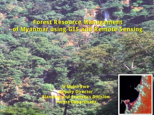
<strong>Forest</strong> <strong>Resource</strong> <strong>Management</strong><br />
<strong>of</strong> <strong>Myanmar</strong> using <strong>GIS</strong> and Remote Sensing<br />
U Myint Swe<br />
Deputy Director<br />
Planning and Statistics Division<br />
<strong>Forest</strong> Department
CONTENTS<br />
1. INTRODUCTION<br />
2. FOREST RESOURCES<br />
3. PROTECTED AREAS AND WILDLIFE RESOURCES<br />
4. APPLICATIONS OF <strong>GIS</strong> AND REMOTE SENSING<br />
5. SPACE-RELATED ACTIVITES<br />
6. INTERNATIONAL COOPERATION<br />
7. CONCLUSIONS<br />
FIGURES<br />
REFERENCES
1. INTRODUCTION<br />
Location<br />
Area<br />
Latitudes<br />
Longitudes<br />
Total land area 676,577 km 2<br />
Length (south to north)<br />
Maximum width(west to east)<br />
9° 30′ N and 28° 31′ N<br />
92° 10′ E and 101° 10′ E<br />
2,090 km<br />
805 km<br />
Climate<br />
Temperature<br />
Rainy season<br />
Cold season<br />
Hot season<br />
Rainfall<br />
Minimum rainfall<br />
Maximum rainfall<br />
25° C to 33° C<br />
10° C to 25° C<br />
32° C to 38° C<br />
800 mm<br />
5,000 mm
Figure 1.
2. FOREST RESOURCES<br />
2.1 <strong>Forest</strong> Cover Status<br />
<strong>Forest</strong> Cover Status in 2002<br />
Figure 2.<br />
Other<br />
Lands<br />
30.10%<br />
Closed<br />
<strong>Forest</strong>s<br />
37.38%<br />
<strong>Forest</strong><br />
Fallows<br />
1.77%<br />
Shrubs<br />
15.85%<br />
Open<br />
<strong>Forest</strong>s<br />
14.90%<br />
<strong>Forest</strong> Cover Status in 2002<br />
Closed <strong>Forest</strong> 37.38 %<br />
Open <strong>Forest</strong>s 14.90 %<br />
Total Natural <strong>Forest</strong>s 52.28 %<br />
(Closed and Open <strong>Forest</strong>s)<br />
Shrubs 15.85 %<br />
<strong>Forest</strong> Fallows 1.77 %<br />
Other Lands 30.10 %<br />
<strong>Forest</strong> Cover Appraisals<br />
Year <strong>of</strong> Appraisal<br />
% <strong>of</strong> Total Land<br />
1925 65.8 %<br />
1955 57.2 %<br />
1975 52.7 %<br />
1989 50.8 %<br />
1997 52.3 %
2.2 Natural <strong>Forest</strong> <strong>Resource</strong>s<br />
• rich in forest resources<br />
• about 7,000 plant species, <strong>of</strong> which 1,071 are endemic<br />
• recorded vegetative species in <strong>Myanmar</strong> are:-<br />
Big Tree 1,347<br />
Small Tree 741<br />
Bamboo 96<br />
Shrub 1,696<br />
Rattan 36<br />
Orchid 841<br />
• Out <strong>of</strong> 2,088 big and small trees, 85 species have been recognized<br />
and accepted as multiple-used timber <strong>of</strong> good quality.
Major <strong>Forest</strong> Types<br />
Hill and Temperate<br />
Evergreen<br />
25%<br />
Tidal, Beach, Dune<br />
and Swamp<br />
4%<br />
Tropical Evergreen<br />
16%<br />
Deciduous<br />
Indaing <strong>Forest</strong><br />
5%<br />
Dry<br />
10%<br />
Mixed Deciduous<br />
38%
Major <strong>Forest</strong> Types in <strong>Myanmar</strong><br />
Figure 3.
Table 4. <strong>Forest</strong> Area by Type <strong>of</strong> Vegetation and Productivity<br />
Closed broad-leaved Mangrove Bamboo<br />
Conifers<br />
Sr. Type <strong>of</strong> Productive Unproductive Total<br />
No. Vegetation <strong>Forest</strong> (km 2 ) <strong>Forest</strong> (km 2 ) (km 2 )<br />
1. Closed broad-leveled 206,550 119,080 325,630<br />
2. Mangrove 3,820 4,030 7,850<br />
3. Bamboo 9,630 - 9,630<br />
4. Conifers 10,640 - 10,640<br />
Total 230,640 123,110 353,750<br />
Source: Planning and Statistics Division, FD.
Table 5. Volume by Type <strong>of</strong> Vegetation and Productivity<br />
Closed broad-leaved Mangrove Conifers<br />
Sr. Type <strong>of</strong> Productive <strong>Forest</strong> Unproductive <strong>Forest</strong> Total<br />
No. Vegetation Total m 3 /ha Total m 3 /ha mil.m 3<br />
(mil.m 3 ) (mil.m 3 )<br />
1. Closed broad-leveled 1,859 90.0 357 30 2,216<br />
2. Mangrove 12 30.6 4 10 16<br />
3. Conifers 16 141.6 - - 16<br />
Total 1,887 361 2,248<br />
Source: Planning and Statistics Division, FD.
2.3 Permanent <strong>Forest</strong> Estate<br />
A boundary pillar, demarcating a<br />
reserved forest<br />
Table 6 . Permanent <strong>Forest</strong> Estate<br />
A double blaze for resource<br />
security<br />
Category Area(km 2 ) % <strong>of</strong> Total Land Area<br />
Permanent <strong>Forest</strong> Estate 173,739 25.68<br />
Reserved <strong>Forest</strong>s 114,995 17.00<br />
Protected Public <strong>Forest</strong>s 26,799 3.96<br />
Protected Areas System 31,945 4.72<br />
Unclassified <strong>Forest</strong> Area 180,008 26.60<br />
Total <strong>Forest</strong> Cover 353,747 52.28<br />
Source: Planning and Statistics Division, FD.
2.4 Bamboo and Rattan <strong>Resource</strong>s<br />
Bamboo <strong>Resource</strong>s<br />
17 genera & 96 recorded bamboo species<br />
Pure Bamboo Stands in Rakhine State<br />
•Kayin-wa(Melocanna bambusoides) 8, 000 km 2<br />
• Estimated growing stock<br />
Pure Bamboo Stands in Tanintharyi Division<br />
• Area 1,873 km 2<br />
• Estimated growing stock<br />
21.34 million metric tons<br />
( 830, 000 metric tons <strong>of</strong> pulp annually)<br />
6.09 million metric tons<br />
( 247, 904 metric tons <strong>of</strong> pulp annually)<br />
Stocking <strong>of</strong> Bamboos growing mixed with tree species<br />
• Estimated growing stock<br />
1.66 metric tons/ha to 8.71 metric tons/ha<br />
Rattan <strong>Resource</strong>s<br />
36 rattan species
2.5 <strong>Forest</strong> Plantations<br />
Teak Plantation<br />
Pyinkado Plantation<br />
Eucalyptus Plantation<br />
Fuelwood Plantation<br />
(Commercial)<br />
(Commercial)<br />
(Industrial)<br />
(Local Supply)<br />
Table 7. Areas and Percentages <strong>of</strong> <strong>Forest</strong> Plantations by Type by end 2002<br />
Sr.No. Plantation Type Area (ha) % <strong>of</strong> Total Area<br />
1. Commercial 418,550 55<br />
2. Village Supply 201,577 26<br />
3. Industrial 59,614 8<br />
4. Watershed 87,756 11<br />
Total 767,497 100<br />
Source: Planning and Statistics Division, FD.
Table 8. <strong>Forest</strong> Plantations by Tree Species by end 2002<br />
Sr.<br />
No.<br />
1.<br />
2.<br />
3.<br />
4.<br />
5.<br />
6.<br />
Tree Species Area (ha) % <strong>of</strong> total<br />
area<br />
Teak (Tectona grandis)<br />
Pyinkado (Xylia kerri)<br />
Padauk (Pterocarpus macrocarpus)<br />
Pine (Pinus species)<br />
Eucalyptus<br />
Others<br />
319,953<br />
56,883<br />
16,148<br />
19,122<br />
76,189<br />
279,202<br />
42<br />
8<br />
2<br />
2<br />
10<br />
36<br />
Total 767,497 100<br />
Source: Planning and Statistics Division, FD.
2.6 Special Teak Plantation Programme<br />
• launched a Special Teak Plantation Programme in<br />
1998 in addition to the existing normal teak<br />
plantation programme.<br />
• The rotation is fixed at 40-year. The rotation is<br />
structure with a series <strong>of</strong> 8 consecutive phases.<br />
• Each phase, with the duration <strong>of</strong> 5 years, consists <strong>of</strong><br />
20 plantation centres.<br />
• Each centre will establish 405 ha <strong>of</strong> teak<br />
plantation annually and a total <strong>of</strong> 2,025 ha<br />
would be planted by the end <strong>of</strong> the first<br />
phase. Consequently, a total <strong>of</strong> 40,500 ha<br />
would be planted by the end <strong>of</strong> the first<br />
phase at 20 plantation centres.<br />
• Therefore, the Special Teak Plantation<br />
Programme would have completed the<br />
establishment <strong>of</strong> teak plantations over and<br />
area <strong>of</strong> 324,000 ha by the end <strong>of</strong> the 40-year<br />
rotation.<br />
Young teak plantation under<br />
special programme
2.7 Local Distribution and Export <strong>of</strong> Teak and Other Hardwoods<br />
Local Distribution (m 3 ) Export (m 3 )<br />
Year<br />
Teak Hardwoods Teak Hardwoods<br />
Log Swan Log Swan Log Swan Log Swan<br />
1992-1993 1,896 34,822 18,973 140,445 277,034 45,857 224,495 333<br />
1993-1994 2,339 44,593 17,742 172,888 342,373 36,201 234,903 1,470<br />
1994-1995 1,652 19,321 19,739 204,143 203,734 32,929 136,321 1,029<br />
1995-1996 5,435 17,349 102,829 244,846 175,356 28,331 136,721 769<br />
1996-1997 6,017 14,626 43,526 271,637 213,625 28,504 195,656 991<br />
1997-1998 4,303 12,145 42,312 279,405 219,754 22,734 263,759 2,382<br />
1998-1999 14,328 9,443 338,657 196,372 272,679 29,558 404,794 518<br />
1999-2000 3,678 10,173 150,505 235,174 378,932 15,895 601,052 691<br />
2000-2001 3,045 8,580 101,997 240,373 383,435 24,137 543,112 -<br />
2001-2002 3,008 9,732 72,617 274,667 175,688 22,173 566,450 -<br />
Source : Planning and Statistics Division, FD.
2.8 Small Timbers and Non-wood <strong>Forest</strong> Products (NWFPs)<br />
The annual<br />
production <strong>of</strong><br />
NWFPs is<br />
controlled by the<br />
FD with the<br />
objective <strong>of</strong><br />
achieving<br />
sustained<br />
production.<br />
Small timbers<br />
and NWFPs<br />
for sale<br />
Table 10: Production <strong>of</strong> Small Timbers and Some NWFPs over the Last 6<br />
Years<br />
Sr.<br />
Particular<br />
2002<br />
Unit 1997 1998 1999 2000 2001<br />
No. to to to to to to<br />
1998 1999 2000 2001 2002 2003<br />
(1) (2) (3) (4) (5) (6) (7) (8) (9)<br />
Small Timbers<br />
1 Post No.(,000) 131 127 156 175 341 360<br />
(Teak & Non-teak)<br />
2 Pole<br />
No.(,000)<br />
287 349 472 510 501 1,133<br />
(Teak & Non-teak)<br />
3 Firewood Cu.ton (,000) 17,275 17,616 18,388 18,580 18,972 19,384<br />
4 Charcoal Cu.ton (,000)<br />
73 145 223 182 223 260<br />
Non-wood <strong>Forest</strong><br />
Products<br />
5 Bamboo No.(million) 952 971 1,011 1,018 1,057 1,094<br />
6 Rattan No.(million) 40 35 53 44 38 48<br />
7 Cutch Viss a (,000) 171 304 226 242 363 273<br />
8 Bark Viss (,000) 1910 1,145 2,582 1,703 1,696 1,530<br />
9 Thanakha<br />
b Viss (,000) 209 221 263 259 246 281<br />
10 Thatch No.(million) 767 790 834 856 880 894<br />
11 Indwe c Viss (,000) 219 162 228 259 221 247<br />
12 Bat guano Viss (,000) 172 200 187 265 247 314<br />
Source: Planning and Statistics Division, FD.<br />
a = 1 viss is equivalent to 1.63 kg. , b = Limonia accidissima, Linn<br />
c = Resin <strong>of</strong> Pentacme siamensis
3. PROTECTED AREAS AND WILDLIFE RESOURCES<br />
3.1 Wildlife <strong>Resource</strong>s<br />
Mammal 300<br />
Reptile 360<br />
Bird 1,000<br />
Butterfly 1,200
3.2 Protected Areas <strong>Management</strong><br />
So far, 27 wildlife sanctuaries<br />
and six parks, constituting<br />
about 4.2% (30,000km 2 ) <strong>of</strong> the<br />
total land area <strong>of</strong> the country<br />
have been formed and<br />
managed. In the long run, PAS<br />
will be increased up to 10% <strong>of</strong><br />
the total land area. The Nature<br />
and Wildlife Conversation<br />
Division <strong>of</strong> FD is promoting the<br />
PAS throughout the country.<br />
Figure 4.<br />
National Parks 4<br />
Wildlife Parks 2<br />
Wildlife Sanctuaries 27<br />
Protected Wildlife Species<br />
Totally protected species 98<br />
Protected species 61<br />
Seasonally protected species 15
4. APPLICATIONS OF <strong>GIS</strong> AND REMOTE SENSING<br />
• The <strong>Forest</strong> Department is one <strong>of</strong> the foremost organizations which<br />
used aerial photographs for assessing the vegetative cover <strong>of</strong> the<br />
Ayeyawady Delta Mangroves back in the 1920s.<br />
• In <strong>Myanmar</strong>, Satellite Remote Sensing was first introduced in 1980 by<br />
FAO/UNEP Project.<br />
• With the financial assistance <strong>of</strong> the National <strong>Forest</strong> <strong>Management</strong> and<br />
Inventory Project (MYA/85/003), a PC based Arc/Info <strong>GIS</strong> was<br />
installed at the <strong>Forest</strong> Department in July 1993.
• PCI EASI/ PACE, a digital image processing system, was installed at the<br />
<strong>Forest</strong> Department in early 1996 with the financial assistance <strong>of</strong> the<br />
Watershed <strong>Management</strong> for Three Critical Areas Project (MYA/93/005).<br />
• The global positioning systems (<strong>GIS</strong>s) are mainly used for locating <strong>of</strong> ground<br />
control points in the process <strong>of</strong> ground truthing in digital image processing.<br />
The Magellan GPSs were used to record the locations <strong>of</strong> permanent sample<br />
plots established in Sagaing Division in 1998-99.<br />
Magellan GPS
4.1 <strong>Forest</strong>ry Applications <strong>of</strong> <strong>GIS</strong> and Remote Sensing<br />
<strong>Forest</strong>ry applications <strong>of</strong> <strong>GIS</strong> and Remote Sensing are as follows:<br />
(a) <strong>Forest</strong> <strong>Management</strong><br />
Statistics <strong>of</strong> forest cover, forest types, deforestation rate etc.<br />
are essential data for forest management. These data are now<br />
being secured applying on <strong>GIS</strong> and Remote Sensing.<br />
(b) Watershed <strong>Management</strong><br />
Watersheds <strong>of</strong> all important dams and reservoirs are now in<br />
Arc/Info format using the latest satellite data. Critical<br />
watersheds are being mapped in 3D <strong>GIS</strong>. Data are distributed<br />
to the field staff with required administrative layers.
(c) Desertification Combat<br />
Although the Central Dryzone <strong>of</strong> <strong>Myanmar</strong> is a semi-arid region, the<br />
situation is approaching to the desertification level. The Remote Sensing<br />
and <strong>GIS</strong> Section <strong>of</strong> the <strong>Forest</strong> Department has done 1:50,000 scale<br />
maps <strong>of</strong> current landuse, slope information, erosion susceptibility and<br />
regeneration planning data for 10.52 million hectares <strong>of</strong> the area.<br />
(d) Biodiversity <strong>Management</strong><br />
For the Nature and Wildlife Conservation Division <strong>of</strong> the <strong>Forest</strong><br />
Department, the locations <strong>of</strong> the wildlife sanctuaries and national parks<br />
are now available in Arc/Info format at 1:1,000,000 scale. The<br />
vegetation layer for habitat mapping is supplied from current landuse<br />
data.<br />
(e) Environmental Monitoring and Evaluation<br />
The <strong>Forest</strong> Department has assisted with its RS and <strong>GIS</strong> facilities to<br />
carry out environmental impact assessment (EIA) operations in the<br />
critical areas such as the TOTAL Gas Pipeline Project, Yeywa<br />
Hydropower Project, Mekong River Basin etc.
4.2 Other Applications <strong>of</strong> <strong>GIS</strong> and Remote Sensing<br />
Other applications <strong>of</strong> <strong>GIS</strong> and Remote Sensing are as follows: -<br />
(a) Disaster <strong>Management</strong><br />
Flood control, flood monitoring, storm-warning etc. are<br />
important matters for developing countries. <strong>Myanmar</strong> has a good stormwarning<br />
system because <strong>of</strong> radar stations and Meteo Satellite data. But<br />
in time <strong>of</strong> crisis like severe floods, optical satellite data are almost<br />
useless. Radarsat is very good, but it takes data only when ordered. In<br />
a time <strong>of</strong> flood crisis or any other natural disaster developing countries<br />
need their hard currencies for immediate supply <strong>of</strong> food, medicines etc.<br />
A fund should be raised to supply SAR data in time <strong>of</strong> crisis. The data<br />
should be free to the developing countries without waiting for the<br />
orders so that immediate actions can be taken depending upon<br />
information obtained from the satellite data.<br />
(b) Anti-narcotic Activities<br />
<strong>Myanmar</strong> has started a programme for monitoring and<br />
assessing <strong>of</strong> anti-narcotic activities with its own resources. It is hoped<br />
that the organizations like GAC, NASDA etc. may be able to support it in<br />
this critical issue.
4.3 Involvement <strong>of</strong> Private Sector in the Applications <strong>of</strong> <strong>GIS</strong><br />
and Remote Sensing<br />
Many countries and governments are encouraging private sector<br />
involvement in the applications <strong>of</strong> space technology. The private sector,<br />
which is market-oriented, has resources and motivation. When the <strong>Forest</strong><br />
Department started using <strong>GIS</strong> and Remote Sensing, there were no<br />
private companies investing in these modern advanced technologies.<br />
Currently, there are four private companies investing in Remote Sensing<br />
and <strong>GIS</strong> technologies. They are as follows: -<br />
(1) Geocomp <strong>Myanmar</strong> Company Ltd.<br />
Geocomp <strong>Myanmar</strong> Company Ltd. is the first private company in<br />
<strong>Myanmar</strong>, which actually invested in Remote Sensing and <strong>GIS</strong>. This<br />
company is also a distributor <strong>of</strong> ER Mapper S<strong>of</strong>tware.
(2) <strong>Myanmar</strong> Intergraph Company Ltd.<br />
<strong>Myanmar</strong> Intergraph Company Ltd. is the second company in<br />
<strong>Myanmar</strong>, which followed with its own Geomedia Pro and<br />
associated modules such as ENVI.<br />
(3) Myanma Computer Company Ltd.<br />
The third company that entered into the <strong>GIS</strong> world is Myanma<br />
Computer Company Ltd. It started by constructing a LIS<br />
database <strong>of</strong> Yangon City cadastral maps. Now, it is the vendor<br />
<strong>of</strong> ESRI products (Arc/Info, Arc View) and Erdas Imaging in<br />
<strong>Myanmar</strong>.<br />
(4) Suntac International Company Ltd.<br />
The fourth one is Suntac International Company Ltd., which<br />
introduces TNTmips S<strong>of</strong>tware and is also successfully using<br />
LH digital photogrammetry workstations.<br />
It is hoped that with the cooperation and coordination <strong>of</strong><br />
governmental organizations and private companies the momentum <strong>of</strong><br />
<strong>GIS</strong> and Remote Sensing applications will be much faster than it was<br />
in the past.
5. SPACE-RELATED ACTIVITIES<br />
Space and space-related activities are an indispensable part <strong>of</strong><br />
humanity’s culture and they have to be necessarily a part <strong>of</strong> education<br />
<strong>of</strong> all children to build a sustainable world. Both the current and future<br />
space-related activities <strong>of</strong> the <strong>Myanmar</strong> <strong>Forest</strong> Department are<br />
mentioned below.<br />
5.1 Current Space-related Activities<br />
The current space-related activities are as follows: -<br />
(1) The first responsibility in priority is the watershed mapping<br />
and planning which include dry zone area. This work is<br />
overlapping with desertification combat. <strong>GIS</strong> database <strong>of</strong> all<br />
important watershed areas <strong>of</strong> <strong>Myanmar</strong> is being built.<br />
(2) The mapping and survey needs <strong>of</strong> the <strong>Forest</strong> Department and<br />
Dry Zone Greening Department are being fulfilled.
(3) <strong>GIS</strong> database for Protected Areas Systems in <strong>Myanmar</strong> is<br />
being built together with Wildlife Conservation Society<br />
(WCS). This database will be used to support habitat<br />
mappings, fauna surveys (e.g. tiger survey, biodiversity<br />
monitoring etc.).<br />
(4) <strong>GIS</strong> database <strong>of</strong> 11 townships in the Shan State has been<br />
built to link with ground field survey data <strong>of</strong> UNDCP (United<br />
Nations Drug Control Programme) and CCDAC (Central<br />
Committee for Drug Abuse Control). The section is the<br />
Remote Sensing and <strong>GIS</strong> arm <strong>of</strong> the anti-narcotic<br />
campaign in <strong>Myanmar</strong> on request <strong>of</strong> the Ministry <strong>of</strong> Home<br />
Affairs.<br />
(5) Supervisory and consultant works are being provided to<br />
postgraduate, Master and Ph.D. students <strong>of</strong> various<br />
institutions who are using remote sensing and <strong>GIS</strong> in their<br />
projects. The projects range from urban planning to<br />
watershed modeling.<br />
(6) Information, education and communication services are being<br />
provided by the IEC unit attached to the Remote<br />
Sensing and <strong>GIS</strong> Section.
5.2 Future Space-related Activities<br />
The future space-related activities will be as follows: -<br />
(1) Establishment <strong>of</strong> a <strong>Forest</strong> <strong>Management</strong> Information<br />
System linking <strong>Forest</strong> Inventory and RS data for <strong>Forest</strong><br />
<strong>Management</strong> Planning<br />
(2) National Land Capability and Land Suitability Mappings to<br />
formulate National Land Use Policy
6. INTERNATIONAL COOPERATION<br />
Regarding international cooperation, <strong>Myanmar</strong> has good cooperation<br />
with both international organizations and countries including UNDP/FAO,<br />
JICA, JAFTA, ESCAP, NASDA, ICIMOD, Japan, Thailand, and India.<br />
Cooperation <strong>of</strong> some international organizations is briefly mentioned<br />
below.<br />
UNDP/FAO<br />
International organizations, mainly UNDP/FAO, supported the<br />
capacity building <strong>of</strong> <strong>GIS</strong> and Remote Sensing infrastructure <strong>of</strong> the<br />
<strong>Forest</strong> Department by providing technical assistance as well as logistics.
Japan International Cooperation Agency (JICA)<br />
• In <strong>Myanmar</strong>, a three-year Information System Development Project (ISDP),<br />
funded by JICA was started in the fiscal year 1995-96 for the management <strong>of</strong><br />
tropical forests in <strong>Myanmar</strong>.<br />
• During the project period, the Japan <strong>Forest</strong> Technical Association (JAFTA)<br />
acquired the most recent Thematic Mapper (TM) satellite data and conducted<br />
digital image processing in Japan.<br />
• After the termination <strong>of</strong> the three-year project, the project was extended for<br />
another one year and 5 more Landsat scenes were digitally classified.<br />
• During the four-year project period, altogether 23 Landsat scenes had been<br />
finished in digital image processing.<br />
• On the whole the project provided the <strong>Forest</strong> Department with computer<br />
hardware and s<strong>of</strong>tware, satellite digital data, false color composites, forest<br />
type maps and forest registers.
NASDA and ESCAP<br />
National Space Development<br />
Agency <strong>of</strong> Japan (NASDA) and<br />
Economic and Social Commission for<br />
Asia and the Pacific (ESCAP ) also<br />
gave financial assistance and satellite<br />
digital data to the <strong>Myanmar</strong> <strong>Forest</strong><br />
Department for a research project on<br />
"Monitoring the Landuse Changes in<br />
Thaton District <strong>of</strong> Mon State between<br />
1993 and 1997". This study adopted<br />
the integrated applications <strong>of</strong> Remote<br />
Sensing and <strong>GIS</strong> and applied it to a<br />
landuse change monitoring situation<br />
in Thaton District <strong>of</strong> Mon State. The<br />
Map showing All Landuse Changes <strong>of</strong><br />
Thaton District between 1993 and<br />
1997 is shown in Figure 5.<br />
Figure 5.
International Centre for Integrated Mountain Development (ICIMOD)<br />
• ICIMOD has been engaged in <strong>GIS</strong> capacity building <strong>of</strong> national<br />
institutions <strong>of</strong> the regional member countries in the Hindus Kush-<br />
Himalayan region and has been promoting the use <strong>of</strong> <strong>GIS</strong> and<br />
related technologies during the early phase <strong>of</strong> Mountain<br />
Environment and Natural <strong>Resource</strong>s' Information Systems<br />
(MENRIS).<br />
• Some pr<strong>of</strong>essionals from <strong>Myanmar</strong> had already been trained in <strong>GIS</strong><br />
technology through ICIMOD training courses. The Ministry <strong>of</strong><br />
<strong>Forest</strong>ry and other ministries had sent the staff abroad to pursue<br />
basic and advanced trainings on Remote Sensing and <strong>GIS</strong>.<br />
• Now, <strong>Myanmar</strong> has many technicians trained in these technologies<br />
in various ministries. However, to keep abreast with the quick pace<br />
<strong>of</strong> these technologies, further refresher courses, advanced trainings<br />
and adequate facilities are needed to maintain the current<br />
efficiency.
<strong>Forest</strong>ry Agency <strong>of</strong> Japan<br />
• The <strong>Forest</strong> Dynamism Study Project for<br />
the Eastern Part <strong>of</strong> Asia (FDSP) has been<br />
formulated by the <strong>Forest</strong>ry Agency,<br />
Ministry <strong>of</strong> Agriculture, <strong>Forest</strong>ry and<br />
Fisheries in Japan as a part <strong>of</strong> its<br />
international cooperation since 2001. This<br />
project aims at provision <strong>of</strong> satellite data<br />
to assess forest conditions in the eastern<br />
part <strong>of</strong> Asia. The Japan <strong>Forest</strong> Technology<br />
Association (JAFTA) under the auspices <strong>of</strong><br />
the <strong>Forest</strong>ry Agency is responsible for the<br />
implementation <strong>of</strong> FDSP. The Regions<br />
Covered by FDSP is shown in Figure 6.<br />
• The main objectives <strong>of</strong> the Project are<br />
(a) to study the situation <strong>of</strong> forest<br />
degradation in the eastern part <strong>of</strong> Asia<br />
and (b) to forecast future forest<br />
degradation in the eastern part <strong>of</strong> Asia.<br />
• The <strong>Myanmar</strong> <strong>Forest</strong> Department is a<br />
counterpart agency <strong>of</strong> the JAFTA study<br />
team. The term <strong>of</strong> the project is 5 years<br />
from 2001(April 2001) to 2005(March<br />
2006). The Regions Covered by FDSP is<br />
shown in Figure 6. <strong>Myanmar</strong> belongs to<br />
zone A and B.<br />
Figure 6.
Other International Organizations<br />
Other international organizations, such as Remote Sensing<br />
Technology Centre <strong>of</strong> Japan (RESTEC), <strong>GIS</strong> Application Centre (GAC),<br />
Indian Institute <strong>of</strong> Remote Sensing (IIRS), and Asian Institute <strong>of</strong><br />
Technology (AIT), had also made significant contributions to the<br />
development <strong>of</strong> Remote Sensing and <strong>GIS</strong> applications in <strong>Myanmar</strong>.
7. CONCLUSIONS<br />
1. Successful implementation <strong>of</strong> sustainable forest management (SFM)<br />
requires the availability <strong>of</strong> appropriate techniques and adequate finance.<br />
2. Since the biodiversity is the national heritage <strong>of</strong> the country, it should be<br />
safeguarded for the benefit <strong>of</strong> both present and future generations.<br />
3. For effective management and planning <strong>of</strong> forest resources, precise,<br />
frequent and timely data and information are required. In this context,<br />
remotely sensed data should be used as inputs to a <strong>GIS</strong> for analysis and<br />
decision supporting.<br />
4. Since socio-economic environment has changed due to rapid development<br />
<strong>of</strong> information and communication technology (ICT), it is essential to keep<br />
up with the advancing world without sticking to old methods.<br />
5. Involvement <strong>of</strong> private sectors is very important for applications <strong>of</strong> <strong>GIS</strong><br />
and Remote Sensing. To promote <strong>GIS</strong>/RS applications, concerted<br />
efforts between governmental organizations and private companies<br />
should be strengthened.<br />
6. Capacity building for space technology and geo-informatics should be<br />
widely supported by the high potential countries.<br />
7. Technical assistance and financial support will be needed to carry out<br />
natural and environmental disaster mitigation/satellite communication<br />
pilot projects in <strong>Myanmar</strong>.
Let’s make our world more sustainable through<br />
better management <strong>of</strong> natural resources.<br />
THANK YOU FOR YOUR ATTENTION.