Neuse River Basin Restoration Priorities - N. C. Ecosystem ...
Neuse River Basin Restoration Priorities - N. C. Ecosystem ...
Neuse River Basin Restoration Priorities - N. C. Ecosystem ...

Create successful ePaper yourself
Turn your PDF publications into a flip-book with our unique Google optimized e-Paper software.
Please send comments on this DRAFT DOCUMENT to rob.breeding@ncdenr.gov<br />
by April 30, 2011<br />
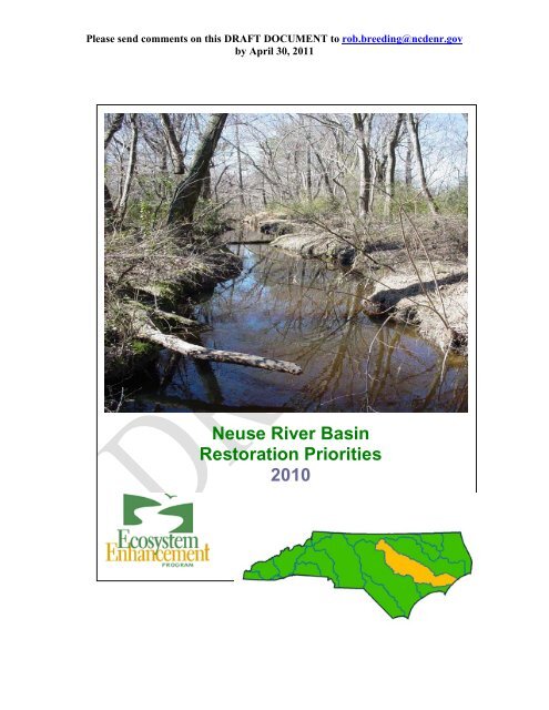
<strong>Neuse</strong> <strong>River</strong> <strong>Basin</strong><br />
<strong>Restoration</strong> <strong>Priorities</strong><br />
2010<br />
3
Please send comments on this DRAFT DOCUMENT to rob.breeding@ncdenr.gov<br />
by April 30, 2011<br />
TABLE OF CONTENTS<br />
Introduction 1<br />
What is a <strong>River</strong> <strong>Basin</strong> <strong>Restoration</strong> Priority 1<br />
Criteria for Selecting a Targeted Local Watershed (TLW) 2<br />
<strong>Neuse</strong> <strong>River</strong> <strong>Basin</strong> Overview 3<br />
<strong>Neuse</strong> <strong>River</strong> <strong>Basin</strong> <strong>Restoration</strong> Goals 3<br />
<strong>Neuse</strong> <strong>River</strong> <strong>Basin</strong> TLW Overview 6<br />
Targeted Local Watershed Summary Table 7<br />
<strong>Neuse</strong> <strong>River</strong> <strong>Basin</strong> Target Local Watershed Map 11<br />
Discussion of <strong>Neuse</strong> <strong>River</strong> <strong>Basin</strong> TLWs 12<br />
Information on Watersheds with removed TLW designation 85<br />
References 94<br />
For More Information 95<br />
Definitions 96<br />
This Document was developed by Rob Breeding,<br />
Eastern Watershed Planner, NCEEP<br />
Cover Photo: Stoney Creek, Wayne County, NC<br />
4
Introduction<br />
Little Contentnea Creek headwaters<br />
stained with naturally occurring tannins.<br />
This document, prepared by the North Carolina <strong>Ecosystem</strong> Enhancement<br />
Program (EEP), presents a description of Targeted Local Watersheds<br />
within the <strong>Neuse</strong> <strong>River</strong> <strong>Basin</strong>. This is an update of the original document<br />
developed in 2002 by the NC Wetlands <strong>Restoration</strong> Program (NC WRP)<br />
<strong>Neuse</strong> <strong>River</strong> <strong>Basin</strong> Watershed <strong>Restoration</strong> Plan 2002.<br />
The 2002 plan described 55 Hydrologic Units (14-digit HUs as denoted by<br />
the United States Geological Survey) to be targeted for stream, wetland,<br />
and riparian buffer restoration and protection, and for watershed planning<br />
efforts (i.e., Targeted Local Watersheds or TLWs). Nine have been<br />
delisted. In this update, 27 new TLWs have been added as targets for<br />
restoration and preservation efforts in the <strong>Neuse</strong> <strong>River</strong> <strong>Basin</strong>.<br />
In addition to updating the <strong>Neuse</strong> <strong>River</strong> <strong>Basin</strong> Watershed <strong>Restoration</strong> Plan<br />
2002, this report complements information found in the <strong>Neuse</strong> <strong>River</strong><br />
<strong>Basin</strong>wide Water Quality Plan (NC DWQ 2009). These two reports<br />
provide much of the justification for selection of HUs by detailing water<br />
preservation needs in the <strong>Neuse</strong> <strong>River</strong> <strong>Basin</strong>.<br />
In past documents, North Carolina Division of Water Quality (DWQ)<br />
“subbasin” units were used to organize the document and discussion of the<br />
selected TLWs. This document, however, uses the US Geological<br />
Survey’s (USGS) 8-digit Cataloging Unit in the river basin as the<br />
framework for organization and discussion of TLWs.<br />
What is a <strong>River</strong><br />
<strong>Basin</strong> <strong>Restoration</strong><br />
Priority<br />
EEP develops <strong>River</strong> <strong>Basin</strong> <strong>Restoration</strong> <strong>Priorities</strong> (RBRPs) to guide its<br />
mitigation activities within each of North Carolina’s 17 major river basins.<br />
The RBRPs designate specific watersheds that exhibit a need for<br />
restoration and protection of wetlands, streams and riparian buffers. These<br />
priority watersheds, called Targeted Local Watersheds (TLWs), are the<br />
USGS delineated 14-digit HUs that receive priority for EEP planning and<br />
project funds. The designation may also benefit stakeholders writing<br />
watershed improvement proposals for grant funds (e.g., Section 319 or<br />
Clean Water Management Trust Fund) by giving added weight to their<br />
proposals.<br />
North Carolina General Statute 143-214.10 charges EEP to pursue<br />
wetland and riparian restoration activities in the context of basin<br />
restoration plans, with the goal of protecting and enhancing water quality,<br />
fisheries, wildlife habitat, recreational opportunities and preventing floods.<br />
<strong>Neuse</strong> <strong>River</strong> <strong>Basin</strong> <strong>Restoration</strong> <strong>Priorities</strong> 2010 1
Please send comments on this DRAFT DOCUMENT to rob.breeding@ncdenr.gov<br />
by April 30, 2011.<br />
Criteria for<br />
Selecting a<br />
Targeted Local<br />
Watershed<br />
EEP evaluates a variety of GIS data and resource and planning documents<br />
on water quality and habitat conditions to select TLWs. Public comment<br />
and the professional judgment of local resource agency staff also play a<br />
critical role in targeting local watersheds. TLWs are chosen based on an<br />
evaluation of three factors—problems, assets, and opportunities.<br />
Problems reflect the need for restoration; assets reflect the ability for a<br />
watershed to recover from degradation and the need for land conservation;<br />
and opportunities indicate the potential for local partnerships in restoration<br />
and conservation work. Methods for evaluation of these three factors are<br />
outlined below:<br />
Problems: EEP evaluates DWQ use support ratings, the presence of<br />
impaired or 303(d)-listed streams, and DWQ <strong>Basin</strong>wide Plans to identify<br />
streams with known problems. EEP also assesses the potential for<br />
degradation by evaluating land cover data, riparian buffer condition,<br />
impervious cover, road density, and projected population change.<br />
Newly graded wetland restoration in<br />
Havelock being prepared for planting.<br />
Assets: In order to gauge the natural resource value of each watershed,<br />
EEP considers the forest and wetland area, land in public or private<br />
conservation, riparian buffer condition, high quality resource waters, and<br />
NC Natural Heritage Program data.<br />
Opportunity: EEP reviews restoration and protection projects that are<br />
already in the ground, such as Clean Water Management Trust Fund<br />
projects, US Clean Water Act Section 319 initiatives, mitigation banks 1 ,<br />
and land conservation efforts. EEP also considers the potential for<br />
partnership opportunities by consulting with local, state, and federal<br />
resource agencies and conservation organizations to assess the potential to<br />
partner in their priority areas.<br />
In addition to these factors, local resource professional feedback is an<br />
important element in selecting TLWs. Comments and recommendations<br />
of local resource agency professionals, including staff with Soil & Water<br />
Conservation districts, the Natural Resources Conservation Service<br />
(NRCS), county and municipal planning staff, NC Department of<br />
Environment and Natural Resources (DENR) regional staff (e.g., Wildlife<br />
Resources Commission), local and regional land trusts and other<br />
watershed organizations provide integral input to the TLW selection<br />
process. Local resource professionals often have specific and up-to-date<br />
information regarding the condition of local streams and wetlands.<br />
Furthermore, local resource professionals may be involved in water<br />
resource protection initiatives that provide good partnership opportunities<br />
for EEP restoration and preservation projects and EEP Local Watershed<br />
Planning initiatives.<br />
1 Army Corps of Engineer data from April 2010 indicates eight approved mitigation<br />
banks are present in the <strong>Neuse</strong> <strong>River</strong> <strong>Basin</strong>.<br />
<strong>Neuse</strong> <strong>River</strong> <strong>Basin</strong> <strong>Restoration</strong> <strong>Priorities</strong> 2010 2
Please send comments on this DRAFT DOCUMENT to rob.breeding@ncdenr.gov<br />
by April 30, 2011.<br />
Finally, TLWs that were chosen for the last Watershed <strong>Restoration</strong> Plan or<br />
RBRP document are reevaluated. If new information reveals that a<br />
watershed is not a good TLW candidate, then it will be removed from the<br />
TLW list. An explanation for each delisting is provided in the last section<br />
of this document.<br />
<strong>Neuse</strong> <strong>River</strong> <strong>Basin</strong><br />
Catalog Unit<br />
Overview<br />
Seasonally inundated wetland in the<br />
lower <strong>Neuse</strong>.<br />
The <strong>Neuse</strong> <strong>River</strong> <strong>Basin</strong> includes four USGS Catalog Units—03020201,<br />
03020202, 03020203, and 03020204. This expansive originates in Person<br />
and Orange counties, flowing from the Piedmont to the outer Coastal<br />
Plain. The <strong>River</strong> is essentially freshwater from its headwaters to New<br />
Bern where it broadens and assumes estuarine characteristics. This <strong>Basin</strong><br />
is more than 6200 square miles including both land and open water. The<br />
<strong>Neuse</strong> watershed contains 77 incorporated municipalities including all or<br />
portions of the cities of Raleigh, Durham, Smithfield, Wilson, Goldsboro,<br />
New Bern and Havelock; it also includes an abundant number of towns<br />
including Butner, Wake Forest, Cary, Clayton, and Kinston.<br />
The four CUs encompass 188 14-digit hydrologic units and contain part or<br />
all of 18 counties, eight in the piedmont and 10 in the coastal plain.<br />
<strong>Neuse</strong> <strong>River</strong> <strong>Basin</strong><br />
Catalog Unit<br />
<strong>Restoration</strong> Goals<br />
Based on an assessment of existing watershed characteristics and resource<br />
information, EEP has developed restoration and protection goals for the<br />
<strong>Basin</strong>’s four Catalog Units (CUs). General goals for all CUs are to:<br />
promote nutrient reduction in municipal areas through the<br />
implementation of stormwater best management practices<br />
promote nutrient and sediment reduction in agricultural areas by<br />
restoring and preserving wetlands, streams, and riparian buffers<br />
continue targeted implementation of projects under the Nutrient Offset<br />
and Buffer programs, as well as focusing DOT sponsored restoration<br />
in areas where they will provide the most functional improvement to<br />
the ecosystem<br />
Specific goals for each CU are outlined below. NCEEP intends to:<br />
CU 03020201<br />
Walnut Creek in the Town of Cary.<br />
support the Falls Lake Watershed Management Plan; a separate<br />
prioritization process for EEP will be developed in next 1-2 years<br />
continue to implement planning initiatives including the NCEEP Phase<br />
IV LWP for the Upper <strong>Neuse</strong> (incorporates updated plans for Ellerbe<br />
Creek, Lake Rogers/Ledge Creek, Lick Creek, Little Lick Creek, and<br />
Upper Swift Creek) and the Upper <strong>Neuse</strong> <strong>River</strong> <strong>Basin</strong> Association’s<br />
Upper <strong>Neuse</strong> Watershed Management Plan<br />
<strong>Neuse</strong> <strong>River</strong> <strong>Basin</strong> <strong>Restoration</strong> <strong>Priorities</strong> 2010 3
Please send comments on this DRAFT DOCUMENT to rob.breeding@ncdenr.gov<br />
by April 30, 2011.<br />
protect, augment and connect Natural Heritage Areas and other<br />
conservation lands<br />
CU 03020202<br />
continue to implement the NCEEP Stoney Creek Local Watershed<br />
Plan<br />
protect, augment and connect Natural Heritage Areas and other<br />
conservation lands<br />
CU 03020203<br />
continue to implement the NCEEP Hominy Swamp Creek Local<br />
Watershed Plan<br />
support removal of barriers to anadromous fish movement and to help<br />
improve nursery and spawning habitats<br />
support implementation of Coastal Habitat Protection Plan (CHPP)<br />
strategies<br />
protect, augment and connect Natural Heritage Areas and other<br />
conservation lands<br />
CU 03020204<br />
Monitoring wells used to collect<br />
hydrologic data to determine success of<br />
restoration projects.<br />
develop additional Strategic Habitat Areas (SHAs) and coordinate data<br />
and methodology improvements with other state and federal agencies<br />
participate in initiatives to map, monitor and restore submerged<br />
aquatic vegetation (SAV)<br />
support the enhancement and restoration of shellfish beds<br />
implement agricultural BMPs to reduce nonpoint source inputs to the<br />
estuary<br />
support the removal of barriers to anadromous fish movement to help<br />
improve nursery and spawning habitats<br />
protect, augment and connect Natural Heritage Areas and other<br />
conservation lands<br />
Sea level rise will be incorporated into the RBRP plan within the next<br />
1-2 years<br />
The Lower <strong>Neuse</strong> <strong>River</strong> <strong>Basin</strong> offers an array of assets, especially<br />
noteworthy are its large forested tracts and conservation areas. Arguably,<br />
the most important priority here is to promote projects that reestablish<br />
riparian buffers and corridors of substantial width to improve connectivity<br />
of these protected areas. Agricultural impacts are also prevalent<br />
throughout the CU, including nonpoint source runoff and hydrologic<br />
modification. Projects that address agricultural runoff are important here.<br />
The watershed will also benefit from stream restoration projects that<br />
reestablish more natural pattern, hydrology and habitat, especially in<br />
<strong>Neuse</strong> <strong>River</strong> <strong>Basin</strong> <strong>Restoration</strong> <strong>Priorities</strong> 2010 4
Please send comments on this DRAFT DOCUMENT to rob.breeding@ncdenr.gov<br />
by April 30, 2011.<br />
heavily ditched headwater areas. Additionally, this CU has an abundance<br />
of diverse marsh habitats along an extensive shoreline. Wetland and<br />
marsh restoration projects, as well as shoreline stabilization are high<br />
priorities for areas prone to erosion from natural exposure or from heavy<br />
boat traffic.<br />
NCEEP will also actively develop projects that can coincidentally meet<br />
CHPP objectives while meeting its primary mitigation requirements within<br />
designated planning areas. The program will continue to promote<br />
innovative coastal mitigation methods such as the split function crediting<br />
strategy proposed expert panels in the White Oak Local Watershed Plan<br />
project titled An Approach to Coordinate Compensatory Mitigation<br />
Requirements to Meet the Goals of the Coastal Habitat Protection Plan<br />
(2009).<br />
Perched culverts like this one in Duke Forest can be replaced with concrete spans or bridges<br />
to allow for natural stream bed formation below. Frequently called “stream simulation<br />
design”, the more natural bedform restores upstream passage for migratory fish and<br />
reconnects fragmented habitat.<br />
<strong>Neuse</strong> <strong>River</strong> <strong>Basin</strong> <strong>Restoration</strong> <strong>Priorities</strong> 2010 5
Please send comments on this DRAFT DOCUMENT to rob.breeding@ncdenr.gov<br />
by April 30, 2011.<br />
<strong>Neuse</strong> <strong>River</strong> <strong>Basin</strong><br />
TLW Overview<br />
Fifty-five HUs were targeted in the 2002 <strong>Neuse</strong> <strong>River</strong> <strong>Basin</strong> Watershed<br />
<strong>Restoration</strong> Plan. In this 2010 update, however, nine HUs have their<br />
TLW status removed. An additional 27 HUs are designated as new<br />
TLWs. In total, 73 HUs are highlighted as TLWs by EEP in this 2010<br />
RBRP.<br />
Table 1 provides a partial summary of information used to select TLWs.<br />
Additionally, Figure 1 is a map of the <strong>Neuse</strong> <strong>River</strong> <strong>Basin</strong> showing current<br />
TLWs and those with removed TLW designation.<br />
<strong>Neuse</strong> <strong>River</strong> <strong>Basin</strong> <strong>Restoration</strong> <strong>Priorities</strong> 2010 6
Table 1. <strong>Neuse</strong> <strong>River</strong> <strong>Basin</strong> TLW Summary (pink highlight indicates existing TLWs, turquoise indicates new TLWs, red indicates de-listed TLWs).<br />
HUCODE<br />
HU_Name<br />
HU<br />
Area 1<br />
(mi)<br />
Stream<br />
Length 2<br />
(mi)<br />
Ag Area 3<br />
(%)<br />
Forest<br />
Area 4<br />
(%)<br />
Imperv<br />
Area 5<br />
(%)<br />
HQW or<br />
ORW<br />
Length 6<br />
(%)<br />
WSW<br />
Length 7<br />
(%)<br />
SNHA<br />
Area 8<br />
(sq mi)<br />
NHEO 9<br />
(#)<br />
Conserv<br />
Area 10<br />
(%)<br />
303(d)<br />
Length 11<br />
(%)<br />
Animal<br />
Ops 12<br />
(#)<br />
Nonforested<br />
Stream<br />
Buffer 13<br />
(%)<br />
Catalog Unit 03020201<br />
03020201010020 South Flat <strong>River</strong> 56 153 38 57 0.7 0.0 153 1.1 53 0.0 0 13 23<br />
03020201020010 North Fork Little <strong>River</strong> 33 88 32 61 0.7 0.0 88 0.3 17 0.6 0.0 11 23<br />
03020201030020 Upper Eno <strong>River</strong> 39 102 23 61 2.9 0.0 88 2.2 47 1.6 0 7 23<br />
03020201050010 Ellerbe Creek 37 90 11 38 12.6 0.0 76 2.5 9 5.8 8.9 5 42<br />
03020201050020 Little Lick Creek 22 64 15 52 5.6 0.0 64 2.6 3 3.5 7.2 1 31<br />
03020201050030 Lick Creek 22 68 14 78 1.1 0.0 67 0.4 6 3.2 7.9 2 12<br />
03020201060010 Ledge Creek 47 145 23 62 2.4 0.0 145 0.6 28 9.2 0 4 22<br />
03020201065010 New Light Creek 27 65 17 77 0.3 0.0 65 0.4 1 5.4 0.0 6 8<br />
03020201070060 Richland Creek 16 45 18 44 8.1 0.0 34 0.0 1 0.1 0 1 39<br />
03020201070070 Toms Creek 29 79 23 54 4.0 0.0 7.1 0.9 2 0.6 4.0 2 28<br />
03020201070100 Perry Creek 12 28 6 23 17.2 0.0 0.0 0.0 1 0.7 20.5 0 66<br />
03020201080010 Upper Crabtree Creek 53 150 10 35 15.7 0.0 0.0 0.4 5 3.0 6.5 4 54<br />
03020201080020 Crabtree Creek 93 209 5 27 15.9 0.0 0.0 8.6 48 12.0 25.6 8 56<br />
03020201090010 Walnut Creek 46 101 7 29 15.9 0.0 0.0 1.1 6 2.6 5.9 1 52<br />
03020201100020 Marks Creek 29 69 31 61 1.1 0.0 0.0 1.1 3 0.0 0 2 17<br />
03020201110010 Upper Swift Creek 36 84 8 34 10.4 0.0 84 1.7 6 2.4 10.7 2 45<br />
03020201110020 Swift Creek 30 76 18 43 7.7 0.0 76 1.9 6 4.7 0.1 7 33<br />
03020201110050 Little Creek 18 36 40 36 6.1 0.0 0.0 0.0 3 0.1 25.4 9 39<br />
03020201120010 Middle Creek 57 147 28 46 5.2 0.0 0.0 0.6 24 0.3 0.6 19 35<br />
03020201140010 <strong>Neuse</strong> <strong>River</strong> 53 128 34 62 0.4 0.0 16 8.9 23 0.9 0 18 26<br />
03020201150050 Lower Mill Creek 35 94 31 66 0.2 0.0 11 5.1 19 4.1 0 42 14<br />
03020201180010 Upper Little <strong>River</strong> 43 120 49 42 1.1 0.0 119 0.4 17 1.5 0 6 34<br />
03020201180020 Middle Little <strong>River</strong> 51 126 38 51 1.9 0.0 34 0.5 26 0.3 0.0 10 24<br />
<strong>Neuse</strong> <strong>River</strong> <strong>Basin</strong> <strong>Restoration</strong> <strong>Priorities</strong> 2010 7
Please send comments on this DRAFT DOCUMENT to rob.breeding@ncdenr.gov by April 30, 2011.<br />
HUCODE<br />
HU_Name<br />
HU<br />
Area 1<br />
(mi)<br />
Stream<br />
Length 2<br />
(mi)<br />
Ag Area 3<br />
(%)<br />
Forest<br />
Area 4<br />
(%)<br />
Imperv<br />
Area 5<br />
(%)<br />
HQW or<br />
ORW<br />
Length 6<br />
(%)<br />
WSW<br />
Length 7<br />
(%)<br />
SNHA<br />
Area 8<br />
(sq mi)<br />
NHEO 9<br />
(#)<br />
Conserv<br />
Area 10<br />
(%)<br />
303(d)<br />
Length 11<br />
(%)<br />
Animal<br />
Ops 12<br />
(#)<br />
Nonforested<br />
Stream<br />
Buffer 13<br />
(%)<br />
03020201180050 Buffalo Creek 58 130 44 47 1.2 0.0 0.0 1.6 5 0.5 6.4 19 30<br />
03020201020020 South Fork Little <strong>River</strong> 39 102 34 60 0.5 0.0 101 0.1 23 0.3 0 11 22<br />
03020201030030 Middle Eno <strong>River</strong> 48 123 19 68 1.8 0.0 64 2.9 47 5.4 0 6 23<br />
03020201030040 Eno <strong>River</strong> 28 64 8 54 5.1 0.0 64 2.4 34 3.4 0 3 31<br />
03020201060020 Beaverdam Creek 52 161 23 69 0.9 0.0 136 1.6 21 6.4 0.0 8 15<br />
03020201100010 Poplar Creek 9 26 35 47 2.0 0.0 0.0 0.0 0 0.0 0.0 3 27<br />
03020201100030 Beddingfield Creek 41 104 33 55 1.3 0.0 25 1.7 2 1.6 0.0 13 21<br />
03020201100050 <strong>Neuse</strong> <strong>River</strong> 52 106 37 45 5.1 0.0 89 0.7 13 0.2 0.0 13 31<br />
03020201120030 Lower Middle Creek 48 132 50 42 1.3 0.0 0.0 0.5 18 0.7 0.0 32 31<br />
03020201150020 Hannah Creek 34 102 54 38 1.0 0.0 0.0 2.1 5 0.2 2.3 44 42<br />
03020201150040 Mill Creek 61 151 55 39 0.7 0.0 0.0 0.4 12 0.8 0.0 75 41<br />
03020201065020 Horse Creek 24 53 20 68 1.3 0.0 46 0.0 0 2.5 0.0 1 14<br />
Catalog Unit 03020202<br />
03020202010010 Stoney Creek 16 66 59 26 3.4 0.0 0.0 0 0 0.0 6.8 9 70<br />
03020202010020 Stoney Creek 7 20 28 18 18 0.0 0.0 0 1 0.2 5.8 1 79<br />
03020202010021 Stoney Creek 4.4 8 13 15 20 0.0 0.0 0 0 1.8 26.7 1 54<br />
03020202010022 Stoney Creek 12 33 40 26 9 0.0 0.0 0 1 3.1 19.6 8 59<br />
03020202040010 Falling Creek 44 119 59 33 0.0 0.0 0.0 0.0 1 0 0.0 19 56<br />
03020202040020 Lower Falling Creek 33 121 56 33 2 0.0 23 0 0 1.0 9.9 7 70<br />
03020202060030 <strong>Neuse</strong> <strong>River</strong> 7.3 14.4 17 23 16.4 0.0 0.0 0.0 2 0.1 16.4 0 58<br />
03020202080010 Core Creek 74 296 39 55 0.6 0.0 0.0 11 14 7.0 6.1 13 57<br />
03020202090030 Clayroot Swamp 50 228 41 53 0.5 0.0 0.0 1.8 2 1.8 6.3 27 49<br />
03020202090060 Lower Swift Creek 68 192 37 58 0.7 0.0 0.0 0.6 12 0.9 14.8 9 41<br />
03020202100020 Bachelor Creek 41 54 37 53 1.0 0.0 0.0 4.6 4 2.4 4.9 3 37<br />
03020202050010 Southwest Creek 66 166 48 46 0.7 0.0 0.0 0 3 0.3 1.0 35 55<br />
03020202050030 Trotters Creek 41 86 50 42 1.2 0.0 49 0 3 0.1 14.6 36 46<br />
<strong>Neuse</strong> <strong>River</strong> <strong>Basin</strong> <strong>Restoration</strong> <strong>Priorities</strong> 2010 8
Please send comments on this DRAFT DOCUMENT to rob.breeding@ncdenr.gov by April 30, 2011.<br />
HUCODE<br />
HU_Name<br />
HU<br />
Area 1<br />
(mi)<br />
Stream<br />
Length 2<br />
(mi)<br />
Ag Area 3<br />
(%)<br />
Forest<br />
Area 4<br />
(%)<br />
Imperv<br />
Area 5<br />
(%)<br />
HQW or<br />
ORW<br />
Length 6<br />
(%)<br />
WSW<br />
Length 7<br />
(%)<br />
SNHA<br />
Area 8<br />
(sq mi)<br />
NHEO 9<br />
(#)<br />
Conserv<br />
Area 10<br />
(%)<br />
303(d)<br />
Length 11<br />
(%)<br />
Animal<br />
Ops 12<br />
(#)<br />
Nonforested<br />
Stream<br />
Buffer 13<br />
(%)<br />
03020202090010 Swift Creek 95 282 52 36 2.7 0.0 0.0 0 4 0.2 9.7 21 59<br />
03020202090020 Grinnell Creek 50 165 42 51 0.6 0.0 0.0 7 11 3.5 1.2 13 59<br />
03020202040030 <strong>Neuse</strong> <strong>River</strong> 3.9 9.5 19 17 21.3 0.0 0.0 0.0 0 0.1 37.1 1 55<br />
03020202050040 <strong>Neuse</strong> <strong>River</strong> 7.2 16.8 33 38 6.6 0.0 0.0 0.0 0 0.0 17.1 0 49<br />
03020202060020 Briery Run 19.4 51.6 48 37 3.6 0.0 0.0 0.0 0 0.0 0.0 1 56<br />
03020202090040 Creeping Swamp 11.5 41.4 40 57 0.3 0.0 0.0 1.6 0 1.6 4.1 0 51<br />
03020202090050 Creeping Swamp 17.8 59.6 35 62 0.3 0.0 0.0 0.0 0 0.0 5.1 46 4<br />
Catalog Unit 03020203<br />
03020203020030 Contentnea Creek 16.2 14.3 44 32 6.7 0.0 4.8 0.0 1 0.0 0.0 1 44<br />
03020203020040 Hominy Swamp 15.5 24.1 27 21 15.4 0.0 0.0 0.0 0 0.3 27.6 0 57<br />
03020203060020 Nahunta Swamp 21.3 36.1 57 37 0.4 0.0 0.0 0.0 0 0.2 19.4 17 46<br />
03020203070010 Little Contentnea Creek 41.0 77.2 48 44 1.0 0.0 0.0 0.0 2 0.0 12.5 19 36<br />
03020203070030 Little Contentnea Creek 37.4 67.1 49 42 1.2 0.0 0.0 0.1 0 1.2 7.4 5 41<br />
03020203070040 Upper Middle Swamp 53.9 83.4 52 41 0.9 0.0 0.0 0.0 0 0.9 0.0 31 42<br />
03020203070050 Middle Swamp 33.8 89.6 62 32 0.5 0.0 0.0 0.0 3 0.5 22.7 24 55<br />
03020203010010 Moccasin Creek 82.9 178.4 38 49 1.5 0.0 0.0 3.8 25 1.5 6.0 25 28<br />
03020203010020 Beaverdam Creek 74.8 157.2 37 53 1.4 0.0 0.0 0.8 36 1.4 0.0 23 19<br />
03020203020020 Upper Contentnea Creek 45.5 92.2 53 37 1.4 0.0 46.5 0.2 9 1.4 5.7 22 36<br />
03020203050040 Mid Contentnea Creek 32.2 110.9 56 38 0.4 0.0 0.0 0.0 4 0.4 0.0 27 64<br />
03020203050060 Lower Contentnea Creek 27.8 92.7 50 42 1.1 0.0 0.0 0.3 3 1.1 0.0 3 54<br />
03020203040020 Toisnot Swamp 35.3 64.1 45 33 5.1 0.0 35.4 0.0 0 0.1 0.0 1 49<br />
03020203060010 Nahunta Swamp 17.9 29.6 65 30 0.5 0.0 0.0 0.0 0 0.0 18.0 10 40<br />
03020203060040 Nahunta Swamp 16.0 42.0 64 30 0.4 0.0 0.0 0.0 0 0.0 6.7 14 55<br />
Catalog Unit 03020204<br />
03020204020010 Lower Trent <strong>River</strong> 21.6 44.8 9 23 16.8 0.0 0.0 0.6 10 16.8 32.6 0 64<br />
03020204020040 Brice Creek 22.4 34.2 13 73 1.9 0.0 0.0 0.1 7 10.3 27.3 1 22<br />
<strong>Neuse</strong> <strong>River</strong> <strong>Basin</strong> <strong>Restoration</strong> <strong>Priorities</strong> 2010 9
Please send comments on this DRAFT DOCUMENT to rob.breeding@ncdenr.gov by April 30, 2011.<br />
HUCODE<br />
HU_Name<br />
HU<br />
Area 1<br />
(mi)<br />
Stream<br />
Length 2<br />
(mi)<br />
Ag Area 3<br />
(%)<br />
Forest<br />
Area 4<br />
(%)<br />
Imperv<br />
Area 5<br />
(%)<br />
HQW or<br />
ORW<br />
Length 6<br />
(%)<br />
WSW<br />
Length 7<br />
(%)<br />
SNHA<br />
Area 8<br />
(sq mi)<br />
NHEO 9<br />
(#)<br />
Conserv<br />
Area 10<br />
(%)<br />
303(d)<br />
Length 11<br />
(%)<br />
Animal<br />
Ops 12<br />
(#)<br />
Nonforested<br />
Stream<br />
Buffer 13<br />
(%)<br />
03020204050050 Adams Creek 71.6 132.3 27 46 0.3 0.0 0.0 0.2 5 0.3 9.3 1 51<br />
03020204070010 South <strong>River</strong> 115.1 96.9 19 34 0.3 0.0 0.0 9.3 21 0.3 7.7 0 51<br />
03020204010030 Tuckahoe Creek 51.1 101.5 36 60 0.5 0.0 0.0 0.0 2 0.5 0.0 46 31<br />
03020204010040 Upper Trent <strong>River</strong> 61.0 74.7 24 73 0.2 0.0 0.0 2.4 6 0.2 18.5 17 35<br />
03020204010070 Crooked Run 55.7 93.5 28 68 0.4 0.0 0.0 5.0 14 0.4 28.1 12 48<br />
03020204010080 Middle Trent <strong>River</strong> 63.4 137.0 43 52 0.4 0.0 0.0 0.5 14 0.4 19.2 20 36<br />
03020204010090 Mill Creek 36.1 59.7 16 81 0.3 0.0 0.0 6.6 16 0.3 0.0 2 21<br />
03020204010100 Lower Trent <strong>River</strong> 41.4 69.6 21 70 1.0 0.0 0.0 0.7 23 1.0 9.6 8 26<br />
03020204030010 Northwest Creek 27.3 33.7 18 50 2.5 0.0 0.0 6.4 25 2.5 19.7 0 48<br />
03020204050020 Slocum Creek 49.6 65.4 8 62 6.4 0.0 0.0 13.9 91 6.4 0.8 0 37<br />
1 Hydrologic Unit (HU) Area estimate based on USGS 14-digit HU boundaries (USDA NRCS 1998).<br />
2 Stream Length estimate derived from blue line streams on USGS 1:24,000 scale maps (NC CGIA 2008).<br />
3 Agricultural Area estimate based on 2001 National Land Cover Database (NLCD) (Homer et al., 2004).<br />
4 Forest Area estimate based on 2001 NLCD (Homer et al., 2004).<br />
5 Impervious Area Estimates based on 2001 NLCD (Homer et al., 2004).<br />
6 High Quality Waters (HQW) and Outstanding Resources Waters (ORW) (NC CGIA 2008).<br />
7 Water Supply Watershed (WSW) length (NC GIA 2008).<br />
8 Significant Natural Heritage Areas (SNHA) estimates (NC NHP 2007 1 ).<br />
9 Natural Heritage Element Occurrences (NHEO) (NC NHP 2007 2 ).<br />
10 Conserved Area estimate based on federal, state, and local land under protection (NC GIA 2008).<br />
11 303(d) List of impaired waters (NC DWQ 2006 2 ).<br />
12 Animal Operations estimates based on NC estimates for pork, poultry, and bovine operations in 2007 (NCDA, 2007).<br />
13 Non-forested Stream Buffer estimate based on 2001 NLCD and a 100 foot buffer distance from USGS blue line streams<br />
<strong>Neuse</strong> <strong>River</strong> <strong>Basin</strong> <strong>Restoration</strong> <strong>Priorities</strong> 2010 10
Figure 1. TLWs, <strong>Neuse</strong> <strong>River</strong> <strong>Basin</strong>.<br />
<strong>Neuse</strong> <strong>River</strong> <strong>Basin</strong> <strong>Restoration</strong> <strong>Priorities</strong> 2010 11
Discussion of <strong>Neuse</strong> <strong>River</strong> <strong>Basin</strong> Targeted Local Watersheds<br />
The following section provides maps and descriptions of TLWs and a discussion of the<br />
environmental conditions and activities that lead to their selection.<br />
<strong>Neuse</strong> 01 Targeted Local Watersheds<br />
South Flat <strong>River</strong>: 03020201010020<br />
The South Flat <strong>River</strong> HU covers of about 57 square miles of the Piedmont Region with 153<br />
miles of streams, all designated Water Supply Watershed waters by the NC Division of Water<br />
Quality (DWQ). Only 5% of the watershed is developed and 57% is forest or wetlands. There<br />
are approximately 20 square miles of hydric type B soils here. Thirty-eight percent of the<br />
watershed is used for agriculture. Fifty-three documented Natural Heritage Element Occurrences<br />
(NHEOs) can be found here. Twenty-three percent of streams are unbuffered. Thirteen<br />
permitted animal operations are in this watershed.<br />
<strong>Priorities</strong> of the South Flat <strong>River</strong> watershed include construction of projects that offset nutrient<br />
inputs to the streams and agricultural best management practices (BMPs). Stream restoration<br />
should be implemented in altered reaches where erosion is a major source of sediment inputs to<br />
the stream. Protection of rare species and communities is also important here.<br />
<strong>Neuse</strong> <strong>River</strong> <strong>Basin</strong> <strong>Restoration</strong> <strong>Priorities</strong> 2010 12
Please send comments on this DRAFT DOCUMENT to rob.breeding@ncdenr.gov by April 30, 2011.<br />
North Fork Little <strong>River</strong>: 3020201020010<br />
The North Fork Little <strong>River</strong> HU is 33 square miles in area with 88 miles of streams, 23%<br />
unbuffered. Sixty-one percent of the watershed is forested. Seventeen NHEOs are documented<br />
here. Thirty-two percent of the watershed is used for agriculture including 11 permitted<br />
livestock operations.<br />
Highest priority projects for the North Fork Little <strong>River</strong> HU are buffer restoration in degraded<br />
riparian areas and those that offset agricultural impacts.<br />
<strong>Neuse</strong> <strong>River</strong> <strong>Basin</strong> <strong>Restoration</strong> <strong>Priorities</strong> 2010 13
Please send comments on this DRAFT DOCUMENT to rob.breeding@ncdenr.gov by April 30, 2011.<br />
South Fork Little <strong>River</strong>: 03020201020020<br />
The South Fork of the Little <strong>River</strong> lies primarily in Orange County and contains about 102 miles<br />
of streams, also all designated as Water Supply Waters. Twenty-two percent of streams are<br />
unbuffered. This watershed covers approximately 39 square miles. Sixty percent is forested or<br />
in wetlands, six percent is developed and 34% is used for agriculture. Twenty-three Natural<br />
Heritage Element Occurrences (NHEOs) are documented here. Twenty percent of soils are<br />
categorized hydric type B. Hydric type A soils are essentially absent from the watershed. The<br />
watershed contains 11 permitted animal operations. There are two Clean Water Management<br />
Trust Fund (CWMTF) sponsored projects here and one by the NC Wildlife Resources<br />
Commission (WRC).<br />
Priority projects for this watershed should address absent or sparse buffers or stormwater inputs<br />
from agricultural fields or animal operations. Stream restoration projects are a priority for areas<br />
where banks are eroded or straightened.<br />
<strong>Neuse</strong> <strong>River</strong> <strong>Basin</strong> <strong>Restoration</strong> <strong>Priorities</strong> 2010 14
Please send comments on this DRAFT DOCUMENT to rob.breeding@ncdenr.gov by April 30, 2011.<br />
Upper Eno <strong>River</strong>: 03020201030020<br />
The Upper Eno <strong>River</strong> watershed covers approximately 39 square miles of the Carolina Slate<br />
Belt. It contains about 102 miles of streams, 89 miles of which are water supply waters. About<br />
23% of these streams lack wooded buffers. There is one surface water intake that supplies the<br />
Town of Hillsborough. The watershed is 15% developed with about 23% of land area used for<br />
agriculture. Sixty-one percent is forested (14 square miles unfragmented forest) with a small<br />
amount of that area in wetlands. A little over two square miles are designated Significant<br />
Natural Heritage Area by the Natural Heritage Program (NHP). Forty-seven Natural Heritage<br />
Element Occurrences can be found in the watershed also. Seven permitted animal operations are<br />
in this watershed. The NC Department of Transportation (DOT) has planned 3.5 miles of<br />
Transportation Improvement Program (TIP) projects in the near future. There are two CWMTF<br />
projects, one Section 319 project, and one WRC project in the Upper Eno watershed.<br />
High priority projects here should improve buffers and provide habitat of rare species via<br />
preservation and restoration. Stormwater projects are recommended to reduce inputs especially<br />
in the Hillsborough vicinity. Stream restoration and enhancement should be pursued where<br />
feasible.<br />
<strong>Neuse</strong> <strong>River</strong> <strong>Basin</strong> <strong>Restoration</strong> <strong>Priorities</strong> 2010 15
Please send comments on this DRAFT DOCUMENT to rob.breeding@ncdenr.gov by April 30, 2011.<br />
Middle Eno <strong>River</strong>: 03020201030030<br />
The HU that contains the Middle Eno <strong>River</strong> is approximately 50 square miles. It lies within the<br />
Carolina Slate Belt ecoregion and as such, has very well-drained soils and small streams prone to<br />
drying out. There are nearly 123 miles of streams, 23% of which are not adequately buffered.<br />
More than half of streams are designated Water Supply Waters (WSW). The watershed is has<br />
about 12% of land area developed with a relatively low amount of impervious surface (2%).<br />
Nineteen percent of land is in agricultural usage. Six permitted animal operations occur here.<br />
Hydric soils (all type B) cover 12 square miles in this watershed. Sixty-eight percent of the<br />
watershed is forested with nearly 14 square miles considered unfragmented. There are three<br />
square miles of SNHA and 47 NHEOs. DOT has planned eight miles of TIP projects here.<br />
CWMTF has completed seven projects in the Middle Eno <strong>River</strong> watershed. The local land trust<br />
and WRC have each completed one project in the area.<br />
Priority projects should increase or improve buffers here as well as address stormwater issues of<br />
eastern Hillsborough. <strong>Restoration</strong> and preservation opportunities that augment existing<br />
easements are important here also.<br />
<strong>Neuse</strong> <strong>River</strong> <strong>Basin</strong> <strong>Restoration</strong> <strong>Priorities</strong> 2010 16
Please send comments on this DRAFT DOCUMENT to rob.breeding@ncdenr.gov by April 30, 2011.<br />
Eno <strong>River</strong>: 03020201030040<br />
This segment of the Eno <strong>River</strong> watershed covers 28 square miles of the Carolina Slate Belt.<br />
There are 64 miles of streams, all designated WSW. About 31% of these streams are unbuffered.<br />
The northern portion of the City of Durham covers about 12 square miles of this watershed and<br />
is subject to Phase II stormwater regulations. The watershed contains about 11% developed land<br />
with a total of 5% impervious surface. Only 8% of the land is used for agriculture, including<br />
three animal operations. Nearly 14% of soils are designated hydric, 1% type A and 13% type B.<br />
Fifty-four percent is forested or wetland. There are 34 NHEOs here and 2.4 square miles of<br />
designated SNHA, existing primarily as the corridor along the mainstem of the river. DOT has<br />
planned a little over 6 miles of TIP projects in the watershed.<br />
<strong>Priorities</strong> for this watershed include stormwater management projects, especially in the city<br />
limits. Preservation and restoration that improves habitat for rare species is important here also.<br />
Buffer establishment along streams is a high priority for this part of the Eno <strong>River</strong> watershed as<br />
well.<br />
<strong>Neuse</strong> <strong>River</strong> <strong>Basin</strong> <strong>Restoration</strong> <strong>Priorities</strong> 2010 17
Please send comments on this DRAFT DOCUMENT to rob.breeding@ncdenr.gov by April 30, 2011.<br />
Ellerbe Creek: 03020201050010<br />
The Ellerbe Creek watershed is 37 square miles in area. It lies primarily in the Triassic <strong>Basin</strong><br />
ecoregion with rocky, well-drained soils. Five percent of soils are designated hydric type A and<br />
12% hydric type B. There are 90 miles of streams here with 1.5% open water of the total HU<br />
area. This open water cover exists where the HU boundary cuts across Falls Lake. Seventy-six<br />
miles of the total 90 are designated Water Supply Watershed waters. Forty-two percent of<br />
streams are unbuffered and 9% is 303(d)-listed. Forty-nine percent of the watershed is<br />
developed with a total of 13% impervious surface. The impervious surface lies predominantly in<br />
the City of Durham. Half the watershed is subject to Phase II stormwater regulations. Eleven<br />
percent of the land is used for agriculture. Six square miles is designated conservation area<br />
including over two square miles of SNHA. Nine miles of TIP projects are planned by DOT.<br />
EEP developed a Local Watershed Plan (LWP) for Ellerbe Creek and is currently working of<br />
Phase IV plan implementation. Highest priority projects for this watershed are described in the<br />
LWP Project Atlas (Ellerbe Creek Project Atlas, 2009), including many preservation and nutrient<br />
offset projects.<br />
<strong>Neuse</strong> <strong>River</strong> <strong>Basin</strong> <strong>Restoration</strong> <strong>Priorities</strong> 2010 18
Please send comments on this DRAFT DOCUMENT to rob.breeding@ncdenr.gov by April 30, 2011.<br />
Little Lick Creek: 03020201050020<br />
The Little Lick Creek watershed covers 22 square miles, including a small amount of open water<br />
on Falls Lake. EEP has developed a Local Watershed Plan (LWP) for Little Lick Creek and is<br />
currently implementing Phase IV projects here. It rests completely within the Triassic <strong>Basin</strong><br />
ecoregion. There are 64 miles of stream, all of which are considered WSW waters. Thirty-one<br />
percent of streams are unbuffered and over 7% of the waters here are on the 303(d) list of<br />
impaired waters. Very little of the soils here are hydric. Over half of the watershed is forested<br />
and 15% of the land is used for agriculture. Thirty-two percent of the watershed is developed<br />
and nearly 6% is considered impervious surface. Nearly three square miles of SNHA occurs<br />
here. Two agricultural BMPs and one Section 319 project has been constructed here. Over six<br />
square miles of the City of Durham falls in the watershed boundary and is subject to Phase II<br />
stormwater rules.<br />
<strong>Priorities</strong> for this watershed include stormwater management projects and buffer establishment<br />
along streams. Priority projects for this watershed have been identified in the LWP Project Atlas<br />
(Little Lick Creek Project Atlas, 2009), including primarily riparian buffer, nutrient offset, and<br />
stormwater retrofit projects.<br />
<strong>Neuse</strong> <strong>River</strong> <strong>Basin</strong> <strong>Restoration</strong> <strong>Priorities</strong> 2010 19
Please send comments on this DRAFT DOCUMENT to rob.breeding@ncdenr.gov by April 30, 2011.<br />
Lick Creek: 03020201050030<br />
Lick Creek is about 22 square miles in area. The Upper <strong>Neuse</strong> <strong>River</strong> <strong>Basin</strong> Association has<br />
developed a watershed restoration plan for the watershed. About 80% of the watershed lies in<br />
the Triassic <strong>Basin</strong> ecoregion. There are 68 miles of stream here, all WSW waters with nearly 8%<br />
designated impaired on the state’s 303(d) list. Twelve percent of streams are unbuffered. The<br />
watershed is only 7% developed, and 78% forested (12 square miles unfragmented). Fourteen<br />
percent 14% of land is in agriculture. Three square miles of land is designated conservation area.<br />
Two stormwater Best Management Practice (BMP) projects have been constructed by the City of<br />
Durham here.<br />
Priority projects for this watershed should include preservation efforts that augment existing<br />
natural areas and buffer establishment along streams. Priority projects for this watershed have<br />
been identified in the LWP Project Atlas (Lick Creek Project Atlas, 2009) including primarily<br />
riparian buffer projects.<br />
<strong>Neuse</strong> <strong>River</strong> <strong>Basin</strong> <strong>Restoration</strong> <strong>Priorities</strong> 2010 20
Please send comments on this DRAFT DOCUMENT to rob.breeding@ncdenr.gov by April 30, 2011.<br />
Ledge Creek: 03020201060010<br />
The Ledge Creek watershed is 47 square miles in area and lies predominantly in the Triassic<br />
<strong>Basin</strong> ecoregion. EEP developed a LWP for the Lake Rogers portion of the watershed and is<br />
currently pursuing Phase IV implementation of priority projects. There are 145 stream miles in<br />
the watershed, all designated WSW. Twenty-two percent of streams are unbuffered. Three<br />
percent of the watershed area is open water due to Lake Rogers and the part of Falls Lake within<br />
the watershed boundaries. Approximately 62% of the watershed is either forest or wetland.<br />
Seven square miles of the forest are considered unfragmented. There are nine square miles of<br />
conservation area in the watershed. Twenty-eight NHEOs occur here. Twenty-three percent of<br />
soils are hydric (6% type A, 17% type B). Twenty-three percent of the watershed is used for<br />
agriculture and 12% is developed. There are four permitted animal operations in the watershed.<br />
Three agricultural BMPs have been implemented here to help improve water quality in Falls<br />
Lake.<br />
<strong>Priorities</strong> for this watershed include preservation and restoration that extends the forest and<br />
creates forested corridors. Buffer projects are also needed here. Priority projects for this<br />
watershed have been identified in the LWP Project Atlas (Ledge Creek (Lake Rogers) Project<br />
Atlas, 2009) and are predominantly nutrient offset and stream and wetland preservation projects.<br />
<strong>Neuse</strong> <strong>River</strong> <strong>Basin</strong> <strong>Restoration</strong> <strong>Priorities</strong> 2010 21
Please send comments on this DRAFT DOCUMENT to rob.breeding@ncdenr.gov by April 30, 2011.<br />
Beaverdam Creek: 03020201060020<br />
The Beaverdam Creek HU lies primarily in the Triassic <strong>Basin</strong> and covers 52 square miles. There<br />
are 161 miles of stream, 136 of them designated WSW. Fifteen percent of streams here lack<br />
woody buffers. One-and-a-half percent of the watershed is open water where watershed<br />
boundaries incorporate a small part of Falls Lake. Most of the watershed is wooded (69% forest<br />
or wetlands, 14% unfragmented forest). Only 12% of the soils are hydric, type B only. Six<br />
percent of the watershed is developed with less than 1% impervious surface. Another 23% is<br />
used for agricultural purposes including eight permitted animal operations. Over six square<br />
miles is dedicated conservation area including 1.6 square miles SNHA. There are 21<br />
documented NHEOs here as well.<br />
<strong>Priorities</strong> for this watershed are similar to the other minimally developed watersheds draining<br />
into Falls Lake; preservation and restoration of riparian corridors and buffers. Stream restoration<br />
and stabilization should be implemented where feasible.<br />
<strong>Neuse</strong> <strong>River</strong> <strong>Basin</strong> <strong>Restoration</strong> <strong>Priorities</strong> 2010 22
Please send comments on this DRAFT DOCUMENT to rob.breeding@ncdenr.gov by April 30, 2011.<br />
New Light Creek: 3020201065010<br />
The New Light Creek watershed is 27 square miles with 65 miles of streams, with only 8%<br />
lacking wooded buffers. Seventy-seven percent is forested or forested wetlands. Seventeen<br />
percent of the watershed is used for agriculture. There are six permitted animal operations here.<br />
This watershed drains into Falls Lake.<br />
High priority projects for this watershed should address agricultural inputs.<br />
<strong>Neuse</strong> <strong>River</strong> <strong>Basin</strong> <strong>Restoration</strong> <strong>Priorities</strong> 2010 23
Please send comments on this DRAFT DOCUMENT to rob.breeding@ncdenr.gov by April 30, 2011.<br />
Richland Creek: 03020201070060<br />
The Richland Creek HU is approximately 16 square miles and lying entirely in the Northern<br />
Outer Piedmont ecoregion. There are 45 miles of streams in the watershed, 34 miles of which<br />
are designated WSW. Thirty-nine percent of streams are unbuffered. The watershed is 44%<br />
forested and approximately 18% agriculture. Thirty-seven percent of the HU is developed with<br />
over 8% imperviousness. Portions of Raleigh, Wake Forest, and Youngsville account for most<br />
of this imperviousness are subject to Phase II stormwater regulation.<br />
<strong>Priorities</strong> for the Richland Creek watershed are to establish buffers where absent or inadequate<br />
and stream stabilization and restoration. Stormwater projects are critical for developed areas in<br />
the watershed.<br />
<strong>Neuse</strong> <strong>River</strong> <strong>Basin</strong> <strong>Restoration</strong> <strong>Priorities</strong> 2010 24
Please send comments on this DRAFT DOCUMENT to rob.breeding@ncdenr.gov by April 30, 2011.<br />
Toms Creek: 03020201070070<br />
The Toms Creek watershed covers about 29 square miles and contains 79 miles of streams. Over<br />
seven miles are designated WSW and 28% of streams lack wooded buffers. Four percent of<br />
streams here are impaired. The HU is 21% developed with 4% impervious surface. Portions of<br />
five municipalities here are subject to Phase II stormwater regulations. Fifty-four percent of the<br />
watershed is forested, including 6 square miles unfragmented, interior forest. Nearly one-quarter<br />
of land here is used for agriculture. DOT has planned three miles of TIP projects in the<br />
watershed. CWMTF has completed five projects here and sponsored a detailed watershed<br />
assessment project conducted by the Watershed Assessment and <strong>Restoration</strong> Project in DWQ.<br />
<strong>Priorities</strong> for this HU include buffer and stream restoration and enhancement. Stormwater<br />
projects are recommended for developed areas in the municipalities.<br />
<strong>Neuse</strong> <strong>River</strong> <strong>Basin</strong> <strong>Restoration</strong> <strong>Priorities</strong> 2010 25
Please send comments on this DRAFT DOCUMENT to rob.breeding@ncdenr.gov by April 30, 2011.<br />
Perry Creek: 3020201070100<br />
The Perry Creek HU is 12 square miles in area and has 28 miles of streams, two-thirds of which<br />
are unbuffered. Twenty-three percent of the watershed is forested with six percent used for<br />
agriculture. The watershed is situated in the heart of the City of Raleigh and has about 17%<br />
imperviousness. Twenty-one percent of the streams are 303(d)-listed. The watershed is subject<br />
to Phase II stormwater regulations.<br />
Highest priority projects for Perry Creek are BMPs that offset the impacts of impervious surface.<br />
In riparian areas with degraded banks and riparian areas, bank stabilization and woody buffer<br />
plantings are priority.<br />
<strong>Neuse</strong> <strong>River</strong> <strong>Basin</strong> <strong>Restoration</strong> <strong>Priorities</strong> 2010 26
Please send comments on this DRAFT DOCUMENT to rob.breeding@ncdenr.gov by April 30, 2011.<br />
Upper Crabtree Creek: 03020201080010<br />
Upper Crabtree Creek is comprised of 53 square miles of the Piedmont, predominantly in the<br />
Triassic <strong>Basin</strong> ecoregion. There are 150 miles of stream and 2.5% of the HU area is open water.<br />
Over half the streams are unbuffered (54%) and 6.5% are 303(d)-listed, including Black Creek<br />
and the headwaters of Crabtree Creek. Fifty-three percent of the watershed is developed<br />
including much of the towns of Morrisville and Cary. Thirty-five square miles of the watershed<br />
is subject to Phase II stormwater rules. There is an estimated 16% imperviousness in the<br />
watershed and related stormwater issues are evident here. Agricultural land use here is low<br />
(10%) while there is still a relatively large amount of forested area (35% total, 6%<br />
unfragmented). One WRC and one Section 319 project can be found in the watershed. DOT has<br />
planned 18 miles of road projects in the watershed.<br />
Highest priorities for Upper Crabtree Creek include projects that address stormwater runoff and<br />
establish riparian buffers.<br />
<strong>Neuse</strong> <strong>River</strong> <strong>Basin</strong> <strong>Restoration</strong> <strong>Priorities</strong> 2010 27
Please send comments on this DRAFT DOCUMENT to rob.breeding@ncdenr.gov by April 30, 2011.<br />
Crabtree Creek: 03020201080020<br />
This segment of Crabtree Creek is 93 square miles in area and lies predominantly in the Northern<br />
Outer Piedmont ecoregion. Approximately 209 miles of stream run through this watershed.<br />
Twenty-six percent of these are listed as impaired on the state’s 303(d) list, including Richlands<br />
Creek, Sycamore Creek, Hare Snipe Creek, Mine Creek and two major segments of Crabtree<br />
Creek. Fifty-six percent of streams are unbuffered. The watershed is highly developed (67%)<br />
with a high level of imperviousness (16%). Seventy-six square miles of the watershed are<br />
subject to Phase II stormwater regulations. Only 27% of the watershed is forested while 5% is<br />
dedicated to agricultural use. There are eight permitted animal production operations here.<br />
Forty-eight NHEOs have been documented here and 9 square miles are dedicated SNHA. Two<br />
CWMTF, three local land trust, and one WRC projects have been implemented in the watershed.<br />
DOT has planned 12.4 miles of TIP road projects here.<br />
Stormwater and buffer projects are the highest priorities for the Crabtree Creek watershed.<br />
<strong>Neuse</strong> <strong>River</strong> <strong>Basin</strong> <strong>Restoration</strong> <strong>Priorities</strong> 2010 28
Please send comments on this DRAFT DOCUMENT to rob.breeding@ncdenr.gov by April 30, 2011.<br />
Walnut Creek: 03020201090010<br />
The Walnut Creek watershed covers a 46 square mile area of the Northern Outer Piedmont.<br />
There are 101 stream miles here including over 6 miles of 303(d)-listed impaired streams. Fiftytwo<br />
percent of these streams lack significantly woody buffers. Approximately 62% of the<br />
watershed is developed, 32 square miles of which are subject to Phase II stormwater regulations.<br />
About 16% of the watershed is considered impervious. Twenty-nine percent is forested or in<br />
wetlands while only 7% is used for agriculture. One CWMTF and 4 Section 319 watershed<br />
improvement projects have been completed here.<br />
Projects that improve the instream condition of Walnut Creek are a priority here. Stormwater<br />
and buffer projects are critical.<br />
<strong>Neuse</strong> <strong>River</strong> <strong>Basin</strong> <strong>Restoration</strong> <strong>Priorities</strong> 2010 29
Please send comments on this DRAFT DOCUMENT to rob.breeding@ncdenr.gov by April 30, 2011.<br />
Poplar Creek: 03020201100010<br />
The Poplar Creek watershed is one of five HUs included in the Wake-Johnston Collaborative<br />
Local Watershed Planning area (WJCLWP). It is a small watershed covering only about nine<br />
square miles. There are 26 miles of stream here, 27% of which are not adequately buffered.<br />
Seventeen percent of the area is developed, mostly low-density residential with a portion of the<br />
City of Knightdale in the north. Approximately 35% of the watershed is used for agriculture and<br />
47% is forest or wetland. DOT has planned two miles of TIP projects here.<br />
Preservation of intact riparian corridors is important in Poplar Creek. <strong>Restoration</strong> of streams and<br />
buffers are high priorities for the watershed.<br />
<strong>Neuse</strong> <strong>River</strong> <strong>Basin</strong> <strong>Restoration</strong> <strong>Priorities</strong> 2010 30
Please send comments on this DRAFT DOCUMENT to rob.breeding@ncdenr.gov by April 30, 2011.<br />
Marks Creek: 03020201100020<br />
Marks Creek is also one of the watersheds of the WJCLWP. It covers 29 square miles and<br />
includes 69 miles of stream (17% unbuffered). Only 7% of the watershed is developed with less<br />
than one percent impervious surface total. Sixty-one percent of the watershed is forested,<br />
including a small amount of wetlands. Six square miles of this forest is unfragmented. Thirtyone<br />
percent of the land area is used for agriculture. CWMTF has sponsored six watershed<br />
improvement projects in this HU. There are three miles of planned TIP projects here as well.<br />
Priority projects for the watershed will address streambank erosion and absent or inadequate<br />
wooded buffers in the riparian zone. The large amount of forested area here indicates good<br />
opportunities for preservation and habitat reconnection via corridors.<br />
<strong>Neuse</strong> <strong>River</strong> <strong>Basin</strong> <strong>Restoration</strong> <strong>Priorities</strong> 2010 31
Please send comments on this DRAFT DOCUMENT to rob.breeding@ncdenr.gov by April 30, 2011.<br />
Beddingfield Creek: 03020201100030<br />
The Beddingfield Creek watershed encompasses a large segment of the <strong>Neuse</strong> <strong>River</strong> downstream<br />
of the City of Raleigh. Most of this HU is included in the WJCLWP study area is spans<br />
approximately 41 square miles. There are 104 miles of stream here with 21% unbuffered.<br />
Almost 25% of the area is designated WSW by DWQ. The watershed houses 13 permitted<br />
animal operations and 33% is agricultural land. Fifty-five percent of the area is forest or<br />
wetland, and 7.6 square miles of the forest is unfragmented. A small portion of the watershed is<br />
designated SNHA (1.7 square miles). About 10% of soils here are hydric. Eleven percent of the<br />
watershed is developed with 1.3% imperviousness concentrated primarily in the vicinity of the<br />
Town of Clayton. DOT has programmed four miles of TIP projects. There is one CWMTF<br />
project completed in the watershed. The Triangle Land Conservancy is actively pursuing<br />
acquisition in the Beddingfield Creek area to expand current conservation areas.<br />
<strong>Priorities</strong> for this watershed include expansion and reconnection of conservation areas with intact<br />
habitat and buffer establishment on eroding streams. Stormwater projects should be sought in<br />
developed areas. Stream restoration projects are a priority in localized areas of degradation.<br />
<strong>Neuse</strong> <strong>River</strong> <strong>Basin</strong> <strong>Restoration</strong> <strong>Priorities</strong> 2010 32
Please send comments on this DRAFT DOCUMENT to rob.breeding@ncdenr.gov by April 30, 2011.<br />
<strong>Neuse</strong> <strong>River</strong>: 03020201100050<br />
This <strong>Neuse</strong> <strong>River</strong> HU encompasses 52 square miles of the Rolling Coastal Plain ecoregion.<br />
Eighty-nine miles of the 106 miles of stream are WSW streams. About one-third of streams lack<br />
woody buffers. Forty-five percent of the watershed land cover is forest or wetland. Wetland<br />
soils cover nearly half of the area, 17% hydric A and 31% hydric B soils. There are 13<br />
documented NHEOs in the watershed. Thirty-seven percent of land is used for agriculture<br />
including 13 animal operations. Seventeen percent of the area is developed approaching 5%<br />
imperviousness total. There is one WRC project and one 319 project in this part of the <strong>Neuse</strong><br />
<strong>River</strong>. Nine miles of TIP projects are scheduled by DOT here.<br />
High priority projects here should address buffer and wetland restoration needs. Stormwater<br />
management projects are needed to offset runoff, especially near the Town of Smithfield. As the<br />
town expands, impervious surface will increase, surpassing the critical 7% benchmark.<br />
<strong>Neuse</strong> <strong>River</strong> <strong>Basin</strong> <strong>Restoration</strong> <strong>Priorities</strong> 2010 33
Please send comments on this DRAFT DOCUMENT to rob.breeding@ncdenr.gov by April 30, 2011.<br />
Upper Swift Creek: 03020201110010<br />
Much of the 36 square mile Swift Creek watershed lies in the Town of Cary. Clean Water<br />
Management Trust Fund sponsored a detailed study of the watershed (Watershed Assessment<br />
and <strong>Restoration</strong> Project Report, 2003) and EEP followed this with the Upper Swift Creek LWP<br />
(Local Watershed Plan Fact Sheet) Currently EEP is pursuing Phase IV priority projects from<br />
the plan’s Project Atlas (Management Report, 2005). It includes 84 miles of stream running<br />
through this section of the Northern Outer Piedmont ecoregion. Forty-five percent of the streams<br />
here are unbuffered. Over 3.6 square miles of open water occur in the form of multiple smaller<br />
lakes on tributaries of Swift Creek and one major lake on the mainstem, Lake Wheeler. A small<br />
amount (8%) of agriculture persists here. Fifty-four percent of this watershed is developed and<br />
10% is considered impervious. Nineteen square miles (53%) is required to follow Phase II<br />
stormwater regulations. DOT has planned 2.5 miles of TIP projects. The mainstem of Swift and<br />
all of Williams Creek is impaired, resulting in 11% of the stream total on the 303(d) list. Despite<br />
the large amount of development, 34% of the watershed is forested. There are 1.7 square miles<br />
of SNHA in the watershed. Triangle Land Conservancy maintains one conservation area called<br />
Swift Creek Bluffs and the Town of Cary maintains another called Hemlock Bluffs. These two<br />
natural areas are home to a relic eastern hemlock forest community.<br />
High priorities for this watershed are hydrologic restoration projects including stream<br />
enhancement, dam removal and flow management from impoundments. Preservation and<br />
corridor enhancement are a high priority for maintaining rare habitats. Stormwater management<br />
projects are critical in the Cary vicinity to improve water quality in the creek and Lake Wheeler.<br />
DWQ developed a Total Maximum Daily Load (TMDL) plan to guide improvement of the<br />
benthic macroinvertebrate community. This “biological TMDL” is the first of its kind for NC<br />
and is aimed at removing Swift and Williams creeks from the 303(d) list.<br />
<strong>Neuse</strong> <strong>River</strong> <strong>Basin</strong> <strong>Restoration</strong> <strong>Priorities</strong> 2010 34
Please send comments on this DRAFT DOCUMENT to rob.breeding@ncdenr.gov by April 30, 2011.<br />
Swift Creek: 03020201110020<br />
This is the second HU comprising the Upper Swift Creek LWP study area. It covers 30 square<br />
miles and has approximately 76 miles of streams, all designated WSW. Thirty-three percent of<br />
streams are unbuffered. Lake Benson accounts for most of the 2.4% open water land cover.<br />
There is one surface water intake here. Thirty-seven percent of the watershed is developed with<br />
nearly 8% impervious surface. Raleigh, Garner, and Cary each have jurisdiction in the<br />
watershed that is subject to stormwater regulation. Forty-three percent of the watershed is<br />
forested. Six NHEOs are documented here and there are nearly two square miles of SNHA.<br />
Eighteen percent of the HU is agricultural with 7 permitted animal operations. WRC has<br />
completed one and CWMTF has completed two watershed improvement projects.<br />
Highest priority for this watershed is to establish wooded buffers in the riparian zone of denuded<br />
streams. Stormwater projects that reduce runoff from impervious surfaces is a priority for<br />
concentrated development.<br />
<strong>Neuse</strong> <strong>River</strong> <strong>Basin</strong> <strong>Restoration</strong> <strong>Priorities</strong> 2010 35
Please send comments on this DRAFT DOCUMENT to rob.breeding@ncdenr.gov by April 30, 2011.<br />
Little Creek: 03020201110050<br />
The Little Creek watershed covers 18 square miles with 36 miles of streams (39% unbuffered).<br />
One-quarter of the streams here are listed on the state’s impaired waters 303(d) list. Thirty-six<br />
percent of the HU is forested. A significant portion of the watershed is occupied by western<br />
Clayton, accounting for an average of 6% imperviousness. Forty percent of the Little Creek<br />
watershed is used for agriculture with nine permitted animal operations.<br />
Highest priority projects here address the impacts of agriculture or reestablish degraded buffers.<br />
Stormwater BMPs are important in localized areas in Clayton where they can reduce inputs in<br />
storm runoff.<br />
<strong>Neuse</strong> <strong>River</strong> <strong>Basin</strong> <strong>Restoration</strong> <strong>Priorities</strong> 2010 36
Please send comments on this DRAFT DOCUMENT to rob.breeding@ncdenr.gov by April 30, 2011.<br />
Middle Creek: 03020201120010<br />
The Middle Creek watershed covers 57 square miles of the Northern Outer Piedmont (72%) and<br />
Rolling Coastal Plain (28%) ecoregions. There are 147 miles of stream here and about 1% open<br />
water land cover. One-third of streams are unbuffered. Forty-six percent of land is forested or in<br />
wetlands (13.5% hydric type B soils). Twenty-four NHEOs have been documented in the<br />
watershed. There are 19 permitted animals operations here and 28% of the land is used for<br />
agriculture. One-quarter of the area is developed with 5.2% imperviousness. Twelve square<br />
miles are subject to stormwater regulation. DOT has programmed 3.5 miles of TIP projects.<br />
There are two agricultural BMPs and one WRC project constructed here.<br />
Stormwater management projects are a priority here, especially in the vicinity of Holly Springs<br />
and Fuquay-Varina. Buffer and stream restoration projects are critical in areas of bank<br />
instability.<br />
<strong>Neuse</strong> <strong>River</strong> <strong>Basin</strong> <strong>Restoration</strong> <strong>Priorities</strong> 2010 37
Please send comments on this DRAFT DOCUMENT to rob.breeding@ncdenr.gov by April 30, 2011.<br />
Lower Middle Creek: 03020201120030<br />
The Lower Middle Creek watershed is 48 square miles of the Rolling Coastal Plain ecoregion.<br />
There are 132 miles of stream here, 31% unbuffered. The watershed is largely agricultural<br />
(50%) and houses 32 permitted animal facilities, mostly cattle production. Forty-two percent of<br />
the watershed is forested or forested wetland. About 56% of soils are hydric (21% type A, 35%<br />
type B). There are 18 documented NHEOs here, as well as two land trust projects, one<br />
agricultural BMP and two WRC projects.<br />
High priority projects for Lower Middle Creek should address the large amount of unbuffered<br />
stream and agricultural inputs. Wetland restoration and enhancement projects that improve<br />
treatment of runoff are critical here as well.<br />
<strong>Neuse</strong> <strong>River</strong> <strong>Basin</strong> <strong>Restoration</strong> <strong>Priorities</strong> 2010 38
Please send comments on this DRAFT DOCUMENT to rob.breeding@ncdenr.gov by April 30, 2011.<br />
<strong>Neuse</strong> <strong>River</strong>: 03020201140010<br />
This <strong>Neuse</strong> <strong>River</strong> HU covers 53 square miles, comprised mostly of Southeastern Floodplains and<br />
Terrace ecoregion. There are 138 miles of stream with more than a quarter of these unbuffered.<br />
Thirty-four percent of the watershed is used for agriculture including 18 permitted animal<br />
operations. Sixty-two percent is forest or wetland, including 16 square miles of unfragmented<br />
forest. Most of the soils here are hydric, 44% hydric A and 43% hydric B. Nine square miles<br />
are designated SNHA by the Natural Heritage Program who has also documented 23 NHEOs<br />
here. Two agricultural BMPs have been implemented in the watershed as well as one WRC<br />
project. DOT has scheduled 4.2 miles of TIP projects.<br />
<strong>Priorities</strong> for the watershed include wetlands restoration and enhancement that contribute to the<br />
improvement of water quality downstream in the estuary. Buffer and stream projects in the<br />
headwaters will also contribute to the watershed goals.<br />
<strong>Neuse</strong> <strong>River</strong> <strong>Basin</strong> <strong>Restoration</strong> <strong>Priorities</strong> 2010 39
Please send comments on this DRAFT DOCUMENT to rob.breeding@ncdenr.gov by April 30, 2011.<br />
Hannah Creek: 03020201150020<br />
Hannah Creek includes 34 square miles of watershed area, mostly Rolling Coastal Plains. Fortytwo<br />
percent of the 102 stream miles lack wooded buffers. A significant reach of Hannah Creek<br />
in the western part of the HU is 303(d)-listed, accounting for 2.3% of the total. Seven percent of<br />
the watershed is developed. Thirty-eight percent is forested or forested wetland and over 60% of<br />
soils are hydric (26% type A, 35% type B). Fifty-four percent of the watershed is used for<br />
agriculture. Forty-four permitted animal operations occur here including 32 cattle farms and 12<br />
swine farms. Despite these stressors, the NHP has designated 2.1 square miles as SNHA. DOT<br />
has planned 6.4 miles of road improvement projects.<br />
Buffer projects are high priority for this watershed as are wetland restoration and enhancement.<br />
Agricultural BMPs should also be implemented where feasible.<br />
<strong>Neuse</strong> <strong>River</strong> <strong>Basin</strong> <strong>Restoration</strong> <strong>Priorities</strong> 2010 40
Please send comments on this DRAFT DOCUMENT to rob.breeding@ncdenr.gov by April 30, 2011.<br />
Mill Creek: 03020201150040<br />
The Mill Creek HU consists of 61 square miles of land area. It is situated in the Rolling Coastal<br />
Plain ecoregion. Forty-one percent of the 151 stream miles here have inadequate buffers.<br />
Thirty-nine percent of the watershed is wetlands or forest. Nearly 80% of soils are hydric (28%<br />
type A, 51% type B). Twelve NHEOs are documented here. Fifty-five percent of the watershed<br />
is used for agriculture. Seven agricultural BMPs have been constructed to manage stormwater<br />
runoff. Seventy-five permitted animal operations, including 15 cattle, 25 poultry, and 35 hog<br />
farms. There is little development here (5%) with less than 1% imperviousness. CWMTF and<br />
WRC have each sponsored one project in the watershed.<br />
Buffer projects are a high priority for the watershed, but stream and wetland restoration are<br />
needed in much of the watershed. Due to the abundance of livestock production here, projects<br />
that reduce these inputs are also very high priority.<br />
<strong>Neuse</strong> <strong>River</strong> <strong>Basin</strong> <strong>Restoration</strong> <strong>Priorities</strong> 2010 41
Please send comments on this DRAFT DOCUMENT to rob.breeding@ncdenr.gov by April 30, 2011.<br />
Lower Mill Creek: 03020201150050<br />
The Lower Mill Creek HU spans 35 square miles of the Southeastern Floodplains and Terraces<br />
and the Rolling Coastal Plain ecoregions. Ninety-four miles of streams flow through the<br />
watershed with a relatively low percentage unbuffered (14%). There is very little development<br />
or imperviousness in this watershed. Sixty-six percent of the area is forested or forested wetland<br />
with 13 square miles of unfragmented forest. Soils are predominantly hydric with 46% type A<br />
and 27% type B. Thirty-one percent of land is used for agriculture. There are 42 permitted<br />
livestock production facilities here including 26 swine farms. There are over five square miles of<br />
designated SNHA and 19 NHEOs have been documented here. CWMTF and WRC have each<br />
constructed two projects in the watershed. There are also two significant agricultural BMPs built<br />
in Lower Mill Creek.<br />
Preservation opportunities that augment the existing assets of SNHAs and unfragmented forests<br />
are high priority. Projects that reduce the water quality impacts of row crops and livestock<br />
productions are also highly recommended.<br />
<strong>Neuse</strong> <strong>River</strong> <strong>Basin</strong> <strong>Restoration</strong> <strong>Priorities</strong> 2010 42
Please send comments on this DRAFT DOCUMENT to rob.breeding@ncdenr.gov by April 30, 2011.<br />
Upper Little <strong>River</strong>: 03020201180010<br />
The Upper Little <strong>River</strong> watershed covers 43 square miles of the Northern Outer Piedmont. There<br />
are 120 miles of stream here, approximately one-third lacking wooded buffers in the riparian<br />
zone. There is little hydric soil here. Forty-two percent of the area is forested. Only 7% of the<br />
HU is developed with a relatively low imperviousness of 1.1%. Nearly half the watershed is<br />
used for agriculture, mostly for crop production. There are six animal production operations<br />
here. Seventeen NHEOs can be found here. There are three agricultural BMP projects here as<br />
well as one CWMTF project and one WRC project. DOT has programmed 6 miles of TIP<br />
projects. The US Army Corps of Engineers is currently investigating the feasibility of a new<br />
reservoir in this segment of the Little <strong>River</strong>.<br />
Highest priorities here include buffer restoration and agricultural BMPs that address crop runoff.<br />
<strong>Neuse</strong> <strong>River</strong> <strong>Basin</strong> <strong>Restoration</strong> <strong>Priorities</strong> 2010 43
Please send comments on this DRAFT DOCUMENT to rob.breeding@ncdenr.gov by April 30, 2011.<br />
Middle Little <strong>River</strong>: 03020201180020<br />
The Middle Little <strong>River</strong> is part of the WJCLWP study area and spans 51 square miles of the<br />
Northern Outer Piedmont ecoregion. There are 126 miles of stream here, with nearly one-quarter<br />
of them unbuffered. There are 34 miles of WSW waters and a single water intake in the river.<br />
Fifty-one percent of the watershed is either forest or wetland, with approximately 11% hydric<br />
soils. There are 26 documented NHEOs here. Thirty-eight percent of the HU is agricultural land<br />
use. There are 10 permitted animal operations, most of them cattle farms. Ten percent of the<br />
watershed is developed with a low imperviousness of about 2%. Two land trust projects, four<br />
agricultural BMPs, and one WRC project have been implemented here.<br />
Buffer and stream restoration projects are most important here. Projects that improve natural<br />
flow of streams should be considered high priority also.<br />
<strong>Neuse</strong> <strong>River</strong> <strong>Basin</strong> <strong>Restoration</strong> <strong>Priorities</strong> 2010 44
Please send comments on this DRAFT DOCUMENT to rob.breeding@ncdenr.gov by April 30, 2011.<br />
Buffalo Creek: 03020201180050<br />
Buffalo Creek is a central watershed of the WJCLWP. Of its 131 miles of streams, 6.4% are on<br />
the 303(d) list. Thirty percent are unbuffered. The watershed covers 58 square miles of the<br />
Northern Outer Piedmont. Forty-seven percent of the HU are forested or forested wetlands.<br />
Over 30% of soils here are hydric (17% type A, 14% type B). The forested area includes six<br />
square miles of unfragmented, interior forest. There are 1.6 square miles of designated SNHA.<br />
Forty-four percent of land is in agriculture including 19 animal operations—14 cattle, 3 poultry,<br />
and two hog farms. Eight percent of the watershed is developed with relatively low impervious<br />
surface (1.2%). There are 13 agricultural BMPs constructed here, as well as one local land trust<br />
project and one WRC watershed improvement project.<br />
Projects that address flow restoration and reduction of impoundments are high priority for this<br />
watershed. Buffer projects are also very important here.<br />
<strong>Neuse</strong> <strong>River</strong> <strong>Basin</strong> <strong>Restoration</strong> <strong>Priorities</strong> 2010 45
Please send comments on this DRAFT DOCUMENT to rob.breeding@ncdenr.gov by April 30, 2011.<br />
<strong>Neuse</strong> 02 Targeted Local Watersheds<br />
Stoney Creek: 03020202010010<br />
This portion of Stoney Creek lies to the north of the City of Goldsboro and includes the<br />
headwaters of mainstem Stoney Creek, Howell Creek, Stoney Run and Reedy Branch. This<br />
watershed was one of the four component HUs of the Stoney Creek LWP. The watershed covers<br />
16 square miles and has a relatively large of amount of streams (66 miles). Nearly 7% of<br />
streams are designated impaired on the state’s 303(d) list. Seventy percent of them lack<br />
sufficient woody buffer vegetation. Fifty-nine percent of the land area is used for agriculture and<br />
there are nine permitted livestock operations here, mostly hog farms. Twenty-six percent of the<br />
HU is forested or forested wetland, with 58% of soils being hydric (37% type A, 21% type B).<br />
Fifteen percent of the watershed is developed yielding 3% imperviousness. Over two square<br />
miles of northern Goldsboro lie inside this HU and are subject to Phase II stormwater<br />
regulations. Five miles of TIP projects have been planned.<br />
Projects that restore flow and establish buffers are important for this part of Stoney Creek.<br />
Priority projects including stream, wetland and stormwater management practices are outlined in<br />
the Stoney Creek LWP (Local Watershed Plan Fact Sheet).<br />
<strong>Neuse</strong> <strong>River</strong> <strong>Basin</strong> <strong>Restoration</strong> <strong>Priorities</strong> 2010 46
Please send comments on this DRAFT DOCUMENT to rob.breeding@ncdenr.gov by April 30, 2011.<br />
Stoney Creek: 03020202010020<br />
This Stoney Creek HU is very small with only seven square miles of the Rolling Coastal Plain.<br />
There are 20 miles of stream here with nearly 6% listed on the state’s 303(d) list. Seventy-nine<br />
percent are unbuffered. Fifty-four percent of the watershed is developed yielding 18%<br />
imperviousness. The City of Goldsboro accounts for most of the developed area and five square<br />
miles of the watershed are subject to Phase II stormwater rules. About 28% of the watershed<br />
remains in agriculture and 18% is either forested or wetlands. A little over 70% of the soils in<br />
the part of Stoney Creek are hydric (48% type A, 23% type B). CWMTF has funded two<br />
projects here. DOT has programmed 2 miles of TIP projects.<br />
This is another of the four HUs that make up the Stoney Creek LWP study area. The creek was<br />
part of an earlier study funded by the CWMTF (Watershed Assessment and <strong>Restoration</strong> Project<br />
Report, 2003). The plan recommends priority projects for this area that offset the impacts of<br />
stormwater as well as some localized stream repair and buffer establishment.<br />
<strong>Neuse</strong> <strong>River</strong> <strong>Basin</strong> <strong>Restoration</strong> <strong>Priorities</strong> 2010 47
Please send comments on this DRAFT DOCUMENT to rob.breeding@ncdenr.gov by April 30, 2011.<br />
Stoney Creek: 03020202010021<br />
This Stoney Creek HU is also small containing only 4.4 square miles of land area. There are<br />
only eight miles of stream in the watershed over half of which lack buffers. Twenty-seven<br />
percent of streams are 303(d)-listed here. Fifteen percent of the watershed exists as forest or<br />
wetlands. Sixty-four percent of soils are hydric here. Seventy-two percent of the area is<br />
developed accounting for 20% impervious surface, primarily in the City of Goldsboro. The<br />
entire watershed is subject to Phase II stormwater regulations. Despite these issues, there is still<br />
1.8 square miles of land conserved by the Seymour-Johnson Air Force Base.<br />
<strong>Priorities</strong> for this part of Stoney Creek are outlined in the LWP (Local Watershed Plan Fact<br />
Sheet).<br />
<strong>Neuse</strong> <strong>River</strong> <strong>Basin</strong> <strong>Restoration</strong> <strong>Priorities</strong> 2010 48
Please send comments on this DRAFT DOCUMENT to rob.breeding@ncdenr.gov by April 30, 2011.<br />
Stoney Creek: 03020202010022<br />
This is the fourth HU in Stoney Creek included in the LWP study area. It includes 12 square<br />
miles, about a quarter of which lies within Seymour-Johnson Air Force Base. The watershed is<br />
split nearly evenly between the Southeastern Floodplains and Terraces ecoregion and the Rolling<br />
Coastal Plain. There are 33 miles of stream here, about 59% unbuffered. Twenty percent of<br />
them are listed on the state’s 303(d) list. Thirty-two percent of the watershed is developed<br />
resulting in about 9% imperviousness. Nearly five square miles are subject to Phase II<br />
regulations. Twenty-six percent of the area is forested or forested wetlands. Thirty-seven<br />
percent of soils are hydric type A and 28% are hydric type B. Forty percent of the watershed is<br />
used for agriculture including eight animal operations. CWMTF has two completed projects<br />
here.<br />
High priority project here address buffer problems and stormwater management. Specific high<br />
priority projects are outline in the Stoney Creek LWP Project Atlas (Watershed <strong>Restoration</strong><br />
Opportunity Atlas, 2005).<br />
<strong>Neuse</strong> <strong>River</strong> <strong>Basin</strong> <strong>Restoration</strong> <strong>Priorities</strong> 2010 49
Please send comments on this DRAFT DOCUMENT to rob.breeding@ncdenr.gov by April 30, 2011.<br />
Falling Creek: 3020202040010<br />
The Falling Creek watershed contains a portion of the Town of La Grange accounting for a small<br />
amount of imperviousness here. The HU is 44 square miles in area with 119 miles of streams,<br />
56% lack woody buffers. Thirty-three percent is forested. An additional 59% is used for<br />
agriculture and there are 19 permitted livestock facilities here.<br />
Highest priority projects in Falling Creek address the impacts of agriculture or restore degraded<br />
riparian buffers. Preservation and restoration of Carolina Bays are important here also.<br />
<strong>Neuse</strong> <strong>River</strong> <strong>Basin</strong> <strong>Restoration</strong> <strong>Priorities</strong> 2010 50
Please send comments on this DRAFT DOCUMENT to rob.breeding@ncdenr.gov by April 30, 2011.<br />
Lower Falling Creek: 03020202040020<br />
The Lower Falling Creek watershed is 33 square miles in area and lies predominantly in the<br />
Southeastern Floodplains and Terraces ecoregion. The City of Kinston lies in the easternmost<br />
part of the watershed. There are 121 miles of stream here 10% of which are impaired. Seventy<br />
percent of streams are unbuffered. Fifty-six percent of the watershed is used for agriculture<br />
including seven permitted animal operations, mostly hog farms. There are four agricultural BMP<br />
projects completed here. About one-third of the HU is forest or wetland with 89% hydric soils<br />
(47% type A, 42% type B). Ten percent is developed and 2% is impervious surface. There are<br />
two land trust preservation projects here and 5.8 miles of programmed TIP projects.<br />
Priority projects here should address restoration of ditches in the headwaters and the replacement<br />
of wooded buffers throughout the watershed. Stormwater projects should be a local priority in<br />
the vicinity of Kinston.<br />
<strong>Neuse</strong> <strong>River</strong> <strong>Basin</strong> <strong>Restoration</strong> <strong>Priorities</strong> 2010 51
Please send comments on this DRAFT DOCUMENT to rob.breeding@ncdenr.gov by April 30, 2011.<br />
Southwest Creek: 03020202050010<br />
Southwest Creek has a watershed area of 66 square miles and contains about 166 miles of stream<br />
flowing through the Rolling Coastal Plain ecoregion. Fifty-five percent of streams lack buffers.<br />
Forty-eight percent of land is in agriculture and there are 35 livestock operations here—19 hog<br />
farms, 10 poultry facilities, and 6 cattle farms. Thirteen agricultural BMP projects have been<br />
implemented here to reduce inputs to the waterways. Forty-six percent of the watershed is<br />
wetland or forest (11 square miles unfragmented). Soils are mostly hydric here—38% type A<br />
and 37% type B. Five percent of the watershed is developed with less than 1% imperviousness<br />
estimated. DOT has planned 10.7 miles of road improvements. CWMTF and the local land trust<br />
have each completed one watershed improvement project in the watershed.<br />
Priority projects here need to address buffers, unstable streambanks, and agricultural runoff.<br />
<strong>Neuse</strong> <strong>River</strong> <strong>Basin</strong> <strong>Restoration</strong> <strong>Priorities</strong> 2010 52
Please send comments on this DRAFT DOCUMENT to rob.breeding@ncdenr.gov by April 30, 2011.<br />
Trotters Creek: 03020202050030<br />
The Trotters Creek watershed is 41 square miles and lies predominantly in the Rolling Coastal<br />
Plain. There are 86 miles of stream including 49 miles designated WSW. Forty-six percent of<br />
streams are unbuffered and 15% are 303(d)-listed, primarily accounted for by the <strong>Neuse</strong> <strong>River</strong><br />
flowing along the northern HU border. Half the watershed is used for agriculture and there are<br />
36 animal operations—13 cattle, 7 poultry, and 16 swine facilities. Four agricultural BMPs have<br />
been implemented here. Forty-two percent of land area is either forest or wetland, with 59%<br />
hydric soils (23% type A, 36% type B). Seven percent is developed producing 1.2% impervious<br />
surface. DOT has planned 5 miles of TIP projects. The local land trust has developed two<br />
watershed improvement projects in the watershed.<br />
High priorities for Trotters Creek should include buffer projects and agricultural BMPs that<br />
reduce inputs to the <strong>Neuse</strong>. This is particularly important in areas like this where many small<br />
catchments flow directly into a major waterway.<br />
<strong>Neuse</strong> <strong>River</strong> <strong>Basin</strong> <strong>Restoration</strong> <strong>Priorities</strong> 2010 53
Please send comments on this DRAFT DOCUMENT to rob.breeding@ncdenr.gov by April 30, 2011.<br />
<strong>Neuse</strong> <strong>River</strong>: 3020202060030<br />
This HU also contains a significant portion of the City of Kinston, accounting for 16%<br />
imperviousness. The watershed covers 7 square miles and has 14 miles of streams, over half<br />
unbuffered. Sixteen percent of waters here are listed on the 303(d) list of impaired waters.<br />
Twenty-three percent of this watershed is forested and 17% is in agriculture.<br />
Highest priority projects for this section of the <strong>Neuse</strong> address the impacts of stormwater runoff.<br />
<strong>Neuse</strong> <strong>River</strong> <strong>Basin</strong> <strong>Restoration</strong> <strong>Priorities</strong> 2010 54
Please send comments on this DRAFT DOCUMENT to rob.breeding@ncdenr.gov by April 30, 2011.<br />
Core Creek: 03020202080010<br />
The Core Creek HU consists of 74 square miles of land area, predominantly in the Carolina<br />
Flatwoods ecoregion. There are 296 miles of streams here with about 57% unbuffered. Over 6%<br />
of streams are on the 303(d) list. Fifty-five percent of the watershed is forested with nearly all<br />
hydric soils (71% type A, 26% type B). There are 17.5 square miles of interior, unfragmented<br />
forest, 11 square miles of SNHA, and 14 NHEOs in the watershed. There are two CWMTF<br />
projects and two local land trust projects here. Thirty-nine percent of the area is in agricultural<br />
land use. There are 13 permitted livestock operations. Five percent of the watershed is<br />
developed with very little impervious surface. There are 0.3 square miles of shellfish closure<br />
area on the mainstem of the <strong>Neuse</strong>.<br />
<strong>Priorities</strong> for this watershed include restoration of ditched streams and establishment of wooded<br />
buffers in the riparian corridors. Priority should also be given to projects that preserve rare<br />
habitats and species.<br />
<strong>Neuse</strong> <strong>River</strong> <strong>Basin</strong> <strong>Restoration</strong> <strong>Priorities</strong> 2010 55
Please send comments on this DRAFT DOCUMENT to rob.breeding@ncdenr.gov by April 30, 2011.<br />
Swift Creek: 03020202090010<br />
The Swift Creek watershed consists primarily of Mid-Atlantic Flatwoods and covers 95 square<br />
miles. There are 282 miles of stream here, 59% of which lacks buffers. Nearly 10% of streams<br />
here are impaired. Fifty-two percent of the watershed is agricultural land use. Eight agricultural<br />
BMP projects have been completed here. There are 21 animal operations including 16 hog farms<br />
and five cattle operations. Thirty-six percent of the HU is forested, including 12 square miles of<br />
intact interior forest. Hydric soils are extensive throughout the watershed (51% type A, 27%<br />
type B). Twelve percent of the watershed is developed with 2.7% imperviousness. Twelve<br />
square miles are subject to Phase II stormwater rules, including parts of Greenville and<br />
Winterville. There are nine miles of TIP planned for the HU.<br />
Priority projects for this watershed should address the lack of woody buffers and should reduce<br />
the inputs from agricultural sources.<br />
<strong>Neuse</strong> <strong>River</strong> <strong>Basin</strong> <strong>Restoration</strong> <strong>Priorities</strong> 2010 56
Please send comments on this DRAFT DOCUMENT to rob.breeding@ncdenr.gov by April 30, 2011.<br />
Grinnell Creek: 03020202090020<br />
Grinnell Creek covers 50 square miles of the Mid-Atlantic Floodplains and Terraces ecoregion.<br />
There are 165 miles of stream here, 59% unbuffered. Nearly 3% of the area is open water,<br />
including 0.8 square miles of shellfish closure area. Fifty-one percent of the watershed is<br />
characterized as forest or wetland land cover. Nearly three-quarters of soils are hydric (55% type<br />
A, 19% type B). There are 7.4 square miles of SNHA and 11 NHEOs occur in the watershed.<br />
Forty-two percent of the area is used for agricultural purposes. Thirteen animal operations are<br />
located here. Five percent of the watershed is developed. There is about 1 mile of TIP project<br />
planned for the area. The watershed contains two completed agricultural BMP projects, two<br />
CWMTF project and two local land trust projects.<br />
Buffer projects are a high priority here as are stream restoration of straightened, dredged ditches<br />
in the headwaters. Preservation and restoration of unique features like Carolina Bays are also a<br />
high priority here.<br />
<strong>Neuse</strong> <strong>River</strong> <strong>Basin</strong> <strong>Restoration</strong> <strong>Priorities</strong> 2010 57
Please send comments on this DRAFT DOCUMENT to rob.breeding@ncdenr.gov by April 30, 2011.<br />
Clayroot Swamp: 03020202090030<br />
The Clayroot Swamp watershed is 50 square miles in area, lying predominantly in the Mid-<br />
Atlantic Flatwoods ecoregion. There are 228 miles of stream here, 6.3% of which is impaired.<br />
Forty-nine percent of streams are unbuffered. Fifty-three percent of the watershed is either forest<br />
or wetlands. There are 12 square miles of unfragmented forest here. Soils are mostly hydric<br />
including 55% type A and 27% type B. Nearly two square miles are designated SNHA. Fortyone<br />
percent of the watershed is used for agriculture. There are 27 livestock farms here, including<br />
24 hog farms. Two agricultural BMP projects have been implemented. There is little<br />
impervious surface (
Please send comments on this DRAFT DOCUMENT to rob.breeding@ncdenr.gov by April 30, 2011.<br />
Lower Swift Creek: 03020202090060<br />
The Lower Swift Creek watershed has 192 miles of stream flowing through 68 square miles of<br />
the Mid-Atlantic Flatwoods ecoregion. Forty-one percent of streams are unbuffered and 15% of<br />
waters in the HU are on the 303(d) list of impaired waters. Half a square mile of open water on<br />
the <strong>Neuse</strong> is closed to shellfish harvesting. Fifty-eight percent of the watershed is forested and<br />
90% of soils are hydric. Twelve NHEOs can be found here. One land trust and two CWMTF<br />
projects have been completed here. Thirty-seven percent of the watershed is used for agriculture<br />
including nine permitted animal production farms. Five percent is developed land (
Please send comments on this DRAFT DOCUMENT to rob.breeding@ncdenr.gov by April 30, 2011.<br />
Bachelor Creek: 03020202100020<br />
Bachelor Creek spans 41 square miles and contains 54 miles of stream. The predominant<br />
ecoregion is the Carolina Flatwoods ecoregion. Thirty-seven percent of streams are unbuffered<br />
and nearly 5% of the waters are 303(d)-listed. The watershed includes two square miles of open<br />
water, 0.9 square miles of which are closed to shellfish harvest. Fifty-three percent of the<br />
watershed is forested wetland, including 48% hydric A soils and 45% hydric B soils. The<br />
Natural Heritage Program has designated 4.6 square miles as SNHA. Thirty-seven percent of the<br />
area is in agricultural use. Seven percent is developed with low imperviousness (1%). DOT has<br />
planned 7 miles of TIP projects. There are four land trust projects and two CWMTF projects<br />
completed in the watershed.<br />
Again, priority projects here should address absent or diminished buffers and promote the<br />
preservation of rare habitats. Reduction of agricultural inputs is important here. Projects that<br />
address estuarine water quality are of high importance too.<br />
<strong>Neuse</strong> <strong>River</strong> <strong>Basin</strong> <strong>Restoration</strong> <strong>Priorities</strong> 2010 60
Please send comments on this DRAFT DOCUMENT to rob.breeding@ncdenr.gov by April 30, 2011.<br />
<strong>Neuse</strong> 03 Targeted Local Watersheds<br />
Moccasin Creek: 03020203010010<br />
The Moccasin Creek watershed is 83 square miles and lies in the Northern Outer Piedmont.<br />
There are 178 miles of stream here, 28% of which is unbuffered and 6% of which is impaired.<br />
Over 4% of the area exists as open water. Forty-nine percent of the watershed is wetland or<br />
forest, 11 square miles of it unfragmented. There are 28% hydric soils here. Approximately four<br />
square miles of SNHA have been designated here and there are 25 NHEOs documented. The<br />
local land trust and WRC have each completed one watershed improvement project in the HU.<br />
Thirty-eight percent of the watershed is used for agriculture including 25 animal operations.<br />
Seven BMP projects have been implemented to address agricultural issues. Eight percent of the<br />
watershed is developed with about 1.5% impervious surface.<br />
<strong>Priorities</strong> here include buffer establishment and protection of rare habitats and species.<br />
<strong>Neuse</strong> <strong>River</strong> <strong>Basin</strong> <strong>Restoration</strong> <strong>Priorities</strong> 2010 61
Please send comments on this DRAFT DOCUMENT to rob.breeding@ncdenr.gov by April 30, 2011.<br />
Beaverdam Creek: 03020203010020<br />
The Beaverdam Creek watershed covers 75 square miles of the Northern Outer Piedmont and<br />
contains 157 miles of stream. Nineteen percent of streams lack buffers. There is about 1.6%<br />
open water. About 53% of the HU is either forest or wetland. Twenty-seven percent of soils are<br />
hydric (23% type A, 14% type B). Eleven square miles of unfragmented forest habitat occurs<br />
here. Nearly one square mile of the watershed is designated SNHA and there are 36 records of<br />
NHEOs. Thirty-seven percent of the watershed is used for agricultural purposes. There are 23<br />
permitted livestock operations. Nearly 9% of land area is developed with 1.4% imperviousness.<br />
WRC has completed one project in the area.<br />
High priority projects will address agricultural impacts and reestablish buffer habitat in the<br />
riparian zone of altered streams. Preservation opportunities should be pursued where feasible.<br />
<strong>Neuse</strong> <strong>River</strong> <strong>Basin</strong> <strong>Restoration</strong> <strong>Priorities</strong> 2010 62
Please send comments on this DRAFT DOCUMENT to rob.breeding@ncdenr.gov by April 30, 2011.<br />
Upper Contentnea Creek: 03020203020020<br />
The Upper Contentnea Creek HU covers 46 square miles of the Rolling Coastal Plan ecoregion.<br />
It contains 92 miles of stream, over a third unbuffered. Approximately 6% of streams here are<br />
303(d)-listed. Fifty-three percent of the watershed is used for agriculture and there are 22 animal<br />
operations here (11 cattle, 3 poultry, and 8 hog farms). Three agricultural BMP projects have<br />
been implemented here. Thirty-seven percent of the area is forest or wetland. Hydric soils<br />
account for 72% of the area (33% type A, 39% type B). Nine percent of the watershed is<br />
developed resulting in approximately 1.4% impervious surface.<br />
Buffer restoration is a priority here as are projects that offset agricultural inputs to the streams.<br />
<strong>Neuse</strong> <strong>River</strong> <strong>Basin</strong> <strong>Restoration</strong> <strong>Priorities</strong> 2010 63
Please send comments on this DRAFT DOCUMENT to rob.breeding@ncdenr.gov by April 30, 2011.<br />
Contentnea Creek: 03020203020030<br />
The Contentnea Creek watershed covers 16 square miles, mostly in the Rolling Coastal Plain<br />
ecoregion. There are 14 miles of stream here and an extensive amount of wetlands along the<br />
mainstem. Nearly five miles of streams are designated WSW and 44% of streams lack buffers.<br />
The City of Wilson occupies much of the northern portion of the watershed (approximately 21%<br />
of land area) and surrounds much of the Wiggins Mill Reservoir. There is a single surface water<br />
intake here. The watershed has approximately 7% impervious surface. Forty-four percent of the<br />
watershed is used for agriculture and about 32% is forested, mostly wetlands. Soils in the<br />
watershed are predominantly hydric (74%, half type A, half type B). DOT has programmed 6.2<br />
miles of TIP projects for construction in the near future.<br />
<strong>Priorities</strong> for this HU include restoration of buffers and stormwater management projects in<br />
concentrated development around Wilson.<br />
<strong>Neuse</strong> <strong>River</strong> <strong>Basin</strong> <strong>Restoration</strong> <strong>Priorities</strong> 2010 64
Please send comments on this DRAFT DOCUMENT to rob.breeding@ncdenr.gov by April 30, 2011.<br />
Hominy Swamp: 03020203020040<br />
The Hominy Swamp watershed covers about 16 square miles and is part of an EEP planning<br />
effort completed in 2004. The watershed contains much of the City of Wilson and lies mostly in<br />
the Rolling Coastal Plain ecoregion. There are 24 miles of stream here with about 57% of them<br />
unbuffered. Over one-quarter of the waters here is 303(d)-listed. Wilson accounts for most of<br />
the HU’s impervious surface and the 51% of developed land. Twenty-seven percent of the<br />
watershed is used for agriculture and 21% is forested. Hydric soils exist over 73% of the<br />
watershed.<br />
Stormwater projects are a high priority for this watershed as well as reestablishment of buffers<br />
on streams.<br />
<strong>Neuse</strong> <strong>River</strong> <strong>Basin</strong> <strong>Restoration</strong> <strong>Priorities</strong> 2010 65
Please send comments on this DRAFT DOCUMENT to rob.breeding@ncdenr.gov by April 30, 2011.<br />
Middle Contentnea Creek: 03020203050040<br />
The Middle Contentnea Creek watershed lies in the Rolling Coastal Plain ecoregion and spans 32<br />
square miles. It contains 111 miles of stream (64% unbuffered). Fifty-six percent of the land is<br />
used for agriculture and there are 27 livestock production farms here. Thirty-eight percent of the<br />
watershed is forested wetland. Over 90% of soils here are hydric (36% type A, 55% type B).<br />
Five percent of the HU is developed but there is very little imperviousness (
Please send comments on this DRAFT DOCUMENT to rob.breeding@ncdenr.gov by April 30, 2011.<br />
Lower Contentnea Creek: 03020203050060<br />
The Lower Contentnea Creek watershed is 28 square miles in area. It contains 93 miles of<br />
stream with 54% of them unbuffered. It lies predominantly in the Southeastern Floodplains and<br />
Terraces ecoregion. There is approximately one square mile of open water. Half the watershed<br />
is in agricultural land use. Three agricultural BMP projects have been implemented here. Fortytwo<br />
percent of the area is forest or wetlands and nearly 80% of soils are hydric (42% type A,<br />
37% type B). Seven percent of the watershed is developed with little impervious surface (1.1%).<br />
Grifton is the only stormwater II regulated community in the watershed. CWMTF completed a<br />
single project in this HU.<br />
Highest priority projects should include buffer restoration and agricultural runoff reduction.<br />
<strong>Neuse</strong> <strong>River</strong> <strong>Basin</strong> <strong>Restoration</strong> <strong>Priorities</strong> 2010 67
Please send comments on this DRAFT DOCUMENT to rob.breeding@ncdenr.gov by April 30, 2011.<br />
Nahunta Swamp: 3020203060020<br />
This HU contains the middle segment of Nahunta Swamp. It covers 23 square miles and has 36<br />
miles of streams (46% unbuffered). Nineteen percent of streams here are 303(d)-listed. Thirtyseven<br />
percent of the watershed is forested. Fifty-seven percent of the watershed is used for<br />
agriculture, including 17 permitted animal operations.<br />
The highest priority projects in Nahunta Swamp should address the lack and degradation of<br />
existing riparian buffers. Agricultural BMPs that reduce inputs to streams are also important<br />
here.<br />
<strong>Neuse</strong> <strong>River</strong> <strong>Basin</strong> <strong>Restoration</strong> <strong>Priorities</strong> 2010 68
Please send comments on this DRAFT DOCUMENT to rob.breeding@ncdenr.gov by April 30, 2011.<br />
Little Contentnea Creek: 03020203070010<br />
This HU contains the part of the Little Contentnea watershed between Wilson and Farmville. It<br />
covers about 41 square miles of the Rolling Coastal Plain. There are 77 miles of stream here<br />
with 12.5% on the 303(d) list and about 36% unbuffered. Agriculture accounts for about 48% of<br />
the land use here, including 19 permitted animal operations (5 cattle, 1 poultry, and 13 hog<br />
farms). There are three completed agricultural BMPs here. Forty-four percent of the watershed<br />
is forested, including over 6 square miles of unfragmented forest habitat. Wetland soils account<br />
for about 87% of the HU. Nearly 8% is developed with a low imperviousness of 1%.<br />
High priorities for this watershed include reestablishing buffers along streams and stream<br />
restoration projects that reduce agricultural impacts on the mainstem.<br />
<strong>Neuse</strong> <strong>River</strong> <strong>Basin</strong> <strong>Restoration</strong> <strong>Priorities</strong> 2010 69
Please send comments on this DRAFT DOCUMENT to rob.breeding@ncdenr.gov by April 30, 2011.<br />
Little Contentnea Creek: 03020203070030<br />
The Little Contentnea Creek watershed is 37 square miles of the Rolling Coastal Plain. Sixtyseven<br />
miles of stream flow through the watershed. Forty-one percent of them are not buffered<br />
adequately with woody vegetation. Over 7% of waters here are impaired. Nearly half the<br />
watershed is in agricultural land use, including five permitted animal production operations.<br />
Two agricultural BMP projects have been implemented here. Forty-two percent of the watershed<br />
is forested or forested wetland, including 6.3 square miles of unfragmented forest. Soils are<br />
primarily hydric here with 44% type A and 24% type B. Eight percent of the HU is developed<br />
with about 1.2% imperviousness. DOT has programmed 1.2 miles of TIP projects for<br />
development in the near future.<br />
Priority projects for Little Contentnea Creek should address agricultural runoff and buffer<br />
restoration. Stream restoration should be focused in areas of excessive ditching.<br />
<strong>Neuse</strong> <strong>River</strong> <strong>Basin</strong> <strong>Restoration</strong> <strong>Priorities</strong> 2010 70
Please send comments on this DRAFT DOCUMENT to rob.breeding@ncdenr.gov by April 30, 2011.<br />
Upper Middle Swamp: 03020203070040<br />
The Upper Middle Swamp watershed includes 54 square miles of Rolling Coastal Plain. There<br />
are 83 miles of streams here. Forty-two percent of them lack buffers. Fifty-two percent of the<br />
watershed is used for agriculture and there are 30 swine operations and one cattle farm. Three<br />
agricultural BMP projects have been constructed in the watershed. Forty-one percent of land<br />
area is forest or forested wetlands. Hydric soils predominate—33% hydric type A and 59%<br />
hydric type B. Over eight square miles of unfragmented forest can be found here too. One<br />
CWMTF project was completed here. Six percent of the watershed is developed with less than<br />
1% impervious surface.<br />
Priority projects here should address buffer inadequacies and agricultural runoff.<br />
<strong>Neuse</strong> <strong>River</strong> <strong>Basin</strong> <strong>Restoration</strong> <strong>Priorities</strong> 2010 71
Please send comments on this DRAFT DOCUMENT to rob.breeding@ncdenr.gov by April 30, 2011.<br />
Middle Swamp: 03020203070050<br />
The Middle Swamp HU lies in the Rolling Coastal Plain and covers 34 square miles. There are<br />
90 miles of stream here with 55% of them lacking wooded buffers. Twenty-three percent of<br />
streams here are impaired and are on the state’s 303(d) list. Sixty-two percent of the watershed<br />
is used for agriculture and there are 24 livestock production operations here. Thirty-two percent<br />
of the watershed is wetland or forest. Sixty-three percent of soils are hydric (25% type A, 38%<br />
type B). There is a single CWMTF project in the watershed. Only about 5% of the watershed is<br />
developed.<br />
Priority projects for the watershed should reestablish buffers or reduce agricultural inputs to<br />
streams.<br />
<strong>Neuse</strong> <strong>River</strong> <strong>Basin</strong> <strong>Restoration</strong> <strong>Priorities</strong> 2010 72
Please send comments on this DRAFT DOCUMENT to rob.breeding@ncdenr.gov by April 30, 2011.<br />
<strong>Neuse</strong> 04 Targeted Local Watersheds<br />
Tuckahoe Creek: 03020204010030<br />
Tuckahoe Creek is about 51 square miles of the Carolina Flatwoods ecoregion. There are 102<br />
miles of stream here (31% unbuffered). No streams are currently listed as impaired. Sixty<br />
percent of the watershed is forest or wetland. Most soils here are hydric (48% type A, 39% type<br />
B). Thirteen square miles is interior, unfragmented forest. Thirty-six percent of the watershed is<br />
used for agriculture. There are 46 permitted animal production facilities, nearly one per square<br />
mile—eight cattle, 12 poultry, and 26 hog farms. There are six agricultural BMP projects here.<br />
A low percentage of the HU (4%) is developed. There is one 319 project and one WRC project<br />
in the watershed. DOT has planned 2.3 miles of TIP projects for development in the near future.<br />
Buffer projects and reduction of agricultural inputs are high priorities here.<br />
<strong>Neuse</strong> <strong>River</strong> <strong>Basin</strong> <strong>Restoration</strong> <strong>Priorities</strong> 2010 73
Please send comments on this DRAFT DOCUMENT to rob.breeding@ncdenr.gov by April 30, 2011.<br />
Upper Trent <strong>River</strong>: 03020204010040<br />
The Upper Trent <strong>River</strong> is 61 square miles of Carolina Flatwoods. Seventy-five miles of stream<br />
here include 26 miles of unbuffered riparian zone. Approximately 19% of streams are 303(d)-<br />
listed. Seventy-three percent of the HU is forested wetland including 28 square miles of<br />
unfragmented forest. Ninety-seven percent of soils are hydric. Twenty-four percent of land is<br />
agricultural and there are 17 permitted animal operations. A low 3% of the watershed is<br />
developed and very little imperviousness. There are 2.4 square miles of designated SNHA here.<br />
Two agricultural BMPs have been constructed as well as one WRC watershed improvement<br />
project.<br />
<strong>Priorities</strong> for this watershed include establishing buffers. The watershed offers a great deal of<br />
wetland preservation opportunities as well.<br />
<strong>Neuse</strong> <strong>River</strong> <strong>Basin</strong> <strong>Restoration</strong> <strong>Priorities</strong> 2010 74
Please send comments on this DRAFT DOCUMENT to rob.breeding@ncdenr.gov by April 30, 2011.<br />
Crooked Run: 03020204010070<br />
The Crooked Run watershed is 56 square miles. There are 94 miles of stream here with nearly<br />
half of them unbuffered. Sixty-eight percent of the watershed is forested wetland. Ninety-four<br />
percent of soils are hydric (68 type A, 26% type B). Twenty square miles of forest are<br />
considered unfragmented. There are five square miles designated SNHA and 14 NHEOs here.<br />
Twenty-eight percent of the land is used for agriculture. There are 12 permitted livestock<br />
operations here. Only 4% of the watershed is developed. There is a single WRC project in the<br />
watershed.<br />
Priority projects here also address buffer inadequacies and preservation or restoration of<br />
contiguous forested wetland habitat.<br />
<strong>Neuse</strong> <strong>River</strong> <strong>Basin</strong> <strong>Restoration</strong> <strong>Priorities</strong> 2010 75
Please send comments on this DRAFT DOCUMENT to rob.breeding@ncdenr.gov by April 30, 2011.<br />
Middle Trent <strong>River</strong>: 03020204010080<br />
The Middle Trent <strong>River</strong> watershed covers 63 square miles of the Carolina Flatwoods ecoregion.<br />
Thirty-six percent of the 137 miles of stream here lack adequate buffers. Nineteen percent of<br />
streams are 303(d)-listed. Over half the watershed is forested wetland and 96% of soils are<br />
hydric. Fourteen NHEOs are documented in the watershed. Forty-three percent of the watershed<br />
is agricultural including 20 animal operations. Four percent is developed. DOT has<br />
programmed less than one mile of TIP projects here.<br />
Buffer projects and wetland restoration projects are high priorities here. Localized stream<br />
restoration should be focused in ditched areas, especially in headwaters.<br />
<strong>Neuse</strong> <strong>River</strong> <strong>Basin</strong> <strong>Restoration</strong> <strong>Priorities</strong> 2010 76
Please send comments on this DRAFT DOCUMENT to rob.breeding@ncdenr.gov by April 30, 2011.<br />
Mill Creek: 03020204010090<br />
The Mill Creek watershed spans 36 square miles of Carolina Flatwoods. There are 60 miles of<br />
streams, 21% unbuffered. The watershed is 81% forested wetland and soils here are extensively<br />
hydric (79% type A, 19% type B). Twenty-two square miles of contiguous, unfragmented forest<br />
can be found in this HU. Agricultural land use is relatively low (19%). Two agricultural BMP<br />
projects have been completed here. Three percent of the watershed is considered developed with<br />
very little impervious surface compared to other watersheds. There are 6.6 square miles of<br />
designated SNHA and 16 documented NHEOs. Section 319 and WRC have each sponsored a<br />
single project here. DOT has planned four miles of TIP projects.<br />
<strong>Priorities</strong> for the Mill Creek watershed include preservation of intact forested wetlands and<br />
restoration of more natural stream channels in ditched areas. Buffer reestablishment is locally<br />
important as well.<br />
<strong>Neuse</strong> <strong>River</strong> <strong>Basin</strong> <strong>Restoration</strong> <strong>Priorities</strong> 2010 77
Please send comments on this DRAFT DOCUMENT to rob.breeding@ncdenr.gov by April 30, 2011.<br />
Lower Trent <strong>River</strong>: 03020204010100<br />
The Lower Trent <strong>River</strong> HU contains 41 square miles of the Carolina Flatwoods ecoregion with<br />
70 miles of stream flowing through it. Over one-quarter of streams lack wooded buffers and<br />
9.6% of streams are 303(d)-listed. About 1.6 square miles of open water cover exists here,<br />
primarily on the Trent <strong>River</strong> near <strong>River</strong> Bend. Most of the watershed is covered by forested<br />
wetlands (70%). There are 12 square miles of unfragmented forest. Soils are mostly hydric<br />
(35% type A, 53% type B). Twenty-one percent of the HU is used for agriculture and there are 8<br />
permitted livestock operations here. A single BMP project is documented for the watershed.<br />
Eight percent is developed with about 1% imperviousness. Less than a square mile of SNHA is<br />
designated here and there are 23 NHEOs in the watershed. DOT has programmed 6.6 miles of<br />
TIP projects. The local land trust has completed a single project here as has WRC.<br />
High priority projects in the Lower Trent <strong>River</strong> include preservation and establishment of<br />
riparian corridors connecting forested wetland areas.<br />
<strong>Neuse</strong> <strong>River</strong> <strong>Basin</strong> <strong>Restoration</strong> <strong>Priorities</strong> 2010 78
Please send comments on this DRAFT DOCUMENT to rob.breeding@ncdenr.gov by April 30, 2011.<br />
Lawson Creek: 03020204020010<br />
The Lawson Creek watershed is 22 square miles, containing 45 miles of stream (64%<br />
unbuffered). It lies in the Carolina Flatwoods ecoregion. The City of New Bern accounts for<br />
most of the 52% of developed area in the watershed. The watershed has a high level of<br />
imperviousness (17%). About one-third of the waters here are 303(d)-listed. Approximately<br />
23% is forest or wetland and there is very little unfragmented forest. Soils are 63% hydric—<br />
38% type A and 25% type B. Only 9% of this watershed is used for agriculture.<br />
Sixteen percent of the HU is open water along the <strong>Neuse</strong> and Trent rivers. There are 2.7 square<br />
miles of shellfish closure area here. Ten NHEOs are documented here and there is a small<br />
amount of designated SNHA (0.6 square miles). CWMTF has two projects here and WRC has<br />
completed one. There are 1.4 miles of TIP projects planned for the HU.<br />
Highest priority for this watershed is the development of stormwater projects that reduce the<br />
inputs to the surrounding rivers. Wetland and stream restoration are important in areas where<br />
ditching has extensively altered hydrology and habitat.<br />
<strong>Neuse</strong> <strong>River</strong> <strong>Basin</strong> <strong>Restoration</strong> <strong>Priorities</strong> 2010 79
Please send comments on this DRAFT DOCUMENT to rob.breeding@ncdenr.gov by April 30, 2011.<br />
Brice Creek: 3020204020040<br />
The Brice Creek watershed is 22 square miles with 34 miles of streams. Twenty-two percent of<br />
streams here lack wooded buffers and 27% are 303(d)-listed. Seventy-three percent of the HU is<br />
forested and 13% is used for agriculture. A portion of the City of New Bern lies within this<br />
watershed and contributes to an average imperviousness of about two percent. Seven NHEOs<br />
occur here and approximately 10% of the land area is conservation land.<br />
High priority projects for Brice Creek address stormwater runoff in the vicinity of New Bern.<br />
Preservation projects that augment conservation areas are also important here.<br />
<strong>Neuse</strong> <strong>River</strong> <strong>Basin</strong> <strong>Restoration</strong> <strong>Priorities</strong> 2010 80
Please send comments on this DRAFT DOCUMENT to rob.breeding@ncdenr.gov by April 30, 2011.<br />
Northwest Creek: 03020204030010<br />
Northwest Creek is a 27 square mile watershed with 34 miles of stream in the Mid-Atlantic<br />
Floodplains and Low Terraces ecoregion. Nearly half of streams here are unbuffered and 20% of<br />
waters are listed as impaired. About 5.6 square miles of open water is closed to shellfishing.<br />
Fifty percent of the watershed consists of forest or wetland habitat, including 6.3 square miles of<br />
unfragmented, interior forest. Three-quarters of soils are hydric (66% type A, 8% type B). The<br />
area supports 25 NHEOs and 6.4 square miles of the watershed is designated SNHA. Eighteen<br />
percent of the area is agricultural. Eleven percent is developed with about 2.5% impervious<br />
surface. CWMTF has completed on watershed improvement project here. The Department of<br />
Transportation has planned 6.8 miles of improvement projects in the watershed.<br />
Buffer projects are a high priority for the watershed as is preservation and restoration of forested<br />
wetlands.<br />
<strong>Neuse</strong> <strong>River</strong> <strong>Basin</strong> <strong>Restoration</strong> <strong>Priorities</strong> 2010 81
Please send comments on this DRAFT DOCUMENT to rob.breeding@ncdenr.gov by April 30, 2011.<br />
Slocum Creek: 03020204050020<br />
The Slocum Creek watershed is 50 square miles, predominantly Carolina flatwoods, with about<br />
12% open water area. Over 75% of the land consists of hydric soils. There are 65 miles of<br />
stream, 37% of which lacks woody buffers. The City of Havelock cuts through the watershed<br />
along the US70 corridor, occupying about 19% of the land area. A total of 6.4% of the area is<br />
considered impervious. Of the remaining land area, 62% is either forested or in wetlands (19<br />
square miles unfragmented), with a relatively small amount of agriculture (8% of land area).<br />
The NC DOT Transportation Improvement Program has slated six miles of projects in the<br />
watershed. Twenty-three square miles of the area is considered conservation area, with 14<br />
square miles designated as Significant Natural Heritage Area. There are 91 Natural Heritage<br />
Element Occurrences here. CWMTF funded three projects and WRC funded one project in this<br />
watershed. Shellfish Sanitation maintains 1.8 square miles of shellfish closure area.<br />
High priorities for the watershed include stormwater projects that help offset the effects of paved<br />
surfaces around Havelock as well as the establishment of buffers along streams that lack them.<br />
<strong>Neuse</strong> <strong>River</strong> <strong>Basin</strong> <strong>Restoration</strong> <strong>Priorities</strong> 2010 82
Please send comments on this DRAFT DOCUMENT to rob.breeding@ncdenr.gov by April 30, 2011.<br />
Adams Creek: 03020204050050<br />
The Adams Creek HU encompasses 72 square miles, 24% of which is open water. There are 132<br />
miles of stream (9% 303(d)-listed, 51% unbuffered). Approximately 70% of soils here are<br />
hydric with 46% of land area existing as wetlands or forest (17 square miles unfragmented).<br />
Two-and-a-half percent of land is developed and 27% is used for agriculture. About two square<br />
miles of shellfish beds are closed to harvesting and one square mile is designated primary &<br />
secondary fish nursery habitat.<br />
Priority projects here should include buffering streambanks and managing stormwater to help<br />
improve water quality in the estuarine habitat.<br />
<strong>Neuse</strong> <strong>River</strong> <strong>Basin</strong> <strong>Restoration</strong> <strong>Priorities</strong> 2010 83
Please send comments on this DRAFT DOCUMENT to rob.breeding@ncdenr.gov by April 30, 2011.<br />
South <strong>River</strong>: 03020204070010<br />
The South <strong>River</strong> watershed is a 115 square mile area consisting primarily of Chesapeake-<br />
Pamlico lowlands and tidal marshes. There are 97 miles of stream here with about 45% of the<br />
HU in open water. Eight percent of streams are included on the NC 303(d) list of impaired<br />
waters and 51% are unbuffered. About half the soils in the watershed are hydric. A very small<br />
amount is developed (1.4%) with 34% forested land (17 square miles unfragmented) or wetlands.<br />
Nineteen percent of the land is used for agriculture. Over nine square miles are designated<br />
Significant Natural Heritage Area and 21 Natural Heritage Element Occurrences exist in the<br />
watershed. Two existing water quality improvement projects were sponsored by the Clean<br />
Water Management Trust Fund in the watershed.<br />
<strong>Priorities</strong> for this HU include restoring ditched and straightened headwaters and stormwater<br />
management projects that enhance water quality in the estuary where shellfish and finfish<br />
reproduce.<br />
<strong>Neuse</strong> <strong>River</strong> <strong>Basin</strong> <strong>Restoration</strong> <strong>Priorities</strong> 2010 84
Please send comments on this DRAFT DOCUMENT to rob.breeding@ncdenr.gov by April 30, 2011.<br />
Information on Watersheds with removed TLW designation<br />
This section contains information on HUs that had their TLW designation removed. This change<br />
in designation affected 17 TLWs in the <strong>Neuse</strong>.<br />
Horse Creek: 3020201065020<br />
The Horse Creek watershed ranked low for all indicator categories. The small amount of Wake<br />
Forest and Raleigh inside the HU boundaries (qualifying the watershed for two Phase II<br />
communities in the analysis) was not sufficient to raise the opportunities score high enough for<br />
inclusion as a TLW. This watershed has been delisted.<br />
<strong>Neuse</strong> <strong>River</strong> <strong>Basin</strong> <strong>Restoration</strong> <strong>Priorities</strong> 2010 85
Please send comments on this DRAFT DOCUMENT to rob.breeding@ncdenr.gov by April 30, 2011.<br />
<strong>Neuse</strong> <strong>River</strong>: 3020202040030<br />
This watershed on the <strong>Neuse</strong> <strong>River</strong> proper includes much of the City of Kinston. It has a<br />
moderate score for problem metrics including 37% 303(d)-listed waters, 21% imperviousness,<br />
and 55% unbuffered streams. However, due to its comparatively low scores for both assets and<br />
opportunities, this HU has been delisted.<br />
<strong>Neuse</strong> <strong>River</strong> <strong>Basin</strong> <strong>Restoration</strong> <strong>Priorities</strong> 2010 86
Please send comments on this DRAFT DOCUMENT to rob.breeding@ncdenr.gov by April 30, 2011.<br />
<strong>Neuse</strong> <strong>River</strong>: 3020202050040<br />
This HU on the <strong>Neuse</strong> <strong>River</strong> also contains part of the City of Kinston. It scored moderately low<br />
for problems (17% impaired waters and 6.6% imperviousness) and very low on asset and<br />
opportunity metrics. This watershed has been delisted.<br />
<strong>Neuse</strong> <strong>River</strong> <strong>Basin</strong> <strong>Restoration</strong> <strong>Priorities</strong> 2010 87
Please send comments on this DRAFT DOCUMENT to rob.breeding@ncdenr.gov by April 30, 2011.<br />
Briery Run: 3020202060020<br />
Part of the City of Kinston also lies in this watershed. The HU scored low in all three categories<br />
of metrics. Despite some imperviousness (3.6% impervious surface) and poor buffer condition<br />
(56% unbuffered streams), this watershed has been delisted.<br />
<strong>Neuse</strong> <strong>River</strong> <strong>Basin</strong> <strong>Restoration</strong> <strong>Priorities</strong> 2010 88
Please send comments on this DRAFT DOCUMENT to rob.breeding@ncdenr.gov by April 30, 2011.<br />
Creeping Swamp: 3020202090040<br />
The Creeping Swamp watershed scored low in all categories. It does lack adequate buffers in<br />
most of the watershed (51% unbuffered streams), but compared with other HUs in the catalog<br />
unit, it still scored in the low range. This watershed has been delisted.<br />
<strong>Neuse</strong> <strong>River</strong> <strong>Basin</strong> <strong>Restoration</strong> <strong>Priorities</strong> 2010 89
Please send comments on this DRAFT DOCUMENT to rob.breeding@ncdenr.gov by April 30, 2011.<br />
Creeping Swamp: 3020202090050<br />
This Creeping Swamp HU also scored low in all categories. It also has been delisted.<br />
<strong>Neuse</strong> <strong>River</strong> <strong>Basin</strong> <strong>Restoration</strong> <strong>Priorities</strong> 2010 90
Please send comments on this DRAFT DOCUMENT to rob.breeding@ncdenr.gov by April 30, 2011.<br />
Toisnot Swamp: 3020203040020<br />
Toisnot Swamp contains part of the City of Wilson. Five percent of the watershed is impervious<br />
surface and all of the waters are designated water supply waters. Despite these features, it scored<br />
low in all categories. The watershed has been removed from the list of Targeted Local<br />
Watersheds.<br />
<strong>Neuse</strong> <strong>River</strong> <strong>Basin</strong> <strong>Restoration</strong> <strong>Priorities</strong> 2010 91
Please send comments on this DRAFT DOCUMENT to rob.breeding@ncdenr.gov by April 30, 2011.<br />
Nahunta Swamp: 3020203060010<br />
Nahunta Swamp lies in three hydrologic units including this one and the next two. The<br />
watershed scored low in all metric categories, despite having a significant amount of impaired<br />
streams (18%). The watershed has been delisted.<br />
<strong>Neuse</strong> <strong>River</strong> <strong>Basin</strong> <strong>Restoration</strong> <strong>Priorities</strong> 2010 92
Please send comments on this DRAFT DOCUMENT to rob.breeding@ncdenr.gov by April 30, 2011.<br />
Nahunta Swamp: 3020203060040<br />
This lower segment of Nahunta Swamp also has a significant amount of impaired streams (6.7%)<br />
but it scored low in all categories. It has been delisted.<br />
<strong>Neuse</strong> <strong>River</strong> <strong>Basin</strong> <strong>Restoration</strong> <strong>Priorities</strong> 2010 93
Please send comments on this DRAFT DOCUMENT to rob.breeding@ncdenr.gov by April 30, 2011.<br />
References<br />
Homer, C. C. Huang, L. Yang, B. Wylie and M. Coan. 2004. Development of a 2001 National<br />
Landcover Database for the United States. Photogrammetric Engineering and Remote Sensing,<br />
Vol. 70, No. 7, July 2004, pp. 829-840. Online at http://www.mrlc.gov/mrlc2k_nlcd.asp<br />
NC Center for Geographic Information and Analysis (2008). Unpublished data delivered to NC<br />
EEP documenting GIS analytical steps used to estimate watershed-based metrics.<br />
NC Department of Agriculture. 2007. Unpublished data provided to NC EEP.<br />
NC DWQ. 2006 1 . Final North Carolina Water Quality Assessment and Impaired Waters List<br />
(2006 Integrated 305(b) and 303(d) Report). Online at<br />
http://h2o.enr.state.nc.us/tmdl/General_303d.htm#Downloads<br />
NC DWQ. 2009 2 . <strong>Basin</strong>wide Planning Program: 2009 <strong>Neuse</strong> <strong>River</strong> <strong>Basin</strong>wide Water Quality<br />
Plan. Online at http://h2o.enr.state.nc.us/basinwide/<strong>Neuse</strong>/2008/documents/NR<strong>Basin</strong>widePlan-<br />
Final.pdf<br />
NC Natural Heritage Program 1 . 2007. Natural Heritage Element Occurrences. Data received on<br />
October 2007.<br />
NC Natural Heritage Program 2 . 2007. Significant Natural Heritage Areas. Data received on<br />
October 2007.<br />
NC Natural Heritage Program. 2008. Statewide Assessment of Conservation <strong>Priorities</strong> at the<br />
Landscape Level.<br />
NC Natural Heritage Program. 2009. Biennial Protection Plan: List of Significant Natural<br />
Heritage Areas. http://www.ncnhp.org/Images/priority_list%202009.pdf<br />
NC Office of State Budget and Management. 2007 Certified County Population Estimates.<br />
Online at http://www.osbm.state.nc.us/ncosbm/facts_and_figures/socioeconomic_data/<br />
population_estimates/county_estimates.shtm.<br />
NC Wetland <strong>Restoration</strong> Program. 2002. <strong>Neuse</strong> <strong>River</strong> <strong>Basin</strong> Watershed <strong>Restoration</strong> Plan.<br />
Online at http://www.nceep.net/services/restplans/neuse_2003.pdf<br />
NC Wildlife Resources Commission. 2005. North Carolina Wildlife Action Plan. Raleigh, N.C.<br />
Pp 577. Online at http://www.ncwildlife.org/pg07_WildlifeSpeciesCon/pg7c1_3.htm<br />
Street, M.W., A.S. Deaton, W.S. Chappell, and P.D. Mooreside. 2005. North Carolina Coastal<br />
Habitat Protection Plan, North Carolina Department of Environment and Natural Resources,<br />
Division of Marine Fisheries, Morehead City, NC. 656 pp. Online at<br />
http://www.ncfisheries.net/habitat/chpp2k5/_Complete%20CHPP.pdf<br />
<strong>Neuse</strong> <strong>River</strong> <strong>Basin</strong> <strong>Restoration</strong> <strong>Priorities</strong> 2010 94
Please send comments on this DRAFT DOCUMENT to rob.breeding@ncdenr.gov by April 30, 2011.<br />
Watershed Needs Assessment Team. 2003. Report from the Watershed Needs Assessment Team<br />
to the Mitigation Coordination Group. Online at<br />
http://www.nceep.net/news/reports/WNAT%20Mit%20Group%20Final.pdf<br />
US Department of Agriculture Natural Resource Conservation Service. 1998. Hydrologic Units<br />
- North Carolina Subbasins: USDA, Natural Resources Conservation Service, Raleigh, NC.<br />
For More<br />
Information<br />
Contact:<br />
Rob Breeding<br />
Eastern Watershed Planner, EEP<br />
919-733-5311<br />
rob.breeding@ncdenr.gov<br />
Or online at:<br />
http://www.nceep.net/pages/lwplanning.htm<br />
<strong>Neuse</strong> <strong>River</strong> <strong>Basin</strong> <strong>Restoration</strong> <strong>Priorities</strong> 2010 95
Please send comments on this DRAFT DOCUMENT to rob.breeding@ncdenr.gov by April 30, 2011.<br />
Definitions<br />
303(d) List – This refers to Section 303(d) of the federal Clean Water Act, under which the U.S.<br />
EPA requires states to submit biennially a list of all impaired water bodies. Impaired water<br />
bodies are streams and lakes not meeting state water quality standards linked to their designated<br />
uses (e.g., water supply, recreation/fishing, propagation of aquatic life). Best professional<br />
judgment (in interpreting water quality monitoring data and observations) along with numeric<br />
and narrative standards/criteria are considered when evaluating the ability of a water body to<br />
serve its uses.<br />
8-digit Catalog Unit (CU) – The USGS developed a hydrologic coding system to delineate the<br />
country into uniquely identified watersheds that can be commonly referenced and mapped.<br />
North Carolina has 54 of these watersheds uniquely defined by an 8-digit number. EEP<br />
typically addresses watershed – based planning and restoration in the context of the 17 river<br />
basins (each has a unique 6-digit number), 54 catalog units and 1,601 14-digit hydrologic units.<br />
14–digit Hydrologic Unit (HU) – In order to address watershed management issues at a smaller<br />
scale, the U.S. Natural Resources Conservation Service (NRCS) developed methodology to<br />
delineate and uniquely identify watersheds at a scale smaller than the 8-digit catalog unit. A<br />
hydrologic unit is a drainage area delineated to nest in a multilevel, hierarchical drainage system.<br />
Its boundaries are defined by hydrographic and topographic criteria that delineate an area of land<br />
upstream from a specific point on a river, stream or similar surface waters. North Carolina has<br />
1,601 14-digit hydrologic units.<br />
Animal Operations – Inventory of animal farms (bovine; swine; poultry) provided by NC<br />
Department of Agriculture (NCDA) in December 2007.<br />
Aquatic Habitat – the wetlands, streams, lakes, ponds, estuaries, and streamside (riparian)<br />
environments where aquatic organisms (e.g., fish, benthic macroinvertebrates) live and<br />
reproduce; includes the water, soils, vegetation, and other physical substrate (rocks, sediment)<br />
upon and within which the organisms occur.<br />
Benthic Macroinvertebrates – organisms living in or on the bottom substrate of aquatic<br />
habitats; include insect larvae, worms, snails, crayfish and mussels; can be used as indicators of<br />
stream water quality and stream habitat condition.<br />
BMPs (best management practices) – any land or stormwater management practice or structure<br />
used to mitigate flooding, reduce erosion & sedimentation, or otherwise control water pollution<br />
from runoff; includes urban stormwater management BMPs and agriculture/forestry BMPs.<br />
EEP – The North Carolina <strong>Ecosystem</strong> Enhancement combines existing wetlands restoration<br />
initiatives (formerly the Wetlands <strong>Restoration</strong> Program or NCWRP) of the N.C. Department of<br />
Environment and Natural Resources with ongoing efforts by the N.C. Department of<br />
Transportation (NCDOT) to offset unavoidable environmental impacts from transportationinfrastructure<br />
improvements.<br />
<strong>Neuse</strong> <strong>River</strong> <strong>Basin</strong> <strong>Restoration</strong> <strong>Priorities</strong> 2010 96
Please send comments on this DRAFT DOCUMENT to rob.breeding@ncdenr.gov by April 30, 2011.<br />
GIS - A geographic information system integrates hardware, software, and data for capturing,<br />
managing, analyzing, and displaying all forms of geographically referenced information.<br />
High Quality Waters (HQW) - Supplemental NC DWQ classification intended to protect<br />
waters with quality higher than state water quality standards. In general, there are two means<br />
by which a water body may be classified as HQW. They may be HQW by definition, or they<br />
may qualify for HQW by supplemental designation and then be classified as HQW through the<br />
rule-making process.<br />
1) The following are HQW by definition:<br />
• (Water Supply) WS-I, WS-II,<br />
• SA (shellfishing area),<br />
• ORW (outstanding resource water),<br />
• Waters designated as Primary Nursery Areas (PNA) or other functional nursery areas by the Marine<br />
Fisheries Commission, or<br />
• Native and special native (wild) trout waters as designated by the Wildlife Resources Commission.<br />
2) The following waters can qualify for supplemental HQW designation:<br />
• Waters for which DWQ has received a petition for reclassification to either WS-I or WS-II, or<br />
• Waters rated as Excellent by DWQ.<br />
II. Classifications by Other State and Federal Agencies.<br />
NC DWQ – North Carolina Division of Water Quality.<br />
NC WRP – The North Carolina Wetlands <strong>Restoration</strong> Program was a wetland restoration<br />
program under NC DENR and a predecessor of the NCEEP.<br />
Natural Heritage Element Occurrences (NHEOs) – NC Natural Heritage Program (NHP)<br />
documented locations of rare and endangered species (plant and animal) populations and<br />
occurrences of unique or exemplary natural ecosystems and special wildlife habitats (terrestrial<br />
and palustrine community types).<br />
Outstanding Resource Waters (ORW) - Supplemental NC DWQ classification intended to<br />
protect unique and special waters having excellent water quality and being of exceptional state<br />
or national ecological or recreational significance. To qualify, waters must be rated Excellent<br />
by DWQ and have one of the following outstanding resource values:<br />
• Outstanding fish habitat or fisheries,<br />
• Unusually high level of water-based recreation,<br />
• Some special designation such as NC or National Wild/Scenic/Natural/Recreational <strong>River</strong>, National<br />
Wildlife Refuge, etc.,<br />
• Important component of state or national park or forest, or<br />
• Special ecological or scientific significance (rare or endangered species habitat, research or<br />
educational areas).<br />
• No new discharges or expansions of existing discharges shall be permitted.<br />
There are associated development controls enforced by DWQ. ORW areas are HQW by<br />
definition.<br />
<strong>Neuse</strong> <strong>River</strong> <strong>Basin</strong> <strong>Restoration</strong> <strong>Priorities</strong> 2010 97
Please send comments on this DRAFT DOCUMENT to rob.breeding@ncdenr.gov by April 30, 2011.<br />
Preservation – the long-term protection of an area with high habitat and/or water quality<br />
protection value (e.g., wetland, riparian buffer), generally effected through the purchase or<br />
donation of a conservation easement by/to a government agency or non-profit group (e.g., land<br />
trust); such areas are generally left in their natural state, with minimal human disturbance or<br />
land-management activities.<br />
RBRP - The <strong>River</strong> <strong>Basin</strong> <strong>Restoration</strong> <strong>Priorities</strong> are documents that delineate specific watersheds<br />
(Targeted Local Watersheds) within a <strong>River</strong> <strong>Basin</strong> that exhibit both the need and opportunity for<br />
wetland, stream and riparian buffer restoration.<br />
Resource Professionals – staff of state, federal, regional or local (city, county) natural resource<br />
agencies –including planners, water resources and storm water engineers, parks & recreation<br />
departments, water quality programs, regional councils of government, local/regional land trusts<br />
or other non-profit groups with knowledge/expertise and/or interest in local watershed issues and<br />
initiatives<br />
<strong>Restoration</strong> – the re-establishment of wetlands or stream hydrology and wetlands vegetation<br />
into an area where wetland conditions (or stable streambank and stream channel conditions) have<br />
been lost; examples include: stream restoration using natural channel design methods coupled<br />
with re-vegetation of the riparian buffer; riparian wetlands restoration through the plugging of<br />
ditches, re-connection of adjacent stream channel to the floodplain, and planting of native<br />
wetland species; this type of compensatory mitigation project receives the greatest mitigation<br />
credit under the 401/404 regulatory framework.<br />
Riparian –relating to the strip of land adjacent to streams and rivers, including streambanks and<br />
adjoining floodplain area; important streamside zones of natural vegetation that, when disturbed<br />
or removed, can have serious negative consequences for water quality and habitat in streams and<br />
rivers.<br />
Significant Natural Heritage Areas (SNHA) – NC Natural Heritage Program identified areas<br />
containing ecologically significant natural communities or rare species. May be on private or<br />
public lands, and may or may not be in conserved status.<br />
TLW - Targeted Local Watershed, are 14-digit hydrologic units which receive priority for EEP<br />
planning and restoration project funds.<br />
Use Support –refers to the DWQ system for classifying surface waters based on their designated<br />
best use(s); at present, the DWQ primary stream classifications include the following: class C<br />
[fishing/boating & aquatic life propagation]; class B [primary recreation/direct contact]; SA<br />
[shellfish harvesting]; and WSW [water supply]. Supplemental classifications include High<br />
Quality Waters (HQW), Outstanding Resource Waters (ORW), Nutrient Sensitive Waters<br />
(NSW), Trout Waters (Tr), and Swamp Waters (Sw). All waters must at least meet the standards<br />
for class C waters.<br />
USGS – United States Geological Survey.<br />
<strong>Neuse</strong> <strong>River</strong> <strong>Basin</strong> <strong>Restoration</strong> <strong>Priorities</strong> 2010 98
Please send comments on this DRAFT DOCUMENT to rob.breeding@ncdenr.gov by April 30, 2011.<br />
Watershed –all the land area which contributes runoff to a particular point along a stream or<br />
river; also known as a “drainage basin”, although the term <strong>Basin</strong> usually implies a very large<br />
drainage system, as of an entire river and its tributary streams.<br />
Watershed <strong>Restoration</strong> Plan – Older versions of RBRP documents were called Watershed<br />
<strong>Restoration</strong> Plans. In essence, they are the same thing.<br />
WSW—Water Supply Watershed<br />
<strong>Neuse</strong> <strong>River</strong> <strong>Basin</strong> <strong>Restoration</strong> <strong>Priorities</strong> 2010 99