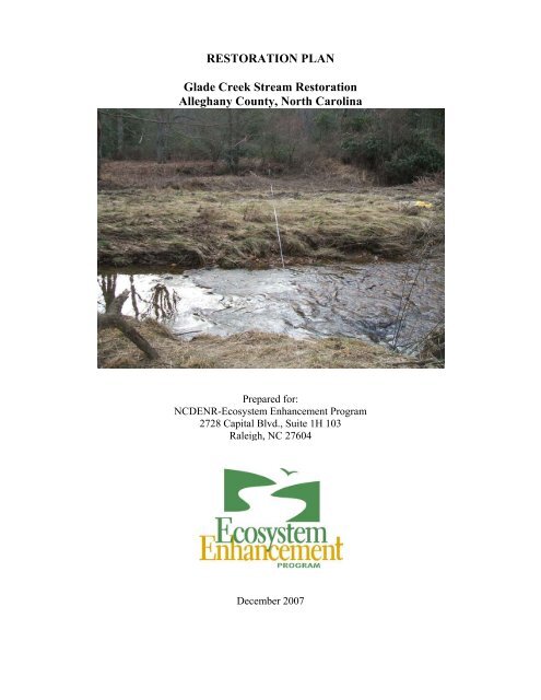
RESTORATION PLAN Glade Creek Stream Restoration Alleghany ...
RESTORATION PLAN Glade Creek Stream Restoration Alleghany ...
RESTORATION PLAN Glade Creek Stream Restoration Alleghany ...

Create successful ePaper yourself
Turn your PDF publications into a flip-book with our unique Google optimized e-Paper software.
<strong>RESTORATION</strong> <strong>PLAN</strong><strong>Glade</strong> <strong>Creek</strong> <strong>Stream</strong> <strong>Restoration</strong><strong>Alleghany</strong> County, North CarolinaPrepared for:NCDENR-Ecosystem Enhancement Program2728 Capital Blvd., Suite 1H 103Raleigh, NC 27604December 2007
By8218 Creedmoor Road, Suite 200Raleigh, NC 27613Office 919-518-0311 Fax 919-518-0313Project Manager: Kevin Nunnery2
Table of ContentsExecutive Summary................................................................................................................... 51.0 Project Site Identification and Location ................................................................................ 71.1 Directions to Project Site ...................................................................................................... 71.2 USGS Hydrologic Unit Code and NCDWQ River Basin Designations............................... 71.3 Project Vicinity Map............................................................................................................. 72.0 Watershed Characterization................................................................................................... 82.1 Drainage Area ....................................................................................................................... 82.2 Surface Water Classification / Water Quality....................................................................... 82.3 Physiography, Geology and Soils......................................................................................... 82.4 Historical Land Use and Development Trends..................................................................... 92.5 Endangered / Threatened Species ......................................................................................... 92.6 Cultural Resources.............................................................................................................. 132.7 Potential Constraints ........................................................................................................... 142.7.1 Property Ownership and Boundary.............................................................................. 142.7.2 Site Access................................................................................................................... 142.7.3 Utilities......................................................................................................................... 142.7.4 FEMA / Hydrologic Trespass ...................................................................................... 142.7.5a. Beaver Pond and Design Approach .......................................................................... 142.7.5b. Research on Beaver Activity and <strong>Stream</strong>/Riparian Zone Ecology........................... 153.0 Project Site <strong>Stream</strong>s (existing conditions) ........................................................................... 163.1 Channel Classification ........................................................................................................ 163.2 Discharge ............................................................................................................................ 163.3 Channel Morphology (pattern, dimension, profile) ............................................................ 173.4 Channel Stability Assessment............................................................................................. 183.5 Bankfull Verification .......................................................................................................... 183.6 Vegetation........................................................................................................................... 194.0 Reference <strong>Stream</strong>................................................................................................................. 204.1 Watershed Characterization................................................................................................ 204.2 Channel Classification ........................................................................................................ 204.3 Discharge (bankfull, trends)................................................................................................204.4 Channel Morphology (pattern, dimension, profile) ............................................................ 204.5 Vegetation........................................................................................................................... 215.0 Project Site Wetlands (existing conditions)......................................................................... 225.1 Jurisdictional Wetlands....................................................................................................... 225.2 Soil Characterization........................................................................................................... 225.3 Plant Community Characterization..................................................................................... 226.0 Project Site <strong>Restoration</strong> Plan ...............................................................................................236.1 <strong>Restoration</strong> Project Goals and Objectives........................................................................... 236.1.1 Designed Channel Classification ................................................................................. 236.1.2 Designed Channel Structures....................................................................................... 236.1.3 Target Buffer Communities ......................................................................................... 236.2 Sediment Transport Analysis.............................................................................................. 246.2.1 Methodology................................................................................................................ 246.2.2 Calculations and Discussion ........................................................................................ 256.3 HEC-RAS Analysis ............................................................................................................266.3.1 No-rise, LOMR, CLOMR............................................................................................ 266.4 Soil <strong>Restoration</strong>................................................................................................................... 266.6.1 Topsoil Salvage, Soil Testing and Nutrient Amendments........................................... 263
6.5 Natural Plant Community <strong>Restoration</strong>................................................................................ 276.5.1 Narrative & Plant Community <strong>Restoration</strong>.................................................................. 276.5.2 On-site Invasive Species Management ........................................................................ 277.0 Performance Criteria............................................................................................................ 287.1 <strong>Stream</strong>s................................................................................................................................ 287.2 Vegetation........................................................................................................................... 287.3 Schedule / Reporting........................................................................................................... 288.0 References............................................................................................................................ 299.0 Tables................................................................................................................................... 32Table 1. Project <strong>Restoration</strong> Structure and Objectives ...................................................... 32Table 2. Drainage Areas......................................................................................................... 32Table 3. Land Use of Watershed ........................................................................................... 32Table 4. Morphological Table................................................................................................ 33Table 5. BEHI/NBS and Sediment Export Estimate for Project Site <strong>Stream</strong>s ................. 34Table 6. Designed Vegetative Communities (by Zone)…………………………………….3510.0 FiguresFigure 1. Project Site Vicinity MapFigure 2. Project Site Watershed MapFigure 3. Project Site NRCS Soil Survey MapFigure 4. Project Site Hydrological Features and Wetland Delineation MapFigure 5. Reference Site Vicinity MapFigure 6. Reference Site Watershed MapFigure 7. Reference Site NRCS Soil Survey MapFigure 8. Reference Site Vegetative Communities Map11.0 Designed SheetsSheet 1. CoverSheet 2. Designed Channel AlignmentSheet 3. GeometrySheet 4. Longitudinal ProfileSheet 5. Longitudinal ProfileSheet 6. <strong>Restoration</strong> PlanSheet 7. <strong>Restoration</strong> PlanSheet 8. <strong>Restoration</strong> PlanSheet 9. <strong>Restoration</strong> PlanSheet 10. <strong>Restoration</strong> PlanSheet 11. <strong>Restoration</strong> PlanSheet 12. DetailsSheet 13. DetailsSheet 14. DetailsSheet 15. Typical Cross SectionsSheet 16. Planting Plan12.0 AppendicesAppendix 1. Project Site PhotographsAppendix 2. Project Site USACE Routine Wetland Determination Data FormsAppendix 3. Project Site NCDWQ <strong>Stream</strong> Classification FormsAppendix 4. HEC-RAS AnalysisAppendix 5. EEP Floodplain Requirements Checklist4
Executive SummaryThe project site and easement is located on the Steven Faw property (PIN # 3999252005), at 541 DewittRoad, approximately 4 miles south of Sparta, North Carolina. The project reaches include the portion of<strong>Glade</strong> <strong>Creek</strong> that flows through the Faw property as well as an unnamed tributary that flows through theproperty and exits the property just before its confluence with <strong>Glade</strong> <strong>Creek</strong>. The total existing channellength on <strong>Glade</strong> <strong>Creek</strong> is 2,569 feet (thalweg) based on survey data and stationing. The unnamedtributary (UT) to <strong>Glade</strong> <strong>Creek</strong> is 1,088 feet long based on the survey. There is 0.17 acre of wetland thathas been delineated beside the main channel of <strong>Glade</strong> <strong>Creek</strong> and 0.16 acre of wetland that has beendelineated on the upper section of the UT, for a total of 0.33 acre of delineated wetland on the project site.<strong>Glade</strong> <strong>Creek</strong> and the downstream portion of the UT channel are currently unstable, with an over-widechannel in many areas, mid-channel sediment bars, incised bed and steep, eroding, unvegetated banksthroughout. Approximately 62% of the <strong>Glade</strong> <strong>Creek</strong> channel within the project boundary has a BEHIrating of High, 33% has a rating of Very High and 5% has a rating of Moderate. The estimated totalsediment export per year for the <strong>Glade</strong> <strong>Creek</strong> reach is 619 tons, based on the Rosgen (2004) sedimentexport curves. The entire proposed restoration reach of the unnamed tributary has a BEHI rating of VeryHigh, and the estimated total sediment export per year for the reach is 72 tons. The pervasive extent ofhigh BEHI scores indicates that the channel is widening and migrating throughout most of the projectreaches. Approximately 70% of the channel on <strong>Glade</strong> <strong>Creek</strong> had bank height ratios (BHR) of 2 or moreand all of the channel proposed for restoration on the UT has a BHR of >2. A bank height ratio greaterthan two indicates a highly erosive condition for stream banks by definition, so field review of thechannel indicates that it has experienced extensive incision and entrenchment. These conditions willbecome stabilized on their own only through the natural reconfiguration of the channel from bankfullflows, which takes place over many years and introduces very large amounts of sediment from the bedand banks into the stream flow and aquatic habitat as the channel readjusts its geometry and course.The goals of the project are to: Rapidly stabilize the channel of <strong>Glade</strong> <strong>Creek</strong> relative to natural process, Rapidly stabilize and preserve the channel of the UT relative to natural process, Restore and rehabilitate channel features and aquatic habitat in <strong>Glade</strong> <strong>Creek</strong> and the UT, Rehabilitate the riparian buffer along both streams, Preserve the existing wetlands onsite.These goals will be accomplished by designing and constructing a stable plan, profile and dimension forthe stream channels and re-establishing continuous riparian buffers along the banks. Projectimplementation will greatly reduce bank erosion and consequently decrease the amount of sediment loadin the stream at flows above baseflow. <strong>Restoration</strong> level (Rosgen Priority Level II) design is needed onall but 125 feet (which will be Enhancement I) of the channel on the project, due to unstable channelgeometry, sinuosity and streambank steepness. Structures will be used to enhance holding and feedingareas for trout. Riparian buffer vegetation will be established to provide food and cover for terrestrialfauna and to provide a carbon source and shade for aquatic habitat.Through its Local Watershed Planning initiative, EEP focuses resources in specific 14-digit hydrologicunits - local watersheds - in order to address critical watershed issues. This process involves conducting adetailed assessment of the condition of the watershed, involving the local community in identifyingsolutions to water-quality, habitat and flooding problems, and working to get agreed-upon solutionsimplemented within priority sub-watersheds. <strong>Stream</strong> restoration on <strong>Glade</strong> <strong>Creek</strong> will help alleviate twoproblems identified in the Local Watershed Plan for the Little River (Phase I) as being sources of waterquality degradation-inadequate riparian buffers and sediment. This project would address both of those5
problems by stabilizing the severely eroding stream banks onsite and establishing a permanent riparianbuffer on them.To meet the goals listed above, the proposed objectives for <strong>Glade</strong> <strong>Creek</strong> are to perform Priority II<strong>Restoration</strong> on approximately 2,430 linear feet (LF) and stabilize 125 LF with Enhancement I design.Please note that a 25-foot section of channel underneath the existing bridge was excluded from theproposed restoration total, although channel profile and dimension will be reconfigured and stabilizedthere. The proposed objectives for the UT are to perform <strong>Restoration</strong> on approximately 275 LF andPreserve 788 LF. All the wetlands onsite will be preserved with the proposed project (see Table 1).Reach Existing <strong>Restoration</strong>(Priority II)EnhancementI<strong>Glade</strong> <strong>Creek</strong> 2,569 2,430 125*PreservationUn. Trib. 1,088 275** 788Column Totals 3,657 2,705 125 788Wetlands ~0.33 ac ~0.33 ac*25 feet of channel underneath the bridge were excluded.**The restoration on the UT will actually shorten the UT channel by 25 feet due to the unduly highexisting sinuosity.6
1.0 Project Site Identification and LocationThe project site and easement is located on the Steven Faw property (PIN # 3999252005), at 541 DewittRoad, approximately 4 miles south of Sparta, North Carolina. The project reaches include the portion of<strong>Glade</strong> <strong>Creek</strong> that flows through the Faw property as well as an unnamed tributary that flows through theproperty and exits the property just before its confluence with <strong>Glade</strong> <strong>Creek</strong>. The total existing channellength on <strong>Glade</strong> <strong>Creek</strong> is 2,550 feet (thalweg) based on survey data and stationing. The unnamedtributary to <strong>Glade</strong> <strong>Creek</strong> is 1,088 feet long based on the survey. The latitude and longitude of the midpointof the restored mainstem is 1392171.90N, 995691.64E using the NAD83 coordinate system. For thetributary section the coordinates are 1392799.71N, 995076.13E. For the wetland on <strong>Glade</strong> <strong>Creek</strong> thecoordinates for the approximate center are 1392253.65N, 995752.46E1.1 Directions to Project SiteThe project site is located in <strong>Alleghany</strong> County, North Carolina, approximately 4 miles southeast ofthe town of Sparta. From the south and east, the site can be accessed by exiting Interstate 77 North atthe US 21 Bypass exit in Elkin and traveling 23.1 miles to Dewitt Road, turning left on Dewitt Roadand traveling 0.7 miles to the site entrance on the left at 541 Dewitt Road. From the north and west,proceed south on US 21 4 miles to Dewitt Road, turn right and proceed 0.7 miles to 541 Dewitt Roadon the left.1.2 USGS Hydrologic Unit Code and NCDWQ River Basin Designations<strong>Glade</strong> <strong>Creek</strong> is located in the USGS 8-digit Hydrologic Unit Code 05050001, and in the05050001030020 14-digit Code. The N.C. Division of Water Quality stream index number for <strong>Glade</strong><strong>Creek</strong> is 10-9-9. This stream is classified as Class C trout water.1.3 Project Vicinity MapSee Figure 1 (Section 10).
2.0 Watershed CharacterizationThe <strong>Glade</strong> <strong>Creek</strong> watershed is located in a rural area of a sparsely populated county. County land area is235 square miles. The population of <strong>Alleghany</strong> County as of the 2000 Census was 10,677, rendering apopulation density of 45 persons per square mile, approximately 23 percent of the state average of 165persons per square mile. The average temperature is 50.1 degrees Fahrenheit, the average annual rainfallis 46 inches and the average annual snowfall is 17 inches. (<strong>Alleghany</strong> County Demographics,http://ealleghany.net/main/demographics/)2.1 Drainage AreaThe drainage area of the main channel of <strong>Glade</strong> <strong>Creek</strong> at the downstream end of the project is ~2,922acres (4.6 mi 2 ) and the drainage area of the unnamed tributary at the downstream end of the project isapproximately 521 acres (0.8 mi 2 ), for a total watershed area of approximately 3,443 acres (5.4 mi 2 ).The area within the conservation easement or project area itself is approximately 12 acres.2.2 Surface Water Classification / Water Quality<strong>Glade</strong> <strong>Creek</strong> is located in the USGS 8-digit Hydrologic Unit Code 05050001, and in the05050001030020 14-digit Code. The N.C. Division of Water Quality stream index number for <strong>Glade</strong><strong>Creek</strong> is 10-9-9. This stream is classified as a Class C trout water.2.3 Physiography, Geology and Soils<strong>Alleghany</strong> County is located in northwestern North Carolina, and its northern border is with Virginia.The county is located entirely within the Appalachian Mountains region of western North Carolina.Most of the county is located atop a rolling plateau that ranges from 2,500 feet to 3,000 feet above sealevel. The <strong>Glade</strong> <strong>Creek</strong> watershed is part of the area, and is underlain by sedimentary andmetamorphic rock from the late Proterozoic Period, clastic metasedimentary rock, and mafic andfelsic metavolcanic rock of the Ashe Metamorphic Suite, Tallulah Falls Formation and Alligator BackFormation, gneiss, schist, metagraywacke, amphibolite, and calc-silicate granofels (N.C. GeologicalSurvey, 1985).The NRCS is currently revising the soil survey of <strong>Alleghany</strong> County, and limited information isavailable on the Web Soil Survey 2.0 website. However, Biohabitats was able to get GIS soilsinformation from the 1973 Soil Survey from the State NRCS office and analyze it (Figure 3). Theresults for the combined <strong>Glade</strong> <strong>Creek</strong> and unnamed tributary watersheds are listed below.Series Name Acres Percent Series Name Acres Percent1. Watauga 1,512.0 43.9 8. Fannin 75.1 2.22. Chester 550.4 16.0 9. Cordurus 75.0 2.23. Porters 411.5 11.9 10. Clifton 73.0 2.14. Tusquitee 236.6 6.9 11. Ashe 44.3 1.35. Chandler 198.9 5.8 12. Stony Steep Land 22.9 0.76. Alluvial land 138.1 4.0 13. Rock Outcrop 1.7 0.17. Tate 103.5 3.0 14. Gullied Land 1.6 0.015. Water 1.6 0.0TOTALS 3,446.2 100
By far the most prevalent soil series in the watershed is the Watauga series (44%, Typic Hapludults)followed by Chester (16%, Typic Hapludults) and Porters (12%, Typic Dystrudepts) soils. All theseseries are upland soils, and no hydric soil is included in the list, although it is assumed that thealluvial land category may contain hydric soils.2.4 Historical Land Use and Development TrendsThe main land use patterns for the <strong>Glade</strong> <strong>Creek</strong> watershed upstream of the project are approximately44% (1,500 ac) Managed Herbaceous Cover (pasture), and 36% (1,226 ac) forested in Mixed UplandForest (see Table 3 in Section 9). A major component of <strong>Alleghany</strong> County’s economic history andpresent economy is dairy and livestock production. The high percentage of pasture in the watershedreflects this economic trend. A major cause of accelerated stream bank erosion can be related to landuse change (Henderson, 1986). For decades livestock and dairy production has known to compactsoils, increase stormwater runoff and increase sediment loading in stormwater. For example,overgrazing and soil compaction in the uplands often lead to rill erosion and elevated peak flowsinstream. Soil can become compacted by the repeated pressure of moving animals, especially if thesoil is wet. The combination of soil exposure and compaction can decrease infiltration and increasesurface runoff. If infiltration capacity is severely limited on a large fraction of a catchment, the extrarunoff can quickly enter streams and generate higher peak flows (Davis, 1977.) The high percentageof land in the watershed converted to pasture indicates a high potential for non-point source runoffand pollution to be generated upstream of the site and transported downstream. Only 0.5% of thewatershed is in cultivated land, the balance of the remaining land being in forest, shrub or herbaceouscover.In addition to erosive impacts caused by livestock and dairy production, research has shown thatstream erosion can be caused by logging done without following Best Management Practices. Rice etal. (1979) and Burwell (1970) showed that the quantity of sediment produced and delivered to astream from a logging site is determined to a large extent by the care taken by the harvesting operator.Toews and Moore (1982) reported stream bank erosion was more than 250% greater after loggingthan before in clearcut areas where no buffer strips were left. After clearcutting an area where a bufferstrip 5 meters or less was used, streambank erosion increased only 32% over the preharvest rate.Logging was historically common throughout the mountains of North Carolina, and based on thedegree of incision of the restoration reach, the <strong>Glade</strong> <strong>Creek</strong> watershed was no exception. BestManagement Practices were only developed and mandated for use in the past 20-30 years.Projected population growth for the state of North Carolina from 2000 to 2006 was 10.1% while<strong>Alleghany</strong> County’s population was projected to grow by 3%, indicating a suppressed population anddevelopment growth compared to the state as a whole (N.C. State Demographics, 2007). From thesame data source, the projected growth rate from 2010-2020 was projected to be low, approximately3%. The population growth for Sparta, NC from 2000-2007 was 2.3% (http://www.bestplaces.net/zipcode/Sparta_NC-72867500000.aspx).2.5 Endangered / Threatened SpeciesA visual site assessment was conducted by traversing the entire project site. Biohabitats inspected thesite for any indication of suitable habitat for any listed species. Based on the visual assessmentresults, Biohabitats determined if the project may affect one or more federally listed species ordesignated critical habitats. Prior to the site visit, we obtained an updated species list for <strong>Alleghany</strong>County from the US Fish and Wildlife Service web site (http://nc-es.fws.gov/es/countyfr.html).The USFWS lists the following protected species for <strong>Alleghany</strong> County:9
USFWS List of Protected Species in <strong>Alleghany</strong> County, N.C.Common Name Scientific name Fed. Status Record StatusVertebrate:Allegheny woodrat Neotoma magister FSC Probable/potentialAppalachian cottontail Sylvilagus obscurus FSC CurrentBog turtle Clemmys muhlenbergii T (S/A) CurrentEastern small-footed bat Myotis leibii FSC HistoricGolden-winged warbler Vermivora chrysoptera FSC CurrentHellbender Cryptobranchus alleganiensis FSC CurrentKanawha minnow Phenacobius teretulus FSC CurrentInvertebrate:Diana fritillary (butterfly) Speyeria diana FSC CurrentGrayson crayfish ostracod Ascetocythere cosmeta FSC HistoricGreen floater Lasmigona subviridis FSC CurrentGrizzled skipper Pyrgus wyandot FSC CurrentMidget snaketail Ophiogomphus howei FSC CurrentRegal fritillary (butterfly) Speyeria idalia FSC HistoricVascular Plant:Butternut Juglans cinerea FSC CurrentCuthbert turtlehead Chelone cuthbertii FSC CurrentFen sedge Carex sp. 2 FSC CurrentGray's lily Lilium grayi FSC CurrentGray's saxifrage Saxifraga caroliniana FSC HistoricLarge-leaved Grass-of- Parnassia grandifolia FSC CurrentParnassusSweet pinesap Monotropsis odorata FSC ObscureTall larkspur Delphinium exaltatum FSC HistoricNote: T(S/A) = threatened due to similarity or appearance. A species that is threatened due to similarityof appearance with other rare species and is listed for its protection. These species are not biologicallyendangered or threatened and are not subject to Section 7 consultation. Federal Species of Concern (FSC)are defined as species under consideration for listing, for which there is insufficient information tosupport listing at this time (USFWS, May 2007).Rare, threatened and endangered species listed by the N.C. Natural Heritage Program (NHP) for the U.S.Geological Survey <strong>Glade</strong> Valley 7.5-minute topographic quadrangle are presented in the list below.10
N.C. Natural Heritage Program List of Rare, Threatened and Endangered SpeciesMajorGroupInvertebrateAnimalScientific Name Common Name State Status FederalStatusPyrgus wyandotAppalachianCheckered-SkipperSRFSCNaturalCommunitySouthern Appalachian Bog (northernsubtype)None None NoneNonvascularPlantNonvascularPlantVascularPlantVascularPlantVascularPlantVascularPlantVascularPlantVascularPlantVascularPlantVascularPlantVascularPlantVascularPlantVascularPlantVascularPlantVascularPlantVascularPlantVascularPlantVascularPlantVascularPlantVascularPlantMacrocoma sullivatiiSullivant’s ManedmossSR-D NoneOrthotrichum keeverae Keever’s Bristle-moss E NoneCalamagrostis canadensis Canada Reed Grass SR-P NoneCarex leptonervia A Wood Sedge SR-P NoneCarex woodii Wood’s Sedge SR-P NoneChelone cuthbertii Cuthbert’s Turtlehead SR-L FSCCoptis trifolia ssp. groenlandica Goldthread SR-P NoneCrocanthemum propinquum Creeping Sunrose SR-P NoneDalibarda repens Robin Runaway E NoneGeum laciniatum var. trichocarpum Rough Avens SR-P NoneGlyceria laxa Lax Mannagrass SR-P NoneHackelia virginiana Virginia Stickseed SR-P NoneHexalectris spicata Crested Coralroot SR-P NoneLillium grayi Gray’s Lily T-SC FSCPlatenthera grandifloraLarge Purple-fringedOrchidSR-PNoneRhynchospora albaNorthern White SR-P NoneBeaksedgeRobinia hispida var. fertilis Fruitcul Locust SR-O NoneSpirathes lucida Shining Ladies-tresses SR-O NoneStenanthium roubustum Bog Featherbells SR-P NoneVaccinium macrocarpon Cranberry SR-P None11
N.C. Natural Heritage Program List of Rare, Threatened and Endangered Species (Continued)MajorGroupVertebrateAnimalVertebrateAnimalVertebrateAnimalVertebrateAnimalVertebrateAnimalVertebrateAnimalVertebrateAnimalVertebrateAnimalVertebrateAnimalVertebrateAnimalVertebrateAnimalScientific Name Common Name State Status FederalStatusAmbystoma talpoideum Mole salamander SC NoneCrotalus horridus Timber Rattlesnake SC NoneEtheostoma kanawhae Kanawha Darter SR NoneEumeces anthracinus Coal Skink SR NoneExoglossum laurae Tonguetied Minnow SR NoneGlyptemys muhlenbergii Bog Turtle T T(S/A)Myotis leibeeMyotis septentrionalisEastern Small-footedMyotisNorthern Long-earedMyotisSCSCFSCNonePasserculus sandwichensis Savannah Sparrow SR NonePhenacobius teretulus Kanawha’s Minnow SC FSCPlethodon wehrlei Wehrle’s Salamander T NoneVertebrate Sylvilagus obscurus Appalachian Cottontail SR FSCAnimalPlant statuses for the NHP list are determined by the Plant Conservation Program (NC Department ofAgriculture) and the Natural Heritage Program (NC Department of Environment and Natural Resources).Endangered (E), Threatened (T), and Special Concern (SC) species are protected by state law (PlantProtection and Conservation Act, 1979). Candidate and Significantly Rare (SR) designations indicaterarity and the need for population monitoring and conservation action. The additional significantly raredesignations “-P” and “-O” refer to species at the periphery of their range in North Carolina, and that therange of species is sporadic or cannot be described by other significantly rare designations, respectively.Note that plants can have a double status, e.g., E-SC, indicates that while the plant is endangered, it iscollected or sold under regulation.Animal statuses for the NHP list are determined by the Wildlife Resources Commission and theNatural Heritage Program. Endangered, Threatened, and Special Concern species of mammals, birds,reptiles, amphibians, freshwater fishes, and freshwater and terrestrial mollusks have legal protectionstatus in North Carolina (Wildlife Resources Commission). The Significantly Rare designationindicates rarity and the need for population monitoring and conservation action.There are no federally endangered species listed for <strong>Alleghany</strong> County. There is one federallythreatened species listed for this county, the Bog turtle (Clemmys muhlenbergii). The Bog turtle has ashell length of approximately 4 inches with a distinctive red, orange, or yellow patch on each side ofthe head. The Bog turtle has a light brown to ebony shell.12
Bog turtles inhabit slow, shallow, muck-bottomed rivulets of sphagnum bogs, calcareous fens,marshy/sedge-tussock meadows, spring seeps, wet cow pastures, and shrub swamps; the habitatusually contains an abundance of sedges or mossy cover. The turtles depend on a mosaic ofmicrohabitats for foraging, nesting, basking, hibernation, and shelter (USFWS, 2000). "Unfragmentedriparian systems that are sufficiently dynamic to allow the natural creation of open habitat are neededto compensate for ecological succession" (USFWS, 2000). Beaver, deer, and cattle may beinstrumental in maintaining the essential open-canopy wetlands (USFWS, 2000).Bog turtles rarely leave wetland habitats, although recent radio-telemetry evidence indicates that bogturtles sometimes venture into and across upland habitats (375 m, Carter et al., 2000) and cross roadsto reach adjacent wetlands (Morrow et al. 2001). Whitlock (unpublished data) also documentedindividuals regularly moving back and forth across 1 km of a typical wetland habitat to more suitablehabitat patches. Successful movement across developed areas is probably negligible, due tosusceptibility to collection, predation, and road mortality.In North Carolina over somewhat less than 1 year, distances between relocations of radio-taggedturtles ranged from 0 to 87 m (mean= 24 m) for males, and 0 to 62 m (mean= 16 m) for females(Herman and Fahey, 1992).There are 5 delineated wetlands on the project site, and they are all forested (refer to Section 5.1 andFigure 4), While these forested wetlands are not preferred habitat of the bog turtle, based on currentscientific knowledge, they could be used by turtles as they travel between more suitable or preferredhabitat. Based on personal communication with Dennis Herman of the N.C. Dept. of TransportationOffice of the Natural Environment (July 20, 2007), a recognized bog turtle expert, bog turtlesprobably travel through the site on their way upstream or downstream to other sites, and may use theproject site wetlands as stopping-over points. However, since all wetland areas within the project sitewill be undisturbed during project construction and will be permanently preserved, he stated that hebelieved that the short term disturbance of project construction would be offset by the long termpreservation of the wetlands. Therefore, stream restoration activities associated with the <strong>Glade</strong> <strong>Creek</strong><strong>Stream</strong> Mitigation site in <strong>Alleghany</strong> County will have no negative effect on the bog turtle species.2.6 Cultural ResourcesA visual on-site assessment was conducted by traversing the entire project site thoroughly, on bothsides of the streams. No archeological artifacts were observed or noted during the site survey. TheEnvironmental Data Resources, Inc. review for the project site revealed no record of mapped historicsites within the project area.The State Historical Preservation Office (SHPO) was contacted and conducted a review of the site. Ina response dated March 27, 2007 it was stated that SHPO was not aware of any historic resources thatwould be affected by the restoration project and that SHPO had no comment on the proposedundertaking.A formal letter was sent to the Tribal Historic Preservation Office of the Eastern Band of CherokeeIndians on February 22, 2007. The project is still under review and when the letter is received, it willbe submitted to EEP.13
2.7 Potential Constraints2.7.1 Property Ownership and BoundaryThe project site and easement is located on the Steven Faw property (PIN # 39992520005), at 541Dewitt Road, approximately 4 miles southeast of Sparta, North Carolina. The project reachesinclude the portion of <strong>Glade</strong> <strong>Creek</strong> that flows through the Faw property as well as an unnamedtributary that flows through the property and exits the property just before its confluence with<strong>Glade</strong> <strong>Creek</strong> (Figure 3).2.7.2 Site AccessThe easement is accessed from Dewitt Road by crossing the bridge over <strong>Glade</strong> <strong>Creek</strong> (the Faw’sdriveway) and accessing the easement from the side of the creek opposite from Dewitt Road. Atemporary construction access road may need to be built from Dewitt Road to the creek if it isdetermined that the Faw’s bridge over <strong>Glade</strong> <strong>Creek</strong> is not capable of safely supporting heavyequipment.2.7.3 UtilitiesAn overhead power line services the property owner’s house and passes over the easement. It isthe only known utility that passes through the project site.2.7.4 FEMA / Hydrologic TrespassAs of September 26, 2007, there is no FEMA mapping for the project area, based on a review ofthe N.C. Flood maps website. The proposed project is a Rosgen Priority II stream restorationproject, with no wetland restoration component, only wetland preservation. The hydrology of thesite will not be significantly altered by the project. The Faw’s property and the adjoiningproperties will not be hydrologically trespassed upon by the stream restoration project.2.7.5a. Beaver Pond and Design ApproachThere is an existing beaver dam and pond along <strong>Glade</strong> <strong>Creek</strong> at station 17+75. Beavers built thisfeature during the fall of 2006 and then enlarged it in the winter of 2007. The proposed designwill construct a stable channel directing flow beside and around the pond, preserving its presentsize and configuration. The mud and stick beaver dam will be removed and replaced withsomewhat more permanent channel bed material. During higher flows the pond area will serve asadditional floodplain capacity, and during low flows the stream thalweg will be adjacent to thepond area, flowing around it. This will allow the beaver impoundment area to persist, with astable channel adjacent to it, thus providing stability while still allowing unimpeded sedimenttransport in the channel. The water table is expected to be high enough to maintain water in theadjacent pond area during periods of low flow.This design provides a stable channel for stream flow and also maintains the small, ~ 0.1 acimpoundment that beavers have already constructed. According to the land owner, the beaverpopulation is established both upstream and downstream from the project, and beaver are anatural part of the ecosystem. Eliminating them from a limited reach of stream when theirpopulation is established immediately upstream and downstream is generally not a reliable14
control measure. There is no guarantee that the beavers wouldn’t return and build a new damnear the present pond location if it is removed. This design approach, by retaining the impoundedwater in the existing pond, should allow the beavers to continue limited activity, whilediscouraging them from building new dams in the project area.2.7.5b. Research on Beaver Activity and <strong>Stream</strong>/Riparian Zone EcologyMuch research has been published on the beneficial ecological effects of beaver activity. In theRocky Mountain region, beaver have been shown to facilitate regeneration of long absent riparianvegetation (if cattle grazing was properly managed), and improve conditions for trout (Smith1980; Munther 1981; Johnson 1984). Lack of beaver dams and imposition of grazing had led tochannel incision and deterioration of trout habitat in the mountain valley creeks. Stocking beaverand initially providing them with aspen cuttings as food and dam-building material enabled themto impound water, which rejuvenated riparian zones. In such terrain, healing creeks with beaverproved to be more economical than traditional measures (Johnson 1984). Beaver help resistadverse perturbation of riparian areas, and their ponds improve chemical water quality (Parker1986).The reintroduction of beaver has demonstrated: 1) an elevated water table upstream of the dam,which in turn improves vegetation condition, reduces water velocities, reduces bank erosion, andimproves fish habitat (increased water depth, better food production, higher dissolved oxygen,and various water temperatures), 2) reduced sedimentation downstream of the dam, 3) increasedwater storage, 4) improved water quality, and 5) more waterfowl nesting and brooding areas(McKinstry et al. 2001). In North Carolina beavers have naturally re-introduced themselves, buttheir effects on the environment are the same as if they were artificially re-introduced, as in muchof the published research to date.15
3.0 Project Site <strong>Stream</strong>s (existing conditions)3.1 Channel ClassificationAs part of the field reconnaissance, the Rosgen classification system (Rosgen, 1994) was used todetermine channel type at each field cross section on the basis of existing morphological features ofthe stream channel. Two stable, representative riffle cross sections were surveyed on <strong>Glade</strong> <strong>Creek</strong>.The measured channel dimensions for the representative cross sections generate a C4 classification;except for width/depth ratio at the cross sections were 9.1 and 11.1, just under the classificationminimum for a C channel, which is 12. A width/depth ration of less than 12 is characteristic of an Echannel. For this reason, the existing channel is classified as a C E 4 channel, in deference to the lowwidth/depth ratios at these representative riffles. However, in other sections of the <strong>Glade</strong> <strong>Creek</strong>channel, where downcutting and widening have occurred, decreasing the entrenchment ratio andincreasing the width/depth ratio, the channel classification is F4 or G4. The F4 and G4 classificationsare indicative of channel instability. Only one stable, representative cross section could be located onthe unnamed tributary. Based on the measurements taken in the field, the unnamed tributary also wasclassified as a C4.3.2 DischargeIn adjustable, alluvial, transport-limited rivers in temperate climates, flows of moderate frequency(e.g., the 1.5- to 2-year storm event) and magnitude perform most of the geomorphic work (Wolmanand Miller, 1960). This concept of the “dominant discharge” provides a statistical index for the flowthat corresponds with the peak volume of sediment transported. Dominant discharge is the maximumpossible product of the frequency of a flow occurrence and the amount of sediment transported bythat flow event. Channel morphology is ultimately a result of all flows above a sediment transportthreshold that do some geomorphic work. However, the dominant discharge is commonly used as asingle-value estimate for a flow that may be largely responsible for resulting geomorphic form.It is thought that, in many cases, the morphological feature of a bankfull elevation corresponds fairlywell to the flow stage of the dominant discharge. This has led to the concept of bankfull elevation asa tool in stream restoration design. However, the concept should be applied cautiously in streamrestoration design. It should be noted that as channel boundaries are more resistant or less adjustable(i.e., bedrock, hillslope constraints, or large bed material) or in more arid environments, the majorityof geomorphic work is more likely to be performed by larger and rarer flood events. For the purposesof this restoration plan, here the bankfull discharge is considered to be essentially equivalent to thedominant discharge, and serves a guiding value in many aspects of the restoration design.As mentioned in Section 3.1, the bankfull elevation was identified in the field by Biohabitatspersonnel at surveyed cross sections. The bankfull elevation at each cross section was derived fromall available indications including depositional features, changes in bank angle, vegetation, scourlines, and storm debris lines. Bankfull discharge was estimated by solving the Manning equation fordischarge given the bankfull elevation, local channel geometry, slope, and roughness. Channelroughness, represented by Manning's "n", was approximated using the standard references Chow(1959) and Barnes (1967) based on field observations of bed material, channel geometry, andadjacent riparian vegetation.For the purpose of comparison, a predicted bankfull discharge was also calculated for <strong>Glade</strong> <strong>Creek</strong>and the unnamed tributary using available North Carolina regression relationships for rural streams in
the Mountain physiographic province (Harman et al., 1999). The rural regression relationships areexpressed by the following equations:A bkf = 22.1 A w0.67Q bkf = 115.7 A w0.73W bkf = 19.9A w0.36D bkf = 1.1A w0.31where A w is watershed area in square miles (mi 2 ), A bkf is the bankfull cross-sectional area in squarefeet (ft 2 ), Q bkf is the bankfull discharge in cubic feet per second (cfs), W bkf is the bankfull width in feet(ft), and D bkf is the bankfull mean depth in feet (ft).For the purpose of comparison, a predicted bankfull discharge was also calculated for <strong>Glade</strong> <strong>Creek</strong>and the unnamed tributary using available North Carolina regression relationships for rural streams inthe Piedmont physiographic province (Harman et al., 1999). The rural regression relationships areexpressed by the following equations:A bkf = 21.43 A w0.68Q bkf = 89.04 A w0.72W bkf = 11.89A w0.42D bkf = 1.50A w0.32The discharge was also estimated using the hydrologic model TR-20. The results of deriving Q bkffrom the different methods are listed below, along with the chosen design discharges.<strong>Stream</strong>Manning’sEquationBankfull DischargeMountain RegionalCurvePiedmontRegional CurvePeak Flow,TR-20DesignDischarge<strong>Glade</strong> <strong>Creek</strong>Discharge (cfs) X/S 1: 228 352 267 1-yr: 204 200X/S 2: 153 2-yr: 335Unnamed TributaryDischarge (cfs) 27 98 76 1-yr: 16 202-yr: 23The existing channel cross section geometry data was used in the Manning’s Equation and TR-20estimates, making those estimates site specific. Bankfull indicators were more reliable at crosssection 1 on <strong>Glade</strong> <strong>Creek</strong>. The Manning’s Equation estimate at cross section 1 also falls within thebounds of the 1-year and 2-year discharge predictions from the TR-20 model output. The RegionalCurve predictions are above the Manning’s and TR-20 values, but the Manning’s and TR-20 valuesfall reasonably within confidence intervals on the Piedmont curve, and within a reasonable range onthe Mountain Curve. Therefore, the design discharges were determined using a combination of theManning’s Equation and TR-20 estimates.3.3 Channel Morphology (pattern, dimension, profile)The existing channel morphology exhibits several Rosgen Classifications over the project reaches of<strong>Glade</strong> <strong>Creek</strong> and the unnamed tributary (channel geometry is summarized in Table 4). The diagnosticclassification, measured at stable riffle cross sections for both <strong>Glade</strong> <strong>Creek</strong> and the unnamed tributaryis C4. C4 is what the entire channel would have been classified as before it experienced degradation.17
However, the majority of the project channel reaches have experienced over-widening and incision,probably due to long-term increasing flows from forest conversion to pasture land upstream and fromrelatively short-lived increased runoff from clear-cutting in the watershed, and are classified as F4and G4.The existing C4 channel has a sinuosity of 1.2, a riffle cross sectional area of approximately 51 ft 2 ,and an average slope of 0.005.3.4 Channel Stability AssessmentThe entire <strong>Glade</strong> <strong>Creek</strong> reach and the downstream reach of the unnamed tributary that are proposedfor restoration/enhancement were assessed in the field by Biohabitats using the Bank Erosion HazardIndex (BEHI) (Rosgen 2001). Approximately 62% of the <strong>Glade</strong> <strong>Creek</strong> channel within the projectboundary has a BEHI rating of High, 33% has a rating of Very High and 5% has a rating of Moderate(see Table 5). The estimated total sediment export per year for the <strong>Glade</strong> <strong>Creek</strong> reach is 619 tons,based on the BEHI methodology and sediment export curves. The entire proposed restoration reachof the unnamed tributary has a BEHI rating of Very High, and the estimated total sediment export peryear for the reach is 72 tons. The pervasive extent of high BEHI scores indicates that the channel iswidening and migrating throughout most of the project reaches. Bank height ratios (BHR) wereestimated while performing the BEHI analysis. Approximately 70% of the channel on <strong>Glade</strong> <strong>Creek</strong>had BHR’s of 2 or more and all of the channel proposed for restoration on the UT has a BHR of >2.In the BEHI protocol, a bank height ratio greater than 1.5 is an indication of highly unstable banks.Bedrock is present in a limited number of locations throughout the project reaches, but bank heightratios are greater than 1 throughout most of the project, and approach and exceed 2 in some places,indicating instability and downcutting of the channel.3.5 Bankfull VerificationThe 1- and 2-year water surface elevations predicted by HEC-RAS were compared with bankfullflows calculated based on field indicators using the Manning equation to help calibrate bankfulldischarge estimates to be used in channel design. At both representative riffle cross sections on <strong>Glade</strong><strong>Creek</strong>, the maximum depth predicted by the HEC-RAS program using the TR-20 discharge estimatecoincided well with the maximum depth at the surveyed cross sections using the Manning’s Equationdischarge prediction, listed below.Cross Section Mannings Eq. Q(cfs)TR-20 Q(cfs)HEC-RAS d max(ft)Surveyed d max(ft)<strong>Glade</strong> 1 228 1-yr: 204 2.55 2.82-yr: 335 3.33<strong>Glade</strong> 2 153 1-yr: 204 2.36 2.42-yr: 335 3.14Unnamed Tributary 27 1-yr: 16 0.56 1.02-yr: 23 0.71At the unnamed tributary cross section, the correlation was not as close, but it was within 0.4 ft of themidpoint between the two discharges. Therefore, the identified bankfull indicators in the fieldcorrelate well with the predictive estimates generated by Manning’s Equation and HEC-RAS. Inaddition, the predicted discharges correlate well with the bankfull channel geometry identified in thefield.18
3.6 VegetationThe riparian area along <strong>Glade</strong> <strong>Creek</strong> is in a relatively undisturbed, natural condition. The dominantcanopy species there are white oak (Quercus alba), white pine (Pinus strobus) and red maple (Acerrubrum). The two dominant species in the understory/shrub layer are rhododendron (Rhododendronmaximum) and mountain laurel (Kalmia latifolia). Other understory species included smooth alder(Alnus serulata), black cherry (Prunus serotina), multiflora rose (Rosa multiflora), and black willow(Salix nigra). The herbaceous layer, where the canopy is closed, is not present, but where there areopenings it contains many grasses, including fescue (Festuca sp.), blackberry bushes (Rubus sp.) andvarious wild flowers, dominated by the Asteracae family.19
4.0 Reference <strong>Stream</strong>Basin <strong>Creek</strong>, located in Wilkes County in Doughton State Park, was used as the reference stream (Figure5). It was surveyed by a team of NRCS and NCWRC personnel (Angela Jessup, Dick Everhart, GregGoings, Jerry Pate and Joe Mickey) and by an NC SRI crew (Dan Clinton, Jan Patterson, Louise O’Haraand Jon Williams) in 1998. The original survey data from both surveys was acquired from the NC SRI.The data generated from those surveys was compared and used for design purposes. Biohabitats reviewedthe stream in the field in May 2007 and determined from a walk of the stream from the downstreamboundary of Doughton Park to above the confluence of Cove and Basin <strong>Creek</strong>s (approximately 2 miles ofstream), that it was a stable, suitable reference reach.4.1 Watershed CharacterizationThe Basin <strong>Creek</strong> watershed was delineated (see Figure 6) and the land uses within it are summarizedbelow. The watershed is approximately 98% forested, and less than 1% developed.Land Use In Basin <strong>Creek</strong> Watershed (Reference)Land Use Acreage %Deciduous Forest 3,963.2 91.3Mixed Forest 139.2 3.2Evergreen Forest 119.9 2.8Pasture/Hay 59.2 1.4Developed Open Space 20.7 0.5Shrub Scrub 20.0 0.5Woody Wetlands 13.6 0.3Developed Low Intensity 6.2 0.1Totals 4,342.0 1004.2 Channel ClassificationBased on the data collected in the field by both survey crews, the channel has a Rosgen <strong>Stream</strong> TypeClassification of C4.4.3 Discharge (bankfull, trends)The reference bankfull discharge, estimated from the N.C. Mountain Regional Curve isapproximately 425 cfs, and estimated from the N.C. Piedmont Regional Curve is approximately 300cfs. The NRCS survey discharge estimate using Mannings Equation is approximately 375 cfs. Thevery high percentage of forest land cover in the watershed (98%) serves to stabilize and maintainbankfull discharge quantities, which in theory should remain unchanged unless the developed areawithin the watershed increases, generating more stormwater runoff that reaches the channel.4.4 Channel Morphology (pattern, dimension, profile)The reference channel has a sinuosity of 1.1, a riffle bankfull cross-sectional area of 57 square feetand an average slope of 0.014 (see Table 4).
4.5 VegetationThe forest canopy is dominated by yellow poplar (Liriodendron tulipifera), white pine, red maple(Acer rubrum), hemlock (Tsuga canadensis) and sycamore (Platanus occidentalis). The understory isdominated by rhododendron and smooth alder along the stream. This community is most closelyrelated to a Rich Cove Forest classification (Schafale and Weakley, 1990).21
5.0 Project Site Wetlands (existing conditions)5.1 Jurisdictional WetlandsWetlands on the site were evaluated based on the U.S. Army Corps of Engineers 1987 WetlandDelineation Manual. The presence or absence of three wetland parameters was documented (hydricsoils, hydrophytic vegetation and wetland hydrology), following the guidance set forth in the Manual.One jurisdictional wetland was delineated on <strong>Glade</strong> <strong>Creek</strong> and four jurisdictional wetlands weredelineated on the unnamed tributary to <strong>Glade</strong> <strong>Creek</strong> (see Figure 4 for map and Appendix 2 for forms).The areas of the individual wetlands are as follows:<strong>Glade</strong> <strong>Creek</strong> wetlands:Wetland 1-0.17 acresUnnamed Tributary wetlands:Wetland 1-0.009 acresWetland 2-0.034 acresWetland 3-0.033 acresWetland 4-0.087 acresTotal Wetland Area in Easement-0.33 acresThese wetland areas will not be disturbed, they will be preserved with the proposed project.5.2 Soil CharacterizationAs previously noted, the mapping of soils in <strong>Alleghany</strong> County is currently under revision. The 1973Soil Survey shows the area where the wetlands occur as Alluvial Land Wet, and does not include adetailed soil color description. However, based on field investigation and soil cores taken throughoutthe wetlands, the wetland soils present on the project site are Toxaway series soils (CumulicHumaquepts). This conclusion is based on soil color and texture. The typical horizon description forthe Toxaway series is 0-12 inches 10YR 3/1 loam, 12-25 inches 10YR 3/1 loam and 25-32 inches10YR 4/1 loam. From the wetland delineation soil descriptions, the hydric soils found onsite aretypically 7.5 YR or 10YR 2/1 sandy clay loams in the upper 18 inches of the profile, similar to theToxaway series.5.3 Plant Community CharacterizationThe wetland areas onsite are individually quite small, and the dominant woody vegetation occupyingthe wetlands is red maple. The herbaceous layer is often sparse, but where present, common rush(Juncus effusus) is dominant, along with various sedge species. These wetlands most closely resemblethe High Elevation Seep community (Schafale and Weakley, 1990).
6.0 Project Site <strong>Restoration</strong> Plan6.1 <strong>Restoration</strong> Project Goals and ObjectivesThe goals of the project are to: Rapidly stabilize the channel of <strong>Glade</strong> <strong>Creek</strong> relative to natural process, Rapidly stabilize and preserve the channel of the UT relative to natural process, Restore and rehabilitate channel features and aquatic habitat in <strong>Glade</strong> <strong>Creek</strong> and the UT, Rehabilitate the riparian buffer along both streams, Preserve the existing wetlands onsite.These goals will be accomplished by designing and constructing a stable plan, profile and dimension forthe stream channels and re-establishing continuous riparian buffers along the banks. Projectimplementation will greatly reduce bank erosion and consequently decrease the amount of sediment loadin the stream at flows above baseflow. <strong>Restoration</strong> level (Rosgen Priority Level II) design is needed onall but 125 feet of the channel on the project, due to unstable channel geometry, sinuosity and streambanksteepness. Structures will be used to enhance holding and feeding areas for trout. Riparian buffervegetation will be established to provide food and cover for terrestrial fauna and to provide a carbonsource and shade for aquatic habitat.To meet the goals listed above, the proposed objectives for <strong>Glade</strong> <strong>Creek</strong> are to perform <strong>Restoration</strong> onapproximately 2,430 linear feet (LF) and stabilize 125 LF with Enhancement I design. Please note that a25-foot section of channel underneath the existing bridge was excluded from the proposed restorationtotal, although channel profile and dimension will be altered. The proposed objectives for the UT are toperform <strong>Restoration</strong> on approximately 275 LF and Preserve 570 LF. All the wetlands onsite will bepreserved with the proposed project (see Table 1).6.1.1 Designed Channel ClassificationThe designed channel classification, based on the existing channel substrate (D 50 =12.5 mm) andthe designed channel average slope (0.004), entrenchment ratio (>2.2), width/depth ratio (>12)and sinuosity (>1.2) is a Rosgen C4.6.1.2 Designed Channel StructuresIn order to provide stabilization to the newly graded channel, especially along outside meanderbanks, in-stream structures such as log vanes, rootwads, and large woody debris bundles will beutilized. The realignment of the channel will necessitate the removal of some trees (although thealignment was selected to minimize disturbance to mature trees) and this material will be utilizedin these structures. Because this restoration is utilizing natural channel techniques and becausethere are very few man-made constraints on this project, we prefer to use wood structures ratherthan rock for bank stabilization. The logs used in these structures have a life expectancy of about20 years which is plenty of time to establish native, riparian trees and shrubs to provide bankstabilization. Rock structures such as cross vanes and steps will be utilized to provide gradecontrol and to quickly bring raised thalwegs down to meet existing elevations.6.1.3 Target Buffer CommunitiesThe site is located in a stream valley at an elevation of approximately 2,600 feet above mean sealevel. This location can be characterized as transitional between relatively low elevationvegetation communities and high elevation communities. Accordingly, the stream buffer plantingschedule (see Section 11, Table 6) incorporates species from several vegetation communities
described by Shafale and Weakley in the draft Fourth Approximation of the Classification of theNatural Communities of North Carolina. Those communities include Northern Hardwood Forest(Typic and Rich Subtype) and the Rich Cove Forest (Montane Intermediate Subtype). Twonotable exceptions are the common occurrence of black willow and smooth alder along theexisting channel, and their inclusion in the proposed planting schedule, and the absence of thosetwo species from the Shafale and Weakley descriptions.6.2 Sediment Transport Analysis6.2.1 MethodologyFor use as a guideline for sizing the substrate in the proposed restoration channel, a sedimentcompetency analysis was undertaken, using shear stresses computed for the channel. Thecompetency analysis provides an estimate of the local ability of the channel to move sediment fora given discharge and is embodied by estimating the local threshold grain size. For manyengineering applications the threshold of sediment motion for an unisize or unimodal sedimentcan be characterized with the Shields criteria:* 'c 0.045( s 1)gD* cwhere is the dimensionless critical Shields parameter (in this case assumed to beapproximately 0.045), ' is the grain stress (that component of the total boundary shear stress thatacts upon the sediment grains populating the channel bed surface), s is the specific gravity ofsediment (2.65), is the density of water (1000 kg/m 3 ), g is the gravitational accelerationconstant (9.81 m/s 2 ), and D is the median grain size of an unimodal sediment or the grain size ofan unisize sediment (in meters when adopting the above values for the other parameters). Whenrearranged to solve for the critical grain size, the above equation is transformed to: 'D 1.37'*( s 1)gcwhere D is now in units of millimeters and ' is expressed in Pascals (N/m 2 ). To estimate thethreshold grain size for any location within the project reach, the total boundary shear stressacting on the channel was computed and then decomposed into the grain stress. For steady,uniform flow the local total boundary stress is provided by the depth-slope product: o gR hSwhere ois the total channel boundary shear stress, and g are as defined before, R h is thehydraulic radius, and S is the channel slope. In addition, the Manning’s Equation holds for steadyuniform flow:C 2 1R3 S2U hnwhere U is the mean channel velocity, C is a dimensioning coefficient (1.0 for SI units, 1.49 forImperial units), and n, R h , S and are as defined before. By using the Strickler Equation, aManning’s n-value attributable to the sediment roughness can be estimated:n D 0.013Dwhere n Dis the Manning’s n-value and D is the sediment grain size in millimeters. When theabove equations are combined, an equation for the stress decomposition can be developed:1624
o n' nDwhere all terms are as defined earlier. When this equation is folded into the Shields criteria, thefollowing estimate for the threshold grain size is attained: 0.00203 D o32 n where all terms are as defined earlier. This equation provides an estimate of the local thresholdgrain size at each cross-section for a given discharge (or shear stress).6.2.2 Calculations and Discussion3243The competency analysis provides an estimate of the local ability of the channel to movesediment for a given discharge and is embodied by estimating the local threshold grain size.The local threshold grain size mobilized at bankfull discharge was computed for <strong>Glade</strong> <strong>Creek</strong> andthe unnamed tributary for existing and proposed conditions. The list below summarizes theresults of the computations.Computed ChannelShear (lbs/ft 2 )Threshold Diameter(mm)<strong>Glade</strong> <strong>Creek</strong>Proposed (riffle) 0.39 10Existing (riffle) 0.41 11Unnamed TributaryProposed (riffle) 0.17 3Existing (riffle) 0.52 15The reader will note that the <strong>Glade</strong> <strong>Creek</strong> proposed conditions are very similar to the existingconditions. This is because there was one riffle located on the restoration reach that, compared tothe rest of the restoration reach, was stable, based on the data and field evidence. Data from thisstable cross section were used to compute existing shear and particle threshold diameter. Shearstresses and particle threshold diameters in the remainder of the restoration reach are higher in themeanders and much lower in the F/G channel sections.After numerous field reviews of the unnamed tributary channel, it was determined to be in adynamic state and design parameters for restoration of the downstream end of the reach shouldallow for higher flows to access the floodplain more readily, thus reducing shear stress andparticle sized threshold. Therefore, the shear stress and threshold diameter for the proposedchannel are lower than existing.25
6.3 HEC-RAS Analysis6.3.1 No-rise, LOMR, CLOMRAs of July 2, 2007, there is no FEMA mapping for the project area, based on a review of the N.C.Flood maps website. The proposed project is a Rosgen Priority II stream restoration project, withno wetland restoration component, only wetland preservation. The hydrology of the site will notbe significantly altered by the project. The Faw’s property and the adjoining properties will not behydrologically trespassed upon by the stream restoration project.HEC-RAS (USACE, 2001) was used to model water surface elevations for existing conditions fora variety of discharges generated from TR-20. The peak 1-, 2-, 10-, and 100-year stormdischarges were all modeled in HEC-RAS.An existing conditions topographic basemap for the project reach was constructed in ArcGIS bymerging the 1-foot contour interval channel survey conducted by Cavanaugh and Associates, PAwith the 10-foot contour interval <strong>Alleghany</strong> County map. For existing conditions, topographicinformation from the Cavanaugh survey superceded that of the County basemap. Thesebasemaps were then used in HEC-GeoRAS (version 3.1) to define and assemble the channelnetwork topology, cross-sections, and reach lengths. Cross-sections were located at hydrauliccontrol points (such as upstream and downstream of bridge culverts and at slope breaks), as wellas at intermediate locations to capture changes to channel and overbank geometry. The crosssectionswere oriented to be orthogonal to the local mean channel flow and anticipated overbankflow. Bridge and culvert geometry and hydraulic coefficients for the bridge were measured in thefield during a site visit conducted in the Spring of 2007. The site visit also provided informationon existing channel conditions and overbank vegetation so that the channel and overbankManning’s n-values could be estimated using a table of typical values found in Chow (1959).In the absence of paired discharge-stage flow measurements on <strong>Glade</strong> <strong>Creek</strong>, model boundaryconditions had to be assumed to be uniform flow with bed slopes estimated from the topographicbasemaps. A subcritical flow regime was modeled, as there were no significant areas that wouldwarrant calculations under mixed or supercritical conditions. Because of limited detailed surveydata beyond the reach extents, boundary conditions were calculated by assuming that a localslope at the top and the slope from the downstream end of the bridge to the bottom of the reachextended beyond the reach.6.4 Soil <strong>Restoration</strong>6.6.1 Topsoil Salvage, Soil Testing and Nutrient AmendmentsWhere grading is performed for channel stabilization, the overlying 4-6 inches of topsoil will bestockpiled for redistribution over the site after grading is complete. Soil samples were collectedonsite and were sent to the N.C. Department of Agriculture Soils Laboratory for analysis. Theanalysis report confirms the field assessment of the alluvial soils that occupy the project site, thatthey are loamy with a moderate to low bulk density and they will not require any morefertilization or lime application than is usually applied for tree seedling and live stakeestablishment.26
6.5 Natural Plant Community <strong>Restoration</strong>6.5.1 Narrative & Plant Community <strong>Restoration</strong>The project site is approximately 2,600 feet above seal level, in the Blue Ridge Mountains. Theplanting schedule for riparian plantings (see Section 11, Table 6) reflects both thePiedmont/Mountain Levee Forest (Shafale and Weakley 1990) and the species already present onsite. The trees, mid-story trees and shrubs species listed for Zone 1, Riparian Woodlands-Mesicare all common to the area and easily observed nearby. Many of the species are good foodsources for wildlife and are adapted to the more well-drained areas of the site. The Zone 2-Floodplain Bench planting schedule lists a variety of willows, to be planted as live stakes toestablish root systems quickly, stabilizing the soil in the active channel. Tag or smooth alderand river birch are listed as sub-canopy and canopy species, respectively. These specieswill grow taller than the willows and provide additional shading of the channel over thelong term.6.5.2 On-site Invasive Species ManagementMultiflora rose is the only vegetative invasive species observed onsite, and it occurs mainly onthe downstream end of the project. Mechanical control and herbicide will be used to control thisspecies.27
7.0 Performance CriteriaAll performance criteria for this project are taken directly from the April 2003 <strong>Stream</strong> MitigationGuidelines, as adopted by the USACE, EPA, NCWRC and NCDWQ, Monitoring Level 1.7.1 <strong>Stream</strong>sUpon completion of the project, an as-built survey will be conducted, to document the dimension,pattern and profile of the restored channel. Permanent cross sections will be established with anapproximate frequency of one per 20 bankfull-width lengths. The as-built survey will include photodocumentation at all cross sections and structures, a plan view diagram, a longitudinal profile,vegetation information and a pebble count for at least 6 cross sections. The stream will be resurveyedeach year and the survey data compared to the previous year. Success is defined as thedocumentation of no substantial aggradation or degradation of the channel or banks. Downcutting,deposition, bank erosion and an increase in sands or finer substrate material must be documented forassessment by the regulatory agencies.7.2 VegetationPlant survival will be documented with survival plots and photographs. A minimum of 320 stems peracre must be surviving after year 3, 288 stems per acre after year 4 and 260 stems per acre after fiveyears of monitoring.7.3 Schedule / ReportingMonitoring will be performed each year for 5 years with no less than 2 bankfull events documentedthroughout the period. If less than 2 bankfull events occur, then monitoring will continue until thesecond bankfull event is documented. The bankfull events must occur during separate years. In theevent that the bankfull events do not occur during the five year period, the USACE and NCDWQ, inconsultation with the resource agencies, may determine that further monitoring is not necessary.The CVS-EEP Protocol for Recording Vegetation (Lee, 2007) will be used to document and trackvegetation survival and growth.
8.0 ReferencesBarnes, H.H. Jr., 1967. Roughness Characteristics of Natural Channels. U.S. Geological Survey Water-Supply Paper 1849.Burwell, D. 1970. Prevention of debris accumulation in streams by uphill felling. In, Forest land uses andstream environment. Oregon State University, Corvallis, OR. Pp. 118-120.Carter, S. L., C. A. Haas, and J. C. Mitchell. 2000. Movements and activity of bog turtles (Clemmysmuhlenbergii) in southwestern Virginia. Journal of Herpetology 34:75-80.Davis GA. 1977. Management alternatives for the riparian habitat in the southwest. In: Johnson RR, D. A.Jones, Technical Coordinators--USDA Forest Service. Importance, Preservation, andManagement of Riparian Habitat: A Symposiump 59-67; General Technical Report RM-43.Chow, V.T., 1959. Open-Channel Hydraulics, McGraw-Hill Kogakusha, Ltd., Tokyo.Harman, W.A., D.E. Wise, M.A. Walker, R. Morris, M.A. Cantrell, M. Clemmons, G.D. Jennings, D.Clinton and J. Patterson. 2000. Bankfull Regional Curves for North Carolina Mountain <strong>Stream</strong>s.AWRA Wildland Hydrology Symposium Proceedings. Edited by: D.S. Olsen and J.P. Potyondy.AWRA Summer Symposium. Bozeman, MT.Harman, W.A., Jennings, G.D., Patterson, J.M., Clinton, D.R., Slate, L.O., Jessup, A.G., Everhart, J.R.,and Smith, R.E., 1999. Bankfull Hydraulic Geometry Relationships for North Carolina <strong>Stream</strong>s.AWRA Wildland Hydrology Symposium Proceedings. Edited by: D.S. Olsen and J.P. Potyondy.AWRA Summer Symposium. Bozeman, MT. (Rural Piedmont).Henderson, J.E., 1986. Environmental designs for streambank protection projects, Water ResourcesBulletin, 22(4):549-558.Herman, D.W., personal communication, July 20, 2007.Herman, D. W., and K. M. Fahey. 1992. Seasonal activity and movements of bog turtles (ClemmysMulenbergii) in North Carolina. Copeia 1992:1107-1111.Johnson, P. 1984. The dam builder is at it again! National Wildlife Magazine (May-June 1984):9-15.Lee, Michael T, Robert K. Peet, Steven D. Roberts, Thomas R. Wentworth. 2007. CVS-EEP Protocol forRecording Vegetation, http://cvs.bio.unc.edu/methods.htm.McKinstry, M. C., P. Caffrey, and S. H. Anderson. 2001. The importance of beaver to wetland habitatsand waterfowl in Wyoming. Journal of the American Water Resources Association 37 (6): 1571-1577.
Morrow, J. L., J. H. Howard, S. A. Smith, and D. K. Poppel. 2001. Home range and movements of thebog turtle (Clemmys muhlenbergii) in Maryland. Journal of Herpetology 35:68-73.Munther, G. L. 1981. Beaver management in grazed riparian ecosystems. Pages 234-241 in L. Nelson &J. M. Peek, organizers. Proceedings of the wildlife-livestock relationships symposium, Coeurd’Alene, Idaho, April 20-22, 1981. Forest, Wildlife & Range Experiment Station, Univ. of Idaho,Moscow.North Carolina Geological Survey. 1985 , N.C. Dept. of Envir. And Nat. Res.,http://www.geology.enr.state.nc.us/usgs/blueridg.htm.North Carolina State Demographics, 2007 Provisional County Population Estimates.http://demog.state.nc.us/.Parker, M. 1986. Beaver, water quality, and riparian systems. Pages 88-101 in D. J. Brosz & J. D.Rodgers, coordinators. Proceedings, Wyoming Water 1986 and <strong>Stream</strong>side Zone Conference,Casper, April 28-30, 1986. Wyoming Water Research Center, Univ. of Wyoming, Laramie.Rice, R.M., F.B. Tilley, and P.A. Datzman. 1979. A watershed's response to logging and roads: SouthFork of Caspar <strong>Creek</strong>, California, 1967-76. USDA Forest Service Research Paper PSW-146,Berkeley, CA. 12p.Rosgen, D.L. 1994. Applied River Hydrology. Wildland Hydrology, Pagosa Springs, CO.Rosgen, D. (2001). A Practical Method of Computing <strong>Stream</strong>bank Erosion Rate. Wildland Hydrology,Inc. Pagosa Springs, CO.Schafale, M.P., and A.S. Weakley 1990. Classification of the Natural Communities of North Carolina,Third Approximation. N.C. Natural Heritage Program.Schafale, M.P., and A.S. Weakley (Draft, unpublished but available online athttp://www.bio.unc.edu/faculty/peet/lab/CVS/links.htm). Classification of the NaturalCommunities of North Carolina, Fourth Approximation. N.C. Natural Heritage Program.Smith, B. H. 1980. Not all beaver are bad; or, an ecosystem approach to stream habitat management, withpossible software. Pages 32-37 in Proceedings, 15 th Annual Meeting, Colorado-WyomingChapter, American Fisheries Society.Toews, D.A.A. and M.K. Moore. 1982. The effects of three streamside logging treatments on organicdebris and channel morphology of Carnation <strong>Creek</strong>. In, G. Hartman, editor. Proceedings:Carnation <strong>Creek</strong> workshop: a ten-year review. Malaspina College, Nanaimo, BC. Pp. 129-153.U.S. Fish and Wildlife Service (USFWS). 2000. Bog turtle (Clemmys muhlenbergii), northern population,recovery plan, agency draft. Hadley, Massachusetts. viii + 90 pp.30
Wolman, M.G., and Miller, J.P., 1960. Magnitude and frequency of forces in geomorphic process, J.Geol., 68: 54-74.31
9.0 TablesTable 1. Project <strong>Restoration</strong> Structure and Objectives<strong>Restoration</strong>Segment / ReachIDStationRange(Existing)<strong>Restoration</strong>TypePriorityApproachExistingLinearFootage orAcreageDesignedLinearFootage orAcreage<strong>Glade</strong> Cr 0+00-22+15 <strong>Restoration</strong> Rosgen II 2,215 2,210<strong>Glade</strong> Cr 22+35-23+60 Enhancement I Rosgen II 125 125<strong>Glade</strong> Cr 23+60-25+69 <strong>Restoration</strong> Rosgen II 219 220UT to <strong>Glade</strong> Cr 0+00-3+00 <strong>Restoration</strong> Rosgen II 300 275UT to <strong>Glade</strong> Cr 3+00-10+88 Preservation 788 788Table 2. Drainage AreasReachDrainage Area (Acres)<strong>Glade</strong> Mainstem 2,921.95Unnamed Tributary 520.87Total3,442.82Table 3. Land Use of WatershedLand Use Acreage PercentageBottomland Forest /Hardwood Swamps5 0.15%Cultivated 160.46%Deciduous Shrubland 30.10%Evergreen Shrubland 160.45%Mixed Hardwoods / Conifers483 14.02%Managed Herbaceous Cover1,500 43.52%Mixed Upland Hardwoods1,226 35.57%Mountain Conifers165 4.79%Southern Yellow Pine27 0.77%Unmanaged HerbaceousCover-Upland6 0.18%Totals3,446 100.00%
Table 4. Morphological TableTable 4. Morphological TableProject Number X (<strong>Glade</strong> <strong>Creek</strong> <strong>Stream</strong> <strong>Restoration</strong>)Item Existing Conditions Designed Conditions Existing Conditions Designed Conditions Reference ReachLOCATION <strong>Glade</strong> <strong>Creek</strong> <strong>Glade</strong> <strong>Creek</strong> <strong>Glade</strong> <strong>Creek</strong> Tributary <strong>Glade</strong> <strong>Creek</strong> Tributary Basin <strong>Creek</strong>STREAM TYPE C E 4/F4/G4 C4 C4 C4 C4DRAINAGE AREA, Ac-Sq Mi2,922 ac--4.6 sq mi 2,922 ac--4.6 sq mi 521 ac--0.8 sq mi 521 ac--0.8 sq mi 4,352 ac--6.8 sq miBANKFULL RIFFLEWIDTH, (W bkf ), ft44.7 34 12.6 12 30.7BANKFULL MEANRIFFLE DEPTH (d bkf ),1.41 1.56 0.8 0.7 1.9ftMAXIMUMBANKFULL RIFFLE2.3 2.2 1 1 2.5DEPTH (d max ), ftWIDTH/DEPTHRATIO (W bkf /d bkf )31.7 22 16 18 16.4BANKFULL RIFFLE X-SECTION AREA (A bkf ), 63 53 9.9 8.2 57.4ft 2BANKFULL MEANVELOCITY, fps3.3 3.8 2 2.4 NABANKFULLDISCHARGE, cfs200 200 20 20 NAWIDTHFLOODPRONE AREA45 >76 13-25 >44 70(W fpa ), ftENTRENCHMENTRATIO (ER)6 >2.2 1.1-2 >2.2 2.3MEANDER LENGTH(Lm), ft66-403 (10) 136-261 (14) 66-93 (6) 75-84 (3) 350RADIUS OFCURVATURE (R c ), ft34-118 (8) 53-172 (17) 14-71 (10) 27-33 (6) 76-135 (NA)BELT WIDTH (W blt ), ft77-184 (8) 55-134 (15) 57-79 (7) 30-45 (5) 90-104 (NA)MEANDER WIDTHRATIO3.6-18.7 1.6-4.0 4.5-6.3 2.5-3.8 2.9-3.4SINUOSITY 1.21 1.23 1.71 1.22 1.1AVERAGEBANKFULL SLOPE0.005 0.004 0.011 0.006 0.014(s), ft/ftVALLEY SLOPE (s),ft/ft0.0075 0.0075 0.019 0.019 0.017POOL BANKFULLWIDTH (W pool ), ft51 43 27 16 34-43MAX. POOL DEPTH(D pool ), ft5.7 4.4 3.5 2.2 3.1POOL X-SECTIONAREA (A pool ) ft 2 107 77.2 49 16 64.3POOL TO POOLSPACING (P-P) ft110-228 (7) 91-155 (15) NA 31-56 (5) 224BANK HT. RATIO 1.2-3 1 2 1 1MATERIALSCHANNEL SIZEDISTRIBUTIOND16, mm 0.136 NA 0.3 NA 0.17D35, mm 0.87 NA 11 NA 29D50, mm 12.5 NA 27 NA 58D84, mm 114 NA 85 NA 180D95, mm 2656 NA 115 NA 300NOTE: Radius of curvature is measured along the bankfull elevation along the outside of the meander for the existing and proposed conditionsFor the reference reach, measurement protocol is not known.NOTE: Sinuosity is the thalweg length/valley length for the existing and proposed conditions.NOTE: Floodprone widths and entrenchment ratios are estimated for the proposed conditions. They will be defined at the next submittal.NOTE: Number in parantheses indicates number of data points used to determine the ratio for the item.
Table 5. BEHI/NBS and Sediment Export Estimate for Project Site <strong>Stream</strong>sTimePointSegment/ReachLinearFootage orAcreageExtremeft % ft % ft % ft % ft % ft % Ton/yPre-Project 0+00-15+75 1,575 100 42515+75-22+00 625 100 14422+00-23+50 150 100 023+50-25+69 219 100 50UnnamedTributary 0+00-3+15 315 100 72TOTALS 3,545 691Very HighHighModerateLowVery LowSediment Export
Table 6. Designed Vegetative Communities (by zone)<strong>PLAN</strong>T COMPOSITION SCHEDULE 1NOTE: EACH TREE SPECIES SHOULD COMPRISE AT LEAST 10% AND NO MORE THAN 25% OF THE TOTALSTEMS <strong>PLAN</strong>TED IN EACH VEGETATION STRATA-A MINIMUM OF 680 STEMS PER ACRE WILL BE OF<strong>PLAN</strong>TED IN ZONE 1-A MINIMUM OF 1,210 STEMS PER ACRE WILL BE <strong>PLAN</strong>TED IN ZONE 2.(The taxonomic standard follows Flora of the Carolinas, Virginia Georgia andSurrounding Areas by Alan S. Weakley)Zone 1: Riparian Woodlands - MesicOverallSpacingMaximum MaximumQuantity(feet offFrequency Stemper acrecenter)(%) QuantityVegetation Strata/Species NameCommon NameSize (acres): 3.6UnitSpacingType 2 Size3 TypeIndividualSpacing(ft.)14 226 TREES: Minimum of 5 Species, Minimum # of Trees = 230N/A N/A Quercus alba White Oak c, bb 2" dbh min Random 200N/A N/A Pinus strobus White Pine c, bb 2" dbh min Random 200N/A N/A Tsuga canadensis Eastern Hemlock c, bb 2" dbh min Random 20020 163 Quercus rubra N. Red Oak br, c, t 18-36" Random 3120 163 Betula alleghansiensis Yellow Birch br, c, t 18-36" Random 3120 163 Liriodendron tulipifera Yellow Poplar br, c, t 18-36" Random 3120 163 Tilia americana Basswood br, c, t 18-36" Random 3120 163 Platanus occidentalis Sycamore br, c, t 18-36" Random 3120 163 Betula nigra River Birch br, c, t 18-36" Random 3120 163 Acer saccharum Sugar Maple br, c, t 18-36" Random 3120 163 Acer rubrum Red Maple br, c, t 18-36" Random 3120 163 Prunus serotina Black Cherry br, c, t 18-36" Random 31815 TOTAL14 226 MIDSTORY TREES: Minimum of 5 Species, Minimum # of Trees = 23020 163 Carpinus caroliniana Ironwood br, c, t 18-36" Random 3120 163 Ostrya virginiana American Hophornbeam br, c, t 18-36" Random 3120 163 Ilex opaca Holly br, c, t 18-36" Random 3120 163 Oxydendron arboretum Sourwood br, c, t 18-36" Random 3120 163 Amelanchier arborea Serviceberry br, c, t 18-36" Random 3120 163 Chionanthus virginicus Fringetree br, c, t 18-36" Random 3120 163 Cornus florida Flowering Dogwood br, c, t 18-36" Random 31815 TOTAL14 226 SHRUBS: Minimum of 5 Species, Minimum # of Shrubs = 230*20 163 Lindera benzoin Spicebush br, c, t 18-36" Random 3120 163 Sambucus canadensis Elderberry br, c, t 18-36" Random 3120 163 Calycanthus florida Sweetshrub br, c, t 18-36" Random 3120 163 Callicarpa americana American Beautyberry br, c, t 18-36" Random 3120 163 Hydrangea arborescens Wild Hydrangea br, c, t 18-36" Random 3120 163 Symplocos tinctoria Horse Sugar br, c, t 18-36" Random 3120 163 Rhododendron maximum Rhododendron br, c, t 18-36" Random 3120 163 Hamamelis virginiana Witchhazel br, c, t 18-36" Random 31815 TOTAL8 2,445 GRAND TOTAL
Zone 2: Floodplain BenchOverallSpacingMaximumQuantity(feet offFrequencyper acrecenter)(%)StemQuantityVegetation Strata/Species NameCommon NameUnitTypeSize (acres): 2.2SizeSpacingTypeIndividualSpacing(ft.)7 870 LIVE STAKES: Min. # of Stems = 87034 651 Salix nigra Black Willow live stake 2-3' Random 1233 632 Salix sericea Silky Willow live stake 2-3' Random 1233 632 Cornus amomum Silky Dogwood live stake 2-3' Random 121,915 TOTAL16 340 SHRUB AND TREES: Minimum # = 34034 254 Sambucus canadensis Elderberry br, c, t 18-36" Random 1933 247 Alnus serrulata Tag Alder br, c, t 18-36" Random 2033 247 Betula nigra River Birch br, c, t 18-36" Random 20748 TOTAL6 2,663 GRAND TOTAL1 All planting stock provided shall be secured from a local producer located in the mountain physiographic province, notmore than 200 miles from the site. Planting shall occur during the last full week of February through March. Bare root materialmust be stored in a refrigerated truck from nursery pick-up to no more than 30 minutes before planting. All planting stockmust be stored properly before planting to avoid freezing or dessication, and must be approved by the Designer before it canbe planted. Bare root seedlings that have been shipped by commercial carriers will not be accepted. If proper care of thematerial has not been taken, the material will be rejected for planting.2 unit type c, bb = container or balled in burlap, unit type br, c, t = bare root, container or tubling. NOTE-White Oak, White Pineand Eastern Hemlock minimum size is 2" dbh. At least 10 stems of each of these species must be planted if available. Thereshould be at least 50 feet between 2" dbh stems and at least 200' between 2" dbh stems of the same species.3 Sizes listed are recommended, but are not meant to be a restriction in size.Acres= 3.6Lbs./AcFrequency(%)Lbs perSpeciesSpecies Name Common Name UnitAdditionalAmendmentQuantity LBS/ACZONE 1 RIPARIAN WOODLANDS-MESIC PERMANENT HERBACEOUS SEED40-rye 100 144.0 Secale cereale Rye grain LB of P.L.S. 76 % Ground Limestone 4,00030-other 20 21.6 Panicum virgatum Switchgrass LB of P.L.S. 76 % Organic Fertilizer 320species 20 21.6 Dicanthelium clandestinium Deer tongue LB of P.L.S. 76 % Straw Mulch 4,000combined 10 10.8 Sorghastrum nutans Indian grass LB of P.L.S. 76 %10 10.8 Elymus virginicus Virginia wild rye LB of P.L.S. 76 %10 10.8 Tridens flavus Purpletop LB of P.L.S. 76 %5 5.4 Andropogon glomeratus Bluestem LB of P.L.S. 76 %5 5.4 Rudbeckia hirta Black-eyed susan LB of P.L.S. 76 %5 5.4 Baptista australis Blue false indigo LB of P.L.S. 76 %5 5.4 Daucus carota Queen Anne's lace LB of P.L.S. 76 %5 5.4 Senna hebecarpa Wild senna LB of P.L.S. 76 %5 5.4 Parthenium integrifolium Wild quinine LB of P.L.S. 76 %100 252.0 = Total LBS1. APPLY SOIL AMENDMENTS EVENLY AND INCORPORATE TO A DEPTH OF 4-6 INCHES. LOOSEN SURFACE JUST BEFORE BROADCASTING.2. MULCH MUST COVER 75% OF THE GROUND SURFACE.Lbs./AcFrequency(%)Lbs perSpeciesSpecies Name Common Name UnitAcres= 2.2AdditionalAmendmentQuantity LBS/ACZONE 2 FLOODPLAIN BENCH PERMANENT HERBACEOUS SEED40-rye 100 88.0 Secale cereale Rye grain LB of P.L.S. 76 % Ground Limestone 4,00030-other 12.5 8.3 Veronia noveboracensis New York ironweed LB of P.L.S. 76 % Organic Fertilizer 320species 12.5 8.3 Helianthus angustifolia Swamp sunflower LB of P.L.S. 76 % Straw Mulch 4,000combined 10 6.6 Chasmanthium latifolium River oats LB of P.L.S. 76 %60 39.6 Panicum virgatum Switchgrass LB of P.L.S. 76 %5 3.3 Coreopsis lanceolata Lance-leaf coreopsis LB of P.L.S. 76 %100 154.1 = Total LBS1. APPLY SOIL AMENDMENTS EVENLY AND INCORPORATE TO A DEPTH OF 4-6 INCHES. LOOSEN SURFACE JUST BEFORE BROADCASTING.2. MULCH MUST COVER 75% OF THE GROUND SURFACE.
TEMPORARY HERBACEOUS SEEDDateSpecies Name Common Name UnitAdditional QuantityAmendment LBS/per acreJan.1-May 15 Secale cereale Rye grain LB of P.L.S. 76 % 35Ground Limestone 4,000Organic Fertilizer 320Straw Mulch 4,000May 15-Aug.15 Setaria italica German millet LB of P.L.S. 76 % 40Ground Limestone 4,000Organic Fertilizer 320Straw Mulch 4,000Aug. 15-Dec. 31 Secale cereale Rye grain LB of P.L.S. 76 % 35Ground Limestone 4,000Organic Fertilizer 320Straw Mulch 4,000Notes:1. SELECT AN APPROPRIATE TEMPORARY SPECIES BASED ON THE DATES GIVEN.2. AVOID SEEDING IN DECEMBER OR JANUARY. IF NECESSARY TO SEED AT THESE TIMES, USE RYEGRAIN AND A SECURELY TACKED MULCH.3. APPLY SOIL AMENDMENTS EVENLY AND INCORPORATE TO A DEPTH OF 4-6 INCHES. LOOSEN SURFACEJUST BEFORE BROADCASTING.4. MULCH MUST COVER 75% OF THE GROUND SURFACE.
10.0 FiguresFigure 1. Project Site Vicinity MapFigure 2. Project Site Watershed MapFigure 3. Project Site NRCS Soil Survey MapFigure 4. Project Site Hydrological Features and Wetland Delineation MapFigure 5. Reference Site Vicinity MapFigure 6. Reference Site Watershed MapFigure 7. Reference Site NRCS Soil Survey MapFigure 8. Reference Site Vegetative Communities Map
P a r k w a y¬« 18 £¤ 21SpartaDewitt RdDewitt RdR i d g e R i d g eB ll u eFigure 1. Project Site Vicinity Map$<strong>Glade</strong> <strong>Creek</strong> <strong>Stream</strong> <strong>Restoration</strong>Miles0 0.25 0.5 1 1.5 2<strong>Alleghany</strong> County, North CarolinaLegendDecember 2007Project BoundaryUSGS Quad Sheet <strong>Glade</strong> Valley
SpartaFigure 2. Project Site Watershed Map<strong>Glade</strong> <strong>Creek</strong> <strong>Stream</strong> <strong>Restoration</strong><strong>Alleghany</strong> County, North CarolinaDecember 2007LegendProject Boundary<strong>Glade</strong> <strong>Creek</strong> Watershed BoundaryTributary WatershedUSGS Quad Sheet <strong>Glade</strong> ValleyMiles0 0.125 0.25 0.5 0.75 1$
CeCCeECeCCdGWaFCaFWaE<strong>Glade</strong> <strong>Creek</strong>TlCAdWaEWaFWaCUnnamedT ributaryWaFCeCWaFWaFTlCCeECeEFigure 3. Project Site NRCS Soil Survey Map$<strong>Glade</strong> <strong>Creek</strong> <strong>Stream</strong> <strong>Restoration</strong>Feet<strong>Alleghany</strong> County, CeC0 62.5 125 250 375 500North CarolinaDecember 2007 CeCLegendProject Boundary Soil TypesChester loam, 10-25% slopes, CeE Watauga loam, 10-25% slopes, WaE<strong>Stream</strong>sAlluvial land, AdChandler silt loam, 25-45% slope, CaFChandler stony silt loam, 25-45% slope, CdGChester loam, 2-6% slope, CeBChester loam, 6-10% slopes, CeCTusquitee loam, 6-10% slopes, TlCWatauga loam, 6-10% slopes, WaCWatauga stony loam, 15-45% slopes, WaF
<strong>Glade</strong> <strong>Creek</strong> Wetland 1:0.17 acres<strong>Glade</strong> <strong>Creek</strong>UT Wetland 4:0.087 acresT ributaryUnnamedUT Wetland 1:0.009 acresUT Wetland 3:0.033 acresUT Wetland 2:0.034 acresFigure 4. Project Site Hydrological Features and Wetland Delineation<strong>Glade</strong> <strong>Creek</strong> <strong>Stream</strong> <strong>Restoration</strong>$<strong>Alleghany</strong> County, North CarolinaDecember 2007 Feet0 62.5 125 250 375 500LegendProposed MitigationProject Easement BoundaryWetlands<strong>Stream</strong>sPreservationEnhancement I<strong>Restoration</strong>
WhiteheadWhitehead 7.5 Min Topo QuadBasinDoughtonRecreation AreaCoveCr eekCr e ekAbsherFigure 5. Reference Site Vicinity Map<strong>Glade</strong> <strong>Creek</strong> <strong>Stream</strong> <strong>Restoration</strong><strong>Alleghany</strong> County, North CarolinaDecember 2007LegendReference Reach SiteMiles0 0.25 0.5 1 1.5 2$
CoveWhiteheadBasinDoughtonRecreation Area<strong>Creek</strong><strong>Creek</strong>AbsherFigure 6. Reference Site Watershed Map<strong>Glade</strong> <strong>Creek</strong> <strong>Stream</strong> <strong>Restoration</strong><strong>Alleghany</strong> County, North CarolinaDecember 2007LegendReference Site Watershed BoundaryReference Reach SiteFeet0 312.5 625 1,250 1,875 2,500$
ChDCeFCeFGrDChDCrFCoveChEDoughtonRecreation AreaGrDCrFBasin<strong>Creek</strong>ChDCeFChDGrDChEChE<strong>Creek</strong>CeFErDEsEChDEsETaDBrD2ErDEsEFigure ChD 7. Reference Site NRCS Soil Survey MapGrD<strong>Glade</strong> <strong>Creek</strong> <strong>Stream</strong> <strong>Restoration</strong><strong>Alleghany</strong> County, North CarolinaDecember 2007LegendReference Reach Site<strong>Stream</strong>s/<strong>Creek</strong>sReference Reach Site SoilsBraddock clay loam, 8-25%, BrD2Chestnut-Ashe, 25 to 90 % slopes, CeFChestnut-Edneyville, 25-60% percent slopes, ChEChestnut-Edneyville, 8 to 25 % slopes, ChDCleveland-Rock outcrop, 8 to 90 % slopes, CrFEvard gravelly sandy loam, 15 to 25 % slopes, ErDEsDEsEFeet0 250 500 1,000 1,500 2,000Evard-Cowee complex, 25 to 60 % slopes, EsEGreenlee-Ostin complex, 3 to 40 % slopes, GrDTate fine sandy loam, 8 to 25 % slopes, TaD$
C r e e kBasinDoughtonRecreation AreaCove<strong>Creek</strong><strong>Creek</strong>Figure 8. Reference Site Vegetation Communities Map<strong>Glade</strong> <strong>Creek</strong> <strong>Stream</strong> <strong>Restoration</strong><strong>Alleghany</strong> County, North CarolinaDecember 2007LegendReference Reach SiteReference Site Watershed BoundaryLand Cover TypeDeciduous ForestDeveloped Low IntensityMiles0 0.125 0.25 0.5 0.75 1Developed Open SpaceEvergreen ForestMixed ForestPasture/HayShrub ScrubWoody Wetlands$
11.0 Designed SheetsSheet 1. CoverSheet 2. Designed Channel AlignmentSheet 3. GeometrySheet 4. Longitudinal ProfileSheet 5. Longitudinal ProfileSheet 6. <strong>Restoration</strong> PlanSheet 7. <strong>Restoration</strong> PlanSheet 8. <strong>Restoration</strong> PlanSheet 9. <strong>Restoration</strong> PlanSheet 10. <strong>Restoration</strong> PlanSheet 11. <strong>Restoration</strong> PlanSheet 12. DetailsSheet 13. DetailsSheet 14. DetailsSheet 15. Typical Cross SectionsSheet 16. Planting Plan
Click on the Desired Link BelowAppendices