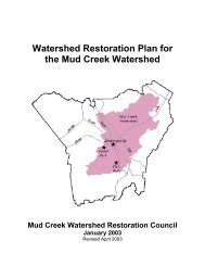
RESTORATION PLAN Glade Creek Stream Restoration Alleghany ...
RESTORATION PLAN Glade Creek Stream Restoration Alleghany ...
RESTORATION PLAN Glade Creek Stream Restoration Alleghany ...

Create successful ePaper yourself
Turn your PDF publications into a flip-book with our unique Google optimized e-Paper software.
5.0 Project Site Wetlands (existing conditions)5.1 Jurisdictional WetlandsWetlands on the site were evaluated based on the U.S. Army Corps of Engineers 1987 WetlandDelineation Manual. The presence or absence of three wetland parameters was documented (hydricsoils, hydrophytic vegetation and wetland hydrology), following the guidance set forth in the Manual.One jurisdictional wetland was delineated on <strong>Glade</strong> <strong>Creek</strong> and four jurisdictional wetlands weredelineated on the unnamed tributary to <strong>Glade</strong> <strong>Creek</strong> (see Figure 4 for map and Appendix 2 for forms).The areas of the individual wetlands are as follows:<strong>Glade</strong> <strong>Creek</strong> wetlands:Wetland 1-0.17 acresUnnamed Tributary wetlands:Wetland 1-0.009 acresWetland 2-0.034 acresWetland 3-0.033 acresWetland 4-0.087 acresTotal Wetland Area in Easement-0.33 acresThese wetland areas will not be disturbed, they will be preserved with the proposed project.5.2 Soil CharacterizationAs previously noted, the mapping of soils in <strong>Alleghany</strong> County is currently under revision. The 1973Soil Survey shows the area where the wetlands occur as Alluvial Land Wet, and does not include adetailed soil color description. However, based on field investigation and soil cores taken throughoutthe wetlands, the wetland soils present on the project site are Toxaway series soils (CumulicHumaquepts). This conclusion is based on soil color and texture. The typical horizon description forthe Toxaway series is 0-12 inches 10YR 3/1 loam, 12-25 inches 10YR 3/1 loam and 25-32 inches10YR 4/1 loam. From the wetland delineation soil descriptions, the hydric soils found onsite aretypically 7.5 YR or 10YR 2/1 sandy clay loams in the upper 18 inches of the profile, similar to theToxaway series.5.3 Plant Community CharacterizationThe wetland areas onsite are individually quite small, and the dominant woody vegetation occupyingthe wetlands is red maple. The herbaceous layer is often sparse, but where present, common rush(Juncus effusus) is dominant, along with various sedge species. These wetlands most closely resemblethe High Elevation Seep community (Schafale and Weakley, 1990).