Watershed Restoration Plan for the White Oak River Basin i
Watershed Restoration Plan for the White Oak River Basin i
Watershed Restoration Plan for the White Oak River Basin i

Create successful ePaper yourself
Turn your PDF publications into a flip-book with our unique Google optimized e-Paper software.
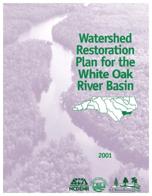
<strong>Watershed</strong> <strong>Restoration</strong> <strong>Plan</strong> <strong>for</strong> <strong>the</strong> <strong>White</strong> <strong>Oak</strong> <strong>River</strong> <strong>Basin</strong><br />
i
EXECUTIVE SUMMARY<br />
This document, prepared by <strong>the</strong> North Carolina Wetlands <strong>Restoration</strong> Program (NCWRP),<br />
presents a description of Targeted Local <strong>Watershed</strong>s within <strong>the</strong> <strong>White</strong> <strong>Oak</strong> <strong>River</strong> <strong>Basin</strong>. It is <strong>the</strong><br />
first update since <strong>the</strong> original <strong>Basin</strong>wide Wetlands and Riparian <strong>Restoration</strong> <strong>Plan</strong> <strong>for</strong> <strong>the</strong> <strong>White</strong><br />
<strong>Oak</strong> <strong>River</strong> <strong>Basin</strong> was released in 1998. This plan provides more detailed descriptions of <strong>the</strong><br />
areas of interest, <strong>the</strong> Targeted Local <strong>Watershed</strong>s, than <strong>the</strong> preceding document. NCWRP targets<br />
local watersheds based on <strong>the</strong>ir need and opportunity <strong>for</strong> stream, wetland and riparian buffer<br />
restoration. The NCWRP <strong>Watershed</strong> <strong>Restoration</strong> <strong>Plan</strong>s are developed <strong>for</strong> each of <strong>the</strong> 17 major<br />
river basins in <strong>the</strong> State, and <strong>the</strong>y are intended as companion documents to <strong>the</strong> N.C. Division of<br />
Water Quality’s <strong>Basin</strong>wide Water Quality <strong>Plan</strong>s -- both of <strong>the</strong>se documents are updated on a 5-<br />
year planning cycle <strong>for</strong> each of <strong>the</strong> river basins in North Carolina.<br />
The watershed approach infers that water quality improvements are likely to have more<br />
pronounced and longer lasting effects if assessments and restoration ef<strong>for</strong>ts are focused on <strong>the</strong><br />
local watershed level as opposed to discrete and isolated stream segments or wetland areas<br />
within <strong>the</strong> basin. The NCWRP hopes that o<strong>the</strong>r agencies, groups and local governments will use<br />
<strong>the</strong> in<strong>for</strong>mation in this document when identifying and locating water quality improvement<br />
projects. By coordinating project implementation in watersheds with significant restoration<br />
need, organizations with similar goals can generate a greater positive ecological impact on North<br />
Carolina’s aquatic resources.<br />
This document is complemented by <strong>the</strong> Guide to NCWRP’s <strong>Watershed</strong> <strong>Restoration</strong> <strong>Plan</strong>ning<br />
Strategy (Version 1), which provides general in<strong>for</strong>mation pertaining to program goals and plan<br />
methodology [available at <strong>the</strong> NCWRP website: http://h2o.enr.state.nc.us/wrp/]. In<strong>for</strong>mation<br />
relating to <strong>White</strong> <strong>Oak</strong> <strong>River</strong> <strong>Basin</strong> restoration goals and basin-specific resource assessments are<br />
contained within this <strong>Watershed</strong> <strong>Restoration</strong> <strong>Plan</strong>. In general, this document provides an<br />
overview of <strong>the</strong> <strong>White</strong> <strong>Oak</strong> <strong>River</strong> <strong>Basin</strong> and component Subbasins within which Targeted Local<br />
<strong>Watershed</strong>s have been selected. Then each Targeted Local <strong>Watershed</strong> is described and reasons<br />
<strong>for</strong> its selection are given.<br />
Section 2 provides an overview of <strong>the</strong> basin and includes a map of <strong>the</strong> <strong>White</strong> <strong>Oak</strong> <strong>River</strong><br />
<strong>Basin</strong> with county boundaries and major municipalities. Section 2 also contains habitat<br />
in<strong>for</strong>mation, permitted wetlands losses and Division of Water Quality Use Support Ratings.<br />
Section 3 outlines basin-specific restoration goals and provides a brief discussion of <strong>the</strong><br />
Targeted Local <strong>Watershed</strong> selection process. Figure 3.1 shows <strong>the</strong> <strong>White</strong> <strong>Oak</strong> <strong>River</strong> <strong>Basin</strong> with<br />
<strong>the</strong> 12 Targeted Local <strong>Watershed</strong>s highlighted. This section also provides in<strong>for</strong>mation regarding<br />
<strong>the</strong> stakeholder process that was a valuable part of <strong>the</strong> development of this plan, as public input<br />
was solicited and weighed heavily in <strong>the</strong> selection of Targeted Local <strong>Watershed</strong>s.<br />
The Targeted Local <strong>Watershed</strong>s are described in Section 4. Maps of each Targeted Local<br />
<strong>Watershed</strong> follow <strong>the</strong> text describing <strong>the</strong> watersheds within a given Subbasin. [Not all<br />
Subbasins will necessarily contain Targeted Local <strong>Watershed</strong>s.] NCWRP selected <strong>the</strong>se<br />
watersheds based on <strong>the</strong>ir need <strong>for</strong> water quality and habitat improvement, and on <strong>the</strong> merit of<br />
potential stream, riparian buffer, and wetlands restoration opportunities in that watershed.<br />
Section 5 contains contact in<strong>for</strong>mation <strong>for</strong> several water quality programs and initiatives<br />
taking place within <strong>the</strong> <strong>White</strong> <strong>Oak</strong> <strong>River</strong> <strong>Basin</strong>, organized by federal, state, and local programs.<br />
<strong>Watershed</strong> <strong>Restoration</strong> <strong>Plan</strong> <strong>for</strong> <strong>the</strong> <strong>White</strong> <strong>Oak</strong> <strong>River</strong> <strong>Basin</strong><br />
I
TABLE OF CONTENTS<br />
EXECUTIVE SUMMARY ............................................................................................................ I<br />
TABLE OF CONTENTS............................................................................................................. II<br />
LIST OF FIGURES ................................................................................................................... III<br />
LIST OF TABLES .....................................................................................................................IV<br />
SECTION 1: INTRODUCTION.................................................................................................. 1<br />
Purpose and Background of <strong>the</strong> NC Wetlands <strong>Restoration</strong> Program .............................. 1<br />
Purpose of <strong>Watershed</strong> <strong>Restoration</strong> <strong>Plan</strong>s .......................................................................... 1<br />
Application of Geographic In<strong>for</strong>mation Systems (GIS) ..................................................... 1<br />
SECTION 2: OVERVIEW OF THE WHITE OAK RIVER BASIN ............................................... 3<br />
Sensitive Species and Habitat In<strong>for</strong>mation ........................................................................ 5<br />
Wetland Communities .............................................................................................................5<br />
Wetland and Riparian Area Species In<strong>for</strong>mation ................................................................... 5<br />
Permitted Wetland and Stream Losses .............................................................................. 6<br />
Division of Water Quality Use Support Ratings ................................................................. 8<br />
Local Water Resource Management Initiatives................................................................ 10<br />
Unified <strong>Watershed</strong> Assessment ........................................................................................ 11<br />
SECTION 3: RESTORATION GOALS FOR THE WHITE OAK RIVER BASIN ...................... 13<br />
Public Input into <strong>the</strong> Targeted Local <strong>Watershed</strong> Selection Process .............................. 14<br />
SECTION 4: TARGETED LOCAL WATERSHEDS IN THE WHITE OAK RIVER BASIN BY<br />
SUBBASIN ............................................................................................................................. 16<br />
Subbasin 03-05-01.............................................................................................................. 16<br />
Targeted Local <strong>Watershed</strong>s in Subbasin 01.......................................................................... 18<br />
Subbasin 03-05-02.............................................................................................................. 24<br />
Targeted Local <strong>Watershed</strong>s in Subbasin 02.......................................................................... 26<br />
Subbasin 03-05-03.............................................................................................................. 31<br />
Targeted Local <strong>Watershed</strong>s in Subbasin 03.......................................................................... 33<br />
Subbasin 03-05-04.............................................................................................................. 37<br />
Targeted Local <strong>Watershed</strong>s in Subbasin 04.......................................................................... 39<br />
Important Local <strong>Watershed</strong>s Outside Targeted Local <strong>Watershed</strong>s ................................ 42<br />
Wetlands <strong>Restoration</strong> Program Local <strong>Watershed</strong> <strong>Plan</strong>ning Initiative............................. 42<br />
SECTION 5: CONTACT INFORMATION FOR THE WHITE OAK RIVER BASIN .................. 44<br />
REFERENCES CITED............................................................................................................. 48<br />
APPENDIX 1 - LIST OF TARGETED LOCAL WATERSHEDS ............................................... 49<br />
<strong>Watershed</strong> <strong>Restoration</strong> <strong>Plan</strong> <strong>for</strong> <strong>the</strong> <strong>White</strong> <strong>Oak</strong> <strong>River</strong> <strong>Basin</strong><br />
II
LIST OF FIGURES<br />
Figure 2.1 General Map of <strong>White</strong> <strong>Oak</strong> <strong>River</strong> <strong>Basin</strong> with Counties, Municipalities & Subbasins... 4<br />
Figure 2.2 Unified <strong>Watershed</strong> Assessment Categories <strong>for</strong> 8-Digit Hydrologic Units in North<br />
Carolina............................................................................................................................ 12<br />
Figure 3.1 Map of <strong>White</strong> <strong>Oak</strong> <strong>River</strong> <strong>Basin</strong>, Subbasins, and NCWRP Targeted Local <strong>Watershed</strong>s<br />
......................................................................................................................................... 15<br />
Figure 4.1: Map of Subbasin 01 with Targeted Local <strong>Watershed</strong>s and DWQ Use Support<br />
Ratings ............................................................................................................................. 17<br />
Figure 4.2 <strong>White</strong> <strong>Oak</strong> <strong>River</strong> Subbasin 01 -- Targeted Local <strong>Watershed</strong> 10010 -- Upper <strong>White</strong><br />
<strong>Oak</strong> <strong>River</strong> and Tributaries................................................................................................. 22<br />
Figure 4.3 <strong>White</strong> <strong>Oak</strong> <strong>River</strong> Subbasin 01-- Targeted Local <strong>Watershed</strong>s 20010, 20030, 20060 --<br />
Lower <strong>White</strong> <strong>Oak</strong> and Tributaries ..................................................................................... 23<br />
Figure 4.4 <strong>White</strong> <strong>Oak</strong> <strong>River</strong> Subbasin 02 with Targeted Local <strong>Watershed</strong>s & Use Support ...... 25<br />
Figure 4.5 <strong>White</strong> <strong>Oak</strong> <strong>River</strong> Subbasin 02 -- Targeted Local <strong>Watershed</strong>s 10010 and 10020 --<br />
Upper New <strong>River</strong> and Tributaries...................................................................................... 29<br />
Figure 4.6 <strong>White</strong> <strong>Oak</strong> <strong>River</strong> Subbasin 02 -- Targeted Local <strong>Watershed</strong>s 10040, 10050 and<br />
20010 -- New <strong>River</strong> at Jacksonville and Major Tributaries ................................................ 30<br />
Figure 4.7 <strong>White</strong> <strong>Oak</strong> <strong>River</strong> Subbasin 03 with Targeted Local <strong>Watershed</strong>s & Use Support ...... 32<br />
Figure 4.8 <strong>White</strong> <strong>Oak</strong> <strong>River</strong> Subbasin 03 -- Targeted Local <strong>Watershed</strong> 30030 -- Newport <strong>River</strong>,<br />
Black Creek & Mill Creek .................................................................................................. 35<br />
Figure 4.9 <strong>White</strong> <strong>Oak</strong> <strong>River</strong> Subbasin 03 -- Targeted Local <strong>Watershed</strong> 30060 -- Gales Creek &<br />
Jumping Run .................................................................................................................... 36<br />
Figure 4.10 <strong>White</strong> <strong>Oak</strong> <strong>River</strong> Subbasin 04 -- Targeted Local <strong>Watershed</strong>s & Use Support ........ 38<br />
Figure 4.11 <strong>White</strong> <strong>Oak</strong> <strong>River</strong> Subbasin 04 -- Targeted Local <strong>Watershed</strong> 40010 -- North <strong>River</strong> &<br />
Ward Creek ......................................................................................................................41<br />
<strong>Watershed</strong> <strong>Restoration</strong> <strong>Plan</strong> <strong>for</strong> <strong>the</strong> <strong>White</strong> <strong>Oak</strong> <strong>River</strong> <strong>Basin</strong><br />
III
LIST OF TABLES<br />
Table 2.1 Permitted Total Wetland Impacts (acres) in <strong>the</strong> <strong>White</strong> <strong>Oak</strong> <strong>River</strong> <strong>Basin</strong>, by DWQ<br />
Subbasin from 1995-2000. ................................................................................................. 7<br />
Table 2.2 Permitted Unmitigated Wetland Impacts (acres) in <strong>the</strong> <strong>White</strong> <strong>Oak</strong> <strong>River</strong> <strong>Basin</strong>, by<br />
DWQ Subbasin from 1995-2000: Projects less than 1 acre. ............................................... 7<br />
Table 2.3 Permitted Total Stream Impacts (linear feet) in <strong>the</strong> <strong>White</strong> <strong>Oak</strong> <strong>River</strong> <strong>Basin</strong> by DWQ<br />
Subbasin from 1997-2000. ................................................................................................. 7<br />
Table 2.4 Impaired Waters in <strong>the</strong> <strong>White</strong> <strong>Oak</strong> <strong>River</strong> <strong>Basin</strong> (DWQ, 2001). ................................... 9<br />
Table 4.1: Summary in<strong>for</strong>mation <strong>for</strong> Targeted Local <strong>Watershed</strong>s in <strong>White</strong> <strong>Oak</strong> <strong>River</strong> <strong>Basin</strong><br />
Subbasin 01 .....................................................................................................................21<br />
Table 4.2 Summary In<strong>for</strong>mation <strong>for</strong> Targeted Local <strong>Watershed</strong>s in <strong>White</strong> <strong>Oak</strong> <strong>River</strong> Subbasin 02<br />
......................................................................................................................................... 28<br />
Table 4.3 Summary In<strong>for</strong>mation <strong>for</strong> Targeted Local <strong>Watershed</strong>s in <strong>White</strong> <strong>Oak</strong> <strong>River</strong> Subbasin 03<br />
......................................................................................................................................... 34<br />
Table 4.4 Summary In<strong>for</strong>mation <strong>for</strong> Targeted Local <strong>Watershed</strong> in <strong>White</strong> <strong>Oak</strong> <strong>River</strong> Subbasin 04<br />
......................................................................................................................................... 40<br />
Table 5.1 Contacts <strong>for</strong> Federal water quality programs and initiatives in <strong>the</strong> <strong>White</strong> <strong>Oak</strong> <strong>River</strong><br />
<strong>Basin</strong>. ............................................................................................................................... 45<br />
Table 5.2 Contacts <strong>for</strong> State water quality programs and initiatives in <strong>the</strong> <strong>White</strong> <strong>Oak</strong> <strong>River</strong><br />
<strong>Basin</strong>. ............................................................................................................................... 46<br />
Table 5.3 Contacts <strong>for</strong> Local Water Quality Programs and Initiatives in <strong>the</strong> <strong>White</strong> <strong>Oak</strong> <strong>River</strong><br />
<strong>Basin</strong>. ............................................................................................................................... 47<br />
<strong>Watershed</strong> <strong>Restoration</strong> <strong>Plan</strong> <strong>for</strong> <strong>the</strong> <strong>White</strong> <strong>Oak</strong> <strong>River</strong> <strong>Basin</strong><br />
IV
SECTION 1: INTRODUCTION<br />
Purpose and Background of <strong>the</strong> NC Wetlands <strong>Restoration</strong> Program<br />
Recognizing <strong>the</strong> value of wetlands and riparian areas <strong>for</strong> maintaining water quality, storing<br />
floodwaters, providing fish and wildlife habitat, and per<strong>for</strong>ming o<strong>the</strong>r valuable functions, <strong>the</strong><br />
North Carolina General Assembly established <strong>the</strong> North Carolina Wetlands <strong>Restoration</strong> Program<br />
(NCWRP) in 1996. The purpose of <strong>the</strong> NCWRP is to restore, enhance, preserve and create<br />
wetlands, stream and riparian buffer areas throughout North Carolina’s seventeen major river<br />
basins (G.S. 143-214.9). The goals of <strong>the</strong> program are:<br />
• To protect and improve water quality by restoring wetland and stream functions and<br />
values lost through historic, current and future permitted impacts.<br />
• To achieve a net increase in wetlands acres, functions, and values in all of North<br />
Carolina’s major river basins.<br />
• To promote a comprehensive approach <strong>for</strong> protecting natural resources.<br />
• To provide a consistent approach to addressing wetland and stream mitigation<br />
requirements associated with wetland regulations, and to increase <strong>the</strong> ecological<br />
effectiveness of mitigation projects.<br />
Purpose of <strong>Watershed</strong> <strong>Restoration</strong> <strong>Plan</strong>s<br />
To accomplish <strong>the</strong> goals described above, <strong>the</strong> NCWRP develops <strong>Watershed</strong> <strong>Restoration</strong><br />
<strong>Plan</strong>s to focus planning and implementation of restoration activities within each of <strong>the</strong> 17 major<br />
river basins. These plans provide in<strong>for</strong>mation on areas in <strong>the</strong> state that <strong>the</strong> NCWRP has<br />
determined are a priority <strong>for</strong> restoration ef<strong>for</strong>ts. The NCWRP uses <strong>the</strong> <strong>Watershed</strong> <strong>Restoration</strong><br />
<strong>Plan</strong>s to target degraded wetland and riparian areas which, if restored, could contribute<br />
significantly to <strong>the</strong> goal of protecting and enhancing local watershed functions.<br />
The purpose of this document is to communicate to interested parties and individuals specific<br />
areas in <strong>the</strong> <strong>White</strong> <strong>Oak</strong> <strong>River</strong> <strong>Basin</strong> where <strong>the</strong> NCWRP will consider implementing restoration<br />
projects. This document also provides justification <strong>for</strong> those choices. It is intended to<br />
complement two o<strong>the</strong>r NC Division of Water Quality (DWQ) documents: 1) <strong>the</strong> <strong>White</strong> <strong>Oak</strong><br />
<strong>River</strong> <strong>Basin</strong>wide Water Quality <strong>Plan</strong> (2001), and 2) <strong>the</strong> Guide to <strong>the</strong> NCWRP’s <strong>Watershed</strong><br />
<strong>Restoration</strong> <strong>Plan</strong>ning Strategy (Version 1).<br />
One purpose <strong>for</strong> communicating <strong>the</strong> specific watersheds where <strong>the</strong> NCWRP intends to focus<br />
its projects is to encourage o<strong>the</strong>r groups and organizations to consider implementing projects in<br />
<strong>the</strong>se areas also. The NCWRP believes that multiple restoration projects concentrated within a<br />
local watershed will result in greater benefits to water quality and o<strong>the</strong>r important watershed<br />
functions.<br />
Application of Geographic In<strong>for</strong>mation Systems (GIS)<br />
In order to target areas of focus, <strong>the</strong> NCWRP relies heavily on geographic data. With a<br />
variety of habitat and water quality data available digitally, NCWRP staff can view a variety of<br />
in<strong>for</strong>mation about river basins, subbasins and local watersheds to evaluate watersheds <strong>for</strong><br />
<strong>Watershed</strong> <strong>Restoration</strong> <strong>Plan</strong> <strong>for</strong> <strong>the</strong> <strong>White</strong> <strong>Oak</strong> <strong>River</strong> <strong>Basin</strong> 1
estoration need and opportunity. The data used by NCWRP <strong>for</strong> this analysis include <strong>the</strong><br />
following: water quality data (use support ratings and surface water quality classifications);<br />
resource in<strong>for</strong>mation (location of streams, wetlands, important aquatic habitats, state and national<br />
<strong>for</strong>ests or wilderness areas, and significant natural heritage sites); and basic location references<br />
(such as municipalities, roads and county boundaries). In river basins which encompass coastal<br />
counties, <strong>the</strong> GIS data evaluation also includes a consideration of mapped areas identified by <strong>the</strong><br />
NC Division of Coastal Management [DCM] as containing potential wetland restoration sites.<br />
As a component of <strong>the</strong> <strong>Watershed</strong> <strong>Restoration</strong> <strong>Plan</strong>s, <strong>the</strong> NCWRP develops GIS-based maps<br />
to communicate NCWRP priority areas <strong>for</strong> restoration projects. Each restoration plan includes<br />
maps of <strong>the</strong> river basin, component subbasins, and Targeted Local <strong>Watershed</strong>s. To reduce<br />
printing costs, most of <strong>the</strong>se maps are black and white. However, color maps are provided<br />
through <strong>the</strong> NCWRP web site [http://h2o.enr.state.nc.us/wrp/] <strong>for</strong> anyone interested in<br />
referencing more thorough and detailed geographic in<strong>for</strong>mation on NCWRP targeted watersheds.<br />
To evaluate watershed conditions, <strong>the</strong> NCWRP assesses multiple data and in<strong>for</strong>mation<br />
sources describing <strong>the</strong> location and condition of natural resources. The in<strong>for</strong>mation described in<br />
Sections 2 through 4 was compiled from a number of existing sources including DWQ’s<br />
<strong>Basin</strong>wide Water Quality <strong>Plan</strong>s, DWQ's <strong>Basin</strong>wide Assessment Reports, <strong>the</strong> Natural Heritage<br />
Program’s Rare <strong>Plan</strong>t and Animal Lists, in<strong>for</strong>mation and recommendations received from local<br />
resource professionals and o<strong>the</strong>r interested parties in <strong>the</strong> basin, and <strong>the</strong> GIS data coverages noted<br />
above. A more detailed discussion of <strong>the</strong> types of in<strong>for</strong>mation evaluated by <strong>the</strong> NCWRP is<br />
included in Section 2 of <strong>the</strong> Guide to NCWRP's <strong>Watershed</strong> <strong>Restoration</strong> <strong>Plan</strong>ning Strategy.<br />
<strong>Watershed</strong> <strong>Restoration</strong> <strong>Plan</strong> <strong>for</strong> <strong>the</strong> <strong>White</strong> <strong>Oak</strong> <strong>River</strong> <strong>Basin</strong> 2
SECTION 2: OVERVIEW OF THE WHITE OAK RIVER BASIN<br />
The <strong>White</strong> <strong>Oak</strong> <strong>River</strong> <strong>Basin</strong> covers much of Onslow and Carteret Counties as well as<br />
small portions of Craven and Jones Counties. The basin encompasses a 1,264-square mile<br />
watershed area which includes <strong>the</strong> drainages of four separate river systems: <strong>the</strong> New <strong>River</strong> and<br />
its tributaries in <strong>the</strong> southwestern section; <strong>the</strong> <strong>White</strong> <strong>Oak</strong> <strong>River</strong> and its tributaries; <strong>the</strong> Newport<br />
<strong>River</strong> and its tributaries; and <strong>the</strong> North <strong>River</strong> in <strong>the</strong> eastern section. The basin also includes<br />
Bogue and Core Sounds. Large portions of <strong>the</strong> basin are publicly owned areas such as <strong>the</strong><br />
Croatan National Forest adjacent to <strong>the</strong> <strong>White</strong> <strong>Oak</strong> <strong>River</strong>, Hoffman State Forest, and Camp<br />
Lejeune Military Reservation on <strong>the</strong> New <strong>River</strong>.<br />
The 1990 population <strong>for</strong> <strong>the</strong> <strong>White</strong> <strong>Oak</strong> basin was approximately 150,000, with over 75%<br />
of this total residing in Onslow County. Jacksonville [in Subbasin 02] is by far <strong>the</strong> most<br />
populous and fastest growing of <strong>the</strong> 16 municipalities located in <strong>the</strong> basin, with a current<br />
population of over 66,000. O<strong>the</strong>r municipalities in <strong>the</strong> <strong>White</strong> <strong>Oak</strong> basin -- with populations<br />
between 3,000 and 8,000 -- are Beau<strong>for</strong>t, Emerald Isle, Morehead City, and Newport. The 1990<br />
population density in <strong>the</strong> basin was 141 persons per square mile, exclusive of Subbasin 05 which<br />
is sparsely populated National Seashore lands. The most densely populated areas of <strong>the</strong> <strong>Basin</strong><br />
are Jacksonville and Camp Lejeune on <strong>the</strong> New <strong>River</strong>, and Morehead City and Beau<strong>for</strong>t on<br />
Bogue Sound and <strong>the</strong> Newport <strong>River</strong>]. The basin is expected to see a 26% increase in population<br />
from 1998 to 2015 [DWQ, 2001.<br />
The NC Division of Water Quality [DWQ] subdivides each of <strong>the</strong> 17 major river basins<br />
in <strong>the</strong> state into component subbasins, which are designated with 6-digit codes. The <strong>White</strong> <strong>Oak</strong><br />
<strong>River</strong> <strong>Basin</strong> consists of 5 such subbasins, designated 03-05-01 [Subbasin 01] to 03-05-05<br />
[Subbasin 05]. The basin includes 417 miles of streams, over 130,000 acres of estuarine waters<br />
[including over 60,000 acres of Outstanding Resource Waters in Bogue and Core Sounds], and<br />
91 miles of Atlantic Coastline [DWQ, 2001].<br />
Figure 2.1 presents a general map of <strong>the</strong> <strong>White</strong> <strong>Oak</strong> <strong>River</strong> <strong>Basin</strong> with major rivers,<br />
municipalities, county boundaries, and subbasin boundaries depicted.<br />
.<br />
<strong>Watershed</strong> <strong>Restoration</strong> <strong>Plan</strong> <strong>for</strong> <strong>the</strong> <strong>White</strong> <strong>Oak</strong> <strong>River</strong> <strong>Basin</strong> 3
Figure 2.1 General Map of <strong>White</strong> <strong>Oak</strong> <strong>River</strong> <strong>Basin</strong> with Counties, Municipalities & Subbasins<br />
<strong>Watershed</strong> <strong>Restoration</strong> <strong>Plan</strong> <strong>for</strong> <strong>the</strong> <strong>White</strong> <strong>Oak</strong> <strong>River</strong> <strong>Basin</strong> 4
Sensitive Species and Habitat In<strong>for</strong>mation<br />
Wetland Communities<br />
The <strong>White</strong> <strong>Oak</strong> <strong>River</strong> <strong>Basin</strong> is within <strong>the</strong> Outer Coastal Plain physiographic province of<br />
<strong>the</strong> state. The basin contains numerous estuarine wetland communities, including Salt Marsh,<br />
Brackish Marsh and Estuarine Fringe Loblolly Pine Forest. The basin also contains high-quality<br />
examples of Tidal Freshwater Marsh and Pine Savanna wetland types.<br />
The basin is noted <strong>for</strong> its extensive pocosin wetlands (Natural Heritage Program, 1998),<br />
including many thousands of acres in Croatan National Forest and Hoffman State Forest,<br />
including <strong>the</strong> Catfish Lake and Great Lake Wilderness areas. Pocosins are typically located along<br />
interstream divides and are marked by dense thickets of shrubs and vines, and by thick peaty<br />
soils. In some areas of <strong>the</strong> <strong>White</strong> <strong>Oak</strong> basin <strong>the</strong>y occur as bay <strong>for</strong>ests [or "tall pocosins"]<br />
dominated by pond pine. Pocosins constitute important wildlife habitat <strong>for</strong> species such as black<br />
bear, bobcat, pine warbler, gray fox, deer, and a variety of snakes and amphibians (NC DEHNR,<br />
1996).<br />
Wetland and Riparian Area Species In<strong>for</strong>mation<br />
The <strong>White</strong> <strong>Oak</strong> <strong>River</strong> <strong>Basin</strong> contains many rare animal and plant species that are<br />
dependent on wetlands or open water <strong>for</strong> <strong>the</strong>ir existence. In Onslow and Carteret Counties, which<br />
comprise <strong>the</strong> bulk of <strong>the</strong> <strong>White</strong> <strong>Oak</strong> basin, <strong>the</strong>re are a total of 26 federally or state-listed<br />
endangered or threatened species [plant and animal] that have documented sightings within <strong>the</strong><br />
past 20 years. Listed animal species include <strong>the</strong> Manatee, Eastern Woodrat, American Alligator,<br />
Loggerhead, Green Turtle, Bald Eagle, Peregrine Falcon, Red-cockaded Woodpecker, and Piping<br />
Plover (Natural Heritage Program, 2001). The <strong>White</strong> <strong>Oak</strong> <strong>River</strong> <strong>Basin</strong> has more than 60 rare<br />
plant species, many of which grow in <strong>the</strong> wet soils of Savannas and Pocosins and are indirectly<br />
affected by water quality and quantity (Natural Heritage Program, 1998). Listed plant species in<br />
<strong>the</strong> basin that are associated with aquatic and/or wetland habitats include <strong>the</strong> Seabeach Amaranth,<br />
Rough-leaf Loosestrife, Carolina Goldenrod, Dwarf Bladderwort, Cooley’s Meadowrue, and<br />
Golden Sedge (Natural Heritage Program, 2001).<br />
In addition to federally or state-listed endangered and threatened species, 13 statedesignated<br />
"Special Concern" species -- which have legal protection status in North Carolina --<br />
have been documented in Onslow and Carteret Counties in <strong>the</strong> past 20 years. These include <strong>the</strong><br />
following: Bachman’s Sparrow; Black Skimmer; Little Blue Heron; Snowy Egret; Carolina<br />
Diamondback Terrapin; Mimic Glass Lizard; Carolina Gopher Frog; and <strong>the</strong> Venus Flytrap<br />
(Natural Heritage Program, 2001). Many of <strong>the</strong>se Special Concern species are at least partially<br />
dependent upon aquatic, riparian, or wetland habitats <strong>for</strong> <strong>the</strong>ir existence. A detailed listing of <strong>the</strong><br />
state’s rare animal and plant species can be found in <strong>the</strong> “Natural Heritage Program List of Rare<br />
Animal Species of North Carolina” or <strong>the</strong> “Natural Heritage Program List of <strong>the</strong> Rare <strong>Plan</strong>t<br />
Species of North Carolina”, which are published every two years. More in<strong>for</strong>mation about rare,<br />
threatened, and endangered species in <strong>the</strong> <strong>White</strong> <strong>Oak</strong> <strong>River</strong> <strong>Basin</strong>, and <strong>the</strong>ir preferred habitat or<br />
plant community types, can be found at <strong>the</strong> N.C. Natural Heritage Program's web site<br />
[http://ils.unc.edu/parkproject/nhp/index.html].<br />
Over 80 fish species have been identified in <strong>the</strong> <strong>White</strong> <strong>Oak</strong> <strong>River</strong> <strong>Basin</strong>, including a<br />
variety with recreational and commercial importance. Many anadromous species which support<br />
<strong>Watershed</strong> <strong>Restoration</strong> <strong>Plan</strong> <strong>for</strong> <strong>the</strong> <strong>White</strong> <strong>Oak</strong> <strong>River</strong> <strong>Basin</strong> 5
ecreational and commercial interests rely on access to upstream portions of <strong>the</strong> <strong>White</strong> <strong>Oak</strong> <strong>River</strong><br />
and tributaries <strong>for</strong> spawning during <strong>the</strong> spring (Wildlife Resources Commission, 1998).<br />
Permitted Wetland and Stream Losses<br />
The Division of Water Quality regulates activities involving streams and wetlands to ensure<br />
that construction projects cause minimal damage to <strong>the</strong>se resources and that unavoidable impacts<br />
are addressed through mitigation projects. One important role of <strong>the</strong> NCWRP is to provide<br />
compensation <strong>for</strong> permitted impacts to wetlands and streams that fall below <strong>the</strong> regulatory<br />
threshold of less than one acre <strong>for</strong> wetlands and less than 150 feet <strong>for</strong> streams. The NCWRP uses<br />
<strong>the</strong> permitting database maintained by <strong>the</strong> Wetlands/401 Certification Unit of <strong>the</strong> Division of<br />
Water Quality to evaluate where <strong>the</strong> permitted impacts to wetlands and streams across <strong>the</strong> river<br />
basin are <strong>the</strong> greatest and where NCWRP projects are needed to offset unmitigated impacts.<br />
Tables 2.1, 2.2, and 2.3 below present a summary of permitted wetland and stream impacts in<br />
<strong>the</strong> <strong>White</strong> <strong>Oak</strong> <strong>River</strong> <strong>Basin</strong> <strong>for</strong> 1995 to 2001, broken down by subbasins. Permitted wetland<br />
impacts total 447 acres over this time period, with projects in Subbasin 02 accounting <strong>for</strong> 54% of<br />
this total. Permitted but unmitigated [less than 1 acre] impacts to wetlands total 52 acres over <strong>the</strong><br />
same time period, with Subbasins 01, 02, and 03 accounting <strong>for</strong> over 90% of <strong>the</strong>se smaller, but<br />
cumulatively important permitted impacts. Unmitigated [less than 1 acre] wetland impacts in <strong>the</strong><br />
<strong>Basin</strong> cumulatively represent 12% of <strong>the</strong> total permitted impacts to wetlands in <strong>the</strong> <strong>Basin</strong>.<br />
Stream impacts from 1997 to 2001 total nearly 6,500 linear feet, with 98% occurring in Subbasin<br />
02. Unmitigated stream impacts [<strong>for</strong> projects less than 150 linear feet] over this time period<br />
amount to only 120 feet of this total [all in Subbasin 02].<br />
These numbers suggest that <strong>the</strong> greatest development, road-building, and general landclearing<br />
activities in <strong>the</strong> <strong>White</strong> <strong>Oak</strong> basin have occurred in <strong>the</strong> westernmost portions of <strong>the</strong> basin,<br />
including new subdivisions and encroaching urbanization in and around Jacksonville, Richlands,<br />
Swansboro, Newport, and Morehead City. This is where <strong>the</strong> greatest loss of aquatic habitat and<br />
water quality impacts would be predicted to occur, although relatively undeveloped headwater<br />
reaches of <strong>the</strong> New [subbasin 02], <strong>White</strong> <strong>Oak</strong> [subbasin 01], and Newport <strong>River</strong>s [subbasin 03]<br />
also show evidence of stream and riparian habitat degradation from land-clearing activities<br />
[agriculture and logging] according to <strong>the</strong> draft 2001 DWQ <strong>Basin</strong>wide Water Quality <strong>Plan</strong> <strong>for</strong> <strong>the</strong><br />
<strong>White</strong> <strong>Oak</strong> (and recent field visits to some of <strong>the</strong>se headwater areas).<br />
<strong>Watershed</strong> <strong>Restoration</strong> <strong>Plan</strong> <strong>for</strong> <strong>the</strong> <strong>White</strong> <strong>Oak</strong> <strong>River</strong> <strong>Basin</strong> 6
Table 2.1 Permitted Total Wetland Impacts (acres) in <strong>the</strong> <strong>White</strong> <strong>Oak</strong> <strong>River</strong> <strong>Basin</strong>, by DWQ<br />
Subbasin from 1995-2000.<br />
DWQ Subbasins<br />
(Counties in Subbasin)<br />
Subbasin 01 [Onslow, Jones,<br />
Carteret, Craven]<br />
1995 1996 1997 1998 1999 2000 2001<br />
[as of<br />
7/01]<br />
Subbasin<br />
Total<br />
35.2 10.9 1.31 45.2 1.16 0.99 0 94.8<br />
Subbasin 02 [Onslow] 86.5 88.6 43.6 13 7.2 3.9 0.28 243.1<br />
Subbasin 03 [Carteret] 6.96 8.95 30.4 2.8 38 4.92 5.16 97.1<br />
Subbasin 04 [Carteret] 1 3.64 5.3 0.72 0.01 0.48 0.47 11.6<br />
Subbasin 05 [Carteret] 0 0 0 0.05 0 0 0 0.05<br />
TOTAL ACRES 129.7 112.1 80.6 61.8 46.4 10.3 5.91 446.7<br />
Table 2.2 Permitted Unmitigated Wetland Impacts (acres) in <strong>the</strong> <strong>White</strong> <strong>Oak</strong> <strong>River</strong> <strong>Basin</strong>, by<br />
DWQ Subbasin from 1995-2000: Projects less than 1 acre.<br />
DWQ Subbasins<br />
(Counties in Subbasin)<br />
Subbasin 01 [Onslow, Jones,<br />
Carteret, Craven]<br />
1995 1996 1997 1998 1999 2000 2001<br />
[as of<br />
7/01]<br />
Subbasin<br />
Total<br />
1.09 9.39 1.31 1.25 1.16 0.99 0 15.19<br />
Subbasin 02 [Onslow] 4.77 0.87 10.24 0.71 1.29 2.24 0.28 20.4<br />
Subbasin 03 [Carteret] 2.05 3.54 2.97 1.77 0.35 1.99 0.66 13.33<br />
Subbasin 04 [Carteret] 1 0.32 0.25 0.72 0.01 0.48 0.47 3.25<br />
Subbasin 05 [Carteret] 0 0 0 0.05 0 0 0 0.05<br />
TOTAL ACRES 8.91 14.12 14.77 4.5 2.81 5.7 1.41 52.22<br />
Table 2.3 Permitted Total Stream Impacts (linear feet) in <strong>the</strong> <strong>White</strong> <strong>Oak</strong> <strong>River</strong> <strong>Basin</strong> by<br />
DWQ Subbasin from 1997-2000.<br />
DWQ Subbasins (Counties in Subbasin) 1997 1998 1999 2000 2001<br />
Subbasin 01 [Onslow, Jones, Carteret,<br />
Craven]<br />
[as of<br />
7/01]<br />
Subbasin<br />
Totals<br />
0 0 0 0 0 0<br />
Subbasin 02 [Onslow] 0 910 2149 3250 0 6309<br />
Subbasin 03 [Carteret] 0 0 0 160 0 160<br />
Subbasin 04 [Carteret] 0 0 0 0 0 0<br />
Subbasin 05 [Carteret] 0 0 0 0 0 0<br />
TOTAL LINEAR FEET 0 910 2149 3410 0 6469<br />
<strong>Watershed</strong> <strong>Restoration</strong> <strong>Plan</strong> <strong>for</strong> <strong>the</strong> <strong>White</strong> <strong>Oak</strong> <strong>River</strong> <strong>Basin</strong> 7
Division of Water Quality Use Support Ratings<br />
Waters are classified according to <strong>the</strong>ir best intended uses. Use support categories that are<br />
applied to stream and estuarine waters of <strong>the</strong> <strong>White</strong> <strong>Oak</strong> basin include: aquatic life & secondary<br />
recreation; fish consumption; primary recreation; and shellfish harvesting. [As <strong>the</strong>re are no<br />
surface waters in this basin utilized as public water supplies, <strong>the</strong> WS classification <strong>for</strong> water<br />
supply watersheds does not apply within this river basin.] Determining how well a water body<br />
supports its designated uses is an important method of interpreting water quality data and<br />
assessing a given stream or river’s overall aquatic health and use impairment. The NCWRP uses<br />
<strong>the</strong> use support assessments as criteria in determining restoration need within a local watershed.<br />
A water body that is designated as "partially supporting" or "not supporting" its designated uses<br />
indicates that water quality impairment and/or habitat degradation has occurred; <strong>the</strong>re<strong>for</strong>e,<br />
wetland and/or stream restoration initiatives within that local watershed could be beneficial to<br />
water quality. If nonpoint source pollution issues are indicated as factors contributing to local<br />
water quality impairment, <strong>the</strong> NCWRP may consider it as a water body in need of restoration.<br />
Waters lacking sufficient biological assessment or chemical water quality monitoring data<br />
and/or having inconclusive data [e.g., swamp waters naturally low in dissolved oxygen content<br />
and pH values] are assigned a "Not Rated" [NR] rating. A more detailed discussion of <strong>the</strong><br />
Division of Water Quality’s Surface Water Classifications and <strong>the</strong> Use Support Rating System can<br />
be found in Sections 3.2 through 3.5 of <strong>the</strong> <strong>Basin</strong>wide Water Quality <strong>Plan</strong> <strong>for</strong> <strong>the</strong> <strong>White</strong> <strong>Oak</strong><br />
<strong>River</strong> [DWQ, 2001], which can be downloaded from <strong>the</strong> Division of Water Quality website at<br />
http://h2o.enr.state.nc.us/basinwide/index.html or is available from <strong>the</strong> Division of Water Quality at (919)<br />
733-5083 ext. 354.<br />
Current use support ratings <strong>for</strong> <strong>the</strong> <strong>White</strong> <strong>Oak</strong> <strong>Basin</strong> are summarized here <strong>for</strong> each of <strong>the</strong> four<br />
applicable use support categories:<br />
Aquatic Life & Secondary Recreation (applies to all waters): no impaired streams or<br />
estuarine waters in this use support category during this planning cycle; 17% of stream miles [72<br />
miles] fully supporting; 83% of stream miles [345 miles] not rated; 91% of estuarine waters<br />
[119,437 acres] fully supporting; 9% of estuarine waters [11,779 acres] not rated.<br />
Fish Consumption (applies to all waters): due to a statewide advisory limiting<br />
consumption of bowfin [due to elevated mercury concentrations], all waters are considered<br />
partially supporting <strong>for</strong> this use support category; however, only 31 stream miles in <strong>the</strong> basin are<br />
considered monitored <strong>for</strong> this category [actual fish tissue analyses], which represents less than 8%<br />
of <strong>the</strong> total freshwater stream miles in <strong>the</strong> basin.<br />
Primary Recreation (applies to class B, SB and SA waters): no impaired streams,<br />
estuarine waters, or coastal miles in this use support category [36 stream miles; 118,132 estuarine<br />
acres; 91 coastal miles]; 100% of applicable stream miles are not rated; 80% of estuarine acres are<br />
fully supporting [20% not rated]; 100% of coastal miles are fully supporting.<br />
Shellfish Harvesting (applies to class SA waters): of <strong>the</strong> approximately 118,000 acres<br />
total of estuarine waters classified <strong>for</strong> shellfish harvesting in <strong>the</strong> basin, 76% are fully supporting<br />
and 24% [approximately 28,000 acres] are impaired -- 16% partially supporting; 8% not<br />
supporting.<br />
<strong>Watershed</strong> <strong>Restoration</strong> <strong>Plan</strong> <strong>for</strong> <strong>the</strong> <strong>White</strong> <strong>Oak</strong> <strong>River</strong> <strong>Basin</strong> 8
Color maps depicting current use support ratings in individual subbasins of <strong>the</strong> <strong>White</strong> <strong>Oak</strong><br />
<strong>River</strong> <strong>Basin</strong> are presented in Section 4. These maps focus on <strong>the</strong> use support ratings <strong>for</strong><br />
shellfishing waters [class SA] and aquatic life/secondary recreation [class C] streams, essentially<br />
depicting worst-case use support impairment within streams and estuarine waters of <strong>the</strong> basin. In<br />
<strong>the</strong> <strong>White</strong> <strong>Oak</strong> <strong>Basin</strong> most of <strong>the</strong> impairment is in <strong>the</strong> Shellfish Harvesting use support category.<br />
Table 2.4 below summarizes <strong>the</strong> impaired estuarine waters [class SA - Shellfish Harvesting]<br />
in <strong>the</strong> <strong>White</strong> <strong>Oak</strong> <strong>River</strong> <strong>Basin</strong> <strong>for</strong> each of <strong>the</strong> five subbasins. Also noted are "o<strong>the</strong>r issue" waters<br />
identified by <strong>the</strong> Division of Water Quality in <strong>the</strong> 2001 <strong>White</strong> <strong>Oak</strong> <strong>River</strong> <strong>Basin</strong>wide Water<br />
Quality <strong>Plan</strong>. These "o<strong>the</strong>r issue" waters, despite being not rated or rated fully supporting <strong>for</strong><br />
aquatic life & secondary recreation [AL/SR], show evidence of nutrient loading and habitat<br />
degradation from new subdivisions, road building, wetlands ditching/draining, and poor posthurricane<br />
de-snagging operations [DWQ, 2001]. The term habitat degradation refers to a notable<br />
decline in <strong>the</strong> quality of instream and riparian habitat due to sedimentation, bank erosion,<br />
streambed scour, lack of riparian vegetation, loss of pools or riffles, and loss of woody habitat<br />
[DWQ, 2001].<br />
Table 2.4 Impaired Waters in <strong>the</strong> <strong>White</strong> <strong>Oak</strong> <strong>River</strong> <strong>Basin</strong> (DWQ, 2001).<br />
Subbasin Listed Waters Use Support<br />
Rating<br />
Potential Sources of Impairment<br />
03-05-01 - 6,631 acres total, including Bear Creek,<br />
Queens Creek & tribs., <strong>White</strong> <strong>Oak</strong> <strong>River</strong> &<br />
tribs., and <strong>the</strong> ICWW<br />
NS and PS<br />
- fecal coli<strong>for</strong>m bacteria in runoff from<br />
subdivisions, septic systems, <strong>for</strong>est clearing,<br />
agriculture, and wildlife<br />
- upper <strong>White</strong> <strong>Oak</strong> <strong>River</strong><br />
03-05-02 - 2,431 acres total, including Stones Bay and<br />
New <strong>River</strong> tribs., Fullards Crk, Rogers Bay,<br />
Chadwick Bay, Alligator Bay, Salliers Bay,<br />
Gillets Crk, Freemans Crk and <strong>the</strong> ICWW<br />
FS [AL/SR]<br />
NS and PS<br />
- nutrient loading, channelization, habitat<br />
removal/degradation [nonpoint]<br />
- fecal coli<strong>for</strong>m bacteria in runoff from<br />
subdivisions, septic systems, <strong>for</strong>est clearing,<br />
agriculture, and wildlife<br />
- upper New <strong>River</strong><br />
03-05-03 - 7,463 acres total, including portions of<br />
Bogue Sound and tribs. [Spooner Crk, Broad<br />
Crk, Money Island Bay]; Newport <strong>River</strong> and<br />
adjacent bays & tribs. [Harlowe Crk, Core<br />
Crk, Crab Pt. Bay]<br />
- upper Newport <strong>River</strong><br />
03-05-04 - 11,535 acres total, including North <strong>River</strong> &<br />
adjacent bays, tribs. [Ward Crk, Goose Crk,<br />
The Straits, Newby Crk, Davis Bay]; Western<br />
bays, tribs., and adjacent areas of Core<br />
Sound [Jarrett Bay, Nelson Bay, Oyster Crk]<br />
PS [fish<br />
consumpt.]<br />
NS and PS<br />
NR [AL/SR]<br />
NS and PS<br />
- nutrient loading, channelization, habitat<br />
removal/degradation [nonpoint]<br />
- fecal coli<strong>for</strong>m bacteria in runoff from<br />
subdivisions, septic systems, urban areas,<br />
<strong>for</strong>est clearing, agriculture, and wildlife<br />
- nutrient loading, channelization, habitat<br />
removal/degradation [nonpoint]<br />
- fecal coli<strong>for</strong>m bacteria in runoff from<br />
subdivisions, septic systems, urban areas,<br />
<strong>for</strong>est clearing, agriculture, and wildlife<br />
- upper North <strong>River</strong><br />
- nutrient loading, channelization, habitat<br />
FS [AL/SR]<br />
removal/degradation [nonpoint]<br />
03-05-05 - No impaired waters N/A - N/A<br />
Section 303(d) of <strong>the</strong> federal Clean Water Act requires states to develop a list of waters not<br />
meeting water quality standards and to submit this list to <strong>the</strong> U.S. Environmental Protection<br />
<strong>Watershed</strong> <strong>Restoration</strong> <strong>Plan</strong> <strong>for</strong> <strong>the</strong> <strong>White</strong> <strong>Oak</strong> <strong>River</strong> <strong>Basin</strong> 9
Agency biennially. Waters are placed on North Carolina’s 303(d) List primarily due to a partially<br />
or not supporting use support rating. Addressing water quality impairment in waters that are on<br />
<strong>the</strong> state’s 303(d) List is a priority <strong>for</strong> <strong>the</strong> state. The NCWRP considers <strong>the</strong> 303(d) List in<br />
selecting watersheds <strong>for</strong> restoration ef<strong>for</strong>ts. Many of <strong>the</strong> waters listed in Table 2.4 above will be<br />
added to <strong>the</strong> state’s 303(d) list of impaired waters in 2002 [DWQ, 2001].<br />
Local Water Resource Management Initiatives<br />
The <strong>White</strong> <strong>Oak</strong> <strong>River</strong> <strong>Basin</strong> encompasses all or portions of four counties and 16<br />
municipalities, all of which fall within <strong>the</strong> Region P Council of Governments planning<br />
jurisdiction. As <strong>the</strong> population in <strong>the</strong> <strong>White</strong> <strong>Oak</strong> <strong>River</strong> basin is projected to increase by 40,000<br />
people over <strong>the</strong> next 15 years, with most of this growth occurring on <strong>the</strong> coast and around existing<br />
urban areas, <strong>the</strong>re is an obvious need <strong>for</strong> environmental planning ef<strong>for</strong>ts at <strong>the</strong> local government<br />
level -- especially in <strong>the</strong> areas of land use planning, storm water management, and general water<br />
quality protection. A concise discussion of state and local planning considerations pertinent to <strong>the</strong><br />
<strong>White</strong> <strong>Oak</strong> basin is presented in Section 4.3 of <strong>the</strong> 2001 <strong>Basin</strong>wide Water Quality <strong>Plan</strong> [DWQ,<br />
2001].<br />
Proactive planning ef<strong>for</strong>ts from county and municipal governments in <strong>the</strong> basin -- <strong>for</strong><br />
instance, developing ordinances designed to limit impervious surfaces and preserve intact riparian<br />
buffer zones and wetlands -- are needed to ensure that new development is done in a manner that<br />
maintains water quality. The NC Coastal Area Management Act [CAMA] requires <strong>the</strong><br />
development and periodic updating of local land use plans in <strong>the</strong> 20 coastal counties, including<br />
three of <strong>the</strong> four counties encompassed by <strong>the</strong> <strong>White</strong> <strong>Oak</strong> basin [Carteret, Craven, Onslow]. The<br />
NC Division of Coastal Management [DCM] provides oversight, review, and approval of <strong>the</strong><br />
local land use planning process. A detailed review of <strong>the</strong> current status of local land use planning<br />
ef<strong>for</strong>ts in <strong>the</strong> <strong>White</strong> <strong>Oak</strong> basin is beyond <strong>the</strong> scope of this document. Fur<strong>the</strong>r in<strong>for</strong>mation on<br />
coastal land use planning under <strong>the</strong> CAMA rules is available through <strong>the</strong> DCM website at<br />
http://dcm2.enr.state.nc.us/.<br />
The NCWRP will begin implementing in 2001 a Local <strong>Watershed</strong> <strong>Plan</strong>ning initiative in a<br />
cluster of local watersheds [NRCS 14-digit hydrologic units] within subbasin 02 of <strong>the</strong> <strong>White</strong> <strong>Oak</strong><br />
<strong>River</strong> <strong>Basin</strong>. This process will entail <strong>the</strong> development of a comprehensive package of<br />
recommendations <strong>for</strong> water quality improvement within several local watersheds comprising <strong>the</strong><br />
drainage area <strong>for</strong> <strong>the</strong> upper New <strong>River</strong>, extending upstream from Jacksonville to <strong>the</strong> Richlands<br />
area. Local watershed protection tools include stream and wetland restoration projects, land use<br />
controls, open space planning, and stormwater best management practices (BMPs).<br />
Coincidentally, Onslow County and several municipalities in <strong>the</strong> county, including Jacksonville,<br />
are presently considering <strong>the</strong> adoption of an "Intelligent Development" planning strategy to<br />
control urban sprawl and preserve open space and greenways more effectively [Hargett, personal<br />
communication, 2001]. For fur<strong>the</strong>r in<strong>for</strong>mation on <strong>the</strong> NCWRP Local <strong>Watershed</strong> <strong>Plan</strong>ning initiative in<br />
<strong>the</strong> <strong>White</strong> <strong>Oak</strong> basin, see Section 4 of this plan ["Targeted Local <strong>Watershed</strong>s by Subbasin"], Subbasin 02.<br />
Jacksonville and Onslow County will fall under <strong>the</strong> EPA NPDES Phase II storm water<br />
permitting program, which requires <strong>the</strong> development of a strategy <strong>for</strong> implementing storm water<br />
Best Management Practices [BMPs] in six program areas. For additional in<strong>for</strong>mation regarding<br />
<strong>the</strong> Phase II stormwater program requirements in North Carolina, go to<br />
http://h2o.enr.state.nc.us/su/stormwater.html.<br />
<strong>Watershed</strong> <strong>Restoration</strong> <strong>Plan</strong> <strong>for</strong> <strong>the</strong> <strong>White</strong> <strong>Oak</strong> <strong>River</strong> <strong>Basin</strong> 10
Unified <strong>Watershed</strong> Assessment<br />
In September of 1998 <strong>the</strong> NC Division of Water Quality and <strong>the</strong> USDA-Natural Resource<br />
Conservation Service evaluated all 8-digit cataloging units [CUs] in <strong>the</strong> state using <strong>the</strong> US<br />
Environmental Protection Agency’s (EPA) Framework <strong>for</strong> <strong>the</strong> Unified <strong>Watershed</strong> Assessment to<br />
determine priority areas <strong>for</strong> water quality restoration. The assessment assigned one of four<br />
categories to each 8-digit CU in <strong>the</strong> state:<br />
• Category I: <strong>Watershed</strong>s in Need of <strong>Restoration</strong>. These watersheds do not now meet, or<br />
face imminent threat of not meeting, clean water and o<strong>the</strong>r natural resource goals.<br />
• Category II: <strong>Watershed</strong>s Meeting Goals, Including Those Needing Action to Sustain<br />
Water Quality. These watersheds meet clean water and o<strong>the</strong>r natural resource goals and<br />
standards and support healthy aquatic systems.<br />
• Category III: <strong>Watershed</strong>s with Pristine or Sensitive Aquatic System Conditions on Lands<br />
Administered by Federal, State, and Tribal Governments.<br />
• Category IV: <strong>Watershed</strong>s With Insufficient Data to Make an Assessment.<br />
As shown in Figure 2.2, <strong>the</strong> Unified <strong>Watershed</strong> Assessment process identified two 8-digit<br />
CUs, toge<strong>the</strong>r encompassing <strong>the</strong> entire <strong>White</strong> <strong>Oak</strong> <strong>River</strong> basin, as Category I priority areas <strong>for</strong><br />
restoration: Cataloging Units 03020106 and 03030001. Unified <strong>Watershed</strong> Assessment<br />
Category I watersheds receive priority <strong>for</strong> EPA Section 319 Incremental Grant funds. The<br />
NCWRP is committed to working with o<strong>the</strong>r agencies and programs to leverage Section 319<br />
resources in <strong>the</strong> Unified <strong>Watershed</strong> Assessment high-priority areas. In some cases, <strong>the</strong><br />
NCWRP can provide matching funds <strong>for</strong> projects located in NCWRP Targeted Local<br />
<strong>Watershed</strong>s. In<strong>for</strong>mation on <strong>the</strong> NC 319 Grant Program is available online at<br />
http://h2o.enr.state.nc.us/nps/bigpic.htm.<br />
<strong>Watershed</strong> <strong>Restoration</strong> <strong>Plan</strong> <strong>for</strong> <strong>the</strong> <strong>White</strong> <strong>Oak</strong> <strong>River</strong> <strong>Basin</strong> 11
Figure 2.2 Unified <strong>Watershed</strong> Assessment Categories <strong>for</strong> 8-Digit Hydrologic Units in North Carolina.<br />
<strong>Watershed</strong> <strong>Restoration</strong> <strong>Plan</strong> <strong>for</strong> <strong>the</strong> <strong>White</strong> <strong>Oak</strong> <strong>River</strong> <strong>Basin</strong> 12
SECTION 3: RESTORATION GOALS FOR THE WHITE OAK RIVER BASIN<br />
Based on an assessment of existing watershed characteristics and resource in<strong>for</strong>mation, <strong>the</strong><br />
NCWRP has developed three broad restoration goals <strong>for</strong> <strong>the</strong> <strong>White</strong> <strong>Oak</strong> <strong>River</strong> <strong>Basin</strong>. Each goal<br />
reflects <strong>the</strong> NCWRP’s watershed restoration strategy to focus restoration projects within local<br />
watersheds in order to address water quality impacts from nonpoint source pollution. The goals<br />
also reflect <strong>the</strong> NCWRP's focus on restoring wetland and riparian area values such as<br />
maintaining and enhancing water quality, increasing storage of floodwaters, and improving fish<br />
and wildlife habitat. The general restoration goals <strong>for</strong> <strong>the</strong> <strong>White</strong> <strong>Oak</strong> <strong>River</strong> <strong>Basin</strong> are listed<br />
below, including specific objectives <strong>for</strong> reaching those goals.<br />
1. Protect and improve water quality throughout <strong>the</strong> <strong>Basin</strong> by reducing sediment and<br />
nutrient inputs into streams and rivers.<br />
- Implement stream restoration projects that reduce<br />
instream sources of sediment pollution by stabilizing<br />
streambanks and restoring channel meanders, especially in<br />
headwater tributaries and upper portions of rivers.<br />
- Restore riparian vegetation and wetlands to trap<br />
sediment pollution and remove nutrients from surface<br />
runoff.<br />
- Work with local land trusts and landowners to protect<br />
in perpetuity high-quality watersheds through restoration<br />
and preservation of critical riparian and wetland tracts.<br />
- Support <strong>the</strong> education/outreach ef<strong>for</strong>ts of local Cooperative Extension Service and Soil &<br />
Water District staff, especially in <strong>the</strong> areas of agricultural, residential and urban stormwater<br />
BMPs.<br />
2. Protect shellfish harvesting waters and reduce <strong>the</strong> number & frequency of Division of<br />
Environmental Health (DEH) closures of designated shellfish growing areas.<br />
- Support local studies of <strong>the</strong> sources of fecal coli<strong>for</strong>m<br />
bacteria and <strong>the</strong> development of strategies <strong>for</strong> reducing<br />
fecal coli<strong>for</strong>m inputs into local waters-- including urban<br />
stormwater BMPs.<br />
- Implement stream, wetland and riparian buffer restoration<br />
projects within watersheds that drain directly into class SA<br />
waters [e.g., tidal creeks].<br />
- Support local public education/outreach ef<strong>for</strong>ts to increase<br />
public awareness of <strong>the</strong> sources and controls of pathogens<br />
in local streams, rivers, bays and sounds.<br />
<strong>Watershed</strong> <strong>Restoration</strong> <strong>Plan</strong> <strong>for</strong> <strong>the</strong> <strong>White</strong> <strong>Oak</strong> <strong>River</strong> <strong>Basin</strong> 13
3. Support ef<strong>for</strong>ts to restore local watersheds in <strong>the</strong> <strong>White</strong> <strong>Oak</strong> <strong>River</strong> <strong>Basin</strong>.<br />
- Develop a Local <strong>Watershed</strong> <strong>Plan</strong> <strong>for</strong> upper New<br />
<strong>River</strong> watersheds [see Section 4] to address future<br />
compensatory mitigation needs and local stakeholder<br />
priorities.<br />
- Cooperate with local resource agencies to help<br />
obtain federal and state grant monies <strong>for</strong> watershed<br />
restoration ef<strong>for</strong>ts.<br />
- Complete and maintain existing NCWRP stream,<br />
shoreline, and wetland restoration projects in <strong>the</strong> basin,<br />
including those in <strong>the</strong> Jacksonville area.<br />
Targeted Local <strong>Watershed</strong>s<br />
In order to meet <strong>the</strong> identified restoration goals, <strong>the</strong> NCWRP has selected 12 Targeted Local<br />
<strong>Watershed</strong>s in <strong>the</strong> <strong>White</strong> <strong>Oak</strong> <strong>River</strong> <strong>Basin</strong>. Figure 3.1 presents a map of <strong>the</strong> <strong>Basin</strong> with Targeted<br />
Local <strong>Watershed</strong>s highlighted. These geographic priorities have been selected based on need<br />
and opportunity <strong>for</strong> restoration. The decision-making process used to make <strong>the</strong>se selections is<br />
described in detail in <strong>the</strong> Guide to <strong>the</strong> NCWRP’s <strong>Watershed</strong> <strong>Restoration</strong> <strong>Plan</strong>ning Strategy<br />
(Version 1). The purpose <strong>for</strong> selecting Targeted Local <strong>Watershed</strong>s is to concentrate projects<br />
geographically. In doing so, projects are more likely to result in water quality protection, flood<br />
control benefits, and habitat improvement through <strong>the</strong> cumulative effect of multiple projects<br />
within smaller-scale drainage systems.<br />
Public Input into <strong>the</strong> Targeted Local <strong>Watershed</strong> Selection Process<br />
To solicit input on proposed local watershed selections, NCWRP held a three-hour meeting<br />
at <strong>the</strong> Carteret-Craven Electric Cooperative [CCEC] facility near Morehead City on June 21,<br />
2001. Representatives from federal, state and local government agencies, environmental and<br />
resource protection groups and organizations, and o<strong>the</strong>r interested parties from throughout <strong>the</strong><br />
<strong>White</strong> <strong>Oak</strong> <strong>River</strong> <strong>Basin</strong> were invited to participate and were notified of <strong>the</strong> meeting during <strong>the</strong><br />
outreach process of developing this report. The purpose of <strong>the</strong> meeting was to involve citizens<br />
and resource professionals in updating <strong>the</strong> <strong>Watershed</strong> <strong>Restoration</strong> <strong>Plan</strong> <strong>for</strong> <strong>the</strong> <strong>White</strong> <strong>Oak</strong> <strong>River</strong><br />
<strong>Basin</strong>. This meeting included an overview of <strong>the</strong> NCWRP watershed planning approach and an<br />
opportunity <strong>for</strong> participants to brainstorm on restoration needs and opportunities within <strong>the</strong><br />
NCWRP Subbasins and proposed Targeted Local <strong>Watershed</strong>s. Water quality problems and<br />
habitat degradation "hot spots" were identified by meeting participants.<br />
As a follow-up to <strong>the</strong> resource professionals meeting, a letter was sent on July 19, 2001<br />
detailing draft final Targeted Local <strong>Watershed</strong> selections. At this point, much ef<strong>for</strong>t had gone<br />
into analyzing available data and soliciting input from <strong>the</strong> public. Response to <strong>the</strong> draft Targeted<br />
Local <strong>Watershed</strong> picks weighed heavily in <strong>the</strong> final selection of <strong>the</strong> 12 targeted watersheds.<br />
Also, a field trip to explore possible candidate sites <strong>for</strong> stream, riparian buffer, and wetlands<br />
restoration projects in <strong>the</strong> <strong>Basin</strong> was conducted on August 9, 2001, led by staff of <strong>the</strong> Onslow<br />
County Cooperative Extension Service [CES] and Soil & Water Conservation District.<br />
<strong>Watershed</strong> <strong>Restoration</strong> <strong>Plan</strong> <strong>for</strong> <strong>the</strong> <strong>White</strong> <strong>Oak</strong> <strong>River</strong> <strong>Basin</strong> 14
Figure 3.1 Map of <strong>White</strong> <strong>Oak</strong> <strong>River</strong> <strong>Basin</strong>, Subbasins, and NCWRP Targeted Local <strong>Watershed</strong>s<br />
<strong>Watershed</strong> <strong>Restoration</strong> <strong>Plan</strong> <strong>for</strong> <strong>the</strong> <strong>White</strong> <strong>Oak</strong> <strong>River</strong> <strong>Basin</strong> 15
SECTION 4: TARGETED LOCAL WATERSHEDS IN THE WHITE OAK RIVER BASIN BY SUBBASIN<br />
This section summarizes <strong>the</strong> status of water quality and aquatic habitat conditions within <strong>the</strong><br />
Targeted Local <strong>Watershed</strong>s selected within four of <strong>the</strong> five subbasins in <strong>the</strong> <strong>White</strong> <strong>Oak</strong> <strong>River</strong><br />
<strong>Basin</strong>. [No Targeted Local <strong>Watershed</strong>s have been selected within Subbasin 5 because no<br />
significant aquatic habitat degradation or water quality impairment has been documented within<br />
streams or estuarine waters of this subbasin (DWQ, 2001)]. This section also includes<br />
in<strong>for</strong>mation about potential causes of resource degradation within <strong>the</strong>se areas from <strong>the</strong> Division<br />
of Water Quality [DWQ] <strong>Basin</strong>wide Water Quality <strong>Plan</strong>s, and comments provided by resource<br />
professionals and o<strong>the</strong>r interested parties within <strong>the</strong> basin. Maps of each Subbasin with Targeted<br />
Local <strong>Watershed</strong>s in <strong>the</strong> <strong>White</strong> <strong>Oak</strong> <strong>River</strong> <strong>Basin</strong> are provided in <strong>the</strong>ir respective sections. [Note:<br />
<strong>the</strong> term “local watershed" denotes a small, defined drainage area within a larger subbasin. Specifically, <strong>the</strong> term<br />
"local watershed" or "Targeted Local <strong>Watershed</strong>" refers to <strong>the</strong> 14-digit hydrologic unit as defined by <strong>the</strong> Natural<br />
Resource Conservation Service (NRCS). The term "subbasin" is reserved solely to denote a subbasin of <strong>the</strong> larger<br />
<strong>White</strong> <strong>Oak</strong> <strong>River</strong> <strong>Basin</strong>, as defined by <strong>the</strong> DWQ.]<br />
The NCWRP selected <strong>the</strong>se Targeted Local <strong>Watershed</strong>s based on readily available resource<br />
in<strong>for</strong>mation [e.g., GIS coverages] and on comments and recommendations received from local<br />
resource professionals, environmental organizations, citizens, and groups or agencies with<br />
planned or ongoing water quality projects in <strong>the</strong> local watersheds. The Targeted Local<br />
<strong>Watershed</strong>s are selected primarily on <strong>the</strong> basis of <strong>the</strong>ir need <strong>for</strong> water quality and habitat<br />
restoration, and on <strong>the</strong> basis of <strong>the</strong> opportunity to initiate collaborative water quality and habitat<br />
restoration projects within <strong>the</strong> local watersheds. [Readers interested in a more detailed explanation of <strong>the</strong><br />
methodology used to target and prioritize local watersheds <strong>for</strong> restoration work are referred to <strong>the</strong> Guide to <strong>the</strong><br />
North Carolina Wetland <strong>Restoration</strong> Program’s <strong>Watershed</strong> <strong>Restoration</strong> Strategy, version 1 (NCWRP, 2001)].<br />
Subbasin 03-05-01<br />
Area (square miles): 351<br />
1990 Population Estimate: 39,400<br />
Land Cover (%):<br />
• Forest/Wetland 76<br />
• Surface Water 8<br />
• Urban 1<br />
• Cultivated Crop 11<br />
• Pasture/managed herbaceous 3<br />
Water Area<br />
Stream Miles: 116<br />
Estuarine Acres: 11,567<br />
Coastal Miles: 8<br />
Shellfish Harvest Acres: 11,239<br />
• Summary of Impaired Waters<br />
- Aq. Life & Secondary Recreation:<br />
no impaired stream miles<br />
- Shellfishing Harvesting [SA waters]:<br />
3,581 acres Partially Supporting<br />
Subbasin 03-05-01<br />
Subbasin 01 contains <strong>the</strong> <strong>White</strong> <strong>Oak</strong> <strong>River</strong> and its<br />
tributaries in Onslow, Jones, Craven, and Carteret<br />
counties. Much of this subbasin consists of relatively<br />
undisturbed <strong>for</strong>est lands within <strong>the</strong> Croatan National<br />
Forest and Hoffman State Forest. The text box<br />
immediately to <strong>the</strong> left summarizes important basin<br />
statistics, including <strong>the</strong> miles and acres of impaired<br />
waters <strong>for</strong> <strong>the</strong> two key use support categories<br />
considered by NCWRP.<br />
According to <strong>the</strong> Division of Water Quality <strong>Basin</strong>wide<br />
Water Quality <strong>Plan</strong> <strong>for</strong> <strong>the</strong> <strong>White</strong> <strong>Oak</strong> [DWQ, 2001],<br />
tributaries to <strong>the</strong> west of <strong>the</strong> <strong>White</strong> <strong>Oak</strong> <strong>River</strong> appear more<br />
impacted by agriculture and development than streams<br />
draining <strong>the</strong> pocosin wilderness areas and national <strong>for</strong>est<br />
lands to <strong>the</strong> east of <strong>the</strong> <strong>White</strong> <strong>Oak</strong> mainstem. Also, <strong>the</strong>re<br />
are indications of nutrient loading, channelization, and<br />
habitat degradation in reaches of <strong>the</strong> upper <strong>White</strong> <strong>Oak</strong><br />
<strong>River</strong>. Figure 4.1 presents <strong>the</strong> use support ratings <strong>for</strong><br />
freshwater streams and estuarine shellfishing waters within<br />
this subbasin, as well as Targeted Local <strong>Watershed</strong>s.<br />
3,049 acres Not Supporting<br />
<strong>Watershed</strong> <strong>Restoration</strong> <strong>Plan</strong> <strong>for</strong> <strong>the</strong> <strong>White</strong> <strong>Oak</strong> <strong>River</strong> <strong>Basin</strong> 16
Figure 4.1: Map of Subbasin 01 with Targeted Local <strong>Watershed</strong>s and DWQ Use Support Ratings<br />
<strong>Watershed</strong> <strong>Restoration</strong> <strong>Plan</strong> <strong>for</strong> <strong>the</strong> <strong>White</strong> <strong>Oak</strong> <strong>River</strong> <strong>Basin</strong> 17
Targeted Local <strong>Watershed</strong>s in Subbasin 01<br />
See Table 4.1 <strong>for</strong> a concise summary of water quality and resource conditions in <strong>the</strong> four<br />
Targeted Local <strong>Watershed</strong>s selected within this Subbasin. See Figures 4.2 and 4.3 <strong>for</strong> maps depicting<br />
<strong>the</strong> major features in each of <strong>the</strong> four Targeted Local <strong>Watershed</strong>s selected within this subbasin.<br />
Upper <strong>White</strong> <strong>Oak</strong> <strong>River</strong> and Gibson Branch <strong>Watershed</strong> (HU 03020106010010)<br />
This 68-square mile drainage area includes channelized and o<strong>the</strong>rwise degraded reaches of <strong>the</strong><br />
upper <strong>White</strong> <strong>Oak</strong> <strong>River</strong> and its tributary, Gibson Branch. At least one resource professional noted<br />
that development in <strong>the</strong> Maysville area has impacted Gibson Branch. Evidence of nutrient<br />
enrichment [algal mats] has been noted at <strong>the</strong> Division of Water Quality sampling station on <strong>the</strong><br />
upper <strong>White</strong> <strong>Oak</strong> mainstem just south of Maysville [station B-2]. The N.C. Coastal Federation<br />
[NCCF] is working towards land acquisition and preservation along <strong>the</strong> upper <strong>White</strong> <strong>Oak</strong> mainstem,<br />
with <strong>the</strong> assistance of <strong>the</strong> Clean Water Management Trust Fund [CWMTF]. Despite being rated<br />
"Fully Supporting" <strong>for</strong> <strong>the</strong> aquatic life and secondary recreation [AL/SR] use support category, <strong>the</strong><br />
upper <strong>White</strong> <strong>Oak</strong> <strong>River</strong> and its tributaries may provide good sites <strong>for</strong> stream, riparian buffer, and<br />
wetlands restoration (or enhancement) that could benefit downstream water quality and aquatic and<br />
riparian habitat conditions. Protection and restoration of headwater streams and wetlands is an<br />
important tool <strong>for</strong> <strong>the</strong> maintenance or improvement of downstream water quality, and <strong>the</strong> NCWRP<br />
places a priority on finding suitable restoration sites in such headwater areas. This local watershed<br />
also includes at least one Aquatic Natural Heritage Element as identified by <strong>the</strong> N.C. Natural<br />
Heritage Program [NHP], including <strong>the</strong> Hoffman Forest <strong>White</strong> <strong>Oak</strong> Pocosin natural heritage area.<br />
Figure 4.2 depicts major features of this local watershed, including areas considered to have<br />
wetlands restoration or enhancement potential by <strong>the</strong> NC Division of Coastal Management [DCM].<br />
The DCM wetlands restoration/enhancement mapping data -- which represents <strong>the</strong> latest version of a<br />
GIS system first developed by <strong>the</strong> DCM in <strong>the</strong> mid-1990s [DCM, 1997] -- have been used as a<br />
general screening tool in each of <strong>the</strong> <strong>White</strong> <strong>Oak</strong> subbasins to help identify those local watersheds [14-<br />
digit hydrologic units] which may offer a higher probability of locating suitable wetland restoration<br />
sites than o<strong>the</strong>r local watersheds. The area encompassed by this particular mapping <strong>the</strong>me includes<br />
six different restoration types identified by DCM; <strong>the</strong> restoration types represent <strong>the</strong> historic natural<br />
wetland types that once existed in a specific area and, <strong>the</strong>re<strong>for</strong>e, <strong>the</strong> vegetation community to which<br />
<strong>the</strong> site could be <strong>the</strong>oretically restored. [The six potential wetland restoration types include:<br />
salt/brackish marsh; estuarine shrub/scrub & maritime <strong>for</strong>est; swamp <strong>for</strong>ests; bottomland hardwood<br />
<strong>for</strong>ests; wet flatwoods; and pocosins. Most of <strong>the</strong> restoration types identified by DCM in <strong>the</strong> <strong>White</strong><br />
<strong>Oak</strong> <strong>Basin</strong> fall into <strong>the</strong> category of wet flatwoods -- altered as managed pinelands -- or pocosin areas<br />
(often altered through clearing and ditching).]<br />
Only Figure 4.2 in this <strong>Plan</strong>, depicting <strong>the</strong> Upper <strong>White</strong> <strong>Oak</strong> <strong>River</strong> - Gibson Branch watershed,<br />
will show <strong>the</strong> DCM-identified areas containing potential wetland restoration/enhancement sites. This<br />
is simply to illustrate <strong>the</strong> relatively large areas within this Targeted Local <strong>Watershed</strong> that may contain<br />
such sites [and which contributed to its selection] and <strong>the</strong> general methodology used to assess local<br />
watersheds in this manner. In <strong>the</strong> future, subbasin-specific maps depicting potential wetland<br />
restoration areas within <strong>the</strong> <strong>Basin</strong> will be available on <strong>the</strong> NCWRP website.<br />
<strong>Watershed</strong> <strong>Restoration</strong> <strong>Plan</strong> <strong>for</strong> <strong>the</strong> <strong>White</strong> <strong>Oak</strong> <strong>River</strong> <strong>Basin</strong> 18
Webb Creek, Holland Mill Creek, and <strong>White</strong> <strong>Oak</strong> <strong>River</strong> mainstem <strong>Watershed</strong> [HU<br />
03020106020010]<br />
This local watershed encompasses approximately 22 square miles just west of, and including, <strong>the</strong><br />
lower <strong>White</strong> <strong>Oak</strong> <strong>River</strong> estuary down to <strong>the</strong> nor<strong>the</strong>rn Swansboro area. A high percentage of land<br />
(36%) in this watershed has been cleared. An ambient monitoring station on <strong>the</strong> <strong>White</strong> <strong>Oak</strong> <strong>River</strong><br />
near Stella has shown exceedences of <strong>the</strong> fecal coli<strong>for</strong>m standard and elevated total suspended solids,<br />
suggesting water quality impacts from land-disturbing activities in <strong>the</strong> area such as logging and<br />
construction. Also, as reported in <strong>the</strong> <strong>Basin</strong>wide Assessment Report <strong>for</strong> <strong>the</strong> <strong>White</strong> <strong>Oak</strong> [DWQ,<br />
2000], <strong>the</strong> headwaters of Webb Creek exhibit severe bank erosion, breaks in <strong>the</strong> riparian zone, and<br />
very little instream habitat. Over 1,000 acres of <strong>the</strong> <strong>White</strong> <strong>Oak</strong> <strong>River</strong> estuary in this watershed are<br />
impaired class SA waters [closed or conditionally approved shellfish harvesting waters; rated NS or<br />
PS by <strong>the</strong> DWQ]. These impaired estuarine waters are affected by fecal coli<strong>for</strong>m inputs in storm<br />
water runoff from subdivisions and agricultural land. At least one aquatic Natural Heritage Element<br />
occurs in this watershed. The NC Coastal Federation (NCCF) has acquired large riparian tracts <strong>for</strong><br />
preservation along <strong>the</strong> <strong>White</strong> <strong>Oak</strong> mainstem within this local watershed.<br />
Petti<strong>for</strong>d Creek and lower <strong>White</strong> <strong>Oak</strong> <strong>River</strong> <strong>Watershed</strong> [HU 03020106020030]<br />
Although a large percentage of this 25-square mile watershed lies within <strong>the</strong> Croatan National<br />
Forest, this is a rapidly growing region within <strong>the</strong> <strong>White</strong> <strong>Oak</strong> <strong>River</strong> <strong>Basin</strong> (including <strong>the</strong><br />
municipalities of Cedar Point and Cape Carteret) with significant impairment of shellfishing waters<br />
due primarily to fecal coli<strong>for</strong>m contamination in storm water runoff. Significant Natural Heritage<br />
Areas in this watershed, with high recreational and natural resource value, include <strong>the</strong> Croatan<br />
Pocosin Wilderness, Pringle Road Bay Rims, and Cedar Point/<strong>White</strong> <strong>Oak</strong> <strong>River</strong> marshes. Ongoing<br />
319-funded initiatives in this watershed include a collaborative study of impaired shellfish harvesting<br />
areas in Petti<strong>for</strong>d Creek and <strong>the</strong> lower <strong>White</strong> <strong>Oak</strong> <strong>River</strong> estuary. Duke University Marine Lab, <strong>the</strong><br />
<strong>White</strong> <strong>Oak</strong> <strong>River</strong> Advisory Board (WORAB), NC State University (NCSU), <strong>the</strong> NC Division of<br />
Shellfish Sanitation, <strong>the</strong> Town of Swansboro, and <strong>the</strong> Carteret CES are all partnering in this study to<br />
identify "hot spots" of fecal coli<strong>for</strong>m loading in <strong>the</strong> watershed and to develop solutions (including<br />
storm water BMPs). NCSU’s <strong>Watershed</strong> Education <strong>for</strong> Communities & Local Officials (WECO) and<br />
WORAB are seeking to educate local citizens about water quality and storm water issues in this area.<br />
The NCSU College of Design will be doing a land use/land cover analysis of <strong>the</strong> Petti<strong>for</strong>d Creek<br />
watershed to identify areas needing restoration [<strong>White</strong>, personal communication, 2001]. <strong>Restoration</strong><br />
projects undertaken by NCWRP could effectively dovetail with <strong>the</strong> existing NCSU/WECO/WORAB<br />
ef<strong>for</strong>ts in this watershed.<br />
Queen Creek and Parrot Swamp <strong>Watershed</strong> [HU 03020106020060]<br />
This 35-square mile drainage system includes a relatively high proportion [approx. 25%] of<br />
cleared lands, and it contains over 800 acres total of impaired shellfishing waters. Runoff from new<br />
subdivisions and <strong>for</strong>est clearing are cited as possible sources of fecal coli<strong>for</strong>m and sediment inputs<br />
into stream and estuarine waters within this watershed. Urban sprawl in <strong>the</strong> Swansboro area and high<br />
numbers of wildlife and waterfowl may also be contributing to elevated fecal coli<strong>for</strong>m levels in local<br />
waters. In responding to our request <strong>for</strong> comments on <strong>the</strong> draft Targeted Local <strong>Watershed</strong> selections,<br />
one Swansboro resident (a recreational fisherman) noted that <strong>the</strong> abundance of fish species in Queen<br />
Creek and <strong>the</strong> lower <strong>White</strong> <strong>Oak</strong> <strong>River</strong> has conspicuously declined over <strong>the</strong> years; he attributed this to<br />
habitat degradation, excessive sedimentation, and an apparent decline in water quality [Kropinack,<br />
<strong>Watershed</strong> <strong>Restoration</strong> <strong>Plan</strong> <strong>for</strong> <strong>the</strong> <strong>White</strong> <strong>Oak</strong> <strong>River</strong> <strong>Basin</strong> 19
personal communication, 2001]. Camp Lejeune Pocosin Road Flatwoods and upper Queen Creek<br />
Tidal Marshes are identified as Significant Natural Heritage Areas in this watershed, and at least one<br />
Clean Water Management Trust Fund (CWMTF) property has been acquired in Swansboro, within<br />
<strong>the</strong> boundaries of this local hydrologic unit. The NCWRP is implementing a two-acre wetlands<br />
restoration/shoreline stabilization project at Hammocks Beach State Park, near <strong>the</strong> mouth of Queen<br />
Creek -- see pre-construction [left] and post-construction [right] photos below.<br />
August 2000 May 2001<br />
<strong>Watershed</strong> <strong>Restoration</strong> <strong>Plan</strong> <strong>for</strong> <strong>the</strong> <strong>White</strong> <strong>Oak</strong> <strong>River</strong> <strong>Basin</strong> 20
Table 4.1: Summary in<strong>for</strong>mation <strong>for</strong> Targeted Local <strong>Watershed</strong>s in <strong>White</strong> <strong>Oak</strong> <strong>River</strong> <strong>Basin</strong> Subbasin 01<br />
TARGETED LOCAL<br />
WATERSHED<br />
UPPER WHITE OAK RIVER &<br />
GIBSON BRANCH<br />
WEBB CR., HOLLAND MILL CR.<br />
& WH.ITE OAK<br />
PETTIFORD CREEK & WHITE<br />
OAK MAINSTEM<br />
QUEEN CREEK & PARROT<br />
SWAMP<br />
County Onslow, Jones Onslow Carteret Onslow<br />
14-digit Hydrologic Unit # 030201060 10010 030201060 20010 030201060 20030 030201060 20060<br />
Land Area [sq. mi.s] 68.0 21.7 24.5 35.3<br />
Impaired Waters<br />
[NS or PS use support rating] 1<br />
Possible Causes/Sources of<br />
Degradation 2<br />
none<br />
nutrient loading, channelization,<br />
habitat degradation; stormwater<br />
runoff from urban, agric. [NPS]<br />
Yes: >1,000 acres of <strong>the</strong> <strong>White</strong> <strong>Oak</strong><br />
mainstem [estuary]<br />
fecal coli<strong>for</strong>m, nutrients, sediments<br />
in urban & agric. stormwater runoff<br />
[NPS]; riparian clearing<br />
Yes: 270+ acres of SA waters, incl.<br />
Bay at mouth of Petti<strong>for</strong>d Crk.<br />
fecal coli<strong>for</strong>m, sediments, and nutrient<br />
inputs from subdivisions, ag. & urban<br />
runoff, <strong>for</strong>est clearing, wildlife [NPS]<br />
Yes: 800+ acres of SA waters<br />
fecal coli<strong>for</strong>m, sediments, and<br />
nutrient inputs from subdivisions, ag.<br />
& urban runoff, <strong>for</strong>est clearing,<br />
wildlife [NPS]<br />
Land Cover - % Cleared 13% 36% 11% 18%<br />
Land Cover - % Developed 0 0 2% 5%<br />
Land Cover - % Forested 87% 64% 86% 76%<br />
Shellfishing Waters 3 No Yes Yes Yes<br />
NSW, HQW or ORW Waters 4 No HQW [SA waters] HQW [SA waters] HQW [SA waters]<br />
Aquatic Natural Heritage<br />
Element(s) 5 Yes Yes Yes Yes<br />
Current 319, CWMTF, or NCWRP<br />
Projects<br />
<strong>Plan</strong>ned [NCCF] Yes Yes [319; plus WOR Adv. Brd.]<br />
Yes [Swansboro CWMTF; NCWRP<br />
Hammocks Beach SP]<br />
1 See Section 2 <strong>for</strong> a brief explanation of use impairment. See <strong>the</strong> DWQ <strong>White</strong> <strong>Oak</strong> <strong>River</strong> <strong>Basin</strong>wide Water Quality <strong>Plan</strong> <strong>for</strong> a more complete explanation of DWQ stream classifications & standards<br />
and use support ratings.<br />
2 In<strong>for</strong>mation on possible causes [e.g., habitat degradation, sediment & nutrient inputs] and sources [e.g., non-point source runoff from agricultural/logging areas] of water quality degradation and use<br />
support impairment is obtained primarily from <strong>the</strong> DWQ <strong>Basin</strong>wide Water Quality <strong>Plan</strong> and <strong>Basin</strong>wide Assessment Report <strong>for</strong> <strong>the</strong> <strong>White</strong> <strong>Oak</strong> basin. Habitat degradation includes instream<br />
sedimentation, bank erosion, channelization, lack of riparian vegetation, loss of pools/riffles, removal of woody habitat, and streambed scour.<br />
3 Shellfishing Waters are DWQ Class SA waters, whose best use is commercial shellfish harvesting. All SA waters are, by definition, also considered to be High Quality Waters [HQW], which<br />
include critical habitat areas or primary nursery areas..<br />
4 NSW = nutrient sensitive waters. ORW = outstanding resource waters.<br />
5 Aquatic Natural Heritage elements are special species, habitats, or community types identified by <strong>the</strong> NC Natural Heritage Program and that occur, or spend some portion of <strong>the</strong>ir life cycle, in<br />
wetlands, streams, riparian areas, or estuarine waters.<br />
<strong>Watershed</strong> <strong>Restoration</strong> <strong>Plan</strong> <strong>for</strong> <strong>the</strong> <strong>White</strong> <strong>Oak</strong> <strong>River</strong> <strong>Basin</strong> 21
Figure 4.2 <strong>White</strong> <strong>Oak</strong> <strong>River</strong> Subbasin 01 -- Targeted Local <strong>Watershed</strong> 10010 -- Upper <strong>White</strong> <strong>Oak</strong> <strong>River</strong> and Tributaries<br />
<strong>Watershed</strong> <strong>Restoration</strong> <strong>Plan</strong> <strong>for</strong> <strong>the</strong> <strong>White</strong> <strong>Oak</strong> <strong>River</strong> <strong>Basin</strong> 22
Figure 4.3 <strong>White</strong> <strong>Oak</strong> <strong>River</strong> Subbasin 01-- Targeted Local <strong>Watershed</strong>s 20010, 20030, 20060 -- Lower <strong>White</strong> <strong>Oak</strong> and Tributaries<br />
<strong>Watershed</strong> <strong>Restoration</strong> <strong>Plan</strong> <strong>for</strong> <strong>the</strong> <strong>White</strong> <strong>Oak</strong> <strong>River</strong> <strong>Basin</strong> 23
Subbasin 03-05-02<br />
Area (square miles): 462<br />
1998 Population Estimate: 84,359<br />
Land Cover (%):<br />
• Forest/Wetland 67<br />
• Surface Water 9<br />
• Urban 4<br />
• Cultivated Crop 13<br />
• Pasture/managed herbaceous 7<br />
Water Area<br />
Stream Miles: 208<br />
Estuarine Acres: 21,865<br />
Coastal Miles: 15<br />
Shellfish Harvest Acres: 11,122<br />
• Summary of Impaired Waters<br />
- Aq. Life & Secondary Recreation:<br />
no impaired stream miles<br />
- Shellfishing Harvesting [SA waters]:<br />
1,711 acres Partially Supporting<br />
720 acres Not Supporting<br />
Subbasin 03-05-02<br />
supplemental classification of nutrient sensitive waters (NSW).<br />
The New <strong>River</strong>, its tributaries, several small<br />
tidal steams and <strong>the</strong> Intracoastal Waterway<br />
(ICWW) make up this subbasin, which lies almost<br />
entirely within Onslow County. This is <strong>the</strong> most<br />
densely populated and most heavily developed<br />
subbasin within <strong>the</strong> <strong>White</strong> <strong>Oak</strong> basin (over 200<br />
persons per square mile), with most of <strong>the</strong><br />
development concentrated along <strong>the</strong> New <strong>River</strong>:<br />
Richlands near <strong>the</strong> headwaters; Jacksonville and<br />
Camp Lejeune Military Base in <strong>the</strong> middle reaches;<br />
and Sneads Ferry near <strong>the</strong> mouth. Animal<br />
operations and agriculture are prevalent in <strong>the</strong><br />
headwaters area north of Richlands (DWQ, 2001).<br />
Nutrient enrichment occurs in headwater<br />
tributaries and estuarine portions of <strong>the</strong> New <strong>River</strong>,<br />
and periodic elevated fecal coli<strong>for</strong>m levels appear to<br />
be a recurring problem in <strong>the</strong> waters of this<br />
subbasin. Fish kills are noted as a "chronic<br />
occurrence throughout <strong>the</strong> mainstem of <strong>the</strong> New<br />
<strong>River</strong>" (DWQ, 2000). Headwaters of <strong>the</strong> New<br />
<strong>River</strong>, Southwest Creek and Nor<strong>the</strong>ast Creek drain<br />
swampy areas (with naturally low pH and dissolved<br />
oxygen conditions); <strong>the</strong>se reaches have a<br />
Figure 4.4 depicts <strong>the</strong> Targeted Local <strong>Watershed</strong>s selected within this subbasin, as well as<br />
use support ratings <strong>for</strong> monitored streams and estuarine waters. The text box to <strong>the</strong> upper left<br />
summarizes major characteristics of <strong>the</strong> subbasin, including a summary of impaired waters in <strong>the</strong><br />
aquatic life (class C and SC) and shellfish harvesting (class SA) use support categories.<br />
Monitored waters classified <strong>for</strong> primary recreation (class B and SB) in this subbasin showed no<br />
impairment based on <strong>the</strong> most recent assessment conducted by DWQ [i.e., were rated as ei<strong>the</strong>r<br />
fully supporting (FS) or were not rated (NR)]. Based on an evaluation of restoration need and<br />
opportunity, <strong>the</strong> NCWRP has selected five Targeted Local <strong>Watershed</strong>s in this subbasin, <strong>the</strong> most<br />
of any of <strong>the</strong> <strong>White</strong> <strong>Oak</strong> <strong>River</strong> subbasins.<br />
Four of <strong>the</strong> five Targeted Local <strong>Watershed</strong>s in this subbasin are <strong>the</strong> focus of a NCWRP Local<br />
<strong>Watershed</strong> <strong>Plan</strong>ning initiative, scheduled to begin in <strong>the</strong> fall of 2001. This process seeks to<br />
develop a comprehensive local watershed management plan <strong>for</strong> addressing water quality and<br />
habitat degradation issues in a cluster of watersheds comprising <strong>the</strong> upper New <strong>River</strong> drainage<br />
system, from Jacksonville to Richlands. For additional in<strong>for</strong>mation on <strong>the</strong> NCWRP Local<br />
<strong>Watershed</strong> <strong>Plan</strong>ning initiative in <strong>the</strong> <strong>White</strong> <strong>Oak</strong> <strong>River</strong> <strong>Basin</strong>, contact Bonnie Duncan at (919)<br />
733-5315.<br />
<strong>Watershed</strong> <strong>Restoration</strong> <strong>Plan</strong> <strong>for</strong> <strong>the</strong> <strong>White</strong> <strong>Oak</strong> <strong>River</strong> <strong>Basin</strong> 24
Figure 4.4 <strong>White</strong> <strong>Oak</strong> <strong>River</strong> Subbasin 02 with Targeted Local <strong>Watershed</strong>s & Use Support<br />
<strong>Watershed</strong> <strong>Restoration</strong> <strong>Plan</strong> <strong>for</strong> <strong>the</strong> <strong>White</strong> <strong>Oak</strong> <strong>River</strong> <strong>Basin</strong> 25
Targeted Local <strong>Watershed</strong>s in Subbasin 02<br />
The five Targeted Local <strong>Watershed</strong>s (TLWs) in this subbasin can be grouped geographically<br />
and hydrologically into three distinct areas, each of which is discussed below. Table 4.2 presents<br />
a summary of pertinent in<strong>for</strong>mation <strong>for</strong> each of <strong>the</strong> five TLWs selected in this subbasin. Figures<br />
4.5 and 4.6 depict <strong>the</strong> major hydrologic and natural resource features within <strong>the</strong>se watersheds.<br />
Upper New <strong>River</strong> & Cow<strong>for</strong>d Branch <strong>Watershed</strong> [HU 03030001010010] and Mill Swamp &<br />
Squire Run <strong>Watershed</strong> [HU 03030001010020]<br />
These two local watersheds comprise <strong>the</strong> upper tributaries<br />
and mainstem of <strong>the</strong> New <strong>River</strong> in northwestern Onslow County,<br />
a predominantly rural area. Toge<strong>the</strong>r, <strong>the</strong>se watersheds cover an<br />
area of approximately 53 square miles, a significant percentage<br />
of which (over 45% total) has been cleared or o<strong>the</strong>rwise<br />
developed. A DWQ benthic monitoring station located just<br />
downstream of <strong>the</strong>se two watersheds on <strong>the</strong> New <strong>River</strong> mainstem<br />
has exhibited a continued decline in water quality in <strong>the</strong> upper<br />
New <strong>River</strong> system throughout <strong>the</strong> 1990s (DWQ, 2000). Possible<br />
reasons <strong>for</strong> this decline include: increased agricultural inputs;<br />
road construction impacts [widening of NC 24/258]; and<br />
channelization along some reaches of <strong>the</strong> New <strong>River</strong>. The photos<br />
at left illustrate conditions at two areas of <strong>the</strong> upper New <strong>River</strong><br />
near Highway NC-24 [August 2001]. Channelization, streambed<br />
scouring, unstable streambanks, instream sedimentation, ditching<br />
& culvert installation to drain agricultural fields, and<br />
little or no riparian buffer adjacent to agricultural fields<br />
were all observed at <strong>the</strong>se locations. Such areas<br />
represent an opportunity <strong>for</strong> potential stream and riparian<br />
buffer restoration projects. [Mapping of potential<br />
wetlands restoration and enhancement sites by <strong>the</strong> DCM<br />
indicates that many such areas, both riparian and nonriparian,<br />
occur within <strong>the</strong>se two local watersheds.]<br />
Staff of <strong>the</strong> Onslow Soil & Water District noted that<br />
some areas of <strong>the</strong> upper New <strong>River</strong> and its tributary<br />
streams are planned <strong>for</strong> channel clearing [post-storm desnagging<br />
operations] to remove downed trees, limbs, and o<strong>the</strong>r debris which may be obstructing<br />
stream flow in <strong>the</strong>se reaches. Such operations may reduce overbank flooding, particularly at<br />
bridge crossings and roadway culverts, but also have <strong>the</strong> potential to contribute to fur<strong>the</strong>r<br />
degradation of instream and riparian habitat. At least one Resource Professional commented that<br />
stream conditions in Squires Run have been affected by increased erosion and sediment inputs<br />
from new developments and land clearing in <strong>the</strong> area around <strong>the</strong> Town of Richlands. Land<br />
clearing <strong>for</strong> logging operations may be ano<strong>the</strong>r source of water quality impacts in <strong>the</strong>se two<br />
watersheds of <strong>the</strong> upper New <strong>River</strong>.<br />
These two local watersheds are included in <strong>the</strong> NCWRP Local <strong>Watershed</strong> <strong>Plan</strong>ning focus<br />
area [see page 24].<br />
<strong>Watershed</strong> <strong>Restoration</strong> <strong>Plan</strong> <strong>for</strong> <strong>the</strong> <strong>White</strong> <strong>Oak</strong> <strong>River</strong> <strong>Basin</strong> 26
Bachelors Delight Swamp, Half Moon Creek and New <strong>River</strong> <strong>Watershed</strong> [HU<br />
03030001010040]<br />
This 58-square mile watershed is over 70% <strong>for</strong>ested and its headwater area includes <strong>the</strong><br />
Hofmann Forest <strong>White</strong> <strong>Oak</strong> Pocosin Natural<br />
Heritage Area; however, this watershed has some<br />
areas that have been significantly thinned or cleared<br />
<strong>for</strong> logging operations. The photo at left shows such<br />
an area along Bachelors Delight Swamp. Such areas<br />
may contain good candidate sites <strong>for</strong> stream or<br />
wetlands restoration. Some reaches of <strong>the</strong> New<br />
<strong>River</strong> have been channelized in this watershed. The<br />
lower reaches of this watershed, along <strong>the</strong> New <strong>River</strong><br />
mainstem, include large potential preservation tracts<br />
of a Natural Heritage Area: New <strong>River</strong> Swamps and<br />
Marshes.<br />
This local watershed is included in <strong>the</strong> NCWRP Local <strong>Watershed</strong> <strong>Plan</strong>ning initiative [see page 24].<br />
Brinson Creek, Wilson Bay, Jacksonville Urban Streams & upper New <strong>River</strong> Estuary<br />
<strong>Watershed</strong> [HU 03030001010050] and Nor<strong>the</strong>ast Creek & Little Nor<strong>the</strong>ast Creek <strong>Watershed</strong><br />
[HU 03030001020010]<br />
These two local watersheds toge<strong>the</strong>r comprise over 90 square miles of land area, over 25% of<br />
which has been cleared and/or developed. These watersheds encompass <strong>the</strong> bulk of <strong>the</strong><br />
Jacksonville urban area and <strong>the</strong> nor<strong>the</strong>rn portion of Camp Lejeune Marine Corps Base. Impacts<br />
from stream channelization and urban stormwater runoff occur throughout <strong>the</strong>se areas.<br />
Opportunities <strong>for</strong> stream and wetland restoration (and<br />
implementation of stormwater BMPs) are actively<br />
being explored within <strong>the</strong>se watersheds. CWMTF and<br />
319 grant monies were obtained in fiscal years 1997<br />
and 1998 to initiate some of <strong>the</strong>se projects in <strong>the</strong><br />
Jacksonville area. A current NCWRP project at<br />
Sturgeon City is designed to restore five acres of<br />
brackish marsh at <strong>the</strong> site of an old municipal<br />
wastewater treatment plant on Wilson Bay [photo at<br />
left]. A city park at <strong>the</strong> confluence of Nor<strong>the</strong>ast and<br />
Little Nor<strong>the</strong>ast Creeks in eastern Jacksonville<br />
contains what appear to be high-quality tracts of tidal<br />
<strong>for</strong>ests [photo below left]. These and o<strong>the</strong>r sites create<br />
a foundation of wetland preservation and restoration<br />
properties that, if supplemented with additional<br />
restoration projects and water quality protection tools,<br />
could <strong>for</strong>m <strong>the</strong> basis <strong>for</strong> long term water quality<br />
protection in <strong>the</strong>se two watersheds.<br />
The Brinson Creek-Wilson Bay local watershed is<br />
included in <strong>the</strong> focus area <strong>for</strong> <strong>the</strong> NCWRP Local <strong>Watershed</strong><br />
<strong>Plan</strong>ning initiative [see page 24]. This initiative is being<br />
developed in cooperation with <strong>the</strong> City of Jacksonville,<br />
Onslow County, and o<strong>the</strong>r local stakeholders.<br />
<strong>Watershed</strong> <strong>Restoration</strong> <strong>Plan</strong> <strong>for</strong> <strong>the</strong> <strong>White</strong> <strong>Oak</strong> <strong>River</strong> <strong>Basin</strong> 27
Table 4.2 Summary In<strong>for</strong>mation <strong>for</strong> Targeted Local <strong>Watershed</strong>s in <strong>White</strong> <strong>Oak</strong> <strong>River</strong> Subbasin 02<br />
TARGETED LOCAL<br />
WATERSHED<br />
UPPER NEW RIVER &<br />
COWFORD BRANCH<br />
MILL SWAMP &<br />
SQUIRES RUN<br />
BACHELORS DELIGHT<br />
SW., HALF MOON CRK.<br />
& NEW R. MAINSTEM<br />
BRINSON CR.,<br />
WILSON BAY &<br />
UPPER NEW R.<br />
ESTUARY<br />
NORTHEAST &<br />
LITTLE NORTHEAST<br />
CREEKS<br />
County Onslow Onslow Onslow Onslow Onslow<br />
14-digit Hydrologic Unit # 030300010 10010 030300010 10020 030300010 10040 030300010 10050 030300010 20010<br />
Land Area [sq. mi.s] 35.4 17.3 57.6 16.5 76.7<br />
Impaired Waters<br />
[NS or PS use support rating] 1<br />
Yes: mainstem New R. is PS <strong>for</strong><br />
fish consumption<br />
Not Rated<br />
[insufficient data]<br />
Yes: mainstem New R. is PS<br />
<strong>for</strong> fish consumpt.<br />
Yes: Brinson Cr. (2.9<br />
mi.) is PS <strong>for</strong> fish<br />
consumpt.<br />
Yes: Nor<strong>the</strong>ast Cr. (10.3<br />
mi.) is PS <strong>for</strong> fish<br />
consumpt.<br />
Possible Causes/Sources of<br />
Degradation 2<br />
nutrient loading, channelization,<br />
habitat removal/degradation; new<br />
subdivisions, urban runoff,<br />
logging impacts [NPS]<br />
nutrient loading,<br />
channelization, habitat<br />
removal/degradation;<br />
new subdivisions, urban<br />
runoff, logging impacts<br />
[NPS]<br />
nutrient loading,<br />
channelization, habitat<br />
removal/degradation; new<br />
subdivisions, urban runoff,<br />
logging impacts [NPS]<br />
nutrients, sediment in<br />
stormwater runoff; urban<br />
& agric. NPS;<br />
subdivisions, road<br />
construction<br />
nutrients, sediment in<br />
urban & agric stormwater<br />
runoff [NPS];<br />
subdivisions, road<br />
construction; stream<br />
clearing/de-snagging<br />
Land Cover - % Cleared 45% 45% 27% 12% 19%<br />
Land Cover - % Developed 2% 1% 2% 26% 6%<br />
Land Cover - % Forested 52% 54% 71% 62% 75%<br />
Shellfishing Waters 3 No No No No No<br />
NSW, HQW or ORW Waters 4 NSW No NSW NSW NSW<br />
Aquatic Natural Heritage Element(s) 5 No No Yes No Yes<br />
Current 319, CWMTF, or NCWRP<br />
Projects<br />
No - potential No - potential No - potential<br />
Yes [319;<br />
NCWRP/CWMTF]<br />
No - potential<br />
1 See Section 2 <strong>for</strong> a brief explanation of use impairment. See <strong>the</strong> DWQ <strong>White</strong> <strong>Oak</strong> <strong>River</strong> <strong>Basin</strong>wide Water Quality <strong>Plan</strong> <strong>for</strong> a more complete explanation of DWQ stream classifications &<br />
standards and use support ratings.<br />
2 In<strong>for</strong>mation on possible causes [e.g., habitat degradation, sediment & nutrient inputs] and sources [e.g., non-point source runoff from agricultural/logging areas] of water quality degradation and<br />
use support impairment is obtained primarily from <strong>the</strong> DWQ <strong>Basin</strong>wide Water Quality <strong>Plan</strong> and <strong>Basin</strong>wide Assessment Report <strong>for</strong> <strong>the</strong> <strong>White</strong> <strong>Oak</strong> basin. Habitat degradation includes instream<br />
sedimentation, bank erosion, channelization, lack of riparian vegetation, loss of pools/riffles, removal of woody habitat, and streambed scour.<br />
3 Shellfishing Waters are DWQ Class SA waters, whose best use is commercial shellfish harvesting. All SA waters are, by definition, also considered to be High Quality Waters [HQW], which<br />
include critical habitat areas or primary nursery areas..<br />
4 NSW = nutrient sensitive waters. ORW = outstanding resource waters.<br />
5 Aquatic Natural Heritage elements are special species, habitats, or community types identified by <strong>the</strong> NC Natural Heritage Program and that occur, or spend some portion of <strong>the</strong>ir life cycle, in<br />
ands, streams, riparian areas, or estuarine waters.<br />
<strong>Watershed</strong> <strong>Restoration</strong> <strong>Plan</strong> <strong>for</strong> <strong>the</strong> <strong>White</strong> <strong>Oak</strong> <strong>River</strong> <strong>Basin</strong> 28
Figure 4.5 <strong>White</strong> <strong>Oak</strong> <strong>River</strong> Subbasin 02 -- Targeted Local <strong>Watershed</strong>s 10010 and 10020 -- Upper New <strong>River</strong> and Tributaries<br />
<strong>Watershed</strong> <strong>Restoration</strong> <strong>Plan</strong> <strong>for</strong> <strong>the</strong> <strong>White</strong> <strong>Oak</strong> <strong>River</strong> <strong>Basin</strong> 29
Figure 4.6 <strong>White</strong> <strong>Oak</strong> <strong>River</strong> Subbasin 02 -- Targeted Local <strong>Watershed</strong>s 10040, 10050 and 20010 -- New <strong>River</strong> at Jacksonville and<br />
Major Tributaries<br />
<strong>Watershed</strong> <strong>Restoration</strong> <strong>Plan</strong> <strong>for</strong> <strong>the</strong> <strong>White</strong> <strong>Oak</strong> <strong>River</strong> <strong>Basin</strong> 30
Subbasin 03-05-03<br />
Area (square miles): 228<br />
1990 Population Estimate: 11,404<br />
Land Cover (%):<br />
• Forest/Wetland 59<br />
• Surface Water 26<br />
• Urban 4<br />
• Cultivated Crop 7<br />
• Pasture/managed herbaceous 4<br />
Water Area<br />
Stream Miles: 18<br />
Estuarine Acres: 34,723<br />
Coastal Miles: 25<br />
Shellfish Harvest Acres: 34,146<br />
• Summary of Impaired Waters<br />
- Aq. Life & Secondary Recreation:<br />
no impaired stream miles<br />
- Shellfishing Harvesting [SA waters]:<br />
2,763 acres Partially Supporting<br />
4,700 acres Not Supporting<br />
Subbasin 03-05-03<br />
This subbasin encompasses <strong>the</strong> center of Carteret<br />
County, extending from Croatan National Forest and<br />
<strong>the</strong> Town of Cape Carteret to Beau<strong>for</strong>t and Beau<strong>for</strong>t<br />
Inlet, and including all of Bogue Banks and <strong>the</strong><br />
Outstanding Resource Waters of western Bogue Sound.<br />
Most of <strong>the</strong> development is concentrated in <strong>the</strong><br />
immediate coastal regions of Morehead City and<br />
Beau<strong>for</strong>t, and in <strong>the</strong> towns on Bogue Banks. Most of<br />
<strong>the</strong> waters in this subbasin are estuarine, with <strong>the</strong><br />
Newport <strong>River</strong> <strong>the</strong> only major freshwater stream.<br />
Documented water quality impairment in this subbasin<br />
is due to pollution of estuarine shellfishing waters by<br />
fecal coli<strong>for</strong>m contamination. This amounts to over<br />
7,400 acres of impaired shellfish harvesting areas,<br />
which constitutes approximately 22 percent of <strong>the</strong> total<br />
designated shellfishing acreage of <strong>the</strong> subbasin. There<br />
are also indications of nutrient loading, channelization,<br />
and habitat degradation in <strong>the</strong> upper Newport <strong>River</strong><br />
[DWQ, 2001]. Nonpoint source pollution in <strong>the</strong> <strong>for</strong>m<br />
of stormwater runoff from urban areas, subdivisions,<br />
campgrounds, marinas, agriculture and <strong>for</strong>estry is <strong>the</strong><br />
most likely source of water quality impairment in this<br />
subbasin.<br />
Figure 4.7 depicts <strong>the</strong> use support ratings <strong>for</strong> streams and estuarine waters in Subbasin 03. It<br />
also highlights <strong>the</strong> two Targeted Local <strong>Watershed</strong>s chosen within this subbasin.<br />
<strong>Watershed</strong> <strong>Restoration</strong> <strong>Plan</strong> <strong>for</strong> <strong>the</strong> <strong>White</strong> <strong>Oak</strong> <strong>River</strong> <strong>Basin</strong> 31
Figure 4.7 <strong>White</strong> <strong>Oak</strong> <strong>River</strong> Subbasin 03 with Targeted Local <strong>Watershed</strong>s & Use Support<br />
<strong>Watershed</strong> <strong>Restoration</strong> <strong>Plan</strong> <strong>for</strong> <strong>the</strong> <strong>White</strong> <strong>Oak</strong> <strong>River</strong> <strong>Basin</strong> 32
Targeted Local <strong>Watershed</strong>s in Subbasin 03<br />
Table 4.3 summarizes pertinent in<strong>for</strong>mation <strong>for</strong> <strong>the</strong> two Targeted<br />
Local <strong>Watershed</strong>s in this subbasin. Figures 4.8 and 4.9 depict <strong>the</strong><br />
major hydrologic and resource features <strong>for</strong> <strong>the</strong> two TLWs.<br />
Newport <strong>River</strong>, Black Creek and Mill Creek <strong>Watershed</strong> [HU<br />
03020106030030]<br />
This 20-square mile watershed includes a stretch of <strong>the</strong> Newport<br />
<strong>River</strong> and its tributaries just downstream of Newport, extending into<br />
<strong>the</strong> estuarine [class SA] waters of <strong>the</strong> Newport <strong>River</strong> due north of<br />
Morehead City. It encompasses approximately 300 acres of impaired<br />
shellfishing waters. The watershed is 99% <strong>for</strong>ested, including large<br />
tracts of <strong>for</strong>mer pine plantation (ditched/drained pine flats and pocosins) which could provide<br />
good wetland restoration opportunities. The Division of Coastal Management (DCM) classifies<br />
much of <strong>the</strong> existing or altered wetland areas within this watershed as having exceptional or<br />
substantial "functional significance", in terms of <strong>the</strong>ir water quality, hydrology, and habitat<br />
functions (DCM, 1999). Several local resource professionals commented on <strong>the</strong> development<br />
threat to <strong>the</strong> <strong>for</strong>mer pine plantation areas in this watershed, in addition to <strong>the</strong> encroaching<br />
development and new home sites [and septic systems] being constructed in <strong>the</strong> marginal (hydric)<br />
soils along Mill Creek and north of <strong>the</strong> Newport <strong>River</strong>. The NC Coastal Land Trust holds an<br />
easement on riparian lands amounting to over 1,100 acres along Black Creek and <strong>the</strong> Newport<br />
<strong>River</strong> in this watershed. According to one resource professional, <strong>the</strong>re is at least one 319-funded<br />
agricultural project in <strong>the</strong> watershed.<br />
Gales Creek, Jumping Run Creek and <strong>the</strong> ICWW <strong>Watershed</strong> [HU 03020106030060]<br />
This relatively small local watershed (only 7.6<br />
square miles in area) includes approximately 50<br />
acres of impaired shellfishing waters attributed to<br />
fecal coli<strong>for</strong>m contamination in storm water runoff.<br />
Under <strong>the</strong> direction of NC Sea Grant, Section 319<br />
and CWMTF monies have been used to monitor<br />
water quality in <strong>the</strong> watershed and to implement<br />
demonstration-scale BMPs <strong>for</strong> urban planning and<br />
storm water management. The NCWRP, in<br />
collaboration with <strong>the</strong> Carteret-Craven Electric<br />
Cooperative (CCEC), is restoring 4.4 acres of<br />
wetlands along Jumping Run Creek adjacent to <strong>the</strong> CCEC facility [photo at right]. This project<br />
is designed to restore headwater wetlands, provide retention and treatment of freshwater runoff<br />
from <strong>the</strong> upper Jumping Run Creek watershed, and reduce storm water inputs of nutrients and<br />
fecal coli<strong>for</strong>m bacteria into closed shellfishing waters in <strong>the</strong> watershed. This project should<br />
contribute to <strong>the</strong> eventual removal of shellfish harvesting restrictions in local waters. It also represents a<br />
unique partnership between public agencies and private industry to work toward local water quality<br />
improvement. As this watershed faces future development pressures and expanding land clearing<br />
activities around Newport and Highway NC-24, identifying it as a Targeted Local <strong>Watershed</strong> is intended<br />
to encourage additional water quality and habitat restoration initiatives here.<br />
<strong>Watershed</strong> <strong>Restoration</strong> <strong>Plan</strong> <strong>for</strong> <strong>the</strong> <strong>White</strong> <strong>Oak</strong> <strong>River</strong> <strong>Basin</strong> 33
Table 4.3 Summary In<strong>for</strong>mation <strong>for</strong> Targeted Local <strong>Watershed</strong>s in <strong>White</strong> <strong>Oak</strong> <strong>River</strong> Subbasin 03<br />
TARGETED LOCAL WATERSHED NEWPORT RIVER & BLACK CREEK GALES CREEK, JUMPING RUN CREEK & ICWW<br />
County Carteret Carteret<br />
14-digit Hydrologic Unit # 030201060 30030 030201060 30060<br />
Land Area [sq. mi.s] 19.7 7.6<br />
Impaired Waters<br />
[NS or PS use support rating] 1<br />
Possible Causes/Sources of Degradation 2<br />
Yes: approx. 300 acres of SA waters are NS [upper estuary<br />
of Newport R.]<br />
fecal coli<strong>for</strong>m in stormwater runoff [NPS]; subdivisions,<br />
marinas, agric./<strong>for</strong>estry, wildlife<br />
Yes: approx. 50 acres of SA waters are NS [Gales & Jumping<br />
Run Creeks]<br />
fecal coli<strong>for</strong>m in stormwater runoff [NPS]; urban areas,<br />
subdivisions, marinas, agric. lands, wildlife<br />
Land Cover - % Cleared 1% 11%<br />
Land Cover - % Developed 0% 7%<br />
Land Cover - % Forested 99% 82%<br />
Shellfishing Waters 3 Yes Yes<br />
NSW, HQW or ORW Waters 4 HQW [SA waters] HQW [SA waters]<br />
Current 319, CWMTF, or NCWRP Projects Yes [Coastal Land Trust; 319] Yes [CWMTF; NCWRP]<br />
1 See Section 2 <strong>for</strong> a brief explanation of use impairment. See <strong>the</strong> DWQ <strong>White</strong> <strong>Oak</strong> <strong>River</strong> <strong>Basin</strong>wide Water Quality <strong>Plan</strong> <strong>for</strong> a more complete explanation of DWQ stream<br />
classifications & standards and use support ratings.<br />
2 In<strong>for</strong>mation on possible causes [e.g., habitat degradation, sediment & nutrient inputs] and sources [e.g., nonpoint source runoff from agricultural/logging areas] of water quality<br />
degradation is obtained primarily from <strong>the</strong> DWQ <strong>Basin</strong>wide Water Quality <strong>Plan</strong> and <strong>Basin</strong>wide Assessment Report <strong>for</strong> <strong>the</strong> <strong>White</strong> <strong>Oak</strong> basin. Habitat degradation includes<br />
instream sedimentation, bank erosion, channelization, lack of riparian vegetation, loss of pools/riffles, removal of woody habitat, and streambed scour.<br />
3 Shellfishing Waters are DWQ Class SA waters, whose best use is commercial shellfish harvesting. All SA waters are, by definition, also considered to be High Quality Waters<br />
[HQW], which include critical habitat or primary nursery areas.<br />
4 NSW = nutrient sensitive waters. ORW = outstanding resource waters.<br />
5 Aquatic Natural Heritage elements are special species, habitats, or community types identified by <strong>the</strong> NC Natural Heritage Program and that occur or (in <strong>the</strong> case of species)<br />
spend some portion of <strong>the</strong>ir life cycle in wetlands, streams, riparian areas, or estuarine waters.<br />
<strong>Watershed</strong> <strong>Restoration</strong> <strong>Plan</strong> <strong>for</strong> <strong>the</strong> <strong>White</strong> <strong>Oak</strong> <strong>River</strong> <strong>Basin</strong> 34
Figure 4.8 <strong>White</strong> <strong>Oak</strong> <strong>River</strong> Subbasin 03 -- Targeted Local <strong>Watershed</strong> 30030 -- Newport <strong>River</strong>, Black Creek & Mill Creek<br />
<strong>Watershed</strong> <strong>Restoration</strong> <strong>Plan</strong> <strong>for</strong> <strong>the</strong> <strong>White</strong> <strong>Oak</strong> <strong>River</strong> <strong>Basin</strong> 35
Figure 4.9 <strong>White</strong> <strong>Oak</strong> <strong>River</strong> Subbasin 03 -- Targeted Local <strong>Watershed</strong> 30060 -- Gales Creek & Jumping Run<br />
<strong>Watershed</strong> <strong>Restoration</strong> <strong>Plan</strong> <strong>for</strong> <strong>the</strong> <strong>White</strong> <strong>Oak</strong> <strong>River</strong> <strong>Basin</strong> 36
Subbasin 03-05-04<br />
Area (square miles): 170<br />
1998 Population Estimate: 8,514<br />
Land Cover (%):<br />
• Forest/Wetland 35<br />
• Surface Water 40<br />
• Urban 1<br />
• Cultivated Crop 23<br />
• Pasture/managed herbaceous 1<br />
Water Area<br />
Stream Miles: 6<br />
Estuarine Acres: 39,498<br />
Coastal Miles: 0<br />
Shellfish Harvest Acres: 39,176<br />
• Summary of Impaired Waters<br />
- Aq. Life & Secondary Recreation:<br />
no impaired stream miles<br />
- Shellfishing Harvesting [SA waters]:<br />
10,132 acres Partially Supporting<br />
1,403 acres Not Supporting<br />
Subbasin 03-05-04<br />
This subbasin is dominated by <strong>the</strong> estuarine<br />
waters of <strong>the</strong> North <strong>River</strong> drainage, Core Sound,<br />
and <strong>the</strong> tributary bays to Core Sound stretching<br />
from Harkers Island to <strong>the</strong> Town of Atlantic. There<br />
are no major freshwater streams in this subbasin<br />
and no documented impairment of such waters,<br />
although <strong>the</strong> upper North <strong>River</strong> shows evidence of<br />
nutrient loading, channelization, and habitat<br />
degradation or loss (DWQ, 2001). A large portion<br />
of <strong>the</strong> land use is cultivated cropland (Open<br />
Grounds Farm), primarily <strong>for</strong>mer pocosin wetlands<br />
and pine flats that have been ditched and drained.<br />
In this subbasin, over 11,500 acres of class SA<br />
waters are considered impaired in <strong>the</strong> shellfish<br />
harvesting use support category, which represents<br />
approximately 30% of <strong>the</strong> total estuarine acres. The<br />
cause of impairment is fecal coli<strong>for</strong>m bacteria<br />
contamination, whose primary sources include<br />
runoff from subdivisions, agricultural land,<br />
domesticated animals, <strong>for</strong>estry practices, wildlife,<br />
and septic systems (DWQ, 2001). These impaired<br />
shellfishing waters include <strong>the</strong> North <strong>River</strong>-Ward<br />
Creek waters and most of <strong>the</strong> major tributary bays<br />
to Core Sound [see Figure 4.10].<br />
<strong>Watershed</strong> <strong>Restoration</strong> <strong>Plan</strong> <strong>for</strong> <strong>the</strong> <strong>White</strong> <strong>Oak</strong> <strong>River</strong> <strong>Basin</strong> 37
Figure 4.10 <strong>White</strong> <strong>Oak</strong> <strong>River</strong> Subbasin 04 -- Targeted Local <strong>Watershed</strong>s & Use Support<br />
<strong>Watershed</strong> <strong>Restoration</strong> <strong>Plan</strong> <strong>for</strong> <strong>the</strong> <strong>White</strong> <strong>Oak</strong> <strong>River</strong> <strong>Basin</strong> 38
Targeted Local <strong>Watershed</strong>s in Subbasin 04<br />
Of <strong>the</strong> four local watersheds which comprise this subbasin (one of which is simply <strong>the</strong> open<br />
waters of Core Sound), one watershed has been selected as a Targeted Local <strong>Watershed</strong> <strong>for</strong><br />
stream and wetlands restoration: <strong>the</strong> North <strong>River</strong> - Ward Creek drainage system. Table 4.4<br />
summarizes important in<strong>for</strong>mation <strong>for</strong> this watershed, and Figure 4.11 depicts its major<br />
hydrologic and natural resource features.<br />
North <strong>River</strong> and Ward Creek <strong>Watershed</strong> [HU 03020106040010]<br />
This 66-square mile watershed is dominated by <strong>the</strong> estuarine waters of North <strong>River</strong>, Ward<br />
Creek, Goose Bay, and The Straits just north of Harkers Island. Nearly 50% of <strong>the</strong> land area has<br />
been cleared, primarily <strong>for</strong> agriculture (Open Grounds Farm). Over 9,000 acres of class SA<br />
waters are rated as impaired <strong>for</strong> <strong>the</strong> shellfish harvesting use support category in this watershed.<br />
The North <strong>River</strong> and Deep Creek brackish marsh wetlands are considered a Significant Natural<br />
Heritage Area, and a major restoration project is under way on approximately 2,000 acres of land<br />
at North <strong>River</strong> Farms in central Carteret County. This project is a joint ef<strong>for</strong>t involving<br />
CWMTF, 319, NCCF and NCWRP resources; it includes marsh restoration, <strong>for</strong>ested wetland<br />
restoration, and riparian buffer establishment in an area abutting <strong>the</strong> upper North <strong>River</strong> and Deep<br />
Creek [see Figure 4.11]. It encompasses more than 30,000 linear feet of drainage canals [photo<br />
at left] and more than 70,000 feet of inter-field<br />
ditches, and it is designed to treat runoff from<br />
10,000 acres of cropland. As such, it will be one of<br />
<strong>the</strong> largest habitat and water quality restoration<br />
projects in <strong>the</strong> nation. Its basic goal is to improve<br />
water quality in <strong>the</strong> North <strong>River</strong> estuary, which is a<br />
primary nursery area <strong>for</strong> Core Sound fisheries.<br />
Additional opportunities <strong>for</strong> wetlands restoration<br />
may exist in this watershed -- along Ward Creek<br />
and its tributaries and <strong>the</strong> tributary bays to North<br />
<strong>River</strong> and The Straits.<br />
<strong>Watershed</strong> <strong>Restoration</strong> <strong>Plan</strong> <strong>for</strong> <strong>the</strong> <strong>White</strong> <strong>Oak</strong> <strong>River</strong> <strong>Basin</strong> 39
Table 4.4 Summary In<strong>for</strong>mation <strong>for</strong> Targeted Local <strong>Watershed</strong> in <strong>White</strong> <strong>Oak</strong> <strong>River</strong> Subbasin 04<br />
TARGETED LOCAL WATERSHED<br />
County<br />
NORTH RIVER & WARD CREEK<br />
Carteret<br />
14-digit Hydrologic Unit # 030201060 40010<br />
Land Area [sq. mi.s] 66.2<br />
Impaired Waters<br />
[NS or PS use support rating] 1<br />
Possible Causes/Sources of Degradation 2<br />
Yes: > 9,000 acres of SA waters [North R., Ward Cr. & tributary bays/creeks] are PS or NS <strong>for</strong> shellfish<br />
harvesting<br />
fecal coli<strong>for</strong>m in stormwater runoff [NPS] from subdivisions, agric. land, wildlife; upper North <strong>River</strong>:<br />
nutrient loading, channelization, habitat loss/degradation<br />
Land Cover - % Cleared 45%<br />
Land Cover - % Developed 1%<br />
Land Cover - % Forested 54%<br />
Shellfishing Waters 3<br />
NSW, HQW or ORW Waters 4<br />
Aquatic Natural Heritage Element(s) 5<br />
Yes<br />
HQW [SA waters]<br />
Yes<br />
Current 319, CWMTF, or NCWRP Projects<br />
Yes [CWMTF/NCCF/NCWRP North <strong>River</strong> restoration project: approx. 2,000 acres]<br />
1 See Section 2 <strong>for</strong> a brief explanation of use impairment. See <strong>the</strong> DWQ <strong>White</strong> <strong>Oak</strong> <strong>River</strong> <strong>Basin</strong>wide Water Quality <strong>Plan</strong> <strong>for</strong> a more complete explanation of DWQ stream<br />
classifications & standards and use support ratings.<br />
2 In<strong>for</strong>mation on possible causes [e.g., habitat degradation, sediment & nutrient inputs] and sources [e.g., nonpoint source runoff from agricultural/logging areas] of water quality<br />
degradation is obtained primarily from <strong>the</strong> DWQ <strong>Basin</strong>wide Water Quality <strong>Plan</strong> and <strong>Basin</strong>wide Assessment Report <strong>for</strong> <strong>the</strong> <strong>White</strong> <strong>Oak</strong> basin. Habitat degradation includes<br />
instream sedimentation, bank erosion, channelization, lack of riparian vegetation, loss of pools/riffles, removal of woody habitat, and streambed scour.<br />
3 Shellfishing Waters are DWQ Class SA waters, whose best use is commercial shellfish harvesting. All SA waters are, by definition, also considered to be High Quality Waters<br />
[HQW], which include critical habitat or primary nursery areas.<br />
4 NSW = nutrient sensitive waters. ORW = outstanding resource waters.<br />
5 Aquatic Natural Heritage elements are special species, habitats, or community types identified by <strong>the</strong> NC Natural Heritage Program and that occur or (in <strong>the</strong> case of species)<br />
spend some portion of <strong>the</strong>ir life cycle in wetlands, streams, riparian areas, or estuarine waters<br />
<strong>Watershed</strong> <strong>Restoration</strong> <strong>Plan</strong> <strong>for</strong> <strong>the</strong> <strong>White</strong> <strong>Oak</strong> <strong>River</strong> <strong>Basin</strong> 40
Figure 4.11 <strong>White</strong> <strong>Oak</strong> <strong>River</strong> Subbasin 04 -- Targeted Local <strong>Watershed</strong> 40010 -- North <strong>River</strong> & Ward Creek<br />
<strong>Watershed</strong> <strong>Restoration</strong> <strong>Plan</strong> <strong>for</strong> <strong>the</strong> <strong>White</strong> <strong>Oak</strong> <strong>River</strong> <strong>Basin</strong> 41
Important Local <strong>Watershed</strong>s Outside Targeted Local <strong>Watershed</strong>s<br />
The 12 local watersheds that have been "targeted" in this <strong>Plan</strong> represent those which, in <strong>the</strong><br />
best professional judgment of <strong>the</strong> NCWRP and based on <strong>the</strong> best available in<strong>for</strong>mation, are (1)<br />
likely to provide <strong>the</strong> best opportunities <strong>for</strong> stream, wetlands, or riparian buffer restoration; and<br />
(2) which may have ongoing water quality initiatives and projects that could be linked with<br />
NCWRP restoration projects; and (3) which also have a clear and significant need <strong>for</strong> water<br />
quality and aquatic habitat restoration. The fact that a given local watershed within <strong>the</strong> <strong>White</strong><br />
<strong>Oak</strong> <strong>River</strong> <strong>Basin</strong> may not have been selected as a Targeted Local <strong>Watershed</strong> in this <strong>Plan</strong> does not<br />
necessarily mean that <strong>the</strong> watershed is not worthy of water quality or habitat restoration<br />
initiatives. The <strong>White</strong> <strong>Oak</strong> <strong>River</strong> <strong>Basin</strong> contains many local watershed units, beyond <strong>the</strong> 12<br />
Targeted Local <strong>Watershed</strong>s identified in this plan, that may hold unique or significant natural<br />
resources and that may be affected by nonpoint source pollution.<br />
One interested citizen in <strong>the</strong> <strong>White</strong> <strong>Oak</strong> <strong>River</strong> <strong>Basin</strong> brought to our attention a sub-watershed<br />
within a local watershed that we have not specifically targeted in this <strong>Plan</strong>. Wading Creek is a<br />
small tributary stream that flows directly into <strong>the</strong> Newport <strong>River</strong> estuary about one mile north of<br />
Beau<strong>for</strong>t. [It is within <strong>the</strong> Harlowe Creek-Core Creek-lower Newport <strong>River</strong> watershed unit.] It<br />
is an impaired water body, with 16 acres from its source to <strong>the</strong> Newport <strong>River</strong> closed to shellfish<br />
harvesting due to excessive fecal coli<strong>for</strong>m bacteria levels (DWQ, 2001). According to<br />
observations made by local citizens, its degradation has occurred primarily within <strong>the</strong> last few<br />
years, and <strong>the</strong>re are no obvious sources of pollution in this small watershed. It, like so many<br />
o<strong>the</strong>r tidal creeks in <strong>the</strong> <strong>White</strong> <strong>Oak</strong> basin, has most likely been impacted by contaminated storm<br />
water runoff from urban and/or agricultural areas (including possible contributions from wildlife<br />
populations, waterfowl, etc.). It was reported that landowners along Wading Creek would be<br />
eager to work with <strong>the</strong> NCWRP in any restoration ef<strong>for</strong>ts that might be undertaken here in <strong>the</strong><br />
future (Hooper, personal communication, 2001). The NCWRP appreciates <strong>the</strong> in<strong>for</strong>mation and<br />
recommendations we receive from interested citizens in <strong>the</strong> <strong>Basin</strong>. We generally focus our<br />
restoration ef<strong>for</strong>ts in Targeted Local <strong>Watershed</strong>s (TLWs); however, we will consider o<strong>the</strong>r<br />
opportunities <strong>for</strong> restoration projects that may fall outside of our TLWs, if <strong>the</strong>y make good<br />
economic, hydrologic, and ecological sense.<br />
Wetlands <strong>Restoration</strong> Program Local <strong>Watershed</strong> <strong>Plan</strong>ning Initiative<br />
In addition to identifying Targeted Local <strong>Watershed</strong>s in our <strong>Watershed</strong> <strong>Restoration</strong> <strong>Plan</strong>s <strong>for</strong><br />
each of <strong>the</strong> major river basins in North Carolina, <strong>the</strong> primary aim of which is to encourage water<br />
quality and habitat restoration ef<strong>for</strong>ts in <strong>the</strong>se local watersheds, NCWRP has also initiated Local<br />
<strong>Watershed</strong> <strong>Plan</strong>ning Initiatives in selected high-priority local watersheds across <strong>the</strong> State.<br />
NCWRP is using funds provided by <strong>the</strong> NC Department of Transportation (DOT) to develop<br />
Local <strong>Watershed</strong> <strong>Plan</strong>s over <strong>the</strong> next seven years in watersheds with water quality restoration<br />
needs and where future DOT projects are expected to significantly impact wetlands, streams and<br />
riparian buffers. During fiscal year 2001-2002, a Local <strong>Watershed</strong> <strong>Plan</strong>ning process will be<br />
initiated in a cluster of local watersheds [14-digit NRCS hydrologic units]in Subbasin 02 of <strong>the</strong><br />
<strong>White</strong> <strong>Oak</strong> <strong>River</strong> <strong>Basin</strong>. Local <strong>Watershed</strong> <strong>Plan</strong>s will consider all sources of<br />
pollution/degradation in a watershed and recommend a comprehensive strategy <strong>for</strong> improving<br />
water quality through a consensus-driven process involving local stakeholders. In accordance<br />
with <strong>the</strong> overarching strategy of NCWRP, restoration projects identified through this process will<br />
<strong>Watershed</strong> <strong>Restoration</strong> <strong>Plan</strong> <strong>for</strong> <strong>the</strong> <strong>White</strong> <strong>Oak</strong> <strong>River</strong> <strong>Basin</strong> 42
e linked to o<strong>the</strong>r water quality improvement ef<strong>for</strong>ts initiated at <strong>the</strong> local level, such as<br />
stormwater management projects, water supply protection strategies, land use planning<br />
guidelines, and BMPs <strong>for</strong> reducing sediment and nutrient pollution.<br />
Bonnie Duncan is <strong>the</strong> NCWRP <strong>Watershed</strong> <strong>Plan</strong>ner <strong>for</strong> this initiative in Subbasin 02 of <strong>the</strong><br />
<strong>White</strong> <strong>Oak</strong> basin, and she can be contacted at (919) 733-5315 <strong>for</strong> additional in<strong>for</strong>mation<br />
regarding this ef<strong>for</strong>t.<br />
<strong>Watershed</strong> <strong>Restoration</strong> <strong>Plan</strong> <strong>for</strong> <strong>the</strong> <strong>White</strong> <strong>Oak</strong> <strong>River</strong> <strong>Basin</strong> 43
SECTION 5: CONTACT INFORMATION FOR THE WHITE OAK RIVER BASIN<br />
The NCWRP can implement restoration projects cooperatively with o<strong>the</strong>r state or federal<br />
programs or environmental groups. The NCWRP believes that integrating wetland or stream<br />
restoration with o<strong>the</strong>r projects such as stormwater management practices, agricultural BMPs, or<br />
pollutant source studies will often increase <strong>the</strong> overall water quality benefits of <strong>the</strong> project. In<br />
selecting Targeted Local <strong>Watershed</strong>s, <strong>the</strong> NCWRP considers completed and current restoration<br />
ef<strong>for</strong>ts in <strong>the</strong> watershed to determine if <strong>the</strong>re are opportunities to link NCWRP projects with<br />
<strong>the</strong>se ef<strong>for</strong>ts through <strong>the</strong> watershed approach. Section C of <strong>the</strong> <strong>White</strong> <strong>Oak</strong> <strong>River</strong> <strong>Basin</strong>wide<br />
Water Quality <strong>Plan</strong> (DWQ, 2001) -- Current and Future Water Quality Initiatives -- provides a<br />
comprehensive overview of current and planned water quality initiatives and projects in <strong>the</strong><br />
<strong>White</strong> <strong>Oak</strong> <strong>River</strong> <strong>Basin</strong>, some of which may act as building blocks <strong>for</strong> current or future NCWRP<br />
project ef<strong>for</strong>ts. Many of <strong>the</strong>se projects are highlighted in <strong>the</strong> discussion of Targeted Local<br />
<strong>Watershed</strong>s (Section 4) in this <strong>Plan</strong>.<br />
The following tables provide contact in<strong>for</strong>mation <strong>for</strong> <strong>the</strong> key projects and programs discussed<br />
in Section 4 of this <strong>Plan</strong>.<br />
<strong>Watershed</strong> <strong>Restoration</strong> <strong>Plan</strong> <strong>for</strong> <strong>the</strong> <strong>White</strong> <strong>Oak</strong> <strong>River</strong> <strong>Basin</strong> 44
Table 5.1 Contacts <strong>for</strong> Federal water quality programs and initiatives in <strong>the</strong> <strong>White</strong> <strong>Oak</strong> <strong>River</strong> <strong>Basin</strong>.<br />
ORGANIZATION/PROGRAM CONTACT ADDRESS PHONE E-MAIL / WEB SITE<br />
U.S. EPA, Region 4<br />
Environmental Protection Agency<br />
mailto:able.tony@epa.gov<br />
Coastal & NPS Section<br />
Region IV<br />
Tony Able<br />
(404) 562-9273 www.epa.gov<br />
61 Forsyth St., S.W.<br />
319 Program<br />
Atlanta, Georgia 30303<br />
USDA - Natural Resource<br />
Conservation Service<br />
Carteret County<br />
Jones & Craven County<br />
Onslow County<br />
Todd Kelly<br />
District Tech.<br />
Andrew Metts<br />
District<br />
Conservationist<br />
Harry Tyson<br />
District<br />
Conservationist<br />
P.O. Box 125<br />
Beau<strong>for</strong>t, NC 28516<br />
302 Industrial Drive<br />
New Bern, NC 28562-5434<br />
604 College St.<br />
Jacksonville, NC 28540<br />
(252) 728-4078<br />
www.nc.nrcs.usda.gov<br />
mailto:toddkelly@nc.nacdnet.org<br />
(252) 637-2547 mailto:ametts@nc.usda.gov<br />
(910) 455-4472<br />
mailto:htyson@nc.usda.go<br />
v<br />
<strong>Watershed</strong> <strong>Restoration</strong> <strong>Plan</strong> <strong>for</strong> <strong>the</strong> <strong>White</strong> <strong>Oak</strong> <strong>River</strong> <strong>Basin</strong> 45
Table 5.2 Contacts <strong>for</strong> State water quality programs and initiatives in <strong>the</strong> <strong>White</strong> <strong>Oak</strong> <strong>River</strong> <strong>Basin</strong>.<br />
ORGANIZATION/PROGRAM CONTACT ADDRESS PHONE E-MAIL / WEB SITE<br />
Clean Water Management Trust Eastern Field Rep. - Damon 505 Copley Dr.<br />
(252) 441-<br />
Fund<br />
Tatem<br />
Kill Devil Hills, NC 27948<br />
6672<br />
mailto:damon@cwmtf.net<br />
Division of Forest Resources<br />
District 4<br />
Ralph Cullom,<br />
District Forester<br />
3810 M.L.King Jr. Blvd.<br />
New Bern, NC 28562<br />
(252) 514-<br />
4764<br />
mailto:ralph.cullom@ncmail.n<br />
et<br />
Division of Land Resources Dan Sams<br />
127 Cardinal Drive Ext.<br />
(910) 395-<br />
Land Quality - Erosion Control Wilmington Regional Office Wilmington, NC 28405<br />
3900<br />
mailto:rick.shiver@ncmail.net<br />
Division of Soil and Water<br />
www.enr.state.nc.us/DSWC/<br />
Conservation - District Offices<br />
Carteret<br />
Todd Kelly<br />
P.O. Box 125<br />
(252) 728- mailto:toddkelly@nc.nacdnet.org<br />
Beau<strong>for</strong>t, NC 28516<br />
4078<br />
Jones<br />
P.O. Box 40, Market St.<br />
(252) 448-<br />
Trenton, NC 28585<br />
2731<br />
Onslow<br />
Bill Norris<br />
604 College St.,<br />
(910) 455- mailto:bill_norris@co.onslow.<br />
Jacksonville, NC 28540<br />
4472<br />
nc.us<br />
Cooperative Extension Svc.<br />
Carteret County<br />
Onslow County<br />
Jones County<br />
Ray Harris, Ext. Director<br />
Lisa Wimpfheimer<br />
Diana Rashash<br />
Minton Small, Ext. Director<br />
303 College Circle,<br />
Morehead City, NC 28557<br />
604 College St.<br />
Jacksonville, NC 28540<br />
P.O. Box 218<br />
Trenton, NC 28585<br />
(252) 222-<br />
6352<br />
(910) 455-<br />
5873<br />
(252) 448-<br />
9621<br />
mailto:ray_harris@ncsu.edu<br />
mailto:diana_rashash@ncsu.ed<br />
u<br />
Division of Water Quality www.h2o.enr.state.nc.us<br />
Wilmington Regional Office<br />
<strong>Basin</strong>wide <strong>Plan</strong>ning Program<br />
Section 319 Grant Program<br />
Wetlands <strong>Restoration</strong> Program<br />
Modeling Unit/TMDLs<br />
Division of Marine Fisheries<br />
DENR - Div. of Environmental<br />
Health<br />
Rick Shiver, WQ Supervisor<br />
Cam McNutt<br />
<strong>Basin</strong>wide <strong>Plan</strong>ner<br />
Sean Groom<br />
Hal Bryson -<br />
<strong>Watershed</strong> <strong>Plan</strong>ner<br />
Larry Hobbs -<br />
Project Implementation<br />
Michelle Woolfolk<br />
Anne Deaton<br />
Alice Anderson, Pest Mgt.<br />
J.D. Potts, Shellfish Sanitation<br />
127 Cardinal Drive Ext.<br />
Wilmington, NC 28405<br />
1617 Mail Service Center<br />
Raleigh, NC 27699-1617<br />
1617 Mail Service Center<br />
Raleigh, NC 27699-1617<br />
1619 Mail Service Center<br />
Raleigh, NC 27699-1619<br />
1617 Mail Service Center<br />
Raleigh, NC 27699-1617<br />
127 Cardinal Drive Ext.<br />
Wilmington, NC 28405<br />
205 Country Aire Suites,<br />
Morehead City, NC 28557<br />
(910) 395-<br />
3900 mailto:rick.shiver@ncmail.net<br />
mailto:darlene.kucken@ncmail<br />
(919) 733- .net<br />
5083 ext. 575 http://www.h2o.enr.state.nc.us/<br />
basinwide/index.html<br />
(919) 733-<br />
5083 ext. 582<br />
(919) 715-<br />
7452<br />
(919) 733-<br />
5083 ext. 505<br />
(910) 395-<br />
3900<br />
(252) 726<br />
-8970 and<br />
-6827<br />
Sean.Groom@ncmail.net<br />
http://www.h2o.enr.state.nc.us/<br />
nps/319.htm<br />
mailto:hal.bryson@ncmail.net<br />
mailto:larry.hobbs@ncmail.net<br />
http://www.h2o.enr.state.nc.us/<br />
wrp/index.htm.<br />
mailto:andy.mcdaniel@ncmail.<br />
net<br />
mailto:anne.deaton@ncmail.ne<br />
t<br />
mailto:alice.anderson@ncmail.<br />
net<br />
mailto:jd.potts@ncmail.net<br />
<strong>Watershed</strong> <strong>Restoration</strong> <strong>Plan</strong> <strong>for</strong> <strong>the</strong> <strong>White</strong> <strong>Oak</strong> <strong>River</strong> <strong>Basin</strong> 46
Table 5.3 Contacts <strong>for</strong> Local Water Quality Programs and Initiatives in <strong>the</strong> <strong>White</strong> <strong>Oak</strong> <strong>River</strong> <strong>Basin</strong>.<br />
ORGANIZATION/PROJECTS CONTACT ADDRESS PHONE E-MAIL / WEB SITE<br />
Duke University Marine Lab<br />
City of Jacksonville, NC<br />
Michael Orbach;<br />
Bill Kirby-Smith<br />
Glenn Hargett,<br />
Community Affairs<br />
135 Duke Marine Lab Road<br />
Beau<strong>for</strong>t, NC 28516-9721<br />
(252) 504-7655<br />
(910) 938-5220<br />
http://www.env.duke.edu/marin<br />
elab/marine.html<br />
mailto:mko@duke.edu<br />
http://www.ci.jacksonville.nc.u<br />
s/<br />
New <strong>River</strong> Foundation,<br />
NC <strong>Watershed</strong> Coaliton<br />
Pauline Joos<br />
P.O. Box 1543<br />
Jacksonville, NC 28541<br />
(910) 347-4830 mailto:joos@earthlink.net<br />
NC Coastal Federation<br />
Jim Stephenson<br />
3609 Hwy 24<br />
Newport, NC 28570<br />
(252) 393-8185 mailto:jims@nccoast.org<br />
NCWRP - Local <strong>Watershed</strong><br />
<strong>Plan</strong>ning Initiative<br />
Bonnie Duncan,<br />
<strong>Watershed</strong> <strong>Plan</strong>ner<br />
1619 Mail Service Center<br />
Raleigh, NC 27699-1619<br />
(919) 733-5315<br />
mailto:bonnie.duncan@ncmail.<br />
net<br />
<strong>White</strong> <strong>Oak</strong> <strong>River</strong> Advisory Board<br />
Christy Perrin<br />
NCSU - WECO<br />
Box 8109, 332 Nelson Hall<br />
Raleigh, NC 27695<br />
(919) 515-9602<br />
mailto:christy_perrin@ncsu.ed<br />
u<br />
Carteret-Craven Electric Coop.<br />
Craig Conrad<br />
P.O. Box 1499<br />
Morehead City, NC 28557<br />
(252) 247-3107<br />
mailto:craig.conrad@carteretcr<br />
aven.ncemcs.com<br />
Carteret County<br />
Stacy Allen,<br />
Dept. of <strong>Plan</strong>ning<br />
Courthouse Square<br />
Beau<strong>for</strong>t, NC 28516<br />
(252) 728-8497<br />
mailto:stacya@mail.co.carteret.<br />
nc.us<br />
NC Coastal Land Trust<br />
Camilla Herlevich<br />
3806-B Park Ave.<br />
Wilmington, NC 28403<br />
(910) 790-0392<br />
mailto:nccoast@wilmington.ne<br />
t<br />
USMC Marine Corps Base<br />
Camp Lejeune<br />
Scott Brewer,<br />
Environmental Mgt. Div.<br />
PSC Box 20004<br />
Camp Lejeune, NC 28542-0004<br />
<strong>Watershed</strong> <strong>Restoration</strong> <strong>Plan</strong> <strong>for</strong> <strong>the</strong> <strong>White</strong> <strong>Oak</strong> <strong>River</strong> <strong>Basin</strong> 47
REFERENCES CITED<br />
Hooper, Irving. Private Citizen. Personal Communication to NCWRP, August 2001.<br />
Kropinack, Kirk R. Private Citizen. Personal Communication to NCWRP, July 2001.<br />
NC Department of Environment and Natural Resources, Division of Water Quality, Water Quality<br />
Section. <strong>White</strong> <strong>Oak</strong> <strong>River</strong> <strong>Basin</strong>wide Water Quality <strong>Plan</strong>. September 2001.<br />
NC Department of Environment and Natural Resources, Division of Water Quality, Water Quality<br />
Section, Environmental Sciences Branch. <strong>Basin</strong>wide Assessment Report, <strong>White</strong> <strong>Oak</strong> <strong>River</strong> <strong>Basin</strong>.<br />
June 2000.<br />
NC Department of Environment and Natural Resources, Division of Coastal Management. A<br />
Geographic In<strong>for</strong>mation System <strong>for</strong> Targeting Wetland <strong>Restoration</strong>. July 1997.<br />
NC Department of Environment and Natural Resources, Division of Coastal Management. NC-<br />
CREWS: North Carolina Coastal Region Evaluation of Wetland Significance. May 1999.<br />
NC Department of Environment and Natural Resources, Division of Coastal Management. Carteret<br />
County, Wetland Functional Significance [Map]. February 1999.<br />
NC Wildlife Resources Commission, Division of Inland Fisheries. Fisheries Management <strong>Plan</strong> <strong>for</strong><br />
<strong>the</strong> <strong>White</strong> <strong>Oak</strong> <strong>River</strong> <strong>Basin</strong>. May 1998.<br />
<strong>White</strong>, Nancy. N.C. State University, School of Design - Extension Programs. Personal<br />
Communication to NCWRP, August 2001.<br />
<strong>Watershed</strong> <strong>Restoration</strong> <strong>Plan</strong> <strong>for</strong> <strong>the</strong> <strong>White</strong> <strong>Oak</strong> <strong>River</strong> <strong>Basin</strong> 48
APPENDIX 1<br />
LIST OF TARGETED LOCAL WATERSHEDS<br />
The following is a comprehensive list of local watersheds targeted by <strong>the</strong> NCWRP in <strong>the</strong><br />
<strong>White</strong> <strong>Oak</strong> <strong>River</strong> <strong>Basin</strong>. O<strong>the</strong>r agencies, individuals and private groups are encouraged to target<br />
<strong>the</strong>ir search <strong>for</strong> restoration sites within <strong>the</strong>se local watersheds. The watershed codes are <strong>the</strong><br />
fourteen-digit codes <strong>for</strong> each local watershed in <strong>the</strong> state that have been designated by <strong>the</strong> USDA<br />
Natural Resources Conservation Service (NRCS).<br />
DWQ Subbasin Local <strong>Watershed</strong> Name<br />
14-Digit HU Code<br />
01 Upper <strong>White</strong> <strong>Oak</strong> <strong>River</strong> & Gibson Branch 030201060 10010<br />
01 Webb Creek, Holland Mill Crk. & <strong>White</strong> <strong>Oak</strong> <strong>River</strong> 030201060 20010<br />
01 Petti<strong>for</strong>d Creek & lower <strong>White</strong> <strong>Oak</strong> <strong>River</strong> 030201060 20030<br />
01 Queen Creek and Parrot Swamp 030201060 20060<br />
02 Upper New <strong>River</strong> and tributaries 030300010 10010<br />
02 Mill Swamp and Squires Run 030300010 10020<br />
02 Bachelors Delight Swamp & New <strong>River</strong> 030300010 10040<br />
02 Brinson Creek, Wilson Bay & New <strong>River</strong> Esturary 030300010 10050<br />
02 Nor<strong>the</strong>ast and Little Nor<strong>the</strong>ast Creeks 030300010 20010<br />
03 Newport <strong>River</strong> and Black Creek 030201060 30030<br />
03 Gales Creek and Jumping Run 030201060 30060<br />
04 North <strong>River</strong> and Ward Creek 030201060 40010<br />
<strong>Watershed</strong> <strong>Restoration</strong> <strong>Plan</strong> <strong>for</strong> <strong>the</strong> <strong>White</strong> <strong>Oak</strong> <strong>River</strong> <strong>Basin</strong> 49