RESTORATION PLAN Glade Creek Stream Restoration Alleghany ...
RESTORATION PLAN Glade Creek Stream Restoration Alleghany ...
RESTORATION PLAN Glade Creek Stream Restoration Alleghany ...
Create successful ePaper yourself
Turn your PDF publications into a flip-book with our unique Google optimized e-Paper software.
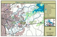
ChDCeFCeFGrDChDCrFCoveChEDoughtonRecreation AreaGrDCrFBasin<strong>Creek</strong>ChDCeFChDGrDChEChE<strong>Creek</strong>CeFErDEsEChDEsETaDBrD2ErDEsEFigure ChD 7. Reference Site NRCS Soil Survey MapGrD<strong>Glade</strong> <strong>Creek</strong> <strong>Stream</strong> <strong>Restoration</strong><strong>Alleghany</strong> County, North CarolinaDecember 2007LegendReference Reach Site<strong>Stream</strong>s/<strong>Creek</strong>sReference Reach Site SoilsBraddock clay loam, 8-25%, BrD2Chestnut-Ashe, 25 to 90 % slopes, CeFChestnut-Edneyville, 25-60% percent slopes, ChEChestnut-Edneyville, 8 to 25 % slopes, ChDCleveland-Rock outcrop, 8 to 90 % slopes, CrFEvard gravelly sandy loam, 15 to 25 % slopes, ErDEsDEsEFeet0 250 500 1,000 1,500 2,000Evard-Cowee complex, 25 to 60 % slopes, EsEGreenlee-Ostin complex, 3 to 40 % slopes, GrDTate fine sandy loam, 8 to 25 % slopes, TaD$


