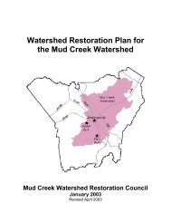
RESTORATION PLAN Glade Creek Stream Restoration Alleghany ...
RESTORATION PLAN Glade Creek Stream Restoration Alleghany ...
RESTORATION PLAN Glade Creek Stream Restoration Alleghany ...

You also want an ePaper? Increase the reach of your titles
YUMPU automatically turns print PDFs into web optimized ePapers that Google loves.
6.3 HEC-RAS Analysis6.3.1 No-rise, LOMR, CLOMRAs of July 2, 2007, there is no FEMA mapping for the project area, based on a review of the N.C.Flood maps website. The proposed project is a Rosgen Priority II stream restoration project, withno wetland restoration component, only wetland preservation. The hydrology of the site will notbe significantly altered by the project. The Faw’s property and the adjoining properties will not behydrologically trespassed upon by the stream restoration project.HEC-RAS (USACE, 2001) was used to model water surface elevations for existing conditions fora variety of discharges generated from TR-20. The peak 1-, 2-, 10-, and 100-year stormdischarges were all modeled in HEC-RAS.An existing conditions topographic basemap for the project reach was constructed in ArcGIS bymerging the 1-foot contour interval channel survey conducted by Cavanaugh and Associates, PAwith the 10-foot contour interval <strong>Alleghany</strong> County map. For existing conditions, topographicinformation from the Cavanaugh survey superceded that of the County basemap. Thesebasemaps were then used in HEC-GeoRAS (version 3.1) to define and assemble the channelnetwork topology, cross-sections, and reach lengths. Cross-sections were located at hydrauliccontrol points (such as upstream and downstream of bridge culverts and at slope breaks), as wellas at intermediate locations to capture changes to channel and overbank geometry. The crosssectionswere oriented to be orthogonal to the local mean channel flow and anticipated overbankflow. Bridge and culvert geometry and hydraulic coefficients for the bridge were measured in thefield during a site visit conducted in the Spring of 2007. The site visit also provided informationon existing channel conditions and overbank vegetation so that the channel and overbankManning’s n-values could be estimated using a table of typical values found in Chow (1959).In the absence of paired discharge-stage flow measurements on <strong>Glade</strong> <strong>Creek</strong>, model boundaryconditions had to be assumed to be uniform flow with bed slopes estimated from the topographicbasemaps. A subcritical flow regime was modeled, as there were no significant areas that wouldwarrant calculations under mixed or supercritical conditions. Because of limited detailed surveydata beyond the reach extents, boundary conditions were calculated by assuming that a localslope at the top and the slope from the downstream end of the bridge to the bottom of the reachextended beyond the reach.6.4 Soil <strong>Restoration</strong>6.6.1 Topsoil Salvage, Soil Testing and Nutrient AmendmentsWhere grading is performed for channel stabilization, the overlying 4-6 inches of topsoil will bestockpiled for redistribution over the site after grading is complete. Soil samples were collectedonsite and were sent to the N.C. Department of Agriculture Soils Laboratory for analysis. Theanalysis report confirms the field assessment of the alluvial soils that occupy the project site, thatthey are loamy with a moderate to low bulk density and they will not require any morefertilization or lime application than is usually applied for tree seedling and live stakeestablishment.26