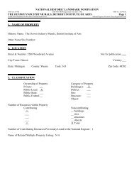
At the Foot of the Belton Hills - National Park Service
At the Foot of the Belton Hills - National Park Service
At the Foot of the Belton Hills - National Park Service

Create successful ePaper yourself
Turn your PDF publications into a flip-book with our unique Google optimized e-Paper software.
DRAWING GLAC 117 2116A<br />
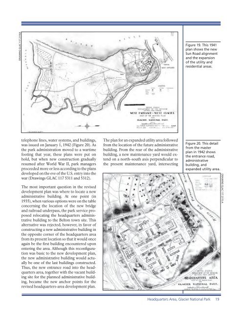
telephone lines, water systems, and buildings,<br />
was issued on January 1, 1942 (Figure 20). As<br />
<strong>the</strong> park administration moved to a wartime<br />
footing that year, <strong>the</strong>se plans were put on<br />
hold, but when new construction gradually<br />
resumed after World War II, park managers<br />
proceeded more or less according to <strong>the</strong> plans<br />
developed on <strong>the</strong> eve <strong>of</strong> <strong>the</strong> U.S. entry into <strong>the</strong><br />
war (Drawings GLAC 117 5311 and 5312).<br />
The most important question in <strong>the</strong> revised<br />
development plan was where to locate a new<br />
administrative building. <strong>At</strong> one point (in<br />
1935), when various options were on <strong>the</strong> table<br />
concerning <strong>the</strong> location <strong>of</strong> <strong>the</strong> new bridge<br />
and railroad underpass, <strong>the</strong> park service proposed<br />
relocating <strong>the</strong> headquarters administrative<br />
building to <strong>the</strong> <strong>Belton</strong> town site. This<br />
alternative was rejected, however, in favor <strong>of</strong><br />
constructing a new administrative building in<br />
<strong>the</strong> opposite corner <strong>of</strong> <strong>the</strong> headquarters area<br />
from its present location so that it would once<br />
again be <strong>the</strong> fi rst building encountered upon<br />
entering <strong>the</strong> area. Although this reconfi guration<br />
was basic to <strong>the</strong> new development plan,<br />
<strong>the</strong> new administrative building would actually<br />
be one <strong>of</strong> <strong>the</strong> last buildings constructed.<br />
Thus, <strong>the</strong> new entrance road into <strong>the</strong> headquarters<br />
area, toge<strong>the</strong>r with <strong>the</strong> vacant building<br />
site for <strong>the</strong> planned administrative building,<br />
became <strong>the</strong> new anchor points for <strong>the</strong><br />
revised headquarters-area development plan.<br />
The plan for an expanded utility area followed<br />
from <strong>the</strong> location <strong>of</strong> <strong>the</strong> future administrative<br />
building. From <strong>the</strong> rear <strong>of</strong> <strong>the</strong> administrative<br />
building, a new maintenance yard would extend<br />
on a north–south axis perpendicular to<br />
<strong>the</strong> present maintenance yard, intersecting<br />
Figure 19. This 1941<br />
plan shows <strong>the</strong> new<br />
Sun Road alignment<br />
and <strong>the</strong> expansion<br />
<strong>of</strong> <strong>the</strong> utility and<br />
residential areas.<br />
Figure 20. This detail<br />
from <strong>the</strong> master<br />
plan in 1942 shows<br />
<strong>the</strong> entrance road,<br />
administrative<br />
building, and<br />
expanded utility area.<br />
Headquarters Area, Glacier <strong>National</strong> <strong>Park</strong> 19<br />
DRAWING GLAC 117 2115-A