Countryside Guide - Huntingdonshire District Council
Countryside Guide - Huntingdonshire District Council
Countryside Guide - Huntingdonshire District Council

Create successful ePaper yourself
Turn your PDF publications into a flip-book with our unique Google optimized e-Paper software.
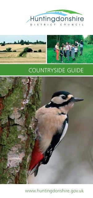
COUNTRYSIDE GUIDE<br />
www.huntingdonshire.gov.uk
Contents<br />
Welcome 1<br />
Key to Symbols used in the guide 3<br />
<strong>Huntingdonshire</strong>’s Woodland<br />
Brampton Wood 4<br />
Monks Wood 6<br />
Waresley and Gransden Woods 8<br />
Holme Fen National Nature Reserve 10<br />
<strong>Huntingdonshire</strong>’s Meadowland<br />
Houghton Meadow 12<br />
Portholme Meadow 14<br />
St Neots Common 16<br />
Upwood Meadows 18<br />
<strong>Huntingdonshire</strong>’s Wetland<br />
Grafham Water 20<br />
Hinchingbrooke Country Park 22<br />
Woodwalton Fen National Nature Reserve 24<br />
MAP OF HUNTINGDONSHIRE & SITES 26<br />
Hanson-RSPB Wetland Project 28<br />
Paxton Pits Nature Reserve 30<br />
Welcome to <strong>Huntingdonshire</strong>’s<br />
<strong>Countryside</strong> <strong>Guide</strong><br />
<strong>Huntingdonshire</strong> has a fantastic range of wildlife<br />
sites, many of which are National Nature<br />
Reserves. We hope that this booklet will inspire<br />
you to visit some of them, and to explore the<br />
beautiful countryside surrounding the small<br />
market towns and villages of this ancient county.<br />
<strong>Huntingdonshire</strong> lies about 80km north of London,<br />
where EW and NS routes intersect, bringing<br />
millions of people past our doorstep. Increasing<br />
numbers choose to stop and have a look around at<br />
the special wildlife and places we have to offer,<br />
particularly along the corridor of the River Great<br />
Ouse. The scenery remains largely unspoilt and<br />
there is good access for outdoor recreation,<br />
including birdwatching or walking. It is worth<br />
noting that beyond the immediate district, the<br />
Brecks, the Norfolk and Suffolk coasts, Rutland<br />
Water and Rockingham Forest are all within easy<br />
reach, so <strong>Huntingdonshire</strong> is a great place to stop.<br />
ST IVES<br />
Other <strong>Huntingdonshire</strong> Sites<br />
Barford Road Pocket Park 32<br />
Holt Island Nature Reserve 33<br />
Spring Common 34<br />
The Thicket 35<br />
Around <strong>Huntingdonshire</strong><br />
Barnack Hills & Holes 36<br />
Wicken Fen & Fowlmere Nature Reserve 37<br />
Ouse Washes & Welney 38<br />
The Lodge at Sandy 39<br />
The Ouse Valley Way 40<br />
The Great Fen Project 42<br />
Birdwatching in <strong>Huntingdonshire</strong> 43<br />
Win £25 Marks & Spencer vouchers 51<br />
The River Great Ouse runs for 41km through<br />
<strong>Huntingdonshire</strong>, connecting the historic market<br />
towns of Huntingdon, St Ives and St Neots. Much<br />
of the river valley has been dug for gravel, leaving<br />
large areas of lakes.These have developed into<br />
fantastic wetland areas such as Paxton Pits Nature<br />
Reserve and the Hanson-RSPB Wetland Project at<br />
Needingworth. The area is also well known for its<br />
extensive wet meadows, some of which are still<br />
botanically very rich.<br />
www.huntingdonshire.gov.uk<br />
1
The two oldest nature reserves in Britain were<br />
created by the Rothschild family at Woodwalton<br />
Fen and Wicken Fen, but perhaps of most interest<br />
to conservationists is the large area that is currently<br />
involved in the creation of new wetlands. The Great<br />
Fen Project aims to restore 3,700 hectares of lost<br />
fenland between Woodwalton Fen and Holme Fen.<br />
It is one of the most exciting habitat restoration<br />
projects ever undertaken in Britain.<br />
If you are interested in birdwatching, our wetlands<br />
are the main bird habitat. These include the<br />
Cambridgeshire Fens, the Great Ouse valley, and<br />
Grafham Water. The Ouse and Nene Washes are<br />
also on our doorstep.<br />
Alongside our wetlands we have important areas of<br />
wet grassland and wet woodland as well as<br />
agricultural land with its own important wildlife.<br />
Farmland birds such as tree sparrows and corn<br />
buntings may also increase because of our<br />
increased efforts on their behalf, but with the<br />
changing climate it is difficult to predict what new<br />
species will move in. Candidates include ravens,<br />
corncrakes and cranes.<br />
<strong>Huntingdonshire</strong> offers a wealth of heritage<br />
attractions. It is the birthplace of Oliver Cromwell,<br />
and was also home to Samuel Pepys. To fully<br />
appreciate all the district has to offer, you may<br />
want to stay at one of our quality assured hotels,<br />
guesthouses or campsites. Please contact 01480<br />
388588 to request a copy our new Visitor <strong>Guide</strong>.<br />
Key to Symbols<br />
Wheelchair<br />
access<br />
Waterproof<br />
footwear advisable<br />
Information<br />
centre<br />
No dogs<br />
Interesting<br />
invertebrates<br />
Car parking<br />
Toilets<br />
Refreshments<br />
We have several good woodland sites to visit for<br />
those interested in birds. Of course there are no<br />
mountains and no coast in <strong>Huntingdonshire</strong>, so it<br />
may come as a surprise that, if you come at the<br />
right time, we can show you dotterels on passage,<br />
breeding avocets and black tailed godwits.<br />
On a good day in May you might see over 130<br />
species of birds in <strong>Huntingdonshire</strong>, while in winter<br />
you might see over 80. The total bird list in the<br />
district is about 240 species.<br />
We expect the wetland birds that are already in<br />
<strong>Huntingdonshire</strong>, such as bittern, egret, water rail,<br />
marsh harrier, cetti’s warbler and bearded tit to<br />
increase over the next decade because we are<br />
creating habitat especially for them. Red kites breed<br />
here already and ospreys are likely to move in soon.<br />
Of special interest<br />
to birdwatchers<br />
Interesting<br />
plants<br />
National Nature<br />
Reserve<br />
2 www.huntingdonshire.gov.uk<br />
Picnic area<br />
Site of Special<br />
Scientific Interest<br />
If you require a large print<br />
version of this information<br />
please telephone 01480 388588<br />
3
Brampton Wood<br />
Woodland<br />
Brampton Wood is the second largest wood in<br />
Cambridgeshire, and supports a remarkable<br />
variety of plants and animals. It consists<br />
primarily of ash and field maple with hazel<br />
coppice, but there are extensive blackthorn<br />
thickets, stands of recently planted conifers and<br />
many other trees and shrubs. Over 300 plant<br />
species have been recorded here; the wood is<br />
notable for abundant primroses, its wild pears<br />
and the botanical diversity of the fine wide<br />
rides. It is particularly well known for butterflies,<br />
including white admiral, purple hairstreak and<br />
black hairstreak. There have been 39 species of<br />
butterfly recorded in the wood, although some<br />
have not been seen for many years. Brampton<br />
Wood is also noted for birds, with at least 40<br />
breeding species including sparrowhawk, tawny<br />
owl, blackcap, garden warbler and woodcock.<br />
Dormice were released into the wood in 1992<br />
and are continuing to expand their territories.<br />
The Wildlife Trust purchased this Site of Special<br />
Scientific Interest in 1992.<br />
LOCATION: The wood is on the north side of the<br />
road between Brampton and Grafham, about<br />
1.6km west of the A1 and 3.2km east of Grafham<br />
village. If travelling on the A1, take the exit to<br />
Brampton. On reaching the village green, follow the<br />
road past the pub and continue over the A1 bridge<br />
towards Grafham. Brampton Wood is on the right<br />
hand side.<br />
OS MAP REFERENCE: Sheet 153; TL 185 698<br />
OUR MAP REFERENCE: C3 (see pages 26/27)<br />
SIZE: 132 hectares<br />
CONTACT: Managed by The Wildlife Trust,<br />
The Manor House, Broad St, Great Cambourne,<br />
Cambridge, CB23 6DH<br />
Tel: 01954 713500<br />
Website: www.wildlifebcnp.org<br />
4 www.huntingdonshire.gov.uk<br />
5
Monks Wood<br />
Woodland<br />
Monks Wood National Nature Reserve is a remnant<br />
of the ’wildwood’, which covered much of Britain<br />
around 5000 years ago.<br />
The dominant trees are oak, ash, elm, aspen and<br />
field maple. The reserve is also notable for its large<br />
number of wild service trees. A wide range of shrub<br />
species occur, including hazel, hawthorn, guelder<br />
rose, wayfaring tree, spindle, dogwood and wild<br />
privet. There are extensive stands of blackthorn,<br />
which still support colonies of the rare black<br />
hairstreak butterfly.<br />
White-letter hairstreak and white admiral are<br />
amongst the other interesting butterflies to be<br />
found. Even more impressive, is the variety of<br />
beetles; over 1000 species have now been recorded,<br />
making Monks Wood one of the top sites in the<br />
country for this group. More unusual plants such as<br />
greater butterfly orchid, violet helleborine and<br />
crested cow-wheat are also present.<br />
One of the biggest changes to affect the wood over<br />
the last 20 years has been the great increase in the<br />
number of deer. Parts of the woods are still<br />
coppiced, creating a series of green, sunny clearings<br />
used by many different plants, birds and insects.<br />
LOCATION: Situated off the B1090. 1km west of<br />
Woodwalton, near Huntingdon. 3km north of the<br />
A1/A14 junction. No car parking, although there is<br />
a lay-by on the B1090, 300 metres from the<br />
reserve. No disabled access to the site.<br />
OS MAP REFERENCE: TL 198 792<br />
OUR MAP REFERENCE: C3 (see pages 26/27)<br />
SIZE: 157 hectares<br />
CONTACT: Managed by Natural England,<br />
Northminster House, Northminster Road,<br />
Peterborough, PE1 1UA<br />
Tel: 01733 455103<br />
Website: www.naturalengland.org.uk<br />
6 www.huntingdonshire.gov.uk<br />
7
Waresley & Gransden Woods<br />
Woodland<br />
Waresley and Gransden Woods are two adjoining<br />
oak/ash woods, which have been part of the local<br />
landscape for thousands of years. For centuries it<br />
was managed as coppice with standards, and is<br />
mentioned as coppice habitat in the Domesday<br />
Book. This management created the conditions in<br />
which woodland flowers thrive. Although the<br />
woods have year-round appeal, they are at their<br />
most spectacular in spring when the woodland<br />
floor becomes carpeted with wild flowers including<br />
primroses, oxslips, violets and the scented bluebells.<br />
The woods are home to good numbers of breeding<br />
birds, and in summer the rides and glades are filled<br />
with wild flowers and insects that feed on their<br />
nectar, including butterflies, such as the comma.<br />
The paths and rides are mown for the benefit of<br />
wild flowers and visitors. Coppicing has been reintroduced<br />
to allow the ground flora to flourish.<br />
The woods are managed as a Site of Special<br />
Scientific Interest by The Wildlife Trust.<br />
LOCATION: From St Neots take the B1046 towards<br />
Great Gransden. At the edge of the village take the<br />
small road on the right running southwest towards<br />
Waresley. About two thirds of a kilometre down<br />
this road, there is a small bridge (Waresley Dean<br />
Bridge) over a stream; park on the grass verge by<br />
the bridge and walk up the concrete track to the<br />
sewage works. Follow the fence to the right, up to<br />
the wood.<br />
OS MAP REFERENCE: Sheet 153; TL 263 548<br />
OUR MAP REFERENCE: C5 (see pages 26/27)<br />
SIZE: 54 hectares<br />
CONTACT: Managed by The Wildlife Trust,<br />
The Manor House, Broad St, Great Cambourne,<br />
Cambridge, CB23 6DH<br />
Tel: 01954 713500<br />
Website: www.wildlifebcnp.org<br />
8 www.huntingdonshire.gov.uk<br />
9
Holme Fen<br />
Woodland<br />
Holme Fen National Nature Reserve boasts the lowest<br />
point in Britain. In 1852, a cast-iron post was erected<br />
by Charles Wells, at the edge of Holme Lode covert.<br />
Fixed to timber piles driven into the underlying clay,<br />
the post was set with its top at ground level. Over the<br />
years, the peat has dried out and wasted away due to<br />
increased drainage, so that the ground level today has<br />
shrunk nearly 4 metres below the top of the post.<br />
The Holme Fen silver birch woodland is considered to<br />
be the finest of its type in lowland Britain. Although<br />
some trees were planted in the 19th century, most are<br />
self-seeded and form woodland blocks of varying<br />
ages. The woodland and scrub provide rich habitat for<br />
many of the 450 species of fungi, which have been<br />
found on the reserve, and offer shelter and food for<br />
insects and birds. In winter, siskins and redpolls feed<br />
on the alder seeds, while in summer, nightingales,<br />
blackcaps and woodpeckers nest among the foliage.<br />
There are species here that have not been recorded<br />
anywhere else in the UK. The Great Fen Project aims to<br />
link this National Nature Reserve with Woodwalton<br />
Fen (see page 42 for more information).<br />
LOCATION: Holme Fen is between the villages of<br />
Holme and Ramsey St Mary’s, off the B660 road.<br />
Very limited parking available in laybys. Not suitable<br />
for coaches.<br />
OS MAP REFERENCE: Sheet 142; TL 205 890<br />
OUR MAP REFERENCE: C2 (see pages 26/27)<br />
SIZE: 266 hectares<br />
CONTACT: Managed by Natural England,<br />
Northminster House, Northminster Road,<br />
Peterborough, PE1 1UA<br />
Tel: 01733 455103<br />
Website: www.naturalengland.org.uk<br />
www.greatfen.org.uk<br />
10 www.huntingdonshire.gov.uk<br />
11
Houghton Meadow<br />
Meadowland<br />
Houghton Meadow is in a beautiful location on the<br />
edge of the village of Houghton, with its working<br />
mill, set on the banks of the River Great Ouse. The<br />
reserve protects four old meadows; the ridge and<br />
furrow on the surface of three were left by mediaeval<br />
ploughs. Since that time they have been untouched,<br />
and are now carpeted with neutral grassland, which<br />
includes plants like green-winged orchid, yellow<br />
rattle, salad burnet and pepper saxifrage. The fourth,<br />
Browns Meadow, is an old flood meadow, which<br />
provides good grazing after winter flooding each<br />
year. This meadow is not part of the Site of Special<br />
Scientific Interest. The hedges, which edge the fields,<br />
are growing on ridges in the ridge and furrow, and<br />
pre-date the Parliamentary Enclosure Award. These<br />
are relatively old hedges for this area, and contain 18<br />
species of tree and shrub including hazel, which is<br />
rare in hedges in eastern England. The strip of long<br />
grass and tall herbs growing between the meadow<br />
and hedge is an important habitat for small<br />
mammals from both the hedge and grassland. The<br />
meadows are maintained by traditional methods;<br />
Browns Meadow is grazed during the summer and<br />
the other three are allowed to flower and set seed<br />
before a hay cut in mid-July.<br />
LOCATION: The meadow is west of Houghton<br />
village, just off the A1123 (Huntingdon – St Ives).<br />
Please park in Houghton Market Square and walk<br />
along Thicket Road to the reserve. Stiles allow<br />
access to all four fields.<br />
OS MAP REFERENCE: Sheet 153; TL 293 717<br />
OUR MAP REFERENCE: D3 (see pages 26/27)<br />
SIZE: 8 hectares<br />
CONTACT: Managed by The Wildlife Trust,<br />
The Manor House, Broad Street, Great Cambourne,<br />
Cambridge, CB23 6DH<br />
Tel: 01954 713500<br />
Website: www.wildlifebcnp.org<br />
12 www.huntingdonshire.gov.uk<br />
13
Portholme Meadow<br />
Meadowland<br />
Portholme is the largest lowland meadow in<br />
England, and is almost completely surrounded by<br />
water. It is a designated Site of Special Scientific<br />
Interest.<br />
The site is owned by The London Anglers<br />
Association, who are advised on the management of<br />
the site by Natural England. Traditional farming<br />
methods are used on the large area of grazing land,<br />
which provides a source of hay for the farming<br />
community. Many species of insects, grasses and<br />
wild flowers thrive on the site, including the rare<br />
snakeshead frittilary. This vast area of land is a<br />
natural reservoir, holding excess water in times of<br />
flood, and was once the site of the Racecourse. In<br />
1760, racing at Portholme was one of the nation’s<br />
most fashionable events of the year. Today, visitors<br />
can walk around the site on the extensive footpaths<br />
which lead off the three main entrances.<br />
The footpaths form a triangle across the meadow,<br />
and each footpath is approximately 1.6km in length.<br />
Large flocks of waders use this site in winter.<br />
LOCATION: The meadow is near Godmanchester.<br />
The three entrances are via Mill Lane in<br />
Huntingdon, opposite the bus station, Bromholme<br />
Lane, near Brampton, opposite the campsite, and<br />
Riverside Park in Godmanchester, where you go<br />
over the Chinese Bridge and follow the Ouse Valley<br />
Way signs.<br />
OS MAP REFERENCE: Sheet 153; TL 236 705<br />
OUR MAP REFERENCE: C4 (see pages 26/27)<br />
SIZE: 104 hectares<br />
CONTACT: <strong>Countryside</strong> Services, <strong>Huntingdonshire</strong><br />
<strong>District</strong> <strong>Council</strong>, Hinchingbrooke Country Park,<br />
Brampton Road, Huntingdon, Cambs, PE29 6DB.<br />
Tel: 01480 451568<br />
Email: hinchingbrookecountrypark@huntsdc.gov.uk<br />
14 www.huntingdonshire.gov.uk<br />
15
St Neots Common<br />
Meadowland<br />
16<br />
St Neots Common is classed as true common land,<br />
which is used communally by the commoners of<br />
the parish.<br />
The commons were often heaths on poor soil or, as<br />
in St. Neots, meadows which were too wet for<br />
ploughing. Commoners were allowed to own<br />
livestock, which could be grazed on the commons.<br />
St Neots Common is a Site of Special Scientific<br />
Interest and is one of the few alluvial grasslands<br />
(growing on silt deposited by the river), which has<br />
remained under a traditional grazing regime. This<br />
created and maintains a species rich sward, which<br />
varies from permanently dry areas, to others which<br />
are flooded for several months each year.<br />
The ponds and ditches support a thriving<br />
community of aquatic plants, and are home to<br />
many insects, frogs and toads. Nine different<br />
species of willow grow in the holt. It is also one of<br />
the best sites to see the southern marsh orchid and<br />
marsh orchid. You may also find water violet and<br />
tubular water dropwort as well as more common<br />
species such as purple loosestrife and yellow water<br />
lily. Otters are known to use this stretch of the river.<br />
LOCATION: The Common is on the edge of St Neots.<br />
From the town centre take the road to Little Paxton;<br />
the Common is on the left-hand side of the road<br />
and parking is available in St Neots town centre. A<br />
number of public footpaths cross the meadow. The<br />
Ouse Valley Way footpath follows the river around<br />
the edge of the Common.<br />
OS MAP REFERENCE: Sheet 153; TL 182 611<br />
OUR MAP REFERENCE: C4 (see pages 26/27)<br />
SIZE: 32 hectares<br />
CONTACT: <strong>Countryside</strong> Services, <strong>Huntingdonshire</strong><br />
<strong>District</strong> <strong>Council</strong>, Hinchingbrooke Country Park,<br />
Brampton Road, Huntingdon, Cambs, PE29 6DB.<br />
Tel: 01480 451568<br />
Email: hinchingbrookecountrypark@huntsdc.gov.uk<br />
www.huntingdonshire.gov.uk<br />
17
Upwood Meadows<br />
Meadowland<br />
Upwood Meadows National Nature Reserve is a<br />
series of three old meadows growing on poorly<br />
drained chalky boulder clay. They have been<br />
grassland for at least 280 years, although the ridge<br />
and furrow left by ancient ploughs shows they were<br />
once arable land. The hedges and ponds support a<br />
wide variety of animal life, but the meadows<br />
themselves are of critical importance.<br />
Helen’s Close is the first field. It was both sprayed<br />
and fertilised in the past, and at present there are<br />
few herbs growing in the grasses. Little Bentley<br />
Meadow was also partly ‘improved’, but a rich<br />
meadow flora still survives in the north west corner.<br />
Bentley Meadow, the largest of the three fields, has<br />
never been improved and is covered in the spring<br />
with the yellow of thousands of cowslips, followed<br />
in mid-May by the green-winged orchids. Over 180<br />
species typical of ancient grassland grow in this<br />
field, a tiny remnant of the meadows, which were<br />
once common in England. The numerous anthills of<br />
the yellow ant are another indicator of ancient<br />
grassland.<br />
LOCATION: From Ramsey take the road to Upwood<br />
and Great Raveley, and take the last turning on the<br />
right, into Upwood village. Where the road turns<br />
sharply right, continue straight ahead on the rough<br />
lane to Meadow Farm. Park in the grass car park<br />
and please close all gates. The numerous stiles still<br />
provide access to all meadows. Please note that<br />
cattle graze the reserve.<br />
OS MAP REFERENCE: Sheet 142; TL 251 825<br />
OUR MAP REFERENCE: C2 (see pages 26/27)<br />
SIZE: 6 hectares<br />
CONTACT: Managed by The Wildlife Trust,<br />
The Manor House, Broad St, Great Cambourne,<br />
Cambridge. CB23 6DH<br />
Tel: 01954 713500<br />
Website: www.wildlifebcnp.org<br />
18 www.huntingdonshire.gov.uk<br />
19
Grafham Water<br />
Wetland<br />
Grafham Water, a Site of Special Scientific Interest,<br />
was the largest reservoir in England when it opened<br />
in the mid 1960s. The diverse habitats in the<br />
reserve were included in the original design and<br />
now support a variety of wildlife. Woods and<br />
grasslands provide food and shelter for summer<br />
songbirds, including blackcap, garden warbler and<br />
nightingale. In winter, the reservoir usually remains<br />
free of ice, attracting gadwall, wigeon, shoveler,<br />
goldeneye and goosander as well as great crested<br />
grebe. Many more wildfowl arrive when local gravel<br />
pits freeze. In spring, common sandpiper,<br />
greenshank and other migrant waders stop to feed<br />
on the reservoir margins.<br />
There are five hides in the reserve; two are<br />
accessible to wheelchair users throughout the year<br />
and another is generally accessible to wheelchairs in<br />
summer. The management programme is designed<br />
to maintain the diversity of habitats within the<br />
reserve, which include ancient and plantation<br />
woodland, meadows, ponds and grassland rides.<br />
LOCATION: Grafham Water is between Huntingdon<br />
and St Neots; leave the A1 for the B661 at Buckden<br />
or the A14 at Ellington and follow the signs to<br />
Grafham Water. Anglian Water provides several car<br />
parks around the reservoir; there is a charge for<br />
their use. Mander car park in Perry to the<br />
southwest, is closest to the reservoir and the nature<br />
reserve. The 16.7km surfaced track which circles the<br />
reservoir is suitable for use by cycles, and in part,<br />
wheelchairs.<br />
OS MAP REFERENCE: Sheet 153; TL 150 670<br />
OUR MAP REFERENCE: B4/C4 (see pages 26/27)<br />
SIZE: 149 hectares<br />
CONTACT: Reserve managed by The Wildlife Trust,<br />
The Manor House, Broad St, Great Cambourne,<br />
Cambridge, CB23 6DH<br />
Tel: 01480 811075 Website: www.wildlifebcnp.org<br />
Visitor Centre & Café Tel: 01480 812154<br />
20 www.huntingdonshire.gov.uk<br />
21
Hinchingbrooke Country Park<br />
Wetland<br />
Hinchingbrooke Country Park comprises 68 hectares<br />
of mature woodland, grassy meadows and<br />
wetlands. You might see hovering kestrels, foxes<br />
and butterflies amongst the wealth of wild flowers.<br />
All three species of British woodpecker can be seen<br />
here. The bird feeders by the Visitor’s Centre are a<br />
good place to regularly see nuthatch and marsh tit.<br />
A variety of wildfowl can be seen on the lakes and<br />
signs of otters are now regularly found along<br />
Alconbury Brook.<br />
Many of the footpaths are hard-surfaced and<br />
pushchair and wheelchair friendly. Electric<br />
wheelchairs are available from the Visitors’ Centre<br />
along with refreshments, or have a barbecue or<br />
bring a picnic. Environmental events and children’s<br />
activities are frequently organised and school visits<br />
are welcome. The park is always open and the<br />
Visitors’ Centre is open 10am-4pm every day except<br />
Christmas Day. There is no charge to visit.<br />
LOCATION: Located 2.5 km west of Huntingdon,<br />
almost 1km from Brampton. Driving out of<br />
Huntingdon towards Brampton, follow the signs to<br />
Hinchingbrooke Country Park. The entrance to the<br />
park is left at the roundabout by Hinchingbrooke<br />
Hospital. Frequent bus service from Huntingdon<br />
Town Centre to Hinchingbrooke Country<br />
Park/hospital. Short walk from the railway station.<br />
OS MAP REFERENCE: Sheet 153; TL 221 726<br />
OUR MAP REFERENCE: C3 (see pages 26/27)<br />
SIZE: 68 hectares<br />
CONTACT: Managed by <strong>Countryside</strong> Services,<br />
<strong>Huntingdonshire</strong> <strong>District</strong> <strong>Council</strong>, Hinchingbrooke<br />
Country Park, Brampton Road, Huntingdon, Cambs,<br />
PE29 6DB.<br />
Tel: 01480 451568<br />
Email: hinchingbrookecountrypark@huntsdc.gov.uk<br />
22 www.huntingdonshire.gov.uk<br />
23
Woodwalton Fen<br />
Wetland<br />
Woodwalton Fen is one of Britain’s oldest nature<br />
reserves, purchased in 1910 by the Hon. Charles<br />
Rothschild. The Fen has sometimes been called a<br />
‘waterland’. Indeed without the water, there would<br />
hardly be any wildlife, for it is home to many plants<br />
and animals that have become rare since the draining<br />
of the East Anglian Fens. The reserve lies at the lowest<br />
part of the <strong>Huntingdonshire</strong> fens. Over most of the<br />
fenland around Woodwalton and Holme fens,<br />
drainage from the Victorian times has caused the peat<br />
to shrink and waste away. In some places, ground level<br />
today is over 5 metres below that of 150 years ago.<br />
Over 400 plant species occur on the reserve. These<br />
include ragged robin, greater water parsnip, greater<br />
spearwort and marsh pea. Of the 1000 recorded<br />
beetles on the fen, nearly 200 are nationally rare.<br />
Almost half of Britain’s dragonfly species are found<br />
here, and nearly a thousand species of moth. 170<br />
species of birds have been recorded, including the<br />
long-eared owl.<br />
Visitors are welcome to explore the reserve along the<br />
rides and three marked trails. One trail passes Charles<br />
Rothchild’s ‘bungalow’ built in 1911. The Great Fen<br />
Project aims to link this National Nature Reserve with<br />
Holme Fen (see page 42 for more information).<br />
LOCATION: Woodwalton Fen is a left turn off the<br />
B1040. Follow brown signs to the Woodwalton<br />
Fen. Drive to the end of the lane, where the fen lies<br />
straight ahead of you. Limited parking is available<br />
alongside the Great Raveley Drain. Unsuitable for<br />
coaches.<br />
OS MAP REFERENCE: Sheet 142; TL 235 848<br />
OUR MAP REFERENCE: C2 (see pages 26/27)<br />
SIZE: 208 hectares<br />
CONTACT: Managed by Natural England,<br />
Northminster House, Northminster Road<br />
Peterborough, PE1 1UA<br />
Tel: 01733 455103<br />
Websites: www.naturalengland.org.uk<br />
www.greatfen.org.uk<br />
24 www.huntingdonshire.gov.uk<br />
25
A B C D E<br />
1<br />
1<br />
2<br />
2<br />
3<br />
3<br />
4<br />
4<br />
5<br />
5<br />
26<br />
A B C D E<br />
27
Hanson-RSPB Wetland Project at Needingworth Quarry<br />
Wetland<br />
Hanson and RSPB are working together over the<br />
next 30 years to create an exciting new nature<br />
reserve at Needingworth Quarry. The 700 hectare<br />
wetland site will be managed by the RSPB and will<br />
include the biggest reedbed in the UK. There will<br />
eventually be 32km of rights of way around and<br />
through the reserve. This will be a refuge for<br />
bittern, water vole and otter. Today, at the quarry,<br />
you can already see tufted duck, wigeon, shelduck<br />
and coot as well as the many wading birds, such as<br />
ringed plover. Many different types of insect can be<br />
seen on the reserve, especially during the summer<br />
months. The most colourful are the butterflies,<br />
dragonflies and damselflies. Footpaths around the<br />
quarry link up with the <strong>Huntingdonshire</strong> section of<br />
the Ouse Valley Way long distance walk. As part of<br />
the quarry development, 120,000 trees and shrubs<br />
have been planted, plus the quarry has received<br />
four 5 star and three gold awards from the Quarry<br />
Products Association for its environmental<br />
performance.<br />
LOCATION: Hanson-RSPB Wetland Project is located<br />
in the village of Needingworth, near St Ives.<br />
OS MAP REFERENCE: Sheet 153; TL 363 725<br />
OUR MAP REFERENCE: D3 (see pages 26/27)<br />
SIZE: To be 700 hectares<br />
CONTACT: Managed by The RSPB, The Lodge,<br />
Sandy, Bedfordshire. SG19 2DL<br />
Tel: 01603 661662<br />
Website: www.rspb.org.uk<br />
Site is currently under development, with access on<br />
public rights of way but the planned facilities are:<br />
28 www.huntingdonshire.gov.uk<br />
29
Paxton Pits Nature Reserve<br />
Wetland<br />
Paxton Pits Nature Reserve is a beautiful site of<br />
meadows, woodland and scrub, nestling on the<br />
banks of the River Great Ouse. It is a Site of Special<br />
Scientific Interest and is an important birdwatching<br />
site, with large numbers of nightingales to be heard<br />
in May each year. Other important birds at Paxton<br />
Pits include cormorants, gadwall, wigeon, tufted<br />
duck, pochard and mallard, with other wildfowl<br />
appearing in the cold and wet weather, when the<br />
Ouse Washes are frozen or flooded. The site is also<br />
host to a wealth of insects, from 26 species of<br />
butterfly to 148 species of spider. There are two<br />
guided trails, the Meadow Trail and the Heron Trail,<br />
as well as additional footpaths around the reserve<br />
which could be used to plan your walk. The Ouse<br />
Valley Way runs along the eastern edge of the<br />
reserve, and gives great views of the winter<br />
wildfowl on Washout Pit and Island Pit. The 10 acre<br />
arable field system has been set up to encourage<br />
farmland birds, wild flowers and mammals, such as<br />
yellow hammer and harvest mice. Following gravel<br />
extraction, Paxton Pits Nature Reserve will expand<br />
from 192 acres to more than 700 acres over the<br />
next decade.<br />
LOCATION: Located in Little Paxton, at the end of<br />
the High Street. Take the turn to Little Paxton off<br />
the A1 and follow the nature reserve sign.<br />
OS MAP REFERENCE: Sheet 153; TL 196 628<br />
OUR MAP REFERENCE: C4 (see pages 26/27)<br />
SIZE: 75 hectares<br />
CONTACT: Managed by <strong>Countryside</strong> Services,<br />
<strong>Huntingdonshire</strong> <strong>District</strong> <strong>Council</strong>, Paxton Pits Nature<br />
Reserve, High Street, Little Paxton, St Neots, Cambs<br />
PE19 6ET.<br />
Tel: 01480 406795<br />
Website: www.paxton-pits.org.uk<br />
Email: paxtonpits@btconnect.com<br />
30 www.huntingdonshire.gov.uk<br />
31
Barford Road Pocket Park<br />
Holt Island Nature Reserve<br />
LOCATION: Near St Neots Leisure Centre, St Neots.<br />
MAP REFERENCE: C4 (see pages 26/27)<br />
SIZE: 18 hectares<br />
CONTACT: <strong>Huntingdonshire</strong> <strong>District</strong> <strong>Council</strong><br />
Tel: 01480 406795<br />
Website: www.huntingdonshire.gov.uk<br />
Barford Road Pocket Park is 18 hectares of flood<br />
plain consisting of wild flower meadows,<br />
waterways and willow plantations. The willow<br />
plantations are planted with cricket bat willow.<br />
These are made into cricket bats, which are<br />
exported all over the world. The wild flower<br />
meadow is home to a good population of skylarks<br />
which are on the decrease in the area. The park<br />
also has kingfishers and terns and several different<br />
species of wading birds visit the edges of the<br />
waters on site. There is also an abundance of<br />
dragonflies such as the banded demoiselle along<br />
the backwater which runs off the River Great Ouse.<br />
The site is a great place to come and walk around<br />
on the network of hard-surfaced paths that weave<br />
through the park, as well as sitting to watch<br />
wildlife whilst having a picnic. There are no visitor<br />
facilities on site, but toilets are available in the<br />
Leisure Centre.<br />
LOCATION: Besides All Saints Church, St Ives.<br />
MAP REFERENCE: D3 (see pages 26/27)<br />
SIZE: 2.8 hectares<br />
CONTACT: <strong>Huntingdonshire</strong> <strong>District</strong> <strong>Council</strong><br />
Tel: 01480 451568<br />
Website: www.huntingdonshire.gov.uk<br />
Holt Island Nature Reserve was once an osier bed<br />
used for making willow baskets. There are also<br />
areas of reed, sedge and the remnant orchard. It is<br />
in a very peaceful setting, reached by a footbridge<br />
across a backwater of the River Great Ouse.<br />
The island provides a wide range of habitats<br />
reflecting its riverside setting. Plants that you may<br />
see include the purple loosestrife, yellow flag iris<br />
and comfey, plus nettles to provide food for the<br />
caterpillars of the tortoiseshell, peacock and red<br />
admiral butterflies.<br />
Kingfishers are frequently seen and the scrub<br />
provides excellent cover for dunnock, goldfinch,<br />
reed and sedge warblers. Holt Island is open at<br />
weekends and Bank Holidays between April and<br />
September, 10.30am - 5.00pm. At other times<br />
during these months the key is available from<br />
St Ivo Leisure Centre (tel: 01480 388500).<br />
32 www.huntingdonshire.gov.uk<br />
33
Spring Common<br />
The Thicket<br />
LOCATION: Off Ambury Road, behind Huntingdon<br />
Leisure Centre, Huntingdon.<br />
MAP REFERENCE: C3 (see pages 26/27)<br />
SIZE: 5.2 hectares<br />
CONTACT: <strong>Huntingdonshire</strong> <strong>District</strong> <strong>Council</strong><br />
Tel: 01480 451568<br />
Website: www.huntingdonshire.gov.uk<br />
Covering over 5 hectares, Spring Common is within<br />
easy walking distance from Huntingdon town<br />
centre. The name originates from the running<br />
spring, which has become a natural place for people<br />
to gather. Today, it is an ideal location for enjoying<br />
quiet reflection, dog walking and other outdoor<br />
activities. A network of surfaced and grassy paths<br />
make it a good place to explore, and some wooden<br />
sculptures which were developed with the local<br />
schools, add more interest to the Common. Spring<br />
Common has a range of diverse habitats including<br />
grassland, marsh, ponds, streams and scrub. On a<br />
sunny day, butterflies and dragonflies can be seen in<br />
the grassland and marshy areas. The pond hosts<br />
many amphibians and the thick hawthorn and<br />
blackthorn hedges provide shelter and food for a<br />
variety of birds and animals.<br />
LOCATION: Between Houghton and St Ives.<br />
Access is via two entrances off the Thicket Path.<br />
The Thicket Path is accessed via Houghton, or at<br />
the end of the Waits in St Ives.<br />
MAP REFERENCE: D3 (see pages 26/27)<br />
SIZE: 2.5 hectares<br />
CONTACT: <strong>Huntingdonshire</strong> <strong>District</strong> <strong>Council</strong><br />
Tel: 01480 451568<br />
Website: www.huntingdonshire.gov.uk<br />
The Thicket is a narrow, steep bank of ash and field<br />
maple woodland. It is approximately 500 metres<br />
long, and is home to a variety of native woodland<br />
animals and plants. Old maps of St Ives show that<br />
woodland has covered this area of hillside for a<br />
long time. This is proven by the presence of spurge<br />
laurel, which is considered to be an ancient<br />
woodland indicator. Sweet violet can be seen on<br />
sunny days in spring, or you may spot King Alfred’s<br />
cakes growing on dead ash trees. Invertebrates,<br />
including the lesser stag beetle, are encouraged by<br />
the dead wood. Many of these species provide food<br />
for birds, such as the great spotted woodpecker.<br />
34 www.huntingdonshire.gov.uk<br />
35
Barnack Hills and Holes<br />
Wicken Fen<br />
LOCATION: In the village of Barnack,<br />
11km north-west of Peterborough.<br />
SIZE: 22 hectares<br />
CONTACT: Natural England Tel: 01733 455103<br />
The grassy slopes of Barnack Hills and Holes are<br />
home to a profusion of wild flowers. This type of<br />
meadowland covered in wild flowers is now all too<br />
rare, and this area became a National Nature Reserve<br />
in 1976. Barnack’s rich flora supports a wide variety<br />
of wildlife, especially insects and a number of<br />
nationally rare species can be found. Butterflies<br />
recorded include the marbled white and chalkhill<br />
blue. Small mounds indicate the nests of the yellow<br />
meadow ant, and you may see the strange green<br />
lights of the glow-worms, which appear in large<br />
numbers on warm summer nights. Over 300 species<br />
of wild plant have been discovered here, including<br />
several kinds of orchid, many of them appearing in<br />
June and July. One of the rarest plants found on this<br />
grassland is the pasque flower. Visitors may like to<br />
follow the Limestone Walk, a circular 30 minute<br />
walk which takes you through all the main features<br />
of the reserve.<br />
LOCATION: 15km south of Ely. SIZE: 550 hectares<br />
CONTACT: The National Trust Tel: 01353 720274<br />
Website: www.nationaltrust.org.uk<br />
Wicken Fen National Nature Reserve is a remnant of<br />
real fenland. A superb variety of fenland plants and<br />
animals can be seen here including nearly 5000<br />
species of invertebrates. Birds include winter visitors<br />
like the rough legged buzzard and bittern, as well<br />
as summer residents of wetland and scrub, such as<br />
reed and sedge warblers, hobby and marsh harriers.<br />
Fowlmere Nature Reserve<br />
LOCATION: 11.2km south of Cambridge, between<br />
Fowlmere and Melbourn. SIZE: 40 hectares<br />
MAP REFERENCE: E5 (see pages 26/27)<br />
CONTACT: RSPB Tel: 01763 208978<br />
Website: www.rspb.org.uk<br />
Fowlmere Nature Reserve is an isolated area of fen<br />
on the South Cambridgeshire chalk, surrounded by<br />
farmland. Woodland, chalk grassland, reedbed and<br />
open water flowing from natural springs, attract a<br />
wide variety of birds and insects. Education<br />
programmes for children can be booked.<br />
36 www.huntingdonshire.gov.uk<br />
37
Ouse Washes and Welney<br />
The Lodge at Sandy<br />
LOCATION: At Wimblington, take the B103 to<br />
Manea. Follow signs to Reserve, via the Welney or<br />
RSPB entrances.<br />
SIZE: 1274.5 hectares<br />
CONTACT: The Wildlife Trust Tel: 01954 713500<br />
RSPB Tel: 01354 680212<br />
Wildfowl & Wetland Trust Tel: 01353 860711<br />
Website: www.rspb.org.uk<br />
www.wildlifebcnp.org<br />
www.wwt.org.uk<br />
The Ouse Washes are a wide strip of permanent<br />
grassland, running for 33km from Earith in the<br />
southwest to Denver in the northeast. Regular<br />
winter flooding improves the washland for summer<br />
grazing and hay cut, and provides vast areas of<br />
shallow water, which are of international<br />
importance to wintering waterfowl. Large numbers<br />
of teal, pintail, wigeon, shoveler, pochard and<br />
Bewick’s swan may be seen in the winter. In<br />
summer, ruff, black–tailed godwit, lapwing,<br />
redshank and snipe breed in the rough grassland. It<br />
is probably the best site in Cambridgeshire for<br />
dragonflies, with species including variable<br />
damselfly and hairy dragonfly.<br />
LOCATION: 1 mile east of Sandy on the B1042<br />
MAP REFERENCE: C5 (see pages 26/27)<br />
SIZE: 43 hectares<br />
CONTACT: RSPB Tel: 01767 680551<br />
Website: www.rspb.org.uk<br />
The reserve at The Lodge is a mixture of woodland,<br />
heathland and grassland, and includes the formal<br />
gardens of the RSPB’s headquarters. You can watch<br />
birds on the feeders, all year round from the hide.<br />
Occasionally, siskins and great spotted woodpeckers<br />
visit the feeders. Dartford warblers and natterjack<br />
toads can occasionally be seen or heard on the<br />
newly created heathland. The formal gardens are<br />
peat free and run by organic farming methods. The<br />
RSPB shop stocks a wide range of gifts, books,<br />
optics, clothing and souvenirs, and a variety of<br />
garden birds visit the feeding station. A series of<br />
events are held throughout the year, including<br />
guided walks and family fun days.<br />
38 www.huntingdonshire.gov.uk<br />
39
The Ouse Valley Way<br />
Roman origins and interesting old buildings and<br />
then pass literally underneath one of the few<br />
working watermills still left on the Ouse, Houghton<br />
Mill. Here you make your way on to the bustling,<br />
picturesque market town of St Ives. There is a gentle<br />
riverside walk, which leads to the beautiful village of<br />
Holywell and the (allegedly haunted) Ferry Boat Inn.<br />
The Ouse Valley Way follows the route of the River<br />
Great Ouse from its source near Brackley in<br />
Northamptonshire to the sea at Kings Lynn.<br />
This magnificent 250km walk is one of the longest<br />
river valley walks in Britain. You will walk through<br />
beautiful riverside scenery, tranquil English villages,<br />
nature reserves, country parks and historic market<br />
towns, and admire the unique landscape of the<br />
Fens. The walk can be undertaken in one go, or in<br />
shorter walks that can be completed in one day.<br />
The 26 mile stretch through <strong>Huntingdonshire</strong> is<br />
particularly beautiful. You’ll pass by the old mill in<br />
Eaton Socon, now a pub, and walk through<br />
St Neots’ peaceful Riverside Park, arriving at Paxton<br />
Pits Nature Reserve, famous for its nightingales.<br />
Continuing along the riverbank for most of the way,<br />
the Ouse Valley Way takes you through some of the<br />
finest riverside meadows in Britain, following the<br />
river as it winds its way past the impressive spires of<br />
the churches of Offord D’Arcy and Cluny. You then<br />
reach the ancient town of Godmanchester with its<br />
After crossing the Greenwich Meridian line, you’ll<br />
see the landscape open up as you approach the<br />
Cambridgeshire Fens. You’ll be passing through<br />
typical flat landscape, with fields of black soil and<br />
endless skies offering views across the fenland. It’s a<br />
land full of history and on a<br />
misty, autumnal day or with a<br />
dramatic dawn or sunset, it<br />
can be a magical and<br />
mysterious place.<br />
A pack of six circular<br />
walks covering the 26<br />
miles through<br />
<strong>Huntingdonshire</strong> is<br />
available to buy.<br />
CONTACT: <strong>Huntingdonshire</strong> <strong>District</strong> <strong>Council</strong>,<br />
Hinchingbrooke Country Park, Brampton Road,<br />
Huntingdon, Cambs, PE29 6DB<br />
Tel: 01480 451568<br />
Website: www.ousevalleyway.org.uk<br />
40 www.huntingdonshire.gov.uk<br />
41
The Great Fen Project<br />
MUTE SWAN<br />
The Great Fen Project aims to restore over 3700<br />
hectares of fenland habitat between Huntingdon and<br />
Peterborough. This will be achieved by obtaining land<br />
adjacent to two existing National Nature Reserves,<br />
Holme Fen and Woodwalton Fen. Connecting these<br />
two vitally important nature reserves will provide a<br />
haven for wildlife and create a massive green space for<br />
people, opening new opportunities for recreation,<br />
education and business.<br />
The wetland will safeguard threatened habitats and<br />
wildlife. Rare species such as fen violet, bittern and<br />
water vole will once again inhabit its ditches, reed beds<br />
and meres.<br />
The project will also play an important and inherent<br />
part in flood prevention planning. As the Great Fen<br />
Project progresses and more land is restored to fenland<br />
habitat, it will provide more flood storage areas. This<br />
will further protect land and property in the area.<br />
The Great Fen will be an inspirational place to visit, a<br />
mosaic of open water, reedbeds, grassland and<br />
woodland with sudden and surprising changes in<br />
landscape, where it will be possible to wander all day<br />
without retracing your footsteps.<br />
This is a long-term project managed in partnership by<br />
the Environment Agency, <strong>Huntingdonshire</strong> <strong>District</strong><br />
<strong>Council</strong>, Middle Level Commissioners and the local<br />
Wildlife Trust.<br />
For more information on the Great Fen Project, contact<br />
01954 713513, email info@greatfen.org or visit<br />
www.greatfen.org.uk. Map Reference C2/C3.<br />
KINGFISHER<br />
42 www.huntingdonshire.gov.uk<br />
Birdwatching in <strong>Huntingdonshire</strong><br />
43
Introduction<br />
<strong>Huntingdonshire</strong> is a great district for those<br />
interested in wildlife. For birdwatchers in<br />
particular wetlands are the main bird habitat.<br />
These include the Cambridgeshire Fens, the<br />
Great Ouse Valley and Grafham Water. Several<br />
good woodland sites including some ancient<br />
woodlands are home to many different birds<br />
and animals. Around 240 species of birds can<br />
be spotted around <strong>Huntingdonshire</strong> and some<br />
of them are detailed below.<br />
Wetland Birds<br />
Divers turn up regularly at Grafham Water in winter<br />
and we usually see the rarer grebes such as red<br />
necked on our gravel pits in spring and autumn.<br />
Cormorants breed at Paxton Pits Nature Reserve<br />
CORMORANT<br />
have since stabilised, fluctuating between 100 and<br />
180 pairs. Paxton Pits is also used as a roost by<br />
wintering cormorants, which appear to be almost<br />
entirely different individuals from those that breed.<br />
The peak winter count was 1153 in January 1997,<br />
though the average is about 400 birds. Hard<br />
weather in eastern England tends to concentrate<br />
most of the Ouse Valley’s cormorants at the Paxton<br />
Pits roost, though ringing indicates that Paxton’s<br />
wintering birds include individuals hatched at<br />
Rutland Water, Besthorpe (Nottinghamshire),<br />
Abberton Reservoir (Essex) and Jylland (Denmark).<br />
It is still unusual for British cormorants to breed<br />
inland in large numbers and it is thought that the<br />
introduction of rainbow trout into Grafham water<br />
may have been the trigger to get the tree-nesting<br />
Paxton Pits colony started. Despite the nesting<br />
colony on site, Paxton Pits still hold plenty of fish to<br />
support grebes and saw-bill ducks, as well as otters.<br />
Bitterns over-winter at several sites, and they have<br />
BITTERN<br />
and there are a few other small colonies locally.<br />
They can be seen at the nest from December to<br />
July. A breeding colony was established by a single<br />
pair in 1988. Numbers increased rapidly during the<br />
early 1990s to 180-200 pairs during 1994-98, but<br />
recently been heard booming in the fens. As the<br />
projects by the RSPB/Hanson, Natural England, the<br />
Wildlife Trust, the Wildfowl and Wetlands Trust, The<br />
National Trust and <strong>Huntingdonshire</strong> <strong>District</strong> <strong>Council</strong><br />
develop, <strong>Huntingdonshire</strong> should become a<br />
stronghold for the species in the next decade. In<br />
winter bitterns are regularly seen at Paxton Pits<br />
Nature Reserve, Fen Drayton, Woodwalton Fen and<br />
Wicken Fen, and they may occasionally breed.<br />
44 www.huntingdonshire.gov.uk<br />
45
GREY HERON<br />
GOLDENEYE<br />
Little Egrets now occur at almost all of our<br />
wetland sites, though they have not bred yet.<br />
Grey Herons are widespread, but most heronries<br />
are small with less than 3 or 4 nests. Up to 12 pairs<br />
nest in the cormorant colony at Paxton Pits Nature<br />
Reserve.<br />
Geese and ducks can be<br />
seen in large numbers at the<br />
Ouse Washes and Welney in<br />
winter, but their<br />
distribution depends on<br />
water levels. In the<br />
gravel pits, there is<br />
always water and every winter you<br />
can find smew, goosander and<br />
goldeneye at Paxton Pits Nature<br />
Reserve. Other sites have big flocks<br />
of dabbling ducks such as wigeon<br />
and teal.<br />
WIGEON<br />
IN FLIGHT<br />
Garganey turn up each spring at most of the<br />
popular wildfowl sites, but they rarely stay.<br />
However, if the Ouse Washes are flooded, but not<br />
too deep, then you can expect a bonanza of<br />
pintail, shoveller and other dabbling ducks there.<br />
WATER RAIL<br />
Water rail can turn up almost anywhere but to get<br />
the best views, Fowlmere Nature Reserve and<br />
Woodwalton Fen are probably the best locations.<br />
Water rail don’t like open spaces so never stray far<br />
from cover. Kingfishers are to be seen all along<br />
the Ouse Valley Way, especially near sluices, weirs,<br />
locks and mill streams where there is more flow.<br />
These are also the places to find grey wagtails.<br />
Godmanchester, Houghton Mill or near Buckden<br />
marina are good places to look.<br />
GREY WAGTAIL<br />
46 www.huntingdonshire.gov.uk<br />
47
Birds of Prey<br />
Marsh harriers are rapidly expanding their range<br />
in those areas where habitat is being created for<br />
bitterns and other wetland species. They even<br />
breed well away from water on occasions. The best<br />
views are guaranteed at Woodwalton Fen and<br />
Wicken Fen, but you may see them on any drive<br />
through fenland in summer.<br />
BUZZARD<br />
Farmland Birds<br />
Corn buntings and tree sparrows are both very<br />
localised. The best places to find them are at<br />
feeding stations such as at the RSPB’s Ouse Washes<br />
Reserve but look on wires as you pass fenland<br />
farms. Corn buntings also sing from the wires at<br />
Portholme Meadow, between Godmanchester and<br />
Huntingdon.<br />
Lapwing and golden plover can often be seen in<br />
wet arable fields and meadows. Holme Fen can be<br />
a good place to look for siskins and redpolls in<br />
winter.<br />
LAPWINGS OVER PORTHOLME MEADOW<br />
Buzzards were absent from <strong>Huntingdonshire</strong><br />
until quite recently but they now breed in<br />
many woodland locations throughout the<br />
area.<br />
Red kites now breed in<br />
<strong>Huntingdonshire</strong> as a result of a<br />
re-introduction scheme in nearby<br />
Rockingham Forest.<br />
LAPWING<br />
Hobbies gather over our<br />
wetlands in spring and<br />
you might see over<br />
ten at a time at<br />
places like Paxton<br />
Pits Nature Reserve<br />
and Fen<br />
Drayton.<br />
RED KITE<br />
48 www.huntingdonshire.gov.uk<br />
49
Songbirds<br />
Nightingales breed in scrubland at several sites<br />
including Paxton Pits Nature Reserve and Grafham<br />
Water. Paxton Pits are well known for its nightingales<br />
which return each spring and attract visitors from all<br />
over the UK. The reserve holds up to 30 singing<br />
males. They are quite secretive birds but their song is<br />
loud and varied, quite unlike any other songbird.<br />
NIGHTINGALE<br />
Win a £25<br />
Marks & Spencer<br />
voucher<br />
✁<br />
We are continuously monitoring our service to<br />
ensure that we bring you the highest standards<br />
possible. Please help us by completing this<br />
questionnaire and returning it to us at the address<br />
overleaf. You will then be entered into our FREE<br />
prize draw, to win a £25 Marks & Spencer voucher.<br />
Title: ....................... First name: ...............................................................<br />
Surname: ..................................................................................................<br />
50<br />
We hope that you enjoy your visit to<br />
<strong>Huntingdonshire</strong> and find time to<br />
unwind, spending a few days<br />
discovering the hidden charms of<br />
many of the best nature reserves in<br />
lowland England.<br />
We would like to thank the following people and<br />
organisations for the use of their photographs in<br />
this guide:<br />
Barry Dickerson<br />
Kirsty Drew<br />
Ian Johnston<br />
Jim Stevenson<br />
The Wildlife Trust<br />
Pat Doody<br />
Mike Drew<br />
Natural England<br />
Peter Wakely<br />
Address: ...................................................................................................<br />
.................................................................................................................<br />
.................................................................................................................<br />
.................................................................. Postcode: ..............................<br />
Email: .......................................................................................................<br />
1. If you are planning to visit, what is the main reason for your trip<br />
Short break (1–3 nights)<br />
Holiday (3+ nights)<br />
Visiting friends & relatives<br />
Business visit<br />
Day trip<br />
Visit an attraction<br />
Another reason (please state): .............................................................<br />
51
2. Have you visited <strong>Huntingdonshire</strong> before<br />
Never Once 2-5 times 6-10 times<br />
3. As a result of this brochure, will you visit any of the sites listed<br />
If you require a large print<br />
version of this information<br />
please telephone 01480 388588<br />
Yes No Don’t know<br />
4. If yes, please state which site(s):<br />
............................................................................................................<br />
5. How did you obtain this brochure<br />
............................................................................................................<br />
6. How would you rate your overall satisfaction with this guide<br />
Very Satisfied Satisfied Dissatisfied<br />
7. If you have Internet access, would you use<br />
it to obtain holiday information Yes No<br />
8. Can we add you to our mailing list Yes No<br />
9. What is your age group<br />
18-24 25-44 45-64 65+<br />
10. Has this guide increased your awareness of <strong>Huntingdonshire</strong><br />
Yes No Don’t Know<br />
Please tick if you would like to receive a copy of the free<br />
<strong>Huntingdonshire</strong> Accommodation and Visitor <strong>Guide</strong><br />
If you need information on places to<br />
stay, attractions, <strong>Huntingdonshire</strong>’s<br />
heritage, riverside and our historic<br />
market towns please call for a free copy<br />
of the <strong>Huntingdonshire</strong> Accommodation<br />
and Visitor <strong>Guide</strong>.<br />
Tel: 01480 388588<br />
Please return your completed questionnaire to Communications &<br />
Marketing, <strong>Huntingdonshire</strong> <strong>District</strong> <strong>Council</strong>, Pathfinder House,<br />
St Mary’s Street, Huntingdon, Cambs, PE29 3TN.<br />
A random draw will be made by the end of November 2008 and the end of November 2009 and the winner will be contacted.<br />
You must be over 18 to enter. <strong>Huntingdonshire</strong> <strong>District</strong> <strong>Council</strong> (HDC) is registered with the Data Protection Act 1998 for the<br />
purpose of processing personal data. Any data you provide on this form will be used to monitor and improve the services offered<br />
by the <strong>Countryside</strong> Department of HDC. Your personal data will not be passed on to other parties. If you have any other concern<br />
about the processing of personal data by HDC, please contact the Data Protection Officer at HDC or the office of the Information<br />
Commissioner at Wycliffe House, Water Lane, Wilmslow, Cheshire, SK9 5AF.<br />
or visit our website<br />
www.huntingdonshire.gov.uk<br />
52 53
www.huntingdonshire.gov.uk<br />
Getting here<br />
Rail Enquiries: 08457 484950<br />
Bus and Coach Enquiries: 08705 808080<br />
Traveline (bus/coach/rail): 0870 6082608<br />
Or see the map on pages 26 and 27<br />
For information on accommodation, attractions<br />
and events, visit our website or contact:<br />
<strong>Huntingdonshire</strong> <strong>District</strong> <strong>Council</strong><br />
Tel: 01480 388588<br />
Email: Hunts.TIC@huntsdc.gov.uk<br />
St Neots Tourist Information Centre<br />
The Old Court, 8 New Street, St Neots,<br />
Cambs PE19 1AE<br />
Tel: 01480 388788<br />
Fax: 01480 388791<br />
Email: StNeots.TIC@huntsdc.gov.uk<br />
For last minute accommodation availability, call the<br />
<strong>Huntingdonshire</strong> Association for Tourism Vacancy<br />
Hotline: 075 05 56 76 14 - 8am to 9pm daily.<br />
Electronic Tourist Information Kiosks<br />
Huntingdon: St Benedict’s Court<br />
Ramsey: Great Whyte<br />
St Ives: Market Hill<br />
St Neots: Market Square<br />
Produced and published by <strong>Huntingdonshire</strong> <strong>District</strong> <strong>Council</strong> in 2008. Every effort has been made to<br />
ensure accuracy in this publication but no liability can be accepted by the <strong>District</strong> <strong>Council</strong> for any<br />
omissions or inaccuracies. As changes can occur after publication date, it is advisable to check the<br />
information with the establishment concerned. <strong>Huntingdonshire</strong> <strong>District</strong> <strong>Council</strong> 2008.<br />
Design and production by: www.paulmartinassociates.com