OPA 226 - Town of Caledon
OPA 226 - Town of Caledon
OPA 226 - Town of Caledon

You also want an ePaper? Increase the reach of your titles
YUMPU automatically turns print PDFs into web optimized ePapers that Google loves.
AMENDMENT NO <strong>226</strong><br />
TO THE OFFICIAL PLAN FOR<br />
THE TOWN OF CALEDON PLANNING AREA
THE CORPORATION OF THE TOWN OF CALEDON<br />
BY LAW NO 2010 081<br />
A By law to adopt Amendment No <strong>226</strong> to the Official Plan for the <strong>Town</strong> <strong>of</strong><br />
<strong>Caledon</strong><br />
WHEREAS the Council <strong>of</strong> the Corporation <strong>of</strong> the <strong>Town</strong> <strong>of</strong> <strong>Caledon</strong><br />
in<br />
accordance with the provisions <strong>of</strong> the Planning Act R S O 1990 as<br />
amended HEREBY ENACTS AS FOllOWS<br />
1 Amendment No <strong>226</strong> to the Official Plan for the <strong>Town</strong> <strong>of</strong> <strong>Caledon</strong><br />
Planning Area shall be and is hereby adopted<br />
Read three times and<br />
finally passed in open<br />
Council this 8th day <strong>of</strong><br />
June 2010<br />
2
THE CONSTITUTIONAL STATEMENT<br />
PART A THE PREAMBLE does not constitute part <strong>of</strong> this<br />
Amendment<br />
PART B THE AMENDMENT consisting <strong>of</strong> amendments to the Text<br />
Tables Figures and Schedules <strong>of</strong> the<br />
Official Plan for the <strong>Town</strong> <strong>of</strong> <strong>Caledon</strong><br />
constitutes Amendment No <strong>226</strong> to the<br />
Official Plan for the <strong>Town</strong> <strong>of</strong> <strong>Caledon</strong><br />
3
AMENDMENT NO <strong>226</strong><br />
TO THE OFFICIAL PLAN OF THE TOWN OF CALEDON<br />
PART A<br />
THE PREAMBLE<br />
Purpose<br />
<strong>of</strong> the Amendment<br />
The purpose <strong>of</strong> Official Plan Amendment No <strong>226</strong> is to revise as well as add<br />
to the <strong>Town</strong> <strong>of</strong> <strong>Caledon</strong> Official Plan to conform with the<br />
new<br />
policies<br />
Province <strong>of</strong> Ontario policy directions contained in the following<br />
1 The Provincial Policy Statement 2005 PPS 2005 which came into<br />
effect on March 1 2005<br />
2 Bill 135 The Greenbelt Act which received Royal Assent on February<br />
24 2005 and the Greenbelt Plan which took effect December 14<br />
2004<br />
3 Bill 51 The Planning and Conservation Land Statute Law Amendment<br />
Act which received Royal Assent on October 19 2006 and<br />
4 Bill 136 The Places To Grow Act which received Royal Assent on<br />
June 13 2005 and the Growth Plan for the Greater Golden<br />
Horseshoe the Growth Plan which took effect on June 16 2006<br />
As a lower tier municipality in the Region <strong>of</strong> Peel<br />
the <strong>Town</strong> is expected to<br />
bring the <strong>Town</strong> <strong>of</strong> <strong>Caledon</strong> Official Plan into conformity<br />
amendments to the Regional Official Plan as a result <strong>of</strong> the above noted<br />
Provincial legislative and policy changes<br />
with recent<br />
Location<br />
The Amendment applies to the entire geographical extent <strong>of</strong> the <strong>Town</strong> <strong>of</strong><br />
<strong>Caledon</strong><br />
Basis<br />
Under Section 26 1 <strong>of</strong> the Planning Act a municipality with an<br />
existing<br />
Official Plan is required to revise its policy every five years to ensure that it<br />
a<br />
conforms with Provincial Plans or does not conflict with them<br />
b<br />
c<br />
has regard to matters <strong>of</strong> Provincial interest listed in Section 2 <strong>of</strong> the<br />
Planning Act and<br />
is consistent with policy statements issued under Section 3 <strong>of</strong> the<br />
Planning Act<br />
Following a thorough review and analysis <strong>of</strong> new Provincial legislative and<br />
planning directions enacted between 2004 and 2006 the <strong>Town</strong> determined<br />
that revisions to the <strong>Caledon</strong> Official Plan were needed A Special Meeting <strong>of</strong><br />
Council was held on June 26<br />
2007 to inform the public <strong>of</strong> these new<br />
Provincial policy directions and to seek input on the proposed scope <strong>of</strong> work<br />
This special meeting set the stage for the <strong>Caledon</strong> Provincial Policy<br />
Conformity 5Year Official Plan Review commonly known as the Provincial<br />
Policy Conformity PPC Exercise<br />
On September 11<br />
2007 Council approved the PPC Work Plan which the<br />
guiding principles for the policy review as well as established the scope <strong>of</strong><br />
work for the Background Studies Discussion Papers to be conducted in the<br />
following 8 Key Topic Areas for which the Official Plan is to be reviewed in<br />
response to the Provincial policies<br />
4
1 Growth Forecasts Density Intensification Targets<br />
2 Employment<br />
3 Transportation and Services<br />
4 Agriculture and Rural Policies<br />
5 Sustainability<br />
6 Water ResourceslWatershed Planning<br />
7 Natural Heritage System<br />
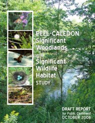
8 Significant Woodlands Significant Wildlife Habitat Study<br />
9 Housing<br />
The PPC Work Plan made provisions for a<br />
high degree <strong>of</strong> co operation and<br />
coordination between the Region <strong>of</strong> Peel and the area municipalities in<br />
conducting the Provincial conformity work within a limited time as<br />
stipulated<br />
by the Provincial deadline <strong>of</strong> June 16 2009 for Growth Plan conformity<br />
The review process involved the completion <strong>of</strong> a number <strong>of</strong> background<br />
studies and or discussion papers for the Key Topic Areas for the purpose <strong>of</strong><br />
providing<br />
an overview <strong>of</strong> issues related to the Key Topic Area<br />
an assessment <strong>of</strong> the current <strong>Town</strong> <strong>of</strong> <strong>Caledon</strong> Official Plan with respect<br />
to conformity with new Provincial and Regional policy directions<br />
a summary <strong>of</strong> best practices and policy approaches and<br />
recommendations for Official Plan revisions<br />
The PPC Work Plan made provisions for extensive public involvement<br />
including opportunities for public input at workshops and open houses held<br />
at key stages in the process <strong>of</strong> preparing the background studies discussion<br />
papers for the Key Topic Areas<br />
The public consultation process also made provision for seeking the input <strong>of</strong><br />
First Nations groups through a consultation protocol developed by the<br />
Region <strong>of</strong> Peel for contact with First Nations groups<br />
The introductory<br />
information about the <strong>Town</strong> s Provincial Policy Conformity Exercise was sent<br />
to various First Nationsgroups on February 4 2009<br />
A number <strong>of</strong> Council workshops have been held to provide information and<br />
update and seek input from members <strong>of</strong> Council on the background<br />
studies discussion papers for each <strong>of</strong> the Key Topic Areas A series <strong>of</strong><br />
workshops were also held specifically to seek Council s<br />
input during the<br />
policy formulation states <strong>of</strong> process<br />
As part <strong>of</strong> the <strong>Town</strong> s communication strategy a webpage in the <strong>Town</strong> <strong>of</strong><br />
<strong>Caledon</strong> s website is devoted exclusively to providing information on the<br />
PPC Exercise The webpage contains information on all Background<br />
Studies Discussion Papers council reports and proposed meetings related<br />
to the conformity work In addition to providing up to date information to<br />
members <strong>of</strong> the public the website also serves as a communication medium<br />
between staff members and interested parties<br />
The <strong>Town</strong> could not meet the Provincial deadline set for June 16 2009<br />
Therefore on April 7 2009 <strong>Town</strong> Council adopted a revised work plan which<br />
reflected the time it would require for the <strong>Town</strong> to review and comply with<br />
5
new Regional Official Plan policies seek public input and hold public<br />
meetings in accordance with the requirements <strong>of</strong> Section 26 <strong>of</strong> the Planning<br />
Act The Minister <strong>of</strong> Energy and Infrastructure granted the <strong>Town</strong> s request<br />
for an extension to the conformity deadline until December 31 2009 6
PART B<br />
THE AMENDMENT<br />
This part <strong>of</strong> the document entitled Part B The Amendment and<br />
consisting <strong>of</strong> the following Text Tables Figures and Schedules constitutes<br />
Amendment No <strong>226</strong> to the Official Plan <strong>of</strong> the <strong>Town</strong> <strong>of</strong> <strong>Caledon</strong><br />
Details <strong>of</strong> the Amendment<br />
The <strong>Town</strong> <strong>of</strong> <strong>Caledon</strong> Official Plan is amended as follows<br />
1 Chapter 1 Introduction Section 1 4 is amended by deleting the<br />
section in its entirety and replacing it with the following<br />
1 4 Basis <strong>of</strong> the Plan<br />
The original <strong>Town</strong> <strong>of</strong> <strong>Caledon</strong> Official Plan came into effect in 1979<br />
Since that time the Plan has been systematically reviewed and<br />
amended in order to keep it current reflect changing community<br />
needs and dynamics address external influences and to respond to<br />
new<br />
Regional and Provincial planning policies and legislation<br />
The first major review <strong>of</strong> the Official Plan was initiated in 1989<br />
review resulted in Official Plan Amendment<br />
This<br />
<strong>OPA</strong> 114 which was<br />
approved by the Ontario Municipal Board in September 1997 <strong>OPA</strong><br />
114 established an overall growth management framework for the<br />
<strong>Town</strong> within a 2021 planning horizon Among other things this<br />
growth management framework established a hierarchy <strong>of</strong> settlement<br />
areas<br />
reflecting the distinctive attributes and planned functions <strong>of</strong><br />
<strong>Caledon</strong> s settlement areas This hierarchy identified Rural Service<br />
Centres Villages Hamlets and Industrial Commercial Centres<br />
Under to tri nodal concept the majority <strong>of</strong> <strong>Caledon</strong> s new growth<br />
was to be directed to three Rural Service Centres Bolton <strong>Caledon</strong><br />
East and Mayfield West These three communities have full water<br />
and wastewater servicing which allows them to be planned as<br />
compact communities with a full range <strong>of</strong> land uses housing and<br />
economic development opportunities and to provide services to<br />
<strong>Caledon</strong> s urban and rural residents<br />
<strong>OPA</strong> 114 also identified the Villages <strong>of</strong> Alton <strong>Caledon</strong> Village<br />
Cheltenham Inglewood Mono Mills and Palgrave as locations for a<br />
moderate amount <strong>of</strong> growth to occur in order to maintain their vitality<br />
and provide a more limited range <strong>of</strong> services to the surrounding rural<br />
community and called for the completion <strong>of</strong> Village Studies to guide<br />
growth within each <strong>of</strong> these communities In addition <strong>OPA</strong> 114<br />
established three Industrial Commercial Centres Tullamore Sandhill<br />
and Victoria which were intended to serve a<br />
complementary role to<br />
the other settlements and provide at a small scale a supportive<br />
function to the Rural Service Centres for industrial and commercial<br />
development The Hamlets were other historic settlement areas in<br />
<strong>Caledon</strong> which were identified for only minor growth through infill and<br />
the development <strong>of</strong> vacant parcels<br />
Following the approval <strong>of</strong> <strong>OPA</strong> 114 a series <strong>of</strong> Secondary Plans were<br />
completed to implement the growth management strategy<br />
Secondary Plans were completed for Bolton s Residential Policy<br />
Areas and the Bolton Core during and shortly after the approval <strong>of</strong><br />
<strong>OPA</strong> 114<br />
These were followed by the Inglewood Village Plan <strong>OPA</strong><br />
155 in 1999 the <strong>Caledon</strong> East Secondary Plan <strong>OPA</strong> 162 in 2000<br />
the Tullamore Industrial Commercial Secondary Plan <strong>OPA</strong> 159 in<br />
2001 Secondary Plans for Bolton s Industrial Policy Areas <strong>OPA</strong> s<br />
180 and 184 in 2003 the Snells Hollow Secondary Plan <strong>OPA</strong> 194 in<br />
2005 Victoria Industrial Area Secondary Plan <strong>OPA</strong> 202 in 2005 and<br />
7
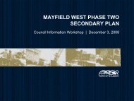
most recently the Mayfield West Phase 1 Secondary Plan <strong>OPA</strong> 208<br />
approved<br />
in 2006<br />
While the growth management strategy <strong>of</strong> <strong>OPA</strong> 114 was being<br />
implemented the <strong>Town</strong> proceeded to systematically review other<br />
sections <strong>of</strong> the Official Plan New Ecosystem Planning and<br />
Management and Open Space and Recreation policies were<br />
established through <strong>OPA</strong> 124 which was<br />
approved in two steps in<br />
1997 and 2003 New Mineral Resources policies were developed on<br />
the basis <strong>of</strong> the <strong>Caledon</strong> Community Resources Study and instituted<br />
through <strong>OPA</strong> 161 approved in 2003 New Cultural Heritage<br />
Conservation policies were implemented through <strong>OPA</strong> 173 approved<br />
in 2004 The <strong>Town</strong> s<br />
Agricultural and Rural policies were<br />
comprehensively updated through <strong>OPA</strong> 179 which came into effect in<br />
2009 Bolton s oommercial policies were comprehensively reviewed<br />
through<br />
<strong>OPA</strong> 215 which came Into effect In 2007<br />
In accordance with the Oak Ridges Moraine Conservation Act 2001<br />
the <strong>Town</strong><br />
<strong>of</strong> <strong>Caledon</strong> adopted Official Plan Amendment 186 on<br />
October 6 2003 to bring the Official Plan into conformity with the Oak<br />
Ridges Moraine Conservation Plan Ontario Regulation 140 02 <strong>OPA</strong><br />
186 was approved by the Minister <strong>of</strong> Municipal Affairs and Housing on<br />
December 6<br />
non decision<br />
2006 except for several policies that were subject to a<br />
and remain outstanding<br />
In 2005 a review <strong>of</strong> the <strong>Town</strong> s<br />
population and employment forecasts<br />
was initiated This review originally undertaken to address local<br />
growth issues in Bolton resulted in the development <strong>of</strong> <strong>Town</strong> wide<br />
forecasts and distributions that were<br />
incorporated into draft Official<br />
Plan Amendment 203<br />
Draft <strong>OPA</strong> 203 also extended the <strong>Town</strong> s<br />
population and employment forecasts to 2031 Draft <strong>OPA</strong> 203 was<br />
twice endorsed by Council in August 2006 and November 2007 and<br />
<strong>Town</strong> staff was directed to use the forecasts for planning purposes<br />
While this work was<br />
ongoing the Province <strong>of</strong> Ontario implemented a<br />
series <strong>of</strong> sweeping changes to the land use planning system in<br />
Ontario These changes included<br />
1 The Provincial Policy Statement 2005 PPS 2005 which came<br />
into effect on March 1 2005<br />
2 Bill 135 the Greenbelt Act which received Royal Assent on<br />
February 24 2005 and the Greenbelt Plan which took effect<br />
December 14 2004<br />
3 Bill 51 the Planning and Conservation Land Statute Law<br />
Amendment Act which received Royal Assent on October 19<br />
2006 and<br />
4 Bill 136 the Places To Grow Act which received Royal Assent<br />
on June 13 2005 and the Growth Plan for the Greater Golden<br />
Horseshoe the Growth Plan which took effect on June 16<br />
2006<br />
In response to these major Provincial policy and legislative changes<br />
the <strong>Town</strong> initiated an Official Plan review in 2007 In September<br />
2007 Council approved a work plan for this review This work plan<br />
established that the scope <strong>of</strong> the Official Plan review would be limited<br />
to addressing conformity with these new Provincial planning<br />
directions The work plan also identified eight Key Topic Areas that<br />
would be reviewed Growth Forecasts and Density Intensification<br />
Targets Employment Transportation and Services Agriculture and<br />
Rural Policies Sustainability Water ResourceslWatershed Planning<br />
8
Greenbelt Plan Conformity Natural Heritage System and Significant<br />
Woodlands Significant Wildlife Habitat Study<br />
Through the subsequent conformity exercise it was determined that<br />
the Key Topic Area <strong>of</strong> Water ResourceslWatershed Planning would<br />
be separated out to be completed at a later time and<br />
Topic Area addressing Housing policies was added to the work plan<br />
The earlier population and employment forecasting work that was<br />
a new Key<br />
reflected in draft <strong>OPA</strong> 203 was incorporated into the work plan for the<br />
overall Provincial policy conformity exercise Also consistent with the<br />
earlier <strong>OPA</strong> 203 work and in accordance with the Provincial Growth<br />
Plan it was determined that one <strong>of</strong> the purposes <strong>of</strong> the review would<br />
be to extend the planning<br />
horizon <strong>of</strong> the Official Plan to 2031<br />
At the same time the Region <strong>of</strong> Peel initiated an Official Plan review<br />
to address Provincial policy conformity and other matters that had<br />
arisen since the previous Regional Official Plan review<br />
resulted in<br />
This review<br />
the Region adopting a series <strong>of</strong> Regional Official Plan<br />
Amendments R<strong>OPA</strong> s in 2009 and 2010 including R<strong>OPA</strong> 20<br />
Sustainability R<strong>OPA</strong> 21A Air Quality and Integrated Waste<br />
Management R<strong>OPA</strong> 21 B Natural Heritage and Agriculture R<strong>OPA</strong> 22<br />
Transportation policies R<strong>OPA</strong> 23 Housing R<strong>OPA</strong> 24 Growth<br />
Management Employment Areas and Greenbelt Plan conformity and<br />
R<strong>OPA</strong> 25 Monitoring and Planning and Conservation Land Statute<br />
LawAmendment Act conformity<br />
Between 2007 and 2010 the <strong>Town</strong> conducted research related to the<br />
Key Topic Areas produced discussion papers undertook joint studies<br />
with the Region <strong>of</strong> Peel and consulted extensively with the public<br />
stakeholders First Nations groups and other agencies The <strong>Town</strong><br />
closely collaborated with the Region <strong>of</strong> Peel and the Cities <strong>of</strong><br />
Brampton and Mississauga regarding the development <strong>of</strong> revised<br />
Regional Official Plan policies in order to ensure that revised Regional<br />
policies were responsive to <strong>Caledon</strong> s needs to the extent possible<br />
and also to understand conformity requirements for <strong>Caledon</strong> flowing<br />
from the revisions to the upper tier Region <strong>of</strong> Peel Official Plan<br />
This Provincial<br />
policy conformity work culminated in <strong>Caledon</strong><br />
Council s<br />
adoption <strong>of</strong> Official Plan Amendment <strong>226</strong> on June 8 2010<br />
<strong>OPA</strong> <strong>226</strong> established revised policies regarding the identified Key<br />
Topic Areas and brought the <strong>Caledon</strong> Official Plan into conformity with<br />
both the new Provincial policies and legislation noted earlier and the<br />
new<br />
Region <strong>of</strong> Peel Official Plan policies adopted through Peel<br />
Region s Official Plan review<br />
2031<br />
The planning horizon for this Plan is<br />
2 Chapter 1 Introduction is amended by adding the following as the final<br />
sentence <strong>of</strong> the second paragraph <strong>of</strong> Section 1 1<br />
<strong>Caledon</strong> s extensive protected natural heritage systems perform a<br />
vital role within the Region <strong>of</strong> Peel and the greater Toronto Area with<br />
respect to climate change mitigation and adaptation acting as a major<br />
carbon sink and moderating extremes in rainfall events and<br />
temperatures<br />
3 Chapter 1 is amended by deleting the word natives in the first<br />
paragraph <strong>of</strong> Section 1<br />
2 and replacing it with First Nations<br />
4 Chapter 1 Introduction is amended by deleting Sections 1 6 Niagara<br />
Escarpment and 1 7 Oak Ridges Moraine renumbering Sections 1 5<br />
The Regional Municipality <strong>of</strong> Peel and 1 8 Contents <strong>of</strong> the Plan to 1 6<br />
and 1 7 respectively and adding the following new Section 1 5<br />
9
1 5 THE PROVINCIAL POLICY STATEMENT AND PROVINCIAL<br />
PLANS<br />
The Provincial Policy Statement PPS 2005 provides overall<br />
policy directions on matters <strong>of</strong> Provincial interest and applies<br />
to all lands within the <strong>Town</strong> <strong>of</strong> <strong>Caledon</strong><br />
In addition to the PPS the <strong>Town</strong> <strong>of</strong> <strong>Caledon</strong> is subject to four<br />
Provincial Plans the Niagara Escarpment Plan the Oak<br />
Ridges Moraine Conservation Plan the Greenbelt Plan and<br />
the Growth Plan for the Greater Golden Horseshoe These<br />
Plans<br />
which collectively affect the entire land base <strong>of</strong> the<br />
municipality form a<br />
key foundation for the <strong>Town</strong> s overall land<br />
use<br />
planning structure The boundaries <strong>of</strong> each <strong>of</strong> these Plan<br />
Areas are<br />
depicted<br />
on Schedule A1<br />
<strong>Town</strong> Structure<br />
This Official Plan has been amended to be brought into<br />
conformity with the PPS 2005 and these four Provincial Plans<br />
Sections 1 5 1 to 1 5 5 below provide<br />
an overview <strong>of</strong> the PPS<br />
2005 and the four Provincial Plans Section 1 5 6 generally<br />
describes the relationships between the PPS 2005 the<br />
Provincial Plans and the <strong>Caledon</strong> Official Plan Section 6 6 3<br />
provides additional generalized policy direction regarding<br />
conformity requirements interpretation <strong>of</strong> boundaries conflict<br />
provisions and transition provisions Other sections <strong>of</strong> this<br />
Plan provide add itional detailed policies necessary to fully<br />
implement the PPS 2005 and Provincial Plans<br />
1 5 1 Provincial Policy Statement<br />
The Provincial Policy Statement PPS issued under the<br />
authority <strong>of</strong> Section 3 <strong>of</strong> the Planning Act came into effect on<br />
March 1 2005 and provides policy direction on matters <strong>of</strong><br />
Provincial interest related to land use planning and<br />
development The PPS sets the policy foundation for regulating<br />
the development and use <strong>of</strong> land<br />
The declared intent <strong>of</strong> the PPS is to provide for appropriate<br />
development while protecting resources <strong>of</strong> Provincial interest<br />
public health and safety and the quality <strong>of</strong> the natural<br />
environment The PPS supports improved land use<br />
planning<br />
and management which contributes to a more effective and<br />
efficient land use<br />
planning system<br />
The policies <strong>of</strong> the PPS are<br />
complemented by Provincial Plans<br />
and by locally generated policies regarding matters <strong>of</strong><br />
municipal interest Collectively the PPS Provincial Plans and<br />
municipal <strong>of</strong>ficial plans provide<br />
a framework for<br />
comprehensive integrated and long term planning that<br />
supports and integrates the principles <strong>of</strong> strong communities a<br />
clean and healthy environment and economic growth for the<br />
long term<br />
1 5 2 Niagara Escarpment Plan<br />
A commitment to the preservation <strong>of</strong> the Niagara Escarpment<br />
was made through the enactment <strong>of</strong> the Niagara Escarpment<br />
Planning and Development Act which lead to the approval <strong>of</strong><br />
the original Niagara Escarpment Plan in June 1985 The<br />
Niagara Escarpment Plan has since been revised as a result <strong>of</strong><br />
reviews that were initiated in 1990 and 1999 The purpose <strong>of</strong><br />
the Niagara Escarpment Plan is to provide for the maintenance<br />
<strong>of</strong> the Niagara Escarpment and lands in its vicinity substantially<br />
10
as a continuous natural environment and to ensure<br />
only such<br />
development<br />
occurs as is compatible with that natural<br />
environment The objectives <strong>of</strong> the Niagara Escarpment Plan<br />
are as follows<br />
to protect unique ecological and historic areas<br />
to maintain and enhance the quality<br />
natural streams and water supplies<br />
and character <strong>of</strong><br />
to provide adequate opportunities for outdoor recreation<br />
to maintain and enhance the open landscape character<br />
<strong>of</strong> the Niagara Escarpment in so far as possible by such<br />
means as compatible farming or forestry and by<br />
preserving the natural scenery<br />
to ensure that all new<br />
development is compatible with<br />
the purpose <strong>of</strong> the Plan<br />
to provide for adequate public access to the Niagara<br />
Escarpment and<br />
to support municipalities within the Niagara Escarpment<br />
Plan Area in their exercise <strong>of</strong> the planning functions<br />
conferred upon them by the Planning Act<br />
1 5 3 Oak Ridges Moraine Conservation Plan<br />
The Oak Ridges Moraine is a Provincially significant prominent<br />
upland area that runs east west through south central Ontario<br />
The western terminus <strong>of</strong> the Moraine occurs in the <strong>Town</strong> <strong>of</strong><br />
<strong>Caledon</strong> where the Moraine intersects the Niagara<br />
Escarpment The Moraine was formed by glacial action<br />
between two opposing<br />
ice lobes within the last one million<br />
years The Moraine has a<br />
unique combination <strong>of</strong> geological<br />
hydrological topographical and biotic attributes It performs<br />
essential ecological functions including the provisions <strong>of</strong><br />
significant natural habitat the protection and maintenance <strong>of</strong><br />
surface and groundwater resources and has distinctive<br />
topographical and scenic values<br />
In recognition <strong>of</strong> the Moraine s<br />
significance the Province <strong>of</strong><br />
Ontario enacted the Oak Ridges Moraine Conservation Act<br />
2001 and the accompanying Oak Ridges Moraine<br />
Conservation Plan ORMCP Together these documents<br />
establish the Ontario government s vision for the Moraine as a<br />
continuous band <strong>of</strong> green rolling hills that provides form and<br />
structure to south central Ontario while protecting the<br />
ecological and hydrological features and functions that support<br />
the health and well being <strong>of</strong> the region<br />
s residents and<br />
ecosystems and provide<br />
a<br />
planning framework for<br />
implementing this vision primarily through municipal <strong>of</strong>ficial<br />
plans<br />
Detailed policies pertaining to the Oak Ridges Moraine<br />
Conservation Plan can be found in Section 7 10 and other<br />
relevant sections <strong>of</strong> this Plan<br />
1 5 4 Greenbelt Plan<br />
The Greenbelt Act 2005 provides for the establishment <strong>of</strong> the<br />
Greenbelt Plan The Greenbelt Plan established under<br />
11
Section 3 <strong>of</strong> the Greenbelt Act took effect on December 16<br />
2004<br />
The Greenbelt Plan identifies where urbanization should not<br />
occur in order to provide permanent protection to the<br />
agricultural land base and the ecological features and functions<br />
occurring on this landscape The Greenbelt Plan includes<br />
lands within and builds upon the ecological protections<br />
provided by the Niagara Escarpment Plan<br />
Ridges Moraine Conservation Plan ORMCP<br />
NEP and the Oak<br />
The Protected Countryside lands identified in the Greenbelt<br />
Plan are intended to enhance the spatial extent <strong>of</strong> agriculturally<br />
and environmentally protected lands currently covered by the<br />
NEP and the ORMCP while at the same time improving<br />
linkages between these areas and the surrounding major lake<br />
systems and watersheds Collectively the lands in these three<br />
plans form the Greenbelt The Protected Countryside<br />
as<br />
shown on Schedule S <strong>of</strong> this Plan is made up <strong>of</strong> an<br />
Agricultural System and a Natural System together with a<br />
series <strong>of</strong> settlement areas as derived from municipal <strong>of</strong>ficial<br />
plans<br />
Detailed policies pertaining to the Greenbelt Plan can be found<br />
in Section 7 13 and other relevant sections <strong>of</strong> this Plan<br />
1 5 5 Growth Plan for the Greater Golden Horseshoe<br />
The Places to Grow Act 2005 provides for the establishment<br />
<strong>of</strong> growth plans for specific geographic<br />
areas within the<br />
Province <strong>of</strong> Ontario The Growth Plan for the Greater Golden<br />
Horseshoe hereinafter referred to as the Growth Plan was<br />
established under the Places to Grow Act 2005 and came into<br />
effect on June 16 2006<br />
The Growth Plan establishes a framework for implementing the<br />
Government <strong>of</strong> Ontario s vision for building stronger<br />
prosperous communities by better managing growth in this<br />
region to 2031 This is a plan that is intended to provide<br />
leadership for improving the ways in which our cities suburbs<br />
towns and villages will grow overthe long term<br />
The Growth Plan guides decisions on transportation<br />
infrastructure planning land use<br />
planning urban form housing<br />
natural heritage and resource protection in the interest <strong>of</strong><br />
promoting economic prosperity and in doing so aimsto<br />
revitalize downtowns to become vibrant and convenient<br />
centres<br />
create complete communities that <strong>of</strong>fer more options for<br />
living working learning shopping and playing<br />
provide housing options to meet the needs <strong>of</strong> people at<br />
any age<br />
curb sprawl and protect farmland and green spaces<br />
and<br />
reduce traffic gridlock by improving access to a greater<br />
range <strong>of</strong> transportation options<br />
Detailed policies derived from the Growth Plan can be found in<br />
Chapter 4 Section 5 5 and other relevant sections <strong>of</strong> this Plan<br />
12
1 5 6 Relationships Between the PPS Provincial Plans and<br />
Municipal Official Plans<br />
The Provincial Policy Statement PPS 2005 provides overall<br />
policy direction on matters <strong>of</strong> Provincial interest related to land<br />
use and development in Ontario<br />
The policies <strong>of</strong> the PPS are<br />
complemented by Provincial Plans and by locally generated<br />
policies regarding matters <strong>of</strong> municipal interest as expressed<br />
through municipal <strong>of</strong>ficial plans The PPS Provincial Plans<br />
and municipal <strong>of</strong>ficial plans provide an overall framework for<br />
comprehensive land use planning within the Province <strong>of</strong><br />
Ontario<br />
Municipal <strong>of</strong>ficial plans are the most important vehicle for<br />
implementing the PPS and are also a key vehicle for<br />
Implementing the policies <strong>of</strong> the Oak Ridges Moraine<br />
Conservation Plan ORMCP the Greenbelt Plan and the<br />
Provincial Growth Plan<br />
Unlike the other Provincial Plans the Niagara Escarpment Plan<br />
NEP is primarily implemented within the Niagara Escarpment<br />
Plan Area by the Niagara Escarpment Commission through the<br />
Niagara Escarpment Planning and Development Act and the<br />
development control regulation Ontario Regulation 828 90 as<br />
amended<br />
The Greenbelt Plan Area includes lands within the NEP Area<br />
the ORMCP Area and lands designated as Protected<br />
Countryside For lands within the ORMCP and NEP Areas the<br />
requirements <strong>of</strong> the ORMCP and NEP continue to apply and<br />
the Protected Countryside policies <strong>of</strong> the Greenbelt Plan do not<br />
apply with the exception <strong>of</strong> Section 3 3 Parkland Open Space<br />
and Trails<br />
The Growth Plan applies to the Greater Golden Horseshoe<br />
which includes the entire <strong>Town</strong> <strong>of</strong> <strong>Caledon</strong> including the lands<br />
within the <strong>Town</strong> that are<br />
subject to the NEP ORMCP and the<br />
Greenbelt Plan<br />
The <strong>Town</strong> <strong>of</strong> <strong>Caledon</strong> Official Plan has been brought into<br />
conformity with the PPS 2005 and the Provincial Plans<br />
described above As such the policies contained in this Plan<br />
implement the PPS 2005 and the Provincial Plans while also<br />
addressing local land use and community objectives to the<br />
extent permitted by Provincial policy<br />
Refer to Section 6 6 3 <strong>of</strong> this Plan for additional detailed<br />
policies pertaining to conformity requirements boundaries<br />
conflicts between the PPS Provincial Plans and municipal<br />
Official Plans and transition provisions<br />
5 The renumbered Section 1 6 The Regional Municipality <strong>of</strong> Peel is<br />
amended by deleting and replacing the third paragraph<br />
following new paragraph<br />
with the<br />
The Council <strong>of</strong> the Region <strong>of</strong> Peel adopted the first Regional Official<br />
Plan on<br />
July 11 1996 The Regional Official Plan has since been the<br />
subject <strong>of</strong> a number <strong>of</strong> amendments since that time including<br />
amendments flowing from two comprehensive Official Plan reviews<br />
The most recent comprehensive review was initiated by the Region in<br />
2007 in order to address a number <strong>of</strong> legislative and policy initiatives<br />
that had been introduced by the Province since the Regional Official<br />
Plan was last reviewed in 2002<br />
The 2007 review resulted in the<br />
13
Region adopting a series <strong>of</strong> Regional Official Plan Amendments in<br />
2009 and 2010<br />
And by adding the following sentence to the end <strong>of</strong> the fourth<br />
paragraph<br />
The planning roles and responsibilities <strong>of</strong> the Region <strong>of</strong> Peel and the<br />
area<br />
municipalities within Peel are further detailed and refined from<br />
time to time through the establishment <strong>of</strong> appropriate operating<br />
protocols and other service delivery agreements Information<br />
regarding the most current set <strong>of</strong> operating protocols is attached to<br />
this Plan as<br />
Appendix VI<br />
6 The renumbered Section 1 7 Contents <strong>of</strong> the Plan is amended by<br />
adding reference to Schedule S Figure 1 and Figure 17<br />
7 Section 2 2 1 c is amended by adding the following words protecting<br />
expanding and diversifying the <strong>Town</strong> s employment and assessment<br />
base and after the words achieve fiscal sustainability by<br />
8 Section 2 2 2 a is amended by adding the following<br />
end <strong>of</strong> the second paragraph<br />
sentences to the<br />
Notwithstanding that a significant portion <strong>of</strong> <strong>Caledon</strong> s Prime<br />
Agricultural Area is also located within the Growth Plan Area based<br />
on <strong>Caledon</strong> s current population and employment forecasts the vast<br />
majority <strong>of</strong> the Growth Plan Area in <strong>Caledon</strong> will remain in a Prime<br />
Agricultural Designation during and beyond the life <strong>of</strong> this Plan This<br />
will pose unique challenges with respect to the continued viability and<br />
vitality <strong>of</strong> agriculture in southern <strong>Caledon</strong> which will require policies<br />
that support agricultural innovation diversity and flexibility<br />
9 Section 2 2 2 b is amended by adding the following as the final<br />
paragraph<br />
The Provincial Growth Plan June 2006 identifies a<br />
conceptual<br />
Future Transportation Corridor that generally extends east from the<br />
Guelph area to the east <strong>of</strong> <strong>Caledon</strong> and includes policy directions<br />
requiring that transportation corridors be identified and protected The<br />
Ministry <strong>of</strong> Transportation has initiated an Environmental Assessment<br />
study that will more<br />
specifically define the GTA West Future<br />
Transportation Corridor Should the outcome <strong>of</strong> this Environmental<br />
Assessment determine that a<br />
major east west transportation<br />
infrastructure corridor is needed in south <strong>Caledon</strong> it could significantly<br />
influence long term development patterns and provide opportunities<br />
for strategic employment lands development<br />
10 Chapter 3 General Policies is amended by adding the following new<br />
Section 3 1 Sustainability and renumbering all subsequent Sections<br />
accordingly<br />
3 1 SUSTAINABILITY<br />
3 1 1 Introduction<br />
Sustainability in its broadest sense refers to the wise use <strong>of</strong><br />
available resources to meet the needs <strong>of</strong> the present without<br />
compromising the ability <strong>of</strong> future generations to meet their<br />
own needs Under many policy models sustainability is<br />
considered to have three primary pillars economic<br />
environmental and social cultural<br />
The <strong>Town</strong> <strong>of</strong> <strong>Caledon</strong> prides itself for its tradition <strong>of</strong> progressive<br />
local community based land use planning This tradition has<br />
14
over the past several decades resulted in Official Plan policies<br />
that embody and embrace many <strong>of</strong> the principles <strong>of</strong><br />
sustainability<br />
This includes<br />
growth management policies that focus new<br />
development into areas that can be planned as<br />
compact diverse and transit supportive communities<br />
while minimizing impacts on the natural environment<br />
and rural agricultural resources<br />
economic development and employment policies<br />
which pursue an enhanced tax base and promote live<br />
work opportunities<br />
fiscal and economic management policies aimed at<br />
ensuring <strong>Caledon</strong> s continued and enhanced fiscal<br />
sustainability<br />
advanced ecosystem planning and management<br />
policies which ensure the continued health and<br />
integrity <strong>of</strong> <strong>Caledon</strong> s natural heritage<br />
innovative policies fostering a vibrant economically<br />
vital rural and agricultural community<br />
resource management policies that strive to balance<br />
the wise use <strong>of</strong> renewable and non renewable natural<br />
resources with community social values and the<br />
protection and stewardship <strong>of</strong> natural and cultural<br />
resources and<br />
progressive cultural heritage conservation policies<br />
The Province <strong>of</strong> Ontario has recognized the degree <strong>of</strong> inter<br />
relatedness in decisions about land use planning in a number<br />
<strong>of</strong> Ontario Provincial statutes supporting sustainability<br />
i<br />
Bill 51 the Planning and Conservation Land Statute Law<br />
Amendment Act amended the Planning Act to establish<br />
the promotion <strong>of</strong> development that is designed to be<br />
sustainable to support public transit and to be oriented<br />
to pedestrians to be a matter <strong>of</strong> Provincial interest<br />
ii The Provincial Policy Statement PPS 2005 directs<br />
municipalities to promote ways to support strong<br />
liveable communities protect the environment and<br />
public health and safety and facilitate economic<br />
growth and<br />
iii<br />
The Places to Grow Act and corresponding Growth Plan<br />
direct municipalities to plan for complete and sustainable<br />
communities<br />
As a framework for decision making sustainability allows for<br />
the coordinated and integrated consideration <strong>of</strong> the implications<br />
<strong>of</strong> land use decisions economic environmental and<br />
social cultural matters<br />
The <strong>Town</strong> <strong>of</strong> <strong>Caledon</strong> intends to remain a prosperous vibrant<br />
and liveable community by continuing to actively promote<br />
sustainability principles in all facets <strong>of</strong> its land use planning and<br />
decision making role Collectively all <strong>of</strong> the policies contained<br />
in the different sections this Official Plan reflect <strong>Caledon</strong> s<br />
15
ongoing commitment to planning the <strong>Town</strong> as a whole as a<br />
sustainable community The policies <strong>of</strong> Section 3 1 are<br />
intended to confirm <strong>Caledon</strong> s commitment to sustainability as<br />
an<br />
explicit principle and to supplement the other policies <strong>of</strong> this<br />
Plan with additional policies addressing Sustainable<br />
Development Patterns and Urban Design Climate Change<br />
Conservation <strong>of</strong> Water and Energy Alternative and Renewable<br />
Energy Air Quality Adaptive Environmental Management and<br />
Sustainability Indicators and Monitoring<br />
3 1 2<br />
3 1 2 1<br />
Obiectives<br />
To ensure that the three pillars <strong>of</strong> sustainability economic<br />
environmental and socialcultural are considered as a<br />
primary<br />
guiding principle for land use<br />
planning and decision making in<br />
the <strong>Town</strong> <strong>of</strong> <strong>Caledon</strong><br />
3 1 2 2<br />
To ensure that new<br />
development and redevelopment promotes<br />
and integrates the principles <strong>of</strong> sustainability<br />
as detailed in this<br />
and other Sections <strong>of</strong> the Official Plan<br />
3 1 2 3<br />
3 1 3<br />
3 1 3 1<br />
3 1 3 2<br />
3 1 3 3<br />
3 1 3 4<br />
To work with <strong>Caledon</strong> residents land and business owners<br />
community organizations the Region <strong>of</strong> Peel Conservation<br />
Authorities and other levels <strong>of</strong> government in researching<br />
implementing and monitoring the sustainability objectives<br />
policies and programs <strong>of</strong> this Plan<br />
Policies<br />
The <strong>Town</strong> shall implement and participate in as appropriate<br />
policies and programs that support <strong>Caledon</strong> s commitment to<br />
addressing the principles <strong>of</strong> sustainability through the land use<br />
planning system<br />
The <strong>Town</strong> will consider developing and implementing a range<br />
<strong>of</strong> appropriate mechanisms and tools to promote and facilitate<br />
new<br />
development and redevelopment that addresses the<br />
sustainability objectives and policies <strong>of</strong> this Plan<br />
Within the context <strong>of</strong> the <strong>Town</strong> <strong>of</strong> <strong>Caledon</strong> s roles and<br />
responsibilities with respect to local land use<br />
planning and<br />
development approvals the <strong>Town</strong> shall work with <strong>Caledon</strong><br />
residents land and business owners community organizations<br />
the Region <strong>of</strong> Peel Conservation Authorities and other levels<br />
<strong>of</strong> government in researching implementing and monitoring the<br />
sustainability objectives policies and programs <strong>of</strong> this Plan<br />
including the policies contained in Sections 3 1 3 7 to 3 1 3 13<br />
addressing Sustainable Development Patterns and Urban<br />
Design Climate Change Conservation <strong>of</strong> Water and Energy<br />
Alternative and Renewable Energy Air Quality Adaptive<br />
Environmental Management and Sustainability Indicators and<br />
Monitoring<br />
To assist in interpreting and implementing the sustainability<br />
policies contained in Sections 3 1 3 the <strong>Town</strong> may collaborate<br />
with the Region <strong>of</strong> Peel other agencies and appropriate<br />
partners to develop appropriate guidance documents and<br />
sustainability assessment tools such as a Sustainability Design<br />
Brief and Sustainability Checklist<br />
3 1 3 5<br />
Once appropriate guidance document s have been developed<br />
by the <strong>Town</strong> proponents <strong>of</strong> development and redevelopment<br />
will be required to submit a<br />
Sustainability Design Brief as part<br />
16
<strong>of</strong> a<br />
complete application which addresses the sustainability<br />
objectives and policies<br />
<strong>of</strong> this Plan<br />
3 1 3 6<br />
The <strong>Town</strong> will develop a Sustainability Checklist to be used<br />
when reviewing planning applications including plans <strong>of</strong><br />
subdivision Official Plan and Zoning By law amendments and<br />
site plan control to determine how each development proposal<br />
will assist in achieving the sustainability objectives and policies<br />
<strong>of</strong> this Plan<br />
3 1 3 7<br />
Sustainable Develooment Patterns and Communitv Desion<br />
The <strong>Town</strong> <strong>of</strong> <strong>Caledon</strong> is committed to implementing<br />
sustainable development patterns and sustainable urban<br />
design in order to create complete compact and connected<br />
communities An emphasis on a high standard <strong>of</strong> community<br />
design is essential as the <strong>Town</strong> continues to plan for and<br />
promote development and redevelopment opportunities that<br />
incorporate the principles <strong>of</strong> sustainability In accordance with<br />
Provincial and Regional planning directions and the <strong>Town</strong> s<br />
Official Plan policies the <strong>Town</strong> will be planning for higher<br />
density residential and mixed use neighbourhoods and<br />
employment areas intensification in appropriate locations the<br />
use <strong>of</strong> energy conservation techniques and alternative energy<br />
sources a wide range <strong>of</strong> housing types and tenures that<br />
address afford ability accessibility and the needs <strong>of</strong> different<br />
age and income groups recreation opportunities and<br />
innovative techniques to manage the quality and quantity <strong>of</strong><br />
stormwater run<strong>of</strong>f<br />
All <strong>of</strong> these progressive ideas require a<br />
strong attention to<br />
design to ensure that the end products the <strong>Town</strong> s<br />
communities neighbourhoods residences shopping and<br />
employment areas are liveable viable compatible and<br />
attractive The creation <strong>of</strong> a<br />
complete community requires<br />
developments that provide alternative forms <strong>of</strong> transportation<br />
provide linkages that facilitate access<br />
by pedestrians and<br />
cyclists to residential employment and recreational areas and<br />
provide public spaces that are safe and accessible to all<br />
including people with disabilities<br />
3 1 3 7 1<br />
Development and redevelopment shall be designed to achieve<br />
the <strong>Town</strong> <strong>of</strong> <strong>Caledon</strong> sustainability objectives and policies <strong>of</strong><br />
this Plan including the detailed policies <strong>of</strong> Sections 3 1<br />
and the<br />
Community Form and Complete Communities policies<br />
contained in Section 4 1 10<br />
The <strong>Town</strong> shall ensure that appropriate design guidelines are<br />
developed and implemented to assist in achieving sustainable<br />
development patterns and high quality design Such guidelines<br />
may include but are not necessarily limited to the following<br />
considerations<br />
integration <strong>of</strong> natural systems features and functions<br />
into the design <strong>of</strong> the community in an ecologically<br />
compatible manner<br />
preservation <strong>of</strong> existing trees and other significant<br />
vegetation<br />
planting <strong>of</strong> native species on lands adjacent to the<br />
<strong>Town</strong> s natural heritage system ecosystem<br />
17
components and other appropriate natural system<br />
enhancements<br />
promotion <strong>of</strong> active and passive recreation such as<br />
walking and cycling in an integrated trail network<br />
providing<br />
access between<br />
employment areas residential and<br />
optimizing existing public services and infrastructure<br />
energy and water efficiency<br />
techniques<br />
and conservation<br />
integration <strong>of</strong> renewable energy and locally produced<br />
or district energy where appropriate<br />
public health and safety<br />
public views <strong>of</strong> and where appropriate public access<br />
to natural features<br />
landform conservation<br />
appropriate protection and stewardship measures for<br />
greenways and or watercourses<br />
design opportunities to introduce links that connect<br />
different areas <strong>of</strong> the <strong>Town</strong> parks walkways and<br />
trails for an<br />
integrated community<br />
promotion <strong>of</strong> public transit and alternative forms <strong>of</strong><br />
transportation which decrease automobile<br />
dependency<br />
the needs <strong>of</strong> persons with disabilities and other<br />
special needs groups including public transit<br />
accessibility easily accessible parking for the<br />
physically challenged and universal design in housing<br />
compatibility between existing uses and new uses<br />
considering such items as<br />
lighting height traffic<br />
noise dust air quality odours and vibrations<br />
innovative design techniques promoted through<br />
various programs such as<br />
Leadership in Energy and<br />
Environmental Design LEED Low Impact<br />
Development LID and Energy Star and<br />
alternatives to hard surfacing where technically<br />
feasible and appropriate<br />
3 1 3 7 2<br />
Once design guidelines are established by Council proponents<br />
for development and redevelopment shall demonstrate how the<br />
proposal addresses the applicable design guidelines<br />
satisfaction <strong>of</strong> the <strong>Town</strong><br />
to the<br />
3 1 3 8<br />
Climate Chanae<br />
Climate change is considered to be one <strong>of</strong> the most significant<br />
challenges facing human society today Although climate<br />
change is global in scale the <strong>Town</strong> <strong>of</strong> <strong>Caledon</strong> can and should<br />
pursue practical and innovative climate change mitigation and<br />
adaptation measures within the context <strong>of</strong> the <strong>Town</strong> s local land<br />
18
use<br />
planning and development approvals functions <strong>Caledon</strong> s<br />
extensive protected natural heritage systems perform a vital<br />
role within the Region <strong>of</strong> Peel and the greater Toronto Area<br />
acting as a<br />
major carbon sink and moderating<br />
rainfall events and temperatures<br />
extremes in<br />
<strong>Caledon</strong> s<br />
healthy connected ecosystems are also more<br />
resilient and adaptable to the impacts <strong>of</strong> climate change The<br />
<strong>Town</strong> policy approaches to land use<br />
planning energy<br />
consumption transportation and infrastructure systems and the<br />
management and wise use <strong>of</strong> natural resources can all<br />
contribute to climate change mitigation and adaptation The<br />
following policies supplement the other policies <strong>of</strong> this Plan that<br />
have positive impacts with respect to climate change<br />
3 1 3 8 1<br />
The <strong>Town</strong> shall work with the Region<br />
<strong>of</strong> Peel development<br />
interests and other appropriate partners to identify and<br />
implement development patterns standards and practices that<br />
reduce greenhouse gas emissions<br />
3 1 3 8 2<br />
The <strong>Town</strong> shall participate<br />
in the Region <strong>of</strong> Peel Climate<br />
Change Strategy which is intended to address both the<br />
mitigation and adaptation aspects <strong>of</strong> climate change including<br />
the establishment <strong>of</strong> targets policies and programs to reduce<br />
the effects <strong>of</strong> climate change and minimize adverse impacts<br />
3 1 3 8 3<br />
3 1 3 8 4<br />
The <strong>Town</strong> shall encourage and promote the Region <strong>of</strong> Peel<br />
and other levels <strong>of</strong> government to research the<br />
economic financial value <strong>of</strong> the climate change mitigation and<br />
adaptation services provided by natural heritage systems in<br />
<strong>Caledon</strong> and to develop appropriate financial and other<br />
incentives which recognize the value <strong>of</strong> these services and<br />
support appropriate private land stewardship<br />
The <strong>Town</strong> will work with the Region <strong>of</strong> Peel the Province and<br />
other organizations to review municipal infrastructure standards<br />
with a view to adapting to and mitigating the anticipated<br />
potential impacts <strong>of</strong> climate change such as more frequent and<br />
intense rainfall events<br />
3 1 3 8 5<br />
3 1 3 8 6<br />
3 1 3 9<br />
The <strong>Town</strong> shall work with the Region <strong>of</strong> Peel<br />
Metrolinx the<br />
City <strong>of</strong> Brampton adjacent municipalities and other appropriate<br />
jurisdictions to improve public transit car pooling and other<br />
Traffic Demand Measures TDM to reduce overall greenhouse<br />
gas emissions from transportation that contribute to climate<br />
change<br />
The <strong>Town</strong> may consider supporting Region <strong>of</strong> Peel energy from<br />
waste initiatives which have the effect <strong>of</strong> reducing the reliance<br />
on traditional fossil fuel based sources <strong>of</strong> energy and their<br />
associated greenhouse gas emissions<br />
subject to local<br />
planning considerations such as land use<br />
compatibility and the<br />
protection <strong>of</strong> resources<br />
Conservation <strong>of</strong> Water and Enerov<br />
The conservation <strong>of</strong> water and energy is essential to the<br />
sustainability <strong>of</strong> the <strong>Town</strong> Past increases in <strong>Caledon</strong> s<br />
population and economic growth have accelerated water and<br />
energy consumption In view <strong>of</strong> the population and<br />
employment allocations for the <strong>Town</strong> to 2031 a renewed and<br />
vigorous commitment to the conservation <strong>of</strong> water and energy<br />
is essential to reduce the impact <strong>of</strong> growth on the natural<br />
19
environment while fostering<br />
the social<br />
well being <strong>of</strong> <strong>Caledon</strong> s residents and communities<br />
cultural and economic<br />
The following land use policies are intended to compliment<br />
current public awareness programs for the water conservation<br />
practices for residents and programs that advocate energy<br />
systems that will reduce the rate <strong>of</strong> consumption<br />
3 1 3 9 1<br />
The <strong>Town</strong> shall facilitate the conservation <strong>of</strong> water and energy<br />
through land use planning by exploring and implementing as<br />
appropriate progressive water and energy conservation<br />
efficiency and reuse techniques through all levels <strong>of</strong> the<br />
development approvals process and through feasible<br />
innovative building designs<br />
3 1 3 9 2<br />
3 1 3 9 3<br />
The <strong>Town</strong> shell encourage proponents <strong>of</strong> new development to<br />
consider energy conservation measures derived by the<br />
planning and design for the orientation <strong>of</strong> streets and buildings<br />
to maximize exposure to the sun passive solar energy and<br />
green design for buildings<br />
The <strong>Town</strong> shall encourage proponents <strong>of</strong> new<br />
development to<br />
explore innovative land use patterns building standards<br />
transportation systems and urban design that will significantly<br />
reduce the overall demand for energy<br />
3 1 3 9 4<br />
Proponents <strong>of</strong> new<br />
development shall be encouraged to<br />
minimize the percentage <strong>of</strong> impervious surfaces as well as<br />
adopt Low Impact Development LID<br />
as to reduce rates <strong>of</strong> surface water flow and run <strong>of</strong>f<br />
or similar standards so<br />
3 1 3 9 5<br />
The <strong>Town</strong> shall promote urban design and development<br />
patterns that minimize the movement <strong>of</strong> water between<br />
watersheds and maintain predevelopment water balance to the<br />
extent practicable<br />
3 1 3 9 6<br />
The <strong>Town</strong> shall<br />
encourage development proposals that<br />
maximize water capture and reuse e g grey water capture<br />
and promote the use <strong>of</strong> storage facilities throughout the <strong>Town</strong><br />
3 1 3 9 7<br />
The <strong>Town</strong> shall promote landscaping practices that are<br />
responsive to local climate and ecological conditions and<br />
which minimize the need for irrigation and the use <strong>of</strong> chemicals<br />
which could contaminate surface and groundwater resources<br />
3 1 3 9 8<br />
The <strong>Town</strong> shall collaborate with the Region <strong>of</strong> Peel and<br />
Conservation Authorities to work towards implementing the<br />
recommendations <strong>of</strong> completed watershed and subwatershed<br />
plans and other documents strategies<br />
conservation <strong>of</strong> energy and water<br />
that address the<br />
3 1 3 10<br />
Alternative and Renewable EnerQV Systems<br />
The impact <strong>of</strong> human activities on the environment can be<br />
minimized through improved land use<br />
planning and efficient<br />
transportation which reduce energy<br />
use Development and<br />
transportation patterns that promote dependence on the use <strong>of</strong><br />
fossil fuel are unsustainable and contribute greatly to climate<br />
change For this reason the promotion development and use<br />
<strong>of</strong> alternative and renewable energy systems are essential<br />
steps in conserving energy and reducing current dependence<br />
on non renewable sources <strong>of</strong> energy<br />
20
Although the Green Energy Act 2009 has significantly curtailed<br />
the ability <strong>of</strong> municipalities to directly regulate most forms <strong>of</strong><br />
alternative and renewable energy systems through the land<br />
use<br />
planning process the <strong>Town</strong> <strong>of</strong> <strong>Caledon</strong> aspires to show<br />
leadership in the promotion and development <strong>of</strong> appropriate<br />
alternative and renewable energy systems that are<br />
compatible<br />
with <strong>Caledon</strong> s other land use<br />
planning objectives<br />
3 1 3 10 1 The <strong>Town</strong> may consider supporting and promoting the<br />
development <strong>of</strong> alternative and renewable energy systems<br />
subject to compatibility with surrounding land uses and<br />
consideration <strong>of</strong> the effect <strong>of</strong> the energy systems on the human<br />
and natural environment<br />
3 1 3 10 2 The <strong>Town</strong> will work with and participate in Region <strong>of</strong> Peel<br />
initiatives to promote alternative and<br />
renewable forms <strong>of</strong><br />
energy and energy conservation practices and develop criteria<br />
for evaluating the use <strong>of</strong> alternative and renewable energy<br />
systems having regards for their location land use<br />
compatibility<br />
and potential impacts on human and natural environments<br />
3 1 3 10 3 The <strong>Town</strong> will work with proponents <strong>of</strong> new<br />
development and<br />
redevelopment projects to promote compact mixed use<br />
neighbourhood development patterns that incorporate and<br />
enhance opportunities for the use <strong>of</strong> alternative and renewable<br />
energy systems where appropriate such as passive and<br />
active solar energy geothermal wind power district heating<br />
systems and new technologies as they become available<br />
3 1 3 10 4 The <strong>Town</strong> will consider developing and implementing green<br />
building guidelines which among other things facilitate the<br />
incorporation <strong>of</strong> alternative and renewable energy systems into<br />
new<br />
buildings and through retr<strong>of</strong>its to existing buildings<br />
3 1 3 11 Air Qualitv<br />
Air quality affects human health<br />
the environment and the<br />
economy Air quality in <strong>Caledon</strong> is affected by local Regional<br />
national and international sources <strong>of</strong> air pollution which come<br />
from a number <strong>of</strong> origins including residential industrial and<br />
transportation In the context <strong>of</strong> projected growth in population<br />
and employment activities the <strong>Town</strong> supports efficiency in land<br />
use<br />
planning reduction <strong>of</strong> emissions associated with<br />
employment activities and less reliance on the use <strong>of</strong> fossil<br />
fuels for the purpose <strong>of</strong> improving air quality for all <strong>of</strong><br />
<strong>Caledon</strong> s residents<br />
The <strong>Town</strong> recognizes its role in improving local air quality and<br />
reducing greenhouse gas emissions However due to the<br />
nature <strong>of</strong> air pollution in terms <strong>of</strong> its ability to transcend local<br />
Regional and international boundaries the <strong>Town</strong> will work<br />
actively with others at the Regional and Provincial levels in<br />
providing leadership through land use and infrastructure<br />
planning to create a healthier <strong>Caledon</strong> In conjunction with the<br />
other policies <strong>of</strong> Section 3 1 the following policies will promote<br />
land uses and development patterns which address air quality<br />
3 1 3 11 1 While working towards enhanced economic sustainability and<br />
associated land development activities the <strong>Town</strong> shall promote<br />
residential industrial and commercial developments that will<br />
contribute to the maintenance or improvement <strong>of</strong> air quality<br />
21
3 1 3 11 2 Proponents <strong>of</strong> new developments shall be encouraged<br />
to use<br />
green building guidelines and rating systems for new<br />
construction to promote the use <strong>of</strong> building materials and<br />
products that have minimal potential to radiate harmful<br />
emissions that affect air quality<br />
3 1 3 11 3 The <strong>Town</strong> shall encourage land stewardship activities such as<br />
reforestation naturalization <strong>of</strong> public and private lands and low<br />
maintenance landscaping that will have positive air quality<br />
benefits<br />
3 1 3 11 4 The <strong>Town</strong> shall work with the Region <strong>of</strong> Peel and the Province<br />
to promote public transit and support attractive alternatives to<br />
the use <strong>of</strong> the automobile so as to minimize emissions<br />
3 I a 11 a T <strong>Town</strong> enell Implement epproprlete setbacks for residential<br />
development and other sensitive land uses from potential<br />
sources <strong>of</strong> harmful emissions in accordance with established<br />
Provincial or other applicable standards and regulations<br />
3 1 3 11 6 The <strong>Town</strong> shall participate in Region <strong>of</strong> Peel air quality<br />
initiatives including the development <strong>of</strong> tools for assessing the<br />
air quality implications <strong>of</strong> new<br />
developments<br />
3 1 3 12 Adaotive Environmental Manaoement<br />
Adaptive Environmental Management provides a framework for<br />
designing and implementing an environmental monitoring<br />
program quantifying the effects <strong>of</strong> land use<br />
change on the<br />
natural environment evaluating the effectiveness <strong>of</strong><br />
environmental management and mitigation practices and<br />
identifying the need for changed improved practices policies<br />
In simple terms it is a system <strong>of</strong> continuous learning and<br />
adaptation<br />
As such Adaptive Environmental Management is<br />
an ideal tool to assist the <strong>Town</strong> in measuring its progress<br />
towards environmental sustainability and continuously learning<br />
and improving its practices and policies<br />
3 1 3 12 1 The <strong>Town</strong> shall develop and use Adaptive Environmental<br />
Management as a framework for measuring and evaluating the<br />
<strong>Town</strong> s progress towards sustainability and determining the<br />
need to adjust practices and poliCies<br />
performance<br />
based on measured<br />
3 1 3 12 2 The <strong>Town</strong> shall develop and apply Adaptive Environmental<br />
Management in <strong>Town</strong> lead initiatives such as broader scale<br />
planning strategies and Secondary Plans and shall require<br />
proponents <strong>of</strong> large scale development proposals to develop<br />
and implement Adaptive Environmental Management as<br />
appropriate and applicable<br />
3 1 3 13 Sustainabilitv Indicators and Monitorino<br />
As noted in Section 3 1 1 collectively all <strong>of</strong> the policies<br />
contained in the different sections <strong>of</strong> this Official Plan reflect<br />
<strong>Caledon</strong> s<br />
ongoing commitment to planning the <strong>Town</strong> as a<br />
whole as a sustainable community In order to measure the<br />
<strong>Town</strong> s progress towards enhanced sustainability it is<br />
important for the <strong>Town</strong> to develop sustainability indicators and<br />
monitoring programs relating to the three pillars <strong>of</strong><br />
sustainability economic environmental and socialcultural By<br />
establishing quantifiable indicators and implementing effective<br />
monitoring programs in concert with other government and<br />
22
non government organizations the <strong>Town</strong> will be able to<br />
monitor the effectiveness <strong>of</strong> the policies <strong>of</strong> this Plan which will<br />
assist in determining changes and adjustments that may be<br />
required when the Plan is being updated<br />
3 1 3 13 1 The <strong>Town</strong> shall in concert with other appropriate partners<br />
establish and or<br />
participate in the development and<br />
implementation <strong>of</strong> sustainability indicators and monitoring<br />
programs designed to measure the effectiveness <strong>of</strong> the policies<br />
<strong>of</strong> this Plan relating to the three pillars <strong>of</strong> sustainability<br />
economic environmental and social cultural<br />
3 1 3 13 2 The <strong>Town</strong> shall periodically review and update the policies <strong>of</strong><br />
this Plan as necessary and appropriate<br />
outcomes <strong>of</strong> the monitoring programs<br />
based on the<br />
11 The renumbered Section 3 2 1 Ecosystem Planning and Management<br />
Introduction is amended by adding the following sentence to the end<br />
<strong>of</strong> the 2nd paragraph<br />
Within the Greenbelt Plan Area these <strong>Town</strong> wide provisions are also<br />
supplemented by detailed policies and designations contained in<br />
Section 7 13<br />
12 The renumbered Section 3 2 3 1 Ecosystem Framework is amended<br />
by adding the following sentence to the end <strong>of</strong> the 2nd paragraph<br />
Within the Greenbelt Plan Protected Countryside designation this<br />
framework incorporates Key Natural Heritage Features KNHF s and<br />
Key Hydrologic Features KHF s and their related Vegetation<br />
Protection Zones as defined in the Greenbelt Plan and lands within<br />
120 metres <strong>of</strong> such features<br />
13 The renumbered Section 3 2 3 1 1 Natural Core Areas and Natural<br />
Corridors is amended by adding the wording and the Greenbelt Plan<br />
Area after the word ORMCPA at the beginning <strong>of</strong> the third<br />
sentence and by adding the wording<br />
respectively to the end <strong>of</strong> the paragraph<br />
and Sections 7 10 and 7 13<br />
14 The renumbered Section 3 2 3 1 2 Supportive Natural Systems and<br />
Natural Linkages is amended by adding the wording and the<br />
Greenbelt Plan Area after the word ORMCPA in the final sentence<br />
and by adding the wording and Sections 7 10 and 7 13 respectively<br />
to the end <strong>of</strong> the final sentence<br />
15 Table 3 1 <strong>Town</strong> <strong>of</strong> <strong>Caledon</strong> Ecosystem Framework is amended by<br />
deleting the row entitled Vulnerable Threatened and Endangered<br />
Species and inserting the following two new rows in the same<br />
location<br />
All Significant<br />
Habitats <strong>of</strong><br />
Threatened and<br />
Endangered<br />
S ecies<br />
All Significant<br />
Wildlife Habitat<br />
All Other Habitats <strong>of</strong><br />
Threatened and<br />
Endangered Species<br />
All Other Wildlife<br />
Habitat<br />
16 Table 3 1 <strong>Town</strong> <strong>of</strong> <strong>Caledon</strong> Ecosystem Framework is further amended<br />
by adding the following two rows to the bottom <strong>of</strong> the Table and by<br />
adding the additional two explanatory notes following the Table<br />
23
AIIKNHFs All KNHFs All VPZ s all lands within 120<br />
metres <strong>of</strong>KNHFs within the Natural<br />
Heritage System and all lands<br />
within 120 metres <strong>of</strong> KHF s within<br />
the Protected Countryside<br />
All KHF s All KHF s All VPZ s all lands within 120<br />
metres <strong>of</strong>KNHF s within the Natural<br />
Heritage System and all lands<br />
within 120 metres <strong>of</strong>KHFs within<br />
the Protected Countryside<br />
All VPZ s all lands<br />
within 120 metres <strong>of</strong> KNHF s<br />
within the Natural Heritage<br />
System and aJllands within<br />
120 metres <strong>of</strong> KHF s within<br />
the Protected Count side<br />
All VPZ s all lands<br />
within 120 metres <strong>of</strong> KNHFs<br />
within the Natural Heritage<br />
System and aJllands within<br />
120 metres <strong>of</strong> KHF s within<br />
the Protected Count side<br />
As located within the Greenbelt Protected Countryside and defined by<br />
the Greenbelt Plan or the Glossary <strong>of</strong> Terms contained in Section 6 7<br />
<strong>of</strong> this Plan as the case may be<br />
VPZ refers to the Vegetation Protection Zones associated with<br />
Greenbelt Key Natural Heritage and Key Hydrologic Features as<br />
determined in accordance with the Greenbelt Plan<br />
17 The renumbered Section 3 2 3 3 Environmental Impact Studies and<br />
Management Plans EIS MP is amended by adding the following<br />
as the final sentence<br />
Within the Greenbelt Protected Countryside designation these EIS<br />
MP requirements shall also address the applicable study<br />
requirements as detailed in Section 7 13 and in particular<br />
7 13 3 2 3 7<br />
18 The renumbered Section 3 2 4 General Policies is amended by<br />
adding the following wording to the end <strong>of</strong> the introductory paragraph<br />
and within the Greenbelt Protected Countryside designation the<br />
detailed policies <strong>of</strong> Section 7 13<br />
19 The renumbered Section 3 2 4 4 is amended by adding the following<br />
wording to the end <strong>of</strong> the paragraph<br />
and within the Greenbelt Protected Countryside designation the<br />
detailed policies <strong>of</strong> Section 7 13<br />
20 The renumbered Section 3 2 4 5 is amended by adding the following<br />
wording to the end <strong>of</strong> the paragraph<br />
and within the Greenbelt Protected Countryside designation the<br />
detailed policies <strong>of</strong> Section 7 13<br />
21 The renumbered Section 3 2 4 6 is amended by adding the following<br />
wording to the end <strong>of</strong> the paragraph<br />
and within the Greenbelt Protected Countryside designation the<br />
detailed policies <strong>of</strong> Section 7 13<br />
22 The renumbered Section 3 2 4 8 is amended by adding the following<br />
as the final sentence<br />
Within the Greenbelt Protected Countryside designation lands that are<br />
determined to be KNHF s and or KHF s shall be deemed to be EPA and<br />
shall be subject to the policies <strong>of</strong> Sections 5 7 and 7 13<br />
23 The renumbered Section 3 2 4 9 is amended by deleting the 2nd<br />
paragraph in its entirety and adding the following sentence to the end<br />
<strong>of</strong> the 1st paragraph<br />
24
Refer to Section 6 6 3 4 <strong>of</strong> this Plan for further transitional<br />
policies<br />
respecting the PPS and Provincial Plans<br />
24 The renumbered Section 3 2 4 11 is amended by deleting the last<br />
sentence in the paragraph and replacing it with the following<br />
sentence<br />
Refer to Section 6 6 3 3 <strong>of</strong> this Plan for further policies respecting<br />
conflicts between the policies <strong>of</strong> this Plan and the policies <strong>of</strong> the PPS<br />
and Provincial Plans<br />
25 The renumbered Section 3 2 4 15 is amended by adding the following<br />
new clause<br />
3 2 4 15 I participate in the review <strong>of</strong> the Region <strong>of</strong> Peel s natural heritage<br />
systems policy framework as described in Section 7 6 2 10 <strong>of</strong><br />
the Region <strong>of</strong> Peel Official Plan<br />
26 The renumbered Section 3 2 4 17 regarding the <strong>Town</strong> undertaking a<br />
Woodlands Policy Review is deleted in its entirety and replaced with<br />
the following<br />
new Section 3 2 4 17<br />
3 2 4 17 Notwithstanding the exemption to certain policies <strong>of</strong> this Plan<br />
provided for in Section 3 2 4 16 golf courses and<br />
complementary<br />
uses and commercial uses on the lands<br />
described in Section 3 2 4 16 must conform to all other<br />
applicable legislation policies regulations and standards<br />
including the Greenbelt Plan and the Region <strong>of</strong> Peel Official<br />
Plan In the case <strong>of</strong> a conflict between Section 3 2 4 16 and<br />
any other applicable policies regulations<br />
more restrictive provisions shall prevail<br />
or standards the<br />
27 The renumbered Section 3 2 5 2 is amended by deleting<br />
sentence and replacing it with the following<br />
the last<br />
Refer to Section 6 6 3 1 <strong>of</strong> this Plan for further policies respecting<br />
conformity requirements between the policies <strong>of</strong> this Plan and the<br />
policies <strong>of</strong> the PPS and Provincial Plans<br />
28 The renumbered Section 3 2 5 is amended by adding the following<br />
new Section 3 2 5 11 renumbering subsequent sections accordingly<br />
and adding a new Section 3 2 5 18 as the final section<br />
3 2 5 11 Wildlife Habitat<br />
3 2 5 11 1 New development within Significant Wildlife Habitat is<br />
prohibited in accordance with Section 5 7 with the exception <strong>of</strong><br />
the permitted uses as specified in policy 5 7 3 1 2<br />
3 2 5 11 2 New development may be permitted in Other Wildlife Habitat<br />
subject to the requirements <strong>of</strong> other relevant agencies<br />
3 2 5 11 3 Unevaluated Wildlife Habitat shall be studied and evaluated<br />
through joint initiatives potentially involving the <strong>Town</strong> the<br />
Conservation Authority the Ministry <strong>of</strong> Natural Resources the<br />
Region <strong>of</strong> Peel a<br />
development proponent or other appropriate<br />
parties<br />
3 2 5 11 4 Management and restoration <strong>of</strong> Wildlife Habitat shall adhere to<br />
the <strong>Town</strong> s ecosystem principles goals objectives policies<br />
and performance measures as well as any relevant policies or<br />
guidelines established by the Ministry <strong>of</strong> Natural Resources<br />
the Conservation Authority and the Niagara Escarpment Plan<br />
25
where applicable and shall generally be implemented through<br />
an<br />
approved management plan<br />
3 2 5 18 Greenbelt Kev Natural Heritaae and Kev Hvdroloaic Features<br />
3 2 5 18 1 Greenbelt Key Natural Heritage Features and Key Hydrologic<br />
Features are designated EPA<br />
3 2 5 18 2 New development within Greenbelt Key Natural Heritage<br />
Features and Key Hydrologic Features and their related<br />
Vegetation Protection Zones is prohibited in accordance with<br />
Sections 5 7 and 7 13 with the exception <strong>of</strong> uses permitted in<br />
accordance with Sections 5 7 3 1 2 and 7 13<br />
3 2 5 18 3 New development within 120 metres <strong>of</strong> a Greenbelt Key<br />
Natural Heritage Features within the Natural Heritage System<br />
and within 120 metres <strong>of</strong> Key Hydrologic Features within the<br />
Protected Countryside designation but outside the features<br />
themselves and the related Vegetation Protection Zones may<br />
be permitted subject to the provisions <strong>of</strong> the applicable land<br />
use<br />
designation and the provisions <strong>of</strong> Section 7 13<br />
3 2 5 18 4 Management and restoration <strong>of</strong> Greenbelt Key Natural<br />
Heritage Features Key Hydrologic Features and their related<br />
Vegetation Protection Zones shall adhere to the <strong>Town</strong> s<br />
ecosystem principles goals objectives policies and<br />
performance measures as well as the objectives and policies<br />
<strong>of</strong> the Greenbelt Plan Management and restoration efforts<br />
shall also have regard for relevant guidelines as may be<br />
established by the Province from time to time<br />
29 The renumbered Section 3 5 1 Housing Introduction is amended by<br />
deleting the existing paragraph and replacing it with the following<br />
3 5 1 Introduction<br />
The <strong>Town</strong> recognizes the need to create opportunities for a<br />
diverse range and mix <strong>of</strong> housing types densities and tenure to<br />
provide for the current and future needs <strong>of</strong> a diverse<br />
population The housing policies that follow reflect the unique<br />
nature <strong>of</strong> the <strong>Town</strong> <strong>of</strong> <strong>Caledon</strong> s rural based community as well<br />
as<br />
acknowledge the pressures <strong>of</strong> a<br />
transitioning urban<br />
landscape With changing demographics and an increasingly<br />
diverse population <strong>Caledon</strong> is seeking unique solutions to<br />
address housing needs for all income levels including<br />
affordable and special needs housing<br />
Consistent with the Sustainability and Growth Management<br />
policies contained in this Plan the <strong>Town</strong> will<br />
encourage the<br />
creation <strong>of</strong> diverse housing types and tenures where there is<br />
sufficient existing or planned infrastructure to ensure the<br />
efficient use <strong>of</strong> existing resources and public services<br />
30 The renumbered Section 3 5 2 Housing Objectives is amended by<br />
deleting existing Sections 3 5 2 1<br />
the following new Sections<br />
and 3 5 2 2 and replacing<br />
them with<br />
3 5 2 1 To promote and foster the development <strong>of</strong> a diverse mix <strong>of</strong><br />
housing types and tenure in order to meet the needs <strong>of</strong> current<br />
and future residents <strong>of</strong> the <strong>Town</strong> <strong>of</strong> <strong>Caledon</strong> including the<br />
needs <strong>of</strong> different income groups people with special needs<br />
and accessibility challenges and the needs <strong>of</strong> people though all<br />
stages <strong>of</strong> their lives<br />
26
3 5 2 2 To encourage all forms <strong>of</strong> residential intensification in parts <strong>of</strong><br />
built up areas that have sufficient existing or planned<br />
infrastructure and community services<br />
3 5 2 3 To maintain and increase existing and future supply<br />
housing stock<br />
<strong>of</strong> rental<br />
3 5 2 4 To increase the number <strong>of</strong> existing<br />
and new residential<br />
dwelling units that incorporate universal design features<br />
3 5 2 5 To promote and foster energy efficiency measures in existing<br />
and new residential development<br />
31 The renumbered Sections 3 5 3 2 to 3 5 3 5 Housing Policies are<br />
deleted and replaced with the following Sections 3 5 3 2 to 3 5 3 9<br />
existing renumbered Section 3 5 3 8 Apartments in Houses Is<br />
renumbered to 3 5 3 10 and new Sections 3 5 3 11 to 3 5 3 13 are<br />
added<br />
3 5 3 2<br />
Land Suoolv for Housino<br />
3 5 3 2 1<br />
In order to ensure that an<br />
adequate supply <strong>of</strong> housing is<br />
available at all times the <strong>Town</strong> will<br />
a<br />
maintain at all times at least a ten year supply <strong>of</strong> land<br />
designated and available for residential development<br />
redevelopment and residential intensification and<br />
b<br />
endeavour to maintain a minimum three year continuous<br />
supply <strong>of</strong> residential units with servicing capacity in draft<br />
approved or registered plans<br />
3 5 3 3<br />
Reaional Housina Strateav<br />
3 5 3 3 1<br />
The <strong>Town</strong> will work in collaboration with the Region <strong>of</strong> Peel to<br />
promote implement monitor evaluate and update the<br />
Regional Housing Strategy as appropriate and applicable to<br />
the <strong>Town</strong> <strong>of</strong> <strong>Caledon</strong><br />
3 5 3 3 2<br />
The <strong>Town</strong> will consider the appropriateness <strong>of</strong> applying<br />
housing targets for social affordable rental and ownership and<br />
market dwelling units Regional with the acknowledgement<br />
that the <strong>Town</strong> s distinctive nature may result in certain targets<br />
being inappropriate incompatible or unachievable within the<br />
life <strong>of</strong> this Plan<br />
3 5 3 4<br />
Rental Housino Suoolv<br />
3 5 3 4 1<br />
The <strong>Town</strong> will encourage the preservation and or<br />
replacement<br />
<strong>of</strong> purpose built rental properties <strong>of</strong> six 6 or more units should<br />
such properties be considered for demolition or conversion to<br />
allow a purpose other than a rental residential subject to<br />
a<br />
the <strong>Town</strong> conducting an inventory <strong>of</strong> purpose<br />
buildings <strong>of</strong> six 6<br />
or more units and<br />
built rental<br />
b<br />
the <strong>Town</strong> developing an implementation process and<br />
criteria to monitor the demolition or conversion <strong>of</strong><br />
purpose built rental properties <strong>of</strong> six 6<br />
or more units<br />
3 5 3 5<br />
Diverse Housing Tvoes and Tenure<br />
3 5 3 5 1<br />
A full range <strong>of</strong> housing types and densities will be planned as<br />
an<br />
integral part <strong>of</strong> each Rural Service Centre<br />
27
3 5 3 5 2<br />
3 5 3 5 3<br />
3 5 3 5 3<br />
Within the context <strong>of</strong> the other objectives and policies<br />
Plan the <strong>Town</strong> will support alternative kinds <strong>of</strong> private market<br />
<strong>of</strong> this<br />
rental and special needs housing to meet the demands <strong>of</strong> the<br />
<strong>Town</strong> s changing demographics by facilitating applications<br />
that would provide housing for moderate and lower income<br />
households encouraging life cycle housing and encouraging<br />
the work <strong>of</strong> the Peel Non Pr<strong>of</strong>it Housing Corporation and any<br />
community based groups in the provision <strong>of</strong> special needs<br />
housing<br />
The <strong>Town</strong> will consider innovative housing types which are in<br />
keeping with the Principles Strategic Direction Goals and<br />
Objectives <strong>of</strong> this Plan<br />
The <strong>Town</strong> will consider establishing and implementing housing<br />
targets for effordeble rental and ownership housing and for<br />
market housing based on local supply and demand<br />
3 5 3 6<br />
Affordable Housina<br />
3 5 3 6 1<br />
The <strong>Town</strong> will endeavour to facilitate applications that would<br />
provide affordable housing for moderate and lower income<br />
households<br />
3 5 3 6 2<br />
3 5 3 6 3<br />
The <strong>Town</strong> may consider allowing single room occupancy<br />
accommodation such as<br />
rooming and boarding houses and<br />
secondary garden suites as a form <strong>of</strong> affordable housing<br />
subject to the adoption <strong>of</strong> detailed policies<br />
The <strong>Town</strong> will work in collaboration with the Region <strong>of</strong> Peel to<br />
streamline the planning and building permit approval processes<br />
to facilitate affordable housing projects<br />
3 5 3 6 4<br />
Along with the Region <strong>of</strong> Peel and other local municipalities<br />
the <strong>Town</strong> will advocate to the Province to provide municipalities<br />
with the authority to implement inclusionary zoning as one <strong>of</strong><br />
the tools for the provision <strong>of</strong> affordable housing in new<br />
development<br />
3 5 3 6 5<br />
Along with the Region <strong>of</strong> Peel and other municipalities the<br />
<strong>Town</strong> will endeavour to advocate to the Federal and Provincial<br />
governments to provide greater economic incentives and<br />
funding for affordable housing projects<br />
3 5 3 6 6<br />
As an incentive to encourage affordable housing in<br />
new<br />
development redevelopment and intensification as per<br />
Section 37 <strong>of</strong> the Planning Act zoning by laws may be passed<br />
to authorize an increase in height and or<br />
density <strong>of</strong> the<br />
development that would not otherwise be allowed by the<br />
Zoning By law This provision is subject to the <strong>Town</strong><br />
developing detailed implementation guidelines and protocols<br />
for implementing Section 37 <strong>of</strong> the Planning Act<br />
3 5 3 6 7<br />
The <strong>Town</strong> will consider giving priority to selling or lease surplus<br />
municipal properties for the development <strong>of</strong> affordable housing<br />
where consistent with the goals objectives and policies <strong>of</strong> this<br />
Plan<br />
3 5 3 6 8<br />
The <strong>Town</strong> shall consider reviewing its development standards<br />
with the objective <strong>of</strong> identifying and implementing appropriate<br />
opportunities to support and facilitate affordable housing<br />
28
3 5 3 7<br />
3 5 3 7 1<br />
Soecial Needs Housina<br />
The <strong>Town</strong> will encourage special needs housing such as<br />
housing for the elderly and shelters in locations with<br />
convenient access to existing or planned infrastructure<br />
amenities and support services<br />
3 5 3 7 2 The <strong>Town</strong> <strong>of</strong> <strong>Caledon</strong> recognizes and encourages the<br />
leadership role <strong>of</strong> the Peel Non Pr<strong>of</strong>it Housing Corporation and<br />
any community based groups in the provision <strong>of</strong> special needs<br />
housing<br />
3 5 3 8 Universal Desion<br />
Universal design refers to housing that incorporates<br />
d lgl1 and dOn tructioh tag the ability<br />
changes easily and with minimum expense<br />
evolving needs <strong>of</strong> its occupants<br />
at the<br />
to Make future<br />
to meet the<br />
3 5 3 8 1 When making planning decisions the <strong>Town</strong> will encourage the<br />
use <strong>of</strong> universal design features for new residential<br />
development redevelopment and intensification<br />
3 5 3 6 7 The <strong>Town</strong> will work with the building industry and other<br />
stakeholders towards increasing the number <strong>of</strong> new residential<br />
dwelling units that incorporate universal design features<br />
3 5 3 8 2 The <strong>Town</strong> will collaborate with the Region <strong>of</strong> Peel the building<br />
industry accessibility and older adult stakeholders to develop<br />
and implement guidelines for universal design for new<br />
residential development redevelopment and intensification<br />
3 5 3 9 Enerov Efficient Housina<br />
3 5 3 9 1 The <strong>Town</strong> shall promote and foster energy efficient housing in<br />
new<br />
development redevelopment and intensification<br />
3 5 3 9 2 The <strong>Town</strong> shall work with development interests and home<br />
builders through the planning approvals process to promote<br />
the adoption <strong>of</strong> additional green standards beyond the<br />
minimum required by the Ontario Building Code to support<br />
energy conservation and energy efficient housing<br />
3 5 3 9 3 The <strong>Town</strong> may consider developing and implementing<br />
guidelines for energy efficient housing in collaboration with<br />
appropriate agencies and stakeholders<br />
3 5 3 11 Rural Estate Residential<br />
3 5 3 11 1 1 For policies regarding Rural Estate Residential development<br />
refer to Section 5 3 <strong>of</strong> this Plan<br />
3 5 3 12 Adult Lifestvle and Retirement Proiects<br />
3 5 3 12 1 For policies regarding Adult Lifestyle and Retirement Projects<br />
refer to Section 5 10 3 22 <strong>of</strong> this Plan<br />
3 5 3 13 Garden Suites<br />
3 5 3 13 1 For policies regarding Garden Suites refer to Section 6 2 13 3<br />
<strong>of</strong> this Plan<br />
32 Chapter 4 Population and Employment is deleted in its entirety and<br />
replaced with the following new Chapter 4 29
4 0 TOWN STRUCTURE AND GROWTH MANAGEMENT<br />
4 1 TOWN STRUCTURE<br />
The present and planned structure <strong>of</strong> the <strong>Town</strong> <strong>of</strong> <strong>Caledon</strong> is<br />
based on a variety <strong>of</strong> historical geographic and demographic<br />
factors and the Principles Directions and Goals outlined in<br />
Chapter 2 The long term structure <strong>of</strong> the <strong>Town</strong> will also be<br />
fundamentally influenced by Provincial Plans including the<br />
Niagara Escarpment Plan the Oak Ridges Moraine<br />
Conservation Plan the Greenbelt Plan and the Growth Plan<br />
and the Region <strong>of</strong> Peel Official Plan<br />
land base <strong>of</strong> the <strong>Town</strong> <strong>of</strong> <strong>Caledon</strong><br />
which affect the entire<br />
These Plans identify areas<br />
where growth should and should not occur and how much<br />
growth <strong>Caledon</strong> should plan for and contain direction<br />
regarding the character <strong>of</strong> this growth These Plans also<br />
establish a<br />
policy framework for managing renewable and non<br />
renewable resources and planning for infrastructure<br />
investments<br />
The key elements <strong>of</strong> the <strong>Town</strong> s structure as shown on<br />
Schedule A and or Schedule A1<br />
include<br />
Provincial Plan Areas including the Niagara Escarpment<br />
Plan and Oak Ridges Moraine Conservation Plan Areas<br />
components <strong>of</strong> the Greenbelt Plan the Greenbelt Plan<br />
Protected Countryside area and the Growth Plan Area<br />
a hierarchy <strong>of</strong> settlements including Rural Service<br />
Centres Villages Hamlets and Industrial Commercial<br />
Centres<br />
the Palgrave Estate Residential Community<br />
the Agricultural Area<br />
the Rural Area<br />
the Natural Systems<br />
the Strategic Infrastructure Study Area<br />
Settlement Study Areas<br />
Major Transit Station Study<br />
Coulterville Special Study Area<br />
Areas and<br />
4 1 1<br />
Hierarchv <strong>of</strong> Settlements<br />
4 1 1 1<br />
Introduction<br />
A hierarchy <strong>of</strong> settlements as shown on Schedule A 1<br />
has been<br />
established to implement the <strong>Town</strong> s<br />
growth management<br />
strategy by defining the role and function <strong>of</strong> various types <strong>of</strong><br />
settlements and allocating growth accordingly consistent with<br />
Section 2 2 2 Strategic Directions subsection b Settlement<br />
Patterns<br />
are the three Rural Service<br />
Central to this hierarchy<br />
Centres and their role in implementing the Tri Nodal Growth<br />
Strategy<br />
This section describes the hierarchy <strong>of</strong> settlements within the<br />
<strong>Town</strong> and establishes the intended role and function <strong>of</strong> the<br />
types <strong>of</strong> settlements within the hierarchy General and specific<br />
30
policies for each <strong>of</strong> the settlements within the Rural System are<br />
provided in Section 5 10 Settlements and Chapter 7 Secondary<br />
Plans and other Detailed Area Policies The settlement<br />
hierarchy consists <strong>of</strong><br />
Rural Service Centres<br />
Villages<br />
Hamlets and<br />
Industrial Commercial Centres<br />
Settlement boundaries are<br />
designated<br />
on Schedules A B C<br />
D E<br />
2 to 16 <strong>of</strong> this Plan<br />
M and N and are shown on<br />
Figures<br />
4 1 1 2<br />
4 1 1 2 1<br />
Objectives<br />
To designate a hierarchy <strong>of</strong> settlements where new<br />
growth<br />
and a range <strong>of</strong> services will be concentrated<br />
4 1 1 2 2<br />
4 1 1 3<br />
To allocate growth according to the hierarchy <strong>of</strong> settlements to<br />
foster and enhance the distinct community character <strong>of</strong><br />
settlements in <strong>Caledon</strong> develop <strong>Caledon</strong> as a complete<br />
<strong>of</strong> services<br />
community ensure equitable and efficient provision<br />
maintain a<br />
high quality <strong>of</strong> life and promote economic<br />
development and employment<br />
General Policies<br />
4 1 1 3 1<br />
Development <strong>of</strong> settlements will take place within the following<br />
hierarchy<br />
a Rural Service Centres compact well<br />
integrated rural<br />
towns on full piped<br />
water and sewer services<br />
Rural Service Centres are<br />
designated as the primary<br />
growth areas for the planning period In order to provide<br />
services in an efficient manner to the large geographical<br />
area that comprises the <strong>Town</strong> the Rural Service<br />
Centres will be the focus for the majority <strong>of</strong> new<br />
residential and employment growth as well as the focus<br />
for the provision <strong>of</strong> a wide range <strong>of</strong> goods and services<br />
for residents <strong>of</strong> the <strong>Town</strong> Given this role the Rural<br />
Service Centres are<br />
emerging urban centres within the<br />
<strong>Town</strong> and their character will evolve accordingly<br />
The Rural Service Centres are<br />
Mayfield West<br />
and <strong>Caledon</strong> East<br />
Bolton<br />
b<br />
Villages primarily residential communities that are<br />
generally focused on a historic main street or<br />
crossroads They are smaller than Rural Service<br />
Centres and provide a limited range <strong>of</strong> services to the<br />
surrounding community<br />
Each village is served by a central water supply system<br />
operated by the Region and private septic systems or a<br />
communal sewage disposal system and contains one or<br />
more <strong>of</strong> the following municipal services swimming<br />
pool arena library fire hall or<br />
community hall<br />
Villages serve two primary functions<br />
31
to provide an alternative lifestyle to the<br />
Rural<br />
Service Centres Hamlets and the rural areas and<br />
to provide local convenience goods and services<br />
within the village and to the surrounding<br />
area that<br />
compliments the wider range <strong>of</strong> goods and<br />
services available in the Rural Service Centres<br />
<strong>Caledon</strong><br />
The Villages<br />
are the settlements <strong>of</strong> Alton<br />
Village Cheltenham Inglewood Mono Mills and<br />
Palgrave<br />
c Hamlets small residential communities that are<br />
generally limited in size to a cluster <strong>of</strong> houses around a<br />
small historic settlement They<br />
are smaller than<br />
Villages and provide very limited services If any<br />
Hamlets have generally experienced slow or no growth<br />
over the past planning period and this pattern is<br />
planned to continue Private individual water and<br />
sewage services predominate Hamlets rely on the<br />
Villages and the Rural Service Centres for most<br />
services<br />
The Hamlets are Albion Belfountain Campbell s Cross<br />
Cataract Claude Melville Mono Road Terra Cotta and<br />
Wildfield<br />
d Industrial Commercial Centres small mixed use<br />
settlements that provide at a small scale a supportive<br />
function to the Rural Service Centres for industrial and<br />
commercial development The Centres are located in<br />
the southern part <strong>of</strong> the <strong>Town</strong> in close proximity to the<br />
rest <strong>of</strong> the Greater Toronto Area and growing markets<br />
and are located at the intersections <strong>of</strong> Provincial or<br />
Regional transportation routes<br />
The Industrial Commercial Centres are Sandhill<br />
Tullamore and Victoria<br />
4 1 1 3 2<br />
4 1 1 3 3<br />
Reclassification <strong>of</strong> a<br />
specific settlement from one settlement<br />
category to another will require an amendment to this Plan<br />
Development <strong>of</strong> settlements will take place in accordance with<br />
the population allocations and policies <strong>of</strong> Section 4 2<br />
Population and Employment Forecasts Chapter 5 Land Use<br />
Policies and Chapter 7 Secondary Plans and Other Detailed<br />
Area Policies<br />
4 1 1 3 4<br />
4 1 2<br />
The establishment <strong>of</strong> new settlement areas will not be<br />
permitted during the planning period<br />
Palarave Estate Residential Community<br />
In order to provide for a<br />
variety <strong>of</strong> housing types and living<br />
styles within the <strong>Town</strong> and recognizing the demand for Rural<br />
Estate Residential development the <strong>Town</strong> is providing for<br />
estate residential development in the Palgrave Estate<br />
Residential Community The Palgrave Estate Residential<br />
Community is designated on Schedule A Land Use Plan and<br />
the land use<br />
designations within this area are shown on<br />
Schedule G Development Pattern Development within the<br />
Palgrave Estate Residential Community shall be in accordance<br />
with Sections 5 3 Rural Estate Residential and 7 1 Palgrave<br />
32
Estate Residential Community <strong>of</strong> this Plan and subsections<br />
there<strong>of</strong><br />
4 1 3 Aaricultural Area<br />
The Agricultural Area includes the Prime Agricultural Area and<br />
General Agricultural Areas designated on Schedule A Land<br />
Use Plan Schedule B Mayfield<br />
West Land Use Plan and<br />
Schedule M Inglewood Village and Area Land Use Plan and<br />
generally coincides with a relatively large contiguous<br />
area <strong>of</strong><br />
high capability agricultural lands recognized as Classes 1 2<br />
and 3 agricultural lands according to the Canada Land<br />
Inventory <strong>of</strong> Soil Capability for Agriculture through the Region<br />
<strong>of</strong> Peel Official Plan Smaller pockets <strong>of</strong> land with lower<br />
capability for agriculture<br />
Agricultural Area<br />
have been included in the Prime<br />
The function <strong>of</strong> the Agricultural Area within the <strong>Town</strong> Structure<br />
is to protect and promote agricultural<br />
uses and support the<br />
conservation <strong>of</strong> agriculturally productive soils and lands<br />
Specific objectives and policies for the Prime Agricultural Area<br />
and General Agricultural<br />
area<br />
designations<br />
are contained in<br />
Section 5 1<br />
<strong>of</strong> this Plan<br />
4 1 4 Rural Area<br />
The Rural Area designation on Schedule A Land Use Plan and<br />
Schedule M Inglewood Village and Area Land Use Plan<br />
generally coincides with those lands which demonstrate a<br />
lower capability for agriculture and contain extensive lot<br />
fragmentation The Rural Area is an<br />
important component <strong>of</strong><br />
the <strong>Town</strong> s land base with its open countryside scenic vistas<br />
built and cultural heritage landscapes agricultural activities and<br />
interrelationships with villages and hamlets<br />
Lands within this designation are generally located within the<br />
major upland physiographic or landform units <strong>of</strong> the <strong>Town</strong><br />
including the Oak Ridges Moraine and the Niagara<br />
Escarpment<br />
The function <strong>of</strong> the Rural Area within the <strong>Town</strong> Structure is to<br />
protect the open rural character and rural lifestyle <strong>of</strong> the<br />
countryside protect existing agricultural uses and encourage<br />
appropriate new agricultural and appropriate rural economic<br />
development uses<br />
Specific objectives and policies for the Rural Area are<br />
contained in Section 5 2 <strong>of</strong> this Plan<br />
4 1 5 Natural Systems<br />
At a<br />
broad scale Natural heritage systems are defined and<br />
protected in the Provincial Plans and the Region <strong>of</strong> Peel Official<br />
Plan At a <strong>Town</strong> scale the <strong>Caledon</strong> Official Plan has defined<br />
and protected an extensive local Natural Heritage System<br />
through its Ecosystem Planning Strategy the Environmental<br />
Policy Area designation as shown on the Schedules <strong>of</strong> this<br />
Plan and associated policies in Sections 3 1 Ecosystem<br />
Planning and Management and 5 7 Environmental Policy Area<br />
<strong>of</strong> this Plan<br />
As a result <strong>of</strong> the <strong>Town</strong> s unique combination <strong>of</strong> significant<br />
Regional landforms and ecosystems the identification and<br />
33
protection <strong>of</strong> natural systems is a key defining element <strong>of</strong> the<br />
<strong>Town</strong> Structure<br />
4 1 6<br />
Strateaic Infrastructure Studv Area<br />
4 1 6 1<br />
Introduction<br />
The Provincial Growth Plan June 2006 identifies a<br />
conceptual<br />
Future Transportation Corridor that generally extends east<br />
from the Guelph area to the east <strong>of</strong> <strong>Caledon</strong> and includes<br />
policy directions requiring that transportation corridors be<br />
identified and protected The Ministry <strong>of</strong> Transportation has<br />
initiated an Environmental Assessment study that will more<br />
specifically define the GTA West Future Transportation<br />
Corridor The Region <strong>of</strong> Peel has identified a<br />
Strategic<br />
Infrastructure Study Area SISA in south <strong>Caledon</strong> and north<br />
east Brampton on Schedule D <strong>of</strong> its Official Plan and has<br />
introduced policies to protect the SISA from land uses that<br />
would predetermine or preclude the potential outcomes <strong>of</strong> the<br />
GTA West Corridor Environmental Assessment These<br />
policies direct the area municipalities to include policies in their<br />
Official Plans to restrict new land uses to protect the lands<br />
within the SISA Accordingly Schedule A 1 <strong>of</strong> this Plan<br />
identifies the SISA and the potential linkage <strong>of</strong> the proposed<br />
North South Transportation Corridor extending south <strong>of</strong> the<br />
SISA on the west side <strong>of</strong> <strong>Caledon</strong> The SISA and the North<br />
South Transportation Corridor are subject to the following<br />
objectives and policies<br />
4 1 6 2<br />
Obiectives<br />
To identify and protect areas that require comprehensive study<br />
and assessment with respect to long term strategic planning<br />
and infrastructure needs such as<br />
transportation facilities<br />
utilities and electricity transmission infrastructure<br />
4 1 6 3<br />
Policies<br />
4 1 6 3 1<br />
<strong>Caledon</strong> will work in partnership with the Province the Region<br />
<strong>of</strong> Peel area municipalities and adjacent regions to further<br />
define and refine the location <strong>of</strong> the conceptual Strategic<br />
Infrastructure Study Area SISA and the potential linkage <strong>of</strong><br />
the proposed North South Transportation Corridor as shown on<br />
Schedule A 1 based on the outcomes <strong>of</strong> the Ministry <strong>of</strong><br />
Transportation s GTA West Corridor Environmental<br />
Assessment and identify and implement tools policies and<br />
other measures to protect lands within the SISA and the North<br />
South Transportation Linkage from land uses that would<br />
predetermine or preclude the potential outcomes <strong>of</strong> the GTA<br />
West Corridor Environmental Assessment<br />
4 1 6 3 2<br />
4 1 6 3 3<br />
Settlement expansions will only be proposed and development<br />
applications will only be considered for approval within the<br />
SISA and the North South Transportation Corridor linkage<br />
where there has been a<br />
satisfactory assessment that has<br />
concluded that the proposal would not predetermine or<br />
preclude the outcomes <strong>of</strong> the GTA West Corridor<br />
Environmental Assessment<br />
All land uses currently permitted within the Prime Agricultural<br />
Area will continue to be permitted<br />
34
4 1 7<br />
Settlement Study Area<br />
4 1 7 1<br />
Introduction<br />
To provide a framework to manage future long term growth in<br />
<strong>Caledon</strong> Settlement Study Areas Study Areas<br />
have been<br />
identified on Schedule A1 around Bolton Mayfield West and<br />
Tullamore The Settlement Study Areas delineate the general<br />
geographic area within which the <strong>Town</strong> will undertake studies<br />
to identify future settlement boundary expansions to<br />
accommodate the majority <strong>of</strong> its population and employment<br />
growth within the timeframe <strong>of</strong> this Plan and beyond The<br />
identification <strong>of</strong> the Settlement Study Areas will allow<br />
settlement boundary expansions to be planned in the<br />
appropriate broader context Any settlement expansions within<br />
the Settlement Study Areas will require a Regional Official Plan<br />
Amendment and ensure that the proposal will not predetermine<br />
or<br />
preclude the potential outcomes <strong>of</strong> the GTA West Corridor<br />
Environmental Assessment as<br />
required in the Strategic<br />
Infrastructure Study Area policies in Section 4 1 6 <strong>of</strong> this Plan<br />
Bolton and Mayfield<br />
West are established Rural Service<br />
Centres that as the foci for future growth may require<br />
settlement boundary expansions to accommodate the 2031<br />
population and employment forecasts<br />
Bolton and Mayfield West shown on Schedule A 1 are<br />
Areas for current and<br />
communities<br />
The Study Areas for<br />
the Study<br />
future expansion studies for these<br />
Tullamore is the largest Industrial Commercial Centre in the<br />
<strong>Town</strong> <strong>of</strong> <strong>Caledon</strong><br />
The function <strong>of</strong> Tullamore will be reviewed<br />
to determine whether it should become a more<br />
significant<br />
employment node within the hierarchy <strong>of</strong> settlements A Study<br />
Area has been identified around Tullamore to define the area<br />
within which a settlement expansion study will be conducted to<br />
accommodate the employment allocations within this Plan and<br />
define the broader area that will be assessed as part <strong>of</strong> the<br />
functional review <strong>of</strong> Tullamore Any change to the role and<br />
function <strong>of</strong> Tullamore will require an amendment to the Region<br />
<strong>of</strong> Peel Official Plan<br />
4 1 7 2<br />
4 1 7 2 1<br />
4 1 7 2 2<br />
Obiectives<br />
To support the <strong>Town</strong> s Growth Management Strategy by<br />
defining the general geographic areas within which the <strong>Town</strong><br />
will plan to accommodate the majority <strong>of</strong> its long term<br />
population and employment growth beyond what is currently<br />
provided for in this Plan<br />
To define the areas within which growth management studies<br />
including settlement boundary expansion studies will be<br />
undertaken in accordance with the policies <strong>of</strong> Section 4 2 3<br />
Settlement Boundary Expansions<br />
4 1 7 3<br />
Policies<br />
4 1 7 3 1<br />
The <strong>Town</strong> <strong>of</strong> <strong>Caledon</strong> will initiate settlement boundary<br />
expansion studies within the Settlement Study Areas identified<br />
on Schedule A 1<br />
in accordance with Section 4 2 3 Settlement<br />
Expansions <strong>of</strong> this Plan and Section 7 9 2 10 <strong>of</strong> the Region <strong>of</strong><br />
Peel Official Plan as necessary to accommodate the population<br />
and employment forecasts allocated to the <strong>Town</strong> by the Region<br />
<strong>of</strong> Peel<br />
35
4 1 7 3 2<br />
The <strong>Town</strong> <strong>of</strong> <strong>Caledon</strong> will review the function <strong>of</strong> Tullamore as<br />
an enhanced focus for employment growth that goes beyond<br />
its current function as an Industrial Commercial Centre<br />
4 1 8<br />
Maior Transit Station Study Areas<br />
4 1 8 1<br />
Introduction<br />
Major Transit Station Areas are defined in the Growth Plan as<br />
the area around higher order transit stations and major bus<br />
depots within urban cores These areas provide opportunities<br />
for focusing intensification and higher density residential<br />
commercial and employment<br />
uses that will contribute to the<br />
viability <strong>of</strong> transit services and the creation <strong>of</strong> complete<br />
communities by providing housing diversity convenient access<br />
to job looal rvlo and publio traneportetlon MAjOr ire lt<br />
Station Areas also contribute to the achievement <strong>of</strong> the<br />
intensification and Greenfield Density targets set out in the<br />
Growth Plan<br />
Major Transit Station Areas generally<br />
are defined in the Growth<br />
Plan as the area within an approximate 500m radius <strong>of</strong> a<br />
transit station representing about a 10 minute walk Major<br />
Transit Station Areas are to be designated in <strong>of</strong>ficial plans and<br />
planned to achieve increased residential and employment<br />
densities<br />
The Region <strong>of</strong> Peel Official Plan requires the area<br />
municipalities to identify intensification areas such as Major<br />
Transit Station Areas and encourages the area<br />
municipalities<br />
to require a minimum density <strong>of</strong> 100 residents and jobs<br />
combined per hectare around major transit stations within the<br />
designated Greenfield area<br />
<strong>Caledon</strong> has two areas that may potentially be identified as<br />
Major Transit Station Areas A GO Transit rail station will be<br />
located in Bolton and Mayfield West and is expected to be<br />
serviced by an enhanced bus service These communities are<br />
identified as Rural Service Centres where growth is to be<br />
focused and are the most appropriate locations in <strong>Caledon</strong> to<br />
consider planning for higher density transit oriented<br />
development nodes<br />
Studies will be required to examine the potential to create<br />
Major Transit Station Areas in Bolton and Mayfield West and to<br />
determine the most appropriate development areas mix <strong>of</strong> land<br />
uses density and community planning policies The potential<br />
for a<br />
Major Transit Station Area may be examined as part <strong>of</strong> a<br />
municipal comprehensive review being undertaken in support<br />
<strong>of</strong> a settlement boundary expansion In the case <strong>of</strong> Bolton the<br />
review <strong>of</strong> the potential for a<br />
Major Transit Station Area will<br />
address the long term use <strong>of</strong> existing employment lands in the<br />
vicinity<br />
<strong>of</strong> the GO station<br />
Two Study Areas jn and adjacent to Bolton and Mayfield West<br />
have been indicated conceptually on Schedule A 1 to generally<br />
identify the area that may be included in the Major Transit<br />
Station Area Studies<br />
4 1 8 2<br />
Obiectives<br />
4 1 8 2 1<br />
To support the <strong>Town</strong> s Growth Management objectives and<br />
objectives regarding community form and complete<br />
36
communities by defining the general geographic areas within<br />
which the <strong>Town</strong> will undertake studies to examine the potential<br />
to identify Major Transit Station Areas and the appropriate<br />
configuration and character <strong>of</strong> these areas The studies may be<br />
undertaken as<br />
part <strong>of</strong> a<br />
municipal comprehensive review being<br />
undertaken in support <strong>of</strong> a settlement boundary expansion<br />
4 1 8 3<br />
Policies<br />
4 1 8 3 1<br />
The <strong>Town</strong> <strong>of</strong> <strong>Caledon</strong> will initiate studies to examine the<br />
potential to locate Major Transit Station Areas in Bolton and<br />
Mayfield West and refine the conceptual Study Areas shown on<br />
Schedule A 1 <strong>of</strong> this Plan<br />
4 1 8 3 2<br />
Where it has been determined that it is appropriate to locate a<br />
Mejot ireln81t Station Area further study will be undertaken to<br />
determine the appropriate boundaries and function <strong>of</strong> the Major<br />
Transit Station Area and develop a Secondary Plan for the<br />
Area<br />
4 1 9<br />
Coulterville SDecial Studv Area<br />
The Coulterville Special Study Area denotes an area within the<br />
Rural Area land use<br />
designation which contains outstanding<br />
natural environmental features and cultural heritage features as<br />
well as intensive and less intensive tourism development and<br />
extensive areas <strong>of</strong> aggregate extraction<br />
This area has the<br />
potential for additional tourism and recreational opportunities<br />
The Coulterville Special Study Area has been identified as the<br />
study area for an examination <strong>of</strong> appropriate after uses for the<br />
aggregate extraction areas and the development <strong>of</strong> detailed<br />
policies to ensure that such uses will be complimentary to the<br />
natural environmental features and the cultural heritage<br />
features within the Study Area as well as continuing aggregate<br />
extraction and the <strong>Caledon</strong> High Potential Mineral Aggregate<br />
Resource Areas within and in proximity to the Study Area<br />
Detailed policies developed through the Study will be in<br />
conformity with the Niagara Escarpment Plan the Greenbelt<br />
Plan the Region <strong>of</strong> Peel Official Plan and the <strong>Caledon</strong> Official<br />
Plan<br />
Specific objectives and policies for the Coulterville Special<br />
Study Area are contained in Section 5 2 6 <strong>of</strong> this Plan<br />
4 1 1 0<br />
Community Form and ComDlete Communities<br />
4 1 10 1<br />
Introduction<br />
The Provincial Growth Plan encourages cities and towns to<br />
develop as complete communities with a diverse mix <strong>of</strong> land<br />
uses a range and mix <strong>of</strong> employment and housing types high<br />
quality public open space and easy access to local stores and<br />
services Communities built in designated Greenfield Areas<br />
are to be compact and transit supportive Intensification Areas<br />
are to be planned and designed to provide a diverse and<br />
compatible mix <strong>of</strong> land uses including<br />
employment uses to support vibrant neighbourhoods<br />
residential and<br />
The relationship between community design and public health<br />
has been recognized by the medical and planning pr<strong>of</strong>essions<br />
The Region <strong>of</strong> Peel Official Plan expresses the intent to jointly<br />
with the area<br />
municipalities develop an assessment tool for<br />
evaluating the public health impacts <strong>of</strong> development proposals<br />
37
as<br />
part <strong>of</strong> the approval process and to raise awareness <strong>of</strong><br />
public health issues related to planning through partnerships<br />
with the public and private sectors<br />
The <strong>Town</strong> <strong>of</strong> <strong>Caledon</strong> as a<br />
large rural area containing<br />
settlements <strong>of</strong> various sizes and functions including a number<br />
<strong>of</strong> emerging urban centres is a community <strong>of</strong> communities<br />
The <strong>Town</strong> is planned as a whole to function as a complete<br />
community providing the necessary living accommodation<br />
employment and services to its residents This is the basis for<br />
the Growth Management Strategy described in Section 4 1 1<br />
4 1 10 2 Obiectives<br />
4 1 10 2 1 To plan <strong>Caledon</strong> as a<br />
complete community that is well<br />
designed <strong>of</strong>fers transportation choices aocommodates people<br />
at all stages <strong>of</strong> life and has an<br />
appropriate mix <strong>of</strong> housing a<br />
good range <strong>of</strong> jobs and easy access to retail and services to<br />
meet daily needs<br />
4 1 10 2 2 To protect and promote human health through community<br />
planning and design<br />
4 1 10 3 Policies<br />
4 1 10 3 1 Community plans and Secondary Plans will contain policies to<br />
ensure that <strong>Caledon</strong> s settlement areas are<br />
planned<br />
in such a<br />
way as to contribute to the development <strong>of</strong> <strong>Caledon</strong> as a<br />
complete community are well designed and <strong>of</strong>fer<br />
transportation choices an appropriate mix <strong>of</strong> housing and<br />
range <strong>of</strong> jobs and provide goods and services in keeping with<br />
their function within the hierarchy <strong>of</strong> settlements set out in<br />
Section 4 1 1 <strong>of</strong> this Plan<br />
4 1 10 3 2 <strong>Caledon</strong> will participate jointly with the Region <strong>of</strong> Peel and area<br />
municipalities in the preparation <strong>of</strong> an assessment tool for<br />
evaluating the public health impacts <strong>of</strong> development proposals<br />
4 1 10 3 3 <strong>Caledon</strong> will work jointly with the Region <strong>of</strong> Peel and area<br />
municipalities to raise awareness <strong>of</strong> public health issues<br />
related to planning<br />
4 2 GROWTH MANAGEMENT<br />
4 2 1 Intensification<br />
4 2 1 1 Introduction<br />
To make better use <strong>of</strong> land and infrastructure the Province has<br />
included policies in the Growth Plan to promote compact urban<br />
form intensification and redevelopment including<br />
an<br />
intensification target for the upper and single tier municipalities<br />
in the Greater Golden Horseshoe By the year 2015 and for<br />
each year thereafter a minimum <strong>of</strong> 40 per cent <strong>of</strong> all residential<br />
development occurring annually will be within the built up area<br />
The Province has issued mapping <strong>of</strong> the built up area which is<br />
defined as the area that was built as <strong>of</strong> June 2006<br />
The built<br />
up area for <strong>Caledon</strong> is shown on<br />
Figure 1 Areas within<br />
existing settlements that were not built as <strong>of</strong> June 2006 are<br />
identified as the designated Greenfield Area Small rural<br />
settlements and the Palgrave Estate Residential Community do<br />
not have a defined built up area and are identified as<br />
38
undelineated built up areas All development within the<br />
undelineated built up area is considered intensification<br />
The Provincial Growth Plan also requires all municipalities to<br />
develop an intensification strategy and policies to phase in<br />
intensification and achieve the intensification target<br />
Intensification strategies will identify appropriate areas for<br />
intensification such as intensification corridors urban nodes<br />
Major Transit Station Areas and other intensification areas and<br />
identify the appropriate type and scale <strong>of</strong> development in these<br />
areas<br />
The Region <strong>of</strong> Peel has included mapping <strong>of</strong> the built up area<br />
the undelineated built up area and the designated Greenfield<br />
Area in its Offioial Plan and established Regional intensification<br />
targets The Regional Plan requires the area municipalities to<br />
address the Growth Plan policies and targets in their growth<br />
management and phasing strategies <strong>Caledon</strong> is specifically<br />
directed to include policies for the Rural Service Centres<br />
addressing the Regional Greenfield density and intensification<br />
targets The Region will only consider approving settlement<br />
boundary expansions for Rural Service Centres if they<br />
contribute to the achievement <strong>of</strong> the Regional minimum<br />
intensification targets and the Regional Greenfield density<br />
target established for 2031<br />
<strong>Caledon</strong> as a<br />
mainly rural municipality has a limited potential<br />
for intensification within the built up area defined by the<br />
Province<br />
Opportunities for intensification within the built up<br />
area exist primarily in the Bolton Rural Service Centre and to<br />
some<br />
degree in the rural settlements identified as undelineated<br />
built up area Intensification strategies will differ among<br />
communities with full municipal services communities on<br />
partial municipal services and communities serviced by private<br />
systems There is also an<br />
opportunity for intensification in the<br />
rural area<br />
through secondary suites and other forms <strong>of</strong> housing<br />
on<br />
existing lots <strong>Caledon</strong> will make an<br />
appropriate contribution<br />
to the achievement <strong>of</strong> the Regional intensification targets<br />
based on the opportunities identified in the <strong>Caledon</strong><br />
Intensification Strategy<br />
4 2 1 2<br />
Obiectives<br />
4 2 1 2 1<br />
To achieve compact and efficient urban forms optimize the use<br />
<strong>of</strong><br />
existing infrastructure and services revitalize and or<br />
enhance developed areas increase the availability and<br />
diversity <strong>of</strong> housing and business opportunities and create<br />
mixed use transit supportive pedestrian friendly urban<br />
environments through intensification<br />
4 2 1 2 2<br />
4 2 1 3<br />
To ensure that intensification occurs in an appropriate manner<br />
in keeping with the role and function <strong>of</strong> <strong>Caledon</strong> s communities<br />
according to the hierarchy <strong>of</strong> settlements within the <strong>Town</strong><br />
Structure through the preparation <strong>of</strong> an intensification strategy<br />
community design guidelines<br />
Policies<br />
and other measures<br />
4 2 1 3 1<br />
<strong>Caledon</strong> will encourage intensification within the built up area<br />
and undelineated built up areas shown on Figure 1 <strong>of</strong> this Plan<br />
and will work to overcome barriers to intensification where<br />
consistent with Section 3 <strong>of</strong> the Provincial Policy Statement<br />
39
4 2 1 3 2<br />
<strong>Caledon</strong> will prepare an intensification strategy that will identify<br />
opportunities for intensification appropriate to the role and<br />
function <strong>of</strong> <strong>Caledon</strong> s communities within the <strong>Town</strong> structure<br />
and the availability <strong>of</strong> community infrastructure water and<br />
wastewater services to support intensification appropriate<br />
areas for focusing intensification such as intensification<br />
corridors urban nodes Major Transit Station Areas and other<br />
appropriate intensification areas the appropriate type and<br />
scale <strong>of</strong> development in intensification areas barriers to<br />
intensification and measures for overcoming identified barriers<br />
4 2 1 3 3<br />
<strong>Caledon</strong> will permit and encourage compatible forms <strong>of</strong><br />
intensification in existing residential neighbourhoods<br />
rural area such as Apartments<br />
apartments above garages and duplexes<br />
Section 5 10 3 14 <strong>of</strong> this Plan<br />
and the<br />
in Houses coach houses<br />
in accordance with<br />
4 2 2<br />
Greenfield Densitv<br />
4 2 2 1<br />
Introduction<br />
To create compact efficient and complete communities the<br />
Growth Plan requires that Greenfield development within each<br />
upper or<br />
single tier municipality be planned to meet a density<br />
target <strong>of</strong> 50 residents and jobs combined per hectare<br />
In response to this Provincial direction<br />
the Region <strong>of</strong> Peel<br />
Official Plan area<br />
municipalities state that the Region will plan<br />
to achieve a minimum Greenfield density <strong>of</strong> 50 residents and<br />
jobs combined per hectare by 2031 The Region <strong>of</strong> Peel will<br />
complete<br />
an<br />
analysis in collaboration with the area<br />
municipalities to demonstrate how the allocation <strong>of</strong> the<br />
Regional forecasts will be planned at the municipal level to<br />
contribute to the achievement <strong>of</strong> the minimum combined<br />
Regional Greenfield density target<br />
The Region will only consider approving settlement boundary<br />
expansions for Rural Service Centres if they contribute to the<br />
achievement <strong>of</strong> the Regional minimum Greenfield Density<br />
Target established for 2031 Regional approval will be required<br />
for expansions to rural settlement areas if the expansion will<br />
adversely affect the achievement <strong>of</strong> the Regional Greenfield<br />
density target<br />
<strong>Caledon</strong> will make its best efforts to contribute to the<br />
achievement <strong>of</strong> the Regional Greenfield Density Target<br />
however this will be very difficult as employment lands in<br />
<strong>Caledon</strong> are<br />
generally at a density far below the Greenfield<br />
Density Target and are not expected to achieve 50 jobs per<br />
hectare in the future Compensating for lower density<br />
employment lands will necessitate higher residential and<br />
population related employment densities in the Rural Service<br />
Centres Higher densities may be accommodated in part<br />
through the development <strong>of</strong> high density nodes such as the<br />
potential Major Transit Station Areas but would not be<br />
desirable in residential neighbourhoods due to the lack <strong>of</strong><br />
public transit and other necessary services and objectives for<br />
community form and character<br />
A built boundary and Designated Greenfield Area have been<br />
identified by the province in the Palgrave Estate Residential<br />
Community The Palgrave Estate Residential Community is<br />
approved to be developed at a very low density in this Plan and<br />
40
the Oak Ridges Moraine Conservation Plan The Palgrave<br />
Estate Residential Community was not intended to<br />
accommodate significant intensification or densities<br />
approaching the Greenfield Density Target and does not satisfy<br />
the Provincial criteria for the application <strong>of</strong> a built boundary<br />
including the availability <strong>of</strong> full municipal services Therefore<br />
the Palgrave Estate Residential Community is shown as an<br />
undelineated built up area in the Region <strong>of</strong> Peel Official Plan<br />
and on Figure 1<br />
<strong>of</strong> this Plan and is excluded from consideration<br />
in <strong>Caledon</strong> s contribution to meeting the Regional Greenfield<br />
Density Target<br />
4 2 2 2<br />
Obiectives<br />
4 2 2 2 1<br />
4 2 2 2 2<br />
To optimize the use <strong>of</strong> the Designated Greenfield Area<br />
To achieve compact urban forms within the Designated<br />
Greenfield Area<br />
4 2 2 3<br />
Policies<br />
4 2 2 3 1<br />
4 2 2 3 2<br />
4 2 2 3 3<br />
<strong>Caledon</strong> will collaborate with the Region <strong>of</strong> Peel in undertaking<br />
its analysis to demonstrate how the allocation <strong>of</strong> the Regional<br />
forecasts will be planned at the municipal level to contribute to<br />
the achievement <strong>of</strong> the minimum Regional density <strong>of</strong> 50<br />
residents and jobs combined per hectare by 2031 within its<br />
Designated Greenfield Areas<br />
<strong>Caledon</strong> will through its community planning initiatives identify<br />
higher density urban nodes and intensification corridors in<br />
appropriate locations within the Designated Greenfield Area to<br />
contribute to the achievement <strong>of</strong> the overall Regional<br />
Greenfield Density Target<br />
Should a<br />
Major Transit Station be located in <strong>Caledon</strong> <strong>Caledon</strong><br />
will require development within the Designated Greenfield Area<br />
around the Major Transit Station to achieve a minimum density<br />
<strong>of</strong> 100 residents and jobs combined per hectare by 2031<br />
4 2 2 3 4<br />
<strong>Caledon</strong> will support and plan for innovative means <strong>of</strong><br />
contributing to the achievement <strong>of</strong> the Regional minimum<br />
Greenfield Density Target in residential neighbourhoods in the<br />
Designated Greenfield Area such as Apartments in Houses<br />
coach houses apartments above garages and duplexes<br />
4 2 3<br />
Settlement EXDansions<br />
4 2 3 1<br />
Introduction<br />
The Provincial Growth Plan has introduced new<br />
requirements<br />
and considerations for permitting expansions to settlements A<br />
settlement boundary expansion may only occur through a<br />
municipal comprehensive review that comprehensively applies<br />
the policies and schedules <strong>of</strong> the Growth Plan and<br />
demonstrates that certain conditions specified in the Growth<br />
Plan are met These conditions include but are not limited to a<br />
demonstration that the forecasted growth cannot be<br />
accommodated through intensification and in Designated<br />
Greenfield Areas within the existing settlement areas the lands<br />
are sufficient for a time horizon not exceeding 20 years and<br />
the timing and phasing <strong>of</strong> development will not adversely affect<br />
the achievement <strong>of</strong> the intensification and Greenfield density<br />
targets<br />
41
As the boundaries <strong>of</strong> the Rural Service Centres in <strong>Caledon</strong> are<br />
designated in the Region <strong>of</strong> Peel Official Plan a<br />
Regional<br />
Official Plan Amendment and a<br />
Regional municipal<br />
comprehensive review are required to expand the boundary <strong>of</strong><br />
a Rural Service Centre A municipal comprehensive review is<br />
required to expand the boundary <strong>of</strong> a<br />
Village Hamlet or<br />
Industrial Commercial Centre and Regional approval is<br />
required if the expansion will adversely affect the ability to<br />
achieve the Regional Greenfield density target The Region <strong>of</strong><br />
Peel Official Plan lists the matters that must be addressed<br />
through the Regional municipal comprehensive<br />
expand a Settlement Boundary<br />
review to<br />
The <strong>Town</strong> <strong>of</strong> <strong>Caledon</strong> requirements for a<br />
municipal<br />
compreh nsive review to initiate an Official Plan Amendment<br />
fOr b H d Y XpIM oM ut I thla O I<br />
respond to the directions <strong>of</strong> the Provincial Growth Plan and the<br />
Region <strong>of</strong> Peel Official Plan as well as local considerations<br />
4 2 3 2<br />
4 2 3 2 1<br />
Obiectives<br />
To provide for orderly and efficient residential commercial and<br />
industrial growth within settlements<br />
4 2 3 2 2<br />
4 2 3 2 3<br />
To satisfy the land need to accommodate the population and<br />
employment forecasts in this Plan<br />
To manage growth based on the growth forecasts and<br />
intensification policies and Greenfield density objectives <strong>of</strong> this<br />
Plan<br />
4 2 3 2 4<br />
To optimize the use <strong>of</strong> the existing and planned infrastructure<br />
and services<br />
4 2 3 3<br />
Policies<br />
4 2 3 3 1<br />
Expansions to settlements will require an amendment to this<br />
Plan and shall be undertaken through a municipal<br />
comprehensive review that will address the following<br />
a<br />
how the proposed expansion is based on the population<br />
and employment forecasts and population allocations in<br />
Tables 4 1<br />
to 4 6 <strong>of</strong> this Plan<br />
b protection and enhancement <strong>of</strong> environmental and<br />
cultural resources<br />
c<br />
the potential impact <strong>of</strong> the expansion on the function and<br />
character <strong>of</strong> the community<br />
d<br />
the expansion is a logical and contiguous<br />
existing settlement<br />
addition to the<br />
e the ability to provide the necessary Regional<br />
infrastructure and services including Regional and local<br />
transportation infrastructure water and wastewater<br />
servicing in a financially and environmentally sustainable<br />
manner<br />
f<br />
fiscal impact<br />
g sufficient opportunities to accommodate forecasted<br />
growth contained in Section 4 2 4 <strong>of</strong> this Plan through<br />
42
intensification<br />
not available in <strong>Caledon</strong><br />
and in designated Greenfield areas are<br />
h<br />
an examination <strong>of</strong> reasonable alternative locations which<br />
avoid Prime Agricultural Areas and reasonable<br />
alternative locations on lands with lower priority in the<br />
Prime Agricultural Area<br />
i<br />
the preparation and conclusions <strong>of</strong> watershed and sub<br />
watershed studies<br />
j<br />
k<br />
compliance with minimum distance separation formulae<br />
the provisions <strong>of</strong> the Niagara Escarpment Plan the Oak<br />
Ridges Moraine Conservation Plan and the Greenbelt<br />
Plan<br />
I<br />
the objectives and policies <strong>of</strong> the Region <strong>of</strong> Peel Official<br />
Plan and the principles strategic direction goals<br />
objectives and policies <strong>of</strong> this Plan<br />
m<br />
the expansion makes available sufficient lands for a time<br />
horizon not exceeding the timeframe <strong>of</strong> this Plan<br />
n<br />
the expansion contributes to the achievement <strong>of</strong> the<br />
Regional intensification targets and the Regional<br />
Greenfield Density Target<br />
0<br />
mitigation <strong>of</strong> impacts <strong>of</strong> settlement area expansions on<br />
agricultural operations which are<br />
adjacent<br />
the settlement area to the greatest<br />
to or close to<br />
extent feasible and<br />
p the sustainability objectives and policies <strong>of</strong> Section 3 1<br />
<strong>of</strong> this Plan<br />
4 2 4<br />
PODulation and EmDlovment Forecasts and Allocations<br />
4 2 4 1<br />
Introduction<br />
The <strong>Town</strong> s total population and employment forecasts and<br />
related population allocations within specific settlements or<br />
land use areas are based on the Plan s<br />
Principles Strategic<br />
Direction and Goals The forecasts are consistent with the<br />
broader framework <strong>of</strong> population and employment forecasts for<br />
the Region <strong>of</strong> Peel and the Greater Golden Horseshoe as set<br />
out in Schedule 3 <strong>of</strong> the Provincial Growth Plan and the<br />
allocation <strong>of</strong> the Region s population and employment growth<br />
to the area<br />
municipalities contained in Table 3 <strong>of</strong> the Region <strong>of</strong><br />
Peel Official Plan<br />
The population growth allocations contained<br />
in the Growth Plan and Table 3 <strong>of</strong> the Region <strong>of</strong> Peel Official<br />
Plan include the 2001 Census undercount <strong>of</strong> 4 200 The<br />
Census undercount represents existing population that was not<br />
accounted for in the Census but which has been identified<br />
through other information sources The population allocations<br />
in Table 3 <strong>of</strong> the Region <strong>of</strong> Peel Official Plan represent the total<br />
population for the purpose <strong>of</strong> planning services and<br />
infrastructure<br />
The population forecasts in this section include the Census<br />
undercount and are consistent with the Regional population<br />
growth allocations to <strong>Caledon</strong> in Table 3 <strong>of</strong> the Region <strong>of</strong> Peel<br />
Official Plan<br />
43
4 2 4 2<br />
Objectives<br />
a<br />
b<br />
To establish population and employment forecasts and<br />
allocations based on the Plan s Strategic Directions<br />
Principles and Goals and the allocation <strong>of</strong> population<br />
and employment growth by the Region <strong>of</strong> Peel in<br />
conformity with the Provincial Growth Plan<br />
To utilise the population and employment forecasts and<br />
the population allocations in establishing a planning<br />
framework and<br />
c<br />
To encourage an optimum population and employment<br />
balance for the purposes <strong>of</strong> live work relationship and<br />
fiscal sustainability<br />
4 2 4 3<br />
Policies<br />
4 2 4 3 1<br />
The population and employment forecasts for the <strong>Town</strong> <strong>of</strong><br />
<strong>Caledon</strong> over the Plan Period are detailed on the following<br />
Table 4 1 The population and employment forecasts and the<br />
population allocations assigned in Tables 4 2 through 4 6 will<br />
be used as a<br />
guide to<br />
manage both population and employment growth within<br />
the <strong>Town</strong><br />
plan for the provision <strong>of</strong> hard and s<strong>of</strong>t services<br />
establish land area requirements and<br />
enhance the relationship between local employment and<br />
population growth<br />
4 2 4 3 2<br />
Adjustments to <strong>Town</strong> wide forecasts on Table 4 1 will generally<br />
be made as a result <strong>of</strong> a Provincial review <strong>of</strong> the forecasts in<br />
Schedule 3 <strong>of</strong> the Growth Plan and the associated review by<br />
the Region <strong>of</strong> Peel <strong>of</strong> the growth allocations to the area<br />
municipalities in Table 3 <strong>of</strong> the Region <strong>of</strong> Peel Official Plan<br />
Adjustments to the population and employment allocations for<br />
specific communities will be considered by amendment to this<br />
Plan when further detailed studies such as the Village<br />
Studies have determined specific population allocations for<br />
these settlements for the planning period<br />
TABLE 4 1<br />
TOWN OF CALEDON Population Employment<br />
Forecasts<br />
Note<br />
2011<br />
2021<br />
2031<br />
<strong>of</strong> 4 200<br />
Population figures include the 2001 Census undercount<br />
4 2 5<br />
PODulation Allocations<br />
General<br />
4 2 5 1<br />
Population Allocations for 2021 and 2031 have been assigned<br />
in Tables 4 2 through 4 6 to settlement categories specific<br />
settlements and land areas<br />
generally based on the Plan s<br />
44
principles strategic direction and goals<br />
<strong>Town</strong> wide forecast contained in Table 4 1<br />
consistent with the<br />
4 2 5 2<br />
Population allocations for 2011<br />
monitoring purposes in order to measure progress<br />
assigned 2021 and 2031 population allocations<br />
have been established for<br />
towards the<br />
TABLE 4 2<br />
POPULATION ALLOCATIONS by Settlement Category<br />
or Land Use Area<br />
Rural Service Centres 45 724 55 016 75 127<br />
Villa es 6 592 8 242 10 753<br />
Haml ets t4p2 1666 1 662<br />
Industrlal Oommerclal 178 17e 175<br />
Centres<br />
Palgrave Estate Residential 3 909 4 636 5 756<br />
Communit<br />
Rural 17 146 17 264 17 528<br />
1<br />
The category Rural includes lands in the Prime Agricultural Area<br />
General Agricultural Area and the Rural Area<br />
4 2 6<br />
PODulation Allocations Rural Service Centres and<br />
Villaaes<br />
4 2 6 1<br />
The 2021 and 2031 Population Allocation for Bolton <strong>Caledon</strong><br />
East and Mayfield West have been assigned subject to any<br />
adjustments made in accordance with Section 4 2 4 3 2 <strong>of</strong> this<br />
Plan<br />
4 2 6 2<br />
The 2016 population for <strong>Caledon</strong> East is 6 400 and shall not be<br />
exceeded before this date<br />
The 2011 population for <strong>Caledon</strong><br />
East represents an interpolation based on the 2016 population<br />
<strong>of</strong> 6 400 as<br />
projected in the <strong>Caledon</strong> East Secondary Plan<br />
Bolton<br />
28 199<br />
28 848<br />
38 889<br />
<strong>Caledon</strong> East<br />
5 225<br />
8 654<br />
8 654<br />
Ma ield West<br />
Total<br />
12 300<br />
45 724<br />
17 515<br />
55 016<br />
27 584<br />
75 127<br />
4 2 6 3<br />
The 2021 and 2031 Population Allocations for the Villages in<br />
Table 4 2 and Table 4 4 represent interim budget population<br />
allocations only pending completion <strong>of</strong> the Village Studies<br />
The completion <strong>of</strong> these studies will determine the actual<br />
population allocation for each <strong>of</strong> the Villages as well as refine<br />
the total population allocation for all <strong>of</strong> the Villages Until these<br />
studies are<br />
completed and the appropriate Official Plan<br />
Amendment s are approved the historically established<br />
population for each Village will be used to regulate the<br />
population to be accommodated in these communities<br />
A Village Study has been completed for Inglewood Village<br />
therefore the 2021 Inglewood population number shown in<br />
45
Table 4 4 represents the assigned 2021 population allocation<br />
for Inglewood<br />
TABLE 4 4<br />
POPULATION ALLOCATIONS<br />
Villa<br />
Alton<br />
<strong>Caledon</strong><br />
Cheltenham<br />
Mono Mills<br />
Pal rave<br />
1 530<br />
1 850<br />
1 130<br />
860<br />
1 025<br />
1 262<br />
4 2 6 4<br />
If as a result <strong>of</strong> the Village Studies population for the Villages<br />
remain unassigned from the interim budget allocations noted in<br />
Table 4 2 or 4 4 such residual may be reallocated to other<br />
settlements in accordance with Section 4 2 4 3 2<br />
4 2 7 PODulation Allocations Hamlets Industrial Commercial<br />
Centres and Rural<br />
4 2 7 1 The Hamlet population allocations contained in Table 4 5<br />
reflect the historically established populations for these<br />
communities They will be used as a guide only in regulating<br />
the population to be accommodated within the existing<br />
settlement boundaries<br />
TABLE 4 5<br />
POPULATION ALLOCATIONS<br />
Hamlets<br />
Albion<br />
Belfountain<br />
Campbell s Cross<br />
Cataract<br />
Claude<br />
Melville<br />
Mono Road<br />
Terra Cotta<br />
Wildfield<br />
92<br />
520<br />
125<br />
280<br />
38<br />
33<br />
88<br />
250<br />
110<br />
4 2 7 2 The Industrial Commercial Centres population allocations in<br />
Table 4 6 generally reflect the historically established<br />
populations for these settlements The historically established<br />
populations will be used as a guide only in regulating the<br />
population to be accommodated within the existing settlement<br />
boundaries<br />
46
TABLE 4 6<br />
POPULATION ALLOCATIONS lndustrial Commercial Centres<br />
Total<br />
4 2<br />
from Table<br />
Sandhill<br />
Tullamore<br />
Victoria<br />
4 2 7 3<br />
55<br />
50<br />
71<br />
Development <strong>of</strong> Rural land over the Planning Period will be<br />
limited to the population allocation identified in Table 4 2<br />
The title <strong>of</strong> Chapter 5 0 is amended by removing <strong>Town</strong> Structure and<br />
from the title leaving the title as Land Use Policies<br />
34 The two introductory paragraphs to Section 5 0 are deleted and<br />
replaced with the following text<br />
The Schedules to this Plan identify various land use designations that<br />
apply to lands within the <strong>Town</strong> <strong>of</strong> <strong>Caledon</strong> The policies pertaining to<br />
the specific land use<br />
designations identified on the Schedules to this<br />
Plan are outlined in this Chapter<br />
As described in Section 1 5 the entire land base <strong>of</strong> the <strong>Town</strong> <strong>of</strong><br />
<strong>Caledon</strong> is subject to Provincial Plans the Niagara Escarpment Plan<br />
the Oak Ridges Moraine Conservation Plan the Greenbelt Plan and<br />
the Growth Plan for the Greater Golden Horseshoe The policies <strong>of</strong><br />
this section must therefore<br />
be read in conjunction with those Plans<br />
and all other applicable policies <strong>of</strong> this Plan including policies derived<br />
from those Provincial Plans Refer to Section 6 6 3 3 <strong>of</strong> this Plan for<br />
further policies respecting conflicts between the policies <strong>of</strong> this Plan<br />
and the policies <strong>of</strong> the PPS and Provincial Plans<br />
In addition to the specific land use designation policies contained in<br />
this Plan other policies <strong>of</strong> this Plan are generally applicable to lands<br />
within the <strong>Town</strong> and may also apply to specific land use designations<br />
35 Section 5 1 1 3 1 Prime Agricultural Area Objectives is amended by<br />
adding the words and normal farm practices after the words To<br />
protect and promote agricultural uses<br />
36 Section 5 1 1 5 1 Prime Agricultural Area General Policies is deleted<br />
in its entirety and subsequent sections are renumbered accordingly<br />
37 Section 5 1 1 8 1 Prime Agricultural Area Secondary Uses is<br />
amended by deleting the last sentence<br />
38 Section 5 1 1 9 1 Prime Agricultural Area Agri<br />
amended by deleting the last sentence<br />
tourism uses is<br />
39 Section 5 1 1 13 1 Prime Agricultural Area Second Dwellings for<br />
Farm Help is amended by deleting the last sentence<br />
40 Section 5 1 1 15 2 Prime Agricultural Area Consents for Severances<br />
is amended by deleting subsection a<br />
pertaining<br />
lots and renumbering subsequent subsections accordingly<br />
to farm retirement<br />
41 Section 5 1 1 15 2 Prime Agricultural Area Consents for Severances<br />
is further amended by deleting the final sentence and replacing it with<br />
the following<br />
47
Other sections <strong>of</strong> this Plan also contain policies respecting consents<br />
for severances such as the Secondary Plan<br />
Policies contained in Chapter 7<br />
Other Detailed Area<br />
and the consent policies <strong>of</strong> this<br />
section must be read in conjunction with any other applicable consent<br />
policies Refer to Section 6 6 3 3 <strong>of</strong> this Plan for further policies<br />
respecting conflicts between the policies <strong>of</strong> this Plan and the policies<br />
<strong>of</strong> the PPS and Provincial Plans<br />
42 Section 5 1 1 15 3 Prime Agricultural Area Consents for Severances<br />
is amended by adding the words the applicant must be a bona fide<br />
farmer the lands must be part <strong>of</strong> their current agricultural operation<br />
and after the words In the context <strong>of</strong> the rezoning in the second<br />
sentence <strong>of</strong> the section<br />
43 Section 5 1 1 15 4 Prime Agricultural Area Consents for Severances<br />
Perm Retirement Lot Is deleted In Its entirety end subsequent<br />
sections renumbered accordingly<br />
44 Section 5 1 2 2 General Agricultural Area Introduction is amended<br />
by deleting<br />
the final three sentences <strong>of</strong> the section<br />
45 Section 5 1 2 4 General Agricultural Area General Policies is deleted<br />
and replaced with the following<br />
5 1 2 4<br />
Obiectives<br />
5 1 2 4 1<br />
5 1 2 5<br />
The Objectives <strong>of</strong> the Prime Agricultural Area designation also<br />
apply to the General Agricultural Area designation<br />
General Policies<br />
5 1 2 5 1<br />
The General Policies <strong>of</strong> the Prime Agricultural Designation also<br />
apply to the General Agricultural Area designation<br />
additional consent policies set out in Section 5 1 2 6<br />
and the<br />
5 1 2 6<br />
Consents for Severances<br />
5 1 2 6 1<br />
Consents for severances within the General Agricultural Area<br />
shall be permitted in accordance with Section 5 1 1 15 and<br />
a<br />
a farm retirement lot for a bona fide farmer subject to<br />
Section 5 1 2 6 2<br />
5 1 2 6 2<br />
A maximum <strong>of</strong> one lot may be severed as a retirement lot from<br />
one 40 hectare 100 acre half township lot where no more<br />
than three residential lots have been previously created for a<br />
bona fide farmer retiring from active farming life and to whom<br />
no retirement lot has been previously granted The retirement<br />
lot for agricultural<br />
uses must be in accordance with Section<br />
5 1 2 6 3<br />
5 1 2 6 3<br />
5 1 2 6 4<br />
A new lot created in accordance with Section 5 1<br />
2 6 2 must<br />
be limited in lot area to the minimum required for a single<br />
detached dwelling and driveway have sufficient room for<br />
adequate servicing<br />
ensure adequate separation<br />
distance in<br />
accordance with Section 5 1 1 16 1 maintain a reasonable<br />
buffer from other land uses abut an<br />
existing residential lot<br />
where possible or be created at the limits <strong>of</strong> the existing parcel<br />
to minimize the impact on agriculture and comply with all other<br />
policies <strong>of</strong> this Plan and Zoning By law<br />
In the event the <strong>Town</strong> supports the establishment <strong>of</strong> a rural<br />
economic development use in the General Agricultural Area a<br />
48
consent may be considered provided such consent satisfies all<br />
other applicable policies <strong>of</strong> this Plan<br />
46 The first paragraph <strong>of</strong> Section 5 2 2 Rural Area Introduction is<br />
amended by adding the words which are components <strong>of</strong> the<br />
Greenbelt Plan after the words and the Niagara Escarpment at the<br />
end <strong>of</strong> the second sentence and by adding the words Conservation<br />
Plan and Greenbelt Plan after the words Oak Ridges Moraine in the<br />
third sentence<br />
47 Section 5 2 4 1 2 Rural Area General Policies is deleted in its<br />
entirety and subsequent sections renumbered accordingly<br />
48 Section 5 2 6 2 Rural Area Coulterville Special Study Area is<br />
amended by adding the words and the Greenbelt Plan to the end <strong>of</strong><br />
the paragreph<br />
49 Section 5 3 1 Rural Estate Residential Introduction is amended by<br />
deleting the words or those which have been committed by the <strong>Town</strong><br />
prior to approval <strong>of</strong> this Plan in the first sentence and replacing them<br />
with the following words<br />
or those which have legal status as commenced applications<br />
pursuant to applicable Provincial Legislation and Regulations refer to<br />
Section 6 6 3 4 for additional transition policies<br />
50 Section 5 3 2 6 pertaining to the Orangeville Airport Estate Area is<br />
deleted in its entirety and all subsequent sections are renumbered<br />
accordingly<br />
51 The renumbered Section 5 3 2 6 is deleted and replaced with the<br />
following<br />
5 3 2 6 Lands identified on Schedule F as Rural Estate Residential<br />
Areas that are within the ORMCPA or the Greenbelt Protected<br />
Countryside designation shall also be subject to the policies <strong>of</strong><br />
Sections 7 10 and 7 13 as<br />
applicable Refer to Section 6 6 3 3<br />
<strong>of</strong> this Plan for further policies respecting conflicts between the<br />
policies <strong>of</strong> this Plan and the policies <strong>of</strong> the PPS and Provincial<br />
Plans<br />
52 Section 5 4 3 16 is deleted in its entirety and replaced<br />
following<br />
with the<br />
5 4 3 16 Within the ORMCPA or the Greenbelt Protected Countryside<br />
designation commercial uses shall also be subject to the<br />
policies <strong>of</strong> Sections 7 10 and 7 13 as<br />
applicable Refer to<br />
Section 6 6 3 3 <strong>of</strong> this Plan for further policies respecting<br />
conflicts between the policies <strong>of</strong> this Plan and the policies <strong>of</strong><br />
the PPS and Provincial Plans<br />
53 Section 5 5 INDUSTRIAL is renamed EMPLOYMENT AREAS<br />
54 Section 5 5 1 Introduction is deleted in its entirety and replaced with<br />
the following<br />
5 5 1 Introduction<br />
Employment areas play a key role in maintaining expanding<br />
and diversifying the <strong>Town</strong> s<br />
employment and assessment base<br />
creating a complete community by providing opportunities for<br />
local residents to work in <strong>Caledon</strong> and furthering the economic<br />
development goals <strong>of</strong> the <strong>Town</strong> <strong>Caledon</strong> s<br />
employment areas<br />
also contribute to a vibrant and sustainable Regional and<br />
Provincial economy<br />
49
The Provincial Growth Plan requires municipalities to maintain<br />
an<br />
adequate supply <strong>of</strong> employment land to accommodate the<br />
employment growth forecasts and to plan for<br />
protect and<br />
preserve employment<br />
areas for current and future uses<br />
Employment areas are defined as Areas designated in an<br />
<strong>of</strong>ficial plan<br />
for clusters <strong>of</strong> business and economic activities<br />
including but not limited to manufacturing warehousing<br />
<strong>of</strong>fices and associated retail and ancillary facilities Provincial<br />
Policy Statement 2005 The lands within <strong>Caledon</strong> s<br />
employment areas are designated Prestige Industrial General<br />
Industrial and Dry Industrial in this Plan<br />
The Region <strong>of</strong> Peel has allocated the employment forecasts<br />
assigned to it by the Province to the area municipalities The<br />
employment forecasts for the <strong>Town</strong> <strong>of</strong> <strong>Caledon</strong> are shown on<br />
Table 3 <strong>of</strong> the Regional Official Plan and Table 4 1 <strong>of</strong> this Plan<br />
Through the Employment Lands Project undertaken as part <strong>of</strong><br />
its Official Plan Review the Region has forecasted<br />
employment growth on employment lands and determined the<br />
area <strong>of</strong> employment land that will be needed to accommodate<br />
this growth This analysis is summarized on Figure 15 <strong>of</strong> the<br />
Regional Official Plan The area<br />
municipalities are directed to<br />
designate an adequate supply <strong>of</strong> employment land The<br />
employment forecasts and the employment land needs<br />
identified in the Region <strong>of</strong> Peel Official Plan will provide the<br />
basis for planning future employment<br />
areas in <strong>Caledon</strong><br />
To protect the existing employment land supply<br />
the Provincial<br />
Growth Plan and Regional Official Plan direct the area<br />
municipalities to include policies in their Official Plans to<br />
regulate the conversion <strong>of</strong> employment land to non<br />
employment uses Local <strong>of</strong>ficial plan amendments to convert<br />
employment land to non<br />
employment<br />
uses will require a<br />
municipal comprehensive review and are subject to approval<br />
by the Region <strong>of</strong> Peel The Growth Plan and the Regional<br />
Official Plan list the requirements for the municipal<br />
comprehensive review for permitting a conversion and also<br />
indicate that major retail uses are not considered employment<br />
uses in the context <strong>of</strong> the employment land conversion policies<br />
In conformity with the Growth Plan and the Regional Official<br />
Plan policies regarding the conversion <strong>of</strong> employment land to<br />
non<br />
employment<br />
uses are included in this section The <strong>Town</strong><br />
<strong>of</strong> <strong>Caledon</strong> through a municipal comprehensive review will<br />
determine whether the proposed conversion <strong>of</strong> employment<br />
land meets the specified conditions and whether the<br />
conversion is warranted to meet community planning objectives<br />
such as the creation <strong>of</strong> high density mixed use nodes for<br />
example Major Transit Station Areas<br />
Development <strong>of</strong> employment areas will be primarily focused in<br />
the Rural Service Centres <strong>of</strong> Bolton and Mayfield West and the<br />
Industrial Commercial Centre <strong>of</strong> Tullamore<br />
This will maximize<br />
the existing and future labour pool existing and proposed<br />
transportation linkages servicing systems proximity to<br />
markets and develop a critical mass <strong>of</strong> employment<br />
land<br />
development in the <strong>Town</strong> Employment Land development is<br />
also permitted in the Industrial Commercial Centres <strong>of</strong> Victoria<br />
and to a lesser extent in Sandhill in a role that is<br />
complementary to the employment<br />
areas in Bolton Mayfield<br />
West and Tullamore The function <strong>of</strong> Tullamore will be<br />
reviewed to determine whether it should become a more<br />
significant employment node and a Settlement Study Area for<br />
Tullamore has been identified on Schedule A1 <strong>of</strong> this Plan<br />
50
Development <strong>of</strong> employment areas will occur in a planned<br />
manner that best utilizes both the land base and <strong>Town</strong><br />
resources The road network and infrastructure requirements<br />
will be considered on a<br />
comprehensive basis on a scale large<br />
enough to co ordinate employment growth within each<br />
settlement<br />
The Region <strong>of</strong> Peel Official Plan has established a<br />
planning<br />
framework for examining long term employment potential<br />
through the identification <strong>of</strong> the Strategic Infrastructure Study<br />
Area The Strategic Infrastructure Study Area is a conceptual<br />
representation <strong>of</strong> the Future Transportation Corridor shown in<br />
the Growth Plan and is described in Section 4 1 5 <strong>of</strong> this Plan<br />
The Provincial Growth Plan directs that land uses in the vicinity<br />
<strong>of</strong> transportation corridors should be compatible with and<br />
supportive <strong>of</strong> goods movement and encourages municipalities<br />
to preserve lands in the vicinity <strong>of</strong> major highway interchanges<br />
for employment land uses Recognizing the economic<br />
opportunities created by transportation corridors the Region <strong>of</strong><br />
Peel Official Plan encourages the study and protection <strong>of</strong> the<br />
Strategic Infrastructure Study Area for employment land needs<br />
As noted in Section 4 2 2 1 <strong>of</strong> this Plan the Growth Plan has<br />
established a Regional Greenfield Density Target <strong>of</strong> 50<br />
persons and jobs combined per hectare that includes<br />
Greenfield development<br />
on<br />
employment lands As part <strong>of</strong><br />
<strong>Caledon</strong> s efforts to contribute to meeting the overall target<br />
measures for increasing employment land densities are<br />
being<br />
introduced in the policies <strong>of</strong> this section These measures<br />
include the identification <strong>of</strong> nodes and corridors for high density<br />
employment uses within the Designated Greenfield Area and<br />
where appropriate requiring higher density employment uses<br />
Major Transit Station Areas as described in Section 4 1 8 <strong>of</strong><br />
this Plan provide an opportunity to locate high density<br />
employment uses in areas with convenient access to transit<br />
services Nevertheless it is not expected that overall<br />
employment land densities on their own will achieve the<br />
Regional Greenfield Density Target <strong>of</strong> 50 persons and jobs per<br />
hectare<br />
55 Existing Section 5 5 2 Objectives is amended by renumbering existing<br />
objectives a to e to 5 5 2 1 to 5 5 2 5 and deleting renumbered<br />
Section 5 5 2 3 in its entirety and replacing it with the following<br />
5 5 2 3 e To ensure that a diverse and sufficient supply <strong>of</strong><br />
employment land is available to accommodate the<br />
employment forecasts in Table 4 1 and meet the<br />
demands and needs <strong>of</strong> various industries<br />
56 Section 5 5 2 Objectives is amended by adding the following new<br />
Sections 5 5 2 4 and 5 5 2 5 and renumbering subsequent sections<br />
accordingly<br />
5 5 2 4<br />
5 5 2 5<br />
To meet the need for employment land primarily within the<br />
Settlement Study Areas identified on Schedule A 1<br />
To encourage the study and protection <strong>of</strong> the Strategic<br />
Infrastructure Study Area shown on Schedule A1 for potential<br />
infrastructure and employment lands<br />
57 Section 5 5 2 Objectives is amended by adding the following new<br />
Sections 5 5 2 8 to 5 5 2 13 after the renumbered 5 5 2 6 and 5 5 2 7<br />
51
5 5 2 8<br />
To encourage higher overall employment<br />
land densities<br />
5 5 2 9<br />
5 5 2 10<br />
To protect the employment land base for employment uses<br />
except where conversion <strong>of</strong> low density employment land is<br />
warranted based on community planning objectives such as<br />
the creation <strong>of</strong> high density<br />
mixed use nodes<br />
To locate high density employment in areas served by public<br />
transit or that are planned to accommodate public transit<br />
5 5 2 11<br />
To develop employment areas at a density<br />
meeting the Greenfield Density Target<br />
that contributes to<br />
5 5 2 12<br />
To promote sustainable development <strong>of</strong> employment<br />
areas in<br />
accordance with the sustainable development principles set out<br />
in Section 3 1 <strong>of</strong> this Plan<br />
5 5 2 13<br />
To support the provision <strong>of</strong> leading edge telecommunications<br />
services including broadband technology in employment areas<br />
to attract knowledge based industries and the growth <strong>of</strong><br />
existing businesses<br />
58 Section 5 5 3 1 is amended by deleting the words Industrial<br />
development from the beginning <strong>of</strong> this section and replacing with<br />
Employment<br />
areas<br />
adding the word primarily after the word<br />
focused in the 2nd line and by adding the words will also be<br />
permitted in after the words Bolton and in the 3rd line<br />
59 The following<br />
5 5 3 1 and subsequent sections are renumbered accordingly<br />
new Sections 5 5 3 2 to 5 5 3 9 are added after Section<br />
5 5 3 2<br />
An adequate supply <strong>of</strong> employment land will be designated<br />
within the Rural Service Centres and Industrial Commercial<br />
Centres to achieve the employment forecasts in Table 4 1<br />
5 5 3 3<br />
<strong>Caledon</strong> will add ress the majority <strong>of</strong> its 2031 employment land<br />
needs within the three Settlement Study Areas identified on<br />
Schedule A 1 in accordance with Section 4 1 3 <strong>of</strong> this Plan<br />
5 5 3 4<br />
5 5 3 5<br />
A range <strong>of</strong> employment designations will be provided to meet<br />
the locational and market requirements <strong>of</strong> a<br />
variety <strong>of</strong><br />
employment uses<br />
<strong>Caledon</strong> will encourage the planning and development <strong>of</strong><br />
employment<br />
areas in a manner consistent with the<br />
sustainability objectives and policies <strong>of</strong> Section 3 1 <strong>of</strong> this<br />
Plan Energy efficient buildings that meet Regional green<br />
development standards as may be prepared by the Region<br />
will be encouraged<br />
5 5 3 6<br />
5 5 3 7<br />
<strong>Caledon</strong> will encourage the study and protection <strong>of</strong> the<br />
Strategic Infrastructure Study Area shown on Schedule A1 for<br />
potential infrastructure and employment land needs in<br />
consultation with the Province the Region <strong>of</strong> Peel area<br />
municipalities and other regions<br />
Through its community planning for employment lands<br />
<strong>Caledon</strong> will consider incorporating policies that facilitate and<br />
require where appropriate employment uses that contribute to<br />
the achievement <strong>of</strong> the Regional Greenfield Density Target<br />
5 5 3 8<br />
Nodes and corridors for <strong>of</strong>fice and high density employment<br />
uses will be identified in planning and employment areas within<br />
the Designated Greenfield Areas in settlements<br />
52
5 5 3 9 Office development will be encouraged to locate in Maj9r<br />
Transit Station Areas<br />
60 The renumbered Section 5 5 3 10 is amended by replacing<br />
industrial in the second line with the word employment<br />
the word<br />
61 The renumbered Section 5 5 3 11 is amended by adding the word<br />
only after the words Commercial use may in the first line by<br />
replacing the words any industrial designation with the words<br />
employment areas by deleting the word industrial and replacing<br />
with employment in the first line and adding the word or to the end<br />
<strong>of</strong> the sentence in subsection b and adding<br />
a new subsection c as<br />
follows<br />
c<br />
the commercial use is not a<br />
major<br />
retail use<br />
62 The renumbered Section 5 5 3 12 is amended by replacing the words<br />
an industrial designation with an employment area in the first line<br />
and replacing the words the industrial area with the employment<br />
area in the last line<br />
63 The following new Section 5 5 3 14 is added and all subsequent<br />
sections renumbered accordingly<br />
5 5 3 14 Conversions <strong>of</strong> employment lands to non employment<br />
only be permitted where it has been demonstrated that<br />
uses will<br />
a<br />
there is a need for conversion that has been established<br />
through a municipal comprehensive review<br />
b the employment<br />
continue to be met<br />
forecasts contained in Table 4 1 will<br />
c<br />
the conversion does not affect the overall viability <strong>of</strong> the<br />
employment area and the achievement <strong>of</strong> the Regional<br />
intensification and density targets<br />
d there is existing<br />
or<br />
planned infrastructure to<br />
accommodate the proposed conversion<br />
e the lands are not required over the long<br />
employment purposes<br />
term for<br />
f the lands do not fulfill the criteria for Provincially<br />
significant employment lands<br />
g<br />
the lands do not affect the operations or viability <strong>of</strong><br />
existing or permitted employment uses or nearby lands<br />
and<br />
h<br />
cross jurisdictional issues have been considered<br />
64 The renumbered Section 5 5 3 15 is amended by replacing the words<br />
Industrial Use at the beginning <strong>of</strong> the sentence with the words<br />
Employment Areas and by replacing<br />
word employment in the third line<br />
the word industrial with the<br />
65 The renumbered Section 5 5 3 16 is amended by replacing the word<br />
Industrial with the word Employment at the beginning <strong>of</strong> the<br />
sentence<br />
66 The renumbered Section 5 5 3 17 is amended by replacing the words<br />
Industrial lands with the word Employment at the beginning <strong>of</strong> the<br />
sentence<br />
53
67 The renumbered Section 5 5 3 18 is amended by replacing<br />
Lands that are to be developed<br />
Employment areas at the beginning <strong>of</strong> the sentence<br />
the words<br />
for industrial uses with the words<br />
68 The renumbered Section 5 5 3 20 is amended by replacing<br />
industrial with the word employment in the first line<br />
the word<br />
69 The renumbered Section 5 5 3 22 is amended by replacing the words<br />
Industrial lands with the word Employment areas at the beginning<br />
<strong>of</strong> the sentence<br />
a<br />
b<br />
is amended by replacing<br />
the words industrial lands with the<br />
words employment lands in the first line and amended by<br />
deleting<br />
the entire second sentence<br />
is amended by replacing words employment<br />
the words industrial lands with the<br />
lands in the first line<br />
c<br />
is amended by replacing<br />
words employment lands<br />
the words industrial lands with the<br />
in the first line<br />
70 The renumbered Section 5 5 3 23 is amended by replacing<br />
industrial uses with the words employment<br />
uses in the first line<br />
the words<br />
71 Section 5 5 4 5 2 is amended by adding the words and areas served<br />
by public transit at the end <strong>of</strong> subsection b<br />
72 Section 5 6 2 7 is deleted in its entirety and replaced<br />
following<br />
with the<br />
5 6 2 7 Within the ORMCPA or the Greenbelt Protected Countryside<br />
designation institutional uses shall also be required to conform to<br />
all applicable provisions <strong>of</strong> Sections 7 10 and 7 13 as<br />
applicable<br />
Refer to Section 6 6 3 3 <strong>of</strong> this Plan for further policies respecting<br />
conflicts between the policies <strong>of</strong> this Plan and the policies <strong>of</strong> the PPS<br />
and Provincial Plans<br />
73 Section 5 7 3 1 2 is amended by deleting the last two sentences <strong>of</strong> the<br />
paragraph and replacing them with the following<br />
Within the ORMCPA or the Greenbelt Protected Countryside<br />
designation permitted uses are also subject to the provisions <strong>of</strong><br />
Sections 7 10 and 7 13 as applicable Refer to Section 6 6 3 3 <strong>of</strong> this<br />
Plan for further policies respecting conflicts between the policies <strong>of</strong><br />
this Plan and the PPS and Provincial Plans<br />
74 Section 5 7 3 1 3 is amended as follows by adding the words or the<br />
Greenbelt Protected Countryside designation after the words within<br />
the ORMCPA in the 7th line by adding the words or the Greenbelt<br />
Plan as<br />
applicable after the words <strong>of</strong> the ORMCP in the 9th line<br />
and by adding the words and 7 13 respectively following the words<br />
as contained in Section 7 10 in the 1 Oth line<br />
75 Section 5 7 3 1 6 is amended by adding the words and within the<br />
Greenbelt Protected Countryside designation pursuant to Section<br />
7 13 after the words pursuant to Section 7 10 in the 3rd line<br />
76 Section 5 7 3 2 1 is amended by adding the following words to the end<br />
<strong>of</strong> the paragraph<br />
and existing uses within the Greenbelt Protected Countryside<br />
designation are subject to the provisions <strong>of</strong> Section 7 13 and in<br />
particular Section 7 13 4 5<br />
54
77 Section 5 7 3 3 8 is amended by adding the following sentence to the<br />
end <strong>of</strong> the paragraph<br />
Lot creation within the Greenbelt Protected Countryside designation is<br />
also subject to the provisions <strong>of</strong> Section 7 13 and in particular Section<br />
7 13 4 6<br />
78 Section 5 7 3 4 4 is amended by adding the following<br />
end <strong>of</strong> the paragraph<br />
sentence to the<br />
New non intensive recreational uses within the Greenbelt Protected<br />
Countryside designation are also subject to the provisions<br />
7 13 and in particular Section 7 13 4 2<br />
<strong>of</strong> Section<br />
79 Section 5 7 3 5 5 is amended by adding the following<br />
end <strong>of</strong> the paragraph<br />
sentence to the<br />
New public and private infrastructure within the Greenbelt Protected<br />
Countryside designation is also subject to the provisions<br />
and in particular Section 7 13 4 3<br />
<strong>of</strong> Section 7 13<br />
80 The final paragraph <strong>of</strong> Section 5 7 3 7 2 is amended as follows by<br />
deleting the word ORMCPA and replacing it with the words<br />
Greenbelt Plan Area in the 5th line by adding and 7 13 after the<br />
words Section 7 10 in the 7th line and by adding<br />
the words and<br />
7 13 3 2 3 7 after the words Sections 7 10 5 1 4 in the 8th line<br />
81 Section 5 7 3 7 3 is amended by adding the following sentence to the<br />
end <strong>of</strong> the paragraph<br />
Within the Greenbelt Plan Protected Countryside designation where<br />
the EIS MP identifies additional lands that are Key Natural Heritage<br />
Features and Key Hydrologic Features such lands shall be deemed to<br />
be designated EPA and shall be subject to the policies <strong>of</strong> Sections 5 7<br />
and 7 13<br />
82 Section 5 8 3 1 is deleted in its entirety and replaced<br />
following<br />
with the<br />
5 8 3 1 Within the Greenbelt Plan Area in addition to being subject to<br />
the provisions <strong>of</strong> Section 5 8<br />
recreational and open space<br />
uses are<br />
subject to the provisions <strong>of</strong> Sections 7 10 and 7 13 as<br />
applicable and in particular Sections 7 10 6 3 7 10 6 4 and<br />
7 13 4 2 Refer to Section 6 6 3 3 <strong>of</strong> this Plan for further policies<br />
respecting conflicts between the policies <strong>of</strong> this Plan and the<br />
policies <strong>of</strong>the PPS and Provincial Plans<br />
83 Section 5 8 4 4 is renumbered to 5 8 3 10 and all subsequent sections<br />
in Section 5 8 4 are renumbered accordingly<br />
84 Section 5 9 1 Transportation Introduction is amended by deleting the<br />
existing paragraph in its entirety and replacing it with the following<br />
5 9 1 Introduction<br />
The <strong>Town</strong> s<br />
transportation system is an essential part <strong>of</strong><br />
achieving the goals objectives and policies <strong>of</strong> this Plan and it<br />
significantly influences both land use patterns and quality <strong>of</strong> life<br />
in the <strong>Town</strong> <strong>of</strong> <strong>Caledon</strong> The transportation system is designed<br />
to service existing and future land uses and to facilitate the<br />
safe and efficient passage <strong>of</strong> people and goods throughout the<br />
<strong>Town</strong> The Official Plan recognizes the important relationship<br />
between existing and future development and all transportation<br />
modes and their elements<br />
55
There has been significant growth in the number <strong>of</strong> vehicles<br />
and trips due to population growth and increased travel<br />
demands<br />
The huge volume <strong>of</strong> traffic passing through the<br />
<strong>Town</strong> has added further pressure on the <strong>Town</strong> s transportation<br />
infrastructure This is a cause <strong>of</strong> concern due to the<br />
detrimental effects on the quality <strong>of</strong> life<br />
the environment and<br />
the economy Increased travel times trip lengths parking<br />
demand congestion increased fuel consumption and the high<br />
costs <strong>of</strong> transportation infrastructure are all matters for serious<br />
consideration<br />
In order to attain more sustainable transportation practices in<br />
the future the <strong>Town</strong> has devised policies to provide an<br />
integrated diverse transportation system for all residents and<br />
businesses that is safe convenient affordable efficient and<br />
minimizing environmental impacts<br />
energy conserving while<br />
<strong>Caledon</strong> intends to support and promote efficient intra and<br />
inter Regional transit connections However <strong>Caledon</strong> does not<br />
currently own or operate a transit system so a major shift from<br />
automobiles to transit use will require close collaboration with<br />
adjacent municipalities the Region <strong>of</strong> Peel and also requires<br />
senior levels <strong>of</strong> government to assume an expanded role in<br />
providing and or funding transit<br />
The high proportion <strong>of</strong> truck traffic passing through the <strong>Town</strong><br />
places an additional burden on our roads and financial<br />
resources Efforts to shift the movement <strong>of</strong> goods towards rail<br />
transportation and future highway improvements are a few<br />
measures that would help reduce through truck trips The<br />
efficient movement <strong>of</strong> goods is important to the Regional<br />
economy and is an important factor in attracting and retaining a<br />
range <strong>of</strong> industries and businesses thereby making high<br />
quality jobs available in both the <strong>Town</strong> and Region <strong>of</strong> Peel<br />
Nevertheless it is recognized that trucks will continue to playa<br />
dominant role in the movement <strong>of</strong> goods hence it is important<br />
that the <strong>Town</strong> in concert with the Region the Province and<br />
adjacent municipalities should plan for a<br />
transportation system<br />
that provides truck traffic with access to an efficient network <strong>of</strong><br />
highways and arterial roads segregating them from residential<br />
neighbourhoods<br />
The <strong>Town</strong> is committed to the provision and enhancement <strong>of</strong><br />
an efficient transportation system which is consistent with the<br />
Multi Modal Transportation System approach that is<br />
accessible to all members <strong>of</strong> the community including persons<br />
with disabilities<br />
The Transportation policies <strong>of</strong> this Plan set out the following<br />
broad goal<br />
To develop a safe convenient economical efficient<br />
sustainable and energy conserving transportation system for<br />
the movement <strong>of</strong> people and goods which is well integrated<br />
with the envisioned land use<br />
designations and facilitates<br />
appropriate development <strong>of</strong> the <strong>Town</strong><br />
The policies <strong>of</strong> this Plan adopt a comprehensive transportation<br />
planning approach and emphasize the need to optimize the<br />
available existing transportation facilities in addition to the<br />
envisioned improvements<br />
and other elements <strong>of</strong> transportation The policies <strong>of</strong> this Plan<br />
also promote a transportation system that is accessible to all<br />
including persons with disabilities<br />
in the Road Network Public Transit<br />
56
85 Section 5 9 Transportation is amended by inserting the following new<br />
Section 5 9 2 Transportation System Principles and renumbering all<br />
subsequent sections accordingly<br />
5 9 2 TransDortation Svstem PrinciDles<br />
The broad principles for formulating the transportation system<br />
polices<br />
are to<br />
a<br />
adopt a multi modal transportation system approach that<br />
<strong>of</strong>fers safe convenient and efficient movement <strong>of</strong> goods<br />
services and people including persons<br />
with disabilities<br />
b provide for an adequate network <strong>of</strong> roads highways<br />
transit pedestrian bicycle and rail links between<br />
<strong>Caledon</strong> and adjacent municipalities<br />
c promote the development <strong>of</strong> an efficient and cost<br />
effective transportation system which is well integrated<br />
with the <strong>Town</strong> s land use<br />
planning goals objectives and<br />
policies<br />
d foster a collaborative coordinated approach with the<br />
Province Metrolinx the Region <strong>of</strong> Peel and<br />
neighbouring municipalities to pursue integrated<br />
transportation planning and<br />
e<br />
support the Sustainability objectives and policies <strong>of</strong> this<br />
Plan and develop a transportation system that is<br />
responsive to the three pillars <strong>of</strong> sustainability<br />
economic environmental and social cultural<br />
86 The renumbered Section 5 9 3 Objectives is amended by<br />
renumbering existing objectives 5 9 2 a to I to 5 9 3 1 to 5 9 3 12<br />
Existing objectives a to d renumbered 5 9 3 1 to 5 9 3 2 are deleted<br />
and replaced with the following objectives 5 9 3 1 and 5 9 3 2 and<br />
subsequent remaining objectives are renumbered accordingly<br />
5 9 3 Obiectives<br />
5 9 3 1 To develop an appropriate transportation network and<br />
hierarchy <strong>of</strong> roads to promote the safe convenient economical<br />
and efficient movement <strong>of</strong> people and goods within and<br />
through the <strong>Town</strong> in concert with the Region Province<br />
Metrolinx neighbouring municipalities and other appropriate<br />
jurisdictions<br />
5 9 3 2 To promote an integrated transportation system which supports<br />
the provision <strong>of</strong> improved transportation mobility and choice to<br />
residents employees and visitors and provides appropriate<br />
linkages amongst local Regional and Provincial roads<br />
including the network within adjacent municipalities<br />
87 Existing Sections 5 9 2 g and h renumbered 5 9 3 5 and 5 9 3 6 are<br />
deleted in their entirety and replaced with the following<br />
5 9 3 5 To support energy conservation and reduced transportation<br />
costs by advocating an expanded role <strong>of</strong> a<br />
public transit system<br />
and other sustainable modes <strong>of</strong> transportation<br />
5 9 3 6 To ensure that the design <strong>of</strong> development is supportive <strong>of</strong> the<br />
efficient provision <strong>of</strong> public transit taking into consideration the<br />
Provincial Transit Supportive Land Use Planning Guidelines<br />
57
88 Renumbered Section 5 9 3 Objectives is amended by adding the<br />
following<br />
new<br />
objective 5 9 3 8 and renumbering subsequent<br />
subsections accordingly<br />
5 9 3 8 To optimize the use <strong>of</strong> the <strong>Town</strong> s transportation infrastructure<br />
and services<br />
89 Renumbered Section 5 9 4 General Policies is amended by adding<br />
the following new Section 5 9 4 1 and renumbering all subsequent<br />
sections accordingly<br />
5 9 4 1 The <strong>Town</strong> shall endeavour to create a<br />
comprehensive<br />
transportation system consisting <strong>of</strong> all modes and their related<br />
elements which is accessible to all members <strong>of</strong> the <strong>Town</strong> As<br />
warranted a<br />
comprehensive set <strong>of</strong> specific programs shall be<br />
created to support each <strong>of</strong> the strategic elements that will<br />
contribute towards the sustainability and economic vitality <strong>of</strong><br />
the <strong>Town</strong><br />
90 The renumbered Section 5 9 4 3 is amended by adding the following<br />
words to the end <strong>of</strong> the policy<br />
although the <strong>Town</strong> shall endeavour to provide for holistic<br />
transportation system comprising all modes and related elements<br />
91 The renumbered Section 5 9 4 6 is deleted in its entirety and replaced<br />
with the following<br />
5 9 4 6 The <strong>Town</strong> shall in cooperation with various jurisdictions as<br />
appropriate undertake or participate in transportation studies<br />
as needed to determine and refine transportation requirements<br />
and to designate and protect corridors areas<br />
required for future<br />
transportation infrastructure Amendments to the<br />
transportation policies and Schedules <strong>of</strong> this Plan may be<br />
needed from time to time to properly facilitate changes in the<br />
transportation system<br />
92 The renumbered Section 5 9 4 9 is amended by deleting the word<br />
ORMCPA and replacing it with Greenbelt Plan Area in the 1 st line<br />
and by adding the words and 7 13 after the word 7 10 and adding<br />
and 7 13 3 4 after the words Section 7 10 6 6 in the last line<br />
93 A new Section 5 9 5 is added and all subsequent sections are<br />
renumbered accordingly<br />
5 9 5 TransDortation System<br />
The <strong>Town</strong> s<br />
transportation system consists <strong>of</strong> the existing and<br />
proposed road network transit cycling pedestrian trucking<br />
rail and air facilities The transportation system plays a major<br />
role in shaping and supporting the form<br />
<strong>of</strong> the <strong>Town</strong><br />
character and growth<br />
The formulation <strong>of</strong> an effective Transportation System Plan<br />
involves various authorities with a<br />
variety <strong>of</strong> jurisdictions<br />
<strong>Town</strong> recognizes the need for partnership consultation co<br />
The<br />
ordination and co operation between various levels <strong>of</strong><br />
government and appropriate agencies and stakeholders to<br />
achieve the envisioned transportation system<br />
The transportation system and related policies <strong>of</strong> this Plan are<br />
formulated to achieve the Transportation System Principles set<br />
out in Section 5 9 2 and General Objectives set out in Section<br />
5 9 3 The components <strong>of</strong> the Transportation System are<br />
58
summarized as follows and detailed policies for each<br />
component are provided in subsequent sections<br />
Transportation Study Areas identifies areas where future<br />
transportation studies are required to address identified<br />
transportation system issues<br />
Provincial Freeway and Road Network deals with highway<br />
planning and improvements hierarchy and functionality <strong>of</strong><br />
roads right <strong>of</strong> way widths road planning traffic circulation and<br />
other appropriate improvement measures in order to enhance<br />
the overall efficiency <strong>of</strong> the road network<br />
Design and Construction <strong>of</strong> Roads addresses design<br />
standards and other aspects <strong>of</strong> road construction<br />
Public Transit<br />
includes policies intended to support the<br />
enhanced use and accessibility <strong>of</strong> public transit in general<br />
Further specific policies with regard to an expanded GO Bus<br />
service Bolton GO Rail Station location and the expanded role<br />
<strong>of</strong> the Region in addressing<br />
incorporated<br />
<strong>Caledon</strong> s transit needs are<br />
Transportation System and Demand Management<br />
TSM TDM includes policies focused on enhancing the<br />
capacity <strong>of</strong> the existing transportation system by adopting<br />
TSMITDM strategies and devising traffic circulation patterns to<br />
optimize road network efficiency<br />
Railways includes policies respecting the need to provide<br />
adequate accessible and safe rail facilities and particularly<br />
the need for the grade separation <strong>of</strong> railway mainlines from<br />
urban roads where feasible<br />
Airports recognizes the importance <strong>of</strong> the Lester B Pearson<br />
International Airport as a major transportation facility and sets<br />
out policies recognizing the Brampton Flying Club and<br />
analyzing its potential future role This section also includes<br />
policies on land use compatibility<br />
Parking Management includes policies regarding the<br />
planning <strong>of</strong> the location and quantity <strong>of</strong> parking to ensure<br />
appropriate provision and accessibility <strong>of</strong> parking areas to<br />
facilitate the efficient functioning <strong>of</strong> the transportation system<br />
The policies also address supporting carpool lots at strategic<br />
locations to integrate with GO Transit and Highway<br />
Interchanges<br />
Active Transportation incorporates and strengthens policies<br />
which encourage the use <strong>of</strong> a<br />
cycling and walking network in<br />
order to accommodate work recreation and other uses<br />
Trucking and Goods Movement includes policies<br />
addressing the development <strong>of</strong> goods movement strategies in<br />
consultation with other levels <strong>of</strong> government to provide a safe<br />
and efficient multi modal goods movement network with<br />
effective inter modal connections while addressing the<br />
protection <strong>of</strong> residential communities from adverse impacts <strong>of</strong><br />
goods movements<br />
mplementation and Monitoring includes policies setting out<br />
an implementation strategy to ensure that the transportation<br />
objectives <strong>of</strong> the Plan are met and the functional efficiency <strong>of</strong><br />
59
the transportation<br />
regular basis<br />
system is reviewed and monitored on a<br />
94 Existing Section 5 9 4 Transportation Study Areas is renumbered to<br />
5 9 5 1 and is amended by deleting subsection b and inserting the<br />
following<br />
revised subsection b and new subsections c and d<br />
b<br />
North Bolton Arterial Road Network<br />
Corridors for potential routes north and south <strong>of</strong> King<br />
Street as recommended in the Bolton Arterial Roads<br />
BAR Environmental Assessment Report as amended<br />
in 1997 have been depicted<br />
as the Bolton Arterial<br />
Roads Conceptual Corridor on Schedules C and J <strong>of</strong><br />
this Plan The Bolton Arterial Roads Environmental<br />
Assessment Report<br />
as amended in 1998 was<br />
approved by the Minister <strong>of</strong> Environment MOE in 2002<br />
The improvements in the network entailing BAR will be<br />
carried out in accordance with the Environmental Study<br />
Report ESR as<br />
approved by the MOE<br />
c<br />
Albion Bolton Transoortation Master Plan<br />
The <strong>Caledon</strong> Area Transportation Study Update 2009<br />
recommended that an overall transportation master plan<br />
study for Albion Bolton should be undertaken to deal<br />
with issues encompassing Bolton Arterial Roads BAR<br />
Improvements for Mayfield Road and Highway 50 the<br />
need for east west connections a<br />
plan or plans for<br />
future connections <strong>of</strong> Highway 427 and traffic passing<br />
through the <strong>Town</strong> in order to accommodate growth with<br />
adequate transportation infrastructure The Study Area<br />
will be determined through the Terms <strong>of</strong> Reference<br />
which will be duly approved by the <strong>Town</strong> Council<br />
d<br />
Strateaic Infrastructure Study Area SISA<br />
The Provincial Growth Plan June 2006 identifies a<br />
conceptual Future Transportation Corridor namely the<br />
GTA West Transportation Corridor that generally<br />
extends east from the Guelph area to the Highway 400<br />
area<br />
along the boundary <strong>of</strong> Brampton and <strong>Caledon</strong> and<br />
includes policy directions requiring that transportation<br />
corridors be identified and protected The Ministry <strong>of</strong><br />
Transportation has initiated an Environmental<br />
Assessment Study that will more specifically define the<br />
GTA West Future Transportation Corridor The Region<br />
<strong>of</strong> Peel has identified a<br />
Strategic Infrastructure Study<br />
Area SISA in south <strong>Caledon</strong> and north east Brampton<br />
on Schedule D <strong>of</strong> its Official Plan and has introduced<br />
policies to protect the SISA from land uses that would<br />
predetermine or preclude the potential outcomes <strong>of</strong> the<br />
GTA West Corridor Environmental Assessment<br />
The <strong>Town</strong> shall work with the Province<br />
the Region <strong>of</strong><br />
Peel area<br />
municipalities and adjacent Regions to<br />
identify and protect areas that require comprehensive<br />
study and assessment with respect to long term<br />
strategic planning and infrastructure needs such as<br />
transportation facilities utilities and electricity<br />
transmission infrastructure Accordingly Schedule A 1 <strong>of</strong><br />
this Plan<br />
identifies the SISA and a Potential Major<br />
Transportation Linkage between the proposed North 60
95 Existing<br />
South Transportation Corridor in north west Brampton<br />
and the SISA in the south west corner <strong>of</strong> <strong>Caledon</strong> The<br />
SISA and the Potential Major Transportation Linkage are<br />
subject to the<br />
objectives and policies<br />
Sections 4 1 6 2 and 4 1 6 3 <strong>of</strong> this Plan<br />
contained in<br />
Section 5 9 5 Roads is renumbered to 5 9 5 2 and renamed<br />
Provincial Freeway<br />
and Road Network all<br />
subsequent subsections<br />
are renumbered accordingly and the following new paragraphs are<br />
inserted as<br />
introductory<br />
text to the section<br />
5 9 5 2 Provincial Freewav and Road Network<br />
The <strong>Town</strong> <strong>of</strong> <strong>Caledon</strong> s road network consists <strong>of</strong> the <strong>Town</strong> s<br />
local roads Regional roads and Provincial highways<br />
The <strong>Town</strong><br />
will work with appropriate jurisdictions to ensure that the <strong>Town</strong> s<br />
road<br />
network is geared to respond to the changing urban<br />
development patterns and travel demands The role and<br />
function <strong>of</strong> each element <strong>of</strong> the road system should be well<br />
defined within an effective road classification system to support<br />
the provision <strong>of</strong> an efficient safe and accessible road network<br />
with adequate capacity for both passengers and goods<br />
movement<br />
It is the policy <strong>of</strong> the <strong>Town</strong> to plan and support a road network<br />
which is in accordance with Schedules J and K that provides for<br />
both inter and intra <strong>Town</strong> traffic movements balances demand<br />
and capacity protects and stewards ecosystems and<br />
preserves conserves cultural heritage<br />
resources and human<br />
environments The <strong>Town</strong> will coordinate local road<br />
improvements with the Region Province Metrolinx<br />
neighbouring municipalities and other appropriate jurisdictions<br />
96 Existing Section 5 9 5 3 is deleted and the following<br />
new Sections<br />
5 9 5 2 3 to 5 9 5 2 9 are added and subsequent subsections<br />
renumbered accord ingly<br />
5 9 5 2 3<br />
This Plan recognizes the importance <strong>of</strong> the Highway 410<br />
extension to Highway 10 in order to meet north south<br />
transportation demands The <strong>Town</strong> will continue to work with<br />
the Province and Region to monitor the traffic volumes and any<br />
needed improvements in the future within the Plan horizon<br />
5 9 5 2 4<br />
The <strong>Town</strong> will encourage and work with the Province Region<br />
area and other neighbouring municipalities to undertake<br />
appropriate measures to identify protect and expedite the<br />
planning for the following multi modal transportation corridors<br />
a<br />
the Potential Major Transportation Linkage between the<br />
proposed North South transportation corridor in<br />
Brampton and the potential GTA West Transportation<br />
Corridor and<br />
b<br />
appropriate linkage <strong>of</strong> Highway<br />
potential GTA West Transportation Corridor<br />
427 extension with the<br />
5 9 5 2 5<br />
The <strong>Town</strong> will participate in and support the Provincial study <strong>of</strong><br />
the GTA West Transportation Corridor in consultation with the<br />
Region and affected municipalities and encourage the<br />
Province to take appropriate measures to protect the corridor<br />
within the identified Strategic Infrastructure Study Area SISA<br />
including the areas <strong>of</strong> interest designated by the Ministry <strong>of</strong><br />
Transportation The <strong>Town</strong> in cooperation with the Region and<br />
61
other affected municipalities will further work with the Province<br />
to promote appropriate integration <strong>of</strong> identified links in various<br />
studies such as the Highway 427 extension Highway<br />
the potential North South Transportation Linkage in Brampton<br />
410 and<br />
5 9 5 2 6<br />
The <strong>Town</strong> will support and work with the Region appropriate<br />
area and neighbouring municipalities and the Province to<br />
expedite the process <strong>of</strong> network planning for accommodating a<br />
North South Transportation Linkage in Brampton and related<br />
Bram West Parkway facility along the Peel Halton Regional<br />
Boundary until such time as the need for and long term role<br />
<strong>of</strong> one or both <strong>of</strong> these major transportation facilities can be<br />
evaluated and approved through the completion <strong>of</strong> one or more<br />
Environmental Assessment Studies<br />
5 9 5 2 7<br />
The <strong>Town</strong> will work with the Region and other affected<br />
the Province for<br />
municipalities to encourage<br />
a<br />
timely construction and completion <strong>of</strong> Highway the proposed terminus at Major Mackenzie Drive<br />
427 to<br />
b initiating the planning <strong>of</strong> a Highway<br />
beyond the proposed terminus at Major<br />
to Highway 9 and beyond<br />
427 extension<br />
Mackenzie Drive<br />
5 9 5 2 8<br />
5 9 5 2 9<br />
The <strong>Town</strong> will work with the Ministry <strong>of</strong> Transportation the<br />
Regions <strong>of</strong> Peel and York and the cities <strong>of</strong> Brampton and<br />
Vaughan to implement road network improvements in the<br />
vicinity <strong>of</strong> the Highway 427 extension in accordance with the<br />
recommendations <strong>of</strong> the joint municipal Highway 427 Peel<br />
Transportation Master Plan Study<br />
The <strong>Town</strong> will work with the Region and area municipalities to<br />
devise policies in order to control frequent access points being<br />
proposed to accommodate planned developments fronting on<br />
Major Regional Roads The Region in consultation with area<br />
municipalities will be encouraged to<br />
a<br />
pursue the timely and appropriate review <strong>of</strong> the Region s<br />
Access Control By law and<br />
b implement innovative road cross section designs in<br />
order to avoid frequent access points such as<br />
consolidating accesses and the provision <strong>of</strong> service<br />
roads as appropriate<br />
97 Existing Section 5 9 5 4 is renumbered to 5 9 5 2 10 and is amended<br />
by adding the following new criteria iv to subsection a<br />
Freeways<br />
iv<br />
Developments located adjacent to a Provincial<br />
Highway will also require approval from the<br />
Ministry <strong>of</strong> Transportation<br />
98 The following new Section 5 9 5 2 11 is added and all subsequent<br />
sections are renumbered accordingly<br />
5 9 5 2 11 The collector and local roads on the Schedules <strong>of</strong> this Plan are<br />
for orientation purposes only and such indications do not<br />
constitute designations <strong>of</strong> such roads in the Official Plan and<br />
therefore will not require any amendments in the event that the<br />
location <strong>of</strong> such roads is changed Similarly the identifications<br />
<strong>of</strong> Regional Roads are shown for convenience and<br />
consequently any addition or removal <strong>of</strong> such Regional Roads<br />
from Schedule J to reflect the designation changes in the<br />
62
Regional Official Plan will not require<br />
<strong>Caledon</strong> s Official Plan<br />
an amendment to<br />
99 The renumbered Section 5 9 5 2 12 is amended by adding<br />
Secondary Plan process and or after the word through<br />
line and by adding the following<br />
the words<br />
in the 3rd<br />
sentence to the end <strong>of</strong> subsection d<br />
However under certain circumstances such as where there are<br />
physical constraints such as environmental features or cemeteries or<br />
other policy objectives to be considered such as heritage<br />
conservation <strong>of</strong>f set or<br />
single sided road allowance widenings may be<br />
considered<br />
100 Existing Section 5 9 6 Design<br />
renumbered to 5 9 5 3<br />
and Construction <strong>of</strong> Roads is<br />
101 Existing Section 5 9 7 Public Transit renumbered to 5 9 5 4 and is<br />
amended by adding the following new introductory paragraph<br />
5 9 5 4 Public Transit<br />
In light <strong>of</strong> current and future growth planned<br />
<strong>Caledon</strong><br />
in and around<br />
and new Provincial policy directions requiring more<br />
compact complete communities a key future component<br />
<strong>Town</strong> s transportation system is the role <strong>of</strong> public transit<br />
<strong>of</strong> the<br />
With<br />
greater Provincial emphasis<br />
on transit the <strong>Town</strong> must continue<br />
to work with the Region Province Metrolinx neighbouring<br />
municipalities and other appropriate jurisdictions for the<br />
provision <strong>of</strong> transit services to key growth areas within the <strong>Town</strong><br />
These policies are intended to support the enhanced use and<br />
accessibility <strong>of</strong> public transit in general and specific policies<br />
have been formulated with regard to the provision <strong>of</strong> expanded<br />
GO Bus Service provision <strong>of</strong> GO Rail Service to Bolton<br />
optimum location <strong>of</strong> a GO rail station in Bolton bringing<br />
Hurontario higher order transit into the Mayfield West community<br />
and advocating an expanded role for the Region <strong>of</strong> Peel in<br />
addressing <strong>Caledon</strong> s transit needs<br />
102 The renumbered Section 5 9 5 4 Public Transit is amended by adding<br />
the following new Sections 5 9 5 4 2 to 5 9 5 4 7<br />
5 9 5 4 2 The <strong>Town</strong> will collaboratively work with the Region Metrolinx<br />
Province neighbouring municipalities and other appropriate<br />
jurisdictions to<br />
a<br />
expedite provision <strong>of</strong> GO Rail service to Bolton<br />
b<br />
protect for an optimum site for locating<br />
Station<br />
a Bolton GO Rail<br />
c<br />
enhance the existing GO Bus services passing through<br />
Bolton and<br />
d explore opportunities for a future extension <strong>of</strong> the<br />
Hurontario Transit Corridor north <strong>of</strong> Mayfield Road into<br />
the Mayfield West community<br />
5 9 5 4 3<br />
The <strong>Town</strong> with the assistance <strong>of</strong> the Region <strong>of</strong> Peel and other<br />
appropriate jurisdictions will initiate discussions with the City <strong>of</strong><br />
Brampton for the extension <strong>of</strong> Brampton transit services to serve<br />
the residents and businesses in Bolton and also to provide<br />
future services to the Mayfield West Community in <strong>Caledon</strong><br />
5 9 5 4 4<br />
The <strong>Town</strong> with the assistance <strong>of</strong> the Region <strong>of</strong> Peel will work<br />
with York Region to explore the possibility <strong>of</strong> the extension <strong>of</strong><br />
63
future bus services on King Street Highway 9 and Major<br />
Mackenzie Drive to key destinations in <strong>Caledon</strong><br />
5 9 5 4 5<br />
The <strong>Town</strong> with the assistance <strong>of</strong> the Region<br />
<strong>of</strong> Peel shall<br />
undertake discussions with the concerned jurisdictions and<br />
interest groups to investigate the feasibility <strong>of</strong> developing the<br />
Orangeville Railway Line corridor to serve the future travel<br />
demand in <strong>Caledon</strong><br />
5 9 5 4 6<br />
The <strong>Town</strong> will work with the Region <strong>of</strong> Peel to encourage the<br />
Ministry <strong>of</strong> Transportation to accommodate higher order transit<br />
services on the future extension <strong>of</strong> Highway 427 to cater to the<br />
peak commuter travel between Bolton and the GTA activity<br />
centres<br />
5 9 5 4 7 The <strong>Town</strong> will continue to work with the Region <strong>of</strong> Peel for the<br />
provision <strong>of</strong> transportation services such as Peel Trans Help<br />
door to door accessibility service and other related<br />
programs services which accommodate transportation needs for<br />
members <strong>of</strong> the <strong>Caledon</strong> community with disabilities<br />
103 The following new Section 5 9 5 5 is added and all subsequent<br />
sections are renumbered accordingly<br />
5 9 5 5<br />
Transoortation System Manaoement and Demand Manaoement<br />
TSMITDM<br />
The policies respecting TSMITDM are focused on augmenting<br />
the capacity <strong>of</strong> the existing transportation system to ensure an<br />
optimal mix <strong>of</strong> both supply and demand rather than always<br />
adding capital intensive new facilities<br />
Transportation System Management strategies are the set <strong>of</strong><br />
measures which are<br />
effectively used to optimize the road<br />
network capacity especially due to the increased demand for<br />
limited road capacity and the inability to keep constructing new<br />
transportation infrastructure to satisfy that demand due to right<br />
<strong>of</strong> way and funding constraints<br />
5 9 5 5 1<br />
The <strong>Town</strong> shall encourage the maintenance <strong>of</strong> efficient traffic<br />
flows by design improvements such as jog elimination<br />
regulation <strong>of</strong> turning movements one way streets<br />
implementation <strong>of</strong> traffic control devices parking restrictions<br />
intersection geometric improvements<br />
as required by the site<br />
conditions and traffic flows and in accordance with the <strong>Town</strong> s<br />
Traffic By law<br />
5 9 5 5 2<br />
The <strong>Town</strong> shall strive to achieve a<br />
significant increase in vehicle<br />
occupancy rates on an overall basis by continuing to work with<br />
Brampton <strong>Caledon</strong> Smart Commute Transport Management<br />
Association TMA to encourage employers employees to<br />
choose sustainable modes <strong>of</strong> transportation for their daily<br />
commutes<br />
5 9 5 5 3<br />
5 9 5 5 4<br />
The <strong>Town</strong> will support work as appropriate with the Region<br />
Metrolinx and other stakeholders to undertake an awareness<br />
and marketing initiative to encourage employers and residents<br />
to use sustainable modes which are viable alternatives to the<br />
private automobile<br />
In new developments in the designated greenfield areas the<br />
<strong>Town</strong> shall endeavour to create street configurations densities<br />
and urban form that support walking cycling and the early<br />
integration and sustained viability <strong>of</strong> transit services<br />
64
104 Existing Section 5 9 8 Railways is renumbered to 5 9 5 6 all<br />
subsequent subsections are renumbered accordingly and the<br />
following new introductory paragraph is added<br />
5 9 5 6 Railwavs<br />
The railway maintenance and operation is under the jurisdiction<br />
<strong>of</strong> the Government <strong>of</strong> Canada which is managed by the various<br />
railway companies namely Canadian Pacific Rail CP<br />
Canadian National CN and the Orangeville Rail Development<br />
Corporation <strong>Town</strong> recognizes the importance <strong>of</strong> rail<br />
infrastructure for its role in long term economic growth<br />
105 The renumbered Section 5 9 5 6 1 is amended by adding the following<br />
new subsection e<br />
e<br />
the <strong>Town</strong> will protect residential areas from noise glare<br />
and air pollution subject to jurisdictional limitations in<br />
accordance with established standards<br />
106 Existing Section 5 9 9 Airports is renumbered to 5 9 5 7 all<br />
subsequent subsections are renumbered accordingly<br />
following new introductory paragraphs<br />
are added<br />
and the<br />
5 9 5 7<br />
Airoorts<br />
The Toronto Pearson International Airport is an important<br />
element in the Region <strong>of</strong> Peel s transportation system and is a<br />
positive economic attribute for the <strong>Town</strong> <strong>of</strong> <strong>Caledon</strong> It provides<br />
national and international transportation linkages creates a<br />
substantial number <strong>of</strong> employment opportunities and is a large<br />
generator <strong>of</strong> direct and indirect economic benefits for the Region<br />
<strong>of</strong> Peel and the GTHA<br />
The Brampton Flying Club airport which is a smaller scale<br />
private flying club and flight training school is also an important<br />
local land use planning consideration both in terms <strong>of</strong> the<br />
airport s potential future role in <strong>Caledon</strong> as well as the need to<br />
ensure that land use<br />
change in the vicinity <strong>of</strong> the airport is<br />
compatible with its function<br />
107 The renumbered Section 5 9 5 7 Airports is amended by adding the<br />
following new sections<br />
5 9 5 7 2<br />
5 9 5 7 3<br />
The <strong>Town</strong> will in cooperation <strong>of</strong> the Region and Brampton<br />
Flying Club examine the potential future role <strong>of</strong> the Club<br />
The <strong>Town</strong> will ensure that development adjacent to the airport<br />
is compatible with airport operations and the needs <strong>of</strong> the<br />
residents<br />
The <strong>Town</strong> will discourage land uses which may<br />
cause a<br />
potential aviation safety hazard<br />
108 Existing Section 5 9 10 Parking is renumbered and renamed to<br />
5 9 5 8 Parking Management and is amended by adding the following<br />
new<br />
introductory paragraph<br />
65
5 9 5 8 Parkina Manaaement<br />
The <strong>Town</strong> recognizes the need to achieve careful planning <strong>of</strong><br />
the location quantity and cost <strong>of</strong> parking<br />
The devised policies<br />
ensure<br />
appropriate provision and accessibility <strong>of</strong> parking areas<br />
facilitating efficient functioning <strong>of</strong> the transportation system<br />
Appropriate policies have also been incorporated to support<br />
carpool lots at strategic locations to integrate with GO Transit<br />
and highway interchanges<br />
109 The renumbered Section 5 9 5 8 4 is amended by adding<br />
among other things after the words which will in the 2nd line<br />
the words<br />
110 The renumbered Section 5 9 5 8 is amended by adding the following<br />
new Sections 5 9 5 8 5 and 5 9 5 8 6<br />
5 9 5 8 5<br />
5 9 5 8 6<br />
The <strong>Town</strong> will work with the Region neighbouring municipalities<br />
Metrolinx the Province and other appropriate jurisdictions to<br />
devise a long term Carpool Lot Strategy<br />
The <strong>Town</strong> will promote the establishment <strong>of</strong> carpool lots at<br />
strategic locations to integrate with GO Transit York Region<br />
Transit Brampton Transit and major highway interchanges<br />
111 Existing Section 5 9 11 Bicycle<br />
renumbered and renamed to 5 9 5 9<br />
Routes and Pedestrian Paths is<br />
Active Transportation and is<br />
amended by adding the following new introductory paragraph<br />
5 9 5 9 Active Transoortation<br />
Active transportation is any form <strong>of</strong> self propelled transportation<br />
that uses human energy such as<br />
walking and bicycling Active<br />
transportation <strong>of</strong>fers an alternative to trips made by automobile<br />
especially for trips covering<br />
on active transportation<br />
sustainable modes would not only help<br />
transportation system<br />
short distances<br />
environmental and economic benefits<br />
Increased reliance<br />
by itself or in combination with other<br />
reduce the strain on the<br />
but will have immense individual societal<br />
An increased share <strong>of</strong><br />
trips made by active transportation would contribute towards the<br />
sustainability <strong>of</strong> the transportation system reduce<br />
transportation related pollutant emissions provide health<br />
benefits and increase peoples connection to their communities<br />
112 Existing Sections 5 9 11 1 and 5 9 11 2 are deleted in their entirety<br />
and replaced with the following<br />
5 9 5 9 1<br />
The <strong>Town</strong> will encourage the development <strong>of</strong> a<br />
system <strong>of</strong><br />
bicycle and pedestrian facilities to link major public open<br />
spaces activity centres and the transportation network in a<br />
manner that enhances the quality <strong>of</strong> life for residents<br />
businesses and visitors<br />
5 9 5 9 2<br />
Consideration will be given to multi use paths as part <strong>of</strong> the<br />
transportation system in the implementation <strong>of</strong> the Parks and<br />
Recreation Master Plan<br />
5 9 5 9 3<br />
5 9 5 9 4<br />
Consideration will be given in all new subdivision and<br />
development proposals to provisions for multi use links with<br />
transportation networks<br />
The <strong>Town</strong> will work with the Region<br />
and school boards to<br />
promote the use <strong>of</strong> active transportation by students and to<br />
support the safe and active routes to school sites<br />
66
113 Existing Section 5 9 12 Truck Routes is renumbered and<br />
renamed to 5 9 5 10 Trucking and Goods Movement and is<br />
amended by adding the following new introductory paragraphs<br />
5 9 5 10<br />
Truckina and Movement <strong>of</strong> Goods<br />
Goods movement is an important aspect <strong>of</strong> the overall<br />
transportation system Safe and efficient movement <strong>of</strong> goods<br />
and services within and through the <strong>Town</strong> is essential for<br />
sustainable economic growth and is an important component <strong>of</strong><br />
the <strong>Town</strong> s<br />
economy in attracting and retaining a wide range <strong>of</strong><br />
industries and businesses In order to gain a competitive edge<br />
the <strong>Town</strong> needs to ensure that goods are transported in an<br />
efficient and timely manner by utilizing integrated transportation<br />
networks The movement <strong>of</strong> trucks in the <strong>Town</strong> is regulated by<br />
means <strong>of</strong> a<br />
By law which restricts heavy truck movement to<br />
certain parts <strong>of</strong> the arterial road network and also regulates<br />
vehicle weights relative to the carrying capacity <strong>of</strong> roads and<br />
bridges<br />
114 The renumbered Section 5 9 5 10 is amended by adding the following<br />
new Sections 5 9 5 10 2 to 5 9 5 10 7<br />
5 9 5 10 2 The <strong>Town</strong> shall work with the Region <strong>of</strong> Peel other appropriate<br />
levels <strong>of</strong> government and industry stakeholders to develop and<br />
support a comprehensive integrated and effective multi modal<br />
goods movement system for the safe and efficient movement <strong>of</strong><br />
goods<br />
5 9 5 10 3 The <strong>Town</strong> will work with the Region Metrolinx the Province and<br />
other levels <strong>of</strong> government to formulate a<br />
strategic goods<br />
movement network and to define a truck route network for the<br />
<strong>Town</strong><br />
5 9 5 10 4 The <strong>Town</strong> shall support the Region <strong>of</strong> Peel and other<br />
jurisdictions in an effort to acquire a necessary goods movement<br />
database for strategic planning analysis and formulation <strong>of</strong><br />
goods movement plans and programs<br />
5 9 5 10 5 The <strong>Town</strong> shall promote the Region <strong>of</strong> Peel to investigate the<br />
feasibility <strong>of</strong> truck only lanes on selected roads in Peel and the<br />
<strong>Town</strong> shall support the Region s efforts in encouraging the<br />
Province to undertake highway improvements in a timely<br />
fashion<br />
5 9 5 10 6 The <strong>Town</strong> shall endeavour to minimize the adverse noise and<br />
pollution impacts associated with truck traffic particularly in<br />
residential areas<br />
through the following measures<br />
a<br />
through truck movement to be prohibited<br />
local roads within residential neighbourhoods<br />
on collector and<br />
b activities generating substantial truck traffic will be<br />
encouraged to locate near arterials and Provincial<br />
highways and<br />
c work with the Region and Province to improve<br />
connections between arterials expressways and inter<br />
modal freight facilities to ensure that through traffic is<br />
concentrated on<br />
major arterials and highways<br />
separation from residential areas<br />
due to their<br />
5 9 5 10 7 The <strong>Town</strong> shall work with the Region and other jurisdictions to<br />
encourage railway companies to play a more significant role in<br />
the movement <strong>of</strong> goods to and from the <strong>Town</strong> <strong>of</strong> <strong>Caledon</strong><br />
67
115 Existing Section 5 9 13 Monitoring is renumbered and renamed<br />
to 5 9 5 11 lmplementation and Monitoring and is amended by<br />
adding the following new Section 5 9 5 11 1 and renumbering<br />
all subsequent subsections accordingly<br />
5 9 5 11 Imolementation and Monitorina<br />
5 9 5 11 1 A comprehensive implementation strategy is needed along with<br />
financial commitment to ensure that the transportation<br />
objectives <strong>of</strong> this Plan are met The <strong>Town</strong> s<br />
capital budget<br />
indicates priorities for improving transportation facilities<br />
Furthermore the <strong>Town</strong> will investigate and implement<br />
as<br />
appropriate new capital and operating programs as required to<br />
increase the level <strong>of</strong> service throughout <strong>Caledon</strong><br />
116 Section 5 10 3 Settlements General Policies is amended by<br />
adding the following new Section 5 10 3 18 and renumbering<br />
all subsequent sections accordingly<br />
5 10 3 18 The objectives and policies <strong>of</strong> the Greenbelt Plan as generally<br />
incorporated into Section 7 13 <strong>of</strong> this Plan shall apply to the<br />
growth and development <strong>of</strong> those portions <strong>of</strong> the Rural Service<br />
Centre <strong>of</strong> <strong>Caledon</strong> East the Villages <strong>of</strong> <strong>Caledon</strong> and Alton the<br />
Hamlets <strong>of</strong> Campbell s Cross Claude and Melville and the<br />
Industrial Commercial Centre <strong>of</strong> Victoria that are within the<br />
Greenbelt Plan Protected Countryside and shall apply<br />
to the<br />
consideration for expansion <strong>of</strong> any Settlement Area within or<br />
abutting the Greenbelt Plan Area Notwithstanding any policy<br />
contained in Section 5 10 where the provisions <strong>of</strong> Section 7 13<br />
are more restrictive the more restrictive policies shall apply<br />
117 Section 5 10 4 3 2 2 General Policies Mayfield West is amended by<br />
adding the words shown on Schedule A and the Mayfield West<br />
Settlement Study Area Shown on Schedule A1 after the words This<br />
additional growth in the Mayfield West Study Area<br />
sentence and the reference to Section 7 9 2 8 <strong>of</strong> the Region<br />
Official Plan in the final sentence is changed to 7 9 2 12<br />
in the second<br />
<strong>of</strong> Peel<br />
118 Section 5 104 3 2 3 subsection g is amended by adding and<br />
Section 4 2 3 3 1<br />
at the end <strong>of</strong> the subsection<br />
119 Section 5 12 Waste Management is amended by adding the following<br />
new Section 5 12 2 12<br />
5 12 2 12 The <strong>Town</strong> will work with the Region <strong>of</strong> Peel to explore the<br />
development <strong>of</strong> safe cost effective and innovative ways to deal<br />
with waste materials including the diversion <strong>of</strong> residential<br />
commercial and industrial materials from landfill<br />
This may<br />
include the development <strong>of</strong> appropriate policies and guidelines<br />
120 Section 5 13 5 Existing Uses is amended by adding the following text<br />
to the end <strong>of</strong> the paragraph and within the Greenbelt Protected<br />
Countryside designation the applicable provisions <strong>of</strong> Section 7 13<br />
121 Section 5 14 3 Accessory Uses is amended by adding the following<br />
text to the end <strong>of</strong> the paragraph and within the Greenbelt Protected<br />
Countryside designation the applicable provisions <strong>of</strong> Section 7 13<br />
122 Section 5 15 3 Public Uses is deleted in its entirety and replaced with<br />
the following<br />
new section<br />
5 15 3 Notwithstanding Sections 5 15 1 and 5 15 2 within the<br />
ORMCPA or the Greenbelt Protected Countryside designation<br />
new or expanded public uses must conform to the ORMCP or<br />
68
the Greenbelt Plan as the case may be and are<br />
only permitted<br />
in accordance with the provisions <strong>of</strong> Sections 7 10 or 7 13 as<br />
applicable For further clarification reference should be made<br />
to the ORMCP and the Greenbelt Plan<br />
123 Section 6 2 1 6 2 is amended by adding<br />
as follows<br />
a new subsection hh<br />
6 2 1 6 2 hh sustainability design brief<br />
124 Section 6 2 3 3 Official Plan Amendments is amended by deleting<br />
subsections d and e inserting the following new subsection b and<br />
renumbering all remaining subsections accordingly<br />
6 2 3 3 b the need to conform to Provincial Plans<br />
125 Section 6 2 4 3 is amended by adding the following words to the end<br />
<strong>of</strong> the paragraph including conformity to the sustainability objectives<br />
and policies in Section 3 1<br />
126 Section 6 2 8 1 is amended by adding the following words to the end<br />
<strong>of</strong> subsection b<br />
policies in Section 3 1<br />
including conformity to sustainability objectives and<br />
127 Section 6 2 9 1 is amended by adding the following words to the end<br />
<strong>of</strong> subsection b including conformity to the sustainability objectives<br />
and policies and in Section 3 1<br />
128 Section 6 5 1 is amended by adding the following new subsection I<br />
6 5 1 I conformity to the sustainability objectives and policies in<br />
Section 3 1<br />
129 Section 6 6 3 is deleted in its entirety and replaced with the following<br />
new section and all subsequent sections are renumbered accordingly<br />
6 6 3 The Provincial Policy Statement and Provincial Plans<br />
Conformitv Reauirements InterDretina Boundaries<br />
Conflicts between Policies and Transition Provisions<br />
To assist the reader <strong>of</strong> this Plan this section provides a general<br />
summary <strong>of</strong> the requirements <strong>of</strong> the Provincial Policy Statement<br />
PPP Provincial Plans and related Acts with respect to<br />
conformity <strong>of</strong> decisions interpretation <strong>of</strong> boundaries conflicts<br />
between policies and transition provisions for planning<br />
applications For further detail reference should be made to the<br />
relevant Provincial Policy Act or Plan as these are the final<br />
authorities on the subject matter In general the policies <strong>of</strong> the<br />
PPS the applicable Provincial Plans and this Plan must be read<br />
in their entirety and not interpreted and applied in isolation<br />
6 6 3 1<br />
Conformity Reauirements<br />
6 6 3 1 1<br />
Provincial Policy Statement<br />
A decision <strong>of</strong> the Council <strong>of</strong> a municipality in respect <strong>of</strong> the<br />
exercise <strong>of</strong> any authority that affects a planning matter shall be<br />
consistent with the PPS Comments submissions or advice<br />
that affect a<br />
planning matter that are<br />
provided by the Council <strong>of</strong><br />
a municipality<br />
shall be consistent with the PPS<br />
6 6 3 1 2<br />
Niagara Escarpment Plan<br />
69
All development shall conform to the policies and development<br />
criteria contained in the Niagara Escarpment Plan In<br />
accordance with the requirements <strong>of</strong> the Niagara Escarpment<br />
Planning and Development Act all amendments to this Plan or<br />
implementing Zoning By law must conform to the Niagara<br />
Escarpment Plan<br />
6 6 3 1 3<br />
Oak Ridges Moraine Conservation Plan<br />
All developments and decisions <strong>of</strong> the Council <strong>of</strong> a<br />
municipality<br />
are<br />
required to conform to the policies <strong>of</strong> the Oak Ridges<br />
Moraine Conservation Plan ORMCP subject to the transition<br />
provisions <strong>of</strong> the Oak Ridges Moraine Conservation Act and<br />
Plan and any applicable regulations<br />
6 6 3 1 4<br />
Greenbelt Plan<br />
The decisions <strong>of</strong> the Council <strong>of</strong> a<br />
municipality with respect to<br />
matters proceedings or applications made under the Planning<br />
Act and the Condominium Act 1998 are<br />
required to conform to<br />
the policies <strong>of</strong> the Greenbelt Plan subject to the transition<br />
provisions <strong>of</strong> the Greenbelt Act and Plan and any applicable<br />
regulations<br />
6 6 3 1 5<br />
Growth Plan for the Greater Golden Horseshoe<br />
The decisions <strong>of</strong> the Council <strong>of</strong> a<br />
municipality with respect to<br />
matters proceedings or applications made under the Planning<br />
Act and the Condominium Act 1998 are required to conform to<br />
the policies <strong>of</strong> the Growth Plan subject to the transition<br />
provisions <strong>of</strong> the Places to GrowAct and the Growth Plan for the<br />
Greater Golden Horseshoe and any applicable regulations<br />
6 6 3 2<br />
Interoretina Boundaries<br />
6 6 3 2 1<br />
Niagara Escarpment Plan<br />
The lands affected by the Niagara Escarpment Plan are shown<br />
on Schedules A and A 1 to the Official Plan For information<br />
purposes a copy <strong>of</strong> the Niagara Escarpment Plan map<br />
illustrating the NEP Land Use Designations within the <strong>Town</strong> <strong>of</strong><br />
<strong>Caledon</strong> is included as<br />
Appendix I to this Plan This map<br />
represents the most recent update provided to the <strong>Town</strong> <strong>of</strong><br />
<strong>Caledon</strong> by the Niagara Escarpment Commission Any specific<br />
questions relating to either the map or the designations should<br />
be directed to the Niagara Escarpment Commission<br />
The boundaries <strong>of</strong> the Niagara Escarpment Plan Area as<br />
identified on Schedules A and A1 <strong>of</strong> the <strong>Town</strong> <strong>of</strong> <strong>Caledon</strong><br />
Official Plan are fixed and can be changed only by an<br />
amendment to the Niagara Escarpment Plan The internal<br />
boundaries between designations identified on the maps to the<br />
Niagara Escarpment Plan As illustrated in Appendix I are less<br />
definite except where they are formed by such facilities as<br />
roads railways and electrical transmission lines<br />
boundaries are not intended to be site specific<br />
be used for accurate measurement<br />
These internal<br />
and should not<br />
The exact delineation <strong>of</strong><br />
designations and boundaries on specific sites will be done on a<br />
case<br />
by case basis by the Niagara Escarpment Commission<br />
through the application <strong>of</strong> the designation criteria utilizing the<br />
most up to date information available and site inspections Such<br />
designation boundary interpretations will not require an<br />
amendment to this Plan or the Niagara Escarpment Plan 70
6 6 3 2 2<br />
Oak Ridges Moraine Conservation Plan<br />
The boundary <strong>of</strong> the Oak Ridges Moraine Conservation Plan<br />
Area ORMCPA has been established by the Province <strong>of</strong><br />
Ontario as<br />
being lands included in the Oak Ridges Moraine as<br />
defined by Ontario Regulation 01 02 and is delineated on the<br />
The outer boundary <strong>of</strong> the ORMCPA is<br />
Schedules to this Plan<br />
fixed and can<br />
only be changed by<br />
an amendment to the<br />
ORMCP and normally only by the Province at the time <strong>of</strong> the<br />
10 year Plan review<br />
Within the ORMCPA the internal boundaries <strong>of</strong> the ORMCP<br />
land use<br />
designations as delineated on Schedule P have been<br />
further defined by the <strong>Town</strong> <strong>of</strong> <strong>Caledon</strong> in accordance with the<br />
applicable provisions <strong>of</strong> the ORMCP No further amendments to<br />
the ORMCP land use<br />
designations on Schedule P will be<br />
considered until the time <strong>of</strong>the 10 year review <strong>of</strong> the ORMCP<br />
6 6 3 2 3<br />
Greenbelt Plan<br />
The Boundary <strong>of</strong> the Greenbelt Plan as shown on Schedule S<br />
<strong>of</strong> this Plan<br />
is prescribed by Ontario Regulation 59 05 as<br />
provided by the Greenbelt Act 2005 The outer boundary <strong>of</strong> the<br />
Greenbelt Plan Area is fixed and can<br />
only be changed by an<br />
amendment to the Greenbelt Plan<br />
Province at the time <strong>of</strong> the 10 year Plan review<br />
and normally only by the<br />
The boundaries <strong>of</strong> the Natural Heritage System<br />
as shown on<br />
Schedule S <strong>of</strong> this Plan were derived directly from digital data<br />
provided by the Province and were not further refined at the<br />
time this Plan was<br />
brought into conformity with the Greenbelt<br />
Plan Refinements to the boundaries <strong>of</strong> the Natural Heritage<br />
System may only be considered at the time <strong>of</strong> the 10 year<br />
review <strong>of</strong> the Greenbelt Plan<br />
Boundaries <strong>of</strong> prime agricultural<br />
areas<br />
agricultural<br />
areas rural<br />
areas and settlement areas are as established in municipal<br />
Official Plans<br />
Key Natural Heritage and Key Hydrologic<br />
defined in the text <strong>of</strong> this Plan as Environmental Policy Areas<br />
Features have been<br />
and known features identified through current municipal<br />
mapping methodologies have been identified on the Schedules<br />
to this Plan The detailed delineation <strong>of</strong> these features whether<br />
currently identified in this Plan or<br />
meeting established criteria<br />
can be undertaken at the time a<br />
municipality deals with<br />
applications for development under the Planning Act or<br />
Condominium Act 1998 or via a<br />
municipal zoning by law<br />
update<br />
6 6 3 2 4<br />
Growth Plan for the Greater Golden Horseshoe<br />
The Growth Plan applies to lands designated by Ontario<br />
Regulation 416 05 Except for the outer Growth Plan<br />
boundary which is fixed and can<br />
only be changed by an<br />
amendment to the Growth Plan and normally only by the<br />
Province at the time <strong>of</strong> the 10 year Plan review the boundaries<br />
and lines displayed on Schedules to the Growth Plan provide<br />
general direction only and should not be read to scale unless<br />
otherwise stated<br />
The Delineated Built Up Area Designated Greenfield Areas and<br />
Settlements with Undelineated Built Up Areas shown on<br />
Figure<br />
1 to this Plan are based on<br />
mapping issued by the Province as<br />
refined by the Region <strong>of</strong> Peel and <strong>Town</strong> <strong>of</strong> <strong>Caledon</strong><br />
71
6 6 3 3<br />
Conflict<br />
Given the overlapping nature <strong>of</strong> the PPS<br />
the Provincial Plans<br />
and municipal Official Plans the PPS and the Provincial Plans<br />
and their underlying Acts contain various provisions that<br />
establish which policies take precedence in<br />
the case <strong>of</strong> a<br />
conflict In very general terms a conflict arises if the application<br />
<strong>of</strong> one<br />
policy prevents another policy from being implemented<br />
Municipalities are however permitted to have policies that are<br />
different from more detailed or more restrictive than Provincial<br />
policy<br />
without this being considered a conflict except under<br />
very specific prescribed circumstances<br />
6 6 3 3 1<br />
Provincial Policy Statement<br />
The policies <strong>of</strong> the PPS represent minimum standards The<br />
PPS does not prevent planning authorities and decision makers<br />
from going beyond the minimum standards established in<br />
specific policies unless doing so would conflict with any other<br />
policy <strong>of</strong> the PPS Provincial Plans take precedence over the<br />
policies <strong>of</strong> the PPS to the extent <strong>of</strong> any conflict<br />
6 6 3 3 2<br />
Niagara Escarpment Plan<br />
The Niagara Escarpment Plan and The <strong>Town</strong> <strong>of</strong> <strong>Caledon</strong> Official<br />
Plan both contain policies which regulate land use growth and<br />
development within the Niagara Escarpment Plan Area The<br />
policies <strong>of</strong> both plans apply to lands within the Niagara<br />
Escarpment Plan Area and in the case <strong>of</strong> a conflict between the<br />
policies <strong>of</strong> the two plans the more restrictive policies shall apply<br />
6 6 3 3 3<br />
Oak Ridges<br />
Moraine Conservation Plan<br />
In the case <strong>of</strong> a conflict between the policies <strong>of</strong> this Plan and the<br />
ORMCP the policies <strong>of</strong> the ORMCP prevail Subject to Section<br />
7 10 3 4 <strong>of</strong> this Plan where the policies <strong>of</strong> this Plan are more<br />
restrictive than the ORMCP they shall not be considered to be<br />
in conflict with the ORMCP and the more restrictive provisions<br />
shall prevail<br />
6 6 3 3 4<br />
Greenbelt Plan<br />
In the case <strong>of</strong> a conflict between the policies <strong>of</strong> this Plan and the<br />
Greenbelt Plan the policies <strong>of</strong> the Greenbelt Plan prevail<br />
Despite the policies <strong>of</strong> the Greenbelt Plan there is nothing in the<br />
Greenbelt Plan that limits the ability <strong>of</strong> decision makers on<br />
planning applications to adopt policies that are more stringent<br />
than the requirements <strong>of</strong> the Greenbelt Plan unless doing so<br />
would conflict with any <strong>of</strong> the policies or objectives <strong>of</strong> the<br />
Greenbelt Plan<br />
With the exception <strong>of</strong> the lot creation policies <strong>of</strong><br />
the Greenbelt Plan municipal Official Plans and Zoning By laws<br />
shall not contain provisions that are more restrictive than the<br />
policies <strong>of</strong> Sections 3 1 and 4 3 2 <strong>of</strong> the Greenbelt Plan as<br />
they<br />
aggregate resources<br />
apply to agricultural<br />
uses and mineral<br />
respectively within the Prime Agricultural Area<br />
6 6 3 3 5<br />
Growth Plan for the Greater Golden Horseshoe<br />
As provided for in the Places to Grow Act 2005 the Growth<br />
Plan prevails where there is a conflict between the PPS and the<br />
Growth Plan The only exception is where the conflict is<br />
between policies relating to the natural environment or human<br />
health In that case the direction that provides more protection<br />
to the natural environment or human health prevails Similarly<br />
72
where there is a conflict between the Greenbelt Niagara<br />
Escarpment or Oak Ridges Moraine Conservation Plans and the<br />
Growth Plan regarding the natural environment or human health<br />
the direction that provides more protection to the natural<br />
environment or human health prevails<br />
The policies and targets <strong>of</strong> the Growth Plan represent minimum<br />
standards Planning authorities and decision makers are<br />
encouraged to go beyond the minimum standards established in<br />
specific policies and targets <strong>of</strong> the Growth Plan unless doing so<br />
would conflict with any policy <strong>of</strong> the Growth Plan the applicable<br />
PPS or any other Provincial Plan<br />
6 6 3 4<br />
Aoolicabilitv and Transition<br />
The following provides a very general summary <strong>of</strong> the<br />
applicability <strong>of</strong> the PPS and the Provincial Plans to planning<br />
matters proceedings and decision and transitional provisions<br />
for applications that were commenced but not decided upon<br />
when the PPS and Provincial Plans came into effect Reference<br />
should be made to the relevant Acts Plans and Regulations for<br />
further detail as these are the final authority on the subject<br />
matter<br />
6 6 3 4 1<br />
Provincial Policy Statement<br />
The PPS applies to all applications matters or proceedings<br />
commenced on or after March 1 2005<br />
6 6 3 4 2<br />
Niagara Escarpment Plan<br />
The Niagara Escarpment Plan NEP applies to all municipal<br />
planning and development decisions within the NEP Area If the<br />
NEP does not contain specific transition provisions reference<br />
should be made to the Niagara Escarpment Planning and<br />
Development Act and any related regulations<br />
6 6 3 4 3<br />
Oak Ridges Moraine Conservation Plan<br />
The ORMCP applies to the area shown as the Oak Ridges<br />
Moraine Conservation Plan Area on the map entitled Oak<br />
Ridges Moraine Conservation Plan Land Use Designation Map<br />
numbered 208 dated April 17 2002 and on file in the <strong>of</strong>fices <strong>of</strong><br />
the Ministry <strong>of</strong> Municipal Affairs and Housing in Toronto This<br />
area is shown on the Schedules to this Plan<br />
The ORMCP applies to all development applications that<br />
commenced on or after November 17 2001 Transition<br />
provisions for applications that were commenced before<br />
November 17 2001 and were not decided upon as <strong>of</strong> that date<br />
are set out in Section 7 10 3 7 <strong>of</strong>this Plan<br />
6 6 3 4 4<br />
Greenbelt Plan<br />
The Greenbelt Act 2005 requires that all decisions with respect<br />
to applications made under the Ontario Planning and<br />
Development Act 1994 the Planning<br />
Act or the Condominium<br />
Act 1998 which were commenced on or after December 16<br />
2004 the date the Greenbelt Plan came into effect and relate<br />
to the areas in the Greenbelt Plan designated<br />
as Protected<br />
Countryside<br />
are required to conform to all applicable policies<br />
and provisions <strong>of</strong> the Greenbelt Plan The GreenbeltAct 2005<br />
authorizes the Minister to pass regulations for various prescribed<br />
matters to address applications which were commenced prior to<br />
December 16 2004 but for which no decision had been made<br />
73
and for other transitional matters Reference should be made to<br />
the applicable provisions <strong>of</strong> the Greenbelt Act 2005 and related<br />
Provincial regulations as may<br />
be issued from time to time<br />
6 6 3 4 5 Growth Plan for the Greater Golden Horseshoe<br />
The Places to Grow Act 2005 requires<br />
that all decisions with<br />
respect to applications made under the Planning Act or the<br />
Condominium Act 1998 which were commenced on or after<br />
June 16 2006 the date the Growth Plan came into effect<br />
are<br />
required to conform to all applicable policies and provisions <strong>of</strong><br />
the Growth Plan The Places to Grow Act 2005 authorizes the<br />
Minister to pass regulations for various prescribed matters to<br />
address applications which were commenced prior to June 16<br />
2006 but for which no decision had been made and for other<br />
transitional matters Reference should be made to the<br />
applicable provisions <strong>of</strong> the Places to Grow Act 2005 and<br />
related Provincial regulations as may be issued from time to<br />
time<br />
130 Section 6 7 Glossary <strong>of</strong> Terms is amended by deleting the following<br />
existing definitions Ecological Functions Endangered Species<br />
Natural Core Areas Natural Corridors Natural Linkages<br />
Supportive Natural Systems Threatened Species Vulnerable<br />
Species Wildlife Habitat Woodlands Wetland Core Area<br />
Woodland Core Areas and Woodlands Other and renumbering all<br />
remaining definitions accordingly<br />
131 Section 6 7 Glossary <strong>of</strong> Terms is amended by adding the following<br />
new and revised definitions and renumbering all definitions<br />
accordingly<br />
Adaotive Environmental Manaaement shall mean a framework for<br />
designing and implementing an environmental monitoring program<br />
quantifying the effects <strong>of</strong> land use change<br />
on the natural environment<br />
evaluating the effectiveness <strong>of</strong> environmental management and<br />
mitigation practices and identifying the need for changed improved<br />
practices policies in order to meet established objectives<br />
Communitv Infrastructure shall mean lands buildings and structures<br />
that support the quality <strong>of</strong> life for people and communities by providing<br />
public services for health education recreation socio cultural<br />
activities security and safety and affordable housing<br />
Coulterville Soecial Studv Area shall mean the geographic area<br />
within which the <strong>Town</strong> <strong>of</strong> <strong>Caledon</strong> will study appropriate after uses for<br />
the aggregate extraction areas and develop associated land use<br />
policies<br />
Ecoloaical Functions shall mean the natural processes products or<br />
services that living and non living environments provide or perform<br />
within or between species ecosystems and landscapes These may<br />
include biological physical and socio economic interactions<br />
Endanaered Soecies shall mean a<br />
species that is listed or<br />
categorized as an Endangered Species on the Ontario Ministry <strong>of</strong><br />
Natural Resources <strong>of</strong>ficial species at risk list as updated and<br />
amended from time to time<br />
Emolovment Area Areas shall mean lands designated for clusters <strong>of</strong><br />
business and economic activities including but not limited to<br />
manufacturing warehousing <strong>of</strong>fices and associated retail and<br />
ancillary facilities<br />
74
Emolovment Land Lands shall mean land within employment areas<br />
Emolovment Forecast shall mean the <strong>Town</strong> wide employment levels<br />
established for the years 2011 2021 and 2031<br />
Green Buildina shall mean a building whose design focuses on<br />
increasing the efficiency <strong>of</strong> resource use in the areas <strong>of</strong> energy water<br />
and materials while reducing building impacts on human health and the<br />
environment during the building s Iifecycle through better siting design<br />
construction operation<br />
waste<br />
maintenance and removal <strong>of</strong> construction<br />
Leadershio in Enerav and Environmental Desion shall mean a<br />
universally accepted Green Building Rating System that provides a<br />
suite <strong>of</strong> standards for environmentally sustainable development<br />
Low Imoact Develooment shall mean an innovative stormwater<br />
management approach with a basic principle that is modelled after the<br />
natural way <strong>of</strong> managing rainfall at the source This is done by using<br />
uniformly distributed decentralized micro scale controls Low Impact<br />
Development imitates the site s predevelopment hydrology by using<br />
landscaping design techniques that infiltrate filter store evaporate<br />
and detain run<strong>of</strong>f close to its source<br />
Maior Transit Station Stud v Area shall mean an area that delineates<br />
the general geographic extent within which the <strong>Town</strong> <strong>of</strong> <strong>Caledon</strong> will<br />
undertake studies to examine the potential to create Major Transit<br />
Station Areas and determine the appropriate development <strong>of</strong> these<br />
areas<br />
Natural Core Areas shall mean all features and areas identified as<br />
Natural Core Areas on Table 3 1<br />
<strong>of</strong> this Plan<br />
Natural Corridors shall mean all features and areas identified as<br />
Natural Corridors on Table 3 1<br />
<strong>of</strong> this Plan<br />
Natural Linkaaes shall mean all features and areas identified as<br />
Natural Linkages<br />
on Table 3 1 <strong>of</strong><br />
this Plan<br />
Normal Farm Practices shall mean a<br />
practice as defined in the<br />
Farming and Food Production Protection Act 1998 that is conducted<br />
in a manner consistent with proper and acceptable customs and<br />
standards as established and followed by similar agricultural operations<br />
under similar circumstances or makes use <strong>of</strong> innovative technology in<br />
a manner consistent with proper advanced farm management<br />
practices Normal farm practices shall be consistent with the Nutrient<br />
Management Act 2002 and regulations made under that Act<br />
Plannina Period<br />
year period from 2011 to 2031<br />
shall mean for the purposes <strong>of</strong> this Plan the twenty<br />
Pooulation Forecast shall mean the <strong>Town</strong> wide population levels<br />
projected to be achieved by 2011 2021 and 2031 and which form the<br />
basis for population related planning<br />
Settlement Studv Area shall mean an area that delineates the general<br />
geographic extent within which the <strong>Town</strong> <strong>of</strong> <strong>Caledon</strong> will plan to<br />
accommodate long term population and employment growth within and<br />
beyond the planning period<br />
Strateaic Infrastructure Study Area<br />
SISA shall mean an area under<br />
protection for long term planning and infrastructure studies<br />
75
Suooortive Natural Systems shall mean all features and areas<br />
identified as Supportive Natural Systems on Table 3 1 <strong>of</strong>this Plan<br />
Sustainabilitv shall mean meeting the needs <strong>of</strong> the present without<br />
compromising the ability <strong>of</strong>future generations<br />
to meet their own needs<br />
Sustainabilitv Checklist shall mean a tool using measurable<br />
criteria targets relating to the three pillars <strong>of</strong> sustainability economic<br />
environmental and social cultural developed by the <strong>Town</strong> <strong>of</strong> <strong>Caledon</strong><br />
to evaluate the degree to which development and redevelopment<br />
proposals contribute to achieving the sustainability objectives and<br />
policies <strong>of</strong> this Plan<br />
Sustainabilitv Desian Brief shall mean a report to be submitted as<br />
part<br />
<strong>of</strong> a complete development application which illustrates how a<br />
development or redevelopment application addresses the sustainability<br />
objectives and policies <strong>of</strong> this Plan<br />
Threatened Soecies shall mean a species that is listed or categorized<br />
as a Threatened Species on the Ontario Ministry <strong>of</strong> Natural<br />
Resources <strong>of</strong>ficial species at risk list as<br />
updated and amended from<br />
time to time<br />
Transoortation Demand Svstem Manaaement shall mean actions or<br />
programs designed to reduce or modify<br />
optimum use <strong>of</strong> existing and future transportation<br />
such as ride sharing encouragement to walk cycle<br />
encouragement to travel outside peak travel periods<br />
the demand for travel to make<br />
facilities and services<br />
or use transit and<br />
Universal Desion shall mean housing that incorporates at the design<br />
and construction stage the ability to make future changes easily and<br />
with minimum expense to meet the evolving needs <strong>of</strong> its occupants<br />
Wetland Core Area shall mean all Wetland Core Areas as identified<br />
and defined in the <strong>Town</strong> <strong>of</strong> <strong>Caledon</strong> Environmental Background Study<br />
EBS May 1993 and revised EBS Map 10 dated May 1994 other<br />
wetlands identified for protection as Natural Core Areas through<br />
approved studies and significant wetlands identified in accordance with<br />
the Ontario Wetland Evaluation System OWES and approved by the<br />
Ministry <strong>of</strong> Natural Resources<br />
Wildlife Habitat shall mean areas where plants animals and other<br />
organisms live and find adequate amounts <strong>of</strong> food water shelter and<br />
space to sustain their populations Specific wildlife habitats <strong>of</strong> concern<br />
may include areas where species concentrate at a vulnerable point in<br />
their annual or life cycle and areas which are important to migratory or<br />
non<br />
migratory species<br />
Wildlife Habitat Sianificantt shall mean<br />
a<br />
Within the Oak Ridges Moraine Conservation Plan Area areas<br />
defined and identified as<br />
Significant Wildlife Habitat in<br />
accordance with Oak Ridges Moraine Conservation Plan<br />
Technical Paper 2 Significant Wildlife Habitat published by the<br />
Province <strong>of</strong> Ontario in 2007 or any successor thereto<br />
b<br />
Within the Natural Heritage System <strong>of</strong> the Greenbelt Plan<br />
Protected Countryside<br />
areas defined and identified as<br />
Significant Wildlife Habitat in accordance with criteria approved<br />
by the Province for the Greenbelt Plan Protected Countryside<br />
or in the absence <strong>of</strong> Provincially approved criteria in<br />
accordance with clause c<br />
or<br />
76
c<br />
Outside <strong>of</strong> the Oak Ridges Moraine Conservation Plan Area and<br />
the Natural Heritage System <strong>of</strong> the Greenbelt Plan Protected<br />
Countryside areas identified in accordance with established<br />
Provincial technical methodologies or other acceptable<br />
methodologies to the satisfaction <strong>of</strong> the <strong>Town</strong> <strong>of</strong> <strong>Caledon</strong> The<br />
identification <strong>of</strong> Significant Wildlife Habitat shall consider the<br />
criteria in Figure 5 <strong>of</strong> the Region <strong>of</strong> Peel Official Plan attached<br />
as Appendix IV to this Plan for information<br />
Wildlife Habitat Other<br />
shall mean all other wildlife habitat within the<br />
<strong>Town</strong> <strong>of</strong> <strong>Caledon</strong> that does not meet the definition <strong>of</strong> Wildlife Habitat<br />
Significant<br />
Woodlands shall mean<br />
complex ecosystems comprising communities<br />
<strong>of</strong> trees shrubs ground vegetation and the immediate biotic and<br />
abiotic environmental conditions on which they depend<br />
Woodlands<br />
provide environmental and economic benefits to both the private<br />
landowner and the general public such as erosion prevention<br />
hydrological and nutrient cycling the provision<br />
<strong>of</strong> clean air and the<br />
long term storage <strong>of</strong> carbon the provision <strong>of</strong> wildlife habitat outdoor<br />
recreational opportunities and the sustainable harvest <strong>of</strong> a wide range<br />
<strong>of</strong> woodland products Woodlands include treed areas woodlots<br />
plantations and forested areas and may also contain remnants <strong>of</strong> old<br />
growth forests<br />
Woodlands are further defined as any area greater than 0 5 hectares<br />
that has<br />
a a tree crown cover <strong>of</strong> over 600 0 <strong>of</strong> the ground determinable<br />
from aerial photography or<br />
b a tree crown cover <strong>of</strong> over 250 0 <strong>of</strong> the ground determinable<br />
from aerial photography together with on<br />
ground stem<br />
estimates <strong>of</strong> at least<br />
i 1 000 trees <strong>of</strong> any size per hectare or<br />
ii<br />
750 trees measuring over five centimetres in diameter at<br />
breast height 1 37m per hectare or<br />
iii<br />
250 trees measuring over 20 centimetres in diameter at<br />
breast height 1 37m per hectare densities based on<br />
the Forestry Act <strong>of</strong>Ontario 1998<br />
and which have a minimum average width <strong>of</strong> 40 metres or more<br />
measured to crown<br />
edges<br />
Treed portions with less than the required stocking level will be<br />
considered part <strong>of</strong> the woodland as long as the combination <strong>of</strong> all treed<br />
units in the overall connected treed area meets the required stocking<br />
level Woodlands experiencing changes such as harvesting blowdown<br />
or other tree mortality are still considered woodlands Such changes<br />
are considered temporary whereby the forest still retains its long term<br />
ecological value<br />
Woodlands include cultural woodlands and cultural savannahs and<br />
exclude plantations that are<br />
a<br />
managed for production<br />
nursery stock<br />
<strong>of</strong> fruits nuts Christmas trees or<br />
b<br />
managed for tree products with an average<br />
20 years e g hybrid willow or poplar<br />
or<br />
rotation <strong>of</strong> less than<br />
77
c<br />
established and continuously managed for the sole purpose <strong>of</strong><br />
complete removal at rotation as demonstrated with<br />
documentation acceptable to the Region or area municipality<br />
without a woodland restoration objective<br />
Additional exclusions may be considered for treed communities which<br />
are dominated by invasive non native tree or shrub species such as<br />
buckthorn Rhamnus species and Norway maple Acer plantanoides<br />
that threaten the ecological diversity <strong>of</strong> native communities good<br />
forestry practices and environmental management Such exceptions<br />
may be considered where native tree species comprise less than 100 0<br />
<strong>of</strong> the tree crown cover and are<br />
represented by less than 100 stems <strong>of</strong><br />
any size per hectare<br />
Woodland Core Area shall mean<br />
a<br />
within the Oak Ridges Moraine Conservation Plan Area areas<br />
defined and identified as<br />
Significant Woodlands in accordance<br />
with Oak Ridges Moraine Conservation Plan Technical Paper 7<br />
Identification and Protection <strong>of</strong> Significant Woodlands<br />
published by the Province <strong>of</strong> Ontario in 2007 or any successor<br />
thereto<br />
b<br />
within and west <strong>of</strong> the Niagara Escarpment Plan Area areas<br />
meeting one or more <strong>of</strong> the criteria for Core Woodlands in Table<br />
1 <strong>of</strong> the Region <strong>of</strong> Peel Official Plan attached as<br />
Appendix V to<br />
this Plan for information or<br />
c<br />
South and East <strong>of</strong> the Niagara Escarpment and Oak Ridges<br />
Moraine Conservation Plan Areas areas<br />
meeting<br />
one or more<br />
<strong>of</strong> the criteria for Core and Natural Areas and Corridors<br />
Woodlands in Table 1 <strong>of</strong> the Region <strong>of</strong> Peel Official Plan<br />
attached as<br />
Appendix V to this Plan for information<br />
Woodlands<br />
Other shall mean all other woodlands within the <strong>Town</strong> <strong>of</strong><br />
<strong>Caledon</strong> that do not meet the definition <strong>of</strong> Woodland Core Area<br />
132 The definition <strong>of</strong> Adjacent Lands in Section 6 7 Glossary <strong>of</strong> Terms is<br />
amended by deleting the asterisk preceding the word Adjacent in the<br />
title and adding the following new subsection b<br />
subsequent subsections accordingly<br />
and renumbering<br />
b within the Greenbelt Plan Protected Countryside all lands<br />
within 120 metres <strong>of</strong> a<br />
Key Natural Heritage Feature within the<br />
Natural Heritage System and all lands within 120 metres <strong>of</strong> a<br />
Key Hydrologic Feature anywhere within Protected<br />
Countryside and those lands described in subsections c ii<br />
and d <strong>of</strong> this definition or<br />
133 The definition <strong>of</strong> Mineral Aggregate Resources in Section 6 7<br />
Glossary <strong>of</strong> Terms is amended by deleting the words that Act at the<br />
end <strong>of</strong> the definition and replacing them with the words the Mining<br />
Acf<br />
134 ChaDter 7 Secondarv Plans and Other Detailed Area Policies the<br />
introductory Section is amended by adding the following final bullet<br />
point to the list<br />
the Greenbelt Plan<br />
135 Chapter 7 is amended by adding the following new Section 7 13 The<br />
Greenbelt Plan<br />
78
7 13<br />
THE GREENBELT PLAN<br />
7 13 1<br />
Introduction<br />
The Greenbelt Plan provides policy<br />
direction within an area<br />
extending from Niagara Falls to Durham Region referred to as<br />
the Greater Golden Horseshoe Through the Greenbelt Act<br />
2005 and the accompanying Greenbelt Plan the Province<br />
identifies where urbanization should not occur in order to<br />
provide protection to the agricultural land base and the<br />
ecological features and functions occurring on this landscape<br />
The Greenbelt Plan includes the Protected Countryside and<br />
lands within the Niagara Escarpment Plan NEP and Oak<br />
Ridges Moraine Conservation Plan ORMCP and<br />
complements and supports other Provincial level initiatives<br />
such as the Parkway Belt West Plan Area The Greenbelt Plan<br />
also seeks to improve ecological linkages between these areas<br />
and the surrounding major lake systems<br />
and watersheds<br />
The Greenbelt Plan contains Geographic Specific Policies and<br />
General Policies that apply to the lands designated Protected<br />
Countryside The geographic specific policies <strong>of</strong> the Protected<br />
Countryside deals with three key policy areas the Agricultural<br />
System the Natural System and the Settlement Areas within<br />
the Greenbelt The General Policies are those policies that<br />
apply across the Protected Countryside and apply to non<br />
agricultural<br />
uses recreation and tourism uses infrastructure<br />
natural resource uses cultural heritage resources and existing<br />
uses These General Policies also pertain to lot creation in the<br />
Protected Countryside<br />
Within <strong>Caledon</strong> the Agricultural System<br />
Agricultural Areas General Agricultural Areas and Rural Areas<br />
includes Prime<br />
as<br />
designated on the Schedules to this Official Plan<br />
The<br />
Natural System identifies lands that support both natural<br />
heritage and hydrologic features and functions Both systems<br />
maintain connections to the broader agricultural and natural<br />
systems <strong>of</strong> Southern Ontario The settlement areas identified<br />
in this Plan as Rural Service Centres Villages Hamlets and<br />
Industrial Commercial Centres vary in size diversity and<br />
intensity <strong>of</strong> uses and are found throughout the Protected<br />
Countryside While providing permanent agricultural and<br />
environmental protection the Greenbelt also contains<br />
important natural resources and supports a wide range <strong>of</strong><br />
recreational and tourism uses areas and opportunities<br />
Lands within the Protected Countryside as shown on Schedule<br />
S are<br />
subject to the entirety <strong>of</strong> the Greenbelt Plan<br />
A significant portion <strong>of</strong> <strong>Caledon</strong> s rural<br />
population Protected Countryside <strong>of</strong> the Greenbelt Plan Area<br />
resides in the<br />
It is the<br />
intention <strong>of</strong> this Plan and the <strong>Town</strong> s<br />
implementing Zoning By<br />
law together with the Region <strong>of</strong> Peel Official Plan to recognize<br />
and protect the continuing presence <strong>of</strong> existing lawful uses and<br />
support the continued vitality <strong>of</strong> agricultural<br />
uses while<br />
encouraging minimum impacts on the long term ecological<br />
integrity <strong>of</strong> the Natural System <strong>of</strong> the Greenbelt Plan Area<br />
7 13 2<br />
Obiectives<br />
To implement the Greenbelt Plan through local land use<br />
planning policies and decisions in a manner that is consistent<br />
with the intent <strong>of</strong> the Greenbelt Plan and is supportive <strong>of</strong> the<br />
79
Strategic Direction Goals objectives and policies <strong>of</strong> the<br />
Region <strong>of</strong> Peel Official Plan and this Plan<br />
7 13 3 Geoaraohic Soecific Policies in the Protected Countryside<br />
There are three types <strong>of</strong> Geographic Specific Policies that<br />
apply to key policy areas within the Protected Countryside<br />
designation <strong>of</strong> the Greenbelt Plan identified on Schedule S to<br />
this Plan the Agricultural System the Natural System and<br />
Settlement Areas<br />
7 13 3 1 Aaricultural Svstem<br />
The Agricultural System is comprised <strong>of</strong> Prime Agricultural<br />
Areas General Agricultural Areas and Rural Areas as<br />
designated on the Schedules to this Official Plan<br />
the policies <strong>of</strong> Section 5 1 1 and other applicable policies<br />
Plan the following specific policies apply<br />
In addition to<br />
<strong>of</strong> this<br />
7 13 3 1 1 Prime Agricultural Area<br />
7 13 3 1 1 1 For lands designated Prime Agricultural Area on the Schedules<br />
to this Plan uses shall be permitted<br />
in accordance with<br />
Sections 5 1 1 7 13 3 1 1 2 and 7 13 3 1 1 3 <strong>of</strong> this Plan<br />
7 13 3 1 1 2 Settlement area expansions into Prime Agricultural Areas may<br />
be considered in accordance with Section 7 13 3 2 6<br />
7 13 3 1 1 3 Other uses may be permitted in Prime Agricultural Areas in<br />
accordance with Sections 7 13 4 3 to 7 13 4 6<br />
7 13 3 1 2 General Agricultural Area<br />
7 13 3 1 2 1 For lands designated General Agricultural Area on the<br />
Schedules to this Plan<br />
in accordance<br />
uses shall be permitted<br />
with Sections 5 1 2 7 13 3 1 2 2 and 7 13 3 1 2 3 <strong>of</strong> this Plan<br />
7 13 3 1 2 2 Settlement Area expansions into General Agricultural Areas<br />
may be considered in accordance with Section 7 13 3 3<br />
7 13 3 1 2 3 Other uses may be permitted in General Agricultural Areas in<br />
accordance with Sections 7 13 4 1 to 7 13 4 6<br />
7 13 3 1 3 Rural Area<br />
7 13 3 1 3 1 For lands designated Rural Area on the Schedules to this Plan<br />
uses shall be permitted in accordance with Sections 5 2<br />
7 13 3 1 3 2 and 7 13 3 1 3 3 <strong>of</strong> this Plan<br />
7 13 3 1 3 2 Settlement Area expansions into Rural Areas may be<br />
considered in accordance with Section 7 13 3 2 6<br />
7 13 3 1 3 3 Other uses may be permitted in Rural Areas in accordance with<br />
Sections 7 13 4 3 to 7 13 4 6<br />
7 13 3 2 Natural System<br />
The Natural System <strong>of</strong> the Protected Countryside is comprised<br />
<strong>of</strong> a Natural Heritage System NHS as defined and mapped in<br />
the Greenbelt Plan and as shown on Schedule S to this Plan a<br />
Water Resource System Key Natural Heritage Features and<br />
Key Hydrologic Features and External Connections The<br />
Natural System policies protect areas <strong>of</strong> natural heritage<br />
hydrologic and or landform features which are <strong>of</strong>ten<br />
80
functionally inter related and which collectively support<br />
biodiversity and overall ecological integrity The Natural<br />
Heritage System functions as an overlay on top <strong>of</strong> the primary<br />
land use<br />
designations<br />
as shown on the Schedules to this Plan<br />
As such permitted uses within the Greenbelt Natural Heritage<br />
System are those uses permitted within the applicable primary<br />
land use<br />
designations subject to constraints <strong>of</strong> the Natural<br />
System and the other Greenbelt specific policies set out in<br />
Section 7 13<br />
7 13 3 2 1 Natural Heritage System<br />
The policies and designations contained in this Plan shall apply<br />
to lands within the Natural Heritage System subject to Sections<br />
7 13 3 2 1 1 to 7 13 3 2 1 4<br />
7 13 3 2 1 1 New buildings or structures for agriculture agricultural related<br />
and secondary uses are not subject to the Natural Heritage<br />
System policies below but are subject to the policies on Key<br />
Natural Heritage Features and Key Hydrologic Features as<br />
identified in the natural features policies <strong>of</strong> Section 7 13 3 2 3<br />
7 13 3 2 1 2 New development in the Natural Heritage System as permitted<br />
by the policies <strong>of</strong> this Plan shall demonstrate that<br />
a there will be no negative impacts<br />
on<br />
Key Natural<br />
Heritage Features or Key Hydrologic Features or their<br />
functions<br />
b<br />
connectivity between Key Natural Heritage Features and<br />
Key Hydrologic Features is maintained or where<br />
possible enhanced for the movement <strong>of</strong> native plants<br />
and animals across the landscape<br />
c<br />
the removal <strong>of</strong> other natural features not identified as<br />
Key Natural Heritage Features and Key<br />
Features should be avoided<br />
Hydrologic<br />
Such features should be<br />
incorporated into the planning and design <strong>of</strong> the<br />
proposed use wherever possible and<br />
d the disturbed area <strong>of</strong> any site does not exceed 25<br />
percent <strong>of</strong> the total developable area and the impervious<br />
surface does not exceed 10 percent <strong>of</strong> the total<br />
developable area except for uses described in and<br />
governed by Sections 7 13 4 2 and 7 13 4 4 With<br />
respect to golf courses the disturbed area shall not<br />
exceed 40 percent <strong>of</strong> the site <strong>of</strong> the total developable<br />
area For clarity <strong>of</strong> interpretation for sites that are<br />
partially within and partially outside the NHS the<br />
percentages noted in this subsection only apply to those<br />
portions <strong>of</strong> the site that are within the NHS and are<br />
calculated on the basis <strong>of</strong> the total developable<br />
area <strong>of</strong><br />
those portions <strong>of</strong> the site that are within the NHS<br />
7 13 3 2 1 3 Where non<br />
agricultural<br />
uses are contemplated within the<br />
Natural Heritage System applicants shall demonstrate that<br />
a<br />
b<br />
at least 30 percent <strong>of</strong> the total developable<br />
area <strong>of</strong> the<br />
site will remain or be returned to natural self sustaining<br />
vegetation recognizing that Section 7 13 4 4 establishes<br />
specific standards for the uses described there<br />
connectivity along the system and between Key Natural<br />
Heritage Features or Key Hydrologic Features located<br />
81
within 240 metres <strong>of</strong> each other is maintained or<br />
enhanced and<br />
c buildings or structures do not occupy more than 25<br />
percent <strong>of</strong> the total developable area and are planned to<br />
optimize the compatibility <strong>of</strong> the project with the natural<br />
surroundings<br />
For clarity <strong>of</strong> interpretation for sites that are partially within and<br />
partially outside the NHS the percentages noted in<br />
subsections a and c above only apply to those portions <strong>of</strong> the<br />
site that are within the NHS and are calculated on the basis <strong>of</strong><br />
the total developable area <strong>of</strong> those portions <strong>of</strong> the site that are<br />
within the NHS<br />
7 13 3 2 1 4 The Natural Heritage System including<br />
policies <strong>of</strong> Section 7 13 3 2 3 does not apply within the existing<br />
boundaries <strong>of</strong> settlement areas but does apply when<br />
the natural features<br />
considering expansions to settlements as<br />
permitted by the<br />
policies <strong>of</strong> this Plan Municipalities should consider the Natural<br />
Heritage Systems connections within settlement areas when<br />
implementing municipal policies plans and strategies<br />
7 13 3 2 2 Water Resources System<br />
7 13 3 2 2 1 The <strong>Town</strong> shall continue to promote watershed planning in<br />
accordance with the policies <strong>of</strong> this Plan particularly<br />
subsection 3 1 4 15 b and the policies <strong>of</strong> the Greenbelt Plan<br />
7 13 3 2 2 2 The <strong>Town</strong> shall continue to manage surface and groundwater<br />
resources in accordance with the policies <strong>of</strong> this Plan<br />
particularly Sections 3 1 and 5 7 and the policies<br />
Greenbelt Plan<br />
<strong>of</strong> the<br />
7 13 3 2 2 3 The <strong>Town</strong> shall continue to manage sources <strong>of</strong> drinking water<br />
and well head protection areas in accordance with the policies<br />
<strong>of</strong> this Plan particularly Section 3 2 5 12 and the policies <strong>of</strong><br />
the Greenbelt Plan<br />
7 13 3 2 3 Key Natural Heritage Features and Key Hydrologic Features<br />
7 13 3 2 3 1 Key Natural Heritage Features within the Greenbelt Plan Area<br />
Protected Countryside are significant habitat <strong>of</strong> endangered<br />
species threatened species and special concern<br />
species fish<br />
habitat wetlands Life Science Areas <strong>of</strong> Natural and Scientific<br />
Interest significant valleylands significant woodlands<br />
significant wildlife habitat Sand barrens savannahs and<br />
tallgrass prairies and alvars<br />
7 13 3 2 3 2 Key Hydrologic Features are<br />
permanent and intermittent<br />
streams lakes and their littoral zones<br />
seepage areas and<br />
springs<br />
and wetlands<br />
7 13 3 2 3 3 Key Natural Heritage Features and Key Hydrologic Features<br />
shall be designated Environmental Policy Area EPA and shall<br />
be subject to all related policies <strong>of</strong> this Plan particularly<br />
Section 5 7 and Subsections 7 13 3 2 3 4 to 7 13 3 2 3 9<br />
7 13 3 2 3 4 In the case <strong>of</strong> Key Hydrologic Features located anywhere<br />
within the Protected Countryside designation the associated<br />
Vegetation Protection Zone shall be a minimum <strong>of</strong> 30 metres<br />
wide measured from the outside boundary <strong>of</strong> the Key<br />
Hydrologic Feature 82
7 13 3 2 3 5 In the case <strong>of</strong> significant woodlands and fish habitat located<br />
within the Natural Heritage System the associated Vegetation<br />
Protection Zone shall be a minimum <strong>of</strong> 30 metres wide<br />
measured from the outside boundary <strong>of</strong> the Key Natural<br />
Heritage Feature<br />
7 13 3 2 3 6 Except<br />
as otherwise permitted by this Plan particularly<br />
Sections 5 7 3 1 2 and 7 13 4 1 to 7 13 4 4 development is<br />
prohibited within Key Natural Heritage Features and Key<br />
Hydrologic Features and their associated Vegetation<br />
Protection Zones<br />
7 13 3 2 3 7 A proposal for development within 120 metres <strong>of</strong> a<br />
Key Natural<br />
Heritage Feature within the Natural Heritage System or a Key<br />
Hydrologic Feature anywhere within the Protected Countryside<br />
requires a natural heritage evaluation and hydrological<br />
evaluation which identify a Vegetation Protection Zone which<br />
a<br />
is <strong>of</strong> sufficient width to protect the Key Natural Heritage<br />
Feature or<br />
Key Hydrologic Feature and its functions<br />
from the impacts <strong>of</strong> the proposed change and<br />
associated activities that may occur before during and<br />
after construction and where possible restore or<br />
enhance the feature and or its function and<br />
b<br />
is established to achieve and be maintained as natural<br />
self sustaining vegetation<br />
7 13 3 2 3 8 Expansions to existing agricultural buildings and the<br />
construction <strong>of</strong> new<br />
agricultural buildings and structures and<br />
farm and non farm dwellings together with accessory uses are<br />
permitted in Key Natural Heritage Features and Key Hydrologic<br />
Features subject to the existing use policies <strong>of</strong> Section<br />
7 13 4 5 <strong>of</strong> this Plan<br />
7 13 3 2 4 Urban River Connections<br />
The Greenbelt Plan depicts river valleys running through<br />
approved urban areas that connect the Greenbelt to the Great<br />
Lakes as external connections and indicates that such<br />
connections are a<br />
key component <strong>of</strong> the long term health <strong>of</strong> the<br />
Natural System In <strong>Caledon</strong> the main Humber River valley<br />
running though the approved Bolton Settlement Area and the<br />
Etobicoke Creek valley running through the approved Mayfield<br />
West Settlement Area have been depicted as external<br />
connections<br />
In recognition <strong>of</strong> the function <strong>of</strong> urban river<br />
valleys the Greenbelt Plan states that the Federal government<br />
municipalities Conservation Authorities other agencies and<br />
stakeholders should consider the policy directions in Sections<br />
7 13 3 2 4 1 to 7 13 3 2 4 3<br />
7 13 3 2 4 1 Continue with stewardship remediation and appropriate park<br />
and trail initiatives which maintain and to the extent possible<br />
enhance the ecological features and functions found within<br />
these valley systems<br />
7 13 3 2 4 2 In considering land conversions or redevelopments in or<br />
abutting an urban river valley strive for planning approaches<br />
that<br />
a<br />
establish or increase the extent or width <strong>of</strong> Vegetation<br />
Protection Zones in natural self sustaining vegetation<br />
83
especially in the most ecologically<br />
near the stream and below the stable top<br />
sensitive areas Le<br />
<strong>of</strong> bank<br />
b<br />
c<br />
increase or improve fish habitat in streams and in the<br />
adjacent riparian lands<br />
include landscaping and habitat restoration that increase<br />
the ability <strong>of</strong> native plants and animals to use valley<br />
systems as both wildlife habitat and movement<br />
corridors and<br />
d seek to avoid minimize and or<br />
mitigate impacts<br />
associated with the quality and quantity <strong>of</strong> urban run <strong>of</strong>f<br />
into the valley systems<br />
7 13 3 2 4 3 Integrate watershed planning and management approaches for<br />
lands both within and beyond<br />
the Greenbelt<br />
7 13 3 3 Parkland Ooen Soace and Trails<br />
For all lands falling within the Protected Countryside the<br />
Greenbelt Plan states that municipalities<br />
should consider the<br />
policy directions as set out in Sections 7 13 3 3 3 1 to<br />
7 13 3 33 4<br />
7 13 3 3 3 1 Provide for a full range <strong>of</strong> publicly accessible built and natural<br />
settings for recreation including facilities parklands open<br />
space areas trails and water based activities<br />
7 13 3 3 3 2 Develop and incorporate strategies such as<br />
community<br />
specific levels <strong>of</strong> provision into <strong>of</strong>ficial plans to guide the<br />
adequate provision <strong>of</strong> municipal recreation facilities parklands<br />
open space areas and trails<br />
7 13 3 3 3 3 Include the following considerations in municipal parkland and<br />
open space strategies<br />
a<br />
providing for open space areas for current and future<br />
populations and promoting stewardship <strong>of</strong> open space<br />
areas<br />
b providing facilities parklands open space areas and<br />
trails that particularly support an active healthy<br />
community lifestyle<br />
c<br />
identifying key areas or sites for the future development<br />
<strong>of</strong> major facilities that avoid sensitive landscapes<br />
d identifying and targeting under serviced areas for<br />
improved levels <strong>of</strong> protection and<br />
e protecting the recreation and tourism values <strong>of</strong><br />
waterfront areas as a<br />
high priority<br />
7 13 3 3 3 4 Include the following considerations in municipal trail<br />
strategies<br />
a<br />
preserving the continuous integrity <strong>of</strong> corridors e g<br />
abandoned railway rights <strong>of</strong> way and utility corridors<br />
b<br />
planning trails on a cross boundary basis to enhance<br />
interconnectivity where practical<br />
84
c<br />
incorporating the existing system <strong>of</strong> parklands and trails<br />
where practical<br />
d restricting trail uses that are inappropriate to the<br />
reasonable capacity <strong>of</strong> the site notwithstanding the<br />
ability to continue existing trails uses<br />
e<br />
providing for multi use trail systems<br />
safe system for both motorized and non motorized uses<br />
which establish a<br />
f<br />
supporting and ensuring compatibility with agriculture<br />
and<br />
g<br />
ensuring the protection <strong>of</strong> the sensitive Key Natural<br />
Heritage Features and Key Hydrologic Features and<br />
functions <strong>of</strong> the landscape<br />
7 13 3 4 Settlement Areas<br />
The Greenbelt Plan defers to municipal <strong>of</strong>ficial plans<br />
for the<br />
detailed delineation <strong>of</strong> settlement boundaries Settlement<br />
areas and their associated boundaries within the <strong>Town</strong> <strong>of</strong><br />
<strong>Caledon</strong> are delineated on the Land Use Schedules to this<br />
Plan In addition to all <strong>of</strong> the other applicable policies <strong>of</strong> this<br />
Plan Settlement areas within the Protected Countryside<br />
designation are subject to the following specific policies<br />
7 13 3 4 1 Lands with the approved boundaries <strong>of</strong> existing settlement<br />
areas as delineated in this Plan on the date the Greenbelt Plan<br />
came into effect are not subject to the Greenbelt Plan and<br />
therefore not subject to Section 7 13 <strong>of</strong> this Plan and any<br />
related policies<br />
save for the External Connections policies<br />
contained in Section 7 13 3 2 4<br />
7 13 3 4 2 Municipalities are encouraged to continue their efforts to<br />
support the long term vitality <strong>of</strong> these settlements through<br />
appropriate planning and economic development approaches<br />
which seek to maintain intensify and or revitalize these<br />
communities This includes modest growth that is compatible<br />
with the long term role <strong>of</strong> these settlements as part <strong>of</strong> the<br />
Protected Countryside and the capacity to provide locally<br />
based sewage<br />
and water services<br />
7 13 3 4 3 Settlement areas outside the Greenbelt Plan Area are not<br />
permitted to expand into the Greenbelt Plan Area<br />
7 13 3 4 4 Extensions or expansions <strong>of</strong> services to settlement areas within<br />
the Protected Countryside shall be subject to the infrastructure<br />
policies <strong>of</strong> Section 7 13 4 3 <strong>of</strong> this Plan including the<br />
requirements regarding environmental assessments<br />
7 13 3 4 5 At the 10 year Greenbelt Plan review period modest<br />
settlement area expansions may be possible for<br />
<strong>Town</strong>sNillages provided the proposed growth<br />
a<br />
is on<br />
municipal sewage<br />
and water services<br />
b<br />
would not exceed the assimilative and water production<br />
capacities <strong>of</strong> the local environment as determined on a<br />
watershed or subwatershed basis<br />
c<br />
complies with any applicable watershed plan<br />
d does not extend into the Natural Heritage System and 85
e<br />
appropriately implements the requirements <strong>of</strong> any other<br />
Provincial and municipal policies plans strategies or<br />
regulations<br />
including requirements for assessment <strong>of</strong><br />
need locational and similar considerations<br />
7 13 3 4 6 In accordance with Section 3 4 4 <strong>of</strong> the Greenbelt Plan and<br />
notwithstanding Section 7 13 3 4 5 the <strong>Town</strong> <strong>of</strong> <strong>Caledon</strong> in<br />
partnership with the Region <strong>of</strong> Peel and Credit Valley<br />
Conservation is undertaking an Alton Village Study which<br />
among other things will be assessing the potential for an<br />
expansion to the approved Alton settlement boundary In<br />
addition to all other applicable policies <strong>of</strong> this Plan the<br />
following additional policies apply with respect to the potential<br />
expansion <strong>of</strong> Alton Village<br />
a the settlement expansion shall not extend into the<br />
Natural Heritage System and<br />
b<br />
the settlement expansion shall maintain the rural and or<br />
existing<br />
character <strong>of</strong> Alton<br />
7 13 3 4 7 Should it be determined through the Alton Village study that a<br />
settlement boundary expansion is appropriate and meets all<br />
applicable policies the expansion shall be proposed through<br />
an Official Plan Amendment as part <strong>of</strong> the Village Study<br />
Provided such an Official Plan Amendment is based<br />
process<br />
on the Village Study process that was underway when this Plan<br />
was brought into conformity with the Greenbelt Plan the<br />
proposed expansion may be considered under the provisions<br />
<strong>of</strong> Section 3 4 4 1 <strong>of</strong> the Greenbelt Plan<br />
7 13 4 General Policies for the Protected Countryside<br />
This section describes the general policies that apply across<br />
the Protected Countryside<br />
These policies are applicable to<br />
non<br />
agricultural uses recreation and tourism uses<br />
infrastructure natural resource uses cultural heritage<br />
resources<br />
existing<br />
uses and lot creation<br />
7 13 4 1 General Non Aaricultural Use Policies<br />
7 13 4 1 1 Any non agricultural<br />
uses proposed within the Protected<br />
Countryside designation shall conform to all applicable policies<br />
<strong>of</strong> this Plan and must demonstrate that<br />
a<br />
the use is appropriate for location in a Rural Area<br />
b the type <strong>of</strong> water and sewer<br />
servicing proposed is<br />
appropriate for the type<br />
<strong>of</strong> use<br />
c<br />
there are no<br />
negative impacts on Key Natural Heritage<br />
Features and or Key Hydrologic Features or their<br />
functions and<br />
d<br />
there are no<br />
negative impacts on the biodiversity or<br />
connectivity <strong>of</strong> the Natural Heritage System<br />
7 13 4 2 Recreational Use Policies<br />
Intensive and Non Intensive Recreational Uses within the<br />
Protected Countryside designation are subject to all applicable<br />
policies <strong>of</strong> this Plan and the following specific policies<br />
86
7 13 4 2 1 Residential dwelling units other than for an<br />
employee shall not<br />
be permitted in association with recreational uses<br />
7 13 4 2 2 An application to expand<br />
or establish an Intensive Recreational<br />
use on lands designated Rural Area within the Natural Heritage<br />
System will be accompanied by a vegetation enhancement<br />
plan that incorporates planning design landscaping and<br />
construction measures that<br />
enhance the amount <strong>of</strong><br />
a maintain or where possible<br />
natural self sustaining vegetation on the site and the<br />
connectivity between adjacent Key Natural Heritage<br />
Features or Key Hydrologic Features<br />
b wherever possible keep<br />
and drainage swales in a free to grow<br />
condition<br />
intermittent stream channels<br />
low maintenance<br />
c minimize the application and use <strong>of</strong> pesticides and<br />
fertilizers and<br />
d<br />
locate new natural self sustaining vegetation<br />
that maximize the ecological value <strong>of</strong> the area<br />
in areas<br />
7 13 4 2 3 An application to expand or establish an Intensive Recreational<br />
Use shall be accompanied by<br />
a conservation plan<br />
demonstrating how water use and nutrient and biocide will be<br />
kept to a minimum including the establishment and monitoring<br />
<strong>of</strong> targets<br />
7 13 4 2 4 Intensive Recreational Uses including related facilities<br />
buildings and structures may be considered within the<br />
Vegetation Protection Zone associated with a Key Natural<br />
Heritage Feature and Key Hydrologic Feature subject to<br />
meeting the requirements <strong>of</strong> this Plan particularly Sections 3 1<br />
5 7 and 7 13 3 2 3 This shall normally be demonstrated<br />
though the completion <strong>of</strong> an Environmental Impact Study and<br />
Management Plan completed in accordance with Section<br />
5 7 3 7 <strong>of</strong> this Plan<br />
7 13 4 2 5 Small scale structures normally associated with Intensive and<br />
Non I ntensive Recreational uses such as boardwalks foot<br />
bridges limited cart paths fences dock and picnic facilities<br />
are<br />
permitted within Key Natural Heritage Features and Key<br />
Hydrologic Features however negative impacts on these<br />
features should be avoided or minimized<br />
7 13 4 3 Infrastructure<br />
Infrastructure within the Protected Countryside designation is<br />
subject to all applicable policies <strong>of</strong> this Plan and the following<br />
specific policies<br />
7 13 4 3 1 General Infrastructure Policies<br />
7 13 4 3 1 1 All existing expanded or new infrastructure subject to and<br />
approved under the Canadian Environmental Assessment Act<br />
the Environmental Assessment Act the Planning Act the<br />
Aggregate Resources Act the Telecommunications Act or by<br />
the National or Ontario Energy Boards or which receives a<br />
similar environmental approval is permitted within the<br />
Protected Countryside subject to the policies <strong>of</strong> this section<br />
and provided it meets one <strong>of</strong> the following two objectives<br />
87
a it supports agriculture recreation and tourism rural<br />
settlement areas<br />
resource use or the rural economic<br />
activity that exists and is permitted within the Greenbelt<br />
or<br />
b it serves the significant growth and economic<br />
development expected in Southern Ontario beyond the<br />
Greenbelt by providing for the appropriate infrastructure<br />
connections among urban growth<br />
these centres and Ontario s borders<br />
centres and between<br />
7 13 4 3 1 2 The location and construction <strong>of</strong> infrastructure and expansions<br />
extensions operations and maintenance <strong>of</strong> infrastructure in the<br />
Protected Countryside are subject to the following<br />
a planning design and construction practices shall<br />
minimize wherever possible the amount <strong>of</strong> the<br />
Greenbelt and particularly the Natural Heritage System<br />
traversed and or occupied by such infrastructure<br />
b planning design and construction practices<br />
shall<br />
minimize wherever possible the negative impacts and<br />
disturbance <strong>of</strong> the existing landscape including but not<br />
limited to impacts caused by light intrusion noise and<br />
road salt<br />
c where practicable existing capacity and coordination<br />
with different infrastructure services is optimized so that<br />
the rural and existing character <strong>of</strong> the Protected<br />
Countryside and the overall urban structure for Southern<br />
Ontario established by the Greenbelt and any Provincial<br />
growth management initiatives are<br />
supported and<br />
reinforced<br />
d<br />
new or<br />
expanding infrastructure shall avoid Key Natural<br />
Heritage Features or<br />
Key Hydrologic Features unless<br />
need has been demonstrated and it has been<br />
established that there is no reasonable alternative and<br />
e<br />
Where infrastructure does cross the Natural Heritage<br />
System or intrude into or result in the loss <strong>of</strong> a Key<br />
Natural Heritage Feature or Key Hydrologic Feature<br />
including related landform features planning design<br />
and construction practices shall minimize negative<br />
impacts and disturbance on the features or their related<br />
functions and where reasonable maintain or<br />
improve<br />
connectivity<br />
7 13 4 3 1 3 Infrastructure serving the agricultural sector such as<br />
agricultural irrigation systems may need certain elements to be<br />
located within the Vegetation Protection Zone <strong>of</strong> a<br />
Key Natural<br />
Heritage Feature or<br />
Key Hydrologic Feature In such<br />
instances these elements <strong>of</strong> the infrastructure may be<br />
established within the feature itself or its associated Vegetation<br />
Protection Zone but all reasonable efforts shall be made to<br />
keep such infrastructure out <strong>of</strong> Key Natural Heritage Features<br />
or<br />
Key Hydrologic Features or the Vegetation Protection<br />
Zones<br />
7 13 4 3 2 Sewage and Water Infrastructure Policies<br />
88
7 13 4 3 2 1 Proposals for infrastructure within or<br />
crossing<br />
Countryside shall demonstrate that<br />
the Protected<br />
a sewage and water servicing can be provided in a<br />
manner that does not negatively impact ecological<br />
features and functions quality and quantity <strong>of</strong> ground<br />
and surface water including stream baseflow and is<br />
sufficient to accommodate the proposed use s<br />
b<br />
applicable recommendations standards or targets within<br />
watershed plans and water budgets<br />
are reflected and<br />
c<br />
any sewage and water servicing installation is planned<br />
designed and constructed to minimize surface and<br />
groundwater disruption<br />
7 13 4 3 2 2 Where settlements do not currently<br />
have Great Lake or Lake<br />
Simcoe based water and sewage services extensions to or<br />
expansions <strong>of</strong> existing Great Lake or lake Simcoe based<br />
services to such settlements is not permitted unless such<br />
servicing is required to address failed individual on site sewage<br />
or water services or to ensure the protection <strong>of</strong> public health<br />
where it has been determined by<br />
a medical <strong>of</strong>ficer <strong>of</strong> health or<br />
health concern<br />
health authority that there is a<br />
public<br />
associated with existing services within the settlement The<br />
capacity <strong>of</strong> the services provided in these circumstances will be<br />
restricted to that required to service the affected existing<br />
settlement plus the capacity for potential development within<br />
the approved settlement boundary as it existed on December<br />
16 2004 the date the Greenbelt Plan came into effect<br />
7 13 4 3 2 3 Where settlements currently have or have approvals for Great<br />
Lake based water and or sewer services as <strong>of</strong> December 16<br />
2004 the date the Greenbelt Plan came into effect such<br />
services may be extended and expanded to service growth<br />
within an<br />
approved settlement boundary<br />
as it<br />
December 16<br />
existed on<br />
2004 Where only Great Lake water exists or<br />
has been approved corresponding municipal sewage service<br />
shall be required in order for any expansion <strong>of</strong> the current<br />
settlement boundary where such expansion would be permitted<br />
by<br />
this Plan<br />
7 13 4 3 2 4 Where settlement area expansions are contemplated by a<br />
municipality the environmental assessment in support <strong>of</strong><br />
expanded sewage and water services must be completed or<br />
approved prior to amending the boundaries <strong>of</strong> the settlement<br />
within the municipal <strong>of</strong>ficial plan The expansion must not<br />
extend into the Natural Heritage System<br />
7 13 4 3 2 5 The extension <strong>of</strong> municipal<br />
or private communal sewage or<br />
water services outside <strong>of</strong> a settlement boundary shall only be<br />
permitted in the case <strong>of</strong> health issues or to service existing<br />
uses and the expansion there<strong>of</strong> adjacent to the settlement<br />
Notwithstanding the above where municipal water services<br />
exist outside <strong>of</strong> settlements areas<br />
existing<br />
uses within the<br />
service area<br />
boundary as defined by the environmental<br />
assessment may be connected to such a service<br />
7 13 4 3 2 6 New or<br />
expanded partial servicing where site conditions are<br />
suitable for the long term provision <strong>of</strong> such services is only<br />
permitted in the following circumstances<br />
89
a<br />
b<br />
where such servicing is necessary to address failed<br />
individual on site sewage or water services serving<br />
existing development or<br />
to allow for infilling and intensification within settlement<br />
services as <strong>of</strong> the date this Plan<br />
areas served by partial<br />
came into effect<br />
7 13 4 3 2 7 In the siting <strong>of</strong> new municipal and other wells consideration<br />
shall be given to the location <strong>of</strong> vulnerable areas<br />
7 134 3 3 Stormwater Management Infrastructure Policies<br />
7 134 3 3 1 Stormwater management ponds are prohibited in Key Natural<br />
Heritage Features or Key Hydrologic Features or their<br />
Vegetation Protected Zones except for those portions <strong>of</strong> the<br />
Protected Countryside that define the major river valleys that<br />
connect the Niagara Escarpment and Oak Ridges<br />
Moraine to<br />
Lake Ontario In these areas naturalized stormwater<br />
management ponds are permitted provided they are located a<br />
minimum <strong>of</strong> 30 metres away from the edge <strong>of</strong> the river stream<br />
and in the Vegetation Protection Zones <strong>of</strong> any abutting Key<br />
Natural Heritage Features or<br />
Key Hydrologic Features<br />
7 13 4 3 3 2 Applications for development in the Protected Countryside shall<br />
be accompanied by a<br />
demonstrates that<br />
stormwater management plan which<br />
a<br />
planning design and construction practices<br />
vegetation removal grading and soil compaction<br />
sediment erosion and impervious surfaces<br />
will minimize<br />
b where appropriate an integrated treatment approach<br />
shall be used to minimize stormwater management<br />
such measures as lot level<br />
flows and structures through<br />
controls and conveyance techniques such as grass<br />
swales and<br />
c<br />
applicable recommendations standards or targets within<br />
watershed plans and water budgets are complied with<br />
7 13 4 3 3 3 The objectives <strong>of</strong> a stormwater management plan<br />
are to avoid<br />
minimize and or<br />
mitigate stormwater volume contaminant<br />
loads and impacts to receiving water courses in order to<br />
a maintain groundwater quality and flow and stream<br />
baseflow<br />
b<br />
c<br />
protect water quality<br />
minimize the disruption <strong>of</strong> pre existing natural drainage<br />
patterns wherever possible<br />
d<br />
prevent increases in stream channel erosion<br />
e<br />
f<br />
prevent any increase in flood risk and<br />
protect aquatic species<br />
and their habitats<br />
7 13 4 4 Natural Resources<br />
7 13 4 4 1 Renewable and non renewable resource uses within the<br />
Protected Countryside designation are subject to all applicable<br />
policies <strong>of</strong> this Plan The Mineral Resources policies <strong>of</strong> this<br />
90
Plan particularly Section 5 11 and related sections are<br />
deemed to conform to the Greenbelt Plan in accordance with<br />
Section 4 3 2 9 <strong>of</strong> the Greenbelt Plan<br />
However<br />
applicants for<br />
new or expanded mineral aggregate operations are<br />
encouraged to consider the provisions <strong>of</strong> Sections 4 3 2 5 to<br />
4 3 2 7 <strong>of</strong> the Greenbelt Plan<br />
7 13 4 5 Existina Uses<br />
Existing uses within the Protected Countryside designation are<br />
subject to all applicable policies <strong>of</strong> this Plan and the following<br />
specific policies<br />
7 13 4 5 1 All<br />
existing uses lawfully used for such purpose on the day<br />
before the Greenbelt Plan came into effect are permitted<br />
7 13 4 5 2 Outside <strong>of</strong> settlement areas expansions to existing buildings<br />
and structures accessory structures and uses and or<br />
conversions <strong>of</strong> legally existing uses which bring<br />
the use more<br />
into conformity with this Plan are permitted subject to a<br />
demonstration <strong>of</strong> the following<br />
a<br />
notwithstanding Section 7 13 4 3 2 6 new municipal<br />
services are not required and<br />
b<br />
the use does not expand into Key Natural Heritage<br />
Features and Key Hydrologic Features unless there is<br />
no other alternative in which case any expansion shall<br />
be limited in scope and kept within close geographical<br />
proximity to the existing structure<br />
7 13 4 5 3 Expansions to existing agricultural buildings and structures<br />
residential dwellings and accessory uses to both are<br />
permitted within Key Natural Heritage Features and Key<br />
Hydrologic Features if it is demonstrated that<br />
a<br />
there is no alternative and the expansion alteration or<br />
establishment is directed away from the feature to the<br />
maximum extent possible and<br />
b<br />
the impact <strong>of</strong> the expansion or alteration on the feature<br />
and its functions is minimized to the maximum extent<br />
possible<br />
7 13 4 5 4 In implementing the policies <strong>of</strong> Sections 7 13 4 5 2 and<br />
7 13 4 5 3 the <strong>Town</strong> shall give consideration to appropriate<br />
implementation tools and mechanisms including the existing<br />
tools and mechanisms <strong>of</strong> the <strong>Town</strong> and other agencies<br />
7 13 4 5 5 Expansion maintenance and or replacement <strong>of</strong><br />
existing<br />
infrastructure is permitted subject to the infrastructure policies<br />
<strong>of</strong> Section 7 13 4 3<br />
7 13 4 6 Lot Creation<br />
Lot creation within the Protected Countryside designation is<br />
subject to all applicable policies <strong>of</strong> this Plan and the following<br />
specific policies<br />
7 13 4 6 1 Lot creation is also permitted in the following circumstances<br />
a<br />
acquiring land for infrastructure purposes subject to the<br />
infrastructure policies <strong>of</strong> Section 7 13 4 3<br />
91
facilitating conveyances to public bodies or non pr<strong>of</strong>it<br />
entities for natural heritage conservation provided it<br />
does not create a<br />
separate lot for a residential dwelling<br />
in prime agricultural<br />
areas and<br />
c minor lot adjustments or boundary additions provided<br />
they do not create a separate lot for a residential<br />
dwelling in prime agricultural<br />
areas and there is no<br />
increased fragmentation <strong>of</strong> a<br />
Key Natural Heritage<br />
Feature or<br />
Key Hydrologic Feature<br />
7 13 4 6 2 More specifically within the prime agricultural is permitted for<br />
area lot creation<br />
a<br />
agricultural<br />
uses where the severed and retained lots<br />
are intended for agricultural uses and provided the<br />
minimum lot size is 100 acres within prime agricultural<br />
areas<br />
b<br />
existing and new agriculture related uses provided that<br />
any new lot will be limited to the minimum size needed<br />
to accommodate the use<br />
including a sewage<br />
system appropriate for such a use<br />
and water<br />
c the severance <strong>of</strong> a residence surplus to a farming<br />
operation as a result <strong>of</strong> a farm consolidation which<br />
residence was an<br />
existing use as <strong>of</strong> December 16<br />
2004 the date the Greenbelt Plan came into force<br />
provided that the planning authority ensures that a<br />
residential dwelling is not permitted in perpetuity on the<br />
retained lot <strong>of</strong> farmland created by this severance<br />
Approaches to ensuring no new residential dwellings on<br />
the retained lot <strong>of</strong> farmland may be recommended by<br />
the Province or municipal approaches that achieve the<br />
same<br />
objective should be considered or<br />
d the surplus dwelling policy in 7 134 6 2 c also applies<br />
to the General Agricultural Area and Rural Area The<br />
severance should be limited to the minimum size<br />
needed to accommodate the dwelling including existing<br />
and reserve areas for individual sewage<br />
services<br />
and water<br />
136 Schedule A <strong>Town</strong> <strong>of</strong> <strong>Caledon</strong> Land Use Plan is amended by adding<br />
the outer boundary <strong>of</strong> the Greenbelt Plan Area and by deleting the<br />
Orangeville Airport Estate designation and redesignating the<br />
undeveloped lands within it that are not designated Environmental<br />
Policy Area to General Agricultural Area as depicted on Schedule A<br />
attached hereto<br />
137 A new Schedule A1 <strong>Town</strong> <strong>of</strong> <strong>Caledon</strong> <strong>Town</strong> Structure is added to the<br />
Official Plan as attached hereto<br />
138 Schedule B Mayfield West Land Use Plan is amended by adding the<br />
outer boundary <strong>of</strong> the Greenbelt Plan Area as<br />
depicted on Schedule<br />
B attached hereto<br />
139 Schedule C Bolton Land Use Plan is amended by adding the outer<br />
boundary <strong>of</strong> the Greenbelt Plan Area as depicted on Schedule C<br />
attached hereto<br />
140 Schedule C 4 North East Bolton Land Use Plan is amended by adding<br />
the outer boundary <strong>of</strong> the Greenbelt Plan Area as depicted on<br />
Schedule C 4 attached hereto<br />
92
141 Schedule F <strong>Town</strong> <strong>of</strong> <strong>Caledon</strong> Rural Estate Residential Areas is<br />
amended by deleting certain lands from the Schedule as<br />
depicted on<br />
Schedule F attached hereto<br />
142 A new Schedule S <strong>Town</strong> <strong>of</strong> <strong>Caledon</strong> The Greenbelt in <strong>Caledon</strong> is<br />
added to the Official Plan as attached hereto<br />
143 A new<br />
Figure 1 Growth Plan Policy Areas in <strong>Caledon</strong> is added to the<br />
Official Plan as attached hereto<br />
144 A new<br />
Figure 17 Core Areas <strong>of</strong> the Greenlands System<br />
the <strong>Town</strong> <strong>of</strong> <strong>Caledon</strong> is added to the Official Plan as attached hereto<br />
in Peel within<br />
Implementation and Interpretation<br />
The implementation and interpretation <strong>of</strong> this Amendment shall be in<br />
accordance with the policies <strong>of</strong> the <strong>Town</strong> <strong>of</strong> <strong>Caledon</strong> Official Plan<br />
93