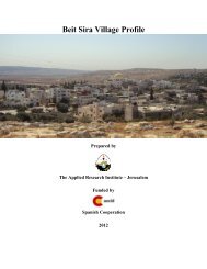
Kharas Town Profile - ARIJ
Kharas Town Profile - ARIJ
Kharas Town Profile - ARIJ

Create successful ePaper yourself
Turn your PDF publications into a flip-book with our unique Google optimized e-Paper software.
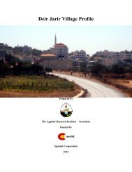
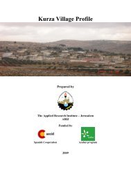
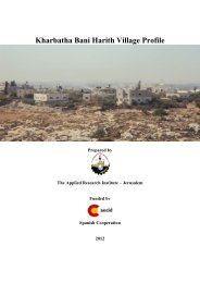
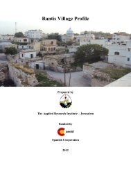
<strong>Kharas</strong> <strong>Town</strong> <strong>Profile</strong><br />
Prepared by<br />
The Applied Research Institute - Jerusalem<br />
Funded by<br />
Spanish Cooperation<br />
Azahar program<br />
2009
Palestinian Localities Study<br />
Hebron Governorate<br />
Acknowledgments<br />
<strong>ARIJ</strong> hereby expresses its deep gratitude to the Spanish Agency for International<br />
Cooperation for Development (AECID) for their funding of this project through the<br />
Azahar Program.<br />
<strong>ARIJ</strong> is grateful to the Palestinian officials in the ministries, municipalities, joint<br />
services councils, village committees and councils, and the Palestinian Central<br />
Bureau of Statistics (PCBS) for their assistance and cooperation with the project<br />
team members during the data collection process.<br />
<strong>ARIJ</strong> also thanks all the staff who worked throughout the past couple of years<br />
towards the accomplishment of this work.<br />
1
Palestinian Localities Study<br />
Hebron Governorate<br />
Background<br />
This booklet is part of a series of booklets, which contain compiled information about each city,<br />
town, and village in Hebron Governorate. These booklets come as a result of a comprehensive<br />
study of all localities in Hebron Governorate, which aims at depicting the overall living<br />
conditions in the governorate and presenting developmental plans to assist in developing the<br />
livelihood of the population in the area. It was accomplished through the 'Village <strong>Profile</strong>s and<br />
Azahar Needs Assessment'; a project funded by the Spanish Agency for International<br />
Cooperation for Development (AECID) and the Azahar Program.<br />
The 'Village <strong>Profile</strong>s and Azahar Needs Assessment' was designed to study, investigate, analyze<br />
and document the socio-economic conditions and the needed programs and activities to mitigate<br />
the impact of the current unsecure political, economic and social conditions in Hebron<br />
Governorate with particular focus on the Azahar program objectives and activities concerning<br />
water, environment, and agriculture.<br />
The project's objectives are to survey, analyze and document the available natural, human,<br />
socioeconomic and environmental resources, and the existing limitations and needs assessment<br />
for the development of the rural and marginalized areas in Hebron Governorate. In addition, the<br />
project aims at preparing strategic developmental programs and activities to mitigate the impact<br />
of the current political, social, and economic instability with the focus on the agricultural sector.<br />
All locality profiles in Arabic and English are available online at http://proxy.arij.org/vprofile/<br />
2
Palestinian Localities Study<br />
Hebron Governorate<br />
Table of Contents<br />
Location and Physical Characteristics _____________________________________________4<br />
History_______________________________________________________________________5<br />
Religious and Archeological Sites _________________________________________________6<br />
Population____________________________________________________________________6<br />
Education ____________________________________________________________________7<br />
Health Status _________________________________________________________________8<br />
Economic Activities ____________________________________________________________9<br />
Agricultural Sector____________________________________________________________10<br />
Institutions and Services _______________________________________________________13<br />
Infrastructure and Natural Resources ____________________________________________14<br />
Impact of the Israeli Occupation _________________________________________________15<br />
Implemented Development Plans and Projects______________________________________15<br />
Locality Development Priorities and Needs ________________________________________16<br />
References___________________________________________________________________17<br />
3
Palestinian Localities Study<br />
Hebron Governorate<br />
<strong>Kharas</strong> <strong>Town</strong> <strong>Profile</strong><br />
Location and Physical Characteristics<br />
<strong>Kharas</strong> is a town located within Hebron Governorate, 11 km north-west of Hebron city in the<br />
southern part of the West Bank. It is bordered by Halhul town to the east, Surif to the north, Nuba<br />
to the south and the Green Line to the west (See map 1).<br />
Map 1: <strong>Kharas</strong> location and borders<br />
<strong>Kharas</strong> town is located in the west of Halhul mountain region, at an elevation of 523 m above sea<br />
level. The mean annual rainfall in <strong>Kharas</strong> town is 481 mm; the average annual temperature is 17°<br />
C, and the average annual humidity is 60 % (<strong>ARIJ</strong> GIS).<br />
4
Palestinian Localities Study<br />
Hebron Governorate<br />
<strong>Kharas</strong> town was governed by a village council, established in 1972, until 2000 when a municipal<br />
council, appointed by the Palestinian Authority, took over the responsibilities of the village<br />
council. In 2005, a new council was elected, consisting of 11 members and 15 employees. The<br />
municipal council operations and responsibilities include:<br />
1. Administration, planning and development, organizing and issuing building licenses;<br />
2. Infrastructural maintenance of water, electricity, solid waste collection, open and paved<br />
roads and the distribution of social services.<br />
History<br />
A town rich in water wells and olive trees, <strong>Kharas</strong> town dates back more than 250 years.<br />
According to town residents, <strong>Kharas</strong> was originally named "Deir Hrash" after an existing<br />
convent, though changed its name over time to its present name (<strong>Kharas</strong>).<br />
<strong>Kharas</strong> town was also mentioned in the Torah as 'Heret' in Samuel I (5: 22). (Arraf,1996)<br />
Photos of <strong>Kharas</strong><br />
5
Palestinian Localities Study<br />
Hebron Governorate<br />
Religious and Archeological Sites<br />
There are four mosques in the town: Khaled Ibn Al Waleed Mosque, Omar Bin Al Khatab<br />
Mosque, Abu Baker Mosque and Al Sahabeh Mosque.<br />
A few historical and archeological sites in the town exist, including Khirbet Al Mosheraf, Khirbet<br />
Leqya and Wad Al Shekh well. In north <strong>Kharas</strong>, there is another archeological site called Khirbet<br />
Luqa (Luke), where there are many ancient ruins remaining. (Ad Dabbagh, 1991)<br />
Map 2: Main locations in <strong>Kharas</strong> town<br />
Population<br />
According to the 2007 Palestinian Central Bureau of Statistics (PCBS) Census, the total<br />
population of <strong>Kharas</strong> in 2007 was approximately 6,655 people, with 3,472 males and 3,183<br />
females. Furthermore, 1,042 households resided in 1,182 housing units.<br />
The population of <strong>Kharas</strong> town constitutes about 1.2% of the total population of the Hebron<br />
Governorate and is classified as a rural area.<br />
6
Palestinian Localities Study<br />
Hebron Governorate<br />
Age groups and gender<br />
The data of the 2007 census shows that 44% of the town population was less than 15 years of<br />
age, 52 % are in the 15-64 age range and 2.7 % are 65 years and above. The sex ratio in the town<br />
was 109 males for every 100 females, thus males constitute 52.2 % of the population and females<br />
constitute 47.8 %<br />
Families<br />
The population of <strong>Kharas</strong> is comprised of six main families, several smaller families, and a few<br />
refugees, such as the Al Hrub family, Kdemat family, Attwan family, Halahlih family, Aqabneh<br />
family, Abu Aljarish family.<br />
Education<br />
According to the 2007 Population Census, 6.3% of the residents were illiterate, with women<br />
representing 64.6% of this population. Of the literate population, 13.2% of residents could read<br />
and write having received no formal education, 24.5% had completed elementary education,<br />
31.1% had completed preparatory education and 25% had completed secondary and higher<br />
education. Table 1 shows the 2007 education status in <strong>Kharas</strong> by sex and educational attainment.<br />
Table 1: <strong>Kharas</strong> population (10 years and above) by sex and educational attainment<br />
Sex<br />
Illiterate<br />
Can read<br />
& write<br />
Elementary Preparatory Secondary<br />
Associate<br />
Diploma<br />
Bachelor<br />
Higher<br />
Diploma<br />
Master PhD Total<br />
M 101 322 593 715 410 56 158 2 17 3 2,377<br />
F 184 277 514 703 336 37 96 2 - - 2,149<br />
T 285 599 1,107 1,418 746 93 254 4 17 3 4,526<br />
Source: PCBS, May 2009. Population, Housing and Establishment Census-2007, Final Results<br />
Field survey data indicates three levels of education in <strong>Kharas</strong> town: pre-school (kindergarten),<br />
elementary and secondary education. The data specifically identifies five schools in the town, of<br />
which three were for males and two for females. The number of schools by stage, sex and<br />
supervising authority is shown in table 2.<br />
Table 2: The schools in <strong>Kharas</strong> by name, stag, sex and supervising authority<br />
No. School name Stage Sex Supervising<br />
Authority<br />
1.<br />
Khaled Ibn Al Walled Boys Elementary<br />
School<br />
Elementary Male Governmental<br />
2. <strong>Kharas</strong> Martyr Boys Elementary School Elementary Male Governmental<br />
3. <strong>Kharas</strong> Girls Elementary School Elementary Female Governmental<br />
4. <strong>Kharas</strong> Boys Secondary School Secondary Male Governmental<br />
5. <strong>Kharas</strong> Girls Secondary School Secondary Female Governmental<br />
The data of Ministry of Higher Education (MOHE) shows that during the 2006/2007 scholastic<br />
year there were 62 classes, 83 teachers and 2,081 students in <strong>Kharas</strong> town (See table 3).<br />
7
Palestinian Localities Study<br />
Hebron Governorate<br />
Table 3: Total No. of schools, classes and students by sex in <strong>Kharas</strong><br />
Government Private Total<br />
Male No. of Schools 3 - 3<br />
No. of class 32 - 32<br />
No. of Teachers 43 - 43<br />
No. of Students 1,062 - 1,062<br />
Female No. of Schools 2 - 2<br />
No. of class 30 - 30<br />
No. of Teachers 40 - 40<br />
No. of Students 1,019 - 1,019<br />
Source: Ministry of Higher Education –Hebron Directorate -2006/2007<br />
As of 2006, there were two kindergartens in <strong>Kharas</strong>, both supervised by charitable societies,<br />
providing pre-school education services to 240 children. Table 4 shows the kindergartens by<br />
name, number of children and supervising authority.<br />
Table 4: The kindergartens in <strong>Kharas</strong> by name, number of classes, number of children,<br />
number of teachers and supervising authority<br />
No. Kindergarten Name Number of Number of Number of Supervising<br />
Classes Children Teachers Authority<br />
1. <strong>Kharas</strong> Kindergarten 5 150 5 <strong>Kharas</strong> Charitable<br />
Society<br />
2. Al Zaytonah Kindergarten 3 90 3 Developing Rural<br />
Woman<br />
Residents cite the lack of transportation to and from schools, which are located far from the<br />
residential area, as the main impediment to educational services in <strong>Kharas</strong>.<br />
Health Status<br />
In <strong>Kharas</strong>, one governmental clinic provides health services for women and children. In addition,<br />
there are four private general physician clinics, three dental clinics and several other health<br />
institutions. Table 5 below shows the number of health institutions in <strong>Kharas</strong> town.<br />
Table 5: Number of health institutions in <strong>Kharas</strong> by supervising authority<br />
Institution Governmental Privet Charitable NGO<br />
Physician Clinic - 4 - -<br />
Dental Clinic - 3 - -<br />
Health Clinic - - -<br />
X Ray Center - - - -<br />
Medical Lab - 1 - -<br />
Maternity & Pediatric Center 1 -<br />
Pharmacy - 3 - -<br />
Other - - - -<br />
Total 1 11 0 0<br />
8
Palestinian Localities Study<br />
Hebron Governorate<br />
When health services are unavailable in the town or in the case of emergencies, residents of<br />
<strong>Kharas</strong> travel to neighboring towns including Halhul, or Hebron City.<br />
Obstacles and problems facing the health sector in <strong>Kharas</strong> include:<br />
1. Shortage of modern health centre facilities; and<br />
2. Lack of an ambulance.<br />
Economic Activities<br />
Nearly 50% of the town labor force in engaged in the Israeli labor market, while thirty percent of<br />
the labor force depends on agriculture and trade activities<br />
Field survey data indicated that the share of the population working in the various sectors of the<br />
economy is:<br />
• The agriculture sector -15 %<br />
• The employee sector - 8%<br />
• The service sector -2 %<br />
• Israeli labor market -50 %<br />
• The industrial sector -10 %<br />
• The trade sector -15 %<br />
Figure 1: Percentage of economic activity in <strong>Kharas</strong> town<br />
Agriculture<br />
15%<br />
Industry<br />
10%<br />
Services<br />
2%<br />
Trade<br />
15%<br />
employee<br />
8%<br />
Israeli labor market<br />
50%<br />
The main economic institutions in the town include two olive pressing plants, two stone cutting<br />
factories and one automatic backer. Traders include two clothing shops, four butchers, three<br />
blacksmiths, three carpenters, and a number of grocers and other shops. A significant proportion<br />
of <strong>Kharas</strong> residents also depend on the public and private sectors.<br />
Based on <strong>ARIJ</strong> survey in 2007, the social groups most affected by Israeli restrictions during the<br />
second Intifada are: 1) workers previously employed on the Israeli labor market, 2) families with<br />
9
Palestinian Localities Study<br />
Hebron Governorate<br />
six individuals and more, 3) small-holder traders 4) small-holder farmers 5) housekeepers and<br />
children.<br />
Labor Force<br />
The 2007 census data showed that labor force participation constituted 70% of the town's total<br />
population, with 47.5% being women participants (2,149 women in total). The labor force in<br />
<strong>Kharas</strong> town is 4,526 people in total, of which 28.7% are economically active, and 85.8% of the<br />
economically active people are employed. The remaining 71.3% of the labor force population<br />
represent non-economically active people. The largest groups of non-economically active people<br />
are the students and housekeepers, who constitute 60.4% and 29.7% respectively. Table 6 shows<br />
the labor force statistics of <strong>Kharas</strong> town.<br />
Table 6: <strong>Kharas</strong> population (10 years and above) by sex and employment status<br />
Sex Economically Active Not Economically Active Total<br />
Employed<br />
Currently<br />
Unemployed<br />
Unemployed<br />
(Never<br />
worked)<br />
Total<br />
Students<br />
House<br />
keeping<br />
Unable<br />
to work<br />
Not<br />
working &<br />
Not looking<br />
for work<br />
M 1,037 72 70 1,179 996 5 137 16 44 1,198 2,377<br />
F 77 4 38 119 955 955 107 2 11 2,030 2,149<br />
T 1,114 76 108 1,298 1,951 960 244 18 55 3,228 4,526<br />
Source: PCBS, May 2009. Population, Housing and Establishment Census-2007, results<br />
Other<br />
Total<br />
Agricultural Sector<br />
According to the Palestinian Ministry of Agricultural, <strong>Kharas</strong> town lies on a total area of 6,800<br />
dunums. 5,500 dunums are considered arable land; however, only 4,242 dunums are cultivated.<br />
(See table 7 and map 3)<br />
Table 7: Land Use in <strong>Kharas</strong> town (dunum)<br />
Arable Land<br />
Total Area Uncultivated<br />
Area<br />
Cultivated<br />
Area<br />
Built up<br />
Area<br />
Forests Area<br />
Open Spaces and Rangelands<br />
6,800 1,258 4,242 800 200 300<br />
Source: Palestinian Ministry of Agricultural (MoA), 2006<br />
10
Palestinian Localities Study<br />
Hebron Governorate<br />
Map 3: Land use/ land cover in <strong>Kharas</strong> town<br />
There are about 15 greenhouses with a total area equal 10 dunums, but no tunnels in <strong>Kharas</strong><br />
town. Five dunums of this area are used for growing tomatoes and five for planting summer<br />
cucumber.<br />
Table 8 shows the different types of rain-fed and irrigated open cultivated vegetables in the town<br />
of <strong>Kharas</strong>. The rain-fed fruity vegetables are the most cultivated covering an area of about 119<br />
dunums. The most common vegetables cultivated within this area are okra, squash, snake<br />
cucumber and cauliflower.<br />
Table 8: Total area of rain fed and irrigated open cultivated vegetables in <strong>Kharas</strong> town (dunum)<br />
Fruity Leafy Green<br />
Other<br />
Bulbs<br />
vegetables vegetable legumes<br />
vegetables<br />
Total area<br />
Rf Irr Rf Irr Rf Irr Rf Irr Rf Irr Rf Irr<br />
119 17 3 15 15 1 0 6 0 20 137 59<br />
Rf: Rain-fed, Irr: Irrigated<br />
There are two types of aromatic medical plants in the town of <strong>Kharas</strong>, thyme and sage, which<br />
spread over a total area of about four dunums.<br />
11
Palestinian Localities Study<br />
Hebron Governorate<br />
In the town of <strong>Kharas</strong>, there is a total area of 3,533 dunums planted with olive trees. Other trees<br />
planted in the area include almond trees, plum trees, fig trees nut trees and grape vines.<br />
Table 9: Total area of horticulture and olive tree in <strong>Kharas</strong> town (dunum)<br />
Olives Stone-fruits Pome fruits Nuts Other fruit Total area<br />
Rf Irr Rf Irr Rf Irr Rf Irr Rf Irr Rf Irr<br />
3,353 0 40 0 1 0 86 0 108 0 3,588 0<br />
Rf: Rain-fed, Irr: Irrigated<br />
Table 10 shows the total field crops cultivated in the town of <strong>Kharas</strong>. Cereals, in particular wheat<br />
and barley, are the most cultivated crops covering an area of about 505 dunums. In addition, the<br />
cultivation of dry legumes such as chickpeas, lentils and broad bean is common in the town of<br />
<strong>Kharas</strong>. 17 dunums of land was cultivated with forage crops such as vetch and sern.<br />
Table 10: Total area of field crops in <strong>Kharas</strong> town (dunum)<br />
Cereals<br />
Bulbs<br />
Dry<br />
legumes<br />
Forage<br />
crops<br />
Stimulating<br />
crops<br />
Total area<br />
Rf Irr Rf Irr Rf Irr Rf Irr Rf Irr Rf Irr<br />
505 0 11 0 50 0 17 0 5 0 588 0<br />
Rf: Rain-fed, Irr: Irrigated<br />
The survey data conducted by <strong>ARIJ</strong> indicated that about 40% of <strong>Kharas</strong> residents are also<br />
dependent upon rearing and keeping livestock, such as cows, sheep, goats and chicken, in<br />
addition to 123 bee hives.<br />
Table 11: Livestock in <strong>Kharas</strong> town<br />
Cows* Sheep Goats Horses Donkeys Mules Broilers Layers Bee Hives<br />
104 800 600 5 20 5 70,000 1,000 123<br />
*Including cows, bull calves, heifer calves and bulls<br />
There are approximately 10 km of agricultural roads in the town providing farmers access to their<br />
lands and crops. Some of these roads are suitable for driving vehicles and others only for driving<br />
agricultural machines<br />
Farmers of <strong>Kharas</strong> town participate in local agricultural societies and unions that provide<br />
agricultural assistance, which include the Charitable Society, the Agricultural Union and the<br />
Women’s Club.<br />
The other problem facing the agricultural sector, other than the Israeli procedures, is the<br />
extension of built up areas infringing on arable lands. In addition, a general shortage of grazing<br />
area for livestock is a threat not only to a sustainable livestock economy but also to overgrazing<br />
of existing pasturelands.<br />
12
Palestinian Localities Study<br />
Hebron Governorate<br />
Institutions and Services<br />
<strong>Kharas</strong> town has no national institutions; residents receive most services from Hebron City or the<br />
neighboring towns. <strong>Kharas</strong> has five societies, as well as other institutions including:<br />
1. <strong>Kharas</strong> Municipality, established 2000. With a new council elected in 2005 consisting of<br />
eleven members, the municipality provides public services to the residents such as water,<br />
electricity, license issuance, solid waste management, etc.<br />
2. The <strong>Kharas</strong> Charitable Society, established in 1974, has a board with six members. Based<br />
out of a building located in the centre of <strong>Kharas</strong>, the society has a kindergarten providing<br />
educational and cultural training, as well as health activities.<br />
3. <strong>Kharas</strong> Society for co-operation and consumption, established in 2004, consists of 50<br />
members. Its objective is to provide consumption needs to members as well as residents<br />
and to support other activities in the town.<br />
4. <strong>Kharas</strong> Women's Club (KWC), established in 1990, has more than 450 members, most<br />
who work within the developmental sector. KWC is increasingly participating in rural<br />
women's development activities by providing vocational training courses and<br />
implementing small income generating initiatives, as well as hosting social activities. The<br />
club has a board of six female members.<br />
5. The Youth Promoting Centre, established in 2002, has 18 members. The centre has<br />
implemented many activities in the town for youths including first aid instruction,<br />
computer and academic courses.<br />
6. <strong>Kharas</strong> 'Zakat' and Charity Committee, established in 1995, provides assistance to needy<br />
households, orphans and needy students.<br />
7. The Agricultural Union was established in 2001 with 10 members. Today the union has<br />
more than 200 farmers as members, with a range of activities implemented by the union<br />
including opening agricultural roads, cisterns construction and extension. The union<br />
provides some services to its members including government insurance, private insurance<br />
and health cards.<br />
8. <strong>Kharas</strong> Young Women's Centre, established in 2005, is an NGO funded by UNIFIM. It<br />
provides services to women, including education, raising awareness of women’s rights,<br />
encouraging the role of women socially and economically, and encouraging woman for<br />
leadership roles.<br />
9. <strong>Kharas</strong> Sport Club.<br />
13
Palestinian Localities Study<br />
Hebron Governorate<br />
Table 12 shows the number of institutions in <strong>Kharas</strong> by type:<br />
Table 12: No of institutions in <strong>Kharas</strong> by type<br />
Type of institution<br />
Governmental Charitable Women NGO Agriculture Sports Religious<br />
2 2 2 0 1 1 4<br />
Infrastructure and Natural Resources<br />
• Telecommunication Services: Approximately 50% of <strong>Kharas</strong> town households are<br />
connected to the telecommunications network.<br />
• Water Services: <strong>Kharas</strong> connected to the water network in 1973 and nearly 98% of housing<br />
units are currently connected. The Palestinian Water Authority is the primary provider of<br />
water in the town. Water tanks and cisterns provide an alternative resource to the water<br />
network. In addition, a water reservoir exists in <strong>Kharas</strong> with a capacity of 1000 m 3 used<br />
mainly during the summer season. Potential domestic water supply per capita is 47 (L/day).<br />
However, during summer, potential water supply falls considerably.<br />
• Electricity Services: <strong>Kharas</strong> has been connected to the electricity network since 1998.<br />
Approximately 95% of housing units in the town are connected to the network. <strong>Kharas</strong><br />
municipality manages the supply of electricity, which is provided by the Israeli Electric<br />
Cooperation.<br />
• Solid Waste Collection: Solid waste management in <strong>Kharas</strong> is managed by the <strong>Kharas</strong><br />
municipality in cooperation with Joint Services Council for Planning and Development-<br />
North West Hebron. Solid waste produced in the town is collected and sent to a dumping<br />
site 3-4 km away, which is operated by the Joint Services Council. Burning and dumping<br />
are the main methods used to dispose of solid waste.<br />
• Sewage Disposal Facilities: <strong>Kharas</strong> town had been partially connected to the sewage<br />
network since 2003, covering an estimated 50% of the town. The remainder of the town<br />
disposes of wastewater in cesspits. This is considered one of the main sources of pollution<br />
to local groundwater.<br />
• Transportation Services: There are approximately 33,207 m of roads in <strong>Kharas</strong>, 21,200 m<br />
of which are surfaced and in good condition, 5,500 m are surfaced yet not in good condition<br />
and 6,507 m are completely unsurfaced. Transportation in <strong>Kharas</strong> is compromised of four<br />
buses and ten informal taxies. <strong>Town</strong> transportation suffers from a general shortage of<br />
vehicles and services.<br />
14
Palestinian Localities Study<br />
Hebron Governorate<br />
Impact of the Israeli Occupation<br />
<strong>Kharas</strong> town had already lost part of its land as a result of the 1948 Arab-Israeli war. Since the<br />
beginning of the second Intifada, approximately 2,000 dunums of the town’s land has been<br />
confiscated; 1,000 dunums of these confiscated lands have been allotted for the construction of<br />
the segregation wall, which will pass through the western part of the town. The Israeli authorities<br />
began construction of the wire and concrete wall near <strong>Kharas</strong> in 2005, with 2 km currently<br />
completed.<br />
Upon completion, an additional 600 dunums of land will be isolated behind the wall, thus making<br />
it arduous for farmers to access these lands. Local construction of the wall is responsible for<br />
uprooting more than 2,000 trees including 1,000 olive trees, 300 grape vines, 500 fruit trees and<br />
200 other forest trees.<br />
The Israeli forces also destroyed one housing unit and more than three cisterns for construction of<br />
the segregation wall.<br />
Implemented Development Plans and Projects<br />
In light of <strong>Kharas</strong>’s largely agricultural character, the municipality implemented a project to<br />
rehabilitate its agricultural land funded by the Palestinian Agricultural Relief Committee and the<br />
Ministry of Agriculture.<br />
The municipality of <strong>Kharas</strong> has implemented many projects in the town with an objective to<br />
develop the town infrastructure and increase services available to residents. Since 2004, more<br />
than twelve projects have been implemented in the town. These include:<br />
Table 13: Development plans and projects in <strong>Kharas</strong> town<br />
No. Project name Type Funded by<br />
1 Rehabilitation of open and surfaced<br />
Roads<br />
Infrastructure USAID, Arabic Fund, PASIA<br />
and <strong>Kharas</strong> Municipality<br />
2 Build water reservoir and construction Infrastructure Palestinian Water Authority<br />
of water networks.<br />
(Water)<br />
3 Construction of internal electricity Infrastructure Local Community and <strong>Kharas</strong><br />
network<br />
(Electricity) Municipality<br />
4 Construction of sewage network (1 km) Infrastructure PHG<br />
5 Preparation and outfit <strong>Kharas</strong> Health Health Italy and Turkish Governments<br />
Centre<br />
6 Preparation of <strong>Kharas</strong> Stadium Infrastructure<br />
(Sport)<br />
Municipality and Ministry of<br />
Finance<br />
7 Automatic Backer Investment YMCA<br />
8 Outfit <strong>Kharas</strong> Municipality General<br />
Library<br />
15
Palestinian Localities Study<br />
Hebron Governorate<br />
Locality Development Priorities and Needs<br />
<strong>Kharas</strong> Municipality has prepared a study for the developmental priorities and needs in the town,<br />
shown below in Table 14. The strategic plan for <strong>Kharas</strong> municipality is to implement numerous<br />
town infrastructure and service development projects involving, among others, projects for water,<br />
schools and roads. The shortage of funds and irregular budgetary resources are the main<br />
obstacles for implementing this plan.<br />
Table 14: Development priorities and needs in <strong>Kharas</strong><br />
No. Sector Strongly<br />
Needed<br />
Needed<br />
Moderately<br />
Needed<br />
Not<br />
Needed<br />
Infrastructural Needs<br />
1 Opening and Pavement of Roads * 7 km internal<br />
2 Construction of New Water Networks *<br />
3 Rehabilitation of Old Water Networks *<br />
4 Construction of Water Reservoirs *<br />
5 Extending the Water Network to cover New<br />
Built up Areas<br />
6 Construction of Sewage Disposal Network *<br />
Health Needs<br />
1 Building of New Clinics or Health Care *<br />
Centre<br />
2 Rehabilitation of Old Clinics or Health Care<br />
*<br />
Centres<br />
3 Purchasing of Medical Equipments and<br />
*<br />
Tools<br />
*<br />
Notes<br />
Educational Needs<br />
1 Building of New Schools * Elementary<br />
2 Rehabilitation of Old Schools *<br />
3 Purchasing of New Equipments for Schools *<br />
Agriculture Needs<br />
1 Rehabilitation of Agricultural lands * 200 dunum<br />
2 Building Cisterns * 50 cistern<br />
3 Construction of Barracks for Livestock * 20 unit<br />
4 Veterinary Services *<br />
5 Seeds and Hay for Animals *<br />
6 Rehabilitation of Greenhouses * 15 unit<br />
7 Field Crops Seeds *<br />
8 Plants and Agricultural Supplies *<br />
16
Palestinian Localities Study<br />
Hebron Governorate<br />
References:<br />
- Ad Dabbagh, Mustafa. Palestine Our Homeland.: Kufr Qare', Palestine: Dar Al Huda<br />
Press, 1991. (In Arabic)<br />
- Applied Research Institute – Jerusalem (<strong>ARIJ</strong>). GIS Database. 2006-2009.<br />
- Arraf, Shukry. The Arab Palestinian Village. Ma'lya, Palestine: 'Ela Al Omq' Publishing,<br />
1996. (In Arabic)<br />
- Ministry of Agriculture. Agricultural Status Database in Hebron Governorate. 2006.<br />
- Ministry of Higher Education. Educational Status Database. 2006-2007.<br />
- Palestinian Central Bureau of Statistics. Population, Housing and Establishment<br />
Census- Final Results. Ramallah, Palestine. 1997 -2007.<br />
17