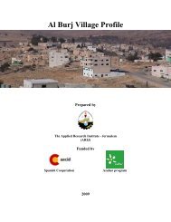
Abu Qash Village Profile - ARIJ
Abu Qash Village Profile - ARIJ
Abu Qash Village Profile - ARIJ

You also want an ePaper? Increase the reach of your titles
YUMPU automatically turns print PDFs into web optimized ePapers that Google loves.
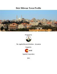
<strong>Abu</strong> <strong>Qash</strong> <strong>Village</strong> <strong>Profile</strong>Prepared byThe Applied Research Institute – JerusalemFunded bySpanish Cooperation2012
Palestinian Localities StudyRamallah GovernorateAcknowledgments<strong>ARIJ</strong> hereby expresses its deep gratitude to the Spanish agency for International Cooperation forDevelopment (AECID) for their funding of this project.<strong>ARIJ</strong> is grateful to the Palestinian officials in the ministries, municipalities, joint services councils,village committees and councils, and the Palestinian Central Bureau of Statistics (PCBS) for theirassistance and cooperation with the project team members during the data collection process.<strong>ARIJ</strong> also thanks all the staff who worked throughout the past couple of years towards theaccomplishment of this work.2
Palestinian Localities StudyRamallah GovernorateBackgroundThis report is part of a series of booklets, which contain compiled information about each city, town, andvillage in the Ramallah Governorate. These booklets came as a result of a comprehensive study of alllocalities in Ramallah Governorate, which aims at depicting the overall living conditions in thegovernorate and presenting developmental plans to assist in developing the livelihood of the populationin the area. It was accomplished through the "<strong>Village</strong> <strong>Profile</strong>s and Needs Assessment;" the projectfunded by the Spanish Agency for International Cooperation for Development (AECID).The "<strong>Village</strong> <strong>Profile</strong>s and Needs Assessment" was designed to study, investigate, analyze and documentthe socio-economic conditions and the needed programs and activities to mitigate the impact of thecurrent unsecure political, economic and social conditions in Ramallah Governorate.The project's objectives are to survey, analyze, and document the available natural, human,socioeconomic and environmental resources, and the existing limitations and needs assessment for thedevelopment of the rural and marginalized areas in Ramallah Governorate. In addition, the project aimsat preparing strategic developmental programs and activities to mitigate the impact of the currentpolitical, social, and economic instability with the focus on the agricultural sector.All locality profiles in Arabic and English are available online at http://vprofile.arij.org.3
Palestinian Localities StudyRamallah GovernorateTable of ContentsLocation and physical characteristics .......................................................... 5History ....................................................................................................... 6Religious and Archaeological Sites .............................................................. 7Demography and Population ...................................................................... 8Education ................................................................................................... 9Health Sector ........................................................................................... 10Economic Activities .................................................................................. 10Agricultural Sector ................................................................................... 11Institutions and Services .......................................................................... 14Infrastructure and Natural Resources ....................................................... 14Environmental Conditions ........................................................................ 16Impact of Israeli Occupation ..................................................................... 17Development Plans and Projects .............................................................. 18Proposed Projects .................................................................................... 18Locality Development Priorities and Needs ............................................... 19References ............................................................................................... 204
Palestinian Localities StudyRamallah Governorate<strong>Abu</strong> <strong>Qash</strong> <strong>Village</strong> <strong>Profile</strong>Location and physical characteristics<strong>Abu</strong> <strong>Qash</strong> is a Palestinian village in Ramallah Governorate, located 5.3km north of Ramallah City. It isbordered by Surda and Jifna villages to the east, Bir Zeit to the north, Al-Zaytouneh and Ramallah cityto the west, and by Ramallah city and Surda village to the south (<strong>ARIJ</strong>-GIS, 2012) (See Map 1).Map 1: <strong>Abu</strong> <strong>Qash</strong> location and bordersSource: <strong>ARIJ</strong>-GIS, 20125
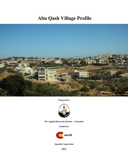
Palestinian Localities StudyRamallah GovernorateThe village is located at an altitude of 751 m above sea level. The mean annual rainfall in the village is660.4 mm, the average annual temperature is 16 °C and the average annual humidity is 61% (<strong>ARIJ</strong>-GIS,2012).A village council was established in 1996. It consists of nine members appointed by the PalestinianNational Authority and three employees. It has a permanently rented headquarters but does not own avehicle for the collection of solid waste (<strong>Abu</strong> <strong>Qash</strong> <strong>Village</strong> Council, 2011). Main responsibilities of theCouncil include:Management of the construction licensing process.Implementing major projects and studies related to village development.Construction of elementary, preparatory and secondary schools.Waste collection, street cleaning and pavement, rehabilitation and construction of roads.Supplying an electricity network or generators.Supplying and maintaining a drinking water network.HistoryAccording to the <strong>Village</strong> Council, there are three different stories behind the name of <strong>Abu</strong> <strong>Qash</strong>:1. <strong>Abu</strong> <strong>Qash</strong> in Arabic means the source of wheat and barley; the village was famous for thecultivation of such crops and so it was named <strong>Abu</strong> <strong>Qash</strong>. This etymology is considered to be themost credible.2. A Moroccan tribe came to the village and named it after their village in Morocco.3. A man named <strong>Abu</strong> <strong>Qash</strong> lived in a nearby military site and gave his name to the village.The village was constructed 500 years ago, and its population are believed to be of Jordanian origin(<strong>Abu</strong> <strong>Qash</strong> <strong>Village</strong> Council, 2011) (See photo below for <strong>Abu</strong> <strong>Qash</strong> village).6
Palestinian Localities StudyRamallah GovernoratePhoto of <strong>Abu</strong> <strong>Qash</strong>Religious and Archaeological SitesThere are two mosques in the village, Al Omari (<strong>Abu</strong> <strong>Qash</strong> Old) Mosque and Al Saliheen (New)Mosque. There are some sites of archaeological interest, including Khirbet Al Hafna which contains anolive oil-press and walls and foundations of buildings, and a set of military Khirba (ruins) (Al Dabbagh,1991) (See Map 2).7
Palestinian Localities StudyRamallah GovernorateMap 2: Main location in <strong>Abu</strong> <strong>Qash</strong> <strong>Village</strong>Source: <strong>ARIJ</strong>-GIS, 2012Demography and PopulationAccording to the Palestinian Central Bureau of Statistics (PCBS) Census in 2007, the total population of<strong>Abu</strong> <strong>Qash</strong> was 1,319 inhabitants, of whom 664 were male and 655 were female. There were 273households and 401 housing units in the village.Age Group and GenderThe 2007 Census results for <strong>Abu</strong> <strong>Qash</strong> village showed the distribution of the population in terms of agegroup and sex, demonstrating that 36.5% of the total population was less than 15 years of age, 56.9%were in the 15-64 age group and 5% were 65 years of age or older. The sex ratio in the village was101.4:100, meaning that males and females constituted 50.3% and 49.7 % of the populationrespectively.8
Palestinian Localities StudyRamallah GovernorateFamiliesThe village residents are from several families, including the Al Qa’ed, Mayha and Al Bayatna families(<strong>Abu</strong> <strong>Qash</strong> <strong>Village</strong> Council, 2011).Immigration<strong>ARIJ</strong>’s survey indicated that several families have left the village since 2001 (<strong>Abu</strong> <strong>Qash</strong> <strong>Village</strong>Council, 2011).EducationAccording to the results of the PCBS, Population, Housing and Establishment Census-2007, 6.1% ofthe population were illiterate, of whom 81.4% were females. Of the literate population, 12.3%could only read and write with no formal education, 16.1% completed elementary education, 21.6%completed preparatory education, 23.2% completed secondary education, and 20.3% had a specializedacademic degree (See Table 1).SexTable 1: <strong>Abu</strong> <strong>Qash</strong> population (10 years and above) by sex and educational statementCanread andwriteAssociateDiplomaHigherDiplomaMasterIlliterateElementaryPreparatorySecondaryBachelorDoctorateNotstatedM 11 65 89 87 136 27 61 1 9 2 2 490F 48 54 67 123 89 37 56 - 3 1 3 481T 59 119 156 210 225 64 117 1 12 3 5 971M: Male; F: Female; T: Total.Source: PCBS, 2009.TotalThere are two registered governmental schools in the illage run by the Ministry of Education and HigherEducation (MoEHE). These are <strong>Abu</strong> <strong>Qash</strong> Boys Elementary School and <strong>Abu</strong> <strong>Qash</strong> Girls SecondarySchool. The <strong>Village</strong> lacks a secondary school for boys and there is no scientific stream in the girl’ssecondary school, meaning that most students travel to Prince Hasan and Al Majida Wasila schools inBir Zeit (around 4 km from the village) to complete their education. There are no kindergartens in thevillage.The education sector in <strong>Abu</strong> <strong>Qash</strong> suffers from some problems such as the lack of laboratories in theschools, the lack of educational, information technology, and sport equipment (<strong>Abu</strong> <strong>Qash</strong> <strong>Village</strong>Council, 2011).9
Palestinian Localities StudyRamallah GovernorateIn 2010/11 there were 20 classes, 296 students, and 31 teaching staff in the village. Classroom densitywas recorded at 15 students per class, and the average number of students per teacher was 10.Health SectorThere are no medical or health centers in the <strong>Village</strong> of <strong>Abu</strong> <strong>Qash</strong>; however, there is one privatepharmacy.In case of emergencies, patients are transferred to hospitals or medical centers in Ramallah City or BirZeit for treatment (<strong>Abu</strong> <strong>Qash</strong> <strong>Village</strong> Council, 2011).Economic Activities<strong>Abu</strong> <strong>Qash</strong>’s economy is dependent on several economic sectors, mainly the agricultural sector, whichabsorbs 50% of the village’s workforce (<strong>Abu</strong> <strong>Qash</strong> <strong>Village</strong> Council, 2011) (See Figure 1).In <strong>Abu</strong> <strong>Qash</strong> there are 10 grocery stores, a butcher, two fruit and vegetable shops, 4 service offices, and8 occupational industry shops such as carpenters’ workshops.Unemployment in <strong>Abu</strong> <strong>Qash</strong> reached approximately 10% in 2011 and particularly affects those whowork within the agricultural sector. The Israeli occupation and its associated practices have contributedsignificantly to unemployment in <strong>Abu</strong> <strong>Qash</strong> (<strong>Abu</strong> <strong>Qash</strong> <strong>Village</strong> Council, 2011).Figure 1: the main economic activities in <strong>Abu</strong> <strong>Qash</strong> <strong>Village</strong>Source: <strong>Abu</strong> <strong>Qash</strong> <strong>Village</strong> Council, 201110
Palestinian Localities StudyRamallah GovernorateLabor ForceAccording to the PCBS Population, Housing and Establishment Census (2007), 37.3% of the populationwas economically active, of whom 83.7% were employed, and 62.3% of the population were noteconomically active, of which 49.9% were students and 38% were involved in housekeeping (Table 2).SexTable 2: <strong>Abu</strong> <strong>Qash</strong> population (10 years and above) by sex and employment statusEconomically activeNon-economically activeUnemployedStud-House-Unable working &NotCurrentlyEmployed(neverent keeping to work not lookingUnemployedTotalworked)for workOthersTotalNotstatedM 243 27 21 291 154 1 28 8 5 196 3 490F 60 6 5 71 148 229 28 - 4 409 1 481T 303 33 26 362 302 230 56 8 9 605 4 971M: Male; F: Female; T: Total.Source: PCBS, 2009.TotalAgricultural Sector<strong>Abu</strong> <strong>Qash</strong> <strong>Village</strong> lies on an area of 4,900 dunums, of which 1,589 dunums are arable lands, and 464dunums are registered as residential (see Table 3 and Map 3).TotalAreaBuiltupAreaTable 3: Land use and land cover in <strong>Abu</strong> <strong>Qash</strong> village in 2010 (area in dunum)PermanentCropsAgricultural area(1,589)GreenhousesRange-landsArablelandsInlandwaterForestsOpenSpacesArea ofIndustrial,Commercial&TransportUnitArea ofSettlement,MilitaryBases &Wall Zone4,900 464 1,422 1 0 166 0 23 2,635 189 0Source: <strong>ARIJ</strong> – GIS Unit, 2012.11
Palestinian Localities StudyRamallah GovernorateMap 3: Land use and land cover of <strong>Abu</strong> <strong>Qash</strong> <strong>Village</strong>Source: <strong>ARIJ</strong>-GIS, 2012Table 4 shows the different types of rain-fed and irrigated open cultivated vegetables in <strong>Abu</strong> <strong>Qash</strong>.Snake-cucumber and squash are the most cultivated vegetables.Table 4: Total area of rain-fed and irrigated open cultivated vegetables in <strong>Abu</strong> <strong>Qash</strong> <strong>Village</strong> (area in dunums)Fruity vegetablesLeafyOtherGreen legumes BulbsvegetablesvegetablesTotal areaRf. Irr. Rf. Irr. Rf. Irr. Rf. Irr. Rf. Irr. Rf. Irr.14 0 0 0 7 0 5 0 2 0 28 0Rf.: Rain-fed; Irr.: Irrigated.Source: Ministry of agriculture-Ramallah, 2009<strong>Abu</strong> <strong>Qash</strong> <strong>Village</strong> is famous for the cultivation of olives; there are 781.5 dunums of land planted witholive trees (Table 5).12
Palestinian Localities StudyRamallah GovernorateTable 5: Total area of horticulture and olive trees in <strong>Abu</strong> <strong>Qash</strong> <strong>Village</strong> (area in dunums)Olives Citrus Stone-fruits Pome fruits Nuts Other fruits Total areaRf. Irr. Rf. Irr. Rf. Irr. Rf. Irr. Rf. Irr. Rf. Irr. Rf. Irr.781.5 0 0 0 13 0 0 0 80 0 80 0 954.5 0Rf.: Rain-fed; Irr.: Irrigated.Source: Ministry of agriculture-Ramallah, 2009Table 6 shows the total area of field crops cultivated in <strong>Abu</strong> <strong>Qash</strong>, with cereals covering the largest area(approximately 60 dunums). Dry legumes, particularly beans, are also cultivated in <strong>Abu</strong> <strong>Qash</strong>.Table 6: Total area of horticulture and olive trees in <strong>Abu</strong> <strong>Qash</strong> <strong>Village</strong> (area in dunums)Cereals BulbsDryForage Stimulatin OtherOil cropslegumescrops g crops cropsTotal areaRf. Irr. Rf. Irr. Rf. Irr. Rf. Irr. Rf. Irr. Rf. Irr. Rf. Irr. Rf. Irr.60 0 19 0 25 0 0 0 5 0 0 0 0 0 109 0Rf.: Rain-fed; Irr.: Irrigated.Source: Ministry of agriculture-Ramallah, 2009The difference between the two sets of results obtained from the Ministry of Agriculture and by <strong>ARIJ</strong>’sGIS Unit in sizes of agricultural areas is explained by the fact that the Ministry of Agriculture and thePalestinian Central Bureau of Statistics (2010) conducted a survey which used a definition ofagricultural areas based on land ownership. Therefore, the areas included in the survey were those ofactual holdings of agricultural areas instead of seasonal ones. The survey did not consider fragmentedand small seasonal cultivated areas in residential and agricultural areas. <strong>ARIJ</strong>’s survey, however,indicated the existence of a high proportion of small and fragmented holdings (home gardens)throughout the occupied Palestinian territories, thus accounting for the larger area of agriculturalholdings calculated by <strong>ARIJ</strong>.The field survey conducted by <strong>ARIJ</strong> shows that 7% of the residents in <strong>Abu</strong> <strong>Qash</strong> rear and keep domesticanimals such as sheep and goats (See Table 7).Table 7: Livestock in abu <strong>Qash</strong> villageCows* Sheep Goats Camels Horses Donkeys Mules Broilers LayersBeeHives0 164 657 0 0 0 0 11,550 2,500 0*Including cows, bull calves, heifer calves and bullsSource: Palestinian Ministry of Agriculture - Ramallah, 2009There are around 30 km of agricultural roads in the village, which are suitable only for the use ofanimals (<strong>Abu</strong> <strong>Qash</strong> <strong>Village</strong> Council, 2011).The agricultural sector in <strong>Abu</strong> <strong>Qash</strong> suffers from many problems, including:1. Lack of water resources.13
Palestinian Localities StudyRamallah Governorate2. Lack of agricultural capacities and awareness of the importance of agriculture.3. Lack of agricultural roads4. Lack of economic feasibility.Institutions and ServicesThere are no official institutions that provide public services to the community, except the <strong>Village</strong>Council (<strong>Abu</strong> <strong>Qash</strong> <strong>Village</strong> Council, 2011).Infrastructure and Natural Resources<strong>Abu</strong> <strong>Qash</strong> is supplied with electricity by Jerusalem Electricity Company through the public networkestablished in 1980. Approximately 100% of housing units in the village are connected to the network.However, <strong>Abu</strong> <strong>Qash</strong> residents experience some problems with the electricity supply, primarily the weakelectrical current and the high prices of public services (<strong>Abu</strong> <strong>Qash</strong> <strong>Village</strong> Council, 2011).The village is connected to a telecommunications network and approximately 80% of the housing unitsare connected to phone lines (<strong>Abu</strong> <strong>Qash</strong> <strong>Village</strong> Council, 2011).Transportation Services:Residents of <strong>Abu</strong> <strong>Qash</strong> use public transportation that passes through the village from Ramallah city andother neighboring villages (<strong>Abu</strong> <strong>Qash</strong> <strong>Village</strong> Council, 2011). There are 2 km of paved roads in goodcondition and 15 km of internal roads, 5 km of which are paved but in poor condition and 10 km ofwhich are unpaved (<strong>Abu</strong> <strong>Qash</strong> <strong>Village</strong> Council, 2011).Water Resources:The water company in Jerusalem provides the village with water through the public network constructedin 1978. This network supplies water to almost all the housing units in the village. In 2010, the quantityof water supplied to the village was approximately 61,143 m 3 (PWA, 2009), and therefore the amount ofwater consumed per person is estimated to be 127 liter/capita/day. However, no resident of <strong>Abu</strong> <strong>Qash</strong>consumes this amount of water due to water losses during water transfer and distribution. These lossesare estimated at 26.5 %, and therefore the average water consumption per capita is 93.3 liter/capita/day(Jerusalem Water Authority, 2011). The rate experienced by <strong>Abu</strong> <strong>Qash</strong> residents is slightly lowcompared with the minimum quantity of 100 liters/capita/day proposed by the World HealthOrganization.14
Palestinian Localities StudyRamallah GovernorateThere are 3 water springs in the village used to irrigate agricultural lands planted with vegetables (<strong>Abu</strong><strong>Qash</strong> <strong>Village</strong> Council, 2011).To determine water costs, the water authority has adopted an upward rate where the price of waterincreases with increasing consumption. Table 8 shows the price of water by category of consumption.Table 8: Water tariffs of Jerusalem Water Authority adopted since 01.01.2012ConsumptionCategory(m³)Domestic(NIS/m³)Industrial(NIS/m³)Tourist(NIS/m³)Commercial(NIS/m³)PublicInstitutions(NIS/m³)0 – 5 4.5 5.6 5.6 5.6 5.45.1 – 10 4.5 5.6 5.6 5.6 4.510.1 – 20 5.6 6.8 6.8 6.8 5.620.1 – 30 6.8 8.1 8.1 8.1 6.830.1+ 9 9.9 10.8 9 9Source: Jerusalem Water Authority, 2012Sanitation:<strong>Abu</strong> <strong>Qash</strong> <strong>Village</strong> lacks a public sewage network; most of the population uses cesspits as main meansfor wastewater disposal (<strong>Abu</strong> <strong>Qash</strong> <strong>Village</strong> Council, 2011).Based on the estimated daily per capita water consumption, the estimated amount of wastewatergenerated per day is approximately 98.5 cubic meters, or 36,000 cubic meters annually. At theindividual level in the village, it is estimated that the per capita wastewater generation is approximately65 liters per day. The wastewater collected by cesspits is discharged by wastewater tankers directly toopen areas or nearby valleys with no regard for the environment; there is no wastewater treatment eitherat the source or at the disposal sites and this poses a serious threat to both the environment and to publichealth (<strong>ARIJ</strong> - WERU, 2012).Solid Waste Management:<strong>Abu</strong> <strong>Qash</strong> village does not have a system for the collection and disposal of solid waste generated bycitizens and establishments in the village. Residents of <strong>Abu</strong> <strong>Qash</strong> collect and dispose of wasteindividually, primarily through burning it on nearby lands (<strong>Abu</strong> <strong>Qash</strong> <strong>Village</strong> Council, 2011).15
Palestinian Localities StudyRamallah GovernorateThe daily per capita rate of solid waste production in <strong>Abu</strong> <strong>Qash</strong> is 0.7kg. Thus the estimated amount ofsolid waste produced per day from the <strong>Abu</strong> <strong>Qash</strong> residents is nearly 0.9 tons, or 337 tons per year (<strong>ARIJ</strong>- WERU, 2012).Environmental ConditionsLike other villages and towns in the governorate, in <strong>Abu</strong> <strong>Qash</strong> experiences several environmentalproblems which must be addressed and solved. These problems can be identified as follows:Water CrisisWater is cut off by the Jerusalem Water Authority for long periods of time during summer inseveral neighborhoods of the village for several reasons:(1) Israeli control over Palestinian water resources. Consequently, the Jerusalem WaterAuthority purchases water from the Israeli company of Mekorot in order to satisfy residents'needs.(2) High rate of water losses, because the water network is old and in need of rehabilitation andrenovation.Weak water pressure, particularly in areas where it is supplied uphill.Lack of the village's share of water allocated by the company that supplies the village with water.Wastewater ManagementThe absence of a public sewage network means that in <strong>Abu</strong> <strong>Qash</strong> residents are forced to useunhygienic cesspits and endocrines for the disposal of wastewater, and/or discharge wastewaterin the streets. This is particularly common in winter, as citizens cannot afford the high cost ofsewage tankers during this period. These methods facilitate environmental damage, healthproblems, and the spread of epidemics and diseases in the village. This wastewater alsocontaminates the groundwater and water collected in household cisterns (rainwater harvestingcisterns), as it mixes with the waste water thus becomes unsuitable for drinking, because mostcesspits are built without lining, allowing wastewater to enter into the ground and avoiding theneed to use sewage tankers. Moreover, the untreated wastewater collected from cesspits bysewage tankers is disposed of in open areas without concern for the damage it causes to theenvironment and to residents' health.Solid Waste Management:The complete lack of waste collection services leading residents to burn waste randomly nearhouses and on nearby lands.The lack of a central sanitary landfill to serve <strong>Abu</strong> <strong>Qash</strong> and the other neighboring communitiesin the governorate is due mainly to the obstacles created by the Israeli authorities for local andnational institutions in granting licenses to establish such a landfill, because the appropriate landis within Area C and under Israeli control. Additionally, the implementation of such projects16
Palestinian Localities StudyRamallah Governoratedepends on funding from donor countries. The lack of a sanitary landfill is a source of pollutionto the groundwater and soil through the leachate produced from the solid waste, and producesbad odors and distortion of the landscape.Impact of Israeli OccupationGeopolitical status in <strong>Abu</strong> <strong>Qash</strong>According to the Oslo II Interim Agreement signed in 28 th September 1995 between the PalestinianLiberation Organization (PLO) and Israel, <strong>Abu</strong> <strong>Qash</strong> was divided into areas “B” and “C”.Approximately 4,892 dunums (99.8% of the village’s total area) were assigned as area B, where thePalestinian National Authority (PNA) has a complete control over civil matters but Israel continues tohave overriding responsibility for security. Area “B” constitutes most of the inhabited Palestinian areas,including municipalities, villages and some camps. It is worth mentioning that all of the village’spopulation resides in area “B” which constitutes the larger area in comparison to the total area of thevillage. The rest of the village’s area, constituting 8 dunums (0.2% of the total area), is classified as area“C”, where Israel retains full control over security and administration related to the territory. In area “C”Palestinian building and land management is prohibited unless through a consent or authorization by theIsraeli Civil Administration (table 9).Table 9: The Geopolitical Divisions of <strong>Abu</strong> <strong>Qash</strong> – Ramallah GovernorateAreaArea in dunums Percent of Total village areaArea A00Area B4,89299.8Area C80.2Nature Reserve004,900100TotalSource: Source: <strong>ARIJ</strong>-GIS, 2011There are no Israeli settlements on <strong>Abu</strong> <strong>Qash</strong> lands, although some settlement blocs are very close to thevillage and located on neighboring villages' lands. These include Beit El settlement bloc and Beit Elmilitary base, both of which are built on lands of Al Bireh and Dura al Qar’. Beit El military base wasconstructed on 1422 dunums of Al Bireh lands and houses the central Israeli Civil Administration in theWest Bank, a detention center, and an Israeli military camp. Beit El settlement is one of the major Israelisettlements in the Ramallah and Al Bireh Governorate; it was established in 1977 on almost 1056dunums of land and is currently inhabited by approximately 5,500 Israeli settlers. Talmon and Dolevsettlement blocs are located on the western side of <strong>Abu</strong> <strong>Qash</strong> village on Al Mazra’a al Qabaliya and AlJaniya lands; these settlements are inhabited by more than 3,700 Israeli settlers and surrounded by agroup of settlement outposts.17
Palestinian Localities StudyRamallah GovernorateDevelopment Plans and ProjectsImplemented projectsThe <strong>Village</strong> Council of <strong>Abu</strong> <strong>Qash</strong> has implemented several development projects during the past 5years. For more details please see Table 10.Table 10: Implemented development projects and plans in <strong>Abu</strong> <strong>Qash</strong>, 2011Name of the Project Type Year DonorConstructing an elementary school for boys Educational 2008 GTZConstructing a secondary school for girls Educational 2008 Arab Monetary FundPaving sub roads Infrastructure 2007 Ministry of Local GovernmentSupplying street lightings Infrastructure 2007 <strong>Abu</strong> <strong>Qash</strong> <strong>Village</strong> CouncilSource: <strong>Abu</strong> <strong>Qash</strong> <strong>Village</strong> Council, 2011Proposed Projects<strong>Abu</strong> <strong>Qash</strong> <strong>Village</strong> Council, in cooperation with the civil society organizations in the village and thevillage residents, hopes to implement several projects in the coming years. The project ideas weredeveloped during the PRA workshop conducted by <strong>ARIJ</strong> staff in the village. The projects are as follows,in order of priority from the viewpoints of the participants in the workshop:1. Establishing a sewage network (6 km) to be connected to all housing units in the village.2. Supporting poor and needy families in the village through productive projects that would achieveself-sufficiency such as sheep and poultry farms, beehives and home gardens.3. Rehabilitating existing water springs and constructing a water reservoir with a capacityappropriate to the size of the village's population (about 2500 people).4. Establishing a fully-integrated health center to be equipped with modern facilities and a qualifiedmedical staff working seven days a week, and providing an ambulance to transport emergencymedical cases.5. Constructing headquarters for a sport, social and cultural club, a women’s center and a sportsstadium.6. Constructing five classrooms in <strong>Abu</strong> <strong>Qash</strong> Boys School to accommodate students from the ninthto the twelfth grade.7. Rehabilitating the village's main street (1 km) through repaving, establishing a roundabout islandand sidewalks, and rehabilitating sub-roads (4 km).8. Reclaiming 150 dunums of agricultural lands and rehabilitating a further 80 dunums, in additionto constructing agricultural roads (6 km).18
Palestinian Localities StudyRamallah GovernorateLocality Development Priorities and NeedsThe village suffers from a significant shortage in infrastructure and services. The following table showsthe development priorities and needs in the village, according to the <strong>Abu</strong> <strong>Qash</strong> <strong>Village</strong> Council's point ofview and feedback from <strong>ARIJ</strong>’s survey.Table 11: Development Priorities and Needs in <strong>Abu</strong> <strong>Qash</strong>No. SectorStronglyNot aNeededneededpriorityNotesInfrastructural Needs1 Opening and pavement of roads * 32 km*2 Rehabilitation of old water networks * 4 km3 Extending the water network to cover new builtup areas* 5 km4 Construction of new water networks * 4 km5 Rehabilitation/ Construction of new wells orsprings* 3 springs6 Construction of water reservoirs * 500 m 37 Construction of a sewage disposal network * 6 km8 Construction of a new electricity network *9 Providing containers for solid waste collection * 15 containers10 Providing vehicles for collecting solid waste * 1 vehicle11 Providing a sanitary landfill *Health Needs1 Building of new clinics or health care centres * 1 health center2 Rehabilitation of old clinics or health care centres *3 Purchasing of medical equipment and tools *Educational Needs1 Building of new schools *2 Rehabilitation of old schools * science laboratories, sport tools,3 Purchasing of new equipment for schools *playgrounds and computer labsAgriculture Needs1 Rehabilitation of agricultural lands * 100 dunums2 Building rainwater harvesting cisterns * 50 cisterns3 Construction of barracks for livestock * 20 barracks4 Veterinary services *5 Forage and hay for animals * 1,500 tons per year6 Construction of new greenhouses * 20 greenhouses7 Rehabilitation of greenhouses *8 Field crops seeds *9 Plants and agricultural supplies **2 km are main roads, 10 km are sub roads and 20 km are agricultural.Source: <strong>Abu</strong> <strong>Qash</strong> <strong>Village</strong> Council, 201119
Palestinian Localities StudyRamallah GovernorateReferences <strong>Abu</strong> <strong>Qash</strong> <strong>Village</strong> Council, 2011 Al Dabbagh, M. Our Country, Palestine; Chapter 8, Part Two. Kafr Qari' – Palestine. Dar alHuda Press, 1991. Applied Research Institute - Jerusalem (<strong>ARIJ</strong>), 2012. Geographic Information Systems andRemote Sensing Unit; Land Use Analysis (2010) – Half Meter High Accuracy. Bethlehem -Palestine. Applied Research Institute - Jerusalem (<strong>ARIJ</strong>), 2012. Geographic Information Systems andRemote Sensing unit Database. Bethlehem - Palestine. Applied Research Institute - Jerusalem (<strong>ARIJ</strong>). 2012. Water & Environment Research UnitDatabase (WERU). Bethlehem - Palestine. Ministry of Education & Higher Education (MOHE) - Ramallah, 2011. Directorate of Education;A database of schools (2010/2011). Ramallah – Palestine. Palestinian Ministry of Agriculture (MOA), 2009. Directorate of Agriculture data (2008/2009).Ramallah - Palestine. Palestinian Central Bureau of Statistics. 2009. Ramallah, Palestine: General Census ofPopulation and Housing Censuses, 2007. Jerusalem Water Authority (for Ramallah & Al Bireh areas) (2011). Detection showing theamount of water sold from 1/1/2010 till 31/12/2010. Ramallah – Palestine. Jerusalem Water Authority (2012). Jerusalem Water Authority's Website; Data Retrieved on thefirst of March. http://www.jwu.org/newweb/atemplate.php?id=87.20