Al Burj Village Profile - ARIJ
Al Burj Village Profile - ARIJ
Al Burj Village Profile - ARIJ

Create successful ePaper yourself
Turn your PDF publications into a flip-book with our unique Google optimized e-Paper software.
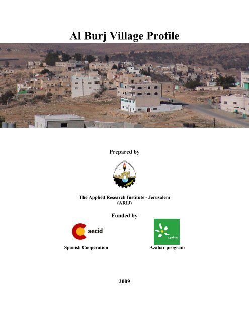
<strong>Al</strong> <strong>Burj</strong> <strong>Village</strong> <strong>Profile</strong>Prepared byThe Applied Research Institute - Jerusalem(<strong>ARIJ</strong>)Funded bySpanish CooperationAzahar program2009
Palestinian Localities StudyHebron GovernorateAcknowledgments<strong>ARIJ</strong> hereby expresses its deep gratitude to the Spanish Agency for InternationalCooperation for Development (AECID) for their funding of this project through theAzahar Program.<strong>ARIJ</strong> is grateful to the Palestinian officials in the ministries, municipalities, jointservices councils, village committees and councils, and the Palestinian CentralBureau of Statistics (PCBS) for their assistance and cooperation with the projectteam members during the data collection process.<strong>ARIJ</strong> also thanks all the staff who worked throughout the past couple of yearstowards the accomplishment of this work.1
Palestinian Localities StudyHebron GovernorateBackgroundThis booklet is part of a series of booklets, which contain compiled information about each city,town, and village in Hebron Governorate. These booklets come as a result of a comprehensivestudy of all localities in Hebron Governorate, which aims at depicting the overall livingconditions in the governorate and presenting developmental plans to assist in developing thelivelihood of the population in the area. It was accomplished through the '<strong>Village</strong> <strong>Profile</strong>s andAzahar Needs Assessment'; a project funded by the Spanish Agency for InternationalCooperation for Development (AECID) and the Azahar Program.The '<strong>Village</strong> <strong>Profile</strong>s and Azahar Needs Assessment' was designed to study, investigate, analyzeand document the socio-economic conditions and the needed programs and activities to mitigatethe impact of the current unsecure political, economic and social conditions in HebronGovernorate with particular focus on the Azahar program objectives and activities concerningwater, environment, and agriculture.The project's objectives are to survey, analyze and document the available natural, human,socioeconomic and environmental resources, and the existing limitations and needs assessmentfor the development of the rural and marginalized areas in Hebron Governorate. In addition, theproject aims at preparing strategic developmental programs and activities to mitigate the impactof the current political, social, and economic instability with the focus on the agricultural sector.<strong>Al</strong>l locality profiles in Arabic and English are available online at http://proxy.arij.org/vprofile/2
Palestinian Localities StudyHebron GovernorateTable of ContentsLocation and Physical Characteristics _____________________________________________4History_______________________________________________________________________5Religious and Archaeological Sites ________________________________________________5Population____________________________________________________________________6Education ____________________________________________________________________7Health Status _________________________________________________________________8Economy _____________________________________________________________________8Agricultural Sector_____________________________________________________________9Institutions and Services _______________________________________________________11Infrastructure and Natural Resources ____________________________________________12Impact of the Israeli Occupation _________________________________________________12Section of segregation wall in <strong>Al</strong> <strong>Burj</strong> village_______________________________________13Development Plans and Projects _________________________________________________13Locality Development Priorities and Needs ________________________________________14References___________________________________________________________________153
Palestinian Localities StudyHebron Governorate<strong>Al</strong> <strong>Burj</strong> <strong>Village</strong> <strong>Profile</strong>Location and Physical Characteristics<strong>Al</strong> <strong>Burj</strong> is a village in the Dura area which is located 35 kilometers southwest of the City ofHebron, in the southern part of the West Bank. It is bordered by <strong>Al</strong> Bireh village to the east, BeitMirsim to the north, Ar Ramadin to the south, and by the 1949 Armistice Line (the Green Line)to the west.Map 1: <strong>Al</strong> <strong>Burj</strong> location and bordersThe total area of <strong>Al</strong> <strong>Burj</strong> village is approximately 9,910 dunums, of which 160 dunums arePalestinian built-up areas, 6,850 dunums are agricultural lands, 1,906 dunums can be categorizedas forest, uncultivated, or public land, and 2,000 dunums which have been confiscated by theIsraeli forces to build settlements and construct the segregation wall. The village council has amaster plan for 348 dunums of village lands verified by the Ministry of the Local Government(MOLG).4
Palestinian Localities StudyHebron Governorate<strong>Al</strong> <strong>Burj</strong> lies on a hill, with an evaluation of 464 m above sea level. The mean annual rainfall in <strong>Al</strong><strong>Burj</strong> is 435.9 mm; the average annual temperature is 15.7 o C, and the average annual humidity is60.6% (<strong>ARIJ</strong> GIS).<strong>Al</strong> <strong>Burj</strong> village is considered a rural area as it meets the criteria relevant to rural areas. Thevillage is governed by a village council, which was established in 1996 with seven members andtwo full-time employees. The council provides services to the households in the village, such as:History• Infrastructure services: water, electricity and paved roads.• Establishing schools.• Overseeing governmental services such as building licenses and social aid.• Providing social services and assistance.According to one narrative, the history of <strong>Al</strong> <strong>Burj</strong> dates back to between 800- and 1000 yearsago. According to this narrative the name of the village is derived from a castle established in1254, called “Salah <strong>Al</strong> Deen Castle”. The castle was used as a monitoring tower for the westernvillages (today located inside the Green Line). The name of the village comes from the word“<strong>Burj</strong>” which means (in Arabic (البرج “tower”. The origin of <strong>Al</strong> <strong>Burj</strong> residents is the ArabianPeninsula and eastern Jordan.Photos of <strong>Al</strong> <strong>Burj</strong>Religious and Archaeological SitesIn terms of religious establishments, there are three mosques serving the community; <strong>Al</strong> <strong>Burj</strong>Mosque, <strong>Al</strong> Shaheed Saleh <strong>Al</strong> Talahma Mosque, and <strong>Al</strong> Bireh <strong>Al</strong> Jaded Mosque. In terms ofhistorical sites, there are <strong>Al</strong> <strong>Burj</strong> Castle, and the Place of Abu <strong>Al</strong> Touq.5
Palestinian Localities StudyHebron GovernorateMap 2: Main locations in <strong>Al</strong> <strong>Burj</strong> villagePopulationThe total population of <strong>Al</strong> <strong>Burj</strong>, in 2007, is estimated to be 2,289. this is an estimate numberbased on the Palestinian Central Bureau of Statistics (PCBS) Census of 1997,of which 1,141were males and 1,148 were females.Age Group and GenderThe 2007 Census data shows the distribution of the <strong>Al</strong> <strong>Burj</strong> population by age group and sex. Thelargest age group was between 0-14 years, which constituted 42.6% of the total population,followed by the 15-64 years (age group) which constituted 53.5%, and the age group 65 andabove, which constituted 3.2% of the total population. The sex ratio in the village was 102.8males for every 100 females. In the village of <strong>Al</strong> <strong>Burj</strong>, males constituted 50.7% of the totalpopulation, and females constituted 49.3%. ((This data includes population figures from thevillages of <strong>Al</strong> Burij and <strong>Al</strong> Bireh)).6
Palestinian Localities StudyHebron GovernorateFamiliesThe residents of <strong>Al</strong> <strong>Burj</strong> descend from the following families: Talahma , <strong>Al</strong> Feqyat , <strong>Al</strong> Amayra ,<strong>Al</strong> Masharqa , <strong>Al</strong> Awawda , Etbesha , <strong>Al</strong> Qemary , Shahateet , Dudeen , and <strong>Al</strong> Henaweiah .MigrationThe village officials indicated that about 50 inhabitants have migrated from the village due to thepolitical and economic situation.EducationAccording to the PCBS Population, Housing and Establishment Census-2007, Final Results, ofthe entire village population aged ten years and older, about 9.7% of them were illiterate, 14% ofthe population could read and write but had no formal education, 48.5% of the population hadelementary and preparatory education, and 17.1% had a secondary education. 48 and 137 personshad an associate diploma or a bachelor’s degree. Table 1 shows the education attainment by sexin <strong>Al</strong> <strong>Burj</strong> village:Table 1: <strong>Al</strong> <strong>Burj</strong> population (10 years and above) by sex and educational attainmentSCan read &AssociateHighere IlliterateElementary Preparatory SecondaryBachelorwriteDiplomaDiplomaxMaster PhD TotalM 49 118 201 250 167 30 85 1 5 - 906F 126 133 180 243 142 18 52 - 3 - 897T 175 251 381 493 309 48 137 1 8 - 1,803Source: PCBS, May 1999. Population, Housing and Establishment Census-1997, Final ResultsThis data includes population figures from the villages of <strong>Al</strong> Burij and <strong>Al</strong> Bireh<strong>Al</strong> <strong>Burj</strong> is served by two secondary governmental schools, one for boys and one for girls (seetable 2). The data of Ministry of Education and Higher Education reveals that at the end of the2006/2007 scholastic year there were 689 students, 25 classes and 32 teachers in <strong>Al</strong> <strong>Burj</strong> village.Table 2: The schools in <strong>Al</strong> <strong>Burj</strong> by name, stage, sex, supervising authority and main data.No. School Name Stage Sex SupervisingAuthorityNo. ofStudentsNo. ofClassesNo. ofTeachers1. <strong>Al</strong> <strong>Burj</strong> Secondary forBoys SchoolSecondary Male Government 353 12 152. <strong>Al</strong> <strong>Burj</strong> Secondary forGirls SchoolSecondary Female Government 336 13 17Total 689 25 32As of 2007, there were three kindergartens in <strong>Al</strong> <strong>Burj</strong>, one supervised by the <strong>Al</strong> <strong>Burj</strong> YouthSociety, and two supervised by the private sector in the village. The main obstacles facing theeducation sector in the village are:7
Palestinian Localities StudyHebron Governorate• The distance between the village and the city of Dura, with students forced to travel about 10km to reach Dura city.• A lack in the number of classrooms.• A lack of play groundsHealth StatusThe health sector in <strong>Al</strong> <strong>Burj</strong> is made up of one primary health care center and one maternity andchild center, both supervised by the Ministry of Health. Otherwise, there are no hospitals,ambulances, or pharmacies in the village. This is in combination with the distance of medicalfacilities from the village, with the nearest hospitals to the village in Dura (25 km) and in Hebron(35 km). Often the residents are forced to travel 8 km to reach health centers in Adh Dhahiriya.The village council officials cite that the main obstacles facing the health sector in the village arethe lack of clinics and full-time doctors, the lack of ambulances, and the lack of proper dentalcare professionals.EconomyMost of the residents in the village depend on the Israeli labor market, with about half of theworkers in the village finding employment in the Israeli labor market. The agricultural sector andthe employees in the public and private sector have a significant proportion of <strong>Al</strong> <strong>Burj</strong>’seconomic base, with about 20% of the workers engaged in each sector. In terms of tradeinstitutions, there are 12 groceries, one cloth shop, one shop for selling chickens, one hair salon,and one library.According to village officials, the village economic base can be classified as follows:• The Israeli Labor Market (50%).• The Agricultural Sector (20%).• Employees (government or private sector) (20%).• The Trade and Commercial Sector (10%).Figure 1: Percentage of economic activity in <strong>Al</strong> <strong>Burj</strong> villageEmployee20%Trade &Commercial10%Agriculture20%Israeli LaborMarket50%8
Palestinian Localities StudyHebron GovernorateBased on the survey conducted in January 2007 in Hebron Governorate localities by <strong>ARIJ</strong>, thesocial groups in the village most affected by the Israeli restrictions and activities since thebeginning of the Second Intifada were:1) Workers previously employed in the Israeli labor market.2) Small-holder farmers.3) Families maintaining 6 individuals or more.4) Small-holder traders.5) Housekeeping and children.Labor ForceAccording to the PCBS Population, Housing and Establishment Census in 2007, there were 496economically active persons in <strong>Al</strong> <strong>Burj</strong>, of whom 84.7% were employed. According to thesefigures, 22 individuals were unemployed, a group which constituted 4.4% of the total population(10 years of age and older). Of the 1,307 non-economically active persons in the village, 57.8%were students, 31.5% were housekeeping, and 8% were unable to work (See table 3).Table 3: <strong>Al</strong> <strong>Burj</strong> Population (10 years and above) by sex and activity statusSEconomically ActiveNot Economically ActiveeNot working &Currently UnemployedHouse UnableEmployedTotal StudentsNot looking forxUnemployed (Never work)keeping to workM 369 21 43 433 379 - 59 2 33 473 906F 51 1 11 63 377 412 45 - - 834 897T 420 22 54 496 756 412 104 2 33 1,307 1,803Source: PCBS, March 2009. Population, Housing and Establishment Census-2007, Final ResultsThis data includes population figures from the villages of <strong>Al</strong> Burij and <strong>Al</strong> BirehWorkOthersTotalTotalAgricultural SectorAccording to the Palestinian Ministry of Agriculture, the total area of <strong>Al</strong> <strong>Burj</strong> village is 9,910dunums. 6,850 dunums are considered arable land; however, only 2,637 dunums are cultivated(see table 4).About 2,000 dunums of cultivable land are uncultivated, with farmers using it as pastures forlivestock. <strong>Village</strong> officials cite the disuse of arable lands as a result of: water shortage, lack ofmanpower, and economic unfeasibility as a direct result of the occupation.Table 4: Land Use in <strong>Al</strong> <strong>Burj</strong> <strong>Village</strong> (dunum)TotalArable LandBuilt up Forests Open Spaces andAreaArea AreaRangelandsUncultivated Area Cultivated Area9,910 5,610.5 1,239.5 160 16 1,8909
Palestinian Localities StudyHebron GovernorateMap 3: Land use/land cover and segregation wall map of <strong>Al</strong> <strong>Burj</strong> villageTable 5 shows the different types of rain-fed and irrigated open cultivated vegetables in thevillage of <strong>Al</strong> <strong>Burj</strong>. The rain-fed fruity vegetables are the most cultivated, with an area of about10.5 dunums. The most common vegetables cultivated within this area are squash, snakecucumber and gourd.Table 5: Total area of rain fed and irrigated open cultivated vegetables in <strong>Al</strong> <strong>Burj</strong> <strong>Village</strong> (dunum)Fruity vegetables Green legumes Other vegetables Total areaRf Irr Rf Irr Rf Irr Rf Irr10.5 0 7 0 2 0 19.5 0Rf: Rain-fed, Irr: IrrigatedThere are 2 types of aromatic medical plants in the village of <strong>Al</strong> <strong>Burj</strong> spread over a total area ofabout 2 dunums. These plants are thyme and sage.Table 6 below shows that about 239 dunums of <strong>Al</strong> <strong>Burj</strong>’s land is planted with olive trees. Othertrees planted in the area are mostly almond trees, fig trees and grape vines.10
Palestinian Localities StudyHebron GovernorateTable 6: Total area of horticulture and olive trees in <strong>Al</strong> <strong>Burj</strong> <strong>Village</strong> (dunum)Olives Citrus Nuts Other fruit Total areaRf Irr. Rf Irr. Rf Irr. Rf Irr. Rf Irr.239 0 0 1 63 0 44 0 346 1Rf: Rain-fed, Irr: IrrigatedTable 7 shows the total field crops cultivated in the village of <strong>Al</strong> <strong>Burj</strong>. Cereals, in particularwheat, white corn and barley, are the most cultivated crops, with an area of about 693 dunums. Inaddition, the cultivation of dry legumes crops, mostly lent, and forage crops such as Sern andVetch, is common in the village of <strong>Al</strong> <strong>Burj</strong>.Table 7: Total area of Field crops in <strong>Al</strong> <strong>Burj</strong> <strong>Village</strong> (dunum)CerealsBulbsDrylegumesSeeds Forage crops Other crops Total areaRf Irr. Rf Irr. Rf Irr. Rf Irr. Rf Irr. Rf Irr. Rf Irr.693 0 4 0 32 0 1 0 138 0 3 0 871 0Rf: Rain-fed, Irr: IrrigatedAccording to an <strong>ARIJ</strong> survey, the residents of <strong>Al</strong> <strong>Burj</strong> village are also dependent upon rearingand keeping livestock, where about 10% of households breed domestic animals, such as sheep,goats and chicken, in addition to about 47 bee hives. (See table 8).Table 8: Livestock in <strong>Al</strong> <strong>Burj</strong> <strong>Village</strong>Cows* Sheep Goats Horses Donkeys Broilers Bee Hives2 2,435 667 1 40 41,800 47*Including cows, bull calves, heifer calves and bullsThere are about 10 km of agricultural roads in <strong>Al</strong> <strong>Burj</strong>, largely considered insufficient, butsuitable for agricultural vehicles and hardware.Israeli Forces destroyed 60 olive trees belonging to <strong>Al</strong> <strong>Burj</strong> residents, and they confiscated about200 dunums of agricultural lands to construct the Segregation Wall. <strong>Village</strong> officials cite that theagricultural sector suffers from lack of rain (where the rain is less than 300 mm most years),desertification (because the village is near the Negev Desert – 20 km) and, as mentioned before,from the economic unfeasibility as a result of lack of water.Institutions and Services<strong>Al</strong> <strong>Burj</strong> is headed by a village council, which was founded in 1996. In addition, other institutionsserving the village residents are:• <strong>Al</strong> <strong>Burj</strong> Sport Youth Club.• <strong>Al</strong> <strong>Burj</strong> Women’s Society.• The Rural Central Development (RCD).11
Palestinian Localities StudyHebron GovernorateInfrastructure and Natural ResourcesTelecommunication Services: <strong>Al</strong> <strong>Burj</strong> is connected to a telecommunications network and 70%of the village housing units are connected.Water Services: Since 1987, <strong>Al</strong> <strong>Burj</strong> has been connected to a water network supplied by theIsraeli company (MECOROT). The village authorities estimate that 60% of the housing units areconnected to this network. In terms of alternative sources, the residents depend on cisterns,buying portable tanks, and a natural water spring that exists on the <strong>Al</strong> <strong>Burj</strong> side of theSegregation Wall. The per capita water supply is 100 liters per day, and the per capita water useis 61 liters per day. <strong>Village</strong> officials cite several obstacles to a functional water network, such asthe disruption of continuous water supply, especially since 2000, and the age of the existingwater network. In addition, the price of purchased water is high, adding to the difficulty for the40% of the housing units that are not connected to the water network.Electricity Networks: Since 1995, <strong>Al</strong> <strong>Burj</strong> has been provided with an electrical networkpowered by the Israeli National Electricity Company (Qutria). Currently, 90% of the housingunits are connected to this network. The village suffers from the weak currents, especially theregion that is distant from the lone generator, and the electrical network needs maintenance aswell.Sewage Disposal Facilities: The village does not have a sewage disposal network, andwastewater is disposed of by means of cesspits. The volume of wastewater produced annually bythe village is 0.0389 MCM/yr, all of which is put into cesspits.Solid Waste Collection Services: There is no solid waste management system in the village.Each resident or household must dispose of solid waste individually by burning. It is estimatedthat 491.8 tons of solid waste are generated annually.Transportation Facilities: The residents of the village are served by two buses belonging to theFront Line Transportation Company, which serves many of the villages in the areas. The bus lineruns from the north of <strong>Al</strong> <strong>Burj</strong> to a village called Sikka. In addition, there is a taxi office, “Taxi<strong>Al</strong> Janoub”. The taxi office belongs to the city of Dura. The number of taxis provided to service<strong>Al</strong> <strong>Burj</strong> and neighboring villages is 20, in addition to three informal taxis which run inside thevillage. <strong>Village</strong> officials cite the primary obstacle to transportation in the village as a lack ofvehicles and automotive services. In terms of road quality, 7,500 meters of main road are pavedand in good condition, and 4,000 meters of main road are unpaved.Impact of the Israeli OccupationThough the village of <strong>Al</strong> <strong>Burj</strong> is reasonably free from the encroachment of settlements, there is anIsraeli stone cutting factory to the south of the village on about 2000 dunums. Israeli forcesmanning flying checkpoints, which are unpredictable, make access to the nearest hospitals andhealth centers restricted, as well as hampering the transportation of the sick. <strong>Al</strong>so, there is abypass road near the village that connects settlements in the Hebron Governorate to Israel.12
Palestinian Localities StudyHebron GovernorateRegarding the segregation wall, Israel started construction of the wall around the village in 2003.The wall surrounded the village from the west side with 6 km of the wall on the land of thevillage. Approximately 500 dunums of <strong>Al</strong> <strong>Burj</strong> land will be isolated behind the wall oncompletion of its proposed path. As a direct result of the wall, Israeli Forces have cut about 60olive trees, and destroyed two houses and one kilometer of agricultural road. In addition, thefarmers will lose the natural water spring “Bayara <strong>Al</strong> <strong>Burj</strong>,” which will be isolated behind thewall.Section of segregation wall in <strong>Al</strong> <strong>Burj</strong> villageDevelopment Plans and ProjectsAs a result of the fact that <strong>Al</strong> <strong>Burj</strong> is suffering from a shortage of decent infrastructural anddevelopmental services, the village council has established a development plan which includesdevelopment projects. Starting in 2004 the village council implemented four projects funded byoutside donors, including:Table 9: Development plans and projects in <strong>Al</strong> <strong>Burj</strong> villageNo. Project name Type Funded by1 Paved internal roads (3 km) Infrastructure UNDP2Established building for theThe Norwegian and DutchInfrastructurevillage councildonor3Sheep, beehives and domesticUnion of Agricultural WorkHuman ServiceswellsCommittees4 <strong>Al</strong> <strong>Burj</strong> Garden for Children Services UNICEFThe village council is currently overseeing a number of developing projects and plans:• The repaving of old internal roads.• Establishment of a new water network.• Providing the village with new sources of electricity.• Providing solid water collection services in the village.•13
Palestinian Localities StudyHebron GovernorateLocality Development Priorities and NeedsAccording to <strong>Al</strong> <strong>Burj</strong> village council studies, the village has suffered from a shortage of manyinfrastructural and service needs. Table 10 shows the development priorities and needs in thevillage.Table 10: Development Need in <strong>Al</strong> <strong>Burj</strong> <strong>Village</strong>No. Sector StronglyNeededNeededModeratelyNeededNotNeededInfrastructural Needs1 Opening and Pavement of Roads * 6,000 m ^2 Construction of New Water Networks * 12 km3 Rehabilitation of Old Water Networks *4 Construction of Water Reservoirs * 5,000 m 35 Extending the Water Network to cover New Built* 6 kmup Areas6 Construction of a Sewage Disposal Network *Health Needs1 Building of New Clinics or Health Care Centres2 Rehabilitation of Old Clinics or Health CareCentres3 Purchasing of Medical Equipment and Tools *Educational Needs1 Building of New Schools * SecondaryEducation2 Rehabilitation of Old Schools * SecondaryEducation3 Purchasing of New Equipment for Schools *Agricultural Needs1 Rehabilitation of Agricultural lands * 1,000 dunums2 Building Cisterns * 50 cisterns3 Construction of Barracks for Livestock * 20 barns4 Veterinary Services *5 Seeds and Hay for Animals *6 Rehabilitation of Greenhouses *7 Field Crops Seeds * <strong>Al</strong>mond, olive,and grapes ^^8 Plants and Agricultural Supplies *^ 4,000 m internal roads and 2,000 m agricultural roads^^ The village needs these kinds of crops because they are suitable for the weather conditions and they are rainfed.*Notes14
Palestinian Localities StudyHebron GovernorateReferences:- Applied Research Institute – Jerusalem (<strong>ARIJ</strong>). GIS Database. 2006-2009.- Ministry of Agriculture. Agricultural Status Database in Hebron Governorate. 2006.- Ministry of Higher Education. Educational Status Database. 2006-2007.- Palestinian Central Bureau of Statistics. Population, Housing and EstablishmentCensus- Final Results. Ramallah, Palestine. 1997 -2007.15