Kurza Village Profile - ARIJ
Kurza Village Profile - ARIJ
Kurza Village Profile - ARIJ

Create successful ePaper yourself
Turn your PDF publications into a flip-book with our unique Google optimized e-Paper software.
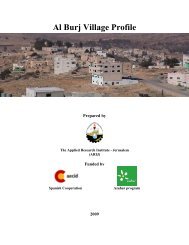
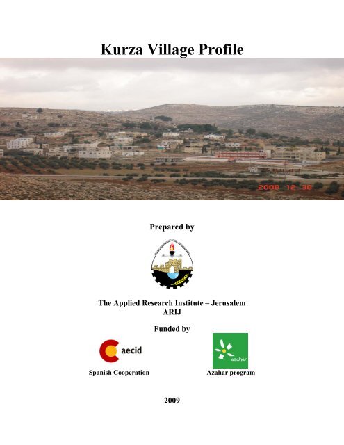
<strong>Kurza</strong> <strong>Village</strong> <strong>Profile</strong>Prepared byThe Applied Research Institute – Jerusalem<strong>ARIJ</strong>Funded bySpanish CooperationAzahar program2009
Palestinian Localities StudyHebron GovernorateAcknowledgments<strong>ARIJ</strong> hereby expresses its deep gratitude to the Spanish Agency for InternationalCooperation for Development (AECID) for their funding of this project through theAzahar Program.<strong>ARIJ</strong> is grateful to the Palestinian officials in the ministries, municipalities, jointservices councils, village committees and councils, and the Palestinian CentralBureau of Statistics (PCBS) for their assistance and cooperation with the projectteam members during the data collection process.<strong>ARIJ</strong> also thanks all the staff who worked throughout the past couple of yearstowards the accomplishment of this work.1
Palestinian Localities StudyHebron GovernorateBackgroundThis booklet is part of a series of booklets, which contain compiled information about each city,town, and village in Hebron Governorate. These booklets come as a result of a comprehensivestudy of all localities in Hebron Governorate, which aims at depicting the overall livingconditions in the governorate and presenting developmental plans to assist in developing thelivelihood of the population in the area. It was accomplished through the '<strong>Village</strong> <strong>Profile</strong>s andAzahar Needs Assessment'; a project funded by the Spanish Agency for InternationalCooperation for Development (AECID) and the Azahar Program.The '<strong>Village</strong> <strong>Profile</strong>s and Azahar Needs Assessment' was designed to study, investigate, analyzeand document the socio-economic conditions and the needed programs and activities to mitigatethe impact of the current unsecure political, economic and social conditions in HebronGovernorate with particular focus on the Azahar program objectives and activities concerningwater, environment, and agriculture.The project's objectives are to survey, analyze and document the available natural, human,socioeconomic and environmental resources, and the existing limitations and needs assessmentfor the development of the rural and marginalized areas in Hebron Governorate. In addition, theproject aims at preparing strategic developmental programs and activities to mitigate the impactof the current political, social, and economic instability with the focus on the agricultural sector.All locality profiles in Arabic and English are available online at http://proxy.arij.org/vprofile/2
Palestinian Localities StudyHebron GovernorateTable of ContentsLocation and Physical Characteristics ...........................................................................................4History..............................................................................................................................................5Religious and Archaeological Sites ................................................................................................5Demography and Population ..........................................................................................................6Education.........................................................................................................................................7Health Status ...................................................................................................................................8Economic Activities .........................................................................................................................8Agricultural Sector........................................................................................................................10Institutions and Services ...............................................................................................................12Infrastructure and Natural Resources .........................................................................................12Impact of the Israeli Occupation ..................................................................................................12Development Plans and Projects ..................................................................................................13Locality Development Priority and Needs ....................................................................................13References......................................................................................................................................143
Palestinian Localities StudyHebron Governorate<strong>Kurza</strong> <strong>Village</strong> <strong>Profile</strong>Location and Physical Characteristics<strong>Kurza</strong> is a village in the Dura area which is located 13 kilometers southwest the city of Hebron inthe southern West Bank. It is bordered by Abu Al ‘Asja and Abu Al Ghuzlan villages to the east,Hadab Al 'Alaqa to the north, Deir Al ‘Asal to the west, and by Adh Dhahiriya to the south (SeeMap 1).Map 1: <strong>Kurza</strong> location and bordersThe village of <strong>Kurza</strong> is located at an elevation of 675 m above Sea level. The mean annualrainfall in <strong>Kurza</strong> village is 435.9 mm; the average annual temperature is 15.7 o C, and the averageannual humidity is 60.6% (<strong>ARIJ</strong> GIS).<strong>Kurza</strong> village is considered to be a rural area. It is governed by a village council which wasestablished in 1995. Currently the council consists of seven members. Its main duty is to provideinfrastructure services to the residents in the village..4
Palestinian Localities StudyHebron GovernorateHistoryThe history of <strong>Kurza</strong> dates back to 1850, in the Ottoman period. Its residents are all Palestinians,originally from Dura city. <strong>Kurza</strong>, the village name, means ‘cherry’. The village was named <strong>Kurza</strong>as it was famous for having cherry groves in abundance in the area.Photo of <strong>Kurza</strong>Religious and Archaeological SitesIn terms of religious establishment, there is one mosque serving <strong>Kurza</strong>; <strong>Kurza</strong> mosque which wasestablished in 1984 by the Mosques Founding Committee in the village. In terms of historicalsites, there are two holy sites in the village, Sheikh Saleh shrine and Sheikh Salah shrine in "Al-Marj Dome".5
Palestinian Localities StudyHebron GovernorateMap 2: Main locations in <strong>Kurza</strong> villageDemography and PopulationAccording to the Palestinian Central Bureau of Statistics (PCBS) Census in 2007, the totalpopulation of <strong>Kurza</strong> village was 771 inhabitants, of whom 383 were males and 388 were females.There were 137 household residents in 138 housing in the village and the average household sizewas 5.6 people.Age Group and GenderCensus 2007 results about <strong>Kurza</strong> <strong>Village</strong> show the distribution of the population in terms of agegroup and sex. The data shows that 40.9% of the total population is less than 15 years, 56.5% isin the 15-64 age group and 2.7 % is 65 years and above . The sex ratio in <strong>Kurza</strong> is 98.7 males per100 females. In terms of percentage, the males in the village constitute 49.7% of the totalpopulation while females constitute 50.3% of the total population.6
Palestinian Localities StudyHebron GovernorateFamiliesThere are three main families in <strong>Kurza</strong> village; these are the Doudin family، which consists aboutof the total population, the Al Namoura family and Al Jawa'da family.EducationAccording to PCBS, Population, Housing and Establishment Census-2007, Final Results, about35 persons (6.4%) are illiterate of whom 17% are males and 83% are females. Of the literatepopulation, 11% of the population can read and write, 20.7% have completed elementaryeducation, 26.9% have completed preparatory education, 20.5% have completed secondaryeducation and 14.5% have completed their higher education (See table 1).Table 1: <strong>Kurza</strong> population (10 years and above) by sex and educational attainmentSexIlliterateCan read &writeElementary Preparatory SecondaryAssociateDiplomaBachelorHigherDiplomaMaster PhD TotalM 6 22 54 66 62 18 29 - 3 - 260F 29 38 59 81 50 11 18 - - - 286T 35 60 113 147 112 29 47 - 3 - 546Source: PCBS, March 2009. Population, Housing and Establishment Census-2007, Final ResultsThe data of field survey indicated that there are two governmental schools in <strong>Kurza</strong> village;<strong>Kurza</strong> Secondary Boys School, which provides elementary, preparatory and secondary educationfor male students, and <strong>Kurza</strong> Secondary Girls School, which provides elementary, preparatoryand secondary education for female students.According to Ministry of Higher Education (MOHE) data, by the end of the scholastic year2006/2007 there were 486 students, 271 male students and 215 female students. They weredistributed into 20 classes of which 4 were elementary co-educational classes, 8 were preparatoryand secondary classes for males, and 8 were preparatory and secondary classes for females.Around 27 teachers are currently working in schools in the village; there are 14 male teachers and13 female teachers.Table 2: Total No. of Schools, Classes and Students by Sex in <strong>Kurza</strong> villageGovernment Private TotalMale No. of Schools 1 0 1No. of class 8 0 8No. of Teachers 11 0 11No. of Students 203 0 203Female No. of Schools 1 0 2(co-education) No. of class 12 0 12No. of Teachers 16 0 16No. of Students 283 0 2837
Palestinian Localities StudyHebron GovernorateThe field survey data indicates that there is also a private coeducational kindergarten in thevillage, called <strong>Kurza</strong> Kindergarten. It provides pre-school education services to 30 children in<strong>Kurza</strong>.However, the educational sector in <strong>Kurza</strong> still suffers from some severe problems. For example,there is a need to establish a computer laboratory and a meeting hall in the <strong>Kurza</strong> Secondary GirlsSchool. Furthermore, there is a need to build an additional storey and to establish a playgroundfor the male Boys Secondary school to provide better educational services and meet futureactivities.Health Status<strong>Kurza</strong> does not have any kind of health services, it has; no clinics, no ambulances, and nopharmacies, and the closest health facility can be found in Dura, 10 kilometers away from the<strong>Village</strong>. However, there is a Mother and Child Care center that is run by the UNICEF, incooperation with the Palestinian Ministry of Health.The village officials state that <strong>Kurza</strong> is in need of a permanent clinic with a full-time doctor toprovide medical diagnosis and treatment for the village's residents.Economic ActivitiesThe economy of <strong>Kurza</strong> mainly depends on the agricultural and public sector. According to asurvey data around 50% of work force engages in agriculture activities and 29% of them areemployed in public sector.According to village officials’ estimates, the economic base of the village consists of thefollowing sectors:• Agricultural Sector (50%)• Government or Other Employees (29%)• The Israeli Labor Market (14%)• Services Sector (2%)• Trade and the Commercial Sector (5%)8
Palestinian Localities StudyHebron GovernorateFigure 1: Percentage of economic activities in <strong>Kurza</strong> villageThe IsraeliLabor Market ,14%Trade &Commercial ,5%Service , 2%Employees ,29%Agricultural ,50%There are no industrial institutions or workshops currently in <strong>Kurza</strong> village, and the village alsolacks any major economic institutions, there are however, nine small groceries.Based on a survey conducted in 2007 by <strong>ARIJ</strong> in Hebron localities, the unemployment rate in<strong>Kurza</strong> village is at 20%. The survey data also indicated that the social groups most affected in thevillage due to Israeli measures were:1. Workers that had previously worked in the Israeli labor market.2. Families with six individuals and more.3. Small-holder farmers.4. Small-holder traders.Labor ForceAccording to the PCBS, Population, Housing and Establishment Census in 2007, there were 546persons within the working age (10 years and above). Out of 546 people within the working age,164 are economically active in <strong>Kurza</strong> village, of which 88.4% were employed. There were 382non-economically active persons in the village, of which 59.7% were students, 29.6% werehousewives and 10.7% were either unable to work, or not working and not currently looking forwork. Females are over-represented in the non-economically active sector as housekeeping, seetable 3.Table 3: <strong>Kurza</strong> Population (10 years and above) by sex and activity statusSEconomically ActiveNot Economically ActiveeCurrentlyNot working &UnemployedHouse UnableEmployed UnemployedTotal StudentsNot looking forx(Never Worked)keeping to workM 117 10 7 134 105 2 14 1 4 126 260F 28 1 1 30 123 111 20 - 2 256 286T 145 11 8 164 228 113 34 1 6 382 546Source: PCBS, March 2009. Population, Housing and Establishment Census-2007, Final ResultsWorkOthersTotalTotal9
Palestinian Localities StudyHebron GovernorateAgricultural Sector<strong>Kurza</strong> village lies on a total area of approximately 1,500 dunums. 870 dunums are consideredarable land; however, only 674 dunums are used for growing crops. A lack of availableinvestment capital for agricultural development, in addition to lack of water resources haveseverely contributed to the unsuitability of arable farming in the villageTable 4: Land Use in <strong>Kurza</strong> (dunum)Arable LandTotalBuilt up Forests Open Spaces andAreaCultivated Un cultivatedArea Area RangelandsArea Area1,500 674 196 230 3 73Source: Palestinian Ministry of Agricultural (MoA), 2006Map 3: Land use/land cover in <strong>Kurza</strong> <strong>Village</strong>Table 5 shows the rain-fed and irrigated open cultivated vegetables in <strong>Kurza</strong>. The fruityvegetables are the most cultivated with an area of about 43 dunums.10
Palestinian Localities StudyHebron GovernorateTable 5: Total area of rain-fed and irrigated open cultivated vegetables in <strong>Kurza</strong> village (dunum)Fruity vegetables Green legumes Other vegetables Total areaRf Irr. Rf Irr. Rf Irr. Rf Irr.43 0 3 0 0 0 46 0Rf: Rain-fed, Irr: IrrigatedTwo species of aromatic medical plants are grown in the village of <strong>Kurza</strong> over a total area ofabout 2 dunums. These plants are thyme and sage.In the village of <strong>Kurza</strong>, there is a total area of 343 dunums of Olive Tree plantations. Other treesplanted in the area are mostly almond trees, apricot trees, fig trees and grape vines (See table 6).Table 6: Total area of horticulture and olive trees in <strong>Kurza</strong> <strong>Village</strong> (dunum)Olives Stone-fruits Nuts Other fruit Total areaRf Irr. Rf Irr. Rf Irr. Rf Irr. Rf Irr.343 0 24 1 68 0 24 0 459 1Rf: Rain-fed, Irr: IrrigatedCereals, in particular wheat and barley, are the most cultivated crops totaling an area of about 95dunums. In addition, the cultivation of dry legumes crops, mostly lentils, and forage crops suchas common vetch and bitter vetch is common in the village (See Table 7).Table 7: Total area of field crops cultivated in <strong>Kurza</strong> <strong>Village</strong> (dunum)Cereals Bulbs Dry Forage Stimulating Other Total arealegumes crops crops cropsRf Irr. Rf Irr. Rf Irr. Rff Irr. Rf Irr. Rf Irr. Rf Irr.95 0 5 0 24 0 38 0 2 0 3 0 167 0Rf: Rain-fed, Irr: IrrigatedData collected from <strong>Kurza</strong> <strong>Village</strong> Council indicates that the village residents depend onlivestock rearing and dairy production. The data indicates that around 10% of the householdsrearing farm animals. In total there are about 50 goats, 290 sheep and 13 donkeys in addition to 5poultry farms with approximately 51,800 birdsTable 8: Live Stock in <strong>Kurza</strong> villageCows* Sheep Goats Donkeys Broilers0 290 50 13 51,800*Including cows, bull calves, heifer calves and bullsThere is about 7,000 meters of agricultural road in <strong>Kurza</strong>; this is only suitable for tractors andagricultural hardware. It is largely insufficient and the village needs to construct new roads inorder to cover the vast agricultural area of the village.In general, the agricultural sector in <strong>Kurza</strong> village suffers from many problems; lack of waterresources, pastures and capital are the main obstacles. Lack of agricultural service extensions isalso accountable for inhibited agricultural development.11
Palestinian Localities StudyHebron GovernorateInstitutions and ServicesThe main institute in <strong>Kurza</strong> village is the village council. The council was established in 1995.Infrastructure and Natural ResourcesTelecommunication Services: <strong>Kurza</strong> village is connected to a telecommunication network, andabout 80% of the housing units are currently connected to the network.Water Services: <strong>Kurza</strong> village is not connected to any water network, and the water needed fordomestic and agricultural uses is collected from by cisterns and water tanks. There is a well in thevillage, but it is not hygienic for humans to use. The total quantity of water available to theresidents is not sufficient enough for their daily activities and the water tanks are in need ofreplacement. There is a need to connect the housing units in the village to a water network tomeet the residents' water demand.Electricity Networks: Since 1997, the Southern Electric Company has been the major providerof energy to <strong>Kurza</strong>, where all housing units are connected to the network.Sewage Disposal Facilities: The sewage disposal system in <strong>Kurza</strong> is chronically under-funded.There is no sewage disposable network, and the bulk of domestic and wastewater is disposed ofin cesspits.Solid Waste Collection Services: In 2006, about 155.7 tons of solid waste was generated in<strong>Kurza</strong> village (<strong>ARIJ</strong> database, 2006). However, there is no solid waste management system in<strong>Kurza</strong>, and each family disposes of its own wastes by either throwing it out or burning it.Transportation Facilities: There are about 8 km of internal roads in <strong>Kurza</strong>: 1 km is surfacedmain road but currently in a bad condition, 5 km are unpaved roads and 2 km unpavedagricultural roads.The public transportation in <strong>Kurza</strong> is currently an informal transport system. There are around 5informal taxis operate to transport people within the local area, between <strong>Kurza</strong> and nearbyvillages. The transportation system in the village is currently very poorly developed and lacks aregulated transport services. The passengers of the village often rely on Adh' Dhahiriya taxiswhich are configured to provide services on fixed routes.Impact of the Israeli OccupationThough <strong>Kurza</strong> is not directly affected by Israeli procedures, settlement or the Wall andcheckpoints, it, like all Palestinian localities is still affected indirectly by occupation. Examplesinclude the Israeli checkpoints that residents face when they travel outside the village.12
Palestinian Localities StudyHebron GovernorateDevelopment Plans and ProjectsThere have been many funded infrastructural implementations in <strong>Kurza</strong> since 2004; these includethe re-construction of the Girls School by Save Children, surfacing a street on individuals' costs,and finishing the skeleton work of a clinic By MEDECINS SANS FRONTIERES.Furthermore, the village has future development plans. The plans include an establishment of aschool, a playgrounds and a sport club for the youth in the village.Locality Development Priority and NeedsAccording to <strong>Kurza</strong> village council the city is still suffering from shortages in manyinfrastructures and service requirements. Table 9 below summarizes development priorities in thevillage.Table 9: Development priorities and needs for <strong>Kurza</strong> <strong>Village</strong>No.SectorInfrastructural NeedsStrongly Needed Moderately Not NotesNeededNeeded Needed1 Opening and Pavement of Roads * ^ 6 Km2 Construction of New Water Networks * 6 km3 Rehabilitation of Old Water Networks *4 Construction of Water Reservoirs *5 Extending the Water Network to cover New*Built up Areas6 Construction of Sewage Disposal Network *Health Needs1 Building of New Clinics or Health Care Centre *2 Rehabilitation of Old Clinics or Health Care*Centres3 Purchasing of Medical Equipments and Tools *Educational Needs1 Building of New Schools * secondary2 Rehabilitation of Old Schools * secondary3 Purchasing of New Equipments for Schools *Agriculture Needs1 Rehabilitation of Agricultural lands * 100 dunum2 Building Cisterns * 50 cisterns3 Construction of Barracks for Livestock *4 Veterinary Services *5 Seeds and Hay for Animals *6 Rehabilitation of Greenhouses *7 Field Crops Seeds *8 Plants and Agricultural Supplies *^6 km : 2km Internal road 4 km Agricultural roads13
Palestinian Localities StudyHebron GovernorateReferences:- Applied Research Institute – Jerusalem (<strong>ARIJ</strong>). GIS Database. 2006-2009.- Ministry of Agriculture. Agricultural Status Database in Hebron Governorate. 2006.- Ministry of Higher Education. Educational Status Database. 2006-2007.- Palestinian Central Bureau of Statistics. Population, Housing and EstablishmentCensus- Final Results. Ramallah, Palestine. 1997 -2007.14