Plant Communities of the Midwest - NatureServe
Plant Communities of the Midwest - NatureServe
Plant Communities of the Midwest - NatureServe

Create successful ePaper yourself
Turn your PDF publications into a flip-book with our unique Google optimized e-Paper software.
PLANT COMMUNITIES<br />
OF THE MIDWEST<br />
CLASSIFICATION IN AN ECOLOGICAL CONTEXT<br />
Don Faber-Langendoen, Editor<br />
A contribution to <strong>the</strong><br />
U.S. National Vegetation Classification and<br />
International Classification <strong>of</strong> Ecological <strong>Communities</strong>
PLANT COMMUNITIES OF THE MIDWEST<br />
CLASSIFICATION IN AN ECOLOGICAL CONTEXT<br />
Editor:<br />
Don Faber-Langendoen<br />
Contributors:<br />
Norman Aaseng<br />
Dennis Albert<br />
Pat Comer 1<br />
Robert Dana<br />
Jim Drake<br />
Hannah Dunevitz<br />
Eric Epstein<br />
Mike Homoya<br />
Max Hutchison<br />
Kelly Kindscher<br />
Chris Lauver<br />
Mike Leahy<br />
Darla Lenz 2<br />
Bill McClain<br />
Shannon Menard<br />
Tim Nigh<br />
Dave Ode<br />
John Pearson<br />
Kurt Rusterholz<br />
Greg Schneider<br />
Rick Schneider<br />
Kristin Snow<br />
Gerry Steinauer<br />
Association for Biodiversity Information<br />
Minnesota County Biological Survey<br />
Michigan Natural Features Inventory<br />
Michigan Natural Features Inventory<br />
Minnesota Natural Heritage and Nongame Research<br />
Association for Biodiversity Information<br />
Minnesota Natural Heritage and Nongame Research<br />
Wisconsin Natural Heritage Program<br />
Indiana Natural Heritage Program<br />
The Nature Conservancy, Illinois Field Office<br />
Kansas Natural Heritage Inventory<br />
Kansas Natural Heritage Inventory<br />
Missouri Department <strong>of</strong> Conservation<br />
North Dakota Natural Heritage Inventory<br />
Illinois Natural Heritage Division<br />
Association for Biodiversity Information<br />
Missouri Department <strong>of</strong> Conservation<br />
South Dakota Natural Heritage Database<br />
Iowa Natural Areas Inventory<br />
Minnesota Natural Heritage and Nongame Research<br />
Ohio Department <strong>of</strong> Natural Resources<br />
Nebraska Natural Heritage Program<br />
Association for Biodiversity Information<br />
Nebraska Natural Heritage Program<br />
1 Currently with The Nature Conservancy, Western Conservation Science Center<br />
2 Currently with <strong>the</strong> USDA Forest Service, Region 1, Dakota National Grasslands<br />
A contribution to <strong>the</strong><br />
U.S. NATIONAL VEGETATION CLASSIFICATION and<br />
INTERNATIONAL CLASSIFICATION OF ECOLOGICAL COMMUNITIES<br />
Association for Biodiversity Information<br />
in cooperation with The Nature Conservancy
ISBN 0-9711053-0-8<br />
© 2001 Association for Biodiversity Information<br />
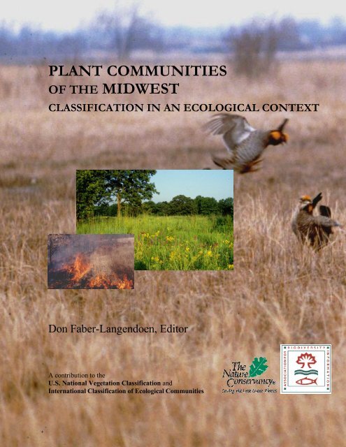
Cover Photos: The larger inset photo shows a summer view <strong>of</strong> Central Mesic Tallgrass<br />
Prairie grading into Central Bur Oak Openings. The site is along a railroad right-<strong>of</strong>-way at<br />
Carlinville Prairie in Macoupin County, Illinois. The smaller inset photo is <strong>of</strong> a winter burn<br />
<strong>of</strong> <strong>the</strong> same prairie type at Sac Prairie, Cuivre River State Park, Lincoln County, Missouri.<br />
The background photo shows greater prairie chickens (Tympanuchus cupido pinnatus) mating<br />
in early spring at <strong>the</strong> Bluestem Prairie Preserve <strong>of</strong> The Nature Conservancy, western<br />
Minnesota. All photos by D. Faber-Langendoen.<br />
Citation:<br />
Faber-Langendoen, D., editor. 2001. <strong>Plant</strong> communities <strong>of</strong> <strong>the</strong> <strong>Midwest</strong>: Classification in an<br />
ecological context. Association for Biodiversity Information, Arlington, VA. 61 pp. + appendix<br />
(705 pp.).<br />
<strong>Plant</strong> <strong>Communities</strong> <strong>of</strong> <strong>the</strong> <strong>Midwest</strong>: Classification in an Ecological Context consists <strong>of</strong> a this main<br />
report and a 705-page appendix <strong>of</strong> <strong>Midwest</strong> plant community descriptions. The appendix is available<br />
both as an Adobe Acrobat file and as a bound volume. The Adobe Acrobat file is provided on <strong>the</strong> CD<br />
insert (see inside back cover) and on <strong>the</strong> internet at http://www.abi.org/publications/midwest/. The<br />
bound volume is available at cost; send requests to Heritage Data Services, Database Project Specialist,<br />
Association for Biodiversity Information, 1101 Wilson Blvd, 15th floor, Arlington, VA 22209.<br />
The CD and website also contain individual state subsets <strong>of</strong> <strong>the</strong> appendix and a copy <strong>of</strong> this main<br />
report. State subsets have <strong>the</strong> name <strong>of</strong> <strong>the</strong> state “stamped” on <strong>the</strong> title page, and do not include a cover,<br />
addendums, or bibliography (although <strong>the</strong> latter 2 items are available separately). Pagination on state<br />
subsets mirrors that <strong>of</strong> <strong>the</strong> complete appendix; thus, page numbers are not sequential.
ACKNOWLEDGEMENTS<br />
It is no trivial matter to compile a description <strong>of</strong> midwestern plant communities using a<br />
classification framework that is part <strong>of</strong> a national and international effort. As <strong>Midwest</strong> Regional<br />
Ecologist for The Nature Conservancy, I could not hope in any reasonable time to develop on my own a<br />
classification that covered all twelve states in <strong>the</strong> <strong>Midwest</strong>ern Region (Illinois, Indiana, Iowa, Kansas,<br />
Michigan, Minnesota, Missouri, Nebraska, North Dakota, Ohio, South Dakota, and Wisconsin). I was<br />
fortunate to have <strong>the</strong> support <strong>of</strong> <strong>the</strong> network <strong>of</strong> ecologists in <strong>the</strong> state Natural Heritage programs that are<br />
listed as contributors on <strong>the</strong> title page <strong>of</strong> this document. They, along with various Conservancy field <strong>of</strong>fice<br />
staff, formed <strong>the</strong> core team that provided <strong>the</strong> expertise and <strong>the</strong> many hours in review and at meetings that<br />
ensured <strong>the</strong> accuracy <strong>of</strong> this classification. These individuals worked closely with me to define <strong>the</strong> various<br />
plant community types in <strong>the</strong> <strong>Midwest</strong>. Through <strong>the</strong>ir own extensive field experience, <strong>the</strong>y provided <strong>the</strong> best<br />
and most current knowledge <strong>of</strong> midwestern vegetation and ensured that this classification is tied directly to<br />
state classifications. Although not all agreed with all <strong>of</strong> <strong>the</strong> decisions and approaches taken in producing this<br />
classification, <strong>the</strong>y never<strong>the</strong>less helped to ensure its quality.<br />
When I joined The Nature Conservancy’s <strong>Midwest</strong> Conservation Science Center in 1992 to<br />
fur<strong>the</strong>r <strong>the</strong> work <strong>of</strong> a national vegetation classification, Steve Chaplin, (Director, <strong>Midwest</strong> Conservation<br />
Science Center) lent his full support to this effort. Time and again, when <strong>the</strong> demands <strong>of</strong> my job<br />
threatened to distract me from this goal, he kept me focused, and I thank him for those efforts. Since<br />
1993, I have been fortunate to have Jim Drake and Kristin Snow working with me in <strong>the</strong> <strong>Midwest</strong>. Their<br />
contributions were instrumental in completing this document. Early on, Jim helped with <strong>the</strong> writing <strong>of</strong><br />
many <strong>of</strong> <strong>the</strong> association descriptions, and he co-authored <strong>the</strong> alliance descriptions. Kristin Snow put her<br />
innovative database skills to great use, helping with database design, data management, and reporting.<br />
My move from Minneapolis to Syracuse in 1997 only complicated her work, but she successfully kept me<br />
from straying too far from good database practices while I wrote and edited <strong>the</strong> descriptions. I thank<br />
Mary Russo, our database manager, particularly for her care in updating all <strong>of</strong> <strong>the</strong> plant species taxonomy<br />
to Kartesz (1999) standards. I am pleased to now work with Shannon Menard, who succeeded me as<br />
<strong>Midwest</strong> Regional Ecologist in April <strong>of</strong> 2000. She has already begun to improve <strong>the</strong> classification,<br />
including assisting with <strong>the</strong> final review <strong>of</strong> all descriptions.<br />
Regional integration <strong>of</strong> information on midwestern vegetation did not begin in 1992. Starting in<br />
1985, Kim Chapman, <strong>Midwest</strong> Regional Ecologist at <strong>the</strong> time, began syn<strong>the</strong>sizing <strong>the</strong> midwestern natural<br />
community concepts used among many <strong>of</strong> <strong>the</strong> state Natural Heritage programs. His classification (Chapman<br />
1988) provided a detailed cross-reference to <strong>the</strong> different state vegetation classifications in <strong>the</strong> region and<br />
helped set <strong>the</strong> stage for <strong>the</strong> work presented here.<br />
A number <strong>of</strong> ecologists wrote plant community descriptions as a part <strong>of</strong> <strong>the</strong>ir work on <strong>Midwest</strong><br />
Office projects: Donn Ambrose assisted with <strong>the</strong> writing <strong>of</strong> some <strong>of</strong> <strong>the</strong> rare plant community types;<br />
Carol Reschke completed a major syn<strong>the</strong>sis <strong>of</strong> information on all <strong>of</strong> <strong>the</strong> alvar types in <strong>the</strong> Great Lakes<br />
region and on all vegetation types on Isle Royale National Park (Michigan); Peter Lesica worked on a<br />
number <strong>of</strong> <strong>the</strong> rare types in <strong>the</strong> Nor<strong>the</strong>rn Great Plains; Steve Rolfsmeier worked on types found in Scotts<br />
Bluff National Monument (Nebraska); Michael Smith and Norm Aaseng worked on types at Voyageurs<br />
National Park (Minnesota); and Hollis Marriott provided an invaluable service in helping to write up<br />
information on all types in <strong>the</strong> Black Hills region <strong>of</strong> South Dakota and Wyoming.<br />
Without <strong>the</strong> help <strong>of</strong> Rick Schneider during his time with <strong>the</strong> Great Plains Program <strong>of</strong> <strong>the</strong><br />
Conservancy, I would still be riding <strong>the</strong> Plains in an effort to understand how midwestern types fit in with<br />
surrounding regions. His shuttle diplomacy over a two-year period enabled ecologists from <strong>the</strong><br />
Conservancy’s <strong>Midwest</strong>ern, Western, and Sou<strong>the</strong>rn Resource Offices and from state Natural Heritage<br />
programs to resolve many classification differences in <strong>the</strong> Great Plains.<br />
PLANT COMMUNITIES OF THE MIDWEST – 2001<br />
i
This work has also benefited from input by academic scientists, Conservancy field staff, and o<strong>the</strong>r<br />
ecologists. Among <strong>the</strong>m are Lee Frelich and Charles Umbanhowar, who helped with early drafts <strong>of</strong><br />
Minnesota, Michigan, and Wisconsin types. Charles also reviewed North Dakota types. Tom Blewett, Paul<br />
Christiansen, Don Farrar, Susan Galatowitsch, David Glenn-Lewin, Tom Rosburg, and Daryl Smith reviewed<br />
drafts <strong>of</strong> <strong>the</strong> Iowa portion <strong>of</strong> <strong>the</strong> classification. Greg Gremaud, Doug Ladd, and Paul Nelson helped review<br />
drafts for Missouri, and Mark Guetersloh and Cynthia Olmstead reviewed those for Illinois. Marilyn Ortt and<br />
Alison Cusick provided review for <strong>the</strong> Ohio drafts. Bonnie Heidel compiled a great deal <strong>of</strong> information on<br />
North Dakota natural communities during her time at <strong>the</strong> Natural Heritage program <strong>the</strong>re. Collaboration with<br />
Jason Greenall and Wasyl Bakowsky (ecologists at <strong>the</strong> conservation data centres in Manitoba and Ontario,<br />
respectively) allowed me to develop a more global perspective on <strong>the</strong> community types presented here. I<br />
thank <strong>the</strong>m all for <strong>the</strong>ir input.<br />
For an even broader perspective, our ecology team was fortunate to be invited in April <strong>of</strong> 1994 to a<br />
workshop in Britain, led by John Rodwell <strong>of</strong> <strong>the</strong> Unit <strong>of</strong> Vegetation Science at Lancaster University. John<br />
adapted <strong>the</strong> one-week workshop on <strong>the</strong> British National Vegetation Classification to our team’s specific<br />
interests. We had <strong>the</strong> opportunity to learn firsthand about European classification methods (with a British<br />
twist). At that time, John was in <strong>the</strong> midst <strong>of</strong> his monumental five-volume series on <strong>the</strong> classification <strong>of</strong><br />
British vegetation, now complete (Rodwell 2000), and he proved an able teacher and inspiration to our efforts<br />
here, particularly regarding <strong>the</strong> role <strong>of</strong> quantitative plot sampling in vegetation classification.<br />
As this project neared its end, Shannon Menard and I were struggling with how best to handle <strong>the</strong><br />
revisions to <strong>the</strong> ecological groups. These groups, drafted in 1999, were defined based on a midwestern<br />
perspective. We were fortunate that Rob Evans, Terrestrial Ecologist with <strong>the</strong> Conservancy’s Sou<strong>the</strong>astern<br />
Conservation Science Center, was more than willing to join in <strong>the</strong> fray. Working with a similar set <strong>of</strong><br />
ecological groups drafted by Alan Weakley and o<strong>the</strong>rs in <strong>the</strong> South, we were able to resolve many <strong>of</strong> <strong>the</strong><br />
differences that existed between <strong>the</strong> regions. As a result, <strong>the</strong> version presented in this document is much<br />
more coherent across regional lines.<br />
Nationally, Dennis Grossman, Kathy Goodin, and Kat Maybury at <strong>the</strong> Conservancy’s Home Office<br />
were instrumental in leading and coordinating efforts to develop a U.S. National Vegetation classification.<br />
They supported <strong>the</strong> work <strong>of</strong> <strong>the</strong> regional ecology staff, including, over <strong>the</strong> years, Alan Weakley, Karen<br />
Patterson, Milo Pyne, Sally Landaal, and Dorothy Allard <strong>of</strong> <strong>the</strong> Sou<strong>the</strong>astern Region; Lesley Sneddon, Mark<br />
Anderson, and Ken Metzler <strong>of</strong> <strong>the</strong> Eastern Region; Pat Bourgeron, Lisa Engelking, Rex Crawford, and<br />
Marion Reid <strong>of</strong> <strong>the</strong> Western Region; and <strong>the</strong> staff <strong>of</strong> <strong>the</strong> <strong>Midwest</strong>ern Region mentioned above. These<br />
colleagues helped to ensure that all <strong>the</strong> types described here in <strong>the</strong> <strong>Midwest</strong> are also understood throughout<br />
<strong>the</strong>ir range in <strong>the</strong> United States. Many <strong>of</strong> us have now transferred from <strong>the</strong> Conservancy to <strong>the</strong> Association<br />
for Biodiversity Information, where we continue <strong>the</strong> work on <strong>the</strong> national classification.<br />
Funding support was received from a number <strong>of</strong> federal partners for various projects relating to<br />
classification <strong>of</strong> midwestern plant communities. We gratefully acknowledge <strong>the</strong>ir support, in particular <strong>the</strong><br />
U.S. Geological Survey GAP Analysis Program, <strong>the</strong> U.S. Forest Service, U.S. Geological Survey Biological<br />
Resources Division, <strong>the</strong> National Park Service, and <strong>the</strong> Environmental Protection Agency.<br />
Many o<strong>the</strong>rs have contributed to this effort, and though <strong>the</strong>y go unmentioned here, <strong>the</strong>ir marks have<br />
been made in various ways. I especially want to thank many <strong>of</strong> my friends and family who helped me<br />
maintain a healthy attitude toward work. I have not always been as free with my time as <strong>the</strong>y might have<br />
liked. And I owe a great deal to my wife, Kathy Faber-Langendoen, who sometimes refers to herself as my<br />
Senior Field Assistant because <strong>of</strong> all <strong>the</strong> trips she has been on with me, and who has all-too-<strong>of</strong>ten put up with<br />
my absences during my road trips. I am thankful that she, like me, does not tire <strong>of</strong> looking at <strong>the</strong> natural<br />
diversity <strong>of</strong> <strong>the</strong> world God has so wonderfully made and shaped.<br />
—Don Faber-Langendoen<br />
PLANT COMMUNITIES OF THE MIDWEST – 2001<br />
ii
CONTENTS<br />
Acknowledgements ........................................................................................................................................................i<br />
List <strong>of</strong> Tables................................................................................................................................................................iv<br />
List <strong>of</strong> Figures...............................................................................................................................................................iv<br />
I. INTRODUCTION...................................................................................................................................................1<br />
II. A BRIEF INTRODUCTION TO THE ECOLOGICAL REGIONS OF THE MIDWEST............................4<br />
GREAT PLAINS REGION ............................................................................................................................................4<br />
PRAIRIE PARKLAND REGION.....................................................................................................................................5<br />
EASTERN DRY DECIDUOUS (BROADLEAF) FORESTS REGION ...................................................................................5<br />
EASTERN MOIST DECIDUOUS (BROADLEAF) FORESTS REGION ................................................................................6<br />
LAURENTIAN MIXED FORESTS REGION ....................................................................................................................6<br />
CONSERVATION CHALLENGES..................................................................................................................................6<br />
III. THE U.S. NATIONAL VEGETATION CLASSIFICATION..........................................................................7<br />
BACKGROUND ..........................................................................................................................................................7<br />
Key Attributes..................................................................................................................................................7<br />
Hierarchy .........................................................................................................................................................8<br />
Association Concept ........................................................................................................................................9<br />
The USNVC and <strong>the</strong> Natural Heritage Network ...........................................................................................12<br />
METHODS ...............................................................................................................................................................13<br />
Assembling <strong>the</strong> Information ..........................................................................................................................13<br />
Cross-walking and Integration.......................................................................................................................14<br />
Defining <strong>the</strong> Association in <strong>the</strong> <strong>Midwest</strong>.......................................................................................................16<br />
APPLICATIONS OF THE CLASSIFICATION .................................................................................................................18<br />
IV. ECOLOGICAL GROUPS.................................................................................................................................19<br />
BACKGROUND ........................................................................................................................................................19<br />
METHODS ...............................................................................................................................................................19<br />
STRUCTURE ............................................................................................................................................................20<br />
Overview .......................................................................................................................................................20<br />
Illustration <strong>of</strong> <strong>the</strong> Ecological Groups Approach ............................................................................................27<br />
V. PLANT COMMUNITIES OF THE MIDWEST ..............................................................................................31<br />
BIBLIOGRAPHY......................................................................................................................................................55<br />
APPENDIX: PLANT COMMUNITY (ASSOCIATION) DESCRIPTIONS ......................................................61<br />
(available on CD or as a separate volume; see p. 61 for more information)<br />
OVERVIEW<br />
ASSOCIATION NOMENCLATURE<br />
INDEX TO ASSOCIATIONS BY ECOLOGICAL GROUP<br />
PLANT COMMUNITY (ASSOCIATION) DESCRIPTIONS<br />
ADDITIONAL TYPES OF UNCERTAIN STATUS IN THE MIDWEST<br />
A LIST OF ASSOCIATIONS FOR THE MIDWEST IN ORDER OF GLOBAL ELCODE<br />
BIBLIOGRAPHY FOR DESCRIPTIONS<br />
PLANT COMMUNITIES OF THE MIDWEST – 2001<br />
iii
LISTS OF TABLES AND FIGURES<br />
List <strong>of</strong> Tables<br />
Table 1. Hierarchical levels <strong>of</strong> <strong>the</strong> USNVC................................................................................................. 9<br />
Table 2. Illustration <strong>of</strong> <strong>the</strong> USNVC hierarchy. .......................................................................................... 10<br />
Table 3. Illustration <strong>of</strong> <strong>the</strong> cross-walk between USNVC associations and state Natural Heritage<br />
community types.......................................................................................................................... 15<br />
Table 4. Structure <strong>of</strong> <strong>the</strong> four levels <strong>of</strong> ecological groups ......................................................................... 21<br />
Table 5. Definitions <strong>of</strong> ecological groups in Level 2................................................................................. 22<br />
Table 6. Summary <strong>of</strong> ecological groups across Levels 1 – 3..................................................................... 28<br />
Table 7. Summary <strong>of</strong> number <strong>of</strong> types at each USNVC level in <strong>the</strong> <strong>Midwest</strong> .......................................... 33<br />
Table 8. Summary <strong>of</strong> number <strong>of</strong> types at each ecological group level in <strong>the</strong> <strong>Midwest</strong> ............................. 33<br />
Table 9. A list <strong>of</strong> plant communities (associations) for <strong>the</strong> <strong>Midwest</strong> by ecological group........................ 36<br />
List <strong>of</strong> Figures<br />
Figure 1. Alvar distribution maps and photograph ...................................................................................... 2<br />
Figure 2. Illustration <strong>of</strong> <strong>the</strong> association concept ........................................................................................ 11<br />
Figure 3. TNC and ABI ecology administrative regions ...........................................................................13<br />
Figure 4. a) Floristic regions <strong>of</strong> Takhtajan (1986) b) Floristic subregions proposed for <strong>the</strong> <strong>Midwest</strong> ... 25<br />
Figure 5. Illustration <strong>of</strong> <strong>the</strong> relationship between ecological groups and associations.............................. 29<br />
Figure 6. The prairie – forest continuum ................................................................................................... 30<br />
Figure 7. Dynamic relationships among ecological groups....................................................................... 30<br />
Figure 8. Prairie-forest dynamics over time............................................................................................... 32<br />
PLANT COMMUNITIES OF THE MIDWEST – 2001<br />
iv
I. INTRODUCTION<br />
For many years conservationists and resource managers have recognized <strong>the</strong> need to address<br />
biological diversity at multiple levels, from species to communities, ecosystems, and landscapes. The<br />
community level, which emphasizes assemblages <strong>of</strong> species and <strong>the</strong>ir interactions within a system, is<br />
widely used to help assess and protect <strong>the</strong> full suite <strong>of</strong> species and ecological processes across landscapes<br />
and ecoregions. <strong>Communities</strong> also provide an important tool for characterizing <strong>the</strong> current biotic<br />
condition <strong>of</strong> ecological systems. But <strong>the</strong> variability and diversity <strong>of</strong> community patterns has not been<br />
easy to describe and classify. Classifications provide useful organizing tools that can help measure how<br />
well biological diversity is being protected and managed. The lack <strong>of</strong> a consistent, standardized<br />
classification <strong>of</strong> communities has <strong>of</strong>ten hindered conservation efforts that require such tools.<br />
The utility <strong>of</strong> having a standardized vegetation classification for conservation is now becoming<br />
apparent. Consider <strong>the</strong> following examples in <strong>the</strong> <strong>Midwest</strong>. In 1986, Victoria Nuzzo found that no single<br />
definition <strong>of</strong> <strong>Midwest</strong> oak savanna was universally accepted in <strong>the</strong> region, and she attempted to provide a<br />
general definition that could guide <strong>the</strong> syn<strong>the</strong>sis <strong>of</strong> information across an eight-state area (Nuzzo 1986).<br />
Because <strong>of</strong> inconsistencies from state-to-state, she was unable to provide a standardized set <strong>of</strong><br />
information that was consistent across <strong>the</strong> region. As a result, <strong>the</strong> summary information for Indiana<br />
included what were called “savannas” (nor<strong>the</strong>rn Indiana), but not “barrens” (sou<strong>the</strong>rn Indiana), whereas<br />
<strong>the</strong> summaries for Illinois included both savannas and barrens. Fur<strong>the</strong>rmore, although Missouri doesn’t<br />
use <strong>the</strong> term “barrens,” <strong>the</strong>ir bedrock savanna types (such as “chert savanna”) would be called “barrens”<br />
in both Illinois and Indiana. These definitional problems (which still persist today; see Anderson et al.<br />
1999b) hindered abilities to do rangewide conservation <strong>of</strong> <strong>Midwest</strong> oak savannas, and <strong>the</strong>y indicate <strong>the</strong><br />
value <strong>of</strong> a standardized classification for conservation (Leach and Ross 1995).<br />
By contrast, a recent effort by <strong>the</strong> International Alvar Working Group to conduct a rangewide<br />
review <strong>of</strong> alvar communities across North America began with <strong>the</strong> recognition that a consistent,<br />
standardized classification would allow partners to work across state and provincial lines (Reschke et al.<br />
1999). By working with, and helping to develop, <strong>the</strong> International Classification <strong>of</strong> Ecological<br />
<strong>Communities</strong> (ICEC)/ U.S. National Vegetation Classification (USNVC) framework, <strong>the</strong> group was able<br />
to provide an integrated assessment <strong>of</strong> alvar communities rangewide, from New York to Ontario and<br />
Michigan. This work catalogued <strong>the</strong> various types <strong>of</strong> alvars and identified <strong>the</strong> alvar sites <strong>of</strong> highest<br />
conservation priority (Figure 1). The development and use <strong>of</strong> an agreed-upon standard classification for<br />
alvars does not preclude <strong>the</strong> use <strong>of</strong> alternative ones (e.g., Catling and Brownell 1999, Brownell and Riley<br />
2000). The needs <strong>of</strong> <strong>the</strong> user and <strong>the</strong> issues to be addressed will determine which classification(s) are <strong>the</strong><br />
most useful. However, where a rangewide perspective is needed, <strong>the</strong> ICEC/USNVC can provide a strong<br />
ecological and conservation tool.<br />
The Nature Conservancy and <strong>the</strong> Association for Biodiversity Information (ABI), two<br />
organizations dedicated to inventorying and protecting biological diversity, recognized <strong>the</strong> need for a<br />
consistent ecological community classification some years ago. Over <strong>the</strong> last 25 years, scientists from<br />
<strong>the</strong>se two organizations have worked collaboratively with a number <strong>of</strong> partners to develop an<br />
International Classification <strong>of</strong> Ecological <strong>Communities</strong>, which includes freshwater, marine, and terrestrial<br />
systems. A primary emphasis was placed on <strong>the</strong> terrestrial systems, which led to <strong>the</strong> development <strong>of</strong> <strong>the</strong><br />
U.S. National Vegetation Classification (USNVC) (Grossman et al. 1998, Anderson et al. 1998). This<br />
classification is now a national standard for U.S. federal agencies (FGDC 1997), is supported by<br />
academic and pr<strong>of</strong>essional ecologists (Loucks 1996, Glenn-Lewin and Jennings 2001), and is receiving<br />
widespread application for resource management, inventory, and conservation planning. The ICEC<br />
framework for terrestrial communities is now also being implemented in Canada (Ponomarenko et al.<br />
2000, Alvo and Ponomarenko 2001) and Latin America (Carmen Josse, pers. comm. ).<br />
PLANT COMMUNITIES OF THE MIDWEST – 2001<br />
1
Figure 1a. Distribution <strong>of</strong> alvar sites<br />
across <strong>the</strong>ir entire range. Sites are<br />
marked with a star. Map shows <strong>the</strong><br />
outline <strong>of</strong> <strong>the</strong> Great Lakes basin. Used<br />
with permission from The Nature<br />
Conservancy’s Great Lakes Program.<br />
Figure 1b. Distribution <strong>of</strong> Alvar Nonvascular<br />
Pavement (Tortella tortuosa -<br />
Cladonia pocillum - Placynthium spp. Sparse<br />
Vegetation – CEGL005192) across its<br />
range. The sites are labeled as to <strong>the</strong>ir<br />
conservation value for this type, from A<br />
(high) to C (fair). From Reschke et al.<br />
(1999), used with permission from The<br />
Nature Conservancy’s Great Lakes<br />
Program.<br />
Figure 1c. Photo <strong>of</strong> Alvar Nonvascular<br />
Pavement with lakeside daisy<br />
(Hymenoxis herbacea) in bloom.<br />
Misery Bay Provincial Park on<br />
Manitoulin Island, Ontario, Canada.<br />
D. Faber-Langendoen.<br />
PLANT COMMUNITIES OF THE MIDWEST – 2001
The development <strong>of</strong> a standard vegetation classification for conservation, resource management,<br />
and vegetation ecology research is not without controversy. Concerns range from continuum issues to<br />
single versus multi-factor approaches, and to questions about <strong>the</strong> most practical ways to protect<br />
biodiversity above <strong>the</strong> species level. For example, should conservation be based on ecological<br />
communities, ecological land units, or functional landscapes The rationale for <strong>the</strong> approach used by <strong>the</strong><br />
ICEC/USNVC, <strong>of</strong> which <strong>the</strong> <strong>Midwest</strong> classification is a part, is more fully explained by Grossman et al.<br />
(1998). However, a core feature <strong>of</strong> this approach is that it provides <strong>the</strong> tools needed to define<br />
“naturalness” or “ecological integrity” <strong>of</strong> an ecological community. The classification categorizes types<br />
based on existing or actual vegetation, <strong>the</strong>reby describing <strong>the</strong> current condition <strong>of</strong> <strong>the</strong> system, including<br />
whe<strong>the</strong>r <strong>the</strong> vegetation is native, planted, or exotic, and whe<strong>the</strong>r it is maintained by disturbances (e.g.,<br />
fire, grazing, or flooding), ei<strong>the</strong>r natural or cultural (Grossman et. al. 1998). By using this approach to<br />
describe <strong>the</strong> natural ecological communities across <strong>the</strong> <strong>Midwest</strong>, we can define <strong>the</strong> native assemblages <strong>of</strong><br />
species that occur <strong>the</strong>re and <strong>the</strong> ecological processes that <strong>the</strong>y depend on. Naturalness, which is not a<br />
static or discrete concept, doesn’t preclude human activity in native systems, but it emphasizes <strong>the</strong> degree<br />
to which native systems function without regular human intervention (Grossman et al. 1998, Angermeier<br />
2000). It is a key criterion for assessing <strong>the</strong> conservation status <strong>of</strong> systems, from global to local scales<br />
(Hannah et al. 1995).<br />
Although <strong>the</strong> USNVC, and <strong>the</strong> <strong>Midwest</strong> portion described here, was developed primarily to<br />
address conservation and resource management issues, it also provides a systematic way to describe<br />
natural vegetation patterns and processes across <strong>the</strong> region. The descriptions provided here attempt to<br />
place <strong>the</strong> midwestern vegetation in a new perspective. Such an effort is sorely needed. Braun’s (1950)<br />
approach to describing <strong>the</strong> eastern deciduous forests <strong>of</strong> North America—an outstanding work in its day—<br />
is still widely used whenever syn<strong>the</strong>ses <strong>of</strong> forest patterns in <strong>the</strong> eastern United States are needed (Greller<br />
1988, Barnes 1991, Delcourt and Delcourt 2000). However, early on it was recognized to have some<br />
limitations because <strong>of</strong> <strong>the</strong> climax approach used (Whittaker 1957). The seminal work by Curtis (1959),<br />
who described <strong>the</strong> vegetation <strong>of</strong> Wisconsin, led to no o<strong>the</strong>r comparable state-level efforts in <strong>the</strong> <strong>Midwest</strong>.<br />
The hundreds <strong>of</strong> more local vegetation studies have not been integrated into any single, coherent<br />
framework to interpret <strong>the</strong> diverse and dynamic patterns <strong>of</strong> vegetation, although many Natural Heritage<br />
programs have developed systematic classifications and descriptions for conservation applications in <strong>the</strong>ir<br />
states (White and Madany 1978, Anderson 1982, Nelson 1985, Minnesota Natural Heritage Program<br />
1993, Lauver et al. 1999, Steinauer and Rolfsmeier 2000). The North American-wide surveys edited by<br />
Barbour and Billings (1988, 2000), although very valuable, are broadly synoptic, and omit many <strong>of</strong> <strong>the</strong><br />
more regional and local vegetation patterns, such as cliff communities, alvars, and “Great Lakes Dunes.”<br />
The approach used here works from broad-based to fine-scale patterns, and relies on existing vegetation<br />
concepts to describe <strong>the</strong> patterns and condition <strong>of</strong> <strong>the</strong> midwestern landscape. In this way, users can<br />
compare <strong>the</strong> vegetation patterns defined here to ones defined by o<strong>the</strong>rs, whatever <strong>the</strong> scale <strong>of</strong><br />
presentation. We hope this first qualitative syn<strong>the</strong>sis <strong>of</strong> midwestern natural terrestrial vegetation will spur<br />
o<strong>the</strong>rs to review, critique, and refine <strong>the</strong> patterns <strong>of</strong> vegetation—at all scales—that are outlined here.<br />
The <strong>Midwest</strong> classification presented here is an integral part <strong>of</strong> <strong>the</strong> USNVC. Through that<br />
system’s hierarchy, associations can be organized hierarchically based primarily on <strong>the</strong>ir floristic and<br />
physiognomic relationships (Grossman et al. 1998, Anderson et al. 1998). Such an arrangement is<br />
important for many purposes, many <strong>of</strong> <strong>the</strong>m <strong>of</strong> national or international scope. However, when<br />
attempting to convey <strong>the</strong> information available at <strong>the</strong> association level to a wide audience <strong>of</strong> midwestern<br />
ecologists, we have found that such a vegetation-based, international framework is unfamiliar and can be<br />
somewhat cumbersome. As <strong>the</strong> purpose <strong>of</strong> this report is to present detailed descriptions at <strong>the</strong> association<br />
level within <strong>the</strong> <strong>Midwest</strong>, we chose to organize <strong>the</strong> associations by a more ecological, or habitat-based,<br />
approach that we call “ecological groups.” Developing this alternative arrangement for associations,<br />
based on <strong>the</strong> purpose and audience, is not new; such alternatives have been used when presenting similar<br />
association-based approaches in Europe (e.g., Ellenberg 1988; Rodwell 1991, 2000; Muchina 2001). The<br />
decision to use ecological groups to organize <strong>the</strong> associations was made late in <strong>the</strong> classification process<br />
PLANT COMMUNITIES OF THE MIDWEST – 2001<br />
3
(most associations were defined and reviewed by <strong>the</strong> Natural Heritage Network prior to 1999); as such,<br />
<strong>the</strong> ecological groups are experimental and need more review.<br />
Our main objective is to provide a classification and description <strong>of</strong> natural plant communities<br />
found in <strong>the</strong> <strong>Midwest</strong>. The information is based on a combination <strong>of</strong> literature review, data analyses,<br />
existing classification documents, expert opinion, and peer review from colleagues throughout <strong>the</strong> Natural<br />
Heritage Network, many <strong>of</strong> whom have contributed <strong>the</strong>ir time and expertise in reviewing <strong>the</strong> material<br />
presented here. Each description provides a link to <strong>the</strong> state classifications used by Natural Heritage<br />
programs. The description also includes an assessment <strong>of</strong> <strong>the</strong> rarity and rangewide distribution <strong>of</strong> <strong>the</strong><br />
type, which is consistent with <strong>the</strong> mission <strong>of</strong> ABI to apply this classification to conservation issues.<br />
II. A BRIEF INTRODUCTION TO THE ECOLOGICAL REGIONS OF THE<br />
MIDWEST<br />
The <strong>Midwest</strong>ern Region covers a twelve state area in <strong>the</strong> northcentral United States, totaling<br />
some 752,000 square miles (1,946,000 square kilometers). Canada forms <strong>the</strong> border to <strong>the</strong> north. The<br />
Central Lowlands Province dominates <strong>the</strong> physiographic landscape <strong>of</strong> <strong>the</strong> <strong>Midwest</strong>. It extends westward<br />
to <strong>the</strong> Great Plains and eastward to <strong>the</strong> Allegheny Plateau (sou<strong>the</strong>astern Ohio). Southward, it is bordered<br />
by <strong>the</strong> Interior Highlands (Interior Low Plateau and Ozark Plateau), which is divided by <strong>the</strong> nor<strong>the</strong>rn<br />
extension <strong>of</strong> <strong>the</strong> Mississippi River Alluvial Plain into <strong>the</strong> boo<strong>the</strong>el <strong>of</strong> Missouri and adjacent Illinois.<br />
Northward, <strong>the</strong> Central Lowlands extend into <strong>the</strong> mixed conifer-hardwood region around <strong>the</strong> Great Lakes,<br />
except for a small part <strong>of</strong> nor<strong>the</strong>rn Wisconsin and nor<strong>the</strong>astern Minnesota that are on <strong>the</strong> Canadian Shield.<br />
An integrated perspective on <strong>the</strong> ecological diversity <strong>of</strong> <strong>the</strong> region is provided by ecological land<br />
classifications <strong>of</strong> <strong>the</strong> region. Among <strong>the</strong> best developed and most widely used is that <strong>of</strong> Robert Bailey<br />
(1995, 1998), who has produced a series <strong>of</strong> ecoregional maps (Bailey et al. 1994, 1998). To address<br />
issues <strong>of</strong> scale, Bailey’s system is hierarchical, distinguishing four ecological levels—domain, division,<br />
province, and section—at increasingly finer levels <strong>of</strong> scale. Finer scale units, such as <strong>the</strong> subsection level,<br />
have been developed by o<strong>the</strong>rs (Keys et al. 1995). Units at each level are established based on interacting<br />
biotic and abiotic factors. Macroclimate is <strong>the</strong> principal factor used to identify continental-scale regions at<br />
<strong>the</strong> division and domain levels. Climatic subzones, assessed in part by broad-scale vegetation formations,<br />
form <strong>the</strong> basis for subdividing <strong>the</strong> divisions into provinces. Mountain provinces are those that exhibit<br />
altitudinal zonation within a shared climatic division <strong>of</strong> <strong>the</strong> adjacent lowland (in <strong>the</strong> <strong>Midwest</strong> <strong>the</strong>se occur<br />
only in <strong>the</strong> Black Hills on <strong>the</strong> South Dakota - Wyoming border). Within provinces, landforms exert <strong>the</strong><br />
major control over climate, and are used to subdivide <strong>the</strong> provinces into sections (Bailey 1995). The<br />
ecoregional map for <strong>the</strong> <strong>Midwest</strong> displays broad climatic and vegetation formation gradients across <strong>the</strong><br />
regions, as well as some <strong>of</strong> <strong>the</strong> major landforms that shape regional vegetation patterns. The ecological<br />
features (including landforms, soils, climate, and vegetation) <strong>of</strong> <strong>the</strong>se regions are described down to <strong>the</strong><br />
province level by Bailey (1995) and at <strong>the</strong> section level by McNab and Evers (1994) (see also Plate 11).<br />
Great Plains Region<br />
The Great Plains (Temperate Steppe Division) contains two provinces (see Plate 11). This semiarid<br />
continental climate has cold and dry winters with warm to hot summers. Precipitation ranges from<br />
about 10 inches (26 cm) in <strong>the</strong> north and west (Province 331) to as much as 30 inches (77 cm) along <strong>the</strong><br />
eastern portions <strong>of</strong> Nebraska and Oklahoma (Province 332). Evaporation typically exceeds precipitation.<br />
The Black Hills, geologically a part <strong>of</strong> <strong>the</strong> Rocky Mountains, are tall enough (7200 feet) to create a<br />
mountain climate. At higher elevations <strong>the</strong>y contain montane grasslands, ponderosa pine (Pinus<br />
ponderosa) and white spruce (Picea glauca) forests. Mixedgrass prairie or steppe (0.5 to 1 m tall)<br />
dominates <strong>the</strong> nor<strong>the</strong>rn parts <strong>of</strong> <strong>the</strong> Great Plains. Dominants include western wheatgrass (Pascopyrum<br />
smithii), green needle-and-thread (Hesperostipa comata), little bluestem (Schizachyrium scoparium) and<br />
side-oats grama (Bouteloua curtipendula). The central and sou<strong>the</strong>rn parts <strong>of</strong> Province 331 transition to<br />
PLANT COMMUNITIES OF THE MIDWEST – 2001<br />
4
shortgrass prairies, where <strong>the</strong> vegetation rarely exceeds 0.5 m. Dominants <strong>the</strong>re include blue grama<br />
(Bouteloua gracilis) and buffalo grass (Buchloe dactyloides). Much <strong>of</strong> <strong>the</strong> landscape consists <strong>of</strong> rolling<br />
plains and tablelands, but some extensive badlands formations occur in <strong>the</strong> White River Badlands <strong>of</strong><br />
South Dakota and <strong>the</strong> Little Missouri Badlands <strong>of</strong> western North Dakota (Section 331F). Soils are<br />
primarily Mollisols and can be quite saline (or haline). The nor<strong>the</strong>rn part <strong>of</strong> Province 332 and adjacent<br />
parts <strong>of</strong> 331E were glaciated (more or less north <strong>of</strong> <strong>the</strong> Missouri River), creating geologically young,<br />
glacially-derived soils and dissected till plains. Water is much more extensive, and prairie potholes are<br />
numerous. South <strong>of</strong> <strong>the</strong> Missouri River, loess and sand deposits cover much <strong>of</strong> <strong>the</strong> area, including <strong>the</strong><br />
large Sandhills region <strong>of</strong> western Nebraska (Section 332C). Eastern cottonwood (Populus deltoides) and<br />
green ash (Fraxinus pennsylvanica) are common floodplain trees. Drought, fires, and grazing herbivores<br />
(e.g., prairie dogs, bison) have historically influenced <strong>the</strong> vegetation.<br />
Prairie Parkland Region<br />
Within <strong>the</strong> Prairie Division, <strong>the</strong> Prairie Parkland Province extends southward from <strong>the</strong> Canadian<br />
border to Oklahoma and extends eastward in <strong>the</strong> “prairie peninsula” to northwest Indiana (see Plate 11).<br />
The subhumid climate varies in annual precipitation from 20 to 40 inches (51 to 100 cm), with<br />
precipitation and evaporation more or less equal. Soils are primarily Mollisols. In <strong>the</strong> nor<strong>the</strong>rn regions<br />
glaciation has left extensive rolling glacial till uplands and prairie potholes. Southward, soils vary from<br />
loess (sometimes formed into Loess Hills east <strong>of</strong> <strong>the</strong> Missouri River in Iowa) to thin soils over bedrock,<br />
especially in <strong>the</strong> Flint Hills region <strong>of</strong> Kansas and Oklahoma (Section 251F). The vegetation in this<br />
climate is a mixture <strong>of</strong> deciduous (especially oak) forest, woodland, savanna, and grassland (or prairie).<br />
Prairies are dominated by tall grasses, <strong>of</strong>ten 1 to 2 m tall. Big bluestem (Andropogon gerardii), yellow<br />
Indian grass (Sorghastrum nutans), little bluestem (Schizachyrium scoparium), switchgrass (Panicum<br />
virgatum), prairie dropseed (Sporobolus heterolepis), and porcupine grass (Hesperostipa spartea) are<br />
common. The alternation <strong>of</strong> <strong>the</strong>se types in <strong>the</strong> western part <strong>of</strong> <strong>the</strong> parkland is partly a function <strong>of</strong> <strong>the</strong><br />
local soil conditions and slopes; forests and woodlands are restricted to more moist and well-protected<br />
areas. In <strong>the</strong> eastern part <strong>of</strong> <strong>the</strong> parkland, forests and woodlands are more widespread, but prairies and<br />
savannas predominate in <strong>the</strong> flattest and most exposed areas. Fire and grazing (and more recently,<br />
haying) play a critical role in <strong>the</strong> balance between prairie and woodland. Floodplains are dominated by<br />
eastern cottonwood (Populus deltoides) and green ash (Fraxinus pennsylvanica), along with willows and<br />
oaks.<br />
Eastern Dry Deciduous (Broadleaf) Forests Region<br />
This dry (or continental) eastern deciduous forest region is part <strong>of</strong> <strong>the</strong> Hot Continental Division,<br />
where hot summers and cool winters prevail (see Plate 11). In this province (222), precipitation varies<br />
from 20 inches (51 cm) on <strong>the</strong> western edge to over 40 inches (100 cm) in <strong>the</strong> east. Most <strong>of</strong> <strong>the</strong> central<br />
area has rolling topography that was mostly glaciated, but some parts are nearly flat. The soils show<br />
some degree <strong>of</strong> podzolization and are typically Alfisols. Fur<strong>the</strong>r south in <strong>the</strong> Ozark Highlands region<br />
(Section 222A), <strong>the</strong> relief is moderate, up to 1,000 feet (300 m). Low rolling hills and dissection plateaus<br />
are found in <strong>the</strong> Interior Low Plateau region (Sections 222D, E, and F). Toge<strong>the</strong>r, <strong>the</strong>se two unglaciated<br />
regions are sometimes referred to as <strong>the</strong> Interior Highlands. Ultisols tend to predominate. The vegetation<br />
across this province is dominated by broadleaf, deciduous hardwoods, including sugar maple (Acer<br />
saccharum) and American basswood (Tilia americana), but <strong>the</strong> dry conditions towards <strong>the</strong> west tend to<br />
favor a diverse mix <strong>of</strong> oaks and hickories, which are <strong>of</strong>ten less than 60 feet (20 m) tall. Northward <strong>the</strong><br />
oaks are typically white oak (Quercus alba), nor<strong>the</strong>rn red oak (Quercus rubra), black oak (Quercus<br />
velutina) and bur oak (Quercus macrocarpa). Southward (especially in <strong>the</strong> unglaciated border regions),<br />
<strong>the</strong>se mix with post oak (Quercus stellata) and blackjack oak (Quercus marilandica). Prairie and<br />
savannas predominate in <strong>the</strong> border regions with <strong>the</strong> Prairie Parkland (especially in Sections 222A, 222G,<br />
222K, 222M, and 222N). The dissected regions <strong>of</strong> <strong>the</strong> Interior Highlands <strong>of</strong>ten have open cliffs and<br />
rocky ledges with grassy or scrubby glade communities. The Paleozoic Plateau (or Driftless Area) in<br />
Section 222L is more dissected and favorable to forested conditions. Fur<strong>the</strong>r east in <strong>the</strong> province,<br />
PLANT COMMUNITIES OF THE MIDWEST – 2001<br />
5
particularly in Indiana and western Ohio, American beech (Fagus grandifolia) - maple forests are<br />
dominant on <strong>the</strong> glaciated till plains. A variety <strong>of</strong> unique dune and wetland communities occurs along <strong>the</strong><br />
sou<strong>the</strong>rn Great Lakes shores.<br />
Eastern Moist Deciduous (Broadleaf) Forests Region<br />
This eastern deciduous forest region is also part <strong>of</strong> <strong>the</strong> Hot Continental Division, but <strong>the</strong> region<br />
contains a moister climate than <strong>the</strong> Eastern Dry Deciduous Forest Region (see Plate 11). Only a small<br />
portion <strong>of</strong> <strong>the</strong> <strong>Midwest</strong> occurs in this province (221); most <strong>of</strong> <strong>the</strong> province extends fur<strong>the</strong>r east and south.<br />
Precipitation in <strong>the</strong> <strong>Midwest</strong> part <strong>of</strong> this province (sou<strong>the</strong>astern Ohio) varies from 35 to 45 inches (89 to<br />
115 cm), some <strong>of</strong> <strong>the</strong> highest levels in <strong>the</strong> <strong>Midwest</strong>. Droughts are much less frequent than elsewhere in<br />
<strong>the</strong> <strong>Midwest</strong>. Soils show varying degrees <strong>of</strong> podzolization and are typically Alfisols. Eastern Ohio is on<br />
<strong>the</strong> Allegheny Plateau, one <strong>of</strong> a series <strong>of</strong> Appalachian Plateaus that border <strong>the</strong> western side <strong>of</strong> <strong>the</strong><br />
Appalachian Mountains. Much <strong>of</strong> this area has never been glaciated, and elevations are rarely over 1,500<br />
feet (450 m). The vegetation in <strong>the</strong> Ohio region contains a diverse set <strong>of</strong> deciduous broadleaf hardwoods,<br />
especially mixed mesophytic forests <strong>of</strong> tulip tree (Liriodendron tulipifera), sugar maple (Acer<br />
saccharum), American beech (Fagus grandifolia), basswoods (Tilia americana and Tilia heterophylla)<br />
and yellow buckeye (Aesculus flava). This area also contains a mix <strong>of</strong> Appalachian oaks, including rock<br />
chestnut oak (Quercus prinus), scarlet oak (Quercus coccinea), white oak (Quercus alba), and nor<strong>the</strong>rn<br />
red oak (Quercus rubra). Some eastern white pine (Pinus strobus) and eastern hemlock (Tsuga<br />
canadensis) may mix with <strong>the</strong> oaks and o<strong>the</strong>r hardwoods.<br />
Laurentian Mixed Forests Region<br />
The northcentral areas <strong>of</strong> <strong>the</strong> <strong>Midwest</strong> are part <strong>of</strong> <strong>the</strong> Warm Continental Division, which is<br />
located between <strong>the</strong> source regions <strong>of</strong> polar continental air masses to <strong>the</strong> north and tropical continental air<br />
masses to <strong>the</strong> south (see Plate 11). Winters are cold and summers warm. Average annual precipitation in<br />
<strong>the</strong> midwestern part <strong>of</strong> this province varies from 21 to 36 inches (53 to 92 cm). Much <strong>of</strong> <strong>the</strong> area has low<br />
relief, but rolling hills occur in many places, and elevations may rise to over 2,200 feet (675 m) in limited<br />
areas <strong>of</strong> <strong>the</strong> region. This area was completely glaciated and is characterized by lakes, poorly drained<br />
depressions, moraines, drumlins, eskers, outwash plains, and o<strong>the</strong>r glacial features. Paleozoic<br />
sedimentary rocks underlay <strong>the</strong> glaciated surface; however, <strong>the</strong> igneous materials <strong>of</strong> <strong>the</strong> Canadian Shield<br />
are exposed in some areas <strong>of</strong> <strong>the</strong> province. Soils vary from peat, muck, marl, clay, silt, sand, and gravel,<br />
to glacially scoured boulders and ridges. Spodosols are common along <strong>the</strong> Great Lakes, with Inceptisols<br />
and Alfisols located fur<strong>the</strong>r inland. Vegetation includes pure to mixed stands <strong>of</strong> eastern white pine (Pinus<br />
strobus), red pine (Pinus resinosa) or jack pine (Pinus banksiana). Jack pine and nor<strong>the</strong>rn pin oak<br />
(Quercus ellipsoidalis) forests and barrens can predominate on dry sand plains. Extensive stands <strong>of</strong><br />
eastern hemlock (Tsuga canadensis) and nor<strong>the</strong>rn hardwoods, including sugar maple (Acer saccharum),<br />
American basswood (Tilia americana), American beech (Fagus grandifolia), and yellow birch (Betula<br />
alleghaniensis) are common. Fur<strong>the</strong>r north, in <strong>the</strong> boreal transition, forests <strong>of</strong> white spruce-balsam fir<br />
(Picea glauca-Abies balsamea) and trembling aspen-paper birch (Populus tremuloides-Betula papyrifera)<br />
mix in various combinations. Peatlands dominated by both black spruce-tamarack (Picea mariana-Larix<br />
laricina) and lea<strong>the</strong>rleaf (Chamaedaphne calyculata) bogs may occupy extensive areas or occur in kettle<br />
bog depressions. Fires and windstorms are important disturbances in <strong>the</strong> region.<br />
Conservation Challenges<br />
The wide array <strong>of</strong> plant community diversity present in <strong>the</strong> <strong>Midwest</strong> has been a source <strong>of</strong><br />
inspiration to conservationists and ecologists in <strong>the</strong>ir efforts to understand and conserve this region. But<br />
it is also apparent that this diversity has been extensively modified by human activity. Activities in <strong>the</strong><br />
last 100 years have converted what were once extensive tallgrass prairies into prime agricultural fields.<br />
Wetlands in <strong>the</strong> United States have been so extensively drained that, <strong>of</strong> <strong>the</strong> seven states with greater than<br />
75% loss <strong>of</strong> wetlands, five are found in <strong>the</strong> <strong>Midwest</strong> (Illinois, Indiana, Iowa, Missouri, Ohio) (Dahl<br />
PLANT COMMUNITIES OF THE MIDWEST – 2001<br />
6
1990). As a result, <strong>the</strong> percentage <strong>of</strong> imperiled plant communities in <strong>the</strong> <strong>Midwest</strong> is higher than in any<br />
o<strong>the</strong>r part <strong>of</strong> <strong>the</strong> country: <strong>of</strong> eight states reporting greater than 30% <strong>of</strong> <strong>the</strong>ir communities imperiled, six<br />
were found in <strong>the</strong> <strong>Midwest</strong> (Illinois, Indiana, Iowa, Kansas, Missouri, and Nebraska) (Grossman et al.<br />
1998).<br />
While <strong>the</strong> broad patterns <strong>of</strong> habitats, and <strong>of</strong> habitat loss and degradation, have become apparent,<br />
no accounting <strong>of</strong> <strong>the</strong> particular plant communities across <strong>the</strong> region has been available. The classification<br />
outlined below attempts to portray <strong>the</strong> entire array <strong>of</strong> natural plant communities across <strong>the</strong> <strong>Midwest</strong> in<br />
order to better understand it and to assist with conservation efforts across <strong>the</strong> region.<br />
III. THE U.S. NATIONAL VEGETATION CLASSIFICATION<br />
BACKGROUND<br />
In <strong>the</strong> late 1990s, <strong>the</strong> Conservancy published <strong>the</strong> first edition <strong>of</strong> <strong>the</strong> U.S. National Vegetation<br />
Classification (USNVC), including both a detailed introduction to <strong>the</strong> classification system (Grossman et<br />
al. 1998) and a list <strong>of</strong> <strong>the</strong> units across <strong>the</strong> country (Anderson et al. 1998). This work was based on <strong>the</strong><br />
efforts <strong>of</strong> <strong>the</strong> Conservancy’s national and regional ecology staff, working closely with state Natural<br />
Heritage program ecologists, international conservation data centers, and with cooperators in federal<br />
agencies, colleges and universities. Earlier, in 1994, <strong>the</strong> Natural Heritage programs and conservation data<br />
centers founded <strong>the</strong> Association for Biodiversity Information (ABI) as a membership organization to<br />
represent <strong>the</strong> Natural Heritage Network’s interests. In 1999, <strong>the</strong> Conservancy and ABI joined toge<strong>the</strong>r to<br />
build a stronger, fully independent organization to streng<strong>the</strong>n <strong>the</strong> Network and to provide regional,<br />
national, and international biodiversity information products. ABI was reconstituted from existing<br />
Conservancy staff and <strong>the</strong> Heritage-related databases, s<strong>of</strong>tware, and methodology that <strong>the</strong> Conservancy<br />
had developed over <strong>the</strong> years. The work <strong>of</strong> refining <strong>the</strong> classification was also transferred to ABI. The<br />
principles <strong>of</strong> <strong>the</strong> classification, and its development, current status, and future plans are detailed by<br />
Grossman et al. (1998; see also Maybury 1999), but a brief summary <strong>of</strong> <strong>the</strong> four key attributes is needed<br />
to put <strong>the</strong> <strong>Midwest</strong> subset in context.<br />
Key Attributes<br />
1. It is based on vegetation.<br />
Classifications <strong>of</strong> ecological systems can be based on a variety <strong>of</strong> factors, such as vegetation,<br />
soils, and landforms that can be used ei<strong>the</strong>r singly or in combination. The terrestrial classification<br />
presented here is based primarily on vegetation, for several reasons. First because <strong>the</strong> mission <strong>of</strong> <strong>the</strong><br />
Conservancy and ABI is to protect biodiversity, a classification that emphasizes <strong>the</strong> biotic component <strong>of</strong><br />
ecological systems was seen as being most directly relevant to this mission. Second, vegetation is an<br />
easily measured component <strong>of</strong> an ecological system. It is <strong>of</strong>ten chosen as <strong>the</strong> most useful single factor for<br />
classifying terrestrial ecological systems because it integrates <strong>the</strong> environmental conditions, ecological<br />
processes, and biogeographical dynamics <strong>of</strong> a site or landscape more measurably than any o<strong>the</strong>r factor.<br />
Third, vegetation can serve to describe many facets <strong>of</strong> biological and ecological patterns across <strong>the</strong><br />
landscape. <strong>Plant</strong>s provide <strong>the</strong> habitat and structure for many o<strong>the</strong>r organisms in an ecological community,<br />
and vegetation is <strong>of</strong>ten used to infer soil and climate patterns. Fourth, building a single-factor system was<br />
simply more practical than building a more complex, multifactor system.<br />
2. It has been applied to natural vegetation.<br />
The USNVC may be used to classify all vegetation, from <strong>the</strong> extremes <strong>of</strong> natural (those that<br />
appear to be unmodified by human activities) to cultural (planted and maintained types, such as annual<br />
croplands, tree plantations, orchards, and vineyards). However, because much <strong>of</strong> <strong>the</strong> conservation focus<br />
is on <strong>the</strong> protection <strong>of</strong> natural vegetation, only <strong>the</strong> more natural types are being classified and described<br />
PLANT COMMUNITIES OF THE MIDWEST – 2001<br />
7
y ABI and <strong>the</strong> Natural Heritage Network. Natural vegetation is defined as vegetation that occurs<br />
without regular human management, maintenance, or planting, and that generally has a strong component<br />
<strong>of</strong> native species.<br />
3. It is based on existing vegetation.<br />
Vegetation classifications are typically based on ei<strong>the</strong>r existing or potential natural vegetation<br />
(PNV). PNV types represent <strong>the</strong> projected mature or stable end points <strong>of</strong> vegetation development over<br />
time (late seral types). These types are projected to occur and persist on a site in <strong>the</strong> absence <strong>of</strong><br />
disturbance, whe<strong>the</strong>r human-caused or natural (though some PNV concepts, such as those <strong>of</strong> Küchler<br />
[1964] recognize vegetation maintained by natural disturbances as PNV). PNV classifications <strong>of</strong>fer<br />
insight into vegetation-site relationships and can be helpful in projecting <strong>the</strong> type <strong>of</strong> vegetation expected<br />
under a certain set <strong>of</strong> ecological factors. Never<strong>the</strong>less, disturbances have a strong influence on <strong>the</strong><br />
structure and composition <strong>of</strong> vegetation, and each major successional stage following a natural<br />
disturbance (or a human-caused disturbance that closely mimics a natural one) may be biologically and<br />
ecologically distinct. Early successional communities also provide important habitat for many species. In<br />
addition to its usefulness for conservation purposes, a classification <strong>of</strong> existing vegetation makes fewer<br />
assumptions about natural processes or vegetation dynamics than PNV and allows <strong>the</strong> classification to be<br />
grounded in what is directly observable and measurable. Finally, <strong>the</strong> focus on existing vegetation can<br />
support a wide number <strong>of</strong> uses, including inventorying and monitoring <strong>the</strong> current status <strong>of</strong> ecological<br />
systems. For <strong>the</strong>se reasons, <strong>the</strong> USNVC classification is based on existing vegetation, inclusive <strong>of</strong> all<br />
major stages <strong>of</strong> plant community dynamics.<br />
Although <strong>the</strong> USNVC framework is comprehensive with regard to existing vegetation—<br />
encompassing <strong>the</strong> spectrum from natural to cultivated—ABI has focused on <strong>the</strong> natural types, both<br />
naturally disturbed (early and mid-seral) and naturally undisturbed (late-seral).<br />
4. It is a hierarchical system, defined by physiognomy and floristics.<br />
The USNVC has a hierarchical taxonomic structure with physiognomic criteria used at <strong>the</strong><br />
coarsest levels <strong>of</strong> <strong>the</strong> hierarchy and floristic criteria used at <strong>the</strong> finest. Physiognomy refers to <strong>the</strong> structure<br />
(height and spacing) and overall shape <strong>of</strong> plants, and to leaf characteristics, such as seasonality, shape,<br />
size, and texture. These features provide a fast, efficient way to categorize vegetation on broad<br />
geographic scales. Physiognomic features can <strong>of</strong>ten be linked to remote sensing signatures, are easily<br />
recognized in <strong>the</strong> field, and can be applied even in places where very little information about <strong>the</strong> flora<br />
exists. Floristics refers to species composition. Using species composition or species groups to<br />
characterize vegetation reveals finer-scale local and regional patterns than are likely to be perceived using<br />
physiognomic characteristics.<br />
A combined physiognomic-floristic system allows for most <strong>of</strong> <strong>the</strong> advantages <strong>of</strong> both approaches<br />
and provides a unifying framework within which to relate typically coarse-scale physiognomic systems to<br />
more local and regional floristic systems. Structuring <strong>the</strong> USNVC in a hierarchical fashion allows it to be<br />
used at different taxonomic scales, depending on <strong>the</strong> amount <strong>of</strong> information available and <strong>the</strong> resolution<br />
needed.<br />
Hierarchy<br />
A key requirement <strong>of</strong> <strong>the</strong> classification system was that it would work not only in <strong>the</strong> United<br />
States, but also internationally. For this reason, <strong>the</strong> Conservancy and ABI chose to work with a<br />
physiognomic classification, <strong>the</strong> UNESCO world vegetation classification (UNESCO 1973). Several<br />
factors contributed to this decision. First, <strong>the</strong> UNESCO classification is <strong>the</strong> result <strong>of</strong> an international<br />
collaboration <strong>of</strong> scientists with considerable vegetation expertise, and has been used in many parts <strong>of</strong> <strong>the</strong><br />
world. Second, it has a hierarchical arrangement, allowing it to be used at various conceptual and<br />
mapping scales, depending on <strong>the</strong> level <strong>of</strong> detail available or needed for a specific purpose. Third, its<br />
units are vegetation formations, i.e., vegetation types defined by physiognomy, with clear identification<br />
PLANT COMMUNITIES OF THE MIDWEST – 2001<br />
8
criteria associated with each. This means that <strong>the</strong> system creates standard, easily identifiable units that<br />
may apply to many areas <strong>of</strong> <strong>the</strong> globe. Finally, <strong>the</strong> UNESCO formation levels contained associated<br />
ecological criteria (especially climate, topography, and hydrology) that helped clarify <strong>the</strong> geographic and<br />
ecologic scope <strong>of</strong> <strong>the</strong> units.<br />
The Conservancy and ABI made some amendments to <strong>the</strong> UNESCO classification in order to<br />
provide better representation <strong>of</strong> physiognomic conditions and more coherent links to floristic levels,<br />
which are not included in <strong>the</strong> UNESCO classification. An additional level was added between <strong>the</strong><br />
“formation group” and <strong>the</strong> “formation” levels in order to allow a separation between cultural vegetation<br />
(e.g., corn fields, pine plantations) and natural vegetation. The USNVC system uses floristic units at <strong>the</strong><br />
lowest levels—<strong>the</strong> association and alliance—that are similar in many respects to <strong>the</strong> Braun-Blanquet<br />
approach (Braun-Blanquet 1932, Mueller-Dombois and Ellenberg 1974). These floristic units are nested<br />
within <strong>the</strong> physiognomic units (Tables 1 and 2).<br />
Table 1. The framework <strong>of</strong> <strong>the</strong> International Classification <strong>of</strong> Ecological <strong>Communities</strong> (ICEC) and <strong>the</strong><br />
U.S. National Vegetation Classification (Grossman et al. 1998). The top five levels are physiognomic, <strong>the</strong><br />
bottom two levels are floristic.<br />
LEVEL PRIMARY BASIS FOR CLASSIFICATION EXAMPLE<br />
Class Growth form and structure <strong>of</strong> vegetation Forest<br />
Subclass Growth form characteristics (e.g., leaf phenology) Deciduous Forest<br />
Group Leaf type, corresponding to climate Cold-deciduous Forest<br />
Subgroup<br />
Formation<br />
Alliance<br />
Association<br />
Relative human impact (natural/semi-natural or<br />
cultural)<br />
Additional physiognomic and environmental<br />
factors, including hydrology<br />
Diagnostic/dominant species <strong>of</strong> uppermost or<br />
dominant stratum<br />
Natural/Semi-natural<br />
Lowland or Submontane<br />
Cold-Deciduous Forest<br />
Acer saccharum - Tilia<br />
americana - (Quercus rubra)<br />
Forest Alliance<br />
Additional diagnostic/dominant species in all strata Acer saccharum - Tilia<br />
americana / Ostrya virginiana<br />
- Carpinus caroliniana Forest<br />
Association Concept<br />
The association is <strong>the</strong> lowest level <strong>of</strong> <strong>the</strong> hierarchy, and <strong>the</strong> proposed basic unit for vegetation<br />
classification in North America north <strong>of</strong> Mexico (Grossman et al. 1998, Ponomarenko et al. 2000). It is<br />
defined as “a plant community type <strong>of</strong> definite floristic composition, uniform habitat conditions, and<br />
uniform physiognomy” (see Flahault and Schroter 1910). It is <strong>the</strong> combination <strong>of</strong> <strong>the</strong>se interrelated<br />
criteria that conceptually defines <strong>the</strong> association (Figure 2). Typically, primary emphasis is given to<br />
floristics and physiognomy, with habitat features assessed through correlation with <strong>the</strong> vegetation.<br />
“Uniform” physiognomy and habitat may include patterned fine-scale heterogeneity (e.g., <strong>the</strong> canopy<br />
heterogeneity <strong>of</strong> grass-dominated and shrub-dominated patches in a shrub steppe or savanna). “Habitat”<br />
refers to <strong>the</strong> combination <strong>of</strong> environmental (site) conditions and ecological processes (such as<br />
disturbances or nutrient cycling) that influence <strong>the</strong> community.<br />
PLANT COMMUNITIES OF THE MIDWEST – 2001<br />
9
Table 2. Illustration <strong>of</strong> <strong>the</strong> USNVC hierarchy showing all classes and subclasses and some examples <strong>of</strong> lower levels. The subgroup level is not shown;<br />
it simply divides <strong>the</strong> groups into ei<strong>the</strong>r Natural/Semi-natural or <strong>Plant</strong>ed/Cultivated. The association level is also not shown.<br />
PHYSIOGNOMIC LEVELS FLORISTIC LEVELS<br />
CLASS SUBCLASS GROUP (example) FORMATION (example) ALLIANCE (example)<br />
FOREST EVERGREEN…………………………… Temperate or subpolar needleleaved<br />
DECIDUOUS<br />
evergreen forest<br />
MIXED<br />
Rounded-crowned temperate or<br />
subpolar needle-leaved evergreen forest<br />
Pinus banksiana Forest Alliance<br />
WOODLAND EVERGREEN…………………………… Temperate or subpolar needleleaved<br />
DECIDUOUS<br />
evergreen woodland<br />
MIXED<br />
Rounded-crowned temperate or subpolar<br />
needle-leaved evergreen<br />
woodland<br />
Pinus (banksiana, resinosa) Woodland<br />
Alliance<br />
SHRUBLAND EVERGREEN…………………………… Needle-leaved evergreen<br />
DECIDUOUS<br />
shrubland<br />
MIXED<br />
Needle-leaved evergreen shrubland<br />
(e.g., krummholz)<br />
Juniperus communis Shrubland Alliance<br />
DWARF- SHRUBLAND EVERGREEN…………………………… Needle-leaved or microphyllous<br />
DECIDUOUS<br />
evergreen dwarf-shrubland<br />
MIXED<br />
Creeping or matted needle-leaved or<br />
microphyllous evergreen dwarfshrubland<br />
Juniperus horizontalis Dwarf-shrubland<br />
Alliance<br />
HERBACEOUS<br />
VEGETATION<br />
PERENNIAL GRAMINOID…………….<br />
PERENNIAL FORB<br />
HYDROMORPHIC ROOTED<br />
ANNUAL GRAMINOID OR FORB<br />
Temperate or subpolar grassland Tall sod temperate grassland Andropogon gerardii – (Sorghastrum<br />
nutans) Herbaceous Alliance<br />
NONVASCULAR<br />
BRYOPHYTE<br />
LICHEN…………………………………..<br />
ALGA<br />
Temperate or subpolar lichen<br />
vegetation<br />
Lichen vegetation with a sparse tree<br />
layer<br />
Pinus banksiana / Cladonia spp.<br />
Nonvascular Alliance<br />
SPARSE<br />
VEGETATION<br />
CONSOLIDATED ROCK ………………<br />
BOULDER, GRAVEL, COBBLE, TALUS<br />
UNCONSOLIDATED MATERIAL<br />
Sparsely vegetated pavement Pavement with sparse vascular<br />
vegetation<br />
Open pavement Sparsely Vegetated<br />
Alliance<br />
PLANT COMMUNITIES OF THE MIDWEST – 2001
site factors,<br />
disturbances,<br />
naturalness,<br />
biogeography<br />
Habitat<br />
Association<br />
Physiognomy<br />
• top stratum<br />
(>10% cover)<br />
• dominant strata<br />
(> 25% cover)<br />
Floristics<br />
• dominant species<br />
• diagnostic (characteristic)<br />
species<br />
Figure 2. Schematic presentation <strong>of</strong> <strong>the</strong> various components <strong>of</strong> <strong>the</strong> association concept.<br />
The association concept uses both <strong>the</strong> dominant species (those covering <strong>the</strong> largest area in a stand<br />
or plot) and <strong>the</strong> diagnostic species (those particularly helpful in discriminating stands <strong>of</strong> one type from<br />
ano<strong>the</strong>r, whe<strong>the</strong>r dominant or not). Dominant species contribute to <strong>the</strong> overall structure and physiognomy<br />
<strong>of</strong> <strong>the</strong> stand, but <strong>the</strong>y may also be widespread and occur with a wide variety <strong>of</strong> species in many different<br />
habitats. For example, in northcentral Minnesota and central Wisconsin, jack pine (Pinus banksiana)<br />
occurs over a broad range <strong>of</strong> glacially scoured bedrock and outwash sand plains, with cover ranging from<br />
sparse to dense, depending on habitat features. On sand plain habitats, <strong>the</strong> combination <strong>of</strong> physiognomy,<br />
floristics, and disturbance factors can be used to fur<strong>the</strong>r distinguish <strong>the</strong> denser forests with blueberries<br />
(Vaccinium spp.) and fea<strong>the</strong>rmoss (Pleurozium schreberi) from more open stands, maintained by a 25 to<br />
50 year fire rotation, where oaks (Quercus spp.), little bluestem (Schizachyrium scoparium), and o<strong>the</strong>r<br />
prairie forbs may be common. Stands <strong>of</strong> <strong>the</strong> former are called <strong>the</strong> Pinus banksiana / Vaccinium spp. /<br />
Pleurozium schreberi Forest, while those <strong>of</strong> <strong>the</strong> latter are included in Pinus banksiana – (Quercus<br />
ellipsoidalis) / Schizachyrium scoparium Prairie Forbs Wooded Herbaceous Vegetation.<br />
The association (and related alliance) concept contrasts with <strong>the</strong> forest cover type approach,<br />
which is based on existing vegetation but relies entirely on <strong>the</strong> dominant canopy species (e.g., <strong>the</strong> Jack<br />
Pine type as defined by Eyre 1980). The concept also contrasts with that <strong>of</strong> habitat typing, which is based<br />
on potential natural vegetation and relies more on ground-layer species that reflect <strong>the</strong> undisturbed,<br />
mature, or climax stages <strong>of</strong> vegetation (e.g., in Wisconsin, <strong>the</strong> open jack pine barrens are treated toge<strong>the</strong>r<br />
with <strong>the</strong> late successional pine types that occur on sand substrates [Kotar 1988]).<br />
Associations may occur at a variety <strong>of</strong> spatial scales driven by steepness <strong>of</strong> <strong>the</strong> environmental<br />
gradients and <strong>the</strong> patterning <strong>of</strong> disturbance processes across <strong>the</strong> landscape. For example, a number <strong>of</strong><br />
upland eastern forest and western grassland associations occur naturally in patches <strong>of</strong> thousands or even<br />
tens <strong>of</strong> thousands <strong>of</strong> acres, extending across relatively modest slopes where gradients change gradually<br />
over many miles. Some wet meadow associations, on <strong>the</strong> o<strong>the</strong>r hand, occur in small patches that contain<br />
steep hydrologic gradients over a few acres or less, and <strong>the</strong>se conditions can shift dramatically from year<br />
PLANT COMMUNITIES OF THE MIDWEST – 2001<br />
11
to year. In addition, <strong>the</strong> same association can occur at different spatial scales depending on <strong>the</strong><br />
environmental and disturbance conditions within a landscape.<br />
Associations are grouped into <strong>the</strong> next level <strong>of</strong> <strong>the</strong> USNVC hierarchy, <strong>the</strong> alliance, primarily<br />
through shared canopy dominants and physiognomic structure. These characteristics along with some<br />
habitat features such as climate and hydrology, are used to place alliances into <strong>the</strong> physiognomic parts <strong>of</strong><br />
<strong>the</strong> hierarchy (Tables 1 and 2).<br />
The USNVC and <strong>the</strong> Natural Heritage Network<br />
The development <strong>of</strong> <strong>the</strong> <strong>Midwest</strong> portion <strong>of</strong> <strong>the</strong> USNVC began in <strong>the</strong> context <strong>of</strong> numerous local<br />
and state vegetation or natural community classifications that had been developed in different<br />
jurisdictions. There has never been a strong tradition <strong>of</strong> vegetation classification among academics in <strong>the</strong><br />
<strong>Midwest</strong>, which is perhaps a reflection <strong>of</strong> <strong>the</strong> influence <strong>of</strong> <strong>the</strong> individualistic concept <strong>of</strong> <strong>the</strong> association<br />
developed by Gleason (1926) and extended into <strong>the</strong> continuum concept by Curtis (1959) and o<strong>the</strong>rs.<br />
The various needs for classification by both academic and applied ecologists led to a wide variety<br />
<strong>of</strong> approaches to classification, including <strong>the</strong> approach used by Curtis himself to summarize vegetation<br />
patterns, i.e., that <strong>of</strong> segmenting vegetation along an inferred or measured environmental continuum.<br />
O<strong>the</strong>r examples <strong>of</strong> various classifications produced in <strong>the</strong> <strong>Midwest</strong> include those <strong>of</strong> Braun (1936),<br />
Tolstead (1942), Braun (1950), Bliss and Cox (1964), Voigt and Mohlenbrock (1964), Weaver (1965),<br />
Redmann (1972), Küchler (1974), Grigal and Ohmann (1975), Pell and Mack (1977), Cahayla-Wynne<br />
and Glenn-Lewin (1978), White and Madany (1978), and Jackson (1979).<br />
Beginning in <strong>the</strong> 1970s, The Nature Conservancy recognized <strong>the</strong> need for systematically<br />
collecting information on biological diversity, including natural ecological communities. The<br />
Conservancy began working with state agencies in <strong>the</strong> United States to establish state Natural Heritage<br />
programs. It also worked with provincial and territorial agencies in Canada, and with national partners in<br />
Latin American and o<strong>the</strong>r countries, to establish conservation data centers (CDCs). Programs were<br />
successfully established in all 50 U.S. states, and in most provinces and territories in Canada, and in a<br />
number <strong>of</strong> nations in Latin America and elsewhere. These programs, collectively referred to as <strong>the</strong><br />
Natural Heritage Network, have as one <strong>of</strong> <strong>the</strong>ir missions to collect and disseminate information on<br />
exemplary occurrences <strong>of</strong> natural communities in <strong>the</strong>ir jurisdiction (Jenkins 1988, 1996; Stein and Davis<br />
2000). Many <strong>of</strong> <strong>the</strong>se programs, including those in <strong>the</strong> <strong>Midwest</strong>, developed classifications to assist <strong>the</strong>ir<br />
work in conducting ecological community surveys. Examples include White and Madany (1978) for<br />
Illinois, Nelson (1985) for Missouri, and <strong>the</strong> Minnesota Natural Heritage Program (1993) for Minnesota.<br />
These systems used a variety <strong>of</strong> factors, such as physiognomy, floristics, and abiotic site characteristics,<br />
for identification <strong>of</strong> <strong>the</strong>ir types. Although <strong>the</strong>y work well within <strong>the</strong>ir states, <strong>the</strong>se classifications were<br />
not consistent with each o<strong>the</strong>r, preventing conservation efforts from being easily prioritized at <strong>the</strong><br />
regional, national, or international levels. This pointed to <strong>the</strong> need for a nationwide, and indeed<br />
worldwide, ecological community classification that would still have a high resolution on a local level.<br />
Only by building a classification that crosses political lines, and by working in partnership with <strong>the</strong><br />
Natural Heritage Network that ga<strong>the</strong>rs critical conservation information on ecological communities,<br />
would <strong>the</strong> Conservancy (and later ABI) be able to provide accurate, timely information for conservation<br />
decision-making.<br />
The USNVC that resulted from this partnership was developed through a long, collaborative<br />
process led by <strong>the</strong> Conservancy and ABI and involving Natural Heritage programs, U.S. governmental<br />
agencies, and a number <strong>of</strong> scientific institutions. The collaboration <strong>of</strong> ABI and Conservancy ecologists<br />
with <strong>the</strong> Natural Heritage Network has been particularly important during this process. The USNVC was<br />
developed by coordinating efforts across four major U.S. regions (Figure 3). A team <strong>of</strong> ecologists in each<br />
region took <strong>the</strong> lead in developing and describing <strong>the</strong> vegetation types in <strong>the</strong>ir jurisdiction, but <strong>the</strong>y<br />
worked collaboratively across regions (and across national borders) to ensure that a truly national and<br />
global perspective was maintained when describing <strong>the</strong> units.<br />
PLANT COMMUNITIES OF THE MIDWEST – 2001<br />
12
<strong>Midwest</strong>ern Region<br />
ND<br />
Western Region<br />
SD<br />
NE<br />
KS<br />
MN<br />
WI<br />
IA<br />
IL<br />
MO<br />
IN<br />
MI<br />
OH<br />
Eastern<br />
Region<br />
Sou<strong>the</strong>astern Region<br />
Figure 3. Map <strong>of</strong> <strong>the</strong> United States showing <strong>the</strong> states included in ABI’s four regions. Each region has been<br />
responsible for <strong>the</strong> development <strong>of</strong> <strong>the</strong> USNVC in <strong>the</strong>ir region, as well as for working with partners in<br />
adjacent areas <strong>of</strong> North America. Abbreviations are provided for each <strong>of</strong> <strong>the</strong> twelve states in <strong>the</strong> <strong>Midwest</strong>ern<br />
Region.<br />
In <strong>the</strong> <strong>Midwest</strong>, <strong>the</strong> collaboration led to a series <strong>of</strong> draft <strong>Midwest</strong> classification documents<br />
(Chapman 1988, Faber-Langendoen 1993, Faber-Langendoen and <strong>Midwest</strong> state Heritage program<br />
ecologists 1996) that helped contribute to <strong>the</strong> national list <strong>of</strong> vegetation units, including alliances and<br />
associations (Anderson et al. 1998). But that list was indeed only a list. There were no descriptions to<br />
guide <strong>the</strong> users in understanding how <strong>the</strong> types were defined. Subsequent descriptive work focused on<br />
<strong>the</strong> alliance level, driven in part by <strong>the</strong> desire <strong>of</strong> <strong>the</strong> U.S. Geological Survey GAP Analysis Program to<br />
use alliances as a classification standard for mapping existing vegetation across <strong>the</strong> country (Jennings<br />
1993). Currently about 85% all <strong>of</strong> <strong>the</strong> alliances in <strong>the</strong> United States have been described (Sneddon et<br />
al.1996, Drake and Faber-Langendoen 1997, Weakley et al. 1997, Reid et al. 1999). 1 More pressing,<br />
however, is a need to describe <strong>the</strong> associations, because although <strong>the</strong> USNVC was designed for<br />
conservation applications at multiple hierarchical levels, <strong>the</strong> association is a basic unit <strong>of</strong> <strong>the</strong> hierarchy<br />
and a key level for conservation decision-making.<br />
METHODS<br />
Assembling <strong>the</strong> Information<br />
Three key review steps were used to develop an initial set <strong>of</strong> associations and alliances for <strong>the</strong><br />
<strong>Midwest</strong> portion <strong>of</strong> <strong>the</strong> USNVC: literature review; state Natural Heritage program review; and regional,<br />
national, and international review. Literature review consisted <strong>of</strong> cataloguing a large number <strong>of</strong> published<br />
1 These alliance descriptions, along with all developed association descriptions presented here, are available at<br />
www.natureserve.org, a searchable online resource provided by ABI. <strong>NatureServe</strong> provides critical biological and<br />
conservation status data on species and ecological communities across North America.<br />
PLANT COMMUNITIES OF THE MIDWEST – 2001<br />
13
journal articles, books, agency reports, and o<strong>the</strong>r publications that contained information on <strong>the</strong><br />
vegetation ecology <strong>of</strong> <strong>the</strong> <strong>Midwest</strong>. Chapman (1988) assembled many <strong>of</strong> <strong>the</strong>se during earlier stages <strong>of</strong><br />
classification development in <strong>the</strong> <strong>Midwest</strong>. Thousands <strong>of</strong> articles have been catalogued and <strong>the</strong>ir citations<br />
computerized in <strong>the</strong> ABI Ecology Databases. Additional articles have been compiled at <strong>the</strong> state level by<br />
state programs.<br />
All twelve midwestern state Natural Heritage programs had drafted some type <strong>of</strong> state community<br />
classification by <strong>the</strong> early 1990s. Some states had only preliminary lists <strong>of</strong> types that were still in <strong>the</strong><br />
process <strong>of</strong> refinement (Iowa, North Dakota, and South Dakota); o<strong>the</strong>rs had developed relatively brief<br />
qualitative summaries (Illinois, Indiana, Kansas, and Michigan); and still o<strong>the</strong>rs had developed relatively<br />
detailed qualitative summaries (Minnesota, Missouri, Nebraska, and Ohio). More rarely, both detailed<br />
qualitative and quantitative information were available, such as in Wisconsin, where <strong>the</strong> landmark<br />
publication on <strong>the</strong> vegetation <strong>of</strong> Wisconsin by Curtis (1959) guided <strong>the</strong> types defined by <strong>the</strong> Natural<br />
Heritage program. Some <strong>of</strong> <strong>the</strong> classifications were based on extended field surveys conducted by<br />
ecologists across <strong>the</strong> state over a period <strong>of</strong> five to ten or more years. In those states, even when <strong>the</strong><br />
ecologists collected plot data, vegetation information was typically summarized qualitatively.<br />
Conversely, in cases where no plot data were collected, <strong>the</strong> state types may have been based on<br />
quantitative data summarized in <strong>the</strong> literature. Based on <strong>the</strong> literature and <strong>the</strong> state classification<br />
information, preliminary definitions <strong>of</strong> associations and alliances were created and placed within <strong>the</strong><br />
USNVC hierarchy. Given <strong>the</strong> sources <strong>of</strong> information, which were <strong>of</strong>ten descriptive and lacking in<br />
quantitative stand tables, <strong>the</strong>se preliminary units relied on dominance patterns and characteristic species<br />
patterns (see Defining <strong>the</strong> Association on page 16 for definitions <strong>of</strong> dominant and characteristic species).<br />
These units were <strong>the</strong>n compared to those developed in o<strong>the</strong>r states, provinces, and regions outside <strong>the</strong><br />
<strong>Midwest</strong> to assess possible redundancies in types. This review was summarized as <strong>the</strong> first<br />
approximation <strong>of</strong> midwestern plant associations (Faber-Langendoen 1993).<br />
Cross-walking and Integration<br />
A series <strong>of</strong> meetings was <strong>the</strong>n held with state Natural Heritage program ecologists to review <strong>the</strong><br />
first approximation and to ensure that it was linked, or “cross-walked,” to <strong>the</strong> state classifications.<br />
Typically, meetings were first held with ecologists from three to four states that shared types, followed by<br />
subsequent one-on-one meetings that focused on key issues within a state. Academic and o<strong>the</strong>r experts<br />
on <strong>the</strong> vegetation <strong>of</strong> <strong>the</strong> state attended some <strong>of</strong> <strong>the</strong>se meetings. Beginning in 1995-1996, Canadian<br />
provincial ecologists from Manitoba and Ontario also began reviewing <strong>the</strong> types.<br />
The process <strong>of</strong> “cross-walking” is a key step in <strong>the</strong> building <strong>of</strong> <strong>the</strong> midwestern plant associations,<br />
and requires fur<strong>the</strong>r explanation. The <strong>Midwest</strong> portion <strong>of</strong> <strong>the</strong> USNVC was developed in partnership with<br />
<strong>the</strong> Natural Heritage Network in order that <strong>the</strong> classification be used as both a basic vegetation description<br />
tool and to provide critical information for conservation decision-making across jurisdictional lines.<br />
However, individual Natural Heritage programs have, for a variety <strong>of</strong> reasons and to varying degrees,<br />
maintained <strong>the</strong>ir own state classifications at <strong>the</strong> same time that <strong>the</strong>y use and support <strong>the</strong> “global” types in<br />
<strong>the</strong> USNVC. In order to improve <strong>the</strong> degree <strong>of</strong> synonymy between USNVC and state classifications,<br />
types were subjected to a series <strong>of</strong> reviews and revisions and, wherever possible, a standardized unit at<br />
both <strong>the</strong> state and global level was agreed upon. Where this was not possible, <strong>the</strong> nature <strong>of</strong> <strong>the</strong><br />
relationship between <strong>the</strong> two units was explicitly stated (i.e., if not equivalent to <strong>the</strong> USNVC type, <strong>the</strong><br />
state type may be broader than, finer than, or may intersect in some way with it).<br />
These expert-driven meetings helped produce a draft list <strong>of</strong> types that received widespread review<br />
throughout <strong>the</strong> Network, in <strong>the</strong> <strong>Midwest</strong> and beyond (Faber-Langendoen et al. 1996). The links between<br />
<strong>the</strong> USNVC associations and <strong>the</strong> state classification types were defined and stored in <strong>the</strong> Conservancy/<br />
ABI databases (Table 3). In turn, various states can report <strong>the</strong> USNVC types that correspond to <strong>the</strong>ir<br />
state types (e.g., Lauver et al. 1999, Steinauer and Rolfsmeier 2000).<br />
PLANT COMMUNITIES OF THE MIDWEST – 2001<br />
14
TABLE 3. Illustration <strong>of</strong> <strong>the</strong> relationship (cross-walk) between USNVC global association types and selected state Natural Heritage program classification<br />
types. For each USNVC type, <strong>the</strong> global name is given, followed by <strong>the</strong> database code (“elcode,” see Addenum II in <strong>the</strong> Appendix). The state scientific<br />
name or names are shown for each example state in which <strong>the</strong> USNVC type occurs. To <strong>the</strong> right <strong>of</strong> each state name, <strong>the</strong> relationship between <strong>the</strong> state and<br />
global type is shown. If not directly equal (=) to <strong>the</strong> USNVC type, <strong>the</strong> state type may be broader than (B), finer than (F), or intersect in some way (I) with <strong>the</strong><br />
global type. Names for state types come from <strong>the</strong> following sources: Illinois, White and Madany (1978, modified); Indiana, Homoya et al. (1988); Iowa,<br />
Pearson (unpublished); Missouri, Nelson (1985). Additional states in which <strong>the</strong> USNVC type occurs are listed in <strong>the</strong> right-hand column.<br />
STATE CLASSIFICATION NAMES with CROSSWALK RELATIONSHIPS<br />
for SELECTED STATES<br />
USNVC type<br />
global name (database code) ILLINOIS INDIANA IOWA MISSOURI<br />
OTHER STATES<br />
where USNVC<br />
type occurs<br />
Andropogn gerardii – Sorghastrum nutans –<br />
(Sporobolus heterolepis) – Liatris spp. – Ratibida<br />
pinnata Herbaceous Vegetation (CEGL002203)<br />
Mesic Prairie (North) F<br />
Mesic Prairie (South) F<br />
Mesic Sand Prairie = [Same as global =<br />
name]<br />
Mesic Prairie B KS, MI, MN,<br />
OH, WI<br />
Andropogon gerardii – Sorghastrum nutans –<br />
Schizachyrium scoparium – Aletris farinosa<br />
Herbaceous Vegetation (CEGL005096)<br />
Mesic Sand Prairie = Mesic Sand Prairie = [Does not occur in state] [Does not occur in state] MI, OH, WI,<br />
ON<br />
Andropogon gerardii – Calamagrostis canadensis –<br />
Helianthus grosseserratus Herbaceous Vegetation<br />
(CEGL002024)<br />
Wet-mesic Prairie (North) F<br />
Wet-mesic Prairie (South) F<br />
Wet-mesic Prairie = [Same as global =<br />
name]<br />
Wet-mesic Prairie = AR, KS, KY,<br />
MI, MN, MO,<br />
NE, OK, WI<br />
PLANT COMMUNITIES OF THE MIDWEST – 2001
Once <strong>the</strong> cross-walk and review <strong>of</strong> <strong>the</strong> USNVC types were complete, ABI regional ecologists<br />
began to describe <strong>the</strong> associations. In many cases, <strong>the</strong> literature compiled for <strong>the</strong> alliance descriptions <strong>of</strong><br />
<strong>the</strong> <strong>Midwest</strong> (see Drake and Faber-Langendoen 1997) also helped to begin <strong>the</strong> process <strong>of</strong> describing<br />
associations. Some earlier work was also revisited, such as <strong>the</strong> “Rare <strong>Plant</strong> <strong>Communities</strong> <strong>of</strong> <strong>the</strong> <strong>Midwest</strong>”<br />
(Ambrose et al. 1994), which describes some <strong>of</strong> <strong>the</strong> rarest plant communities based on <strong>the</strong> preliminary list<br />
from Faber-Langendoen (1993). Many more new references were also consulted to complete <strong>the</strong><br />
descriptions. Regional, state, and provincial ecologists from across <strong>the</strong> Network contributed <strong>the</strong>ir<br />
comments and review, which helped to integrate <strong>the</strong> concepts and descriptions across <strong>the</strong> country and into<br />
Canada. These descriptions, funded by <strong>the</strong> Conservancy, ABI, and a variety <strong>of</strong> federal projects, were <strong>the</strong>n<br />
reviewed again by various state ecologists in <strong>the</strong> <strong>Midwest</strong>.<br />
Defining <strong>the</strong> Association in <strong>the</strong> <strong>Midwest</strong><br />
The definition and description <strong>of</strong> each association was guided by <strong>the</strong> association concept.<br />
However, <strong>the</strong> definition <strong>of</strong> <strong>the</strong> association used in <strong>the</strong> USNVC (see Association Concept on page 9) is<br />
broad and flexible, using floristics, physiognomy, and habitat (Figure 2). The floristic component<br />
encompasses both <strong>the</strong> dominant species (those covering <strong>the</strong> largest area in a stand or plot), and <strong>the</strong><br />
diagnostic species (those species, whe<strong>the</strong>r dominant or not, that are particularly helpful in discriminating<br />
stands <strong>of</strong> one type from stands <strong>of</strong> ano<strong>the</strong>r type). Given <strong>the</strong> qualitative process used to derive <strong>the</strong> units<br />
(literature review, state classification cross-walking, and expert review), <strong>the</strong> definitions <strong>of</strong> dominant and<br />
diagnostic species are equally qualitative. In fact, in this qualitative stage, <strong>the</strong> diagnostic species are best<br />
described as “characteristic species” (see also Lincoln et al. 1982):<br />
dominant species: a plant species which predominates in a community because <strong>of</strong> its size,<br />
abundance, or coverage.<br />
characteristic species: a plant species that is almost always found in a particular community and<br />
is used in <strong>the</strong> delimitation <strong>of</strong> that community.<br />
Both <strong>of</strong> <strong>the</strong>se terms stand in contrast to more formal diagnostic species criteria for associations<br />
(such as “character species,” “differential species,” or “constant species”) that are typically based on<br />
quantitative sampling <strong>of</strong> stands (Mueller-Dombois and Ellenberg 1974). Never<strong>the</strong>less, <strong>the</strong> dominant and<br />
characteristic species criteria are valuable for defining associations (and alliances).<br />
In <strong>the</strong> midwestern literature, dominance is defined using a variety <strong>of</strong> abundance measures. For<br />
forested stands, abundance for tree species is typically assessed from measures <strong>of</strong> basal area, density, or<br />
frequency (sometimes combined into a single measurement called <strong>the</strong> Importance Value [Curtis 1959,<br />
Mueller-Dombois and Ellenberg 1974]). Less <strong>of</strong>ten, at least historically, abundance is assessed from<br />
estimates <strong>of</strong> canopy cover. Abundance for shrub and herbaceous species in both forested and nonforested<br />
communities is <strong>of</strong>ten assessed using measures <strong>of</strong> frequency or estimates <strong>of</strong> cover, or occasionally<br />
using biomass. In <strong>the</strong> USNVC, emphasis is placed on estimates <strong>of</strong> cover, as it is <strong>the</strong> most efficient and<br />
widely used method for assessing abundance for classification purposes. Never<strong>the</strong>less, measures using<br />
basal area or biomass are also helpful.<br />
Because <strong>the</strong> USNVC uses both physiognomy and floristics to define <strong>the</strong> association, species<br />
dominance patterns in <strong>the</strong> top or dominant strata are particularly important in <strong>the</strong> definition <strong>of</strong> a type<br />
(more so for <strong>the</strong> alliance, but also for <strong>the</strong> association). The uppermost stratum is recognized when it<br />
covers at least 10% <strong>of</strong> a stand. However, <strong>the</strong> uppermost stratum is considered <strong>the</strong> dominant stratum only<br />
when it covers at least 25% <strong>of</strong> <strong>the</strong> stand (Grossman et al. 1998). For example, in an oak savanna, <strong>the</strong> tree<br />
layer is recognized as a stratum because it has between 10 and 25% cover, but <strong>the</strong> herbaceous layer is<br />
recognized as <strong>the</strong> uppermost dominant stratum because it consistently covers at least 25% (and typically<br />
much more) <strong>of</strong> <strong>the</strong> stand. Thus, oak species that are common in <strong>the</strong> tree stratum and grass species that are<br />
dominant in <strong>the</strong> herbaceous stratum may be particularly important for <strong>the</strong> definition <strong>of</strong> a type. By<br />
contrast, in a forested stand where <strong>the</strong> uppermost tree stratum is also <strong>the</strong> dominant stratum (typically<br />
covering at least 60% <strong>of</strong> <strong>the</strong> stand), <strong>the</strong> dominant species in that layer are <strong>the</strong> more important in helping to<br />
PLANT COMMUNITIES OF THE MIDWEST – 2001<br />
16
define <strong>the</strong> type. O<strong>the</strong>r lower strata, whatever <strong>the</strong>ir cover, are somewhat less critical in terms <strong>of</strong><br />
identifying dominant species to define <strong>the</strong> type.<br />
Since dominant species lend <strong>the</strong>mselves to delimiting types, <strong>the</strong>y may also be characteristic<br />
species, especially where quantitative data on all plant species present in a community are not available.<br />
But characteristic species <strong>of</strong>ten have at least three o<strong>the</strong>r interrelated features. First, <strong>the</strong>y may be fairly<br />
constant in any stratum in a community type. Second, because <strong>of</strong> <strong>the</strong>ir geographic range relative to<br />
community types with similar dominant species, <strong>the</strong>y may help distinguish <strong>the</strong> geographic limits <strong>of</strong> a<br />
type. For example, flowering dogwood (Cornus florida) is more typically abundant in unglaciated,<br />
sou<strong>the</strong>rn oak forests compared to glaciated, nor<strong>the</strong>rn oak forests. Third, characteristic species may be<br />
particularly restricted to certain environmental conditions. For example, chinquapin oak (Quercus<br />
muehlenbergii) is typically found on thin soils over alkaline bedrock and is thus characteristic <strong>of</strong> oak<br />
types in those settings. A species may contain multiple features that make it characteristic <strong>of</strong> a type. The<br />
choice <strong>of</strong> characteristic species, <strong>the</strong>n, is partly made in relation to <strong>the</strong> definition <strong>of</strong> o<strong>the</strong>r types; it is chosen<br />
because it helps discriminate one type from ano<strong>the</strong>r. Information on characteristic species was <strong>of</strong>ten<br />
developed from <strong>the</strong> characteristic species listed by a local or state classification which, upon rangewide<br />
review, also held up regionally.<br />
Characteristic species identified as such from a regional and rangewide perspective may, from a<br />
local or state perspective, ei<strong>the</strong>r be ra<strong>the</strong>r widespread and not helpful in discriminating types or,<br />
conversely, be ra<strong>the</strong>r rare and not constant enough in stands <strong>of</strong> a particular type. These issues can be<br />
difficult to resolve given <strong>the</strong> different geographic perspectives between regional or global definitions and<br />
state or local definitions. This is one <strong>of</strong> <strong>the</strong> reasons that state Natural Heritage programs sometimes prefer<br />
to develop <strong>the</strong>ir own names for types within a state, even when those types are conceptually equivalent to<br />
those in <strong>the</strong> USNVC.<br />
Finally, in addition to <strong>the</strong> more primary floristic and physiognomic criteria, <strong>the</strong> association<br />
concept also uses criteria based on “uniform habitat conditions.” This component has also proven to be <strong>of</strong><br />
value in <strong>the</strong> qualitative stages <strong>of</strong> development. Habitat criteria are helpful when using studies that have<br />
assessed vegetation patterns in relation to environmental gradients, or when working with state Natural<br />
Heritage program classifications based on “natural community” concepts that rely as much on abiotic and<br />
geographic criteria as on vegetation criteria. For example, <strong>the</strong> Missouri Natural Heritage Program<br />
recognizes two kinds <strong>of</strong> alkaline glade types in <strong>the</strong> state: “Dolomite Glades” and “Limestone Glades”<br />
(Nelson 1985). These units, named and identified primarily through physical habitat features,<br />
never<strong>the</strong>less also contain some floristic and geographic differences that suggest <strong>the</strong>y may represent two<br />
different associations: <strong>the</strong> Schizachyrium scoparium – Bouteloua curtipendula – Rudbeckia missouriensis<br />
– Mentzelia oligosperma Wooded Herbaceous Vegetation (on limestone), and <strong>the</strong> Schizachyrium<br />
scoparium – Sorghastrum nutans – Bouteloua curtipendula – Rudbeckia missouriensis – Hedyotis<br />
nigricans Wooded Herbaceous Vegetation (on dolomite). The 2 types share many species in common,<br />
but at least at <strong>the</strong> outset, <strong>the</strong> requirement for uniform habitat conditions led <strong>the</strong>m to be recognized as<br />
distinct associations. It is hoped that future collection and analysis <strong>of</strong> quantitative plot data from <strong>the</strong>se<br />
two habitats can be used to clarify <strong>the</strong> distinction at <strong>the</strong> association level.<br />
The habitat criteria are particularly helpful for more sparsely vegetated community types, such as<br />
some cliffs, talus, or gravel bar habitats, where species assemblages may be highly variable or not well<br />
described across <strong>the</strong>ir range. In some cases, associations are <strong>of</strong>ten named based entirely on habitat<br />
criteria (e.g., <strong>the</strong> Basalt-Diabase Cobble-Gravel Great Lakes Shore Sparse Vegetation). Emphasizing<br />
habitat over vegetation criteria is perhaps an interim solution, and when better data are collected on <strong>the</strong>se<br />
types, vegetation criteria may play a more predominant role in <strong>the</strong>ir definition.<br />
Occasionally, associations form distinctive spatial aggregations that lend <strong>the</strong>mselves to being<br />
defined as complexes. In <strong>the</strong> <strong>Midwest</strong>, several <strong>of</strong> <strong>the</strong>se complexes have been described in order to<br />
facilitate conservation applications <strong>of</strong> <strong>the</strong> associations. Complexes include <strong>the</strong> patterned (string and flark)<br />
PLANT COMMUNITIES OF THE MIDWEST – 2001<br />
17
peatland, Great Lakes dune-swale complex, Great Lakes coastal marsh complex, prairie pothole, prairie<br />
dog town, and Great Plains badlands. The component associations that comprise <strong>the</strong>se complexes are<br />
noted in <strong>the</strong> description.<br />
In summary, <strong>the</strong> definitions and criteria used in applying <strong>the</strong> association concept in <strong>the</strong> <strong>Midwest</strong><br />
rely on a combination <strong>of</strong> dominant species (particularly in <strong>the</strong> uppermost or uppermost dominant strata)<br />
and characteristic species, both <strong>of</strong> which are assessed in relation to habitat conditions. These criteria have<br />
helped to guide <strong>the</strong> syn<strong>the</strong>sis <strong>of</strong> information from <strong>the</strong> literature, existing state classifications, and<br />
comments from o<strong>the</strong>rs. The descriptions that have been compiled for each association were written and<br />
reviewed over <strong>the</strong> past two years. An effort was made to highlight <strong>the</strong> specific criteria and sources <strong>of</strong><br />
information used to define each type. Outstanding problems and questions regarding classification issues<br />
are presented. Crosswalks are provided to all state Natural Heritage and provincial conservation data<br />
center classifications as <strong>the</strong>y existed in December 2000. O<strong>the</strong>r distributional information is likewise<br />
presented. The conservation status <strong>of</strong> <strong>the</strong> community type is also summarized using a global ranking<br />
system. Details on <strong>the</strong> various fields that comprise <strong>the</strong>se descriptions are given in Box 1 on page 34. All<br />
<strong>of</strong> <strong>the</strong> information is managed in ABI’s Heritage Data Management System (ABI 2001).<br />
APPLICATIONS OF THE CLASSIFICATION<br />
There are many applications <strong>of</strong> <strong>the</strong> USNVC in <strong>the</strong> United States. The U.S. Geological Survey<br />
(USGS) Gap Analysis Program (GAP) adopted <strong>the</strong> USNVC as a standard for assisting with satellitebased<br />
vegetation maps <strong>of</strong> each state in <strong>the</strong> country (Jennings 1993). The USGS Biological Resources<br />
Division and <strong>the</strong> National Park Service have also adopted <strong>the</strong> USNVC as <strong>the</strong> vegetation classification<br />
standard for mapping National Parks (Grossman et al. 1994). The U.S. Fish and Wildlife Service funded<br />
a survey <strong>of</strong> all rare plant USNVC types across <strong>the</strong> U.S. (Grossman et al. 1994, see Ambrose et al. 1994<br />
for <strong>the</strong> <strong>Midwest</strong> portion). The USNVC was used to characterize <strong>the</strong> vegetation component <strong>of</strong> ecological<br />
land units developed by <strong>the</strong> U.S. Forest Service (Keys et al. 1995), demonstrating its ability to be used in<br />
conjunction with an ecological lands classification approach. In 1997, <strong>the</strong> USNVC was adopted by <strong>the</strong><br />
U.S. Federal Geographic Data Committee (FGDC) as <strong>the</strong> Vegetation Classification and Information<br />
Standard, making it <strong>the</strong> national standard for reporting <strong>of</strong> all vegetation data by federal agencies (FGDC<br />
1997). In <strong>the</strong> mid-1990s, <strong>the</strong> Ecological Society <strong>of</strong> America recognized <strong>the</strong> USNVC as a basis for<br />
developing a comprehensive vegetation classification for <strong>the</strong> United States. Since <strong>the</strong>n, ESA has been<br />
assisting with <strong>the</strong> definition <strong>of</strong> standards for <strong>the</strong> fur<strong>the</strong>r development <strong>of</strong> <strong>the</strong> classification (Loucks 1996,<br />
Glenn-Lewin and Jennings 2001).<br />
There have been a number <strong>of</strong> specific applications <strong>of</strong> <strong>the</strong> USNVC by federal agencies in <strong>the</strong><br />
<strong>Midwest</strong>. The GAP project has completed or nearly completed maps in Iowa, Kansas, Missouri,<br />
Nebraska, Wisconsin and South Dakota. Each <strong>of</strong> <strong>the</strong>se state-wide vegetation maps has units that are<br />
linked in various ways to alliances or associations. Various national parks in <strong>the</strong> <strong>Midwest</strong> have now been<br />
mapped using <strong>the</strong> USNVC, including Badlands, Isle Royale, Jewel Cave, Mount Rushmore, Scotts Bluff,<br />
Theodore Roosevelt, Voyageurs, and Wind Cave (e.g., Von Loh et al. 1999, Hop et al. 2001). The U.S.<br />
Forest Service has used <strong>the</strong> USNVC in <strong>the</strong> <strong>Midwest</strong> for a comprehensive Research Natural Areas<br />
Assessment across all National Forests in Region 9 (midwestern and nor<strong>the</strong>astern states) <strong>of</strong> <strong>the</strong> Forest<br />
Service (Faber-Langendoen et al., in press). It has also supported various community surveys on national<br />
forest lands such as <strong>the</strong> Shawnee National Forest (TNC 1995) and <strong>the</strong> Black Hills National Forest<br />
(Marriott et al. 1999, Marriott and Faber-Langendoen 2000). The Environmental Protection Agency,<br />
among o<strong>the</strong>rs, helped fund <strong>the</strong> <strong>Midwest</strong> Oak Ecosystems Recovery Plan, which included <strong>the</strong> oak savannas<br />
and woodlands portion <strong>of</strong> <strong>the</strong> classification (Leach and Ross 1995).<br />
The Conservancy has been using <strong>the</strong> <strong>Midwest</strong> portion <strong>of</strong> <strong>the</strong> USNVC for ecoregional planning,<br />
and plans are now complete for many <strong>of</strong> <strong>the</strong> midwestern ecoregions (e.g., TNC 1998). The Conservancy<br />
PLANT COMMUNITIES OF THE MIDWEST – 2001<br />
18
also helped to conduct a rangewide conservation assessment for alvar communities, working in<br />
conjunction with state and provincial partners (Reschke et al. 1999, Brownell and Riley 2000).<br />
ABI has recently developed web-based access to <strong>the</strong> classification, providing select information<br />
on all USNVC types, including much <strong>of</strong> <strong>the</strong> descriptive information provided here, to <strong>the</strong> public. All<br />
documented associations in <strong>the</strong> United States are listed. The information can be accessed at <strong>the</strong> web site<br />
maintained by ABI (http://www.natureserve.org).<br />
Among state agencies, state Natural Heritage programs use <strong>the</strong> USNVC in many different ways<br />
for conservation, particularly where <strong>the</strong>re is a need to bring in both a state-level perspective and a national<br />
or global perspective. Individual programs are working to provide better links among <strong>the</strong> USNVC<br />
associations and <strong>the</strong>ir state classification types (e.g., Lauver et al. 1999, Steinauer and Rolfsmeier 2000,<br />
Minnesota Natural Heritage Program, in preparation). These efforts will help provide consistent<br />
information on <strong>the</strong> types <strong>the</strong>mselves, and on <strong>the</strong> exemplary locations where <strong>the</strong>y are found. This<br />
information can help guide <strong>the</strong> decision-making process during land-use planning. In this way, <strong>the</strong> ability<br />
to prioritize conservation activities both within <strong>the</strong> state and across state lines, as was done by <strong>the</strong><br />
International Alvar Working Group (Reschke et al. 1999), can be realized by <strong>the</strong> network <strong>of</strong> programs.<br />
IV. ECOLOGICAL GROUPS<br />
BACKGROUND<br />
As mentioned previously, we chose to organize <strong>the</strong> catalogue <strong>of</strong> association descriptions based on<br />
an ecological or habitat-based approach that we call “ecological groups.” Our working definition <strong>of</strong><br />
ecological groups is: plant communities within a biogeographic region that share similar habitats (e.g.,<br />
ecological processes, abiotic factors, and environmental gradients) and that have broadly similar species<br />
composition. The principle underlying ecological groups is organizing associations based primarily on<br />
broadly shared ecological processes and vegetation, ra<strong>the</strong>r than primarily on vegetation alone. Such<br />
groupings provide a more ecological perspective on associations, emphasizing <strong>the</strong> shared geographic, site,<br />
and disturbance factors that shape vegetation patterns.<br />
Where associations occur in very distinctive habitats, <strong>the</strong> habitat may take precedence over<br />
vegetation composition and structure. For example, associations found in dune habitats along <strong>the</strong> Great<br />
Lakes are placed toge<strong>the</strong>r in a “Great Lakes Dune” group. By contrast, <strong>the</strong> USNVC organizes<br />
associations based primarily on vegetation structure and floristics, so that, for example, forests on dunes<br />
are placed in different parts <strong>of</strong> <strong>the</strong> hierarchy from grasslands on dunes.<br />
An additional benefit <strong>of</strong> using ecological groups is that information related to <strong>the</strong> conservation <strong>of</strong><br />
community types may be more readily available. For example, although we may not have good<br />
information on <strong>the</strong> distribution, abundance, or rarity <strong>of</strong> all <strong>the</strong> associations included in <strong>the</strong> “<strong>Midwest</strong>ern<br />
Deep-Soil Tallgrass Prairies” ecological group, we do have good distribution maps at <strong>the</strong> group level and<br />
can document that <strong>the</strong> group is very imperiled (e.g., Küchler 1964, Robertson et al. 1997). Ecological<br />
groups may also provide units that are more mappable at coarser scales than <strong>the</strong> coarser-level vegetation<br />
units <strong>of</strong> <strong>the</strong> USNVC.<br />
METHODS<br />
Ecological groupings <strong>of</strong> various kinds have been used in a variety <strong>of</strong> community classifications.<br />
Brown et al. (1998) used physiognomic, hydrologic, and biogeographic criteria to organize North<br />
American biotic communities down to <strong>the</strong> association level. In <strong>the</strong> United States, many state Natural<br />
Heritage programs that use <strong>the</strong> natural community concept organize <strong>the</strong>ir types by broad ecological<br />
PLANT COMMUNITIES OF THE MIDWEST – 2001<br />
19
groupings, such as “forested peatlands,” “fen,” “shrub swamp,” “coniferous woodland,” or “cliff” (e.g.,<br />
White and Madany 1978, Nelson 1985, Reschke 1990, Minnesota Natural Heritage Program 1993). In<br />
Ontario, Lee et al. (1998) also used ecological categories at higher levels (“community class” and<br />
“community series”) above <strong>the</strong>ir vegetation types.<br />
In Canada, something similar to an ecological groups approach was used to define wetland types<br />
(National Wetlands Working Group 1988). The Working Group used five broad wetland classes to<br />
organize wetland types: bog, fen, swamp, marsh, and shallow open water. Their reason for retaining<br />
familiar terms for broad ecological groups is worth highlighting: “It is not surprising that a close<br />
examination shows that <strong>the</strong>re are many subtly or substantially different definitions <strong>of</strong> <strong>the</strong>se terms. One<br />
solution is to abandon <strong>the</strong>m completely......<strong>the</strong> o<strong>the</strong>r solution is to define <strong>the</strong>m, keeping in mind <strong>the</strong><br />
possibility <strong>of</strong> o<strong>the</strong>r usage…” Cowardin et al. (1979) chose <strong>the</strong> former approach; <strong>the</strong> Wetlands Working<br />
Group chose <strong>the</strong> latter, as did we. Thus, even though users will be familiar with many <strong>of</strong> <strong>the</strong> terms used<br />
for ecological groups, we recommend that all users read <strong>the</strong> definitions (see Table 5) to ensure that <strong>the</strong>y<br />
understand <strong>the</strong> usage intended here.<br />
<strong>Midwest</strong>ern ecological groups were developed using <strong>the</strong> above-mentioned sources. A first draft<br />
was outlined in 1999 in consultation with <strong>the</strong> sou<strong>the</strong>astern regional ecology teams <strong>of</strong> both ABI and <strong>the</strong><br />
Conservancy, who had also begun to experiment with an ecological groups approach. In August <strong>of</strong> 2000,<br />
both teams began to work closely toge<strong>the</strong>r to resolve differences, at least at <strong>the</strong> finest level. That work<br />
was completed late in 2000. As a result, <strong>the</strong> ecological groups approach presented below has been<br />
integrated across both regions. The groups are experimental and still need more review, both at<br />
state/provincial levels and globally.<br />
Currently, each association is reported in only one ecological group; that is, <strong>the</strong> groups are<br />
mutually exclusive. In this way <strong>the</strong> groups facilitate <strong>the</strong> listing <strong>of</strong> associations in this report. 2 However,<br />
individual alliances are <strong>of</strong>ten divided among ecological groups. This is not surprising, given that<br />
alliances are typically defined by patterns <strong>of</strong> dominant canopy species, which <strong>of</strong>ten range quite widely<br />
across environmental conditions.<br />
STRUCTURE<br />
Overview<br />
Ecological groups are defined based on habitat, ecological processes, vegetation and<br />
biogeography. Criteria vary somewhat among groups, but generally groups share similar macro- to mesoclimate,<br />
geology/parent material, substrate, and physiognomy. The ecological groups are organized<br />
hierarchically into four levels above <strong>the</strong> association. Given <strong>the</strong> preliminary nature <strong>of</strong> this hierarchy, <strong>the</strong><br />
levels have not been formally named; instead, <strong>the</strong>y are numbered from 1 (broadest) to 4 (finest) (Table 4).<br />
Level 2 groups form <strong>the</strong> backbone <strong>of</strong> <strong>the</strong> system and each is defined in Table 5.<br />
2 However, associations could be listed under multiple ecological groups, depending on how those groups are defined.<br />
In what could be termed a more “systems-based” approach, ecological groups would be defined based more on <strong>the</strong>ir<br />
spatial relationships and shared processes than on similar vegetation. For example, currently <strong>the</strong> “<strong>Midwest</strong>ern<br />
Riverfront Floodplain Forests” group contains associations that are all found in floodplains (Table 6). There are also<br />
several more generic wetland ecological groups, such as “<strong>Midwest</strong>ern Rich Shrub Swamps” and “<strong>Midwest</strong>ern Wet<br />
Prairies and Meadows,” whose associations are found in both floodplains and in upland depression wetlands (<strong>the</strong><br />
same association may be found in both settings). Using <strong>the</strong> “systems-based” approach, <strong>the</strong> “<strong>Midwest</strong>ern Riverfront<br />
Floodplain Forests” group could be generalized to be a “<strong>Midwest</strong>ern Riverfront Floodplains” system that includes<br />
forest, shrubland, and marsh associations that are <strong>of</strong>ten spatially contiguous and that share similar floodplain<br />
processes. Since <strong>the</strong> same shrubland and marsh associations that occur in floodplains also occur in upland<br />
depressional wetlands, <strong>the</strong>y would be listed under o<strong>the</strong>r system types encompassing those wetlands. Such an<br />
approach, which may be termed an “ecological systems” approach, is currently being considered by <strong>the</strong> Conservancy<br />
and ABI.<br />
PLANT COMMUNITIES OF THE MIDWEST – 2001<br />
20
Table 4. Definitions and criteria used to define <strong>the</strong> various levels <strong>of</strong> ecological groups.<br />
Level 1. This level is more or less <strong>the</strong> “System Level” <strong>of</strong> Cowardin et al. (1979). This level differentiates <strong>the</strong><br />
uplands from all types <strong>of</strong> wetlands, and differentiates among <strong>the</strong> wetland types in terms <strong>of</strong> <strong>the</strong>ir major<br />
hydrologic, geomorphic, chemical and biological factors, separating freshwater palustrine wetlands from tidal<br />
marine and estuarine wetlands (see Cowardin et al. 1979). Ecological groups only cover <strong>the</strong> vegetated or<br />
sparsely vegetated parts <strong>of</strong> <strong>the</strong>se systems. Lakes and rivers are not included. Note that some wetland<br />
associations are placed within upland groups, in cases where <strong>the</strong>y occur toge<strong>the</strong>r spatially with upland<br />
assocations (e.g., 2.1. Shoreline Sand/Mud Strands, Beaches and Dunes).<br />
Level 2. Among <strong>the</strong> wetland types, <strong>the</strong> primary distinctions are based on hydrology, water quality and<br />
vegetation physiognomy. Peatlands (defined as wetlands with a peat depth <strong>of</strong> at least 30 cm) are divided at<br />
this level into acid peatlands and rich fens. O<strong>the</strong>r types include seeps, marshes, wet prairies and meadows,<br />
and wooded swamps and floodplains (swamps may contain both minerotrophic peatlands and mineral soils).<br />
Among <strong>the</strong> upland types, <strong>the</strong> primary distinctions are based on parent material and substrate type and <strong>the</strong>ir<br />
interaction with physiognomy. Groups with parent material or parent mineral material (sand, clays)<br />
extensively exposed at <strong>the</strong> surface, and with up to 60% herbaceous, shrub, or tree cover (e.g., cliffs, talus<br />
slopes), are separated from types where sufficient mineral soil exists to permit a more or less complete cover<br />
(> 60% cover <strong>of</strong> <strong>the</strong> dominant strata <strong>of</strong> vegetation), whe<strong>the</strong>r herbaceous, shrub, or tree-dominated.<br />
Level 3. Both upland and wetland types are grouped by floristic and ecoregionally-based categories. The<br />
categories used are based on <strong>the</strong> division and province level ecoregions <strong>of</strong> <strong>the</strong> U.S. Forest Service ECOMAP<br />
(Bailey et al. 1994, Keys et al. 1995), as interpreted from a midwestern perspective, within <strong>the</strong> larger<br />
framework <strong>of</strong> Takhtajan’s floristic province level (Figure 4).<br />
• The “Nor<strong>the</strong>rn (Laurentian)” group more or less equates to Province 212 (Bailey 1994). “Laurentian,” a<br />
term used by Bailey, is used to qualify “Nor<strong>the</strong>rn” from a North American perspective.<br />
• “Great Lakes” refers to shoreline or near-shoreline communities around <strong>the</strong> Great Lakes.<br />
• “<strong>Midwest</strong>ern” includes <strong>the</strong> central and nor<strong>the</strong>rn (primarily glaciated) portion <strong>of</strong> Province 222 and much <strong>of</strong><br />
Province 251, <strong>the</strong> Tallgrass Prairie Region.<br />
• “Interior Highlands” includes <strong>the</strong> Ozarks and Interior Low Plateau, both unglaciated.<br />
• The Appalachian Highlands include <strong>the</strong> areas <strong>of</strong> Provinces 221 (Allegheny and Cumberland Regions)<br />
M221 (<strong>the</strong> Appalachian Mountains), and Section 231A (<strong>the</strong> Piedmont).<br />
• “Sou<strong>the</strong>astern” equates more or less with Province 232.<br />
• “Great Plains” equates to Division 330.<br />
• “Rocky Mountains” includes <strong>the</strong> Black Hills.<br />
Level 4. A variety <strong>of</strong> factors are used to distinguish groups at this level. In many cases physiognomy is<br />
important, e.g., Nor<strong>the</strong>rn (Laurentian) Acid Peatlands are separated into Conifer versus Shrub/Graminoid<br />
groups. O<strong>the</strong>r factors include dominant species, substrate, or water salinity.<br />
Level 5. The association. This is <strong>the</strong> lowest level <strong>of</strong> <strong>the</strong> classification and is taken from <strong>the</strong> USNVC<br />
hierarchy (Grossman et al. 1998).<br />
PLANT COMMUNITIES OF THE MIDWEST – 2001<br />
21
Table 5. Definitions <strong>of</strong> ecological groups for Level 2. These definitions are preliminary and exploratory.<br />
Citations given with each definition are <strong>the</strong> general source <strong>of</strong> <strong>the</strong> definitions, but modifications may have<br />
been made to improve <strong>the</strong>ir application in <strong>the</strong> <strong>Midwest</strong>.<br />
Ecological Group<br />
DESCRIPTION<br />
NON-TIDAL WETLANDS<br />
1.1 Acid Peatlands An acid peatland is a peatland, generally with <strong>the</strong> water table at or near <strong>the</strong> surface. The<br />
surface <strong>of</strong> <strong>the</strong> peatland, which may be raised or level with <strong>the</strong> surrounding terrain, is virtually<br />
unaffected by <strong>the</strong> nutrient-rich groundwaters from <strong>the</strong> surrounding mineral soils, and thus is<br />
generally acidic and low in nutrients (ombrotrophic or bog), but may also be minimally<br />
minerotrophic (poor fen). The dominant materials are weakly to moderately decomposed<br />
sphagnum and woody peat, underlain at times by sedge peat. Bogs and poor fens may be<br />
treed or treeless, and <strong>the</strong>y are usually covered with Sphagnum spp. and ericaceous shrubs<br />
(modified from National Wetlands Working Group 1988).<br />
1.2 Rich Peat Fens A rich fen is a peatland with <strong>the</strong> water table usually at or just above <strong>the</strong> surface. The waters<br />
are nutrient-rich and minerotrophic from mineral soils. The dominant materials are<br />
moderately- to well-decomposed sedge and/or brown moss peat <strong>of</strong> variable thickness. The<br />
vegetation consists predominately <strong>of</strong> sedges, grasses, reeds, and brown mosses with some<br />
shrubs and, at times, a sparse tree layer (modified from National Wetlands Working Group<br />
1988).<br />
1.3 Seeps A seep is a wetland with saturated soil caused by water flowing to <strong>the</strong> surface in a diffuse,<br />
ra<strong>the</strong>r than concentrated, flow (White and Madany 1978). Soils can be muck or peat, <strong>the</strong> latter<br />
leading to some overlap with <strong>the</strong> definition <strong>of</strong> fens (e.g., calcareous seepage fens). The<br />
1.4 Open and<br />
Emergent Marshes<br />
1.5 Wet Prairies and<br />
Wet Meadows<br />
1.6 Wooded Swamps<br />
and Floodplains<br />
vegetation consists <strong>of</strong> graminoids, forbs, ferns, mosses, shrubs, or trees.<br />
An aquatic marsh is a wetland with intermittently or permanently flooded, or seasonally stable<br />
water regimes, featuring open expanses <strong>of</strong> standing or flowing water which are variously called<br />
ponds, pools, shallow lakes, oxbows, reaches, channels, or impoundments. The water may<br />
vary from fresh to highly saline. Marshes are distinguished from deep-water (lakes) by midsummer<br />
depths <strong>of</strong> less than 2 m and open water generally less than 8 ha, and from o<strong>the</strong>r<br />
wetlands by ei<strong>the</strong>r summer open water occupying 75% or more <strong>of</strong> <strong>the</strong> wetland surface, or<br />
having standing water present for most or all <strong>of</strong> <strong>the</strong> year. The vegetation in open marshes, if<br />
present, is confined to submerged or floating aquatic plant forms. Emergent marshes<br />
characteristically show zonal or mosaic surface patterns composed <strong>of</strong> pools or channels<br />
interspersed with clumps <strong>of</strong> emergent sedges, grasses, rushes, and reeds (modified from<br />
National Wetlands Working Group 1988).<br />
The wet prairies and wet meadows are mineral wetlands or peatlands that are periodically<br />
inundated by standing or slowly moving water or subject to seasonal saturation. Surface water<br />
levels may fluctuate seasonally, with declining levels exposing drawdown zones <strong>of</strong> matted<br />
vegetation or mudflats, or drying out <strong>of</strong> <strong>the</strong> surface horizon. The waters are rich in nutrients,<br />
varying from fresh to highly saline. The substrate usually consists <strong>of</strong> mineral material,<br />
although occasionally it consists <strong>of</strong> well-decomposed peat. The closed-canopy meadows are<br />
typically dominated by grasses and sedges (modified from National Wetlands Working Group<br />
1988).<br />
A swamp is a mineral wetland or peatland with standing water or water gently flowing through<br />
pools or channels. The water table is at or near <strong>the</strong> surface. There is pronounced internal<br />
water movement from <strong>the</strong> margin or o<strong>the</strong>r mineral sources; hence, <strong>the</strong> waters are rich in<br />
nutrients. If peat is present, it is mainly well-decomposed wood, underlain at times by sedge<br />
peat. The vegetation is characterized by a dense cover <strong>of</strong> deciduous or coniferous trees, with<br />
an understory <strong>of</strong> shrubs, herbs, and some mosses. A floodplain or riparian wetland is an area,<br />
typically with channel features, where annual or periodic inundation <strong>of</strong> water occurs over <strong>the</strong><br />
surface, <strong>of</strong>ten with subsequent drying by early- or mid-growing season. Areas with slower<br />
draw downs, such as back water sloughs, may overlap in concept with swamps (modified<br />
from National Wetlands Working Group 1988).<br />
PLANT COMMUNITIES OF THE MIDWEST – 2001<br />
22
Table 5, cont.<br />
UPLANDS<br />
2.1 Shoreline<br />
Sand/Mud Strands,<br />
Beaches and Dunes<br />
These areas contain exposed parent mineral material and are subject to active shoreline<br />
processes, such as ice scour, wave energy, erosion and deposition. Substrate varies from coarse<br />
grained sands, gravel, and rocks to fine-grained muds. Areas may be above <strong>the</strong> seasonal high<br />
water mark. They may be subject to moisture and temperature extremes. Vegetation cover<br />
varies from patchy and barren to more closed and tree covered (rarely up to 60%), but <strong>the</strong> soil<br />
surface <strong>of</strong>ten remains > 50% exposed. A dune is an area where active rolling sand hills are<br />
formed by shoreline and aeolian processes. The substrate stability is variable, and <strong>the</strong>re is little<br />
to no accumulation <strong>of</strong> organic materials. Nutrient availability is poor. (Lee et al. 1998).<br />
2.2 Rocky Shores These areas contain exposed parent material and are subject to active shoreline processes such<br />
as ice scour, wave energy, erosion and deposition. Substrate is generally bedrock, but may<br />
include cobble/gravel shores. Areas may be above or below <strong>the</strong> seasonal high water mark.<br />
They may be subject to moisture and temperature extremes. Vegetation cover varies from<br />
patchy and barren to more closed and tree covered (up to 25%), but <strong>the</strong> rock surface <strong>of</strong>ten<br />
2.3 Rocky Uplands<br />
(Glades, Rock<br />
Barrens, Outcrops<br />
and Alvars)<br />
2.4 Cliffs, Talus,<br />
Buttes and Badlands<br />
2.5 Forests and<br />
Woodlands<br />
2.6 Shrublands/<br />
Dwarf-Shrublands<br />
2.7 Shrub<br />
Grasslands<br />
2.8 Savannas and<br />
Non-Rock Barrens<br />
2.9 Prairies/<br />
Grasslands<br />
remains > 50% exposed.<br />
These areas contain exposed parent material on moderate to steep slopes (but typically less<br />
than 60% slope), with variable bedrock features, including rolling rock knobs and hollows,<br />
rock reefs, blocks and fissures, rock ledges, and glacially scraped limestone pavements. Rock<br />
type can be important to vegetation patterns. Soil development is patchy, and substrate depth<br />
is typically < 15 cm, though variable. Sites may be subject to extremes in moisture and<br />
temperature. The vegetation cover varies from patchy and barren, with very low cover to a<br />
fairly good cover <strong>of</strong> herbaceous or shrubby vegetation (sometimes over 60% cover) and to a<br />
moderately closed tree cover (up to 60%) (Nelson 1985, Lee et al. 1998).<br />
Cliffs and buttes are vertical or near vertical (including overhangs) exposed bedrock > 3 m in<br />
height, with associated exposed cliff rims. The bedrock type can be important, as can aspect,<br />
which affects degree <strong>of</strong> shading. Soils are virtually non-existent, accumulating only on ledges<br />
or rock shelves. Sites may be subject to moisture and temperature extremes, particularly if<br />
unshaded with sou<strong>the</strong>rly exposures. A talus area contains slopes <strong>of</strong> rock rubble at <strong>the</strong> base <strong>of</strong><br />
cliffs or steep rocky slopes. Coarse rocky debris covers > 50% <strong>of</strong> substrate surface, and <strong>the</strong><br />
average substrate depth is < 15 cm. Bedrock type is <strong>of</strong>ten important. The vegetation cover<br />
varies from patchy and barren to more closed and tree covered (up to 60%), but <strong>the</strong> soil<br />
surface <strong>of</strong>ten remains > 50% exposed (Nelson 1985, Lee et al. 1998). Bluffs and badlands are<br />
vertical or near vertical exposed parent mineral soils such as loess, clays, or badlands soils, and<br />
<strong>the</strong> associated eroded clay plains at <strong>the</strong> base <strong>of</strong> <strong>the</strong>se slopes. Soils generally have no horizons.<br />
Sites are subject to moisture and temperature extremes. The vegetation is typically sparse,<br />
rarely exceeding 25%.<br />
Forests and woodlands occur on mineral soils (rarely on unconsolidated materials) over a wide<br />
range <strong>of</strong> depths, but soils generally are > 15 cm deep. Where rocks are exposed at <strong>the</strong> surface<br />
(such as in boulderfields or glacially scoured bedrock regions), <strong>the</strong>y have a fairly continuous<br />
vegetation cover. Tree canopy cover varies from 25% to 100%.<br />
Shrublands and dwarf-shrublands occur on mineral soils (rarely on unconsolidated materials)<br />
over a wide range <strong>of</strong> depths. Soils are at least 15 cm deep. Temperature, droughts, and/or fire<br />
limit shrub cover (which ranges from 25% to 100%); herbaceous cover is generally continuous.<br />
Shrub Grasslands occur on mineral soils (rarely on unconsolidated materials) over a wide<br />
range <strong>of</strong> depths. Soils are at least 15 cm deep. Temperature, droughts, and fire limit shrub<br />
canopy cover (which ranges from 10 to 25%), herbaceous cover is generally continuous.<br />
Savannas and Non-Rock Barrens occur on mineral soils (rarely on unconsolidated materials)<br />
over a wide range <strong>of</strong> depths. Soils are at least 15 cm deep, and rocks are rarely exposed at <strong>the</strong><br />
surface. Temperature, droughts, and fire limit tree canopy cover (which ranges from 10% to<br />
25%), but herbaceous cover is generally continuous (Lee et al. 1998). Thin soil or bedrock<br />
savannas are sometimes termed barrens, but such “Non-Rock Barrens are distinct from Rock<br />
Barrens (see 2.3 above) which contain exposed bedrock at <strong>the</strong> surface and where <strong>the</strong><br />
vegetation is discontinuous to sparse.<br />
Prairies/Grasslands occur on mineral soils (rarely on unconsolidated materials) over a wide<br />
range <strong>of</strong> depths. Soils are at least 15 cm deep. Temperature, droughts, and fire limit woody<br />
canopy encroachment (woody cover does not typically exceed 10%); herbaceous cover is<br />
generally continuous.<br />
PLANT COMMUNITIES OF THE MIDWEST – 2001<br />
23
Level 1 distinguishes wetland ecological groups from upland ones. Non-tidal wetlands include<br />
wetlands that vary from permanently saturated to intermittently flooded. The water table is usually at or<br />
near <strong>the</strong> surface, or <strong>the</strong> surface is covered by water. Non-tidal wetlands are also referred to as palustrine<br />
wetlands (Cowardin et al. 1979). No wetlands in <strong>the</strong> <strong>Midwest</strong> are subject to tidal movements so no o<strong>the</strong>r<br />
Level 1 wetland group is necessary in <strong>the</strong> <strong>Midwest</strong>. Uplands contain well-drained soils that range from<br />
xeric to very moist. Some strand and rocky shore ecological groups overlap with wetlands.<br />
Level 2 groups are more diverse (see Table 5). Among <strong>the</strong> wetland types, <strong>the</strong> primary<br />
distinctions are based on hydrology, water quality and vegetation physiognomy. The wetland groups are<br />
defined, in part, using <strong>the</strong> Canadian Wetland classification system (National Wetlands Working Group<br />
1988). Among <strong>the</strong> upland groups, <strong>the</strong> primary distinctions are based on parent material and substrate type<br />
and <strong>the</strong>ir interaction with physiognomy. The upland ecological groups fall into two main categories:<br />
those where <strong>the</strong> parent material is exposed or prominent and vegetation cover is discontinuous (e.g., talus,<br />
dunes, rock flats), and those where vegetation cover is continuous (e.g., forests and woodlands,<br />
prairies/grasslands).<br />
Level 3 groups are based on biogeographic factors that help to aggregate groups that share similar<br />
broad patterns <strong>of</strong> vegetation and ecological processes. Biogeographic regions are defined using<br />
information on <strong>the</strong> distribution <strong>of</strong> flora and fauna (and <strong>the</strong>ir evolutionary history) and information on<br />
large-scale vegetation structure. Biogeographic regions, even at <strong>the</strong>ir finest scales, are expected to<br />
contain a wide number <strong>of</strong> endemic species, and even endemic genera. They also contain distinctive<br />
vegetation features (Brown et al. 1998).<br />
To define biogeographic units for <strong>the</strong> midwestern ecological groups, we used <strong>the</strong> floristic<br />
provinces or regions approach <strong>of</strong> Takhtajan (1986) and <strong>the</strong> biotic communities approach <strong>of</strong> Brown et al.<br />
(1998). In <strong>the</strong> <strong>Midwest</strong>, <strong>the</strong>se two approaches have three virtually identical units (Takhtajan’s names are<br />
in paren<strong>the</strong>ses): <strong>the</strong> Nor<strong>the</strong>astern (Appalachian), <strong>the</strong> Sou<strong>the</strong>astern (Atlantic and Gulf Coastal Plain) and<br />
<strong>the</strong> Plains (North American Prairies) (Figure 4a). A fourth region, <strong>the</strong> Canadian (Takhtajan uses <strong>the</strong> same<br />
name) comes very near to <strong>the</strong> United States-Canada border north <strong>of</strong> Minnesota and Michigan. These<br />
broad regions serve as a useful framework for organizing North American-wide vegetation patterns.<br />
Associations are readily placed into <strong>the</strong>se regions. The boundaries for <strong>the</strong>se regions are used somewhat<br />
flexibly, depending on <strong>the</strong> pattern <strong>of</strong> associations; that is, associations placed within a biogeographic<br />
region are expected to be concentrated in that region, but occurrences may extend “outside” <strong>the</strong> region.<br />
Within <strong>the</strong>se regions, a number <strong>of</strong> subregions were helpful in organizing <strong>the</strong> associations (Figure<br />
4b). These subregions show some similarities to <strong>the</strong> vegetational or ecological regions <strong>of</strong> Braun (1950)<br />
and <strong>of</strong> Bailey (1995). Within <strong>the</strong> Nor<strong>the</strong>astern Region, subregions include <strong>the</strong> Nor<strong>the</strong>rn Laurentian,<br />
<strong>Midwest</strong>ern (upper part <strong>of</strong> Bailey’s Dry Deciduous Forest), <strong>the</strong> Interior Highlands (<strong>the</strong> lower part <strong>of</strong><br />
Bailey’s Dry Deciduous Forest, including both <strong>the</strong> Ozarks and <strong>the</strong> Interior Low Plateau), and <strong>the</strong><br />
Appalachian Highlands (Bailey’s Moist Deciduous Forest). In <strong>the</strong> Plains, <strong>the</strong> only subregion is <strong>the</strong> Great<br />
Plains.<br />
These major regions and subregions provide a useful biogeographic component to <strong>the</strong> definitions<br />
<strong>of</strong> ecological groups. Again, <strong>the</strong> regions and subregions are primarily conceptual units, and have flexible<br />
geographical boundaries. For example, <strong>the</strong> Nor<strong>the</strong>rn (Laurentian) Acid Peatlands are concentrated in <strong>the</strong><br />
area defined as <strong>the</strong> Nor<strong>the</strong>rn Laurentian Subregion (Figure 4b), but individual associations may extend<br />
southward into <strong>the</strong> <strong>Midwest</strong>ern Subregion (and probably northward into <strong>the</strong> Canadian Region).<br />
Level 4 groups, where needed, add finer level groupings based on a variety <strong>of</strong> vegetation<br />
structure, species dominants, substrate, and hydrogeomorphic criteria that fur<strong>the</strong>r refine <strong>the</strong> vegetational<br />
and ecological processes that <strong>the</strong> various associations share. Level 4 has been standardized between <strong>the</strong><br />
PLANT COMMUNITIES OF THE MIDWEST – 2001<br />
24
PLATE 1<br />
1. 2.<br />
1.1. Acid Peatlands<br />
1. Lea<strong>the</strong>rleaf Poor Fen (CEGL005277) at edge <strong>of</strong> beaver pond.<br />
Junction Bay, Voyageurs National Park, nor<strong>the</strong>rn Minnesota.<br />
D. Faber-Langendoen<br />
2. Lea<strong>the</strong>rleaf Bog (CEGL005278). Trygg Island, Voyageurs National<br />
Park, nor<strong>the</strong>rn Minnesota. D. Faber-Langendoen<br />
3. Black Spruce - (Tamarack) / Labrador Tea Poor Swamp (CEGL005271).<br />
Chequamegon National Forest, nor<strong>the</strong>rn Wisconsin. D. Faber-Langendoen<br />
3.<br />
1.2. Rich Peat Fens<br />
4. Prairie Transition Rich Fen (CEGL002383). Neufolden Fen,<br />
Marshall County, northwest Minnesota. D. Faber-Langendoen<br />
5. Western Allegheny Cinquefoil - Sedge Rich Fen (CEGL005140).<br />
Beck Fen Nature Preserve, Portage County, nor<strong>the</strong>ast Ohio. D. Faber-Langendoen<br />
4. 5.
PLATE 2<br />
1.<br />
1.4. Open and Emergent Marshes<br />
1. <strong>Midwest</strong> Cattail Deep Marsh (CEGL002233). Island<br />
View area, Voyageurs National Park, nor<strong>the</strong>rn Minnesota.<br />
D. Faber-Langendoen<br />
1.5. Wet Prairies and Wet Meadows<br />
2. Nor<strong>the</strong>rn Sedge Wet Meadow (CEGL002257).<br />
Itasca State Park, nor<strong>the</strong>rn Minnesota. D. Faber-Langendoen<br />
3. Nor<strong>the</strong>rn Prairie Pothole Wetland Complex (CECX002005).<br />
Mallard South Unit, Fort Pierre National Grassland<br />
Lymon County, South Dakota. D. Ode<br />
2.<br />
3.
PLATE 3<br />
1.<br />
2.<br />
1.6. Wooded Swamps and Floodplains<br />
1. Black Ash - Mixed Hardwood Swamp (CEGL002105). Near<br />
Hwy 77, west <strong>of</strong> Minong, nor<strong>the</strong>rn Wisconsin. D. Faber-Langendoen<br />
2. Silver Maple - Elm - (Cottonwood) Forest (CEGL002586).<br />
View from Wyalusing State Park, Wisconsin, where Wisconsin River<br />
joins Mississippi River. D. Faber-Langendoen<br />
3. Cottonwood - Black Willow Forest (CEGL002018). Mississippi River<br />
east <strong>of</strong> Franklin Avenue bridge, Minneapolis, Minnesota. C. Zabinski<br />
4. Bald-cypress Swamp (CEGL002420). Heron Pond Nature Preserve,<br />
sou<strong>the</strong>rn Illinois. D. Faber-Langendoen<br />
5. Cottonwood/Switchgrass Floodplain Woodland (CEGL001454).<br />
Quivira National Wildlife Refuge in central Kansas. S. Chaplin<br />
3.<br />
4. 5.
PLATE 4<br />
1. 2.<br />
2.1. Shoreline Sand/Mud Strands, Beaches and Dunes<br />
1. Great Lakes Beachgrass Dune (CEGL005098). Lost Valley,<br />
Lake Michigan, west <strong>of</strong> Whitehall, Michigan.<br />
D. Faber-Langendoen<br />
2. Great Lakes Pine Barrens (CEGL005125). Stockton Island,<br />
Apostle Islands National Park, Wisconsin. D. Faber-Langendoen<br />
3. Sand Cherry Dune Shrubland (CEGL005075). Stockton Island,<br />
Apostle Islands National Park, Wisconsin. D. Faber-Langendoen<br />
4. Great Lakes Beach (CEGL005162). Mainland Unit, Apostle<br />
Islands National Park, nor<strong>the</strong>rn Wisconsin. D. Faber-Langendoen<br />
3.<br />
2.2. Rocky Shores<br />
5. Great Lakes Limestone Cobble-Gravel Shore (CEGL005169).<br />
Bruce Peninsula, Ontario, Canada. D. Faber-Langendoen<br />
6. Great Lakes Basalt-Diabase Cobble-Gravel Shore (CEGL005250). Hollow Rock Bay<br />
on Lake Superior, near Hovland, nor<strong>the</strong>rn Minnesota. D. Faber-Langendoen<br />
4. 5. 6.
PLATE 5<br />
1. 2.<br />
2.3. Rocky Uplands (Glades, Rock Barrens, Outcrops and Alvars)<br />
1. Alvar Nonvascular Pavement (CEGL005192). Unit 20, Misery Bay<br />
Provincial Park, Manitoulin Island, Ontario, Canada.<br />
D. Faber-Langendoen<br />
2. Tufted Hairgrass Wet Alvar Grassland (CEGL005110). Chaumont<br />
Barrens, Conservancy preserve, central New York.<br />
D. Faber-Langendoen<br />
3. Juniper Alvar Shrubland (CEGL005212). Chaumont Barrens,<br />
New York. D. Faber-Langendoen<br />
4. White-cedar - Jack Pine /Shrubby-cinquefoil Alvar Savanna<br />
(CEGL005132). Bruce Peninsula, Ontario, Canada.<br />
D. Faber-Langendoen 3.<br />
5. Mixed Pine - (Oak) Igneous-Metamorphic Rock Outcrop<br />
(CEGL002491). Daley Bay, Voyageurs National Park, Minnesota.<br />
D. Faber-Langendoen<br />
4. 5.
PLATE 6<br />
2.<br />
3.<br />
1.<br />
2.3. Rocky Uplands (Glades, Rock Barrens, Outcrops and Alvars) (continued)<br />
1. Ozark Dolomite Glade (CEGL002398). Henning Conservation Area,<br />
southwestern Missouri. J. Ra<strong>the</strong>rt<br />
2. Central Limestone Glade (CEGL005131). Mosquito Creek State Nature Preserve,<br />
Harrison Co., sou<strong>the</strong>rn Indiana. D. Faber-Langendoen<br />
3. Ozark Dolomite Glade (CEGL002398). Henning Conservation Area,<br />
southwestern Missouri. J. Ra<strong>the</strong>rt<br />
4. Black Hills Granite-Metamorphic Rock Outcrop (CEGL002295). Ca<strong>the</strong>dral Spires,<br />
Custer State Park, Black Hills, South Dakota. D. Faber-Langendoen<br />
2.4. Cliffs, Talus, Buttes and Badlands<br />
5. <strong>Midwest</strong> Moist Sandstone Cliff (CEGL002287). Fern Rocks Nature Preserve at Giant<br />
City State Park, sou<strong>the</strong>rn Illinois. D. Faber-Langendoen<br />
6. Eroding Great Plains Badlands (CEGL002050). North Dakota Badlands. D. Faber-Langendoen<br />
7. Ponderosa Pine Scree Woodland (CEGL000878). Bear Butte, South Dakota. D. Faber-Langendoen<br />
4.<br />
5.<br />
6. 7.
PLATE 7<br />
1. 2.<br />
2.5. Forests and Woodlands<br />
1. Paper Birch / Fir Forest (CEGL002463). Mainland<br />
Unit, Apostle Islands National Park, nor<strong>the</strong>rn<br />
Wisconsin. D. Faber-Langendoen<br />
2. Red Pine / Blueberry Dry Forest (CEGL002443).<br />
Boundary Waters Canoe Area, Superior National<br />
Forest, nor<strong>the</strong>rn Minnesota. D. Faber-Langendoen<br />
3. North-Central Dry-mesic Oak Woodland<br />
(CEGL002142). Glacial Parks County Park,<br />
McHenry County, Illinois. D. Faber-Langendoen<br />
4. North Central Hemlock - Hardwood Forest<br />
(CEGL005044). Porcupine Mountains State Park,<br />
Upper Peninsula, Michigan. D. Faber-Langendoen<br />
3.<br />
4.
PLATE 8<br />
1. 2.<br />
2.5. Forests and Woodlands (continued)<br />
1. Post Oak Flatwoods (CEGL002405). Posen Woods Nature Preserve,<br />
Washington County, central Illinois. D. Faber-Langendoen<br />
2. Beech - Maple Unglaciated Forest (CEGL002411). Bell Smith<br />
Springs, sou<strong>the</strong>rn Illinois. D. Faber-Langendoen<br />
3. White Oak - Post Oak / Bluestem Woodland (CEGL002150).<br />
Ha Ha Tonka State Park, Missouri. D. Faber- Langendoen<br />
4. Rocky Mountain Juniper / Little-seed Ricegrass Woodland<br />
(CEGL000747). Columnar Juniper Overlook, Little Missouri<br />
National Grasslands, western North Dakota. D. Faber-Langendoen<br />
5. Ponderosa Pine / Little Bluestem Woodland (CEGL000201).<br />
Black Hills National Forest, South Dakota. D. Faber-Langendoen 3.<br />
5.<br />
4.
PLATE 9<br />
1.<br />
2.6. Shrublands/Dwarf-Shrublands<br />
1. Aspen - Oak Brush Prairie (CEGL002182). Caribou Wildlife<br />
Management Area, Kittson County, northwestern Minnesota.<br />
D. Faber-Langendoen<br />
2.8. Savannas and Non-Rock Barrens 2.<br />
2. North-central Bur Oak Openings (CEGL002020). St. Croix Savanna,<br />
east-central Minnesota, overlooking <strong>the</strong> St. Croix River.<br />
D. Faber-Langendoen<br />
3. Nor<strong>the</strong>rn Oak Barrens (CEGL002160). Agassiz Beach Ridges, northwest<br />
Minnesota. D. Faber-Langendoen<br />
4. Jack Pine / Prairie Forbs Barrens (CEGL002490). Bauer/Brockway Road<br />
Barrens, Jackson County, central Wisconsin. D. Faber-Langendoen<br />
5. Central Bur Oak Openings (CEGL002159). Daughmer Savanna,<br />
Crawford County, Ohio. D. Faber-Langendoen<br />
3.<br />
4.<br />
5.
PLATE 10<br />
1. 2.<br />
2.9. Prairies/Grasslands<br />
1. Nor<strong>the</strong>rn Mesic Tallgrass Prairie (CEGL002202). Goose Lake,<br />
Minnesota. D. Faber-Langendoen<br />
2. Central Wet-mesic Tallgrass Prairie (CEGL002024). Black Dog<br />
Preserve, along <strong>the</strong> Minnesota River just south <strong>of</strong> Minneapolis,<br />
Minnesota. D. Faber-Langendoen<br />
3. Little Bluestem Bedrock Bluff Prairie (CEGL002245). Morgan<br />
Conlee Road Prairie, Pierce County, nor<strong>the</strong>rn Driftless Area <strong>of</strong><br />
Wisconsin. D. Faber-Langendoen 3.<br />
4. Flint Hills Tallgrass Prairie (CEGL002201). Flint Hills region <strong>of</strong><br />
east-central Kansas. G. Steinauer<br />
5. Nor<strong>the</strong>rn Great Plains Little Bluestem Prairie (CEGL001681).<br />
Burning Coal Vein Campsite, Little Missouri National Grassland,<br />
western North Dakota. D. Faber-Langendoen<br />
6. Nor<strong>the</strong>rn Great Plains Little Bluestem Prairie (CEGL001681).<br />
Custer State Park, Black Hills <strong>of</strong> western South Dakota.<br />
D. Faber-Langendoen<br />
4.<br />
5. 6.
Map <strong>of</strong> <strong>the</strong> ecological provinces and sections for <strong>the</strong> <strong>Midwest</strong>ern part <strong>of</strong> <strong>the</strong> United.States<br />
(from Bailey et al. 1994).<br />
PLATE 11
PLATE 12<br />
Map <strong>of</strong> The Nature Conservancy’s conservation planning ecoregions <strong>of</strong> <strong>the</strong> lower 48 United<br />
States (TNC 1997).
Figure 4a. Map <strong>of</strong> Takhtajan (1986) floristic regions and provinces. Used with permission <strong>of</strong><br />
Oxford University Press.<br />
PLANT COMMUNITIES OF THE MIDWEST – 2001
Great Plains Nor<strong>the</strong>rn (Laurentian)<br />
Rocky<br />
<strong>Midwest</strong>ern<br />
Mountain<br />
Interior Highlands<br />
Sou<strong>the</strong>astern<br />
Coastal Plain<br />
Appalachian<br />
Figure 4b. Map <strong>of</strong> “subprovinces” within <strong>the</strong> Takhtajan provinces. The subprovinces define <strong>the</strong> biogeographic units for<br />
ecological groups. They are shown in dotted lines because <strong>the</strong>y are not fixed spatial units; ra<strong>the</strong>r, <strong>the</strong>y indicate <strong>the</strong> rough<br />
extent <strong>of</strong> many <strong>of</strong> <strong>the</strong> associations within ecological groups defined by <strong>the</strong>se biogeographic units. These subprovinces have<br />
some similarities to <strong>the</strong> ecoregions map <strong>of</strong> Bailey et al. (1994), which is shown as <strong>the</strong> background map. (See also Plate 11.)<br />
PLANT COMMUNITIES OF THE MIDWEST – 2001
<strong>Midwest</strong>ern and Sou<strong>the</strong>astern regions <strong>of</strong> ABI (see Figure 3). That is, all associations found in <strong>the</strong> two<br />
regions are uniquely placed into a single agreed-upon ecological group at this level. Higher levels <strong>of</strong><br />
organization at Levels 1-3 are undergoing more extensive review. The hierarchy <strong>of</strong> ecological groups for<br />
Levels 1-3 in <strong>the</strong> <strong>Midwest</strong> is shown in Table 6.<br />
In this report, only those associations found in ABI’s <strong>Midwest</strong>ern region are reported for an<br />
ecological group, but <strong>the</strong>re may be o<strong>the</strong>r associations in that group that are found in o<strong>the</strong>r regions. Thus,<br />
some ecological groups that appear to contain few member associations would be much larger if a<br />
complete list <strong>of</strong> associations were included. (For example, <strong>the</strong>re is only one association in <strong>the</strong> <strong>Midwest</strong><br />
reported for <strong>the</strong> Rocky Mountains Rich Fens group, but <strong>the</strong>re are many o<strong>the</strong>r fen associations in <strong>the</strong><br />
Rocky Mountains <strong>of</strong> <strong>the</strong> Western United States).<br />
Illustration <strong>of</strong> <strong>the</strong> Ecological Groups Approach<br />
The process <strong>of</strong> developing ecological groups to portray <strong>the</strong> ecological relationships among<br />
associations is an iterative one. That is, <strong>the</strong> member associations help determine <strong>the</strong> criteria for ecological<br />
groups, and <strong>the</strong> groups in turn highlight some <strong>of</strong> <strong>the</strong> major ecological characteristics that are shared<br />
among <strong>the</strong> associations. An illustration <strong>of</strong> how ecological groups and associations can be determined may<br />
help demonstrate this relationship.<br />
Tallgrass prairies were a dominant feature <strong>of</strong> <strong>the</strong> midwestern landscape. These prairies are<br />
defined by <strong>the</strong> one to two meter tall grass physiognomy and <strong>the</strong> dominance <strong>of</strong> a number <strong>of</strong> grass species,<br />
including big bluestem (Andropogon gerardii), Indian grass (Sorghastrum nutans), little bluestem<br />
(Schizachyrium scoparium), switchgrass (Panicum virgatum), prairie dropseed (Sporobolus heterolepis),<br />
porcupine grass (Hesperostipa spartea) and o<strong>the</strong>rs. Tallgrass prairies also form a complex ecotone with<br />
midwestern oak forests, woodlands, and savannas (see Anderson 1983, Sims and Risser 2000).<br />
Numerous studies <strong>of</strong> tallgrass prairies have interpreted <strong>the</strong> vegetation patterns using a topographic<br />
moisture and substrate gradient (Curtis 1959, Dix and Smeins 1967, Nelson and Anderson 1983, White<br />
and Glenn-Lewin 1984, Faber-Langendoen and Maycock 1987, Umbanhowar 1992, Robertson et al.<br />
1997), and many midwestern state Natural Heritage programs have used similar approaches in <strong>the</strong>ir<br />
classifications (White and Madany 1978, Nelson 1985, Minnesota Natural Heritage Program 1993).<br />
These studies helped inform <strong>the</strong> association units recognized here and suggest some useful ecological<br />
group categories that might clarify <strong>the</strong> underlying abiotic gradients.<br />
To demonstrate how <strong>the</strong>se ecological groups can help bridge <strong>the</strong> association concept and an<br />
ecological-type perspective, we can use Nelson’s (1985) natural community types in Missouri. Tallgrass<br />
prairie types in Missouri were defined using moisture and substrate. Nelson provides a schematic<br />
illustration <strong>of</strong> <strong>the</strong> range <strong>of</strong> types from dry prairie to wet-mesic prairie vegetation along a topographic<br />
gradient <strong>of</strong> substrate and moisture (Figure 5). Associations in <strong>the</strong> <strong>Midwest</strong> were defined in part using this<br />
information, and <strong>the</strong> “cross-walk” links can be readily shown (see also Table 3). The associations and<br />
natural community are <strong>the</strong>n categorized into two ecological groups, <strong>the</strong> “<strong>Midwest</strong>ern Deep Soil Tallgrass<br />
Prairies” and <strong>the</strong> “<strong>Midwest</strong>ern Thin Soil Tallgrass Prairies,” which in turn are grouped into “<strong>Midwest</strong>ern<br />
Tallgrass Prairies” (Figure 5). Thus, <strong>the</strong> original habitat criteria used for <strong>the</strong> associations and natural<br />
community types (substrate and physiognomy) are used to define <strong>the</strong>ir ecological group membership.<br />
The overall presentation <strong>of</strong> ecological groups is familiar to many ecologists, and <strong>the</strong> linkage <strong>of</strong> <strong>the</strong>se<br />
groups to both associations and state types clarifies <strong>the</strong> scale <strong>of</strong> resolution provided by <strong>the</strong> associations.<br />
PLANT COMMUNITIES OF THE MIDWEST – 2001<br />
27
Table 6. Ecological groups for <strong>the</strong> <strong>Midwest</strong> (Levels 1-3). (See also Tables 4 and 5.)<br />
1. Wetlands - Non Tidal<br />
1. Acid Peatlands<br />
1. Nor<strong>the</strong>rn (Laurentian) Acid Peatlands<br />
2. Rich Peat Fens<br />
1. Nor<strong>the</strong>rn (Laurentian) Rich Fens<br />
2. <strong>Midwest</strong>ern Rich Fens<br />
3. Interior Highlands Rich Fens<br />
4. Great Plains Rich Fens<br />
5. Rocky Mountains Rich Fens<br />
3. Seeps<br />
1. Nor<strong>the</strong>rn (Laurentian) Seeps<br />
2. <strong>Midwest</strong>ern Seeps<br />
3. Appalachian and Interior Highlands Seeps<br />
4. Great Plains Seeps<br />
4. Open and Emergent Marshes<br />
1. Eastern Open and Emergent Marshes<br />
2. Great Plains Open and Emergent Marshes<br />
3. Rocky Mountains Open and Emergent Marshes<br />
5. Wet Prairies and Wet Meadows<br />
1. Nor<strong>the</strong>rn (Laurentian) Wet Meadows<br />
2. Great Lakes Shores Wet Meadows<br />
3. <strong>Midwest</strong>ern Wet Prairies and Wet Meadows<br />
4. Appalachian and Interior Highlands Wet Prairies and Wet<br />
Meadows<br />
5. Great Plains Wet Prairies and Wet Meadows<br />
6. Rocky Mountains Wet Meadows<br />
6. Wooded Swamps and Floodplains<br />
1. Nor<strong>the</strong>rn (Laurentian) Wooded Swamps and Floodplains<br />
2. <strong>Midwest</strong>ern Wooded Swamps, Floodplains and Wet<br />
Flatwoods<br />
3. Appalachian and Interior Highlands Wooded Swamps,<br />
Ponds, Floodplains, and Wet Flatwoods<br />
4. Sou<strong>the</strong>rn Wooded Swamps, Depression Ponds and<br />
Floodplains<br />
5. Great Plains Wooded Riparian Vegetation<br />
6. Rocky Mountains Wooded Riparian Vegetation<br />
2. Uplands<br />
1. Shoreline Sand/Mud Strands, Beaches and Dunes<br />
1. Great Lakes Shore Strands and Dunes<br />
2. <strong>Midwest</strong>ern Strands and Mudflats<br />
3. Great Plains Strands and Mudflats<br />
2. Rocky Shores<br />
1. Nor<strong>the</strong>rn (Laurentian) Lakes and Rivers Rocky Shores<br />
2. Great Lakes Rocky Shores<br />
3. Appalachian and Interior Highlands Riverine Rocky Shores<br />
3. Rocky Uplands (Glades, Rock Barrens, Outcrops and<br />
Alvars)<br />
1. Nor<strong>the</strong>rn (Laurentian) Rock Outcrops and Rock Barrens<br />
2. Great Lakes Alvars<br />
3. <strong>Midwest</strong>ern Rock Outcrops and Glades<br />
4. Appalachian and Interior Highlands Glades (Rock Barrens)<br />
5. Great Plains Rock Outcrops<br />
6. Rocky Mountains Rock Outcrops<br />
4. Cliffs, Talus, Buttes and Badlands<br />
1. Nor<strong>the</strong>rn (Laurentian) Cliffs and Talus<br />
2. Great Lakes Shore Cliffs<br />
3. Eastern Cliffs and Talus<br />
4. Great Plains Cliffs, Talus, Buttes and Badlands<br />
5. Rocky Mountains Cliffs, Buttes and Talus<br />
5. Forests and Woodlands<br />
1. Nor<strong>the</strong>rn (Laurentian) Forests and Woodlands<br />
2. <strong>Midwest</strong>ern Forests and Woodlands<br />
3. Appalachian and Interior Highlands Forests and Woodlands<br />
4. Aspen Parkland Forests and Woodlands<br />
5. Great Plains Forests and Woodlands<br />
6. Rocky Mountains Forests and Woodlands<br />
6. Shrublands/Dwarf-Shrublands<br />
1. Nor<strong>the</strong>rn (Laurentian) Shrublands<br />
2. <strong>Midwest</strong>ern Shrub Prairie and Barrens<br />
3. Great Plains Shrublands<br />
7. Shrub Grasslands<br />
1. Great Plains Shrub Steppe<br />
8. Savannas and Non-Rock Barrens<br />
1. Nor<strong>the</strong>rn (Laurentian) Pine Barrens<br />
2. <strong>Midwest</strong>ern Oak Savannas and Non-Rock Barrens<br />
3. Interior Highlands Oak Savannas and Non-Rock Barrens<br />
4. Great Plains Oak Savannas<br />
9. Prairies/Grasslands<br />
1. <strong>Midwest</strong>ern Tallgrass Prairies<br />
2. Sou<strong>the</strong>astern Coastal Plain Prairies<br />
3. Great Plains Prairies<br />
4. Rocky Mountains Montane Grasslands<br />
Ecological groups can also help clarify o<strong>the</strong>r dynamic processes that shape vegetation patterns <strong>of</strong><br />
tallgrass prairie on <strong>the</strong> landscape. Prairies in <strong>the</strong> central <strong>Midwest</strong> are found in what is called <strong>the</strong> “prairieforest<br />
border” region (Anderson 1983), with types ranging from open prairie to closed forest (Figure 6).<br />
The structural gradient from prairie to forest is <strong>of</strong>ten caused by <strong>the</strong> variability in fire frequency in <strong>the</strong><br />
landscape, with prairies dependent on more frequent fire (Anderson 1983, Collins and Wallace 1990).<br />
Grazing (and more recently, haying) also affected this gradient. The prairie-forest structural/fire<br />
frequency continuum forms a second set <strong>of</strong> gradients that can be related to <strong>the</strong> topographic soil<br />
moisture/substrate continuum (Figure 7). Thus <strong>the</strong> tallgrass prairie ecological groups are dynamically<br />
related to tallgrass oak savannas and oak woodlands and forests. Using ecological groups, it is possible to<br />
show, in schematic fashion, <strong>the</strong>se dynamic relationships, and <strong>the</strong>reby to gain a perspective on <strong>the</strong><br />
ecological dynamics <strong>of</strong> <strong>the</strong> component associations.<br />
PLANT COMMUNITIES OF THE MIDWEST – 2001<br />
28
Ecological<br />
Groups<br />
<strong>Midwest</strong>ern Deep Soil Tallgrass Prairies<br />
UPLANDS<br />
MIDWESTERN TALLGRASS PRAIRIES<br />
<strong>Midwest</strong>ern Thin Soil<br />
Tallgrass Prairies<br />
<strong>Midwest</strong>ern Deep Soil<br />
Tallgrass Prairies<br />
Natural Community<br />
(Association code)<br />
Mesic prairie<br />
(2203)<br />
Dry-mesic<br />
prairie<br />
(2214)<br />
Dry<br />
prairie<br />
(2035)<br />
Dry<br />
limestone/<br />
dolomite<br />
prairie<br />
(2403)<br />
Dry-mesic<br />
limestone/<br />
dolomite<br />
prairie<br />
(5179)<br />
Mesic<br />
prairie<br />
(2203)<br />
Wet-mesic<br />
prairie<br />
(2024)<br />
LOESS<br />
VEGETATION<br />
COVER<br />
LIMESTONE<br />
ALLUVIUM<br />
Figure 5. A schematic diagram showing natural communities distributed along a topographic/soil moisture<br />
gradient in nor<strong>the</strong>rn Missouri, and <strong>the</strong>ir relationship to ecological groups. The natural community types (and<br />
equivalent USNVC associations) are placed into ecological groups based on similarity in ecological processes,<br />
structure, and composition. The Missouri state name and <strong>the</strong> last 4 digits <strong>of</strong> <strong>the</strong> corresponding USNVC association<br />
code (elcode) are shown; <strong>the</strong> code may be used to look up <strong>the</strong> association name in Addendum II <strong>of</strong> <strong>the</strong> Appendix.<br />
The natural community types and <strong>the</strong>ir distribution along <strong>the</strong> gradient is adapted with permission from<br />
Nelson (1985).<br />
PLANT COMMUNITIES OF THE MIDWEST – 2001
Grassland<br />
Forest and Woodland<br />
Prairie Savanna Woodland (open forest)<br />
Forest (closed forest)<br />
0 10 25 60 100<br />
percent canopy cover<br />
Figure 6. Schematic diagram showing <strong>the</strong> changes in structure along a gradient from prairie to forest. This<br />
structural gradient is <strong>of</strong>ten reflective <strong>of</strong> a fire frequency gradient, with prairies maintained by more frequent<br />
fires.<br />
Forest<br />
<strong>Midwest</strong>ern Dry &<br />
Dry-mesic Oak<br />
Forests<br />
<strong>Midwest</strong>ern Mesic<br />
Oak & Oak-Maple<br />
Forests<br />
Structural /<br />
Fire<br />
Gradient<br />
<strong>Midwest</strong>ern Dry &<br />
Dry-mesic Oak<br />
Woodlands<br />
<strong>Midwest</strong>ern Mesic<br />
Oak Woodlands<br />
<strong>Midwest</strong>ernThin Soil<br />
Oak Savannas<br />
<strong>Midwest</strong>ern Deep Soil<br />
Oak Savannas<br />
<strong>Midwest</strong>ern Shrub<br />
Prairie/Barrens<br />
Prairie<br />
<strong>Midwest</strong>ern Thin Soil<br />
Tallgrass Prairies<br />
<strong>Midwest</strong>ern Deep Soil<br />
Tallgrass Prairies<br />
Dry Soil Moist Soil Wet Soil<br />
Topographic / Moisture Gradient<br />
Figure 7. Schematic diagram showing simplified two-dimensional gradients that influence ecological groups<br />
in <strong>the</strong> midwestern prairie-forest border region. The dynamic relationships that may occur among <strong>the</strong> various<br />
ecological groups depend on changes in climate, fire, and o<strong>the</strong>r factors (see also Figure 8).<br />
PLANT COMMUNITIES OF THE MIDWEST – 2001<br />
30
Ecological groups allow us to think at bigger scales and consider ecological factors that may not<br />
be readily apparent at <strong>the</strong> association level. As Grimm (1983, 1984) demonstrated in his studies <strong>of</strong> <strong>the</strong><br />
prairie-forest border in Minnesota (Figure 8), ecological groups can extend our understanding <strong>of</strong><br />
vegetation pattern beyond site and disturbance factors to historical and climatic factors. By working at<br />
<strong>the</strong> scale <strong>of</strong> “<strong>Midwest</strong>ern Tallgrass Prairies” and “<strong>Midwest</strong>ern Oak Woodlands” we can incorporate<br />
ecological studies that occur over much larger spatial and temporal scales than do many association<br />
studies, and <strong>the</strong>reby we gain a perspective on <strong>the</strong> dynamics <strong>of</strong> individual associations within those groups.<br />
So, this approach allows us to address <strong>the</strong> variety <strong>of</strong> ecological processes and abiotic factors affecting<br />
midwestern plant communities, from <strong>the</strong> moisture/substrate gradient and <strong>the</strong> prairie-forest<br />
physiognomic/fire gradient to <strong>the</strong> interactions <strong>of</strong> both <strong>of</strong> <strong>the</strong>se gradients with climate.<br />
V. PLANT COMMUNITIES OF THE MIDWEST<br />
At this time, <strong>the</strong>re are 588 associations (including 21 <strong>of</strong> uncertain status) and 258 alliances in <strong>the</strong><br />
<strong>Midwest</strong> (Table 7). The total number <strong>of</strong> associations in various states <strong>of</strong> <strong>the</strong> <strong>Midwest</strong> ranged from 74 in<br />
Kansas and Nebraska to 185 in Michigan. By comparison, in 1991, <strong>the</strong> number <strong>of</strong> types catalogued in<br />
natural community classifications from state to state varied from 25 in North Dakota to 191 in Minnesota.<br />
Thus, <strong>the</strong> USNVC has helped to standardize <strong>the</strong> scale <strong>of</strong> community type definition across <strong>the</strong> region.<br />
The midwestern associations can also be aggregated by ecological groups. The number <strong>of</strong> units<br />
by ecological group level is summarized in Table 8. The total number <strong>of</strong> ecological groups in <strong>the</strong><br />
<strong>Midwest</strong> at Level 4 is 152, ranging from 38 in Kansas to 63 in Illinois and Michigan. The complete list <strong>of</strong><br />
associations in order <strong>of</strong> Ecological Group is presented in Table 9. Descriptions <strong>of</strong> each association are<br />
provided in <strong>the</strong> Appendix. A summary <strong>of</strong> <strong>the</strong> fields, as laid out in each association description, is<br />
presented in Box 1, followed by an example description.<br />
Given <strong>the</strong> qualitative but extensive nature <strong>of</strong> <strong>the</strong> work completed to date, it is difficult to estimate<br />
<strong>the</strong> degree to which associations may be added or subtracted in <strong>the</strong> <strong>Midwest</strong>. All twelve states in <strong>the</strong><br />
<strong>Midwest</strong> have helped review <strong>the</strong> associations presented here, and every attempt has been made to include<br />
only vegetation types that meet <strong>the</strong> association concept. Many associations, however, are described only<br />
briefly, and fur<strong>the</strong>r research is needed to understand <strong>the</strong>se types.<br />
There is an urgent need for more extensive, quantitative-based surveys <strong>of</strong> many <strong>of</strong> <strong>the</strong>se types.<br />
Some states, such as Nebraska and Minnesota, are engaged in detailed, plot-based surveys across <strong>the</strong><br />
entire state. In Wisconsin, <strong>the</strong> entire <strong>Plant</strong> Ecology Laboratory vegetation data set that was developed by<br />
Curtis and his students has been computerized (Umbanhower 1990). Analysis <strong>of</strong> <strong>the</strong>se data at <strong>the</strong> local or<br />
state level will, in turn, assist with more rigorous definitions <strong>of</strong> <strong>the</strong> associations. O<strong>the</strong>r states are<br />
collecting data on a project-by-project basis. Ultimately, a national plots database, which allows analyses<br />
to be conducted across jurisdictional lines, will provide <strong>the</strong> quantitative data that will augment and inform<br />
<strong>the</strong> qualitative global descriptions provided here. A collaborative project to develop such a plots database<br />
is now underway at <strong>the</strong> National Center for Ecological Analysis and Syn<strong>the</strong>sis (Peet et al. 2000).<br />
PLANT COMMUNITIES OF THE MIDWEST – 2001<br />
31
High<br />
Tp<br />
w<br />
Woodland Only<br />
Mean Annual Precipitation<br />
P w<br />
P p<br />
Site 1<br />
Site 2<br />
Prairie or Woodland<br />
Low<br />
Tw<br />
p<br />
Prairie Only<br />
t w<br />
Time period<br />
Figure 8. Schematic diagram showing <strong>the</strong> thresholds in which prairie or woodland will persist across<br />
a two-dimensional gradient <strong>of</strong> mean annual precipitation (and its effect on fire frequency) and time.<br />
In <strong>the</strong> upper, shaded area only woodlands will persist; in <strong>the</strong> lower, shaded area only prairie will<br />
persist; in <strong>the</strong> unshaded area ei<strong>the</strong>r woodland or prairie will persist once established. The amount <strong>of</strong><br />
climate change necessary to change an established woodland to prairie (or vice versa) is greater than<br />
that necessary for an established woodland (or prairie) to persist. The curves shown are <strong>the</strong> climatic<br />
thresholds (T) for <strong>the</strong> change from an existing prairie to a woodland (T p w), and <strong>the</strong> reverse<br />
change from an existing woodland to a prairie (T w p). P w = <strong>the</strong> precipitation level below which<br />
existing prairies will never be invaded by woodland. As precipitation increases above P w, <strong>the</strong> time<br />
period necessary for woodland to invade prairie decreases until it approaches tw, <strong>the</strong> minimum time<br />
period in which woodland can invade prairie. P p= <strong>the</strong> precipitation level above which an existing<br />
woodland will never be invaded by prairie. As precipitation falls below P p, <strong>the</strong> time period necessary<br />
for prairie to invade woodland decreases until reaching t w. If we assume unchanging precipitation<br />
levels over time at site 1, <strong>the</strong>n <strong>the</strong> site could start as ei<strong>the</strong>r prairie or woodland, but if it were prairie,<br />
it would change over time to woodland (where it crosses <strong>the</strong> threshold <strong>of</strong> change from prairie to<br />
woodland (T p w). Conversely, at site 2, if we assume uniform (but lower) precipitation levels over<br />
time, <strong>the</strong> site would likely remain in whatever condition it started at, whe<strong>the</strong>r prairie or woodland.<br />
Adapted with permission from Grimm (1983).<br />
PLANT COMMUNITIES OF THE MIDWEST – 2001
Table 7. Total number <strong>of</strong> vegetation types occurring in each state at each level <strong>of</strong> <strong>the</strong> USNVC (Formation<br />
Subgroup not shown).<br />
Number <strong>of</strong> Types<br />
Level<br />
All<br />
States IA IL IN KS MI MN MO ND NE OH SD WI<br />
Class 7 5 6 6 5 7 7 5 6 5 6 6 7<br />
Subclass 18 9 13 11 8 16 15 14 11 11 13 13 15<br />
Group 29 10 17 15 11 22 20 16 15 14 17 18 21<br />
Formation 70 25 36 33 23 44 39 30 33 26 32 39 41<br />
Alliance 258 63 82 87 43 100 91 71 84 49 64 84 92<br />
Associations 588 85 136 128 74 185 170 121 121 74 91 139 150<br />
Complexes 7 2 2 1 4 2 3 2 2 3 2<br />
Associations +<br />
complexes<br />
595 85 138 130 75 189 172 121 124 76 93 142 152<br />
Table 8. Total number <strong>of</strong> types occurring in each state at each level <strong>of</strong> <strong>the</strong> ecological groups hierarchy.<br />
Number <strong>of</strong> Types<br />
Level<br />
All<br />
States IA IL IN KS MI MN MO ND NE OH SD WI<br />
Level 1 2 2 2 2 2 2 2 2 2 2 2 2 2<br />
Level 2 15 12 14 14 12 14 14 12 12 13 13 12 13<br />
Level 3 59 22 26 25 20 26 28 21 25 20 25 28 25<br />
Level 4 152 40 63 61 38 63 59 54 46 38 54 51 57<br />
Associations<br />
+ complexes<br />
595 85 138 130 75 189 172 121 124 76 93 142 152<br />
PLANT COMMUNITIES OF THE MIDWEST – 2001<br />
33
Box 1. Summary <strong>of</strong> information used in <strong>the</strong> association descriptions.<br />
Ecological Group Level 2: Ecological Group Level 4<br />
Global Community Name (scientific): scientific name for a community<br />
Global Community Name (translated) : common species names<br />
Global Common Name: A commonly used, more colloquial, name for a type.<br />
Code (CEGL00xxxx)<br />
for <strong>the</strong> USNVC<br />
DESCRIPTION: This is a summary <strong>of</strong> three key components <strong>of</strong> <strong>the</strong> community type description (each in its own<br />
paragraph): a vegetation summary, an environmental summary, and, where available, a summary <strong>of</strong> <strong>the</strong><br />
dynamics and natural disturbances <strong>of</strong> <strong>the</strong> community.<br />
COMMENTS: #, ABI Region Code. Classification Comments.<br />
The number gives <strong>the</strong> classification confidence, on a scale <strong>of</strong> 1 (strong confidence) to 3 (weak confidence). The<br />
ABI Region code is <strong>the</strong> regional team that has responsibility for maintaining <strong>the</strong> classification <strong>of</strong> <strong>the</strong> type. The<br />
classification comments discuss issues relating to <strong>the</strong> classification <strong>of</strong> <strong>the</strong> type.<br />
CONSERVATION RANK: Global Rank: Reasons.<br />
The global rank assesses <strong>the</strong> relative rarity <strong>of</strong> <strong>the</strong> association across its entire range on a scale <strong>of</strong> 1 to 5:<br />
G1 (critically imperiled); G2 (imperiled); G3 (vulnerable); G4 (apparently secure); G5 (secure). G and GU<br />
indicate that <strong>the</strong> association is not yet ranked or is considered unrankable, respectively. A “” indicates <strong>the</strong><br />
rank is somewhat uncertain and a range rank (e.g., G2G3) indicates an even higher degree <strong>of</strong> uncertainty.<br />
A ”Q” indicates that <strong>the</strong> taxonomy <strong>of</strong> <strong>the</strong> type is in question, and, if resolved, may result in a less imperiled rank.<br />
DISTRIBUTION: Distribution <strong>of</strong> <strong>the</strong> type is briefly summarized across its entire range.<br />
USFS ECOREGIONS: Distribution <strong>of</strong> <strong>the</strong> type across its entire range is summarized using <strong>the</strong> U.S. Forest Service<br />
ECOMAP Ecological Land Classification, giving province, section, and subsection codes, and <strong>the</strong> confidence <strong>of</strong><br />
assignment to that region (C = 95% confidence, P = 80-95% confident, = 10-80% confident). (See Plate 11.)<br />
Example: 212He:CP indicates that <strong>the</strong> type is confidently believed to occur in province 212, probably occurs in<br />
section 212H, and might occur in subsection 212He.<br />
CONSERVATION REGIONS: Distribution <strong>of</strong> <strong>the</strong> type across its entire range is given for The Nature Conservancy<br />
ecoregional planning units, which are numbered from 1-64, followed by a confidence code (see details above<br />
under USFS Ecoregions). (See Plate 12.)<br />
STATES, PROVINCES: Distribution <strong>of</strong> each type is given for states and provinces in <strong>the</strong> United States and Canada,<br />
respectively.<br />
MIDWEST HERITAGE SYNONYMY: The name used by <strong>the</strong> state classification is provided for <strong>the</strong> eight states in <strong>the</strong><br />
<strong>Midwest</strong> using an independent state classification (Illinois, Indiana, Michigan, Minnesota, Missouri, Nebraska,<br />
Ohio, and Wisconsin). A symbol (+, -, =, I) indicates whe<strong>the</strong>r <strong>the</strong> state type is broader than, finer than, equivalent<br />
to, or intersects in a complex manner, respectively.<br />
OTHER SYNONYMY: A selected cross-walk to names used in o<strong>the</strong>r classifications that have helped described this<br />
type.<br />
USNVC HIERARCHY: The alliance name and <strong>the</strong> alliance code are provided for <strong>the</strong> level above <strong>the</strong><br />
association in <strong>the</strong> USNVC hierarchy.<br />
PLANT COMMUNITIES OF THE MIDWEST – 2001<br />
34
EXAMPLE DESCRIPTION:<br />
Acid Peatlands: Nor<strong>the</strong>rn Shrub/Graminoid Bogs and Poor Fens<br />
Carex oligosperma - Carex pauciflora - Eriophorum vaginatum / Sphagnum spp. Herbaceous<br />
Vegetation<br />
Few-seed Sedge - Few-flower Sedge - Tussock Cottongrass / Peatmoss Species Herbaceous Vegetation<br />
Open Graminoid / Sphagnum Bog<br />
CEGL005256<br />
DESCRIPTION: The vegetation is ei<strong>the</strong>r dominated by sedges, especially Carex oligosperma, or by Sphagnum spp.<br />
(sphagnum lawns). Shrub cover is less than 25%, and tree cover is less than 10%. Microtopography in more nor<strong>the</strong>rn<br />
stands is high hummocks and weakly developed hollows, but some stands can be flat. The ground cover is a<br />
continuous layer <strong>of</strong> Sphagnum spp., including Sphagnum angustifolium, Sphagnum fuscum, and Sphagnum<br />
magellanicum. Graminoid-dominated examples contain Carex oligosperma and Carex pauciflora, as well as<br />
Eriophorum vaginatum and Eriophorum virginicum. Herbs include Sarracenia purpurea and Scheuchzeria palustris.<br />
Scattered low shrubs may occur, such as Andromeda polifolia, Chamaedaphne calyculata, Kalmia polifolia, Ledum<br />
groenlandicum, and Vaccinium oxycoccos. Minerotrophic indicators may be present at low cover when rooted in<br />
minerotrophic peat beneath <strong>the</strong> mat. Species include Betula pumila, Carex aquatilis, and Carex stricta. (Minnesota<br />
Natural Heritage Program 1993, Harris et al. 1996)<br />
Stands occur in drainageways at margins <strong>of</strong> raised bogs in large peatland complexes, or occasionally on shores, but<br />
<strong>the</strong>y are isolated from groundwater influence. The substrate is a saturated, fibric peat (Harris et al. 1996).<br />
COMMENTS: 2, MCS. Type may occur as small patches within low-shrub bog types, Chamaedaphne calyculata /<br />
Carex oligosperma - Eriophorum virginicum Dwarf-shrubland (CEGL005092), Chamaedaphne calyculata / Carex<br />
oligosperma / Sphagnum spp. Poor Fen Dwarf-shrubland (CEGL005277), and Chamaedaphne calyculata - Ledum<br />
groenlandicum - Kalmia polifolia Bog Dwarf-shrubland (CEGL005278). Tracking occurrences <strong>of</strong> <strong>the</strong>se sphagnum<br />
mats in Ontario and Michigan should be checked.<br />
CONSERVATION RANK: G4G5. This type is expected to be fairly common and widespread in peatlands in Canada.<br />
DISTRIBUTION: This open sedge/sphagnum bog type is found widely in <strong>the</strong> boreal/sub-boreal regions <strong>of</strong> <strong>the</strong> Great<br />
Lakes, and more widely in Canada. It ranges from Minnesota to possibly Maine, and northward in Canada from<br />
Quebec to Manitoba and possibly elsewhere.<br />
USFS ECOREGIONS: 212A:C, 212La:CCC, 212Mb:CCC, M212A:C<br />
CONSERVATION REGIONS: 47:C, 48:, 63:<br />
STATES: ME MI MN WI PROVINCES: MB ON QC<br />
MIDWEST HERITAGE SYNONYMY: MI<br />
bog<br />
MN open sphagnum bog =<br />
WI open bog (graminoid subtype) <br />
OTHER SYNONYMY: open graminoid bog: sedge / Sphagnum (W23) = (Harris et al. 1996), Nonforested bog (Glaser<br />
1992) B<br />
USNVC HIERARCHY: CAREX OLIGOSPERMA - CAREX LASIOCARPA SATURATED HERBACEOUS ALLIANCE (V.A.5.N.m)<br />
PLANT COMMUNITIES OF THE MIDWEST – 2001<br />
35
Table 9. A list <strong>of</strong> plant communities (associations) for <strong>the</strong> <strong>Midwest</strong> by ecological group. The associations are nested within <strong>the</strong> four levels <strong>of</strong><br />
ecological groups (see also Tables 4 and 6). The scientific name for <strong>the</strong> association is given in <strong>the</strong> left hand column and a common name is<br />
provided on <strong>the</strong> right.<br />
1. Wetlands - Non Tidal<br />
1.1. ACID PEATLANDS<br />
1.1.1. Nor<strong>the</strong>rn (Laurentian) Acid Peatlands<br />
1.1.1.1. Nor<strong>the</strong>rn Conifer Bogs and Poor Swamps<br />
Larix laricina / Photinia melanocarpa / Sphagnum spp. Forest................................................................................................................................................................... Central Tamarack Poor Swamp<br />
Picea mariana - (Larix laricina) / Ledum groenlandicum / Sphagnum spp. Forest ...............................................................................................Black Spruce - (Tamarack) / Labrador Tea Poor Swamp<br />
Picea mariana / Alnus incana / Sphagnum spp. Forest .................................................................................................................................................................................... Black Spruce / Alder Swamp<br />
Picea mariana / Ledum groenlandicum / Carex trisperma / Sphagnum spp. Forest.......................................................................................................................................................... Black Spruce Bog<br />
Pinus banksiana - (Picea mariana) - Mixed Hardwoods / Sphagnum spp. Forest..............................................................................................................................................................Jack Pine Swamp<br />
1.1.1.2. Nor<strong>the</strong>rn Shrub/Graminoid Bogs and Poor Fens<br />
Carex lasiocarpa - Carex oligosperma - (Lysimachia terrestris) / Sphagnum spp. / Spiraea tomentosa Herbaceous Vegetation..............................................................<strong>Midwest</strong>ern Graminoid Poor Fen<br />
Carex lasiocarpa - Carex oligosperma / Sphagnum spp. Herbaceous Vegetation.................................................................................................................................................Nor<strong>the</strong>rn Sedge Poor Fen<br />
Carex lasiocarpa - Rhynchospora alba - Scheuchzeria palustris Herbaceous Vegetation ...............................................................................................................................................Open Schlenke Bog<br />
Carex oligosperma - Carex pauciflora - Eriophorum vaginatum / Sphagnum spp. Herbaceous Vegetation............................................................................................Open Graminoid / Sphagnum Bog<br />
Chamaedaphne calyculata - Ledum groenlandicum - Kalmia polifolia Bog Dwarf-shrubland............................................................................................................................................Lea<strong>the</strong>rleaf Bog<br />
Chamaedaphne calyculata / Carex oligosperma - Eriophorum virginicum Dwarf-shrubland....................................................................................................................................Lea<strong>the</strong>rleaf Kettle Bog<br />
Chamaedaphne calyculata / Carex oligosperma / Sphagnum spp. Dwarf-shrubland ............................................................................................................ Great Lakes Lea<strong>the</strong>rleaf Intermittent Wetland<br />
Chamaedaphne calyculata / Carex oligosperma / Sphagnum spp. Poor Fen Dwarf-shrubland................................................................................................................................... Lea<strong>the</strong>rleaf Poor Fen<br />
Larix laricina / Chamaedaphne calyculata / Carex lasiocarpa Shrubland ........................................................................................................................................................... Tamarack Scrub Poor Fen<br />
Picea mariana / Chamaedaphne calyculata / Sphagnum spp. Dwarf-shrubland......................................................................................................................... Black Spruce / Lea<strong>the</strong>rleaf Semi-treed Bog<br />
Vaccinium corymbosum - Gaylussacia baccata - Photinia melanocarpa / Calla palustris Shrubland ........................................................................................................... Highbush Blueberry Poor Fen<br />
1.1.1.3. Nor<strong>the</strong>rn Patterned Peatlands<br />
Nor<strong>the</strong>rn Patterned Poor Fen Complex ...........................................................................................................................................................................................Nor<strong>the</strong>rn Patterned Poor Fen Complex<br />
Nor<strong>the</strong>rn Patterned Rich Fen Complex ........................................................................................................................................................................................... Nor<strong>the</strong>rn Patterned Rich Fen Complex<br />
1.2. RICH PEAT FENS<br />
1.2.1. Nor<strong>the</strong>rn (Laurentian) Rich Fens<br />
1.2.1.1. Nor<strong>the</strong>rn Rich Fens<br />
Betula pumila - Dasiphora fruticosa ssp. floribunda / Carex lasiocarpa - Trichophorum alpinum Shrubland .................................................................. Bog Birch - Shrubby-cinquefoil Rich Boreal Fen<br />
Betula pumila / Chamaedaphne calyculata / Carex lasiocarpa Shrubland ................................................................................................................................................Bog Birch - Lea<strong>the</strong>rleaf Rich Fen<br />
Carex lasiocarpa - Carex buxbaumii - Trichophorum caespitosum Boreal Herbaceous Vegetation.........................................................................................................................Boreal Sedge Rich Fen<br />
Carex lasiocarpa - Trichophorum caespitosum - Rhynchospora capillacea / Andromeda polifolia Herbaceous Vegetation ............................................................... Boreal Extremely Rich Seepage Fen<br />
Myrica gale Fen Shrubland ....................................................................................................................................................................................................................................... Sweet Gale Shrub Fen<br />
Thuja occidentalis - (Myrica gale) / Trichophorum alpinum / Drepanocladus spp. Shrubland............................................................................................................White-cedar - Sweet Gale Scrub Fen<br />
1.2.1.2. Nor<strong>the</strong>rn Shore Fens<br />
Alnus incana - Salix spp. - Betula pumila / Chamaedaphne calyculata Shrubland..........................................................................................................................................Bog Birch-Willow Shore Fen<br />
Calamagrostis canadensis - Carex viridula - Cladium mariscoides - Lobelia kalmii Herbaceous Vegetation ....................................................................................... Great Lakes Sedge Rich Shore Fen<br />
Carex lasiocarpa - (Carex rostrata) - Equisetum fluviatile Herbaceous Vegetation...........................................................................................................................................Wiregrass Sedge Shore Fen<br />
Chamaedaphne calyculata - Myrica gale / Carex lasiocarpa Dwarf-shrubland.......................................................................................................................................Lea<strong>the</strong>rleaf - Sweetgale Shore Fen<br />
Dasiphora fruticosa ssp. floribunda - Myrica gale Rich Shore Fen Shrubland ...................................................................................................................Shrubby-cinquefoil - Sweetgale Rich Shore Fen<br />
PLANT COMMUNITIES OF THE MIDWEST – 2001
1.2.1.3. Nor<strong>the</strong>astern Rich Fens<br />
Cornus sericea - Cornus amomum - Photinia melanocarpa - Viburnum lentago Fen Shrubland ....................................................................................................Western Allegheny Tall Shrub Rich Fen<br />
Dasiphora fruticosa ssp. floribunda / Carex interior - Carex flava - Sarracenia purpurea Shrub Herbaceous Vegetation.................................................. Western Allegheny Cinquefoil - Sedge Rich Fen<br />
1.2.2. <strong>Midwest</strong>ern Rich Fens<br />
1.2.2.1. <strong>Midwest</strong>ern Prairie Rich Fens<br />
Betula pumila - Salix spp. Prairie Fen Shrubland....................................................................................................................................................................................... Bog Birch - Willow Prairie Fen<br />
Carex lasiocarpa - Calamagrostis spp. - (Eleocharis rostellata) Herbaceous Vegetation .................................................................................................................................. Prairie Transition Rich Fen<br />
Carex prairea - Schoenoplectus pungens - Rhynchospora capillacea Herbaceous Vegetation .............................................................................................................Nor<strong>the</strong>rn Tallgrass Calcareous Fen<br />
Carex stricta - Valeriana edulis - Parnassia palustris Herbaceous Vegetation ................................................................................................................................................................ Tussock Sedge Fen<br />
Cornus amomum - Salix spp. - Toxicodendron vernix - Rhamnus lanceolata Fen Shrubland..............................................................................................Dogwood - Willow - Poison Sumac Shrub Fen<br />
Dasiphora fruticosa ssp. floribunda / Carex sterilis - Andropogon gerardii - Arnoglossum plantagineum Shrub Herbaceous Vegetation...................................................Cinquefoil - Sedge Prairie Fen<br />
1.2.3. Interior Highlands Rich Fens<br />
1.2.3.1. Interior Highlands Alkaline Fens<br />
(Carex interior, Carex lurida) - Carex leptalea - Parnassia grandifolia - Rhynchospora capillacea Herbaceous Vegetation.........................................................................................................Ozark Fen<br />
Carex interior - Carex lurida - Andropogon gerardii - Parnassia grandifolia Herbaceous Vegetation............................................................................................................................. Ozark Prairie Fen<br />
1.2.4. Great Plains Rich Fens<br />
1.2.4.1. Great Plains Rich Fens<br />
Carex interior - Eleocharis elliptica - Thelypteris palustris Herbaceous Vegetation ...............................................................................................................................................................Sandhills Fen<br />
Carex pellita - Carex spp. - Schoenoplectus tabernaemontani Fen Herbaceous Vegetation ...................................................................................................................................... Central Tallgrass Fen<br />
Carex spp. - Triglochin maritima - Eleocharis quinqueflora Marl Fen Herbaceous Vegetation ............................................................................................................................... Great Plains Marl Fen<br />
1.2.5. Rocky Mountains Rich Fens<br />
1.2.5.1. Rocky Mountains Rich Fens<br />
Salix candida / Carex rostrata Shrubland .......................................................................................................................................................................................................................... Sage Willow Fen<br />
1.3. SEEPS<br />
1.3.1. Nor<strong>the</strong>rn (Laurentian) Seeps<br />
1.3.1.1. Nor<strong>the</strong>rn Alkaline Seeps<br />
Clay Seeps Sparse Vegetation.....................................................................................................................................................................................................................................................Clay Seeps<br />
1.3.2. <strong>Midwest</strong>ern Seeps<br />
1.3.2.1. <strong>Midwest</strong>ern Seepage Meadows<br />
Symplocarpus foetidus Herbaceous Vegetation ...................................................................................................................................................................................... Skunk Cabbage Seepage Meadow<br />
1.3.3. Appalachian and Interior Highlands Seeps<br />
1.3.3.2. Interior Highlands Acid Herbaceous Seeps<br />
Carex crinita - Osmunda spp. / Physocarpus opulifolius Seep Herbaceous Vegetation..................................................................................................................................................<strong>Midwest</strong> Sand Seep<br />
Carex crinita - Osmunda spp. / Sphagnum spp. Herbaceous Vegetation........................................................................................................................................................................ <strong>Midwest</strong> Acid Seep<br />
1.3.4. Great Plains Seeps<br />
1.3.4.1. Great Plains Seeps<br />
Typha latifolia - Equisetum hyemale - Carex (hystericina, pellita) Seep Herbaceous Vegetation.......................................................................................................................Great Plains Neutral Seep<br />
Typha spp. - Carex spp. Acid Seep Herbaceous Vegetation.....................................................................................................................................................................................Great Plains Acid Seep<br />
PLANT COMMUNITIES OF THE MIDWEST – 2001
1.4. OPEN AND EMERGENT MARSHES<br />
1.4.1. Eastern Open and Emergent Marshes<br />
1.4.1.1. Eastern Open Marshes and Ponds<br />
Nelumbo lutea Herbaceous Vegetation.................................................................................................................................................................................................... American Lotus Aquatic Wetland<br />
Nuphar lutea ssp. advena - Nymphaea odorata Herbaceous Vegetation........................................................................................................................................................... Water Lily Aquatic Wetland<br />
Nymphaea odorata - Nuphar lutea (ssp. pumila, ssp. variegata) Herbaceous Vegetation ..................................................................................................................Nor<strong>the</strong>rn Water Lily Aquatic Wetland<br />
Nymphaea tetragona - Nuphar lutea (ssp. pumila, ssp. variegata) Herbaceous Vegetation ...................................................................................................................Boreal Water Lily Aquatic Wetland<br />
Potamogeton spp. - Ceratophyllum spp. <strong>Midwest</strong> Herbaceous Vegetation ......................................................................................................................<strong>Midwest</strong> Pondweed Submerged Aquatic Wetland<br />
Vallisneria americana Herbaceous Vegetation............................................................................................................................................................................. Tape Grass Submerged Aquatic Wetland<br />
1.4.1.2. Eastern Emergent Marshes<br />
Equisetum fluviatile - (Eleocharis palustris) Herbaceous Vegetation......................................................................................................................................................Water Horsetail-Spikerush Marsh<br />
Polygonum spp. - Mixed Forbs Herbaceous Vegetation ..................................................................................................................................................................................... <strong>Midwest</strong> Ephemeral Pond<br />
Rhynchospora capitellata - Rhexia virginica - Rhynchospora scirpoides - Schoenoplectus hallii Herbaceous Vegetation .............................................................................. Inland Coastal Plain Marsh<br />
Sagittaria latifolia - (Sagittaria rigida) Herbaceous Vegetation....................................................................................................................................................................................... Arrowhead Marsh<br />
Schoenoplectus acutus - (Schoenoplectus fluviatilis) Freshwater Herbaceous Vegetation.................................................................................................................................Freshwater Bulrush Marsh<br />
Schoenoplectus fluviatilis - Schoenoplectus spp. Herbaceous Vegetation .................................................................................................................................................................. River Bulrush Marsh<br />
Schoenoplectus maritimus - Atriplex patula - Eleocharis parvula Herbaceous Vegetation ..........................................................................................................................................Inland Saline Marsh<br />
Schoenoplectus tabernaemontani - Typha spp. - (Sparganium spp., Juncus spp.) Herbaceous Vegetation ...............................................................................Bulrush - Cattail - Burreed Shallow Marsh<br />
Typha spp. - Schoenoplectus acutus - Mixed Herbs <strong>Midwest</strong> Herbaceous Vegetation ................................................................................................................... <strong>Midwest</strong> Mixed Emergent Deep Marsh<br />
Typha spp. <strong>Midwest</strong> Herbaceous Vegetation ..................................................................................................................................................................................................<strong>Midwest</strong> Cattail Deep Marsh<br />
Zizania (aquatica, palustris) Herbaceous Vegetation..........................................................................................................................................................................................................Wild Rice Marsh<br />
1.4.1.3. Great Lakes Coastal Marshes and Complex<br />
Great Lakes Coastal Wetlands Complex....................................................................................................................................................................................... Great Lakes Coastal Wetlands Complex<br />
Potamogeton gramineus - Potamogeton natans Nor<strong>the</strong>rn Great Lakes Shore Herbaceous Vegetation .............................................................................Nor<strong>the</strong>rn Great Lakes Shore Submergent Marsh<br />
Potamogeton zosteriformis - Ceratophyllum demersum - Elodea canadensis Sou<strong>the</strong>rn Great Lakes Shore Herbaceous Vegetation ..........................................Sou<strong>the</strong>rn Great Lakes Submergent Marsh<br />
Schoenoplectus acutus - Schoenoplectus subterminalis - Eleocharis palustris - (Schoenoplectus americanus) Nor<strong>the</strong>rn Great<br />
Lakes Shore Herbaceous Vegetation....................................................................................................................................................................................... Nor<strong>the</strong>rn Great Lakes Emergent Marsh<br />
Typha spp. - Schoenoplectus tabernaemontani - Mixed Herbs Sou<strong>the</strong>rn Great Lakes Shore Herbaceous Vegetation.......................................................... Sou<strong>the</strong>rn Great Lakes Shore Emergent Marsh<br />
1.4.1.4. Interior Highlands Open Ponds and Marshes<br />
Carex comosa - Carex decomposita - Dulichium arundinaceum - Lycopus rubellus Herbaceous Vegetation............................................................................................................ Sinkhole Pond Marsh<br />
1.4.2. Great Plains Open and Emergent Marshes<br />
1.4.2.1. Great Plains Open Marshes and Ponds<br />
Potamogeton spp. - Ceratophyllum demersum Great Plains Herbaceous Vegetation................................................................................................Great Plains Pondweed Submerged Aquatic Wetland<br />
Stuckenia pectinata - Myriophyllum spicatum Herbaceous Vegetation ..................................................................................................................... Sago Pondweed - Water-milfoil Submerged Wetland<br />
Stuckenia pectinata - Ruppia maritima Herbaceous Vegetation......................................................................................................................................................... Sago Pondweed Submerged Wetland<br />
Stuckenia pectinata - Zannichellia palustris Herbaceous Vegetation .................................................................................................................Sago Pondweed - Horned Pondweed Submerged Wetland<br />
1.4.2.2. Great Plains Freshwater Emergent Marshes<br />
Schoenoplectus acutus - Typha latifolia - (Schoenoplectus tabernaemontani) Sandhills Herbaceous Vegetation.................................................................................................Sandhills Bulrush Marsh<br />
Typha (angustifolia, domingensis, latifolia) - Schoenoplectus americanus Herbaceous Vegetation .................................................................................. Sou<strong>the</strong>rn Great Plains Cattail - Bulrush Marsh<br />
1.4.2.3. Great Plains Saline Emergent Marshes<br />
Schoenoplectus maritimus - Schoenoplectus acutus - (Triglochin maritima) Herbaceous Vegetation ........................................................................................ Nor<strong>the</strong>rn Plains Bulrush Brackish Marsh<br />
Schoenoplectus pungens - Suaeda calceoliformis Alkaline Herbaceous Vegetation .........................................................................................................................Western Great Plains Alkaline Marsh<br />
Schoenoplectus pungens Herbaceous Vegetation....................................................................................................................................................................................................... Bulrush Wet Meadow<br />
Typha spp. - Schoenoplectus spp. - Mixed Herbs Great Plains Herbaceous Vegetation .................................................................................................... Nor<strong>the</strong>rn Great Plains Cattail - Bulrush Marsh<br />
Typha spp. Great Plains Herbaceous Vegetation................................................................................................................................................................................Nor<strong>the</strong>rn Great Plains Cattail Marsh<br />
PLANT COMMUNITIES OF THE MIDWEST – 2001
1.5. WET PRAIRIES AND WET MEADOWS<br />
1.5.1. Nor<strong>the</strong>rn (Laurentian) Wet Meadows<br />
1.5.1.1. Nor<strong>the</strong>rn Wet Meadows<br />
Calamagrostis canadensis - Phalaris arundinacea Herbaceous Vegetation............................................................................................................................................................... Bluejoint Wet Meadow<br />
Carex rostrata - Carex lacustris - (Carex vesicaria) Herbaceous Vegetation ..................................................................................................................................................Nor<strong>the</strong>rn Sedge Wet Meadow<br />
1.5.2. Great Lakes Shores Wet Meadows<br />
1.5.2.1. Great Lakes Interdunal Wetlands<br />
Dasiphora fruticosa ssp. floribunda / Cladium mariscoides - Juncus balticus - (Rhynchospora capillacea) Herbaceous Vegetation..............................................................................Interdunal Wetland<br />
1.5.3. <strong>Midwest</strong>ern Wet Prairies and Wet Meadows<br />
1.5.3.1. <strong>Midwest</strong>ern Wet Prairies and Meadows<br />
Carex aquatilis - Carex spp. Herbaceous Vegetation...........................................................................................................................................................................................Water Sedge Wet Meadow<br />
Carex a<strong>the</strong>rodes Herbaceous Vegetation............................................................................................................................................................................................................Awned Sedge Wet Meadow<br />
Carex lacustris Herbaceous Vegetation.................................................................................................................................................................................................................Lake Sedge Wet Meadow<br />
Carex pellita - Calamagrostis stricta Herbaceous Vegetation...........................................................................................................................................................Bluejoint - Woolly Sedge Wet Meadow<br />
Carex spp. - (Carex pellita, Carex vulpinoidea) Herbaceous Vegetation................................................................................................................................................... Central <strong>Midwest</strong> Sedge Meadow<br />
Carex stricta - Carex spp. Herbaceous Vegetation ...........................................................................................................................................................................................Tussock Sedge Wet Meadow<br />
Cladium mariscoides - (Carex lasiocarpa, Hypericum kalmianum, Oligoneuron riddellii, Eleocharis elliptica) Herbaceous Vegetation ..................................................................Twigrush Wet Prairie<br />
Salix petiolaris - (Betula pumila) / Spartina pectinata - Carex pellita Shrubland ................................................................................................................................................ Willow Wet Brush Prairie<br />
Spartina pectinata - Calamagrostis stricta - Carex spp. Herbaceous Vegetation........................................................................................................................................Nor<strong>the</strong>rn Cordgrass Wet Prairie<br />
Spartina pectinata - Carex spp. - Calamagrostis canadensis - Lythrum alatum - (Oxypolis rigidior) Herbaceous Vegetation..................................................................... Central Cordgrass Wet Prairie<br />
Spartina pectinata - Carex spp. - Calamagrostis canadensis Lakeplain Herbaceous Vegetation................................................................................................................................ Lakeplain Wet Prairie<br />
Spartina pectinata - Carex spp. - Calamagrostis canadensis Sand Herbaceous Vegetation ................................................................................................................ Central Cordgrass Wet Sand Prairie<br />
1.5.4. Appalachian and Interior Highlands Wet Prairies and Wet Meadows<br />
1.5.4.2. Appalachian and Interior Highlands Herbaceous Depression Ponds and Pondshores<br />
Scirpus cyperinus - Panicum rigidulum var. elongatum - Rhynchospora corniculata - (Dulichium arundinaceum)<br />
Herbaceous Vegetation ..............................................................................................................................................................Highland Rim Pond (Woolgrass Bulrush - Threeway Sedge Subtype)<br />
1.5.5. Great Plains Wet Prairies and Wet Meadows<br />
1.5.5.1. Great Plains Freshwater Wet Prairies and Meadows<br />
Calamagrostis canadensis - Juncus spp. - Carex spp. Sandhills Herbaceous Vegetation............................................................................................................................................ Sandhills Wet Prairie<br />
Carex nebrascensis Herbaceous Vegetation .................................................................................................................................................................................................. Nebraska Sedge Wet Meadow<br />
Eleocharis palustris Herbaceous Vegetation ............................................................................................................................................................................................Creeping Spikerush Wet Meadow<br />
Juncus balticus Herbaceous Vegetation ............................................................................................................................................................................................................... Baltic Rush Wet Meadow<br />
Panicum virgatum - (Pascopyrum smithii) Herbaceous Vegetation .............................................................................................................................................Switchgrass Wet-mesic Tallgrass Prairie<br />
Pascopyrum smithii - Eleocharis spp. Herbaceous Vegetation...................................................................................................................................Western Wheatgrass - Spikerush Mixedgrass Prairie<br />
Scolochloa festucacea Herbaceous Vegetation ..............................................................................................................................................................................................................Sprangletop Marsh<br />
Spartina pectinata - Carex spp. Herbaceous Vegetation................................................................................................................................................................ Prairie Cordgrass - Sedge Wet Meadow<br />
Spartina pectinata - Eleocharis spp. - Carex spp. Herbaceous Vegetation............................................................................................................................ Sou<strong>the</strong>rn Great Plains Cordgrass Wet Prairie<br />
1.5.5.2. Great Plains Saline Wet Prairies and Meadows<br />
Calamagrostis stricta - Carex sartwellii - Carex praegracilis - <strong>Plant</strong>ago eriopoda Saline Herbaceous Vegetation..........................................................................Nor<strong>the</strong>rn Tallgrass Saline Wet Meadow<br />
Distichlis spicata - (Hordeum jubatum, Poa arida, Sporobolus airoides) Herbaceous Vegetation....................................................................................................Sou<strong>the</strong>rn Great Plains Saline Meadow<br />
Distichlis spicata - Hordeum jubatum - (Poa arida, Iva annua) Herbaceous Vegetation ......................................................................................................................... Central Tallgrass Saline Meadow<br />
Distichlis spicata - Hordeum jubatum - Puccinellia nuttalliana - Suaeda calceoliformis Herbaceous Vegetation ............................................................Nor<strong>the</strong>rn Great Plains Saltgrass Saline Meadow<br />
Distichlis spicata - Schoenoplectus maritimus - Salicornia rubra Herbaceous Vegetation ....................................................................................................................Eastern Great Plains Saline Marsh<br />
Hordeum jubatum Herbaceous Vegetation..............................................................................................................................................................................................................Foxtail Barley Meadow<br />
Pascopyrum smithii - Distichlis spicata Herbaceous Vegetation.........................................................................................................................................Western Wheatgrass - Saltgrass Saline Prairie<br />
Pascopyrum smithii - Hordeum jubatum Herbaceous Vegetation...............................................................................................................................Western Wheatgrass - Foxtail Barley Saline Prairie<br />
Salicornia rubra Herbaceous Vegetation ................................................................................................................................................................................................Slender Glasswort Saline Meadow<br />
Sporobolus airoides Nor<strong>the</strong>rn Plains Herbaceous Vegetation ............................................................................................................................................Nor<strong>the</strong>rn Plains Alkali Sacaton Saline Meadow<br />
Sporobolus airoides Sou<strong>the</strong>rn Plains Herbaceous Vegetation ....................................................................................................................................................Alkali Sacaton Sou<strong>the</strong>rn Plains Grassland<br />
PLANT COMMUNITIES OF THE MIDWEST – 2001
1.5.5.3. Great Plains Prairie Pothole Complex<br />
Nor<strong>the</strong>rn Prairie Pothole Wetland Complex............................................................................................................................................................................ Nor<strong>the</strong>rn Prairie Pothole Wetland Complex<br />
1.5.5.4. Great Plains Playas<br />
Eleocharis palustris - (Eleocharis compressa) - Leptochloa fusca ssp. fascicularis Herbaceous Vegetation .............................................................................................................. Spikerush Playa Lake<br />
Heteran<strong>the</strong>ra limosa - Bacopa rotundifolia - Sagittaria latifolia Herbaceous Vegetation................................................................................................................................................. Forb Playa Marsh<br />
Pascopyrum smithii - Buchloe dactyloides - (Phyla cuneifolia, Oeno<strong>the</strong>ra canescens) Herbaceous Vegetation ............................................................................................ Wheatgrass Playa Grassland<br />
Polygonum spp. - Echinochloa spp. - Distichlis spicata Playa Lake Herbaceous Vegetation...................................................................................................................................................Playa Marsh<br />
1.5.6. Rocky Mountains Wet Meadows<br />
1.5.6.1. Rocky Mountains Wet Meadows<br />
Calamagrostis canadensis Western Herbaceous Vegetation...................................................................................................................................................................Canadian Reedgrass Wet Meadow<br />
1.6. WOODED SWAMPS AND FLOODPLAINS<br />
1.6.1. Nor<strong>the</strong>rn (Laurentian) Wooded Swamps and Floodplains<br />
1.6.1.1. Nor<strong>the</strong>rn Rich Conifer Swamps<br />
Larix laricina - Acer rubrum / (Rhamnus alnifolia, Vaccinium corymbosum) Forest ............................................................................................................ Central Tamarack - Red Maple Rich Swamp<br />
Larix laricina / Alnus incana Forest ......................................................................................................................................................................................................... Nor<strong>the</strong>rn Tamarack Rich Swamp<br />
Pinus strobus - (Acer rubrum) / Osmunda spp. Forest................................................................................................................................................................................ White Pine - Red Maple Swamp<br />
Thuja occidentalis - (Larix laricina) Seepage Forest ...................................................................................................................................................................................... White-cedar Seepage Swamp<br />
Thuja occidentalis - (Picea mariana, Abies balsamea) / Alnus incana Forest....................................................................................................................... White-cedar - (Mixed Conifer) / Alder Swamp<br />
Thuja occidentalis - Fraxinus nigra Forest ................................................................................................................................................................................................ White-cedar - Black Ash Swamp<br />
Thuja occidentalis - Larix laricina / Sphagnum spp. Forest............................................................................................................................................................... White-cedar - Tamarack Peat Swamp<br />
Tsuga canadensis - Betula alleghaniensis Saturated Forest ............................................................................................................................................Hemlock - Yellow Birch Swamp Wet-mesic Forest<br />
1.6.1.2. Nor<strong>the</strong>rn Rich Hardwood Swamps<br />
Acer rubrum - Fraxinus spp. - Betula papyrifera / Cornus canadensis Forest................................................................................................................................. Red Maple - Ash - Birch Swamp Forest<br />
Fraxinus nigra - Mixed Hardwoods - Conifers / Cornus sericea / Carex spp. Forest......................................................................................................................... Black Ash - Mixed Hardwood Swamp<br />
Populus tremuloides - Populus balsamifera - Mixed Hardwoods Lowland Forest .........................................................................................................................Aspen - Balsam Poplar Lowland Forest<br />
1.6.1.3. Nor<strong>the</strong>rn Rich Shrub Swamps<br />
Alnus incana Swamp Shrubland .............................................................................................................................................................................................................................. Speckled Alder Swamp<br />
Alnus serrulata Eastern Shrubland ............................................................................................................................................................................................................................. Smooth Alder Swamp<br />
1.6.2. <strong>Midwest</strong>ern Wooded Swamps, Floodplains and Wet Flatwoods<br />
1.6.2.1. <strong>Midwest</strong>ern Rich Hardwood Swamps<br />
Acer (rubrum, saccharinum) - Fraxinus spp. - Ulmus americana Forest ..................................................................................................................................................Maple - Ash - Elm Swamp Forest<br />
Fraxinus pennsylvanica - Celtis occidentalis - Tilia americana - (Quercus macrocarpa) Forest...........................................................................................Ash - Elm - Mixed Lowland Hardwood Forest<br />
Fraxinus pennsylvanica - Celtis spp. - Quercus spp. - Platanus occidentalis Bottomland Forest.......................................................................................Ash - Oak - Sycamore Mesic Bottomland Forest<br />
Quercus palustris - Quercus bicolor - (Liquidambar styraciflua) Mixed Hardwood Forest......................................................................................................................Pin Oak Mixed Hardwood Forest<br />
1.6.2.2. <strong>Midwest</strong>ern Rich Shrub Swamps<br />
Cephalanthus occidentalis / Carex spp. Nor<strong>the</strong>rn Shrubland...........................................................................................................................................................................Nor<strong>the</strong>rn Buttonbush Swamp<br />
Cornus sericea - Salix (bebbiana, discolor, petiolaris) / Calamagrostis stricta Shrubland ...........................................................................................................Dogwood - Mixed Willow Shrub Meadow<br />
Cornus sericea - Salix spp. - (Rosa palustris) Shrubland.................................................................................................................................................................................... Dogwood - Willow Swamp<br />
Cornus spp. - Salix spp. - Vaccinium corymbosum - Rhamnus alnifolia - Toxicodendron vernix Shrubland................................................................................. Dogwood - Willow - Blueberry Swamp<br />
1.6.2.3. <strong>Midwest</strong>ern Riverfront Floodplain Forests<br />
Acer saccharinum - Ulmus americana - (Populus deltoides) Forest ........................................................................................................................................... Silver Maple - Elm - (Cottonwood) Forest<br />
Fraxinus pennsylvanica - Ulmus americana - (Acer negundo, Tilia americana) Nor<strong>the</strong>rn Forest.....................................................................................................Nor<strong>the</strong>rn Ash - Elm Floodplain Forest<br />
Fraxinus pennsylvanica - Ulmus spp. - Celtis occidentalis Forest..........................................................................................................................................Central Green Ash - Elm - Hackberry Forest<br />
Populus deltoides - Salix nigra Forest ....................................................................................................................................................................................................Cottonwood - Black Willow Forest<br />
1.6.2.4. <strong>Midwest</strong>ern Bottomland Hardwood Forests<br />
Acer saccharum - Carya cordiformis / Asimina triloba Floodplain Forest ................................................................................................................................. Maple - Hickory Mesic Floodplain Forest<br />
Quercus macrocarpa - Quercus bicolor - Carya laciniosa / Leersia spp. - Cinna spp. Forest................................................................................. Bur Oak - Swamp White Oak Mixed Bottomland Forest<br />
PLANT COMMUNITIES OF THE MIDWEST – 2001
1.6.2.5. <strong>Midwest</strong>ern Wet Flatwoods<br />
Fagus grandifolia - Acer saccharum - Quercus bicolor - Acer rubrum Flatwoods Forest.............................................................................................................Beech - Hardwoods Till Plain Flatwoods<br />
Fagus grandifolia - Quercus alba - (Quercus michauxii) - Acer rubrum Flatwoods Forest .................................................................................................................Beech - Oak - Red Maple Flatwoods<br />
Quercus palustris - Quercus bicolor - Acer rubrum Flatwoods Forest................................................................................................................................................... Nor<strong>the</strong>rn (Great Lakes) Flatwoods<br />
Quercus palustris - Quercus bicolor - Nyssa sylvatica - Acer rubrum Sand Flatwoods Forest ..............................................................................................Pin Oak - Swamp White Oak Sand Flatwoods<br />
1.6.3. Appalachian and Interior Highlands Wooded Swamps, Ponds, Floodplains, and Wet Flatwoods<br />
1.6.3.1. Appalachian and Interior Highlands Limesink and Karst Wooded Ponds<br />
Nyssa aquatica / Cephalanthus occidentalis Pond Forest ....................................................................................................................................................................Water Tupelo Sinkhole Pond Swamp<br />
1.6.3.2. Interior Highlands Forested Upland Depression Ponds<br />
Quercus lyrata Pond Forest .................................................................................................................................................................................................................................Overcup Oak Pond Forest<br />
Quercus palustris - (Quercus bicolor) / Carex crinita / Sphagnum spp. Forest ................................................................................................................Pin Oak - Swamp White Oak Sinkhole Flatwoods<br />
1.6.3.3. Appalachian and Interior Highlands Upland Depression Shrub Ponds<br />
Cephalanthus occidentalis / Hibiscus moscheutos ssp. moscheutos Shrubland...................................................................................................................................... Buttonbush Sinkhole Pond Swamp<br />
1.6.3.4. Appalachian Highlands Riverfront and Levee Forests and Shrublands<br />
Platanus occidentalis - Acer saccharinum - Juglans nigra - Ulmus rubra Forest ........................................................................................................................Sycamore-Silver Maple Floodplain Forest<br />
1.6.3.5. Interior Highlands Small Stream Floodplain / Terrace Forests<br />
Acer rubrum - Fraxinus pennsylvanica / Carex spp. / Climacium americanum Forest.........................................................................................................................................Red Maple Forested Seep<br />
Acer saccharum - Quercus rubra - Carya cordiformis / Asimina triloba Forest...................................................................................... Sugar Maple - Oak - Bitternut Hickory Mesic Bottomland Forest<br />
Fagus grandifolia - Quercus spp. - Acer rubrum - Juglans nigra Forest ................................................................................................................................. Beech - Mixed Hardwood Floodplain Forest<br />
1.6.3.6. Interior Highlands Riverbank Shrublands<br />
Arundinaria gigantea ssp. gigantea Shrubland ..........................................................................................................................................................................................................Floodplain Canebrake<br />
1.6.3.7. Interior Highlands Wet Flatwoods<br />
Quercus falcata Flatwoods Forest .......................................................................................................................................................................................................Sou<strong>the</strong>rn Red Oak Flatwoods Forest<br />
Quercus palustris - (Quercus stellata) - Quercus pagoda / Isoetes spp. Forest............................................................................................................................... Pin Oak - Post Oak Lowland Flatwoods<br />
1.6.4. Sou<strong>the</strong>rn Wooded Swamps, Depression Ponds and Floodplains<br />
1.6.4.1. Sou<strong>the</strong>astern Coastal Plain Upland Depression Shrub Ponds<br />
Decodon verticillatus Seasonally Flooded Shrubland ............................................................................................................................................................................................Swamp-loosestrife Pond<br />
1.6.4.2. Sou<strong>the</strong>astern Coastal Plain Bottomland Hardwood Forests<br />
Acer negundo Forest ....................................................................................................................................................................................................................................... Box-elder Floodplain Forest<br />
Fraxinus pennsylvanica - Ulmus americana - Celtis laevigata / Ilex decidua Forest .......................................................................................................... Sou<strong>the</strong>rn Green Ash - Elm - Sugarberry Forest<br />
Quercus lyrata - Carya aquatica - (Quercus texana) / Forestiera acuminata Forest.............................................................................................................. Overcup Oak - Nuttall Oak Bottomland Forest<br />
Quercus lyrata - Liquidambar styraciflua / Forestiera acuminata Forest ............................................................................................................................... Overcup Oak - Sweetgum Bottomland Forest<br />
Quercus michauxii - Quercus shumardii - Liquidambar styraciflua / Arundinaria gigantea Forest ................................................................. Swamp Chestnut Oak - Sweetgum Mesic Floodplain Forest<br />
Quercus phellos - (Quercus lyrata) / Carex spp. - Leersia spp. Forest......................................................................................................................................................... Willow Oak Bottomland Forest<br />
1.6.4.3. Sou<strong>the</strong>astern Coastal Plain Backswamp/Slough Floodplain Forests<br />
Acer rubrum - Gleditsia aquatica - Planera aquatica - Fraxinus pr<strong>of</strong>unda Forest .......................................................................................................Red Maple - Water Locust Mixed Bottomland Forest<br />
Nyssa aquatica Forest...................................................................................................................................................................................................................................... Water Tupelo Swamp Forest<br />
Quercus lyrata - Quercus palustris / Acer rubrum var. drummondii / Itea virginica - Cornus foemina - (Lindera<br />
melissifolia) Forest............................................................................................................................................................................................................... Mixed Oak-Hardwood Sand Pond Forest<br />
Taxodium distichum - (Nyssa aquatica) / Forestiera acuminata - Planera aquatica Forest ...............................................................................................................Bald Cypress - (Water Tupelo) Swamp<br />
Taxodium distichum - Populus heterophylla Forest .................................................................................................................................................................. Bald Cypress - Swamp Cottonwood Forest<br />
Taxodium distichum / Lemna minor Forest ................................................................................................................................................................................................................ Bald-cypress Swamp<br />
1.6.4.4. Sou<strong>the</strong>astern Coastal Plain Riverfront and Levee Bottomland Forests<br />
Acer saccharinum - Betula nigra / Cephalanthus occidentalis Forest ...........................................................................................................................................................................................................<br />
Acer saccharinum - Celtis laevigata - Carya illinoinensis Forest ............................................................................................................................. Silver Maple - Sugarberry - Pecan Floodplain Forest<br />
Betula nigra - Platanus occidentalis Forest................................................................................................................................................................................................... River Birch - Sycamore Forest<br />
Salix caroliniana Temporarily Flooded Shrubland............................................................................................................................................................................................Carolina Willow Shrubland<br />
Salix nigra Forest .......................................................................................................................................................................................................................................... Black Willow Riparian Forest<br />
Salix nigra Temporarily Flooded Shrubland .........................................................................................................................................................................................Black Willow Riverbank Shrubland<br />
PLANT COMMUNITIES OF THE MIDWEST – 2001
1.6.4.5. Sou<strong>the</strong>astern Coastal Plain Floodplain Shrublands<br />
Cephalanthus occidentalis / Carex spp. - Lemna spp. Sou<strong>the</strong>rn Shrubland ........................................................................................................................................................Sou<strong>the</strong>rn Buttonbush Pond<br />
1.6.5. Great Plains Wooded Riparian Vegetation<br />
1.6.5.1. Nor<strong>the</strong>rn and Central Great Plains Wooded Riparian Vegetation<br />
Acer negundo / Prunus virginiana Forest ................................................................................................................................................................................................. Box-elder / Choke Cherry Forest<br />
Cornus drummondii - Amorpha fruticosa - Cornus sericea Shrubland...................................................................................................................................................... Dogwood Floodplain Shrubland<br />
Fraxinus pennsylvanica - (Ulmus americana) / Symphoricarpos occidentalis Forest ............................................................................................................... Great Plains Ash - Elm - Snowberry Forest<br />
Populus angustifolia / Cornus sericea Woodland ..................................................................................................................................................... Narrowleaf Cottonwood / Red-osier Dogwood Forest<br />
Populus deltoides - (Salix amygdaloides) / Salix exigua Woodland..................................................................................................................... Cottonwood - Peach-Leaf Willow Floodplain Woodland<br />
Populus deltoides - (Salix nigra) / Spartina pectinata - Carex spp. Woodland........................................................................................................................................Cottonwood Floodplain Woodland<br />
Populus deltoides - Fraxinus pennsylvanica Forest................................................................................................................................................................. Cottonwood - Green Ash Floodplain Forest<br />
Populus deltoides - Platanus occidentalis Forest ......................................................................................................................................................................................... Cottonwood - Sycamore Forest<br />
Populus deltoides / Juniperus scopulorum Woodland ...............................................................................................................................................................................Cottonwood / Juniper Woodland<br />
Populus deltoides / Panicum virgatum - Schizachyrium scoparium Woodland................................................................................................................Cottonwood / Switchgrass Floodplain Woodland<br />
Populus deltoides / Symphoricarpos occidentalis Woodland ................................................................................................................................................. Cottonwood / Western Snowberry Woodland<br />
Salix amygdaloides Woodland........................................................................................................................................................................................................................ Peachleaf Willow Woodland<br />
Salix exigua / Mesic Graminoids Shrubland .......................................................................................................................................................................Sandbar Willow / Mesic Graminoid Shrubland<br />
Salix exigua Temporarily Flooded Shrubland....................................................................................................................................................................................................Sandbar Willow Shrubland<br />
1.6.5.2. South Central Bottomland Forests<br />
Carya illinoinensis - Celtis laevigata Forest ....................................................................................................................................................................................................... Pecan - Sugarberry Forest<br />
Quercus macrocarpa - Quercus shumardii - Carya cordiformis / Chasmanthium latifolium Forest...............................................................................Bur Oak - Shumard Oak Mixed Bottomland Forest<br />
1.6.6. Rocky Mountains Wooded Riparian Vegetation<br />
1.6.6.1. Rocky Mountains Wooded Riparian Vegetation<br />
Betula occidentalis / Cornus sericea Shrubland..................................................................................................................................................................... Water Birch / Red-osier Dogwood Shrubland<br />
Picea glauca Alluvial Black Hills Forest...................................................................................................................................................................................... White Spruce Alluvial Black Hills Forest<br />
Salix bebbiana Shrubland........................................................................................................................................................................................................................................... Beaked Willow Scrub<br />
2. Uplands<br />
2.1. SHORELINE SAND/MUD STRANDS, BEACHES AND DUNES<br />
2.1.1. Great Lakes Shore Strands and Dunes<br />
2.1.1.1. Great Lakes Beach Strands<br />
Cakile edentula Great Lakes Shore Sparse Vegetation................................................................................................................................................................................................... Great Lakes Beach<br />
2.1.1.2. Great Lakes Dunes and Dune-Swale Complex<br />
Ammophila breviligulata - (Schizachyrium scoparium) Herbaceous Vegetation......................................................................................................................................... Great Lakes Beachgrass Dune<br />
Great Lakes Wooded Dune and Swale Complex............................................................................................................................................................... Great Lakes Wooded Dune and Swale Complex<br />
Juniperus horizontalis - Arctostaphylos uva-ursi - Juniperus communis Dune Dwarf-shrubland...................................................................................................... Great Lakes Juniper Dune Shrubland<br />
Pinus banksiana - (Pinus resinosa) - Pinus strobus / Juniperus horizontalis Wooded Herbaceous Vegetation .................................................................................................... Great Lakes Pine Barrens<br />
Pinus banksiana - Pinus resinosa - Pinus strobus Dune Forest ..................................................................................................................................................................... Great Lakes Dune Pine Forest<br />
Populus deltoides - (Juniperus virginiana) Dune Woodland.............................................................................................................................................................................................Cottonwood Dune<br />
Prunus pumila - (Ptelea trifoliata) Dune Shrubland........................................................................................................................................................................................Sand Cherry Dune Shrubland<br />
2.1.2. <strong>Midwest</strong>ern Strands and Mudflats<br />
2.1.2.1. <strong>Midwest</strong>ern Sand and Gravel Strands<br />
Inland Freshwater Strand Beach Sparse Vegetation..................................................................................................................................................................................Inland Freshwater Strand Beach<br />
Riverine Sand Flats - Bars Sparse Vegetation...............................................................................................................................................................................................................Riverine Sand Flats<br />
Salix exigua - Salix lutea Sandbar Shrubland...................................................................................................................................................................................... <strong>Midwest</strong> Willow Sandbar Shrubland<br />
PLANT COMMUNITIES OF THE MIDWEST – 2001
2.1.2.2. <strong>Midwest</strong>ern Mudflats<br />
Lake Mud Flats Sparse Vegetation ..................................................................................................................................................................................................................................... Lake Mud Flats<br />
River Mud Flats Sparse Vegetation.....................................................................................................................................................................................................................................River Mud Flats<br />
Saline Spring Mud Flats Sparse Vegetation...........................................................................................................................................................................................................Saline Spring Mud Flats<br />
2.1.3. Great Plains Strands and Mudflats<br />
2.1.3.1. Great Plains Sand and Gravel Strands<br />
Riverine Gravel Flats Great Plains Sparse Vegetation ..........................................................................................................................................................................Great Plains Riverine Gravel Flats<br />
2.2. ROCKY SHORES<br />
2.2.1. Nor<strong>the</strong>rn (Laurentian) Lakes and Rivers Rocky Shores<br />
2.2.1.1. Nor<strong>the</strong>rn Lakes Rocky Shores<br />
Igneous - Metamorphic Bedrock Inland Lake Shore Sparse Vegetation ..................................................................................................................... Inland Lake Igneous - Metamorphic Bedrock Shore<br />
Igneous - Metamorphic Cobble - Gravel Inland Lake Shore Sparse Vegetation ............................................................................................. Inland Lake Igneous - Metamorphic Cobble - Gravel Shore<br />
2.2.1.2. Nor<strong>the</strong>rn Rivers Rocky Shores<br />
Igneous - Metamorphic Cobble - Gravel River Shore Sparse Vegetation .............................................................................................................Riverine Igneous - Metamorphic Cobble - Gravel Shore<br />
Sandstone Bedrock River Shore Sparse Vegetation .................................................................................................................................................................................River Ledge Sandstone Pavement<br />
2.2.2. Great Lakes Rocky Shores<br />
2.2.2.1. Great Lakes Alkaline Rocky Shores<br />
Dasiphora fruticosa ssp. floribunda / Clinopodium arkansanum - Argentina anserina - Primula mistassinica Sparse<br />
Vegetation............................................................................................................................................................................................................. Great Lakes Limestone - Dolostone Bedrock Shore<br />
Limestone Cobble - Gravel Great Lakes Shore Sparse Vegetation ..................................................................................................................................... Great Lakes Limestone Cobble - Gravel Shore<br />
2.2.2.2. Great Lakes Non-Alkaline Rocky Shores<br />
Basalt - Conglomerate Bedrock Great Lakes Shore Sparse Vegetation........................................................................................................................Great Lakes Basalt - Conglomerate Bedrock Shore<br />
Basalt - Diabase Cobble - Gravel Great Lakes Shore Sparse Vegetation .................................................................................................................. Great Lakes Basalt - Diabase Cobble - Gravel Shore<br />
Granite - Metamorphic Bedrock Great Lakes Shore Sparse Vegetation......................................................................................................................Great Lakes Granite - Metamorphic Bedrock Shore<br />
Non-alkaline Cobble - Gravel Great Lakes Shore Sparse Vegetation .............................................................................................................................Great Lakes Non-alkaline Cobble - Gravel Shore<br />
Picea glauca - Abies balsamea Basalt - Conglomerate Woodland......................................................................................................................................Great Lakes Spruce - Fir Basalt Bedrock Shore<br />
Sandstone Bedrock Great Lakes Shore Sparse Vegetation...............................................................................................................................................................Great Lakes Sandstone Bedrock Shore<br />
2.2.3. Appalachian and Interior Highlands Riverine Rocky Shores<br />
2.2.3.1. Appalachian Highlands Floodplain Pools and Rocky Riverbeds<br />
Justicia americana Herbaceous Vegetation ...............................................................................................................................................................................................................Water-willow Wetland<br />
2.2.3.2. Appalachian Highlands Riverscour Vegetation<br />
Andropogon gerardii - Panicum virgatum - Baptisia australis Herbaceous Vegetation..................................................................................................................................... Riverwash Bedrock Prairie<br />
2.2.3.3. Interior Highlands Riverscour Vegetation<br />
Alnus serrulata - Amorpha fruticosa Shrubland ...........................................................................................................................................................................................................................................<br />
Hamamelis vernalis - Cornus obliqua - Hypericum prolificum Shrubland........................................................................................................................................ Witch-hazel - Dogwood Gravel Wash<br />
Salix spp. / Andropogon gerardii - Sorghastrum nutans Gravel Wash Herbaceous Vegetation.........................................................................................................................Brush Prairie Gravel Wash<br />
2.3. ROCKY UPLANDS (GLADES, ROCK BARRENS, OUTCROPS AND ALVARS)<br />
2.3.1. Nor<strong>the</strong>rn (Laurentian) Rock Outcrops and Rock Barrens<br />
2.3.1.1. Nor<strong>the</strong>rn Alkaline Rock Outcrops/Barrens<br />
Thuja occidentalis Limestone Bedrock Woodland....................................................................................................................................................................White-cedar Limestone Bedrock Woodland<br />
PLANT COMMUNITIES OF THE MIDWEST – 2001
2.3.1.2. Nor<strong>the</strong>rn Acid Rock Outcrops/Barrens<br />
(Pinus strobus, Quercus rubra) / Danthonia spicata Acid Bedrock Wooded Herbaceous Vegetation............................................................................................... White Pine - Oak Acid Bedrock Glade<br />
Corylus cornuta - Amelanchier spp. - Prunus virginiana Rocky Shrubland .................................................................................................................... Boreal Hazelnut - Serviceberry Rocky Shrubland<br />
Danthonia spicata - Poa compressa Granite Herbaceous Vegetation...........................................................................................................................................................Poverty Grass Granite Barrens<br />
Juniperus communis - (Quercus rubra) / Juniperus horizontalis - Arctostaphylos uva-ursi Shrubland................................................................................................ Common Juniper Rocky Krummholz<br />
Picea glauca - (Betula papyrifera) / Danthonia spicata Woodland ...............................................................................................................................................................White Spruce Rocky Woodland<br />
Pinus banksiana - (Picea mariana, Pinus strobus) / Vaccinium spp. Rocky Woodland ..................................................................................................................................Boreal Pine Rocky Woodland<br />
Pinus banksiana - Pinus strobus - (Quercus rubra) / Cladina spp. Nonvascular Vegetation .............................................................................. Mixed Pine - (Oak) Igneous - Metamorphic Rock Outcrop<br />
Pinus banksiana / (Quercus rubra, Quercus ellipsoidalis) Forest....................................................................................................................................................................Jack Pine / Scrub Oak Forest<br />
Populus tremuloides - (Populus grandidentata) Rocky Woodland ............................................................................................................................................................... Mixed Aspen Rocky Woodland<br />
Quercus ellipsoidalis - Quercus macrocarpa - (Pinus banksiana) Rocky Woodland ......................................................................................................................... Boreal Oak - (Pine) Rocky Woodland<br />
2.3.2. Great Lakes Alvars<br />
2.3.2.1. Alvar Savannas and Woodlands<br />
Pinus banksiana - Thuja occidentalis - Picea glauca / Juniperus communis Woodland.................................................................................................Mixed Conifer / Common Juniper Alvar Woodland<br />
Thuja occidentalis - Pinus banksiana / Dasiphora fruticosa ssp. floribunda / Clinopodium arkansanum Wooded<br />
Herbaceous Vegetation... .......................................................................................................................................................................White-cedar - Jack Pine / Shrubby-cinquefoil Alvar Savanna<br />
2.3.2.2. Alvar Shrublands<br />
Juniperus communis - (Juniperus virginiana) - Rhus aromatica - Viburnum rafinesquianum / Oligoneuron album Shrubland ............................................................................ Juniper Alvar Shrubland<br />
Juniperus horizontalis - Dasiphora fruticosa ssp. floribunda / Schizachyrium scoparium - Carex richardsonii Dwarfshrubland<br />
..................................................................................................................................................................................................... Creeping Juniper - Shrubby-cinquefoil Alvar Pavement<br />
Picea glauca - Thuja occidentalis - Juniperus communis / Iris lacustris - Carex eburnea Shrubland............................................................................... Scrub Conifer / Dwarf Lake Iris Alvar Shrubland<br />
2.3.2.3. Alvar Grasslands and Pavement<br />
Danthonia spicata - Poa compressa - (Schizachyrium scoparium) Herbaceous Vegetation..................................................................................................................Poverty Grass Dry Alvar Grassland<br />
Deschampsia caespitosa - (Sporobolus heterolepis, Schizachyrium scoparium) - Carex crawei - Packera paupercula<br />
Herbaceous Vegetation ............................................................................................................................................................................................................ Tufted Hairgrass Wet Alvar Grassland<br />
Spartina pectinata - Muhlenbergia richardsonis - Sporobolus heterolepis - Oligoneuron album - Euthamia graminifolia<br />
Herbaceous Vegetation .....................................................................................................................................................................................................................River Ledge Limestone Pavement<br />
Sporobolus heterolepis - Schizachyrium scoparium - (Carex scirpoidea) / (Juniperus horizontalis) Herbaceous Vegetation.....................................................................Little Bluestem Alvar Grassland<br />
Tortella tortuosa - Cladonia pocillum - Placynthium spp. Sparse Vegetation ................................................................................................................................................ Alvar Nonvascular Pavement<br />
2.3.3. <strong>Midwest</strong>ern Rock Outcrops and Glades<br />
2.3.3.1. <strong>Midwest</strong>ern Acid Rock Outcrops and Glades<br />
Quartzite - Granite Rock Outcrop Sparse Vegetation............................................................................................................................................... Nor<strong>the</strong>rn Tallgrass Quartzite - Granite Rock Outcrop<br />
Quercus alba - Carya ovata / Carex pensylvanica - Heuchera richardsonii Quartzite Glade Woodland ................................................................................<strong>Midwest</strong>ern Oak Woodland - Quartzite Glade<br />
2.3.4. Appalachian and Interior Highlands Glades (Rock Barrens)<br />
2.3.4.2. Interior Highlands Carbonate Glades and Barrens<br />
Juniperus ashei / Cotinus obovatus / Carex eburnea - Rudbeckia missouriensis Woodland............................................................................................................Ozark Ashe's Juniper Glade Woodland<br />
Juniperus virginiana Alkaline Bluff Woodland....................................................................................................................................................................................Red Cedar Alkaline Bluff Woodland<br />
Quercus muehlenbergii - Juniperus virginiana / Schizachyrium scoparium - Manfreda virginica Wooded Herbaceous Vegetation.....................................................................Central Limestone Glade<br />
Schizachyrium scoparium - Bouteloua curtipendula - Rudbeckia missouriensis - Mentzelia oligosperma Wooded Herbaceous Vegetation .........................................................Ozark Limestone Glade<br />
Schizachyrium scoparium - Sorghastrum nutans - Bouteloua curtipendula - Rudbeckia missouriensis - Hedyotis nigricans Wooded Herbaceous Vegetation ...............................Ozark Dolomite Glade<br />
2.3.4.3. Interior Highlands Sandstone Glades and Barrens<br />
Quercus marilandica - Juniperus virginiana var. virginiana / Schizachyrium scoparium - Hypericum gentianoides Wooded Herbaceous Vegetation.......................................Shawnee Sandstone Glade<br />
Schizachyrium scoparium - Aristida dichotoma - Croton willdenowii / Lichens Wooded Herbaceous Vegetation ................................................................................................Ozark Sandstone Glade<br />
Schizachyrium scoparium - Sedum nuttallianum - Selaginella rupestris - Portulaca pilosa / Lichens Wooded Herbaceous Vegetation ........................................................................ Ozark Chert Glade<br />
2.3.4.4. Interior Highlands Shale Glades and Barrens<br />
Quercus marilandica - (Juniperus virginiana) / Schizachyrium scoparium - Danthonia spicata Wooded Herbaceous Vegetation ...............................................................................Central Shale Glade<br />
2.3.4.5. Interior Highlands Igneous/Metamorphic Glades and Barrens<br />
Schizachyrium scoparium - Sorghastrum nutans - Coreopsis lanceolata - Croton willdenowii Wooded Herbaceous Vegetation...............................................................................Ozark Igneous Glade<br />
PLANT COMMUNITIES OF THE MIDWEST – 2001
2.3.5. Great Plains Rock Outcrops<br />
2.3.5.1. Great Plains Rock Outcrops<br />
Redbeds (Siltstone, Sandstone, Gypsum) Sparse Vegetation ..................................................................................................................................................................Redbeds (Siltstone) Rock Outcrop<br />
Shale Barren Slopes Sparse Vegetation ....................................................................................................................................................................................................................... Shale Barren Slopes<br />
Siltstone - Sandstone Rock Outcrop Sparse Vegetation ................................................................................................................................................................................ Siltstone - Clay Rock Outcrop<br />
2.3.6. Rocky Mountains Rock Outcrops<br />
2.3.6.1. Rocky Mountains Rock Outcrops<br />
Granite - Metamorphic Black Hills Rock Outcrop Sparse Vegetation ........................................................................................................................... Black Hills Granite - Metamorphic Rock Outcrop<br />
2.4. CLIFFS, TALUS, BUTTES AND BADLANDS<br />
2.4.1. Nor<strong>the</strong>rn (Laurentian) Cliffs and Talus<br />
2.4.1.1. Nor<strong>the</strong>rn Alkaline Cliffs<br />
Maderate Cliff Sparse Vegetation ......................................................................................................................................................................................................................................... Maderate Cliff<br />
Thuja occidentalis Cliff Woodland ..................................................................................................................................................................................................................White-cedar Cliff Woodland<br />
2.4.1.2. Nor<strong>the</strong>rn Acid Cliffs<br />
Acer spicatum - Thuja occidentalis - Betula papyrifera / Taxus canadensis Shrubland........................................................................... Nor<strong>the</strong>rn (Laurentian) Igneous - Metamorphic Moist Cliff Scrub<br />
Igneous - Metamorphic Nor<strong>the</strong>rn Dry Cliff Sparse Vegetation............................................................................................................................ Nor<strong>the</strong>rn (Laurentian) Igneous - Metamorphic Dry Cliff<br />
2.4.1.3. Nor<strong>the</strong>rn Alkaline Talus<br />
Impatiens pallida - Cystopteris bulbifera - Adoxa moschatellina - (Chrysosplenium iowense, Aconitum noveboracense)<br />
Herbaceous Vegetation ........................................................................................................................................................................................................................................... Algific Talus Slope<br />
Thuja occidentalis Carbonate Talus Woodland.............................................................................................................................................................................White-cedar Limestone Talus Woodland<br />
2.4.1.4. Nor<strong>the</strong>rn Acid Talus<br />
Basalt - Diabase Nor<strong>the</strong>rn Open Talus Sparse Vegetation .............................................................................................................................................................. Nor<strong>the</strong>rn Basalt - Diabase Open Talus<br />
Betula papyrifera - Picea glauca / Acer spicatum - Alnus viridis / Polypodium virginianum Talus Shrubland [Provisional] .........................................................Nor<strong>the</strong>rn Basalt - Diabase Scrub Talus<br />
Boreal Glaciere Talus Sparse Vegetation..............................................................................................................................................................................................................................Glaciere Talus<br />
Granite - Metamorphic Talus Nor<strong>the</strong>rn Sparse Vegetation .............................................................................................................................................................Nor<strong>the</strong>rn Granite - Metamorphic Talus<br />
Sandstone Talus Nor<strong>the</strong>rn Sparse Vegetation ..................................................................................................................................................................................................... Nor<strong>the</strong>rn Sandstone Talus<br />
2.4.2. Great Lakes Shore Cliffs<br />
2.4.2.1. Great Lakes Shore Alkaline Cliffs<br />
Basalt - Diabase Great Lakes Shore Cliff Sparse Vegetation.......................................................................................................................................................Great Lakes Shore Basalt - Diabase Cliff<br />
Limestone - Dolostone Great Lakes Shore Cliff Sparse Vegetation................................................................................................................................... Great Lakes Shore Limestone - Dolostone Cliff<br />
2.4.2.2. Great Lakes Shore Acid Cliffs<br />
Granite - Metamorphic Great Lakes Shore Cliff Sparse Vegetation.................................................................................................................................. Great Lakes Shore Granite - Metamorphic Cliff<br />
Sandstone Great Lakes Shore Cliff Sparse Vegetation...........................................................................................................................................................................Great Lakes Shore Sandstone Cliff<br />
2.4.3. Eastern Cliffs and Talus<br />
2.4.3.1. Eastern Dry Alkaline Cliffs<br />
Juniperus ashei Ozark Clifftop Woodland.....................................................................................................................................................................................Ozark Ashe's Juniper Clifftop Woodland<br />
Limestone - Dolostone <strong>Midwest</strong> Dry Cliff Sparse Vegetation .....................................................................................................................................................<strong>Midwest</strong> Dry Limestone - Dolostone Cliff<br />
Thuja occidentalis / Carex eburnea - Pellaea atropurpurea Woodland ........................................................................................................................................Appalachian Cliff White-cedar Woodland<br />
2.4.3.2. Eastern Moist Alkaline Cliffs<br />
Limestone - Dolostone <strong>Midwest</strong> Moist Cliff Sparse Vegetation ................................................................................................................................................<strong>Midwest</strong> Moist Limestone -Dolostone Cliff<br />
2.4.3.3. Eastern Dry Acid Cliffs<br />
Chert Ozark Dry Cliff Sparse Vegetation...................................................................................................................................................................................................................Ozark Dry Chert Cliff<br />
Igneous Ozark Dry Cliff Sparse Vegetation........................................................................................................................................................................................................... Ozark Dry Igneous Cliff<br />
Sandstone Dry Cliff Sparse Vegetation...........................................................................................................................................................................................................<strong>Midwest</strong> Dry Sandstone Cliff<br />
2.4.3.4. Eastern Moist Acid Cliffs<br />
Chert Ozark Moist Cliff Sparse Vegetation ............................................................................................................................................................................................................Ozark Moist Chert Cliff<br />
Igneous Ozark Moist Cliff Sparse Vegetation..................................................................................................................................................................................................... Ozark Moist Igneous Cliff<br />
Sandstone <strong>Midwest</strong> Moist Cliff Sparse Vegetation......................................................................................................................................................................................<strong>Midwest</strong> Moist Sandstone Cliff<br />
PLANT COMMUNITIES OF THE MIDWEST – 2001
2.4.3.5. Eastern Alkaline Talus<br />
Limestone - Dolostone Talus Sparse Vegetation...............................................................................................................................................................................<strong>Midwest</strong> Limestone - Dolostone Talus<br />
2.4.3.6. Eastern Acid Talus<br />
Igneous Ozark Talus Sparse Vegetation.......................................................................................................................................................................................................................Ozark Igneous Talus<br />
Sandstone Interior Highlands Talus Sparse Vegetation........................................................................................................................................................................Interior Highlands Sandstone Talus<br />
2.4.3.7. Eastern Eroding Bluffs<br />
Eroding Clay Bank Sparse Vegetation...........................................................................................................................................................................................................................Eroding Clay Bank<br />
Small Eroding Bluffs <strong>Midwest</strong>ern Sparse Vegetation..............................................................................................................................................................................<strong>Midwest</strong>ern Small Eroding Bluffs<br />
2.4.4. Great Plains Cliffs, Talus, Buttes and Badlands<br />
2.4.4.1. Great Plains Alkaline Cliffs and Buttes<br />
Limestone Butte Sparse Vegetation ...............................................................................................................................................................................................................Great Plains Limestone Butte<br />
Limestone - Dolostone Great Plains Xeric Cliff Sparse Vegetation................................................................................................................................... Great Plains Xeric Limestone - Dolostone Cliff<br />
2.4.4.2. Great Plains Acid Cliffs and Buttes<br />
Sandstone Butte Sparse Vegetation................................................................................................................................................................................................................Great Plains Sandstone Butte<br />
Sandstone Great Plains Dry Cliff Sparse Vegetation ...............................................................................................................................................................................Great Plains Dry Sandstone Cliff<br />
Sandstone Great Plains Xeric Butte - Bluff Sparse Vegetation ............................................................................................................................................................ Great Plains Xeric Sandstone Butte<br />
2.4.4.3. Great Plains Badlands<br />
Artemisia longifolia Badlands Sparse Vegetation.................................................................................................................................................................... Badlands Longleaf Sage Sparse Vegetation<br />
Eriogonum pauciflorum - Gutierrezia sarothrae Badlands Sparse Vegetation...................................................................................................Wild Buckwheat - Snakeweed Badlands Sparse Vegetation<br />
Eroding Great Plains Badlands Sparse Vegetation..................................................................................................................................................................................... Eroding Great Plains Badlands<br />
Great Plains Badlands Sparse Vegetation Complex .................................................................................................................................................................................. Great Plains Badlands Complex<br />
Sarcobatus vermiculatus / Pseudoroegneria spicata Shrubland ........................................................................................................................................Greasewood / Bluebunch Wheatgrass Shrubland<br />
2.4.5. Rocky Mountains Cliffs, Buttes and Talus<br />
2.4.5.1. Rocky Mountains Alkaline Cliffs and Buttes<br />
Pinus ponderosa Limestone Cliff Sparse Vegetation..................................................................................................................................................................................Ponderosa Pine Limestone Cliff<br />
2.4.5.2. Rocky Mountains Acid Cliffs and Buttes<br />
Igneous - Metamorphic Black Hills Butte Sparse Vegetation ......................................................................................................................................................Black Hills Igneous - Metamorphic Butte<br />
2.4.5.3. Rocky Mountains Acid Talus and Scree<br />
Pinus ponderosa Scree Woodland ............................................................................................................................................................................................................ Ponderosa Pine Scree Woodland<br />
Scree - Talus Black Hills Sparse Vegetation.....................................................................................................................................................................................................................Black Hills Talus<br />
2.5. FORESTS AND WOODLANDS<br />
2.5.1. Nor<strong>the</strong>rn (Laurentian) Forests and Woodlands<br />
2.5.1.1. Nor<strong>the</strong>rn Dry Jack Pine-Mixed Pine Sandplain Forests and Woodlands<br />
Pinus banksiana - (Pinus resinosa) - Quercus ellipsoidalis / Carex pensylvanica Forest .................................................................................................................... Jack Pine - Nor<strong>the</strong>rn Pin Oak Forest<br />
Pinus banksiana - (Pinus resinosa) / Corylus cornuta Forest ................................................................................................................................................................................. Jack Pine / Hazel Forest<br />
Pinus banksiana / Arctostaphylos uva-ursi Forest .......................................................................................................................................................................................... Jack Pine / Bearberry Forest<br />
Pinus banksiana / Vaccinium spp. / Pleurozium schreberi Forest.............................................................................................................................................Jack Pine / Blueberry / Fea<strong>the</strong>rmoss Forest<br />
Pinus strobus - Quercus alba / (Corylus americana, Gaylussacia baccata) Forest ...............................................................................................................................White Pine - White Oak Sand Forest<br />
2.5.1.2. Nor<strong>the</strong>rn Mesic Jack Pine and Black Spruce Forests and Woodlands<br />
Picea mariana - Populus tremuloides / Mixed Herbs Forest .................................................................................................................................................................... Black Spruce - Aspen Rich Forest<br />
Picea mariana / Pleurozium schreberi Forest.........................................................................................................................................................................................Black Spruce / Fea<strong>the</strong>rmoss Forest<br />
Pinus banksiana - Picea mariana / Vaccinium spp. / Pleurozium schreberi Forest ............................................................................................................. Jack Pine - Black Spruce / Fea<strong>the</strong>rmoss Forest<br />
Pinus banksiana - Populus tremuloides / Diervilla lonicera Forest........................................................................................................................................Jack Pine - Aspen / Bush Honeysuckle Forest<br />
Pinus banksiana / Abies balsamea Forest ......................................................................................................................................................................................................Jack Pine / Balsam Fir Forest<br />
PLANT COMMUNITIES OF THE MIDWEST – 2001
2.5.1.3. Nor<strong>the</strong>rn White Pine-Red Pine Forests and Woodlands<br />
Pinus resinosa - Populus tremuloides / Diervilla lonicera - Vaccinium spp. Forest....................................................................................................................................Red Pine - Aspen - Birch Forest<br />
Pinus resinosa / Vaccinium spp. Forest.....................................................................................................................................................................................................Red Pine / Blueberry Dry Forest<br />
Pinus strobus - (Pinus resinosa) - Quercus rubra Forest ..................................................................................................................................................................................White Pine - Red Oak Forest<br />
Pinus strobus - (Pinus resinosa) Driftless Bluff Forest......................................................................................................................................................... White Pine - (Red Pine) Driftless Bluff Forest<br />
Pinus strobus - Abies balsamea - Betula alleghaniensis Driftless Forest...................................................................................................................... Driftless White Pine - Nor<strong>the</strong>rn Hardwoods Forest<br />
Pinus strobus - Populus tremuloides / Corylus cornuta Forest.................................................................................................................................................................White Pine - Aspen - Birch Forest<br />
Pinus strobus / Acer spicatum - Corylus cornuta Forest...........................................................................................................................................................White Pine / Mountain Maple Mesic Forest<br />
Pinus strobus / Vaccinium spp. Forest .........................................................................................................................................................................................White Pine / Blueberry Dry-mesic Forest<br />
2.5.1.4. Nor<strong>the</strong>rn White Spruce-Fir Forests<br />
Abies balsamea - Betula papyrifera / Diervilla lonicera Forest .................................................................................................................................................................Balsam Fir - Paper Birch Forest<br />
Picea glauca - Abies balsamea - Populus tremuloides / Mixed Herbs Forest ....................................................................................................................................................Spruce - Fir - Aspen Forest<br />
Picea glauca - Abies balsamea / Acer spicatum / Rubus pubescens Forest........................................................................................................................................Spruce - Fir / Mountain Maple Forest<br />
2.5.1.5. Nor<strong>the</strong>rn Aspen-Birch Forests and Woodlands<br />
Betula papyrifera / Acer saccharum - Mixed Hardwoods Forest............................................................................................................................Paper Birch / Sugar Maple - Mixed Hardwoods Forest<br />
Betula papyrifera / Diervilla lonicera - (Abies balsamea) Forest............................................................................................................................................................................Paper Birch / Fir Forest<br />
Populus tremuloides - Betula papyrifera - (Acer rubrum, Populus grandidentata) Forest ....................................................................................................................... Aspen - Birch - Red Maple Forest<br />
Populus tremuloides - Betula papyrifera / (Abies balsamea, Picea glauca) Forest ........................................................................................................................... Aspen – Birch / Boreal Conifer Forest<br />
Populus tremuloides - Betula papyrifera / Acer saccharum - Mixed Hardwoods Forest ......................................................................................Aspen - Birch / Sugar Maple - Mixed Hardwoods Forest<br />
Populus tremuloides / Corylus americana Forest ........................................................................................................................................................................................Aspen / American Hazel Forest<br />
2.5.1.6. Nor<strong>the</strong>rn Mesic Conifer-(Hardwood) Forests<br />
Pinus strobus - Tsuga canadensis Great Lakes Forest ................................................................................................................................................................ Great Lakes White Pine - Hemlock Forest<br />
Thuja occidentalis - (Betula alleghaniensis, Tsuga canadensis) Forest ........................................................................................................................................... White-cedar - (Hemlock) Mesic Forest<br />
Thuja occidentalis - Betula alleghaniensis Forest....................................................................................................................................................................Nor<strong>the</strong>rn White-cedar - Yellow Birch Forest<br />
Thuja occidentalis / Abies balsamea - Acer spicatum Forest.................................................................................................................................................... White-cedar - Boreal Conifer Mesic Forest<br />
Tsuga canadensis - (Betula alleghaniensis) Forest ....................................................................................................................................................................................................Hemlock Mesic Forest<br />
Tsuga canadensis - Acer saccharum - Betula alleghaniensis Forest .........................................................................................................................................North Central Hemlock - Hardwood Forest<br />
Tsuga canadensis - Acer saccharum / (Hepatica nobilis var. acuta) Driftless Forest ......................................................................................................................... Hemlock - Sugar Maple Relict Forest<br />
Tsuga canadensis - Fagus grandifolia - (Acer saccharum) Great Lakes Forest...............................................................................................................Great Lakes Hemlock - Beech - Hardwood Forest<br />
2.5.1.7. Nor<strong>the</strong>rn Hardwood Forests<br />
Acer saccharum - Betula alleghaniensis - (Tilia americana) Forest...............................................................................................................................Maple - Yellow Birch Nor<strong>the</strong>rn Hardwoods Forest<br />
Acer saccharum - Fagus grandifolia - Betula spp. / Maian<strong>the</strong>mum canadense Forest ........................................................................................................... Beech - Maple - Nor<strong>the</strong>rn Hardwoods Forest<br />
Acer saccharum - Fraxinus spp. - Tilia americana / Osmorhiza claytonii - Caulophyllum thalictroides Forest..............................................................Sugar Maple - Ash - Basswood Rich Mesic Forest<br />
Acer saccharum - Pinus strobus / Acer pensylvanicum Forest ................................................................................................................................................................. Sugar Maple - White Pine Forest<br />
Acer saccharum - Tilia americana / Ostrya virginiana / Lonicera canadensis Forest............................................................................................................................ Nor<strong>the</strong>rn Maple - Basswood Forest<br />
Quercus rubra - Acer saccharum Forest ....................................................................................................................................................................................... Nor<strong>the</strong>rn Red Oak - Sugar Maple Forest<br />
2.5.2. <strong>Midwest</strong>ern Forests and Woodlands<br />
2.5.2.1. <strong>Midwest</strong>ern Dry and Dry-mesic Oak Forests<br />
Populus tremuloides - Quercus macrocarpa / Aralia nudicaulis Forest ...................................................................................................................................................................Aspen - Bur Oak Forest<br />
Quercus alba - (Quercus velutina) - Carya ovata / Ostrya virginiana Forest..................................................................................................................................................... White Oak - Hickory Forest<br />
Quercus alba - Quercus rubra - Carya ovata Glaciated Forest......................................................................................................................................................<strong>Midwest</strong>ern White Oak - Red Oak Forest<br />
Quercus ellipsoidalis - (Quercus macrocarpa) Forest........................................................................................................................................................................ Nor<strong>the</strong>rn Pin Oak - (Bur Oak) Forest<br />
Quercus velutina - Quercus alba - Carya (glabra, ovata) Forest ....................................................................................................................................................Black Oak - White Oak - Hickory Forest<br />
Quercus velutina - Quercus alba / Vaccinium (angustifolium, pallidum) / Carex pensylvanica Forest ......................................................................................Black Oak - White Oak / Blueberry Forest<br />
Quercus velutina / Carex pensylvanica Forest...................................................................................................................................................................................................................Black Oak Forest<br />
2.5.2.2. <strong>Midwest</strong>ern Mesic Oak and Oak-Maple Forests<br />
Acer saccharum - Quercus muehlenbergii Forest............................................................................................................................................................................ Sugar Maple - Chinquapin Oak Forest<br />
Quercus rubra - (Acer saccharum, Quercus alba) Forest .................................................................................................................................................................... Red Oak - Sugar Maple - Elm Forest<br />
Quercus rubra - Quercus alba - (Quercus velutina, Acer rubrum) / Viburnum acerifolium Forest ................................................................................... Nor<strong>the</strong>rn Red Oak - White Oak - (Maple) Forest<br />
PLANT COMMUNITIES OF THE MIDWEST – 2001
2.5.2.3. <strong>Midwest</strong>ern Mesic Hardwood Forests<br />
Acer saccharum - Acer nigrum - Tilia americana - Quercus rubra / Ostrya virginiana Forest.................................................................................................................Central Maple - Basswood Forest<br />
Acer saccharum - Tilia americana / Ostrya virginiana - Carpinus caroliniana Forest.................................................................................................................... North-central Maple - Basswood Forest<br />
Fagus grandifolia - Acer saccharum Glaciated <strong>Midwest</strong> Forest .................................................................................................................................................................Beech - Maple Glaciated Forest<br />
2.5.2.4. <strong>Midwest</strong>ern Dry and Dry-mesic Oak Woodlands<br />
Quercus alba - (Carya ovata) / Carex pensylvanica Glaciated Woodland ...................................................................................................................Central <strong>Midwest</strong> White Oak - Mixed Oak Woodland<br />
Quercus alba - Quercus macrocarpa - Quercus rubra / Corylus americana Woodland .................................................................................................................North-Central Dry-mesic Oak Woodland<br />
Quercus muehlenbergii - Quercus (alba, velutina) Bluff Woodland......................................................................................................................................................... Chinquapin Oak Bluff Woodland<br />
Quercus muehlenbergii - Quercus macrocarpa / Andropogon gerardii Ravine Woodland ....................................................................................................Chinquapin Oak - Bur Oak Ravine Woodland<br />
Quercus stellata - Quercus velutina / Schizachyrium scoparium Woodland.....................................................................................................................................Central Tallgrass Post Oak Woodland<br />
Quercus velutina - (Quercus ellipsoidalis) - Quercus alba / Deschampsia flexuosa Woodland................................................................. Black Oak - Nor<strong>the</strong>rn Pin Oak / Common Hairgrass Woodland<br />
2.5.2.5. <strong>Midwest</strong>ern Mesic Oak Woodlands<br />
Quercus alba - Quercus velutina - Quercus palustris / Carex pensylvanica Woodland...............................................................................................................................Lakeplain Mesic Oak Woodland<br />
Quercus bicolor - (Quercus macrocarpa, Quercus stellata) Woodland ........................................................................................................................................................... Swamp White Oak Woodland<br />
Quercus macrocarpa - Quercus bicolor - (Celtis occidentalis) Woodland .................................................................................................................................................. Bur Oak Bottomland Woodland<br />
Quercus macrocarpa / Andropogon gerardii - Hesperostipa spartea Woodland ............................................................................................................................... Western Tallgrass Bur Oak Woodland<br />
Quercus macrocarpa / Andropogon gerardii - Panicum virgatum Woodland .........................................................................................................................Western Tallgrass Bur Oak Mesic Woodland<br />
2.5.2.6. <strong>Midwest</strong>ern Dry Flatwoods<br />
Quercus stellata / (Danthonia spicata, Croton willdenowii) Woodland....................................................................................................................................................................Post Oak Clay Barrens<br />
Quercus stellata / Cinna arundinacea Flatwoods Forest ............................................................................................................................................................................................... Post Oak Flatwoods<br />
2.5.3. Appalachian and Interior Highlands Forests and Woodlands<br />
2.5.3.1. Appalachian Highlands Xeric Virginia / Shortleaf Pine Woodlands<br />
Pinus virginiana - Pinus (rigida, echinata) - (Quercus prinus) / Vaccinium pallidum Forest.............................................................................................. Appalachian Low Elevation Mixed Pine Forest<br />
2.5.3.2. Appalachian Highlands Dry-mesic Oak Forests and Woodlands<br />
Quercus alba - Quercus rubra - Quercus prinus - Acer saccharum / Lindera benzoin Forest.............................................................................................. White Oak - Chestnut Oak - Maple Acid Forest<br />
Quercus prinus - Quercus (alba, coccinea, velutina) / Viburnum acerifolium - (Kalmia latifolia) Forest...................................................... Appalachian / Interior Low Plateau Oak - (Chestnut) Forest<br />
Quercus rubra - Acer saccharum - Liriodendron tulipifera Forest.............................................................................................................................. High Allegheny Rich Red Oak - Sugar Maple Forest<br />
2.5.3.3. Appalachian Highlands Mixed Mesophytic/Cove Forests<br />
Liriodendron tulipifera - Tilia americana var. heterophylla - Aesculus flava - Acer saccharum / Magnolia tripetala Forest.................................................................Nor<strong>the</strong>rn Mixed Mesophytic Forest<br />
2.5.3.4. Appalachian Highlands Hemlock-Hardwood Forests<br />
Tsuga canadensis - Fagus grandifolia - Acer saccharum / (Hamamelis virginiana, Kalmia latifolia) Forest ................................................................................ East-Central Hemlock Hardwood Forest<br />
2.5.3.5. Interior Highlands Shortleaf Pine Forests and Woodlands<br />
Pinus echinata - Quercus (alba, rubra) / Vaccinium (arboreum, pallidum) / Schizachyrium scoparium -<br />
Chasmanthium sessiliflorum - Solidago ulmifolia Forest...........................................................................................................................Interior Highlands Shortleaf Pine - Oak Dry-mesic Forest<br />
Pinus echinata - Quercus alba / Schizachyrium scoparium Woodland .......................................................................................................................................Shortleaf Pine - Oak Dry-mesic Woodland<br />
Pinus echinata - Quercus stellata - Quercus marilandica / Schizachyrium scoparium Woodland.........................................................................................................Shortleaf Pine - Oak Dry Woodland<br />
Pinus echinata - Quercus velutina - Quercus stellata / Vaccinium spp. Forest ........................................................................................................................................Shortleaf Pine - Black Oak Forest<br />
Pinus echinata / Rock Outcrop Interior Highland Woodland .....................................................................................................................................................Shortleaf Pine / Little Bluestem Woodland<br />
Pinus echinata / Schizachyrium scoparium - Solidago ulmifolia - Monarda russeliana - Echinacea pallida Woodland .........................................................................Ouachita Shortleaf Pine Savannah<br />
Pinus echinata / Vaccinium (arboreum, pallidum, stamineum) Forest .....................................................................................................................................................Shortleaf Pine / Blueberry Forest<br />
2.5.3.6. Interior Highlands Xeric Oak Forests and Woodlands<br />
Quercus marilandica / Vaccinium arboreum / Danthonia spicata Scrub Woodland ...........................................................................................................................................Blackjack Oak Xeric Scrub<br />
Quercus stellata - Quercus alba - (Quercus falcata) / Schizachyrium scoparium Woodland .......................................................................................................Post Oak - White Oak Dry-mesic Barrens<br />
Quercus stellata - Quercus marilandica - Carya (glabra, texana) / Vaccinium arboreum Forest.................................................................................................<strong>Midwest</strong> Post Oak - Blackjack Oak Forest<br />
Quercus stellata - Quercus marilandica - Quercus falcata / Schizachyrium scoparium Sand Woodland .................................................................. Post Oak - Blackjack Oak / Bluestem Sand Woodland<br />
Quercus stellata - Quercus marilandica - Quercus velutina - Carya texana / Schizachyrium scoparium Woodland...................................................Post Oak-Blackjack Oak / Little Bluestem Woodland<br />
Quercus stellata - Quercus velutina - Quercus alba - (Quercus falcata) / Croton michauxii Sand Woodland.................................................................................. Post Oak - Mixed Oak Sand Woodland<br />
PLANT COMMUNITIES OF THE MIDWEST – 2001
2.5.3.7. Interior Highlands Dry-mesic Oak Forests and Woodlands<br />
Quercus alba - Carya alba - (Quercus velutina) / Desmodium nudiflorum - (Carex picta) Forest ......................................................................................Interior Dry-mesic White Oak - Hickory Forest<br />
Quercus alba - Quercus rubra - Carya (alba, ovata) / Cornus florida Acid Forest ..................................................................................................................White Oak - Red Oak Dry-mesic Acid Forest<br />
Quercus alba - Quercus rubra - Quercus muehlenbergii / Cercis canadensis Forest..................................................................................................... White Oak - Mixed Oak Dry-mesic Alkaline Forest<br />
Quercus alba - Quercus stellata - Quercus velutina / Schizachyrium scoparium Woodland.................................................................................................... White Oak - Post Oak / Bluestem Woodland<br />
Quercus alba / Cornus florida Unglaciated Forest........................................................................................................................................................................ White Oak / Dogwood Dry-Mesic Forest<br />
Quercus falcata - Quercus alba - Quercus stellata - Quercus velutina Forest ...................................................................................................................................Sou<strong>the</strong>rn Red Oak - Mixed Oak Forest<br />
Quercus prinus / Smilax spp. Forest.............................................................................................................................................................................................................................Chestnut Oak Forest<br />
Quercus velutina - Quercus coccinea - Carya texana Ozark Forest .................................................................................................................................................. Ozark Black Oak - Scarlet Oak Forest<br />
2.5.3.8. Interior Highlands Circumneutral/Basic Dry-mesic Hardwood Forests and Woodlands<br />
Quercus muehlenbergii - Fraxinus (quadrangulata, americana) / Schizachyrium scoparium Woodland ....................................................................... Chinquapin Oak - Ash / Little Bluestem Woodland<br />
Quercus muehlenbergii - Juniperus virginiana - Acer saccharum / Frangula caroliniana Forest ....................................................................................Chinquapin Oak - Red Cedar Dry Alkaline Forest<br />
Quercus muehlenbergii - Quercus (falcata, shumardii, stellata) / Cercis canadensis / Viburnum rufidulum Forest.......................................... Interior Low Plateau Chinquapin Oak - Mixed Oak Forest<br />
2.5.3.9. Interior Highlands Mesic Hardwood Forests<br />
Fagus grandifolia - Acer saccharum - Liriodendron tulipifera Unglaciated Forest.................................................................................................................................Beech - Maple Unglaciated Forest<br />
Fagus grandifolia - Quercus alba / Cornus florida Forest........................................................................................................................................................................Central Beech - White Oak Forest<br />
Quercus alba - Quercus rubra - Acer saccharum - Carya cordiformis / Lindera benzoin Forest.................................................................................... White Oak - Red Oak - Sugar Maple Mesic Forest<br />
2.5.4. Aspen Parkland Forests and Woodlands<br />
2.5.4.1. Aspen Parkland Forests and Woodlands<br />
Populus tremuloides - Populus balsamifera / Calamagrostis canadensis Forest ........................................................................................................................................... Aspen Prairie Lowland Forest<br />
Populus tremuloides / Corylus spp. / Andropogon gerardii Woodland .............................................................................................................................................. Aspen Parkland Tallgrass Woodland<br />
Quercus macrocarpa - Populus tremuloides / Corylus spp. Woodland..............................................................................................................................................................Bur Oak - Aspen Woodland<br />
2.5.5. Great Plains Forests and Woodlands<br />
2.5.5.1. Nor<strong>the</strong>rn Great Plains Juniper and Pine Forests and Woodlands<br />
Juniperus scopulorum / Pipta<strong>the</strong>rum micranthum Woodland........................................................................................................................... Rocky Mountain Juniper / Little-seed Ricegrass Woodland<br />
Pinus flexilis / Pseudoroegneria spicata Woodland.......................................................................................................................................................... Limber Pine / Bluebunch Wheatgrass Woodland<br />
2.5.5.2. Nor<strong>the</strong>rn Great Plains Bur Oak Forests and Woodlands<br />
Quercus macrocarpa / (Amelanchier alnifolia, Cornus drummondii) / Aralia nudicaulis Forest ................................................................................................................Nor<strong>the</strong>rn Bur Oak Mesic Forest<br />
Quercus macrocarpa / Carex inops ssp. heliophila Woodland........................................................................................................................................................................... Bur Oak / Sedge Woodland<br />
Quercus macrocarpa / Corylus americana - Amelanchier alnifolia Woodland ..............................................................................................................................................Bur Oak / Hazelnut Woodland<br />
Quercus macrocarpa / Corylus cornuta Woodland............................................................................................................................................................. Northwestern Great Plains Bur Oak Woodland<br />
Quercus macrocarpa / Ostrya virginiana Forest ................................................................................................................................................................................................ Bur Oak / Ironwood Forest<br />
Quercus macrocarpa / Prunus virginiana - Symphoricarpos occidentalis Woodland............................................................................................ Bur Oak / Chokecherry - Western Snowberry Woodland<br />
Tilia americana - (Quercus macrocarpa) / Ostrya virginiana Forest ................................................................................................................................................................. Basswood - Bur Oak Forest<br />
2.5.5.3. Nor<strong>the</strong>rn Great Plains Ash-Elm Forests and Woodlands<br />
Fraxinus pennsylvanica - Ulmus americana / Prunus virginiana Woodland................................................................................................................................................. Green Ash - Elm Woody Draw<br />
Fraxinus pennsylvanica - Ulmus americana / Symphoricarpos occidentalis Forest.........................................................................................................................................Ash - Elm / Wolfberry Forest<br />
2.5.5.4. Nor<strong>the</strong>rn Great Plains Aspen-Birch Forests and Woodlands<br />
Betula papyrifera - (Tilia americana, Quercus macrocarpa) Canyon Forest......................................................................................................................................................Paper Birch Canyon Forest<br />
Betula papyrifera / Corylus cornuta Forest.........................................................................................................................................................................................................Paper Birch / Hazel Forest<br />
Betula papyrifera / Corylus cornuta Woodland............................................................................................................................................................................... Paper Birch / Beaked Hazel Woodland<br />
Betula papyrifera / Juniperus horizontalis Shale Woodland...................................................................................................................................................... Paper Birch / Creeping Juniper Woodland<br />
Populus tremuloides / Prunus virginiana Woodland................................................................................................................................................................................... Aspen / Chokecherry Woodland<br />
2.5.5.5. Cross Timbers Upland Oak Forests and Woodlands<br />
Quercus stellata - Quercus marilandica - (Carya texana) Forest....................................................................................................................................... Cross Timbers Post Oak - Blackjack Oak Forest<br />
Quercus stellata - Quercus marilandica / Schizachyrium scoparium Woodland......................................................................................................... Post Oak - Blackjack Oak Cross Timbers Woodland<br />
PLANT COMMUNITIES OF THE MIDWEST – 2001
2.5.6. Rocky Mountains Forests and Woodlands<br />
2.5.6.1. Rocky Mountains Dry Ponderosa Pine Forests and Woodlands<br />
Pinus ponderosa / Arctostaphylos uva-ursi Woodland ....................................................................................................................................................................Ponderosa Pine / Bearberry Woodland<br />
Pinus ponderosa / Carex inops ssp. heliophila Woodland ......................................................................................................................................................................Ponderosa Pine / Sedge Woodland<br />
Pinus ponderosa / Juniperus scopulorum Woodland ................................................................................................................................................ Ponderosa Pine / Rocky Mountain Juniper Woodland<br />
Pinus ponderosa / Mahonia repens Forest ......................................................................................................................................................................................Ponderosa Pine / Oregon Grape Forest<br />
Pinus ponderosa / Pascopyrum smithii Woodland ..........................................................................................................................................................Ponderosa Pine / Western Wheatgrass Woodland<br />
Pinus ponderosa / Physocarpus monogynus Forest ................................................................................................................................................................Ponderosa Pine / Mountain Ninebark Forest<br />
Pinus ponderosa / Pseudoroegneria spicata Woodland................................................................................................................................................Ponderosa Pine / Bluebunch Wheatgrass Woodland<br />
Pinus ponderosa / Schizachyrium scoparium Woodland......................................................................................................................................................... Ponderosa Pine / Little Bluestem Woodland<br />
2.5.6.2. Rocky Mountains Mesic Ponderosa Pine Forests and Woodlands<br />
Pinus ponderosa / Juniperus communis Woodland ..............................................................................................................................................................Ponderosa Pine / Common Juniper Woodland<br />
Pinus ponderosa / Oryzopsis asperifolia Woodland ...................................................................................................................................................... Ponderosa Pine / Rough-leaf Ricegrass Woodland<br />
Pinus ponderosa / Prunus virginiana Forest.......................................................................................................................................................................................Ponderosa Pine / Chokecherry Forest<br />
Pinus ponderosa / Quercus macrocarpa Woodland ............................................................................................................................................................................Ponderosa Pine / Bur Oak Woodland<br />
Pinus ponderosa / Symphoricarpos albus Forest ..................................................................................................................................................................................Ponderosa Pine / Snowberry Forest<br />
2.5.6.3. Rocky Mountains White Spruce Forests<br />
Picea glauca / Linnaea borealis Forest .................................................................................................................................................................................................... White Spruce / Twinflower Forest<br />
Picea glauca / Vaccinium scoparium Forest..........................................................................................................................................................................................White Spruce / Grouseberry Forest<br />
2.5.6.4. Rocky Mountains Aspen Forests<br />
Populus tremuloides / Corylus cornuta Forest.................................................................................................................................................................................................Aspen / Beaked Hazel Forest<br />
Populus tremuloides / Prunus virginiana Forest ............................................................................................................................................................................................... Aspen / Chokecherry Forest<br />
Populus tremuloides / Pteridium aquilinum Forest..........................................................................................................................................................................................Aspen / Bracken Fern Forest<br />
Populus tremuloides / Spiraea betulifolia Forest ..................................................................................................................................................................................... Aspen / Shiny-leaf Spiraea Forest<br />
2.6. SHRUBLANDS/DWARF-SHRUBLANDS<br />
2.6.1. Nor<strong>the</strong>rn (Laurentian) Shrublands<br />
2.6.1.1. Nor<strong>the</strong>rn Acid Rocky Shrublands<br />
Sorbus decora - Acer spicatum / Dryopteris carthusiana Shrubland........................................................................................................................................ Mountain Ash - Mountain Maple Shrubland<br />
Taxus canadensis - Viburnum edule - Cornus sericea - Alnus viridis - Oplopanax horridus Shrubland....................................................................................................... Canada Yew Mixed Shrubland<br />
2.6.2. <strong>Midwest</strong>ern Shrub Prairie and Barrens<br />
2.6.2.1. <strong>Midwest</strong>ern Shrub Prairie/Barrens<br />
Corylus americana - Malus ioensis - Ceanothus americanus Shrubland..................................................................................................................................... Hazelnut - Prairie Apple Loam Shrubland<br />
Corylus americana - Salix humilis / Schizachyrium scoparium Shrubland ..............................................................................................................................................................Hazelnut Sand Barrens<br />
Populus tremuloides - Quercus macrocarpa - Salix spp. / Andropogon gerardii Shrubland ............................................................................................................................... Aspen - Oak Brush Prairie<br />
Spiraea tomentosa - Salix humilis / Andropogon gerardii - Panicum virgatum Shrubland.........................................................................................................Hardhack Wet-mesic Sand Shrub Meadow<br />
2.6.3. Great Plains Shrublands<br />
2.6.3.1. Nor<strong>the</strong>rn and Central Great Plains Dry Shrublands<br />
Artemisia filifolia / Calamovilfa longifolia Shrubland................................................................................................................................................................. Sand Sage / Prairie Sandreed Shrubland<br />
Artemisia tridentata - Atriplex confertifolia Shrubland.................................................................................................................................................................... Big Sagebrush – Shadscale Shrubland<br />
Artemisia tridentata ssp. wyomingensis - Atriplex confertifolia Shrubland ......................................................................................................................Wyoming Big Sagebrush - Shadscale Shrubland<br />
Artemisia tridentata ssp. wyomingensis / Pascopyrum smithii Shrubland.........................................................................................................................Big Sagebrush / Western Wheatgrass Shrubland<br />
Artemisia tridentata ssp. wyomingensis / Pseudoroegneria spicata Shrubland..............................................................................................Wyoming Big Sagebrush / Bluebunch Wheatgrass Shrubland<br />
Betula occidentalis - Juniperus horizontalis / Calamovilfa longifolia Shrubland ........................................................................................Water Birch - Creeping Juniper / Prairie Sandreed Shrubland<br />
Ceanothus velutinus Shrubland.......................................................................................................................................................................................................................... Mountain Balm Shrubland<br />
Cercocarpus montanus / Bouteloua curtipendula Shrubland ........................................................................................................................................ Mountain Mahogany / Side-oats Grama Shrubland<br />
Ericameria nauseosa / Pseudoroegneria spicata Shrubland ............................................................................................................................... Common Rabbitbrush / Bluebunch Wheatgrass Shrubland<br />
Juniperus horizontalis / Carex inops ssp. heliophila Dwarf-shrubland ..................................................................................................................................... Creeping Juniper / Sedge Dwarf-shrubland<br />
Juniperus horizontalis / Schizachyrium scoparium Dwarf-shrubland.........................................................................................................................Creeping Juniper / Little Bluestem Dwarf-shrubland<br />
PLANT COMMUNITIES OF THE MIDWEST – 2001
2.6.3.2. Nor<strong>the</strong>rn and Central Great Plains Mesic Shrublands<br />
Artemisia cana / Pascopyrum smithii Shrubland...........................................................................................................................................................Silver Sagebrush / Western Wheatgrass Shrubland<br />
Cornus drummondii - (Rhus glabra, Prunus spp.) Shrubland .........................................................................................................................................................................Sumac - Dogwood Shrubland<br />
Crataegus douglasii - (Crataegus chrysocarpa) Shrubland .............................................................................................................................................................................. Black Hawthorne Shrubland<br />
Elaeagnus commutata / Pascopyrum smithii Shrubland............................................................................................................................................................................ American Silverberry Shrubland<br />
Prunus virginiana - (Prunus americana) Shrubland .................................................................................................................................................................Choke Cherry - (American Plum) Shrubland<br />
Shepherdia argentea Shrubland...............................................................................................................................................................................................................................Buffaloberry Shrubland<br />
Symphoricarpos occidentalis Shrubland ...................................................................................................................................................................................................... Western Snowberry Shrubland<br />
2.6.3.3. Sou<strong>the</strong>rn Great Plains Xeric Shrublands<br />
Artemisia filifolia / Andropogon hallii Shrubland................................................................................................................................................................... Sand Sagebrush / Sand Bluestem Shrubland<br />
Artemisia filifolia / Bouteloua (curtipendula, gracilis) Shrubland............................................................................................................................................. Sand Sagebrush / Grama Grass Shrubland<br />
Artemisia filifolia / Schizachyrium scoparium - Andropogon hallii Shrubland.......................................................................................................................Sand Sagebrush / Little Bluestem Shrubland<br />
Atriplex canescens / Bouteloua gracilis Shrubland ............................................................................................................................................................... Four-wing Saltbush / Blue Grama Shrubland<br />
2.7. SHRUB GRASSLANDS<br />
2.7.1. Great Plains Shrub Steppe<br />
2.7.1.1. Great Plains Sagebrush-Steppe<br />
Artemisia cana / Hesperostipa comata Shrub Herbaceous Vegetation ...................................................................................................................... Silver Sagebrush / Needle-and-Thread Shrub Prairie<br />
Artemisia tridentata ssp. wyomingensis / Pseudoroegneria spicata Shrub Herbaceous Vegetation......................................................................... Big Sagebrush / Bluebunch Wheatgrass Shrub Prairie<br />
2.7.1.2. Great Plains Deciduous Shrub Steppe<br />
Dasiphora fruticosa ssp. floribunda / Schizachyrium scoparium Shrub Herbaceous Vegetation...................................................................................Shrubby-cinquefoil / Little Bluestem Shrub Prairie<br />
Krascheninnikovia lanata / Bouteloua gracilis Dwarf-shrub Herbaceous Vegetation..................................................................................................................... Winter Fat / Blue Grama Shrub Prairie<br />
Rhus trilobata / Carex filifolia Shrub Herbaceous Vegetation............................................................................................................................... Ill-scented Sumac / Thread-leaved Sedge Shrub Prairie<br />
Yucca glauca / Calamovilfa longifolia Shrub Herbaceous Vegetation.....................................................................................................................................Soapweed / Prairie Sandreed Shrub Prairie<br />
2.7.1.3. Great Plains Saline Shrub Steppe<br />
Sarcobatus vermiculatus / Distichlis spicata - (Puccinellia nuttalliana) Shrub Herbaceous Vegetation...................................................................................................Greasewood Saline Shrub Prairie<br />
Sarcobatus vermiculatus / Pascopyrum smithii - (Elymus lanceolatus) Shrub Herbaceous Vegetation.......................................................................... Greasewood / Western Wheatgrass Shrub Prairie<br />
2.8. SAVANNAS AND NON-ROCK BARRENS<br />
2.8.1. Nor<strong>the</strong>rn (Laurentian) Pine Barrens<br />
2.8.1.1. Great Lakes Pine Barrens<br />
Pinus banksiana - (Quercus ellipsoidalis) / Schizachyrium scoparium - Prairie Forbs Wooded Herbaceous Vegetation ........................................................................Jack Pine / Prairie Forbs Barrens<br />
Pinus banksiana - Pinus resinosa - (Quercus ellipsoidalis) / Carex pensylvanica Wooded Herbaceous Vegetation.......................................................................................Jack Pine - Red Pine Barrens<br />
Pinus banksiana - Pinus resinosa / Quercus ellipsoidalis Woodland .......................................................................................................................................Jack Pine - Red Pine / Scrub Oak Woodland<br />
Pinus strobus - Quercus alba - (Quercus velutina) / Andropogon gerardii Wooded Herbaceous Vegetation ............................................................................................ White Pine - White Oak Barrens<br />
Populus tremuloides - Quercus (ellipsoidalis, macrocarpa) / Andropogon gerardii Shrubland ......................................................................................................................... Aspen - Oak Scrub Barrens<br />
Pteridium aquilinum - Bromus kalmii Herbaceous Vegetation ......................................................................................................................................................................................Bracken Grassland<br />
2.8.2. <strong>Midwest</strong>ern Oak Savannas and Non-Rock Barrens<br />
2.8.2.1. <strong>Midwest</strong>ern Deep Soil Oak Savannas<br />
Quercus alba - Quercus macrocarpa / Andropogon gerardii Wooded Herbaceous Vegetation....................................................................................................................White Oak - Bur Oak Openings<br />
Quercus macrocarpa - (Quercus alba, Quercus stellata) / Andropogon gerardii Wooded Herbaceous Vegetation.............................................................................................Central Bur Oak Openings<br />
Quercus macrocarpa - (Quercus alba, Quercus velutina) / Andropogon gerardii Wooded Herbaceous Vegetation ................................................................................. North-central Bur Oak Openings<br />
Quercus macrocarpa - Quercus palustris - Quercus bicolor / Calamagrostis canadensis Wooded Herbaceous Vegetation ..................................................................Lakeplain Wet-mesic Oak Openings<br />
Quercus macrocarpa Nor<strong>the</strong>rn Tallgrass Wooded Herbaceous Vegetation ..................................................................................................................................................... Nor<strong>the</strong>rn Bur Oak Openings<br />
2.8.2.2. <strong>Midwest</strong>ern Sand Oak Savannas/Barrens<br />
Quercus macrocarpa - (Quercus ellipsoidalis) / Schizachyrium scoparium - Koeleria macrantha Wooded Herbaceous Vegetation.........................................................................Nor<strong>the</strong>rn Oak Barrens<br />
Quercus velutina - (Quercus alba) - Quercus ellipsoidalis / Schizachyrium scoparium - Lupinus perennis Wooded Herbaceous Vegetation ................................................. Black Oak / Lupine Barrens<br />
PLANT COMMUNITIES OF THE MIDWEST – 2001
2.8.3. Interior Highlands Oak Savannas and Non-Rock Barrens<br />
2.8.3.1. Interior Highlands Thin Soil Oak Savannas/Barrens<br />
Quercus muehlenbergii / Schizachyrium scoparium - Bouteloua curtipendula Wooded Herbaceous Vegetation .............................................................Chinquapin Oak Limestone - Dolomite Savanna<br />
Quercus stellata - Quercus marilandica / Schizachyrium scoparium - Silphium terebinthinaceum Wooded Herbaceous Vegetation .................................................................... Post Oak Chert Barrens<br />
Quercus stellata - Quercus marilandica / Schizachyrium scoparium Wooded Herbaceous Vegetation ........................................................................................................ Post Oak Central Dry Barrens<br />
2.8.4. Great Plains Oak Savannas<br />
2.8.4.1. Nor<strong>the</strong>rn Great Plains Oak Savannas<br />
Quercus macrocarpa / Mixedgrass Loam Wooded Herbaceous Vegetation ........................................................................................................................................ Bur Oak Mixedgrass Loam Savanna<br />
Quercus macrocarpa / Mixedgrass Sand Wooded Herbaceous Vegetation .......................................................................................................................................... Bur Oak Mixedgrass Sand Savanna<br />
Quercus macrocarpa / Mixedgrass Shale Wooded Herbaceous Vegetation.............................................................................................................................................................Bur Oak Shale Savanna<br />
2.9. PRAIRIES/GRASSLANDS<br />
2.9.1. <strong>Midwest</strong>ern Tallgrass Prairies<br />
2.9.1.1. <strong>Midwest</strong>ern Sand and Gravel Tallgrass Prairies<br />
Andropogon gerardii - Calamagrostis canadensis Sand Herbaceous Vegetation........................................................................................................................ Central Wet-mesic Sand Tallgrass Prairie<br />
Andropogon gerardii - Sorghastrum nutans - Schizachyrium scoparium - Aletris farinosa Herbaceous Vegetation......................................................................................Mesic Sand Tallgrass Prairie<br />
Schizachyrium scoparium - Bouteloua curtipendula Gravel Herbaceous Vegetation.......................................................................................................................................<strong>Midwest</strong> Dry Gravel Prairie<br />
Schizachyrium scoparium - Bouteloua spp. - Hesperostipa spartea Gravel Herbaceous Vegetation ............................................................................................. Nor<strong>the</strong>rn Little Bluestem Gravel Prairie<br />
Schizachyrium scoparium - Carex tonsa var. rugosperma - Carex muehlenbergii - Lithospermum caroliniense -<br />
Opuntia humifusa Herbaceous. Vegetation........................................................................................................................................................................................................<strong>Midwest</strong> Sand Barrens<br />
Schizachyrium scoparium - Danthonia spicata - Carex pensylvanica - (Viola pedata) Herbaceous Vegetation..................................................................................................<strong>Midwest</strong> Dry Sand Prairie<br />
Schizachyrium scoparium - Hesperostipa spartea - Bouteloua (curtipendula, gracilis) Sand Herbaceous Vegetation ..............................Little Bluestem - Porcupine Grass - Grama Grass Sand Prairie<br />
Schizachyrium scoparium - Sorghastrum nutans - Andropogon gerardii - Lespedeza capitata Sand Herbaceous Vegetation.................................................................. <strong>Midwest</strong> Dry-mesic Sand Prairie<br />
Schizachyrium scoparium - Sorghastrum nutans - Bouteloua curtipendula Gravel Herbaceous Vegetation ......................................................................................... <strong>Midwest</strong> Dry-mesic Gravel Prairie<br />
2.9.1.2. <strong>Midwest</strong>ern Thin-soil Tallgrass Prairies<br />
Andropogon gerardii - Panicum virgatum - Schizachyrium scoparium - (Tradescantia tharpii) Herbaceous Vegetation.................................................................... Dakota Sandstone Tallgrass Prairie<br />
Andropogon gerardii - Sorghastrum nutans - Schizachyrium scoparium Flint Hills Herbaceous Vegetation...................................................................................................Flint Hills Tallgrass Prairie<br />
Deschampsia caespitosa - Spartina pectinata - Schizachyrium scoparium - Oligoneuron ohioense Herbaceous Vegetation..............................................................<strong>Midwest</strong> Wet-mesic Dolomite Prairie<br />
Schizachyrium scoparium - Bouteloua curtipendula - Muhlenbergia cuspidata - Symphyotrichum sericeum Alkaline<br />
Herbaceous Vegetation .......................................................................................................................................................................................... North-central Dry Limestone - Dolomite Prairie<br />
Schizachyrium scoparium - Bouteloua curtipendula Bedrock Bluff Herbaceous Vegetation.............................................................................................................Little Bluestem Bedrock Bluff Prairie<br />
Schizachyrium scoparium - Sorghastrum nutans - Andropogon ternarius - Coreopsis grandiflora Sandstone - Shale<br />
Herbaceous Vegetation ...................................................................................................................................................................................................................<strong>Midwest</strong> Sandstone / Shale Prairie<br />
Schizachyrium scoparium - Sorghastrum nutans - Clinopodium arkansanum Alkaline Herbaceous Vegetation ................................................... North-central Dry-mesic Limestone - Dolomite Prairie<br />
Schizachyrium scoparium - Sorghastrum nutans - Danthonia spicata - Silene regia Chert Herbaceous Vegetation..................................................................................................<strong>Midwest</strong> Chert Prairie<br />
Schizachyrium scoparium - Sorghastrum nutans - Tradescantia bracteata Alkaline Bedrock Herbaceous Vegetation.....................................................Central Dry-mesic Limestone - Dolomite Prairie<br />
2.9.1.3. <strong>Midwest</strong>ern Deep Soil Tallgrass Prairies<br />
Andropogon gerardii - (Panicum virgatum) - Muhlenbergia richardsonis Herbaceous Vegetation .................................................................................................. Nor<strong>the</strong>rn Wet-mesic Tallgrass Prairie<br />
Andropogon gerardii - Calamagrostis canadensis - Pycnan<strong>the</strong>mum virginianum - Oligoneuron ohioense Herbaceous Vegetation................................................................Lakeplain Wet-mesic Prairie<br />
Andropogon gerardii - Hesperostipa spartea - Sporobolus heterolepis Herbaceous Vegetation .............................................................................................................. Nor<strong>the</strong>rn Mesic Tallgrass Prairie<br />
Andropogon gerardii - Panicum virgatum - Helianthus grosseserratus Herbaceous Vegetation..........................................................................................................Central Wet-mesic Tallgrass Prairie<br />
Andropogon gerardii - Sorghastrum nutans - (Sporobolus heterolepis) - Liatris spp. - Ratibida pinnata Herbaceous Vegetation..............................................................Central Mesic Tallgrass Prairie<br />
Andropogon gerardii - Sorghastrum nutans - Hesperostipa spartea Loess Hills Herbaceous Vegetation ............................................................................. Central Tallgrass Big Bluestem Loess Prairie<br />
Andropogon gerardii - Sorghastrum nutans Unglaciated Herbaceous Vegetation.............................................................................................................................. Unglaciated Mesic Tallgrass Prairie<br />
Schizachyrium scoparium - Bouteloua curtipendula - Agrostis hyemalis - Eleocharis spp. Hardpan Herbaceous Vegetation.................................................................. Little Bluestem Hardpan Prairie<br />
Schizachyrium scoparium - Bouteloua curtipendula - Bouteloua hirsuta - (Yucca glauca) Herbaceous Vegetation .......................................................................Loess Hills Little Bluestem Dry Prairie<br />
Schizachyrium scoparium - Bouteloua curtipendula - Hesperostipa spartea - (Pascopyrum smithii) Herbaceous Vegetation .................................. Little Bluestem - Porcupine Grass Dry-mesic Prairie<br />
Schizachyrium scoparium - Sorghastrum nutans - Bouteloua curtipendula Herbaceous Vegetation................................................................................................................. <strong>Midwest</strong> Dry-mesic Prairie<br />
Schizachyrium scoparium - Sorghastrum nutans - Bouteloua curtipendula Loess-Till Herbaceous Vegetation...........................................................................<strong>Midwest</strong> Glacial Drift-Loess Hill Prairie<br />
PLANT COMMUNITIES OF THE MIDWEST – 2001
2.9.2. Sou<strong>the</strong>astern Coastal Plain Prairies<br />
2.9.2.1. Sou<strong>the</strong>astern Coastal Plain Patch Prairies<br />
Schizachyrium scoparium - Sorghastrum nutans - Aristida lanosa - Polypremum procumbens Herbaceous Vegetation ...................................................................Mississippi Embayment Sand Prairie<br />
2.9.3. Great Plains Prairies<br />
2.9.3.1. Great Plains Tallgrass Prairies<br />
Andropogon gerardii - Schizachyrium scoparium Nor<strong>the</strong>rn Plains Herbaceous Vegetation .............................................................................................................Nor<strong>the</strong>rn Plains Big Bluestem Prairie<br />
Andropogon gerardii - Sorghastrum nutans Western Great Plains Herbaceous Vegetation ............................................................................... Big Bluestem - Indiangrass Western Great Plains Prairie<br />
Andropogon gerardii - Sporobolus heterolepis - Schizachyrium scoparium - Pascopyrum smithii Herbaceous Vegetation ..................................................Nor<strong>the</strong>rn Plains Transition Bluestem Prairie<br />
2.9.3.2. Great Plains Mixedgrass Prairies<br />
Blacktailed Prairie Dog Town Grassland Complex...................................................................................................................................................... Blacktailed Prairie Dog Town Grassland Complex<br />
Festuca altaica - (Hesperostipa spp., Achna<strong>the</strong>rum spp.) Herbaceous Vegetation............................................................................................................Rough Fescue - Needlegrass Mixedgrass Prairie<br />
Hesperostipa comata - Bouteloua gracilis - Carex filifolia Herbaceous Vegetation .................................................................................................Needle-and-Thread - Blue Grama Mixedgrass Prairie<br />
Pascopyrum smithii - (Elymus trachycaulus) Clay Pan Herbaceous Vegetation.......................................................................................................................Wheatgrass Clay Flats Mixedgrass Prairie<br />
Pascopyrum smithii - Bouteloua gracilis - Carex filifolia Herbaceous Vegetation..................................................................................... Western Wheatgrass - Blue Grama - Threadleaf Sedge Prairie<br />
Pascopyrum smithii - Bouteloua gracilis Herbaceous Vegetation..........................................................................................................................Western Wheatgrass - Blue Grama Mixedgrass Prairie<br />
Pascopyrum smithii - Hesperostipa comata Central Mixedgrass Herbaceous Vegetation ........................................................................................ Wheatgrass - Needle-and-Thread Mixedgrass Prairie<br />
Pascopyrum smithii - Nassella viridula Herbaceous Vegetation .................................................................................................................Western Wheatgrass - Green Needlegrass Mixedgrass Prairie<br />
Pascopyrum smithii Herbaceous Vegetation................................................................................................................................................................................ Western Wheatgrass Mixedgrass Prairie<br />
Pseudoroegneria spicata - Bouteloua curtipendula Herbaceous Vegetation .................................................................................................Bluebunch Wheatgrass - Sideoats Grama Mixedgrass Prairie<br />
Schizachyrium scoparium - Bouteloua (curtipendula, gracilis) - Carex filifolia Herbaceous Vegetation.............................................................................Nor<strong>the</strong>rn Great Plains Little Bluestem Prairie<br />
Schizachyrium scoparium - Bouteloua curtipendula - Bouteloua gracilis Central Plains Herbaceous Vegetation ................................................................. Central Great Plains Little Bluestem Prairie<br />
Schizachyrium scoparium - Bouteloua curtipendula Chalkflat Herbaceous Vegetation........................................................................................................ Little Bluestem Chalkflat Mixedgrass Prairie<br />
Schizachyrium scoparium - Bouteloua curtipendula Loess Mixedgrass Herbaceous Vegetation................................................................................................ Little Bluestem Loess Mixedgrass Prairie<br />
Schizachyrium scoparium - Bouteloua curtipendula Red Hills Herbaceous Vegetation ....................................................................................................... Red Hills Little Bluestem Mixedgrass Prairie<br />
Schizachyrium scoparium - Bouteloua curtipendula Western Great Plains Herbaceous Vegetation .................................................................. Western Great Plains Little Bluestem Mixedgrass Prairie<br />
Schizachyrium scoparium - Muhlenbergia cuspidata Herbaceous Vegetation ..............................................................................................................Little Bluestem - Plains Muhly Bunchgrass Prairie<br />
2.9.3.3. Great Plains Shortgrass Prairies<br />
Bouteloua gracilis - Buchloe dactyloides Herbaceous Vegetation ...................................................................................................................................... Blue Grama - Buffalograss Shortgrass Prairie<br />
Bouteloua gracilis - Buchloe dactyloides Xeric Soil Herbaceous Vegetation ...................................................................................................Blue Grama - Buffalo Grass Xeric Soil Shortgrass Prairie<br />
2.9.3.4. Great Plains Sand Prairies<br />
Andropogon gerardii - Panicum virgatum Sandhills Herbaceous Vegetation ..................................................................................................................................................Sandhills Wet-mesic Prairie<br />
Andropogon hallii - Calamovilfa longifolia Herbaceous Vegetation .................................................................................................................................Sand Bluestem - Prairie Sandreed Sand Prairie<br />
Andropogon hallii - Carex inops ssp. heliophila Herbaceous Vegetation............................................................................................................................................ Sand Bluestem - Sedge Sand Prairie<br />
Calamovilfa longifolia - Carex inops ssp. heliophila Herbaceous Vegetation.......................................................................................................................................... Prairie Sandreed - Sedge Prairie<br />
Calamovilfa longifolia - Hesperostipa comata Herbaceous Vegetation...............................................................................................................................Prairie Sandreed - Needle-and-Thread Prairie<br />
Schizachyrium scoparium - Aristida basiramea - Sporobolus cryptandrus - Eragrostis trichodes Herbaceous Vegetation .................................................................. Central Plains Sand/Gravel Prairie<br />
2.9.4. Rocky Mountains Montane Grasslands<br />
2.9.4.1. Rocky Mountains Montane Grasslands<br />
Sporobolus heterolepis - Achna<strong>the</strong>rum richardsonii - Danthonia intermedia Herbaceous Vegetation ....................................................................................................... Black Hills Montane Grassland<br />
PLANT COMMUNITIES OF THE MIDWEST – 2001
PLANT COMMUNITIES OF THE MIDWEST – 2001
BIBLIOGRAPHY<br />
ABI [Association for Biodiversity Information]. 2001. International Classification <strong>of</strong> Ecological<br />
<strong>Communities</strong>: Terrestrial Vegetation. Natural Heritage Central Databases. The Association for<br />
Biodiversity Information, Arlington, VA.<br />
Alvo, R. and S. Ponomarenko. 2001. International Workshop on Vegetation Classification Standards<br />
(Hull, Quebec). Bulletin <strong>of</strong> <strong>the</strong> Ecological Society <strong>of</strong> America 82:80-81.<br />
Ambrose, D. M., J. F. Drake, and D. Faber-Langendoen. 1994. Rare plant communities <strong>of</strong> <strong>the</strong><br />
coterminous United States: <strong>Midwest</strong>ern region. Pages 211-304 in D. Grossman, K.L. Goodin, and<br />
C.L. Reuss, editors. Rare plant communities <strong>of</strong> <strong>the</strong> conterminous United States. The Nature<br />
Conservancy, Arlington, VA.<br />
Anderson, D. M. 1982. <strong>Plant</strong> communities <strong>of</strong> Ohio: A preliminary classification and description.<br />
Division <strong>of</strong> Natural Areas and Preserves, Ohio Department <strong>of</strong> Natural Resources, Columbus, OH.<br />
Unpublished manuscript.<br />
Anderson, M., P. Bourgeron, M. T. Bryer, R. Crawford, L. Engelking, D. Faber-Langendoen, M.<br />
Gallyoun, K. Goodin, D. H. Grossman, S. Landaal, K. Metzler, K. D. Patterson, M. Pyne, M. Reid, L.<br />
Sneddon, and A. S. Weakley. 1998. International classification <strong>of</strong> ecological communities:<br />
Terrestrial vegetation <strong>of</strong> <strong>the</strong> United States. Volume II. The National Vegetation Classification<br />
System: List <strong>of</strong> types. The Nature Conservancy, Arlington, VA.<br />
Anderson, M., P. Comer, D. Grossman, C. Groves, K. Poiani, M. Reid, R. Schneider, B. Vickery, and A.<br />
Weakley. 1999a. Guidelines for representing ecological communities in ecoregional conservation<br />
plans. The Nature Conservancy, Arlington, VA.<br />
Anderson, R.C. 1983. The eastern prairie-forest transition – an overview. Pages 86-92 in R. Brewer,<br />
editor. Proceedings <strong>of</strong> <strong>the</strong> Eighth North American Prairie Conference. Western Michigan University,<br />
Kalamazoo, MI.<br />
Anderson, R. C., J. S. Fralish, and J. M. Baskin, editors. 1999b. Savannas, barrens, and rock outcrop<br />
plant communities <strong>of</strong> North America. Cambridge University Press, New York, NY.<br />
Angermeier, P. L. 2000. The natural imperative for biological conservation. Conservation Biology 14:<br />
373-381.<br />
Bailey, R. B. 1995. Description <strong>of</strong> <strong>the</strong> ecoregions <strong>of</strong> <strong>the</strong> United States. Second edition, revised and<br />
expanded. U.S. Forest Service Miscellaneous Publication 1391 (revised), with separate map at a scale<br />
<strong>of</strong> 1:7,500,000. U.S. Forest Service, Washington, D.C.<br />
Bailey, R. B. 1998. Ecoregions map <strong>of</strong> North America: Explanatory Note. Miscellaneous Publication<br />
1548. U.S. Forest Service, Washington, D.C. [1:15,000,000 scale map <strong>of</strong> North America included].<br />
Bailey, R. B., P. E. Avers, T. King, and W. H. McNab, editors. 1994. Ecoregions and subregions <strong>of</strong> <strong>the</strong><br />
United States. U.S. Forest Service, Washington, D.C. [scale 1:7,500,000, with supplementary table <strong>of</strong><br />
map unit descriptions].<br />
Barbour, M. G. and W. D. Billings, editors. 1988. North American terrestrial vegetation. First edition.<br />
Cambridge University Press, Cambridge, UK.<br />
Barbour, M. G. and W. D. Billings. 2000. North American terrestrial vegetation. Second edition.<br />
Cambridge University Press, Cambridge, UK.<br />
Barnes, B. V. 1991. Deciduous forests <strong>of</strong> North America. Pages 219-344 in E. Rohrig and B. Ulrich,<br />
editors. Ecosystems <strong>of</strong> <strong>the</strong> World 7: Temperate deciduous forests. Elsevier Publishing, Amsterdam,<br />
The Ne<strong>the</strong>rlands.<br />
PLANT COMMUNITIES OF THE MIDWEST – 2001<br />
55
Bliss, L. C. and G. W. Cox. 1964. <strong>Plant</strong> community and soil variation within a nor<strong>the</strong>rn Indiana prairie.<br />
The American Midland Naturalist 72:115-128.<br />
Braun, E. L. 1936. Forests <strong>of</strong> <strong>the</strong> Illinoian till plain <strong>of</strong> southwestern Ohio. Ecological Monographs 6:90-<br />
149.<br />
Braun, E. L. 1950. Deciduous forests <strong>of</strong> eastern North America. Hafner Press, New York, NY.<br />
Braun-Blanquet, J. 1932. <strong>Plant</strong> sociology: The study <strong>of</strong> plant communities (translated by G.D. Fuller and<br />
H.S. Conrad). Translation <strong>of</strong> First edition <strong>of</strong> Planzensoziologie (1928). McGraw-Hill, New York,<br />
NY.<br />
Brown, D. E., F. Reichenbacher, and S. E. Franson. 1998. A classification <strong>of</strong> North American biotic<br />
communities. University <strong>of</strong> Utah Press, Salt Lake City.<br />
Brownell, V. R. and J. L. Riley. 2000. The alvars <strong>of</strong> Ontario: Significant alvar natural areas in <strong>the</strong> Ontario<br />
Great Lakes region. Federation <strong>of</strong> Ontario Naturalists. Don Mills, Ontario.<br />
Cahayla-Wynne, R. and D. C. Glenn-Lewin. 1978. The forest vegetation <strong>of</strong> <strong>the</strong> driftless area, nor<strong>the</strong>ast<br />
Iowa. The American Midland Naturalist 100:307-319.<br />
Catling, P. and V. R. Brownell. 1999. Alvars <strong>of</strong> <strong>the</strong> Great Lakes region. Pages 375-391 in Anderson, R. C.,<br />
J. S. Fralish, and J. M. Baskin, editors. Savannas, barrens, and rock outcrop plant communities <strong>of</strong><br />
North America. Cambridge University Press, New York, NY.<br />
Chapman, K. A. 1988. Crosswalk classification <strong>of</strong> terrestrial and palustrine natural community types used<br />
by state Natural Heritage programs in <strong>the</strong> <strong>Midwest</strong>. Version 2.2, January 15, 1988. The Nature<br />
Conservancy, <strong>Midwest</strong> Heritage Task Force, Minneapolis, MN.<br />
Collins, S. L. and L. L. Wallace, editors. 1990. Fire in North American tallgrass prairies. University <strong>of</strong><br />
Oklahoma Press, Norman.<br />
Cowardin, L. M., V. Carter, F. C. Golet, and E. T. LaRoe. 1979. Classification <strong>of</strong> wetlands and deepwater<br />
habitats <strong>of</strong> <strong>the</strong> United States. U.S. Fish and Wildlife Service, FWS/OBS-79/31, Washington, D.C.<br />
Curtis, J. T. 1959. The vegetation <strong>of</strong> Wisconsin: An ordination <strong>of</strong> plant communities. University <strong>of</strong><br />
Wisconsin Press, Madison.<br />
Dahl, T. E. 1990. Wetland losses in <strong>the</strong> United States 1780s to 1980s. U.S. Fish and Wildlife Service,<br />
Washington, D.C.<br />
Delcourt, H. R. and P. A. Delcourt. 2000. Eastern deciduous forests. Pages 357-395 in M. G. Barbour and<br />
W. D. Billings, editors. North American terrestrial vegetation. Second edition. Cambridge University<br />
Press, Cambridge, UK.<br />
Dix, R. L. and F. E. Smeins. 1967. The prairies, meadows, and marsh vegetation <strong>of</strong> Nelson County, North<br />
Dakota. Canadian Journal <strong>of</strong> Botany 45:21-58.<br />
Drake, J. and D. Faber-Langendoen. 1997. An alliance level classification <strong>of</strong> <strong>the</strong> vegetation <strong>of</strong> <strong>the</strong><br />
<strong>Midwest</strong>ern United States. The Nature Conservancy, <strong>Midwest</strong> Conservation Science Department,<br />
Minneapolis, MN.<br />
Ellenberg, H. 1988. Vegetation ecology <strong>of</strong> central Europe. Fourth edition. Cambridge University Press,<br />
New York, NY.<br />
Eyre, F. H., editor. 1980. Forest cover types <strong>of</strong> <strong>the</strong> United States and Canada. Society <strong>of</strong> American<br />
Foresters, Washington, D.C.<br />
Faber-Langendoen, D. 1993. <strong>Midwest</strong> regional community classification. Preliminary draft. The Nature<br />
Conservancy, <strong>Midwest</strong> Heritage Task Force, Minneapolis, MN.<br />
PLANT COMMUNITIES OF THE MIDWEST – 2001<br />
56
Faber-Langendoen, D. and P. F. Maycock. 1987. Composition and soil-environment analysis <strong>of</strong> prairies<br />
on Walpole Island, southwestern Ontario. Canadian Journal <strong>of</strong> Botany 65:2410-2419.<br />
Faber-Langendoen, D. and <strong>Midwest</strong> state Heritage program ecologists. 1996. Terrestrial vegetation <strong>of</strong><br />
<strong>the</strong> <strong>Midwest</strong> United States. Draft. The Nature Conservancy, Arlington, VA.<br />
Faber-Langendoen, D., K. Snow, and L. Tyrrell (in press). Establishing a region-wide network <strong>of</strong><br />
representative research natural areas: An assessment for <strong>the</strong> U.S. Forest Service Eastern Region<br />
(Region 9). Overview. The Nature Conservancy, <strong>Midwest</strong> Conservation Science Department,<br />
Minneapolis, MN and U.S. Forest Service, North-Central Forest Experiment Station, St. Paul, MN.<br />
Federal Geographic Data Committee. 1997. Vegetation classification standard, FGDC-STD-005. Web<br />
address: http://www.fgdc.gov/standards/status/sub2_1.html.<br />
Flahault, C. and C. Schroter. 1910. Rapport sur la nomenclature phytogeographique. Proceedings <strong>of</strong> <strong>the</strong><br />
Third International Botanical Congress, Brussels 1:131-164.<br />
Gleason, H. A. 1926. The individualistic concept <strong>of</strong> <strong>the</strong> plant association. Bulletin <strong>of</strong> <strong>the</strong> Torrey<br />
Botanical Club 53:7-26<br />
Glenn-Lewin, D. and M. Jennings. 2001. ESA Panel on Vegetation Classification (January 2001). Bulletin<br />
<strong>of</strong> <strong>the</strong> Ecological Society <strong>of</strong> America 82:68-69.<br />
Greller, A. M. 1988. Deciduous forest. Pages 287-316 in M. G. Barbour and W. D. Billings, editors. North<br />
American terrestrial vegetation. First edition. Cambridge University Press, Cambridge, UK.<br />
Grigal, D. F. and L. F. Ohmann. 1975. Classification, description, and dynamics <strong>of</strong> upland plant<br />
communities within a Minnesota wilderness area. Ecological Monographs 45:389-407.<br />
Grimm, E. C. 1983. Chronology and dynamics <strong>of</strong> vegetation change in <strong>the</strong> prairie-woodland region <strong>of</strong><br />
sou<strong>the</strong>rn Minnesota, U.S.A. New Phytologist 93:311-350.<br />
Grimm, E. C. 1984. Fire and o<strong>the</strong>r factors controlling <strong>the</strong> Big Woods vegetation <strong>of</strong> Minnesota in <strong>the</strong> midnineteenth<br />
century. Ecological Monographs 54:291-311.<br />
Grossman, D. H., K. L. Goodin, and C. L. Reuss, editors. 1994. Rare plant communities <strong>of</strong> <strong>the</strong><br />
conterminous United States: An initial survey. The Nature Conservancy, Arlington, VA.<br />
Grossman, D.H., D. Faber-Langendoen, A. W. Weakley, M. Anderson, P. Bourgeron, R. Crawford, K.<br />
Goodin, S. Landaal, K. Metzler, K.D. Patterson, M. Pyne, M. Reid, and L. Sneddon. 1998.<br />
International classification <strong>of</strong> ecological communities: Terrestrial vegetation <strong>of</strong> <strong>the</strong> United States.<br />
Volume I. The national vegetation classification system: Development, status, and applications. The<br />
Nature Conservancy, Arlington, VA.<br />
Hannah, L., J. L. Carr, and A. Lankerani. 1995. Human disturbance and natural habitat: A biome level<br />
analysis <strong>of</strong> a global set. Biodiversity and Conservation 4:128-155.<br />
Homoya, M. A., J. Aldrich, J. Bacone, L. Casebere, and T. Post. 1988. Indiana natural community<br />
classification. Indiana Natural Heritage Program, Indianapolis, IN. Unpublished manuscript.<br />
Hop, K., D. Faber-Langendoen, M. Lew-Smith, N. Aaseng, and S. Lubinski. 2001. Voyageurs National<br />
Park, Minnesota: USGS Vegetation Mapping Program – Project report February 2. U.S. Geological<br />
Survey, Upper <strong>Midwest</strong> Environmental Sciences Center, La Crosse, WI.<br />
Jackson, M. T. 1979. A classification <strong>of</strong> Indiana plant communities. Proceedings <strong>of</strong> <strong>the</strong> Indiana<br />
Academy <strong>of</strong> Science 89:159-171.<br />
Jenkins, R. 1988. Information management for <strong>the</strong> conservation <strong>of</strong> biodiversity. Pages 231-239 in E.O.<br />
Wilson, editor. Biodiversity. National Academy Press, Washington, D.C.<br />
PLANT COMMUNITIES OF THE MIDWEST – 2001<br />
57
Jenkins, R. 1996. Natural Heritage Data Center Network: Managing information for managing<br />
biodiversity. Pages 176-192 in R.C. Szaro and D.W. Johnston, editors. Biodiversity in manged<br />
landscapes: Theory and practice. Oxford University Press, New York, NY.<br />
Jennings, M. 1993. Natural terrestrial cover classification; assumptions and definitions. GAP Analysis<br />
Technical Bulletin 2. U.S. Fish and Wildlife Service, Idaho Cooperative Fish and Wildlife Research<br />
Unit, University <strong>of</strong> Idaho, Moscow.<br />
Kartesz, J. T. 1999. A synonymized checklist and atlas with biological attributes for <strong>the</strong> vascular flora <strong>of</strong><br />
<strong>the</strong> United States, Canada, and Greenland. First edition. In J. T. Kartesz and C. A. Meacham.<br />
Syn<strong>the</strong>sis <strong>of</strong> <strong>the</strong> North American Flora, Version 1.0. North Carolina Botanical Garden, Chapel Hill.<br />
Kotar, J., J. A. Kovach, and C. T. Locey. 1988. Field guide to forest habitat types <strong>of</strong> nor<strong>the</strong>rn Wisconsin.<br />
Department <strong>of</strong> Forestry, University <strong>of</strong> Wisconsin–Madison and Wisconsin Department <strong>of</strong> Natural<br />
Resources, Madison.<br />
Keys, J.E., Jr., J. C. Carpenter, S. Hooks, F. Koenig, W.H. McNab, W.E. Russell, and M.L. Smith. 1995.<br />
Ecological units <strong>of</strong> <strong>the</strong> eastern United States - first approximation (map and booklet <strong>of</strong> map unit tables.<br />
U.S. Forest Service, Atlanta, GA. [Presentation scale 1:3,500,000, colored.]<br />
Küchler, A. W. 1964. Manual to accompany <strong>the</strong> map: Potential natural vegetation <strong>of</strong> <strong>the</strong> conterminous<br />
United States. Special Publication 36, American Geographical Society, New York, NY. [With<br />
separate map at 1:3,168,000.]<br />
Küchler, A. W. 1974. A new vegetation map <strong>of</strong> Kansas. Ecology 55:586-604 (with map supplement).<br />
Lauver, C. L., K. Kindscher, D. Faber-Langendoen, and R. Schneider. 1999. A classification <strong>of</strong> <strong>the</strong> natural<br />
vegetation <strong>of</strong> Kansas. Southwestern Naturalist 44:421-443<br />
Leach, M. K. and L. Ross. 1995. <strong>Midwest</strong> oak ecosystems recovery plan: A call to action. U.S.<br />
Environmental Protection Agency, Great Lakes National Program Office, and The Nature Conservancy,<br />
Chicago, IL.<br />
Lee, H. T., W. D. Bakowsky, J. Riley, J. Bowles, M. Puddister, P. Uhlig and S. McMurray. 1998.<br />
Ecological land classification for Sou<strong>the</strong>rn Ontario: First approximation and its application. SCSS Field<br />
Guide FG-02. Ontario Ministry <strong>of</strong> Natural Resources, Southcentral Science Section, Science<br />
Development and Technology Branch, Northbay, ON.<br />
Lincoln, R. J., G. A. Boxshall, and P. F. Clark. 1982. A dictionary <strong>of</strong> ecology, evolution, and systematics.<br />
Cambridge University Press, New York, NY.<br />
Loucks, O. 1996. 100 years after Cowles: A national classification for vegetation. Bulletin <strong>of</strong> <strong>the</strong> Ecological<br />
Society <strong>of</strong> America 77:75-76.<br />
McNab, W. H. and P. E. Avers. 1994. Ecological subregions <strong>of</strong> <strong>the</strong> United States: Section descriptions.<br />
U.S. Forest Service Administrative Publications WO-WSA-5. U.S. Forest Service, Washington, D.C.<br />
Marriott, H. J., D. Faber-Langendoen, A. McAdams, D. Stutzman, and B. Burkhart. 1999. The Black<br />
Hills community inventory: Final report. The Nature Conservancy, <strong>Midwest</strong> Conservation Science<br />
Center, Minneapolis, MN.<br />
Marriott, H. J. and D. Faber-Langendoen. 2000. The Black Hills community inventory. Volume 2: <strong>Plant</strong><br />
community descriptions. The Nature Conservancy, <strong>Midwest</strong> Conservation Science Center and<br />
Association for Biodiversity Information, Minneapolis, MN.<br />
Maybury, K., editor. 1999. Seeing <strong>the</strong> forest and <strong>the</strong> trees: Ecological classification for conservation. The<br />
Nature Conservancy, Arlington, VA.<br />
PLANT COMMUNITIES OF THE MIDWEST – 2001<br />
58
Minnesota Natural Heritage Program. 1993. Minnesota’s native vegetation: A key to natural communities.<br />
Version 1.5. Minnesota Department <strong>of</strong> Natural Resources Biological Report No. 20. Minnesota<br />
Department <strong>of</strong> Natural Resources, St. Paul.<br />
Mucina, L. 2001. Ecosystems <strong>of</strong> Europe. Pages 635-647 in S.A. Levin, editor. Encyclopedia <strong>of</strong><br />
Biodiversity. Volume 2. Academic Press, New York, NY.<br />
Mueller-Dombois, D. and H. Ellenberg. 1974. Aims and methods <strong>of</strong> vegetation ecology. John Wiley<br />
and Sons, New York, NY.<br />
National Wetlands Working Group. 1988. Wetlands <strong>of</strong> Canada. Ecological Land Classification Series No.<br />
24. Sustainable Development Branch, Environment Canada, Ottawa, ON, and Polyscience Publications,<br />
Inc., Montreal, QU.<br />
Nelson, P. 1985. The terrestrial natural communities <strong>of</strong> Missouri. Missouri Natural Areas Committee,<br />
Jefferson City. (Reprinted in 1987).<br />
Nelson, D. C. and R. C. Anderson. 1983. Factors related to <strong>the</strong> distribution <strong>of</strong> prairie plants along a moisture<br />
gradient. The American Midland Naturalist 109:367-375.<br />
Nuzzo, V. 1986. Extent and status <strong>of</strong> <strong>Midwest</strong> oak savanna: Presettlement and 1985. Natural Areas Journal<br />
6:6-36.<br />
Peet, R. B., M. Walker, M. Jennings, and D. Grossman. 2000. An information infrastructure for vegetation<br />
science. National Science Foundation/National Center for Ecological Analysis and Syn<strong>the</strong>sis. University<br />
<strong>of</strong> California, Santa Barbara. Web address: http//www2.nceas.ucsb.edu.<br />
Pell, W. F. and R. N. Mack. 1977. The Fagus grandifolia - Acer saccharum - Podophyllum peltatum<br />
association in nor<strong>the</strong>astern Ohio. Botanical Gazette 138:64-70.<br />
Ponomarenko, S., R. Alvo, K. Baldwin, D. Faber-Langendoen, D. Grossman, O. Hendrickson, K. Maybury,<br />
N. Loupoukhine, and D. Welch. 2000. Developing a Canadian National Vegetation Classification. Parks<br />
Canada, Ottawa, ON.<br />
Redmann, R. E. 1972. <strong>Plant</strong> communities and soils <strong>of</strong> an eastern North Dakota prairie. Bulletin <strong>of</strong> <strong>the</strong><br />
Torrey Botanical Club 99:65-76.<br />
Reid, M. S., K. A. Schulz, P. J. Comer, M. H. Schindel, D. R. Culver, D. A. Starr, and M. C. Damm. 1999.<br />
An alliance level classification <strong>of</strong> vegetation <strong>of</strong> <strong>the</strong> coterminous western United States. The Nature<br />
Conservancy, Western Conservation Science Department, Boulder, CO.<br />
Reschke, C. 1990. Ecological communities <strong>of</strong> New York State. New York Natural Heritage Program,<br />
Latham.<br />
Reschke, C., R. Reid, J. Jones, T. Feeney and H. Potter. 1999. Conserving Great Lakes alvars. The Nature<br />
Conservancy, Great Lakes Program, Chicago, IL.<br />
Robertson, K. R., R. C. Anderson, and M. W. Schwartz. 1997. The tallgrass prairie mosaic. Pages 55-87 in<br />
M. W. Schwartz, editor. Conservation in highly fragmented landscapes. Chapman and Hall, NewYork,<br />
NY.<br />
Rodwell, J. S., editor. 1991. British plant communities. Volume 1. Woodlands and scrub. Cambridge<br />
University Press, New York, NY.<br />
Rodwell, J. S., editor. 2000. British plant communities. Volume 5. Maritime communities and<br />
vegetation <strong>of</strong> open habitats. Cambridge University Press, New York, NY.<br />
Sims, P. L. and P. G. Risser. 2000. Grasslands. Pages 323-356 in M. G. Barbour and W. D. Billings,<br />
editors. North American terrestrial vegetation. Second edition. Cambridge University Press, Cambridge,<br />
UK.<br />
PLANT COMMUNITIES OF THE MIDWEST – 2001<br />
59
Sneddon, L., M. Anderson, and K. Metzler. 1996. Community alliances and elements <strong>of</strong> <strong>the</strong> Eastern<br />
Region. Second draft. The Nature Conservancy, Eastern Conservation Science Department, Boston,<br />
MA.<br />
Stein, B. A. and F. W. Davis. 2000. Discovering life in America: Tools and techniques <strong>of</strong> biodiversity<br />
inventory. Pages 19-53 in B. A. Stein, L. W. Kutner, and J. S. Adams. Precious Heritage: The status<br />
<strong>of</strong> biodiversity in <strong>the</strong> United States. Oxford University Press, New York, NY.<br />
Steinauer, G. and S. Rolfsmeier. 2000. Terrestrial natural communities <strong>of</strong> Nebraska. Nebraska Game<br />
and Parks Commission, Lincoln, NE. Unpublished report.<br />
Takhtajan, A. 1986. Floristic regions <strong>of</strong> <strong>the</strong> world. University <strong>of</strong> California Press, Los Angeles.<br />
TNC [The Nature Conservancy]. 1995. A classification and description <strong>of</strong> plant communities in sou<strong>the</strong>rn<br />
Illinois. Report by <strong>the</strong> Sou<strong>the</strong>rn Illinois Field Office, Ullin, IL, and <strong>the</strong> <strong>Midwest</strong> Regional Office,<br />
Minneapolis, MN.<br />
TNC [The Nature Conservancy, Nor<strong>the</strong>rn Tallgrass Prairie Ecoregional Planning Team]. 1998.<br />
Ecoregional Planning in <strong>the</strong> Nor<strong>the</strong>rn Tallgrass Prairie Ecoregion. The Nature Conservancy, <strong>Midwest</strong><br />
Regional Office, Minneapolis, MN.<br />
Tolstead, W. L. 1942. Vegetation <strong>of</strong> <strong>the</strong> nor<strong>the</strong>rn part <strong>of</strong> Cherry County, Nebraska. Ecological<br />
Monographs 12:257-292.<br />
Umbanhowar, C. E., Jr. 1990. A guide to <strong>the</strong> Wisconsin <strong>Plant</strong> Ecology Laboratory data. Available from<br />
<strong>the</strong> author on request.<br />
Umbanhowar, C. E., Jr. 1992. Reanalysis <strong>of</strong> <strong>the</strong> Wisconsin prairie continuum. The American Midland<br />
Naturalist 127:268-275.<br />
UNESCO. 1973. International classification and mapping <strong>of</strong> vegetation. Series 6, Ecology and<br />
Conservation. United Nations Education, Scientific, and Cultural Organization, Paris, France.<br />
Voigt, J. W. and R. H. Mohlenbrock. 1964. <strong>Plant</strong> communities <strong>of</strong> sou<strong>the</strong>rn Illinois. Sou<strong>the</strong>rn Illinois<br />
University Press, Carbondale.<br />
Von Loh, J., D. Cogan, D. Faber-Langendoen, D. Crawford, and M.J. Pucherelli. 1999. Badlands<br />
National Park, South Dakota. USGS-NPS Vegetation Mapping Program, U.S. Department <strong>of</strong> <strong>the</strong><br />
Interior, Bureau <strong>of</strong> Reclamation’s Remote Sensing and GIS Group, Denver Federal Center, Denver.<br />
Weakley, A. S., K. D. Patterson, S. Landaal, M. Pyne, M. Gallyoun. 1997. An alliance level<br />
classification <strong>of</strong> <strong>the</strong> vegetation <strong>of</strong> <strong>the</strong> sou<strong>the</strong>astern United States. A report to <strong>the</strong> University <strong>of</strong> Idaho<br />
Cooperative Fish and Wildlife Research Unit and National Gap Analysis Program. The Nature<br />
Conservancy, Sou<strong>the</strong>ast Regional Office, Sou<strong>the</strong>rn Conservation Science Department, Community<br />
Ecology Group, Chapel Hill, NC.<br />
Weaver, J. E. 1965. Native vegetation <strong>of</strong> Nebraska. University <strong>of</strong> Nebraska Press, Lincoln.<br />
White, J. A. and D. C. Glenn-Lewin. 1984. Regional and local variation in tallgrass prairie remnants <strong>of</strong><br />
Iowa and eastern Nebraska. Vegetatio 57:65-78.<br />
White, J. and M. Madany. 1978. Classification <strong>of</strong> natural communities in Illinois. Pages 311-405 in<br />
Natural Areas Inventory technical report. Volume I. Survey methods and results. Illinois Natural<br />
Areas Inventory, Urbana.<br />
Whittaker, R. H. 1957. Recent evolution <strong>of</strong> ecological concepts in relation to eastern forests <strong>of</strong> North<br />
America. American Journal <strong>of</strong> Botany 44:197-206.<br />
PLANT COMMUNITIES OF THE MIDWEST – 2001<br />
60
APPENDIX: PLANT COMMUNITY (ASSOCIATION) DESCRIPTIONS<br />
This appendix is provided on CD in Adobe Acrobat format (see <strong>the</strong> inside back cover <strong>of</strong> this<br />
document). The CD also contains individual state subsets for midwestern states. State subsets have<br />
<strong>the</strong> name <strong>of</strong> <strong>the</strong> state “stamped” on <strong>the</strong> title page, and do not include a cover, addendums, or<br />
bibliography (although <strong>the</strong> latter 2 items are available separately). Pagination on state subsets<br />
mirrors that <strong>of</strong> <strong>the</strong> complete appendix; thus, page numbers are not sequential.<br />
The files are also available to download from http://www.abi.org/publications/midwest/. Bound<br />
volumes <strong>of</strong> <strong>the</strong> entire 705-page appendix are available at cost; send requests to <strong>the</strong> Association for<br />
Biodiversity Information.<br />
PLANT COMMUNITIES OF THE MIDWEST – 2001<br />
61