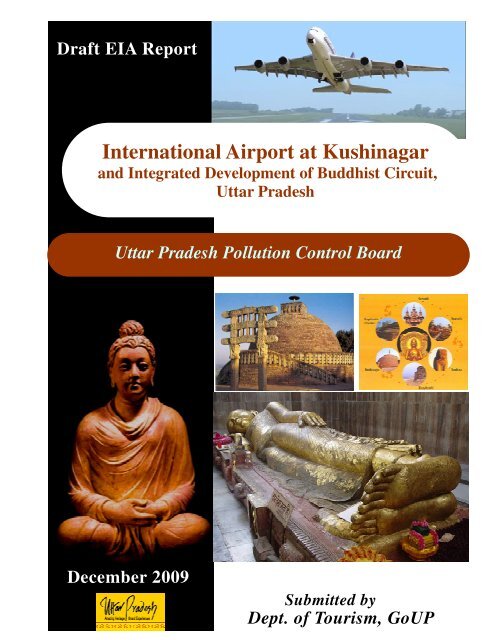
Draft EIA Report for Kushinagar Airport Project - Uttar Pradesh Tourism
Draft EIA Report for Kushinagar Airport Project - Uttar Pradesh Tourism
Draft EIA Report for Kushinagar Airport Project - Uttar Pradesh Tourism

You also want an ePaper? Increase the reach of your titles
YUMPU automatically turns print PDFs into web optimized ePapers that Google loves.
<strong>Draft</strong> <strong>EIA</strong> <strong>Report</strong><br />
International <strong>Airport</strong> at <strong>Kushinagar</strong><br />
and Integrated Development of Buddhist Circuit,<br />
<strong>Uttar</strong> <strong>Pradesh</strong><br />
<strong>Uttar</strong> <strong>Pradesh</strong> Pollution Control Board<br />
December 2009<br />
Submitted by<br />
Dept. of <strong>Tourism</strong>, GoUP
<strong>EIA</strong> Study - International <strong>Airport</strong> at <strong>Kushinagar</strong> & Integrated Development of Buddhist Circuit, U.P.<br />
Table of Contents<br />
1.0 Introduction ............................................................................... 1<br />
1.1 Historical Importance ................................................................................................ 1<br />
1.2 Cultural Importance ................................................................................................... 2<br />
1.3 Importance of the <strong>Project</strong> ........................................................................................... 3<br />
1.3.1 <strong>Kushinagar</strong> – Existing Features and Incidents of Attraction ............................... 3<br />
1.3.2 <strong>Kushinagar</strong> – A Place of Tourist Destination ..................................................... 5<br />
1.3.3 Details of other Buddhist Places ........................................................................ 5<br />
1.3.4 Benifit of the <strong>Project</strong> .......................................................................................... 8<br />
1.4 Nature, Size, Location of <strong>Project</strong> ............................................................................... 9<br />
1.5 Purpose of the <strong>Report</strong> ................................................................................................ 9<br />
1.6 Objectives And Scope of the Study ............................................................................ 9<br />
1.7 <strong>EIA</strong> Methodology .................................................................................................... 10<br />
1.8 Structure of the <strong>EIA</strong> <strong>Report</strong> ..................................................................................... 12<br />
2.0 <strong>Project</strong> Description .................................................................. 13<br />
2.1 Site Location and Accessibility ................................................................................ 13<br />
2.2 Site Surroundings .................................................................................................... 15<br />
2.3 <strong>Project</strong> Components................................................................................................. 18<br />
2.3.1 Site Master Plan ............................................................................................... 18<br />
2.3.3 Land Development during Construction Phase ................................................. 23<br />
2.4 <strong>Project</strong> Infrastructure and Utilities ........................................................................... 23<br />
2.5 Mitigation Measures ................................................................................................ 27<br />
2.5.1 Construction Phase .......................................................................................... 27<br />
2.5.2 Operation Phase ............................................................................................... 28<br />
3.0 Description of the Environment ............................................. 30<br />
3.1 Site Setting and Study Area ..................................................................................... 30<br />
3.2 Criteria <strong>for</strong> Baseline Environment Study ................................................................. 32<br />
3.3 Components and Parameters of Baseline Environmental Study ................................ 33<br />
3.4 Establishment of Baseline <strong>for</strong> Environmental Components ...................................... 35<br />
3.4.1 Air Environment .............................................................................................. 35<br />
3.4.2 Noise Environment .......................................................................................... 41<br />
December 2009<br />
i<br />
Department of <strong>Tourism</strong>, U.P
<strong>EIA</strong> Study - International <strong>Airport</strong> at <strong>Kushinagar</strong> & Integrated Development of Buddhist Circuit, U.P.<br />
3.4.3 Traffic Environment ........................................................................................ 45<br />
3.4.4 Water Environment .......................................................................................... 46<br />
3.4.5 Land Environment ........................................................................................... 53<br />
3.4.6 Ecological Environment ................................................................................... 65<br />
3.4.7 Socio Economic Environment .......................................................................... 80<br />
4.0 Environmental Impacts and Mitigation Measures .............. 99<br />
4.1 Environmental Impacts during Pre Construction Phase ............................................ 99<br />
4.1.1 Relocation ........................................................................................................ 99<br />
4.1.2 Land use change ............................................................................................ 100<br />
4.2 Impact Assessment - Construction Phase ............................................................... 100<br />
4.2.1 Land Environment ......................................................................................... 100<br />
4.2.2 Water Environment ........................................................................................ 101<br />
4.2.3 Air Environment ............................................................................................ 102<br />
4.2.4 Noise Environment ........................................................................................ 107<br />
4.2.5 Ecological Environment ................................................................................. 108<br />
4.2.6 Socio-Economic Environment........................................................................ 112<br />
4.3 Mitigation Measures – Construction Phase ............................................................ 116<br />
4.3.1 Land Environment ......................................................................................... 116<br />
4.3.2 Water Environment ........................................................................................ 119<br />
4.3.3 Air Environment ............................................................................................ 120<br />
4.3.4 Noise Environment ........................................................................................ 121<br />
4.3.5 Ecological Environment ................................................................................. 121<br />
4.3.6 Socio Economic Environment ........................................................................ 122<br />
4.4 Impact Assessment - Operation Phase.................................................................... 124<br />
4.4.1 Air Environment ............................................................................................ 124<br />
4.4.2 Impact on Traffic ........................................................................................... 135<br />
4.4.3 Noise Environment ........................................................................................ 135<br />
4.4.4 Water Environment ........................................................................................ 145<br />
4.4.5 Land Environment ......................................................................................... 148<br />
4.4.6 Ecological Environment ................................................................................. 149<br />
4.4.7 Socio Economic Environment ........................................................................ 152<br />
December 2009<br />
ii<br />
Department of <strong>Tourism</strong>, U.P
<strong>EIA</strong> Study - International <strong>Airport</strong> at <strong>Kushinagar</strong> & Integrated Development of Buddhist Circuit, U.P.<br />
4.5 Mitigation Measures – Operation Phase ................................................................. 155<br />
4.5.1 Air Environment ............................................................................................ 155<br />
4.5.2 Noise Environment ........................................................................................ 156<br />
4.5.3 Traffic Environment ...................................................................................... 158<br />
4.5.4 Water Environment ........................................................................................ 160<br />
4.5.5 Land Environment ......................................................................................... 167<br />
4.5.6 Ecological Environment ................................................................................. 168<br />
4.5.7 Social Environment ........................................................................................ 169<br />
4.5.8 Implication on the Cultural and Heritage Assets ............................................. 169<br />
5.0 Analysis of Alternatives ........................................................ 171<br />
5.1 Site Selection Options ........................................................................................... 171<br />
6.0 Environmental Monitoring Program .................................. 172<br />
6.1 General .................................................................................................................. 172<br />
6.2 Objectives of Environmental Monitoring Plan ....................................................... 172<br />
6.3 Suggested Environmental Monitoring Plan ............................................................ 172<br />
6.3.1 Data Analysis................................................................................................. 174<br />
6.3.2 <strong>Report</strong>ing Schedule ........................................................................................ 175<br />
6.3.3 Emergency Procedures/Corrective Measures .................................................. 175<br />
6.3.4 Detailed budgetary provisions ........................................................................ 175<br />
7.0 Additional Studies ................................................................. 177<br />
7.1 Public Consultation ............................................................................................... 177<br />
7.2 Risk Assessment .................................................................................................... 178<br />
7.2.1 Introduction ................................................................................................... 178<br />
7.2.2 Approach to the Study .................................................................................... 178<br />
7.2.3 Fuel Storage at <strong>Airport</strong> .................................................................................. 179<br />
7.2.4 Hazard Assessment and Evaluation ................................................................ 179<br />
7.2.5 Third Party Risks from <strong>Airport</strong> Development & Operations and Land Use<br />
Control ...................................................................................................................... 188<br />
December 2009<br />
iii<br />
Department of <strong>Tourism</strong>, U.P
<strong>EIA</strong> Study - International <strong>Airport</strong> at <strong>Kushinagar</strong> & Integrated Development of Buddhist Circuit, U.P.<br />
7.3 Disaster Management Plan .................................................................................... 190<br />
7.3.1 Introduction ................................................................................................... 190<br />
7.3.2 Disaster ......................................................................................................... 190<br />
7.3.3 Concept of Operations ................................................................................... 191<br />
7.3.4 Emergency Functions ..................................................................................... 192<br />
7.3.5 Rough Weather Emergency ............................................................................ 192<br />
7.3.6 Maintaining Emergency ................................................................................. 194<br />
7.3.7 Security .......................................................................................................... 196<br />
8.0 <strong>Project</strong> Benefits ...................................................................... 199<br />
9.0 Environment Management Plan .......................................... 202<br />
9.1 General .................................................................................................................. 202<br />
9.2 Environment Management Cell ............................................................................. 203<br />
9.2.1 Structure of the Cell ....................................................................................... 203<br />
9.2.2 Hierarchical Structure of Environmental Management Cell ........................... 204<br />
9.2.3 Record Keeping and <strong>Report</strong>ing ...................................................................... 204<br />
9.2.4 Environmental Audits and Corrective Action Plans ........................................ 205<br />
9.3 Implementation Mechanism <strong>for</strong> Mitigation Measures ............................................ 205<br />
9.3.1 Construction Phase ........................................................................................ 205<br />
9.3.2 Operation Phase ............................................................................................ 208<br />
9.4 India Policy on the <strong>Airport</strong> Infrastructure .............................................................. 217<br />
9.4.1 Environmental Issues <strong>for</strong> <strong>Airport</strong> Development .............................................. 217<br />
9.4.2 Commercial Activities .................................................................................... 218<br />
10.0 Summary and Conclusion .................................................... 219<br />
10.1 Salient Features of the project ............................................................................ 219<br />
10.2 Overall Justification <strong>for</strong> Implementation of the <strong>Project</strong> ...................................... 221<br />
10.3 Explanation on Environmental Mitigation .......................................................... 222<br />
10.4 CONCLUSION ................................................................................................. 223<br />
December 2009<br />
iv<br />
Department of <strong>Tourism</strong>, U.P
<strong>EIA</strong> Study - International <strong>Airport</strong> at <strong>Kushinagar</strong> & Integrated Development of Buddhist Circuit, U.P.<br />
11.0 Disclosure of the Consultants Engaged ............................... 224<br />
11.1 SENES Consultants Limited .............................................................................. 224<br />
11.2 SENES Capability ............................................................................................. 225<br />
11.3 Brief CVs of the Personnel <strong>for</strong> the <strong>EIA</strong> Study .................................................... 226<br />
December 2009<br />
v<br />
Department of <strong>Tourism</strong>, U.P
<strong>EIA</strong> Study - International <strong>Airport</strong> at <strong>Kushinagar</strong> & Integrated Development of Buddhist Circuit, U.P.<br />
List of Tables<br />
Table No.<br />
Page No.<br />
Table 1-1: Existing Features of Attraction ............................................................................. 3<br />
Table 1-2: Tourist Arrival Data- <strong>Kushinagar</strong> ......................................................................... 5<br />
Table 2-1: Facilities within the airport and commercial area ................................................ 18<br />
Table 3-1: Environmental Components and Parameters <strong>for</strong> Baseline Study ......................... 34<br />
Table 3-2: Climatological Summary <strong>for</strong> IMD Station at Civil Hospital, Gorakhpur ............. 37<br />
Table 3-3: Meteorological Monitoring Data ........................................................................ 30<br />
Table 3-4 : Frequency of Stability Classes Over Monitoring Period ..................................... 31<br />
Table 3-5: Air Quality Monitoring Locations ...................................................................... 32<br />
Table 3-6: NAAQS Standard <strong>for</strong> Residential Areas ............................................................. 33<br />
Table 3-7: Monitoring Program Results – AQ1 (<strong>Project</strong> Site) .............................................. 34<br />
Table 3-8: Monitoring Program Results – AQ2 (Misrauli)................................................... 34<br />
Table 3-9: Monitoring Program Results – AQ3 (Parsauni) .................................................. 34<br />
Table 3-10: Monitoring Program Results – AQ4 (Jurwaniya) .............................................. 35<br />
Table 3-11: Monitoring Program Results – AQ5 (Bariya).................................................... 35<br />
Table 3-12: Monitoring Program Results – AQ6 (Naukatola).............................................. 35<br />
Table 3-13: Monitoring Program Results – AQ7 (Pataya).................................................... 36<br />
Table 3-14: Monitoring Program Results – AQ8 (Ghera) .................................................... 36<br />
Table 3-15 : Ambient Noise Standards as per CPCB ........................................................... 42<br />
Table 3-16: Baseline Background Noise Quality Monitoring Results .................................. 44<br />
Table 3-17 : Baseline Water Quality Monitoring Locations ................................................. 49<br />
Table 3-18 : Ground Water Quality in The Study Area ........................................................ 51<br />
Table 3-19 : Surface Water Quality in The Study Area ........................................................ 52<br />
Table 3-20: Particle Size Scale (IS: 1498) ........................................................................... 60<br />
Table 3-21: Soil Sampling Location .................................................................................... 61<br />
Table 3-22: Soil Characteristics in the Study area ................................................................ 62<br />
Table 3-24: List of Species Recorded in the Quadrant Sampling Method ............................. 71<br />
Table 3-25: Common Avifauna Recorded During the Survey in Core Zone ......................... 73<br />
Table 3-26: Common Mammals Recorded During Survey in Core Zone ............................. 73<br />
December 2009<br />
vi<br />
Department of <strong>Tourism</strong>, U.P
<strong>EIA</strong> Study - International <strong>Airport</strong> at <strong>Kushinagar</strong> & Integrated Development of Buddhist Circuit, U.P.<br />
Table 3-27: Common Avifauna Recorded During Survey .................................................... 78<br />
Table 3-28: Study Area Details ........................................................................................... 81<br />
Table 3-29: Village wise Population, Sex Ration & Household Size ................................... 82<br />
Table 3-30: Caste wise distribution of population of villages in the impact zone ................. 83<br />
Table 3-31: Village wise literacy profile as per Census 2001 ............................................... 83<br />
Table 4-1 : SPM Levels <strong>for</strong> Receptors- (24 hourly Maximum GLC in µg/m 3 ) – Const Ph.. 106<br />
Table 4-2 : Noise levels Generated from Construction Equipment ..................................... 107<br />
Table 4-3: Predicted Impacts on Existing Ecology During Construction Phase .................. 110<br />
Table 4-4: Land Acquisition Detail ................................................................................... 113<br />
Table 4-5 : Waste Management Plan – Construction Phase................................................ 118<br />
Table 4-6: Diesel Generator Set Specifications .................................................................. 124<br />
Table 4-7: Ground Level SPM Concentration (µg/m 3 ) At Different Locations ................... 126<br />
Table 4-8: Ground Level SO 2 Concentration (µg/m 3 ) At Different Locations .................... 128<br />
Table 4-9: Ground Level NO x Concentration (µg/m 3 ) At Different Locations .................... 130<br />
Table 4-10: Ground Level CO Concentration (µg/m 3 ) At Different Locations ................... 132<br />
Table 4-11: Traffic Scenario due to the <strong>Airport</strong> ................................................................. 135<br />
Table 4-12: <strong>Airport</strong> Runway Data ..................................................................................... 136<br />
Table 4-13: Aircrafts Flight Number ................................................................................. 136<br />
Table 4-14 Day Night Average Sound Level in dB (A): Approach Mode Operation .......... 140<br />
Table 4-15 Day Night Average Sound Level in dB (A): Departure Mode Operation .......... 141<br />
Table 4-16: Water Requirement and Wastewater Generation from the Proposed <strong>Airport</strong> ... 145<br />
Table 4-17: Expected Wastewater Characteristics ............................................................. 148<br />
Table 4-18: Expected Solid Waste Generation ................................................................... 149<br />
Table 4-19: Predicted Impacts on Ecology During Operation Phase .................................. 150<br />
Table 4-20: Social Assessment Matrix .............................................................................. 153<br />
Table 4-21 : Standards <strong>for</strong> Effluent Disposal ..................................................................... 163<br />
Table 4-22 : Detail of Rainwater Harvesting Potential ....................................................... 164<br />
Table 6-1: Recommended Environmental Monitoring Plan ............................................... 173<br />
Table 6-2: Applicable Standards <strong>for</strong> different Environmental Components ........................ 175<br />
Table 6-3 : Cost Estimates <strong>for</strong> Environmental Monitoring ................................................. 175<br />
Table 7-1: Fuel Explosive Limits ...................................................................................... 179<br />
December 2009<br />
vii<br />
Department of <strong>Tourism</strong>, U.P
<strong>EIA</strong> Study - International <strong>Airport</strong> at <strong>Kushinagar</strong> & Integrated Development of Buddhist Circuit, U.P.<br />
Table 7-2: Damage Due to Incident Radiation Intensities .................................................. 181<br />
Table 7-3: Damage due to Peak Over pressure .................................................................. 182<br />
Table 9-1: Record Keeping Requirements ......................................................................... 204<br />
Table 9-3: List of plant suitable <strong>for</strong> noise pollution attenuation ......................................... 212<br />
Table 9-4: Gives list of trees used in greenbelts <strong>for</strong> Dust pollution abatements .................. 213<br />
Table 9-5: <strong>Tourism</strong> related training given by Government Department .............................. 217<br />
Table 10-1: Salient Features .............................................................................................. 219<br />
December 2009<br />
viii<br />
Department of <strong>Tourism</strong>, U.P
<strong>EIA</strong> Study - International <strong>Airport</strong> at <strong>Kushinagar</strong> & Integrated Development of Buddhist Circuit, U.P.<br />
List of Figures<br />
Figure No.<br />
Page No.<br />
Figure 1-1: Guide Map of <strong>Kushinagar</strong> ................................................................................... 4<br />
Figure 1-2: Road Plan <strong>for</strong> approach to <strong>Kushinagar</strong> from other Buddhist circuit destinations .. 7<br />
Figure 1-3: <strong>EIA</strong> Methodology ............................................................................................. 11<br />
Figure 2-1: Location Map of the Proposed Site .................................................................... 14<br />
Figure 2-2: Satellite imagery of the Site .............................................................................. 17<br />
Figure 2-3: Master Plan of the Proposed <strong>Airport</strong> ................................................................. 21<br />
Figure 3-1: Major Structures Within 5 km Radius ............................................................... 32<br />
Figure 3-2: Ste Surrounding Features (Within 10 km from Proposed Site) ........................... 33<br />
Figure 3-3: Climatic Regions .............................................................................................. 36<br />
Figure 3-4: Wind Rose <strong>for</strong> Meteorological Monitoring Data ............................................... 30<br />
Figure 3-5: Locations Ambient Air Quality Monitoring Stations ......................................... 33<br />
Figure 3-6: Baseline Air Quality at station AQ1 (<strong>Project</strong> Site) ............................................. 37<br />
Figure 3-7: Baseline Air Quality at station AQ2 (Misrauli) ................................................. 37<br />
Figure 3-8: Baseline Air Quality at station AQ3 (Parsauni) ................................................. 38<br />
Figure 3-9: Baseline Air Quality at station AQ4 (Jurwaniya)............................................... 38<br />
Figure 3-10: Baseline Air Quality at station AQ5 (bariya) ................................................... 39<br />
Figure 3-11: Baseline Air Quality at station AQ6 (Naukatola)............................................. 39<br />
Figure 3-12: Baseline Air Quality at station AQ7 (Pataya) .................................................. 40<br />
Figure 3-13: Baseline Air Quality at station AQ8 (Ghera) ................................................... 40<br />
Figure 3-14: CO Concentration at all the Monitoring Locations .......................................... 41<br />
Figure 3-15: Location of Background Noise Quality Monitoring Stations ........................... 43<br />
Figure 3-16: Traffic Count Monitoring Result (Weekday) ................................................... 45<br />
Figure 3-17: Traffic Count Monitoring Result (Weekend) ................................................... 46<br />
Figure 3-18: Hydrogeological Map of <strong>Kushinagar</strong> District .................................................. 47<br />
Figure 3-19: Ground Water Map of <strong>Kushinagar</strong> District ...................................................... 48<br />
Figure 3-20: Location of Baseline Water Quality Monitoring Stations ................................. 50<br />
Figure 3-21: Land Use and Cropping Pattern ....................................................................... 54<br />
Figure 3-22: Land use Pattern of the Proposed Site ............................................................. 55<br />
December 2009<br />
ix<br />
Department of <strong>Tourism</strong>, U.P
<strong>EIA</strong> Study - International <strong>Airport</strong> at <strong>Kushinagar</strong> & Integrated Development of Buddhist Circuit, U.P.<br />
Figure 3-23: Seismological map locating project site (<strong>Kushinagar</strong>) ..................................... 56<br />
Figure 3-24: Relief and Slope Map of District <strong>Kushinagar</strong> .................................................. 57<br />
Figure 3-25: Contour Plan ................................................................................................... 59<br />
Figure 3-26: Soil Profile of the Study Area.......................................................................... 60<br />
Figure 3-27: Soil Monitoring locations ................................................................................ 61<br />
Figure 3-28: Rocks and Minerals ........................................................................................ 65<br />
Figure 3-29: Eco sensitivity of the Study Area .................................................................... 67<br />
Figure 3-30: Work<strong>for</strong>ce Engagement in Different Sectors ................................................... 84<br />
Figure 4-1: Modelling Grid Of Proposed <strong>Project</strong> ............................................................... 104<br />
Figure 4-2: Predicted maximum 24 hour GLC (µg/m 3 ) of SPM With Control .................... 105<br />
Figure 4-3 : Spatial variation of incremental noise level during construction phase .............. 108<br />
Figure 4-5 : Spatial Distribution of Predicted SPM Concentration (µg/m 3 ).......................... 127<br />
Figure 4-6: Spatial Distribution of Predicted SO 2 Concentration (µg/m 3 ) ............................ 129<br />
Figure 4-7 : Spatial Distribution of Predicted NO x Concentration (µg/m 3 )........................... 131<br />
Figure 4-8 : Spatial Distribution of Predicted CO Concentration (µg/m 3 ) ............................ 133<br />
Figure 4-9: Road link geometry and receptor’s locations ................................................... 134<br />
Figure 4-10: Noise Contour <strong>for</strong> Approach Operational Mode ............................................ 138<br />
Figure 4-11: Noise Contour <strong>for</strong> Departure Operational Mode ............................................ 139<br />
Figure 4-12: Noise (LCmax) Contour <strong>for</strong> Approach Operational Mode ............................. 143<br />
Figure 4-13: noise (LCmax) contour <strong>for</strong> departure operational mode ................................. 144<br />
Figure 4-14: Water Balance Diagram ................................................................................ 147<br />
Figure 4-15: Schematic of the Parking and Circulation Plan .............................................. 159<br />
Figure 4-16: Flow Diagram of the Sewage Treatment Plant ............................................... 162<br />
Figure 4-17: Schematic Layout of Storm water Collection Drain ....................................... 165<br />
Figure 4-18: Schematic Diagram of Rainwater Harvesting Scheme ................................... 166<br />
Figure 7-1: Atf Storage Tank Failure – Poolfire ................................................................ 185<br />
Figure 7-2: Hsd Storage Tank Failure - Poolfire ................................................................ 185<br />
Figure 7-3: Atf Storage Tank Failure – Bleve Fireball ....................................................... 187<br />
Figure 7-4: Hsd Storage Tank Failure – Bleve Fireball ...................................................... 187<br />
Figure 9-1: Environmental Management Cell .................................................................... 204<br />
Figure 9-2: Indicative Plantation Plan ................................................................................ 214<br />
December 2009<br />
x<br />
Department of <strong>Tourism</strong>, U.P
<strong>EIA</strong> Study - International <strong>Airport</strong> at <strong>Kushinagar</strong> & Integrated Development of Buddhist Circuit, U.P.<br />
1.0 Introduction<br />
<strong>Uttar</strong> <strong>Pradesh</strong>, being the modern face of India, is a kaleidoscope of diverse religions and<br />
cultures from all over the world and thereby attracts a large number of both national and<br />
international visitors. This state is home to six sacred sites associated with the life of Lord<br />
Buddha comprising Sarnath, <strong>Kushinagar</strong>, Sravasti, Kapilvastu, Kaushambhi and Sankisa.<br />
Buddhism is the world's fourth largest religion with 350 million people as followers (6% of the<br />
world's population).The most revered Buddhist religious locations globally are Lumbini,<br />
Bodhgaya, Sarnath and <strong>Kushinagar</strong>. <strong>Kushinagar</strong> set against a pastoral landscape, 60 km west of<br />
Gorakhpur, is revered as the site of the Gautama Buddha's Mahaparinirvana, his death and<br />
cremation that marked his final liberation from the cycles of death and rebirth. It also has<br />
additional importance as Buddha delivered his last sermon and had attained the status of Lord<br />
Buddha here.<br />
<strong>Kushinagar</strong> also has in its surroundings several temples, stupas and shrines built by Indian<br />
kings during various ages. Structures built by Buddhists of different nationalities, prominently<br />
being Japan, Thailand and Srilanka and a few archaeological sites of ancient era – Ganwara and<br />
Salargarh. The connectivity to the area restricts the inflow of adequate tourist population. The<br />
site has immense potential to be developed as an international spiritual tourist destination. The<br />
nearest airport at Gorakhpur limits development as an international airport as it is an Air <strong>for</strong>ce<br />
base and has limited land availability.<br />
Government of <strong>Uttar</strong> <strong>Pradesh</strong> has appointed Department of <strong>Tourism</strong> <strong>for</strong> conceptualization and<br />
development of the international airport at <strong>Kushinagar</strong> along with integrated development of<br />
the Buddhist circuits. The project model would be based on Public Private Partnership (PPP)<br />
mode on Design Build Finance Operate and Transfer (DBFOT) basis. M/s Infrastructure<br />
Leasing and Financial Services – Infrastructure Development Corporation (IL&FS-IDC) has<br />
been retained to prepare the Feasibility report and Master plan <strong>for</strong> the proposed development.<br />
1.1 HISTORICAL IMPORTANCE<br />
The present <strong>Kushinagar</strong> is identified with Kushawati ( in pre- Buddha period ) and<br />
Kushinara (in Buddha period). Kushinara was the capital of Mallas which was one of<br />
the sixteen mahajanpads of the 6th Century B.C.<br />
According to the Valmiki's Ramayana, the Mallas was earlier part of Kosala Janpad.<br />
Kushwati capital was built by Kush, son of Lord Ram, the hero of the famous epic, 'The<br />
Ramayan'. As per Buddha Pali literature, Kushawati was named prior to the king Kush.<br />
The naming of Kushwati was due to abundance of Kush grass found in this region<br />
which still holds good. Since then, it remained an integral part of the erstwhile empires<br />
of Maurya, Shunga, Kushana, Gupta and Harsha dynasties.<br />
In medieval period, <strong>Kushinagar</strong> had passed under the suzerainty of Kultury Kings.<br />
Kushinara continued to be a living city till the 12th Century A.D. and was thereafter lost<br />
December 2009<br />
1<br />
Department of <strong>Tourism</strong>, U.P
<strong>EIA</strong> Study - International <strong>Airport</strong> at <strong>Kushinagar</strong> & Integrated Development of Buddhist Circuit, U.P.<br />
into oblivion. Padrauna is believed to be ruled over by a Rajput adventurer, Madan<br />
Singh in the 15th century A.D.<br />
However, modern <strong>Kushinagar</strong> came into prominence in the 19th Century with<br />
archeological excavations carried out by A.Cuningham, the first Archeological<br />
Surveyor of India and later followed by C.L. Carlleyle who exposed the main stupa and<br />
also discovered a 6.10 meters long statue of reclining Buddha, in 1876 A.D. Ven.<br />
Chandra Swami, a Burmeses Monk, came to India in 1903 and made "Mahaparinirvana<br />
Temple" into a living shrine.<br />
After independence, <strong>Kushinagar</strong> remained the part of district Deoria. On 13th May,<br />
1994, it came into being as a new district of <strong>Uttar</strong> <strong>Pradesh</strong> <strong>for</strong> an all round balanced<br />
and speedy development.<br />
1.2 CULTURAL IMPORTANCE<br />
The historical place <strong>Kushinagar</strong>, has its own cultural importance in terms of sacred sense and<br />
religious sentiments. The facts that make the place an abode of God and holiness are as follows:<br />
It belongs to the Great Lord Buddha, founder of Buddhism, who delivered his last<br />
sermon, attained "Mahaparinirvana" and was cremated at Ramabhar<br />
(<strong>Kushinagar</strong>).Buddha's cremation was done at " Mukut Bandhan" (Ramabhar), where<br />
'Mallas' constructed a big stupa over the ashes. Later, Ashoka, the great, had also<br />
renovated it. Chinese travellers, Fa Hien & Hieun Tsang have also mentioned<br />
‘Kushinara " in their Travel-Memo.<br />
It is also associated with Lord Mahavir, 24th tirthankar of Jain Sect, founder of Jainism.<br />
It is believed that Lord Mahavrir passed away or attained Parinirvana at Pawa. As per<br />
Pali Tripitak, Pawa was the second capital of the Mallas, the first being Kushinara.<br />
Pawa is now being identified with present day 'Fazilnagar', a place 16 kms south - east<br />
of <strong>Kushinagar</strong>.<br />
The district of <strong>Kushinagar</strong> had been witness to the glorious ancient history and culture.<br />
It is believed to be an important centre <strong>for</strong> Vaishnav, Shiv, Shaktipeeth, Buddha,<br />
Mahavir etc. Situtaed on the bank of river Gandak and nearerto the terai of the<br />
Himalayas, this region was an ideal 'Meditation Place' <strong>for</strong> sages, saints hermits and<br />
Mahatamas who were attracted by its pious. tranquil and charming natural<br />
surroundings. Archeological excavation has yielded rich collection of antiquities.<br />
Artistic artifacts and statues of various gods and goddesses.<br />
The significance of this region is also due to being ' Link - route ' of ancient highways.<br />
Among them were important highways Ayodhya - Janakpur (Bihar), Rajgrih - Vaishali<br />
- Shrawasti, Maharshi Valmiki's Ashram, Ashoka, the great Mauryas, Pillars routes,<br />
passing through this district.<br />
December 2009<br />
2<br />
Department of <strong>Tourism</strong>, U.P
<strong>EIA</strong> Study - International <strong>Airport</strong> at <strong>Kushinagar</strong> & Integrated Development of Buddhist Circuit, U.P.<br />
1.3 IMPORTANCE OF THE PROJECT<br />
1.3.1 <strong>Kushinagar</strong> – Existing Features and Incidents of Attraction<br />
<strong>Kushinagar</strong> has a number of temples, monasteries, dharmashalas, museums, and monuments<br />
which attract a number of people throughout the year, from different corners of the world.<br />
TABLE 1-1: EXISTING FEATURES OF ATTRACTION<br />
Temples Monasteries Dharmashalas Hotels Monuments Others<br />
Mahaparinirvana<br />
Temple<br />
Matha Kuar<br />
Shrine<br />
Watt Thai<br />
Temple<br />
Indo-Japan-<br />
Srilanka Temple<br />
Lynhson<br />
Chinese(Taiwan)<br />
Lynhson<br />
Chinese<br />
Pathik<br />
Niwas(UPSTDC)<br />
Maha<br />
Parinirvan<br />
Sthal<br />
Kuber<br />
Asthan<br />
Myanmar Myanmar Lotus Nikko Matha<br />
Kuanwar<br />
Temple (last<br />
sermon site)<br />
Devraha<br />
Asthan<br />
Tibetan Birla Royal Residency Ramabhar Kurukulla<br />
Stupa Asthan<br />
Japan-Sri Lanka Tibetan Imperial (cremation Sidhua<br />
site) Asthan<br />
Sun Temple Sri Lanka Japan-Sri<br />
Lanka<br />
International<br />
Guest House<br />
Thailand Thai Gyaneshwar<br />
Korea Sri Lanka Buddha Vihar<br />
Rambhar Stupa<br />
Wat Thai Temple<br />
Indo-Japan Srilanka Temple<br />
Ruins and Brick Structure<br />
December 2009<br />
3<br />
Department of <strong>Tourism</strong>, U.P
<strong>EIA</strong> Study - International <strong>Airport</strong> at <strong>Kushinagar</strong> & Integrated Development of Buddhist Circuit, U.P.<br />
Presently the other important factor to be accounted in<br />
assessing the traffic potential of <strong>Kushinagar</strong> International<br />
<strong>Airport</strong> is the upcoming Maitreya <strong>Project</strong> in this area –<br />
this entails constructing a 152 meters tall bronze statue of<br />
Lord Buddha in a sitting posture. Once this unique project<br />
is established, it has the potential to offer <strong>Kushinagar</strong> fame<br />
and admiration. This project would also elevate<br />
<strong>Kushinagar</strong>’s stature as a place of interest not only <strong>for</strong><br />
Buddhists but <strong>for</strong> the public in general. Additionally, the<br />
traffic potential of <strong>Kushinagar</strong> will multiply manifold immediately after the commissioning<br />
of the Maitreya <strong>Project</strong>.<br />
Apart from the above features, there are a number of festivals that take place during different<br />
period of years such as – Budhha festival (during Budhha purnima), A New Year festival,<br />
Navaratri mela (Palta Devi), Shiva ratri mela etc. The guide map of these different tourist<br />
destination points are schematically shown in Figure 1-1. The UP Govt. Budha museum is<br />
also located at <strong>Kushinagar</strong>.<br />
FIGURE 1-1: GUIDE MAP OF KUSHINAGAR<br />
December 2009<br />
4<br />
Department of <strong>Tourism</strong>, U.P
<strong>EIA</strong> Study - International <strong>Airport</strong> at <strong>Kushinagar</strong> & Integrated Development of Buddhist Circuit, U.P.<br />
1.3.2 <strong>Kushinagar</strong> – A Place of Tourist Destination<br />
<strong>Kushinagar</strong>, being an important Buddhist pilgrimage site in <strong>Uttar</strong><br />
<strong>Pradesh</strong>, is a much-frequented visiting place <strong>for</strong> Indian and<br />
<strong>for</strong>eign tourists. The two places most frequently visited in<br />
<strong>Kushinagar</strong> are the Mahaparinirvana Stupa, which is built on the<br />
place of Buddha's Mahaparinirvana (Great Nirvana or passing away)<br />
and the place of his cremation, which is 1.6 km away. The tourist<br />
arrival data <strong>for</strong> <strong>Kushinagar</strong> <strong>for</strong> the last seven years has been given in Table 1.2.<br />
TABLE 1-2: TOURIST ARRIVAL DATA- KUSHINAGAR<br />
Year Indian Tourist Arrivals Foreign Tourist Arrivals Total Tourists<br />
2002 109731 11067 120798<br />
2003 109882 13341 123223<br />
2004 110751 13326 124077<br />
2005 236789 13328 250117<br />
2006 512570 32500 545070<br />
2007 518752 39885 558637<br />
2008 521878 41638 563516<br />
The data indicates that more than 2 million <strong>for</strong>eign tourists come to India to visit the place.<br />
Poor connectivity to <strong>Kushinagar</strong> limits the inflow of tourist population thereby limiting its<br />
potential as an international spiritual tourist destination. The nearest airport to <strong>Kushinagar</strong> is<br />
at Gorakhpur (44 km, aerial distance), which is a military air <strong>for</strong>ce base and has limited land<br />
availability. Considering the above facts, the development of an international airport at<br />
<strong>Kushinagar</strong> which already has an existing functional airstrip <strong>for</strong> non scheduled flights under<br />
UP Civil Aviation Authority has been conceptualized and proposed.<br />
1.3.3 Details of other Buddhist Places<br />
<strong>Uttar</strong> <strong>Pradesh</strong> is home to some of the most<br />
renowned and revered Buddhist sites in India<br />
and abroad. Each of these places has a special<br />
place in the heart of every Buddhist since Lord<br />
Buddha was associated was each of them in<br />
some way or the other. The road plan <strong>for</strong><br />
approach to <strong>Kushinagar</strong> from other Buddhist<br />
circuit destinations has been prepared and<br />
shown in Figure 1-2. These key Buddhist<br />
destinations and their reason of importance<br />
include:<br />
December 2009<br />
5<br />
Department of <strong>Tourism</strong>, U.P
<strong>EIA</strong> Study - International <strong>Airport</strong> at <strong>Kushinagar</strong> & Integrated Development of Buddhist Circuit, U.P.<br />
• <strong>Kushinagar</strong> - place where Lord Buddha passed away and attained Maha Parinirvana<br />
• Sravasti - Lord Buddha spent 27 rainy seasons here<br />
• Kapilvastu - Lord Buddha was born here<br />
• Sarnath - the Site where Lord Buddha delivered his first sermon<br />
• Kaushambi - a pillar from the Ashoka era exists here<br />
• Sankisa - believed to be the place Lord Buddha revisited after his death<br />
• Budhagaya – the place where lord Budhha achieved his enlightment<br />
December 2009<br />
6<br />
Department of <strong>Tourism</strong>, U.P
<strong>EIA</strong> Study - International <strong>Airport</strong> at <strong>Kushinagar</strong> & Integrated Development of Buddhist Circuit, U.P.<br />
FIGURE 1-2: ROAD PLAN FOR APPROACH TO KUSHINAGAR FROM OTHER BUDDHIST CIRCUIT DESTINATIONS<br />
December 2009 7<br />
Department of <strong>Tourism</strong>, U.P
<strong>EIA</strong> Study - International <strong>Airport</strong> at <strong>Kushinagar</strong> & Integrated Development of Buddhist Circuit, U.P.<br />
1.3.4 Benifit of the <strong>Project</strong><br />
The proposed international airport at <strong>Kushinagar</strong> will lead to the following benefits:<br />
Capability to provide <strong>for</strong> the increased air traffic demand in the area;<br />
Facilitate Buddhist pilgrims from national and international countries to travel directly<br />
to all the Buddhist circuits.<br />
Significantly ease a large population of people from Eastern UP & Bihar, working in<br />
Middle east countries<br />
decongestion of other international airports such as Delhi, avoiding unnecessary travel<br />
needs of international Buddhist tourists<br />
Providing <strong>for</strong> additional revenue generation in terms of <strong>for</strong>eign exchange earned from<br />
operations at the proposed international airport;<br />
Providing <strong>for</strong> additional employment areas in view of associated development in the<br />
area due to the proposed project;<br />
Trigger growth in the district and of the region due to increased air traffic demand in<br />
the area and the resultant associated development;<br />
Improvement in quality of life of the local population<br />
With the establishment of this new airport there will be holistic regional change in terms of<br />
economic and social condition. This could be accompanied by packages arranged and offered<br />
by the Tour operators in respective countries with large population of the religious<br />
community, like Thailand, Korea, Japan, China and Sri Lanka. The additional infrastructure<br />
development will be in the <strong>for</strong>m hotel / motel / lodging facilities/ restaurants, malls, shopping<br />
centres etc that would be developed to meet the specific needs of the tourists from Buddhist<br />
countries considering their age and traditions etc. It also enhances the potential of revenue<br />
generation due to marketting of Indian handicrafts, tea, Indian fabrics like silk, Indian<br />
carvings and souvenirs etc. Places such as <strong>Kushinagar</strong> that are principally a pilgrimage<br />
attraction, also offer opportunities <strong>for</strong> leisure. Given the fact that places in and around<br />
<strong>Kushinagar</strong> do not have much to offer in the <strong>for</strong>m of recreation and entertainment, some<br />
leisure facilities that could be potentially explored include sports like golf. This facility does<br />
not necessarily require one to create a 9 or 18 hole golf course but by creating putting holes<br />
and sand bunkers. As an example, Singapore <strong>Airport</strong> provides <strong>for</strong> putting facilities within the<br />
airport building with a tariff of $15 per hour. In addition to golf, facilities like bowling,<br />
fitness centers etc become an integral part of the recreation facilities.<br />
Case Study – Success Story of Gaya <strong>Airport</strong><br />
Gaya <strong>Airport</strong> experienced 243% traffic increase with starting of the international flights in<br />
2006. Success of Gaya <strong>Airport</strong> is the inherent potential of the proposed <strong>Kushinagar</strong> airport. It<br />
is noteworthy that within a few years of operational the International Aircraft movement and<br />
the International Pax traffic has doubled in three years i.e. from 2004 to 2007. The Gaya<br />
December 2009<br />
8<br />
Department of <strong>Tourism</strong>, U.P
<strong>EIA</strong> Study - International <strong>Airport</strong> at <strong>Kushinagar</strong> & Integrated Development of Buddhist Circuit, U.P.<br />
<strong>Airport</strong> handles more than 50,000 international tourists today. This justifies the need and<br />
indicates the potential of developing an International <strong>Airport</strong> in <strong>Kushinagar</strong>.<br />
1.4 NATURE, SIZE, LOCATION OF PROJECT<br />
The proposed site is located in Kasia, which is 5 km away from <strong>Kushinagar</strong> and comprises of<br />
39.34 ha (97.238 acre) of land which is under the ownership of U.P Civil Aviation. The site is<br />
a plain level land and comprises of an existing functional airstrip of 1750 m length and about<br />
27 m width. The site is located between 26 0 46’07.34’’ to 26 0 46’29.75’’ North latitude and<br />
83 0 54’44.07’’ to 83 0 53’37.33’’ East longitude. The elevation of the proposed site is 92 m above<br />
mean sea level.<br />
The proposed airport will be developed in an area of total 753.285 acres, out of which<br />
550.476 acres will be required solely <strong>for</strong> operational purposes and the balance 202.809 acres<br />
will be allotted <strong>for</strong> commercial development. There is an existing 97.238 acres of functional<br />
airstrip of U.P Civil Aviation Authority. Thus, an additional land of about 453.238 acres<br />
needs to be acquired around the existing airstrip from twelve villages. No settlement from all<br />
of these villages is coming within the area of the development.<br />
1.5 PURPOSE OF THE REPORT<br />
The proposed has been conceptualized <strong>for</strong> the development of an International <strong>Airport</strong> along<br />
with the development of integrated Buddhist Circuit. As per the <strong>EIA</strong> notification dated<br />
September 14, 2006 that supersedes <strong>EIA</strong> Notification of 1994, the development of<br />
international airport falls under category A (Category 7(a)) and will require clearance from<br />
Ministry of Environment and Forests. For the other six sites to be developed as a part of the<br />
Buddhist circuit, “Consent to Establish” will be required from <strong>Uttar</strong> <strong>Pradesh</strong> Pollution<br />
Control Board (UPPCB).<br />
M/s IL&FS-IDC has retained M/s SENES Consultants India (P) Limited to conduct the<br />
Environmental Impact Assessment study <strong>for</strong> the proposed project as per the TOR provided by<br />
MoEF vide letter No. F.No: 10-66/2009-IA.III, dated October 8, 2009 (Annexure I). The<br />
purpose of the <strong>EIA</strong> report is to address the in<strong>for</strong>mation on the nature and extent of potential<br />
environmental impacts, both negative and positive, during the construction and operation phase<br />
of the proposed project and related activities taking place concurrently.<br />
1.6 OBJECTIVES AND SCOPE OF THE STUDY<br />
The objectives of the <strong>EIA</strong> study are as follows:<br />
i. to describe the proposed project and associated works together with the requirements<br />
<strong>for</strong> carrying out the proposed development;<br />
ii. to identify and describe the elements of the community and environment likely to be<br />
affected by the proposed developments;<br />
December 2009<br />
9<br />
Department of <strong>Tourism</strong>, U.P
<strong>EIA</strong> Study - International <strong>Airport</strong> at <strong>Kushinagar</strong> & Integrated Development of Buddhist Circuit, U.P.<br />
iii. to identify, predict and evaluate environmental and social impacts expected to arise<br />
during the construction and operation phase of the project in relation to the sensitive<br />
receptors;<br />
iv. to identify the negative impacts and develop mitigation measures so as to minimize<br />
pollution, environmental disturbance and nuisance during construction and<br />
operations of the development; and<br />
v. to design and specify the monitoring requirements necessary to ensure the<br />
implementation and the effectiveness of the mitigation measures adopted.<br />
With these basic objectives, the scope of the work <strong>for</strong> the project, as mentioned in the Terms<br />
of Reference (ToR) is underlined below:<br />
• To understand the project pertinence<br />
• Site appreciation, reconnaissance survey and basic data collection<br />
• Secondary data collection<br />
• To establish baseline environmental and social scenario of the project surroundings;<br />
especially ambient air quality, noise, traffic, water and soil;<br />
• Collation and analysis of the data<br />
• Impact identification, prediction, assessment and <strong>for</strong>mulating mitigating measures<br />
• Formulation of Environmental Management Plan (EMP) , Risk assessment and Disaster<br />
Management Plan (DMP)<br />
• Preparation of <strong>Draft</strong> <strong>EIA</strong> <strong>Report</strong><br />
• Assisting in public consultation process and providing inputs <strong>for</strong> presentation be<strong>for</strong>e the<br />
regulatory authority<br />
• Preparation of final <strong>EIA</strong> <strong>Report</strong>.<br />
1.7 <strong>EIA</strong> METHODOLOGY<br />
The <strong>EIA</strong> study <strong>for</strong> the proposed project will be carried out as per the Ministry of Environment<br />
and Forest (MoEF) guidelines covering an area of 10 km radius from the proposed site. The<br />
<strong>EIA</strong> methodology <strong>for</strong> the proposed project has been described in Figure 1-3.<br />
December 2009<br />
10<br />
Department of <strong>Tourism</strong>, U.P
<strong>EIA</strong> Study - International <strong>Airport</strong> at <strong>Kushinagar</strong> & Integrated Development of Buddhist Circuit, U.P.<br />
FIGURE 1-3: <strong>EIA</strong> METHODOLOGY<br />
<strong>Project</strong> Initial Meeting & Reconnaissance Survey<br />
Filling of Form I and approval of TOR from MoEF<br />
Base Line Data Collection<br />
Primary Survey<br />
• Physical Environment<br />
Meteorological details, Air Quality, Noise<br />
environment, Hydro-geological Environmental<br />
Settings, traffic and land environment<br />
• Biological Environment<br />
Density and diversity of flora and fauna in the study<br />
area, ecologically sensitive areas, List of floral<br />
Diversity, List of faunal Diversity, Current use<br />
pattern of natural resources<br />
Secondary Survey<br />
Indian Meteorological Department<br />
Soil department<br />
Geology department<br />
Land use map /master plan<br />
Ground water department<br />
Census department<br />
• Socio-economic Environment -<br />
Demographic Details, Land utilisation and land use<br />
pattern, Community structure, Planned<br />
developmental activities, Employment status,<br />
Prediction of Environmental Impacts<br />
Input from modeling software and techniques<br />
The possible impact on local<br />
Environmental conditions:<br />
Air Environment<br />
Water Environment<br />
comprehensive assessment<br />
Land environment<br />
Noise Environment<br />
Health Environment<br />
Assessment of Impacts and Risk Assessment<br />
Developing EMP and Disaster Management Plan<br />
Public Hearing (PH)<br />
Submission to MoEF with PH proceedings <strong>for</strong> Environmental<br />
Clearance<br />
Grant of EC<br />
December 2009<br />
11<br />
Department of <strong>Tourism</strong>, U.P
<strong>EIA</strong> Study - International <strong>Airport</strong> at <strong>Kushinagar</strong> & Integrated Development of Buddhist Circuit, U.P.<br />
1.8 STRUCTURE OF THE <strong>EIA</strong> REPORT<br />
The <strong>EIA</strong> report <strong>for</strong> development of <strong>Kushinagar</strong> International <strong>Airport</strong> along with the<br />
development of Integrated Buddhist circuit presents the existing environmental scenario and<br />
the evaluation of the impacts that may arise during the construction and operation of the<br />
proposed development. Following impact prediction, the requirement <strong>for</strong> mitigation measures<br />
to address any unacceptable environmental impacts are also covered in this report. This report<br />
also highlights the Environmental Monitoring program. The content of the report is as<br />
follows:<br />
Chapter 1: Introduction<br />
Chapter 2: <strong>Project</strong> Description<br />
Chapter 3: Description of the Environment<br />
Chapter 4: Anticipated Environmental Impacts and Mitigation Measures<br />
Chapter 5: Analysis of Alternatives<br />
Chapter 6: Environmental Monitoring Program<br />
Chapter 7: Additional Studies<br />
Chapter 8: <strong>Project</strong> Benefits<br />
Chapter 9: Environmental Management Plan<br />
Chapter 10: Risk Assessment and Disaster Management Plan<br />
Chapter 11: Summary & Conclusions<br />
Chapter 12: Disclosure of <strong>EIA</strong> Consultant<br />
December 2009<br />
12<br />
Department of <strong>Tourism</strong>, U.P
<strong>EIA</strong> Study - International <strong>Airport</strong> at <strong>Kushinagar</strong> & Integrated Development of Buddhist Circuit, U.P.<br />
2.0 <strong>Project</strong> Description<br />
The proposed international airport will be developed in Tehsil Kasia, in district <strong>Kushinagar</strong>.<br />
As per the <strong>EIA</strong> notification dated September 14, 2006, the proposed project falls under<br />
category A (Category 7(a)) and will require clearance from Ministry of Environment and<br />
Forests. For the other six sites to be developed as a part of the Buddhist circuit, “Consent to<br />
Establish” will be required from <strong>Uttar</strong> <strong>Pradesh</strong> Pollution Control Board (UPPCB).<br />
This chapter presents the site appraisal, discusses the sensitivity of the site in respect to<br />
availability of various resources, provide the details of the components planned <strong>for</strong> the<br />
proposed project and the mitigation measures proposed <strong>for</strong> the various environmental impacts<br />
anticipated due to the proposed development.<br />
2.1 SITE LOCATION AND ACCESSIBILITY<br />
The proposed site is located in Tehsil Kasia in district <strong>Kushinagar</strong>. The place is 5 km away<br />
from <strong>Kushinagar</strong>. The site is located between 26 0 46’7.34’’ to 26 0 47’5.55’’ North latitude and<br />
83 0 51’54.90’’ to 83 0 54’47.17’’ East longitude. The elevation of the proposed site is 92 m<br />
above mean sea level.<br />
The additional land required <strong>for</strong> the expansion of the existing airstrip, will be acquired from<br />
twelve villages, namely Bhaluhi Madaripatti, Shahpur, Bishunpur, Belwa Durga Rai, Nibi,<br />
Khorabar, Narayanpur, Narkatiya Khurd, Misrauli, Belwa Ramjas Dube, Parshawa, Pataya.<br />
The proposed site is accessible from all over the country through road; rail and air transport<br />
system, and attracts tourists from within the country. The existing connectivity system <strong>for</strong> the<br />
proposed site is as follows:<br />
Road – The proposed site is accessible through NH-28 which runs adjacent to the site<br />
towards the south and finally joins the road junction at Kasia. The road junction at Kasia<br />
extends as NH-28 situated about 3.5 km from the site towards the south and NH-28B towards<br />
the north which is also referred to as the Kasia-Padruna road. An existing approach road<br />
(Kasia – Ramkola road) provides the connectivity to the site through NH-28. This present<br />
approach road will be developed during the development of the proposed airport. The site is<br />
also acessible through <strong>Kushinagar</strong> to Shahpur road.<br />
Rail – The site is well connected with the other parts of the country through the rail network<br />
of the main northern railway line. The nearest railway station is Hatimpur railway station,<br />
which is located at a distance of about 7.6 km towards south-west of the site. Gorakhpur is a<br />
major junction and is located at a distance of 50.5 km from the site.<br />
Air – The nearest airport is situated at Gorakhpur at a distance of 44 km from the site. This is<br />
basically a military air base, which is occasionally used by the general commuters.<br />
The location map <strong>for</strong> the proposed site is shown as Figure 2-1.<br />
December 2009<br />
13<br />
Department of <strong>Tourism</strong>, U.P
<strong>EIA</strong> Study - International <strong>Airport</strong> at <strong>Kushinagar</strong> & Integrated Development of Buddhist Circuit, U.P.<br />
FIGURE 2-1: LOCATION MAP OF THE PROPOSED SITE<br />
December 2009 14<br />
Department of <strong>Tourism</strong>, U.P
<strong>EIA</strong> Study - International <strong>Airport</strong> at <strong>Kushinagar</strong> & Integrated Development of Buddhist Circuit, U.P.<br />
2.2 SITE SURROUNDINGS<br />
The site surroundings comprise of rural settings and agricultural land. The land use in the<br />
surrounding area primarily comprises of residential and agricultural practices. The details of<br />
site surroundings are as follows:<br />
North : The site is abutted by agricultural<br />
fields on the North. The villages namely,<br />
Nibi and Belwa Durga Rai are located<br />
towards this side within close proximity.<br />
South: NH – 28 passes along this direction at<br />
a distance of 3.5 km from the centre of the<br />
site.<br />
East : Baluhi Madaripatti settlement is<br />
located in close proximity of the site towards<br />
south-east direction. Kasia- Padrauna Road<br />
(NH- 28B) also lies in this direction.<br />
West: Agricultural fields surround the site in<br />
the west direction. The river Chhoti Gandak<br />
and the Khajuria branch of Western Gandak<br />
main canal are also located at a distance of<br />
5.6 km and 4.7 km respectively towards<br />
south-west of the site. A water body called<br />
Madrah Tal also lies at a distance of 2.0 km<br />
towards south-west of the site. Bakiya Tal, a<br />
small water body is located at a distance of<br />
2.4 km towards the south of the site.<br />
December 2009<br />
15<br />
Department of <strong>Tourism</strong>, U.P
<strong>EIA</strong> Study - International <strong>Airport</strong> at <strong>Kushinagar</strong> & Integrated Development of Buddhist Circuit, U.P.<br />
The map showing the satellite imagery of the site with the surrounding features is shown in<br />
Figure 2-2.<br />
December 2009<br />
16<br />
Department of <strong>Tourism</strong>, U.P
<strong>EIA</strong> Study - International <strong>Airport</strong> at <strong>Kushinagar</strong> & Integrated Development of Buddhist Circuit, U.P.<br />
FIGURE 2-2: SATELLITE IMAGERY OF THE SITE<br />
December 2009 17<br />
Department of <strong>Tourism</strong>, U.P
<strong>EIA</strong> Study - International <strong>Airport</strong> at <strong>Kushinagar</strong> & Integrated Development of Buddhist Circuit, U.P.<br />
2.3 PROJECT COMPONENTS<br />
2.3.1 Site Master Plan<br />
The proposed airport will be developed in an area of total 753.285 acres, out of which<br />
550.476 acres will be required solely <strong>for</strong> operational purposes and the balance 202.809 acres<br />
will be allotted <strong>for</strong> commercial development, as mentioned earlier also. There is an existing<br />
97.238 acres of functional airstrip of U.P Civil Aviation Authority. Thus, an additional land<br />
of about 453.238 acres needs to be acquired around the existing airstrip from twelve villages.<br />
No major settlement from all of these villages is coming within the area of the development.<br />
The airport will have a passenger handling capacity of around 10 lakhs /annum, starting with<br />
about 5 lakhs/ annum passengers using the airport. Around 9-11 flights per day (day/ night)<br />
have been anticipated to be operated during starting years, which would increase up to 20~22<br />
by 10 th year. All narrow bodied aircraft and some wide bodied aircrafts (B737, AB 310/AB<br />
330 and A320 etc) and occasional wide body aircraft like B747 will be operated in the<br />
airport. The width of the runway will be 45 m, with 3200 m length and the landing & take off<br />
will be taken place from both of the sides. Initially no cargo traffic is proposed <strong>for</strong> the airport.<br />
The major facilities in the airport development area will be Runway / Taxiway with<br />
Navigational Aids, Apron, Air Traffic Control tower, terminal building, ATF storage, control<br />
tower. Auxiliary facilities like service block, car park, taxi stand, bus depot, access roads, etc.<br />
The airport will be served with other infrastructural facilities such as - Security system, Fire<br />
fighting system, STP, storm water network, power substation area, Air conditioning system,<br />
data networking system, telecommunication system, public addressal system, flight<br />
in<strong>for</strong>mation display, restaurant, snack counters, pantries, VIP lounges, child care room, and<br />
toilets <strong>for</strong> the handicap people etc.<br />
The commercial development area will be accompanied with theme park, green area, hotels,<br />
market place, motel, fuel station, industrial zone, residential area, mission buildings,<br />
convention centre, police station, power substation, etc.<br />
The proposed facilities coming up at the airport along with the commercial development is<br />
given below in Table 2-1.<br />
TABLE 2-1: FACILITIES WITHIN THE AIRPORT AND COMMERCIAL AREA<br />
<strong>Airport</strong> Development<br />
SN Facilities Area (sq.m)<br />
1. Terminal Building 40512.05<br />
2. Ground Support equipment (GSE) 4121.9<br />
3. ATC 1200<br />
4. Fuel Farm 21588.62<br />
5. Sub Station 1200<br />
6. STP 800<br />
December 2009<br />
18<br />
Department of <strong>Tourism</strong>, U.P
<strong>EIA</strong> Study - International <strong>Airport</strong> at <strong>Kushinagar</strong> & Integrated Development of Buddhist Circuit, U.P.<br />
<strong>Airport</strong> Development<br />
SN Facilities Area (sq.m)<br />
7. Car Park 26296.18<br />
8. Fire station 599.9<br />
9. Bus Depot 5095.76<br />
Commercial Development<br />
SN<br />
Facilities<br />
I Transportation Zone<br />
1<br />
Radio Cabs/ Regional Bus Terminal &<br />
Parking 87946<br />
2 Truck Terminal 18737<br />
Subtotal 106683<br />
II Green & Recreational Areas<br />
3 Buddhist Theme Park 32753<br />
4 Green Buffer Zone 7261<br />
Subtotal 40014<br />
III Commercial Zone<br />
5 5 Star Hotel Area 19049<br />
6 Budget Hotel Areas 16248<br />
7 Central Market Place & Office area 6906<br />
8 Warehousing Area 18585<br />
9 Motel & Fuel Station 11592<br />
Sub Total 72380<br />
IV Industrial Zone 111713<br />
V Residential Zone<br />
10 Country 1- Residential Area- Mixed 16054<br />
11 Country 2- Residential Area- Mixed 31399<br />
12 Country 3 27468<br />
13 Country 4 17801<br />
14 Country 5 33097<br />
15 <strong>Airport</strong> Village Staff Quarters 16904<br />
Sub Total 142723<br />
VI Intitutional Area<br />
Monastries & Mission Buildings<br />
16 Country 1 18232<br />
17 Country 2 20303<br />
18 Country 3 21294<br />
19 Country 4 19901<br />
20 Country 5 17006<br />
21 Convention Center 22873<br />
December 2009<br />
19<br />
Department of <strong>Tourism</strong>, U.P
<strong>EIA</strong> Study - International <strong>Airport</strong> at <strong>Kushinagar</strong> & Integrated Development of Buddhist Circuit, U.P.<br />
Commercial Development<br />
SN<br />
Facilities<br />
Sub Total 119609<br />
VII Utilities Area<br />
22 Police station 4107<br />
23 Power Sub Station/ Treatment Plants 73386<br />
Sub Total 77493<br />
VIII Roads 70414<br />
IX Green Connections 68148<br />
24 Grand Total 551006<br />
The site layout (Master Plan) <strong>for</strong> the proposed development is as enclosed in Figure 2-3.<br />
December 2009<br />
20<br />
Department of <strong>Tourism</strong>, U.P
<strong>EIA</strong> Study - International <strong>Airport</strong> at <strong>Kushinagar</strong> & Integrated Development of Buddhist Circuit, U.P.<br />
FIGURE 2-3: MASTER PLAN OF THE PROPOSED AIRPORT<br />
December 2009 21<br />
Department of <strong>Tourism</strong>, U.P
<strong>EIA</strong> Study - International <strong>Airport</strong> at <strong>Kushinagar</strong> & Integrated Development of Buddhist Circuit, U.P.<br />
The estimated cost of the proposed project is Rs. 525 Crores. The project would be<br />
operational (tentative) by April 2012.<br />
2.3.2 Integration of the <strong>Airport</strong> in the Regional Plan<br />
As per the <strong>Kushinagar</strong> Special Area Master Plan 2021, the development of the region has<br />
been aimed as per the following:<br />
• To develop all required facility <strong>for</strong> the tourist<br />
• Preservation and conservation of the archaeological areas and entities<br />
• To regulate uncontrolled development in the area<br />
• To identify and designated the residential areas as per the future population<br />
• To designate and improve the traffic and transportation framework<br />
• To develop community facilities<br />
• To develop conservation policies <strong>for</strong> historical importance<br />
• To identify and designate the commercial and institutional areas<br />
• To control encroachments in the major parts of the region<br />
• To ensure the holistic development of the region<br />
• To establish mutual balance <strong>for</strong> different land uses <strong>for</strong> organized physical<br />
development of the city<br />
During development of the project, it has also been important to integrate the project with the<br />
regional development plan. The integration mechanism could be in terms of public health and<br />
safety, commercial development, infrastructural development etc. Below the integration of<br />
the airport project in the regional development plan is described.<br />
Overall Public Safety Criteria of the Region in the <strong>Airport</strong> Development<br />
The development of the <strong>Kushinagar</strong> airport shall address the Public Safety Zone in order to<br />
avoid any risk during the operational phase. This restricts what new development can be<br />
located in these zones. Public Safety Zone (PSZ) is determined based on the number of<br />
flights at the airport, the likelihood of a crash, where the crash might occur, and the likely<br />
consequences of a crash. <strong>Kushinagar</strong> Special Area Development Plan has already built in<br />
special land use restrictions within 1 km and 5 km zones of the airport development.<br />
Regional Commercial Development<br />
Commercial area development in the proposed project is an integral part of the airport<br />
development. Other than this, due to the airport development the overall commercial<br />
activities in the region will be increased in terms of IT Hub, hotels, restaurants, recreational<br />
areas, amusement parks etc. This will help in optimal exploitation of the full commercial<br />
potential of airports and make it not only viable but capable of generating surpluses <strong>for</strong><br />
further expansion and development.<br />
December 2009<br />
22<br />
Department of <strong>Tourism</strong>, U.P
<strong>EIA</strong> Study - International <strong>Airport</strong> at <strong>Kushinagar</strong> & Integrated Development of Buddhist Circuit, U.P.<br />
Infrastructural Development and Community Facilities<br />
The development of the airport will lead to the improvement of the community facilities and<br />
the infrastructural development in terms of road connectivity, traffic improvement, petrol<br />
stations, and amenity centers etc. <strong>Kushinagar</strong> will be connected from other Buddhist areas<br />
such as Sankisha, Sarnath, Sravasti, Lumbini, Kapilavastu, Kausambhi by means of National<br />
Highway and State Highway.<br />
2.3.3 Land Development during Construction Phase<br />
As discussed above, the proposed airstrip will be developed to an international airport with<br />
all the required infrastructural facilities like Passenger Terminal, Runway/Taxiway with<br />
Navigational aids, Apron, ATF Storage etc. These facilities require two major predevelopmental<br />
activities like acquiring of land <strong>for</strong> expansion of airport and demolition of<br />
existing airstrip.<br />
The construction work will be started with the erection of a boundary wall and leveling of the<br />
proposed land to a certain level more than the surrounding area in order to facilitate the<br />
drainage flow away from the site. As the land is almost flat with very gentle slope, hence<br />
leveling requirement would be very less. The material generated from demolition of the<br />
existing airstrip will be used <strong>for</strong> the leveling purpose and the rest will be either sold to the<br />
market or will be reused <strong>for</strong> filling during road construction. Once the leveling is completed,<br />
paving of the area will be carried out, in order to provide smooth landing of the aircrafts.<br />
After the completion of leveling and paving of the land, the construction work will be started,<br />
which includes erection of terminal building upto a height of approx. 8-10 m, development of<br />
airport lounge with sufficient seating arrangement, construction of the Apron, Runways and<br />
Taxiways and other targeted facilities.<br />
2.4 PROJECT INFRASTRUCTURE AND UTILITIES<br />
Buddhist Architecture in the <strong>Airport</strong><br />
External Look of the <strong>Airport</strong><br />
The proposed project shall be developed considering the<br />
architecture of Buddhist era. The external look of the airport<br />
would have dome structure, pagodas etc. Pagodas are the<br />
principle <strong>for</strong>m of Buddhist architecture. The exterior of the<br />
airport will have symbols of five elements of the universe - earth,<br />
water, fire, air and ether, in the <strong>for</strong>m of Pagoda. The gates of the<br />
airport could be made in <strong>for</strong>m of great Stupa.<br />
December 2009<br />
23<br />
Department of <strong>Tourism</strong>, U.P
<strong>EIA</strong> Study - International <strong>Airport</strong> at <strong>Kushinagar</strong> & Integrated Development of Buddhist Circuit, U.P.<br />
Internal Architecture<br />
The internal area will bring a sense of<br />
Buddhist art in terms of artificial caves<br />
(in the walking passages or in transit<br />
areas) or grottoes (also known as the<br />
rock-cut monasteries), which could be<br />
made in the roof and walls of the airport.<br />
This will be further decorated with relief carvings, paintings and stone<br />
images of the Buddha or the Bodhisattvas. The corridor will have<br />
pillars and walls showing sculptures from Buddhist era.<br />
Museum like Corner and Paintings<br />
In order to make guest have a feeling of Buddhist<br />
sentiment a museum like corner shall be set up in the<br />
airport, which would have different prototypes of<br />
Buddhist monuments, monasteries, ruins, sthambs etc<br />
etc. The museum will also have different paintings of<br />
Budhhas and different events of his life.<br />
Social Infrastructure<br />
Social infrastructural development would be a part of the project, which includes upliftment<br />
of the living condition of those people whose land would be acquired. Another aspect of such<br />
project will be improved connectivity with the surrounding area as well as the outside world,<br />
which attracts tourists from all over the world and thereby creates market demand <strong>for</strong> local<br />
produce, which also indirectly cause social benefits. In addition to this, development of water<br />
and sewer line, power supply system etc. will be upgraded as a part of the project.<br />
Water Requirement and Supply<br />
Construction Phase<br />
Groundwater will be the main source of water during the construction phase and 2 existing bore<br />
wells on site will meet the water requirement during that phase, <strong>for</strong> which due permission will<br />
be acquired from regulatory authorities, if necessary. The water requirement during the<br />
construction phase can be broadly divided into two categories;<br />
Construction activities and<br />
Domestic water requirement <strong>for</strong> labourers (18 KLD).<br />
December 2009<br />
24<br />
Department of <strong>Tourism</strong>, U.P
<strong>EIA</strong> Study - International <strong>Airport</strong> at <strong>Kushinagar</strong> & Integrated Development of Buddhist Circuit, U.P.<br />
Operation Phase<br />
During the operation phase, the total water requirement is 460 KLD to be met from ground<br />
water source. Fresh water requirement is 145 KLD <strong>for</strong> the proposed project. The remaining<br />
amount of water will be met through treated wastewater.<br />
Power Requirement and Supply<br />
Construction Phase<br />
The power requirement during the construction phase will be in order to running of various<br />
types of construction equipments, machineries and <strong>for</strong> labor camps & administrative office.<br />
The power requirement would be around 200-250 kVA (approximately), which may be sourced<br />
from State Electricity Board. 100% power back up is provided during the construction phase<br />
with 1 no. of DG set of 250 kVA capacity.<br />
Operation Phase<br />
The power requirement during the operation phase is 3 MW and the power will be sourced<br />
from <strong>Uttar</strong> <strong>Pradesh</strong> Power Corporation Limited. 100 % power back up is provided during the<br />
operation phase with 3 DG sets of 1250 kVA capacity each.<br />
Parking Facilities<br />
In the proposed airport, an entire range of parking facilities catering to Tourist Bus services,<br />
car rentals and associated parking would be created as the entire movement of tourists to and<br />
fro from <strong>Kushinagar</strong> may be assumed to be initiated at the airport.<br />
The project premises will have specialized parking facilities <strong>for</strong> the passengers and visitors<br />
with the provision of surface parking <strong>for</strong> 15 buses and 250 cars.<br />
Fire Safety Facilities<br />
The proposed project of airport will involve handling and storage of Aviation Turbine Fuel<br />
(ATF) and HSD, which may cause fire hazard. The fuel storage area <strong>for</strong> the proposed project<br />
is 21588.62 sq.m. (5.33 acres). A proper fire fighting system will be designed as per the<br />
provisions of National Building Code (NBC) of India (SP 7: 1983 Part IV Amendment No. 3<br />
of January 1997) and Fire Protection Manual issued by Tariff Advisory Committee and the<br />
latest Indian and International standards/codes. The fire protection system will cover the<br />
entire internal premises of the building as well as the outer area.<br />
Following fire safety facilities are planned <strong>for</strong> the proposed project:<br />
Addressable fire alarm system<br />
Wet riser system with fire hose cabinet at different locations<br />
Fire hydrants<br />
Automatic fire sprinkler system<br />
Static fire water tank<br />
Portable Fire Extinguisher<br />
December 2009<br />
25<br />
Department of <strong>Tourism</strong>, U.P
<strong>EIA</strong> Study - International <strong>Airport</strong> at <strong>Kushinagar</strong> & Integrated Development of Buddhist Circuit, U.P.<br />
Landscape areas<br />
Green and recreational areas will be developed within the airport comprising of a Buddhist<br />
Theme Park (32753 sq.m.) and green buffer zone (7261 sq.m.). Proper plantation with variety<br />
of species will be adopted in order to attenuate noise pollution and vibration generated from<br />
the aircraft operation.<br />
Wastewater Treatment<br />
Construction Phase<br />
During the construction phase, it is expected that 15 KLD of waste water will be generated<br />
from labour camps which will be treated and disposed off in septic tanks and soak pits.<br />
Operation Phase<br />
During the operation phase, it is expected that 315 KLD of wastewater will be generated<br />
which will be treated in an STP of 375 KLD capacity based on FMR (Fluidized Media<br />
reactor) process. The Treated wastewater will meet the prescribed CPCB standards and will<br />
be used <strong>for</strong> onsite landscaping, flushing, DG set cooling and fire fighting. The remaining<br />
treated water will be used <strong>for</strong> HVAC cooling make up.<br />
Waste Management<br />
Construction Phase<br />
The construction waste generated due to the demolition of existing structures and the existing<br />
airstrip <strong>for</strong> the proposed project is about 34130 MT. The waste generated from the proposed<br />
construction work will be reused on the site as much as possible. The construction debris<br />
generated will be reused within the site <strong>for</strong> filling purposes and <strong>for</strong> various construction<br />
works.<br />
The Municipal solid waste (MSW) will also be generated from the labour camps during the<br />
construction phase, which is 0.2 TPD. Due to the involvement of local labour, waste<br />
generation will be reduced. It will be ensured that the generated waste will be sent to nearest<br />
designated waste storage bins.<br />
Operation Phase<br />
1.5 TPD of MSW will be generated during the operation phase of the proposed project which<br />
will be treated within a package compost plant within the airport.<br />
The proposed waste management system <strong>for</strong> the upcoming project would be prepared in<br />
accordance with the Municipal Solid Waste (Management and Handling) Rules 2000 and<br />
other regulatory requirements. The philosophy of solid waste management should be to<br />
minimize reliance on disposal by encouraging the four R’s of waste i.e. waste reduction,<br />
reuse, recycling, and recovery.<br />
Internal Road Network<br />
For the proposed project, an area of 70414 sq.m. has been allotted <strong>for</strong> the development of<br />
internal road network <strong>for</strong> providing smooth traffic movement within the premises.<br />
December 2009<br />
26<br />
Department of <strong>Tourism</strong>, U.P
<strong>EIA</strong> Study - International <strong>Airport</strong> at <strong>Kushinagar</strong> & Integrated Development of Buddhist Circuit, U.P.<br />
The existing approach road to the airport will also be altered as a part of development work.<br />
The village road connecting villages Nibi, Belwa Durgarai to the NH-28B (Kasia-Padrauna<br />
road) will also be altered.<br />
2.5 MITIGATION MEASURES<br />
2.5.1 Construction Phase<br />
Air Environment<br />
The major sources of air pollution during construction activities include dust generation, DG<br />
set operation and vehicular emissions. The mitigation measures proposed to reduce the air<br />
pollution includes application of dust suppressants, paving of the roads, water sprinkling,<br />
reducing vehicle speed by provision of speed breakers and providing covered storage areas<br />
<strong>for</strong> construction materials.<br />
Noise Environment<br />
Noise and vibrations will be generated due to the operation of construction equipments like<br />
cement concrete mixing, pulverizing, aluminum channel folding, drilling and several other<br />
activities. Heavy dumpers, DG sets, machineries and bulk carriers will lead to vibrations. The<br />
impact of noise and vibrations will be controlled by providing equipments like ear plugs, ear<br />
muffs <strong>for</strong> workers. The noise vibrations will also be controlled by using damped tools and<br />
minimizing the number of hours <strong>for</strong> their usage. The time of exposure in high noise areas will<br />
be reduced by job rotation policy and night time operations will be discouraged.<br />
Water Environment<br />
The water requirement during construction phase will mainly comprise of water <strong>for</strong> curing<br />
purposes and domestic requirement <strong>for</strong> construction labourers. The requirement during<br />
construction phase will be met through groundwater resources. The water demand <strong>for</strong> the<br />
curing operations will be reduced by spraying of water on the concrete structures instead of<br />
allowing free flow of water. The concrete structures will be covered with thick gunny bags on<br />
which water will be sprayed to ensure sustained and complete curing.<br />
The waste water generated during the construction activity will mainly comprise of<br />
suspended materials, oil and grease spillage and washing from construction areas. Garland<br />
drains will be provided <strong>for</strong> the contaminated runoff. The sewage generated from labour<br />
camps will be disposed to septic tanks and soak pits provided onsite.<br />
Land Environment<br />
The construction activity will lead to generation of waste such as sand, gravel, concrete,<br />
stones, bricks and wood. Several environmental management measures will be implemented<br />
to minimize the soil erosion and other impacts such as conservation of topsoil from<br />
construction activity, prevention of spillages and storage of any hazardous materials under<br />
covered sheds. Measures will be taken to minimize the construction waste generation. The<br />
waste material will be segregated at source and recycling of waste will be done in the<br />
December 2009<br />
27<br />
Department of <strong>Tourism</strong>, U.P
<strong>EIA</strong> Study - International <strong>Airport</strong> at <strong>Kushinagar</strong> & Integrated Development of Buddhist Circuit, U.P.<br />
construction work itself to the extent possible. The responsibility of transporting and<br />
disposing construction and demolition waste will be of the contractor and will be transported<br />
to an authorized site. However, the waste generated from the labour camp can also be<br />
reduced, due to involvement of the local labor, who may not stay on at the project site.<br />
Ecological Environment<br />
The construction activity will involve disturbance to the existing agricultural activity in the<br />
surrounding area, soil conditions, tree cutting and will also cause an overall change in the<br />
micro climate of the area. In order to minimize the impact on the ecological environment,<br />
care will be taken to have minimal vegetation clearing at the site. The location of labour<br />
camps and offices <strong>for</strong> project staff will be planned in order to avoid human induced<br />
secondary additional impacts on the flora and fauna species. Cutting, uprooting, coppicing of<br />
trees or small trees present in and around the project site <strong>for</strong> cooking, burning or heating<br />
purposes by the labourers will be prohibited and suitable alternatives will be provided. Green<br />
belt development plan will be taken up by plantation of native species thereby minimizing the<br />
impacts on the microclimate of the area.<br />
Socio Economic Environment<br />
During the construction phase, preference will be given to local labourers based on the skill<br />
set. Secondary business opportunities will also be generated <strong>for</strong> the locals. The health and<br />
safety aspects of the labours will be given due importance. Adequate facilities will be<br />
provided <strong>for</strong> sanitation, drinking water and waste management. The safety measures will be<br />
provided as per the Occupational Health and Safety Rules.<br />
2.5.2 Operation Phase<br />
Air Environment<br />
The vehicular emissions due to onsite traffic movement, aircraft engine emissions, emissions<br />
from the auxiliary power unit, emission from ground support equipments and from stand by<br />
During airport design, care would be taken in reducing the taxiing distances to avoid<br />
emissions. Many a times, airport delays during taxiing period contribute to emissions, if these<br />
delays are suffered with engines running; hence the additional aircraft should not be allowed<br />
to begin taxi-out as long as more aircraft are already on the outbound taxiway system.<br />
Shutdowns of engines to the maximum extent possible can also help in reducing the<br />
emissions. Sometimes, imposing of emission based surcharge will also encourage use of<br />
cleaner engines by airlines. In addition to all these measures, thick greenbelt will be<br />
developed to mitigate the adverse impacts on the air environment.<br />
Noise Environment<br />
Noise generation during the operation phase will be due to the aircraft operation and internal<br />
as well as external vehicular traffic movement. Allocation of proper time management system<br />
December 2009<br />
28<br />
Department of <strong>Tourism</strong>, U.P
<strong>EIA</strong> Study - International <strong>Airport</strong> at <strong>Kushinagar</strong> & Integrated Development of Buddhist Circuit, U.P.<br />
<strong>for</strong> aircraft operation, proper traffic management plan etc. will be implemented. Noise<br />
reduction strategies like preventive maintenance, noise reduction at sources and use of<br />
acoustic enclosures will be adopted. Thick greenbelt plantation around the area will be done<br />
to reduce the vehicular noise.<br />
Water Environment<br />
Effective measures will be taken to reduce the water demand during the operation phase.<br />
Efficient fixtures will be provided to reduce the flushing requirement and thereby to achieve<br />
savings in water consumption <strong>for</strong> domestic purposes. The domestic sewage generated during<br />
the operation phase will be treated in an onsite sewage treatment plant based on Fludized<br />
Media Reactor (FMR) Technology.<br />
The airport related activities need to be managed properly in order to reduce fluid discharges,<br />
which include discharges associated with handling of fuels, storm water runoffs and ordinary<br />
sewage. These discharges will be done in accordance with the locally prevailing regulations.<br />
As the airport consists of paved surface, rainwater runs off quickly from runways, taxiways,<br />
aprons and roadways and flushes the pollutants away from the airport. Sometimes this large<br />
amount of water also creates flood in the surrounding area, if the drainage system is not<br />
designed properly; hence, the airport designing will involve a number of settling ponds,<br />
which will retain storm water both to prevent floods and to settle the particulate matter swept<br />
away from the airfield.<br />
Land Environment<br />
The proposed waste management system <strong>for</strong> the upcoming development would be prepared<br />
in accordance with the Municipal Solid Waste (Management and Handling) Rules 2000 and<br />
other regulatory requirements. The philosophy of solid waste management will be to<br />
minimize reliance on disposal by encouraging the four R’s of waste i.e. waste reduction,<br />
reuse, recycling and recovery (materials and energy). Segregation at source will be<br />
introduced with bio-degradable and non recyclable/non-biodegradable waste to be stored and<br />
collected separately. Non recyclable and non biodegradable waste will be disposed off to<br />
authorized recyclers.<br />
Ecological Environment<br />
A considerable portion of the land has been allocated <strong>for</strong> exclusive greenbelt in the<br />
surrounding area. Plantation will be carried out with the selection of proper species, which<br />
will help in increasing the aesthetic look of the surrounding area, as well as in attenuating the<br />
noise pollution, generated from aircraft operation. Native species will be planted on site to<br />
ensure proper growth and reduction in water demand.<br />
Socio Economic Environment<br />
During the operation phase, locals would be given preference <strong>for</strong> employment based on their<br />
skill set. The establishment of such project will lead to major infrastructure development in<br />
December 2009<br />
29<br />
Department of <strong>Tourism</strong>, U.P
<strong>EIA</strong> Study - International <strong>Airport</strong> at <strong>Kushinagar</strong> & Integrated Development of Buddhist Circuit, U.P.<br />
the area and contribute to increase in land value. This kind of development will attract<br />
tourists from all over the world and will thereby increase the market demand or local<br />
produce, which further improve the overall economy of the region.<br />
December 2009<br />
30<br />
Department of <strong>Tourism</strong>, U.P
<strong>EIA</strong> Study - International <strong>Airport</strong> at <strong>Kushinagar</strong> & Integrated Development of Buddhist Circuit, U.P<br />
3.0 Description of the Environment<br />
This chapter describes the existing environmental settings in the study area. In order to<br />
identify any potential impact on and to the natural and socioeconomic environment, it is<br />
essential to have a thorough understanding of the nature of the existing environment prior to<br />
commencement of the proposed activities. This acts as a need to characterize the existing<br />
baseline environmental and socio-economic conditions including establishing the prevailing<br />
conditions <strong>for</strong> a range of media through primary monitoring, undertaking focused surveys<br />
and the collection of secondary in<strong>for</strong>mation from various published sources. It includes the<br />
physical environment comprising of air, water and land components, the biological<br />
environment and socio-economic environment. The major purposes of describing the<br />
environmental settings of the study area are:<br />
• To assess the existing environmental quality, as well as the environmental impacts of<br />
the future developments being studied;<br />
• To identify environmentally significant factors or geographical areas that could<br />
preclude any future development.<br />
Additional purposes of the baseline studies is to provide sufficient in<strong>for</strong>mation so that<br />
decision makers alien with the general location can develop an understanding of<br />
The project need<br />
Environmental characteristics of the study area<br />
The objective of the present study is to assess comprehensive environmental impacts due to<br />
proposed international airport being developed in <strong>Kushinagar</strong>. The current environmental<br />
quality status around the identified project site represents the baseline status <strong>for</strong> proposed<br />
project.<br />
3.1 SITE SETTING AND STUDY AREA<br />
The proposed site is located at the tehsil Kasia of <strong>Kushinagar</strong> district. The proposed site is at<br />
a distance of 5 km from <strong>Kushinagar</strong>. There is an existing airstrip under the ownership of U.P<br />
Civil Aviation, which comprises of 39 ha of land. The land required <strong>for</strong> the expansion of the<br />
existing airstrip, has been acquired from twelve villages, namely Bhaluhi Madaripatti,<br />
Shahpur, Bishunpura, Belwa Durgarai, Nibi, Khorabar, Narayanpur, Narkatiya Khurd,<br />
Misrauli, Belwa Ranijas Dube, Parsahwa, Pataya,.<br />
The proposed site is basically a flat land with a gentle slope towards the south. There are few<br />
water bodies like Hirawati Nala and Madaraha Tal towards west and Bakiya Tal towards<br />
south of the proposed site. All these water bodies flow towards the south finally draining into<br />
Choti Gandhak nadi. The proposed project will not affect the existing drainage pattern.<br />
Existing natural slope of the ground will be given due consideration while preparing the plan<br />
<strong>for</strong> the proposed airport.<br />
December 2009<br />
30<br />
Department of <strong>Tourism</strong>, U.P
<strong>EIA</strong> Study - International <strong>Airport</strong> at <strong>Kushinagar</strong> & Integrated Development of Buddhist Circuit, U.P<br />
There are no sensitive features within the site, however some portion of agricultural land and<br />
a portion of village settlements will be acquired <strong>for</strong> the proposed development.<br />
Photographs Showing Site Settings<br />
Photograph showing temple &<br />
primary school adjoining existing<br />
airstrip<br />
Photograph showing settlement of<br />
Birthi village<br />
Agricultural fields & terminal<br />
building to be cleared <strong>for</strong> proposed<br />
project<br />
Madraha tal Chotti gandhak nadi Hirhrawati nala<br />
Shiva temple Local pond Primary school<br />
Cultural Sites<br />
There are two cultural sites within a radius of 5 km from the centre of the proposed site.<br />
Buddhist shrine (4.2 km)<br />
Rambhar Stupa (4.9 km)<br />
December 2009<br />
31<br />
Department of <strong>Tourism</strong>, U.P
<strong>EIA</strong> Study - International <strong>Airport</strong> at <strong>Kushinagar</strong> & Integrated Development of Buddhist Circuit, U.P<br />
Since the cultural sites are located beyond a distance of 2 km from the proposed site, hence<br />
the impact of noise and vibrations on the monuments will be not significant.<br />
The import site features within 5 km radius from the proposed site is enclosed as Figure 3.1.<br />
FIGURE 3-1: MAJOR STRUCTURES WITHIN 5 KM RADIUS<br />
3.2 CRITERIA FOR BASELINE ENVIRONMENT STUDY<br />
The guiding factors <strong>for</strong> the baseline study are as per the requirements laid down by the Central<br />
Pollution Control Board (CPCB) and MoEF. For the purpose of the <strong>EIA</strong> study, the impact zone<br />
<strong>for</strong> the proposed development shall confine within a radius of 10 km from the center of the<br />
project site (Ref Figure 3-2). The study has been conducted by considering the following:<br />
• The various environmental attributes were divided into primary and secondary studies.<br />
Primary attributes such as micro-meteorology, air environment, water, soil, noise,<br />
traffic, flora and fauna and socio-economic aspects were assessed by conducting field<br />
studies and on-site monitoring and review of the past studies conducted; and<br />
• Secondary attributes such as land use studies, geology, physiological characteristics,<br />
have been assessed by literature review of studies conducted in the past and by various<br />
government publications.<br />
December 2009<br />
32<br />
Department of <strong>Tourism</strong>, U.P
<strong>EIA</strong> Study - International <strong>Airport</strong> at <strong>Kushinagar</strong> & Integrated Development of Buddhist Circuit, U.P<br />
• The socioeconomic environment has been studied through extensive consultations with<br />
various stakeholders with a strong focus on the neighbouring villages. Additionally,<br />
socioeconomic data has been obtained from the Census and various government<br />
departments.<br />
The scoping and the extent of data generation were <strong>for</strong>mulated with interdisciplinary team<br />
discussions, criteria questions and professional judgment. The baseline studies started with<br />
reconnaissance survey and site visits in the study area <strong>for</strong> fixing the monitoring locations <strong>for</strong><br />
collection of the primary data. Various Government, Semi-Government departments were<br />
approached <strong>for</strong> getting in<strong>for</strong>mation <strong>for</strong> the secondary data generation.<br />
FIGURE 3-2: STE SURROUNDING FEATURES (WITHIN 10 KM FROM PROPOSED SITE)<br />
3.3 COMPONENTS AND PARAMETERS OF BASELINE ENVIRONMENTAL STUDY<br />
The various physical components <strong>for</strong> baseline monitoring study have been mentioned below:<br />
• Physical Environment<br />
Air Environment<br />
Noise Environment<br />
Traffic Pattern and Density<br />
Water Environment<br />
Land Environment<br />
• Biological Environment<br />
December 2009<br />
33<br />
Department of <strong>Tourism</strong>, U.P
<strong>EIA</strong> Study - International <strong>Airport</strong> at <strong>Kushinagar</strong> & Integrated Development of Buddhist Circuit, U.P<br />
• Socio-Economic Environment<br />
The different parameters of the above components (as mentioned in the Terms of Reference)<br />
are furnished in Table 3-1.<br />
TABLE 3-1: ENVIRONMENTAL COMPONENTS AND PARAMETERS FOR BASELINE STUDY<br />
SN Components Parameters<br />
1 Meteorology Wind speed, wind direction, rainfall and temperature<br />
2 Ambient Air Quality SPM, RSPM, SO 2 , NOx, and CO<br />
3 Water Quality • Hydro-geological setting of the site<br />
• Parameter <strong>for</strong> Surface Water - Colour, pH, Total Dissolve<br />
Solids, Total suspended Solids, Oil and Grease, DO, BOD,<br />
COD, chlorides, sulphates, Total hardness, Salinity (Na)<br />
Salinity (K), Lead, Iron, Arsenic, Cadmium, Chromium,<br />
Total coli<strong>for</strong>ms, feacal coli<strong>for</strong>ms<br />
• Parameter <strong>for</strong> Groundwater - Color, Odor, Taste, pH,<br />
turbidity, Total hardness, Iron, Chloride, Residual free<br />
chlorine, Dissolved solids, Nitrates, Fluoride, Cadmium,<br />
Lead, Arsenic.<br />
4 Land Environment • General geology of the area<br />
• Seismo-tectonic nature of the study area<br />
• Geomorphology<br />
• Relief and drainage<br />
• Soil Property - Texture, type, grain size distribution,<br />
Atterburgs limit, permeability etc., Sodium Absorption<br />
Ratio (SAR), Nitrogen, Phosphorous, Potassium (NPK)<br />
values, Copper, Zinc.<br />
5 Ambient Noise Equivalent sound level in dB (A)<br />
6 Traffic Survey Traffic count as per the IRC<br />
7 Ecological Environment • Density and diversity of flora and fauna in the study area<br />
• Ecologically sensitive areas in the study region like<br />
sanctuaries, national parks, endangered species and wildlife<br />
corridors.<br />
• List of floral Diversity - Crop species; Medicinal plants;<br />
Commercial tree species.<br />
• List of faunal Diversity - wild species; domesticated<br />
species; bird species; aquatic species; terrestrial species<br />
• Migratory path, breeding seasons, etc.<br />
8 Socio-economic<br />
Environment<br />
• Demographic Details - Population structure; Sex ratio;<br />
Ratio of urban: rural population<br />
• Land holding pattern<br />
• Planned developmental activities - Status of public<br />
December 2009<br />
34<br />
Department of <strong>Tourism</strong>, U.P
<strong>EIA</strong> Study - International <strong>Airport</strong> at <strong>Kushinagar</strong> & Integrated Development of Buddhist Circuit, U.P<br />
SN Components Parameters<br />
development schemes; Details of implementation; Details<br />
of population to be benefited<br />
• Economic structure - Economic status of population; Local<br />
population trade details; Agricultural dependent population;<br />
Commercial trading dependent population; Distribution of<br />
income; Present income sources<br />
• Health conditions - Current medical status of population;<br />
Availability of medical amenities<br />
• Civic amenities - Sources of local public transportation;<br />
Presence of highways; Condition of connecting roads;<br />
Public recreation facilities; Parks & gardens<br />
• Aesthetic and Culture - Religious places and structure;<br />
Historic/ Archaeological places or structures; Community<br />
structure<br />
3.4 ESTABLISHMENT OF BASELINE FOR ENVIRONMENTAL COMPONENTS<br />
The study area <strong>for</strong> the proposed development is within a radius of 10 km from the center of the<br />
development site since most of the potential impacts are likely to occur within this area.<br />
Baseline monitoring study has been conducted during summer season, 2009. The locations of<br />
the baseline monitoring have been selected with respect to proposed land-use and<br />
environmental susceptibility of the critical areas. The sampling locations have been selected on<br />
the basis of the following factors:<br />
Predominant wind directions recorded by the Indian Meteorological Department (IMD),<br />
Gorakhpur observatory;<br />
Existing topography;<br />
Drainage pattern and location of existing surface water bodies like ponds, tals;<br />
Location of villages/towns/sensitive areas;<br />
The detail of the outcome of baseline monitoring with the sampling locations and monitoring<br />
schedule <strong>for</strong> different environmental components are discussed below.<br />
3.4.1 Air Environment<br />
The existing quality of the air environment serves as an index <strong>for</strong> assessing the pollution load<br />
and the assimilative capacity of any region and <strong>for</strong>ms an important tool <strong>for</strong> planning project<br />
activity in the area. Primary data was collected <strong>for</strong> pre monsoon season to understand the air<br />
quality in the region and to assess the impacts on air environment.<br />
Climate and Meteorology<br />
Climate and meteorology of a place can play an important role in the implementation of any<br />
developmental project. Meteorology is also the key to understand local air quality, as there is<br />
December 2009<br />
35<br />
Department of <strong>Tourism</strong>, U.P
<strong>EIA</strong> Study - International <strong>Airport</strong> at <strong>Kushinagar</strong> & Integrated Development of Buddhist Circuit, U.P<br />
an essential relationship between meteorology and atmospheric dispersion involving wind in<br />
the broadest sense of the term.<br />
Secondary data <strong>for</strong> climatic aspects was collected from IMD station at the Civil Hospital<br />
compound, about 1.5 km to the north of the river Rapti in Gorakhpur, <strong>Uttar</strong> <strong>Pradesh</strong>, as it is<br />
the nearest IMD station from the proposed project site. The surrounding area is plain. The<br />
wind instruments were placed on the roof of the outpatient ward with good exposure. The<br />
region experiences tropical climate with extreme temperatures. The overall climatic pattern of<br />
the country is shown in Figure 3-3.<br />
FIGURE 3-3: CLIMATIC REGIONS<br />
Methodology <strong>for</strong> Baseline Meteorology monitoring<br />
Meteorological in<strong>for</strong>mation is important <strong>for</strong> devising baseline ambient air quality monitoring<br />
plans and <strong>for</strong> the prediction of impacts from air quality modeling. At project site, a<br />
meteorological station was installed to monitor parameters of wind speed and direction and<br />
temperature. Hourly meteorological data was collected <strong>for</strong> one season. Monitoring was done<br />
as per IS: 8829: Micro-meteorological Techniques in Air Pollution.<br />
Climate Trends<br />
As per the meteorological data <strong>for</strong> Gorakhpur <strong>for</strong> the year 2007.<br />
The following section discusses the climatic trends based on the meteorological data <strong>for</strong><br />
Gorakhpur <strong>for</strong> the year 2007, collected from the Civil Hospital compound, Gorakhpur, <strong>Uttar</strong><br />
<strong>Pradesh</strong>. This data, alongside the data obtained from the site has been used <strong>for</strong> air dispersion<br />
December 2009<br />
36<br />
Department of <strong>Tourism</strong>, U.P
<strong>EIA</strong> Study - International <strong>Airport</strong> at <strong>Kushinagar</strong> & Integrated Development of Buddhist Circuit, U.P<br />
modeling. The Climatological summary <strong>for</strong> Civil Hospital compund, Gorakhpur, <strong>Uttar</strong><br />
<strong>Pradesh</strong> is given in Table 3-2.<br />
TABLE 3-2: CLIMATOLOGICAL SUMMARY FOR IMD STATION AT CIVIL HOSPITAL, GORAKHPUR<br />
UTTAR PRADESH (2007)<br />
Month<br />
Mean max.<br />
temp (°C)<br />
Mean min.<br />
temp (°C)<br />
Total rainfall<br />
(mm)<br />
Mean wind<br />
speed (m/s)<br />
Predominant<br />
wind direction<br />
January 23.0 7.9 0.0 0.44 W<br />
February 24.7 12.2 59.0 0.55 E & SW<br />
March 30.5 15.4 22.4 1.0 W<br />
April 37.6 21.8 14.3 1.38 E<br />
May 37.4 24.2 73.9 1.19 E<br />
June 35.5 25.9 85.5 1.69 E<br />
July 31.4 25.3 376.4 1.16 E<br />
August 31.9 25.6 514.6 1.05 E<br />
September 32.4 24.8 233.0 0.94 E<br />
October 32.1 21.6 54.7 0.44 W<br />
November 29.6 15.4 0.0 0.13 NE<br />
December 24.4 10.0 0.4 0.25 W<br />
Average/ Total 30.8 19.1 119.5 0.85<br />
Source: Climatological Table, IMD<br />
Precipitation: Gorakhpur receives an annual average precipitation of 119.5 mm. The<br />
maximum mean monthly rainfall of 514.6 mm occurs during August while the mean<br />
minimum monthly rainfall of 0.0 mm takes place in the month of November and January.<br />
Near Surface Temperature: April is observed as the hottest month of the year having mean<br />
daily maximum temperature of 37.6°C, where as January is the coldest month having mean<br />
daily minimum temperature of 7.9°C.<br />
Wind Direction and Speed: Wind direction is reported as the direction from which the wind<br />
blows and is based on surface observations. Over the course of a year, wind usually blows in<br />
all directions, with varying frequencies. Certain directions occur more frequently than others<br />
– these are known as the prevailing wind directions.<br />
The distribution of average wind speed over the year is 0.85 m/s. Maximum and minimum<br />
mean wind speeds were observed in the months of June and November respectively.<br />
Meteorological Station Data<br />
Table 3-3 provides maximum and minimum temperature, rainfall and average wind speed<br />
over the seasonal monitoring period at the site.<br />
December 2009<br />
37<br />
Department of <strong>Tourism</strong>, U.P
<strong>EIA</strong> Study - International <strong>Airport</strong> at <strong>Kushinagar</strong> & Integrated Development of Buddhist Circuit, U.P<br />
Season<br />
TABLE 3-3: METEOROLOGICAL MONITORING DATA<br />
Maximum Temp<br />
(°C)<br />
Minimum Temp<br />
(°C)<br />
Average Wind<br />
speed (m/sec)<br />
Rainfall<br />
Pre Monsoon 37.1 0 C 29.7 0 C 1.48 ms -1 Nil<br />
(mm)<br />
Wind Rose<br />
The wind rose denotes a class of diagrams designed to display the distribution of wind<br />
direction experienced at a given location over a period of time - long <strong>for</strong> a Climatological<br />
record of prevailing winds or short to show wind character <strong>for</strong> a particular event or purpose.<br />
Wind rose summarizes a considerable amount of wind frequency in<strong>for</strong>mation into a single<br />
graphic during the monitoring period at the proposed site and is shown in Figure 3-4 below.<br />
FIGURE 3-4: WIND ROSE FOR METEOROLOGICAL MONITORING DATA<br />
The wind rose diagram reveals that wind was blowing predominantly from the East direction<br />
with frequency of approximately 43% having speed in the range of 0.5-3.6 m s -1 during the<br />
monitoring period. The onsite average wind speed was observed 1.48 m s -1 with frequency of<br />
calm winds 0.83% during the monitoring period. The wind rose diagram shows that during the<br />
monitoring period predominant wind direction was observed concurrent with climatological<br />
prevailing wind direction (Easterly).<br />
December 2009<br />
30<br />
Department of <strong>Tourism</strong>, U.P
<strong>EIA</strong> Study - International <strong>Airport</strong> at <strong>Kushinagar</strong> & Integrated Development of Buddhist Circuit, U.P<br />
TABLE 3-4 : FREQUENCY OF STABILITY CLASSES OVER MONITORING PERIOD<br />
Stability Class Frequency (%)<br />
A – Extremely Unstable 30.0<br />
B – Unstable 20.0<br />
C – Slightly Unstable<br />
D – Neutral<br />
nil<br />
nil<br />
E – Slightly Stable 1.7<br />
F – Stable 48.3<br />
This data indicates that over the monitoring period, the site exhibits trends of slightly stable to<br />
stable conditions. Stable conditions exhibit poor vertical mixing, and low levels of contaminant<br />
dispersion. Use of this stability data <strong>for</strong> modeling purposes will produce higher concentrations<br />
of pollutants at a given receptor (i.e. more conservative results).<br />
Baseline Ambient Air Quality Monitoring in the Study Area<br />
Reconnaissance<br />
The proposed site is located at the tehsil Kasia of <strong>Kushinagar</strong> district. The proposed site is at<br />
a distance of 5 km from <strong>Kushinagar</strong>. There is an existing airstrip under the ownership of U.P<br />
Civil Aviation, which comprises of 39 ha of land. The proposed site is at an elevation of<br />
about 92 m above mean sea level. The topography of the project site as well as the<br />
surrounding impact zone (10 km radial distance) is flat terrain. There is no <strong>for</strong>estland<br />
involved.<br />
The nearest National Highway is NH-28 B (kasia-Padrauna road).<br />
The vehicular emissions on National Highway and domestic emissions as well as biomass<br />
burning in nearby villages also contribute towards air pollution in the study area.<br />
As per the regional climatological conditions, the project area experiences extreme weather<br />
conditions with special reference to ambient temperature. The ambient temperature in the<br />
region on monthly basis varies from 7.9°C, the extreme lowest during January (winter) to<br />
37.6°C, the extreme highest during April (summer). The average annual rainfall in this region<br />
has been recorded as 119.5 mm with the variation from 0.0 mm (November & January) to<br />
514.6 mm (August), major component occurs during monsoon season (July-September).<br />
Locations of AAQ Monitoring Stations<br />
An assessment of baseline air quality was undertaken to establish the status of exposure of<br />
the receptors. This assessment was accomplished by examining sources of air emissions<br />
within the study area and by conducting a site–specific background–sampling program.<br />
The basic considerations <strong>for</strong> designing air quality surveillance programme include:<br />
i. Topography<br />
ii. Physical Features<br />
December 2009<br />
31<br />
Department of <strong>Tourism</strong>, U.P
<strong>EIA</strong> Study - International <strong>Airport</strong> at <strong>Kushinagar</strong> & Integrated Development of Buddhist Circuit, U.P<br />
iii. Micro-meteorology of the region<br />
iv. Representation of regional background<br />
v. Proper representation of upwind and downwind directions<br />
vi. Ecologically Sensitive Locations within 10 km<br />
Keeping the historical meteorological conditions, topography, physical features, sensitive<br />
locations and current and anticipated pollution loads, in mind, and based on the<br />
reconnaissance Survey of the <strong>Project</strong> Area, a monitoring framework <strong>for</strong> air quality in the<br />
study area (10 km radius) has been drawn up. In this manner, three monitoring stations have<br />
been set up at downwind direction, two monitoring stations at upwind direction and two<br />
monitoring station at crosswind direction.<br />
A site–specific background air quality monitoring program was conducted in and around the<br />
project site <strong>for</strong> one season i.e. Pre monsoon season - 2009. Background data was collected <strong>for</strong><br />
SPM, RSPM, SO 2 , NO x , and CO. Total 8 numbers of sampling stations were selected to<br />
assess the existing air quality in the area.<br />
The monitoring locations are shown in Figure 3-5. The monitoring locations are specified in<br />
Table 3.5<br />
TABLE 3-5: AIR QUALITY MONITORING LOCATIONS<br />
Monitor<br />
Description<br />
Distance From Site<br />
Boundary (Km)<br />
Upwind/<br />
Downwind<br />
Category<br />
AQ1 <strong>Project</strong> Site -- -- Rural<br />
AQ2 Misrauli village 0.7 Crosswind<br />
AQ3 Parsauni village 1.2 Downwind<br />
AQ4 Jurwaniya village 1.6 Downwind<br />
AQ5 Bariya village 0.9 Upwind<br />
AQ6 Naukatola village 1.0 Upwind<br />
AQ7 Pataya village 0.6 Crosswind<br />
AQ8 Ghera village 2.5 Downwind<br />
Rural +<br />
Residential<br />
December 2009<br />
32<br />
Department of <strong>Tourism</strong>, U.P
<strong>EIA</strong> Study - International <strong>Airport</strong> at <strong>Kushinagar</strong> & Integrated Development of Buddhist Circuit, U.P<br />
FIGURE 3-5: LOCATIONS AMBIENT AIR QUALITY MONITORING STATIONS<br />
Methodology <strong>for</strong> Baseline AAQ monitoring<br />
The background-monitoring program was carried out as per standard methodologies and<br />
accepted protocols as detailed by the MoEF. Air quality was monitored with 8 numbers high<br />
volume samplers, <strong>for</strong> 24 hours, twice a week, <strong>for</strong> one season. Each sampler maintained a<br />
volumetric flow rate between 1.0-1.2 m 3 /min. In this manner 24 hourly values <strong>for</strong> all<br />
pollutants (except CO, where 8 hourly samples were collected) were collected at each of the<br />
locations. Analysis of pollutants was done as per standard IS codes.<br />
The National Ambient Air Quality Standard (NAAQS) <strong>for</strong> SPM, RSPM, SO 2 , NO x and CO<br />
are presented in Table 3-6.<br />
TABLE 3-6: NAAQS STANDARD FOR RESIDENTIAL AREAS<br />
SN Parameter NAAQS <strong>for</strong> Residential Area<br />
1 SPM 200<br />
2 RSPM 100<br />
3 SO 2 80<br />
4 NO x 80<br />
5 CO 2000<br />
December 2009<br />
33<br />
Department of <strong>Tourism</strong>, U.P
<strong>EIA</strong> Study - International <strong>Airport</strong> at <strong>Kushinagar</strong> & Integrated Development of Buddhist Circuit, U.P<br />
Results of AAQ Monitoring<br />
Monitoring results (observed levels and ranges) of SPM, RSPM, SO 2 , NO x , and CO, are<br />
presented in Table 3.7 to Table 3.14, where exceedances of NAAQS are highlighted.<br />
TABLE 3-7: MONITORING PROGRAM RESULTS – AQ1 (PROJECT SITE)<br />
Units: µg/m 3<br />
Parameter<br />
Monitoring Results<br />
Maximum Average Minimum<br />
NAAQS <strong>for</strong><br />
Residential, Rural &<br />
Other Areas<br />
SPM 196 171 144 200<br />
RSPM 69 60 50 100<br />
SO 2 19 15 11 80<br />
NO x 29 25 24 80<br />
CO 1419 1260 1126 2000<br />
TABLE 3-8: MONITORING PROGRAM RESULTS – AQ2 (MISRAULI)<br />
Units: µg/m 3<br />
Parameter<br />
Monitoring Results<br />
Maximum Average Minimum<br />
NAAQS <strong>for</strong><br />
Residential, Rural &<br />
Other Areas<br />
SPM 208 177 148 200<br />
RSPM 73 62 52 100<br />
SO 2 19 14 12 80<br />
NO x 27 25 23 80<br />
CO 1508 1206 1041 2000<br />
TABLE 3-9: MONITORING PROGRAM RESULTS – AQ3 (PARSAUNI)<br />
Units: µg/m 3<br />
Parameter<br />
Monitoring Results<br />
Maximum Average Minimum<br />
NAAQS <strong>for</strong><br />
Residential, Rural &<br />
Other Areas<br />
SPM 202 182 165 200<br />
RSPM 76 63 56 100<br />
SO 2 18 13 9 80<br />
NO x 30 25 22 80<br />
CO 1412 1219 1078 2000<br />
December 2009<br />
34<br />
Department of <strong>Tourism</strong>, U.P
<strong>EIA</strong> Study - International <strong>Airport</strong> at <strong>Kushinagar</strong> & Integrated Development of Buddhist Circuit, U.P<br />
TABLE 3-10: MONITORING PROGRAM RESULTS – AQ4 (JURWANIYA)<br />
Units: µg/m 3<br />
Parameter<br />
Monitoring Results<br />
Maximum Average Minimum<br />
NAAQS <strong>for</strong><br />
Residential, Rural &<br />
Other Areas<br />
SPM 204 180 160 200<br />
RSPM 70 61 56 100<br />
SO 2 17 14 11 80<br />
NO x 30 27 22 80<br />
CO 1630 1251 1119 2000<br />
TABLE 3-11: MONITORING PROGRAM RESULTS – AQ5 (BARIYA)<br />
Units: µg/m 3<br />
Parameter<br />
Monitoring Results<br />
Maximum Average Minimum<br />
NAAQS <strong>for</strong><br />
Residential, Rural &<br />
Other Areas<br />
SPM 211 178 148 200<br />
RSPM 76 62 52 100<br />
SO 2 21 16 11 80<br />
NO x 33 26 22 80<br />
CO 1761 1281 1131 2000<br />
TABLE 3-12: MONITORING PROGRAM RESULTS – AQ6 (NAUKATOLA)<br />
Units: µg/m 3<br />
Parameter<br />
Monitoring Results<br />
Maximum Average Minimum<br />
NAAQS <strong>for</strong><br />
Residential, Rural &<br />
Other Areas<br />
SPM 213 177 152 200<br />
RSPM 73 62 52 100<br />
SO 2 25 14 10 80<br />
NO x 37 26 22 80<br />
CO 1646 1255 1127 2000<br />
December 2009<br />
35<br />
Department of <strong>Tourism</strong>, U.P
<strong>EIA</strong> Study - International <strong>Airport</strong> at <strong>Kushinagar</strong> & Integrated Development of Buddhist Circuit, U.P<br />
TABLE 3-13: MONITORING PROGRAM RESULTS – AQ7 (PATAYA)<br />
Units: µg/m 3<br />
Parameter<br />
Monitoring Results<br />
Maximum Average Minimum<br />
NAAQS <strong>for</strong><br />
Residential, Rural &<br />
Other Areas<br />
SPM 213 186 163 200<br />
RSPM 67 63 55 100<br />
SO 2 17 14 11 80<br />
NO x 31 25 20 80<br />
CO 1398 1235 1126 2000<br />
TABLE 3-14: MONITORING PROGRAM RESULTS – AQ8 (GHERA)<br />
Units: µg/m 3<br />
Parameter<br />
Monitoring Results<br />
Maximum Average Minimum<br />
NAAQS <strong>for</strong><br />
Residential, Rural &<br />
Other Areas<br />
SPM 199 175 156 200<br />
RSPM 71 61 54 100<br />
SO 2 18 12 10 80<br />
NO x 28 24 20 80<br />
CO 1571 1220 1088 2000<br />
Interpretation of AAQ Monitoring Results<br />
With respect to pollutants, the results of the monitoring program indicate the following:<br />
• Observed SPM levels exceeded the ambient air quality standards at all the locations<br />
except at AQ1- project site and AQ8- Ghera village.<br />
• RSPM level observations lie within the specified standards <strong>for</strong> rural and residential areas<br />
at all the locations.<br />
• Observed NO x and SO 2 levels are within the specified standards at all locations <strong>for</strong> rural<br />
and residential areas i.e. 80 µg/ m 3 .<br />
• Observed CO levels are also well within the specified standards <strong>for</strong> rural and residential<br />
areas i.e. 2000 µg/ m 3<br />
The major reasons <strong>for</strong> exceedances of air pollutant concentration may be due to unpaved<br />
roads, movement of tractors, village activities and occasional windy condition during the<br />
monitoring period. All the other parameters are within the prescribed standards.<br />
The baseline conditions of each of the monitoring parameters at every location are described<br />
below and graphically represented in Figure 3-6 through Figure 3-13.<br />
December 2009<br />
36<br />
Department of <strong>Tourism</strong>, U.P
<strong>EIA</strong> Study - International <strong>Airport</strong> at <strong>Kushinagar</strong> & Integrated Development of Buddhist Circuit, U.P<br />
FIGURE 3-6: BASELINE AIR QUALITY AT STATION AQ1 (PROJECT SITE)<br />
250<br />
Concentration<br />
(microgram per cubic meter)<br />
200<br />
150<br />
100<br />
50<br />
Maximum<br />
Minimum<br />
Mean<br />
0<br />
SPM RSPM SO2 NOx<br />
Parameters<br />
NAQQS<br />
FIGURE 3-7: BASELINE AIR QUALITY AT STATION AQ2 (MISRAULI)<br />
250<br />
Concentration<br />
(microgram per cubic meter)<br />
200<br />
150<br />
100<br />
50<br />
Maximum<br />
Minimum<br />
Mean<br />
0<br />
SPM RSPM SO2 NOx<br />
Parameters<br />
NAQQS<br />
December 2009<br />
37<br />
Department of <strong>Tourism</strong>, U.P
<strong>EIA</strong> Study - International <strong>Airport</strong> at <strong>Kushinagar</strong> & Integrated Development of Buddhist Circuit, U.P<br />
FIGURE 3-8: BASELINE AIR QUALITY AT STATION AQ3 (PARSAUNI)<br />
250<br />
Concentration<br />
(microgram per cubic meter)<br />
200<br />
150<br />
100<br />
50<br />
Maximum<br />
Minimum<br />
Mean<br />
0<br />
SPM RSPM SO2 NOx<br />
Parameters<br />
NAQQS<br />
FIGURE 3-9: BASELINE AIR QUALITY AT STATION AQ4 (JURWANIYA)<br />
250<br />
Concentration<br />
(microgram per cubic meter)<br />
200<br />
150<br />
100<br />
50<br />
Maximum<br />
Minimum<br />
Mean<br />
0<br />
SPM RSPM SO2 NOx<br />
Parameters<br />
NAQQS<br />
December 2009<br />
38<br />
Department of <strong>Tourism</strong>, U.P
<strong>EIA</strong> Study - International <strong>Airport</strong> at <strong>Kushinagar</strong> & Integrated Development of Buddhist Circuit, U.P<br />
FIGURE 3-10: BASELINE AIR QUALITY AT STATION AQ5 (BARIYA)<br />
250<br />
Concentration<br />
(microgram per cubic meter)<br />
200<br />
150<br />
100<br />
50<br />
Maximum<br />
Minimum<br />
Mean<br />
0<br />
SPM RSPM SO2 NOx<br />
Parameters<br />
NAQQS<br />
FIGURE 3-11: BASELINE AIR QUALITY AT STATION AQ6 (NAUKATOLA)<br />
250<br />
Concentration<br />
(microgram per cubic meter)<br />
200<br />
150<br />
100<br />
50<br />
Maximum<br />
Minimum<br />
Mean<br />
0<br />
SPM RSPM SO2 NOx<br />
Parameters<br />
NAQQS<br />
December 2009<br />
39<br />
Department of <strong>Tourism</strong>, U.P
<strong>EIA</strong> Study - International <strong>Airport</strong> at <strong>Kushinagar</strong> & Integrated Development of Buddhist Circuit, U.P<br />
FIGURE 3-12: BASELINE AIR QUALITY AT STATION AQ7 (PATAYA)<br />
250<br />
Concentration<br />
(microgram per cubic meter)<br />
200<br />
150<br />
100<br />
50<br />
Maximum<br />
Minimum<br />
Mean<br />
0<br />
SPM RSPM SO2 NOx<br />
Parameters<br />
NAQQS<br />
FIGURE 3-13: BASELINE AIR QUALITY AT STATION AQ8 (GHERA)<br />
250<br />
Concentration<br />
(microgram per cubic meter)<br />
200<br />
150<br />
100<br />
50<br />
Maximum<br />
Minimum<br />
Mean<br />
0<br />
SPM RSPM SO2 NOx<br />
Parameters<br />
NAQQS<br />
CO Concentration<br />
The CO concentration is well below the prescribed NAAQS limits at all the 8 monitoring<br />
locations.<br />
December 2009<br />
40<br />
Department of <strong>Tourism</strong>, U.P
<strong>EIA</strong> Study - International <strong>Airport</strong> at <strong>Kushinagar</strong> & Integrated Development of Buddhist Circuit, U.P<br />
FIGURE 3-14: CO CONCENTRATION AT ALL THE MONITORING LOCATIONS<br />
2000<br />
Maximum Minimum Mean<br />
Concentration (micrgram per cu.m.)<br />
1800<br />
1600<br />
1400<br />
1200<br />
1000<br />
800<br />
600<br />
400<br />
200<br />
0<br />
<strong>Project</strong> Site Misrauli Parsauni Jurw aniya Bariya Naukatola Pataya Ghera<br />
Monitoring Locations<br />
3.4.2 Noise Environment<br />
Unwanted noise and unpleasant sounds are generally classified as noise pollution. Normally a<br />
person begins to identify sounds when a level of 10 to 15 dB is reached. The other end of the<br />
scale is known as the threshold of pain (140 dB), or the point at which the average person<br />
experiences pain. Noise is generally measured in frequency-weighted scales and noise quality<br />
measurements are generally represent in the ‘A’ level and reported as dB (A).<br />
Reconnaissance<br />
The agriculture related and village/rural activities are predominant in the study area. The<br />
study area including project site represent flat terrain without any significant natural barriers<br />
<strong>for</strong> noise propagation.<br />
The other major sources of noise would be movement of vehicles (including movement of<br />
heavy vehicles) within the impact zone and anthropogenic activities in the surrounding<br />
villages, residential area/commercial activity falling within the impact zone.<br />
Sources of Noise Emissions Surrounding the Site<br />
The major source of noise will be due to the take off and landing of flights. Noise will also be<br />
generated due to the vehicular movement along NH-28. The impacts from these sources are<br />
expected to be captured in the levels of noise measured in the site-specific background noise<br />
monitoring study.<br />
Methodology of Background Noise Quality Monitoring<br />
A site–specific background noise quality monitoring program was conducted <strong>for</strong> the existing<br />
project site.<br />
The basic considerations <strong>for</strong> designing noise quality surveillance programme include:<br />
December 2009<br />
41<br />
Department of <strong>Tourism</strong>, U.P
<strong>EIA</strong> Study - International <strong>Airport</strong> at <strong>Kushinagar</strong> & Integrated Development of Buddhist Circuit, U.P<br />
Vehicle Movement Within the Impact Zone<br />
Activities in Surrounding Villages / Settlements<br />
Ecologically Sensitive Locations<br />
Noise monitoring was conducted at 8 locations within the impact zone. Sound Pressure Level<br />
(SPL) measurements were automatically recorded to give the noise level <strong>for</strong> every hour,<br />
continuously <strong>for</strong> 24 hours in a day. Accordingly one full day (i.e. 24 hourly values) of data<br />
was collected at each of the locations. The equivalent noise levels viz. L eq -day and L eq -night,<br />
at the noise monitoring locations, alongside noise standards has been prescribed by the CPCB<br />
(Refer Table 3-15) and was calculated using the following equation:<br />
L<br />
eq<br />
⎛ n<br />
⎜<br />
, T<br />
= 10 log<br />
1/ n∑10<br />
⎝ i=<br />
1<br />
Where L i = levels observed at n equally spaced times during interval T.<br />
TABLE 3-15 : AMBIENT NOISE STANDARDS AS PER CPCB<br />
Li<br />
10<br />
⎞<br />
⎟<br />
⎠<br />
Area<br />
Code<br />
Category of Area/ Zone<br />
Limits in dB(A) Leq*<br />
Day Time<br />
Night Time<br />
(A) Industrial area 75 70<br />
(B) Commercial area 65 55<br />
(C) Residential area 55 45<br />
(D) Silence Zone 50 40<br />
1. Day time shall mean from 6.00 a.m. to 10.00 p.m.<br />
2. Night-time shall mean from 10.00 p.m. to 6.00 a.m.<br />
3. Silence zone is defined as an area comprising not less than 100 m around hospitals, educational institutions<br />
and courts. The silence zones are zones, which are declared as such by the competent authority.<br />
Baseline Background Noise Quality Monitoring in the Study Area<br />
Results of baseline background noise quality monitoring results are presented in Table 3-16<br />
and the locations of monitoring stations are shown in Figure 3-15.<br />
December 2009<br />
42<br />
Department of <strong>Tourism</strong>, U.P
<strong>EIA</strong> Study - International <strong>Airport</strong> at <strong>Kushinagar</strong> & Integrated Development of Buddhist Circuit, U.P<br />
FIGURE 3-15: LOCATION OF BACKGROUND NOISE QUALITY MONITORING STATIONS<br />
December 2009<br />
43<br />
Department of <strong>Tourism</strong>, U.P
<strong>EIA</strong> Study - International <strong>Airport</strong> at <strong>Kushinagar</strong> & Integrated Development of Buddhist Circuit, U.P.<br />
TABLE 3-16: BASELINE BACKGROUND NOISE QUALITY MONITORING RESULTS<br />
Location<br />
Code<br />
Location Name<br />
Distance from<br />
Site/ Direction<br />
(Km)<br />
Day Time Night Time<br />
Leq (dB (A)) Limit (dB (A)) Leq (dB (A)) Limit (dB (A))<br />
Land-use Category<br />
NQ1 <strong>Project</strong> Site -- 61.3 55 47.1 45<br />
NQ2 Misrauli village 0.7 59.0 55 43.9 45<br />
NQ3 Parsauni village 1.2 55.4 55 44.9 45<br />
NQ4 Jurwaniya village 1.8 54.4 55 44.5 45<br />
NQ5 Bariya village 0.8 55.3 55 44.2 45<br />
NQ6 Naukatola village 0.9 56.9 55 46.1 45<br />
NQ7 Pataya village 0.6 56.3 55 46.7 45<br />
NQ8 Ghera village 2.6 56.1 55 44.2 45<br />
Rural<br />
Rural/Residential<br />
December 2009 44<br />
Department of <strong>Tourism</strong>, U.P
<strong>EIA</strong> Study - International <strong>Airport</strong> at <strong>Kushinagar</strong> & Integrated Development of Buddhist Circuit, U.P.<br />
Interpretation of Background Noise Quality Monitoring Results<br />
The daytime noise level exceeded marginally the permissible standards at all the monitoring<br />
locations except at one location while the night time noise level marginally exceeded the<br />
permissible standards at three locations. The major reasons <strong>for</strong> exceedances of noise level may<br />
be due to occasional windy condition during the monitoring period, movement of tractors,<br />
village activities and use of DG sets by the villagers <strong>for</strong> agricultural purpose.<br />
3.4.3 Traffic Environment<br />
Traffic count was carried out along the Kasia_Padrauna road, to provide background values of<br />
traffic volume. The examination of traffic volume was also used to estimate the effects of<br />
increasing traffic volume due to the proposed plant on the road infrastructure.<br />
Site-Specific Traffic Monitoring<br />
Vehicular traffic count was per<strong>for</strong>med on either side of Kasia_Padrauna. In total, the road was<br />
surveyed <strong>for</strong> a period of 24 hours both during weekday and weekend. Vehicular traffic included<br />
heavy motor vehicles, light motor vehicles, two wheelers and three wheelers. The hourly traffic<br />
variation <strong>for</strong> 24 hours is shown in Figure 3-16 & 3.17.<br />
FIGURE 3-16: TRAFFIC COUNT MONITORING RESULT (WEEKDAY)<br />
350<br />
300<br />
250<br />
200<br />
150<br />
100<br />
50<br />
0<br />
06:00 AM<br />
07:00 AM<br />
08:00 AM<br />
09:00 AM<br />
No. of Vehicles<br />
10:00 AM<br />
11:00 AM<br />
12:00 PM<br />
01:00 PM<br />
02:00 PM<br />
03:00 PM<br />
04:00 PM<br />
05:00 PM<br />
06:00 PM<br />
07:00 PM<br />
08:00 PM<br />
09:00 PM<br />
10:00 PM<br />
11:00 PM<br />
12:00 AM<br />
01:00 AM<br />
02:00 AM<br />
03:00 AM<br />
04:00 AM<br />
05:00 AM<br />
Time in Hrs<br />
Heavy Motor Vehicles Light vehicle Three Wheeler Two Wheelers<br />
December 2009<br />
45<br />
Department of <strong>Tourism</strong>, U.P
<strong>EIA</strong> Study - International <strong>Airport</strong> at <strong>Kushinagar</strong> & Integrated Development of Buddhist Circuit, U.P.<br />
FIGURE 3-17: TRAFFIC COUNT MONITORING RESULT (WEEKEND)<br />
450<br />
400<br />
350<br />
300<br />
250<br />
200<br />
150<br />
100<br />
50<br />
0<br />
06:00 AM<br />
07:00 AM<br />
08:00 AM<br />
09:00 AM<br />
10:00 AM<br />
No. of Vehicles<br />
11:00 AM<br />
12:00 PM<br />
01:00 PM<br />
02:00 PM<br />
03:00 PM<br />
04:00 PM<br />
05:00 PM<br />
06:00 PM<br />
07:00 PM<br />
08:00 PM<br />
09:00 PM<br />
10:00 PM<br />
11:00 PM<br />
12:00 AM<br />
01:00 AM<br />
02:00 AM<br />
03:00 AM<br />
04:00 AM<br />
05:00 AM<br />
Time in Hrs<br />
Heavy Motor Vehicles Light vehicle Three Wheeler Two Wheelers<br />
Interpretation of Traffic Count Monitoring Results<br />
The graphical representation of traffic study during weekday reveals that, the two-wheeler is<br />
the vastly plying vehicle, followed by light motor vehicles, heavy vehicles and three<br />
wheelers. The weekend data is also showing the same pattern of traffic with the maximum<br />
number of two-wheelers.<br />
The maximum numbers of two wheelers were observed during 6 p.m to 7 p.m, where as the<br />
maximum number of light vehicles were observed during 10 a.m to 11 a.m. The three<br />
wheeler movement was maximum during 6.30 p.m to 7.00 p.m. The movement of heavy<br />
vehicles was maximum during 8.30 a.m to 9 a.m and again from 11 a.m and 12 p.m during<br />
morning.<br />
During weekend, the maximum numbers of two wheelers were observed from 8 a.m to 9 a.m<br />
and again from 5 p.m to 6 p.m, where as the havoc movement of light vehicles were observed<br />
during 8 a.m and again at 6 p.m. The three wheelers were plying from 6 a.m in the morning<br />
to 7 p.m in the evening. The trend of heavy vehicle movement was almost similar through out<br />
the day during weekend period.<br />
The monitoring data reveals that there is maximum movement of two wheelers on the Kasia<br />
Padrauna road. The traffic trend reveals that during weekday and weekend there is similar<br />
pattern of movement <strong>for</strong> two wheelers and heavy vehicles. However the movement of light<br />
vehicles increase on weekend as compared to weekday and the movement of three wheelers<br />
decrease on weekend as compared to weekday and<br />
3.4.4 Water Environment<br />
This section documents the baseline scenario of the water environment in the study area and<br />
discusses water resources both quantitatively and qualitatively. The data has been collected<br />
from various secondary sources and primary survey, carried out in the study area.<br />
December 2009<br />
46<br />
Department of <strong>Tourism</strong>, U.P
<strong>EIA</strong> Study - International <strong>Airport</strong> at <strong>Kushinagar</strong> & Integrated Development of Buddhist Circuit, U.P.<br />
Water Resources and Availability<br />
The hydro geological studies revealed that the district comprises of aquifers with primary<br />
inter granular porosity and fractures with a yield of less than 40 litres /second. The proposed<br />
project site falls in aquifers with primary inter granular porosity. The water table contours in<br />
the district indicate the depth of water table as 70- 80 m above msl. The proposed site lies in<br />
an area with a water table contour of 70 m above msl. The depth of dug wells//hand pump is<br />
20-40 m in the district. The hydro geological map of the district indicating the project site is<br />
as shown in Figure 3.18.<br />
FIGURE 3-18: HYDROGEOLOGICAL MAP OF KUSHINAGAR DISTRICT<br />
As per the groundwater user map published by CGWB, the groundwater details of<br />
<strong>Kushinagar</strong> district are as follows:<br />
• Net Annual Groundwater availability 1524 MCM/year<br />
• Gross Annual <strong>Draft</strong><br />
391 MCM/year<br />
• Stage of Groundwater Development 26 %<br />
Figure 3-19 shows the ground water map of <strong>Kushinagar</strong> district.<br />
December 2009<br />
47<br />
Department of <strong>Tourism</strong>, U.P
<strong>EIA</strong> Study - International <strong>Airport</strong> at <strong>Kushinagar</strong> & Integrated Development of Buddhist Circuit, U.P.<br />
FIGURE 3-19: GROUND WATER MAP OF KUSHINAGAR DISTRICT<br />
The groundwater status in the district is not critical. There is abundant supply of groundwater<br />
in the district and it is the main source of water in the area. The main use of water in the<br />
district apart from drinking and domestic purposes is <strong>for</strong> agriculture. Tube wells, wells are<br />
being used <strong>for</strong> agricultural purposes in the district. However, agricultural fields in the vicinity<br />
of the project site are mainly dependent on monsoon.<br />
Baseline Water Quality & Sampling Locations<br />
Methodology of Baseline Water Quality Monitoring<br />
The basic considerations <strong>for</strong> designing water quality surveillance programme include:<br />
Topography<br />
Surface run off<br />
Natural & man made drainage/irrigation canal systems<br />
Water sampling and analysis has been conducted to establish baseline water quality in the<br />
area. Sampling has been done following the standard guidelines <strong>for</strong> physical, chemical and<br />
bacteriological parameters. Analysis has been carried out by following the methods<br />
December 2009<br />
48<br />
Department of <strong>Tourism</strong>, U.P
<strong>EIA</strong> Study - International <strong>Airport</strong> at <strong>Kushinagar</strong> & Integrated Development of Buddhist Circuit, U.P.<br />
prescribed in “Standard methods <strong>for</strong> the examination of water and wastewater (American<br />
Public Health Association)”.<br />
Results of Baseline Water Quality Monitoring at Different Location<br />
Ground water samples and surface water samples were collected from total five locations in<br />
the study area <strong>for</strong> analysis. Table 3-17 gives the location details, which are also depicted in<br />
Figure 3-20.<br />
TABLE 3-17 : BASELINE WATER QUALITY MONITORING LOCATIONS<br />
SN Station Code Station Name<br />
Distance from<br />
Site (Km)<br />
Category<br />
1 GW1 <strong>Project</strong> Site -- Hand pump (Ground water)<br />
2 GW2 Misrauli 0.6 Hand Pump (Ground water)<br />
3<br />
Nala water (near 0.1 Nala Water (Surface water)<br />
SW1<br />
<strong>Project</strong> site)<br />
4 SW2 Nala water (Pataya) 0.6 Nala Water (Surface water)<br />
5 SW3 Madraha Tal 0.9 Pond Water (Surface water)<br />
SW – Surface Water Monitoring Locations<br />
GW – Ground Water Monitoring Locations<br />
Table 3-18 depicts the physico-chemical characteristics of the ground water samples, as<br />
compared with the standard (IS 10500: Indian Standards/Specifications <strong>for</strong> Drinking Water)<br />
reference values. Similar to ground water, surface water quality analysis has been furnished<br />
in Table 3-19.<br />
December 2009<br />
49<br />
Department of <strong>Tourism</strong>, U.P
<strong>EIA</strong> Study - International <strong>Airport</strong> at <strong>Kushinagar</strong> & Integrated Development of Buddhist Circuit, U.P.<br />
FIGURE 3-20: LOCATION OF BASELINE WATER QUALITY MONITORING STATIONS<br />
December 2009<br />
50<br />
Department of <strong>Tourism</strong>, U.P
<strong>EIA</strong> Study - International <strong>Airport</strong> at <strong>Kushinagar</strong> & Integrated Development of Buddhist Circuit, U.P.<br />
TABLE 3-18 : GROUND WATER QUALITY IN THE STUDY AREA<br />
S.N Parameters Units GW-1 GW-2<br />
Desired limit as<br />
per IS: 10500<br />
Permissible<br />
limit (IS: 10500)<br />
1 Colour Hazen
<strong>EIA</strong> Study - International <strong>Airport</strong> at <strong>Kushinagar</strong> & Integrated Development of Buddhist Circuit, U.P.<br />
TABLE 3-19 : SURFACE WATER QUALITY IN THE STUDY AREA<br />
SN Test Parameters Unit SW1 SW2 SW3<br />
IS: 2296: Class<br />
‘C’ Water<br />
1 Colour Hazen
<strong>EIA</strong> Study - International <strong>Airport</strong> at <strong>Kushinagar</strong> & Integrated Development of Buddhist Circuit, U.P.<br />
The analysis of water sample from Madraha Tal indicates that the water quality is hard in<br />
nature due to calcium and magnesium hardness levels. BOD value exceeds the specified<br />
limits of Class C water as prescribed by CPCB. pH value is 6.57 but within the specified<br />
limits of CPCB. Comparing with specified limits of CPCB class A,B,C,D and E this pond<br />
water quality can only be used <strong>for</strong> irrigation purposes.<br />
The analysis of surface water sample from a nala in Pataya indicates a hardness value of 172<br />
and a TDS value of 284. The hardness of water is attributed to calcium and magnesium<br />
present in water. Comparing with the specified limits of CPCB class A,B,C,D and E this<br />
water can be used <strong>for</strong> irrigation purposes, industrial cooling after pretreatment and softening.<br />
The proposed project site falls in aquifers with primary inter granular porosity. The first<br />
aquifer level has been observed at 20 ft bgl and the second aquifer is at approx. 125 ft (30-40<br />
m) bgl. The proposed site lies in an area with a water table contour of 70 m above msl. The<br />
water quality was found to be within the permissible limits of drinking water standards IS-<br />
10500 and can be used <strong>for</strong> human consumption at both the locations.<br />
3.4.5 Land Environment<br />
The objectives of land use studies are<br />
To determine the existing land use pattern in the study area and to assess its<br />
compatibility with the development plan of the <strong>Kushinagar</strong> authority;<br />
To analyze the impacts on land use in the study area.<br />
Land use & Cropping Pattern of the District<br />
The study of land use in the area enables one to know about the present land use practices as<br />
well as to know the type of land that can be used <strong>for</strong> various development activities envisaged<br />
in post project scenario. It also enables to envisage the scenario emerging due to the increase<br />
in demand <strong>for</strong> land with increase in population and the impacts arising due to the interface<br />
with the various project activities. A study of the land use pattern of the area reveals that the<br />
district comprises of the arable irrigated land, arable unirrigated land, <strong>for</strong>est, scrub and<br />
grasses. Agriculture engages 80% of the total workers. Out of 3,16,475 hectare of arable land,<br />
about 46.25% is irrigated. The major crops grown area rice, wheat and sugarcane. The minor<br />
crops include oil seeds, pulses, maize, potato etc. The irrigation system consists of canal, tube<br />
well and rivers. The project site comes under arable unirrigated areas. Figure 3-21 shows the<br />
land use and cropping pattern of the district with the project site.<br />
December 2009<br />
53<br />
Department of <strong>Tourism</strong>, U.P
<strong>EIA</strong> Study - International <strong>Airport</strong> at <strong>Kushinagar</strong> & Integrated Development of Buddhist Circuit, U.P.<br />
FIGURE 3-21: LAND USE AND CROPPING PATTERN<br />
The land use study <strong>for</strong> the proposed project has been carried out in an area covering 10 km<br />
radius using the latest satellite image. The land use distribution studied through the latest<br />
satellite image indicates that the agricultural land comprises of 93.77%, settlements occupy<br />
4.85% and the water bodies occupy 1.38% of the land area. The land use distribution within<br />
10 km radius is as shown in Figure 3.22.<br />
December 2009<br />
54<br />
Department of <strong>Tourism</strong>, U.P
<strong>EIA</strong> Study - International <strong>Airport</strong> at <strong>Kushinagar</strong> & Integrated Development of Buddhist Circuit, U.P.<br />
FIGURE 3-22: LAND USE PATTERN OF THE PROPOSED SITE<br />
December 2009 55<br />
Department of <strong>Tourism</strong>, U.P
<strong>EIA</strong> Study - International <strong>Airport</strong> at <strong>Kushinagar</strong> & Integrated Development of Buddhist Circuit, U.P.<br />
Seismo-Tectonic Appraisal of the Area<br />
According to Global Seismic Hazard Assessment Program (GSHAP) data, the state of <strong>Uttar</strong><br />
<strong>Pradesh</strong> falls in a region of moderate to high seismic hazard. The proposed site falls in Zone<br />
IV which is a high damage risk zone. The seismological map of the project site is shown in<br />
Figure 3-23.<br />
FIGURE 3-23: SEISMOLOGICAL MAP LOCATING PROJECT SITE (KUSHINAGAR)<br />
Since the area falls under zone IV, it is very important to take this fact in consideration during<br />
designing of the structural components of the airport in the construction phase. The depth of<br />
the foundation, footing of the structural components, the bending moment calculations shall<br />
adhere to the criteria of seismic load.<br />
Relief and Slope<br />
The project site and its surrounding area show an average elevation of 50-100 m. with a slope<br />
of less than 10 m/ km. The relief and slope map of the district showing the proposed project<br />
site is shown in Figure 3.24.<br />
December 2009<br />
56<br />
Department of <strong>Tourism</strong>, U.P
<strong>EIA</strong> Study - International <strong>Airport</strong> at <strong>Kushinagar</strong> & Integrated Development of Buddhist Circuit, U.P.<br />
FIGURE 3-24: RELIEF AND SLOPE MAP OF DISTRICT KUSHINAGAR<br />
Drainage<br />
The proposed site is basically a flat land with a gentle slope towards the south. The main river<br />
is Chhoti Gandak Nadi, which is flowing towards the south along the south-west side of the<br />
site. Few water bodies are there, like Hirawati Nala/Bakia Nala and Madaraha Tal is situated<br />
towards west and south-west, where as Bakiya Tal is situated towards south of the proposed<br />
site. Apart from this, few minor canals, namely Parsauni minor, Nakahani minor, Khajuria<br />
Branch (Western Gandak Main Canal), <strong>Kushinagar</strong> distributary Khanua Nala, Chauwar Nala,<br />
Mainpur minor, Bakanah minor pass around the site and thereby creating dendritic drainage<br />
pattern.<br />
The rain water from the villages of northern side of the airport is drained by Chanwar Nala,<br />
passes along the north-east side of the project site. A siphon over Prempur canal helps to let<br />
the water flow from Belwa Durga Rai and Ramjas village to Chanwar Nala. This Chanwar<br />
Nala flows to Banri Nala which further drains into Chhotei Gandak river.<br />
The water from west and south of the airport drains into Madraha Tal, which further drains<br />
into Chhotee Gandhak via Bakia Nala.<br />
The proposed project will not affect the existing drainage pattern. Existing natural slope of<br />
the ground will be given due consideration while preparing the plan <strong>for</strong> the proposed airport.<br />
The drainage from within the upcoming airport will be meeting Madaraha Tal and Bakiya Tal<br />
and finally going to be discharged at Choti Gandak Nadi. From the contour map (Refer<br />
Figure 3.25); it has been observed that the contour level varies from 82 m to 84.5 m<br />
indicating the difference between the highest and lowest point as 2.5 m.<br />
The topography of the area is flat however during monsoon the district is prone to water<br />
logging and flooding. This is mainly due to the funnel shaped structure <strong>for</strong>med near the<br />
December 2009<br />
57<br />
Department of <strong>Tourism</strong>, U.P
<strong>EIA</strong> Study - International <strong>Airport</strong> at <strong>Kushinagar</strong> & Integrated Development of Buddhist Circuit, U.P.<br />
project site. Massive floods occurred in the year 1993 in which the entire existing airstrip was<br />
submerged under water.<br />
Soil and Geology<br />
The soil of the district is considerably fertile and highly retentive of moisture. It is divided<br />
into older alluvial soil (alfisols), younger alluvial soil (entisols) and calcareous alluvial soils<br />
(inceptisols). The project site comprises of the younger alluvial type of soil (entisols). The<br />
soil map of the district with project site marked on it is given as Figure 3-26.<br />
December 2009<br />
58<br />
Department of <strong>Tourism</strong>, U.P
<strong>EIA</strong> Study - International <strong>Airport</strong> at <strong>Kushinagar</strong> & Integrated Development of Buddhist Circuit, U.P.<br />
FIGURE 3-25: CONTOUR PLAN<br />
December 2009 59<br />
Department of <strong>Tourism</strong>, U.P
<strong>EIA</strong> Study - International <strong>Airport</strong> at <strong>Kushinagar</strong> & Integrated Development of Buddhist Circuit, U.P.<br />
FIGURE 3-26: SOIL PROFILE OF THE STUDY AREA<br />
A quantitative assessment of the particle size distribution in the soil was made by wet sieve<br />
analysis and sedimentation analysis using hydrometer, as per procedures laid down in IS:<br />
2720 Part IV. The particle sizes were designated according to the scale given in IS: 1498,<br />
which are given in Table 3-20.<br />
TABLE 3-20: PARTICLE SIZE SCALE (IS: 1498)<br />
Soil Type Texture Particle Size<br />
Gravel<br />
Sand<br />
Silt and Clay<br />
Coarse<br />
Fine<br />
Coarse<br />
Medium<br />
Fine<br />
20 – 80 mm<br />
4.75 – 20 mm<br />
2.0 – 4.75 mm<br />
0.425 – 2.0 mm<br />
0.075 – 0.425 mm<br />
Less than 0.075 mm<br />
The basic considerations <strong>for</strong> designing soil quality surveillance programme include:<br />
Physical & Chemical properties of the area<br />
Erosion Potential<br />
Storm water run off quality<br />
Agricultural productivity of land<br />
December 2009<br />
60<br />
Department of <strong>Tourism</strong>, U.P
<strong>EIA</strong> Study - International <strong>Airport</strong> at <strong>Kushinagar</strong> & Integrated Development of Buddhist Circuit, U.P.<br />
Soil sampling has been done at two locations (Ref Table 3-21 and Figure 3-27) to assess the<br />
baseline soil condition of the proposed study area. The physical and chemical characteristics<br />
of the soil samples collected are shown in the Table 3-22.<br />
TABLE 3-21: SOIL SAMPLING LOCATION<br />
Station Code<br />
Station Name<br />
Distance from Site<br />
(Km)<br />
Category<br />
<strong>Project</strong> Site (at commercial<br />
Rural<br />
S1<br />
development area)<br />
S2 Misrauli 0.6 Rural/ Residential<br />
FIGURE 3-27: SOIL MONITORING LOCATIONS<br />
December 2009<br />
61<br />
Department of <strong>Tourism</strong>, U.P
<strong>EIA</strong> Study - International <strong>Airport</strong> at <strong>Kushinagar</strong> & Integrated Development of Buddhist Circuit, U.P.<br />
TABLE 3-22: SOIL CHARACTERISTICS IN THE STUDY AREA<br />
SN Parameters Units<br />
Results<br />
SQ - 1 SQ - 2<br />
1 Texture Sandy clay Clay loam<br />
2 pH value (10%slurry) ----- 7.78 6.92<br />
3 Electrical Conductance µmhos/cm 1328 1800<br />
4 Moisture % 8.6 16.74<br />
5 Sand % 24.75 7.89<br />
6 Organic Content % 0.38 0.51<br />
7 Bulk Density g/cm 3 1.2841 1.2913<br />
8 Alkalinity mg/kg 4 8<br />
9 Porosity --- 0.51 0.55<br />
10 Silt clay content % 2.29 7.06<br />
11<br />
Sodium Absorption Ratio<br />
(Dry basis)<br />
----- 0.31 0.23<br />
12 Acidity mg/kg 36 48<br />
13 Specific Gravity --- 1.9 2.4<br />
14 Void ratio --- 2.64 1.95<br />
15 Infiltration Capacity mm/hr 53 45<br />
16 Carbonates as CaCO 3 mg/kg 2 Nil<br />
17 Sodium as Na mg/kg 18.7 12.14<br />
18 Potassium as K % 72.8 76.82<br />
19 Phosphorous % 0.2 0.02<br />
20 Chloride as Cl mg/kg 2 14<br />
21 Zinc as Zn mg/kg 1.12 1.09<br />
22 Copper as Cu mg/kg 0.59 0.50<br />
23 Iron as Fe mg/kg 58.7 52.4<br />
24 Nitrogen as N(TKN) % 0.38 0.41<br />
25 Sulphate as SO 4 mg/kg 31.8 43.8<br />
26 Manganese as Mn mg/kg 18.2 26.4<br />
27 Boron as B mg/kg Nil Nil<br />
28 Permeability Cm/ min 0.27 0.13<br />
The above table indicates that the soil of the project site is almost neutral with a pH of 7.78.<br />
Most crops grow best if the soil pH range is 6.0 to 7.5. Conductivity of the soil at the project<br />
site is 1328 µmhos/cm.<br />
Texture of the soil sample at the project site is sandy clay. The bulk density of the soil sample<br />
at the project site is 1.2841 gm/cm 3 .<br />
December 2009<br />
62<br />
Department of <strong>Tourism</strong>, U.P
<strong>EIA</strong> Study - International <strong>Airport</strong> at <strong>Kushinagar</strong> & Integrated Development of Buddhist Circuit, U.P.<br />
Soil permeability is the property of the soil pore system that allows fluid to flow. It is<br />
generally the pore sizes and their connectivity that determines whether a soil has high or low<br />
permeability. Water flows easily through soil with large pores with good connectivity<br />
between them. Analysis of the soil sample at the project site shows that its permeability is<br />
0.27 cm/min.<br />
Soil porosity includes both the total amount of pore space and the distribution of sizes of<br />
pores. It controls soil water content, air movement and water movement. The rates of air<br />
exchange and water movement depend on both the volume and continuity of pore spaces<br />
within the soil. Analysis of soil sample at the site shows that the soil is 0.51.<br />
The Sodium Absorption Ratio (SAR) measures the relative proportion of sodium ions in a<br />
water sample to those of calcium and magnesium. The SAR is used to predict the sodium<br />
hazard of high carbonate waters especially if they contain no residual alkali. High<br />
concentration of sodium disperses soil colloidal particles, rendering the soil hard and resistant<br />
to water penetration. The potential of sodium hazards increases in soil with higher SAR<br />
values. The analysis of the sample shows SAR <strong>for</strong> the project site is 0.31 which indicates that<br />
the soil is sodic in nature.<br />
The soil quality at project site is sandy in character. Clay content is also present. Sodium<br />
content of soil is more than 18% which makes the soil sodic in character and results in hard<br />
soil character. Permeability is 0.027 which is making infiltration capacity of soil is poor.<br />
The soil quality at Misrauli is clay loam. The percentage of sand is low. Such soils with<br />
sodium content approaching 10-15 mg/kg become sodic soils and show hard nature and low<br />
infiltration rates. Low infiltration capacity of 45 mm/hr appears to be due to low permeability<br />
factor.<br />
Geotechnical Study<br />
Apart from the above, the geotechnical property of the soil has been conducted at the runway<br />
strip. Around 15 samples have been tested and the result of the analysis is given in Table 3-<br />
23.<br />
December 2009<br />
63<br />
Department of <strong>Tourism</strong>, U.P
<strong>EIA</strong> Study - International <strong>Airport</strong> at <strong>Kushinagar</strong> & Integrated Development of Buddhist Circuit, U.P.<br />
TABLE 3-23: GEOTECHNICAL STUDY RESULT AT THE RUNWAY STRIP<br />
Site<br />
Sample No.<br />
Sieve<br />
4.75mm 2.00mm 425µ 75µ<br />
Sand Content (%)<br />
Silt Content (%)<br />
Liquid Limit<br />
Plastic Limit<br />
Plasticity Index<br />
Soil<br />
Classific<br />
ation<br />
IS<br />
Proctor's Test<br />
Dry<br />
Density<br />
(t/m3)<br />
OMC<br />
(%)<br />
CBR (%) (Soaked)<br />
Coef. of<br />
Permeability<br />
(cm/sec)<br />
1 100.0 93.6 88.6 53.2 46.8 53.2 19.0 15.0 4.0 ML 2.01 10.5 6.17 8.50E-06<br />
2 100.0 96.8 89.4 35.6 64.4 35.6 ― ― NP SM 2.04 10.0 19.50 7.70E-05<br />
3 100.0 97.4 91.2 41.8 58.2 41.8 ― ― NP SM 2.00 9.4 20.20 2.20E-05<br />
4 100.0 96.6 90.8 44.4 55.6 44.4 ― ― NP SM 2.02 10.0 18.50 4.00E-05<br />
Runway of Kasia <strong>Airport</strong><br />
5 100.0 96.0 88.0 42.4 57.6 42.4 ― ― NP SM 1.96 10.0 15.70 5.60E-06<br />
6 100.0 98.6 92.2 41.8 58.2 41.8 ― ― NP SM 1.94 10.3 17.50 6.80E-05<br />
7 100.0 96.2 91.2 42.0 58.0 42.0 ― ― NP SM 1.99 9.0 16.47 6.70E-05<br />
8 100.0 99.2 97.6 87.8 12.2 87.8 ― ― NP ML 1.85 12.3 10.94 4.50E-06<br />
9 100.0 99.0 97.0 85.2 14.8 85.2 ― ― NP ML 1.84 12.5 10.20 3.20E-06<br />
10 100.0 98.2 95.0 80.0 20.0 80.0 ― ― NP ML 1.87 11.0 9.73 4.60E-06<br />
11 100.0 99.2 96.6 85.2 14.8 85.2 ― ― NP ML 1.89 11.5 8.73 3.15E-06<br />
12 100.0 99.6 99.2 89.6 10.4 89.6 ― ― NP ML 1.85 11.8 6.45 2.70E-06<br />
13 100.0 97.6 95.4 83.6 16.4 83.6 ― ― NP ML 1.86 11.5 6.63 4.00E-06<br />
14 100.0 100.0 99.4 91.8 8.2 91.8 ― ― NP ML 1.80 13.0 6.30 2.60E-06<br />
15 100.0 98.2 96.2 57.6 42.4 57.6 21.0 17.0 4.0 ML 1.97 11.2 14.50 7.20E-06<br />
December 2009 64<br />
Department of <strong>Tourism</strong>, U.P
<strong>EIA</strong> Study - International <strong>Airport</strong> at <strong>Kushinagar</strong> & Integrated Development of Buddhist Circuit, U.P.<br />
Mineral Resources<br />
A review of the rocks and minerals of the study area shows that the district comprises of<br />
sedimentary unconsolidated alluvium type of rocks.<br />
<strong>Kushinagar</strong> is poor in mineral resources. No important minerals are found within the district.<br />
The map showing the distribution of rock types and mineral resources in the district is given<br />
as Figure 3-28.<br />
FIGURE 3-28: ROCKS AND MINERALS<br />
3.4.6 Ecological Environment<br />
<strong>Kushinagar</strong> district falls under the Gangetic plain as per the bio-geographic zones and 3S<br />
biotic province of India. It also falls under the Tarai region of Himalaya. The region has<br />
number of sensitive ecosystem comprising both terrestrial and aquatic components.<br />
The primary objectives of the biological environment study are:<br />
• Assess the vegetation type (qualitative and quantitative)<br />
• Identify common flora & fauna in the study area<br />
• Find out any rare and endangered plant species (if any)<br />
• Evaluate wildlife habitat of the area and assess impact of the proposed project on<br />
wildlife and their habitats, agriculture and domestic livestock<br />
• Identify and assess aquatic ecology<br />
December 2009<br />
65<br />
Department of <strong>Tourism</strong>, U.P
<strong>EIA</strong> Study - International <strong>Airport</strong> at <strong>Kushinagar</strong> & Integrated Development of Buddhist Circuit, U.P.<br />
Terrestrial Ecosystem<br />
Forest Resources<br />
As per the Forest Survey of India, 2003, <strong>Kushinagar</strong> district has 34 sq. km of area under the<br />
<strong>for</strong>est cover, i.e. 1.17 percent of its total geographical area. It has 4 sq. km of area under<br />
moderate dense <strong>for</strong>est and 30 sq. km of area under open <strong>for</strong>est. The district has <strong>for</strong>ests near<br />
village Dashwa, Arnhawa, Kulkula, Dilipnagar, Dhanipatti, Ahirauli, Shahpur, Saraya<br />
Maithan Pattai, Dhari Patti, Madhuria, Rajwabar and Basgaon. These <strong>for</strong>ests are tropical<br />
deciduous in nature.<br />
There is no <strong>for</strong>est in the core zone and inner buffer zone (2.0 km from the project boundary).<br />
The nearest <strong>for</strong>est reported in the buffer zone is near Dhanipatti village about 10.5 km from<br />
project site. Other <strong>for</strong>est in the Buffer zone (within 15 km from the proposed project<br />
boundary) is Dilipnagar-10.6 km, Maithan patti-13.6 km and Rajwabar-12.6 km. These<br />
<strong>for</strong>ests are towards South East direction from the proposed site. There is planted <strong>for</strong>est near<br />
Kulkula village about 14.1 km towards South East direction from project site. It has an area<br />
of about 100 Acers and plantation is carried by <strong>for</strong>est department. The tree species recorded<br />
in this planted <strong>for</strong>est are teak (Tectona grandis), Arjun (terminalia arjuna), Siris (Albizzia<br />
lebbek), Gulhar (Ficus glomerata), acacia catachu, Delonix regia, Pithecolobium dulce,<br />
Jacaranda mimosifolia, Syzygium cumini, Butea monosperma, Azadirachta indica, Ficus<br />
religios, Zizyphus Mauritian, Eucalyptus hybrid, Dalbergia sissoo, Morus alba, Albizia<br />
procera, Bombax ceiba, Shorea robusta, etc. This <strong>for</strong>est acts as habitat <strong>for</strong> wild mammals and<br />
regional avifauna. During the time of survey small mammals like common mongoose and<br />
field mice were also observed. The densities of avifauna are mainly dictated on the base of<br />
call and their count.<br />
December 2009<br />
66<br />
Department of <strong>Tourism</strong>, U.P
<strong>EIA</strong> Study - International <strong>Airport</strong> at <strong>Kushinagar</strong> & Integrated Development of Buddhist Circuit, U.P.<br />
FIGURE 3-29: ECO SENSITIVITY OF THE STUDY AREA<br />
December 2009 67<br />
Department of <strong>Tourism</strong>, U.P
<strong>EIA</strong> Study International <strong>Airport</strong> at <strong>Kushinagar</strong> & Integrated Development of Buddhist Circuit, U.P.<br />
Other <strong>for</strong>est recorded in the district, witnesses moderate canopy density with extensive<br />
growth of bushes and weeds. Lumbering and over grassing by domesticated mammals of the<br />
near by villages has resulted in degraded type of habitat. Due to anthropogenic activity and<br />
trespassing there has been path <strong>for</strong>mation and habitat fragmentation.<br />
Floristic survey of the <strong>for</strong>est area witnesses degraded type habitats. The tree species recorded<br />
during the time of survey are of common type. None of the tree species recorded belongs to<br />
the endangered list of IUCN Red Data Book- 2009.<br />
Mammalian species reported in this <strong>for</strong>est area, based on Forest Action Plan are Monkey<br />
(Macaca mulata), Langoor (Presbytis entellus), Mongoose (Herpestes auropunctatus), Canis<br />
aureus, Vuples bengalensis, Hyaena hyaena, Boselaphus traqocamelus, Axis axis,<br />
Funambulus pennanti, rattus rattus, Mus booduga and Scotoplhilus heathi. Majority of the<br />
species recorded show diurnal behavioral responses. Only few show nocturnal behavior like<br />
Scotoplhilus heathi and Hyaena hyaena. There is decline in the mammalian species due to<br />
reduction of <strong>for</strong>est area. Lumbering and over grazing has resulted in habitat loss and hideout<br />
of mammals.<br />
Bird species reported in this <strong>for</strong>est are Black partridge ( melanoperdix niger), red jungle fowl (<br />
Gallus gallus ), peacock (Pavo cristatus), green sandpiper (Tringo ochropus), Indian grey<br />
hornbill (Ocyceros birostris), ring rose parakeet (Psittacula karmen), jungle babbler (<br />
Turdoides striata) Red wattled lapwing (Vanellus indicus) and Shikra (Accipiter badius).<br />
Among mammals four horned antelope (Tetracerus quadricornis) and bird like black partridge<br />
(melanoperdix niger) are declared vulnerable by IUCN Red List -2009. Among mammals<br />
Hyaena is declared Near Threatened by IUCN Red List – 2009.<br />
Non-Forest Vegetation<br />
Core Zone - The existing ecology in the core zone comprises of terrestrial and aquatic habitat.<br />
Terrestrial habitat comprises of planted trees (along the airport strip), farm <strong>for</strong>est and village<br />
woodlots. No reserve <strong>for</strong>est, protected <strong>for</strong>est or open <strong>for</strong>est area are recorded in core zone. Due<br />
to agrarian habitats in adjacent surrounding, no established habitat of avifauna, mammals and<br />
reptiles are noticed at and in close vicinity of the proposed project site. The existing airport<br />
witnesses higher relative frequency of Eucalyptus sp. followed by Sissoo (Dalbergia Sissoo),<br />
Kadamb (Anthocephalus indicus), Teak (Tectona Grandis), Siris (Albizzia lebback) and Neem<br />
(Azadirachta indica) etc. The detailed surveys of these trees are carried out to study the nesting<br />
and roosting patterns of birds.<br />
December 2009<br />
68<br />
Department of <strong>Tourism</strong>, U.P
<strong>EIA</strong> Study International <strong>Airport</strong> at <strong>Kushinagar</strong> & Integrated Development of Buddhist Circuit, U.P.<br />
Photo Showing Plantation along airstrip<br />
Photo Showing extensive growth of grasses<br />
Along the side of existing airstrip, dense growth of grasses like Munj (Saccharum Munja),<br />
Sain (Sehima nervosun), Aristida depressa, Dub grass (Cynodon dactylon), Heteropogan<br />
contortus, Cenchrus ciliaris etc. are noticed.<br />
In the agrarian area of the core zone, farm <strong>for</strong>ests and village woodlot are noticed. These farm<br />
<strong>for</strong>ests comprise of trees along farm bunds and in small patches up to 0.1 hectare of land.<br />
Mostly planted trees like Sissoo (Dalbergia Sissoo), Neem (Azadirachta indica) , Kadamb<br />
(Anthocephalus indicus), Eucalyptus sp., Gulhar (Ficus glomerata), Peepal (Ficus religiosa),<br />
Bargad (Ficus bengalensis), Banana (Musa Acuminata), Arjun (Terminalia Arjuna), etc are<br />
recorded in the project site. The floral profile of site witnesses relatively higher frequency of<br />
Sissoo, along the proposed project site, agricultural fields and bunds.<br />
In the village woodlot dense growth with lustrous canopy of Sissoo, Neem, Mango, Kadamb,<br />
Banana, teak, Sal, Eucalyptus, Jackfruit, Gulhar, etc are noticed. These trees provide timber,<br />
seeds and their foliage act as fodder <strong>for</strong> domesticated animals.<br />
Photo Showing farm <strong>for</strong>est in the core zone<br />
Photo Showing Village woodlot in core zone<br />
December 2009<br />
69<br />
Department of <strong>Tourism</strong>, U.P
<strong>EIA</strong> Study International <strong>Airport</strong> at <strong>Kushinagar</strong> & Integrated Development of Buddhist Circuit, U.P.<br />
Phytological Studies<br />
To have detailed phytological in<strong>for</strong>mation, quadrant method sampling was done within one<br />
km from the boundary of the proposed project site. The phytosociological data of trees was<br />
collected by the random quadrant of 100 x 100 m size. Number of plants of different species<br />
identified in each quadrant was counted. Based on the quadrant data, frequency, density,<br />
abundance, relative frequency and relative density are calculated.<br />
These data gives us idea regarding species richness, distribution and importance value index.<br />
It also gives us idea regarding local floral distribution, similarities and growth patterns, like<br />
wild type or planted. The given data reveals that the flora of the proposed project site are<br />
mostly planted, with species like Sissoo (Dalbergia Sissoo) witness wild growth in<br />
agricultural waste land, bunds and along the paved roads. The floral diversity of the proposed<br />
project site is poor, due to species homogeneity. Majority of the quadrants studies shows<br />
similarity in species distribution. Table 3-24 given below gives the list of species recorded in<br />
the quadrants, during random quadrants, with their density, frequency, abundance, relative<br />
frequency and relative density.<br />
December 2009<br />
70<br />
Department of <strong>Tourism</strong>, U.P
<strong>EIA</strong> Study International <strong>Airport</strong> at <strong>Kushinagar</strong> & Integrated Development of Buddhist Circuit, U.P.<br />
TABLE 3-24: LIST OF SPECIES RECORDED IN THE QUADRANT SAMPLING METHOD<br />
S.No Local Name Scientific Name Total No. of<br />
individuals<br />
Quadrate of<br />
occurrence<br />
Total No of<br />
Quadrant<br />
studies<br />
Density Abundance Frequency Relative<br />
Frequen<br />
cy<br />
Relative<br />
Density<br />
1 Kadamb Anthocaphalu 9 5 50 0.18 0.5 10 3.787 1.88<br />
indious<br />
2 Siris Albizzia 30 14 50 0.6 2.142 28 10.606 6.276<br />
procera<br />
3 Sissoo Dalbergia 106 28 50 2.12 3.785 56 21.212 22.1<br />
Sissoo<br />
4 Teak Tectona 6 3 50 0.12 2.00 6 2.272 1.255<br />
grandis<br />
5 Neem Azadirachta 17 9 50 0.34 1.888 18 6.818 3.556<br />
indica<br />
6 Eucalyptus Eucalyptus sp 39 7 50 0.74 5.571 14 5.303 8.158<br />
7 Arjun Terminalia 3 1 50 0.06 3.000 2 0.757 0.627<br />
Arjuna<br />
8 Mango Mangifera 17 4 50 0.34 4.25 8 3.030 3.556<br />
indica<br />
9 Bamboo Bambusa sp 113 6 50 2.26 18.8 12 4.545 23.640<br />
10 Banana Musa<br />
21 4 50 0.42 5.25 8 3.030 4.393<br />
acuminata<br />
11 Bargad Ficus<br />
4 3 50 0.08 1.333 6 2.272 0.836<br />
Bengalensis<br />
12 Peepal Ficus religiosa 7 5 50 0.14 1.4 10 3.787 1.464<br />
December 2009 71<br />
Department of <strong>Tourism</strong>, U.P
<strong>EIA</strong> Study International <strong>Airport</strong> at <strong>Kushinagar</strong> & Integrated Development of Buddhist Circuit, U.P.<br />
S.No Local Name Scientific Name Total No. of<br />
individuals<br />
Quadrate of<br />
occurrence<br />
Total No of<br />
Quadrant<br />
studies<br />
Density Abundance Frequency Relative<br />
Frequen<br />
cy<br />
Relative<br />
Density<br />
13 Arjun Terminalia 8 3 50 0.16 2.666 6 2.272 1.673<br />
arjuna<br />
14 Ashok Polyalthia 5 2 50 0.1 2.5 4 1.515 1.046<br />
longifolia<br />
15 Jack fruit Artocarpus 12 5 50 0.24 2.5 10 3.787 2.510<br />
heterophyllus<br />
16 Gulhar Ficus<br />
7 4 50 0.14 1.75 8 3.030 1.464<br />
glomerata<br />
17 Jamun Syzygium 13 6 50 0.26 2.166 12 4.545 2.719<br />
cumini<br />
18 Chilbil Holoptelea 9 4 50 0.18 2.25 8 3.030 1.882<br />
integrifolia<br />
19 Bakain Melia<br />
4 3 50 0.08 1.333 6 2.272 0.836<br />
azedarach<br />
20 Bair Zizyphus 11 4 50 0.22 2.75 8 3.030 2.301<br />
mauritiana<br />
21 Bail Aegle<br />
7 3 50 0.14 2.333 6 2.272 1.464<br />
marmeloss<br />
22 Sal Shorea robusta 4 2 50 0.08 2.000 4 1.515 0.836<br />
23 Semal Bombax ceiba 3 2 50 0.06 1.5 4 1.515 0.627<br />
24 Populus Populus sp. 23 5 50 0.46 4.6 10 3.787 4.811<br />
December 2009 72<br />
Department of <strong>Tourism</strong>, U.P
<strong>EIA</strong> Study International <strong>Airport</strong> at <strong>Kushinagar</strong> & Integrated Development of Buddhist Circuit, U.P.<br />
Avifauna - To study the avifauna distribution, survey was carried out at early morning (6 to 8<br />
A.M) and in evening (4: 30 to 6 P.M) to record the bird species visiting the site. No nesting<br />
pattern was noticed, few species of birds like myna, sparrow, and parakeet were noticed<br />
flying across the airport or roosting on tree tops near existing airport and in the proposed<br />
project site. Table 3-25 gives details of avifauna recorded in core zone.<br />
TABLE 3-25: COMMON AVIFAUNA RECORDED DURING THE SURVEY IN CORE ZONE<br />
Sl.<br />
No.<br />
Scientific Name Common Name Local Status IUCN Red<br />
Data -2009<br />
1. Acridotheres tristis Common Myna A L C<br />
2. Corvus splendens House Crow A L C<br />
3. Merops orientalis Green Bee Eater C L C<br />
4. Milvus migrans Pariah Kite C L C<br />
5. Passer domesticus House Sparrow A L C<br />
6. Psittacula krameri Rose ringed Parakeet C L C<br />
7. Pycnonotus cafer Red vented Bulbul A L C<br />
8. Sturnus contra Pied Myna C L C<br />
[A= Abundant, C = Common, S = Sporadic, L C- Least Concern ]<br />
Mammals - Trap arrays are installed along the proposed project site and in adjacent area, to<br />
study the presence of small mammalian habitat. Small mammals like field mouse, shrew,<br />
mongoose, squirrels are trapped in the trap arrays which are examined at evening and early<br />
morning. Field mice are trapped in higher frequency. This trap array provides details about<br />
small mammalian habitat along the proposed project site and also to predict the impact on<br />
mammalian habitat due to project development. Large mammals are recorded during active<br />
search from incidental sighting as well as spoor. List of mammals identified by trap arrays,<br />
incidental sighting as well as spoors are given in table below.<br />
TABLE 3-26: COMMON MAMMALS RECORDED DURING SURVEY IN CORE ZONE<br />
Sl.<br />
No.<br />
Scientific Name Common Name Local Status IUCN Red<br />
Data -2009<br />
1. Bos Taurus Cow A L C<br />
2. Capra hircus Goat A L C<br />
3. Canine sp Dog C L C<br />
4. Herpestes auropunctatus Mongoose C L C<br />
5. Funambulus pennanti Squarrel A L C<br />
6. Mus booduga Field mouse A L C<br />
7. Rattus rattus Rat A L C<br />
[A= Abundant, C = Common, S = Sporadic, L C – Least Concern]<br />
December 2009<br />
73<br />
Department of <strong>Tourism</strong>, U.P
<strong>EIA</strong> Study International <strong>Airport</strong> at <strong>Kushinagar</strong> & Integrated Development of Buddhist Circuit, U.P.<br />
Amphibians and Reptiles - For amphibians study calls of amphibians were noted and<br />
identified, including one survey done after dark. Funnel traps were set along the proposed site<br />
to trap the amphibians <strong>for</strong> species identification and distribution.<br />
To study the presence of reptiles along the proposed project site two types of trap like pitfall<br />
and funnel trap were installed randomly at regular interval. The traps were examined<br />
regularly at dawn and dusk <strong>for</strong> two days. No reptiles were reported within the proposed<br />
project site and core zone.<br />
No amphibians and reptiles are recorded during the time of survey; this may be due to<br />
agricultural activity along the proposed project site. The existing anthropogenic activities,<br />
like farming, and frequent movement has resulted habitat loss. Reptiles like Gecko and<br />
garden lizard were noticed near the fence of the existing airport.<br />
Buffer Zone<br />
The area between core zone and 15 km from the project site is regarded as the buffer zone. It<br />
comprises of agricultural land and non <strong>for</strong>ested area like farm <strong>for</strong>est, roadside plantation,<br />
village woodlot, block plantation, Canal side plantation and pond side plantation. It also<br />
comprises of ecological sensitive features like <strong>for</strong>est, wetland and rivers.<br />
Flora<br />
Farm Forest - In the agricultural<br />
field, farm <strong>for</strong>ests are commonly<br />
noticed during the time of<br />
survey. Majority of the trees<br />
observed are planted on farm<br />
bunds and small patches of land.<br />
Mainly timber trees are observed.<br />
The species of trees recorded in<br />
higher frequency in farm <strong>for</strong>est<br />
are Sissoo (Dalbergia Sissoo),<br />
Neem (Azadirachta indica),<br />
Mango (Mangifera indica), Teak<br />
(Tectona grandis), Arjun<br />
Photo farm <strong>for</strong>est in Agricultural field<br />
(Terminalia arjuna), Gulmohar<br />
(Delonix regia), Banana (Musa acuminate), Eucalyptus (Eucalyptus sp), Ficus Bengalensis,<br />
and grasses like Bamboo (Dendrocalamus strictus), Bambuaa aroundinacea, and donax<br />
(Arundo donax. All the species reported are endemic and are uni<strong>for</strong>mly distributed all over<br />
the region. No endangered species are reported.<br />
Village Woodlot - The regional survey witnesses that the villages are surrounded by the<br />
village woodlots. These are mostly planted and are fruit bearing. Timber producing trees are<br />
also observed. These woodlots provide fodder and seed <strong>for</strong> animal’s feed. It also provides<br />
December 2009<br />
74<br />
Department of <strong>Tourism</strong>, U.P
<strong>EIA</strong> Study International <strong>Airport</strong> at <strong>Kushinagar</strong> & Integrated Development of Buddhist Circuit, U.P.<br />
habitat <strong>for</strong> birds and mammals. Species of trees most commonly observed are Mango<br />
(Mangifera indica), Sissoo (Dalbergia sissoo), Teak (Tectona grandis), Mahua (Madhua<br />
indica), Neem (Azadirachta indica), Sissoo (Dalbergia Sissoo), Bakain (Melia azaderach),<br />
Imli (Tamarinda indica), Teak (Tectona grandis), Ficus Bengalensis, Arjun (Terminalia<br />
arjuna), Gulmohar (Delonix regia), Banana (Musa acuminate), Eucalyptus (Eucalyptus sp),<br />
Siris (Albizzia lebback), Bakain (Melia azaderach), Babul (Acacia catechu), Kadamb<br />
(Anthocephalus indicus), Chilbil (Holoptelea integrifolia), Semal (Bombax ceiba), Sal<br />
(Shorea robusta), White Siris (Albizzia procera), etc. Tall grasses like Bamboo<br />
(Dendrocalamus strictus), Bambuaa aroundinacea) and Donax (Arundo donax) are<br />
abundantly noticed.<br />
Block Plantation - Block<br />
plantation are compact plantation<br />
covering an area more that 0.1<br />
hectare of land. It comprises of<br />
orchids like mango, lemon,<br />
banana or mix type. These<br />
compact plantations are done by<br />
the farmers to increase annual<br />
income by selling fruits, barks<br />
leaves as fodder and timber.<br />
Majority of the planted trees<br />
recorded in block plantation are<br />
mango (Mangifera indica),<br />
Photo showing Block Plantation near settlement<br />
Mahua (Madhua indica), banana<br />
(Musa acuminate), Bail (Aegle marmelose), Bair (Zizypus mauritiana), Sissoo (Dalbergia<br />
Sissoo), Siris (Albizia sp.), Peepal (Ficus religiosa) Neem (Azadirachta indica), Jamun<br />
(Syzygium cumini), Bakain (Melia azedarach), Teak (Tectona grandis), Kadamb<br />
(Anthocephalus indicus), Bargad (Ficus Bengalensis), Chilbil (Holoptelea integrifolia),<br />
Semal (Bombax ceiba), Sal (Shorea robusta), etc. Among natural occurring trees are babul,<br />
bushy acacia, dwarf dates etc. Dense plantation of bamboo species was observed growing in<br />
bunches along the edges of blocks.<br />
December 2009<br />
75<br />
Department of <strong>Tourism</strong>, U.P
<strong>EIA</strong> Study International <strong>Airport</strong> at <strong>Kushinagar</strong> & Integrated Development of Buddhist Circuit, U.P.<br />
Road side Plantation - Trees are<br />
observed along the village road,<br />
National Highways and other<br />
service lane road. These<br />
plantations are mostly carried out<br />
by <strong>for</strong>est department. Thick<br />
lustrous leaves with dense<br />
canopy leaning over the road<br />
were commonly noticed. These<br />
trees provide <strong>for</strong>aging, nesting<br />
and movement corridor <strong>for</strong> birds<br />
and small mammals. Higher<br />
frequency of Mahua (Madhua<br />
Photo showing road side plantation<br />
indica), Mango (Mangifera<br />
indica), Sissoo (Dalbergia sissoo), Neem (Azadirachta indica), Siris (Albizzia lebback),<br />
Bakain (Melia azaderach) etc. were recorded along the National Highways. The village road<br />
connecting villages witness Babul (Acacia catechu), Kadamb (Anthocephalus indicus), Neem<br />
(Azadirachta indica), mango (Mangifera indica), Chilbil (Holoptelea integrifolia), Arjun<br />
(Terminalia Arjuna), Sain (Terminalia alata), Imli (Tamarinda indica) etc. The undergrowth<br />
comprises of weeds like Congress grass, Munja, Aristida sp., Cenchrus cilitaris etc.<br />
Pond side Plantation - During field survey, ponds are commonly noticed near villages.<br />
These are mostly man made and plantations are commonly noticed along the elevated edge.<br />
These are mostly carried out to provide shade, and to reduce water evaporation. It provides<br />
additional source of income and prevent soil erosion. The rotten leaves of these trees provide<br />
food <strong>for</strong> detritus feeding fishes. Majority of the plants recorded along the pond side are<br />
Bamboo sp., Mahua (Madhua indica), Sissoo (Dalbergia Sissoo), Jamun (Syzygium cumini),<br />
Neem (Azadirachta indica), Babul (Acacia sp) and banana (Musa acuminate), Mango<br />
(Mangifera indica).<br />
Agricultural Diversity:<br />
Agriculture is the main occupation of the people of the district engaging 80% of the main<br />
work <strong>for</strong>ce. Major crops in the district include wheat, rice and sugar cane, while the minor<br />
crops are oil seeds, pulses, maize, potato etc. These crops provide good source of income,<br />
food and fodder <strong>for</strong> domesticated animal. Vegetable farming is practiced by small land<br />
holders.<br />
December 2009<br />
76<br />
Department of <strong>Tourism</strong>, U.P
<strong>EIA</strong> Study International <strong>Airport</strong> at <strong>Kushinagar</strong> & Integrated Development of Buddhist Circuit, U.P.<br />
Photo showing vegetable farming<br />
Photo showing rice transplantation<br />
Fauna:<br />
Mammals<br />
Detailed mammalian survey was carried out at early morning and the evening to have a rough<br />
idea of their distribution pattern and habitats. Same survey was repeated <strong>for</strong> two consecutive<br />
days to record mammalian distribution and their presence. These animals do not have fixed<br />
habitat, they lead a nomadic life and their presence is dependent on availability of feeds. In<br />
the inner buffer zone wild mammals like Nilgai was spotted. Wild mammals like Indian Fox,<br />
Nilgai, Small Indian Mongoose, Hares, Rabbits and Sambar are in open field. No established<br />
habitat was noticed in the inner buffer zone. In the outer buffer zone, they are mostly noticed<br />
along the canal and river banks. The extensive growth of bushes along the rivers and<br />
agricultural waste land provide hide out <strong>for</strong> these animals. Domesticate mammals like cow;<br />
goat, dog, buffalo, ox, etc are recorded in the near by villages in buffer zone. No migratory<br />
route of wild mammals is reported in inner buffer zone and buffer zone.<br />
Avifauna:<br />
The buffer zone has moderate type of avifauna distribution. In the inner buffer zone birds like<br />
rock pigeon, myna, babbler, ring dove, sparrow was noticed. The outer buffer zone within 15<br />
km radius witnesses rich avifaunal distribution. This is mainly due to presence of <strong>for</strong>est, thick<br />
growth of bushes and riparian habitat along the rivers. Due to abundant growth of trees and<br />
availability of feeds, higher frequency and counts of birds are recorded with moderate type of<br />
avifauna biodiversity. Avifauna recorded during the time of survey are pariah kite, Jungle<br />
babbler, red-wattled lapwing, ring dove, large Indian parakeet, white breasted king fisher,<br />
indian roller, common myna, black drango, pond heron, cattle egrets, hornbill, flock of<br />
sparrow, etc. Table 3-27 gives comparative distribution of avifauna between core and buffer<br />
zone.<br />
December 2009<br />
77<br />
Department of <strong>Tourism</strong>, U.P
<strong>EIA</strong> Study International <strong>Airport</strong> at <strong>Kushinagar</strong> & Integrated Development of Buddhist Circuit, U.P.<br />
TABLE 3-27: COMMON AVIFAUNA RECORDED DURING SURVEY<br />
Sl.<br />
No.<br />
Scientific Name Common Name Local<br />
Status<br />
<strong>Project</strong><br />
Site<br />
Study<br />
Area<br />
Wildlife<br />
Schedule<br />
1. Acridotheres fuscus Jungle Myna C + + IV<br />
2. Acridotheres tristis Common Myna A + + IV<br />
3. Columba livia Blue Rock Pigeon C + IV<br />
4. Corvus splendens House Crow A + V<br />
5. Cuculus canorus Cuckoo C + IV<br />
6. Cutornix cutornix Quail S + IV<br />
7. Dendrocitta<br />
Tree Pie C + IV<br />
vagabunda<br />
8. Dicrurous adsimilis Drongo A + + IV<br />
9. Eudynamys scolopacea Koel C + IV<br />
10. Merops orientalis Green Bee Eater C + IV<br />
11. Milvus migrans Pariah Kite C + IV<br />
12. Passer domesticus House Sparrow A + IV<br />
13. Psittacula krameri Roseringed Parakeet C + IV<br />
14. Pycnonotus cafer Red vented Bulbul A + IV<br />
15. Streptopelia chinensis Spotted Dove A + IV<br />
16. Sturnus contra Pied Myna C + + IV<br />
17. Halcyon smyrenensis White Breasted King S + IV<br />
Fisher<br />
18. Coracias benghalensis Indian Roller S + IV<br />
19. Ardeola grayii Pond Heron C + IV<br />
20. Bubulcus ibis Cattle Egrets C + IV<br />
21. Ocyceros birostris Hornbill R + IV<br />
22. Fulica atra Coot S + IV<br />
23. Gallinula chloropus Common moorhen S + IV<br />
24. Anas acuta Pintail S + IV<br />
25. Eudynamys scolopacea Koel S + IV<br />
26. Bubo bubo Owl S + IV<br />
27. upupa epops Hoopoe C + IV<br />
28. Halcyon smyrensis White breasted S + IV<br />
kingfisher<br />
29. Falecocorax carbo Great cormorant S + IV<br />
30. Teron pompedora Green pigeon S + IV<br />
[A= Abundant, C = Common, S = Sporadic, + Presence]<br />
Reptiles:<br />
During the time of survey no reptilian species were noticed. The villagers mention the<br />
presence Agama (Agama tuberculata), lizard (Calotes variscolor), skink (Scincilla sp.), and<br />
December 2009<br />
78<br />
Department of <strong>Tourism</strong>, U.P
<strong>EIA</strong> Study International <strong>Airport</strong> at <strong>Kushinagar</strong> & Integrated Development of Buddhist Circuit, U.P.<br />
Hemidactylus flavioirdis in field and in close proximity of site. Among snakes Dhaman<br />
(Ptyas mucosa) are commonly noticed in field by farmers. Other snakes like Cobra (Naja<br />
naja ), Banded Krait (Bungarus multicinctus) , Russel viper (Vipera ruselii), are occasionally<br />
encountered by the farmers. Due to agricultural setup and large clearance of bushes, their<br />
habitat has been restricted to smaller area. The decline in snake population was noticed in the<br />
area due to inter and intra species competition <strong>for</strong> space, feed and increase in encounter by<br />
human beings.<br />
Aquatic ecology<br />
<strong>Kushinagar</strong> district comprises of fresh water habitat supported by lotic and lentic water<br />
bodies. Lotic water bodies present in buffer zone are Choti Gandak Nadi-5.6 km and Hirawati<br />
Nala-2.4 km from the proposed project site. These lotic water bodies flow towards South and<br />
finally drains into Gandak River which also flows in the same direction. These lotic water<br />
bodies have well established riparian habitat along its banks. The riparian flora comprises of<br />
trees like Sissoo, Jamun, Kikar, Bamboo, Bargad, Gulhar etc. Dense growth of bushes like<br />
Apluda munja, Donax (Arundo Donax), Munja (Saccharum munja), Cenchrus ciliaris,<br />
Sporobolus marginatus, Heteropogon contortus, Sataria glauca, Aristida depressa, Imperata<br />
cylindrioa,etc. are recorded.<br />
Photo showing Hirawati Nala<br />
Photo showing Choti Gandak river<br />
To have an account of presence of aquatic fauna, netting was carried out in Hirawati Nala.<br />
Water beetle and Giant water bug were observed. No fish was caught despite repetitive<br />
sampling. This may be due to water pollution caused by agricultural runoff from adjacent<br />
agricultural field. Extensive growth of weeds was observed along the edge.<br />
The existing scenario at Choti Gandak River is dire. Excessive illegal sand mining has<br />
resulted in river bed damage. The whole of the bottom habitat is getting destroyed by<br />
anthropogenic activity. Fish species reported in river are Puntius sophore, Labeo calbasu,<br />
Puntius ticto, Mystus aor, Labeo gonius, Catla catla, Labeo rohita, Channa marulius and<br />
Channa marulius. (Source: Forest Action Plan <strong>Kushinagar</strong>). Insects like Water beetle<br />
December 2009<br />
79<br />
Department of <strong>Tourism</strong>, U.P
<strong>EIA</strong> Study International <strong>Airport</strong> at <strong>Kushinagar</strong> & Integrated Development of Buddhist Circuit, U.P.<br />
(Haliplus fasciatus), Giant water bug (Lethocerus americanus), etc. were noticed over water<br />
surface.<br />
Lentic and seasonal water bodies<br />
like man made ponds are noticed<br />
near villages. These ponds are<br />
rain fed and mostly dried up in<br />
summer season. Very few are<br />
perennial. During detailed survey<br />
of these ponds <strong>for</strong> floral and<br />
faunal study, aquatic species of<br />
plants like Echhornia crassipes,<br />
Marsilea villosa, Potamogeton<br />
sp, Azolla sp, spirodela<br />
polyrhiza, Ipomoea repetans etc.<br />
were noticed in water along the<br />
Photo showing Lentic water body(Pond) in near by Village<br />
edge. Avifauna like white<br />
throated kingfisher (Halcyon smyrensis) and pied kingfisher (Ceryle rudis) was noticed<br />
sitting on branch of tree near pond, away from human disturbance. In these ponds, composite<br />
fish farming is practiced. Common carp like Catla catla, Lebio rohita, Lebio gonias are<br />
mainly used in Piciculture practice. These are fished and sold in local market.<br />
3.4.7 Socio Economic Environment<br />
The baseline socio-economic scenario focuses on demographic structure, economic activity,<br />
education, literacy profile, and infrastructure profile of the study area. Based on the data<br />
compiled in this section, attempts will be made to evaluate and predict the anticipated<br />
impacts due to the proposed project on the people of the village, their physical and<br />
psychological health and well-being, economic facilities, heritage culture, lifestyle and other<br />
value systems.<br />
The in<strong>for</strong>mation provided in this section has been derived from two major kinds of sources,<br />
viz. the primary source (i.e. the extensive surveys carried out in the villages covering various<br />
socio-economic attributes) and secondary sources (Government Departments, Census of<br />
India, websites).<br />
The primary survey pertaining to various socio economic aspects was carried out in all<br />
villages located in the study area so as to develop an understanding of the prevailing socio<br />
economic conditions and identify various problems and issues due to the proposed project.<br />
General Socio-Economic Profile<br />
<strong>Kushinagar</strong> district falls under the administrative boundary of the state of <strong>Uttar</strong> <strong>Pradesh</strong>. The<br />
population of <strong>Uttar</strong> <strong>Pradesh</strong> as per 2001 census is 1660 lakh. The population of the state has<br />
increased at a decadal growth rate of 19.4%. The 2001 Census shows the sex ratio of <strong>Uttar</strong><br />
December 2009<br />
80<br />
Department of <strong>Tourism</strong>, U.P
<strong>EIA</strong> Study International <strong>Airport</strong> at <strong>Kushinagar</strong> & Integrated Development of Buddhist Circuit, U.P.<br />
<strong>Pradesh</strong> as 898 females per 1000 males. The scheduled caste and scheduled tribe population<br />
are 21.1 (%) and 0.1 (%) respectively. The average household size of the state is 6.5 persons<br />
per household.<br />
<strong>Kushinagar</strong> district comprises of four sub-divisions and fourteen development blocks<br />
Ravindra Nagar is the district headquarters. The total population of the district as per 2001<br />
census is 2893196 persons out of which 49.07% are females and 50.93% are males. The sex<br />
ratio of the district is 963 females per 1000 males. The decadal growth rate of population of<br />
the district <strong>for</strong> 1991-2001 is 29.42%, which is higher in comparison to the state growth rate.<br />
The scheduled caste and scheduled tribe population in the district are 18.12 (%) and 0.01(%)<br />
respectively. Religion wise break up <strong>for</strong> the population is 82.76 % Hindus, 16.86% Muslims<br />
and 0.24% Buddhist 1 . The literacy rate of the district is 46.93% with literacy rate of male and<br />
female at 63.64% and 29.64% respectively. Padrauna is the biggest town and center <strong>for</strong> most<br />
of the commercial and business activities of the district.Impact zone<br />
The study area <strong>for</strong> socio-economic assessment has been divided as the core zone (within 2<br />
km from the center of the proposed site) and the buffer zone (within 5 km from the center of<br />
the proposed site) as per the initial survey, the understanding of the project and professional<br />
judgement.<br />
The baseline study focuses on villages located in close proximity to the proposed site. The<br />
villages likely to be influenced (either positively or negatively) due to the proposed project<br />
are presented in Table 3-28.<br />
TABLE 3-28: STUDY AREA DETAILS<br />
SN<br />
Village<br />
Population (2001)<br />
Direction of villages from<br />
proposed site<br />
1 Pataya 3143 North<br />
2 Parsahwa 1541 Southwest<br />
3 Nibi 386 North<br />
4 Belwa Durga Rai 1126 Northeast<br />
5 Belwa Ramjas 1348 Northeast<br />
6 Narkatia Khurd 1473 Southeast<br />
7 Misrauli 872 South<br />
8 Shahpur 1613 Southeast<br />
9 Bhaluhi Madari Patti 4137 East<br />
10 Narainpur 917 North<br />
11 Khorabar 1338 North<br />
12 Bishunpura 879 South<br />
1 District Census Book<br />
December 2009<br />
81<br />
Department of <strong>Tourism</strong>, U.P
<strong>EIA</strong> Study International <strong>Airport</strong> at <strong>Kushinagar</strong> & Integrated Development of Buddhist Circuit, U.P.<br />
Demographic Profile<br />
The baseline data <strong>for</strong> the population of the surrounding area is significant to the study as it<br />
enables to predict the population that may be affected due to the proposed project. It also<br />
enables to determine the situation due to an increase in population during the tenure of the<br />
project, until its completion, and, the various impacts arising as a result of the different<br />
project activities.<br />
Table 3-29 provides break-up of population, household size and sex ratio of the identified<br />
villages.<br />
TABLE 3-29: VILLAGE WISE POPULATION, SEX RATION & HOUSEHOLD SIZE<br />
Village<br />
Total<br />
Population<br />
Total<br />
Households<br />
Total Male Total Female<br />
Sex Ratio<br />
Household<br />
Size<br />
Pataya 3143 401 1520 1623 1068 7.8<br />
Parsahwa 1541 206 777 764 983 7.5<br />
Nibi 386 57 193 193 1000 6.8<br />
Belwa Durga Rai 1126 144 578 548 948 7.8<br />
Belwa Ramjas 1348 178 662 686 1036 7.6<br />
Narkatia Khurd 1473 213 777 696 896 6.9<br />
Misrauli 872 112 448 424 946 7.8<br />
Shahpur 1613 236 791 822 1039 6.8<br />
Bhaluhi Madari<br />
Patti 4137 574 2066 2071 1002 7.2<br />
Narainpur 917 120 467 450 964 7.6<br />
Khorabar 1338 174 720 618 858 7.7<br />
Bishunpura 879 118 448 431 962 7.4<br />
Source: Census of India, 2001<br />
As seen in Table 3-29, Bhaluhi Madari Patti village is most densely populated (4,137)<br />
followed by Pataya (3,143). The sex ratio in most of the villages is favorable except Khorabar<br />
and Narkatia Khurd, which are below 900, compared to the district average of 963 and state<br />
average of 898.The household size varies between 7.8 (Pataya, Belwa Durga Rai and<br />
Misrauli)) and 6.8 (Nibi and Shahpur).<br />
In addition to majority of the Hindu population in most of the villages, Belwa Ramjas,<br />
Narkatia Khurd and Shapur are the villages with Muslim majority population.<br />
Table 3-30 provides in<strong>for</strong>mation on the caste distribution of the villages in the impact zone.<br />
December 2009<br />
82<br />
Department of <strong>Tourism</strong>, U.P
<strong>EIA</strong> Study International <strong>Airport</strong> at <strong>Kushinagar</strong> & Integrated Development of Buddhist Circuit, U.P.<br />
TABLE 3-30: CASTE WISE DISTRIBUTION OF POPULATION OF VILLAGES IN THE IMPACT ZONE<br />
Village<br />
Total Population<br />
Scheduled Caste<br />
Schedules Tribe<br />
Nos. % Nos. %<br />
Pataya 3143 165 5.25 Nil Nil<br />
Parsahwa 1541 450 29.20 Nil Nil<br />
Nibi 386 169 43.78 Nil Nil<br />
Belwa Durga Rai 1126 94 8.35 Nil Nil<br />
Belwa Ramjas 1348 176 13.06 Nil Nil<br />
Narkatia Khurd 1473 79 5.36 Nil Nil<br />
Misrauli 872 27 3.10 Nil Nil<br />
Shahpur 1613 450 27.90 Nil Nil<br />
Bhaluhi Madari Patti 4137 538 13.00 Nil Nil<br />
Narainpur 917 90 9.81 Nil Nil<br />
Khorabar 1338 156 11.66 Nil Nil<br />
Bishunpura 879 71 8.08 Nil Nil<br />
Source: Census of India 2001<br />
Education & Literacy<br />
An understanding of education and literacy profile in the region is relevant in order to<br />
understand whether better jobs due to the proposed project could utilize the existing human<br />
resource in the area. According to the 2001 census data, literacy level in <strong>Uttar</strong> <strong>Pradesh</strong> 56.3%<br />
and <strong>for</strong> <strong>Kushinagar</strong> district is 46.9%.<br />
Table 3-31 presents village wise literacy profile. Amongst the impact zone villages, highest<br />
literacy rate is observed in Belwa Durga Rai village (69.90%) and the lowest is in Narkatia<br />
Khurd (29.86%)<br />
TABLE 3-31: VILLAGE WISE LITERACY PROFILE AS PER CENSUS 2001<br />
Village Literacy Rate (%) Literate Male (%) Literate Female (%)<br />
Pataya 46.38 58.91 34.80<br />
Parsahwa 63.23 79.28 47.31<br />
Nibi 61.23 80.72 40.88<br />
Belwa Durga Rai 69.90 87.78 51.49<br />
Belwa Ramjas 51.95 71.37 33.33<br />
Narkatia Khurd 29.86 40.30 18.16<br />
Misrauli 62.67 76.07 47.78<br />
Shahpur 57.45 73.40 42.19<br />
Bhaluhi Madari Patti 68.24 79.31 57.03<br />
Narainpur 56.05 72.29 39.94<br />
Khorabar 61.74 76.87 44.53<br />
Bishunpura 51.37 65.23 37.32<br />
December 2009<br />
83<br />
Department of <strong>Tourism</strong>, U.P
<strong>EIA</strong> Study International <strong>Airport</strong> at <strong>Kushinagar</strong> & Integrated Development of Buddhist Circuit, U.P.<br />
Economic Activity and Livelihood Pattern<br />
An understanding of the economic activity and livelihood patterns is important to predict the<br />
impact of the project activities on the economy of the regions. Livelihood patterns coupled<br />
with educational profile will assist in identifying areas where the local work<strong>for</strong>ce can be<br />
integrated into the project activities.<br />
Economy of <strong>Kushinagar</strong> district is primarily agrarian based. Industrial development is<br />
negligible with only 9-10 sugar mills in the region. <strong>Tourism</strong> is the only major industry with a<br />
growth potential.<br />
As seen in Figure 3-30, the category of Cultivators and Agricultural Labours is the major<br />
category of workers and income generation sector in the study area. Other Workers category<br />
constitutes working as construction labours, daily wages and labours <strong>for</strong> small commercial<br />
activities.<br />
FIGURE 3-30: WORKFORCE ENGAGEMENT IN DIFFERENT SECTORS<br />
100%<br />
80%<br />
60%<br />
40%<br />
20%<br />
0%<br />
Pataya<br />
Parsahwa<br />
Nibi<br />
Belwa Durga Rai<br />
Belwa Ramjas<br />
Narkatia Khurd<br />
Misrauli<br />
Shahpur<br />
Bhaluhi Madari Patti<br />
Narainpur<br />
Khorabar<br />
Bishunpura<br />
Other Workers<br />
Household Workers<br />
Agricultural Labours<br />
Cultivators<br />
Health Status<br />
Source: Census of India 2001<br />
The highest health facility in the area is Community<br />
health centre of Kasia. Subcentres at Baluhi madari<br />
Patti and Mishrauali provide Mother and Child<br />
Health services. There is no specific disease in the<br />
study area. Common illnesses like viral, diarrhea,<br />
malaria are prevalent but there are no epidemic or<br />
endemic diseases. Regular immunization is being<br />
done by the ANM at subcentre as well as in villages<br />
at anganwari Kendra on schedule days. The health<br />
December 2009<br />
84<br />
Department of <strong>Tourism</strong>, U.P
<strong>EIA</strong> Study International <strong>Airport</strong> at <strong>Kushinagar</strong> & Integrated Development of Buddhist Circuit, U.P.<br />
programmes like institutional deliveries and immunization is supported by Accredited Social<br />
Health Activist (ASHA) appointed under National Rural Health Mission. Serious cases and<br />
high risk pregnancies are referred to Community health centre of Kasia or to district hospital<br />
in Rabindranagar. Villagers also consult private doctors and visit nursing homes in Kasia and<br />
Padrauna towns.<br />
Social Amenities<br />
The amenities in the villages include electricity, water supply, and telephone and sewerage<br />
network. Power supply in the villages is available but the supply is limited to 5-10 hrs in a<br />
day. Water is available through hand pumps and tube wells and is available at the depth of<br />
10-15 feet below the ground level. Community ponds are in and around the villages, which<br />
are used <strong>for</strong> fishing. Basic telephones and mobile facility is available in all the villages.<br />
Drains are on both sides of the roads. Sanitation facilities are lacking in all the villages.<br />
Land Holding<br />
Most of the farmers have small land holdings of 4-5 Kattha (1 Katha = 1734 Sq Ft).<br />
Agriculture is the major land use along with a small portion, used <strong>for</strong> residential purposes.<br />
Small farmers grow paddy and wheat while farmers with large landholding are doing<br />
sugarcane farming.<br />
Housing Characteristics<br />
Houses are pucca and semi pucca in nature, constructed by using bricks with inner walls and<br />
flooring plastered. The cattle sheds are usually outside the house.<br />
Community Sites<br />
There are number of temples but all of them are inside the village habitation. There are some<br />
other community sites, which hold importance like School, Panchayat ghar, Health center,<br />
Idgah, and Kabristan.<br />
Culture and Tradition<br />
The language spoken in the area is Bhojpuri. The Hindu community celebrates the festivals<br />
like Holi, Diwali, Durga Puja and Chhatth puja and Muslim community celebrates Eid-ul-Fitr<br />
and Adha with much gaiety and fervor.<br />
Roads and Transportation<br />
The present road network in the district consists of NH-28<br />
and NH-28 B. The site is accessible through Kasia –<br />
Ramkola road and also from Padrauna road. Both these<br />
roads are single lane. Common modes of transportation are<br />
shared auto and Mini buses.<br />
December 2009<br />
85<br />
Department of <strong>Tourism</strong>, U.P
<strong>EIA</strong> Study International <strong>Airport</strong> at <strong>Kushinagar</strong> & Integrated Development of Buddhist Circuit, U.P.<br />
Livestock<br />
The villagers keep livestock like buffalo, cow and goats. Bulk cattle rearing <strong>for</strong> supplying<br />
milk is normally not done.<br />
Social Consultation<br />
A project development entails a host of social concerns, which need to be identified <strong>for</strong><br />
sustainable growth in the area. To identify project related social concerns, a series of<br />
consultations were carried out with the villagers within the impact zone.<br />
The villages covered <strong>for</strong> social consultation include Belwa Ramjas, Belwa Durga Rai, Baluhi<br />
Madari Patti, Narayanpur, Narkatia Khurd and Shahpur. Social Consultation was carried out<br />
in the villages and the baseline in<strong>for</strong>mation related with amenities, caste structure, livelihood,<br />
transportation was discussed. Their knowledge about the project, its negative and positive<br />
benefits was also discussed.<br />
The village level consultation was done at a location where more and more villagers can<br />
participate and put in their views. The consultation done in the villages with some<br />
observations is given in Box.<br />
December 2009<br />
86<br />
Department of <strong>Tourism</strong>, U.P
<strong>EIA</strong> Study International <strong>Airport</strong> at <strong>Kushinagar</strong> & Integrated Development of Buddhist Circuit, U.P.<br />
Box 1: Social Consultation at village level<br />
Village: Belwa Ramjas<br />
Venue: Near Maktab (Arabic School)<br />
The villager’s involvement in the discussion provided an insight into the livelihood,<br />
education, health and social structure of the village.<br />
The village population consists of more than 50 % population of Muslim community followed<br />
by sunars, pandits, SC from the Hindu community. Their main source of income is<br />
agriculture, construction labours, and employment in small business establishments.<br />
For education there is one primary school and higher education facilities are in Kasia and<br />
<strong>Kushinagar</strong>. Students and villagers use existing airport premises as short cut to travel to Kasia<br />
and kushinagar. There is one Arabic education school in the village.<br />
Health facilities are available in Kasia Community Health Centre (CHC) and Subcentre of<br />
Baluhi Madari Patti village. Anganwari center is functional with (Accredited Social Health<br />
Activist) ASHA and Anganwari workers.<br />
Toilets at household level are only in approximately 10% of houses rest defecate in fields or<br />
on the roadside.<br />
Internal roads are metalled as well as of kharanja type. Approach to the village is through<br />
Kasia -Padrauna road<br />
December 2009<br />
87<br />
Department of <strong>Tourism</strong>, U.P
<strong>EIA</strong> Study International <strong>Airport</strong> at <strong>Kushinagar</strong> & Integrated Development of Buddhist Circuit, U.P.<br />
Village: Belwa Durga Rai<br />
Venue: Near Middle School<br />
The villager’s involvement in the discussion provided an insight into the livelihood,<br />
education, health and social structure of the village.<br />
According to villagers, 90% farmers are marginal with –3 Kattha of land. About 20 % farmers<br />
are cultivating other people’s land.<br />
A Primary school and a middle school exist in the village. Primary school will be relocated<br />
and middle school is also very near to the airport boundary. Higher education facilities are in<br />
Kasia and <strong>Kushinagar</strong>. Students and villagers use existing airport premises as short cut to<br />
travel to Kasia and kushinagar. Health facilities are available in Kasia CHC and Subcentre of<br />
Baluhi Madari Patti village.<br />
Toilets at household level are only in approximately 10% of houses rest defecate in fields or<br />
on the roadside.<br />
Internal roads are metalled as well as of kharanja type. Approach to the village is through<br />
Kasia -Padrauna road.<br />
One mandir, which is adjoing primary school, will also be relocated. Villagers are not very<br />
happy with the proposal of acquisition of land but with proper compensation and employment<br />
they say they would be able to sustain.<br />
Village: Bhaluhi Madari Patti<br />
Venue: Near the proposed airport boundary adjoining Dubey ki baithak<br />
In the village there are 80-100 houses .The village is on the southern side of the proposed site.<br />
The villagers are mainly dependent on agricultural activities<br />
Educational facilities are upto primary level and Junior High school is in another cluster of the<br />
village i.e. Bhaluhi Pipralia.<br />
Internal roads are cemented with drains on both sides. Access road from the western side of<br />
December 2009<br />
88<br />
Department of <strong>Tourism</strong>, U.P
<strong>EIA</strong> Study International <strong>Airport</strong> at <strong>Kushinagar</strong> & Integrated Development of Buddhist Circuit, U.P.<br />
the village will be closed due to the proposed project<br />
The major concern of the villagers is due to anticipated noise pollution due to the proposed<br />
project and acquisition of land. Some of them are even of the view that some village<br />
habitation should be relocated to Kasia.<br />
Village: Narayanpur<br />
Venue: Baithak of Harihar Seth<br />
The village is located near Northern boundary of the proposed site. There are approximately<br />
100 houses out of which Hindus and Muslims are in equal numbers. Madhesia are the<br />
majority Hindu community, which apart from agriculture is also involved in small business<br />
activities. Education facilities are available till primary level but villagers prefer private<br />
schools. Internal road and connectivity to Kasia is through pucca roads. Sanitation facilities<br />
are absent.<br />
The major concern of the villagers is that the land, which falls on the southern side of the<br />
proposed site would become almost inaccessible from the village habitations.<br />
Village: Narkatiya Khurd<br />
Venue: Near Madarsa<br />
The village is located on the southern side of the existing airstrip. Narkatiya Khurd village is a<br />
Muslim dominated village with agriculture as its dominant source of income. Some of the<br />
villagers are also employed in Gulf primarily in non-technical jobs. Primary and Junior school<br />
is available in the village with religious education provided by registered Madarsa.<br />
Connectivity to kasia is through Kasia-Ramkola road.<br />
The major concern of the villagers in addition to land acquisition is unemployment of youths,<br />
who see this project as a hope <strong>for</strong> employment.<br />
December 2009<br />
89<br />
Department of <strong>Tourism</strong>, U.P
<strong>EIA</strong> Study International <strong>Airport</strong> at <strong>Kushinagar</strong> & Integrated Development of Buddhist Circuit, U.P.<br />
Village: Shahpur<br />
Venue: Chandrika Prasad shop<br />
The village is located near southern boundary of the proposed site. There are approximately<br />
250 houses, the majority of which belongs to Ansari’s from Muslim community and Barhai’s<br />
from Hindi community. Education facilities are available till primary level in the village.<br />
Internal road and connectivity to Kasia is through pucca roads. Sanitation facilities are absent<br />
like other villages. Some women SHG’s are <strong>for</strong>med in Harijan basti of the village.<br />
Dependency on agriculture is almost cent percent with small land holdings. There<strong>for</strong>e the<br />
villagers are worried that even if they get market rate <strong>for</strong> their land it will be of no use to<br />
them, as they won’t be able to buy land at an alternative location.<br />
In addition to village level consultations, the discussions were also carried out with<br />
Government departments, officials and elected members <strong>for</strong> assessing baseline conditions.<br />
The list of stakeholders consulted is given below:<br />
1. Health Department, CHC Incharge- Kasia, LHV Subcenter Bhaluhi Madari Patti.<br />
2. District Minorities Welfare officer.<br />
3. District Social Welfare officer.<br />
4. District Education officer.<br />
5. <strong>Kushinagar</strong> Area development Authority.<br />
6. Gram Pradhan- Belwa Ram Jas Dube<br />
December 2009<br />
90<br />
Department of <strong>Tourism</strong>, U.P
<strong>EIA</strong> Study - International <strong>Airport</strong> at <strong>Kushinagar</strong> & Integrated Development of Buddhist Circuit, U.P<br />
4.0 Environmental Impacts and Mitigation Measures<br />
This chapter identifies various pollution sources from the proposed expansion of the airport<br />
and their impacts on different environmental parameters. The identification and assessment of<br />
these impacts will further help in <strong>for</strong>mulating mitigation measures in order to reduce or<br />
eliminate these impacts.<br />
Generally, the environmental impacts can be divided in two separate categories; primary and<br />
secondary impacts. Primary impacts are those, which generate directly from the proposed<br />
project, where as secondary impacts are those, which indirectly include associated<br />
investments and changed pattern of social and economic developments.<br />
The anticipated impacts due to the proposed project can be broadly divided into two distinct<br />
phases:<br />
• During the construction phase, which are considered as temporary or short<br />
term impacts and<br />
• During the operational phase, which are considered to have long-term<br />
affects.<br />
The earlier chapter provided the in<strong>for</strong>mation on the baseline conditions of various<br />
environmental parameters in and around the project site. This chapter introduces the various<br />
pollution loads and stressors that could impact the environment and the incremental impacts<br />
on the environmental parameters during the construction and operation phase of the project.<br />
This chapter will also offer the basis <strong>for</strong> decision makers to understand the nature of potential<br />
impacts and thereby take appropriate decisions regarding the project activities.<br />
4.1 ENVIRONMENTAL IMPACTS DURING PRE CONSTRUCTION PHASE<br />
4.1.1 Relocation<br />
The land proposed <strong>for</strong> the airport belongs to approximately 3106 farmers of which around<br />
90% of farmers cultivate their own land while 10 % of land is cultivated by other farmers or<br />
landless farmers on lease. The fodder <strong>for</strong> livestock is presently collected either from their<br />
own land or common land. Due to the loss of land, fodder will have to be purchased or<br />
arranged from nearby areas. The connectivity of the villages to Kasia town will be affected<br />
and also access of villagers to their agricultural field specifically of Narayanpur village would<br />
require a detour route. There will not be any displacement of settlements from the villages.<br />
The development will involve displacement of a primary school in village Nibi and a temple<br />
and a primary school in Belwa Durga Rai village adjacent to the existing airstrip towards<br />
north.<br />
The acquisition of land on which livelihood and sustenance of the local community is<br />
dependent, will be taken care of as per National Policy on Rehabilitation and<br />
Resettlement, 2007. The main focus would be on local community engagement, employment<br />
December 2009<br />
99<br />
Department of <strong>Tourism</strong>, U.P
<strong>EIA</strong> Study - International <strong>Airport</strong> at <strong>Kushinagar</strong> & Integrated Development of Buddhist Circuit, U.P<br />
and entrepreneurship, compensation of livelihood loss with alternative opportunities, skill<br />
development by training the locals etc. Alternative access provision would be made <strong>for</strong> the<br />
local communities and connectivity improvement with the adjacent population centers will be<br />
made.<br />
4.1.2 Land use change<br />
The major land use of the proposed site and its surrounding area is agriculture. The proposed<br />
site is demarcated <strong>for</strong> airport development as per the <strong>Kushinagar</strong> Development Plan 2021.<br />
Hence no impact due to the proposed development is envisaged.<br />
4.2 IMPACT ASSESSMENT - CONSTRUCTION PHASE<br />
The development of the proposed site will involve pre-construction works like acquiring of<br />
lands and demolition of the existing airstrip. The construction work involves leveling of the<br />
land if required, development of road, erection of boundary wall and construction of paved<br />
roads, terminal building, apron, Runway/Taxiway, ATF Storage and other infrastructure<br />
facilities, construction of labor camps, provision of utilities, laying of pipelines <strong>for</strong> water<br />
supply, sewerage and storm water management, development of transmission towers and other<br />
project components along with open areas, allotted <strong>for</strong> greenery. The associated impacts due to<br />
all these construction activities have been discussed in the following sections:<br />
4.2.1 Land Environment<br />
Construction Material and its Transportation<br />
The construction materials which will essentially be sourced from outside area is rock. The<br />
rock will be required basically <strong>for</strong> construction of foundation. It will be quarried from the<br />
nearest Govt. approved quarry, which is located at approximately 300 km distance from the<br />
site. To avoid this, the option of using local material, wherever possible shall be explored and<br />
used.<br />
The proposed development work could lead to erosion of base soil by continuous excavation,<br />
leveling and stock piling over the surface area. The airport development will further increase<br />
impervious surface areas, which will be associated with the development of roads,<br />
runways/taxiways, neighborhoods and commercial establishments and eventually will<br />
increase the amount of storm water flow.<br />
Filling, Leveling work and Transportation<br />
Impact on soil owing to the construction activity includes erosion of top soil, loosening of<br />
soil compaction material and pollution adsorption onto soil in case of waste discharge on<br />
land. A very few portion of demolished material of the existing airport will be used in<br />
leveling of the land, as the land is almost flat with very gentle slope; hence the balance<br />
material from demolition activities will be used <strong>for</strong> filling in times of construction of road<br />
and the rest will be sold to the market. This will reduce the requirement of earth material<br />
from the outside area. There<strong>for</strong>e, no significant adverse impact on soil is anticipated from the<br />
December 2009<br />
100<br />
Department of <strong>Tourism</strong>, U.P
<strong>EIA</strong> Study - International <strong>Airport</strong> at <strong>Kushinagar</strong> & Integrated Development of Buddhist Circuit, U.P<br />
expansion of the airport. However, during monsoon the district is prone to water logging and<br />
flooding. This is mainly due to the funnel shaped structure <strong>for</strong>med near the project site. To<br />
take into consideration of this fact, the entire project site should be heighten at least above the<br />
highest flood level of the area. For this purpose, the additional borrow earth could be sourced<br />
from the Govt. approved borrow area on Kasia-Padrauna road which is approximately 15-20<br />
km from the site.<br />
Waste disposal<br />
The wastes which are likely to be generated during the construction phase of the airport will<br />
cause adverse environmental impacts during its storage, transportation and disposal. The<br />
wastes include the following:<br />
Site clearance residue of the existing structures and the existing airstrip;<br />
construction and demolition material;<br />
excavated materials;<br />
chemical waste material from washing of equipment and vehicle carrying construction<br />
material; and<br />
Municipal wastes from labour camp<br />
Construction and Demolition Waste<br />
The construction waste will be approximately 34130 MT which will be generated from the<br />
demolition of the existing structures and the existing airstrip. This material will be reused on<br />
the site <strong>for</strong> leveling of the land (as much required), <strong>for</strong> filling purposes during construction of<br />
roads and the remaining will be sold to market. Construction and demolition materials may<br />
include waste timber, spent concrete and cement screening, material and equipment wrappings.<br />
Chemical Wastes<br />
Regular maintenance and servicing of construction equipments and its washing will be the<br />
likely primary source of chemical wastes during the construction period, the majority of<br />
which include waste oils and solvents.<br />
Municipal Waste<br />
Workers engaged during construction phase will generate municipal solid wastes such as<br />
food wastes, packaging and wastepaper. The waste from labor camps would be mainly<br />
household domestic waste and it is estimated to be 0.2 TPD.<br />
The principal adverse affects related to waste generation includes contamination of water<br />
quality in the surrounding area or it may cause pollution adsorption in the soil in case of<br />
waste discharge on land.<br />
4.2.2 Water Environment<br />
The water requirement during construction phase will mainly comprise of water <strong>for</strong> various<br />
construction activities and the potable water <strong>for</strong> the laborers. The water during the<br />
December 2009<br />
101<br />
Department of <strong>Tourism</strong>, U.P
<strong>EIA</strong> Study - International <strong>Airport</strong> at <strong>Kushinagar</strong> & Integrated Development of Buddhist Circuit, U.P<br />
construction phase will be sourced through groundwater. The construction activities will<br />
affect the water quality of the area due to the following reasons:<br />
Labor Activities<br />
• The increased impervious area will contribute to the degradation of water<br />
quality through the increase in the quantity of pollutants contributed to<br />
runoff and thereby affect surface water channels.<br />
• Improper disposal of construction debris leading to off-site contamination<br />
of water resources.<br />
• Disposal of domestic wastewater from labour camps.<br />
• An accidental spill of a large quantity of hazardous material from the<br />
vehicles and wastewater stream generated from on- site activities such as<br />
vehicles washing and other activities could affect surface waters if it is not<br />
immediately contained and cleaned up.<br />
During construction phase, 15 KLD of wastewater will be generated from onsite labour camps,<br />
which would be characterized by high levels of BOD, Suspended Solids, Nitrogen and E. Coli.<br />
Significant water quality impact may occur if the sewage is disposed without any prior<br />
treatment; hence proper treatment and sanitation facilities will be provided. The septic tank<br />
followed by soak pit will be provided during the construction phase to treat the effluent<br />
generated from the temporary labour camps.<br />
The impact on the quality of water resources is not going to be significant as proper storage<br />
facilities will be maintained <strong>for</strong> construction materials, construction waste and oil and grease.<br />
Moreover, the amount of waste water generation from the labour camp will also be very less,<br />
since most of the labourers will be hired locally.<br />
4.2.3 Air Environment<br />
During the construction phase, Suspended Particulate Matter (SPM) is expected to be the<br />
critical pollutant associated with the construction activity and hauling of material. For the<br />
proposed project it is planned that the construction activity will be carried out in phases. The<br />
emission sources will be distributed throughout the project site and will fall under the<br />
category of area source.<br />
Basic Consideration<br />
In the absence of in<strong>for</strong>mation regarding the quantity and type of construction equipment to be<br />
deployed at any particular time, overall emission factor <strong>for</strong> SPM from construction activities<br />
has been used. Overall SPM emission has been estimated using the emission factor of 1.2<br />
tons SPM/month of activity/acre as per AP-42 Section 13.2.3.3 (USEPA, 1995). This<br />
emission factor is used <strong>for</strong> developing emission estimates from construction activities<br />
throughout a geographical area and is most applicable <strong>for</strong> construction operations with<br />
medium activity level, moderate silt contents and semiarid climate (USEPA, 1995). The<br />
December 2009<br />
102<br />
Department of <strong>Tourism</strong>, U.P
<strong>EIA</strong> Study - International <strong>Airport</strong> at <strong>Kushinagar</strong> & Integrated Development of Buddhist Circuit, U.P<br />
derivation of the factor assumes that construction activity occurs 30 days per month, making<br />
the above estimate somewhat conservatively high <strong>for</strong> total suspended particulate matter (U.S.<br />
EPA, 1995).<br />
For the air environmental impact assessment study, United States Environmental Protection<br />
Agency (USEPA) approved and MoEF recommended air quality model, Industrial Source<br />
Complex Short Term (ISCST3-version 3) has been applied to predict ground level<br />
incremental concentrations (GLCs).<br />
Air Dispersion Model - (ISCST3)<br />
Air dispersion modeling can be used to predict atmospheric concentrations of pollutants at<br />
specific locations (receptors) over specific averaging times (i.e. annual, daily, and hourly).<br />
An atmospheric dispersion model accounts <strong>for</strong> the emissions from a source; estimates how<br />
high into the atmosphere they will go, how widely they will spread and how far they will<br />
travel based on temporal meteorological data; and outputs the pattern of concentrations that<br />
will occur <strong>for</strong> various exposure periods, thereby providing the exposure risks <strong>for</strong> different<br />
receptors.<br />
The U.S. EPA Industrial Source Complex 3 (ISCST3) air dispersion model has been used to<br />
predict ground level concentrations of the contaminants emitted from area source at the site.<br />
For air quality modeling, ISCST3 model required:<br />
Hourly meteorological data as described in Chapter 3.<br />
The receptor locations and grid (as indicated in Figure 4-1), designed based on the<br />
site coordinates, receptor locations and nature of sources.<br />
a) Predicted concentrations were calculated <strong>for</strong> the critical pollutant (SPM) assessed in<br />
this study, over appropriate averaging times (i.e. 24 hours) based on the applicability<br />
of the NAAQS.<br />
December 2009<br />
103<br />
Department of <strong>Tourism</strong>, U.P
<strong>EIA</strong> Study - International <strong>Airport</strong> at <strong>Kushinagar</strong> & Integrated Development of Buddhist Circuit, U.P<br />
FIGURE 4-1: MODELLING GRID OF PROPOSED PROJECT<br />
For the modelling purposes, it has been assumed that the construction activity will occur <strong>for</strong> 24<br />
hours covering an area of 10,000 m 2 (Refer Figure 4-1) and the emission rate will be 1.144 ×<br />
10 -4 g/m 2 /s.<br />
Results and Discussion<br />
While modeling, one assumption is that heavy construction activities generating heavy dust<br />
emissions are in progress <strong>for</strong> 24 hours, when it is most probable that this construction activity<br />
will occur in the day time, when higher pollutant dispersion is available; and most of the<br />
construction dust will be generated from the movement of construction vehicles on unpaved<br />
roads. The moisture content of these roads can be low, and effective dust suppression<br />
measures are provided in the Dust Control Plan. With proper implementation of this Plan,<br />
approximately 90-95% of SPM reduction is anticipated.<br />
December 2009<br />
104<br />
Department of <strong>Tourism</strong>, U.P
<strong>EIA</strong> Study - International <strong>Airport</strong> at <strong>Kushinagar</strong> & Integrated Development of Buddhist Circuit, U.P<br />
Table 4-1 provides the 24-hour maximum predicted GLCs of SPM with and without control<br />
measures. Baseline conditions have also been taken into consideration to estimate the total<br />
SPM at the receptor locations. The spatial distributions of SPM around the project site have<br />
been shown in an area 1000 m x 1000 m as shown in Figure 4-2. It can be concluded that the<br />
average maximum Ground Level Concentration (GLC) with 95% control measures based on<br />
the observed meteorological conditions has been estimated as 111 µg/m 3 at a distance of<br />
approximately 900 meter towards the north direction from the centre of the area under<br />
construction activity as shown in Figure 4-2.<br />
FIGURE 4-2: PREDICTED MAXIMUM 24 HOUR GLC (µg/m 3 ) OF SPM WITH CONTROL MEASURE-<br />
CONSTRUCTION PHASE<br />
December 2009<br />
105<br />
Department of <strong>Tourism</strong>, U.P
<strong>EIA</strong> Study - International <strong>Airport</strong> at <strong>Kushinagar</strong> & Integrated Development of Buddhist Circuit, U.P<br />
TABLE 4-1 : SPM LEVELS FOR RECEPTORS- (24 HOURLY MAXIMUM GLC IN µg/m 3 ) – CONSTRUCTION PHASE<br />
Concentration<br />
(µg/m 3 )<br />
Highest<br />
Maximum<br />
24 Hour<br />
GLC<br />
AQ1 AQ2 AQ3 AQ4 AQ5 AQ6 AQ7 AQ8<br />
(0, 600) (898, -373) (-184, -767) (-2986, 1918) (-2801, -792) (3213, -452) (2534, -2449)<br />
SPM from Site 2212 0.00 0.00 5.87 5.83 0.00 0.00 14.23 3.02<br />
SPM Baseline<br />
(Maximum)<br />
196 196 208 202 204 211 213 213 199<br />
Total SPM 2408 196 208 208 210 211 213 227 202<br />
NAAQS 200 µg/m 3<br />
Controlled SPM<br />
from Site<br />
111 0.0 0.0 0.3 0.3 0.0 0.0 0.7 0.2<br />
(-1185,<br />
1314)<br />
(-4874,<br />
1223)<br />
December 2009 106<br />
Department of <strong>Tourism</strong>, U.P
<strong>EIA</strong> Study - International <strong>Airport</strong> at <strong>Kushinagar</strong> & Integrated Development of Buddhist Circuit, U.P<br />
4.2.4 Noise Environment<br />
The construction of terminal building and other parts of an airport construction is like any<br />
other normal building construction activity, where noise levels are of less importance and are<br />
insignificant considering the daily schedule of work. The concreting in batch mixers is<br />
expected to produce noise levels in the range of 70-90 dB(A) only during their operations and<br />
the casting of slabs, beams and columns is expected to generate noise <strong>for</strong> a specific period.<br />
Thus the noise produced during the construction will be intermittent and not have any<br />
significant impact on the existing ambient noise levels. Moreover, the construction work will<br />
be carried out during the daytime without causing any objectionable impact.<br />
The noise emission sources during construction phase will include construction<br />
machineries/equipments to be employed at site. The expected noise levels from the operation of<br />
equipment and machinery are provided in Table 4-2 below:<br />
TABLE 4-2 : NOISE LEVELS GENERATED FROM CONSTRUCTION EQUIPMENT<br />
Name of Source<br />
Noise Level at 16 m (50 ft)<br />
from source in dB (A)<br />
Back Hoe/Loader 85<br />
Concrete Mixer Truck 81<br />
Mobile Cranes 81<br />
Dump Truck 89<br />
Generator 75<br />
Pile Driver 101<br />
Jack hammer 90<br />
Source:EPA 1971<br />
Noise Prediction Model<br />
For an approximate estimation of propagation of noise in the ambient air from the area or<br />
point source, a standard mathematical model <strong>for</strong> sound wave propagation has been used<br />
which is as follows:<br />
Noise (Receptor) = Noise (Source) - 20 Log [distance (Receptor) / distance (Source) ]<br />
The incremental noise level during construction phase has been predicted using the CPCB<br />
approved noise model DHAWANI, applicable <strong>for</strong> stationary point sources. For the modeling<br />
purposes, worst case scenario has been considered assuming a flat terrain and absence of<br />
sound absorbers. The following assumptions have been made <strong>for</strong> the model run:<br />
• All construction equipments as mentioned in Table 4-2 are located within a distance<br />
of 50-100 m from each other having a noise level in the range of 75-101 dB(A)<br />
• All construction equipments are under operation<br />
The predicted incremental noise levels without control measures have been presented as noise<br />
contours in an area of 2 km x 2 km as shown in Figure 4-3.<br />
December 2009<br />
107<br />
Department of <strong>Tourism</strong>, U.P
<strong>EIA</strong> Study - International <strong>Airport</strong> at <strong>Kushinagar</strong> & Integrated Development of Buddhist Circuit, U.P<br />
FIGURE 4-3 : SPATIAL VARIATION OF INCREMENTAL NOISE LEVEL DURING CONSTRUCTION<br />
PHASE WITHOUT CONTROL<br />
Results and Discussion<br />
Modeling results indicate that the cumulative noise level is expected to be within the<br />
permissible AAQSRN standards of 55 dB (A) at a distance of about 2000 m. These predicted<br />
noise levels are without mitigation measures; hence it is assumed that with the adoption of the<br />
mitigation measures noise levels will be further reduced within very short distances from the<br />
source.<br />
With respect to occupational exposure, the permissible threshold is 90 dB (A) <strong>for</strong> 8 hours per<br />
day. Thus, based on the modeling results it can be concluded that all sensitive receptors (i.e.<br />
labour colonies) will be located between 125 – 225 meters from the noise generating sources<br />
during construction activities.<br />
4.2.5 Ecological Environment<br />
An attempt has been made here to identify primary and secondary impacts due to the proposed<br />
project on the biological environment of the region. The significance of ecological impacts is<br />
evaluated based on the criteria set <strong>for</strong>th:<br />
December 2009<br />
108<br />
Department of <strong>Tourism</strong>, U.P
<strong>EIA</strong> Study - International <strong>Airport</strong> at <strong>Kushinagar</strong> & Integrated Development of Buddhist Circuit, U.P<br />
• Habitat quality<br />
• Species affected<br />
• Size/abundance of habits/organisms affected<br />
• Duration of impacts<br />
• Magnitude of environmental changes<br />
However this being a rapid <strong>EIA</strong>, impacts is ranked here as “negligible”, “moderate” or<br />
“severe”. An impact is ranked as “negligible” if it affects only common species and habitat or<br />
if it affects small number of individuals or small area; whereas it is ranked as “severe”, if it<br />
affects rare species or habitat of large number of individuals or large area. Table 4-3 gives<br />
predicted impacts on existing regional ecology during construction phase of the project.<br />
December 2009<br />
109<br />
Department of <strong>Tourism</strong>, U.P
<strong>EIA</strong> Study - International <strong>Airport</strong> at <strong>Kushinagar</strong> & Integrated Development of Buddhist Circuit, U.P<br />
TABLE 4-3: PREDICTED IMPACTS ON EXISTING ECOLOGY DURING CONSTRUCTION PHASE<br />
S.No Habitat Ecological<br />
components<br />
Source<br />
Impact<br />
Of<br />
Impact<br />
evaluation<br />
Predicated impact Impact Zone Duration Of<br />
Impact<br />
1. Terrestrial<br />
(Flora)<br />
2 Terrestrial<br />
(Fauna)<br />
Trees Cutting &<br />
removal<br />
Shrubs Cutting &<br />
removal<br />
Herb Cutting &<br />
removal<br />
Agricultural Biomass removal<br />
<strong>for</strong> airport<br />
development<br />
Mammals<br />
and Birds<br />
Severe Trees will be permanently<br />
removed <strong>for</strong> the project<br />
development.<br />
Minor Shrubs will be permanently<br />
removed<br />
Minor Herbs and grasses covering the<br />
ground will be cleared and<br />
removed<br />
Severe The agricultural practice and<br />
biomass removal will take place<br />
Habitat loss Severe The mammals and avifauna<br />
present in the proposed project<br />
area and core zone will be<br />
permanently displaced & will<br />
be completely destroyed<br />
Light Severe Arial lighting in the proposed<br />
project area will have major<br />
impact on behavioral response.<br />
Mainly Diurnal and nocturnal<br />
behavior<br />
<strong>Project</strong> site &<br />
core zone<br />
<strong>Project</strong> site &<br />
core zone<br />
Projet site & core<br />
zone<br />
<strong>Project</strong> site and<br />
core zone<br />
<strong>Project</strong> site &<br />
core zone<br />
<strong>Project</strong> site &<br />
core zone<br />
Permanent<br />
Permanent<br />
Construction<br />
period<br />
December 2009 110<br />
Department of <strong>Tourism</strong>, U.P
<strong>EIA</strong> Study - International <strong>Airport</strong> at <strong>Kushinagar</strong> & Integrated Development of Buddhist Circuit, U.P<br />
S.No Habitat Ecological<br />
components<br />
Source<br />
Impact<br />
Of<br />
Impact<br />
evaluation<br />
Predicated impact Impact Zone Duration Of<br />
Impact<br />
3 Aquatic<br />
Flora<br />
4 Aquatic<br />
Fauna<br />
Mammals<br />
and Birds<br />
Sound<br />
Severe -core<br />
zone<br />
Moderate -<br />
inner buffer<br />
zone<br />
The sound produced during the<br />
project development will<br />
disrupt the normal behavioural<br />
response like warning call,<br />
mating call, feeding call etc. in<br />
the proposed project area and<br />
core zone<br />
Barrier Severe The airport construction will act<br />
as a barrier <strong>for</strong> the movement of<br />
domestic and wild mammals<br />
Reptiles Habitat loss Severe There will be complete habitat<br />
loss due to grass, shrubs, herbs<br />
& trees removal<br />
Hydrophytes Nil Minimal No aquatic habitat is present in<br />
project site, core zone and inner<br />
buffer zone<br />
Pisces Nil Minimal No aquatic habitat in core and<br />
inner buffer zone<br />
Water birds Barrier Moderate Development will act as barrier<br />
<strong>for</strong> the local migratory birds<br />
which migrate on circadian<br />
rhythms<br />
<strong>Project</strong> site &<br />
core zone<br />
<strong>Project</strong> area and<br />
core zone<br />
<strong>Project</strong> site and<br />
core zone<br />
Absent<br />
Absent<br />
<strong>Project</strong> site, Core<br />
zone and Inner<br />
buffer zone<br />
Construction<br />
period<br />
Permanent<br />
Permanent<br />
Nil<br />
Nil<br />
Permanent<br />
December 2009 111<br />
Department of <strong>Tourism</strong>, U.P
<strong>EIA</strong> Study International <strong>Airport</strong> at <strong>Kushinagar</strong> & Integrated Development of Buddhist Circuit, U.P<br />
4.2.6 Socio-Economic Environment<br />
Social Impact Assessment involves the processes of analyzing, monitoring and managing the<br />
intended and unintended social consequences both positive and negative of planned<br />
interventions and any social change processes invoked by those interventions. The main<br />
purpose is to bring about a more sustainable and equitable biophysical and human<br />
environment.<br />
In order to assess the impacts of the proposed project on the social environment, public<br />
consultation has been carried out in the project affected area. During the social consultation<br />
process, local community raised some issues out of which relevant ones are highlighted<br />
below:<br />
Livelihood would be disturbed, due to loss of agricultural land.<br />
Compensation at the market rate or on the similar lines as the NH-28 highwaywidening<br />
project<br />
It will affect the people, especially those who are earning their livelihood from<br />
peripheral areas.<br />
Priority to the local people <strong>for</strong> employment during construction and operation.<br />
Noise pollution would create stress and disturb peaceful rural environment.<br />
Detour route will increase time duration <strong>for</strong> traveling especially <strong>for</strong> the school and<br />
college going students and villagers to reach their agricultural fields<br />
Cultural and social fabric would be altered<br />
Fodder collection would become difficult<br />
These concerns of the local community and Valued Environmental Component’s (VEC) have<br />
been addressed in impact assessment.<br />
The following impacts have been identified during construction phase of the project:<br />
Loss of Land<br />
The proposed land <strong>for</strong> development is approximately 304.844 Ha or 753.285 acres, out of<br />
which approximately 75-80% land belongs to farmers and the rest is under the ownership of<br />
Gram Sabha and Civil aviation Authority. The villagers are well aware of the proposed<br />
project. The land acquisition detail of the proposed site is given in Table 4-4.<br />
The villagers have a common perception that as the proposed project is being executed by the<br />
Government; they will get appropriate compensation package <strong>for</strong> their land and livelihood.<br />
Hence, the villagers are willing to give their land against the monetary benefits they will get,<br />
by which they are planning to purchase land in another location. The modalities <strong>for</strong> rates and<br />
rehabilitation have to be worked out.<br />
December 2009<br />
112<br />
Department of <strong>Tourism</strong>, U.P
<strong>EIA</strong> Study - International <strong>Airport</strong> at <strong>Kushinagar</strong> & Integrated Development of Buddhist Circuit, U.P<br />
TABLE 4-4: LAND ACQUISITION DETAIL<br />
SN<br />
Village Name<br />
No. of<br />
Affected<br />
Farmers<br />
No. of<br />
Affected<br />
Farmers<br />
(SC)<br />
No. of<br />
Affected<br />
Farmers<br />
(SC)<br />
who will<br />
lose<br />
their<br />
100%<br />
land<br />
No. of<br />
Affected<br />
Farmers<br />
(minority,<br />
general<br />
category,<br />
backward<br />
class) who<br />
will lose<br />
their 100%<br />
land<br />
Total affected area in Ha<br />
Farmers land Gram sabha land Total<br />
Gata<br />
No.<br />
Area<br />
Gata<br />
No.<br />
Area<br />
Gata<br />
No.<br />
Area<br />
Civil<br />
Aviation<br />
Authorit<br />
y Land<br />
Area<br />
(Ha)<br />
Grand<br />
total<br />
(12+13)<br />
1 2 3 4 5 6 7 8 9 10 11 12 13 14<br />
1 Bhaluhi Madari 622 88 10 33 254 62.104 41 3.464 295 65.568 3.46 69.032<br />
Patti<br />
2 Shahpur 386 37 - 31 132 28.198 17 0.972 149 29.170 1.35 30.521<br />
3 Bishunpur 205 3 - - 54 11.794 9 0.326 63 12.120 0.00 12.120<br />
Bindavliya<br />
4 Belva durga Rai 261 3 - 3 94 15.857 20 1.384 114 17.241 21.115 38.356<br />
5 Nibi 232 19 7 - 99 19.285 5 0.330 104 10.614 13.063 23.677<br />
6 Khoravar 195 2 - 4 67 10.016 11 0.678 78 10.694 0.00 10.694<br />
7 Narayanpur 657 3 - 16 259 58.199 49 3.768 308 61.967 0.00 61.967<br />
8 Narkatiya Khurd 261 - - 4 101 21.120 15 0.654 116 21.774 2.399 24.173<br />
9 Mishrauli 27 - - - 11 1.053 2 0.016 13 1.069 0.00 1.069<br />
10 Belva Ramjas<br />
Dube<br />
22 - - 3 6 0.322 0 0.000 6 0.322 3.711 4.033<br />
December 2009 113<br />
Department of <strong>Tourism</strong>, U.P
<strong>EIA</strong> Study - International <strong>Airport</strong> at <strong>Kushinagar</strong> & Integrated Development of Buddhist Circuit, U.P<br />
11 Parsahwa 84 3 - - 33 3.381 9 0.170 42 3.551 0.00 3.551<br />
12 Nakhani 47 - - - 17 2.797 10 0.397 27 3.194 0.00 3.194<br />
13 Patya 107 - - 29 42 12.706 9 0.379 51 13.085 0.00 13.085<br />
14 Total 3106 163 17 133 169 237.831 197 12.538 1366 250.369 45.103 295.472<br />
(Source: KSADA, updated as on December, 2009)<br />
December 2009 114<br />
Department of <strong>Tourism</strong>, U.P
<strong>EIA</strong> Study - International <strong>Airport</strong> at <strong>Kushinagar</strong> & Integrated Development of Buddhist Circuit, U.P<br />
Demolition of residential structures<br />
Utmost care has been taken to exclude any settlements but there are some isolated structures<br />
about 7-10, which are located around agricultural fields and near main roads. These structures<br />
will be demolished and removed to suitable position.<br />
Livelihood Loss<br />
The land proposed <strong>for</strong> the project belongs to about 3106 farmers, out of this number<br />
approximately 90% of farmers cultivate their own land while 10 % of land is cultivated by<br />
other farmers or landless farmers on lease. The farmers from SC, OBC + minorities that will<br />
become landless after land acquisition are 17 and 133 respectively Livelihood loss is<br />
imminent since economy is agriculture based and majority of villagers are dependent on the<br />
agricultural income.<br />
Economics of Agricultural Land Loss in Longer Period<br />
The economic loss due to acquisition of land can be worked out on an assumption that:<br />
Suppose two crops in a year wheat and Paddy<br />
On an average production from 1 Acre: Wheat: 10 Quintal; Rice: 18 Quintal<br />
Rate of FCI (2008-09): Wheat: Rs. 1100/- per Quintal, Rice: Rs.1000/- per Quintal<br />
There<strong>for</strong>e total amount of production:<br />
Wheat: 10*1100= Rs.11000/-<br />
Rice: 18*1000=Rs.18000/-<br />
Total per Acre=11000+18000 ≅ Rs. 30000/- Per Year<br />
Since 587.6908 Acres of farmers land is proposed to be acquired there<strong>for</strong>e the economics <strong>for</strong><br />
total land will be approximately 1.75 Crores per year. There<strong>for</strong>e considering the agricultural<br />
and livelihood loss a comprehensive Rehabilitation Plan is required.<br />
Immediate loss of Income<br />
The transition of the village community from the livelihood practices they are engaged in to<br />
the generation of new employments cause hassle in their earning procedures; hence the<br />
source of income needs to be smooth and assured one <strong>for</strong> sustainable development.<br />
Vulnerable population<br />
The vulnerable population consists of disabled, old age, widows and other weaker sections.<br />
The numbers of widows and disabled persons as per in<strong>for</strong>mation collected from the District<br />
welfare board are as follows:<br />
♦ Number of widows - 167<br />
♦ Number of disabled - 75 (Approx.)<br />
December 2009<br />
115<br />
Department of <strong>Tourism</strong>, U.P
<strong>EIA</strong> Study - International <strong>Airport</strong> at <strong>Kushinagar</strong> & Integrated Development of Buddhist Circuit, U.P<br />
Since, most of the families will be affected due to the livelihood loss; hence this vulnerable<br />
group of people will be at greater risk, as their families are their support system.<br />
Impact on Community Structure<br />
Due to the proposed upcoming project, some community structures like Mandir, schools etc<br />
will get affected in some of the villages; hence there are chances <strong>for</strong> relocation of a Mandir<br />
and a primary school in the village Belwa Durga Rai and a government supported primary<br />
school in village Narayanpur. The mentioned structures are given below:<br />
Mandir - Belwa Durga Rai<br />
Primary School –Belwa Durga<br />
Rai<br />
Primary School-Narayanpur<br />
Residential Structures<br />
Settlements have not been acquired <strong>for</strong> the proposed development. However, there are about<br />
10-15 small structures spread all over the area which will be demolished <strong>for</strong> the proposed<br />
development.<br />
Noise and dust pollution<br />
Noise in the area will increase with the construction activities, as it will involve movement of<br />
heavy vehicles, construction equipments, drilling, excavation etc.<br />
4.3 MITIGATION MEASURES – CONSTRUCTION PHASE<br />
4.3.1 Land Environment<br />
Soil conservation<br />
Top soil comprises of organic carbon that helps in soil aggregation and improves the water<br />
holding capacity of the soil and thereby reduces the flow of water through soil. It also<br />
comprises of basic inorganic nutrients which are essential <strong>for</strong> healthy growth of plants. The<br />
topsoil shall be stripped to a depth of 200 mm from the areas where construction activities are<br />
proposed and will be stockpiled in pre designated areas. The topsoil will be preserved and<br />
reapplied to the site <strong>for</strong> plantation purposes.<br />
December 2009<br />
116<br />
Department of <strong>Tourism</strong>, U.P
<strong>EIA</strong> Study - International <strong>Airport</strong> at <strong>Kushinagar</strong> & Integrated Development of Buddhist Circuit, U.P<br />
Soil Erosion Control Measures<br />
Sometimes, surface run-off leads to topsoil erosion; hence an effective plan <strong>for</strong> urban runoff<br />
management on construction sites will control erosion and retain sediments on site to the<br />
maximum extent possible. An effective plan <strong>for</strong> both structural and nonstructural controls<br />
will help in restricting soil erosion on site. Erosion controls can directly reduce the amount of<br />
sediment transported off-site, thereby reducing the need <strong>for</strong> sediment controls. Some of the<br />
structural and non-structural controls that can be adopted are as follows:<br />
Structural controls include:<br />
• Mulching and seeding exposed areas;<br />
• Construction of sediment basins, which allow sediment to settle out of the urban<br />
runoff.<br />
• Filter fabric fence, by which the sediment is filtered out as urban runoff flows through<br />
the fabric.<br />
Nonstructural erosion controls include:<br />
• Planning and designing the development within the natural constraints of the site;<br />
• Minimizing the area of bare soil exposed at one time (phased grading);<br />
• Planning <strong>for</strong> stage construction; and<br />
• Avoiding the unnecessary clearing of the site, that is not required at all.<br />
In addition to the above measures, material stockpiles, borrow areas, access roads and other<br />
land-disturbing activities will be located away from critical areas such as steep slopes, highly<br />
erodible soils and other susceptible areas prone to soil erosion. The top soils, which are<br />
removed by the clearing activity during construction, will be stockpiled and then reapplied to<br />
the site <strong>for</strong> plantation purposes. Wind erosion controlling measures like some of the wind<br />
blowing barriers like solid board fence etc. can limit the movement of dust from disturbed<br />
soil surfaces and can be effective in controlling soil blowing. Sprinkling moistens the soil<br />
surface with water and will be repeated as needed to be effective <strong>for</strong> preventing soil erosion.<br />
Waste Management<br />
The recommended waste management plan is aimed to reduce the amount of waste <strong>for</strong><br />
disposal through the development of outline plans <strong>for</strong> waste avoidance, material re-use and<br />
recycling. Mitigation measures are proposed to alleviate the impacts caused by the excavated<br />
materials and residual wastes during their handling, temporary storage on site, transportation<br />
and final disposal. Waste management procedures will be implemented to minimize potential<br />
impacts to the environment. This may be achieved by consideration and application of the<br />
following:<br />
• avoid and/or minimize waste generation wherever practical by altering the site<br />
procedures<br />
• maximize the opportunity <strong>for</strong> reusing/ recycling/ recovering materials and thereby<br />
negate/minimize the disposal requirements (e.g. by waste segregation according to<br />
December 2009<br />
117<br />
Department of <strong>Tourism</strong>, U.P
<strong>EIA</strong> Study - International <strong>Airport</strong> at <strong>Kushinagar</strong> & Integrated Development of Buddhist Circuit, U.P<br />
type, separation of recyclable materials such as metal, maximize reuse of timber<br />
framework wherever possible, utilization of excavated material <strong>for</strong> filling or<br />
landscaping); and<br />
• Ensure that all treatment and disposal options comply with all relevant guidelines and<br />
standards.<br />
Construction and Demolition Waste<br />
The following practices will be followed to minimize the construction and demolition waste:<br />
• Segregate waste materials according to types to facilitate re-use and recycling;<br />
• Separate inert construction and demolition materials;<br />
• Segregate different materials at source as far as practical;<br />
• Co-ordinate material deliveries to minimize storage times on site to avoid damage and<br />
• Provide training to site staff in waste minimization practices<br />
It will be ensured that construction debris will be reused on site to the maximum extent<br />
possible.<br />
Excavated Material<br />
The following measures will be implemented to mitigate the likely adverse impacts to the<br />
environment:<br />
• excavated material and sites will be covered to prevent washout and erosion during<br />
heavy rainfall;<br />
• dust suppression techniques will be adopted;<br />
• designated areas <strong>for</strong> stockpiling will be fenced<br />
The excavated material will be used <strong>for</strong> filling and will be compacted and further will be sold<br />
to market.<br />
Municipal Solid Waste<br />
A temporary refuse collection facility will be set-up by the contractor and wastes will be<br />
stored in appropriate containers prior to collection and disposal.<br />
The waste management plan <strong>for</strong> construction phase has been summarized in Table 4-5.<br />
Detailed Design Stage<br />
TABLE 4-5 : WASTE MANAGEMENT PLAN – CONSTRUCTION PHASE<br />
Waste Management Plan<br />
Maximizing the re-use of excavated materials;<br />
Providing an area within the construction site to allow <strong>for</strong> sorting and segregation of<br />
materials.<br />
December 2009<br />
118<br />
Department of <strong>Tourism</strong>, U.P
<strong>EIA</strong> Study - International <strong>Airport</strong> at <strong>Kushinagar</strong> & Integrated Development of Buddhist Circuit, U.P<br />
Construction Stage<br />
minimization of waste generation <strong>for</strong> disposal (via reduction/recycling/re-use onsite);<br />
segregating waste materials according to type to facilitate re-use and recycling;<br />
separation of inert construction and demolition materials <strong>for</strong> re-use on-site or to be<br />
dumped in authorized site;<br />
during demolition works, segregating materials at source as far as practical;<br />
co-ordinate material deliveries to site in order to minimize storage times on site and the<br />
likelihood of causing damage;<br />
training site staff in waste minimization practices;<br />
transport of wastes off site as soon as possible;<br />
maintenance of comprehensive accurate waste records;<br />
use of re-useable metal boarding / signboards;<br />
no on-site burning will be permitted<br />
4.3.2 Water Environment<br />
Quantity of Water<br />
The water demand <strong>for</strong> construction activities mainly comprise of water <strong>for</strong> curing purposes<br />
and <strong>for</strong> other construction activities. The following measures will be adopted to reduce the<br />
water demand during construction phase:<br />
• New sources <strong>for</strong> drinking water, irrigation and stock watering need to be identified, so<br />
that continued development should not create any doubt about the efficiency of<br />
existing water in fulfilling the future requirement.<br />
• Curing water will be sprayed on concrete structures and free flow of water will not be<br />
allowed <strong>for</strong> curing;<br />
• After liberal curing on the first day, all concrete structures will be painted with curing<br />
chemical to save water. This will stop daily water curing and hence will save water ;<br />
• Concrete structures will be covered with thick bags/gunny bags and water will be<br />
sprayed on them to avoid water rebound to ensure sustained and complete curing;<br />
• Cement mixers will be used <strong>for</strong> concrete preparation to ensure minimum loss of<br />
water.<br />
Quality of Water<br />
To prevent degradation and maintain the quality of the surface and ground water, adequate<br />
control measures have been proposed to check the surface run-off, as well as uncontrolled<br />
flow of water into any water body. Following management measures will be adopted to<br />
protect the water quality during the construction phase.<br />
• Excavation will be avoided during monsoon season<br />
• Adequate care will be taken to avoid soil erosion<br />
• Any area with loose debris within the site will be planted.<br />
December 2009<br />
119<br />
Department of <strong>Tourism</strong>, U.P
<strong>EIA</strong> Study - International <strong>Airport</strong> at <strong>Kushinagar</strong> & Integrated Development of Buddhist Circuit, U.P<br />
• To prevent surface and ground water contamination by oil/grease, leak proof<br />
containers will be used <strong>for</strong> storage and transportation of oil/grease. The floors of<br />
oil/grease handling area will be kept effectively impervious and any wash off from the<br />
oil/grease handling area or workshop will be drained through impervious drains<br />
• Construction activities generally disturb soil, concrete fines, fertilizer, oils and other<br />
wastes. On-site collection and settling of storm water, prohibition of equipment wash<br />
downs and prevention of soil loss and toxic releases from the construction site will be<br />
adopted to minimize water pollution.<br />
• All stacking and loading areas will be provided with proper garland drains equipped<br />
with baffles to prevent run off from the site to enter any water body.<br />
4.3.3 Air Environment<br />
To mitigate the impacts of SPM (dust) during the construction phase of the proposed project,<br />
the following measures are recommended <strong>for</strong> implementation:<br />
• Dust control plan; and<br />
• Procedural changes to construction activities.<br />
Dust Control Plan<br />
Appropriate measures have been recommended and will be implemented to mitigate the<br />
adverse impacts of dust on health of construction workers and the settlements around the site.<br />
The following measures have been recommended:<br />
Paving: The major access roads to the site will be paved as part of the overall development<br />
plan. The material storage areas will also be paved <strong>for</strong> dust control.<br />
Graveling: Locally found gravel will be applied to other access roads to serve as a protective<br />
layer over the exposed soil.<br />
Water Sprinkling: Water sprinkling will be carried out <strong>for</strong> the surfaces exposed to high wind<br />
speeds or heavy vehicular movement.<br />
Reducing Vehicle Speed: High vehicle speeds increase the amount of fugitive dust created<br />
from unpaved areas. Speed bumps in and around the area will be provided to ensure speed<br />
reduction of construction vehicles on unpaved areas.<br />
Material Storage: All material storage areas within the development area will be adequately<br />
covered and contained so that they are not exposed to high wind speeds on site leading to<br />
dust/particulate emissions. Fabrics and plastics will be used <strong>for</strong> covering soils and debris to<br />
reduce fugitive dust emissions.<br />
Procedural Changes of Activities associated to Construction<br />
Production and Transportation of Material - The transport of materials such as concrete and<br />
asphalt to the construction sites generate significant amount of road dust, especially <strong>for</strong> sites<br />
that are relatively far from material manufacturers. Setting up temporary portable concrete<br />
December 2009<br />
120<br />
Department of <strong>Tourism</strong>, U.P
<strong>EIA</strong> Study - International <strong>Airport</strong> at <strong>Kushinagar</strong> & Integrated Development of Buddhist Circuit, U.P<br />
plants and/or asphalt plants at construction sites, provision <strong>for</strong> storage of construction<br />
material can eliminate haulage of materials to the site.<br />
Idling Time Reduction - Construction equipment is commonly left idling while the operators<br />
are on break or waiting <strong>for</strong> the completion of another task. Exhaust emissions from such<br />
vehicles and equipments deployed during the construction phase also result in marginal<br />
increase in the levels of SO2, NOx, SPM, CO and un burnt hydrocarbons. Proper upkeep and<br />
maintenance of vehicles and providing sufficient vegetation are some of the proposed<br />
measures that would greatly reduce the adverse impact on the air quality generated from the<br />
vehicles during the construction phase of the project.<br />
Emissions from idling equipment tend to be high, since catalytic converters cool down, thus<br />
reducing the efficiency of hydrocarbon and carbon monoxide oxidation. Hence, adaptations of<br />
idling control technologies, which automatically shut the engine off after a preset time can<br />
reduce emissions without intervention from the operators.<br />
Improved Maintenance - Recognizing that significant emission reductions can be achieved<br />
through regular equipment maintenance, contractors will be asked to provide maintenance<br />
records <strong>for</strong> their fleet as part of the contract bid and at regular intervals throughout the life of<br />
the contract.<br />
4.3.4 Noise Environment<br />
To mitigate the impact of noise from construction equipments on site, the following measures<br />
are recommended <strong>for</strong> implementation:<br />
Time of Operation<br />
Minimum construction activities will be scheduled during night time, while material transport<br />
will be strictly limited to daytime hours only to ensure minimum incremental noise during<br />
night hours.<br />
Job rotation - Workers employed in high noise areas will be engaged in shifts to minimise<br />
exposure to high noise level.<br />
Protective equipments<br />
The workers will be provided with earplugs/earmuffs or other hearing protective wear to cope<br />
up with the exposed level of noise generated from the machineries.<br />
Vibration control<br />
For vibration control, damped tools will be used and the working hours will be limited.<br />
4.3.5 Ecological Environment<br />
The construction of the proposed project involves large stretch of agricultural land with trees,<br />
shrubs, herbs and grasses. Proper mitigation measures will be taken as per the advice of the<br />
December 2009<br />
121<br />
Department of <strong>Tourism</strong>, U.P
<strong>EIA</strong> Study - International <strong>Airport</strong> at <strong>Kushinagar</strong> & Integrated Development of Buddhist Circuit, U.P<br />
Forest Department, <strong>Kushinagar</strong> during removal of vegetation or agricultural land. Young and<br />
medium sized trees will be removed along with soil and will be replanted in vacant Gram<br />
Sabha land, road side or where <strong>for</strong>est department land is available.<br />
Trees of larger size will be removed and compensatory af<strong>for</strong>estation will be carried out as per<br />
the advice of the <strong>for</strong>est department. Plantation will be carried out with the endemic species to<br />
maintain species uniqueness.<br />
Care will be taken that the labours do not cut small tress or branches as fuel wood, <strong>for</strong> their<br />
requirement in cooking and other purposes.<br />
The construction of the proposed project will affect the small mammals, avifauna and<br />
reptilian habitat in project site and core zone. Trees, grass and shrubs removal will damage<br />
the hideout, but availability of similar habitat in nearby area will reduce the predicted impact.<br />
Thick plantation in the wasteland, gram sabha land, <strong>for</strong>est land and along the road side will<br />
help to restore the damaged habitats. To reduce the impact of arial lighting and sound,<br />
construction activity will be halted during the nighttime. If in case, the work needs to be<br />
continued during the nighttime, lighting will be concentrated only in that particular area.<br />
4.3.6 Socio Economic Environment<br />
The mitigation measures have been designed taking into consideration the impacts and to<br />
make the development multi-dimensional which are sensitive and beneficial to the sociocultural<br />
setting of the region. The various mitigation measures that have been adopted during<br />
the pre-construction and construction stages are described as follows:<br />
Land Acquisition and Loss of Livelihood – as per R&R Policy of India<br />
The acquisition of farmers land would be done under Land Acquisition Act 1894.The market<br />
rates will be considered <strong>for</strong> compensation.<br />
The discussion with elected members of Gram pachayat suggest there is Gram sabha land as<br />
well as government land, it can be given to those farmers whose entire land is acquired.<br />
Those who are reduced as marginal farmers will also be considered subject to availability of<br />
government land and willingness of farmers to relocate.<br />
Manifestation of Rehabilitation policy considering large magnitude of the project is to be<br />
done and as a part of that, a universal policy will be adopted taking into account National<br />
R&R Policy, 2007 and best practices will be followed during all the infrastructure<br />
development. In addition to this, special initiatives would be taken <strong>for</strong> the vulnerable,<br />
minorities and underprivileged section of the community.<br />
Relocation of Community and residential Structures<br />
The residential structures that are required to be removed will be provided with a house site<br />
to the extent of actual loss but not more than 250 Sq.m and shifting allowance not less than<br />
Rs.10,000/-.Special grant <strong>for</strong> construction of house will also be provided in consultation with<br />
the affected families and as decided by the state government. The proposed aite site <strong>for</strong><br />
relocation could be choosen at civil aviation department land on Kasia- Padrauna road in<br />
December 2009<br />
122<br />
Department of <strong>Tourism</strong>, U.P
<strong>EIA</strong> Study - International <strong>Airport</strong> at <strong>Kushinagar</strong> & Integrated Development of Buddhist Circuit, U.P<br />
Baluhi madari Patti village, Kasia –Ramkola road and near Kasia bus stand. The tentative<br />
options <strong>for</strong> locations (land of <strong>Airport</strong> Authority of India) of proposed relocation have been<br />
indicated in Figure 4-4.<br />
All compensations and provisions suggested here are as per R&R Policy 2007.<br />
Detour route <strong>for</strong> Villagers<br />
During the process of construction of airport the present Kasia-Ramkola road would be<br />
closed in between Bhaluhi and Naryanpur village, hence alternate routes will be developed<br />
<strong>for</strong> villagers and vehicles plying on the road.<br />
Employment <strong>for</strong> Locals<br />
The manpower <strong>for</strong> construction activities will be sourced from adjoining villages since many<br />
villagers are already working on daily wages as masons and laborers in the nearby cities and<br />
towns. This would create job opportunity of the local people and thereby improve their<br />
earning.<br />
FIGURE 4-4 : INDICATIVE OPTIONS FOR STRUCTURE RELOCATION<br />
December 2009<br />
123<br />
Department of <strong>Tourism</strong>, U.P
<strong>EIA</strong> Study - International <strong>Airport</strong> at <strong>Kushinagar</strong> & Integrated Development of Buddhist Circuit, U.P<br />
Safety and Health Safeguards <strong>for</strong> the construction labour and adjoining community<br />
Considering the nature of work, proper equipments and safety gears will be provided to the<br />
workers. Regular checkups <strong>for</strong> the adjoining community would be done to ascertain that no<br />
negative health impact is there due to construction activities.<br />
Construction workers would be mainly migrants from nearby areas with different level of<br />
vulnerability and risks towards HIV/AIDS. To make them aware about the safe practices,<br />
work place intervention would be designed and implemented. Workplace Occupational<br />
Health and Safety officers and Worksite health workers would take special initiative <strong>for</strong><br />
awareness and well being of the workers.<br />
Barricading and Signboards<br />
Construction area will be barricaded and signboards will be displayed, which will provide<br />
requisite in<strong>for</strong>mation to the neighbouring villagers about the construction activity and<br />
construction material transportation.<br />
4.4 IMPACT ASSESSMENT - OPERATION PHASE<br />
4.4.1 Air Environment<br />
DG set Operation<br />
The major air emissions expected during the operation phase of the proposed project will be<br />
due to the operation of DG sets. 3 DG sets of 1250 KVA capacity each are proposed to be<br />
installed to serve as a back up power during emergency period. To assess the quantitative<br />
impact of generation of gases, air quality modeling has been carried out using USEPA<br />
(United State Environmental Protection Agency) and MoEF approved model ISCST<br />
(Industrial Source Complex Short Term), version 3, assuming an operation time of 24 hours,<br />
in relation to on-site observed meteorological parameters (as discussed in Chapter 3.0). The<br />
DG set specifications used <strong>for</strong> modelling are as given in Table 4-6.<br />
TABLE 4-6: DIESEL GENERATOR SET SPECIFICATIONS<br />
S. N Particulars 1250 kVA<br />
1 No of DG sets 3<br />
2 No of stacks 3<br />
3 Oil consumption 252 L/hr<br />
4 Sulphur content 0.25 %<br />
5 Density of oil 856 kg/m³<br />
6 Height of stack 30 m<br />
7 Diameter of stack 0.40 m<br />
8 Exit Gas Temperature 529 o C<br />
9 Exit velocity of gas 29.0 m/s<br />
December 2009<br />
124<br />
Department of <strong>Tourism</strong>, U.P
<strong>EIA</strong> Study - International <strong>Airport</strong> at <strong>Kushinagar</strong> & Integrated Development of Buddhist Circuit, U.P<br />
The maximum predicted concentrations <strong>for</strong> SPM, SO 2, NOx, and CO due to D.G sets are<br />
estimated to be 1.16µg/m 3 , 3.86µg/m 3 , 23.20µg/m 3 and 5.90µg/m 3 respectively. The details<br />
of the predicted values along with background air quality levels are provided in Table 4-7<br />
through Table 4-10. The spatial distribution of predicted pollutants concentrations are also<br />
shown in Figure 4-5 to Figure 4-8. As the DG sets will be operated <strong>for</strong> back-up power<br />
supply only, hence the impact of generation of gaseous pollutants in the ambient<br />
environment is negligible.<br />
December 2009<br />
125<br />
Department of <strong>Tourism</strong>, U.P
<strong>EIA</strong> Study - International <strong>Airport</strong> at <strong>Kushinagar</strong> & Integrated Development of Buddhist Circuit, U.P<br />
TABLE 4-7: GROUND LEVEL SPM CONCENTRATION (µg/m 3 ) AT DIFFERENT LOCATIONS<br />
(24 HOURS AVERAGE) DUE TO DG SET<br />
Concentration<br />
(µg/m 3 )<br />
Maximum<br />
24 Hour<br />
GLC<br />
AQ1 AQ2 AQ3 AQ4 AQ5 AQ6 AQ7 AQ8<br />
(1100, -900) (898, -373) (-184, -767)<br />
(-2986,<br />
1918)<br />
(-2801, -792) (3213, -452) (2534, -2449) (-1185, 1314)<br />
(-4874,<br />
1223)<br />
Predicted<br />
1.16<br />
Incremental SPM<br />
0.05 0.25 0.01 0.29 0.00 0.00 0.03 0.05<br />
SPM Baseline<br />
(Maximum)<br />
196 196 208 202 204 211 213 213 199<br />
Total SPM 197.16 196.05 208.25 202.01 204.29 211.00 213.00 213.03 199.05<br />
SPM<br />
Contribution<br />
from Site to<br />
Maximum SPM<br />
0.59% 0.03% 0.12% 0.00% 0.14% 0.00% 0.00% 0.01% 0.03%<br />
NAAQS 200 µg/m 3<br />
December 2009 126<br />
Department of <strong>Tourism</strong>, U.P
<strong>EIA</strong> Study International <strong>Airport</strong> at <strong>Kushinagar</strong> & Integrated Development of Buddhist Circuit, U.P<br />
FIGURE 4-5 : SPATIAL DISTRIBUTION OF PREDICTED SPM CONCENTRATION (µg/m 3 ) AT<br />
DIFFERENT LOCATIONS (24 HOURS AVERAGE) DUE TO DG SET<br />
December 2009<br />
127<br />
Department of <strong>Tourism</strong>, U.P
S<strong>EIA</strong> Study - International <strong>Airport</strong> at <strong>Kushinagar</strong> & Integrated Development of Buddhist Circuit, U.P<br />
TABLE 4-8: GROUND LEVEL SO 2 CONCENTRATION (µg/m 3 ) AT DIFFERENT LOCATIONS<br />
(24 HOURS AVERAGE) DUE TO DG SET<br />
Concentration<br />
(µg/m 3 )<br />
Maximum<br />
24 Hour<br />
GLC<br />
AQ1 AQ2 AQ3 AQ4 AQ5 AQ6 AQ7 AQ8<br />
(1100, -900) (898, -373) (-184, -767)<br />
(-2986,<br />
1918)<br />
(-2801, -792) (3213, -452) (2534, -2449) (-1185, 1314)<br />
(-4874,<br />
1223)<br />
Predicted<br />
Incremental SO 2<br />
3.86<br />
0.17 0.84 0.03 0.98 0.00 0.00 0.10 0.15<br />
SO 2 Baseline<br />
(Maximum)<br />
19<br />
19 19 18 17 21<br />
25 17 18<br />
Total SO 2 22.86 19.17 19.84 18.03 17.98 21.00 25.00 17.10 18.15<br />
SO 2 Contribution<br />
from Site to<br />
Maximum SO 2<br />
20.32% 0.89% 4.42% 0.17% 5.76% 0.00% 0.00% 0.59% 0.83%<br />
NAAQS 80 µg/m 3<br />
December 2009 128<br />
Department of <strong>Tourism</strong>, U.P
<strong>EIA</strong> Study - International <strong>Airport</strong> at <strong>Kushinagar</strong> & Integrated Development of Buddhist Circuit, U.P<br />
FIGURE 4-6: SPATIAL DISTRIBUTION OF PREDICTED SO 2 CONCENTRATION (µg/m 3 ) AT<br />
DIFFERENT LOCATIONS (24 HOURS AVERAGE) DUE TO DG SET<br />
December 2009<br />
129<br />
Department of <strong>Tourism</strong>, U.P
<strong>EIA</strong> Study - International <strong>Airport</strong> at <strong>Kushinagar</strong> & Integrated Development of Buddhist Circuit, U.P<br />
TABLE 4-9: GROUND LEVEL NO X CONCENTRATION (µg/m 3 ) AT DIFFERENT LOCATIONS<br />
(24 HOURS AVERAGE) DUE TO DG SET<br />
Concentration<br />
(µg/m 3 )<br />
Maximum<br />
24 Hour<br />
GLC<br />
AQ1 AQ2 AQ3 AQ4 AQ5 AQ6 AQ7 AQ8<br />
(1100, -900) (898, -373) (-184, -767)<br />
(-2986,<br />
1918)<br />
(-2801, -792)<br />
(3213, -<br />
452)<br />
(-1145, 4651) (-1185, 1314) (-4874, 1223)<br />
Predicted<br />
Incremental NO x<br />
23.20 1.03 5.05 0.21 5.88 0.00<br />
0.00 0.60 0.90<br />
NO x Baseline<br />
(Maximum)<br />
29<br />
29 27 30 30 33<br />
37 31 28<br />
Total NO x 52.20 30.03 32.05 30.21 35.88 33.00 37.00 31.60 28.90<br />
NO x Contribution<br />
from Site to<br />
Maximum NO x<br />
80.00% 3.55% 18.70% 0.70% 19.60% 0.00% 0.00% 1.94% 3.21%<br />
NAAQS 80 µg/m 3<br />
December 2009 130<br />
Department of <strong>Tourism</strong>, U.P
<strong>EIA</strong> Study - International <strong>Airport</strong> at <strong>Kushinagar</strong> & Integrated Development of Buddhist Circuit, U.P<br />
FIGURE 4-7 : SPATIAL DISTRIBUTION OF PREDICTED NO X CONCENTRATION (µg/m 3 ) AT<br />
DIFFERENT LOCATIONS (24 HOURS AVERAGE) DUE TO DG SET<br />
December 2009<br />
131<br />
Department of <strong>Tourism</strong>, U.P
<strong>EIA</strong> Study - International <strong>Airport</strong> at <strong>Kushinagar</strong> & Integrated Development of Buddhist Circuit, U.P<br />
TABLE 4-10: GROUND LEVEL CO CONCENTRATION (µg/m 3 ) AT DIFFERENT LOCATIONS<br />
(24 HOURS AVERAGE) DUE TO DG SET<br />
Concentration<br />
(µg/m 3 )<br />
Maximum 8<br />
Hour GLC<br />
AQ1 AQ2 AQ3 AQ4 AQ5 AQ6 AQ7 AQ8<br />
(1100, -1000) (898, -373) (-184, -767)<br />
(-2986,<br />
1918)<br />
(-2801, -792) (3213, -452) (6013, 7656) (-1185, 1314)<br />
(-4874,<br />
1223)<br />
Predicted<br />
Incremental CO<br />
5.90<br />
0.31 0.84 0.05 0.94 0.00 0.00 0.17 0.28<br />
CO Baseline<br />
(Maximum) 1419<br />
1419.0 1508 1412 1630 1761 1646 1398 1571<br />
Total CO 1424.9 1419.31 1508.84 1412.05 1630.94 1761.00 1646.00 1398.17 1571.28<br />
CO Contribution<br />
from Site to<br />
Maximum CO<br />
0.42% 0.02% 0.06% 0.00% 0.06% 0.00% 0.00% 0.01% 0.02%<br />
NAAQS 2000 µg/m 3<br />
December 2009 132<br />
Department of <strong>Tourism</strong>, U.P
<strong>EIA</strong> Study - International <strong>Airport</strong> at <strong>Kushinagar</strong> & Integrated Development of Buddhist Circuit, U.P<br />
FIGURE 4-8 : SPATIAL DISTRIBUTION OF PREDICTED CO CONCENTRATION (µg/m 3 ) AT<br />
DIFFERENT LOCATIONS (24 HOURS AVERAGE) DUE TO DG SET<br />
Vehicular Traffic<br />
CO is considered as the primary pollutant due to tailpipe emissions. Air quality impact<br />
assessment due to additional traffic load on the road adjacent to the airport terminal building<br />
has been carried out under worst-case scenario <strong>for</strong> the increased light vehicles such as cars<br />
(250) and heavy vehicles such as buses (15) traveling per hour on the roads. The CO<br />
concentrations prediction due to the proposed project is assessed with the help of US-EPA<br />
approved model CALINE4 (Cali<strong>for</strong>nia Line Source Model; version-4) using the emission<br />
factor in accordance with EURO III norms (Auto Policy <strong>Report</strong> (2003), Ministry of<br />
Petroleum, GOI) <strong>for</strong> light and heavy vehicles.<br />
CALINE4 is the last in a series of line source air quality models developed by the Cali<strong>for</strong>nia<br />
Department of Transportation (Caltrans). It is based on the Gaussian diffusion equation and<br />
employs a mixing zone concept to characterize pollutant dispersion over the roadway.<br />
CALINE4 can predict pollutant concentrations <strong>for</strong> receptors located within 500 meters of the<br />
roadway.<br />
December 2009<br />
133<br />
Department of <strong>Tourism</strong>, U.P
<strong>EIA</strong> Study - International <strong>Airport</strong> at <strong>Kushinagar</strong> & Integrated Development of Buddhist Circuit, U.P<br />
The impact assessment <strong>for</strong> vehicular activities due to proposed project has been assessed at<br />
20 receptors (RC1 through RC 20) locations on one and both sides of the roads of length<br />
2632m and widths11m and 23m at a distance of 8m from the edge of the road. The road<br />
geometry and receptors locations taken into consideration <strong>for</strong> traffic modeling are shown in<br />
Figures 4-9 and the modelling grid along with layout plan is shown in Figure 4-1.<br />
The maximum 1 hour average incremental CO concentration at 1.8 meters receptor height<br />
due to the proposed traffic generations is estimated 611 µg/m 3 and is well below the NAAQS<br />
of 4000 µg/m 3 . Hence, no significant impact in the ambient air environment would be<br />
expected due to the increased traffic load from the proposed project.<br />
Presently no cargo traffic has been proposed <strong>for</strong> the airport operation. Even in the future<br />
course of cargo operation, there will be negligible impact on the ambient environment due to<br />
the minimal increment of the traffic volume <strong>for</strong> this activity.<br />
FIGURE 4-9: ROAD LINK GEOMETRY AND RECEPTOR’S LOCATIONS<br />
December 2009<br />
134<br />
Department of <strong>Tourism</strong>, U.P
<strong>EIA</strong> Study - International <strong>Airport</strong> at <strong>Kushinagar</strong> & Integrated Development of Buddhist Circuit, U.P<br />
4.4.2 Impact on Traffic<br />
<strong>Airport</strong>s and airport-related development generate traffic on nearby roads from:<br />
• Operational workers travelling to and from the site;<br />
• Travelers arriving and departing from the airport.<br />
Within the airport boundary, additional traffic can be caused by airport vehicles such as tugs,<br />
fuel trucks, and buses and vans that transport passengers around the site. Traffic can cause<br />
congestion, severance, and environmental problems such as noise and air pollution. This<br />
increase in traffic load will lead to congestion of NH-28 and thereby to the surrounding<br />
environment, as this is the main connectivity to the site. It is estimated that the annual<br />
increase in the tourist influx due to this airport will go up to nearly six lakhs, which will<br />
further cause over exploitation of major as well as connecting road. There is a metal approach<br />
road, which connects the site to NH-28B; this road is to be upgraded as a part of the<br />
development of the airport in accordance with the frequency of scheduled flights and tourist<br />
influx in the area.<br />
The estimated traffic due to the proposed project is as given in the following Table 4-11.<br />
TABLE 4-11: TRAFFIC SCENARIO DUE TO THE AIRPORT<br />
Type of vehicles No. of vehicles PCU<br />
Existing Traffic<br />
HMV 1471 4413<br />
LMV 1797 1797<br />
Three wheeler 1076 1076<br />
Two wheeler 3615 1807<br />
Total - 9093<br />
Traffic from the proposed project<br />
HMV 1731 5193<br />
LMV 2646 2646<br />
4.4.3 Noise Environment<br />
<strong>Airport</strong> operation will cause noise pollution due to aircraft or its components, during various<br />
phases of a flight: on the ground while parked such as auxiliary power units; while taxiing; on<br />
run-up from propeller and jet exhaust during take off; underneath and lateral to departure and<br />
arrival paths; over-flying while en route or during landing time. The noise level of the<br />
proposed site and its surrounding area will get adversely affected due to the aircraft<br />
operation. To evaluate the impact of aircraft noise, noise modeling has been per<strong>for</strong>med using<br />
the Integrated Noise Model (INM) version 7.0a.<br />
Integrated Noise Model (INM)<br />
The Integrated Noise Model (INM) is a computer program developed by Federal Aviation<br />
Administration’s (FAA) Office of Environment and Energy (AEE), United States. INM<br />
December 2009<br />
135<br />
Department of <strong>Tourism</strong>, U.P
<strong>EIA</strong> Study - International <strong>Airport</strong> at <strong>Kushinagar</strong> & Integrated Development of Buddhist Circuit, U.P<br />
evaluates aircraft noise in the vicinity of airport using flight track in<strong>for</strong>mation, aircraft fleet<br />
mix, standards defined aircraft profiles, user-defined aircraft profiles and terrain. INM<br />
supports three different types of aircraft: civil airplanes, military airplanes and helicopters.<br />
The INM program requires the input of the physical and operational characteristics of the<br />
airport. Physical characteristics include runway coordinates, airport altitude, temperature and<br />
optional topographical data. Operational characteristics refer to various types of aircraft data,<br />
which includes not only the aircraft types and flight tracks, but also departure and arrival<br />
procedures that are specific to the operations at the airport. INM is used to generate noise<br />
exposure contours, <strong>for</strong> which following aspects have been considered: -<br />
Important consideration <strong>for</strong> Modeling<br />
<strong>Airport</strong> and Runway Data<br />
The proposed airport at <strong>Kushinagar</strong> will have single runway (11/29) of 3200 m length and<br />
45m width. The airport coordinate and elevation data is provided in Table 4-12.<br />
TABLE 4-12: AIRPORT RUNWAY DATA<br />
Location<br />
Latitude<br />
(decimal degrees)<br />
Longitude<br />
(decimal degrees)<br />
Elevation (m) from<br />
mean seas Level<br />
Aerodrome reference point 26.46 0 N 83 . 54 0 E 75<br />
Runway End 11 26.469423 0 N 83.512197 0 E 75<br />
Runway End 29 26.450386 0 N 83.567726 0 E 75<br />
Aircraft Proposed, Substitution and Number of Flight<br />
The proposed airport will be developed <strong>for</strong> operating Boeing 737, Boeing 747 and Airbus<br />
A320, AB 310/AB 330 types of aircrafts. As every aircraft type is not specifically included in<br />
the INM model, there<strong>for</strong>e aircraft substitution is required; hence <strong>for</strong> noise modelling purpose,<br />
B747 and A320 are substituted by Boeing 747-100 and Airbus A320-232 respectively. The<br />
type of aircraft with its corresponding number of flights during day and night time is given in<br />
the following Table 4-13, which has been considered as an input to the INM.<br />
TABLE 4-13: AIRCRAFTS FLIGHT NUMBER<br />
Aircraft Proposed<br />
Day<br />
Number of Flights<br />
Night<br />
Boeing 737 5 4<br />
Boeing 747 1 1<br />
Airbus 320 1 1<br />
December 2009<br />
136<br />
Department of <strong>Tourism</strong>, U.P
<strong>EIA</strong> Study - International <strong>Airport</strong> at <strong>Kushinagar</strong> & Integrated Development of Buddhist Circuit, U.P<br />
Aircraft Flight Tracks<br />
A flight track represents the plan view where an aircraft flies. These are defined within as<br />
either a series of connected points (X-Y coordinates) or as vectors (straight line segments and<br />
arcs). In this impact assessment study, flight tracks were entered as vectors. The standard<br />
approach and departure tracks at <strong>Kushinagar</strong> <strong>Airport</strong> have been used.<br />
Traffic Distribution by Route<br />
The proposed airport has only one track. In order to conduct this modelling, it is assumed that<br />
aircraft may approach/departure from either direction, which represents the 100% usage of<br />
runway in both approach and departure operation mode.<br />
Results & Discussion<br />
Noise contours have been predicted <strong>for</strong> one day-night aircraft movements using the FAA<br />
prediction methodology, the Integrated Noise Model (INM) version 7.0a. A 3 0 approach<br />
angle is used <strong>for</strong> the modeled aircraft and the ground topography is assumed to be flat. The<br />
model default headwind of 14.8 km/h and soft ground lateral attenuation is assumed <strong>for</strong> noise<br />
impact evaluation. Noise exposure contours have been calculated <strong>for</strong> single noise metric<br />
DNL (Day Night Average Sound Level) at an interval of 5 dB (A) in the noise contour level<br />
range of 55-85 dB (A). The noise contours generated <strong>for</strong> approach and departure operations<br />
mode are presented in Figure 4-10 and Figure 4-11 respectively. The actual pattern of<br />
departing aircraft is dispersed about the route’s main track. The degree of dispersion is<br />
normally a function of distance traveled by an aircraft along the route after take-off and on<br />
the <strong>for</strong>m of route. The INM allows this dispersion about the departure tracks to be taken into<br />
account. The effect on the contours is to slightly widen the contours where departure noise<br />
dominates. The results of the study indicate that the bulk of noise impact remain located close<br />
to the runway. The predicted noise levels meet the Ambient Noise Quality Standards of 55<br />
dB (A) at a distance of about 1000m from either side of the runway.<br />
December 2009<br />
137<br />
Department of <strong>Tourism</strong>, U.P
<strong>EIA</strong> Study - International <strong>Airport</strong> at <strong>Kushinagar</strong> & Integrated Development of Buddhist Circuit, U.P<br />
FIGURE 4-10: NOISE CONTOUR FOR APPROACH OPERATIONAL MODE<br />
December 2009 138<br />
Department of <strong>Tourism</strong>, U.P
<strong>EIA</strong> Study - International <strong>Airport</strong> at <strong>Kushinagar</strong> & Integrated Development of Buddhist Circuit, U.P<br />
FIGURE 4-11: NOISE CONTOUR FOR DEPARTURE OPERATIONAL MODE<br />
December 2009 139<br />
Department of <strong>Tourism</strong>, U.P
<strong>EIA</strong> Study - International <strong>Airport</strong> at <strong>Kushinagar</strong> & Integrated Development of Buddhist Circuit, U.P<br />
For the purpose of determining the effects of airport operation on existing conditions, the<br />
modeled aircrafts DNL are determined at the noise measurement points and combined with<br />
that existing DNL to derive the impact of aircraft operations at each site. The results listed in<br />
Table 4-13 and Table 4-14 shows the difference between the DNL at each measurement<br />
point, based on the existing conditions and the DNL with the addition of modeled aircraft<br />
operations during approach and departure mode operations respectively. Existing DNL values<br />
are the levels that were acquired during the baseline measurement program.<br />
As shown in the Table 4-14, during approach mode, total DNL at the project site may be<br />
expected to increases from 59.7 dB(A) (existing) to 77.4 dB(A) (with airport). The increase<br />
in the total DNL with the proposed airport project at other sites is negligible in terms of DNL.<br />
The marginal exceedances of the noise level above the Ambient Noise Quality Standards<br />
(ANQS) at the sites other than project site during approach mode of aircraft operations may<br />
be attributed to the existing noise level.<br />
TABLE 4-14 DAY NIGHT AVERAGE SOUND LEVEL IN DB (A): APPROACH MODE OPERATION<br />
Site Aircrafts Existing Total<br />
Difference<br />
(Total-<br />
Existing)<br />
Ambient Noise<br />
Quality Standards<br />
Day (Night)<br />
<strong>Project</strong> Site (PS) 77.4 59.7 77.4 17.7 55 (45)<br />
Misrauli Village (MV) 49.6 57.3 57.9 0.6 55 (45)<br />
Parsauni Village PRV) 48.4 53.8 54.9 1.1 55 (45)<br />
Jurwaniya Village 35.7 52.8 52.8<br />
55 (45)<br />
(JV)<br />
0.0<br />
Bariya Village (BV) 48.2 53.7 54.7 1.0 55 (45)<br />
Naukatola Village 39.9 55.3 55.4<br />
55 (45)<br />
NV)<br />
0.1<br />
Pataya Village (PTV) 47.4 54.8 55.5 0.7 55 (45)<br />
Ghera Village (GV) 50.9 54.5 56.0 1.5 55 (45)<br />
Buddhist Shrine (BS) 24.4 - - 50 (40)<br />
Ramabhar Stup (RS) 24.5 - - 50 (40)<br />
December 2009<br />
140<br />
Department of <strong>Tourism</strong>, U.P
<strong>EIA</strong> Study - International <strong>Airport</strong> at <strong>Kushinagar</strong> & Integrated Development of Buddhist Circuit, U.P<br />
During departure mode, however, the noise level considerably increased in comparison to<br />
approach mode. At the project site, total DNL may be expected to increases from 59.7 dB (A)<br />
(existing) to 88.4 dB (A) (with airport). As shown in the Table 4-15, the increase in the total<br />
DNL with the proposed airport project at other sites are in the range of 2.5-9.8 in terms of<br />
DNL. The exceedances of the noise level above the Ambient Noise Quality Standards<br />
(ANQS) at the sites other than project site during departure mode of aircraft operations may<br />
also be attributed to the existing noise level.<br />
TABLE 4-15 DAY NIGHT AVERAGE SOUND LEVEL IN DB (A): DEPARTURE MODE OPERATION<br />
Locations Aircrafts Existing Total<br />
Difference<br />
(Total-<br />
Existing)<br />
Ambient Noise<br />
Quality Standards<br />
Day (Night)<br />
<strong>Project</strong> Site (PS) 88.4 59.7 88.4 28.7 55 (45)<br />
Misrauli Village (MV) 63.3 57.3 64.2 6.9 55 (45)<br />
Parsauni Village PRV) 59.6 53.8 60.6 6.8 55 (45)<br />
Jurwaniya Village (JV) 54.4 52.8 56.6 3.8 55 (45)<br />
Bariya Village (BV) 60.4 53.7 61.2 7.5 55 (45)<br />
Naukatola Village NV) 54.4 55.3 57.8 2.5 55 (45)<br />
Pataya Village (PV) 64.2 54.8 64.6 9.8 55 (45)<br />
Ghera Village (GV) 59.3 54.5 60.5 6.0 55 (45)<br />
Buddhist Shrine (BS) 42.9 - 50 (40)<br />
Ramabhar Stup (RS) 42.0 - 50 (40)<br />
Noise modelling results indicate that no significant impact is envisaged to the nearby villages<br />
during the landing and taking off operations of the aircrafts as the predicted noise levels<br />
meets the Ambient Noise Quality Standards of 55 dB (A) at a distance within 1000m from<br />
either side of the runway. During flight operations, the villages such as Mahui Khurd,<br />
Nakhni, Narayanpur, Nibi, Belwa Durga Rai, Bhaluhi Madaripatti, Parsauni will fall within<br />
the noise levels of 60 -65 dB (A). These exceedances in the noise level will not have any<br />
significant impact on the villagers as the villagers will not be exposed to such noise level <strong>for</strong><br />
a long duration.<br />
Vibration effect<br />
The vibration effects of the aircraft are airborne generated and there<strong>for</strong>e are more confined to<br />
vibration of windows or walls and associated with objects rattling. This is different from<br />
ground-borne vibration, generally associated with heavy constriction and pile driving which<br />
creates more vibration in floors and walls. Various studies, dealing primarily with<br />
determining vibration effects <strong>for</strong> jet aircraft at the start of takeoff, indicate that the threshold<br />
of sound induced vibration generally occurs at LCmax levels at and above 80 dB. Following<br />
noise contour Figure 4-12 and Figure 4-13 show the spatial variation of noise level (LCmax)<br />
during approach and departure operation mode.<br />
December 2009<br />
141<br />
Department of <strong>Tourism</strong>, U.P
<strong>EIA</strong> Study - International <strong>Airport</strong> at <strong>Kushinagar</strong> & Integrated Development of Buddhist Circuit, U.P<br />
Vibration due to aircraft operation may be expected to occur in the nearby villages such as<br />
Mahui Khurd, Nakhni, Narayanpur, Nibi, Belwa Durga Rai, Bhaluhi Madaripatti, Parsauni,<br />
Misrauli, Naukatola, Pataya, Kurmauta and Parkidh. The vibration caused will be at a much<br />
less magnitude and will not cause any damage to the villagers.<br />
December 2009<br />
142<br />
Department of <strong>Tourism</strong>, U.P
<strong>EIA</strong> Study - International <strong>Airport</strong> at <strong>Kushinagar</strong> & Integrated Development of Buddhist Circuit, U.P<br />
FIGURE 4-12: NOISE (LCMAX) CONTOUR FOR APPROACH OPERATIONAL MODE<br />
December 2009<br />
143<br />
Department of <strong>Tourism</strong>, U.P
<strong>EIA</strong> Study - International <strong>Airport</strong> at <strong>Kushinagar</strong> & Integrated Development of Buddhist Circuit, U.P<br />
FIGURE 4-13: NOISE (LCMAX) CONTOUR FOR DEPARTURE OPERATIONAL MODE<br />
December 2009<br />
144<br />
Department of <strong>Tourism</strong>, U.P
<strong>EIA</strong> Study - International <strong>Airport</strong> at <strong>Kushinagar</strong> & Integrated Development of Buddhist Circuit, U.P<br />
4.4.4 Water Environment<br />
Water Requirement<br />
The proposed expansion of airport will comprise of various land use practices, likewise<br />
development of terminal building, five star and budget hotel; motel and fuel station; central<br />
market place and office area; residential area and village staff quarters; institutional area,<br />
monasteries and Buddhist theme park etc. The water demand <strong>for</strong> all such activities has been<br />
estimated considering the water requirement of each person and the activities proposed in the<br />
expansion project.<br />
The water requirement <strong>for</strong> the proposed project can be categorized as<br />
• Domestic consumption;<br />
• Water requirement <strong>for</strong> various activities within the airport;<br />
• Ancillary facilities outside the airport boundary;<br />
• Fire fighting;<br />
• DG set cooling and<br />
• Landscaping purposes.<br />
The total water requirement is estimated to be, say 460 KLD, out of which fresh water<br />
requirement <strong>for</strong> the proposed project is 145 KLD, which will be sourced through groundwater<br />
source.<br />
Wastewater Generation and Characteristics<br />
During operation phase, it is assumed that 80 % of the water supplied will be discharged as<br />
wastewater (Source: Manual on Sewerage and Sewage Treatment, published by Government<br />
of India). Approximately 315 m 3 /day of wastewater will be generated which will be treated in<br />
an onsite STP of 375 KLD capacity (based on FMR technology). The reclaimed water will be<br />
used <strong>for</strong> flushing, landscaping, fire fighting, DG set cooling, HVAC etc. The use of treated<br />
effluent ensures zero discharge of reclaimed water on surrounding land. The water<br />
requirement table and the water balance diagram <strong>for</strong> the proposed airport project are shown in<br />
Table 4-16 and Figure 4-14 respectively.<br />
TABLE 4-16: WATER REQUIREMENT AND WASTEWATER GENERATION FROM THE PROPOSED<br />
AIRPORT<br />
SN<br />
Head<br />
Total water<br />
requirement<br />
(m 3 /day)<br />
Wastewater<br />
generation<br />
(m 3 /day)<br />
1 <strong>Airport</strong> Area (part A) 74 60<br />
2 Commercial development area (part B)<br />
A Commercial Zone 123 98<br />
December 2009<br />
145<br />
Department of <strong>Tourism</strong>, U.P
<strong>EIA</strong> Study - International <strong>Airport</strong> at <strong>Kushinagar</strong> & Integrated Development of Buddhist Circuit, U.P<br />
SN<br />
Head<br />
Total water<br />
requirement<br />
(m 3 /day)<br />
Wastewater<br />
generation<br />
(m 3 /day)<br />
B Industrial Zone 14 11<br />
C Residential Zone 130 105<br />
D Institutional Area 45 35<br />
E Utilities area 8 6<br />
F Green & Recreation Areas 30 -<br />
3 Fire demand (@4%) 4 -<br />
4 DG cooling etc. 30<br />
5 Grand total 457, say 460 315<br />
December 2009<br />
146<br />
Department of <strong>Tourism</strong>, U.P
<strong>EIA</strong> Study - International <strong>Airport</strong> at <strong>Kushinagar</strong> & Integrated Development of Buddhist Circuit, U.P<br />
FIGURE 4-14: WATER BALANCE DIAGRAM<br />
December 2009 147<br />
Department of <strong>Tourism</strong>, U.P
<strong>EIA</strong> Study - International <strong>Airport</strong> at <strong>Kushinagar</strong> & Integrated Development of Buddhist Circuit, U.P<br />
Wastewater generated is expected to have characteristics and pollution load as shown in<br />
Table 4-17.<br />
TABLE 4-17: EXPECTED WASTEWATER CHARACTERISTICS<br />
SN<br />
Parameter<br />
Concentration in<br />
wastewater, (mg/L)<br />
1 pH 6-7.5<br />
2 Total Solids 500-800<br />
3 Suspended solids 150-250<br />
4 Biochemical Oxygen Demand (BOD 3 days @ 27 0 C) 200-250<br />
5 Chemical Oxygen Demand 250-350<br />
6 Phosphates 6-16<br />
7 Nitrates 1-3<br />
8 Alkalinity 125-200<br />
(Source: Manual on Sewerage and Sewage Treatment, CPHEEO)<br />
The wastewater with the <strong>for</strong>esaid characteristics can neither be discharged into inland surface<br />
water nor reused or recycled. Hence, the generated waste water will be treated in an on-site<br />
sewage treatment plant of 375 KLD based on Fluidized Media Reactor (FMR) technology<br />
and the treated effluent will be used <strong>for</strong> flushing (137 KLD), landscaping (29 KLD), fire<br />
fighting (4 KLD), DG set (30 KLD) and the balanced will be used <strong>for</strong> HVAC cooling<br />
purpose (80 KLD or more, depending on the amount of treated effluent). The use of treated<br />
effluent ensures zero discharge of reclaimed water on surrounding land.<br />
4.4.5 Land Environment<br />
Impact on land use<br />
The proposed airport will cause trans<strong>for</strong>mation of land use practice in the surrounding area.<br />
Earlier the land was basically comes under agricultural practice as per the master plan and the<br />
existing scenario, but later on it has changed with the expansion of existing airport. The land<br />
use change at such level will involve resettlement and rehabilitation issues of local habitats<br />
within the affected area.<br />
Impact on soil<br />
During operation phase, the solid waste generated due to various activities within the airport<br />
premises has been calculated on the basis of MSW 2000 Manual <strong>for</strong> Municipal Solid Waste<br />
and as per the norms prescribed under CIWMB <strong>for</strong> commercial waste and other wastes<br />
generated from various land use and is shown in Table 4-18.<br />
November 2009<br />
148<br />
Department of <strong>Tourism</strong>, U.P
<strong>EIA</strong> Study - International <strong>Airport</strong> at <strong>Kushinagar</strong> & Integrated Development of Buddhist Circuit, U.P<br />
TABLE 4-18: EXPECTED SOLID WASTE GENERATION<br />
SN<br />
Head<br />
Solid waste generation<br />
(kg/day)<br />
1 <strong>Airport</strong> Area (part A) 400<br />
2 Commercial development area (part B)<br />
A Commercial Zone 185<br />
B Industrial Zone 60<br />
C Residential Zone 485<br />
D Institutional Area 100<br />
E Utilities area 18<br />
F Green & Recreation Areas 30<br />
G Road area 120<br />
3 Grand total Approx. 1.5 TPD<br />
The total waste generated from the proposed project is expected to be about 1.5 TPD<br />
comprising of municipal solid waste, garden waste and waste from street sweeping. As the<br />
airport does not have any maintenance facility within its premises, hence generation of<br />
hazardous waste from the airport during its operational phase will be insignificant. Proper<br />
segregation, collection, storage, treatment and disposal facilities <strong>for</strong> various categories of<br />
waste will be provided in accordance with the regulatory requirements. The MSW generated<br />
would be treated within a packaged compost plant within the airport. Negligible amount of<br />
hazardous waste will be generated which would be handled and stored properly and sent to an<br />
authorized recycler. As there is no hospital or nursing home is going to be established; hence<br />
no bio-medical waste would be generated.<br />
4.4.6 Ecological Environment<br />
The impacts on the surrounding ecology from the operation of the proposed airport has been<br />
studied by the experts, which reveal the fact that, some of the impact will be generated from<br />
the operation of the airport, which will be permanent in nature. The predicted impacts during<br />
operation phase have been explained in the following Table 4-19:<br />
November 2009<br />
149<br />
Department of <strong>Tourism</strong>, U.P
<strong>EIA</strong> Study - International <strong>Airport</strong> at <strong>Kushinagar</strong> & Integrated Development of Buddhist Circuit, U.P<br />
TABLE 4-19: PREDICTED IMPACTS ON ECOLOGY DURING OPERATION PHASE<br />
Habitat<br />
Terrestrial<br />
Fauna<br />
Ecological<br />
components<br />
Source<br />
Impact<br />
Of<br />
Impact<br />
evaluation<br />
Predicated impact Impact Zone Duration Of<br />
Impact<br />
Light Severe Arial lighting during the operation phase<br />
will have major impact in behavioural<br />
response. Mainly Diurnal and nocturnal<br />
behaviour cycle will be affected<br />
<strong>Project</strong> site & core<br />
zone<br />
Permanent<br />
Mammals<br />
Sound<br />
Moderate<br />
The sound produced during the<br />
operation phase while landing and take<br />
off will disrupt the normal behavioural<br />
response like warning call, mating call,<br />
feeding call etc. in the proposed project<br />
area and core zone<br />
<strong>Project</strong> site & core<br />
zone<br />
Short<br />
duration<br />
5.1 km long<br />
barrier by<br />
wall<br />
construction<br />
Severe The barrier to the movement of<br />
mammals will affect their feeding and<br />
dwelling behaviour<br />
<strong>Project</strong> site and<br />
core zone<br />
Permanent<br />
Sound<br />
Severe<br />
The sound will affect avifauna<br />
distribution and habitat behaviour<br />
<strong>Project</strong> site, core<br />
zone and inner<br />
buffer zone<br />
Short<br />
duration<br />
December 2009 150<br />
Department of <strong>Tourism</strong>, U.P
<strong>EIA</strong> Study - International <strong>Airport</strong> at <strong>Kushinagar</strong> & Integrated Development of Buddhist Circuit, U.P<br />
Habitat<br />
Ecological<br />
components<br />
Source<br />
Impact<br />
Of<br />
Impact<br />
evaluation<br />
Predicated impact Impact Zone Duration Of<br />
Impact<br />
Light Severe Arial lighting at night will change<br />
behavioural response of nocturnal birds.<br />
The diurnal birds will be affected by this<br />
light. Breeding cycle which depend on<br />
circadian period will get altered<br />
<strong>Project</strong> site, core<br />
zone and inner<br />
buffer zone<br />
Permanent<br />
Barrier of 7<br />
Km length<br />
Severe<br />
The barrier will hinder the local<br />
migratory route & will affect bird<br />
aviation patterns<br />
<strong>Project</strong> site, core<br />
zone and inner<br />
buffer zone<br />
Permanent<br />
Avifauna<br />
Bird hitting Moderate There is chance of bird hitting during the<br />
operation phase of the project.<br />
Proposed project<br />
area, core zone,<br />
inner buffer zone<br />
and buffer zone<br />
--<br />
Habitat loss Severe Complete loss of habitat in proposed<br />
project area has been anticipated<br />
<strong>Project</strong> site and<br />
core zone<br />
Permanent<br />
Reptiles Habitat loss Minimal No established habitat was noticed<br />
during the survey<br />
Proposed project<br />
site and core zone<br />
Nil<br />
Aquatic Flora and<br />
Fauna<br />
Nil Minimal No aquatic habitat in core and inner<br />
buffer zone<br />
Absent<br />
Nil<br />
December 2009 151<br />
Department of <strong>Tourism</strong>, U.P
<strong>EIA</strong> Study - International <strong>Airport</strong> at <strong>Kushinagar</strong> & Integrated Development of Buddhist Circuit, U.P<br />
4.4.7 Socio Economic Environment<br />
During the operation phase of the project, following impacts have been identified on the basis<br />
of various public consultations carried out during field visit:<br />
Regional Development<br />
The proposed project is expected to bring in required development in the region, which is <strong>for</strong><br />
comparatively longer duration of time because of the due importance of the place among<br />
Buddhist community all over the World. It will in turn enhance the prospects of local and<br />
regional development.<br />
Employment and Job opportunity<br />
The proposed airport will require approximately 200- 250 persons during operation phase.<br />
Since these jobs will vary in nature like technical, non-technical, managerial, support staff etc<br />
there<strong>for</strong>e there is wide scope of employment <strong>for</strong> villagers and local population.<br />
Additional Revenues <strong>for</strong> Government agencies<br />
Direct access to <strong>Kushinagar</strong> will provide an opportunity to more <strong>for</strong>eign pilgrims and tourist<br />
to visit the famous Buddhist shrine and thereby will generate revenue <strong>for</strong> the state and central<br />
governments. There will be additional business opportunities in the <strong>for</strong>m of tour and travels,<br />
and hospitality sector development.<br />
Demography<br />
Proposed project involves emergence of a new and developed transportation facility with<br />
some ancillary commercial development. Hence there will be no significant change in the<br />
local demography.<br />
Impact on accessing utilities<br />
The resources available to locals will not be affected in any way by this project, as all the<br />
resources and infrastructure will be self-contained. The sewerage system, solid and liquid<br />
waste disposal, water harvesting etc will be incorporated in the operational section design of<br />
the proposed study.<br />
Noise Generation<br />
During operation phase, it is expected that high decibel noise will be generated due to<br />
airplane landing and takeoff.<br />
Based on consultations, observations and discussions with the local people, a social impact<br />
matrix is given in Table 4-20 below:<br />
December 2009<br />
152<br />
Department of <strong>Tourism</strong>, U.P
<strong>EIA</strong> Study - International <strong>Airport</strong> at <strong>Kushinagar</strong> & Integrated Development of Buddhist Circuit, U.P<br />
TABLE 4-20: SOCIAL ASSESSMENT MATRIX<br />
Social Impact Variable<br />
Construction<br />
Significant /Limited/No Impact/Not<br />
Known<br />
Operation<br />
Significant /Limited/No Impact/Not<br />
Known<br />
Plan or other Action<br />
required<br />
Population characteristics<br />
Population change Limited Limited No<br />
Influx/outflow of temporary workers Limited-Initially unskilled workers from Limited Outflow of temporary workers<br />
Yes<br />
the adjoining villages. But the required Significant Employment of full time<br />
technical manpower would be from other manpower.<br />
areas also<br />
Community and institutional<br />
structures<br />
Villagers association Significant-Restoration of Livelihood Limited Yes<br />
Size and structure of local No Impact No Impact No<br />
government<br />
Employment/ income characteristics Significant-Employment to construction Significant-Employment to specialists,<br />
labour and support staff.<br />
support staff and development of new<br />
business avenues<br />
Industrial/commercial diversity Significant-Sourcing of material and Significant- Commercial activities<br />
services <strong>for</strong> design and construction<br />
Individual and family changes<br />
Displacement/relocation concerns Significant-Land Acquisition, village Limited-Implementation of R&R Plan<br />
Yes<br />
settlements unaltered<br />
Residential stability Would not be altered Limited Yes<br />
Attitudes towards project Significant-Due to Land acquisition Significant-Would generate goodwill Yes<br />
Social well being No Impact Significant-<strong>Project</strong> will provide<br />
employment opportunities and hence<br />
Yes<br />
Yes<br />
Yes<br />
December 2009 153<br />
Department of <strong>Tourism</strong>, U.P
<strong>EIA</strong> Study - International <strong>Airport</strong> at <strong>Kushinagar</strong> & Integrated Development of Buddhist Circuit, U.P<br />
Social Impact Variable<br />
Construction<br />
Significant /Limited/No Impact/Not<br />
Known<br />
Operation<br />
Significant /Limited/No Impact/Not<br />
Known<br />
Plan or other Action<br />
required<br />
Community resources<br />
Change in Social Infrastructure Limited-Relocation of school and No Impact<br />
religious structures<br />
increase their access to facilities <strong>for</strong><br />
their well being<br />
Yes<br />
December 2009 154<br />
Department of <strong>Tourism</strong>, U.P
<strong>EIA</strong> Study - International <strong>Airport</strong> at <strong>Kushinagar</strong> & Integrated Development of Buddhist Circuit, U.P<br />
4.5 MITIGATION MEASURES – OPERATION PHASE<br />
In order to reduce the impacts arising due to the operation of airport, some mitigation<br />
measures will have to be adopted <strong>for</strong> different environmental attributes, which are discussed<br />
below:<br />
4.5.1 Air Environment<br />
The operation phase of the airport involves slight increase in traffic volume, which further<br />
contributes to increased vehicular emissions. In order to cope up with this situation, a detailed<br />
traffic management plan will be implemented <strong>for</strong> abatement of vehicular emissions.<br />
Traffic Management Plan<br />
Proper Linkage with public transport system: The existing metalled service lane, which<br />
connects the National Highways to the site, will be upgraded as a part of the development<br />
process in accordance with the vehicular frequency to the site.<br />
Geometric design of Road: The internal road design of the horizontal and vertical alignment,<br />
sections, medians and intersections will be as per the relevant IRC: 64 (India Road Congress)<br />
codes, which will facilitate smooth traffic movement within and outside the airport premises.<br />
Parking Facilities: Adequate parking provision will be made in the airport <strong>for</strong> 15 buses and<br />
250 cars.<br />
DG Set Emissions<br />
It is proposed that a separate power house will be provided within the complex. In spite of that,<br />
the airfield lighting system will be supported by an emergency power supply diesel generators.<br />
A provision of emergency power back up will be made available in the airport with 3 DG sets<br />
of 1250 KVA capacity each. However, the DG sets will be rarely used to supply power to the<br />
essential consumers of the airport in case of power supply failure. The DG sets installed will be<br />
provided with adequate stack heights and will be equipped with acoustic enclosures and will<br />
meet the CPCB standards.<br />
Emissions from Aircraft Operation<br />
The major pollutants found to be generated in an airport is from the aircraft exhaust. Hence,<br />
following methods of abatement can be adopted to control the air pollution at the source<br />
level:<br />
• Shut down of engines to the maximum extent possible during taxiing and idling<br />
period<br />
• Increasing the frequency of large aircrafts, which increase occupancy rate on aircrafts<br />
and thereby would reduce the number of landings and take-offs.<br />
• Allowing aircrafts with ICAO certified engines to land and take-off, as far as possible<br />
December 2009<br />
155<br />
Department of <strong>Tourism</strong>, U.P
<strong>EIA</strong> Study - International <strong>Airport</strong> at <strong>Kushinagar</strong> & Integrated Development of Buddhist Circuit, U.P<br />
Green Belt Development Plan<br />
Appropriate greenbelt development with thick plantation covers is one of the preferred<br />
methods to mitigate air pollution as plants serve as a sink <strong>for</strong> pollutants and also check flow<br />
of dust and also reduce noise pollution.<br />
4.5.2 Noise Environment<br />
The proposed airport operation will lead to increase in existing noise level in and around the<br />
area. This increased noise will lead to people feeling stressed and angry. It also interferes<br />
with the conversations and leisure activities in the home; disrupt activities requiring<br />
concentration and discourage people from using outdoor spaces. Apart from this, various<br />
other activities, like outside traffic movement, DG set operation as power back up system will<br />
also contribute to increased noise emissions. In order to mitigate noise pollution, following<br />
measures will be adopted.<br />
Noise Emissions from Aircraft<br />
At international level, the International Civil Aviation Organisation (ICAO) sets<br />
progressively tighter certification standards (known as Chapters) <strong>for</strong> noise emissions from<br />
civil aircraft. In addition to these specific requirements, the ICAO has suggested to adopt a<br />
‘balanced approach’ <strong>for</strong> managing airport noise, which is as follows:<br />
• Reducing aircraft noise at source<br />
• Land-use planning<br />
• Changes to operational procedures<br />
• Restrictions on the use of the noisiest aircraft.<br />
Reducing aircraft noise at source: The aircrafts with improved technology have resulted in<br />
substantial reductions in the noise of individual aircraft. Aircraft noise arises from engines<br />
and from the movement of turbulent air over the physical structure (airframe) of an aircraft.<br />
Till date, noise reduction has focused mainly on reducing engine noise. With the technology<br />
development, tackling of noise from airframe has become an important factor under<br />
considerations.<br />
Land-use planning: The proposed airports will be located in rural set up with populated<br />
areas, so the potential <strong>for</strong> land-use planning to reduce noise exposure from existing airports is<br />
limited. However, planning can be done in accordance with the <strong>Kushinagar</strong> Development<br />
Plan 2021. The two main ways by which land-use planning can be used to help control<br />
aircraft noise are:<br />
• Planning permission – Taking help of Government planning authorities,<br />
which does not give permission <strong>for</strong> residential development in the areas<br />
exposed to noise louder than 66dB(A) during the day and 57dB(A) during<br />
night. On the other hand, the places with noise levels between 57 and 66<br />
dB(A), mitigation measures should be a condition on planning permission.<br />
December 2009<br />
156<br />
Department of <strong>Tourism</strong>, U.P
<strong>EIA</strong> Study - International <strong>Airport</strong> at <strong>Kushinagar</strong> & Integrated Development of Buddhist Circuit, U.P<br />
Changes to operational procedures: The management of airspace <strong>for</strong> safety, navigation and<br />
logistical reasons, will lead to the concentration of air traffic along a small number of specific<br />
airways. The area on the ground affected by noise from departing aircraft depends both on the<br />
flight path followed and on the rate of ascent of the aircraft. There are three main ways to<br />
control take-off noise:<br />
• Noise preferential routes (NPRs) – where aircraft fly over the least populated<br />
areas after take-off.<br />
• Managing thrust – maximum thrust generates extra noise close to the runway,<br />
but an aircraft gains height quickly. Hence, <strong>for</strong> residential areas, less thrust<br />
will be adopted, which may reduce noise, despite the slower climb rate.<br />
• Concentrating or ‘sharing’ noise – an airport may adopt a policy to concentrate<br />
noise on a small number of residents under NPRs or to distribute it more<br />
widely.<br />
Restrictions on the use of the noisiest aircraft: <strong>Airport</strong>s already impose restrictions on<br />
certain categories of aircraft at night. However, under an EU directive on aircraft noise<br />
(2002/30), restrictions on the noisiest aircraft can be introduced only after land use controls<br />
and changes in procedures have been considered. This will also help in reducing noise to<br />
some extent possible.<br />
Further measures to reduce aviation noise<br />
A number of further policy instruments could be used to reduce noise from aircraft,<br />
including:<br />
• Reducing, with Air Traffic Control, the times that planes wait to take off.<br />
• Connecting on stand aircraft with main electrical supply, allowing engines to be cut.<br />
• Landscaping to provide noise barriers between the planes and the local community.<br />
• Acoustic shield <strong>for</strong> noisy plant and machinery and DG set<br />
• Careful operation of machineries to minimize high noise generation.<br />
• The number or types of day and night flights; and between airports and airlines on<br />
procedures to minimize noise.<br />
• Guidance to airport operators on potential mitigation measures such as preparation of<br />
a list of take-off noise limits realistically achievable by different aircraft types<br />
• Regulation such as legal sanctions <strong>for</strong> failure to follow noise preferential routes (track<br />
keeping), take-off noise limits or the number of night flights, possibly en<strong>for</strong>ced via<br />
fines on offending airlines or airports<br />
• Economic instruments such as landing charges that vary according to the noise<br />
per<strong>for</strong>mance of aircraft, or an airline’s record on track keeping.<br />
Onsite Traffic Management Plan:<br />
A detailed onsite traffic management plan will be implemented <strong>for</strong> abatement of noise<br />
emissions. The entry and exit points to the proposed airport will be designed in such a way<br />
December 2009<br />
157<br />
Department of <strong>Tourism</strong>, U.P
<strong>EIA</strong> Study - International <strong>Airport</strong> at <strong>Kushinagar</strong> & Integrated Development of Buddhist Circuit, U.P<br />
that the existing traffic will not be disturbed in and around the site to avoid traffic congestion<br />
leading to noise pollution. Moreover, honking will also be prohibited within the site to the<br />
extent possible.<br />
DG Set Emissions<br />
The DG sets proposed to be installed <strong>for</strong> emergency power back up purposes will con<strong>for</strong>m to<br />
CPCB norms, 2004 of Govt. of India <strong>for</strong> noise pollution and Environment Protection Rules,<br />
1986, MoEF. DG sets will be provided with acoustic enclosures and there will be a provision<br />
<strong>for</strong> air intake and air exhaust silencers preventing any leakage of sound.<br />
Greenbelt Development<br />
Greenbelt development with the provision of plantation will also help in mitigating noise<br />
pollution and can be used to serve as noise breakers.<br />
4.5.3 Traffic Environment<br />
Traffic levels at key roads and junctions will be regularly monitored during airport<br />
development and operations and these levels compared with the capacity figures, to relate<br />
congestion and assess actions to avoid severance of congestion and it’s environmental effects.<br />
Traffic impact assessment which attempt to determine whether, and <strong>for</strong> how long, nearby<br />
roads and junctions are likely to be congested, with and without the proposed development<br />
will be part of the <strong>Airport</strong> master plan. Congestion will be reduced by assessing and adopting<br />
the relevant measures such as improving public transport provision, use of charging regimes<br />
such as tolls or high parking charges, provision of bus-only lanes, encouraging airport<br />
workers to car pool, expand roads and junctions so that their carrying capacities increase; and<br />
provide new roads. Regional Spatial Strategies and Local Development Documents <strong>for</strong><br />
<strong>Kushinagar</strong> Special Area will promote some combination of these measures, in close<br />
consultation with the airport development agency and the road development agencies in the<br />
area.<br />
Parking Requirement and Circulation Plan<br />
On the basis of the projected traffic due to the proposed airport, suitable parking provisions<br />
will be given <strong>for</strong> on-site traffic. The surface parking arrangement will be made to cater to the<br />
requirement of staff and visitors coming to and going out of the airport. A provision of<br />
parking <strong>for</strong> 250 cars and 15 buses will be made in the airport. A schematic of the parking and<br />
circulation plan is shown in Figure 4-15.<br />
December 2009<br />
158<br />
Department of <strong>Tourism</strong>, U.P
<strong>EIA</strong> Study - International <strong>Airport</strong> at <strong>Kushinagar</strong> & Integrated Development of Buddhist Circuit, U.P<br />
FIGURE 4-15: SCHEMATIC OF THE PARKING AND CIRCULATION PLAN<br />
December 2009 159<br />
Department of <strong>Tourism</strong>, U.P
<strong>EIA</strong> Study - International <strong>Airport</strong> at <strong>Kushinagar</strong> & Integrated Development of Buddhist Circuit, U.P<br />
4.5.4 Water Environment<br />
The water requirement during operation phase will be reduced by proper and efficient using<br />
of the same. Appropriate measures will be adapted to reduce the fresh water requirement. The<br />
wastewater generated during operation phase of the airport will be treated in an onsite<br />
Sewage Treatment Plant of 375 KLD capacity, based on Fluidized Media Reactor (FMR).<br />
The treated waste water will be reused onsite <strong>for</strong> various purposes like flushing, landscaping,<br />
fire fighting, DG set and HVAC cooling etc. The measures have been detailed out below:<br />
Wastewater Management<br />
The waste water generated from the airport activities and from the outside commercial area<br />
will be collected and stored by a properly maintained sewer network and will be conveyed to<br />
the sewage treatment plant. It has been estimated that the wastewater generation from the<br />
project activities will be about 315 KLD, which will be treated in an onsite sewage treatment<br />
plant of 375 KLD capacity. The Sewage Treatment Plant will be based on Fluidized Media<br />
reactor (FMR) technology and will be treated the generated sewage to meet the appropriate<br />
standards <strong>for</strong> discharge.<br />
Wastewater Treatment Scheme<br />
The FMR process refers to the operation of activated sludge tanks in various configurations<br />
in a combination of<br />
o Suspended biomass,<br />
o MLSS (mixed liquid suspended solids) and<br />
o Attached biomass, which is attached to the FMR media<br />
As compared to conventional technologies, FMR media reactors are compact, energy<br />
efficient and user friendly. The FMR technology is a single tank design unit; incorporating<br />
PROCESS DETAILS<br />
Bar Screen:<br />
• A bar screen<br />
• A specially designed tank with synthetic media<br />
• A lamella settler and<br />
• A chlorine contact tank<br />
Raw sewage from the source is usually received into the bar screen chamber by gravity.<br />
Screen provided will remove all floating and big size matter such as plastic bottles, polythene<br />
bags, glasses, stones, etc., which may otherwise choke the pipeline and pumps.<br />
Oil and Grease Trap (Civil Construction)<br />
If the sewage generated includes maximum quantity from kitchen and canteen, there is a<br />
possibility of higher concentrations of oil and grease in the raw sewage. It needs to be<br />
December 2009<br />
160<br />
Department of <strong>Tourism</strong>, U.P
<strong>EIA</strong> Study - International <strong>Airport</strong> at <strong>Kushinagar</strong> & Integrated Development of Buddhist Circuit, U.P<br />
removed be<strong>for</strong>e biological treatment as it otherwise may cause problems <strong>for</strong> biological<br />
treatment. Usually, a small civil construction tank with a baffle wall and slotted oil pipe<br />
skimmer is provided. The oil and grease removed by gravity floats to the surface, which is<br />
removed by the oil skimmer.<br />
Equalization Tank (Civil Construction)<br />
Usually, sewage generation is more during morning hours and evening hours and visually no<br />
sewage is generated during night hours. Any biological system needs constant feed <strong>for</strong><br />
bacteria to work efficiently. Hence, it is important to put-an equalization tank to collect the<br />
excess flow during peak hours and feed sewage in lean hours. A typical equalization tank has<br />
a capacity of 8 - 12 hours of average flow rate. The tank is generally of civil construction by<br />
client. Provision of air grid is to be made <strong>for</strong> thoroughly mixing the sewage to make it<br />
homogenous quality and to keep the suspended matter in suspension and to avoid septic<br />
conditions.<br />
Transfer of Sewage<br />
The distance of transfer of sewage from Equalization Tank to FMR tank should not exceed<br />
beyond 5 meter. The transfer pump can be either submersible or non submersible type <strong>for</strong> this<br />
application.<br />
Fluidized Media Reactor (FMR)<br />
, -,<br />
Fluidized Media Reactor (FMR) as the name indicates consists of floating media of various<br />
shapes and sizes. The main objective of adding this media is to make available more surface<br />
area <strong>for</strong> bacteria to grow on, thereby maintaining and retaining maximum possible bacterial<br />
population in a limited volume. The media material allows biomass concentration of 20 - 40<br />
Kgs/m 3 material. Thus, FMR consists of combination of biomass in attached as well as<br />
suspended <strong>for</strong>m. High concentration of biomass enables reduction of aeration tank. Volume<br />
of the media shall vary from 6 to 25 % based on the concentration of organic matter.<br />
Another main feature of the FMR is its compactness. The FMR consists of biological system<br />
<strong>for</strong> removal of organic matter (BOD, COD), lamella <strong>for</strong> clarification and chlorine contact<br />
tank <strong>for</strong> disinfection. As all units are placed inside a single tank, it saves space and also<br />
increases operational ease. \<br />
In FMR, raw sewage enters at the top of the tank. Air is introduced at the bottom of the tank<br />
through fine bubble diffusers. Media will be in suspension because of the turbulence created<br />
by the air. The bacteria required <strong>for</strong> the oxidation of the organic matter is attached to the<br />
media and some part is suspended in the tank. After oxidation, the bacteria grow in number<br />
and need to be separated from the aeration tank liquor. The lamella section inside the FMR<br />
helps in clarification and separation of the bacteria (sludge) and clear overflows to flow into<br />
chlorine contact tank. Lamella plates helps in increasing the settling area and removing the<br />
particles effectively in a smaller plan area. In chlorine contact tank, Sodium hypo Chlorite<br />
December 2009<br />
161<br />
Department of <strong>Tourism</strong>, U.P
<strong>EIA</strong> Study - International <strong>Airport</strong> at <strong>Kushinagar</strong> & Integrated Development of Buddhist Circuit, U.P<br />
(NaOCI) is added <strong>for</strong> disinfecting the clarified sewage. Baffle plates are provided to make<br />
better contact. The chlorinated treated sewage then flows out of FMR either <strong>for</strong> further<br />
treatment or <strong>for</strong> disposal.<br />
Treated Water Collection Tank<br />
The treated water can be collected either from the ''chlorination chamber “or from “Activated<br />
Carbon Filter”.<br />
Sludge<br />
The sludge from the Clarifier to be removed from the bottom of the Clarifier once in a day<br />
and transferred to sludge drying bed either by gravity or through pump depending on site<br />
condition. Be<strong>for</strong>e starting the Desludging, shut off the aeration <strong>for</strong> 30 minutes and allow the<br />
sludge to concentrate at the bottom.<br />
After concentration, the bottom sludge valve can be open to drain the required quantity of<br />
sludge. An air scour pipe is provided to dislodge any media choking the drain outlet. Open<br />
the air scour valve <strong>for</strong> short time to remove the clog.<br />
FIGURE 4-16: FLOW DIAGRAM OF THE SEWAGE TREATMENT PLANT<br />
December 2009<br />
162<br />
Department of <strong>Tourism</strong>, U.P
<strong>EIA</strong> Study - International <strong>Airport</strong> at <strong>Kushinagar</strong> & Integrated Development of Buddhist Circuit, U.P<br />
TABLE 4-21 : STANDARDS FOR EFFLUENT DISPOSAL<br />
SN Parameter Into inland<br />
surface waters<br />
Into public<br />
sewers, mg/L<br />
On land <strong>for</strong><br />
irrigation, mg/L<br />
1 pH 5.5-9.0 5.5-9.0 5.5-9.0<br />
2 BOD <strong>for</strong> 5 days at 20 30 350 100<br />
o C, mg/L<br />
3 Chemical Oxygen 250 - -<br />
Demand, mg/L<br />
4 Suspended Solids, 100 600 200<br />
mg/L<br />
5 Total Dissolved 2100 2100 2100<br />
Solids, mg/L<br />
6 Temperature, mg/L 40 45 -<br />
7 Oil and grease, mg/L 10 20 10<br />
8 Phenolic compounds, 1 5 -<br />
mg/L<br />
9 Cyanides, mg/L 0.2 2 0.2<br />
10 Sulphides, mg/L 2 - -<br />
11 Fluorides, mg/L 2 15 -<br />
12 Total residual chlorine, 1 - -<br />
mg/L<br />
13 Pesticides, mg/L - - -<br />
14 Arsenic, mg/L 0.2 0.2 0.02<br />
15 Cadmium , mg/L 2 1 -<br />
16 Chromium<br />
0.2 2 -<br />
(Hexavalent) , mg/L<br />
17 Copper, mg/L 3 3 -<br />
18 Lead, mg/L 0.1 1 -<br />
19 Mercury , mg/L 0.01 .01 -<br />
20 Nickel , mg/L 3 3 -<br />
21 Selenium , mg/L .05 .05 -<br />
22 Zinc, mg/L 5 15 -<br />
23 Chlorides, mg/L 1000 1000 600<br />
24 Boron, mg/L 2 2 2<br />
25 Sulphates, mg/L 1000 1000 1000<br />
26 Sodium ( 9%), mg/L - 60 60<br />
27 Ammonical Nitrogen, 50 50 -<br />
mg/L<br />
28 Radioactive materials 10 -7 10 -7 10 -8<br />
29 Alpha emitters 10 -6 10 -6 10 -7<br />
(milicurie/ml)<br />
December 2009<br />
163<br />
Department of <strong>Tourism</strong>, U.P
<strong>EIA</strong> Study - International <strong>Airport</strong> at <strong>Kushinagar</strong> & Integrated Development of Buddhist Circuit, U.P<br />
Storm Water Management/ Rain Water Harvesting<br />
The storm water will often be overflowed due to the paving of the road within the airport<br />
premises; hence this will be channelized to harvesting pits and will be stored <strong>for</strong> ground<br />
water recharging purpose.<br />
In order to achieve this, transverse slope (approx. 2%) shall be provided at regular interval in<br />
order to cater the storm water from the airport catchment area (other than the runway). The<br />
catered storm water will be collected in storm water drain and transported to the rainwater<br />
collection pit. The storm water drain would have a longitudinal slope of 1 in 1000. The slope<br />
<strong>for</strong> the runway depends upon the category of the runway. The longitudinal slope shall not<br />
exceed 1-2% and the transverse slope is ideally 1.5-2% (ref. Aerodrome Design and<br />
Operation, Office of Director General of Civil Aviation)<br />
Proper management will be done to make it free of contamination. A detailed Storm Water<br />
Management Plan will be developed which will consider the sources of storm water, from<br />
where the storm water will be channelized into drain and further to harvesting pit. The plan<br />
will incorporate best management practices which will include the following:<br />
<br />
<br />
<br />
<br />
<br />
<br />
<br />
Regular inspection and cleaning of storm drains.<br />
Clarifiers or oil/water separators will be installed in all the parking areas.<br />
Cover waste storage areas.<br />
Allotment of fuel storage area in a separate and isolated place away from the<br />
harvesting pit areas.<br />
Avoid application of pesticides and herbicides be<strong>for</strong>e wet season.<br />
Preparation of spill response plans, particularly <strong>for</strong> fuel and oil storage areas.<br />
Provision of slit traps in storm water drains.<br />
It is estimated that 1269662 cum/year of storm water will be harvested (ref Table 4-22).<br />
Schematic diagram of the rainwater harvesting structure is shown in Figure 4-18.<br />
TABLE 4-22 : DETAIL OF RAINWATER HARVESTING POTENTIAL<br />
SN Particulars Roof Top Area Paved Area Open Area<br />
1 Area (M2) 695782.4 966214.2 1916700.8<br />
2 Runoff Coefficient 0.8 0.7 0.2<br />
3 Rainfall (M) 1.23 1.23 1.23<br />
4 Harvesting Potential 683536.6 830557.7 353056.3<br />
5 Total (m3/year) 1867150<br />
Note: 65% area of the built up consered as roof top<br />
6 Losses<br />
Net recharging<br />
per year (cum)<br />
7 After 20% Evaporation 1493720<br />
8 After wastage/spillage etc net potential (15%) 1269662<br />
December 2009<br />
164<br />
Department of <strong>Tourism</strong>, U.P
<strong>EIA</strong> Study - International <strong>Airport</strong> at <strong>Kushinagar</strong> & Integrated Development of Buddhist Circuit, U.P<br />
FIGURE 4-17: SCHEMATIC LAYOUT OF STORM WATER COLLECTION DRAIN<br />
December 2009 165<br />
Department of <strong>Tourism</strong>, U.P
<strong>EIA</strong> Study - International <strong>Airport</strong> at <strong>Kushinagar</strong> & Integrated Development of Buddhist Circuit, U.P<br />
FIGURE 4-18: SCHEMATIC DIAGRAM OF RAINWATER HARVESTING SCHEME<br />
December 2009 166<br />
Department of <strong>Tourism</strong>, U.P
<strong>EIA</strong> Study - International <strong>Airport</strong> at <strong>Kushinagar</strong> & Integrated Development of Buddhist Circuit, U.P<br />
4.5.5 Land Environment<br />
Waste Management Plan<br />
The solid waste generated during operation phase will comprise of municipal solid waste,<br />
waste from garden and open area and a very insignificant amount of hazardous waste. It is<br />
proposed to develop an Integrated Solid Waste Management system <strong>for</strong> the proposed site that<br />
would address waste collection, segregation, transportation, recycling, processing and<br />
disposal. Waste management <strong>for</strong> the proposed project has been suggested based on the<br />
following criteria:<br />
• The proposed system will be developed in accordance with the Municipal Solid Waste<br />
(Management and Handling) Rules 2000 and other regulatory requirements.<br />
• The philosophy of solid waste management will be to minimize reliance on disposal<br />
by encouraging the four R’s of waste i.e. waste reduction, reuse, recycling and<br />
recovery (materials and energy).<br />
• The proposed solid waste management system will be self-sustaining.<br />
• The MSW generated would be treated within a packaged compost plant within the<br />
airport.<br />
• The preferred solid waste management system will be flexible and adaptable with<br />
respect to changes in solid waste composition, generation rates and markets <strong>for</strong><br />
recovered materials.<br />
• Manual handling of waste will be minimized.<br />
The average depth of the water table has been found as 15-20 ft after the monsoon and 45-60<br />
ft be<strong>for</strong>e the monsoon.<br />
Collection and Transportation<br />
Segregation at source will be introduced <strong>for</strong> biodegradable and non-biodegradable waste and<br />
will be stored in bins with proper measures to minimize littering and odours. The storage bins<br />
will be located at pre identified strategic locations to minimize disturbance to traffic flow.<br />
Adequate number of collection and transportation vehicles will be provided to reduce manual<br />
handling of waste and induced mechanization <strong>for</strong> greater efficiency. The collection vehicles<br />
will be well maintained to minimize noise and emissions and while transporting waste, these<br />
will be covered to avoid littering.<br />
Waste Treatment and Disposal System<br />
Prior to the disposal, the MSW will be treated within a packaged compost plant within the<br />
airport.<br />
December 2009<br />
167<br />
Department of <strong>Tourism</strong>, U.P
<strong>EIA</strong> Study - International <strong>Airport</strong> at <strong>Kushinagar</strong> & Integrated Development of Buddhist Circuit, U.P<br />
4.5.6 Ecological Environment<br />
During operation phase care will be taken that over all green belt development will be<br />
maintained <strong>for</strong> nearly 30% along with adequate tree plantation with appropriate species.<br />
Thick green belt fence should be developed to prevent light dispersion and scattering in<br />
adjacent area. This will minimize the impact on fauna, residing adjacent to project area.<br />
Arial lighting will be carried out in such a way, that the light does not spread out in adjacent<br />
area. For this purpose, the low intensity light will be installed along the boundary wall with<br />
major focus towards the airport. The road lighting in the connecting metalled will also be<br />
carried out in such a way that it does not spread out in the surrounding adjacent area.<br />
To prevent the collision of birds during the operation phase, ultra sonic sound waves should<br />
be emitted be<strong>for</strong>e flight landing and take off. This will reduce such kind of casualty from bird<br />
hitting.<br />
Connecting road will be provided with under pass, this will reduce the chance of causality of<br />
small mammals while crossing road.<br />
There will be complete habitat loss within the proposed project area, core zone and inner<br />
buffer zone. This will be compensated by trees plantation and by providing artificial nesting<br />
material on the trees (detail mentioned in the EMP). This will minimize the likely impact<br />
during operation phase, which has been anticipated. In addition to this, the birds recorded in<br />
the core zone, will ecologically have high adoptability to any kind of environment; hence the<br />
likely impact from habitat destruction will be minimal in nature.<br />
Examination of Impact on the nearby Pond<br />
No macro level hydrology is assessed to be impacted due to the proposed development, as the<br />
major watershed of Gandhak is away from the area selected <strong>for</strong> airport development. Based<br />
on community consultations and those with the state Irrigation department and the divisions<br />
relating Flood and Drainage, flooding in the area is unlikely to effect the settlements but only<br />
the livelihood activities of cultivation.<br />
It has also been assessed that Madraha tal is the<br />
closest water body (local pond) at the South of the<br />
proposed airport site, which is basically a results<br />
of contribution of accumulated wastewater in the<br />
Bakinan Nallah from the nearby area. Any<br />
significant deviation in it’s flow has a potential to<br />
effect the Rambhar stupa situated on the banks of<br />
this Nala. Regulated flow of surface runoff,<br />
diversion of local obstructed drainage, treated<br />
wastewater from developed airport is there<strong>for</strong>e considered essential to protect any indirect<br />
effect to the local communities as well as the Rambhar Stupa from hydrological flow/ quality<br />
variations.<br />
December 2009<br />
168<br />
Department of <strong>Tourism</strong>, U.P
<strong>EIA</strong> Study - International <strong>Airport</strong> at <strong>Kushinagar</strong> & Integrated Development of Buddhist Circuit, U.P<br />
4.5.7 Social Environment<br />
The mitigation measures during operation phase <strong>for</strong> the socio economic environment includes<br />
preference to locals <strong>for</strong> employment based on their skill set and to further development of the<br />
socio economic condition of the area. The following mitigation measures will be adopted<br />
during the operational phase:<br />
Employment and Business opportunities<br />
The airport development and commercial development would require manpower at different<br />
levels like manager, supervisor, security, maintenance etc. There<strong>for</strong>e as far as possible the<br />
locally available manpower would be absorbed depending upon their capability and<br />
suitability. Some kind of allied business opportunities will also emerge during the operational<br />
phase of the airport and ancillary activities.<br />
Noise<br />
The aircraft takeoff and landing will generate high level of noise, which may affect the social<br />
life of the community people. The impact studied using INM model clearly shows that noise<br />
within one km around the boundary would be 65-70 decibels. As this exposure would be of<br />
short duration (5-10 mins), hence negative impact is not expected but still green cover would<br />
be provided around the village habitations to absorb the noise as much as possible and to give<br />
relief to the surrounding community (the detail has been provided in the EMP chapter).<br />
Employment to Vulnerable population<br />
The vulnerable population consists of disabled persons, widows and old age people. The<br />
section of vulnerable population would be provided skill development training so that, at least<br />
some of them get regular employment <strong>for</strong> alternative source of income. Villagers from the<br />
minority community would be made aware about the schemes already run by the Minorities<br />
Welfare and Welfare Department, Government of <strong>Uttar</strong> <strong>Pradesh</strong>.<br />
Infrastructure Development<br />
The proposed airport is an infrastructure development project, which involves improvement<br />
of peripheral infrastructure like road and transportation facilities, sewer line and solid waste<br />
management system etc. to cater to the expected increased tourist population.<br />
4.5.8 Implication on the Cultural and Heritage Assets<br />
Heritage/ cultural assets include archaeological remains, both above ground and buried.<br />
Construction planning will consider all possibilities of coming across buried archaelogical<br />
remains as part of airport development and also include measures to identify and report such<br />
finds, to be able to avoid accidental archaeological losses due to construction. No above<br />
ground archaeological structures exist within the land acquisition area <strong>for</strong> land development<br />
except a temple / eidgah/ school which would be relocated at an appropriate and convenient<br />
location, in consultation with the local communities. The nearest above ground archaelogical<br />
structures are located at a sufficient distance away from the upcoming airport development,<br />
December 2009<br />
169<br />
Department of <strong>Tourism</strong>, U.P
<strong>EIA</strong> Study - International <strong>Airport</strong> at <strong>Kushinagar</strong> & Integrated Development of Buddhist Circuit, U.P<br />
not to cause any effect on them due to vibrations from aircraft or road traffic. Air pollution<br />
from airport and associated vehicular movement in the areas, should be strictly monitored to<br />
anticipate and prevent any weathering effect on building materials, historical parks /<br />
vegetation.<br />
Any archaeological artifacts encountered during construction will be reported, recorded and<br />
moved to museum. In situ preservation of archaeological assets encountered if any and<br />
amendment of master plan designs shall be integrated into construction planning.<br />
Construction traffic planning would consider avoiding / minimizing vibration effect of<br />
construction traffic on the heritage, cultural assets of the area. The airport related structures<br />
would have a significant impact on the first and last architectural impressions of the area.<br />
There<strong>for</strong>e, design of all structures and landscaping in and around the airport will strongly<br />
consider integration of local Buddhist architectural elements, in close consultation with the<br />
local research institutions.<br />
December 2009<br />
170<br />
Department of <strong>Tourism</strong>, U.P
<strong>EIA</strong> Study - International <strong>Airport</strong> at <strong>Kushinagar</strong> & Integrated Development of Buddhist Circuit, U.P<br />
5.0 Analysis of Alternatives<br />
5.1 SITE SELECTION OPTIONS<br />
There is an existing airstrip of U.P. Civil Aviation Authority in Tehsil Kasia of the distrit<br />
<strong>Kushinagar</strong>. The proposed site is 5 km away from <strong>Kushinagar</strong> and comprises of 39.34 ha<br />
(97.238 acre) of land which is under the ownership of U.P Civil Aviation Authority. The site<br />
is a plain level land and comprises of an existing functional airstrip of 1750 m length and<br />
about 27 m width.<br />
In order to expand and rehabilitate the existing airport to an international level, four feasible<br />
options<br />
Considering the area availability, following 3/4 alternatives were considered:<br />
Option 1<br />
• Single Runway<br />
• Capacity of handling narrow body aircrafts (Boeing 737)<br />
• Maximum utilization of existing airstrip – relocation of villages involved<br />
Option 2<br />
• Single Runway<br />
• Capacity of handling narrow body aircrafts (Boeing 737)<br />
• Minimum relocation / rehabilitation of villages<br />
Option 3<br />
• Single Runway<br />
• Capacity of handling wide body aircrafts (Boeing 747, A320)<br />
• Minimum relocation / rehabilitation of villages<br />
Option 4<br />
• Two Parallel Runways<br />
• Capacity of handling wide body aircrafts<br />
• Maximum relocation of villages involved<br />
The third option has been selected <strong>for</strong> the proposed expansion of the airport as it can<br />
accomodate wide body aircraft operations although involving minimum rehabilitation issues.<br />
December 2009<br />
171<br />
Department of <strong>Tourism</strong>, U.P
<strong>EIA</strong> Study - International <strong>Airport</strong> at <strong>Kushinagar</strong> & Integrated Development of Buddhist Circuit, U.P<br />
6.0 Environmental Monitoring Program<br />
6.1 GENERAL<br />
An environmental monitoring plan provides feedback about the difference between actual<br />
environmental scenario and the impacts of the project on the environment and helps to judge<br />
the adequacy of the mitigation measures in protecting the environment. The purpose of<br />
environmental monitoring is to evaluate the effectiveness of implementation of<br />
Environmental Management Plan (EMP) by periodically monitoring the important<br />
environmental parameters within the impact area, so that any adverse effectsogram are<br />
detected and timely action can be taken.<br />
6.2 OBJECTIVES OF ENVIRONMENTAL MONITORING PLAN<br />
The key issues associated with the life cycle of a project are the monitoring of environmental<br />
parameters. Three types of environmental monitoring are associated with the project, which<br />
includes baseline monitoring effects/ impacts monitoring and compliance monitoring.<br />
Baseline monitoring deals with the measurement of environmental variables during a preproject<br />
period to determine existing conditions, ranges of variation and process of change;<br />
Effects/impact monitoring involves measurements of environmental variable during<br />
construction and operation phase of the project to asses the impact that may have been caused<br />
by the project. Finally compliance monitoring takes the <strong>for</strong>m of periodic sampling and<br />
continuous measurements of level of pollutant emissions in the air, waste discharge on land<br />
or water, level of noise to ensure that standards are met. The basic objective of the<br />
environment monitoring program is:<br />
• To ensure implementation of mitigation measures during project implementation;<br />
• To provide feedback to the decision makers about the effectiveness of their actions;<br />
• To determine the project’s actual environmental impacts so that modifications can be<br />
made to the mitigation measures;<br />
• To identify the needs <strong>for</strong> en<strong>for</strong>cement action be<strong>for</strong>e irreversible environmental damage<br />
occurs;<br />
• To provide scientific in<strong>for</strong>mation about the response of an ecosystem to a given set of<br />
human activities and mitigation measures;<br />
6.3 SUGGESTED ENVIRONMENTAL MONITORING PLAN<br />
The environmental monitoring plan <strong>for</strong> the proposed project has been developed in view of<br />
the institutional, scientific and fiscal issues pertaining to the project. For developing the<br />
monitoring plan, appropriate Value Ecosystem Components (VEC’s) which are likely to be<br />
affected have been identified. For each component, suitable measurable environmental<br />
indicators which are appropriate to the impact mechanism and scale of disturbance and have a<br />
low natural variability, broad applicability and an existing data series have been defined.<br />
December 2009<br />
172<br />
Department of <strong>Tourism</strong>, U.P
<strong>EIA</strong> Study - International <strong>Airport</strong> at <strong>Kushinagar</strong> & Integrated Development of Buddhist Circuit, U.P<br />
The monitoring plan has been designed <strong>for</strong> the construction and the operation phase of the<br />
project and the details of the plan have been presented in Table 6-1.<br />
TABLE 6-1: RECOMMENDED ENVIRONMENTAL MONITORING PLAN<br />
S.N Component<br />
Environmental<br />
Indicator<br />
Locations<br />
Frequency/<br />
Duration<br />
Measurement<br />
methodology<br />
Construction Phase (Baseline Monitoring)<br />
1 Ambient Air<br />
Quality<br />
2 Ambient<br />
Noise Quality<br />
3 Surface<br />
Water quality<br />
4 Groundwater<br />
Quality<br />
Suspended<br />
Particulate Matter<br />
(SPM),<br />
Respirable<br />
Particulate Matter<br />
(RSPM), SO 2 ,<br />
NOx, CO<br />
Existing ambient<br />
noise level<br />
(Hourly Leq , L 10 ,<br />
L 50 , L 90 )<br />
Parameters as<br />
listed in IS:2296:<br />
Class ‘C’ Water<br />
Parameters as<br />
listed in IS<br />
10500:1991<br />
5 Soil Quality Texture, type,<br />
grain size<br />
distribution,<br />
Atterburg’s limit,<br />
permeability etc.<br />
5 locations<br />
including<br />
project site<br />
Eight<br />
locations<br />
within site<br />
Operation Phase (Compliance Monitoring)<br />
1 Ambient Air Suspended <strong>Project</strong> site<br />
Quality Particulate Matter & 3<br />
(SPM),<br />
Sulphur Dioxide<br />
surrounding<br />
villages<br />
(SO 2 ),<br />
Nitrogen Oxides<br />
(NOx),<br />
Carbon Monoxide<br />
Quarterly IS 5182 ( Part –IV), 1973<br />
IS 5182 (Part –XXIII),<br />
1973<br />
Monthly Operational manual of<br />
noise level meter<br />
Madraha Tal Monthly Standard method <strong>for</strong> the<br />
examination of water and<br />
wastewater, 21st Edition,<br />
edited by Lenore S.<br />
Clesceri, Arnold E.<br />
Greenberg, Andre D. Eton<br />
2 hand One month Standard method <strong>for</strong> the<br />
pumps<br />
examination of water and<br />
within &<br />
wastewater, 21st Edition,<br />
around site<br />
edited by Lenore S.<br />
Clesceri, Arnold E.<br />
Greenberg, Andre D. Eton<br />
Two Annually Practical methods in<br />
locations<br />
Ecology<br />
and<br />
within &<br />
Environmental Sciences<br />
around site<br />
Annually IS 5182 ( Part –IV), 1973<br />
IS 5182 ( Part II)<br />
IS 5182 ( Part VI)<br />
IS 5182 ( Part X)<br />
December 2009<br />
173<br />
Department of <strong>Tourism</strong>, U.P
<strong>EIA</strong> Study - International <strong>Airport</strong> at <strong>Kushinagar</strong> & Integrated Development of Buddhist Circuit, U.P<br />
S.N Component<br />
Environmental<br />
Indicator<br />
Locations<br />
Frequency/<br />
Duration<br />
Measurement<br />
methodology<br />
2 Ambient<br />
Noise Quality<br />
3 Surface<br />
Water quality<br />
4 Groundwater<br />
Quality<br />
( CO),<br />
Hydrocarbons<br />
(HC)<br />
Hourly Leq , L10,<br />
L50, L90<br />
Parameters as<br />
listed in IS:2296:<br />
Class ‘C’ Water<br />
Parameters as<br />
listed in IS<br />
10500:1991<br />
5 Soil Quality Texture, type,<br />
grain size<br />
distribution,<br />
Atterburg’s limit,<br />
permeability etc.<br />
6 Treated<br />
sewage<br />
Quality #<br />
pH, Color, Odor,<br />
BOD, COD, Total<br />
Suspended Solids,<br />
Oil & Grease,<br />
Temperature in oC<br />
One location<br />
in nearby<br />
settlement<br />
area & in<br />
commercial<br />
area each<br />
Madaraha<br />
tal, Bakiya<br />
tal<br />
Water intake<br />
structure<br />
Two<br />
locations<br />
within<br />
around site<br />
&<br />
STP Outlet Twice a<br />
month <strong>for</strong><br />
1st three<br />
months,<br />
monthly <strong>for</strong><br />
next three<br />
months and<br />
quarterly<br />
<strong>for</strong> rest of<br />
the period<br />
APHA IInd Edition, 2001<br />
Quarterly Operational manual of<br />
noise level meter<br />
Quarterly Standard method <strong>for</strong> the<br />
examination of water and<br />
wastewater, 21st Edition,<br />
edited by Lenore S.<br />
Clesceri, Arnold E.<br />
Greenberg, Andre D. Eton<br />
Quarterly Standard method <strong>for</strong> the<br />
examination of water and<br />
wastewater, 21st Edition,<br />
edited by Lenore S.<br />
Clesceri, Arnold E.<br />
Greenberg, Andre D. Eton<br />
Annually Practical methods in<br />
Ecology<br />
and<br />
Environmental Sciences<br />
Standard method <strong>for</strong> the<br />
examination of water and<br />
wastewater, 21st Edition,<br />
edited by Lenore S.<br />
Clesceri, Arnold E.<br />
Greenberg, Andre D. Eton<br />
# - The per<strong>for</strong>mance of the proposed STP will be evaluated on a regular basis by the operator, in terms of quick<br />
check of different physical and physicochemical parameters<br />
6.3.1 Data Analysis<br />
The monitored data will be analyzed and compared with the baseline levels as established in<br />
the <strong>EIA</strong> study and the regulatory standards specified by different government agencies. The<br />
December 2009<br />
174<br />
Department of <strong>Tourism</strong>, U.P
<strong>EIA</strong> Study - International <strong>Airport</strong> at <strong>Kushinagar</strong> & Integrated Development of Buddhist Circuit, U.P<br />
standards against which the different environment components will be compared are as per<br />
Table 6-2.<br />
TABLE 6-2: APPLICABLE STANDARDS FOR DIFFERENT ENVIRONMENTAL COMPONENTS<br />
S.N Component Applicable Standards<br />
1 Ambient Air Quality National Ambient Air Quality standards,<br />
CPCB<br />
2 Noise Quality Ambient Air Quality Standards with Respect<br />
to Noise, CPCB<br />
3 Surface water quality IS:2296: Class ‘C’ Water, CPCB<br />
4 Groundwater quality IS: 10500 Standards, BIS<br />
5 Soil Quality --<br />
6 Treated sewage water<br />
quality<br />
6.3.2 <strong>Report</strong>ing Schedule<br />
IS 2490(1974) – Discharge into surface water,<br />
IS 3306(1974) – Discharge on land, IS<br />
3307(1974)- Discharge <strong>for</strong> agricultural use<br />
The monitoring results of the different environmental components will be analyzed and<br />
compiled every six months during the construction phase and every twelve months during the<br />
operation phase. The report will also list the project activities along with the environmental<br />
mitigation measures and will evaluate the efficacy of the Environmental Management Plan.<br />
6.3.3 Emergency Procedures/Corrective Measures<br />
Corrective measures will be adopted if the review of the monitoring report reveals that the<br />
environmental management plan is inadequate or has not been implemented properly. A<br />
detailed review will be carried out by the interdisciplinary team of experts of the<br />
Environment Management Cell <strong>for</strong> assessing the gaps between the EMP and its implication.<br />
A corrective action plan will be worked out <strong>for</strong> the environmental component and a rigorous<br />
follow up of that plan will be adopted.<br />
6.3.4 Detailed budgetary provisions<br />
A MoEF accredited lab will be sub contracted <strong>for</strong> the monitoring work and no monitoring<br />
equipments will be purchased. The cost estimates <strong>for</strong> the proposed monitoring plan are as<br />
detailed in Table 6.3.<br />
TABLE 6-3 : COST ESTIMATES FOR ENVIRONMENTAL MONITORING<br />
S.N Parameter No. of Samples<br />
per annum<br />
Cost per<br />
Sample<br />
(INR)<br />
Total<br />
Annual Cost<br />
(INR)<br />
A Construction Phase<br />
1 Ambient air quality (5 x 4 x 4 = 80) 1200 96,000<br />
2 Noise quality (8 x 12 = 96) 500 4,800<br />
3 Surface Water quality 12 1200 14,400<br />
4 Groundwater quality (2 x 12 = 24) 1200 28,800<br />
December 2009<br />
175<br />
Department of <strong>Tourism</strong>, U.P
<strong>EIA</strong> Study - International <strong>Airport</strong> at <strong>Kushinagar</strong> & Integrated Development of Buddhist Circuit, U.P<br />
S.N Parameter No. of Samples<br />
per annum<br />
Cost per<br />
Sample<br />
(INR)<br />
Total<br />
Annual Cost<br />
(INR)<br />
5 Soil quality 2 1500 3000<br />
Total Cost 1,47,000<br />
B Operation Phase<br />
1 Ambient air quality (3 x 4 = 12) 1200 14,400<br />
2 Noise quality (2 x 4 = 8) 500 40,000<br />
3 Surface water quality (2 x 4 = 8) 1200 96,000<br />
4 Groundwater quality 4 1200 4,800<br />
5 Soil quality 2 1500 3,000<br />
6 Treated wastewater<br />
quality<br />
11 - In-house<br />
7 Total Cost 1,58,200<br />
The treated wastewater could be monitored in the in-house testing facility which would cost<br />
around Rs. 4-5 lakhs per annum. In this facility the basic parameters <strong>for</strong> ground and surface<br />
water would also be tested.<br />
December 2009<br />
176<br />
Department of <strong>Tourism</strong>, U.P
<strong>EIA</strong> Study - International <strong>Airport</strong> at <strong>Kushinagar</strong> & Integrated Development of Buddhist Circuit, U.P.<br />
7.0 Additional Studies<br />
7.1 PUBLIC CONSULTATION<br />
“Public Consultation” is a part of some of the <strong>EIA</strong> projects and has been categorized as<br />
additional studies. It refers to the process by which the concerns of local affected persons and<br />
others who have plausible stake in the environmental impacts of the project or activity are<br />
ascertained with a view of taking into account all the material concerns in the project or<br />
activity design as appropriate. All the projects under Category ‘A’ are required to undertake<br />
Public Consultation as per the <strong>EIA</strong> notification dated September 14, 2006.<br />
The present project is a designated project under Schedule and falls under category A (Any<br />
<strong>Airport</strong> <strong>Project</strong>, comes under 7 (a)).<br />
The Public Consultation normally has two components comprising of:<br />
A public hearing at the site or in its close proximity- district wise, to be carried out in<br />
the manner prescribed in Appendix IV of <strong>EIA</strong> Notification, 2006 <strong>for</strong> ascertaining<br />
concerns of local affected persons; (Reproduced in Annexure II of <strong>EIA</strong> <strong>Report</strong>)<br />
Obtain responses in writing from other concerned persons having a plausible stake in<br />
the environmental aspects of the project or activity.<br />
The public hearing at, or in close proximity to the site(s), in all cases is conducted by the<br />
State Pollution Control Board (SPCB) or the Union Territory Pollution Control Committee<br />
(UTPCC) concerned in the specified manner and <strong>for</strong>ward the proceedings to the regulatory<br />
authority concerned within 45 (<strong>for</strong>ty five ) days of a request to the effect from the applicant.<br />
In case the State Pollution Control Board or the Union Territory Pollution Control Committee<br />
concerned does not undertake and complete the public hearing within the specified period,<br />
and/or does not convey the proceedings of the public hearing within the prescribed period<br />
directly to the regulatory authority concerned as above, the regulatory authority will engage<br />
another public agency or authority which is not subordinate to the regulatory authority, to<br />
complete the process within a further period of <strong>for</strong>ty five days.<br />
If the public agency or authority nominated under the notification reports to the regulatory<br />
authority concerned that owing to the local situation, it is not possible to conduct the public<br />
hearing in a manner which will enable the views of the concerned local persons to be freely<br />
expressed, it will report the facts in detail to the concerned regulatory authority, which may,<br />
after due consideration of the report and other reliable in<strong>for</strong>mation that it have, decide that the<br />
public consultation in the case need not include the public hearing.<br />
For obtaining responses in writing from other concerned persons having a plausible stake in<br />
the environmental aspects of the project or activity, the concerned regulatory authority and<br />
the State Pollution Control Board (SPCB) shall invite responses from such concerned persons<br />
December 2009<br />
177<br />
Department of <strong>Tourism</strong>, U.P
<strong>EIA</strong> Study - International <strong>Airport</strong> at <strong>Kushinagar</strong> & Integrated Development of Buddhist Circuit, U.P.<br />
by placing on their website, the Summary <strong>EIA</strong> report prepared in the specified <strong>for</strong>mat. The<br />
regulatory authority concerned may also use other appropriate media <strong>for</strong> ensuring wide<br />
publicity about the project or activity. The regulatory authority shall, however, make<br />
available on a written request from any concerned person, the <strong>Draft</strong> <strong>EIA</strong> report <strong>for</strong> inspection<br />
at a notified place during normal office hours till the date of the public hearing. All the<br />
responses received as part of this public consultation process shall be <strong>for</strong>warded to the<br />
applicant through the quickest available means.<br />
After completion of the public consultation, the applicant will address all the material of<br />
environmental concerns, expressed during this process and make appropriate changes in the<br />
draft <strong>EIA</strong> and EMP. The final <strong>EIA</strong> report, so prepared, shall be submitted by the applicant to<br />
the concerned regulatory authority <strong>for</strong> appraisal. The applicant may alternatively submit a<br />
supplementary report to draft <strong>EIA</strong> and EMP, addressing all the concerns expressed during the<br />
public consultation.<br />
The minutes of Public Consultation would be addressed in the report.<br />
7.2 RISK ASSESSMENT<br />
7.2.1 Introduction<br />
Risk analysis involves the identification and quantification of various probable hazards<br />
(unsafe conditions) that may occur at the proposed <strong>Airport</strong>. Risk analysis also deals with the<br />
identification and quantification of risks, the <strong>Airport</strong> equipment/facilities and personnel may<br />
get exposed to, due to accidents resulting from the hazards present at the proposed<br />
<strong>Kushinagar</strong> International <strong>Airport</strong>.<br />
Risk analysis follows an extensive hazard analysis. It involves the identification and<br />
assessment of risks the neighboring population is exposed to the hazardous occurrence. This<br />
requires a thorough knowledge of failure probability, credible accident scenario, vulnerability<br />
of populations etc. Much of this in<strong>for</strong>mation is difficult to get or generate. Consequently, the<br />
risk analysis is often confined to maximum credible accident studies.<br />
In the sections below, the identification of various hazards, probable risks in the <strong>Airport</strong><br />
operation, maximum credible accident analysis and consequence analysis are addressed either<br />
qualitatively or quantitatively, which gives a broad identification of risks involved in the<br />
<strong>Airport</strong> operation. Based on the risk assessment of various hazards, disaster management plan<br />
has been <strong>for</strong>mulated and presented here.<br />
7.2.2 Approach to the Study<br />
Risk involves the occurrence or potential occurrence of various types of accidents consisting of an event<br />
or sequence of events. The risk analysis assessment study covers the following:<br />
December 2009<br />
178<br />
Department of <strong>Tourism</strong>, U.P
<strong>EIA</strong> Study - International <strong>Airport</strong> at <strong>Kushinagar</strong> & Integrated Development of Buddhist Circuit, U.P.<br />
• Identification of potential hazard areas;<br />
• Identification of representative failure cases;<br />
• Visualization of the resulting scenarios in terms of fire and explosion;<br />
• Assess the overall damage potential of the identified hazardous events and the impact zones<br />
from the accidental scenarios;<br />
• Assess the overall suitability of the site from hazard minimization and disaster mitigation<br />
points of view;<br />
• Furnish specific recommendations on the minimization of the worst accident possibilities;<br />
and<br />
• Preparation of broad Disaster Management Plan (DMP), On-site and Off-site Emergency<br />
Plan, which includes Health & Safety Plan.<br />
7.2.3 Fuel Storage at <strong>Airport</strong><br />
Fuel storage area has been one of the prime concerns as far as airport risk and hazards are<br />
concerned. There will be mainly two types of fuel storages in the fuel farm area at the<br />
proposed airport site viz: Aviation Turbine Fuel (ATF) <strong>for</strong> the aircrafts and High Speed<br />
Diesel (HSD) <strong>for</strong> the DG sets. It is proposed that leading oil company will operate the fuel<br />
farm <strong>for</strong> the proposed international airport. ATF and HSD will be proposed to store in 3300<br />
KL and 18 KL capacity tank respectively. The leading oil company will provide the<br />
necessary arrangements <strong>for</strong> storage and filling including underground Fuel Hydrant System<br />
<strong>for</strong> Aviation Fuel filling in the Aircrafts. Characteristics of these fuels are given in Table 7-1.<br />
TABLE 7-1: FUEL EXPLOSIVE LIMITS<br />
Chemical Codes/Label UEL (%) LEL (%)<br />
ATF Flammable liquid 5.6 0.7<br />
HSD Flammable liquid 6.0 0.6<br />
UEL : Upper Explosive Limit LEL : Lower Explosive Limit<br />
7.2.4 Hazard Assessment and Evaluation<br />
Introduction<br />
Preliminary hazards analysis is based on the philosophy "Prevention is better than cure". How<br />
safe are the operations Safety is relative and implies freedom from danger or injury. But<br />
there is always some element of danger or risk in anything we do or build. When a facility is<br />
considered safe This calls <strong>for</strong> identification of hazards, quantification of risk and further<br />
suggests hazard mitigating measures.<br />
An assessment of the conceptual design is conducted <strong>for</strong> the purpose of identifying and<br />
examining hazards related to operation of the proposed airport, utility and support systems,<br />
environmental factors and the safety measures.<br />
December 2009<br />
179<br />
Department of <strong>Tourism</strong>, U.P
<strong>EIA</strong> Study - International <strong>Airport</strong> at <strong>Kushinagar</strong> & Integrated Development of Buddhist Circuit, U.P.<br />
Maximum Credible Accident Analysis (MCAA)<br />
Hazardous substances may be released as a result of failures or catastrophes, causing possible<br />
damage to the surrounding area. This section deals with the question of how the<br />
consequences of the release of such substances and the damage to the surrounding area can<br />
be determined by using consequence calculation models. Major hazards posed by flammable<br />
storage can be identified taking recourse to MCA analysis. MCA analysis encompasses<br />
certain techniques to identify the hazards and calculate the consequent effects in terms of<br />
damage distances of heat radiation, toxic releases, vapour cloud explosion, etc. A host of<br />
probable or potential accidents of the major units in the airport premises arising due to use,<br />
storage and handling of the hazardous materials are examined to establish their credibility.<br />
Depending upon the effective hazardous attributes and their impact on the event, the<br />
maximum effect on the surrounding environment and the respective damage caused can be<br />
assessed.<br />
Proposed <strong>Airport</strong> mainly poses flammable and explosion hazards due to unwanted release or<br />
leakage of fuel. Consequence analysis is basically a study of quantitative analysis of hazards<br />
due to various failure scenarios. It is that part of risk analysis, which considers failure cases<br />
and the damage caused by these failure cases. It is done in order to <strong>for</strong>m an opinion on<br />
potentially serious hazardous outcome of accidents and their possible consequences. The<br />
reason and purpose of consequence analysis are many folds like:<br />
• Part of Risk Assessment;<br />
• <strong>Airport</strong> Layout/Code Requirements;<br />
• Protection of other installations;<br />
• Protection of the public;<br />
• Emergency Planning; and<br />
• Design Criteria.<br />
The results of consequence analysis are useful <strong>for</strong> getting in<strong>for</strong>mation about all known and<br />
unknown effects that are of importance when some failure scenario occurs and also to get<br />
in<strong>for</strong>mation as to how to deal with the possible catastrophic events. It also gives the<br />
workers/passengers in the <strong>Airport</strong> and people living in the vicinity of the area, an<br />
understanding of their personal situation.<br />
Damage Criteria<br />
The fuel storage may lead to fire and explosion hazards. The damage criteria due to an<br />
accidental release of any hydrocarbon arise from fire and explosion. Contamination of soil or<br />
water is not expected as these fuels will vaporize slowly and would not leave any residue.<br />
The vapors of these fuels are not toxic and hence no effects of toxicity are expected.<br />
December 2009<br />
180<br />
Department of <strong>Tourism</strong>, U.P
<strong>EIA</strong> Study - International <strong>Airport</strong> at <strong>Kushinagar</strong> & Integrated Development of Buddhist Circuit, U.P.<br />
Fire Damage<br />
A flammable liquid in a pool will burn with a large turbulent diffusion flame. This releases<br />
heat based on the heat of combustion and the burning rate of the liquid. A part of the heat is<br />
radiated while the rest is convected away by rising hot air and combustion products. The<br />
radiation can heat the contents of a nearby storage or unit to above its ignition temperature<br />
and thus result in a spread of fire. The radiation can also cause severe burns or fatalities of<br />
workers or fire fighters located within a certain distance. Hence, it will be important to know<br />
be<strong>for</strong>e handling the damage potential of a flammable liquid pool likely to be created due to<br />
leakage or catastrophic failure of a storage tank. Table 7-2 provides the damage effect on<br />
equipment and people due to thermal radiation intensity.<br />
SN<br />
Incident Radiation<br />
(kW/m 2 )<br />
TABLE 7-2: DAMAGE DUE TO INCIDENT RADIATION INTENSITIES<br />
Type of Damage Intensity<br />
Damage to Equipment<br />
Damage to People<br />
1. 37.5 Damage to process equipment 100% lethality in 1 min. 1%<br />
lethality in 10 sec.<br />
2. 25.0 Minimum energy required to ignite<br />
wood at indefinitely long exposure<br />
without a flame<br />
3. 19.0 Maximum thermal radiation<br />
intensity allowed on thermally<br />
unprotected adjoining equipment<br />
4. 12.5 Minimum energy to ignite with a<br />
flame; melts plastic tubing<br />
5. 4.5<br />
6. 1.6<br />
--<br />
--<br />
Source: Techniques <strong>for</strong> Assessing Industrial Hazards by World Bank.<br />
50% Lethality in 1 min.<br />
Significant injury in 10 sec.<br />
--<br />
1% lethality in 1 min.<br />
Causes pain if duration is<br />
longer than 20 sec, however<br />
blistering is un-likely (First<br />
degree burns)<br />
Causes no discom<strong>for</strong>t on long<br />
exposures<br />
Damage Due to Explosion<br />
Explosion is a sudden and violent release of energy accompanied by the generation of<br />
pressure wave and a loud noise. The rate of energy release is very large and has potential to<br />
cause injury to the people, damage the <strong>Airport</strong> and nearby property etc. The effect of overpressure<br />
can directly result in deaths to those working in the direct vicinity of the explosion.<br />
The pressure wave may be caused by a Boiling Liquid Expanding Vapour Explosion<br />
(BLEVE) or Vapour Cloud Explosion (VCE).<br />
BLEVE - Fireball<br />
BLEVE is sometimes referred to as a fireball. A BLEVE is a combination of fire and<br />
December 2009<br />
181<br />
Department of <strong>Tourism</strong>, U.P
<strong>EIA</strong> Study - International <strong>Airport</strong> at <strong>Kushinagar</strong> & Integrated Development of Buddhist Circuit, U.P.<br />
explosion with an intense radiant heat emission within a relatively short time interval. This<br />
phenomenon can occur as a result of overheating of a pressurized vessel by a primary fire. If<br />
a pressure vessel fails as a result of a weakening of its structure the contents are<br />
instantaneously released from the vessel as a turbulent mixture of liquid and gas expanding<br />
rapidly and dispersing in air as a cloud. When this cloud is ignited, a fireball occurs, causing<br />
enormous heat radiation intensity within a few seconds. This heat intensity is sufficient to<br />
cause severe skin burns and deaths at several hundred meters from the vessel, depending on<br />
the quantity of gas involved. A BLEVE can there<strong>for</strong>e be caused by a physical impact on a<br />
vessel or a tank, which is already overstressed.<br />
Vapour Cloud Explosion<br />
Vapour Cloud Explosion can be confined or unconfined explosions. Confined explosions are<br />
those which occur within some sort of containment such as a vessel or pipeline. Explosions in<br />
buildings also come under this category. Explosions which occur in the open air are referred<br />
to as unconfined explosions and produce peak pressures of only a few kPa. The peak<br />
pressures of confined explosions are generally higher and may reach hundreds of kPa.<br />
Tables-6.6 provides the damage criteria as a result of peak over pressure of a pressure wave<br />
on structures and people.<br />
TABLE 7-3: DAMAGE DUE TO PEAK OVER PRESSURE<br />
Human Injury<br />
Structural Damage<br />
Peak Over<br />
Pressure - bar<br />
Type of Damage<br />
Peak Over<br />
Pressure- bar<br />
Type of Damage<br />
5 - 8 100% lethality 0.3 Heavy (90% damage)<br />
3.5 - 5 50% lethality 0.1 Repairable (10% damage)<br />
2 - 3 Threshold lethality 0.03 Damage of Glass<br />
1.33 - 2 Severe lung damage 0.01 Crack of Windows<br />
1 - 1 1/3 50% Eardrum rupture - -<br />
Source: Marshall, V.C. (1977) ' How lethal are explosives and toxic escapes'<br />
Modeling Scenarios<br />
Based on the fuel properties, the following failure scenarios <strong>for</strong> the proposed <strong>Airport</strong> have<br />
been identified <strong>for</strong> MCA analysis and the scenarios are discussed in Table 7-4.<br />
December 2009<br />
182<br />
Department of <strong>Tourism</strong>, U.P
<strong>EIA</strong> Study - International <strong>Airport</strong> at <strong>Kushinagar</strong> & Integrated Development of Buddhist Circuit, U.P.<br />
TABLE 7-4: SCENARIOS CONSIDERED FOR MCA ANALYSIS<br />
SN Fuel/Chemical Total Quantity Pool Fire BLEVE-Fire Ball<br />
1. Failure of ATF storage tank 3300 KL * *<br />
2. Failure of HSD storage tank 18 KL * *<br />
Note: * Considered <strong>for</strong> Analysis<br />
Methodology<br />
Maximum Credible Accident Analysis (MCAA) <strong>for</strong> the above mentioned scenarios has been<br />
carried out using US-EPA approved model ALOHA (Areal Locations of Hazardous<br />
Atmospheres) designed especially <strong>for</strong> use of people responding to chemical releases, as well<br />
as <strong>for</strong> emergency planning and training.<br />
As flammable liquid are stored in the tank. Fires could occur due to presence of ignition<br />
source at or near the source of spill or could occur due to flashback upon ignition of the<br />
traveling vapor cloud.<br />
For the present study, the scenarios under consideration assume that the peak level of<br />
radiation intensity will not occur suddenly. For thermal radiation consequence analysis,<br />
radiation criteria 37.5, 25.0, 12.5 and 1.6kW/m2 have been employed <strong>for</strong> both scenarios<br />
(Pool fire and BLEVE). The assumptions <strong>for</strong> calculations are:<br />
• It is not continuous exposure;<br />
• It is assumed that no fire detection and mitigation measures are initiated<br />
• There is not enough time available <strong>for</strong> warning the public and initiating emergency action;<br />
• Secondary fire at public road and building is not likely to happen;<br />
• The effect of smoke on reduction of source radiation intensity has not been considered; there<strong>for</strong>e<br />
hazard distances calculated tend to be conservative; and<br />
• Tank is 100% full<br />
• Circular opening is 4” and is located 1’ from the tank bottom<br />
Based on the above assumptions the storages of ATF and HSD at the proposed airport have<br />
been assessed with respect to Pool fire and BLEVE Fireball scenarios.<br />
Modeling Results & Discussion<br />
The maximum quantity of ATF & HSD stored in the tank will be 3300 kL and 18 kL and are<br />
located in the in the fuel farm of area 21558 m2. In the event of a tank spilling its content<br />
through a small leakage or due to rupture of the tank and on ignition fire will ensue.<br />
The MCA analysis <strong>for</strong> ATF and HSD are carried out <strong>for</strong> radiation intensities levels of 37.5,<br />
25, 12.5, and 1.6kW/m2 and the maximum damage distance is <strong>for</strong> Pool fire and BLEVE<br />
fireball scenario respectively <strong>for</strong> the existing meteorological condition. The distances<br />
December 2009<br />
183<br />
Department of <strong>Tourism</strong>, U.P
<strong>EIA</strong> Study - International <strong>Airport</strong> at <strong>Kushinagar</strong> & Integrated Development of Buddhist Circuit, U.P.<br />
computed <strong>for</strong> various scenarios are given in meters and are from the center of the pool.<br />
TABLE 7-5: METEOROLOGICAL CONDITION<br />
SN Component Details<br />
1 Wind speed 1 m/s<br />
2 Wind Direction Easterly<br />
3 Cloud Cover 5 tenth<br />
4 Air Temperature 8 0 C<br />
5 Stability class B<br />
6 Relative Humidity 50%<br />
7 Ground roughness Open country<br />
Scenario-1 Pool Fire Due to Failure of ATF & HSD Storage Tank<br />
The hazard distance estimated <strong>for</strong> pool fire due to failure of the proposed ATF & HSD<br />
storage tank is provided in Table 7-6 and threat zone are shown in Figure 7-1 and Figure 7-<br />
2 respectively.<br />
TABLE 7-6: OCCURRENCE OF VARIOUS RADIATION INTENSITIES - POOLFIRE<br />
Scenario<br />
Storage<br />
Quantity (KL)<br />
Radiation Intensities<br />
(kW/m 2 )/Distances (m)<br />
37.5 25.0 12.5<br />
Failure of ATF Tank 3300 26 34 52<br />
Failure of HSD Tank 18 Less than 10 12 20<br />
The above indicates that in the case of failure of ATF tank, thermal radiation intensity of<br />
magnitude 37.5 kw/m2 (100% lethality), 25.0 kW/m2 (50% lethality) and 12.5 kW/m2 (1%<br />
lethality) will be restricted to the radius of pool of 26m, 34m and 52m respectively, The<br />
vulnerable zone may damage all process equipment falling within the pool radius. However,<br />
in the case of failure of HSD tank, the distances <strong>for</strong> 37.5kW/m2, 25kW/m2 and 12.5kW/m2<br />
are reduced to about 10m, 12m and 20m respectively.<br />
December 2009<br />
184<br />
Department of <strong>Tourism</strong>, U.P
<strong>EIA</strong> Study - International <strong>Airport</strong> at <strong>Kushinagar</strong> & Integrated Development of Buddhist Circuit, U.P.<br />
FIGURE 7-1: ATF STORAGE TANK FAILURE –<br />
POOLFIRE<br />
FIGURE 7-2: HSD STORAGE TANK FAILURE - POOLFIRE<br />
December 2009<br />
185<br />
Department of <strong>Tourism</strong>, U.P
<strong>EIA</strong> Study - International <strong>Airport</strong> at <strong>Kushinagar</strong> & Integrated Development of Buddhist Circuit, U.P.<br />
Scenario-2: Fireball Due to Failure of ATF & HSD storage Tank<br />
The hazard distance calculated <strong>for</strong> BLEVE-fireball due to failure of ATF and HSD storage<br />
tank are provided in Table 7-7 and threat zone shown in Figure 7-3 and Figure 7-4 <strong>for</strong> ATF<br />
& HSD respectively. This type of release will be un-confined fire or explosion<br />
TABLE 7-7: OCCURRENCE OF VARIOUS RADIATION INTENSITIES - BLEVE FIREBALL<br />
Scenario<br />
Storage Quantity<br />
(KL)<br />
Radiation Intensities (kW/m 2 )/Distances<br />
(m)<br />
37.5 25.0 12.5<br />
Failure of ATF Tank<br />
Fireball radius =777 m<br />
Fireball Duration=35 sec<br />
Failure of HSD Tank<br />
Fireball radius =137 m<br />
Fireball Duration=10.7sec<br />
3300<br />
805 1000 1500<br />
18 155 197 285<br />
The modelling results presented in the above Table shows that damage distance <strong>for</strong> 37.5<br />
kW/m2 (100% lethality), 25.0kW/m2 (50% lethality) and 12.5kW/m2 (1% lethality) will<br />
extend upto the distance of 805m, 1000m and 1500m respectively in case of BLEVE fireball<br />
due to failure of ATF Storage Tank. However, in the case of failure of HSD tank, these<br />
damage distance are restricted to 155m, 197m and 285m <strong>for</strong> the radiation intensity of 37.5<br />
kW/m2 (100% lethality), 25.0kW/m2 (50% lethality) and 12.5kW/m2 (1% lethality)<br />
respectively.<br />
From MCA analysis <strong>for</strong> the BLEVE fireball scenario, it can be inferred that, the maximum<br />
damage distance due to failure of ATF tank corresponding to thermal radiation intensity of<br />
12.5kw/m2 is likely to occur about 1.5 km from the fuel farm area and expected to occur only<br />
<strong>for</strong> 35 sec of fireball burning duration. It can, there<strong>for</strong>e, be concluded that village such as<br />
Narkatiya khurd, Misrauli, Nibi, Kurmauta, Shahpur, pipra, Birthi, Bhaluhi Madaipatti and<br />
Belwa may get exposed to this intensity <strong>for</strong> a very short duration. However, villages which<br />
fall within the radius of about 800m such as Bhaluhi Madaripatti, Belwa and Birthi, may be<br />
expected to expose <strong>for</strong> radiation intensity of 37.5kW/m2 only <strong>for</strong> 35 sec of burning duration.<br />
December 2009<br />
186<br />
Department of <strong>Tourism</strong>, U.P
<strong>EIA</strong> Study - International <strong>Airport</strong> at <strong>Kushinagar</strong> & Integrated Development of Buddhist Circuit, U.P.<br />
FIGURE 7-3: ATF STORAGE TANK FAILURE –<br />
BLEVE FIREBALL<br />
FIGURE 7-4: HSD STORAGE TANK FAILURE –<br />
BLEVE FIREBALL<br />
Effect of Thermal Radiation on Population<br />
The above section envisages that 1.6 kW/m2 represents the safe radiation intensity <strong>for</strong> human<br />
population even <strong>for</strong> long exposures. Hence, modelling has also been done <strong>for</strong> this radiation<br />
intensity to estimate the safe distance <strong>for</strong> both Pool fire and BLEVE scenarios. The distance<br />
of occurrence of safe radiation intensity <strong>for</strong> each modeling scenario is presented in Table 7-8.<br />
December 2009<br />
187<br />
Department of <strong>Tourism</strong>, U.P
<strong>EIA</strong> Study - International <strong>Airport</strong> at <strong>Kushinagar</strong> & Integrated Development of Buddhist Circuit, U.P.<br />
TABLE 7-8: OCCURRENCE OF SAFE RADIATION INTENSITY (1.6 KW/M2)<br />
SN<br />
Scenario<br />
Distance (M) of Occurrence<br />
of Safe Radiation Intensity<br />
(1.6 KW/M 2 )<br />
1. Pool Fire due to HSD storage failure 60<br />
2. BLEVE Fireball to HSD storage failure 786<br />
3. Pool Fire due to ATF storage failure 144<br />
4. BLEVE Fireball due to ATF storage failure 4100<br />
The results presented in the above Table 7-8 reveals that in case of failure of HSD Tank on<br />
fire, the distance of occurrence of 1.6kW/m2 is restricted to 60m <strong>for</strong> pool fire scenario and<br />
786m <strong>for</strong> BLEVE fireball scenario respectively. However, in the case of failure of ATF<br />
storage, the safe distance <strong>for</strong> pool fire and BLEVE fireball scenarios is occurred upto 144m<br />
and 4100m respectively.<br />
7.2.5 Third Party Risks from <strong>Airport</strong> Development & Operations and Land Use<br />
Control<br />
As take-off and landing phases of aircraft operations are most hazardous phases of aircraft<br />
operations, most crashes occur at or near the ends of runways. This risk is addressed by<br />
designating Public Safety Zones (PSZs) at / near airports, which restrict what new<br />
development can be located in these zones. PSZ is determined based on the number of flights<br />
at the airport, the likelihood of a crash, where the crash might occur, and the likely<br />
consequences of a crash. PSZs have two contours:<br />
• 1 in 10,000 individual risk: nobody should live or work in these zones; and<br />
• 1 in 100,000 individual risk: new development in this contour is restricted<br />
Aviation related safety concerns will be addressed by determining land area requirement of<br />
the airport and its components, and also aspects of regional landuse planning near the<br />
proposed airport:<br />
• Minimize the severity of an aircraft accident by limiting the types of land uses near an<br />
airport and<br />
• Minimize adjacent land uses that can create hazards to flight and involves limitations<br />
on the height of objects on the ground near airports, activities which can cause<br />
electronic or visual impairments to navigation or attract large numbers of birds.<br />
December 2009<br />
188<br />
Department of <strong>Tourism</strong>, U.P
<strong>EIA</strong> Study - International <strong>Airport</strong> at <strong>Kushinagar</strong> & Integrated Development of Buddhist Circuit, U.P.<br />
To address these concerns:<br />
• <strong>Airport</strong> master plan will integrate findings from the obstruction survey already carried<br />
out and adjacent wildlife / bird attractant current land use<br />
• <strong>Kushinagar</strong> Special Area Development Plan has already built in special landuse<br />
restrictions within 1 km and 5 km zones of the airport development.<br />
• Noise impacting sensitive landuses identified adjacent to the proposed airport will be<br />
either relocated or shielded with vegetation barriers, based on community<br />
consultations after the current land acquisition process<br />
Additional data and in<strong>for</strong>mation that would be available at a later stage of airport planning<br />
could be fed into specialist risk assessment models, to arrive at more precise and accurate<br />
triangular zones towards the runway ends of the airport runways and regulating existing<br />
settlements nearby.<br />
December 2009<br />
189<br />
Department of <strong>Tourism</strong>, U.P
<strong>EIA</strong> Study - International <strong>Airport</strong> at <strong>Kushinagar</strong> & Integrated Development of Buddhist Circuit, U.P.<br />
7.3 DISASTER MANAGEMENT PLAN<br />
7.3.1 Introduction<br />
Disaster planning is an integral part of the overall loss control program and is essential <strong>for</strong><br />
any well-run organization. This is important <strong>for</strong> effective management of an accident/incident<br />
to minimize losses to people and property, both in and around the facility.<br />
The important aspect in disaster management is to prevent by technical and organizational<br />
measures, the unintentional escape of hazardous materials out of the facility and minimize<br />
accidents and losses. Not only are unrecognized hazardous conditions which could aggravate<br />
an emergency situation be discovered, the disaster planning process also brings to light<br />
deficiencies such as lack of resources necessary <strong>for</strong> effective emergency response.<br />
Disaster planning also demonstrates the organization's commitment to the safety of<br />
employees and increases the organization's safety awareness. The <strong>for</strong>mat and contents of the<br />
On-Site Emergency Management Plan have been developed taking into consideration the<br />
regulatory guidelines, other applicable documents, and accepted industry good practice<br />
principles <strong>for</strong>mulated as a result of lessons learned in actual emergencies requiring extensive<br />
emergency response. A plan can work smoothly and effectively only if the instructions are<br />
correctly and promptly followed and action taken at various levels is well coordinated.<br />
7.3.2 Disaster<br />
A disaster can be defined as an "occurrence of such magnitude so as to create a situation in<br />
which normal pattern of life within a facility is suddenly disrupted, adversely affecting not<br />
only the personnel and property within the facility but also in its vicinity."<br />
On-site Incidents<br />
Such an occurrence may result in on-site implications like:<br />
• Fire and/or explosion;<br />
• Leakage of flammable material;<br />
• Release of toxic material (sabotage);<br />
• Crash landing;<br />
• Bomb threat; and<br />
• Natural calamities like earthquake etc.<br />
Off-Site Incidents<br />
Incidents having off-site origins can be:<br />
• Air raids; and<br />
• Crashing of aircraft i.e. while landing or Take-off.<br />
Other Incidents<br />
Other incidents, which can also result in a disaster, are:<br />
December 2009<br />
190<br />
Department of <strong>Tourism</strong>, U.P
<strong>EIA</strong> Study - International <strong>Airport</strong> at <strong>Kushinagar</strong> & Integrated Development of Buddhist Circuit, U.P.<br />
• Agitation/<strong>for</strong>ced entry by external group of People;<br />
• Sabotage; and<br />
• Hijacking.<br />
An important aspect of the disaster is its un<strong>for</strong>eseen nature. Thus, by definition itself, a<br />
disaster is impossible to control completely. However, occurrence of events, which lead to a<br />
disaster, may be minimized through proper technology and engineering practices.<br />
7.3.3 Concept of Operations<br />
Concept of operations deals with the possible steps associated with an emergency response<br />
assuming the most severe emergency scenario (although this may not, and most likely, will<br />
not always be the case). This includes:<br />
1. Accident Initiation and raising the Alarm;<br />
2. Accident Evaluation and Classification of on-site emergency;<br />
3. Declaration;<br />
4. Off-site and External Agency Notification;<br />
5. Implementation of On-site Response Actions;<br />
6. Implementation of Protective Actions and Evacuation;<br />
7. Co-ordination of Response Actions with External agencies;<br />
8. Management of Emergency Resources; and<br />
9. Recovery and Facility Re-entry procedures.<br />
Thus, when an emergency occurs, the initial indication is by raising the alarm in the<br />
Emergency Control Center or by the person who first notices a problem. The <strong>Airport</strong> Director<br />
is immediately notified who then assesses the severity of the condition, classifies it<br />
appropriately and directs the response actions of the facility personnel to mitigate the<br />
condition. The Director assumes the responsibility of the Main Controller on arriving at the<br />
ATC Tower takes over from the ATC, Sr. Manager who officiates till he is relieved by the<br />
Director (<strong>Airport</strong>).<br />
After classification of the emergency as a Site or General Emergency, the Director provides<br />
<strong>for</strong> the immediate notification of the appropriate off-site governmental agencies, provides<br />
recommendations <strong>for</strong> protective actions, if necessary, and activates the full Emergency<br />
Response Organization. This organization, operating out of the Emergency Control Center,<br />
functioning as Emergency Operations Center (EOC) i.e. Aircraft Traffic Control (ATC)<br />
Tower, provides overall assessment, damage control, notifications and communications, and<br />
employee and public protective actions during emergency.<br />
Upon termination of the emergency, the Director in conjunction with facility management<br />
establishes a Recovery Organization, to manage those activities necessary to return activities<br />
to normal.<br />
December 2009<br />
191<br />
Department of <strong>Tourism</strong>, U.P
<strong>EIA</strong> Study - International <strong>Airport</strong> at <strong>Kushinagar</strong> & Integrated Development of Buddhist Circuit, U.P.<br />
7.3.4 Emergency Functions<br />
Command and control of an emergency condition encompasses the key management<br />
functions necessary to ensure the health and safety of employees, as well as the public living<br />
in the vicinity. In addition, the implementation of a plan relies on a number of response<br />
functions, which deal with different aspects of emergency, with the most important<br />
emergency functions being:<br />
⇒ Communications, Co-ordination, and Liaison;<br />
⇒ Fire and Rescue;<br />
⇒ Special Hazard (Leakage Release Control);<br />
⇒ Utilities;<br />
⇒ Engineering/Technical Services;<br />
⇒ Environmental and Field Survey;<br />
⇒ Medical Services;<br />
⇒ Security;<br />
⇒ Safety;<br />
⇒ Logistics; and<br />
⇒ Administration.<br />
Depending on the response organization structure, the personnel in-charge of each of these<br />
functions will respond to the Site Main Controller (Director). Each function would be staffed<br />
with a team, the size and composition of which, would depend on the task to be carried out<br />
during the emergency and the size of the facility. These teams would operate according to the<br />
instructions provided by the Site Main Controller and would utilize prewritten guidelines to<br />
accomplish their task. Some of these teams would mainly operate in the Emergency<br />
Operations Center (e.g., the co-ordination/liaison team) and others would operate in the field<br />
(e.g., the fire and rescue teams) or in other parts of the facility.<br />
7.3.5 Rough Weather Emergency<br />
In case of storm approaching the area, prior warning will be received. There<strong>for</strong>e, the radio<br />
room must receive daily weather <strong>for</strong>ecast, which must be signed by the Air Traffic<br />
Controller or his designated officer;<br />
It is strongly suggested that specific weather report be prepared or obtained, as it would<br />
be more accurate than general report; and<br />
Three stages of operation control shall be followed:<br />
(i) Green Status<br />
This status applies when weather is good. Operations can go on smoothly as planned.<br />
(ii) Yellow Status<br />
This is an alert stage when rough weather is expected or may be expected, hence alert must<br />
be maintained with all precautions with emergency status but operations can continue.<br />
December 2009<br />
192<br />
Department of <strong>Tourism</strong>, U.P
<strong>EIA</strong> Study - International <strong>Airport</strong> at <strong>Kushinagar</strong> & Integrated Development of Buddhist Circuit, U.P.<br />
(iii) Red Status<br />
Emergency situation - operations suspended. All activities are to be controlled by the<br />
designated officer of the <strong>Kushinagar</strong> International <strong>Airport</strong>.<br />
6.6.7 Bomb Emergency Management<br />
Objectives<br />
In view of the nature of storage material in the <strong>Kushinagar</strong> International <strong>Airport</strong>, the<br />
possibility of receiving bomb threats cannot be ruled out. There<strong>for</strong>e, the golden rule is to<br />
consider all bomb threats as genuine and act accordingly keeping in mind the safety of airport<br />
employees, visitors and the property. Thus, the objective is:<br />
• To avoid/minimize any loss or damage to lives and property;<br />
• To eliminate panic and build-up confidence; and<br />
• To be prepared <strong>for</strong> proper handling of any critical situation.<br />
Immediate Actions<br />
• Bomb threats may be received in writing or may be received on phone;<br />
• When the call is received on phone, keep the caller on the line as long as possible.<br />
Request the caller to repeat the message, listen carefully as every word spoken by the<br />
person has to be recorded mentally or penned down;<br />
• If the caller does not indicate the location of the bomb or the time of possible detonation,<br />
it is advisable to try to ask the caller <strong>for</strong> such in<strong>for</strong>mation;<br />
• In<strong>for</strong>m the caller that the building is occupied and the detonation of a bomb would result<br />
in death or serious injury to many innocent persons;<br />
• Pay particular attention to peculiar background noises such as motors running,<br />
background music and any other noise, which may give a clue as to the likely location of<br />
the call;<br />
• Listen closely to the voice (male/female), voice quality (calm/excited), accents and<br />
speech impediments. Immediately after the caller hangs up, report should be made to the<br />
immediate <strong>Airport</strong> Manager or Security officer on duty about all the above details;<br />
• Fill up the bomb threat call details in the <strong>for</strong>mat provided. Such a <strong>for</strong>m should be<br />
available with all telephone operators, and all those with a direct line;<br />
• Call all important telephone numbers; and<br />
• As soon as an emergency is envisaged/occurs, the Emergency chief or his alternate shall<br />
promptly communicate the in<strong>for</strong>mation by a telephone or any other quickest mode of<br />
communication to the Inspector of Police, highest administrative officer and Fire brigade.<br />
The in<strong>for</strong>mation should include the location in question and the degree of emergency<br />
(anticipated, eminent or actual).<br />
December 2009<br />
193<br />
Department of <strong>Tourism</strong>, U.P
<strong>EIA</strong> Study - International <strong>Airport</strong> at <strong>Kushinagar</strong> & Integrated Development of Buddhist Circuit, U.P.<br />
7.3.6 Maintaining Emergency<br />
Response Capabilities<br />
In order to ensure a prompt and professional emergency response capability, facility<br />
personnel are required to be knowledgeable of the possibility of various emergencies and<br />
emergency actions. General safety training would be provided to all employees to familiarize<br />
them with alarms, evacuation routes, sheltering areas. In addition, personnel who are a part of<br />
the Emergency Response Organization are required to have additional training and would<br />
participate in periodic drills and exercises.<br />
Training and Education<br />
Regular training would be provided to all personnel who have a role in planning and<br />
operational response to an emergency. The main goal of training <strong>for</strong> emergencies is to enable<br />
the participants to understand their roles in the response organization, the tasks associated<br />
with each position and the procedures <strong>for</strong> maintaining effective communications with other<br />
response functions and individuals.<br />
The training objectives are:<br />
• To familiarize personnel with the contents and manner of implementation of the plan and<br />
its procedures;<br />
• To train personnel in the per<strong>for</strong>mance of the specific duties assigned to them in the plan<br />
and in the applicable implementation procedures;<br />
• To keep personnel in<strong>for</strong>med of any changes in the plan and the implementing procedures;<br />
• To maintain a high degree of preparedness at all levels of the Emergency Response<br />
Organization;<br />
• Train new personnel who may have moved within the facility organization;<br />
• Test the validity, effectiveness, timing and content of the plan; and<br />
• Update and modify the plan on the basis of experience acquired through exercises and<br />
drills.<br />
Mock Drills and Exercises<br />
Emergency drills and integrated exercises have the following objectives. These constitute<br />
another important component of emergency preparedness. They refer to the re-enactment,<br />
under the assumption of a mock scenario, of the implementation of response actions to be<br />
aken during an emergency.<br />
December 2009<br />
194<br />
Department of <strong>Tourism</strong>, U.P
<strong>EIA</strong> Study - International <strong>Airport</strong> at <strong>Kushinagar</strong> & Integrated Development of Buddhist Circuit, U.P.<br />
• To test, efficacy, timing, and content of the plan and implementing procedures;<br />
• To ensure, that the emergency organization personnel are familiar with their duties and<br />
responsibilities by demonstration;<br />
• Provide hands-on experience with the procedures to be implemented during emergency;<br />
and<br />
• Maintain emergency preparedness.<br />
The frequency of the drills would vary depending on the severity of the hazard. However,<br />
drills would be conducted once in a year. Scenarios may be developed in such a manner as to<br />
accomplish more than one event objective.<br />
Drills and exercises will be conducted as realistically as is reasonably practicable.<br />
Planning <strong>for</strong> drills and exercises would include:<br />
• The basic objectives;<br />
• The dates, times and places;<br />
• The participating organizations;<br />
• The events to be simulated;<br />
• An approximate schedule of events;<br />
• Arrangements <strong>for</strong> qualified observers; and<br />
• An appropriate critique of drills/exercises with participants.<br />
Evaluation of drills and exercises would be carried out which would include comments from<br />
the participants and observers. Discrepancies noted by the drill observers during the drill shall<br />
be pointed out during the drill.<br />
The individual responsible <strong>for</strong> conducting the drill or exercise would prepare a written<br />
evaluation of the drill or exercise. The evaluation would include assessments and<br />
recommendations on:<br />
• Areas that require immediate correction;<br />
• Areas where additional training is needed;<br />
• Suggested modifications to the plan or procedures; and<br />
• Deficiencies in equipment, training, and facilities.<br />
The evaluation of a drill or exercise shall be submitted to the <strong>Airport</strong> Director <strong>for</strong> review and<br />
acceptance who shall then determine the corrective actions to be taken and assign the<br />
responsibility to appropriate personnel.<br />
The Safety In-charge would track all approved drill and exercise corrective actions as a<br />
means of assuring that corrections are made in a reasonable amount of time, and shall advise<br />
the <strong>Airport</strong> Director of the status of implementation of corrective actions.<br />
Records of drills, exercises, evaluations, and corrective actions would be duly maintained.<br />
December 2009<br />
195<br />
Department of <strong>Tourism</strong>, U.P
<strong>EIA</strong> Study - International <strong>Airport</strong> at <strong>Kushinagar</strong> & Integrated Development of Buddhist Circuit,<br />
U.P.<br />
Emergency Response Plan Review<br />
The Emergency Response Plan and associated implementing procedures would be<br />
reviewed to ensure compliance with relevant regulations.<br />
The Plan would be reviewed under the direction of the Director, which would<br />
encompass the plan, response procedures, equipment, training, drills and interfaces with<br />
local emergency management agencies. The need <strong>for</strong> changes is based upon the<br />
following aspects:<br />
• Written evaluations of drills and exercises which identify deficiencies or more<br />
desirable methods, procedures, or organizations;<br />
• Changes in key personnel involved in the organization;<br />
• Changes in the facility organization structure;<br />
• Changes in state regulations;<br />
• Modifications to the facility which could affect emergency planning; and<br />
• Recommendations received from other organizations and state agencies.<br />
Declaration and Termination of Emergency<br />
The Director shall make the declaration of an on-site or off-site emergency. Sirens shall<br />
be used <strong>for</strong> annunciation of facility emergency as indicated in the document.<br />
The notification <strong>for</strong> start and termination of the emergency shall be sent to:<br />
• Collector and District Magistrate;<br />
• Nearby occupancies;<br />
• Fire Station; and<br />
• Police Superintendent of the area<br />
The message shall include the following:<br />
• Identification of the emergency e.g. fires explosion, etc.;<br />
• Date and time of the accident;<br />
• Details concerning accident or emergency and probable affected areas; and<br />
• Type of the accident.<br />
The Director shall do the announcement of termination of the on-site emergency<br />
respectively after ensuring that the facility emergency is under control.<br />
7.3.7 Security<br />
Hijacking<br />
• On receiving an emergency call from the distressed aircraft, the ATC has to ensure<br />
that all the airport operations pertaining to take off and landing should be<br />
suspended;<br />
December 2009<br />
196<br />
Department of <strong>Tourism</strong>, U.P
<strong>EIA</strong> Study - International <strong>Airport</strong> at <strong>Kushinagar</strong> & Integrated Development of Buddhist Circuit,<br />
U.P.<br />
• The refueling provision should be made on standby;<br />
• The exact location <strong>for</strong> positioning the Fire Tender with respect to the hijacked<br />
aircraft positioning on apron or the predetermined location should be given to the<br />
Fire Manager;<br />
• The ATC to immediately open up direct channel with the Crisis Management Group<br />
in Delhi;<br />
• Instructions should be such that no outside call should be allowed while the ATC is<br />
making arrangement <strong>for</strong> the Hijacked aircraft to be stationed;<br />
• The NSG commander should be asked to be in<strong>for</strong>med about the hijack with exact<br />
in<strong>for</strong>mation like:<br />
(i)<br />
(ii)<br />
How many hijackers are present in the aircraft<br />
What is the type of arms being carried by;<br />
• He is to take over the situation once the <strong>Airport</strong> security has briefed him on the<br />
latest ground situation surrounding the aircraft as well as inside the aircraft;<br />
• It should be ensured that Aircraft flying to destinations considered hostile to our<br />
Nation should be asked to fly with Air Marshals;<br />
• Airlines should be asked to consider and provide a remotely operable hand-switch<br />
<strong>for</strong> rising of an alarm i.e. pertaining to a hijacking incident;<br />
• The entire airline staff i.e. the air steward and the airhostesses should be briefed on<br />
trauma care and should also be trained in how to deal with such eventuality;<br />
• At the ground in the airport the press in<strong>for</strong>mation officer at the airport along with<br />
airline officer, they should be ready with the in<strong>for</strong>mation <strong>for</strong> briefing the press i.e.<br />
pertaining names of the passengers and the crewmembers;<br />
Terminal Building<br />
• It should be ensured that the departure terminal building does not have any opening<br />
facing any of the other blocks;<br />
• All the windows should be facing the apron;<br />
• It should be ensured that there is no entry point to the departure lounge from any of<br />
the blocks apart from the one leading from the immigration counters;<br />
• All the areas should be covered by closed circuit television;<br />
• There should be no viewer’s gallery in the airport;<br />
• There should be no receiving area <strong>for</strong> the inbound passengers within the airport<br />
building;<br />
• All the airport staff should be given magnetic entry cards to the operating area;<br />
• Areas like passenger lounge should be out of bounds once the passengers have<br />
checked in, <strong>for</strong> the airport staff or the airline staff until and unless they have special<br />
permission to do so;<br />
• There should be no vendors inside the departure lounge;<br />
• The cleaning staff at the airport once inside the departure lounge should not be<br />
allowed to exit from the area;<br />
• All the staff should be asked to pass through the screening corridor;<br />
December 2009<br />
197<br />
Department of <strong>Tourism</strong>, U.P
<strong>EIA</strong> Study - International <strong>Airport</strong> at <strong>Kushinagar</strong> & Integrated Development of Buddhist Circuit,<br />
U.P.<br />
• After checking in no passenger should be allowed to exit from the gate under any<br />
circumstances;<br />
• There should be metal electronic entrance gates in order to prevent backward<br />
movement of the passenger;<br />
• Even the security staff at the airport should not be allowed to move back and <strong>for</strong>th;<br />
• All the staff should be given access cards used to gain access to different areas like<br />
departure lounge or any other section. A separate entrance from that of the<br />
passengers should be provided;<br />
• After immigration check has been done none of the airport authorities should be<br />
allowed to loiter inside the building;<br />
• The airline staff inside the departure lounge should be under surveillance at all the<br />
time;<br />
• Only two staff from the airline should be allowed to be present inside the departure<br />
lounge that too once they are inside they should not be allowed to leave the area till<br />
the flight takes off;<br />
• No one airline should be allowed to use two neighboring passenger concourses;<br />
• The staff operating at one counter should be different from that of the airline<br />
receiving the inbound flight;<br />
• In the event of any alert from the intelligence bureau the flight scheduling should be<br />
done thirty to <strong>for</strong>ty minutes prior to the departure of the flight to avoid giving away<br />
the concourse to be used; and<br />
• It should be ensured that the aircraft regarding which the bomb threat should be<br />
passed at least 300 m away from any structure or the nearest aircraft.<br />
Passenger Concourse<br />
• The concourse should lead the passenger to one direction i.e. directly to the<br />
immigration and the customs department;<br />
• The immigration should have computers with a photo data bank of the terrorist<br />
wanted in our country (as well as by the Inter-pole) to ensure that none of them are<br />
entering into a flight; and<br />
• If any passenger is suspected he should be detained till all the checks are made; and<br />
General Recommendations<br />
Access Passes of different colors should be issued to all the contractors and people<br />
working in the various areas. The access passes should be in the <strong>for</strong>m of magnetic access<br />
cards or ordinary colour cards as well as photo cards <strong>for</strong> the employees.<br />
As far as possible, the contractors should not be allowed in the area i.e. in proximity to<br />
the passenger areas i.e. areas where passengers are still present.<br />
Be<strong>for</strong>e boarding of the passengers on to the aircraft, it should be ensured that passengers<br />
should be asked to walk through the corridor lined with x-ray screen on both the sides.<br />
December 2009<br />
198<br />
Department of <strong>Tourism</strong>, U.P
<strong>EIA</strong> Study - International <strong>Airport</strong> at <strong>Kushinagar</strong> & Integrated Development of Buddhist Circuit,<br />
U.P.<br />
8.0 <strong>Project</strong> Benefits<br />
<strong>Kushinagar</strong> is a much-frequented place <strong>for</strong> indian and <strong>for</strong>eign tourists. The tourist arrival<br />
data <strong>for</strong> <strong>Kushinagar</strong> <strong>for</strong> the last seven years indicates that more than 2 million <strong>for</strong>eign<br />
tourists come to India to visit the place. Poor connectivity to <strong>Kushinagar</strong> limits the<br />
inflow of tourist population thereby limiting its potential as an international spiritual<br />
tourist destination. The nearest airport to <strong>Kushinagar</strong> is at Gorakhpur (44 km, aerial<br />
distance), which is a military air <strong>for</strong>ce base and has limited land availability.<br />
Considering the above facts, the development of an international airport at <strong>Kushinagar</strong><br />
which already has an existing functional airstrip <strong>for</strong> non scheduled flights under UP<br />
Civil Aviation Authority has been conceptualized and proposed.<br />
A targeted annual tourist traffic of 4,15,000 is anticipated if one flight carrying 300<br />
passengers from seven countries visit the Buddhist tourist spots <strong>for</strong> five months.<br />
The proposed international airport at <strong>Kushinagar</strong> will lead to the following benefits:<br />
Capability to provide <strong>for</strong> the increased air traffic demand in the area:<br />
<strong>Kushinagar</strong>, being an important Buddhist pilgrimage in <strong>Uttar</strong> <strong>Pradesh</strong>, is a muchfrequently<br />
visited site <strong>for</strong> Indian and <strong>for</strong>eign tourists from China, Sri Lanka, Thailand,<br />
Burma, South Korea and from other parts of the world. This further increases the<br />
demand <strong>for</strong> air traffic route at international level; hence the development of the existing<br />
airstrip as an international airport will facilitate the increasing air traffic demand in and<br />
around the area.<br />
Facilitate Buddhist pilgrims to travel directly to all the Buddhist circuits:<br />
<strong>Kushinagar</strong> is one of the main four Buddhists pilgrimage sites related to the life of<br />
Gautam Buddha as it is believed that Gautam Buddha attained Parinirvana or 'Final<br />
Nirvana' at this location. Number of temples has been constructed by Indian, Chinese,<br />
Sri Lankan, Thai, Burmese, South Korean, Tibetan and Japanese Buddhists alongside<br />
the ruins of monasteries and stupas. The two places most frequently visited in<br />
<strong>Kushinagar</strong> are the Mahaparinirvana Stupa, which is built on the place of Buddha's<br />
Mahaparinirvana (Great Nirvana or passing away) and the place of his cremation, which<br />
is 1.6 km away. All these, has made <strong>Kushinagar</strong>, a much-frequently visited pilgrimage<br />
site <strong>for</strong> Indian and <strong>for</strong>eign tourists. The proposed project involves development of<br />
international airport and integrated development of Buddhist circuit in <strong>Uttar</strong> <strong>Pradesh</strong>.<br />
The international airport at <strong>Kushinagar</strong> will ease Buddhist pilgrims from all over the<br />
world to come to this universally accepted pillgrimage site. The Buddhist tourist will get<br />
acceleration from this international airport by which they can avoid the unnecessary<br />
delay in travellling to <strong>Kushinagar</strong> from far distant places.<br />
December 2009<br />
199<br />
Department of <strong>Tourism</strong>, U.P
<strong>EIA</strong> Study - International <strong>Airport</strong> at <strong>Kushinagar</strong> & Integrated Development of Buddhist Circuit,<br />
U.P.<br />
Significantly ease a large population of people from Eastern UP & Bihar, working in<br />
Middle east countries:<br />
In addition to this, studies indicate that Eastern <strong>Uttar</strong> <strong>Pradesh</strong>, which is called<br />
Purvanchal and the adjoining areas of Bihar, has approximately 60,000 contract workers<br />
who travel to Middle East annually. These workers travel to the Middle East from in and<br />
around <strong>Kushinagar</strong> and constitute a huge base that can be tapped in case connectivity to<br />
this region is improved.<br />
Marketing and promotion activities and increase revenue generation:<br />
With the expansion of this existing airstrip into an international airport, especially a<br />
tourist airport like this one proposed at <strong>Kushinagar</strong> - a message is sent globally. The<br />
various packages can be arranged and offered by the tour operators in respective<br />
Buddhist countries of Thailand, Korea, Japan, China and Sri Lanka with large<br />
population of the religious community. This will, however, depend on the development<br />
of ancillary infrastructural facilities that would be coming up with the airport project.<br />
These will also influence the local area in terms of the additional infrastructure in the<br />
<strong>for</strong>m of Hotel / Motel / Lodging facilities; commercial development like central market,<br />
office complex; institutional enrichment like monasteries and mission buildings etc that<br />
would fulfill the specific needs of the tourists from various Buddhist countries. This will<br />
further encourage additional revenue generation from tourism sectors as well from<br />
operations of the proposed international airport operation.<br />
Decongestion of other international airports such as Delhi, avoiding unnecessary<br />
travel needs of international Buddhist tourists:<br />
The international airport of Delhi was the most important airport earlier, which usually<br />
connects India with other parts of the country as well as the outside world. The tourists<br />
and the pilgrimages were to travel a long distance in order to come to this sanctified<br />
place of <strong>Kushinagar</strong>. But, with the upcoming international airport, the travelling will be<br />
an ease to these tourists from all over the world, as they have to travel comparatively<br />
less distance. This will indirectly reduce the unnecessary loads on Delhi airport.<br />
Providing <strong>for</strong> additional employment areas in view of associated development in the<br />
area due to the proposed project;<br />
The proposed expansion of existing airstrip involves some ancilary development of<br />
other facilities like hotel, various commercial offices and outlets; institutional<br />
organization etc. All these will encourage increased employment of educated as well as<br />
less educated and even uneducated people also depending on the nature of the<br />
requirement of the jobs in the various field of concerns.<br />
Trigger growth in the district and of the region:<br />
December 2009<br />
200<br />
Department of <strong>Tourism</strong>, U.P
<strong>EIA</strong> Study - International <strong>Airport</strong> at <strong>Kushinagar</strong> & Integrated Development of Buddhist Circuit,<br />
U.P.<br />
Due to increased air traffic demand, the area is experiencing development of the prposed<br />
airport and integrated Buddhist circuit, which further leads to associated development in<br />
ancilary facilities and social infrastucture in terms of waste management, identification<br />
of proper water sources, proper deliniation of sewer and storm water lines along with the<br />
control over it. This will further improve the quality of life of the local people inhibit the<br />
area and their living standard.<br />
December 2009<br />
201<br />
Department of <strong>Tourism</strong>, U.P
<strong>EIA</strong> Study - International <strong>Airport</strong> at <strong>Kushinagar</strong> & Integrated Development of Buddhist Circuit,<br />
U.P.<br />
9.0 Environment Management Plan<br />
9.1 GENERAL<br />
An Environmental Management Plan (EMP) is a site specific plan developed to ensure<br />
that the project is implemented in an environmentally sustainable manner where all<br />
contractors and subcontractors, including consultants understand the potential<br />
environmental risks arising from the proposed project and take appropriate actions to<br />
properly manage that risk. EMP also ensures that the project implementation is carried<br />
out in accordance with the design and the mitigative measures as recommended in the<br />
Environment Impact Assessment study to reduce the adverse impacts during the<br />
project’s life cycle. The plan outlines existing and potential problems that may adversely<br />
impact the environment and recommends corrective measures where required. Also, the<br />
plan outlines roles and responsibility of the key personnel and contractors who are<br />
charged with the responsibility to manage the proposed project site and its surroundings.<br />
The EMP is generally:<br />
Prepared in accordance with the approved TOR (attached as Annexure I) given<br />
by the MoEF and in compliance with the rules and requirements of the State<br />
Pollution Control Board;<br />
To ensure that the proposed facilities are operated in accordance with the design;<br />
A process that confirms proper operation through supervision and monitoring;<br />
A system that addresses public complaints during construction and operation of<br />
the facility and take appropriate corrective action plans to overcome those<br />
unwanted situation; and<br />
A plan that ensures remedial measures is implemented immediately.<br />
The key benefits of the EMP are that it provides the organization with means of<br />
managing and improving its environmental per<strong>for</strong>mance thereby allowing it to<br />
contribute to better environmental quality. The other benefits include cost control and<br />
improved relations with the stakeholders. EMP includes four major elements;<br />
Commitment & Policy: The proposed project management will strive to provide<br />
and implement the Environmental Management Plan that incorporates all issues<br />
related to environmental and social components and will comply with the<br />
suggestions given by the Ministry of Environment and Forests (MoEF)<br />
Planning: This includes identification of environmental impacts, and setting<br />
environmental objectives. The various potential impacts are discussed under<br />
Section 4.0.<br />
Implementation: This comprises of resources available to the developers,<br />
accountability of contractors, training of operational staff associated with<br />
environmental control facilities and documentation of measures to be taken.<br />
Measurement & Evaluation: This includes monitoring of implementation of the<br />
December 2009<br />
202<br />
Department of <strong>Tourism</strong>, U.P
<strong>EIA</strong> Study - International <strong>Airport</strong> at <strong>Kushinagar</strong> & Integrated Development of Buddhist Circuit,<br />
U.P.<br />
mitigation measures, corrective actions and record keeping.<br />
The environmental impacts <strong>for</strong> the proposed project have been identified and quantified<br />
in Section 4.0. Appropriate mitigation measures have also been recommended to<br />
minimize the impact on the environmental and social parameters.<br />
9.2 ENVIRONMENT MANAGEMENT CELL<br />
For the effective implementation of the mitigation measures and consistent functioning<br />
of the proposed airport, an Environmental Management System (EMS) has been<br />
proposed. The EMS will include the following:<br />
• An Environmental Management Cell<br />
• Environmental Monitoring Programme<br />
• Personnel Training<br />
• Regular Environmental Audits and Corrective Action Plan<br />
• Documentation – Standard operating procedures of Environmental Management<br />
Plans and other records<br />
9.2.1 Structure of the Cell<br />
A permanent organizational set up will be <strong>for</strong>med to ensure the effective implementation<br />
of mitigation measures and to conduct environmental monitoring. The major duties and<br />
responsibilities of Environmental Management Cell will be as follows:<br />
• To implement the environmental management plan,<br />
• To ensure regular operation and maintenance of pollution control devices,<br />
• To assure regulatory compliance with all relevant rules and regulations,<br />
• To minimize environmental impacts of operations by strict adherence to the<br />
EMP,<br />
• To initiate environmental monitoring as per approved schedule.<br />
• Review and interpretation of monitored results and corrective measures in case<br />
monitored results are above the specified limit.<br />
• Maintain documentation of good environmental practices and applicable<br />
environmental laws as ready reference.<br />
• Maintain environmental related records.<br />
• Coordination with regulatory agencies, external consultants and monitoring<br />
laboratories.<br />
• Maintaining log of public complaints and the action taken.<br />
December 2009<br />
203<br />
Department of <strong>Tourism</strong>, U.P
<strong>EIA</strong> Study - International <strong>Airport</strong> at <strong>Kushinagar</strong> & Integrated Development of Buddhist Circuit,<br />
U.P.<br />
9.2.2 Hierarchical Structure of Environmental Management Cell<br />
Normal activities of the EMP cell will be supervised by a dedicated person who will<br />
report to the site coordinator of the proposed airport. The hierarchical structure of a<br />
suggested Environment Management Cell is given in following Figure 9-1.<br />
FIGURE 9-1: ENVIRONMENTAL MANAGEMENT CELL<br />
Corporate<br />
Environmental Division<br />
Site In charge<br />
Representative from<br />
Planning group<br />
Environmental<br />
Engineer, 15 years<br />
STP In charge<br />
(Env.Engg-10 years)<br />
Sociologist<br />
(Sociologist-5 years)<br />
years)<br />
Greenbelt Developer In<br />
charge (Ecologist – 8 years)<br />
9.2.3 Record Keeping and <strong>Report</strong>ing<br />
Record keeping and reporting of per<strong>for</strong>mance is an important management tool <strong>for</strong><br />
ensuring sustainable operation of the proposed airport. Records will be maintained <strong>for</strong><br />
regulatory, monitoring and operational issues. Typical record keeping requirements is<br />
summarized in Table 9-2.<br />
TABLE 9-1: RECORD KEEPING REQUIREMENTS<br />
Parameter<br />
Ambient air quality<br />
Solid Waste Handling and<br />
Disposal<br />
Sewage Treatment<br />
Regulatory<br />
(Environmental)<br />
Monitoring and Survey<br />
Others<br />
Licenses<br />
Particulars<br />
Annual monitoring of air quality parameters<br />
Daily quantity of waste received<br />
Daily quantity treated and recycle<br />
Daily quantity of raw and treated sewage<br />
Quantity and area of usage of treated wastewater<br />
Treated wastewater quality<br />
Environmental Permits / Consents from UPPCB/ MoEF<br />
Copy of waste manifests as per requirement<br />
Records of all monitoring carried out as per the finalized monitoring<br />
protocol.<br />
Log book of compliance<br />
Employee environmental, health and safety records<br />
Equipment inspection and calibration records, where applicable<br />
December 2009<br />
204<br />
Department of <strong>Tourism</strong>, U.P
<strong>EIA</strong> Study - International <strong>Airport</strong> at <strong>Kushinagar</strong> & Integrated Development of Buddhist Circuit,<br />
U.P.<br />
Parameter<br />
Particulars<br />
Vehicle maintenance and inspection records<br />
Maintenance of Corporate Social Responsibilities towards the<br />
society even after the completion of the project work and during the<br />
operation phase of the airport<br />
9.2.4 Environmental Audits and Corrective Action Plans<br />
To assess whether the implemented EMP is adequate, periodic environmental audits will<br />
be conducted by the Department of <strong>Tourism</strong>, U.P. The audits will provide an assessment<br />
of effectiveness of mitigation measures and institutional development and whether any<br />
unanticipated effects occur due to the project activities. These audits will be followed by<br />
Corrective Action Plans (CAP) to modify various issues identified during the audits.<br />
9.3 IMPLEMENTATION MECHANISM FOR MITIGATION MEASURES<br />
The environment management cell developed <strong>for</strong> the upcoming project will ensure the<br />
implementation of the mitigation measures suggested <strong>for</strong> the proposed project.<br />
The details of the implementation mechanism <strong>for</strong> the mitigation measures have been<br />
discussed below:<br />
9.3.1 Construction Phase<br />
Air Environment<br />
The management plan <strong>for</strong> the air environment focuses on dust control trough paving of<br />
major access roads, water sprinkling, gaveling of other roads, proper material storage<br />
and reduction of vehicular speeds by provision of speed breakers. The plan also focuses<br />
on some of the basic procedural changes in activities associated with the construction<br />
pattern like idling time reduction of vehicles, temporary construction of portable<br />
concrete/ asphalt plant at sites, improved maintenance of machineries and equipment<br />
etc. To ensure the implementation of mitigation measures, following actions will be<br />
adopted:<br />
• Pollution control check points will be provided within site<br />
• Visual inspection <strong>for</strong> black smoke generating equipments and vehicles<br />
• Inspection of covering sheets <strong>for</strong> vehicles transporting construction materials<br />
• Paving of roads to be scheduled prior to commencement of heavy vehicular<br />
movement<br />
• Adoption of dust control measures like use of dust suppressors will be made a<br />
part of the contractual agreement of the site contractor<br />
• Site contractor to furnish monthly reports <strong>for</strong> the progress of the work and<br />
compliance with the agreement.<br />
• Ambient air quality monitoring during construction phase as per the<br />
environmental monitoring plan ( section 5.0)<br />
December 2009<br />
205<br />
Department of <strong>Tourism</strong>, U.P
<strong>EIA</strong> Study - International <strong>Airport</strong> at <strong>Kushinagar</strong> & Integrated Development of Buddhist Circuit,<br />
U.P.<br />
Noise Environment<br />
The mitigation measures recommended <strong>for</strong> noise control include providing construction<br />
workers with earmuffs/earplugs, limiting time of exposure by job rotation and restricting<br />
construction activities during daytime. The implementation mechanism <strong>for</strong> the noise<br />
environment has been described as follows:<br />
• Machinery to be procured <strong>for</strong> the construction activities will be in con<strong>for</strong>mance<br />
to the emission standards of CPCB.<br />
• The workers employed in high noise areas will be provided with protective<br />
equipments on a daily basis.<br />
• Log book <strong>for</strong> monitoring the shifts of the workers will be maintained by the site<br />
supervisor.<br />
• Monthly inspection of construction equipments will be done and the old and high<br />
noise generating equipments will be replaced.<br />
• The greenbelt development plan will be scheduled along with the construction<br />
activities<br />
Water Environment<br />
The management plan <strong>for</strong> the water environment focuses on the prevention of<br />
contaminated runoff from flowing into the existing drains by installing silt traps. The<br />
water demand <strong>for</strong> the curing operations will also be reduced by direct spraying of water<br />
on concrete structures, painting of concrete structures with curing chemicals and<br />
covering of concrete structures with thick gunny bags. The compliance with mitigation<br />
measures will be checked using the following measures:<br />
• The construction work will be carrying out mainly be<strong>for</strong>e or after the monsoon<br />
period in order to avoid the water contamination during monsoon season<br />
• Monitoring the water use by installation of water meters<br />
• Visual inspection of silt traps<br />
• Net imperviousness of the site will be checked by the contractor to ensure that it<br />
does not exceed the imperviousness factor as prescribed by NBC, 2005<br />
• Periodical site maintenance reports <strong>for</strong> drainage system and per<strong>for</strong>mance of<br />
septic tank will be furnished by the site contractor<br />
• Regular maintenance of imperviousness of the surface drains in order to avoid<br />
ground water contamination<br />
• Water saving measures will be made a part of the contractual agreement and<br />
compliance with the terms of the agreement will be delivered on a monthly basis.<br />
• Monitoring of surface and groundwater quality as per the Environmental<br />
Monitoring Plan as discussed in Section 5.0.<br />
December 2009<br />
206<br />
Department of <strong>Tourism</strong>, U.P
<strong>EIA</strong> Study - International <strong>Airport</strong> at <strong>Kushinagar</strong> & Integrated Development of Buddhist Circuit,<br />
U.P.<br />
Land Environment<br />
The major areas of concern on land environment will be soil erosion and disposal of<br />
construction waste. The soil erosion will be controlled by adopting structural and nonstructural<br />
controls and by the provision of vegetative cover. Topsoil shall be stripped off<br />
and stockpiled <strong>for</strong> future use in landscaping. A detailed waste management plan has<br />
been developed <strong>for</strong> the construction phase. The details of implementation of the<br />
mitigative measures have been discussed below:<br />
• Inventorisation of waste and maintenance of proper records<br />
• Monitoring reuse of construction waste<br />
• The contractor will arrange details of domestic waste disposal areas prior to<br />
commencement of construction activities and will furnish the details of the same<br />
• Net imperviousness of the site will be checked by the contractor to ensure that it<br />
does not exceed the imperviousness factor as prescribed by NBC, 2005<br />
Ecological Environment<br />
During the construction phase, proper management plan should be adopted to implement<br />
the mitigation measures that have been taken into consideration to reduce the over all<br />
impact.<br />
Prier to the starting of construction, temporary fence should be erected along the<br />
proposed project site. This will reduce risk of wild animal causality. If some young<br />
animals are noticed during the cutting and clearance phase, they should be properly<br />
handled or work should be suspended in that portion <strong>for</strong> the time being during which<br />
relocation of that animal should be carried out, if possible. Be<strong>for</strong>e cutting of the trees,<br />
inspection of nest over the trees should be carried out to avoid chicks’ causality.<br />
Further more, to conserve the ecological resources, minimal tree cutting will be<br />
proposed and the details of the tree felling will be properly compiled and a list of<br />
plantations, that can be carried out on the site will be furnished by the site contractor.<br />
Maintenance reports <strong>for</strong> the green areas will be submitted periodically to the site in<br />
charge.<br />
Socio Economic Environment<br />
During this time of construction and pre-construction phase, following steps would be<br />
carried out as a part of the management plan to ensure successful implementation the<br />
mitigation measures:<br />
• The Resettlement and Rehabilitation plan <strong>for</strong> the affected villagers will be<br />
adopted by keeping into consideration the market rates and other benefits, which<br />
are to be provided to the affected villagers.<br />
December 2009<br />
207<br />
Department of <strong>Tourism</strong>, U.P
<strong>EIA</strong> Study - International <strong>Airport</strong> at <strong>Kushinagar</strong> & Integrated Development of Buddhist Circuit,<br />
U.P.<br />
• Once the plans will be implemented, the grievance redressal <strong>for</strong>m will be given<br />
to the local community and further the R & R plan will be modified accordingly<br />
to comply with the unresolved issues of the locals. A complaint book will also be<br />
maintained by the contractor who will coordinate with the site in charge and<br />
accordingly mitigate the problems raised by the people.<br />
• For successful implementation of National R&R Policy, 2007, planning and<br />
implementation would be participatory and accountable to the community.<br />
• Contractors will be required to abide by the Indian Labour Laws regarding<br />
standards on employee working conditions, minimum wages <strong>for</strong> workers etc.<br />
where as the occupational health and safety standards will be followed as per the<br />
guidelines of Building and Other Construction Workers (Regulation of<br />
Employment and working Conditions) Act, 1996 and Factories Act 1948. The<br />
project would provide some kind of enjoyment facilities to the workers in order<br />
to encourage theme further in their work practices.<br />
9.3.2 Operation Phase<br />
Energy Conservation Measure<br />
<strong>Airport</strong> terminals require large amounts of energy (lighting, heating, ventilation, air<br />
conditioning, etc.). Many airport operators have reduced operating expenses<br />
by focusing on energy efficiency, considering both energy supply and energy<br />
consumption. Some airports have used terminal roofs or land areas to host alternative<br />
energy systems. Many airports have eliminated unnecessary energy use in airport<br />
facilities as a way to reduce operating expenses. For example, airports have updated<br />
mechanical systems and lighting technology to current standards, and some airports have<br />
used available rebates to install up to date technology. Some of the most successful<br />
practices <strong>for</strong> energy conservation in airports are:<br />
• Strategies to reduce redundant electric lighting and use daylight when available.<br />
• Energy use metering.<br />
• Passive solar applications.<br />
• Recapture of waste heat from existing equipment<br />
• Tightening up building envelopes to reduce energy loss.<br />
• Lighting controls, including occupancy sensors.<br />
• Light positioning.<br />
• Host third party alternative energy production opportunities<br />
• Operational changes such as low-cost HVAC optimization, systematic<br />
maintenance of equipment, regular O&M energy audits<br />
• Energy efficient remodeling/commissioning practices<br />
• No-cost activities such as prohibiting vehicle idling, turning off equipment when<br />
not needed, temperature controls.<br />
December 2009<br />
208<br />
Department of <strong>Tourism</strong>, U.P
<strong>EIA</strong> Study - International <strong>Airport</strong> at <strong>Kushinagar</strong> & Integrated Development of Buddhist Circuit,<br />
U.P.<br />
• Identifying energy efficiency resources and checking resources regularly<br />
Use of energy conservation measures as part of airport design and operations, will be<br />
part of the Master Planning and the specifications as part of awarding development work<br />
of this airport to a private contractor.<br />
Air Environment<br />
The main source of emissions during the operation phase will be the vehicular<br />
movement within site and stack emissions from DG sets installed <strong>for</strong> power back up.<br />
The control measures will include development of proper traffic management plan and<br />
provision of adequate stack heights <strong>for</strong> DG sets and compliance with the ICAO<br />
standards in operating the aircraft. The following implementation mechanism will be<br />
adopted:<br />
• Registration of vehicles will be done to estimate the adequacy of parking<br />
facilities<br />
• The internal road design of the airport with proper sections, medians and<br />
intersections will be as per the relevant IRC: 64 (India Road Congress) codes in<br />
order to ensure smooth traffic flow<br />
• Road signage will be provided to facilitate smooth flow of traffic<br />
• Scientifically designed traffic signaling system will be provided within the site<br />
boundary<br />
• DG sets in the airside area shall run on the low sulfur diesel<br />
• Time to time monitoring of the stack of DG sets will be maintained by the<br />
contractor as per the monitoring schedule given in Sec.5.0.<br />
• All passenger coaches shall run on CNG and shall have a mandatory pollution<br />
under control certificate.<br />
Noise Environment<br />
The noise emissions will be due to the vehicular movement within site and aircraft<br />
operation and DG set operation during emergency power failure season. The following<br />
implementation mechanism will be adopted:<br />
• Appropriate traffic infrastructure facilities will be provided to avoid traffic<br />
congestion and excessive honking<br />
• The noise levels will be monitored on a regular basis to check the efficacy of the<br />
mitigation measures<br />
• Existing and future land use planning of the nearby areas, where the noise impact<br />
will be maximum, can be modified by the contractor after studying the Master<br />
Plan and continuous Liaisoning with the Government planning authorities<br />
December 2009<br />
209<br />
Department of <strong>Tourism</strong>, U.P
<strong>EIA</strong> Study - International <strong>Airport</strong> at <strong>Kushinagar</strong> & Integrated Development of Buddhist Circuit,<br />
U.P.<br />
• The site in-charge of the environment management cell will continuously keep<br />
record of all the aircrafts, so that the noisiest aircraft operation can immediately<br />
be restricted<br />
Water Environment<br />
The mitigation measures <strong>for</strong> the water environment will include appropriate treatment of<br />
wastewater in a sewage treatment plant, reduction of fresh water demand by using the<br />
treated effluent to the maximum extent possible and collection and use of storm water to<br />
recharge the ground water level. The implementation of mitigation measures will be<br />
ensured in the following manner:<br />
• Installation of water meter as per ISO standards at the inlet point of the water<br />
uptake and the discharge point to monitor daily consumption<br />
• By monitoring the groundwater level <strong>for</strong> the pre monsoon and post monsoon<br />
season to estimate the drawdown curve<br />
• By carrying out regular inspection and cleaning of storm water drains<br />
• By maintaining and cleaning the rain water harvesting structures regularly to<br />
facilitate the collection and recharging of ground water<br />
• The STP operator will be made to set a laboratory <strong>for</strong> monitoring the quality of<br />
the effluent<br />
Land Environment<br />
The project activities will lead to generation of waste. A detailed waste management<br />
plan has been developed <strong>for</strong> the site which includes waste segregation, treatment and<br />
disposal. Visual inspection of bins, segregation yard and inventorisation of waste being<br />
treated and disposed off will be maintained.<br />
Ecological Environment<br />
During the operational phase of the proposed project, plantation shall be done <strong>for</strong> three<br />
specific reasons –<br />
• Plantation in and around the airport to reduce noise impact<br />
• Plantation to absorb air pollutant<br />
• Re-plantation, pertaining to the cutting of trees<br />
During the operational phase, air emissions will be from the vehicular traffic and<br />
operation of the DG sets. An adequate greenbelt development at and around the project<br />
site has been suggested to reduce the impact on the flora and fauna as the plant species<br />
will act as air and noise pollutants sink. Green belt will be developed in and around the<br />
airport area, in the Gram Sabha land, along the road side and on vacant <strong>for</strong>est land.<br />
December 2009<br />
210<br />
Department of <strong>Tourism</strong>, U.P
<strong>EIA</strong> Study - International <strong>Airport</strong> at <strong>Kushinagar</strong> & Integrated Development of Buddhist Circuit,<br />
U.P.<br />
Based on the location, suitable type of trees and plants will be recommended as a part of<br />
the greenbelt development plan to mitigate the impact and to restore the damaged habitat<br />
of the region.<br />
Guideline <strong>for</strong> Plantation & Landscaping<br />
Selection of plant species is to be done on the basis of their adaptability to the existing<br />
geographical conditions and the vegetation composition of the topography of the region.<br />
As the area is an open agricultural belt and open scrub, suitable native species of flora to<br />
be planted, those are found in that geographical region.<br />
Selection of plant species will be done carefully, as such they are of fast growing verity,<br />
perennial and evergreen with thick canopy cover, large leaf area index (LAI) and a high<br />
pollution attenuation factor (PAF) <strong>for</strong> effective dry deposition of particles and fibers. On<br />
the same time, the species selection must take into consideration those trees, which do<br />
not attract the birds in order to avoid the chances of bird hitting with aircraft.<br />
Green Belt Development Plan<br />
In order to assure proper greenbelt development, following management plan will be<br />
adopted:<br />
• Healthy and established sapling having 1m height should be selected <strong>for</strong> planting<br />
in greenbelt to avoid mortality<br />
• Pit measurements of 0.6 m x 0.6 m x 0.6 m are to be dug up at desired point in<br />
triangular pattern<br />
• The tall shrubs and dwarf trees with 3 m spacing between plants and rows is<br />
sufficient while medium and tall trees in middle and rear rows are to be planted<br />
at a distance of 6-7m and 8-10m apart respectively depending upon the space<br />
available.<br />
• Close plantation is recommended <strong>for</strong> accommodating more number of trees per<br />
unit area resulting in more leaf surface<br />
• The pit should be filled with mixture of cow dung manure and soil in ratio of 1:<br />
4. 10 gm BHC of 10% concentration should be properly mixed with the soil and<br />
manure to kill the termites and insect.<br />
• Close plantation with three tiers system keeping dwarf trees with round canopy<br />
exposed to the source of emission followed by medium and tall trees with<br />
cylindrical canopy is ideal design <strong>for</strong> the polluted area, because all plants are<br />
exposed to the pollutants. This plantation shall be done in the Gram sabha area<br />
near the villages, and along the proposed road.<br />
• Close plantation also result in tall trees with deeper roots and ultimately yield<br />
more bio-mass per unit area and more efficient absorption of pollutants.<br />
Plantation of trees in staging arrangement in multiple rows across the direction of<br />
the wind is recommended <strong>for</strong> better trapping and absorption of the pollutants<br />
December 2009<br />
211<br />
Department of <strong>Tourism</strong>, U.P
<strong>EIA</strong> Study - International <strong>Airport</strong> at <strong>Kushinagar</strong> & Integrated Development of Buddhist Circuit,<br />
U.P.<br />
Selection of Appropriate Species <strong>for</strong> Plantation<br />
Plantation in <strong>Airport</strong> Area - List of plant with higher sound absorption coefficient are<br />
given in Table 9-2. These plants are strictly considered particularly <strong>for</strong> airport area <strong>for</strong><br />
successful implementation of the mitigation measures to reduce the sound level.<br />
TABLE 9-2: LIST OF PLANT SPECIES WITH HIGHER SOUND ABSORPTION COEFFICIENT<br />
S.No Scientific Name Common Name Type<br />
1 Ficus benjamina Weeping fig Shrub, Tree<br />
2 Howea <strong>for</strong>steriana Thatch palm Shrub<br />
3 Dracaena fragrans Corn plant Shrubs<br />
4 Dracaena marginata Madagascar dragon tree Shrubs, tree<br />
5 Schefflera arboricola Dwarf umbrella tree Shrub<br />
Re-plantation in Surrounding Area and Settlements – Re-plantation has been aimed<br />
to reduce noise and additional dust level reduction during the operational phase. For<br />
noise reduction (in screening planting), plant leaves should be as big as possible and<br />
strong and hard in structure; the leaves should overlap scale - wise and their position<br />
should preferably be perpendicular to the angle of incidence of the noise. Foliage density<br />
is also necessary in the inner vegetation zone. Hence, keeping in mind all these aspects,<br />
plant species should be selected which will be suitable <strong>for</strong> noise pollution attenuation.<br />
These species will also compensate the green area loss, during the construction phase<br />
(Compensatory Plantation). The list of species recommended <strong>for</strong> this purpose is given<br />
below in Table 9-3.<br />
TABLE 9-3: LIST OF PLANT SUITABLE FOR NOISE POLLUTION ATTENUATION<br />
S.No Scientific Name Common Name Type<br />
1 Alostonia scholaris Indian Devil tree Tree<br />
2 Butea monosperma Dhak Tree<br />
3 Erythrina variegata Indian coral tree Tree<br />
4 Grevillea robusta Silky oak Tree<br />
5 Pterospermum aceriolium karnikara tree Tree<br />
6 Tamarindus indica Tamarind Tree<br />
7 Terminalia arjuna Arjun Tree<br />
8 Acer negunda Maple ash Tree<br />
9 Betula pendula Silver birch Tree<br />
10 Cornus alba Dogwood Small Tree<br />
11 Junipeus chinensis Chinese juniher Tree<br />
12 Populus ferolinensis Populus Tree<br />
13 Syringe vulgarus Common liliac shrub<br />
14 Viburnum lantana Wayfaring Tree Shrub<br />
December 2009<br />
212<br />
Department of <strong>Tourism</strong>, U.P
<strong>EIA</strong> Study - International <strong>Airport</strong> at <strong>Kushinagar</strong> & Integrated Development of Buddhist Circuit,<br />
U.P.<br />
In addition to the above selected species, some other plants will also be considered <strong>for</strong><br />
pollution abatement, which is listed below in Table 9-4.<br />
TABLE 9-4: GIVES LIST OF TREES USED IN GREENBELTS FOR DUST POLLUTION ABATEMENTS<br />
S.No Scientific Name Height Duct collection<br />
Index<br />
Air Pollution<br />
tolerant<br />
1 Albizzia lebbeck Tall Moderate High<br />
2 Azadirachta indica Tall Fair Medium<br />
3 Pithecolobium dulce Tall Moderate High<br />
4 Ficus glomerata Tall Moderate High<br />
5 Ficus infectoria Tall Moderate High<br />
6 Polyalthia longifolia Tall Moderate Medium<br />
7 Tectona grandis Tall Moderate Medium<br />
8 Terminalia arjuna Tall Moderate Medium<br />
9 Bauhinalia purpurea Medium Good Low<br />
10 Cassia fistula Medium Fair High<br />
11 Lagerstroemia flosreginae Medium Fair High<br />
12 Saraca indica Medium Fair Fair<br />
13 Thesperia populrea Medium Moderate Fair<br />
14 Acacia Arabica Dwarf Good High<br />
15 Diospyros embryopteris Dwarf Moderate High<br />
16 Parkinson aculeter Dwarf Good low<br />
Figure 9-2 indicates a tentative green belt development plan.<br />
Financial Outlay <strong>for</strong> the Af<strong>for</strong>estation Measure<br />
As per the District Forest Department, <strong>Kushinagar</strong> it is mandate to plant, ten trees<br />
against the cutting of a single tree or compensation of a sum of Rs 200/- per cutting of<br />
tree.<br />
December 2009<br />
213<br />
Department of <strong>Tourism</strong>, U.P
<strong>EIA</strong> Study - International <strong>Airport</strong> at <strong>Kushinagar</strong> & Integrated Development of Buddhist Circuit, U.P.<br />
FIGURE 9-2: INDICATIVE PLANTATION PLAN<br />
December 2009 214<br />
Department of <strong>Tourism</strong>, U.P
<strong>EIA</strong> Study - International <strong>Airport</strong> at <strong>Kushinagar</strong> & Integrated Development of Buddhist Circuit, U.P.<br />
Socio Economic Environment<br />
The following plans will be taken into considerations by the contractor <strong>for</strong> successful<br />
implementation of the mitigation measures:<br />
• Grievance Cell: A public grievance cell will be maintained <strong>for</strong> the people, the site<br />
manager will immediately look into raised concern. A complaint book will also be<br />
maintained within the site and suggestions given by the people will be taken into<br />
account <strong>for</strong> further development.<br />
• Corporate Social Responsibility (CSR) Policy: The project proponent will<br />
implement a comprehensive CSR plan, which will cover health, education, women<br />
empowerment etc. Developing social infrastructure and enhancing the quality of life<br />
of local communities around the airport are the key objectives as part of Development<br />
of <strong>Kushinagar</strong> International <strong>Airport</strong>. In addition, the land acquisition process will be<br />
carried out in a manner that the land losers and the affected communities are provided<br />
resettlement & rehabilitation benefits in close consultation and acceptance with the<br />
local communities.<br />
Some of the key local community concerns identified based on assessment and<br />
public consultations that will be considered in <strong>for</strong>mulating the Corporate Social<br />
Responsibility (CSR) Plan of KIA are:<br />
<br />
<br />
<br />
<br />
<br />
<br />
Market-based and just compensation values <strong>for</strong> loss of land<br />
Indecisiveness of the local communities with respect to resettlement needs of<br />
airport land acquisition requirement<br />
Loss of Access and inconvenience due to longer access routes induced by<br />
airport development<br />
Livelihood problems that the local communities currently face with respect<br />
to agricultural activities (flooding of farms in villages to the north of<br />
proposed KIA), inadequate employment alternatives in the area<br />
Inadequate health & education infrastructure in the villages surrounding the<br />
proposed airport<br />
Anticipated noise disturbances and crash risk that institutions such as schools<br />
located close to the boundary of proposed development of KIA<br />
CSR plans will there<strong>for</strong>e primarily focus on addressing the above concerns, once land<br />
acquisition is completed to close satisfaction of the local communities. As <strong>for</strong><br />
example, ITI training institutes can be introduced <strong>for</strong> the people having education at<br />
least up to class ten; mobile health centre, schools etc. The trained people can be<br />
absorbed as employee <strong>for</strong> different activities during operational phase of the airport.<br />
The tourism department recognizing the various revenue earnings and employment<br />
opportunities in <strong>Kushinagar</strong> area, will <strong>for</strong>mulate a broad level CSR plan in close<br />
consultation with the government departments, institutions, NGOs and the local<br />
communities. The private developer involved in KIA development will then be bound<br />
to detail out and implement this CSR plan. The UP <strong>Tourism</strong> Department will support<br />
December 2009<br />
215<br />
Department of <strong>Tourism</strong>, U.P
<strong>EIA</strong> Study - International <strong>Airport</strong> at <strong>Kushinagar</strong> & Integrated Development of Buddhist Circuit, U.P.<br />
all co-ordination needs required <strong>for</strong> improving the social infrastructure of the region<br />
and the quality of life of the local communities.<br />
• Regular Training Programmes: The contractor will arrange <strong>for</strong> the training facilities<br />
<strong>for</strong> youth and villagers in order to facilitate employment to the local people as per the<br />
project needs. The area does not have any technical education facility there<strong>for</strong>e as a<br />
CSR initiative a technical training center/training programmes may be planned in the<br />
area, which will at least give option <strong>for</strong> the youth to get employment in cities and<br />
metropolitan.<br />
• The tourism related training under Government initiative, which can be imparted is<br />
given in the Table 9-5.<br />
December 2009<br />
216<br />
Department of <strong>Tourism</strong>, U.P
<strong>EIA</strong> Study - International <strong>Airport</strong> at <strong>Kushinagar</strong> & Integrated Development of Buddhist Circuit, U.P.<br />
TABLE 9-5: TOURISM RELATED TRAINING GIVEN BY GOVERNMENT DEPARTMENT<br />
Manyavar Kanshiram Paryatan Prabandhan Sansthan, Chinhat Road, Near Malhaur<br />
Railway Station, Vikalp Khand, Gomti Nagar, Lucknow<br />
The institute under the administration of Directorate of <strong>Tourism</strong> provides in-campus and<br />
off- campus training on following topics:<br />
S.No Topic Qualification Duration<br />
1. Reception and In<strong>for</strong>mation High School 80 Hrs<br />
2. Room Attendant 8 th 100 Hrs<br />
3. Assistant Waiter High School 120 Hrs<br />
4. Ticket Reservation Assistant High School 150 Hrs<br />
5. Household Assistant (General) 8 th 150 Hrs<br />
6. Household Assistant (Kitchen and<br />
Service)<br />
8 th 150 Hrs<br />
7. Driver cum tour Guide High School +<br />
Driving License<br />
180 Hrs<br />
8. Tour Agent/Tour Operator 12 th 120 Hrs<br />
The training is provided free of cost with nominal Security deposit of Rs. 500-1000<br />
In addition to the above area, the training <strong>for</strong> technical and supervisory level can also be<br />
provided through Industrial Training Institute (I.T.I) and institutes keeping in view the future<br />
project demand.<br />
9.4 INDIA POLICY ON THE AIRPORT INFRASTRUCTURE<br />
India’s Policy on <strong>Airport</strong> Infrastructure states in its preamble that “It is now increasingly<br />
recognized that aviation, far from being a mere mode of transportation <strong>for</strong> an elite group, is<br />
crucial <strong>for</strong> sustainable development of trade and tourism”.<br />
9.4.1 Environmental Issues <strong>for</strong> <strong>Airport</strong> Development<br />
• The operation of airports has to be in full accord with the provisions relating to<br />
prevention of air, water and noise pollution. All effluents would require to be treated<br />
be<strong>for</strong>e these are allowed to leave the airports. There will be close liaison with state<br />
governments and municipal authorities to maintain cleanliness and remove<br />
encroachments in airports and surrounding areas, so as to obviate the menace of bird<br />
December 2009<br />
217<br />
Department of <strong>Tourism</strong>, U.P
<strong>EIA</strong> Study - International <strong>Airport</strong> at <strong>Kushinagar</strong> & Integrated Development of Buddhist Circuit, U.P.<br />
hits. Large scale plantations and other eco-friendly activities like construction of golf<br />
courses would be encouraged around airports, both <strong>for</strong> environmental purposes as also<br />
to provide relaxation to transit passengers. Such environmental issues would need close<br />
interaction with regional planning bodies.<br />
• The airports would be set up after the requisite environmental clearances and a timeframe<br />
of 90 days would be prescribed by Ministry of Environment and Forests <strong>for</strong><br />
completing the processing of applications <strong>for</strong> such clearances.<br />
• Improved connectivity between airports and adjacent population centers should <strong>for</strong>m an<br />
integral part of each airport infrastructure development projects and not be left to evolve<br />
by itself.<br />
9.4.2 Commercial Activities<br />
• Across the world, the trend is towards a very high percentage, ranging from 60 to 70%,<br />
of the total revenue of airport operators being generated from non-aeronautical sources<br />
at major airports. In India, although these services are even now provided by private<br />
agencies, the comparable figure <strong>for</strong> AAI at international airports is just 22%. There will<br />
be a major thrust towards increasing the share of commercial revenue emerging from<br />
non-aeronautical sources. This will help in optimal exploitation of the full commercial<br />
potential of airports and make many airports not only viable but capable of generating<br />
surpluses <strong>for</strong> further expansion and development.<br />
• In order to maximize the revenue while at the same time maintain transparency, there<br />
will be a master plan <strong>for</strong> development of commercial activities and facilities, as part of<br />
the overall master plan approved by the management, <strong>for</strong> the airport as a whole. The<br />
space-use patterns will normally not be deviated from.<br />
• In the allocation of space among concessionaires, there will be a strict adherence to<br />
stipulated procedures, while maintaining sufficient flexibility in order to ensure quality<br />
products and services and attract the holders of reputed brand-names. For this purpose,<br />
innovative tendering procedures involving limited tenders, two-bid system, use of net<br />
present value of bids spread over several years, grant of management contracts,<br />
bunching of similar facilities etc. will be devised.<br />
• Except <strong>for</strong> user developmental fees, there will be total freedom <strong>for</strong> airport operators in<br />
the matter of raising revenue through non-aeronautical charges and there will not be any<br />
Government control over the same.<br />
December 2009<br />
218<br />
Department of <strong>Tourism</strong>, U.P
<strong>EIA</strong> Study - International <strong>Airport</strong> at <strong>Kushinagar</strong> & Integrated Development of Buddhist<br />
Circuit, U.P.<br />
10.0 Summary and Conclusion<br />
A Rapid Environment Impact Assessment (R<strong>EIA</strong>) study report has been prepared <strong>for</strong><br />
this project based on baseline environmental quality data collected <strong>for</strong> pre monsoon<br />
season’09 <strong>for</strong> the study area. Identification and prediction of significant environmental<br />
impacts due to the proposed project with an Environmental Impact Statement followed<br />
by delineation of appropriate impact mitigation measures in an Environmental<br />
Management Plan (EMP) are included in the R<strong>EIA</strong> report.<br />
The proposed project intends to ensure that the developmental activities related to the<br />
project are environmentally sound and does not have any adverse effects on the<br />
natural environment in the surroundings of the site.<br />
The purpose of this Environmental Impact Assessment (<strong>EIA</strong>) study is to provide<br />
in<strong>for</strong>mation on the nature and extent of environmental impacts arising from the<br />
construction and operation of the proposed project and related activities taking place<br />
concurrently.<br />
10.1 SALIENT FEATURES OF THE PROJECT<br />
The salient features of the project are discussed below:<br />
TABLE 10-1: SALIENT FEATURES<br />
Total land requirement : 753.286 acres (including existing strip)<br />
Total project Cost : Rs. 525 Crores<br />
Existing Airstrip : 97.238 acres of functional airstrip <strong>for</strong> non<br />
scheduled flights of U.P Civil Aviation Authority<br />
in Kasia.<br />
Additional land requirement<br />
<strong>for</strong> airport development<br />
Land requirement <strong>for</strong><br />
commercial purposes<br />
: 453.238 acres around the existing airstrip.<br />
: 202.809 acres<br />
Passenger handling capacity : 10.00 lac passengers /annum – starting with<br />
about 5.00 lac passengers using the airport.<br />
No. of flights : ∼ 9-11 flights per day during starting years to<br />
20~22 by 10 th year.<br />
Operational suitability : All Narrow bodied aircraft and some wide bodied<br />
aircrafts (B737, AB 310/AB 330 and A320 etc)<br />
and occasional wide body aircraft like B747<br />
December 2009<br />
<strong>Tourism</strong>, U.P<br />
219<br />
Department of
<strong>EIA</strong> Study - International <strong>Airport</strong> at <strong>Kushinagar</strong> & Integrated Development of Buddhist<br />
Circuit, U.P.<br />
Runway length : 3200 meters long, 45 meters wide single runway.<br />
Major facilities : Runway / Taxiway with Navigational Aids,<br />
Apron, Air Traffic Control tower, terminal<br />
building, ATF storage, control tower. Auxiliary<br />
facilities like service block, car park, taxi stand,<br />
bus depot, access roads, etc.<br />
Common facilities : Security system, Fire fighting system, STP, storm<br />
water network, power substation area, Air<br />
conditioning system, data networking system,<br />
telecommunication system, public addressal<br />
system, flight in<strong>for</strong>mation display, restaurant,<br />
snack counters, pantries, VIP lounges, child care<br />
room, toilets <strong>for</strong> the handicap people etc.<br />
Commercial Facilities : Theme park, green area, hotels, market place,<br />
motel, fuel station, industrial zone, residential<br />
area, mission buildings, convention centre, police<br />
station, power substation, etc.<br />
Water Requirement :<br />
Construction phase<br />
Operation phase<br />
18 KLD domestic consumption <strong>for</strong> construction<br />
labors (groundwater)<br />
Total water requirement is 460 KLD.<br />
Fresh water requirement is 145 KLD <strong>for</strong> airport<br />
to be met from ground water source.<br />
Rest amount will be met from treated wastewater<br />
Waste water generation :<br />
Construction phase<br />
Operation phase<br />
15 KLD (construction phase)<br />
315 KLD (operation phase)<br />
STP Capacity : Total capacity of the STP will be around 375<br />
m 3 /day (Fluidized media Reactor – FMR process)<br />
Solid Waste generation :<br />
Construction phase<br />
Operation phase<br />
0.2 TPD MSW<br />
1.5 TPD MSW treated within a package compost<br />
plant within the airport.<br />
December 2009<br />
<strong>Tourism</strong>, U.P<br />
220<br />
Department of
<strong>EIA</strong> Study - International <strong>Airport</strong> at <strong>Kushinagar</strong> & Integrated Development of Buddhist<br />
Circuit, U.P.<br />
Parking Facilities : Surface parking <strong>for</strong> 250 cars and 15 buses<br />
Power Requirement<br />
Power Back up<br />
3 MW<br />
3 DG sets of 1250 KVA capacity each<br />
No. of trees to be cut : Approx. 300<br />
Fuel Storage area<br />
21588.62 sq.m. (5.33 acres)<br />
10.2 OVERALL JUSTIFICATION FOR IMPLEMENTATION OF THE PROJECT<br />
<strong>Kushinagar</strong> is a much-frequented place <strong>for</strong> indian and <strong>for</strong>eign tourists. The tourist<br />
arrival data <strong>for</strong> <strong>Kushinagar</strong> <strong>for</strong> the last seven years indicates that more than 2 million<br />
<strong>for</strong>eign tourists come to India to visit the place. Poor connectivity to <strong>Kushinagar</strong><br />
limits the inflow of tourist population thereby limiting its potential as an international<br />
spiritual tourist destination. The nearest airport to <strong>Kushinagar</strong> is at Gorakhpur (44 km,<br />
aerial distance), which is a military air <strong>for</strong>ce base and has limited land availability.<br />
Considering the above facts, the development of an international airport at <strong>Kushinagar</strong><br />
which already has an existing functional airstrip <strong>for</strong> non scheduled flights under UP<br />
Civil Aviation Authority has been conceptualized and proposed. A targeted annual<br />
tourist traffic of 4,42,902 is anticipated.<br />
December 2009<br />
<strong>Tourism</strong>, U.P<br />
221<br />
Department of
<strong>EIA</strong> Study - International <strong>Airport</strong> at <strong>Kushinagar</strong> & Integrated Development of Buddhist Circuit, U.P.<br />
The proposed international airport at <strong>Kushinagar</strong> will lead to the following benefits:<br />
Capability to provide <strong>for</strong> the increased air traffic demand in the area;<br />
Facilitate Buddhist pilgrims from national and international countries to travel directly<br />
to all the Buddhist circuits.<br />
Significantly ease a large population of people from Eastern UP & Bihar, working in<br />
Middle east countries<br />
decongestion of other international airports such as Delhi, avoiding unnecessary travel<br />
needs of international Buddhist tourists<br />
Providing <strong>for</strong> additional revenue generation in terms of <strong>for</strong>eign exchange earned from<br />
operations at the proposed international airport;<br />
Providing <strong>for</strong> additional employment areas in view of associated development in the<br />
area due to the proposed project;<br />
Trigger growth in the district and of the region due to increased air traffic demand in<br />
the area and the resultant associated development;<br />
Improvement in quality of life of the local population<br />
10.3 EXPLANATION ON ENVIRONMENTAL MITIGATION<br />
Adequate environmental management measures will be incorporated during the entire<br />
planning, construction and operating stages of the project to minimize any adverse<br />
environmental impact and assure sustainable development of the area. The EMP planned <strong>for</strong><br />
the construction and operating stages of the project will include the following elements:<br />
• Air Pollution Control and Management<br />
• Noise Control and Management<br />
• Storm Water Management<br />
• Hazardous and Solid Waste Management<br />
• Plantation and Landscaping<br />
• Sewage Treatment and Management<br />
• Energy Conservation<br />
• Emergency Response Plans <strong>for</strong> emergency scenarios<br />
• Environmental Management System<br />
• Environmental Monitoring<br />
For the effective implementation of the EMP, an Environmental Management System (EMS)<br />
will be established at the proposed project. The EMS will include the following:<br />
1. An Environmental Management cell<br />
2. Environmental Monitoring Program<br />
3. Personnel Training<br />
4. Regular Environmental Audits and Corrective Action<br />
December 2009<br />
222<br />
Department of <strong>Tourism</strong>, U.P
<strong>EIA</strong> Study - International <strong>Airport</strong> at <strong>Kushinagar</strong> & Integrated Development of Buddhist Circuit, U.P.<br />
5. Documentation – Standard operating procedures Environmental Management<br />
Plans and other records.<br />
10.4 CONCLUSION<br />
Based on the environmental assessment, all possible environment aspects have been<br />
adequately assessed and necessary control measures have been <strong>for</strong>mulated to meet with<br />
statutory requirements, in the preparation of the <strong>EIA</strong>-EMP.<br />
The proposed project is aimed at the infrastructural development of the area. The project will<br />
provide impetus to the growth of <strong>Kushinagar</strong> district. Thus implementing this project will not<br />
have any significant negative impacts. Thus, the proposed project is a welcome development<br />
and may be accorded environmental clearance.<br />
December 2009<br />
223<br />
Department of <strong>Tourism</strong>, U.P
<strong>EIA</strong> Study - International <strong>Airport</strong> at <strong>Kushinagar</strong> & Integrated Development of Buddhist Circuit, U.P.<br />
11.0 Disclosure of the Consultants Engaged<br />
The names of the consultants engaged and the brief resume of the key personnel are furnished<br />
below.<br />
11.1 SENES CONSULTANTS LIMITED<br />
SENES, an acronym <strong>for</strong> Specialists in Energy, Nuclear and Environmental Sciences is a<br />
wholly Canadian employee-owned company, incorporated in 1980 in the Province of<br />
Ontario, Canada. During its 25 years in business, SENES has participated in over 5,000<br />
projects in Canada and internationally. SENES has extensive international experience<br />
working with people from different cultures and languages and has successfully worked in<br />
more than 50 countries outside of North America.<br />
SENES' principal areas of services are: environmental and social assessments, environmental<br />
management systems; environmental monitoring; health safety and risk assessments; nuclear,<br />
solid and hazardous waste management; emergency response planning; auditing; permitting;<br />
institutional strengthening, public consultation, training and education. The firm's clients<br />
include regulatory agencies from all levels of government, municipalities, public-interest<br />
groups, industries, international financial institutions, associations and public organisations.<br />
As one of Canada’s premier environmental consulting firms, SENES is trusted by our clients<br />
to provide them with cost effective, expert yet practical advice addressing their range of<br />
environmental challenges. SENES projects have ranged from the provision of individual<br />
expert advice through to the development and management of multi-disciplinary<br />
environmental projects.<br />
SENES Consultants India Pvt. Ltd. is a 100% subsidiary of SENES Consultants Limited,<br />
which is a wholly owned Canadian company. SENES India has been operational in India <strong>for</strong><br />
the last five years and has its head office in Delhi with branch offices in Kolkata, Hyderabad<br />
and Mumbai and has all supporting infrastructure <strong>for</strong> project implementation including GIS<br />
lab in New Delhi office and software development centre in Kolkata office.<br />
SENES has extensive experience working with international aid and governmental agencies<br />
including: the Inter-American Development Bank (IDB), Canadian International Development<br />
Agency (CIDA), Caribbean Development Bank (CDB), The World Bank, European<br />
Development Bank, Asian Development Bank (ADB), the Organisation of Eastern Caribbean<br />
States (OECS), United Nations Development Program (UNDP), United Nations office at<br />
Geneva, United Nations Environment Program (UNEP), World Health Organisation (WHO),<br />
the International Monetary Fund (IMF), the United Nations Industrial Development<br />
Organisation (UNIDO), Indian Ministry of Environment and Forests, Guyana Environmental<br />
Protection Agency (Guyana EPA), Guyana Ministry of Public Works and Communications,<br />
Trinidad and Tobago Ministry of Planning and Development, Grenada Solid Waste<br />
Management Authority, and St. Christopher Solid Waste Management Corporation.<br />
December 2009<br />
224<br />
Department of <strong>Tourism</strong>, U.P
<strong>EIA</strong> Study - International <strong>Airport</strong> at <strong>Kushinagar</strong> & Integrated Development of Buddhist Circuit, U.P.<br />
The technical resources within SENES include many engineering disciplines, physical and<br />
natural sciences, mathematics, statistics, and computer sciences. One of our strengths is our<br />
desire to continually build upon our abilities in our areas of technical expertise, providing<br />
exceptional knowledge and insight into our clients needs. This concentrated technical ef<strong>for</strong>t is<br />
looked upon favorably by our clients that continually uses our services and retain us as<br />
technical experts.<br />
11.2 SENES CAPABILITY<br />
We feel that with our multidisciplinary team combined with expertise in carrying out <strong>EIA</strong>’s<br />
in India and worldwide, SENES India would be in an excellent position to implement a<br />
project of this kind. Our mix of management, scientific, engineering, and field staff allows us<br />
to provide fully integrated services from initial assessment and problem definition,<br />
engineering design, implementation of remedial action and per<strong>for</strong>mance verification. The<br />
business philosophy of the firm is to provide an exceptional level of service to our clients<br />
while ensuring that our common interest in preserving the environment is enhanced.<br />
Following are some of our key strengths, which we think, uniquely qualify us <strong>for</strong> this<br />
proposed project:<br />
SENES and its team members have extensive experience of carrying out <strong>EIA</strong>s and<br />
defending them with regulatory agencies around the world;<br />
SENES India is presently involved in <strong>EIA</strong>s <strong>for</strong> more than 200 projects (in different<br />
sectors) all across the country<br />
December 2009<br />
225<br />
Department of <strong>Tourism</strong>, U.P
<strong>EIA</strong> Study - International <strong>Airport</strong> at <strong>Kushinagar</strong> & Integrated Development of Buddhist Circuit, U.P.<br />
Our proposed Team <strong>for</strong> this project bring with them multidisciplinary skill sets and<br />
relevant experience required <strong>for</strong> undertaking this project level <strong>EIA</strong> <strong>for</strong> proposed project.<br />
SENES uses the services of reputed laboratory <strong>for</strong> primary monitoring and analysis.<br />
However, the final decision is taken based on discussion with clients.<br />
11.3 BRIEF CVS OF THE PERSONNEL FOR THE <strong>EIA</strong> STUDY<br />
Mohd. Najeeb Ahsan, MSW – Mr. Ahsan has ten years of experience on Community<br />
Development, Participation, Mobilisation, IEC, Solid Waste Management studies, GIS<br />
Mapping, Health Programmes, etc. He has worked on a number of projects with some of the<br />
most reputed organizations like UNICEF, MDP/DHV Consultants and SCOVA (Rajasthan<br />
Government) to name a few. Currently he is working as a Sociologist in SENES Consultants<br />
India Limited. He has extensive experience on project management, public, private<br />
participation projects, Impact Assessment, Baseline Surveys and development of Action<br />
Plans.<br />
Dr. Manoj Mishra - Dr. Mishra has over 9 years of experience in the field of Air Quality<br />
Monitoring and Modelling. He holds a M. Tech. degree in Atmospheric Sciences and has<br />
done doctorate in the area of Air Quality Modelling and Meteorology from IIT, Delhi. He has<br />
developed an analytical coastal regulatory dispersion model (published in 2005) to assess air<br />
quality in a coastal environment under a project sponsored by the Atomic Energy Regulatory<br />
Board. Besides this, he is well versed with the various available EPA approved regulatory<br />
models used <strong>for</strong> air quality impact assessment from different sources located either on land or<br />
costal areas. He has modified US developed weather generator model (WGEN) to make it<br />
more suitable <strong>for</strong> Indian meteorological conditions. He represented IIT-Delhi in Coastal<br />
Atmospheric Boundary Layer (CABL) field experiment campaign at Kalpakkam in<br />
collaboration with the Indira Gandhi Centre <strong>for</strong> Atomic Research (IGCAR), Kalpakkam,<br />
Bhabha Atomic Research Centre (B.A.R.C), Bombay and the Institute of Meteorology and<br />
Physics, University of Agriculture, Forestry and Renewable Resources, Vienna, Austria. He<br />
has participated in many symposias on air quality modelling and management.<br />
Mangesh Dhakore - Mangesh Dakhore is an <strong>EIA</strong> expert qualified in Chemical Engineering<br />
& Biotechnology, with more than ten years of working experience both in an advisory as well<br />
as implementation role. He has experience of evaluation & implementation of environmental<br />
& social impacts and plans of major development projects. He has an excellent appreciation<br />
of concerns of communities, NGOs, regulators on environmental issues and demonstrated<br />
capability in negotiation with stakeholders <strong>for</strong> relevant approvals and <strong>for</strong> fair & reasonable<br />
outcomes. He has a strong ability to develop material, organize and deliver in<strong>for</strong>mation &<br />
presentations to abroad range of stakeholder groups. He has lead preparation of<br />
Environmental and Social Impact Assessment (ESIA) studies <strong>for</strong> seeking regulatory<br />
approvals and ensuring compliance & consistency with Corporate Environment and<br />
Sustainability Standards. His consulting experience involved provided advisory services on<br />
Institutional re<strong>for</strong>ms <strong>for</strong> National-level Environmental Clearance process and Environmental<br />
December 2009<br />
226<br />
Department of <strong>Tourism</strong>, U.P
<strong>EIA</strong> Study - International <strong>Airport</strong> at <strong>Kushinagar</strong> & Integrated Development of Buddhist Circuit, U.P.<br />
planning of large-scale projects in energy, transport, industrial manufacturing and<br />
infrastructure sectors. During his initial career, he has also gained a good exposure to<br />
industrial manufacturing activities & processes.<br />
Namita Mittal- Mrs Mittal is an Environmental Specialist with experience of almost 10<br />
years. She has done her M. Sc. (Ecology and Environment) from Bhopal University. She was<br />
attached as a Senior Research Fellow, Department of Civil Engineering, Indian Institute of<br />
Technology, Roorkee <strong>for</strong> over seven years. Namita had worked in the area of traffic related<br />
noise & air pollution, environmental impact assessments and has been involved in various<br />
research projects sponsored by the Ministry of Road Transport & Highways (MORTH) and<br />
All India Council of Technical Education (AICTE). Her major experience is in the area of air<br />
and noise pollution modeling <strong>for</strong> urban areas, highways and intersections using various noise<br />
and air prediction models like FHWA, CORTN, Stop & Go, CALINE 4, design of noise<br />
barriers <strong>for</strong> fly-overs and highways, rapid <strong>EIA</strong> studies <strong>for</strong> residential townships, group<br />
housing, commercial complexes, IT parks, hotels and SEZs (Special Economic Zones) etc.<br />
Namita to her credit has more than 22 research publications in various journals, conference<br />
and seminars.<br />
Kankana Das- Miss Das is a Post Graduate in Environment Management (PGD EnvM) from<br />
the Indian Institute of Social Welfare and Business Management, Kolkata. Kankana is<br />
presently working in the Environmental Impact Assessment field and <strong>for</strong> the Solid Waste<br />
sector. She specializes in Baseline Data Analysis, Impact Assessment and Environment<br />
Management Plan <strong>for</strong> various development and construction projects.<br />
She has worked as a <strong>Project</strong> Coordinator <strong>for</strong> various projects which involved preparation of<br />
<strong>EIA</strong> <strong>Report</strong>s <strong>for</strong> Vatika, Infotech city (Jaipur), Suncity Township(Jaipur), Suncity SEZ<br />
(Haryana), Azamgarh medical college etc.<br />
Ishita Shah- Mrs Shah has a B.E. in Environmental Engineering from the Delhi College of<br />
Engineering, Delhi University and has 3 years experience as an Environment Engineer. Ishita<br />
has worked on numerous projects related to Environment Impact Assessment <strong>for</strong> the World<br />
Bank, the Ministry of Environment and Forests and the Government of Haryana. She is<br />
currently handling Environmental Impact Assessments <strong>for</strong> four aerial ropeways and other<br />
tourism infrastructure in <strong>Uttar</strong>akhand; Environmental Impact Assessment and Sustainable<br />
Development Plan <strong>for</strong> Town and Country Planning Department, Gurgaon City,<br />
Environmental Impact Assessment <strong>for</strong> expansion of Synthetic Chemical Organic Plant,<br />
Gajraula, Environment Impact Assessment <strong>for</strong> Construction <strong>Project</strong>s <strong>for</strong> leading<br />
infrastructure organizations such as Parsvnath Developers Limited, the Unitech Group and<br />
Reliance Retail.<br />
Daleep Kumar- Mr Daleep has obtained a Diploma in Draughtsmanship (Mechanical)<br />
from National Small Scale Industries Corporation, Technical Service Centre, Okhla, New<br />
Delhi and Auto CAD from DON BOSCO, New Delhi. Daleep has nine years of experience<br />
as a CAD/GIS Engineer and he specializes in designing surveyed data <strong>for</strong> Network Planning<br />
December 2009<br />
227<br />
Department of <strong>Tourism</strong>, U.P
<strong>EIA</strong> Study - International <strong>Airport</strong> at <strong>Kushinagar</strong> & Integrated Development of Buddhist Circuit, U.P.<br />
(Pan India Network) from digitization to final output; OSP uploading and fault updation in<br />
NE; design and detailed engineering <strong>for</strong> BTS Tower; duct connectivity schematics drawings;<br />
UFR Planning of Ban Area and as-built preparation of BAN and Plotting; piping design<br />
(Mech.); GIS; Structural & 3D Drawings. He has prepared drawings <strong>for</strong> Solid Waste<br />
Collection; Isometric Drawings; Section Drawings he has developed maps and has worked on<br />
graphical representation of management data. His experience also extends to preparation of<br />
Topographic Features within 10km Buffer area from the site from Survey of India<br />
Toposheets; interpretation of satellite imaginary, QC & QA of Digitized Maps; drawing and<br />
modification as per client requirement.<br />
Kalyan Singh – Mr Singh has obtained Diploma in Mechanical Engineering from<br />
Government Polytechnic Bareli, under UPTE Board. kalyan has worked as a GIS Engineer<br />
on various projects in the area of industrial, construction, land filling & ropeway<br />
developments. His specific nature of duties includes; Detailed Drawings <strong>for</strong> Solid waste<br />
collection, treatment and disposal projects; preparation of Topographic Features within 10km<br />
Buffer area from the site from Survey of India Toposheets; Interpretation of satellite<br />
Imaginary; QC & QA of digitized map; modification of drawings as per clients requirements;<br />
prepare drawing <strong>for</strong> presentation and he is also responsible <strong>for</strong> plotting. His software skills<br />
include; Auto Cad, Map Info, Adobe Photoshop, Auto Cad Map, Arc View, Arc Gis and<br />
Micro Station.<br />
Mr Lala Ram- Mr Ram has obtained is Graduation in Arts from Dr. B. R. Ambedkar<br />
University, Agra. Asa GIS assistant he has worked on various projects in the area of<br />
construction and ropeway developments. His specific nature of duties includes; preparation of<br />
Topographic Features within 10km Buffer area from the site from Survey of India<br />
Toposheets; Interpretation of satellite Imaginary; modification of drawings as per clients<br />
requirements; prepare drawing <strong>for</strong> presentation and he is also responsible <strong>for</strong> plotting His<br />
software skills include; Auto Cad, Adobe Photoshop, Auto Cad Map etc.<br />
Mohd. Sadre Alam Khan- Mr Khan is persuing M.Phil from the Indian Institute of Ecology<br />
and Environment. He has completed his M.Sc and B.Sc(Hons) from Aligarh Muslim<br />
University. Sadre is presently working as an ecologist and is involved in analysis of sensitive<br />
features <strong>for</strong> construction projects, Power plant, SEZ development, Ropeway and Land fill<br />
sites. He is also involved in assessment of impact caused by these projects and their proper<br />
management plan. He has carried out surveys of numerous cities involving site assessment,<br />
surrounding sensitive features, study of existing socio structure in surrounding village, waste<br />
management plan and disposal carried out by government departments. This includes<br />
Preparation of base line report of Ecological Environment; Ecological Impact Assessment;<br />
preparing Management Plan during and after construction. Sadre to his credit also has<br />
ecological base line of other construction project like Parasvnath, Exotica, Commercial<br />
Complex, Tulip infrastructure, Reliance SEZ, Gas recovery & reuse from closure from<br />
Landfills, etc.<br />
December 2009<br />
228<br />
Department of <strong>Tourism</strong>, U.P
<strong>EIA</strong> Study - International <strong>Airport</strong> at <strong>Kushinagar</strong> & Integrated Development of Buddhist Circuit, U.P.<br />
Ayan Majumder – Mr Majumder is an Mtech from Indian Institution of Technology,<br />
Kanpur in Environmental Engineering and Management, with 8 years of professional<br />
experiences in Environmental Impact Assessment. He was responsible <strong>for</strong> data collection<br />
with necessary site visit, collation and analysis of baseline environmental scenario of the<br />
project site along with preparation of base map <strong>for</strong> <strong>EIA</strong> studies. Responsibility also includes<br />
prediction of impacts on physical environment within 10 km area of the site and its mitigation<br />
measures due to the project. He has also carried out water balance, solid waste generation<br />
estimation, landuse study, traffic analysis, preparation of drawing and report writing.<br />
December 2009<br />
229<br />
Department of <strong>Tourism</strong>, U.P
Annexure 1<br />
Raw Baseline Monitoring Data
DETAILS OF AMBIENT AIR QUALITY<br />
NAME OF PROJECT: <strong>Kushinagar</strong> International <strong>Airport</strong><br />
12-05-2009 to<br />
Location<br />
CO<br />
1521 130813-05-2009<br />
RPM N02 S02 SPM Time Date<br />
(/lg/m3) 34 68<br />
180 157 169<br />
163<br />
1943 1511 1419 1646 1508 1761 1398 1412 1325 1672 1543 1429 1732 1536 1378 1526 1797 1483 1391 1399 17J5 1321 61.3<br />
23<br />
24 22<br />
75<br />
31<br />
60<br />
13-05-2009 184<br />
1571 1630 1742 1578 1528 1421 1621 56.3 55.6<br />
27<br />
33<br />
58<br />
18 03 1900 19:00-02:45<br />
11:00 156<br />
188 174 158<br />
198 164 167 153 161 175 184<br />
185 146 192 166 178 168 163 156 187 162 176 172<br />
- 02:45<br />
10:45<br />
18:45<br />
03 03:00-10:45<br />
--- 10:45<br />
Standard Analytical Laboratory<br />
Pvt. Ltd.<br />
10.<br />
---~_..•.<br />
ND 12'~1_~_(ftr-~"_011J_~+- -,-- _
Location<br />
II<br />
120816-05-2009<br />
1423 RPM<br />
N02 CO S02 SPM Time Date<br />
(/lg/m3) 65<br />
76<br />
182 155 148 164 169 165<br />
1303 1374 1231 1425 1312 1235 1297 1283 1412 1225 1299<br />
1642 1432 1202 1143 1291 1278 1426<br />
1275 51.6<br />
34<br />
60<br />
52<br />
53 68<br />
55<br />
16-05-2009 177<br />
1363 1204 1421 1121 1442 1215 1228 24<br />
17 62 18 56<br />
57 15 54 58 9<br />
0300 11:00- 1100 19:00-02:45 II 1900 19:do 163<br />
154 165 183<br />
152 164<br />
173 156 177 189 148 176 153 155 182 160 162 142 168 167 147 170<br />
- 02:45<br />
10:45<br />
18:45<br />
03 0300 03:00 :00 - - 10:45<br />
57<br />
03 :00 - 10:45<br />
.- ~<br />
Standard Analytical Laboratory Pvt. Ltd. 11.
Location<br />
120819-05-2009<br />
RPM<br />
N02 (l1g/m3) 76 189 196 198 182 194 176<br />
1225 1075 1166 1161 1078 1303 1107 1278 1142 1132 1121 1126 1143 1297 1183 1281 1012 1178 1025 1021 1199 1224<br />
645<br />
74<br />
65<br />
82 18 56 17<br />
59 15 53<br />
69<br />
73<br />
62<br />
70 CO<br />
n12<br />
19-05-2009 197<br />
1179 1204 1242 1125 1128 1221 1235 67<br />
54<br />
16 58 14 60 68<br />
II<br />
77<br />
8S02<br />
SPM Time 03 11:00- 1900 19:00 178 Date 206 225<br />
215 214 217<br />
196 187 188 190 165 204 158 185 212<br />
176<br />
178 151 In 189<br />
- 02:45<br />
10:45<br />
18:45<br />
0300 03:00- -- - 10:45<br />
Standard Analytical Laboratory Pvt. Ltd. 12.
Location<br />
II<br />
1234 121822-05-2009 RPM<br />
NO, CO S02 SPM Time Date<br />
(llg/~3) (llg/m3) 202 213 ]57 152 199 ]76<br />
]]75 1186 1240 1208 1131 1041 1043 1026 1021 1268 1078 1243 1125 1178 1242 1135 1217 1212 1189<br />
1121 1261 1084<br />
2]<br />
13<br />
65<br />
22-05-2009 204<br />
1025 1194 1151 1232 1123 1227 1250 18<br />
28<br />
58<br />
57<br />
54<br />
62<br />
14<br />
63<br />
16<br />
15 ]0<br />
56 53 6] 60 55<br />
76 66<br />
67 64<br />
872<br />
9 03 11:00 19:00-02:45<br />
180 217 237 232 212<br />
216 160 156 144 188 178 153<br />
165 186 167<br />
214<br />
189 198 177 158<br />
- 02:45<br />
10:45<br />
18:45<br />
0300 03:00-10:45<br />
- -- 10:45<br />
Standard Analytical Laboratory Pvt. Ltd. 13
Location<br />
II<br />
113527-05-2009<br />
1221 RPM N02 CO S02 SPM Time Date<br />
(/lg/m3) 201 180 187 189 ]85<br />
1112 1158 1197 1142 1205 1187 1151 1078 1265 1268 1226 1234 1012 1058 1236 1143 1152 1289<br />
24<br />
16<br />
27-05-2009 ]92<br />
1216 1130 1125 1256 1132 1023 1237<br />
72 57<br />
14<br />
61<br />
54<br />
67 13<br />
62 63<br />
70<br />
75<br />
03:00-10:45<br />
11:00 II 19:00-02:45 1900 19]<br />
214 215 216<br />
180<br />
167 176 188<br />
168 206 186<br />
183 213 172 198 185<br />
175 187<br />
- 02:45<br />
18:45<br />
0300 03:00-10:45<br />
- - - 10:45<br />
Standard Analytical Laboratory Pvt. Ltd. 14.
Location<br />
II<br />
1421 130801-06-2009<br />
RPM NOz CO SOz SPM Time Date<br />
(/lg/m3) 182 ]70 ]72 179 150 185<br />
]]58 1272 1359 1327 1383 1337 1325 1078 1380 1428 1256 1276 1132 1280 1320<br />
1287 1298 1410 1267 1419 1265 1217 64<br />
61 ]8<br />
]5<br />
62<br />
52<br />
55<br />
69 75<br />
66<br />
19<br />
54<br />
18<br />
01-06-2009 160<br />
1220 1232 1247 1189 1241 1183 15 48 16<br />
17<br />
63<br />
51<br />
57<br />
03:00-10:45<br />
11:00 19:00 1900 163<br />
194 164 183<br />
148 187<br />
178 176<br />
158 140 174 175 134 198<br />
185 163<br />
138<br />
- 02:45<br />
18:45<br />
0300 :00 :00 -- - 10:45<br />
31-05-2009 to<br />
Standard Analytical Laboratory Pvt. Ltd. 15.
Location<br />
CO<br />
RPM<br />
N02<br />
S02 SPM Time Date<br />
(l1g/m3) 177 176 192 163 157 \76<br />
1216 1230 1233 1252 1219 1315 1266 1168 1287 1267<br />
1246 1220 1245 119805-06-2009<br />
1178 1047 1148 \280 1236 1412 1210 1268 29<br />
18<br />
05-06-2009 160<br />
1232 1260 1189 1241 \262 1283 1237<br />
3\ 27<br />
17 65<br />
64<br />
16<br />
69<br />
54<br />
15 58 63<br />
71<br />
56 57<br />
77 85 , 03 19:00 1100 11:00 1900 199 216 212<br />
145 167 218<br />
178 157 174 188 166<br />
148 183 134 172<br />
168 175<br />
182 163<br />
- 02:45<br />
10:45<br />
18:45<br />
03:00-10:45<br />
- - 10:45<br />
Standard Analytical Laboratory Pvt. Ltd.<br />
!<br />
k--<br />
16.
Location<br />
II<br />
1032 113808-06-2009<br />
1209 RPM<br />
N02 CO S02 SPM Time Date<br />
(/-lg/m3) 52 48<br />
213 211 144 191 195 183<br />
1197 1235 1163 1183 1126 1216 1237 1141 1167 1181 1211 1147 1234 1204 1238 1087 1134<br />
22 25<br />
13<br />
15<br />
62<br />
08-06-2009 181<br />
1088 1067 1112 1161 1155 1098<br />
27 28<br />
24<br />
64<br />
73<br />
59 56 58 14 51<br />
76<br />
72 69 66<br />
68<br />
8 03 1100 II 1900 11:00 19:00-02:45 179 218 216 208 213 204<br />
148 127<br />
166 182 157 183<br />
174 168 198<br />
185 187 158 188<br />
- 02:45<br />
10:45<br />
18:4503:00- 0300 -- - 10:45<br />
Standard Analytical Laboratory Pvt. Ltd. / 17.
Location<br />
II CO<br />
112811-06-2009<br />
RPM<br />
N02 S02 SPM Time Date<br />
(/lg/m3) 48 46<br />
208 176 148 144 199 165<br />
1132 1130 1156 1077 1134 1067 1126 1094 1138 1037 1137<br />
1127 1209 1116 1182 1125 1065 1098 22<br />
26.<br />
24<br />
78<br />
51<br />
15<br />
55<br />
57<br />
74 II ]45<br />
63<br />
50<br />
]21<br />
68 58 73<br />
1]-06-2009 166<br />
1105 1119 ]034 1121 1087<br />
23<br />
14<br />
54 71 16<br />
62 52<br />
76 60 136 ]32 03:00-10:45<br />
11:00 1900 19:00-02:45 166 231 207 212 208 185 268 138<br />
143<br />
165 127<br />
178 136 153 145 154<br />
179 189 176 186 148<br />
- 02:45<br />
18:45<br />
0300 03:00 :00 - - - 10:45<br />
]0:45<br />
Standard Analytical Laboratory Pvt. Ltd. 18.
NAME OF CLIENT<br />
NAME OF PROJECT<br />
SENES CONSULTANTS INDIA PVT. LTD.<br />
KUSHINAGAR INTERNATIONAL<br />
AIRPORT KUSHINAGAR, GORAKHPUR.<br />
AMBIENT NOISE LEVEL<br />
LOCA nON OF SAMPLING SITE<br />
PROJECT<br />
SITE<br />
DATE OF SAMPLING<br />
20/0512009 to 21/0512009<br />
06 J 06 07 02 03 04 05 01 11 08AM. 10 12Midnight.-<br />
12Noon.-<br />
09AM.-]0 1 PM.- AM.-ll AM.-03 AM.-04 AM.-05 AM.-02 Avg. 07AM. - -11 -12Noon. 03 04 05 02 12Midnight. 10 06AM. 08AM. 09AM. 0] Noise PM.<br />
PM. 0IAM. Level<br />
TIME AMBIENT 54.6 53.2 40.7 40.1 64.1 64.5 63.7 65.8 61.9 60.8 60.1 56.3 41.5 42.1 43.4 46.] 49.5 47.7 50.3 52.] 55.9 53.3 54.1 66.6NOISE LEVEL<br />
TOTAL<br />
2.<br />
NIGHTTIME<br />
DAYTIME<br />
LIMITS<br />
61.34 AVG. dB NOISE (A) 55 PERMISSIBLE<br />
dB LEVEL (A)<br />
47.13 dB (A)<br />
45 dB (A)<br />
Standard Analytical Laboratory Pvt. Ltd.<br />
/<br />
.,. "".<br />
, .:-, \<br />
~'>-..-:~.".-'<br />
".-- / r \<br />
/ .-<br />
I<br />
19
NAME OF CLIENT<br />
NAME OF PROJECT<br />
TYPE OF SAMPLE<br />
LOCATION OF SAMPLING SITE<br />
DA TE OF SAMPLING<br />
SENES CONSULTANTS INDIA PVT. LTD,.<br />
KUSHINAGAR INTERNATIONAL<br />
AIRPORT KUSHINAGAR, GORAKHPUR.<br />
AMBIENT NOISE LEVEL<br />
MISRAULI<br />
21/05/2009 to 22/05/2009<br />
02 03 04 05 01 10 06 07AM. 08AM. 12Noon.- 09AM.-I0<br />
AM.-ll - -11 -12Noon.<br />
09 10 03 04 05 07 02 08AM.<br />
01 PM.<br />
06<br />
11 12Midnight.-<br />
AM.-<br />
PM.- AM.-03 AM.-02 AM.-04 AM.-05 Avg. 07 AM.<br />
12Midnight. 06AM. Noise 0IAM. Level<br />
TIME AMBIENT 52.4 41.5<br />
54.4 55.5 40.3 40.1 41.3 41.9 42.7 66.2 57.8 56.3 55.8 63.1 48.7 46.2 43.5<br />
62.4 61.9 54.3 53.1 50.5NOISE LEVEL<br />
TOTAL<br />
2.<br />
DAY NIGHT TIME TIME TIME 59.04 A VG. dB NOISE (A) 55 PERMISSIBLE<br />
dB LEVEL (A)<br />
45 dB (A)<br />
LIMITS 43.95 dB (A)<br />
Standard Analytical Laboratory Pvt. Ltd.<br />
I 1-'<br />
(~<br />
/~.....-<br />
.- ....•<br />
20
NAME OF CLIENT<br />
SENES CONSULTANTS<br />
INDIA PVT. LTD.<br />
NAME OF PROJECT<br />
TYPE OF SAMPLE<br />
LOCATION OF SAMPLING SITE<br />
DA TE OF SAMPLING<br />
KUSHINAGAR INTERNATIONAL<br />
AIRPORT KUSHINAGAR, GORAKHPUR.<br />
AMBIENT NOISE LEVEL<br />
PARSAUNI<br />
22/05/2009 to 23/05/2009. /'<br />
06 04 05 06 01 02 03 12Noon.-<br />
07AM. 08AM. 10 11 12Midnight.-<br />
09AM.-I0<br />
AM.-05AM<br />
PM.-I0 AM.-03 AM.-11 AM.-02 AM.-04 Avg. 07AM. - -12Noon.<br />
04 02 03 12Midnight. 06AM. 08AM. 09AM. 01 Noise PM.<br />
0IAM. Level<br />
TIME AMBIENT 51.7 47.4 48.4 60.3 43.5 60.1 58.5 57.6 49.7 49.1 48.3<br />
44.5 43.1 44.8 45.7 55.7 42.2 42.7 50.1 56.4 55.5 54.3 50.6 NOISE LEVEL<br />
TOTAL<br />
2. 'NIGHT TIME<br />
DAY TIME TIME<br />
LIMITS<br />
55.35 AVG. dB NOISE (A) 55 PERMISSIBLE<br />
dB LEVEL (A)<br />
44.93 dB (A.)<br />
45 dB (A)<br />
Standard Analytical Laboratory Pvt. Ltd. 21.<br />
~.
NAME OF CLIENT<br />
SENES CONSULTANTS<br />
INDIA PVT. LTD.<br />
NAME OF PROJECT<br />
TYPE OF SAMPLE<br />
LOCA nON OF SAMPLING SITE<br />
DA TE OF SAMPLING<br />
KUSHINAGAR INTERN A nONAL<br />
AIRPORT KUSHINAGAR, GORAKHPUR.<br />
AMBIENT NorSE LEVEL<br />
JURWANIYA I<br />
24/0512009 to 25/05/2009.<br />
06 08AM. 12Noon.-<br />
06 07 10 02 03 04 05 01 11 12Midnight.-<br />
09AM.-I0<br />
AM.-ll PM.- AM.-03 AM.-04 AM.-05 AM.-02 Avg. 07AM. - -11 -12Noon. 02 03 04 05 10 l2Midni2:ht. 06AM. 08AM. 09AM. 01 Noise PM.<br />
0IAM. Level<br />
TIME AMBIENT 51.3 48.7 47.3 44.5 45.7 46.1 48.9 51.8 52.4 51.9<br />
52.3 53.3 60.3 58.2 59.1 54.7 51.5 50.1 42.1 40.3 40.0 41.3 42.5 NOISE LEVEL<br />
TOTAL<br />
2.<br />
DAYTIME NIGHTTIME<br />
44.5 54.4 AVG. dB NOISE (A)45 (A)55 PERMISSIBLE<br />
dB LEVEL<br />
(A)<br />
LIMITS<br />
Standard Analytical Laboratory Pvt. Ltd. 22.
NAME OF CLIENT<br />
SENES CONSULTANTS<br />
INDIA PVT. LTD.<br />
NAME OF PROJECT<br />
KUSHINAGAR INTERNATIONAL<br />
AIRPORT KUSHINAGAR, GORAKHPUR.<br />
TYPE OF SAMPLE<br />
LOCA nON OF SAMPLING SITE<br />
AMBIENT<br />
BARIYA<br />
NOISE LEVEL<br />
DATE OF SAMPLING<br />
26/05/2009 to 27/05/2009.<br />
06 06 10 01 02 03 04 05 07AM. 08AM. 11 12Midnight.-<br />
12Noon.- 09AM.-I0<br />
PM.- AM.-ll AM.-02 AM.-03 AM.-04 AM.-05 Avg. 07 -11 -12Noon.<br />
07 02 03 04 05 12Midnight. 10 06AM. 08AM. 09AM. 01 Noise PM.<br />
0IAM. Level<br />
TlME AMBIENT 45.8 48.6 42.3 42.1 46.9 47.5 49.1 41.9 43.5 42.8 43.1 44.1 44.5 44.9 45.2 46.2 50.3 49.5 53.5 55.6 60.3 62.3 61.4<br />
NOISE LEVEL<br />
TOTAL<br />
2.<br />
DAY NIGHTTIME TIME TIME<br />
LIMITS<br />
55.28 44.16 AVG. dB NOISE (A) 55 PERMISSIBLE<br />
dB LEVEL (A)<br />
45 dB (A)<br />
Standard Analytical Laboratory Pvt. Ltd. 23.
NAME OF CLIENT<br />
NAME OF PROJECT<br />
TYPE OF SAMPLE<br />
LOCA TlON OF SAMPLING SITE<br />
DATE OF SAMPLING<br />
SENES CONSULTANTS INDIA PVT. LTD.<br />
KUSHINAGAR INTERNATIONAL<br />
AIRPORT KUSHINAGAR, GORAKHPUR.<br />
AMBIENT NOISE LEVEL<br />
NAUKATOLA<br />
27/0512009 to 28/05/2009.<br />
/'<br />
06 07AM. 08AM. AM.- 03 12Noon.- 02 04 05 01 09 06 11 10 12Midnight.-<br />
II AM.-04 PM.- AM.-l1 AM.-03 AM.-05 AM.-02 Avg. 07- -11 -12Noon.<br />
02 03 04 05 07 12Midnight. 08AM. 10 06AM. 09AM. 01 Noise PM.<br />
0IAM. Level<br />
TIME AMBIENT 54.1 48.7 55.7 50.5 47.1 48.9 49.7 52.4 56.1<br />
44.5 40.3 40.7 42.5 56.5 58.8 60.3 62.6 57.2 53.3 42.1 56.2 55.4 55.8 NOISE LEVEL<br />
TOTAL<br />
2.<br />
DAY NIGHTTIME TIME TIME<br />
LIMITS<br />
56.93 AVG. dB NOISE (A) 55 PERMISSIBLE<br />
dB LEVEL (A)<br />
46.05 dB (A)<br />
45 dB (A)<br />
Standard Analytical Laboratory Pvt. Ltd. 24.
NAME OF CLIENT<br />
NAME OF PROJECT<br />
LOCA TION OF SAMPLING<br />
DA TE OF SAMPLING<br />
SITE<br />
SENES CONSULTANTS INDIA PVT. LTD.<br />
KUSHINAGAR INTERNATIONAL<br />
AIRPORT KUSHINAGAR, GORAKHPUR.<br />
PATAYA<br />
28/0512009 to 29/0512009.<br />
PM.- 06 06 02 03 04 05 01 07AM. 08AM. 10 II 12Midnight.-<br />
11 12Noon.- 09AM.-IO 10 AM.-03 AM.-04 AM.-05 AM.-02 PM.- AM.-11 PM.<br />
Avg. 07 - -12Noon.<br />
07 02 03 04 05 09 12Midnight. 08AM. 06AM.<br />
01 Noise PM.<br />
OIAM. . Level<br />
. TIME AMBIENT 57.7 49.3 48.7 48.1 56.8 55.9 45.4 43.7 43.1 43.5 47.3 44.7 45.6 47.9 58.7 57.2 57.8 60.2 61.5 50.4 50.3 54.7 53.8 52.3 NOISE . LEVEL<br />
TOTAL<br />
/'<br />
2.<br />
DAY NIGHTTIME<br />
TIME TIME<br />
LIMITS<br />
46.75 56.31 AVG. dB NOISE (A)<br />
55 45 PERMISSIBLE<br />
dB LEVEL<br />
(A)<br />
Standard Analytical Laboratory Pvt. Ltd. .. ~ 25.
NAME OF CLIENT<br />
SENES CONSULTANTS<br />
INDIA PVT. LTD.<br />
NAME OF PROJECT<br />
TYPE OF SAMPLE<br />
LOCATION OF SAMPLING SITE<br />
DATE OF SAMPLING<br />
KUSHINAGAR INTERNATIONAL<br />
AIRPORT KUSHINAGAR, GORAKHPUR.<br />
AMBIENT NOISE LEVEL<br />
GHERA<br />
30/0512009 to 01/06/2009.<br />
06 02 03 04 05 01 07AM. 08AM. 06 10 11 12Midnight.-<br />
12Noon.-<br />
09AM.-I0 AM.-03 AM.-05 PM.-I0 AM.-04 AM.-02 AM.-ll Avg. 07AM. - -11 -12Noon. 03 04 05 02 12Midnight. 06AM. 08AM. 09AM. 01 Noise PM.<br />
0IAM. Level<br />
TIME AMBIENT 44.3<br />
52.3 52.9 55.8 43.2 43.9 44.5 44.1<br />
44.9 50.3 60.3 62.6 56.2 55.3 59.9 55.1 54.4 49.3 48.5 44.6 44.8 NOISE LEVEL<br />
TOTAL<br />
2.<br />
DAYTIME NIGHTTIME<br />
LIMITS<br />
56.08 44.21 AVG. dB NOISE (A) 55 45 PERMISSIBLE<br />
dB LEVEL<br />
(A)<br />
Standard Analytical Laboratory Pvt. Ltd.<br />
26.
DETAILS OF MATEOROLOICAL<br />
DATA<br />
NAME OF CLIENT<br />
LTD.<br />
NAME OF PROJECT<br />
LOCATION<br />
DATE<br />
OF MONITORING<br />
SENES CONSULTANTS<br />
INDIA PVT.<br />
KUSHINAGAR INTERNA TIQNAL<br />
AIRPORT KUSHINAGAR, GORAKHPUR.<br />
PROJECT SITE<br />
12/05/2009.<br />
(m/sec.)<br />
DATE<br />
12:00 11:00 1:00 P.M A.M<br />
TEMPERATURE<br />
DIRECTION<br />
SPEED TIME 4:00 0.668 0.965 0.867 2.285 0.977 0.878 0.875 0.579 0.985<br />
1.5<br />
1.4 1.9 1.7 1.1 1.2 1.3 1.6<br />
1.8 113 112 103 WIND 94 90 91 92<br />
93 76 WIND (0) P.M (%)<br />
35.7<br />
36.1 34.6<br />
66<br />
67<br />
65 63 72 70 69 64 62 61 68<br />
35.9 35.8 35.1 34.8 35.0 35.2 34.7 34.5 34.1<br />
33.8 33.3 34.2 34.9 35.4 35.3 HUMIDITY .<br />
METEROLOGICAL<br />
DATA<br />
Standard Analytical Laboratory Pvt. Ltd. 27.
NAME OF CLIENT<br />
LTD.<br />
NAME OF PROJECT<br />
LOCA TION OF MONITORING<br />
DATE<br />
SENES CONSULTANTS<br />
INDIA PVT.<br />
KUSHINAGAR INTERNATIONAL<br />
AIRPORT KUSHINAGAR, GORAKHPUR.<br />
PROJECT SITE<br />
13/05/2009.<br />
METEROLOGICAL<br />
DATA<br />
(m/sec.)<br />
DATE<br />
12:00 11:00 1:00 P.M AM<br />
TEMPERATURE<br />
DIRECTION<br />
SPEED TIME 4:00 0.266 0.676 0.849 1.1 1.7<br />
1.3 1.6<br />
1.4<br />
1.2 1.9 110 WIND 92 48 91 75 98 93 82 95 53 56 54 81 86 83<br />
WIND (0) P.M (%)<br />
36.2<br />
36.3<br />
36.0<br />
66 68 71 33.2<br />
35.2 61<br />
67 63 73 69 65 77<br />
72 75 70<br />
64 74 34.8 34.1 33.7 35.8 33.4 36.1 35.9<br />
31.3 36.5 30.4 30.0 29.8 29.7 32.8 31.9 36.4 HUMIDITY<br />
Standard Analytical Laboratory Pvt. Ltd. 28.
NAME OF CLIENT<br />
LTD.<br />
NAME OF PROJECT<br />
LOCATION<br />
DATE<br />
OF MONITORING<br />
SENES CONSULTANTS INDIA PVT.<br />
KUSHINAGAR INTERNATIONAL<br />
AIRPORT KUSHINAGAR, GORAKHPUR.<br />
PROJECT SITE<br />
14/0512009.<br />
METEROLOGICAL<br />
DATA<br />
..•.•<br />
(m/sec.)<br />
DATE<br />
11:00 12:00 1:00 P.M AM<br />
TEMPERATURE<br />
DIRECTION<br />
SPEED TIME 5:00 2.7 3.2 0.936 0.982 0.83 3.670 2.470 2.569 2.2<br />
1.2 1.7<br />
1.5<br />
1.8 1.9 1.0 1.4 102 104 100 139 145 182 119 132 112 46 134 WIND 49 95 68 75 WIND P.M (0) (%) 36.2 37.1<br />
36.8 35.4 34.5 67<br />
75<br />
68<br />
69<br />
70 71<br />
73<br />
72 66<br />
74 35.1<br />
34.7 32.9 34.8 33.7 34.2<br />
31.9 31.6 32.0 34.1 33.5 32.4 32.1 34.3 35.2 35.0 HUMIDITY<br />
Standard Analytical Laboratory Pvt. Ltd. 29.
NAME OF CLIENT<br />
LTD.<br />
,NAME OF PROJECT<br />
LOCA TION OF MONITORING<br />
DATE<br />
SENES CONSULTANTS<br />
INDIA PVT.<br />
KUSHINAGAR INTERNATIONAL<br />
AIRPORT KUSHINAGAR, GORAKHPUR.<br />
PROJECT SITE<br />
15/05/2009.<br />
METEROLOGICAL<br />
DATA<br />
(m/sec.)<br />
DATE . 183 TEMPERATURE<br />
DIRECTION<br />
SPEED TIME 5:00 ,1.7134<br />
0.981 0.85 3.681 2.61 2.282 2.082 0.964 2.482 2.265 2.183 0.969 1.0<br />
1.9 1.5<br />
1.3 1.4 1.8 110 104 114 102 113 139 WIND<br />
75 70 (0)<br />
P.M (%)<br />
34.5 35.1<br />
32.7 69 34.3<br />
65 64<br />
75<br />
61<br />
71 72 66<br />
62 67 73<br />
68 34.9 33.8 34.1 35.2 33.1 33.0 34.6 32.4 35.0 32.1 31.9 32.0 35.3 32.2 32.8 33.2 33.7 35.7 HUMIDITY<br />
12:00 1:00 11:00<br />
P.M AM<br />
Standard Analytical Laboratory Pvt. Ltd. 30.
NAME OF CLIENT<br />
LTD.<br />
NAME OF PROJECT<br />
LOCATION<br />
DATE<br />
OF MONITORING<br />
SENES CONSULTANTS<br />
INDIA PVT.<br />
KUSHINAGAR INTERNATIONAL<br />
AIRPORT KUSHINAGAR, GORAKHPUR.<br />
PROJECT SITE<br />
16/05/2009<br />
(m/sec.)<br />
DATE<br />
12:00 1:00P.M II A,M<br />
METEROLOGICAL<br />
TEMPERA DIRECTION<br />
SPEED TIME 5:00 0,8 1.] 1.584' 1.3<br />
].492 1.6 ].3<br />
1.2 1.8 1.4 1.9 1.7 113 114 112 109 110 94 93 96 98 74<br />
79 76 83 95 97WIND<br />
(0) P,M . (%)<br />
36,3 35,6 36,2<br />
34,6 36,1<br />
60<br />
59 6]<br />
58<br />
66<br />
67 64 65 63<br />
62 68 61<br />
35,8 35,0 35,2 34,9 34.8<br />
34,7 33,6 33.8 34.3 34,1 33,8 33,5<br />
34,3 35,3 35.4 36,6 60 HUMIDITY TURE ]<br />
DATA<br />
Standard Analytical Laboratory Pvt. Ltd. 31.
NAME OF CLIENT<br />
DATE<br />
DAYTIME<br />
LOCATION<br />
SENES CONSULTANTS INDIA PVT. LTD.<br />
23/05/2009. (Saturday Weekend)<br />
6.00am to 9.00pm<br />
Kasia -Padrona Road (North Bank)<br />
TRAFFIC DENSITY<br />
TO<br />
TIME26 25 86 93 TRUCKS JEEPS TWO CYCLES WHEE- TRAILERS TRACTORS<br />
30<br />
10324546 81 CARS I<br />
231 184<br />
2453<br />
28 92 84 72 19 89 43 21 17- I24256<br />
309 210 98 362<br />
149 176 192<br />
34 38<br />
39 41 16 17<br />
20 49 62 182 24<br />
16 65 223 170 145 62 55<br />
20 29 31 35 23 78 34707 83 1056 75 3510 33 30469 393<br />
1899 28453<br />
143 195 193<br />
31 383 850 81 25 73 19 19<br />
12 19 5 209<br />
8 \I 18<br />
15 13 14 16 17 HEA VY VEHICLESLIGHT VEHICLES<br />
LERS<br />
Standard Analytical Laboratory Pvt. Ltd. 32.
NAME OF CLIENT<br />
DATE<br />
DAYTIME<br />
SENES CONSULTANTS INDIA PVT. LTD.<br />
23/05/2009. (Saturday Weekend)<br />
9.00pm to 6.00am<br />
LOCATION<br />
Kasia -Padrona<br />
Road (North Bank)<br />
TRAFFIC<br />
DENSITY<br />
TO<br />
TIME 40 35 TRUCKS JEEPS/<br />
30 810<br />
2- TRAILERS TWO CYCLES<br />
--<br />
432106 I 2 - 26<br />
3 WHEE-<br />
13 I 417<br />
21 22<br />
-2 4<br />
TRACTORS<br />
3CARS<br />
510<br />
1<br />
41453<br />
19 - 6 2 1 1540<br />
80 8II 6 12<br />
2 34<br />
-<br />
I12<br />
HEA VY VEHICLESLIGHT VEHICLES<br />
LERS<br />
Standard Analytical Laboratory Pvt. Ltd. 33.
NAME OF CLIENT<br />
DATE<br />
DAYTIME<br />
LOCATION<br />
SENES CONSULTANTS INDIA PVT. LTD.<br />
22/05/2009. (Friday Weekday)<br />
6.00am to 9.00pm<br />
Kasia -Padrona Road (North Bank)<br />
.'<br />
TRAFFIC<br />
DENSITY<br />
UTO<br />
TIME 32 TRUCKS JEEPS 19- 43 45 41 50 52 TWO CYCLES TRAILERS WHEE- 232<br />
239<br />
136 TRACTORS<br />
36 52<br />
132 312<br />
21 23 31 6\ 72 24 48 58 33 21073<br />
163 28 66<br />
35 46 30<br />
69 28 225<br />
198<br />
48 46<br />
25171<br />
72<br />
81<br />
19<br />
3\ 18 62 75 39 269<br />
26075<br />
29 3\ 71 - 24<br />
8613595 54 44707 48 62 887 31183 319<br />
I 93 479 42 1061 76 CARS / 40 31 20 30 428<br />
29 333 25 22 23 12<br />
19 16 15 HEA VY VEHICLESLIGHT VEHICLES<br />
LERS<br />
Standard Analytical Laboratory Pvt. Ltd. 34.
NAME OF CLIENT<br />
DATE<br />
DAYTIME<br />
SENES CONSULTANTS INDIA PVT. LTD.<br />
22/05/2009. (Friday Weekday)<br />
9.00pm to 6.00am<br />
/'<br />
LOCATION<br />
Kasia -Padrona<br />
Road (South Bank)<br />
TRAFFIC DENSITY<br />
TO<br />
TIME TRUCKS 8 JEEPS 1243<br />
II 32 TRAILERS TWO CYCLES<br />
WHEE- 5I 5<br />
30 33 24 -19-<br />
I122 18- 12- I3 2 2I TRACTORS<br />
- 317205 42 -I 2-2<br />
CARS 10 -I<br />
I<br />
16 415<br />
19 /<br />
32<br />
I-<br />
09<br />
HEA VY VEHICLESLIGHT VEHICLES<br />
LERS<br />
Standard Analytical Laboratory Pvt. Ltd. 35.
NAME OF CLIENT<br />
NAME OF PROJECT<br />
LOCATION<br />
SOURCE<br />
DA TE OF SAMPLING<br />
SENES CONSULTANTS INDIA PVT. LTD.<br />
KUSHINAGAR INTERNATIONAL AIRPORT<br />
KUSHINAGAR, GORAKHPUR<br />
PROJECT SITE<br />
HANDPUMP<br />
20/05/2009<br />
REFERENCE<br />
TO PROTOCOL<br />
IS:]0500<br />
Ground Water<br />
S. No. PARAMETERS Nitrate Nickel Totall-lardness Colour Conductivity (Hazen DESIRABLE<br />
pH Lead Copper Fluoride Turbidity Chlorides Phosp)late Sulphate Iron value (( Dissolved Suspended (as ( Fe) ( Pb (NTU) ( Ni) (as 5002000 6.5 (/lmhos/cm) N03 Cu) 300600 2501000<br />
200400 0.31<br />
0.051.5 45100<br />
1 F S04 P04) CI Zinc Manganese Oil &(as Chromium Grease Zn ( 0.05No 5) 0.]0.3<br />
15<br />
Calcium Ammonical Magnesium (as Nitrogen (as Ca) 75200<br />
Chemical Alkalinity 200600<br />
Bio-chemical LIMITS PERMISSIBLE<br />
Dissolved Oxygen - - Oxygen )mg/liter Units) ( Mg) Mn to ) as ( Solids ) ) relaxation<br />
as Demand 8.5<br />
CaC03) ) Cr) ( Demand (mg/liter)( /(mg/liter)<br />
L / L )(mg/liter) ) 0.05 80.10<br />
6.57 24 0.4 0.07<br />
46 Not 0.04 Nil<br />
254<br />
15 20<br />
7.2 RESULTS 0.37 less 1.4 167/lmhos/cm<br />
Less 178<br />
Detected than 2<br />
Standard Analytical Laboratory Pvt. Ltd. 36.
NAME OF CLIENT<br />
NAME OF PROJECT<br />
LOCATION<br />
SOURCE<br />
DATE OF SAMPLING<br />
SENES CONSULTANTS INDIA PVT. LTD.<br />
KUSHINAGAR INTERNATIONAL AIRPORT<br />
KUSHINAGAR, GORAKHPUR<br />
MISRAULI<br />
HANDPUMP<br />
20/05/2009<br />
REFERENCE<br />
TO PROTOCOL:<br />
IS:10500<br />
GROUND WATER<br />
S. No. PARAMETERS Colour Conductivity (Hazen DESIRABLE<br />
Nitrate Phosphate Turbidity Chlorides pH Sulphate value Dissolved Suspended Hardness (NTU)( (as NO] 300600 2501000 200400 45100<br />
Fluoride Copper Nickel Iron Lead (as ( Fe ( Pb Ni) Cu) ) 6.5 5002000 0.31<br />
1 F (ilmhos/cm) S04 P04) LIMITS Cl Zinc Manganese Oil Calcium Ammonical Total Magnesium &( Chromium Grease (as Zn ( Nitrogen (as Ca) Chemical Alkalinity 0.10.3 0.05 ) (mg/liter)<br />
No PERMISSIBLE<br />
Bio-chemical Dissolved Oxygen 75200 30100 200600 - - Oxygen 15<br />
1.5 )mg/liter Units) Mg) ( Mn to ) ( as ) Solids ) relaxation Demand as (mg/liter) 8.5<br />
CaCO]) ) Cr ( Demand () mglliter /(mg/liter) L / L )(mg/liter) )<br />
30<br />
0.03 0.05 57 940<br />
Not 243 6.74 315<br />
0.3 0.06 0.13 1.8 Less Nil RESULTS less 18 0.52 11 163<br />
Detected<br />
than /-lmhos/cm<br />
22<br />
Standard Analytical Laboratory Pvt. Ltd. 37.
. NAME OF CLIENT<br />
NAME OF PROJECT<br />
LOCATION<br />
SOURCE<br />
DA TE OF SAMPLING<br />
SENES CONSULTANTS lNDlA PVT. LTD.<br />
KUSHINAGAR INTERNATIONAL AIRPORT<br />
KUSHINAGAR,GORAKHPUR<br />
NEAR PROJECT SITE<br />
NALA WATER<br />
21/05/2009<br />
REFERENCE<br />
TO PROTOCOL<br />
Class C Water<br />
CPCB<br />
30<br />
S<br />
ND '" 6.83<br />
Nitrates Chloride Magnesium Iron Manganese Total Fluoride Calcium Copper Colour BOD Oil pH DO T. Mineral Conductivity Coli<strong>for</strong>m value & Hardness Dissolved Grease 600 5000 6.5-8.5<br />
300<br />
31500354<br />
20DC Oil (as Nil<br />
Unit<br />
IS: '0' Water<br />
Results·;W:iji@
NAME OF CLIENT<br />
NAME OF PROJECT<br />
LOCATION<br />
SOURCE<br />
DA TE OF SAMPLING<br />
SENES CONSULTANTS INDIA PVT. LTD.<br />
KUSHINAGAR INTERNATIONAL AIRPORT<br />
KUSHINAGAR, GORAKHPUR<br />
PATAYA<br />
NALA WATER<br />
21/05/2009<br />
Oml<br />
REFERENCE TO PROTOCOL<br />
Class C Water CPCB<br />
IS: 2296:<br />
Colour Test 300 Results<br />
6.73<br />
Nitrates pH
NAME OF CLIENT<br />
NAME OF PROJECT<br />
LOCATION<br />
SOURCE<br />
DATE OF SAMPLING<br />
SENES CONSULTANTS INDIA PVT. LTD.<br />
KUSHINAGAR INTERNATIONAL AIRPORT<br />
KUSHINAGAR, GORAKHPUR<br />
Madraha Tal (nearest pond)<br />
Pond WATER<br />
21/0512009<br />
REFERENCE<br />
TO PROTOCOL<br />
Class C Water<br />
CPCB<br />
led<br />
Solids<br />
SN<br />
Water<br />
IS: 2296: Class 'c'<br />
Nitrates Colour Chloride Calcium SOD Test pH Conductivity DO4<br />
300 6.5-8.5<br />
6.57 5.45
·,<br />
NAME OF CLIENT<br />
NAME OF PROJECT<br />
TYPE OF SAMPLE<br />
LOCATION OF SAMPLING SITE<br />
DATE OF SAMPLING<br />
SENES CONSULTANTS INDIA PVT. LTD.<br />
KUSHINAGAR INTERNATIONAL AIRPORT<br />
KUSHlNAGAR, GORAKHPUR.<br />
SOIL<br />
MISRAULI<br />
23/05/2009<br />
Description :- One soil sample marked as Soil-2 was collected by us on 23/05/2009.<br />
Sr. No. Texture P ARAMETERES UNIT<br />
Organic Bulk Moisture Alkalinity Conductivity Porosity Sand pH Phosphorus Specific Acidity Carbonates Infiltration Potassium Void Nitrogen Iron Sodium Silt Zinc Copper (20% clay density Matter Absorption gravity<br />
-<br />
content Slurry) J.lmhos/cm<br />
-<br />
gram/cm3<br />
Manganese Chloride Boron Permeability Sulphate Fe Zn as as BCu. as Na capacity Nas CI S04 KCaC03 Mn P %<br />
cm/min mm/h %v/v mg/kg<br />
Ratio (SAR) 43.8<br />
Nil<br />
0.50 26.4 7.89 48 0.23 45 7.06 52.4 0.51<br />
0.023 876.82<br />
6.92 0.55 1.09 0.41 14 12.14 1.2913 16.74 1800 1.95 RESULTS ClavLoam<br />
Standard Analytical Laboratory Pvt. Ltd.<br />
41.<br />
/ ~ /-.:-- ,.' ",
.-.<br />
NAME OF CLIENT<br />
NAME OF PROJECT<br />
TYPE OF SAMPLE<br />
LOCA TION OF SAMPLING<br />
DATE OF SAMPLING<br />
SITE<br />
SENES CONSULTANTS INDIA PVT. LTD.<br />
KUSHINAGAR INTERNATIONAL AIRPORT<br />
KUSHINAGAR, GORAKHPUR.<br />
SOIL<br />
PROJECT SITE<br />
23/05/2009<br />
Description: - One soil sample marked as Soil-l was collected by us on 23/05/2009.<br />
Sr. No. Texture Moisture Organic Bulk Alkalinity Porosity Sand Conductivity pH Silt PARAMETERES (20% clay density Matter Absorption Slurry) UNITgram/cm'<br />
f.1mhos/cm<br />
%y/v<br />
Acidity Void Infi Specific gravity -<br />
content -<br />
Phosphorus Carbonates Potassium Nitrogen Sodium Chloride Zinc Copper Iron Permeability Sulphate Manganese Boron Itration Fe Zn as Bas Cu. Na capacity CI Nas S04 KCaC03 PMn % em/min<br />
mm/h<br />
mg/kg Ratio (SAR) Nil 24.75 40:31<br />
0.59 7.78 2.29 2.64<br />
72.8 31.8<br />
0.51 58.7 36 53 0.2 0.027 1.12 8.6 1.2841 0.38 1.9 18.7 1328 18.2 RESULTS Sandy Clay<br />
/'<br />
Standard Analytical Laboratory pyt. Ltd.<br />
42.