P-O Life n°29 (11.8MB) - Anglophone-direct.com
P-O Life n°29 (11.8MB) - Anglophone-direct.com
P-O Life n°29 (11.8MB) - Anglophone-direct.com

You also want an ePaper? Increase the reach of your titles
YUMPU automatically turns print PDFs into web optimized ePapers that Google loves.
Walktheregion...<br />
with Mike Rhodes<br />
6<br />
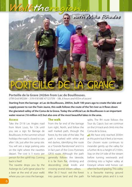
Porteille de la Grave<br />
Porteille de la Grave 2426m from Lac de Bouillouses.<br />
UTM Grid WGS84 – 31N 418168E 4712375N - 18k, 6 hours and 455m of ascent<br />
Starting from the barrage at Lac de Bouillouses, 2005m, built 100 years ago to create the lake and<br />
supply power to run the Train Jaune, this walk follows the route of the Tet river as it flows down<br />
the glaciated valley of the Coma de la Grava. Today the artificial Lac de Bouillouses is an important<br />
water reserve (16 million m3) but also one of the most beautiful lakes in the area.<br />
Access<br />
Take the D118 Les Angles road<br />
from Mont Louis, for 1.5k until<br />
you see a sign for Barrage de<br />
Bouillouses. In the summer school<br />
holidays the road is closed to cars<br />
after 1.6k, just after the camp site.<br />
You will see a large parking area<br />
on the right where the navettes<br />
depart. The cost is 5 euros per<br />
person for the uphill trip. Coming<br />
back is free!!<br />
The navette drops you by the<br />
Auberge du Carlit (great place for<br />
a beer at the end of your walk)<br />
where you can cross the barrage.<br />
The walk<br />
From the far end of the barrage<br />
turn right, North, and follow the<br />
well marked path, through the<br />
forest, by the side of the lake. The<br />
path is marked with white and<br />
red dashes, identifying the route<br />
as a “Grande Randonnee” and it is<br />
in fact part of the Cross Pyrenees<br />
GR10 route. Although the path<br />
generally follows the lakeside,<br />
it is far from flat, climbing and<br />
descending small knolls and<br />
crossing several stream valleys.<br />
After 3k (1 hour) exit the forest<br />
into pasture land and the path<br />
splits. The RH route follows the<br />
Tour du Capcir, but we continue<br />
on the LH track and climb into the<br />
Coma de la Grava.<br />
We have only reached 2030m<br />
at this point but it feels a lot more.<br />
Our chosen route continues to<br />
meander gently up the valley for<br />
a further 4k to a height of 2150m.<br />
Stay on the LH side of the stream<br />
before turning westwards and<br />
climbing into a higher valley at<br />
Estanyol where wild horses can<br />
often be found grazing. This valley<br />
is a favourite training ground<br />
for helicopter pilots and it is not