Active Transportation Plan - City of Pomona
Active Transportation Plan - City of Pomona
Active Transportation Plan - City of Pomona

Create successful ePaper yourself
Turn your PDF publications into a flip-book with our unique Google optimized e-Paper software.
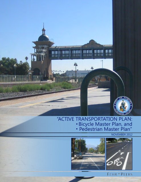
“ACTIVE TRANSPORTATION PLAN:<br />
Bicycle Master <strong>Plan</strong>, and<br />
Pedestrian Master <strong>Plan</strong>”<br />
NOVEMBER 2012
TABLE OF CONTENTS<br />
1. Introduction ................................................................................................................................................. 1<br />
<strong>Active</strong> <strong>Transportation</strong> <strong>Plan</strong> Overview ................................................................................................................................... 2<br />
<strong>Plan</strong> Development and Public Involvement ...................................................................................................................... 3<br />
Public Input..................................................................................................................................................................................... 4<br />
<strong>Plan</strong> Contents ................................................................................................................................................................................. 5<br />
2. Existing Policy Framework ......................................................................................................................... 7<br />
<strong>City</strong> <strong>of</strong> <strong>Pomona</strong> <strong>Plan</strong>s and Policies ........................................................................................................................................ 8<br />
Other <strong>City</strong> and County <strong>Plan</strong>s .................................................................................................................................................12<br />
Regional or Strategic <strong>Plan</strong>s ....................................................................................................................................................14<br />
State <strong>Plan</strong>s .....................................................................................................................................................................................15<br />
Federal Initiatives .......................................................................................................................................................................17<br />
3. Existing Conditions ................................................................................................................................... 18<br />
<strong>Pomona</strong> Today ............................................................................................................................................................................19<br />
Types <strong>of</strong> Bikeway Facilities .....................................................................................................................................................26<br />
Bicycle Trip Types .......................................................................................................................................................................31<br />
Existing Bicycling Facilities ......................................................................................................................................................33<br />
Key Issues and Bicycle Needs Assessment .......................................................................................................................37<br />
Bicycle Collision Reports .........................................................................................................................................................44<br />
4. Proposed <strong>Active</strong> <strong>Transportation</strong> Network ............................................................................................ 50<br />
Proposed Bicycling Network ..................................................................................................................................................51<br />
Project List .....................................................................................................................................................................................54<br />
School Area Bicycle Improvements (Micro-Level Bicycle Analysis) ........................................................................59<br />
5. Pedestrian Network .................................................................................................................................. 84<br />
Sidewalk Prioritization ................................................................................................................................. 84<br />
6. Support Programs ..................................................................................................................................... 94<br />
Existing Programs ......................................................................................................................................................................95<br />
Proposed Programs ...................................................................................................................................................................96<br />
7. Funding and Implementation ...............................................................................................................108<br />
State and Federal Programs................................................................................................................................................ 109<br />
Regional and Local Funding ............................................................................................................................................... 113<br />
Cost <strong>of</strong> New Bicycling Facilities ......................................................................................................................................... 115<br />
8. Bicycle and Pedestrian Design Guidelines ...........................................................................................129<br />
Types <strong>of</strong> Bicycle Facilities ..................................................................................................................................................... 130<br />
Bicycle Signage ........................................................................................................................................................................ 158<br />
Maintenance Standards ........................................................................................................................................................ 161<br />
Pedestrian Design Guidelines............................................................................................................................................. 163
APPENDICES<br />
Appendix A: Public Input<br />
Appendix B: Bike Lane Feasibility Analysis<br />
Appendix C: <strong>Pomona</strong> Pedestrian Policies and Principles<br />
Appendix D: Pedestrian Improvements at Intersections
LIST OF FIGURES<br />
Figure 3-1 – <strong>Pomona</strong> Land Use.................................................................................................................................................... 20<br />
Figure 3-2 – National Pedestrian and Bicycle Funding and Number <strong>of</strong> Trips ........................................................... 25<br />
Figure 3-3 – Bikeway Types ........................................................................................................................................................... 28<br />
Figure 3-4 – Bikeway Facilities and Key Destinations ......................................................................................................... 29<br />
Figure 3-5 – Barriers to Bicycling ................................................................................................................................................ 38<br />
Figure 3-6 – Bicycle Collision Frequency (2007-2010)........................................................................................................ 45<br />
Figure 3-7 – Bicycle Collisions Resulting in Injuries and/or Fatalities (2007-2010)................................................. 46<br />
Figure 4-1 – Proposed Bicycle Network ................................................................................................................................... 52<br />
Figure 4-2 – Proposed Bicycle Parking Facilities ................................................................................................................... 57<br />
Figure 4-3 – <strong>Pomona</strong> School Locations and Enrollment Boundaries ........................................................................... 60<br />
Figure 4-4 – Diamond Ranch High School Recommendations ...................................................................................... 62<br />
Figure 4-5 – Fremont, Garey, and Simmons Recommendations .................................................................................... 66<br />
Figure 4-6 – Ganesha, Marshall, and Park West Recommendations ............................................................................ 70<br />
Figure 4-7 – School <strong>of</strong> Arts and Enterprise and Emerson Recommendations .......................................................... 75<br />
Figure 4-8 – Village Academy High School Recommendations ..................................................................................... 78<br />
Figure 4-9 – Palomares Academy and <strong>Pomona</strong> High School Recommendations................................................... 83<br />
Figure 5-1 – Proxies for Walking Activity ................................................................................................................................. 85<br />
Figure 5-2 – Census Tract Walking Activity Index Classifications .................................................................................. 88<br />
Figure 5-3 – Missing Sidewalk Area Reference Map ........................................................................................................... 90<br />
Figure 5-4 – Missing Sidewalk Priority Tiers, Area 1 <strong>of</strong> 3 .................................................................................................. 91<br />
Figure 5-5 – Missing Sidewalk Priority Tiers, Area 2 <strong>of</strong> 3 .................................................................................................. 92<br />
Figure 5-6 – Missing Sidewalk Priority Tiers, Area 3 <strong>of</strong> 3 .................................................................................................. 93<br />
Figure 8-1 – Typical Class I Path ................................................................................................................................................ 132<br />
Figure 8-2 – Shared Use Path at Controlled Intersection ................................................................................................ 135<br />
Figure 8-3 – Signage at Shared-Use Path .............................................................................................................................. 136<br />
Figure 8-4 – Bicycling Lanes Adjacent to Parallel Parking .............................................................................................. 139
LIST OF EXHIBITS<br />
Exhibit 7-1 – San Antonio Avenue Bicycle Lane .................................................................................................................. 119<br />
Exhibit 7-2 – San Jose Creek Bikeway ...................................................................................................................................... 121<br />
Exhibit 7-3 – Park Avenue Bikeway .......................................................................................................................................... 123<br />
Exhibit 7-4 – Monterey Street Bikeway ................................................................................................................................... 125<br />
Exhibit 7-5 – Garey Avenue Bikeway........................................................................................................................................ 127
LIST OF TABLES<br />
Table 1-1 – Bicycle Master <strong>Plan</strong> Contents .................................................................................................................................. 5<br />
Table 1-2 – Caltrans Bicycle <strong>Transportation</strong> Account Funding Requirements ............................................................. 6<br />
Table 2-1 – Summary <strong>of</strong> Relevant Existing <strong>Plan</strong>s and Policies............................................................................................ 7<br />
Table 2.2 – Summary <strong>of</strong> Relevant General <strong>Plan</strong> Goals and Policies .................................................................................. 8<br />
Table 3-1 – Chapter Outline .......................................................................................................................................................... 18<br />
Table 3-2 – <strong>Pomona</strong> Bicyclists by Trip Group ........................................................................................................................ 23<br />
Table 3-3 – <strong>Pomona</strong> Bicycle Travel – Existing and 2020 .................................................................................................... 25<br />
Table 3-4 – Bike Facility Types ..................................................................................................................................................... 27<br />
Table 3-5 – Existing Multi-Use Paths (Class I) ........................................................................................................................ 33<br />
Table 3-6 – Existing Class II and Class III Bike FacilIties ..................................................................................................... 34<br />
Table 3-7 – Stakeholder Responses to Survey Question #1 ............................................................................................ 37<br />
Table 3-8 – Stakeholder Responses to Survey Question #3 ............................................................................................ 40<br />
Table 3-9 – Mode Split for Select <strong>Pomona</strong> Schools ............................................................................................................ 42<br />
Table 3-10 – Top Bicycle Collision locations by Intersection – 2007-2011 ............................................................... 47<br />
Table 3-11 – Primary Collision Factors, 2007-2011 .............................................................................................................. 48<br />
Table 3-12 – Collisions by Time <strong>of</strong> Day .................................................................................................................................... 48<br />
Table 4-1 – Length <strong>of</strong> Bicycling Network ................................................................................................................................. 51<br />
Table 4-2 – Proposed Project List ............................................................................................................................................... 55<br />
Table 5-1 – Census Data, Intervals, and Weights .................................................................................................................. 87<br />
Table 5-2 – Sidewalk Priority Tier Definitions ........................................................................................................................ 89<br />
Table 7-1 – Conceptual Unit Costs for Bikeway Construction ....................................................................................... 115<br />
Table 7-2 – Bicycle Facility Phasing <strong>Plan</strong> and Cost Estimates ........................................................................................ 116<br />
Table 8-1 – Standards for Class I Facilities ............................................................................................................................ 131
<strong>Pomona</strong> <strong>Active</strong> <strong>Transportation</strong> <strong>Plan</strong><br />
November 2012<br />
Chapter 1 – Introduction<br />
1. Introduction<br />
Bicycling and walking are increasingly recognized important components <strong>of</strong> the transportation system. In<br />
the <strong>Pomona</strong> General <strong>Plan</strong>, the <strong>City</strong> recognized the importance <strong>of</strong> cycling in reducing traffic, air pollution,<br />
and energy consumption, and providing greater transportation options that enhance quality <strong>of</strong> life. The<br />
<strong>City</strong> has also made great strides in improving the pedestrian environment, particularly in Downtown<br />
<strong>Pomona</strong>. This <strong>Active</strong> <strong>Transportation</strong> <strong>Plan</strong> (ATP) is consistent with these sustainability efforts and provides<br />
detailed direction on how to continue the <strong>City</strong>’s progress toward a better bicycling and walking<br />
environment. The <strong>Plan</strong> does this by proposing a system <strong>of</strong> bikeways connecting neighborhoods to key<br />
activity centers throughout the <strong>City</strong>, developing support facilities, such as bike parking, and education<br />
programs, and by identifying recommendations for improving bicyclist safety. This document satisfies the<br />
requirements <strong>of</strong> the California Bicycle <strong>Transportation</strong> Act, granting the <strong>City</strong> eligibility for Bicycle<br />
<strong>Transportation</strong> Account (BTA) funding through the California Department <strong>of</strong> <strong>Transportation</strong> (Caltrans) for<br />
any <strong>of</strong> the bicycle improvements identified in this plan. The ATP also contains detailed recommendations<br />
for improving pedestrian safety and comfort at intersections and for prioritizing the installation <strong>of</strong><br />
sidewalks where they do not currently exist.<br />
This chapter describes the process that was used to develop the <strong>Plan</strong>, describes the contents <strong>of</strong> the <strong>Plan</strong><br />
and outlines how these contents meet the requirements <strong>of</strong> Caltrans for BTA funding eligibility.<br />
Image 1-1. Cyclists on Holt Boulevard, <strong>Pomona</strong>, CA.<br />
1
<strong>Pomona</strong> <strong>Active</strong> <strong>Transportation</strong> <strong>Plan</strong><br />
November 2012<br />
Chapter 1 – Introduction<br />
ACTIVE TRANSPORTATION PLAN OVERVIEW<br />
The <strong>City</strong> <strong>of</strong> <strong>Pomona</strong> received a $40,000 technical assistance contribution from the Los Angeles County<br />
Department <strong>of</strong> Public Health’s Healthy Policies Initiative (HPI). The <strong>City</strong> used this contribution to develop<br />
supplemental materials to the <strong>City</strong>'s first ever <strong>Active</strong> <strong>Transportation</strong> <strong>Plan</strong>. These supplements include<br />
three products:<br />
(1) A micro-level assessment enhancing bicycle access to middle and high schools<br />
(2) A methodology to rank missing sidewalk sections throughout the city (and a prioritized list <strong>of</strong><br />
those sections)<br />
(3) A list <strong>of</strong> possible pedestrian treatments at 35 key intersections<br />
The first two products, along with the <strong>City</strong>’s bicycle plan, are integrated into this <strong>Active</strong> <strong>Transportation</strong><br />
<strong>Plan</strong>. The third product, the list <strong>of</strong> 35 intersection recommendations was developed giving priority to<br />
pedestrians and is included as an appendix and it will be used to prioritize potential pedestrian<br />
improvements as the <strong>City</strong> proceeds with future projects at these locations. These recommendations will<br />
serve as a useful baseline for improvements; however, the recommendations may need to be modified to<br />
insure pedestrian needs are balanced with vehicle, truck, and bus movements. In addition, should the<br />
<strong>Pomona</strong> General <strong>Plan</strong> Update and Corridors Specific <strong>Plan</strong> be adopted, there will be a greater emphasis on<br />
pedestrian and transit mobility in the city. Should these policies become adopted—and as broader shifts<br />
transpire with rising fuel prices and AB 32/SB 375 compliance—the <strong>City</strong> will be well positioned with a set<br />
<strong>of</strong> projects to enhance walkability and make travel by foot a safe, convenient choice.<br />
At the time <strong>of</strong> implementation the ATP/BMP recommendations will be balanced with corridor specific plan<br />
recommendations and existing and projected conditions on particular roadways - to develop a safe<br />
project which balances all modes and builds on the complete streets concept.<br />
2
<strong>Pomona</strong> <strong>Active</strong> <strong>Transportation</strong> <strong>Plan</strong><br />
November 2012<br />
Chapter 1 – Introduction<br />
PLAN DEVELOPMENT AND PUBLIC INVOLVEMENT<br />
The <strong>City</strong> <strong>of</strong> <strong>Pomona</strong> has developed a handful <strong>of</strong> designated bicycle facilities over the years. The<br />
development <strong>of</strong> the BMP comes as part <strong>of</strong> an effort by the <strong>City</strong> to address local and regional desires to<br />
enhance the viability <strong>of</strong> bicycling as a mode <strong>of</strong> transportation and reduce transportation system impacts<br />
on local communities. The BMP and ATP <strong>of</strong>fers a multifaceted strategy designed to meet the growing<br />
demand for bicycle infrastructure and help reduce <strong>Pomona</strong>’s contribution to air pollution, congestion,<br />
energy consumption, and climate change. By making biking easier and safer, the <strong>City</strong> can better manage<br />
its transportation network and reduce its overall greenhouse gas emissions resulting from singleoccupant<br />
driving. The planning process to develop this plan started in February 2012.<br />
The goals, policies, recommendations, and action items in this <strong>Plan</strong> are the outcome <strong>of</strong> a substantial<br />
public outreach effort by the <strong>City</strong>. Between April and September 2012, the <strong>City</strong> and consultant team<br />
accepted public input to the <strong>Plan</strong> at three public events. Additionally, a public website (www.pomonaatp.org)<br />
broadcast the latest news related to<br />
the <strong>Plan</strong>, and provided a forum for public<br />
dialogue about the <strong>Plan</strong>. <strong>City</strong> staff or the<br />
project team members talked to the public<br />
about the <strong>Plan</strong> at the following events:<br />
<strong>Pomona</strong> Bicycle Master <strong>Plan</strong> / <strong>Active</strong><br />
<strong>Transportation</strong> <strong>Plan</strong> Public Meeting #1 (April<br />
2012); <strong>Pomona</strong> Bicycle Master <strong>Plan</strong> / <strong>Active</strong><br />
<strong>Transportation</strong> <strong>Plan</strong> Public Meeting #2 (July<br />
2012); and the <strong>Pomona</strong> Stakeholders Public<br />
Meeting (September 2012). The Final Draft<br />
<strong>Active</strong> <strong>Transportation</strong> <strong>Plan</strong> (Bicycle Master<br />
<strong>Plan</strong> & Pedestrian Master <strong>Plan</strong>) went before<br />
the <strong>Pomona</strong> <strong>City</strong> Council in December 2012<br />
for adoption.<br />
Images 1-2 to 1-4. <strong>Pomona</strong> Public Workshop #1, April 26, 2012.<br />
(Source: Fehr & Peers)<br />
3
<strong>Pomona</strong> <strong>Active</strong> <strong>Transportation</strong> <strong>Plan</strong><br />
November 2012<br />
Chapter 1 – Introduction<br />
PUBLIC INPUT<br />
At the first public meeting with the BMP Stakeholder Committee, stakeholder input was collected via a<br />
survey, maps that could be marked up by the public, and discussions with meeting facilitators. As a result,<br />
a list <strong>of</strong> desired improvements was developed based on public input. This list is by no means exhaustive,<br />
and the Stakeholder Committee recognized that the list could grow as the public gave input to the plans.<br />
• Bike lanes on major streets and commercial corridors<br />
• Bike paths along railroads or utility channels<br />
• Bike routes or bike boulevards on residential streets<br />
• Additional bicycle parking, particularly at the following locations:<br />
o Along Garey Avenue<br />
o <strong>Pomona</strong> Civic Center/downtown <strong>Pomona</strong>/Fox Theater<br />
o Glasshouse Records<br />
o Along Holt Boulevard<br />
o Fairplex<br />
o Ganesha Park Community Center<br />
o North <strong>Pomona</strong> Metrolink Station/<strong>Pomona</strong> Transit Center<br />
o Cal Poly <strong>Pomona</strong><br />
o Local schools and parks<br />
• Improved lighting<br />
• Improved pavement condition<br />
• Additional bicycle capacity and improved ease <strong>of</strong> using bicycles on buses/transit<br />
• Improved bicycle detection at intersections<br />
• Enhanced bicycle lanes via increased width and use <strong>of</strong> green paint or buffers<br />
• Education promoting awareness <strong>of</strong> bicyclists and rights on road for following groups:<br />
o Motorists<br />
o Law enforcement<br />
o Bicyclists<br />
• Improved access to major destinations such as:<br />
o Cal Poly <strong>Pomona</strong><br />
o Downtown <strong>Pomona</strong><br />
o Major travel corridors<br />
• Accommodate a full range <strong>of</strong> cyclists on the bicycle network<br />
• Host car-free street days, such as Sunday Streets or CicLAvia events<br />
4
<strong>Pomona</strong> <strong>Active</strong> <strong>Transportation</strong> <strong>Plan</strong><br />
November 2012<br />
Chapter 1 – Introduction<br />
PLAN CONTENTS<br />
The Bicycle Master <strong>Plan</strong> is presented in the following chapters:<br />
TABLE 1-1 – BICYCLE MASTER PLAN CONTENTS<br />
Chapter<br />
Contents<br />
1. Introduction --<br />
2. Existing Policy Framework<br />
3. Existing Conditions<br />
4. Proposed Bicycle Improvements<br />
5. Proposed Pedestrian Improvements<br />
6. Support Programs<br />
7. Funding and Implementation<br />
8. Design Guidelines<br />
Appendices A-D<br />
Summarizes the key plans, programs, policies and other<br />
planning documents that will be affected and may affect the<br />
recommendations and implementation <strong>of</strong> the Bicycle Master<br />
<strong>Plan</strong><br />
Discusses the existing local conditions relevant to bicycling and<br />
walking, including land use patterns and commuting statistics.<br />
This section also includes a variety <strong>of</strong> bicycle-specific<br />
information required for BTA compliance.<br />
Establishes a menu <strong>of</strong> proposed network <strong>of</strong> bikeways and<br />
support facilities based on expressed needs, gaps in existing<br />
the network and key destinations and activity centers. This<br />
chapter also includes a map <strong>of</strong> the proposed network and<br />
provides a list <strong>of</strong> proposed projects based on <strong>City</strong> priorities.<br />
Provides location-specific improvements intended to enhance<br />
pedestrian safety and mobility.<br />
Describes the bicycle and pedestrian safety and education<br />
programs in <strong>Pomona</strong>, and recommends additional programs or<br />
enhancements to improve the state <strong>of</strong> bicycling and walking in<br />
the city.<br />
Includes a phased implementation plan for bicycle projects<br />
based on community-input, project readiness, and<br />
connectivity. Provides planning-level cost estimates for<br />
implementation and maintenance <strong>of</strong> the proposed bicycle<br />
network. Potential funding sources are also identified. More<br />
detailed project descriptions are included for five high-priority<br />
projects, for use in grant applications.<br />
Provides guidelines for the design <strong>of</strong> bicycle and pedestrian<br />
facilities, including on- and <strong>of</strong>f-street bikeways, bicycle parking,<br />
pedestrian crossings, signage and support facilities.<br />
Appendix A includes a summary <strong>of</strong> public input; Appendix B<br />
includes a segment-by-segment feasibility analysis; and<br />
Appendix C includes recommended Pedestrian Policies and<br />
Principles. Appendix D identifies potential pedestrian<br />
improvements at various intersections in the <strong>City</strong>.<br />
5
<strong>Pomona</strong> <strong>Active</strong> <strong>Transportation</strong> <strong>Plan</strong><br />
November 2012<br />
Chapter 1 – Introduction<br />
Caltrans requires that bicycle plans include certain components, as identified in Section 891.2 <strong>of</strong> the<br />
California Streets and Highway Code, to be eligible for BTA funding. Table 1-2 summarizes these<br />
elements and the chapters <strong>of</strong> this plan in which each is addressed.<br />
TABLE 1-2 – CALTRANS BICYCLE TRANSPORTATION ACCOUNT FUNDING REQUIREMENTS<br />
Element<br />
Chapter <strong>of</strong> this <strong>Plan</strong><br />
Number <strong>of</strong> Existing and Future Bicycle Commuters Chapter 3 [Existing pp. 22-24, Future pp. 24-25]<br />
Land Use and Settlement Patterns Chapter 3 [pp. 19-21]<br />
Existing and Proposed Bikeways Chapters 3 and 4 [Existing pp. 33-34, Proposed p. 50-53]<br />
Existing and Proposed Bicycle Parking Facilities<br />
Existing and Proposed Access to other <strong>Transportation</strong><br />
Modes<br />
Facilities for Changing and Storing Clothes and<br />
Equipment<br />
Chapters 3 and 4 [Existing p. 35-36, Proposed p. 55<br />
(description) & p. 57 (map)]<br />
Chapters 3 and 4 [Existing p. 35-36, Proposed p. 54, 58,<br />
119-128, (description) & p. 52 (map)]<br />
Chapters 3 and 4 [Existing p. 35-36, Proposed p. 58]<br />
Bicycle Safety, Education, and Enforcement Programs Chapter 6 [pp. 94-107]<br />
Citizen and Community Involvement in the<br />
Development <strong>of</strong> the <strong>Plan</strong><br />
Chapters 1 and 3 [pp. 3-4 and 37-40]<br />
Coordination and Consistency with Other <strong>Plan</strong>s Chapter 2 [pp. 7-17]<br />
Projects Proposed in the <strong>Plan</strong> and their Priority for<br />
Implementation<br />
Past Expenditures for Bicycle Facilities and Future<br />
Financial Needs<br />
Chapter 7 [pp. 115-118]<br />
Chapter 7 [p. 115]<br />
Source: Caltrans Streets and Highway Code, Section 890-894.2<br />
6
<strong>Pomona</strong> <strong>Active</strong> <strong>Transportation</strong> <strong>Plan</strong><br />
November 2012<br />
Chapter 2 – Existing Policy Framework<br />
2. Existing Policy Framework<br />
This chapter summarizes existing plans and policy documents relevant to non-motorized transportation in<br />
the <strong>City</strong> <strong>of</strong> <strong>Pomona</strong>. These documents have been grouped into <strong>City</strong> <strong>of</strong> <strong>Pomona</strong> <strong>Plan</strong>s and Policies, Other<br />
<strong>City</strong> and County <strong>Plan</strong>s, Regional <strong>Plan</strong>s, State <strong>Plan</strong>s and Federal Initiatives. Table 2-1 lists the existing<br />
planning and policy documents addressed in this chapter.<br />
TABLE 2-1 – SUMMARY OF RELEVANT EXISTING PLANS AND POLICIES<br />
<strong>City</strong> <strong>of</strong> <strong>Pomona</strong><br />
<strong>Plan</strong>s & Policies<br />
Other <strong>City</strong> and<br />
County <strong>Plan</strong>s<br />
Regional <strong>Plan</strong>s State <strong>Plan</strong>s Federal Initiatives<br />
General <strong>Plan</strong><br />
San Dimas Bicycle<br />
<strong>Plan</strong><br />
SCAG 2012<br />
RTP/SCS<br />
Caltrans’<br />
Complete Streets<br />
Policy<br />
Department <strong>of</strong><br />
<strong>Transportation</strong> Policy<br />
Statement on Bicycle<br />
Municipal Code<br />
Claremont Bicycle<br />
<strong>Plan</strong><br />
California<br />
Complete Streets<br />
Act<br />
and Pedestrian<br />
Accommodation<br />
Regulations and<br />
Recommendations<br />
<strong>Transportation</strong><br />
Impact Study<br />
Guidelines<br />
Los Angeles<br />
County Bicycle <strong>Plan</strong><br />
Metro BTSP<br />
Assembly Bill 32 &<br />
State Bill 375<br />
Downtown <strong>Pomona</strong><br />
Specific <strong>Plan</strong><br />
San Bernardino<br />
County Bicycle <strong>Plan</strong><br />
Assembly Bill 1581<br />
& Caltrans’ Policy<br />
Directive 09-06<br />
7
<strong>Pomona</strong> <strong>Active</strong> <strong>Transportation</strong> <strong>Plan</strong><br />
November 2012<br />
Chapter 2 – Existing Policy Framework<br />
CITY OF POMONA PLANS AND POLICIES<br />
This section discusses adopted plans and policies relevant to bicycling and walking in the<br />
<strong>City</strong> <strong>of</strong> <strong>Pomona</strong>. These documents guide how the <strong>City</strong> <strong>of</strong> <strong>Pomona</strong> plans for and manages<br />
its built environment.<br />
General <strong>Plan</strong><br />
The <strong>City</strong> <strong>of</strong> <strong>Pomona</strong> Comprehensive General <strong>Plan</strong>: Circulation and <strong>Transportation</strong> Element describes the<br />
existing bicycle, pedestrian, transit, and vehicle facilities within the <strong>City</strong> and establishes the goals and<br />
policies for future transportation needs. Table 2.2 summarizes the goals and policies that relate directly<br />
to the Bicycle Master <strong>Plan</strong>:<br />
TABLE 2.2 – SUMMARY OF RELEVANT GENERAL PLAN GOALS AND POLICIES<br />
Policy – It is the policy <strong>of</strong> the <strong>City</strong> <strong>of</strong> <strong>Pomona</strong> to<br />
coordinate circulation planning with existing and<br />
proposed land use policies <strong>of</strong> the <strong>City</strong> and to use<br />
circulation planning as one means to accomplish desired<br />
land use patterns for the future.<br />
Circulation Element Objectives:<br />
• To develop a plan for circulation which allows for<br />
the movement <strong>of</strong> people and goods in and<br />
through the <strong>City</strong> in a safe and efficient manner,<br />
and which respects other policies <strong>of</strong> the <strong>City</strong>.<br />
• To use circulation planning as a means to<br />
develop greater <strong>City</strong> identity and create a strong<br />
<strong>City</strong> structure through coherent designation <strong>of</strong><br />
street function and street beautification<br />
programs.<br />
• To use circulation planning to encourage<br />
desirable future land use patterns in the <strong>City</strong>.<br />
Policy – It is the policy <strong>of</strong> the <strong>City</strong> <strong>of</strong> <strong>Pomona</strong> to<br />
recognize the important role street aesthetics play in<br />
determining the overall image <strong>of</strong> the <strong>City</strong> and to<br />
coordinate street construction or improvement projects<br />
with <strong>City</strong> beautification programs.<br />
Policy – It is the policy <strong>of</strong> the <strong>City</strong> <strong>of</strong> <strong>Pomona</strong> to improve<br />
the safety and convenience <strong>of</strong> pedestrian movement<br />
throughout the community.<br />
Policy – It is the policy <strong>of</strong> the <strong>City</strong> <strong>of</strong> <strong>Pomona</strong> to<br />
recognize the importance <strong>of</strong> the bicycle as a viable<br />
means <strong>of</strong> transportation and to make adequate<br />
provision for its safe use within the community.<br />
Policy – It is the policy <strong>of</strong> the <strong>City</strong> <strong>of</strong> <strong>Pomona</strong> to support<br />
efforts which will lead to the development <strong>of</strong> a regional<br />
bicycle trail system for the <strong>Pomona</strong> Valley.<br />
Policy – It is the policy <strong>of</strong> the <strong>City</strong> <strong>of</strong> <strong>Pomona</strong> to support<br />
the development <strong>of</strong> alternative local transportation<br />
systems which effectively serve the needs <strong>of</strong> <strong>Pomona</strong>’s<br />
residents.<br />
Environmental Resources Element Objectives:<br />
• To assure that <strong>Pomona</strong>’s environment is not<br />
unnecessarily polluted from any source by<br />
developing policies and standards for<br />
environmental quality.<br />
Policy – It is the policy <strong>of</strong> the <strong>City</strong> <strong>of</strong> <strong>Pomona</strong> to work<br />
toward the elimination <strong>of</strong> air pollution from all<br />
manmade sources.<br />
Policy – It is the policy <strong>of</strong> the <strong>City</strong> <strong>of</strong> <strong>Pomona</strong> to develop<br />
8
<strong>Pomona</strong> <strong>Active</strong> <strong>Transportation</strong> <strong>Plan</strong><br />
November 2012<br />
Chapter 2 – Existing Policy Framework<br />
• To assure that the environmental impact <strong>of</strong><br />
proposed public and private actions does not<br />
have a negative effect on the community.<br />
• To develop an open space plan which provides<br />
opportunities for recreation and education;<br />
preserves scenic, cultural, and historic values;<br />
protects the public safety and preserves <strong>City</strong><br />
identity.<br />
appropriate linear systems, such as streets, highways,<br />
utility and flood control rights-<strong>of</strong>-way, bike trails, and<br />
fixed transit lines, throughout the city as “green<br />
linkages: within the open space net, tying the various<br />
elements together.<br />
Community Design Element Objectives:<br />
• To make the <strong>City</strong>’s streets the unifying<br />
framework <strong>of</strong> the community through the use <strong>of</strong><br />
distinctive design treatments.<br />
Policy – It is the policy <strong>of</strong> the <strong>City</strong> <strong>of</strong> <strong>Pomona</strong> to increase<br />
amenities and provide human scale along city streets in<br />
order to insure increased comfort and usability for<br />
pedestrians and bicyclists.<br />
Source: <strong>City</strong> <strong>of</strong> <strong>Pomona</strong> General <strong>Plan</strong>, 1976<br />
<strong>City</strong> <strong>of</strong> <strong>Pomona</strong> Municipal Code<br />
The <strong>City</strong> <strong>of</strong> <strong>Pomona</strong> Municipal Code includes ordinances that address how development should occur<br />
within the <strong>City</strong>. In addition to defining standards for future development, the Code also defines existing<br />
pedestrian-oriented districts within the <strong>City</strong>. The following sections are relevant to the Cycling <strong>Plan</strong>:<br />
50.479 – Commercial Improvement Districts: This section defines Commercial Improvement Districts<br />
and allowed activities. "Activities which benefit real property and/or businesses located in the district,"<br />
means, but is not limited to, all <strong>of</strong> the following:<br />
(1): Promotion <strong>of</strong> public events which benefit real properties and/or businesses in the district;<br />
(5): Providing security, sanitation, graffiti removal, street and sidewalk cleaning and other<br />
municipal services supplemental to those normally provided by the municipality.<br />
46.347(1)(b) – Outdoor Dining and Newsstands within Public Rights-<strong>of</strong>-Way: Outdoor dining is<br />
permitted only where the sidewalk is wide enough to adequately accommodate both the usual pedestrian<br />
traffic in the area and the operation <strong>of</strong> the proposed activity. A clear, continuous pedestrian path not less<br />
than four feet in width shall be required for unimpeded pedestrian circulation outside <strong>of</strong> the outdoor<br />
dining area. The minimum width <strong>of</strong> the pedestrian path may be increased by the public works director in<br />
areas requiring public utility access. As used in this subsection, the term "pedestrian path" means a<br />
continuous obstruction-free sidewalk area between the outside boundary <strong>of</strong> the dining area and any<br />
obstruction, including but not limited to parking meters, street trees, landscaping, streetlights, bus<br />
benches, public art and curb lines.<br />
46.230 – Maintenance <strong>of</strong> Vehicle and Pedestrian Crossings: Every person making any excavation for<br />
any purpose whatsoever in or under any street shall maintain adequate and safe crossings for vehicular<br />
and pedestrian traffic at all street intersections and at intervals <strong>of</strong> not less than 300 feet for pedestrian<br />
traffic. If any such excavation is made across any street, at least one adequate and safe crossing shall be<br />
maintained at all times for vehicles and pedestrians.<br />
9
<strong>Pomona</strong> <strong>Active</strong> <strong>Transportation</strong> <strong>Plan</strong><br />
November 2012<br />
Chapter 2 – Existing Policy Framework<br />
58.633 (a) (1) – Prohibited Activities: The following activities shall be prohibited at all city-owned<br />
and/or operated skate parks: Use <strong>of</strong> bicycles or motorized vehicles within designated skate park areas.<br />
38.73 (6) – Specific acts Prohibited: Riding any domestic animal or riding or driving any bicycle or any<br />
other vehicle whatsoever elsewhere than on the roads or drives provided for such purpose.<br />
.503 H – Off-Street Parking: 1 13. Safety Features. Parking lots shall meet the following standards:<br />
a. Safety barriers, protective bumpers or curbing, concrete wheel stops and directional markings<br />
shall be provided to assure pedestrian/vehicular safety, efficient utilization, protection <strong>of</strong><br />
landscaping, and to prevent encroachment onto adjoining public or private property. In lieu <strong>of</strong><br />
concrete wheel stops, a three-foot landscaped planter, with a six-inch-high concrete curb, may be<br />
utilized. This shall not be construed to allow any parking spaces to encroach into any required<br />
setback area or the additional landscape to be considered as part <strong>of</strong> the six percent landscape<br />
requirement.<br />
b. Visibility <strong>of</strong> pedestrians, bicyclists, and motorists shall be assured when entering individual<br />
parking spaces, when circulating within a parking facility, and when entering or leaving a parking<br />
facility.<br />
<strong>City</strong> <strong>of</strong> <strong>Pomona</strong> Traffic Impact Study Guidelines<br />
The <strong>City</strong> <strong>of</strong> <strong>Pomona</strong> requires a Traffic Impact Study (TIS) for any project that generates 50 or more trips<br />
during any peak hour and for projects adjacent to intersections <strong>of</strong> two major arterials. Traffic impact<br />
studies may be required for other projects at the discretion <strong>of</strong> the <strong>City</strong>’s Traffic Engineer. A TIS must<br />
address bicycle and pedestrian circulation, as well as driveways, on-site circulation, consistency with <strong>City</strong><br />
plans and policies, adjacent streets and intersections, and any intersections controlled by traffic signals or<br />
stop signs to which the project will add Projects that generate 1 to 49 trips during any peak hour are<br />
required to complete a Focused TIS, which restricts the TIS scope to adjacent streets and intersections.<br />
Both full and Focused Traffic Impact Studies are required to address bicycle and pedestrian access to the<br />
project site, existing bicycle and pedestrian traffic and planned bicycle facilities outlined in the <strong>City</strong>’s<br />
General <strong>Plan</strong>.<br />
Downtown <strong>Pomona</strong> Specific <strong>Plan</strong><br />
The <strong>City</strong> <strong>of</strong> <strong>Pomona</strong> adopted an update to the Downtown <strong>Pomona</strong> Specific <strong>Plan</strong> (DPSP) in May 2007. The<br />
DPSP was originally adopted in May 1994 and was updated in 2005, 2006, and 2007. The DPSP document<br />
addresses the specific plan process, urban design, land use, development standards, circulation and<br />
parking, design guidelines, and project implementation. Overall, the DPSP aims to provide the vision and<br />
implementation program for creating an appealing commercial district that serves <strong>Pomona</strong> residents and<br />
the broader region.<br />
The DPSP focuses on place-making, quality design, and enhancements that serve transit patrons,<br />
pedestrians, or motorists. The parking and circulation chapter <strong>of</strong> the plan focuses on improving<br />
pedestrian linkages to transit, downtown parking supply, and concerns with neighborhood intrusion by<br />
1 The municipal code <strong>of</strong>f-street parking section does not include requirements for bicycle parking.<br />
10
<strong>Pomona</strong> <strong>Active</strong> <strong>Transportation</strong> <strong>Plan</strong><br />
November 2012<br />
Chapter 2 – Existing Policy Framework<br />
vehicles. Bicyclists are not specifically mentioned, but could expect to benefit from improvements to<br />
transit linkages, streetscape design, and overall improved access to the downtown area. The DPSP seeks<br />
to capitalize on the rich history and vibrant assets <strong>of</strong> the downtown area for advancing the condition and<br />
success <strong>of</strong> downtown <strong>Pomona</strong>.<br />
<strong>Pomona</strong> Corridors Specific <strong>Plan</strong><br />
The Corridors Specific <strong>Plan</strong> establishes a vision for 13 miles <strong>of</strong><br />
<strong>Pomona</strong>’s major arterial corridors—Foothill Boulevard, Garey<br />
Avenue, Holt Avenue and Mission Boulevard. The plan is intended<br />
to guide the physical and economic development <strong>of</strong> these<br />
important thoroughfares. The plan includes analysis <strong>of</strong> existing<br />
traffic conditions and the impact <strong>of</strong> future land uses on<br />
transportation in the corridor, with a focus on promoting land uses<br />
that will increase economic activity while encouraging land uses that<br />
will capture more trips internally. The plan also envisions a redesign<br />
<strong>of</strong> these key arterials with a focus on multimodal transportation and<br />
enhanced urban design. The following table compares the<br />
recommendations <strong>of</strong> the Corridors Specific <strong>Plan</strong> (CSP) with the<br />
recommendations in the <strong>Active</strong> <strong>Transportation</strong> <strong>Plan</strong> (ATP).<br />
Corridor Segment (Limits) CSP Recommendation ATP Recommendation Notes<br />
Foothill<br />
Boulevard<br />
Garey<br />
Avenue**<br />
Holt<br />
Avenue**<br />
Mission<br />
Boulevard**<br />
Garey to Towne<br />
Foothill to Bonita<br />
Bonita to Artesia<br />
Artesia to Holt<br />
Mission to SR-60<br />
Fairplex to Garey<br />
Garey to East <strong>City</strong><br />
Limit<br />
SR-71 to East <strong>City</strong><br />
Limit<br />
Gateway Boulevard<br />
(no bikeway)<br />
Parkway<br />
(no bikeway)<br />
Palm Tree Boulevard<br />
(no bikeway)<br />
Grand Boulevard<br />
(no bikeway)*<br />
Parkway<br />
(no bikeway)<br />
Grand Boulevard<br />
(no bikeway)*<br />
Grand Avenue<br />
(no bikeway)<br />
Midtown Boulevard<br />
(cycle track)<br />
No designated bikeway<br />
Bike Lanes<br />
Bike Lanes & Potential<br />
Future Bikeway<br />
No Bikeway<br />
No Bikeway<br />
No designated bikeway<br />
No Bikeway<br />
Potential Future Bikeway<br />
Bonita Avenue bike lanes<br />
provide east-west access to the<br />
south.<br />
Bike lanes are feasible in this<br />
segment.<br />
Bike lanes are feasible between<br />
Bonita & La Verne.<br />
Bike lanes would require<br />
removal <strong>of</strong> travel lanes or<br />
parking.<br />
Bike lanes would require<br />
removal <strong>of</strong> travel lanes or<br />
parking.<br />
Bike lanes would require<br />
removal <strong>of</strong> travel lanes or<br />
parking.<br />
Bike lanes would require<br />
removal <strong>of</strong> travel lanes or<br />
parking.<br />
Cycle track requires lane<br />
removal and access<br />
management (driveway<br />
consolidation).<br />
*The cross section with dimensions for the Grand Boulevard typology shows no bike lanes, however a plan view graphic illustrating<br />
the “Typical Grand Boulevard <strong>Plan</strong> Layout” shows a green cycle track treatment, but no dimensions.<br />
**At the time <strong>of</strong> implementation the ATP/BMP recommendations will be balanced with corridor specific plan recommendations and<br />
existing and projected conditions on particular roadways - to develop a safe project which balances all modes and builds on the<br />
complete streets concept.<br />
11
<strong>Pomona</strong> <strong>Active</strong> <strong>Transportation</strong> <strong>Plan</strong><br />
November 2012<br />
Chapter 2 – Existing Policy Framework<br />
OTHER CITY AND COUNTY PLANS<br />
This section describes the plans and policies related to bicycling and pedestrian activity in adjacent cities,<br />
unincorporated areas, or along county-owned or managed facilities such as Thompson Creek.<br />
Claremont Bicycle <strong>Plan</strong><br />
The <strong>City</strong> <strong>of</strong> Claremont adopted this plan in November 2007. The plan provides an overview <strong>of</strong> the <strong>City</strong><br />
and <strong>of</strong> related plans, projects and policies; describes existing conditions, including facilities and demand<br />
estimates for bicycling; identifies goals; designates a bikeway network and recommends specific<br />
improvements; discusses past bicycle facility expenditures; documents the extent <strong>of</strong> public participation;<br />
identifies “major activity centers” and other priority areas for improvement; and describes recommended<br />
support programs. The <strong>City</strong>’s primary goal in completing a bicycle master plan includes eligibility for BTA<br />
funding to further implement bicycle related projects.<br />
San Dimas Bicycle <strong>Plan</strong><br />
The <strong>City</strong> <strong>of</strong> San Dimas adopted this plan in August 2011 as an update to the <strong>City</strong>’s 1997 Bikeway Systems<br />
Master <strong>Plan</strong>. The plan provides an overview <strong>of</strong> the <strong>City</strong> and <strong>of</strong> related plans, projects and policies;<br />
describes existing conditions, including facilities and demand estimates for bicycling; identifies goals;<br />
designates a bikeway network and recommends specific improvements relating to signage, bicycle<br />
parking, and bicycle facilities; identifies “major activity centers” and other priority areas for improvement;<br />
contains facility design considerations; describes recommended support programs; and includes project<br />
implementation strategies.<br />
Los Angeles County Bicycle Master <strong>Plan</strong><br />
The Los Angeles County Bicycle Master <strong>Plan</strong> was adopted by the Los<br />
Angeles County Board <strong>of</strong> Supervisors. The <strong>Plan</strong> was developed by the<br />
Los Angeles County Public Works Department and an appointed Bicycle<br />
Task Force. The Countywide Bicycle <strong>Plan</strong> identifies opportunities for <strong>of</strong>fstreet<br />
bicycle facilities, on-street bicycle facilities, and shared-use<br />
pathways in unincorporated areas <strong>of</strong> Los Angeles County.<br />
Unincorporated areas near <strong>Pomona</strong> where proposed facilities are<br />
considered include Walnut Islands, West San Dimas, and Rowland<br />
Heights.<br />
12
<strong>Pomona</strong> <strong>Active</strong> <strong>Transportation</strong> <strong>Plan</strong><br />
November 2012<br />
Chapter 2 – Existing Policy Framework<br />
San Bernardino County Non-Motorized <strong>Transportation</strong> <strong>Plan</strong><br />
The San Bernardino County Non-Motorized <strong>Transportation</strong> <strong>Plan</strong> identifies and<br />
prioritizes bicycle and pedestrian-related projects, programs, and planning<br />
efforts which have countywide significance. The <strong>Plan</strong> is used to plan and<br />
allocate countywide funding for bicycle and pedestrian -related projects. Areas<br />
<strong>of</strong> importance noted in the plan include a Class I “backbone bicycle system,”<br />
better connectivity between cities and county sub areas, and prioritization <strong>of</strong><br />
“low-hanging fruit” that increase connectivity on class II and Class III bicycle<br />
facilities as they represent low-cost improvements, removal <strong>of</strong> gaps in the<br />
bicycle network, and connect to key destinations. Transit centers and civic<br />
service facilities are also <strong>of</strong> importance. The <strong>Plan</strong> focuses on access to activity<br />
centers and inter-jurisdictional facilities.<br />
13
<strong>Pomona</strong> <strong>Active</strong> <strong>Transportation</strong> <strong>Plan</strong><br />
November 2012<br />
Chapter 2 – Existing Policy Framework<br />
REGIONAL OR STRATEGIC PLANS<br />
Regional or strategic plans are typically intended to facilitate coordinated planning across jurisdictional<br />
boundaries and set regional priorities for funding <strong>of</strong> transportation infrastructure, including bicycle and<br />
pedestrian projects.<br />
Metro Bicycle <strong>Transportation</strong><br />
Strategic <strong>Plan</strong><br />
In 2006, the Los Angeles County Metropolitan<br />
<strong>Transportation</strong> Authority (Metro) released two<br />
documents relating to bicycle planning in the region:<br />
the Metro Bicycle <strong>Transportation</strong> Strategic <strong>Plan</strong> and<br />
BTA Compliance Document. Both <strong>of</strong> these<br />
documents supplant prior countywide bicycle<br />
planning documents dating back to 1996. The<br />
Strategic <strong>Plan</strong> is intended to be used by local cities<br />
and Los Angeles County Transit agencies in setting<br />
bicycle-related priorities that lead to regional improvements. The document discusses the significance <strong>of</strong><br />
bicycle usage with transit as a way <strong>of</strong> expanding mobility options within the region. The BTA document<br />
inventories and maps existing and planned facilities, and provides information regarding past<br />
expenditures by the 89 local jurisdictions within the county. The plan also includes: a listing <strong>of</strong> 167 “biketransit<br />
hubs” in the county, procedures for evaluating access to transit, best-practices in a tool box <strong>of</strong><br />
design measures, gaps in the regional bikeway network, and 12 prototypical “bike-transit hub” access<br />
plans in different areas <strong>of</strong> the county, including a sample bicycle access plan for the Downtown <strong>Pomona</strong><br />
Metrolink Station.<br />
SCAG Regional <strong>Transportation</strong> <strong>Plan</strong>/Sustainable Communities Strategy<br />
(RTP/SCS)<br />
In 2012, the Southern California Association <strong>of</strong><br />
Governments (SCAG) adopted the 2012 Regional<br />
<strong>Transportation</strong> <strong>Plan</strong>/Sustainable Communities Strategy<br />
(RTP/SCS), which integrates the region’s transportation<br />
and land use planning. The RTP/SCS is intended to<br />
reduce greenhouse gas emissions from transportation<br />
in accordance with California’s Sustainable<br />
Communities and Climate Protection Act and includes<br />
significant investments in multimodal transportation. It<br />
identifies regional solutions to transportation issues in<br />
southern California by reviewing existing<br />
transportation system conditions and providing improvement recommendations for the various focus<br />
areas including aviation, goods movement, highways and arterials, land use, non-motorized<br />
transportation, transit, and transportation finance. The non-motorized transportation section provides<br />
14
<strong>Pomona</strong> <strong>Active</strong> <strong>Transportation</strong> <strong>Plan</strong><br />
November 2012<br />
Chapter 2 – Existing Policy Framework<br />
information regarding existing mode split, bicyclist types, bicycle safety, the California Strategic Highway<br />
Safety <strong>Plan</strong> for bicyclists, and identifies implementation priorities for local jurisdictions. This document<br />
serves more as a policy guide for the region, than as a regional bicycle plan identifying potential<br />
expansion <strong>of</strong> bicycle facilities. The regional bikeway network is estimated to extend approximately 4,315<br />
miles with an additional 5,807 miles <strong>of</strong> planned facilities. Of the $524.7 billion transportation expenditures<br />
in the RTP, $6.9 billion are allocated for non-motorized projects. Additionally, this document includes a<br />
regional <strong>Active</strong> <strong>Transportation</strong> <strong>Plan</strong>.<br />
U.S. Bike Route 66<br />
<strong>Plan</strong>ning efforts are underway for a (multi-state) regional bike route along Route 66 (Foothill Boulevard)<br />
that could run through <strong>Pomona</strong>. If the US Bicycle Route 66 (USBR 66) project extends through <strong>Pomona</strong>,<br />
the <strong>City</strong> <strong>of</strong> <strong>Pomona</strong> proposes to utilize the recently-installed bike lanes on nearby Bonita Avenue—which<br />
parallels Route 66—as part <strong>of</strong> the USBR 66 project alignment.<br />
STATE PLANS<br />
Caltrans is responsible for building and maintaining state-funded transportation infrastructure. Within the<br />
<strong>City</strong> <strong>of</strong> <strong>Pomona</strong>, Caltrans maintains Interstate 80, Interstate 580, and San Pablo Avenue. The following<br />
policies would affect strategic planning decisions on those corridors. In conjunction with Caltrans, the<br />
State has also passed legislation that affects all streets in <strong>Pomona</strong>.<br />
Caltrans’ Complete Streets Policy<br />
In 2001, Caltrans adopted a routine accommodation policy for the state in the form <strong>of</strong> Deputy Directive<br />
64, “Accommodating Nonmotorized Travel.” The directive was updated in 2008 as “Complete Streets—<br />
Integrating the <strong>Transportation</strong> System.” The new policy reads in part:<br />
The Department views all transportation improvements as opportunities to improve safety, access, and<br />
mobility for all travelers in California and recognizes bicycle, pedestrian, and transit modes as integral<br />
elements <strong>of</strong> the transportation system.<br />
The Department develops integrated multimodal projects in balance with community goals, plans, and<br />
values.<br />
Addressing the safety and mobility needs <strong>of</strong> bicyclists, pedestrians, and transit users in all<br />
projects, regardless <strong>of</strong> funding, is implicit in these objectives. Bicycle, pedestrian and transit travel is<br />
facilitated by creating “complete streets” beginning early in system planning and continuing through<br />
project delivery and maintenance and operations….<br />
The directive establishes Caltrans’ own responsibilities under this policy. Among the responsibilities that<br />
Caltrans assigns to various staff positions under the policy are:<br />
• Ensure bicycle, pedestrian, and transit interests are appropriately represented on interdisciplinary<br />
planning and project delivery development teams.<br />
15
<strong>Pomona</strong> <strong>Active</strong> <strong>Transportation</strong> <strong>Plan</strong><br />
November 2012<br />
Chapter 2 – Existing Policy Framework<br />
• Ensure bicycle, pedestrian, and transit user needs are addressed and deficiencies identified during<br />
system and corridor planning, project initiation, scoping, and programming.<br />
• Ensure incorporation <strong>of</strong> bicycle, pedestrian, and transit travel elements in all Department<br />
transportation plans and studies.<br />
• Promote land uses that encourage bicycle, pedestrian, and transit travel.<br />
• Research, develop, and implement multimodal performance measures.<br />
California Complete Streets Act<br />
Assembly Bill 1358, the “California Complete Streets Act <strong>of</strong> 2008,” requires “that the legislative body <strong>of</strong> a<br />
city or county, upon any substantive revision <strong>of</strong> the circulation element <strong>of</strong> the general plan, modify the<br />
circulation element to plan for a balanced, multimodal transportation network that meets the needs <strong>of</strong> all<br />
users [including] motorists, pedestrians, bicyclists, children, persons with disabilities, seniors, movers <strong>of</strong><br />
commercial goods, and users <strong>of</strong> public transportation….” This provision <strong>of</strong> the law goes into effect on<br />
January 1, 2011. The law also directs the Governor’s Office <strong>of</strong> <strong>Plan</strong>ning and Research to amend its<br />
guidelines for the development <strong>of</strong> circulation elements so as to assist cities and counties in meeting the<br />
above requirement.<br />
Assembly Bill 32 and State Bill 375<br />
Senate Bill (SB) 375 is the implementation legislation for Assembly Bill (AB) 32. AB 32 requires the<br />
reduction <strong>of</strong> greenhouse gases (GHG) by 28 percent by the year 2020 and by 50 percent by the year 2050.<br />
GHGs are emissions – carbon dioxide chief among them – that accumulate in the atmosphere and trap<br />
solar energy in a way that can affect global climate patterns. The largest source <strong>of</strong> these emissions related<br />
to human activity is generated by combustion-powered machinery, internal combustion vehicle engines,<br />
and equipment used to generate power and heat. SB 375 tasks metropolitan and regional planning<br />
agencies with achieving GHG reductions through their Regional or Metropolitan <strong>Transportation</strong> <strong>Plan</strong>s.<br />
The reduction <strong>of</strong> the use the automobile for trip making is one method for reducing GHG emissions. This<br />
can be achieved through the use <strong>of</strong> modes other than the automobile, such as walking, bicycling, or using<br />
transit.<br />
Assembly Bill 1581 and Caltrans Policy Directive 09-06<br />
Assembly Bill (AB) 1581 provides direction that new actuated traffic signal construction and modifications<br />
to existing traffic signals include the ability to detect bicycles and motorcycles. It also calls for the timing<br />
<strong>of</strong> actuated traffic signals to account for bicycles. In response to AB 1581, Caltrans has issues Traffic<br />
Operations Policy Directive 09-06, which has proposed modifications to Table 4D-105(D) <strong>of</strong> the California<br />
Manual on Uniform Traffic Control Devices. The California Traffic Control Devices Committee is<br />
considering the proposed modifications.<br />
16
<strong>Pomona</strong> <strong>Active</strong> <strong>Transportation</strong> <strong>Plan</strong><br />
November 2012<br />
Chapter 2 – Existing Policy Framework<br />
FEDERAL INITIATIVES<br />
The United States Department <strong>of</strong> <strong>Transportation</strong> has issued the following statement on pedestrian and<br />
bicycle activity and planning.<br />
The US DoT Statement on Bicycle and Pedestrian Accommodations,<br />
Regulations and Recommendations<br />
On March 5, 2010, the United States Department <strong>of</strong> <strong>Transportation</strong> (DOT)<br />
announced a policy directive to demonstrate the DOT’s support <strong>of</strong> fully<br />
integrated active transportation networks by incorporating walking and<br />
bicycling facilities into transportation projects. The statement encourages<br />
transportation agencies to go beyond minimum standards in the provision <strong>of</strong><br />
the facilities. The DOT further encourages agencies to adopt policy statements<br />
that would affect bicycling and walking, such as:<br />
• Considering walking and bicycling as equals with other transportation modes<br />
• Ensuring availability <strong>of</strong> transportation choices for people <strong>of</strong> all ages and abilities<br />
• Going beyond minimum design standards<br />
• Integrating bicycle and pedestrian accommodations on new, rehabilitated, and limited access<br />
bridges<br />
• Collecting data on walking and biking trips<br />
• Setting mode share for walking and bicycling and tracking them over time<br />
• Removing snow from sidewalks and shared use paths<br />
• Improving non-motorized facilities during maintenance projects<br />
17
<strong>Pomona</strong> <strong>Active</strong> <strong>Transportation</strong> <strong>Plan</strong><br />
November 2012<br />
Chapter 3 – Existing Conditions<br />
3. Existing Conditions<br />
<strong>Pomona</strong> provides an excellent environment for active transportation, including a temperate climate, a<br />
network <strong>of</strong> schools and open space, close proximity <strong>of</strong> several universities, a well-connected street grid<br />
and relatively flat terrain in most <strong>of</strong> the <strong>City</strong>. Despite the fact that bicycling and walking are becoming<br />
increasingly popular in southern California, the lack <strong>of</strong> a safe, well-connected, and accessible network <strong>of</strong><br />
bikeways, sidewalks and pedestrian crossings presents an obstacle to active transportation in <strong>Pomona</strong>.<br />
As <strong>Pomona</strong>’s first Bicycle Master <strong>Plan</strong>, this effort will lay the groundwork and vision for developing a<br />
system <strong>of</strong> on-street and <strong>of</strong>f-street bicycle facilities throughout the <strong>City</strong>, focusing on completing a system<br />
<strong>of</strong> bikeways and support facilities between neighborhoods and providing safe routes to schools and<br />
access to major destinations such as employment centers, stores and shops, parks, trails, and open space<br />
areas. This <strong>Plan</strong> also includes criteria for defining different types <strong>of</strong> bicycle facilities, a listing <strong>of</strong> priority<br />
projects, design standards and education and safety programs. This chapter provides a snapshot <strong>of</strong> the<br />
existing physical environment and existing programs, practices, and policies related to bicycling<br />
conditions in the <strong>City</strong>. The chapter outline is shown in Table 3-1 below.<br />
TABLE 3-1 – CHAPTER OUTLINE<br />
Existing Bicycling Conditions<br />
<strong>Pomona</strong> Today<br />
- Existing Land Use and Settlement Patterns<br />
- Existing and Potential Bicycle Activity in <strong>Pomona</strong><br />
Types <strong>of</strong> Bikeway Facilities<br />
Existing Bicycling Facilities<br />
- Existing On- and Off-Street Facilities<br />
- Existing Bicycle Parking<br />
- Status <strong>of</strong> On-Going and Past Bike Projects<br />
Barriers to Cycling / Needs Assessment<br />
Vehicle/Bicycle Collision Analysis<br />
18
<strong>Pomona</strong> <strong>Active</strong> <strong>Transportation</strong> <strong>Plan</strong><br />
November 2012<br />
Chapter 3 – Existing Conditions<br />
POMONA TODAY<br />
Land Use and Settlement Patterns<br />
The <strong>City</strong> <strong>of</strong> <strong>Pomona</strong> is located in the eastern portion <strong>of</strong> Los Angeles County, between the San Gabriel<br />
Valley and the Inland Empire. First settled in the 1830s and incorporated in 1888, the <strong>City</strong> <strong>of</strong> <strong>Pomona</strong> is<br />
now home to approximately 149,058 residents and is the seventh-largest city in Los Angeles County, with<br />
a land area <strong>of</strong> about 23 square miles. <strong>Pomona</strong> lies on the eastern border <strong>of</strong> Los Angeles County with San<br />
Bernardino County.<br />
Historically, <strong>Pomona</strong> has established and interconnected neighborhood commercial corridors, schools,<br />
parks, and residences through the development <strong>of</strong> a grid street system. Most <strong>of</strong> the city is flat, with hills<br />
in the southwestern corner <strong>of</strong> the <strong>City</strong>. The <strong>City</strong>’s major thoroughfares are Garey Avenue and Towne<br />
Avenue (north-south), and Holt Avenue, Phillips Boulevard, Foothill Boulevard, Arrow Highway, and<br />
Mission Boulevard (east-west). Portions <strong>of</strong> SR-57, SR-60, SR-71, and I-10 are within <strong>Pomona</strong>’s city limits.<br />
Amtrak and Metrolink trains serve the <strong>Pomona</strong> Transit Center, located south <strong>of</strong> Garey Avenue and<br />
Monterey Avenue. This area is anchored by the historic Fox Theater and home to a growing arts colony.<br />
Most <strong>of</strong> the city’s housing stock is single-family, which is spread throughout the northern area <strong>of</strong> the <strong>City</strong><br />
and the central part <strong>of</strong> the <strong>City</strong> to the south. <strong>Pomona</strong>’s newest neighborhood, Phillips Ranch, is located in<br />
the southwest area <strong>of</strong> the <strong>City</strong> and is home to a few <strong>of</strong>f-street bicycle paths. Multi-family housing is<br />
primarily located along downtown’s southern border, between Mission Boulevard and Phillips Boulevard,<br />
and along Holt Avenue.<br />
Light industry is concentrated in several areas: along 2 nd Street, east <strong>of</strong> Reservoir Street, between Holt<br />
Avenue and Mission Boulevard west <strong>of</strong> Hamilton Boulevard, and along Bonita Avenue. Cal Poly <strong>Pomona</strong><br />
lies at the western edge <strong>of</strong> <strong>Pomona</strong> and the Western University <strong>of</strong> Health Sciences is located downtown.<br />
Local public and private schools are spread throughout the <strong>City</strong>. The Claremont Colleges, Mount San<br />
Antonio College and University <strong>of</strong> La Verne are all within one mile <strong>of</strong> <strong>City</strong> boundaries. The Fairplex, where<br />
the Los Angeles County Fair and many large sporting and recreational events are held, occupies the<br />
northwestern corner <strong>of</strong> the <strong>City</strong>. <strong>Pomona</strong> is bordered on the northwest by Frank Bonelli Regional Park.<br />
19
Bonita Ave<br />
D<br />
i<br />
San Dimas Ave<br />
San Antonio Ave<br />
N Reservoir St<br />
East End Ave<br />
Indian Hill Blvd<br />
Indian Hill Blvd<br />
Pipeline Ave<br />
Central Ave<br />
Central Ave<br />
Mountain Ave<br />
UNIVERSITY OF<br />
LA VERNE<br />
Gladstone St<br />
L o n e H i ll A v e<br />
V a lle y C e n t e r A v e<br />
C h a r t e r O a k<br />
Bonnie Cove Ave<br />
C o v in a B lv d<br />
Cypress St<br />
Arrow Hwy<br />
Cienega Ave<br />
S a n D i m a s<br />
Bonita Ave<br />
San Dimas Canyon Rd<br />
Arrow Hwy<br />
Puddingstone Dr<br />
Wheeler Ave<br />
UNIVERSITY OF<br />
LA VERNE<br />
L a V e r n e<br />
White Ave<br />
Garey Ave<br />
Briarcr<strong>of</strong>t Rd<br />
Foothill Blvd<br />
Bonita Ave<br />
Butte St<br />
Mountain Ave<br />
8th St<br />
C l a r e m o n t<br />
Berkely Ave<br />
College Ave<br />
M i lls A v e<br />
C l a r e m o n t B l v d<br />
THE CLAREMONT<br />
COLLEGES<br />
Arrow Rte<br />
Badillo St<br />
San Dimas Ave<br />
Fairplex Dr<br />
La Verne Ave<br />
8th St<br />
Arrow Hwy<br />
San Jose Ave<br />
Puente St<br />
Via Verde<br />
Via Verde<br />
Orange Grove Ave<br />
%&' 10<br />
American Ave<br />
4th St<br />
M u r c h is o n A v e<br />
Dudley St<br />
Mills Ave<br />
Ramona Ave<br />
Orchard St<br />
Grand Ave<br />
LEGEND<br />
Commercial<br />
Commercial Industrial<br />
Industrial<br />
Administrative Pr<strong>of</strong>essional<br />
Temple Ave<br />
Single Family Residential<br />
CALIFORNIA STATE<br />
POLYTECHNIC UNIVERSITY<br />
Kellogg Dr<br />
South Campus Dr<br />
Valley Blvd<br />
Temple Ave<br />
<strong>Pomona</strong> Blvd<br />
Mission Blvd<br />
Orange Grove Ave<br />
2nd St<br />
Holt Ave<br />
<strong>Pomona</strong><br />
Dudley St<br />
9th St<br />
Hamilton Blvd<br />
White Ave<br />
Park Ave<br />
Garey Ave<br />
Palomares St<br />
Phillips Blvd<br />
Franklin Ave<br />
Towne Ave<br />
Holt Ave<br />
2nd St<br />
Mission Blvd<br />
9th St<br />
Grand Ave<br />
M o n t c l a i r<br />
Phillips Blvd<br />
Holt Blvd<br />
Mission Blvd<br />
Francis Ave<br />
|} 57 |} 71 |} 60<br />
Amar Rd<br />
Multiple Family Residential<br />
Downtown Specific <strong>Plan</strong> Area<br />
W a l n u t<br />
Other Specific <strong>Plan</strong> Areas<br />
Fairgrounds<br />
Publicly Owned Land<br />
Parks, Open Spaces, Vacant<br />
V a lle y B lv d<br />
Civic Center / Public Buildings<br />
Schools<br />
Universities<br />
Bridges<br />
<strong>City</strong> Boundary<br />
Diamond Bar Blvd<br />
a m o n d<br />
Sunset Crossing Rd<br />
B a r B lv d<br />
Golden Springs Dr<br />
Gold Rush D<br />
r<br />
Avenida Rancheros<br />
Armito<br />
Leyland Dr<br />
s Pl<br />
D i a m o n d B a r<br />
V<br />
illa g e L o o p R d<br />
C h in o H ills P k w y<br />
Old <strong>Pomona</strong> Rd<br />
Chi no Ave<br />
Park Ave<br />
Lexington Ave<br />
Philadelphia St<br />
Peyton Dr<br />
County Rd<br />
Riverside Dr<br />
Ramona Ave<br />
Philadelphia St<br />
Walnut Ave<br />
Riverside Dr<br />
¯<br />
\\FpLA1\Data\Jobs\<strong>Active</strong>\2500s\2517 - <strong>Pomona</strong> Bike\Graphics\GIS\MXD\f0x_Landuse_8by11.mxd<br />
ZONING AND LAND USE<br />
CITY OF POMONA<br />
FIGURE 3-1
<strong>Pomona</strong> <strong>Active</strong> <strong>Transportation</strong> <strong>Plan</strong><br />
November 2012<br />
Chapter 3 – Existing Conditions<br />
The <strong>Pomona</strong> Unified School District (PUSD) operates nearly forty schools in <strong>Pomona</strong>. The <strong>City</strong> also has<br />
several private schools, one charter high school and one magnet high school. The following schools are<br />
located within <strong>Pomona</strong>:<br />
PUSD Elementary Schools<br />
• Alcott Elementary<br />
• Allison Elementary<br />
• Armstrong Elementary<br />
• Arroyo Elementary<br />
• Barfield Elementary<br />
• Cortez Elementary<br />
• Decker Elementary<br />
• Harrison Elementary<br />
• Kellogg Polytechnic Elementary<br />
• Kingsley Elementary<br />
• Lexington Elementary<br />
• Lincoln Elementary<br />
• Lopez Elementary<br />
• Madison Elementary<br />
• Montvue Elementary<br />
• Philadelphia Elementary<br />
• Pueblo Elementary<br />
• Ranch Hills Elementary<br />
• Roosevelt Elementary<br />
• San Antonio Elementary<br />
• San Jose Elementary<br />
• Vejar Elementary<br />
• Washington Elementary<br />
• Westmont Elementary<br />
• Yorba Elementary<br />
PUSD Middle Schools<br />
• Emerson Middle School<br />
• Fremont Academy<br />
• Marshall Middle School<br />
• Simons Middle School<br />
PUSD High Schools<br />
• Diamond Ranch High School<br />
• Ganesha High<br />
• Garey High<br />
• <strong>Pomona</strong> High<br />
• Palomares Academy<br />
• Village Academy<br />
PUSD Alternative Schools<br />
• Community Day School<br />
• Park West High School<br />
• <strong>Pomona</strong> Alternative School<br />
• School <strong>of</strong> Extended Educational<br />
Options<br />
Other Schools<br />
• American Christian Academy<br />
• Charisma Christian Academy<br />
• <strong>City</strong> <strong>of</strong> Knowledge Islamic School<br />
• First Christian Church Child<br />
Development Center<br />
• ICC Community School<br />
• International Polytechnic High School<br />
• <strong>Pomona</strong> Catholic High School<br />
• The School <strong>of</strong> Arts and Enterprise<br />
• St. Joseph Elementary School<br />
• St. Madeline School<br />
21
<strong>Pomona</strong> <strong>Active</strong> <strong>Transportation</strong> <strong>Plan</strong><br />
November 2012<br />
Chapter 3 – Existing Conditions<br />
Existing and Potential Bicycling Activity in <strong>Pomona</strong><br />
Knowing how many people bicycle, and for what purposes, can help <strong>Pomona</strong> develop effective projects<br />
and programs to better serve residents and resident-employees. A common term used in describing<br />
demand for bicycle facilities is “mode split.” Mode split refers to the form <strong>of</strong> transportation a person<br />
chooses to take, such as walking, bicycling, public transit, or driving, and is <strong>of</strong>ten used in evaluating<br />
commuter alternatives such as bicycling, where the objective is to increase the percentage <strong>of</strong> people<br />
selecting an alternative means <strong>of</strong> transportation to the single-occupant (or drive-alone) automobile.<br />
Table 3-1 presents American Community Survey data for the journey-to-work mode split for the <strong>City</strong> <strong>of</strong><br />
<strong>Pomona</strong>, compared to the United States, California, and Los Angeles County. As shown, driving is the<br />
predominant means <strong>of</strong> commuting in <strong>Pomona</strong>, comparable to the rates for Los Angeles County and<br />
California, and slightly lower than the United States as a whole.<br />
TABLE 3.1 – EXISTING JOURNEY TO WORK DATA<br />
Mode United States California Los Angeles County <strong>City</strong> <strong>of</strong> <strong>Pomona</strong><br />
Drive Alone 76% 73% 72% 73%<br />
Carpool 10% 12% 11% 16%<br />
Transit 5% 5% 7% 4%<br />
Bike 1% (0.5%) 1% 1% (0.8%) 1% (0.8%)<br />
Walk 3% 3% 3% 2%<br />
Other 5% 6% 6% 5%<br />
Total 100% 100% 100% 100%<br />
Source: American Community Survey 2008-2010<br />
Note: Totals may not add to 100% due to rounding<br />
As shown in Table 3-1, bicycle trips represent less than one percent <strong>of</strong> home-based work trips in<br />
<strong>Pomona</strong>. This should not be misinterpreted as the bicycle mode share <strong>of</strong> all trips for several reasons:<br />
• Journey-to-work data only represents commute trips, which tend to be longer than shopping,<br />
school, recreation, and other trips, and are therefore less compatible with bicycling.<br />
• Census journey-to-work data fails to capture people who commute by bicycle one or two<br />
days per week.<br />
• Journey-to-work data does not account for commuters with multiple modes <strong>of</strong> travel to and<br />
from work, such as commuters that ride a bicycle to a transit station before transferring to<br />
transit for the remainder <strong>of</strong> their journey to work.<br />
• No separate accounting <strong>of</strong> shopping, school, or recreational trips is made in the Census; these<br />
trips make up more than half <strong>of</strong> the person trips on a typical weekday and a significantly<br />
greater proportion on the weekend. These trips also tend to be short to medium in length<br />
and are therefore very well suited for bicycling.<br />
22
<strong>Pomona</strong> <strong>Active</strong> <strong>Transportation</strong> <strong>Plan</strong><br />
November 2012<br />
Chapter 3 – Existing Conditions<br />
• Journey-to-work reports information for adult work trips, but does not request data on school<br />
trips, which are much more likely to be bicycling trips because school-aged individuals cannot<br />
drive until the latter half <strong>of</strong> their high school years.<br />
The SCAG’s Year 2000 Post-Census Regional Travel Survey, which surveyed 17,000 households in the sixcounty<br />
Los Angeles area, found that one percent <strong>of</strong> all trips in the region are by bicycle. Bicycle<br />
commuting rates in Los Angeles County have risen since 2000 (from 0.6% to 0.8%), so it is likely that<br />
overall bicycle trips have risen as well.<br />
Table 3-2 summarizes bicycle ridership estimates for commute and non-commute cyclists. According to<br />
the 2010 American Community Survey (5-year estimates), there were 31,847 enrolled students from<br />
grades 1 to 12 in <strong>Pomona</strong>, and 10,329 college students. A roll-call tally conducted at three <strong>Pomona</strong><br />
Unified School District Schools, indicates that approximately 2.1% <strong>of</strong> grade-school students bike to school.<br />
According to local surveys cited in the Metro Bicycle <strong>Transportation</strong> Strategic <strong>Plan</strong> BTA Compliance<br />
Document, a similar percentage (2%) <strong>of</strong> local college students commute by bicycle. Based on these<br />
assumptions [(31,847 x 2.1%) + (10,329 x 2.0%)], <strong>Pomona</strong> would have an estimated 876 student cyclists.<br />
Approximately 2,594 <strong>of</strong> <strong>Pomona</strong> workers commute by transit (4.3% <strong>of</strong> employed population, 60,742).<br />
According to on-board bus and rail surveys conducted by Metro in 2001, approximately 1.2% <strong>of</strong> transit<br />
riders cycle to transit stops; therefore, <strong>Pomona</strong> would have about 31 home-to-transit cyclists.<br />
TABLE 3-2 – POMONA BICYCLISTS BY TRIP GROUP<br />
Trip Group<br />
Daily Bicycle Commuters<br />
Workers (Home-to-Work Trips) 501 36%<br />
Students (Home-to-School Trips) 876 62%<br />
Transit Riders (Home-to-Transit Trips) 31 2%<br />
Total 1,408 100%<br />
Source: Census 2000; Fehr & Peers, 2010<br />
Commute trips represent a minority <strong>of</strong> bicycle trips. To get a fuller sense <strong>of</strong> bicycling in <strong>Pomona</strong>, one<br />
must account for the other reasons for which people use bicycles. The National Bicycle & Walking Study,<br />
published by the Federal Highway Administration in 1995, estimated that for every commute trip made by<br />
bicycle, there were 1.74 trips made for shopping, social, and other utilitarian purposes. We can estimate<br />
these types <strong>of</strong> trips in <strong>Pomona</strong> as follows:<br />
• Number <strong>of</strong> daily bicycle commuters: 1,408<br />
• Number <strong>of</strong> daily trips per commuter: 2 (assuming each commuter bikes to work or school<br />
and then bikes home again later)<br />
• Number <strong>of</strong> daily bicycle commute trips: 2,816 (1,408 x 2)<br />
• Daily bicycle trips for non-commute purposes: 4,900 (2,816 x 1.74)<br />
23
<strong>Pomona</strong> <strong>Active</strong> <strong>Transportation</strong> <strong>Plan</strong><br />
November 2012<br />
Chapter 3 – Existing Conditions<br />
Lastly, cycling is a popular recreational activity for all age groups. While most <strong>of</strong> this plan is focused on<br />
encouraging bicycling as a form <strong>of</strong> transportation, recreational riders, with encouragement, may transition<br />
to bicycling commuters. Similarly, recreational cycling can be a popular family activity, and children who<br />
ride with parents may be more likely to bike to school or with their friends. Regardless, <strong>Pomona</strong> has a<br />
mild climate, mostly flat terrain, and many parks within a 10-minute bicycle ride <strong>of</strong> downtown or<br />
residential neighborhoods.<br />
The Federal Highway Administration and U.S. Department <strong>of</strong> <strong>Transportation</strong> released in May 2010 the<br />
National Bicycle & Walking Study: 15 Year Status Report. The agencies found that between the initial<br />
report in 1995 and household survey data collected in 2009, bicycling activity had increased in general,<br />
though not to the goal <strong>of</strong> doubling walking and biking trips that was set in 1995. Interestingly, though<br />
only one percent <strong>of</strong> respondents in the 2009 National Households <strong>Transportation</strong> Survey said that they<br />
made everyday trips by bike, 12 percent said that they had ridden a bike in the past week.<br />
Future Bicycling Activity<br />
Future bicycle trips will depend on a number <strong>of</strong> factors such as the availability <strong>of</strong> well-connected facilities,<br />
appropriate education and promotion programs designed to encourage cycling, and location, density,<br />
and type <strong>of</strong> future land development. Cities with thoughtful bikeway plans and meaningful<br />
implementation programs have found high levels <strong>of</strong> correlation between bicycle facilities and number <strong>of</strong><br />
cyclists. Three cities with such plans – Portland, San Francisco, and Seattle – found that the number <strong>of</strong><br />
cyclists on a bicycle corridor after it was improved was double or triple the previous count. More<br />
generally, the 2010 National Bicycle & Walking Study: 15 Year Status Report found that between 1990 and<br />
2008 funding for bike and pedestrian projects increased from less than 0.5 percent <strong>of</strong> federal<br />
transportation funding to about one percent. Over that same time, pedestrian and bicycle trips increased<br />
by about 50 percent.<br />
With appropriate bicycle facilities in place and implementation <strong>of</strong> employer trip reduction programs, the<br />
bicycle mode split could increase significantly above its current rate. According to the methodology<br />
adopted by the Los Angeles County Metropolitan <strong>Transportation</strong> Authority and outlined in their Bicycle<br />
<strong>Transportation</strong> Strategic <strong>Plan</strong> (Volume 2), cities can expect to see a 279% increase in bicycling upon<br />
buildout <strong>of</strong> a complete bicycle network. By expanding bicycle facilities that encourage a broad cross<br />
section <strong>of</strong> bicyclists and improve safety, <strong>Pomona</strong> could increase the current mode split, which would result<br />
in over 25,000 bicycle trips daily by 2020, as shown in Table 3-3.<br />
24
<strong>Pomona</strong> <strong>Active</strong> <strong>Transportation</strong> <strong>Plan</strong><br />
November 2012<br />
Chapter 3 – Existing Conditions<br />
Figure 3-2 – National Pedestrian and Bicycle Funding and Number <strong>of</strong> Trips<br />
Source: National Bicycle & Walking Study: 15 Year Status Report (2010)<br />
TABLE 3-3 – POMONA BICYCLE TRAVEL – EXISTING AND 2020<br />
Mode<br />
<strong>City</strong> <strong>of</strong> <strong>Pomona</strong> –<br />
Today<br />
<strong>City</strong> <strong>of</strong> <strong>Pomona</strong> – 2020<br />
Daily Bicycle Commuters 1,408 3,928<br />
Daily Bicycle Commute Trips 2,816 7,857<br />
Daily Non-Commute Bicycle Trips 4,900 13,671<br />
TOTAL 9,124 25,456<br />
Sources: U.S. Census Bureau, ACS, 5-years estimates (2006-2010); LACMTA, Bicycle <strong>Transportation</strong><br />
Strategic <strong>Plan</strong>, 2006; Fehr & Peers, 2012<br />
25
<strong>Pomona</strong> <strong>Active</strong> <strong>Transportation</strong> <strong>Plan</strong><br />
November 2012<br />
Chapter 3 – Existing Conditions<br />
TYPES OF BIKEWAY FACILITIES<br />
The <strong>City</strong> <strong>of</strong> <strong>Pomona</strong> began to develop its bicycle network in the 1990s. Since that time, the <strong>City</strong> has<br />
identified others for future consideration. These bikeways include three distinct types <strong>of</strong> facilities, as<br />
defined by Caltrans, and shown in Figure 3-3:<br />
• Class I bike paths, such as along Fairplex Drive<br />
• Class II bike lanes, such as on Hamilton Boulevard<br />
• Class III bike routes<br />
An understanding <strong>of</strong> the condition <strong>of</strong> existing bicycle facilities in <strong>Pomona</strong> is necessary for determining<br />
future opportunities for improvement. The existing and future bike network will aim to provide<br />
connections to city and regional destinations, including key destinations such as Cal Poly <strong>Pomona</strong>,<br />
downtown <strong>Pomona</strong>, the Fairplex, <strong>Pomona</strong> Metrolink Station, and various schools, park and other<br />
community destinations. These existing activity generators are shown in Figure 3-4.<br />
26
<strong>Pomona</strong> <strong>Active</strong> <strong>Transportation</strong> <strong>Plan</strong><br />
November 2012<br />
Chapter 3 – Existing Conditions<br />
TABLE 3-4 – BIKE FACILITY TYPES<br />
Class I: Shared-Use Path<br />
These facilities provide a completely separate right-<strong>of</strong>-way and are designated for the exclusive use <strong>of</strong> bicycles<br />
and pedestrians with vehicles cross-flow minimized.<br />
Class II: Bike Lane<br />
Bike lanes provide a restricted right-<strong>of</strong>-way and are designated for the use <strong>of</strong> bicycles with a striped lane on a<br />
street or highway. Bicycle lanes are generally five feet wide. Vehicle parking and vehicle/pedestrian cross-flow<br />
are permitted. Recent variations on the bike lane seeing increased use in urban areas <strong>of</strong> the U.S. include cycle<br />
tracks and buffered bike lanes, which are not covered in traditional roadway design manuals, but are featured<br />
in the NACTO Urban Bikeway Design Guide, described below. These facilities, like bike lanes, are constructed<br />
within a roadway, but provide a greater level <strong>of</strong> separation from vehicular traffic and/or parked vehicles.<br />
Class III: Bike Route<br />
Bike routes provide a right-<strong>of</strong>-way designated by signs or pavement markings for shared use with pedestrians or<br />
motor vehicles. A standard Class III bike route per the CA-MUTCD may simply have signs or combine signs and<br />
shared lane markings. A bicycle boulevard is a special type <strong>of</strong> shared route on a local or collector street that<br />
encourage through travel by bicyclists, but discourages motor vehicle through traffic. Bike boulevards may<br />
include a range <strong>of</strong> bicycle treatments and traffic calming elements from simple signage and pavement<br />
markings to mini traffic circles to traffic diverters.<br />
Source: Caltrans, 2001<br />
27
<strong>Pomona</strong> <strong>Active</strong> <strong>Transportation</strong> <strong>Plan</strong><br />
November 2012<br />
Chapter 3 – Existing Conditions<br />
Figure 3-3 – Bikeway Types<br />
Note: bike lanes may be striped adjacent to the curb or between the travel lane and on-street parking.<br />
28
Bonita Ave<br />
D<br />
i<br />
San Dimas Ave<br />
San Dimas Canyon Rd<br />
Be le vu e Ave<br />
Be le vu e Ave<br />
Union Ave<br />
Reg gio Pl<br />
Storrs Pl<br />
Erie St<br />
N We ber St<br />
Davidson Ln<br />
Han se n Ave<br />
N D ate St<br />
Oa k Ave<br />
Lew is St<br />
N Le wis St<br />
N Fi lmo re Pl<br />
S Myrtle St<br />
S Myrtle Ave<br />
S Ha milt on Blvd<br />
N H unting ton S t<br />
Ga rlan d St<br />
N Wh it e Ave<br />
S White Ave<br />
N C ypre ss S t<br />
N I lin ois St<br />
N R ebe cca St<br />
S Cypress St<br />
N Wisconsin St<br />
S Re becca St<br />
S Re becca St<br />
Florin da St<br />
S Parcels S t<br />
Falcon St<br />
S Park Ave<br />
N Gordo n St<br />
S Gordon S t<br />
S Gordon S t<br />
S Main St<br />
Ga mbier D r<br />
S Main St<br />
S Th oma s S t<br />
Brad ford St<br />
N Lo cust St<br />
S Garey Ave<br />
N Garey Ave<br />
N Gibbs St<br />
S Locust St<br />
N Gibbs St<br />
Nelson St<br />
S Gib bs St<br />
Eton P l<br />
S Elm St<br />
N Pa lo mares St<br />
Maple Ave<br />
Lublin St<br />
Angela St<br />
S Palom are s St<br />
Kim ba l Ave<br />
S Palom are s St<br />
S Linde n St<br />
Cam pho r Pl<br />
S Eleano r St<br />
Sumn er Ave<br />
Ta mpa St<br />
Ba tram St<br />
S To wn e Ave<br />
Shirley Pl<br />
Ho land er S t<br />
N C aswe l Ave<br />
S Virginia Ave<br />
Wilkie D r<br />
Sterling St<br />
S Ca sw e l St<br />
Stanto n St<br />
Titus Ave<br />
Yorksh ire Wa y<br />
San Antonio Ave<br />
Kathryn Ave<br />
S San An tonio Ave<br />
Ficus St<br />
Claremo nt Pl<br />
Larch mon t St<br />
Ann Arbor Ave<br />
Sin gingw ood Ave<br />
Stanfo rd Ave<br />
S La M esa St<br />
Burm a C t<br />
N Reservoir St<br />
Sco t Ave<br />
Marque te Ave<br />
Jo An n Way<br />
Lovejoy St<br />
Leslie Ct<br />
S Re se rvoir St<br />
Industrial St<br />
Wa shington Ave<br />
Marig old St<br />
Loranne Ave<br />
Loranne Ave<br />
Miram ar St<br />
Sebrin g St<br />
Loga n St<br />
San Sim eon S t<br />
Balboa St<br />
Moun tain Ave<br />
Ross St<br />
S Signal D r<br />
Delan y St<br />
Sherid an Ave<br />
San L ore nzo St<br />
East End Ave<br />
Den sm ore St<br />
Ne E nd Ave<br />
Wa yne St<br />
Bened ict Wa y<br />
Kare sh Ave<br />
Appleto n Way<br />
Abbey L n<br />
Indian Hill Blvd<br />
Cap per Ave<br />
Saint Pa ul St<br />
Indian Hill Blvd<br />
Indian Hi l Blvd<br />
Bonnie Brae St<br />
Bonnie Brae St<br />
Pipeline Ave<br />
Central Ave<br />
Central Ave<br />
Mountain Ave<br />
C h a r t e r O a k<br />
Grand Ave<br />
Amar Rd<br />
LEGEND<br />
Bonnie Cove Ave<br />
C o v in a B lv d<br />
Cypress St<br />
Cienega Ave<br />
Badillo St<br />
Transit Centers<br />
Gladstone St<br />
Arrow Hwy<br />
Recycling Center<br />
Day Labor Center<br />
Puente St<br />
Community Centers<br />
Proposed Bike Facilities<br />
Class I<br />
Class II<br />
Class III<br />
Existing Bike Facilities<br />
Class I<br />
Class II<br />
Class III<br />
Zoning / Land Use<br />
Commercial<br />
Temple Ave<br />
W a l n u t<br />
Downtown Specific <strong>Plan</strong> Area<br />
Parks, Open Spaces, Vacant<br />
V a l le y B l v d<br />
Civic Center / Public Buildings<br />
Fairplex<br />
Schools<br />
Universities<br />
Bridges<br />
<strong>City</strong> Boundary<br />
V a lle y C e n t e r A v e<br />
UNIVERSITY OF<br />
LA VERNE<br />
L o n e H ill A v e<br />
Via Verde<br />
S a n D i m a s<br />
San Dimas Ave<br />
Bonita Ave<br />
CALIFORNIA STATE<br />
POLYTECHNIC UNIVERSITY<br />
Kellogg Dr<br />
South Campus Dr<br />
Polyo na I slan der<br />
Poly Vista<br />
State St<br />
Empress Rd<br />
Lancer Ave<br />
Valley Blvd<br />
Sante z Dr<br />
Exch ange Pl<br />
Temple Ave<br />
Diamond Bar Blvd<br />
a m o n d<br />
State St<br />
B a r B lv d<br />
Hi l St<br />
Circle D r<br />
57<br />
Oran ge Fwy<br />
Foley Wa y<br />
S Ca mpu s D r<br />
Gretch en Pl<br />
Sunset Crossing Rd<br />
R id g e w<br />
Ke lo gg Pa rk D r<br />
Barjud Ave<br />
Cath y Ave<br />
Golden Spr ings Dr<br />
Gold Rush D<br />
M u rc h is o n<br />
Lyn dale Ave<br />
W Pom ona Blvd<br />
Cornelia St<br />
Aca dem y Ave<br />
Con co rd Ave<br />
Ridge way St<br />
<strong>Pomona</strong> Blvd<br />
r<br />
a y S t<br />
Appian Way<br />
A leg ro Ln<br />
Belin da Ave<br />
Carlton Ave<br />
Cromw ell St<br />
Can terbury Ave<br />
Ke lo gg Pa rk D r<br />
A v e<br />
Laurel Ave<br />
Ava lo n Ave<br />
A royo D r<br />
W Ora nge Grove Ave<br />
S Ho lt Ave<br />
Hum ane Way<br />
Mission Blvd<br />
South view Pl<br />
Rom a Pl<br />
Nap oli P l<br />
Mila no Pl<br />
Grier St<br />
Elw ood Ave<br />
Club D r<br />
N A royo Ave<br />
W Missio n Blvd<br />
Den ison St<br />
W Ho lt Ave<br />
Flem in g St<br />
Wright St<br />
<strong>Pomona</strong><br />
Seagree n Dr<br />
Messina Pl<br />
Avenida Rancheros<br />
Armit o<br />
Leyland Dr<br />
Arrow Hwy<br />
Puddingstone Dr<br />
s Pl<br />
Humane Way<br />
Fairplex Dr<br />
Westmo nt Pl<br />
Westmo nt Ave<br />
Glen park St<br />
Arth ur Ave<br />
Ven ezia Pl<br />
Te race L n<br />
Blu egrass Pl<br />
El Vecino Pl<br />
Ove rde n Pl<br />
Santa Clara D r<br />
Via Verde<br />
La Sierra Dr<br />
Gi le te Rd<br />
L a V e r n e<br />
W Phi lips D r<br />
Fairplex Dr<br />
Moun t Vern on Ave<br />
W 2N d St<br />
D i a m o n d B a r<br />
Prock St<br />
Glen Ave<br />
Resort L n<br />
W Bu fing ton S t<br />
Go ld enrod P l<br />
Los Felis D r<br />
Wi low brook Ln<br />
Franciscan Pl<br />
El C am in o<br />
New Yo rk D r<br />
La Torre Dr<br />
Westbrook Ln<br />
Oa k Cli f Dr<br />
Dud le y St<br />
2nd St<br />
V<br />
Pala Me sa Dr<br />
Via Estre la<br />
Bu terfield R d<br />
Va lecito<br />
Crest Way<br />
W Lau re l Ave<br />
Vejar St<br />
A royo Ave<br />
Meserve St<br />
Je ss S t<br />
Mi l Va le y Rd<br />
La M ancha<br />
Hi lcrest Dr<br />
Dou glas Dr<br />
Curra n Pl<br />
Maple Vie w D r<br />
Ju niper Ridg e<br />
Kenw ood Dr<br />
Murchiso n<br />
Holt Ave<br />
Grier St<br />
i<br />
Wheeler Ave<br />
Dudley St<br />
Orange Grove Ave<br />
Brea Pl<br />
lla g e L o o<br />
UNIVERSITY OF<br />
LA VERNE<br />
Sequo ia Gle n St<br />
Fairplex Dr<br />
Fairplex Dr<br />
Hi lside D r<br />
Weber St<br />
W Smith St<br />
Sunda nce D r<br />
p R d<br />
Ro lin g R id ge D r<br />
Paseo L a Paz<br />
W Lom a Vista St<br />
Viola Pl<br />
Win gate Pl<br />
Ba le rina Pl<br />
Bla cksm ith Cir<br />
Ta nglew ood Dr<br />
N R anch Rd<br />
Phi lips R anch R d<br />
Val Vista St<br />
S Du dley St<br />
I 10<br />
Vi lage Loop Rd<br />
Midvale D r<br />
Los R obles Pl<br />
Val Vista St<br />
Bu terfield R d<br />
Dudley St<br />
W 1St St<br />
Pavilion Dr<br />
W 11Th St<br />
W Phi lips Blvd<br />
Can yo n R im Rd<br />
Can yo n Way<br />
Murchiso n Ave<br />
Hun ter Point R d<br />
Gr<strong>of</strong>f St<br />
Ash port St<br />
Kno lview D r<br />
Fairvie w Pl<br />
Cleveland St<br />
Bla ckb ird Ln<br />
Oa k Kno l Dr<br />
Dessie Pl<br />
S Buen a Vista Ave<br />
W Gra nd Ave<br />
Prosp ect Dr<br />
W Frem ont St<br />
Red rock Ln<br />
Mead ow Vie w D r<br />
Altu ra Ct<br />
Casa Vista Dr<br />
W Ora nge Grove Ave<br />
N C urrier St<br />
W 6Th St<br />
9th St<br />
Low nes Pl<br />
Old <strong>Pomona</strong> Rd<br />
P k w y<br />
C h in o H ills<br />
Peppe rw ood Cir<br />
Corona Fwy<br />
Ced arw ood Dr<br />
Hi lcrest Pl<br />
N H amilton Blvd<br />
Wilson St<br />
Laurel Ave<br />
Calatina Dr<br />
Qu ie t H i ls Rd<br />
Fair Ave<br />
N Wh it e Ave<br />
W Mckinley Ave<br />
N H i l R d<br />
Hamilton Blvd<br />
W Fern le af Ave<br />
Colon y Dr<br />
Aralia D r<br />
Rainb ow Ridge Rd<br />
White Ave<br />
Mckinley Ave<br />
Casa Vista Dr<br />
Hamilton Blvd<br />
71<br />
Sunset Dr<br />
Hamilton Blvd<br />
S Ha milt on Blvd<br />
Wa ters Ave<br />
W 3R d St<br />
W 4Th St<br />
W 9Th St<br />
S Hu ntingto n St<br />
W Lexing ton Ave<br />
N Slop e Ln<br />
Bla ck Oa k Dr<br />
Carriag e Way<br />
W Burdick Dr<br />
W 8Th St<br />
Cou ntry Mile Rd<br />
Fulto n R d<br />
Westwo od Pl<br />
Paige D r<br />
W A lvarado St<br />
Fria r L n<br />
W Mu ir Ave<br />
Dee r C re ek Rd<br />
Chi no Ave<br />
La Verne Ave<br />
W Ra ndo lph St<br />
W Ch ester Pl<br />
White Ave<br />
W 12Th St<br />
Rio R ancho Rd<br />
Yorba D r<br />
Berke le y Ave<br />
Wilart Pl<br />
Ala med a St<br />
W Ken oak Pl<br />
Milfo rd Ave<br />
Wa ren Pl<br />
Bainbrid ge St<br />
W A liso St<br />
W Wi lo w St<br />
W A rte sia S t<br />
Anderw ood C t<br />
W Mckinley Ave<br />
Haciend a Pl<br />
Kenoa k Dr<br />
Wiscon sin Pl<br />
W 10Th St<br />
Furlong Ave<br />
Arm our St<br />
Fue go Ave<br />
N Pa rk Ave<br />
W Gro ve St<br />
W La Ve rne Ave<br />
Ford Ave<br />
Sherwo od Pl<br />
W Ce nter St<br />
Daw n View Ave<br />
W Mo nterey Ave<br />
Mayfair Ave<br />
Powe rs St<br />
Ga yridge St<br />
Marip osa St<br />
Penfield S t<br />
Cary Ln<br />
W Co mme rcial St<br />
Van dergrift Ln<br />
Auto C en ter Dr<br />
Park Ave<br />
W 6Th St<br />
Park Ave<br />
Go rd on St<br />
Emerald Ln<br />
Op al Ln<br />
W Pea rl St<br />
W Fran klin Ave<br />
W Ha riso n Ave<br />
W Je ferson Ave<br />
N M ain St<br />
Ga brie l D r<br />
N Pine St<br />
Cad i lac Dr<br />
E Artesia St<br />
W Kingsley Ave<br />
Pe rin St<br />
Win dsor Pl<br />
Artesia St<br />
Alameda St<br />
60<br />
W A lvarado St<br />
W 7Th St<br />
W 8Th St<br />
Garey Ave<br />
Youn g C t<br />
Poppy L n<br />
W Olive St<br />
E Pearl St<br />
Abbot t St<br />
Freda Ave<br />
Las Vega s Ave<br />
Monroe Ave<br />
N Thom as St<br />
Garey Ave<br />
Ge neva St<br />
W Gre vi lia St<br />
La Lu na Wa y<br />
E Mag nolia St<br />
Ga rfield Ave<br />
Raven swoo d Way<br />
E Lincoln Ave<br />
E Kingsley Ave<br />
E 10Th S t<br />
E 11 Th St<br />
Foxb ury Ave<br />
Fan shaw Ave<br />
Vam ana St<br />
Harrison Ave<br />
Alb ert Ave<br />
Fow ler Ave<br />
Broo kmont Ln<br />
Bobolink Way<br />
Gree nhed ge L n<br />
Spence r Ave<br />
Phila delphia S t<br />
Cou nty R d<br />
Crane<br />
Valera Ave<br />
Verdu go St<br />
Cinde re la Way<br />
Orange Grove Ave<br />
Palomares St<br />
Com o D r<br />
E 1St S t<br />
E 12Th S t<br />
N Orang e Gro ve Ave<br />
Vint on Ave<br />
E Kingsley Ave<br />
Cynth ia St<br />
N Elea nor St<br />
E Mon terey Ave<br />
E 2N d St<br />
Cha nslo r St<br />
Kim ba l Ave<br />
Bango r S t<br />
Ta sm an Ave<br />
Madison Ave<br />
Roo se velt Ave<br />
E Mckinley Ave<br />
Alcot t Ave<br />
Silverdale D r<br />
Fox P ark D r<br />
E Arrow Hw y<br />
E Co lu mbia Ave<br />
Phillips Blvd<br />
Franklin Ave<br />
Lexington Ave<br />
Foothill Blvd<br />
10<br />
Alvarado St<br />
Peyton Dr<br />
Briarcr<strong>of</strong>t Rd<br />
E Olive S t<br />
E Co unty R d<br />
Market Pl<br />
Deo dar Rd<br />
Mead ow Ln<br />
Stocker St<br />
N Tow ne Ave<br />
E Alvarado St<br />
E Pasad ena S t<br />
Palm Pl<br />
Edwin St<br />
E Lincoln Ave<br />
San Francisco Ave<br />
E Co mme rcial St<br />
Pin afore Pl<br />
Towne Ave<br />
Raylene Pl Husto n St<br />
Bonita Ave<br />
Rod erick Ave<br />
Asp en L n<br />
Dicke rm an Pl<br />
Ram sey Way<br />
E 3R d St<br />
E Ho lt Ave<br />
Packard Dr<br />
Diana Ave<br />
N Sa n Anton io Ave<br />
Mang o C t<br />
Te la mon Ln<br />
Dod ge C t<br />
E 4Th St<br />
N Sa n Anton io Ave<br />
E 6Th St<br />
E 7Th St<br />
Carson L n<br />
To wne Ce nter D r<br />
Alp in e D r<br />
Oa khurst Dr<br />
Vassar St<br />
Briarwo od Ln<br />
Claremo nt Pl<br />
E Gra nd Ave<br />
E La Verne Ave<br />
E Ha wth orn e Pl<br />
Norval St<br />
Hyde Ave<br />
Wildrose Ave<br />
Ree ve s Pl<br />
E 8Th St<br />
Philadelphia St<br />
O l iv e S t<br />
Towne Ave<br />
E Lexingt on Ave<br />
Hun t Ave<br />
Merryw ood St<br />
Ha lwo od Ave<br />
2nd St<br />
Ho ly Way<br />
Palmgrove Ave<br />
N C arnegie Ave<br />
E Je ferson Ave<br />
E Co lu mbia Ave<br />
Made le in e Way<br />
Airshire Ln<br />
County Rd<br />
Riverside Dr<br />
Butte St<br />
E 7Th St<br />
Ash field Ave<br />
N R eservo ir St<br />
E Phi lips Blvd<br />
E len Pl<br />
Notre D am e Ave<br />
N R eservo ir St<br />
Wa ln ut Ave<br />
Ald er St<br />
Neva Ln<br />
Saund ers S t<br />
Valha lla S t<br />
Lenn ox St<br />
Te rryview Ave<br />
Wa shington Ave<br />
Mountain Ave<br />
E Co lu mbia Ave<br />
N Lo ra nne Ave<br />
Clark Ave<br />
E Fran klin Ave<br />
San Be rn ard in o Ave<br />
Dalton Ct<br />
E Alvarado St<br />
Brew ster Dr<br />
Clark Ave<br />
Price St<br />
E 3R d St<br />
Mission Blvd<br />
9th St<br />
8th St<br />
Sco vi le Ave<br />
Selkirk Ave<br />
Baywo od Ave<br />
Edgeh i l Dr<br />
Deveron Pl<br />
Emba ssy Pl<br />
Mindo Dr<br />
Morning Su n D r<br />
Grand Ave<br />
E 9Th St<br />
C l a r e m o n t<br />
Berkely Ave<br />
San Jose Ave<br />
S a n B e rn a n d i n o A v e<br />
Elysian Ave<br />
Lin coln Ave<br />
E Missio n Blvd<br />
Se End Ave<br />
Colma r St<br />
E Kingsley Ave<br />
Holt Ave<br />
E 7Th St<br />
Cordova St<br />
Russe l Pl<br />
Carol D r<br />
College Ave<br />
American Ave<br />
Ja mes Pl<br />
Darby Ave<br />
Mills Ave<br />
Ela in e St<br />
M ills A v e<br />
Ramona Ave<br />
C la re m o n t B lv d<br />
THE CLAREMONT<br />
COLLEGES<br />
4th St<br />
Orchard St<br />
M o n t c l a i r<br />
Ramona Ave<br />
Phillips Blvd<br />
Holt Blvd<br />
Mission Blvd<br />
Francis Ave<br />
Philadelphia St<br />
Walnut Ave<br />
Riverside Dr<br />
8th St<br />
Arrow Rte<br />
Arrow Hwy<br />
N:\Jobs\<strong>Active</strong>\2500s\2517 - <strong>Pomona</strong> Bike\Graphics\GIS\MXD\f0x_facilitiesandkeydestinations8by11.mxd<br />
BIKEWAY FACILITIES KEY DESTINATIONS<br />
CITY OF POMONA<br />
FIGURE 3-4<br />
C h i n o
<strong>Pomona</strong> <strong>Active</strong> <strong>Transportation</strong> <strong>Plan</strong><br />
November 2012<br />
Chapter 3 – Existing Conditions<br />
Bikeway planning and design in California typically relies on the guidelines and design standards<br />
established by Caltrans as documented in “Chapter 1000: Bikeway <strong>Plan</strong>ning and Design” <strong>of</strong> the Highway<br />
Design Manual (5th Edition, California Department <strong>of</strong> <strong>Transportation</strong>, January 2001). Chapter 1000 follows<br />
standards developed by the American Association <strong>of</strong> State Highway and <strong>Transportation</strong> Officials<br />
(AASHTO) and the Federal Highway Administration (FHWA), and identifies specific design standards for<br />
various conditions and bikeway-to-roadway relationships. The California Manual on Uniform Traffic<br />
Control Devices (MUTCD) also provides design standards for bicycle facilities, pavement markings,<br />
signage, and traffic control. Caltrans standards provide for three distinct types <strong>of</strong> bikeway facilities, as<br />
described in Table 3-4.<br />
Another important source for bikeway planning and design is the National Association <strong>of</strong> <strong>City</strong><br />
<strong>Transportation</strong> Officials (NACTO) Urban Bikeway Design Guide. This document was developed based on<br />
the experience <strong>of</strong> cities in designing and implementing bicycle facilities. Because cities and the built<br />
environment differ throughout the country, this source was developed to provide urban areas with<br />
innovative solutions that have been implemented in cities across the United States and abroad. Many <strong>of</strong><br />
the treatments in this document are not specifically identified in the documents referenced above, but<br />
have received approval status from the FHWA. Ultimately, the document seeks to guide the development<br />
<strong>of</strong> bikeway facilities where uncommon challenges are created by competing modal demands for limited<br />
right-<strong>of</strong>-way.<br />
30
<strong>Pomona</strong> <strong>Active</strong> <strong>Transportation</strong> <strong>Plan</strong><br />
November 2012<br />
Chapter 3 – Existing Conditions<br />
BICYCLE TRIP TYPES<br />
Bikeways, like streets and sidewalks, are used by a wide range <strong>of</strong> people: children riding to school;<br />
commuters riding to work; and people running errands, exercising, racing, or touring. This analysis takes<br />
into account the different user groups to design a comprehensive bicycle system that meets their needs.<br />
Related to the user groups mentioned above is trip purpose, which helps identify common needs among<br />
the groups. In general, bicycle trips can be broken down into recreational (including all discretionary<br />
trips), commuter (whether to work or school) or shopping trips. The biggest difference between these<br />
groups is that while recreational riders may be interested in routes leading to parks or other areas <strong>of</strong><br />
interest, commuters and shoppers are interested in the shortest and safest route between two points. The<br />
Bicycle Master <strong>Plan</strong> identifies appropriate improvements for recreational and commuter bicycle facilities.<br />
Commuter and Student Destinations and Needs<br />
Commuter and student destinations include downtown employment centers, <strong>of</strong>fice parks, university<br />
campuses, and elementary, junior high, and high schools. Targeting bikeway improvements to<br />
commuters is important because most roadway congestion and a significant portion <strong>of</strong> air contaminants<br />
occur during the AM and PM peak periods.<br />
In many cases, bicycling as a commute alternative has the potential to improve traffic and air quality. For<br />
example, bicycle commuters in the <strong>City</strong> <strong>of</strong> Davis have reduced peak hour traffic volumes by over 15<br />
percent – to the point that many downtown streets that would normally require four traffic lanes (with no<br />
bike lanes) have only two traffic lanes and ample room for bicyclists. While Davis may be an anomaly,<br />
national surveys have shown that about 20 percent <strong>of</strong> the adult population would use a bicycle to ride to<br />
work, at least occasionally, if a properly designed bikeway system existed.<br />
Commuters and students have similar travel behavior, which is typically to take the most direct route from<br />
origin to destination. For elementary school students, this may consist <strong>of</strong> residential or collector streets,<br />
with few crossings <strong>of</strong> major arterials. For junior high and high school students, riders may have to cross<br />
several arterials to reach school. For college students and adult commuters, rides are most <strong>of</strong>ten less than<br />
five miles but may be as long as 10 or 15 miles. Cal Poly <strong>Pomona</strong> is located on the <strong>City</strong>’s western border,<br />
while Mt. San Antonio College and the Claremont Colleges are no more than a mile from the <strong>City</strong>’s<br />
borders.<br />
Commuters and students (in the morning) travel during peak periods <strong>of</strong> traffic to destinations that may<br />
have high levels <strong>of</strong> congestion and speeds. For example, one <strong>of</strong> the most dangerous parts <strong>of</strong> a student’s<br />
commute is the drop-<strong>of</strong>f zone in front <strong>of</strong> the school where many vehicles search for parking or drop-<strong>of</strong>f<br />
spaces.<br />
Commuting bicyclists have simple and obvious needs. They require bike lanes or wide curb lanes along<br />
arterials and collectors, loop detectors at signalized intersections that respond to bicycles, signals where<br />
school children need to cross busy arterials, periodic maintenance <strong>of</strong> the pavement, and adequate bicycle<br />
storage and lockers/showers at their destination points.<br />
31
<strong>Pomona</strong> <strong>Active</strong> <strong>Transportation</strong> <strong>Plan</strong><br />
November 2012<br />
Chapter 3 – Existing Conditions<br />
Most commute bicycle trips are fewer than five miles and are not regional trips, except for those<br />
commuters linking to another mode, such as at bus stops or transit stations. Continuing to allow bicycles<br />
on transit vehicles operated by Metro, Foothill Transit, and Metrolink and providing bike lockers at transit<br />
stations will help extend the range <strong>of</strong> commute bicyclists in <strong>Pomona</strong>.<br />
Not all bicycle trips are related to commuting purposes. Bicycling is ideally suited for short elective trips,<br />
such as groceries, lunch/dinner, or other errands that are <strong>of</strong>ten done with an automobile. The potential<br />
for increasing the proportion <strong>of</strong> these trips that are made by bicycle can be increased by providing<br />
convenient bicycle parking and bicycle facilities for all skill and comfort levels that connect dense<br />
employment and residential areas to nearby commercial and neighborhood retail that serve these other<br />
trip purposes.<br />
Recreational Destinations and Needs<br />
<strong>Pomona</strong> has a diverse recreational system that includes city parks and several existing and proposed<br />
multi-use paths as well as access to regional parks that appeal to various types <strong>of</strong> bicyclists. Recreational<br />
bicycling includes children riding to a nearby park, casual riders riding over their lunch hour or in the<br />
evening for exercise, and older adults riding to a community center. More serious recreational cyclists<br />
<strong>of</strong>ten ride long distances on the weekend and may participate in organized bike tours. The common<br />
attribute <strong>of</strong> all <strong>of</strong> these activities is that they are generally done for the pleasure <strong>of</strong> the ride itself, they<br />
<strong>of</strong>ten have a recreational facility as a final destination, they are discretionary by nature, and they value<br />
speed and directness less than surroundings and relative safety.<br />
Recreational bicyclists can generally be categorized into two groups. The first group is casual bicyclists<br />
who typically have short trips and <strong>of</strong>ten include less experienced cyclists, particularly young children and<br />
older adults. The second group includes more experienced and athletic riders who generally seek scenic<br />
back roads as their favorite domain.<br />
It is important to understand these distinct types <strong>of</strong> bicyclists because the proposed system must provide<br />
opportunities for both groups. For the person riding for exercise, the needs are for a relatively quiet route<br />
with no stops, away from automobile traffic, if possible, preferably with visual interest and shades from<br />
the wind and sun. A loop configuration is preferred so that the rider ends up back at his/her starting<br />
point without backtracking. For the person going to another recreational destination (a park or a<br />
shopping mall), the route may consist <strong>of</strong> fairly direct back streets that allow arrival with reasonable time<br />
through a comfortable environment. For other casual riders, a route that leads through interesting<br />
neighborhoods, along creeks, or through parks and open space <strong>of</strong>fers the greatest interest.<br />
32
<strong>Pomona</strong> <strong>Active</strong> <strong>Transportation</strong> <strong>Plan</strong><br />
November 2012<br />
Chapter 3 – Existing Conditions<br />
EXISTING BICYCLING FACILITIES<br />
<strong>Pomona</strong> has a grid-based network <strong>of</strong> streets that provide excellent opportunities to develop a bikeway<br />
system. An inventory was completed <strong>of</strong> existing multi-use paths and on-street bikeway facilities based on<br />
the <strong>City</strong>’s data files, project documents provided by <strong>City</strong> staff, information from the general public, and<br />
extensive field visits. The <strong>City</strong> currently has approximately 3.28 miles <strong>of</strong> bikeway facilities, consisting <strong>of</strong><br />
approximately:<br />
• 2.1 miles <strong>of</strong> Class I multi-use paths<br />
• 1.27 miles <strong>of</strong> Class II bike lanes<br />
• No miles <strong>of</strong> Class III bike routes<br />
The Existing Bikeway Network map (Figure 3-4) shows locations for all existing bikeways.<br />
Multi-Use Paths (Off-Street)<br />
<strong>Pomona</strong> currently has two short segments <strong>of</strong> multi-use path, as shown in Table 3-5. These facilities may<br />
require modifications to be brought into conformance with minimum design standards and best practices<br />
(to be determined in the recommendations phase).<br />
• Village Loop Road Multi-Use Path – This multi-use path in the Phillips Ranch neighborhood runs<br />
through parkland between Pala Mesa Drive and Phillips Ranch Road.<br />
• Skyline Lane Multi-Use Path – This multi-use path in the Phillips Ranch neighborhood runs<br />
through parkland between Deer Creek Road and Rainbow Ridge Road.<br />
TABLE 3-5 – EXISTING MULTI-USE PATHS (CLASS I)<br />
Path From To Length (miles)<br />
Village Loop Road Pala Mesa Drive Phillips Ranch Road 1.0<br />
Skyline Lane Deer Creek Road Rainbow Ridge Road .23<br />
Total 1.23<br />
33
<strong>Pomona</strong> <strong>Active</strong> <strong>Transportation</strong> <strong>Plan</strong><br />
November 2012<br />
Chapter 3 – Existing Conditions<br />
Bike Lanes (On-Street)<br />
<strong>Pomona</strong>’s on-street bicycle facilities are limited to three short segments <strong>of</strong> bike lanes. Table 3-6 provides<br />
a list <strong>of</strong> existing on-street bike facilities.<br />
TABLE 3-6 – EXISTING CLASS II AND CLASS III BIKE FACILITIES<br />
Street From To Class<br />
Length<br />
(miles)<br />
Bonita Avenue West <strong>City</strong> Limit East <strong>City</strong> Limit II 1.4<br />
Hamilton Boulevard Mission Boulevard Phillips Boulevard II 0.75<br />
South Campus Drive Temple Avenue Kellogg Drive III 0.29<br />
South Campus Drive Kellogg Drive East Campus/SR-57 II 0.62<br />
South Campus Drive East Campus/SR-57 Ridgeway Street III 0.59<br />
Innovation Way* Kellogg Drive Temple Avenue II 0.25<br />
Kellogg Drive* South Campus Drive Valley Boulevard II 0.27<br />
Total 4.17<br />
*Owned by Cal Poly <strong>Pomona</strong> (not a <strong>City</strong> <strong>of</strong> <strong>Pomona</strong> facility)<br />
34
<strong>Pomona</strong> <strong>Active</strong> <strong>Transportation</strong> <strong>Plan</strong><br />
November 2012<br />
Chapter 3 – Existing Conditions<br />
Image 3-1 Bike Lane on Hamilton Avenue (Source: <strong>City</strong> <strong>of</strong> <strong>Pomona</strong>)<br />
Existing Bicycle Parking, Transport, and Support Facilities<br />
Bicycle parking is present at <strong>Pomona</strong>’s downtown Metrolink station, the <strong>Pomona</strong> Civic Center, and major<br />
educational institutions such as Cal Poly <strong>Pomona</strong>. Bicycle parking at the downtown <strong>Pomona</strong> Metrolink<br />
station includes bicycle racks. Limited bicycle parking is present throughout the rest <strong>of</strong> the <strong>City</strong> and<br />
should be considered at destinations and bicycle generators. The <strong>City</strong> does not currently have a rack<br />
placement or rack request program enabling accurate tracking or geographic locating <strong>of</strong> city-installed<br />
racks in the public right-<strong>of</strong>-way or on other publicly-owned properties. In addition, there is currently no<br />
city code requirement for private developers or property owners to provide on-site bicycle parking for<br />
residents, tenants or visitors.<br />
Connections to other modes, such as public transit, are primarily provided in two ways in <strong>Pomona</strong>: bicycle<br />
racks on buses and bicycle parking at the two Metrolink stations. The bus operators in <strong>Pomona</strong> include<br />
Metro, Foothill Transit, and OmniTrans, all <strong>of</strong> whose busses provide racks with capacity for two bikes.<br />
Bicycle parking is typically not provided at bus stops. Metrolink allows bikes on all train cars; however,<br />
most are limited to three bikes. Selected Metrolink trains include special “Bike Cars” that are designed to<br />
hold 18 bikes on the lower level. Both Metrolink line serving <strong>Pomona</strong>, the Riverside Line and San<br />
Bernardino Line, have trains that include a “Bike Car.” There are no bicycle parking support facilities such<br />
as lockers, showers, or changing facilities at connections with other transit modes in <strong>Pomona</strong>.<br />
35
<strong>Pomona</strong> <strong>Active</strong> <strong>Transportation</strong> <strong>Plan</strong><br />
November 2012<br />
Chapter 3 – Existing Conditions<br />
Images 3-2 through 3-5 clockwise from top left: Bicycle parking in downtown <strong>Pomona</strong>; bicycle<br />
parking at the <strong>Pomona</strong> Transit Center; Foothill Transit bus with bicycle rack; bike locked to railing<br />
at <strong>Pomona</strong> North Metrolink Station.<br />
36
<strong>Pomona</strong> <strong>Active</strong> <strong>Transportation</strong> <strong>Plan</strong><br />
November 2012<br />
Chapter 3 – Existing Conditions<br />
KEY ISSUES AND BICYCLE NEEDS ASSESSMENT<br />
In making conscious efforts to enhance the bicycle network, the <strong>City</strong> has a number <strong>of</strong> challenges to<br />
overcome. As described in Chapter 1, public outreach was conducted to identify the key public concerns<br />
with cycling in the <strong>City</strong>. The comments received reinforced several issues previously identified by <strong>City</strong><br />
staff. Comments could be summarized in one <strong>of</strong> the following three broader categories:<br />
• Make cycling to key destinations, such as commercial districts and schools, easier and safer<br />
• Identify solutions for bridging major barriers in the <strong>City</strong>, including SR-71, I-10, major eastwest<br />
and north-south arterials, and Metrolink tracks<br />
• Develop a complete and integrated network that accommodates a range <strong>of</strong> cycling skills<br />
The following section discusses more specific elements <strong>of</strong> these issues to be addressed in the proposed<br />
facilities section and design guidelines. A complete list <strong>of</strong> public comments is available in Appendix A.<br />
As discussed, <strong>Pomona</strong> is primarily comprised <strong>of</strong> residential neighborhoods well suited for biking. Based<br />
on local observations, most residents do not walk or bike when purchasing daily goods or services, even<br />
though various destinations are located within an easily “bikeable” distance <strong>of</strong> approximately two miles.<br />
Stakeholder Meeting #1<br />
On April 26, 2012, an initial stakeholder meeting was held at the Ganesha Park Community Center. The<br />
approximately 60 attendees discussed general concerns and facility preferences and identified desired<br />
bike parking locations, potential routes, and barriers to bicycling in <strong>Pomona</strong>. The barriers to bicycling, as<br />
described by meeting attendees are illustrated geographically in Figure 3-5.<br />
.<br />
37
Bonita Ave<br />
D<br />
i<br />
San Dimas Ave<br />
San Dimas Canyon Rd<br />
San Antonio Ave<br />
East End Ave<br />
Indian Hill Blvd<br />
Indian Hill Blvd<br />
Pipeline Ave<br />
Central Ave<br />
Central Ave<br />
Gladstone St<br />
UNIVERSITY OF<br />
LA VERNE<br />
Towne Ave<br />
L o n e H ill A v e<br />
V a lle y C e n te r A v e<br />
C h a r t e r O a k<br />
Bonnie Cove Ave<br />
C o v in a B lv d<br />
Cypress St<br />
Arrow Hwy<br />
Cienega Ave<br />
S a n D i m a s<br />
Bonita Ave<br />
Arrow Hwy<br />
Puddingstone Dr<br />
Wheeler Ave<br />
UNIVERSITY OF<br />
LA VERNE<br />
L a V e r n e<br />
White Ave<br />
Garey Ave<br />
Briarcr<strong>of</strong>t Rd<br />
Foothill Blvd<br />
Bonita Ave<br />
Butte St<br />
Mountain Ave<br />
8th St<br />
C l a r e m o n t<br />
Berkely Ave<br />
College Ave<br />
M ills A v e<br />
C la re m o n t B lv d<br />
THE CLAREMONT<br />
COLLEGES<br />
Arrow Rte<br />
Badillo St<br />
San Dimas Ave<br />
Fairplex Dr<br />
La Verne Ave<br />
8th St<br />
Arrow Hwy<br />
Puente St<br />
Via Verde<br />
Via Verde<br />
Fairplex Dr<br />
Val Vista St<br />
Mckinley Ave<br />
Artesia St<br />
Alameda St<br />
10<br />
Orange Grove Ave<br />
San Jose Ave<br />
S a n B e rn a n d in o A v e<br />
American Ave<br />
4th St<br />
Grand Ave<br />
LEGEND<br />
Temple Ave<br />
Barriers to Cycling Identified by Stakholders<br />
Amar Rd<br />
Intersection<br />
Railroad/Metrolink tracks<br />
Streets<br />
Freeways<br />
Limited bicycle parking downtown<br />
W a l n u t<br />
d<br />
V a l le y B lv<br />
Limited bicycling connectivity to Cal Poly <strong>Pomona</strong><br />
Limited bicycle connectivity to Phillips Ranch<br />
Zoning/ LandUse<br />
Downtown Specific <strong>Plan</strong> Area<br />
Universities<br />
<strong>City</strong> Boundary<br />
CALIFORNIA STATE<br />
POLYTECHNIC UNIVERSITY<br />
Kellogg Dr<br />
South Campus Dr<br />
Valley Blvd<br />
Temple Ave<br />
Diamond Bar Blvd<br />
a m o n d<br />
State St<br />
B a r B lv d<br />
57<br />
Sunset Crossing Rd<br />
Golden Spr<br />
R id g e w<br />
M u rc h is o n<br />
<strong>Pomona</strong> Blvd<br />
ings Dr<br />
Gold R us h D<br />
r<br />
a y S t<br />
A v e<br />
Mission Blvd<br />
Dudley St<br />
Orange Grove Ave<br />
2nd St<br />
Holt Ave<br />
<strong>Pomona</strong><br />
Avenida Rancheros<br />
Armito<br />
Leyland Dr<br />
s Pl<br />
Humane Way<br />
Fairplex Dr<br />
D i a m o n d B a r<br />
V<br />
illa g e L o o<br />
p R d<br />
Dudley St<br />
9th St<br />
Old <strong>Pomona</strong> Rd<br />
P k w y<br />
C h in o H ills<br />
Casa Vista Dr<br />
Hamilton Blvd<br />
71<br />
Hamilton Blvd<br />
Hamilton Blvd<br />
Chi no Ave<br />
White Ave<br />
Park Ave<br />
Park Ave<br />
60<br />
Garey Ave<br />
Alvarado St<br />
Palomares St<br />
Phillips Blvd<br />
Franklin Ave<br />
Towne Ave<br />
Lexington Ave<br />
Philadelphia St<br />
Peyton Dr<br />
O liv e S t<br />
Holt Ave<br />
2nd St<br />
Mission Blvd<br />
County Rd<br />
Riverside Dr<br />
N Reservoir St<br />
E Kingsley Ave<br />
9th St<br />
Grand Ave<br />
Mills Ave<br />
Ramona Ave<br />
Orchard St<br />
M o n t c l a i r<br />
Ramona Ave<br />
Phillips Blvd<br />
Holt Blvd<br />
Mission Blvd<br />
Francis Ave<br />
Philadelphia St<br />
Walnut Ave<br />
Riverside Dr<br />
N:\Jobs\<strong>Active</strong>\2500s\2517 - <strong>Pomona</strong> Bike\Graphics\GIS\MXD\f0x_barrierstobicycling8by11.mxd<br />
BARRIERS TO BICYCLING<br />
CITY OF POMONA<br />
FIGURE 3-5
<strong>Pomona</strong> <strong>Active</strong> <strong>Transportation</strong> <strong>Plan</strong><br />
November 2012<br />
Chapter 3 – Existing Conditions<br />
A short survey distributed to attendees captured the following information:<br />
Question #1: What type <strong>of</strong> bicycle facilities do you prefer<br />
Respondents were instructed to choose up to two <strong>of</strong> the options shown in Table 3-7. The most popular<br />
facility types were bike lanes, bike paths, and bike routes/bike boulevards, respectively.<br />
TABLE 3-7 – STAKEHOLDER RESPONSES TO SURVEY QUESTION #1<br />
Type <strong>of</strong> facility # %<br />
Bike lanes on major streets/commercial corridors 24 75%<br />
Bike paths along railroads or waterways/flood channels 13 41%<br />
Bike routes/bike boulevards on smaller or more residential streets 11 34%<br />
Riding in regular vehicular travel lanes 4 13%<br />
Other (examples included: connections to downtown <strong>Pomona</strong>, open streets event/CicLAvia) 2 6%<br />
Note: A total <strong>of</strong> 32 completed surveys were received.<br />
Question #2: Please list up to five locations where you would like to see<br />
bicycle parking<br />
Participants suggested a total <strong>of</strong> 52 places for bicycle parking, ranging from specific businesses and<br />
intersections to entire <strong>City</strong> Council districts. Many locations were mentioned more than once. Downtown<br />
<strong>Pomona</strong> and locations within it were mentioned 26 times. The North <strong>Pomona</strong> Metrolink station and the<br />
<strong>Pomona</strong> Transit Center were mentioned 11 times. Participants described a need for bicycle parking at<br />
local and regional destinations including parks, Cal Poly <strong>Pomona</strong>, the Fairplex and public facilities such as<br />
post <strong>of</strong>fices and libraries. Major transportation corridors were also a key location for bicycle parking.<br />
Garey Avenue and intersections along it were mentioned 13 times. Other frequently mentioned corridors<br />
include White Avenue (6 times), 2nd Street (6 times) and Holt Avenue (3 times). These responses will<br />
inform the development <strong>of</strong> a bicycle parking pilot program for installing bicycle racks at <strong>City</strong>-owned<br />
facilities and within the <strong>City</strong>-owned public right-<strong>of</strong>-way.<br />
39
<strong>Pomona</strong> <strong>Active</strong> <strong>Transportation</strong> <strong>Plan</strong><br />
November 2012<br />
Chapter 3 – Existing Conditions<br />
Question #3: Would you like to share anything else that would make<br />
bicycling in <strong>Pomona</strong> easier for you<br />
Table 3-8 presents a summary <strong>of</strong> responses to this open-ended final question.<br />
TABLE 3-8 – STAKEHOLDER RESPONSES TO SURVEY QUESTION #3<br />
Facilitating bicycles on transit 4<br />
Metrolink 1<br />
Foothill Transit buses 1<br />
Triple bike racks 1<br />
Secure bike parking at transit 3<br />
Bicycle facilities 13<br />
Bicycle lanes(inc. green lanes, wide lanes near parked cars) 4<br />
Bilingual signage 1<br />
Water fountains 2<br />
Bicycle loop detectors at intersections 1<br />
Lighting and visibility 3<br />
Education 4<br />
Increased driver awareness and respect for bicyclists 2<br />
Police education about right to road 1<br />
Bicyclist education about riding on the right side <strong>of</strong> the street 1<br />
General street maintenance and engineering 3<br />
Traffic calming 1<br />
Better condition pavement 1<br />
Keeping major roads clear <strong>of</strong> debris 1<br />
Bicycle access to destinations 3<br />
Cal Poly <strong>Pomona</strong> 1<br />
Downtown <strong>Pomona</strong> 1<br />
Major corridors (Garey, Holt, Temple, Mission) 1<br />
General safety concerns 1<br />
Stakeholder Meeting #2<br />
On July 18, 2012, a second stakeholder meeting was held at Emerson Middle School. The approximately<br />
30 attendees discussed preliminary bicycle facility recommendations, desired bike parking locations, and<br />
policies and programs that could be implemented to facilitate and promote active transportation in<br />
<strong>Pomona</strong>.<br />
Stakeholder Meeting #3<br />
On September 19, 2012, a third stakeholder meeting was held at <strong>Pomona</strong> <strong>City</strong> Hall. There were<br />
representatives form seven stakeholder groups. The discussion included an overview <strong>of</strong> the proposed<br />
40
<strong>Pomona</strong> <strong>Active</strong> <strong>Transportation</strong> <strong>Plan</strong><br />
November 2012<br />
Chapter 3 – Existing Conditions<br />
plan, preliminary bicycle facility recommendations and general issues and concerns relating to the<br />
development and future implementation <strong>of</strong> the <strong>Active</strong> <strong>Transportation</strong> <strong>Plan</strong>.<br />
The Citrus Regional Bikeway<br />
<strong>Pomona</strong> is located along the newly completed Citrus Regional Bikeway, a regionally significant on-street<br />
facility that connects with <strong>of</strong>f-street paths to the east and west. The bicycle lane on the Citrus Regional<br />
Bikeway was recently implemented on Bonita Avenue within the city limits. Just outside the city limits,<br />
immediately east and west <strong>of</strong> <strong>Pomona</strong>, the bicycle lane was also recently installed on Bonita Avenue,<br />
creating a continuous bike lane on Bonita Avenue within the city and connecting to existing bicycle lanes<br />
in adjacent jurisdictions. In San Bernardino County to the east, there is an existing <strong>of</strong>f-street bike path<br />
that is known as the Pacific Electric Trail, to which the Citrus Regional Bikeway connects. In Los Angeles<br />
County to the west, the Citrus Regional Bikeway connects to the San Gabriel River Trail.<br />
Other Regional Bikeway Improvements<br />
The 2012 Los Angeles County Bicycle Master <strong>Plan</strong> proposes two major regional Class I facilities that would<br />
pass through the <strong>City</strong> <strong>of</strong> <strong>Pomona</strong>: the Thompson Creek Path, which would travel north-south through the<br />
northwestern corner <strong>of</strong> the <strong>City</strong>, and the San Jose Creek Trail, which would travel north-south through the<br />
western part <strong>of</strong> the <strong>City</strong>, between the 10 Freeway and the <strong>City</strong> <strong>of</strong> Diamond Bar. The two Class I facilities<br />
would be connected by a Class III facility traveling on surface streets between White Avenue and<br />
Murchison Avenue in the <strong>City</strong> <strong>of</strong> <strong>Pomona</strong>.<br />
The Citrus Regional Bikeway, which is the Los Angeles County continuation <strong>of</strong> San Bernardino County’s<br />
Pacific Electric Trail, would travel through north <strong>Pomona</strong> parallel to the Metrolink rail tracks, connecting to<br />
surface streets in Claremont at its eastern end, continuing west through La Verne and eventually<br />
connecting to the San Gabriel River Trail. In 2011, the Claremont portion <strong>of</strong> this bikeway was constructed<br />
along Bonita Avenue and 1st Street.<br />
Safe Routes to School<br />
<strong>Pomona</strong>’s neighborhood-oriented schools make biking and walking to school a viable and attractive<br />
alternative to driving. As shown in Table 3-9, a roll-call survey conducted by the Los Angeles County<br />
Department <strong>of</strong> Public Health staff in three <strong>Pomona</strong> Unified School District Schools (76 total classrooms)<br />
indicates an average <strong>of</strong> 31% <strong>of</strong> student arrive to school on foot and 2% arrive by bicycle.<br />
41
<strong>Pomona</strong> <strong>Active</strong> <strong>Transportation</strong> <strong>Plan</strong><br />
November 2012<br />
Chapter 3 – Existing Conditions<br />
TABLE 3-9 – MODE SPLIT FOR SELECT POMONA SCHOOLS<br />
Means <strong>of</strong> <strong>Transportation</strong><br />
Ganesha High Garey High Arroyo Elementary TOTAL<br />
# % # % # % # %<br />
Walk 197 27% 201 38% 192 40% 590 34%<br />
Bicycle 18 2% 14 3% 8 2% 40 2%<br />
Drove 34 5% 18 3% 0 0% 52 3%<br />
Other self-driven 49 7% 7 1% 0 0% 56 3%<br />
School bus 5 1% 1 0% 2 0% 8 0%<br />
Family Vehicle driven by a parent 391 53% 230 43% 265 55% 886 50%<br />
Carpool driven by a parent 30 4% 51 10% 12 3% 93 5%<br />
Metro bus 18 2% 9 2% 0 0% 27 2%<br />
Other not listed 1 0% 3 1% 1 0% 5 0%<br />
Total 743 1 534 1 480 1 1757 1<br />
Ganesha survey administered:<br />
Garey survey administered:<br />
Arroyo survey administered:<br />
Week <strong>of</strong> 2/20/12;<br />
Week <strong>of</strong> 2/20/12;<br />
Week <strong>of</strong> 2/20/12;<br />
33 classrooms<br />
25 classrooms<br />
18 classrooms<br />
Source: Los Angeles County Department <strong>of</strong> Public Health (February 20, 2012)<br />
In coordination with the local school district, the school has been successful in obtaining funding to<br />
implement improvements near several schools. However, opportunities exist to improve safety around<br />
the schools, particularly by improving crossings and bike routes, and slowing speeds near schools.<br />
Additionally, education, encouragement, and enforcement efforts that are developed and implemented<br />
through collaboration between parent groups, local bicycle advocacy groups, the <strong>City</strong>, and law<br />
enforcement have the potential to promote a number <strong>of</strong> Safe Routes to School activities, including<br />
bike/walk to school days, walking school buses, and additional infrastructure improvements near schools.<br />
Retail Areas<br />
Several key destinations, such as the <strong>Pomona</strong> Civic Center, retail destinations in downtown <strong>Pomona</strong>, and<br />
the <strong>Pomona</strong> Metrolink station are within a mile radius <strong>of</strong> many residential homes in <strong>Pomona</strong>. A one-mile<br />
radius from the <strong>Pomona</strong> Civic Center generally encompasses the area to Dudley Street to the west,<br />
Lexington Avenue to the south, Reservoir Street to the east, and Alvarado Street to the north. Despite<br />
this, driving remains a dominate mode. Also, the lack <strong>of</strong> dedicated bike facilities along key arterials that<br />
provide access to downtown such as Mission Street, Holt Boulevard, and Garey Avenue make getting to<br />
popular destinations difficult at best. The <strong>City</strong> is considering increasing the number <strong>of</strong> bike racks on<br />
commercial streets, but bike parking is in limited in supply in some areas. Short- and long-term bicycle<br />
parking is needed in key commercial areas, at large employment areas, transit hus, schools, parks, and<br />
other community destinations. The addition <strong>of</strong> secure bicycle parking will be a critical component <strong>of</strong><br />
encouraging people to bicycle in <strong>Pomona</strong> and should be prioritized.<br />
42
<strong>Pomona</strong> <strong>Active</strong> <strong>Transportation</strong> <strong>Plan</strong><br />
November 2012<br />
Chapter 3 – Existing Conditions<br />
It is important to recognize that many cyclists, at least initially, may not feel comfortable utilizing some <strong>of</strong><br />
the key arterials that provide access to key destinations in <strong>Pomona</strong>- with or without bicycle lanes. A<br />
fundamental component <strong>of</strong> implementing any successful bicycling plan is providing projects and facilities<br />
that provide interconnected and alternative routes for cyclists <strong>of</strong> different capabilities. For example,<br />
commuter cyclists are typically more confident, defensive, and faster than children or less frequent riders.<br />
Thus, these types <strong>of</strong> cyclists require a different type <strong>of</strong> facility than a child riding to school or an<br />
occasional cyclist who rides on the weekends. Having different types <strong>of</strong> facilities also requires providing<br />
education on how different facilities should operate so that cyclists as well as drivers understand what is<br />
expected to maintain a safe facility.<br />
Intersections<br />
Oftentimes, bicyclists must wait through lengthy signal cycles or risk proceeding through intersections<br />
against the light. At uncontrolled intersections, cyclists must wait for gaps in traffic before proceeding.<br />
Bicycle-specific detectors or bicycle-specific signals should be considered at intersections along the<br />
bicycle network and stencils should be used to inform bicyclists where to potions their bikes in order to<br />
actuate the signal. The 2012 California MUTCD requires that all new limit line detector installations and<br />
modifications, all new and modified bike path approaches, new signalized intersections, or modifications<br />
to advanced detection provide bicycle detection and appropriate markings informing bicyclists where to<br />
place their bikes or utilize a push-button for actuation. Alternatively, these locations can operate with<br />
fixed time signal cycles.<br />
43
<strong>Pomona</strong> <strong>Active</strong> <strong>Transportation</strong> <strong>Plan</strong><br />
November 2012<br />
Chapter 3 – Existing Conditions<br />
BICYCLE COLLISION REPORTS<br />
While traffic collisions can affect anyone, they have a disproportionate impact on bicyclists, who, along<br />
with pedestrians, are the most vulnerable users on the road. Data on collisions and a brief analysis <strong>of</strong><br />
collision reports provided by the <strong>City</strong> <strong>of</strong> <strong>Pomona</strong> can show some generalized trends in vehicle-cyclist<br />
collisions in the <strong>City</strong> and help planners and decision-makers identify specific locations and support<br />
programs. Figure 3-6 identifies the locations <strong>of</strong> bicycle-related collision reports between 2007 and 2011,<br />
and Figure 3-7 identifies the locations where injuries occurred. Both figures use data provided by the<br />
California Highway Patrol’s Statewide Integrated Traffic Records System (SWITRS). This data set is also<br />
used by UC Berkeley’s <strong>Transportation</strong> Injury Mapping System (TIMS).<br />
The collision reports identify crash locations; however, many factors that influence collision rates are not<br />
location-specific, such as time <strong>of</strong> day, weather conditions, degree <strong>of</strong> sobriety, and age <strong>of</strong> parties involved.<br />
Furthermore, many bicycle collisions might involve stationary objects, and these types <strong>of</strong> collisions are not<br />
typically recorded in the <strong>City</strong>’s collision database. Therefore, a small number <strong>of</strong> data points may not<br />
indicate much about a specific location. While the collision locations identified in this section help<br />
identify “hotspots,” they should not be assumed to be the most hazardous or risky locations. For a more<br />
meaningful evaluation, the data would need to be adjusted for the number <strong>of</strong> bicyclists to account for<br />
“exposure.” At best, a group <strong>of</strong> data points at a single location reveals that there is a tendency for<br />
collisions to occur relative to the number <strong>of</strong> bicyclists in the area. For example, Holt Avenue has more<br />
bicycle collision reports than other areas <strong>of</strong> the <strong>City</strong>, but it is a primary shopping district with greater<br />
numbers <strong>of</strong> bicycles than the more residential areas <strong>of</strong> the <strong>City</strong>. It is possible that the places with high<br />
numbers <strong>of</strong> collisions also have a high number <strong>of</strong> bicyclists. Absent a complete database <strong>of</strong> bicycle<br />
volumes, there is no reliable way to adjust for exposure and relative safety. Thus, the data in the following<br />
section is presented for informational purposes only, and does not necessarily identify a certain location<br />
as unsafe.<br />
Collisions occurring within 100 feet <strong>of</strong> an intersection are assigned to that intersection, defined as the<br />
combination <strong>of</strong> primary and secondary roadway. Collisions occurring more than 100 feet from an<br />
intersection are assigned to that segment. Based on the data provided, 81% <strong>of</strong> bicycle-involved collisions<br />
occurred at an intersection. Table 3-10 summarizes the 10 intersections that were reported most<br />
frequently in the 2007-2011 bicycle-involved collision data. The collision data set also includes the<br />
reported violation type, according to the California Vehicle Code. Table 3-11 summarizes the 2007 to<br />
2011 bicycle-involved collision data by code violation. Data for the ages <strong>of</strong> bicyclists and drivers was not<br />
available.<br />
44
Bonita Ave<br />
D<br />
i<br />
San Dimas Ave<br />
San Dimas Canyon Rd<br />
San Antonio Ave<br />
N Reservoir St<br />
East End Ave<br />
Indian Hill Blvd<br />
Indian Hill Blvd<br />
Pipeline Ave<br />
Central Ave<br />
Central Ave<br />
Mountain Ave<br />
Gladstone St<br />
L o n e H il l A v e<br />
C h a r t e r O a k<br />
Grand Ave<br />
Amar Rd<br />
C o v in a B lv d<br />
LEGEND<br />
Bonnie Cove Ave<br />
Cypress St<br />
Badillo St<br />
Arrow Hwy<br />
Cienega Ave<br />
Number <strong>of</strong> collisions<br />
!( 1<br />
!( 2<br />
!( 3<br />
!( 4<br />
Puente St<br />
Temple Ave<br />
W a l n u t<br />
!( 5<br />
Parks, Open Spaces, Vacant<br />
V a l le y B lv d<br />
Civic Center / Public Buildings<br />
Fairplex<br />
Schools<br />
Universities<br />
<strong>City</strong> Boundary<br />
V a l le y C e n te r A v e<br />
Via Verde<br />
S a n D i m a s<br />
San Dimas Ave<br />
Bonita Ave<br />
Kellogg Dr<br />
!(<br />
!(<br />
South Campus Dr<br />
Valley Blvd<br />
!(<br />
Temple Ave<br />
Diamond Bar Blvd<br />
a m o n d<br />
!(<br />
Sunset Crossing Rd<br />
B a r B lv d<br />
Golden Springs Dr<br />
Gold Rush D<br />
r<br />
!(<br />
M u rc h is o n A v e<br />
!(<br />
!(<br />
<strong>Pomona</strong> Blvd<br />
!(<br />
!(<br />
Mission Blvd<br />
!(<br />
!(<br />
!(<br />
!(<br />
!(<br />
!(<br />
!( !(<br />
<strong>Pomona</strong><br />
Avenida Rancheros<br />
Armito<br />
Leyland Dr<br />
Arrow Hwy<br />
Puddingstone Dr<br />
s Pl<br />
Via Verde<br />
L a V e r n e<br />
2nd St<br />
!(<br />
D i a m o n d B a r<br />
V<br />
Wheeler Ave<br />
Dudley St<br />
Orange Grove Ave<br />
Holt Ave<br />
il la g e L o o p R d<br />
Fairplex Dr<br />
!(<br />
Dudley St<br />
!(<br />
!(<br />
!(<br />
C h in o H ills P k w y<br />
!(<br />
!(<br />
!(<br />
!(<br />
!(<br />
!(<br />
!(<br />
!(<br />
!(<br />
!( !(<br />
!( !(<br />
!(<br />
!(<br />
!(!(<br />
!(!(<br />
!( !(!( !(<br />
!(!( !(!(<br />
!(<br />
!(<br />
!(<br />
!(<br />
!(<br />
!(<br />
!(<br />
!( !( !( !(<br />
!( !(<br />
!(<br />
!( !( !(<br />
9th St<br />
!(<br />
Hamilton Blvd<br />
White Ave<br />
!(<br />
Old <strong>Pomona</strong> Rd<br />
Chi no Ave<br />
La Verne Ave<br />
!(<br />
!(<br />
White Ave<br />
!(<br />
!(<br />
!(<br />
!(<br />
!(<br />
!(<br />
!(<br />
!(<br />
!( !(<br />
Park Ave<br />
Park Ave<br />
!(<br />
!(<br />
!(<br />
Garey Ave<br />
Garey Ave<br />
!(<br />
!(<br />
!(<br />
!(<br />
!( Foothill Blvd<br />
!( !(<br />
!(<br />
!(<br />
Orange Grove Ave<br />
!(<br />
!( !(<br />
!(<br />
Palomares St<br />
!(<br />
%&' 10<br />
!(<br />
!(<br />
!(<br />
!(<br />
!(<br />
!(<br />
!(<br />
!(<br />
!(<br />
!(<br />
!(<br />
Phillips Blvd<br />
Franklin Ave<br />
Lexington Ave<br />
Peyton Dr<br />
Briarcr<strong>of</strong>t Rd<br />
Towne Ave<br />
!(<br />
!(<br />
!(<br />
!(<br />
!(<br />
!(<br />
!(<br />
Bonita Ave<br />
!(<br />
!(<br />
!(<br />
2nd St<br />
!(<br />
!(<br />
Philadelphia St<br />
County Rd<br />
Riverside Dr<br />
Butte St<br />
!(<br />
!(<br />
!(<br />
!(<br />
!(<br />
!(<br />
Mountain Ave<br />
!( !(<br />
!(<br />
Mission Blvd<br />
!(<br />
9th St<br />
8th St<br />
Holt Ave<br />
Grand Ave<br />
!(<br />
!(<br />
!(<br />
C l a r e m o n t<br />
Berkely Ave<br />
San Jose Ave<br />
!(<br />
!(<br />
!(<br />
!(<br />
!(<br />
College Ave<br />
American Ave<br />
Mills Ave<br />
!(!(<br />
M ill s A v e<br />
Ramona Ave<br />
C la re m o n t B lv d<br />
4th St<br />
Orchard St<br />
M o n t c l a i r<br />
Ramona Ave<br />
Phillips Blvd<br />
Holt Blvd<br />
Mission Blvd<br />
Francis Ave<br />
Philadelphia St<br />
Walnut Ave<br />
Riverside Dr<br />
8th St<br />
Arrow Rte<br />
Arrow Hwy<br />
¯<br />
|} 57 |} 71 |} 60 CITY OF POMONA<br />
BICYCLE COLLISION FREQUENCY (2007 - 2011)<br />
N:\Jobs\<strong>Active</strong>\2500s\2517 - <strong>Pomona</strong> Bike\Graphics\GIS\MXD\f0x_bikeCollision.mxd<br />
FIGURE 3-6
Bonita Ave<br />
D<br />
i<br />
San Dimas Ave<br />
San Dimas Canyon Rd<br />
San Antonio Ave<br />
N Reservoir St<br />
East End Ave<br />
Indian Hill Blvd<br />
Indian Hill Blvd<br />
Pipeline Ave<br />
Central Ave<br />
Central Ave<br />
Mountain Ave<br />
Gladstone St<br />
L o n e H il l A v e<br />
C h a r t e r O a k<br />
Grand Ave<br />
Amar Rd<br />
C o v in a B lv d<br />
LEGEND<br />
Injuries<br />
!( 1<br />
!( 2<br />
!( 3<br />
Bonnie Cove Ave<br />
Cypress St<br />
Badillo St<br />
Arrow Hwy<br />
Cienega Ave<br />
Puente St<br />
Temple Ave<br />
W a l n u t<br />
Fatalities<br />
kj 1<br />
Civic Center / Public Buildings<br />
Fairplex<br />
Schools<br />
Universities<br />
Parks, Open Spaces, Vacant<br />
<strong>City</strong> Boundary<br />
V a l le y C e n te r A v e<br />
V a l le y B lv d<br />
Via Verde<br />
S a n D i m a s<br />
San Dimas Ave<br />
Bonita Ave<br />
Kellogg Dr<br />
!(<br />
South Campus Dr<br />
Valley Blvd<br />
!(<br />
Temple Ave<br />
Diamond Bar Blvd<br />
a m o n d<br />
!(<br />
Sunset Crossing Rd<br />
B a r B lv d<br />
Golden Springs Dr<br />
Gold Rush D<br />
r<br />
M u rc h is o n A v e<br />
!(<br />
<strong>Pomona</strong> Blvd<br />
!(<br />
!(<br />
Mission Blvd<br />
!(<br />
!(<br />
!(<br />
!(<br />
<strong>Pomona</strong><br />
Avenida Rancheros<br />
Armito<br />
Leyland Dr<br />
Arrow Hwy<br />
Puddingstone Dr<br />
s Pl<br />
Via Verde<br />
L a V e r n e<br />
2nd St<br />
!(<br />
!(<br />
!(<br />
!(<br />
D i a m o n d B a r<br />
V<br />
Wheeler Ave<br />
Dudley St<br />
Orange Grove Ave<br />
Holt Ave<br />
il la g e L o o p R d<br />
Fairplex Dr<br />
Dudley St<br />
!(<br />
!(<br />
C h in o H ills P k w y<br />
!(<br />
!(<br />
9th St<br />
!(<br />
!(<br />
!(<br />
!(<br />
!(<br />
!(<br />
!(<br />
!(<br />
!(<br />
!(<br />
!(<br />
Hamilton Blvd<br />
White Ave<br />
!(<br />
!(<br />
!(<br />
!(<br />
Old <strong>Pomona</strong> Rd<br />
Chi no Ave<br />
La Verne Ave<br />
!(<br />
!(<br />
White Ave<br />
!(<br />
!(<br />
!(<br />
!(<br />
!(<br />
!(<br />
!(<br />
!(<br />
!(<br />
Park Ave<br />
!(<br />
!<br />
(<br />
!(<br />
Park Ave<br />
!(<br />
!(<br />
Garey Ave<br />
!(<br />
!(<br />
Garey Ave<br />
!(<br />
!(<br />
!(<br />
Foothill Blvd<br />
!(<br />
!(<br />
Orange Grove Ave<br />
!(<br />
!(<br />
!(<br />
!(<br />
!(<br />
!(<br />
%&' 10<br />
!(<br />
Palomares St<br />
!(<br />
!(<br />
!(<br />
Phillips Blvd<br />
Franklin Ave<br />
Lexington Ave<br />
Peyton Dr<br />
Briarcr<strong>of</strong>t Rd<br />
!(<br />
!(<br />
Towne Ave<br />
!(<br />
!(<br />
!(<br />
!(<br />
!(<br />
!(<br />
!(<br />
!(<br />
!(<br />
!(<br />
!(<br />
!(<br />
Bonita Ave<br />
!(<br />
!(<br />
!(<br />
!(<br />
!(<br />
!(<br />
!(<br />
!<br />
(<br />
kj !(<br />
!(<br />
2nd St<br />
!(<br />
!(<br />
!(<br />
Philadelphia St<br />
County Rd<br />
Riverside Dr<br />
Butte St<br />
!(<br />
!(<br />
!(<br />
!(<br />
!(<br />
Mountain Ave<br />
!(<br />
!(<br />
Mission Blvd<br />
9th St<br />
8th St<br />
Holt Ave<br />
Grand Ave<br />
!(<br />
!(<br />
!(<br />
!(<br />
C l a r e m o n t<br />
Berkely Ave<br />
San Jose Ave<br />
!(<br />
!(<br />
!<br />
(<br />
!(<br />
!(<br />
College Ave<br />
American Ave<br />
Mills Ave<br />
M ill s A v e<br />
Ramona Ave<br />
C la re m o n t B lv d<br />
4th St<br />
Orchard St<br />
M o n t c l a i r<br />
Ramona Ave<br />
Phillips Blvd<br />
Holt Blvd<br />
Mission Blvd<br />
Francis Ave<br />
Philadelphia St<br />
Walnut Ave<br />
Riverside Dr<br />
8th St<br />
Arrow Rte<br />
Arrow Hwy<br />
¯<br />
|} 57 |} 71 |} 60 CITY OF POMONA<br />
BICYCLE COLLISIONS RESULTING IN INJURIES AND / OR FATALITIES (2007 - 2011)<br />
N:\Jobs\<strong>Active</strong>\2500s\2517 - <strong>Pomona</strong> Bike\Graphics\GIS\MXD\f0x_bikeInjury.mxd<br />
FIGURE 3-7
<strong>Pomona</strong> <strong>Active</strong> <strong>Transportation</strong> <strong>Plan</strong><br />
November 2012<br />
Chapter 3 – Existing Conditions<br />
TABLE 3-10 – TOP BICYCLE COLLISION LOCATIONS BY INTERSECTION – 2007-2011<br />
Intersection Collisions Reported Intersection<br />
Collisions<br />
Reported<br />
Holt Avenue/San Antonio Avenue<br />
Holt Avenue/Hamilton Boulevard<br />
Towne Avenue/La Verne Avenue<br />
Holt Avenue/Park Avenue<br />
Holt Avenue/Garey Avenue<br />
Garey Avenue at 9th Street<br />
Reservoir Street at Holt Avenue (W)<br />
5<br />
4<br />
3<br />
3<br />
3<br />
3<br />
3<br />
1st Street / Palomares Street<br />
Academy Avenue / Augusta Street<br />
Arrow Highway / Towne Avenue<br />
Beaver Court / Garey Avenue<br />
Bonita Avenue / Garey Avenue<br />
Buena Vista Avenue / Mission Boulevard<br />
Garey Avenue / Grand Avenue<br />
Grand Avenue / Reservoir Street<br />
Hamilton Boulevard / Orange Grove Avenue<br />
Holt Avenue / Mills Avenue<br />
Mission Boulevard / Park Avenue<br />
Mission Boulevard / San Antonio Avenue<br />
Mission Boulevard / White Avenue<br />
Reservoir Street / Mission Boulevard<br />
San Bernardino Avenue / Towne Avenue<br />
Towne Avenue / Harrison Avenue<br />
Towne Avenue / San Antonio Avenue<br />
2 at each<br />
Source: <strong>City</strong> <strong>of</strong> <strong>Pomona</strong>, 2012<br />
47
<strong>Pomona</strong> <strong>Active</strong> <strong>Transportation</strong> <strong>Plan</strong><br />
November 2012<br />
Chapter 3 – Existing Conditions<br />
Table 3-11 provides a list <strong>of</strong> the most common PCFs for collisions at signalized locations. The<br />
top three PCFs were travel on the wrong side <strong>of</strong> the road, auto right-<strong>of</strong>-way violations, and traffic<br />
signals and signs. These three PCFs accounted for 60% <strong>of</strong> collisions.<br />
TABLE 3-11 – PRIMARY COLLISION FACTORS, 2007-2011<br />
Primary Collision Factor Percent Share Primary Collision Factor Percent Share<br />
Wrong Side <strong>of</strong> Road 22.4% Other Hazardous Movement 4.1%<br />
Auto Right-<strong>of</strong>-Way Violation 21.8% Driving Under the Influence 1.8%<br />
Traffic Signals and Signs 15.9% Improper Passing 1.8%<br />
Unknown 14.7% Pedestrian Right-<strong>of</strong>-Way Violation 1.2%<br />
Improper Turning 8.8% Pedestrian Violation 1.2%<br />
Unsafe Speed 4.7% Unsafe Starting or Backing 1.2%<br />
Source: <strong>City</strong> <strong>of</strong> <strong>Pomona</strong>, 2012<br />
Table 3-12 provides a summary <strong>of</strong> time <strong>of</strong> day data for collisions. The time <strong>of</strong> day was grouped into four<br />
categories: school/business hours (7:00 AM to 4:59 PM), evening hours (5:00 to 8:59 PM), night hours<br />
(9:00 PM to 2:59 AM), and morning hours (3:00 to 6:59 AM). Among bicycle involved collisions, the<br />
greatest proportion <strong>of</strong> collisions occurred during business hours with 51% <strong>of</strong> the total, followed by<br />
evening hours. Evening and night hours combined for less than 15% <strong>of</strong> the total collisions.<br />
TABLE 3-12 – COLLISIONS BY TIME OF DAY<br />
Time <strong>of</strong> Day<br />
% <strong>of</strong> Total<br />
7:00 AM to 4:59 PM 51%<br />
5:00 to 8:59 PM 38%<br />
9:00 PM to 2:59 AM 9%<br />
3:00 to 6:59 AM 3%<br />
Source: <strong>City</strong> <strong>of</strong> <strong>Pomona</strong>, 2012<br />
48
<strong>Pomona</strong> <strong>Active</strong> <strong>Transportation</strong> <strong>Plan</strong><br />
November 2012<br />
Chapter 3 – Existing Conditions<br />
Table 3-13 provides information on the involvement <strong>of</strong> alcohol for collisions. The PCF “driving under the<br />
influence” occurred three times out <strong>of</strong> 170 bicycle-vehicle collisions. Based on this data, alcohol was<br />
involved in 1.8% <strong>of</strong> collisions in <strong>Pomona</strong>.<br />
TABLE 3-13 – INVOLVEMENT OF ALCOHOL FOR BICYCLE-VEHICLE COLLISIONS IN POMONA, 2007-<br />
2011<br />
Alcohol Involved<br />
% <strong>of</strong> Total<br />
PCF for Driving Under the Influence 1.8%<br />
Other PCF 98.2%<br />
Source: <strong>City</strong> <strong>of</strong> <strong>Pomona</strong>, 2012<br />
As indicated in the data above, a majority <strong>of</strong> bicycle-involved collisions in <strong>Pomona</strong> occur at intersections,<br />
during daylight business hours, and do not involve alcohol. The propensity for bicycle-involved collisions<br />
at intersections during daylight signals potential conflicts between bicycles and vehicles at intersections<br />
and the need to educate motorists and cyclists about safe and lawful behavior as they share the road.<br />
Developing a bicycle network with a mix <strong>of</strong> bicycle facility types and up-to-date design guidelines for<br />
signing and striping will help communicate the rules <strong>of</strong> the road and designate space for motorists and<br />
cyclists on the public roadway network.<br />
49
<strong>Pomona</strong> <strong>Active</strong> <strong>Transportation</strong> <strong>Plan</strong><br />
November 2012<br />
Chapter 4 – Proposed <strong>Active</strong> <strong>Transportation</strong> Network<br />
4. Proposed <strong>Active</strong> <strong>Transportation</strong> Network<br />
While all streets should be designed to safely accommodate all who use them, the proposed active<br />
transportation network consists <strong>of</strong> pedestrian improvements at a number <strong>of</strong> locations and bicycling<br />
facilities that are designed to be the primary system for active transportation within, to, and from <strong>Pomona</strong>.<br />
The pedestrian-oriented improvements and the Bikeway Network are the primary tools that allow the <strong>City</strong><br />
to focus and prioritize implementation efforts where they will provide the greatest community benefit.<br />
Streets or corridors selected for inclusion in the networks are targeted for specific improvements in this<br />
<strong>Plan</strong>, such as the installation <strong>of</strong> bicycling lanes, <strong>of</strong>f-street paths, signage, crossing improvements, or<br />
streetscape improvements. Combined, these two networks form the citywide active transportation<br />
network. The individual projects in this <strong>Plan</strong> represent specific improvements considered necessary to<br />
help <strong>Pomona</strong> meet its goals and objectives for active transportation.<br />
Once completed, the active transportation network will provide safer and more direct travel paths<br />
throughout the <strong>City</strong> for those who prefer to walk or bike. The proposed system was developed according<br />
to the following criteria:<br />
Connection to Activity Centers: Schools and universities; community facilities such as Garey High School,<br />
the library, the community center, parks, and open space; and neighborhood commercial districts should<br />
be accessible by foot or bicycle. Residents should be able to walk or bike from home to both local and<br />
regional destinations.<br />
Comfort and Access: The system should provide safe and equitable access from all areas <strong>of</strong> the <strong>City</strong> to<br />
both commute and recreation destinations, and should be designed for people <strong>of</strong> all levels <strong>of</strong> ability.<br />
Purpose: Each link in the system should serve one or a combination <strong>of</strong> these purposes: encourage<br />
bicycling for recreation, improve facilities for commuting, and provide a connection to the citywide bike<br />
network. On-street facilities should be continuous and direct, and <strong>of</strong>f-street facilities should have a<br />
minimal number <strong>of</strong> arterial crossings and uncontrolled intersections.<br />
Connection to Regional Networks: The system should provide access to regional bikeways, regional<br />
trails, and routes in adjacent communities.<br />
Image 5.1. South Campus Drive, fronting Cal<br />
Poly <strong>Pomona</strong><br />
50
<strong>Pomona</strong> <strong>Active</strong> <strong>Transportation</strong> <strong>Plan</strong><br />
November 2012<br />
Chapter 4 – Proposed <strong>Active</strong> <strong>Transportation</strong> Network<br />
PROPOSED BICYCLING NETWORK<br />
To be eligible for grant funds under Caltrans’ Bicycle <strong>Transportation</strong> Account, a city or county must adopt<br />
a bicycle plan that includes certain components outlined in Section 891.2 <strong>of</strong> the Streets and Highways<br />
Code. This section addresses the components required under Sections 891.2 (c), (d), (e), (f), and (j).<br />
The proposed bikeway network consists <strong>of</strong> routes that are designed to be the primary system for bicyclists<br />
traveling through <strong>Pomona</strong>. Streets or corridors selected for inclusion in the network are targeted for<br />
specific improvements in this <strong>Plan</strong>, such as the installation <strong>of</strong> bicycling lanes, <strong>of</strong>f-street paths, or signage.<br />
By law, unless explicitly prohibited (as they are on I-10, SR-57 and SR-71), bicyclists are allowed on all<br />
streets and roads regardless <strong>of</strong> whether the streets and roads are a part <strong>of</strong> the bikeway network.<br />
TABLE 4-1 – LENGTH OF BICYCLING NETWORK<br />
Bikeway Classification<br />
Caltrans<br />
Classification 1 Existing Proposed<br />
Shared-Use Bicycling and Walking Path Class I 1.2 miles 7.5 miles<br />
On-Street Bicycling Lane Class II 4.2 miles 28 miles<br />
Bicycling Route (Signed and Marked) Class III 2 -- 26.4 miles<br />
Long-Term Improvements TBD -- 9.9 miles<br />
Improvements Recently Completed Class II -- 3.7 miles<br />
Notes:<br />
Based on Caltrans Highway Design Manual<br />
Total -- 5.4 miles 75.5 miles<br />
The Caltrans definition <strong>of</strong> Class III includes only bicycling route signs; however, all bicycling routes in <strong>Pomona</strong> are<br />
proposed with both signage and shared lane (sharrow) markings. The <strong>City</strong> <strong>of</strong> Berkeley refers to signed and sharrowed<br />
Class III bicycling routes as Class II.5.<br />
Source: Fehr & Peers, 2012<br />
Figure 4-1 illustrates the <strong>City</strong>wide Existing and Proposed Bikeway Network. The proposed system<br />
includes a total <strong>of</strong> approximately 76 miles <strong>of</strong> new bikeway facilities in addition to the three miles currently<br />
in place. Table 4-1 above shows the number <strong>of</strong> proposed miles for each bikeway classification.<br />
51
FIGURE 4-1:<br />
EXISTING AND PROPOSED<br />
BICYCLE FACILITIES<br />
Potential Future Connection<br />
Bonita Ave<br />
Bike Path Access Points<br />
Indian Hill Blvd<br />
Intersection / Crossing Improvements<br />
Proposed Bike Facilities<br />
Arrow Rte<br />
Bike Path<br />
Bike Path (Long Term)<br />
Bike Lane<br />
Arrow Hwy<br />
Bike Route<br />
8th St<br />
Bike Lane After Road Diet<br />
Bike Lane After Removal <strong>of</strong> Parking<br />
Potential Future Bike Facilities<br />
Transit Centers<br />
Day Labor Center<br />
San Antonio Ave<br />
Bridges<br />
Indian Hill Blvd<br />
Community Centers<br />
Central Ave<br />
Existing Bike Facilities<br />
Bike Path<br />
Holt Blvd<br />
Bike Lane<br />
Bike Route<br />
2nd St<br />
<strong>City</strong> Boundary<br />
Mission Blvd<br />
Towne Ave<br />
Zoning / Land Use<br />
9th St<br />
N Reservoir St<br />
9th St<br />
Commercial<br />
Garey Ave<br />
Pom o n a<br />
Pom o n a<br />
Hamilton Blvd<br />
Franklin Ave<br />
Park Ave<br />
O liv e S t<br />
Walnut Ave<br />
Pipeline Ave<br />
East End Ave<br />
Central Ave<br />
Riverside Dr<br />
M ills A v e<br />
Walnut<br />
San Dimas<br />
La Verne<br />
Diamond Bar<br />
Claremont<br />
C<br />
la re m o n t B lv d<br />
Berkely Ave<br />
Mountain Ave<br />
4th St<br />
Ramona Ave<br />
Mills Ave<br />
E Kingsley Ave<br />
Montclair<br />
Holt Ave<br />
Grand Ave<br />
Phillips Blvd<br />
Mission Blvd<br />
Foothill Blvd<br />
Francis Ave<br />
Philadelphia St<br />
Butte St<br />
Briarcr<strong>of</strong>t Rd<br />
White Ave<br />
Park Ave<br />
Palomares St<br />
Garey Ave<br />
Bonita Ave<br />
La Verne Ave<br />
Fairplex Dr<br />
Orange Grove Ave<br />
Via Verde<br />
A v e<br />
Dudley St<br />
Holt Ave<br />
2nd St<br />
Kellogg Dr<br />
South Campus Dr<br />
Dudley St<br />
Mission Blvd<br />
M u rc h is o n<br />
Orange Grove Ave<br />
Monterey Ave<br />
8th St<br />
College Ave<br />
San Jose Ave<br />
American Ave<br />
S a n B e rn a n d in o A v e<br />
Wheeler Ave<br />
San Dimas Canyon Rd<br />
White Ave<br />
Arrow Hwy<br />
San Dimas Ave<br />
Hamilton Blvd<br />
Ramona Ave<br />
Towne Ave<br />
CASA COLINA CENTER<br />
FOR REHABILITATION<br />
Puddingstone Dr<br />
San Dimas Ave<br />
FAIRPLEX<br />
Alameda St<br />
Fairplex Dr<br />
Mckinley Ave<br />
Artesia St<br />
Val Vista St<br />
Via Verde<br />
Alvarado St<br />
HamiltonBlvd<br />
CasaVistaDr<br />
Fairplex Dr<br />
R id g e w<br />
a y S t<br />
Humane Way<br />
<strong>Pomona</strong> Blvd<br />
Valley Blvd<br />
57<br />
10<br />
Parks, Open Spaces, Vacant<br />
Civic Center / Public Buildings<br />
WESTERN UNIVERSITY<br />
OF HEALTH SCIENCES<br />
Temple Ave<br />
Phillips Blvd<br />
71<br />
Fairplex<br />
State St<br />
Lexington Ave<br />
V<br />
Avenida Rancheros<br />
Old <strong>Pomona</strong> Rd<br />
Philadelphia St<br />
illa g e L o o p R d<br />
Sunset Crossing Rd<br />
Diamond Bar Blvd<br />
County Rd<br />
60<br />
Schools<br />
CALIFORNIA STATE<br />
POLYTECHNIC UNIVERSITY<br />
Universities<br />
Downtown Specific <strong>Plan</strong> Area<br />
Miles<br />
0 0.5 1<br />
Golden Springs Dr<br />
P k w y<br />
D<br />
i<br />
Riverside Dr<br />
C h in o H ills<br />
s Pl<br />
a m o n d<br />
Armito<br />
Peyton Dr<br />
Gold Rush D r<br />
Chi no Ave<br />
LeylandDr<br />
B a r B lv d<br />
L o n e H ill A v e<br />
V a lle y B lv d<br />
V a lle y C e n te r A v e
<strong>Pomona</strong> <strong>Active</strong> <strong>Transportation</strong> <strong>Plan</strong><br />
November 2012<br />
Chapter 4 – Proposed <strong>Active</strong> <strong>Transportation</strong> Network<br />
General Design Guidance<br />
The <strong>City</strong> <strong>of</strong> <strong>Pomona</strong> has a street grid that is well suited for a robust bicycling and walking network. To<br />
accommodate a wide range <strong>of</strong> bicyclists, this network should be designed to facilitate commute bicycling<br />
trips and recreational and casual bicycling. Regardless, some design features may be universally applied<br />
to many bicycling facilities. This section summarizes some basic design features <strong>of</strong> standard Class I<br />
(shared-use paths), Class II (bicycling lanes), and Class III (bicycling routes). More detailed bicycling facility<br />
design guidelines are provided in Chapter 8 - Design Guidelines.<br />
Shared-use Paths (Class I) should be designed to separate bicycle and pedestrian traffic as much as<br />
possible. The bicycling path portion should be a minimum <strong>of</strong> eight feet wide, with a preferred width <strong>of</strong><br />
ten feet and up to fourteen feet in areas where heavy use is expected. Adjacent to bicycle paths, a<br />
separately designated walking path constructed with decomposed granite is preferable. Signage or<br />
stencils should indicate bicycling and walking only paths, as well as portions <strong>of</strong> paths that are shared.<br />
Paths should be continuous and have as few stops and crossings as are practical and safe.<br />
Bicycle lanes (Class II) should be a minimum <strong>of</strong> five feet wide with a preferred width <strong>of</strong> six feet, measured<br />
from the edge <strong>of</strong> the parking lane or the curb face at locations without on-street parking. A minimum<br />
area outside <strong>of</strong> the gutter pan <strong>of</strong> four feet (three feet for a five-foot bicycling lane) should be provided. A<br />
4-foot lane may be provided where there is no on-street parking and no gutter. In urban areas, 4-foot<br />
bike lanes are typically used only on intersection approaches where the bike lane is striped to the left <strong>of</strong> a<br />
designated right-turn lane. Bicycle lanes should be striped and marked on both sides <strong>of</strong> the roadway at<br />
the same time to provide continuity and discourage wrong-way riding. On steep grades, bicycle lanes<br />
may be provided in the uphill direction with shared lane markings in the downhill direction. If shorter<br />
segments <strong>of</strong> the corridors have insufficient width for bicycle lanes, on-street signage or stencils to raise<br />
the visibility <strong>of</strong> bicyclists and alert motorists that they are likely to encounter cyclists may be appropriate.<br />
All bicycle routes (Class III) should be marked with signage and stencils to raise the visibility <strong>of</strong> bicyclists to<br />
motorists. In addition to standard bicycle lanes and bicycle routes, several bicycling design and traffic<br />
calming treatments should be considered to enhance the comfort and safety along specific routes.<br />
53
<strong>Pomona</strong> <strong>Active</strong> <strong>Transportation</strong> <strong>Plan</strong><br />
November 2012<br />
Chapter 4 – Proposed <strong>Active</strong> <strong>Transportation</strong> Network<br />
PROJECT LIST<br />
As part <strong>of</strong> the planning process, several project areas were identified for site-specific recommendations<br />
and conceptual plans. The recommendations include short- to long-term improvements. The concept<br />
designs for these projects also serve as templates for best practices design guidelines for other areas in<br />
the <strong>City</strong> not prioritized in this <strong>Plan</strong>. Each project is accompanied by a fact sheet that can be used to<br />
pursue project-specific grant funding as an implementation step after <strong>Plan</strong> completion.<br />
Over the past decade, <strong>Pomona</strong> has implemented a limited number <strong>of</strong> facilities; however, the <strong>City</strong> is in the<br />
midst <strong>of</strong> implementing two bike lanes in the <strong>City</strong> along South Campus Drive and Bonita Avenue. As the<br />
currently planned heavy infrastructure projects are put into construction, though, the <strong>City</strong> should use<br />
opportunities, such as roadway repaving or utility work, to implement network segments that require<br />
“sign and paint only.” These features can be implemented relatively rapidly at low cost and greatly<br />
expand the network, which would both facilitate and encourage increased cycling in the <strong>City</strong>. Segments<br />
facing significant obstacles such as I-10 crossing at San Jose/Thompson Creek and the SR-71 crossings at<br />
9 th Street and San Jose Creek, will require more time to implement due to additional design analysis and<br />
the high cost <strong>of</strong> these projects.<br />
Many <strong>of</strong> the projects in Table 4-2 contain<br />
items that can be fully or partially<br />
implemented using paint and signs. The<br />
<strong>Plan</strong> recommends that these projects that<br />
can be coordinated with street<br />
improvement and resurfacing projects<br />
receive priority, provided this does not<br />
unreasonably delay the overall projects.<br />
Projects involving hardscape and changes<br />
in street operations will be subject to<br />
further review prior to implementation.<br />
The proposed project list in Table 4-2<br />
lists the various projects in alphabetical<br />
order.<br />
Recommended Bicycling Facilities for Key Corridors<br />
The following bicycling-friendly treatments may be considered<br />
along bicycling routes. These treatments are described in detail<br />
in the Design Guidelines (Chapter 8).<br />
• 5-6’ bicycle lanes<br />
• Physically separated bicycle lanes with buffer<br />
• Colored bicycling lanes<br />
• Bicycle loop detection<br />
• Sharrows<br />
• Accommodation at large intersections and freeway<br />
interchanges<br />
• Signage & Wayfinding<br />
Proposed Parking Facilities<br />
It is recommended that the <strong>City</strong> <strong>of</strong> <strong>Pomona</strong> establish a bicycle rack program that allows for the installation<br />
<strong>of</strong> bike parking throughout the <strong>City</strong> and should prioritize locations near bicycle generators, civic uses,<br />
transit facilities, and key destinations such as downtown <strong>Pomona</strong>. Additionally, the city should maintain<br />
an inventory <strong>of</strong> requests for the installation <strong>of</strong> bicycle racks based on local requests. Resident and<br />
stakeholder input would assist with the prioritization process and the city should seek to install additional<br />
bicycle racks as funding allows and demand justifies. Based on stakeholder input and a review <strong>of</strong> bicycle<br />
generators, locations for which bicycle parking is recommended are shown in Figure 4-2.<br />
54
TABLE 4.2 - PROPOSED PROJECT LIST<br />
Facility From (N/W) To (S/E) Distance Facility Type<br />
2nd St Chino Valley Fwy Garey Ave 2 Bike Route<br />
Garey Ave Gibbs St 0.4 TBD<br />
Gibbs St Reservoir St 0.5 Bike Route<br />
9th St Butterfield Rd Dudley St 0.35 Bike Route<br />
Dudley St ECL 3 Bike Lane<br />
Alameda St Artesia St Garey Ave 0.3 Bike Route<br />
Alvarado St Huntington St San Antonio Ave 1.5 Bike Route<br />
Artesia St Alameda St Orange Grove Ave 0.4 Bike Route<br />
Butterfield Rd Fleming St Wright St 0.3 TBD<br />
Casa Vista Dr Murchison Ave Orange Grove Ave 0.3 Bike Route<br />
Caswell Ave Alvarado St Kingsley Ave 0.1 Bike Route<br />
College Ave Brin Mawr Rd San Bernardino Ave 0.35 Bike Route<br />
Dudley St Lavita Ave Murchison Ave 0.2 Bike Route<br />
Murchison Ave Crest Way 0.3 Bike Lane<br />
Mission Blvd Phillips Blvd 0.6 Bike Route<br />
Fairplex Dr (w/o McKinley Ave) McKinley Ave Mountain Meadows Drvwy 0.15 Bike Route<br />
Mountain Meadows Drvwy I-10 Freeway 0.95 Bike Lane<br />
Fremont St/Franklin Ave Hansen Ave ECL 2.6 Bike Route<br />
Garey Ave Briarcr<strong>of</strong>t Rd Foothill Blvd 0.2 Bike Route<br />
Foothill Blvd La Verne Ave 1.6 Bike Lane<br />
La Verne Ave Artesia St 0.65 TBD<br />
N Hamilton Blvd Murchison Ave Orange Grove Ave 0.2 Bike Route<br />
Hamilton Blvd Orange Grove Ave Mission Blvd 1 Bike Lane<br />
S Hamilton Blvd Phillips Blvd Lexington Ave 0.5 Bike Route<br />
Humane Way Holt Ave Mission Blvd 0.7 TBD<br />
Kingsley Ave Caswell Ave ECL 1.3 Bike Route<br />
Laurel Ave Erie St Hamilton Blvd 0.9 Bike Route<br />
La Verne Ave Arrow Hwy Towne Ave 1.1 Bike Lane<br />
Towne Ave Mountain Ave 0.8 Bike Route<br />
Lexington Ave Hamilton Blvd Garey Ave 0.8 Bike Route<br />
Garey Ave ECL 1.3 Bike Lane<br />
McKinley Ave Fairplex Dr Gibbs Ave 1.7 Bike Lane<br />
Gibbs Ave Palomares St 0.1 Bike Route<br />
Palomares St Towne Ave 0.2 Bike Lane<br />
Mission Bl Temple Ave ECL 5 TBD<br />
Monterey Ave Myrtle Ave Lorrane Ave 2 Bike Route<br />
Mountain Ave Arrow Hwy I-10 Freeway 0.6 Bike Route<br />
Murchison Ave Ridgeway St Fairplex Dr 0.7 Bike Lane<br />
Olive St Park Ave ECL 1.5 Bike Route<br />
Old <strong>Pomona</strong> Rd Village Loop Rd SR-71 0.45 Bike Route<br />
Orange Grove Ave Fairplex Dr Lewis St 1 Bike Lane<br />
Lewis St Artesia St 1.3 Bike Route<br />
Artesia St E Arrow Hwy 1.1 Bike Lane<br />
Palomares St McKinley Ave Pasadena St 0.7 Bike Route<br />
Pasadena St Phillips Blvd 1.3 Bike Lane<br />
Phillips Blvd Franklin Ave 0.25 Bike Route<br />
Park Ave Artesia St 3rd St 1.5 Bike Route<br />
3rd St Olive St 2 Bike Lane
TABLE 4.2 - PROPOSED PROJECT LIST<br />
Facility From (N/W) To (S/E) Distance Facility Type<br />
Philadelphia St Garey Ave ECL 1.3 Bike Lane<br />
Phillips Blvd Dudley St ECL 2.8 Bike Lane<br />
Phillips Ranch Rd Village Loop Rd Rio Rancho Rd 0.1 Bike Route<br />
<strong>Pomona</strong> Bl Temple Ave Pacific Street 0.7 Bike Lane<br />
Preciado St White Ave Park Ave 0.3 Bike Route<br />
Ridgeway St Murchison Ave Valley Bl 0.5 Bike Lane<br />
Valley Blvd Mt. Vernon Ave 0.25 Bike Route<br />
San Antonio Ave Towne Ave Philadelphia St 3.7 Bike Lane<br />
Philadelphia St County Rd 0.5 Bike Route<br />
San Bernardino Ave San Antonio Ave Mills Ave 1.5 Bike Lane<br />
San Jose Creek Poly Vista Murchison Ave 3.5 Bike Path<br />
State St <strong>Pomona</strong> Bl Diamond Bar Bl 0.85 TBD<br />
Rio Rancho Rd Phillips Ranch Rd Garey Ave 1.6 Bike Route<br />
Thompson Creek I-10 NCL 3 Bike Path<br />
Towne Ave Arrow Hwy San Antonio Ave 0.2 Bike Lane<br />
San Antonio Ave Holt Ave 1.75 TBD<br />
Val Vista Crest Way White Ave 1.2 Bike Route<br />
Valley Blvd/Holt Ave Ridgeway St Humane Way 0.25 TBD<br />
Village Loop Rd Pala Mesa Dr Phillips Ranch Rd 1 Bike Path<br />
Notes: ECL, WCL, NCL, SCL = Eastern, Western, Northern, Southern <strong>City</strong> Limit
Bonita Ave<br />
Indian Hill Blvd<br />
Arrow Rte<br />
C o v in a B lv d<br />
Cypress St<br />
Arrow Hwy<br />
8th St<br />
San Antonio Ave<br />
Indian Hill Blvd<br />
Central Ave<br />
Holt Blvd<br />
2nd St<br />
Mission Blvd<br />
Towne Ave<br />
9th St<br />
N Reservoir St<br />
9th St<br />
Garey Ave<br />
P P omona omona<br />
Hamilton Blvd<br />
Park Ave<br />
O liv e S t<br />
Walnut Ave<br />
Pipeline Ave<br />
East End Ave<br />
Central Ave<br />
Riverside Dr<br />
M ills A v e<br />
er Oak<br />
San Dimas<br />
La Verne<br />
Briarcr<strong>of</strong>t Rd<br />
Foothill Blvd<br />
Claremont<br />
C<br />
Wheeler Ave<br />
San Dimas Canyon Rd<br />
L o n e H ill A v e<br />
Garey Ave<br />
V a lle y C e n te r A v e<br />
Arrow Hwy<br />
Bonnie Cove Ave<br />
la re m o n t B lv d<br />
Berkely Ave<br />
Mountain Ave<br />
Butte St<br />
Cienega Ave<br />
8th St<br />
White Ave<br />
Arrow Hwy<br />
San Dimas Ave<br />
College Ave<br />
Bonita Ave<br />
Puddingstone Dr<br />
La Verne Ave<br />
Fairplex Dr<br />
San Dimas Ave<br />
Badillo St<br />
FAIRPLEX<br />
Transit<br />
CASA COLINA CENTER<br />
FOR REHABILITATION<br />
Orange Grove Ave<br />
Via Verde<br />
4th St<br />
Ramona Ave<br />
Mills Ave<br />
A v e<br />
Orchard St<br />
Dudley St<br />
Adult School<br />
Walnut<br />
Legend<br />
Parks, Open Spaces, Vacant<br />
Schools<br />
Destinations Identified For Bike Parking<br />
Corridors / Areas Identified for Bike Parking Not to Scale<br />
Diamond Bar<br />
San Jose Ave<br />
American Ave<br />
Alameda St<br />
Fairplex Dr<br />
Mckinley Ave<br />
Puente St<br />
S a n B e rn a n d in o A v e<br />
Artesia St<br />
Val Vista St<br />
Via Verde<br />
Montclair<br />
White Ave<br />
Park Ave<br />
Palomares St<br />
Holt Ave<br />
2nd St<br />
Kellogg Dr<br />
Mission Blvd<br />
South Campus Dr<br />
Dudley St<br />
Mission Blvd<br />
M u rc h is o n<br />
E Kingsley Ave<br />
Alvarado St<br />
Hamilton Blvd<br />
Casa Vista Dr<br />
<strong>Pomona</strong> Blvd<br />
Orange Grove Ave<br />
Valley Blvd<br />
Temple Ave<br />
Phillips Blvd<br />
Franklin Ave<br />
Lexington Ave<br />
V<br />
Old <strong>Pomona</strong> Rd<br />
Philadelphia St<br />
Holt Ave<br />
California State<br />
Polytechnic University<br />
Hamilton Blvd<br />
Humane Way<br />
CALIFORNIA STATE<br />
POLYTECHNIC UNIVERSITY<br />
Fairplex<br />
Ganesha Park<br />
USPS<br />
WESTERN UNIVERSITY<br />
OF HEALTH SCIENCES<br />
|} 57<br />
illa g e Loo p R d<br />
Diamond Bar Blvd<br />
County Rd<br />
Grand Ave<br />
Phillips Blvd<br />
Temple Ave<br />
|} 71 |} 60<br />
The Glass House /<br />
The Fox Theater<br />
Transit<br />
%&' 10<br />
Western University<br />
Library / Courthouse<br />
Francis Ave<br />
State St<br />
Avenida Rancheros<br />
Philadelphia St<br />
Sunset Crossing Rd<br />
V a lle y B lv d<br />
Ramona Ave<br />
Golden Springs Dr<br />
P k w y<br />
D<br />
i<br />
Riverside Dr<br />
C h in o H ills<br />
s Pl<br />
a m o n d<br />
Armito<br />
Peyton Dr<br />
r<br />
Gold Rush D<br />
Chi no Ave<br />
LeylandDr<br />
B a rBlv d<br />
\\fpla1\data\Jobs\<strong>Active</strong>\2500s\2517 - <strong>Pomona</strong> Bike\Graphics\GIS\MXD\f0x_bikeParking.mxd<br />
PROPOSED BIKE PARKING LOCATIONS<br />
FIGURE 4-2
<strong>Pomona</strong> <strong>Active</strong> <strong>Transportation</strong> <strong>Plan</strong><br />
November 2012<br />
Chapter 4 – Proposed <strong>Active</strong> <strong>Transportation</strong> Network<br />
Proposed Parking Facilities for Other Modes and Support Facilities<br />
It is recommended that the <strong>City</strong> <strong>of</strong> <strong>Pomona</strong> enhance the accessibility <strong>of</strong> transit to bicyclists by installing<br />
secure short-term bicycle parking in the form <strong>of</strong> additional bicycle racks and long-term bicycle parking in<br />
the form <strong>of</strong> lockers. Bicycle lockers allow potential transit patrons to ride to a transit station and board<br />
transit service without having to take their bicycle along. These should be acquired and established at the<br />
North <strong>Pomona</strong> and Downtown <strong>Pomona</strong> Metrolink stations. In addition, support facilities such as<br />
restrooms, showers, and changing facilities should be provided at these locations to further facilitate bike<br />
commuters’ comfort and willingness to bicycle to and from these facilities.<br />
58
<strong>Pomona</strong> <strong>Active</strong> <strong>Transportation</strong> <strong>Plan</strong><br />
November 2012<br />
Chapter 4 – Proposed <strong>Active</strong> <strong>Transportation</strong> Network<br />
SCHOOL AREA BICYCLE IMPROVEMENTS (MICRO-LEVEL<br />
BICYCLE ANALYSIS)<br />
The following presents plans to improve bicycle access to <strong>Pomona</strong>’s 12 middle and high schools. Middle<br />
and high schools were studied as many students at these age levels rely on bicycling and walking as their<br />
primary modes <strong>of</strong> transportation. At a later date, this analysis may be expanded to include <strong>Pomona</strong>’s<br />
elementary schools. Figure 4-3 shows middle/high school locations and enrollment boundaries.<br />
Infrastructure improvements are proposed both on school properties and nearby streets. While the<br />
improvements are based on a careful, field-researched examination <strong>of</strong> existing conditions, they are<br />
subject to additional, more refined traffic and design review. Furthermore, all projects located on school<br />
grounds will require coordination with and approval from the <strong>Pomona</strong> Unified School District and/or<br />
school principals. Coordination and approval may alter the design or location <strong>of</strong> proposed facilities on<br />
school properties.<br />
The goal <strong>of</strong> these recommendations is to make bicycling to school safer and more convenient for<br />
students. Generally, the goal <strong>of</strong> the recommendations is to minimize bicycle, pedestrian, and auto<br />
conflicts. For each school, we classify improvements into the following three categories:<br />
1. School Access (A) – Infrastructure improvements designed to enhance the safety and convenience<br />
<strong>of</strong> bicycle access to schools. These improvements are located on a school’s campus or in its<br />
immediate vicinity.<br />
2. Bicycle Parking (P) – Modifications to existing on-campus bicycle parking or recommendations for<br />
new/additional bicycle parking. All proposed bicycle parking should adhere to the guidelines for<br />
adequate and secure bicycle parking set forth in Chapter 8. Middle schools should provide<br />
bicycle parking for 20 bicycles; high schools should provide parking for 30 bicycles. These figures<br />
represent a baseline that may be adjusted in accordance with demand.<br />
3. Bikeway Network (N) – Bikeways radiating from a school’s campus into surrounding<br />
neighborhoods, which are designed to improve connectivity between schools and their<br />
surrounding communities. In some instances, these recommendations include additional<br />
bikeways beyond those in the overall proposed <strong>Pomona</strong> bikeway network. Other routes are<br />
coterminous with bicycle facilities proposed in the overall <strong>Pomona</strong> bikeway network. We<br />
highlight both here to signify their importance in developing a cohesive, safe network <strong>of</strong> schoolserving<br />
bikeways.<br />
Alphanumeric codes describe each infrastructure improvement in the following text and maps. The letter<br />
corresponds to the type <strong>of</strong> improvement proposed (A – school access, P – bicycle parking, or N – bikeway<br />
network). In some instances, numbers in parenthesis indicate the quantity <strong>of</strong> a listed improvement.<br />
59
<strong>Pomona</strong> <strong>Active</strong> <strong>Transportation</strong> <strong>Plan</strong><br />
November 2012<br />
Chapter 4 – Proposed <strong>Active</strong> <strong>Transportation</strong> Network<br />
Figure 4-3 – <strong>Pomona</strong> School Locations and Enrollment Boundaries<br />
60
<strong>Pomona</strong> <strong>Active</strong> <strong>Transportation</strong> <strong>Plan</strong><br />
November 2012<br />
Chapter 4 – Proposed <strong>Active</strong> <strong>Transportation</strong> Network<br />
Diamond Ranch High School<br />
Bicycle Parking<br />
P1. Additional Bicycle Parking<br />
Existing<br />
• Wave rack located in car parking space<br />
Proposed<br />
• Add bicycle parking at the location shown in Figure 4-4, along the existing sidewalk located<br />
northeast <strong>of</strong> the existing pick-up and drop-<strong>of</strong>f area<br />
• Add racks to accommodate 30 bicycles<br />
Bikeway Network<br />
N1. Diamond Ranch Road between Existing On-Campus Bicycle Parking and Chino Hills Parkway<br />
Existing<br />
• Four lanes, planted median, edge line (westbound)<br />
• 25’ wide (westbound); 22’ wide (eastbound)<br />
Proposed<br />
• Add 5’-wide bicycle lane in the westbound (uphill) direction<br />
• Add sharrows in the eastbound (downhill) direction<br />
• Add pedestrian-scale street lighting<br />
N2. Phillips Ranch Road between Diamond Ranch Road and Rio Rancho Road<br />
Existing<br />
• Four lanes, planted median<br />
• 24’ (southbound); 30’ (northbound)<br />
Existing – State Route 60 overpass section<br />
• Six lanes, including freeway slip ramps<br />
• 80’ (varies)<br />
Proposed<br />
• Add 4’-wide bicycle lane (southbound) and 6’ bicycle lane with 2’ buffer (northbound)<br />
to connect to the proposed bikeway on Rio Rancho Road<br />
61
<strong>Pomona</strong> <strong>Active</strong> <strong>Transportation</strong> <strong>Plan</strong><br />
November 2012<br />
Chapter 4 – Proposed <strong>Active</strong> <strong>Transportation</strong> Network<br />
Figure 4-4 – Diamond Ranch High School Recommendations<br />
62
<strong>Pomona</strong> <strong>Active</strong> <strong>Transportation</strong> <strong>Plan</strong><br />
November 2012<br />
Chapter 4 – Proposed <strong>Active</strong> <strong>Transportation</strong> Network<br />
Proposed – State Route 60 overpass section<br />
• Add 6’ bicycle lanes<br />
Add conflict treatments at freeway on-/<strong>of</strong>f-ramps<br />
Fremont Academy <strong>of</strong> Engineering and Design<br />
Access<br />
A1. Bicycle Parking Access<br />
Existing<br />
• Locked auxiliary school entrance located west <strong>of</strong> the main school entrance<br />
• Path connecting auxiliary school entrance to north sidewalk <strong>of</strong> Franklin Avenue; path intersects<br />
sidewalk immediately east <strong>of</strong> Bolivar Street<br />
Proposed<br />
• Ensure that auxiliary school entrance remains open to provide cyclists a direct route to the bicycle<br />
parking proposed in P2<br />
• Add a curb ramp at the southern end <strong>of</strong> the path connecting the auxiliary school entrance to<br />
Franklin Avenue<br />
Bicycle Parking<br />
P2. New Bicycle Parking<br />
Existing<br />
• No existing on-campus bicycle parking<br />
Proposed<br />
• Add bicycle parking at the location shown in Figure 4-5, the auxiliary school entrance located<br />
west <strong>of</strong> the main school entrance. Locate bicycle parking inside the entrance gate to improve<br />
security<br />
• Add racks to accommodate 30 bicycles<br />
63
<strong>Pomona</strong> <strong>Active</strong> <strong>Transportation</strong> <strong>Plan</strong><br />
November 2012<br />
Chapter 4 – Proposed <strong>Active</strong> <strong>Transportation</strong> Network<br />
Bikeway Network<br />
N3. Fremont Street/Franklin Avenue between Hamilton Boulevard and <strong>Pomona</strong> Eastern <strong>City</strong> Limit<br />
Existing<br />
• Two lanes, on-street parking<br />
• 40’ wide<br />
Proposed<br />
• Add sharrows to entire corridor<br />
• Add lighting on Fremont Street between Hamilton Boulevard and White Avenue and on Franklin<br />
Avenue east <strong>of</strong> Garey Avenue<br />
• Add bicycle loop detectors on Fremont Street/Franklin Avenue at White Avenue and Park Avenue<br />
• Add traffic circle at the intersection <strong>of</strong> Franklin Avenue & San Antonio Avenue as a component <strong>of</strong><br />
the San Antonio Avenue road diet project proposed in the Fehr & Peers <strong>Pomona</strong> bikeway network<br />
• Add intersection crossing treatment at the intersection <strong>of</strong> Franklin Avenue & Towne Avenue<br />
Garey Senior High School<br />
School Access<br />
A2. On-Campus Bicycle Path<br />
Existing<br />
• Grass lawn between on-campus bicycle parking and Lexington Avenue<br />
Proposed<br />
• Add bicycle path, following the alignment shown in Figure 4-5, between the existing on-campus<br />
bicycle parking and Lexington Avenue<br />
Bicycle Parking<br />
P3. Modified Bicycle Parking<br />
Existing<br />
• Front wheel support bicycle rack with insufficient space to lock bicycles perpendicularly to the<br />
rack<br />
64
<strong>Pomona</strong> <strong>Active</strong> <strong>Transportation</strong> <strong>Plan</strong><br />
November 2012<br />
Chapter 4 – Proposed <strong>Active</strong> <strong>Transportation</strong> Network<br />
Proposed<br />
• Remove vegetation and replace front wheel support rack with bicycle racks compliant with bicycle<br />
parking design guidelines<br />
• Add racks to accommodate 30 bicycles<br />
Bikeway Network<br />
N4. Lexington Avenue between Park Avenue and Garey Avenue<br />
Existing<br />
• Two lanes, center turn lane, on-street parking<br />
• 54’ wide<br />
Proposed<br />
• Remove on-street parking on the south side <strong>of</strong> Lexington Avenue and add 6’ bicycle lane with 2’<br />
painted buffer<br />
Simmons Middle School<br />
Bicycle Parking<br />
P4. Modified Bicycle Parking<br />
Existing<br />
• Fenced-in bicycle parking area with poor bicycle circulation<br />
Proposed<br />
• Remove planter to create parking aisle<br />
• Add additional bicycle parking in courtyard adjacent to fenced-in area<br />
• Add racks to accommodate 20 bicycles, as shown in Figure 4-5<br />
65
<strong>Pomona</strong> <strong>Active</strong> <strong>Transportation</strong> <strong>Plan</strong><br />
November 2012<br />
Chapter 4 – Proposed <strong>Active</strong> <strong>Transportation</strong> Network<br />
Figure 4-5 – Fremont, Garey, and Simmons Recommendations<br />
66
<strong>Pomona</strong> <strong>Active</strong> <strong>Transportation</strong> <strong>Plan</strong><br />
November 2012<br />
Chapter 4 – Proposed <strong>Active</strong> <strong>Transportation</strong> Network<br />
Ganesha High School<br />
School Access<br />
A3. Bicycle Parking Access<br />
Existing<br />
• Locked auxiliary school entrance located south <strong>of</strong> the main school entrance<br />
Proposed<br />
• Ensure that auxiliary school entrance remains open to provide cyclists a direct route to the bicycle<br />
parking proposed in P5, as shown in Figure 4-6<br />
A4. Fairplex Drive Bicycle Left-Turn Lane<br />
Existing<br />
• Elwood Avenue: two lanes, on-street parking, T-intersection with Fairplex Drive<br />
• Fairplex Drive: four lanes, planted median, northbound left turns not possible due to T-<br />
intersection<br />
• Ganesha High School driveway: one lane, on-street parking, separated from Fairplex Drive by<br />
additional median<br />
Proposed<br />
• Add bicycle-only left-turn lane with bicycle loop detector from northbound Fairplex Drive at<br />
Elwood Avenue into high school; modify signals to accommodate bicycle left-turn movements<br />
• Add gap across median between Fairplex Drive and Ganesha High School driveway<br />
A5. On-Campus Bicycle Path<br />
Existing<br />
• Narrow walkway between Ganesha High School driveway at Elwood Avenue and existing bicycle<br />
parking<br />
• Grass lawn between Ganesha High School driveway at Elwood Avenue and bicycle parking<br />
proposed in P5<br />
Proposed<br />
• Add bicycle path between Ganesha High School driveway at Elwood Avenue and existing oncampus<br />
bicycle parking or bicycle parking proposed in P5; path alignment depends on whether<br />
bicycle parking remains at existing location or is relocated to location shown in P5<br />
• Add curb ramp where path intersects with Ganesha High School driveway<br />
67
<strong>Pomona</strong> <strong>Active</strong> <strong>Transportation</strong> <strong>Plan</strong><br />
November 2012<br />
Chapter 4 – Proposed <strong>Active</strong> <strong>Transportation</strong> Network<br />
Bicycle Parking<br />
P5. Additional Bicycle Parking<br />
Existing<br />
• Bicycle parking located in school quad<br />
Proposed<br />
• Option 1: Expand bicycle parking at existing location<br />
• Option 2: Add additional, enclosed bicycle parking at location shown in Figure 4<br />
• Add racks to accommodate 30 bicycles<br />
Marshall Middle School<br />
School Access<br />
A6. Modified Pick-Up/Drop-Off Area<br />
Existing<br />
• Pick-up/drop-<strong>of</strong>f area west <strong>of</strong> main entrance<br />
Proposed<br />
• Add “keep clear” area at eastern end <strong>of</strong> pick-up/drop-<strong>of</strong>f area to reduce conflicts between<br />
motorists and bicyclists, as shown in Figure 4-6<br />
A7. On-Campus Bicycle Path<br />
Existing<br />
• Grass lawn between on-campus bicycle parking and Arroyo Avenue<br />
Proposed<br />
• Add bicycle path, following the alignment shown in Figure 4-6, between the existing on-campus<br />
bicycle parking and the easternmost driveway on the school campus<br />
• Remove section <strong>of</strong> brick wall adjacent to existing bicycle parking, through which bicycle path will<br />
extend<br />
68
<strong>Pomona</strong> <strong>Active</strong> <strong>Transportation</strong> <strong>Plan</strong><br />
November 2012<br />
Chapter 4 – Proposed <strong>Active</strong> <strong>Transportation</strong> Network<br />
Bicycle Parking<br />
P6. Modified Bicycle Parking<br />
Existing<br />
• Two front wheel support bicycle racks<br />
Proposed<br />
• Replace front wheel support rack with bicycle racks compliant with bicycle parking design<br />
guidelines<br />
• Add racks to accommodate 20 bicycles<br />
• Add fence around bicycle parking<br />
Bikeway Network<br />
N5. San Jose Creek Bicycle Path<br />
Existing<br />
• Creek immediately north <strong>of</strong> campus with adequate space for bicycle path<br />
Proposed<br />
• Add bicycle path along San Jose Creek from west city limit to Interstate 10<br />
Park West High School<br />
School Access<br />
A8. On-Campus Bicycle Path<br />
Existing<br />
• Parking lot driveway immediately west <strong>of</strong> main school building<br />
Proposed<br />
• Add bike path along east side <strong>of</strong> driveway connecting 2 nd Street to existing on-campus bicycle<br />
parking<br />
69
<strong>Pomona</strong> <strong>Active</strong> <strong>Transportation</strong> <strong>Plan</strong><br />
November 2012<br />
Chapter 4 – Proposed <strong>Active</strong> <strong>Transportation</strong> Network<br />
Figure 4-6 – Ganesha, Marshall, and Park West Recommendations<br />
70
<strong>Pomona</strong> <strong>Active</strong> <strong>Transportation</strong> <strong>Plan</strong><br />
November 2012<br />
Chapter 4 – Proposed <strong>Active</strong> <strong>Transportation</strong> Network<br />
School <strong>of</strong> Arts and Enterprise<br />
Bicycle Parking<br />
P7a. New Bicycle Parking<br />
Existing<br />
• One front wheel support rack<br />
Proposed<br />
• Add new bicycle parking at the location shown in Figure 4-7, south <strong>of</strong> Monterey Street and east<br />
<strong>of</strong> Thomas Street between the two school buildings<br />
• Add racks to accommodate 30 bicycles<br />
• Open gate on west side <strong>of</strong> school for students to access proposed bicycle parking<br />
P7b. Modified Bicycle Parking<br />
Existing<br />
• One front wheel support rack<br />
Proposed<br />
• Replace front wheel support rack with bicycle racks compliant with bicycle parking design<br />
guidelines, at current bicycle parking location<br />
• Add racks to accommodate 30 bicycles<br />
Bikeway Network<br />
N6. Thomas Street between Monterey Avenue and Commercial Street<br />
Existing<br />
• Two lanes, on-street parking<br />
• 46’ wide<br />
Proposed<br />
• Add 6’ bicycle lanes<br />
71
<strong>Pomona</strong> <strong>Active</strong> <strong>Transportation</strong> <strong>Plan</strong><br />
November 2012<br />
Chapter 4 – Proposed <strong>Active</strong> <strong>Transportation</strong> Network<br />
N7. Monterey Avenue between Hamilton Boulevard and Loranne Avenue; Loranne Avenue between<br />
Monterey Avenue and Price Street<br />
Existing<br />
• Monterey Avenue from Hamilton Boulevard to Rebecca Street<br />
o Two lanes, center turn lane, on-street parking<br />
o 55’ wide<br />
• Monterey Avenue from Rebecca Street to Towne Avenue<br />
o Two lanes, center turn lane, on-street parking<br />
o 45’ wide<br />
• Monterey Avenue from Towne Avenue to San Antonio Avenue<br />
o Two lanes, center turn lane, on-street parking<br />
o 68’ wide<br />
• Monterey Avenue from San Antonio Avenue to Loranne Avenue<br />
o Two lanes, on-street parking<br />
o 38’ wide<br />
• Loranne Avenue from Monterey Avenue to Price Street<br />
o Two lanes, on-street parking<br />
o 44’ wide<br />
Proposed<br />
• Designate as bicycle boulevard<br />
• Add sharrows to entire corridor<br />
Emerson Middle School<br />
School Access<br />
A9. On-Campus Bicycle Path<br />
Existing<br />
• Grass lawn and parking lot between main school entrance and Lincoln Avenue & Towne Avenue<br />
intersection<br />
Proposed<br />
• Add bicycle path with pedestrian side path, following the alignment shown in Figure 4-7, from the<br />
main school entrance, around the parking lot, to the Lincoln Avenue & Towne Avenue<br />
intersection<br />
• Add gate to existing school fence at Lincoln Avenue & Towne Avenue intersection allowing<br />
cyclists to access proposed path from street<br />
72
<strong>Pomona</strong> <strong>Active</strong> <strong>Transportation</strong> <strong>Plan</strong><br />
November 2012<br />
Chapter 4 – Proposed <strong>Active</strong> <strong>Transportation</strong> Network<br />
A10. Lincoln Avenue Bicycle Access Improvement<br />
Existing<br />
• Path leading from main school entrance to north sidewalk on Lincoln Avenue<br />
Proposed<br />
• Add curb ramp where path intersects with street, allowing cyclists to access the path directly from<br />
Lincoln Avenue; bicyclists cross sidewalk to access path, but do not ride on sidewalk<br />
Bicycle Parking<br />
P8. New Bicycle Parking<br />
Existing<br />
• No existing on-campus bicycle parking<br />
Proposed<br />
• Add bicycle parking at the location shown in Figure 4-7, near the school <strong>of</strong>fice<br />
• Add racks to accommodate 20 bicycles<br />
Bikeway Network<br />
N8. Caswell Avenue between Lincoln Avenue and Holt Avenue<br />
Existing<br />
• Two lanes, on-street parking<br />
• 45’ wide<br />
Proposed<br />
• Remove centerline striping<br />
• Add 6’ bicycle lanes<br />
73
<strong>Pomona</strong> <strong>Active</strong> <strong>Transportation</strong> <strong>Plan</strong><br />
November 2012<br />
Chapter 4 – Proposed <strong>Active</strong> <strong>Transportation</strong> Network<br />
N9. Lincoln Avenue between Towne Avenue and San Antonio Avenue<br />
Existing<br />
• Two lanes, on-street parking<br />
• 44’ wide<br />
Proposed<br />
• Add 5’ bicycle lanes<br />
74
<strong>Pomona</strong> <strong>Active</strong> <strong>Transportation</strong> <strong>Plan</strong><br />
November 2012<br />
Chapter 4 – Proposed <strong>Active</strong> <strong>Transportation</strong> Network<br />
Figure 4-7 – School <strong>of</strong> Arts and Enterprise and Emerson Recommendations<br />
75
<strong>Pomona</strong> <strong>Active</strong> <strong>Transportation</strong> <strong>Plan</strong><br />
November 2012<br />
Chapter 4 – Proposed <strong>Active</strong> <strong>Transportation</strong> Network<br />
Village Academy High School<br />
School Access<br />
A11a. Option 1: Price Street Connection to High School via Bicycle Bridge over East End Avenue<br />
Existing<br />
• Price Street ends with cul-de-sac immediately west <strong>of</strong> East End Avenue railroad undercrossing<br />
Proposed<br />
• Add bicycle/pedestrian bridge over East End Avenue from eastern end <strong>of</strong> Price Street to Village<br />
Academy High School campus<br />
A11b. Option 2: Price Street Connection to High School via At-Grade Crossing <strong>of</strong> East End Avenue<br />
Existing<br />
• Two signalized driveways leading from East End Avenue into Village Academy High School<br />
• Narrow path along west side <strong>of</strong> East End Avenue connecting Price Street to west sidewalk <strong>of</strong> East<br />
End Avenue; path meets sidewalk immediately south <strong>of</strong> northernmost signalized school driveway<br />
• East End Avenue at northern signalized school driveway: two lanes, concrete median, yellow<br />
lateral line crosswalk across East End Avenue at northern intersection approach<br />
• Advanced school crossing signs<br />
Proposed<br />
• Between Price Street and northern signalized school driveway, widen path on west side <strong>of</strong> East<br />
End Avenue to accommodate bicycles<br />
• Improve pedestrian crossing across south approach <strong>of</strong> northern signalized school driveway; add:<br />
o Zebra-stripe crosswalk (1)<br />
o Pedestrian crossing signs (2)<br />
o Advanced pedestrian warning signs (2)<br />
• Add shared use path along edge <strong>of</strong> school parking lot from east side <strong>of</strong> proposed crosswalk<br />
across south approach <strong>of</strong> school driveway to school entrance, as shown in Figure 4-8<br />
Bicycle Parking<br />
P9. New Bicycle Parking<br />
Existing<br />
• No existing on-campus bicycle parking<br />
76
<strong>Pomona</strong> <strong>Active</strong> <strong>Transportation</strong> <strong>Plan</strong><br />
November 2012<br />
Chapter 4 – Proposed <strong>Active</strong> <strong>Transportation</strong> Network<br />
Proposed<br />
• Add bicycle parking at the locations shown in Figure 4-8: near the northern school entrance and<br />
east <strong>of</strong> the southern, main school entrance<br />
• Add racks to accommodate 30 bicycles<br />
Bikeway Network<br />
N10. Price Street between Loranne Avenue and East End <strong>of</strong> Price Street<br />
Existing<br />
• Two lanes, on-street parking<br />
• 44’ wide<br />
Proposed<br />
• Remove centerline striping<br />
• Add 6’ bicycle lanes<br />
N11. Parking Lot Driveways to Holt Avenue and Mills Avenue<br />
Existing<br />
• School driveways<br />
o Two lanes<br />
o 40’ wide<br />
Proposed<br />
• Add 6’ colored bicycle lanes as shown in Figure 4-8<br />
• Remove speed humps<br />
77
<strong>Pomona</strong> <strong>Active</strong> <strong>Transportation</strong> <strong>Plan</strong><br />
November 2012<br />
Chapter 4 – Proposed <strong>Active</strong> <strong>Transportation</strong> Network<br />
Figure 4-8 – Village Academy High School Recommendations<br />
78
<strong>Pomona</strong> <strong>Active</strong> <strong>Transportation</strong> <strong>Plan</strong><br />
November 2012<br />
Chapter 4 – Proposed <strong>Active</strong> <strong>Transportation</strong> Network<br />
Palomares Academy <strong>of</strong> Health Services<br />
School Access<br />
A12. Orange Grove Avenue/Deborah Drive Intersection Bicycle Crossing Improvements<br />
Existing<br />
• Orange Grove Avenue: two lanes, on-street parking, yellow lateral line crosswalk across Orange<br />
Grove Avenue at northern intersection approach<br />
• Deborah Drive: two lanes, on-street parking, no marked crosswalk<br />
• Pedestrian crossing signs<br />
• Advanced school crossing signs/flashing beacons<br />
Proposed<br />
• As shown in Figure 4-9, at location <strong>of</strong> existing crosswalk across Orange Grove Avenue, add:<br />
o Raised zebra-stripe crosswalk (1)<br />
o Advanced yield markings (2)<br />
o Advanced yield signs (2)<br />
o Crossing islands (1 pair)<br />
A13. School Driveway Bicycle Crossing Improvements<br />
Existing<br />
• Yellow ladder crossing with diagonal hatching across one-way school driveway west <strong>of</strong> Deborah<br />
Drive<br />
Proposed<br />
• Add raised zebra-stripe crosswalk (1)<br />
• Add pedestrian crossing sign (1)<br />
• Add advanced yield markings (1)<br />
• Add advanced yield sign (1)<br />
• Add advanced pedestrian warning signs (1)<br />
79
<strong>Pomona</strong> <strong>Active</strong> <strong>Transportation</strong> <strong>Plan</strong><br />
November 2012<br />
Chapter 4 – Proposed <strong>Active</strong> <strong>Transportation</strong> Network<br />
Bicycle Parking<br />
P10. New Bicycle Parking<br />
Existing<br />
• No existing on-campus bicycle parking<br />
Proposed<br />
• Add bicycle parking in the school courtyard as shown in Figure 4-9<br />
• Add racks to accommodate 30 bicycles<br />
Bikeway Network<br />
N12. Orange Grove Avenue between Arrow Highway and La Verne Avenue<br />
Existing<br />
• Two lanes, on-street parking<br />
• 50’ wide<br />
Proposed<br />
• Add 6’ colored bicycle lane with 2’ painted buffer<br />
N13. Berkeley Avenue between White Avenue and Westwood Place; Westwood Place between Willow<br />
Street and Berkeley Avenue; Willow Street between Yorba Drive and Westwood Place; Yorba Drive<br />
between Flanders Avenue and Willow Street; Flanders Avenue between Yorba Drive and Armour<br />
Street/Cary Lane; Armour Street/Cary Lane between Flanders Avenue and Freda Avenue; Freda Avenue<br />
between Armour Street/Cary Lane and Cinderella Way; Cinderella Way between Freda Avenue and Bangor<br />
Street; Bangor Street between Cinderella Way and Towne Avenue<br />
Existing<br />
• Two lanes, on-street parking<br />
• 30’-35’ width<br />
Proposed<br />
• Designate as bicycle route<br />
• Add sharrows<br />
• Signalize Garey Avenue & Freda Avenue intersection<br />
• Add bicycle connection between Garey Avenue & Freda Avenue intersection and Cary Lane<br />
• Add roundabout at Cary Lane & La Verne Avenue intersection<br />
80
<strong>Pomona</strong> <strong>Active</strong> <strong>Transportation</strong> <strong>Plan</strong><br />
November 2012<br />
Chapter 4 – Proposed <strong>Active</strong> <strong>Transportation</strong> Network<br />
<strong>Pomona</strong> High School<br />
School Access<br />
A14. On-Campus Bicycle Path<br />
Existing<br />
• Landscaping and school buildings between bicycle parking proposed in P11 and Bangor Street<br />
Proposed<br />
• Add bicycle path, following the alignment shown in Figure 4-9, between the on-campus bicycle<br />
parking proposed in P11 and Bangor Street<br />
• Add curb ramp where path intersects with Bangor Street<br />
A15. Palomares Cemetery-Adjacent Bicycle Path<br />
Existing<br />
• Vacant lot between Palomares Cemetery and Towne Avenue<br />
Proposed<br />
• As shown in Figure 4-9, add bicycle/pedestrian path from Towne Avenue & San Antonio Avenue<br />
intersection, across vacant lot, to proposed new school entrance on north side <strong>of</strong> campus; school<br />
staff will determine exact entrance location<br />
Bicycle Parking<br />
P11. Expanded Bicycle Parking<br />
Existing<br />
• Bicycle parking located immediately inside main school entrance<br />
Proposed<br />
• Add additional bicycle parking immediately east <strong>of</strong> existing bicycle parking<br />
• Add racks to accommodate 30 bicycles<br />
81
<strong>Pomona</strong> <strong>Active</strong> <strong>Transportation</strong> <strong>Plan</strong><br />
November 2012<br />
Chapter 4 – Proposed <strong>Active</strong> <strong>Transportation</strong> Network<br />
Bikeway Network<br />
N14. San Antonio Avenue between Towne Avenue and La Verne Avenue<br />
Existing<br />
• Two lanes, on-street parking<br />
• 56’ wide<br />
Proposed<br />
• Add 6’ bicycle lanes<br />
N15. Vassar Street between San Antonio Avenue and Lovejoy Street; Lovejoy Street between Vassar Street<br />
and Arrow Highway<br />
Existing<br />
• Two lanes, on-street parking<br />
• 32’ wide<br />
Proposed<br />
• Designate as bicycle route<br />
• Add sharrows<br />
• At Lovejoy Street & Arrow Highway intersection, add:<br />
o HAWK (High-Intensity Activated crosswalk) beacon (2)<br />
o Cul-de-sac bike path cut through from Lovejoy Street to Arrow Highway (1)<br />
o Curb ramp through median on Arrow Highway (1)<br />
o Zebra-stripe crosswalk (1 north <strong>of</strong> Arrow Highway median, 1 south <strong>of</strong> Arrow Highway<br />
median)<br />
o Pedestrian crossing signs (2)<br />
o Advanced yield markings (2)<br />
o Advanced yield signs (2)<br />
o Advanced pedestrian warning signs (2)<br />
82
<strong>Pomona</strong> <strong>Active</strong> <strong>Transportation</strong> <strong>Plan</strong><br />
November 2012<br />
Chapter 4 – Proposed <strong>Active</strong> <strong>Transportation</strong> Network<br />
Figure 4-9 – Palomares Academy and <strong>Pomona</strong> High School Recommendations<br />
83
<strong>Pomona</strong> <strong>Active</strong> <strong>Transportation</strong> <strong>Plan</strong><br />
November 2012<br />
Chapter 5 – Pedestrian Network<br />
5. Pedestrian Network<br />
SIDEWALK PRIORITIZATION<br />
Many streets in the <strong>City</strong> do not have sidewalks, and the <strong>City</strong> is currently embarking on a sidewalk<br />
construction program to address this. The missing sidewalks are substantial in mileage and dispersed<br />
throughout the <strong>City</strong>, with 484 linear segments <strong>of</strong> missing sidewalk totaling about 35 miles. Analyzing<br />
walking demand, safety concerns, and pedestrian activity at each location would be prohibitively timeintensive.<br />
This sidewalk prioritization guides the <strong>City</strong>’s efforts towards the areas where there is likely to be<br />
the most walking activity using available citywide data. By constructing sidewalks in these areas first, the<br />
<strong>City</strong> provides a greater immediate benefit to pedestrians.<br />
The provision <strong>of</strong> basic pedestrian infrastructure, such as sidewalks, is essential to creating a comfortable<br />
walking environment. Additional polices and principles, covering topics relating to the pedestrian<br />
environment, such as land use considerations, parking, driveways, street networks, and pedestrian<br />
crossings, are available in Appendix C.<br />
Methodology<br />
The prioritization methodology employs existing spatial data to group the missing sidewalks into three<br />
tiers, where Tier 1 is the highest priority, followed by Tier 2 and Tier 3.<br />
Proxies for Walking Activity<br />
The <strong>City</strong> does not possess any pedestrian count data, which would serve as the most direct indicator <strong>of</strong><br />
how much walking happens along or near a segment <strong>of</strong> missing sidewalk. In the absence <strong>of</strong> pedestrian<br />
counts, there are three data sources that indicate walking activity and places where the need to walk is<br />
high. These are the locations <strong>of</strong> pedestrian-involved crashes, transit stops with high boardings and<br />
alightings, and schools. Any segment <strong>of</strong> missing sidewalk that fell in the vicinity <strong>of</strong> one or more <strong>of</strong> these<br />
as described below was classified as Tier 1.<br />
The locations <strong>of</strong> pedestrian-involved crashes that took place between 2008 and 2011 are shown on Figure<br />
5-1. The time period was chosen to represent recent activity without relying too heavily upon the<br />
randomness <strong>of</strong> a single year. Although the spatial distribution <strong>of</strong> crashes varies significantly from the<br />
spatial distribution <strong>of</strong> walking activity, because danger to pedestrians varies from place to place, the<br />
location <strong>of</strong> a pedestrian-involved crash does indicate that someone was walking there. Additionally,<br />
because sidewalks are a pedestrian safety countermeasure, they reduce pedestrian risk. The sidewalk<br />
prioritization methodology thus places importance on crashes as indicators <strong>of</strong> locations where risk may be<br />
high. A 500-foot buffer is placed around the crashes, with the rationale that areas within 500 feet <strong>of</strong> a<br />
crash share many characteristics with the precise crash location, in terms <strong>of</strong> the demand for walking as<br />
well as the walking environment.<br />
84
<strong>Pomona</strong> <strong>Active</strong> <strong>Transportation</strong> <strong>Plan</strong><br />
November 2012<br />
Chapter 5 – Pedestrian Network<br />
Figure 5-1 – Proxies for Walking Activity<br />
85
<strong>Pomona</strong> <strong>Active</strong> <strong>Transportation</strong> <strong>Plan</strong><br />
November 2012<br />
Chapter 5 – Pedestrian Network<br />
Transit boardings and alightings indicate pedestrian activity because the majority <strong>of</strong> riders access transit<br />
by walking. We obtained and analyzed average boardings and alightings in October 2011 for all Los<br />
Angeles Metropolitan <strong>Transportation</strong> Authority (Metro) and Foothill Transit stops in the <strong>City</strong>. Where there<br />
were multiple stops at an intersection, we summed across all lines and stops to find the total boardings<br />
and alightings at that intersection. Of 156 intersections with Foothill Transit stops, 37 carry over 1000<br />
boardings and alightings per week. Of five intersections with Metro stops, one carries more than 100<br />
boardings and alightings per day. These 42 intersections were then considered high activity transit stops,<br />
and are shown in Figure 5-1.<br />
Schools in the <strong>City</strong> <strong>of</strong> <strong>Pomona</strong> are shown on Figure 5-1. It is important to provide safe walking routes to<br />
school. Most <strong>of</strong> <strong>Pomona</strong>’s schools are neighborhood schools, and the distance from home to school is a<br />
walkable one. A 500-foot buffer is shown around each school. This buffer captures the locations nearest<br />
the school that likely serve the most school-related walking trips.<br />
Census Walking Activity Index<br />
In order to discriminate between Tier 2 and Tier 3, tract-level information from the Census are combined<br />
to form a walking activity index. Although walking undoubtedly varies within a tract, Census data<br />
concerning the people who live in that tract is the next best available source <strong>of</strong> information about walking<br />
activity and demand in <strong>Pomona</strong>. Table 5-1 shows the Census data that are employed; they are listed<br />
under “Census Information.” For each Census attribute, the tracts are classified into up to three intervals<br />
based on natural breaks in the data (low interval, middle interval, or high interval). These intervals are<br />
assigned scores 0, 1, or 2, and each attribute is assigned a weight based on a heuristic assessment <strong>of</strong> how<br />
closely the attribute corresponds to walking activity.<br />
Each Census tract in <strong>Pomona</strong> is then categorized as high, medium, or low based upon its aggregate score.<br />
For example, if a tract has above 3% <strong>of</strong> workers that walk to work (score <strong>of</strong> 2); 6% <strong>of</strong> households without a<br />
vehicle (score <strong>of</strong> 1), fewer than 3,780 people (score <strong>of</strong> 0), $50,000 median household income (score <strong>of</strong> 1);<br />
and 29% <strong>of</strong> the population under 18 (score 2), the final score would be the weight multiplied by each<br />
score, and then summed (3 x 2) + (3 x 1) + (2 x 0) + (1 x 1) + (1 x 2) for a total <strong>of</strong> 12.<br />
The maximum total is 18, and the minimum total is 1. Tracts with totals 11 or above are classified as high,<br />
tracts with totals between 8 and 10 are classified as medium, and tracts with totals 7 and below are<br />
classified as low. The tract classifications are shown in Map 1-33.<br />
86
<strong>Pomona</strong> <strong>Active</strong> <strong>Transportation</strong> <strong>Plan</strong><br />
November 2012<br />
Chapter 5 – Pedestrian Network<br />
TABLE 5-1 – CENSUS DATA, INTERVALS, AND WEIGHTS<br />
Census Information Weight Low Interval<br />
(Score: 0)<br />
Middle Interval<br />
(Score: 1)<br />
High Interval<br />
(Score: 2)<br />
Percentage <strong>of</strong> Workers that<br />
Walk to Work<br />
3 Below 1% 1% - 3% Above 3%<br />
Percentage <strong>of</strong> Households<br />
without a Vehicle<br />
3 Below 1.5% 1.5% - 6% Above 6%<br />
Population 2 Below 3,780<br />
people<br />
3,780 - 4,880<br />
people<br />
Above 4,880<br />
people<br />
Median Household Income 1 Above 52,200 40,200-52,200 Below 40,200<br />
Percentage <strong>of</strong> the Population<br />
Under 18 Years Old<br />
1 -- Below 28% Above 28%<br />
87
<strong>Pomona</strong> <strong>Active</strong> <strong>Transportation</strong> <strong>Plan</strong><br />
November 2012<br />
Chapter 5 – Pedestrian Network<br />
Figure 5-2 – Census Tract Walking Activity Index Classifications<br />
88
<strong>Pomona</strong> <strong>Active</strong> <strong>Transportation</strong> <strong>Plan</strong><br />
November 2012<br />
Chapter 5 – Pedestrian Network<br />
Segments <strong>of</strong> missing sidewalk that do not fall in Tier 1 but are located in a tract with a High Walking<br />
Activity Index are Tier 2. The remaining missing sidewalks are Tier 3. The results are shown in Figure 5-3,<br />
along with the boundaries <strong>of</strong> three inset maps that show the results at greater zoom. The three inset<br />
maps are Figure 5-4, Figure 5-5, and Figure 5-6. Table 5-2 summarizes the definitions <strong>of</strong> the three<br />
priority tiers.<br />
TABLE 5-2 – SIDEWALK PRIORITY TIER DEFINITIONS<br />
Tier<br />
Definition<br />
Tier 1 (Highest) Located in the vicinity <strong>of</strong> a walking activity proxy as shown in Figure 5-1<br />
Tier 2<br />
Not in Tier 1, and in a census tract with a High Walking Activity Index<br />
Tier 3 All remaining missing sidewalks not in Tiers 1 or 2<br />
89
<strong>Pomona</strong> <strong>Active</strong> <strong>Transportation</strong> <strong>Plan</strong><br />
November 2012<br />
Chapter 5 – Pedestrian Network<br />
Figure 5-3 – Missing Sidewalk Area Reference Map<br />
90
<strong>Pomona</strong> <strong>Active</strong> <strong>Transportation</strong> <strong>Plan</strong><br />
November 2012<br />
Chapter 5 – Pedestrian Network<br />
Figure 5-4 – Missing Sidewalk Priority Tiers, Area 1 <strong>of</strong> 3<br />
91
<strong>Pomona</strong> <strong>Active</strong> <strong>Transportation</strong> <strong>Plan</strong><br />
November 2012<br />
Chapter 5 – Pedestrian Network<br />
Figure 5-5 – Missing Sidewalk Priority Tiers, Area 2 <strong>of</strong> 3<br />
92
<strong>Pomona</strong> <strong>Active</strong> <strong>Transportation</strong> <strong>Plan</strong><br />
November 2012<br />
Chapter 5 – Pedestrian Network<br />
Figure 5-6 – Missing Sidewalk Priority Tiers, Area 3 <strong>of</strong> 3<br />
93
<strong>Pomona</strong> <strong>Active</strong> <strong>Transportation</strong> <strong>Plan</strong><br />
November 2012<br />
Chapter 6 – Support Programs<br />
6. Support Programs<br />
While Chapters 4 and 5 focused on specific engineering/infrastructure enhancements to improve safety<br />
and encourage walking and bicycling in <strong>Pomona</strong>, this chapter presents recommendations for<br />
complementary, and essential, education and enforcement strategies in support <strong>of</strong> active transportation<br />
and specific programs and policies that will facilitate non-motorized transportation in <strong>Pomona</strong>. This<br />
section also addresses BTA requirement (g): “A description <strong>of</strong> bicycling safety and education programs<br />
conducted in the area included within the plan, efforts by the law enforcement agency having primary<br />
traffic law enforcement responsibility in the area to enforce provisions <strong>of</strong> the Vehicle Code pertaining to<br />
bicycle operation, and the resulting effect on accidents involving bicyclists.”<br />
Education is a critical element for a complete and balanced approach to improving both bicycling and<br />
walking safety in <strong>Pomona</strong>. Education campaigns should include residents <strong>of</strong> all ages, especially<br />
emphasizing education <strong>of</strong> school children where safe walking and bicycling habits may be instilled as<br />
lifelong lessons. The following organizations and projects are involved in active transportation education<br />
initiatives in <strong>Pomona</strong>.<br />
94
<strong>Pomona</strong> <strong>Active</strong> <strong>Transportation</strong> <strong>Plan</strong><br />
November 2012<br />
Chapter 6 – Support Programs<br />
EXISTING PROGRAMS<br />
Safe Routes to School<br />
<strong>Pomona</strong> has applied for multiple state and federal Safe Routes to Schools grants in recent years and has<br />
been awarded several grants, primarily for infrastructure improvements. <strong>Pomona</strong> has used Safe Routes to<br />
School funds for bicycling and walking infrastructure.<br />
<strong>Pomona</strong> Valley Bicycle Coalition<br />
The <strong>Pomona</strong> Valley Bicycle Coalition (PVBC) was founded in 2012. The group’s mission, as a part <strong>of</strong> the<br />
community, is to increase bicycling access, bicycling-safety, awareness, and safe routes for bicyclists and<br />
pedestrians within <strong>Pomona</strong>. PVBC aims to improve facilities in <strong>Pomona</strong>, and provides support and<br />
guidance to the <strong>City</strong> <strong>of</strong> <strong>Pomona</strong> with a focus on helping make <strong>Pomona</strong> a bicycling friendly and green<br />
community. The group is extremely active with organizing bike rides, providing public input in planning<br />
processes, and strongly supporting Bike to Work Day and Bike Month activities.<br />
<strong>Pomona</strong> Police Department Enforcement Activities<br />
The <strong>Pomona</strong> Police Department has a team <strong>of</strong> traffic <strong>of</strong>ficers who conduct enforcement activities at local<br />
schools and partner with the school district to address school circulation issues. Additionally, the Police<br />
Department is involved in pedestrian education activities at local schools, pedestrian safety training, and<br />
various enforcement activities, such as pedestrian stings, geared toward motorists.<br />
95
<strong>Pomona</strong> <strong>Active</strong> <strong>Transportation</strong> <strong>Plan</strong><br />
November 2012<br />
Chapter 6 – Support Programs<br />
PROPOSED PROGRAMS<br />
Support programs are important because they increase the safety, utility, and viability <strong>of</strong> infrastructure<br />
projects. They may also be more cost effective, longer lasting, or reach a broader audience for more<br />
meaningful impact. Municipalities provide support to, and even administer, a broad range <strong>of</strong> programs<br />
and activities related to bicycling and walking safety, education, promotion, and law enforcement as a way<br />
to complement their project-building efforts. Below is a list <strong>of</strong> programs and activities that have proven<br />
effective in other jurisdictions and which the <strong>City</strong> <strong>of</strong> <strong>Pomona</strong> could choose to <strong>of</strong>fer its residents. The<br />
toolbox <strong>of</strong> education, encouragement, and enforcement programs that follows is both adaptable to<br />
<strong>Pomona</strong>’s unique needs and flexible to budget opportunities and constraints. Many education efforts<br />
involve an element <strong>of</strong> community participation as they are volunteer-based. As a result, education<br />
programs are among the most inexpensive tools to improve the walking and bicycling environment.<br />
Education programs can also be a collaborative effort between the <strong>City</strong> and local public health<br />
organizations.<br />
Education and Encouragement Programs<br />
Billboards/Electronic Message Boards and Street Smarts Program<br />
Billboards and electronic message boards promote safety in the community, inform the public about<br />
bicycling and walking safety programs, and provide feedback on the program’s effects. Street Smarts is<br />
one example <strong>of</strong> a public education campaign targeted at changing driver, pedestrian, and bicyclist<br />
behavior to improve safety on city streets.<br />
Street Smarts (http://www.getstreetsmarts.org/) is a safety program initiated by the <strong>City</strong> <strong>of</strong> San Jose.<br />
Electronic message boards were used to display safety messages. Messages were changed regularly and<br />
the boards were moved repeatedly to maximize their impact. The Street Smarts campaign launched in<br />
November 2002 and has received positive feedback from the public.<br />
96
<strong>Pomona</strong> <strong>Active</strong> <strong>Transportation</strong> <strong>Plan</strong><br />
November 2012<br />
Chapter 6 – Support Programs<br />
Street Smarts was designed as both a media and a community relations campaign. It uses education to<br />
raise awareness <strong>of</strong> certain problem behaviors that contribute to traffic crashes and aims to change those<br />
behaviors over time. Behaviors addressed by the campaign are: red-light running, speeding, stop sign<br />
violations, school zone violations, and crosswalk violations. In addition to a media campaign, a<br />
community relations campaign should be conducted, working with schools, neighborhood associations,<br />
businesses, and community organizations to create a public forum to address this community issue.<br />
Message boards can be used at various safety hot spots. The Street Smarts campaign materials are<br />
designed for use by any public agency for any community and are available from the <strong>City</strong> <strong>of</strong> San Jose.<br />
Materials are available in English, Spanish and Vietnamese.<br />
The Street Smarts program has the following advantages:<br />
• The program provides multiple messages using a single tool<br />
• The high-quality campaign materials were designed to be used by any public agency<br />
• The artwork is available from the <strong>City</strong> <strong>of</strong> San José for $3,500<br />
• Media campaigns use a wide variety <strong>of</strong> communication tools<br />
Although the Street Smarts campaign requires staff resources, the overall cost is low to implement.<br />
<strong>City</strong>wide Walking and Bicycling Maps<br />
Attractive maps with bicycle and walking routes, both in print and on <strong>City</strong> websites, can serve as an<br />
educational tool. These maps should highlight convenient routes for walking and bicycling in <strong>Pomona</strong><br />
and include tips on safe walking and bicycling practices. Maps should be distributed at public facilities<br />
throughout the <strong>City</strong>, through the <strong>Pomona</strong> Valley Bicycle Coalition, and at local bicycle shops.<br />
Brochures and Pamphlets<br />
Supplemental brochures and pamphlets are helpful to educate residents and visitors on topics such as (1)<br />
how to ride a bicycle safely in traffic, (2) how traffic signals work for pedestrians and bicyclists and the<br />
best way to be detected at signalized intersections, (3) pedestrian and bicyclists’ rights and responsibilities<br />
when sharing the road, and (4) motorists’ rights and responsibilities when sharing the road. Premade<br />
versions these pamphlets are available through advocacy organizations, the Federal Highway<br />
Administration (http://safety.fhwa.dot.gov/ped_bike/ped_bike_order), AAA<br />
(http://www.aaafoundation.org/products), and the National Highway Traffic Safety Administration<br />
(http://www.nhtsa.gov/Pedestrians). These materials can be distributed at locations with high volumes <strong>of</strong><br />
pedestrians and bicyclists and through the same outlets as citywide bicycle maps.<br />
SmartTrips Program<br />
<strong>Pomona</strong>, like many cities, has single occupancy vehicle trips as the primary mode <strong>of</strong> transportation.<br />
SmartTrips, developed in Portland, Oregon, is a program to encourage walking, bicycling, carpooling and<br />
transit through hand-delivered information packets. Key components <strong>of</strong> the packet include: bicycling and<br />
walking maps (with personalized route selections) and organized activities that get people out in their<br />
neighborhoods or places <strong>of</strong> employment to shop, work, and discover how many trips they can easily,<br />
97
<strong>Pomona</strong> <strong>Active</strong> <strong>Transportation</strong> <strong>Plan</strong><br />
November 2012<br />
Chapter 6 – Support Programs<br />
conveniently, and safely make without using a car. The success <strong>of</strong> this program is measured by surveys<br />
and other measures. TransForm has a similar pilot program in the Bay Area, known as TravelChoice (more<br />
information at http://transformca.org/campaign/travelchoice).<br />
Safe Routes to School<br />
Safe Routes to School (SRTS) refers to a variety <strong>of</strong> programs aimed at promoting walking and bicycling to<br />
school, and improving traffic safety around schools. The program takes a comprehensive “5 E” approach<br />
(as defined in this chapter) with specific engineering, education, encouragement, enforcement, and<br />
evaluation. The programs involve partnerships among school staff, parents, students, city staff, school<br />
districts, neighbors, and law enforcement. The National Center for Safe Routes to School has in-depth<br />
programming information. Integrating educational messages into a comprehensive SRTS program can be<br />
a very effective way to kick-start a citywide program. Specific education tools include:<br />
• Pedestrian skills training for 1st and 3rd graders<br />
• Bicycle skills training for 3rd and 5th graders<br />
• Messaging to parents about safe driving, walking and bicycling habits<br />
• Creating drop-<strong>of</strong>f and pick-up procedures<br />
• Incorporating information about walking and bicycling into classroom subjects such as math or<br />
science (e.g., calculate average walking speeds or distances)<br />
• Assemblies or classroom sessions about safety<br />
Bicycling Guide for Kids Brochure<br />
Children should learn the correct bicycling rules at an early age. For example, riding on a sidewalk is one<br />
<strong>of</strong> the most dangerous places for a child to ride, particularly in a residential neighborhood, because <strong>of</strong> the<br />
driveways and cars backing out, curb cuts, parking lots, trees, bushes, garbage cans, etc.<br />
A bicycling guide targeting children and similar resources are available from the International Bicycle<br />
Fund’s website at http://www.ibike.org/education/.<br />
Public Service Announcements<br />
Radio and television public service announcements (PSAs) can provide accurate and current information<br />
to the public. PSAs are valuable as they are versatile and can reach a large audience on walking and<br />
bicycling issues, education, and announcements. Organizations such as the National Highway Traffic<br />
Safety Administration (NHTSA), Safe Kids Coalition, and California Office <strong>of</strong> Traffic Safety have existing<br />
PSAs that <strong>Pomona</strong> can use. <strong>Pomona</strong> can incorporate its own logos and slogans into these PSAs.<br />
<strong>Pomona</strong>’s mayor or council members could also record their own radio or television announcements for<br />
broadcast. Potential PSA topics might include:<br />
• Pedestrian education for seniors<br />
• Driver education about pedestrians<br />
98
<strong>Pomona</strong> <strong>Active</strong> <strong>Transportation</strong> <strong>Plan</strong><br />
November 2012<br />
Chapter 6 – Support Programs<br />
• Drivers running red lights<br />
• Bicyclists riding safely<br />
• “Everybody walks” campaign, promoting the notion that every trip, no matter what mode is<br />
ultimately used, begins and ends with a walking trip<br />
One challenge is that PSAs can be costly and may not reach the intended audience. A lower-cost<br />
alternative is to air PSAs only on public access channels; however, this low-cost approach may not be as<br />
effective as using a public relations firm and purchasing advertising time targeted to a specific audience.<br />
Perils for Pedestrians<br />
A great way to educate the public on walking and bicycling issues is the media. Perils for Pedestrians<br />
(http://www.pedestrians.org/), a monthly television series, promotes awareness <strong>of</strong> issues affecting the<br />
safety <strong>of</strong> people who walk and bicycle. Many cities in California, including Berkeley and Davis, are already<br />
taking part through cable stations and webcasts. A typical series consists <strong>of</strong> interviews with walking and<br />
bicycling advocates, planners, engineers, and local and international public <strong>of</strong>ficials. They talk about<br />
important issues affecting active transportation, such as: walking hazards, infrastructure, bicycles, transit,<br />
and more. This program helps raise awareness <strong>of</strong> local and international issues through a common form<br />
<strong>of</strong> interface.<br />
Educational Signs for Bicycle Detectors<br />
Educational signs can be installed along bicycling routes approaching signalized intersections. They<br />
instruct bicyclists to look for the bicycle detector symbol and stop their bicycle on it. Signs can improve<br />
the understanding <strong>of</strong> bicycle detections and encourage<br />
bicyclist compliance at signals. This could supplement<br />
brochures available on the <strong>City</strong>’s website and at <strong>City</strong><br />
Hall. Signs can be posted along bicycling lanes, routes,<br />
and boulevards at actuated signals. <strong>Pomona</strong> is using<br />
video detection technology on new signals, which<br />
eliminates the need for indicating where bicyclists<br />
should stop.<br />
The cost <strong>of</strong> a sign is approximately $200 plus<br />
installation. Costs can become high if large numbers <strong>of</strong><br />
intersections are signed. Additionally, the use <strong>of</strong> wordintensive<br />
signs poses difficulties in areas with<br />
multilingual populations.<br />
Educational Signs for Pedestrian Signal Indications<br />
Educational signs can be installed above pedestrian push buttons or integrated into the push button<br />
housing to improve understanding <strong>of</strong> pedestrian signal indications. Signs improve public understanding<br />
<strong>of</strong> pedestrian signal indications, and thus encourage pedestrian compliance at the signals. Signs should<br />
be considered where 10 or more pedestrian crossings per hour are anticipated.<br />
99
<strong>Pomona</strong> <strong>Active</strong> <strong>Transportation</strong> <strong>Plan</strong><br />
November 2012<br />
Chapter 6 – Support Programs<br />
The cost <strong>of</strong> a sign is approximately $200 plus installation. Costs can be high if large numbers <strong>of</strong> push<br />
buttons are signed. Additionally, this treatment is not accessible to pedestrians with visual impairments,<br />
and the use <strong>of</strong> word-intensive signs poses difficulties in areas with multilingual populations.<br />
Bicycle Training/Repair and Partnership with Local Bicycle Stores<br />
Bicycling training and bicycle repair classes, as currently <strong>of</strong>fered by the <strong>Pomona</strong> Strollers and Rollers, are<br />
an excellent tool to increase community knowledge <strong>of</strong> bicycle maintenance issues and street riding skills.<br />
Youth training classes can include a “build-a-bike” program, in which youth learn how to rebuild a used<br />
bicycle that they may keep at the end <strong>of</strong> the program. Such classes are most helpful for beginner to<br />
intermediate bicyclists who would like to improve their understanding <strong>of</strong> bicycle maintenance and street<br />
riding skills.<br />
Bicycle shops are a natural outlet for distributing walking and cycling pamphlets, maps, and other<br />
informational materials to the community. These stores are also ideal locations to post notices about<br />
bicycle/pedestrian meetings, safety workshops, and events. Bicycle shops may also <strong>of</strong>fer knowledgeable<br />
personnel and/or sponsorship for future cycling events and workshops.<br />
Walking School Buses/Bicycle Trains<br />
Walking school buses and bicycle trains are organized walking and bicycling groups, respectively, where<br />
adults “pick up” walkers and bicyclists along a specific routes to school at specific locations. This way,<br />
children are supervised during their travel to school.<br />
Walking Mascot<br />
Bellevue, WA launched a walking mascot campaign at their elementary school in conjunction with<br />
roadway improvements. The mascot, called PedBee, is on school safety signs and makes personal<br />
appearances at school safety days. Safety days include local staff from the <strong>City</strong>’s <strong>Transportation</strong> and<br />
Police Departments. Children are taught bicycling, walking, and traffic safety basics, such as crossing the<br />
street safely. Children are also given traffic safety workbooks that provide guidance with hands-on<br />
activities such as coloring and safety procedure quizzes.<br />
Corner Captains<br />
The program is effective in neighborhoods where lack <strong>of</strong> adult supervision is a barrier to walking and<br />
bicycling. Neighbors or parents agree to stand at a corner <strong>of</strong> a route to school during the start or end <strong>of</strong><br />
the school day to supervise kids as they walk to or from school. With clear sight lines, students will be<br />
seen the entire length <strong>of</strong> the block. Corner captains should wear reflective vests.<br />
Teen Driving, Cycling, and Pedestrian Education<br />
Teens need different educational messages than adults or children. The <strong>City</strong> should work with local teenorganizations<br />
or schools to facilitate a participatory process whereby teens create educational messages.<br />
Youth Participatory Action Research (YPAR) is an effective way to assist youth to create visuals, videos, or<br />
campaigns for bicycle and pedestrian safety among their peers. The California Department <strong>of</strong> Public<br />
Health has guides on YPAR and youth-led projects.<br />
100
<strong>Pomona</strong> <strong>Active</strong> <strong>Transportation</strong> <strong>Plan</strong><br />
November 2012<br />
Chapter 6 – Support Programs<br />
Adult Bicycle Education<br />
A course on safe urban bicycling skills, such as that developed by the League <strong>of</strong> American Bicyclists, could<br />
be <strong>of</strong>fered in coordination with the <strong>Pomona</strong> Valley Bicycle Coalition and League <strong>of</strong> American Bicyclists.<br />
This program would train adults to ride defensively in traffic and provide instructions for effective bicycle<br />
commuting.<br />
Senior Bicycle, Pedestrian, and Driving Education/Walk Wise, Drive Smart<br />
Seniors <strong>of</strong>ten rely on walking and transit as their primary modes <strong>of</strong> transportation. <strong>Pomona</strong> should work<br />
with local senior centers to provide activities related to safe walking for seniors. The <strong>City</strong>’s program<br />
should also focus on safe driving for seniors. Many seniors do not want to give up driving even when it<br />
may be unsafe because it is perceived as a loss <strong>of</strong> independence. Educational messaging should address<br />
this concern.<br />
Nationally and regionally, the number <strong>of</strong> senior citizen pedestrians is growing. Walk Wise, Drive Smart is<br />
a program aimed to improve the walking environment not only for senior adults, but also for all members<br />
<strong>of</strong> the community. It is a program that holds educational workshops, walking audits, and feedback<br />
surveys. Activities are aimed at senior citizens providing exercise at a pace and location comfortable to<br />
the participants, but are open to all. More information is available at http://www.walk-wise.org/.<br />
Enforcement Programs<br />
Enforcement tools have been demonstrated to be very effective in improving safety for road users.<br />
However, some programs can require a significant investment from local agencies. Newer enforcement<br />
tools like radar “wagons” can minimize the amount <strong>of</strong> time required for local law enforcement agencies.<br />
Increased Fines<br />
An increase in traffic fines has been shown to discourage driver violations against pedestrians in<br />
crosswalks. For example, in Salt Lake <strong>City</strong>, UT, fines were increased from $34 to $70 for driver violations<br />
against pedestrians in crosswalks. A lowering <strong>of</strong> fines for jaywalking from $70 to $10 was also<br />
implemented. Variations on this include double fines in school zones and construction zones.<br />
Bicycle Traffic School<br />
With this program, bicyclists or motorists who are ticketed for unsafe bicycling or unsafe driving around<br />
bicyclists, respectively, attend a class about safe and lawful behavior while riding a bicycle or sharing the<br />
road as a motorist with bicyclists. The class is <strong>of</strong>fered in lieu <strong>of</strong> paying a fine or appearing in court.<br />
Bicycle traffic school is <strong>of</strong>ten accompanied by a media campaign informing road users <strong>of</strong> the program.<br />
Citations can be focused on common or uniquely hazardous behaviors such as unsafe passing <strong>of</strong> bicyclists<br />
by motorists or wrong way riding by bicyclists.<br />
Wrong Way Riding Signs<br />
Signs can inform bicyclists they are riding in the wrong direction for each side <strong>of</strong> the street. The California<br />
MUTCD provides guidance on wrong way signs that can be mounted on the back side <strong>of</strong> existing sign<br />
101
<strong>Pomona</strong> <strong>Active</strong> <strong>Transportation</strong> <strong>Plan</strong><br />
November 2012<br />
Chapter 6 – Support Programs<br />
posts on streets with bike lanes to maximize their visibility to bicyclists traveling in the wrong direction.<br />
Local law enforcement should also provide enforcement by educating and/or citing cyclists who are riding<br />
in the opposite direction <strong>of</strong> traffic, as this is a common cause <strong>of</strong> collisions.<br />
Pedestrian Sting Operations<br />
Officers can conduct random pedestrian sting operations at locations where motorists do not yield to<br />
pedestrians crossing in a crosswalk. A plain-clothes <strong>of</strong>ficer crosses the crosswalk in front <strong>of</strong> an<br />
approaching vehicle (where the vehicle has enough time to stop). Another <strong>of</strong>ficer waits nearby to ticket<br />
any motorists who do not yield to the pedestrian. Such operations can also target pedestrians who make<br />
unsafe crossings. The <strong>City</strong> should work with local law enforcement to announce the pedestrian sting<br />
operation and campaign prior to enforcement, and present the operation as an educational tool.<br />
Pedestrian stings increase drivers’ awareness <strong>of</strong> pedestrians at intersections; however, as the program is<br />
typically not an ongoing operation, changes in motorist behavior can be short-term. The cost <strong>of</strong> the<br />
program could range from $3,000 to $5,000 for a 6-week operation, which includes the cost <strong>of</strong> police<br />
<strong>of</strong>ficer staffing time.<br />
Speed Trailers and <strong>Active</strong> Speed Monitors<br />
Speed trailers and active speed monitors display the speed <strong>of</strong> oncoming vehicles. Speed trailers are<br />
portable, whereas speed monitors are installed at permanent locations. Both devices help <strong>of</strong>ficers track<br />
motorist speed, display current speed to motorists, and create awareness <strong>of</strong> the posted speed limit.<br />
Devices should be placed at known locations with reported speeding, and should be used in conjunction<br />
with random ticketing operations.<br />
Neighborhood Speed Watch/Radar Lending Program<br />
If speeding is a problem, law enforcement <strong>of</strong>ficers can lend speed radar guns to students or residents to<br />
check speeds <strong>of</strong> passing vehicles. The student or resident records the license plate number <strong>of</strong> any<br />
speeding vehicles, and law enforcement will send a speeding notice warning to the motorist. A group <strong>of</strong><br />
organized neighbors can also commit to periodically monitoring streets for speeding vehicles.<br />
Neighborhood Pace Vehicle<br />
Residents can set the pace on streets in their neighborhood by driving no faster than the posted speed<br />
limit. On streets with only one lane in each direction, this will effectively force other motorists to drive<br />
slower. Many communities distribute stickers that say “Neighborhood Pace Car - Drive the Speed Limit,”<br />
which residents can place on their rear windshield.<br />
Traffic Complaint Hotline<br />
<strong>Pomona</strong> residents can report non-emergency traffic violations to law enforcement if there is an<br />
established traffic complaint hotline. Officers can target problem areas more effectively with records <strong>of</strong><br />
traffic complaints. This also allows the community to engage efficiently with <strong>of</strong>ficers.<br />
102
<strong>Pomona</strong> <strong>Active</strong> <strong>Transportation</strong> <strong>Plan</strong><br />
November 2012<br />
Chapter 6 – Support Programs<br />
Speed Enforcement in School Zones<br />
Strict enforcement <strong>of</strong> speed laws in school zones can improve the safety for children walking and bicycling<br />
to school. A ‘zero tolerance’ policy for speeders in school zones, and an increase in fines for drivers who<br />
violate the posted school zone speed limit, are both potential approaches.<br />
Tattletale Lights<br />
To help law enforcement <strong>of</strong>ficers catch red-light runners safely and more effectively, a “rat box” is wired<br />
into the backside <strong>of</strong> a traffic signal controller and allows enforcement <strong>of</strong>ficers stationed downstream to<br />
identify, pursue, and cite red-light runners. Warning signs may be set up along with the box to warn<br />
drivers about the fine for red-light violations. Rat boxes are a low-cost initiative (approximately $100 to<br />
install the box), but do require police <strong>of</strong>ficers for enforcement.<br />
Law Enforcement Officer Bicycle and Pedestrian Training/Bicycle Liaison<br />
Officer<br />
Law enforcement <strong>of</strong>ficers should receive training specifically focused on bicycle and pedestrian safety and<br />
enforcement principles. As a cost-saving measure, the <strong>City</strong> <strong>of</strong> <strong>Pomona</strong> may collaborate with surrounding<br />
jurisdictions and share resources as practical. Additionally, the <strong>Pomona</strong> Police Department should<br />
consider appointing a bicycle and pedestrian liaison <strong>of</strong>ficer—as the Los Angeles Police Department has<br />
successfully instituted—who is a single point <strong>of</strong> contact for all matters concerning bicyclist and pedestrian<br />
safety.<br />
<strong>City</strong>wide Programs and Strategies<br />
As a complement to the support programs listed above, the following policies and programs are<br />
recommended for the <strong>City</strong> <strong>of</strong> <strong>Pomona</strong>:<br />
Accessibility<br />
• Facilitate bicycles on transit<br />
o<br />
o<br />
Install secure bicycle parking at major transit stops/centers<br />
Encourage Foothill Transit and Metro to install triple bike racks on buses<br />
• Provide bicycle detection at intersections<br />
• Install bicycle parking throughout downtown<br />
• Install bicycle parking in the public right-<strong>of</strong>-way, such as in converted car parking spaces, serving<br />
major destinations. Prioritize corridors with existing or planned bicycle facilities<br />
• Adopt a bicycle parking ordinance to ensure quality bike parking is installed on private property.<br />
The parking ordinance should include commercial, residential, and <strong>of</strong>fice uses; specify the number<br />
<strong>of</strong> spaces and types <strong>of</strong> parking racks to be provided; and provide for long-term and short-term<br />
parking.<br />
103
<strong>Pomona</strong> <strong>Active</strong> <strong>Transportation</strong> <strong>Plan</strong><br />
November 2012<br />
Chapter 6 – Support Programs<br />
• Adopt a bicycle amenities ordinance that requires or provides incentives for developers <strong>of</strong> new<br />
commercial buildings to install showers and clothing lockers for bicycle commuters.<br />
• Develop citywide bicycle wayfinding signage (including distances and travel times). Principal<br />
destinations to include on wayfinding signs are:<br />
o<br />
o<br />
o<br />
o<br />
o<br />
o<br />
Cal Poly <strong>Pomona</strong><br />
Downtown, FOX<br />
Transit centers<br />
Western University<br />
Library<br />
<strong>City</strong> Hall<br />
• Develop an ADA Transition <strong>Plan</strong><br />
• Continue to create capital improvement projects to enhance pedestrian access<br />
Maintenance and Funding<br />
• Improve pavement condition (give priority to designated bike routes and corridors with high bike<br />
ridership)<br />
• Keep roads and bike lanes clear <strong>of</strong> debris (prioritize street sweeping on routes with curbside bike<br />
lanes)<br />
• Pursue active transportation and multi-modal funding to implement the projects in this plan.<br />
Sources for funding include, but are not limited to, State and Federal Safe Routes to School<br />
grants, California Bicycle <strong>Transportation</strong> Account, Caltrans <strong>Transportation</strong> <strong>Plan</strong>ning Grants, SCAG<br />
RTIP Call for Projects, and Metro Call for Projects. Set a goal <strong>of</strong> submitting at least two nonmotorized<br />
grant-funding applications per year.<br />
• Identify an employee who will serve as the bicycle and pedestrian coordinator and manage nonmotorized<br />
transportation projects and ongoing route maintenance<br />
• Update infrastructure capital improvement project list to prioritize projects that would proactively<br />
address areas with substantial pedestrian or bicyclist-involved collision history<br />
• Coordinate street repaving, facility upgrades, and restriping with bicycle plan implementation and<br />
prioritize projects that include bicycle infrastructure<br />
• Assign a funding source or responsibility to keep sidewalks maintained<br />
Education/Community Involvement<br />
• Promote increased driver awareness and respect for bicyclists and pedestrians<br />
• Pursue Office <strong>of</strong> Traffic Safety grants for outreach campaigns<br />
104
<strong>Pomona</strong> <strong>Active</strong> <strong>Transportation</strong> <strong>Plan</strong><br />
November 2012<br />
Chapter 6 – Support Programs<br />
• Consider expanding the <strong>Pomona</strong> <strong>Active</strong> <strong>Transportation</strong> <strong>Plan</strong> project website into a permanent<br />
bicycle and pedestrian information website/blog hosted within the <strong>City</strong>’s web domain, similar to<br />
the successful Los Angeles Department <strong>of</strong> <strong>Transportation</strong> Bicycle Services website<br />
(http://www.bicyclela.org) and LADOT Bike Blog (http://ladotbikeblog.wordpress.com)<br />
• Create education programs to reach non-English speaking and low-income communities. In<br />
particular, partner with the <strong>Pomona</strong> Economic Opportunity Center to create outreach programs<br />
and educational material targeting the day laborer population in <strong>Pomona</strong>.<br />
• Conduct targeted outreach <strong>of</strong> proposed bicycle and pedestrian related improvements and events<br />
to educate local residents and employees, and garner greater interest and support. Target<br />
outreach at:<br />
o<br />
o<br />
o<br />
o<br />
o<br />
o<br />
<strong>Pomona</strong> Unified School District<br />
Cal Poly <strong>Pomona</strong><br />
Cycling groups/shops<br />
Merchant associations<br />
Downtown Business Association<br />
Public events and festivals<br />
• Establish a standing <strong>City</strong> <strong>of</strong> <strong>Pomona</strong> Bicycle and Pedestrian Advisory Committee (BPAC) that<br />
meets regularly with <strong>City</strong> staff to discuss walking and bicycling issues. The role <strong>of</strong> the BPAC<br />
includes identifying key problems, crafting public outreach campaigns, promoting bicycle and<br />
pedestrian programs, and serving as an interface between the <strong>City</strong> and community<br />
members/advocacy organizations. BPAC members may include:<br />
o<br />
o<br />
o<br />
o<br />
o<br />
o<br />
o<br />
Local bicycle and pedestrian advocates, including members <strong>of</strong> the <strong>Pomona</strong> Valley Bicycle<br />
Coalition<br />
<strong>Pomona</strong> Unified School District and Cal Poly <strong>Pomona</strong> students and staff<br />
<strong>City</strong> Public Works Department staff<br />
<strong>City</strong> <strong>Plan</strong>ning Department staff<br />
Law enforcement and fire department <strong>of</strong>ficers<br />
Neighborhood business owners<br />
Hospital and public health staff<br />
• Establish a Bike-Friendly Business District (BFBD) in Downtown <strong>Pomona</strong>. Long Beach began the<br />
first BFBD program in 2010. The program encourages merchants and their customers to replace<br />
cars with bicycles. The <strong>City</strong> works with local business owners in certain retail districts, such as<br />
<strong>Pomona</strong>’s downtown, to <strong>of</strong>fer incentives including discounts for bicyclists, free bike valet, free<br />
bike tune-ups, bicycle parking, and special stickers. This creates an incentive to travel by bicycle<br />
and benefits merchants, who <strong>of</strong>ten see an increase in customers.<br />
Enforcement/Safety<br />
• Consider police bicycle patrol for downtown area<br />
105
<strong>Pomona</strong> <strong>Active</strong> <strong>Transportation</strong> <strong>Plan</strong><br />
November 2012<br />
Chapter 6 – Support Programs<br />
• Conduct targeted enforcement efforts, with citations and educational materials that focus on safe<br />
and lawful behavior for all road users. Enforcement can be targeted at areas such as schools,<br />
public facilities, and locations with demonstrated collision history. Combine with bike traffic<br />
school above.<br />
• Monitor and record bicyclist and pedestrian-involved collisions<br />
• Consider the establishment <strong>of</strong> repair, air, and bike maintenance sites<br />
• Prohibit sidewalk bicycle riding in high pedestrian areas/downtown (include “no bicycle riding on<br />
sidewalk” signage and markings)<br />
Encouragement/Evaluation<br />
• Establish a large-scale car-free day similar to the popular CicLAvia<br />
• Establish a “bike-buddy” program in conjunction with the <strong>Pomona</strong> Valley Bicycle Coalition and<br />
employers. This program would pair experienced cyclists with new cyclists to bicycle to work<br />
together. The <strong>City</strong> could hold skills training workshops prior to the program’s kick-<strong>of</strong>f to teach<br />
bicycling safety skills to all participants.<br />
• Conduct walk/bicycle audits as part <strong>of</strong> outreach strategies for new development projects or as a<br />
comprehensive SRTS program. A walk/bicycle audit leads stakeholders on a set course to discuss<br />
bicyclist/pedestrian safety concerns and strategies to improve safety.<br />
• Partner with Cal Poly <strong>Pomona</strong> Urban <strong>Plan</strong>ning students, Los Angeles County Bicycle Coalition, and<br />
sister chapter <strong>Pomona</strong> Valley Bicycle Coalition to conduct annual bicycle and pedestrian counts,<br />
to implement an annual monitoring program that conducts bicycle and pedestrian counts once a<br />
year, or require that all traffic study counts include bicycles and pedestrians to estimate bicycling<br />
levels and changes in bicycling levels over time.<br />
• Develop metrics to measure the impact <strong>of</strong> walking and bicycling on public health, resident and<br />
merchant perceptions, environmental impact, amount <strong>of</strong> cycling, and safety (note: it may not be<br />
possible to measure the impact <strong>of</strong> bicycling alone). Some examples are provided below:<br />
o<br />
o<br />
o<br />
Public Health – Partner with local schools to measure distance cycled or calories/weight<br />
lost during Bike Month (May)<br />
Resident and Merchant Perceptions – Survey questions such as “how frequently do you<br />
walk or bicycle around town” “what prevents you from walking and bicycling” and<br />
“what mode <strong>of</strong> travel do you use for short trips” aim to understand attitudes toward<br />
walking and bicycling, and common concerns. These surveys, which should be available<br />
in English and Spanish, can be done citywide or as part <strong>of</strong> an SRTS program for parents.<br />
Environmental Impact – Measure reductions in vehicle miles traveled or vehicle emissions<br />
through surveys<br />
106
<strong>Pomona</strong> <strong>Active</strong> <strong>Transportation</strong> <strong>Plan</strong><br />
November 2012<br />
Chapter 6 – Support Programs<br />
o<br />
o<br />
Amount <strong>of</strong> Cycling and Walking – Partner with Cal Poly <strong>Pomona</strong> and require bicycle and<br />
pedestrian counts with traffic studies so that changes in levels <strong>of</strong> cycling can be measured<br />
over time<br />
Safety – Review the number <strong>of</strong> bicycle/pedestrian-involved collisions on a regular basis<br />
and develop collision rates as data on the number <strong>of</strong> vehicles, bicyclists, and pedestrians<br />
is collected over time<br />
107
<strong>Pomona</strong> <strong>Active</strong> <strong>Transportation</strong> <strong>Plan</strong><br />
November 2012<br />
Chapter 7 – Funding and Implementation<br />
7. Funding and Implementation<br />
With approximately three miles <strong>of</strong> bicycle facilities in the <strong>City</strong> <strong>of</strong> <strong>Pomona</strong>, recent implementation <strong>of</strong><br />
bicycle facilities has been limited. As the currently planned heavy infrastructure projects come under<br />
construction, the <strong>City</strong> should use opportunities such as roadway repaving or utility work to implement<br />
network segments that require limited changes or consist <strong>of</strong> “sign and paint only.” These features can be<br />
implemented relatively rapidly at low cost and greatly expand the network, which would both facilitate<br />
and encourage increased cycling in the <strong>City</strong>. This approach allows the <strong>City</strong> to implement more <strong>of</strong> the <strong>Plan</strong><br />
at a quicker pace, with the intent <strong>of</strong> effectively providing alternative mobility choices.<br />
Numerous funding sources are potentially available at the federal, state, regional, county, and local levels<br />
for the <strong>City</strong> <strong>of</strong> <strong>Pomona</strong> to implement the projects and programs in the <strong>Active</strong> <strong>Transportation</strong> <strong>Plan</strong>. Below<br />
is a description <strong>of</strong> the most promising funding programs available for the proposed projects at the<br />
federal, state, MPO and county levels. Most <strong>of</strong> these sources are highly competitive and require the<br />
preparation <strong>of</strong> extensive applications.<br />
108
<strong>Pomona</strong> <strong>Active</strong> <strong>Transportation</strong> <strong>Plan</strong><br />
November 2012<br />
Chapter 7 – Funding and Implementation<br />
STATE AND FEDERAL PROGRAMS<br />
The majority <strong>of</strong> public funds for bicycle and pedestrian projects are derived through a core group <strong>of</strong><br />
federal and state programs. Federal funds from the Surface <strong>Transportation</strong> Program (STP), <strong>Transportation</strong><br />
Enhancements (TE), and Congestion Mitigation Air Quality (CMAQ) programs are allocated to the County<br />
and distributed accordingly.<br />
Bicycle <strong>Transportation</strong> Account (BTA)<br />
The BTA is a Caltrans-administered program that provides funding to cities and counties for projects that<br />
improve the safety and convenience <strong>of</strong> bicycling commuting. Eligible projects include secure bicycle<br />
parking; bicycle-carrying facilities on transit vehicles; installation <strong>of</strong> traffic-control devices that facilitate<br />
bicycling; planning, design, construction and maintenance <strong>of</strong> bikeways that serve major transportation<br />
corridors; and elimination <strong>of</strong> hazards to bicycling commuters. In fiscal year 2008/09, the BTA provided<br />
$7.2 million for projects throughout the state. To be eligible for BTA funds, a city or county must prepare<br />
and adopt a bicycling transportation plan that meets the requirements outlined in Section 891.2 <strong>of</strong> the<br />
California Streets and Highways Code. More information on the Bicycle <strong>Transportation</strong> Account is<br />
available at: www.dot.ca.gov/hq/LocalPrograms/bta/btawebPage.htm<br />
<strong>Transportation</strong> Enhancements<br />
Under the <strong>Transportation</strong> Enhancements (TE) program, California receives approximately $60 million per<br />
year from the federal government to fund projects and activities that enhance the surface transportation<br />
system. The program funds projects under 12 eligible categories, including the provision <strong>of</strong> bicycling<br />
lanes, trails, bicycle parking, and other bicycling facilities; safety-education activities for pedestrians and<br />
bicyclists; landscaping, streetscaping, and other scenic beautification projects; and the preservation <strong>of</strong><br />
abandoned railway corridors and their conversion to trails for non-motorized transportation. In California,<br />
75 percent <strong>of</strong> TE funding is distributed by the regional transportation planning agencies. For the Los<br />
Angeles County, the Metropolitan <strong>Transportation</strong> Authority (Metro) manages the disbursement <strong>of</strong> funds.<br />
The remaining 25 percent <strong>of</strong> the state budget is allocated by Caltrans at the district level.<br />
Safe Routes to School (SR2S)<br />
California’s Safe Routes to Schools program (SR2S) is a Caltrans-administered grant-funding program<br />
established in 1999 (and extended in 2007 to the year 2013). Eligible projects include bikeways, walkways,<br />
crosswalks, traffic signals, traffic-calming applications, and other infrastructure projects that improve the<br />
safety <strong>of</strong> walking and biking routes to elementary, middle, and high schools, as well as “incidental”<br />
education, enforcement, and encouragement activities. <strong>Plan</strong>ning projects are not eligible. In fiscal year<br />
2007/08, approximately $25.5 million was available in grant funding. More information on the Caltrans<br />
www.dot.ca.gov/hq/LocalPrograms/saferoutes/saferoutes.htm<br />
109
<strong>Pomona</strong> <strong>Active</strong> <strong>Transportation</strong> <strong>Plan</strong><br />
November 2012<br />
Chapter 7 – Funding and Implementation<br />
Proposition 84<br />
The Department <strong>of</strong> Conservation manages competitive grants, on behalf <strong>of</strong> the California Strategic<br />
Growth Council (SGC), to cities, counties, and designated regional agencies to promote sustainable<br />
community planning and natural resource conservation. The grant program supports development,<br />
adoption, and implementation <strong>of</strong> various planning elements. In 2010, it awarded $20 million through the<br />
Proposition 84 Sustainable Communities <strong>Plan</strong>ning Grant and Incentives Program. The SGC will award $20<br />
million more in grants in both 2011 and 2012 (totaling $40 million). Eligible projects include plans that<br />
support greenhouse gas emission reduction and sustainable communities.<br />
http://www.sgc.ca.gov/planning_grants.html<br />
Caltrans <strong>Transportation</strong> <strong>Plan</strong>ning Grants<br />
Caltrans provides <strong>Transportation</strong> <strong>Plan</strong>ning Grants on a yearly basis. These grants are available to<br />
jurisdictions focusing on improving mobility by innovatively addressing problems or deficiencies in the<br />
transportation system. Funds can be used for planning or feasibility studies. The maximum funding<br />
available per project is $300,000. Fiscal year 2012-2013 grants were awarded to 70 projects totaling<br />
almost $10 million.<br />
http://www.dot.ca.gov/hq/tpp/grants.html<br />
OTS Grant Opportunities<br />
The California Office <strong>of</strong> Traffic Safety (OTS) provides grants for safety programs and equipment. Bicycle<br />
and Pedestrian Safety is a specifically identified funding priority. This category <strong>of</strong> grants includes<br />
enforcement and education programs, which encompass a wide range <strong>of</strong> activities, including bicycle<br />
helmet distribution, design and printing <strong>of</strong> billboards and bus posters, other public information materials,<br />
development <strong>of</strong> safety components as part <strong>of</strong> physical education curriculum, or police safety<br />
demonstrations through school visitations. In 2009, OTS awarded $82 million to 203 agencies.<br />
http://www.ots.ca.gov/Grants/default.asp<br />
Highway Safety Improvement Program (HSIP)<br />
The Highway Safety Improvement Program (HSIP) is a core federal-aid program that aims to reduce traffic<br />
fatalities and serious injuries on public roads. Caltrans administers the program in California and received<br />
$74.5 million for the 2010/11 Federal Fiscal Year. HSIP funds can be used for projects such as bike lane or<br />
sidewalk projects on local roadways, improvements to Class I multi-use paths, or for traffic calming<br />
measures. Applications that identify a history <strong>of</strong> incidents and demonstrate their project’s improvement<br />
to safety are most competitive for funding. The <strong>Transportation</strong> Development Act can also be used to fund<br />
related improvements; however, these funds are allocated to cities on the basis <strong>of</strong> a formula.<br />
http://www.dot.ca.gov/hq/LocalPrograms/hsip.htm<br />
110
<strong>Pomona</strong> <strong>Active</strong> <strong>Transportation</strong> <strong>Plan</strong><br />
November 2012<br />
Chapter 7 – Funding and Implementation<br />
Land and Water Conservation Fund<br />
The Land and Water Conservation Fund (LWCF) provides matching grants to States and local governments<br />
for the acquisition and development <strong>of</strong> public outdoor recreation areas and facilities. The program is<br />
intended to create and maintain a nationwide legacy <strong>of</strong> high quality recreation areas and facilities and to<br />
stimulate non-federal investments in the protection and maintenance <strong>of</strong> recreation resources.<br />
http://www.nps.gov/ncrc/programs/lwcf/grants.html<br />
Environmental Enhancement and Mitigation Program<br />
The Environmental Enhancement and Mitigation Program (EEMP) was established in 1989 and is<br />
administered by the California Natural Resources Agency and Caltrans. The program <strong>of</strong>fers a total <strong>of</strong> $10<br />
million each year for grants to local, state, and federal governmental agencies and to nonpr<strong>of</strong>it<br />
organizations, funded through gasoline taxes. EEMP Funds are allocated to projects that either directly or<br />
indirectly <strong>of</strong>fset environmental impacts <strong>of</strong> modified or new public transportation facilities including<br />
streets, mass transit guideways, park-n-ride facilities, transit stations, tree planning to <strong>of</strong>fset the effects <strong>of</strong><br />
vehicular emissions, and the acquisition or development <strong>of</strong> roadside recreational facilities, such as trails.<br />
http://resources.ca.gov/eem/<br />
Recreational Trails Program<br />
The Recreational Trails Program (RTP) provides funds to states to develop and maintain recreational trails<br />
and trail-related facilities for both non-motorized and motorized recreational trail uses. The RTP is an<br />
assistance program <strong>of</strong> the Department <strong>of</strong> <strong>Transportation</strong>'s Federal Highway Administration (FHWA). The<br />
RTP funds come from the Federal Highway Trust Fund, and represent a portion <strong>of</strong> the motor fuel excise<br />
tax collected from non-highway recreational fuel use. RTP funds are distributed to each state by<br />
legislative formula: half <strong>of</strong> the funds are distributed equally among all states, and half are distributed in<br />
proportion to the estimated amount <strong>of</strong> non-highway recreational fuel use in each State. RTP funds may<br />
be used for maintenance and restoration <strong>of</strong> existing trails, purchase and lease <strong>of</strong> equipment to construct<br />
or maintain trails, administrative costs associated with the program, or operation <strong>of</strong> educational programs<br />
to promote safety and environmental protection related to trails.<br />
http://www.fhwa.dot.gov/environment/recreational_trails/index.cfm<br />
<strong>Transportation</strong> Development Account Article III<br />
<strong>Transportation</strong> Development Act was enacted by the California State Legislature and is administered by<br />
Caltrans. Article 3 <strong>of</strong> the TDA provides funding for pedestrian and bicycle facilities. By ordinance, Metro is<br />
responsible for administering the program and establishing its policies within Los Angeles County. TDA,<br />
Article 3 funds are allocated annually on a per capita basis to both cities and the County <strong>of</strong> Los Angeles.<br />
Agencies must submit a claim form to Metro by the end <strong>of</strong> the fiscal year in which they are allocated. TDA<br />
Article 3 funds may be used for right-<strong>of</strong>-way acquisition, design costs, construction or major<br />
reconstruction, retr<strong>of</strong>itting to comply with the Americans with Disabilities Act (ADA), route improvements<br />
111
<strong>Pomona</strong> <strong>Active</strong> <strong>Transportation</strong> <strong>Plan</strong><br />
November 2012<br />
Chapter 7 – Funding and Implementation<br />
such as bicycle detectors at signals, and purchase and installation <strong>of</strong> supporting bicycle facilities such as<br />
parking, lockers, and showers.<br />
http://www.metro.net/projects/tda/<br />
Safe and <strong>Active</strong> Communities<br />
The California Department <strong>of</strong> Public Health Safe and <strong>Active</strong> Communities Branch (SACB) is soliciting<br />
applications from eligible entities to develop, implement, and evaluate a set <strong>of</strong> small-scale, low-cost<br />
educational interventions with underserved California schools. A total <strong>of</strong> $375,000 is available in the<br />
support <strong>of</strong> building school interest and capacity to conduct year-round interventions to improve safety for<br />
walking and bicycling in the neighborhoods surrounding school campuses. Interventions must focus on<br />
improving safety rather than simply encouraging walking and bicycling. The desired outcome is that each<br />
local intervention site will create a calendar outlining its ongoing SRTS activities during the year<br />
subsequent to the grant period. Applications must include five to eight elementary or middle school<br />
interventions over a 24-month period.<br />
www.cdph.ca.gov<br />
112<br />
119
<strong>Pomona</strong> <strong>Active</strong> <strong>Transportation</strong> <strong>Plan</strong><br />
November 2012<br />
Chapter 7 – Funding and Implementation<br />
REGIONAL AND LOCAL FUNDING<br />
At the regional and county level, SCAG and Metro administer much <strong>of</strong> the funds that can be used to fund<br />
active transportation projects. Metro administers several programs that are sources <strong>of</strong> funding for<br />
recommended projects. As mentioned, federal and state programs, such as the <strong>Transportation</strong><br />
Enhancements program, are administered at the state or county level and distributed to local jurisdictions.<br />
Metro Call for Projects<br />
Metro is responsible for allocating discretionary federal, state, and local transportation funds to improve<br />
all modes <strong>of</strong> surface transportation. Metro also prepares the Los Angeles County <strong>Transportation</strong><br />
Improvement Program (TIP). The Call for Projects program is a competitive process that distributes<br />
discretionally capital transportation funds to regionally significant projects. Metro accepts applications for<br />
this program every other year. Funding levels for each mode is established by the Metro Long Range<br />
<strong>Transportation</strong> <strong>Plan</strong> and bicycling may be included in up to five modal categories.<br />
Modal Categories Relevant to Bicycle <strong>Plan</strong> Projects and Programs<br />
From LA <strong>City</strong> Bicycle <strong>Plan</strong>, 2010.<br />
113
<strong>Pomona</strong> <strong>Active</strong> <strong>Transportation</strong> <strong>Plan</strong><br />
November 2012<br />
Chapter 7 – Funding and Implementation<br />
SCAG Non-Motorized RTP<br />
The Southern California Association <strong>of</strong> Governments' Non-Motorized Program is currently developing a<br />
Regional Bicycle and Pedestrian <strong>Plan</strong>. The program was kicked <strong>of</strong>f in August 2009 and is working towards<br />
improving transportation options, increasing safety and assisting with the SB 375 goals in reduction in<br />
greenhouse gases.<br />
http://www.scag.ca.gov/nonmotorized.htm<br />
Local Conservation Corp<br />
Local Conservation Corp services may be used in the implementation and maintenance <strong>of</strong> bicycle and<br />
pedestrian improvements. Conservation Corps crews typically provide services which may include, but are<br />
not limited to:<br />
• Sidewalk repair<br />
• Landscaping & tree-planting<br />
• Steam cleaning<br />
• Median maintenance<br />
• Pressure washing<br />
• Trail construction<br />
• Filling potholes<br />
• Urban park construction<br />
• Installing signs<br />
• Graffiti removal<br />
Local Conservation Corps <strong>of</strong>fices are located in <strong>Pomona</strong>, Norwalk, downtown Los Angeles and San<br />
Bernardino (Inland Empire).<br />
http://www.ccc.ca.gov/Pages/default.aspx<br />
114<br />
121
<strong>Pomona</strong> <strong>Active</strong> <strong>Transportation</strong> <strong>Plan</strong><br />
November 2012<br />
Chapter 7 – Funding and Implementation<br />
COST OF NEW BICYCLING FACILITIES<br />
Table 7-1 provides a unit cost summary for the construction <strong>of</strong> bikeway facilities in <strong>Pomona</strong>; Table 7-2<br />
summarizes the conceptual cost estimates for each priority project. These estimates are based on costs<br />
experienced in other communities throughout southern California. More detailed estimates should be<br />
developed following the preliminary engineering stage as individual projects advance towards<br />
implementation.<br />
TABLE 7-1 – CONCEPTUAL UNIT COSTS FOR BIKEWAY CONSTRUCTION<br />
Facility Type Improvement Estimated Cost<br />
Per Mile<br />
Class I Shared-Use Path Construct Path with Minimal Grading Needed $1.5 million<br />
Class II Bicycling Lane Signing/Striping with Minor Improvements $50,000<br />
Class III Bicycling Route Signing Plus Stencils $30,000<br />
Note: Costs are in 2012 dollars, excluding right-<strong>of</strong>-way costs<br />
For purposes <strong>of</strong> this <strong>Plan</strong>, conceptual construction costs for the proposed system were based on the<br />
following assumptions:<br />
• New Class I facilities would be constructed on generally flat right-<strong>of</strong>-way with no grade separation and<br />
minimal grading needed given the existing topography within the <strong>City</strong>; cost <strong>of</strong> right-<strong>of</strong>-way acquisition<br />
is not included.<br />
• New Class II facilities would require minimal or no roadway improvements. Bike lanes enhanced with<br />
buffers or coloring may be considered, but may have higher per mile costs.<br />
• New Class III facilities would require signing only and stencils with minor improvements.<br />
Past Bicycle Facility Expenditures<br />
The <strong>City</strong> <strong>of</strong> <strong>Pomona</strong> has opportunistically implemented bicycle facilities in conjunction with street<br />
improvements. Based on the length <strong>of</strong> existing bicycle facilities and planning level cost estimates, it is<br />
estimated that the <strong>City</strong> has spent $191,000 on bicycle facilities. This estimate <strong>of</strong> past expenditures is<br />
based on 3.3 miles <strong>of</strong> bicycle lanes implemented at a cost <strong>of</strong> $164,500 and .9 miles <strong>of</strong> bicycle routes<br />
implemented at a cost <strong>of</strong> $26,400.<br />
Bicycle Facility Implementation Phasing<br />
The project list developed in chapter four was updated to reflect project implementation phasing. The<br />
project list is divided into four tiers:<br />
• Tier 0 – Recently completed projects<br />
• Tier 1 – Top Priority Projects<br />
• Tier 2 – Second Priority Projects<br />
• Tier 3 – Long-term Priority Projects<br />
115<br />
122
TABLE 7.2 - BICYCLE FACILITY PHASING PLAN AND COST ESTIMATES<br />
Project # Facility From (N/W) To (S/E)<br />
Distance<br />
(miles)<br />
Facility Type<br />
Cost<br />
Potential<br />
Funding<br />
Source(s)<br />
Target Cycle<br />
Tier 0 Projects (Recently Completed)<br />
N/A Bonita Ave WCL ECL 1.4 Bike Lane Completed<br />
N/A Hamilton Blvd Mission Blvd Phillips Blvd 0.75 Bike Lane Completed<br />
N/A<br />
South Campus Dr<br />
Temple Ave Kellog Drive 0.29 Bike Route<br />
Kellog Drive East Campus/SR-57 0.62 Bike Lane<br />
East Campus/SR-57 Ridgeway Street 0.59 Bike Route<br />
Completed<br />
Tier 1 Priority Projects (2017)<br />
1 San Jose Creek (Design and<br />
Environmental)<br />
Poly Vista Murchison Ave 3.5 Bike Path $ 500,000.00 Metro CFP<br />
BTA<br />
2013-2017<br />
2013-2017<br />
2 San Antonio Ave Towne Ave Philadelphia St 3.7 Bike Lane $ 200,000.00 Metro CFP 2013-2017<br />
Philadelphia St County Rd 0.5 Bike Route<br />
3 Park Ave Artesia St 3rd St 1.5 Bike Route $ 145,000.00 Metro CFP 2013-2017<br />
3rd St Olive St 2 Bike Lane<br />
4 Palomares St McKinley Ave Pasadena St 0.7 Bike Route $ 93,500.00 Metro CFP 2013-2017<br />
Pasadena St Phillips Blvd 1.3 Bike Lane<br />
Phillips Blvd Franklin Ave 0.25 Bike Route<br />
5 Garey Ave Briarcr<strong>of</strong>t Rd Foothill Blvd 0.2 Bike Route $ 86,000.00 Metro CFP 2013-2017<br />
Foothill Blvd La Verne Ave 1.6 Bike Lane<br />
6 San Bernardino Ave San Antonio Ave Mills Ave 1.5 Bike Lane $ 75,000.00 Metro CFP 2013-2017<br />
7 Caswell Ave Alvarado St Kingsley Ave 0.1 Bike Route $ 42,000.00 Metro CFP 2013-2017<br />
Kingsley Ave Caswell Ave ECL 1.3 Bike Route<br />
8 Alvarado St Huntington St San Antonio Ave 1.5 Bike Route $ 45,000.00 Metro CFP 2013-2017<br />
9 McKinley Ave Fairplex Dr Gibbs Ave 1.7 Bike Lane $ 98,000.00 Metro CFP 2013-2017<br />
Gibbs Ave Palomares St 0.1 Bike Route<br />
Palomares St Towne Ave 0.2 Bike Lane<br />
10 2nd St Chino Valley Fwy Garey Ave 2 Bike Route $ 87,000.00 Metro CFP 2013-2017<br />
Garey Ave Gibbs St 0.4 TBD<br />
Gibbs St Reservoir St 0.5 Bike Route<br />
11 Phillips Blvd Dudley St ECL 2.8 Bike Lane $ 140,000.00 Metro CFP 2013-2017<br />
12 9th St Butterfield Rd Dudley St 0.35 Bike Route $ 160,500.00 Metro CFP 2013-2017<br />
Dudley St ECL 3 Bike Lane<br />
13 N Hamilton Blvd Murchison Ave Orange Grove Ave 0.2 Bike Route $ 71,000.00 Metro CFP 2013-2017<br />
Hamilton Blvd Orange Grove Ave Mission Blvd 1 Bike Lane<br />
S Hamilton Blvd Phillips Blvd Lexington Ave 0.5 Bike Route<br />
14 Artesia St Alameda St Orange Grove Ave 0.4 Bike Route $ 12,000.00 Metro CFP 2013-2017<br />
15 Alameda St Artesia St Garey Ave 0.3 Bike Route $ 9,000.00 Metro CFP 2013-2017<br />
16 Orange Grove Ave Fairplex Dr Lewis St 1 Bike Lane $ 144,000.00 Metro CFP 2013-2017<br />
Lewis St Artesia St 1.3 Bike Route<br />
Artesia St E Arrow Hwy 1.1 Bike Lane<br />
18 Murchison Ave Ridgeway St Fairplex Dr 0.7 Bike Lane $ 35,000.00 Metro CFP 2013-2017<br />
19 Ridgeway St Murchison Ave Valley Bl 0.5 Bike Lane $ 32,500.00 Metro CFP 2013-2017<br />
Valley Blvd Mt. Vernon Ave 0.25 Bike Route<br />
Tier 1 Priority Projects Total Cost Estimate $ 1,975,500.00<br />
Tier 2 Priority Projects (2021)<br />
1 San Jose Creek (Construction) Poly Vista Murchison Ave 3.5 Bike Path $ 5,250,000.00 Metro CFP<br />
BTA<br />
2017-2021<br />
2017-2021<br />
20 La Verne Ave Arrow Hwy Towne Ave 1.1 Bike Lane $ 79,000.00 Metro CFP 2017-2021<br />
Towne Ave Mountain Ave 0.8 Bike Route<br />
21 Casa Vista Dr Murchison Ave Orange Grove Ave 0.3 Bike Route $ 9,000.00 Metro CFP 2017-2021<br />
22 Laurel Ave Erie St Hamilton Blvd 0.9 Bike Route $ 27,000.00 Metro CFP 2017-2021<br />
23 Village Loop Rd Pala Mesa Dr Phillips Ranch Rd 1 Bike Path $ 551,000.00 Metro CFP 2017-2021<br />
Phillips Ranch Rd Village Loop Rd Rio Rancho Rd 0.1 Bike Route<br />
Rio Rancho Rd Phillips Ranch Rd Garey Ave 1.6 Bike Route<br />
24 Dudley St Lavita Ave Murchison Ave 0.2 Bike Route $ 39,000.00 Metro CFP 2017-2021<br />
Murchison Ave Crest Way 0.3 Bike Lane<br />
Mission Blvd Phillips Blvd 0.6 Bike Route<br />
25 Fremont St/Franklin Ave Hansen Ave ECL 2.6 Bike Route $ 78,000.00 Metro CFP 2017-2021<br />
26 Lexington Ave Hamilton Blvd Garey Ave 0.8 Bike Route $ 89,000.00 Metro CFP 2017-2021<br />
Garey Ave ECL 1.3 Bike Lane<br />
27 Philadelphia St Garey Ave ECL 1.3 Bike Lane $ 65,000.00 Metro CFP 2017-2021<br />
28 Olive St Park Ave ECL 1.5 Bike Route $ 45,000.00 Metro CFP 2017-2021<br />
29 Mountain Ave Arrow Hwy I-10 Freeway 0.6 Bike Route $ 18,000.00 Metro CFP 2017-2021<br />
30 Monterey Ave Myrtle Ave Lorrane Ave 2 Bike Route $ 60,000.00 Metro CFP 2017-2021<br />
31 Val Vista Crest Way White Ave 1.2 Bike Route $ 45,000.00 Metro CFP 2017-2021<br />
32 Preciado St White Ave Park Ave 0.3 Bike Route<br />
33 Fairplex Dr (w/o McKinley Ave) McKinley Ave Mountain Meadows Drvwy 0.15 Bike Route $ 52,000.00 Metro CFP 2017-2021<br />
Mountain Meadows Drvwy I-10 Freeway 0.95 Bike Lane
TABLE 7.2 - BICYCLE FACILITY PHASING PLAN AND COST ESTIMATES<br />
Project # Facility From (N/W) To (S/E)<br />
Distance<br />
(miles)<br />
Facility Type<br />
Cost<br />
Potential<br />
Funding<br />
Source(s)<br />
Target Cycle<br />
34 College Ave Brin Mawr Rd San Bernardino Ave 0.35 Bike Route $ 10,500.00 Metro CFP 2017-2021<br />
35 Old <strong>Pomona</strong> Rd Village Loop Rd SR-71 0.45 Bike Route $ 13,500.00 Metro CFP 2017-2021<br />
36 <strong>Pomona</strong> Bl Temple Ave Pacific Street 0.7 Bike Lane $ 35,000.00 Metro CFP 2017-2021<br />
37 Towne Ave Arrow Hwy San Antonio Ave 0.2 Bike Lane $ 10,000.00 Metro CFP 2017-2021<br />
Tier 2 Priority Projects Total Cost Estimate $ 6,476,000.00<br />
Tier 1 & 2 Projects Total Cost Estimate $ 8,451,500.00<br />
Tier 3 Long-Term Priority Projects*<br />
38 Towne Ave San Antonio Ave Holt Ave 1.75<br />
39 Mission Bl Temple Ave ECL 5<br />
40 Garey Ave La Verne Ave Artesia St 0.65<br />
41 State St <strong>Pomona</strong> Bl Diamond Bar Bl 0.85<br />
42 Humane Way Holt Ave Mission Blvd 0.7<br />
43 Valley Blvd/Holt Ave Ridgeway St Humane Way 0.25<br />
44 Butterfield Rd Fleming St Wright St 0.3<br />
45 Thompson Creek I-10 NCL 3<br />
Tier 3 Projects Total Cost<br />
Estimate (Bike Lanes and<br />
Bike Path)<br />
$<br />
4,975,000.00<br />
TBD (Bike Lane)<br />
TBD (Bike Lane)<br />
TBD (Bike Lane)<br />
TBD (Bike Lane)<br />
TBD (Bike Lane)<br />
TBD (Bike Lane)<br />
TBD (Bike Lane)<br />
TBD (Bike Path)<br />
Notes: ECL, WCL, NCL, SCL = Eastern, Western, Northern, Southern <strong>City</strong> Limit<br />
*To provide a conservative cost estimate, cost estimates for on-street facilities in Tier 3 were developed assuming the facility would be implemented as a bike lane. The facility may<br />
be implemented as a bike lane or bike route.
<strong>Pomona</strong> <strong>Active</strong> <strong>Transportation</strong> <strong>Plan</strong><br />
November 2012<br />
Chapter 7 – Funding and Implementation<br />
The Tier 1 and Tier 2 projects were prioritized based on project readiness, public input, the connectivity<br />
considerations described at the beginning <strong>of</strong> this chapter, and ease <strong>of</strong> implementation as related to street<br />
resurfacing projects. The following section includes grant ready project sheets for five projects in the Tier<br />
1 priority list that are prime candidates to receive funding such as Bicycle <strong>Transportation</strong> Account funds,<br />
Metro Call for Projects, or Safe Routes to School funding.<br />
Note that cost estimates for the San Jose Creek Bike Path in Tier 1 are not a direct multiplication <strong>of</strong> the<br />
unit cost and mileage, rather that construction cost is included in Tier 2. Tier 1 includes the other design<br />
elements <strong>of</strong> the Class I facility that change the cost from a direct multiplication <strong>of</strong> unit cost and mileage<br />
design.<br />
Construction <strong>of</strong> the Class I, II and III system would require approximately $13.5 million, which equates to<br />
an investment <strong>of</strong> approximately $1.4 million per year over 10 years. This means that if the <strong>City</strong> were to<br />
implement these projects, a local match <strong>of</strong> approximately $2.7 million would be needed. A portion <strong>of</strong> the<br />
proposed system may be constructed as part <strong>of</strong> new development or as redevelopment occurs, which<br />
may <strong>of</strong>fset some costs.<br />
Maintenance Costs<br />
Multi-use path maintenance includes cleaning, resurfacing, and re-striping the asphalt path; repairing<br />
bridges and other structures; cleaning drainage systems; removing trash; and landscaping. While this<br />
maintenance effort may not be incrementally major, it does have the potential to develop heavy expenses<br />
if it is not done periodically.<br />
The estimated annual maintenance expenses for Class I bicycling paths is approximately $15,000 per mile.<br />
If all <strong>of</strong> the proposed bicycling paths are implemented, this would yield a total <strong>of</strong> 7.5 miles <strong>of</strong> Class I<br />
facilities. The annual maintenance cost for <strong>Pomona</strong>’s Class I facilities at build-out is estimated at about<br />
$112,500.<br />
For Class II bicycling lanes, the cost consists <strong>of</strong> maintaining signage, pavement markings and striping,<br />
estimated at $2,500 per year. The estimated additional annual cost for maintenance <strong>of</strong> all near and<br />
medium-term facilities proposed in this plan (28 miles) is $70,000.<br />
Class III facilities will require maintenance <strong>of</strong> signage and shared lane markings located along the route,<br />
also estimated at $2,500 per year. At full build-out, the cost <strong>of</strong> maintaining the Class III facilities proposed<br />
in this plan (26.4 miles) is estimated at approximately $66,000.<br />
Project Sheets<br />
The following section contains project fact sheets (Exhibit 7-1) for five proposed high-priority projects<br />
identified through public input, collaboration with <strong>Pomona</strong> staff, and discussed in this chapter. Projects<br />
involving hardscape and changes in street operations will be subject to further neighborhood review prior<br />
to implementation. These project fact sheets can be included in grant applications for implementation<br />
funds. Specific grants to consider for funding include, but are not limited to, Safe Routes to School<br />
grants, Metro Call for Projects, and BTA grants.<br />
118<br />
125
Exhibit 7-1 – San Antonio Avenue Bicycle Lane<br />
The <strong>City</strong> recognizes the importance <strong>of</strong> continuous north-south bicycle facilities paralleling major arterial<br />
roads. San Antonio Avenue is one block east and parallels Towne Avenue, <strong>of</strong>fering an alternative to bicycling<br />
on Towne Avenue while facilitating access to its destinations. San Antonio Avenue links to Monterey Avenue<br />
and Second Avenue, major retail and service corridors providing connections to Metrolink and Amtrak rail<br />
service. It also provides access to civic uses such as <strong>Pomona</strong> High School, several elementary schools, and<br />
Washington Park. The proposed bicycle facilities will extend along the 4.2-mile length <strong>of</strong> San Antonio<br />
Avenue from Towne Avenue to County Road.<br />
San Antonio Avenue serves two-way traffic, providing one or two lanes in each direction, along its length.<br />
Intersections along San Antonio Avenue are four-way stop controlled at seven intersections, and signal<br />
controlled at nine major intersections along its length including the merge with Towne Avenue.<br />
Bikeway Connections<br />
Destinations<br />
o<br />
o<br />
o<br />
o<br />
o<br />
o<br />
o<br />
o<br />
o<br />
o<br />
o<br />
o<br />
La Verne Avenue Bicycle Route<br />
San Bernardino Avenue Bicycle Lane<br />
Alvarado Street Bicycle Route<br />
Kingsley Avenue Bicycle Route<br />
Monterey Avenue Bicycle Route<br />
2 nd Street Bicycle Route<br />
9 th Street Bicycle Lane<br />
Phillips Boulevard Bicycle Lane<br />
Franklin Avenue Bicycle Route<br />
Lexington Avenue Bicycle Lane<br />
Philadelphia Street Bicycle Lane<br />
Olive Street Bicycle Route<br />
o<br />
o<br />
o<br />
o<br />
o<br />
o<br />
o<br />
o<br />
o<br />
o<br />
o<br />
o<br />
o<br />
o<br />
o<br />
<strong>Pomona</strong> High School<br />
Barfield Elementary School<br />
<strong>Pomona</strong> Jaycees Community Park<br />
Allison Elementary School<br />
Emerson Middle School<br />
Kingsley Elementary School<br />
San Antonio Middle School<br />
Garfield Park<br />
Downtown access via 2 nd St and Monterey Ave<br />
Regional and national rail in downtown<br />
Washington Elementary School<br />
Washington Park<br />
Alcott Elementary School<br />
Simons Middle School<br />
Philadelphia Elementary School<br />
Existing Conditions<br />
At Towne Ave South <strong>of</strong> 1 st St South <strong>of</strong> Philadelphia St<br />
119
Issues<br />
Opportunities<br />
o<br />
o<br />
o<br />
San Antonio Ave has seven four-way stop signs at<br />
intersections that slow bicyclists<br />
San Antonio Ave has excess capacity along some<br />
segments<br />
San Antonio Ave lacks bicycle detection at signals<br />
the eight signals along its length<br />
o<br />
o<br />
o<br />
o<br />
Consider removing stop control for San Antonio<br />
Ave at some locations<br />
Remove travel lanes to install bicycle lanes<br />
Install inductive or video detection for bicyclists at<br />
intersections with activated traffic signals<br />
Consider buffered bicycle lanes where excess width<br />
allows<br />
Improvements<br />
This project would add dedicated bicycle lanes in each direction from Towne Avenue south to<br />
Philadelphia Street. South <strong>of</strong> Philadelphia Street to the dead end after County Road, this project would<br />
add signs and shared lane markings to indicate a bicycle route.<br />
o<br />
Add bicycle lane<br />
o<br />
o<br />
Implement road<br />
diet from McKinley<br />
Ave to Alvarado<br />
Blvd<br />
Add bicycle lane<br />
o<br />
o<br />
Implement road<br />
diet from Holt Ave<br />
to 2 nd St<br />
Add bicycle lane<br />
o<br />
Add bicycle lane<br />
Cost - $200,000<br />
Includes bicycle lane striping and signage, and bicycle detection at signals north <strong>of</strong> Philadelphia Street as<br />
well as striping in sections undergoing road diets. Bicycle route segments include signage and shared lane<br />
markings.<br />
120
Exhibit 7-2 – San Jose Creek Bicycle Path<br />
The <strong>City</strong> recognizes the importance <strong>of</strong> grade-separated bicycle paths to provide a complete bicycle network.<br />
The San Jose Creek Bicycle Path parallels South Campus Drive, <strong>of</strong>fering a greater level <strong>of</strong> east-west<br />
connectivity and <strong>of</strong>fering access to California Polytechnic University at <strong>Pomona</strong>. The San Jose Creek Bicycle<br />
Path connects the university to Hamilton Boulevard, facilitating access to downtown <strong>Pomona</strong>, the Civic<br />
Center, and regional transit connections. The proposed bicycle facilities will extend along the 3.5-mile length<br />
<strong>of</strong> the path from east <strong>of</strong> Temple Avenue to Casa Vista Drive. This stretch includes 15 access points to the<br />
grade-separated path.<br />
Bikeway Connections<br />
Destinations<br />
o<br />
o<br />
o<br />
o<br />
o<br />
o<br />
Ridgeway Street Bicycle Lane<br />
Dudley Street Bicycle Route<br />
Hamilton Boulevard Bicycle Lane<br />
Kellogg Drive Bicycle Path<br />
Casa Vista Drive Bicycle Route<br />
Cal Poly Bicycle Path<br />
o<br />
o<br />
o<br />
o<br />
o<br />
o<br />
o<br />
o<br />
o<br />
o<br />
Cal Poly <strong>Pomona</strong><br />
Kellogg Park<br />
Kellogg Polytechnic Elementary<br />
Ganesha High School<br />
John F. Kennedy Park<br />
Marshall Middle School<br />
Kiwanis Park<br />
Arroyo Elementary School<br />
Cortez Elementary School<br />
DeVry University<br />
Existing Conditions<br />
Undercrossing at SR 57<br />
A paved and lighted pathway already<br />
exists at the SR 57 undercrossing.<br />
Pathway east <strong>of</strong> Kellogg Park<br />
User-created openings in the chain-link<br />
fence at Kellogg Park indicate that the<br />
wide right-<strong>of</strong>-way is currently being<br />
used as access to and from the park.<br />
121
The bridge north <strong>of</strong> Kellogg Drive<br />
along South Campus Drive provides<br />
an opportunity for cyclists and<br />
pedestrians to cross to the north side<br />
<strong>of</strong> the channel and connect to the<br />
Cal Poly campus.<br />
Bridge along South Campus Dr<br />
Of the 15 access points, six are neighborhood or park access points where bicyclists may enter or exit the<br />
path without interacting with vehicular traffic. The remaining nine access points are at-grade crossings that<br />
will require improvements for safe passage <strong>of</strong> bicyclists across lanes <strong>of</strong> travel. The path also travels<br />
underneath SR 71. Though the path underneath SR 57 has enough horizontal and vertical clearance for a<br />
bicycle path, the right-<strong>of</strong>-way under the SR 71 overpass may require civil engineering work to accommodate<br />
a bicycle path undercrossing.<br />
Issues<br />
Opportunities<br />
o<br />
o<br />
o<br />
San Jose Bicycle Path has nine at-grade crossings<br />
SR 71 has low-hanging overpass<br />
Potential neighborhood access points are currently<br />
fenced.<br />
o Install signage and infrastructure to improve safety<br />
and ease <strong>of</strong> access at at-grade crossings<br />
o Improve crossing and facilities at SR 71<br />
o Create access points by creating a continuous<br />
bicycle path, using existing access points.<br />
Improvements<br />
This project would create a bicycle path separated from traffic along the San Jose Creek. The project<br />
would also include intersection safety improvements where the path crosses traffic in nine locations. Wayfinding<br />
and safety signage, as well as striping where appropriate, would also be included.<br />
Cost - $500,000<br />
This cost includes the design and environmental review processes for the bikeway. An estimated<br />
additional $5,250,000 may be required for construction <strong>of</strong> the grade-separated bicycle path along San<br />
Jose Creek as well as associated earthwork, signage, and improvements at crossings and access points.<br />
Following the design and environmental review processes, the construction cost may vary, and<br />
opportunities for including improvements for the bicycle path in adjacent projects may arise.<br />
122
Exhibit 7-3 – Park Avenue Bicycle Lane<br />
The <strong>City</strong> recognizes the importance <strong>of</strong> continuous north-south bicycle facilities paralleling major arterial<br />
roads. Park Avenue parallels White and Garey Avenues, <strong>of</strong>fering an alternative to bicycling on these busy<br />
streets while facilitating access to their destinations. Park Avenue links to Monterey Avenue and Second<br />
Street, major retail and service corridors providing connections to Metrolink and Amtrak rail service. It also<br />
connects with the major east-west thoroughfare Mission Boulevard. Park Avenue provides access to civic<br />
uses such as Garey High School and Civic Center. The proposed bicycle facilities will extend along the 3.5-<br />
mile length <strong>of</strong> Park Avenue from Artesia Street to Olive Street.<br />
Park Avenue serves two-way traffic, providing one or two lanes in each direction, along its length. Park<br />
Avenue is signal controlled at eight intersections along its length and is otherwise stop controlled.<br />
Bikeway Connections<br />
Destinations<br />
o<br />
o<br />
o<br />
o<br />
o<br />
o<br />
o<br />
o<br />
o<br />
o<br />
o<br />
o<br />
o<br />
McKinley Avenue Bicycle Lane<br />
Artesia and Alameda Street Bicycle Routes<br />
Val Vista Street Bicycle Route<br />
Orange Grove Avenue Bicycle Lane<br />
Alvarado Street Bicycle Route<br />
Monterey Avenue Bicycle Route<br />
2 nd Street Bicycle Route<br />
9 th Street Bicycle Lane<br />
Phillips Boulevard Bicycle Lane<br />
Franklin Avenue Bicycle Route<br />
Lexington Avenue Bicycle Lane<br />
Philadelphia Street Bicycle Route<br />
Olive Street Bicycle Route<br />
o<br />
o<br />
o<br />
o<br />
o<br />
o<br />
o<br />
o<br />
o<br />
o<br />
o<br />
o<br />
Lincoln Elementary School<br />
Downtown <strong>Pomona</strong> Train Station<br />
Central Park<br />
Memorial Park<br />
Civic Center<br />
Tony Cerda Park<br />
Madison Elementary School<br />
Fremont Middle School<br />
Garey High School<br />
Martin Luther King Junior Memorial Park<br />
Lexington Elementary School<br />
Powers Park<br />
Existing Conditions<br />
At Artesia St South <strong>of</strong> 2 nd St South <strong>of</strong> Phillips St<br />
Issues<br />
Opportunities<br />
o<br />
o<br />
o<br />
Park Ave has eight stop signs at intersections that<br />
slow bicyclists<br />
Park Ave has excess capacity along some segments<br />
Park Ave lacks bicycle detection at signals the eight<br />
signals along its length<br />
o<br />
o<br />
o<br />
Consider removing stop control for Park Ave at some<br />
locations<br />
Remove travel lanes to install bicycle lanes<br />
Install inductive or video detection for bicyclists at<br />
intersections with activated traffic signals<br />
123
Improvements<br />
This project would add dedicated bicycle lanes in each direction from 3 rd Street south to Olive Street.<br />
North <strong>of</strong> 3rd Street to the intersection with Artesia Street, this project would add signs and shared lane<br />
markings to indicate a bicycle route.<br />
o<br />
Add bicycle route<br />
o<br />
Add bicycle route<br />
o<br />
Add bicycle lane<br />
o<br />
Add bicycle lane<br />
o<br />
Add bicycle lane<br />
o<br />
Add bicycle lane<br />
Cost - $145,000<br />
Includes bicycle lanes, shared lane markings along Class III segments, signage, bicycle detection at signals,<br />
and modifications to stop-controlled intersections.<br />
124
Exhibit 7-4 – Monterey Avenue Bicycle Route<br />
The <strong>City</strong> recognizes the importance <strong>of</strong> east-west bicycle facilities through the downtown area. Monterey<br />
Avenue parallels Holt Avenue, <strong>of</strong>fering an alternative to bicycling on this busy street while facilitating access<br />
to its destinations. Monterey Avenue connects with the major arterials White Avenue, Garey Avenue, Towne<br />
Avenue, and major retail and service corridors in the downtown area. It also serves the transit center <strong>of</strong>fering<br />
service on Metrolink and Amtrak rail. Monterey Avenue provides access to civic uses such as the <strong>Pomona</strong><br />
Post Office, parks, and schools. The proposed bicycle facilities will extend along the 2-mile length <strong>of</strong><br />
Monterey Avenue from Myrtle Avenue east to Lorrane Avenue. Monterey Avenue serves two-way traffic,<br />
providing one or two lanes in each direction, along its length. Monterey Avenue is signal controlled at three<br />
intersections along its length and is otherwise stop controlled.<br />
Bikeway Connections<br />
Destinations<br />
o<br />
o<br />
o<br />
o<br />
San Antonio Bicycle Lane<br />
Palomares Street Bicycle Route<br />
Park Avenue Bicycle Route<br />
Hamilton Avenue Bicycle Lane<br />
o<br />
o<br />
o<br />
o<br />
o<br />
o<br />
o<br />
Hamilton Park<br />
<strong>Pomona</strong> Post Office<br />
Downtown <strong>Pomona</strong> Train Station<br />
American Museum <strong>of</strong> Ceramic Art<br />
Garfield Park<br />
Pueblo Elementary School<br />
Village Academy High School<br />
Existing Conditions<br />
At Hamilton Avenue At White Avenue At San Antonio Avenue<br />
Issues<br />
Opportunities<br />
o<br />
o<br />
o<br />
Monterey Ave has six stop signs at intersections that<br />
slow bicyclists<br />
Monterey Ave appears to have excess capacity along<br />
some segments<br />
Monterey Ave lacks bicycle detection at signals<br />
o<br />
o<br />
o<br />
Consider removing stop control for Monterey Ave at<br />
some locations<br />
Consider removing travel/ turn lanes to install bicycle<br />
lanes<br />
Install inductive or video detection for bicyclists at<br />
intersections with activated traffic signals.<br />
125
Improvements<br />
This project would include shared lane markings and signage to indicate a bicycle route.<br />
o<br />
Add bicycle route<br />
o<br />
Add bicycle route<br />
Cost - $60,000<br />
Includes shared lane markings, signage, bicycle detection at signals, and modifications to stop-controlled<br />
intersections.<br />
126
Exhibit 7-5 – Garey Avenue Bicycle Lane<br />
The <strong>City</strong> recognizes the importance <strong>of</strong> north-south bicycle facilities connecting to adjacent jurisdictions and<br />
providing access to other modes, such as transit stations. Garey Avenue is a significant north-south corridor<br />
in <strong>Pomona</strong>, facilitating access to commercial destinations and educational institutions. The Garey Avenue<br />
bicycle lane will connect with the major arterials <strong>of</strong>: Foothill Boulevard, Bonita Avenue, Arrow Highway, and<br />
La Verne Avenue. It also serves the North <strong>Pomona</strong> Metrolink Station and transit center. Garey Avenue<br />
provides access to Casa Colina Rehabilitation Center, <strong>Pomona</strong> Valley Hospital, San Jose Elementary School,<br />
Yorba Elementary School, and various commercial uses. The proposed bicycle facilities will extend along<br />
approximately 2 miles <strong>of</strong> Garey Avenue from the northern city limit to LaVerne Avenue. Garey Avenue serves<br />
two-way traffic, providing two lanes in each direction, along its length. Garey Avenue is generally signal<br />
controlled along its length. Minor streets intersecting Garey Avenue are stop controlled.<br />
Bikeway Connections<br />
Destinations<br />
o<br />
o<br />
o<br />
o<br />
o<br />
Bonita Avenue Bicycle Lane<br />
La Verne Avenue Bicycle Lane<br />
Thompson Creek Bicycle Route<br />
Alameda Street Bike Route<br />
Artesia Street Bike Route<br />
o<br />
o<br />
o<br />
o<br />
o<br />
Garey Shipping Center<br />
Casa Colina Rehabilitation Center<br />
North <strong>Pomona</strong> Metrolink Station<br />
Yorba and San Jose Elementary Schools<br />
<strong>Pomona</strong> Valley Hospital<br />
Existing Conditions<br />
Garey Ave south <strong>of</strong> Grove St At Bonita Ave At La Verne Avenue<br />
Issues<br />
Opportunities<br />
o Garey Ave is a major arterial with relatively high<br />
traffic volumes and speeds<br />
o Garey Ave lacks bicycle detection at signals along its<br />
length<br />
o The proposed bicycle facility will not go south <strong>of</strong> I-10<br />
o<br />
o<br />
o<br />
Garey Avenue is a major commercial corridor<br />
providing direct access to a number <strong>of</strong> destinations<br />
Install inductive or video detection for bicyclists at<br />
signal controlled intersections<br />
Consider options for extending the bicycle facility<br />
south <strong>of</strong> I-10<br />
127
Improvements<br />
This project would install bicycle lanes, bicycle detection at signalized intersections, and signs to indicate a<br />
bicycle lane along the Garey Avenue.<br />
o Add bicycle lane<br />
o Add bicycle lane<br />
Cost - $86,000<br />
Includes striping, signage, and bicycle detection at signals.<br />
128
<strong>Pomona</strong> <strong>Active</strong> <strong>Transportation</strong> <strong>Plan</strong><br />
November 2012<br />
Chapter 8 – Bicycle and Pedestrian Design Guidelines<br />
8. Bicycle and Pedestrian Design Guidelines<br />
This chapter identifies guidelines for the design <strong>of</strong> bikeways and bicycle<br />
parking facilities in the <strong>City</strong> <strong>of</strong> <strong>Pomona</strong>. The appropriate design <strong>of</strong> bicycling<br />
facilities is an integral component <strong>of</strong> encouraging the public to bicycle for<br />
commuting and recreational purposes. Good design affects the experience,<br />
enjoyment and comfort for bicyclists, and should ultimately provide the<br />
highest level <strong>of</strong> safety possible for all road and shared-use path users. The<br />
<strong>Pomona</strong> <strong>Active</strong> <strong>Transportation</strong> <strong>Plan</strong> envisions a 2-part bicycling network, one<br />
that accommodates utilitarian trips, such as those between home and work,<br />
and one that accommodates recreational trips.<br />
The following design guidelines focus on treatments that prioritize bicycling<br />
and walking. As the city proceeds with future projects the recommendations<br />
will serve as a useful baseline, but may need to be modified to insure<br />
pedestrian needs are balanced with other goals. The recommendations in this<br />
report will need to undergo further analysis and design, which may lead to<br />
modification to the design <strong>of</strong> the projects.<br />
Bikeway planning and design in California typically relies on the guidelines and<br />
design standards established by Caltrans and documented in “Chapter 1000:<br />
Bikeway <strong>Plan</strong>ning and Design” <strong>of</strong> the Highway Design Manual (California<br />
Department <strong>of</strong> <strong>Transportation</strong>, 2006). Chapter 1000 follows standards<br />
developed by the American Association <strong>of</strong> State Highway and <strong>Transportation</strong><br />
Officials (AASHTO) and the Federal Highway Administration (FHWA) and<br />
identifies specific design standards for various conditions and bikeway-toroadway<br />
relationships. These standards provide a good framework for future<br />
implementation, but depending on the circumstances may not always be<br />
feasible given specific constraints. Likewise, these standards can <strong>of</strong>ten be<br />
expanded. Whatever the case may be, local jurisdictions must be protected<br />
from liability concerns so most agencies adopt the Caltrans or AASHTO<br />
standards as a minimum. Caltrans standards provide for three distinct types <strong>of</strong><br />
bikeway facilities, as generally described below.<br />
Note: The final design <strong>of</strong> the improvements at specific locations must be<br />
left to the pr<strong>of</strong>essional engineer who will be responsible for the design<br />
and who will be charged with exercising good engineering judgment that<br />
This chapter presents<br />
design guidelines for the<br />
following topics:<br />
Class I Shared-Use Path<br />
• Shared-Use Path<br />
Structures<br />
• Crossing Treatments<br />
• Path Amenities<br />
Class II Bicycling Lanes<br />
• Bicycling lanes next to<br />
Parallel Parking<br />
• Bicycling lanes next to<br />
Angled Parking<br />
• Bicycling lanes without<br />
Parking<br />
• Bicycling lanes on Hills<br />
• Bicycling lanes at<br />
Intersections<br />
• Bicycling Lane Markings<br />
• Treatments at<br />
Interchanges, Bridges<br />
and Tunnels<br />
• Bicycle Loops and<br />
Detectors<br />
Class III Bicycling<br />
Routes<br />
• Bicycling Boulevards<br />
• Share the Road<br />
Markings<br />
Bicycling Signage<br />
• Wayfinding/Destination<br />
Signage<br />
• Signs for Shared<br />
Roadways<br />
Maintenance Standards<br />
• Utility Covers and<br />
Construction Plates<br />
meets acceptable standard <strong>of</strong> care for pedestrian, bicycle, and vehicular traffic. This chapter is<br />
meant to guide the design process.<br />
129
<strong>Pomona</strong> <strong>Active</strong> <strong>Transportation</strong> <strong>Plan</strong><br />
November 2012<br />
Chapter 8 – Bicycle and Pedestrian Design Guidelines<br />
TYPES OF BICYCLE FACILITIES<br />
Class I: Shared Use Path<br />
These facilities provide a completely separate right-<strong>of</strong>-way and are designated for the exclusive use <strong>of</strong> bicycles and<br />
pedestrians with vehicles cross-flow minimized.<br />
Class II: Bicycling Lane<br />
Bicycling lanes provide a restricted right-<strong>of</strong>-way and are designated for the use <strong>of</strong> bicycles with a striped lane on a<br />
street or highway. Bicycling lanes are generally five feet wide. Vehicle parking and vehicle/pedestrian cross-flow are<br />
permitted. May be implemented with or without parking, width permitting.<br />
Class III: Bicycling Route<br />
These bikeways provide a right-<strong>of</strong>-way designated by signs or pavement markings for shared use with pedestrians or<br />
motor vehicles. May be implemented with or without parking, width permitting.<br />
130
<strong>Pomona</strong> <strong>Active</strong> <strong>Transportation</strong> <strong>Plan</strong><br />
November 2012<br />
Chapter 8 – Bicycle and Pedestrian Design Guidelines<br />
Class I Shared Use Path<br />
Class I bikeways (shown in Figure 8-1) are typically called bicycling paths, multi-use or shared use paths<br />
and are completely separated from roads by a buffer (five feet or more) or barriers. Cross traffic by motor<br />
vehicles should be minimized along bicycling paths to avoid conflicts. Bicycling paths can <strong>of</strong>fer<br />
opportunities not provided by the road system by serving as both recreational areas and/or desirable<br />
commuter routes.<br />
According to the AASHTO standards, 2-way bicycling paths should be 10 feet wide under most conditions,<br />
with a minimum 2-foot graded area on both sides. In constrained areas, an 8-foot path may be adequate.<br />
Bicycling paths are usually shared with pedestrians and if pedestrian use is expected to be significant, the<br />
path should be greater than 10 feet, preferably 12 feet wide.<br />
Where possible, bicycling paths should have an adjacent 4-foot unpaved area to accommodate joggers.<br />
This jogging path should be placed on the side with the best view, such as adjacent to the waterfront or<br />
other vista. Where equestrians are expected, a separate facility should be provided.<br />
Decomposed granite, which is a better running surface for preventing injuries, is the preferred surface<br />
type for side areas and jogging path, while asphaltic concrete or Portland cement concrete should be<br />
used for the bicycling path. A yellow centerline stripe may be used to separate opposite directions <strong>of</strong><br />
travel. A centerline strip is particularly beneficial to bicycling commuters who may use unlighted bicycling<br />
paths after dark.<br />
Sidewalks and meandering paths are usually not appropriate to serve as bicycling paths because they are<br />
primarily intended to serve pedestrians, generally do not meet Caltrans’ design standards, and do not<br />
minimize motor vehicle cross flows. Where a shared use path is parallel and adjacent to a roadway, there<br />
should be a 5-foot or greater width separating the path from the edge <strong>of</strong> roadway, or a physical barrier <strong>of</strong><br />
sufficient height should be installed.<br />
TABLE 8-1 – STANDARDS FOR CLASS I FACILITIES<br />
AASHTO<br />
Standards<br />
Preferred<br />
Standards**<br />
Minimum Width 8.0’ 10.0’<br />
Vertical Clearance 8.0’ 8.0’<br />
Horizontal Clearance 2.0’ 3.0’<br />
Maximum Cross Slope 2.0% 2.0%<br />
**The <strong>City</strong> <strong>of</strong> <strong>Pomona</strong> should decide what their preferred minimum<br />
standards are, and if they should exceed AASHTO standards.<br />
131
<strong>Pomona</strong> <strong>Active</strong> <strong>Transportation</strong> <strong>Plan</strong><br />
November 2012<br />
Chapter 8 – Bicycle and Pedestrian Design Guidelines<br />
Figure 8-1 – Typical Class I Path<br />
132
<strong>Pomona</strong> <strong>Active</strong> <strong>Transportation</strong> <strong>Plan</strong><br />
November 2012<br />
Chapter 8 – Bicycle and Pedestrian Design Guidelines<br />
Shared Use Path Structures<br />
The following sections present typical design features found on Class I facilities.<br />
Bollards<br />
Bollards can be placed at bicycling<br />
path access points to separate the<br />
path from motor vehicles and to<br />
warn and slow bicyclists as they<br />
approach street crossings.<br />
However, bollards are not<br />
recommended unless there is a<br />
demonstrated need for them (e.g.,<br />
vehicle non-compliance). Thus,<br />
paths should be bollard-ready if the<br />
latter instance occurs.<br />
The diagonal layout <strong>of</strong> bollards will make the space between the bollards appear narrower, slowing<br />
bicyclists and deterring motorcyclists from entering the trail. The bollards are spaced to provide access by<br />
people using wheelchairs (generally 5’ apart). A trail sign post can be incorporated into the bollard layout.<br />
The image to the right shows the recommended striping and placement for bollards on shared use paths.<br />
Careful consideration should be taken before installing bollards as they can become obstacles for bicycles<br />
and result in fixed-object collisions. Where need for bollards is a possibility, but uncertain, install bollardready<br />
infrastructure, but delay installation <strong>of</strong> the bollard until a need is demonstrated.<br />
Split Trailway<br />
New 2009 California MUTCD standards discourage the use <strong>of</strong> bollards if other options are practical. If<br />
feasible, the path should be split by direction to go around a small center landscape feature. Rather than<br />
one 8’ or 10’ trail, the trail would be split into two 4’ or 5’ paths. This feature not only narrows the trail<br />
and prevent vehicles from entering, but also introduces a lateral shift for cyclists, encouraging slower<br />
speeds in conflict zones.<br />
Bridges<br />
Bridges will be required wherever bicycling paths cross creeks and drainages. Crossings can utilize prefabricated<br />
bridges made from self-weathering steel with wood decks. Bridges should be a minimum <strong>of</strong> 8’<br />
wide (between handrails) sand preferably as wide as the approaching trails. Openings between railings<br />
should be 4” maximum. Railing height should be a minimum <strong>of</strong> 42” high.<br />
Fencing<br />
Fencing may be necessary on some bicycling paths to prevent path users from trespassing on adjacent<br />
lands, or to protect the user from dangerous areas. In areas near railway lines, safety may be a concern.<br />
Fencing should maintain safety without compromising security. They should be tall enough to prevent<br />
trespassing, but they should maintain clear sight lights from the trail to the adjacent land uses. In areas<br />
133
<strong>Pomona</strong> <strong>Active</strong> <strong>Transportation</strong> <strong>Plan</strong><br />
November 2012<br />
Chapter 8 – Bicycle and Pedestrian Design Guidelines<br />
where private residences are passed, privacy may be a concern. Screen fences should be used to maintain<br />
privacy <strong>of</strong> residents. Screen fences can be made <strong>of</strong> wood, concrete block or chain link if combined with<br />
vine planting. However, if fencing is used, there must be at least 2’ <strong>of</strong> lateral clearance from the edge <strong>of</strong><br />
the bicycling path.<br />
Curb Ramps<br />
Where curbs are present, curb ramps should be provided and be as wide as the entire path.<br />
Crossing Treatments<br />
The following guidance is derived from the AASHTO Guide to the Development <strong>of</strong> Bicycle Facilities, the <strong>City</strong><br />
<strong>of</strong> Seattle’s Bicycle Master <strong>Plan</strong>, and the <strong>City</strong> <strong>of</strong> San Francisco’s Supplemental Bicycle Design Guidelines.<br />
Shared-use path crossings come in many configurations, with many variables: the number <strong>of</strong> roadway<br />
lanes to be crossed, divided or undivided roadways, number <strong>of</strong> approach legs, the speeds and volumes <strong>of</strong><br />
traffic, and traffic controls that range from uncontrolled to yield, stop or signal controlled. Each<br />
intersection is unique and requires engineering judgment to determine the appropriate intersection<br />
treatment. The safe and convenient passage <strong>of</strong> all modes through the intersection is the primary design<br />
objective. Regardless <strong>of</strong> whether a pathway crosses a roadway at an existing roadway intersection or at a<br />
new midblock location, the principles that apply to general pedestrian safety at crossings (controlled and<br />
uncontrolled) are transferable to pathway intersection design.<br />
Signs on Paths<br />
Some jurisdictions have used STOP<br />
signs and BICYCLISTS MUST DISMOUNT<br />
signs to regulate bicycling traffic on<br />
shared-use paths. These signs are<br />
generally ineffective and result in<br />
frequent violations and disregard for<br />
other types <strong>of</strong> path signage.<br />
•<br />
Signalized Intersections. When shared use paths cross roadways<br />
at intersections, the path should generally be assigned the same<br />
traffic control as the parallel roadway (i.e., if the adjacent<br />
roadway has a green signal, the path should also have a<br />
green/walk signal or if the parallel roadway is assigned the right<strong>of</strong>-way<br />
with a stop or yield sign for the intersecting street, the<br />
path should also be given priority). At signalized intersections, if<br />
the parallel roadway has signals that are set to<br />
recall to green every cycle, the pedestrian<br />
signal heads for the path should generally be<br />
set to recall to walk. Countdown pedestrian<br />
signals should be installed at all signalized path<br />
crossings as signal heads are replaced. As required by the Manual on Uniform Traffic<br />
Control Devices, the walk signal for any path shall not conflict with a protected left- or<br />
right-turn interval. Bicyclists benefit from the safe passage that pedestrian signals<br />
provide by having a dedicated time during which to cross a roadway without having to<br />
yield to oncoming vehicle traffic.<br />
Consideration should be given to providing a leading pedestrian interval at path crossings (i.e., three<br />
seconds <strong>of</strong> green/walk signal time are given to path users before any potentially conflicting motor vehicle<br />
movements are given a green signal). This allows pedestrians and bicyclists to have a head start into the<br />
roadway to become more visible to turning traffic.<br />
134
<strong>Pomona</strong> <strong>Active</strong> <strong>Transportation</strong> <strong>Plan</strong><br />
November 2012<br />
Chapter 8 – Bicycle and Pedestrian Design Guidelines<br />
Where the signals for the parallel roadway are actuated, the path crossing will also need to be actuated.<br />
For shared-use path crossings, the minimum WALK interval may be 9 to 12 seconds to accommodate<br />
increased flow. The USE PED SIGNAL sign should be used at shared-use path crossings at signalized<br />
intersections. Pedestrian pushbuttons should be located within easy reach <strong>of</strong> both pedestrians and<br />
bicyclists, who should not have to dismount to reach the pushbutton.<br />
Figure 8-2 illustrates the preferred<br />
approach for a shared use path at a<br />
controlled intersection. Paths should<br />
cross at the intersection to encourage<br />
use <strong>of</strong> the intersection crossing and have<br />
path users in the location where they are<br />
most anticipated. In many cases, a path<br />
will be separated from a roadway by<br />
between 20 and 50 feet. Locating path<br />
crossings along these alignments (that is<br />
20 to 50 feet away from the intersection)<br />
creates a condition where vehicles do<br />
not expect to encounter a path crossing<br />
and vehicles leaving the intersection are<br />
accelerating away from it when they<br />
cross the path crossing. For signalized<br />
trail crossing, an advance loop detector<br />
within 100 feet <strong>of</strong> the intersection should<br />
be considered, so bicyclists can<br />
approach the intersection slowly but<br />
without having to stop.<br />
Figure 8-2 – Shared Use Path at Controlled Intersection<br />
Unsignalized Intersections. At<br />
unsignalized or stop-controlled<br />
locations, an engineering study should<br />
be conducted to determine an<br />
appropriate way to control cross bicycle<br />
and pedestrian traffic. The following are general guidelines that can be used for these locations:<br />
• If paths cross at intersections with all way stops, stop signs should be placed at each path<br />
approach.<br />
• Consideration should be given to removing stop signs along continuous paths and their parallel<br />
roadways and controlling intersecting roadways with stop signs. An engineering study should be<br />
conducted before removing or adding any stop signs.<br />
• At intersections with STOP signs controlling only one <strong>of</strong> the approaches, the trail should be<br />
assigned the same right-<strong>of</strong>-way as the parallel street. Stop signs should not be placed on the<br />
path approaches to the intersecting roadway if the parallel street has no stop signs.<br />
• If the two streets have the same roadway classification, and the stop signs face the intersecting<br />
street that is parallel to the path, consideration should be given to reversing the stop sign<br />
135
<strong>Pomona</strong> <strong>Active</strong> <strong>Transportation</strong> <strong>Plan</strong><br />
November 2012<br />
Chapter 8 – Bicycle and Pedestrian Design Guidelines<br />
placement, giving the right-<strong>of</strong>-way to the path and the parallel street. An engineering study<br />
should be conducted before reversing the stop sign placement.<br />
• The decision <strong>of</strong> whether to use a traffic signal at a mid-block crossing should be primarily based<br />
on the latest version <strong>of</strong> the MUTCD Pedestrian Signal Warrants.<br />
At mid-block crossings, all path users (including bicyclists) should be included in calculating the<br />
“pedestrian volume” for the warrant procedure. While the CA MUTCD has not yet been updated with<br />
revised pedestrian-related signal warrants, the 2009 national MUTCD contains these revised warrants and<br />
should be used. When a path crossing meets the warrants, there may be other reasons why a signal is not<br />
necessary at the crossing. Where a decision has been made not to install a traffic signal at a mid-block<br />
path crossing, STOP or YIELD signs should be used to assign the right-<strong>of</strong>-way to the path or the roadway.<br />
The assignment <strong>of</strong> priority at a shared-use path/roadway intersection should be assigned with<br />
consideration <strong>of</strong> the relative importance <strong>of</strong> the path and the roadway; the relative volumes <strong>of</strong> path and<br />
roadway traffic; and the relative speeds <strong>of</strong> path and roadway users.<br />
Signage at Shared Use Path Crossings<br />
Signage should be provided in advance <strong>of</strong> shared use<br />
path crossings to alert drivers to pedestrians and<br />
bicyclists using the path. Typically, these signs would be<br />
placed at the crossing with a downward pointing arrow,<br />
Figure 8-3 – Signage at Shared-Use Path<br />
136
<strong>Pomona</strong> <strong>Active</strong> <strong>Transportation</strong> <strong>Plan</strong><br />
November 2012<br />
Chapter 8 – Bicycle and Pedestrian Design Guidelines<br />
in advance <strong>of</strong> the crossing with an AHEAD warning, and in advance <strong>of</strong> intersections with roadways that are<br />
parallel to the path.<br />
Bicycle Signal Heads<br />
Bicycle signal heads permit an exclusive bicycling-only signal<br />
phase and movement at signalized intersections. This takes the<br />
form <strong>of</strong> a new signal head installed with red, amber and green<br />
bicycle indications. Bicycle signals can be actuated with bicycle<br />
sensitive loop detectors, video detection or push buttons. Bicycle<br />
signals are an approved traffic control device in California,<br />
described in Part 4 and 9 <strong>of</strong> the CAMUTCD. The <strong>City</strong> <strong>of</strong> <strong>Pomona</strong><br />
may install bicycle signals at intersections with heavy bicycle<br />
volumes, on bicycling paths adjacent to intersections where heavy<br />
bicycle traffic in the crosswalk may conflict with turning vehicles, or<br />
at three-legged intersections where bikes may enter or exit a<br />
bicycling path at the intersection. Bicycle signal warrants could be<br />
considered when bicycle volumes exceed 50 per hour and vehicle<br />
volumes are greater than 1,000 vehicles per hour, or in locations<br />
that have a history <strong>of</strong> bicyclist-involved collisions (>2 in one<br />
calendar year), or in locations where a multi-use path intersects a<br />
roadway.<br />
Shared-Use Path Amenities<br />
Furnishings along a shared-use path should be concentrated at specific points to form gathering nodes.<br />
These nodes occur at intersections between different path types, special viewpoints, or at distinctive<br />
landscape features. Shared-use path support facilities consist <strong>of</strong> staging areas, seating and tables,<br />
weather-protection structures, drinking fountains, waste receptacles, fencing, bicycle racks, interpretive<br />
and directional signage and restrooms.<br />
Staging Areas<br />
Staging areas should be provided at path entrances. These areas should include basic information such as<br />
directional information and signage, bicycle parking, seating and waste receptacles. Restrooms, water<br />
fountains, weather structures should be provided where practical and feasible. At path entrances where a<br />
substantial number <strong>of</strong> users are likely to drive, a parking lot should be provided; however, vehicle parking<br />
should be minimized to encourage non-motorized access to recreational facilities.<br />
Rest Areas<br />
Rest areas are portions <strong>of</strong> paths that are wide enough to provide wheelchair users and others a place to<br />
rest while on trails without blocking continuing traffic. Rest areas are more effective when placed at<br />
intermediate points, scenic lookouts, or near other trail amenities. Most rest areas will have seating,<br />
shade, a place to rest bicycles, and waste receptacles. On longer paths, restrooms and/or water fountains<br />
may be desirable where feasible. The California State Parks Guidelines calls for rest areas every 200’ on<br />
137
<strong>Pomona</strong> <strong>Active</strong> <strong>Transportation</strong> <strong>Plan</strong><br />
November 2012<br />
Chapter 8 – Bicycle and Pedestrian Design Guidelines<br />
outdoor recreational routes with grades <strong>of</strong> no steeper than 8.3%. Accessible paths at steeper grades may<br />
require resting areas at greater frequency.<br />
Seating<br />
Benches provide people <strong>of</strong> all ages and abilities a place to site and rest along trails. Seating should be<br />
placed away from the path, at least 3’ from the trail edge, to allow room for people to sit with<br />
outstretched legs. An area adjacent to the bench should be able to accommodate a wheelchair.<br />
Waste<br />
Trash receptacles should be installed along bicycling paths at regular intervals, as well as at rest areas,<br />
path entrances, and seating areas, to encourage proper waste disposal and discourage littering.<br />
Class II Bicycling Lanes<br />
This section includes guidelines for Class II bicycling lanes along roadways and at intersections. Most<br />
bicyclists benefit by having a lane separate from motor vehicle traffic, and bicycling lanes are typically<br />
used on streets with higher traffic volumes or greater speeds.<br />
Standards for Class II Facilities<br />
The figures on the following pages illustrate the preferred widths for bicycling lanes in the following<br />
situations:<br />
• Figure 8-4. Next to Parallel Parking<br />
• Figure 8-5. Next to Back In Angled Parking<br />
• Figure 8-6. Without Parking<br />
• Figure 8-7. Buffered Bicycling Lane<br />
Standard Bicycling Lane<br />
Bicycling lanes should be designed to meet Caltrans standards, which require a minimum width <strong>of</strong> five<br />
feet. The preferred bicycling lane width is six feet. The preferred vehicle travel lane width is 10 feet;<br />
however, AC Transit prefers that any roadway with bus routes have 11-foot travel lanes. Signs that say<br />
BICYCLISTS WRONG WAY may be used on the back <strong>of</strong> bicycling lane signs or on separate posts to<br />
discourage wrong way riding.<br />
Shared Bicycling/Parking Lane<br />
If a bicycling lane is shared with a parking lane, the combined lane should be a minimum <strong>of</strong> 12.5 feet, with<br />
13 feet desirable. This minimum combined lane should be striped with a 6 foot bicycling lane and 7-foot<br />
parking lane. The optimum combined lane should be a 6-foot bicycling lane and a 7-foot parking lane.<br />
138
<strong>Pomona</strong> <strong>Active</strong> <strong>Transportation</strong> <strong>Plan</strong><br />
November 2012<br />
Chapter 8 – Bicycle and Pedestrian Design Guidelines<br />
Figure 8-4 – Bicycling Lanes Adjacent to Parallel Parking<br />
Parking<br />
Lane<br />
Parking<br />
Lane<br />
Note: Five feet is minimum bike lane width per 2012 CAMUTCD. Four foot bike lanes may be used<br />
on a section without curb/gutter or on segments to the left <strong>of</strong> right-turn lanes.<br />
139
<strong>Pomona</strong> <strong>Active</strong> <strong>Transportation</strong> <strong>Plan</strong><br />
November 2012<br />
Chapter 8 – Bicycle and Pedestrian Design Guidelines<br />
Figure 8-5 – Bicycling Lanes Adjacent to Back-In Angled Parking<br />
Note: Five feet is minimum bike lane width per 2012 CAMUTCD. Four foot bike lanes may be used<br />
on a section without curb/gutter or on segments to the left <strong>of</strong> right-turn lanes.<br />
140
<strong>Pomona</strong> <strong>Active</strong> <strong>Transportation</strong> <strong>Plan</strong><br />
November 2012<br />
Chapter 8 – Bicycle and Pedestrian Design Guidelines<br />
Figure 8-6 – Bicycling Lanes without Parking<br />
Note: Five feet is minimum bike lane width per 2012 CAMUTCD. Four foot bike lanes may be used<br />
on a section without curb/gutter or on segments to the left <strong>of</strong> right-turn lanes.<br />
141
<strong>Pomona</strong> <strong>Active</strong> <strong>Transportation</strong> <strong>Plan</strong><br />
November 2012<br />
Chapter 8 – Bicycle and Pedestrian Design Guidelines<br />
Figure 8-7 – Buffered Bicycling Lanes<br />
Note: Five feet is minimum bike lane width per 2012 CAMUTCD. Four foot<br />
bike lanes may be used on a section without curb/gutter or on segments to<br />
the left <strong>of</strong> right-turn lanes.<br />
142
<strong>Pomona</strong> <strong>Active</strong> <strong>Transportation</strong> <strong>Plan</strong><br />
November 2012<br />
Chapter 8 – Bicycle and Pedestrian Design Guidelines<br />
Bicycling Lane without Parking<br />
In places where there is no on-street parking, the 6-foot preferred width applies. In exceptional<br />
circumstances where no other reasonable options exist or retr<strong>of</strong>it situations, a 4-foot minimum is allowed<br />
as long as there is no on-street parking. A 5-foot wide bike lane should be implemented on a curbside<br />
lane with a gutter.<br />
Bicycling Lanes on Hills<br />
Gutter Pans and Bicycling Lanes. Where drainage<br />
or other obstructions constrict clearance between<br />
the vehicle travel lane and storm drains, designers<br />
should take care to maintain a 2.5-foot clear<br />
longitudinal surface, free from drainage grates and<br />
other obstructions in order to give the cyclist<br />
adequate width to<br />
ride. It is<br />
On the Horizon: Bicycle<br />
preferable not to<br />
Boxes<br />
consider the<br />
gutter pan as clear<br />
surface.<br />
In most cases, bicycling lanes should be provided on both sides <strong>of</strong> a 2-<br />
way street; however, in cases where roadways have steep grades, a<br />
bicycling lane in the uphill direction and shared lane markings (sharrows)<br />
in the downhill direction would be considered acceptable (AASHTO, 2010),<br />
as shown in Figure 8-8. On narrower roadways, sharrows may be placed<br />
in the center <strong>of</strong> the lane to discourage vehicles from passing cyclists.<br />
BIKES ALLOWED FULL USE OF LANE signage may be appropriate on<br />
downhill segments. Posted speed limits <strong>of</strong> 25 mph or lower are preferred.<br />
Bicycling Lanes at Intersections<br />
Nationally, the majority <strong>of</strong> collisions between motorists and bicyclists<br />
occur at intersections. While design guidance for bicycling lanes<br />
acknowledges that intersections are <strong>of</strong>ten constrained by the desire for<br />
addition turn lanes for autos and allows engineers to drop bicycling lanes<br />
at intersections, this practice is not recommended. There are several<br />
engineering treatments to significantly reduce conflicts at intersections.<br />
Bicycle boxes are used at<br />
signalized intersections to<br />
create a dedicated space for<br />
cyclists while waiting for a<br />
green light. They <strong>of</strong>fer the<br />
cyclist a “head start” and<br />
allow cyclists to position<br />
themselves for various<br />
movements (left turns, for<br />
instance). They also allow<br />
cyclists to avoid conflicts with<br />
right-turning vehicles.<br />
Bike boxes have been used in<br />
New York, Tucson (AZ),<br />
Portland, Eugene, and<br />
recently in San Francisco.<br />
Bike boxes work best at<br />
locations where they are selfenforced,<br />
that is, where there<br />
is a cyclist in the bike box<br />
during the red phase for a<br />
majority <strong>of</strong> the time.<br />
Therefore, a good baseline for<br />
a bike box would be a<br />
location with 90 to 120<br />
bicycles or more per hour.<br />
143
<strong>Pomona</strong> <strong>Active</strong> <strong>Transportation</strong> <strong>Plan</strong><br />
November 2012<br />
Chapter 8 – Bicycle and Pedestrian Design Guidelines<br />
Figure 8-8 – Climbing Lanes<br />
144
<strong>Pomona</strong> <strong>Active</strong> <strong>Transportation</strong> <strong>Plan</strong><br />
November 2012<br />
Chapter 8 – Bicycle and Pedestrian Design Guidelines<br />
Caltrans provides recommended intersection treatments in Chapter 1000 <strong>of</strong> the Highway Design Manual<br />
including bicycling lane “pockets” and loop detectors. Bicycling lane pockets between right-turn lanes<br />
and through lanes should be provided where available lane width allows. Where there is inadequate<br />
space for a separate bicycling lane and right-turn lane, the designer should consider the use <strong>of</strong> a<br />
combined lane, shown in the figure on the following page. The <strong>City</strong> <strong>of</strong> Eugene, Oregon evaluated this<br />
design and concluded that it was easy for cyclists to use. A majority <strong>of</strong> the cyclists using the facility felt<br />
that it was no different from a standard right-turn lane and bicycling lane. 2 An alternate treatment is a<br />
sharrow, or “shared right-<strong>of</strong>-way” marking, in the through lane adjacent to the right-turn lane.<br />
Figure 8-9 shows the appropriate location and use <strong>of</strong> loop detector stencils at intersections and typical<br />
striping and lane configurations for bicycling lanes and loop detectors at a multi-lane intersection<br />
Figure 8-10 presents several options for the treatment <strong>of</strong> Class II lanes approaching intersections with<br />
right-turn lanes.<br />
Bicycling Lane Markings<br />
Pavement stencils should be reflectorized and be capable <strong>of</strong> maintaining an appropriate skid resistance<br />
under rainy or wet conditions to maximize safety for bicyclists. The minimum coefficient <strong>of</strong> friction should<br />
be 0.30.<br />
The Caltrans standard for placement <strong>of</strong> bicycling lane stencils states that markings should be on the far<br />
side <strong>of</strong> each intersection and at other locations as desired. Generally, bicycling lane markings should be<br />
provided at transition points, particularly where the bicycling lane disappears and reappears, as it<br />
transitions from curb side to the left side <strong>of</strong> the right-turn lane. Otherwise, place them at least every 500<br />
feet or once per block. Symbols shown in the figures are for illustration purposes and should not be used<br />
as spacing or placement guidelines<br />
2 Evaluation <strong>of</strong> a Combined Bicycling Lane/Right Turn Lane in Eugene, Oregon, Federal Highway Administration, 2000<br />
145
<strong>Pomona</strong> <strong>Active</strong> <strong>Transportation</strong> <strong>Plan</strong><br />
November 2012<br />
Chapter 8 – Bicycle and Pedestrian Design Guidelines<br />
Figure 8-9 – Bicycling Lanes adjacent to Parallel Parking and at Intersections<br />
146
<strong>Pomona</strong> <strong>Active</strong> <strong>Transportation</strong> <strong>Plan</strong><br />
November 2012<br />
Chapter 8 – Bicycle and Pedestrian Design Guidelines<br />
Figure 8-10 – Bicycling Lanes at Right Turns<br />
147
<strong>Pomona</strong> <strong>Active</strong> <strong>Transportation</strong> <strong>Plan</strong><br />
November 2012<br />
Chapter 8 – Bicycle and Pedestrian Design Guidelines<br />
Colored Bicycling Lanes. Colored bicycling lanes can be<br />
used in high-conflict areas to alert motorists to the<br />
presence <strong>of</strong> bicyclists and bicycling lanes. Cities including<br />
Portland, Oregon and New York <strong>City</strong> have successfully<br />
experimented with colored bicycling lanes at highway<br />
interchanges and locations where drivers have otherwise<br />
encroached on bicycling lanes. These lanes can be<br />
painted or treated with thermoplastic. The <strong>City</strong> <strong>of</strong><br />
<strong>Pomona</strong> may consider installing a trial colored bicycling<br />
lane before expanding the use <strong>of</strong> the treatment<br />
throughout the <strong>City</strong>. If the <strong>City</strong> were to use colored<br />
bicycling lanes, it should consider requesting formal<br />
permission to experiment from the Federal Highway Administration.<br />
Skip-Stripe. At intersections with moderate to high bicycle<br />
volumes, or at intersections where bicyclists may need to reposition<br />
themselves to continue on the bicycling lane, it may be advisable to<br />
stripe the bicycling lane through the intersection using dashed<br />
lines. This “skip-striping” directs cyclists to the bicycling lane and<br />
increases the visibility <strong>of</strong> cyclists to motorists traveling through the<br />
intersection. To identify the markings are for bicyclists, the <strong>City</strong> <strong>of</strong><br />
<strong>Pomona</strong> may consider striping chevrons or sharrows through the<br />
intersection as well.<br />
On the Horizon: Separated Bikeways<br />
Separated on-street bike lanes provide a buffer between bikes and cars. These facilities are<br />
useful along streets with moderate to high bicycle volumes and relatively few driveways or<br />
intersections. New York <strong>City</strong> has recently and extensively used separated on-street<br />
bikeways to improve bicycling conditions on several key corridors.<br />
Image: Green Bike Lane in Seattle, WA<br />
The New York Department <strong>of</strong> <strong>Transportation</strong> has experimented with two forms <strong>of</strong> separated<br />
bikeways. The first physically separates the bike lane from vehicle traffic and the bike lane<br />
is positioned between the sidewalk and the parking lane. At intersections, bikes receive a<br />
signal that allows cyclists to proceed without conflicting with turning vehicles. The second<br />
treatment positions the bike lane between the travel lane and the parking lane; however, a<br />
striped painted median separates the travel lane from the bike lane. The New York Street<br />
Design Manual recommends allowing at least 8’ <strong>of</strong> space to accommodate the separated<br />
bike lane and the adjacent separation marking or structure.<br />
Images: (left) 9 th Avenue, New York <strong>City</strong> (RL Layman); (right) Greenwich Street (L Alter)<br />
148
<strong>Pomona</strong> <strong>Active</strong> <strong>Transportation</strong> <strong>Plan</strong><br />
November 2012<br />
Chapter 8 – Bicycle and Pedestrian Design Guidelines<br />
Treatments at Highway Interchanges. Bicycling and walking routes at highway interchanges require<br />
special treatment to ensure the safety and comfort for all road users. Fast moving traffic, highway on and<br />
<strong>of</strong>f-ramps and wide travel lanes make interchanges difficult areas for bicyclists and pedestrians to<br />
navigate. The guidance below can be used for retr<strong>of</strong>it projects or new interchange designs:<br />
• Travel lanes should be reduced from 12 feet to 10 or 11 feet to slow motor vehicle speeds and<br />
provide additional space for bicycling lanes and sidewalks<br />
• Class II bicycling lanes should be striped continuously across overpasses and underpasses<br />
wherever feasible<br />
• Minimize distances in which bicyclists are required to travel between two moving traffic lanes<br />
• Use skip stripes to delineate bicycling path travel through conflict zones<br />
• Consider colored bicycling lanes in conflict areas<br />
• Avoid high-speed, uncontrolled movements. A tight diamond configuration with square <strong>of</strong>f and<br />
on-ramps to encourage slower motor vehicle speeds and is recommended<br />
• Avoid multiple right-turn lanes on cross-street. Dedicated right-turn lanes create a conflict for<br />
cyclists traveling through an intersection that must cross the right-turn lane to continue to ride<br />
straight. Where possible, retain single right-turn lanes, even if greater than 200 feet. Where<br />
possible, avoid right-turn lanes longer than 200 feet.<br />
Treatments at Bridges and Tunnels. Bicycling connections to bridges and<br />
tunnels require special treatment to ensure the safety and comfort for all road<br />
users. Fast moving traffic, transitions between the roadway and the structure<br />
and wide travel lanes <strong>of</strong>ten make approaches to bridges and tunnels difficult<br />
areas for bicyclists and pedestrians to navigate. Appropriate measures to<br />
improve bicycling safety at bridge and tunnel approaches include:<br />
• Reduce travel lanes from 12 feet to 10 or 11 feet to slow motor vehicle<br />
speeds and provide additional space for bicycling lanes and sidewalks<br />
• Stripe Class II bicycling lanes continuously across bridges and through<br />
tunnels wherever feasible<br />
• Minimize distances in which bicyclists are required to travel between two moving traffic lanes<br />
• Use skip stripes to delineate bicycling path travel through conflict zones<br />
• Consider colored bicycling lanes in conflict areas<br />
149
<strong>Pomona</strong> <strong>Active</strong> <strong>Transportation</strong> <strong>Plan</strong><br />
November 2012<br />
Chapter 8 – Bicycle and Pedestrian Design Guidelines<br />
Bicycle Loop Detectors and Push Buttons. As new signals are installed<br />
or major updates occur to existing signalized locations, bicycle loop<br />
detectors should be installed on the bikeway system at the stop bar for<br />
all actuated movements <strong>of</strong> the signal. It is suggested that loop<br />
detectors be installed in the approach bicycling lane 100 feet in<br />
advance <strong>of</strong> the intersection as well as at the intersection itself. The<br />
upstream loop should not be used when it would be triggered by rightturning<br />
vehicles. When the upstream loop is triggered, the green time<br />
should be extended for the cyclist to reach the loop at the stop bar, at<br />
which point the signal should allow the cyclist to clear the intersection.<br />
The time that a bicyclist needs to cross an intersection is longer than<br />
the time needed for motorist, but shorter than the time needed for<br />
pedestrians. The AASHTO Guide for the Development <strong>of</strong> Bicycle<br />
Facilities includes detailed equations for bicycle signal timing. In<br />
general, while the normal yellow interval is usually adequate for bikes,<br />
an adjustment to the minimum green should be considered.<br />
Stencils indicating the loop detector should be marked on the roadway at the intersection where a<br />
bicyclist may not be positioned correctly over a loop, as shown in Figure 8-11. The figure on the<br />
following page shows the appropriate location and use <strong>of</strong> loop detector stencils at intersections.<br />
Push buttons are appropriate when other methods <strong>of</strong> detection are not feasible, particularly at narrow<br />
tunnels or where multi-use paths cross signalized intersections. A bicycle push button/pad/bar is similar<br />
to those used for pedestrians, but installed in a location most convenient for bicycles and actuates a<br />
signal timing most appropriate for bicyclists. The sign plate located above the push button/pad/bar<br />
indicates that it is for use by bicyclists. The larger the surface <strong>of</strong> the button, the easier it is for cyclists to<br />
use, thus a push pad is preferential to a push button, and a push bar is preferential to a push pad, as it can<br />
be actuated without removing one’s hands from the handlebars. Advantages <strong>of</strong> the push button are that<br />
it is typically less expensive than other means <strong>of</strong> detection, and it allows for different signal timing for<br />
different user needs. The disadvantages <strong>of</strong> the pushbutton are that the location <strong>of</strong> the pushbutton usually<br />
does not allow the cyclist to prepare for through or left-turning movements at the intersection, and that it<br />
forces the bicyclist to stop completely in order to actuate the signal.<br />
Caltrans Policy Directive 09-06<br />
Caltrans recently modified its policy on bicycle detection at new and<br />
modified approaches to traffic-actuated signals. The California<br />
MUTCD was amended to require that in-pavement bike detectors or<br />
push buttons be placed on approaches to signalized intersections. If<br />
more than 50 percent <strong>of</strong> limit line vehicle detectors need to be<br />
replaced, then an entire intersection should be upgraded so that<br />
every lane has limit line detection. The signal timing guidance was<br />
also updated to reflect a bike speed <strong>of</strong> 10 mph (14.7 ft/sec) with 6<br />
seconds <strong>of</strong> startup time based on current research.<br />
150
<strong>Pomona</strong> <strong>Active</strong> <strong>Transportation</strong> <strong>Plan</strong><br />
November 2012<br />
Chapter 8 – Bicycle and Pedestrian Design Guidelines<br />
Figure 8-11 – Bicycle Loop Detector<br />
151
<strong>Pomona</strong> <strong>Active</strong> <strong>Transportation</strong> <strong>Plan</strong><br />
November 2012<br />
Chapter 8 – Bicycle and Pedestrian Design Guidelines<br />
Class III Bicycling Routes<br />
Class III bicycling routes are<br />
intended to provide continuity<br />
throughout a bikeway network<br />
and are primarily identified with<br />
signage. Bicycling routes can be<br />
used to connect discontinuous<br />
segments <strong>of</strong> a Class I or Class II<br />
bikeway. Bicycling routes are<br />
shared facilities either with<br />
motorists on roadways or with<br />
pedestrians on sidewalks (not<br />
desirable).<br />
Table 8-2 – Recommended Guidelines for Class III Facilities<br />
Curb Lane Width (in<br />
feet)<br />
12’ (arterial); 11’<br />
(collector); no<br />
minimum on local<br />
street<br />
Average Daily<br />
Traffic (ADT)<br />
Under 5,000<br />
vehicles<br />
Travel Speed<br />
Under 25 mph<br />
14’ 5,000 – 20,000 25 – 35 mph<br />
15’ Over 20,000 Over 35 mph<br />
Source: Fehr & Peers<br />
Minimum widths for bicycling routes are not presented in the Highway Design Manual, as the acceptable<br />
width is dependent on many factors. Table 8-2 presents recommended average daily traffic (ADT) and<br />
speed thresholds for bicycling routes.<br />
Share the Road Markings<br />
Share the Road Markings, or “sharrows” are a newer design application used in California, and have been<br />
tentatively approved for the 2009 update to the CA MUTCD Standards. Sharrows are on-street stencils<br />
that reinforce that bicyclists are legitimate road users, and are helpful connectors between Class I or Class<br />
II facilities when roadway widths are too narrow for a bicycling lane. Sharrows are suitable for streets with<br />
posted speeds below 35 mph, preferably with on-street parking.<br />
Another potential application for sharrows is in high-conflict zones. Some cities are experimenting with<br />
colored bicycling lanes for this purpose; however, sharrows are more immediately understood by<br />
motorists and cyclists as a bicycling facility. New York is the latest American city to use sharrows this way,<br />
although they have long been used in Paris to raise the visibility <strong>of</strong> cyclists through complex intersections<br />
and to clearly indicate the best path <strong>of</strong> travel for cyclists.<br />
152
<strong>Pomona</strong> <strong>Active</strong> <strong>Transportation</strong> <strong>Plan</strong><br />
November 2012<br />
Chapter 8 – Bicycle and Pedestrian Design Guidelines<br />
Guidance for Sharrow Placement (from Section 9C.07 <strong>of</strong> the 2009 MUTCD)<br />
If used in a shared lane with on-street parallel parking, shared lane markings should be placed so that the<br />
centers <strong>of</strong> the markings are at least 11 feet from the face <strong>of</strong> the curb, or from the edge <strong>of</strong> the pavement<br />
where there is no curb.<br />
If used on a street without on-street parking that has an outside travel lane that is less than 14 feet wide,<br />
the centers <strong>of</strong> the shared lane markings should be at least four feet from the face <strong>of</strong> the curb, or from the<br />
edge <strong>of</strong> the pavement where there is no curb. If used, the shared lane marking should be placed<br />
immediately after an intersection and spaced at intervals not greater than 250 feet thereafter.<br />
Option: A “BICYCLES MAY USE FULL LANE” sign that may be used in addition to the shared lane marking<br />
to inform road users that bicyclists might occupy the travel lane is shown in Figure 8-12 along with other<br />
shared lane markings guidance. Figure 8-13 illustrates the typical placement <strong>of</strong> sharrow markings.<br />
153
<strong>Pomona</strong> <strong>Active</strong> <strong>Transportation</strong> <strong>Plan</strong><br />
November 2012<br />
Chapter 8 – Bicycle and Pedestrian Design Guidelines<br />
Figure 8-12 – 2009 MUTCD and Caltrans Shared Roadway Marking Guidance for Installation<br />
154
<strong>Pomona</strong> <strong>Active</strong> <strong>Transportation</strong> <strong>Plan</strong><br />
November 2012<br />
Chapter 8 – Bicycle and Pedestrian Design Guidelines<br />
Figure 8-13 – Typical Class III Bicycling Routes<br />
155
<strong>Pomona</strong> <strong>Active</strong> <strong>Transportation</strong> <strong>Plan</strong><br />
November 2012<br />
Chapter 8 – Bicycle and Pedestrian Design Guidelines<br />
Bicycling Boulevards<br />
An additional type <strong>of</strong> Class III facility is the Bicycling Boulevard. Typically, bicycling boulevards are on lowvolume<br />
streets adjacent to higher volume arterials where bicycles have priority and have a relatively stopfree,<br />
low-conflict route to their<br />
destinations. Traffic calming treatments<br />
such as traffic circles, chokers and<br />
medians are <strong>of</strong>ten used on bicycling<br />
boulevards to calm traffic.<br />
There are six general issues to address<br />
during bicycling boulevard<br />
implementation, as shown in Table 8-<br />
14. These issues relate to bicycling and<br />
walking safety and traffic circulation.<br />
There are two categories <strong>of</strong> tools that<br />
can help address these issues. The first category is called Basic Tools. These strategies are appropriate for<br />
all bicycling boulevards. The second category is called Site Specific Tools. These are used to varying<br />
degrees on a bicycling boulevard to respond to a specific issue, and they require more analysis and<br />
stakeholder involvement.<br />
Table 8-15 – Considerations and Tools for Bicycle Boulevards<br />
Issue Basic Tool Site Specific Tools<br />
• Create the look and feel <strong>of</strong> a bicycling<br />
boulevard<br />
• Slow traffic and discourage diversion <strong>of</strong><br />
traffic to the bicycling boulevard when<br />
unwarranted STOP signs are removed.<br />
Unwarranted STOP signs cause excessive<br />
stopping and delay for cyclists. They also<br />
increase noise and air pollution, increase fuel<br />
consumption, and non-compliance<br />
compromises safety for all. They <strong>of</strong>ten<br />
increase speeds mid-block as well.<br />
• Address school or walking safety issues<br />
• Help bicyclists cross major streets<br />
• Reduce motor vehicle traffic speeds<br />
• Signage<br />
• Unique pavement<br />
stencils<br />
• Pavement legends<br />
• Landscaping and street<br />
trees<br />
• Traffic circles<br />
• Curb extensions<br />
• Traffic signals<br />
• High-visibility crosswalks<br />
• Prevent diversion <strong>of</strong> motor vehicle traffic<br />
onto adjacent neighborhood streets<br />
Source: Berkeley Bicycle Boulevard Tools and Design Guidelines<br />
156
<strong>Pomona</strong> <strong>Active</strong> <strong>Transportation</strong> <strong>Plan</strong><br />
November 2012<br />
Chapter 8 – Bicycle and Pedestrian Design Guidelines<br />
Figure 8-14 – Class III Bicycle Boulevard<br />
157
<strong>Pomona</strong> <strong>Active</strong> <strong>Transportation</strong> <strong>Plan</strong><br />
November 2012<br />
Chapter 8 – Bicycle and Pedestrian Design Guidelines<br />
BICYCLE SIGNAGE<br />
Several new bicycling guide signs, along with information on their use, will be added to the 2009 CA<br />
MUTCD guidelines. These signs provide flexibility and may reduce costs for signing bicycling routes in<br />
urban areas where multiple routes intersect or overlap.<br />
Wayfinding and Destination Signage<br />
Among these signs are a new Alternative Bicycle Route guide sign and new Bicycling Destination signs,<br />
which indicate direction, distance in miles and destinations along bicycling routes.<br />
In July 2009, the <strong>City</strong> <strong>of</strong> Oakland adopted a new system for bicycling wayfinding signage 3 based on these<br />
new MUTCD sign standards, with the addition <strong>of</strong> the <strong>City</strong> <strong>of</strong> Oakland logo (see image, above). The <strong>City</strong> <strong>of</strong><br />
<strong>Pomona</strong> should consider adopting a similar system, and should consider a logo or <strong>City</strong> seal that reflects<br />
local qualities. Additional examples are provided in Figure 8-15.<br />
The green sign system includes three sign types:<br />
• Confirmation Signs – Confirm that a cyclist is on a designated<br />
bikeway. Confirmation signs are located mid-block or on the far side<br />
<strong>of</strong> intersections, and include destinations and distances.<br />
• Turn Signs – Indicate where a bikeway turns from one street on to<br />
another street. Turn signs are located on the near side <strong>of</strong><br />
intersections, and include directional arrows.<br />
• Decision Signs – Mark the junction <strong>of</strong> two or more bikeways.<br />
Decision signs are located on the near-side <strong>of</strong> intersections, and<br />
include destinations and directional arrows.<br />
Destination symbols, such as to the El Cerrito and North Berkeley BART Stations, shoreline access, and<br />
community destinations may be used. The figure on the next page illustrates these sign types.<br />
3 The <strong>City</strong> <strong>of</strong> Oakland’s Design Guidelines for Bicycle Wayfinding Signage can be found at<br />
http://www.oaklandpw.com/AssetFactory.aspxdid=3528<br />
158
<strong>Pomona</strong> <strong>Active</strong> <strong>Transportation</strong> <strong>Plan</strong><br />
November 2012<br />
Chapter 8 – Bicycle and Pedestrian Design Guidelines<br />
Figure 8-15 – Bicycling Sign Types for the <strong>City</strong> <strong>of</strong> Oakland (source: <strong>City</strong> <strong>of</strong> Oakland Design Guidelines<br />
for Bicycling Wayfinding Signage, July, 2009)<br />
159
<strong>Pomona</strong> <strong>Active</strong> <strong>Transportation</strong> <strong>Plan</strong><br />
November 2012<br />
Chapter 8 – Bicycle and Pedestrian Design Guidelines<br />
Signs for Shared Roadways<br />
Share the Road Signage<br />
A “Share the Road” sign assembly (W11‐1 + W16‐1P) is intended to<br />
alert motorists that bicyclists may be encountered and that they<br />
should be mindful and respectful <strong>of</strong> them. However, the sign is not a<br />
substitute for appropriate geometric design measures that are<br />
needed to accommodate bicyclists. The sign should not be used to<br />
address reported operational issues, as the addition <strong>of</strong> this warning<br />
sign will not significantly improve bicycling conditions. The sign may<br />
be useful under certain limited conditions, such as at the end <strong>of</strong> a<br />
bicycling lane, or where a shared use path ends and bicyclists must<br />
share a lane with traffic. The sign may also be useful during<br />
construction operations, when bicyclists may need to share a<br />
narrower space than usual on a travelway. This sign should not be<br />
used to indicate a bicycling route. A fluorescent yellow‐green<br />
background can be used for this sign.<br />
Another sign that may be used in shared lane conditions is the BICYCLES MAY USE FULL LANE sign (R4‐31<br />
11). This sign may be used on roadways without bicycling lanes or usable shoulders where travel lanes<br />
are too narrow for cyclists and motorists to operate side by side within a lane.<br />
Wrong Way Riding<br />
Where wrong‐way riding by cyclists is a frequent problem, the MUTCD<br />
provides a bicycling WRONG WAY sign and RIDE WITH TRAFFIC plaque (R5‐1b<br />
and R9‐3cP) that can be mounted back‐to‐back with other roadway signs (such<br />
as parking signs) to reduce sign clutter and minimize visibility to other traffic.<br />
This sign assembly can be used in shared lane situations, as well as on streets<br />
with bicycling lanes and paved shoulders.<br />
160
<strong>Pomona</strong> <strong>Active</strong> <strong>Transportation</strong> <strong>Plan</strong><br />
November 2012<br />
Chapter 8 – Bicycle and Pedestrian Design Guidelines<br />
MAINTENANCE STANDARDS<br />
Since most cycling occurs on public roads, roadway maintenance is an important part <strong>of</strong> accommodating<br />
cycling. Below are some types <strong>of</strong> targeted maintenance. 4<br />
Surface Repairs<br />
Inspect bikeways and road shoulders regularly for surface irregularities, such as potholes, pavement gaps<br />
or ridges. Such hazards should be repaired quickly.<br />
Sweeping<br />
Prioritize bicycling routes when establishing a street sweeping schedule. Sweep road shoulders <strong>of</strong><br />
accumulated sand and gravel in the springtime and fallen leaves in the autumn where they accumulate.<br />
Sweepings should be picked up rather than just pushed aside in areas with curbs. Driveway approaches<br />
may be paved to reduce loose gravel on paved roadway shoulders. Off-street bicycling facilities should<br />
have an established maintenance schedule that includes routine sweeping.<br />
Pavement Overlays<br />
Where new pavement is installed, extend the overlay to the edge <strong>of</strong> the roadway. If this is not possible,<br />
ensure that no ridge remains at the edge <strong>of</strong> the road shoulder or bicycling lane. Do not leave a ridge<br />
within the bicycle travel area. Drain grates should be within 6 millimeters <strong>of</strong> the pavement height to<br />
create a smooth travel surface. Special attention should be given to ensure that utility covers and other<br />
road hardware are flush with new pavement.<br />
Rail Crossings<br />
Rail crossings can be hazardous to cyclists, particularly if they are at an oblique angle. Warning signs and<br />
extra space at the road shoulder can allow cyclists to cross at a 90º angle. A special smooth concrete<br />
apron or rubber flange may be justified at some crossings.<br />
Vegetation<br />
Vegetation may impede sight lines, or roots may break up the travel surface. Vegetation should be cut<br />
back to ensure adequate sight lines, and invasive tree roots may be cut back to preserve the travel<br />
surface.<br />
4 Todd Litman, Robin Blair, Bill Demopoulos, Nils Eddy, Anne Fritzel, Danelle Laidlaw, Heath Maddox, and Katherine<br />
Forster. Pedestrian and Bicycle <strong>Plan</strong>ning: A Guide to Best Practices. Victoria Transport Policy Institute (2010)<br />
161
<strong>Pomona</strong> <strong>Active</strong> <strong>Transportation</strong> <strong>Plan</strong><br />
November 2012<br />
Chapter 8 – Bicycle and Pedestrian Design Guidelines<br />
Street Markings<br />
Bicycling lane markings signal loop indicators may become hard to see over time. These should be<br />
inspected regularly and retraced when necessary.<br />
Markings<br />
Whenever roadway markings are used, traction or non-skid paint should be used to avoid the markings<br />
becoming slippery in wet weather.<br />
Utility Covers and Construction Plates<br />
Utility covers and construction plates present obstacles to bicyclists due to their slipperiness and change<br />
in surface elevation with the surrounding pavement. While covers and plates can be replaced with less<br />
slippery designs, as discussed below, to minimize their adverse impacts on bicyclists, it is best to design<br />
the roadway so that they are not located within the typical path <strong>of</strong> bicyclists riding on the roadway.<br />
Therefore, new construction should endeavor not place manhole and other utility plates and covers where<br />
bicyclists typically ride (i.e., within the six feet adjacent to the curb, or between 7 and 12.5 feet from curb if<br />
parking is permitted). These guidelines require a minimum <strong>of</strong> 2.5 feet straight and clear.<br />
Wet utility covers and construction plate materials can be slippery. Plain steel plates are slippery and<br />
should not be used for permanent installation on the roadway. Temporary installations <strong>of</strong> construction<br />
plates on the roadway should endeavor to avoid using plain steel plates if possible. The placement <strong>of</strong><br />
construction plates should consider bicycles and if possible, be located to provide a clear zone for cyclists<br />
to avoid the plates. An example <strong>of</strong> an effective method for covers and plates (both steel and concrete) to<br />
have acceptable skid resistance is for the manufacturer to imprint waffle shaped patterns or right-angle<br />
undulations on the surface. The maximum vertical deviation within the pattern should be 0.25 inch (6<br />
mm). 5<br />
5 Santa Clara Valley <strong>Transportation</strong> Authority Bicycle Technical Guidelines<br />
162
<strong>Pomona</strong> <strong>Active</strong> <strong>Transportation</strong> <strong>Plan</strong><br />
November 2012<br />
Chapter 8 – Bicycle and Pedestrian Design Guidelines<br />
PEDESTRIAN DESIGN GUIDELINES<br />
Walking requires two important features in the built environment: people must walk along streets and<br />
they must get across streets. Crossing a street should be easy, safe, convenient, and comfortable. While<br />
pedestrian behavior and crossing design affect the street crossing experience, motorist behavior (whether<br />
and how motorists yield to pedestrians) is the most significant factor in pedestrian safety.<br />
A number <strong>of</strong> tools exist to improve pedestrian safety, to make crossing streets easier and walking along<br />
streets more comfortable and inviting. Effective traffic management can address concerns about traffic<br />
speed and volume. A motorist driving more slowly has more time to see, react, and stop for a pedestrian.<br />
The number <strong>of</strong> pedestrians also influences motorists; in general, motorists are more aware <strong>of</strong> pedestrians<br />
when more people walk.<br />
Providing marked crosswalks is only one <strong>of</strong> the many possible engineering measures. According to<br />
Charles Zegeer <strong>of</strong> the Pedestrian and Bicycle Information Center (PBIC), when considering how to provide<br />
safer crossings for pedestrians, the question should not be: “Should I provide a marked crosswalk”<br />
Instead, the question should be: “What are the most effective measures that can be used to help<br />
pedestrians safely cross the street” Deciding whether to mark or not mark crosswalks is only one<br />
consideration in creating safe and convenient pedestrian crossings.<br />
In addition, providing adequate sidewalk width and amenities can increase pedestrian comfort and safety.<br />
Land uses play an important part in sidewalk design, and dictate appropriate widths for each zone in the<br />
pedestrian way.<br />
This section describes the majority <strong>of</strong> measures available to improve pedestrian crossings and sidewalks,<br />
including marked crosswalks, raised crossing islands and medians, lighting, sidewalk design, and<br />
streetscape enhancements. The measures are arranged in alphabetical order for crossings first, then for<br />
sidewalks.<br />
The estimated costs in this section are for planning purposes. They will vary greatly depending on the<br />
existing conditions, design specifics <strong>of</strong> the treatment, and local materials and labor costs.<br />
Note: The final design <strong>of</strong> the improvements at specific locations must be left to the pr<strong>of</strong>essional<br />
engineer who will be responsible for the design and who will be charged with exercising good<br />
engineering judgment that meets the acceptable standard <strong>of</strong> care for pedestrian, bicycle, and<br />
vehicular traffic. These recommendations are meant to guide the design process.<br />
Intersection Type Guidance<br />
Every location needs tailored design and engineering judgment. That judgment should follow the<br />
guidelines described in each <strong>of</strong> the following device sheets, as well as other guidance from the California<br />
Manual on Uniform Traffic Control Devices and other documents. We can, however, identify the<br />
treatments commonly used at different types <strong>of</strong> intersections. They are as listed below.<br />
163
<strong>Pomona</strong> <strong>Active</strong> <strong>Transportation</strong> <strong>Plan</strong><br />
November 2012<br />
Chapter 8 – Bicycle and Pedestrian Design Guidelines<br />
Stop-Control Crossings<br />
• Marked crosswalks (high-visibility crosswalks depending on traffic volumes, number <strong>of</strong> lanes,<br />
street width, number <strong>of</strong> pedestrians, presence <strong>of</strong> schools nearby)<br />
• Advanced stop bars<br />
• Perpendicular curb ramps with tactile warning devices<br />
• Curb extensions where on-street parking exists (depending on traffic volumes, number <strong>of</strong> lanes,<br />
street width, number <strong>of</strong> pedestrians, presence <strong>of</strong> schools nearby)<br />
• Crossing islands (depending on number <strong>of</strong> travel lanes, street width, traffic volumes)<br />
As the number <strong>of</strong> travel lanes, traffic volume, street width and speed increases, more devices are needed.<br />
Pedestrians need signals to cross four-lane crossings with ADTs between 20,000 and 30,000 (or greater);<br />
the exact threshold depends on the number <strong>of</strong> lanes, speeds, and roadway width.<br />
Signalized Crossings<br />
• Countdown pedestrian signal heads<br />
• Advanced stop bars<br />
• High-visibility crosswalks<br />
• Accessible pedestrian signals<br />
• Bulb-outs where on-street parking exists<br />
• Crossing islands (depending on available space, traffic volumes, number <strong>of</strong> lanes, street width,<br />
number <strong>of</strong> pedestrians, presence <strong>of</strong> schools nearby)<br />
Accessible Pedestrian Signal<br />
Audio signal at signalized intersection tells pedestrians when it<br />
is safe to cross<br />
Description<br />
A device that communicates information to pedestrians in<br />
nonvisual format such as audible tones, verbal messages,<br />
and/or vibrating surfaces. These signals provide accessibility<br />
to those who have visual impairments. Verbal messages are<br />
generally preferred to tones.<br />
Benefits<br />
• Creates a more accessible pedestrian network<br />
• Assists those who are visually impaired<br />
• Can contain additional wayfinding information in messages<br />
• More accurate judgments <strong>of</strong> the onset <strong>of</strong> the WALK interval<br />
• Reduction in crossings begun during DONT WALK<br />
• Reduced delay<br />
• Significantly more crossings completed before the signal changed<br />
164
<strong>Pomona</strong> <strong>Active</strong> <strong>Transportation</strong> <strong>Plan</strong><br />
November 2012<br />
Chapter 8 – Bicycle and Pedestrian Design Guidelines<br />
Key Design Features<br />
• Provide pedestrian signal information to those who cannot see the pedestrian signal head across<br />
the street<br />
• Provide information to pedestrians about the presence and location <strong>of</strong> pushbuttons, if pressing a<br />
button is required to actuate pedestrian timing<br />
• Provide unambiguous information about the WALK indication and which crossing is being<br />
signaled<br />
• Use audible beaconing only where necessary<br />
• Two poles should be installed for APS speakers, located close to departure location and crosswalk<br />
• Ensure accessibility to for pushbutton placement<br />
Approximate Cost<br />
• $600 to $800 per signal<br />
Applications<br />
• ADA requires newly constructed or altered public facilities to be accessible, regardless <strong>of</strong> the<br />
funding source<br />
• Installed by request along a specific route <strong>of</strong> travel for a particular individual, or group <strong>of</strong><br />
individuals who are blind or visually impaired<br />
• Not intended for use in residential areas<br />
Advanced Stop Bar<br />
Car stops at advanced stop line, prior to crosswalk<br />
Description<br />
An advanced stop bar is the placing <strong>of</strong> the stop limit line for vehicle traffic at a traffic signal behind the<br />
crosswalk for the added safety <strong>of</strong> crossing pedestrians.<br />
165
<strong>Pomona</strong> <strong>Active</strong> <strong>Transportation</strong> <strong>Plan</strong><br />
November 2012<br />
Chapter 8 – Bicycle and Pedestrian Design Guidelines<br />
Benefits<br />
• Keeps cars from encroaching on crosswalk<br />
• Low cost, effective device<br />
• Improve visibility <strong>of</strong> through cyclists and crossing pedestrians for motorists<br />
• Allows pedestrians and motorists more time to assess each other’s intentions when the signal<br />
phase changes<br />
Key Design Features<br />
• Vehicle stop line moved 4 to 6 feet further back from the pedestrian crossing<br />
Approximate Cost<br />
• Little cost if done with new paving/repaving<br />
• $200 to $300 per stop bar<br />
Applications<br />
• Can be used at any signalized or stop-controlled intersection<br />
• Presence <strong>of</strong> advanced stop bar is more important on roadways with higher speeds (30 mph and<br />
greater)<br />
• Should be included at all crossings <strong>of</strong> road with four or more lanes without a raised median or<br />
crossing island that has an ADT <strong>of</strong> 12,000<br />
Advanced Yield Line<br />
Advanced yield line (shark’s teeth) denote yield point to motorists<br />
166
<strong>Pomona</strong> <strong>Active</strong> <strong>Transportation</strong> <strong>Plan</strong><br />
November 2012<br />
Chapter 8 – Bicycle and Pedestrian Design Guidelines<br />
Description<br />
An advanced yield line is the placing <strong>of</strong> the yield line (shark’s teeth) for vehicle traffic in advance <strong>of</strong> a<br />
crosswalk at uncontrolled locations.<br />
Benefits<br />
• Inexpensive treatment<br />
• Improves sight visibility <strong>of</strong> pedestrians and motorists when used correctly<br />
• Helps reduce potential <strong>of</strong> multiple-threat crashes<br />
• Yielding vehicle does not screen the view <strong>of</strong> motorists in the pedestrian’s next lane <strong>of</strong> travel<br />
• Reduce likelihood that vehicle travelling behind yielding vehicle will cross centerline and strike<br />
pedestrian<br />
Key Design Features<br />
• Advanced yield line should be placed 20 to 50 feet in advance <strong>of</strong> crosswalks along with “Yield<br />
here to pedestrians” sign placed adjacent to the markings<br />
Approximate Cost<br />
• Little cost if done with new paving/repaving<br />
• $200 to $300 per yield line<br />
Applications<br />
• Crosswalks on streets with uncontrolled approaches<br />
• Right-turn slip lane crossings<br />
• Midblock marked crosswalks<br />
• Presence <strong>of</strong> advanced yield line are most important on multi-lane streets<br />
Countdown Signal<br />
Pedestrian countdown signal shows there are 12 seconds left to cross before signal will turn<br />
167
<strong>Pomona</strong> <strong>Active</strong> <strong>Transportation</strong> <strong>Plan</strong><br />
November 2012<br />
Chapter 8 – Bicycle and Pedestrian Design Guidelines<br />
Description<br />
The pedestrian countdown signal is a walk signal that provides a countdown to the next solid “don’t walk”<br />
signal phase in order to provide pedestrians with information on how much time they have to cross.<br />
Benefits<br />
• Indicates appropriate time for pedestrians to cross<br />
• Provides pedestrian clearance interval<br />
Key Design Features<br />
• Ensure that signals are visible to pedestrians<br />
• When possible, provide a walk interval for every cycle<br />
• Pedestrian pushbuttons must be well positioned and within easy reach for all approaching<br />
pedestrians<br />
Approximate Cost<br />
• $1,000 to $1,500 per signal<br />
Applications<br />
• Should be placed for each crossing leg at signalized intersections<br />
Crosswalk Markings<br />
Continental-style marked crosswalk at midblock crossing is visible from farther away<br />
168
<strong>Pomona</strong> <strong>Active</strong> <strong>Transportation</strong> <strong>Plan</strong><br />
November 2012<br />
Chapter 8 – Bicycle and Pedestrian Design Guidelines<br />
Description<br />
High-visibility crosswalks — continental, zebra-stripe, piano key, or ladder style, should be provided at any<br />
intersection where a significant number <strong>of</strong> pedestrians cross. They are most important at uncontrolled<br />
crossings <strong>of</strong> multi-lane streets.<br />
Benefits<br />
• Indicate preferred pedestrian crossings<br />
• Warn motorists to expect pedestrians crossing<br />
• Higher visibility than typical lateral-line marked crosswalks<br />
• Can be placed to minimize wear and tear (between tire tracks)<br />
Key Design Features<br />
• Locations should be convenient for pedestrian access<br />
• Used in conjunction with other measures such as advance warning signs, markings, crossing<br />
islands, and curb extensions<br />
• Place to avoid wear due to tires<br />
Approximate Cost<br />
• $300 to $600 for each leg <strong>of</strong> an intersection, depending on roadway width<br />
Applications<br />
• Enhances all marked crossings<br />
• Necessary at marked midblock and uncontrolled crossing locations<br />
Curb Extensions<br />
Asheville, North Carolina curb extension<br />
169
<strong>Pomona</strong> <strong>Active</strong> <strong>Transportation</strong> <strong>Plan</strong><br />
November 2012<br />
Chapter 8 – Bicycle and Pedestrian Design Guidelines<br />
Description<br />
A curb extension is a segment <strong>of</strong> sidewalk, landscaping, or curb that is extended into the street at the<br />
corner, and usually associated with crosswalks. A curb extension typically extends out to align with the<br />
edge <strong>of</strong> the parking lane. They can be placed at locations where there is no on-street parking by tapering<br />
the extensions to the approach.<br />
Benefits<br />
• Shortens pedestrian crossing<br />
• Reduces curb radius, slowing turning vehicles<br />
• Provides traffic calming<br />
• Improves sight visibility for pedestrians and motorists<br />
• Provides space for landscaping, beautification, water treatment, furnishings, signs, etc.<br />
• Often can provide space for perpendicular curb ramps<br />
Key Design Features<br />
• Curb extensions sited at corners or midblock<br />
• Extends out to approximately align with parking (typically 1’ to 2’ less than parking lane width)<br />
• Reduced effective curb radius<br />
• Can be tapered at approach in cases where there is no on-street parking<br />
• Should not block travel or bicycle lanes<br />
• Paired with bicycle lanes, curb extensions can increase the effective curb radius for larger vehicles<br />
• Bulb-outs are a type <strong>of</strong> curb extension that has a distinct bulb-shape that extends into the onstreet<br />
parking lane (see graphic)<br />
Approximate Cost<br />
• $5,000 to $15,000 depending on size and shape<br />
• Varies with design and jurisdiction<br />
Applications and Considerations<br />
• Areas with high pedestrian traffic (downtown, mixed-use areas) where traffic calming is desired<br />
• Jurisdiction must evaluate placement on case-by-case basis, taking into account drainage, signal<br />
pole modification, lane widths, driveways, and bus stops<br />
• Should be placed in pairs on near and far sides <strong>of</strong> intersections whenever far side is desired.<br />
170
<strong>Pomona</strong> <strong>Active</strong> <strong>Transportation</strong> <strong>Plan</strong><br />
November 2012<br />
Chapter 8 – Bicycle and Pedestrian Design Guidelines<br />
Curb Ramps<br />
Perpendicular ramps with truncated domes assist sight-impaired and wheelchair users<br />
Description<br />
A curb ramps is a ramp and landing that allows for a smooth transition between sidewalk and street via a<br />
moderate slope. The Americans with Disabilities Act requires wheelchair access at every street corner. On<br />
streets with low traffic volumes and short crossing distances, diagonal ramps may be acceptable.<br />
Benefits<br />
• Double curb ramps make the trip across the street shorter and more direct than diagonal ramps<br />
• Provide compliance with ADA when designed correctly<br />
• Improve pedestrian accessibility for those in wheelchairs, with strollers, and for children<br />
Key Design Features<br />
• Where feasible, ramps for each crosswalk at an intersection are preferable<br />
• Tactile warnings will alert pedestrians to the sidewalk/street edge<br />
• Curb ramps must have a slope <strong>of</strong> no more than 1:12 (must not exceed 25.4 mm/0.3 m (1 in/ft) or<br />
a maximum grade <strong>of</strong> 8.33 percent), and a maximum slope on any side flares <strong>of</strong> 1:10<br />
Approximate Cost<br />
• $3,500 to $4,000 per ramp<br />
Applications<br />
• Curb ramps must be installed at all intersections and midblock locations where pedestrian<br />
crossings exist, as mandated by federal legislation (1973 Rehabilitation Act and 1990 Americans<br />
with Disabilities Act)<br />
171
<strong>Pomona</strong> <strong>Active</strong> <strong>Transportation</strong> <strong>Plan</strong><br />
November 2012<br />
Chapter 8 – Bicycle and Pedestrian Design Guidelines<br />
• Priority locations for curb ramps are in downtown areas, near transit stops, schools, parks, medical<br />
facilities, and near residences with people who use wheelchairs<br />
Intersection Geometry Modifications<br />
Description<br />
Geometry sets the basis for how all users traverse intersections and interact with each other. Intersection<br />
skew can create an unfriendly environment for pedestrians. Skewed intersections are those where two<br />
streets intersect at angles other than right angles. Intersection geometry should be as close to 90 degrees<br />
as possible.<br />
Benefits<br />
• Skewed intersections are undesirable<br />
• Slows turning vehicles by making angles more acute<br />
• Shortens pedestrian crossing distances<br />
• Improves sight visibility<br />
Key Design Features<br />
• Consider removing one or more legs from the major intersection and creating a minor<br />
intersection further up or downstream (if there are more than two streets intersecting)<br />
• Close one or more <strong>of</strong> the approach lanes to motor vehicle traffic, while still allowing access for<br />
pedestrians and bicyclists<br />
• Introduce pedestrian islands if the crossing distance exceeds three lanes (approximately 44 feet)<br />
• General use, travel lanes, and bike lanes may be striped with dashes to guide bicyclists and<br />
motorists through a long undefined area<br />
Approximate Cost<br />
• Varies<br />
172
<strong>Pomona</strong> <strong>Active</strong> <strong>Transportation</strong> <strong>Plan</strong><br />
November 2012<br />
Chapter 8 – Bicycle and Pedestrian Design Guidelines<br />
Applications<br />
Lighting<br />
• Every reasonable effort should be made to design or redesign the intersection closer to a right<br />
angle<br />
Well-lit crosswalk in Denmark<br />
Description<br />
Lighting is important to include at all pedestrian crossing locations for the comfort and safety <strong>of</strong> the road<br />
users. Lighting should be present at all marked crossing locations. Lighting provides early cues to drivers<br />
to expect pedestrians.<br />
Benefits<br />
• Enhance safety <strong>of</strong> all roadway users, particularly pedestrians<br />
• Enhance commercial districts<br />
• Improve nighttime safety<br />
Key Design Features<br />
• FHWA HT-08-053, The Information Report on Lighting Design for Mid-block Crosswalks, found<br />
that a vertical illumination <strong>of</strong> 20 lux in front <strong>of</strong> the crosswalk, measured at a height <strong>of</strong> 5 feet from<br />
the road surface, provided adequate detection distances in most circumstances.<br />
• Illumination just in front <strong>of</strong> crosswalks creates optimal visibility <strong>of</strong> pedestrians<br />
• Crosswalk lighting should provide color contrast from standard roadway lighting<br />
173
<strong>Pomona</strong> <strong>Active</strong> <strong>Transportation</strong> <strong>Plan</strong><br />
November 2012<br />
Chapter 8 – Bicycle and Pedestrian Design Guidelines<br />
Approximate Cost<br />
• $5,000 per standard light pole<br />
• $7,000 to $9,000 for decorative light poles<br />
Applications<br />
• Ensure pedestrian walkways and crosswalks are well lit<br />
• Use uniform lighting levels<br />
• When installing roadway lighting, install on both sides <strong>of</strong> wide streets<br />
• Consider pedestrian vs. vehicular scale for lighting (each has a different application)<br />
• Not intended for midblock use<br />
•<br />
Neighborhood Traffic Circle<br />
Neighborhood traffic circle in Vancouver B.C., Canada<br />
Description<br />
Neighborhood traffic circles, sometimes called “mini-circles” are small circles that are retr<strong>of</strong>itted into local<br />
street intersections to control vehicle speeds within a neighborhood. Typically, a tree and/or landscaping<br />
are provided in the central island to provide increased visibility <strong>of</strong> the roundabout and enhance the<br />
intersection.<br />
Benefits<br />
• Create continuous, slow vehicle speeds<br />
• Better for bicyclists than stop-controls<br />
• Improves traffic flow<br />
174
<strong>Pomona</strong> <strong>Active</strong> <strong>Transportation</strong> <strong>Plan</strong><br />
November 2012<br />
Chapter 8 – Bicycle and Pedestrian Design Guidelines<br />
• Allows space for landscaping and beautification, as well as stormwater recapture<br />
• Reduces crashes<br />
Key Design Features<br />
• The design <strong>of</strong> neighborhood traffic circles is primarily confined to selecting a central island size to<br />
achieve the appropriate design speed <strong>of</strong> around 15 to 20 mph<br />
• Neighborhood traffic circles should generally have similar features as roundabouts, including<br />
yield-on-entry and painted or mountable splitter islands<br />
• Can replace stop-controlled intersections in residential areas<br />
Approximate Cost<br />
• $6,000 to $12,000 for mini-circle with landscaping<br />
Applications<br />
• Neighborhood traffic circles should be used on low-volume, neighborhood streets<br />
• Larger vehicles can turn left in front <strong>of</strong> the central island if necessary<br />
• Curb radius should be tight; may impede some large vehicles from turning<br />
• Landscaped circles <strong>of</strong>ten require agreements from adjacent residents and maintenance<br />
Pedestrian Hybrid Beacon<br />
Pedestrian hybrid beacon on 4-lane street with high speeds and volumes<br />
Description<br />
175
<strong>Pomona</strong> <strong>Active</strong> <strong>Transportation</strong> <strong>Plan</strong><br />
November 2012<br />
Chapter 8 – Bicycle and Pedestrian Design Guidelines<br />
A pedestrian hybrid beacon is used to warn and control traffic at an unsignalized location so as to help<br />
pedestrians cross a street or highway at a marked crosswalk.<br />
Benefits<br />
• Can be used at a location that does not meet traffic signal warrants or at a location that meets<br />
traffic signal warrants but a decision has been made to not install a traffic control signal<br />
• Additional safety measure and warning device at uncontrolled location<br />
• Remain dark until activated<br />
Key Design Features<br />
• Minimum <strong>of</strong> 20 pedestrians per hour is needed to warrant installation<br />
• Should be placed in conjunction with signs, crosswalks, and advanced yield lines to warn and<br />
control traffic at locations where pedestrians enter or cross a street or highway<br />
• A pedestrian hybrid beacon should only be installed at a marked crosswalk<br />
Approximate Cost<br />
• $30,000 to $100,000<br />
176
<strong>Pomona</strong> <strong>Active</strong> <strong>Transportation</strong> <strong>Plan</strong><br />
November 2012<br />
Chapter 8 – Bicycle and Pedestrian Design Guidelines<br />
Applications<br />
• Installations should be done according to the MUTCD Chapter 4F, “Pedestrian Hybrid Beacons.”<br />
The California MUTCD has not yet approved the beacons for use. Cities should follow the formal<br />
experimental process to use these.<br />
Pedestrian-Activated Push Button<br />
Pedestrian push button<br />
Description<br />
Pedestrian-activated traffic controls require pedestrians to push a button to activate a walk signal. Where<br />
significant pedestrian traffic is expected, pedestrian-activated signals are generally discouraged. The<br />
“WALK” signal should automatically come on.<br />
Benefits<br />
• Provides for smoother traffic flow if there are few pedestrians, and no need to provide walk signal<br />
for every cycle<br />
Key Design Features<br />
• Should be located as close as possible to top <strong>of</strong> curb ramps without reducing the width <strong>of</strong> the<br />
path<br />
• Buttons should be at a level that is easily reached by people in wheelchairs near the top <strong>of</strong> the<br />
ramp.<br />
177
<strong>Pomona</strong> <strong>Active</strong> <strong>Transportation</strong> <strong>Plan</strong><br />
November 2012<br />
Chapter 8 – Bicycle and Pedestrian Design Guidelines<br />
• U.S. Access Board guidelines recommend buttons raised above or flush with their housing and<br />
large enough (a minimum <strong>of</strong> 2 inches) for people with visual impairments to see them.<br />
• Buttons should also be easy to push<br />
Approximate Cost<br />
• $1,000 to $1,500/push button<br />
Applications<br />
• Areas where there are few pedestrians<br />
• Midblock crossings at locations where signalized crossing is needed<br />
PUFFIN Crossing<br />
Description<br />
Pedestrian user-friendly intelligent (PUFFIN) crossings detect pedestrians and hold the signal red for<br />
motor vehicles until the pedestrian has crossed. They are most appropriate at locations where a<br />
significant number <strong>of</strong> senior citizens or disabled people cross.<br />
Benefits<br />
• Detects whether pedestrians are still in crosswalk before signal changes<br />
• Overall crossing time determined by presence <strong>of</strong> pedestrians<br />
Key Design Features<br />
• Curbside detector monitors pedestrian’s presence in crossing<br />
• Signal mounted at the near road side, set diagonally to road edge<br />
• Lights closer to user assists visually impaired persons<br />
178
<strong>Pomona</strong> <strong>Active</strong> <strong>Transportation</strong> <strong>Plan</strong><br />
November 2012<br />
Chapter 8 – Bicycle and Pedestrian Design Guidelines<br />
• Adds 4 seconds to “walk” sign, then another 4 seconds if necessary (if pedestrians are still in<br />
crosswalk)<br />
Approximate Cost<br />
• $1,000 to $2,000 per crossing<br />
Applications<br />
• Locations where pedestrians crossing walk more slowly than 3.5 feet / second such as senior<br />
centers and near schools<br />
• Signalized intersections<br />
Railroad Crossings<br />
Pedestrian crossing <strong>of</strong> railroad in Glendale, CA<br />
Description<br />
Pedestrian crossings <strong>of</strong> railroad tracks apply a special set <strong>of</strong> tools. In California, the California Public<br />
Utilities Commission should approve the design before application.<br />
Benefits<br />
• Enhances safety at railroad crossings (nearly 500 pedestrians are injured or killed at crossings<br />
annually)<br />
Key Design Features<br />
• Pedestrian gates<br />
• Channelization <strong>of</strong> pedestrians through gates and across tracks<br />
• Edge lines across tracks<br />
179
<strong>Pomona</strong> <strong>Active</strong> <strong>Transportation</strong> <strong>Plan</strong><br />
November 2012<br />
Chapter 8 – Bicycle and Pedestrian Design Guidelines<br />
• Warning flashers<br />
• Signs<br />
• Audible signals<br />
• Tactile devices prior to railroad tracks<br />
Approximate Cost<br />
• Varies<br />
Applications<br />
• All railroad crossings where there are existing streets and pedestrian crossings<br />
• More details can be found in Pedestrian Rail Crossings in California, Richard Clark, California<br />
Public Utilities Commission (PUC), May 2008.<br />
• Must follow PUC guidelines and be approved by PUC<br />
Raised Crosswalk<br />
Raised crosswalk on campus<br />
Description<br />
Crosswalks can be raised in order to slow motor vehicles and to enhance the visibility <strong>of</strong> crossing<br />
pedestrians.<br />
Benefits<br />
• Increases visibility <strong>of</strong> pedestrian, especially to motorists in large vehicles<br />
• Traffic calming<br />
• Continuous level for pedestrians<br />
180
<strong>Pomona</strong> <strong>Active</strong> <strong>Transportation</strong> <strong>Plan</strong><br />
November 2012<br />
Chapter 8 – Bicycle and Pedestrian Design Guidelines<br />
Key Design Features<br />
• Trapezoidal in shape on both sides and has a flat top where the pedestrians cross<br />
• Level crosswalk area must be paved with smooth materials<br />
• Texture or special pavements used for aesthetics should be placed on the beveled slopes, where<br />
they will be seen by approaching motorists<br />
• Often require culverts or another means <strong>of</strong> drainage treatment<br />
Approximate Cost<br />
• $15,000 to $25,000 depending on drainage accommodation<br />
Applications<br />
• Areas with significant pedestrian traffic and where motor vehicle traffic should move slowly, such<br />
as near schools, on college campuses, in Main Street retail environments, and in other similar<br />
places<br />
• Effective near elementary schools where they raise small children by a few inches and make them<br />
more visible<br />
Rectangular Rapid-Flash Beacons<br />
RRFBs at uncontrolled crossing location<br />
Description<br />
The RRFB uses rectangular-shaped high-intensity LED-based indications, flashes rapidly in a wig-wag<br />
“flickering” flash pattern, and is mounted immediately between the crossing sign and the sign’s<br />
supplemental arrow plaque.<br />
181
<strong>Pomona</strong> <strong>Active</strong> <strong>Transportation</strong> <strong>Plan</strong><br />
November 2012<br />
Chapter 8 – Bicycle and Pedestrian Design Guidelines<br />
Benefits<br />
• Increases motorist compliance to yield to pedestrians crossing at uncontrolled marked locations<br />
• Provides additional visibility to crosswalks<br />
• Visible at night and during the day<br />
Key Design Features<br />
• Placed at crosswalk and in center median / crossing island<br />
• Crosswalk sign with arrow<br />
• Wig-wag flickering flash pattern mounted between crossing sign and arrow pointing to crosswalk<br />
Approximate Cost<br />
• $23,000 per set (including island units)<br />
Applications<br />
• Approved for interim use by the California Traffic Control Device Committee (CTCDC)<br />
• <strong>City</strong> should go through appropriate CTCDC steps to use<br />
• Use <strong>of</strong> RRFBs should be limited to locations with the most critical safety concerns, such as<br />
pedestrian and school crosswalks at uncontrolled locations<br />
Reduced Curb Radius<br />
Description<br />
The geometry <strong>of</strong> the corner radius impacts the feel and look <strong>of</strong> a street. Tight corner radii create shorter<br />
crossing distances, and provide a traffic calming effect.<br />
182
<strong>Pomona</strong> <strong>Active</strong> <strong>Transportation</strong> <strong>Plan</strong><br />
November 2012<br />
Chapter 8 – Bicycle and Pedestrian Design Guidelines<br />
Benefits<br />
• Slower vehicular turning speeds<br />
• Reduced pedestrian crossing distance and crossing time<br />
• Better geometry for installing perpendicular ramps for both crosswalks at each corner<br />
• Simpler and more appropriate crosswalk placement that aligns directly with sidewalks on the<br />
other side <strong>of</strong> the intersection<br />
Key Design Features<br />
• Default design vehicle should be the passenger (P) vehicle; initial corner radius is between 15 and<br />
25 feet<br />
• Larger design vehicles should be used only where they are known to regularly make turns at the<br />
intersection (such as in the case <strong>of</strong> a truck or bus route)<br />
• Design based on the larger design vehicle traveling at near 5 mph or crawl speed Consider the<br />
effect that bicycle lanes and on-street parking have on the effective radius, increasing the ease<br />
with which large vehicles can turn<br />
Approximate Cost<br />
• $2,000 to $7,000<br />
Applications<br />
• All corners<br />
Right-Turn Channelization Islands<br />
Right-turn lane in Orlando, FL<br />
Description<br />
A raised channelization island between the through lanes and the right-turn lane is a good alternative to<br />
an overly large corner radius and enhances pedestrian safety and access. It allows pedestrians to cross<br />
183
<strong>Pomona</strong> <strong>Active</strong> <strong>Transportation</strong> <strong>Plan</strong><br />
November 2012<br />
Chapter 8 – Bicycle and Pedestrian Design Guidelines<br />
fewer lanes at a time.<br />
Benefits<br />
• Allow motorists and pedestrians to judge the right turn/pedestrian conflict separately<br />
• Reduce pedestrian crossing distance, which can improve signal timing for all users<br />
• Balance vehicle capacity and truck turning needs with pedestrian safety<br />
• Provide an opportunity for landscape and hardscape enhancement<br />
• Slows motorists<br />
Key Design Features<br />
• Provide a yield sign for the slip lane<br />
• Provide at least a 60-degree angle between vehicle flows<br />
• Place the crosswalk across the right-turn lane about one car length back from where drivers yield<br />
to traffic on the other street<br />
• Typical layout involves creating an island that is roughly twice as long as it is wide. The corner<br />
radius will typically have a long radius (150 feet to 300 feet) followed by a short radius (20 feet to<br />
50 feet)<br />
• Necessary to allow large trucks to turn into multiple receiving lanes<br />
Approximate Cost<br />
• $10 to $12/square foot<br />
Applications<br />
• Right-turn lanes should generally be avoided as they increase the size <strong>of</strong> the intersection, the<br />
pedestrian crossing distance, and the likelihood <strong>of</strong> right-turns-on-red by inattentive motorists<br />
who do not notice pedestrians on their right<br />
• Heavy volumes <strong>of</strong> right turns (approximately 200 vehicles per hour or more)<br />
184
<strong>Pomona</strong> <strong>Active</strong> <strong>Transportation</strong> <strong>Plan</strong><br />
November 2012<br />
Chapter 8 – Bicycle and Pedestrian Design Guidelines<br />
Roundabouts<br />
Single-lane roundabout in La Jolla, CA<br />
Description<br />
A roundabout is an intersection design that can replace traffic signals. Users approach the intersection,<br />
slow down, stop and/or yield to pedestrians in a crosswalk, and then enter a circulating roadway, yielding<br />
to drivers already in the roundabout. The circulating roadway encircles a central island around which<br />
vehicles travel counterclockwise.<br />
Benefits<br />
• Reduce conflicts, all forms <strong>of</strong> crashes and crash severity (particularly left-turn and right-angle<br />
crashes)<br />
• Little to no delay for pedestrians<br />
• Improved accessibility for bicyclists<br />
• Approximately 30% more vehicle capacity than signals (allowing possible reduction in number <strong>of</strong><br />
lanes and roadway width)<br />
• Reduced maintenance and operational costs, delay, travel time, and vehicle queue lengths<br />
Key Design Features<br />
• Deflection encourages slow traffic speeds,<br />
• Landscaped visual obstruction in the central island discourage users from entering the<br />
roundabout at high speeds<br />
• Central island should not contain attractions<br />
185
<strong>Pomona</strong> <strong>Active</strong> <strong>Transportation</strong> <strong>Plan</strong><br />
November 2012<br />
Chapter 8 – Bicycle and Pedestrian Design Guidelines<br />
• Each leg <strong>of</strong> a roundabout has a triangular splitter island that prevents drivers from turning left<br />
(the “wrong-way”)<br />
• Truck apron<br />
Approximate Cost<br />
• Varies greatly depending on drainage accommodation<br />
• $150,000<br />
Applications<br />
Before starting the design <strong>of</strong> a roundabout, it is very important to determine the following:<br />
• Number and type <strong>of</strong> lane(s) on each approach and departure as determined by a capacity analysis<br />
• Design vehicle for each movement<br />
• Presence <strong>of</strong> on-street bike lanes<br />
• Right-<strong>of</strong>-way and its availability for acquisition if needed<br />
• Existence or lack <strong>of</strong> sidewalks<br />
• Approach grade <strong>of</strong> each approach<br />
• Transit, existing or proposed<br />
• Roundabouts can be applied at nearly all intersections, but are more legible for single-lane<br />
approaches<br />
• Must have adequate space<br />
Scramble Phase<br />
Sign indicating pedestrian scramble phase<br />
Description<br />
A scramble phase provides a separate all-direction red phase in the traffic signal to allow pedestrians to<br />
cross linearly and diagonally. They are most appropriate in retail districts with heavy volumes <strong>of</strong><br />
pedestrians and motor vehicles, and/or many vehicle turning movements.<br />
186
<strong>Pomona</strong> <strong>Active</strong> <strong>Transportation</strong> <strong>Plan</strong><br />
November 2012<br />
Chapter 8 – Bicycle and Pedestrian Design Guidelines<br />
Benefits<br />
• Reduces pedestrian delay for those crossing both directions<br />
• Reduces pedestrian-vehicle conflicts by providing an all-pedestrian crossing phase<br />
• Does not necessarily eliminate regular walk phase<br />
Key Design Features<br />
• Signs indicating scramble is permitted<br />
• Countdown signals<br />
• Markings indicating diagonal cross<br />
• Allow pedestrians to cross straight and reduces delay<br />
Approximate Cost<br />
• Varies<br />
Applications<br />
• Exclusive pedestrian phases may be used where turning vehicles conflict with very high pedestrian<br />
volumes and pedestrian crossing distances are short<br />
• Should be used in areas with high pedestrian volumes such as near shopping centers, downtown,<br />
university crossings, turning movements, etc.<br />
Signal Timing/Phasing<br />
Traffic signal with pedestrian countdown signal and restricts right-turns-on-red<br />
Description<br />
Signals provide control <strong>of</strong> pedestrians and motor vehicles. Signals can be used to control vehicle speeds<br />
by providing appropriate signal progression on a corridor. Traffic signals allow pedestrians and bicyclists<br />
to cross major streets with only minimal conflict with motor vehicle traffic. Signalized intersections <strong>of</strong>ten<br />
have significant turning volumes, which conflict with concurrent pedestrian and bicycle movements.<br />
187
<strong>Pomona</strong> <strong>Active</strong> <strong>Transportation</strong> <strong>Plan</strong><br />
November 2012<br />
Chapter 8 – Bicycle and Pedestrian Design Guidelines<br />
Benefits<br />
• Reduces pedestrian-vehicle conflicts by providing separate phases for travel<br />
• Limiting permissive turning movements at signalized intersections improves safety for pedestrians<br />
• Walk signals timed at 3.5 feet/second reduce conflicts; less where large numbers <strong>of</strong> seniors or<br />
disabled pedestrians crossing<br />
Key Design Features<br />
• Signal progression at speeds that support the target speed <strong>of</strong> a corridor<br />
• Short signal cycle lengths<br />
• Ensure signals detect bicycles<br />
• Place pedestrian signal heads in locations where they are visible<br />
• Time the pedestrian phase to be on automatic recall<br />
• Where few pedestrians are expected, place pedestrian pushbuttons in convenient locations, using<br />
separate pedestals if necessary.<br />
• Include adequate pedestrian crossing time <strong>of</strong> 3.5 feet/second or more<br />
• Leading Pedestrian Intervals (LPI) allows pedestrians to begin crossing while all directions <strong>of</strong> traffic<br />
have red signal<br />
• Protected left-turn phases are preferable to permissive movements<br />
Approximate Cost<br />
• New signals cost $100,000 to $250,000<br />
• Improvements to timing and phasing can be done at little cost<br />
Applications<br />
Signs<br />
• <strong>City</strong> must follow standard warrants in the California MUTCD<br />
Pedestrian crossing sign indicating location <strong>of</strong> marked pedestrian crossing<br />
Description<br />
Signs alert motorists to the presence <strong>of</strong> crosswalks and pedestrians. Center signs can help slow traffic.<br />
These are placed according to the CA MUTCD.<br />
188
<strong>Pomona</strong> <strong>Active</strong> <strong>Transportation</strong> <strong>Plan</strong><br />
November 2012<br />
Chapter 8 – Bicycle and Pedestrian Design Guidelines<br />
Benefits<br />
• Provide important information<br />
• Give motorists advance warning<br />
• Regulatory signs require certain driver actions and can be enforced<br />
Key Design Features<br />
• Placed with adequate sight distance and according to MUTCD standards<br />
• Should not block pedestrian view or obstruct pathways<br />
• Kept free <strong>of</strong> graffiti and in good condition<br />
• Should have adequate nighttime reflectivity<br />
Approximate Cost<br />
• $50 to $150/sign<br />
• $150 for sign installation<br />
Applications<br />
• Overuse <strong>of</strong> signs can create noncompliance and disrespect<br />
• Signs should be placed at locations where appropriate to enforce certain types <strong>of</strong> behavior<br />
• Uncontrolled crossings<br />
• Commonly used signs are advanced pedestrian crossing sign in advance <strong>of</strong> marked uncontrolled<br />
crossing; pedestrian crossing sign at uncontrolled crossing; and advanced yield signs.<br />
Speed Feedback Signs<br />
Description<br />
Speed feedback signs alert motorists when they are going over the speed limit. They are most<br />
appropriate where motor vehicles commonly speed and there are pedestrians or bicyclists.<br />
189
<strong>Pomona</strong> <strong>Active</strong> <strong>Transportation</strong> <strong>Plan</strong><br />
November 2012<br />
Chapter 8 – Bicycle and Pedestrian Design Guidelines<br />
Benefits<br />
• Heighten awareness <strong>of</strong> speed limits<br />
• Establish lower speed limit during school crossing times<br />
• Alert drivers <strong>of</strong> their actual speed and posted speed<br />
• Can record traffic counts and speeds<br />
Key Design Features<br />
• Must be placed in conjunction with speed limit sign<br />
• Should flash ”SLOW DOWN” message if driver is going above speed limit<br />
Approximate Cost<br />
• $8,000 to $10,000 per sign<br />
Applications<br />
• Place in school zones or corridors where speeding is a known issue<br />
Sidewalks<br />
Access Management<br />
Description<br />
Most conflicts between users occur at intersections and driveways. The presence <strong>of</strong> many driveways in<br />
addition to the necessary intersections creates many conflicts between vehicles entering or leaving a<br />
street and bicyclists and pedestrians riding or walking along the street.<br />
190
<strong>Pomona</strong> <strong>Active</strong> <strong>Transportation</strong> <strong>Plan</strong><br />
November 2012<br />
Chapter 8 – Bicycle and Pedestrian Design Guidelines<br />
Benefits<br />
• Number <strong>of</strong> conflict points is reduced<br />
• Pedestrian crossing opportunities are enhanced with a raised median<br />
• Universal access for pedestrians is easier, since the sidewalk is less frequently interrupted by<br />
driveway slopes<br />
• Result in more space available for higher and better uses.<br />
• Improved traffic flow may reduce the need for road widening<br />
Key Design Features<br />
• When possible, new driveways should be minimized and old driveways should be eliminated or<br />
consolidated, and raised medians should be placed to limit left turns into and out <strong>of</strong> driveways<br />
Approximate Cost<br />
• Varies<br />
Applications<br />
• New development<br />
• Redevelopment<br />
• Where driveways make sidewalk inaccessible based on ADA guidelines<br />
Streetscape Features<br />
Street furniture and landscaping in Portland, OR<br />
Description<br />
Well-designed walking environments are enhanced by urban design elements and street furniture, such as<br />
benches, bus shelters, trash receptacles, and water fountains. Landscaping and streetwater management<br />
can create a more beautiful and sustainable environment.<br />
191
<strong>Pomona</strong> <strong>Active</strong> <strong>Transportation</strong> <strong>Plan</strong><br />
November 2012<br />
Chapter 8 – Bicycle and Pedestrian Design Guidelines<br />
Benefits<br />
• Enhance the pedestrian environment<br />
• Enliven commercial districts by providing improved public space<br />
• Encourages visitors and residents to walk to destinations rather than drive<br />
Key Design Features<br />
• Street furniture should be carefully placed to create an unobstructed path and sight lines for<br />
pedestrians<br />
• Good-quality street furniture will show that the community values its public spaces and is more<br />
cost-effective in the long run<br />
• Include plans for landscape irrigation and maintenance at the outset<br />
• Ensure adequacy <strong>of</strong> overhead clearances and detectability <strong>of</strong> protruding objects for pedestrians<br />
who are blind or visually impaired<br />
• Create a theme<br />
• Placemaking<br />
• Sustainable drainage<br />
Approximate Cost<br />
• Varies<br />
Applications<br />
• Focus improvements in downtown areas and commercial districts<br />
• Landscaping should focus on native plants that will not require excessive watering or<br />
maintenance<br />
• Shade-giving trees or shelters are important in jurisdictions with high temperatures<br />
Sidewalk Design<br />
Sidewalks should provide a comfortable space for pedestrians between the roadway and adjacent land<br />
uses. Sidewalks along city streets are the most important component <strong>of</strong> pedestrian mobility. They<br />
provide access to destinations and critical connections between modes <strong>of</strong> travel, including automobiles,<br />
transit, and bicycles. General provisions for sidewalks include pathway width, slope, space for street<br />
furniture, utilities, trees and landscaping, and building ingress/egress. Besides pedestrian mobility,<br />
sidewalks also add to people’s outdoor enjoyment <strong>of</strong> landscape, urban forest, and streetscapes.<br />
Sidewalks in the public right-<strong>of</strong>-way are generally constructed <strong>of</strong> concrete, with construction details<br />
regarding materials, procedures, and design specified in the Standard Specifications for Public Works<br />
Construction (SSPWC), along with its companion SSPWC Standard <strong>Plan</strong>s. However, sidewalks may also be<br />
constructed and maintained <strong>of</strong> other materials such as rubber, decomposed granite, or other hard<br />
unyielding surface.<br />
Sidewalk maintenance is also important since trees and large shrubs and plant life are common near and<br />
around sidewalks, and root systems sometimes lift sidewalks and create vertical displacements. These<br />
vertical displacements must be controlled and maintained to a maximum <strong>of</strong> one inch.<br />
192
<strong>Pomona</strong> <strong>Active</strong> <strong>Transportation</strong> <strong>Plan</strong><br />
November 2012<br />
Chapter 8 – Bicycle and Pedestrian Design Guidelines<br />
Sidewalks include four distinct zones: the frontage zone, the pedestrian (aka walking) zone, the furniture<br />
zone, and the curb zone. The minimum widths <strong>of</strong> each <strong>of</strong> these zones vary based on street classifications<br />
as well as land uses. The table at the end <strong>of</strong> this section recommends minimum widths for each zone for<br />
different street types and land uses.<br />
Frontage Zone<br />
The frontage zone is the portion <strong>of</strong> the sidewalk located immediately adjacent to buildings, and provides<br />
shy distance from buildings, walls, fences, or property lines. It includes space for building-related features<br />
such as entryways and accessible ramps. It can include landscaping as well as awnings, signs, news racks,<br />
benches, and outdoor café seating. In single-family residential neighborhoods, landscaping typically<br />
occupies the frontage zone.<br />
Pedestrian Zone<br />
The pedestrian zone, situated between the frontage zone and the furniture zone, is the area dedicated to<br />
walking and should be kept clear <strong>of</strong> all fixtures and obstructions. In the pedestrian zone, the Pedestrian<br />
Access Route (PAR) is the path that provides continuous connections from the public right-<strong>of</strong>-way to<br />
building and property entry points, parking areas, and public transportation.<br />
This pathway is required to comply with ADA guidelines and is intended to be a seamless pathway for<br />
wheelchair and white cane users. As such, this route should be firm, stable, and slip-resistant, and should<br />
comply with maximum cross slope (transverse) requirements (2 percent grade). The walkway grade<br />
(longitudinal) shall not exceed the general grade <strong>of</strong> the adjacent street. Aesthetic textured pavement<br />
materials (e.g., brick and pavers) are best used in the frontage and furniture zones, rather than the PAR.<br />
The PAR should be a minimum <strong>of</strong> 4 feet, but preferably at least 5 feet in width to provide adequate space<br />
for two pedestrians to comfortably pass or walk side by side. All transitions (e.g., from street to ramp or<br />
ramp to landing) must be flush and free <strong>of</strong> changes in level. The engineer should determine the<br />
pedestrian zone width to accommodate the projected volume <strong>of</strong> users. In no case will this zone be less<br />
than the width <strong>of</strong> the PAR.<br />
Non-compliant driveways <strong>of</strong>ten present significant obstacles to wheelchair users. The cross slope on<br />
these driveways is <strong>of</strong>ten much steeper than the 2 percent maximum grade. Driveway aprons that extend<br />
into the pedestrian zone can render a sidewalk impassable to users <strong>of</strong> wheelchairs, walkers, and crutches.<br />
They need a flat plane on which to rest all four supports (two in the case <strong>of</strong> crutches). To provide a<br />
continuous PAR across driveways, aprons should be confined to the furniture and curb zones.<br />
Furniture Zone<br />
The furniture zone is located between the curb line and the pedestrian zone. The furniture zone should<br />
contain all fixtures, such as street trees, bus stops and shelters, parking meters, utility poles and boxes,<br />
lamp posts, signs, bike racks, news racks, benches, waste receptacles, drinking fountains, and other street<br />
furniture to keep the pedestrian zone free <strong>of</strong> obstructions. In residential neighborhoods, the furniture<br />
zone is <strong>of</strong>ten landscaped. Resting areas with benches and space for wheelchairs should be provided in<br />
high volume pedestrian districts and along blocks with a steep grade to provide a place to rest for older<br />
adults, wheelchair users, and others who need to catch their breath.<br />
193
<strong>Pomona</strong> <strong>Active</strong> <strong>Transportation</strong> <strong>Plan</strong><br />
November 2012<br />
Chapter 8 – Bicycle and Pedestrian Design Guidelines<br />
Curb Zone<br />
The curb zone serves primarily to prevent water and cars from encroaching on the sidewalk. It defines<br />
where the area for pedestrians begins, and the area for cars ends. It is the area people using assistive<br />
devices must traverse to get from the street to the sidewalk, so its design is critical to accessibility.<br />
Other Sidewalk Guidelines<br />
• Landscaped buffers or fences should separate sidewalks from <strong>of</strong>f-street parking lots or <strong>of</strong>f-street<br />
passenger loading areas.<br />
• Pedestrian and driver sight distances should be maintained near driveways. Fencing and foliage<br />
near the intersection <strong>of</strong> sidewalks and driveways should ensure adequate sight distance as<br />
vehicles enter or exit.<br />
• Where no frontage zone exists, driveway ramps usually violate cross slope requirements. In these<br />
situations, sidewalks should be built back from the curb at the driveway as shown in the adjacent<br />
photo.<br />
• Construction tolerances require less than one quarter inch (1/4”) vertical displacement between<br />
panel levels<br />
• Sidewalks should be maintained so that a one inch (1”) vertical displacement is not exceeded.<br />
Land Use<br />
The <strong>City</strong> <strong>of</strong> <strong>Pomona</strong> recently adopted a new General <strong>Plan</strong>. The <strong>Pomona</strong> Tomorrow section identifies<br />
districts with mixes <strong>of</strong> land uses, many determined in part due to prevailing street types in the area.<br />
Sidewalks will vary according to the type <strong>of</strong> street and land use. A local street with residences will require<br />
different sidewalk dimensions than an arterial with commercial establishments. The descriptions below<br />
indicate the type <strong>of</strong> pedestrian activity expected at each <strong>of</strong> the specified land uses. The matrix in the<br />
following section provides specific minimum requirements for the four sidewalk zones according to<br />
combinations <strong>of</strong> land use and street classifications.<br />
Residential Neighborhoods<br />
<strong>Pomona</strong>’s residential neighborhoods vary greatly, and include a mix <strong>of</strong> densities, street network types,<br />
housing types, and architectural styles.<br />
Low-/Medium-Density Residential<br />
These streets are typically quieter than others and generally do not carry transit vehicles or high volumes<br />
<strong>of</strong> traffic. Pedestrians require a pleasant walking environment within these neighborhoods, as well as to<br />
access land uses and transit on nearby streets. Of the four sidewalk zones, the furniture zone is <strong>of</strong>ten the<br />
widest, to provide room for street trees.<br />
Medium-/High-Density Residential<br />
These streets support greater volumes <strong>of</strong> pedestrians. Streets with transit service require good pedestrian<br />
links to bus stops. The pedestrian zone should be wider than in low-/medium-density residential.<br />
194
<strong>Pomona</strong> <strong>Active</strong> <strong>Transportation</strong> <strong>Plan</strong><br />
November 2012<br />
Chapter 8 – Bicycle and Pedestrian Design Guidelines<br />
Activity Centers<br />
Activity centers are districts or concentrations <strong>of</strong> development catalyzed by retail and other<br />
complementary uses.<br />
Downtown<br />
Downtown serves as the primary activity center <strong>of</strong> <strong>Pomona</strong>, as a place for commercial, residential, cultural,<br />
educational, and civic activity. The downtown core or Main Street is a pedestrian-oriented area. This is<br />
where the greatest numbers <strong>of</strong> pedestrians are encouraged and expected. The downtown core serves as<br />
the retail, restaurant, and entertainment center <strong>of</strong> a community. This area will need the widest sidewalks,<br />
the widest crosswalks, the brightest street lighting, the most furnishings, and other features that will<br />
enhance the pedestrian environment. Of the four sidewalk zones, the pedestrian and frontage zones will<br />
be favored, with a furniture zone wide enough for street trees.<br />
Regional Centers<br />
These areas have retail, <strong>of</strong>fice, civic, and recreational uses concentrated along major streets. Transit service<br />
runs along these streets and pedestrians need buffers from traffic. Of the four sidewalk zones, the<br />
pedestrian and furniture zones are favored. These sidewalks also should be designed with the<br />
understanding that a significant number <strong>of</strong> cars will cross sidewalks as they enter and exit commercial<br />
driveways.<br />
Community Center/Neighborhood Centers<br />
These are medium-sized centers that act as community shopping and gathering spaces. They <strong>of</strong>ten have<br />
grocers, laundromats, drug stores, and other neighborhood-serving retail establishments. Sidewalks in<br />
neighborhood commercial areas should accommodate pedestrians walking from residences to stores. Of<br />
the four sidewalk zones, the pedestrian zone should be the widest, with a generous frontage zone to<br />
provide room for features next to buildings such as newspaper boxes. These sidewalks should also be<br />
designed with the understanding that cars will cross sidewalks as they enter and exit commercial<br />
driveways.<br />
Transit-Oriented Districts<br />
Transit-oriented districts are the most active and walkable districts in the <strong>City</strong>, and feature development<br />
types <strong>of</strong> greater intensity. Sidewalks with wide pedestrian, frontage, and furniture zones best suit these<br />
areas.<br />
Neighborhood Edges<br />
The major vehicle corridors that traverse <strong>Pomona</strong> connect employment centers and mixed-use activity<br />
centers. They are primarily commercial, but represent an opportunity for shift to intensification <strong>of</strong><br />
residential uses, streetscape enhancements, and mixed-use development. They are primarily along<br />
arterial and collector streets, and will need large furniture zones for bus stop areas and shade-giving trees.<br />
195
<strong>Pomona</strong> <strong>Active</strong> <strong>Transportation</strong> <strong>Plan</strong><br />
November 2012<br />
Chapter 8 – Bicycle and Pedestrian Design Guidelines<br />
Urban Neighborhoods<br />
Urban neighborhoods are moderately intense clusters <strong>of</strong> development that contain a mix <strong>of</strong> uses. The<br />
sidewalks along these streets should support significant pedestrian volumes due to their integrated nature<br />
and higher densities. Of the four sidewalk zones, the pedestrian and frontage zones will be favored.<br />
Transit service may run along these streets and sidewalks will require buffers from traffic.<br />
Workplace Districts<br />
Industrial<br />
Industrial streets are zoned for manufacturing, <strong>of</strong>fice warehousing, and distribution. Pedestrian volumes<br />
are likely to be lower here given that these land uses typically employ fewer people per square foot than<br />
general commercial areas. Employees will need good sidewalks to get to work.<br />
Office Campus<br />
These streets are home to national and regional <strong>of</strong>fices <strong>of</strong> financial institutions, government, large<br />
companies, and other uses. Cities can expect pedestrians during the morning and evening commutes<br />
walking to and from their cars. Visitors will use the sidewalks throughout the day and employees will<br />
need them during the lunch hour. The furniture zone should provide adequate buffer from parking lots.<br />
Special Campuses<br />
Public Facilities<br />
Public facilities streets, particularly streets near schools, libraries, and civic centers, require special<br />
attention and treatment. High pedestrian volumes are expected during peak times, such as school pickup<br />
and drop-<strong>of</strong>f, and during the morning and evening commute hours. Sidewalk design should<br />
accommodate these peak travel times and include adequate furniture zones to buffer pedestrians from<br />
the street. Public facilities are located on various types <strong>of</strong> streets ranging from local streets to arterials<br />
with transit service.<br />
Other Campuses<br />
Sidewalks at special campuses at the Fairplex, Lanterman Center, and Cal Poly <strong>Pomona</strong> require special<br />
consideration given the different types <strong>of</strong> development and uses within each campus.<br />
The following table lists minimum widths for the frontage, pedestrian, furniture, and curb zones, as well as<br />
minimum total widths. These minimums should not be considered the design width; in many cases, wider<br />
zones will be needed.<br />
196
<strong>Pomona</strong> <strong>Active</strong> <strong>Transportation</strong> <strong>Plan</strong><br />
November 2012<br />
Chapter 8 – Bicycle and Pedestrian Design Guidelines<br />
Category Land Use Arterial Collector Local<br />
Frontage: 18”<br />
Frontage: 18”<br />
RESIDENTIAL NEIGHBORHOODS<br />
Low / Medium-Low<br />
Med / High<br />
Density Residential<br />
Density Residential<br />
Not applicable<br />
Frontage: 18”<br />
Pedestrian: 6’<br />
Furniture: 5’, 6’-8’ at bus<br />
stops and where large<br />
trees are desired<br />
Curb: 6”<br />
Pedestrian: 5’<br />
Furniture: 4’, 6’-8’ at bus<br />
stops and where large trees<br />
are desired<br />
Curb: 6”<br />
Frontage: 18”<br />
Pedestrian: 6’<br />
Furniture: 5’, 6’-8’ at bus<br />
stops and where large trees<br />
are desired<br />
Curb: 6”<br />
Pedestrian: 5’<br />
Furniture: 4’<br />
Frontage: 18”<br />
Pedestrian: 6’<br />
Furniture: 4’, 6’-8’ at bus<br />
stops and where large trees<br />
are desired<br />
Curb: 6”<br />
Frontage: 30”, 8’ with<br />
cafe seating<br />
Pedestrian: 6’<br />
Frontage: 30”, 8’ with cafe<br />
seating<br />
Pedestrian: 6’<br />
Frontage: 30”, 8’ with cafe<br />
seating<br />
Pedestrian: 6’<br />
Downtown<br />
Furniture: 5’, 6’-8’ at bus<br />
stops and where large<br />
trees are desired<br />
Curb: 6”<br />
Furniture: 5’, 6’-8’ at bus<br />
stops and where large trees<br />
are desired<br />
Curb: 6”<br />
Furniture: 5’<br />
Frontage: 18”<br />
Frontage: 18”<br />
ACTIVITY CENTERS<br />
Regional Centers<br />
Pedestrian: 6’<br />
Furniture: 5’, 6’-8’ at bus<br />
stops and where large<br />
trees are desired<br />
Curb: 6”<br />
Pedestrian: 6’<br />
Furniture: 5’, 6’-8’ at bus<br />
stops and where large trees<br />
are desired<br />
Curb: 6”<br />
Not applicable<br />
197
<strong>Pomona</strong> <strong>Active</strong> <strong>Transportation</strong> <strong>Plan</strong><br />
November 2012<br />
Chapter 8 – Bicycle and Pedestrian Design Guidelines<br />
Category Land Use Arterial Collector Local<br />
Community /<br />
Neighborhood Centers<br />
Not applicable<br />
Frontage: 18”<br />
Pedestrian: 6’<br />
Furniture: 5’, 6’-8’ at bus<br />
stops and where large trees<br />
are desired<br />
Curb: 6”<br />
Frontage: 18”<br />
Pedestrian: 6’<br />
Furniture: 4’, 6’-8’ at bus<br />
stops and where large trees<br />
are desired<br />
Curb: 6”<br />
Frontage: 30”<br />
Frontage: 30”<br />
Frontage: 18”<br />
TRANSIT ORIENTED<br />
DISTRICTS<br />
NEIGHBORHOOD EDGES<br />
URBAN NEIGHBORHOODS<br />
Pedestrian: 8’<br />
Furniture: 5’, 6’-8’ at bus<br />
stops and where large<br />
trees are desired<br />
Curb: 6”<br />
Frontage: 18”<br />
Pedestrian: 6’<br />
Furniture: 5’, 6’-8’ at bus<br />
stops and where large<br />
trees are desired<br />
Curb: 6”<br />
Frontage: 30”, 8’ with<br />
cafe seating<br />
Pedestrian: 6’-12’<br />
Furniture: 5’, 6’-8’ at bus<br />
stops and where large<br />
trees are desired<br />
Curb: 6”<br />
Min. Width: 14’<br />
Pedestrian: 8’<br />
Furniture: 5’, 6’-8’ at bus<br />
stops and where large trees<br />
are desired<br />
Curb: 6”<br />
Frontage: 18”<br />
Pedestrian: 6’<br />
Furniture: 5’, 6’-8’ at bus<br />
stops and where large trees<br />
are desired<br />
Curb: 6”<br />
Frontage: 30”, 8’ with cafe<br />
seating<br />
Pedestrian: 6’-12’<br />
Furniture: 4’, 6’-8’ at bus<br />
stops and where large trees<br />
are desired<br />
Curb: 6”<br />
Min. Width: 13’<br />
Pedestrian: 6’<br />
Furniture: 5’, 6’-8’ at bus<br />
stops and where large trees<br />
are desired<br />
Curb: 6”<br />
Frontage: 18”<br />
Pedestrian: 6’<br />
Furniture: 5’, 6’-8’ at bus<br />
stops and where large trees<br />
are desired<br />
Curb: 6”<br />
Frontage: 18”<br />
Pedestrian: 6’-12’<br />
Furniture: 4’<br />
198
<strong>Pomona</strong> <strong>Active</strong> <strong>Transportation</strong> <strong>Plan</strong><br />
November 2012<br />
Chapter 8 – Bicycle and Pedestrian Design Guidelines<br />
Category Land Use Arterial Collector Local<br />
Frontage: 18”<br />
Frontage: 18”<br />
Frontage: 18”<br />
Pedestrian: 5’<br />
Pedestrian: 5’<br />
Pedestrian: 5’<br />
Industrial<br />
Furniture: 5’<br />
Curb: 18”<br />
Furniture: 4’<br />
Curb: 18”<br />
Furniture: 4’<br />
Curb: 18”<br />
WORKPLACE DISTRICTS<br />
Office Campus<br />
Frontage: 18”<br />
Pedestrian: 5’<br />
Furniture: 5’<br />
Curb: 6”<br />
Min. Width: 12’<br />
Frontage: 18”<br />
Pedestrian: 5’<br />
Furniture: 5’<br />
Curb: 6”<br />
Min. Width: 12’<br />
Not applicable<br />
Frontage: 30”<br />
Frontage: 30”<br />
Frontage: 18”<br />
SPECIAL CAMPUS<br />
Public Facilities<br />
Pedestrian: 8’<br />
Furniture: 5’, 6’-8’ at bus<br />
stops and where large<br />
trees are desired<br />
Curb: 6”<br />
Pedestrian: 8’<br />
Furniture: 5’, 6’-8’ at bus<br />
stops and where large trees<br />
are desired<br />
Curb: 6”<br />
Pedestrian: 6’<br />
Furniture: 5’, 6’-8’ at bus<br />
stops and where large trees<br />
are desired<br />
Curb: 6”<br />
General Guidelines<br />
For those few areas not covered by the table above, the following list provides general guidelines for<br />
sidewalks:<br />
• The recommended minimum frontage zone width is 18 inches.<br />
• The recommended minimum pedestrian zone width is 5 feet.<br />
• The recommended minimum curb zone width is 6 inches or 18 inches where pedestrian or freight<br />
loading is expected and may conflict with obstacles in the furniture zone.<br />
• The recommended minimum furniture zone width is 4 feet and 6 feet to 8 feet where bus stops<br />
exist.<br />
• Low curbs (3 to 4 inches high) reduce the division between the traveled way and the sidewalk.<br />
They are favored in areas with significant pedestrian traffic. Low curbs also improve the geometry<br />
and feasibility <strong>of</strong> providing two perpendicular curb ramps per corner.<br />
• Some judgment may be needed on a case-by-case basis to establish actual widths <strong>of</strong> each <strong>of</strong> the<br />
four zones.<br />
199
APPENDIX A:<br />
PUBLIC INPUT
IN-PERSON AND ON-LINE BIKEWAY FACILITY STAKEHOLDER INPUT<br />
Facilities Comments Times Mentioned at Meetings Times Mentioned on Website Total<br />
Fairplex Dr 2 2 4<br />
Fairplex Dr/McKinley Ave dangerous 1 1<br />
Orange Grove Ave 8 1 9<br />
sharrows or lanes 1 1<br />
used as existing route 2 2<br />
bad conditions 1 1<br />
<strong>Pomona</strong> Blvd 5 1 6<br />
already safe, unnecessary to improve 2 2<br />
used as existing route 1 1<br />
class 1 facility requested 1 1<br />
Connect to Humane Way 1 1<br />
Holt Ave 9 3 12<br />
identify as potential future project 1 1<br />
lots <strong>of</strong> bikers already - bad conditions 5 5<br />
add bike lanes - lots <strong>of</strong> side parking 3 3<br />
Mission Blvd 11 2 13<br />
add bike lane - minimize sidewalk 2 2<br />
continue bike lane from Diamond Bar 2 2<br />
good west <strong>of</strong> Dudley St (Appian Way and Allegro Ln) 1 1<br />
improve pavement condition, provide lanes at hills 2 2<br />
used as existing route 3 3<br />
safer for cyclists; doesn't cross 71 1 1<br />
Rio Rancho Rd 1 1 2<br />
add bike lane by removing third lane 1 1<br />
San Antonio Ave 4 1 5<br />
sharrows or lanes 1 1<br />
used as existing route 1 1<br />
Towne Ave 5 2 7<br />
bad conditions 2 2<br />
used as existing route 2 2<br />
Garey Ave 5 1 6<br />
bus/transit plaza dangerous 1 1<br />
new facilities 2 2<br />
Park Ave 5 1 6<br />
sharrows or lanes 1 1<br />
used as existing route 1 1<br />
Valley Blvd 8 4 12<br />
lots <strong>of</strong> bikers already - no alternative routes 2 2<br />
bad conditions 1 1<br />
bad conditions: resurfacing 1 1<br />
new facilities 1 1<br />
2nd St 1 1<br />
new facilities 3 3<br />
0<br />
Temple Ave 4 4 8<br />
new facilities 1 1<br />
bad conditions 1 1<br />
bad conditions: resurfacing 2 2<br />
South Campus Dr 6 6<br />
bad conditions 1 1<br />
bad conditions: resurfacing 1 1<br />
new facilities 1 1<br />
Indian Hill Blvd 3 3<br />
new facilities 1 1<br />
used as existing route 1 1<br />
Palomares St 3 1 4<br />
new facilities 1 1<br />
White Ave 5 1 6<br />
used as existing route 2 2<br />
Philadelphia St 2 2<br />
used as existing route 1 1<br />
San Bernardino Ave 3 3<br />
bad conditions: resurfacing 1 1<br />
used as existing route 1 1<br />
McKinley Ave 2 2<br />
new facilities 1 1<br />
existing route: sharrows requested 1 1<br />
Humane Way 3 3<br />
used as existing route 1 1<br />
Hamilton Blvd 1 1<br />
improved lighting 1 1<br />
1st St 1 1<br />
bikeway requested 1 1<br />
9th St 1 1 2<br />
bikeway requested 1 1<br />
Foothill Blvd 1 1 2
ad conditions 1 1<br />
Kingsley 1 1<br />
used as existing route 1 1<br />
Reservoir St 1 1<br />
used as existing route 1 1<br />
State St 2 2<br />
Val Vista St 2 2<br />
Arrow Hwy 1 1 2<br />
La Verne Ave/San Jose Ave 1 1 2<br />
Bonita Ave 2 2 4<br />
Kellogg Dr 1 1 2<br />
Laurel Ave 1 1<br />
Avenida Rancheros/Village Loop Rd/Rio Rancho Rd 4 3 7<br />
Dudley St 2 2<br />
Ridgeway Ave 1 1<br />
Improve Connectivity 4 4<br />
along and across 71 2 2<br />
to other existing bike paths (Pacific Electric Trail), via Arrow Hwy 2 2<br />
Investigate bike/ped path east side <strong>of</strong> SR-71 1 1<br />
Community Embrace 2 2<br />
introduce sharrows 1 1<br />
finish bike paths to increase excitement 1 1
POMONA STAKEHOLDER FACILITY PRIORITIZATION<br />
Facilities Green Blue Red<br />
Priority<br />
(G=3,B=2,R=1)<br />
Total Votes<br />
Holt Ave 4 3 2 20 9<br />
Mission Blvd 5 1 3 20 9<br />
<strong>Pomona</strong> Creek 2 0 3 9 5<br />
San Antonio Ave 2 1 1 9 4<br />
Orange Grove Ave 0 2 3 7 5<br />
Bonita Ave 0 2 0 4 2<br />
Park Ave 0 2 0 4 2<br />
Towne Ave 1 0 0 3 1<br />
White Ave 0 1 1 3 2<br />
Fairplex Dr 0 1 0 2 1<br />
9th St 0 1 0 2 1<br />
Rio Rancho Rd 0 1 0 2 1<br />
Indian Hill Blvd 0 1 0 2 1<br />
Monterey Ave 0 0 1 1 1<br />
Garey Ave 0 0 1 1 1<br />
Connection across 71 0 1 0 2 1
STAKEHOLDER PARKING INPUT - JULY PUBLIC MEETING<br />
Intersection<br />
Specific Location<br />
Comments<br />
Park Ave 2nd St<br />
Indian Hill Blvd Holt Ave Swap Meet very busy during meet hours<br />
Towne Ave Lexington Ave Cemetery walking path needs repaving<br />
Garey Ave Philadelphia Ave Shopping Center<br />
Towne Ave Market Pl Shopping Center<br />
SR 71 Mission Blvd Golf Course<br />
SR 71 2nd St <strong>Pomona</strong> Labor Center<br />
White Ave Monterey Ave Post Office<br />
Garey Ave La Verne Ave Post Office & other<br />
Fairgrounds<br />
at all major intersections and lots<br />
Garey Ave Santa Fe St North Metrolink Station<br />
White Ave Mckinley Ave Ganesha Park more evenly distributed<br />
Dudley St Mission Blvd Seven Eleven<br />
Mission Blvd Dudley St Seven Eleven<br />
Temple<br />
Kwik Country Mart<br />
White Ave<br />
Schools<br />
Ranch Hills Elementary<br />
Rio Rancho Road Country Mile Road Shopping center just east <strong>of</strong> country mile road<br />
2nd Street Park/Parcel<br />
Palomares Park<br />
La Verne Arrow<br />
Destinations<br />
Taco Shops<br />
and other fast-food / convenience stores<br />
Older Bike Racks retr<strong>of</strong>it for safety<br />
Banks
Question 1: What type <strong>of</strong> bicycle facilities do you prefer<br />
Type <strong>of</strong> facility Total # <strong>of</strong> Surveys 32<br />
Bike lanes on major streets/commercial corridors 24 75% Bike Lanes<br />
Bike paths along railroads or waterways/flood channels 13 41% Bike Paths<br />
Bike routes/bike boulevards on smaller or more residential streets 11 34% Bike Routes<br />
Riding in regular vehicular travel lanes 4 13% Any Facility<br />
Other (examples) 2 6% Other (connections to downtown <strong>Pomona</strong>/Open streets event)<br />
Connections to Downtown <strong>Pomona</strong><br />
Open streets event/ciclovia 169%<br />
80%<br />
70%<br />
60%<br />
50%<br />
40%<br />
30%<br />
20%<br />
10%<br />
0%<br />
Bike Lane Bike Path Bike Route Any Facility Other
Question 2: Please list up to five locations where you would like to see bicycle parking.<br />
Intersection<br />
Specific Location<br />
Times mentioned<br />
Street 1 Street 2<br />
2nd St Thomas St Glasshouse Records 2<br />
2nd Street Main Street 1<br />
2nd Street 1<br />
3rd St Thomas St Pho Vi 1<br />
Fairplex Dr. I-10 Freeway 1<br />
Franklin Ave Town Ave 1<br />
Garey Marketplace 1<br />
Garey Mission Public Library, <strong>City</strong> Hall, Courthouse 2<br />
Garey Willow Garey Plaza 1<br />
Garey "all <strong>of</strong> it"/ from Foothill to S. <strong>Pomona</strong> 5<br />
Garey Avenue 2nd St Glasshouse Records 3<br />
Garey Avenue 3rd St Fox Theater 1<br />
Grand Towne 1<br />
Holt "all <strong>of</strong> it" 3<br />
Indian Hill Hott <strong>Pomona</strong> Indoor Swap Meet 1<br />
Mission Dudley Adult School 1<br />
Monterey White post <strong>of</strong>fice 1<br />
S. Campus Blvd. 1<br />
Town Ave 1<br />
W. Temple Ave near college's connection to West Covina 1<br />
White Arrow 1<br />
White Foothill near Fairplex 1<br />
White McKinley 1<br />
White Ave Orange Grove Subway/7-11 2<br />
White Ave 1<br />
Brackett Field Airport 1<br />
Community pools 1<br />
Council District 1 1<br />
Council District 2 1<br />
Council District 3 1<br />
Council District 4 1<br />
Council District 6 1<br />
Downtown <strong>Pomona</strong> 11<br />
Fairplex 2<br />
Fairplex Park & Ride 1<br />
Ganesha Park Community Center 4<br />
large shopping centers 1<br />
Lincoln Park 1<br />
Mission Promenade 1<br />
N. <strong>Pomona</strong> Metrolink Station 5<br />
small businesses 1<br />
Cal Poly <strong>Pomona</strong> 4<br />
Palomares Adobe 1<br />
parks 3<br />
<strong>Pomona</strong> Transit Center 4<br />
public areas 1<br />
schools 2<br />
stores/restaurants 1<br />
Thomas Plaza 1<br />
Washington Park 1<br />
Writeup<br />
Participants suggested 52 places for bicycle parking, ranging from specific<br />
businesses and intersections to entire <strong>City</strong> Council districts. Many locations were<br />
mentioned more than once. Downtown <strong>Pomona</strong> and locations within it were<br />
mentioned 26 times. The North <strong>Pomona</strong> Metrolink station and the <strong>Pomona</strong> Transit<br />
Center were mentioned 11 times. Participants described a need for bicycle parking at<br />
local and regional destinations including parks, Cal Poly <strong>Pomona</strong>, the Fairplex and<br />
public facilities such as post <strong>of</strong>fices and libraries. Major transportation corridors were<br />
also a key location for bicycle parking. Garey Avenue and intersections along it were<br />
mentioned 13 times. Other frequently mentioned corridors include White Avenue<br />
(mentioned 6 times), 2nd Street (6 times) and Holt Avenue (3 times).
Question 3: Would you like to share anything else that would make bicycling in <strong>Pomona</strong> easier for you<br />
Factor<br />
Times mentioned<br />
Better visibility for commuters 1<br />
Use Cal Poly <strong>Pomona</strong> bike racks designed by architecture students 1<br />
Downtown-Cal Poly connection 1<br />
Improve conditions/cyclist detection at busy intersections 1<br />
Streetlights 2<br />
Safety 1<br />
Better pavement on streets 1<br />
Triple bike racks on buses/assurance that bike will be able to fit on bus 2<br />
Better bike parking 1<br />
Bike carrying space on Metrolink 1<br />
Bike carrying space on Foothill Transit buses 1<br />
Traffic calming 1<br />
Education for drivers and police on cyclists' right to the road 1<br />
Education and enforcement <strong>of</strong> right-side riding 1<br />
Bike lanes 2<br />
Water fountains 2<br />
Clearer roads on major boulevards 1<br />
Signage 1<br />
Increased care for bikes by drivers 1<br />
Secure bike parking at transit centers 1<br />
Bicycle boulevards along major corridors (Garey, Holt, Temple, Mission) for bike commuting 1<br />
Green-painted bike lanes like in <strong>City</strong> <strong>of</strong> LA 1<br />
Bilingual bicycle signs 1<br />
Bike lanes that leave room for the doors <strong>of</strong> parked cars 1<br />
Summary<br />
Facilitating bicycles on transit 4<br />
Metrolink 1<br />
Foothill Transit buses 1<br />
Triple bike racks 1<br />
Secure bike parking at transit 1<br />
Bicycle facilities 13<br />
Bicycle lanes(inc. green lanes, wide lanes near parked cars) 4<br />
Bicycle parking (including secure parking at transit centers) 2<br />
Bilingual signage 1<br />
Water fountains 2<br />
Bicycle loop detectors at intersections 1<br />
Lighting and visibility 3<br />
Education 4<br />
Increased driver awareness and respect for bicyclists 2<br />
Police education about right to road 1<br />
Bicyclist education about riding on the right side <strong>of</strong> the street 1<br />
General street maintenance and engineering 3<br />
Traffic calming 1<br />
Better condition pavement 1<br />
Keeping major roads clear <strong>of</strong> debris 1<br />
Bicycle access to destinations 3<br />
Cal Poly <strong>Pomona</strong> 1<br />
Downtown <strong>Pomona</strong> 1<br />
Major corridors (Garey, Holt, Temple, Mission) 1<br />
Safety 1
APPENDIX B:<br />
BIKE LANE FEASIBILITY ANALYSIS
As part <strong>of</strong> the <strong>Pomona</strong> Bicycle Master <strong>Plan</strong> project, Fehr & Peers developed a list <strong>of</strong> proposed bicycle<br />
facilities for the <strong>City</strong> with the goal <strong>of</strong> increasing connectivity and generally expanding the dedicated<br />
bicycle network. Fehr & Peers assessed the proposed facilities for feasibility and classified the proposed<br />
facilities based on the facility type that could be implemented under current configurations or with<br />
associated modifications. This appendix describes the methodology behind the assessment and presents<br />
the findings in tabular format, where applicable.<br />
We assessed the facilities against criteria specific to the group they were presented in. In some cases,<br />
they were assessed against criteria from other groups to determine if a facility could be built to a higher<br />
level. The criteria are as follows:<br />
Class 1 Bikeways: We measured the typical width and horizontal clearance in Google Earth for sections<br />
where these might be constraining factors. The minimum width for a Class 1 Bikeway is considered to be<br />
10’ for this study, with at least 2’ <strong>of</strong> clearance on each side from other obstructions. Crossings at streets<br />
or physical barriers were also assessed, with special considerations noted.<br />
Class 2 Bike Lanes: Feasibility is determined by comparing the actual curb-to-curb width <strong>of</strong> a roadway<br />
with the minimum width necessary to support the current number <strong>of</strong> lanes plus 5’ bike lanes in each<br />
direction. For this analysis, the minimum lane widths are considered to be 10’ for through/turn lanes, and<br />
12’ for lanes that are curb-adjacent. Where parking is permitted, 8’ was added to the total lane width.<br />
Painted medians and two-way left turn lanes were considered to be through/turn lanes in most cases.<br />
Raised medians and curb lines are considered to be static; these analyses assume that no physical<br />
construction or demolition would occur.<br />
Through this comparison we determined if bike lanes can be installed along a roadway segment without<br />
decreasing the number <strong>of</strong> lanes or eliminating any parking. The analysis typically breaks proposed<br />
improvement sections into smaller segments depending on changes in layout or physical characteristics.<br />
Thus a bike lane may be feasible within one block and infeasible within the next block if lanes are added<br />
or total width changes.<br />
Class 3 Bike Routes: Bike routes are typically selected where connectivity could be improved by filling<br />
gaps in the system, but there isn’t sufficient space to install bike lanes. For this analysis, the total widths<br />
<strong>of</strong> the proposed bike route streets were compared to the minimum widths necessary for bike lanes (as<br />
outlined previously) to ensure that a full Class 2 facility could not be implemented.<br />
Future Potential Bicycle Facilities: Feasibility for different facility types was tested using the steps above.<br />
In many cases, public input, bicycle network gaps, and accessibility to key destinations indicated that there<br />
was demand for a facility that could not be implemented with the existing roadway configuration. These<br />
locations will undergo future study to determine the feasibility <strong>of</strong> bicycle facility implementation and<br />
consideration <strong>of</strong> new treatments that will result in the provision <strong>of</strong> bicycle facilities.<br />
This appendix shows the results <strong>of</strong> the analysis along with notes about facilities and any field<br />
measurements or observations. This was done where the total width was within 4’ <strong>of</strong> the minimum width.<br />
Tables comparing widths show the difference between the necessary width and existing width in the<br />
columns labeled “Delta”, and use a color coding system to indicate feasibility <strong>of</strong> improvements. Green<br />
indicates feasible, red indicated infeasible. A blue color indicates a value within 4’ <strong>of</strong> the minimum, which<br />
was therefore verified in the field.
Existing Lanes<br />
Width Needed (feet)<br />
(including 2-way bike lanes)<br />
12 10 8 1 1 5<br />
Facility Between... (N/W) … and (S/E)<br />
Curb Travel<br />
Travel/Turn<br />
Parking<br />
Striped Median/Center-Left<br />
Turn Lane (ft.)<br />
Raised Median (feet)<br />
Curb/#2 Travel Lane<br />
Travel<br />
Parking<br />
Striped Median/Center-Left<br />
Turn Lane (ft.)<br />
Raised Median (feet)<br />
Bike Lanes (2 x 5 ft.)<br />
TOTAL<br />
Existing<br />
Width (ft.) Delta Notes Add'l Notes ADT (2006)<br />
Truck<br />
Route Facility Type Distance (miles)<br />
#2: San Antonio Avenue<br />
San Antonio Avenue Towne Avenue McKinley Avenue 2 2 0 20 16 0 0 10 46 54 8<br />
McKinley Avenue Columbia Avenue 4 2 0 40 16 0 0 10 66 64 -2<br />
Columbia Avenue San Francisco Avenue 3 2 0 30 16 0 0 10 56 62 6<br />
San Francisco Avenue Holt Avenue 3 2 0 30 16 0 0 10 56 62 6<br />
Holt Avenue Phillips Boulevard 3 2 0 30 16 0 0 10 56 68 12<br />
Phillips Boulevard Philadelphia Street 2 2 0 20 16 0 0 10 46 60 14<br />
Philadelphia Street County Road 2 2 0 20 16 0 0 10 46 34 -12<br />
Parking not signed or striped<br />
Parking not signed or striped<br />
Parking lane striped<br />
Parking not signed or striped<br />
Parking not signed or striped<br />
Parking not signed or striped<br />
Parking not signed or striped; lanes not striped<br />
7,023 N Bike Lane 1<br />
10,939 N Bike Lane After Road Diet (to Alvarado) 0.3<br />
8,551 N Bike Lane (from Alvarado to Holt) 0.35<br />
8,551 N Bike Lane (from Alvarado to Holt)<br />
9,831 N Bike Lane After Road Diet (to 2nd) 0.35<br />
3,724 N Bike Lane (2nd to Philadelphia) 1.7<br />
3,581 N Bike Route 0.5<br />
#3: Park Avenue<br />
Park Ave Garey Avenue 10 Fwy 2 2 0 20 16 0 0 10 46 56 10 3,135 N Bike Route 1.5<br />
10 Fwy Orange Grove Avenue 4 2 0 40 16 0 0 10 66 52 -14<br />
Orange Grove Avenue Alvarado Street 3 2 0 30 16 0 0 10 56 48 -8<br />
Alvarado Street 3rd Street 3 2 0 30 16 0 0 10 56 54 -2<br />
3rd Street Mission Boulevard 3 2 0 30 16 0 0 10 56 64 8<br />
Mission Boulevard 11th Street 3 2 0 30 16 0 0 10 56 56 0<br />
11th Street Franklin Avenue 3 2 0 30 16 0 0 10 56 62 6<br />
Franklin Avenue Rio Rancho Road 3 2 0 30 16 0 0 10 56 60 4<br />
Rio Rancho Road Olive Street 2 2 0 20 16 0 0 10 46 45 -1<br />
Olive Street Geneva Street 2 2 0 20 16 0 0 10 46 35 -11<br />
Parking not signed or striped; left turn pockets for<br />
minor may be unnecessary<br />
Parking not signed or striped; left turn pockets for<br />
minor may be unnecessary<br />
Parking not signed or striped<br />
Parking not signed or striped<br />
Parking not signed or striped<br />
Parking not signed or striped<br />
Parking not signed or striped<br />
Parking not signed or striped<br />
Parking not signed or striped; lanes not striped<br />
3,135 N Bike Route<br />
3,135 N Bike Route<br />
5,075 N Bike Route<br />
5,075 N Bike Lane 2<br />
4,701 N Bike Lane<br />
4,701 N Bike Lane<br />
5,415 N Bike Lane<br />
8,499 N Bike Lane<br />
N/A N Bike Route 0.35<br />
#4: Palomares<br />
Palomares St McKinley Avenue Alvarado Street 2 2 0 20 16 0 0 10 46 40 -6<br />
Alvarado Street Pasadena Street 2 2 0 20 16 0 0 10 46 44 -2<br />
Pasadena St Commmercial Street 2 2 0 20 16 0 0 10 46 52 6<br />
Commercial Street 4th Street 2 2 0 20 16 0 0 10 46 52 6<br />
4th Street Phillips Boulevard 2 2 0 20 16 0 0 10 46 54 8<br />
Phillips Boulevard Franklin Avenue 2 2 0 20 16 0 0 10 46 44 -2<br />
#5: Garey Ave<br />
Garey Ave Foothill Boulevard La Verne Avenue 4 2 10 0 40 16 0 10 10 76 82 6<br />
La Verne Avenue Monterey Avenue 5 2 0 50 16 0 0 10 76 68 -8<br />
Parking not signed or striped,<br />
Parking not signed or striped,<br />
Parking not signed or striped,<br />
Diagonal parking is striped and includes at-grade<br />
crossing at tracks. Bike Lanes would require removal<br />
Parking not signed or striped,<br />
Parking not signed or striped; lanes not striped;<br />
adjacent to Philadelphia Elementary School<br />
Raised median becomes LTL at intersections; parking<br />
not signed or striped<br />
Parking not signed or striped<br />
1,400 N Bike Route 0.7<br />
2,494 N Bike Route<br />
2,494 N Bike Lane 1.3<br />
3,442 N Bike Lane<br />
3,487 N Bike Lane<br />
2,564 N Bike Route 0.25<br />
17,867 Y Bike Lane 1.6<br />
19,951 Y Bike Lane<br />
Monterey Avenue <strong>Pomona</strong> Mall Street 2 4 6 24 40 0 0 6 10 80 90 10 14,330 Y Bike Lane<br />
<strong>Pomona</strong> Mall Street Mission Boulevard 5 2 0 50 16 0 0 10 76 70 -6<br />
Mission Boulevard 9th Street 5 2 0 50 16 0 0 10 76 66 -10<br />
9th Street Grand Avenue 4 2 9 0 40 16 0 9 10 75 66 -9<br />
Parking limited or restricted<br />
Parking not signed or striped<br />
Parking not signed or striped; raised median<br />
becomes LTL at intersections<br />
21,742 Y Bike Lane<br />
22,868 Y Bike Lane<br />
22,868 Y Potential Future Bike Facilities 2.7<br />
Grand Avenue County Road 2 2 9 24 20 0 0 9 10 63 68 5 22,868 Y Bike Lane 1.6<br />
County Road Riverside Drive 2 2 28 24 20 0 0 28 10 82 84 2<br />
median becomes LTL<br />
20,295 Y Bike Lane<br />
#6: Valley Bl/Holt Ave
Existing Lanes<br />
Width Needed (feet)<br />
(including 2-way bike lanes)<br />
12 10 8 1 1 5<br />
Facility Between... (N/W) … and (S/E)<br />
Valley Boulevard Temple Avenue Fairplex Drive 4 2 10 0 40 16 10 0 10 76 76 0<br />
Curb Travel<br />
Travel/Turn<br />
Parking<br />
Striped Median/Center-Left<br />
Turn Lane (ft.)<br />
Raised Median (feet)<br />
Curb/#2 Travel Lane<br />
Travel<br />
Parking<br />
Striped Median/Center-Left<br />
Turn Lane (ft.)<br />
Raised Median (feet)<br />
Bike Lanes (2 x 5 ft.)<br />
TOTAL<br />
Existing<br />
Width (ft.) Delta Notes Add'l Notes ADT (2006)<br />
Striped median becomes LTL at intersections; parking X-section at 76' with BLs and 10' lanes, 2A at 76'<br />
not signed or striped; width between 76' and 80';<br />
median becomes raised for last block between<br />
Humane Way and Fairplex Drive (under Chino<br />
Freeway), Truck route, ADT 21,700-37,900<br />
18,543 Y<br />
Truck<br />
Route Facility Type Distance (miles)<br />
Holt Avenue Valley Boulevard Union Avenue 4 2 10 0 40 16 10 0 10 76 86 10<br />
Union Avenue Dudley Street 5 2 0 50 16 0 0 10 76 76 0<br />
Dudley Street Reservoir Street 5 2 0 50 16 0 0 10 76 68 -8<br />
Reservoir Street East End Avenue 5 2 0 50 16 0 0 10 76 80 4<br />
East End Avenue Indian Hill Blvd 5 2 2 0 50 16 0 2 10 78 80 2<br />
Parking not signed or striped, Truck route, ADT<br />
21,700-37,900<br />
Parking not signed or striped, Truck route, ADT<br />
21,700-37,900<br />
Parking not signed or striped, Truck route, ADT<br />
21,700-37,900<br />
Parking not signed or striped, Truck route, ADT<br />
21,700-37,900<br />
Parking not signed or striped; rasied median <strong>of</strong><br />
varying width, depending on LTL; e/o Indian Hill, Holt<br />
continues with ~80ft curb-to-curb and raised median<br />
<strong>of</strong> varying width, Truck route, ADT 21,700-37,900<br />
X-section at 76' with BLs and 10' lanes, 2A at 76' -<br />
need to consider 86'<br />
X-section at 76' with BLs and 10' lanes, 2A at 76'<br />
No recommendation<br />
X-section 2B at 80' with 7' BL and 10' lanes, widen<br />
outside lanes<br />
X-section 2B at 80' with 7' BL and 10' lanes, widen<br />
outside lanes<br />
30,236 Y<br />
30,236 Y<br />
25,332 Y<br />
Bike Lane After Removal <strong>of</strong> Parking (San<br />
Antonio to Reservoir)<br />
30,358 Y Bike Lane (Reservoir to NE End) 0.5<br />
32,965 Y<br />
0.2<br />
#7: San Bernardino Avenue<br />
San Bernardino Ave Gibbs Street Towne Avenue 2 2 0 20 16 0 0 10 46 36 -10<br />
Towne Avenue San Antonio Avenue 3 2 0 30 16 0 0 10 56 55 -1<br />
San Bernardino Ave San Antonio Avenue Bonnie Brae Street 3 2 0 30 16 0 0 10 56 55 -1<br />
Bonnie Brae Street Mills Avenue 2 2 0 20 16 0 0 10 46 52 6<br />
Parking not signed or striped<br />
Parking not signed or striped<br />
Parking not signed or striped<br />
Parallel access road also potential route<br />
N/A<br />
No Proposed Facilities<br />
9,731 No Proposed Facilities<br />
9,731 Bike Lane 1.5<br />
9,731 Bike Lane<br />
#8: Caswell Ave/Kingsley Ave<br />
Caswell Ave<br />
Alvarado St Kingsley Ave N/A Bike Route 0.1<br />
Kingsley Ave Caswell Ave ECL 5,303 Bike Route 1.3<br />
#9: Alvarado St<br />
Alvarado St<br />
Huntington St San Antonio Ave 3,797 Bike Route 1.5<br />
#10: McKinley Avenue<br />
McKinley Ave Fairplex Dr Paige Drive 2 1 24 10 0 0 0 10 44 46 2 10,484 N Bike Lane 1.7<br />
Paige Drive White Avenue 2 2 24 20 0 0 0 10 54 58 4 10,484 N Bike Lane<br />
White Avenue Orange Grove Avenue 2 2 0 20 16 0 0 10 46 50 4 5,955 N Bike Lane<br />
Orange Grove Avenue Gibbs Avenue 2 2 0 20 16 0 0 10 46 55 9 2,290 N Bike Lane<br />
Gibbs Avenue Palomares Street 2 2 0 20 16 0 0 10 46 36 -10 2,290 N Bike Route 0.1<br />
Palomares Street Towne Ave 2 2 0 20 16 0 0 10 46 50 4 2,290 N Bike Lane 0.2<br />
#11: 2nd Street<br />
2nd St Chino Valley Fwy Oak Avenue 2 2 0 20 16 0 0 10 46 45 -1<br />
Oak Avenue Buena Vista Avenue 2 2 0 20 16 0 0 10 46 50 4<br />
Parking not signed or striped; lanes not striped<br />
Parking not signed or striped<br />
666 N Bike Route 3<br />
1,814 N Bike Route<br />
Buena Vista Avenue Park Avenue 2 2 0 20 16 0 0 10 46 45 -1 1,968 N Bike Route<br />
Park Avenue Gibbs Street 2 2 0 20 16 0 0 10 46 35 -11<br />
Gibbs Street Towne Avenue 0 0 0 0 0 10 10 -10<br />
Towne Avenue Reservoir St 2 2 0 20 16 0 0 10 46 45 -1<br />
Width varies with parking and landscaping<br />
Landscaped pedestrian promenade, closed to<br />
vehicular traffic<br />
Parking not signed or striped; lanes not striped<br />
N/A N Bike Route<br />
N/A N Bike Route<br />
N/A N Bike Route<br />
#12: Phillips Boulevard<br />
Phillips Blvd Dudley St Buena Vista Ave 4 2 0 40 16 0 0 10 66 74 8<br />
Buena Vista Ave Reservoir Street 5 2 0 50 16 0 0 10 76 67 -9<br />
Reservoir Street Signal Drive 3 2 0 30 16 0 0 10 56 69 13<br />
No TWLTL on this segment.<br />
Parking is not signed or striped; no parking in certain<br />
areas; width between 67' and 81'. Need road diet on<br />
Parking is not signed or striped; width between 52'<br />
(adjacent to Reservoir) and 69'<br />
N/A N Bike Lane 0.3<br />
6,615 Y Bike Lane After Road Diet 2<br />
4,825 Y Bike Lane 0.5
Existing Lanes<br />
Width Needed (feet)<br />
(including 2-way bike lanes)<br />
12 10 8 1 1 5<br />
Facility Between... (N/W) … and (S/E)<br />
Curb Travel<br />
Travel/Turn<br />
Parking<br />
Signal Drive ECL 2 1 24 10 0 0 0 10 44 47 3<br />
Striped Median/Center-Left<br />
Turn Lane (ft.)<br />
Raised Median (feet)<br />
Curb/#2 Travel Lane<br />
Travel<br />
Parking<br />
Striped Median/Center-Left<br />
Turn Lane (ft.)<br />
Raised Median (feet)<br />
Bike Lanes (2 x 5 ft.)<br />
TOTAL<br />
Existing<br />
Width (ft.) Delta Notes Add'l Notes ADT (2006)<br />
Two travel/turn lanes east <strong>of</strong> bridge over drainage<br />
channel; width between 31' and 47'<br />
Truck<br />
Route Facility Type Distance (miles)<br />
4,825 Y Bike Lane<br />
#13: 9th Street<br />
9th St Butterfield Rd Dudley St 2 2 0 20 16 0 0 10 46 34 -12<br />
Dudley St Buena Vista Ave 2 2 0 20 16 0 0 10 46 65 19<br />
Buena Vista Ave Hamilton Blvd 2 2 0 20 16 0 0 10 46 65 19<br />
Hamilton Blvd White Ave 2 2 0 20 16 0 0 10 46 60 14<br />
Hamilton Blvd ECL 2 2 0 20 16 0 0 10 46 55 9<br />
#14: Hamilton Boulevard<br />
Parking not signed or striped. Lanes not striped<br />
(residential street). Speed humps 300 ft east <strong>of</strong><br />
intersection with Butterfield and 300 ft wet <strong>of</strong><br />
intersection with Curran Pl.<br />
Parking not signed or striped.<br />
1 EB travel lane and 18 ft wide angled parking<br />
adjacent to high school, otherwise unstriped parallel<br />
parking and 2 EBtravel lanes.<br />
Parking not signed or striped.<br />
Parking not signed or striped. Width varies between<br />
50 and 60 ft between Hamilton and Eastern <strong>City</strong><br />
Limits.<br />
Need to deal with angled parking.<br />
N/A N Bike Route 0.35<br />
3,651 N Bike Lane 3<br />
3,651 N Bike Lane<br />
3,651 N Bike Lane<br />
3,765 N Bike Lane<br />
Hamilton Blvd Orange Grove Avenue Laurel Av 4 2 0 40 16 0 0 10 66 62 -4 4,299 N Bike Lane After Road Diet 0.3<br />
Laurel Av Holt Ave 5 2 0 50 16 0 0 10 76 66 -10 4,299 N Bike Lane 0.7<br />
Holt Ave Mission Bl 4 2 0 40 16 0 0 10 66 65 -1 6,019 N Bike Lane<br />
Mission Blvd 6th St 3 2 0 30 16 0 0 10 56 68 12<br />
6th St Phillips Blvd 3 2 0 30 16 0 0 10 56 68 12<br />
Class II bike lanes in place: 5 ft wide SB<br />
Class II bike lanes in place:5.5 ft wide NB, 5 ft wide SB<br />
6,019 N<br />
6,019 N<br />
#15: Artesia St<br />
Artesia St Alameda Street Park Av 2 2 0 20 16 0 0 10 46 40 -6<br />
Class III or remove parking<br />
N/A N Bike Route 0.4<br />
#16: Alameda Street<br />
Alameda St Park Ave Artesia St 2 2 0 20 16 0 0 10 46 36 -10<br />
Class III or remove parking<br />
N/A N Bike Route 0.3<br />
#17: Orange Grove Ave<br />
Orange Grove Ave Fairplex Drive Dudley Street 4 2 0 40 16 0 0 10 66 60 -6<br />
Dudley Street Lewis Street 4 2 0 40 16 0 0 10 66 56 -10<br />
Lewis Street Casa Vista Drive 3 2 0 30 16 0 0 10 56 56 0<br />
Casa Vista Drive Huntington Street 3 2 0 30 16 0 0 10 56 48 -8<br />
Orange Grove Ave Huntington Street White Avenue 3 2 0 30 16 0 0 10 56 42 -14<br />
White Avenue Garey Avenue 4 2 0 40 16 0 0 10 66 56 -10<br />
Garey Avenue Artesia Street 2 3 24 30 0 0 0 10 64 56 -8<br />
Artesia Street La Verne Avenue 2 3 24 30 0 0 0 10 64 56 -8<br />
La Verne Avenue E Arrow Hwy 2 2 0 20 16 0 0 10 46 56 10<br />
Parking not signed or striped<br />
Parking not signed or striped<br />
Parking striped on EB side <strong>of</strong> road<br />
Parking not signed or striped<br />
Parking not signed or striped<br />
Parking not signed or striped<br />
Red curb; passes under I-10<br />
Red curb/no parking<br />
6,152 N Bike Lane After Road Diet 1<br />
5,777 N Bike Lane After Road Diet<br />
5,777 N Bike Route 1.3<br />
8,381 N Bike Route<br />
10,229 N Bike Route<br />
11,299 N Bike Route<br />
9,645 N Bike Route<br />
10,543 N Bike Lane After Road Diet 0.5<br />
Parking not signed or striped; street resurfacing<br />
underway in aerial, not clear what current striping is 5,538 N Bike Lane 0.6<br />
#18: Murchison Ave<br />
Murchison Ave Ridgeway Fairplex Dr 2 2 24 20 0 0 0 10 54 55 1 8,094 N Bike Lane 0.7<br />
#19: Ridgeway Street<br />
Ridgeway St Murichson Ave South Campus Drive 4 2 0 40 16 0 0 10 66 63 -3<br />
South Campus Drive Valley Bl 2 2 24 20 0 0 0 10 54 43 -11<br />
Valley Bl Mt. Vernon Av 1 1 1 12 10 8 0 0 10 40 34 -6<br />
Parking not signed or striped; no parking in certain<br />
areas<br />
No parking<br />
Parking not signed or striped.<br />
8,155 N Bike Lane 0.5<br />
8,155 N Bike Lane<br />
8,155 N Bike Route 0.25<br />
#20: La Verne Ave<br />
La Verne Ave/ San Jose Ave Arrow Highway Fulton Road 2 2 0 20 16 0 0 10 46 45 -1<br />
Parking not signed or stiped; use <strong>of</strong> parking seems<br />
unlikely<br />
9,100 N Bike Lane 1.1
Existing Lanes<br />
Width Needed (feet)<br />
(including 2-way bike lanes)<br />
12 10 8 1 1 5<br />
Facility Between... (N/W) … and (S/E)<br />
Curb Travel<br />
Travel/Turn<br />
Parking<br />
Fulton Road Orange Grove Avenue 2 2 0 20 16 0 0 10 46 56 10<br />
Orange Grove Avenue Towne Avenue 2 2 0 20 16 0 0 10 46 54 8<br />
Towne Avenue Mountain Avenue 3 2 0 30 16 0 0 10 56 56 0<br />
Mountain Avenue Indian Hill Blvd 3 2 0 30 16 0 0 10 56 56 0<br />
Indian Hill Blvd Colgate Place 4 1 0 40 8 0 0 10 58 60 2<br />
Colgate Place College Avenue 3 1 0 30 8 0 0 10 48 50 2<br />
College Avenue Mills Avenue 2 0 20 0 0 0 10 30 34 4<br />
Striped Median/Center-Left<br />
Turn Lane (ft.)<br />
Raised Median (feet)<br />
Curb/#2 Travel Lane<br />
Travel<br />
Parking<br />
Striped Median/Center-Left<br />
Turn Lane (ft.)<br />
Raised Median (feet)<br />
Bike Lanes (2 x 5 ft.)<br />
TOTAL<br />
Existing<br />
Width (ft.) Delta Notes Add'l Notes ADT (2006)<br />
Parking not signed or striped<br />
Parking not signed or striped<br />
Parking not signed or striped<br />
Class II bike lanes already in place<br />
Class II bike lane in place on WB side<br />
Class II bike lane in place on WB side; confusion<br />
between parking and bike lane – cars parked in bike<br />
lane<br />
Class II bike lanes already in place Confusion<br />
between parking and bike lane – cars parked in bike<br />
lane. Lane not well marked and no signs prohibiting<br />
parking<br />
Truck<br />
Route Facility Type Distance (miles)<br />
10,104 N Bike Lane<br />
8,361 N Bike Lane<br />
7,939 N Bike Route 0.8<br />
4,796 N<br />
N/A<br />
N/A<br />
N/A<br />
N<br />
N<br />
N<br />
#21: Casa Vista Dr<br />
Casa Vista Dr<br />
Murchison Ave Orange Grove Ave N/A N Bike Route 0.3<br />
#22: Laurel Ave<br />
Laurel Ave Dudley St White Ave 2 2 0 20 16 0 0 10 46 45 -1<br />
Parking not signed or striped; lanes not striped<br />
N/A N Bike Route (Erie to Hamilton) 0.9<br />
#23: Rio Rancho Road<br />
Rio Rancho Road Old Wood Road Phillips Ranch Road 2 2 13 24 20 0 0 13 10 67 60 -7 12,519 N Bike Path 1<br />
Village Loop Road Rio Rancho Road 2 2 13 24 20 0 0 13 10 67 70 3 12,519 N Bike Route 1.5<br />
Phillips Ranch Road Chino Valley Freeway Bridge 1 4 1 13 12 40 8 0 13 10 83 85 2<br />
Chino Valley Freeway Bridge Park Ave (Garey Avenue) 2 2 13 24 20 0 0 13 10 67 65 -2<br />
#24: Dudley St<br />
Dudley St Val Vista Gillette Road 2 2 0 20 16 0 0 10 46 36 -10<br />
Gillette Road Murchison Avenue 2 2 0 20 16 0 0 10 46 50 4<br />
Murchison Avenue Holt Ave 5 2 0 50 16 0 0 10 76 64 -12<br />
Parking on eastbound side <strong>of</strong> street<br />
65 feet appears to be most constrained section;<br />
width and turn lanes vary significantly across this 0.3-<br />
Parking not signed or striped; use <strong>of</strong> parking seems<br />
unlikely<br />
Parking not signed or striped; use <strong>of</strong> parking seems<br />
unlikely<br />
Parking not signed or striped<br />
17,265 N Bike Route<br />
14,613 N Bike Route<br />
6,827 N Bike Route 0.2<br />
6,827 N Bike Lane 0.3<br />
5,979 N Bike Route 0.6<br />
#25: Fremont St/Franklin Avenue<br />
Fremont St Hansen Ave Garey 2 2 0 20 16 0 0 10 46 38 -8<br />
Franklin Ave Garey ECL 2 2 0 20 16 0 0 10 46 46 0<br />
Parking not signed or striped,<br />
Parking not signed or striped,<br />
N/A N Bike Route 2.6<br />
3,411 N Bike Route<br />
#26: Lexington Avenue<br />
Lexington Ave Hamilton/Waters White Avenue 2 2 0 20 16 0 0 10 46 45 -1<br />
White Avenue Garey Avenue 3 2 0 30 16 0 0 10 56 55 -1<br />
Parking not signed or striped, western residential<br />
segment<br />
Adjacent to many schools, squeeze in lane or<br />
consider removal <strong>of</strong> TWLTL<br />
3,405 N Bike Route 0.8<br />
6,284 N Bike Route<br />
Garey Avenue ECL 2 2 0 20 16 0 0 10 46 54 8 1,090 N Bike Lane 1.3<br />
#27: Philadelphia Street<br />
Philadelphia St Garey Avenue Virginia Avenue 5 2 0 50 16 0 0 10 76 68 -8<br />
Virginia Avenue San Antonio Avenue 5 2 0 50 16 0 0 10 76 75 -1<br />
San Antonio Avenue Reservoir Street 5 2 0 50 16 0 0 10 76 73 -3<br />
Philadelphia St Reservoir Street East End Avenue 5 2 0 50 16 0 0 10 76 70 -6<br />
#28: Olive St<br />
Parking not signed or striped<br />
Parking not signed or striped<br />
Parking not signed or striped<br />
Parking not signed or striped; narrows to 2 lanes, no<br />
parking, and 26 feet at eastern city limit, just before<br />
9,419 N Bike Lane After Road Diet 1.3<br />
9,419 N Bike Lane After Road Diet<br />
8,792 N Bike Lane After Road Diet<br />
5,769 N Bike Lane After Road Diet<br />
Olive St Park Ave ECL 2,232 N Bike Route 1.5<br />
#29: Mountain Avenue<br />
Mountain Ave San Jose Ave Bonita Ave 0 0 0 0 0 10 10 -10 N/A N Bike Route (Arrow to San Bernardino) 0.6
Existing Lanes<br />
Width Needed (feet)<br />
(including 2-way bike lanes)<br />
12 10 8 1 1 5<br />
#30: Monterey Ave<br />
Facility Between... (N/W) … and (S/E)<br />
Monterey Ave Hamilton Bl Huntington Street 3 2 0 30 16 0 0 10 56 45 -11<br />
Curb Travel<br />
Travel/Turn<br />
Parking<br />
Huntington Street White Avenue 3 2 0 30 16 0 0 10 56 62 6<br />
White Avenue Rebecca St 3 2 0 30 16 0 0 10 56 54 -2<br />
Rebecca St Park Avenue 3 2 0 30 16 0 0 10 56 44 -12<br />
Park Avenue Thomas St 3 2 0 30 16 0 0 10 56 54 -2<br />
Thomas St Garey Avenue 2 1 24 10 0 0 0 10 44 44 0<br />
Garey Avenue Towne Avenue 3 2 0 30 16 0 0 10 56 44 -12<br />
Towne Avenue San Antonio Avenue 3 2 0 30 16 0 0 10 56 62 6<br />
Striped Median/Center-Left<br />
Turn Lane (ft.)<br />
Raised Median (feet)<br />
Curb/#2 Travel Lane<br />
Travel<br />
Parking<br />
Striped Median/Center-Left<br />
Turn Lane (ft.)<br />
Raised Median (feet)<br />
Bike Lanes (2 x 5 ft.)<br />
TOTAL<br />
Existing<br />
Width (ft.) Delta Notes Add'l Notes ADT (2006)<br />
Parking not signed or striped, TWLTL, bike lanes only<br />
possible with removal <strong>of</strong> parking or TWLTL<br />
Parking not signed or striped, TWLTL<br />
Parking not signed or striped, TWLTL<br />
Parking not signed or striped, TWLTL<br />
Parking not signed or striped, TWLTL<br />
Road narrows, no street parking,<br />
44 to 54 feet, varies block to block, not sufficient to<br />
accommodate BLs<br />
Parking not signed or striped, TWLTL, industrial land<br />
uses<br />
Truck<br />
Route Facility Type Distance (miles)<br />
1,727 N Bike Route (from Myrtle) 2<br />
1,727 N Bike Route<br />
5,145 N Bike Route<br />
5,145 N Bike Route<br />
5,145 N Bike Route<br />
5,145 N Bike Route<br />
3,891 N Bike Route<br />
3,637 N Bike Route (to Lorrane)<br />
#31: Foothill Blvd<br />
Foothill Blvd Williams Avenue Garey Avenue 5 2 0 50 16 0 0 10 76 82 6<br />
#32: Val Vista<br />
Val Vista St Dudley St Loma Vista Street 2 2 0 20 16 0 0 10 46 35 -11<br />
Loma Vista Street White Ave 2 8 24 0 0 0 8 10 42 46 4<br />
Preciado Street Park Ave White Ave 2 2 0 20 16 0 0 10 46 44 -2<br />
Center left turn lane occasionally replaced by raised<br />
median, red curb eastbound<br />
Parking not signed or striped<br />
Large median, need to verify lanes approx 17 feet or<br />
greater<br />
Parking not signed or striped<br />
42,000 N<br />
2,512 N Bike Route 1.2<br />
2,515 N Bike Route<br />
N/A N Bike Route 0.3<br />
#33: Fairplex Drive<br />
Fairplex Dr (w/o McKinley Ave) McKinley Avenue Mountain Meadows Drive 2 4 12 24 40 0 0 12 10 86 70 -16<br />
Mountain Meadows Drive 1-10 Freeway 2 2 24 20 0 0 0 10 54 56 2<br />
Parking not allowed<br />
Parking not allowed, painted median approx 3 feet<br />
wide<br />
9,493 N Bike Route 0.15<br />
13,153 N Bike Lane 0.95<br />
#34: College Ave<br />
College Ave San Bernardino Avenue American Avenue N/A N Bike Route 0.35<br />
#35: Old <strong>Pomona</strong> Road<br />
Old <strong>Pomona</strong> Rd Village Loop Road SR-71 2,977 N Bike Route 0.45<br />
#36: <strong>Pomona</strong> Bl<br />
<strong>Pomona</strong> Blvd State St Humane Ave 3 2 0 30 16 0 0 10 56 64 8<br />
Parking not signed or striped, Truck Route & 6,400<br />
ADT<br />
X-section 3 a 62' with 6.5' BL and 11' travel lanes<br />
8,932 Y Bike Lane (Temple Ave to Roselawn St) 1.5<br />
#37: Towne Avenue<br />
#38: Towne Avenue<br />
Arrow Highway San Antonio Avenue 2 3 24 30 0 0 0 10 64 70 6 19,144 N Bike Lane 0.2<br />
San Antonio Avenue Holt Bl 4 2 4 0 40 16 0 4 10 70 68 -2 16,838 N Potential Future Bike Facility 1.75<br />
#39: Mission Blvd<br />
Mission Blvd Temple Ave/Avenida Rancheros Humane Way 2 3 24 30 0 0 0 10 64 65 1<br />
Humane Way Dudley Street 2 4 8 24 40 0 0 8 10 82 100 18<br />
Truck route & ADT approx 16,000<br />
up to 115 feet wide in places, but with wider center<br />
raised median; overpass construction over Chino<br />
Valley Freeway (SR-71), Truck route & ADT 16,400<br />
X-section 4A at 64' with 6' bike lanes and 10' travel<br />
lanes<br />
X-section 4B at 100' with 7' BL, 11' travel lanes, and<br />
upto 20' raised median<br />
19,167 Y Potential Future Bike Facility 5<br />
22,787 Y Potential Future Bike Facility<br />
Dudley Street ECL 5 2 0 50 16 0 0 10 76 68 -8<br />
Parking not signed or striped; widens and adds raised No recommendation<br />
median east <strong>of</strong> city limit<br />
25,457 Y Potential Future Bike Facility<br />
#40: Garey Avenue<br />
Garey Ave La Verne Avenue Monterey Avenue 5 2 0 50 16 0 0 10 76 68 -8 Parking not signed or striped 23,145<br />
Monterey Avenue <strong>Pomona</strong> Mall Street 2 4 6 24 40 0 0 6 10 80 90 10 23,145<br />
<strong>Pomona</strong> Mall Street Mission Boulevard 5 2 0 50 16 0 0 10 76 70 -6 Parking limited or restricted 14,330<br />
Mission Boulevard 9th Street 5 2 0 50 16 0 0 10 76 66 -10 Parking not signed or striped 21,742<br />
Potential Future Bike Facility
Existing Lanes<br />
Width Needed (feet)<br />
(including 2-way bike lanes)<br />
12 10 8 1 1 5<br />
#41: State St<br />
#42: Humane Way<br />
Facility Between... (N/W) … and (S/E)<br />
Curb Travel<br />
Travel/Turn<br />
Parking<br />
9th Street Grand Avenue 4 2 9 0 40 16 0 9 10 75 66 -9<br />
<strong>Pomona</strong> Boulevard (bridge) 2 24 0 0 0 0 10 34 60 26<br />
(bridge) Hill Street 2 24 0 0 0 0 10 34 32 -2<br />
Striped Median/Center-Left<br />
Turn Lane (ft.)<br />
Raised Median (feet)<br />
Curb/#2 Travel Lane<br />
Travel<br />
Parking<br />
Striped Median/Center-Left<br />
Turn Lane (ft.)<br />
Raised Median (feet)<br />
Bike Lanes (2 x 5 ft.)<br />
TOTAL<br />
Existing<br />
Width (ft.) Delta Notes Add'l Notes ADT (2006)<br />
Parking not signed or striped; raised median<br />
becomes LTL at intersections<br />
One-way couplet divided by a large, planted median<br />
Assuming no parking (street view not available)<br />
Hill Street Center Street 2 2 0 20 16 0 0 10 46 56 10<br />
One-way couplet divided by a large, planted median;<br />
some perpendicular parking<br />
N/A<br />
Center Street (roundabout) 2 2 44 0 20 16 44 0 10 90 104 14<br />
Diagonal parking in center median indicated here as<br />
stiped median<br />
N/A<br />
(roundabout) (parking lot) 1 1 1 12 10 8 0 0 10 40 42 2 N/A<br />
(parking lot) Diamond Bar Boulevard 2 24 0 0 0 0 10 34 40 6 N/A<br />
22,868<br />
N/A<br />
N/A<br />
Truck<br />
Route Facility Type Distance (miles)<br />
Potential Future Bike Facility<br />
Humane Way Valley Blvd POTENTIAL FUTURE FACILITY 9,149 N Potential Future Bike Facility 0.7<br />
#43: Butterfield Road<br />
Butterfield Rd (west <strong>of</strong> Hwy 71) POTENTIAL FUTURE FACILITY N/A N Potential Future Bike Facility 0.3<br />
South Campus Drive<br />
South Campus Dr Temple Avenue Kellogg Drive 2 3 24 30 0 0 0 10 64 62 -2<br />
Existing Truck Route, ADT 9,600<br />
62' x-section shows all 10' lanes on truck route<br />
13,237 Y Bike Lane 1.5<br />
Kellogg Drive East Campus Drive 4 2 0 40 16 0 0 10 66 65 -1<br />
Existing Truck Route, ADT 9,600<br />
62' x-section shows all 10' lanes on truck route<br />
13,237 Y Bike Lane<br />
East Campus Drive Corporate Center Drive 2 3 24 30 0 0 0 10 64 62 -2<br />
Existing Truck Route, ADT 9,600<br />
62' x-section shows all 10' lanes on truck route<br />
7,924 Y Bike Lane<br />
Corporate Center Drive Ridgeway Street 2 3 24 30 0 0 0 10 64 65 1<br />
Existing Truck Route, ADT 9,600<br />
62' x-section shows all 10' lanes on truck route<br />
7,924 Y<br />
Bonita Avenue<br />
Bonita Ave Fulton Road Metropolitan Place 4 2 0 40 16 0 0 10 66 60 -6<br />
Metropolitan Place Garey Avenue 3 2 0 30 16 0 0 10 56 60 4<br />
Garey Avenue Melbourne Avenue 4 0 0 40 0 0 0 10 50 60 10<br />
Parking not signed or striped; use <strong>of</strong> parking seems<br />
unlikely<br />
Parking not signed or striped; use <strong>of</strong> parking seems<br />
unlikely<br />
Parking not signed or striped<br />
8,855 Y Bike Lane 1.4<br />
8,855 Y Bike Lane<br />
7,938 Y Bike Lane<br />
Melbourne Avenue Carnegie Avenue 4 2 0 40 16 0 0 10 66 64 -2<br />
Parking not signed or striped<br />
7,938 Y Bike Lane<br />
Arrow Hwy<br />
Arrow Highway Fulton Road Garey Avenue 1 4 1 14 12 40 8 0 14 10 84 80 -4<br />
Garey Avenue Towne Avenue 1 5 1 12 12 50 8 0 12 10 92 80 -12<br />
Towne Avenue Cambridge Avenue 1 4 1 12 12 40 8 0 12 10 82 80 -2<br />
PM peak period parking restrictions (3:30-6:00pm)on<br />
eastbound side <strong>of</strong> street<br />
PM peak period parking restrictions (3:30-6:00pm)on<br />
eastbound side <strong>of</strong> street<br />
Bike lane begins at Cambridge Avenue<br />
14,364 Y No Proposed Facilities<br />
17,245 Y<br />
22,452 Y<br />
Ranch Road<br />
N Ranch Rd Sage Canyon Rd Hunter Point Rd 2 24 0 0 0 0 10 34 40 6<br />
Parking not signed or striped. Part <strong>of</strong> Route A (based<br />
on community input at 4/26/12 meeting). N/A N No Proposed Facility<br />
White Avenue<br />
White Ave Arrow Highway (KOA entrance) 2 2 13 24 20 0 0 13 10 67 84 17 14,128 Y No Proposed Facilities<br />
(KOA entrance) McKinley Avenue 2 4 14 24 40 0 0 14 10 88 84 -4<br />
Raised median becomes LTL intermittently; slight<br />
widening at McKinley Avenue<br />
McKinley Avenue Val Vista Street 1 4 1 18 12 40 8 0 18 10 88 100 12 14,450 Y<br />
Val Vista Street 10 Fwy 2 4 13 24 40 0 0 13 10 87 90 3 14,450 Y<br />
14,128 Y<br />
10 Fwy Monterey Avenue 5 2 0 50 16 0 0 10 76 68 -8<br />
Monterey Avenue 2nd Street 4 2 8 0 40 16 0 8 10 74 82 8<br />
2nd Street 9th Street 5 2 0 50 16 0 0 10 76 68 -8<br />
9th Street Lexington 4 2 0 40 16 0 0 10 66 68 2<br />
Parking not signed or striped<br />
Parking not signed or striped; use <strong>of</strong> parking seems<br />
unlikely<br />
Parking not signed or striped<br />
Parking not signed or striped<br />
12,197 Y<br />
18,863 Y<br />
13,958 N<br />
11,061 N<br />
Temple Avenue
Existing Lanes<br />
Width Needed (feet)<br />
(including 2-way bike lanes)<br />
12 10 8 1 1 5<br />
Facility Between... (N/W) … and (S/E)<br />
Curb Travel<br />
Travel/Turn<br />
Parking<br />
Striped Median/Center-Left<br />
Turn Lane (ft.)<br />
Raised Median (feet)<br />
Curb/#2 Travel Lane<br />
Travel<br />
Parking<br />
Striped Median/Center-Left<br />
Turn Lane (ft.)<br />
Raised Median (feet)<br />
Bike Lanes (2 x 5 ft.)<br />
TOTAL<br />
Existing<br />
Width (ft.) Delta Notes Add'l Notes ADT (2006)<br />
Truck<br />
Route Facility Type Distance (miles)<br />
Temple Ave University Drive Valley Boulevard 2 4 18 24 40 0 0 18 10 92 88 -4 17,502 Y<br />
Truck route, ADT 13,500<br />
X-section 5B @ 88' with 6' BL and 10' travel lanes<br />
Valley Boulevard Orange Freeway Ramps 2 4 16 24 40 0 0 16 10 90 90 0<br />
17,502 Y Bike Lane (Valley to <strong>Pomona</strong>) 0.15<br />
Orange Freeway Ramps Mission Blvd 2 4 12 24 40 0 0 12 10 86 88 2<br />
Truck route, ADT 13,500<br />
X-section 5B @ 88' with 6' BL and 10' travel lanes,<br />
can widen travel lanes with extra 2'<br />
29,642 Y
APPENDIX C:<br />
POMONA PEDESTRIAN POLICIES AND PRINCIPLES
<strong>Pomona</strong> Pedestrian Policies and Principles<br />
The vision stated in the <strong>Pomona</strong> General <strong>Plan</strong> is one for a city that is economically<br />
vibrant, and capitalizes on creating places defined by active street life. The General <strong>Plan</strong>’s<br />
policies address the pedestrian environment through a variety <strong>of</strong> channels including new<br />
development, redevelopment, land use planning, street network improvements, and<br />
landscaping.<br />
This section reiterates several policies in the General <strong>Plan</strong>, explains how they improve the<br />
pedestrian environment, and provides additional guidance to implement the policy.<br />
General Principles<br />
The following general principles should guide new development and redevelopment.<br />
• Pedestrians should be able to walk safely to all destinations that motor vehicles<br />
access.<br />
• Pedestrian access should be made safe and convenient.<br />
• All urban streets and thoroughfares, except limited access highways, should have<br />
sidewalks, street lighting, and safely designed intersections for pedestrians.<br />
• All urban streets and thoroughfares, except limited access highways, should<br />
have sidewalks, street lighting, and safely designed intersections for people with<br />
disabilities.<br />
• Rural highways, except limited access highways and those where terrain prohibits,<br />
should have wide shoulders for pedestrians.<br />
• Areas with potential for high pedestrian activity should have a variety <strong>of</strong> streetscape<br />
features to make the pedestrian experience interesting.The design and operation<br />
<strong>of</strong> pedestrian oriented areas should carefully integrate the needs <strong>of</strong> people arriving<br />
by foot, as well as motor vehicles, transit and bicycle. Public events such as farmers’<br />
markets, arts and craft shows and festivals liven the streets and create public<br />
space. Streetscape features in pedestrian activity centers need to be tailored for<br />
each location. They can include such features as:<br />
--<br />
Bus shelters<br />
--<br />
Trees and landscaping<br />
--<br />
Benches and street furniture<br />
--<br />
Colored or textured pavers (smooth in the Pedestrian Through Zone)<br />
--<br />
Attractive street lights<br />
--<br />
Attractive trash and recycling receptacles<br />
--<br />
Attractive, consolidated news racks<br />
--<br />
Clocks<br />
--<br />
Public Art<br />
--<br />
Banners and Flags<br />
--<br />
Fountains<br />
2
--<br />
Information kiosks<br />
--<br />
District-wide logo/signage program<br />
Several General <strong>Plan</strong>ning principles <strong>of</strong> embody these principles. The following are<br />
examples.<br />
6B.P9 Integrate old and new pedestrian connections, streetscape improvements,<br />
and complementary architecture and site design approaches including orienting new<br />
development towards streets and decreasing building heights near adjacent neighborhoods.<br />
6D.P7 - Support renovation <strong>of</strong> existing commercial strip development. Potential treatments<br />
could include adding landscaping and street trees, adding or widening sidewalks, bulbing<br />
the sidewalks in key locations, providing pedestrian-scale lighting and orienting buildings<br />
to the street.<br />
7D.P10 Require proposed development to implement or fund capital improvements to 1)<br />
maintain sidewalks, roadway paving, and landscaping 2) implement streetscape design<br />
improvements, and 3) accommodate growth with an emphasis on reduced reliance on<br />
the automobile.<br />
Land Use <strong>Plan</strong>ning and Zoning<br />
Land use planning that adheres to smart growth principles provides opportunities for people<br />
to travel on bicycle, on foot or on trails. Mixing land uses brings origins and destinations<br />
closer to one another so that people can travel between them by non-motorized means.<br />
Compact land use that builds up more than out does the same. Comprehensive land use<br />
planning integrates parks and greenways so that bikeways and trails can be built in.<br />
Pedestrian-oriented Buildings<br />
• High storefront density in retail districts makes walking interesting and attracts<br />
pedestrians.<br />
Street with High Storefront Density<br />
3
• 6D.P13 - Where street activity is important, locate new development closer to the<br />
sidewalk with buildings lining the majority <strong>of</strong> the property frontage. Require the<br />
majority <strong>of</strong> each building frontage to be located at or near the sidewalk. Define<br />
specific standards, including maximum setbacks, in the Zoning Ordinance.<br />
• Zero lot line zoning allows buildings to abut one another, keeping the distance<br />
between them convenient for walkers.<br />
• Setbacks shall be required where adequate width does not presently exist to meet<br />
the minimum widths for sidewalks. The minimum width for sidewalks is 5’. Setbacks<br />
and ideal sidewalk zone widths depend upon surrounding land uses and street<br />
typology. These widths will be further defined in this <strong>Plan</strong>’s design guidelines.<br />
• Clear glass as opposed to opaque windows on building fronts enhances the feeling<br />
<strong>of</strong> permeability and makes for interesting window shopping.<br />
• Ground floor retail and other interesting uses on the ground floor <strong>of</strong> buildings also<br />
attract window shoppers and make for interesting and pleasant walking<br />
environments, as opposed to large blank walls.<br />
Building with Ground Floor Retail<br />
Building with Blank Wall<br />
4
• Policy 6A.P3, which states, “Establish regulation that require development with<br />
retail uses to feature pedestrian oriented shopfronts located along the sidewalks<br />
<strong>of</strong> publicly accessible streets and pedestrian ways,” will ensure future retail<br />
development will be clustered and face the sidewalks. For implementation purposes,<br />
the <strong>City</strong> should establish minimum widths between buildings and setbacks.<br />
• Sidewalks adjacent to business and storefronts make access more convenient than<br />
those with parking separating sidewalks from entrances. This is safer for pedestrians<br />
as well. Sidewalks next to businesses attract window shoppers and make for<br />
interesting and pleasant walking environments.<br />
Stores Adjacent to Sidewalk<br />
Store with Parking in Front<br />
• In main street environments a building entrance from the sidewalk shall be provided<br />
at least every 75 feet where there are retail and <strong>of</strong>fice establishments. This will<br />
ensure a pedestrian-oriented compactness.<br />
• 6A.P11 - Require development to feature pedestrian oriented shopfronts with<br />
primary entrances oriented toward streets or pedestrian ways<br />
• Architecture that blends well with its surroundings brings visual and functional<br />
interest and attracts pedestrians.<br />
Building with Attractive Architecture<br />
5
• 6A.P14 - Establish regulations that identify architectural and site design treatments<br />
which create an appropriate relationship between neighborhood serving retail<br />
clusters and adjacent housing<br />
• Pedestrian-friendly street standards produce narrower streets that slow traffic and<br />
are easier to cross. They also make for more compact neighborhoods than wide<br />
streets.<br />
Commercial Street with Narrow Lanes<br />
Commercial Street with Wide Lanes<br />
• Walls around new development take life <strong>of</strong>f streets and prevent people from<br />
walking in and out. Walled development has become necessary with high-speed<br />
arterial streets feeding large housing tracts. As street standards are revised, the<br />
walls become unnecessary and allow for neighborhoods to integrate with each<br />
other.<br />
Walled in Housing Development<br />
6
Mixed Land Use<br />
• Mixed land uses make it convenient to walk between land uses -- from home to<br />
work, from home to the store, from work to restaurants, etc.<br />
Building with Retail, Office and Housing<br />
• Mixed-use development should be encouraged through planning and zoning codes.<br />
Transit-oriented Design<br />
• Convenient transit access encourages a mode <strong>of</strong> travel that stimulates walking at<br />
either end <strong>of</strong> the trip.<br />
Commercial Area with Bus Lane<br />
• 6B.P2 - Permit the highest densities and intensities within comfortable walking<br />
distance <strong>of</strong> major transit.<br />
7
• 6B.P5 - Establish transit oriented design and development standards that enhance<br />
pedestrian and bicycle circulation, comfort, and safety<br />
--<br />
Establish maximum setbacks<br />
--<br />
Establish building transparency requirements<br />
--<br />
Prohibit auto-oriented and drive-through establishments<br />
--<br />
Establish street connectivity requirements<br />
--<br />
Consolidate parking in structures or <strong>of</strong>f-street parking lots located behind<br />
buildings or away from the street edge<br />
--<br />
Install streetscape improvements to enhance walkability and create a clear<br />
identity for each district<br />
• 6B.P14 - Require development in the area around the station to provide streets<br />
and pedestrian connections that link the station to the surrounding district<br />
Parking<br />
• Compact parking structures spread walking destinations less than large surface<br />
parking lots.<br />
• In commercial or civic areas, vehicular parking shall be located in the back <strong>of</strong> the<br />
building or in a subterranean garage. This is to prevent parking lots in front <strong>of</strong><br />
buildings that spread walking distances between buildings, visually impact the<br />
pedestrian environment, and conflict with pedestrian movement in driveways.<br />
• Along multi-family residential streets, vehicular parking shall be located in the<br />
back <strong>of</strong> the building or in a subterranean garage. A maximum <strong>of</strong> one level <strong>of</strong><br />
parking garage shall be permitted above natural grade up to a maximum <strong>of</strong> 7 feet<br />
in height. Any portion <strong>of</strong> the parking garage above grade shall be mechanically<br />
ventilated and enclosed, except for the driveway.<br />
• Commercial properties that have vehicle parking in front should also have a<br />
physical separation between the parking and sidewalk to prevent intrusion into the<br />
sidewalk.<br />
• Parking structure entrances shall be designed in a way that minimizes the occurrence<br />
<strong>of</strong> vehicles waiting for gates to open. Entry controllers shall be set back a minimum<br />
<strong>of</strong> 20 feet from the property line.<br />
• Parking lots in new commercial development should be pedestrian friendly in<br />
keeping with the goals <strong>of</strong> the <strong>City</strong>. Walkways should be in place to gain entry to<br />
the parking lot and pedestrian friendly arteries should be in place to allow for easy<br />
and safe walking between buildings.<br />
8
• 6A.P5 - Encourage consolidated, shared parking facilities that support “park once<br />
and walk” shopping and entertainment experiences.<br />
Building with Compact Parking<br />
Structure Above Retail<br />
Large Surface Parking Lot<br />
• 6D.P14 Encourage development with parking located to the side or rear <strong>of</strong> buildings,<br />
in shared parking facilities, and in parking structures.<br />
Driveways<br />
• In commercial or civic areas the number and width <strong>of</strong> driveways should be limited.<br />
• Drive-through commercial establishments should be prohibited.<br />
• Driveways and driveway landscaping shall be designed to minimize interference<br />
with pedestrians. Motorists’ view shall not be obstructed from 8 feet inside the<br />
property line to a distance <strong>of</strong> 10 feet from the side <strong>of</strong> the driveway on the driver’s<br />
right side and 10 feet from the centerline <strong>of</strong> the driveway to the driver’s left<br />
side. It will minimize conflicts between pedestrians and vehicles backing out <strong>of</strong><br />
driveways on private lots.<br />
• Driveway aprons shall not extend beyond the sidewalk furniture zone into the<br />
pedestrian zone. This will maintain an even walking surface for persons in<br />
wheelchairs and others.<br />
Public Space<br />
• 6A.P17 - Require development to incorporate publicly accessible open spaces such<br />
as plazas or park spaces.<br />
Pedestrian Amenities<br />
• 6D.P21 - Require developers to provide pedestrian amenities along with new<br />
development and focus on connections between parks, transit, and surrounding<br />
properties.<br />
9
Street Networks Conducive to Non-Motorized Travel<br />
• Ahwahnee Principle: Streets, pedestrian paths and bike paths should contribute to<br />
a system <strong>of</strong> fully-connected and interesting routes to all destinations. Their design<br />
should encourage pedestrian and bicycle use by being small and spatially defined<br />
by buildings, trees and lighting and by discouraging high-speed traffic.<br />
Street networks play a key role in bikeable and walkable neighborhoods. Typical suburban<br />
developments with 45 and 50 mph arterials isolate neighborhoods. In such developments,<br />
people have to travel long distances to enter or exit a neighborhood and must find their<br />
way to the few streets that lead in and out. Individual neighborhoods, although adjacent,<br />
may be isolated from each other. Schools, stores and workplaces are too far to walk to<br />
and the wide, busy streets are inhospitable to walk along, bicycle along, or to cross.<br />
Neighborhoods that have disconnected streets, significant numbers <strong>of</strong> culs-de-sac, and<br />
walls force people to take longer, indirect routes that involve travel along high-speed<br />
arterial roads that are inhospitable to non-motorized users.<br />
7D.P17 Ensure that new developments provide an integrated pattern <strong>of</strong> streets and<br />
pedestrian paths that provide connections between neighborhoods.<br />
7D.P9 Prepare an <strong>Active</strong> <strong>Transportation</strong> <strong>Plan</strong> to improve neighborhood connectivity for<br />
bicycles, pedestrians, and neighborhood electric vehicles (NEV).<br />
Bikeable and walkable neighborhoods need both the streets that lend themselves, and<br />
street networks that lend to cycling and walking. Bicyclists and pedestrians fare best in<br />
neighborhoods with well-connected streets that have small blocks. Such street networks<br />
bring many origins and destinations within walking and bicycling distance. They also<br />
spread traffic among more streets so that fewer wide, high-speed streets that discourage<br />
bicycling and walking are needed. Many destinations can be accessed along quiet, direct<br />
streets. The graphics below contrast these two neighborhood types.<br />
10
Not this …<br />
This<br />
Disconnected and Connected Street Networks<br />
• Streets should consist <strong>of</strong> interconnected grid patterns. Culs-de-sac without<br />
pedestrian and bicycle connectivity should be avoided.<br />
Block Size<br />
• Blocks should be short. Short blocks allow for more route options that keep a<br />
greater number <strong>of</strong> destinations closer than long blocks. Ideally 200-foot long<br />
blocks are best. Blocks that are longer than 400 to 500 feet discourage walking.<br />
• Short blocks bring more destinations within walking distance than long blocks.<br />
Destinations Reached on Long Blocks<br />
Destinations Reached on Short Blocks<br />
11
• 6A.P10 - Require large retail centers to incorporate smaller blocks with an internal<br />
grid <strong>of</strong> streets for both pedestrian and vehicular circulation<br />
• 7D.P8 Develop a master street layout that promotes short blocks and bett er<br />
connections throughout the <strong>City</strong>’s neighborhoods, and require individual<br />
developments to incorporate these into their layout.<br />
• In the <strong>City</strong>’s core, the streets should not be designed for travel at over 35 miles per<br />
hour. Local streets and pedestrian-oriented streets should be designed for speeds<br />
<strong>of</strong> 20 to 25 miles per hour. Design speed determines how fast cars will travel.<br />
Therefore, design speed should not be engineered in excess <strong>of</strong> desired speed.<br />
• Freeway on and <strong>of</strong>f-ramps should be designed as close to 90 degrees with the<br />
access street as possible.<br />
• The number <strong>of</strong> lanes, and lane widths should be kept to the minimum necessary.<br />
Table 12-2 presents sample road standards for consideration. The traffic engineer<br />
in each community will need to investigate the particulars <strong>of</strong> each situation.<br />
Compact Development<br />
• Compact, clustered developments locate a greater number <strong>of</strong> destinations within<br />
walking distance than linear development.<br />
Clustered Grid Development<br />
Linear Development<br />
• General <strong>Plan</strong> policy 6D.P18 states to, “Improve connectivity between larger corridors<br />
and surrounding neighborhoods by requiring large scale new developments to<br />
provide new streets and pedestrian paths throughout the project.”<br />
12
• Culs-de-sac separate streets and neighborhoods from one another, making walking<br />
either inconvenient or impossible. Streets should connect. Where culs-de-sac are<br />
built they should be linked to allow for pedestrians and bicycles to pass through.<br />
Cul-de-Sac Trip<br />
Grid Trip<br />
• Where culs-de-sac are used they can be made to work with bikeways and trails.<br />
In order for this to function, the ends <strong>of</strong> the cul-de-sac need to be connected to<br />
the bike paths and trails that run in between. This can actually give bicyclists and<br />
trail users an advantage over motorists for short trips.<br />
Connecting Culs-de-Sac<br />
13
Road Standards<br />
The “DNA” <strong>of</strong> community form rests in both land use planning and street network planning.<br />
The mold for street networks in local jurisdictions is found in their road standards. The<br />
road standards spell out how many lanes will be built on each street type, how wide the<br />
lanes will be, whether bike lanes will be striped, etc. Given this, it is important that local<br />
road standards create a mold that will yield walkable, bikeable communities. They should<br />
embody the concepts previously described. Some guidance is provided here.<br />
New collector streets and streets higher on the hierarchy should include bicycle lanes.<br />
This means that the curb-to-curb cross section <strong>of</strong> these types <strong>of</strong> streets should have bike<br />
lanes included. Ideally 6’ wide lanes should be used as a minimum with 7’ or 8’ bike lanes<br />
on wide, high-speed arterials or rural highways. By including bike lanes in such road<br />
standards they will be built along with the new roads. Table 12-2 below shows guidelines<br />
for ideal road standards.<br />
Table 12-2: Example Road Standards<br />
STREET TYPE LAND USE # OF TRAVEL<br />
LANES<br />
Street (Local)<br />
Avenue<br />
(Collector and<br />
Secondary<br />
Arterial)<br />
Boulevard<br />
(Arterial)<br />
Main Street<br />
Single-family<br />
residential,<br />
home-<strong>of</strong>fice<br />
and/or small<br />
retail<br />
Single-family<br />
residential,<br />
multifamily<br />
residential,<br />
small retail, or<br />
industrial<br />
Multi-family<br />
residential,<br />
mixed-use<br />
commercial or<br />
industrial<br />
Retail or mixed<br />
use with retail<br />
and/or <strong>of</strong>fice<br />
STREET OR<br />
LANE WIDTH<br />
2 26 to 28 feet<br />
total including<br />
on-street<br />
parking<br />
2 to 4 10 feet per lane<br />
plus on street<br />
parking, up to<br />
11 feet per lane<br />
where there are<br />
many trucks<br />
and buses<br />
4 10 feet per lane<br />
plus on street<br />
parking, up to<br />
11 feet per lane<br />
where there are<br />
many trucks<br />
and buses<br />
2 lanes are<br />
preferred; 4<br />
lanes with<br />
slowing<br />
features<br />
10 feet per lane<br />
plus on street<br />
parking; may<br />
have angled<br />
parking<br />
BIKE LANES<br />
Not needed<br />
Yes, minimum<br />
5 feet wide; 6<br />
feet is preferred<br />
Yes, preferably<br />
6 feet wide<br />
In some cases<br />
14
Integrating Trails into the Street Network<br />
The best way to integrate trails into new neighborhoods is to integrate them into the street<br />
network. This way the trail right-<strong>of</strong>-way receives the same treatment as another street<br />
with appropriate street crossings. Every section <strong>of</strong> street blocks would have one <strong>of</strong> its<br />
streets in the north-south, and one in the east-west direction designed as a bikeway and<br />
trail. The ideal cross-section would include a bike path and a parallel hiking/equestrian<br />
trail. The ideal crossing <strong>of</strong> two-lane streets would be an appropriately sized roundabout.<br />
This would allow users to yield and continue on without stopping. Crossings <strong>of</strong> multilane<br />
streets should include the suitable treatments with crossing islands, flashing LED<br />
beacons, zebra-stripe crosswalks and/or signals where warranted. The graphics below<br />
illustrate how this concept would work. The minimum width for a paved trail is 12’, and 6’<br />
to 8’ for the earthen portion as shown in Figure 12-49.<br />
Integrated Trail and Street Networks<br />
15
Pedestrian Crossings<br />
Safe pedestrian crossings are critical components <strong>of</strong> the pedestrian network. Although<br />
the California Vehicle Code states that a crosswalk implicitly exists on every leg at every<br />
intersection, it is important to recognize that visibility and safety are important factors<br />
that determine where people will attempt to cross a street. The following guidelines<br />
are recommended for pedestrian crossings, including both signalized and unsignalized<br />
crosswalks.<br />
• Crosswalks should be a minimum <strong>of</strong> 6 feet in width, and at least 10 feet in business<br />
districts. Wider crosswalks should be considered in areas <strong>of</strong> high pedestrian<br />
volumes.<br />
• Appropriate pedestrian crossing signage should be displayed in advance <strong>of</strong> and<br />
adjacent to all marked unsignalized crosswalks in order to the enhance visibility <strong>of</strong><br />
pedestrians by motorists.<br />
• Unsignalized pedestrian crosswalks should be adequately lighted, have clear sight<br />
distances, and be free from obstructions, such as foliage and poles.<br />
• Unsignalized crosswalks should be well marked with high visibility paint.<br />
• Mid-block crosswalks should be designated in areas with relatively high pedestrian<br />
activity and crossing patterns, and where the distance to the nearest marked<br />
crosswalk is greater than 200 feet.<br />
• At signalized intersections, efforts should be made to install marked crosswalks at<br />
every leg <strong>of</strong> the intersection where feasible given traffic and other considerations.<br />
• Pedestrian signals should be timed in order to accommodate slower pedestrians.<br />
This should take into consideration people with slower walking speeds, such as<br />
seniors and persons with disabilities, in areas where this is appropriate. This<br />
may be also be achieved by using Pedestrian-Friendly-User-Intelligent (PUFFIN)<br />
signals that detect pedestrians in the crosswalk and extend the walk time to allow<br />
pedestrians to finish their crossing.<br />
• In Pedestrian-Oriented Retail Districts the “walk” signals should be automatically<br />
timed with the traffic signal and no push buttons should be needed.<br />
• All crossings should meet all ADA standards and guidelines.<br />
• ADA-compliant curb ramps should be provided at all corners. Where physically<br />
feasible, every corner should have two perpendicular ramps.<br />
• Where feasible, pedestrian crossing islands should be considered where pedestrians<br />
are required to cross a wide multi-lane street, especially at uncontrolled locations.<br />
• Consideration should be given to reducing the turning radius <strong>of</strong> corners at<br />
intersections in order to minimize the crossing distance <strong>of</strong> pedestrians and to slow<br />
traffic, especially across busy multi-lane arterials. The presence <strong>of</strong> buses, trucks<br />
and other large vehicles should be considered in designing the turning radii.<br />
• Curb extensions should be considered at intersection corners as a way to minimize<br />
the crossing distance <strong>of</strong> pedestrians and to increase visibility.<br />
16
APPENDIX D:<br />
PEDESTRIAN IMPROVEMENTS AT INTERSECTIONS<br />
17
Pedestrian Improvements<br />
<strong>City</strong> <strong>of</strong> <strong>Pomona</strong><br />
Los Angeles County Department <strong>of</strong> Public Health<br />
Healthy Policies Initiative<br />
<strong>City</strong> <strong>of</strong> <strong>Pomona</strong>
PEDESTRIAN IMPROVEMENTS<br />
In order to make walking in <strong>Pomona</strong> safer and more comfortable, potential improvements are<br />
included at 35 key intersections. The <strong>City</strong> and consultant team chose the intersections based on<br />
pedestrian crash data and community input. The following improvements were developed giving<br />
priority to pedestrians. As the <strong>City</strong> proceeds with future projects at those intersections and other<br />
pedestrian improvement areas, the recommendations will serve as a useful baseline for improvements,<br />
and may need to be modified to ensure pedestrian needs are balanced with vehicle, truck, and<br />
bus movements. Each <strong>of</strong> the following potential improvements will need to undergo further concept/<br />
preliminary analysis and design. This analysis/design may modify the actual constructed project.<br />
Potential improvements at intersections aim to shorten pedestrian crossing distance and to reduce<br />
vehicle speeds. Bulb-outs, perpendicular curb ramps, reduced curb returns, and crossing islands<br />
have these effects. Improvements also aim to increase pedestrian visibility and driver awareness<br />
<strong>of</strong> pedestrians. Zebra-stripe crosswalks, advanced stop bars or yield markings, and signs<br />
accomplish this goal. The potential improvements also aim to create an accessible environment for<br />
travel by disabled persons; therefore, truncated domes, audio signals, compliant landing areas,<br />
and pushbutton relocations are included where applicable. Where high pedestrian volumes are<br />
observed, a potential improvement includes removing pedestrian pushbuttons and changing signal<br />
timing such that the walk signal comes on automatically. This increases convenience and reduces<br />
travel times for pedestrians. Where high pedestrian volumes are coincident with high traffic volumes,<br />
protected left turn phases are proposed.<br />
With new bulb-outs, perpendicular curb ramps with truncated domes can be added. Bulb-outs<br />
should be designed such that the effective curb radius is short, in order to constrain the speed <strong>of</strong><br />
turning vehicles. Perpendicular ramps with truncated domes can also be constructed when a bulbout<br />
is proposed on only one face <strong>of</strong> a corner with a reduced curb return. When there are two ramps<br />
per corner, they should be designed to be perpendicular or nearly perpendicular when possible.<br />
The graphics depict in a general manner what potential improvements will look like, but are not to<br />
scale and are for illustrative purposes only.<br />
The intersections are ordered geographically, from west to east, and north to south (as shown on<br />
Map 1-1).<br />
2 <strong>City</strong> <strong>of</strong> <strong>Pomona</strong>
Index <strong>of</strong> Intersections<br />
Project<br />
Page<br />
Number Intersection Number<br />
1. Foothill Boulevard and Garey Avenue 5<br />
2. Harrison Avenue and Towne Avenue 6<br />
3. Bonita Avenue and Garey Avenue 7<br />
4. Bonita Avenue and Towne Avenue 8<br />
5. Arrow Highway and Garey Avenue 9<br />
6. Arrow Highway and Towne Avenue 10<br />
7. McKinley Avenue and White Avenue 11<br />
8. Willow Street and Garey Avenue 12<br />
9. San Bernardino Avenue and Indian Hill Boulevard 13<br />
10. Orange Grove Avenue and Garey Avenue 14<br />
11. Lincoln Avenue and Washington Avenue 15<br />
12. Alvarado Street and Garey Avenue 16<br />
13. Holt Avenue and Fairplex Drive 17<br />
14. Holt Avenue and Hamilton Boulevard 18<br />
15. Holt Avenue and Garey Avenue 19<br />
16. Holt Avenue and Towne Avenue 20<br />
17. Holt Avenue and Paloma Drive 21<br />
18. Holt Avenue and San Antonio Avenue 22<br />
19. Holt Avenue and Indian Hill Boulevard 23<br />
20. <strong>Pomona</strong> Transcenter 24<br />
21. 2nd Street and Garey Avenue 25<br />
22. 3rd Street and Garey Avenue 26<br />
23. 4th Street and Garey Avenue 27<br />
24. Mission Boulevard and Buena Vista Avenue 28<br />
25. Mission Boulevard and Garey Avenue 29<br />
26. Mission Boulevard and Towne Avenue 30<br />
27. Mission Boulevard and San Antonio Avenue 31<br />
28. 7th Street and Garey Avenue 32<br />
29. Phillips Boulevard and Garey Avenue 33<br />
30. Franklin Avenue and Garey Avenue 34<br />
31. Lexington Avenue and White Avenue 35<br />
32. Old <strong>Pomona</strong> Road and Village Loop Road 36<br />
33. Philadelphia Street and Garey Avenue 37<br />
34. Rio Rancho Road and Lone Ridge Road 38<br />
35. Olive Street and Garey Avenue 39<br />
Pedestrian Master <strong>Plan</strong><br />
3
N Mountain Ave<br />
EAST AVE<br />
S College Ave<br />
N Walnut Ave<br />
NORTON AVE<br />
N Mills Ave<br />
W Arrow Hwy<br />
W Cienega Ave<br />
I- 10<br />
Via Verde<br />
Coyote Dr<br />
Potential Improvements<br />
W Gladstone St<br />
#<br />
W Covina Blvd<br />
Valley Blvd<br />
N Grand Ave<br />
Orange Fwy<br />
Union Pacific RR<br />
W 4th St<br />
Legend<br />
Ave Entrada<br />
University Dr<br />
Walnut<br />
Unincorporated<br />
Industry<br />
S Cataract Ave<br />
Intersection<br />
State Hwy 57<br />
I- 10<br />
Golden Springs Dr<br />
S San Dimas Ave<br />
Park or Open Space<br />
School<br />
Orange Fwy<br />
San<br />
Eucalyptus Ln<br />
Temple Ave<br />
Lakeside Rd<br />
E Campus Dr<br />
Campus Dr<br />
SOUTH CAMPUS DR<br />
VALLEY BLVD<br />
E Bonita Ave<br />
E Arrow Hwy<br />
Dimas<br />
HILL ST<br />
<strong>Pomona</strong> Fwy<br />
N Diamond Bar Blvd<br />
Goldrush<br />
Crestview Dr<br />
Damien Ave<br />
State Rte 60<br />
Leyland Dr<br />
Bonita Ave<br />
Puddingstone Dr<br />
View Ln<br />
B St<br />
D St<br />
3rd St<br />
Arrow Hwy<br />
Foothill Blvd<br />
Map 1-1: Locations <strong>of</strong> Potential Pedestrian Improvements<br />
Ghent St<br />
Park Rd<br />
BELINDA AVE<br />
POMONA BLVD<br />
Valley Blvd<br />
<strong>Pomona</strong> Blvd<br />
57<br />
TEMPLE AVE<br />
High Knob Rd<br />
Moreno Ave<br />
McKinley Ave<br />
GILLETTE RD<br />
PHILLIPS DR<br />
CLUB DR<br />
Wright Ave<br />
ARROYO AVE<br />
DENISON ST<br />
LA SIERRA DR<br />
Diamond Bar<br />
Fairplex Dr<br />
60<br />
13<br />
La Verne<br />
VIA VERDE<br />
W HOLT AVE<br />
Holt St<br />
71<br />
CURRAN PL<br />
Mission Blvd<br />
9th St<br />
STORRS PL<br />
VILLAGE LOOP RD<br />
Village Loop Rd<br />
10<br />
White Ave<br />
Grove St<br />
6th St<br />
1st St<br />
W 9TH ST<br />
CHINO AV<br />
N WHITE AVE<br />
N GAREY AVE<br />
W 2ND ST<br />
W MISSION BLVD<br />
Buena Vista Ave<br />
32<br />
R<br />
24<br />
White Ave<br />
S WHITE AVE<br />
N PARK AVE<br />
S PARK AVE<br />
RIMROCK AV<br />
S GAREY AVE<br />
Sumner Ave<br />
W ARROW HWY<br />
YORBA DR<br />
Orange Grove Ave<br />
WATERS AVE<br />
i o Ranch o Rd<br />
White Ave<br />
7<br />
S TOWNE AVE<br />
N Towne Ave<br />
N TOWNE AVE<br />
E LA VERNE AVE<br />
BRADFORD ST<br />
2nd St<br />
4th St<br />
E 2ND ST<br />
ELM ST<br />
VAMANA ST<br />
E ALISO ST<br />
7th St<br />
Garey Ave<br />
La Verne Ave<br />
8<br />
10<br />
12<br />
Garey Ave<br />
1<br />
Holt St<br />
Lexington Ave<br />
ANGELA ST<br />
Foothill Blvd<br />
Northwestern Ave<br />
E HOLT AVE<br />
E 1ST ST<br />
E 9TH ST<br />
S SAN ANTONIO AVE<br />
Towne Ave<br />
3<br />
Bonita Ave<br />
4<br />
Arrow Hwy<br />
5 6<br />
Towne Ave<br />
3rd St<br />
S RESERVOIR ST<br />
LOGAN ST<br />
JAMES PL<br />
CHINO CRK<br />
S.H.71 FWY<br />
EAST END AVE<br />
State Rte 66<br />
W 8th St<br />
Harrison Ave<br />
at and Sf Rlwy<br />
Geneva Ave<br />
E KINGSLEY AVE<br />
Paloma Dr<br />
San Antonio Ave<br />
E MISSION BLVD<br />
Phillips Blvd<br />
Philadelphia Ave<br />
Olive St<br />
ROSWELL AVE<br />
W 11th St<br />
S Indian Hill Blvd<br />
LINCOLN AVE<br />
1st St<br />
Resevoir St<br />
WALNUT AVE<br />
Claremont<br />
Lincoln Ave<br />
11<br />
14 15 16 17 18 19<br />
34<br />
31<br />
20 21<br />
22<br />
23<br />
25<br />
29<br />
30<br />
33<br />
35<br />
28<br />
2<br />
26 27<br />
Indian Hill Blvd<br />
PIPE LINE AVE<br />
MILLS AVE<br />
NINTH AVE<br />
I 10 FWY<br />
BENITO ST<br />
ORCHARD ST<br />
KINGSLEY ST<br />
HOLT BLVD<br />
STATE ST<br />
BOTER ST<br />
San Bernardino County<br />
9<br />
E 6th St<br />
SAN JOSE ST<br />
FIFTH AVE<br />
GRAND AVE<br />
FRANCIS AVE<br />
60<br />
San Bernardino County<br />
0 0.5 1 Miles<br />
¯<br />
RAMONA AVE<br />
E 9th St<br />
ARROW HWY<br />
MORENO ST<br />
HOWARD AVE<br />
4 <strong>City</strong> <strong>of</strong> <strong>Pomona</strong>
Sample Intersection with Potential Improvements<br />
The graphic below indicates some <strong>of</strong> the potential improvements proposed to the following 35<br />
key intersections. The design features, applications, costs, and benefits <strong>of</strong> each type <strong>of</strong> potential<br />
improvement are further described in the Pedestrian Design Guidelines.<br />
Pedestrian Master <strong>Plan</strong><br />
5
1) FOOTHILL BOULEVARD AND GAREY AVENUE<br />
Existing<br />
• Foothill Blvd. has 4 lanes, center-turn lane /<br />
median, and on-street parking<br />
• Garey Ave. has 4 lanes and on-street<br />
parking north <strong>of</strong> Foothill Blvd., and 4 lanes,<br />
and a median / center-turn lane south <strong>of</strong><br />
Foothill Blvd.<br />
• Signalized intersection with permissive left<br />
turns<br />
• Bus stops on Foothill Blvd. (eastbound and<br />
westbound, far side), and on Garey Ave.<br />
(southbound, far side)<br />
• Medians on Foothill Blvd. extend into the<br />
crosswalk and are about 5’ wide<br />
Potential<br />
• Coordinate with <strong>City</strong> <strong>of</strong> Claremont for any<br />
improvements<br />
• Add zebra-stripe crosswalks to all crossings<br />
(4)<br />
• Add pedestrian countdown signals to all<br />
crossings (8)<br />
• Add audio signals to all crossings (8)<br />
• Add advanced stop bars to all crossings (4)<br />
• Add bulb-outs on the northwest and<br />
southeast corners to cross Foothill Blvd. and<br />
on the northeast and southwest corners to<br />
cross Garey Ave. (4)<br />
• Truncate medians on Foothill Blvd. so they<br />
do not extend into the crosswalk (2)<br />
6 <strong>City</strong> <strong>of</strong> <strong>Pomona</strong>
2) HARRISON AVENUE AND TOWNE AVENUE<br />
Existing<br />
• Harrison Ave. has 2 lanes, center-turn lane<br />
(37’ wide)<br />
• Towne Ave. has 4 lanes, center-turn lane /<br />
median, and on-street parking<br />
• Signalized intersection with permissive left<br />
turns<br />
• Bus stops on Towne Ave. (northbound, near<br />
side; and southbound, far side)<br />
Potential<br />
• Coordinate with <strong>City</strong> <strong>of</strong> Claremont for any<br />
improvements<br />
• Add zebra-stripe crosswalks to all crossings<br />
(4)<br />
• Add pedestrian countdown signals to all<br />
crossings (8)<br />
• Add advanced stop bars to all crossings (4)<br />
• Add bulb-outs on the northeast and<br />
northwest corners to cross Towne Ave. (2)<br />
• Remove center-turn lane on Harrison Ave.<br />
and add bulb outs to cross Harrison Ave.<br />
(4)<br />
• Remove or relocate pedestrian pushbuttons<br />
(8)<br />
Pedestrian Master <strong>Plan</strong><br />
7
3) BONITA AVENUE AND GAREY AVENUE<br />
Existing<br />
• Bonita Ave. has 2 lanes, turn pockets, and<br />
bike lanes<br />
• Garey Ave. has 4 lanes, center-turn lane /<br />
median, and on-street parking<br />
• Signalized intersection with protected left<br />
turns from Garey Ave.<br />
• Bus stops on Bonita Ave. (eastbound and<br />
westbound, far side) and on Garey Ave.<br />
(northbound, far side, and southbound, far<br />
side)<br />
• Medians on Garey Ave. extend into<br />
crosswalks and are about 3’ wide<br />
• No ADA accessible landing area on<br />
northeast, northwest, and southwest corners<br />
Potential<br />
• Add zebra-stripe crosswalks to all crossings<br />
(4)<br />
• Add pedestrian countdown signals to all<br />
crossings (8)<br />
• Remove or relocate all pushbuttons (8)<br />
• Add advanced stop bars to all crossings (4)<br />
• Add bulb-outs to northwest and southeast<br />
corners to cross in both directions, and<br />
northeast and southwest corners to cross<br />
Bonita Ave. (6)<br />
8 <strong>City</strong> <strong>of</strong> <strong>Pomona</strong>
4) BONITA AVENUE AND TOWNE AVENUE<br />
Existing<br />
• Bonita Ave. has 2 lanes, turn pockets, and<br />
bike lanes<br />
• Towne Ave. has 4 lanes, center-turn lane<br />
/ median, and right-turn lanes at the<br />
intersection<br />
• Signalized intersection with permissive left<br />
turns<br />
• Bus stops on Bonita Ave. (eastbound, far<br />
side; westbound, near side) and Towne<br />
Ave. (northbound, near side; southbound,<br />
far side)<br />
• No ADA accessible landing area on<br />
northeast and southeast corners<br />
Potential<br />
• Add zebra-stripe crosswalks to all crossings<br />
(4)<br />
• Add pedestrian countdown signals to all<br />
crossings (8)<br />
• Remove or relocate all pushbuttons (8)<br />
• Add advanced stop bars to all crossings (4)<br />
• Add bulb-outs on the northeast and<br />
southwest corners to cross Towne Ave. (2)<br />
• Create ADA compliant landing area on the<br />
southeast corner (1)<br />
• Add truncated domes to the northwest and<br />
southeast curb ramps (2)<br />
Pedestrian Master <strong>Plan</strong><br />
9
5) ARROW HIGHWAY AND GAREY AVENUE<br />
Existing<br />
• Arrow Hwy. has 6 lanes, center-turn lane<br />
/ median (34’ wide on either side <strong>of</strong> the<br />
median)<br />
• Garey Ave. has 4 lanes, on-street parking,<br />
and a center-turn lane / median<br />
• Signalized intersection with protected left<br />
turns<br />
• No ADA accessible landing area on<br />
northeast and southwest corners<br />
• Bus stops on Arrow Hwy. (eastbound, far<br />
side; westbound, near side), and on Garey<br />
Ave. (northbound, far side)<br />
• ADTs on Arrow Hwy. as <strong>of</strong> 7/06: 17,200<br />
Potential<br />
• Add zebra-stripe crosswalks to all crossings<br />
(4)<br />
• Add pedestrian countdown signals to all<br />
crossings (8)<br />
• Add audio signals to all crossings (8)<br />
• Add advanced stop bars to all crossings (4)<br />
• Add bulb-out on the southwest corner to<br />
cross Garey Ave. (1)<br />
• Reduce curb return on northeast, northwest<br />
and southeast corners (3)<br />
• Remove or relocate pedestrian pushbuttons<br />
on northeast, southeast, and southwest<br />
corners (6)<br />
• Option: road diet on Arrow Hwy. and add<br />
bulb-outs to cross Arrow Hwy.<br />
10 <strong>City</strong> <strong>of</strong> <strong>Pomona</strong>
6) ARROW HIGHWAY AND TOWNE AVENUE<br />
Existing<br />
• Arrow Hwy. has 6 lanes, center-turn lane<br />
/ median (34’ wide on either side <strong>of</strong> the<br />
median)<br />
• Towne Ave. has 4 lanes and on-street<br />
parking, and a southbound right-turn lane<br />
• 2’ wide medians on Arrow Hwy. extend into<br />
the crosswalk<br />
• Signalized intersection with protected lefts<br />
• Bus stop on Arrow Hwy. (westbound, far<br />
side)<br />
• ADTs on Arrow Hwy. as <strong>of</strong> 7/06: 17,200<br />
Potential<br />
• Add zebra-stripe crosswalks to all crossings<br />
(4)<br />
• Add pedestrian countdown signals to all<br />
crossings (8)<br />
• Add advanced stop bars to all crossings (4)<br />
• Reduce curb return on all corners (4)<br />
• Remove or relocate pedestrian pushbuttons<br />
(8)<br />
• Truncate medians on Arrow Hwy. so they do<br />
not extend into the crosswalk (2)<br />
• Option: road diet on Arrow Hwy. and add<br />
bulb outs to cross Arrow Hwy.<br />
Pedestrian Master <strong>Plan</strong><br />
11
7) MCKINLEY AVENUE AND WHITE AVENUE<br />
Existing<br />
• McKinley Ave. has 2 lanes and a centerturn<br />
lane. At the intersection, it has an<br />
eastbound left/through option lane, and<br />
right-turn lanes in both directions<br />
• White Ave. has 5 to 6 lanes, center-turn<br />
lane / median, and parking on the east<br />
side <strong>of</strong> the street only<br />
• Medians on White Ave. extend into<br />
crosswalks<br />
• Signalized intersection with protected left<br />
turns<br />
• Diagonal ramps with truncated domes on<br />
the northeast and northwest corners<br />
• No ADA accessible landing area on<br />
southeast corner<br />
Potential<br />
• Add zebra-stripe crosswalks to all crossings<br />
(4)<br />
• Add pedestrian countdown signals to all<br />
crossings (8)<br />
• Remove or relocate all pushbuttons (8)<br />
• Add advanced stop bars to all crossings (4)<br />
• Add bulb-out on the northwest corner to<br />
cross McKinley Ave. (2)<br />
• Reduce curb returns on the northeast,<br />
southeast, and southwest corners (3)<br />
• Add truncated domes on the northeast,<br />
southwest, and southeast corner ramps (3)<br />
• Truncate medians on White Ave. so they do<br />
not extend into crosswalk (2)<br />
12 <strong>City</strong> <strong>of</strong> <strong>Pomona</strong>
8) WILLOW STREET AND GAREY AVENUE<br />
Existing<br />
• Willow St. has 2 lanes with center-turn<br />
lane and on-street parking west <strong>of</strong> the<br />
intersection. East <strong>of</strong> the intersection, Willow<br />
St. is an access road in the hospital parking<br />
lot<br />
• Garey Ave. has 4 lanes, center-turn lane,<br />
and on-street parking<br />
• Signalized intersection with permissive left<br />
turns<br />
• Bus stops on Garey Ave. (northbound and<br />
southbound, far sides)<br />
Potential<br />
• Add zebra-stripe crosswalks to all crossings<br />
(4)<br />
• Add pedestrian countdown signals to all<br />
crossings (8)<br />
• Add audio signals to all crossings (8)<br />
• Remove or relocate all pushbuttons (8)<br />
• Add advanced stop bars to all crossings (4)<br />
• Add bulb-outs to all crossings except<br />
northeast and southwest corners to cross<br />
Garey Ave. (6)<br />
Pedestrian Master <strong>Plan</strong><br />
13
9) SAN BERNARDINO AVENUE AND INDIAN HILL BOULEVARD<br />
Existing<br />
• San Bernardino Ave. has 2 lanes,<br />
center-turn lane, right-turn lanes at the<br />
intersection, and on-street parking<br />
• Indian Hill Blvd. has 4 lanes and on-street<br />
parking<br />
• Signalized intersection with protected left<br />
turns on Indian Hill Blvd.<br />
• Pushbuttons to cross Indian Hill Blvd.,<br />
automatic walk phase to cross San<br />
Bernardino Ave.<br />
• Bus stop on Indian Hill Blvd. (northbound<br />
and southbound, near sides)<br />
• ADTs on San Bernardino Ave. as <strong>of</strong> 7/06:<br />
9,700<br />
Potential<br />
• Add zebra-stripe crosswalks to all crossings<br />
(4)<br />
• Add pedestrian countdown signals to all<br />
crossings (8)<br />
• Add audio signals to all crossings (8)<br />
• Add advanced stop bars to all crossings (4)<br />
• Add bulb-outs on the northwest and<br />
southeast corners to cross Indian Hill Blvd.<br />
and on all corners to cross Indian Hill Blvd<br />
(6)<br />
• Remove or relocate pedestrian pushbuttons<br />
(4)<br />
14 <strong>City</strong> <strong>of</strong> <strong>Pomona</strong>
10) ORANGE GROVE AVENUE AND GAREY AVENUE<br />
Existing<br />
• Orange Grove Ave. has 4 lanes, center-turn<br />
lane, and no on-street parking<br />
• Garey Ave. has 4 lanes, center-turn lane,<br />
and on-street parking<br />
• Signalized intersection with protected left<br />
turns in all directions<br />
• Bus stops on Garey Ave. (northbound and<br />
southbound, far sides)<br />
• Northwest corner has perpendicular ramps<br />
Potential<br />
• Add zebra-stripe crosswalks to all crossings<br />
(4)<br />
• Add pedestrian countdown signals to all<br />
crossings (8)<br />
• Add audio signals to all crossings (8)<br />
• Add advanced stop bars to all crossings (4)<br />
• Add bulb-out on the southwest corner to<br />
cross Garey Ave. (1)<br />
• Reduce curb return on the northeast and<br />
southeast corners (2)<br />
• Add truncated domes on the northwest,<br />
northeast, and southeast corners (6)<br />
Pedestrian Master <strong>Plan</strong><br />
15
11) LINCOLN AVENUE AND WASHINGTON AVENUE<br />
Existing<br />
• Lincoln Ave. is 2 lanes with on-street<br />
parking<br />
• Washington Ave. is 2 lanes with on-street<br />
parking<br />
• Stop-controlled intersection<br />
• Yellow lateral-line crosswalks for all<br />
crossings<br />
• Truncated domes on northwest, northeast,<br />
and southwest corner ramps<br />
Potential<br />
• Add yellow zebra-stripe crosswalks to all<br />
crossings (4)<br />
• Add advanced stop bars to all crossings (4)<br />
• Add bulb-outs to all crossings (8)<br />
• Relocate stop signs further back from<br />
intersection after bulb-outs are installed (4)<br />
• Option: install roundabout with splitter<br />
islands<br />
• Option: add raised crosswalks to one<br />
crossing <strong>of</strong> Lincoln Ave. and one crossing <strong>of</strong><br />
Washington Ave. (2)<br />
16 <strong>City</strong> <strong>of</strong> <strong>Pomona</strong>
12) ALVARADO STREET AND GAREY AVENUE<br />
Existing<br />
• Alvarado St. has 2 lanes, center-turn lane,<br />
and on-street parking<br />
• Garey Ave. has 4 lanes, center-turn lane,<br />
and on-street parking<br />
• Signalized intersection with permissive left<br />
turns<br />
• Bus stops on Garey Ave. (northbound and<br />
southbound, far sides)<br />
• Pedestrian crossing <strong>of</strong> Garey Ave.<br />
prohibited on the south leg<br />
Potential<br />
• Open pedestrian crossing <strong>of</strong> Garey Ave.<br />
on the south leg (may need engineering<br />
study)<br />
• Add zebra-stripe crosswalks to all crossings<br />
(4)<br />
• Add pedestrian countdown signals to all<br />
crossings (8)<br />
• Add audio signals to all crossings (8)<br />
• Add advanced stop bars to all crossings (4)<br />
• Add bulb-outs to the northwest and<br />
southeast corners to cross Alvarado St. (2)<br />
• Close driveway to vacant lot near northeast<br />
corner (subject to coordination with private<br />
property owner)<br />
Pedestrian Master <strong>Plan</strong><br />
17
13) HOLT AVENUE AND FAIRPLEX DRIVE<br />
Existing<br />
• Holt Ave. has 4 lanes, median / centerturn<br />
lane, two eastbound left turn lanes,<br />
westbound right turn lane, westbound<br />
merging lane on the far side <strong>of</strong> the<br />
intersection to access CA-71 N on-ramp,<br />
and on-street parking<br />
• Fairplex Dr. has 4 lanes, center-turn lane,<br />
and ends at CA-71<br />
• South leg <strong>of</strong> intersection is on- and <strong>of</strong>framps<br />
to CA-71<br />
• Signalized intersection with permissive left<br />
turns, except for eastbound left turn<br />
• Pedestrian crossing <strong>of</strong> Holt Ave. prohibited<br />
on west leg<br />
• Perpendicular ramp on southwest corner<br />
Potential<br />
• Coordinate with Caltrans for any<br />
improvements<br />
• Open pedestrian crossing <strong>of</strong> Holt Ave. on<br />
the west leg (may be subject to engineering<br />
study)<br />
• Add zebra-stripe crosswalks to all crossings<br />
(4)<br />
• Add pedestrian countdown signals to all<br />
crossings (8)<br />
• Add audio signals to all crossings (8)<br />
• Add advanced stop bars to all crossings (4)<br />
• Add bulb-out to the southwest corner to<br />
cross Fairplex Ave. (1)<br />
• Add truncated domes to the northwest,<br />
northeast, and southeast corner ramps (3)<br />
• Add protected left turn phase for<br />
southbound to eastbound turns from<br />
Fairplex Dr.<br />
18 <strong>City</strong> <strong>of</strong> <strong>Pomona</strong>
14) HOLT AVENUE AND HAMILTON BOULEVARD<br />
Existing<br />
• Holt Ave. has 4 lanes, center-turn lane, and<br />
on-street parking<br />
• Hamilton Blvd. has 4 lanes, center-turn lane<br />
at the intersection, and on-street parking<br />
• Signalized intersection with protected lefts<br />
from Hamilton Blvd.<br />
• Bus stops on Holt Ave. (eastbound, near<br />
side, and westbound, far side)<br />
Potential<br />
• Add zebra-stripe crosswalks to all crossings<br />
(4)<br />
• Add pedestrian countdown signals to all<br />
crossings (8)<br />
• Add audio signals to all crossings (8)<br />
• Remove or relocate all pushbuttons (8)<br />
• Add advanced stop bars to all crossings (4)<br />
• Add bulb-outs to all crossings except on the<br />
northwest and southwest corners to cross<br />
Holt Ave. (6)<br />
• Close driveway to Hamilton Blvd. on<br />
southwest corner (subject to coordination<br />
with private property owner)<br />
Pedestrian Master <strong>Plan</strong><br />
19
15) HOLT AVENUE AND GAREY AVENUE<br />
Existing<br />
• Holt Ave. has 4 lanes, center-turn lane, and<br />
on-street parking<br />
• Garey Ave. has 4 lanes, center-turn lane,<br />
and on-street parking<br />
• Signalized intersection with protected left<br />
turns in all directions<br />
• Bus stops on Holt Ave. (eastbound and<br />
westbound, far sides) and Garey Ave.<br />
(northbound and southbound, far sides)<br />
Potential<br />
• Add zebra-stripe crosswalks to all crossings<br />
(4)<br />
• Add pedestrian countdown signals to all<br />
crossings (8)<br />
• Add audio signals to all crossings (8)<br />
• Remove or relocate all pushbuttons (8)<br />
• Add advanced stop bars to all crossings (4)<br />
• Reduce curb return on southeast corner (1)<br />
• Add truncated domes on all corners (5)<br />
20 <strong>City</strong> <strong>of</strong> <strong>Pomona</strong>
16) HOLT AVENUE AND TOWNE AVENUE<br />
Existing<br />
• Holt Ave. has 4 lanes, center-turn lane, and<br />
on-street parking<br />
• Towne Ave. has 4 lanes, median / centerturn<br />
lane, and on-street parking<br />
• Signalized intersection with protected left<br />
turns in all directions<br />
• Bus stops on Holt Ave. (eastbound and<br />
westbound, far sides)<br />
Potential<br />
• Add zebra-stripe crosswalks to all crossings<br />
(4)<br />
• Add pedestrian countdown signals to all<br />
crossings (8)<br />
• Add audio signals to all crossings (8)<br />
• Remove or relocate all pushbuttons (8)<br />
• Add advanced stop bars to all crossings (4)<br />
• Add bulb-outs on southeast corner to cross<br />
Holt Ave., and on northeast and southwest<br />
corners to cross Towne Ave. (3)<br />
• Reduce curb return on northwest corner (1)<br />
Pedestrian Master <strong>Plan</strong><br />
21
17) HOLT AVENUE AND PALOMA DRIVE<br />
Existing<br />
• Holt Ave. has 4 lanes, center-turn lane, and<br />
on-street parking<br />
• Paloma Dr. has 2 lanes and on-street<br />
parking<br />
• Unsignalized T-intersection: Paloma Dr. ends<br />
at Holt Ave. Stop sign on Paloma Dr.<br />
• Lateral line crosswalk to cross Paloma Dr.,<br />
no marked crosswalks to cross Holt Ave.<br />
Potential<br />
• Add zebra-stripe crosswalk to cross Paloma<br />
Dr. (1)<br />
• Add advanced stop bar (1)<br />
• Add bulb-outs to cross Paloma Dr. (2)<br />
• Relocate stop sign (1)<br />
22 <strong>City</strong> <strong>of</strong> <strong>Pomona</strong>
18) HOLT AVENUE AND SAN ANTONIO AVENUE<br />
Existing<br />
• Holt Ave. has 4 lanes, center-turn lane, and<br />
on-street parking<br />
• San Antonio Ave. has 1 lane northbound,<br />
2 lanes southbound, left turn lanes, onstreet<br />
parking, and right-turn lanes at the<br />
intersection<br />
• Signalized intersection with permissive left<br />
turns<br />
• Bus stop on Holt Ave. (westbound, far side)<br />
• ADTs on Holt Ave. as <strong>of</strong> 7/06: 33,000<br />
• ADTs on San Antonio Ave. as <strong>of</strong> 7/06:<br />
between 8,600 and 9,800<br />
Potential<br />
• Add zebra-stripe crosswalks to all crossings<br />
(4)<br />
• Add pedestrian countdown signals to all<br />
crossings (8)<br />
• Add audio signals to all crossings (8)<br />
• Add advanced stop bars to all crossings (4)<br />
• Add bulb-outs on the northeast, southeast<br />
and southwest corners to cross San Antonio<br />
Ave. (3)<br />
• Remove or relocate pedestrian pushbuttons<br />
(8)<br />
Pedestrian Master <strong>Plan</strong><br />
23
19) HOLT AVENUE AND INDIAN HILL BOULEVARD<br />
Existing<br />
• Holt Ave. has 4 lanes, 2 left-turn lanes<br />
eastbound, 1 left-turn lane westbound, and<br />
on-street parking only west <strong>of</strong> Indian Hill<br />
Blvd.<br />
• Indian Hill Blvd. has 4 lanes, left-turn<br />
lanes, a southbound right-turn lane at the<br />
intersection, and on-street parking<br />
• Indian Hill Blvd. ends at Holt Ave., and<br />
south leg <strong>of</strong> intersection is a driveway<br />
entrance to a parking lot<br />
• Signalized intersection with protected left<br />
turns on Holt Ave. and right-turn overlap<br />
phase on Indian Hill Blvd. southbound<br />
• Bus stop on Holt Ave. (westbound, far side)<br />
• ADTs on Holt Ave. as <strong>of</strong> 7/06: 33,000<br />
Potential<br />
• Add zebra-stripe crosswalks to all crossings<br />
(4)<br />
• Add pedestrian countdown signals to all<br />
crossings (8)<br />
• Add audio signals to all crossings (8)<br />
• Add advanced stop bars to all crossings (4)<br />
• Add bulb-outs to all crossings (8)<br />
• Remove or relocate pedestrian pushbuttons<br />
(8)<br />
• Create ADA compliant landing areas on<br />
southwest and southeast corners (2)<br />
24 <strong>City</strong> <strong>of</strong> <strong>Pomona</strong>
20) POMONA TRANSCENTER<br />
Existing<br />
• Metrolink, Foothill Transit and Amtrak<br />
Service<br />
• Bridge to cross tracks<br />
• Access stairways from west side <strong>of</strong> Garey<br />
Ave. north <strong>of</strong> tracks<br />
• First St. accesses station from the south<br />
Potential<br />
• Add wayfinding sign near northwest corner<br />
<strong>of</strong> the intersection <strong>of</strong> 2nd St. and Garey<br />
Ave.<br />
• Add zebra-stripe crosswalk to south leg <strong>of</strong><br />
intersection <strong>of</strong> 1st St. and access road that<br />
runs north-south to the east <strong>of</strong> Garey Ave.<br />
(2)<br />
• Add advanced stop bars to crossing <strong>of</strong><br />
access road (1)<br />
• Add advanced yield markings (2)<br />
• Add advanced yield signs (2)<br />
Pedestrian Master <strong>Plan</strong><br />
25
21) 2ND STREET AND GAREY AVENUE<br />
Existing<br />
• 2nd St. has 2 lanes, center-turn lane, and<br />
on-street parking<br />
• Garey Ave. has 4 lanes, center-turn lane,<br />
southbound right-turn lane, and on-street<br />
parking<br />
• Signalized intersection with protected left<br />
turns on Garey Ave.<br />
• West leg <strong>of</strong> intersection is a driveway and<br />
is not ADA-compliant<br />
Potential<br />
• Add zebra-stripe crosswalks to all crossings<br />
(4)<br />
• Add pedestrian countdown signals to all<br />
crossings (8)<br />
• Add audio signals to all crossings (8)<br />
• Add advanced stop bars to all crossings (4)<br />
• Add bulb-outs on the northwest corner to<br />
cross 2nd St., on the northeast corner to<br />
cross 2nd St., on the southwest corner to<br />
cross 2nd St. and Garey Ave., and on the<br />
southeast corner to cross 2nd St. (5)<br />
• Remove pushbuttons and set walk phase to<br />
automatic for north/south crossings<br />
• Reconstruct driveway on west leg <strong>of</strong><br />
intersection to create flat crossing area and<br />
landing areas. Crosswalk will be aligned to<br />
the west <strong>of</strong> existing signal pole. Subject to<br />
coordination with private property owner.<br />
26 <strong>City</strong> <strong>of</strong> <strong>Pomona</strong>
22) 3RD STREET AND GAREY AVENUE<br />
Existing<br />
• 3rd St. has 2 lanes, center-turn lane, and<br />
on-street parking<br />
• Garey Ave. has 4 lanes, center-turn lane,<br />
southbound right-turn lane, and on-street<br />
parking<br />
• Signalized intersection<br />
• Diagonal ramps on all corners, existing<br />
truncated domes<br />
Potential<br />
• Add zebra-stripe crosswalks to all crossings<br />
(4)<br />
• Add pedestrian countdown signals to all<br />
crossings (8)<br />
• Add audio signals to all crossings (8)<br />
• Add advanced stop bars to all crossings (4)<br />
• Add bulb-outs to all crossings (8)<br />
• Remove pushbuttons and set walk phase to<br />
automatic for north/south crossings<br />
Pedestrian Master <strong>Plan</strong><br />
27
23) 4TH STREET AND GAREY AVENUE<br />
Existing<br />
• 4th St. has 2 lanes, center-turn lane, and<br />
parking east <strong>of</strong> Garey Ave., and is one<br />
lane with one-way westbound traffic west<br />
<strong>of</strong> Garey Ave.<br />
• Garey Ave. has 4 lanes, center-turn lane,<br />
southbound right-turn lane, and on-street<br />
parking<br />
• Bulb-outs on the west side <strong>of</strong> the<br />
intersection to cross 4th St.<br />
• Signalized intersection<br />
• Diagonal ramps on northwest, northeast,<br />
and southeast corners, existing truncated<br />
domes<br />
• Perpendicular ramps on southwest corner<br />
Potential<br />
• Add zebra-stripe crosswalks to all crossings<br />
(4)<br />
• Add pedestrian countdown signals to all<br />
crossings (8)<br />
• Add audio signals to all crossings (8)<br />
• Add advanced stop bars to all crossings (4)<br />
• Add bulb-outs to all faces on all corners,<br />
except where they are existing on<br />
northwest and southwest corners to cross<br />
4th St. (6)<br />
• Remove pushbuttons and set walk phase to<br />
automatic for north/south crossings<br />
28 <strong>City</strong> <strong>of</strong> <strong>Pomona</strong>
24) MISSION BOULEVARD AND BUENA VISTA AVENUE<br />
Existing<br />
• Mission Blvd. has 4 lanes, center-turn lane,<br />
and on-street parking<br />
• Buena Vista Ave. has 2 lanes and on-street<br />
parking<br />
• Signalized intersection with permissive left<br />
turns<br />
• Bus stops on Mission Blvd. (eastbound, near<br />
side; and westbound, far side)<br />
• Perpendicular ramps on the northwest and<br />
southeast corners to cross Buena Vista Ave.,<br />
with no ramps on these corners to cross<br />
Mission Blvd.<br />
• Pushbuttons are not accessible per ADA<br />
requirements on all corners<br />
Potential<br />
• Add zebra-stripe crosswalks to all crossings<br />
(4)<br />
• Add pedestrian countdown signals to all<br />
crossings (8)<br />
• Add advanced stop bars to all crossings (4)<br />
• Add bulb-outs to the northwest corner to<br />
cross Buena Vista Blvd., to the northeast<br />
corner to cross Buena Vista Blvd. and<br />
Mission Blvd., to the southeast corner to<br />
cross Buena Vista Blvd. and Mission Blvd.,<br />
and to the southwest corner to cross Buena<br />
Vista Blvd. (6)<br />
• Close driveways on southwest corner on<br />
Mission Blvd. and Buena Vista Ave. to<br />
vacant lot (subject to coordination with<br />
private property owner)<br />
• Set walk phase to cross Buena Vista Ave. to<br />
automatic and remove pushbuttons<br />
• Relocate pushbuttons to cross Mission Blvd.<br />
(4)<br />
• Bulb outs and ADA compliant ramps on<br />
the northwest and southeast corner may<br />
require relocation <strong>of</strong> poles or unusual<br />
design<br />
Pedestrian Master <strong>Plan</strong><br />
29
25) MISSION BOULEVARD AND GAREY AVENUE<br />
Existing<br />
• Mission Blvd. has 4 lanes, center-turn lane,<br />
and on-street parking<br />
• Garey Ave. has 4 lanes, center-turn lane,<br />
right-turn lanes at the intersection, and onstreet<br />
parking<br />
• Signalized intersection with protected lefts<br />
• Bus stops on Garey Ave. (southbound and<br />
northbound, far sides)<br />
Potential<br />
• Add zebra-stripe crosswalks to all crossings<br />
(4)<br />
• Add pedestrian countdown signals to all<br />
crossings (8)<br />
• Add audio signals to all crossings (8)<br />
• Add advanced stop bars to all crossings (4)<br />
• Add bulb-outs on the northwest and<br />
southeast corners to cross Mission Blvd., and<br />
on the northeast and southwest corners to<br />
cross Garey Ave. (4)<br />
30 <strong>City</strong> <strong>of</strong> <strong>Pomona</strong>
26) MISSION BOULEVARD AND TOWNE AVENUE<br />
Existing<br />
• Mission Blvd. has 4 lanes, center-turn lane,<br />
and on-street parking<br />
• Towne Ave. has 4 lanes, center-turn lane,<br />
and on-street parking<br />
• Diagonal ramps on all corners with grey<br />
truncated domes<br />
• Bus stops on Mission Blvd. (eastbound, near<br />
side; and westbound, far side)<br />
Potential<br />
• Add zebra-stripe crosswalks to all crossings<br />
(4)<br />
• Add pedestrian countdown signals to all<br />
crossings (8)<br />
• Add advanced stop bars to all crossings (4)<br />
• Add bulb-outs on the northeast and<br />
southwest corners to cross Towne Ave., and<br />
southeast corner to cross Mission Blvd. (3)<br />
• Reduce curb return on northwest corner (1)<br />
• Relocate pedestrian push-buttons (8)<br />
• Option: relocate bus stop on Mission Blvd.<br />
eastbound to far side <strong>of</strong> intersection<br />
Pedestrian Master <strong>Plan</strong><br />
31
27) MISSION BOULEVARD AND SAN ANTONIO AVENUE<br />
Existing<br />
• Mission Blvd. has 4 lanes, center-turn lane,<br />
and on-street parking<br />
• San Antonio Ave. has 4 lanes, center-turn<br />
lane, and on-street parking<br />
• Signalized intersection with permissive left<br />
turns<br />
• Bus stops on Mission Blvd. (eastbound, near<br />
side; westbound, far side)<br />
• Street rises to sidewalk level at northeast<br />
and southeast corners<br />
Potential<br />
• Add zebra-stripe crosswalks to all crossings<br />
(4)<br />
• Add pedestrian countdown signals to all<br />
crossings (8)<br />
• Add audio signals to all crossings (8)<br />
• Remove or relocate pushbuttons on<br />
southeast corner (2), northeast corner (1),<br />
and southwest corner (2)<br />
• Add advanced stop bars to all crossings (4)<br />
• Add bulb-outs on the southeast corner to<br />
cross Mission Blvd., and on the northeast<br />
corner to cross San Antonio Ave. (2).<br />
• Bulb outs on the northeast and southeast<br />
corners will be raised<br />
• Reduce curb return on northwest corner (1)<br />
• Add truncated domes to the southwest and<br />
northwest corners (2)<br />
32 <strong>City</strong> <strong>of</strong> <strong>Pomona</strong>
28) 7TH STREET AND GAREY AVENUE<br />
Existing<br />
• 7th St. has 2 lanes, left-turn lanes, and onstreet<br />
parking<br />
• Garey Ave. has 4 lanes, center-turn lane,<br />
right-turn lanes at the intersection, and onstreet<br />
parking<br />
• Signalized intersection with permissive left<br />
turns<br />
• Bus stops on Garey Ave. (southbound and<br />
northbound, near sides)<br />
Potential<br />
• Add zebra-stripe crosswalks to all crossings<br />
(4)<br />
• Add pedestrian countdown signals to all<br />
crossings (8)<br />
• Add audio signals to all crossings (8)<br />
• Add advanced stop bars to all crossings (4)<br />
• Add bulb-outs on the northeast and<br />
southeast corners to cross 7th St., and on<br />
the southwest corner to cross Garey Ave.<br />
(3)<br />
• Remove right-turn lane on 7th St. and<br />
southbound right-turn lane on Garey Ave.<br />
• Remove pushbuttons and set walk phase to<br />
automatic for north/south crossing<br />
Pedestrian Master <strong>Plan</strong><br />
33
29) PHILLIPS BOULEVARD AND GAREY AVENUE<br />
Existing<br />
• Phillips Blvd. has 4 lanes, center-turn lane,<br />
and on-street parking.<br />
• Garey Ave. has 4 lanes, center-turn lane /<br />
median, and on-street parking<br />
• Signalized intersection with protected left<br />
turns from Garey Ave.<br />
• Bus stops on Garey Ave. (northbound and<br />
southbound, far sides)<br />
Potential<br />
• Add zebra-stripe crosswalks to all crossings<br />
(4)<br />
• Add pedestrian countdown signals to all<br />
crossings (8)<br />
• Remove or relocate all pushbuttons (8)<br />
• Add advanced stop bars to all crossings (4)<br />
• Add bulb-outs on the northwest and<br />
southeast corners to cross Phillips Blvd. (2)<br />
• Reduce curb return on the northeast and<br />
southwest corners (2)<br />
• Add truncated domes on the northeast and<br />
southwest corner ramps (2)<br />
34 <strong>City</strong> <strong>of</strong> <strong>Pomona</strong>
30) FRANKLIN AVENUE AND GAREY AVENUE<br />
Existing<br />
• Franklin Ave. has 2 lanes, on-street parking,<br />
center-turn lane at the intersection, and a<br />
westbound right-turn lane<br />
• Garey Ave. has 4 lanes, on-street parking,<br />
and center-turn lane/median<br />
• Signalized intersection with permissive left<br />
turns<br />
• Bus stops on Garey Ave. (northbound, near<br />
side; southbound, far side)<br />
Potential<br />
• Add zebra-stripe crosswalks to all crossings<br />
(4)<br />
• Add pedestrian countdown signals to all<br />
crossings (8)<br />
• Remove or relocate all pushbuttons (8)<br />
• Add bulb-outs to all crossings (8)<br />
• Add advanced stop bars to all crossings (4)<br />
Pedestrian Master <strong>Plan</strong><br />
35
31) LEXINGTON AVENUE AND WHITE AVENUE<br />
Existing<br />
• Lexington Ave. has 2 lanes with on-street<br />
parking, and center-turn lane at the<br />
intersection<br />
• White Ave. has 4 lanes, on-street parking,<br />
and center-turn lane at the intersection<br />
• Signalized intersection with permissive left<br />
turns<br />
• Yellow lateral line crosswalks on all<br />
crossings<br />
Potential<br />
• Add yellow zebra-stripe crosswalks to all<br />
crossings (4)<br />
• Add pedestrian countdown signals to all<br />
crossings (8)<br />
• Remove or relocate all pushbuttons (8)<br />
• Add advanced stop bars to all crossings (4)<br />
• Add bulb-outs on the northwest and<br />
southeast corners to cross Lexington Ave.,<br />
and on the northeast and southwest corners<br />
to cross White Ave. (4)<br />
36 <strong>City</strong> <strong>of</strong> <strong>Pomona</strong>
32) OLD POMONA ROAD AND VILLAGE LOOP ROAD<br />
Existing<br />
• Old <strong>Pomona</strong> Rd. has 2 lanes eastbound,<br />
westbound left-turn lane, westbound rightor-left-turn<br />
lane, and westbound right-turn<br />
lane, with no on-street parking<br />
• Village Loop Rd. has 4 lanes, southbound<br />
center-turn lane<br />
• Stop-controlled 3-way intersection<br />
Potential<br />
• Add zebra-stripe crosswalks to all crossings<br />
(3)<br />
• Add advanced stop bars to all crossings (3)<br />
• Reduce curb return on all corners (2)<br />
• Option: road diet Village Loop Rd. to two<br />
lanes, install roundabout at intersection<br />
Pedestrian Master <strong>Plan</strong><br />
37
33) PHILADELPHIA STREET AND GAREY AVENUE<br />
Existing<br />
• Philadelphia St. has 4 lanes, median /<br />
center-turn lane, and on-street parking<br />
• Garey Ave. has 4 lanes, median / centerturn<br />
lane, and on-street parking<br />
• Signalized intersection with protected lefts<br />
from Garey Ave.<br />
• Bus stops on Philadelphia St. (eastbound,<br />
far side; westbound, near side) and Garey<br />
Ave. (northbound and southbound, far<br />
sides)<br />
Potential<br />
• Add zebra-stripe crosswalks to all crossings<br />
(4)<br />
• Add pedestrian countdown signals to all<br />
crossings (8)<br />
• Add audio signals to all crossings (8)<br />
• Remove or relocate all pushbuttons (8)<br />
• Add advanced stop bars to all crossings (4)<br />
• Reduce curb return on all corners (4)<br />
• Add perpendicular curb ramps to all<br />
corners (8)<br />
• Add truncated domes to all corner ramps<br />
(8)<br />
38 <strong>City</strong> <strong>of</strong> <strong>Pomona</strong>
34) RIO RANCHO ROAD AND LONE RIDGE ROAD<br />
Existing<br />
• Rio Rancho Rd. has 6 lanes, median<br />
/ center-turn lane, northbound and<br />
southbound right-turn lanes, and a second<br />
southbound left-turn lane<br />
• Lone Ridge Rd. north <strong>of</strong> the intersection has<br />
2 lanes and a center-turn lane. South <strong>of</strong><br />
the intersection, Lone Ridge Rd. has 2 lanes<br />
southbound, 1 lane northbound, a median,<br />
and a center-turn lane<br />
• Signalized intersection with protected left<br />
turns <strong>of</strong>f Rio Rancho Rd.<br />
• Bus stops on Rio Rancho Rd. in both<br />
directions on the far side <strong>of</strong> the intersection<br />
• Pedestrian crossing <strong>of</strong> Rio Rancho Rd.<br />
prohibited on the east leg<br />
Potential<br />
• Open pedestrian crossing <strong>of</strong> Rio Rancho<br />
Rd. on the east leg (may be subject to<br />
engineering study) (1)<br />
• Add pedestrian heads and pushbuttons to<br />
the east leg (2)<br />
• Add zebra-stripe crosswalks to all crossings<br />
(4)<br />
• Add pedestrian countdown signals to all<br />
crossings (8)<br />
• Relocate pushbuttons on the southwest<br />
corner (2)<br />
• Add advanced stop bars to all crossings (4)<br />
• Add bulb-outs to all crossings (8)<br />
Pedestrian Master <strong>Plan</strong><br />
39
35) OLIVE STREET AND GAREY AVENUE<br />
Existing<br />
• Olive St. has 2 lanes with on-street parking<br />
• Garey Ave. has 4 lanes, median / centerturn<br />
lane, and on-street parking<br />
• Signalized intersection with protected lefts<br />
on Garey Ave.<br />
• Bus stops on Garey Ave. (southbound and<br />
northbound, far sides)<br />
• Truncated domes on northwest and<br />
southwest corners<br />
Potential<br />
• Add zebra-stripe crosswalks to all crossings<br />
(4)<br />
• Add pedestrian countdown signals to all<br />
crossings (8)<br />
• Add advanced stop bars to all crossings (4)<br />
• Add bulb-outs on the northwest and<br />
southeast corners to cross Garey Ave. and<br />
on the northeast, southeast, and southwest<br />
corners to cross Olive St. (5)<br />
40 <strong>City</strong> <strong>of</strong> <strong>Pomona</strong>
Intersection Improvement Implementation<br />
Prioritization<br />
The following list orders the intersection improvements by project priority. This prioritization is based<br />
on crash data (the first 26 intersections) and community input (the last 9 intersections). The <strong>City</strong> will<br />
prioritize improvements based on safety concerns, but is not limited to this order.<br />
Project<br />
Project<br />
Priority Intersection Number<br />
1 Olive Street and Garey Avenue 35<br />
2. Willow Street and Garey Avenue 8<br />
3. Arrow Highway and Garey Avenue 5<br />
4. Alvarado Street and Garey Avenue 12<br />
5. Foothill Boulevard and Garey Avenue 1<br />
6. McKinley Avenue and White Avenue 7<br />
7. Mission Boulevard and Buena Vista Avenue 24<br />
8. Arrow Highway and Towne Avenue 6<br />
9. Harrison Avenue and Towne Avenue 2<br />
10. Franklin Avenue and Garey Avenue 30<br />
11. Philadelphia Street and Garey Avenue 33<br />
12. 2nd Street and Garey Avenue 21<br />
13. 7th Street and Garey Avenue 28<br />
14. Holt Avenue and Hamilton Boulevard 14<br />
15. Holt Avenue and Fairplex Drive 13<br />
16. Holt Avenue and Indian Hill Boulevard 19<br />
17. Holt Avenue and Paloma Drive 17<br />
18. Holt Avenue and San Antonio Avenue 18<br />
19. San Bernardino Avenue and Indian Hill Boulevard 9<br />
20. Mission Boulevard and Towne Avenue 26<br />
21. Phillips Boulevard and Garey Avenue 29<br />
22. Rio Rancho Road and Lone Ridge Road 34<br />
23. Mission Boulevard and San Antonio Avenue 27<br />
24. Old <strong>Pomona</strong> Road and Village Loop Road 32<br />
25. Holt Avenue and Garey Avenue 15<br />
26. Orange Grove Avenue and Garey Avenue 10<br />
27. Mission Boulevard and Garey Avenue 25<br />
28. Lexington Avenue and White Avenue 31<br />
29. Lincoln Avenue and Washington Avenue 11<br />
30. Holt Avenue and Towne Avenue 16<br />
31. Bonita Avenue and Garey Avenue 3<br />
32. Bonita Avenue and Towne Avenue 4<br />
33. <strong>Pomona</strong> Transcenter 20<br />
34. 3rd Street and Garey Avenue 22<br />
35. 4th Street and Garey Avenue 23<br />
Pedestrian Master <strong>Plan</strong><br />
41