Regional Greenways & Trails Plan - North Florida TPO
Regional Greenways & Trails Plan - North Florida TPO
Regional Greenways & Trails Plan - North Florida TPO

Create successful ePaper yourself
Turn your PDF publications into a flip-book with our unique Google optimized e-Paper software.
First Coast MPO <strong>Regional</strong> <strong>Greenways</strong> & <strong>Trails</strong> <strong>Plan</strong><br />
Page 27 of 56<br />
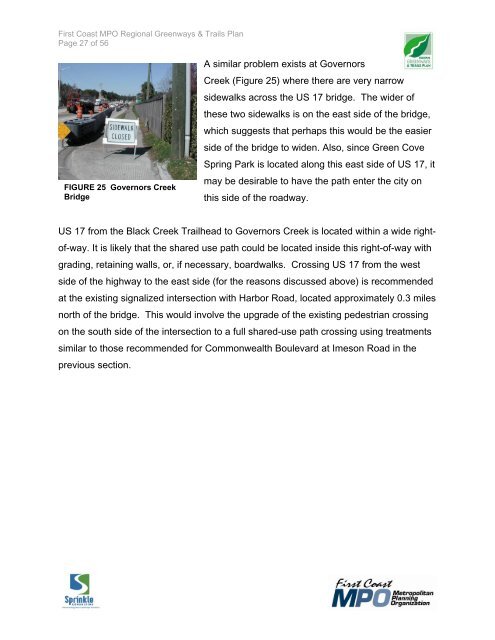
FIGURE 25 Governors Creek<br />
Bridge<br />
A similar problem exists at Governors<br />
Creek (Figure 25) where there are very narrow<br />
sidewalks across the US 17 bridge. The wider of<br />
these two sidewalks is on the east side of the bridge,<br />
which suggests that perhaps this would be the easier<br />
side of the bridge to widen. Also, since Green Cove<br />
Spring Park is located along this east side of US 17, it<br />
may be desirable to have the path enter the city on<br />
this side of the roadway.<br />
US 17 from the Black Creek Trailhead to Governors Creek is located within a wide rightof-way.<br />
It is likely that the shared use path could be located inside this right-of-way with<br />
grading, retaining walls, or, if necessary, boardwalks. Crossing US 17 from the west<br />
side of the highway to the east side (for the reasons discussed above) is recommended<br />
at the existing signalized intersection with Harbor Road, located approximately 0.3 miles<br />
north of the bridge. This would involve the upgrade of the existing pedestrian crossing<br />
on the south side of the intersection to a full shared-use path crossing using treatments<br />
similar to those recommended for Commonwealth Boulevard at Imeson Road in the<br />
previous section.