Regional Greenways & Trails Plan - North Florida TPO
Regional Greenways & Trails Plan - North Florida TPO
Regional Greenways & Trails Plan - North Florida TPO

Create successful ePaper yourself
Turn your PDF publications into a flip-book with our unique Google optimized e-Paper software.
First Coast MPO <strong>Regional</strong> <strong>Greenways</strong> & <strong>Trails</strong> <strong>Plan</strong><br />
Page 41 of 56<br />
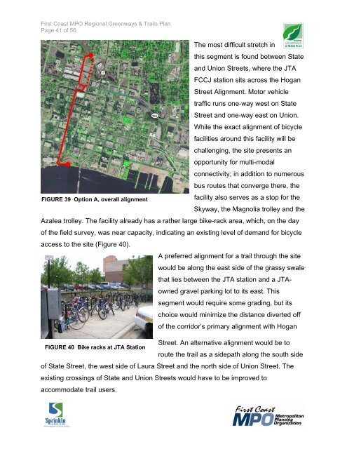
The most difficult stretch in<br />
this segment is found between State<br />
and Union Streets, where the JTA<br />
FCCJ station sits across the Hogan<br />
Street Alignment. Motor vehicle<br />
traffic runs one-way west on State<br />
Street and one-way east on Union.<br />
While the exact alignment of bicycle<br />
facilities around this facility will be<br />
challenging, the site presents an<br />
opportunity for multi-modal<br />
connectivity; in addition to numerous<br />
bus routes that converge there, the<br />
FIGURE 39 Option A, overall alignment<br />
facility also serves as a stop for the<br />
Skyway, the Magnolia trolley and the<br />
Azalea trolley. The facility already has a rather large bike-rack area, which, on the day<br />
of the field survey, was near capacity, indicating an existing level of demand for bicycle<br />
access to the site (Figure 40).<br />
A preferred alignment for a trail through the site<br />
would be along the east side of the grassy swale<br />
that lies between the JTA station and a JTAowned<br />
gravel parking lot to its east. This<br />
segment would require some grading, but its<br />
choice would minimize the distance diverted off<br />
of the corridor’s primary alignment with Hogan<br />
Street. An alternative alignment would be to<br />
FIGURE 40 Bike racks at JTA Station<br />
route the trail as a sidepath along the south side<br />
of State Street, the west side of Laura Street and the north side of Union Street. The<br />
existing crossings of State and Union Streets would have to be improved to<br />
accommodate trail users.