Mapping climate change - barriers and opportunities for action
Mapping climate change - barriers and opportunities for action
Mapping climate change - barriers and opportunities for action

Create successful ePaper yourself
Turn your PDF publications into a flip-book with our unique Google optimized e-Paper software.
It will have to be assessed whether future <strong>climate</strong> scenarios call <strong>for</strong> the establishment of coastal<br />
models <strong>for</strong> different extremes in order to identify the different implications <strong>climate</strong> <strong>change</strong> will<br />
have on coasts. The model calculations may <strong>for</strong>m the basis <strong>for</strong> planning future siting of new<br />
installations <strong>and</strong> buildings <strong>and</strong> <strong>for</strong> protecting existing ones.<br />
The Department of Geography <strong>and</strong> Geology (University of Copenhagen) <strong>and</strong> the Danish Coastal<br />
Authority are currently working to provide the required data <strong>and</strong> to develop a screening tool <strong>for</strong><br />
assessing erosion of Danish coasts. The Danish Coastal Authority has per<strong>for</strong>med very general<br />
calculations of the increased erosion following from <strong>climate</strong> <strong>change</strong>.<br />
The goal is that the screening tool will be able to provide knowledge about which areas will be or<br />
are already at threat of flooding, as well as the scope of the existing <strong>and</strong> potential erosion. This<br />
knowledge can be used as a basis <strong>for</strong> making decisions about how to adapt the Danish coastline to<br />
the <strong>climate</strong> of the future.<br />
Regulation<br />
The Coastal Protection Act, including the state's sovereignty over Danish territorial waters, <strong>and</strong> the<br />
recent amendment to the Planning Act (see the section on planning), provides <strong>for</strong> a legislative<br />
framework <strong>for</strong> timely adaptation of Danish coastal zones to the <strong>climate</strong> of the future.<br />
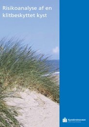
Danish coasts are generally covered by a 300-meter-wide beach- <strong>and</strong> dune-protection zone (in<br />
holiday home areas the zone is only 100m) within which it is prohibited to make any <strong>change</strong>s<br />
pursuant to the Nature Protection Act. On some stretches this zone may be smaller or may have<br />
lapsed all together. The course of the zone is evident from the digital cadastral map. In situations<br />
with considerable coastal erosion or accretion, or to mitigate the risk of s<strong>and</strong> drift, the Minister <strong>for</strong><br />
the Environment may revise the delineation of the beach- <strong>and</strong> dune-protection zones.<br />
The coastal zone, which is generally a 3-meter-wide zone along the shoreline in rural zones or in<br />
holiday home areas, is defined in the Planning Act. Installations <strong>and</strong> buildings may only be sited in<br />
the coastal zone when special planning or functional needs call <strong>for</strong> this.<br />
Danish municipalities are free to plan their <strong>climate</strong> <strong>change</strong> adaptation <strong>and</strong> pollution prevention at<br />
higher levels of the planning hierarchy. The municipal council can thus choose to exert their<br />
influence on the municipal development plans, so that these take <strong>climate</strong> <strong>change</strong> into account.<br />
Summary<br />
Changes in sea level <strong>and</strong> wind patterns may influence the risk of flooding <strong>and</strong> coastal erosion.<br />
Erosion <strong>and</strong> flooding are well known phenomena, which l<strong>and</strong> owners are already dealing with<br />
today. Individual coastal stretches are predicted to be affected by <strong>climate</strong> <strong>change</strong> to varying degrees,<br />
however the additional strain on Danish coasts up to 2050 is expected to be relatively modest.<br />
Developments are being monitored continuously in order to assess whether future <strong>climate</strong> scenarios<br />
call <strong>for</strong> the establishment of coastal models <strong>for</strong> different extremes in order to identify the<br />
implications <strong>climate</strong> <strong>change</strong> will have on coasts. On the basis of the Ministry of Transport's <strong>climate</strong><br />
<strong>change</strong> adaptation strategy, the Danish Coastal Authority will prepare an <strong>action</strong> plan <strong>for</strong> <strong>climate</strong><br />
<strong>change</strong> adaptation with targets <strong>and</strong> a milestone plan, as well as a "declaration of services"<br />
concerning the availability of the transport infrastructure. The Danish Coastal Authority has<br />
ongoing dialogue with the municipalities, <strong>and</strong> provides guidance <strong>for</strong> them. In connection with the<br />
implementation of the EU Floods Directive, in spring 2012 the Danish Coastal Authority visited the<br />
relevant municipalities.<br />
35