Environmental Impact Statement - Sonoma Land Trust
Environmental Impact Statement - Sonoma Land Trust
Environmental Impact Statement - Sonoma Land Trust

Create successful ePaper yourself
Turn your PDF publications into a flip-book with our unique Google optimized e-Paper software.
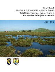
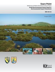
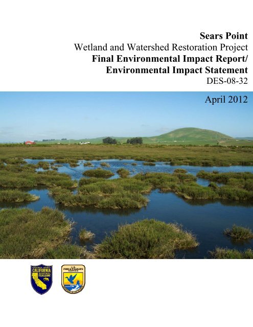
Sears Point<br />
Wetland and Watershed Restoration Project<br />
Final <strong>Environmental</strong> <strong>Impact</strong> Report/<br />
<strong>Environmental</strong> <strong>Impact</strong> <strong>Statement</strong><br />
DES-08-32<br />
April 2012
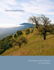
Cover Photo: Stephen Joseph for <strong>Sonoma</strong> <strong>Land</strong> <strong>Trust</strong>, 2004.
Sears Point Wetland and Watershed Restoration Project<br />
<strong>Sonoma</strong> County, California<br />
DraftFinal<br />
<strong>Environmental</strong> <strong>Impact</strong> Report/<br />
<strong>Environmental</strong> <strong>Impact</strong> <strong>Statement</strong><br />
State Clearinghouse #: 2007102037<br />
This <strong>Environmental</strong> <strong>Impact</strong> Report/<strong>Environmental</strong> <strong>Impact</strong> <strong>Statement</strong> (EIR/EIS) evaluates alternative approaches<br />
for the Sears Point Wetland and Watershed Restoration Project. In cooperation with California Department of<br />
Fish and Game (CDFG) and the U.S. Fish and Wildlife Service (USFWS), the <strong>Sonoma</strong> <strong>Land</strong> <strong>Trust</strong> (SLT) is<br />
seeking to restore tidal wetlands and rehabilitate diked wetlands and upland habitats for a wide range of species, to<br />
protect open space, and to develop public access and educational opportunities, including extending the San<br />
Francisco Bay Trail. This EIR/EIS provides a description of the alternatives being considered for the restoration of<br />
Sears Point, including the Proposed Project, and the No Action and Full Tidal Alternatives. The Project includes<br />
options for varying degrees of dredging and breach sizes, as well as Bay Trail alignments. This EIR/EIS will<br />
support decision making by the USFWS and DFG to approve the Proposed Project and to ensure compliance with<br />
the National <strong>Environmental</strong> Policy Act (NEPA), the California <strong>Environmental</strong> Quality Act (CEQA), and other<br />
pertinent laws and regulations.<br />
Federal, state, and local agencies and the public will have had an opportunity to comment on this<br />
document during a 45-day comment period from August 28, 2009 to October 132, 2009.<br />
Prepared by:<br />
U.S. Fish & Wildlife Service<br />
San Pablo Bay National Wildlife Refuge<br />
7715 Lakeville Highway<br />
Petaluma, CA 94954<br />
Contact: Christy SmithDon Brubaker<br />
707/769-4200<br />
California Department of Fish & Game<br />
Central Coast Region<br />
P.O. Box 47<br />
Yountville, CA 94599<br />
Contact: Greg Martinelli<br />
<strong>Sonoma</strong> <strong>Land</strong> <strong>Trust</strong><br />
966 <strong>Sonoma</strong> Avenue<br />
Santa Rosa, CA 95404<br />
Contact: John BrosnanJulian Meisler<br />
707/526 – 6930<br />
August 2009<br />
April 2012
U.S. Fish and Wildlife Service and California Department of Fish and Game. 20092012. Sears Point<br />
Wetland and Watershed Restoration Project <strong>Environmental</strong> <strong>Impact</strong> Report/<strong>Environmental</strong> <strong>Impact</strong> <strong>Statement</strong>.<br />
Draft Final. August April. Draft prepared with support of ICF Jones & Stokes. Sacramento, California.<br />
Final prepared with support of Ducks Unlimited, Rancho Cordova, California and GAIA Consulting, Inc.,<br />
Napa, California.
Contents<br />
List of Tables ............................................................................................ ix<br />
List of Figures ...........................................................................................xii<br />
Acronyms & Abbreviations.......................................................................xiv<br />
Executive Summary .................................................................................................. ES-1<br />
Project Overview.................................................................................. ES-1<br />
Goals and Objectives........................................................................... ES-2<br />
Project Goals ................................................................................. ES-2<br />
Project Objectives.......................................................................... ES-3<br />
Alternatives.......................................................................................... ES-4<br />
Initial Alternatives Development .................................................... ES-4<br />
Alternatives Considered for Evaluation in the EIR/EIS .................. ES-5<br />
Action Alternatives Analyzed in the EIR/EIS.................................. ES-5<br />
Partial-Tidal Wetland Restoration (Proposed<br />
Project)..................................................................................... ES-5<br />
Full-Tidal Restoration Alternative............................................. ES-6<br />
<strong>Environmental</strong> Consequences............................................................. ES-6<br />
Cumulative <strong>Impact</strong>s ................................................................. ES-6<br />
Significant and Unavoidable <strong>Impact</strong>s....................................... ES-7<br />
Irreversible and Irretrievable Commitment of<br />
Resources................................................................................ ES-7<br />
Relationship between Short-Term Uses of the<br />
Environment and the Maintenance and<br />
Enhancement of Long-Term Productivity................................. ES-8<br />
Areas of Controversy........................................................................... ES-8<br />
Chapter 1 Introduction, Purpose and Need .........................................................1-1<br />
Introduction.............................................................................................1-1<br />
Project Background ................................................................................1-1<br />
Location and Setting .........................................................................1-1<br />
Background.......................................................................................1-2<br />
Project Founders ..............................................................................1-4<br />
Disposition of Sears Point Properties ...............................................1-4<br />
State and Federal Agency Sponsors......................................................1-6<br />
Overview of the National <strong>Environmental</strong> Policy Act and the<br />
California <strong>Environmental</strong> Quality Act ......................................................1-6<br />
Project Purpose/Objectives ....................................................................1-7<br />
<strong>Statement</strong> of Objectives ...................................................................1-7<br />
Need for Project................................................................................1-8<br />
Project Goals ..........................................................................................1-9<br />
Sears Point Wetland and Watershed Restoration<br />
Project Final <strong>Environmental</strong> <strong>Impact</strong><br />
Report/<strong>Environmental</strong> <strong>Impact</strong> <strong>Statement</strong><br />
i<br />
April 2012
California Department of Fish and Game<br />
U.S. Fish and Wildlife Service<br />
Table of Contents<br />
Relationship of the Project to Local, Regional, and National<br />
Plans.....................................................................................................1-10<br />
San Francisco Bay Plan .................................................................1-10<br />
San Francisco Estuary Project Comprehensive<br />
Conservation and Management Plan .............................................1-11<br />
San Francisco Estuary Baylands Ecosystem Goals<br />
Project.............................................................................................1-11<br />
San Francisco Bay Joint Venture Implementation<br />
Strategy ..........................................................................................1-12<br />
<strong>Sonoma</strong> County General Plan and Zoning Ordinance ...................1-12<br />
Bay Trail Plan and <strong>Sonoma</strong> Bay Trail Corridor Plan.......................1-13<br />
Public Involvement................................................................................1-13<br />
Restoration Plan Development .......................................................1-13<br />
NEPA/CEQA...................................................................................1-14<br />
Scoping...........................................................................................1-14<br />
Notice of Preparation and Notice of Intent......................................1-14<br />
Distribution and Review of this Draft EIR/EIS.................................1-15<br />
Other Changes to the Draft EIR/EIS...............................................1-15<br />
List of Local, State, and Federal Permits..............................................1-17<br />
Organization of this EIR/EIS.................................................................1-18<br />
Chapter 2 Alternatives ...........................................................................................2-1<br />
Introduction.............................................................................................2-1<br />
Alternatives Development.......................................................................2-1<br />
Initial Alternatives Development .......................................................2-1<br />
NEPA/CEQA Alternatives Development...........................................2-2<br />
Description of Alternatives Evaluated in Detail.......................................2-3<br />
Overview...........................................................................................2-3<br />
No-Action Alternative ........................................................................2-3<br />
Partial-Tidal Wetland Restoration (Proposed Project) ......................2-5<br />
Full-Tidal Restoration Alternative....................................................2-34<br />
Operation and Maintenance ...........................................................2-42<br />
Alternatives Considered but Not Evaluated in Detail............................2-46<br />
Muted-Tidal Alternative...................................................................2-46<br />
Full Equilibrium Dredging Alternative..............................................2-46<br />
Bayfront Spur Trail Alternative........................................................2-47<br />
Dickson Ranch Alternative..............................................................2-47<br />
Off-Site Alternative..........................................................................2-49<br />
Chapter 3<br />
Section 3.1<br />
Affected Environment and <strong>Environmental</strong><br />
Consequences ......................................................................................3-1<br />
Introduction.............................................................................................3-1<br />
Geology, Soils, and Paleontology....................................................3.1-1<br />
Introduction..........................................................................................3.1-1<br />
Affected Environment ..........................................................................3.1-1<br />
Data Sources .................................................................................3.1-1<br />
Regulatory Setting .........................................................................3.1-2<br />
Regional Topography ....................................................................3.1-4<br />
Sears Point Geology and Paleontology .........................................3.1-5<br />
Sears Point Wetland and Watershed Restoration<br />
Project Final <strong>Environmental</strong> <strong>Impact</strong><br />
Report/<strong>Environmental</strong> <strong>Impact</strong> <strong>Statement</strong><br />
ii<br />
April 2012
California Department of Fish and Game<br />
U.S. Fish and Wildlife Service<br />
Table of Contents<br />
Soils ...............................................................................................3.1-5<br />
Geologic Hazards ..........................................................................3.1-7<br />
<strong>Land</strong>slides and Other Slope Stability Hazards ..............................3.1-9<br />
<strong>Environmental</strong> Consequences and Mitigation Measures...................3.1-10<br />
Approach and Methods................................................................3.1-10<br />
<strong>Impact</strong> Mechanisms.....................................................................3.1-13<br />
Thresholds of Significance...........................................................3.1-13<br />
<strong>Impact</strong>s and Mitigation Measures ................................................3.1-13<br />
Section 3.2<br />
Section 3.3<br />
Section 3.4<br />
Surface-Water Hydrology, Tidal Hydraulics, and<br />
Sedimentation....................................................................................3.2-1<br />
Introduction..........................................................................................3.2-1<br />
Affected Environment ..........................................................................3.2-1<br />
Data Sources .................................................................................3.2-1<br />
Regulatory Setting .........................................................................3.2-2<br />
Topography....................................................................................3.2-4<br />
Climate...........................................................................................3.2-5<br />
Regional Hydrology .......................................................................3.2-5<br />
Surface-Water Drainage Patterns..................................................3.2-8<br />
Flood Zoning and Risk...................................................................3.2-9<br />
<strong>Environmental</strong> Consequences and Mitigation Measures...................3.2-10<br />
Approach and Methods................................................................3.2-10<br />
<strong>Impact</strong> Mechanisms.....................................................................3.2-10<br />
Thresholds of Significance...........................................................3.2-11<br />
<strong>Impact</strong>s and Mitigation Measures ................................................3.2-12<br />
Water Quality......................................................................................3.3-1<br />
Introduction..........................................................................................3.3-1<br />
Affected Environment ..........................................................................3.3-1<br />
Data Sources .................................................................................3.3-1<br />
Regulatory Setting .........................................................................3.3-1<br />
Regional Water Quality Conditions................................................3.3-6<br />
Site-Specific Water Quality Conditions ..........................................3.3-8<br />
Groundwater Quality......................................................................3.3-9<br />
Wetland Water Quality.................................................................3.3-10<br />
<strong>Environmental</strong> Consequences and Mitigation Measures...................3.3-10<br />
Approach and Methods................................................................3.3-10<br />
<strong>Impact</strong> Mechanisms.....................................................................3.3-11<br />
Thresholds of Significance...........................................................3.3-13<br />
<strong>Impact</strong>s and Mitigation Measures ................................................3.3-13<br />
Public Health and Safety...................................................................3.4-1<br />
Introduction..........................................................................................3.4-1<br />
Affected Environment ..........................................................................3.4-1<br />
Data Sources .................................................................................3.4-1<br />
Regulatory Setting ........................................................................ 3.4-2<br />
Mosquito Breeding and Control .....................................................3.4-2<br />
Mosquito Control Criteria and Methods .........................................3.4-3<br />
Mosquito Breeding Habitats in the Project Area ............................3.4-4<br />
Public Safety..................................................................................3.4-4<br />
Sears Point Wetland and Watershed Restoration<br />
Project Final <strong>Environmental</strong> <strong>Impact</strong><br />
Report/<strong>Environmental</strong> <strong>Impact</strong> <strong>Statement</strong><br />
iii<br />
April 2012
California Department of Fish and Game<br />
U.S. Fish and Wildlife Service<br />
Table of Contents<br />
<strong>Environmental</strong> Consequences and Mitigation Measures.....................3.4-5<br />
Approach and Methods..................................................................3.4-5<br />
<strong>Impact</strong> Mechanisms...................................................................... 3.4-5<br />
Thresholds of Significance.............................................................3.4-6<br />
<strong>Impact</strong>s and Mitigation Measures ..................................................3.4-6<br />
Section 3.5 Biological Resources ........................................................................3.5-1<br />
Introduction..........................................................................................3.5-1<br />
Affected Environment ..........................................................................3.5-1<br />
Data Sources .................................................................................3.5-1<br />
Regulatory Setting ........................................................................ 3.5-2<br />
Biological Communities ...............................................................3.5-11<br />
Special-Status Species................................................................3.5-18<br />
<strong>Environmental</strong> Consequences and Mitigation Measures...................3.5-25<br />
Approach and Methodology.........................................................3.5-25<br />
<strong>Impact</strong> Mechanisms.....................................................................3.5-27<br />
Thresholds of Significance...........................................................3.5-28<br />
<strong>Impact</strong>s and Mitigation Measures ................................................3.5-29<br />
Section 3.6 <strong>Land</strong> Use and Public Utilities ...........................................................3.6-1<br />
Introduction..........................................................................................3.6-1<br />
Affected Environment ..........................................................................3.6-1<br />
Data Sources .................................................................................3.6-1<br />
<strong>Land</strong> Use at the Project Site ..........................................................3.6-1<br />
Adjacent <strong>Land</strong> Use and Ownership ...............................................3.6-2<br />
Regulatory Setting .........................................................................3.6-2<br />
<strong>Land</strong> Use, Zoning, and Utilities......................................................3.6-7<br />
<strong>Environmental</strong> Consequences and Mitigation Measures.....................3.6-8<br />
Approach and Methods..................................................................3.6-8<br />
<strong>Impact</strong> Mechanisms.......................................................................3.6-8<br />
Thresholds of Significance.............................................................3.6-9<br />
<strong>Impact</strong>s and Mitigation Measures ..................................................3.6-9<br />
Section 3.7 Agricultural Resources .....................................................................3.7-1<br />
Introduction..........................................................................................3.7-1<br />
Affected Environment ..........................................................................3.7-1<br />
Data Sources .................................................................................3.7-1<br />
Regulatory Setting .........................................................................3.7-2<br />
<strong>Environmental</strong> Consequences and Mitigation Measures.....................3.7-7<br />
Approach and Methods..................................................................3.7-7<br />
<strong>Impact</strong> Mechanisms.......................................................................3.7-7<br />
Thresholds of Significance.............................................................3.7-8<br />
<strong>Impact</strong>s and Mitigation Measures ..................................................3.7-8<br />
Section 3.8 Recreation ..........................................................................................3.8-1<br />
Introduction..........................................................................................3.8-1<br />
Affected Environment ..........................................................................3.8-1<br />
Data Sources .................................................................................3.8-1<br />
Regulatory Setting .........................................................................3.8-1<br />
Recreational Facilities in the Project Site Vicinity ..........................3.8-3<br />
Sears Point Wetland and Watershed Restoration<br />
Project Final <strong>Environmental</strong> <strong>Impact</strong><br />
Report/<strong>Environmental</strong> <strong>Impact</strong> <strong>Statement</strong><br />
iv<br />
April 2012
California Department of Fish and Game<br />
U.S. Fish and Wildlife Service<br />
Table of Contents<br />
<strong>Environmental</strong> Consequences and Mitigation Measures.....................3.8-4<br />
Approach and Methods..................................................................3.8-4<br />
<strong>Impact</strong> Mechanisms.......................................................................3.8-4<br />
Thresholds of Significance.............................................................3.8-4<br />
<strong>Impact</strong>s and Mitigation Measures ..................................................3.8-5<br />
Section 3.9 Hazardous Substances and Waste ..................................................3.9-1<br />
Introduction..........................................................................................3.9-1<br />
Affected Environment ..........................................................................3.9-1<br />
Data Sources .................................................................................3.9-1<br />
Regulatory Overview .....................................................................3.9-2<br />
<strong>Environmental</strong> Consequences and Mitigation Measures.....................3.9-7<br />
Approach and Methods..................................................................3.9-7<br />
<strong>Impact</strong> Mechanisms ......................................................................3.9-8<br />
Thresholds of Significance.............................................................3.9-9<br />
<strong>Impact</strong>s and Mitigation Measures ..................................................3.9-9<br />
Section 3.10 Traffic and Transportation..............................................................3.10-1<br />
Introduction........................................................................................3.10-1<br />
Affected Environment ........................................................................3.10-1<br />
Data Sources ...............................................................................3.10-1<br />
Regulatory Setting .......................................................................3.10-1<br />
Roadway Network........................................................................3.10-2<br />
Level of Service Definitions, Standards, and<br />
Significance Criteria.....................................................................3.10-3<br />
Existing Levels of Service on Affected Roadways.......................3.10-4<br />
Transit..........................................................................................3.10-6<br />
Bikeways......................................................................................3.10-6<br />
Planned Improvements................................................................3.10-6<br />
<strong>Environmental</strong> Consequences and Mitigation Measures...................3.10-7<br />
Approach and Methods................................................................3.10-7<br />
Construction Assumptions ...........................................................3.10-7<br />
<strong>Impact</strong> Mechanisms...................................................................3.10-11<br />
Thresholds of Significance.........................................................3.10-11<br />
<strong>Impact</strong>s and Mitigation Measures ..............................................3.10-11<br />
Section 3.11 Air Quality.........................................................................................3.11-1<br />
Introduction........................................................................................3.11-1<br />
Affected Environment ........................................................................3.11-1<br />
Data Sources ...............................................................................3.11-1<br />
Climate and Topography .............................................................3.11-1<br />
Criteria Pollutants ........................................................................3.11-2<br />
Federal and State Ambient Air Quality Standards .......................3.11-7<br />
State and Federal Attainment Status...........................................3.11-7<br />
Existing Air Quality Conditions.....................................................3.11-8<br />
Sensitive Receptors.....................................................................3.11-9<br />
Regulatory Setting .......................................................................3.11-9<br />
<strong>Environmental</strong> Consequences and Mitigation Measures.................3.11-13<br />
Approach and Methods..............................................................3.11-13<br />
<strong>Impact</strong> Mechanisms...................................................................3.11-14<br />
Sears Point Wetland and Watershed Restoration<br />
Project Final <strong>Environmental</strong> <strong>Impact</strong><br />
Report/<strong>Environmental</strong> <strong>Impact</strong> <strong>Statement</strong><br />
v<br />
April 2012
California Department of Fish and Game<br />
U.S. Fish and Wildlife Service<br />
Table of Contents<br />
Thresholds of Significance.........................................................3.11-15<br />
<strong>Impact</strong>s and Mitigation Measures ..............................................3.11-17<br />
Section 3.12 Noise.................................................................................................3.12-1<br />
Introduction........................................................................................3.12-1<br />
Affected Environment ........................................................................3.12-1<br />
Noise Terminology.......................................................................3.12-1<br />
Noise-Sensitive <strong>Land</strong> Uses..........................................................3.12-2<br />
Existing Noise Conditions ............................................................3.12-3<br />
Regulatory Setting .............................................................................3.12-3<br />
Federal.........................................................................................3.12-3<br />
State ............................................................................................3.12-4<br />
Local ............................................................................................3.12-4<br />
<strong>Environmental</strong> Consequences and Mitigation Measures...................3.12-5<br />
Approach and Methods................................................................3.12-5<br />
<strong>Impact</strong> Mechanisms.....................................................................3.12-5<br />
Thresholds of Significance...........................................................3.12-7<br />
<strong>Impact</strong>s and Mitigation Measures ................................................3.12-7<br />
Section 3.13 Cultural Resources..........................................................................3.13-1<br />
Introduction........................................................................................3.13-1<br />
Methodology for Assessment of Existing Conditions.........................3.13-1<br />
Area of Potential Effects ..............................................................3.13-1<br />
Data Sources ...............................................................................3.13-2<br />
Field Survey.................................................................................3.13-3<br />
Determination of Significance of Cultural Resources ........................3.13-4<br />
Cultural Resource Significance Criteria .......................................3.13-5<br />
Affected Environment ........................................................................3.13-6<br />
Prehistory.....................................................................................3.13-6<br />
Ethnography ................................................................................3.13-7<br />
History..........................................................................................3.13-8<br />
Summary of Known Cultural Resources in the APE..................3.13-11<br />
<strong>Environmental</strong> Consequences and Mitigation Measures.................3.13-13<br />
Approach and Methods..............................................................3.13-13<br />
<strong>Impact</strong> Mechanisms...................................................................3.13-14<br />
Thresholds of Significance.........................................................3.13-14<br />
<strong>Impact</strong>s and Mitigation Measures ..............................................3.13-15<br />
Section 3.14 Aesthetics.........................................................................................3.14-1<br />
Introduction........................................................................................3.14-1<br />
Affected Environment ........................................................................3.14-1<br />
Data Sources ...............................................................................3.14-1<br />
Regional Setting ..........................................................................3.14-1<br />
Regulatory Setting .......................................................................3.14-2<br />
Viewer Groups .............................................................................3.14-2<br />
Key Viewpoints ............................................................................3.14-3<br />
<strong>Environmental</strong> Consequences and Mitigation Measures...................3.14-4<br />
Approach and Methodology.........................................................3.14-4<br />
<strong>Impact</strong> Mechanisms.....................................................................3.14-5<br />
Thresholds of Significance...........................................................3.14-5<br />
Sears Point Wetland and Watershed Restoration<br />
Project Final <strong>Environmental</strong> <strong>Impact</strong><br />
Report/<strong>Environmental</strong> <strong>Impact</strong> <strong>Statement</strong><br />
vi<br />
April 2012
California Department of Fish and Game<br />
U.S. Fish and Wildlife Service<br />
Table of Contents<br />
<strong>Impact</strong>s and Mitigation Measures ................................................3.14-5<br />
Section 3.15 <strong>Environmental</strong> Justice ....................................................................3.15-1<br />
Introduction........................................................................................3.15-1<br />
Affected Environment ........................................................................3.15-1<br />
Data Sources ...............................................................................3.15-1<br />
Regional Setting ..........................................................................3.15-1<br />
Regulatory Context ......................................................................3.15-3<br />
<strong>Environmental</strong> Consequences and Mitigation Measures...................3.15-4<br />
Approach and Methodology.........................................................3.15-4<br />
<strong>Impact</strong> Mechanisms.....................................................................3.15-4<br />
Thresholds of Significance...........................................................3.15-4<br />
<strong>Impact</strong>s and Mitigation Measures ................................................3.15-5<br />
Chapter 4<br />
Consultation and Other Requirements...............................................4-1<br />
Compliance with Applicable Laws, Policies, and Plans and<br />
Regulatory Framework ...........................................................................4-1<br />
Introduction .......................................................................................4-1<br />
Federal Endangered Species Act ....................................................4-1<br />
California Endangered Species Act ..................................................4-2<br />
National Historic Preservation Act ....................................................4-3<br />
Farmland Protection Policy Act.........................................................4-4<br />
Executive Order 11988—Floodplain Management...........................4-4<br />
Executive Order 11990—Protection of Wetlands .............................4-5<br />
Executive Order 12898—<strong>Environmental</strong> Justice ..............................4-5<br />
NEPA/CEQA <strong>Environmental</strong>ly Preferable/<strong>Environmental</strong>ly<br />
Superior Alternative ............................................................................... 4-6<br />
Cumulative <strong>Impact</strong>s ................................................................................4-8<br />
Requirements for Analysis................................................................4-8<br />
Approach to Cumulative <strong>Impact</strong> Analysis .........................................4-8<br />
Geology, Soils, and Paleontology...................................................4-10<br />
Surface-Water Hydrology and Tidal Hydraulics..............................4-10<br />
Water Quality ..................................................................................4-11<br />
Public Health...................................................................................4-13<br />
Biological Resources ......................................................................4-13<br />
<strong>Environmental</strong> Justice.................................................................... 4-13<br />
Cultural Resources ........................................................................ 4-14<br />
<strong>Land</strong> Use and Public Utilities ..........................................................4-14<br />
Agricultural Resources....................................................................4-14<br />
Recreation ......................................................................................4-15<br />
Hazardous Substances and Waste ................................................4-16<br />
Traffic and Transportation...............................................................4-16<br />
Air Qualtiy .......................................................................................4-17<br />
Noise...............................................................................................4-17<br />
Aesthetics .......................................................................................4-18<br />
Significant and Unavoidable <strong>Impact</strong>s....................................................4-18<br />
Irreversible and Irretrievable Commitment of Resources .....................4-18<br />
Relationship between Short-Term Uses of the Environment<br />
and the Maintenance and Enhancement of Long-Term<br />
Productivity ...........................................................................................4-18<br />
Sears Point Wetland and Watershed Restoration<br />
Project Final <strong>Environmental</strong> <strong>Impact</strong><br />
Report/<strong>Environmental</strong> <strong>Impact</strong> <strong>Statement</strong><br />
vii<br />
April 2012
California Department of Fish and Game<br />
U.S. Fish and Wildlife Service<br />
Table of Contents<br />
Growth-Inducing <strong>Impact</strong>s......................................................................4-19<br />
Requirements in CEQA and NEPA.................................................4-19<br />
<strong>Impact</strong>s on Growth..........................................................................4-19<br />
Chapter 5 Public Involvement and Scoping ........................................................5-1<br />
Project Scoping.......................................................................................5-1<br />
Public Views and Responses During the Scoping Process....................5-1<br />
Public Comments on the Draft EIR/EIS................................................. 5-2<br />
Preparation of the Final EIR/EIS ............................................................5-3<br />
NEPA and CEQA Process............................................................... 5-4<br />
Chapter 6 List of Preparers ...................................................................................6-1<br />
Chapter 7 References ............................................................................................7-1<br />
Appendices<br />
Appendix A Public Comments on the Draft EIR/EIS<br />
Appendix B Response to Public Comments on the Draft EIR/EIS<br />
Appendix C Proposed Bay Trail At-Grade and Undercrossings<br />
Appendix D Example Monitoring Plan<br />
Appendix E<br />
Appendix F<br />
List of Plant Names<br />
List of Fish and Wildlife Names<br />
Appendix G Mitigation and Monitoring Report<br />
Sears Point Wetland and Watershed Restoration<br />
Project Final <strong>Environmental</strong> <strong>Impact</strong><br />
Report/<strong>Environmental</strong> <strong>Impact</strong> <strong>Statement</strong><br />
viii<br />
April 2012
California Department of Fish and Game<br />
U.S. Fish and Wildlife Service<br />
Table of Contents<br />
Tables<br />
On Page<br />
ES-1<br />
Summary of <strong>Impact</strong>s and Mitigation Measures....... Follows Page ES-8<br />
1-1 List of Local, State, and Federal Permits and Other<br />
Approvals Expected for the Sears Point Wetlands and<br />
Watershed Restoration Project................................... Follows Page1-6<br />
2-1 Preliminary Cost Estimates for FPRP Alternatives 1<br />
and 3.................................................................................................2-2<br />
2-2 Alternatives Considered in this EIR/EIS .................... Follows Page 2-3<br />
2-3 Summary of Trail Segment Design Features..................................2-27<br />
3.1-1 Maximum Credible Earthquake and 30-Year<br />
Earthquake Probabilities for Principal Active Faults ......................3.1-8<br />
3.1-2 Society of Vertebrate Paleontology’s Recommended<br />
Treatment for Paleontological Resources, by Sensitivity<br />
Category ......................................................................................3.1-12<br />
3.2-1 Tide Information at the Petaluma River Entrance..........................3.2-7<br />
3.3-1 Waters in the San Pablo Bay and Tributaries to the Bay<br />
Listed as Impaired by the San Francisco Bay Regional<br />
Water Quality Control Board under Section 303(d) of<br />
the Clean Water Act.......................................................................3.3-7<br />
3.3-2 Areas in the San Pablo Bay that Have Significant<br />
Sediment Contamination ...............................................................3.3-8<br />
3.4-1 Potential Mosquito Breeding Habitat in the Project Area...............3.4-4<br />
3.5-1 Habitat Types in the Project Area ................................................3.5-12<br />
3.5-2 Special-Status Species Occurring in or with Potential to<br />
Occur at or near the Sears Point Restoration<br />
Project Site .......................................................... Follows Page 3.5-18<br />
Sears Point Wetland and Watershed Restoration<br />
Project Final <strong>Environmental</strong> <strong>Impact</strong><br />
Report/<strong>Environmental</strong> <strong>Impact</strong> <strong>Statement</strong><br />
ix<br />
April 2012
California Department of Fish and Game<br />
U.S. Fish and Wildlife Service<br />
Table of Contents<br />
3.5-3 Species Protection Windows. ......................................................3.5-26<br />
3.5-4 Net effect of Action Alternatives on Habitat Types at<br />
the Project Site. ...........................................................................3.5-30<br />
3.7-1 Acreages of Oat Hay Harvested during 2005-2008 in<br />
North Bay Counties........................................................................3.7-6<br />
3.8-1 Upland Game Bird and Waterfowl Hunting Facilities<br />
within 50 Miles of the Project Site................................................3.8-10<br />
3.8-2 Shooting Facilities within 50 Miles of the Project Site..................3.8-11<br />
3.10-1 V/C Ratio, Delay, and Traffic Flow Conditions for LOS<br />
Designations ................................................................................3.10-4<br />
3-10-2 Trip Generation Estimates for Worst-Case Project-<br />
Related Construction Traffic ......................................................3.10-10<br />
3.11-1 Ambient Air Quality Standards Applicable in<br />
California .....................................................................................3.11-3<br />
3.11-2 Federal and State Attainment Status for <strong>Sonoma</strong><br />
County .........................................................................................3.11-8<br />
3.11-3 Ambient Air Quality Monitoring Data Measured at the<br />
San Rafael Monitoring Station ............................. Follows Page 3.11-8<br />
3.11-4 Thresholds of Significance for Project Operations.....................3.11-16<br />
3.11-5 Maximum Year 1 Emissions from Construction<br />
Activities for the Proposed Project (tons/year)...........................3.11-19<br />
3.11-6 Maximum Year 2 Emissions in tons/year from<br />
Construction Activities for the Proposed Project........................3.11-19<br />
3.11-7 Maximum Year 3 Emissions in tons/year from<br />
Construction Activities for the Proposed Project........................3.11-20<br />
3.11-8 Maximum Year 1 Emissions in tons/year from<br />
Construction Activities for the Full-Tidal Alternative ..................3.11-22<br />
3.11-9 Maximum Year 2 Emissions in tons/year from<br />
Construction Activities for the Full-Tidal Alternative ..................3.11-22<br />
3.11-10 Maximum Year 3 Emissions in tons/year from<br />
Construction Activities for the Full-Tidal Alternative ..................3.11-23<br />
3.12-1 Noise Level Performance Standards ...........................................3.12-4<br />
Sears Point Wetland and Watershed Restoration<br />
Project Final <strong>Environmental</strong> <strong>Impact</strong><br />
Report/<strong>Environmental</strong> <strong>Impact</strong> <strong>Statement</strong><br />
x<br />
April 2012
California Department of Fish and Game<br />
U.S. Fish and Wildlife Service<br />
Table of Contents<br />
3.12-2 Construction Equipment Noise Emission Levels .........................3.12-6<br />
3.15-1 Community Population Demographics ........................................3.15-2<br />
3.15-2 Community Economic Demographics..........................................3.15-2<br />
3.15-3 Community Population Demographics for San Pablo<br />
Bay Shoreline Communities ........................................................3.15-3<br />
4-1 Past, Present, and Reasonably Foreseeable Projects<br />
Reviewed for Cumulative <strong>Impact</strong>s ....................................................4-9<br />
Sears Point Wetland and Watershed Restoration<br />
Project Final <strong>Environmental</strong> <strong>Impact</strong><br />
Report/<strong>Environmental</strong> <strong>Impact</strong> <strong>Statement</strong><br />
xi<br />
April 2012
California Department of Fish and Game<br />
U.S. Fish and Wildlife Service<br />
Table of Contents<br />
Figures<br />
At End of Each Section<br />
1-1 Regional Location of Project Site<br />
1-2 Project Site<br />
1-3 <strong>Land</strong> Ownership in the Project Vicinity<br />
1-4a-d<br />
Existing <strong>Land</strong> Uses in the Project Vicinity<br />
2-1 Overview of Proposed Project<br />
2-2 Detailed View of Proposed Project<br />
2-3 Project Levee Configurations<br />
2-4 Perimeter Levee Modifications and Pilot Channels<br />
2-5 Marsh Mounds<br />
2-6 Sidecast Ridges<br />
2-7 Mound/Sidecast Ridge Evolution<br />
2-8 Habitat Levees with Pannes<br />
2-9 Soil Remediation and Disposal<br />
2-10 Possible Bay Trail Alignments<br />
2-11 Overview of Full Tidal Alternative<br />
2-12 Detailed View of Full Tidal Alternative (RR to SR37)<br />
2-13 Full-Tidal Levee Configurations<br />
2-14 Full-Tidal Bridge/Culvert Configurations<br />
Sears Point Wetland and Watershed Restoration<br />
Project Final <strong>Environmental</strong> <strong>Impact</strong><br />
Report/<strong>Environmental</strong> <strong>Impact</strong> <strong>Statement</strong><br />
xii<br />
April 2012
California Department of Fish and Game<br />
U.S. Fish and Wildlife Service<br />
Table of Contents<br />
3.2-1 Surface Waters Located in and around the Project<br />
Area<br />
3.5-1 Habitat Categories in the Project Area<br />
3.5-2 Schematic of Habitats by Tide Levels<br />
3.5-3 Fishing Areas and Fish Habitats in San Pablo Bay<br />
3.5-4 Habitat Categories in the Project Area Under the<br />
Proposed Project<br />
3.5-5 Habitat Categories in the Project Area Under the Full<br />
Tidal Alternative<br />
3.6-1 Zoning Designations at the Project Site<br />
3.7-1 Important Farmland Categories in the Project Area<br />
3.8-1 Hunting and Shooting Facilities in a 50-mile Radius of<br />
the Project Site<br />
3.13-1 Area of Potential Effects (APE) for Cultural Resources<br />
3.14-1 Viewpoints<br />
3.14-2 Views of the Sears Point Project Site from Publicly<br />
Accessible Viewpoints<br />
Sears Point Wetland and Watershed Restoration<br />
Project Final <strong>Environmental</strong> <strong>Impact</strong><br />
Report/<strong>Environmental</strong> <strong>Impact</strong> <strong>Statement</strong><br />
xiii<br />
April 2012
California Department of Fish and Game<br />
U.S. Fish and Wildlife Service<br />
Table of Contents<br />
Acronyms & Abbreviations<br />
µg/m 3<br />
AB<br />
ABAG<br />
ABAG<br />
ACHP<br />
afbm<br />
alf<br />
Alquist-Priolo Act<br />
ASTM<br />
BA<br />
BCDC<br />
BMPs<br />
BO<br />
BP<br />
BR<br />
BTI<br />
CAA<br />
CAAQS<br />
California PG<br />
Cal-OSHA<br />
CAP<br />
CARB<br />
CBC<br />
CCMP<br />
CCR<br />
CDFG<br />
CDM<br />
CDM<br />
CEQ<br />
CEQA<br />
CERCLA<br />
CESA<br />
CFR<br />
cfs<br />
CGS<br />
CH 4<br />
micrograms per cubic meter<br />
Assembly Bill<br />
Association of Bay Area Governments<br />
Association of Bay Area Governments<br />
Advisory Council on Historic Preservation<br />
Artificial fill over Bay Mud<br />
Artificial fill, levee<br />
California’s Alquist-Priolo Earthquake Fault Zoning Act<br />
American Society for Testing and Materials<br />
Biological Assessment<br />
San Francisco Bay Conservation and Development Commission<br />
Best Management Practices<br />
Biological Opinion<br />
before present<br />
Biotic Resources Combining District<br />
Bacillus thuringiensis var. israelensis<br />
Federal Clean Air Act<br />
California Ambient Air Quality Standards<br />
State-licensed professional geologist<br />
California Occupational Safety and Health Administration<br />
2000 Clean Air Plan<br />
California Air Resources Board<br />
California Building Code<br />
Comprehensive Conservation and Management Plan<br />
California Code of Regulations<br />
California Department of Fish and Game<br />
Camp Dresser and McKee, Inc.<br />
Council on <strong>Environmental</strong> Quality<br />
California <strong>Environmental</strong> Quality Act<br />
Comprehensive <strong>Environmental</strong> Response, Compensation, and<br />
Liability Act<br />
California Endangered Species Act<br />
Code of Federal Regulations<br />
Cubic feet per second<br />
California Geological Survey<br />
Methane<br />
Sears Point Wetland and Watershed Restoration<br />
Project Final <strong>Environmental</strong> <strong>Impact</strong><br />
Report/<strong>Environmental</strong> <strong>Impact</strong> <strong>Statement</strong><br />
xiv<br />
April 2012
California Department of Fish and Game<br />
U.S. Fish and Wildlife Service<br />
Table of Contents<br />
CMP<br />
CNDDB<br />
CNEL<br />
CNPS<br />
CO<br />
CO 2<br />
CRHR<br />
CWA<br />
CY<br />
dB<br />
dBA<br />
DMMO<br />
DOC<br />
DPRP<br />
DPS<br />
DTSC<br />
DWR<br />
EHT<br />
EIR<br />
EIS<br />
EPA<br />
ESA<br />
F2<br />
FHWA<br />
FMMP<br />
FPPA<br />
FPRP<br />
FR<br />
FTA<br />
General Permit<br />
GHGs<br />
Goals Project<br />
GP<br />
GP 2020<br />
H<br />
ha<br />
HABS<br />
Highway 37 State Route 37<br />
hp<br />
Horsepower<br />
Coastal management plan<br />
California Natural Diversity Data Base<br />
community noise equivalent level<br />
California Native Plant Society<br />
carbon monoxide<br />
carbon dioxide<br />
California Register of Historical Resources<br />
Federal Clean Water Act<br />
Cubic yards<br />
Decibel<br />
A-weighted decibel<br />
San Francisco Dredged Material Management Office<br />
California Department of Conservation<br />
Draft Preliminary Restoration Plan<br />
Distinct Population Segment<br />
California Department of Toxic Substances Control<br />
California Department of Water Resources<br />
Extreme high tide<br />
<strong>Environmental</strong> impact report<br />
<strong>Environmental</strong> impact statement<br />
U.S. <strong>Environmental</strong> Protection Agency<br />
Endangered Species Act<br />
Floodplain Combining District<br />
Federal Highway Administration<br />
Farmland Mapping and Monitoring Program<br />
Farmland Protection Policy Act<br />
Final Preliminary Restoration Plan<br />
Federal Register<br />
Federal Transit Administration<br />
General Permit for Stormwater Discharges Associated with<br />
Construction Activity<br />
Greenhouse gases<br />
San Francisco Bay Area Wetlands Ecosystem Goals Project<br />
General Plan<br />
1989 <strong>Sonoma</strong> County General Plan<br />
Horizontal<br />
Hectares<br />
Historic American Buildings Survey<br />
Sears Point Wetland and Watershed Restoration<br />
Project Final <strong>Environmental</strong> <strong>Impact</strong><br />
Report/<strong>Environmental</strong> <strong>Impact</strong> <strong>Statement</strong><br />
xv<br />
April 2012
California Department of Fish and Game<br />
U.S. Fish and Wildlife Service<br />
Table of Contents<br />
HSWA<br />
Federal Hazardous and Solid Waste Amendments<br />
HWCA<br />
Hazardous Waste Control Act<br />
I-80 Interstate 80<br />
IFI<br />
Important Farmland Inventory<br />
IPCC<br />
Intergovernmental Panel on Climate Change<br />
ITE<br />
Institute of Transportation Engineers<br />
km<br />
Kilometers<br />
KW hours/year kilowatt hours per year<br />
L dn<br />
day-night sound level<br />
LEA<br />
<strong>Land</strong> Extensive Agriculture<br />
L eq<br />
equivalent sound level<br />
LESA<br />
<strong>Land</strong> Evaluation and Site Assessment<br />
L min and L max<br />
minimum and maximum sound levels<br />
LOS<br />
Level of service<br />
LTMS<br />
Long Term Management Strategy<br />
L xx<br />
percentile-exceeded sound levels<br />
MAD<br />
Mosquito abatement district<br />
MBTA<br />
Migratory Bird Treaty Act<br />
MCE<br />
Maximum credible earthquake<br />
MEI<br />
Maximally Exposed Individual<br />
MHHW<br />
Mean higher high water<br />
MHW<br />
Mean high water<br />
MLLW<br />
Mean lower low water<br />
MLW<br />
Mean low water<br />
MMT<br />
2 million metric tons<br />
MMT-CO 2 eq.<br />
Million Metric tons of carbon dioxide equivalent<br />
MOA<br />
memorandum of agreement<br />
mph<br />
Miles per hour<br />
msl<br />
Mean sea level<br />
MSMVCD<br />
Marin-<strong>Sonoma</strong> Mosquito and Vector Control District<br />
MTL<br />
Mean tide level<br />
N 2 O<br />
nitrous oxide<br />
NAAQS<br />
National Ambient Air Quality Standards<br />
NAHC<br />
Native American Heritage Commission<br />
NAVD North American vertical datum of 1988<br />
NCRA<br />
North Coast Railroad Authority<br />
NEPA<br />
National <strong>Environmental</strong> Policy Act<br />
NHPA<br />
National Historic Preservation Act<br />
NMFS<br />
National Marine Fisheries Service<br />
NO 2<br />
nitrogen dioxide<br />
Sears Point Wetland and Watershed Restoration<br />
Project Final <strong>Environmental</strong> <strong>Impact</strong><br />
Report/<strong>Environmental</strong> <strong>Impact</strong> <strong>Statement</strong><br />
xvi<br />
April 2012
California Department of Fish and Game<br />
U.S. Fish and Wildlife Service<br />
Table of Contents<br />
NOAA<br />
NOA<br />
NOC<br />
NOI<br />
NOP<br />
NOS<br />
NO X<br />
NPDES<br />
NPJV<br />
NPPA<br />
NRCS<br />
NWIC<br />
NWP<br />
NWPRR<br />
NWRSIA<br />
OES<br />
OTD<br />
OZD<br />
PAHs<br />
PAHs<br />
PM10<br />
PM2.5<br />
ppm<br />
PRC<br />
PRMD<br />
Project or Proposed<br />
Project<br />
Proposition 65<br />
Q-cs<br />
Qhbm<br />
RCRA<br />
RGP<br />
RIM<br />
ROW<br />
RWQCB<br />
SCDEH<br />
Secretary<br />
SF&NP<br />
SFBJV<br />
SHPO<br />
National Oceanic & Atmospheric Administration<br />
Notice of Availibility<br />
Notice of Completion<br />
Notice of Intent<br />
Notice of Preparation<br />
National Ocean Survey<br />
oxides of nitrogen<br />
National Pollutant Discharge Elimination System<br />
North Point Joint Venture<br />
California Native Plant Protection Act<br />
Natural Resources Conservation Service<br />
Northwest Information Center<br />
Nationwide permit<br />
Northwestern Pacific Railroad<br />
1997 National Wildlife Refuge System Improvement Act<br />
California Office of Emergency Services<br />
Offer to Dedicate<br />
Official Zoning Database<br />
polynuclear aromatic hydrocarbons<br />
polynuclear aromatic hydrocarbons<br />
particulate matter smaller than 10 microns or less in diameter<br />
particulate matter smaller than 2.5 microns or less in diameter<br />
parts per million<br />
Public Resources Code<br />
Permit and Resource Management Department<br />
Partial-Tidal Alternative<br />
Safe Drinking Water and Toxic Enforcement Act<br />
Quaternary silt, clay, sand, and gravel<br />
Holocene San Francisco Bay mud<br />
Resource Conservation and Recovery Act<br />
Regional general permit<br />
Regional Implementation Manual<br />
Right of way<br />
Regional Water Quality Review Board<br />
<strong>Sonoma</strong> County Department of <strong>Environmental</strong> Health<br />
Secretary of the Interior<br />
San Francisco & North Pacific Railroad<br />
San Francisco Bay Joint Venture<br />
State Historic Preservation Officer<br />
Sears Point Wetland and Watershed Restoration<br />
Project Final <strong>Environmental</strong> <strong>Impact</strong><br />
Report/<strong>Environmental</strong> <strong>Impact</strong> <strong>Statement</strong><br />
xvii<br />
April 2012
California Department of Fish and Game<br />
U.S. Fish and Wildlife Service<br />
Table of Contents<br />
SIPs<br />
SLIC<br />
SLT<br />
SMART<br />
SO 2<br />
SPBNWR<br />
SR<br />
State Water Board<br />
Superfund Act<br />
SVP<br />
SVRR<br />
SWPPP<br />
TAC<br />
UBC<br />
UCMP<br />
state implementation plans<br />
Spills, Leaks, Investigations, and Cleanup<br />
<strong>Sonoma</strong> <strong>Land</strong> <strong>Trust</strong><br />
<strong>Sonoma</strong>-Marin Area Rail Transit<br />
sulfur dioxide<br />
San Pablo Bay National Wildlife Refuge<br />
Scenic Resources<br />
State Water Resources Control Board<br />
1980 Comprehensive <strong>Environmental</strong> Response, Compensation, and<br />
Liability Act<br />
Society of Vertebrate Paleontology<br />
<strong>Sonoma</strong> Valley Railroad<br />
Storm Water Pollution Prevention Plan<br />
Toxic air contaminants<br />
Uniform Building Code<br />
University of California, Berkeley Museum of Paleontology<br />
US-101 U.S. Highway 101<br />
USACE<br />
U.S. Army Corps of Engineers<br />
USC<br />
U.S. Code<br />
USDA<br />
U.S. Department of Agriculture<br />
USFWS<br />
U.S. Fish and Wildlife Service<br />
USGS<br />
U.S. Geological Survey<br />
V<br />
Vertical<br />
V/C<br />
Volume to capacity<br />
VOH<br />
Valley Oak Habitat Combining District<br />
Williamson Act California <strong>Land</strong> Conservation Act<br />
WWR<br />
Wetlands and Water Resources, Inc<br />
Sears Point Wetland and Watershed Restoration<br />
Project Final <strong>Environmental</strong> <strong>Impact</strong><br />
Report/<strong>Environmental</strong> <strong>Impact</strong> <strong>Statement</strong><br />
xviii<br />
April 2012
Executive Summary<br />
This summary provides a brief overview of the Sears Point Wetland and<br />
Watershed Restoration Project; project goal and objectives; restoration<br />
alternatives; environmental consequences of the proposed project; public issues<br />
and areas of controversy; evaluation of the alternatives in terms of the project<br />
goals and objectives; and a description of the process for selecting the preferred<br />
alternative.<br />
Project Overview<br />
In cooperation with California Department of Fish and Game (CDFG) and the<br />
U.S. Fish and Wildlife Service (USFWS), the <strong>Sonoma</strong> <strong>Land</strong> <strong>Trust</strong> (SLT) is<br />
seeking to restore tidal wetlands and rehabilitate diked wetlands and upland<br />
habitats for a wide range of species, to protect open space, and to develop public<br />
access and educational opportunities, including extending the San Francisco Bay<br />
Trail.<br />
The 2,327-acre Sears Point property (Project Site) is located in southern <strong>Sonoma</strong><br />
County, just north of San Pablo Bay. The project site is comprised of two large<br />
properties, the North Point Joint Venture (NPJV) parcel and the Dickson Ranch<br />
parcel, which are situated on the edge of San Pablo Bay between the mouth of the<br />
Petaluma River and Tolay Creek.<br />
<strong>Sonoma</strong> <strong>Land</strong> <strong>Trust</strong> acquired the Dickson Ranch and North Point Joint Venture<br />
properties in late 2004 and early 2005. Since 2004, SLT has held title to the Sears<br />
Point properties while it conducts restoration planning. SLT’s wetland restoration<br />
planning has been guided in part by the requirements and management policies<br />
and objectives of the properties’ long-term landowners, CDFG and the USFWS.<br />
Based on the each agency’s respective management policies and the potential to<br />
achieve management efficiencies with adjacent properties, CDFG and USFWS<br />
have agreed to split future ownership and management. Given that the transfer of<br />
lands will eventually come under their jurisdiction, the USFWS and CDFG<br />
require this document to comply with the National <strong>Environmental</strong> Policy Act<br />
(NEPA) and California <strong>Environmental</strong> Quality Act (CEQA) in order to be able<br />
consider authorization of the proposed actions.<br />
This EIR/EIS describes the features of the Project and restoration alternatives,<br />
including the No-Project Alternative, under which current management no<br />
restoration of the project site would occur continue and existing conditions would<br />
Sears Point Wetland and Watershed Restoration<br />
Project Final <strong>Environmental</strong> <strong>Impact</strong><br />
Report/<strong>Environmental</strong> <strong>Impact</strong> <strong>Statement</strong><br />
ES-1<br />
April 2012<br />
7
California Department of Fish and Game<br />
U.S. Fish and Wildlife Service<br />
Executive Summary<br />
remain generally unchanged. As required by NEPA and CEQA, it evaluates the<br />
potential impacts of the Project and all alternatives.<br />
The purpose of the Sears Point Wetland and Watershed Restoration Project is to:<br />
• reestablish aquatic habitats and hydrologic connections including restoration<br />
of tidal wetlands in San Pablo Bay for the benefit of the larger San Francisco<br />
Bay estuary system<br />
• to provide public recreational opportunities not currently available at the site;<br />
and<br />
• to contribute to the recovery of numerous species protected under the federal<br />
Endangered Species Act (ESA) and the California Endangered Species Act<br />
(CESA).<br />
Approximately 90% of the original tidal wetlands of San Francisco Bay have<br />
been destroyed. This destruction is the result of the diking and filling of the tidal<br />
wetlands for purposes of agriculture, urban development, and salt production.<br />
The project would serve to restore aquatic habitats in the larger estuary system by<br />
reestablishing a variety of sub-tidal and inter-tidal habitats and reconnecting<br />
these and upland habitats to open water habitats in San Pablo Bay. It would also<br />
serve to enhance and manage non-tidal marsh habitats on agricultural lands.<br />
Overall, the project would meet many of the restoration needs identified in the<br />
Bay Ecosystem Habitat Goals Report, as well as the habitat needs established in<br />
the San Francisco Bay Joint Venture Implementation Strategy. At the same time,<br />
the project also seeks to retain agricultural uses at the site to the extent feasible.<br />
As such, the project does not propose to restore the site entirely; rather, it seeks<br />
to balance the broader goals of ecosystem restoration with the preservation of<br />
existing compatible land uses.<br />
Restoration of tidal wetland habitat at Sears Point will follow the plan as set by<br />
the Bay Ecosystem Habitat Goals Report. The Goals Report is an informational<br />
document that recommends the types, areal extent, and distribution of habitats<br />
needed to sustain diverse and healthy ecosystems in the San Francisco Bay<br />
estuary system.<br />
Goal and Objectives<br />
Project Goals<br />
The project goals are:<br />
1. For the diked baylands portion of the site, to implement the<br />
recommendations of the Baylands Ecosystem Habitat Goals Report (Goals<br />
Project 1999), including:<br />
• Preserve and restore a large continuous band of tidal marsh along the<br />
bayfront between the Petaluma River and Tolay Creek.<br />
Sears Point Wetland and Watershed Restoration<br />
Project Final <strong>Environmental</strong> <strong>Impact</strong><br />
Report/<strong>Environmental</strong> <strong>Impact</strong> <strong>Statement</strong><br />
ES-2<br />
April 2012
California Department of Fish and Game<br />
U.S. Fish and Wildlife Service<br />
Executive Summary<br />
• Establish a natural wetlands-uplands transition to the greatest extent<br />
possible and provide an upland buffer outside the baylands boundary.<br />
• Establish managed marsh or enhanced seasonal pond habitats on<br />
agricultural baylands that are not restored to tidal marsh.<br />
• In baylands that are not presently restored to tidal marsh, implement the<br />
project in such a way that future phasing of tidal restoration activities is<br />
possible.<br />
2. For the watershed, the goal is to improve conditions for native plants, birds,<br />
mammals, reptiles, and amphibians through the following approaches:<br />
• Control exotic plant and animal species<br />
• Enhance existing streams, wetlands, and riparian areas<br />
• Improve range management practices<br />
• Support viable rangeland practices<br />
3. To ensure the conservation of these lands as open space in perpetuity and<br />
public benefit.<br />
4. To protect cultural and historic resources on the site and to promote<br />
culturally important plant species restoration where possible.<br />
5. To provide recreational opportunities, public access (including the Bay<br />
Trail), and environmental education compatible with protecting and restoring<br />
ecological and cultural resources.<br />
6. To develop a stewardship program that maximizes ecological functions and<br />
minimizes the need for active management and maintenance of the site over<br />
the long term.<br />
7. To ensure public health and safety, including flood protection for Highway<br />
37, Lakeville Highway, Reclamation Road, and the SMART railroad right of<br />
way (ROW), and mosquito abatement.<br />
Project Objectives<br />
• to restore natural estuarine ecosystems on diked baylands,<br />
• to enhance and manage existing watershed resources (e.g. rivers or streams<br />
that drains into the same major waterbody) for ecological benefits, and<br />
• to retain viable agricultural uses and seasonal wetlands to the maximum<br />
extent practical while providing public access and recreational and<br />
Sears Point Wetland and Watershed Restoration<br />
Project Final <strong>Environmental</strong> <strong>Impact</strong><br />
Report/<strong>Environmental</strong> <strong>Impact</strong> <strong>Statement</strong><br />
ES-3<br />
April 2012
California Department of Fish and Game<br />
U.S. Fish and Wildlife Service<br />
Executive Summary<br />
educational opportunities compatible with ecological and cultural resources<br />
protection.<br />
Alternatives<br />
Initial Alternatives Development<br />
Over the course of the development of the Conceptual Restoration Plan (WWR<br />
2005a), DPRP (WWR 2006), and FPRP (WWR 2007), SLT initially developed<br />
three alternatives for the diked baylands portion of the Site: (1) restored tidal<br />
marsh to Highway 37—the Full Tidal Alternative; (2) restored tidal marsh to the<br />
rail line and muted tides between the rail line and Highway 37—the Muted Tidal<br />
Alternative; and (3) restored tidal marsh to the rail line and retained agriculture<br />
and pasture between the rail line and Highway 37 with improved practices to<br />
promote seasonal wetlands—the Non-Tidal Alternative.<br />
SLT initially considered the Full Tidal Alternative as its preferred project to be<br />
evaluated in this EIR/EIS. However, after consideration of several factors, the<br />
SLT shifted its preferred project to the Non-Tidal Alternative, referred to as the<br />
Partial-Tidal Alternative (Project or Proposed Project) in this EIR/EIS. This<br />
evolution reflects input received from the Project’s stakeholder group and the<br />
pending reactivation of the SMART rail line through the site. In March 2006,<br />
SLT held a public meeting to present the DPRP. The majority of stakeholder<br />
comments received at and after the meeting suggested retaining existing<br />
agricultural practices north of the rail line, enhancing existing seasonal wetlands<br />
on those lands, and clarifying public access plans.<br />
In June 2006, SLT learned that the North Coast Railway Authority (NCRA) was<br />
entering into contracts to resume freight service across the site as early as<br />
summer 2007. 1 Following a subsequent meeting with SMART representatives,<br />
SLT learned that restoration activities could not interrupt or impede rail service<br />
on the line. This new constraint rendered implementation of the full tidal<br />
alternative very difficult due to exceedingly high design and construction costs in<br />
the short-term. The Non-Tidal Alternative) was subsequently selected as the<br />
preferred project in the FPRP, in part because it significantly cuts implementation<br />
costs over the full tidal alternative. SLT also assumes that rail line activity on the<br />
existing SMART line will not preclude future restoration efforts in the project<br />
area, including any activities that may be undertaken at a later date to restore full<br />
tidal action north of the rail line. The Final EIR/EIS provides the revisions<br />
resulting from comments received on the Draft EIR/EIS and updated project<br />
design.<br />
1 Rail service was reestablished effective July 13, 2011.<br />
Sears Point Wetland and Watershed Restoration<br />
Project Final <strong>Environmental</strong> <strong>Impact</strong><br />
Report/<strong>Environmental</strong> <strong>Impact</strong> <strong>Statement</strong><br />
ES-4<br />
April 2012
California Department of Fish and Game<br />
U.S. Fish and Wildlife Service<br />
Executive Summary<br />
Alternatives Considered for Evaluation in the EIR/EIS<br />
The USFWS and CDFG considered the comments provided during scoping, the<br />
SLT’s development and evaluation of initial alternatives, and the key<br />
environmental impacts of the project to develop a preliminary list of alternatives<br />
for consideration in this EIR/EIS.<br />
• No Action Alternative<br />
• Partial-Tidal Wetland Restoration (Proposed Project) with<br />
Dredging/Breaching Options and Bay Trail Options<br />
• Full-Tidal Wetland Restoration<br />
• Muted-Tidal Wetland Restoration<br />
• Full Equilibrium Dredging Alternative<br />
• Dickson Ranch Alternative<br />
• Bayfront Spur Trail Alternative<br />
• Off-Site Alternative<br />
These alternatives were screened for their ability to meet the project purpose and<br />
need, for technical, logistical, and financial feasibility, and for their ability to<br />
avoid or substantially reduce one or more significant impacts of the Project.<br />
The result of that screening is that two alternatives, Partial-Tidal Wetland<br />
Restoration (Proposed Project) and Full-Tidal Wetland Restoration, described<br />
below, were determined to meet the purposes/objectives and need, be feasible,<br />
and to provide a range of environmental impacts and thus constitute a reasonable<br />
range of alternatives for NEPA and CEQA evaluation.<br />
Action Alternatives Analyzed in the EIR/EIS<br />
In addition to the No Action Alternative, two action alternatives were analyzed in<br />
the EIS/EIR<br />
Partial-Tidal Wetland Restoration (Proposed Project)<br />
The Project is based on the Non-Tidal Alternative presented in the Sears Point<br />
Wetlands and Watershed Restoration Project Final Preliminary Plan<br />
(FebruaryWWR 2007). The Project would:<br />
• restore 970955 acres of tidal marsh;<br />
• improve tidal exchange in Tolay Creek along the eastern edge of the project<br />
boundary;<br />
• preserve and enhance 106-acre area of non-tidal seasonal wetland while<br />
maintaining existing agriculture between the SMART line and Highway 37;<br />
Sears Point Wetland and Watershed Restoration<br />
Project Final <strong>Environmental</strong> <strong>Impact</strong><br />
Report/<strong>Environmental</strong> <strong>Impact</strong> <strong>Statement</strong><br />
ES-5<br />
April 2012
California Department of Fish and Game<br />
U.S. Fish and Wildlife Service<br />
Executive Summary<br />
• provide public recreation access south and possibly north of Highway 37;<br />
enhance 40 acres of non-tidal seasonal wetland north of Highway 37; and<br />
• enhance 15.5 acres of additional breeding habitat for the California redlegged<br />
frog, including creation of 0.586 acres of excavation in the floodplain<br />
near the northern project boundary.<br />
Summaries of the major restoration components of the Project can be found in<br />
Chapter 2.<br />
Full-Tidal Restoration Alternative<br />
This alternative is based on the Full-Tidal Alternative presented in the Sears<br />
Point Wetlands and Watershed Restoration Project Final Preliminary Plan<br />
(FebruaryWWR 2007). This alternative would:<br />
• restore 1,33552 acres of tidal marsh;<br />
• improve tidal exchange in Tolay Creek along the eastern edge of the project<br />
boundary;<br />
• provide public recreation access south and possibly north of Highway 37;<br />
enhance 40 acres of non-tidal seasonal wetland north of Highway 37; and<br />
• enhance 15.5 acres of additional breeding habitat, including creation of 0.586<br />
acres of excavation in the floodplain, for the California red-legged frog near<br />
the northern project boundary.<br />
Sections summarizing the major restoration components of the Full-Tidal<br />
Restoration Alternative can be found in Chapter 2.<br />
<strong>Environmental</strong> Consequences<br />
This EIR/EIS evaluates the environmental consequences of the restoration<br />
alternatives. A summary of the impact analysis for these alternatives is presented<br />
at the end of this chapter (Table ES-1). In addition, CEQA and NEPA require a<br />
review of other issues summarized below.<br />
Cumulative <strong>Impact</strong>s<br />
The Final EIS/EIR considered a list of projects that could potentially combine<br />
with the Sears Point project to create cumulative impacts. It also considered the<br />
projections associated with the <strong>Sonoma</strong> County General Plan, Bay Trail Plan,<br />
and <strong>Sonoma</strong> Bay Trail Corridor Plan. A number of the projects considered are<br />
wetland restoration projects in areas that interface with San Francisco Bay that<br />
involve sediment control, improved aquatic and upland habitat, invasive species<br />
removal, trail and roadway improvements, and/or flood reduction actions. These<br />
Sears Point Wetland and Watershed Restoration<br />
Project Final <strong>Environmental</strong> <strong>Impact</strong><br />
Report/<strong>Environmental</strong> <strong>Impact</strong> <strong>Statement</strong><br />
ES-6<br />
April 2012
California Department of Fish and Game<br />
U.S. Fish and Wildlife Service<br />
Executive Summary<br />
projects have primarily beneficial impacts, and would combine with the Sears<br />
Point project to create cumulatively beneficial impacts. Other projects, such as<br />
maintenance dredging, were also considered.<br />
Resource areas with cumulatively beneficial impacts included hydrology,<br />
flooding, vegetation communities, and wetlands (by improving site function).<br />
Resource areas with no potential for contribution to cumulative effects include<br />
public health, hazardous substances and waste, population and housing, and<br />
environmental justice.biology and air quality (greenhouse gas emissions).<br />
The project would have less-than-considerable cumulative contributions related<br />
to construction-related effects on air quality, geology, surface water hydrology<br />
and tidal hydraulics, water quality, public health, agricultural resources,<br />
recreation, land use and utilities, recreation, hazards and hazardous materials,<br />
traffic, air quality, and noise, cultural resources, aesthetics, and environmental<br />
justice.<br />
One significant adverse cumulative impact was identified, which related to the<br />
loss of the historic Dickson Ranch property.<br />
For a detailed discussion of cumulative impacts, please refer to Chapter 4.<br />
Significant and Unavoidable <strong>Impact</strong>s<br />
For the proposed project, there are several no significant impacts that currently<br />
proposed mitigation may not mitigate to a less-than-significant level.<br />
• <strong>Impact</strong> CR-2: Destruction of Significant Historic Resource (Dickson<br />
Ranch)<br />
• <strong>Impact</strong> HYD-6: Potential <strong>Impact</strong>s on Tidal Muting in Tolay Creek<br />
(Breach/Dredge Options 1 and 2 only)<br />
• <strong>Impact</strong> BIO-17: Potential for Construction-Related Mortality of Special-<br />
Status Fish Species (Green Sturgeon only)<br />
Irreversible and Irretrievable Commitment of<br />
Resources<br />
The restoration alternatives would result in the irretrievable commitment of fossil<br />
fuels and other energy sources needed to build, operate, and maintain the<br />
wetlands. The restoration of the site to wetlands, however, is not considered an<br />
irreversible commitment because the landscape could again be converted to other<br />
land uses in the future. In sum, the project does not involve converting the land to<br />
urban land uses, which tend to be irreversible.<br />
Sears Point Wetland and Watershed Restoration<br />
Project Final <strong>Environmental</strong> <strong>Impact</strong><br />
Report/<strong>Environmental</strong> <strong>Impact</strong> <strong>Statement</strong><br />
ES-7<br />
April 2012
California Department of Fish and Game<br />
U.S. Fish and Wildlife Service<br />
Executive Summary<br />
Relationship between Short-Term Uses of the<br />
Environment and the Maintenance and Enhancement<br />
of Long-Term Productivity<br />
Short-term uses of the environment that would occur with restoration include the<br />
impacts on existing wetlands and habitat and those from other constructionrelated<br />
activities. However, in the long term, the site is expected to be<br />
substantially more productive for habitat and wildlife values.<br />
Areas of Controversy<br />
During the scoping process, CDFG held a public meeting to introduce interested<br />
members of the public to the project and to solicit public input. The meeting was<br />
held on October 15, 2007 in conjunction with the publication of NOP. The NEPA<br />
scoping period officially began with the publication of the NOI in the Federal<br />
Register on January 25, 2008. Prior to publication of the NOI, informal scoping<br />
was conducted in conjunction with SLT and CDFG, and a scoping notice was<br />
distributed to applicable agencies and members of the public. The public scoping<br />
period for this document ended February 28, 2008.<br />
Public comments received both at the meeting and in response to the scoping<br />
notice for the NOI were recorded for consideration during the restoration<br />
planning process. In addition, participants were encouraged to submit written<br />
comments to the project sponsors during the public comment period. The scoping<br />
process and other consultations undertaken for the proposed project are discussed<br />
in Chapter 5, Public Involvement and Scoping.<br />
Key issues of public concern regarding the proposed restoration that were<br />
identified during the scoping process include the following.<br />
• <strong>Sonoma</strong> Marin Area Rail Transit<br />
• San Francisco Bay Trail<br />
• Black Point Sports Club<br />
The Draft EIR/EIS was published on August 28, 2009, and public comments<br />
were accepted during the public comment period from August 28, 2009 to<br />
October 13, 2009. In addition, a public hearing on the project was held on<br />
September 22, 2009. Public comments received at the meeting were recorded and<br />
participants were encouraged to submit written comments to the project sponsors<br />
during the public comment period.<br />
The key issue of public concern regarding the Proposed Project that was<br />
identified during the public review process for the Draft EIR/EIS consisted of the<br />
fate of the Black Point Sports Club. All public comment (written and oral) that<br />
were received during the public comment period are included in Appendix A.<br />
Appendix B provides the responses to the public comments. All comments were<br />
considered in the preparation of this Final EIR/EIS.<br />
Sears Point Wetland and Watershed Restoration<br />
Project Final <strong>Environmental</strong> <strong>Impact</strong><br />
Report/<strong>Environmental</strong> <strong>Impact</strong> <strong>Statement</strong><br />
ES-8<br />
April 2012
Table ES-1. Summary of <strong>Impact</strong>s and Mitigation Measures Page 1 of 142<br />
<strong>Impact</strong> Significance Determination Mitigation Measure<br />
Geology, Soils, and Seismicity<br />
No-Action Alternative<br />
No <strong>Impact</strong><br />
Proposed Project/Full-Tidal Alternative<br />
<strong>Impact</strong> GEO-1: Potential Damage to Proposed<br />
Facilities Resulting from Strong Seismic Ground<br />
Shaking, Liquefaction, or Other Types of Seismic-<br />
Related Ground Failure<br />
<strong>Impact</strong> GEO-2: Settlement of Proposed Facilities as a<br />
Result of Static Fill Loads on Compressible Substrate<br />
Materials<br />
<strong>Impact</strong> GEO-3: Potential for Increased Exposure of<br />
Persons or Structures to <strong>Land</strong>slide Hazards<br />
<strong>Impact</strong> GEO- 4: Potential Short-Term Increase in<br />
Erosion and Sedimentation Rates during Construction<br />
<strong>Impact</strong> GEO-5: Contribution to Substantial Loss of<br />
Topsoil<br />
<strong>Impact</strong> GEO-6: Potential Damage to Proposed<br />
Facilities Resulting from Location on Expansive Soil<br />
<strong>Impact</strong> GEO-7: Potential for Proposed Levee to<br />
Damage Adjacent Facilities<br />
Less than Significant None Required N/A<br />
Less than Significant None Required N/A<br />
Less than Significant None Required N/A<br />
Less than Significant None Required N/A<br />
Less than Significant None Required N/A<br />
Less than Significant None Required N/A<br />
Less than Significant None Required N/A<br />
<strong>Impact</strong> GEO-8: Damage to Paleontological Resources Significant Mitigation Measure GEO-MM-1: Conduct<br />
Preconstruction Survey, Salvage, and<br />
Protection<br />
Mitigation Measure GEO-MM-2: Notify a<br />
Qualified Professional Paleontologist if<br />
Remains are Found during Ground-<br />
Disturbing Activities<br />
Significance Determination<br />
with Mitigation Incorporation<br />
Less than Significant
Table ES-1. Continued Page 2 of 1412<br />
<strong>Impact</strong> Significance Determination Mitigation Measure<br />
Surface Water Hydrology, Tidal Hydraulics, and Sedimentation<br />
No-Action Alternative<br />
No <strong>Impact</strong><br />
Proposed Project/Full-Tidal Alternative<br />
<strong>Impact</strong> HYD-1: Potential <strong>Impact</strong>s from Tidal<br />
Flooding.<br />
<strong>Impact</strong> HYD-2: Potential Erosion and Sedimentation<br />
<strong>Impact</strong>s in the Tidal Basin.<br />
<strong>Impact</strong> HYD-3: Potential Changes in Tolay Creek<br />
Flood Risk.<br />
Less than Significant None Required N/A<br />
Less than Significant<br />
Less than SignificantBeneficial<br />
<strong>Impact</strong><br />
None RequiredMitigation Measure HYD-<br />
MM-1: Implement Erosion Protection<br />
Measures<br />
None Required<br />
<strong>Impact</strong> HYD-4: Consistency with Flood Zoning No <strong>Impact</strong> None Required N/A<br />
<strong>Impact</strong> HYD-5: Modification to San Pablo Bay Tidal<br />
Circulation<br />
<strong>Impact</strong> HYD-6: Modification to Tolay Creek<br />
Morphology and Sedimentation Processes<br />
<strong>Impact</strong> HYD-7: Modification to San Pablo Bay<br />
Morphology and Sedimentation Processes.<br />
Less than Significant None Required N/A<br />
Proposed Project: Significant and<br />
Unavoidable (Option 1 & 2)<br />
Less than Significant (Option 3)<br />
Full-Tidal: Significant<br />
Proposed Project: None Proposed (Option 1<br />
& 2); None Required (Option 3)<br />
Full Tidal: Mitigation Measure HYD-MM-<br />
2: Expand Tolay Creek Widening and<br />
Deepening to1: Avoid<br />
IncreasedUnacceptable Levels of Tidal<br />
Muting. in Tolay Creek<br />
Less than Significant None Required N/A<br />
Significance Determination<br />
with Mitigation Incorporation<br />
Less than SignificantN/A<br />
N/A<br />
Proposed Project:<br />
Significant and Unavoidable<br />
(Option 1 &2); N/A (Option<br />
3)<br />
Full-Tidal: Less than<br />
Significant
Table ES-1. Continued Page 3 of 1412<br />
<strong>Impact</strong> Significance Determination Mitigation Measure<br />
<strong>Impact</strong> HYD-8: <strong>Impact</strong> of Sea Level Rise on Marsh<br />
Formation and on Levee Protection<br />
Less than Significant<br />
Mitigation Measure HYD-MM-3: Monitor<br />
Sea Level Rise and Raise the Flood<br />
Protection Levee as Needed to Protect the<br />
SMART Line and the Agricultural <strong>Land</strong> East<br />
of the SMART Line<br />
Mitigation Measure HYD-MM-4: Monitor<br />
Marsh Formation and Consider Adaptive<br />
Management Actions to Maintain Tidal<br />
Marsh and/or Allow Inland Migration of the<br />
Tidal Marsh in Light of Ongoing Sea Level<br />
Rise.None Required.<br />
Significance Determination<br />
with Mitigation Incorporation<br />
N/A<br />
Less than Significant<br />
Water Quality<br />
No-Action Alternative<br />
No <strong>Impact</strong><br />
Proposed Project/Full-Tidal Alternative<br />
<strong>Impact</strong> WQ-1: Degradation of Surface Water and<br />
Sediment Quality due to release of Pollutants during<br />
construction.<br />
<strong>Impact</strong> WQ-2: Degradation of Surface Water and<br />
Sediment Quality due to Increase Methyl Mercury<br />
formation<br />
Significant<br />
Significant<br />
Mitigation Measure WQ-MM-1: Prepare<br />
and Implement Revised Corrective Action<br />
Plan for Sports Club Shooting Range Site.<br />
Mitigation Measure WQ-MM-21:<br />
Implement Water Quality Control Measures<br />
for Project Construction.<br />
Significant Mitigation Measure WQ-MM-3: 2:<br />
Development and Implement a Methyl<br />
Mercury Adaptive Management Plan<br />
<strong>Impact</strong> WQ-3: Degradation of Groundwater Quality Less than Significant None Required N/A<br />
<strong>Impact</strong> WQ-4: Changes in Dissolved Oxygen<br />
Concentration in Receiving Waters<br />
<strong>Impact</strong> WQ-5: Potential Turbidity <strong>Impact</strong>s due to<br />
Dredging and Placement of Dredged Material<br />
<strong>Impact</strong> WQ-6: Degradation of Water Quality due to<br />
Inundation of Formerly Drained Wetlands<br />
Less than Significant None Required N/A<br />
Significant<br />
Mitigation Measure WQ-MM-43:<br />
Implement Water Quality Control Measures<br />
for Project Dredging<br />
Less than Significant None Required N/A<br />
Less than Significant<br />
Less than Significant<br />
Less than Significant<br />
Less than Significant
Table ES-1. Continued Page 4 of 1412<br />
<strong>Impact</strong> Significance Determination Mitigation Measure<br />
<strong>Impact</strong> WQ-7: Degradation of Water Quality due to<br />
Potential Leaching of Contaminants from Dredged<br />
Material.<br />
<strong>Impact</strong> WQ-8: Degradation of Water Quality due to<br />
Contaminated Soils in Proposed Tidal Basin.<br />
<strong>Impact</strong> WQ-9: Degradation of Water Quality due to<br />
Residual Herbicides in Proposed Tidal Basin<br />
<strong>Impact</strong> WQ-10: Potential for Changes in Salinity<br />
Levels within Tolay Creek<br />
Public Health and Safety<br />
No-Action Alternative<br />
No <strong>Impact</strong><br />
Proposed Project/Full-Tidal Alternative<br />
<strong>Impact</strong> PH-1: Increased Potential of Mosquito<br />
Breeding Habitat<br />
Less than Significant None Required N/A<br />
Less than Significant None Required N/A<br />
Less than Significant None Required N/A<br />
Less than Significant None Required N/A<br />
Proposed Project: Significant<br />
Full-Tidal alternative: Less than<br />
Significant<br />
Proposed Project: Mitigation Measure PH-<br />
MM-1: Coordinate Water Management,<br />
Restoration Design, Construction, and<br />
Operation Activities with MSMVCD.<br />
Full-Tidal: None Required<br />
Significance Determination<br />
with Mitigation Incorporation<br />
Proposed Project: Less than<br />
Significant<br />
Full-Tidal: N/A<br />
<strong>Impact</strong> PH-2: Risk to the Public or Structures<br />
Resulting from Flooding Hazards or Impediment of<br />
Inadequate Access for Emergency Response Service<br />
Less than Significant None Required N/A
Table ES-1. Continued Page 5 of 1412<br />
<strong>Impact</strong> Significance Determination Mitigation Measure<br />
Biological Resource<br />
No-Action Alternative<br />
No <strong>Impact</strong><br />
Proposed Project/Full-Tidal Alternative<br />
<strong>Impact</strong> BIO-1: Loss of Agricultural <strong>Land</strong>s<br />
<strong>Impact</strong> BIO-2: Loss of Seasonal Wetlands (including<br />
Vernal- Pools, Seasonally Saturated Annual Grasslands<br />
and Farmed Seasonal Wetlands).<br />
Beneficial <strong>Impact</strong> None Required N/A<br />
Less than Significant None Required N/A<br />
<strong>Impact</strong> BIO-3: Loss of Tidal Salt Marsh Significant Mitigation Measure BIO-MM-1: Ensure<br />
Establishment of Tidal Salt Marsh Habitat<br />
within 5 years of Project Completion.<br />
<strong>Impact</strong> BIO-4: Loss of Special-Status Plant<br />
Populations<br />
<strong>Impact</strong> BIO-5: Introduction or Spread of Noxious<br />
Weeds during Construction, Operations and<br />
Maintenance.<br />
<strong>Impact</strong> BIO-6: Potential for Construction-Related<br />
<strong>Impact</strong>s to Salt Marsh Harvest Mice<br />
Significant<br />
Significant<br />
Significant<br />
Mitigation Measure BIO-MM-2a: Survey<br />
for Special Status Plants.<br />
Mitigation Measure BIO-MM-2b: Replace<br />
Special Status Plants.<br />
Mitigation Measure BIO-MM-3a: Prevent<br />
Spread of Perennial Pepperweed and Other<br />
Invasive Weeds to Unifested Areas.<br />
Mitigation Measure BIO-MM-3b: Monitor<br />
Restoration Sites for and Control Infestation<br />
by Invasive Non-Native Plants.<br />
Mitigation Measure BIO-MM-4: Remove<br />
Salt Marsh Harvest Mouse Habitat and<br />
Place Barrier Fencing in the Immediate<br />
Vicinity of Operating Equipment.<br />
Significance Determination<br />
with Mitigation Incorporation<br />
Less than Significant<br />
Less than Significant<br />
Less than Significant<br />
Less than Significant
Table ES-1. Continued Page 6 of 1412<br />
<strong>Impact</strong> Significance Determination Mitigation Measure<br />
<strong>Impact</strong> BIO-7: Potential for Construction-Related<br />
<strong>Impact</strong>s to California Clapper Rails and California<br />
Black Rails<br />
<strong>Impact</strong> BIO-8: Construction-Related <strong>Impact</strong>s to<br />
Burrowing Owl.<br />
<strong>Impact</strong> BIO-9: Construction-Related <strong>Impact</strong>s to<br />
Nesting Special and Non-Special-Status Birds<br />
<strong>Impact</strong> BIO-10: Potential Disturbance or Loss of Bats<br />
or their Roost Sites.<br />
<strong>Impact</strong> BIO-11: Potential Loss of California Red-<br />
Legged Frog Individuals<br />
<strong>Impact</strong> BIO-12: Habitat Enhancement for California<br />
Red-Legged Frog<br />
<strong>Impact</strong> BIO-13: Potential for Loss of Suitable<br />
California Tiger Salamander Habitat and Individuals, if<br />
Present.<br />
Significant<br />
Significant<br />
Significant<br />
Significant<br />
Significant<br />
Mitigation Measure BIO-MM-5: Avoid<br />
Operation of Equipment in the Outboard<br />
Tidal Coastal Marsh during the Breeding<br />
Period of the California Clapper Rail and<br />
California Black Rail.<br />
Mitigation Measure BIO-MM-6: Avoid and<br />
Protect Burrowing Owls and Compensate<br />
for Habitat Loss<br />
Mitigation Measure BIO-MM-7: Avoid<br />
construction during the Nesting Season or<br />
Conduct Pre-Construction Nesting Bird<br />
Survey and Avoid and Protect Active Nests.<br />
Mitigation Measure BIO-MM-8: Conduct<br />
Preconstruction Surveys for Special-Status<br />
Bats and Avoid Construction Activities<br />
during the Breeding Season.<br />
Mitigation Measure BIO-MM-9: Minimize<br />
and Avoid <strong>Impact</strong>s to California Red-<br />
Legged Frog.<br />
Beneficial <strong>Impact</strong> None Required N/A<br />
No <strong>Impact</strong> None Required N/A<br />
<strong>Impact</strong> BIO-14: <strong>Impact</strong>s to Northwestern Pond Turtle Significant Mitigation Measure BIO-MM-10: Conduct<br />
Preconstruction Survey for Northwestern<br />
Pond Turtle and Construct Exclusion<br />
Fencing, if needed.<br />
Significance Determination<br />
with Mitigation Incorporation<br />
Less than Significant<br />
Less than Significant<br />
Less than Significant<br />
Less than Significant<br />
Less than Significant<br />
Less than Significant
Table ES-1. Continued Page 7 of 1412<br />
<strong>Impact</strong> Significance Determination Mitigation Measure<br />
<strong>Impact</strong> BIO-15: Loss of Suitable Habitat for Callippe<br />
Silverspot Butterfly and Myrtle’s Silverspot Butterfly.<br />
<strong>Impact</strong> BIO-16: Potential for Construction-Related<br />
Water Quality Effects on Special-Status Fish Species<br />
<strong>Impact</strong> BIO-17: Potential for Construction-Related<br />
Mortality of Special-Status Fish Species<br />
<strong>Impact</strong> BIO-18: Construction-Related Reduction in<br />
Food Availability for Special-Status Fish Species<br />
<strong>Impact</strong> BIO-19: Reduction in Fish Habitat due to<br />
Restoration Activities<br />
<strong>Land</strong> Use and Public Utilities<br />
No-Action Alternative<br />
No <strong>Impact</strong><br />
Proposed Project/Full-Tidal Alternative<br />
<strong>Impact</strong> LU-1: Conflict with Existing <strong>Land</strong> Uses<br />
<strong>Impact</strong> LU-2: Compatibility with Surrounding <strong>Land</strong><br />
Uses<br />
Significant<br />
Significant<br />
Significant (Salmonids and<br />
Longfin Smelt)<br />
Significant and Unavoidable<br />
(Green Sturgeon)<br />
Mitigation Measure BIO-MM-11: Avoid<br />
and Minimize <strong>Impact</strong>s to Suitable Habitat<br />
for the Calllippe Silverspot and Myrtle’s<br />
Silverspot Butterflies.<br />
Mitigation Measure WQ-MM-21:<br />
Implement Water Quality Control Measures<br />
for Project Construction.<br />
Mitigation Measure WQ-MM-43:<br />
Implement Water Quality Control Measures<br />
for Project Dredging<br />
Mitigation Measure BIO-MM-12: Avoid<br />
Construction in Tidal Aquatic Habitats<br />
when Rearing Salmonids and Longfin Smelt<br />
Could be Present; Utilize Silt Curtains for<br />
Dredging to Minimize Entrainment.<br />
None Proposed (Green Sturgeon)<br />
Less than Significant None Required N/A<br />
Beneficial <strong>Impact</strong> None Required N/A<br />
Less than Significant None Required N/A<br />
Less than Significant None Required N/A<br />
Less than Significant None Required N/A<br />
Significance Determination<br />
with Mitigation Incorporation<br />
Less than Significant<br />
Less than Significant.<br />
Less than Significant<br />
(Salmonids and Longfin<br />
Smelt)<br />
Significant and Unavoidable<br />
(Green Sturgeon)
Table ES-1. Continued Page 8 of 1412<br />
<strong>Impact</strong> Significance Determination Mitigation Measure<br />
<strong>Impact</strong> LU-3: Consistency with Applicable General<br />
Plan Policies<br />
<strong>Impact</strong> LU-4: Consistency with NWRS and CDFG<br />
<strong>Land</strong> Management Policies.<br />
<strong>Impact</strong> LU-5: Consistency with Designated Bay Trail<br />
Routes<br />
<strong>Impact</strong> LU-6: Conflict with Existing Utilities and<br />
Utility Easements<br />
Agricultural Resources<br />
No-Action Alternative<br />
No <strong>Impact</strong><br />
Proposed Project/Full-Tidal Alternative<br />
<strong>Impact</strong> AG-1: Conversion of Prime Farmland,<br />
Farmland of Statewide Importance, or Unique<br />
Farmland to Non-Agricultural Use<br />
<strong>Impact</strong> AG-2: Conversion of Farmland of Local<br />
Importance to Non-Agricultural Use<br />
<strong>Impact</strong> AG-3: Change in Management of Farmland of<br />
Local Importance<br />
Less than Significant None Required N/A<br />
Beneficial <strong>Impact</strong> None Required N/A<br />
Less than Significant None Required N/A<br />
Less than Significant None Required N/A<br />
Less than Significant None Required N/A<br />
No <strong>Impact</strong> None Required N/A<br />
Less than Significant None Required N/A<br />
Less than Significant None Required N/A<br />
<strong>Impact</strong> AG-4: Change in Management of Grazing <strong>Land</strong> Less than Significant None Required N/A<br />
<strong>Impact</strong> AG-5: Conversion of a Substantial Proportion<br />
of a Crop Type in the North Bay Area<br />
Less than Significant None Required N/A<br />
Significance Determination<br />
with Mitigation Incorporation
Table ES-1. Continued Page 9 of 1412<br />
<strong>Impact</strong> Significance Determination Mitigation Measure<br />
Recreation<br />
No-Action Alternative<br />
No <strong>Impact</strong><br />
Proposed Project/Full-Tidal Alternative<br />
<strong>Impact</strong> REC-1: Consistency with Existing or Proposed<br />
Public Access Plans<br />
<strong>Impact</strong> REC-2: Conflicts with Existing or Proposed<br />
Recreational Uses<br />
Hazardous Substances and Waste<br />
No-Action Alternative<br />
No <strong>Impact</strong><br />
Proposed Project/Full-Tidal Alternative<br />
<strong>Impact</strong> HAZ-1: Accidental Release of Fuels and<br />
Lubricants during Construction<br />
Less than Significant None Required N/A<br />
Proposed Project: No <strong>Impact</strong><br />
Full-Tidal: Less than significant<br />
Both: None Required<br />
Less than Significant None Required N/A<br />
Undetermined None Required N/A<br />
Significant<br />
Mitigation Measure HAZ-MM-1: Prepare<br />
and Implement a Spill Prevention, Control,<br />
and Countermeasure Program for<br />
Construction Activities<br />
Significance Determination<br />
with Mitigation Incorporation<br />
Both: N/A<br />
Less than Significant
Table ES-1. Continued Page 10 of 1412<br />
<strong>Impact</strong> Significance Determination Mitigation Measure<br />
<strong>Impact</strong> HAZ-2: Exposure of Humans, Plants, or<br />
Wildlife to Contaminants as a Result of Black Point<br />
Sports Club Remediation Activities – Excavation<br />
<strong>Impact</strong> HAZ-3: Exposure of Humans, Plants, or<br />
Wildlife to Contaminants as a Result of Black Point<br />
Sports Club Remediation Activities - Placement<br />
Significant<br />
Significant<br />
Mitigation Measure HAZ-MM-2a:<br />
Coordinate with State Water Board on Site<br />
Clean-Up Requirements Prior to<br />
Construction.<br />
Mitigation Measure HAZ-MM-32b: Black<br />
Point Sports Club Contaminated Soil<br />
Excavation Protocols<br />
Mitigation Measure HAZ-MM-42c:<br />
Remediation Design Tasks<br />
Mitigation Measure HAZ-MM-5:2d:<br />
Comply with Approved Corrective Action<br />
Plan and Prepare Implementation Report<br />
Additionally for Full Tidal only:<br />
Mitigation Measure HAZ-MM-5a: Prepare<br />
a Site Safety Plan (Soil and Groundwater<br />
Management Plan) to Protect People from<br />
Residual Soil/Groundwater Contamination<br />
During Construction<br />
Mitigation Measure HAZ-MM-6 3a: Black<br />
Point Sports Club Excavated Material<br />
Placement for Construction of Levee Core<br />
Protocols<br />
Mitigation Measure HAZ-MM-73b:<br />
Administrative Controls<br />
Mitigation Measure HAZ-MM-5a: Prepare<br />
a Site Safety Plan (Soil and Groundwater<br />
Management Plan) to Protect People from<br />
Residual Soil/Groundwater Contamination<br />
During Construction<br />
Significance Determination<br />
with Mitigation Incorporation<br />
Less than Significant<br />
Less than Significant
Table ES-1. Continued Page 11 of 1412<br />
<strong>Impact</strong> Significance Determination Mitigation Measure<br />
<strong>Impact</strong> HAZ-4: Potential Exposure of Humans, Plants,<br />
or Wildlife to Hazardous Chemicals contained in<br />
Dredged Material– Dredging and Material Placements<br />
and Activities<br />
<strong>Impact</strong> HAZ-5: Potential Exposure of Humans, Plants,<br />
or Wildlife to Contaminants As a Result of<br />
Construction/Restoration Activities<br />
Transportation<br />
No-Action Alternative<br />
No <strong>Impact</strong><br />
Proposed Project/Full-Tidal Alternative<br />
<strong>Impact</strong> T-1: Change in LOS at Important Intersections<br />
and Roadway Segments during the Construction Phase<br />
<strong>Impact</strong> T-2: Change in LOS at Important Intersection<br />
and Roadway Segments during Post-Construction<br />
Operation<br />
Significant<br />
Significant<br />
Mitigation Measure HAZ-MM-84:<br />
Sampling and Reuse/Disposal of Dredged<br />
Materials Based on DMMO Protocols<br />
Mitigation Measure HAZ-MM-95a: Prepare<br />
a Site Safety Plan (Soil and Groundwater<br />
Management Plan) to Protect People from<br />
Residual Soil/Groundwater Contamination<br />
During Construction.<br />
Mitigation Measure HAZ-MM-105b:<br />
Implement Measures to Protect People from<br />
Exposure to Lead and Asbestos in Buildings<br />
during Building Demolition Activities.<br />
No <strong>Impact</strong> None Required N/A<br />
Significant<br />
Mitigation Measure T-MM-1: Prepare and<br />
Implement Traffic Control Plan<br />
Less than Significant None Required N/A<br />
<strong>Impact</strong> T-3: Increase Hazard due to Design Feature Significant Mitigation Measure T-MM-1: Prepare and<br />
Implement Traffic Control Plan<br />
<strong>Impact</strong> T-4: Result in Inadequate Emergency Access Beneficial None Required N/A<br />
Significance Determination<br />
with Mitigation Incorporation<br />
Less than Significant<br />
Less than Significant<br />
Less than Significant<br />
Less than Significant
Table ES-1. Continued Page 12 of 1412<br />
<strong>Impact</strong> Significance Determination Mitigation Measure<br />
Air Quality<br />
No-Action Alternative<br />
No <strong>Impact</strong><br />
Proposed Project/Full-Tidal Alternative<br />
Noise<br />
<strong>Impact</strong> AIRAQ-1: Increase in Criteria Pollutant<br />
Emissions as a result of Construction<br />
<strong>Impact</strong> AIRAQ-2: Generation of Criteria Pollutant<br />
Emissions in Excess of Federal de minimis Thresholds<br />
<strong>Impact</strong> AIRAQ-3: Exposure of Sensitive Receptors to<br />
Substantial Pollution Concentrations or Objectionable<br />
Odors.<br />
<strong>Impact</strong> AIRAQ-4: Increase in Greenhouse Gas<br />
Emissions.<br />
No-Action Alternative<br />
No <strong>Impact</strong><br />
Proposed Project/Full-Tidal Alternative<br />
<strong>Impact</strong> N-1: Temporary Increases in Ambient Noise<br />
Level during Construction Activities.<br />
<strong>Impact</strong> N-2: Permanent Increases in Ambient Noise<br />
following Construction<br />
Cultural Resources<br />
No-Action Alternative<br />
No <strong>Impact</strong><br />
Significant<br />
Mitigation Measure AQ-MM-1: Implement<br />
BAAQMD BMPs to Reduce Emissions of<br />
PM10<br />
Less than Significant None Required N/A<br />
Less than Significant None Required N/A<br />
Less than Significant None Required N/A<br />
Less than Significant None Required N/A<br />
Significant<br />
Mitigation Measure N-MM-1: Design<br />
Project Facilities to Reduce Noise Levels<br />
Significance Determination<br />
with Mitigation Incorporation<br />
Less than Significant<br />
Less than Significant
Table ES-1. Continued Page 13 of 1412<br />
<strong>Impact</strong> Significance Determination Mitigation Measure<br />
Proposed Project/Full-Tidal Alternative<br />
<strong>Impact</strong> CR-1: Damage or Destruction of<br />
Archaeological Resources.<br />
<strong>Impact</strong> CR-2: Destruction of Significant Historic<br />
Resource (Dickson Ranch)<br />
Aesthetics<br />
No-Action Alternative<br />
No <strong>Impact</strong><br />
Proposed Project/Full-Tidal Alternative<br />
<strong>Impact</strong> AE-1: Changes in Views from a designated<br />
Scenic Corridor<br />
<strong>Impact</strong> AE-2: Temporary changes in Visual Character<br />
of the Project Site<br />
<strong>Impact</strong> AE-3: Permanent changes in Visual Character<br />
of the Project Site<br />
<strong>Impact</strong> AE-4: Permanent obstruction of Existing<br />
Public Views of the Project Site<br />
Significant<br />
Significant Less than significant<br />
Proposed Project: Less than<br />
Significant<br />
Full-Tidal: Significant and<br />
Unavoidable<br />
Mitigation Measure CR-MM-1a: Conduct<br />
Pre-Construction Cultural Resources<br />
Surveys and Required Consultation for any<br />
Areas that Have Not Previously been<br />
Surveyed.<br />
Mitigation Measure CR-MM-1b: Stop<br />
Work if Buried Cultural Resources are<br />
Discovered Inadvertently.<br />
Mitigation Measure CR-MM-21c: Stop<br />
Work if Human Remains are encountered<br />
during Construction Activities.<br />
Mitigation Measure CR-MM-3: Document<br />
the Dickson RanchNone Required<br />
Proposed Project: None Required<br />
Full-Tidal: None Proposed<br />
Less than Significant None Required N/A<br />
Less than Significant None Required N/A<br />
Proposed Project: Less than<br />
Significant<br />
Full-Tidal: Significant and<br />
Unavoidable<br />
Proposed Project: None Required<br />
Full-Tidal: None Proposed<br />
Significance Determination<br />
with Mitigation Incorporation<br />
Less than Significant<br />
Significant and Unavoidable<br />
<strong>Impact</strong>N/A<br />
Proposed Project and Full-<br />
Tidal: N/A<br />
Full-Tidal: Significant and<br />
Unavoidable<br />
Proposed Project and Full-<br />
Tidal: N/A<br />
Full-Tidal: Significant and<br />
Unavoidable
Table ES-1. Continued Page 14 of 1412<br />
<strong>Impact</strong> Significance Determination Mitigation Measure<br />
<strong>Environmental</strong> Justice<br />
No-Action Alternative<br />
No <strong>Impact</strong><br />
Proposed Project/Full-Tidal Alternative<br />
<strong>Impact</strong> EJ-1: Temporary or Permanent Effects on<br />
Minority or Low-Income Groups In the Project<br />
Vicinity<br />
No <strong>Impact</strong> None Required N/A<br />
SignificantLess than Significant<br />
(Vicinity of the Project Site);<br />
Significant (San Pablo Bay<br />
Vicinity)<br />
None Required (Vicinity of Project Site);<br />
HAZ-MM-5, WQ-MM-1, WQ-MM-2, WQ-<br />
MM-3, and WQ-MM-4 (San Pablo Bay<br />
Vicinity)<br />
Significance Determination<br />
with Mitigation Incorporation<br />
N/A (Vicinity of the Project<br />
Site); Less than Significant<br />
(San Pablo Bay Vicinity)
California Department of Fish and Game<br />
U.S. Fish and Wildlife Service<br />
Chapter 1. Introduction, Purpose, and Need<br />
Chapter 1<br />
Introduction, Purpose and Need<br />
Introduction<br />
In cooperation with California Department of Fish and Game (CDFG) and the<br />
U.S. Fish and Wildlife Service (USFWS), the <strong>Sonoma</strong> <strong>Land</strong> <strong>Trust</strong> (SLT) is<br />
seeking to restore tidal wetlands and rehabilitate diked wetlands and upland<br />
habitats for a wide range of species, to protect open space, and to develop public<br />
access and educational opportunities, including extending the San Francisco Bay<br />
Trail.<br />
This chapter provides background information about the project and describes the<br />
purpose/objective and need for the Sears Point Wetland and Watershed<br />
Restoration Project. Related local, regional, and national plans are also described<br />
to provide context for the project.<br />
The intent of this EIR/EIS is to:<br />
• identify potential direct, indirect, and cumulative environmental impacts<br />
associated with the proposed wetland and watershed restoration project and<br />
alternatives to the proposed project;<br />
• describe mitigation measures intended to avoid potentially significant project<br />
impacts or reduce them to a less-than-significant level; and<br />
• disclose potential project impacts and proposed mitigation measures for<br />
public review and comment.<br />
This EIR/EIS is also intended to supply the information necessary to support<br />
additional permit application and review processes related to this project.<br />
Project Background<br />
Location and Setting<br />
The 2,327-acre Sears Point property (Project Site) is located in southern <strong>Sonoma</strong><br />
County, just north of San Pablo Bay (Figure 1-1). The Project Site is near the<br />
intersection of Lakeville-Reclamation Road and State Route 37 (Highway 37). A<br />
portion of the Northwestern Pacific Railroad (NWPRR) line, which is presently<br />
Sears Point Wetland and Watershed Restoration<br />
Project Final <strong>Environmental</strong> <strong>Impact</strong><br />
Report/<strong>Environmental</strong> <strong>Impact</strong> <strong>Statement</strong><br />
1-1<br />
April 2012
California Department of Fish and Game<br />
U.S. Fish and Wildlife Service<br />
Chapter 1. Introduction, Purpose, and Need<br />
owned by <strong>Sonoma</strong>-Marin Area Rail Transit (SMART) District, traverses the<br />
project site from west to east and the alignment turns north near the project’s<br />
eastern boundary. Although the rail line is currently inactive, the North Coast<br />
Railroad Authority (NCRA) is proposing to resume freight rail service on the<br />
alignment as part of an existing Operating Agreement with SMART. Freight<br />
service operation is anticipated to begin as early as fall 2009, though<br />
maintenance crews began upgrading the rail line in late 2007 (Kleinfelder 2007). 1<br />
The project site is comprised of two large properties, the North Point Joint<br />
Venture (NPJV) parcel and the Dickson Ranch parcel, which are situated on the<br />
edge of San Pablo Bay between the mouth of the Petaluma River and Tolay<br />
Creek (Figure 1-2). The 1,679-acre NPJV parcel extends both north and south of<br />
Highway 37. It is bounded on the north by the Infineon Raceway property, on the<br />
east by Cougar Mountain (north of Highway 37) and Paradise Vineyards (south<br />
of Highway 37), on the south by the SMART rail line and San Pablo Bay, and on<br />
the west by Lakeville Highway-Reclamation Road. The 648-acre Dickson Ranch<br />
parcel is located entirely south of Highway 37, and is bounded on the north by<br />
the SMART rail line, on the westeast by Tolay Creek, on the south by San Pablo<br />
Bay, and on the west by the outboard levee as it trends bayward from the<br />
SMART rail line.<br />
The project area is adjacent to the San Pablo Bay National Wildlife Refuge<br />
(SPBNWR), which is largely comprised of thousands of acres of tidelands leased<br />
from the State <strong>Land</strong>s Commission (SLC). Currently, SPBNWR lands in the<br />
project vicinity include the Lower Tubbs Island Unit east of the project site, the<br />
strip marsh alongoutboard of the perimeter levee at the site, and the open waters<br />
of San Pablo Bay south of the site. Other federally- and state-owned lands<br />
adjacent to the project area include the CDFG Napa-<strong>Sonoma</strong> Marshes Wildlife<br />
Area and Tolay Creek restoration areas to the east, and <strong>Sonoma</strong> Baylands, a<br />
property of the California Coastal Conservancy, to the west.<br />
Site topography ranges from below mean sea level in portions of the subsided<br />
diked baylands along the southern project boundary to approximately 400 feet<br />
above mean sea level (MSL) in the rolling uplands north of Highway 37. With<br />
the exception of a small number of barns, houses, and outbuildings scattered<br />
throughout the project site, the area is predominantly undeveloped, comprising<br />
pasture and farmland intermixed with brackish non-tidal, seasonal, and riparian<br />
wetlands, streams, and upland habitats, with tidal wetlands occurring on the<br />
bayward (outboard) side of the perimeter levee along San Pablo Bay and Tolay<br />
Creek.<br />
Background<br />
The baylands portion of the project site existed historically as tidal marsh until it<br />
was diked off from tidal action between the 1890s and the early 1900s. This was<br />
1 Freight service operation began July 13, 2011.<br />
Sears Point Wetland and Watershed Restoration<br />
Project Final <strong>Environmental</strong> <strong>Impact</strong><br />
Report/<strong>Environmental</strong> <strong>Impact</strong> <strong>Statement</strong><br />
1-2<br />
April 2012
California Department of Fish and Game<br />
U.S. Fish and Wildlife Service<br />
Chapter 1. Introduction, Purpose, and Need<br />
principally done to support oat hay production and for dairy pasture land on the<br />
NPJV and Dickson Ranch parcels. Over time, the former wetland soils have<br />
gradually dried and decomposed, causing the land to subside by several feet<br />
below historic elevations. The diking and subsequent subsidence has also<br />
prevented seasonal rains from draining naturally into the Bay, which has required<br />
the construction and maintenance of a network of drainage ditches and pumping<br />
stations. SLT maintains these stormwater management facilities at considerable<br />
annual expense in order to keep fields dry and prevent flooding on Highway 37<br />
and the SMART rail line.<br />
Agricultural activities have historically occurred in the reclaimed marsh areas<br />
south of Highway 37. Presently, SLT maintains an agricultural lease for oat hay<br />
farming on 619 acres on the NPJV parcel. This area is located south of Highway<br />
37, primarily south of the SMART rail line. The Dickson Ranch parcel is also<br />
used for some oat hay farming and the remainder of the property is maintained as<br />
upland game bird habitat. Shooting and hunting activities are permitted on a<br />
portion of the property leased by the Black Point Sports Club, which occupies the<br />
easternmost portion of the Dickson Ranch parcel. Activities associated with the<br />
bird club have resulted in localized soil contamination from lead shot and clay<br />
targets used for skeet shooting. Common contaminants include elevated levels of<br />
lead and various polynuclear aromatic hydrocarbons (PAHs).<br />
Grazing activities have historically occurred in the upland watershed areas both<br />
north and south of Highway 37. Much of the NPJV site was under grazing<br />
management at the time SLT acquired the property in January 2005. According<br />
to SLT’s Existing Conditions Report, dated March 2005, livestock grazing of<br />
approximately 200 cattle occurred on 1,059 acres of the property for at least five<br />
years prior to the preparation of the report. Grazing activities have primarily<br />
occurred within the area east of Lakeville Highway and on the north side of<br />
Highway 37, with some additional grazing on the south side of Highway 37. In<br />
general, the lowland grasslands and swales on the NPJV parcel have been<br />
degraded by cattle trampling, nutrient loading, and long-term dominance by nonnative<br />
grasses and broadleaf weeds. Hillslopes and seasonal drainages in the<br />
upland watershed have also been degraded by cattle, causing sediment deposition<br />
and the eventual aggradation of sediments on local streambeds.<br />
Unsupervised public recreational access is not permitted on the project site due to<br />
the potential for conflicts with existing agricultural operations; however, existing<br />
segments of the Bay Trail are located near and adjacent to the project site. The<br />
Bay Trail segment on <strong>Sonoma</strong> Baylands to the west dead-ends at the project<br />
boundary. A second segment is located on Tubbs Island across Tolay Creek from<br />
the Sears Point site. Absent developed trails, SLT regularly leads guided public<br />
tours on the Sears Point property. Additionally, the San Pablo Bay National<br />
Wildlife Refuge staff manage an on-site native wetland plant nursery. The<br />
nursery is the center of current volunteer activities, community-based restoration,<br />
and environmental education programs at the site.<br />
Sears Point Wetland and Watershed Restoration<br />
Project Final <strong>Environmental</strong> <strong>Impact</strong><br />
Report/<strong>Environmental</strong> <strong>Impact</strong> <strong>Statement</strong><br />
1-3<br />
April 2012
California Department of Fish and Game<br />
U.S. Fish and Wildlife Service<br />
Chapter 1. Introduction, Purpose, and Need<br />
Project Founders<br />
With the assistance of private and federal, state, and local public funds, <strong>Sonoma</strong><br />
<strong>Land</strong> <strong>Trust</strong> acquired the Dickson Ranch and North Point Joint Venture properties<br />
in late 2004 and early 2005. Since 2004, SLT has held title to the Sears Point<br />
properties while it conducts restoration planning. During this period, SLT has<br />
maintained the property’s pre-existing leases for oat-hay farming, cattle grazing,<br />
and the Black Point Sports Club.<br />
The <strong>Sonoma</strong> County Agricultural Preservation and Open Space District provided<br />
public funds totaling $2.6 million toward the purchase of Dickson Ranch. The<br />
California Wildlife Conservation Board, the State Coastal Conservancy, and the<br />
National Oceanic and Atmospheric Administration’s Coastal Estuarine <strong>Land</strong><br />
Conservation Program together provided public funds totaling $8,765,000 toward<br />
the purchase of the North Point Joint Venture property. The Gordon and Betty<br />
Moore Foundation provided $8 million that was applied to the purchase of both<br />
properties.<br />
Funds applied to purchase the properties come with land use restrictions and<br />
obligations that guide SLT’s plans to eventually transfer these properties into<br />
permanent public ownership. SLT raised approximately $17 million to purchase<br />
the properties with the explicit intention of holding title to them for<br />
approximately 5 years while it conducts wetland restoration planning. Following<br />
the completion of restoration plans and/or restoration construction, SLT will<br />
transfer title of portions of the property to state and federal agencies to be<br />
managed as wildlife habitat and for public access. Most of the Sears Point<br />
property (theThe property south of the SMART rail line will transfer to the State<br />
of California, to be managed by the CDFG, while approximately 4500 acres<br />
between the SMART rail line and Highway 37 will transfer to the USFWS as<br />
part of the San Pablo Bay National Wildlife Refuge. The upland areas north of<br />
Highway 37 may be transferred to the USFWS, or may be retained by SLT for<br />
long term management.<br />
As such, SLT’s wetland restoration planning has been guided in part by the<br />
requirements and management policies and objectives of the properties’ longterm<br />
landowners, CDFG and the USFWS. Covenants and restrictions associated<br />
with the acquisition funds included a conservation easement recorded on Dickson<br />
Ranch (held by the <strong>Sonoma</strong> County Agricultural Preservation and Open Space<br />
District), an Irrevocable Offer to Dedicate (OTD) to the State applied to the<br />
North Point Joint Venture parcel, and a plan for disposition of the properties,<br />
which defines the transfer of the properties for inclusion in the CDFG Tolay<br />
Creek management area and the San Pablo Bay National Wildlife Refuge.<br />
Disposition of Sears Point Properties<br />
Beginning in 2004, SLT has worked with CDFG and USFWS officials to<br />
determine the distribution of the 2,327 acres. Based on the each agency’s<br />
respective management policies and the potential to achieve management<br />
Sears Point Wetland and Watershed Restoration<br />
Project Final <strong>Environmental</strong> <strong>Impact</strong><br />
Report/<strong>Environmental</strong> <strong>Impact</strong> <strong>Statement</strong><br />
1-4<br />
April 2012
California Department of Fish and Game<br />
U.S. Fish and Wildlife Service<br />
Chapter 1. Introduction, Purpose, and Need<br />
efficiencies with adjacent properties, CDFG and USFWS have agreed to split<br />
future ownership and management of the area south of Highway 37: CDFG will<br />
take title and management of the approximately 97096055-acre area south of the<br />
SMART rail line; USFWS will take title and management of the approximately<br />
450500-acre area bounded by Highway 37 and the SMART rail line (which<br />
includes the site of the San Pablo Bay National Wildlife Refuge headquarters);<br />
and, the area north of Highway 37, subject to the OTD, could transfer to the<br />
StateUSFWS or remain held by SLT in fee.<br />
In order for any properties to transfer to the USFWS for inclusion in the San<br />
Pablo National Wildlife Refuge, the parcels must first be within the Approved<br />
Refuge Boundary. As originally drawn, the Approved Refuge Boundary included<br />
only the Dickson Ranch portion of the project site but was expanded in 2007 to<br />
include all of the Sears Point properties south of Highway 37. As early as<br />
20092012, the USFWS will take title to the approximately 4500-acre parcel<br />
bounded by Highway 37 and the SMART rail line, which includes the site of<br />
their North Bay headquarters.<br />
Transfer of the southern portion of the property, all of which is slated for<br />
restoration to tidal marsh, to the State will begin in 2011.be completed after<br />
restoration construction is completed. The Sears Point area has long been a target<br />
for incorporation into CDFG’s North Bay wildlife management area. As such,<br />
CDFG recommended the approval of the Wildlife Conservation Board’s $8<br />
million contribution toward the North Point Joint Venture acquisition. CDFG in<br />
2004 first expressed their interest in acquiring title to the Sears Point project’s<br />
restored tidal wetlands south of the SMART rail line, where this unit will be<br />
managed for public recreation, hunting and fishing. Restoration of historic tidal<br />
wetlands at Sears Point will include direct hydrologic connections to CDFG’s<br />
435-acre Tolay Creek unit to the east.<br />
CDFG has indicated that all leases that SLT presently maintains on this parcel<br />
must be extinguished before the land may transfer into State ownership. In order<br />
to facilitate the transfer to CDFG in a timely manner, SLT will not renew any<br />
leases on this portion of the property beyond May 20112012.<br />
USFWS has agreed to honor the terms of SLT’s existing leases, which include<br />
farming and grazing for vegetation management, and conduct wildlife-dependent<br />
recreation and volunteer and environmental education activities on site. Upon<br />
expiration of the existing leases, USFWS is required to conduct a public bid<br />
process to either renew leases with the present tenants or select another<br />
agricultural operator tomay continue vegetation management and agricultural<br />
activities on their parcel subject to a Special Use Permit.<br />
A map indicating the Approved Refuge Boundary for the SBPNWR and State<br />
OTD land within the project site, as well as the current ownership of Sears Point<br />
and surrounding properties, is shown in Figure 1-3. Photos of existing land uses<br />
in the project vicinity are shown in Figure 1-4.<br />
Sears Point Wetland and Watershed Restoration<br />
Project Final <strong>Environmental</strong> <strong>Impact</strong><br />
Report/<strong>Environmental</strong> <strong>Impact</strong> <strong>Statement</strong><br />
1-5<br />
April 2012
California Department of Fish and Game<br />
U.S. Fish and Wildlife Service<br />
Chapter 1. Introduction, Purpose, and Need<br />
State and Federal Agency Sponsors<br />
SLT currently owns the project site, and is the entity responsible for<br />
implementing the proposed restoration. However, as discussed above, SLT<br />
purchased the properties with the intent to transfer title of the properties to<br />
USFWS and CDFG. Given that the transfer of lands will eventually come under<br />
their jurisdiction, the USFWS and CDFG require this document to authorize<br />
actions on refugetheir lands.<br />
Secondarily, USFWS serves as the trustee agency for federally threatened and<br />
endangered freshwater fish, plants, and wildlife under the National<br />
<strong>Environmental</strong> Policy Act (NEPA) and CDFG serves as the trustee agency for<br />
rare, threatened, and endangered fish, plants, and wildlife of the state under the<br />
California <strong>Environmental</strong> Quality Act (CEQA). USFWS and CDFG are thus<br />
tasked with issuing permits and approvals related to the preservation of protected<br />
species and habitats within the project area. Specific permits and approvals that<br />
may be required by USFWS and CDFG, as well as other applicable agencies, are<br />
included in Table 1-1 in the “List of Local, State, and Federal Permits” section<br />
below.<br />
In addition to the project sponsors, 2 cooperating federal agencies participated in<br />
the development and review of this EIR/EIS, and may use this document to<br />
support their discretionary decisions (e.g., granting permits, providing grant<br />
funding):<br />
• United States Army Corps of Engineers (Corps)<br />
• National Oceanic and Atmospheric Administration (NOAA)<br />
Overview of the National <strong>Environmental</strong> Policy Act<br />
and the California <strong>Environmental</strong> Quality Act<br />
When a project 2 is subject to review under both NEPA and CEQA, state and local<br />
agencies are encouraged to cooperate with federal agencies in the environmental<br />
review process and to prepare a joint environmental document. The CDFG and<br />
the USFWS have determined that the Project could significantly affect the<br />
environment and have therefore prepared this joint environmental impact<br />
report/environmental impact statement (EI/EIR).<br />
2 The term project used in this EIS/EIR refers explicitly to the term as defined under CEQ’s regulations for NEPA<br />
and the State CEQA Guidelines: “the entirety of an action which has a potential for resulting in a physical change in<br />
the environment.”<br />
Sears Point Wetland and Watershed Restoration<br />
Project Final <strong>Environmental</strong> <strong>Impact</strong><br />
Report/<strong>Environmental</strong> <strong>Impact</strong> <strong>Statement</strong><br />
1-6<br />
April 2012
Table 1-1. List of Local, State, and Federal Permits and Other Approvals Expected for the Sears Point Wetlands and Watershed Restoration Project<br />
Agency<br />
Jurisdiction Related to<br />
Project<br />
Areas of Jurisdiction<br />
Related to Project<br />
Approvals/Permits<br />
LOCAL/REGIONAL<br />
<strong>Sonoma</strong> <strong>Land</strong> <strong>Trust</strong><br />
Ownership of Project<br />
site/Project sponsor<br />
Project site<br />
Approval and funding of project<br />
<strong>Sonoma</strong> County<br />
<strong>Sonoma</strong> County General<br />
Plan/<strong>Sonoma</strong> County Code<br />
Project site<br />
Determination of consistency with General Plan<br />
Zoning/Grading permit<br />
F2 Zoning Ordinances<br />
Determination of consistency with F2 zoning<br />
<strong>Sonoma</strong> County Parks<br />
<strong>Sonoma</strong> Bay Trail Corridor<br />
Plan<br />
Bay Trail<br />
Determination of consistency with <strong>Sonoma</strong> Bay Trail<br />
Corridor Plan<br />
Marin/<strong>Sonoma</strong> Mosquito and Vector Control<br />
DistrictAssociation of Bay Area Governments<br />
Mosquito abatementBay Trail<br />
Plan<br />
Project site<br />
Bay Trail<br />
Review of proposed marsh restoration designDetermination<br />
of consistency with Bay Trail Plan<br />
STATE<br />
San Francisco Bay Conservation and Development<br />
Commission (BCDC)<br />
McAteer-Petris Act<br />
San Francisco Bay Plan<br />
Coastal Zone Management<br />
Act (CZMA)<br />
Areas within 100 feet of<br />
the edge of the Bay; and<br />
the tidal reach of Tolay<br />
Creek, including fringing<br />
marshes to the inland<br />
edge of marsh vegetation<br />
Permit approval for project<br />
Review of federal permit for consistency<br />
Review of project for consistency with Bay Trail Plan<br />
Bay Area Air Quality Management District<br />
(BAAQMD)<br />
San Francisco Regional Water Quality Control Board<br />
(SFRWQCB)<br />
DMMO<br />
Construction emissions Project site CEQA commenting agency<br />
Porter-Cologne Water<br />
Quality Control Act<br />
Clean Water Act Section 401<br />
Clean Water Act Section 402<br />
DMMO<br />
Water Quality/Discharge<br />
Existing U.S.<br />
wetlands/waters<br />
Stormwater runoff<br />
Approval of dredged material sampling and placement plan<br />
Waste Discharge Requirements for Construction<br />
CWA Section 401 certification<br />
Approval of dredged material sampling and placement<br />
planStormwater Pollution Prevention Plan (SWPPP)
Table 1-1. Continued Page 2 of 3<br />
Agency<br />
California Department of Fish and Game (CDFG)<br />
California Department of Toxic Substances and<br />
Control (DTSC)<br />
State Historical Preservation Office (SHPO)<br />
Jurisdiction Related to<br />
Project<br />
California Endangered<br />
Species Act (CESA)<br />
California Fish and Game<br />
Code<br />
Areas of Jurisdiction<br />
Related to Project<br />
Project site<br />
Tolay Creek; San Pablo<br />
Bay<br />
Project site<br />
Approvals/Permits<br />
Consistency determination under Section 2080.1 with the<br />
federal Biological Opinion regarding take of state-listed<br />
species<br />
Section 2081(b) for incidental take of state-listed species if<br />
criteria listed under CCR Title 14, Sections 783.0 - 783.8<br />
are met (unless consistency determination under Section<br />
2080.1 issued).<br />
Streambed Alteration Agreement (1602) for alterations to<br />
Tolay Creek.<br />
Potentially contaminated sites Project site Approval of remediation plans for identified areas of<br />
contamination, if needed.<br />
National Historic<br />
Preservation Act (NHPA),<br />
Section 106<br />
Potential archeological<br />
and historical sites<br />
State <strong>Land</strong>s Commission (SLC) State <strong>Land</strong>s Subtidal lands<br />
Review of USFWS Section 106 report.<br />
Authorization for use of subtidal lands along Tolay Creek<br />
and outboard of perimeter levee owned by SLC.<br />
California Public Utilities Commission<br />
FEDERAL<br />
Approval of public rail<br />
crossings<br />
U. S. Army Corps of Engineers (USACE) CWA Section 404<br />
Rivers and Harbors Act<br />
Section 10<br />
DMMO<br />
DMMO<br />
Location of public rail<br />
crossing over SMART<br />
railroad tracks<br />
Jurisdictional wetlands<br />
and other waters on the<br />
project site, Tolay Creek<br />
and Connector Channel<br />
to San Pablo Bay<br />
Tolay Creek and<br />
Connector Channel to<br />
San Pablo Bay<br />
Connector Channel<br />
Approval of dredged material sampling and placement plan<br />
Authorization to construct a new public at-grade crossing<br />
Authorization to dredge portions of San Pablo Bay from<br />
Breach 1 to Petaluma Navigation Channel, Authorization<br />
for restoration of jurisdictional areas south of rail line to<br />
tidal marsh<br />
Approval of dredged material sampling and placement plan
Table 1-1. Continued Page 3 of 3<br />
Agency<br />
Jurisdiction Related to<br />
Project<br />
Areas of Jurisdiction<br />
Related to Project<br />
Approvals/Permits<br />
U.S. Fish and Wildlife Service (USFWS)<br />
Federal Endangered Species<br />
Act (FESA)<br />
Locations/habitat for<br />
listed federal species<br />
ESA Section 7 Consultation<br />
National Marine Fisheries Service (NOAA Fisheries)<br />
Federal Endangered Species<br />
Act (FESA)<br />
Marine Mammal Protection<br />
Act (MMPA)<br />
Fish and Wildlife<br />
Coordination Act (FWCA)<br />
Magnuson Fisheries<br />
Conservation Act (MFCA)<br />
Locations/habitat for<br />
listed federal species<br />
Marine mammal habitat<br />
(San Pablo Bay and<br />
Tolay Creek)<br />
Essential Fish Habitat<br />
Marine mammal habitat<br />
(San Pablo Bay and<br />
Tolay Creek)<br />
ESA Section 7 Consultation<br />
MMPA Consultation<br />
EFH Consultation<br />
Natural Resources Conservation Service (NRCS)<br />
Farmland Protection Policy<br />
Act<br />
Project site farmlands<br />
Federal lead agency (USFWS) responsible to consult with<br />
NRCS and complete theof land evaluation and site<br />
assessment<br />
Advisory Council on Historic Preservation (ACHP)<br />
National Historic<br />
Preservation Act (NHPA),<br />
Section 106<br />
Potential archeological<br />
and historical sites<br />
Review of USFWS Section 106 report.<br />
OTHER ORGANIZATIONS<br />
<strong>Sonoma</strong>-Marin Area Regional Transit<br />
Approval for work conducted<br />
in the railroad right of way<br />
ROW which extends<br />
fifty feet in each<br />
direction from the<br />
centerline of the railroad<br />
tracks<br />
Approval of uses within the ROW<br />
Construction permits for all construction activities within<br />
ROW; revocable crossing agreement during construction<br />
North Coast Rail Authority<br />
Approval for work conducted<br />
in the railroad right of way<br />
ROW, which extends<br />
fifty feet in each<br />
direction from the<br />
centerline of the railroad<br />
tracks.<br />
Approval of uses within the ROW<br />
Authorization to construct a new public at grade crossing
California Department of Fish and Game<br />
U.S. Fish and Wildlife Service<br />
Chapter 1. Introduction, Purpose, and Need<br />
NEPA (42 U.S. Code [USC] 4321; 40 Code of Federal Regulations [CFR]<br />
1500.1) is the nation’s broadest environmental law. It provides an<br />
interdisciplinary framework for federal agencies to prevent environmental<br />
damage and contains action-forcing procedures to ensure that federal agency<br />
decision makers take environmental factors into account. NEPA applies to all<br />
federal agencies and to most of the activities they manage, regulate, or fund that<br />
affect the environment. It requires all agencies to consider and to publicly<br />
disclose the environmental implications of their proposed actions through the<br />
preparation of appropriate documents. The President’s Council on <strong>Environmental</strong><br />
Quality (CEQ) has adopted regulations and other guidance that provide detailed<br />
procedures that federal agencies must follow to implement NEPA.<br />
NEPA requires that every federal agency prepare an EIS for proposed legislation<br />
or other major federal actions “significantly affecting the quality of the human<br />
environment” (42 U.S.C. 4332; 40 C.F.R. 1501).<br />
CEQA requires state and local agencies to estimate and evaluate the<br />
environmental implications of their actions and aims to prevent adverse<br />
environmental impacts of those actions by requiring those agencies, when<br />
feasible, to avoid or reduce significant environmental impacts. As set forth in 14<br />
California Code of Regulations (CCR) 15063, CEQA requires that the lead<br />
agency prepare an EIR when the lead agency determines that a project may have<br />
a significant effect on the environment.<br />
Project Purpose/Objectives<br />
CEQA requires an EIR to contain a statement of the objectives sought by the<br />
project proponents. Similarly, NEPA requires the lead agency to describe the<br />
underlying purpose of the action and alternatives.<br />
<strong>Statement</strong> of Objectives<br />
CDFG and USFWS have identified the following project purposes/objectives:<br />
• to restore natural estuarine ecosystems on diked baylands,<br />
• to enhance and manage existing watershed (area that drains into the same<br />
major waterbody (e.g. river, stream)) resources for ecological benefits, and<br />
• to retain viable agricultural uses and seasonal wetlands to the maximum<br />
extent practical while providing public access and recreational and<br />
educational opportunities compatible with ecological and cultural resources<br />
protection.<br />
Sears Point Wetland and Watershed Restoration<br />
Project Final <strong>Environmental</strong> <strong>Impact</strong><br />
Report/<strong>Environmental</strong> <strong>Impact</strong> <strong>Statement</strong><br />
1-7<br />
April 2012
California Department of Fish and Game<br />
U.S. Fish and Wildlife Service<br />
Chapter 1. Introduction, Purpose, and Need<br />
Need for Project<br />
NEPA requires that the lead agency also identify the need for the action. As<br />
discussed in detail below, the project is primarily needed for the following three<br />
reasons:<br />
• to reestablish aquatic habitats and hydrologic connections including<br />
restoration of tidal wetlands in San Pablo Bay for the benefit of the larger<br />
San Francisco Bay estuary system;<br />
• to provide public recreational opportunities not currently available at the site;<br />
and;<br />
• to contribute to the recovery of numerous species protected under the federal<br />
Endangered Species Act (ESA) and the California Endangered Species Act<br />
(CESA).<br />
Approximately 90% of the original tidal wetlands of San Francisco Bay have<br />
been destroyed. This destruction is the result of the diking and filling of the tidal<br />
wetlands for purposes of agriculture, urban development, and salt production.<br />
The overall health of ecosystems within the San Francisco Bay estuary system<br />
has been the focus of a recent collaborative effort undertaken as part of the San<br />
Francisco Bay Area Wetlands Ecosystem Goals Project (Goals Project). The<br />
Goals Project’s primary guidance document, the Baylands Ecosystem Habitat<br />
Goals Report (San Francisco Bay Area Wetlands Ecosystem Goals Project 1999),<br />
identifies the Sears Point site as a key tidal restoration area, specifically to<br />
preserve and restore a large contiguous band of tidal marsh and to provide habitat<br />
for endangered, threatened, and common native species. The project would serve<br />
to restore aquatic habitats in the larger estuary system by reestablishing a variety<br />
of sub-tidal and inter-tidal habitats and reconnecting these and upland habitats to<br />
open water habitats in San Pablo Bay. It would also serve to enhance and manage<br />
non-tidal marsh habitats on agricultural lands. Overall, the project would meet<br />
many of the restoration needs identified in the Bay Ecosystem Habitat Goals<br />
Report, as well as the habitat needs established in the San Francisco Bay Joint<br />
Venture Implementation Strategy. At the same time, the project also seeks to<br />
retain agricultural uses at the site to the extent feasible. As such, the project does<br />
not propose to restore the site entirely; rather, it seeks to balance the broader<br />
goals of ecosystem restoration with the preservation of existing compatible land<br />
uses.<br />
Reclamation of historic tidal marsh in the late 1800s resulted in a loss of habitats<br />
supporting numerous species. In restoring and enhancing diked baylands to tidal<br />
marsh, enhancing and expanding seasonal wetlands, and enhancing riparian<br />
corridors across the project site, the project provides an opportunity to improve<br />
ecosystem function and connectivity, thereby benefiting protected species that<br />
depend upon these ecosystems for their survival, including but not limited to<br />
California black rail, California clapper rail, salt marsh harvest mouse, California<br />
red-legged frog, peregrine falcon, Steelhead Central Valley and Central<br />
California Coast Distinct Population Segments (DPS), and green sturgeon<br />
Southern DPS. At the same time, the project also seeks to retain agricultural uses<br />
at the site to the extent feasible. As such, the project does not propose to restore<br />
Sears Point Wetland and Watershed Restoration<br />
Project Final <strong>Environmental</strong> <strong>Impact</strong><br />
Report/<strong>Environmental</strong> <strong>Impact</strong> <strong>Statement</strong><br />
1-8<br />
April 2012
California Department of Fish and Game<br />
U.S. Fish and Wildlife Service<br />
Chapter 1. Introduction, Purpose, and Need<br />
the site entirely; rather, it seeks to balance the broader goals of ecosystem<br />
restoration with the preservation of existing compatible land uses, while<br />
converting what has been privately help property into a public resource.<br />
Due to the nature of existing land uses within the Sears Point project area, public<br />
access to the project site is currently prohibited. The project site has also been<br />
identified as a candidate site for a segment of the Bay Trail in <strong>Sonoma</strong> County<br />
Regional Park’s <strong>Sonoma</strong> Bay Trail Corridor Plan, which serves to update the trail<br />
routing recommendations set forth in the Association of Bay Area Government’s<br />
(ABAG’s) Bay Trail Plan. Thus, the proposed action is needed to provide public<br />
recreational opportunities not currently available at the site, as well as to meet the<br />
public access needs identified in <strong>Sonoma</strong> County Regional Park’s and ABAG’s<br />
respective plans.<br />
Project Goals<br />
The project goals are:<br />
1. For the diked baylands portion of the site, to implement the<br />
recommendations of the Baylands Ecosystem Habitat Goals Report (San<br />
Francisco Bay Area Wetlands Ecosystem Goals Project 1999), including:<br />
• Preserve and restore a large continuous band of tidal marsh along the<br />
bayfront between the Petaluma River and Tolay Creek.<br />
• Establish a natural wetlands-uplands transition to the greatest extent<br />
possible and provide an upland buffer outside the baylands boundary.<br />
• Establish managed marsh or enhanced seasonal pond habitats on<br />
agricultural baylands that are not restored to tidal marsh.<br />
• In baylands that are not presently restored to tidal marsh, implement the<br />
project in such a way that future phasing of tidal restoration activities is<br />
possible.<br />
2. For the watershed, the goal is to improve conditions for native plants, birds,<br />
mammals, reptiles, and amphibians through the following approaches:<br />
• Control exotic plant and animal species<br />
• Enhance existing streams, wetlands, and riparian areas<br />
• Improve range management practices<br />
• Support viable rangeland practices<br />
3. To ensure the conservation of these lands as open space in perpetuity and<br />
public benefit.<br />
4. To protect cultural and historic resources on the site and to promote<br />
culturally important plant species restoration where possible.<br />
Sears Point Wetland and Watershed Restoration<br />
Project Final <strong>Environmental</strong> <strong>Impact</strong><br />
Report/<strong>Environmental</strong> <strong>Impact</strong> <strong>Statement</strong><br />
1-9<br />
April 2012
California Department of Fish and Game<br />
U.S. Fish and Wildlife Service<br />
Chapter 1. Introduction, Purpose, and Need<br />
5. To provide recreational opportunities, public access (including the Bay<br />
Trail), and environmental education compatible with protecting and restoring<br />
ecological and cultural resources.<br />
6. To develop a stewardship program that maximizes ecological functions and<br />
minimizes the need for active management and maintenance of the site over<br />
the long term.<br />
7. To ensure public health and safety, including flood protection for Highway<br />
37, Lakeville Highway, Reclamation Road, and the SMART railroad right of<br />
way (ROW), and mosquito abatement.<br />
Relationship of the Project to Local, Regional, and<br />
National Plans<br />
The Project is related to the following local, regional, and national planning<br />
efforts.<br />
San Francisco Bay Plan<br />
The San Francisco Bay Plan was prepared to guide the future protection and use<br />
of the San Francisco Bay and its shoreline (San Francisco Bay Conservation and<br />
Development Commission 1969). The federal Coastal Zone Management Act of<br />
1972 encourages states to voluntarily develop coastal management plans (CMPs)<br />
to preserve and protect the unique features of each coastal area. The San<br />
Francisco Bay Conservation and Development Commission (BCDC) is the state<br />
coastal management agency for the San Francisco Bay segment of the coastal<br />
zone, and its laws and policies constitute the federally approved state coastal<br />
management program for the Bay.<br />
In April, 2002, BCDC amended the findings and policies of the San Francisco<br />
Bay Plan regarding marshes and mudflats, fish and wildlife, and dredging (San<br />
Francisco Bay Conservation and Development Commission 2002). These<br />
amendments added identification of “areas diked from the Bay (that) have highvalue<br />
wildlife habitat and restoration potential” to the Bay Plan maps. The<br />
amendments also included a Bay Plan policy of “where and whenever possible,<br />
former tidal marshes and tidal flats that have been diked from the Bay should be<br />
restored to tidal action in order to replace lost historic wetlands or should be<br />
managed to provide important Bay habitat functions, such as resting, foraging,<br />
and breeding habitat for fish, other aquatic organisms and wildlife.” The<br />
proposed project complies with the1992 2002 Bay Plan policy amendment by<br />
proposing to restore tidal wetlands and rehabilitate diked wetlands and upland<br />
habitat.<br />
Sears Point Wetland and Watershed Restoration<br />
Project Final <strong>Environmental</strong> <strong>Impact</strong><br />
Report/<strong>Environmental</strong> <strong>Impact</strong> <strong>Statement</strong><br />
1-10<br />
April 2012
California Department of Fish and Game<br />
U.S. Fish and Wildlife Service<br />
Chapter 1. Introduction, Purpose, and Need<br />
San Francisco Estuary Project Comprehensive<br />
Conservation and Management Plan<br />
The San Francisco Estuary Project was established by Congress through the<br />
National Estuary Program. The San Francisco Estuary Project promotes<br />
consensus on how wetlands should be protected, regulated, and restored<br />
throughout the San Francisco Bay Estuary region. A Comprehensive<br />
Conservation and Management Plan (CCMP) for the Bay and Delta, completed<br />
in 1993, provides a comprehensive implementation strategy describing various<br />
actions to protect the estuary of San Francisco Bay (San Francisco Estuary<br />
Project 1992). The proposed Sears Point project meets several of the objectives<br />
and recommended actions listed in the CCMP, including the reuse of dredged<br />
material for wetland creation and restoration and levee restoration. These<br />
objectives and actions are as follows.<br />
• Objective WT-4: Expand the wetland resource base by restoring, enhancing,<br />
and creating wetland resources using a variety of approaches.<br />
• Action WT-4.1: Identify and convert/restore non-wetland areas to wetlandor<br />
riparian-oriented wildlife habitat. Purchase non-wetland areas to create<br />
wetlands. This action should be guided by and consistent with the Regional<br />
Wetlands Management Plan.<br />
• Objective DW-3: Develop a comprehensive regional strategy to better<br />
manage dredging and waterway modification and ancillary activities.<br />
• Action DW-3.2: Identify dredged material re-use and non-aquatic disposal<br />
opportunities and constraints.<br />
• Action DW-3.4: Develop regulatory land use procedures to promote re-use<br />
of dredged material, wetlands restoration and/or creation, and other<br />
beneficial uses.<br />
San Francisco Estuary Baylands Ecosystem Goals<br />
Project<br />
The Goals Project was a 5-year volunteer collaborative effort completed in 1998.<br />
Sponsored by a group of agencies that included EPA, CDFG, and the Regional<br />
Water Quality Control Board (RWQCB), it involved more than 100 scientists<br />
from federal, state, and local agencies, landowners, as well as private consulting<br />
firms and universities. The results of the Goals Project address a 9-county area<br />
that encompasses the entire estuary downstream of the Delta (San Francisco Bay<br />
Area Wetlands Ecosystem Goals Project 1999).<br />
Overall, the Goals Project proposes scientifically based recommendations for<br />
regional wetland restoration and management actions. The Goals Report provides<br />
specific guidance to public and private stakeholders interested in restoring and<br />
enhancing the wetlands and related habitats of the San Francisco Bay estuary<br />
system. It is an informational document that recommends the types, areal extent,<br />
Sears Point Wetland and Watershed Restoration<br />
Project Final <strong>Environmental</strong> <strong>Impact</strong><br />
Report/<strong>Environmental</strong> <strong>Impact</strong> <strong>Statement</strong><br />
1-11<br />
April 2012
California Department of Fish and Game<br />
U.S. Fish and Wildlife Service<br />
Chapter 1. Introduction, Purpose, and Need<br />
and distribution of habitats needed to sustain diverse and healthy ecosystems in<br />
the San Francisco Bay estuary system. Recommendations are presented by<br />
region, subregion, and segment. Region-wide goals include restoration of large<br />
patches of tidal marsh connected by corridors to enable the movement of small<br />
mammals and marsh-dependent birds; restoration of large complexes of salt<br />
ponds for the management of shorebirds; and expansion of large areas of<br />
managed marsh. The Sears Point site is identified in this plan as a key area for<br />
tidal marsh restoration.<br />
San Francisco Bay Joint Venture Implementation<br />
Strategy<br />
The San Francisco Bay Joint Venture (SFBJV) is a partnership that brings<br />
together public and private agencies, conservation groups, development interests,<br />
and others seeking to collaborate in restoring wetlands and wildlife habitat within<br />
its geographic region. The Joint Venture was created from the conclusions of the<br />
Goals Report, which recommended a regional coordinating entity focused on<br />
wetland restoration policy and design. The Joint Venture has adopted an<br />
Implementation Strategy to help SFBJV partners fulfill their shared habitat<br />
objectives by building on what has been accomplished and planning for the<br />
future. This Strategy is based on an ecosystem perspective that considers the<br />
biological requirements of wetlands, along with issues of public health and<br />
safety. It establishes region-wide habitat goals and subregional objectives for the<br />
restoration of the Bay Estuary using three broad categories: bay habitats, seasonal<br />
wetlands, and creeks and lakes. Specifically for the Sears Point site, the SFBJV<br />
Implementation Strategy supports the restoration of a complete band of tidal<br />
marsh along San Pablo Bay, from the Petaluma River to Tolay Creek, as well as<br />
seasonal wetlands enhancements in areas that are not restored to tidal marsh. The<br />
SFBJV and its member agencies and organizations have been active stakeholders<br />
in the Sears Point project’s planning process.<br />
<strong>Sonoma</strong> County General Plan and Zoning Ordinance<br />
The <strong>Sonoma</strong> County General Plan is a long-range comprehensive plan that<br />
governs growth and development in the unincorporated areas of <strong>Sonoma</strong> County<br />
(County of <strong>Sonoma</strong> 1989 and 2008a). The proposed Sears Point site falls within<br />
this jurisdiction.<br />
The project site is located within the “Petaluma and Environs” Sub-County<br />
Planning Region of <strong>Sonoma</strong> County and is designated for agricultural land uses.<br />
The site is zoned <strong>Land</strong> Extensive Agriculture (LEA), which is intended “to<br />
enhance and protect lands best suited for permanent agricultural use and capable<br />
of relatively low production per acre of land; and to implement the provisions of<br />
the land extensive agriculture land use category (Section 2.7.2) of the general<br />
plan and the policies of the agricultural resources element.” (<strong>Sonoma</strong> County<br />
Code, Chapter 26, Article 6, Section 26-06-005.)<br />
Sears Point Wetland and Watershed Restoration<br />
Project Final <strong>Environmental</strong> <strong>Impact</strong><br />
Report/<strong>Environmental</strong> <strong>Impact</strong> <strong>Statement</strong><br />
1-12<br />
April 2012
California Department of Fish and Game<br />
U.S. Fish and Wildlife Service<br />
Chapter 1. Introduction, Purpose, and Need<br />
Bay Trail Plan and <strong>Sonoma</strong> Bay Trail Corridor Plan<br />
ABAG developed the Bay Trail Plan (Association of Bay Area Governments<br />
1989) as a framework for the implementation of the Bay Trail, a continuous<br />
multi-use shoreline trail that would encircle San Francisco Bay. In <strong>Sonoma</strong><br />
County, the alignments that were chosen by ABAG at the time the Plan was<br />
prepared in 1989 primarily followed State Highways 121, 116, and 37, which<br />
raised concerns about safety for future trail users. In 2000, <strong>Sonoma</strong> County<br />
Regional Parks was awarded a planning grant from ABAG to analyze the<br />
feasibility of new trail alignments given the changes in land ownership, use,<br />
population and other factors that have occurred since completion of the 1989 Bay<br />
Trail Plan. The resulting Regional Park study, called the <strong>Sonoma</strong> County Bay<br />
Trail Corridor Plan, consists of seven separate sections of multi-use trail from<br />
Port <strong>Sonoma</strong> in the west to the Napa County line in the east (<strong>Sonoma</strong> County<br />
Regional Parks 2003). Among the alignments considered in the study is “Section<br />
II—Reclamation Road to Tolay Creek,” which crosses the Sears Point property<br />
via the SMART alignment right-of-way, and connects to the Bay Trail segments<br />
currently terminating at <strong>Sonoma</strong> Baylands to the west and Tubbs Island to the<br />
east. The proposed project would comply with the Bay Trail Plan and <strong>Sonoma</strong><br />
Bay Trail Corridor Plan through the extension of the San Francisco Bay Trail.<br />
Public Involvement<br />
Restoration Plan Development<br />
Since 2004, SLT conducted extensive, on-site data collection in support of a<br />
multi-stakeholder driven wetlands and watershed restoration plan, culminating in<br />
the Project. The Project builds upon and refines information presented in the<br />
previously released Conceptual Restoration Plan, Draft Preliminary Restoration<br />
Plan (DPRP), Final Preliminary Restoration Plan (FPRP)—prepared by Wetlands<br />
and Water Resources (2005a, 2006, and 2007)—and several other related<br />
planning efforts.<br />
Beginning in 2004, SLT held the first of several public stakeholder meetings to<br />
review and discuss wetland and watershed restoration scenarios being considered<br />
for the Sears Point property. SLT developed preliminary restoration plans and<br />
presented them to a stakeholder advisory group of over 50 organizations and<br />
individuals, including staff from public agencies, foundations, and conservation<br />
organizations, as well as those who live, work, and recreate in the Sears Point<br />
area. SLT conducted public meetings in September 2004, May 2005, and March<br />
2006. At and following each meeting, SLT received feedback on restoration<br />
scenarios that was then used to refine wetland and watershed restoration<br />
alternatives. SLT also convened a panel of technical experts, referred to as the<br />
Technical Advisory Committee, in December 2005. That panel critiqued project<br />
designs and offered suggestions to improve ecosystem functions in the restored<br />
wetlands and watershed<br />
Sears Point Wetland and Watershed Restoration<br />
Project Final <strong>Environmental</strong> <strong>Impact</strong><br />
Report/<strong>Environmental</strong> <strong>Impact</strong> <strong>Statement</strong><br />
1-13<br />
April 2012
California Department of Fish and Game<br />
U.S. Fish and Wildlife Service<br />
Chapter 1. Introduction, Purpose, and Need<br />
NEPA/CEQA<br />
The intent of both NEPA and CEQA is to establish opportunities for the public to<br />
review and comment on projects that may affect the environment. Both NEPA<br />
and CEQA provide for public participation through:<br />
• project scoping,<br />
• publication of project Notice of Intent (NOI)/Notice of Preparation (NOP),<br />
• public review of environmental documents, and<br />
• public hearings.<br />
NEPA and CEQA also require that a final EIR/EIS include responses to all<br />
comments received from the public regarding the draft EIR/EIS. The following<br />
sections provide additional information on public involvement in the<br />
environmental review process.<br />
Scoping<br />
Scoping refers to the process used under both NEPA and CEQA to determine the<br />
focus and content of an environmental document. Scoping identifies the issues,<br />
range of project alternatives and mitigation measures to be analyzed in depth.<br />
Scoping is also helpful in establishing methods of assessment and in selecting the<br />
environmental alternatives to be considered in detail. Tools used in scoping of<br />
this EIR/EIS included early public and interagency consultation, public scoping<br />
meetings, and publication of the project NOP and NOI.<br />
During the scoping process, CDFG held a public meeting to introduce interested<br />
members of the public to the project and to solicit public input. The meeting was<br />
held on October 15, 2007 in conjunction with the publication of NOP. The NEPA<br />
scoping period officially began with the publication of the NOI in the Federal<br />
Register on January 25, 2008. Prior to publication of the NOI, informal scoping<br />
was conducted in conjunction with SLT and CDFG, and a scoping notice was<br />
distributed to applicable agencies and members of the public. The public scoping<br />
period for this document ended February 28, 2008.<br />
Public comments received both at the meeting and in response to the scoping<br />
notice for the NOI were recorded for consideration during the restoration<br />
planning process. In addition, participants were encouraged to submit written<br />
comments to the project sponsors during the public comment period.<br />
Notice of Preparation and Notice of Intent<br />
The purpose of the NOP and NOI is to solicit participation in determining the<br />
scope of an environmental document from responsible and coordinating federal,<br />
state, and local agencies and from the public. The lead agencies formally initiated<br />
Sears Point Wetland and Watershed Restoration<br />
Project Final <strong>Environmental</strong> <strong>Impact</strong><br />
Report/<strong>Environmental</strong> <strong>Impact</strong> <strong>Statement</strong><br />
1-14<br />
April 2012
California Department of Fish and Game<br />
U.S. Fish and Wildlife Service<br />
Chapter 1. Introduction, Purpose, and Need<br />
the scoping process for this EIR on October 8, 2007 by submitting the NOP to<br />
the California State Clearinghouse in compliance with CEQA. NEPA Scoping<br />
began later inon January 25, 2008 when it was determined that an EIS would be<br />
necessary with the publishing of the NOI in the Federal Register.<br />
Distribution and Review of theis Draft EIR/EIS<br />
The lead agencies submitted a NOINotice of Availability (NOA) to the federal<br />
register and a NOPNotice of Completion (NOC) to the California State<br />
Clearinghouse and interested parties announcing the availability of theis draft<br />
EIR/EIS for a 6045-day public review and comment period. During this period,<br />
state and federal regulatory agencies and the interested public will reviewed the<br />
draft. Following the review period, CDFG and the USFWS will collated and<br />
addressed all environmental comments received. TheA detailed<br />
discussionsummary of the comments received is presented in Chapter 5, Public<br />
Involvement and Scoping. Appendix A provides the comments received and<br />
Appendix B provides the comment responses. This Final EIR/EIS prepared by<br />
CDFG and the USFWS will then prepare a final EIR/EIS that incorporates<br />
responses to all comments received on the draft EIR/EIS. Changes from the draft<br />
EIR/EIS are shown in underline format for additions, and strikethrough format<br />
for deletions.<br />
Other Changes to the Draft EIR/EIS<br />
In addition to the changes made in response to comments provided on the draft<br />
EIR/EIS, additional corrections/clarifications were made to the draft EIR/EIS by<br />
the lead agencies, USFWS and CDFG. These changes were either made to<br />
account for design refinements, or to fill information gaps, improve consistency,<br />
clarity, flow, and/or correct technical errors. These changes are also shown in<br />
underline and strikethrough format for insertions and deletions, respectively. A<br />
summary of the corrections and changes, and the reason for the changes, is<br />
provided below.<br />
Changes Made as a Result of Design Refinements<br />
The Draft EIR/EIS was based on the Final Preliminary Restoration Plan<br />
completed in 2007 (WWR 2007). Subsequent to the completion of the FPRP,<br />
SLT conducted further studies in support of the restoration design, and identified<br />
alternate approaches to several construction elements that would either reduce<br />
potential impacts to the environment, or enhance the potential habitat benefits of<br />
the Proposed Project, or limit the risk to existing infrastructure. These elements<br />
include the following:<br />
- Addition of an alternative power pole alignment,<br />
- slight modifications to the stormwater detention basin configuration<br />
and pump number,<br />
- removal of 40-acre seasonal wetland enhancement area north of<br />
Highway 37,<br />
Sears Point Wetland and Watershed Restoration<br />
Project Final <strong>Environmental</strong> <strong>Impact</strong><br />
Report/<strong>Environmental</strong> <strong>Impact</strong> <strong>Statement</strong><br />
1-15<br />
April 2012
California Department of Fish and Game<br />
U.S. Fish and Wildlife Service<br />
Chapter 1. Introduction, Purpose, and Need<br />
- modification of estimates of soil quantities for levee and berm<br />
construction,<br />
- modification of the design for the access road and selection of the<br />
Bay Trail alignment,<br />
- modification of the pre-vegetation approach<br />
- modification of levee breach phasing and dredging<br />
- modifications to the trail design<br />
The changes described below generally apply to both the Proposed Project and<br />
Full-Tidal Alternative, unless noted otherwise.<br />
The proposed power pole alignment was modified to also include an alignment<br />
which would avoid the need to cross Tolay Creek, and would connect to existing<br />
power lines along Highway 37, based on a site visit by PG&E.<br />
Further detail has been provided regarding the proposed changes to the<br />
stormwater management system and associated habitat enhancement activities.<br />
The description of the stormwater management system changes was also clarified<br />
(text was moved between sections) to clearly distinguish between activities that<br />
would happen north and south of the rail line. The number of pump stations that<br />
will be included in the final design has been reduced from 3 to 2 following<br />
discussions with the neighboring vineyard owner.<br />
The proposed 40-acre seasonal wetland enhancement area north of Highway 37<br />
has been removed from the proposed project because of concerns from<br />
neighboring landowners regarding flooding.<br />
Soil quantities associated with various construction elements were updated based<br />
on improved design information, and the low berm between the seasonal wetland<br />
priority area and the agricultural priority area was eliminated because it is not<br />
deemed necessary.<br />
The pre-vegetation process has been modified because the process described in<br />
the draft EIR/EIS was determined to be physically and financially infeasible due<br />
to the large amount of infrastructure that would be required to conduct cyclic<br />
raising and lowering of water levels within the site.<br />
The design for the access road has been refined. A portion of the proposed access<br />
road has been moved further to the west, and the entire access road would be<br />
wider than described in the Draft EIR/EIS. In addition, this Final EIR/EIS<br />
evaluates potential impacts associated with constructing all trail segments that<br />
would potentially be constructed for each alternative rather than evaluating<br />
specific Bay Trail options (combinations of potential trail segments). The<br />
description of the Full-Tidal Alternative was further modified to delete Bay Trail<br />
Segments 1 and 5, because placing these trail segments on the same levee as the<br />
SMART rail line would have required the levee to be more than 60 feet wide at<br />
the crest, and more than 120 feet wide at the crest for those sections that have<br />
both Bay Trail Segments 1 and 5. Dimensions for all trail segments potentially<br />
included in the project have been modified to be consistent with the Questa<br />
Sears Point Wetland and Watershed Restoration<br />
Project Final <strong>Environmental</strong> <strong>Impact</strong><br />
Report/<strong>Environmental</strong> <strong>Impact</strong> <strong>Statement</strong><br />
1-16<br />
April 2012
California Department of Fish and Game<br />
U.S. Fish and Wildlife Service<br />
Chapter 1. Introduction, Purpose, and Need<br />
report (Questa 2008), and the proposed trail surfacing has been modified to<br />
compacted aggregate base rather than quarry fines.<br />
The breach alternative was modified to provide adequate tidal circulation within<br />
the project site while avoiding potential flooding impacts to Highway 37 where it<br />
crosses Tolay Creek. Under current conditions the highway periodically floods<br />
at this location during extreme high tides that coincide with winter storms.<br />
Design changes remove the risk of potential or perceived exacerbation of the<br />
flood risk. This revision also eliminated the need for dredging to widen Tolay<br />
Creek. Additionally, more information has been provided regarding the dredging<br />
of the Connector Channel from Breach 1 to San Pablo Bay.<br />
Information Added to Fill Information Gaps, Improve Consistency, Clarity,<br />
and Flow<br />
The project sponsors also provided additional detail on the likely conditions at<br />
the project site under the No Action alternative. This includes clarifications<br />
regarding the level of maintenance, recreational activities, and likely long-term<br />
fate of the existing perimeter levee.<br />
Finally, the description of operations and maintenance activities was modified to<br />
clearly distinguish between activities that would occur under the Proposed<br />
Project, Full-Tidal Alternative, and No Action Alternative.<br />
Appropriate changes were made to Chapters 3 and 4 to reflect these changes to<br />
the alternatives. In addition, regulatory setting information was added in some<br />
sections of Chapter 3, impact determinations were removed from the evaluation<br />
of the No Action alternative, and updated information regarding cultural<br />
resources consultation (including consultation with Native American tribes) was<br />
added to Section 3.13 (Cultural Resources).<br />
Changes to paragraph order were made only as necessary to improve consistency,<br />
clarity and flow of information.<br />
List of Local, State, and Federal Permits<br />
The local, state, and federal permits and other approvals expected to be necessary<br />
for implementation of this project are listed in Table 1-1. The local and state<br />
public agencies and organizations listed in Table 1-1 are considered responsible<br />
agencies as defined in CEQA and would use the analysis in this document when<br />
considering issuance of the permits and review of the design elements as<br />
identified in the table. The federal agencies would use the analysis in this<br />
document when completing NEPA compliance for the identified permits.<br />
Sears Point Wetland and Watershed Restoration<br />
Project Final <strong>Environmental</strong> <strong>Impact</strong><br />
Report/<strong>Environmental</strong> <strong>Impact</strong> <strong>Statement</strong><br />
1-17<br />
April 2012
California Department of Fish and Game<br />
U.S. Fish and Wildlife Service<br />
Chapter 1. Introduction, Purpose, and Need<br />
Organization of this EIR/EIS<br />
This EIR/EIS describes the features of the Project and restoration alternatives,<br />
including the No-Project Action Alternative, under which current management of<br />
the project site would continue and existing conditions would remain generally<br />
unchanged. As required by NEPA and CEQA, it evaluates the potential impacts<br />
of the Project and all alternatives. In addition to this chapter, the document is<br />
organized into the following Chapters and Sections:<br />
• Chapter 2—Alternatives<br />
• Chapter 3—Affected Environment and <strong>Environmental</strong> Consequences<br />
<br />
<br />
<br />
<br />
<br />
<br />
<br />
<br />
<br />
<br />
<br />
<br />
<br />
<br />
Section 3.1—Geology, Soils, and Paleontology<br />
Section 3.2—Surface-Water Hydrology, Tidal Hydraulics and<br />
Sedimentation<br />
Section 3.3—Water Quality<br />
Section 3.4—Public Health & Safety<br />
Section 3.5—Biological Resources<br />
Section 3.6—<strong>Land</strong> Use & Public Utilities<br />
Section 3.7—Agricultural Resources<br />
Section 3.8—Recreation<br />
Section 3.9—Hazardous Substances and Waste<br />
Section 3.10—Traffic & Transportation<br />
Section 3.11—Air Quality<br />
Section 3.12—Noise<br />
Section 3.13—Cultural Resources<br />
Section 3.14—Aesthetics<br />
<br />
Section 3.15—<strong>Environmental</strong> Justice<br />
• Chapter 4—Consultation and Other Requirements<br />
• Chapter 5—Public Involvement and Scoping<br />
• Chapter 6—List of Preparers<br />
• Chapter 7—References Cited.<br />
Sears Point Wetland and Watershed Restoration<br />
Project Final <strong>Environmental</strong> <strong>Impact</strong><br />
Report/<strong>Environmental</strong> <strong>Impact</strong> <strong>Statement</strong><br />
1-18<br />
April 2012
California Department of Fish and Game<br />
U.S. Fish and Wildlife Service<br />
Chapter 2. Alternatives<br />
Chapter 2<br />
Alternatives<br />
Introduction<br />
This chapter provides a description of the alternatives being considered for the<br />
restoration of Sears Point, including the Proposed Project, and the No Action and<br />
Full Tidal Alternatives. The Project includes options for varying degrees of<br />
dredging and breach sizes, as well as Bay Trail alignments. The design and<br />
construction of each of these alternatives and the associated options are described<br />
in this Chapter, and evaluated at an equal level of detail in each resource section<br />
of Chapter 3. In addition, other alternatives considered but eliminated from<br />
detailed evaluation are also summarized in this chapter.<br />
Alternatives Development<br />
Initial Alternatives Development<br />
Over the course of the development of the Conceptual Restoration Plan, DPRP,<br />
and FPRP, SLT initially developed three alternatives for the diked baylands<br />
portion of the Site: (1) restored tidal marsh to Highway 37—the Full Tidal<br />
Alternative; (2) restored tidal marsh to the rail line and muted tides between the<br />
rail line and Highway 37—the Muted Tidal Alternative; and (3) restored tidal<br />
marsh to the rail line and retained agriculture and pasture between the rail line<br />
and Highway 37 with improved practices to promote seasonal wetlands—the<br />
Non-Tidal Alternative.<br />
SLT initially considered the Full Tidal Alternative as its preferred project.<br />
However, after consideration of several factors, the SLT shifted its preferred<br />
project to the Non-Tidal Alternative, referred to as the Partial-Tidal Alternative<br />
(Project or Proposed Project) in this EIR/EIS. This evolution reflects input<br />
received from the Project’s stakeholder group and the pendingrecent reactivation<br />
of the SMART rail line through the site. In March 2006, SLT held a public<br />
meeting to present the DPRP. The majority of stakeholder comments received at<br />
and after the meeting suggested retaining existing agricultural practices north of<br />
the rail line, enhancing existing seasonal wetlands on those lands, and clarifying<br />
public access plans.<br />
Sears Point Wetland and Watershed Restoration<br />
Project Final <strong>Environmental</strong> <strong>Impact</strong><br />
Report/<strong>Environmental</strong> <strong>Impact</strong> <strong>Statement</strong><br />
2-1<br />
April 2012
California Department of Fish and Game<br />
U.S. Fish and Wildlife Service<br />
Chapter 2. Alternatives<br />
In June 2006, SLT learned that the North Coast Railway Authority (NCRA) was<br />
entering into contracts to resume freight service across the site as early as<br />
summer 2007. Services did resume July 13, 2011. Following a subsequent<br />
meeting with SMART representatives, SLT learned that restoration activities<br />
could not interrupt or impede rail service on the line. This new constraint<br />
rendered implementation of the full tidal alternative very difficult due to<br />
exceedingly high design and construction costs in the short-term. Alternative 3<br />
(the Non-Tidal Alternative) was subsequently selected as the preferred project in<br />
the FPRP, in part because it significantly cuts implementation costs over the full<br />
tidal alternative (see Table 2-1). SLT also assumes that rail line activity on the<br />
existing SMART line will not preclude future restoration efforts in the project<br />
area, including any activities that may be undertaken at a later date to restore full<br />
tidal action north of the rail line.<br />
Table 2-1. Preliminary Cost Estimates for FPRP Alternatives 1 and 3<br />
Range<br />
Alternative Low High<br />
Alternative 1—Full-Tidal<br />
Alternative<br />
Alternative 3—No Tidal<br />
Alternative<br />
Source: Wetlands and Water Resources 2007.<br />
Rail Line<br />
Improvement<br />
$ 20,487,804 $ 21,999,823 $ 50,000,000<br />
$ 14,707,262 $ 15,726,724 ---<br />
NEPA/CEQA Alternatives Development<br />
The USFWS and CDFG considered the comments provided during scoping, the<br />
SLT’s development and evaluation of initial alternatives, and the key<br />
environmental impacts of the project to develop a preliminary list of alternatives<br />
for consideration in this EIR/EIS.<br />
• No Action Alternative<br />
• Partial-Tidal Wetland Restoration (Proposed Project) with<br />
Dredging/Breaching Options and Bay Trail Options<br />
• Full-Tidal Wetland Restoration<br />
• Muted-Tidal Wetland Restoration<br />
• Full Equilibrium Dredging Alternative<br />
• Dickson Ranch Alternative<br />
• Bayfront Spur Trail Alternative<br />
• Off-Site Alternative<br />
Sears Point Wetland and Watershed Restoration<br />
Project Final <strong>Environmental</strong> <strong>Impact</strong><br />
Report/<strong>Environmental</strong> <strong>Impact</strong> <strong>Statement</strong><br />
2-2<br />
April 2012
California Department of Fish and Game<br />
U.S. Fish and Wildlife Service<br />
Chapter 2. Alternatives<br />
These alternatives were screened for their ability to meet the project purpose and<br />
need, for technical, logistical, and financial feasibility, and for their ability to<br />
avoid or substantially reduce one or more significant impacts of the Project. The<br />
result of that screening is that two alternatives, described below, were determined<br />
to meet the purposes/objectives and need, be feasible, and to provide a range of<br />
environmental impacts and thus constitute a reasonable range of alternatives for<br />
NEPA and CEQA evaluation. Five other alternatives were determined to either<br />
not meet the purpose and need, not be feasible, or not to provide substantial<br />
variation in environmental impacts. These alternatives and the reasons for not<br />
considering them are described in detail at the end of this chapter. The No Action<br />
Alternative is evaluated as required by CEQA and NEPA.<br />
Description of Alternatives Evaluated in Detail<br />
Overview<br />
Both the action alternatives and the No-Action alternative are described in this<br />
section. Each of the action alternatives would affect the same geographical area,<br />
and vary primarily in the amount of tidal restoration that would be implemented.<br />
Table 2-2 provides an overview of each action alternative’s features.<br />
No-Action Alternative<br />
Analysis of a No -Action Alternative is required under NEPA and CEQA. This<br />
alternative would not involve wetland restoration and enhancement, new trails, or<br />
habitat creation; thus, it would not meet the purpose/objectives and need of the. It<br />
would also not meet the condition for the grants and other funding for purchase<br />
of the project site by SLT. Failure to use the property for the intended purposes<br />
would be a breach of contract, a potential violation of the conservation easement,<br />
and could require repayment of funds. The CRLF enhancement would likely<br />
proceed as a separate project.<br />
It is likely that ongoing maintenance would include reduced levels of pumping to<br />
control the groundwater level within the project area, and invasive plant control,<br />
levee maintenance, and storm water conveyance system operation as feasible.<br />
These activities would likely occur at a reduced level due to funding constraints.<br />
Mosquito abatement would continue on all portions of the property as required<br />
by the Marin-<strong>Sonoma</strong> Mosquito and Vector Control District (MSMVCD).<br />
Mosquito abatement on USFWS property would be conducted in accordance<br />
with the Draft Mosquito Management Plan and <strong>Environmental</strong> Assessment for<br />
the San Pablo Bay National Wildlife Refuge (USFWS 2011a) and the Draft San<br />
Pablo Bay National Wildlife Refuge Comprehensive Conservation Plan and<br />
<strong>Environmental</strong> Assessment (USFWS 2011b).<br />
Sears Point Wetland and Watershed Restoration<br />
Project Final <strong>Environmental</strong> <strong>Impact</strong><br />
Report/<strong>Environmental</strong> <strong>Impact</strong> <strong>Statement</strong><br />
2-3<br />
April 2012
Table 2-2. Action Alternatives Considered in this EIR/EIS<br />
Partial-Tidal Wetland Restoration<br />
(Proposed Project)<br />
Full Tidal Alternative<br />
Restoration Footprint, Total<br />
Area (Excluding<br />
Breaches/Dredging)<br />
Design Elements<br />
1,279.5955 acres 1,35290.5 acres<br />
Proposed Actions<br />
New Levees<br />
Lowering of existing outboard<br />
levee<br />
Breaches/Dredging<br />
Construct one +12 ft flood control levee and possible<br />
Bay Trail alignment south of the SMART rail line<br />
Lower existing perimeter levee to between MHHW and<br />
1ft above MHHW<br />
Implement one of the following Breach 1 and 2 and<br />
Connector Channel with the option to add Breaches 3<br />
and/or 4 if required by Adaptive Management<br />
Plan./Dredge Options<br />
Breach/Dredge Option 1:<br />
Construct three breaches (Breaches 1, 2, and 3) and one<br />
connector channel<br />
Breach/Dredge Option 2:<br />
Construct three breaches (Breaches 1, 2, and 3) and one<br />
connector channel + dredge from mouth of Tolay Cr to<br />
Breach 3<br />
Breach/Dredge Option 3:<br />
Construct four breaches (Breaches 1, 3, 4, and<br />
relocated Breach 2) and one connector channel +<br />
Flood Protection of the SMART Railroad Line<br />
Construct a +12 ft flood control levee along the existing<br />
SMART rail line with raised SMART tracks, levee top Bay<br />
Trail alignment, and box culvert/bridge<br />
Flood Protection Levee along Reclamation Road<br />
Construct a +12 ft flood control levee along Reclamation Road<br />
with possible levee top trail alignment<br />
Flood Protection Levee along Highway 37<br />
Construct a +12 ft flood control levee along Reclamation Road<br />
with possible levee top trail alignment<br />
Same as proposed project<br />
Construct three two breaches (Breaches 1 and, 2) and Connector<br />
Channel, and 3) with the option to add Breaches 3 and/or 4 if<br />
required by Adaptive Management Plan, and one connector<br />
channel + dredge from mouth of Tolay Cr to Breach 2
Table 2-2. Continued Page 2 of 4<br />
Internal Features<br />
Agricultural Modifications<br />
Stormwater Conveyance<br />
Modifications<br />
Access Road<br />
Partial-Tidal Wetland Restoration<br />
(Proposed Project)<br />
dredge from mouth of Tolay Creek to new Breach 2<br />
location<br />
Construct pilot channels, marsh mounds, sidecast ridges,<br />
counter levee mounds,sidecast mounds, ditch blocks,<br />
and habitat levee edges slopes south of SMART rail line<br />
Cease agricultural and pasture activities south of the<br />
SMART rail line<br />
Retain agriculture and pasture activities in the diked<br />
baylands area between the SMART rail line and SR<br />
37<br />
Enhance 40 acres of seasonal wetlands in the oat-hay<br />
area and 3 acres of seasonal wetland pools in the<br />
pasture area<br />
Construct a 1 ft high x 10 ft wide berm between the<br />
wetland and agricultural priority areas<br />
Remove the storm water pumps located at the<br />
outboard existing perimeter levee alongside San<br />
Pablo Bay and Tolay Creek.<br />
Install two new storm water pump stations (SP-2 and<br />
SP-3) north of the railroad embankment, either at<br />
culvert 3 (C-3) or culvert 15 (C-15) and at culvert 17<br />
(C-17). TheRemove existing Pump 1 would be<br />
eliminated and thegrade drainage ditches within the<br />
SMART rail line ROW would be graded to allow<br />
gravity flow from culvert C-53 to the nearest pump<br />
station (SP-2)<br />
Establish riparian woodlands and marsh patches at<br />
the downstream end of culverts C-4 and C-5.<br />
Raise and extend Reclamation Road east to the pump<br />
station at culvert 17 and to USWFS SPBNWR<br />
headquarters<br />
Full Tidal Alternative<br />
Construct pilot channels, marsh mounds, sidecast ridges, sidecast<br />
mounds, ditch blockscounter levee mounds, and habitat levee<br />
edges slopes south of SR 37<br />
Cease agricultural and pasture activities in the diked baylands<br />
area south of SR 37<br />
Remove the storm water pumps located at the outboard<br />
existing perimeter levee alongside San Pablo Bay and Tolay<br />
Creek.<br />
Install one new storm water pump station located near Culvert<br />
4 (C-4) and associated drainage and conveyance infrastructure<br />
southeast of the Highway 37/Reclamation Road intersection<br />
graded to convey water from Culverts 67, 6, 5, and 4 through<br />
the new flood control levee.<br />
Relocate Pump P-1 to Culvert 57 (C-57)<br />
Modify Culvert 7 (C-7)<br />
Extend existing riparian corridor downstream from culvert 10<br />
(C-10)<br />
This feature would not be implemented under this alternative
Table 2-2. Continued Page 3 of 4<br />
Utility Relocation<br />
Bay Trail System<br />
Other Upland AreasNorth Parcel<br />
Seasonal Wetland Enhancement<br />
Partial-Tidal Wetland Restoration<br />
(Proposed Project)<br />
Construct a low berm along edge of existing road<br />
Relocate existing above-ground utility infrastructure<br />
south of the SMART rail line<br />
Implement the highest priority one of the following Trail<br />
System Options<br />
Trail System Option Segments 1 and 5 as funding<br />
becomes available. In addition,<br />
Construct all five of the proposed trail segments<br />
(Segments 1, 2, 3, 4, and 5).<br />
Trail System Option 2<br />
Cconstruct one or more additional all five of the<br />
proposed trail segments (Segments 1, 2, 3, and 4, and 5)<br />
when funded. I, but f required by the resource agencies<br />
potentially close Segment 1 during critical breeding<br />
seasons for the California clapper rail and California<br />
black rail<br />
Trail System Option 3<br />
Construct Segments 2 through 5<br />
Implement the Grazing Plan for the 1,060 acres of<br />
cattle grazing land.Modify 40 acres of bottomland<br />
diked baylands to become a seasonal marsh and pond<br />
Construct a berm and subsurface cutoff wall at the<br />
north end of the enhancement area<br />
Install a storm water pump in and plant willow stakes<br />
in an existing drainage ditch (D-1)<br />
Construct a new drainage ditch that connects culvert<br />
C-24 to the existing ditch D-1<br />
Full Tidal Alternative<br />
Relocate existing above-ground utility infrastructure south of the<br />
SMART rail lineSame as proposed project and protect or relocate<br />
utility infrastructure between Highway 37 and the SMART rail<br />
line<br />
When funding becomes available, construct one or more trail<br />
segments (Segments 2, 3, and 4). Segments 1 and 5 would not be<br />
constructed under this alternative. Construct all five of the<br />
proposed trail segments (Segments 1, 2, 3, 4, and 5).<br />
Same as proposed project
Table 2-2. Continued Page 4 of 4<br />
California Red-Legged Frog<br />
Enhancement<br />
Partial-Tidal Wetland Restoration<br />
(Proposed Project)<br />
Plant willows and riparian shrubs along stream<br />
corridor<br />
Enhance and create a total of 0.5 acres of CRLF<br />
breeding pools<br />
Enhance 15.5 acres of additional breeding habitat for<br />
the California red-legged frog breeding, including<br />
approximately 0.86 acres of excavation in the<br />
floodplain near the northern project boundary.<br />
Install cattle exclusion fencing along stream corridor<br />
and around the CRLF breeding pools.<br />
Full Tidal Alternative<br />
Same as proposed project
California Department of Fish and Game<br />
U.S. Fish and Wildlife Service<br />
Chapter 2. Alternatives<br />
Under the No Action Alternative, SLT would retain the property north of<br />
Highway 37. SLT would continue to offer controlled public access (i.e., guided<br />
walks).<br />
As described in Chapter 1, SLT will move forward with the transfer title of the<br />
Sears Point properties to the federal and state agencies regardless of whether or<br />
not the project is implemented, beginning in 201209. Transfer of the portion of<br />
the property between Highway 37 and the SMART rail line to USFWS will begin<br />
in 201209. USFWS management policies allow them to honor the terms of<br />
existing agricultural leases that transfer with the property. When those lease<br />
terms expire, agricultural each lease would be subject to a public bid process<br />
whereby leases may be renewed or another operator may be selecteduse could<br />
continue through a Special Use Permit that would be subject to special<br />
conditions, and would include habitat and species conservation measures.<br />
USFWS would continue to maintain its components of the stormwater<br />
management system by performing periodic maintenance of the stormwater<br />
drainage ditches (see below). USFWS would also continue invasive species<br />
control to the degree feasible with available funding.<br />
SLT would transfer the property south of the SMART rail line to CDFG<br />
beginning inas early as June 20121. SLT will honor existing agricultural and<br />
commercial leases on the property through May 20112. Once all leases have<br />
expired, SLT would then begin transferring title to CDFG in June 20112. CDFG<br />
is planning to allow hunting on the property, but that hunting would likely be<br />
limited to waterfowl hunting, with access from the levees or by water.<br />
Continuing upland game bird hunting onsite would be unlikely as the Black Point<br />
Sports Club would be shut down prior to CDFG’s acceptance of the property.<br />
Existing pheasant and chukar hunting on the site is dependent on the sports<br />
club’s operation, which includes on-site game bird rearing and continual<br />
repopulation of birds at the site. When the sports club is shut down, there would<br />
no longer be a source for upland game birds at the site.<br />
CDFG would not perform levee maintenance, invasive species management, or<br />
habitat maintenance or enhancement. Levees may be minimally patched;<br />
however, levee failure would eventually occur because the levees require major<br />
structural upgrades that SLT and CDFG would not be able afford. The existing<br />
levees are outdated and were not constructed to USACE flood control standards<br />
(WWR 2005b). The surrounding agricultural land and infrastructure is therefore<br />
at risk of flooding due to potential uncontrolled levee failure. There is also a risk<br />
of erosion of the SMART rail line embankment due to flooding if the perimeter<br />
levee is accidentally breached, and/or flooding of the rail line if the accidental<br />
levee breach cannot be repaired promptly. Sea level rise may exacerbate the risk<br />
of flooding for both surrounding farmland as well as the SMART rail line. Even<br />
if CDFG were able to maintain the existing levees in their current condition, sea<br />
level rise may ultimately result in the levees being overtopped and failing in<br />
future flood/storm events.<br />
Because there would not be a new levee, no trails or new roads would be<br />
constructed south of the rail line. Existing roads on the site would be maintained<br />
Sears Point Wetland and Watershed Restoration<br />
Project Final <strong>Environmental</strong> <strong>Impact</strong><br />
Report/<strong>Environmental</strong> <strong>Impact</strong> <strong>Statement</strong><br />
2-4<br />
April 2012
California Department of Fish and Game<br />
U.S. Fish and Wildlife Service<br />
Chapter 2. Alternatives<br />
as feasible. Existing buildings and other structures on CDFG property would<br />
most likely be maintained for use if structurally sound, or removed, as feasible<br />
based on funding. If necessary, structures that are targets of vandalism and/or<br />
used by trespassers would be removed. Given current budget constraints, CDFG<br />
cannot commit to providing pumping to remove stormwater and groundwater<br />
seepage from the property or to maintaining the stormwater management system.<br />
Performance of the stormwater management system is likely to decline over time<br />
as the pumps age. It is unlikely that there would be adequate funding to perform<br />
all required pump and stormwater conveyance system maintenance activities.<br />
The pumps and stormwater conveyance system require the following<br />
maintenance:<br />
• The stormwater pumps require quarterly inspection and minor maintenance<br />
as well as annual inspection for excessive wear. The pumps are also typically<br />
serviced annually, depending on the number of operating hours. Typically,<br />
these pumps require complete rebuilding every three to five years depending<br />
on usage.<br />
• The various culverts and ditches that comprise the Sears Point stormwater<br />
conveyance system require regular maintenance to remove debris and<br />
excessive sediment build-up that interferes with stormwater flow. Ditch<br />
maintenance intervals on diked agricultural baylands are typically three to six<br />
years. It is anticipated that additional maintenance following significant<br />
storm events may be needed.<br />
Some maintenance of the pumps and potentially of the stormwater conveyance<br />
south of the rail line may be performed by USFWS under a Memorandum of<br />
Understanding with CDFG; however, as described above, USFWS funding is<br />
also likely to be limited.<br />
The Corrective Action Plan for lead- and PAH-contaminated soil remediation<br />
could not be implemented in accordance with the RWQCB’s permit/approval,<br />
because there would be no new levee in which to contain the contaminated soil.<br />
SLT and the RWQCB would have to renegotiate a revised CAP consistent with<br />
the RWQCB regulatory requirements.<br />
Partial-Tidal Wetland Restoration (Proposed Project)<br />
The Project is based on the Non-Tidal Alternative presented in the Sears Point<br />
Wetlands and Watershed Restoration Project Final Preliminary Plan (February<br />
WWR 2007).<br />
The Project would:<br />
• restore 970approximately 955acres of tidal marsh;<br />
• improve tidal exchange in Tolay Creek along the eastern edge of the project<br />
boundary;<br />
• preserve and enhance106-acre area of non-tidal seasonal wetland while<br />
maintaining existing agriculture between the SMART line and Highway 37;<br />
Sears Point Wetland and Watershed Restoration<br />
Project Final <strong>Environmental</strong> <strong>Impact</strong><br />
Report/<strong>Environmental</strong> <strong>Impact</strong> <strong>Statement</strong><br />
2-5<br />
April 2012
California Department of Fish and Game<br />
U.S. Fish and Wildlife Service<br />
Chapter 2. Alternatives<br />
• provide public recreation access south and possibly north of Highway 37;<br />
• enhance 40 acres of non-tidal seasonal wetland north of Highway 37; and<br />
• create 15.5 acres of additional breeding habitat for the California red-legged<br />
frog, including 0.586 acres of excavation in the floodplain near the northern<br />
project boundary.<br />
Figure 2-1 shows an overview of the Project. Figure 2-2 shows a more detailed<br />
view of the components proposed for the diked baylands portions of the project<br />
site and the wetlandsCalifornia red-legged frog (CRLF) enhancement area north<br />
of Highway 37. Actions associated with restoring each component to its<br />
intended state, as identified in the FPRP and modified in response to subsequent<br />
public comments and more recent analyses, are also described in accompanying<br />
text. Project design is being coordinated with MSMVCD to develop strategies to<br />
reduce site suitability for mosquito breeding; with SMART, NCRA, and PUC for<br />
any project elements within the railroad right of way (ROW); and with Caltrans<br />
for any construction adjacent to Highway 37 in the Caltrans ROW.<br />
As part of the project design process, SLT is retaining qualified professionals to<br />
conduct site-specific geotechnical investigations consistent with all applicable<br />
standards and the current standard of care for professional geologic and<br />
geotechnical engineering practice. The purpose of the investigations is to provide<br />
the geotechnical basis for the development of appropriate project design. These<br />
investigations include bedrock and Quaternary geology; geologic structure,<br />
primary and secondary seismic hazards as defined by the State of California;<br />
soils; landslide, liquefaction, and expansive soils hazards; earthwork<br />
recommendations; substrate and foundation design for all project features;<br />
engineering properties of materials used in levee construction; and any other<br />
topics required to provide the geotechnical basis for the design.<br />
The following sections summarize the major restoration components of the<br />
Project. For convenience, these are separated by geographic segment (i.e., south<br />
of railroad, railroad to Highway 37, and north of Highway 37).<br />
South of Railroad—Tidal Marsh<br />
New Levees<br />
Sears Point Wetland and Watershed Restoration<br />
Project Final <strong>Environmental</strong> <strong>Impact</strong><br />
Report/<strong>Environmental</strong> <strong>Impact</strong> <strong>Statement</strong><br />
A levee with a design height of +12 feet (ft) North American vertical datum of<br />
1988 (NAVD) and an initial top elevation of +13 12 to +14 15.8 feet NAVD<br />
would be constructed south of and parallel to the SMART rail line to separate the<br />
nontidal and tidal habitats.(Note: the levee would be constructed to elevations<br />
above the design height as necessary to account for settlement.) The levee<br />
structure would be constructed entirely outside of the SMART rail line right of<br />
way. The levee would consist of three parts: a “core” levee, geotechnical stability<br />
toe berms, and erosion berms or protection/habitat bermsslopes. These<br />
components are described in more detail below. Conceptual levee designs are<br />
shown in Figure 2-3.<br />
2-6<br />
April 2012
California Department of Fish and Game<br />
U.S. Fish and Wildlife Service<br />
Chapter 2. Alternatives<br />
Sears Point Wetland and Watershed Restoration<br />
Project Final <strong>Environmental</strong> <strong>Impact</strong><br />
Report/<strong>Environmental</strong> <strong>Impact</strong> <strong>Statement</strong><br />
The design height selected is equal to the design height of the adjacent <strong>Sonoma</strong><br />
Baylands levee, with a more gentlegentler outboard slope to dissipate wave<br />
energy and provide habitat. The dominant soil type, Bay Mud, is a weak and<br />
highly compressible material and varies in depth along the levee alignment.<br />
Levee construction will place a load on the foundation soils causing them to<br />
compress in relation to their depth. For this reason, the new levee would be<br />
constructed to initial elevations at or above the design height, from<br />
approximately +12 to +15.8 NAVD, to account for settlement. The design height<br />
accounts for the current 100-year flood elevation combined with wave run-up<br />
and freeboard. At 50 years the new levee is expected to settle to an elevation<br />
equal to the 100-year flood level adjusted for sea level rise. During this time<br />
sediments would be expected to have accreted throughout the interior of the site<br />
to a height sufficient to support tidal marsh vegetation and limit wave run-up.<br />
Significant sea level rise is expected for the foreseeable future. There are a broad<br />
range of projections for rates of sea level rise in the future and a large degree of<br />
uncertainty surrounding the projections based on the current state of the science<br />
(U.S. National Research Council 2010). In order to address this uncertainty, the<br />
new levee has been designed to facilitate any potential future maintenance<br />
activities to raise the crest elevation.<br />
A stormwater pollution prevention plan (SWPPP) would be prepared by the<br />
general contractor for the project in order to comply with requirements of<br />
applicable permits under the NPDES program. Compliance with permit<br />
conditions is designed to prevent unacceptable erosion during construction and<br />
accelerated erosion following construction.<br />
Core Levee<br />
The proposed core levee would be comprised of bay muds and alluvial soils, and<br />
would be designed to greatly reduce the potential for cracking. It would have 2:1-<br />
3:1side slopes and would serve as the geotechnical base of the levee.primary<br />
impervious layer for seepage control. The top width of this levee would be from<br />
12 to 16feet to allow for construction of a combined Bay Trail/maintenance<br />
roadway.<br />
The construction of the approximately 13,000-foot long core levee would require<br />
placing approximately 320500,000 cubic yards (CY) of approved alluvial/Bay<br />
Mud fill. This fill would primarily be provided for from the upper level<br />
excavation of on-site pilot tidal channels. In addition, the eastern 6,000 feet of<br />
this levee would contain approximately 12,000 CY of contaminated surface soils<br />
from the Black Point Sports Club. This material would be covered by at least 3<br />
feet of clean on-site soils.Adjacent project areas may also serve as borrow areas<br />
to obtain the needed quality and quantity of levee fill and construct other tidal<br />
features detailed below.<br />
Prior to constructing the levee, the footprint would be cleared and grubbed and a<br />
29,000 cubic yard seepage cutoff walltrench approximately four feet wide and<br />
deep would be excavated. The material from this trench would be placed in<br />
adjacent tidal wetland features such as marsh mounds. Approximately 35,000 CY<br />
of select young bay mud would be usedremoved and then recompacted to refill<br />
thisbackfill the trench and build the internal cutoff wall. Some or all of this select<br />
2-7<br />
April 2012
California Department of Fish and Game<br />
U.S. Fish and Wildlife Service<br />
Chapter 2. Alternatives<br />
material. The purpose of the cut-off trench is to intersect any fissures in the<br />
foundation soils that may need to be trucked in from northern project areas.allow<br />
water seepage through the core. The equipment used to construct these levee<br />
features would typically include bulldozers, excavators, off-road trucks, scrapers,<br />
loaders, compacting rollers, and water trucks. The long term levee management<br />
plan would include periodic levee inspections, no less frequently than annually,<br />
by qualified personnel to inspect for erosion and other potential failures.<br />
Geotechnical Stability Toe Berms andwith Erosion<br />
Protection/Habitat LeveesSlope<br />
Geotechnical stability toe berms would be located on the inboard and outboard<br />
sides of the flood control levee core to stabilize the core filllevee weight and<br />
foundation material and prevent excessive settlement and levee failure during<br />
construction. Fill for stability berms would consist of on-site material, including<br />
Bay Mud material too wet to be used for main embankment fill. The width of<br />
thetoe berms inboardthe inboard stability berm would be 40 feet and would vary<br />
from 01 to 437 feet, in height depending on the depth of the underlying Bay<br />
Mud. Soils required for long-term levee maintenance could be borrowed from<br />
would be stockpiled on top of thisthe inboard geotechnical stability berm in the<br />
future. The equipment used to construct these levee features would likely be the<br />
same equipment used for the core levee discussed above. However, these features<br />
wcould use wetter material and have lower compaction requirements than the<br />
core levee, therefore requiring less compaction equipment and water trucks.<br />
An erosion protection/ or habitat slope levee would be constructed on the bay<br />
side of the levee. As described above for the geotechnical stability toe berms, the<br />
equipment used to construct these levee features would likely be the same<br />
equipment used for the core levee. The levee features would also not be<br />
compacted as densely as material in the levee core and would not require specific<br />
moisture-conditioned fill. Potential levee configurations are described below.<br />
• The “erosion leveeslope” would have a 5:1 slope from the top of the levee+8<br />
to +12 feet NAVD to the existing ground surface to protect the raised tracks<br />
from erosion and wind-waves. Construction of the geotechnical stability and<br />
erosion berms would require placement of approximately 110,000 CY of<br />
material excavated from the deeper portions of the pilot tidal channels. This<br />
configuration minimizes fill placement while still allowing for a gradual<br />
transition between the tidal marsh and the upland edge of the levee.<br />
• The habitat levee slope would have a 5:1 slope from the levee top down to an<br />
approximate elevation of , which ranges in elevation from to +8 to +12 feet<br />
NAVD. Below +8 feet NAVD, the levee slopes would range from 10:1 to<br />
20:1. If sufficient material is available and funding allows, the 10:1 to 20:1<br />
levee slopes would be continued to the levee crest. Construction of the<br />
geotechnical stability berms with and erosion/habitat bermslopes would<br />
require placement of approximately 205,000 CY of material excavated from<br />
the deeper portions of the pilot tidal channels. In selected wide levee areas of<br />
the habitat slope, as designated during final design, level platforms would be<br />
created at elevations ranging from mean higher high water (MHHW) to<br />
elevations that would only be flooded during extreme high tides. In these<br />
Sears Point Wetland and Watershed Restoration<br />
Project Final <strong>Environmental</strong> <strong>Impact</strong><br />
Report/<strong>Environmental</strong> <strong>Impact</strong> <strong>Statement</strong><br />
2-8<br />
April 2012
California Department of Fish and Game<br />
U.S. Fish and Wildlife Service<br />
Chapter 2. Alternatives<br />
level areas, depressions would be scraped to depths of 0.5-1 foot and<br />
possibly be enclosed with a low berm less than 1 foot in height. The resulting<br />
depressions would be flooded on spring tides and by rainfall, forming high<br />
marsh pannes. The long axes of pannes would be roughly aligned with west<br />
winds, if feasible, and/or the pannes themselves would be of sufficient<br />
sizefitted to ensure they experience sufficient wind-wave turbulence to<br />
inhibit mosquito production.<br />
Stockpiled Soil for Future Levee Maintenance<br />
Approximately 30,000 CY of soil may be needed for future levee maintenance<br />
(i.e., capping or crowning) due primarily to foundation settlement. This material<br />
would likely be excavated as part of pilot tidal channel excavation or other onsite<br />
borrow and would likely be stockpiled on the geotechnical stability berm<br />
near the levee crest for ease of future levee maintenance and to reduce potential<br />
future habitat disturbance. Another potential source for this material would be<br />
stockpiled materials obtained from the lowered perimeter levees, as discussed<br />
below.<br />
SLT’s preliminary cost estimates project the cost of building new levees at<br />
approximately $6 million, or about 45% of the estimated total project cost of $13<br />
million.<br />
Lead Contaminated Soil<br />
Approximately 12,000 CY of lead contaminated surface soils from the Black<br />
Point Sports Club are located on the eastern portion of the tidal restoration site.<br />
This material would be remediated by being encapsulated in geotextile fabric and<br />
covered by at least 3 feet of clean on-site soils within the habitat slope to prevent<br />
migration of contaminants. Because the soil must be encapsulated in geotextile<br />
fabric, it would not be placed into the core levee. Dust control methods would be<br />
utilized during construction to prevent soil migration and standard SWPPP Best<br />
Management Practices would be implemented to prevent runoff. The new levee<br />
would be designed to meet current engineering standards to minimize the risk<br />
from levee failure. The long term soil management plan would include periodic<br />
levee inspections, no less frequently than annually, by qualified personnel to<br />
inspect for erosion and other potential failures.<br />
Lowering of the Existing Outboard Levee<br />
Up to 26,000 feet of Tthe existing outboard levee along San Pablo Bay and Tolay<br />
Creek would be lowered to between MHHW and 1 foot above MHHW from<br />
existing heights of about 10 to 11 feet NAVD (Figure 2-4a) to create additional<br />
habitat for high marsh plants such as gumplant, coyote bush, and other native<br />
species that are dependent upon infrequent tidal inundation. To the extent<br />
feasible, Iinvasive upland weed species that currently live on the levee tops such<br />
as Lepidium would be eliminated. Grading the levee to this elevation would<br />
create conditions suitable for native vegetation colonization which would provide<br />
Sears Point Wetland and Watershed Restoration<br />
Project Final <strong>Environmental</strong> <strong>Impact</strong><br />
Report/<strong>Environmental</strong> <strong>Impact</strong> <strong>Statement</strong><br />
2-9<br />
April 2012
California Department of Fish and Game<br />
U.S. Fish and Wildlife Service<br />
Chapter 2. Alternatives<br />
high-tide habitat (refuge) for wildlife such as salt marsh harvest mouse and flood<br />
refuge for the California clapper rail.<br />
The bayfront and Tolay Creek levees (total of about 26,000 feet) would be<br />
lowered from the existing heights of about 10 to 11 feet NAVD to 6.5 to 7.5 feet<br />
NAVD (approximately MHHW). Some of the soil may be used for onsite<br />
construction activities; the majority of the soil would likely be pushed into the<br />
drainage ditch at the inboard toe of the perimeter levee being lowered or sidecast<br />
into the project site to diversify habitat. Levee lowering could be conducted with<br />
tracked excavators and off-road trucks or scrapers and bull dozers and the some<br />
soil would likely be hauled to various areas of the site for reuse. Approximately<br />
10087,000 CY of soil would be generated by lowering the San Pablo Bay and<br />
Tolay Creek levees. Any excess material generated from levee lowering or other<br />
onsite construction activities may be added to the inboard slope of the lowered<br />
perimeter levee to create additional habitat and provide further erosion<br />
protection.<br />
Levee Breaches<br />
Up to four bBreaches would be utilized in the existing outboard levee to restore<br />
the area to full tidal marsh. Breaches 1 and 2 would be excavated during initial<br />
restoration (see Figure 2-2). This option was studied by Moffatt & Nichol in the<br />
supplemental hydrodynamic analysis as Scenario 9b (2011). Up to two additional<br />
breaches (Breaches 3 and 4), as described by Moffatt & Nichol Scenario 7 (2008)<br />
would potentially be installed in the future as adaptive management if it is<br />
deemed that connectivity with Tolay Creek would be beneficial, and/or to<br />
improve circulation within Sears Point. Excavated materials from the pilot<br />
channelsBreaches 1 and 2 would be used to fill the adjacent drainage ditch or<br />
placed on the inboard site of the perimeter levee to create additional<br />
habitat.construct marsh mounds or erosion control berms.<br />
Breach 1 would be located on the southernmost part of the tidal restoration area<br />
and would connect the site to San Pablo Bay through a connector channel<br />
excavated through the perimeter marsh and mudflats. Breach 1 would require<br />
approximately 74,000 CY of excavation, and would have an approximate top<br />
width of 285 feet at MHHW elevation, a 2 horizontal (H):1 vertical (V) side<br />
slope and a bottom elevation of -5 feet NAVD. Breach 2 would be located near<br />
the southwestern corner east of the Dickson Ranch complex and connect to Tolay<br />
Creek. Breach 2 would require approximately 14,000 CY of excavation. The<br />
dimensions of Breach 2 would be identical to Breach 1.<br />
Breaches 1 and 2 would require approximately 1,700 CY of excavation; Breaches<br />
3 and 4 would require approximately 1,400 CY of excavation each. Breaches 3<br />
and 4 would be added at a later date as needed to meet habitat and species goals<br />
in coordination with the Technical Advisory Committee. Breach 3 would likely<br />
be located east of the current hunt club location and would connect to Tolay<br />
Creek. Breach 4 would likely be located on the northernmost portion of the tidal<br />
restoration area and would connect to Tolay Creek in the area opposite the Tolay<br />
Sears Point Wetland and Watershed Restoration<br />
Project Final <strong>Environmental</strong> <strong>Impact</strong><br />
Report/<strong>Environmental</strong> <strong>Impact</strong> <strong>Statement</strong><br />
2-10<br />
April 2012
California Department of Fish and Game<br />
U.S. Fish and Wildlife Service<br />
Chapter 2. Alternatives<br />
Creek Restoration Area. Breaches 3 and 4 would most likely be smaller than<br />
Breaches 1 and 2, and would require less excavation. If Breaches 3 and/or 4 are<br />
required, they would either be constructed once Caltrans has implemented<br />
improvements to protect Highway 37 from flooding at the Upper Lagoon of<br />
Tolay Creek (as a separate and independent project), or would require hardening<br />
a small portion of Tolay Creek just south of the Upper Lagoon to mute the tidal<br />
range reaching Highway 37. In the case of the latter, the narrowest point of the<br />
channel south of the Upper Lagoon in Tolay Creek would be hardened using<br />
riprap, gravel, cobble, articulated mats, or similar armoring. This would require<br />
up to approximately 2,000 CY of material, placed along the side slopes and<br />
bottom of Tolay Creek, and cover a footprint of up to approximately 30,000<br />
square feet.<br />
Constructing all four breaches and the connector channel (see below) could<br />
require removing up to approximately 145,000 CY of material and disturbing a<br />
total of up to approximately 8.7 acres of tidal marsh. Because these small<br />
volumes of excavated materials would be highly saturated and would be difficult<br />
to transport to other areas of the project site, they could be used to construct<br />
Marsh Mounds or side cast inside the site adjacent to the breaches. The typical<br />
equipment used for this work would be an excavator or a long reach excavator. If<br />
material was hauled to other areas of the site for reuse off-road trucks would<br />
likely be used.<br />
Improving tidal exchange in Tolay Creek is no longer a component of the project,<br />
therefore dredging and widening of Tolay Creek has been removed from this<br />
project description.<br />
Dredging<br />
Dredging between the site and Tolay Creek would further enhance hydraulic<br />
connections, allowing for eventual full unimpeded tidal flow in Tolay Creek.<br />
Dredging would be accomplished with a hydraulic rotary cutter head suction<br />
dredge. The dredged materials would be piped into the tidal wetlands area and<br />
used to refill borrow pits or generally raise the interior grade. The dredging<br />
process water would be held in a detention pond and returned to the Bay/Creek in<br />
compliance with water quality permit conditions. In the event that the dredged<br />
material was unneeded or unsuitable for on-site use, this dredging could be done<br />
with a small clamshell dredge and the material could be barged to an open water<br />
disposal area or other suitable reuse option.<br />
Considering the local bathymetry and the size of the project, a 10- to 14-inch<br />
hydraulic dredge would be used. The dredge would be diesel-powered and have<br />
engines totaling about 700 horsepower (hp). A tender tug of about 300 hp and a<br />
crew boat of about 150 hp would also be in use part of the time. On the land side<br />
placement area, a small bulldozer or loader would be used to move the dredged material<br />
pipeline as needed. Temporary drainage pump(s) of approximately 70 hp would<br />
likely be required to return the process water to the Bay/Creek. These pumps<br />
Sears Point Wetland and Watershed Restoration<br />
Project Final <strong>Environmental</strong> <strong>Impact</strong><br />
Report/<strong>Environmental</strong> <strong>Impact</strong> <strong>Statement</strong><br />
2-11<br />
April 2012
California Department of Fish and Game<br />
U.S. Fish and Wildlife Service<br />
Chapter 2. Alternatives<br />
could be diesel or electric if electric service was still available. The existing onsite<br />
pumps could be used for this function if still in place.<br />
A hydraulic dredge of the type described above would be able to move about 300<br />
to 500 CY per hour on average, with an average production rate of 350 CY per<br />
operational hour. Because the average pumping distance is estimated to be less<br />
than 5,000 feet, a booster pump is not likely to be needed.<br />
Connector Channel<br />
Dredging would be utilized to create a connector channel between Breach 1 and<br />
San Pablo Bay. The Connector Channel would be approximately 2,100 feet long,<br />
and consist of two segments. The segment though the marsh immediately<br />
outboard of the existing perimeter levee (perimeter marsh area) would be 500<br />
feet long by 200 feet wide at the top, with a bottom elevation of -5 feet NAVD,<br />
and the second pilot channel segment through the mudflats would be 1,600 feet<br />
long by 50 feet wide at the top, also with a bottom elevation of -5 feet NAVD<br />
(Figure 2-2). The perimeter marsh could be excavated with low ground pressure<br />
land based equipment or by dredge. The pilot channel through the mudflats<br />
would require a dredge. Dredging could be conducted with either a hydraulic<br />
dredge or a clamshell dredge. An estimated total of 30,000CY of sediment would<br />
be removed from the Connector Channel. The dredged sediment is expected to be<br />
similar in quality to the material that would naturally be deposited within the site<br />
from San Pablo Bay. The preferred reuse of the material would be within the site<br />
to fill drainage ditches and construct other project elements. If the material fails<br />
to meet the criteria set by DMMO for surface placement within the site, it would<br />
be capped with a minimum of three feet of on-site material. Any decant water<br />
would be allowed to dissipate onsite. This option was studied by Moffatt &<br />
Nichol in the supplemental hydrodynamic analysis as Scenario 9b (2011)1..<br />
Breach/Dredge Options<br />
Three options are being considered as part of the Project with variations on the<br />
number and extent of breaches and the amount of dredging. Option 3 is the<br />
preferred choice for Project implementation.The locations of the dredging and<br />
breach options are shown in Figure 2-2 and are discussed further below. A<br />
generalized cross-section of Breaches 1-3 is shown in Figure 2-4b. A range of<br />
options for levee breaches and dredging were considered because of the resulting<br />
differing amounts of meet habitat impacts (i.e., temporary disturbance) that<br />
would result relative to the timeline of hydrologic benefits. Table 2-3<br />
summarized the features of the different breaching and dredging options.<br />
Breach/Dredge Option 1 (Three Breaches/No Tolay Creek<br />
Deepening)<br />
This option would include three breaches (Breaches 1, 2, and3) and one<br />
connector channel.<br />
Sears Point Wetland and Watershed Restoration<br />
Project Final <strong>Environmental</strong> <strong>Impact</strong><br />
Report/<strong>Environmental</strong> <strong>Impact</strong> <strong>Statement</strong><br />
2-12<br />
April 2012
California Department of Fish and Game<br />
U.S. Fish and Wildlife Service<br />
Chapter 2. Alternatives<br />
Breaches 1 and 2 would have a top width of 285 feet at MHHW elevation, a 2<br />
horizontal (H):1 vertical (V) side slope and a bottom elevation of -5 feet. Breach<br />
3 would have a top width of 225 feet MHHW elevation, a 2H:1V side slope and a<br />
bottom elevation of -5 feet. The Breach 1 connector channel would be 2,100 feet<br />
long, 50 feet wide, with a bottom elevation of –5 feet.<br />
This option would require approximately 19,000 CY of dredging and would<br />
remove 0.57 acres of tidal marsh. species goals in coordination with the<br />
Technical Advisory Committee.<br />
Breach/Dredge Option 2 (Three Breaches/Tolay Creek Deepening)<br />
This option would include three breaches (Breaches 1, 2, and 3), one connector<br />
channel, and limited dredging of Tolay Creek. The breaches and connector<br />
channel would be the same as Option 1.<br />
Tolay Creek would be dredged in two areas. Dredging would be done from near<br />
the mouth of the creek to Breach 2 (about 4,400 feet) from an existing elevation<br />
of about –5 to about –10 feet and would involve deepening but no widening.<br />
Tolay Creek would also be dredged between Breach 2 and Breach 3 from an<br />
existing elevation of about +1 feet to –1 feet. The total length of the dredging in<br />
this area would be about 5,200 feet and the width of the channel would be 50<br />
feet.<br />
This option would require approximately 159,000 CY of dredging and would<br />
remove 0.57 acres of tidal marsh. This option was studied by Moffatt & Nichol in<br />
thehydrodynamic analysis as Scenario 2.<br />
Breach/Dredge Option 3 (Four Breaches/Wider Connector<br />
Channel/Tolay Creek Deepening and Widening)(Preferred)<br />
This option would include four breaches, one connector channel, and Tolay<br />
Creek Dredging.<br />
Breaches 1, 2, and 3 would have the same dimensions as describe above for<br />
Option 1. Breach 2, however, would be relocated about 2000 feet downstream<br />
from the location in Option 1. Breach 4 would connect the new tidal restoration<br />
area to the upper lagoon on Tolay Creek. Breach 4 would have a top width of 200<br />
feet at +6 elevation and a bottom width of 150 feet elevation at –3 feet.The<br />
Breach 1 connector channel would be 200 feet wide through the outboard marsh<br />
area (approximately 500 feet in length) to a depth of -5 feet and 50 feet wide<br />
through the mudflat area (approximately 1,600 feet in length).<br />
Tolay Creek would be dredged from near the mouth to the new Breach 2 location<br />
(approximately 2,500 feet in length) to an elevation of -5 feet.<br />
This option would require approximately 116,000 CY of dredging, and would<br />
remove 2.87 acres of marsh along Tolay Creek and 2.3 acres of tidal marsh along<br />
the Breach 1 and connector channel.This option was studied by Moffatt & Nichol<br />
in the hydrodynamic analysis as Scenario 7.<br />
Sears Point Wetland and Watershed Restoration<br />
Project Final <strong>Environmental</strong> <strong>Impact</strong><br />
Report/<strong>Environmental</strong> <strong>Impact</strong> <strong>Statement</strong><br />
2-13<br />
April 2012
California Department of Fish and Game<br />
U.S. Fish and Wildlife Service<br />
Chapter 2. Alternatives<br />
Internal Features<br />
Pilot Channels<br />
Approximately 53,000 linear feet of pilot channels south of the SMART rail line<br />
would be excavated from the diked baylands area to facilitate tidal flow between<br />
the site and adjacent waterways. Finished channel geometry would consist of a<br />
two-tiered profile with the middle half of the channel being deeper (Figure 2-4c).<br />
Channels within the proposed network would conform to two size classes:<br />
smaller distribution channels and larger trunk channels. Distribution channels<br />
would be 75 feet wide and have an invert elevation of -3 feet NAVD. Trunk<br />
channels would be 150 feet wide with invert elevations of -5 feet NAVD. Trunk<br />
channels would widen as they near breach locations, eventually equaling the<br />
breach widths.<br />
Pilot channels would have an irregular, sinuous planform layout that emulates the<br />
channel configuration of historic tidal sloughs of similar scale on and near the<br />
project site (Figure 2-2). The channel design would also take advantage of many<br />
pre-existing agricultural drainage channels, many of which are in the location of<br />
historic tidal sloughs. Agricultural ditches that are not part of the proposed<br />
channel network would be plugged with ditch blocks where necessary to<br />
discourage flow capture. Over time, tidal action and sedimentation would create<br />
a naturally-formed secondary network of intertidal channels extending out into<br />
the marsh plain from these pilot channels, guided by the marsh mounds and<br />
sidecast ridges.<br />
Construction of the new pilot channels would require excavation of<br />
approximately 4501,200,000 CY of material. As discussed above, some of this<br />
material will be used in the new project levees. The initial surface layer clearing<br />
and grubbing and some portion; the remainder of the lower wet materials would<br />
likely be used adjacent to the pilot channels to construct approximately 50<br />
sidecast ridges, 250 counter-levee sidecast mounds, and possibly some marsh<br />
mounds (defined further below).<br />
The equipment used to clear and grub would likely be a bulldozer or scraper.<br />
Excavating the pilot channels could be done with a tracked excavator and/or<br />
scrapers. Off-road haul trucks or scrapers would be used to haul the excavated<br />
materials to the levee fill area and ridges and mounds. Ridges and mounds<br />
adjacent to the channel could be placed with bulldozers and/or excavators. Only<br />
limited compaction equipment and water trucks would likely be used on these<br />
features.<br />
Ditch Blocks<br />
Ditch blocks would consist of fills placed in existing agricultural ditches where<br />
they intersect the pilot channels and at other selected locations to prevent these<br />
existing features from becoming linear tidal channels (see Figure 2-2).<br />
Approximately 1,000 CY of material would be required for ditch blocks in the<br />
tidal wetlands area. This activity will be completed during excavation of the pilot<br />
channels.<br />
Sears Point Wetland and Watershed Restoration<br />
Project Final <strong>Environmental</strong> <strong>Impact</strong><br />
Report/<strong>Environmental</strong> <strong>Impact</strong> <strong>Statement</strong><br />
2-14<br />
April 2012
California Department of Fish and Game<br />
U.S. Fish and Wildlife Service<br />
Chapter 2. Alternatives<br />
Topographic Features<br />
A series of graded topographic features—including marsh mounds, sidecast<br />
ridges, counter-leveesidecast mounds, and gently slopinggentle habitat levee<br />
edgesslopes—would be included in project design to help dissipate wind and<br />
wave energy to reduce erosion. TheseHabitat slopes were described previously.<br />
The other features are described below and shown in Figures 2-5 through 2-8.<br />
Many of these features would provide areas at elevations suitable for immediate<br />
vegetation colonization, which would benefit endangered species such as the<br />
California clapper rail by providing high tide refuge.<br />
Marsh Mounds<br />
Marsh mounds would consist of un-engineered piles of spoil measuring<br />
approximately 20 feet in diameter and having top elevations between mean tide<br />
level (MTL) and MHHW. The mound sides would consist of gentle, dissipative<br />
slopes (7:1) that would facilitate seed spread of low marsh vegetation, buffer<br />
natural wind-wave energy, and provide minor topographic relief to otherwise flat,<br />
open tidal expanses that initially lie below the intertidal range of marsh<br />
vegetation. As such, they would establish “nurseries” or topographic oases for<br />
marsh vegetation early in mudflat-marsh succession. Additionally, the mounds<br />
would act as local seed sources and would effectively distribute vegetation<br />
throughout the marsh. The vegetation on the mounds as well as the lowered<br />
velocity of the water traveling over the mounds would enhance sediment<br />
deposition in the vicinity of the mounds. Vegetation on the higher mounds would<br />
provide important high tide refuges within the marsh. Mounds also would guide<br />
natural channel formation to some degree by promoting lateral variations in flow<br />
velocities.<br />
As discussed above, excavated materials from the pilot channels would be used<br />
to construct marsh mounds located adjacent to these areas. Additionally, some<br />
mounds may be constructed using excavated materials from the breaches.<br />
Mounds located away from other work areas would typically be constructed by<br />
pushing adjacent soil into the desired shape with a bulldozer. Mounds near pilot<br />
channel excavations or levee lowering areas may be constructed with the soil and<br />
equipment from those operations. The number, size, and location of these<br />
mounds have not been specifically designed at this time, and would be<br />
determined during construction based on quantity of available material and<br />
project budget. The total number will not exceed 500.<br />
Sidecast Ridges<br />
As discussed above, excavated materials from the pilot channels would likely be<br />
used to construct approximately 50 sidecast ridges. These ridges would consist of<br />
10-foot wide slopes with crest elevations near MHHW that would emulate the<br />
topographic relief of natural tidal creek bank levees associated with historic or<br />
mature tidal marshes. The inner channel bank slopes would range from gentle<br />
(approx. 5:1) to relatively steep (approx. 3:1 to 2:1), while outer mudflat-facing<br />
slopes would be relatively gentle (approx. 7:1 to 10:1).<br />
Sears Point Wetland and Watershed Restoration<br />
Project Final <strong>Environmental</strong> <strong>Impact</strong><br />
Report/<strong>Environmental</strong> <strong>Impact</strong> <strong>Statement</strong><br />
2-15<br />
April 2012
California Department of Fish and Game<br />
U.S. Fish and Wildlife Service<br />
Chapter 2. Alternatives<br />
The ridges would follow the contours of major outside bends of the pilot<br />
channels, and would support well-drained high marsh vegetation such as<br />
gumplant and pickleweed that trap tidal debris. The intertidal slopes of the ridges<br />
would be stabilized by wave-damping tidal marsh vegetation that would in turn<br />
provide important high tide flood refuges within the marsh. At maturity, these<br />
marsh patches would provide potential dispersal habitat for the clapper rail.<br />
Counter LeveeSidecast Mounds<br />
As discussed above, excavated materials from the pilot channels would likely be<br />
used to construct approximately 250 counter-leveesidecast mounds (counterlevee<br />
referring towhich would be placed on the opposite bank of levees or from<br />
sidecast ridges). These mounds would consist of small (less than 5 feet across)<br />
irregular, un-engineered piles of spoil with crest elevations reaching or exceeding<br />
approximate MTL. These mounds would be located at intervals along banks of<br />
constructed trunk channels, and would serve to hasten the onset of marsh<br />
vegetation establishment and stabilization along the banks of channels.<br />
Habitat Levee Edges<br />
Gently sloping habitat levee edges with gentle, wide, planted slopes ranging<br />
between 10:1 to 20:1 would be constructed along the marsh side of the new flood<br />
control levee to dissipate wave energy and minimize erosion potential while<br />
maximizing the width of high marsh transition zones. Incorporation of this<br />
feature into levee design would ensure rapidly forming fringing high marsh<br />
zones, which would serve as critical habitat for small mammals inhabiting the<br />
tidal marsh.<br />
Specifics regarding construction of the erosion/habitat levees are discussed in the<br />
“Geotechnical Stability Toe Berms and Erosion/Habitat Levees” section above.<br />
Building and Infrastructure Demolition<br />
Building demolition in the south of the railroad tidal wetland area would include<br />
removing all buildings and appurtenances associated with the Dickson Ranch and<br />
the Black Point Sports Club. In addition, approximately 12,000 CY of<br />
contaminated surface soils from the vicinity of the club’s skeet shooting range<br />
would be placed within the used for constructing the core leveegeotechnical<br />
stability berms and/or erosion protection/habitat slopes, as described above (see<br />
Figure 2-9).<br />
The Dickson Ranch structures include 3 large barns, 2 houses, an airplane<br />
hangar, and numerous shops, sheds, pumps, and related agricultural debris. The<br />
largest barn is a metal structure that is relatively new and in good condition. This<br />
structure has a high potential for disassembly and off-site reuse. All other<br />
buildings are older wooden and wooden-framed sheet metal-clad structures in<br />
various conditions that would likely be demolished. SLT will make every effort<br />
to sort and recycle demolition debris; debris that cannot be recycled will be<br />
placed in local landfills. Several pumps and wells are also located on the property<br />
and would require abandonment; the pumps would be removed from the wells as<br />
Sears Point Wetland and Watershed Restoration<br />
Project Final <strong>Environmental</strong> <strong>Impact</strong><br />
Report/<strong>Environmental</strong> <strong>Impact</strong> <strong>Statement</strong><br />
2-16<br />
April 2012
California Department of Fish and Game<br />
U.S. Fish and Wildlife Service<br />
Chapter 2. Alternatives<br />
part of the abandonment process. All wells will be abandoned in accordance with<br />
applicable requirements.<br />
The Black Point Sports Club includes a clubhouse, a home, numerous large<br />
kennels and bird pens, and various sheds. These structures are primarily wooden<br />
and wooden-framed and appear in good condition from the exterior. All<br />
structures would likely be demolished. SLT will make every effort to sort and<br />
recycle demolition debris; debris that cannot be recycled will be placed in local<br />
landfills. Several water and propane tanks, a drainage pump, and a well were also<br />
observed on the property. The well will be abandoned in accordance with<br />
applicable requirements.<br />
Both the Dickson Ranch structures and the Black Point Sports Club have<br />
numerous large stands of trees near structures and several isolated groves. Tree<br />
removal would require fealling and limited limbing and bucking to get the trees<br />
to near ground levels. All trees within the railroad right of way would be<br />
removed. It is assumed that all felled trees would remain on site or be harvested<br />
by others for firewood without having impacts on this project.<br />
Concrete slabs and foundations would either remain in place or the concrete<br />
would be reused on-site and metal debris would be recycled in Vallejo or<br />
Richmond, or at another suitable location. Woody debris would be disposed or<br />
reused at Redwood <strong>Land</strong>fill near Novato or another appropriate landfill.<br />
The equipment used for building and infrastructure demolition would include<br />
excavators, dozers, loaders, and a water truck. The debris would be hauled offsite<br />
for disposal and recycling. Temporary stockpiling of debris may occur within<br />
the area of the former building complexes.<br />
Utility Relocation<br />
In order to accommodate tidal marsh restoration south of the railroad, existing<br />
above-ground utility infrastructure (the PG&E power line south of the SMART<br />
rail line) would have to be relocated. This would include the removal of<br />
approximately 36 PG&E power poles and related lines located within the tidal<br />
wetlands area that currently provide power to the Dickson Ranch complex and<br />
the Black Point Sports Club.Additional work would be required fortwo power<br />
poles—one within the diked baylands near the Black Point Sports Club and the<br />
second on the outboard levee—that convey an overhead line and provide power<br />
to Tubbs Island. SLT initiated utility relocation consultation with PG&E in<br />
November 2008. As part of the Project, the pole within the diked baylands would<br />
be removed and the pole on the outboard levee may require improvement to<br />
handle a longer span from the pole to the northwest along the rail line and to<br />
ensure its stability on the remnant of the outboard levee.<br />
Power must still be provided to Tubbs Island and Paradise Vineyard. The<br />
preferred alignment for the replacement power line is shown in Figure 2.2, and<br />
would be entirely outside the tidal restoration area. The project proposes a new<br />
Sears Point Wetland and Watershed Restoration<br />
Project Final <strong>Environmental</strong> <strong>Impact</strong><br />
Report/<strong>Environmental</strong> <strong>Impact</strong> <strong>Statement</strong><br />
2-17<br />
April 2012
California Department of Fish and Game<br />
U.S. Fish and Wildlife Service<br />
Chapter 2. Alternatives<br />
route that would either run parallel to the SMART line or to Highway 37, then<br />
along Tolay Creek to Tubbs Island. Power poles would also be located along the<br />
north side of the railroad tracks to provide power to the vineyard. The preferred<br />
alignment avoids the need to cross Tolay Creek with power lines. If the preferred<br />
alignment cannot be implemented, the alternate alignment initially presented in<br />
the Draft EIR/EIS would be used. Further consultation with PG&E has indicated<br />
that this alignment would require construction of a substantial, tall tower to<br />
support the approximately 2,000 feet span required to cross Tolay Creek. It is<br />
anticipated that up to 60 new poles and 18 guys (wires used to strengthen the<br />
poles and keep them in position) will be required for either new alignment.<br />
Additionally, if the existence of the fiber optic cable south of the SMART rail<br />
line is confirmed during implementation of the proposed flood control levee<br />
modifications, the cable would be relocated in coordination with the applicable<br />
cable service provider so as to avoid prolonged service disruptions.<br />
Stormwater Pump Removal and Relocation<br />
To facilitate tidal restoration south of the railroad, three stormwater discharge<br />
pumps water discharge pumps currently located on the outboard levee would be<br />
removed. These pumps include both manually activated and water-level<br />
automated activation, and are principally used by local farmers and landowners<br />
to drain storm water runoff for all lands within the watershed and to manage<br />
groundwater levels on the agricultural fields used for oat-hay dry farming (i.e.,<br />
no applied irrigation). Currently, stormwater flows through culverts under<br />
Highway 37 and into the southern portion of the project site. The stormwater<br />
accumulates onsite until it is collected by ditches and conveyed under the railroad<br />
embankment to the three pumps located on the perimeter levee, where it is<br />
discharged into Tolay Creek and San Pablo Bay. Highway 37 is currently<br />
protected from localized stormwater flooding due to the storage capacity of the<br />
site. The tidal restoration south of the rail road tracks would significantly reduce<br />
the site’s storage capacity.<br />
To accommodate the tidal wetland restoration, the existing pump stations would<br />
be removed and two new ones constructed adjacent to the berm north of the<br />
railroad tracks (see discussion of features north of the rail line, below). The pump<br />
stations would convey water through the railroad embankment and into the tidal<br />
restoration area. The existing Pump 1 would be eliminated and the drainage<br />
ditches within the SMART rail line ROW would be graded to allow gravity flow<br />
from Culvert C-53 to the nearest pump station (SP-2) (Figure 2-2).<br />
The existing pumps are also used by local farmers and SLT to manage<br />
groundwater levels on the agricultural fields used for oat-hay farming; the new<br />
stormwater pump station would provide the same or better groundwater<br />
management capability for the areas that will continue to be farmed.<br />
Affected pumps that would be removed include:<br />
Sears Point Wetland and Watershed Restoration<br />
Project Final <strong>Environmental</strong> <strong>Impact</strong><br />
Report/<strong>Environmental</strong> <strong>Impact</strong> <strong>Statement</strong><br />
2-18<br />
April 2012
California Department of Fish and Game<br />
U.S. Fish and Wildlife Service<br />
Chapter 2. Alternatives<br />
• Pump 1. A single, small float-activated electric pump permanently installed<br />
that drains the eastern portion of Dickson Ranch and some runoff from the<br />
adjacent vineyard.<br />
• Pump 2. A relatively large float-activated electric pump, permanently<br />
installed and two smaller mobile manual-start pumps operated by tractors or<br />
other external power sources as backup pumps. The <strong>Sonoma</strong> <strong>Land</strong> <strong>Trust</strong> is<br />
currently has upgradeding the electrical pump due to its poor condition.<br />
These pumps drain the remainder of Dickson Ranch and the eastern portion<br />
of the North Point Joint Venture Parcel.<br />
• Pump 3. A single, large manual-start electric pump permanently installed<br />
that drains a significant portion of the NPJV parcel on both sides of Highway<br />
37 plus drainage across a neighboring property (the Silva property) along<br />
Lakeville Highway.<br />
See pages 2-22 and 2-23 for additional details about the modifications to the<br />
stormwater conveyance system. New stormwater pump stations would be<br />
established just upstream northward of either culvert 15 or culvert 3 (SP-3), andat<br />
culvert 17 (SP-2)., and at culvert 53 (SP-1). It is anticipated that SP-2 and SP-3<br />
would consist of new 50 cfs pumping stations., and that SP-1 would consist of<br />
the existing pump P-1 relocated and installed at the new location. These pump<br />
station would pump stormwater from lands in between Highway 37 and the<br />
SMART rail line across the new flood control levee south of the rail line and into<br />
the tidal restoration area.<br />
Pre-Vegetation<br />
Sears Point Wetland and Watershed Restoration<br />
Project Final <strong>Environmental</strong> <strong>Impact</strong><br />
Report/<strong>Environmental</strong> <strong>Impact</strong> <strong>Statement</strong><br />
Pre-vegetation of the tidal marsh area south of the SMART rail line would be<br />
implemented involvethe establishment of salt tolerant wetland plant species<br />
commonly found in brackish and muted tidal marshes prior to tidal breaching.<br />
This serves a number of functions including (1) rapid stabilization of sediments<br />
exposed to wind-generated waves and tidal currents after tidal breaching; (2)<br />
enhancing the ability of the site to trap and hold sediment; (3) establishing initial,<br />
if feasible. The goals of pre-vegetation would be to:<br />
• enhance surface roughness favorable for subsequent to reduce water velocity,<br />
increase sediment trapping, and enhance conditions for seedling colonization<br />
under full tidal conditions, and (4) helping to establish ;<br />
• develop root mass to stabilize the existing soil surface; and<br />
• provide seed/nursery sources for tidal marsh vegetation at upper intertidal<br />
elevations.<br />
Pre-vegetation would be expected to reduce the time required for restoration by<br />
five to ten years. The pre-vegetation process is expected to require a minimum of<br />
two one growing seasons of non-tidal water management (year one: recruitment<br />
and establishment; year two: growth and consolidation of vegetation).Prevegetation<br />
would be seasonbefore tidal action is reintroduced to the site; d.<br />
Depending on construction phasing, pre-vegetation may occur in part of the site<br />
2-19<br />
April 2012
California Department of Fish and Game<br />
U.S. Fish and Wildlife Service<br />
Chapter 2. Alternatives<br />
while construction activities are being completed in the remaining areas. The<br />
type of vegetation that would be established by modifying the current flood-drain<br />
water management schedule at the site using a water control structure such as<br />
slides or flapgates to enable intake of bay water to flood and drain the site. (The<br />
water control structure would be removed upon tidal restoration, and could be<br />
subsequently placed at one of the breach locations.) These water management<br />
modifications would favor the establishment of brackish or salt has not been<br />
determined. While it would be preferable to establish salt-tolerant tidal marsh<br />
vegetation such as pickleweed, saltgrass, or alkali-bulrush, or submerged aquatic<br />
vegetation such as wigeongrass,.Other vegetation, such as brass-buttons and<br />
spearscale,would occur in variable proportions. Allit would be difficult to<br />
provide sufficient brackish water for irrigation to ensure the establishment of<br />
tidal marsh vegetation.<br />
Instead, irrigation would be accomplished using water pumped from ditches<br />
and/or onsite wells. Because all types of vegetation would contribute to soil<br />
stabilization and bed roughness; however, becausemeeting the first two<br />
objectives, any pre-vegetation activities would be considered a benefit for the<br />
site.<br />
Because the existing soil surface is subsided below sea level, much of the<br />
primary vegetation would be sacrificial after tides are restored. Marsh vegetation<br />
established at higher elevations (ridges, mounds, etc.) may persist as live plants,<br />
but even the dead, fibrous remains of submergence-killed vegetation would likely<br />
persist for years and contribute to sediment stability and roughness.Initial<br />
flooding of the site prior to the first growing season would occur after completion<br />
of grading, during late fall seed dispersal periods, to introduce brackish and salt<br />
marsh plant seeds to the site. The initial flooding would briefly reach elevations<br />
approaching MHHW during calm weather to salinize soils and disperse tidal<br />
marsh seeds over the full potential tidal wetland elevations. The site would be<br />
drained to shallow depths during winter to minimize potential internal wave<br />
action and erosion, and to create capacity for impounding rainfall and runoff,<br />
reducing salinity.<br />
The site would be reflooded in early spring with low-salinity water, to mix and<br />
dilute with impounded freshwater. Water levels would be raised to temporarily<br />
submerge graded mounds, ridges, and levee slopes during calm weather. Water<br />
levels would be drawn down gradually to promote wetland plant germination and<br />
seedling establishment over a wide range of elevations during the low salinity<br />
spring growing season. After seedling establishment, water levels would again be<br />
gradually raised as alkali-bulrush seedlings grow in height. Pickleweed would<br />
establish on saline soils that alternate between wet and drained conditions at any<br />
elevation. In case of drought (early onset of high salinity during the spring<br />
growing season), alkali-bulrush recruitment would fail, and water management<br />
would instead focus on pickleweed.<br />
During the spring-early summer growing season, water levels would fluctuate<br />
around depths adapted to the height of alkali-bulrush. Some active transplanting<br />
of alkali-bulrush corms at low density may be undertaken to accelerate its<br />
Sears Point Wetland and Watershed Restoration<br />
Project Final <strong>Environmental</strong> <strong>Impact</strong><br />
Report/<strong>Environmental</strong> <strong>Impact</strong> <strong>Statement</strong><br />
2-20<br />
April 2012
California Department of Fish and Game<br />
U.S. Fish and Wildlife Service<br />
Chapter 2. Alternatives<br />
establishment. This may be done by volunteer crews, using abundant local<br />
vegetative sources dredged from agricultural ditches on site. As salinities<br />
increase in summer, alkali-bulrushAdditional mosquito control measures would<br />
enter enforced dormancy, and water levels may be raised to favor growth of<br />
pickleweed at design elevations above MSL, and minimize emergent saturated<br />
soils that may breed mosquitoes.developed in coordination with MSMVCD, if<br />
needed. Wigeongrass would likely become established during summer in open<br />
shallow water conditions. The site may be adaptively managed in late<br />
summer/fall: either maintainedwith a submerged bed, or drained.<br />
During the second growing season, water levels may be managed similarly:<br />
shallow low-salinity water to favor alkali-bulrush and wigeongrass growth in<br />
spring-early summer, with flood depths 1 to 2 feet deep above the bed, and<br />
potentially higher water levels and salinities in summer to favor pickleweed at<br />
higher elevations, after alkali-bulrush enters induced salt stress dormancy. If bay<br />
waters do not reach critical salinities for initiation of alkali-bulrush shoot dieback<br />
and dormancy, the site manager may fluctuate water levels in summer between<br />
elevations favorable to higher pickleweed and lower alkali-bulrush.<br />
Mosquito Abatement Adaptive Management<br />
Tidal marshes are not generally a large source for mosquito production.<br />
However, several species of mosquitoes could potentially breed in the restored<br />
tidal habitat. MSMVCD has indicated that excavation of ditches may be required<br />
in the restored tidal marsh habitat in the future (once sediments have accreted to<br />
marsh plain elevation) to improve water circulation. MSMVCD would perform<br />
monitoring of mosquito populations, and, if trigger levels are reached, would<br />
determine whether enhanced water circulation may reduce mosquito breeding.<br />
Should enhanced water circulation be desirable, MSMVCD would obtain review<br />
and approval from USFWS and CDFG and other appropriate agencies to<br />
excavate small ditches to improve water circulation.<br />
Railroad to Highway 37—Diked Seasonal Wetlands and<br />
Ongoing Wetland-Compatible Agriculture<br />
Agricultural Modifications<br />
On the diked baylands portion of the site that extends from the SMART rail line<br />
to Highway 37, the project proposes to retain agriculture and pasture while at the<br />
same time enhancing seasonal wetland functions. A portion of these areas<br />
totaling 106 acres would be managed as a “wetland priority area”, with timing of<br />
some agricultural activities optimized for seasonal wetland and wildlife values.<br />
Specifically, the project would enhance 40 acres of seasonal wetlands in the oathay<br />
area andThe wetland priority area has the highest concentration and best<br />
quality of wetlands within the site. Less than half of the wetland priority area<br />
Sears Point Wetland and Watershed Restoration<br />
Project Final <strong>Environmental</strong> <strong>Impact</strong><br />
Report/<strong>Environmental</strong> <strong>Impact</strong> <strong>Statement</strong><br />
2-21<br />
April 2012
California Department of Fish and Game<br />
U.S. Fish and Wildlife Service<br />
Chapter 2. Alternatives<br />
actually consists of wetlands; the wetlands are scattered in patches throughout<br />
this area. In addition, the project would enhance up to 3 acres of seasonal wetland<br />
pools in the cattle pasture near and southeast of the former dairy complex (see<br />
Figures 2-1 and 2-2). Approximately 3,200 CY of soil would be excavated from<br />
the wetland area and would be used to construct various features onsite.<br />
Areas managed as “agriculture priority areas” would be managed for crop<br />
production while maintaining agricultural activities favorable to seasonal wetland<br />
enhancement (such as disking).The boundary between the wetland priority and<br />
agricultural priority areas would be marked by a low berm measuring about 1<br />
foot high, 10 feet wide and about 4,700 feet long, which would be stabilized by<br />
planting with native creeping wildrye (Leymus triticoides). This berm would<br />
provide farmers with clear plowing boundaries and restrict annual weeds, and<br />
would also provide nesting and cover for wildlife. Approximately 1,800 CY of<br />
soil would be needed to construct the low berm and would come from<br />
excavations associated with the enhancement of the wetland priority area, as<br />
described above.<br />
Sears Point Wetland and Watershed Restoration<br />
Project Final <strong>Environmental</strong> <strong>Impact</strong><br />
Report/<strong>Environmental</strong> <strong>Impact</strong> <strong>Statement</strong><br />
Freshwater Habitat Enhancement and Stormwater<br />
Conveyance System Modifications<br />
Riparian woodlands and marsh patches would be established at the downstream<br />
end of culverts C-4 and C-5 (See Figure 2-2). Basins deeper than existing ditches<br />
would be excavated along the south side of Highway 37. The excavation volume<br />
for both basins is estimated at 2,700 CY. The equipment used to create these<br />
basins would include an excavator and a small dozer.<br />
Adjacent to these basins, excavated spoils would be side-cast and gently graded<br />
(slopes of 5-10:1) to provide platforms for elevated riparian woodland.<br />
Additionally, some backwater ponds and marsh pockets connected to the main<br />
basins would be constructed to function as localized sediment detention basins<br />
and freshwater detention basins. The resulting patches of marsh and riparian<br />
woodland would provide habitat for all life stages of California red-legged frogs,<br />
as well as breeding and foraging habitat for a number of bird species. Any<br />
required maintenance for these ponds would be conducted in the same manner as<br />
for the detention basins, including necessary surveys for CRLF.<br />
The three pumps currently located on the perimeter levee would be removed as<br />
part of the tidal restoration and replaced by two pump stations (SP-2 and SP-3)<br />
located on the north side of the railroad tracks. These In addition, two storm<br />
water pump stations, located either at culvert 3 (C-3) or culvert 15 (C-15) and<br />
also at culvert 17 (C-17), would be constructed on concrete foundations at the<br />
southern side of this diked baylands segment north of the railroad embankment.<br />
It is estimated that these electrically-powered pumps would each discharge 50<br />
cubic feet per second (cfs), be 160 horsepower, and use on average 160,000<br />
kilowatt hours per year (KW hours/year). A third pump station, SP-1, was<br />
proposed for placement at Culvert 53, however, based on subsequent discussions<br />
with the adjacent landowner, this pump would not be constructed, and the<br />
2-22<br />
April 2012
California Department of Fish and Game<br />
U.S. Fish and Wildlife Service<br />
Chapter 2. Alternatives<br />
existing drainage system would instead be recontoured to the extent necessary to<br />
allow gravity flow of water from this area to the other two pump stations. Ditches<br />
within the SMART right-of-way would be improved to provide drainage within<br />
this area. An estimated total of 2,500 feet of conveyance ditches would be<br />
located on the diked baylands between Highway 37 and the railroad tracks.<br />
The two pump stations would convey stormwater that previously flowed by<br />
gravity onto the Dickson property from lands in between Highway 37 and the<br />
SMART rail line through the existing, or if deemed necessary by SMART,<br />
upgraded culverts in the railroad embankment and through the new flood control<br />
levee south of the rail line and into the tidal restoration area. The equipment<br />
expected to construct these new pump stations would include service trucks, an<br />
excavator or backhoe, generators and welders, and concrete trucks.<br />
Detention basins would be constructed at both pump stations to help compensate<br />
for reduced storage capacity within the project area, and facilitate water<br />
conveyance to the pumping facilities. The detention basins would be located to<br />
avoid or minimize potential impacts on delineated wetlands. Each pump station<br />
would consist of multiple pumps with different flow rates to accommodate a<br />
range of storm events. The system as a whole would be designed to provide<br />
protection equal to or greater than existing conditions as well as from a 24-hour,<br />
100-year rainfall event.<br />
The detention basins would have an invert (bottom) elevation equal to or lower<br />
than the ditches flowing into to them. The shape of the detention basins would be<br />
irregular and their side slopes would be gently graded to encourage habitat<br />
development. However, the primary purpose for the detention basins would be<br />
stormwater detention and pumping, and routine maintenance of seasonal wetland<br />
vegetation within the basins would be performed as needed to maintain the<br />
capacity of the basins. Maintenance would also be performed on other parts of<br />
the stormwater conveyance system, and would include removal of debris and<br />
excessive sediment build-up that interferes with stormwater flow. All<br />
maintenance would be performed in accordance with applicable permits.<br />
At the downstream end of the main drainage for the site, near the southeast<br />
corner above C-17, a sump pond would be excavated to the approximate depth of<br />
existing ditch beds. This eExcavation of the detention basins is estimated to<br />
generate 853,000 CY of soil. This soil would likely be used to build other project<br />
features such as levees and berms near this site. The equipment used to excavate<br />
this basin would include an excavator and off-road trucks or scrapers and bull<br />
dozers.<br />
At maturity, the bed of the detention basins pond wcould support wigeongrass,<br />
which is widespread and abundant in existing ditches. Thus, itthey would have<br />
the potential to support numerous wildlife species, including California redlegged<br />
frogs. The pond would also provide stormwater detention and would serve<br />
as the sump pond for the new pump P-2. Outside the wet season, this pond would<br />
not be pumped so as to promote conditions suitable for California red-legged<br />
frog.<br />
Sears Point Wetland and Watershed Restoration<br />
Project Final <strong>Environmental</strong> <strong>Impact</strong><br />
Report/<strong>Environmental</strong> <strong>Impact</strong> <strong>Statement</strong><br />
2-23<br />
April 2012
California Department of Fish and Game<br />
U.S. Fish and Wildlife Service<br />
Chapter 2. Alternatives<br />
Maintenance of the detention basins would be completed in September/October,<br />
which is outside of the breeding season and after larval metamorphosis for<br />
California red-legged frogs. If maintenance were necessary at other times, a<br />
USFWS-approved biologist would conduct surveys for California red-legged<br />
frogs, and maintenance would be performed only if no red-legged frogs were<br />
detected.<br />
Access Road<br />
An access road would be constructed from Lakeville Road to the USFWS San<br />
Pablo Bay NWR headquarters (Figure 2-1). The access road would be<br />
constructed by raising a portion of Reclamation Road, and extending<br />
Reclamation Road. The primary purpose of the extensionaccess road is to allow<br />
school and tour buses signalized site access, as visitor uses are expected to<br />
increase over the coming years, and to provide a secondary access to the<br />
headquarters. Where it runs.<br />
Wet weather vehicular access would be provided to both pump locations to allow<br />
for maintenance. The access road would also serve maintenance vehicles for the<br />
portion of the alignment parallel to the SMART rail line, Reclamation<br />
Roadwould be raised.From the point where the access road diverges from the<br />
railroad tracks towards the Refuge headquarters, a maintenance access road<br />
would be constructed, continuing parallel to the railroad tracks and extended east<br />
to the pump station at culvert 17 (C-17) in order to allow access to both pump<br />
locations in wet weather, and a vehicle turnaround would be included at its<br />
eastern terminus at the C-17 pump station. Most construction activities would<br />
occur outside of the SMART ROW. SLT would obtain a construction permit for<br />
any construction activities within the SMART ROW. Approximately 2,2004,450<br />
feet of the existing roadway would be raised to an elevation of +34 feet NAVD .<br />
In addition, a new segment of roadway, built extending beyond the existing<br />
private rail line crossing. The access road would then turn north/northeast for<br />
3,600 feet, terminating at the Refuge Headquarters. A 3,700 foot maintenance<br />
road would extend from the turn in the access road to the eastern pump station<br />
(SP-2).<br />
The access roadway would have the same surface dimensions as the Reclamation<br />
Road extension. Both the improved and new roadway sections would have an<br />
approximately 26-foot top width and 2:1 to an equivalent elevation, would be<br />
extended east of the existing segment by 3,540 ft, and3:1 side slopes. Trail<br />
Segment 5a would parallel the new access road, and would be separated from the<br />
access road by a 2-foot vegetated buffer. The access and maintenance roads<br />
would require an estimated 6,100817,200 CY of material to construct. Both the<br />
improved, and new roadway sections would have a 12-foot top width and 2:1<br />
side slopes. The equipment used to construct this these roads would include<br />
dozers, compactors, and water trucks.<br />
The roadway would continue north-northwest from the western pump station to<br />
the Refuge headquarters, straddling the present boundary between Dickson<br />
Sears Point Wetland and Watershed Restoration<br />
Project Final <strong>Environmental</strong> <strong>Impact</strong><br />
Report/<strong>Environmental</strong> <strong>Impact</strong> <strong>Statement</strong><br />
2-24<br />
April 2012
California Department of Fish and Game<br />
U.S. Fish and Wildlife Service<br />
Chapter 2. Alternatives<br />
Ranch to the west and the grazed parcel to the east. The roadway would have the<br />
same surface dimensions as the Reclamation Road extension. This extended<br />
access road would provide signalized access to the Refuge headquarters, as<br />
visitors would use the lighted intersection at Lakeville Road and Highway 37,<br />
travel on Reclamation Road and its extension, and then enter the Refuge<br />
headquarters from a southern access gate.<br />
A low berm (+3 feet NAVD), approximately 1,600 feet in length, would also be<br />
constructed along Reclamation Road to prevent flooding of the roadwayHighway<br />
37 during high water or flooding events. The berm (comprised of the berm along<br />
Reclamation Road, and the maintenance road extending to the pump stations)<br />
would have a top elevation that is equal to or lower than the lowest elevation of<br />
Highway 37 within the project boundary. The top elevation will be equal to the<br />
100-year flood elevation plus 1 foot of freeboard. Construction of this berm<br />
would require an estimated 10,300 CY of material. Soil to construct this berm<br />
would be generated by other excavations for the project and would be delivered<br />
by off-road truck or scraper. The SLT may close two of the three existing private<br />
rail crossing and, with approval of the California Public Utilities Commission<br />
(CPUC), make the remaining rail crossing into a public rail crossing. SMART<br />
may also convey two parcels (approximately 1.86) acres to SLT.<br />
Utility Relocation<br />
As discussed in the previous section, the existing above-ground utility<br />
infrastructure south of the SMART line would need to be relocated so as not to<br />
impede tidal restoration of that area. The project proposes a new route that would<br />
either run parallel to the SMART line or to Highway 37, then along Tolay Creek<br />
to Tubbs Island.<br />
New poles would be located along the north side of the railroad tracks to provide<br />
power to the vineyard to the east of Sears Point. PG&E typically removes and/or<br />
improves any poles and lines they own. Pole relocation work within the project<br />
area would likely require two or three trucks and a crew of 6, and wcould take<br />
one week or less to complete.<br />
Bay Trail System<br />
Trail Segments<br />
The discussion of proposed trail segments under this alternative is based on<br />
information presented in the Final Bay Trail Feasibility Study, prepared for the<br />
Project by Questa Engineering in December 2008 (Questa 2008). As part of the<br />
restoration effort, SLT would attempt to partially bridge the gap between two<br />
disconnected segments of the San Francisco Bay Trail by constructing one or<br />
more trail alignments across the Sears Point property, as well as provide<br />
additional trails on the property. A total of if funding allows. Up to five trail<br />
segments are proposed for the project. The design features of each segment are<br />
Sears Point Wetland and Watershed Restoration<br />
Project Final <strong>Environmental</strong> <strong>Impact</strong><br />
Report/<strong>Environmental</strong> <strong>Impact</strong> <strong>Statement</strong><br />
2-25<br />
April 2012
California Department of Fish and Game<br />
U.S. Fish and Wildlife Service<br />
Chapter 2. Alternatives<br />
summarized in Table 2-43, and proposed trail routes are shown in Figure 2-10a<br />
and 2-10c.<br />
Segment 1 is the only segment that has been proposed and adopted as part of<br />
ABAG’s Bay Trail Plan. All other segments are optional alternate alignments<br />
that are not part of the Bay Trail Plan or the <strong>Sonoma</strong> County Parks <strong>Sonoma</strong> Bay<br />
Trail Corridor Plan. Segments 1 and 5/5a would be prioritized based on funding<br />
during construction.<br />
A graded earthen pad adjacent on the north side of the rail line would provide<br />
parking for visitors utilizing Segment 1. The parking area would be located in the<br />
vicinity of the public crossing, and would provide a firm and stable surface and<br />
designated parking spaces consistent with ADA requirements. The exact location<br />
has not been determined. The total number of parking spaces would not exceed<br />
15.<br />
Table 2-43. Summary of Trail Segment Design Features<br />
Trail Segment<br />
Segment<br />
Length (feet)<br />
Trail Surface Types<br />
1 13,340 12-foot wide stabilized quarry fines,<br />
compacted aggregate base<br />
2 6,400 10-12-foot wide stabilized quarry<br />
fines,compactedwide, compacted aggregate<br />
base; boardwalk/bridge as needed to cross<br />
restored swale<br />
3 7,000 10-12-foot wide stabilized quarry<br />
fines,compactedwide, compacted aggregate<br />
base; boardwalk/bridge over created wetlands<br />
3A 1,920 10-12-foot wide stabilized quarry fines,<br />
compacted aggregate base(emergency access<br />
road/spur trail)<br />
4 6,000 10-12-foot wide stabilized quarry fines,<br />
compacted aggregate base<br />
5/5a * 10,000 24 ft. permeable pavement road with<br />
shoulders; shared use access road/trail<br />
(bollard/gated access past Reclamation Road<br />
trailhead)10-12-foot wide, compacted<br />
aggregate base; boardwalk/bridge as needed<br />
over wetlands paralleling access road with 2-<br />
foot vegetated buffer between trail and road<br />
Source: Questa Engineering 2007, as amended.<br />
Sears Point Wetland and Watershed Restoration<br />
Project Final <strong>Environmental</strong> <strong>Impact</strong><br />
Report/<strong>Environmental</strong> <strong>Impact</strong> <strong>Statement</strong><br />
2-26<br />
April 2012
California Department of Fish and Game<br />
U.S. Fish and Wildlife Service<br />
Chapter 2. Alternatives<br />
All Segments<br />
All trails would meet Bay Trail Design Guidelines for multi-use trails, if feasible,<br />
and would be fully compliant with the Americans with Disabilities Act (ADA)<br />
access guidelines wherever feasible, which require a firm, stable surface for<br />
trails. An exception would be that Bay Trail Design Guidelines for multi-use<br />
trails specify asphalt, and the trails proposed for the project would have a more<br />
natural surface of compacted aggregate base rather than asphalt. Trails would<br />
have a maximum gradient of 5% in most places, and would generally be elevated<br />
slightly above existing grade, with a cross slope of 2% to provide drainage and<br />
trail compaction..<br />
In general, trail segments would be designed so as to provide sufficient width and<br />
clearance for emergency, patrol, and maintenance vehicles, as well as to<br />
accommodate pedestrians, bicycles, and other non-vehicular traffic moving in<br />
two directions. In places where the trail is located near or over an existing road,<br />
the trail would be flanked by a vegetated strip or 5-foot wide shoulderdivider to<br />
separate trail users from vehicular travel, where feasible. Trails running parallel<br />
to the SMART rail line would be set back a minimum of 2550 feet from the rail<br />
centerline so as to be consistent with standard rail-compatible trail design<br />
guidelines and ensure that they remain outside the SMART right of way.<br />
Construction materials for the Bay Trail segments would be the same assimilar to<br />
those used on the <strong>Sonoma</strong> Baylands trail to the west and include aggregate base<br />
rock (AB) overlaid by paving. The preferred paving material includes quarry<br />
fines (residue from the stone crushing process) with a Portland cement binder of<br />
approximately 5% that is roller compacted over the graded and compacted sub<br />
grade material. The sub grade may include a woven geotextile fabric if needed.<br />
These materials would typically be delivered to the Project by on-highway<br />
trucks.<br />
Material quantity estimates for all Trail Segments 1, 2, 3, 3a and 4 assume that<br />
the trail would be constructed with 4 inches of AB topped with 4 inches of<br />
pavement, and includes 10% additional material for compaction, turnouts and<br />
ramps.Trail Segment 5 is assumed to be a 24-foot wide, 6 inch thick layer of<br />
compacted AB for the entire length, and also includes 10% additional material<br />
for compaction, turnouts, and ramps.<br />
The equipment used to grade and pavesurface the Bay Trail segments would<br />
include dozers, road graders, compactors, smooth rollers, a backhoe and a water<br />
truck and possibly paving machines. In general, this equipment will be smaller in<br />
size and horsepower than the equipment used for other features of this project.<br />
All crossings, signage, benches, and related features would likely be completed<br />
after paving. The schedule for modifications to the existing SMART railroad<br />
grade and Highway 37 at-grade crossings or undercrossings is dependent on<br />
review and approval from the responsible agencies.<br />
Barrier posts at trail intersections and entrances would be necessary to restrict<br />
vehicle access. Removable bollards would be installed at trail locations to<br />
Sears Point Wetland and Watershed Restoration<br />
Project Final <strong>Environmental</strong> <strong>Impact</strong><br />
Report/<strong>Environmental</strong> <strong>Impact</strong> <strong>Statement</strong><br />
2-27<br />
April 2012
California Department of Fish and Game<br />
U.S. Fish and Wildlife Service<br />
Chapter 2. Alternatives<br />
maintain access control and to accommodate entry by maintenance, law<br />
enforcement, or emergency services vehicles.<br />
Segment 1<br />
Segment 1 is the highest priority segment. It would be a 2.6-mile (13,340-foot)<br />
Bay Trail spine on or near the top of the restoration project levee and would<br />
connect with the existing <strong>Sonoma</strong> Baylands trail to the west. This segment would<br />
also include either an at-grade or underpass crossing of the SMART rail line at<br />
Reclamation Road if approved by the California Public Utilities Commission.<br />
Consistent with standard rail-compatible trail design guidelines, a minimum<br />
setback of 2550 feet would be provided between the rail centerline and the trail.<br />
The trail would be constructed on top of the proposed flood protectionnew levee,<br />
and would be designed as an all-weather, multi-use pathway, capable of<br />
accommodating pedestrians, bicycles, and emergency vehicles. Seasonal<br />
closures, if necessary to protect federal and state endangered species, would be at<br />
the discretion of the future property owners, USFWS and CDFG, which are also<br />
the agencies charged with protecting these species.<br />
Because of the need to meet the above requirements, the alignment would consist<br />
of a 12-foot wide trail (8-foot surfaced , 2-foot gravel shoulders),trail, with<br />
turnouts located in key areas. Construction of this segment would require<br />
approximately 1,450 CY of pavement and 2,9003,000 CY of AB for the trail,<br />
shoulders, turnouts, and ramps. It is also expected that the trail would be<br />
designed with a vehicular load rating sufficient for access by maintenance and<br />
emergency services staff, with a minimum weight capacity of 10,000 pounds.<br />
In order to provide a connection from the Bay Trail spine to the Sears Point<br />
Ranch Headquarters north of the SMART rail line, the project could potentially<br />
utilize the at-grade crossing currently located at the bend in Reclamation Road<br />
south of Highway 37, or create a new grade-separated crossing at thatanother<br />
agreed-upon location.The undercrossing would be designated for pedestrian and<br />
bicycle use as well as for small maintenance and patrol vehicles, and would not<br />
affect the existing private vehicular crossing. Vehicular emergency response to<br />
the south of the SMART tracks would utilize the existing at-grade crossing at<br />
Reclamation Road, or another agreed upon location.<br />
If anThe at-grade crossing is selected during final project design, it would be<br />
required to have safety signage, crossing improvements, and warning devices<br />
similar to the crossing at <strong>Sonoma</strong> Baylands., as required. Fencing and barriers<br />
would be installed to funnel trail users to the crossing location, to avoid<br />
unregulated crossings and entry into the agricultural fields on the north side of<br />
the railroad tracks. All signs, safety markings, and other improvements would<br />
conform to the Manual of Uniform Traffic Control Devices (Caltrans 2010).<br />
Detailed design drawings of the at-grade crossing are included in Appendix AC.<br />
If an undercrossing is selected, an 8.5-foot vertical rail clearance would be<br />
necessary to accommodate a trail undercrossing, as well as a ramp to the levee<br />
top trail. The undercrossing would require approximately 250-foot long approach<br />
ramps at a maximum 5% slope supported by a combination of vertical retaining<br />
Sears Point Wetland and Watershed Restoration<br />
Project Final <strong>Environmental</strong> <strong>Impact</strong><br />
Report/<strong>Environmental</strong> <strong>Impact</strong> <strong>Statement</strong><br />
2-28<br />
April 2012
California Department of Fish and Game<br />
U.S. Fish and Wildlife Service<br />
Chapter 2. Alternatives<br />
walls and earthen embankments. The trail extending between the approach ramps<br />
would be approximately 11 feet wide to accommodate pedestrians, bicyclists, and<br />
small maintenance and patrol vehicles. The floor of the undercrossing and the<br />
approach ramps below grade would consist of reinforced concrete slab<br />
constructed over a system of strip drains, sumps and automatic pumping<br />
equipment. Detailed design drawings of the grade-separated crossing are<br />
included in Appendix A.<br />
Segment 2<br />
Segment 2 is an optional segment that would be constructed if funding becomes<br />
available. It would consist of a 1.2-mile (6,400-foot) connector trail along<br />
Reclamation Road and Highway 37 to the Sears Point Ranch and would include a<br />
bridge or boardwalk to cross a restored swale area. The alignment would consist<br />
of a 10- to 12-foot wide trail (10-with a minimum 8-foot surfaced , 1-foot gravel<br />
shoulderssection), with turnouts located in key areas. Construction of Segment 2<br />
would require approximately 782CY of pavement and 1,422800CY of AB for the<br />
trail, shoulders, turnouts, and ramps. Additionally, to avoid trail user/habitat<br />
conflicts in thisthe seasonal wetland area north of the SMART rail line, the<br />
project would provide elevated passage by means of a bridge or boardwalk over<br />
seasonal wetlands, to the extent feasible, based on the verified wetland<br />
delineation (Figure 2-10).<br />
If implemented, the bridge would be approximately 8-10 footfeet wide, and<br />
would consist of a prefabricated steel clear-span design capable of providing<br />
pedestrian and bicycle access, while also supporting occasional emergency<br />
access by ATV, or other light vehicle access. Bridge abutments would typically<br />
be constructed on concrete piles or piers driven or drilled to a minimum depth of<br />
20 feet. The bridgeAll construction activities would utilize recycled plastic<br />
lumber decking over prefabricated support structuresoccur outside of the swale,<br />
and after the seasonal wetlands have dried out and agricultural activities have<br />
resumed.<br />
If a boardwalk is used, it would be founded on piers, spaced a maximum of 8-feet<br />
apart, and extending 8- to 10-feet into the underlying soils. The boardwalk would<br />
utilize recycled lumber decking over a support structure comprised of composite<br />
lumber or sustainable hardwood beams and joists. The boardwalks, it would<br />
connect to the adjacent grade with approach ramps constructed of engineered fill<br />
at a maximum 5% slope.<br />
Segment 3<br />
Segment 3 is an optional segment that would be constructed if sufficient funding<br />
is available. Segment 3 would consist of a 1.3-mile (7,000-foot) connector trail<br />
from the eastern end of Segment 5 to the ranch headquarters. This segment would<br />
include a 0.4-mile (1,920-foot) spur trail (3A) to the highest lands south of<br />
Highway 37, as well as a 100-foot long boardwalk section over created wetlands<br />
(Figure 2-10). Segment 3 would require approximately 855CY of pavement and<br />
1,556900 CY of AB for the trail, shoulders, turnouts and ramps. The design of<br />
Segment 3 and the boardwalk would be similar to that described above for<br />
Segment 2.<br />
Sears Point Wetland and Watershed Restoration<br />
Project Final <strong>Environmental</strong> <strong>Impact</strong><br />
Report/<strong>Environmental</strong> <strong>Impact</strong> <strong>Statement</strong><br />
2-29<br />
April 2012
California Department of Fish and Game<br />
U.S. Fish and Wildlife Service<br />
Chapter 2. Alternatives<br />
Segment 3A would provide an emergency access connection to the Paradise<br />
Vineyard parcel to the east. As such, it is expected that the trail would be<br />
designed with a vehicular load rating sufficient for access by emergency vehicles.<br />
Similar to the levee top Bay Trail, Segment 3A would consist of a 10- to 12-foot<br />
wide trail (with a minimum 8-foot surfaced , 2-foot gravel shoulderssection),<br />
with turnouts located in key areas. This segment would require approximately<br />
210CY of pavement and 420 CY of AB for the trail, shoulders, turnouts, and<br />
ramps.<br />
Segment 4<br />
Segment 4 is an optional segment that would be constructed if sufficient funding<br />
is available. Segment 4 would consist of a 1.1-mile (6,000-foot) loop trail north<br />
of Highway 37 that would originate at the ranch headquarters and utilize an<br />
existing/improved cattle crossing under Highway 37. The alignment would<br />
consist of a 10- to 12-foot wide trail (10-with a minimum 8-foot wide surfaced ,<br />
1-foot gravel shoulderssection), with turnouts located in key areas. Segment 4<br />
would require approximately 733CY of pavement and 1,333750 CY of AB for<br />
the trail, shoulders, turnouts, and ramps.<br />
In order to access northern portions of the site, the alignment would utilize an<br />
existing cattle crossing under Highway 37, which would be retrofitted to provide<br />
pedestrian access. The undercrossing would require regrading of the existing<br />
150-foot long approach ramps to ensure a maximum 5% slope. The trail<br />
extending between the approach ramps would be approximately 8 feet wide and<br />
would have 8.5 feet of vertical clearance to accommodate pedestrians and<br />
bicyclists; however, it would be too narrow for vehicle access. The floor of the<br />
undercrossing and the approach ramps below grade would consist of reinforced<br />
concrete slab constructed over a system of strip drains, sumps and automatic<br />
pumping equipment. Detailed design drawings of the highway undercrossing are<br />
included in Appendix AC.<br />
Segment 5<br />
Segment 5 would be a an approximately1.9-mile (10,000-foot) paved trail/road<br />
from constructed north of and parallel to the SMART rail line, extending from<br />
the current terminus of Reclamation Road to the ranch headquarters, extending<br />
eastward along the north side of the rail alignment to the eastern project<br />
boundaryand northward through the middle of the property to the headquarters.<br />
Although Segment 5 would consist of a continuous paved alignment for its entire<br />
length, for illustrative purposes, the northward portion of this . A 3,600-foot<br />
segment is referred to as Segment 5A on Figure 2-10.The alignment would<br />
consist of a 24-foot wide permeable paved surface with shoulders to provide<br />
direct vehicular and bicycle would commence approximately 2,500 feet<br />
eastward along Segment 5, turning north/northeast, paralleling the access from<br />
Highway 37 toroad and terminating at the Ranch Headquarters. Segment 5 would<br />
consist of a 10- to 12-foot wide trail (with a minimum 8-foot wide surfaced<br />
section), with turnouts located in key areas. This segment would require<br />
approximately 4,4441,300 CY of AB for the trail, shoulders and ramps. A portion<br />
of the trail/roadway would also serve as an extension of Reclamation Road to<br />
serve the proposed pump stations.<br />
Sears Point Wetland and Watershed Restoration<br />
Project Final <strong>Environmental</strong> <strong>Impact</strong><br />
Report/<strong>Environmental</strong> <strong>Impact</strong> <strong>Statement</strong><br />
2-30<br />
April 2012
California Department of Fish and Game<br />
U.S. Fish and Wildlife Service<br />
Chapter 2. Alternatives<br />
Trail System Options<br />
Based on the segments described above, three trail system options are being<br />
considered as part of the Project alternative. These are described below.<br />
Trail System Option 1<br />
This option would include all five of the proposed trail segments (Segments 1, 2,<br />
3, 4, and 5). This option would build out the greatest total length of trails across<br />
the Sears Point site and trails would provide access adjacent to all habitat types<br />
across the area.<br />
Trail System Option 2<br />
This option would include all five trail segments included in Option 1. Segment 1<br />
would be seasonally closed during critical breeding seasons for the California<br />
clapper rail and California black rail to reduce potential trail user/listed species<br />
conflicts. However, the same level of construction activity would be required to<br />
implement Trail System Option 2 as would Trail System Option 1.<br />
Trail System Option 3<br />
This option would include Segments 2 through 5 included in Option 1 but would<br />
not include Segment 1. An at-grade or underpass crossing would connect the<br />
eastern end of the Bay Trail from <strong>Sonoma</strong> Baylands to the origination of trail<br />
segments 2 and 5. This option would offer relatively reduced potential trail<br />
user/listed species conflicts. However, this option would offer fewer recreational<br />
options and eliminate the Bay Trail’s preferred bayfront spine alignment at Sears<br />
Point.<br />
North of Highway37—Diked Seasonal Wetlands<br />
As shown in Figure 2-2, the low-lying diked bayland parcel at the northeast<br />
corner of the Highway 37/Lakeville Highway junction, which currently includes<br />
about 40 acres of bottomland diked baylands consisting of weed-dominated<br />
pasture with shallow pools, would be modified to become a seasonal marsh and<br />
pond dominated by native perennial marsh vegetation. Approximately 60,000 CY<br />
of surface soils would be removed to a depth of about two feet below current<br />
grade to form a single, large shallow depression with low-gradient side slopes.<br />
Excavated soil would be placed within the tidal marsh restoration area south of<br />
the SMART rail line for use in constructing interior graded topographic features<br />
or the flood control levee if soil quality is suitable.<br />
Sears Point Wetland and Watershed Restoration<br />
Project Final <strong>Environmental</strong> <strong>Impact</strong><br />
Report/<strong>Environmental</strong> <strong>Impact</strong> <strong>Statement</strong><br />
At the north end of the enhancement area, a 1,300-foot long, 2,400 cubic yard<br />
berm would be constructed to an elevation of +5 feet NAVD to ensure that<br />
ponded water would not flow north onto the adjacent Silva property to the<br />
immediate north. A subsurface cutoff wall would be constructed beneath the<br />
berm to prevent subsurface groundwater movement onto the Silva property.<br />
Additionally, a storm water pump and 2 culvert flap gates would be installed in<br />
an existing drainage ditch (D-1) on the north side of the pump to maintain<br />
stormwater drainage for the Silva property to the immediate north and to utilize<br />
2-31<br />
April 2012
California Department of Fish and Game<br />
U.S. Fish and Wildlife Service<br />
Chapter 2. Alternatives<br />
that storm water for seasonal wetlands enhancement. Willow stakes would be<br />
planted along either bank of the ditch to provide more varied habitats.<br />
At the southwest corner of the enhancement area, a new 750-foot long, 1,100<br />
cubic yard drainage ditch may be added to link the existing culvert under<br />
Lakeville Highway that connects culvert C-24 to the existing ditch D-1 that<br />
drains south through culvert C-4 under Highway 37. The purpose of this ditch<br />
would be to provide greater hydrologic connectivity between the Sears Point Site<br />
and the adjacent seasonal wetlands enhancement site, thereby increasing water<br />
management flexibility between the two sites.<br />
In total, up to 57,000 CY of excavated soil from the enhancement area may be<br />
hauled to project areas south of Highway 37 in on-road dump trucks. Excavation<br />
and grading would be accomplished with the same equipment mobilized for the<br />
construction south of Highway 37 and the SMART Railroad line. Equipment<br />
used for the earthwork would include dozers, excavators and off-road trucks or<br />
scrapers, compactors, and a water truck. The pump and flap gates would be<br />
installed with the same equipment, supplies, and crew as the pumps near the<br />
SMART rail line, as discussed above.<br />
North of Highway 37—California Red-Legged Frog<br />
Habitat Enhancement and Other Upland Areas<br />
California Red-Legged Frog Enhancement<br />
An enhancement area for California red-legged frog (CLRF) would be created<br />
along one main stream reach in the northern portion of the NPJV parcel (Figure<br />
2-1). A total of three up to five seasonal ponds would be constructed to create<br />
approximately 0.86 acres of high quality breeding and sheltering habitat for the<br />
CLRF. Each pond would be 0.15-0.20 acre in total area (approximately 125 feet<br />
to 150 feet long by 50 feet wide). The ponds would have a maximum depth of<br />
four to six feet. The ponds would be designed to integrate with the landscape,<br />
mimicking a deep scour pool or oxbow, and would be designed as excavated<br />
basins rather than bermed ponds to have a more natural look. The ponds would<br />
include features preferred by breeding and sheltering CRLF including shallow<br />
bench areas for tadpole rearing, deeper benches that will support emergent marsh<br />
vegetation, and deep water escape areas in the pond center. Ponds would have<br />
seasonal hydrology, ponding into the late fall but not year-round, to support<br />
CRLF and preclude conditions favorable to invasive bullfrogs. The ponds would<br />
be designed and built to be self-sustaining and maintaining, and would not be<br />
equipped with drains.<br />
InstallationAs part of its on-going maintenance of the property north of Highway<br />
37, SLT has already installed approximately 9,00018,500 linear feet of interior<br />
pasture fencing, some of which is exclusionary fencing designed to protect the<br />
riparian area. Up to an additional 2,500 linear feet of exclusionary fencing may<br />
Sears Point Wetland and Watershed Restoration<br />
Project Final <strong>Environmental</strong> <strong>Impact</strong><br />
Report/<strong>Environmental</strong> <strong>Impact</strong> <strong>Statement</strong><br />
2-32<br />
April 2012
California Department of Fish and Game<br />
U.S. Fish and Wildlife Service<br />
Chapter 2. Alternatives<br />
be installed as funding becomes available. The riparian exclusionary fencing and<br />
pasture fencing would provide for protection of the enhancement area. The<br />
fencing would consist of cross channel fences to restrict livestock from entering<br />
the stream corridor. Partial or complete exclusion fencing would also be installed<br />
around the CRLF breeding pools.<br />
As described previously for the seasonal wetlands enhancement, upUp to 57,000<br />
CY of excavated soil from the pond excavation may be hauled to project areas<br />
south of Highway 37 in on-road dump trucks. Equipment used for earthwork<br />
would include dozers, excavators or loaders, and on-highway and off-road trucks.<br />
Other Upland Areas<br />
Approximately 1,060 acres of the project site is in active use as cattle grazing<br />
land. As part of the Proposed Project, SLT plans to continue the existing grazing<br />
operations. A Grazing Plan was developed for the area North of Highway 37 in<br />
2006 (Bush 2006). Surveys of the grazing area that were performed for the<br />
Grazing Plan indicate that the grazing is compatible with many of the sensitive<br />
species in the grazing area. SLT has made some changes to grazing operations to<br />
eliminate manure spreading, and provide additional fencing and new water<br />
sources for cattle and to protect and enhance the sensitive species habitat in the<br />
area. Implementation of the Grazing Plan may include evaluation of fertilizer<br />
placement on the property, seasonal grazing restriction in some areas, and<br />
changes in cattle distribution.<br />
SLT and USFWS currently provide guided interpretative walks of the upland<br />
areas; these are expected to continue after the project is complete.<br />
Construction Schedule<br />
All construction is expected to occur over a two-to three-year period with a<br />
construction window between April and December, or as feasible based on<br />
weather. Construction activities would be implemented to ensure compliance<br />
with regulatory requirements.<br />
The first year of construction would include the initial stage of construction for<br />
the new levee, excavation of contaminated soil, the removal of the existing<br />
buildings, stormwater conveyance system, and excavation for the tidal marsh<br />
features south of the rail line. The second year would include completing the new<br />
levee construction, completing the storm water conveyance system, constructing<br />
tidal marsh features, and road and trail features. Prevegetation of the site is<br />
anticipated during the third year, at the end of which perimeter levees would be<br />
lowered, the Connector Channel to San Pablo Bay would be excavated, and<br />
Breaches 1 and 2 would be excavated. Depending on the rate and location of<br />
construction activities, pre-vegetation may also be accomplished in portions of<br />
the property during years 1 and 2, potentially allowing completion of restoration<br />
construction in Year 2.<br />
Sears Point Wetland and Watershed Restoration<br />
Project Final <strong>Environmental</strong> <strong>Impact</strong><br />
Report/<strong>Environmental</strong> <strong>Impact</strong> <strong>Statement</strong><br />
2-33<br />
April 2012
California Department of Fish and Game<br />
U.S. Fish and Wildlife Service<br />
Chapter 2. Alternatives<br />
Full-Tidal Restoration Alternative<br />
This alternative is based on the Full-Tidal Alternative presented in the Sears<br />
Point Wetlands and Watershed Restoration Project Final Preliminary Plan<br />
(February WWR 2007).<br />
This alternative would:<br />
• restore approximately 1,335352 acres of tidal marsh;<br />
• improve tidal exchange in Tolay Creek along the eastern edge of the project<br />
boundary;<br />
• provide public recreation access south and possibly north of Highway 37;<br />
• enhance40 acres of non-tidal seasonal wetland north of Highway 37; and<br />
• create15.5 acres of additional breeding habitat, including 0.5 acres of<br />
excavation in the floodplain , for the California red-legged frog near the<br />
northern project boundary.<br />
Figure 2-11 shows an overview of the Full-Tidal Alternative and the following<br />
sections summarize the major restoration components. For convenience, these are<br />
separated by geographic segment (i.e., south of Highway 37, north of Highway<br />
37).<br />
South of Highway 37—Tidal Marsh<br />
New Levees<br />
Sears Point Wetland and Watershed Restoration<br />
Project Final <strong>Environmental</strong> <strong>Impact</strong><br />
Report/<strong>Environmental</strong> <strong>Impact</strong> <strong>Statement</strong><br />
Under this alternative, full tidal influence is maximized across the site, bringing<br />
the full range of the tides north of the SMART rail line and up to Highway 37<br />
and the natural upland edges south of Highway 37. Implementation of this<br />
alternative would require construction of three flood control levees, with a total<br />
combined length of approximately 19,000 feet, to protect the rail line, Highway<br />
37, and Reclamation Road. Each levee would consist of two components: a<br />
“core” levee and habitat geotechnical stability berm with erosion<br />
protection/habitat slopes. These structures are described below and shown in<br />
(Figures 2-12 and 2-13).. It is anticipated that these project-related actions would<br />
be coordinated around an active rail line, which would require the construction<br />
and use of a temporary bypass line to ensure no disruption to rail service during<br />
the project’s construction.<br />
Core Levees<br />
Core levees would be similar in design to those described for the Project, and<br />
include a cut-off-trench where needed. The construction of the core levees for<br />
this alternative would require placing a total of 520,000 CY of approved alluvial<br />
fill (see Figure 2-12). This fill would primarily be provided for from the upper<br />
level excavation of on-site pilot tidal channels. In addition, the eastern 6,000 feet<br />
of the SMART railroad levee would contain approximately 12,000 CY of<br />
2-34<br />
April 2012
California Department of Fish and Game<br />
U.S. Fish and Wildlife Service<br />
Chapter 2. Alternatives<br />
contaminated surface soils from the Black Point Sports Club (see Figure 2-9).<br />
This material would be covered by 3 feet of clean on-site soils. Adjacent project<br />
areas may also serve as borrow areas to obtain the needed quality and quantity of<br />
levee fill and construct other tidal features detailed below. Specific construction<br />
techniques for this feature and equipment used for construction would be the<br />
same as described for the Project.<br />
Habitat Berms<br />
Geotechnical Stability Berms and Erosion Protection/Habitat Slopes<br />
Stability berms and associated erosion protection/habitat slopes would be similar<br />
in design to those described for the Project. A total of 1,210,000 CY of material<br />
would be used to construct habitat berms on both sides of the SMART railroad<br />
levee and on the inboard side of the Reclamation Road and Highway 37 levees<br />
(see Figure 2-8). In addition, the eastern 6,000 feet of the SMART railroad<br />
geotechnical stability berm would contain approximately 12,000 CY of<br />
contaminated surface soils from the Black Point Sports Club (see Figure 2-9).<br />
This material would be covered by a minimum of 3 feet of clean on-site soils.<br />
The equipment used to construct these levee features would be the same<br />
equipment used for the core levee discussed above. However, these features<br />
would likely use wetter material and have lower compaction requirements than<br />
the core levee; therefore, requiring less compaction equipment and water trucks.<br />
Flood Protection of the SMART Railroad Line<br />
In order to protect the SMART railroad line from flooding, the SMART tracks<br />
would be raised above existing grade on a core levee, with geotechnical stability<br />
berms and erosion protection/habitat bermsslopes abutting the levee on both<br />
sides. The basic design of the core levee and habitat leveesberms/slopes would be<br />
the same as described for the Project. However, in order to provide full tidal<br />
connection for the areas of the project adjacent to Highway 37, a conveyance<br />
structure would need to be installed allowing tidal connectivity under the<br />
SMART rail line at a single location. The crossing could be accomplished with a<br />
box culvert or bridge. Potential bridge/culvert options are described below and<br />
shown in Figure 2-14.<br />
• The box culvert option assumes a 150- to 200-foot long, 100-foot wide<br />
concrete box culvert would be built within the new flood control levee. The<br />
culvert would be constructed with pre-cast concrete box culvert sections<br />
supported by approximately 30 pre-cast concrete piles at a driven depth of 30<br />
feet each, all manufactured offsite and hauled to the site with on-highway<br />
trucks. The construction sequence would include removing the existing rails,<br />
ties and ballast and stockpiling those materials on-site, and construction and<br />
use of a temporary bypass line; constructing the improved levee and box<br />
culverts; and then returning the ballast, ties and rails. Some additional ballast<br />
and replacement ties may be needed.<br />
• This bridge option assumes a 200- to 250-foot bridge would be built within<br />
the new flood control levee section. The bridge would be constructed with<br />
pre-cast reinforced concrete products, including driven pile support bents<br />
using pre-cast concrete piles, pre-cast pile cap beams, pre-cast support<br />
Sears Point Wetland and Watershed Restoration<br />
Project Final <strong>Environmental</strong> <strong>Impact</strong><br />
Report/<strong>Environmental</strong> <strong>Impact</strong> <strong>Statement</strong><br />
2-35<br />
April 2012
California Department of Fish and Game<br />
U.S. Fish and Wildlife Service<br />
Chapter 2. Alternatives<br />
beams, and pre-cast deck sections, all manufactured off-site and hauled to the<br />
site by on-highway trucks. The construction sequence would include<br />
removing the existing rails, ties, and ballast; stockpiling those materials onsite,<br />
and construction and use of a temporary bypass line; constructing the<br />
improved levee and bridge; and then returning the ballast, ties and rails.<br />
Some additional ballast and replacement ties may be needed.<br />
Construction equipment typically would include excavators, dozers, off-road haul<br />
trucks, a large tracked cable crane to drive support piles and set pre-cast culvert<br />
sections, a pile driving hammer, front end loaders, and other railroad specific<br />
equipment for placing and grading ballast, ties, and rails. The on-highway<br />
equipment would include concrete trucks and large delivery trucks. The<br />
feasibility of hauling some of the construction material by rail will be evaluated<br />
as part of the final design.<br />
Flood Protection Levee along Reclamation Road<br />
To prevent inundation of this road during high tide events, a smaller flood control<br />
levee with an elevation +12 feet NAVD and a length of approximately 2,000<br />
linear feet would be constructed along Reclamation Road. The basic design of<br />
the levee would be similar to that described for the Project; however, the west<br />
slope of the levee (facing Reclamation Road) would only have a toegeotechnical<br />
stability berm.<br />
Flood Protection Levee along Highway 37<br />
In order to protect the low areas of this highway from inundation during high tide<br />
events, a major flood control levee would need to be constructed south of<br />
Highway 37. Similar to the levee along the SMART tracks, this levee would have<br />
a design crest elevation of +12 feet NAVD and a length of approximately<br />
3,900 linear feet from Reclamation Road to connect into the higher existing<br />
ground elevations to the east. This levee would have an approximately 12 to 16<br />
foot top width to allow for levee maintenance and an alternative access road to<br />
the USFWS headquarters. Thus, the basic design of the levee would be similar to<br />
that described for the Project; however, the north slope of the levee (facing<br />
Highway 37) would only have a toegeotechnical stability berm.<br />
Lowering of the Existing OutboardPerimeter Levee<br />
The existing outboardperimeter levee would be lowered to between MHHW and<br />
1 foot above MHHW, as described for the Project.<br />
Levee Breaches<br />
The breaches would be designed as described for the Project.<br />
Sears Point Wetland and Watershed Restoration<br />
Project Final <strong>Environmental</strong> <strong>Impact</strong><br />
Report/<strong>Environmental</strong> <strong>Impact</strong> <strong>Statement</strong><br />
2-36<br />
April 2012
California Department of Fish and Game<br />
U.S. Fish and Wildlife Service<br />
Chapter 2. Alternatives<br />
Internal Features<br />
Implementing this alternative would provide a rare opportunity to restore a<br />
historic gradient between tidal marsh, alluvial fan communities, and upland<br />
grassland/riparian habitats. The overall design of this alternative would<br />
incorporate the same internal features described above for the Project and would<br />
appear as shown in Figure 2-12.However, unlike the Project, in which the<br />
proposed pilot channels consist of multiple trunk channels extending from<br />
various breaches in the outboard levee, thisThis alternative would require that<br />
only a single trunk channel be extended from Breach 1 to the area north of the<br />
rail line. The trunk channel would pass through one of the potential<br />
bridge/culvert options. This channel would in turn compose part of an intricate<br />
channel network consistent with what was described for the Project.<br />
Excavation of pilot channels south of the rail line would be the same as for the<br />
Project. Excavation for the approximately 19,000 linear feet of pilot channels<br />
north of the SMART rail line would require removal of approximately 18,800<br />
feet of material with a volume of 137,000 CY of material. The combined pilot<br />
channel excavation north and south of the SMART rail line would be<br />
approximately 72,100000 feet in length, and would require excavation of<br />
586,approximately 1,337,000 CY of material. Ditch blocks would be constructed<br />
in several drainage channels located north of the rail line. They would be<br />
constructed in the same manner as for the Project. An estimated 500 CY of<br />
material would be used to construct ditch blocks north of the rail line.<br />
Additionally, a seriesthe same types of interior graded topographic features—<br />
including marsh mounds, sidecast ridges, counter-leveeand sidecast mounds, and<br />
gently sloping habitat levee edges—would also be included in project design and<br />
would help dissipate wind and wave erosion. These features would be designed<br />
and constructed similar to that described for the Project. These internal features<br />
would include up to 650 marsh mounds, 65 side cast ridges and 325 and sidecast<br />
mounds.<br />
Stormwater Conveyance Modifications<br />
As for the project, storm water flows from the north side of Highway 37 would<br />
need to be discharged to the south side of the highway. Culvert 7 (C-7), which<br />
drains watershed runoff under Highway 37 immediately west of the driveway to<br />
the Dickson Ranch, would be modified to allow flows to gravity drain directly<br />
into the restored tidal marsh. Modifications include raising the existing culvert to<br />
keep the water above tide heights and adding a second culvert through the new<br />
flood control levee alongside Highway 37.<br />
Additionally, the riparian corridor leading downstream from culvert 10 (C-10)<br />
would be extended south to its confluence with culvert 11 (C-11) to create both a<br />
continuous stand of riparian vegetation along its entire length and an area of<br />
freshwater marsh at its downstream end. As described for the Project, the<br />
resulting patches of marsh and riparian woodland created by the these<br />
Sears Point Wetland and Watershed Restoration<br />
Project Final <strong>Environmental</strong> <strong>Impact</strong><br />
Report/<strong>Environmental</strong> <strong>Impact</strong> <strong>Statement</strong><br />
2-37<br />
April 2012
California Department of Fish and Game<br />
U.S. Fish and Wildlife Service<br />
Chapter 2. Alternatives<br />
modifications would provide habitat for all life stages of California red-legged<br />
frogs, as well as breeding and foraging habitat for a number of bird species.<br />
A final modification related to stormwater conveyance under Highway 37 would<br />
involve installation of a new stormwater pump station and associated drainage<br />
and conveyance infrastructure, all of which would be located a short distance<br />
southeast of the Highway 37/Reclamation Road intersection. Proposed<br />
modifications include excavation of a new 2,500-foot, 3,700 cubic yard drainage<br />
ditch that would be aligned approximately parallel to Highway 37 so as to<br />
convey stormwater between culverts C-67, C-6, and C-5 and the new pump<br />
station. Drainage from culvert C-4 would also flow directly to the pump station<br />
via an existing culvert under Highway 37. From the pump station, stormwater<br />
would be pumped directly into the restored tidal marsh.<br />
All of the above modifications are shown in Figure 2-12.<br />
In addition, in order to maintain existing stormwater conditions for Paradise<br />
Vineyards, a new stormwater pump station would be established at an existing<br />
reservoir just upstream of Culvert 53, which would extend under the railroad,<br />
through the new flood control levee (Figure 2-2).<br />
Building and Infrastructure Demolition<br />
Building demolition south of the SMART rail line would include the same<br />
activities as those described for the Project. In addition, one wood and sheet<br />
metal constructed barn would be removed north of the rail line. Removal of this<br />
barn would create an estimated 600 CY of debris material, which would then<br />
need to be hauled offsite. Specific demolition techniques and equipment used for<br />
demolition and materials offhauling would be the same as described for the<br />
Project.<br />
Utility Relocations<br />
This alternative would require removal and modification of the same PG&E<br />
power poles and related lines that were described for the proposed project, as<br />
well as utility poles north of the rail line that would have to be removed/relocated<br />
south of the SMART line. Utility poles extending from Highway 37 to the rail<br />
line would be protected, replaced, or relocated as needed to be able to function in<br />
the tidal environment. A boardwalk or other maintenance access would have to<br />
be provided for PG&E.<br />
Sears Point Wetland and Watershed Restoration<br />
Project Final <strong>Environmental</strong> <strong>Impact</strong><br />
Report/<strong>Environmental</strong> <strong>Impact</strong> <strong>Statement</strong><br />
Stormwater Pump Removal<br />
This alternative would require the removal of the existing storm water pumps<br />
located at the outboardperimeter levee alongside San Pablo Bay and Tolay Creek,<br />
as described for the Project. New stormwater pump stations would be established<br />
at culvert 53 (SP-1) and at culvert4 (SP-4). It is anticipated that SP-4 would<br />
2-38<br />
April 2012
California Department of Fish and Game<br />
U.S. Fish and Wildlife Service<br />
Chapter 2. Alternatives<br />
consist of a new 50 cfs pumping station, and that SP-1 would consist of the<br />
existing pump P-1 relocated and installed at the new location.<br />
Pre-Vegetation<br />
The process of pre-vegetating the site under the Full-Tidal Alternative would be<br />
the same as described for the Project.<br />
Additionally, several areas of marshy non-tidal grassland would be enhanced as<br />
seasonal/brackish marsh habitat contiguous and just upstream from restored tidal<br />
wetlands.<br />
Bay Trail System<br />
Trail Segments<br />
Assumptions about trail design under the full tidal alternative are based on the<br />
conceptual designs for the Partial-Tidal Restoration presented in the Bay Trail<br />
Feasibility Study (Questa Engineering 2007). Under the full-tidal objective<br />
alternative, as with the Project, SLT would attempt to partially bridge the gap<br />
between two disconnected segments of the San Francisco Bay Trail by<br />
constructing one or more trail alignments across the Sears Point property, as well<br />
as provide additional trails on the property. Five trail segments, similar to those<br />
described for the Project, arewere initially proposed for this alternative (see<br />
Figure 2-10b and 2-10c). However, because implementation of the Full Tidal<br />
Alternative would restore tidal action north of the SMART line, it is assumed that<br />
all of the trails traversing the restored tidal areawould be implemented as part of<br />
a combined levee/trail design similar to Segment 1 under the Project. Thus, all<br />
levee top trails under this alternative would be a minimum of 12 feet in width,<br />
with 2-foot gravel shoulders on each side of an 8-foot hard-surfaced trail, and<br />
would be designed to sufficiently accommodate pedestrians, bicycles, and<br />
emergency, patrol, and maintenance vehiclesSegments 1 and 5 cannot be<br />
constructed. Segments 1 and 5 would have to be located on the same levee as the<br />
railroad tracks. A minimum 50-foot setback from the centerline of the closest<br />
track would still be required to comply with rail-compatible trail design. Thus<br />
construction of Segment 1 would require that the entire levee supporting the<br />
railroad tracks be over 60 feet wide at the top (50-foot setback from center line of<br />
nearest track, 12-foot width of trail, and remaining width of tracks). Constructing<br />
a levee that is over 60 feet wide at the top is infeasible due to cost and soil needs.<br />
If Segment 5 is constructed, approximately half of the levee supporting the tracks<br />
would have to be over 60 feet wide at the top. If both Segments 1 and 5 were<br />
constructed, portions of the levee would have to be over 120 feet wide at the top,<br />
to allow the minimum setback and accommodate the trail segments on both sides.<br />
As for the Proposed Project, all trails under this alternative would be a minimum<br />
of 10 to 12 feet in width with an 8-foot surfaced trail, and would be designed to<br />
Sears Point Wetland and Watershed Restoration<br />
Project Final <strong>Environmental</strong> <strong>Impact</strong><br />
Report/<strong>Environmental</strong> <strong>Impact</strong> <strong>Statement</strong><br />
2-39<br />
April 2012
California Department of Fish and Game<br />
U.S. Fish and Wildlife Service<br />
Chapter 2. Alternatives<br />
accommodate pedestrians, bicycles, and emergency, patrol, and maintenance<br />
vehicles.<br />
Segment 1<br />
In concept, this alternative would include a Bay Trail segment along the new<br />
levee south of the SMART rail line similar to Segment 1 under the Project.<br />
However, in order to meet minimum setback requirement, this alignment would<br />
need to be spaced a minimum of 25 feet from the rail line. Assuming that<br />
construction of Segment 5 would also occur under this alternative, the core levee<br />
would need to have a top width of at least 50 feet to sufficiently accommodate<br />
trail setback widths on both sides of the SMART rail line. As an alternative, the<br />
Bay Trail alignments could be constructed on top of the habitat berms on both<br />
sides of the core levee. However, the earthen materials used to construct the<br />
berms would need to be sufficiently compacted and conditioned to accommodate<br />
anticipated loads from multi-use activities, including occasional vehicle use.<br />
Aseparate bridge would also need to be constructed to provide trail passage over<br />
the tidal connection.<br />
Segment 2<br />
A trail following a route similar to Segment 2 under the Project would be built<br />
along the new flood control levees that parallel Reclamation Road and Highway<br />
37. Connections to the Bay Trail from <strong>Sonoma</strong> Baylands could be accomplished<br />
via an at-grade or underpass crossing.<br />
Segment 3<br />
Segment 3 would be designed as described above for the Project.<br />
Segment 4<br />
Segment 4 would be designed as described above for the Project.<br />
Segment 5<br />
As discussed above for Segment 1, this alternative would include a Bay Trail<br />
segment along the new levee north of the SMART rail line similar to Segment 5<br />
under the Project. However, in order to meet minimum setback requirement, this<br />
alignment would need to be spaced a minimum of 25 feet from the rail line.<br />
Assuming that construction of Segment 1 would also occur under this alternative,<br />
the core levee would need to have a top width of at least 50 feet to sufficiently<br />
accommodate trail setback widths on both sides of the SMART rail line. As an<br />
alternative, the Bay Trail alignments could be constructed on top of the habitat<br />
berms on both sides of the core levee. However, the earthen materials used to<br />
construct the berms would need to be sufficiently compacted and conditioned to<br />
accommodate anticipated loads from multi-use activities, including occasional<br />
vehicle use. A separate bridge would also need to be constructed to provide trail<br />
passage over the tidal connection. The portion of Segment 5 that traverses the<br />
middle of the property north to Highway37 would not be built, as this area would<br />
be converted to tidal wetland under this alternative.<br />
Sears Point Wetland and Watershed Restoration<br />
Project Final <strong>Environmental</strong> <strong>Impact</strong><br />
Report/<strong>Environmental</strong> <strong>Impact</strong> <strong>Statement</strong><br />
2-40<br />
April 2012
California Department of Fish and Game<br />
U.S. Fish and Wildlife Service<br />
Chapter 2. Alternatives<br />
North of Highway 37—Diked Seasonal Wetlands<br />
Activities in this geographical region of the project would be the same as<br />
described for the Project.<br />
North of Highway 37—California Red-Legged Frog<br />
Habitat Enhancement and Other Upland Areas<br />
Activities in this geographical region of the project would be the same as<br />
described for the Project.<br />
Operation and Maintenance<br />
No Action Alternative<br />
North of Highway 37<br />
South of the Railroad tracks<br />
There would be no tidal marsh restoration operation and related maintenance<br />
work required. CDFG would perform no habitat maintenance. Maintenance<br />
activities would consist of limited patching of the levee, and limited invasive<br />
species management, as feasible based on funding. Existing roads on the site<br />
would be maintained as feasible. Existing buildings and other structures on<br />
CDFG property would most likely be maintained for use if structurally sound. If<br />
necessary, structures that are targets of vandalism and/or used by trespassers<br />
would be removed. Given current budget constraints, CDFG cannot commit to<br />
providing pumping to remove stormwater and groundwater seepage from the<br />
property or to maintaining the stormwater management system. Performance of<br />
the stormwater management system is likely to decline over time as the pumps<br />
age. It is unlikely that there would be adequate funding to perform all required<br />
pump and stormwater conveyance system maintenance activities.<br />
Railroad to Highway 37<br />
USFWS would continue to maintain its components of the stormwater<br />
management system by performing periodic maintenance of the stormwater<br />
drainage ditches (see below), as feasible based on available funding. USFWS<br />
would also continue invasive species control to the degree feasible with available<br />
funding. <strong>Sonoma</strong> County would continue to maintain Reclamation Road.<br />
SLT would continue to offer controlled public access (i.e., guided walks).<br />
Maintenance of the CRLF habitat would include the following activities to the<br />
Sears Point Wetland and Watershed Restoration<br />
Project Final <strong>Environmental</strong> <strong>Impact</strong><br />
Report/<strong>Environmental</strong> <strong>Impact</strong> <strong>Statement</strong><br />
2-41<br />
April 2012
California Department of Fish and Game<br />
U.S. Fish and Wildlife Service<br />
Chapter 2. Alternatives<br />
extent feasible: bullfrog control, invasive plant removal, willow planting, and 5<br />
years of monitoring to determine use by CRLF.<br />
Partial-Tidal and Full Tidal Alternatives<br />
South of Highway 37—Tidal Marsh Areas<br />
The primary operations and maintenance activities related to tidal restoration<br />
south of the rail line are levee maintenance, vegetation management, and<br />
mosquito control. During the pre-breach period where vegetation is being<br />
established in non-tidal flood/drain management, there will may be a need to<br />
monitor water and salinity levels and adjust them through operation and<br />
maintenance of interim water control structures.irrigation systems. Weed<br />
inspections and interim weed control via spot-spray herbicide and/or mowing<br />
wouldmay be conducted primarily along the levee shoreline. A mosquito<br />
abatement program would be established by CDFG in coordination with<br />
MSMVCD as needed.<br />
During tidal marsh succession, maintenance would focus on invasive weed<br />
inspection, detection and removal, through the summer and fall, focusing on June<br />
and October, during peak flowering of principal weeds, as funding allows.<br />
Annual shoreline inspections for hazardous or nuisance debris, such as flotsam<br />
including boat docks, creosote-treated pilings or lumber, oil-contaminated debris,<br />
and plastic refuse, would be conducted. Unacceptable accumulations of debris<br />
would be removed by manual transport or truck.<br />
Diked Baylands<br />
Railroad to Highway 37—Diked Seasonal Wetlands and<br />
Ongoing Wetland-Compatible Agriculture<br />
Operation and maintenance activities within the diked baylands would primarily<br />
involve levee maintenance, vegetation management within restoration areas,<br />
maintenance of the stormwater conveyance system including culverts and<br />
ditches, maintenance of the stormwater pumping stations, and mosquito control.<br />
Vegetation management and mosquito abatement in the area owned by USFWS<br />
would be conducted in accordance with the Comprehensive Conservation Plan.<br />
Mosquito abatement would also be subject to the Mosquito Management Plan.<br />
Stormwater Conveyance System<br />
In order to assure that existing levels of flood protection are provided, the<br />
stormwater conveyance system will require the following regular maintenance<br />
activities.<br />
Sears Point Wetland and Watershed Restoration<br />
Project Final <strong>Environmental</strong> <strong>Impact</strong><br />
Report/<strong>Environmental</strong> <strong>Impact</strong> <strong>Statement</strong><br />
2-42<br />
April 2012
California Department of Fish and Game<br />
U.S. Fish and Wildlife Service<br />
Chapter 2. Alternatives<br />
• Maintenance of the Stormwater Pumping Stations – The stormwater pumps<br />
would be serviced as necessary, as funding allows.willrequire quarterly<br />
inspection and minor maintenance. On an annual basis the pumps shouldbe<br />
inspected for excessive wear and serviced depending on the number of<br />
operating hours. Typically, these pumps require complete rebuilding every<br />
three to five years depending on usage. The number and location of pumps<br />
varies between alternatives (see Figure 2-2 and Figure 2-12 forpump<br />
locations).<br />
• Maintenance of the Culvert and Ditches – The various culverts and ditches<br />
that comprise the Sears Point stormwater conveyance system will require<br />
regular maintenance to remove debris and excessive sediment build-up that<br />
interferes with stormwater flow. Maintenance of culverts and ditches would<br />
be performed as necessary, as funding allows. Ditch maintenance intervals<br />
on diked agricultural baylands are typically three to six years. It is anticipated<br />
that additional maintenance following significant storm eventsmay be<br />
needed. The extent of drainage ditches under each alternative is<br />
approximately 2,500 feet, and 14,000 feet for the Partial-Tidal and Full Tidal<br />
alternatives, respectively.<br />
Trails<br />
Trail operations and maintenance would be performed as necessary and as<br />
funding allows.<br />
include trash removal, vegetation clearing, weed removal, trail repair, sign<br />
maintenance, monitoring and site security. Maintenance and policing would be<br />
the responsibility of the managing entity determined for each trail segment. As<br />
needed, maintenance activities associated with the trail would include:<br />
• Trash disposal;<br />
• Sign replacement and repair<br />
• Vegetation trimming;<br />
• Surface repair;<br />
• Graffiti removal;<br />
• Weed control;<br />
• Repair/replacement of site furnishings, such as benches and trash receptacles;<br />
and<br />
• Maintenance of railroad crossing infrastructure.<br />
Sears Point Wetland and Watershed Restoration<br />
Project Final <strong>Environmental</strong> <strong>Impact</strong><br />
Report/<strong>Environmental</strong> <strong>Impact</strong> <strong>Statement</strong><br />
2-43<br />
April 2012
California Department of Fish and Game<br />
U.S. Fish and Wildlife Service<br />
Chapter 2. Alternatives<br />
North of Highway 37—California Red-Legged Frog Habitat<br />
Enhancement and Other Upland Areas<br />
California Red-Legged Frog Habitat<br />
The CRLF habitat would be maintained by patching protective fencing, possible<br />
bullfrog control if bullfrogs become established, and implementation of adaptive<br />
management recommendations resulting from periodic USFWS and SLT<br />
inspections.<br />
Grazing and Grassland Maintenance<br />
Maintenance of the grazing area would include: patching fences, continued<br />
oversight of the cattle distribution, monitoring the sensitive species, evaluation of<br />
the use of fertilizer, and implementation of seasonal grazing restrictions where<br />
necessary.<br />
Full-Tidal Alternative<br />
South of Highway 37—Tidal Marsh<br />
Under the Full-Tidal Alternative, maintenance activities in the tidal area would<br />
be similar to those conducted for the Project; however, they would be conducted<br />
for a larger area. The need for maintenance of the new levees would increase due<br />
to the longer length of the new levees under this alternative. Operation and<br />
maintenance activities within the diked baylands would be greatly reduced due to<br />
the much smaller area maintained as diked baylands.<br />
Stormwater Conveyance System<br />
Maintenance of the stormwater conveyance system would include the same<br />
activities as for the Project. More intensive pumping may be required due to the<br />
greater reduction in stormwater storage capacity at the site. This may lead to an<br />
increase in pump service requirements.<br />
Trails<br />
Trail operations and maintenance would occur in the same manner as for the<br />
Project. With fewer trails included in this Alternative, there would be a<br />
corresponding reduction in the level of trail maintenance required.<br />
Sears Point Wetland and Watershed Restoration<br />
Project Final <strong>Environmental</strong> <strong>Impact</strong><br />
Report/<strong>Environmental</strong> <strong>Impact</strong> <strong>Statement</strong><br />
2-44<br />
April 2012
California Department of Fish and Game<br />
U.S. Fish and Wildlife Service<br />
Chapter 2. Alternatives<br />
North of Highway 37—California Red-Legged Frog Habitat<br />
Enhancement and Other Upland Areas<br />
The operations and maintenance activities for the California red-legged frog<br />
habitat and grazing areas would be the same as for the Project.<br />
Long-Term Monitoring and Adaptive Management<br />
A comprehensive monitoring and site security. Maintenance and policing will be<br />
the responsibility of the managing entity. As needed, Maintenance activities<br />
associatedwith the trail would include:adaptive management plan for the project<br />
is currently being developed and will be based on the Monitoring and Adaptive<br />
Management Plans for the Napa Plant Site and Cullinan Ranch Restoration<br />
projects, and approved by regulatory agencies issuing permits for the project. The<br />
focus of the monitoring effort for the Sears Point WWRP would be tidal marsh<br />
evolution (i.e., monitoring of physical processes and vegetation establishment),<br />
water quality in the restored tidal area, and bird and wildlife use of the restored<br />
habitat areas, and as otherwise required by the regulatory agencies.<br />
PavementAdaptive Management<br />
Adaptive management is an approach to resource management in which<br />
management goals remain the same, but management objectives and techniques<br />
may be modified in response to feedback (such as monitoring results) from the<br />
system being managed. Adaptive management recognizes that human knowledge<br />
regarding biological and physical systems is limited and that these systems may<br />
not always behave as expected. When a management or restoration project is to<br />
be implemented but there is some uncertainty regarding the response of the<br />
system to particular actions, adaptive management provides a way for<br />
management actions to respond to feedback from the system being managed. For<br />
example, the capacity for the site to accrete sediments relative to the rate of sea<br />
level rise is a key uncertainty, and could influence marsh development as well as<br />
capacity for developed marsh to keep pace with rising sea level. Adaptive<br />
management would be implemented if it appears that actual conditions would<br />
diverge far enough from intended conditions to threaten the achievement of<br />
overall project goals. Should the development of the site fail to meet restoration<br />
targets, action would be undertaken to correct these concerns if such action could<br />
reasonably be expected to assist in the achievement of these goals. Corrective<br />
action could include construction of Breaches 3 and 4 to Tolay Creek, additional<br />
levee lowering, vegetation management, predator management, modifications to<br />
pumps, or other activities to support the health of the tidal marsh, other wetlands,<br />
and other areas of the project.<br />
Sears Point Wetland and Watershed Restoration<br />
Project Final <strong>Environmental</strong> <strong>Impact</strong><br />
Report/<strong>Environmental</strong> <strong>Impact</strong> <strong>Statement</strong><br />
2-45<br />
April 2012
California Department of Fish and Game<br />
U.S. Fish and Wildlife Service<br />
Chapter 2. Alternatives<br />
Alternatives Considered but Not Evaluated in Detail<br />
These alternatives were determined to not meet the purpose and need, not be<br />
feasible, or not to provide substantial variation in environmental impacts. These<br />
five alternatives are described below along with the reasons for not considering<br />
them in detail in this document.<br />
Muted-Tidal Alternative<br />
A Muted-Tidal alternative was considered by SLT during the initial project<br />
planning. This alternative includes the same features as the Project for south of<br />
the railroad (tidal marsh) and north of Highway 37 (diked seasonal wetland). For<br />
the diked baylands segment from the railroad to Highway 37, this alternative<br />
includes muted tidal marsh, distinct from the Project (non-tidal) and the Full-<br />
Tidal Alternative.<br />
This alternative would meet the project purpose and need and is considered<br />
feasible. However, this alternative is an intermediate alternative between the<br />
Project and the Full-Tidal Alternative in terms of its wetland outputs. The muted<br />
tidal marsh would have unique environmental impacts and provide a diversity of<br />
habitats, including transitional habitat between upland grasslands, and tidal<br />
marsh. However, the muted tidal alternative would convert some of the best<br />
existing seasonal wetlands habitat found at Sears Point. It would also preclude<br />
any oat hay farming on the property. Once built, the muted tidal marsh would<br />
require regular, long-term maintenance and operations funding. SLT has avoided<br />
developing restoration scenarios where regular and costly maintenance is<br />
required. Consequently, SLT with concurrence from USFWS and CDFG has<br />
pursued the FullTidal Alternative and the Partial Tidal Wetland Alternative<br />
(Proposed Project). Thus, detailed analysis of this alternative, would not<br />
substantively add useful information to the NEPA/CEQA evaluation.<br />
Full Equilibrium Dredging Alternative<br />
This alternative would include dredging of Tolay Creek to its geomorphic<br />
equilibrium width at the outset of the project to provide full tidal exchange in the<br />
early years of wetland formation for the project as well as for the prior Tolay<br />
Creek restoration project. The exact dimensions of the dredging necessary to<br />
reach the approximate equilibrium have not been determined. However, Moffatt-<br />
Nichol, in their hydrodynamic analysis, estimated that even with the most<br />
extensive dredging/widening of Tolay Creek (Scenario 6) there would still be<br />
tidal damping (approximately 6%) compared to existing conditions. This<br />
alternative would include additional dredging beyond that included in Scenario 6<br />
to achieve 100% tidal exchange in Tolay Creek. Dredging would likely involve<br />
further widening and deepening beyond Scenario 6.<br />
Sears Point Wetland and Watershed Restoration<br />
Project Final <strong>Environmental</strong> <strong>Impact</strong><br />
Report/<strong>Environmental</strong> <strong>Impact</strong> <strong>Statement</strong><br />
2-46<br />
April 2012
California Department of Fish and Game<br />
U.S. Fish and Wildlife Service<br />
Chapter 2. Alternatives<br />
While this alternative would support project wetland formation in the tidal area<br />
and wetland maturation for the Tolay Creek restoration project better than in the<br />
Project, given the extensive amount of existing tidal salt marsh and mudflat<br />
disturbance that would occur with this alternative, related increased potential<br />
impacts on endangered and threatened species (i.e., salt marsh harvest mouse,<br />
California clapper rail, California black rail), air quality, and increase in energy<br />
consumption, costs, project delay, and that successful wetland formation could<br />
occur with a lesser amount of dredging, this alternative was dismissed from<br />
further consideration in this document.<br />
Bayfront Spur Trail Alternative<br />
In early evaluation of potential trail options, a spur trail running from the current<br />
terminus of the Bay trail on the east side of <strong>Sonoma</strong> Baylands along the existing<br />
<strong>Sonoma</strong> Baylands levee southward to San Pablo Bay was considered as part of<br />
the Project. This trail would provide additional recreational opportunity to<br />
observe both wetland restoration projects over time and to directly view the<br />
mudflats and open water of San Pablo Bay.<br />
While this alternative would provide for increased recreational opportunities not<br />
provided by the Project, this alternative was dismissed from further evaluation<br />
due to likely substantial conflict between management of the bayfront area for<br />
the benefit of listed wildlife species and recreational use.<br />
Dickson Ranch Alternative<br />
This alternative would include tidal wetland restoration on the former North<br />
Point Joint Venture property south of the rail line (approximately 435 acres) and<br />
would maintain the Dickson Ranch parcel as pumped, diked bayland, which<br />
could allow existing agricultural and recreational activities to continue. This<br />
alternative also could maintain the private Black Point Sports Club on-site and<br />
allow upland game bird hunting to occur on the Dickson Ranch parcel. Actions<br />
north of the SMART rail line and north of Highway 37 would be the same as the<br />
Project.<br />
The tidal restoration would include a new levee along the west perimeter of the<br />
Dickson Ranch parcel that would link to a levee south of the SMART rail line<br />
and connect with the <strong>Sonoma</strong> Baylands levee. A segment of the Bay Trail could<br />
be extended along the new levee south of the SMART rail line and then cross<br />
Dickson Ranch provided that compatible management between hunt club,<br />
agricultural, and trail uses could be established.<br />
This alternative would avoid loss of approximately 550 acres of non-irrigated<br />
agricultural land, approximately half of which is used for oat hay production, and<br />
avoid removal of the Dickson Ranch and sports club structures.<br />
Sears Point Wetland and Watershed Restoration<br />
Project Final <strong>Environmental</strong> <strong>Impact</strong><br />
Report/<strong>Environmental</strong> <strong>Impact</strong> <strong>Statement</strong><br />
2-47<br />
April 2012
California Department of Fish and Game<br />
U.S. Fish and Wildlife Service<br />
Chapter 2. Alternatives<br />
This alternative was dismissed from further evaluation for three primary<br />
considerations. Above all, this alternative directly conflicts with the proposed<br />
project’s purpose and need. The project purpose and need is derived from the<br />
1999 Baylands Ecosystem Habitat Goals Report. This alternative would not<br />
implement the fundamental recommendation of the Goals Report for the site to<br />
“preserve and restore a large continuous band of tidal marsh along the bayfront<br />
between the Petaluma River and Tolay Creek.” While a 435-acre tidal<br />
restoration is technically feasible, it doesn’t fulfill the vision expressed in the<br />
Goals Report; if implemented, it would result in fewer acres restored to tidal<br />
marsh, overall, and the habitat quality of those restored acres would be<br />
constrained by the higher ratio of diked marsh and levee edges to tidal marsh,<br />
when compared to the Project. In addition, any potential intervening upland<br />
agricultural and hunt club uses would be more difficult to manage in concert with<br />
the management of adjacent areas for the recovery of listed wildlife species and<br />
their habitat than in the Project, where there would be no conflicting uses in the<br />
area south or the rail line.<br />
Secondarily, as a condition of property acquisition funds received from <strong>Sonoma</strong><br />
County, a conservation easement held by the <strong>Sonoma</strong> County Agricultural<br />
Preservation and Open Space District was applied to the Dickson Ranch. The<br />
conservation easement applies to 650 acres, approximately 550 acres of which<br />
are located south of the SMART rail line. The conservation easement recognizes<br />
the Dickson Ranch’s unique conservation values, including its potential for<br />
restoration to tidal wetlands and wildlife habitat, and prevents any development<br />
on the property and/or any activities that conflict with the conservation values.<br />
Maintenance of site’s diked baylands as pumped, artificially maintained uplands<br />
would preclude the planned habitat restoration of the site and would not achieve<br />
the site’s full suite of potential conservation values.<br />
Finally, from a practical and management perspective, this alternative is<br />
infeasible. SLT is required to transfer portions of the Sears Point properties into<br />
public ownership. Since 2004, SLT has developed restoration plans in concert<br />
with CDFG and USFWS to ensure that the majority of the Sears Point property<br />
can be transferred into permanent state and federal ownership beginning in<br />
20092011. All of the lands that wcould be maintained as diked, pumped bayland<br />
under the Dickson Ranch Alternative are slated for transfer to CDFG beginning<br />
in June 20112012. As part of its obligations to allow for the land transfer, SLT<br />
must conclude existing agricultural and recreationalcommercial leases on the<br />
Dickson Ranch property before June 20112012, when the organization can then<br />
begin the process of transferring fee title to CDFG (See discussion of No Action<br />
Alternative, Chapter 2). Therefore, in the long-term, it is not feasible for the<br />
existing agricultural and recreational uses to continue on the Dickson Ranch<br />
property, as these uses would interfere with SLT’s ability to transfer the property<br />
into State ownership.<br />
Sears Point Wetland and Watershed Restoration<br />
Project Final <strong>Environmental</strong> <strong>Impact</strong><br />
Report/<strong>Environmental</strong> <strong>Impact</strong> <strong>Statement</strong><br />
2-48<br />
April 2012
California Department of Fish and Game<br />
U.S. Fish and Wildlife Service<br />
Chapter 2. Alternatives<br />
Off-Site Alternative<br />
The project site is owned by SLT and is a unique opportunity to consider<br />
restoration of tidal and other wetlands on diked baylands in <strong>Sonoma</strong> County.<br />
While there are other opportunities for tidal wetland restoration around San<br />
Francisco Bay in general, this project site has been identified in long-term<br />
planning such as the Baylands Ecosystems Goals Project as a primary<br />
opportunity for tidal wetland restoration. Additionally, restoration of the project<br />
site provides a unique opportunity to create tidal marsh habitat continuity<br />
between Petaluma Marsh, Tolay Creek, and <strong>Sonoma</strong> Marsh, as well as to provide<br />
important dispersal corridor endangered species such as California clapper rail.<br />
As such, consideration of tidal wetland restoration at off-site areas is a separate<br />
consideration from the current Project and would be in addition to, not instead of<br />
consideration of tidal wetland restoration at this site.<br />
Nearby restoration projects, such as the Hamilton/Bel Marin Keys Unit V<br />
Wetland Restoration Project, the Napa-<strong>Sonoma</strong> Salt Marsh Restoration Project,<br />
the Tolay Creek Restoration Project, the Cullinan Ranch Restoration Project are<br />
all evidence of the long-term priority of extensive restoration of tidal and other<br />
wetlands around San Pablo Bay to replace the wetlands historically lost due to<br />
diking and development over the last 150 years.<br />
Given the unique potential of this site and the long-term priority of restoration at<br />
this site, an off-site alternative for tidal wetland restoration is not considered<br />
further in this document.<br />
Sears Point Wetland and Watershed Restoration<br />
Project Final <strong>Environmental</strong> <strong>Impact</strong><br />
Report/<strong>Environmental</strong> <strong>Impact</strong> <strong>Statement</strong><br />
2-49<br />
April 2012
Chapter 3<br />
Affected Environment and<br />
<strong>Environmental</strong> Consequences<br />
Introduction<br />
This chapter presents the affected environment and the environmental<br />
consequences and mitigation measures of the proposed project. The analysis of<br />
environmental consequences is based on the conceptual designs for wetland<br />
restoration presented in the previous chapter. Each of the restoration alternatives<br />
and the No-Action Alternative are analyzed in terms of the following resource<br />
topics:<br />
• Section 3.1, Geology, Soils, and Paleontology;<br />
• Section 3.2, Surface-Water Hydrology, Tidal Hydraulics, and Sedimentation;<br />
• Section 3.3, Water Quality;<br />
• Section 3.4, Public Health and Safety;<br />
• Section 3.5, Biological Resources;<br />
• Section 3.6, <strong>Land</strong> Use and Public Utilities;<br />
• Section 3.7, Agricultural Resources;<br />
• Section 3.8, Recreation;<br />
• Section 3.9, Hazardous Substances and Waste;<br />
• Section 3.10, Traffic and Transportation;<br />
• Section 3.11, Air Quality;<br />
• Section 3.12, Noise;<br />
• Section 3.13, Cultural Resources; and<br />
• Section 3.14, Aesthetics.<br />
• Section 3.15—<strong>Environmental</strong> Justice<br />
The focus of the analysis of environmental consequences is limited to the<br />
determination of whether the restoration alternatives would result in a<br />
“significant effect on the environment,” according to CEQA, or would<br />
“significantly affect the quality of the human environment,” according to NEPA.<br />
Sears Point Wetland and Watershed Restoration<br />
Project Final <strong>Environmental</strong> <strong>Impact</strong><br />
Report/<strong>Environmental</strong> <strong>Impact</strong> <strong>Statement</strong><br />
3-1<br />
April 2012
California Department of Fish and Game<br />
U.S. Fish and Wildlife Service<br />
Chapter 3. Affected Environment and<br />
<strong>Environmental</strong> Consequences<br />
CEQA defines a significant effect on the environment as “a substantial, or<br />
potentially substantial, adverse change in the environment” (Public Resources<br />
Code [PRC] Div. 13 21068). CEQA Guideline 15382 describes adverse change<br />
as an “adverse change in any of the physical conditions within the area affected<br />
by the project including land, air, water, minerals, flora, fauna, ambient noise,<br />
and objects of historic or aesthetic significance.”<br />
CEQ NEPA Guideline 1508.14 defines the human environment as “the natural<br />
and physical environment and the relationship of people with that environment.”<br />
Significantly, as used in NEPA, requires considerations of both context and<br />
intensity (CEQ NEPA Guideline 1508.27). Context can include the society as a<br />
whole (human, national), the affected region, the affected interests, and the<br />
locality. In this EIR/EIS, the context is explained in the impact discussions<br />
presented in Sections 3.1 through 3.15.<br />
Intensity refers to the severity of impact. For the purposes of this EIR/EIS, the<br />
intensity or severity of impacts is characterized using CEQA terminology. To<br />
determine whether impacts might be significant, potentially adverse impacts are<br />
identified and evaluated using the specific significance threshold criteria<br />
developed for each environmental issue.<br />
While CEQA focuses on adverse impacts, NEPA addresses both adverse and<br />
beneficial impacts. Section 1508.8 of the CEQ Regulations for Implementing<br />
NEPA states that “effects may also include those resulting from actions which<br />
may have both beneficial and detrimental effects.” Consequently, this EIR/EIS<br />
identifies potentially adverse and beneficial impacts of the Sears Point<br />
Restoration Project. The following terms are used to characterize Project<br />
impacts:<br />
• Significant: adverse environmental effects would occur if no mitigation is or<br />
can be provided;<br />
• Significant and unavoidable: significant and no mitigation measures are<br />
available to reduce impacts to levels below the significance criteria;<br />
• Less than Significant: environmental effects would not exceed the<br />
significance criteria;<br />
• Less than Significant with Mitigation: potentially adverse environmental<br />
effects would occur but mitigation measures would be implemented to<br />
reduce adverse effects to less-than-significant levels;<br />
• No <strong>Impact</strong>: no adverse environmental effects would occur; and<br />
• Beneficial: no adverse environmental effects would occur and conditions<br />
would improve, creating a beneficial effect.<br />
Sears Point Wetland and Watershed Restoration<br />
Project Final <strong>Environmental</strong> <strong>Impact</strong><br />
Report/<strong>Environmental</strong> <strong>Impact</strong> <strong>Statement</strong><br />
3-2<br />
April 2012
Section 3.1<br />
Geology, Soils, and Paleontology<br />
Introduction<br />
This section addresses the potential effects related to geologic conditions and<br />
geologic hazards, soil and paleontological resources 1 , that may result from the<br />
implementation of the proposed alternatives, including the No-Action<br />
Alternative. Included in this section is a description of the project site’s regional<br />
geologic and topographic setting; information on site-specific geologic hazards,<br />
soils conditions, and paleontological resources; and an overview of the federal,<br />
state, and local policies and regulations that govern mitigation requirements for<br />
geology and paleontology. The analysis focuses on the potential to increase the<br />
risk of damage to property, including but not limited to project facilities such as<br />
levees, and buried fossilized resources.<br />
Affected Environment<br />
Data Sources<br />
Information presented in this section is based on the following data sources:<br />
• Maps and reports by the U.S. Geological Survey (USGS) and California<br />
Geological Survey (CGS).<br />
• University of California, Berkeley Museum of Paleontology (UCMP)<br />
database.<br />
• Existing Conditions Report, Sears Point Restoration Project (Wetlands and<br />
Water Resources 2005b).<br />
• Geologic and Geotechnical Feasibility Report, Proposed <strong>Sonoma</strong> Casino<br />
(Geocon Consultants 2003).<br />
• <strong>Environmental</strong> Constraints Analysis Report, Southern <strong>Sonoma</strong> Property<br />
(CH2M Hill 2003a).<br />
Specific reference information is provided in the text.<br />
1 Paleontological resources include the fossilized remains of vertebrate and invertebrate organisms; fossil tracks and<br />
trackways; and plant fossils.<br />
Sears Point Wetland and Watershed Restoration<br />
Project Final <strong>Environmental</strong> <strong>Impact</strong><br />
Report/<strong>Environmental</strong> <strong>Impact</strong> <strong>Statement</strong><br />
3.1-1<br />
April 2012
California Department of Fish and Game<br />
U.S. Fish and Wildlife Service<br />
Section 3.1. Geology, Soils, and Paleontology<br />
Regulatory Setting<br />
Federal<br />
Section 402 of the Clean Water Act/National Pollutant<br />
Discharge Elimination System<br />
The provisions of the federal Clean Water Act (CWA) are summarized in Section<br />
3.2, “Surface-Water Hydrology, Tidal Hydraulics, and Sedimentation.” Because<br />
CWA Section 402 is directly relevant to excavation and grading, additional<br />
information is provided here.<br />
CWA Section 402 establishes a framework for regulating municipal and<br />
industrial stormwater discharges under the National Pollutant Discharge<br />
Elimination System (NPDES) program. As described in Section 3.3, “Water<br />
Quality,” of this EIR/EIS, the EPA has delegated to the State Water Resources<br />
Control Board (State Water Board) the authority for the NPDES program in<br />
California, which is implemented by the state’s nine Regional Water Quality<br />
Control Boards (RWQCBs). Under the NPDES Phase II Rule, any construction<br />
activity disturbing 1 acre or more must obtain coverage under the state’s General<br />
Permit for Stormwater Discharges Associated with Construction Activity<br />
(General Permit). General Permit applicants are required to prepare a notice of<br />
intent and, a Storm Water Pollution Prevention Plan (SWPPP), and a Notice of<br />
Termination, and implement and maintain Best Management Practices (BMPs) to<br />
avoid adverse effects on receiving water quality as a result of construction<br />
activities, including earthwork.<br />
Antiquities Act<br />
The federal Antiquities Act of 1906 was enacted with the primary goal of<br />
protecting cultural resources in the United States. As such, it explicitly prohibits<br />
appropriation, excavation, injury, and destruction of “any historic or prehistoric<br />
ruin or monument, or any object of antiquity” located on lands owned or<br />
controlled by the federal government, without permission of the secretary of the<br />
federal department with jurisdiction. It also establishes criminal penalties,<br />
including fines or imprisonment, for these acts. Neither the Antiquities Act itself<br />
nor its implementing regulations (43 CFR 3) specifically mentions<br />
paleontological resources. However, several federal agencies—including the<br />
National Park Service, U.S. Bureau of <strong>Land</strong> Management, and U.S. Forest<br />
Service—have interpreted objects of antiquity as including fossils. Consequently,<br />
the Antiquities Act represents an early cornerstone for efforts to protect the<br />
nation’s paleontological resources.<br />
Sears Point Wetland and Watershed Restoration<br />
Project Final <strong>Environmental</strong> <strong>Impact</strong><br />
Report/<strong>Environmental</strong> <strong>Impact</strong> <strong>Statement</strong><br />
3.1-2<br />
April 2012
California Department of Fish and Game<br />
U.S. Fish and Wildlife Service<br />
Section 3.1. Geology, Soils, and Paleontology<br />
State<br />
Alquist-Priolo Earthquake Fault Zoning Act<br />
California’s Alquist-Priolo Earthquake Fault Zoning Act (Alquist-Priolo Act)<br />
(PRC 2621 et seq.), originally enacted in 1972 as the Alquist-Priolo Special<br />
Studies Zones Act and renamed in 1994, is intended to reduce the risk to life and<br />
property from surface fault rupture during earthquakes. The Alquist-Priolo Act<br />
prohibits the location of most types of structures intended for human occupancy<br />
across the traces of active faults and strictly regulates construction in the<br />
corridors along active faults (Earthquake Fault Zones). It also defines criteria for<br />
identifying active faults, giving legal weight to terms such as active, and<br />
establishes a process for reviewing building proposals in and adjacent to<br />
Earthquake Fault Zones.<br />
Under the Alquist-Priolo Act, faults are zoned, and construction along or across<br />
them is strictly regulated if they are “sufficiently active” and “well defined.” A<br />
fault is considered sufficiently active if one or more of its segments or strands<br />
shows evidence of surface displacement during Holocene time (defined for<br />
purposes of the act as referring to approximately the last 11,000 years). A fault is<br />
considered well defined if its trace can be clearly identified by a trained geologist<br />
at the ground surface or in the shallow subsurface, using standard professional<br />
techniques, criteria, and judgment (Hart and Bryant 1997).<br />
Seismic Hazards Mapping Act<br />
Like the Alquist-Priolo Act, the Seismic Hazards Mapping Act of 1990 (PRC<br />
Sections 2690–2699.6) is intended to reduce damage resulting from earthquakes.<br />
While the Alquist-Priolo Act addresses surface fault rupture, the Seismic Hazards<br />
Mapping Act addresses other earthquake-related hazards, including strong<br />
groundshaking, liquefaction, and seismically induced landslides. Its provisions<br />
are similar in concept to those of the Alquist-Priolo Act: the state is charged with<br />
identifying and mapping areas at risk of strong groundshaking, liquefaction,<br />
landslides, and other corollary hazards, and cities and counties are required to<br />
regulate development within mapped Seismic Hazard Zones.<br />
Under the Seismic Hazards Mapping Act, permit review is the primary<br />
mechanism for local regulation of development. Specifically, cities and counties<br />
are prohibited from issuing development permits for sites within Seismic Hazard<br />
Zones until appropriate site-specific geologic and/or geotechnical investigations<br />
have been carried out and measures to reduce potential damage have been<br />
incorporated into the development plans.<br />
California Building Code<br />
The California Building Code (CBC) is included in 24 CCR. The CBC was based<br />
on the Uniform Building Code (UBC), a widely adopted model building code in<br />
Sears Point Wetland and Watershed Restoration<br />
Project Final <strong>Environmental</strong> <strong>Impact</strong><br />
Report/<strong>Environmental</strong> <strong>Impact</strong> <strong>Statement</strong><br />
3.1-3<br />
April 2012
California Department of Fish and Game<br />
U.S. Fish and Wildlife Service<br />
Section 3.1. Geology, Soils, and Paleontology<br />
the United States. The CBC incorporates most of the UBC’s requirements, but<br />
provides more stringent standards for seismic design.<br />
Portions of the CBC that are particularly relevant to geology and geologic<br />
hazards include Chapter 16, Division IV (Structural Design Requirements—<br />
Earthquake Design), and Appendix Chapter 16 (Structural Forces [including<br />
seismic loading]); Chapter 18 (Foundations and Retaining Walls); Appendix<br />
Chapter 18 (Waterproofing and Dampproofing Foundations); and Chapter 33<br />
(Site Work, Demolition, and Grading), together with Appendix Chapter 33<br />
(Excavation and Grading). The requirements of Appendix Chapter 33 apply only<br />
if they are explicitly adopted by a jurisdiction, even if the remainder of the CBC<br />
is used. The County has adopted Appendix Chapter 33 and incorporated its<br />
requirements by reference into its zoning code.<br />
California Public Resources Code<br />
Several sections of the PRC protect paleontological resources. Section 5097.5<br />
prohibits “knowing and willful” excavation, removal, destruction, injury, and<br />
defacement of any paleontologic feature on public lands (lands under state,<br />
county, city, district, or public authority jurisdiction, or the jurisdiction of a<br />
public corporation), except where the agency with jurisdiction has granted<br />
express permission. Section 30244 requires reasonable mitigation for impacts on<br />
paleontological resources that occur as a result of development on public lands.<br />
The sections of the California Administrative Code relating to the State Division<br />
of Beaches and Parks afford protection to geologic features and “paleontological<br />
materials” but grant the director of the state park system authority to issue<br />
permits for specific activities that may result in damage to such resources, if the<br />
activities are in the interest of the state park system and for state park purposes<br />
(California Administrative Code 4307–4309).<br />
Regional Topography<br />
The project site is located in the Coast Ranges geomorphic province,<br />
characterized in the project vicinity by low rugged mountains and generally<br />
narrow northwest-trending valleys (Norris and Webb 1990).<br />
The project boundary encompasses extensive diked baylands, the hillslopes of<br />
Sears Point (known locally as Cougar Mountain), seasonal creeks, and alluvial<br />
fans with lowland grassland-swale complexes that link uplands and wetlands.<br />
Topography across the project site exhibits a general trend of decreasing<br />
elevations from the hillslopes of the <strong>Sonoma</strong> Mountains bordering the northeast<br />
project boundary through alluvial fans into the subsided diked baylands along the<br />
southern portions of the project boundary. Elevations range from approximately<br />
300 feet above mean sea level to several feet below mean sea level in portions of<br />
the subsided diked baylands (Wetlands and Water Resources 2005b).<br />
Sears Point Wetland and Watershed Restoration<br />
Project Final <strong>Environmental</strong> <strong>Impact</strong><br />
Report/<strong>Environmental</strong> <strong>Impact</strong> <strong>Statement</strong><br />
3.1-4<br />
April 2012
California Department of Fish and Game<br />
U.S. Fish and Wildlife Service<br />
Section 3.1. Geology, Soils, and Paleontology<br />
Sears Point Geology and Paleontology<br />
The upland portions of the site are underlain primarily by sandstone, siltstone,<br />
and conglomerate of the Upper Petaluma Formation of the Late Miocene age<br />
(Graymer, Jones, and Brabb 2002). Conglomerate is rich in laminated siliceous<br />
shale fragments and Tertiary volcanics, with Franciscan clasts (Wagner et al.<br />
2002). Locally present within the sandstone and conglomerate are land-mammal<br />
fossils. Lacustrine and estuarine ostracods, fish remains, and thin-shelled<br />
mollusks (Graymer, Jones, and Brabb 2002) have also been found in the<br />
mudstone. Mammal fossils have also been found within the unit (Graymer, Jones,<br />
and Brabb 2002). Outside of the immediate project vicinity, the fossilized<br />
remnants of a horse were recovered near Cougar Mountain, and an unidentified<br />
vertebrate fossil was recovered at a location identified as “Lakeville Divide,”<br />
presumably near the town of Lakeville to the north (University of California,<br />
Berkeley, Museum of Paleontology 2007). Because of its potential to contain<br />
invertebrate and vertebrate fossils, the Petaluma Formation is considered highly<br />
sensitive for paleontological resources.<br />
The alluvial fans are composed of moderately to poorly sorted sand, silt, gravel,<br />
and clay deposits ranging in age from late Pleistocene to Holocene. Related<br />
deposits include moderately to deeply dissected alluvial, stream terrace, basin,<br />
and channel deposits on gently rolling slopes (Wagner et al. 2002). Numerous<br />
fossil finds have been reported from Pleistocene units in <strong>Sonoma</strong> County<br />
(University of California, Berkeley, Museum of Paleontology 2007). Thus, the<br />
paleontological sensitivity of the Pleistocene-aged alluvial fan deposits is<br />
considered high.<br />
The farmed lowland areas between Highway 37 and the SMART line are<br />
composed primarily of artificial fill placed over Bay mud. A small amount of<br />
artificial fill placed during the last 150 years underlies portions of Highway 37<br />
and the SMART railroad tracks. Bay muds in the diked baylands portions of the<br />
site are composed of silt, clay, peat, and fine sand deposited during the last<br />
10,000 years (Graymer, Jones, and Brabb 2002) and referred to as the Younger<br />
Bay Mud to distinguish them from older, underlying Bay mud strata (Geocon<br />
Consultants 2003). These highly compressible soils extend up to 60 feet deep<br />
below ground surface. Younger Bay Mud interfingers with and grades into finegrained<br />
fan deposits at the distal edge of Holocene fans (Geocon Consultants<br />
2003). Because these Holocene units are too young to contain fossil materials,<br />
which are by definition older than 10,000 years, their paleontological sensitivity<br />
is considered low except in unusual circumstances.<br />
Soils<br />
The Project site is located on soils assigned to Clear Lake clay loam, 2 to 5<br />
percent slopes; Diablo clay, 2 to 9 percent slopes; Diablo clay, 15 to 30 percent<br />
slopes; Diablo clay, 15 to 30 percent slopes, eroded; Haire gravelly loam, 9 to 15<br />
percent slopes, eroded; and Reyes silty clay, 0 to 2 percent slopes (Miller 1972).<br />
These soils are grouped and described below based on their geomorphic<br />
Sears Point Wetland and Watershed Restoration<br />
Project Final <strong>Environmental</strong> <strong>Impact</strong><br />
Report/<strong>Environmental</strong> <strong>Impact</strong> <strong>Statement</strong><br />
3.1-5<br />
April 2012
California Department of Fish and Game<br />
U.S. Fish and Wildlife Service<br />
Section 3.1. Geology, Soils, and Paleontology<br />
distribution within the project area. Areas identified as Gullied land in the<br />
Natural Resources Conservation Service’s (NRCS’s) <strong>Sonoma</strong> County Soil<br />
Survey (Miller 1972) are also discussed.<br />
Uplands<br />
The site’s upland areas feature Diablo clays of varied slopes and erosional states<br />
underlain by the Upper Petaluma Formation. Soils in the Diablo Series are welldrained<br />
but are subject to land slippage. Consequently, these soils have a high<br />
erosion potential. Diablo clays are also characterized by rapid surface runoff and<br />
a high shrink-swell potential (Miller 1972).<br />
Alluvial Fans<br />
Soils on the site’s alluvial fans are assigned to the Clear Lake clay loam, 2 to 5<br />
percent slopes, and Haire gravelly loam, 9 to 15 percent slopes, eroded. Clear<br />
Lake clay loam, 2 to 5 percent slopes consists of clays that formed under poorly<br />
drained conditions from parent material consisting of sedimentary and basic rock<br />
sources. These soils possess a slight erosion hazard, are subject to slight surface<br />
runoff, and have a high shrink-swell potential. Haire gravelly loam, 9 to 15<br />
percent slopes, eroded consists of moderately well-drained clay loams that have a<br />
clay subsoil, and are underlain by old terrace alluvium from mixed sedimentary<br />
and basic rock sources. Runoff is medium, erosion hazard is moderate, and<br />
shrink-swell potential is moderate to high (Miller 1972).<br />
Gullied Areas<br />
Gullied land consists of gently sloping to steep, rounded hills that have been<br />
severely damaged by increased runoff as a result of overgrazing by livestock,<br />
which has in turn resulted in aggravated headcutting of gullies on hillsides. In<br />
areas where overlying soil has eroded away, the parent material of soft coastal<br />
sandstone is exposed and is subject to severe erosion (Miller 1972).<br />
Farmed and Graded Areas<br />
Farmed and graded areas in the project area consist of artificial fill overlying Bay<br />
mud. Artificial fill is in general characterized by undifferentiated man-made<br />
deposits of various materials and ages. Fills made before 1965 are typically<br />
uncontrolled 2 and consist simply of dumped materials (Graymer, Jones, and<br />
Brabb 2002).<br />
2 Uncontrolled fill is fill that was placed without engineering oversight.<br />
Sears Point Wetland and Watershed Restoration<br />
Project Final <strong>Environmental</strong> <strong>Impact</strong><br />
Report/<strong>Environmental</strong> <strong>Impact</strong> <strong>Statement</strong><br />
3.1-6<br />
April 2012
California Department of Fish and Game<br />
U.S. Fish and Wildlife Service<br />
Section 3.1. Geology, Soils, and Paleontology<br />
Diked Baylands<br />
The bay muds in the diked baylands are composed of Reyes silty clay, 0 to 2<br />
percent slopes, an acidic (pH approx. 4.5), poorly drained soil. These soils<br />
originated from estuarine mudflats and marshes formed during the Holocene and,<br />
once disconnected from the tides following dike construction in the late 19 th and<br />
20 th century, were subject to draining, oxidation, compaction, grazing, and oathay<br />
farming. Over time, the former wetland soils have gradually dried and<br />
decomposed, causing the land to subside by several feet below historic<br />
elevations. This soil type exhibits high compressibility, low shear strength, and<br />
generally low permeability but is underlain by much stronger and less<br />
compressible soils. Runoff and erosion is typically slight. Shrink-swell potential<br />
is high (Miller 1972).<br />
Geologic Hazards<br />
Primary Seismic Hazards—Surface Fault Rupture and<br />
Groundshaking<br />
The project site is not located within any Earthquake Fault Zone delineated by<br />
the State of California pursuant to the Alquist-Priolo Earthquake Fault Zoning<br />
Act (Hart and Bryant 1997), nor is it traversed by any faults recognized by the<br />
Uniform Building Code as active (International Conference of Building Officials<br />
1997). The project site is thus considered unlikely to undergo surface fault<br />
rupture.<br />
However, <strong>Sonoma</strong> County, including the Project site, is located in the Uniform<br />
Building Code’s Seismic Zone 4, the most seismically active of the four seismic<br />
zones in the United States. A number of active faults are close enough that the<br />
site and surrounding area are likely to experience substantial seismic<br />
groundshaking during the lifespan of the Project. Faults recognized as active by<br />
the State of California and zoned pursuant to the Alquist-Priolo Earthquake Fault<br />
Zoning Act include, from east to west, the Concord Green Valley fault, 16 miles<br />
to the east; the Calaveras fault, 30 miles to the south; the Greenville fault, 28<br />
miles to the southeast; the Hayward-Rodgers Creek fault, 3 miles to the<br />
northeast; the Maacama fault, 33 miles to the northwest; and the San Andreas<br />
fault, 18 miles to the west. The West Napa fault, which is approximately 10 miles<br />
northeast of the site, is not zoned by the state but is classified as a Type B seismic<br />
source 3 , as defined in the 1997 UBC (International Conference of Building<br />
Officials 1997).<br />
3 Type A seismic sources are faults that are capable of producing large magnitude (M≥7.0) events that have a high<br />
rate of seismic activity. Type B seismic sources are faults other than types A and C. Type C seismic sources are<br />
faults that are not capable of producing large magnitude earthquakes and that have a relatively low rate of seismic<br />
activity.<br />
Sears Point Wetland and Watershed Restoration<br />
Project Final <strong>Environmental</strong> <strong>Impact</strong><br />
Report/<strong>Environmental</strong> <strong>Impact</strong> <strong>Statement</strong><br />
3.1-7<br />
April 2012
California Department of Fish and Game<br />
U.S. Fish and Wildlife Service<br />
Section 3.1. Geology, Soils, and Paleontology<br />
Additional faults have also been mapped within the region; however, the<br />
chronology of movement along these faults is not precisely understood, and the<br />
nature of their connection to other active faults in the region, if any, is largely a<br />
matter of debate. Thus, the effect these could have on seismicity at the project<br />
site is unclear.<br />
Recent studies estimate a 62% probability of at least one earthquake with a<br />
magnitude of 6.7 or greater occurring on one of the faults of the greater San<br />
Francisco Bay Area in the next 30 years, and a 10% probability of a magnitude<br />
7.0 or greater event during the same timeframe (Working Group on California<br />
Earthquake Probabilities 2003). Of the major mapped faults in the San Francisco<br />
Bay region, the Hayward-Rodgers Creek fault has been assigned the highest<br />
probability of generating an earthquake of M 6.7 or greater in the next 30 years.<br />
The San Andreas Fault has the highest probability of generating an earthquake of<br />
M 7.0 or greater within the next 30 years. Table 3.1-1 summarizes current<br />
information on the maximum credible earthquake (MCE) and 30-year probability<br />
of a major earthquake occurring on the key active faults in the project region.<br />
Unconsolidated materials in valleys tend to amplify ground shaking to a greater<br />
extent than bedrock materials on hillsides (Association of Bay Area Governments<br />
2007a). Accordingly, ground shaking during an earthquake would likely be more<br />
intense in the diked baylands and lowlands portions of the project site, which are<br />
underlain by Bay mud, than in nearby upland areas, which are underlain by<br />
bedrock. Based on recent maps produced by the Association of Bay Area<br />
Governments (ABAG) for the purpose of identifying areas with strong<br />
groundshaking potential, the diked baylands and lowlands portions of the site are<br />
identified as being within in a region that will “on average experience stronger<br />
earthquake shaking more frequently” (Association of Bay Area Governments<br />
2007b).<br />
Table 3.1-1. Maximum Credible Earthquake and 30-Year Earthquake Probabilities for Principal Active<br />
Faults<br />
Fault Magnitude of Maximum Credible Earthquake 30-Year Probability (Percent) a<br />
San Andreas 6.9-7.9 a All ruptures: 24<br />
M≥6.7: 24<br />
M≥7.0: 18<br />
M≥7.5: 09<br />
Hayward-Rodgers Creek 6.5-7.3 a All ruptures: 40<br />
M≥6.7: 27<br />
M≥7.0: 11<br />
M≥7.5: 0<br />
Green Valley-Concord 6.0-6.7 a All ruptures: 26<br />
M≥6.7: 4<br />
M≥7.0: 0<br />
M≥7.5: 0<br />
Sears Point Wetland and Watershed Restoration<br />
Project Final <strong>Environmental</strong> <strong>Impact</strong><br />
Report/<strong>Environmental</strong> <strong>Impact</strong> <strong>Statement</strong><br />
3.1-8<br />
April 2012
California Department of Fish and Game<br />
U.S. Fish and Wildlife Service<br />
Section 3.1. Geology, Soils, and Paleontology<br />
Fault Magnitude of Maximum Credible Earthquake 30-Year Probability (Percent) a<br />
Calaveras 5.8-6.9 a All ruptures: 59<br />
M≥6.7: 11<br />
M≥7.0: 2<br />
M≥7.5: 0<br />
Greenville 6.2-6.9 a All ruptures: 8<br />
M≥6.7: 3<br />
M≥7.0: 1<br />
M≥7.5: 0<br />
Macaama (South) 6.9 b Not Provided<br />
West Napa 6.5 b Not Provided<br />
Sources:<br />
a<br />
Working Group on California Earthquake Probabilities 2003.<br />
b<br />
International Conference of Building Officials 1997.<br />
Secondary Seismic Hazards—Liquefaction and Ground<br />
Failure<br />
Secondary seismic hazards refers to liquefaction and related types of ground<br />
failure, as well as seismically induced landsliding. Liquefaction occurs when the<br />
strength and stiffness of a soil are reduced by earthquake shaking or other rapidly<br />
applied loading, and is of greatest concern in areas where well-sorted sandy<br />
unconsolidated sediments are present in the subsurface and the water table is<br />
comparatively shallow.<br />
State seismic hazards maps have not been issued for the Sears Point 7.5-minute<br />
quadrangle, where the project is located. However, based on criteria developed<br />
by Knudsen et al. (2000) to identify liquefaction susceptibility in the 9-County<br />
Bay Area, areas overlying Bay mud at the project site are considered susceptible<br />
to liquefaction hazard. Groundwater in these areas varies seasonally with rainfall,<br />
runoff, and agricultural pumping activities, but generally exceeds ground surface<br />
elevations in the winter months (Wetlands and Water Resources. 2005b). In<br />
general, Knudsen et al. (2000) assign a very high liquefaction potential to<br />
artificial fill over Bay Mud (afbm) and artificial fill, levee (alf), and a high<br />
liquefaction potential to Holocene San Francisco Bay mud (Qhbm) in areas<br />
where groundwater levels are less than 10 feet below ground surface.<br />
<strong>Land</strong>slides and Other Slope Stability Hazards<br />
Based on USGS mapping by Wentworth et al. (1997), landslides have<br />
historically occurred in the upland areas primarily north of Highway 37, on steep<br />
slopes underlain by the Petaluma Formation. <strong>Land</strong>slide-prone areas within the<br />
project boundary are mapped as Quaternary silt, clay, sand, and gravel (Q-cs) and<br />
Sears Point Wetland and Watershed Restoration<br />
Project Final <strong>Environmental</strong> <strong>Impact</strong><br />
Report/<strong>Environmental</strong> <strong>Impact</strong> <strong>Statement</strong><br />
3.1-9<br />
April 2012
California Department of Fish and Game<br />
U.S. Fish and Wildlife Service<br />
Section 3.1. Geology, Soils, and Paleontology<br />
Upper Tertiary mudstone and shale, and sandstone (Tu-md), although both of<br />
these lithologic units also extend to the gentle to moderately steep hillslopes<br />
south of Highway 37. As with the areas north of Highway 37, the southern<br />
hillslopes are characterized by generally erodible surface soils assigned to the<br />
Diablo series and underlain by the Petaluma Formation. A 2003 Draft Geologic<br />
and Geotechnical Feasibility Report (Geocon Consultants 2003) on the area<br />
extending from Highway 37 south to the SMART line noted that although the<br />
upland Diablo clays are known to be prone to slippage, the slopes in that<br />
particular portion should not be steep enough to induce landslides. A 2003<br />
<strong>Environmental</strong> Constraints Analysis of most of the site by CH2M Hill (CH2M<br />
Hill 2003a) contradicts that conclusion, however, stating that “even shallow cuts<br />
[in the Petaluma Formation, or the Diablo clays] may induce slope instability.”<br />
Evaluation of Engineering Materials and<br />
Identification of Methods for Minimizing Structural<br />
Damage During Seismic Events<br />
As described in Chapter 2, as part of the project design process, SLT will be<br />
retaining qualified professionals to conduct site-specific geotechnical<br />
investigations consistent with all applicable standards and the current standard of<br />
care for professional engineering geologic and geotechnical practice. The<br />
purpose of the investigations will be to provide a geologic basis for the<br />
development of appropriate project design. Investigations will address bedrock<br />
and Quaternary geology; geologic structure, including primary and secondary<br />
seismic hazards as defined by the State of California; soils; landslide,<br />
liquefaction, and expansive soils hazards; earthwork recommendations; substrate<br />
and foundation design for all project features; engineering properties of materials<br />
used in levee construction; and any other topics identified by USFWS/CDFG,<br />
design engineer(s), geotechnical engineer, or project engineering geologist as<br />
relevant.<br />
<strong>Environmental</strong> Consequences and Mitigation<br />
Measures<br />
Approach and Methods<br />
Geology, Seismicity, and Soils<br />
Potential impacts related to geology, seismicity, and soils were analyzed<br />
qualitatively, based on a review of available existing data for the project area,<br />
including information contained above in the existing conditions section.<br />
Analysis focused on the Project’s potential to increase the risk of damage to<br />
property, including but not limited to project facilities such as levees, as a result<br />
Sears Point Wetland and Watershed Restoration<br />
Project Final <strong>Environmental</strong> <strong>Impact</strong><br />
Report/<strong>Environmental</strong> <strong>Impact</strong> <strong>Statement</strong><br />
3.1-10<br />
April 2012
California Department of Fish and Game<br />
U.S. Fish and Wildlife Service<br />
Section 3.1. Geology, Soils, and Paleontology<br />
of existing or reasonably foreseeable geologic, seismic, and soil conditions and<br />
processes in the project area.<br />
Paleontological Resources<br />
Analysis of impacts on paleontological resources followed the methodology<br />
recommended by the Society of Vertebrate Paleontology (SVP) (Society of<br />
Vertebrate Paleontology Conformable <strong>Impact</strong> Mitigation Guidelines Committee<br />
1995). These guidelines were developed in response to a recognized need for<br />
standardized methods to assess and mitigate impacts on paleontological<br />
resources, and are now widely accepted as an industry standard.<br />
Because many fossil materials are buried in subsurface geologic units rather than<br />
exposed at the ground surface, it is often uncertain until project earthwork has<br />
made substantial progress whether any such resources will actually be<br />
encountered. Thus, impact analysis for paleontological resources operates based<br />
on probabilities of impact, with the goal of developing flexible strategies to<br />
support adaptive management based on information that may literally “come to<br />
light” during project construction. Consistent with these uncertainties, the SVP<br />
guidelines delineate a two-phase process, as follows.<br />
• Assess the likelihood that the project’s area of potential effect contains<br />
significant nonrenewable paleontological resources that could be directly or<br />
indirectly impacted, damaged, or destroyed as a result of the project. This is<br />
referred to as an area’s paleontological sensitivity or sensitivity for<br />
paleontological resources. Note that the paleontological sensitivity of an area<br />
depends on the sensitivity of the individual geologic units present.<br />
• Based on the identified degree of sensitivity, formulate and implement<br />
measures to mitigate potential adverse impacts.<br />
Table 3.1-2 defines the SVP’s sensitivity categories for paleontological resources<br />
and summarizes its recommended treatments to avoid adverse impacts in each<br />
sensitivity category.<br />
Sears Point Wetland and Watershed Restoration<br />
Project Final <strong>Environmental</strong> <strong>Impact</strong><br />
Report/<strong>Environmental</strong> <strong>Impact</strong> <strong>Statement</strong><br />
3.1-11<br />
April 2012
California Department of Fish and Game<br />
U.S. Fish and Wildlife Service<br />
Section 3.1. Geology, Soils, and Paleontology<br />
Table 3.1-2. Society of Vertebrate Paleontology’s Recommended Treatment for Paleontological<br />
Resources, by Sensitivity Category<br />
Sensitivity Category Definition Recommended Treatment<br />
High sensitivity<br />
Undetermined<br />
sensitivity<br />
Low sensitivity<br />
Geologic units from which<br />
vertebrate or significant<br />
invertebrate fossils or suites<br />
of plant fossils have been<br />
recovered<br />
Areas underlain by geologic<br />
units for which little<br />
information is available<br />
Areas underlain by geologic<br />
units that are not known to<br />
have produced a substantial<br />
body of significant<br />
paleontologic material<br />
Preliminary survey and surface salvage before construction<br />
begins<br />
Monitoring and salvage during construction<br />
Specimen preparation; identification, cataloging, curation,<br />
and storage of materials recovered<br />
Preparation of final report describing finds and discussing<br />
their significance<br />
All work should be supervised by a professional<br />
paleontologist who maintains the necessary collecting<br />
permits and repository agreements.<br />
Preliminary field surveys by a qualified vertebrate<br />
paleontologist to assess project area’s sensitivity<br />
Design and implementation of mitigation if needed, based<br />
on results of field survey<br />
Protection and salvage are generally not required. However,<br />
a qualified paleontologist should be contacted if fossils are<br />
discovered during construction, in order to salvage finds<br />
and assess the need for further mitigation.<br />
Source: Society of Vertebrate Paleontology Conformable <strong>Impact</strong> Mitigation Guidelines Committee 1995.<br />
As used in Table 3.1-2 and the significance criteria adopted for this analysis, the<br />
term significant refers to paleontological resources that fulfill one or more of the<br />
following criteria (Society of Vertebrate Paleontology Conformable <strong>Impact</strong><br />
Mitigation Guidelines Committee 1995):<br />
• provides important information shedding light on evolutionary trends or<br />
helping to relate living organisms to extinct organisms;<br />
• provides important information regarding the development of biological<br />
communities;<br />
• demonstrates unusual circumstances in the history of life;<br />
• represents a rare taxon or a rare or unique occurrence;<br />
• is in short supply and in danger of being destroyed or depleted;<br />
• has a special and particular quality, such as being the oldest of its type or the<br />
best available example of its type; or<br />
• provides important information used to correlate strata for which it may be<br />
difficult to obtain other types of age dates.<br />
Consistent with these criteria, paleontological resources considered significant in<br />
California typically include vertebrate remains but may also include invertebrate<br />
fossils and plant fossils in some areas.<br />
Sears Point Wetland and Watershed Restoration<br />
Project Final <strong>Environmental</strong> <strong>Impact</strong><br />
Report/<strong>Environmental</strong> <strong>Impact</strong> <strong>Statement</strong><br />
3.1-12<br />
April 2012
California Department of Fish and Game<br />
U.S. Fish and Wildlife Service<br />
Section 3.1. Geology, Soils, and Paleontology<br />
<strong>Impact</strong> Mechanisms<br />
Over time, the No Action Alternative could result in flooding due to levee failure<br />
and/or sea level rise. The following restoration-related activities and natural<br />
processes could result in accelerated soil erosion; loss of nonrenewable soil or<br />
geological resources; substantial damage to property, structures, or related<br />
improvements; or destruction of a unique paleontologic resource or site.<br />
• Mass grading, excavation, and other activities involving soil and vegetation<br />
disturbance, including levee breaching<br />
• Trail construction<br />
• Placement of fill materials on weak, compressible Bay mud deposits<br />
• Construction of facilities such as levees in an area subject to earthquakeinduced<br />
ground shaking<br />
Thresholds of Significance<br />
Criteria used for determining the significance of an impact on geology, soils or<br />
paleontological resources are based on the State CEQA Guidelines and<br />
professional standards and practices. <strong>Impact</strong>s were considered significant if an<br />
alternative would:<br />
• result in substantial soil erosion or the loss of nonrenewable soil resources;<br />
• substantially increase the risk of personal injury, loss of life, or substantial<br />
damage to property, structures, or site improvements as a result of existing<br />
geologic, seismic, or soil-related hazards; or<br />
• create a risk of personal injury, loss of life, or substantial damage to property,<br />
structures, or site improvements as the result of geologic, seismic, or soilrelated<br />
hazards that would be created during the construction and operation<br />
of the restoration and other activities.<br />
• result in substantial damage to or destruction of significant paleontological<br />
resources, as defined by SVP (see Society of Vertebrate Paleontology<br />
Conformable <strong>Impact</strong> Mitigation Guidelines Committee 1995).<br />
<strong>Impact</strong>s and Mitigation Measures<br />
No-Action Alternative<br />
Under the No-Action Alternative, the proposed wetland restoration site would<br />
remain in its present condition. Prior to transfer of the property to CDFG,<br />
existing leases (agricultural and Sports Club) would be terminated and the land<br />
managed as seasonal wetlands and saturated grasslands. Property transferred to<br />
USFWS would be similarly treated, though agricultural operations would be<br />
allowed to continue for purposes of vegetation management under a Special Use<br />
Sears Point Wetland and Watershed Restoration<br />
Project Final <strong>Environmental</strong> <strong>Impact</strong><br />
Report/<strong>Environmental</strong> <strong>Impact</strong> <strong>Statement</strong><br />
3.1-13<br />
April 2012
California Department of Fish and Game<br />
U.S. Fish and Wildlife Service<br />
Section 3.1. Geology, Soils, and Paleontology<br />
Permit. The existing levees are outdated and were not constructed to USACE<br />
flood control standards (WWR 2005b). The surrounding agricultural land is<br />
therefore at risk of flooding due to potential levee failure. Levees would continue<br />
to be maintained by CDFG at reduced levels. Soil subsidence would likely<br />
continue in the diked baylands portion of the site due to soil decomposition, wind<br />
erosion, and compaction of organic matter. Existing levels of risk related to<br />
seismic and landslide hazards would also continue in effect.<br />
Conclusion: No <strong>Impact</strong>.<br />
Action Alternatives<br />
<strong>Impact</strong> GEO-1: Potential Damage to Proposed Facilities<br />
Resulting from Strong Seismic Ground Shaking,<br />
Liquefaction, or Other Types of Seismic-Related Ground<br />
Failure<br />
Proposed Project<br />
Implementation of the Project would involve the construction of a levee south of<br />
the SMART rail line, one or more bridges and/or boardwalks north of the rail<br />
line, a possible grade-separated crossing underneath the SMART rail line , and<br />
modifications to an existing undercrossing beneath Highway 37. The project site<br />
is likely to experience ground shaking from a major earthquake in the next 70<br />
years. Because the project site is underlain by unconsolidated Bay mud deposits<br />
south of the SMART rail line and Bay mud deposits overlain by artificial fill in<br />
the area between the rail line and Highway 37, ground shaking likely would be<br />
more intense and/or prolonged at the project site than in adjacent areas underlain<br />
by bedrock. The site is also potentially subject to ground failure related to<br />
liquefaction. Earthquake-induced ground shaking and associated liquefaction<br />
could damage the proposed facilities, including the levee, any bridges and/or<br />
boardwalks, and the modified highway undercrossing. Specific seismic- and<br />
soils-related impacts associated with the above features are discussed below.<br />
Flood Control Levee<br />
As mentioned above, the levee could be subject to strong seismic groundshaking<br />
and ground failure related to liquefaction. This could result in damage to any or<br />
all of the levee’s structural components, including the core levee, geotechnical<br />
stability berm, and erosion /habitat leveesslopes. Damage to the proposed levee<br />
could lead to tidal flooding of the agricultural lands north of the SMART line,<br />
Reclamation Road, and other areas to the north. However, the new levee would<br />
be designed and constructed to meet or exceed relevant standards of the U.S.<br />
Army Corps of Engineers and thus would be expected to perform better in a<br />
seismic event than the existing agriculturalperimeter levee. As discussed abovein<br />
Chapter 2, design would be supported by detailed site-specific geotechnical<br />
investigations consistent with the current standard of care. Although no levee is<br />
earthquake proof, overall risks of tidal inundation as a result of earthquake-<br />
Sears Point Wetland and Watershed Restoration<br />
Project Final <strong>Environmental</strong> <strong>Impact</strong><br />
Report/<strong>Environmental</strong> <strong>Impact</strong> <strong>Statement</strong><br />
3.1-14<br />
April 2012
California Department of Fish and Game<br />
U.S. Fish and Wildlife Service<br />
Section 3.1. Geology, Soils, and Paleontology<br />
induced levee failure are expected to decrease because of the improved<br />
construction standards required by the project. Although there would be some<br />
residual risk, as is the case in any seismically active area, impacts are considered<br />
less than significant. No mitigation is required.<br />
Bridges, Boardwalks and Undercrossings<br />
As discussed previously, the proposed bridges, boardwalks, or undercrossings<br />
could be subject to strong seismic groundshaking and ground failure related to<br />
liquefaction. Exposure of these facilities to groundshaking and/or liquefaction<br />
could result in structural damage and/or risk of injury. However, all bridges,<br />
boardwalks, or undercrossings would be designed and constructed to meet or<br />
exceed the Institute of Transportation Engineers’ (ITE’s) pedestrian facility<br />
standards and Caltrans’ bikeway and bridge design standards. Furthermore, all<br />
facilities would incorporate any additional recommendations identified in sitespecific<br />
geotechnical evaluations completed during detailed design.<br />
Consequently, seismic risks to project structures (and their users) would be<br />
reduced consistent with current engineering standards. Although there would be<br />
some residual risk, as is the case in any seismically active area, impacts are<br />
considered less than significant. No mitigation is required.<br />
Conclusion: Less than Significant.<br />
Full-Tidal Alternative<br />
The potential for damage to occur to proposed facilities to settle as a result of<br />
strong seismic groundshaking, liquefaction, or other seismic-related ground<br />
failure would be the same as for similar to the Project with the possible<br />
construction of a box culvert under the SMART rail line to provide tidal<br />
connectivity to the area north of the rail line. This structure would be designed to<br />
meet all applicable engineering standards and in consultation with SMART.<br />
<strong>Impact</strong>s are considered less than significant, and no mitigation is required.<br />
Conclusion: Less than Significant.<br />
<strong>Impact</strong> GEO-2: Settlement of Proposed Facilities as a<br />
Result of Static Fill Loads on Compressible Substrate<br />
Materials<br />
Proposed Project<br />
Implementation of the Project would involve the construction of a levee in the<br />
southern portion of the project site, one or more bridges and/or boardwalks north<br />
of the rail line, a possible grade-separated crossing underneath the SMART rail<br />
line, and modifications to an existing undercrossing beneath Highway 37. The<br />
project would also involve the placement of dredged materialssoil and sediment<br />
to create conditions suitable for tidal wetland habitats. The Reyes clay soils and<br />
the Bay mud deposits that underlie the site are compressible (Miller 1972) and<br />
Sears Point Wetland and Watershed Restoration<br />
Project Final <strong>Environmental</strong> <strong>Impact</strong><br />
Report/<strong>Environmental</strong> <strong>Impact</strong> <strong>Statement</strong><br />
3.1-15<br />
April 2012
California Department of Fish and Game<br />
U.S. Fish and Wildlife Service<br />
Section 3.1. Geology, Soils, and Paleontology<br />
therefore susceptible to settlement in response to loading. The static loads<br />
imposed on these materials from the construction of these facilities and the<br />
placement of dredged materialssoil and sediment would result in some degree of<br />
ground-surface settlement. Depending on site-specific conditions and the design<br />
of the facilities, the resulting settlement could be fairly uniform, which would<br />
involve relatively uniform settlement over the affected area, or differential, which<br />
would involve unequal settlement over the affected area. Both types of settlement<br />
could affect the structural integrity of proposed facilities and/or reduce the level<br />
of flood protection provided by the levee.<br />
Additionally, since the project includes passive colonization of the restored<br />
wetland area with wetland-specific plant species that exhibit varying tolerances<br />
for exposure to standing water, ground-surface settlement resulting from the<br />
placement of dredged materials could temporarily inhibit the development of<br />
some of the proposed tidal wetland habitats. However, these impacts are<br />
anticipated to be less than significant because the new core levee, geotechnical<br />
stability toe berm, and erosion habitat slopes levees would be designed and<br />
constructed to meet or exceed relevant standards of the U.S. Army Corps of<br />
Engineers (USACE); and any bridges, boardwalks, or undercrossings would be<br />
designed and constructed to meet or exceed ITE’s pedestrian facility standards<br />
and Caltrans’ bikeway and bridge design standards. Furthermore, all facilities<br />
would incorporate any additional recommendations identified in site-specific<br />
geotechnical evaluations completed during detailed design, including provisions<br />
for foundation design. With these measures in place, impacts related to the<br />
settlement of proposed facilities due to the placement of static loads on<br />
compressible substrate materials are considered less than significant, and no<br />
mitigation is required.<br />
Conclusion: Less than Significant.<br />
Full-Tidal Alternative<br />
The potential for the proposed facilities to settle as a result of settlement on<br />
compressible substrate materials would be the same as for the Project. <strong>Impact</strong>s<br />
are considered less than significant, and no mitigation is required.<br />
Conclusion: Less than Significant.<br />
<strong>Impact</strong> GEO-3: Potential for Increased Exposure of<br />
Persons or Structures to <strong>Land</strong>slide Hazards<br />
Proposed Project<br />
The project would include a trail alignment connecting with the Bay Trail to the<br />
east and west, as well as other trail extensions between the SMART rail line and<br />
Highway 37 and north of Highway 37, to the degree funding is available. Upland<br />
areas both north and south of the Highway 37 are characterized by generally<br />
Sears Point Wetland and Watershed Restoration<br />
Project Final <strong>Environmental</strong> <strong>Impact</strong><br />
Report/<strong>Environmental</strong> <strong>Impact</strong> <strong>Statement</strong><br />
3.1-16<br />
April 2012
California Department of Fish and Game<br />
U.S. Fish and Wildlife Service<br />
Section 3.1. Geology, Soils, and Paleontology<br />
erodible surface soils assigned to the Diablo series and underlain by the Petaluma<br />
Formation. Creation of cuts and fill embankments to support the proposed trail<br />
alignments in these areas could lead to a risk of localized slope failure if the<br />
slopes are improperly designed or implemented. This impact would be less than<br />
significant because the new levee that would be utilized for the proposed trail<br />
alignments would be designed and constructed to meet or exceed relevant<br />
standards of the U.S. Army Corps of Engineers and would therefore be built to an<br />
appropriate engineering standard of care. All earthwork required to construct the<br />
proposed trails, including levee top and upland trails, would conform with<br />
applicable codes and design standards. Furthermore, all trail designs would<br />
incorporate any additional recommendations identified in site-specific<br />
geotechnical evaluations completed during detailed design. As such, impacts are<br />
considered less than significant, and no mitigation is required.<br />
Conclusion: Less than Significant.<br />
Full-Tidal Alternative<br />
The potential for the Full-Tidal Alternative to contribute to increased exposure of<br />
persons or structures to landslide hazards would be the same as for the Project.<br />
<strong>Impact</strong>s are considered less than significant, and no mitigation is required.<br />
Conclusion: Less than Significant.<br />
<strong>Impact</strong> GEO- 4: Potential Short-Term Increase in Erosion<br />
and Sedimentation Rates during Construction 4<br />
Proposed Project<br />
Many of the activities that would be conducted during the construction of the<br />
Project would result in disturbances to soil and the existing vegetation that<br />
stabilizes it. These activities include breaching the existing levee, construction of<br />
the new levee, and dredging, removal and replacement of culverts, construction<br />
of the detention basins, internal features, excavation of pilot channels, and<br />
construction of access and maintenance roads, trails, bridges, and/or boardwalks,<br />
and/or undercrossings. This would be a particular concern in areas of the project<br />
site where the soil erosion hazard is high, such as uplands where loose and highly<br />
erodible soils are found. Depending upon the nature of the soil at a given site, site<br />
grading, and other construction-related disturbances could expose bare soil to<br />
erosion by water and wind and could increase erosion and sedimentation rates<br />
above pre-construction levels. <strong>Impact</strong>s could be significant.<br />
4 Sedimentation issues associated with dredging and the placement of dredged material and levee construction are<br />
addressed in the Water Quality section of this chapter.<br />
Sears Point Wetland and Watershed Restoration<br />
Project Final <strong>Environmental</strong> <strong>Impact</strong><br />
Report/<strong>Environmental</strong> <strong>Impact</strong> <strong>Statement</strong><br />
3.1-17<br />
April 2012
California Department of Fish and Game<br />
U.S. Fish and Wildlife Service<br />
Section 3.1. Geology, Soils, and Paleontology<br />
However, the general contractor(s) selected for project implementation would be<br />
required to prepare and implement a SWPPP in order to comply with<br />
requirements of applicable permits under the NPDES program. Compliance with<br />
permit conditions will adequately reduce impacts related to potential accelerated<br />
erosion. As such, these impacts are considered less than significant, and no<br />
mitigation is required.<br />
Conclusion: Less than Significant.<br />
Full-Tidal Alternative<br />
The potential for the Full-Tidal Alternative to contribute to an increase in erosion<br />
and sedimentation rates would be the same as for similar to the Project. <strong>Impact</strong>s<br />
are considered less than significant, and no mitigation is required.<br />
Conclusion: Less than Significant.<br />
<strong>Impact</strong> GEO-5: Contribution to Substantial Loss of<br />
Topsoil<br />
Proposed Project<br />
Restoration earthwork would require removal of existing surface soils from much<br />
if not all of the site, totaling some 970 acres.a portion of the tidal restoration area<br />
In a terrestrial environment, removal of undisturbed surface soils would typically<br />
result in at least some loss of topsoil resources. However, the bay muds in the<br />
diked Baylands portion of the site were formerly part of a highly dynamic tidal<br />
system, which is not conducive to the formation of a topsoil layer. Furthermore,<br />
as described in Chapter 1, the site has been heavily cultivated since the late 19 th<br />
century, and any topsoil that may have been present historically has been<br />
substantially disturbed. Thus, potential impacts on topsoil resources as a result of<br />
project earthwork are considered less than significant, and no mitigation is<br />
required.<br />
Conclusion: Less than Significant.<br />
Full-Tidal Alternative<br />
The potential for the Full-Tidal Alternative to contribute to a substantial loss of<br />
topsoil would be the same assimilar to for the Project. <strong>Impact</strong>s are considered<br />
less than significant, and no mitigation is required.<br />
Conclusion: Less than Significant.<br />
Sears Point Wetland and Watershed Restoration<br />
Project Final <strong>Environmental</strong> <strong>Impact</strong><br />
Report/<strong>Environmental</strong> <strong>Impact</strong> <strong>Statement</strong><br />
3.1-18<br />
April 2012
California Department of Fish and Game<br />
U.S. Fish and Wildlife Service<br />
Section 3.1. Geology, Soils, and Paleontology<br />
<strong>Impact</strong> GEO-6: Potential Damage to Proposed Facilities<br />
Resulting from Location on Expansive Soil<br />
Proposed Project<br />
As discussed in “Geologic Hazards” above, soils in uplands and on alluvial fans,<br />
and Bay mud deposits have a high shrink-swell potential (Miller 1972).<br />
Shrinkage and expansion of underlying soils could damage the proposed<br />
facilities, including the levee, bridges, and/or boardwalks, and/or undercrossings.<br />
Damage to the proposed levee could also increase the potential for tidal flooding<br />
of the SMART rail line, the agricultural lands north of the SMART line,<br />
Reclamation Road, and other areas to the north. This impact would be reduced to<br />
a less-than significant level with implementation of the engineering standards<br />
described in Chapter 2 and any additional recommendations identified in sitespecific<br />
geotechnical evaluations completed during detailed design. As such,<br />
potential impacts are considered less than significant, and no mitigation is<br />
required.<br />
Conclusion: Less than Significant.<br />
Full-Tidal Alternative<br />
The potential for damage to occur to proposed facilities under the Full-Tidal<br />
Alternative as a result of their location on expansive soils would be the same as<br />
for similar to the Project. The new levee would accommodate the SMART rail<br />
line, and would therefore be especially sensitive to settlement. This impact would<br />
be reduced to a less than significant level with implementation of the engineering<br />
standards described in Chapter 2 and any additional recommendations identified<br />
in site-specific geotechnical evaluations completed during detailed design.<br />
<strong>Impact</strong>s are considered less than significant, and no mitigation is required.<br />
Conclusion: Less than Significant.<br />
<strong>Impact</strong> GEO-7: Potential for Proposed Levee to Damage<br />
Adjacent Facilities<br />
Proposed Project<br />
Under the proposed project, a levee consisting of a “core” levee, geotechnical<br />
stability toe berms, and erosion berms or/ habitat bermsslopes would be<br />
constructed south of and parallel to the SMART rail line to separate the nontidal<br />
and tidal habitats. Placement of the new levee on compressible soils could result<br />
in soil deformation that has the potential to affect adjacent facilities. The<br />
geotechnical stability berms included as part of the new levee are designed to<br />
spread the weight of the levee over a larger area, and avoid or minimize the<br />
effects to adjacent facilities. According to the geotechnical investigation, the<br />
Sears Point Wetland and Watershed Restoration<br />
Project Final <strong>Environmental</strong> <strong>Impact</strong><br />
Report/<strong>Environmental</strong> <strong>Impact</strong> <strong>Statement</strong><br />
3.1-19<br />
April 2012
California Department of Fish and Game<br />
U.S. Fish and Wildlife Service<br />
Section 3.1. Geology, Soils, and Paleontology<br />
levee willwould result in less than ½ inch total settlement beneath the existing<br />
railroad tracks. Furthermore, the geotechnical investigation indicates that no<br />
adverse impacts on the existing SMART railroad tracks are expected as a result<br />
of the levee construction.<br />
The proposed levee would be designed and constructed to meet or exceed<br />
relevant standards of the U.S. Army Corps of Engineers and would therefore be<br />
built to an appropriate engineering standard of care. Furthermore, the design of<br />
the levee would incorporate additional recommendations in site-specific<br />
geotechnical evaluations completed during detailed design, which, among other<br />
things, would address issues related to settlement, mudwave creation, and other<br />
site-specific conditions with the potential to adversely affect the rail line. As<br />
such, impacts are considered less than significant, and no mitigation is required.<br />
Conclusion: Less than Significant.<br />
Full-Tidal Alternative<br />
In order to protect the SMART railroad line from flooding, the SMART tracks<br />
would be raised above existing grade on a core levee, with habitat berms slopes<br />
abutting the levee on both sides. Flood control levees would be constructed along<br />
Highway 37 and Reclamation Road. The proposed levees would be designed and<br />
constructed to meet or exceed relevant standards of the U.S. Army Corps of<br />
Engineers and would therefore be built to an appropriate engineering standard of<br />
care, which would ensure the stability of both the core levee and the railroad line<br />
supported by the core levee, as well as the adjacent roads. Furthermore, the<br />
design of the levee would incorporate any additional recommendations identified<br />
in site-specific geotechnical evaluations completed during detailed design. As<br />
such, impacts are considered less than significant, and no mitigation is required.<br />
Conclusion: Less than Significant.<br />
<strong>Impact</strong> GEO-8: Damage to Paleontological Resources<br />
Proposed Project<br />
The majority of the earthwork associated with site restoration would occur in<br />
locations composed of Bay mud or artificial fill placed over Bay mud. As noted<br />
above, the paleontological sensitivity is low; therefore, potential impacts are<br />
considered less than significant.<br />
Upland portions of the Project site (alluvial fan areas north of Highway 37 and<br />
the upland areas south of Highway 37) are underlain by the Petaluma Formation,<br />
which has yielded numerous fossils, including remains of horse, estuarine<br />
ostracods, fish remains, and thin-shelled mollusks. This formation is therefore<br />
considered highly sensitive for paleontological resources. Limited earthwork<br />
would be required to construct the proposed trail alignments within the Petaluma<br />
Sears Point Wetland and Watershed Restoration<br />
Project Final <strong>Environmental</strong> <strong>Impact</strong><br />
Report/<strong>Environmental</strong> <strong>Impact</strong> <strong>Statement</strong><br />
3.1-20<br />
April 2012
California Department of Fish and Game<br />
U.S. Fish and Wildlife Service<br />
Section 3.1. Geology, Soils, and Paleontology<br />
Formation, including surface grading associated with placement of aggregate<br />
base and paving to establish at-grade trails, and potentially construction of the<br />
California red-legged frog habitat enhancement. Potentially significant impacts<br />
on vertebrate and other fossil resources could result depending on the degree of<br />
loss, disturbance, or damage to such resources. Implementation of Mitigation<br />
Measures GEO-MM-1 and GEO-MM-2 would reduce impacts on paleontological<br />
resources to a less-than-significant level.<br />
Mitigation Measure GEO-MM-1: Conduct Preconstruction Survey,<br />
Salvage, and Protection<br />
Before site preparation (including vegetation clearing) and project earthwork<br />
begin within upland portions of the project (i.e., other than diked baylands), the<br />
project proponent will retain a qualified professional paleontologist as defined by<br />
the SVP Conformable <strong>Impact</strong> Mitigation Guidelines Committee (1995) to<br />
conduct a pedestrian surface survey in areas where project earthwork would<br />
affect sensitive paleontological geologic units. If necessary, a paleontological<br />
salvage operation will also be conducted. The goal of the salvage operation, if<br />
needed, will be to ensure that any paleontological materials exposed at the<br />
surface are recovered and properly prepared and curated, or protected from<br />
damage using exclusion fencing or other appropriate means. The completed<br />
survey will be submitted to SLT. Protection will be designed and installed in<br />
consultation with SLT and the project engineering consultant to ensure that it is<br />
appropriate and effective but does not unduly impede construction activities.<br />
Mitigation Measure GEO-MM-2: Notify a Qualified Professional<br />
Paleontologist if Remains are Found during Ground-Disturbing<br />
Activities<br />
SLT and its contractors shall notify a qualified professional paleontologist as<br />
defined by the SVP Conformable <strong>Impact</strong> Mitigation Guidelines Committee<br />
(1995) if sensitive paleontological remains are found during construction in<br />
uplands areas and construction activities shall cease immediately. The<br />
paleontologist will assess the nature and importance of the find and recommend<br />
appropriate treatment, consistent with the SVP’s 1995 guidelines and all other<br />
applicable standards of care. If the paleontologist identifies a need, a statelicensed<br />
professional geologist (California PG) will also be retained to assist with<br />
evaluating the potential for project work to further disturb the geologic units in<br />
which the find was made. Work will not resume in the area of the find until the<br />
find has been assessed by the paleontologist and any treatment identified as<br />
necessary has been implemented. However, with the paleontologist’s approval,<br />
work may resume on other portions of the site during evaluation and treatment of<br />
the find. Depending on the nature of the find, site-specific geologic conditions,<br />
and the project activities planned for the site, treatment may include<br />
paleontological monitoring, preparation, and recovery of fossil materials so that<br />
they can be housed in an appropriate museum or university collection,<br />
preparation of a report for publication describing the finds, or other approaches<br />
developed for the site. SLT will be responsible for ensuring that the<br />
paleontologist’s recommendations regarding treatment and reporting are<br />
implemented.<br />
Conclusion: Less than Significant with Mitigation.<br />
Sears Point Wetland and Watershed Restoration<br />
Project Final <strong>Environmental</strong> <strong>Impact</strong><br />
Report/<strong>Environmental</strong> <strong>Impact</strong> <strong>Statement</strong><br />
3.1-21<br />
April 2012
California Department of Fish and Game<br />
U.S. Fish and Wildlife Service<br />
Section 3.1. Geology, Soils, and Paleontology<br />
Full-Tidal Alternative<br />
The potential to damage and/or disturb vertebrate and other fossil resources in the<br />
alluvial fan areas north of Highway 37 and the upland areas south of Highway 37<br />
would be the same as for the Project. This is a potentially significant impact that<br />
can be reduced to a less-than-significant level through the implementation of<br />
Mitigation Measures GEO-MM-1 and GEO-MM-2.<br />
Conclusion: Less than significant with mitigation.<br />
Sears Point Wetland and Watershed Restoration<br />
Project Final <strong>Environmental</strong> <strong>Impact</strong><br />
Report/<strong>Environmental</strong> <strong>Impact</strong> <strong>Statement</strong><br />
3.1-22<br />
April 2012
Section 3.2<br />
Surface-Water Hydrology,<br />
Tidal Hydraulics, and Sedimentation<br />
Introduction<br />
This section discusses the potential physical changes to surface-water hydrology,<br />
tidal hydraulics, and sedimentation resulting from the proposed alternatives,<br />
including the No-Action Alternative, with emphasis on potential tidal hydraulic<br />
changes and environmental consequences related to sedimentation and flooding<br />
of the restoration alternatives. Included in this section are a description of the<br />
regional hydrologic setting and an overview of the federal and state policies and<br />
regulations that govern mitigation requirements.<br />
Affected Environment<br />
Data Sources<br />
• Information presented in this section is based on the following data sources:<br />
• Sears Point Restoration Project Hydrodynamic Analysis (Moffatt and Nichol<br />
2007, 2011).<br />
• Sears Point Wetlands and Watershed Restoration Project, Final Preliminary<br />
Plan (Wetlands and Water Resources 2007).<br />
• Existing Conditions Report, Sears Point Restoration Project (Wetlands and<br />
Water Resources 2005b).<br />
• Final Supplemental <strong>Environmental</strong> <strong>Impact</strong> Report/<strong>Environmental</strong> <strong>Impact</strong><br />
<strong>Statement</strong> for the Bel Marin Keys Unit V Expansion of the Hamilton<br />
Wetland Restoration Project (Jones & Stokes 2003).<br />
• Restoration Research and Monitoring in Bayland Wetlands of San Francisco<br />
Estuary: The Tolay Creek Project, 2002 Progress Report (Takekawa et al.<br />
2002).<br />
Specific reference information is provided in the text.<br />
Sears Point Wetland and Watershed Restoration<br />
Project Final <strong>Environmental</strong> <strong>Impact</strong><br />
Report/<strong>Environmental</strong> <strong>Impact</strong> <strong>Statement</strong><br />
3.2-1<br />
April 2012
California Department of Fish and Game<br />
U.S. Fish and Wildlife Service<br />
Section 3.2. Surface-Water Hydrology,<br />
Tidal Hydraulics, and Sedimentation<br />
Regulatory Setting<br />
Federal Plans, Programs, and Policies<br />
Clean Water Act<br />
The Clean Water Act (CWA) is the primary federal law that protects the quality<br />
of the nation’s surface waters, including lakes, rivers, and coastal wetlands. It<br />
operates on the principle that all discharges into the nation’s waters are unlawful<br />
unless specifically authorized by a permit; permit review is the CWA’s primary<br />
regulatory tool. The U.S. <strong>Environmental</strong> Protection Agency (EPA) has granted<br />
the State of California primacy in administering and enforcing the provisions of<br />
the CWA.<br />
Several sections of the CWA regulate impacts on waters of the U.S. CWA<br />
Section 101 specifies the objectives of CWA implemented largely through CWA<br />
Title III (Standards and Enforcement) and CWA Section 301 (Prohibitions). In<br />
accordance with Section 303(d), state governments must present the EPA with a<br />
list of “impaired water bodies,” defined as those water bodies that do not meet<br />
water quality standards even after point sources of pollution have installed the<br />
minimum required levels of pollution control technology. The CWA requires the<br />
development of actions to improve the quality of impaired water bodies.<br />
The 1972 amendments to the CWA established the NPDES permit program to<br />
control discharges of pollutants (Section 402). NPDES is the primary federal<br />
program that regulates point-source and nonpoint-source discharges to waters of<br />
the United States. The USEPA has delegated to the State Water Resources<br />
Control Board (State Water Board) the authority for the NPDES program in<br />
California, which is implemented by the state’s nine Regional Water Quality<br />
Control Boards (RWQCBs). In 1992, the State Water Board adopted a General<br />
Storm Water Discharge Permit Associated with Construction Activity, which<br />
requires land owners to file a Notice of Intent to discharge stormwater runoff to<br />
waters of the United States, from land disturbances of one acre or more. The<br />
permit generally requires dischargers to eliminate non-stormwater discharges to<br />
stormwater systems, develop and implement a stormwater pollution prevention<br />
plan, and perform inspections of stormwater pollution prevention measures.<br />
The discharge of dredged or fill material into waters of the U.S. is subject to<br />
permitting specified under CWA Title IV (Permits and Licenses) and specifically<br />
under CWA Section 404, which is administered by USACE. Applicants must<br />
obtain a permit from the USACE for all discharges of dredged or fill material<br />
into waters of the U.S., including wetlands, before proceeding with a proposed<br />
activity. The USACE issues several types of permits, including regional general<br />
permits (RGPs), nationwide permits (NWPs), and individual permits. Under the<br />
CWA, the RWQCB must issue Section 401 Water Quality Certification or a<br />
waiver for an action to be permitted under Section 404. Water quality<br />
certification requires the evaluation of water quality considerations associated<br />
with dredging or placement of fill materials into waters of the U.S.<br />
Sears Point Wetland and Watershed Restoration<br />
Project Final <strong>Environmental</strong> <strong>Impact</strong><br />
Report/<strong>Environmental</strong> <strong>Impact</strong> <strong>Statement</strong><br />
3.2-2<br />
April 2012
California Department of Fish and Game<br />
U.S. Fish and Wildlife Service<br />
Section 3.2. Surface-Water Hydrology,<br />
Tidal Hydraulics, and Sedimentation<br />
Rivers and Harbors Act<br />
The Rivers and Harbors Act (RHA) of 1899 prohibits the unauthorized<br />
obstruction or alteration of any navigable waters of the United States. As defined<br />
by the RHA, navigable waters include all waters that are:<br />
• subject to the ebb and flow of tides; and/or<br />
• presently, historically, or potentially used for foreign or interstate commerce.<br />
Regulations implementing Section 10 of the RHA are coordinated with those<br />
implementing CWA Section 404. Specifically, the RHA regulates:<br />
• construction of structures in, under, or over navigable waters;<br />
• excavation or deposition of material in navigable waters; and<br />
• all work affecting the course, location, condition, or capacity of navigable<br />
waters.<br />
The RHA is administered by the Corps. If a proposed activity falls under the<br />
authority of both CWA Section 404 and RHA Section 10, the Corps processes<br />
and issues a single permit. For activities regulated only under RHA Section 10,<br />
such as installation of a structure not requiring fill, permit conditions may be<br />
added to protect water quality during construction (Jones & Stokes 2004).<br />
State Plans, Programs, and Policies<br />
The provisions of the Porter–Cologne Water Quality Control Act and regulatory<br />
authority of the State Water Resources Control Board and Regional Water<br />
Quality Control Boards are summarized in Section 3.3, Water Quality.<br />
McAteer–Petris Act and San Francisco Bay Conservation<br />
and Development Commission<br />
The McAteer–Petris Act, enacted on September 17, 1965, established the BCDC<br />
as a temporary state agency charged with preparing a plan for the long-term use<br />
of the Bay (San Francisco Bay Plan) (San Francisco Bay Conservation and<br />
Development Commission 2006). In August 1969, the McAteer-Petris Act was<br />
amended to make BCDC a permanent agency and to incorporate the policies of<br />
the Bay Plan into state law.<br />
Any person or non-federal governmental agency wishing to place fill, extract<br />
materials, or make any substantial change in use of any water, land, or structure<br />
within the area of BCDC’s jurisdiction must secure a permit from BCDC. Upon<br />
receiving an application for a permit, BCDC will transmit a copy of the<br />
application to the San Francisco Bay RWQCB. Within 30 days, the RWQCB<br />
must file a report with the BCDC that indicates the effect of the Project on water<br />
Sears Point Wetland and Watershed Restoration<br />
Project Final <strong>Environmental</strong> <strong>Impact</strong><br />
Report/<strong>Environmental</strong> <strong>Impact</strong> <strong>Statement</strong><br />
3.2-3<br />
April 2012
California Department of Fish and Game<br />
U.S. Fish and Wildlife Service<br />
Section 3.2. Surface-Water Hydrology,<br />
Tidal Hydraulics, and Sedimentation<br />
quality within the Bay. Per the San Francisco Bay Plan, dredging should be<br />
authorized when the BCDC can find:<br />
• the applicant has demonstrated that the dredging is needed to serve a wateroriented<br />
use or other important public purpose, such as navigational safety;<br />
• the materials to be dredged meet the water quality requirements of the San<br />
Francisco Bay RWQCB and the inter-agency San Francisco Dredged<br />
Material Management Office (DMMO);<br />
• important fisheries and Bay natural resources would be protected through<br />
seasonal restrictions established by CDFG, USFWS, and/or the National<br />
Marine Fisheries Service (NMFS), or through other appropriate measures;<br />
• the siting and design of the project would result in the minimum dredging<br />
volume necessary for the project;<br />
• the volume to be disposed is consistent with applicable dredger disposal<br />
allocations and disposal site limits adopted by the BCDC by regulation; and<br />
• disposal would be at a site designated by the BCDC.<br />
A permit will be granted for a project if BCDC finds and declares that the project<br />
is either (1) necessary to the health, safety, or welfare of the public in the entire<br />
Bay Area; or (2) of such a nature that it will be consistent with the provisions of<br />
this title and the provisions of the San Francisco Bay Plan then in effect.<br />
Topography<br />
The project site partially consists of former tidal marshlands that were<br />
historically diked and isolated from tidal action to permit agricultural use.<br />
Topographic relief in this area is low and gradients are gentle. A regional<br />
location map that indicates the location of the major surface-water and tidal<br />
channels in the vicinity of the project site is shown in Figure 3.2-1. The area to be<br />
returned to full tidal action is about 955 acres in size and is bordered by the<br />
SMART railroad to the north, San Pablo Bay to the south, and Tolay Creek to the<br />
east. Ground-surface elevations in the area are now as much as 2–3 feet below<br />
MTL (Moffatt and Nichol 2007). Subsidence has likely been an indirect result of<br />
diking for agricultural use. In the absence of natural tidal action, the shallow soils<br />
are no longer saturated; consequently, organic matter oxidizes and is reduced in<br />
volume, leading to settlement.<br />
Additional information about topography is located in Section 3.1, Geology,<br />
Soils, and Paleontology and information about groundwater is located in Section<br />
3.3, Water Quality.<br />
Sears Point Wetland and Watershed Restoration<br />
Project Final <strong>Environmental</strong> <strong>Impact</strong><br />
Report/<strong>Environmental</strong> <strong>Impact</strong> <strong>Statement</strong><br />
3.2-4<br />
April 2012
California Department of Fish and Game<br />
U.S. Fish and Wildlife Service<br />
Section 3.2. Surface-Water Hydrology,<br />
Tidal Hydraulics, and Sedimentation<br />
Climate<br />
The project site and surrounding area are characterized by a Mediterranean<br />
climate with warm, dry summers and cool, wet winters. The climate is strongly<br />
influenced by conditions in San Francisco Bay and, to a lesser extent, the Pacific<br />
Ocean. Data from a climate station at the San Rafael Civic Center, located<br />
approximately 10 miles southeast of the project site, indicate that July is typically<br />
the warmest month, with a mean daytime temperature of approximately 82°F.<br />
January is the coldest month, with a mean daytime temperature of approximately<br />
56° F. Minimum and maximum daily temperatures range from approximately 50<br />
to 82 o F in the summer months and 41 to 69°F in the winter (Western Regional<br />
Climate Center 2007).<br />
Annual precipitation (rainfall) is approximately 36 inches per year, with<br />
approximately 90% falling between the months of November and April (Western<br />
Regional Climate Center 2007). Wind-direction frequency plots show a uniform<br />
directional distribution. The highest mean wind speeds originate from the<br />
northwest (10.4 miles per hour [mph]) and southeast (8.8 mph) (Jones & Stokes<br />
1998). Wind-generated waves develop on San Pablo Bay in response to the wind<br />
patterns. Resultant wave periods of 2–5 seconds are reported as typical for<br />
conditions in San Pablo Bay.<br />
Regional Hydrology<br />
San Pablo Bay is the northernmost embayment of the San Francisco Bay. At high<br />
tide, the surface area of San Pablo Bay is approximately 64,000 acres. Tidal<br />
circulation in San Pablo Bay is determined by its connection with the Delta to the<br />
east and the Central Bay and Pacific Ocean to the south and west. Circulation<br />
patterns in San Pablo Bay are dominated by tidal circulation, river discharge, and<br />
winds. The current pattern is generally in a clockwise direction from Point San<br />
Pedro towards the Petaluma River, resulting from both tidal and fluvial forces.<br />
Water currents are greatest in the deeper portions of the bay, such as the Pinole<br />
Shoal Channel.<br />
More than 90% of the freshwater inflow to San Pablo Bay arises from the<br />
Sacramento and San Joaquin River systems and enters through Carquinez Strait.<br />
The combined flow of these rivers averages approximately 32,000 cubic feet per<br />
second (cfs) during the winter months and averages approximately 6,000 cfs<br />
during the summer months (California Department of Water Resources 1993).<br />
Other minor sources of freshwater inflow include the Petaluma River, the Napa<br />
River and <strong>Sonoma</strong> Creek/Second Napa Slough. Freshwater inflow primarily<br />
occurs during winter rains, spring snowmelt runoff, and reservoir releases. This<br />
freshwater inflow has an extensive influence on current patterns, vertical mixing,<br />
and constituent transport patterns within San Pablo Bay. During periods of high<br />
inflow, the bay becomes well mixed, and salinity stratification and intrusion are<br />
diminished.<br />
Sears Point Wetland and Watershed Restoration<br />
Project Final <strong>Environmental</strong> <strong>Impact</strong><br />
Report/<strong>Environmental</strong> <strong>Impact</strong> <strong>Statement</strong><br />
3.2-5<br />
April 2012
California Department of Fish and Game<br />
U.S. Fish and Wildlife Service<br />
Section 3.2. Surface-Water Hydrology,<br />
Tidal Hydraulics, and Sedimentation<br />
The morphology of San Pablo Bay is characterized by extensive mudflat and<br />
subtidal mud surfaces and a primary 30- to 40-foot-deep channel (the Pinole<br />
Shoal Channel) extending from Carquinez Strait to San Pablo Strait. The Pinole<br />
Shoal Channel is dredged annually by the USACE for deep draft navigation to<br />
the ports of Richmond, Mare Island, Pittsburg, Antioch, Stockton, and<br />
Sacramento. A smaller channel, the Petaluma Across the Flats Channel, traverses<br />
the mudflats from the mouth of the Petaluma River to the primary channel. The<br />
mudflats outside of these channels slope gently upwards through the tidal range<br />
to San Pablo Bay’s shoreline. Average depths are less than 6 feet over much of<br />
the mudflat and subtidal mud surfaces. The shoreline fringe is primarily tidal<br />
marsh, whose width varies from zero to several hundred feet along the Bay’s<br />
northern shoreline.<br />
Tides<br />
Tides in San Pablo Bay follow a mixed semidiurnal cycle, with 2 high tides of<br />
unequal elevation and 2 low tides of unequal elevation per day. The average of<br />
the higher high tide elevation values are referred to as mean higher high water<br />
(MHHW) and the average of all the high water heights observed is referred to as<br />
mean high water (MHW). Similarly, low tide peaks are referred to as mean low<br />
water (MLW) and mean lower low water (MLLW). The highest tide level water<br />
will reach in any one year is referred to as extreme high tide (EHT).<br />
Because of geographic and hydrodynamic conditions, tidal characteristics –<br />
including the elevations of average high, low, and mean tides – differ<br />
substantially throughout the San Francisco Bay–San Pablo Bay system. Tide<br />
cycles in San Pablo Bay typically lag behind those at the Golden Gate by<br />
approximately 90 minutes (National Oceanic & Atmospheric<br />
Administration/National Ocean Survey 2005a and 2005b). Table 3.2-1 shows<br />
statistical tidal information near the project site, obtained from measurements<br />
made by the National Oceanic & Atmospheric Administration/National Ocean<br />
Survey (NOAA/NOS) at the mouth of the Petaluma River (Tide Gage #941<br />
5252) (National Oceanic & Atmospheric Administration/National Ocean Survey<br />
2005c). Spring tides are periods of increased tidal range which occur around<br />
dates of the full and new moon.<br />
Sears Point Wetland and Watershed Restoration<br />
Project Final <strong>Environmental</strong> <strong>Impact</strong><br />
Report/<strong>Environmental</strong> <strong>Impact</strong> <strong>Statement</strong><br />
3.2-6<br />
April 2012
California Department of Fish and Game<br />
U.S. Fish and Wildlife Service<br />
Section 3.2. Surface-Water Hydrology,<br />
Tidal Hydraulics, and Sedimentation<br />
Tide Level<br />
Table 3.2-1. Tide Information at the Petaluma River Entrance<br />
Feet<br />
Mean Range (MLW to MHW) 4.49<br />
Spring Range (MLW to MHW) 6.06<br />
Mean Tide Level (relative to MLLW) 3.24<br />
Source: National Oceanic & Atmospheric<br />
Administration 2005c<br />
Measured tidal ranges along Tolay Creek indicate significant tidal muting within<br />
the creek. The tidal range is reduced at the upstream lagoon. This suggests that<br />
the existing Tolay Creek channel is not big enough to convey full tidal flows into<br />
the creek and Lower and Upper Lagoons. As a result, the channel is likely being<br />
scoured over time (Moffat and Nichols 2007).<br />
Suspended-Sediment in San Pablo Bay<br />
Like salinity, suspended-sediment concentration is controlled by a balance of<br />
factors. Important influences on suspended-sediment loading include wind<br />
waves, tidal currents, spring/neap cycle, and watershed runoff (Schoellhammer<br />
1996). Freshwater influx shows a strong seasonal variation, with a peak during<br />
the winter (November–April) rainy season; land-derived sediment loading shows<br />
a corresponding peak in the winter. Tidal currents vary on a semi-monthly basis<br />
from neap tides to spring tides, with the greatest sediment mobility at spring<br />
tides.<br />
Throughout the year, suspended-sediment concentrations are generally highest in<br />
the North Bay region and at the southern end of the Bay. USGS data show<br />
average concentrations of approximately 32-38 milligram/liter (mg/l) in San<br />
Pablo Bay for water year 2005. Sediment concentrations are typically lower in<br />
the central portion of the Bay (Buchanan and Lionberger 2005).<br />
Many of the North Bay’s sloughs are fed by relatively small creeks. Measured<br />
suspended sediment concentrations in northern San Pablo Bay creeks range from<br />
42 to 109 mg/l and typically decrease with increasing distance from San Pablo<br />
Bay (Buchanan and Lionberger 2005) because the Bay is their primary source of<br />
sediment. By contrast, the larger Petaluma River system carries a substantial<br />
suspended-sediment load because of its larger watershed. As a result,<br />
sedimentation rates at locations on the margin of San Pablo Bay near the river<br />
mouth (e.g., Petaluma Marsh) are as much as 0.5–1.3 feet per year (California<br />
Coastal Conservancy and U.S. Army Corps of Engineers 1998).<br />
The sediment supply is a key factor in tidal wetland restoration because the<br />
design development process relies on sedimentation to transform the framework<br />
created by restoration construction into a functioning, mature wetland over time.<br />
The fine-sediment fraction (suspended load and fine bed load) is particularly<br />
Sears Point Wetland and Watershed Restoration<br />
Project Final <strong>Environmental</strong> <strong>Impact</strong><br />
Report/<strong>Environmental</strong> <strong>Impact</strong> <strong>Statement</strong><br />
3.2-7<br />
April 2012
California Department of Fish and Game<br />
U.S. Fish and Wildlife Service<br />
Section 3.2. Surface-Water Hydrology,<br />
Tidal Hydraulics, and Sedimentation<br />
important because it provides the primary sedimentary building blocks for<br />
naturally evolving tidal wetland regimes.<br />
Suspended sediment supply in the Project area is very high due both to the close<br />
proximity of extensive intertidal mudflats along the turbulent, wave-exposed<br />
northern shoreline of San Pablo Bay and to the estuarine sediment dynamics of<br />
large channel entrances (e.g., the Petaluma River) into shallow, open<br />
embayments (e.g., San Pablo Bay) (WWR 2007). A USGS study in San Pablo<br />
Bay, Petaluma River, and <strong>Sonoma</strong> Creek examined dynamics of suspended<br />
sediment transport in a shallow bay system with expansive mudflats and small<br />
tributaries and observed net landward deposition of sediments (Ganju et al.<br />
2004).<br />
Surface-Water Drainage Patterns<br />
The project site is a 2,327-acre parcel located on the boundary between two<br />
watersheds—Petaluma River and <strong>Sonoma</strong> Creek (KRIS 2006). The watershed<br />
encompassing the Sears Point restoration site is bounded by the uplands of Sears<br />
Point to the north and the levees separating San Pablo Bay and the Petaluma<br />
River from the diked baylands to the south. The entire watershed is 4,470 acres<br />
and encompasses land outside the Sears Point project boundary (WWR 2007).<br />
The Petaluma River is located approximately two miles to the west, outside of<br />
the project boundaries. Tolay Creek meanders along the eastern boundary of the<br />
project site. Mode Creek, a wide, shallow tidal slough between Tolay Creek and<br />
the Petaluma River, historically formed the southwestern site boundary; today, it<br />
is reduced to a small agricultural drainage ditch.<br />
The upland areas of the site have elevations up to 300 feet above MTL and<br />
support grasslands of mixed native bunch grasses and introduced annual grasses<br />
and forbes. The lowlands have elevations as low as 2–3 feet below MTL and<br />
consist of agricultural fields that were reclaimed from San Pablo Bay by levees<br />
built in the late 1800s (Wetlands and Water Resources 2005b; Moffatt and<br />
Nichol 2007).<br />
In the San Francisco Bay region, the permeability of both soils and underlying<br />
bedrock is typically low. As a result, infiltration rates are slow, runoff rates are<br />
correspondingly high and strongly dependent on precipitation, and base flow is<br />
poorly sustained. The muds of the diked baylands in the vicinity of the Project<br />
are composed of Reyes silty clay, poorly drained soil that under tidal hydrology<br />
supports typical salt marsh vegetation (Wetlands and Water Resources 2007).<br />
Tolay Creek<br />
Tolay Creek, which is ephemeral in its upper reaches, drains about 10 square<br />
miles of the southern <strong>Sonoma</strong> Mountains and the tidelands south of the<br />
Sears Point Wetland and Watershed Restoration<br />
Project Final <strong>Environmental</strong> <strong>Impact</strong><br />
Report/<strong>Environmental</strong> <strong>Impact</strong> <strong>Statement</strong><br />
3.2-8<br />
April 2012
California Department of Fish and Game<br />
U.S. Fish and Wildlife Service<br />
Section 3.2. Surface-Water Hydrology,<br />
Tidal Hydraulics, and Sedimentation<br />
mountains (Wetlands and Water Resources 2005b). Annual discharge from the<br />
creek is approximately 4,300 acre-feet when measured at the Highway 37 bridge<br />
crossing (Wetlands and Water Resources 2005b). The section of Tolay Creek<br />
within the restoration site no longer connects to the creek that drains the<br />
watershed north of Highway 37; instead, that portion of Tolay Creek drains into<br />
diked baylands east of Infineon Raceway then into <strong>Sonoma</strong> Creek (Wetlands and<br />
Water Resources 2005b). Historically, Tolay Creek adjacent to the site received<br />
watershed inflows, and flooded and drained extensive tidal wetlands on the<br />
project site and Tubbs Island to the east and marshlands to the north of what is<br />
now Highway 37. Freshwater, non-tidal reaches of Tolay Creek discharge as a<br />
deltaic alluvial fan within diked baylands across from the Infineon Raceway<br />
entrance on Highway 121 (Wetlands and Water Resources 2007).<br />
Storm Water Drainage<br />
Historically, storm water on the project site drained to San Pablo Bay through the<br />
tidal marsh sloughs. However, levee construction altered this natural drainage<br />
pattern. Subsidence following levee construction led to the need for pumps to<br />
remove storm water runoff. Three pumping stations (P-1 through P-3) discharge<br />
storm water runoff into San Pablo Bay from the Project site. Storm water<br />
drainage is accomplished through the use of culverts beneath roads and rail lines,<br />
ditches across the diked baylands, and pumps at the bayward margin of these<br />
properties (Wetlands and Water Resources 2007).<br />
Flood Zoning and Risk<br />
The entire portion of the property south of Highway 37 and a small area<br />
immediately north of the highway is zoned as an F-2 (secondary floodway)<br />
overlay zone by the <strong>Sonoma</strong> County Permit and Resource Management<br />
Department (Yolanda Solano pers. comm. ). The purpose of the F-2 zone is to<br />
protect life and property and to prevent random, uncontrolled development from<br />
increasing flooding by decreasing the capacity of secondary floodplains to<br />
receive overflow floodwaters. No buildings, dredging, filling, levee or dike<br />
construction is permitted within F-2 zones if it would reduce or eliminate the<br />
ponding capacity of the land within the F-2 zone by more than 25%.<br />
Perimeter levees separate the project site from San Pablo Bay to the south and<br />
Tolay Creek to the east. The elevation of the Sears Point/ San Pablo Bay<br />
perimeter levee is 10-13 feet, and the average levee top elevation is<br />
approximately 11 feet NAVD. The existing levees are outdated and were not<br />
constructed to USACE flood control standards (Wetlands and Water Resources<br />
2005b). The surrounding agricultural land is therefore at risk of flooding due to<br />
potential levee failure.<br />
Sears Point Wetland and Watershed Restoration<br />
Project Final <strong>Environmental</strong> <strong>Impact</strong><br />
Report/<strong>Environmental</strong> <strong>Impact</strong> <strong>Statement</strong><br />
3.2-9<br />
April 2012
California Department of Fish and Game<br />
U.S. Fish and Wildlife Service<br />
Section 3.2. Surface-Water Hydrology,<br />
Tidal Hydraulics, and Sedimentation<br />
<strong>Environmental</strong> Consequences and Mitigation<br />
Measures<br />
Approach and Methods<br />
<strong>Impact</strong> mechanisms for tidal hydraulic changes were based on baseline<br />
hydrologic and hydraulic information (described above), and on an understanding<br />
of how tidal wetland restoration generally affects localized tidal hydraulics. The<br />
potential tidal hydraulic changes and environmental consequences related to<br />
sedimentation and flooding of the restoration alternatives were identified based<br />
on these impact mechanisms and additional technical analysis was conducted<br />
where required to quantify or mitigate impacts associated with the alternatives.<br />
To assess the impacts of the tidal wetland restoration on the hydrology of the site,<br />
Moffatt and Nichol (2007, 2008, 2011) collaborated with Wetlands and Water<br />
Resources (WWR) to develop restoration scenarios. They developed a numerical<br />
model to evaluate likely tidal hydraulics within Tolay Creek and the tidal<br />
wetlands, and to evaluate likely effects on sedimentation patterns under each of<br />
seven scenarios. Existing and restored land features such as the drainage ditch<br />
network, internal dikes, and future constructed channels, were included in the<br />
model bathymetry. Calibration and validation of the model were performed using<br />
water level and current data provided by WWR.<br />
<strong>Impact</strong> Mechanisms<br />
The Project is based on the concept that reintroducing tidal waters and capturing<br />
suspended sediment in the water column would raise the subsided site to an<br />
elevation that would facilitate marsh growth (above MTL). Continued tidal<br />
action would develop tidal channels, and maintain an active exchange of water,<br />
sediment, and nutrients between the marsh habitat and the San Pablo Bay.<br />
The following types of activities and processes associated with implementation<br />
of the Project could result in changes in surface-water hydrology, tidal<br />
hydraulics, and sedimentation in the vicinity of the project area:<br />
• Removal of existing storm water pumps;<br />
• Installation of 2 new storm water pump stations and conveyance<br />
infrastructure at culverts landward of the SMART rail line;<br />
• Excavation of levee breaches between the restoration site, Tolay Creek, and<br />
San Pablo Bay, which opens formerly diked areas to tidal flow;<br />
• Excavation of approximately 0.86 acres in the floodplain near the northern<br />
project boundary;<br />
• Lowering of the existing perimeter levees;<br />
Sears Point Wetland and Watershed Restoration<br />
Project Final <strong>Environmental</strong> <strong>Impact</strong><br />
Report/<strong>Environmental</strong> <strong>Impact</strong> <strong>Statement</strong><br />
3.2-10<br />
April 2012
California Department of Fish and Game<br />
U.S. Fish and Wildlife Service<br />
Section 3.2. Surface-Water Hydrology,<br />
Tidal Hydraulics, and Sedimentation<br />
• Construction of a tidal connector channel through the existing salt marsh and<br />
mudflats to San Pablo Bay;<br />
• Sediment deposition within the restored wetlands.<br />
Thresholds of Significance<br />
Criteria used for determining the significance of an impact on surface hydrology<br />
are based on the State CEQA Guidelines and professional standards and<br />
practices. <strong>Impact</strong>s were considered significant if an alternative would:<br />
• substantially alter drainage patterns, flow rates, or volumes;<br />
• increase the risk of flood peaks or volumes that would damage infrastructure<br />
or property or endanger public safety;<br />
• place within a 100-year flood hazard area structures that would impede or<br />
redirect flood flows;<br />
• expose people or structures to a significant risk of loss, injury, or death<br />
involving flooding, including flooding as a result of the failure of a levee or<br />
dam;<br />
• result in hydrologic changes that could adversely affect existing or planned<br />
biological communities;<br />
• result in the need for new drainage facilities and capital expenditures; or<br />
• increase the potential for erosion or sediment deposition.<br />
Regarding tidal hydraulics, impacts were considered significant if an alternative<br />
would:<br />
• alter the magnitude and direction of tidal circulation outside the immediate<br />
zone of subtidal and outboard marsh channels constructed for the project;<br />
• alter the large-scale morphology of mudflats and subtidal channels outside<br />
the immediate zone of the project;<br />
• cause erosion of the perimeter levee, thus increasing the risk of tidal flooding<br />
on adjacent properties; or<br />
• induce or aggravate erosion of the existing outboard salt marsh.<br />
In addition to these criteria, the consistency of the Project and existing flood<br />
zoning designations were considered when evaluating the significance of<br />
potential project effects.<br />
Sears Point Wetland and Watershed Restoration<br />
Project Final <strong>Environmental</strong> <strong>Impact</strong><br />
Report/<strong>Environmental</strong> <strong>Impact</strong> <strong>Statement</strong><br />
3.2-11<br />
April 2012
California Department of Fish and Game<br />
U.S. Fish and Wildlife Service<br />
Section 3.2. Surface-Water Hydrology,<br />
Tidal Hydraulics, and Sedimentation<br />
<strong>Impact</strong>s and Mitigation Measures<br />
No-Action Alternative<br />
Under the No-Action Alternative, the Project site existing perimeter levee is<br />
likely to continue to deteriorate, and would eventually either be overtopped due<br />
to storm events, or breach due to continued erosion. The levees currently<br />
separating the Project site from Tolay Creek and San Pablo Bay are outdated and<br />
the current risk of flooding by Tolay Creek and coastal flooding from San Pablo<br />
Bay of surrounding farmland and infrastructure is a baseline condition that has<br />
the potential to worsen over time if the No Action Alternative were selected.<br />
There is also an existing baseline risk of erosion of the SMART rail line<br />
embankment from erosion due to flooding if it were to breach the perimeter<br />
levee. There would likely be a reduction in levee and water control structure<br />
maintenance under the No Action Alternative. While a reduced level of<br />
maintenance could result in levee failure occurring sooner than under the<br />
baseline condition, it is impossible to predict when and how the levee would fail.<br />
The No Action Alternative would have no impact on local morphology, and<br />
would result in no changes in sedimentation in adjacent tidal areas, unless there is<br />
an uncontrolled breach at the site or repeated levee overtopping.<br />
As discussed below under analysis of the action alternatives, sea level rise will<br />
accelerate due to the impacts of global warming. This will exacerbate the risk of<br />
flooding for both surrounding farmland as well as the SMART rail line and<br />
Highway 37.<br />
Maintaining the Sears Point site in its present condition would have no short-term<br />
impact on Tolay Creek morphology, and would result in no changes in<br />
sedimentation in adjacent tidal areas. However, in time, with sea level rise,<br />
unless the existing levees are improved and raised, the levees will ultimately be<br />
overtopped and fail in future flood/storm events. If this were to occur, it is<br />
possible that the course of Tolay Creek could shift to include a portion of the<br />
Project site.<br />
Thus, the No Action Alternative could result in the unplanned loss of farmland<br />
and farming infrastructure, potential risk to rail and highway infrastructure, and<br />
potential diversion of Tolay Creek. However, these risks are part of the current<br />
site conditions and projected future conditions and thus there would be no<br />
impact.<br />
Sears Point Wetland and Watershed Restoration<br />
Project Final <strong>Environmental</strong> <strong>Impact</strong><br />
Report/<strong>Environmental</strong> <strong>Impact</strong> <strong>Statement</strong><br />
3.2-12<br />
April 2012
California Department of Fish and Game<br />
U.S. Fish and Wildlife Service<br />
Section 3.2. Surface-Water Hydrology,<br />
Tidal Hydraulics, and Sedimentation<br />
Action Alternatives<br />
<strong>Impact</strong> HYD-1: Potential <strong>Impact</strong>s from Tidal Flooding<br />
Proposed Project<br />
The Project would breach and lower the levees between the Project site, San<br />
Pablo Bay, and Tolay Creek, thereby opening the site to tidal inundation. The<br />
breaches would divert tidal flows into the Project site, flooding the basin area and<br />
exposing both the existing perimeter levee and the new levee parallel to the<br />
SMART rail line to tidal inundation.<br />
In the existing condition, the average high and low tides within San Pablo Bay<br />
range from 0.4 to 6.8 feet (Moffatt and Nichol 2011). . The average high and low<br />
tides within the restored tidal area, as measured at the perimeter levee (Breaches<br />
1 and 2) would be muted. Muting of the tidal range in the restored tidal area<br />
would occur due to the constriction provided by the breaches themselves. This<br />
substantial narrowing of the tidal range would ensure that tidal flooding impacts<br />
on the site are similarly reduced, while the flooding of the wetland restoration<br />
area would also result in a minor decrease in high water levels near Highway 37<br />
(Moffat and Nichol 2011). Increased currents and tidal prism could create downcutting<br />
of the channel upstream of the breach over time. Monitoring of Tolay<br />
Creek and appropriate adaptive management such as limited hardening of the<br />
channel bottom would minimize this condition. If required as adaptive<br />
management Breaches 3 and/or 4 could be constructed once Caltrans has<br />
implemented improvements to protect Highway 37 from flooding at the Upper<br />
Lagoon of Tolay Creek (as a separate and independent project), or Breach 3<br />
could be constructed after hardening a small portion of the channel bottom of<br />
Tolay Creek just south of the Upper Lagoon, as described above, to mute the<br />
tidal range reaching Highway 37. Therefore, potential impacts resulting from<br />
tidal flooding are considered less than significant, and no mitigation is required.<br />
Conclusion: Less than Significant.<br />
Full-Tidal Alternative<br />
The Full-Tidal Alternative would breach and lower the levee between the Project<br />
site, San Pablo Bay, and Tolay Creek, and also provide a tidal connection under<br />
the SMART rail line to open the entire site to tidal inundation. As with the<br />
Project, the breaches would divert tidal flows to the Sears Point site, thereby<br />
inundating the wetlands restoration area and result in a minor decrease in high<br />
water levels near Highway 37 (Moffatt and Nichol 2011).. If required as adaptive<br />
management Breaches 3 and 4 could be constructed subject to the same<br />
considerations as for the Project. Therefore, potential impacts resulting from tidal<br />
Sears Point Wetland and Watershed Restoration<br />
Project Final <strong>Environmental</strong> <strong>Impact</strong><br />
Report/<strong>Environmental</strong> <strong>Impact</strong> <strong>Statement</strong><br />
3.2-13<br />
April 2012
California Department of Fish and Game<br />
U.S. Fish and Wildlife Service<br />
Section 3.2. Surface-Water Hydrology,<br />
Tidal Hydraulics, and Sedimentation<br />
flooding under the Full-Tidal Alternative are considered less than significant, and<br />
no mitigation is required.<br />
Conclusion: Less than Significant.<br />
<strong>Impact</strong> HYD-2: Potential Erosion and Sedimentation<br />
<strong>Impact</strong>s in the Tidal Basin<br />
Proposed Project<br />
Construction of the new tidal basin in the Project could result in erosion and<br />
sedimentation impacts as tidal flows scoured the perimeter levee. Breach 1<br />
through the perimeter levee would result in an increase in tidal velocity during<br />
ebb (150% of existing) and flood tides (133% of existing) as estimated for a point<br />
approximately 0.38 kilometers west of the connector channel between Petaluma<br />
Navigation Channel and the perimeter marsh, but no change to ebb and flood<br />
tides at a point approximately 2.25 kilometers east of the connector channel.<br />
Implementation of Breach 2 and the perimeter levee lowering would result in an<br />
increase in tidal velocities in downstream Tolay Creek, while midstream areas of<br />
the creek would experience a minor reduction (Moffatt and Nichol 2011).<br />
Increases in tidal velocity in downstream areas of Tolay Creek could generate<br />
erosion along the existing creek channel, and levee breaches along Tolay Creek.<br />
The diked baylands portion of the site (north of the SMART rail) would not be<br />
subject to tidal flows or flooding, though increases in tidal velocities into the<br />
proposed basin could expose the new levee along the SMART rail line and the<br />
lowered perimeter levees to erosion. In addition, perimeter levees surrounding<br />
the restoration area could be subject to erosion from wave forces. Wind waves<br />
generally pose a more significant erosion risk than tidal currents. To address this,<br />
the geotechnical stability berms with erosion/habitat slopes would be constructed<br />
along the outboard side of the new levee parallel to the SMART rail line. These<br />
berms would have a 5:1 slope from the levee top down to an approximate<br />
elevation of +8 NAVD, below which the slope would vary from 10:1 to 20:1 to<br />
protect the raised tracks from erosion and wind-waves. The impact of windwaves<br />
has the potential to be significant, however, flood protection, which is part<br />
of the Project design described in Chapter 2 for the SMART rail line and the new<br />
levee would reduce this impact to a less-than-significant level.<br />
Conclusion: Less than Significant.<br />
Full-Tidal Alternative<br />
Similar to the Project, the proposed breaches would divert tidal flows to the<br />
Sears Point site, thereby increasing tidal velocities both within the basin and<br />
potentially in downstream Tolay Creek. The potential for erosion of the perimeter<br />
Sears Point Wetland and Watershed Restoration<br />
Project Final <strong>Environmental</strong> <strong>Impact</strong><br />
Report/<strong>Environmental</strong> <strong>Impact</strong> <strong>Statement</strong><br />
3.2-14<br />
April 2012
California Department of Fish and Game<br />
U.S. Fish and Wildlife Service<br />
Section 3.2. Surface-Water Hydrology,<br />
Tidal Hydraulics, and Sedimentation<br />
levees (including the new flood control levees along Reclamation Road and<br />
Highway 37) due to tidal velocity or wind/wave action also would exist.<br />
However, flood protection, which is part of the project design described in<br />
Chapter 2 for the Full-Tidal Alternative, would adequately protect the site after<br />
restoration.<br />
Conclusion: Less than Significant.<br />
<strong>Impact</strong> HYD-3: Potential Changes in Tolay Creek Flood<br />
Risk<br />
Proposed Project<br />
The levee breaches between the Project site, San Pablo Bay, and Tolay Creek<br />
would create new hydrologic connections. Breach 1 would not affect Tolay<br />
Creek flood risk. Breach 2 would reduce peak water levels in Tolay Creek above<br />
the breach site in the near term (Moffatt and Nichol 2011).<br />
If in the adaptive management process additional connectivity to the site were<br />
required to meet project objectives, then one or two additional breaches<br />
(Breaches 3 and 4) could be constructed. These additional breaches would allow<br />
additional creek flow to be re-directed into the new tidal basin. This could result<br />
in changes to the flooding regime within Tolay Creek. Downstream of the Project<br />
site, peak high water levels in Tolay Creek would be slightly reduced<br />
immediately following the levee breaches, while upstream, peak water levels<br />
would increase slightly relative to existing conditions. Construction of Breaches<br />
3 and 4 could either occur once Caltrans has implemented improvements to<br />
protect Highway 37 from flooding at the Upper Lagoon of Tolay Creek (as a<br />
separate and independent project), or Breach 3 could be constructed after<br />
hardening a small portion of Tolay Creek just south of the Upper Lagoon to mute<br />
the tidal range reaching Highway 37. If over time Tolay Creek cuts near the head<br />
of the creek, there could be the potential to increase flooding to Highway 37 near<br />
the Upper Tolay Creek Lagoon. This could be prevented by hardening the<br />
channel to prevent head cutting as part of the adaptive management plan.<br />
Addressing the potential flood risk along Tolay Creek would be part of adaptive<br />
management planning and any change in flood risk would be considered less than<br />
significant.<br />
Conclusion: Less than significant.<br />
Full-Tidal Alternative<br />
The impacts to Tolay Creek for the Full-Tidal Alternative would be similar to<br />
those for the Project. Breaches 1 and 2, and the levee lowering would create new<br />
hydrologic connections between the proposed tidal area south of the SMART rail<br />
Sears Point Wetland and Watershed Restoration<br />
Project Final <strong>Environmental</strong> <strong>Impact</strong><br />
Report/<strong>Environmental</strong> <strong>Impact</strong> <strong>Statement</strong><br />
3.2-15<br />
April 2012
California Department of Fish and Game<br />
U.S. Fish and Wildlife Service<br />
Section 3.2. Surface-Water Hydrology,<br />
Tidal Hydraulics, and Sedimentation<br />
line and Tolay Creek and San Pablo Bay. Creek flow would be diverted into a<br />
larger new tidal basin, thereby reducing peak high water levels and associated<br />
flooding risk along Tolay Creek immediately following the levee breach<br />
construction. Breaches 3 and 4 could be constructed subject to the same<br />
conditions as the Project. Addressing the potential flood risk along Tolay Creek<br />
would be part of adaptive management planning. This impact is considered less<br />
than significant.<br />
Conclusion: Less than significant.<br />
<strong>Impact</strong> HYD-4: Consistency with Flood Zoning<br />
The Floodplain Combining District F-2 flood zone covers the portion of the<br />
Project site south of Highway 37 and a small strip north of Highway 37 (Figure<br />
3.6-1). The F-2 zone designation is intended to protect life and property and<br />
prevent increased flooding caused by development that would decrease the<br />
capacity of secondary floodplains to receive overflow floodwaters.<br />
Proposed Project<br />
Construction of the Project would require flooding of the site to establish tidal<br />
marsh habitat south of the SMART rail line. Proposed Project components that<br />
would be implemented to protect structures and the public from flooding hazards<br />
include the new flood control levee construction, south of the SMART rail line,<br />
modifying stormwater conveyance facilities, raising and extending access roads,<br />
and relocating above-ground utilities currently located south of the SMART rail<br />
line. These components would ensure that flooding hazards would be minimized.<br />
The Project would decrease the area of the floodplain; however, there would not<br />
be any decrease in the capacity of water to be removed from the floodplain north<br />
of the SMART rail line, and there would not be any structures south of the rail<br />
that would require protection from flooding. Wetland restoration may provide an<br />
increase in secondary floodplain capacity and result in a net reduction in<br />
localized flood risk. Since the Project does not include structures that would<br />
impede flood flows nor reduce floodway capacity, it is not expected that there<br />
would be a conflict with the F-2 designation. Installation of two new storm water<br />
pump stations and conveyance infrastructure at culverts landward of the SMART<br />
rail line would also help to rectify flooding problems in the area. Therefore, there<br />
would be no impact and no mitigation is required.<br />
Conclusion: No <strong>Impact</strong>.<br />
Full-Tidal Alternative<br />
The effect to the flood plain and therefore potential conflicts with existing flood<br />
zoning for the Full-Tidal Alternative would be similar to that described above for<br />
Sears Point Wetland and Watershed Restoration<br />
Project Final <strong>Environmental</strong> <strong>Impact</strong><br />
Report/<strong>Environmental</strong> <strong>Impact</strong> <strong>Statement</strong><br />
3.2-16<br />
April 2012
California Department of Fish and Game<br />
U.S. Fish and Wildlife Service<br />
Section 3.2. Surface-Water Hydrology,<br />
Tidal Hydraulics, and Sedimentation<br />
the Project in the area south of Highway 37. The Full-Tidal Alternative does not<br />
include structures that would impede flood flows nor reduce floodway capacity,<br />
and would therefore not conflict with the F-2 designation. Construction of a new<br />
flood control levee along Highway 37, the SMART rail line, and Reclamation<br />
Road would prevent flood waters from affecting these facilities. Additionally,<br />
installation of a new storm water pump station and associated conveyance<br />
infrastructure southeast of the Highway 37/Reclamation Road intersection would<br />
also help to rectify flooding problems in the area. Therefore, there would be no<br />
impact and no mitigation is required.<br />
Conclusion: No <strong>Impact</strong>.<br />
<strong>Impact</strong> HYD-5: Modification to San Pablo Bay Tidal<br />
Circulation<br />
Proposed Project<br />
Tidal fluctuations would generate large tidal currents in and around the perimeter<br />
levee breaches to the restored tidal wetlands. Hydrodynamic modeling predicts<br />
velocities in the Connector Channel would peak at 4 feet per second at maximum<br />
flood tide and 2.9 feet per second during maximum ebb tide, both of which<br />
would be short lived events limited to a few minutes once per year (personal<br />
comm., Moffatt & Nichol). The fluid momentum associated with these flows<br />
would be rapidly dissipated along the mud flats as the channel discharges into<br />
San Pablo Bay. If all four breaches were to be constructed, the averaged<br />
maximum ebb tide velocity projected for San Pablo Bay outlet points would<br />
remain comparable to existing conditions, with localized increased velocity<br />
between the perimeter marsh and the Petaluma Navigation Channel west of the<br />
Connector Channel. The Hydrodynamic Model concluded that the mudflat areas<br />
fronting San Pablo Bay east and west of Tolay Creek would not be significantly<br />
affected by the Project.<br />
Because of the vast size and volume of San Pablo Bay, the general effect of fluid<br />
momentum exchange away from the channel would be minimal. Therefore,<br />
large-scale tidal circulation patterns in San Pablo Bay would not be substantially<br />
affected by the Project.<br />
Conclusion: Less than Significant.<br />
Full-Tidal Alternative<br />
Although the Full-Tidal Alternative has a larger tidal prism with higher tidal<br />
flows in through the breaches, the vast size and volume of San Pablo Bay would<br />
dwarf any potential circulation impacts of the Full-Tidal Alternative, and the<br />
Full-Tidal Alternative would not substantially affect San Pablo Bay circulation<br />
Sears Point Wetland and Watershed Restoration<br />
Project Final <strong>Environmental</strong> <strong>Impact</strong><br />
Report/<strong>Environmental</strong> <strong>Impact</strong> <strong>Statement</strong><br />
3.2-17<br />
April 2012
California Department of Fish and Game<br />
U.S. Fish and Wildlife Service<br />
Section 3.2. Surface-Water Hydrology,<br />
Tidal Hydraulics, and Sedimentation<br />
patterns. Therefore, this impact is considered less than significant, and no<br />
mitigation is required.<br />
Conclusion: Less than Significant.<br />
<strong>Impact</strong> HYD-6: Modification to Tolay Creek Morphology<br />
and Sedimentation Processes<br />
Proposed Project<br />
According to the Hydrodynamic Model, the tidal range within Tolay Creek is<br />
currently muted, meaning the full tidal prism cannot be achieved due to the<br />
channel mouth being undersized. It is estimated that the existing tidal range in the<br />
Upper Lagoon adjacent to the northeast portion of the Project is muted by 43 to<br />
57%, midway up Tolay Creek by 16%, and 10% by the mouth of Tolay Creek<br />
(Moffatt and Nichol 2011). Breach 1 would not affect Tolay Creek morphology<br />
and sedimentation processes because it reconnects the site to San Pablo Bay.<br />
Breach 2 would result in slightly increased tidal damping and potentially reduced<br />
sedimentation in the Upper Lagoon in Tolay Creek as tidal waters flow into the<br />
Sears Point restoration site instead of proceeding upstream in Tolay Creek.<br />
The breaches and Tolay Creek itself would likely erode after levee breaching<br />
and tidal prism would increase gradually as the tidal range is captured over time.<br />
This process would continue as sediment accumulates within the restored area,<br />
and would eventually reach equilibrium with the new tidal prism. The increase in<br />
tidal velocities due to the higher flows in Tolay Creek following construction of<br />
any combination of Breaches 2 – 4 would likely increase the scouring at the<br />
mouth of Tolay Creek and reduce the time to reach full tidal equilibrium. For<br />
Breaches 2-4, there would be localized changes in Tolay Creek morphology and<br />
sedimentation processes during establishment of the wetlands restoration site.<br />
The potential effect of Breach 2 would be limited, and no mitigation is required.<br />
If Breaches 3 or 4 are required due to the need for adaptive management of the<br />
project area, then there is the potential for an impact to Tolay Creek. It is difficult<br />
to assess the level of impact given that the Creek is likely still responding to the<br />
Tolay Creek Restoration Project, and that it may be many years before additional<br />
breaches would be required (if ever), and that there are limited monitoring data<br />
for the Creek. The adaptive management evaluation that would lead to the<br />
decision to construct either or both of Breaches 3 – 4 would also take into<br />
consideration potential effects on Tolay Creek including any measures needed to<br />
reduce damping in the Creek. Measures to address the potential tidal dampening<br />
effect of Breaches 3 and 4 would be incorporated into the design of these<br />
breaches, and the potential effect of Breaches 3 and 4 would therefore also be<br />
less than significant.<br />
Conclusion: Less than Significant<br />
Sears Point Wetland and Watershed Restoration<br />
Project Final <strong>Environmental</strong> <strong>Impact</strong><br />
Report/<strong>Environmental</strong> <strong>Impact</strong> <strong>Statement</strong><br />
3.2-18<br />
April 2012
California Department of Fish and Game<br />
U.S. Fish and Wildlife Service<br />
Section 3.2. Surface-Water Hydrology,<br />
Tidal Hydraulics, and Sedimentation<br />
Full-Tidal Alternative<br />
There would be localized changes in Tolay Creek morphology and sedimentation<br />
processes during establishment of the wetlands restoration site similar to that of<br />
the Project. With a substantially larger area proposed for the new tidal basin and<br />
no dredging of Tolay Creek, potential impacts on tidal muting and associated<br />
reduction in sedimentation in Tolay Creek restoration area would be greater than<br />
in the Project and would likely result in muting greater than under existing<br />
conditions. This impact is considered significant but could be mitigated through<br />
Mitigation Measure HYD-MM-2.<br />
Mitigation Measure HYD-MM-1: Avoid Unacceptable<br />
Levels of Tidal Muting in Tolay Creek<br />
If the Full Tidal Alternative is selected, , and a decision is made to<br />
implement any portion of Breaches 3 and 4 during the adaptive<br />
management phase of the restoration, SLT shall further evaluate the need<br />
for specific actions to avoid unacceptable muting in Tolay Creek. SLT<br />
shall first consult with USFWS to determine an acceptable level of tidal<br />
muting. If modeling or monitoring data indicate that the proposed<br />
adaptive management breaches could lead to an unacceptable level of<br />
tidal muting, SLT shall evaluate measures such as phased breaches,<br />
smaller breaches, deepening of Tolay Creek, and other potential<br />
measures that would reduce tidal muting. The final determination<br />
regarding the appropriate combination of breaches and measures to<br />
mitigate potential muting in Tolay Creek shall be determined in<br />
consultation with USFWS, CDFG, CalTrans, and other appropriate<br />
agencies.<br />
Conclusion: Less than Significant with mitigation.<br />
<strong>Impact</strong> HYD-7: Modification to San Pablo Bay<br />
Morphology and Sedimentation Processes<br />
Proposed Project<br />
The capture of sediment in the restoration area is unlikely to result in lower local<br />
sediment concentrations in San Pablo Bay, because the deposition in the restored<br />
tidal wetlands will be only a small fraction of the suspended sediment that enters<br />
the wetlands during each tidal cycle. The amount of sediment required to sustain<br />
maximum accretion rates for a nearby wetlands restoration site was only a small<br />
fraction of the total estimated sediment inflow into San Pablo Bay from the<br />
Sacramento and San Joaquin Rivers (Jones & Stokes 2003). Therefore, the<br />
impact of the Project on overall San Pablo Bay sedimentation processes is<br />
considered to be less than significant, and no mitigation is required.<br />
Conclusion: Less than Significant.<br />
Sears Point Wetland and Watershed Restoration<br />
Project Final <strong>Environmental</strong> <strong>Impact</strong><br />
Report/<strong>Environmental</strong> <strong>Impact</strong> <strong>Statement</strong><br />
3.2-19<br />
April 2012
California Department of Fish and Game<br />
U.S. Fish and Wildlife Service<br />
Section 3.2. Surface-Water Hydrology,<br />
Tidal Hydraulics, and Sedimentation<br />
Full-Tidal Alternative<br />
As described above under the Project, the Full-Tidal Alternative is unlikely to<br />
result in lower local sediment concentrations in San Pablo Bay. Therefore, the<br />
impact of the Full-Tidal Alternative on overall San Pablo Bay sedimentation<br />
processes is considered to be less than significant, and no mitigation is required.<br />
Conclusion: Less than Significant.<br />
<strong>Impact</strong> HYD-8: <strong>Impact</strong> of Sea Level Rise on Marsh<br />
Formation and on Levee Protection<br />
Proposed Project<br />
A variety of estimates quantify the range of potential sea level rise, report<br />
observed trends and offer predictions of global warming and the potential<br />
impacts (Watson et al. 2001, California Climate Change Center 2006). The<br />
Intergovernmental Panel on Climate Change reports that over the last 100 years<br />
the eustatic (globally averaged) sea level rise was 1 - 2 mm/year (0.3 - 0.6<br />
ft/century). In 2001, the IPCC projected rates of sea level rise to increase over the<br />
next century, with projected increases ranging from 0.4 - 2.9 ft by 2100 (Watson<br />
et al. 2001). Note that the IPCC estimate conservatively assumed no<br />
“speculative” critical threshold changes in Greenland ice sheet wasting, a process<br />
that would substantially accelerate and amplify rise in sea level (Overpeck et al.<br />
2006). More recent estimates by the California Climate Change Center report sea<br />
level rise in California projects increases of 39 to 55 inches (3.2 to 4.6 feet) by<br />
2100 under medium emissions scenarios (California Climate Change Center<br />
2009). The projected increase in sea-level will alter historical storm frequency<br />
predictions by decreasing recurrence intervals and increasing vulnerability of<br />
coastal regions to flooding (California Climate Change Center 2006). To provide<br />
context with a generalized scenario, an increase in sea-level of 1 foot means that<br />
storm-surge induced flood events that formerly occurred as 100-year events<br />
would more likely occur at 10-year intervals (California Climate Change Center<br />
2006). Local sea level rise depends upon a number of physical factors including<br />
local land vertical movement (uplift/subsidence) and hydrodynamic responses.<br />
The ecological consequences of accelerated sea level rise are a concern for all<br />
tidal marsh restoration projects. At low rates of sea level rise, such as those that<br />
have prevailed in the last 3,000 years, tidal marshes generally keep pace with<br />
rising sea level by compensatory increases in either mineral sedimentation,<br />
primary production (organic peat accumulation), or both (Morris et al. 2002,<br />
Reed 1995). Tidal marsh succession may proceed from low intertidal marsh to<br />
high intertidal marsh through the same processes. In contrast, during coastal<br />
submergence at rates that exceed the ability of marshes to equilibrate, higher<br />
marsh zones may submerge and convert to low marsh (often cordgrass), intertidal<br />
unvegetated flats, or shallow open water (Reed and Cahoon 1992).<br />
Sears Point Wetland and Watershed Restoration<br />
Project Final <strong>Environmental</strong> <strong>Impact</strong><br />
Report/<strong>Environmental</strong> <strong>Impact</strong> <strong>Statement</strong><br />
3.2-20<br />
April 2012
California Department of Fish and Game<br />
U.S. Fish and Wildlife Service<br />
Section 3.2. Surface-Water Hydrology,<br />
Tidal Hydraulics, and Sedimentation<br />
The ecological expression of accelerated sea level rise in approaching decades at<br />
the Sears Point Restoration Project may include: (a) more gradual than expected<br />
emergence of low marsh from intertidal mudflat, with prolonged persistence of<br />
mudflats, though the high expected sedimentation rates may partially compensate<br />
for this effect; (b) delayed or arrested emergence of pickleweed-dominated midmarsh<br />
zones (low end of estimated sea level rise rates), or stabilization of the<br />
marsh at the transitional cordgrass-alkali bulrush-mudflat stage (high end of<br />
estimated sea level rise rates); (c) compression of tidal marsh zonation along<br />
steeper slopes of the new levee; (d) reduced or delayed development of speciesrich<br />
high marsh, including critical sub-habitats for marsh wildlife. These<br />
potential alternative outcomes affect all tidal marsh restoration projects in the<br />
San Francisco Estuary. The Sears Point vicinity marshes, however, are relatively<br />
well-buffered against the impacts of accelerated rates of sea level rise because of<br />
their proximity to exceptionally large sources of mobile fine sediment at the<br />
mouth of the Petaluma River. <strong>Impact</strong>s related to systemic sediment deficits, or<br />
submergence due to sea level rise, may be less readily compensated if rates of sea<br />
level rise exceed local sediment budgets.<br />
A number of features have been incorporated into Project design that are likely to<br />
minimize the impact of sea-level rise on marsh restoration and its physical<br />
evolution. These features include:<br />
• Construction of a gradual habitat slope surface (i.e., the terrestrial ecotone)<br />
that provides an elevation gradient over which elevation zones of tidal marsh<br />
may shift upslope as sea level rises;<br />
• Early initiation of marsh vegetation to maximize sediment-trapping, marsh<br />
elevation gain, and biomass accumulation before excessive sea level rise<br />
acceleration may occur;<br />
• Levee design height will account for the moderate predictions of increased<br />
sea level rise.<br />
Thus, the project is designed to accommodate a moderate amount of sea level rise<br />
in terms of wetland formation likely success. However, more accelerated sea<br />
level rise at the higher end of predicted ranges could result in sea level rise<br />
exceeding local sediment budgets.<br />
The project has also been designed to minimize the effects of sea level rise<br />
(potential tidal flooding) on the SMART Rail Line and agricultural area north of<br />
the SMART line. The new levee has been designed to account for anticipated sea<br />
level rise through approximately 2050. Initially, the new levee would provide a<br />
substantially higher level of protection against coastal flooding than the perimeter<br />
levee currently provides. The actual degree of sea level rise after 2050 is difficult<br />
to ascertain (estimates vary widely, and depend greatly on the success of carbon<br />
emission reduction efforts), and attempting to mitigate for sea level rise beyond<br />
this date would be speculative. Nonetheless, the new levee would be built to<br />
better standards than the informally constructed perimeter levee, and would be<br />
more resistant to damage from storms and high tides than the existing levee. It is<br />
also likely that sea level rise would result in levee overtopping/failure on<br />
surrounding properties with older levees before affecting Sears Point. Thus, this<br />
potential impact is less than significant.<br />
Sears Point Wetland and Watershed Restoration<br />
Project Final <strong>Environmental</strong> <strong>Impact</strong><br />
Report/<strong>Environmental</strong> <strong>Impact</strong> <strong>Statement</strong><br />
3.2-21<br />
April 2012
California Department of Fish and Game<br />
U.S. Fish and Wildlife Service<br />
Section 3.2. Surface-Water Hydrology,<br />
Tidal Hydraulics, and Sedimentation<br />
It is important to note that agricultural areas north of the SMART line and the<br />
SMART line would be better protected from flooding and associated erosion<br />
with the Project tidal wetlands and levee compared to baseline which would<br />
leave these areas far more vulnerable to future flooding and erosion.<br />
Conclusion: Less than Significant<br />
Full-Tidal Alternative<br />
The Full-Tidal Alternative would have the same potential ecological<br />
consequences of accelerated sea level rise as described above for the Proposed<br />
Project for the area south of the rail line. A number of features have been<br />
incorporated into Full-Tidal Alternative design that are intended to minimize the<br />
impact of sea-level rise on marsh restoration and its physical evolution, and the<br />
Full-Tidal Alternative provides for additional potential habitat on the levee slope<br />
north of the rail line levee, as well as along the levees east of Reclamation Road<br />
and south of Highway 37. Sea level rise could impact the tidal habitat north of<br />
the rail line, if there is insufficient sediment accretion and/or organic matter<br />
accretion to keep up with sea level rise. In that case, the area north of the rail line<br />
would become a muted tidal lagoon rather than tidal marsh. Although not the<br />
primary target habitat for this area, this would be an acceptable habitat outcome,<br />
and the impact is considered less than significant.<br />
Potential impacts due to coastal flooding on the SMART rail line and<br />
surrounding roads would also be similar to the Proposed Project. The rail line<br />
levee would be designed to address potential sea level rise through approximately<br />
2050, and there would be direct protection for Reclamation Road and Highway<br />
37. Potential impacts due to sea level rise associated with the Full-Tidal<br />
Alternative would therefore also be less than significant.<br />
Conclusion: Less than Significant<br />
Sears Point Wetland and Watershed Restoration<br />
Project Final <strong>Environmental</strong> <strong>Impact</strong><br />
Report/<strong>Environmental</strong> <strong>Impact</strong> <strong>Statement</strong><br />
3.2-22<br />
April 2012
Section 3.3<br />
Water Quality<br />
Introduction<br />
This section discusses the water quality effects of the proposed alternatives,<br />
including the No Action Alternative, with emphasis on the effects of dredging,<br />
levee breaching, and the creation of tidal wetland. Included in this section are a<br />
description of the site specific water quality conditions and an overview of the<br />
federal and state policies and regulations that govern water quality mitigation<br />
requirements.<br />
Affected Environment<br />
Data Sources<br />
Information presented in this section is based on the following data sources:<br />
• Sears Point Wetlands and Watershed Restoration Project <strong>Sonoma</strong> County,<br />
California, Final Preliminary Plan (Wetlands and Water Resources 2007).<br />
• Existing Conditions Report, Sears Point Restoration Project <strong>Sonoma</strong> County,<br />
California (Wetlands and Water Resources 2005b).<br />
• Final Supplemental <strong>Environmental</strong> <strong>Impact</strong> Report/<strong>Environmental</strong> <strong>Impact</strong><br />
<strong>Statement</strong> for the Bel Marin Keys Unit V Expansion of the Hamilton Wetland<br />
Restoration Project (Jones & Stokes 2003).<br />
Specific reference information is provided in the text.<br />
Regulatory Setting<br />
Federal Plans, Programs, and Policies<br />
The provisions of the federal Clean Water Act are summarized in Section 3.2,<br />
Surface-Water Hydrology, Tidal Hydraulics, and Sedimentation.<br />
Sears Point Wetland and Watershed Restoration<br />
Project Final <strong>Environmental</strong> <strong>Impact</strong><br />
Report/<strong>Environmental</strong> <strong>Impact</strong> <strong>Statement</strong><br />
3.3-1<br />
April 2012
California Department of Fish and Game<br />
U.S. Fish and Wildlife Service<br />
Section 3.3. Water Quality<br />
State Plans, Programs, and Policies<br />
The provisions of the McAteer–Petris Act and regulatory authority of the San<br />
Francisco Bay Conservation and Development Commission are summarized in<br />
Section 3.2, Surface-Water Hydrology, Tidal Hydraulics, and Sedimentation.<br />
Porter–Cologne Water Quality Control Act and State<br />
Water Quality Control Board<br />
The Porter-Cologne Act established the State Water Resources Control Board<br />
(State Water Board) and divided the state into 9 regional basins, each with an<br />
RWQCB. The State Water Board is the primary state agency responsible for<br />
protecting the quality of the State’s surface and groundwater supplies.<br />
The Porter-Cologne Act authorizes the State Water Board to draft state policies<br />
regarding water quality. In addition, the Porter-Cologne Act authorizes the State<br />
Water Board to issue Waste Discharge Requirements (WDRs) for discharges into<br />
state waters. The Porter-Cologne Act requires that the State Water Board or the<br />
RWQCB adopt water quality control plans (Basin Plans) for the protection of<br />
water quality. The Basin Plans also provide the technical basis for determining<br />
WDRs, taking enforcement actions, and evaluating clean water grant proposals.<br />
San Francisco Bay Regional Water Quality Control Board<br />
Water quality in streams and aquifers of the region is guided and regulated by the<br />
San Francisco Bay Regional Water Quality Control Board (RWQCB). The San<br />
Francisco Bay RWQCB has primary authority for ensuring that water resources<br />
are protected from degradation by pollutant discharges. To develop water quality<br />
standards that are consistent with the uses of a water body, the RWQCB attempts<br />
to classify historical, present, and future beneficial uses as part of the Basin Plan.<br />
The Basin Plan is periodically reviewed and updated pursuant to the Porter-<br />
Cologne Act. The San Francisco Bay RWQCB adopted the most recent Basin<br />
Plan, with all amendments approved by the Office of Administrative Law, in<br />
January 2007 (San Francisco Bay Regional Water Quality Control Board 2007).<br />
The Basin Plan has adopted the following objectives, which may apply to the<br />
proposed wetland restoration, to protect water resources:<br />
• Waters shall not contain biostimulatory substances in concentrations that<br />
promote aquatic growths to the extent that such growth causes nuisance or<br />
adversely affects beneficial uses.<br />
• Waters shall not contain chemical constituents in concentrations that<br />
adversely affect beneficial uses.<br />
• Waters shall be free of discoloration that causes nuisance or adversely affects<br />
beneficial uses.<br />
Sears Point Wetland and Watershed Restoration<br />
Project Final <strong>Environmental</strong> <strong>Impact</strong><br />
Report/<strong>Environmental</strong> <strong>Impact</strong> <strong>Statement</strong><br />
3.3-2<br />
April 2012
California Department of Fish and Game<br />
U.S. Fish and Wildlife Service<br />
Section 3.3. Water Quality<br />
• No pesticide or combination of pesticides shall be present in concentrations<br />
that adversely affect beneficial uses.<br />
• Discharges shall not result in pesticide concentrations in bottom sediment or<br />
aquatic life that adversely affects beneficial uses.<br />
• Persistent chlorinated hydrocarbon pesticides shall not be detectable in water<br />
within the accuracy of the analytical methods approved by the EPA.<br />
• The suspended sediment load and suspended sediment discharge rate of<br />
surface waters shall not be altered in such a manner as to cause nuisance or<br />
adversely affect beneficial uses.<br />
• Waters shall not contain suspended materials in concentrations that cause<br />
nuisance or adversely affect beneficial uses.<br />
• Groundwater shall not contain chemical constituents in concentrations that<br />
adversely affect beneficial uses.<br />
The Basin Plan also restricts increases in water temperature and reduction of<br />
dissolved oxygen concentrations, especially in water bodies supporting coldwater<br />
aquatic organisms.<br />
Finally, the RWQCB is required to identify water bodies that do not meet water<br />
quality objectives pursuant to Section 303(d) of the CWA. See further description<br />
of CWA Section 303(d) impairments under “Regional Water Quality Conditions”<br />
below.<br />
Waste Discharge Requirements<br />
Beneficial uses of the major rivers and groundwater basins, along with narrative<br />
and numerical water quality objectives, are established in the Basin Plan for the<br />
region (San Francisco Bay Regional Water Quality Control Board 2006X7).<br />
Beneficial uses of surface water in the Project area include municipal and<br />
domestic supply; agricultural supply; industrial service supply; groundwater<br />
recharge; contact and non-contact recreation; warm, freshwater habitat; cold,<br />
freshwater habitat; wildlife habitat; migration of aquatic organisms; and<br />
spawning, reproduction, and or early development. Beneficial uses of<br />
groundwater throughout the region include municipal and domestic supply,<br />
agricultural supply, and industrial service supply.<br />
The San Francisco Bay RWQCB establishes WDRs to protect those beneficial<br />
uses identified in the Basin Plan. Beneficial uses protected by the Basin Plan that<br />
would be applicable to the proposed wetland restoration include wildlife and fish<br />
habitat, estuarine habitat, and preservation of rare and endangered species. In<br />
establishing WDRs, the RWQCB considers the potential impact on beneficial<br />
uses within the area of influence of a discharge and the existing quality of<br />
receiving waters based on the appropriate water quality objectives.<br />
WDRs issued for a project based on water quality objectives may contain moreor<br />
less-restrictive conditions that take into account factors such as economic<br />
considerations in addition to actual and potential beneficial uses. Because San<br />
Pablo Bay is considered a “water quality limited segment” in the Basin Plan,<br />
Sears Point Wetland and Watershed Restoration<br />
Project Final <strong>Environmental</strong> <strong>Impact</strong><br />
Report/<strong>Environmental</strong> <strong>Impact</strong> <strong>Statement</strong><br />
3.3-3<br />
April 2012
California Department of Fish and Game<br />
U.S. Fish and Wildlife Service<br />
Section 3.3. Water Quality<br />
more stringent water quality objectives and treatment levels could be required for<br />
any discharge to this area. WDRs typically address turbidity, suspended solids,<br />
and other water quality issues.<br />
Aquatic Disposal<br />
Aquatic disposal of dredged material is addressed under Section 404 of the CWA<br />
and is regulated by the State Water Board and the San Francisco RWQCB under<br />
Section 401 of the CWA. The San Francisco Bay RWQCB is responsible for<br />
ensuring that water quality objectives in the Basin Plan are not exceeded by a<br />
dredged material disposal effortproject. The WDRs issued by the San Francisco<br />
Bay RWQCB could require that discharge from a project comply with screening<br />
criteria and testing guidelines for wetland creation and upland beneficial reuse to<br />
ensure that disposal does not result in degradation of the existing site.<br />
Dredged material for disposal at aquatic sites must undergo testing to determine<br />
its potential effects on the disposal site environment. Testing is also used to<br />
determine whether dredged material is “suitable for aquatic disposal” (SUAD).<br />
For disposal sites in or potentially affecting inland waters, such as San Pablo<br />
Bay, testing requirements are defined by Section 404 of CWA and follow<br />
laboratory testing protocols established by the EPA. The DMMO agencies<br />
collectively determine of suitability of dredged material for beneficial reuse on a<br />
case-by-case basis according to the current testing guidelines as posted on the<br />
DMMO website (DMMO<br />
2001http://www.spn.usace.army.mil/conops/guidance.html).<br />
Wetlands and Upland Beneficial Reuse<br />
Wetland creation using dredged material is considered upland disposal under the<br />
CCR. The disposal of dredged material to land is regulated by the CCR, Title 23,<br />
Division 3, Chapter 15, Discharge of Hazardous Waste to <strong>Land</strong> Regulations, and<br />
is under the authority of the San Francisco RWQCB. Disposal of dredged<br />
material to augment existing levees or create upland habitat is considered upland<br />
disposal, and project approval by the San Francisco RWQCB would be based on<br />
the concentration of constituents of concern in the dredged sediment, the sitespecific<br />
placement considerations, water discharge and management, and other<br />
site-specific conditions.<br />
To facilitate and promote the reuse of dredged material, the San Francisco Bay<br />
RWQCB prepared a draft staff report titled Draft Beneficial Reuse of Dredged<br />
Materials: Sediment Screening Criteria and Testing Guidelines (San Francisco<br />
Bay Regional Water Quality Control Board 2000). This report was an update of<br />
the RWQCB’s 1992 recommendations in Regional Board Resolution No. 92-145:<br />
Interim Sediment Screening Criteria and Testing Requirements for Wetland<br />
Creation and Upland Beneficial Reuse (RWQCB 1992). The screening criteria<br />
are based on sediment toxicity and ambient concentrations of chemicals found in<br />
the sediments of San Francisco Bay. The beneficial reuse options addressed are:<br />
wetland creation and restoration, levee maintenance, construction fill, and daily<br />
cover at sanitary landfills.<br />
There are two basic levels of screening guidelines for beneficial reuse of dredged<br />
material, based on consideration of sediment and sediment elutriate chemistry,<br />
Sears Point Wetland and Watershed Restoration<br />
Project Final <strong>Environmental</strong> <strong>Impact</strong><br />
Report/<strong>Environmental</strong> <strong>Impact</strong> <strong>Statement</strong><br />
3.3-4<br />
April 2012
California Department of Fish and Game<br />
U.S. Fish and Wildlife Service<br />
Section 3.3. Water Quality<br />
mobility of contaminants, and results of acute toxicity bioassays for sediments<br />
and sediment elutriate:<br />
• Wetland surface materials are those dredged materials that pass evaluation<br />
of sediment chemistry, toxicity bioassays, and leaching characteristics. This<br />
material is or may be in direct contact with wetland flora and fauna, and<br />
therefore must pass all toxicity tests before reuse. Wetlands surface material<br />
can be used in wetland creation and restoration, levee construction and<br />
maintenance, and for daily cover in landfills.<br />
• Wetland foundation materials are those dredged materials that are not of a<br />
quality that constitutes a hazardous or listed waste, but has been found to be<br />
generally unsuitable for unconfined open water disposal. Foundation material<br />
has a potential for biological effects if directly exposed to organisms, so it<br />
must be placed in a manner that will isolate it from biological receptors.<br />
NoncoverWetland foundation material must be covered on the top and sides<br />
by a minimum of 3 feet of coverwetland surface material or material native<br />
to the site.<br />
Policy for Implementation of Toxics Standards for Inland<br />
Surface Waters, Enclosed Bays, and Estuaries of<br />
California<br />
The Enclosed Bays and Estuaries Plan (EBEP) (State Water Resources Control<br />
Board 2005) set forth new objectives for the protection of aquatic life and human<br />
health. The water quality objectives in this plan were developed to apply<br />
statewide, and they apply to all estuarine waters in the project region. The plan<br />
contains objectives for regulating priority toxic pollutants, as listed under the<br />
CWA. However, following a 1993 court decision that overturned the plan, the<br />
State Water Board and EPA collaborated to develop the Policy for<br />
Implementation of Toxics Standards for Inland Surface Waters, Enclosed Bays,<br />
and Estuaries of California (State Water Resources Control Board 2000). This<br />
State policy for water quality control was adopted by the State Water Board on<br />
March 2, 2000 and effective by May 22, 2000. The current version was adopted<br />
on February 24, 2005.<br />
The EBEP applies to discharges of toxic pollutants into the inland surface waters,<br />
enclosed bays, and estuaries of California subject to regulation under the State’s<br />
Porter–Cologne Act (Division 7 of the Water Code) and the federal CWA. Such<br />
regulation may occur through the issuance of NPDES permits, the issuance or<br />
waiver of WDRs, or other relevant regulatory approaches. The goal of this policy<br />
is to establish a standardized approach for permitting discharges of toxic<br />
pollutants to non-ocean surface waters in a manner that promotes statewide<br />
consistency. As such, this policy is a tool to be used in conjunction with<br />
watershed management approaches and, where appropriate, the development of<br />
Total Maximum Daily Loads (TMDLs) to ensure achievement of water quality<br />
standards (i.e., water quality criteria or objectives, and the beneficial uses they<br />
are intended to protect, as well as the State and federal anti-degradation policies).<br />
This policy establishes implementation provisions for priority pollutant criteria<br />
Sears Point Wetland and Watershed Restoration<br />
Project Final <strong>Environmental</strong> <strong>Impact</strong><br />
Report/<strong>Environmental</strong> <strong>Impact</strong> <strong>Statement</strong><br />
3.3-5<br />
April 2012
California Department of Fish and Game<br />
U.S. Fish and Wildlife Service<br />
Section 3.3. Water Quality<br />
promulgated by the EPA through the National Toxics Rule and through the<br />
California Toxics Rule, and for priority pollutant objectives established by the<br />
RWQCB in its Basin Plan.<br />
Regional Water Quality Conditions<br />
San Pablo Bay is the receiving water for all drainage from the Project site,<br />
including adjacent Tolay Creek. San Pablo Bay receives substantial inflow from<br />
the Sacramento and San Joaquin Rivers, as well as smaller amounts of inflow<br />
from the Petaluma and Napa Rivers and <strong>Sonoma</strong> and Tolay Creeks. Water<br />
quality is maintained by circulation and flushing as a result of tidal action and<br />
freshwater inflow. Water quality and salinity in the Bay are determined by the<br />
relative mix of these water sources.<br />
Water circulation and salinity in the northern and central reaches of San<br />
Francisco Bay, which includes San Pablo Bay, are controlled by inflows from the<br />
Sacramento and San Joaquin Rivers. Salinity levels in the southern reach of San<br />
Francisco Bay are more influenced by a combination of ocean and Northern Bay<br />
waters, making salinity levels in this area higher and more uniform (California<br />
Academy of Sciences 2007). Salinity levels in Tolay Creek are influenced by<br />
tidal levels in San Pablo Bay and surface runoff from the surrounding watershed.<br />
During the wet season (approximately November through April), the influences<br />
of surface runoff substantially reduce salinity in the creek, whereas during the<br />
dry season, salinity is mainly controlled by tidal influx.<br />
In a natural system, surface water quality depends primarily on the mineral<br />
composition of the rocks in the upper source areas of the stream. Farther<br />
downstream, the water quality is influenced by the mineral characteristics of the<br />
materials through which it flows and by contributions from tributaries. In an<br />
urban or developed system such as San Francisco Bay, water quality is also<br />
affected by discharges from point and nonpoint sources.<br />
Under Section 303(d) of the Clean Water Act, the State Water Board presents the<br />
EPA with a list of “impaired water bodies,” defined as those water bodies that do<br />
not meet water quality standards, even after point sources of pollution have<br />
installed the minimum required levels of pollution control technology. Table 3.3-<br />
1 lists waters in the San Pablo Bay region that have been designated by the State<br />
Water Board as impaired. The designation can be the result of pollutants, such as<br />
heavy metals or pesticides, or a physical property of the water, such as dissolved<br />
oxygen or temperature.<br />
Sears Point Wetland and Watershed Restoration<br />
Project Final <strong>Environmental</strong> <strong>Impact</strong><br />
Report/<strong>Environmental</strong> <strong>Impact</strong> <strong>Statement</strong><br />
3.3-6<br />
April 2012
California Department of Fish and Game<br />
U.S. Fish and Wildlife Service<br />
Section 3.3. Water Quality<br />
Table 3.3-1. Waters in the San Pablo Bay and Tributaries to the Bay Listed as<br />
Impaired by the San Francisco Bay Regional Water Quality Control Board under<br />
Section 303(d) of the Clean Water Act<br />
Water Body/Waterway<br />
San Pablo Bay<br />
Napa River<br />
Novato Creek<br />
Petaluma River<br />
<strong>Sonoma</strong> Creek<br />
San Francisco Bay,<br />
North<br />
Listed Impairment (Pollutant)<br />
Chlordane, DDT, Diazinon, Dieldrin, Furan, Dioxin, PCBs,<br />
Hg, Ni, Se, exotic species<br />
Nutrients, Pathogens, Sedimentation/Siltation<br />
Diazinon<br />
Diazinon, Nutrients, Pathogens, Sedimentation/Siltation<br />
Nutrients, Pathogens, Sedimentation/Siltation<br />
Diazinon, Chlordane, DDT, Dieldrin, Dioxin, Furan, PCBs,<br />
Hg, Se, exotic species<br />
Source: San Francisco Bay Regional Water Quality Control Board 2006a.<br />
The water quality in the San Pablo Bay tributaries is influenced by past and<br />
present agricultural activities. The Petaluma and Napa Rivers and <strong>Sonoma</strong> Creek<br />
are impaired by sediment, nutrients, and pathogens that are all related to the<br />
abundant agricultural activities found in their watersheds. The North San<br />
Francisco Bay and San Pablo Bay are also impaired by persistent agricultural<br />
chemicals, such as DDT and Chlordane, which may have been used anywhere in<br />
the Sacramento and San Joaquin Rivers watersheds. These areas are also<br />
impaired by metals and PCB’s from past industrial and mining activities. Water<br />
quality in the area is further impaired because of mercury, and some bay fish are<br />
considered unsafe for human consumption because of mercury levels in aquatic<br />
life (State Water Resources an Francisco Bay Regional Water Quality Control<br />
Board 2006b). Smaller drainages that drain primarily urban areas, such as Novato<br />
Creek, are impaired by persistent household insecticides, such as Diazinon.<br />
A TMDL for Diazinon impairment in San Francisco Bay Area urban creeks was<br />
approved in 2005 (San Francisco Bay Regional Water Quality Control Board<br />
2005). San Pablo Bay receives Diazinon and other pesticides through sediment<br />
transport from urban creeks; these contaminants can accumulate in bottom<br />
sediments. TMDLs to address sediment and pathogens in the Napa River and<br />
<strong>Sonoma</strong> Creek watersheds are awaiting final state approval.part of the Basin<br />
Plan. The TMDL and basin plan amendment for mercury impairment in San<br />
Francisco Bay was adopted by the SWRCB in 2007. TMDLs currently in<br />
development include: PCBs and selenium in the San Francisco Bay and nutrients<br />
in the Napa River and <strong>Sonoma</strong> Creek watersheds.<br />
In addition to impaired water bodies identified by the State Water Board, the<br />
RWQCB has identified toxic hot spots where Bay sediments are contaminated.<br />
Table 3.3-2 lists the toxic hot spots in the San Pablo Bay and the contaminants<br />
found at each site.<br />
Sears Point Wetland and Watershed Restoration<br />
Project Final <strong>Environmental</strong> <strong>Impact</strong><br />
Report/<strong>Environmental</strong> <strong>Impact</strong> <strong>Statement</strong><br />
3.3-7<br />
April 2012
California Department of Fish and Game<br />
U.S. Fish and Wildlife Service<br />
Section 3.3. Water Quality<br />
Table 3.3-2. Areas in the San Pablo Bay that Have Significant Sediment<br />
Contamination<br />
Site<br />
Mare Island Naval<br />
Shipyard<br />
Hamilton Army<br />
Airfield<br />
Pollutants Present<br />
As, Ag, Cr, Cu, Hg, Zn, TBT, PAHs, PCBs, dieldrin, endrin<br />
toxaphene<br />
Cr, Hg, Pb, PAHs, PCBs, DDT, petroleum<br />
Source: San Francisco Bay Regional Water Quality Control Board 1999.<br />
Section 3.9 Hazardous Substances and Waste of this EIR/EIS discusses in greater<br />
detail mercury in San Pablo Bay and dredged material, including discussion of<br />
sediment screening criteria.<br />
Site-Specific Water Quality Conditions<br />
The existing soil conditions are important in determining water quality at the<br />
proposed wetland restoration site. The site is a former tidal salt marsh and<br />
mudflat. Soils inRunoff from this area can affect water quality because of the<br />
potential presence of acid-sulfate soils. These soils may have a low pH (high<br />
acidity) and are the result of draining the historic salt marsh and the subsequent<br />
natural processes that occurred with the oxidation of sediments that had<br />
previously been submerged and under anaerobic (oxygen-deprived) conditions.<br />
Acid-sulfate soil conditions may affect the quality of runoff because low pH<br />
levels can lead to water quality problems, such as release of sulfuric acid,<br />
aluminum toxicity and the potential for release of other metals, and fluctuations<br />
in nutrient levels. These conditions will generally be eliminated if the tidal<br />
restoration is accomplished.<br />
Agricultural Runoff<br />
Areas within and surrounding the restoration site have been used historically and<br />
currently for agricultural uses. Part of the area of the proposed tidal lagoon area<br />
has been used for oat hay farming, and most of the Project site north of Highway<br />
37 is currently used for cattle grazing. Pollutants of concern for agricultural uses<br />
include sediment, nutrients, pathogens, pesticides, metals, and salts (U.S.<br />
<strong>Environmental</strong> Protection Agency 2005).<br />
Black Point Sports Club<br />
A former shooting range, in operation since 1991, lies on the Dickson Ranch<br />
portion of the Project site. Lead shot and clay targets containing PAHs were used<br />
until 2003; steel shot and clay targets with a sulfur-based binding agent are<br />
Sears Point Wetland and Watershed Restoration<br />
Project Final <strong>Environmental</strong> <strong>Impact</strong><br />
Report/<strong>Environmental</strong> <strong>Impact</strong> <strong>Statement</strong><br />
3.3-8<br />
April 2012
California Department of Fish and Game<br />
U.S. Fish and Wildlife Service<br />
Section 3.3. Water Quality<br />
currently used. The soils from the Bird Club contain contaminants derived from<br />
lead shot and clay targets, primarily lead and PAHs (Northgate 2006).<br />
Elemental lead from shot used at the shooting range can be transported across the<br />
wetlands restoration site as a particulate by the action of surface water and wind,<br />
which could distribute lead particulates and lead-enriched soil down slope or<br />
along the prevailing wind direction. When pellets are exposed to the atmosphere<br />
and precipitation, elemental lead will tend to oxidize (or corrode) over time.<br />
Oxidation products consist primarily of lead sulfate, lead hydroxide, and lead<br />
carbonate. As pure solids, these oxidized compounds are nearly insoluble;<br />
however, physical abrasion of lead-rich metal fragments during erosion will<br />
release the oxidation products as fine particulates yielding a larger surface area<br />
prone to breakdown and leaching (Northgate 2006). The overall effect on lead<br />
concentrations in the sediment or water is expected to be very small.<br />
Groundwater Quality<br />
Groundwater levels at the Project site are generally located very close to the<br />
ground surface, although they vary seasonally with rainfall, runoff, and pumping<br />
activities (Wetlands and Water Resources 2007). During the wet season,<br />
groundwater levels raise to a point above naturally occurring topographic<br />
depressions on the site, leading to ponding of emergent groundwater (Wetlands<br />
and Water Resources 2007).<br />
In the area of the Project characterized by Bay mud, soils comprise an upper<br />
layer of historic tidal marsh and estuarine soils underlain by estuarine clay<br />
deposits that effectively act as a hydraulic barrier. Groundwater in this area is<br />
therefore very shallow and subject to salt water intrusion from San Pablo Bay.<br />
Past dairy activities on the property may have contributed to potential<br />
groundwater contamination at the site. Wastewater (from washing down cows<br />
and milking areas) was discharged to the ditch just west of the dairy site.<br />
Potential groundwater contamination from bacteria, nitrite/nitrate, and nutrients<br />
may have resulted from this practice. Due to the fact that dairy operations ceased<br />
in the 1970s, these pollutants would have dissipated and any residual effects<br />
would be minimal (Camp Dresser and McKee, Inc. 2004a).<br />
Other potential groundwater quality impacts may have resulted from pollutant<br />
infiltration due to previous activities onsite. These activities include the Black<br />
Point Sports Club, oil and grease can storage, aboveground fuel tank storage, and<br />
pesticide application to agricultural crops (Camp Dresser and McKee, Inc.<br />
2004b). Groundwater sampling of the area near the Black Point Sports Club was<br />
done as part of the preparation for the approved CAP (Northgate 2006). The<br />
sampling indicated that the solubility and mobility of the lead under current<br />
conditions is limited as demonstrated by the absence of significant impact to<br />
shallow groundwater.<br />
Sears Point Wetland and Watershed Restoration<br />
Project Final <strong>Environmental</strong> <strong>Impact</strong><br />
Report/<strong>Environmental</strong> <strong>Impact</strong> <strong>Statement</strong><br />
3.3-9<br />
April 2012
California Department of Fish and Game<br />
U.S. Fish and Wildlife Service<br />
Section 3.3. Water Quality<br />
Wetland Water Quality<br />
Wetland water quality is influenced by wetland depth and morphology and the<br />
relationship of the wetland to the upstream watershed. The hydrologic regime<br />
determines the frequency, depth, and duration of the water’s influence on<br />
vegetation and the aquatic functions that the wetland provides. Wetlands with<br />
little flushing and high nutrient and contaminant loading rates can become<br />
stagnant, resulting in low dissolved-oxygen content, decreased aquatic habitat<br />
quality, and adverse effects on fish and wildlife. These conditions can also<br />
promote excess algal growth and increase mosquito-breeding potential. An<br />
adequate supply of fresh water to the wetland improves the capacity for removal<br />
of nutrients and contaminants. In a salt marsh environment, adequate tidal<br />
flushing maintains good water quality by reducing the potential for development<br />
of these conditions.<br />
Wetlands can improve the quality of source waters by decreasing water velocity,<br />
inducing sediment deposition, and removing excess nutrients and contaminants.<br />
Nutrients and contaminants can adsorb (attach themselves) to sediments in a<br />
wetland and be removed by deposition, chemical breakdown, and assimilation<br />
into plant and animal tissues.<br />
During winter months, Tolay Creek tends to have freshwater flows due to high<br />
runoff conditions in the upstream drainage basin. During summer months,<br />
freshwater flows are low or negligible, and most of the water in the creek is from<br />
the San Pablo Bay. Turbidity can be high because of the relatively shallow depths<br />
of water and the substantial tidal currents that re-suspend bottom sediments.<br />
Tidal flows, however, nourish and sustain the salt marsh habitat along the levee<br />
at the east end of the proposed wetland restoration site.<br />
<strong>Environmental</strong> Consequences and Mitigation<br />
Measures<br />
Approach and Methods<br />
Water quality effects were evaluated qualitatively based on professional<br />
judgment because detailed pollutant transport and fate numerical models are not<br />
available. As described in the <strong>Environmental</strong> Setting section above, all sediments<br />
in the Bay are contaminated to some degree by anthropologic activities.<br />
Restoration, by natural sedimentation or dredged material placement methods,<br />
would result in redistribution of Bay sediments and associated pollutants and<br />
would result in release of a portion of these pollutants into the overlying water<br />
column.<br />
The level of significance for potential water quality impacts was identified by<br />
comparing the water quality effects of the proposed wetland restoration<br />
alternatives to the applicable laws and regulations for water quality in California.<br />
Sears Point Wetland and Watershed Restoration<br />
Project Final <strong>Environmental</strong> <strong>Impact</strong><br />
Report/<strong>Environmental</strong> <strong>Impact</strong> <strong>Statement</strong><br />
3.3-10<br />
April 2012
California Department of Fish and Game<br />
U.S. Fish and Wildlife Service<br />
Section 3.3. Water Quality<br />
The water quality analysis also relies on other sections in this EIS/EIR, especially<br />
Section 3.1 Geology, Soils, and Paleontology, Section 3.2 Surface-Water<br />
Hydrology and Tidal Hydraulics, and Section 3.9 Hazardous Substances and<br />
Waste.<br />
<strong>Impact</strong> Mechanisms<br />
Exceedance of Water Quality Objectives due to Dredged<br />
Material Placement Activities<br />
The primary water quality concern associated with placement of dredged material<br />
is the potential for formation of acid-sulfate soils. During the drying process,<br />
sulfides formed under anaerobic conditions while submerged are oxidized to<br />
sulfate, which then forms sulfuric acid on contact with water from runoff or rain.<br />
The acidic conditions and low pH (less than 5.5) can adversely affect aquatic life<br />
and wetland vegetation.<br />
Other water quality issues associated with wetlands created withplacement of<br />
dredged material include:<br />
• turbidity may increase over the short term during dredging;<br />
• increasing concentrations of sulfide, ammonia, and phosphorus in brackish<br />
water and freshwater environments to levels exceeding those permitted by<br />
water quality objectives, both in drainage water from recently placed dredged<br />
material and in leached runoff after placement; and<br />
• increasing concentrations of heavy metals in drainage water after placement<br />
of dredged material as a result of the conversion of soil chemistry from<br />
anaerobic (reducing) to aerobic (oxidizing) conditions, which increases the<br />
dissolved, readily soluble concentration of many heavy metals.<br />
Dredged material could contain contaminants and other chemical constituents<br />
that pose a threat to water quality. There are several upland and aquatic pathways<br />
by which contaminants can threaten water quality in a wetland environment. The<br />
contaminant pathways are:<br />
• effluent discharge;<br />
• runoff;<br />
• leachate runoff;<br />
• seepage by soluble diffusion and soluble convection through tidal pumping<br />
and capillary action; and<br />
• bioturbation, which includes the physical and biological activities that occur<br />
at or near the sediment surface that cause the sediment to become mixed.<br />
These pathways also indicate the biotic resources potentially affected by the<br />
mobilization and accumulation of toxic contaminants. Water quality degradation<br />
could occur initially in surface water that comes into contact with levees or<br />
Sears Point Wetland and Watershed Restoration<br />
Project Final <strong>Environmental</strong> <strong>Impact</strong><br />
Report/<strong>Environmental</strong> <strong>Impact</strong> <strong>Statement</strong><br />
3.3-11<br />
April 2012
California Department of Fish and Game<br />
U.S. Fish and Wildlife Service<br />
Section 3.3. Water Quality<br />
wetland slopes.dredged material. As seepage of surface water and leachate from<br />
sediment occurs, degradation of shallow groundwater could also occur.<br />
Dredged sediment with chemical concentrations less than the concentrations<br />
listed infor wetland surface criteria ( Section 3.29 Hazardous Substances and<br />
Waste) is acceptable for potential use in all wetland creation projects at any depth<br />
within the wetland (SFRWQCB 2000) Wolfenden and Carlin 1992). Dredged<br />
material at lower higher concentrations is also acceptable for levee restoration<br />
and maintenance, landfill daily cover, and upland creation. The Project would<br />
accept It is expected that only dredged material that meets cover-material<br />
criteria.from the Connector Channel to San Pablo Bay would be used at the site.<br />
Exceedance of Water Quality Objectives due to Natural<br />
Sedimentation Restoration Strategies<br />
Water quality issues associated with wetlands created without dredged material<br />
are related to maintaining adequate flow and circulation. The hydrologic regime<br />
determines the frequency, depth, and duration of the water’s influence on<br />
vegetation and the aquatic functions that the wetland provides. Wetlands with<br />
little flushing and high nutrient and contaminant loading rates can become<br />
stagnant, resulting in depressed dissolved-oxygen content, decreased aquatic<br />
habitat quality, and adverse effects on fish and wildlife. These conditions can<br />
also promote excess algal growth, generate noxious odors, and increase<br />
mosquito-breeding potential.<br />
Exceedance of Water Quality Objectives due to Wetland<br />
Creation<br />
Mercury has been introduced as a contaminant into the San Francisco Bay<br />
environment in various chemical forms from a variety of anthropogenic sources.<br />
In the San Pablo Bay specifically, mercury was introduced through gold mining<br />
runoff from the Sierra Nevada.<br />
Although mercury often resides in forms that are not hazardous, it can be<br />
transformed through natural processes into extremely toxic methylmercury.<br />
Methylmercury is known to work its way up the food chain toand can cause<br />
serious illness and death in humans. The largest contributors of methylmercury in<br />
the environment appear to be sulfate-reducing bacteria, which occupy the anoxic<br />
sediment just below the sediment-water interface in water bodies and salt<br />
marshes.<br />
Disturbance of mercury-contaminated sediments that were previously<br />
sequestered in biologically unavailable deep sediments has the potential to<br />
release mercury bound to sediments and sulfides. In addition, oxidizing<br />
conditions that occur during placement of materials can cause mercury and<br />
sediments to be released into overlying waters. Once released these mercury cations<br />
become biologically available for mercury-methylating bacteria. The<br />
Sears Point Wetland and Watershed Restoration<br />
Project Final <strong>Environmental</strong> <strong>Impact</strong><br />
Report/<strong>Environmental</strong> <strong>Impact</strong> <strong>Statement</strong><br />
3.3-12<br />
April 2012
California Department of Fish and Game<br />
U.S. Fish and Wildlife Service<br />
Section 3.3. Water Quality<br />
resultant concentration of methylmercury is dependent on numerous variables:<br />
salinity, pH, vegetation, sulfur concentration, dissolved organic carbon, oxidation<br />
/reduction, and seasonal variations in each of the identified variables.<br />
Current information suggests that tidal wetlands do not contribute to methyl<br />
mercury production in the same manner as freshwater wetlands. In a study of the<br />
Hamilton Wetland Restoration Project, the USACE (2007) tentatively concluded<br />
that “marsh restoration does not provide evidence for increased bioavailability”.<br />
This conclusion is supported by the work done by Slotton et al. studying<br />
methylmercury concentrations in biota (biosentinel fish). Methylmercury<br />
concentrations in the Napa <strong>Sonoma</strong> Marshes, including the fully-restored Pond<br />
2A, were among the lowest in the entire study area. The study area extended<br />
from the Petaluma River east to the upper watersheds of the Sacramento/San<br />
Joaquin Delta (Slotton et al. 2006).<br />
Preliminary information suggests that methylation is less likely to occur in<br />
permanently flooded environments, and more likely to occur under sequential<br />
drying and flooding conditions (Best et al. 2005). This finding is supported by<br />
information collected by Slotton et al., which also indicated that infrequent<br />
flooding of typically dry lands could lead to short-duration (seasonal) increases<br />
in methylmercury concentrations in biota (Slotton et al. 2006). These findings<br />
suggest that at least during the transition of the site to tidal marsh, production of<br />
methyl mercury would be low. Furthermore, in the study of restored marshes<br />
around San Pablo Bay, researchers found that methyl mercury production was<br />
lower in vegetated sediments than in bare sediments (Best et al. 2005), which is<br />
consistent with the USACE and Slotton et al. (2006) findings regarding methyl<br />
mercury production in brackish to salty tidal marshes.<br />
Thresholds of Significance<br />
Criteria used for determining the significance of an impact on water quality are<br />
based on the State CEQA Guidelines and professional standards and practices.<br />
<strong>Impact</strong>s were considered significant if an alternative would:<br />
• violate any water quality standards or waste discharge requirements,<br />
• substantially degrade surface water and/or groundwater quality,<br />
• contaminate a public water supply,<br />
• substantially increase suspended solids and turbidity in receiving waters, or<br />
• discharge contaminants into the waters of the United States.<br />
<strong>Impact</strong>s and Mitigation Measures<br />
No-Action Alternative<br />
Under the No-Action Alternative, the proposed wetland restoration site would<br />
remain in its present condition. Prior to transfer of the property to CDFG,<br />
Sears Point Wetland and Watershed Restoration<br />
Project Final <strong>Environmental</strong> <strong>Impact</strong><br />
Report/<strong>Environmental</strong> <strong>Impact</strong> <strong>Statement</strong><br />
3.3-13<br />
April 2012
California Department of Fish and Game<br />
U.S. Fish and Wildlife Service<br />
Section 3.3. Water Quality<br />
existing leases would be terminated and the land managed as seasonal wetlands<br />
and saturated grasslands. Property transferred to USFWS would be similarly<br />
treated, though agricultural operations would may be allowed to continue subject<br />
to a Special Use Permit. Water quality impacts resulting from restoration-related<br />
construction activity, wetland inundation, changes in dissolved oxygen<br />
concentration, or changes in natural methylation processes would not occur under<br />
the No-Action Alternative; therefore, resulting in no new impacts. Maintenance<br />
of the existing levees would continue at a reduced level. These levees in their<br />
current state pose a flooding risk due to the potential failure and overtopping<br />
during storm events. This risk would continue to exist with the No Action<br />
Alternative. If the levees were to fail and uncontrolled flooding were to occur<br />
then, depending on the amount of water entering the site and the size of any<br />
breach(es), anoxic water conditions could occur in the site, and result in water<br />
with poor water quality being discharged from the site. Levee failure, especially<br />
uncontrolled breaching, could also result in temporarily elevated turbidity. These<br />
water quality effects would be transitory, as the site owner(s) would either have<br />
to repair the levee, or provide for enhanced circulation within the site.<br />
The Corrective Action Plan for the treatment of contaminated soils at the Sports<br />
Club shooting range site would not be implemented since placement of these<br />
soils within the core of a new flood control levee would not occur. This could<br />
result in a potentially significant impact. With implementation of Mitigation<br />
Measure WQ-MM-1, this impactRenegotiation of the CAP with the SFRWQCB<br />
would be considered less than significant.necessary (Northgate 2006). SLT and<br />
the RWQCB would renegotiate a revised CAP with the RWQCB, consistent<br />
with applicable regulatory requirements. The revised remedy would have to<br />
consider and address the potential for site flooding and uncontrolled breaching.<br />
Mitigation Measure WQ-MM-1: Prepare and Implement Revised<br />
Corrective Action Plan for Sports Club Shooting Range Site<br />
SLT or its contractors shall prepare and implement a revised Corrective Action<br />
Plan in order to remediate soils at the Sports Club Shooting Range site consistent<br />
with the requirements of the RWQCB’s Spills, Leaks, Investigations, and<br />
Cleanup Program. Specific actions and remedial measures required by the<br />
revised Corrective Action Plan shall be approved by the RWQCB.<br />
Conclusion: Less than Significant with Mitigation.<br />
Action Alternatives<br />
<strong>Impact</strong> WQ-1: Degradation of Surface Water and<br />
Sediment Quality due to Release of Pollutants during<br />
Construction<br />
Proposed Project<br />
Hazardous materials associated with construction equipment, including dredging,<br />
grading, and levee construction equipment, would be present onsite for the<br />
Sears Point Wetland and Watershed Restoration<br />
Project Final <strong>Environmental</strong> <strong>Impact</strong><br />
Report/<strong>Environmental</strong> <strong>Impact</strong> <strong>Statement</strong><br />
3.3-14<br />
April 2012
California Department of Fish and Game<br />
U.S. Fish and Wildlife Service<br />
Section 3.3. Water Quality<br />
duration of Project construction. Fuel, lubricants, coolants, and other fluids<br />
contained by construction equipment are considered hazardous to water resources<br />
if accidentally released due to poor equipment maintenance or an unforeseeable<br />
incident. If these materials are not managed appropriately, long-lasting<br />
impairment of water and sediment quality could result as some constructionrelated<br />
materials are highly mobile, persistent, and bioaccumulative in the<br />
environment.<br />
However, Project construction would require permits and approvals from<br />
regulatory agencies, such as the RWQCB (see Regulatory Setting discussion).<br />
SLT and its contractors would be required to comply with conditions of these<br />
permits and approvals, including water quality monitoring included in the project<br />
monitoring plan to protect beneficial uses of water resources. Compliance with<br />
permit conditions for construction BMPs would adequately protect against<br />
degradation of water and sediment quality due to release of construction-related<br />
pollutants and thus hazards due to release of such hazardous materials. In<br />
addition, most construction activities within the new levee areas would be<br />
completed prior to levee breaching to minimize sediment discharges during<br />
construction.<br />
With implementation of Mitigation Measure WQ-MM-2,1 this impact is<br />
considered less than significant.<br />
Mitigation Measure WQ-MM-21: Implement Water Quality Control<br />
Measures for Project Construction<br />
SLT, USFWS or CDFG as successor property owners, and its contractors shall<br />
comply with conditions of construction permits from regulatory agencies,<br />
including the RWQCB, to protect beneficial uses of water resources. RWQCB<br />
permit conditions require protection of water and sediment quality to the<br />
maximum extent practicable that is economically feasible and may include water<br />
quality monitoring surrounding the construction site, if appropriate. Compliance<br />
with permit conditions would adequately prevent degradation of water and<br />
sediment quality due to release of construction-related pollutants.<br />
Conclusion: Less than Significant with Mitigation.<br />
Full-Tidal Alternative<br />
As above, accidental spill or release of hazardous materials associated with<br />
construction equipment wouldcould degrade water and sediment quality at the<br />
Project site. The Full-Tidal Alternative would additionally include construction<br />
of a box culvert/bridge for the SMART rail line, flood protection levees along<br />
Reclamation Road and Highway 37, and an expanded trail system, thereby<br />
increasing the potential for accidental spills or releases relative to the Project.<br />
Compliance with permit conditions would adequately protect against degradation<br />
of water and sediment quality due to release of construction-related pollutants<br />
and thus hazards due to release of such hazardous materials. With<br />
implementation of Mitigation Measure WQ-MM-21, this impact is considered<br />
less than significant.<br />
Sears Point Wetland and Watershed Restoration<br />
Project Final <strong>Environmental</strong> <strong>Impact</strong><br />
Report/<strong>Environmental</strong> <strong>Impact</strong> <strong>Statement</strong><br />
3.3-15<br />
April 2012
California Department of Fish and Game<br />
U.S. Fish and Wildlife Service<br />
Section 3.3. Water Quality<br />
Conclusion: Less than Significant With Mitigation.<br />
<strong>Impact</strong> WQ-2: Degradation of Surface Water and<br />
Sediment Quality due to Increased Methyl Mercury<br />
Formation<br />
Activities that would lower pH, oxidize sediments and attract sulfate-reducing<br />
bacteria, orwould increase the methylation process and decrease the<br />
demethylation process wouldand potentially increase the concentration of<br />
bioavailable mercury, which could result in increased concentrations of mercury<br />
in fish tissue and exceedance of TMDL targets. A significantly larger<br />
concentration of methyl mercury ismay be formed in marsh areas compared to<br />
open water.<br />
Proposed Project<br />
It is possible that mercury methylation could increase as a result of construction<br />
of the proposed tidal wetlands, as compared to the existing agricultural and<br />
seasonal wetlands uses. It is not currently possible, although models are being<br />
developed, to precisely estimate the methyl mercury concentrations and<br />
bioaccumulation and biomagnification in the food chain that may occur due to<br />
tidal wetland restoration. Although it is generally thought that restoring large<br />
areas of salt marsh throughout the San Francisco Bay region is beneficial to the<br />
environment, large-scale restoration projects could also expose populations of<br />
fish and wildlife species to increased levels of methyl mercury. In addition, there<br />
is a potential for human health risks should increased production of methyl<br />
mercury occur that results in increased mercury concentrations in fished species.<br />
However, as discussed earlier, current research appears to indicate that tidal salt<br />
marshes are less prone to mercury methylation than freshwater marshes, and that<br />
concentrations in biota are relatively low, and monitoring for methyl mercury<br />
would be included in the project monitoring plan. Because the scientific<br />
understanding of these processes is still developing, there is a need for adaptive<br />
management of this issue. This impact is potentially significant.<br />
To minimize this effect, the following mitigation measure should will be<br />
implemented.<br />
Mitigation Measure WQ-MM-32: Develop and Implement a Methyl<br />
Mercury Adaptive Management Plan.<br />
Due to the uncertainties regarding mercury methylation and bioaccumulation<br />
processes, potential methyl mercury production at the project site is best<br />
managed adaptively. SLT its successors in interest (e.g. CDFG and USFWS)<br />
shall develop and implement an adaptive management plan to address methyl<br />
mercury production and accumulation in the restoration site. The methyl<br />
mercury adaptive management plan shall be developed in collaboration with<br />
other agencies with jurisdiction over contaminants in the Bay, and shall include<br />
review by a Technical Advisory Committee or Group; preferably an existing<br />
Sears Point Wetland and Watershed Restoration<br />
Project Final <strong>Environmental</strong> <strong>Impact</strong><br />
Report/<strong>Environmental</strong> <strong>Impact</strong> <strong>Statement</strong><br />
3.3-16<br />
April 2012
California Department of Fish and Game<br />
U.S. Fish and Wildlife Service<br />
Section 3.3. Water Quality<br />
group that includes representatives from multiple agencies and projects, such as<br />
the South Bay Salt Pond Project Technical Advisory Committee.<br />
The methyl mercury adaptive management plan shall include a methyl mercury<br />
monitoring plan as well as triggers for further action. To evaluate the potential<br />
effects of the Proposed Project on mercury in biota, methyl mercury monitoring<br />
shall focus on biota, with an emphasis on resident sentinel species, preferably<br />
biosentinel fish. The proposed monitoring shall be coordinated with other methyl<br />
mercury biological monitoring conducted as part of the Regional Monitoring<br />
Program (RMP), and any other methyl mercury monitoring efforts that may be<br />
implemented in the North Bay during the designated monitoring period for the<br />
Proposed Project. The methyl mercury monitoring plan shall be developed in<br />
more detail during the permitting phase, to ensure that it meets resource and<br />
regulatory agency needs. The monitoring effort may be similar to that included in<br />
the example monitoring plan in Appendix D.<br />
The goal of the adaptive management plan is to create a framework to review<br />
monitoring results and to develop corrective actions, in coordination with a<br />
technical advisory committee, based both on the best available science and<br />
feasibility to help ensure that tidal restoration at the Sears Point site does not<br />
substantially increase the risk of bioaccumulation for fish and wildlife species<br />
and does not substantially increase the risks related to human consumption of fish<br />
from San Pablo Bay or Tolay Creek. Physical changes that could be made to<br />
reduce methyl mercury production, if needed, could include change in water<br />
inundation management and vegetation conditions (Brostoff 2007 and Best, Ely<br />
and Team 2010).<br />
The plan should be developed in consultation with the responsible regulatory<br />
agencies implementing and permitting other wetland restoration projects in the<br />
Bay (RWQCB, BCDC, Corps, NMFS, USFWS, federal EPA, CDFG, etc.),<br />
potentially including the Hamilton Wetland Restoration Project and the South<br />
Bay Salt Pond Restoration Project (which has an Adaptive Management Plan that<br />
includes specific measures on methyl mercury). Staff of these agencies should<br />
be part of the adaptive management team to guide development of the plan;<br />
determine the duration, frequency of monitoring, constituents to be monitored,<br />
and monitoring protocols; and develop corrective actions as needed to minimize<br />
the adverse effects of methyl mercury.<br />
As noted above, water quality models are currently being developed to evaluate<br />
methyl mercury concentrations. Once appropriate models are developed and<br />
adopted, they will be used to help develop the proposed methyl mercury adaptive<br />
management plan.<br />
Key elements of this plan would include water- and sediment-quality monitoring,<br />
hydrodynamic monitoring, and benthic invertebrate monitoring. Monitoring<br />
would be conducted for at least 10 years post-breach. The purpose of the<br />
monitoring would be to determine whether methyl mercury concentrations are<br />
found at substantially greater concentrations in the water column, sediments, or<br />
benthic invertebrate population at the restoration site than at reference sites. A<br />
further goal of monitoring is to identify sentinel species that can provide early<br />
Sears Point Wetland and Watershed Restoration<br />
Project Final <strong>Environmental</strong> <strong>Impact</strong><br />
Report/<strong>Environmental</strong> <strong>Impact</strong> <strong>Statement</strong><br />
3.3-17<br />
April 2012
California Department of Fish and Game<br />
U.S. Fish and Wildlife Service<br />
Section 3.3. Water Quality<br />
warning of potential bioaccumulation and biomagnification due to methyl<br />
mercury. The monitoring of sentinel species can be used to identify when trigger<br />
levels may be reached at which time corrective actions would be taken to reduce<br />
associated risks with increased methyl mercury levels.<br />
Corrective actions could include changes in water management, changes in<br />
vegetation conditions through plantings or other measures.<br />
The methyl mercury adaptive management plan shall be modified as necessary to<br />
reflect increased understanding of mercury cycling in San Francisco Bay.<br />
Conclusion: Less than significant with mitigation.<br />
Full-Tidal Alternative<br />
As above, there is a potential for increased methyl mercury concentrations under<br />
the Full-Tidal Alternative and resulting bioaccumulation and biomagnifications<br />
impacts. Mitigation Measure WQ-MM-3 is recommended2 would be<br />
implemented to minimize this impact.<br />
Conclusion: Less than significant with mitigation.<br />
<strong>Impact</strong> WQ-3: Degradation of Groundwater Quality<br />
Because the groundwater table at the proposed wetland restoration site is shallow<br />
(and even creates surface ponding of emergent groundwater during the wet<br />
season), there is potential for contamination of groundwater supplies during<br />
contact with surface water and soils.<br />
Proposed Project<br />
Inundation of the wetlands restoration area could degrade shallow groundwater<br />
through saltwater intrusion or leaching of hazardous materials. However, the<br />
shallow groundwater in the expansion area south of the SMART railroad tracks<br />
already has a high salinity because of the historic influence of San Pablo Bay.<br />
Because of the presence of Bay muds at the site, surface water and shallow<br />
groundwater are unlikely to recharge deeper groundwater aquifers. As such,<br />
potential exchange of saline water contaminants between surface water and<br />
shallow groundwater are considered less than significant, and no mitigation is<br />
required.<br />
Conclusion: Less than Significant.<br />
Sears Point Wetland and Watershed Restoration<br />
Project Final <strong>Environmental</strong> <strong>Impact</strong><br />
Report/<strong>Environmental</strong> <strong>Impact</strong> <strong>Statement</strong><br />
3.3-18<br />
April 2012
California Department of Fish and Game<br />
U.S. Fish and Wildlife Service<br />
Section 3.3. Water Quality<br />
Full-Tidal Alternative<br />
As above, further degradation of groundwater supplies is unlikely due to the<br />
Sears Point site’s historic connection to San Pablo Bay. Contamination of<br />
shallow groundwater supplies through salt water intrusion or hazardous materials<br />
spills areis therefore unlikely to affect deeper groundwater aquifers. This impact<br />
is considered less than significant, and no mitigation is required.<br />
Conclusion: Less than Significant.<br />
<strong>Impact</strong> WQ-4: Changes in Dissolved Oxygen<br />
Concentration in Receiving Waters<br />
Proposed Project<br />
Implementation of the Project would initially create a new basintidal area with a<br />
muted tidal regime by breeching the existing levee (see Section 3.2, Surface-<br />
Water Hydrology, Tidal Hydraulics, and Sedimentation). The shallow depths,<br />
windy conditions, and tidal exchange velocities should maintain relatively high<br />
dissolved oxygen concentrations in the restored wetlands, providing adequate<br />
habitat conditions for aquatic organisms and fish. Inadequate tidal flushing in<br />
portions of the new basinrestored area due to a lack of circulation could result in<br />
stagnation, depressed dissolved-oxygen concentrations, and algal blooms. The<br />
pre-vegetation construction phase would involve temporary water control<br />
structures to manage the site as a muted system for 1–2 years. The water control<br />
structures allow for built-in adaptability in the system to avoid problems<br />
likeWater with low dissolved oxygen levels and stagnant water. could also be<br />
discharged from the site.<br />
Additionally, since the tidal restoration plan has been designed to include<br />
adequate channel formation to assure tidal flows throughout the tidal basin, these<br />
effects are not anticipated. Additional breach(es) (Breaches 3 and/or 4) would be<br />
considered if it is determined to improve dissolve oxygen levels within the site.<br />
Therefore, this impact is considered less than significant, and no mitigation is<br />
required.<br />
Conclusion: Less than Significant.<br />
Full-Tidal Alternative<br />
As above for the Project, shallow depths, windy conditions, and tidal velocities<br />
will maintain relatively high dissolved oxygen levels; however, a muted tidal<br />
system could also create stagnant pools and associated areas of depressed<br />
dissolved-oxygen concentrations. This is of particular concern north of the rail<br />
line, where there is a potential for more sheltered conditions and flows are<br />
limited to the capacity provided by the bridge or box culvert in the rail line levee.<br />
The bridge or box culvert would be sized to avoid potential flow constrictions.<br />
Sears Point Wetland and Watershed Restoration<br />
Project Final <strong>Environmental</strong> <strong>Impact</strong><br />
Report/<strong>Environmental</strong> <strong>Impact</strong> <strong>Statement</strong><br />
3.3-19<br />
April 2012
California Department of Fish and Game<br />
U.S. Fish and Wildlife Service<br />
Section 3.3. Water Quality<br />
The same adaptive management strategy as for the Project would be<br />
implemented for the Full-Tidal Alternative. Because the tidal restoration plan<br />
includes adequate channel formation to assure tidal flows throughout the tidal<br />
basin and includes an adaptive management plan process, this impact is<br />
considered less than significant, and no mitigation is required.<br />
Conclusion: Less than Significant.<br />
<strong>Impact</strong> WQ-5: Potential Turbidity <strong>Impact</strong>s due to<br />
Dredging and Placement of Dredged Material<br />
Proposed Project<br />
Construction of the Project would utilize dredged materials , including placement<br />
of to fill former drainage ditches that could divert flow from the pilot channels,<br />
or other low areas within the site. The material for graded topographiccould also<br />
be used to construct internal features— marsh mounds, sidecast ridges, counterlevee<br />
sidecast mounds, and gently sloping habitat levee edgesslopes—to help<br />
dissipate wind and wave erosion. Dredged material would be excavated from the<br />
Project site (prior to levee breeching) using hydraulic excavators or from the<br />
adjacent tidal mud flats and Tolay Creek Connector Channel using a hydraulic or<br />
clamshell dredge, and deposited directly onto the proposed topographic features<br />
and/or loaded directly into trucks for transport.low areas in the site or transferred<br />
within the property using earthmoving equipment. Any material generated from<br />
adaptive management breaches would most likely be placed on the perimeter<br />
levee in areas above the high tide line.<br />
Dredging and excavation within the boundaries of the outboard levee prior to<br />
levee breeching would not result in increased turbidity as surface tidal flows<br />
would be introduced after the completion of site grading. Dredging and<br />
excavation of tidal marsh area for pilot or the connector channels and widening/<br />
deepening of Tolay Creekexcavation of the breaches would occur in areas<br />
currently subject to tidal flow and cwould therefore result in a temporary increase<br />
in turbidity at the Projectin San Pablo Bay and Tolay Creek. However, as<br />
discussed previously, these areas naturally have high turbidity. site.<br />
Breach/Dredge Option 1 would require approximately 19,000 CY of dredging;<br />
Breach/Dredge Options 2-3 would require approximately 159,000 CY of<br />
dredging; and Breach/Dredge Option 4 would require approximately 116,000 CY<br />
of dredging.<br />
Placement of dredged materials to fill low areas and/or form interior graded<br />
topographic features in the lagoon restored marsh area would occur before the<br />
construction of levee breaches 1 and 2. This technique would allow dredged<br />
sediments to settle and consolidate before inundating the area to form the<br />
proposed tidal lagoon.restore tidal action. However, after the perimeter levee has<br />
been breached and full tidal circulation has been restored across the site, some of<br />
the dredged material cwould be remobilized. TidalUntil the breaches reach an<br />
equilibrium size capable of accommodating the full tidal exchange from the site,<br />
Sears Point Wetland and Watershed Restoration<br />
Project Final <strong>Environmental</strong> <strong>Impact</strong><br />
Report/<strong>Environmental</strong> <strong>Impact</strong> <strong>Statement</strong><br />
3.3-20<br />
April 2012
California Department of Fish and Game<br />
U.S. Fish and Wildlife Service<br />
Section 3.3. Water Quality<br />
tidal flows and velocities at the perimeter levee breach locations cwould increase<br />
localized erosion in the existing tidal slough channelsat and bordering wetlandthe<br />
breaches. Remobilization of the dredged material by tidal currents and windgenerated<br />
waves across the open fetches of the site would increase local turbidity<br />
and sedimentation until the eroded material is redeposited. This localized, shortterm<br />
impact is considered less than significant because high turbidity is<br />
characteristic of the water in dynamic tidal marsh environments.<br />
Potential impacts of clamshell or hydraulic dredging include localized increases<br />
in turbidity and suspended sediments. These impacts could result from spillage of<br />
materials during the dredging operation; disturbance of mud flat sediments may<br />
also result in an increased tendency for sediment to become resuspended as a<br />
result of tidal action. The impact of dredging cwould have a temporary, but<br />
significant impact on water quality given the extant relatively high turbidity<br />
levels in Tolay Creek. With implementation of Mitigation Measure WQ-MM-43,<br />
this impact is considered less than significant.<br />
Mitigation Measure WQ-MM-43: Implement Water Quality Control<br />
Measures for Project Dredging<br />
SLT, CDFG and/or USFWS as successor owners, and its contractors shall<br />
comply with conditions of construction permits from regulatory agencies,<br />
including the USACE and RWQCB, to protect beneficial uses of water resources.<br />
USACE and RWQCB permit conditions require protection of water and sediment<br />
quality to the maximum extent practicable that is economically feasible and may<br />
include water quality monitoring surrounding the construction site, if appropriate.<br />
Compliance with permit conditions would adequately prevent degradation of<br />
water and sediment quality due to project dredging.<br />
SLT and its contractors shall ensure to the extent practicable that the turbidity (as<br />
measured in NTUs) shall not exceed background levels by more than the 10<br />
percent outside the Project Boundary when background levels are greater than or<br />
equal to 50 NTU, to the extent practicable. The Project Boundary for the dredged<br />
areas is to be defined by a silt curtain to be required by SLT of its contractors. In<br />
the event a silt curtain is not used to control turbidity, the Project Boundary shall<br />
be defined as the daily limit of dredging or excavation of breaches and<br />
connections in any area where such work occurs. If turbidity does increase above<br />
the exceedance level, SLT shall follow remedial measures as described below<br />
required by RWQCB.<br />
The following receiving water limitations shall also apply.<br />
1. Dredging shall not cause:<br />
a. floating, suspended or deposited macroscopic particulate matter or foam<br />
at any place more than 100 feet from the Project Boundary or point of<br />
discharge of return flow, except as otherwise authorized by USACE and<br />
RWQCB<br />
b. visible floating, suspended, or deposited oil or other products of<br />
petroleum origin in waters of Tolay Creek<br />
Sears Point Wetland and Watershed Restoration<br />
Project Final <strong>Environmental</strong> <strong>Impact</strong><br />
Report/<strong>Environmental</strong> <strong>Impact</strong> <strong>Statement</strong><br />
3.3-21<br />
April 2012
California Department of Fish and Game<br />
U.S. Fish and Wildlife Service<br />
Section 3.3. Water Quality<br />
c. waters to exceed the following quality limits at any time during<br />
construction activities:<br />
i) Dissolved oxygen: 5.0 mg/l minimum. When natural factors cause<br />
lesser concentrations, then this discharge shall not cause further<br />
reductions in the concentration of dissolved oxygen.<br />
ii) Dissolved sulfide: 0.1 mg/l maximum.<br />
iii) pH: A variation of natural ambient pH by more than 0.5 pH units.<br />
iv) Toxic or other deleterious substances: None shall be present in<br />
concentrations or quantities which may cause deleterious effects on<br />
aquatic biota, wildlife, or waterfowl, or which render any of these unfit<br />
for human consumption either at levels created in the receiving waters or<br />
as a result of biological concentrations.<br />
2. The concentrations of chemicals of concern, as found in grab samples taken<br />
no more than 100 feet beyond the Project Boundary, shall not exceed the<br />
Receiving Water Limits unless it can be shown that site conditions are not<br />
significantly different from ambient concentrations of those chemicals (as<br />
measured in the open waters of San Pablo Bay.<br />
Monitoring – SLT or its contractors shall monitor background turbidity, total<br />
suspended solids, dissolved oxygen, dissolved sulfide, pH and temperature levels<br />
once daily at a location at least 300 yards from dredging activity. Monitoring<br />
during dredging for these constituents shall be done every two hours at a point<br />
no more than 100 feet outside the Project Boundary to ensure water quality<br />
concentrations do not exceed the receiving water standards. Two turbidity<br />
meters shall be used: one no more than 100 feet beyond the Project Boundary<br />
and one in a suitable reference location located at least 300 yards from<br />
construction activity.<br />
Remedial Action – Where monitoring indicates exceedance of the receiving<br />
water standards above for more than four hours continuously or for 8 hours in<br />
any one week, then dredging activity shall be suspended until turbidity levels fall<br />
below exceedance levels for a minimum of 4 hours. Additionally, SLT or its<br />
contractors shall take efforts to avert the repeat of the exceedance. This may<br />
require changing the pace of dredging or reconfiguration of silt curtains or other<br />
measures, as necessary.<br />
Alternative requirements established in conditions of permits issued by USACE<br />
and RWQCB that are certified as protective of water quality by these agencies<br />
will be considered the functional equivalent of the requirements listed above.<br />
Conclusion: Less than Significant with mitigation.<br />
Sears Point Wetland and Watershed Restoration<br />
Project Final <strong>Environmental</strong> <strong>Impact</strong><br />
Report/<strong>Environmental</strong> <strong>Impact</strong> <strong>Statement</strong><br />
3.3-22<br />
April 2012
California Department of Fish and Game<br />
U.S. Fish and Wildlife Service<br />
Section 3.3. Water Quality<br />
Full-Tidal Alternative<br />
The Full-Tidal Alternative includes the construction of a box culvert/bridge for<br />
the SMART rail, and flood protection levees along Reclamation Road and<br />
Highway 37,. and an expanded trail system. This increase in construction<br />
activities would increase the potential for turbidity impacts. However, as above,<br />
most construction will occur prior to levee breaching. and turbidity and<br />
sedimentation cwould increase in the short term until equilibrium is established<br />
in the restored tidal marsh and tidal sloughs. This localized, short-term impact is<br />
considered less than significant because high turbidity is characteristic of the<br />
water in dynamic tidal marsh environments. No mitigation is required.<br />
The potential impacts of dredging the pilot channels and levee breaches include<br />
increased turbidity and suspended sediments comparable to the Project. With<br />
implementation of Mitigation Measure WQ-MM-43, this impact is considered<br />
less than significant.<br />
Conclusion: Less than Significant with Mitigation.<br />
<strong>Impact</strong> WQ-6: Degradation of Water Quality due to<br />
Inundation of Formerly Drained Wetlands<br />
Proposed Project<br />
The proposed restoration site would be located on a formerly drained tidal<br />
wetland. The site is therefore likely to contain acid-sulfate soils. Such conditions<br />
could affect the water quality in the created tidal marsh because of resulting low<br />
pH levels. However, because the proposed restoration site was diked and drained<br />
in the 1890’s, it is likely that any sulfuric acid runoff resulting from the<br />
formation of acid-sulfate soils would have occurred over time and would not be<br />
exacerbated by the Project. In addition, sampling results from the adjacent Tolay<br />
Creek restoration project (Takekawa et al. 2002) have indicated that pH readings<br />
at the Project site would be expected to increase over time following breach of<br />
the surrounding perimeter levee. Therefore, breaching of the levees and<br />
restoration of the Sears Point site to natural tidal wetlands accretion processes are<br />
not expected to generate substantial changes in San Pablo Bay water quality<br />
associated with acid-sulfate soils. Water quality indicators, such as pH, are<br />
expected to normalize over time as the wetlands restoration site matures, and<br />
appropriate monitoring will be included in the project monitoring plan. This<br />
impact is considered less than significant, and no mitigation is required.<br />
Conclusion: Less than Significant.<br />
Full-Tidal Alternative<br />
Similar to the Project, breaching the levees and restoration of the Sears Point site<br />
to natural tidal wetlands accretion processes are not expected to generate<br />
Sears Point Wetland and Watershed Restoration<br />
Project Final <strong>Environmental</strong> <strong>Impact</strong><br />
Report/<strong>Environmental</strong> <strong>Impact</strong> <strong>Statement</strong><br />
3.3-23<br />
April 2012
California Department of Fish and Game<br />
U.S. Fish and Wildlife Service<br />
Section 3.3. Water Quality<br />
substantial changes in San Pablo Bay water quality. Water quality indicators,<br />
such as pH, are expected to normalize over time as the wetlands restoration site<br />
matures. This impact is considered less than significant, and no mitigation is<br />
required.<br />
Conclusion: Less than Significant.<br />
<strong>Impact</strong> WQ-7: Degradation of Water Quality due to<br />
Potential Leaching of Contaminants from Dredged<br />
Material<br />
Proposed Project<br />
Placement of dredged material for the Project could result in leaching of<br />
contaminants from fill and excavatedthe sediments and selective uptake and<br />
biomagnification of contaminants in plants and animals. However, under all four<br />
breach/dredge options, the sediments selected for use in creating interior<br />
topographic features for the proposed tidal lagoon would needthe sediment would<br />
be of a similar quality as the sediment that would naturally be deposited into the<br />
site, and would also receive approval from DMMO prior to placement into the<br />
site. As discussed in Chapter 2, if the material fails to meet the RWQCB<br />
screening criteria. Restricting disposal of sediments to those passing the cover<br />
screening criteria would ensure that no significant adverse impacts on set by<br />
DMMO for surface water quality would occur. Thisplacement within the site, it<br />
would be enhanced by the site design, which would promote the wetlands<br />
restoration site as a physical sink for incoming tidal sediment. covered with a<br />
minimum of three feet of on-site material or reused consistent with the regulatory<br />
permit requirements. With compliance with the DMMO RWQCB screening<br />
criteria, this impact is considered less than significant, and no mitigation is<br />
required.<br />
Conclusion: Less than Significant.<br />
Full-Tidal Alternative<br />
Similar to the Proposed Project, the Full-Tidal Alternative would require dredged<br />
sediment reused on-site to meet DMMO criteria. With compliance with the<br />
DMMO restrict disposal of sediments to those passing the RWQCB screening<br />
criteria, thereby ensuring that no significant adverse impacts on surface water<br />
quality would occur. With compliance with the RWQCB screening criteria, this<br />
impact is considered less than significant, and no mitigation is required.<br />
Sears Point Wetland and Watershed Restoration<br />
Project Final <strong>Environmental</strong> <strong>Impact</strong><br />
Report/<strong>Environmental</strong> <strong>Impact</strong> <strong>Statement</strong><br />
3.3-24<br />
April 2012
California Department of Fish and Game<br />
U.S. Fish and Wildlife Service<br />
Section 3.3. Water Quality<br />
Conclusion: Less than Significant.<br />
<strong>Impact</strong> WQ-8: Degradation of Water Quality due to<br />
Contaminated Soils in Proposed Tidal Basin<br />
Proposed Project<br />
As part of the Project, soil would be excavated from the Black Point Sports Club<br />
and used to construct a portion of the new flood control levee along the SMART<br />
rail line. As discussed above, the soils from the Sports Club contain contaminants<br />
derived from lead shot and clay targets, primarily lead and PAHs (Northgate<br />
2006). If these soils are not remediated, cContaminants from these soils would<br />
therefore have the potential to leach into the tidal wetland and disperse to San<br />
Pablo Bay. A Corrective Action Plan for the Black Point Sports Club site was<br />
developed for SLT by Northgate <strong>Environmental</strong> Management in December 2006<br />
and approved in November 2008. The Corrective Action Plan details<br />
contaminant levels and proposed remediation activities for the site. The preferred<br />
remediation measure proposed in the plan is excavation of 12,000 CY of<br />
contaminated soils to be subsequently used (encapsulated) in construction of the<br />
new flood control levee. After excavation is completed, soil samples would be<br />
taken to confirm that the proposed cleanup criteria have been achieved; if not,<br />
additional soil would be removed and the remaining soil retested until the criteria<br />
met (Northgate 2006). Additionally, a long-term soil management plan would be<br />
developed to control access to the interred soil and inform future landowners of<br />
the presence and location of the soil.<br />
Upon completion of the proposed restoration, tidal waters would come into direct<br />
contact with the new flood control levee. If contaminants from levee fill were to<br />
disperse into the water column, impacts on water quality would be potentially<br />
significant. Because contaminated soils would be used to construct the erosion<br />
control/habitat slopes levee core and subsequently covered with at least 3 feet of<br />
clean cover materials, the likelihood of contaminated soils coming into contact<br />
with surface waters would be minimal. Implementation of the Corrective Action<br />
Plan would ensure that all contaminated soils from the Sports Club site are<br />
appropriately excavated and sequestered during levee construction. Therefore,<br />
this impact is considered less than significant, and no mitigation is required.<br />
Conclusion: Less than Significant.<br />
Full-Tidal Alternative<br />
Similar to the Project, contaminated soils would be used to construct the new<br />
levee core and would be covered with at least 3 feet of clean cover materials.<br />
Therefore, the likelihood of contaminated soils coming into contact with surface<br />
waters would be minimal. Implementation of the Corrective Action Plan would<br />
ensure that all contaminated soils from the Sports Club site are appropriately<br />
Sears Point Wetland and Watershed Restoration<br />
Project Final <strong>Environmental</strong> <strong>Impact</strong><br />
Report/<strong>Environmental</strong> <strong>Impact</strong> <strong>Statement</strong><br />
3.3-25<br />
April 2012
California Department of Fish and Game<br />
U.S. Fish and Wildlife Service<br />
Section 3.3. Water Quality<br />
excavated and sequestered during levee construction. This impact is considered<br />
less than significant, and no mitigation is required.<br />
Conclusion: Less than Significant.<br />
<strong>Impact</strong> WQ-9: Degradation of Water Quality due to<br />
Residual Herbicides in Proposed Tidal Basin<br />
Proposed Project<br />
A portion of the proposed new tidal wetland would be located on land currently<br />
used for oat hay production. Herbicides such as Roundup have been used in<br />
conjunction with hay production activities, and may have been stored or handled<br />
in the existing structures onsite (Wetlands and Water Resources 2005b).<br />
Roundup strongly adsorbs to soils particles, giving it little potential for leaching<br />
to surface waters. In addition, it is rapidly broken down by soil microorganisms<br />
(U.S. <strong>Environmental</strong> Protection Agency 2006). The potential for elevated<br />
herbicide concentrations to enter San Pablo Bay through wetlands pathways<br />
would therefore be minimal.<br />
If pesticides were to enter the Bay, elevated concentrations would be limited to a<br />
localized area near the wetlands restoration site. Given the vast area of San Pablo<br />
Bay relative to the small area of the proposed tidal wetland, and tidal action<br />
within the Bay, and the type of pesticides and limited quantity that have been<br />
applied, any pesticides entering surface waters would dissipate very rapidly.<br />
Potential overall pesticide impacts on San Pablo Bay due to the proposed<br />
restoration Project are therefore considered less than significant, and no<br />
mitigation is required.<br />
Conclusion: Less than Significant.<br />
Full-Tidal Alternative<br />
As above, residual pesticides located within soils of the new tidal basinarea are<br />
likely to strongly adsorb to soils particles, and rapidly break down and/or be<br />
adequately diluted by tidal flushing, giving little potential for leaching to surface<br />
waters. Although the Full-Tidal Alternative will inundate a larger area of former<br />
agricultural fields, potential overall pesticide impacts on San Pablo Bay are<br />
considered less than significant, and no mitigation is required.<br />
Conclusion: Less than Significant.<br />
Sears Point Wetland and Watershed Restoration<br />
Project Final <strong>Environmental</strong> <strong>Impact</strong><br />
Report/<strong>Environmental</strong> <strong>Impact</strong> <strong>Statement</strong><br />
3.3-26<br />
April 2012
California Department of Fish and Game<br />
U.S. Fish and Wildlife Service<br />
Section 3.3. Water Quality<br />
<strong>Impact</strong> WQ-10: Potential for Changes in Salinity Levels<br />
within Tolay Creek<br />
Proposed Project<br />
Salinity levels in Tolay Creek are directly related to tidal flow from San Pablo<br />
Bay and freshwater inflow from the surrounding watershed. Tidal range indicates<br />
the amount of tidal exchange and can therefore be used as a baseline for<br />
determining salinity impacts. The Project could result in dampening of tidal<br />
cycles in Tolay Creek (depending on breaching/dredging option selected) due to<br />
diversion. The breach(es) would divert a portion of flows through the levee<br />
breaches and across the Sears Point site (see Section 3.2, Surface-Water<br />
Hydrology, Tidal Hydraulics, and Sedimentation). These changes in tidal flow in<br />
the Project area could potentially result in slight salinity changes in upstream<br />
areas of Tolay Creek.<br />
Construction of Breach 2 and potentially Breaches 3 and/or 4, could result in<br />
cChanges in salinity levels within Tolay Creek and could have detrimental<br />
effects on water supply for agriculture in the Project vicinity if local groundwater<br />
aquifers are subject to salt water intrusion. The main facilities potentially<br />
impacted would be the Paradise Vineyard property and associated residential<br />
parcels west of Tolay Creek and south of Highway 37. Water supply to these<br />
properties is currently pumped from two groundwater wells located at the North<br />
Point Joint Venture (NPJV) property and conveyed to the vineyard property via<br />
water supply lines. However, because these wells are located upgradient from<br />
Tolay Creek and its associated groundwater aquifer, there is little potential for<br />
salinity changes in the creek to affect these wells.<br />
The Tolay Creek system historically had greater connectivity to tidal flow from<br />
San Pablo Bay. As a result of reduced tidal flows in the creek, salinity levels in<br />
upper Tolay Creek are most likely depressed due to the influence of freshwater<br />
inflows, particularly during the wet season. However, as a result of the Tolay<br />
Creek restoration project, some tidal flow has been restored to upper Tolay<br />
Creek, which has increased salinity levels in the Upper Lagoon. Because it would<br />
not substantially affect salinity of agricultural water supplies and would not<br />
increase salinity beyond historical conditions in Tolay Creek, Project-related<br />
effects to Tolay Creek salinity levels resulting from increased tidal muting are<br />
considered less than significant, and no mitigation is required.<br />
Conclusion: Less than significant.<br />
Full-Tidal Alternative<br />
Effects to salinity levels in Tolay Creek due to the Full-Tidal Alternative would<br />
be comparable to that of the Project. Nearby water users pumping water from<br />
groundwater wells would not likely be affected by changes in salinity. Therefore,<br />
this impact is considered less than significant, and no mitigation is required.<br />
Sears Point Wetland and Watershed Restoration<br />
Project Final <strong>Environmental</strong> <strong>Impact</strong><br />
Report/<strong>Environmental</strong> <strong>Impact</strong> <strong>Statement</strong><br />
3.3-27<br />
April 2012
California Department of Fish and Game<br />
U.S. Fish and Wildlife Service<br />
Section 3.3. Water Quality<br />
Conclusion: Less than Significant.<br />
Sears Point Wetland and Watershed Restoration<br />
Project Final <strong>Environmental</strong> <strong>Impact</strong><br />
Report/<strong>Environmental</strong> <strong>Impact</strong> <strong>Statement</strong><br />
3.3-28<br />
April 2012
Section 3.4<br />
Public Health and Safety<br />
Introduction<br />
This section addresses the public health and safety effects of implementing the<br />
proposed alternatives, including the No-Action Alternative. Included in this<br />
section is a description of mosquito breeding habitats in the project area; control<br />
criteria and methods; and information on regional public safety and emergency<br />
response. Because of the potential for mosquito-borne disease, the analysis<br />
focuses on the creation of potential breeding habitat for mosquitoes through the<br />
proposed actions. The section also discusses worker safety during construction<br />
and emergency response to the area via boat and land both during and post<br />
construction. Potential flood risks are addressed in Section 3.2, Surface-Water<br />
Hydrology, Tidal Hydraulics, and Sedimentation.<br />
Affected Environment<br />
Data Sources<br />
SLT has met with the Mosquito Abatement District (MSMVCD) to discuss their<br />
recommendation for mosquito abatement for the Project. Input provided by the<br />
MSMVCD is reflected in this analysis. Information presented in this section is<br />
also based on the following data sources:<br />
• Sears Point Wetlands and Watershed Restoration Final Preliminary<br />
Restoration Plan (Wetlands and Water Resources 2007).<br />
• Central Valley Joint Venture Technical Guide to Best Management Practices<br />
for Mosquito Control in Managed Wetlands (Dean et al. 2004).<br />
• <strong>Environmental</strong> Analysis of Tidal Marsh Restoration in San Francisco Bay<br />
(Jones & Stokes 2001).<br />
• Hamilton Wetland Restoration Plan Final EIR/EIS (Jones & Stokes<br />
Associates 1998).<br />
• Final Supplemental EIR/EIS for the Bel Marin Keys Unit V Expansion of the<br />
Hamilton Wetland Restoration Project (Jones & Stokes 2003).<br />
Sears Point Wetland and Watershed Restoration<br />
Project Final <strong>Environmental</strong> <strong>Impact</strong><br />
Report/<strong>Environmental</strong> <strong>Impact</strong> <strong>Statement</strong><br />
3.4-1<br />
April 2012
California Department of Fish and Game<br />
U.S. Fish and Wildlife Service<br />
Section 3.4. Public Health and Safety<br />
• Wetlands Development and Management Guidelines for Mosquito Control in<br />
Main and <strong>Sonoma</strong> County: Guidelines, Standards and Checklists<br />
(Marin/<strong>Sonoma</strong> Mosquito and Vector Control District [MSMVCD] 2000)<br />
• Literature on mosquito ecology and control methods.<br />
Specific reference information is provided in the text.<br />
Regulatory Setting<br />
Mosquito and vector control is implemented by local mosquito and vector control<br />
districts. These districts are established in conformance with the Mosquito<br />
Abatement and Vector Control District Law (California Health and Safety Code<br />
Section 2000 et seq.). This law was initially established as the Mosquito<br />
Abatement Act of 1915, and later incorporated into the California Health and<br />
Safety Code. The Mosquito Abatement and Vector Control District Law provides<br />
broad statutory authority for a class of special districts with the power to conduct<br />
programs for the surveillance, prevention, abatement and control of mosquitos<br />
and other vectors. These special districts are also directed by the legislature to<br />
cooperate with other public agencies to protect the public health, safety and<br />
welfare. Mosquito and vector control districts may charge property owners for<br />
abatement activities and may also impose fines of up to $1,000 per day if a<br />
property owner fails to adequately abate a vector source creating a public<br />
nuisance.<br />
Mosquito Breeding and Control<br />
Most species of mosquitoes lay their eggs on the surface of fresh stagnant water,<br />
though some species utilize damp soil. Any body of standing water represents a<br />
potential breeding habitat for mosquitoes, with the exception of areas that are<br />
flushed daily by tidal action and that are either too saline or not stagnant for a<br />
long enough period of time to support mosquito larvae to maturity (Tietze pers.<br />
comm.).<br />
The greatest numbers of mosquitoes are produced in water bodies with poor<br />
circulation, high temperatures, and high organic content (Collins and Resh 1989).<br />
Typically, greater numbers of mosquitoes are produced in water bodies with<br />
water levels that slowly increase or recede, and fewer numbers of mosquitoes are<br />
produced in water bodies with rapidly fluctuating water levels (Jones & Stokes<br />
Associates 19985).<br />
Because mosquito larvae flourish in stagnant water, particularly small, protected<br />
microhabitats created by the stems of emergent vegetation, drainage ditches that<br />
are not properly maintained can be major producers of mosquitoes. Periodic<br />
dredging of ditches substantially reduces the potential for mosquito production<br />
by enhancing water circulation and removing vegetation.<br />
Sears Point Wetland and Watershed Restoration<br />
Project Final <strong>Environmental</strong> <strong>Impact</strong><br />
Report/<strong>Environmental</strong> <strong>Impact</strong> <strong>Statement</strong><br />
3.4-2<br />
April 2012
California Department of Fish and Game<br />
U.S. Fish and Wildlife Service<br />
Section 3.4. Public Health and Safety<br />
Mosquitoes are adapted to breed during periods of temporary flooding, and can<br />
complete their life cycle before water evaporates or predator populations become<br />
established. Some species of mosquito common to the San Pablo Bay area can<br />
grow from egg to biting adult in less than two weeks (Marin-<strong>Sonoma</strong> Mosquito<br />
and Vector Control District 2009). Poor drainage conditions, irrigation, and<br />
flooding associated with the creation of seasonal wetlands can all create the types<br />
of conditions that may produce substantial numbers of mosquitoes (Jones &<br />
Stokes Associates 19985).<br />
Mosquito Control Criteria and Methods<br />
Mosquitoes are potential disease vectors that may carry diseases and viruses<br />
dangerous to humans and animals, including malaria, dengue, yellow fever, and<br />
West Nile virus (encephalitis) (American Mosquito Control Association 2005).<br />
State laws and regulations require that mosquitoes be controlled if diseases<br />
transmitted by mosquitoes are identified in or near human populations, or if<br />
surveillance of mosquito populations suggests the likelihood of transmission<br />
(California Department of Public Health 2005).<br />
Mosquito abatement districts (MADs) are local government agencies responsible<br />
for controlling mosquitoes. California law requires that if a problem source of<br />
mosquito production exists as a result of human-made conditions, the party<br />
responsible for those conditions is liable for the cost of abatement. The law is<br />
enforced at the discretion of the responsible MAD (California Health and Safety<br />
Code Section 2200 et seq.). The project area is located within the jurisdiction of<br />
the Marin-<strong>Sonoma</strong> Mosquito and Vector Control District (MSMVCD).<br />
The decision to control mosquitoes on non-federal land is at the discretion of<br />
each MAD. Factors influencing this decision may include the number of service<br />
calls received from a given locality, the proximity of mosquito sources to<br />
population centers, the availability of funds for abatement, the density of<br />
mosquito larvae present in a mosquito production source, and the number of<br />
adult mosquitoes captured per night in light traps (Jones & Stokes Associates<br />
19985). Mosquito control efforts on Refuge lands are guided by the Refuge’s<br />
Mosquito Management Plan (USFWS 2011a). Once a recurring mosquito<br />
production source has been identified, site-specific abatement schedules are<br />
frequently adopted and maintained (Jones & Stokes Associates 19958).<br />
To reduce mosquito populations, MADs utilize a combination of abatement<br />
procedures tailored to the period in the mosquito life cycle and specific habitat<br />
conditions (Jones & Stokes Associates 19958). Mosquito control methods may<br />
include the use of biological agents (such as mosquitofish), pesticides, ecological<br />
manipulations, and source reductions (i.e. draining water bodies that produce<br />
mosquitoes). Abatement efforts in the project area are primarily focused on<br />
controlling mosquitoes with the potential to transmit malaria, types of<br />
encephalitis, or that cause a substantial nuisance in surrounding communities.<br />
Sears Point Wetland and Watershed Restoration<br />
Project Final <strong>Environmental</strong> <strong>Impact</strong><br />
Report/<strong>Environmental</strong> <strong>Impact</strong> <strong>Statement</strong><br />
3.4-3<br />
April 2012
California Department of Fish and Game<br />
U.S. Fish and Wildlife Service<br />
Section 3.4. Public Health and Safety<br />
Mosquito Breeding Habitats in the Project Area<br />
The project area currently contains many existing types of wetlands that support<br />
mosquito production. Two general classes of habitats, open water habitats and<br />
flooded habitats, provide suitable conditions for mosquito production. Open<br />
water habitats include wetlands, ditches, sloughs, and ponds that are permanently<br />
inundated. Flooded habitats include managed wetlands that only seasonally retain<br />
surface water.<br />
Mosquito larvae were found in low numbers in streams and ponds on the project<br />
site and in some vernal pools and backwater areas within the watershed during<br />
2005 and 2006 aquatic dip-net sampling. The potential mosquito breeding<br />
habitats that exist in the project area are illustrated in Table 3.4-1.<br />
Table 3.4-1. Potential Mosquito Breeding Habitat in the Project Area<br />
Habitat Type Existing Alternative 2:<br />
Partial Tidal<br />
Alternative 3:<br />
Full Tidal<br />
Agricultural <strong>Land</strong>s 1,055.6 223.5 0<br />
Farmed Seasonal Wetlands 94.9 0.1 0.1<br />
Seasonally Saturated Grassland 116.8 116.8 75.4<br />
Alkali Seasonal Wetland 0.4 0.4 0.4<br />
Brackish Marsh 35.5 7.8 1.3<br />
Seep 1.3 1.3 1.3<br />
Vernal Pool 35.2 35.2 4.3<br />
Willow Scrub 1.7 1.7 1.7<br />
Wildflower Field 15.5 15.5 15.5<br />
Non-native Annual Grassland 877.5 877.5 782.2<br />
Total 2,234.4 1279.8 882.2<br />
Public Safety<br />
The project site is currently used for agricultural activities, livestock grazing and<br />
upland game birding. Future members of the public that would use the project<br />
site include construction workers during project implementation, users of the Bay<br />
Trail segments that would traverse the project site, staff at the San Pablo Bay<br />
National Wildlife Refuge North Bay headquarters, visitors to the Refuge<br />
headquarters, volunteers associated with SLT or the Refuge, school groups<br />
participating in environmental education activities, and maintenance workers<br />
under post-restoration conditions.<br />
In the event of flooding or other emergency, the project area is under the<br />
jurisdiction of the <strong>Sonoma</strong> County Sheriff Department and Petaluma Fire<br />
Sears Point Wetland and Watershed Restoration<br />
Project Final <strong>Environmental</strong> <strong>Impact</strong><br />
Report/<strong>Environmental</strong> <strong>Impact</strong> <strong>Statement</strong><br />
3.4-4<br />
April 2012
California Department of Fish and Game<br />
U.S. Fish and Wildlife Service<br />
Section 3.4. Public Health and Safety<br />
Department. In addition, the U.S. Coast Guard provides search and rescue and<br />
emergency response by boat to areas not accessible by vehicle.<br />
By authority and responsibility, the Sheriff Department is the designated “scene<br />
manager” for any disaster related to major flood activity. Public protection plans<br />
are coordinated with other public agencies to plan for disasters.<br />
Emergency response is carried out using vehicles and boats, depending on the<br />
location’s accessibility, predicted response time, and availability of resources.<br />
By emergency vehicle, the project site can be accessed by land via the Bay Trail<br />
that runs parallel to the SMART rail line between the Napa-<strong>Sonoma</strong> Wildlife<br />
Area toBaylands Project and Tolay Creek, adjacent to Lower Tubbs Island.<br />
However, access south of the SMART rail line is impeded by a series of gates on<br />
privately owned land.<br />
Due to sedimentation, Tolay Creek is not navigable only by a boat of any size,<br />
and is therefore not accessible by water.small craft. The project site is also not<br />
navigable boat-accessible from the San Francisco Bay shoreline, which. At low<br />
tide, the water is less than one foot deep in all areas adjacent to the project area.<br />
The closest marina facilities are located along the Petaluma River.<br />
<strong>Environmental</strong> Consequences and Mitigation<br />
Measures<br />
Approach and Methods<br />
Changes in potential mosquito production for the restoration project were<br />
evaluated by comparing existing potential mosquito habitat with potential<br />
mosquito habitat post-restoration. Estimates of post-restoration mosquito habitat<br />
are based on predicted future habitat acreages derived from Section 3.5,<br />
“Biological Resources”. Potential for flooding hazardsmosquito production and<br />
prevention of effective emergency access to the site was evaluated under both<br />
construction and post-restoration conditions.<br />
<strong>Impact</strong> Mechanisms<br />
The project was identified as resulting in a significant impact on public health if<br />
it would:<br />
• Convert areas that do not currently provide breeding habitat for mosquitoes<br />
(e.g., dry grasslands and developed areas) into wetland habitats suitable for<br />
producing problem numbers of mosquitoes; or<br />
• Alter water management practices in a manner likely to support additional<br />
mosquito production.<br />
Sears Point Wetland and Watershed Restoration<br />
Project Final <strong>Environmental</strong> <strong>Impact</strong><br />
Report/<strong>Environmental</strong> <strong>Impact</strong> <strong>Statement</strong><br />
3.4-5<br />
April 2012
California Department of Fish and Game<br />
U.S. Fish and Wildlife Service<br />
Section 3.4. Public Health and Safety<br />
• Create a significant hazard to the public due to flooding and/or impeding<br />
Impede emergency access to the site during construction and post-restoration<br />
conditions.<br />
Thresholds of Significance<br />
Criteria used for determining the significance of an impact on public health are<br />
based on the State CEQA Guidelines and professional standards and practices.<br />
<strong>Impact</strong>s were considered significant if an alternative would:<br />
• Result in habitat changes that would require increasing mosquito abatement<br />
programs to maintain mosquito populations at pre-restoration levels.<br />
• Expose people to a significant risk of contracting a disease.<br />
• Impair implementation of or physically interfere with an adopted emergency<br />
response plan or emergency evacuation plan.<br />
• Place within a 100-year flood hazard area structures that would impede or<br />
redirect flood flows.<br />
• Expose people or structures to a significant risk of loss, injury, or death<br />
involving flooding, including flooding as a result of the failure of a levee or<br />
dam.<br />
Potential flood risks are addressed in Section 3.2, Surface-Water Hydrology,<br />
Tidal Hydraulics, and Sedimentation. Habitat changes that could result in a<br />
substantial decline of mosquito breeding habitat or greater efficiency of the<br />
MSMVCD’s abatement program would be considered a beneficial impact.<br />
<strong>Impact</strong>s and Mitigation Measures<br />
No-Action Alternative<br />
No increases in the current level of mosquito production or associated impacts<br />
would occur under the No-Action Alternative and the need for mosquito control<br />
would remain the same. Because the No-Action Alternative would not create<br />
additional habitat with the potential to increase mosquito populations, no increase<br />
in mosquito abatement would be required. Additionally, access for emergency<br />
vehicles would be somewhat better under the no-action alternative would not<br />
change or increase the exposure of people or structures to than under current<br />
conditions, because a significant risk of loss, injury or death involving flooding.<br />
Therefore, therevehicle access road would be no impactconstructed to the<br />
USFWS headquarters.<br />
Conclusion: No <strong>Impact</strong>.<br />
Sears Point Wetland and Watershed Restoration<br />
Project Final <strong>Environmental</strong> <strong>Impact</strong><br />
Report/<strong>Environmental</strong> <strong>Impact</strong> <strong>Statement</strong><br />
3.4-6<br />
April 2012
California Department of Fish and Game<br />
U.S. Fish and Wildlife Service<br />
Section 3.4. Public Health and Safety<br />
Action Alternatives<br />
<strong>Impact</strong> PH-1: Increase of Potential Mosquito Breeding<br />
Habitat<br />
Proposed Project<br />
The wetland habitats proposed to be created/restored in the project area include<br />
tidal marsh, non-tidal seasonal wetlands, and upland seasonal wetlands.<br />
The proposed restoration project involves breaches in the existing outboard levee<br />
to restore full tidal action for the development of approximately 970-955 acres of<br />
tidal marsh between the southern perimeter of the project site and the SMART<br />
rail line. Tidal marsh in this area would be a mixture of subtidal, intertidal and<br />
brackish open water habitat. Due to high salinities and rapidly fluctuating water<br />
levels, tidal wetlands represent the least need for regular mosquito control.<br />
Above the SMART rail line, the preservation and enhancement of 106-acres of<br />
non-tidal wetlands , and the creation of 40-acres of seasonal wetlands north of<br />
Highway 37 represents the most potential for producing problem numbers of<br />
mosquitoes. Seasonal ponding in this area is also possible from brackish drainage<br />
ditches, agricultural drainage ditches, and ponded areas within cultivated fields<br />
that may hold water during the wet season. Within seasonal wetlands as well as<br />
each of these areas, suitability for mosquito production varies, depending on<br />
water/tidal currents, the extent and duration of ponding, and site-specific<br />
salinities.<br />
In general, the seasonal wetlands component of the Project in diked baylands and<br />
north of the high tide limit represents the greatest potential need for additional<br />
mosquito control, though the degree would be affected by site-specific design<br />
and management.<br />
The proposed creation of seasonal ponds to serve as breeding habitat for<br />
California red-legged frogs also represents a potential increase in suitable<br />
mosquito breeding habitat.<br />
The potential mosquito breeding habitats resulting from the Project are quantified<br />
in Table 3.4-1.<br />
Tidal Marsh<br />
The potential for mosquito production associated with tidal wetland and marsh<br />
restoration is considered in three distinct phases over a period of several decades:<br />
(1) preparatory water managementpre-vegetation; (2) early mudflat-marsh<br />
succession; and (3) youthful tidal marsh.<br />
The preparatory/temporary non-tidal phase involving flooding and draining is<br />
expected to occur over two growing seasons. During the first year, the site would<br />
alternate between prolonged periods of shallow open water and brief periods of<br />
mud emergence. During flooding to create shallow open water, intake of Bay<br />
Sears Point Wetland and Watershed Restoration<br />
Project Final <strong>Environmental</strong> <strong>Impact</strong><br />
Report/<strong>Environmental</strong> <strong>Impact</strong> <strong>Statement</strong><br />
3.4-7<br />
April 2012
California Department of Fish and Game<br />
U.S. Fish and Wildlife Service<br />
Section 3.4. Public Health and Safety<br />
water would be used to maintain water levels and increase salinity. The site<br />
would support only sparse wetland vegetation the first summer, and water surface<br />
turbulence due to wind/wave action would restrict significant production of<br />
standing water mosquitoes. However, the muddy, wet shoreline edges of the<br />
flooded basin would have some potential to produce floodwater mosquitoes.<br />
Drawdown periods would be less than ten days in duration in order to allow<br />
germination and initial marsh seedling growth, but prevent excessive mosquito<br />
reproduction in exposed mud. Drawdown that exposes mud for more than 10<br />
days is not recommended because of the potential for mosquito production<br />
(Kwasny et al. 2004).<br />
During the second growing season of tidal wetland/marsh restoration, patches of<br />
relatively dense marsh vegetation may serve to calm water surfaces and support<br />
the production of standing water mosquitoes. While water surface turbulence<br />
caused by wind-wave action is likely to inhibit significant mosquito production<br />
over most of the site, this impact could be significant.<br />
After two years of non-tidal water managementThe pre-vegetation phase<br />
involving irrigation to develop sacrificial vegetation is expected to occur over<br />
one to two growing seasons. Irrigated areas may have some standing water that<br />
could provide suitable mosquito breeding habitat.<br />
After the pre-vegetation phase and following tidal breaching, substantial<br />
mosquito production would not be likely to occur due to unsuitable habitat<br />
conditions. Early stages of fully tidal mudflat-marsh succession are generally<br />
unlikely to produce nuisance mosquito sources, based on past experience in San<br />
Pablo Bay (Sears Point Wetlands and Watershed Restoration Project Final<br />
Preliminary Plan; 5.2.8 Mosquito Production). This condition should prevail<br />
over most of the site for several years. However, following tidal breaching,<br />
mosquito production may be significant in specific shoreline habitats, such as<br />
high marsh pans (a.k.a. pannes) or large deposits of moist organic tidal litter.<br />
During construction of tidal wetland habitats and prior to tidal breaching, surface<br />
water may pond in depressions on the work site, potentially providing suitable<br />
habitat for mosquito production and propagation of vector-borne diseases that<br />
could threaten public health. These impacts are considered potentially significant.<br />
To minimize these impacts, SLT or its successors in interest shall implement<br />
Mitigation Measure PH-MM-1.<br />
Mitigation Measure PH-MM-1: Coordinate Water Management,<br />
Restoration Design, Construction, and Operation Activities with<br />
MSMVCD<br />
The following mitigation measure ensures that suitable habitat for mosquito<br />
production remains controlled and properly regulated throughout the design,<br />
construction, and implementation of the Project:<br />
SLT or its successors in interest shall continue to consult and coordinate with the<br />
MSMVCD during the design, construction, and operational phases of the Project.<br />
Sears Point Wetland and Watershed Restoration<br />
Project Final <strong>Environmental</strong> <strong>Impact</strong><br />
Report/<strong>Environmental</strong> <strong>Impact</strong> <strong>Statement</strong><br />
3.4-8<br />
April 2012
California Department of Fish and Game<br />
U.S. Fish and Wildlife Service<br />
Section 3.4. Public Health and Safety<br />
Consultation and coordination with MSMVCD to develop and implement<br />
strategies to reduce site suitability for mosquito breeding or control breeding<br />
populations shallmay include the following actions:<br />
• Continue to Cconsult with MSMVCD during project design to incorporate<br />
design elements of nontidal wetland habitats to reduce the mosquito<br />
production potential of the project.<br />
• Design water delivery and drainage systems in nontidal habitats to allow for<br />
rapid manipulation of water levels in wetlands.<br />
• Mitigate the mosquito potential of high marsh pans by designing sizes,<br />
shapes, and orientation according to prevailing winds in order to maximize<br />
the potential for wind-wave turbulence of the flooded water surface. Minimal<br />
pan sizes of several thousand square feet, and exposure to westerly winds<br />
along the long axis of the pans, are expected to minimize production of<br />
standing saltwater mosquitoes. Rapid desiccation and hypersalinity of the<br />
high marsh pan following June-July spring high tides may also restrict<br />
floodwater mosquito production, relative to more gradually drained and dried<br />
pans of intertidal marsh plains.<br />
• Size subtidal channels and ponds to ensure sufficient wind-wave turbulence<br />
to inhibit mosquito breeding.<br />
• Consult with MSMVCD to develop and implement feasible measures to<br />
reduce the likelihood of ponding of surface water on the project area during<br />
the construction period.<br />
• Permit MSMVCD to have access to the project area to monitor or control<br />
mosquito populations. Control activities on Refuge lands shall be consistent<br />
with the Refuge’s Mosquito Management Plan.<br />
• Manage water level fluctuations according to best management practices for<br />
nontidal wetlands.<br />
• Regularly consult with MSMVCD to identify mosquito management<br />
problems, mosquito monitoring and abatement procedures, and opportunities<br />
to adjust water management practices in nontidal wetlands to reduce<br />
mosquito production during problem periods.<br />
• Consult with MSMVCD to identify annual mosquitofish stocking<br />
requirements in nontidal wetlands.<br />
• Consult with MSMVCD to identify opportunities for the <strong>Sonoma</strong> <strong>Land</strong> <strong>Trust</strong><br />
to share costs or otherwise participate in implementing mosquito abatement<br />
programs if it is necessary for MSMVCD to increase mosquito monitoring<br />
and control programs beyond pre-project levels.<br />
• Include non-chemical control methods to minimize mosquito production to<br />
the maximum extent possible.<br />
• Apply periodic air and ground applications of mosquito larvicides such as<br />
Golden Bear Oil 1111, BTI (Bacillus thurigiensis var. israelensis), Agnique,<br />
methoprene growth regulators, or other EPA-approved pesticides, as needed<br />
using aerial or ground application methods, and as allowed on USFWS<br />
Refuge property.<br />
Sears Point Wetland and Watershed Restoration<br />
Project Final <strong>Environmental</strong> <strong>Impact</strong><br />
Report/<strong>Environmental</strong> <strong>Impact</strong> <strong>Statement</strong><br />
3.4-9<br />
April 2012
California Department of Fish and Game<br />
U.S. Fish and Wildlife Service<br />
Section 3.4. Public Health and Safety<br />
• Establish permanent predator populations by inoculating wetland areas with<br />
predators captured in adjacent wetlands and from other sources.<br />
• Provide tools to manage water levels in non-tidal areas, such as weir boards.<br />
• Consult with MSMVCD to perform ongoing monitoring of larval and adult<br />
mosquito populations, water quality, and vegetation density.<br />
• Implement control and management measures under the authority of<br />
MSMVCD.<br />
Conclusion: Less than Significant with Mitigation.<br />
Seasonal Wetland Habitats<br />
As described above, potential mosquito production as a result of the Project is<br />
primarily a concern related to the creation of seasonal wetlands typically known<br />
to provide suitable conditions for mosquito production. Sheltered, ponded water<br />
may allow various standing water and floodwater mosquito species to complete<br />
their growth cycle if the standing water is of sufficient temperature and left<br />
standing for sufficient duration.<br />
Most of the existing seasonal wetlands within the project area are currently<br />
located on cattle-trampled hillslope seeps and springs, valley swales, and<br />
terrestrial or diked bayland vernal pools. While these areas are proposed for<br />
conservation and enhancement, they are not new features and very little<br />
earthwork would be done that could result in an increased potential for mosquito<br />
production.<br />
Enhanced seasonal, non-tidal wetlands totaling up to approximately 43 acres<br />
have the potential to introduce new sources of standing water and floodwater<br />
mosquito species. TheTo the degree feasible, the width of fringing marsh<br />
vegetation associated with these seasonal wetlands would be maintained at ten<br />
feet or less to enable MSMVCD staff sufficient access to treat the marsh if<br />
mosquito production becomes problematic.<br />
Mosquito production is not expected to occur during the winter and spring<br />
rainfall season when water surface levels are fluctuating.<br />
The enhancement of 40 acres of non-tidal, seasonal wetlands north of Highway<br />
37 could result in an increase in mosquito production during gradual summer<br />
drawdown resulting in the emergence of saturated soils. Mosquito production<br />
could be a problem particularly in the early stages of development, before<br />
mosquito predator populations are established. The marsh would be highly<br />
accessible from the Lakeville Highway and could be easily treated with Bacillus<br />
thuringiensis israelensis (BTI), a biological control agent that attacks the<br />
mosquito in its larval stage. As the marsh matures, mosquito production is<br />
expected to subside and stabilize over time as a result of established mosquito<br />
predators. Overall, the potential for mosquito production resulting from creation<br />
and/or enhancement of non-tidal, seasonal wetlands is considered potentially<br />
significant.<br />
Sears Point Wetland and Watershed Restoration<br />
Project Final <strong>Environmental</strong> <strong>Impact</strong><br />
Report/<strong>Environmental</strong> <strong>Impact</strong> <strong>Statement</strong><br />
3.4-10<br />
April 2012
California Department of Fish and Game<br />
U.S. Fish and Wildlife Service<br />
Section 3.4. Public Health and Safety<br />
To minimize these impacts, SLT or its successors in interest shall implement<br />
Mitigation Measure PH-MM-1, as described above.<br />
Conclusion: Less than Significant with Mitigation.<br />
Full-Tidal Alternative<br />
With implementation of the Full-Tidal Alternative, approximately 1,335352 acres<br />
of tidal marsh habitat would be restored compared to 970 955 acres under the<br />
Project. The construction methods used to establish tidal marsh habitat would be<br />
the same as described under the Project and would result in the potential for<br />
providing suitable habitat for mosquito populations, at a slightly larger scale than<br />
under the Project. However, under the Full-Tidal Alternative, the amount of<br />
seasonal wetlands and vernal pools that would be restored and/or enhanced<br />
would be considerably less than under the Project, (as shown in Table 3.4-1).<br />
Because the potential for propagation of mosquito populations still exists with<br />
implementation under this alternative, these impacts are still considered<br />
potentially significantThe Full-Tidal Alternative would result in a net reduction<br />
of potential mosquito breeding habitat and would therefore likely result in a net<br />
reduction in mosquito production in the project area.<br />
To minimize these impacts, SLT or its successors in interest shall implement<br />
Mitigation Measure PH-MM-1.<br />
Conclusion: Less than Significant with Mitigation.<br />
<strong>Impact</strong> PH-2: Risk to the Public or Structures Resulting<br />
from Flooding Hazards or Impediment ofInadequate<br />
Access for Emergency Response Service<br />
Proposed Project<br />
Construction of the Project would require flooding of the site to establish tidal<br />
marsh habitat south of the SMART rail line. Project components that would be<br />
implemented to protect structures and the public from flooding hazards include<br />
constructing a flood control levee south of the SMART rail line, modifying<br />
stormwater conveyance facilities, raising and extending access roads, and<br />
relocating above-ground utilities south of the SMART rail line. These<br />
components would ensure that flooding hazards would be minimized.<br />
As part of the restoration effortThe new access road would provide enhanced<br />
vehicle access to the USFWS Refuge Headquarters and increase public safety by<br />
providing vehicle access to the site from Reclamation Road, rather than directly<br />
from Highway 37. Also, as part of the Project, SLT would attempt to partially<br />
bridge the gap between two disconnected segments of the San Francisco Bay<br />
Trail by constructing one or more trail alignments across the Sears Point property<br />
as well as providing additional trails on the property. A total of five trail<br />
Sears Point Wetland and Watershed Restoration<br />
Project Final <strong>Environmental</strong> <strong>Impact</strong><br />
Report/<strong>Environmental</strong> <strong>Impact</strong> <strong>Statement</strong><br />
3.4-11<br />
April 2012
California Department of Fish and Game<br />
U.S. Fish and Wildlife Service<br />
Section 3.4. Public Health and Safety<br />
segments and three options are proposed for the project as described in Chapter<br />
2. In general, trail segments would be designed so as to provide sufficient width<br />
and clearance for emergency, patrol, and maintenance vehicles, as well as to<br />
accommodate pedestrians, bicycles, and other non-vehicular traffic moving in<br />
two directions. In places where the trail is located near or over an existing road,<br />
the trail wouldmay be flanked by a vegetated strip or 5-foot wide shoulder to<br />
separate trail users from vehicular travel. Trails running parallel to the SMART<br />
line Rail would be set back a minimum of 2550 feet from the rail centerline so as<br />
to be consistent with standard rail-compatible trail design guidelines.<br />
Barrier posts at trail intersections and entrances would be necessary to restrict<br />
vehicle access. Removable bollards would be installed at trail locations to<br />
maintain access control and to accommodate entry by maintenance, law<br />
enforcement, or emergency services vehicles.<br />
Implementing Trail System Option 1 (construct all five segments) would allow<br />
maximum Providing increased public access to the project site for patrolling,<br />
would increase the potential need for emergency or maintenance services<br />
although this incremental increase is expected to be small. Trail system Option 2<br />
(construct all five segments and close segment 1 during breeding seasons) and<br />
Trail system Option 3 (construction segments 2 through 5) would provide the<br />
same level of access as Option 1, except during breeding season, when access to<br />
segment 1 would be either restricted to the public or no access would be provided<br />
at all. Overall, improvements to the Bay Trail system under the Project would not<br />
impede patrolling, emergency or maintenance access to the project site.<br />
Emergency access to the site from off-shore would be improved by the boat<br />
access for emergency responders continued to be provided as under existing<br />
conditions; thereforeimproved by the boat access for emergency responders, this<br />
impact is considered less than significant, and no mitigation is required.<br />
Conclusion: Less than Significant.<br />
Full-Tidal Alternative<br />
The potential for flooding hazards would be the same for the Full-Tidal<br />
Alternative as for the Project. The potential for impediments to emergency<br />
response services would be similar the same for this alternative as Trail Systems<br />
Option 1for the Project. Therefore, this impact is considered less than significant,<br />
and no mitigation is required.<br />
Conclusion: Less than Significant.<br />
Sears Point Wetland and Watershed Restoration<br />
Project Final <strong>Environmental</strong> <strong>Impact</strong><br />
Report/<strong>Environmental</strong> <strong>Impact</strong> <strong>Statement</strong><br />
3.4-12<br />
April 2012
California Department of Fish and Game<br />
U.S. Fish and Wildlife Service<br />
Section 3.5. Biological Resources<br />
Section 3.5<br />
Biological Resources<br />
Introduction<br />
This section discusses the potential effects on biological resources resulting from<br />
the proposed alternatives, including the No-Action Alternative, with emphasis on<br />
potential environmental consequences related to dredging and site grading and<br />
associated changes in site hydrology, drainage, and habitat types. Included in this<br />
section are a description of existing vegetation communities, plant, and animal<br />
usage; special-status communities; and special-status plant and animal species.<br />
As impacts to species and habitats extend beyond the defined footprint of the<br />
project, the term “Action area” will be used to describe the area of extent for<br />
effects anticipated to result from the Project. The Action area for the Sears Point<br />
Restoration Project will include the defined Project site (as described in Chapter<br />
1, Introduction, and shown in Figure 1-2) and would additionally include all the<br />
proposed Tolay Creek dredge areas and all adjacent tidal marsh habitats adjacent<br />
to Tolay Creek that could be affected by altered hydrology inbreaching, levee<br />
lowering, dredging of the connector channel, (asand the preferred alignment for<br />
the power poles shown in Figure 3.5-1). As described in Chapter 2, a Habitat<br />
Monitoring Plan similar to the example provided in Appendix D will be<br />
developed as part of the project, and will incorporate any surveys and related<br />
monitoring that may be required as a result of specific mitigation measures.<br />
Affected Environment<br />
Data Sources<br />
Information presented in this section is based on the following data sources.<br />
• Restoration research and monitoring in bayland wetlands of the San<br />
Francisco Bay Estuary: The Tolay Creek Project. 2002 progress report<br />
(Takekawa et al. 2002).<br />
• Baylands Ecosystem Species and Community Profiles: Life histories and<br />
environmental requirements of key plants, fish and wildlife (Goals Project<br />
2000).<br />
Sears Point Wetland and Watershed Restoration<br />
Project Final <strong>Environmental</strong> <strong>Impact</strong><br />
Report/<strong>Environmental</strong> <strong>Impact</strong> <strong>Statement</strong><br />
3.5-1<br />
April 2012
California Department of Fish and Game<br />
U.S. Fish and Wildlife Service<br />
Section 3.5. Biological Resources<br />
• Final Supplemental <strong>Environmental</strong> <strong>Impact</strong> Report/<strong>Environmental</strong> <strong>Impact</strong><br />
<strong>Statement</strong> for the Bel Marin Keys Unit V Expansion of the Hamilton Wetland<br />
Restoration Project (Jones & Stokes 2003).<br />
• Hamilton Wetlands Restoration Project Dredged Material Aquatic Transfer<br />
Facility Administrative Draft Supplemental EIR/EIS. (Jones & Stokes. 2007.<br />
August.<br />
• Existing Conditions Report, Sears Point Restoration Project, <strong>Sonoma</strong><br />
County, California, March 2005 (Wetlands and Water Resources 2005b).<br />
• Sears Point Wetlands and Watershed Restoration Project, Final Preliminary<br />
Plan (Wetlands and Water Resources 2007).<br />
• California Natural Diversity Database (California Natural Diversity Database<br />
(CNDDB). 2007. RareFind, Version 3.1.0 (August 4, 2007 update).<br />
California Department of Fish and Game, Sacramento, CA.)<br />
Common and scientific names of plant species, and wildlife and fish species<br />
mentioned in the text are presented in Appendices BE and CF, respectively.<br />
Specific reference information is provided in the text.<br />
Regulatory Setting<br />
Federal Laws and Regulations<br />
Federal Endangered Species Act<br />
The federal Endangered Species Act (ESA) of 1973 protects fish and wildlife<br />
species that have been identified by the USFWS and/or the National Oceanic and<br />
Atmospheric Administration (NOAA) as threatened or endangered. The term<br />
“endangered” refers to species, subspecies, or distinct population segments that<br />
are in danger of extinction through all or a significant portion of their range;<br />
threatened refers to species, subspecies, or distinct population segments that are<br />
likely to become endangered in the near future.<br />
The ESA is administered by the USFWS and NOAA. In general, NOAA is<br />
responsible for protection of ESA-listed marine species and anadromous fish<br />
while other listed species are under the jurisdiction of the USFWS. The following<br />
specific provisions of the ESA apply to a proposed action (proposed action is<br />
defined by Section 7 as consisting of all proposed activities or programs of any<br />
kind that are authorized, funded, or carried out by the Federal agency)<br />
Section 9, Prohibition of Take. Section 9 of the ESA prohibits the “take” of any<br />
fish or wildlife species listed under the ESA as endangered. “Take” of threatened<br />
species is also prohibited under Section 9 unless otherwise authorized by federal<br />
regulations. “Take,” as defined by the ESA, means “to harass, harm, pursue,<br />
hunt, shoot, wound, kill, trap, capture, or collect, or to attempt to engage in any<br />
Sears Point Wetland and Watershed Restoration<br />
Project Final <strong>Environmental</strong> <strong>Impact</strong><br />
Report/<strong>Environmental</strong> <strong>Impact</strong> <strong>Statement</strong><br />
3.5-2<br />
April 2012
California Department of Fish and Game<br />
U.S. Fish and Wildlife Service<br />
Section 3.5. Biological Resources<br />
such conduct.” Harm is defined as “any act that kills or injures the species,<br />
including significant habitat modification.” In addition, Section 9 prohibits<br />
removing, digging up, cutting, and maliciously damaging or destroying federally<br />
listed plants that may occur at sites under federal jurisdiction, such as the Sears<br />
Point project site.<br />
Section 7, Consultation and Authorization of Take. Section 7 of the ESA<br />
provides a means for authorizing take of threatened and endangered species by<br />
federal agencies. It applies to actions that are conducted, permitted, or funded by<br />
a federal agency. Under Section 7, the federal agency conducting, funding, or<br />
permitting an action (the lead agency) must consult with USFWS or NOAA, as<br />
appropriate, to ensure that the proposed action will not jeopardize endangered or<br />
threatened species or destroy or adversely modify designated critical habitat. If a<br />
proposed project “may affect” a listed species or designated critical habitat, the<br />
lead agency is required to prepare a biological assessment (BA) evaluating the<br />
nature and severity of the expected effect. In response, USFWS or NOAA issues<br />
a biological opinion (BO) with a determination of one of the following findings.<br />
The proposed action may either:<br />
• jeopardize the continued existence of one or more listed species (jeopardy<br />
finding);<br />
• result in the destruction or adverse modification of critical habitat (adverse<br />
modification finding);<br />
• not jeopardize the continued existence of any listed species (no jeopardy<br />
finding); or<br />
• not result in adverse modification of critical habitat (no adverse modification<br />
finding).<br />
The BO issued by USFWS or NOAA may stipulate discretionary “reasonable<br />
and prudent” conservation measures. If a proposed action under review would<br />
not jeopardize a listed species, USFWS or NOAA would issue an incidental take<br />
statement to authorize the proposed activity.<br />
The USFWS and NOAA Fisheries would complete an internal project review<br />
process pursuant to Section 7 of the Endangered Species Act. The outcome of<br />
the Section 7 process will be a Biological Opinion, as discussed above.<br />
Clean Water Act<br />
The federal Clean Water Act (CWA) is the primary federal law protecting the<br />
quality of the nation’s surface waters, including lakes, rivers, and coastal<br />
wetlands. As such, it empowers the United States <strong>Environmental</strong> Protection<br />
Agency (EPA) to set national water quality standards and effluent limitations and<br />
establishes permit review mechanisms to enforce them, operating on the principle<br />
that all discharges into the nation’s waters are unlawful unless specifically<br />
authorized by a permit.<br />
Most of the CWA’s provisions are at least indirectly relevant to the management<br />
and protection of biological resources because of the link between water quality<br />
Sears Point Wetland and Watershed Restoration<br />
Project Final <strong>Environmental</strong> <strong>Impact</strong><br />
Report/<strong>Environmental</strong> <strong>Impact</strong> <strong>Statement</strong><br />
3.5-3<br />
April 2012
California Department of Fish and Game<br />
U.S. Fish and Wildlife Service<br />
Section 3.5. Biological Resources<br />
and ecosystem health. The portions of the CWA that are most directly relevant to<br />
biological resources management are contained in CWA Section 404, which<br />
regulates the discharge of dredged and fill materials into “waters of the United<br />
States,” including all areas within the ordinary high water mark of a stream,<br />
including non-perennial streams with a defined bed and bank and any stream<br />
channel that conveys natural runoff, even if it has been realigned; and seasonal<br />
and perennial wetlands, such as those present at the Sears Point project site.<br />
Wetlands are defined for regulatory purposes as areas “inundated or saturated by<br />
surface or ground water at a frequency and duration sufficient to support, and that<br />
under normal circumstances do support, a prevalence of vegetation typically<br />
adapted for life in saturated soil conditions” (33 CFR 328.3, 40 CFR 230.3).<br />
CWA Section 404 requires project proponents to obtain a permit from the U.S.<br />
Army Corps of Engineers (USACE) for all discharges of dredged or fill material<br />
into waters of the United States, including oceans, bays, rivers, streams, lakes,<br />
ponds, and wetlands, before proceeding with a proposed activity. The USACE<br />
may issue either an individual permit evaluated on a case-by-case basis, or a<br />
general permit evaluated at a program level for a series of related activities.<br />
General permits are preauthorized and are issued to cover multiple instances of<br />
similar activities expected to cause only minimal adverse environmental effects.<br />
Nationwide Permits (NWPs) are a type of general permit issued to cover<br />
particular fill activities. Each NWP specifies particular conditions that must be<br />
met in order for the NWP to apply to a particular project. Waters of the United<br />
States both at the project site and within its vicinity are under the jurisdiction of<br />
the USACE.<br />
Compliance with CWA Section 404 requires compliance with several other<br />
environmental laws and regulations, including NEPA, the ESA, the federal<br />
Coastal Zone Management Act, and the National Historic Preservation Act. In<br />
addition, the USACE cannot issue or verify any permit until a water quality<br />
certification, or waiver of certification, has been issued (by the State Regional<br />
Water Quality Control Board) pursuant to CWA Section 401. Section 404<br />
permits may be issued only for the least environmentally damaging practicable<br />
alternative. That is, authorization of a proposed discharge is prohibited if there is<br />
a practicable alternative that would have less adverse impacts and lacks other<br />
significant adverse consequences.<br />
Sears Point Wetland and Watershed Restoration<br />
Project Final <strong>Environmental</strong> <strong>Impact</strong><br />
Report/<strong>Environmental</strong> <strong>Impact</strong> <strong>Statement</strong><br />
3.5-4<br />
April 2012
California Department of Fish and Game<br />
U.S. Fish and Wildlife Service<br />
Section 3.5. Biological Resources<br />
Magnuson-Stevens Fishery Conservation and<br />
Management Act<br />
The Magnuson-Stevens Act establishes a management system for national<br />
marine and estuary fishery resources. This legislation requires all federal<br />
agencies to consult with the National Marine Fisheries Service (NMFS)<br />
regarding all actions or proposed actions permitted, funded, or undertaken that<br />
may adversely affect essential fish habitat (EFH). Essential fish habitat is defined<br />
as waters and substrate necessary to fish for spawning, breeding, feeding or<br />
growth to maturity. The legislation states that migratory routes to and from<br />
anadromous fish spawning grounds also should be considered EFH. Within the<br />
context of the Magnuson-Stevens Act, the phrase “adversely affect” refers to the<br />
creation of any impact that reduces the quality or quantity of EFH. Federal<br />
activities that occur outside an EFH but that may nonetheless have an impact on<br />
EFH waters and substrate also must be considered in the consultation process.<br />
Under the Magnuson-Stevens Act, effects on habitat managed under the Pacific<br />
Salmon Fishery Management Plan must be considered as well.<br />
The Magnuson-Stevens Act states that consultation regarding EFH should be<br />
consolidated, where appropriate, with the interagency consultation, coordination,<br />
and environmental review procedures required by other federal statutes, such as<br />
NEPA, CWA, and ESA. Essential fish habitat consultation requirements can be<br />
satisfied through concurrent environmental compliance requirements if the lead<br />
agency provides NOAA Fisheries with timely notification of actions that may<br />
adversely affect EFH and if the notification meets the requirements for EFH<br />
assessments.<br />
Refuge staff will coordinate with NOAA Fisheries pursuant to the Magnuson-<br />
Stevens Act concurrent with the Section 7 consultation process described above.<br />
Migratory Bird Treaty Act<br />
The Migratory Bird Treaty Act (MBTA) (16 USC 703) enacts the provisions of<br />
treaties between the United States, Great Britain, Mexico, Japan, and the Soviet<br />
Union and authorizes the U.S. Secretary of the Interior to protect and regulate the<br />
taking of migratory birds. It establishes seasons and bag limits for hunted species<br />
and protects migratory birds, their occupied nests, and their eggs (16 USC 703,<br />
50 CFR 21, 50 CFR 10). Most actions that result in taking or in permanent or<br />
temporary possession of a protected species constitute violations of the MBTA.<br />
Examples of permitted actions that do not violate the MBTA include: the<br />
possession of a hunting license to pursue specific game birds; legitimate research<br />
activities; display in zoological gardens; bird-banding; and other similar activities<br />
(Faanes et al. 1992). USFWS is responsible for overseeing compliance with the<br />
MBTA.<br />
Bald and Golden Eagle Protection Act<br />
The Bald and Golden Eagle Protection Act (16 U.S.C. 668-668c) prohibits<br />
anyone, without a permit issued by the Secretary of the Interior, from “taking”<br />
Sears Point Wetland and Watershed Restoration<br />
Project Final <strong>Environmental</strong> <strong>Impact</strong><br />
Report/<strong>Environmental</strong> <strong>Impact</strong> <strong>Statement</strong><br />
3.5-5<br />
April 2012
California Department of Fish and Game<br />
U.S. Fish and Wildlife Service<br />
Section 3.5. Biological Resources<br />
bald eagles including their parts, nests or eggs. The Act defines “take” as<br />
“pursue, shoot, shoot at, poison, wound, kill, capture, trap, collect, molest, or<br />
disturb”. For purposes of the “Bald Eagle Management Guidelines and<br />
Conservation Measures” the term “disturb” means to “agitate or bother a bald or<br />
golden eagle to a degree that causes, or is likely to cause, based on the best<br />
scientific information available, 1) injury to an eagle, 2) a decrease in its<br />
productivity, by substantially interfering with normal breeding, feeding, or<br />
sheltering behavior, or 3) nest abandonment by substantially interfering with<br />
normal breeding, feeding, or sheltering behavior”. In addition to immediate<br />
impacts, this definition also covers impact that result from human-induced<br />
alteration initiated around a previously used nest site during a time when eagles<br />
are not present, if, upon the eagles return such alterations agitate or bother an<br />
eagle to a degree that interferes with or interrupts normal breeding, feeding, or<br />
sheltering behavior and causes injury, death or nest abandonment (USFWS<br />
2011c).<br />
State Laws and Regulations<br />
California Endangered Species Act<br />
The California Endangered Species Act (CESA)(Fish and Game Section 2050 et<br />
seq.), which is administered by CDFG, protects wildlife and plants listed as<br />
threatened and endangered by the California Fish and Game Commission. CESA<br />
prohibits all persons from taking species that are state-listed as threatened or<br />
endangered except under certain circumstances. CESA defines “take” as any<br />
action or attempt to “hunt, pursue, catch, capture, or kill” a listed species.<br />
Section 2081 of CESA provides a means by which agencies or individuals may<br />
obtain authorization for incidental take of state-listed species, except for certain<br />
species designated as “fully protected” under the California Fish and Game Code<br />
(see below). Under Section 2081, a take must be incidental to, and not the<br />
purpose of, an otherwise lawful activity. In general, the requirements include<br />
identification of impacts on listed species; development of mitigation measures<br />
that minimize and fully mitigate impacts; development of a monitoring plan; and<br />
assurance of funding to implement mitigation and monitoring.<br />
California Fish and Game Code<br />
The California Fish and Game Code (Code) provides a variety of species<br />
protection from unauthorized take. The Code defines “take” as “hunt, pursue,<br />
catch, capture, or kill, or attempt to hunt, pursue, catch, capture, or kill.” Certain<br />
species are considered fully protected, meaning that the Code explicitly prohibits<br />
all take of individuals of these species, except for take required for scientific<br />
research, which may be authorized by CDFG. Section 5050 of the Code lists<br />
fully protected amphibians and reptiles, Section 5515 lists fully protected fishes,<br />
Section 3511 lists fully protected birds, and Section 4700 lists fully protected<br />
mammals.<br />
Sears Point Wetland and Watershed Restoration<br />
Project Final <strong>Environmental</strong> <strong>Impact</strong><br />
Report/<strong>Environmental</strong> <strong>Impact</strong> <strong>Statement</strong><br />
3.5-6<br />
April 2012
California Department of Fish and Game<br />
U.S. Fish and Wildlife Service<br />
Section 3.5. Biological Resources<br />
The Code provides less stringent protection for other species, prohibiting most<br />
take, but permitting CDFG to issue regulations authorizing take under certain<br />
circumstances. Eggs and nests of all birds are protected under Section 3503,<br />
nesting birds (including raptors and passerines) are protected under Sections<br />
3513 and 3503.5, birds of prey are protected under Section 3503.5, migratory<br />
non-game birds are protected under Section 3800, and other specified birds are<br />
protected under Section 3505.<br />
Lake or Streambed Alteration Agreements (Section 1600<br />
et seq.)<br />
Section 1600 regulates activities that interfere with the natural flow of, or<br />
substantially alter the channel, bed, or bank of a lake, river, or stream. Lake and<br />
streambed alteration activities are covered under Section 1600. Requirements to<br />
protect the integrity of biological resources and water quality are often conditions<br />
of streambed alteration agreements administered under Section 1600 et seq.<br />
California Native Plant Protection Act<br />
The California Native Plant Protection Act (CNPPA) of 1977 prohibits<br />
importation of rare and endangered plants into California; unauthorized take of<br />
rare and endangered plants; and sale of rare and endangered plants (the<br />
“threatened “ category replaced “rare” when the CESA was enacted in 1984).<br />
CESA defers to the CNPPA, which ensures that state-listed plant species are<br />
protected when state agencies are involved in projects subject to CEQA.<br />
Removal of plants for performance of a public service by a public agency or a<br />
publicly- or privately-owned public utility is exempt from CNPPA.<br />
Porter-Cologne Water Quality Control Act<br />
As described in Section 3.2, the Porter-Cologne Act established the State Water<br />
Resources Control Board (SWRCB) and divided the state into nine regional<br />
basins, each of is under the jurisdiction of Regional Water Quality Control<br />
Boards (RWQCBs). The Act also requires the SWRCB or the RWQCB to adopt<br />
water quality control plans, or Basin Plans, for the protection of water quality. A<br />
Basin Plan must identify the beneficial uses of water to be protected, establish<br />
water quality objectives for the reasonable protection of the beneficial uses, and<br />
establish a program of implementation for achieving the water quality objectives.<br />
Furthermore, the Basin Plans also provide a technical basis for determining waste<br />
discharge requirements, justification for enforcement actions, and evaluating<br />
clean water grant proposals (Jones & Stokes 2003). The most recent Basin Plan<br />
for the San Francisco Bay region was adopted by the RWQCB in 2004.<br />
The SWRCB and the RWQCB have taken the position that the Porter-Cologne<br />
Act and basin plans developed pursuant to the Act provide independent authority<br />
to regulate discharge of fill material to wetlands outside the jurisdiction of the<br />
USACE. This applies specifically to isolated wetlands considered non-<br />
Sears Point Wetland and Watershed Restoration<br />
Project Final <strong>Environmental</strong> <strong>Impact</strong><br />
Report/<strong>Environmental</strong> <strong>Impact</strong> <strong>Statement</strong><br />
3.5-7<br />
April 2012
California Department of Fish and Game<br />
U.S. Fish and Wildlife Service<br />
Section 3.5. Biological Resources<br />
jurisdictional based on the Solid Waste Agency of Northern Cook County<br />
(SWANCC) v. United States Army Corps of Engineers (9121 S.CT. 675, 2001)<br />
decision, which limited the USACE’s jurisdiction over isolated wetlands.<br />
Regional and Local Plans and Policies<br />
San Francisco Estuary Project Comprehensive<br />
Conservation and Management Plan and Ecosystem<br />
Goals Project<br />
As described in Chapter 1, the San Francisco Estuary Project (Estuary Project)<br />
was established by the U.S. <strong>Environmental</strong> Protection Agency in 1987 as a result<br />
of growing public concern for the health of the San Francisco Bay and Delta.<br />
The Estuary Project is part of the EPA’s National Estuary Program and is jointly<br />
sponsored by the EPA and the State of California. After five years of study, the<br />
estuary’s cooperative public-private partnership developed the Comprehensive<br />
Conservation and Management Plan (CCMP) for the estuary. The CCMP was<br />
formally adopted by the State on November 17, 1993 and by the EPA on<br />
December 9, 1993.<br />
The San Francisco Bay Area Wetlands Ecosystem Goals Project (Goals Project),<br />
completed in 1998, was a five-year collaborative effort sponsored by a group of<br />
agencies that included EPA, CDFG, and the Regional Water Quality Control<br />
Board (RWQCB), in addition to numerous other public and private entities. The<br />
Goals Project was developed as a way to implement the provisions of the CCMP.<br />
The purpose of the Goals Project is to provide guidance to public and private<br />
stakeholders interested in restoring and enhancing the wetlands and related<br />
habitats of the San Francisco Bay estuary system. It is an informational document<br />
that recommends the types, areal extent, and distribution of habitats needed to<br />
sustain diverse and healthy ecosystems in the San Francisco Bay estuary system.<br />
Recommendations are presented by region, subregion, and segment. Regionwide<br />
goals include restoration of large patches of tidal marsh connected by corridors to<br />
enable the movement of small mammals and marsh-dependent birds; restoration<br />
of large complexes of salt ponds for the management of shorebirds; and<br />
expansion of large areas of managed marsh. The proposed action area considered<br />
in this EIR/EIS lies within the North Bay Subregion – Petaluma River Area as<br />
identified in the Goals Project. This Goals Project area, including Sears Point is<br />
identified as key area for tidal marsh restoration (Goals Project 1999).<br />
CALFED Bay-Delta Program and Ecosystem Restoration<br />
Program Plan<br />
The state and federal interagency CALFED Bay–Delta Program (CALFED) was<br />
created to address various problems in the San Francisco Bay/Sacramento–San<br />
Joaquin River Delta (Bay–Delta) region. The creation of CALFED provided a<br />
combination of state and federal funding to be used with three specific purposes:<br />
Sears Point Wetland and Watershed Restoration<br />
Project Final <strong>Environmental</strong> <strong>Impact</strong><br />
Report/<strong>Environmental</strong> <strong>Impact</strong> <strong>Statement</strong><br />
3.5-8<br />
April 2012
California Department of Fish and Game<br />
U.S. Fish and Wildlife Service<br />
Section 3.5. Biological Resources<br />
the development of water quality standards (Category I), water projects<br />
(Category II), and habitat restoration (Category III). Category III funding is<br />
distributed for projects that benefit targeted species, particularly endangered fish<br />
and marsh species.<br />
In order to effectively administer Category III funding, CALFED produced a<br />
draft Ecosystem Restoration Program Plan (ERPP) that describes the important<br />
ecological processes, habitats, species, and stressors of the San Francisco Bay<br />
ecosystem. The specific goals of the ERPP are:<br />
• recover 19 at-risk native species and contribute to the recovery of 25<br />
additional species;<br />
• rehabilitate natural processes related to hydrology, stream channels,<br />
sediment, floodplains and ecosystem water quality;<br />
• maintain and enhance fish populations critical to commercial, sport and<br />
recreational fisheries;<br />
• protect and restore functional habitats, including aquatic, upland and riparian,<br />
to allow species to thrive;<br />
• reduce the negative impacts of invasive species and prevent additional<br />
introductions that compete with and destroy native species; and<br />
• improve and maintain water and sediment quality to better support ecosystem<br />
health and allow species to flourish.<br />
Long-Term Management Strategy for Disposal of Dredged<br />
Sediments in San Francisco Bay<br />
For many years, dredged material taken from federal and port channels and<br />
berthing areas was removed from the bottom of San Francisco Bay, placed in<br />
barges, transported to one of the federally designated areas in the Bay or ocean,<br />
and dumped. As a result of the controversy over the environmental impacts of<br />
this practice, new practices were adopted in the late 1980s by the agencies with<br />
authority over dredging and disposal operations for large, new work projects. The<br />
Long-Term Management Strategy for Disposal of Dredged Sediments in San<br />
Francisco Bay (LTMS) was established in 1991 to resolve disposal issues. The<br />
goals of the LTMS include disposing dredged material in the most<br />
environmentally sound manner and maximizing the use of dredged material as a<br />
resource. The LTMS agencies have agreed on a strategy of decreasing in-Bay<br />
disposal over time, with a goal of only 20% of Bay-dredged material being<br />
disposed in the Bay. The other 80% of the dredged material is proposed to be<br />
used as a resource or disposed of at an EPA-designated deep-ocean disposal site.<br />
This approach is intended to reduce the risk of adverse impacts from in-Bay<br />
disposal while maximizing environmental benefits through reuse and providing<br />
greater certainty regarding disposal options to dredging project sponsors.<br />
Sears Point Wetland and Watershed Restoration<br />
Project Final <strong>Environmental</strong> <strong>Impact</strong><br />
Report/<strong>Environmental</strong> <strong>Impact</strong> <strong>Statement</strong><br />
3.5-9<br />
April 2012
California Department of Fish and Game<br />
U.S. Fish and Wildlife Service<br />
Section 3.5. Biological Resources<br />
McAteer–Petris Act, Coastal Zone Management Act and<br />
San Francisco Bay Plan<br />
The McAteer Petris Act was passed by the State of California in 1965 when it<br />
established the San Francisco Bay Conservation Development Commission<br />
(BCDC) as the state agency responsible for regulating development in an around<br />
San Francisco Bay. The federal Coastal Zone Management Act of 1972<br />
encourages states to voluntarily develop Coastal Management Programs to<br />
preserve and protect the unique features of each coastal area. BCDC is the state<br />
coastal management agency for the San Francisco Bay Area coastal zone, and its<br />
laws and policies constitute the federally approved state coastal management<br />
program for the Bay.<br />
The San Francisco Bay Plan was completed and adopted by BCDC in 1968 and<br />
amended in May 2002. The BCDC developed the Bay Plan to use as a guide in<br />
governing development activities, including tidal restoration, in and around the<br />
Bay and its shorelines. The objectives of the Bay Plan are to:<br />
• protect the Bay as a great natural resource for the benefit of present and<br />
future generations; and<br />
• develop the Bay and its shoreline to their highest potential with a minimum<br />
of Bay filling.<br />
According to the Bay Plan, the project site is a designated priority use area for<br />
wildlife refuges. The following Bay Plan policies are applicable to the project<br />
area (BCDC website 2004).<br />
• Where and whenever possible, former tidal marshes and tidal flats that have<br />
been diked from the Bay should be restored to tidal action in order to replace<br />
lost historic wetlands or should be managed to provide important Bay habitat<br />
functions, such as resting, foraging and breeding habitat for fish, other<br />
aquatic organisms and wildlife. As recommended in the Baylands Ecosystem<br />
Habitat Goals report, around 65,000 acres of areas diked from the Bay should<br />
be restored to tidal action. Further, local government land use and tax<br />
policies should not lead to the conversion of these restorable lands to uses<br />
that would preclude or deter potential restoration. The public should make<br />
every effort to acquire these lands from willing sellers for the purpose of<br />
restoration. (Bay Plan - Tidal Marshes and Tidal Flats Policy 4).<br />
• Any tidal restoration project should include clear and specific long-term and<br />
short-term biological and physical goals, and success criteria and a<br />
monitoring program to assess the sustainability of the project. Design and<br />
evaluation of the project should include an analysis of: (a) the effects of<br />
relative sea level rise; (b) the impact of the project on the Bay's sediment<br />
budget; (c) localized sediment erosion and accretion; (d) the role of tidal<br />
flows; (e) potential invasive species introduction, spread, and their control;<br />
(f) rates of colonization by vegetation; (g) the expected use of the site by fish,<br />
other aquatic organisms and wildlife; and (h) site characterization. If success<br />
criteria are not met, appropriate corrective measures should be taken. (Bay<br />
Plan - Tidal Marshes and Tidal Flats Policy 5).<br />
Sears Point Wetland and Watershed Restoration<br />
Project Final <strong>Environmental</strong> <strong>Impact</strong><br />
Report/<strong>Environmental</strong> <strong>Impact</strong> <strong>Statement</strong><br />
3.5-10<br />
April 2012
California Department of Fish and Game<br />
U.S. Fish and Wildlife Service<br />
Section 3.5. Biological Resources<br />
• Non-native species should not be used in habitat restoration projects. Any<br />
habitat restoration project approved by the Commission should include a<br />
program for the periodic monitoring of the site for non-native species and a<br />
program for control and, if appropriate and feasible, eradication should an<br />
introduction occur. The use of non-native plant species in public access<br />
landscape improvements should be avoided where a potential exists for nonnative<br />
plants to spread into the Bay, other waterways, or transition zones<br />
between tidal and upland habitats. (Bay Plan - Tidal Marshes and Tidal Flats<br />
Policy 6).<br />
• San Pablo Bay - Tidal marshes and extensive tidal flats are valuable wildlife<br />
habitat. Protect wildlife values (Bay Plan Map 2, Policy 1).<br />
• Route 37 - Public access allowed in a manner protective of sensitive wildlife.<br />
Provide opportunities for wildlife compatible activities, such as wildlife<br />
observation and fishing (Bay Plan Map 2. Policy 2).<br />
Biological Communities<br />
Biological communities are described separately below for the Project site and<br />
for the habitats outside the Project site but within the Action area.<br />
Project Site<br />
The habitats present within the Project site include aquatic, wetland, and<br />
grassland communities and developed areas. A substantial portion of the Project<br />
site is agricultural land. These habitats and the plant and wildlife species<br />
associated with each habitat are described below. The distribution of habitat<br />
types in the Project site is presented in Figure 3.5-1, and the acreage of each<br />
habitat type in the Project site is presented in Table 3.5-1. Habitat types and<br />
acreages are derived from the results of previous habitat inventories of the<br />
Project site.<br />
Sears Point Wetland and Watershed Restoration<br />
Project Final <strong>Environmental</strong> <strong>Impact</strong><br />
Report/<strong>Environmental</strong> <strong>Impact</strong> <strong>Statement</strong><br />
3.5-11<br />
April 2012
California Department of Fish and Game<br />
U.S. Fish and Wildlife Service<br />
Section 3.5. Biological Resources<br />
Table 3.5-1. Habitat Types on the Project Site<br />
Habitat Type<br />
Acres<br />
Agricultural <strong>Land</strong>s 1055.6<br />
Farmed Seasonal Wetlands 94.9<br />
Seasonally Saturated Grasslands 116.8<br />
Alkali Seasonal Wetland 0.4<br />
Brackish Marsh 35.5<br />
Seep 1.3<br />
Vernal Marsh and Vernal Pool 35.2<br />
Willow Scrub 1.7<br />
Wildflower Field 15.5<br />
Coastal Prairie<br />
Purple Needle Grassland<br />
Non-native Annual Grassland<br />
*<br />
*<br />
877.5<br />
*Actual extent not mapped; geomorphic setting described below (Gillenwater pers.<br />
comm. 2011)<br />
Wetland Communities<br />
The Project site contains seven types of non-agricultural wetland communities:<br />
brackish marsh in the drainage ditches, willow scrub, vernal marsh, vernal pools,<br />
seeps, alkali seasonal wetlands, and seasonally saturated annual grasslands. In<br />
addition, farmed seasonal wetlands are present in the south half of the Project<br />
site. A preliminary delineation of jurisdictional wetlands has been completed for<br />
the Project site (<strong>Sonoma</strong> <strong>Land</strong> <strong>Trust</strong>DU 2010a 2007 and DU 2012) but has not<br />
been verified by USACE.<br />
Brackish Marsh<br />
Within the diked baylands, agricultural ditches are present that support 35.5 acres<br />
of brackish marsh. The vegetation consists primarily of emergent and submersed<br />
perennial marsh species, including cattails, alkali-bulrush, and widgeongrass.<br />
Because marsh vegetation associated with ditches occurs in narrow linear bands,<br />
these habitat areas typically support a lower diversity of wildlife than larger,<br />
more contiguous units of brackish marsh. Red-winged blackbirds, tricolored<br />
blackbirds, white-crowned sparrows, and common yellowthroat are common<br />
birds found to nest in these habitats. A state species of special concern, San Pablo<br />
song sparrow, is known to occur onsite in irrigation ditches with alkali bulrush.<br />
Saltmarsh common yellowthroats, and tricolored blackbirds,, also a state species<br />
of special concern, may also use these habitats for nesting.<br />
Sears Point Wetland and Watershed Restoration<br />
Project Final <strong>Environmental</strong> <strong>Impact</strong><br />
Report/<strong>Environmental</strong> <strong>Impact</strong> <strong>Statement</strong><br />
3.5-12<br />
April 2012
California Department of Fish and Game<br />
U.S. Fish and Wildlife Service<br />
Section 3.5. Biological Resources<br />
Willow Scrub<br />
Riparian stands of willow scrub occur primarily in upper stream reaches of the<br />
watershed 1 , totaling approximately 1.7 acres. Nineteen stands are present onsite,<br />
ranging in size from single willows to small woodlands. The two willow species<br />
present in these stands are arroyo willow and shining willow. The willows grow<br />
within or immediately adjacent to the stream channel. The understory is<br />
dominated by non-native weedy species. Birds found in this community are<br />
similar to those found in brackish marsh communities described above.<br />
Vernal Marsh and Vernal Pool<br />
Approximately 35.2 acres of vernal marsh and vernal pools are present on the<br />
Project site. Vernal marsh is a seasonal freshwater wetland dominated by<br />
perennial grasses, rushes, and other grasslike species. Vernal marsh occurs in the<br />
watershed, primarily in the floodplains of middle and lower stream reaches, and<br />
along larger more meandering streams along the west side of the Project site. The<br />
dominant species is brown-headed rush. Common associates include pale<br />
spikerush, Baltic rush, alkali ryegrass, and meadow barley. In drier portions of<br />
the vernal marsh, Italian ryegrass and Mediterranean barley are also common. In<br />
the larger drainages in the western portion of the watershed, scattered semipermanent<br />
scour pools are present that support cattails and other emergent marsh<br />
species, including water plantain and Baltic rush. Other scour pools with more<br />
seasonal hydrology lack cattails and support other species such as hedge nettle,<br />
western mannagrass, and pale spikerush.<br />
Birds found in brackish marsh communities would also likely be found in these<br />
communities. In addition, because these communities contain more open water<br />
areas, wading birds, shorebirds, and waterfowl, such as those previously<br />
mentioned, would also likely frequent these communities. Bullfrogs and Pacific<br />
tree frogs, and California red-legged frogs (a federally threatened species) are<br />
also known to inhabit these communities and have been documented to occur<br />
onsite in the northern portion of the Action areaproject site.<br />
Vernal Pools<br />
Vernal pools are present both in the watershed and in the diked baylands sections<br />
of the Project site. In the watershed, vernal pools are present in slumps, in<br />
landslide depressions, in scoured depressions within off-channel meander scars,<br />
and in depressions within floodplains along the drainages. In the diked baylands,<br />
some low lying areas have developed seasonal wetland hydrology and support<br />
vernal pool vegetation. These vernal pools, also characterized in the data sources<br />
as bayland seasonal pools or farmed wetlands, have low species diversity and are<br />
disturbed by farming activities.<br />
Most of the vernal pools have a high cover of western mannagrass and California<br />
semaphore grass. Other common vernal pool species present are rayless<br />
goldfields, bracteate popcornflower, Jepson’s button celery, and common<br />
spikerush. Vernal pools support numerous aquatic insects and vernal pool<br />
1 For planning purposes, the Sears Point site is broadly divided into two landscape units—diked baylands and watershed. Mean<br />
higher high water (+6.4 foot contour) represents the approximate boundary between these units.<br />
Sears Point Wetland and Watershed Restoration<br />
Project Final <strong>Environmental</strong> <strong>Impact</strong><br />
Report/<strong>Environmental</strong> <strong>Impact</strong> <strong>Statement</strong><br />
3.5-13<br />
April 2012
California Department of Fish and Game<br />
U.S. Fish and Wildlife Service<br />
Section 3.5. Biological Resources<br />
branchiopod species, which in turn support numerous shorebirds and wading<br />
birds.<br />
Seeps<br />
Approximately 1.3 acres of perennial seeps are present in the northeast portion of<br />
the watershed along the base of the steep slopes below Sears Point.Cougar<br />
Mountain. A few other seeps are scattered on lower hillslopes and within gullied<br />
slopes bordering drainages. Most seeps are small, ranging from 10 to 100 square<br />
meters in size. These seeps support a mix of native and non-native perennial and<br />
seasonal marsh species, including brown-headed rush, California oat grass, toad<br />
rush, Italian ryegrass, western rush, armed coyote thistle, seep-spring<br />
monkeyflower, and centaury. Larger seeps may support common amphibians<br />
such as Pacific tree frog and western toad.<br />
Alkali Seasonal Wetlands<br />
Several small alkali seasonal wetlands occur in the diked baylands north of<br />
Highway 37, totaling 0.4 acre. The alkali wetlands support halophytes, primarily<br />
alkali heath and saltgrass. Alkali wetlands in the Action areaProject site are the<br />
consequence of residual salinity in these diked baylands and not indicative of the<br />
presence of alkaline soil types. Alkali seasonal wetlands may support vernal pool<br />
branchiopod species and common amphibians such as those listed above.<br />
Seasonally Saturated Annual Grasslands<br />
Within the diked baylands, both north and south of Highway 37, 116.8 acres of<br />
seasonally saturated grasslands are present. These wetlands consist of large, lowlying<br />
areas in grazed annual grassland where the soils are seasonally saturated<br />
from rainwater. The vegetation consists of native vernal marsh and vernal pool<br />
species, such as popcorn flower and flowering quillwort. Heavily grazed pastures<br />
are dominated by non-natives such as common cocklebur. IrrigatedThese<br />
grasslands provide resting and foraging habitat for wading birds including herons<br />
and egrets, and geese, specifically Canada geese. Northern harrier and shorteared<br />
owl may also use these communities for nesting.<br />
Farmed Seasonal Wetlands<br />
In the diked baylands south of Highway 37, 94.9 acres of farmed seasonal<br />
wetlands are present. These seasonal wetlands occur in low lying, poorly drained<br />
hayfields. The vegetation consists of native and non-native plant species found in<br />
the vernal marsh and vernal pool wetlands. Farmed seasonal wetlands support<br />
similar bird species as seasonally saturated annual grasslands.<br />
Sears Point Wetland and Watershed Restoration<br />
Project Final <strong>Environmental</strong> <strong>Impact</strong><br />
Report/<strong>Environmental</strong> <strong>Impact</strong> <strong>Statement</strong><br />
3.5-14<br />
April 2012
California Department of Fish and Game<br />
U.S. Fish and Wildlife Service<br />
Section 3.5. Biological Resources<br />
Grassland Communities<br />
Grassland communities found on the Project site include non-native annual<br />
grassland, wildflower fields, purple needlegrass grassland, and coastal prairie.<br />
Each of these is described below.<br />
Non-native Annual Grassland<br />
Non-native annual grassland vegetation is the principal plant community in the<br />
watershed, totaling approximately 877.5 acres. The dominant grass species are<br />
soft chess and Italian ryegrass, but dense stands of medusahead are also present.<br />
The grasslands are heavily grazed and support an abundance of invasive nonnative<br />
species, including bellardia, parentucellia, purple star-thistle, yellow starthistle,<br />
artichoke thistle, and Italian thistle. Additionally, non-native annual<br />
grasslands support widespread, but low density, native grassland species,<br />
including bunchgrasses.<br />
Non-native annual grasslands support numerous small mammals such as deer<br />
mice, California meadow vole, western harvest mouse, which in turn become<br />
prey for raptors including red-tailed hawk, American kestrel, and great-horned<br />
owl. Additionally, state species of special concern, northern harrier and golden<br />
eagle, and state fully protected white-tailed kite have been documented to use the<br />
site for foraging. These communities also provide foraging and nesting habitat<br />
for burrowing owl. Individual owls have been documented to use the Action area<br />
as wintering habitat and have been recorded numerous times in the areas north of<br />
Highway 37.<br />
Wildflower Fields<br />
Wildflower fields are plant communities dominated by native herbaceous<br />
wildflowers. This plant community, which is present on about 15.5 acres of the<br />
Project site, primarily occurs at scattered locations within the watershed, mostly<br />
on upper hill slopes. Non-native annual grasses are still a major component of<br />
this plant community, but they occur at lower densities and are of smaller stature,<br />
and the wildflowers exhibit a conspicuous floral display. Both soft chess and<br />
Italian ryegrass are co-dominant grasses with a third non-native grass, little<br />
quaking grass. Conspicuous native wildflowers in this community include<br />
Johnny-jump-up, common yarrow, annual agoseris, stemless morning-glory,<br />
valley tassels, purple owl's-clover, California poppy, royal larkspur, blue dicks,<br />
lomatium, yellow lotus, miniature lupine, western lupine, sky lupine, dye<br />
popcornflower, checker mallow, dwarf sac clover, pinpoint clover, small-headed<br />
clover, Johnny tuck, Ithuriel's spear, purple sanicle, and narrow-leaved mule-ears.<br />
Extensive stands of Johnny-jump-up (Viola pedunculata) were also reported to<br />
occur in this community (Wetlands and Water Resources 2005b). Wildflower<br />
fields support similar wildlife species as is described for non-native annual<br />
grasslands.<br />
Sears Point Wetland and Watershed Restoration<br />
Project Final <strong>Environmental</strong> <strong>Impact</strong><br />
Report/<strong>Environmental</strong> <strong>Impact</strong> <strong>Statement</strong><br />
3.5-15<br />
April 2012
California Department of Fish and Game<br />
U.S. Fish and Wildlife Service<br />
Section 3.5. Biological Resources<br />
Purple Needlegrass Grassland<br />
Stands of purple needlegrass, a native bunchgrass, are present in the watershed.<br />
The stands are interspersed with non-native annual grassland and wildflower<br />
fields, occurring primarily on higher floodplain terraces bordering stream<br />
corridors and on hill slopes. Associated species include California melic, milk<br />
maids, Kellogg's yampah, soaproot, royal larkspur, Douglas' microseris,<br />
California plantain, and miner's lettuce. Purple needlegrass grassland supports<br />
similar wildlife species as is described for non-native annual grasslands.<br />
Coastal Prairie<br />
Coastal prairie is grassland dominated by native perennial grasses that occurs on<br />
coastal terraces. On the Project site, this community is characterized by the<br />
dominance or occurrence of California oatgrass, western rush, sun cups, armed<br />
coyote-thistle, California buttercup, blue-eyed grass, and Kellogg’s yampah.<br />
Stands of coastal prairie occur in the watershed on alluvial fans and higher<br />
floodplain terraces and in association with wildflower fields and seeps. Coastal<br />
prairie supports similar wildlife species as is described for non-native annual<br />
grasslands.<br />
Agricultural <strong>Land</strong>s<br />
Most of the diked baylands, approximately 1,055.6 acres, is composed of<br />
agricultural fields that are planted and harvested annually for oat hay. Following<br />
the harvest, fields remain fallow until the following planting season. When<br />
fallow, the fields typically support non-native invasive plants, such as cocklebur.<br />
Cultivated fields, particularly when fallow, provide habitat values similar to<br />
grasslands, supporting small mammals, raptors, and songbirds. As noted above,<br />
approximately 94.9 acres of the agricultural land have been delineated as<br />
agricultural wetlands.<br />
Developed <strong>Land</strong>s<br />
Human-made structures present within the Project site include drainage pump<br />
stations, small out buildings, farm buildings, BPSC buildings, USFWS<br />
headquarters, power poles, and utility infrastructures. Compared to vegetated<br />
habitats, these developed areas support a low diversity of wildlife. Species<br />
commonly associated with developed areas include barn swallow, northern<br />
mockingbird, mourning dove, American crow, and European starling.<br />
Action Area Outside the Project Site<br />
Aquatic Communities<br />
Aquatic communities found in the Action area outside the Project site include<br />
subtidal aquatic (i.e., aquatic habitats that are never exposed during low tide), and<br />
intertidal aquatic (i.e., emergent wetland habitat and mudflats that are exposed<br />
Sears Point Wetland and Watershed Restoration<br />
Project Final <strong>Environmental</strong> <strong>Impact</strong><br />
Report/<strong>Environmental</strong> <strong>Impact</strong> <strong>Statement</strong><br />
3.5-16<br />
April 2012
California Department of Fish and Game<br />
U.S. Fish and Wildlife Service<br />
Section 3.5. Biological Resources<br />
during low tides), habitats. Each of these is described below. A schematic of<br />
typical aquatic habitats by tide levels is provided in Figure 3.5-2.<br />
Subtidal Aquatic Habitat<br />
Subtidal aquatic habitats are areas of continuous open water that are submerged<br />
during even the lowest tide; as a result, these areas are too deep to support the<br />
types of vegetation found in emergent (i.e., occasionally exposed) wetland<br />
habitat.<br />
Phytoplankton; zooplankton; and fish, such as longfin smelt, northern anchovy,<br />
speckled sanddab, and staghorn sculpin, occupy subtidal aquatic habitat. Benthic<br />
(bottom-feeding) organisms such as worms and clams can be found in the sandy,<br />
muddy bottom. Many species of waterfowl such as mallard, common merganser,<br />
canvasback, and northern pintail and diving birds such as eared grebe, western<br />
grebe, and Clark’s grebe use subtidal aquatic habitat for resting and feeding<br />
areas.<br />
Intertidal Aquatic Habitat<br />
Intertidal aquatic habitat comprises 2 subtypes of habitat: intertidal mudflats, and<br />
coastal salt marsh. Intertidal mudflats are made up of unconsolidated, muddy<br />
bottom areas without vegetation and are present along coastal salt marshes that<br />
are outboard of the perimeter levee. Mudflats are exposed twice daily during low<br />
tide and extend to the extreme low water elevation (Figure 3.5-2). Narrow bands<br />
of mudflat are also found at the same elevations along the margins of subtidal<br />
channels in tidal wetlands.<br />
Mudflats are highly productive and support large populations of benthic<br />
organisms, including aquatic worms, crustaceans, and mollusks, which are<br />
important elements of the estuarine food web. When exposed or covered by<br />
shallow water, mudflats provide important foraging areas for migrant and<br />
wintering shorebirds such as killdeer, greater yellowlegs, and least sandpiper,<br />
wading birds such as great blue heron, great egret, and black-crowned night<br />
heron, and gulls such as ring-billed gull and mew gull.<br />
Coastal salt marsh contains persistent, rooted herbaceous vegetation dominated<br />
by cordgrass and pickleweed. The vegetation in the marsh habitat is used as<br />
direct cover and sources of food by rearing juvenile and adult fish, such as<br />
longfin smelt, Chinook salmon, and steelhead. Emergent marsh habitat, however,<br />
is within the tidal zone and drains frequently; it is therefore not used for<br />
spawning. Benthic organisms use this habitat in the same way they use intertidal<br />
mudflats.<br />
Emergent wetland habitat provides nesting, foraging, and escape cover for<br />
various songbirds such as marsh wren, song sparrow and white-crowned sparrow<br />
and foraging and cover for wading birds such as those mentioned above.<br />
Sears Point Wetland and Watershed Restoration<br />
Project Final <strong>Environmental</strong> <strong>Impact</strong><br />
Report/<strong>Environmental</strong> <strong>Impact</strong> <strong>Statement</strong><br />
3.5-17<br />
April 2012
California Department of Fish and Game<br />
U.S. Fish and Wildlife Service<br />
Section 3.5. Biological Resources<br />
Northern harrier and short-eared owl, state species of special concern, may also<br />
use these and other marsh communities for nesting.<br />
Special-Status Species<br />
Special-status species are plants and animals that are legally protected under the<br />
ESA and the CESA or other regulations, and other plants and animals that are<br />
considered sufficiently rare to qualify for consideration under NEPA and CEQA.<br />
The categories for special-status plants and animals are described below.<br />
• Species listed or proposed for listing as threatened or endangered under the<br />
ESA (50 CFR 17.12 [listed plants], 50 CFR 17.11 [listed animals], and<br />
various notices in the FR [proposed species]);<br />
• Species that are candidates for possible future listing as threatened or<br />
endangered under the ESA (71 FR 53755, September 12, 2006);<br />
• Species listed or candidates for listing by the State of California as threatened<br />
or endangered under CESA (14 CCR 670.5);<br />
• Species that meet the definitions of rare, threatened, or endangered under<br />
CEQA (State CEQA Guidelines, Section 15380);<br />
• Plants listed as rare or endangered under the California Native Plant<br />
Protection Act (NPPA) (California Fish and Game Code, Section 1900 et<br />
seq.);<br />
• Plants considered by the California Native Plant Society (CNPS) to be rare,<br />
threatened, or endangered in California (Lists 1B and 2 in California Native<br />
Plant Society [2001]);<br />
• Plants listed by CNPS as those about which more information is needed to<br />
determine their status and plants of limited distribution (Lists 3 and 4 in<br />
California Native Plant Society [2001]) that may be included as specialstatus<br />
species on the basis of local significance or recent biological<br />
information;<br />
• Animals that are California species of special concern (California<br />
Department of Fish and Game 2007; Remsen 1978; California Department of<br />
Fish and Game and Point Reyes Bird Observatory 2001 [birds], Williams<br />
1986 [mammals], Jennings and Hayes 1994 [amphibians and reptiles], and<br />
Moyle et al. 1995 [fish]); and<br />
• Animals fully protected in California (California Fish and Game Code,<br />
Section 3511 [birds], 4700 [mammals], and 5050 [reptiles and amphibians]).<br />
Special-status plant, animal, and fish species that occur or have potential to occur<br />
in or near the Action area and their likely status in the Action area are presented<br />
in Table 3.5-2.<br />
Sears Point Wetland and Watershed Restoration<br />
Project Final <strong>Environmental</strong> <strong>Impact</strong><br />
Report/<strong>Environmental</strong> <strong>Impact</strong> <strong>Statement</strong><br />
3.5-18<br />
April 2012
Table 3.5-2. Special-Status Species Occurring in or with Potential to Occur at or near the Sears Point Restoration Project Site<br />
Common Name<br />
Scientific Name<br />
INVERTEBRATES<br />
Status<br />
Federal/State/<br />
Other Geographic Distribution Habitat Requirements<br />
Potential Occurrence in<br />
Project/Study Area<br />
Vernal pool fairy shrimp<br />
Branchinecta lynchi<br />
T/–<br />
Central Valley, central and south<br />
Coast Ranges from Tehama County to<br />
Santa Barbara County. Isolated<br />
populations also in Riverside County<br />
Common in vernal pools; also found in<br />
sandstone rock outcrop pools<br />
Low. Nearest occurrence<br />
approximately 10 miles; marginal<br />
habitat present at the project site.<br />
Conservancy fairy shrimp<br />
Branchinecta conserrvatio<br />
E/-<br />
Restricted to Central Valley except<br />
one population in Ventura county.<br />
Found in large turbid pools in northern<br />
2/3 of the Central Valley; located in<br />
swales formed by old braided alluvium<br />
filled by winter/spring rains and filled<br />
into summer<br />
Low. The site is outside the<br />
species range.<br />
California freshwater shrimp<br />
Syncaris pacifica<br />
E/E<br />
Perennial freshwater streams of Marin,<br />
<strong>Sonoma</strong> and Napa counties.<br />
Lowland streams flowing southward into<br />
San Pablo Bay; away from main current<br />
often near undercut banks, exposed roots<br />
and vegetation hanging into water.<br />
Low. Riparian cover is currently<br />
severely limited along ephemeral<br />
streams draining east side of<br />
Cougar Mountain. Tolay Creek is<br />
more saline than preferred habitat<br />
and lacks canopy cover along<br />
creek.<br />
Behren’s silverspot (butterfly)<br />
Speyeria zerene behrensii<br />
E/–<br />
Pacific side of the Coast Ranges from<br />
Point Arena County to Cape<br />
Mendocino, Mendocino County<br />
Habitats with larval food sources<br />
(violets) are required; specific habitat<br />
unknown<br />
None. Project outside of known<br />
range.<br />
Callippe silverspot<br />
Speyeria callippe callippe<br />
E/–<br />
San Bruno Mountain, San Mateo<br />
County, and a single location in<br />
Alameda County.<br />
Open hillsides where wild pansy (Viola<br />
pendunculata) grows; larvae feed on<br />
Johnny jump-up plants, whereas adults<br />
feed on native mints and non-native<br />
thistles.<br />
High. Recorded to occur at Sears<br />
Point since 1988 (USFWS 2007).<br />
Suitable habitat, (Viola<br />
pedunculata) present at project<br />
site.<br />
Myrtle’s silverspot butterfly<br />
Speyeria zerene myrtleae<br />
E/–<br />
Historically known from San Mateo<br />
County north to the mouth of the<br />
Russian River in <strong>Sonoma</strong> County. No<br />
butterflies have been observed<br />
recently at the known population sites<br />
near Pacifica and San Mateo in San<br />
Mateo County.<br />
Inhabits coastal terrace prairie, coastal<br />
bluff scrub, and associated non-native<br />
grassland habitats where the larval food<br />
plant, Viola sp. occurs.<br />
High. Documented occurrences<br />
adjacent to project site; suitable<br />
habitat (Viola sp.) occurs on site.
Table 3.5-2. Continued Page 2 of 12<br />
Common Name<br />
Scientific Name<br />
AMPHIBIANS<br />
Status<br />
Federal/State/<br />
Other Geographic Distribution Habitat Requirements<br />
Potential Occurrence in<br />
Project/Study Area<br />
California red-legged frog<br />
Rana aurora draytoni<br />
T/SSC<br />
Found along the coast and coastal<br />
mountain ranges of California from<br />
Marin County to San Diego County<br />
and in the Sierra Nevada from Tehama<br />
County to Fresno County<br />
Permanent and semipermanent aquatic<br />
habitats, such as creeks and cold-water<br />
ponds, with emergent and submergent<br />
vegetation. May estivate in rodent<br />
burrows or cracks during dry periods.<br />
High. Known to occur at project<br />
site.<br />
Foothill yellow-legged frog<br />
Rana boylii<br />
–/SSC<br />
Occurs in the Klamath, Cascade, north<br />
Coast, south Coast, Transverse, and<br />
Sierra Nevada Ranges up to<br />
approximately 6,000 feet<br />
Creeks or rivers in woodland, forest,<br />
mixed chaparral, and wet meadow<br />
habitats with rock and gravel substrate<br />
and low overhanging vegetation along<br />
the edge. Usually found near riffles with<br />
rocks and sunny banks nearby.<br />
None. No suitable habitat at<br />
project site.<br />
California tiger salamander<br />
Ambystoma californiense<br />
E/SSC<br />
Central Valley, including Sierra<br />
Nevada foothills, up to approximately<br />
1,000 feet, and coastal region from<br />
Butte County south to northeastern<br />
San Luis Obispo County.<br />
Small ponds, lakes, or vernal pools in<br />
grass-lands and oak woodlands for<br />
larvae; rodent burrows, rock crevices, or<br />
fallen logs for cover for adults and for<br />
summer dormancy<br />
Low. Nearest record more than<br />
10 miles from the project site;<br />
limited suitable breeding habitat<br />
on site.<br />
REPTILES<br />
Alameda Whip snake<br />
Masticophis lateralis euryxanthus<br />
Northwestern pond turtle<br />
Emys marmorata marmorata<br />
T/ Inhabits inner coast range mostly in<br />
Contra Costa and Alameda Counties<br />
with additional occurrence records in<br />
San Joaquin and Santa Clara Counties<br />
–/SSC<br />
Occurs from the Oregon border of Del<br />
Norte and Siskiyou Counties south<br />
along the coast to San Francisco Bay,<br />
inland through the Sacramento Valley,<br />
and on the western slope of Sierra<br />
Nevada<br />
Chaparral centered on a scrub<br />
community; however, whipsnakes<br />
venture into adjacent habitats, including<br />
grassland, oak savanna, and occasionally<br />
oak-bay woodland, for up to weeks at a<br />
time.<br />
Occupies ponds, marshes, rivers,<br />
streams, and irrigation canals with<br />
muddy or rocky bottoms and with<br />
watercress, cattails, water lilies, or other<br />
aquatic vegetation in woodlands,<br />
grasslands, and open forests<br />
No known occurrences in or near<br />
the action area.<br />
Moderate. Known occurrences<br />
within 10 miles of project site;<br />
limited suitable habitat onsite.
Table 3.5-2. Continued Page 3 of 12<br />
Common Name<br />
Scientific Name<br />
BIRDS<br />
Status<br />
Federal/State/<br />
Other Geographic Distribution Habitat Requirements<br />
Potential Occurrence in<br />
Project/Study Area<br />
American peregrine falcon<br />
Falco peregrinus anatum<br />
California black rail<br />
Laterallus jamaicensis<br />
coturniculus<br />
California clapper rail<br />
Rallus longirostris obsoletus<br />
Ferruginous hawk<br />
Buteo regalis<br />
–/E<br />
–/T<br />
E/E<br />
–/SSC<br />
Permanent resident along the north<br />
and south Coast Ranges. May summer<br />
in the Cascade and Klamath Ranges<br />
and through the Sierra Nevada to<br />
Madera County. Winters in the Central<br />
Valley south through the Transverse<br />
and Peninsular Ranges and the plains<br />
east of the Cascade Range<br />
Permanent resident in the San<br />
Francisco Bay and east-ward through<br />
the Delta into Sacramento and San<br />
Joaquin Counties; small populations in<br />
Marin, Santa Cruz, San Luis Obispo,<br />
Orange, Riverside, and Imperial<br />
Counties<br />
Marshes around the San Francisco<br />
Bay and east through the Delta to<br />
Suisun Marsh<br />
Does not nest in California; winter<br />
visitor along the coast from <strong>Sonoma</strong><br />
County to San Diego County, eastward<br />
to the Sierra Nevada foothills<br />
and south-eastern deserts, the Inyo-<br />
White Mountains, the plains east of<br />
the Cascade Range, and Siskiyou<br />
County<br />
Nests and roosts on protected ledges of<br />
high cliffs, usually adjacent to lakes,<br />
rivers, or marshes that support large prey<br />
populations<br />
Tidal salt marshes associated with heavy<br />
growth of pickleweed; also occurs in<br />
brackish marshes or freshwater marshes<br />
at low elevations<br />
Restricted to salt marshes and tidal<br />
sloughs; usually associated with heavy<br />
growth of pickle-weed; feeds on<br />
mollusks removed from the mud in<br />
sloughs<br />
Open terrain in plains and foothills<br />
where ground squirrels and other prey<br />
are available<br />
Low. No documented nest<br />
records within 10 miles of the<br />
project site; suitable foraging<br />
habitat on site.<br />
High. Suitable habitat adjacent to<br />
the Project site within the Action<br />
Area. Project will create suitable<br />
habitat for this species and is<br />
expected to benefit the recovery<br />
of this species. Habitat exists<br />
along Tolay Creek and San Pablo<br />
Bay in dredging and breach areas.<br />
Low. Potential winter visitor to<br />
project site.
Table 3.5-2. Continued Page 4 of 12<br />
Common Name<br />
Scientific Name<br />
Brown Pelican<br />
Pelecanus occidentalis<br />
californicus<br />
Golden eagle<br />
Aquila chrysaetos<br />
Great blue heron<br />
Ardea herodias (rookery)<br />
Long-billed curlew<br />
Numenius americanus<br />
Merlin<br />
Falco columbarius<br />
Northern harrier<br />
Circus cyaneus<br />
Status<br />
Federal/State/<br />
Other Geographic Distribution Habitat Requirements<br />
Delisted (ESA<br />
2009 and<br />
CESA 2009.<br />
Will require<br />
monitoring for<br />
5 years. /FP<br />
__PR 1 /SSC<br />
Sensitive<br />
resource<br />
–/SSC<br />
–/SSC<br />
–/SSC<br />
Present most commonly May to the<br />
November in the San Francisco Bay<br />
during the non-breeding season. Flock<br />
moves along the more marine portion<br />
of the estuary following prey. The<br />
project site is not near the traditional<br />
roosting areas (e.g. Fisherman’s<br />
Wharf, Alcatraz Island, Alameda Point<br />
Jetty, and Fort Cronkite, Sausalito.<br />
Foothills and mountains throughout<br />
California. Uncommon nonbreeding<br />
visitor to lowlands such as the Central<br />
Valley<br />
Found throughout much of North<br />
America and into Central and South<br />
America.<br />
Nests in northeastern California in<br />
Modoc, Siskiyou, and Lassen<br />
Counties. Winters along the coast and<br />
in interior valleys west of Sierra<br />
Nevada<br />
Does not nest in California. Rare but<br />
widespread winter visitor to the<br />
Central Valley and coastal areas<br />
Occurs throughout lowland California.<br />
Has been recorded in fall at high<br />
elevations<br />
Forages in shallow nearshore water.<br />
Nest on cliffs and escarpments or in tall<br />
trees overlooking open country. Forages<br />
in annual grasslands, chaparral, and oak<br />
woodlands with plentiful medium and<br />
large-sized mammals<br />
Rookeries occur in tall trees near a<br />
variety of wetland habitat types.<br />
Isolated areas that discourage predation<br />
and human disturbance are preferred.<br />
Nests in high-elevation grasslands<br />
adjacent to lakes or marshes. During<br />
migration and in winter; frequents<br />
coastal beaches and mudflats and<br />
interior grasslands and agricultural fields<br />
Forages along coastline in open<br />
grasslands, savannas, and woodlands.<br />
Often forages near lakes and other<br />
wetlands<br />
Grasslands, meadows, marshes, and<br />
seasonal and agricultural wetlands<br />
Potential Occurrence in<br />
Project/Study Area<br />
Low. Unlikely visitor to project<br />
site or Action Area.<br />
High. Known to use site for<br />
foraging.<br />
None. Documented rookery<br />
record within 10 miles of the<br />
project site; suitable foraging<br />
habitat onsite only.<br />
Low. Known occurrences within<br />
10 miles of project site; suitable<br />
wintering habitat onsite.<br />
Low. Potential winter visitor to<br />
project site.<br />
High. Known to use site for<br />
foraging; likely nests onsite.<br />
1 Protected under the Migratory Bird Treaty Act (16 U.S.C. 703–712) and the Bald and Golden Eagle Protection Act (72 FR 31131).
Table 3.5-2. Continued Page 5 of 12<br />
Common Name<br />
Scientific Name<br />
Saltmarsh common yellowthroat<br />
Geothlypis trichas sinuosa<br />
San Pablo song sparrow<br />
Melospiza melodia samuelis<br />
Status<br />
Federal/State/<br />
Other Geographic Distribution Habitat Requirements<br />
–/SSC<br />
Found only in the San Francisco Bay<br />
Area in Marin, Napa, <strong>Sonoma</strong>, Solano,<br />
San Francisco, San Mateo, Santa<br />
Clara, and Alameda Counties<br />
Freshwater marshes in summer and salt<br />
or brackish marshes in fall and winter;<br />
requires tall grasses, tules, and willow<br />
thickets for nesting and cover<br />
–/SSC Found in San Pablo Bay Uses tidal sloughs within pickleweed<br />
marshes; requires tall bushes (usually<br />
grindelia) along sloughs for cover,<br />
nesting, and songposts; forages over<br />
mudbanks and in the pickleweed<br />
Potential Occurrence in<br />
Project/Study Area<br />
Moderate. Known occurrences<br />
within 10 miles of the project site;<br />
marginally suitable summer and<br />
winter habitat onsite. Habitat<br />
exists in Action Area along Tolay<br />
Creek and San Pablo Bay in<br />
dredging and breach areas.<br />
High. Known occurrences<br />
onsite. Habitat exists in Action<br />
Area along Tolay Creek and San<br />
Pablo Bay in dredging and<br />
breach areas.<br />
California least tern<br />
Stenula antillarum<br />
E/E<br />
Colonies in the San Francisco Bay,<br />
Sacramento Delta, and areas along the<br />
coast of San Luis Obispo to San Diego<br />
counties<br />
Nests along unvegetated coastal areas.<br />
Low. Known occurrences within<br />
10 miles of project site; but<br />
suitable habitat is not present on<br />
site or within Action Area. May<br />
forage in the Action Area May<br />
through August.<br />
Short-eared owl<br />
Asio flammeus<br />
–/SSC<br />
Permanent resident along the coast<br />
from Del Norte County to Monterey<br />
County although very rare in summer<br />
north of San Francisco Bay, in the<br />
Sierra Nevada north of Nevada<br />
County, in the plains east of the<br />
Cascades, and in Mono County;<br />
small, isolated populations<br />
Freshwater and salt marshes, lowland<br />
meadows, and irrigated alfalfa fields;<br />
needs dense tules or tall grass for<br />
nesting and daytime roosts<br />
Moderate. Known occurrence<br />
just outside of project vicinity<br />
(approximately 12 miles from<br />
site); suitable nesting and<br />
foraging habitat occurs onsite.<br />
Northern spotted owl<br />
Strix occidentalis caurina<br />
T/–<br />
Northwestern California to Marin<br />
county<br />
Old forest habitats, mosaic old forest<br />
interspersed with other vegetation types;<br />
tree stands with cavities, snags, dead<br />
wood and deformities found in old<br />
forests. ,<br />
None. No suitable nesting or<br />
foraging habitat onsite.
Table 3.5-2. Continued Page 6 of 12<br />
Common Name<br />
Scientific Name<br />
Tricolored blackbird<br />
Agelaius tricolor<br />
Western burrowing owl<br />
Athene cunicularia hypugea<br />
Western snowy plover (coastal<br />
populations)<br />
Charadrius alexandrinus<br />
nivosus (nesting)<br />
Western yellow-billed cuckoo<br />
Coccyzus americanus<br />
occidentalis<br />
White-tailed kite<br />
Elanus leucurus<br />
Status<br />
Federal/State/<br />
Other Geographic Distribution Habitat Requirements<br />
–/SSC<br />
–/SSC<br />
T/SSC<br />
–/E<br />
Permanent resident in the Central<br />
Valley from Butte County to Kern<br />
County. Breeds at scattered coastal<br />
locations from Marin County south to<br />
San Diego County; and at scattered<br />
locations in Lake, <strong>Sonoma</strong>, and<br />
Solano Counties. Rare nester in<br />
Siskiyou, Modoc, and Lassen Counties<br />
Lowlands throughout California,<br />
including the Central Valley,<br />
northeastern plateau, southeastern<br />
deserts, and coastal areas. Rare along<br />
south coast<br />
Population defined as those birds that<br />
nest adjacent to or near tidal waters,<br />
including all nests along the mainland<br />
coast, peninsulas, offshore islands, and<br />
adjacent bays and estuaries. Twenty<br />
breeding sites are known in California<br />
from Del Norte to Diego County<br />
Nests along the upper Sacramento,<br />
lower Feather, south fork of the Kern,<br />
Amargosa, Santa Ana, and Colorado<br />
Rivers<br />
–/ FP Lowland areas west of Sierra Nevada<br />
from the head of the Sacramento<br />
Valley south, including coastal<br />
valleys and foothills to western San<br />
Diego County at the Mexico border<br />
Nests in dense colonies in emergent<br />
marsh vegetation, such as tules and<br />
cattails, or upland sites with<br />
blackberries, nettles, thistles, and<br />
grainfields. Habitat must be large<br />
enough to support 50 pairs. Probably<br />
requires water at or near the nesting<br />
colony<br />
Level, open, dry, heavily grazed or low<br />
stature grassland or desert vegetation<br />
with available burrows<br />
Coastal beaches above the normal high<br />
tide limit in flat, open areas with sandy<br />
or saline substrates; vegetation and<br />
driftwood are usually sparse or absent<br />
Wide, dense riparian forests with a thick<br />
understory of willows for nesting; sites<br />
with a dominant cottonwood overstory<br />
are preferred for foraging; may avoid<br />
valley-oak riparian habitats where scrub<br />
jays are abundant<br />
Low foothills or valley areas with<br />
valley or live oaks, riparian areas, and<br />
marshes near open grasslands for<br />
foraging<br />
Potential Occurrence in<br />
Project/Study Area<br />
High. Known nesting colony<br />
occurs adjacent to the project site.<br />
Suitable nesting substrates occur<br />
onsite; may nest onsite.<br />
High. Known to occur onsite<br />
during winter. No documented<br />
breeding onsite.<br />
Low. No suitable nesting habitat<br />
onsite; potential visitor to site.<br />
None. No suitable nesting or<br />
foraging habitat onsite.<br />
High. Known to forage onsite;<br />
may use suitable nesting habitat<br />
onsite.
Table 3.5-2. Continued Page 7 of 12<br />
Common Name<br />
Scientific Name<br />
FISH<br />
River lamprey<br />
(Lampetra ayresii)<br />
Longfin smelt<br />
(Spirinchus thaleichthys)<br />
Steelhead:<br />
Central California Coast<br />
(Oncorhynchus mykiss)<br />
Central Valley<br />
(Oncorhynchus mykiss)<br />
Status<br />
Federal/State/<br />
Other Geographic Distribution Habitat Requirements<br />
–/SSC<br />
C/C<br />
T/SSC<br />
T/SSC<br />
Lower Sacramento and San Joaquin<br />
Rivers, Napa River, <strong>Sonoma</strong> Creek,<br />
Alameda Creek, Salmon Creek,<br />
Russian River tributaries, and<br />
tributaries to San Francisco Bay<br />
Lower Sacramento-San Joaquin River,<br />
Suisun Bay, and San Pablo Bay<br />
Coastal streams in California; critical<br />
habitat in San Pablo Bay (70 FR<br />
52571)<br />
Central Valley rivers and streams<br />
Spawn in fresh water habitats in gravelly<br />
riffles; ammocoetes (juveniles) rear in<br />
fresh water for 3–5 years before<br />
migrating to the ocean (Moyle 2002)<br />
Spawns in lower Sacramento-San<br />
Joaquin River and Suisun Bay; prespawning<br />
adults and juveniles inhabit<br />
shoal areas of San Pablo Bay<br />
Spawns in fresh water; juveniles rear in<br />
fresh and estuarine water before<br />
migrating to the ocean.<br />
Potential Occurrence in<br />
Project/Study Area<br />
High. Could occur in San Pablo<br />
Bay during migration<br />
High. Occur in San Pablo Bay and<br />
near Tolay Creek within Action<br />
Area.<br />
High. Juveniles migrating to the<br />
ocean may use Action Area to<br />
rear; adults migrate through San<br />
Pablo Bay to reach freshwater<br />
spawning grounds; steelhead<br />
could stray into Tolay Creek<br />
Chinook Salmon:<br />
Sacramento winter-run<br />
(Oncorhynchus tshawytscha)<br />
Central Valley spring-run<br />
(Oncorhynchus tshawytscha)<br />
Central Valley fall and late fallrun<br />
(Oncorhynchus tshawytscha)<br />
E/E<br />
T/T<br />
SC/SSC<br />
Central Valley rivers and streams;<br />
critical habitat for winter-run Chinook<br />
designated in San Pablo Bay (58 FR<br />
33213). Designated critical habitat for<br />
the Central California Coastal<br />
steelhead<br />
Spawns in fresh water; juveniles rear in<br />
fresh and estuarine water before<br />
migrating to the ocean<br />
High. Juveniles migrating to the<br />
ocean may use these Action Area<br />
to rear; adults from all ESUs<br />
migrate through San Pablo Bay to<br />
reach freshwater spawning<br />
grounds; San Pablo Bay is within<br />
the critical habitat defined for<br />
winter-run Chinook salmon.<br />
Could stray into Tolay Creek.<br />
Green sturgeon (southern DPS)<br />
(Acipenser medirostris)<br />
T/SSC<br />
Sacramento, lower Feather, Klamath,<br />
and Trinity Rivers (Moyle 2002);<br />
southern DPS spawns in the<br />
Sacramento River<br />
Spawns in well-oxygenated, cool,<br />
riverine habitat with water temperatures<br />
from 8.0 to 14°C; juveniles rear in<br />
estuarine waters<br />
High. Adults migrate through San<br />
Pablo Bay on their way to<br />
spawning grounds in the<br />
Sacramento River juveniles and<br />
sub-adults rear in San Pablo Bay.<br />
Could occur in and near Tolay<br />
Creek
Table 3.5-2. Continued Page 8 of 12<br />
Common Name<br />
Scientific Name<br />
Delta smelt<br />
(Hypomesus transpacificus)<br />
Status<br />
Federal/State/<br />
Other Geographic Distribution Habitat Requirements<br />
T/T<br />
Found primarily in the Delta below<br />
Isleton on the Sacramento River and<br />
below Mossdale on the San Joaquin<br />
River, as well as in Suisun Bay<br />
Designated critical habitat for the<br />
Delta smelt includes the Delta west<br />
to the Carquinez Bridge. Designated<br />
critical habitat.<br />
Inhabit open surface waters where they<br />
school. Spawning occurs primarily in<br />
sloughs and shallow edge-waters of<br />
channels in the upper Delta and in the<br />
Sacramento River.<br />
Potential Occurrence in<br />
Project/Study Area<br />
Low. From January to July they<br />
move into freshwater for<br />
spawning and, during high<br />
flows, they can be washed<br />
downstream into San Pablo Bay<br />
(Moyle 2002), but are rarely<br />
found in the project area.<br />
Tidewater Goby<br />
Eucyclogobius newberryi<br />
E/–<br />
Endemic to California, occur from San<br />
Diego county to Del Norte County;<br />
found in coastal lagoons, estuaries and<br />
marshes<br />
Brackish shallow lagoons and slow to<br />
still moving water in lower stream<br />
reaches where the water salinity levels<br />
range zero to 10 parts per thousand.<br />
None. Potential suitable habitat<br />
exists within the Action Area but.<br />
Tidewater Goby are believed<br />
extirpated from San Francisco<br />
Bay Estuary.<br />
Coho salmon (Central California<br />
Coast)<br />
(Oncorhynchus kisutch)<br />
E/E<br />
Includes naturally spawned populations<br />
from Punta Gorda in northern California<br />
south to and including the San Lorenzo<br />
River in central California, as well as<br />
populations in tributaries to San Francisco<br />
Bay, excluding the Sacramento-San<br />
Joaquin River system<br />
Occur in coastal streams with water<br />
temperatures < 15°C. Need cool, clear water<br />
with instream cover. Spawn in tributaries to<br />
large rivers or streams directly connected to<br />
the ocean (Moyle 2002).<br />
None. Outside of range.<br />
MAMMALS<br />
Pacific Townsend’s (=western)<br />
big-eared bat<br />
Corynorhinus townsendii<br />
townsendii<br />
–/SSC<br />
Coastal regions from Del Norte<br />
County south to Santa Barbara County<br />
Roosts in caves, tunnels, mines, and dark<br />
attics of abandoned buildings. Very<br />
sensitive to disturbances and may<br />
abandon a roost after one onsite visit<br />
Moderate. Known occurrences<br />
within 10 miles of project site;<br />
suitable roosting and foraging<br />
habitat onsite.<br />
Pallid bat<br />
Antrozous pallidus<br />
–/SSC<br />
Occurs throughout California except<br />
the high Sierra from Shasta to Kern<br />
County and the northwest coast,<br />
primarily at lower and mid elevations<br />
Occurs in a variety of habitats from<br />
desert to coniferous forest. Most closely<br />
associated with oak, yellow pine,<br />
redwood, and giant sequoia habitats in<br />
northern California and oak woodland,<br />
grassland, and desert scrub in southern<br />
California. Relies heavily on trees for<br />
roosts<br />
Moderate. Known occurrences<br />
within 10 miles of project site;<br />
suitable roosting and foraging<br />
habitat onsite.
Table 3.5-2. Continued Page 9 of 12<br />
Common Name<br />
Scientific Name<br />
Salt marsh harvest mouse<br />
Reithrodontomys raviventris<br />
Suisun ornate shrew<br />
Sorex ornatus sinuosus<br />
American badger<br />
Taxidea taxus<br />
Status<br />
Federal/State/<br />
Other Geographic Distribution Habitat Requirements<br />
E/-<br />
–/SSC<br />
–/SSC<br />
San Francisco, San Pablo, and Suisun<br />
Bays; the Delta<br />
Restricted to San Pablo Bay and<br />
Suisun Bay, both in Solano and<br />
<strong>Sonoma</strong> County.<br />
In California, badgers occur<br />
throughout the state except in humid<br />
coastal forests of northwestern<br />
California in Del Norte and Humboldt<br />
Counties<br />
Salt marshes with a dense plant cover of<br />
pickle-weed and fat hen; adjacent to an<br />
upland site<br />
Tidal, salt, and brackish marshes<br />
containing pickleweed, grindelia,<br />
bulrushes, or cattails; requires driftwood<br />
or other objects for nesting cover<br />
Badgers occur in a wide variety of open,<br />
arid habitats but are most commonly<br />
associated with grasslands, savannas,<br />
mountain meadows, and open areas of<br />
desert scrub; the principal habitat<br />
requirements for the species appear to be<br />
sufficient food (burrowing rodents),<br />
friable soils, and relatively open,<br />
uncultivated ground<br />
PLANTS (NOTE: POTENTIAL OCCURRENCE COLUMN IDENTIFIES TOPOGRAPHIC QUAD OCCURRENCES IN VICINITY OF ACTION AREA)<br />
Napa false indigo<br />
Amorpha californica var.<br />
napensis<br />
Mt. Tamalpais manzanita<br />
Arctostaphylos hookeri subsp.<br />
montana<br />
Alkali milk-vetch<br />
Astragalus tener var. tener<br />
–/–/1B.2<br />
–/–/1B.3<br />
–/–/1B.2<br />
Coastal California, in <strong>Sonoma</strong>, Napa,<br />
Marin, and Monterey Counties<br />
Marin County, around Mount<br />
Tamalpais<br />
Southern Sacramento Valley, northern<br />
San Joaquin Valley, east San<br />
Francisco Bay Area<br />
Openings in broadleaved upland forest,<br />
cismontane woodland, chaparral,<br />
between 500–6.580 feet; blooms April–<br />
July<br />
Chaparral and scattered shrubs in<br />
grassland, on serpentinite, between 525–<br />
2,500 feet<br />
Grassy flats and vernal pool margins, on<br />
alkali soils; blooms March–June<br />
Potential Occurrence in<br />
Project/Study Area<br />
High. Suitable habitat adjacent to<br />
the Project site but no suitable<br />
habitat onsite. Project will create<br />
suitable habitat for this species<br />
and is expected to benefit the<br />
recovery of this species. Habitat<br />
exists along Tolay Creek and San<br />
Pablo Bay in dredging and breach<br />
areas.<br />
Low. Known occurrences with 10<br />
miles of the project site;<br />
marginally suitable habitat onsite.<br />
Low. Upland areas could provide<br />
suitable habitat.<br />
Burdell Mountain, Arrowhead<br />
Mountain<br />
Big Rock Ridge<br />
Petaluma, Napa, American<br />
Canyon
Table 3.5-2. Continued Page 10 of 12<br />
Common Name<br />
Scientific Name<br />
San Joaquin spearscale<br />
Atriplex joaquiniana<br />
<strong>Sonoma</strong> sunshine<br />
Blennosperma bakeri<br />
Narrow-flowered California<br />
Brodiaea<br />
Brodiaea californica var.<br />
leptandra<br />
Pappose spikeweed<br />
Centromadia parryi subsp.<br />
Parryi<br />
<strong>Sonoma</strong> spineflower<br />
Chorizanthe valida<br />
Point Reyes bird’s-beak<br />
Cordylanthus maritimus subsp.<br />
palustris<br />
Soft bird’s-beak<br />
Cordylanthus mollis subsp.<br />
Mollis<br />
Dwarf Downingia<br />
Downingia pusilla<br />
Fragrant fritillary<br />
Fritillaria liliacea<br />
Hayfield tarplant<br />
hemizonia congesta ssp.<br />
congesta<br />
Marin western flax<br />
Hesperolinon congestum<br />
Status<br />
Federal/State/<br />
Other Geographic Distribution Habitat Requirements<br />
–/–/1B.2<br />
Eastern San Francisco Bay Area, west<br />
edge of Central Valley from Glenn<br />
County to Fresno County<br />
Alkali meadow, alkali grassland,<br />
saltbush scrub; blooms April–September<br />
Potential Occurrence in<br />
Project/Study Area<br />
Napa, American Canyon<br />
E/E/1B.1 Endemic to <strong>Sonoma</strong> County Vernal pools; blooms March–April <strong>Sonoma</strong> Valley<br />
–/–/1B.2<br />
–/–/1B.2<br />
E/E/1B.1<br />
–/–/1B.2<br />
Outer North Coast Range: Napa and<br />
<strong>Sonoma</strong> Counties<br />
San Francisco Bay Area, North Coast<br />
Ranges, Sacramento Valley<br />
Marin County; historical occurrences<br />
in <strong>Sonoma</strong> County<br />
Coastal northern California, from<br />
Humboldt to Santa Clara County;<br />
Oregon<br />
Broadleafed upland forest, chaparral,<br />
lower montane coniferous forest; blooms<br />
June–July.<br />
Coastal prairie, meadows, seeps, coastal<br />
salt marsh, annual grassland, below<br />
1,380 feet; blooms July–October.<br />
Coastal prairie<br />
Coastal salt marsh; blooms June–<br />
October<br />
E/R/1B.2 San Francisco Bay Tidal salt marsh; blooms July–<br />
September<br />
–/–/2.2 Central Valley from Tehama to Fresno<br />
Counties, northern San Francisco Bay<br />
Area, southern South Coast Ranges<br />
–/–/1B.2<br />
–/–/1B.2<br />
T/T/1B.1<br />
San Francisco Bay Area, Central<br />
Coast, southern North Coast Ranges,<br />
deltaic Sacramento Valley<br />
<strong>Sonoma</strong>, Marin, San Francisco, and<br />
Mendocino Counties<br />
Marin, San Francisco, and San Mateo<br />
Counties<br />
Vernal pools; blooms March–May<br />
Coastal scrub, coastal prairie, annual<br />
grassland, often on serpentine soils ,<br />
below 1,350 feet; blooms February–<br />
April<br />
Valley and foothill grasslands;<br />
sometimes found along roadsides;<br />
blooms April–November.<br />
Serpentine grassland<br />
Arrowhead Mountain<br />
<strong>Sonoma</strong> Valley<br />
Petaluma<br />
Petaluma River, San Rafael<br />
Napa River, Petaluma River<br />
Napa, <strong>Sonoma</strong> Valley<br />
Novato, Mare Island<br />
Marin/<strong>Sonoma</strong> county line<br />
Burdell Mountain
Table 3.5-2. Continued Page 11 of 12<br />
Common Name<br />
Scientific Name<br />
Contra Costa goldfields<br />
Lasthenia conjugens<br />
Delta tule pea<br />
Lathyrus jepsonii var. jepsonii<br />
Legenere<br />
Legenere limosa<br />
Mason’s lilaeopsis<br />
Lilaeopsis masonii<br />
Baker’s Navarretia<br />
Navarretia leucocephala subsp.<br />
Bakeri<br />
Marin knotweed<br />
Polygonum marinense<br />
Mount Tamalpais jewelflower<br />
Streptanthus glandulosus subsp.<br />
pulchellus<br />
Suisun Marsh aster<br />
Symphyotrichum lentum<br />
Showy Indian clover<br />
Trifolium amoenum<br />
Saline clover<br />
Trifolium depauperatum var.<br />
hydrophilum<br />
Golden (yellow) larkspur<br />
Delphinium luteum<br />
Status<br />
Federal/State/<br />
Other Geographic Distribution Habitat Requirements<br />
E/–/1B.1<br />
–/–/1B.2<br />
–/–/1B.1<br />
San Francisco Bay Area, deltaic<br />
Sacramento Valley. Designated<br />
critical habitat.<br />
Central Valley from Sacramento<br />
County to Fresno County<br />
Great Valley, Cascade Range<br />
Foothills, and scattered locations in<br />
the southern North Coast Ranges and<br />
San Francisco Bay Area<br />
Alkaline or saline vernal pools and<br />
swales, below 700 feet; blooms March–<br />
June<br />
Marshes and swamps (freshwater and<br />
brackish); blooms May–June<br />
Vernal pools; blooms May–June<br />
–/R/1B.1 Sacramento/San Joaquin River delta Freshwater or brackish marsh, in tidal<br />
zone; blooms April–October<br />
–/–/1B.1<br />
Inner Coast Ranges: Mendocino to<br />
Solano County<br />
–/–/3.1 Coastal Marin, Napa, and <strong>Sonoma</strong><br />
Counties<br />
–/–/1B.2<br />
–/–/1B.2<br />
E/–/1B.1<br />
–/–/1B.2<br />
E/R/1B.1<br />
Endemic to Mount Tamalpais, Marin<br />
County<br />
Sacramento–San Joaquin Delta,<br />
Suisun Marsh , Suisun Bay<br />
Coast Range foothills from<br />
Mendocino to Santa Clara County<br />
Sacramento Valley, central western<br />
California<br />
Northwestern Marin and southwestern<br />
<strong>Sonoma</strong> counties<br />
Vernal pools and swales; blooms May–<br />
July<br />
Salt marsh<br />
Grasslands and dry, open areas in<br />
chaparral and oak woodland, usually on<br />
serpentinite; blooms May–July<br />
Brackish and freshwater marsh; blooms<br />
August–November<br />
Low elevation grasslands, including<br />
swales and disturbed areas; blooms<br />
April–June<br />
Salt marsh, mesic alkaline areas in<br />
grasslands, vernal pools, below 990<br />
feet (300 m); blooms April–June<br />
Coastal prairie and coastal scrub;<br />
generally near areas showing ground<br />
disturbance<br />
Potential Occurrence in<br />
Project/Study Area<br />
Between Petaluma and <strong>Sonoma</strong><br />
Napa River<br />
Napa<br />
Napa River<br />
Novato<br />
Napa River, Petaluma River<br />
Big Rock Ridge<br />
Napa River, Petaluma<br />
Vicinity of Napa Junction and<br />
Cuttings Wharf<br />
<strong>Sonoma</strong> Valley, Napa<br />
Coastal Marin and <strong>Sonoma</strong><br />
counties
Table 3.5-2. Continued Page 12 of 12<br />
Common Name<br />
Scientific Name<br />
Sebastopol Meadowfoam<br />
Limanthes vinculans<br />
Status<br />
Federal/State/<br />
Other Geographic Distribution Habitat Requirements<br />
E/E/1B<br />
Lake, Marin, Napa and <strong>Sonoma</strong><br />
counties. In <strong>Sonoma</strong> county most<br />
occurrences nearwithin the Santa Rosa<br />
Plain with one coourence near west of<br />
Sebastopol and northeast of Windsor<br />
Vernal pools and swales<br />
Potential Occurrence in<br />
Project/Study Area<br />
Lake, Marin, Napa and <strong>Sonoma</strong><br />
counties.<br />
Status explanations:<br />
Federal<br />
E = listed as endangered under the federal Endangered Species Act.<br />
T = listed as threatened under the federal Endangered Species Act.<br />
PT = proposed for federal listing as threatened under the federal Endangered Species Act.<br />
C = species for which USFWS has on file sufficient information on biological vulnerability and threat(s) to support issuance of a proposed rule to list, but<br />
issuance of the proposed rule is precluded.<br />
SC = species of concern; species for which existing information indicates it may warrant listing but for which substantial biological information to support a<br />
proposed rule is lacking.<br />
– = no listing.<br />
State<br />
E = listed as endangered under the California Endangered Species Act.<br />
T = listed as threatened under the California Endangered Species Act.<br />
R = listed as rare under the California Endangered Species Act.<br />
FP = fully protected under the California Fish and Game Code.<br />
C = candidate for state listing<br />
SSC = species of special concern in California under the California Fish and Game Code.<br />
– = no listing.<br />
Other: California Native Plant Society<br />
1B = list 1B species: rare, threatened, or endangered in California and elsewhere.<br />
2 = list 2 species: rare, threatened, or endangered in California, but more common elsewhere.<br />
3 = list 3 species: plants about which we need more information.<br />
Threat Rank<br />
.1 = seriously threatened in California<br />
.2 = fairly threatened in California
California Department of Fish and Game<br />
U.S. Fish and Wildlife Service<br />
Section 3.5. Biological Resources<br />
Special-Status Plants<br />
Based on existing information from the CNDDB, the USFWS Species list for the<br />
9 quad area around Sears Point quad (accessed February 2012), and from the<br />
Existing Conditions Report, twenty-fourfive special-status plant species occur in<br />
the vicinity (within 10 miles) of the Action area or have potential to occur.<br />
NineteenTwenty species occur in habitats present within the Action area. Only<br />
oneTwo of these species, saline clover 2 , hasand Mason’s lilaeopsis have been<br />
observed within the Action area.<br />
Six species occurring in the Project vicinity are associated with vernal pools<br />
(<strong>Sonoma</strong> sunshine, dwarf downingia, Contra Costa goldfields, legenere, Baker's<br />
navarretia, and saline clover). The Existing Condition Report states that these<br />
have a moderate to low potential to occur on the Project site. However, saline<br />
clover was observed on the Project site in 2005 during surveys for the<br />
Restoration Plan. Saline clover was found within diked baylands north of<br />
Highway 37. The largest numbers were found around the southwest margin of a<br />
vernal pool situated in the upper edge of the historic baylands margin and in<br />
seasonally saturated grasslands to the southwest of this pool. In addition, a few<br />
scattered plants and small clusters of plants were found within topographically<br />
lower seasonally saturated annual grasslands just north of Highway 37.<br />
Seasonally saturated grassland south of Highway 37 is also potential habitat for<br />
this species.<br />
Two species occurring in the Project vicinity are associated with seasonal alkali<br />
wetlands (alkali milk-vetch, San Joaquin spearscale). Saline clover also is<br />
associated with this habitat.<br />
FiveSix species are associated with coastal prairie and other grasslands (hayfield<br />
tarplant, papoose spikeweed, <strong>Sonoma</strong> spineflower, fragrant fritillary, golden<br />
larkspur, and showy Indian clover).<br />
Six species occurring in Project vicinity are associated with tidal salt marsh<br />
(Point Reyes bird's-beak, soft bird's-beak, Delta tule pea, Mason's lilaeopsis,<br />
Marin knotweed, and Suisun Marsh aster). These species would not occur on the<br />
Project site because tidal salt marsh is absent; however, coastal salt marsh under<br />
tidal influence occurs adjacent to the southern edge of the Project site along San<br />
Pablo Bay and Tolay Creek within the Action area (breach and dredging<br />
locations). Of these species, Mason's lilaeopsis is known to occur within the<br />
Action area at Midshipman’s Point at the mouth of Tolay Creek (Baye pers.<br />
comm.).<br />
Five species (Napa false indigo, Mount Tamalpais manzanita, Marin western<br />
flax, and Mount Tamalpais jewelflower) occur in forest, chaparral, or serpentine<br />
grassland habitats that do not occur within the project site or Action area.<br />
2 Saline Clover is a California Native Plant Society 1B.2 species meaning it is considered rare, threatened, or endangered in<br />
California and elsewhere, and considered fairly threatened in California. This species has no state or federal special-status listing.<br />
Sears Point Wetland and Watershed Restoration<br />
Project Final <strong>Environmental</strong> <strong>Impact</strong><br />
Report/<strong>Environmental</strong> <strong>Impact</strong> <strong>Statement</strong><br />
3.5-19<br />
April 2012
California Department of Fish and Game<br />
U.S. Fish and Wildlife Service<br />
Section 3.5. Biological Resources<br />
Special-Status Wildlife<br />
Based on existing information from the CNDDB (20072011), the USFWS list for<br />
the Sears Point and Petaluma Point USGS quadrangles and <strong>Sonoma</strong> County (U.S.<br />
Fish and Wildlife Service 2007a), the Sears Point Wetlands and Watershed<br />
Restoration Project Existing Conditions Report and Final Preliminary Plan<br />
(Wetlands and Water Resources 2005b, 2007), 2530 special-status wildlife<br />
species are known to occur ofor have the potential to occur in the vicinity of the<br />
Action area (Table 3.5-2). SixTwelve special-status wildlife species are known<br />
to occur within the Project site. Based on documented sightings, eightfour<br />
special-status wildlife species have a moderate to high potential to occur within<br />
the Project site based on the presence of suitable habitat and known occurrences<br />
in the Project vicinity, and sevenfourteen special-status wildlife species have low<br />
potential to occur on the Project site based on the lack of suitable breeding<br />
habitat. Five special status wildlife species have potential to occur in the Action<br />
area outside the Project site along Tolay Creek and northern San Pablo Bay (one<br />
of which could also occur on the Project site)..<br />
Project Site<br />
The following six special-status wildlife species are known to occur within the<br />
Project site:<br />
• California red-legged frog - The two largest drainages on the site have deeply<br />
incised channels with well-developed aquatic habitat including occasional<br />
scour pools in their mid reaches. These scour pools currently provide the<br />
only potential breeding habitat for California red-legged frogs in the<br />
watershed. One adult California red-legged frog was observed in the eastern<br />
reach during June 30, 2006 night-spotlight surveys conducted by Vollmar<br />
Consulting. More than 10 adult and juvenile bullfrogs were also observed in<br />
this reach and the stream to the west. There was no evidence of onsite<br />
California red-legged frog or bullfrog breeding during this survey or earlier<br />
egg mass surveys conducted in March-April (i.e., no eggs or tadpoles). As<br />
such, it is assumed these frogs are moving onsite from a nearby offsite<br />
breeding pond. While a California red-legged frog mitigation pond is located<br />
on the adjacent Infineon Raceway property, the source pond for the<br />
California red-legged frog has not been confirmed (Wetlands and Water<br />
Resources 2007).<br />
• White-tailed kite - White-tailed kite has been detected foraging over the<br />
property (Spautz and Strauss 2005 in Wetlands and Water Resources 2005b).<br />
This species is commonly found foraging over wetlands in the vicinity and<br />
nesting in trees or tall bushes (e.g., at Tolay Creek Wildlife Area), and may<br />
nest on the Project site (Wetlands and Water Resources 2005b).<br />
• Northern harrier - Northern harrier is a regular breeder in the region with<br />
numerous individuals documented foraging over the property. The species<br />
nests in open areas, often adjacent to wetlands, and may breed on the site<br />
(Wetlands and Water Resources 2005b).<br />
Sears Point Wetland and Watershed Restoration<br />
Project Final <strong>Environmental</strong> <strong>Impact</strong><br />
Report/<strong>Environmental</strong> <strong>Impact</strong> <strong>Statement</strong><br />
3.5-20<br />
April 2012
California Department of Fish and Game<br />
U.S. Fish and Wildlife Service<br />
Section 3.5. Biological Resources<br />
• Golden eagle - There are several reports of golden eagles on the Project site.<br />
These individuals are likely to breed in southern <strong>Sonoma</strong> County in forested<br />
areas north of the Project site. Five individuals including pre-breeding birds<br />
were observed in February 2005 (Burridge 1995in Wetlands and Water<br />
Resources 2005b; CH2M Hill 2003b in Wetlands and Water Resources<br />
2005b; and Spautz and Strauss 2005 in Wetlands and Water Resources<br />
2005b). No nesting habitat occurs on site for golden eagle.<br />
• Burrowing owl - In the project area north of Highway 37, there have been<br />
numerous recent sightings of burrowing owls by biologists conducting<br />
reconnaissance site surveys for this Project including at least one<br />
documented burrow site (Vollmar Consulting 2000 in Wetlands and Water<br />
Resources 2005b). This species is known to reside on and near the property,<br />
and is typically associated with levees and pasture edges (CH2M Hill 2003b<br />
and Spautz and Strauss 2005 in Wetlands and Water Resources 2005b).<br />
There is no documentation of this species breeding in the region for 15 years,<br />
and most individuals detected on the property are likely to be winter<br />
residents only (Burridge 1995 in Wetlands and Water Resources 2005b).<br />
• San Pablo Song sparrow - Several pairs of San Pablo song sparrows were<br />
recently detected in a series of irrigation ditches with alkali bulrush in the<br />
field southeast of the junction of Highway 37 and Lakeville Highway (Spautz<br />
and Strauss 2005 in Wetlands and Water Resources 2005b). This bird is<br />
usually found in a wide range of vegetated wetland types in San Pablo Bay<br />
and may nest in ditches and tidal marshes in the Action area (Wetlands and<br />
Water Resources 2005b).<br />
No special-status invertebrates, reptiles, or mammals have been documented or<br />
within the anticipated area of project effects (Wetlands and Water Resources<br />
2005b).<br />
Eight special-status wildlife species which have high to moderate potential to<br />
occur at the Project site, based on the presence of suitable breeding habitat onsite<br />
and known occurrences within the Project vicinity, are discussed below. Two of<br />
these species—Myrtle’s silverspot butterfly and tricolored blackbird—have high<br />
potential to occur onsite due to the presence of suitable habitat onsite and known<br />
occurrences adjacent to the site. The remaining six species—Callippe silverspot<br />
butterfly, short-eared owl, saltmarsh common yellowthroat, pallid bat,<br />
Townsends big-eared bat, and northwestern pond turtle—have moderate potential<br />
to occur onsite based on known occurrences within the Project vicinity and/or the<br />
presence of suitable habitat.<br />
• Myrtle’s silverspot butterfly is known to inhabit coastal prairie and coastal<br />
non-native grassland habitats that contain various violet species. This<br />
butterfly has been documented on an adjacent property (California Natural<br />
Diversity Database 2007) and has a high potential to occur on the Project<br />
site.<br />
• A nesting colony of tricolored blackbirds was found at a stock pond in the<br />
Action area during surveys in 1997 (Wetlands and Water Resources 2005b),<br />
and surveys conducted in spring 2004 documented tricolored blackbirds<br />
Sears Point Wetland and Watershed Restoration<br />
Project Final <strong>Environmental</strong> <strong>Impact</strong><br />
Report/<strong>Environmental</strong> <strong>Impact</strong> <strong>Statement</strong><br />
3.5-21<br />
April 2012
California Department of Fish and Game<br />
U.S. Fish and Wildlife Service<br />
Section 3.5. Biological Resources<br />
foraging on the adjacent North Parcel property (Wetlands and Water<br />
Resources 2005b). This species is primarily associated with freshwater<br />
perennial marsh dominated by cattails and/or bulrush and riparian scrub.<br />
These wetland habitats are present in the vicinity of the Project site including<br />
a perennial stock pond immediately adjacent to the site. As such, tricolored<br />
blackbirds probably use the site for foraging. The small cattail patches<br />
present in some of the deeper ditches and ravines on the site are likely too<br />
small to support tricolored blackbird nesting colonies.<br />
• The Project site supports extensive stands of Viola pedunculata, the host<br />
plant for the Callippe silverspot butterfly and occurs within the species’<br />
known historic range (Wetlands and Water Resources 2005b). While there<br />
are no confirmed observations of Callippe silverspot butterfly on the Project<br />
Site, it is considered to have moderate potential to occur.<br />
• Short-eared owl nests and forages in a variety of wetland types. The closest<br />
recorded occurrence for this species is just outside of the Project vicinity<br />
(12 miles from the Project site) (California Natural Diversity Database 2007).<br />
The Project site may support this species.<br />
• Saltmarsh common yellowthroat has been documented to occur within the<br />
Project vicinity (Wetlands and Water Resources 2005b).<br />
• Special-status bat species, pallid bat and Townsend’s big-eared bat, are<br />
known to occur in the vicinity of the Project (California Natural Diversity<br />
Database 2007) and may forage on the Project site and use the barns onsite<br />
(associated with the Sears Point Ranch facilities) for roosting (Wetlands and<br />
Water Resources 2005b).<br />
• Suitable habitat for northwestern pond turtle is present in the perennial stock<br />
pond immediately adjacent to the Project site near Lakeville Highway<br />
(Wetlands and Water Resources 2005b). Other potentially suitable habitat<br />
onsite may occur in Tolay Creek.<br />
The following seveneleven special-status wildlife species have low potential to<br />
occur in the Project site due to the presence of limited to no suitable breeding<br />
habitat or because the Project site is outside of the species known range.<br />
• Peregrine falcon and Long-billed curlew - Long-billed curlew and peregrine<br />
falcon are known to forage in a variety of wetland community types. These<br />
species have not been documented in the Project vicinity (California Natural<br />
Diversity Database 2007) and would not nest on the Project site because of a<br />
lack of suitable nesting habitat (Wetlands and Water Resources 2005b).<br />
These species may occasionally forage on the Project site but would not be<br />
impacted by the Project.<br />
• Ferruginous hawk and Merlin - Ferruginous hawk and merlin do not nest in<br />
California and are potential winter visitors to the Project site. These species<br />
may occasionally forage on the Project site but would not be impacted by the<br />
Project.<br />
• Western snowy plover – No habitat for this species occurs on the Project site.<br />
Sears Point Wetland and Watershed Restoration<br />
Project Final <strong>Environmental</strong> <strong>Impact</strong><br />
Report/<strong>Environmental</strong> <strong>Impact</strong> <strong>Statement</strong><br />
3.5-22<br />
April 2012
California Department of Fish and Game<br />
U.S. Fish and Wildlife Service<br />
Section 3.5. Biological Resources<br />
• California tiger salamander and Vernal pool fairy shrimp - According to<br />
Wetlands and Water Resources (2005b and 2007) during numerous field<br />
surveys and analysis of the Project site, conducted during 2005 and 2006,<br />
vernal pool fairy shrimp and California tiger salamander were determined to<br />
have little to no potential to occur in the watershed based on a lack of known<br />
regional occurrences or lack of discovery during site surveys. Given that the<br />
Action area is outside of the known range for vernal pool fairy shrimp, this<br />
species is not expected to occur on the Project site. California tiger<br />
salamander is known to occur in <strong>Sonoma</strong> County but the Project site is<br />
outside of the currently known distribution of this species. As reported by<br />
Wetlands and Waters Resources (2005b and 2007) this species was not<br />
observed onsite during numerous surveys conducted within the watershed<br />
and the site contains only limited potential breeding habitat. This species<br />
therefore has low to no potential to occur onsite.<br />
• Conservancy Fairy Shrimp – The site is outside of the species range.<br />
• California Freshwater Shrimp – These shrimp are expected to be extant in<br />
nearby streams but have not been found to occur in the project area (USFWS<br />
1998).<br />
• California Least Tern - The northernmost population is located east of the<br />
Napa Marsh.<br />
• Northern Spotted Owl - No suitable habitat is available onsite.<br />
California Brown Pelican, previously a special status species, was delisted in<br />
2009; however, is included in the USFWS quad list for the site. It has very<br />
limited potential to occur at the project site.<br />
Action Area Outside the Project Site<br />
Two tidal marsh bird species, California black rail and California clapper rail,<br />
have potential to occur within the Project site once restoration is implemented.<br />
Currently the Project site does not currently contain suitable habitat for these<br />
species (Wetlands and Water Resources 2005b). However, there is suitable<br />
habitat in tidal marsh along Tolay Creek and the northern part of San Pablo Bay<br />
within the Action Area.<br />
The salt and freshwater marshes in the Action area currently provide marginally<br />
suitable habitat for saltmarsh common yellowthroat (Wetlands and Water<br />
Resources 2005b).<br />
Saltmarsh harvest mouse is present in pickleweed-dominated tidal salt marsh<br />
adjacent to the Project site in the southern baylands within the Action area<br />
(Wetlands and Water Resources 2005b). It is not currently expected to occur in<br />
the Project site due to a lack of tidal marsh habitat. However, it may occur onsite<br />
in the future once a tidal marsh plain and associated pickleweed marsh is restored<br />
(Wetlands and Water Resources 2005b). Saltmarsh harvest mouse may occur in<br />
Sears Point Wetland and Watershed Restoration<br />
Project Final <strong>Environmental</strong> <strong>Impact</strong><br />
Report/<strong>Environmental</strong> <strong>Impact</strong> <strong>Statement</strong><br />
3.5-23<br />
April 2012
California Department of Fish and Game<br />
U.S. Fish and Wildlife Service<br />
Section 3.5. Biological Resources<br />
tidal salt marsh in the Action area along Tolay Creek and the northern part of San<br />
Pablo Bay.<br />
Suisun shrew occurs in high brackish tidal marshes and could potentially occur<br />
within the Action area along Tolay creek. Given the species’ limited range, it has<br />
low potential to occur once tidal marsh is restored (Wetlands and Water<br />
Resources 2005b).<br />
Special-Status Fish<br />
TenNine special-status fish species are known to occur or are assumed to use<br />
suitable habitat within San Pablo Bay. These species are listed below.<br />
• River lamprey—California Species of Concern<br />
• Longfin smelt—California Species of Concern (candidate for<br />
listing)Threatened<br />
• Steelhead (Central Valley and Central California Coast Distinct Population<br />
Segments [DPSs])—Both federally threatened<br />
• Chinook salmon (Sacramento River winter-run (federally endangered),<br />
Central Valley spring-run (federally threatened), and Central Valley fall/late<br />
fall-run DPSs (federal species of concern)<br />
• Coho salmon (Central California Coast DPS)—federally endangered<br />
• Green sturgeon (Southern DPS)—federally threatened<br />
• Delta smelt—California and federally threatened<br />
No special-status fish surveys were conducted for the Project. Based on existing<br />
fisheries information for San Pablo Bay of the ten special-status fish species, nine<br />
can be found in San Pablo Bay. Coho salmon do not occur in San Pablo Bay<br />
(Table 3.5-2).Tidewater goby is considered to be extirpated in the Petaluma and<br />
Novato creeks, the closest suitable habitat, based on recent surveys of San<br />
Francisco Estuary streams (USFWS 2005).<br />
San Pablo Bay is a migratory corridor for anadromous fish such as steelhead,<br />
Chinook salmon, green sturgeon and river lamprey. All of these species migrate<br />
through San Pablo Bay on their way up to fresh water spawning habitat in the<br />
Sacramento River. Due to the Project site being north of the main migratory<br />
pathway, salmonids are not expected to occur in large numbers in the northern<br />
part of San Pablo Bay near the Action area; however they could stray into Tolay<br />
Creekthe action area. During Tolay Creek biological monitoring, salmonid<br />
carcasses were found on the bank, but were not identified to species (Takekawa<br />
et al. 2002:16). Green sturgeon rear in the San Pablo Bay. White sturgeon are<br />
thought to congregate in an area known as the “Sturgeon Triangle” (see Figure<br />
43.5-23) that is favored by fisherman and this may also be a congregation area<br />
for green sturegeon, but this has not been demonstrated by comprehensive data.<br />
It is not likely that green sturgeon they would occur in the immediate Action area<br />
Sears Point Wetland and Watershed Restoration<br />
Project Final <strong>Environmental</strong> <strong>Impact</strong><br />
Report/<strong>Environmental</strong> <strong>Impact</strong> <strong>Statement</strong><br />
3.5-24<br />
April 2012
California Department of Fish and Game<br />
U.S. Fish and Wildlife Service<br />
Section 3.5. Biological Resources<br />
in large numbers, but sturgeon carcasses were also observed on the creek bank in<br />
Tolay Creek monitoring. They were not identified to species, so it cannot be<br />
known if these were green sturgeon (Takekawa et al 2002:16). Adult longfin<br />
smelt could also occur near the Action area in San Pablo Bay. They were not<br />
found in Tolay Creek during monitoring (Takekawa et al 2002:16).<br />
<strong>Environmental</strong> Consequences and Mitigation<br />
Measures<br />
Approach and Methodology<br />
Analytical Methods<br />
Potential impacts on aquatic, wetland, and grassland habitats were evaluated by<br />
comparing the quantity and quality of each type of habitat predicted to be present<br />
at the end of the 50-year evaluation period under the No Action Alternative,<br />
Project (Figure 3.5-4) and the Full-Tidal Alternative (Figure 3.5-5) with habitat<br />
conditions under the No-Action Alternative.baseline conditions. Fish and wildlife<br />
species that occur or have potential to occur in the Action area were presumed to<br />
be indirectly affected by implementation of an alternative if the quantity or<br />
quality of habitats with which they are typically associated would be affected.<br />
Direct impacts on individual species were assessed qualitatively based on the<br />
likely sensitivity or susceptibility of the species to disruption as a result of<br />
activities that may be associated with implementation of one of the restoration<br />
alternatives (e.g., dredging, inundation, and noise associated with equipment<br />
operation).Consultation with USFWS, NMFS, and CDFG will be required to<br />
determine the exact timing, however, a summary of the approximate species<br />
protection windows during which construction may be modified or special<br />
protection measures may be required is provided in Table 3.5-3.<br />
Sears Point Wetland and Watershed Restoration<br />
Project Final <strong>Environmental</strong> <strong>Impact</strong><br />
Report/<strong>Environmental</strong> <strong>Impact</strong> <strong>Statement</strong><br />
3.5-25<br />
April 2012
California Department of Fish and Game<br />
U.S. Fish and Wildlife Service<br />
Section 3.5. Biological Resources<br />
Table 3.5-3 Species Protection Windows<br />
(Note: The species protection windows may be modified by permits)<br />
Species<br />
California Clapper Rail and Black Rail<br />
Burrowing owls<br />
White-tailed kite, northern harrier, short-eared<br />
owl, tricolored blackbird, San Pablo song sparrow,<br />
and saltmarsh common yellowthroat or other nonspecial<br />
status migratory bird<br />
California red-legged frog<br />
Rearing juvenile salmonids and longfin smelt<br />
Species Protection Window<br />
Avoid construction in tidal marsh habitat during rail<br />
breeding season from February 1 through August 31<br />
if present.<br />
No eviction from burrows.<br />
Restoration construction activities shall not be<br />
conducted during the breeding season (generally<br />
March 1 through September 1) for these species to<br />
the degree feasible to avoid removing or disturbing<br />
any active nests.<br />
Construction that commences in the dry season may<br />
continue into the rainy season if exclusion fencing is<br />
placed. Avoid grading activity within suitable<br />
aquatic and associated upland habitat (within 300<br />
feet of aquatic habitat) between the onset of the<br />
rainy season (generally October 15, whichever<br />
occurs first) to May 1 unless exclusion fencing is<br />
utilized.<br />
Avoid construction activities that could affect tidal<br />
aquatic habitats (e.g., construction associated with<br />
lowering the perimeter levee and excavating tidal<br />
channels through the outboard salt marsh) during<br />
periods when special status fish could be present<br />
(typically August thru November) to the extent<br />
feasible. If hydraulic dredging is used to excavate<br />
the connector channel, a maximum 10-inch pump<br />
would be allowed, and salinity and temperature<br />
considerations would dictate dredge operations.<br />
A major assumption used in this analysis is that the predicted conditions of the<br />
restoration alternatives would actually develop within 50 years of<br />
implementation of the proposed expansion. These predictions are largely based<br />
on estimated rates of sediment accumulation, subsidence of dredged and other fill<br />
material, and colonization of plants, as well as predictions of the effects of wave<br />
action on plant colonization. and the rate of sea level rise. The actual rate at<br />
which nontidal and tidal wetland habitats would evolve and their distribution on<br />
the Project site is speculative because of uncertainties regarding the actual<br />
function and interaction of these parameters in tidal systems. Other assumptions<br />
used to conduct this analysis include the following.<br />
Sears Point Wetland and Watershed Restoration<br />
Project Final <strong>Environmental</strong> <strong>Impact</strong><br />
Report/<strong>Environmental</strong> <strong>Impact</strong> <strong>Statement</strong><br />
3.5-26<br />
April 2012
California Department of Fish and Game<br />
U.S. Fish and Wildlife Service<br />
Section 3.5. Biological Resources<br />
• Restored habitats and supporting hydrology are expected to stabilize under<br />
each of the restoration alternatives within 50 years of implementation of the<br />
proposed restoration. This assumption is based on the design criteria<br />
anticipating future conditions including sediment input levels and potential<br />
sea level rise scenarios.<br />
• All potential sources of surface and subsurface hazardous materials on the<br />
Project site will be removed or isolated before the selected restoration<br />
alternative is implemented.<br />
• All dredged material and other fill material used for construction will meet<br />
the criteria and standards established by the DMMO and other regulatory<br />
agencies with jurisdiction over the site.<br />
<strong>Impact</strong> Mechanisms<br />
The following types of activities associated with implementation of the<br />
restoration alternatives could result in loss of or disturbance to aquatic, wetland,<br />
and grassland habitats and associated species.<br />
• Creating a staging areas to provide temporary storage of topsoil, heavy<br />
equipment, fuel and supplies, and building demolition debris;<br />
• Excavating topsoil and removing it to a staging area;<br />
• Operating equipment and other construction activity, including constructing<br />
internal and perimeter levees and, trails, and roads; levee lowering;<br />
constructing internal and topographic features; grading,; and excavating<br />
channels and levee breaches;<br />
• Dredging Tolay Creek;<br />
• Placing dredged material for restoration of wetland habitat areas;<br />
• Reintroducing tidal flow to currently nontidal lands;<br />
• Installing drainage and other water-control infrastructure;<br />
• Performing management and maintenance activities necessary to maintain<br />
target habitats (e.g., activities associated with control of noxious weeds),<br />
maintain operation and integrity of infrastructure (e.g., water drainage and<br />
control structures), and control mosquito populations;<br />
• Colonization of invasive non-native vegetation species that displace or<br />
prevent establishment of native vegetation potentially lowering the habitat<br />
value of restored wetlands; and<br />
• Constructing, accessing, and using the Bay Trail and other trail segments.<br />
It should be noted that potential impacts related to methyl mercury are not<br />
discussed in this section, but are discussed in Section 3.3, Water Quality.<br />
Changes in methyl mercury availability could affect special-status wildlife<br />
species, such as California Clapper Rails; however the mechanism of impacts is<br />
Sears Point Wetland and Watershed Restoration<br />
Project Final <strong>Environmental</strong> <strong>Impact</strong><br />
Report/<strong>Environmental</strong> <strong>Impact</strong> <strong>Statement</strong><br />
3.5-27<br />
April 2012
California Department of Fish and Game<br />
U.S. Fish and Wildlife Service<br />
Section 3.5. Biological Resources<br />
via water qualitycontamination of food sources and thus this is discussed in the<br />
water quality analysis.<br />
Thresholds of Significance<br />
Criteria used for determining the significance of an impact on biological<br />
resources are based on the State CEQA Guidelines and professional standards<br />
and practices. <strong>Impact</strong>s were considered significant if an alternative would cause:<br />
• long-term degradation of a sensitive plant community because of substantial<br />
alteration of land form or site conditions, including a decrease in the acreage<br />
of intertidal and subtidal aquatic habitats or tidal or nontidal wetlands;<br />
• substantial loss of a plant community and associated wildlife habitat,<br />
including a substantial decrease in the acreage or quality of waterfowl<br />
breeding or wintering habitat or migrant and wintering shorebird habitat;<br />
• fragmentation or isolation of wildlife habitats;<br />
• substantial disturbance of wildlife resulting from human activities;<br />
• avoidance by wildlife of biologically important habitat for substantial<br />
periods, which may increase mortality or reduce reproductive success;<br />
• disruption of natural wildlife movement corridors; or<br />
• substantial reduction in local population size attributable to direct mortality<br />
or habitat loss, lowered reproductive success, or habitat fragmentation of:<br />
<br />
<br />
<br />
species that are federally or state listed or proposed for listing as<br />
threatened or endangered;<br />
portions of local populations that are candidates for federal or state<br />
listing and federal and state species of concern; or<br />
species qualifying as rare and endangered under CEQA.<br />
The following were also considered in determining whether an impact on a<br />
biological resource would be significant:<br />
• federal or state legal protection of the resource;<br />
• federal, state, and local agency regulations and policies regarding the<br />
resource;<br />
• documented local or regional scarcity and sensitivity of the resource; and<br />
• local and regional distribution and extent of the resource.<br />
An alternative was considered to have a beneficial impact if it would result in a<br />
substantial increase in the quantity or quality of aquatic, wetland, and grassland<br />
communities or of habitat for wintering waterfowl, migrant and wintering<br />
shorebirds, or other special-status species.<br />
Sears Point Wetland and Watershed Restoration<br />
Project Final <strong>Environmental</strong> <strong>Impact</strong><br />
Report/<strong>Environmental</strong> <strong>Impact</strong> <strong>Statement</strong><br />
3.5-28<br />
April 2012
California Department of Fish and Game<br />
U.S. Fish and Wildlife Service<br />
Section 3.5. Biological Resources<br />
<strong>Impact</strong>s and Mitigation Measures<br />
No -Action Alternative<br />
Under the no-action alternative there would be noonly limited changes in plant or<br />
wildlife habitat at the Project site. The No-Action Alternative relative to the<br />
baseline conditions. Agricultural use of the area south of the railroad tracks (oat<br />
hay production) would therefore notcease, and the area would be managed as<br />
seasonal wetlands. This change in management may result in loss of disturbance<br />
of habitat, nor would any beneficial impacts to plant and animal species occur.a<br />
shift in the vegetation community in this area.<br />
This evaluation assumes that some level of non-native plant eradication, pumping<br />
and periodic maintenance of the stormwater drainage ditches will continue.<br />
Maintaining the Sears Point parcel in its present condition would result in no<br />
impacts effects on fish and aquatic species in San Pablo Bay and Tolay Creek.<br />
The existing fish habitat at the site would be unaffected.<br />
Conclusion: No <strong>Impact</strong>.<br />
Action Alternatives<br />
Overall impacts to habitat types occurring as the result of either the proposed<br />
action or the Full Tidal Alternative are listed below in Table 3.5-34.<br />
Sears Point Wetland and Watershed Restoration<br />
Project Final <strong>Environmental</strong> <strong>Impact</strong><br />
Report/<strong>Environmental</strong> <strong>Impact</strong> <strong>Statement</strong><br />
3.5-29<br />
April 2012
California Department of Fish and Game<br />
U.S. Fish and Wildlife Service<br />
Section 3.5. Biological Resources<br />
Habitat Type<br />
Table 3.5-34. Net effect of Action Alternatives on Habitat Types at the Project<br />
Site.<br />
Existing<br />
Acres<br />
Proposed<br />
Project<br />
Full-Tidal<br />
Alternative<br />
Agricultural <strong>Land</strong>s 1055.6 -832.1 -1055.6<br />
Farmed Seasonal Wetlands 94.9 -94.89 -94.89<br />
Seasonally Saturated Grasslands 116.8 No change -41.4<br />
Alkali Seasonal Wetland 0.4 No change No change<br />
Brackish Marsh 35.5 -27.7 -34.2<br />
Seep 1.3 No change No change<br />
Vernal Pool 35.2 No change -30.9<br />
Willow Scrub 1.7 No change No change<br />
Wildflower Field 15.5 No change No change<br />
Non-native Annual Grassland 877.5 No change -95.3<br />
Tidal Marsh 5.17 +954.6 +1352.2<br />
Note: Includes accounting for loss of marsh from breaching, connection, and dredging.<br />
See discussion in text.<br />
<strong>Impact</strong> BIO-1: Loss of Agricultural <strong>Land</strong>s<br />
Proposed Project<br />
Restoring 970approximately 955 acres of tidal marsh south of the SMART rail<br />
line would include excavating an interior channel network, grading to establish<br />
topographic features, and establishing a long duration hydrologic regime. These<br />
activities would remove the existing vegetation and promote the establishment of<br />
marsh vegetation. The result of these restoration activities would convert<br />
approximately 832.1 acres of agricultural lands and 94.9 acres of farmed seasonal<br />
wetlands to tidal marsh. This would result in the loss of habitat for common plant<br />
species; however, this would not be an adverse impact because restoring the<br />
historic tidal marsh would also restore the historic wetland and habitat functions,<br />
including conditions suitable for special-status species not currently known<br />
onsite (California clapper rail, salt marsh harvest mouse, California black rail).<br />
Although habitat type conversion would occur, farmed hay fields are a common<br />
habitat, and the habitat functions associated with tidal marsh are relatively more<br />
beneficial than those carried out by farmed hay fields. The Project would<br />
therefore result in a beneficial impact, and no mitigation is required.<br />
Conclusion: Beneficial <strong>Impact</strong>.<br />
Sears Point Wetland and Watershed Restoration<br />
Project Final <strong>Environmental</strong> <strong>Impact</strong><br />
Report/<strong>Environmental</strong> <strong>Impact</strong> <strong>Statement</strong><br />
3.5-30<br />
April 2012
California Department of Fish and Game<br />
U.S. Fish and Wildlife Service<br />
Section 3.5. Biological Resources<br />
Full-Tidal Alternative<br />
<strong>Impact</strong>s from the loss of agricultural lands resulting from restoration under the<br />
Full-Tidal Alternative would be the similar to that described above for the<br />
Project. The Full-Tidal Alternative would additionally result in the loss of<br />
agricultural lands between Highway 37 and the SmartSMART rail line,<br />
ultimately converting approximately 1,055.6 acres of agricultural lands and 94.9<br />
acres of farmed seasonal wetlands to tidal marsh. Because habitat functions<br />
associated with tidal marsh are relatively more beneficial than those carried out<br />
by farmed hay fields, impacts from the Full-Tidal Alternative are considered<br />
beneficial. No mitigation is required.<br />
Conclusion: Beneficial <strong>Impact</strong>.<br />
<strong>Impact</strong> BIO-2: Loss of Seasonal Wetlands (including<br />
Vernal Pools, Seasonally Saturated Annual Grasslands<br />
and Farmed Seasonal Wetlands)<br />
Proposed Project<br />
Seasonal wetlands south of Highway 37 (between Highway 37 and the SMART<br />
rail line) including 35.2 acres of vernal pools and 116.8 acres of seasonally<br />
saturated annual grasslands would be managed to reduce impacts of agricultural<br />
activities. These management measures would include changing tilling practices<br />
and modifying grazing practices to minimize adverse effects on wetland plants,<br />
enhancing existing ponds, creating additional shallow depressions, and<br />
establishing patches of marsh and riparian woodland. These activities would<br />
improve seasonal wetland and habitat functions. This would result in a beneficial<br />
impact to seasonal wetlands.<br />
Restoration activities south of the SMART rail line would convert approximately<br />
94.98acres of farmed seasonal wetlands to tidal marsh. Because farmed seasonal<br />
wetlands are substantially disturbed, their wetland functions are minimal.<br />
Restoring the historic tidal marsh would restore the historic functions carried out<br />
by wetland habitats in this area. Tidal marsh restoration would also provide<br />
suitable habitat conditions for special-status species not currently known onsite,<br />
including the federally and state-listed endangered California clapper rail and salt<br />
marsh harvest mouse (also state fully protected), and the state-listed threatened<br />
California black rail. Although wetland habitat type conversion would occur, the<br />
habitat functions of the restored marsh would greatly exceed those of the current<br />
farmed seasonal wetlands. The Project would therefore result in a beneficial<br />
impact on farmed seasonal wetlands.<br />
North of Highway 37, actions to enhance California red-legged frog habitat<br />
seasonal wetlands wcould include minor excavation and regrading of the existing<br />
wetlands, construction of a berm across the north edge of the wetlands, and<br />
installing a pump on the north side of the berm to move water into the wetlands.<br />
Sears Point Wetland and Watershed Restoration<br />
Project Final <strong>Environmental</strong> <strong>Impact</strong><br />
Report/<strong>Environmental</strong> <strong>Impact</strong> <strong>Statement</strong><br />
3.5-31<br />
April 2012
California Department of Fish and Game<br />
U.S. Fish and Wildlife Service<br />
Section 3.5. Biological Resources<br />
These actions would alter the hydrologic regime, which may result in conversion<br />
of some seasonal wetlands to perennial marsh. A benefit of this action would be<br />
to reduce the abundance of non-native invasive species by removing seeds<br />
contained in the topsoil and by lowering the nutrient load associated with<br />
manure-enriched soils that favor invasive species. It may also increase the overall<br />
level of wetland functions, and benefit waterfowl by providing more perennial<br />
marsh habitat. While these enhancements may result in some degree of<br />
conversion of seasonal wetlands, this would be offset by the increase in wetlands<br />
and habitat function provided by such enhancements. Additionally, none of the<br />
proposed breaching options would change the acreages of Project impacts on<br />
seasonal wetlands. ; this loss would be offset by the increase in habitat function<br />
provided by the enhancements. Therefore, impacts of the Proposed Project on<br />
seasonal wetlands are overall considered less than significant, and no mitigation<br />
is required.<br />
Conclusion: Less than Significant.<br />
Full-Tidal Alternative<br />
<strong>Impact</strong>s from the loss of seasonal wetlands north of Highway 37 resulting from<br />
enhancement activities under the Full-Tidal Alternative would be the same as<br />
that described above for the Project. South of Highway 37, the Full-Tidal<br />
Alternative would include excavating an interior channel network, grading to<br />
establish topographic features, construction of new levees as flood protection to<br />
Highway 37, Reclamation Road and the SMART rail line, and establishing a long<br />
duration hydrologic regime. These activities would remove the existing<br />
vegetation and promote the establishment of tidal marsh vegetation. A<br />
consequence of these restoration activities would be the loss of approximately<br />
30.9 acres of vernal pools, 94.98 acres of farmed seasonal wetland, and 41.4<br />
acres of seasonally saturated annual grasslands by conversion to tidal marsh. or<br />
new levees. These seasonal wetlands were not present on the site historically, and<br />
their commensurate wetland functions are severely degraded by disturbance and<br />
nutrient loading. These wetlands provide lower habitat value and do not provide<br />
the historical functions and values of tidal baylands. Restoring tidal marsh would<br />
re-establish the historic plant community and would result in much higher levels<br />
of wetland function, including conditions suitable for special-status species not<br />
currently known onsite (California clapper rail, salt marsh harvest mouse,<br />
California black rail). Therefore, impacts of the Full-Tidal Alternative are<br />
considered less than significant, and no mitigation is required.<br />
Conclusion: Less than Significant.<br />
Sears Point Wetland and Watershed Restoration<br />
Project Final <strong>Environmental</strong> <strong>Impact</strong><br />
Report/<strong>Environmental</strong> <strong>Impact</strong> <strong>Statement</strong><br />
3.5-32<br />
April 2012
California Department of Fish and Game<br />
U.S. Fish and Wildlife Service<br />
Section 3.5. Biological Resources<br />
<strong>Impact</strong> BIO-3: Loss of Tidal Salt Marsh<br />
Proposed Project<br />
The Project would remove approximately 0.572.4 acres of tidal salt marsh under<br />
breach optionswith the construction of Breaches 1and 2. Breach Option and the<br />
Connector Channel to San Pablo Bay. Breaches 3 includesand 4 would include<br />
removal of 5.17up to 0.2 acres of tidal salt marsh as a result of breaching and<br />
dredging operations, including 2.87 acres of marsh excavation along Tolay Creek<br />
and 2.3 acres of marsh excavation along the Breach 1 connector channel to San<br />
Pablo Bay. construction if both adaptive management breaches are excavated.<br />
This loss would be a temporary decrease in tidal marsh habitat in the project area,<br />
since the Project would ultimately restore 970approximately 955 acres of tidal<br />
salt marsh habitat regardless of breach option..<br />
As a result of Project implementation, tidal salt marsh vegetation is expected to<br />
gradually colonize the newly established mudflats. In the early years of the<br />
restoration effort, vegetation would most likely establish in locations sheltered<br />
from waves and tidal zones near breach locations (dependent in patternand on<br />
topographic features, lowered levees, and levee habitat slopes. Initially, a<br />
minimum of which breach option is preferred). The acreage30 acres would be at<br />
an elevation suitable for establishing tidal salt marsh (the zone between extreme<br />
high tide and mean sea level). This acreage is expected to increase as a result of<br />
sediment deposition. In addition, as the site aggrades and the extent of vegetated<br />
area increases, the effects of wave action on the ability of vegetation to establish<br />
would be reduced because established marsh vegetation would buffer wave<br />
energy.<br />
TheThus, the temporary loss of up to 5.172.6 acres of tidal salt marsh habitat,<br />
under breach option 3, is expected to be offset by the extensive acreage of salt<br />
marsh habitat (970 acres) that would develop on the Sears Point site within 10<br />
years following implementation of the Project. Based on experiences with<br />
lowered levees in the Napa <strong>Sonoma</strong> Marsh and Napa Plant Site Restoration<br />
Projects, tidal marsh vegetation can be expected to be well established within 1 to<br />
2 years in areas with the appropriate elevation. Thus the tidal marsh habitat lost<br />
to breaching and dredging is expected to be replaced within 1 to 2 years.<br />
At ultimate maturity, the Project would provide a greater than 187360:1 ratio of<br />
restored tidal salt marsh habitat to lost habitat under breach Option 3 (with a ratio<br />
of greater than 1,700:1 for Options 1 and 2).tidal marsh habitat. If salt marsh<br />
habitat develops as designed, the net increase in this habitat type would be a<br />
beneficial impact. Because of uncertainties regarding the rate of sedimentation<br />
and the associated rate of establishment of native salt marsh vegetation, there will<br />
be a time lag between the physical construction of the restoration site and<br />
establishment of new salt marsh habitat. This temporal reduction is considered<br />
less than significant given the minor and very temporary reduction in tidal salt<br />
marsh habitat (up to 5.172.6 acres) within the context of greater San Pablo Bay<br />
compared to the long term benefits of the Proposed Action (970Project<br />
Sears Point Wetland and Watershed Restoration<br />
Project Final <strong>Environmental</strong> <strong>Impact</strong><br />
Report/<strong>Environmental</strong> <strong>Impact</strong> <strong>Statement</strong><br />
3.5-33<br />
April 2012
California Department of Fish and Game<br />
U.S. Fish and Wildlife Service<br />
Section 3.5. Biological Resources<br />
(approximately 955 acres of restored tidal salt marsh habitat). In the interim the<br />
project site will provide open water and mudflat habitat as well as long stretches<br />
and various patches of tidal marsh and ecotone habitat. To ensure that impacts to<br />
tidal salt marsh habitat are fully compensated, SLT will enact Mitigation<br />
Measure BIO-MM-1. With mitigation, impacts to tidal salt marsh habitat are<br />
considered less than significant.<br />
Conclusion: Less than Significant with Mitigation.<br />
Mitigation Measure BIO-MM-1: Ensure Establishment of Tidal Salt<br />
Marsh Habitat within 5 Years of Project Completion.<br />
SLT or USFWS and CDFG as successor property owners willshall monitor the<br />
restoration site following the completion to ensure that, at an absolute minimum,<br />
impacted tidal salt marsh habitat is replaced at a 3:1 ratio within 5 years of<br />
completion of the Proposed Action. For breach Options 1 and 2 the<br />
compensation goal will be 1.8 acres of tidal salt marsh habitat and for Option 3<br />
the goal will be 15.5 acres of tidal salt marsh habitat. SLT willProject. If SLT<br />
conducts the monitoring, SLT shall report to USFWS and CDFG on the status of<br />
monitoring once a year during the 5 years following project completion. Once<br />
achieved, SLT willshall notify USFWS and CDFG that the compensation ratio<br />
has been satisfied. If the required ratio is not achieved within the first 5 years<br />
following project completion, SLT will create tidal salt marsh habitat at the<br />
restoration site in consultation with USFWS and CDFG and monitor until the<br />
compensation ratios are achieved. shall consult with USFWS and CDFG to<br />
determine the causes for the delay in tidal marsh development, and shall work<br />
with USFWS and CDFG to develop and implement appropriate adaptive<br />
management activities.<br />
Full-Tidal Alternative<br />
<strong>Impact</strong>s from the temporary loss of tidal marsh habitat resulting from restoration<br />
under the Full-Tidal Alternative would be the same as that described above for<br />
the Project. Therefore, with Mitigation Measure BIO-MM-1, impacts to tidal salt<br />
marsh habitat from the Full-Tidal Alternative are considered less than significant.<br />
Conclusion: Less than Significant with Mitigation.<br />
<strong>Impact</strong> BIO-4: Loss of Special-Status Plant Populations<br />
Proposed Project<br />
No special-status plant species have been documented on the Project site<br />
(Wetlands and Water Resources 2005b). Special-status plant species with low to<br />
moderate potential to occur within the Action area include several grassland<br />
species and species associated with agricultural fields and diked seasonal<br />
wetlands such as papoose tarplant (Centromadia parryi ssp. parryi) [CNPS 1B],<br />
Sears Point Wetland and Watershed Restoration<br />
Project Final <strong>Environmental</strong> <strong>Impact</strong><br />
Report/<strong>Environmental</strong> <strong>Impact</strong> <strong>Statement</strong><br />
3.5-34<br />
April 2012
California Department of Fish and Game<br />
U.S. Fish and Wildlife Service<br />
Section 3.5. Biological Resources<br />
hayfield tarplant (Hemizonia congesta ssp. congesta) [CNPS 1B], and Michael’s<br />
rein orchid (Piperia michaelii) [CNPS 4]. Enhancements to of the 40 acres of<br />
seasonally saturated annual grasslands, vernal pools, and alkali seasonal wetlands<br />
north of Highway 37, as described above,California red-legged frog habitat may<br />
result in the loss of individuals if it is determined they occur at within the Action<br />
area.<br />
Saline clover (Trifolium depauperatum var. hydrophilum)[CNPS 1B] also has<br />
moderate potential to occur in saline soils along the margins of seasonal wetlands<br />
on the site. The number of plants that may be lost cannot be determined because<br />
the number of plants present in the population has not been reported. However, it<br />
is not anticipated that this population would be extirpated by enhancement<br />
activities as prior field surveys have not identified saline clover populations<br />
within areas of proposed enhancement activities (Wetlands and Water Resources<br />
2007).<br />
<strong>Impact</strong>s to tidal salt marsh habitat associated with dredging inbreaching along<br />
Tolay Creek under all of the breaching and dredging options could impact<br />
Mason's lilaeopsis, which is known to occur at the mouth of Tolay Creek and<br />
could have broader distribution within tidal salt marsh habitat in the Action area.<br />
All potential impacts to special-status plants within the Action area are<br />
considered potentially significant. Implementation of Mitigation Measures BIO-<br />
MM-2a and BIO-MM2b would reduce this impact to a less-than-significant level.<br />
Mitigation Measure BIO-MM-2a: Survey for Special Status Plants.<br />
Special-status plant surveys will be conducted within 1 year prior to initiating<br />
construction. The purpose of these surveys willshall be to verify that the<br />
locations of special-status plants identified in previous surveys are extant,<br />
identify any new special-status plant occurrences, and cover any portions of the<br />
project area not previously identified. The extent of mitigation offor the direct<br />
loss of or indirect impacts on special-status plants willshall be based on these<br />
survey results. Locations of special-status plants in proposed construction areas<br />
will be recorded using a global positioning system (GPS) unit and flagged.<br />
Surveys shall be timed so that plant surveys occur during the flowering periods<br />
of the potential species of interest.<br />
If initial screening by a qualified biologist identifies the potential for specialstatus<br />
plant species to be directly or indirectly affected by a site-work in a<br />
specific project area, the biologist will establishdetermine appropriate protective<br />
measures to minimize the impact to the plant species. These measures may<br />
include, among others, establishing an adequate buffer area to exclude activities<br />
that would directly remove or alter the habitat of an identified special-status plant<br />
population or result in indirect adverse effects on the species’ habitat. The<br />
project proponents will oversee installation of a temporary, plastic mesh–type<br />
construction fence (Tensor Polygrid, gathering seed, or equivalent) at least 1.2<br />
meters (4 feet) tall around anyrelocating individual specimens. Any established<br />
buffer areas shall be clearly marked by a qualified biologist to prevent<br />
encroachment by construction vehicles and personnel. A qualified biologist<br />
Sears Point Wetland and Watershed Restoration<br />
Project Final <strong>Environmental</strong> <strong>Impact</strong><br />
Report/<strong>Environmental</strong> <strong>Impact</strong> <strong>Statement</strong><br />
3.5-35<br />
April 2012
California Department of Fish and Game<br />
U.S. Fish and Wildlife Service<br />
Section 3.5. Biological Resources<br />
will determine the exact location of the fencing. The fencing will be strung<br />
tightly on posts set at maximum intervals of 3 meters (10 feet) and will be<br />
checked and maintained weekly until all construction is complete. The buffer<br />
zone established by the fencing will be marked by a sign stating:<br />
This is habitat of [the special-status species being protected], a [identify the<br />
species’ status] plant species, and must not be disturbed. This species is<br />
protected by [the Endangered Species Act of 1973, as amended/California<br />
Endangered Species Act/California Native Plant Protection Act]. Violators<br />
are subject to prosecution, fines, and imprisonment.<br />
No construction activity, including grading, will be allowed until this condition is<br />
satisfied. No grading, clearing, storage of equipment or machinery, or other<br />
disturbance or activity will occur until all temporary construction fencing<br />
hasbuffer areas have been inspected and approvedmarked by the qualified<br />
biologist.<br />
Mitigation Measure BIO-MM-2b: Replace Special Status Plants.<br />
If direct impact or loss of special-status plants is unavoidable, SLT will, in<br />
consultation with or USFWS and CDFG, as successor property owners shall<br />
replace lost species at a 1:1 ratio either through direct relocation of plants or<br />
collection of seed to initiate re-seeding in another appropriate area,the extent<br />
practicable, following an agreed-upon withrevegetation plan designated by<br />
USFWS and CDFG. SLT or USFWS and CDFG will monitor compensation<br />
efforts as deemed appropriate in consultation with USFWS and CDFG.<br />
Conclusion: Less than Significant with mitigation.<br />
Full-Tidal Alternative<br />
<strong>Impact</strong>s to special-status plant populations resulting from restoration under the<br />
Full-Tidal Alternative would be the same as thatsimilar to those described above<br />
for the Project. Therefore, impacts from the Construction and tidal inundation<br />
would be more extensive for the Full-Tidal Alternative are consideredthan for the<br />
proposed project; however, implementation of Mitigation Measure BIO-MM-2a<br />
and BIO-MM2b would reduce this potential impact to a less than significant with<br />
mitigationlevel.<br />
Conclusion: Less than Significant with Mitigation.<br />
Sears Point Wetland and Watershed Restoration<br />
Project Final <strong>Environmental</strong> <strong>Impact</strong><br />
Report/<strong>Environmental</strong> <strong>Impact</strong> <strong>Statement</strong><br />
3.5-36<br />
April 2012
California Department of Fish and Game<br />
U.S. Fish and Wildlife Service<br />
Section 3.5. Biological Resources<br />
<strong>Impact</strong> BIO-5: Introduction or Spread of Noxious Weeds<br />
during Construction, Operations, and Maintenance<br />
All Alternatives<br />
Proposed Project<br />
Construction and maintenance activities surrounding the restoration project,<br />
including breaching options and dredging activities, have the potential to<br />
introduce invasive non-native plant species not presently found in the project<br />
area, and could also promote the spread of non-native plants that now occur in<br />
the Action area. Such species could displace native plants, potentially changing<br />
the species composition on or around the construction area. With<br />
implementation of Mitigation Measure BIO-MM-3, the potential for construction<br />
activities to introduce or spread invasive species within the construction area are<br />
considered less than significant.<br />
Mitigation Measure BIO-MM-3a:Prevent Spread of Perennial<br />
Pepperweed and Other Invasive Weeds to Uninfested Areas.<br />
A qualified botanist will conduct a non-native plant assessment of areas subject<br />
to construction activities and will recommend specific measures to control spread<br />
of non-native species. Measures may include the establishment of wash stations<br />
for construction vehicles and equipment to clean tires of weed seeds and other<br />
propagules before they are moved offsite, and the development of an herbicide<br />
spray program to destroy perennial pepperweed or other invasive weed<br />
infestations prior to construction.<br />
Mitigation Measure BIO-MM-3b:Monitor Restoration Sites for and<br />
Control Infestation by Invasive Non-Native Plants.<br />
Restoration areas will be monitored for infestation of invasive plants, such as<br />
non-native cordgrasses, perennial pepperweed, stinkwort, and/or other potentially<br />
invasive species. All infestations occurring within wetland habitats will be<br />
controlled and removed to the extent feasible without jeopardizing the<br />
establishment of surrounding native vegetation. A. Also, a long-term monitoring<br />
plan will be developed, subject to review and approvalimplemented by USFWS<br />
and DFG, that will remain in effect until marsh habitat is established.<br />
Conclusion: Less than Significant with Mitigation.<br />
Full-Tidal Alternative<br />
<strong>Impact</strong>s from the potential introduction of invasive non-native plant species<br />
resulting from restoration under the Full-Tidal Alternative would be similar to<br />
those described above for the Proposed Project. Because more of the property<br />
would be restored to tidal action, the area potentially affected by non-native<br />
invasive plants would be greater than for the Proposed Project. However, with<br />
implementation of Mitigation Measure BIO-MM-3a and 3b, the potential for<br />
Sears Point Wetland and Watershed Restoration<br />
Project Final <strong>Environmental</strong> <strong>Impact</strong><br />
Report/<strong>Environmental</strong> <strong>Impact</strong> <strong>Statement</strong><br />
3.5-37<br />
April 2012
California Department of Fish and Game<br />
U.S. Fish and Wildlife Service<br />
Section 3.5. Biological Resources<br />
construction activities to introduce or spread invasive species within the<br />
construction area are considered less than significant.<br />
Conclusion: Less than Significant with Mitigation.<br />
Wildlife <strong>Impact</strong>s<br />
<strong>Impact</strong> BIO-6: Potential for Construction-Related <strong>Impact</strong>s<br />
to Salt Marsh Harvest Mice<br />
Proposed Project<br />
Breaching and lowering the perimeter levee and excavating the connector<br />
channel in the outboard marsh could result in impacts to the salt marsh harvest<br />
mice, a federal and state-listed endangered species. This impact is considered<br />
significant. Implementation of Mitigation Measure BIO-MM-4 would reduce this<br />
impact to a less-than-significant level.<br />
Mitigation Measure BIO-MM-4: Remove Salt Marsh Harvest Mouse<br />
Habitat and Place Barrier Fencing in the Immediate Vicinity of<br />
Operating Equipment.<br />
As theThe salt marsh harvest mouse is a fully protected and, listed state species<br />
and a listed federal species,. A Biological Opinion (BO), as described above<br />
under the federal ESA, must be obtained from the USFWS, through preparation<br />
of a Biological Assessment (BA) and a Section 7 consultation prior to the start of<br />
restoration activities. SLT will consult with USFWS and CDFG to evaluate<br />
appropriate methods for avoiding construction-related mortality of salt marsh<br />
harvest mice. Measures to avoid impacts to salt marsh harvest mice may include<br />
the following:<br />
• The hand-Systematic removal of pickleweed habitat to eliminate any<br />
potential habitat and to aid visual location of the species if they have not<br />
already passively relocated out of the construction zone (pickleweed in tidal<br />
marshes is habitat for salt marsh harvest mice)and<br />
• Subsequent placement of a 3-foot or greater barrier fence in which the<br />
bottom will be buried 4 inches or more below grade. The fence will be<br />
placed 20 feet outside the boundaries of the construction areas in and<br />
adjacent to coastal salt marsh habitat to prevent harvest mice from entering<br />
the construction area.<br />
Conclusion: Less than Significant with Mitigation.<br />
Sears Point Wetland and Watershed Restoration<br />
Project Final <strong>Environmental</strong> <strong>Impact</strong><br />
Report/<strong>Environmental</strong> <strong>Impact</strong> <strong>Statement</strong><br />
3.5-38<br />
April 2012
California Department of Fish and Game<br />
U.S. Fish and Wildlife Service<br />
Section 3.5. Biological Resources<br />
Full-Tidal Alternative<br />
Potential i<strong>Impact</strong>s to salt marsh harvest mice under the Full-Tidal Alternative are<br />
the same as previously discussed for the Project. Therefore, impacts of the Full-<br />
Tidal Alternative are considered potentially significant. Implementation of<br />
Mitigation Measure BIO-MM-4 would reduce potential impacts to a less-thansignificant<br />
level.<br />
Conclusion: Less than Significant with Mitigation.<br />
<strong>Impact</strong> BIO-7: Potential for Construction-Related <strong>Impact</strong>s<br />
to California Clapper Rails and California Black Rails<br />
Breaching and lowering the perimeter levee and excavating the connector<br />
channel in the outboard marsh could result in impacts to California clapper rails<br />
and California black rails. Nests with eggs or young birds could be disturbed by<br />
construction equipment operating in the outboard tidal marsh. This impact is<br />
considered significant because restoration construction activities could result in<br />
impacts to individuals of these two special-status species. Implementation of<br />
Mitigation Measure BIO-MM-5would reduce this impact to a less -than -<br />
significant level.<br />
Mitigation Measure BIO-MM-5: Avoid Operation of Equipment in the<br />
Outboard Tidal Coastal Marsh during the Breeding Period of the<br />
California Clapper Rail and California Black Rail.<br />
Because California clapper rails and California black rails are known to occur<br />
adjacent to the Project site and restoration activities will occur in suitable habitat<br />
areas, a Biological Opinion (BO), as described above under the federal ESA,<br />
must be obtained from the USFWS, through preparation of a Biological<br />
Assessment (BA) and a Section 7 consultation prior to the start of restoration<br />
activities. Measures to avoid and minimize impacts to California clapper rails and<br />
California black rails shallmay include the following:<br />
• To minimize or avoid the loss of individual rails, activities within or adjacent<br />
to tidal marsh areas will be avoided during the rail breeding season from<br />
February 1 through August 31 each year unless surveys are conducted to<br />
determine if rail locations and rail territories can be avoided, or the marsh is<br />
determined to be unsuitable rail breeding habitat by a qualified biologist. If<br />
breeding rails are determined to be present, activities will not occur within<br />
700 feet, or greater, if a biologist determines potential impacts of an<br />
identified calling center. If the intervening distance across a major slough<br />
channel or across a substantial barrier between the clapper rail calling center<br />
and any activity area is greater than 200 feet, then it may proceed at that<br />
location within the breeding season if a biologist determines the distance is<br />
sufficient and there are no impacts on rail behavior. If rails are located, SLT<br />
will consult with USFWS and CDFG to determine what, if any, additional<br />
mitigation measures may be required to allow construction to proceed.<br />
Sears Point Wetland and Watershed Restoration<br />
Project Final <strong>Environmental</strong> <strong>Impact</strong><br />
Report/<strong>Environmental</strong> <strong>Impact</strong> <strong>Statement</strong><br />
3.5-39<br />
April 2012
California Department of Fish and Game<br />
U.S. Fish and Wildlife Service<br />
Section 3.5. Biological Resources<br />
Conclusion: Less than Significant with Mitigation.<br />
Full-Tidal Alternative<br />
<strong>Impact</strong>s to California clapper rail and California black rail from the Full-Tidal<br />
Alternative are the same as previously discussed for the Project. Therefore,<br />
impacts of the Full-Tidal Alternative are considered potentially significant.<br />
Implementation of Mitigation Measure BIO-MM-5 would reduce potential<br />
impacts to a less -than -significant level.<br />
Conclusion: Less than Significant with Mitigation.<br />
<strong>Impact</strong> BIO-8: Construction-Related <strong>Impact</strong>s to<br />
Burrowing Owl<br />
Proposed Project<br />
Grasslands, including pasturelands, margins of agricultural lands, and areas along<br />
levees within the Project site provide suitable nesting and foraging habitat for<br />
burrowing owl. Wintering burrowing owls have been documented at the Project<br />
site in the uplands north of Highway 37. Construction related ground-disturbing<br />
activities including grading, excavation, vegetation clearing, breaching, and<br />
dredging could result in nest disturbance or destruction, which could result in the<br />
incidental loss of individuals, fertile eggs or nestlings, or otherwise could lead to<br />
nest abandonment.<br />
These impacts are considered significant. Implementation of Mitigation Measure<br />
BIO-MM-6 would reduce potential impacts to a less -than -significant level.<br />
Mitigation Measure BIO-MM-6: Avoid and Protect Burrowing Owls<br />
and Compensate for Habitat Loss<br />
Pre-construction nesting surveys for burrowing owls shall be completed in<br />
conformance with CDFG guidelines prior to the start of construction within<br />
suitable habitat. These surveys shall take place from one hour before to two hours<br />
after sunrise, as well as two hours before to one hour after sunset. Surveys shall<br />
be conducted on multiple days during each of the above mentioned seasons. As<br />
burrowing owls were documented during wintering or breeding seasons,<br />
additional surveys shall be conducted prior to construction to identify occupied<br />
burrows within the Proposed Project’s impact area.<br />
Surveyed areas shall include all potential habitat located within 150 meters of the<br />
Proposed Project’s footprint and staging areas. A 150-meter buffer zone shall be<br />
surveyed to identify burrows and owls outside of the Proposed Project area that<br />
may have impacts by the Proposed Project construction activities.<br />
A report on the Proposed Project’s survey results shall be prepared and submitted<br />
Sears Point Wetland and Watershed Restoration<br />
Project Final <strong>Environmental</strong> <strong>Impact</strong><br />
Report/<strong>Environmental</strong> <strong>Impact</strong> <strong>Statement</strong><br />
3.5-40<br />
April 2012
California Department of Fish and Game<br />
U.S. Fish and Wildlife Service<br />
Section 3.5. Biological Resources<br />
to CDFG staff according to the guidelines identified in the CDFG “Staff Report<br />
on Burrowing Owl Mitigation” (1995).If no burrowing owls are located during<br />
these surveys, no additional action will be warranted. However, if breeding or<br />
resident owls are located on, or immediately adjacent to, the site, the following<br />
measures willshall be implemented:<br />
• No burrowing owls wouldshall be evicted from burrows.during the nesting<br />
season (February 1 through August 31), unless CDFG authorizes the eviction<br />
in formal written approval based on evaluation of eviction plans;<br />
• A 250-foot buffer, within which no new activity wouldshall be permissible,<br />
wouldshall be maintained between Project activities and nesting burrowing<br />
owls. This protected area would remain in effect until August 31, or at<br />
CDFG’s discretion and based upon monitoring evidence, until the young<br />
owls are foraging independently; and<br />
• No disturbance should occur within 50 meters of occupied burrows during<br />
the non-breeding season (September 1 through January 31) or within 75<br />
meters of occupied burrows during the breeding season (February 1 through<br />
August 31);and<br />
• If accidental take (disturbance, injury, or death of owls) occurs, CDFG<br />
wouldshall be notified immediately.<br />
If burrowing owls occupy the Project site and avoiding construction in occupied<br />
areas is not feasible, then habitat compensation at other on-site mitigation lands<br />
will be implemented. Habitat Management lands comprising existing burrowing<br />
owl foraging and breeding habitat within other upland portions of the Sears Point<br />
property shall be preserved. An area of 6.5 acres (2.6 hectares [ha]) (the amount<br />
of land found to be necessary to sustain a pair or an individual owl) will be<br />
secured for each pair of owls, or individual in the case of an odd number of<br />
birds.shall be implemented. To off-set the loss of any foraging and/or burrow<br />
habitat on the project site, all suitable habitat which will be impacted shall be<br />
replaced acre for acre with suitable, occupied habitat at an appropriate location.<br />
Not less than 6.5 acres of foraging habitat per breeding pair or unpaired resident<br />
bird shall be acquired and permanently protected. The protected lands should be<br />
occupied burrowing owl habitat and at a location acceptable to CDFG. The site<br />
shall provide for the long-term management and monitoring of the species in<br />
addition to permanent protection either through a Conservation Easement or<br />
transfer of fee title to a CDFG-approved entity. As part of an agreement with<br />
CDFG, SLT will may secure the performance of its mitigation duties by<br />
providing CDFG with security in the form of funds that would:<br />
• Allow for the preservation of Habitat Management lands at a rate of 6.5 acres<br />
per pair of owls or individual owl;<br />
• Provide initial protection and enhancement activities on the Habitat<br />
Management lands, potentially including but not limited to such measures as<br />
fencing, trash clean-up, artificial burrow creation, grazing or mowing, and<br />
any habitat restoration deemed necessary by CDFG;<br />
Sears Point Wetland and Watershed Restoration<br />
Project Final <strong>Environmental</strong> <strong>Impact</strong><br />
Report/<strong>Environmental</strong> <strong>Impact</strong> <strong>Statement</strong><br />
3.5-41<br />
April 2012
California Department of Fish and Game<br />
U.S. Fish and Wildlife Service<br />
Section 3.5. Biological Resources<br />
• Establish an endowment for the long-term management of the Habitat<br />
Management lands; and<br />
• Reimburse CDFG for reasonable expenses incurred as a result of the<br />
approval and implementation of this agreement.<br />
Conclusion: Less than Significant with Mitigation.<br />
Full-Tidal Alternative<br />
<strong>Impact</strong>s to burrowing owl under the Full-Tidal Alternative are comparable to<br />
those previously discussed for the Project. A greater acreage of potential nesting<br />
and foraging habitat would be removed through the conversion of agricultural<br />
lands to tidal marsh north of the SMART rail line; however, burrowing owls have<br />
not been documented to nest in this area and would likely only use the margins of<br />
these agricultural lands. Therefore, impacts of the Full-Tidal Alternative are<br />
considered potentially significant. Implementation of Mitigation Measure BIO-<br />
MM-6 would reduce potential impacts to a less-than-significant level.<br />
Conclusion: Less than Significant with Mitigation.<br />
<strong>Impact</strong> BIO-9: Construction-Related <strong>Impact</strong>s to Nesting<br />
Special-Status and Non-Special-Status Birds<br />
Proposed Project<br />
The Project site is within the breeding range and contains suitable nesting habitat<br />
for special-status birds including white-tailed kite, northern harrier, short-eared<br />
owl, tricolored blackbird, San Pablo song sparrow, and saltmarsh common<br />
yellowthroat. Suitable nesting habitat for these species includes large trees for<br />
white-tailed kite, shrubs in marsh communities for tricolored blackbird, San<br />
Pablo song sparrow, and saltmarsh common yellowthroat, and low-growing<br />
ground cover for northern harrier and short-eared owl. These suitable nesting<br />
substrates occur in grassland and wetland communities in and adjacent to the<br />
Project site. Several non-special-status migratory birds, including raptors, could<br />
also nest in the Project site in similar nesting substrates in grassland and wetland<br />
communities in and adjacent to the Project site.<br />
Construction related ground-disturbing activities including grading, vegetation<br />
clearing, tree removal, and dredging could result in nest disturbance or<br />
destruction, which could result in the incidental loss of fertile eggs or nestlings or<br />
otherwise could lead to nest abandonment. The occupied nests and eggs of<br />
migratory birds, including raptors, are protected by federal and state laws,<br />
including the Migratory Bird Treaty Act (MBTA) and California Fish and Game<br />
Code 3503 and 3503.5. CDFG is responsible for overseeing compliance with the<br />
codes and makes recommendations on nesting bird and raptor protection.<br />
Sears Point Wetland and Watershed Restoration<br />
Project Final <strong>Environmental</strong> <strong>Impact</strong><br />
Report/<strong>Environmental</strong> <strong>Impact</strong> <strong>Statement</strong><br />
3.5-42<br />
April 2012
California Department of Fish and Game<br />
U.S. Fish and Wildlife Service<br />
Section 3.5. Biological Resources<br />
These impacts are considered potentially significant. Implementation of the<br />
Mitigation Measure BIO-MM-7 would reduce potential impacts to a less -than -<br />
significant level.<br />
Mitigation Measure BIO-MM-7: Avoid Construction during the<br />
Nesting Season or Conduct Pre-Construction Nesting Bird Survey<br />
and Avoid and Protect Active Nests<br />
To avoid removing or disturbing any active white-tailed kite, northern harrier,<br />
short-eared owl, tricolored blackbird, San Pablo song sparrow, and saltmarsh<br />
common yellowthroat nests or other non-special status migratory bird nests,<br />
restoration construction activities shall be conducted during the non-breeding<br />
season (generally September 1 through February 28January 30) for these species<br />
to the degree feasible.<br />
If construction activities cannot be avoided during the nesting season (generally<br />
between MarchFebruary 1 and August 3031), and appropriate nesting substrates<br />
are identified for special-status species and other migratory bird species, a<br />
preconstruction survey will be conducted by a qualified biologist to determine if<br />
there are active nests onsite. The survey will be conducted no more thana<br />
minimum of three separate days during the 14 days prior to construction. The<br />
survey area shall include all areas within 300 feet of project activities, including<br />
off-site areas that may be affected by project activities. If the biologist<br />
determines that the area surveyed does not contain any active nests, then<br />
construction activities can commence without any further mitigation. If active<br />
nests are found, construction shall not occur within 500 feet (or within another<br />
distance determined by CDFG) of an active nest until the young have fledged, as<br />
determined by a qualified biologist, or until the Project applicant receives written<br />
authorization from CDFG or USFWS to proceed. will provide and SLT shall<br />
implement specific guidance on the types of activities and necessary buffer zones<br />
that may be required. If more than 14 days pass between the survey dates and the<br />
initiation of construction, another survey will be conducted. Nest protection<br />
buffers and other measures shall remain in place until all young have fledged. If a<br />
lapse in project-related work of 15 days or longer occurs, another focused survey<br />
and if required, consultation with CDFG, shall be conducted before project work<br />
is reinitiated.<br />
Conclusion: Less than Significant with Mitigation.<br />
Full-Tidal Alternative<br />
Construction related ground-disturbing activities including grading, vegetation<br />
clearing, tree removal, and dredging could result in nest disturbance or<br />
destruction. The areas between Highway 37 and the SMART rail line are already<br />
highly disturbed doue to the agricultural operations. <strong>Impact</strong>s to nesting specialstatus<br />
and non-special-status birds under the Full-Tidal Alternative are<br />
comparable topotentially greater than those previously discussed for the Project<br />
due to the larger area of disturbance. Therefore, impacts of the Full-Tidal<br />
Alternative are considered potentially significant. Implementation of Mitigation<br />
Sears Point Wetland and Watershed Restoration<br />
Project Final <strong>Environmental</strong> <strong>Impact</strong><br />
Report/<strong>Environmental</strong> <strong>Impact</strong> <strong>Statement</strong><br />
3.5-43<br />
April 2012
California Department of Fish and Game<br />
U.S. Fish and Wildlife Service<br />
Section 3.5. Biological Resources<br />
Measure BIO-MM-7 would reduce potential impacts to a less-than-significant<br />
level.<br />
Conclusion: Less than Significant with Mitigation.<br />
<strong>Impact</strong> BIO-10: Potential Disturbance or Loss of Bats or<br />
their Roost Sites<br />
Proposed Project<br />
The Project site contains suitable roosting and foraging habitat for special-status<br />
bats including pallid bat and Townsend’s big-eared bat, as well as for several<br />
non-special-status bats. Suitable roosting habitat is located in barns onsite and<br />
wetlands, grasslands, and agricultural lands provide suitable foraging<br />
opportunities. Potential impacts to special-status or non-special status bats could<br />
result from construction-related disturbance to bat roosts, destruction of active<br />
roosts, or the loss of individuals.<br />
These impacts would be considered significant if the subsequent population<br />
decline was large and affected the viability of the local populations of bats.<br />
Implementation of the Mitigation Measure BIO-MM-8 would reduce potential<br />
roosting and foraging impacts to a less-than-significant level.<br />
Mitigation Measure BIO-MM-8: Conduct Preconstruction Surveys for<br />
Special-Status Bats and Avoid Construction Activities during the<br />
Breeding Season<br />
A qualified biologist shall conduct an initial visual survey of suitable roosting<br />
habitat to look for evidence of use by bats. The biologist shall determine if the<br />
structure is being used as a day, night, and/or maternal roost. If roosting colonies<br />
are found within the Action area, roosting structures should be retained, and<br />
construction activities should not occur within 500 feet of the roost(s)., or as<br />
determined by CDFG.<br />
If roosting structures cannot be retained and avoided, a qualified biologist shall<br />
conduct two nighttime emergence surveys to include acoustic and visual data<br />
collection for bats during the nursery season (generally April through August)<br />
before construction begins to determine what species are present and if the roosts<br />
are maternity roosts. One survey should be conducted during late spring to early<br />
summer and the other in mid-summer to account for the possibility that the site is<br />
used by different species at different times during the breeding season.<br />
If bat maternity roosts are located or are presumed present, work should be<br />
avoided, until after migration in late fall (October) when bats are less likely to be<br />
roosting; once construction activities have begun, bats will be less likely to use<br />
the area for roosting because of the increased activity in the area. If no maternity<br />
roosts are found, but other day or night roosts of bats are located, where possible,<br />
the biologist will exclude the bats from these roosts prior to construction, or<br />
Sears Point Wetland and Watershed Restoration<br />
Project Final <strong>Environmental</strong> <strong>Impact</strong><br />
Report/<strong>Environmental</strong> <strong>Impact</strong> <strong>Statement</strong><br />
3.5-44<br />
April 2012
California Department of Fish and Game<br />
U.S. Fish and Wildlife Service<br />
Section 3.5. Biological Resources<br />
alternately all construction can be postponed until the bats have migrated from<br />
the roosts. If the bats are resident species that could potentially hibernate onsite,<br />
the biologist will exclude the bats from the roosting structure, where possible,<br />
prior to the hibernation period (generally November through March) and before<br />
construction begins.<br />
If avoiding construction during this time period is not possible, compensatory<br />
mitigation for the loss of roosting habitat shall be determined in consultation with<br />
CDFG. This may include the construction and installation of suitable<br />
replacement habitat onsite.<br />
Conclusion: Less than Significant with Mitigation.<br />
Full-Tidal Alternative<br />
<strong>Impact</strong>s to special-status and non-special status bat roosts under the Full-Tidal<br />
Alternative are the same as those described for the Project. Therefore, impacts of<br />
the Full-Tidal Alternative are considered potentially significant. Implementation<br />
of Mitigation Measure BIO-MM-8 would reduce potential impacts to a less-thansignificant<br />
level.<br />
Conclusion: Less than Significant with Mitigation.<br />
<strong>Impact</strong> BIO-11: Potential Loss of California Red-Legged<br />
Frog Individuals<br />
Proposed Project<br />
California red-legged frog has been documented in drainages in the northern<br />
portion of the Project site, which may provide suitable breeding habitat, though<br />
breeding was not documented onsite. Though not suitable for breeding,<br />
California red-legged frog may also seasonally occupy other wetland<br />
communities at the Project site including vernal pools, seeps, seasonally saturated<br />
annual grasslands, and farmed seasonal wetlands. Additionally, upland<br />
communities that could be used as refuge sites and for dispersal by California<br />
red-legged frogs include willow scrub, various grassland communities, and<br />
fallow fields in the Action area. California red-legged frogs present in aquatic<br />
and upland habitats at the Project site could be harmed or killed during<br />
construction activities for habitat restoration and enhancement.<br />
Direct impacts to California red-legged frog in the form of loss of individuals<br />
would constitute a significant impact. Implementation of the Mitigation Measure<br />
BIO-MM-9 would reduce this potential impact to a less-than-significant level.<br />
Sears Point Wetland and Watershed Restoration<br />
Project Final <strong>Environmental</strong> <strong>Impact</strong><br />
Report/<strong>Environmental</strong> <strong>Impact</strong> <strong>Statement</strong><br />
3.5-45<br />
April 2012
California Department of Fish and Game<br />
U.S. Fish and Wildlife Service<br />
Section 3.5. Biological Resources<br />
Mitigation Measure BIO-MM-9: Minimize and Avoid <strong>Impact</strong>s to<br />
California Red-Legged Frog<br />
Because California red-legged frogs are known to occur onsite and restoration<br />
activities will occur in suitable habitat areas, a BO authorizing incidental take, as<br />
described above under the federal ESA, must be obtained from the USFWS,<br />
through preparation of a BA and a Section 7 consultation prior to the start of<br />
restoration activities. Measures to avoid and minimize impacts to California redlegged<br />
frog shall may include the following:<br />
• All grading activity within suitable aquatic and associated upland habitat<br />
(within 300 feet of aquatic habitat) shall be conducted during the dry season,<br />
between May 1 and October 15, or before the onset of the rainy season,<br />
whichever occurs first unless exclusion fencing is utilized. Construction that<br />
commences in the dry season may continue into the rainy season if exclusion<br />
fencing is placed between the construction area and the suitable habitat to<br />
keep frogs from entering the construction area.<br />
• The footprint of all ground-disturbing activities within suitable habitat shall<br />
be the minimum area necessary for construction.<br />
• SLT shall retain a qualified wildlife biologist to conduct preconstruction<br />
clearance surveys no more than 24 hours before ground disturbance in<br />
aquatic and upland habitats and conduct ongoing monitoring of construction<br />
within suitable aquatic and upland habitats.<br />
• A USFWS-approved biological monitor shall remain onsite during all<br />
activities within suitable aquatic and associated upland habitat (as defined<br />
above). During dredging and vegetation removal, the monitor shall examine<br />
all material removed for the presence of frogs. If a California red-legged frog<br />
is found, it will be removed from the material by a USFWS-approved<br />
biologist and placed in suitable habitat outside of the construction area.<br />
• All food and food-related trash shall be stored away from sensitive areas and<br />
enclosed in sealed trash containers at the end of each workday. Food-related<br />
trash removal will occur no less than every 3 days.<br />
• No pets shall be allowed on the construction site.<br />
• Speed limits of 15 mph shall be maintained on dirt roads and other access<br />
areas.<br />
• All equipment shall be maintained such that there will be no leakage of<br />
automotive fluids such as fuels, oils, and solvents. Any fuel or oil leaks will<br />
be cleaned up immediately and disposed of properly.<br />
• All hazardous materials such as fuels, oils, solvents, etc., shall be stored in<br />
sealable containers in a designated location that is at least 200 feet from<br />
drainages or other aquatic habitats. All fueling and maintenance of vehicles<br />
and other equipment will occur at least 200 feet from these areas.<br />
• If a California red-legged frog is encountered during any Project activity,<br />
activities shall cease until the frog is removed by a USFWS-approved<br />
biologist and relocated to nearby suitable aquatic habitat outside the<br />
Sears Point Wetland and Watershed Restoration<br />
Project Final <strong>Environmental</strong> <strong>Impact</strong><br />
Report/<strong>Environmental</strong> <strong>Impact</strong> <strong>Statement</strong><br />
3.5-46<br />
April 2012
California Department of Fish and Game<br />
U.S. Fish and Wildlife Service<br />
Section 3.5. Biological Resources<br />
construction area. USFWS and CDFG shall be notified within 5 working<br />
days of any California red-legged frog relocation.<br />
• Additional measures may be included in the BA and/or required as part of the<br />
incidental take permit.<br />
Conclusion: Less than Significant with Mitigation.<br />
Full-Tidal Alternative<br />
<strong>Impact</strong>s to California red-legged frogs under the Full-Tidal Alternative are the<br />
same as those described for the Project. Therefore, impacts of the Full-Tidal<br />
Alternative are considered potentially significant. Implementation of Mitigation<br />
Measure BIO-MM-9 would reduce potential impacts to a less-than-significant<br />
level.<br />
Conclusion: Less than Significant with Mitigation.<br />
<strong>Impact</strong> BIO-12: Habitat Enhancement for California Red-<br />
Legged Frog<br />
Proposed Project<br />
Components of the Project that are expected to enhance habitat conditions for<br />
California red-legged frog include:<br />
• the creation of connections between restored tidal marsh south of Highway<br />
37 and the adjacent uplands which will increase the ability of frogs to move<br />
between these different ecosystems;<br />
• the creation of connections between enhanced seasonal marsh north of<br />
Highway 37 and the adjacent uplands which may allow adjacent uplands to<br />
be used as nonbreeding refuge areas;<br />
• the creation of breeding ponds to allow for onsite breeding;<br />
• the enhancement of riparian woodland and erosion control along stream<br />
channel to improve dispersal corridors; and<br />
• the enhancement and management of upland and seasonal wetlands to<br />
improve frog refuge areas.<br />
Conclusion: Beneficial <strong>Impact</strong>.<br />
Full-Tidal Alternative<br />
Habitat enhancements for California red-legged frogs under the Full-Tidal<br />
Alternative are expected to be the same as those described for the Project.<br />
Sears Point Wetland and Watershed Restoration<br />
Project Final <strong>Environmental</strong> <strong>Impact</strong><br />
Report/<strong>Environmental</strong> <strong>Impact</strong> <strong>Statement</strong><br />
3.5-47<br />
April 2012
California Department of Fish and Game<br />
U.S. Fish and Wildlife Service<br />
Section 3.5. Biological Resources<br />
Therefore, impacts of the Full-Tidal Alternative are considered beneficial, and no<br />
mitigation is required.<br />
Conclusion: Beneficial <strong>Impact</strong>.<br />
<strong>Impact</strong> BIO-13: Potential for Loss of Suitable California<br />
Tiger Salamander Habitat and Individuals, if Present<br />
Proposed Project<br />
According to Wetlands and Waters Resources (2005b and 2007), there is little to<br />
no potential for California tiger salamander to occur in vernal pool and seasonal<br />
wetland communities on the Project site based on the lack of known regional<br />
occurrences, the presence of limited breeding habitat, and the lack of discovery<br />
during general site surveys (non-protocol-level surveys) in these communities.<br />
Furthermore, design and planning for the restoration Project was done in concert<br />
with the USFWS including determination of species for which the restoration<br />
effort should be designed. Through these informal discussions with USFWS it<br />
was confirmed that the Project site is not within the range for this species.<br />
Conclusion: No <strong>Impact</strong>.<br />
Full-Tidal Alternative<br />
<strong>Impact</strong>s to California tiger salamander under the Full-Tidal Alternative are<br />
comparable to those discussed for the Project; therefore, there would be no<br />
impact to this species from the Full-Tidal Alternative.<br />
Conclusion: No <strong>Impact</strong>.<br />
<strong>Impact</strong> BIO-14: <strong>Impact</strong>s to Northwestern Pond Turtle<br />
Proposed Project<br />
DredgingThe Proposed Project includes excavation of Breach 2 in Tolay Creek is<br />
a Project component, and possibly Breaches 3 and 4 if determined necessary as<br />
adaptive management. Though northwestern pond turtle is not known to occur<br />
within the Action area, Tolay Creek likely provides suitable nesting habitat for<br />
this species. Therefore, dredging inconstruction of breaches to Tolay Creek under<br />
all breaching and dredging options could result in destruction of active nests or<br />
loss of individuals.<br />
Sears Point Wetland and Watershed Restoration<br />
Project Final <strong>Environmental</strong> <strong>Impact</strong><br />
Report/<strong>Environmental</strong> <strong>Impact</strong> <strong>Statement</strong><br />
3.5-48<br />
April 2012
California Department of Fish and Game<br />
U.S. Fish and Wildlife Service<br />
Section 3.5. Biological Resources<br />
Loss of an active pond turtle nest or loss of individuals would constitute a<br />
significant impact. Implementation of the Mitigation Measure BIO-MM-10<br />
would reduce this potential impact to a less -than -significant level.<br />
Mitigation Measure BIO-MM-10: Conduct Preconstruction Survey for<br />
Northwestern Pond Turtle and Construct Exclusion Fencing, if<br />
Needed<br />
In April or May, before dredgingbreaching activities in Tolay Creek are initiated,<br />
a qualified biologist shall conduct a survey for northwestern pond turtles along<br />
Tolay Creek. The survey will encompass the dredgingbreaching area and an area<br />
0.25 mile upstream and downstream of this area. The purpose of this survey is to<br />
determine whether turtles are using the creek during the period when they are<br />
most likely to be observed. If turtles are observed, measures “a” and “b” below<br />
will be implemented. If turtles are not observed, only measure “b” will be<br />
implemented.<br />
a. If Northwestern pond turtles are observed during the spring survey, fences<br />
will be constructed upstream and downstream of the studyconstruction area<br />
to prevent turtles from entering the construction area. The fences will be<br />
constructed 150 feet upstream and downstream beyond the limit of<br />
dredgingbreaching. The fences will be perpendicular to the creek. Turtles<br />
will If turtles are observed within the fenced area, the turtles shall be moved<br />
downstream of the dredgingconstruction area, outside the barrier fences, by a<br />
qualified biologist in accordance with an MOUrequirements from CDFG<br />
before construction begins. Turtles will be excluded from the construction<br />
area between July and October to prevent them from seeking hibernation<br />
sites within the construction area. If construction takes place over two<br />
seasons, the fencing will be removed at the end of the first season and<br />
replaced the following season. If construction takes place over one season,<br />
the fencingFencing will be left in place during the entire time when<br />
construction is occurring outboard of existing perimeter levees.<br />
b. Before dredgingexcavation occurs infor the breaches to Tolay Creek, a<br />
qualified biologist will conduct a preconstruction survey for Northwestern<br />
pond turtles within the studyproposed work area. This survey will be<br />
conducted 24 hours before construction activities begin. If a turtle is found<br />
within the dredgingconstruction area, the biologist will try to passively move<br />
the turtle downstream of the area or outside of the barrier fence, if<br />
constructed (see “a” above). If barrier fences have not been installed, the<br />
biologist will return to the dredgingbreach site the following day to ensure<br />
that the turtle has not moved back into the area.<br />
Conclusion: Less than Significant with Mitigation.<br />
Full-Tidal Alternative<br />
<strong>Impact</strong>s to northwestern pond turtle under the Full-Tidal Alternative are the same<br />
as those described for the Project. Therefore, impacts of the Full-Tidal<br />
Sears Point Wetland and Watershed Restoration<br />
Project Final <strong>Environmental</strong> <strong>Impact</strong><br />
Report/<strong>Environmental</strong> <strong>Impact</strong> <strong>Statement</strong><br />
3.5-49<br />
April 2012
California Department of Fish and Game<br />
U.S. Fish and Wildlife Service<br />
Section 3.5. Biological Resources<br />
Alternative are considered potentially significant. Implementation of Mitigation<br />
Measure BIO-MM-10 would reduce potential impacts to a less-than-significant<br />
level.<br />
Conclusion: Less than Significant with Mitigation.<br />
<strong>Impact</strong> BIO-15: Loss of Suitable Habitat for Callippe<br />
Silverspot Butterfly and Myrtle’s Silverspot Butterfly<br />
Proposed Project<br />
The wildflower fields in the Project site contain stands of Viola pedunculata,<br />
which is the host plant for the federally-listed endangered Callippe silverspot<br />
butterfly and is also suitable habitat for the federally-listed endangered Myrtle’s<br />
silverspot butterfly. These species have not yet been documented on the Project<br />
site but Myrtle’s silverspot butterfly is documented to occur adjacent to the<br />
Project site and Callippe silverspot butterfly has a moderatehigh potential to<br />
occur onsite based on the presence of its host plant and because the Project site is<br />
within its known distribution. Because the life cycle of these species is closely<br />
tied to their habitat, the removal of suitable habitat areas onsite could prevent<br />
these species from inhabiting the site or if. If these species are occupying<br />
suitable habitat. The, the removal of occupied habitat could result in direct harm<br />
to these species.<br />
Loss of occupied habitat is considered a significant impact. Implementation of<br />
the Mitigation Measure BIO-MM-11 would reduce this potential impact to a less<br />
-than -significant level.<br />
Mitigation Measure BIO-MM-11: Avoid and Minimize <strong>Impact</strong>s to<br />
Suitable Habitat for the Callippe Silverspot and Myrtle’s Silverspot<br />
Butterflies<br />
Because Callippe silverspot butterfly and Myrtle’s silverspot butterfly have a<br />
moderate and high potential, respectively, to occur onsite and restoration<br />
activities will occur in suitable habitat areas, a BO authorizing incidental take, as<br />
described above under the federal ESA, must be obtained from the USFWS,<br />
through preparation of a BA and a Section 7 consultation prior to the start of<br />
restoration activities. Measures to avoid and minimize impacts to these butterfly<br />
species include the following:<br />
• A qualified biologist shall supervise the installation of construction barrier<br />
fences around stands of Viola pedunculata. The barrier fence will be installed<br />
as the first order of work and will provide a minimum 25-foot buffer around<br />
populations of host plant. The temporary fence will be furnished,<br />
constructed, maintained, and later removed as shown on the construction<br />
plans, as specified in the special provisions, and as directed by the Project<br />
engineer. Temporary fencing will be 4-foot-high, orange, commercial-quality<br />
woven polypropylene. No construction activities will be permitted within the<br />
fenced area.<br />
Sears Point Wetland and Watershed Restoration<br />
Project Final <strong>Environmental</strong> <strong>Impact</strong><br />
Report/<strong>Environmental</strong> <strong>Impact</strong> <strong>Statement</strong><br />
3.5-50<br />
April 2012
California Department of Fish and Game<br />
U.S. Fish and Wildlife Service<br />
Section 3.5. Biological Resources<br />
• A biological monitor shall inspect the fences around the stands of Viola<br />
pedunculata periodically during construction to ensure that the fence is<br />
upright and intact. If the fences fall over or are damaged, the monitor will<br />
bring this to the attention of the construction foreman immediately and the<br />
fences will be repaired.<br />
Additional measures may be included in the BA and/or required as part of the<br />
incidental take permit. If the stands of Viola pedunculata cannot be avoided, the<br />
habitat will be mitigated onsite or offsite at a ratio determined in consultation<br />
with USFWS.<br />
Conclusion: Less than Significant with Mitigation.<br />
Full-Tidal Alternative<br />
<strong>Impact</strong>s to Callippe silverspot butterfly and Myrtle’s silverspot butterfly under<br />
the Full-Tidal Alternative are the same as those described for the Project.<br />
Therefore, impacts of the Full-Tidal Alternative are considered potentially<br />
significant. Implementation of Mitigation Measure BIO-MM-11 would reduce<br />
potential impacts to a less -than -significant level.<br />
Conclusion: Less than Significant with Mitigation.<br />
Fish <strong>Impact</strong>s<br />
Several components of the Project and Full-Tidal Alternative could have impacts<br />
on special-status fish species in San Pablo Bay. These include breaches that<br />
would be utilized in the existing outboard levee to restore the area to full tidal<br />
marsh, and dredging of the Connector Channel between the site and Tolay Creek.<br />
Under Option 3 (whichSan Pablo Bay. Construction of Breaches 1 and 2 and the<br />
Connector Channel would result in the largest amount of habitat disturbance)<br />
Tolay Creek would be dredged from near the mouth to the new Breach 2 location<br />
(approximately 2,500 feet in length) to an elevation of -5 feet96,588,000 CY of<br />
excavation, and removal of 2.6 acres of tidal marsh. Up to two additional<br />
breaches (Breaches 3 and 4) would be constructed if determined to be required<br />
for adaptive management. This wouldcould result in approximately 116up to an<br />
additional 17,000 CY of excavation, removal of 2.87 acres of marsh along Tolay<br />
Creek, and removal of 2.3 acres of tidal marsh along the Breach 1 and connector<br />
channel. Option 1 and 2 would only result in disturbance ofup to 0.574 acres of<br />
marsh and mudflat habitat.<br />
Sears Point Wetland and Watershed Restoration<br />
Project Final <strong>Environmental</strong> <strong>Impact</strong><br />
Report/<strong>Environmental</strong> <strong>Impact</strong> <strong>Statement</strong><br />
3.5-51<br />
April 2012
California Department of Fish and Game<br />
U.S. Fish and Wildlife Service<br />
Section 3.5. Biological Resources<br />
<strong>Impact</strong> BIO-16: Potential for Construction-Related Water<br />
Quality Effects on Special-Status Fish Species<br />
Proposed Project<br />
Excessive sediment quantities deposited in or near stream channels can degrade<br />
aquatic habitats. Dredging and levee breaching can also release sediments into<br />
Tolay Creek and San Pablo Bay. Sediments can decrease food production and<br />
increase turbidity in the immediate area. Increased turbidity can increase fish<br />
mortality; reduce feeding opportunities for fish; and cause fish to avoid<br />
biologically important habitat.<br />
Although such an event is unlikely, refueling, operation, and storage of<br />
construction equipment and materials could result in accidental spills of<br />
pollutants, such as concrete, sealants, and oil into Tolay Creek and San Pablo<br />
Bay. Pollutants entering waterbodies in the Action area cwould cause mortality<br />
to, and reduced growth of, the egg, larval, and juvenile life stages of fish.<br />
Furthermore, these pollutants could adversely affect the movement of specialstatus<br />
species, including juvenile Chinook salmon, steelhead, longfin smelt and<br />
sturgeon. Material excavation and grading associated with levee construction<br />
could potentially increase erosion processes, thereby increasing the potential for<br />
releasing sediment and other water quality constituents into Tolay Creek and San<br />
Pablo Bay.<br />
Water quality impacts resulting from the Project are potentially significant.<br />
Implementation of water quality mitigation measure WQ-MM-21 (Implement<br />
Water Quality Control Measures for Project Construction), which requires<br />
compliance with regulatory agency construction permit conditions to protect<br />
beneficial uses of water resources and WQ-MM-43 (Implement Water Quality<br />
Control Measures for Project Dredging) which requires dredging water quality<br />
monitoring and controls would assure that potential impacts of the Project remain<br />
less than significant.<br />
Conclusion: Less than Significant with Mitigation.<br />
Full-Tidal Alternative<br />
Water quality impacts under the Full-Tidal Alternative are the same as those<br />
described for the Project. Therefore, impacts of the Full-Tidal Alternative are<br />
considered potentially significant. Implementation of Mitigation Measure WQ-<br />
MM-21 and WQ-MM-43 would reduce potential impacts to a less -than -<br />
significant level.<br />
Conclusion: Less than Significant with Mitigation.<br />
Sears Point Wetland and Watershed Restoration<br />
Project Final <strong>Environmental</strong> <strong>Impact</strong><br />
Report/<strong>Environmental</strong> <strong>Impact</strong> <strong>Statement</strong><br />
3.5-52<br />
April 2012
California Department of Fish and Game<br />
U.S. Fish and Wildlife Service<br />
Section 3.5. Biological Resources<br />
<strong>Impact</strong> BIO-17: Potential for Construction-Related<br />
Mortality of Special-Status Fish Species<br />
Proposed Project<br />
BreachingExcavating Breaches 1 and 2, lowering the perimeter levee, and<br />
dredging the Connector Channel and if required by the Adaptive Management<br />
Plan, constructing Breaches 3 – 4 to Tolay Creek channel under all breaching<br />
options could result in direct mortality of rearing special-status fish species such<br />
as juvenile salmonids, long fin smelt, and green sturgeon, if individuals are<br />
present when construction occurred.<br />
Dredging is an activity that removes material from the benthic environment and<br />
thus would be more likely to impact benthic species such as green sturgeon. The<br />
potential for entrainment depends on many factors, including: the abundance,<br />
swimming ability (which is positively related to size), and behavioral response of<br />
species such as green sturgeon to dredging activities; the total area dredged; the<br />
speed at which dredging is conducted; and possibly other factors. Lack of<br />
information on the behavioral response and numbers of green sturgeon in<br />
San Pablo Bay makes it difficult to estimate with any certainty the number of<br />
green sturgeon that potentially would be entrained during dredging activities.<br />
However, their susceptibility to entrainment may be higher than that for other<br />
fish species (e.g., Chinook salmon) because of their strong association with<br />
bottom substrates. The type of dredging equipment employed also can influence<br />
susceptibility of fish to entrainment. For example, fish entrainment rates<br />
generally have been shown to be greater for hydraulic dredges than for<br />
mechanical dredges, due to the strong suction field associated with hydraulic<br />
dredges (Nightingale and Simenstad 2001). Therefore, the potential for<br />
entrainment of green sturgeon would be greater when hydraulic dredging<br />
methods are employed.<br />
In a study done with white sturgeon on the Columbia River, sturgeon did not<br />
move out of the area during dredging or hopper dredge disposal operations. In<br />
fact, there seemed to be an increased movement towards dredging operations,<br />
possibly due to increased prey availability (Parsley and Popper 2004).<br />
Dredging inIf required by the Adaptive Management Plan, construction of up to<br />
two additional breaches to Tolay Creek is anticipated to have minimal impact on<br />
adult green sturgeon because:<br />
• The proportion of Tolay Creek that would be dredgedaffected is very small<br />
compared to the entire length of the creek. The total length of creek proposed<br />
for dredgingbank that may be excavated is 0.47 mileseveral hundred feet and<br />
Tolay Creek is 10.56 miles (17 kilometers [km]) long (Takekawa et. al. 2002;<br />
iii); and<br />
• A small number of sturgeon, (ranging from 5 to 110 fish over years of<br />
sampling), were caught during the CDFG surveys in trammel nets throughout<br />
Sears Point Wetland and Watershed Restoration<br />
Project Final <strong>Environmental</strong> <strong>Impact</strong><br />
Report/<strong>Environmental</strong> <strong>Impact</strong> <strong>Statement</strong><br />
3.5-53<br />
April 2012
California Department of Fish and Game<br />
U.S. Fish and Wildlife Service<br />
Section 3.5. Biological Resources<br />
San Pablo Bay (Beamesderfer et. al. 2004). Furthermore, no green sturgeon<br />
were captured in Tolay Creek (Takekawa et. al. 2002).<br />
Due to the small number of green sturgeon captured in San Pablo Bay and none<br />
in Tolay Creek where most dredging is occurring, it is less likely that green<br />
sturgeon would become entrained. If sturgeon were attracted to the dredging<br />
sites, some could become entrained in the dredger; however, based on the results<br />
of the CDFG survey, the number of potentially affected sturgeon is anticipated to<br />
be low.<br />
Mitigation Measure BIO-MM-12 restricts construction to months when juvenile<br />
salmonids and juvenile long fin smelt will not be present in the Action area.<br />
However, green sturgeon and adult longfin smelt are expected to occur during<br />
any month of the year in San Pablo Bay. Mitigation Measure BIO-MM-12 may<br />
also requires use of silt curtains for any dredging in Tolay Creek (i.e., if breaches<br />
to Tolay Creek are constructed using dredging equipment) to minimize potential<br />
entrainment of Green sturgeon. Implementation of Mitigation Measure BIO-<br />
MM-12 would reduce potential impacts to special status fish species, including<br />
green sturgeon, juvenile salmonids, and longfin smelt, to a less than significant<br />
level.; however, complete avoidance of take may not occur and thus impacts<br />
related to Green Sturgeon may be significant and unavoidable.<br />
Mitigation Measure BIO-MM-12: Avoid Construction in Tidal Aquatic<br />
Habitats when Rearing Salmonids and Longfin Smelt could be<br />
Present; Utilize Silt Curtains for dredging to Minimize Entrainment<br />
SLT shall, to the extent feasible, avoid construction activities that could affect<br />
tidal aquatic habitats (e.g., construction associated with lowering the perimeter<br />
levee and excavating tidal channels through the outboard salt marsh) during<br />
periods when rearing juvenile salmonids, and juvenile longfin smelt could be<br />
present (typically November thru June May thru September). If construction<br />
activities must occur during periods when these species could be present, SLT<br />
shall consult with NMFS and CDFG to determine what, if any, additional<br />
conservation measures may be required to allow construction to proceed. Any<br />
Ddredging in associated with the breaches to Tolay Creek shall may be done<br />
within silt curtains to minimize the potential entrainment of green sturgeon. If<br />
hydraulic dredging is utilized to excavate the Connector Channel and Breach 1,<br />
then the associated pump size would be limited to no more than 10 inches in<br />
order to restrict the approach velocity to a level unlikely to entrain green sturgeon<br />
in the area. To minimize the potential of taking longfin smelt, the following<br />
minimization measures shall be implemented: dredging may proceed anywhere<br />
when water temperature exceeds 22 degrees Celsius, and if water temperature is<br />
less than 22 degrees Celsius, no dredging shall occur in water less than 2 parts<br />
per thousand between December 1 and June 30; downstream of the 2 parts per<br />
thousand salinity contour the dredge shall be primed and cleared within 3 feet of<br />
the bottom between December 1 and June 30 and within three feet of the surface<br />
between July 1 and November 30, and dredge operation in the water column<br />
above the substrate shall be minimized.<br />
Sears Point Wetland and Watershed Restoration<br />
Project Final <strong>Environmental</strong> <strong>Impact</strong><br />
Report/<strong>Environmental</strong> <strong>Impact</strong> <strong>Statement</strong><br />
3.5-54<br />
April 2012
California Department of Fish and Game<br />
U.S. Fish and Wildlife Service<br />
Section 3.5. Biological Resources<br />
Conclusion: Less than Significant with Mitigation (salmonids and longfin<br />
smelt); Significant, Unavoidable (Green sturgeon).<br />
Full-Tidal Alternative<br />
<strong>Impact</strong>s to special-status fish species under the Full-Tidal Alternative are the<br />
same as those described for the Project. Therefore, impacts of the Full-Tidal<br />
Alternative are considered potentially significant. Implementation of Mitigation<br />
Measure BIO-MM-12 would reduce potential impacts to a less-than-significant<br />
level for salmonids, and longfin smelt, andbut may not for green sturgeon.<br />
Conclusion: Less than Significant with Mitigation (salmonids and longfin<br />
smelt); Significant, Unavoidable (Green sturgeon).<br />
<strong>Impact</strong> BIO-18: Construction-Related Reduction in Food<br />
Availability for Special-Status Fish Species<br />
Proposed Project<br />
Food production and availability for special-status fish species may be affected<br />
during construction and dredging activities due to the removal of benthic<br />
invertebrates and their substrates. Breaching and dredging of Today CreekAll<br />
breaches would have the potential to permanently modify shallow vegetated<br />
areas and remove bottom substrates that may produce food for special-status fish<br />
species. The area of prey habitat affected by the dredging may total several<br />
acreswould be minimal due to the small size of the habitat disturbance. Green<br />
sturgeon are benthic feeders, so they may be the most affected by a reduction in<br />
prey. Tidal marsh habitat provides benthic prey organisms for special-status fish<br />
species. Approximately 0.574.6 acres of tidal marsh willwould be removed as a<br />
result of breaching Optionsif all four breaches and the Connector Channel were<br />
to be constructed. Initially Breaches 1 and 2 and 5.17the Connector Channel<br />
would be constructed, and would disturb only 4.2 acres of tidal marsh will be<br />
removed as a resulthabitat. Subsequently, several years of breaching and<br />
dredging operations under Option 3.monitoring would occur during which time<br />
the habitat and bottom substrates would be able to revegetate and recolonize. If<br />
it is determined that an additional breach(es) is required, construction and related<br />
habitat disturbance would occur several years afterward and in significantly<br />
different areas of the project site, and would be limited to 0.4 acres.<br />
Removal of organisms via dredging and burying of deposit feeders,<br />
suspension/deposit feeders, and suspension feeders would occur in portions of<br />
the dredging area. Removal and burial effects are expected to be relatively shortlived,<br />
with dredge areas being recolonized by deposit feeders. Amphipods (such<br />
as Traskorchestia traskiana) were found in Tolay Creek and could be used by<br />
fish species during marsh plain inundation (Takekawa et al. 2002, 16).Shrimp<br />
(Crangon and Palaemon species) were also captured during fish surveys<br />
Sears Point Wetland and Watershed Restoration<br />
Project Final <strong>Environmental</strong> <strong>Impact</strong><br />
Report/<strong>Environmental</strong> <strong>Impact</strong> <strong>Statement</strong><br />
3.5-55<br />
April 2012
California Department of Fish and Game<br />
U.S. Fish and Wildlife Service<br />
Section 3.5. Biological Resources<br />
(Takekawa et al 2002, 17).Since dredging in Tolay Creek and<br />
establishmentconstruction of the breaches would only occur once, invertebrates<br />
will be able to recolonize the areas and sustain their populations once the<br />
disturbance is discontinued. The vast majority of San Pablo Bay, which would<br />
not be affected, can provide benthic foraging and other prey items for fish in the<br />
interim. Therefore, construction-related impacts on food availability are<br />
considered less than significant, and no mitigation is required.<br />
Conclusion: Less than Significant.<br />
Full-Tidal Alternative<br />
<strong>Impact</strong>s under the Full-Tidal Alternative are the same as those described for the<br />
Project. Therefore, impacts of the Full-Tidal Alternative are considered less than<br />
significant, and no mitigation is required.<br />
Conclusion: Less than Significant.<br />
<strong>Impact</strong> BIO-19: Reduction in Fish Habitat Due to<br />
Restoration Activities<br />
Proposed Project<br />
Special-status fish and other fish species use tidal marsh habitat for rearing. Tidal<br />
marsh habitat provides food and refugia for fish, especially juvenile Chinook<br />
salmon. The Project would result in the temporary loss of approximately up to<br />
5.174.6 acres of tidal marsh habitat, under the maximum impact breaching<br />
option, in order to connect the project site to Tolay Creek and San Pablo Bay;<br />
however, the Project also would restore 970approximately 955 acres of tidal<br />
marsh habitat which would provide fish with substantially more habitat than is<br />
now available. Therefore, this impact is considered beneficial, and no mitigation<br />
is required.<br />
Conclusion: Beneficial <strong>Impact</strong>.<br />
Full-Tidal Alternative<br />
<strong>Impact</strong>s under the Full-Tidal Alternative are the similar to those described for the<br />
Project; however, the Full-Tidal Alternative would restore an additional 85.6397<br />
acres of tidal marsh habitat. Therefore, impacts of the Full-Tidal Alternative are<br />
considered beneficial, and no mitigation is required.<br />
Conclusion: Beneficial <strong>Impact</strong>.<br />
Sears Point Wetland and Watershed Restoration<br />
Project Final <strong>Environmental</strong> <strong>Impact</strong><br />
Report/<strong>Environmental</strong> <strong>Impact</strong> <strong>Statement</strong><br />
3.5-56<br />
April 2012
Section 3.6<br />
<strong>Land</strong> Use and Public Utilities<br />
Introduction<br />
This section discusses the land use and public utilities effects of the proposed<br />
alternatives, including the No-Action Alternative, with emphasis on the potential<br />
for land use conflicts, disruption or loss of utility services, or conflicts with<br />
easements.<br />
Affected Environment<br />
Data Sources<br />
The following documents were used to prepare this section.<br />
• <strong>Sonoma</strong> County General Plan (County of <strong>Sonoma</strong> 1989).<br />
• General Plan (GP) 2020 (County of <strong>Sonoma</strong> 2007a).<br />
• <strong>Sonoma</strong> County Zoning Code.<br />
• Existing Conditions Report, Sears Point Restoration Project (Wetlands and<br />
Water Resources 2005b).<br />
• Sears Point Wetlands and Watershed Restoration Project, Final Preliminary<br />
Restoration Plan (Wetlands and Water Resources 2007).<br />
• Specific reference information is provided in the text.<br />
<strong>Land</strong> Use at the Project Site<br />
The Sears Point site consists of former baylands that were diked for agricultural<br />
use in the late 19th century. Agricultural activities have historically occurred in<br />
the reclaimed wetland areas south of Highway 37. Presently, SLT maintains an<br />
agricultural lease for oat hay farming on 619 acres on the NPJV parcel, primarily<br />
south of the SMART rail line. Additionally, the portion of the project area that<br />
lies north of Highway 37 is used for livestock grazing. The 648-acre Dickson<br />
Sears Point Wetland and Watershed Restoration<br />
Project Final <strong>Environmental</strong> <strong>Impact</strong><br />
Report/<strong>Environmental</strong> <strong>Impact</strong> <strong>Statement</strong><br />
3.6-1<br />
April 2012
California Department of Fish and Game<br />
U.S. Fish and Wildlife Service<br />
Section 3.6. <strong>Land</strong> Use and Public Utilities<br />
Ranch parcel, which is largely south of the SMART rail line, is used for oat hay<br />
farming; however, the easternmost portion of the property is maintained as<br />
upland game bird habitat. Shooting and hunting activities are permitted on this<br />
portion of the property leased by the Black Point Sports Club.<br />
Adjacent <strong>Land</strong> Use and Ownership<br />
<strong>Land</strong> use and ownership in the vicinity of the Project are described below, and<br />
illustrated in Figure 1-3.<br />
Federal and State <strong>Land</strong><br />
The project area is adjacent to the San Pablo Bay National Wildlife Refuge<br />
(SPBNWR), which is largely comprised of thousands of acres of tidelands leased<br />
from the SLC. Currently, SPBNWR lands in the project vicinity include the<br />
Lower Tubbs Island Unit east of the project site, and the strip marsh along and<br />
including the open waters of San Pablo Bay south of the site. The SLT-owned<br />
350498-acre parcel between Highway 37 and the rail line is also within the<br />
approved SPBNWR boundary; however, it is currently held in trust by the SLC<br />
and will remain a public trust property of the state until it isbe transferred to the<br />
USFWS at a later date. Other federally- and state-owned lands adjacent to the<br />
project area include the CDFG’s Napa-<strong>Sonoma</strong> Marshes Wildlife Area and Tolay<br />
Creek restoration areas to the east, and <strong>Sonoma</strong> Baylands, a property of the<br />
California Coastal Conservancy, to the west.<br />
Private <strong>Land</strong><br />
Privately-owned lands in the project vicinity include SLT’s Leonard Ranch and<br />
North Parcel properties to the west, the Silva and Station Casino properties to the<br />
northwest, Infineon Raceway property to the north, and Paradise Vineyards to the<br />
northeast. The SMART District also owns the rail line and right-of-way that<br />
traverses the property south of Highway 37.<br />
Regulatory Setting<br />
<strong>Sonoma</strong> County General Plan<br />
The government of <strong>Sonoma</strong> County is responsible for regulating development<br />
within its unincorporated areas. The County's principal means for accomplishing<br />
this is the General Plan, which prescribes the policies and guidelines for making<br />
land use decisions (County of <strong>Sonoma</strong> 2007a).<br />
The current <strong>Sonoma</strong> County General Plan was adopted in March 1989, and<br />
includes a land use element. In addition, the County is currently preparing an<br />
Sears Point Wetland and Watershed Restoration<br />
Project Final <strong>Environmental</strong> <strong>Impact</strong><br />
Report/<strong>Environmental</strong> <strong>Impact</strong> <strong>Statement</strong><br />
3.6-2<br />
April 2012
California Department of Fish and Game<br />
U.S. Fish and Wildlife Service<br />
Section 3.6. <strong>Land</strong> Use and Public Utilities<br />
update to the 1989 <strong>Sonoma</strong> County General Plan (GP 2020). Thus, the Project is<br />
evaluated in light of the land use policies and provisions of both the existing<br />
general plan and GP 2020.<br />
Key relevant policies and programs governing land uses on the project site are<br />
listed below.<br />
1989 <strong>Sonoma</strong> County General Plan<br />
• Objective LU-8.1: Avoid conversion of lands currently used for agricultural<br />
production to non-agricultural use.<br />
• Objective LU-8.3: Agricultural lands not currently used for farming but<br />
which have soils or other characteristics which make them suitable for<br />
farming shall not be developed in a way that would preclude future<br />
agricultural use.<br />
• Objective LU-8.4: Discourage uses in agricultural areas that are not<br />
compatible with long term agricultural production.<br />
• Objective LU-9.1: Accomplish development on lands with important biotic<br />
resources and scenic features in a manner which preserves or enhances these<br />
features. In addition to policies in the Open Space and Resource<br />
Conservation Elements, the following policies shall be used to accomplish<br />
the above objectives.<br />
<br />
<br />
<br />
LU-9a: Establish maximum densities and/or siting standards for<br />
development in community separators, scenic landscape units, critical<br />
habitats, riparian corridors, and scenic corridors.<br />
LU-9b: Use incentives to encourage voluntary easements when<br />
considering development on lands with important biotic or scenic<br />
resources.<br />
LU-9c: Develop programs for preservation and enhancement of<br />
important biotic resource areas with emphasis on lands surrounding the<br />
Laguna de Santa Rosa and San Pablo Bay.<br />
• Objective RC-5.3: Recognize and preserve the Laguna de Santa Rosa and<br />
the San Pablo Bay area as biotic resource areas and historic water retention<br />
basins of particular significance to <strong>Sonoma</strong> County's environment.<br />
• Objective RC-5d: Develop comprehensive programs for preservation and<br />
restoration of the Laguna de Santa Rosa as shown on Figures RC-2c, 2d, 2e,<br />
and 2f on pages 229–235 and for the San Pablo Bay Area as shown on<br />
Figures RC-2h and RC-2i on pages 239–241. Include mechanisms for<br />
preservation and enhancement such as acquisition, zoning and easements.<br />
Avoid activities such as filling, grading or construction that would be<br />
detrimental to the biotic resources or historic water retention functions of<br />
these areas.<br />
Sears Point Wetland and Watershed Restoration<br />
Project Final <strong>Environmental</strong> <strong>Impact</strong><br />
Report/<strong>Environmental</strong> <strong>Impact</strong> <strong>Statement</strong><br />
3.6-3<br />
April 2012
California Department of Fish and Game<br />
U.S. Fish and Wildlife Service<br />
Section 3.6. <strong>Land</strong> Use and Public Utilities<br />
GP 2020<br />
• Objective LU-11f: Encourage conservation of undeveloped land, open<br />
space, and agricultural lands; protection of water and soil quality; restoration<br />
of ecosystems; and minimization or elimination of the disruption of existing<br />
natural ecosystems and flood plains.<br />
• Objective OSRC-7.5: Maintain connectivity between natural habitat areas.<br />
• Objective OSRC-7.8: Encourage voluntary efforts to restore and enhance<br />
biotic habitat.<br />
• Objective OSRC-7.9: Preserve and restore the Laguna de Santa Rosa, San<br />
Pablo Bay and Petaluma marshes and other major marshes and wetlands.<br />
• Objective OSRC-7.10: Promote protection of native marine and shoreline<br />
plant and animal habitats along the Pacific Coast and San Pablo Bay<br />
shorelines.<br />
• Objective OSRC-7p: Support voluntary programs for habitat restoration and<br />
enhancement, hazardous fuel management, removal and control of invasive<br />
exotics, native plant revegetation, treatment of woodlands affected by<br />
Sudden Oak Death, use of fencerows and hedgerows, and management of<br />
biotic habitat.<br />
• Objective OSRC-7s: Develop comprehensive programs for preservation and<br />
restoration of the San Pablo Bay area and shoreline habitats, including<br />
mechanisms for preservation and enhancement such as acquisition, zoning<br />
and easements and avoiding activities such as filling, grading or construction<br />
that would be detrimental to the biotic resources or historic water retention<br />
functions.<br />
San Francisco Bay Area Wetlands Ecosystem Goals<br />
Project<br />
The San Francisco Bay Area Wetlands Ecosystem Goals Project (Goals Project)<br />
was a 5-year volunteer collaborative effort completed in 1998. Sponsored by a<br />
group of agencies that included EPA, CDFG, and RWQCB, it involved more<br />
than 100 scientists from federal, state, and local agencies, as well as private<br />
consulting firms and universities. The results of the Goals Project address a 9-<br />
county area that encompasses the entire estuary downstream of the Delta.<br />
The Goals Project is intended to provide guidance to public and private<br />
stakeholders interested in restoring and enhancing the wetlands and related<br />
habitats of the San Francisco Bay estuary system. It is an informational document<br />
that recommends the types, areal extent, and distribution of habitats needed to<br />
sustain diverse and healthy ecosystems in the San Francisco Bay estuary.<br />
Recommendations are presented by region, subregion, and segment. Region-wide<br />
goals include the restoration of large patches of tidal wetland connected by<br />
corridors to enable the movement of small mammals and wetland-dependent<br />
birds, the restoration of large complexes of salt ponds for the management of<br />
shorebirds, and the expansion of large areas of managed wetland.<br />
Sears Point Wetland and Watershed Restoration<br />
Project Final <strong>Environmental</strong> <strong>Impact</strong><br />
Report/<strong>Environmental</strong> <strong>Impact</strong> <strong>Statement</strong><br />
3.6-4<br />
April 2012
California Department of Fish and Game<br />
U.S. Fish and Wildlife Service<br />
Section 3.6. <strong>Land</strong> Use and Public Utilities<br />
The Project’s ecological goals are based on the recommendations of the 1999<br />
Baylands Ecosystem Habitat Goals Report for the San Francisco Estuary (San<br />
Francisco Bay Area Wetlands Ecosystem Goals Project 1999). As described in<br />
the Goals Report, the overall goal for the North Bay Subregion – the subregion in<br />
which the Project is located – is “to restore large areas of tidal marsh and to<br />
enhance seasonal wetlands.” Specifically for the Project area, the Goals Report<br />
recommends the following unique restoration opportunities.<br />
• Restore a continuous, wide band of tidal marsh along the bayshore from<br />
Tolay Creek to the Petaluma River;<br />
• Establish managed marsh or enhanced seasonal pond habitat on agricultural<br />
baylands that are not restored to tidal marsh;<br />
• Provide natural transitions at the marsh/upland ecotone and buffers in the<br />
adjacent uplands;<br />
• Encourage seasonal wetlands and managed marsh creation at Burdell Ranch<br />
around Gnoss Airfield, and in areas constrained by infrastructure along the<br />
Highway 37 corridor between Sears Point and the Petaluma River;<br />
• Protect and enhance moist grassland habitats on the eastern portion of this<br />
segment. (San Francisco Bay Area Wetlands Ecosystem Goals Project 1999).<br />
McAteer–Petris Act, San Francisco Bay Plan, and<br />
Coastal Zone Management Act<br />
The McAteer–Petris Act, passed by the State of California in 1965, established<br />
the BCDC as the state agency responsible for regulating development in and<br />
around San Francisco Bay and directed BCDC to undertake the planning effort<br />
that resulted in the development of the San Francisco Bay Plan. The Bay Plan<br />
describes the values associated with the Bay and presents policies and planning<br />
maps to guide future uses of the Bay and its shoreline. Under the Bay Plan the<br />
priorities for suitable uses of the shoreline are ports, water-related industry,<br />
airports, wildlife refuges, and water-related recreation. The project site is<br />
designated for wildlife priority use. The Bay Plan also proposes to add land to the<br />
Bay refuge system; encourages public access via marinas, waterfront parks, and<br />
beaches; and requires the provision of maximum access along the Bay<br />
shorelines—except where public uses conflict with other significant uses or<br />
where public use is inappropriate because of safety concerns.<br />
The federal Coastal Zone Management Act of 1972 encourages states to<br />
voluntarily develop CMPs to preserve and protect the unique features of each<br />
coastal area. BCDC is the state coastal management agency for the San Francisco<br />
Bay segment of the coastal zone, and its laws and policies constitute the federally<br />
approved state coastal management program for the Bay.<br />
Sears Point Wetland and Watershed Restoration<br />
Project Final <strong>Environmental</strong> <strong>Impact</strong><br />
Report/<strong>Environmental</strong> <strong>Impact</strong> <strong>Statement</strong><br />
3.6-5<br />
April 2012
California Department of Fish and Game<br />
U.S. Fish and Wildlife Service<br />
Section 3.6. <strong>Land</strong> Use and Public Utilities<br />
Bay Trail Plan and <strong>Sonoma</strong> Bay Trail Corridor Plan<br />
The Association of Bay Area Governments (ABAG) developed the Bay Trail<br />
Plan (Association of Bay Area Governments 1989) as a framework for the<br />
implementation of the Bay Trail, a continuous multi-use shoreline trail. In<br />
<strong>Sonoma</strong> County, the alignments that were chosen by ABAG at the time the Plan<br />
was prepared in 1989 primarily followed State Highways 121, 116, and 37,<br />
which raised concerns about safety for future trail users. In 2000, <strong>Sonoma</strong><br />
County Regional Parks was awarded a planning grant from ABAG to analyze the<br />
feasibility of new trail alignments given the changes in land ownership, use,<br />
population and other factors that have occurred since completion of the 1989 Bay<br />
Trail Plan. The resulting Regional Park study, called the <strong>Sonoma</strong> Bay Trail<br />
Corridor Plan, consists of seven separate sections of multi-use trail from Port<br />
<strong>Sonoma</strong> in the west to the Napa County line in the east (<strong>Sonoma</strong> County<br />
Regional Parks 2003). Among the alignments considered in the study is “Section<br />
II—Reclamation Road to Tolay Creek,” which crosses the Sears Point property<br />
via the SMART alignment right-of-way, and connects to the Bay Trail segments<br />
currently terminating at <strong>Sonoma</strong> Baylands to the west and Tubbs Island to the<br />
east.<br />
National Wildlife Refuge System Policies<br />
National Wildlife Refuge System (NWRS) use policies are derived primarily<br />
from the 1997 National Wildlife Refuge System Improvement Act (NWRSIA),<br />
which establishes wildlife conservation as the singular NWRS mission, provides<br />
guidance to the Secretary of the Interior (Secretary) for management of the<br />
National Wildlife Refuge System, provides a mechanism for refuge planning, and<br />
gives refuge managers uniform direction and procedures for making decisions<br />
regarding wildlife conservation and uses of the NWRS. To achieve the overall<br />
NWRS objectives, the NWRSIA states that refuge areas should focus on<br />
conservation of fish, wildlife, and plants and their habitats, and facilitate<br />
compatible wildlife-dependent recreational activities and other public uses (U.S.<br />
Fish and Wildlife Service 2008).<br />
CDFG <strong>Land</strong> Use Program<br />
CDFG’s <strong>Land</strong>s Program is responsible for assisting Regional staff in the<br />
management of over 1,000,000 acres of fish and wildlife habitat. The primary<br />
goal of the <strong>Land</strong> Use Program is to ensure that the state's lands are managed and<br />
maintained to provide optimal benefits for fish, wildlife, and plants (California<br />
Department of Fish and Game 2008). Key objectives of the <strong>Land</strong>s Program<br />
include the following.<br />
■<br />
Managing and maintaining lands to provide optimal benefits for fish, wildlife<br />
and plants by acquisition, restoration, and protection; and<br />
• Fostering public use, knowledge, and enjoyment of lands.<br />
Sears Point Wetland and Watershed Restoration<br />
Project Final <strong>Environmental</strong> <strong>Impact</strong><br />
Report/<strong>Environmental</strong> <strong>Impact</strong> <strong>Statement</strong><br />
3.6-6<br />
April 2012
California Department of Fish and Game<br />
U.S. Fish and Wildlife Service<br />
Section 3.6. <strong>Land</strong> Use and Public Utilities<br />
<strong>Land</strong> Use, Zoning, and Utilities<br />
<strong>Land</strong> Use and Zoning<br />
The <strong>Sonoma</strong> County General Plan <strong>Land</strong> Use Element shows the project area as<br />
being within the Petaluma and Environs planning area (County of <strong>Sonoma</strong> 1989).<br />
This planning area is located in southwest <strong>Sonoma</strong> County and extends from<br />
Penngrove to the Marin County line and from the <strong>Sonoma</strong> Mountains to Two<br />
Rock with population concentrated in Petaluma and rural residential areas<br />
adjoining the city limits. The general plan land use designation for the site is<br />
<strong>Land</strong> Extensive Agriculture.<br />
According to the Official Zoning Database (OZD), an online zoning resource<br />
maintained by <strong>Sonoma</strong> County Permit and Resource Management Department<br />
(PRMD), the project area has a base designation of <strong>Land</strong> Extensive Agriculture<br />
(LEA) B-6 (B-6 Combining District), with lot sizes ranging in size from 60 to<br />
100 acres (County of <strong>Sonoma</strong> 2007b). The purpose of the LEA zoning<br />
designation is:<br />
to enhance and protect lands best suited for permanent agricultural use and<br />
capable of relatively low production per acre of land; and to implement<br />
provisions of the land extensive agriculture land use category of the<br />
<strong>Sonoma</strong> County Plan and the policies of the agricultural resources element<br />
(Ord. No. 4643, 1993).<br />
In addition to the base zoning, there are a number of zoning overlays that apply<br />
to the project area. These are shown in Figure 3.6-1 and described below.<br />
• Scenic Resource Combining District (SR). The purpose of this district is<br />
“to preserve the visual character and scenic resources of lands in the county<br />
and to implement provisions of Sections 2.1, 2.2, and 2.3 of the general plan<br />
open space element (Ord. No. 4643, 1993).”<br />
The SR designation applies to the entire Sears Point project area.<br />
• Floodplain Combining District (F2). The purpose of this district is<br />
“to provide flood protection from hazards and damage which may result<br />
from flood waters. This district shall be combined with others districts as<br />
provided in this chapter (Ord. No. 4643, 1993).”<br />
The F2 designation applies to all of the parcels south of Highway 37, as well<br />
as to the parcels located immediately adjacent to Highway 37 on the north<br />
side.<br />
• Valley Oak Habitat Combining District (VOH). The purpose of this<br />
district is<br />
Sears Point Wetland and Watershed Restoration<br />
Project Final <strong>Environmental</strong> <strong>Impact</strong><br />
Report/<strong>Environmental</strong> <strong>Impact</strong> <strong>Statement</strong><br />
3.6-7<br />
April 2012
California Department of Fish and Game<br />
U.S. Fish and Wildlife Service<br />
Section 3.6. <strong>Land</strong> Use and Public Utilities<br />
“to protect and enhance valley oaks and valley oak woodlands and to<br />
implement the provisions of Section 5.1 of the general plan resource<br />
conservation element (Ord. No. 4991 § 1(h), 1996).”<br />
The VOH designation applies to one large parcel south of Highway 37 and<br />
approximately half of the parcels located north of Highway 37.<br />
• Biotic Resources Combining District (BR). The purpose of this district is<br />
“to protect biotic resource communities including critical habitat areas and<br />
riparian corridors for their habitat and environmental value and to<br />
implement the provisions of Sections 3.1 and 3.2 of the general plan open<br />
space element (Ord. No. 4643, 1993).”<br />
The BR designation applies to three of the four southernmost parcels that<br />
abut San Pablo Bay and Tolay Creek.<br />
Utilities<br />
High voltage PG&E power towers and transmission lines traverse the site in an<br />
east-west trending direction. Low voltage power lines and telephone lines<br />
traverse the site in several locations, including a line that crosses Tolay Creek to<br />
power a pump on the Vallejo Sanitation District lands of Tubbs Island. A fiber<br />
optic cable is also located approximately 10–30 feet south of and parallel to the<br />
SMART rail line. The SMART rail line crosses the site. The rail line has a<br />
50-foot right of way on both sides of the tracks from the center line of the outer<br />
rail track. No other utility easements are known to occur within the Project site.<br />
<strong>Environmental</strong> Consequences and Mitigation<br />
Measures<br />
Approach and Methods<br />
Information related to land uses and utilities at the project site was reviewed and<br />
compared to the proposed restoration alternatives to evaluate the potential for<br />
land use conflicts, disruption or loss of services provided by utilities, or conflicts<br />
with easements. Potential impacts were compared to the thresholds of<br />
significance described below to determine the level of significance of each<br />
impact.<br />
<strong>Impact</strong> Mechanisms<br />
The following impact mechanisms would affect the land use of the project site.<br />
Sears Point Wetland and Watershed Restoration<br />
Project Final <strong>Environmental</strong> <strong>Impact</strong><br />
Report/<strong>Environmental</strong> <strong>Impact</strong> <strong>Statement</strong><br />
3.6-8<br />
April 2012
California Department of Fish and Game<br />
U.S. Fish and Wildlife Service<br />
Section 3.6. <strong>Land</strong> Use and Public Utilities<br />
• Changes in land use, including conversion from agricultural uses to tidal<br />
wetland.<br />
• Changes in land management from agricultural to federal and state managed<br />
wildlife areas.<br />
• Placing dredged material to create elevations suitable for tidal wetland<br />
restoration.<br />
• Barring access to an existing utility easement, or suspending utility service to<br />
facilities located on adjacent properties.<br />
Thresholds of Significance<br />
Criteria used for determining the significance of a land use and public utilities<br />
impact are based on the State CEQA Guidelines and professional standards and<br />
practices. <strong>Impact</strong>s were considered significant if an alternative would:<br />
• substantially conflict or be incompatible with the land use goals, objectives,<br />
or guidelines of applicable general plans;<br />
• be inconsistent or conflict with statutes of the California Coastal Act or the<br />
land use goals, objectives, or policies of BCDC or other applicable state and<br />
federal agencies;<br />
• substantially conflict with an existing onsite land use that is slated to remain;<br />
• substantially conflict with existing or future adjacent land uses;<br />
• result in the loss of an existing easement or service to existing facilities; or<br />
• conflict with existing regional utility infrastructure.<br />
<strong>Impact</strong>s and Mitigation Measures<br />
No-Action Alternative<br />
Under the No-Action Alternative, proposed restoration activities would not<br />
occur.<br />
However, SLT still would conclude all leases on the portion of the property south<br />
of the line SMART rail and transfer title of the Sears Point properties to the<br />
federal and state agencies. For the portion south of the SMART rail line, SLT<br />
would conclude all existing leases by 20112 and immediately begin the process<br />
of transferring that parcel to CDFG. The portion of the property bounded by the<br />
SMART rail line and Highway 37 would transfer to the USFWS to be managed<br />
as part of the San Pablo Bay National Wildlife Refuge; this process would begin<br />
in 2012.2009. As described below, the loss of farming south of the SMART line<br />
and the loss of the hunt club are considered less than significant agricultural and<br />
recreational impacts, respectively.<br />
Sears Point Wetland and Watershed Restoration<br />
Project Final <strong>Environmental</strong> <strong>Impact</strong><br />
Report/<strong>Environmental</strong> <strong>Impact</strong> <strong>Statement</strong><br />
3.6-9<br />
April 2012
California Department of Fish and Game<br />
U.S. Fish and Wildlife Service<br />
Section 3.6. <strong>Land</strong> Use and Public Utilities<br />
The No-Action Alternative would not result in any other impacts to land uses on<br />
the project site. The proposed tidal wetland restoration site would continue to<br />
support pumped, diked bayland fields (seasonal wetlands and saturated<br />
grasslands to the south of the rail line, and seasonal wetlands and oat hay farming<br />
or open fields to the north of the rail line), and related buildings, roads and<br />
infrastructure. Buildings that are no longer required or effectively maintained<br />
would be removed.<br />
Conclusion: Less than Significant.<br />
Action Alternative<br />
<strong>Impact</strong> LU-1: Conflict with Existing <strong>Land</strong> Uses<br />
Proposed Project<br />
<strong>Land</strong> uses in the project areas that will be displaced by the Project include<br />
farming of oat hay and the hunt club. Farming south of the SMART line and the<br />
hunt club operations will be ended with or without the project due to CDFG<br />
policy regarding leases. Farming north of the SMART line may would continue<br />
per USFWS leasing big policies and per USFWS management priorities and can<br />
be managed in concert with habitat restoration activities.<br />
While the project would conflict with these existing land uses, the environmental<br />
impact of ending these uses is analyzed in Section 3.7, Agricultural Resources<br />
and 3.8, Recreation.<br />
As concluded in those sections, the loss of farming south of the SMART line and<br />
ending of hunt club operations would not represent a significant agricultural or<br />
recreational impact. Thus the conflict of the project with these existing land uses<br />
is not considered a significant impact.<br />
A further consideration is that the ending of leases due to CDFG policy will<br />
happen regardless of the project and constitutes the baseline for evaluation of<br />
impacts with CEQA and NEPA. Thus the Project will not result in impacts<br />
relative to farming south of the SMART line or to the hunt club beyond those in<br />
the baseline.<br />
Conclusion: Less than Significant.<br />
Full-Tidal Alternative<br />
Similar to the Project, the Full-Tidal Alternative would conflict with the existing<br />
agricultural and hunt club uses. This alternative would also result in loss of<br />
farming between Highway 37 and the SMART line, which is an impact above the<br />
baseline. However, as discussed in Section 3.7, Agricultural Resources, the<br />
additional loss of this agricultural land is a less than significant impact.<br />
Sears Point Wetland and Watershed Restoration<br />
Project Final <strong>Environmental</strong> <strong>Impact</strong><br />
Report/<strong>Environmental</strong> <strong>Impact</strong> <strong>Statement</strong><br />
3.6-10<br />
April 2012
California Department of Fish and Game<br />
U.S. Fish and Wildlife Service<br />
Section 3.6. <strong>Land</strong> Use and Public Utilities<br />
Conclusion: Less than Significant.<br />
<strong>Impact</strong> LU-2: Compatibility with Surrounding <strong>Land</strong> Uses<br />
Proposed Project<br />
<strong>Land</strong> uses in the surrounding area consist of a mosaic of rural land uses in the<br />
upland interior and natural transitional habitats along the San Pablo Bay<br />
shoreline. Although project implementation would result in the conversion of<br />
agricultural land to tidal marsh, this change would be compatible with the land<br />
use mixture of the surrounding area including other tidal marsh restoration. The<br />
proposed wetland restoration would also be consistent with applicable county<br />
general plan policies that call for preserving and restoring natural habitat along<br />
the San Pablo Bay shoreline, including Objectives LU-9c, RC-5.3, and RC-5d<br />
from the 1989 <strong>Sonoma</strong> County General Plan, and Objectives OSRC-7.9, OSRC-<br />
7.10, OSRC-7p, and OSRC-7s from GP 2020. As such, impacts to surrounding<br />
land uses are expected to be less than significant, and no mitigation is required.<br />
Conclusion: Less than Significant.<br />
Full-Tidal Alternative<br />
Similar to the Project, the Full-Tidal Alternative would result in compatible<br />
conversion of agricultural land to tidal marsh. As such, impacts to surrounding<br />
land uses are expected to be less than significant, and no mitigation is required.<br />
Conclusion: Less than Significant.<br />
<strong>Impact</strong> LU-3: Consistency with Applicable General Plan<br />
Policies<br />
Proposed Project<br />
The proposed wetland restoration is consistent with applicable county general<br />
plan policies that preserve and maintain undeveloped land, open space, and<br />
natural habitat along San Pablo Bay. Objective LU-9.1 encourages development<br />
on lands with important biotic resources and scenic features in a manner which<br />
preserves or enhances these features; Objective LU-11f encourages conservation<br />
of undeveloped land, open space; restoration of ecosystems; and minimization or<br />
elimination of the disruption of existing natural ecosystems and flood plains;<br />
Objective OSRC-7.5 encourages land use practices that maintain connectivity<br />
between natural habitat areas; and Objective OSRC-7.8 encourages voluntary<br />
efforts to restore and enhance biotic habitat.<br />
The county general plan also contains numerous policies that support the<br />
preservation, enhancement, and restoration of the San Pablo Bay area. County<br />
Sears Point Wetland and Watershed Restoration<br />
Project Final <strong>Environmental</strong> <strong>Impact</strong><br />
Report/<strong>Environmental</strong> <strong>Impact</strong> <strong>Statement</strong><br />
3.6-11<br />
April 2012
California Department of Fish and Game<br />
U.S. Fish and Wildlife Service<br />
Section 3.6. <strong>Land</strong> Use and Public Utilities<br />
Objective RC-5.3 encourages land use decisions that recognize and preserve the<br />
San Pablo Bay area as a biotic resource area and historic water retention basin of<br />
particular significance to <strong>Sonoma</strong> County's environment; Objective OSRC-7.9<br />
encourages preservation and restoration of the San Pablo Bay marshes; and<br />
Objective OSRC-7.10 encourages protection of native marine and shoreline plant<br />
and animal habitats along the San Pablo Bay shorelines. In addition, Objectives<br />
LU-9c and Objective OSRC-7s encourage implementation of programs for<br />
preservation and enhancement of important biotic resource areas with emphasis<br />
on lands surrounding San Pablo Bay, and Objective RC-5d and Objective OSRC-<br />
7s specifies that these programs should include mechanisms for preservation and<br />
enhancement such as acquisition, zoning and easements, and should avoid<br />
activities such as filling, grading or construction that would be detrimental to the<br />
biotic resources or historic water retention functions of these areas.<br />
The Project would require the placement of dredged material from the Connector<br />
Channel and construction of a new levee on the site. While these activities are<br />
considered “fill”, they are proposed for the overall purpose of enhancing the<br />
wildlife and aquatic habitat value of the project site and implementing the overall<br />
site design. Mitigation measures described in Section 3.5, “Biological<br />
Resources,” are proposed to reduce adverse impacts resulting from such activities<br />
on existing habitat, ensuring the project would have an overall net increase of<br />
wetland habitat at the site.<br />
Implementation of the Project would result in conversion of the existing<br />
agricultural lands, which would be inconsistent with Objectives LU-8.1, 8.3, and<br />
8.4. These policies discourage conversion of agricultural lands to nonagricultural<br />
use, or undertaking uses that are not compatible with long-term<br />
agricultural production. Objective LU-8.3 also discourages conversion of lands<br />
not currently in use for farming that have soils or other characteristics suitable for<br />
farming. As described in Section 3.1 “Geology, Soils, and Paleontology” the<br />
soils in the diked bay lands (typically Reyes silty clay) are generally finetextured,<br />
somewhat poorly drained, and strongly acidic; consequently, Reyes<br />
soils have a narrow range of agricultural uses, principally for oat hay production<br />
and dry land pasture. As such, under current conditions, the agricultural areas<br />
that occupy the diked baylands south of the SMART rail line are producing oat<br />
hay (see Section 3.7, Agricultural Resources). The continued use of the diked<br />
baylands for farming would not assist the County in preserving or enhancing<br />
important biotic resources in that area, nor would it meet Objectives RC-5.3,<br />
OSRC-7.9, and OSRC-7.10, which encourage the preservation and restoration of<br />
the San Pablo Bay area. While agricultural land can be compatible with wildlife<br />
habitat, restoration of the diked baylands to tidal wetland would provide a<br />
significant enhancement of the wetland and aquatic habitat of the site compared<br />
to the existing setting, and would be consistent with most other regional plans as<br />
described in the affected environment above.<br />
Although the project would be inconsistent with Objectives LU-8.1, 8.3, and 8.4<br />
when taken in isolation, the project is considered overall to be consistent with the<br />
intent of the County policies regarding the preservation and enhancement of<br />
habitat surrounding San Pablo Bay. Given the emphasis within County policies<br />
regarding enhancement and preservation of biotic resources in the vicinity of San<br />
Sears Point Wetland and Watershed Restoration<br />
Project Final <strong>Environmental</strong> <strong>Impact</strong><br />
Report/<strong>Environmental</strong> <strong>Impact</strong> <strong>Statement</strong><br />
3.6-12<br />
April 2012
California Department of Fish and Game<br />
U.S. Fish and Wildlife Service<br />
Section 3.6. <strong>Land</strong> Use and Public Utilities<br />
Pablo Bay, the restoration of the site to habitats of higher quality and greater<br />
importance to the San Pablo Bay ecosystems than those present today would be a<br />
higher priority use of the site than retaining the site in its current agricultural<br />
setting as pumped, diked baylands at elevations around MLLW. Therefore, the<br />
project is considered consistent overall with the intent of <strong>Sonoma</strong> County general<br />
plan policies for the bayfront lands, despite the potential inconsistencies noted<br />
above regarding fill and agriculture. This impact is considered less than<br />
significant, and no mitigation is required.<br />
Conclusion: Less than Significant.<br />
Full-Tidal Alternative<br />
Similar to the Project, as described above, overall the Full-Tidal Alternative<br />
would be considered consistent overall with the intent of <strong>Sonoma</strong> County general<br />
plan policies for the bayfront lands despite potential inconsistencies regarding fill<br />
and agriculture. Therefore, this impact is considered less than significant, and no<br />
mitigation is required.<br />
Conclusion: Less than Significant.<br />
<strong>Impact</strong> LU-4: Consistency with NWRS and CDFG <strong>Land</strong><br />
Management Policies<br />
Proposed Project<br />
Management of the project site to maximize ecological and recreational value in<br />
key areas, such as through the proposed tidal restoration, seasonal wetland<br />
enhancement, CRLF habitat enhancement, and Bay Trail components of the<br />
project, would be consistent with the current management programs, policies,<br />
and objectives of the NWRS and CDFG. Because restoration of the project site –<br />
as opposed to allowing the site to persist in its current condition – would more<br />
closely approximate the intent of the adopted programs and policies of the<br />
NWRS and CDFG, the project would result in an overall beneficial impact. As<br />
such, no adverse impacts would occur as a result of project implementation.<br />
Conclusion: Beneficial <strong>Impact</strong>.<br />
Full-Tidal Alternative<br />
Management of the project site to maximize ecological and recreational value as<br />
proposed under the Full-Tidal Alternative would be consistent with the current<br />
management programs, policies, and objectives of the NWRS and CDFG as<br />
described under the Project. Therefore, implementing the Full-Tidal Alternative<br />
would result in an overall beneficial impact.<br />
Sears Point Wetland and Watershed Restoration<br />
Project Final <strong>Environmental</strong> <strong>Impact</strong><br />
Report/<strong>Environmental</strong> <strong>Impact</strong> <strong>Statement</strong><br />
3.6-13<br />
April 2012
California Department of Fish and Game<br />
U.S. Fish and Wildlife Service<br />
Section 3.6. <strong>Land</strong> Use and Public Utilities<br />
Conclusion: Beneficial <strong>Impact</strong>.<br />
<strong>Impact</strong> LU-5: Consistency with Designated Bay Trail<br />
Routes<br />
Proposed Project<br />
The proposed wetland restoration includes extending the Bay Trail along<br />
numerous proposed alignments both within and across the project site. The<br />
<strong>Sonoma</strong> Bay Trail Corridor Plan (County of <strong>Sonoma</strong> 2003), which supersedes<br />
the 1989 Bay Trail Plan with respect to trail segments in <strong>Sonoma</strong> County,<br />
proposes an alignment that crosses the Sears Point property via the SMART rail<br />
right-of-way and connects to the Bay Trail segments currently terminating at<br />
<strong>Sonoma</strong> Baylands to the west and Tubbs Island to the east. While the proposed<br />
perimeter trail along the new levee would be consistent with this purpose, the<br />
remaining proposed alignments would not be consistent with the Plan, as they<br />
would not follow the route recommended by <strong>Sonoma</strong> County Parks. However,<br />
since the dominant interest concerning the Bay Trail is establishing a connection<br />
between the two disconnected segments on the <strong>Sonoma</strong> Baylands and Tubbs<br />
Island, impacts related to the implementation of alternative alignments are<br />
considered less than significant, and no mitigation is required.<br />
Conclusion: Less than Significant.<br />
Full-Tidal Alternative<br />
<strong>Impact</strong>s related to the implementation of the Bay Trail Components as proposed<br />
under the Full-Tidal Alternative would be the same as those described under the<br />
Project. These impacts are considered less than significant, and no mitigation is<br />
required.<br />
Under the Full-tidal Alternative, Segment 1 and 5 could not be constructed due to<br />
excessive size of the levee that would be required, and the cost and<br />
environmental impacts of constructing such a levee. The SMART tracks would<br />
be raised above existing grade on a core levee, with geotechnical stability berms<br />
and erosion protection/habitat slopes abutting the levee on both sides. Segments 1<br />
and 5 would have to be located on the same core levee as the railroad tracks with<br />
a minimum 50-foot setback from the centerline of the closest track required to<br />
comply with rail-compatible trail design.<br />
Therefore, under the Full-Tidal Alternative, the trail proposed in the <strong>Sonoma</strong> Bay<br />
Trail Corridor Plan could not be constructed. A partial alternate trail segment,<br />
Segment 2, could be constructed connecting with the part of the Bay Trail on<br />
<strong>Sonoma</strong> Baylands but the trail connection would not be continued past the<br />
project site on the northeast side because the property is owned by another<br />
landowner. Additional public access trails could be constructed to include<br />
Segments 2-4 as funding becomes available and these trail alignments would<br />
Sears Point Wetland and Watershed Restoration<br />
Project Final <strong>Environmental</strong> <strong>Impact</strong><br />
Report/<strong>Environmental</strong> <strong>Impact</strong> <strong>Statement</strong><br />
3.6-14<br />
April 2012
California Department of Fish and Game<br />
U.S. Fish and Wildlife Service<br />
Section 3.6. <strong>Land</strong> Use and Public Utilities<br />
substantially increase public access and wildlife viewing compared to existing<br />
conditions. However, implementation of this alternative would not be consistent<br />
with a designated Bay Trail route and implementation of this alternative would<br />
likely preclude implementation of the preferred Bay Trail alignment. <strong>Impact</strong>s<br />
related to the implementation of the Bay Trail Components as proposed under the<br />
Full-Tidal Alternative would be less than significant provided Trail Segments 2 –<br />
4 are implemented.<br />
Conclusion: Less than Significant.<br />
<strong>Impact</strong> LU-6: Conflict with Existing Utilities and Utility<br />
Easements<br />
Proposed Project<br />
Following project implementation, access to the high-voltage PG&E power<br />
towers and transmission lines along Highway 37 would continue to be<br />
maintained. This would include utility infrastructure on the north side of<br />
Highway 37, and the two towers located just south of Highway 37 within the<br />
Caltrans right-of-way (Wetlands and Water Resources 2005b).<br />
Restoration of the diked baylands portion of the project site would involve the<br />
removal of numerous low-voltage power lines that currently carry electricity to<br />
the Black Point Sports Club and Dickson Ranch. Other residual lines on the<br />
project site power facilities on adjacent properties, such as Paradise Vineyards<br />
and the Vallejo Sanitation District property to the east. Project-related impacts to<br />
these utilities are expected to be less than significant, however, because, as noted<br />
in the Sears Point Preliminary Restoration Plan, SLT would coordinate with<br />
adjacent landowners to determine appropriate locations to service the remaining<br />
lines (Wetlands and Water Resources 2007). Additionally, if the existence of the<br />
fiber optic cable south of the SMART rail line is confirmed during<br />
implementation of the proposed flood control levee modifications, the cable<br />
would be relocated in coordination with the applicable cable service provider so<br />
as to avoid prolonged service disruptions. Any impacts related to utility<br />
relocation would be temporary in nature. As such, impacts to utilities resulting<br />
from the Project would be less than significant, and no mitigation is required.<br />
Conclusion: Less than Significant.<br />
Full-Tidal Alternative<br />
Potential conflicts with existing utilities or utility easements under the Full-Tidal<br />
Alternative would be the same assimilar to those described under the Project.<br />
Additional rerouting or in-place protection would be implemented for the power<br />
poles that cross the project site from Highway 37 to the rail line. Subsequently,<br />
any impacts related to utilities would be temporary in nature. As such, impacts to<br />
Sears Point Wetland and Watershed Restoration<br />
Project Final <strong>Environmental</strong> <strong>Impact</strong><br />
Report/<strong>Environmental</strong> <strong>Impact</strong> <strong>Statement</strong><br />
3.6-15<br />
April 2012
California Department of Fish and Game<br />
U.S. Fish and Wildlife Service<br />
Section 3.6. <strong>Land</strong> Use and Public Utilities<br />
utilities resulting from the Full-Tidal Alternative would be less than significant,<br />
and no mitigation is required.<br />
Conclusion: Less than Significant.<br />
Sears Point Wetland and Watershed Restoration<br />
Project Final <strong>Environmental</strong> <strong>Impact</strong><br />
Report/<strong>Environmental</strong> <strong>Impact</strong> <strong>Statement</strong><br />
3.6-16<br />
April 2012
Section 3.7<br />
Agricultural Resources<br />
Introduction<br />
This section describes the agricultural resource effects of the proposed<br />
alternatives, including the No-Action Alternative, with emphasis on the potential<br />
loss of sensitive farmland.<br />
Affected Environment<br />
Data Sources<br />
The following documents and data were used to prepare this section.<br />
• Soil Survey of <strong>Sonoma</strong> County, California (Miller 1972).<br />
• National Cooperative Soil Survey Web Soil Survey (Natural Resources<br />
Conservation Service 2007).<br />
• Sears Point Wetlands and Watershed Restoration Project—Final<br />
Preliminary Plan (Wetlands and Water Resources 2007).<br />
• Existing Conditions Report, Sears Point Restoration Project (Wetlands and<br />
Water Resources 2005b).<br />
• Important Farmland Map of the project area prepared by the Farmland<br />
Mapping and Monitoring Program of the state Department of Conservation<br />
(Farmland Mapping and Monitoring Program 2004).<br />
• Agricultural Resources and Resource Conservation elements of the <strong>Sonoma</strong><br />
County General Plan (County of <strong>Sonoma</strong> 1989).<br />
• 2004–20062008 annual crop reports for <strong>Sonoma</strong>, Marin, and Napa counties.<br />
Specific reference information is provided in the text.<br />
Sears Point Wetland and Watershed Restoration<br />
Project Final <strong>Environmental</strong> <strong>Impact</strong><br />
Report/<strong>Environmental</strong> <strong>Impact</strong> <strong>Statement</strong><br />
3.7-1<br />
April 2012
California Department of Fish and Game<br />
U.S. Fish and Wildlife Service<br />
Section 3.7. Agricultural Resources<br />
Regulatory Setting<br />
Agricultural <strong>Land</strong> Use and Zoning<br />
The <strong>Sonoma</strong> County General Plan <strong>Land</strong> Use Element shows the project area as<br />
being within the Petaluma and Environs planning area. The assessment map of<br />
the parcels comprising the project area shows the area being designated as <strong>Land</strong><br />
Extensive Agriculture (LEA) B-6 (Combining District) and Scenic Resources<br />
<strong>Land</strong>scape Unit respectively. Additionally, the southern part of the project area is<br />
zoned as Floodplain Combining District (F2), which is designated for flood<br />
hazard protection. (Wetlands and Water Resources 2005b) (See Section 3.6,<br />
<strong>Land</strong> Use and Public Utilities, for more information on these designations.)<br />
Farmland Conservation Regulations and Programs<br />
With respect to the project area, three major regulations or programs pertain to<br />
the development and conversion of farmlands in California. These are the federal<br />
Farmland Protection Policy Act (FPPA), the California <strong>Land</strong> Conservation Act<br />
(also known as the Williamson Act) (which operates at the county level), and the<br />
state Farmland Mapping and Monitoring Program. The following summarize<br />
their key aspects.<br />
Farmland Protection Policy Act<br />
The FPPA of 1984 requires federal agencies to consider how their activities or<br />
responsibilities that involve financing or assisting construction of improvement<br />
projects, or acquiring, managing, or disposing of federal land and facilities may<br />
affect farmland. To comply with the provisions of the FPPA, the lead federal<br />
agency must consult with the Natural Resource Conservation Service (NRCS)<br />
(formerly the Soil Conservation Service) and Farmland Conversion <strong>Impact</strong> rating<br />
form (U.S. Department of Agriculture [USDA] Form AD-1006) for each affected<br />
site or area. The federal lead agency is responsible for coordinating completion<br />
of the Farmland Conversion <strong>Impact</strong> Rating Form (Form AD-1006) with the<br />
NRCS. AD-1006 provides the basis for reporting the results of a <strong>Land</strong> Evaluation<br />
and Site Assessment (LESA) analysis that is prepared jointly by the federal lead<br />
agency and the NRCS.<br />
Under the federal LESA model, Project sites receive scores based on several<br />
criteria, including soil quality and existing land use. The highest possible score<br />
for a site is 260 points. If a proposed federal action would affect a site that has<br />
been rated with a score >160, alternative sites should be considered.<br />
Sears Point Wetland and Watershed Restoration<br />
Project Final <strong>Environmental</strong> <strong>Impact</strong><br />
Report/<strong>Environmental</strong> <strong>Impact</strong> <strong>Statement</strong><br />
3.7-2<br />
April 2012
California Department of Fish and Game<br />
U.S. Fish and Wildlife Service<br />
Section 3.7. Agricultural Resources<br />
Farmland Mapping and Monitoring Program<br />
As part of its Farmland Mapping and Monitoring Program (FMMP), the<br />
California Department of Conservation (DOC) periodically prepares maps of<br />
Important Farmlands for most of the state’s agricultural areas. Preparation of<br />
these maps follows DOC’s Important Farmland Inventory (IFI) system, which<br />
relies on the following sources of information.<br />
• NRCS soil survey maps.<br />
• <strong>Land</strong> inventory and monitoring criteria developed by NRCS to characterize<br />
the land’s suitability for agricultural production, the physical and chemical<br />
characteristics of its soil, and the actual (existing) land use.<br />
• <strong>Land</strong> use information compiled by the California Department of Water<br />
Resources (DWR).<br />
• Important Farmland maps, typically updated every 2 years.<br />
The FMMP uses 8 land use/land cover categories to map farmlands and other<br />
areas. Grazing <strong>Land</strong>, four primary categories of farmland, and 3 categories of<br />
other lands/land cover are used. Following are the 4 primary farmland mapping<br />
categories.<br />
Prime Farmland<br />
<strong>Land</strong>s with a combination of physical and chemical features best able to sustain<br />
long-term production of agricultural crops. The land must be supported by a<br />
developed supply of irrigation water that is dependable and of adequate quality<br />
during the growing season. It must also have been used for the production of<br />
irrigated crops at some time during the 4 years before mapping data were<br />
collected.<br />
Farmland of Statewide Importance<br />
<strong>Land</strong>s with agricultural land use characteristics, irrigation water supplies, and<br />
physical characteristics similar to those of Prime Farmland but with minor<br />
shortcomings, such as steeper slopes or soils that retain less moisture.<br />
Unique Farmland<br />
<strong>Land</strong>s with soils of lower quality used for the production of California’s leading<br />
agricultural cash crops. Unique Farmlands are typically irrigated but include nonirrigated<br />
orchards or vineyards in some of the state’s climatic zones.<br />
Farmland of Local Importance<br />
<strong>Land</strong>s of importance to the local agricultural economy, as determined by each<br />
county’s board of supervisors and a local advisory committee.<br />
Sears Point Wetland and Watershed Restoration<br />
Project Final <strong>Environmental</strong> <strong>Impact</strong><br />
Report/<strong>Environmental</strong> <strong>Impact</strong> <strong>Statement</strong><br />
3.7-3<br />
April 2012
California Department of Fish and Game<br />
U.S. Fish and Wildlife Service<br />
Section 3.7. Agricultural Resources<br />
California <strong>Land</strong> Conservation Act (Williamson Act)<br />
The California <strong>Land</strong> Conservation Act (or Williamson Act) is one of the state’s<br />
primary mechanisms for conserving farmland. This voluntary program is<br />
administered at the county level and offers landowners property tax incentives to<br />
maintain their lands in agriculture or other compatible uses. Under the<br />
Williamson Act, private landowners may enter into a contract with their county,<br />
limiting the use of their land to agriculture or other compatible use for a<br />
minimum period of 10 years. In return, the county assesses the land at its<br />
agricultural value rather than its fair market value. This limits property tax<br />
increases that could otherwise arise from land speculation.<br />
Because none of the parcels within the project area are under a Williamson Act<br />
contract (Brosnan pers. comm.), the Act is not relevant to the project.<br />
<strong>Sonoma</strong> County General Plan Agricultural Resources<br />
and Resource Conservation Elements<br />
The Agricultural Resources Element of the <strong>Sonoma</strong> County General Plan<br />
contains goals and policies relating to farmlands and farm workers in the county.<br />
Because the Agricultural Resources Element does not appear to contain any<br />
policies pertaining to conversion of farmlands to non-agriculturalhabitat or<br />
recreational uses and because there are no land use conflicts or other issues that<br />
might arise from the project, the Agricultural Resources Element does not appear<br />
to be relevant to the project.<br />
The Resource Conservation Element contains policies intended to preserve<br />
“prime agricultural” soils and to avoid their conversion to incompatible<br />
residential, commercial, or industrial uses. However, because the project area<br />
does not contain any “prime” soils and because the nature of the land conversion<br />
would not be for residential, commercial, or industrial uses, the Resource<br />
Conservation Element does not appear to be relevant to the project.<br />
Pertinent policies from other elements are summarized below.<br />
1989 <strong>Sonoma</strong> County General Plan<br />
• Objective LU-8.1: Avoid conversion of lands currently used for agricultural<br />
production to non-agricultural use.<br />
• Objective LU-8.3: Agricultural lands not currently used for farming but<br />
which have soils or other characteristics which make them suitable for<br />
farming shall not be developed in a way that would preclude future<br />
agricultural use.<br />
• Objective LU-8.4: Discourage uses in agricultural areas that are not<br />
compatible with long term agricultural production.<br />
Sears Point Wetland and Watershed Restoration<br />
Project Final <strong>Environmental</strong> <strong>Impact</strong><br />
Report/<strong>Environmental</strong> <strong>Impact</strong> <strong>Statement</strong><br />
3.7-4<br />
April 2012
California Department of Fish and Game<br />
U.S. Fish and Wildlife Service<br />
Section 3.7. Agricultural Resources<br />
GP 2020<br />
• Objective LU-11f: Encourage conservation of undeveloped land, open<br />
space, and agricultural lands; protection of water and soil quality; restoration<br />
of ecosystems; and minimization or elimination of the disruption of existing<br />
natural ecosystems and flood plains.<br />
Agricultural Use and Farmland Designations in the<br />
Project Area<br />
Agricultural Use<br />
The majority of all the Sears Point Restoration Project area is used for either<br />
production of oat hay or livestock grazing (dry land pasture). Most of the area<br />
south of Highway 37 is used for oat hay; the remainder consists of abandoned oat<br />
hay fields now managed for stocked game bird hunting, a grazed area,<br />
agricultural outbuildings, and other facilities. The part of the project area north of<br />
Highway 37 is mostly used for livestock grazing. None of the project area is<br />
irrigated and there is no developed irrigation water source, other than perhaps for<br />
domestic purposes.<br />
The areas used for oat hay and stocked game bird hunting in the project area<br />
consist of former tidal wetland areas. In the North Bay in general, diking of the<br />
wetlands began in the 1800s to convert the land initially for livestock grazing. By<br />
the 1930’s, the reclamation efforts were generally complete (San Francisco Bay<br />
Area Wetlands Ecosystem Goals Project 1999).<br />
The soils in the diked baylands (typically Reyes silty clay) are generally finetextured,<br />
somewhat poorly drained, and strongly acidic, the latter characteristic<br />
caused by oxidation of sulfide compounds that were formed as a result of the<br />
improved drainage. Because of the wetness, acidity, and elevated salinity in the<br />
subsoil, the Reyes soils have a narrow range of agricultural uses; in particular,<br />
oat hay production and dry land pasture (Miller 1972; Dickson pers. comm.). Dry<br />
land wheat can be grown with some success when biosolids have first been<br />
applied to the area (Dickson pers. comm.). The extensive use of the diked<br />
baylands to produce silage and the less extensive use for vineyards have also<br />
been reported. As of 1988, there were approximately 28,000 acres of diked<br />
baylands in the North Bay that were used for some form of agriculture (San<br />
Francisco Bay Area Wetlands Ecosystem Goals Project 1999). This acreage is<br />
probably now less as a result of habitat restoration projects that have been<br />
implemented over the last 20 years.<br />
Table 3.7-1 shows the harvested acreage of oat hay in <strong>Sonoma</strong>, Marin, and Napa<br />
counties during 2004–20062008. The table shows wide year-to-year differences<br />
in the harvested acreage, particularly from 2005 to 2006. The reduction in<br />
harvested acreage from 2005 to 2006 is perhaps a result of the heavy rains and<br />
consequent flooding in 2006 (County of <strong>Sonoma</strong> 2007c, County of Marin 2007),<br />
rather than indicating a reduction in the extent of land dedicated to oat hay<br />
Sears Point Wetland and Watershed Restoration<br />
Project Final <strong>Environmental</strong> <strong>Impact</strong><br />
Report/<strong>Environmental</strong> <strong>Impact</strong> <strong>Statement</strong><br />
3.7-5<br />
April 2012
California Department of Fish and Game<br />
U.S. Fish and Wildlife Service<br />
Section 3.7. Agricultural Resources<br />
production. Assuming that the year-to-year differences in the harvested acreage<br />
of oat hay are due to adverse weather conditions, it appears that there are<br />
presently approximately 65,000 acres dedicated to oat hay in <strong>Sonoma</strong> County and<br />
approximately 7,700 acres dedicated to oat hay in the north Bay area in general.<br />
Table 3.7-1. Acreages of Oat Hay Harvested during 2005-20062004-2008 in<br />
North Bay Counties<br />
County 2004 2005 2006 2007 2008<br />
<strong>Sonoma</strong> 5,979 4,638 3,123 4470 4896<br />
Marin 1,525 1,525 115 273 1505<br />
Napa 193 183 193 188 157<br />
Total 7,697 6,346 3,431 4931 6558<br />
Sources: County of Marin 2005, 2006, 2007, 2008, 2009; County of Napa 2005,<br />
2006, 2007, 2008, 2009; County of <strong>Sonoma</strong> 2005, 2006, 2007c, 2008b, 2009.<br />
Note: Based on San Francisco Estuary Institute EcoAtlas maps, Solano County<br />
does not appear to have any significant areas of remaining undeveloped diked<br />
historic baylands on which oat hay can be produced.<br />
The grazed portions of the project area mostly occur on upland soils of the<br />
Diablo, Haire, and Clear Lake series and severely eroded areas of these soils.<br />
These areas are capable of providing forage to support 60 to 120 “animal-unit<br />
days” when well managed, which, when compared to other soils in the county,<br />
are moderate to high levels. These soils are used only for dry land pasture (i.e.,<br />
rangeland) in the project area; the more gently sloping areas may also be used for<br />
oat hay elsewhere in the county (Miller 1972).<br />
Farmland Designations<br />
The most recent FMMP maps available for <strong>Sonoma</strong> County were published in<br />
2004. The maps indicate that the overall 2,327-acre project area contains the<br />
following farmland categories, as shown in Figure 3.7-1.<br />
• Farmland of Local Importance: 1,175 acres<br />
• Grazing <strong>Land</strong>: 1,092 acres<br />
• Water: 56 acres<br />
• Other <strong>Land</strong>: 2 acres<br />
All of the area designated as Farmland of Local Importance is used for oat hay<br />
production, duckupland game bird hunting, and livestock grazing.<br />
Sears Point Wetland and Watershed Restoration<br />
Project Final <strong>Environmental</strong> <strong>Impact</strong><br />
Report/<strong>Environmental</strong> <strong>Impact</strong> <strong>Statement</strong><br />
3.7-6<br />
April 2012
California Department of Fish and Game<br />
U.S. Fish and Wildlife Service<br />
Section 3.7. Agricultural Resources<br />
LESA Analysis<br />
In accordance with the form’s instructions, Jones & Stokes completed the initial<br />
parts of the USDA Form AD-1006 (i.e., Parts I, III, and VI) on the USFWS’<br />
behalf. Part VI is the Site Assessment aspect of the analysis and has a total<br />
maximum number of 1260points. Jones & Stokes’ analysis for the Project<br />
resulted in 94 points.<br />
Jones & Stokes then forwarded the form to the NRCS requesting that they<br />
complete Part IV (<strong>Land</strong> Evaluation) of the form. The NRCS subsequently<br />
returned the form to Jones & Stokes (Sternfels pers. comm.) without completing<br />
Part IV. The NRCS indicated that for agricultural lands that are not irrigated,<br />
their standard practice is not to complete the form, since under the federal<br />
definition of Prime Farmland, Farmland of Statewide Importance, Farmland of<br />
Local Importance, and Unique Farmland, sites must be irrigated. Consequently,<br />
the NRCS regards lands that do not qualify as one of the above four categories as<br />
not being subject to the farmland conversion rating assessment. In California, the<br />
County Boards of Supervisors designate Farmlands of Local Importance.<br />
<strong>Sonoma</strong> County has determined that portions of the project area are Farmlands of<br />
Local Importance (<strong>Sonoma</strong> County, 2008b).<br />
<strong>Environmental</strong> Consequences and Mitigation<br />
Measures<br />
Approach and Methods<br />
Information related to agricultural land issues in the project area was reviewed<br />
and compared to the restoration alternatives to evaluate the potential for<br />
significant losses of farmlands identified as sensitive by Appendix G of the<br />
CEQA Guidelines. Potential impacts were compared to the thresholds of<br />
significance described below to determine the level of significance of each<br />
impact.<br />
Additionally, the significance of converting the agricultural lands in the project<br />
area was quantitatively evaluated by initiating the preparation of federal form<br />
AD-1006 (USDA Farmland Conversion <strong>Impact</strong> Rating form).<br />
<strong>Impact</strong> Mechanisms<br />
The following impact mechanisms would affect the agricultural use of the project<br />
area.<br />
• Tidal Marsh area south of the railroad - restoring tidal action to an area<br />
presently mostly used for oat hay production.<br />
Sears Point Wetland and Watershed Restoration<br />
Project Final <strong>Environmental</strong> <strong>Impact</strong><br />
Report/<strong>Environmental</strong> <strong>Impact</strong> <strong>Statement</strong><br />
3.7-7<br />
April 2012
California Department of Fish and Game<br />
U.S. Fish and Wildlife Service<br />
Section 3.7. Agricultural Resources<br />
• Diked Seasonal Wetlands and Ongoing Wetland-Compatible Agriculture<br />
areas - modifying the way that these areas are managed to promote greater<br />
wetland functions than presently exists to an area presently used for oat hay<br />
production.<br />
• Diked Seasonal Wetland areas north of Highway 37 - converting to seasonal<br />
wetland an area presently used in part for livestock grazing.<br />
• California Red-Legged Frog Enhancement area north of highway 37 -<br />
modifying the way that these areas are managed and constructing small pools<br />
with livestock exclosures to improve red-legged frog habitat in an area<br />
presently used for livestock grazing.<br />
Thresholds of Significance<br />
Criteria used for determining the significance of an impact on agricultural<br />
resources are based on the State CEQA Guidelines and professional<br />
standards and practices. <strong>Impact</strong>s were considered significant if an alternative<br />
would:<br />
• convert Prime Farmland, Farmland of Statewide Importance, or Unique<br />
Farmland to a non-compatible and/or non-agricultural use.<br />
• convert land having a LESA score of >160 points.<br />
• conflict or be incompatible with existing agricultural zoning or a Williamson<br />
Act contract.<br />
<strong>Impact</strong>s and Mitigation Measures<br />
No-Action Alternative<br />
As described in Chapter 1, SLT will move forward with the transfer title of the<br />
Sears Point properties to the federal and state agencies regardless of whether or<br />
not the project is implemented, beginning in 201109. USFWS management<br />
policies allow them to honor the terms of existing agricultural leases that transfer<br />
with the property between Highway 37 and the SMART rail line. When those<br />
lease terms expire, each lease would be subject to a Special Use Permit. public<br />
bid process whereby leases may be renewed or another operator may be selected.<br />
SLT will honor existing agricultural leases on the property south of the SMART<br />
rail line through May 20121. Once all leases have expired, SLT will then transfer<br />
title to CDFG. CDFG’s management policies do not allow continuation of<br />
agricultural leases. <strong>Impact</strong>s to agricultural activities under the No-Action<br />
Alternative would therefore be comparable to that of the Project; however,<br />
lacking implementation of the tidal wetland restoration, formal conversion of<br />
farmland would not occur. This impact is considered less than significant, and no<br />
mitigation is required.<br />
Sears Point Wetland and Watershed Restoration<br />
Project Final <strong>Environmental</strong> <strong>Impact</strong><br />
Report/<strong>Environmental</strong> <strong>Impact</strong> <strong>Statement</strong><br />
3.7-8<br />
April 2012
California Department of Fish and Game<br />
U.S. Fish and Wildlife Service<br />
Section 3.7. Agricultural Resources<br />
Under the No Action Alternative USFWS would most likely leave its lands in<br />
agricultural production. The approximately 955 acres of land that would be<br />
owned by CDFG would be taken out of agricultural production and managed as<br />
seasonal wetlands and saturated grasslands. No Prime Farmland, Farmland of<br />
Statewide Importance, or Unique Farmland would be converted to nonagricultural<br />
use in the project area. The land would remain diked baylands in the<br />
future; thus the change in use would not necessarily represent a permanent<br />
conversion.<br />
Conclusion: Less than Significant.<br />
Action Alternatives<br />
<strong>Impact</strong> AG-1: Conversion of Prime Farmland, Farmland of<br />
Statewide Importance, or Unique Farmland to Non-<br />
Agricultural Use<br />
Proposed Project<br />
No Prime Farmland, Farmland of Statewide Importance, or Unique Farmland<br />
would be converted to non-agricultural use or otherwise affected by habitat<br />
restoration in the project area. There would be no impact and no mitigation is<br />
required.<br />
Conclusion: No <strong>Impact</strong>.<br />
Full-Tidal Alternative<br />
As described above under the Project, there would be no conversion of prime<br />
farmland, farmland of statewide importance, or unique farmland to nonagricultural<br />
use under the Full-Tidal Alternative. There would be no impact and<br />
no mitigation is required.<br />
Conclusion: No <strong>Impact</strong>.<br />
<strong>Impact</strong> AG-2: Conversion of Farmland of Local<br />
Importance to Non-Agricultural Use<br />
Approximately 1,010955 acres of land designated by the FMMP as Farmland of<br />
Local Importance would be converted from agricultural use to wildlife habitat.<br />
Converted areas would include the 970955-acre tidal wetland restoration area<br />
south of the railroad and(approximately 866 acres are designated as Farmland of<br />
Local Importance), the 40-acre diked seasonal wetlandsremainder is designated<br />
as Grazing <strong>Land</strong> and small portions of the area north of Highway 37the rail line.<br />
Sears Point Wetland and Watershed Restoration<br />
Project Final <strong>Environmental</strong> <strong>Impact</strong><br />
Report/<strong>Environmental</strong> <strong>Impact</strong> <strong>Statement</strong><br />
3.7-9<br />
April 2012
California Department of Fish and Game<br />
U.S. Fish and Wildlife Service<br />
Section 3.7. Agricultural Resources<br />
To provide perspective, the extent of Farmland of Local Importance in <strong>Sonoma</strong><br />
County increased to 76,384 acres in 2004 from 74,076 acres in 2002 (Farmland<br />
Mapping and Monitoring Program 2004). and to 80,045 acres in 2008 (<strong>Sonoma</strong><br />
County 2008b). The total extent of Farmland of Local Importance in the county<br />
that is used for oat hay production is unknown.<br />
The total amount of land converted would be small relative to the total area of<br />
similar lands (i.e., diked baylands used for oat hay production) zoned for<br />
agricultural use in the North Bay. Additionally, due to the nature of the soils and<br />
the lack of an irrigation water supply, the areas that would be converted to<br />
wildlife habitat are generally restricted to production of oat hay, which is a low<br />
value crop. Restoration of San Pablo Bay wildlife habitat including enhancement<br />
of connectivity with adjacent wetland habitat is consistent with <strong>Sonoma</strong> County’s<br />
General Plan Objectives. Therefore, this impact is considered less than<br />
significant, and no mitigation is required.<br />
Conclusion: Less than Significant.<br />
Full-Tidal Alternative<br />
Approximately 1,375352 acres of land designated by the FMMP as Farmland of<br />
Local Importance would be converted from agricultural use to wildlife habitat<br />
under the Full-Tidal Alternative. Converted areas would include the 970955-acre<br />
tidal wetland restoration area south of railroad, and the 365397-acre tidal wetland<br />
restoration area north of railroad, and the 40-acre diked seasonal wetlands area<br />
north of Highway 37. As described under the Project above, the total amount of<br />
land converted would be small relative to the total area of similar lands (i.e.,<br />
diked baylands used for oat hay production) zoned for agricultural use in the<br />
North Bay. Additionally, due to the nature of the soils and the lack of an<br />
irrigation water supply, the areas that would be converted to wildlife habitat are<br />
generally restricted to production of oat hay, a low value crop. Therefore, this<br />
impact is considered less than significant, and no mitigation is required.<br />
Conclusion: Less than Significant.<br />
<strong>Impact</strong> AG-3: Change in Management of Farmland of<br />
Local Importance<br />
Approximately 254 acres of land designated by the FMMP as Farmland of Local<br />
Importance would be subject to a change in management to accommodate habitat<br />
improvements. These would include the Diked Seasonal Wetlands and Ongoing<br />
Wetland-Compatible Agriculture areas. Although there would be minor<br />
management changes, these areas would remain in agricultural use. Therefore,<br />
this impact is considered less than significant, and no mitigation is required.<br />
Conclusion: Less than Significant.<br />
Sears Point Wetland and Watershed Restoration<br />
Project Final <strong>Environmental</strong> <strong>Impact</strong><br />
Report/<strong>Environmental</strong> <strong>Impact</strong> <strong>Statement</strong><br />
3.7-10<br />
April 2012
California Department of Fish and Game<br />
U.S. Fish and Wildlife Service<br />
Section 3.7. Agricultural Resources<br />
Full-Tidal Alternative<br />
The lands identified under the Project for a change in management would be<br />
converted to tidal wildlife habitat under the Full-Tidal Alternative. As described<br />
under <strong>Impact</strong> AG-2, the total amount of land converted would be small relative to<br />
the total area of similar lands (i.e., diked baylands used for oat hay production)<br />
zoned for agricultural use in the North Bay. Additionally, due to the nature of the<br />
soils and the lack of an irrigation water supply, the areas that would be converted<br />
to wildlife habitat are generally restricted to production of oat hay, a low value<br />
crop. Therefore, this impact is considered less than significant, and no mitigation<br />
is required..<br />
Conclusion: Less than Significant.<br />
<strong>Impact</strong> AG-4: Change in Management of Grazing <strong>Land</strong><br />
Approximately 165 acres of land designated by the FMMP as Grazing <strong>Land</strong>, in<br />
the California Red-Legged Frog Enhancement area north of Highway 37, would<br />
be subject to a change in grazing management; less than one acre within this<br />
area, corresponding to the red-legged frog breeding pools, could be removed<br />
from grazing. Although these would be minor management changes, this area<br />
would remain in agricultural use. Therefore, this impact would be less than<br />
significant, and no mitigation is required.<br />
Conclusion: Less than Significant.<br />
Full-Tidal Alternative<br />
The impacts under the Full-Tidal Alternative would be the same as those<br />
described for the Project above. Therefore, this impact would be less than<br />
significant, and no mitigation is required.<br />
Conclusion: Less than Significant.<br />
Sears Point Wetland and Watershed Restoration<br />
Project Final <strong>Environmental</strong> <strong>Impact</strong><br />
Report/<strong>Environmental</strong> <strong>Impact</strong> <strong>Statement</strong><br />
3.7-11<br />
April 2012
Section 3.8<br />
Recreation<br />
Introduction<br />
This chapter discusses the effects of the proposed alternatives, including the No -<br />
Action Alternative, with respect to recreation. The analysis focuses on the<br />
potential effects to public access and recreational uses.<br />
Affected Environment<br />
Data Sources<br />
The following documents were used to prepare this section.<br />
• <strong>Sonoma</strong> County General Plan (County of <strong>Sonoma</strong> 1989).<br />
• Existing Conditions Report, Sears Point Restoration Project (Wetlands and<br />
Water Resources 2005b).<br />
Specific reference information is provided in the text.<br />
Regulatory Setting<br />
Americans with Disabilities Act of 1990<br />
The Americans with Disabilities Act of 1990 (ADA) generally prohibits the<br />
denial of services or benefits on the basis of physical or mental disability. The<br />
ADA mandates that individuals with disabilities must be given an equal<br />
opportunity to access public facilities and that reasonable accommodations must<br />
be made to account for physical and mental limitations of individuals with<br />
disabilities. Title II of the ADA ensures accessibility to government programs,<br />
services and activities and also requires State government to follow accessibility<br />
requirements standards of Section 508 of the Federal Rehabilitation Act, which<br />
ensures the accessibility of electronic and information technology. The<br />
Sears Point Wetland and Watershed Restoration<br />
Project Final <strong>Environmental</strong> <strong>Impact</strong><br />
Report/<strong>Environmental</strong> <strong>Impact</strong> <strong>Statement</strong><br />
3.8-1<br />
April 2012
California Department of Fish and Game<br />
U.S. Fish and Wildlife Service<br />
Section 3.8. Recreation<br />
Department of the Interior and other federal agencies oversee the implementation<br />
of the Act within their jurisdictions.<br />
The ADA does not provide definitive measures of accessibility; accessibility<br />
guidelines are developed pursuant to the ADA to provide measurable guidelines<br />
for compliance. The ADA Accessibility Guidelines (ADAAG) were published in<br />
1991; however, the recreational facilities portion was held in reserve pending<br />
development of appropriate guidelines. Recreational accessibility guidelines were<br />
initially developed in 2002, and then merged with guidelines from the 1968<br />
Architectural Barriers Act (ABA) in 2004 to develop ADA-ABA Accessibility<br />
Guidelines (ADA-ABA AGs). Access guidelines for many facilities (such as<br />
routes to and through parking areas, restrooms, parking, picnic areas, walkways,<br />
and railings) have been addressed.<br />
San Francisco Bay Trail Plan<br />
The Bay Trail is a planned recreation corridor that will provide 400 miles of<br />
biking and hiking trails when completed. It will link nine counties, 47 cities, and<br />
130 parks and recreation areas around San Francisco and San Pablo Bays. As<br />
mandated under Senate Bill 100, the Association of Bay Area Governments<br />
(ABAG) developed the Bay Trail Plan as a framework to provide guidance in the<br />
selection and implementation of the Bay Trail plan. The main goal of the Bay<br />
Trail Plan is to provide public access to the Bay and its surrounding shorelines<br />
(Jones & Stokes 2003). The nearest Bay Trail segment exists south of the project<br />
site at the <strong>Sonoma</strong> Baylands Project (ABAG website 2007).<br />
<strong>Sonoma</strong> County General Plan<br />
Key relevant policies governing recreational uses on the project site are listed<br />
below.<br />
• Objective OS-7.1: Provide for adequate parklands and trails primarily in<br />
locations that are convenient to urban areas to meet the outdoor recreation<br />
needs of the population, while not affecting agricultural uses.<br />
• Objective OS-7e: Encourage private organizations to assist in the<br />
construction and maintenance of trails.<br />
<strong>Sonoma</strong> Bay Trail Corridor Plan<br />
This plan is described in Section 3.6, <strong>Land</strong> Use and Public Utilities. <strong>Sonoma</strong><br />
County Regional Parks developed the <strong>Sonoma</strong> Bay Trail Corridor Plan in 2003 to<br />
consider alternative alignments to the Bay Trail Plan in response to changes in<br />
land ownership and use. The <strong>Sonoma</strong> Bay Trail Corridor Plan identifies a trail<br />
alignment which crosses the Sears Point property via the SMART alignment<br />
right-of-way, and connects to the Bay Trail segments currently terminating at<br />
<strong>Sonoma</strong> Baylands to the west and Tubbs Island to the east.<br />
Sears Point Wetland and Watershed Restoration<br />
Project Final <strong>Environmental</strong> <strong>Impact</strong><br />
Report/<strong>Environmental</strong> <strong>Impact</strong> <strong>Statement</strong><br />
3.8-2<br />
April 2012
California Department of Fish and Game<br />
U.S. Fish and Wildlife Service<br />
Section 3.8. Recreation<br />
McAteer–Petris Act and San Francisco Bay Plan<br />
The San Francisco Bay Plan is described in Section 3.6, <strong>Land</strong> Use and Public<br />
Utilities. The Bay Plan proposes to add land to the Bay refuge system;<br />
encourages public access via marinas, waterfront parks, and beaches; and<br />
requires the provision of maximum access along the Bay shorelines—except<br />
where public uses conflict with other significant uses or where public use is<br />
inappropriate because of safety concerns.<br />
Recreational Facilities in the Project Site Vicinity<br />
Unguided public access in the project area is currently prohibited. Shooting and<br />
hunting activities are permitted on the portion of the property leased by the Black<br />
Point Sports Club, a private facility that occupies the easternmost portion of the<br />
Dickson Ranch parcel. Under an existing agreement this portion of the project<br />
site will be transferred to CDFG in 2012 if the Project is not implemented, or<br />
after restoration construction is completed if the Project is implemented. Club<br />
facilities consist of a sporting clay range, clubhouse/meeting facility, dog<br />
kennels, bird cages, and upland game bird hunting areas, which are principally<br />
used for hunting pheasants and chukar (Wetlands and Water Resources 2005b).<br />
Game birds are reared on site in cages adjacent to the clubhouse and regularly<br />
released to stock the site with a population sufficient to support hunting.<br />
Adjacent recreational facilities include Infineon raceway, a road course and drag<br />
strip that is located on Sears Point ridge to the north, the DFG’s Napa-<strong>Sonoma</strong><br />
Marshes Wildlife Area and Tolay Creek restoration areas to the east, Lower<br />
Tubbs Island Unit of the SPBNWR to the southeast, the <strong>Sonoma</strong> Baylands to the<br />
west, and the open waters of SPBNWR to the south.<br />
Hiking is currently available via two disconnected segments of the Bay Trail,<br />
including a 1.5-mile segment on <strong>Sonoma</strong> Baylands and an 84-mile segment on<br />
the east side of Tolay Creek, which extends from the South Tolay Creek Unit of<br />
the Napa-<strong>Sonoma</strong> Marshes Wildlife Area to the Lower Tubbs Unit in SPBNWR.<br />
Waterfowl hunting is permitted on CDFG’s Tolay Creek during respective<br />
seasons. Boat access to the open water of San Pablo Bay also provides<br />
opportunities for fishing and waterfowl hunting south of the project site (U.S.<br />
Fish and Wildlife Service 2007b).<br />
Sears Point Wetland and Watershed Restoration<br />
Project Final <strong>Environmental</strong> <strong>Impact</strong><br />
Report/<strong>Environmental</strong> <strong>Impact</strong> <strong>Statement</strong><br />
3.8-3<br />
April 2012
California Department of Fish and Game<br />
U.S. Fish and Wildlife Service<br />
Section 3.8. Recreation<br />
<strong>Environmental</strong> Consequences and Mitigation<br />
Measures<br />
Approach and Methods<br />
The impacts of the proposed alternatives on recreation and public access were<br />
analyzed qualitatively, focusing on existing and proposed recreation and public<br />
access policies related to the project area, the types of changes expected to result,<br />
and the potential of the restoration changes to adversely affect access and<br />
recreational uses at the project site.<br />
<strong>Impact</strong> Mechanisms<br />
The following impact mechanisms would affect the recreational use of the<br />
project site.<br />
• Closure of the Black Point Sports Club<br />
• Creating public access along the Bay Trail or spurs to the Bay Trail.<br />
• Prohibiting recreational use of the site.<br />
Thresholds of Significance<br />
Criteria used for determining the significance of an impact on public healthaccess<br />
or recreation are based on the State CEQA Guidelines and professional standards<br />
and practices. <strong>Impact</strong>s were considered significant if an alternative would:<br />
• conflict with existing or planned public access plans such that public access<br />
is substantially hindered or diverted and thus diminished; or<br />
• conflict with existing or planned recreational use such that;<br />
<br />
<br />
<br />
no other activity could adequately replace or substitute for the displaced<br />
recreational use,<br />
alternative facilities would be unreasonably distant from the recreational<br />
use and a diminishment in recreational activity would occur; or<br />
displacement of the use would result in the need for new facilities<br />
constructed elsewhere that would have secondary physical adverse<br />
effects on the environment.<br />
Sears Point Wetland and Watershed Restoration<br />
Project Final <strong>Environmental</strong> <strong>Impact</strong><br />
Report/<strong>Environmental</strong> <strong>Impact</strong> <strong>Statement</strong><br />
3.8-4<br />
April 2012
California Department of Fish and Game<br />
U.S. Fish and Wildlife Service<br />
Section 3.8. Recreation<br />
<strong>Impact</strong>s and Mitigation Measures<br />
No -Action Alternative<br />
Under the No -Action Alternative, proposed restoration activities would not<br />
occur; however, SLT still would conclude all leases on the portion of the<br />
property south of the SMART rail line and transfer title of the Sears Point<br />
properties to USFWS and CDFG. The proposed tidal wetland restoration site<br />
would continue to support pumped, diked bayland fields and related buildings,<br />
roads and infrastructure. The Black Point Sports Club lease would not be<br />
renewed beyond May 20121, or prior to the transfer of this portion of the<br />
Dickson Ranch to CDFG; however, public recreational hunting would now be<br />
allowed throughout the Project site under USFWSon CDFG-owned land. Under<br />
the No Action Alternative, the types of hunting available would increase to<br />
include both upland (including residual populations of pheasant) and CDFG’s<br />
ownershipwaterfowl hunting, and management.the duration of the upland hunting<br />
season would decrease. Waterfowl hunting season would be approximately 107<br />
days.<br />
While public access would increase with the addition of public recreational<br />
hunting, the mechanism for completing the Bay Trail connections is unknown<br />
under the No-Action Alternative.<br />
Overall, while the No-Action Alternative would result in the loss of a private<br />
recreational use on the property, this would be offset by the increased public<br />
recreational hunting opportunities onsite following transfer to CDFG and<br />
USFWS. Therefore, impacts to recreational uses are considered less than<br />
significant, and no mitigation is required.<br />
Conclusion: Less than Significant.<br />
The Bay Trail connections would not be constructed under the No Action<br />
Alternative and this part of the <strong>Sonoma</strong> County Parks <strong>Sonoma</strong> Bay Trail Corridor<br />
Plan would not be implemented. However, the CDFG portion of the property<br />
would be open to hiking and other low-impact recreational activities such as bird<br />
watching. These activities would most likely occur on the existing outboard<br />
levee, and may become less feasible as the levee deteriorates over time. Guided<br />
recreational walks led by SLT and USFWS would continue at the site.<br />
Recreational use north of Highway 37 would continue to consist of guided walks<br />
offered by SLT and USFWS.<br />
Overall, the diversity and availability of public access to the site under the No<br />
Action Alternative would increase somewhat relative to the baseline condition.<br />
Sears Point Wetland and Watershed Restoration<br />
Project Final <strong>Environmental</strong> <strong>Impact</strong><br />
Report/<strong>Environmental</strong> <strong>Impact</strong> <strong>Statement</strong><br />
3.8-5<br />
April 2012
California Department of Fish and Game<br />
U.S. Fish and Wildlife Service<br />
Section 3.8. Recreation<br />
Action Alternatives<br />
<strong>Impact</strong> REC-1: Consistency with Existing or Proposed<br />
Public Access Plans<br />
Proposed Project<br />
The proposed wetland restoration includes extending the Bay Trail, to the degree<br />
funding is available, along numerous proposed alignments both within and across<br />
the project site. As such, the project would generally be consistent with the Bay<br />
Plan, which encourages the provision of access along the Bay shorelines.<br />
The project would be consistent with the <strong>Sonoma</strong> County Park’s <strong>Sonoma</strong> Bay<br />
Trail Corridor Plan, which proposes a trail alignment crossing the Sears Point<br />
property viaadjacent to the SMART rail right-of-way and connecting to the Bay<br />
Trail segments currently terminating at <strong>Sonoma</strong> Baylands to the west and Tubbs<br />
Island to the east. The project’s proposed perimeter trail along a new levee<br />
(segments 1 and 5) would be consistent with this purpose as it would follow a<br />
parallel alignment to the SMART rail right-of-way. Since the dominant interest<br />
concerning the Bay Trail is establishing a connection between the two<br />
disconnected segments on <strong>Sonoma</strong> Baylands and Tubbs Island, and the Project<br />
would provide for this, there would be no impact resulting from the Project.<br />
Conclusion: No <strong>Impact</strong>.<br />
Full Tidal Alternative<br />
Under this alternative, restoration would include similar alignment options for<br />
the Bay Trail as discussed for the Project, with only minor modifications to<br />
provide continuity across the additional tidal areas. As such, implementation of<br />
this option would be the same as that described above for the Project, and there<br />
would be no impact Segments 1 and 5, which are proposed in the <strong>Sonoma</strong> Bay<br />
Trail Corridor Plan, could not be constructed due to the large size of the levee<br />
that would be required and the associated environmental impacts and cost. A<br />
partial alternate trail segment, Segment 2, could be constructed connecting with<br />
the part of the Bay Trail at <strong>Sonoma</strong> Baylands but the trail connection could not<br />
be continued past the project site on the east side because the property is owned<br />
by another landowner. Under the Full-Tidal Alternative, trails could be<br />
constructed to include Segments 2-4 as funding becomes available and these trail<br />
alignments would provide significantly more access and wildlife viewing than<br />
under existing conditions. As such, the impacts of implementing this Alternative<br />
would be less than significant.<br />
Conclusion: No impactLess than Significant.<br />
Sears Point Wetland and Watershed Restoration<br />
Project Final <strong>Environmental</strong> <strong>Impact</strong><br />
Report/<strong>Environmental</strong> <strong>Impact</strong> <strong>Statement</strong><br />
3.8-6<br />
April 2012
California Department of Fish and Game<br />
U.S. Fish and Wildlife Service<br />
Section 3.8. Recreation<br />
<strong>Impact</strong> REC-2: Conflicts with Existing or Proposed<br />
Recreational Uses<br />
Proposed Project<br />
Public Recreational Uses<br />
As discussed in the setting, public access to the project area is currently<br />
prohibited. The Project would open over 1,000 acres of land for public access.<br />
The Project proposes to bridge two disconnected segments of the Bay Trail by<br />
constructing one or more trail alignments across the Sears Point property as well<br />
as potentially provide additional trails on the property. Taken separately or<br />
collectively, these proposed alignments would provide more public access to the<br />
project site than is currently available, enabling new public recreation<br />
opportunities on the property including hiking, cycling, wildlife and bayfront<br />
viewing, fishing, and waterfowl hunting, ADA accessible trails, and<br />
environmental education for school groups. Although seasonal closures of<br />
portions of the trail system could be required to protect federal and state<br />
endangered species, any closures would be at the discretion of the future property<br />
owners, USFWS and CDFG, which are also the agencies charged with protecting<br />
these species. Consequently, regardless of their configuration, implementation of<br />
the proposed trail alignments would benefit public recreational use of the project<br />
site.<br />
The lease for the Black Point Sports Club will end in May 2012 prior to the<br />
transfer of the property to CDFG. The lease termination would occur with or<br />
without implementation of the Proposed Project as a requirement of the purchase<br />
as described in Chapter 2. Although the exact suite of services provided by BPSC<br />
may not be found together at another location, each of the services provided by<br />
BPSC is available. Pheasant, quail, and dove hunting are currently available<br />
within Napa <strong>Sonoma</strong> Marshes Wildlife Area Tolay Creek (South), Wingo/Camp<br />
Two, Ringstrom Bay, Tolay Creek, and Huichica Creek Units as well as at Cedar<br />
Roughs Wildlife Area and Knoxville Wildlife Area (Figure 3.8-1). The majority<br />
of these locations are within a 17-mile radius of the site, and all are within a 50-<br />
mile radius (see Table 3.8-1 for approximate distances). Training dogs is also<br />
permitted at all of those wildlife areas consistent with Title 14, Sections 550 and<br />
551 of the California Fish and Game Code.<br />
After the transfer of the site to CDFG a large area of waterfowl hunting would be<br />
available to the public. Pheasant hunting would still be available but birds will<br />
not be stocked. This would be a change in the type of hunting (waterfowl and<br />
remnant pheasant hunting versus pheasant and chukkar hunting), however, this<br />
loss of pheasant and chukkar hunting would allow for increased acreage in<br />
waterfowl hunting. The hunting season for pheasant would be reduced to 44<br />
days; the waterfowl hunting season is 107 days. The Project would result in a<br />
substantial increase in public recreational hunting opportunity over the limited<br />
private hunting opportunity at the BPSC and would be a benefit to public<br />
recreational use. Signs will be posted to limit or prohibit hunting in the railroad<br />
ROW. Other alternate hunting opportunities are available on public lands such<br />
the Petaluma Marshes and the Napa <strong>Sonoma</strong> Marshes.<br />
Sears Point Wetland and Watershed Restoration<br />
Project Final <strong>Environmental</strong> <strong>Impact</strong><br />
Report/<strong>Environmental</strong> <strong>Impact</strong> <strong>Statement</strong><br />
3.8-7<br />
April 2012
California Department of Fish and Game<br />
U.S. Fish and Wildlife Service<br />
Section 3.8. Recreation<br />
Private Recreational Uses<br />
The private recreational lease of the Black Point Sports Club is situated in a<br />
portion of the Dickson Ranch parcel slated for wetland restoration and transfer to<br />
CDFG for incorporation into CDFG’s Tolay Creek unit to the east. Even without<br />
the Project, the Sports club lease would not be renewed beyond May 20121, and t<br />
(beyond the time the property is transferred to CDFG). This is a condition of the<br />
property purchase agreement. CDFG requires that all leases end before the land<br />
is transferred to State ownership. The buildings would be removed with<br />
implementation of the Project.<br />
Based on a preliminary review of hunting facilities in the region, Aas shown in<br />
Table 3.8-1 and 3.8-2 and illustrated in Figure 3.8-1, a number of hunting<br />
facilities offering activities similar to the Black Point Sports Club are located<br />
within 50 miles of the existing facility. These include alternate hunting facilities<br />
on public lands such as San Pablo Bay National Wildlife Refuge, Napa <strong>Sonoma</strong>-<br />
Marshes, Petaluma Marshes, Cedar Roughs, and Knoxville Wildlife Areas; and<br />
post-restoration hunting opportunities at the project site described above, u.<br />
Upland game hunting facilities for pheasant and chukar and sporting clay<br />
facilities also exist at private hunting facilities such as those located at Suisun<br />
Marsh Hunting Preserve and Birds <strong>Land</strong>ing Hunting Preserve. This facility<br />
provides liberated birds and offers an extended season. Von Steuben Kennels<br />
provides hunting dog training facilities at the Hastings Island Hunting and Bird<br />
<strong>Land</strong>ing.Reserve. Blue Ridge Kennels in Dixon provides training and kenneling<br />
services 46.4 miles away. More than half of the facilities identified offer hunting<br />
for upland game bird species such as turkey, pheasant, quail, dove, and/or<br />
pigeon. The remaining facilities provide opportunities to hunt waterfowl. It<br />
should be noted that several of these facilities are located within a few miles of<br />
the Black Point Sports Club. , and include opportunities to hunt both upland<br />
game species and waterfowl (Napa-<strong>Sonoma</strong> Marshes Wildlife Area Tolay Creek<br />
Unit [South]) or waterfowl exclusively (San Pablo Bay NWR— Open Water and<br />
Napa-<strong>Sonoma</strong> Marshes Wildlife Area Napa River Unit [North]). In addition, the<br />
Sears Point property itself will allow public recreational hunting of waterfowl<br />
following completion of the restoration project and transfer of ownership to the<br />
USFWS and CDFG.<br />
As shown in Table 3.8-2, outdoor trap and skeet shooting facilities can be found<br />
in Marin, <strong>Sonoma</strong>, Solano, Contra Costa, and Alameda Counties; and indoor<br />
facilities in Marin and Solano Counties. Of these, approximately two-thirds have<br />
trap/skeet shooting facilities comparable to those at the Black Point Sports Club.<br />
Given the number of known opportunities available for upland game bird hunting<br />
and recreational shooting within 50 miles of the project area, and considering the<br />
number of potential hunting opportunities for upland game birds that exist on<br />
private lands , it is evident that the activities undertaken at the Sports Club do not<br />
constitute a regionally unique resource, and that would be eliminated<br />
fromalternate facilities in the region under the Project.are available. Furthermore<br />
as shown in Tables 3.8-1 and 3.8-2 above, numerous alternative facilities are<br />
located within 50 miles of the Sports Club, including many public hunting<br />
facilities that are located less than one mile from the Sports Club. Given the<br />
relative proximity of these facilities to the Sports Club, it is expected that the<br />
Sears Point Wetland and Watershed Restoration<br />
Project Final <strong>Environmental</strong> <strong>Impact</strong><br />
Report/<strong>Environmental</strong> <strong>Impact</strong> <strong>Statement</strong><br />
3.8-8<br />
April 2012
California Department of Fish and Game<br />
U.S. Fish and Wildlife Service<br />
Section 3.8. Recreation<br />
additional travel required to reach these facilities, while potentially inconvenient<br />
for some, would not pose a substantial hardship for the majority of the Sports<br />
Club members. Further, given their relative proximity and other hunting<br />
opportunities, the loss of the Sports Club would not inherently result in the need<br />
for additional private hunting facilities to be constructed elsewhere that might<br />
result in secondary environmental effects.<br />
Once USFWS and CDFG assumes ownership of its portion of the Sears Point<br />
properties, they intend to allow hunting within the Project site to the general<br />
public. Although no plans are currently made for the continued stocking of<br />
upland game birds, such as pheasant and chukar, the restoration project would<br />
create waterfowl habitat that would offer waterfowl hunting opportunities in<br />
season.<br />
Taken together, the availability of other upland game hunting and the future<br />
availability of the site for waterfowl hunting, the restoration of tidal wetlands<br />
across the southernmost portion of the property would not constitute a<br />
substantialsignificant impact with respect to the loss of upland game bird hunting<br />
or recreational shooting opportunities in the region.<br />
Sears Point Wetland and Watershed Restoration<br />
Project Final <strong>Environmental</strong> <strong>Impact</strong><br />
Report/<strong>Environmental</strong> <strong>Impact</strong> <strong>Statement</strong><br />
3.8-9<br />
April 2012
California Department of Fish and Game<br />
U.S. Fish and Wildlife Service<br />
Section 3.8. Recreation<br />
Table 3.8-1. Upland Game Bird and Waterfowl Hunting Facilities within 50 Miles of the Project Site<br />
Facility Type Location Species Distance (miles)<br />
San Pablo Bay NWR<br />
Open Water<br />
Public <strong>Sonoma</strong> Co. Waterfowl
California Department of Fish and Game<br />
U.S. Fish and Wildlife Service<br />
Section 3.8. Recreation<br />
Table 3.8-2. Shooting Facilities within 50 Miles of the Project Site<br />
Facility Type Location Activity<br />
Valley Of The Moon Gun-<br />
Trap Club<br />
Bullseye Precision Indoor<br />
Shooting Range<br />
Distance<br />
(miles)<br />
Private <strong>Sonoma</strong> Trap/skeet 13.5<br />
Public San Rafael Indoor Range 17.9<br />
Circle S Ranch Private Petaluma Trap/skeet 22.1<br />
Richmond Rod and Gun<br />
Club<br />
Sebastoapol Rifle and Pistol<br />
Club<br />
Private Richmond Trap/skeet 28.4<br />
Private Sebastopabol Indoor Range 31.8<br />
Martinez Gun Club Private Martinez Trap/skeet 32.5<br />
United Sportsman, Inc. Private Concord Trap/skeet 37.8<br />
The Shooting Gallery, Inc. Public Vacaville Indoor Range 41.9<br />
Birds <strong>Land</strong>ing Hunting<br />
Preserve and Sporting Clays<br />
Private Birds <strong>Land</strong>ing Trap/skeet 48.3<br />
Overall, while the Project would result in the loss of a private recreational use on<br />
the property, this would be offset substantially by the variety of public<br />
recreational use opportunities resulting from the Project, including public<br />
recreational hunting opportunities. Further, the loss of the private recreational use<br />
would occur upon transfer of the land to the CDFG, regardless of whether the<br />
tidal restoration is conducted or not. Therefore, impacts to recreational uses are<br />
considered less than significant, and no mitigation is required.<br />
Conclusion: Less than Significant.<br />
Full-Tidal Alternative<br />
The Full-Tidal Alternative would include similar extensionsconstruction of the<br />
Bay Trail as discussed for the Project and trail Segments 2-4 if funding is<br />
available. These proposed alignments would provide more public access to the<br />
project site than is currently available, enabling new public recreation<br />
opportunities similar to those for the Project.<br />
As described for the Project and in Chapter 2 the lease for the Black Point Sports<br />
Club will end in May 2012 to allow restoration to begin. The property will be<br />
transferred to CDFG after restoration construction is completed. Full-Tidal<br />
Alternative would also result in the displacement of the Black Point Sports Club,<br />
and would allow waterfowl hunting within the Project site to the general<br />
public.CDFG-owned portion of the project site. There would be a substantial<br />
Sears Point Wetland and Watershed Restoration<br />
Project Final <strong>Environmental</strong> <strong>Impact</strong><br />
Report/<strong>Environmental</strong> <strong>Impact</strong> <strong>Statement</strong><br />
3.8-11<br />
April 2012
California Department of Fish and Game<br />
U.S. Fish and Wildlife Service<br />
Section 3.8. Recreation<br />
increase in publically available hunting opportunities from the Full-Tidal<br />
alternative. No additional existing or proposed private recreational uses would be<br />
affected; therefore, the potential recreational use impacts of the Full-Tidal<br />
Alternative would be similar to those described above for the Project. This<br />
impact is considered less than significant, and no mitigation is required.<br />
Conclusion: Less than Significant.<br />
Sears Point Wetland and Watershed Restoration<br />
Project Final <strong>Environmental</strong> <strong>Impact</strong><br />
Report/<strong>Environmental</strong> <strong>Impact</strong> <strong>Statement</strong><br />
3.8-12<br />
April 2012
Section 3.9<br />
Hazardous Substances and Waste<br />
Introduction<br />
This section discusses the hazardous substance and waste effects of the proposed<br />
alternatives, including the No Action Alternative, with emphasis on the potential<br />
exposure of humans, plants, or wildlife to contaminants. Included in this section<br />
are a description of the site specific hazardous substances and waste materials,<br />
and an overview of the federal and state policies and regulations that govern<br />
hazardous substance mitigation requirements. Potential flooding hazards are<br />
discussed in Section 3.2, Surface Water Hydrology, Tidal Hydraulics, and<br />
Sedimentation; seismic hazards are addressed in Section 3.1, Geology, Soils, and<br />
Paleontology; and potential public health threats are addressed in Section 3.4,<br />
Public Health and Safety.<br />
Affected Environment<br />
Data Sources<br />
Information presented in this section is based on the following data sources:<br />
• Sears Point Wetlands and Watershed Restoration Project Final Preliminary<br />
Plan (Wetlands and Water Resources 2007).<br />
• Phase 1 <strong>Environmental</strong> Site Assessment, North Joint Venture Property<br />
(Camp Dresser and McKee 2004).<br />
• Phase 1 <strong>Environmental</strong> Site Assessment, Robert Dickson Property (Camp<br />
Dresser and McKee 2004a).<br />
• Corrective Action Plan, Black Point Sports Club, Sears Point Wetland<br />
Restoration Project (Northgate <strong>Environmental</strong> Management 2006).<br />
• Sediment Screening Criteria and Testing Requirements for Wetland Creation<br />
and Upland Beneficial Reuse (Wolfenden, J. and T. Carlin 2000).<br />
• Final LTMS Management Plan (San Francisco Bay Regional Water Quality<br />
Control Board 2001).<br />
Sears Point Wetland and Watershed Restoration<br />
Project Final <strong>Environmental</strong> <strong>Impact</strong><br />
Report/<strong>Environmental</strong> <strong>Impact</strong> <strong>Statement</strong><br />
3.9-1<br />
April 2012
California Department of Fish and Game<br />
U.S. Fish and Wildlife Service<br />
Section 3.9. Hazardous Substances and Waste<br />
Specific reference information is provided in the text.<br />
Regulatory Overview<br />
Regulatory Setting<br />
Several federal and state agencies regulate the use, generation, transport, and<br />
disposal of hazardous substances.<br />
Federal<br />
The EPA is the principal federal regulatory agency responsible for the safe use<br />
and handling of hazardous materials.<br />
Resource Conservation and Recovery Act<br />
The Resource Conservation and Recovery Act (RCRA) enables the EPA to<br />
administer a regulatory program that extends from the manufacture of hazardous<br />
materials to their disposal, thereby regulating the generation, transport, treatment,<br />
storage, and disposal of hazardous waste at all facilities and sites in the nation.<br />
The 1986 amendments to the RCRA enabled the EPA to address environmental<br />
problems that could result from underground tanks storing petroleum and other<br />
hazardous substances. The RCRA focuses only on active and future facilities and<br />
does not address abandoned or historical sites.<br />
The Federal Hazardous and Solid Waste Amendments (HSWA) are the 1984<br />
amendments to the RCRA that required phasing out land disposal of hazardous<br />
waste. Some of the other mandates of this strict law include increased<br />
enforcement authority for the EPA, more stringent hazardous waste management<br />
standards, and a comprehensive underground storage tank program.<br />
1980 Comprehensive <strong>Environmental</strong> Response, Compensation, and<br />
Liability Act (Superfund Act) and 1986 Superfund Amendment and<br />
Reauthorization Act Title III<br />
The Comprehensive <strong>Environmental</strong> Response, Compensation, and Liability Act<br />
(CERCLA), or Superfund, was passed to facilitate the cleanup of the nation’s<br />
toxic waste sites. In 1986, Superfund was amended by the Superfund<br />
Amendment and Reauthorization Act Title III (community right-to-know laws),<br />
also called the Emergency Planning and Community Right-to-Know Act, which<br />
states that past and present owners of land contaminated with hazardous<br />
substances can be held liable for the entire cost of cleanup even if the material<br />
was dumped illegally when the property was under different ownership. Under<br />
CERCLA, EPA has the authority to seek the parties responsible for hazardous<br />
materials releases and to ensure their cooperation in site remediation. These<br />
regulations also establish reporting requirements that provide the public with<br />
information on hazardous chemicals in their communities to enhance community<br />
Sears Point Wetland and Watershed Restoration<br />
Project Final <strong>Environmental</strong> <strong>Impact</strong><br />
Report/<strong>Environmental</strong> <strong>Impact</strong> <strong>Statement</strong><br />
3.9-2<br />
April 2012
California Department of Fish and Game<br />
U.S. Fish and Wildlife Service<br />
Section 3.9. Hazardous Substances and Waste<br />
awareness of chemical hazards and facilitate development of state and local<br />
emergency response plans.<br />
State<br />
California regulations are generally equal to or more stringent than federal<br />
regulations. The EPA has granted the California Department of Toxic Substances<br />
Control (DTSC) primary oversight responsibility to administer and enforce<br />
hazardous waste management programs. State regulations require planning and<br />
management to ensure that hazardous wastes are handled, stored, and disposed of<br />
properly to reduce risks to human health and the environment. Several key state<br />
laws pertaining to hazardous wastes and other wastes are discussed below.<br />
Hazardous Materials Release Response Plans and Inventory Act<br />
This act, also known as the Business Plan Act, requires businesses using<br />
hazardous materials to prepare a plan that describes their facilities, inventories,<br />
emergency response plans, and training programs. Hazardous materials are<br />
defined as raw or unused materials that are part of a process or manufacturing<br />
step and not considered hazardous wastes. Health concerns pertaining to the<br />
release of hazardous materials, however, are similar to those relating to<br />
hazardous wastes.<br />
Hazardous Waste Control Act<br />
The Hazardous Waste Control Act (HWCA) created the State Hazardous Waste<br />
Management Program, which is similar to, but more stringent than, the federal<br />
RCRA program. The HWCA is implemented by regulations contained in Title 26<br />
of the CCR, which describes requirements for the proper management of<br />
hazardous wastes, including criteria for:<br />
• identification and classification;<br />
• generation and transportation;<br />
• design and permitting of recycling, treatment, storage, and disposal facilities;<br />
• treatment standards;<br />
• operation of facilities and staff training; and<br />
• closure of facilities and liability requirements.<br />
These regulations list more than 800 potentially hazardous materials and<br />
establish criteria for identifying, packaging, and disposing of such wastes. Under<br />
the HWCA and Title 26, the generator of hazardous waste must complete a<br />
manifest that accompanies the waste from the generator to the transporter to the<br />
ultimate disposal location. Copies of the manifest must be filed with DTSC.<br />
Emergency Services Act<br />
Under the Emergency Services Act, the state developed an emergency response<br />
plan to coordinate emergency services provided by federal, state, and local<br />
agencies. Quick response to incidents involving hazardous materials or hazardous<br />
Sears Point Wetland and Watershed Restoration<br />
Project Final <strong>Environmental</strong> <strong>Impact</strong><br />
Report/<strong>Environmental</strong> <strong>Impact</strong> <strong>Statement</strong><br />
3.9-3<br />
April 2012
California Department of Fish and Game<br />
U.S. Fish and Wildlife Service<br />
Section 3.9. Hazardous Substances and Waste<br />
waste is a key part of the plan, which is administered by the California Office of<br />
Emergency Services (OES). The California OES coordinates the responses of<br />
other agencies, including the EPA, the California Highway Patrol, Regional<br />
Water Quality Control Boards, air quality management districts, and county<br />
disaster response offices.<br />
California Occupational Safety and Health Administration Standards<br />
Worker exposure to contaminated soils, vapors that could be inhaled, or<br />
groundwater containing hazardous constituents would be subject to monitoring<br />
and personal safety equipment requirements established in Title 8 of the<br />
California Occupational Safety and Health Administration (Cal-OSHA)<br />
regulations. The primary intent of the Title 8 requirements is to protect workers,<br />
but compliance with some of these regulations would also reduce potential<br />
hazards to non-construction workers and project area occupants because required<br />
controls related to site monitoring, reporting, and other activities would be in<br />
place.<br />
Other State Laws and Regulations<br />
Other laws pertaining to hazardous materials include the Safe Drinking Water<br />
and Toxic Enforcement Act (Proposition 65) and the California Government<br />
Code, Section 2.65962.5, which require the Office of Permit Assistance to<br />
compile a list of potentially contaminated sites throughout the state.<br />
Local Regulations Regarding Beneficial Reuse of<br />
Contaminated Soils and Sediment<br />
The relevant regulations and governing agencies responsible for oversight of<br />
cleanup, and beneficial reuse of potentially hazardous substances at the Project<br />
site are described below.<br />
Suitability of Dredged Material for Beneficial Reuse<br />
Dredged material from San Francisco Bay is sometimes used as part of wetland<br />
restoration projects to contour the project site to restore elevations, cover<br />
unsuitable substrate, or create favorable drainage patterns.<br />
In the San Francisco Bay region, a consortium of regulatory agencies developed<br />
a Long Term Management Strategy (LTMS) for the management and disposal of<br />
dredged materials from San Francisco Bay. LTMS agencies (including the<br />
USACE, US EPA, Cal-EPA, San Francisco Bay RWQCB, State Water Board,<br />
BCDC, and SLC) have established an interagency, cooperative DMMO to<br />
evaluate dredged material and make recommendations regarding its suitability<br />
for disposal and/or beneficial reuse in wetlands restoration projects.<br />
In May 2000, the San Francisco Bay RWQCB issued an updated version of the<br />
documentdraft Beneficial Reuse of Dredge Material: Sediment Screening<br />
Criteria and Testing Requirements for Wetlands Creation and Upland Beneficial<br />
Sears Point Wetland and Watershed Restoration<br />
Project Final <strong>Environmental</strong> <strong>Impact</strong><br />
Report/<strong>Environmental</strong> <strong>Impact</strong> <strong>Statement</strong><br />
3.9-4<br />
April 2012
California Department of Fish and Game<br />
U.S. Fish and Wildlife Service<br />
Section 3.9. Hazardous Substances and Waste<br />
Reuse (1992) Guidelines. The document identifies two general classes of dredged<br />
material suitable for reuse:<br />
Wetland surface material—Dredged material with contaminant<br />
concentrations that fall within the range of ambient conditions in San<br />
Francisco Bay and is therefore not considered a threat to water<br />
quality or the aquatic environment, even assuming direct contact<br />
and/or erosion. Suitable material for various beneficial uses.<br />
Wetland foundation material—Dredged material with contaminant<br />
concentrations that fall within the range of ambient conditions in San<br />
Francisco Bay and is therefore not considered a threat to water<br />
quality or the aquatic environment, but is unsuitable for unconfined<br />
open water disposal. Wetland foundation material is suitable for<br />
beneficial use when adequately covered to prevent direct contact<br />
with the aquatic environment or erosion into surface waters (such as<br />
when used for wetland foundation, construction fill, levee<br />
maintenance, or landfill cover). (San Francisco Bay Regional Water<br />
Quality Control Board 19922000)<br />
Management and monitoring of beneficial reuse projects is handled through the<br />
permitting process. Projects proposing to use wetland foundation material must<br />
obtain a WDR permit from the San Francisco Bay RWQCB to minimize the risk<br />
of adverse impacts. San Francisco Bay RWQCB permits may include design<br />
constraints, monitoring requirements, discharge prohibitions, effluent limits, and<br />
receiving water limits. (RWQCBFinal LTMS Management Plan, July 2001, pp.<br />
4-5).<br />
Wetland foundation material must be tested using California Waste Extraction<br />
Test 12 to determine its suitability for beneficial reuse. However, final<br />
determination of sediment suitability for any specific project or permit action is<br />
site-specific based on location, design, and proposed construction methodologies<br />
involved.<br />
A goal of the LTMS and San Francisco Bay RWQCB is “to provide guidelines<br />
on testing (including recommendations for reference sites) and sediment quality<br />
screening for various beneficial uses” (San Francisco Bay Regional Water<br />
Quality Control Board 2001). The LTMS agencies plan to re-evaluate the<br />
appropriateness of existing sediment testing protocols, particularly bioassays, to<br />
ensure that they address the environments and potential biological receptors<br />
likely to be of concern for beneficial reuse projects.<br />
In addition, the LTMS agencies plan to develop a Regional Implementation<br />
Manual (RIM) describing testing and analysis requirements for Bay Area<br />
disposal of dredged material. The RIM will include regional test protocols,<br />
contaminants of concern, appropriate species for bioassays, and quality assurance<br />
guidance.<br />
Sears Point Wetland and Watershed Restoration<br />
Project Final <strong>Environmental</strong> <strong>Impact</strong><br />
Report/<strong>Environmental</strong> <strong>Impact</strong> <strong>Statement</strong><br />
3.9-5<br />
April 2012
California Department of Fish and Game<br />
U.S. Fish and Wildlife Service<br />
Section 3.9. Hazardous Substances and Waste<br />
Suitability of Dredged Sediments from the Connector Channel for<br />
Beneficial Reuse<br />
There are no currently available data on sediment quality in the Connector<br />
Channel from Breach 1 to the Petaluma River. Testing of the sediment in the<br />
Breach 1 Connector Channel would be done as part of a sediment analysis plan<br />
for the Project and submitted to the resource agencies prior to any dredging work.<br />
Sediment from the Connector Channel would primarily be used to fill low spot in<br />
the site, including unneeded drainage ditches. If sediment from the Connector<br />
Channel is acceptable as wetland surface material based on the criteria in the<br />
draft Beneficial Reuse of Dredge Material: Sediment Screening and Testing<br />
Guidelines, then it could also be reused to construct marsh mounds and<br />
topographic features. Any dredged material that does not meet wetland surface<br />
criteria would be encapsulated and overlaid with clean material in compliance<br />
with all regulatory permits.<br />
Black Point Sports Club and Suitability of Remediated Material for<br />
Beneficial Reuse<br />
The Black Point Sports Club is located on the Dickson Ranch parcel between<br />
Tolay Creek and the SMART rail line, and would be inundated with tidal waters<br />
as part of the proposed restoration project to create tidal wetlands and marsh. The<br />
Sears Point Wetlands and Watershed Restoration Final Preliminary Plan includes<br />
a Corrective Action Plan, approved by the San Francisco Bay Water Quality<br />
Control Board in November 2008, that proposes to excavate lead-contaminated<br />
soil from the Black Point Sports Club as a site remediation measure and use it as<br />
fill material for a portion of the new flood control levee.<br />
The San Francisco Bay RWQCB has jurisdiction over this remediation work<br />
under its Spills, Leaks, Investigations, and Cleanup (SLIC) Program. The Water<br />
Board requested development of a Corrective Action Plan for remediating the<br />
Sports Club skeet range to address residual lead and PAHs that are contained in<br />
shallow soil. A Corrective Action Plan (Northgate <strong>Environmental</strong> Management<br />
2006) characterizing soil contaminant levels and outlining appropriate<br />
remediation within the context of restoration was submitted to the San Francisco<br />
Bay RWQCB in December 2006 and approved in November 2008.<br />
The Corrective Action Plan evaluated various remediation alternatives, including<br />
capping, excavation, separation, and consolidation and placement on site. Based<br />
on that evaluation, the recommended corrective action consists of the following<br />
actions:<br />
• Excavation and removal of affected materials above proposed cleanup<br />
criteria for wetlands reuse;<br />
• Consolidation and placement of affected soil within the core of the proposed<br />
flood control levee at the upland edge of the restoration area; and<br />
• Administrative controls, including a long-term soil management plan and<br />
land-use restrictions.<br />
Sears Point Wetland and Watershed Restoration<br />
Project Final <strong>Environmental</strong> <strong>Impact</strong><br />
Report/<strong>Environmental</strong> <strong>Impact</strong> <strong>Statement</strong><br />
3.9-6<br />
April 2012
California Department of Fish and Game<br />
U.S. Fish and Wildlife Service<br />
Section 3.9. Hazardous Substances and Waste<br />
<strong>Environmental</strong> Consequences<br />
Approach and Methods<br />
The approach and methods used to evaluate hazardous substances and waste<br />
consisted of reviewing available reports regarding potential contaminants present<br />
at the site and considering them in light of regulatory parameters and guidance.<br />
Potential exposure of humans, plants, or wildlife to contaminants from the<br />
release of onsite or imported contaminants was reviewed, including an<br />
assessment of toxicity and potential exposure pathways.<br />
Source Areas of Hazardous Substances and Waste<br />
The source areas within the Project area where previous operations have<br />
generated hazardous substances and/or wastes, or where activities as a result of<br />
implementation of the Project may generate hazardous substances and/or wastes,<br />
are listed and briefly described below.<br />
• Contaminated Soils (Black Point Sports Club)<br />
Based on the recommendations of the Corrective Action Plan, both the<br />
Project and the Full-Tidal Alternative call for the excavation of 12,000 cubic<br />
yards of contaminated soil from the Black Point Sports Club to be used as fill<br />
material for up to 6,000 linear feet of the core of the flood controlnew levee<br />
to be located south of the SMART rail line. As part of this design, a<br />
minimum of three feet of clean cover material willwould be used to surround<br />
the levee corearea constructed of contaminated sediments to prevent<br />
environmental exposure to the core material.<br />
• Agricultural operations (Dickson Ranch and NPJV parcels)<br />
Herbicides are used on the Dickson Ranch and NPJV parcels in conjunction<br />
with hay production activities. Limited herbicide use is known to occur once<br />
or twice per year directly on crop fields. Herbicides or pesticides may have<br />
been stored or handled in existing structures on the Dickson and NPJV<br />
properties.<br />
No soil samples have been collected to assess potential contamination, if any,<br />
related to the use of fuels or herbicides at the Dickson Ranch.<br />
• Above Ground Storage Tanks (Dickson Ranch and NPJV parcels)<br />
A number of above ground storage tanks are located on the Dickson Ranch<br />
parcels (Camp Dresser and McKee, Inc. 2004a and 2004b).<br />
• Grease Cans (NPJV Parcel)<br />
Sears Point Wetland and Watershed Restoration<br />
Project Final <strong>Environmental</strong> <strong>Impact</strong><br />
Report/<strong>Environmental</strong> <strong>Impact</strong> <strong>Statement</strong><br />
3.9-7<br />
April 2012
California Department of Fish and Game<br />
U.S. Fish and Wildlife Service<br />
Section 3.9. Hazardous Substances and Waste<br />
Approximately 70 cans of grease were observed on the NPJV parcel, located<br />
in a barn near on Reclamation Road. Minor leakage was observed (Camp<br />
Dresser and McKee, Inc. 2004a)<br />
• Existing Structures Constructed with Asbestos and Lead Based Paint<br />
(Dickson Ranch and NPJV parcels )<br />
Existing structures on the Dickson Ranch and NPJV parcels include several<br />
barns, a small airplane hanger, and a garage. Some of these structures are<br />
proposed to be removed prior to restoration activities. Based upon the age of<br />
the structures on the NPJV site, the potential exists that the barns and<br />
residential structures were constructed with asbestos-containing material.<br />
Also, several buildings within the dairy and the barn on Reclamation Road<br />
may have been painted with lead-based paint (Camp Dresser and McKee,<br />
Inc. 2004a and 2004b).<br />
• Potentially Contaminated Estuarine Sediments (Tolay Creek)<br />
An estimated 5,000–40,000 tons of contaminants that include trace elements<br />
such as copper, nickel, silver, zinc, synthetic organic compounds are<br />
deposited into San Francisco Bay each year. Once these contaminants enter<br />
the Bay and estuary, their fate is determined by a combination of physical,<br />
chemical, and biological processes (U.S. Army Corps of Engineers 1994).<br />
Many persistent contaminants become bound to particulate matter and<br />
accumulate in areas of sediment deposition.<br />
The behavior of contaminants associated with sediments is difficult to predict<br />
but is influenced by temperature, amount of oxygen available, degree of<br />
acidity, sediment organic-carbon content, salinity, and biological activity.<br />
The specific characteristics of each environment in which sediments are<br />
deposited will determine the mobility and toxicity of the contaminants and,<br />
in turn, the way in which those contaminants can affect organisms. Sufficient<br />
data is available to identify, in general terms, the chemical constituents that<br />
may be present in dredged sediments from various potential source locations<br />
around the Bay (U.S. Army Corps of Engineers 1994). Because Tolay Creek<br />
is tidally influenced, there isSan Pablo Bay has the potential for contaminants<br />
to accumulate in deposited sediment. Contaminated sediment could present a<br />
potential hazard during proposed dredging or dredge placement activities.<br />
<strong>Impact</strong> Mechanisms<br />
Potential impacts at the site would be from existing contaminated soils and<br />
contaminants that could be released during construction. These may include:<br />
• upset and accident conditions involving the release of hazardous materials<br />
into the environment during construction;<br />
• exposure soil contamination from the BPSC;<br />
Sears Point Wetland and Watershed Restoration<br />
Project Final <strong>Environmental</strong> <strong>Impact</strong><br />
Report/<strong>Environmental</strong> <strong>Impact</strong> <strong>Statement</strong><br />
3.9-8<br />
April 2012
California Department of Fish and Game<br />
U.S. Fish and Wildlife Service<br />
Section 3.9. Hazardous Substances and Waste<br />
• potential redistribution of contaminants from the Connector Channel; and<br />
• potential exposure to contaminants during the demolition of structures.<br />
Thresholds of Significance<br />
Criteria used for determining the significance of a potential hazardous substance<br />
and waste impact are based on the State CEQA Guidelines and professional<br />
standards and practices. <strong>Impact</strong>s were considered significant if an alternative<br />
would:<br />
• Create a potential public health hazard; or<br />
• Involve the release of onsite contaminants or imported contaminants that<br />
pose a hazard to human, animal, or plant populations in the area affected.<br />
<strong>Impact</strong>s and Mitigation Measures<br />
No-Action Alternative<br />
Under the No-Action Alternative, the proposed wetland restoration site would<br />
remain in its present condition. Prior to transfer of the property south of the rail<br />
line to CDFG, existing leases would be terminated, all current agricultural and<br />
recreational activities would cease, and the land would be managed as seasonal<br />
wetlands and saturated grasslands. Property transferred to USFWS would be<br />
similarly treated, though agricultural operations wouldmay be allowed to<br />
continue through their lease terms. <strong>Impact</strong>s associated with thesubject to a<br />
Special Use Permit. Hhandling of hazardous materials, such as construction fuels<br />
and lubricants, or from the excavation and placement of dredge materials,<br />
required to operate heavy equipment would not occur under the No-Action<br />
Alternativebe required for maintenance and agricultural activities.<br />
As part of the land transfer process, SLT would have to develop an alternate<br />
Corrective Action Plan for the treatment of contaminated soils at the Sports Club<br />
shooting range site since placement of these soils within the core of a new flood<br />
control levee would not occur. Soil remediation would be performed consistent<br />
with the requirements of the RWQCB’s Spills, Leaks, Investigations, and<br />
Cleanup Program; however, specific actions and remedial measures required by<br />
an alternate Corrective Action Plan are unknown at this time. Uncontrolled<br />
residual contamination could pose a health risk to future site users (hunters,<br />
recreationists) as well as wildlife and would be a significant impact. With<br />
implementation of Mitigation Measure WQ-MM-1, this impact would be<br />
considered less than significant.<br />
Sears Point Wetland and Watershed Restoration<br />
Project Final <strong>Environmental</strong> <strong>Impact</strong><br />
Report/<strong>Environmental</strong> <strong>Impact</strong> <strong>Statement</strong><br />
3.9-9<br />
April 2012
California Department of Fish and Game<br />
U.S. Fish and Wildlife Service<br />
Section 3.9. Hazardous Substances and Waste<br />
Mitigation Measure WQ-MM-1: Prepare and Implement Revised<br />
Corrective Action Plan for Sports Club Shooting Range Site<br />
SLT or its contractors shall prepare and implement a revised Corrective Action<br />
Plan in order to remediate soils at the Sports Club Shooting Range site consistent<br />
with the requirements of the RWQCB’s Spills, Leaks, Investigations, and<br />
Cleanup Program. Specific actions and remedial measures required by the<br />
revised Corrective Action Plan shall be approved by the RWQCB.<br />
Conclusion: Less than Significant with Mitigation<br />
Action Alternatives<br />
<strong>Impact</strong> HAZ-1: Accidental Release of Fuels and<br />
Lubricants during Construction<br />
Proposed Project<br />
Construction of the Project could expose construction workers, the public or the<br />
environment to hazardous materials through reasonably foreseeable upset and<br />
accident conditions involving the release of hazardous materials into the<br />
environment. Small quantities of potentially toxic substances (e.g., petroleum and<br />
other chemicals used to operate and maintain construction equipment) would be<br />
used and disposed of at the project site and transported to and from the site<br />
during construction. Accidental releases of small quantities of these substances<br />
could contaminate soils and degrade the quality of surface water and<br />
groundwater, resulting in a public safety hazard.<br />
This is a potentially significant impact. Implementation of Mitigation Measure<br />
HAZ-MM-1 would reduce this impact to a less than significant level.<br />
Mitigation Measure HAZ-MM-1: Prepare and Implement a Spill<br />
Prevention, Control, and Countermeasure Program for Construction<br />
Activities.<br />
As part of compliance with the NPDES General Construction Permit, a<br />
Hazardous Material Spill Prevention Control and Countermeasure Plan shall be<br />
prepared for the use of construction equipment for the Project, and shall<br />
minimize the potential for, and effects from, spills of hazardous, toxic, or<br />
petroleum substances during construction of the project. This plan shall describe<br />
storage procedures and construction site housekeeping practices and identify the<br />
parties responsible for monitoring and spill response. The measures and<br />
monitoring procedures required under the General Construction Permit shall<br />
minimize the potential for release of hazardous materials to the environment.<br />
SLT shall review and approve the Hazardous Materials Spill Prevention Control<br />
and Countermeasure Plan before allowing construction to begin. SLT shall<br />
routinely inspect the action area to verify that the BMPs specified in the plan are<br />
properly implemented and maintained, and immediately notify the contractor if<br />
there is a noncompliance issue and shall require compliance.<br />
Sears Point Wetland and Watershed Restoration<br />
Project Final <strong>Environmental</strong> <strong>Impact</strong><br />
Report/<strong>Environmental</strong> <strong>Impact</strong> <strong>Statement</strong><br />
3.9-10<br />
April 2012
California Department of Fish and Game<br />
U.S. Fish and Wildlife Service<br />
Section 3.9. Hazardous Substances and Waste<br />
The federal reportable spill quantity for petroleum products, as defined in the<br />
EPA’s CFR (40 CFR 110) is any oil spill that (1) violates applicable water<br />
quality standards, (2) causes a film or sheen upon or discoloration of the water<br />
surface or adjoining shoreline, or (3) causes a sludge or emulsion to be deposited<br />
beneath the surface of the water or adjoining shorelines.<br />
If a spill is reportable, the contractor’s superintendent shall follow the guidelines<br />
in the plan. immediately notify the <strong>Sonoma</strong> County Department of<br />
<strong>Environmental</strong> Health (SCDEH) and DTSC, which have spill response and<br />
clean-up ordinances to govern emergency spill response. A written description of<br />
reportable releases shall be submitted to the RWQCB. This submittal shall<br />
include a description of the release, including the type of material and an estimate<br />
of the amount spilled, the date of the release, an explanation of why the spill<br />
occurred, and a description of the steps taken to prevent and control future<br />
releases. The releases shall be documented on a spill report form.<br />
If a reportable spill has occurred and results determine that project activities have<br />
adversely affected surface or groundwater quality in excess of water quality<br />
standards, a detailed analysis shall be performed by a Registered <strong>Environmental</strong><br />
Assessor to identify the likely cause of contamination. This analysis shall<br />
conform to American Society for Testing and Materials (ASTM) standards, and<br />
shall include recommendations for reducing or eliminating the source or<br />
mechanisms of contamination. Based on this analysis, SLT and/or their<br />
contractors shall select and implement measures to control contamination, with a<br />
performance standard that water quality shall be returned to baseline conditions.<br />
These measures shall be subject to approval by the SCDEH and DTSC.<br />
Conclusion: Less than Significant with Mitigation.<br />
Full-Tidal Alternative<br />
The Full-Tidal Alternative would also require construction activities to<br />
implement the proposed restoration components. Although additional structures<br />
would be constructed, this increase in construction activity would not have an<br />
effect on theresult in a slightly greater potential for accidental releases of<br />
hazardous materials. As such, the potential for accidental spills to occur during<br />
the construction period would be the same forsimilar to the Full-Tidal Alternative<br />
as they are for the Project. Implementation of Mitigation Measure HAZ-MM-1<br />
would reduce this impact to a less-than-significant level.<br />
Conclusion: Less than Significant with Mitigation.<br />
Sears Point Wetland and Watershed Restoration<br />
Project Final <strong>Environmental</strong> <strong>Impact</strong><br />
Report/<strong>Environmental</strong> <strong>Impact</strong> <strong>Statement</strong><br />
3.9-11<br />
April 2012
California Department of Fish and Game<br />
U.S. Fish and Wildlife Service<br />
Section 3.9. Hazardous Substances and Waste<br />
<strong>Impact</strong> HAZ-2: Exposure of Humans, Plants, or Wildlife to<br />
Contaminants as a Result of Black Point Sports Club<br />
Remediation Activities – Excavation<br />
Proposed Project<br />
Studies by Northgate <strong>Environmental</strong> Management and Camp Dresser and<br />
McKee, Inc. in 2003 and 2004, respectively, estimated approximately 8,300 tons<br />
of soil on the Black Point Sports Club may need to be excavated from an area<br />
approximately 300 feet by 650 feet within the shooting range perimeter<br />
(Northgate <strong>Environmental</strong> Management 2006).<br />
A preliminary and limited soil investigation was performed at the Sports Club by<br />
Harris & Lee <strong>Environmental</strong> Sciences in 2003 (Harris & Lee 2003). This<br />
investigation identified the occurrence of lead, arsenic, and polynuclear aromatic<br />
hydrocarbons (PAHs) in the soil in the shallow zone extending from the surface<br />
to five inches downwards. (Northgate <strong>Environmental</strong> Management 2006).<br />
A comprehensive soil and groundwater investigation was conducted by<br />
Northgate in 2006 to assess the distribution of chemicals at the shooting range.<br />
The results of this study verified that soils in the vicinity of the Black Point<br />
Sports Club contain lead, arsenic, and various PAHs primarily derived from<br />
shotgun lead shot and clay targets (Wetlands and Water Resources 2007). 13 out<br />
of 25 samples contained elevated (above background) levels of lead. Four<br />
samples contained lead in high enough concentrations (above 1,000 mg/kg) to be<br />
considered hazardous waste. Arsenic concentrations were found to be consistent<br />
with regional background concentrations, and therefore are not of concern<br />
(Northgate <strong>Environmental</strong> Management 2006).<br />
The Water Board requested development of a Corrective Action Plan for<br />
remediating the skeet range to address residual lead and PAHs that are contained<br />
in shallow soil at the Sports Club. A Corrective Action Plan (Northgate<br />
<strong>Environmental</strong> Management 2006) characterizing soil contaminant levels and<br />
outlining appropriate remediation within the context of restoration was submitted<br />
to the San Francisco Bay RWQCB in December 2006 and was approved in<br />
November 2008.<br />
The Corrective Action Plan showed soil contamination levels in the skeet range<br />
to be beneath the legal threshold for contamination when averaged across 12,000<br />
cubic yards of material at the skeet range. While this level is not considered a<br />
threat to animals and wildlife, there is the potential for the transport of<br />
contaminants into more sensitive wetland areas as a result of the Project that<br />
requires the excavation and isolation of contaminated sediments.<br />
In total, the volume of affected soil proposed for removal is approximately<br />
12,000 cubic yards (measured as in-place volume). This is a potentially<br />
significant impact. To reduce this impact to a less than significant level, SLT<br />
would implement will Mitigation Measures HAZ-MM-2 and HAZ-MM-5a.<br />
Sears Point Wetland and Watershed Restoration<br />
Project Final <strong>Environmental</strong> <strong>Impact</strong><br />
Report/<strong>Environmental</strong> <strong>Impact</strong> <strong>Statement</strong><br />
3.9-12<br />
April 2012
California Department of Fish and Game<br />
U.S. Fish and Wildlife Service<br />
Section 3.9. Hazardous Substances and Waste<br />
Mitigation Measure HAZ-MM-2a: Coordinate with State Water Board<br />
on Site Clean-Up Requirements Prior to Construction<br />
SLT shall coordinate with the RWQCB to define RWQCB requirements for site<br />
clean-up consistent with the approved CAP based on actual site conditions.<br />
Potential activities may include additional testing, removal, remediation, and<br />
disposal of affected soils. Any remedial activities will be in compliance with<br />
applicable local, state, and federal regulations.<br />
Mitigation Measure HAZ-MM-2b: Black Point Sports Club<br />
Contaminated Soil Excavation Protocols<br />
After excavation is completed to these depths described in the Corrective Action<br />
Plan, soil samples will be taken to confirm that the proposed cleanup criteria<br />
have been achieved. If not, additional soil will be removed and the remaining soil<br />
retested until the criteria are met.<br />
• Due to the presence of the shallow water table, earthmoving operations using<br />
scrapers may be impractical on the shooting range area. Instead, soil can be<br />
excavated using hydraulic excavators working from southeast to northwest,<br />
and loaded directly into trucks for transport. This will allow the excavation<br />
equipment to remain on ground that is higher than the water table and higher<br />
than the area being excavated. Excavators or Gradalls can be used to remove<br />
the soil from the northwestern slope of the outboard levee and the soil can be<br />
loaded directly into trucks located on the levee northeast of the excavation<br />
equipment.<br />
• Excavation of the soil should be performed in the dry season to minimize the<br />
moisture content of the soil to be compacted in the core of the proposed flood<br />
control levee. Excavation during the dry season also would enable easier<br />
access to the soil for removal and for post-excavation confirmatory sampling.<br />
• Although no special-status or culturally significant wildlife species have been<br />
confirmed to use the shooting range as nesting habitat, two bird species were<br />
identified as having the potential to do so (horned lark and song sparrow).<br />
Nesting for these species occurs in March through June, so it is<br />
recommended that excavation work be completed outside of this timeframe,<br />
unless it can be confirmed that the birds do not use the area for nesting.<br />
• Soil impacted by the presence of lead shot, lead compounds in the soil, clay<br />
target debris, and/or PAHs will be excavated and removed. Depending on<br />
concentrations of lead compounds and PAHs in soil and the presence of lead<br />
pellets or visible clay target fragments, the upper 0.5 feet to 2.0 feet of soil<br />
will be removed from the ground surface. In addition, the upper 0.5 feet of<br />
soil will be removed from the top and inward slope of the outboard levee and<br />
drainage ditch. The estimated area that will be excavated to a depth of 0.5<br />
feet is approximately 148,000 square feet, amounting to a volume of<br />
approximately 2,700 cubic yards.<br />
• In areas where soil contains lead or PAHs above the proposed cleanup<br />
concentrations, soil will be removed to a depth of one foot over<br />
approximately 161,000 square feet and to a depth of two feet over<br />
approximately 43,000 square feet, amounting to volumes of approximately<br />
6,100 and 3,200 cubic yards, respectively.<br />
Sears Point Wetland and Watershed Restoration<br />
Project Final <strong>Environmental</strong> <strong>Impact</strong><br />
Report/<strong>Environmental</strong> <strong>Impact</strong> <strong>Statement</strong><br />
3.9-13<br />
April 2012
California Department of Fish and Game<br />
U.S. Fish and Wildlife Service<br />
Section 3.9. Hazardous Substances and Waste<br />
Mitigation Measure HAZ-MM-2c: Remediation Design Tasks<br />
• Remedial design plans and specifications will be developed in conjunction<br />
with the final design phase of the restoration project. During this phase, the<br />
final layout of the new levee will be determined, and construction<br />
requirements will be specified.<br />
• The final design will address remedial implementation requirements, such as<br />
monitoring the removal, transport and consolidation activities, surveying the<br />
final elevations and dimensions of the consolidated soil, and providing field<br />
markings for the interred soil.<br />
• The remedial design will include a confirmation sampling plan to document<br />
removal of the affected soil and the quality of the soil remaining at the future<br />
wetlands surface. The remedial design also will include a sampling plan to<br />
confirm the lead and PAH content of the soil that will be interred in the levee<br />
core.<br />
• The remedial design will include a contingency in the event that confirmation<br />
results indicate that the removed soil exhibits hazardous characteristics. This<br />
contingency may include soil mixing and resampling, or possibly off-site<br />
disposal.<br />
• Health and safety requirements for workers, and other construction<br />
management components, such as dust and off-site migration control, will be<br />
provided.<br />
Mitigation Measure HAZ-MM-2d: Comply with Approved Corrective<br />
Action Plan and Prepare Implementation Report<br />
SLT shall comply with all required elements of the Corrective Action Plan. A<br />
Corrective Action Implementation Report will be prepared at the completion of<br />
the remediation. The report will document remediation activities and will include<br />
the sampling results of the confirmatory sampling program. The report will be<br />
submitted to the Water Board for approval. The Soil Management Plan will be<br />
prepared in conjunction, but separately, from the Corrective Action<br />
Implementation Report, and also will be submitted to the Water Board for<br />
approval.<br />
Conclusion: Less than Significant with Mitigation.<br />
Full-Tidal Alternative<br />
The Full-Tidal Alternative would also result in the excavation of the Black Point<br />
Sports Club soils. As such, the potential for exposure to contaminated soils<br />
during this excavation would be the same for the Full-Tidal Alternative as they<br />
are for the Project. Implementation of Mitigation Measures HAZ-MM-3 2 and<br />
HAZ-MM-5a would reduce this impact to a less-than-significant level.<br />
Conclusion: Less than Significant with Mitigation.<br />
Sears Point Wetland and Watershed Restoration<br />
Project Final <strong>Environmental</strong> <strong>Impact</strong><br />
Report/<strong>Environmental</strong> <strong>Impact</strong> <strong>Statement</strong><br />
3.9-14<br />
April 2012
California Department of Fish and Game<br />
U.S. Fish and Wildlife Service<br />
Section 3.9. Hazardous Substances and Waste<br />
<strong>Impact</strong> HAZ-3: Exposure of Humans, Plants, or Wildlife to<br />
Contaminants as a Result of Black Point Sports Club<br />
Remediation Activities – Placement<br />
Proposed Project<br />
Based on the recommendations of the Corrective Action Plan, the Sears Point<br />
Wetlands Restoration Final Preliminary Plan calls for the excavation of 12,000<br />
cubic yards of contaminated soil from the sports club to be used as fill material<br />
for up to 6,000 linear feet of the core of the flood control levee to be located<br />
south of the SMART rail line. As part of this design, a minimum of three feet of<br />
clean cover material is recommended to surround the contaminated soil levee<br />
core to prevent environmental exposure of the core material.<br />
The interred soil will be covered by a minimum of three feet of non-impacted<br />
soil, either in the core of the levee or below the habitat bermslope. The proposed<br />
cover thickness of three feet is derived from RWQCB guidelines regarding the<br />
reuse of dredged materials to construct wetland foundations (San Francisco Bay<br />
Regional Water Quality Control Board 2000).<br />
The guidelines consider the upper three feet of soil to be the maximum depth of<br />
biological activity, where most of the ecological exposures would occur, and<br />
recommends a three-foot thick layer of surface material be placed over wetland<br />
foundation material. While these guidelines are intended for protection of the<br />
more sensitive wetlands environments, three feet of cover is recommended<br />
related to construction of the levee core as a conservative measure to protect<br />
against erosion and potential ecological exposure to the affected soil that will be<br />
isolated in the levee.<br />
This would be a potentially significant impact. To reduce this impact to a lessthan-significant<br />
level, SLT would implement HAZ-MM-3 and HAZ-MM-5.<br />
Mitigation Measure HAZ-MM-3a: Black Point Sports Club Excavated<br />
Material Placement for Construction of Levee Core Protocols<br />
• To isolate the removed soil from eroding or otherwise returning to the<br />
wetlands environment, it will be placed in the core of the proposed flood<br />
control levee to be constructed northwest of the shooting range and<br />
immediately southeast of the SMART rail line.<br />
• The flood control levee segment that is proposed was identified by the<br />
restoration design team as a segment that would not be proposed for future<br />
levee breaching, should modifications be made to the restoration design in<br />
the future. This levee segment wraps around the uplands of Sears Point and<br />
therefore would not be an effective or practical segment for a breach.<br />
Locating the soil within this segment minimizes the potential for future<br />
disturbance of the soil, and will not impede future modifications to the<br />
restoration.<br />
Sears Point Wetland and Watershed Restoration<br />
Project Final <strong>Environmental</strong> <strong>Impact</strong><br />
Report/<strong>Environmental</strong> <strong>Impact</strong> <strong>Statement</strong><br />
3.9-15<br />
April 2012
California Department of Fish and Game<br />
U.S. Fish and Wildlife Service<br />
Section 3.9. Hazardous Substances and Waste<br />
• The soil will be placed at the base of the levee , and at a minimum of three<br />
feet above the current groundwater surface elevation, providing a buffer from<br />
direct contact of the soil with the groundwater.<br />
• Although the specific dimensions will vary according to the final levee<br />
design and actual volume of soil that is excavated, a preliminary estimate of<br />
the cross-sectional area and length of levee that will be needed (based on<br />
preliminary levee dimensions provided by the restoration design team and<br />
estimated 12,000 cubic yards of soil expected to be excavated), the crosssectional<br />
area of interred materials is approximately 260 square feet and will<br />
require approximately 1,250 linear feet of levee. If the cross-sectional area<br />
were smaller or larger, a longer or shorter segment of levee would be needed.<br />
For example, decreasing the cross-sectional area by 25% would increase the<br />
length of the levee segment by 25%.<br />
Mitigation Measure HAZ-MM-3b: Administrative Controls<br />
SLT and its successor landowner agencies shall implement appropriate<br />
administrative controls to ensure that the encapsulated soil is not inadvertently<br />
exposed.<br />
• Proposed administrative controls include the development of a long-term soil<br />
management plan to control access to the interred soil and inform future<br />
landowners of the presence and location of the soil.<br />
• Provisions of the plan will address possible access to the soil associated with<br />
levee maintenance or construction activities (e.g., utility installation). The<br />
plan also will include provisions to periodically inspect the levee for integrity<br />
and provide guidance on handling the affected soil, should access or<br />
relocation be necessary.<br />
• <strong>Land</strong>-use restrictions would be applied to the segment of the levee where the<br />
soil is interred. The restrictions would prevent future changes in land-use that<br />
could increase potential exposure to receptors. <strong>Land</strong>-use restrictions would<br />
be filed with the <strong>Sonoma</strong> County Recorder in the form of an environmental<br />
covenant.<br />
Conclusion: Less than Significant with Mitigation.<br />
Full-Tidal Alternative<br />
Although the levee design under the Full-Tidal Alternative would be slightly<br />
modified, soils excavated from the Black Point Sports Club would still be used<br />
for as core fill material. As such, the potential for exposure to contaminated soils<br />
during levee creation would be the same for the Full-Tidal Alternative as they are<br />
for the Project. Implementation of Mitigation Measures HAZ-MM-3 and HAZ-<br />
MM-5 would reduce this impact to a less-than-significant level.<br />
Conclusion: Less than Significant with Mitigation.<br />
Sears Point Wetland and Watershed Restoration<br />
Project Final <strong>Environmental</strong> <strong>Impact</strong><br />
Report/<strong>Environmental</strong> <strong>Impact</strong> <strong>Statement</strong><br />
3.9-16<br />
April 2012
California Department of Fish and Game<br />
U.S. Fish and Wildlife Service<br />
Section 3.9. Hazardous Substances and Waste<br />
<strong>Impact</strong> HAZ-4: Potential Exposure of Humans, Plants, or<br />
Wildlife to Hazardous Chemicals Contained in Dredged<br />
Material— Dredging and Material Placement Activities<br />
Proposed Project<br />
The process of dredging material from Tolay Creekthe Connector Channel may<br />
disturb and redistribute contaminants that have been previously buried or<br />
otherwise sequestered in sediments. Once disturbed, these contaminants may<br />
become biologically available in sediments and the water column and could exert<br />
toxic effects on organisms that come in contact with them.<br />
Additionally, the suitability of dredged material for contouring of the project site<br />
would be determined through the existing testing and suitability framework used<br />
by the state and federal agencies through the DMMO.<br />
The DMMO requires dredging project applicants to sample and test sediments<br />
proposed to be dredged for chemical constituents of concern and toxicity using<br />
protocols acceptable to the agencies. The adequacy of sampling and testing<br />
procedures is evaluated by the DMMO, and the test results analyzed to determine<br />
the acceptability of the dredged material for placement at a proposed site and in<br />
different environments.<br />
Potential impacts resulting from dredging or placement of contaminated soils<br />
wouldsediment could be significant. All dredging operations would be conducted<br />
in compliance with the regulatory permits. To reduce these impacts to a lessthan-significant<br />
level, SLT would implement Mitigation Measure HAZ-MM-4.<br />
Mitigation Measure HAZ-MM-4: Sampling and Reuse/Disposal of<br />
Dredge Materials Based on DMMO Protocols<br />
• SLT shall sample and test sediments proposed to be dredged for chemical<br />
constituents of concern and for toxicity using protocols acceptable to the<br />
DMMO.<br />
• The DMMO will evaluate the adequacy of the sampling and testing and the<br />
acceptability of the dredged material for disposal reuse at proposed sites in<br />
the restoration area for beneficial reuse as either wetland foundation or<br />
surface material.<br />
Conclusion: Less than Significant with Mitigation.<br />
Full-Tidal Alternative<br />
The Full-Tidal Alternative would also implement similar dredging activities to<br />
implement the proposed restoration components. As such, the potential to disturb<br />
contaminated materials during dredging activities would be the same for the Full-<br />
Tidal Alternative as they are for the Project. The Full Tidal Alternative would<br />
also reuse dredged materials to implement the proposed restoration components.<br />
Sears Point Wetland and Watershed Restoration<br />
Project Final <strong>Environmental</strong> <strong>Impact</strong><br />
Report/<strong>Environmental</strong> <strong>Impact</strong> <strong>Statement</strong><br />
3.9-17<br />
April 2012
California Department of Fish and Game<br />
U.S. Fish and Wildlife Service<br />
Section 3.9. Hazardous Substances and Waste<br />
Although additional dredging and contouring would be implemented in the area<br />
between Highway 37 and the SMART rail line, this increase in dredged material<br />
placement would not have an effect on the significance of the impact.<br />
Implementation of Mitigation Measure HAZ-MM-4 would reduce this impact to<br />
a less than significant level.<br />
Conclusion: Less than Significant with Mitigation.<br />
<strong>Impact</strong> HAZ-5: Potential Exposure of Humans, Plants, or<br />
Wildlife to Contaminants As a Result of<br />
Construction/Restoration Activities<br />
Proposed Project<br />
A 2004 Phase 1 <strong>Environmental</strong> Site Assessments of the North Point Joint<br />
Venture property and the Dickson Ranch property were conducted by Camp<br />
Dresser and McKee in 2004. The North Point Joint Venture property assessment<br />
reported potential environmental conditions related to leakage from grease cans<br />
west of the barn located on Reclamation Road, and barns and residential<br />
structures on the site potentially constructed with asbestos-containing material<br />
and lead-based paint (Camp Dresser and McKee 2004a).<br />
While potential leakage of above-ground fuel storage tanks are present at theThe<br />
Dickson Ranch , and property assessment indicates that pesticides/herbicides<br />
have historically been applied biannually in conjunction with hay production<br />
activities and may have been stored or handled in the existing structures (Camp<br />
Dresser and McKee 2004b), however, Camp Dresser and McKee (2004b) did not<br />
observe or review any documentation indicating the presence of hazardous<br />
wastes, substances, or materials; solid waste or non-hazardous substances; or<br />
polychlorinated biphenyls-containing equipment. They found it unlikely that<br />
either aboveground or underground storage tanks were ever used on the subject<br />
property, but that herbicides were mixed near the buildings of the Black Point<br />
Sports Club. Camp Dresser and McKee did not have any indication that<br />
herbicides were mishandled, therefore, no soil samples have been collected to<br />
assess potential contamination associated with these sources.<br />
Lead agencies of the proposed projectSLT or its successors in interest are<br />
required to investigate and remediate identified toxic or hazardous substances to<br />
reduce the risk of exposure to humans and prevent ecological degradation.<br />
This impact cwould be significant. To reduce this impact to a less-thansignificant<br />
level, SLT or its successors in interest will implement Mitigation<br />
Measures HAZ-MM-5 would reduce this impact to a less-than-significant level.<br />
Sears Point Wetland and Watershed Restoration<br />
Project Final <strong>Environmental</strong> <strong>Impact</strong><br />
Report/<strong>Environmental</strong> <strong>Impact</strong> <strong>Statement</strong><br />
3.9-18<br />
April 2012
California Department of Fish and Game<br />
U.S. Fish and Wildlife Service<br />
Section 3.9. Hazardous Substances and Waste<br />
Mitigation Measure HAZ-MM-5a. Prepare a Site Safety Plan (Soil and<br />
Groundwater Management Plan) to Protect People from Residual<br />
Soil /Groundwater Contamination During Construction.<br />
The construction specifications shall include this measure to protect construction<br />
workers and/or the public from known or previously undiscovered soil and<br />
groundwater contamination during construction activities. Prior to excavation, a<br />
Site Safety Plan (Soil and Groundwater Management Plan) will be prepared and,<br />
at a minimum, include the following.<br />
• Require all construction activities involving work in proximity to potentially<br />
contaminated soils and/or groundwater be undertaken in accordance with<br />
California Occupational Safety and Health Administration (Cal-OSHA)<br />
standards, contained in Title 8 of the CCR.<br />
• Establish soil and groundwater mitigation and control specifications for<br />
construction activities, including health and safety provisions for monitoring<br />
exposure to construction workers, procedures to be undertaken in the event<br />
that previously unreported contamination is discovered, and emergency<br />
procedures and responsible personnel.<br />
• Procedures for managing soils and groundwater removed from the site to<br />
ensure that any excavated soils and/or dewatered groundwater where<br />
contaminants are stored, managed, and disposed in accordance with<br />
applicable regulations.<br />
Mitigation Measure HAZ-MM-5b. Implement Measures to Protect<br />
People from Exposure to Lead and Asbestos in Buildings During<br />
Building Demolition Activities.<br />
To protect construction workers and members of the public from known or<br />
undiscovered hazardous building materials, including asbestos and lead, all<br />
demolition activities will be undertaken in accordance with Cal-OSHA standards,<br />
contained in Title 8 of the California Code of Regulations (CCR). During<br />
demolition activities, all building materials containing lead-based paint shall be<br />
removed in accordance with Cal-OSHA Lead in Construction Standard, Title 8,<br />
California Code of Regulations 1532.1. All potentially friable asbestoscontaining<br />
materials (ACMs) shall be removed in accordance with National<br />
Emissions Standards for Hazardous Air Pollutants (NESHAP) guidelines prior to<br />
building demolition that may disturb the materials. Applicable standards may<br />
include the following:<br />
• The facility will be inspected before any demolition occurs in which 160<br />
square feet or more of building materials or 260 linear feet or more of pipe<br />
insulation will be disturbed at a regulated facility.<br />
• An asbestos notification form will be submitted to the BAAQMD for any<br />
regulated asbestos abatement project 10 working days before the activity<br />
begins.<br />
• If ACMs are discovered during demolition, they must be removed before the<br />
project may proceed.<br />
Conclusion: Less than Significant with Mitigation.<br />
Sears Point Wetland and Watershed Restoration<br />
Project Final <strong>Environmental</strong> <strong>Impact</strong><br />
Report/<strong>Environmental</strong> <strong>Impact</strong> <strong>Statement</strong><br />
3.9-19<br />
April 2012
California Department of Fish and Game<br />
U.S. Fish and Wildlife Service<br />
Section 3.9. Hazardous Substances and Waste<br />
Full-Tidal Alternative<br />
The potential for exposure to contaminated materials related to above ground<br />
storage tanks, lead-based paint, asbestos and agricultural chemicals during<br />
restoration activities would be the same for the Full-Tidal Alternative as they are<br />
for the Project. Implementation of Mitigation Measures HAZ-MM-5 would<br />
reduce this potentially significant impact to a less-than-significant level.<br />
Conclusion: Less than Significant with Mitigation.<br />
Sears Point Wetland and Watershed Restoration<br />
Project Final <strong>Environmental</strong> <strong>Impact</strong><br />
Report/<strong>Environmental</strong> <strong>Impact</strong> <strong>Statement</strong><br />
3.9-20<br />
April 2012
Section 3.10<br />
Traffic and Transportation<br />
Introduction<br />
This section analyzes the potential effects of the proposed alternatives, including<br />
the No-Action Alternative, on traffic and transportation. The analysis focuses on<br />
construction and operational traffic, as well as traffic generated by increased<br />
public visitation.<br />
Affected Environment<br />
Data Sources<br />
Information presented in this section is based on the following data sources.<br />
• Existing Conditions Report, Sears Point Restoration Project (Wetlands and<br />
Water Resources 2005b).<br />
• <strong>Sonoma</strong> County General Plan (<strong>Sonoma</strong> County 1989).<br />
• Traffic information from existing reports prepared for other projects in<br />
<strong>Sonoma</strong> County.<br />
Specific reference information is provided in the text.<br />
Regulatory Setting<br />
Federal Regulations<br />
There are no federal regulations that would affect traffic or parking at the local<br />
level.<br />
Sears Point Wetland and Watershed Restoration<br />
Project Final <strong>Environmental</strong> <strong>Impact</strong><br />
Report/<strong>Environmental</strong> <strong>Impact</strong> <strong>Statement</strong><br />
3.10-1<br />
April 2012
California Department of Fish and Game<br />
U.S. Fish and Wildlife Services<br />
Section 3.10. Traffic and Transportation<br />
State Regulations<br />
The California Department of Transportation (Caltrans) is responsible for<br />
conditions on all State Highways, including planning, designing, constructing,<br />
operating, and maintaining state-owned roadways. Within the area of the<br />
Proposed Project, the Caltrans District 4 Intergovernmental Review/California<br />
<strong>Environmental</strong> Quality Act (IGR/CEQA) Branch is responsible for the review of<br />
Traffic <strong>Impact</strong> Studies for projects affecting State Highways (e.g., studies<br />
prepared as part of CEQA reviews).<br />
CalTrans issues permits for projects affecting the Right of Ways (ROWs) of<br />
state-owned roadways and for encroachment on land within its jurisdiction to<br />
ensure:<br />
• The proposed encroachment is compatible with the primary uses of the<br />
state highway system<br />
• The safety of the permittee and highway users, and<br />
• Protection of the state’s investment in the highway system.<br />
Activities within, under, or over a state highway ROW require an encroachment<br />
permit.<br />
Local Regulations<br />
Counties are responsible for planning, designing, constructing, operating and<br />
maintaining local public roadways within their jurisdictions. The <strong>Sonoma</strong> County<br />
Code of Ordinances, Section 15-8 provides for encroachment permits for work<br />
encroaching on any county highway. Encroachment permits are issued by the<br />
Permit and Resource Management Department for any work that would encroach<br />
on a County ROW.<br />
The <strong>Sonoma</strong> County Transportation Authority (SCTA) is the local congestion<br />
management agency (CMA). The SCTA partners with other agencies to improve<br />
transportation in the County, including Highway 101, local streets, transit,<br />
bicycle and pedestrian facilities, and develops plans and policies addressing<br />
transportation within the County.<br />
Roadway Network<br />
Regional Access<br />
Regional access to the Project site is provided by U.S. Highway 101 (US-101)<br />
and Highway 37. US-101 is a principal north–south freeway that connects the<br />
Project site to <strong>Sonoma</strong> County to the north and the San Francisco Bay Area to the<br />
south. Highway 37 extends east from US-101 in Novato to Interstate 80 (I-80) in<br />
Vallejo.<br />
Sears Point Wetland and Watershed Restoration<br />
Project Final <strong>Environmental</strong> <strong>Impact</strong><br />
Report/<strong>Environmental</strong> <strong>Impact</strong> <strong>Statement</strong><br />
3.10-2<br />
April 2012<br />
7
California Department of Fish and Game<br />
U.S. Fish and Wildlife Services<br />
Section 3.10. Traffic and Transportation<br />
Access to Project Area<br />
Access to the central portions of the Project site is via Highway 37, a four-lane<br />
divided Highway that traverses the Project area in a west-east direction. From<br />
Highway 37, portions of the Project site along the Project’s northern boundary<br />
can be accessed via Lakeville Road. South of Highway 37, Lakeville Road<br />
becomes Reclamation Road, a rural two-lane road that crosses the SMART tracks<br />
and intersects the former Dickson Ranch property line. From this intersection,<br />
Black Point Sports Club and the Dickson Ranch complex are accessible via a<br />
private gated road. There is currently no emergency access to the site via<br />
Reclamation Road.<br />
The site can also be accessed via the Bay Trail segment that extends from the<br />
Napa-<strong>Sonoma</strong> Wildlife Area to Lower Tubbs Island, which is wide enough to<br />
accommodate emergency vehicles. However, because the Project site south of the<br />
SMART rail line consists entirely of privately-owned lands that are accessed via<br />
gated roads, emergency access to the site via the Bay Trail is restricted.<br />
Level of Service Definitions, Standards, and<br />
Significance Criteria<br />
Definitions<br />
The quality of service provided by a roadway or intersection is usually measured<br />
in terms of three parameters.<br />
• Level of service (LOS): A qualitative measure describing operational<br />
conditions within a traffic stream, based on service measures such as speed<br />
and travel time, freedom to maneuver, traffic interruptions, comfort, and<br />
convenience.<br />
• Volume to capacity (V/C) ratio: The number of vehicles that travel on a<br />
transportation facility divided by the full vehicular capacity of that facility<br />
(i.e., the number of vehicles the facility was designed to convey).<br />
• Delay: The additional travel time experienced by a vehicle or traveler<br />
because of inability to travel at optimal speed, and/or stops due to congestion<br />
or traffic control.<br />
Table 3.10-1 shows the relationship between V/C ratio, delay, driving conditions<br />
and LOS.<br />
Sears Point Wetland and Watershed Restoration<br />
Project Final <strong>Environmental</strong> <strong>Impact</strong><br />
Report/<strong>Environmental</strong> <strong>Impact</strong> <strong>Statement</strong><br />
3.10-3<br />
April 2012<br />
7
California Department of Fish and Game<br />
U.S. Fish and Wildlife Services<br />
Section 3.10. Traffic and Transportation<br />
Table 3.10-1. V/C Ratio, Delay, and Traffic Flow Conditions for LOS Designations<br />
LOS<br />
Approximate<br />
Maximum<br />
V/C<br />
Average Delay<br />
(seconds per vehicle)<br />
Stop-<br />
Controlled<br />
Intersection<br />
Signalized<br />
Intersection<br />
Traffic Flow Conditions<br />
A 0.6 10 10 Free-flow operations; vehicles unimpeded in ability to<br />
maneuver in traffic stream.<br />
B 0.7 11–15 11–20 Reasonable free-flow conditions; only slightly restricted<br />
ability to maneuver.<br />
C 0.8 16–25 21–35 Flows still near free-flow speed but noticeably restricted<br />
ability to maneuver.<br />
D 0.9 26–35 36–55 Speeds begin to decline; maneuverability limited and<br />
queues begin to form.<br />
E 1.0 36–50 56–80 Operation at capacity of roadway; maneuverability<br />
extremely limited and queues form with any disruption.<br />
F >1.0 >50 >80 Failure conditions indicating breakdowns in vehicular flow<br />
with long queues forming at breakdown points.<br />
Source: Transportation Research Board 2000.<br />
Level of Service Standards<br />
<strong>Sonoma</strong> County has defined the limit of acceptable traffic operations on arterial<br />
and collector roadways as LOS C, unless a lower LOS is determined to be<br />
acceptable due to environmental or community values or a project resulting in a<br />
lower LOS has an overriding public benefit that outweighs the increased<br />
congestion. For roadway segments operating at LOS D or worse, the County sets<br />
significance thresholds at an increase of five percent (0.05) in the existing<br />
volume-to-capacity ratio.<br />
A level of service of LOS D defines the limit of acceptable traffic operations at<br />
intersections in <strong>Sonoma</strong> County. Significant traffic impacts at intersections are<br />
defined to occur when the addition of new project traffic causes traffic operating<br />
conditions to deteriorate from an acceptable level of service to an unacceptable<br />
level, or increases the critical movement delay by five (5) or more seconds at<br />
intersections operating at LOS E or F.<br />
Existing Levels of Service on Affected Roadways<br />
Analysis of existing levels of service in the Project vicinity relies upon the traffic<br />
analysis in the Revised Draft Traffic <strong>Impact</strong> Study for Alternative F (Lakeville<br />
Site) of the Graton Rancheria Casino and Hotel Project (Kimley-Horn and<br />
Associates 2007), which is incorporated by reference. The proposed Graton<br />
Sears Point Wetland and Watershed Restoration<br />
Project Final <strong>Environmental</strong> <strong>Impact</strong><br />
Report/<strong>Environmental</strong> <strong>Impact</strong> <strong>Statement</strong><br />
3.10-4<br />
April 2012<br />
7
California Department of Fish and Game<br />
U.S. Fish and Wildlife Services<br />
Section 3.10. Traffic and Transportation<br />
Rancheria Casino and Hotel Project site is on Lakeville Highway, north of<br />
Highway 37 and adjacent to the western boundary of the Sears Point Project area,<br />
and therefore includes the same roadways that would be affected by the Sears<br />
Point Restoration Project.<br />
Road Segments and Freeway Ramps<br />
Existing traffic volumes were recorded on the following segments and freeway<br />
ramps (Kimley-Horn and Associates 2007).<br />
• Highway 37 between Atherton Avenue and Lakeville Highway<br />
• Lakeville Highway between Highway 116 and Highway 37<br />
• Highway 37 between Lakeville Highway and Highway 121<br />
• Highway 121 between Highway 37 and Highway 116<br />
• Highway 29 eastbound/westbound on- and off-ramps<br />
• Wilson Avenue eastbound/westbound on- and off-ramp<br />
• Walnut Avenue eastbound/westbound on- and off-ramps<br />
• Atherton Avenue eastbound off-ramp<br />
• Atherton Avenue westbound on- and off-ramps<br />
The majority of the study segments were found to operate acceptably at LOS C<br />
or better. However, some segments were found to operate at an unacceptable<br />
LOS based on <strong>Sonoma</strong> County LOS criteria. These segments included: Lakeville<br />
Highway between Highway 37 and Highway 116 (Northbound lanes only; LOS<br />
E), Highway 121 between Highway 37 and Highway 116<br />
(Northbound/Southbound lanes; LOS E), and Lakeville Highway between<br />
Highway 116 and Highway 37 (southbound lanes only; LOS E)<br />
Intersections<br />
The traffic analysis for the Casino and Hotel Project also evaluated the following<br />
intersections in the Project vicinity.<br />
• Atherton Avenue/Harbor Drive and Highway 37 eastbound off-ramp<br />
• Atherton Avenue/Glen Lane and Highway 37 westbound ramps<br />
• Lakeville Highway/Highway 37<br />
• Lakeville Highway/Highway 116<br />
• Highway 121/Highway 116<br />
• Highway 121/Highway 37<br />
• Walnut Avenue/Highway 37<br />
Sears Point Wetland and Watershed Restoration<br />
Project Final <strong>Environmental</strong> <strong>Impact</strong><br />
Report/<strong>Environmental</strong> <strong>Impact</strong> <strong>Statement</strong><br />
3.10-5<br />
April 2012<br />
7
California Department of Fish and Game<br />
U.S. Fish and Wildlife Services<br />
Section 3.10. Traffic and Transportation<br />
• Mare Island/Highway 37 westbound ramps<br />
• Wilson Avenue/Highway 37 eastbound ramps<br />
• Wilson Avenue/Highway 37 westbound off-ramp<br />
• Highway 29/Highway 37 eastbound off-ramp<br />
• Highway 29/Highway 37 westbound off-ramp<br />
The results of the analysis found that several intersections and approaches<br />
operated at an unacceptable LOS based on <strong>Sonoma</strong> County LOS criteria. These<br />
intersections included: Lakeville Highway/Highway 116 (LOS D), Highway<br />
116/Highway 121 (LOS F), and Highway 29/Highway 37 eastbound off-ramp<br />
(LOS E).<br />
Transit<br />
The Project area does not contain any thoroughfares intended for public use and<br />
the Project sites are therefore inaccessible to road transit. A portion of the NWP<br />
line, which is presently owned by the SMART District, traverses the Project site<br />
from west to east and the alignment hooks north near the Project’s eastern<br />
boundary. Although the rail line is currently inactive, the North Coast Railroad<br />
Authority (NCRA) is proposing to resume freight rail service on the alignment as<br />
part of an existing Operating Agreement with SMART. Freight service operation<br />
is anticipated to begin as early as the summer of 2008 (Kleinfelder 2007). 1<br />
Bikeways<br />
No designated bikeways currently exist or are proposed to exist in the Project<br />
vicinity.<br />
Planned Improvements<br />
Lakeville Road is maintained by <strong>Sonoma</strong> County north of Highway 37. The<br />
County is considering widening Lakeville to four lanes in this area (Wetlands and<br />
Water Resources 2005b).<br />
1 The rail line was reactivated in July 2011.<br />
Sears Point Wetland and Watershed Restoration<br />
Project Final <strong>Environmental</strong> <strong>Impact</strong><br />
Report/<strong>Environmental</strong> <strong>Impact</strong> <strong>Statement</strong><br />
3.10-6<br />
April 2012<br />
7
California Department of Fish and Game<br />
U.S. Fish and Wildlife Services<br />
Section 3.10. Traffic and Transportation<br />
<strong>Environmental</strong> Consequences and Mitigation<br />
Measures<br />
This section analyzes impacts on transportation associated with construction and<br />
operation of each restoration alternative.<br />
Approach and Methods<br />
Implementation of the Project alternatives could result in impacts associated with<br />
construction, operation, and maintenance of the Project site. Construction-related<br />
impacts could result from trips made by construction equipment and workers to<br />
and from the Project site (see the Construction Assumptions section below).<br />
Operation and maintenance impacts may occur as a result of trips made to the site<br />
by caretakers, researchers, or visitors.<br />
Guided tours that presently occur onsite today would continue through the<br />
construction period, offering limited public access to the site. Additional<br />
visitation by the general public would be allowed after construction is completed.<br />
Public use of the area between Highway 37 and the railroad tracks would be<br />
restricted to the USFWS Refuge headquarters facility and the Bay Trail routes<br />
that are proposed around the perimeter and within the Project site. Public access<br />
to the tidal area would be limited to boat access. Trips associated with public use<br />
and operation and maintenance of the Project are expected to be minimal and are<br />
not expected to affect circulation patterns or capacity at nearby intersections or<br />
roadway alignments.<br />
Construction Assumptions<br />
Construction Phasing<br />
Construction timing and phasing for this Project will be dependent on many<br />
factors including: project funding, permits, weather, and various market factors.<br />
Therefore, estimating the timing and phasing for this Project is somewhat<br />
speculative.<br />
One of the more economical ways to complete a large earthwork project of this<br />
type would be to bid one large contract for all earthwork construction and also<br />
include related Project features such as the Bay Trail, building demolition, and<br />
the various small Project features. This type of contract would allow rapid<br />
construction of the large Project features and efficient use of crew and equipment<br />
on smaller Project features. This contracting approach would also reduce the<br />
costs and impacts of multiple mobilizations and demobilizations that would occur<br />
if Project construction was phased in multiple contracts.<br />
Sears Point Wetland and Watershed Restoration<br />
Project Final <strong>Environmental</strong> <strong>Impact</strong><br />
Report/<strong>Environmental</strong> <strong>Impact</strong> <strong>Statement</strong><br />
3.10-7<br />
April 2012<br />
7
California Department of Fish and Game<br />
U.S. Fish and Wildlife Services<br />
Section 3.10. Traffic and Transportation<br />
Assuming one large contract to construct most or all Project features, the typical<br />
construction sequencing could include:<br />
Mobilization<br />
Mobilization would include delivering construction equipment, field offices,<br />
materials and supplies, construction surveying, fencing and signage and other<br />
related activities to prepare the site for actual construction. Typically most<br />
mobilization is completed prior to any construction.<br />
Major Earthwork Features<br />
The major earthwork features of this Project would typically include pilot<br />
channel excavation done synchronously with levee and berm construction.<br />
Various operations would be sequenced to provide the needed fill materials for<br />
the levees and berms in a timely and cost-efficient manner.<br />
Building Demolition<br />
Building demolition would typically occur relatively early in the construction<br />
sequence simply to get these features out of the way of construction. This<br />
demolition could be done by the prime contractor as needed when crews are<br />
available or it could be sub-contracted and completed in one continuous process.<br />
Smaller Project Features<br />
The numerous smaller Project features such as small habitat area excavation,<br />
fencing, pumps, and ditches would likely be completed on an as-needed basis or<br />
used as fill-in work to fully utilize the prime contractor’s available crew and<br />
equipment.<br />
The Bay Trail<br />
Since most of the Bay Trail segments for this Project are located on top of or near<br />
constructed earthwork features, the Bay Trail would need to be constructed last<br />
after all other major earthwork features are completed. An efficient way to<br />
construct the Bay trail would be to complete the basic grading as crews are<br />
available, and then complete final grading and paving in a continuous process<br />
over a short time span.<br />
Sears Point Wetland and Watershed Restoration<br />
Project Final <strong>Environmental</strong> <strong>Impact</strong><br />
Report/<strong>Environmental</strong> <strong>Impact</strong> <strong>Statement</strong><br />
3.10-8<br />
April 2012<br />
7
California Department of Fish and Game<br />
U.S. Fish and Wildlife Services<br />
Section 3.10. Traffic and Transportation<br />
Demobilization<br />
Demobilization includes removing all construction equipment from the site,<br />
removal of all extra supplies and debris and final site cleanup. For a project of<br />
this size, demobilization would typically take at least several weeks.<br />
Construction-Related On-Highway Traffic<br />
In general, the Project would require about 3 non-specific delivery trucks per<br />
day. This includes tools, parts, and small supply, sanitary trucks, parcel delivery,<br />
and other various vehicles. Additionally, a project of this size would typically<br />
have at least one equipment service/refueling truck on-site every workday.<br />
Because many of the materials used during Project construction would be<br />
acquired locally from Project-related earthwork and dredging activities, it is<br />
assumed that the only basic earth materials imported into the site would be<br />
ballast rock for the railroad bed (Full Tidal Alternative only) and base rock and<br />
pavement for the Bay Trail (all Alternatives). Additionally, various minimal<br />
volumes of materials such as gravel and sand associated with contractor staging<br />
areas and specific construction features such as pump stations would be hauled<br />
into the site.<br />
Up to an estimated 35,000 cubic yards of clayey alluvial soil may be transported<br />
from Project areas north of Highway 37 to areas south of Highway 37 for levee<br />
core and cutoff trench material. It is anticipated that these trucks would be using<br />
Lakeville Highway and Reclamation Road to travel between sites.<br />
It is possible that site grading, core levee construction, and building demolition<br />
activities would be carried out simultaneously during the site preparation phase,<br />
as discussed above. Traffic would include a variety of trucks to deliver fuel,<br />
equipment, and supplies, and to facilitate site cleanup. An additional 5<br />
miscellaneous trucks have also been factored in to account for any contingencies<br />
that may occur during Project construction. Additionally, it is estimated that<br />
approximately six 20-25 cubic yard dump trucks would travel on Lakeville<br />
Highway/Reclamation Road, at a rate of one trip per truck per hour for 8 hours<br />
each day, to move select fill from the Project area north of Highway 37 to areas<br />
south of Highway 37 for use in core levee construction. A similar number of<br />
trucks would be needed to haul demolition waste from the Dickson Ranch<br />
complex to the Redwood Sanitary landfill near Novato.<br />
Based on the assumptions discussed above and as shown in Table 3-10-2, it is<br />
estimated that as many as 108 daily round trips would be generated by on-<br />
Highway trucks during the greatest level of construction activity.<br />
Sears Point Wetland and Watershed Restoration<br />
Project Final <strong>Environmental</strong> <strong>Impact</strong><br />
Report/<strong>Environmental</strong> <strong>Impact</strong> <strong>Statement</strong><br />
3.10-9<br />
April 2012<br />
7
California Department of Fish and Game<br />
U.S. Fish and Wildlife Services<br />
Section 3.10. Traffic and Transportation<br />
Construction Personnel Vehicle Traffic<br />
The construction team includes equipment operators, support staff, forepersons,<br />
supervisors, safety, and inspection personnel. These persons generally arrive and<br />
depart the construction site each day in personal or company-issued vehicles. On<br />
typical projects, 70% of the crew vehicles are pickup trucks or SUVs and the rest<br />
are small to mid-sized cars.<br />
During the greatest level of construction activity, it is assumed that as many as 50<br />
construction personnel would be required during site grading activities early in<br />
Project phasing. An additional 5 miscellaneous personnel vehicles have also been<br />
factored in to account for any contingencies that may occur during Project<br />
construction. Based on this assumption and as shown in Table 3-10-2, it is<br />
estimated that as many as 55 daily round trips would be generated by personnel<br />
vehicles on a daily basis during initial site preparation.<br />
Table 3-10-2. Trip Generation Estimates for Worst-Case Project-Related<br />
Construction Traffic<br />
Vehicle Type Vehicle Number Trip Frequency Total Round Trips<br />
Site Grading<br />
Fuel Service Truck 2 1 round trip/day 2<br />
Sanitary Truck 1 1 round trip/day 1<br />
Delivery Trucks 4 1 round trip/day 4<br />
CoreNew Levee<br />
Dump Trucks 6 1 round trip/hr per<br />
8 hours<br />
Building Demolition<br />
Dump Trucks 6 1 round trip/hr per<br />
8 hours<br />
Personnel Vehicles<br />
Miscellaneous<br />
48<br />
48<br />
50 1 round trip/day 50<br />
Trucks 5 1 round trip/day 5<br />
Passenger vehicles 5 1 round trip/day 5<br />
Total Trips 163<br />
Sears Point Wetland and Watershed Restoration<br />
Project Final <strong>Environmental</strong> <strong>Impact</strong><br />
Report/<strong>Environmental</strong> <strong>Impact</strong> <strong>Statement</strong><br />
3.10-10<br />
April 2012<br />
7
California Department of Fish and Game<br />
U.S. Fish and Wildlife Services<br />
Section 3.10. Traffic and Transportation<br />
<strong>Impact</strong> Mechanisms<br />
Construction of the Project is the major impact mechanism for transportation<br />
effects, particularly construction related to contaminant excavation, levee<br />
construction, and levee breaches for tidal marsh restoration.<br />
Thresholds of Significance<br />
Criteria used for determining the significance of an impact on public healthtraffic<br />
are based on the State CEQA Guidelines and professional standards and<br />
practices. <strong>Impact</strong>s were considered significant if an alternative would:<br />
• cause traffic operating conditions at local roadway segments and freeway<br />
ramps to deteriorate from an acceptable level of service to an unacceptable<br />
level (from LOS C or better to LOS D, E, or F), or cause an increase of five<br />
percent (.05) or more in the existing volume-to-capacity ratio on local<br />
roadway segments already operating at an unacceptable LOS.<br />
• cause the traffic operating conditions at local intersections to deteriorate from<br />
an acceptable level of service to an unacceptable level (from LOS D or better<br />
to LOS E or F), or increase the critical movement delay by five (5) or more<br />
seconds at intersections operating at LOS E or F.<br />
• increase traffic hazards due to a design feature.<br />
• result in inadequate emergency access.<br />
<strong>Impact</strong>s and Mitigation Measures<br />
No-Action Alternative<br />
Under the No-Action Alternative, no restoration activities would occur in the<br />
area south of Highway 37. SLT would still transfer title of the Sears Point<br />
properties to CDFG and USFWS. The Black Point Sports Club lease would not<br />
be renewed and traffic generated by hunt club users would no longer occur on<br />
local roadways. The proposed tidal wetland restoration site would continue to<br />
support related buildings, roads and infrastructure and would have to be<br />
maintained as pumped, diked bayland. Traffic may also be generated in the longterm<br />
as recreational uses are established on the property such as recreational<br />
waterfowl hunting; however, the level of traffic created by these activities would<br />
not be expected to increase beyond existing conditions. Access to the USFWS<br />
headquarters would improve with the construction of the new access road. Thus,<br />
no impact onchange to LOS at major intersections and roadway segments<br />
adjacent to the Project area would occur under the No-Action Alternative.<br />
Freight rail service was restarted in July 2011. The maximum authorized speed<br />
through the project area is 35 mph, and Northwestern Railroad Pacific Company<br />
Sears Point Wetland and Watershed Restoration<br />
Project Final <strong>Environmental</strong> <strong>Impact</strong><br />
Report/<strong>Environmental</strong> <strong>Impact</strong> <strong>Statement</strong><br />
3.10-11<br />
April 2012<br />
7
California Department of Fish and Game<br />
U.S. Fish and Wildlife Services<br />
Section 3.10. Traffic and Transportation<br />
(NWPCo.) is the operator. NWPCo. expects to operate six trains per day through<br />
the site following a start-up period. No substantial changes to the frequency of<br />
rail crossings would occur under the No Action Alternative.<br />
Conclusion: No <strong>Impact</strong>.<br />
Action Alternatives<br />
<strong>Impact</strong> T-1: Change in LOS at Important Intersections and<br />
Roadway Segments during the Construction Phase<br />
Proposed Project<br />
Restoration activities would increase the number of vehicle trips to the Project<br />
site during the site preparation phase. As a worst-case, this would generate up to<br />
approximately 163 on-Highway truck and personnel vehicle trips on local<br />
roadways on a daily basis during the early phases of Project construction.<br />
Because this Project traffic would be phased throughout the day in compliance<br />
with a traffic control plan prepared for the Project (see Mitigation Measure TN-<br />
MM-1 below) and would be temporary in nature, Project traffic would neither<br />
substantially degrade the level of service at area intersections such that it would<br />
exceed the County’s level of service standards of LOS D, nor increase the critical<br />
movement delay by five (5) or more seconds at intersections operating at LOS E<br />
or F. Project traffic would also neither substantially degrade the level of service<br />
on roadway segments or freeway ramps such that it would exceed the County’s<br />
level of service standard of LOS C, nor cause an increase of five percent (0.05)<br />
or more in the existing volume-to-capacity ratio on local roadway segments<br />
already operating at an unacceptable LOS. However, construction vehicles<br />
entering or exiting the site could result in temporary lane closures or cause<br />
temporary delays or stoppage of through traffic in the Project vicinity, which<br />
could adversely affect local traffic circulation. Effects potentially could be<br />
significant, particularly during peak hours.<br />
To minimize these impacts, SLT shall require the construction contractor to<br />
implement Mitigation Measure T-MM-1.<br />
Mitigation Measure T-MM-1: Prepare and Implement a Traffic<br />
Control Plan<br />
SLT shall develop a traffic control plan to minimize the effects of construction<br />
traffic on adjacent land uses. The traffic control plan will identify all route<br />
restrictions, signage, striping, detours, flagging operations, and/or other devices<br />
used during construction to guide motorists safely through the construction zone.<br />
In addition, the plan would include provisions for coordinating with local<br />
emergency service providers regarding construction times and locations of lane<br />
closures. Implementation of the traffic control plan is expected to reduce the<br />
Project’s impacts on level of service, traffic flow, and safety to less than<br />
significant. SLT will be responsible for monitoring to ensure that the plan is<br />
Sears Point Wetland and Watershed Restoration<br />
Project Final <strong>Environmental</strong> <strong>Impact</strong><br />
Report/<strong>Environmental</strong> <strong>Impact</strong> <strong>Statement</strong><br />
3.10-12<br />
April 2012<br />
7
California Department of Fish and Game<br />
U.S. Fish and Wildlife Services<br />
Section 3.10. Traffic and Transportation<br />
effectively implemented by the construction contractor. Depending on specific<br />
conflicts identified, the construction traffic control plan willmay include<br />
measures such as:<br />
• Limit lane closures on streets to the immediate vicinity of work areas.<br />
• Install standard construction warning signs in advance of construction<br />
activities that affect area roadways.<br />
• Provide access for driveways and private roads outside the immediate<br />
construction zone by using steel plates or temporary backfill if needed.<br />
• Provide crossing guards or flagpersons as needed to avoid traffic conflicts.<br />
• Notify and consult with emergency service providers and provide emergency<br />
access by whatever means necessary to expedite and facilitate the passage of<br />
emergency vehicles.<br />
• Prohibit mobilization and demobilization of heavy construction equipment<br />
during AM and PM peak traffic hours.<br />
• Prohibit truck traffic (spoils haulage and materials deliveries) during AM and<br />
PM peak traffic hours.<br />
Conclusion: Less than Significant with Mitigation.<br />
Full-Tidal Alternative<br />
Potential changes in LOS at important intersections and roadway segments<br />
during the construction phase under the Full-Tidal Alternative would be the same<br />
assimilar to those described above for the Project. This is a potentially significant<br />
impact that can be reduced to a less-than-significant level through the<br />
implementation of Mitigation Measure T-MM-1.<br />
Conclusion: Less than Significant with Mitigation.<br />
<strong>Impact</strong> T-2: Change in LOS at Important Intersections and<br />
Roadway Segments during Post-Construction Operation<br />
Proposed Project<br />
Upon completion of construction, a minimal number of trips to the site would be<br />
required for maintenance and monitoring activities and for access to the Bay<br />
Trail and interpretive center. The number of additional trips attributable to<br />
maintenance and monitoring and increases in recreational users would be small<br />
compared to the existing volume of traffic at local intersections and on local<br />
roadway segments and freeway ramps. In 2007/2008, the Refuge received<br />
approximately 6,500 visitors. <strong>Impact</strong>s on traffic circulation attributable to<br />
operation of the Project are considered less than significant because service<br />
Sears Point Wetland and Watershed Restoration<br />
Project Final <strong>Environmental</strong> <strong>Impact</strong><br />
Report/<strong>Environmental</strong> <strong>Impact</strong> <strong>Statement</strong><br />
3.10-13<br />
April 2012<br />
7
California Department of Fish and Game<br />
U.S. Fish and Wildlife Services<br />
Section 3.10. Traffic and Transportation<br />
levels at roadway segments, freeway ramps, and intersections are not expected to<br />
noticeably change. No mitigation is required.<br />
Conclusion: Less than Significant.<br />
Full-Tidal Alternative<br />
Potential changes in LOS at important intersections and roadway segments<br />
during operation of the restoration site under the Full-Tidal Alternative would be<br />
the same assimilar to those described above for the Project. Therefore, impacts<br />
on traffic circulation attributable to operation of the Full-Tidal Alternative are<br />
considered less than significant, and no mitigation is required.<br />
Conclusion: Less than Significant.<br />
<strong>Impact</strong> T-3: Increase Hazards Due to Design Feature<br />
Proposed Project<br />
The Project would neither alter the physical configuration of the existing<br />
roadway network serving the area, nor introduce unsafe design features or<br />
incompatible uses into the area; therefore, there would be no long-term impact on<br />
safety as a result of the Project. During Project construction, slow-moving<br />
construction vehicles could result in traffic safety hazards. However, as described<br />
in T-MM-1 above, SLT shall develop a traffic control plan to minimize the<br />
effects of construction traffic on adjacent land uses. With this plan in place,<br />
impacts would be considered less than significant.<br />
Conclusion: Less than Significant with Mitigation.<br />
Full-Tidal Alternative<br />
Potential traffic safety hazards posed by slow-moving construction vehicles<br />
would be the same assimilar to those described above for the Project. This is a<br />
potentially significant impact that can be reduced to a less-than-significant level<br />
through the implementation of Mitigation Measure T-MM-1.<br />
Conclusion: Less than Significant with Mitigation.<br />
Sears Point Wetland and Watershed Restoration<br />
Project Final <strong>Environmental</strong> <strong>Impact</strong><br />
Report/<strong>Environmental</strong> <strong>Impact</strong> <strong>Statement</strong><br />
3.10-14<br />
April 2012<br />
7
California Department of Fish and Game<br />
U.S. Fish and Wildlife Services<br />
Section 3.10. Traffic and Transportation<br />
<strong>Impact</strong> T-4: Result in Inadequate Emergency Access<br />
Proposed Project<br />
As discussed in the setting, emergency access to the Project area is currently<br />
restricted due to the presence of numerous gated internal access roads. The<br />
Project proposes to construct a new access road to the USFWS headquarters, and<br />
to bridge two disconnected segments of the Bay Trail by constructing one or<br />
more multi-use trail segments across the Sears Point property, which could<br />
accommodate emergency vehicles. Taken separately, each of these proposed<br />
alignments would provide more access to the Project site than is currently<br />
available, and would be less restrictive than the current network of gated roads<br />
within the Project area. Consequently, regardless of their configuration, the<br />
proposed trails would result in a beneficial impact with respect to emergency<br />
access of the Project site. There would be no impact.<br />
Conclusion: Beneficial <strong>Impact</strong>.<br />
Full-Tidal Alternative<br />
The Full-Tidal Alternative would provide similar emergency access to the<br />
Project. As such, implementation of the Full-Tidal Alternative would result in a<br />
beneficial impact with respect to emergency access of the property.<br />
Conclusion: Beneficial <strong>Impact</strong>.<br />
Sears Point Wetland and Watershed Restoration<br />
Project Final <strong>Environmental</strong> <strong>Impact</strong><br />
Report/<strong>Environmental</strong> <strong>Impact</strong> <strong>Statement</strong><br />
3.10-15<br />
April 2012<br />
7
Section 3.11<br />
Air Quality<br />
Introduction<br />
This section addresses the potential air quality effects that may result from the<br />
implementation of the proposed alternatives, including the No -Action<br />
Alternative. Included in this section is a description of the existing air quality<br />
conditions including Air Basin criteria pollutants and current attainment status,<br />
sensitive receptors; and an overview of the federal, state, and local policies and<br />
regulations that govern air quality. Primary air quality impacts considered in the<br />
analysis include construction equipment emissions.<br />
Affected Environment<br />
Data Sources<br />
Information presented in this section is based on the following data sources:<br />
• Draft <strong>Environmental</strong> <strong>Impact</strong> Report for the <strong>Sonoma</strong> County General Plan<br />
2020 (Nichols Berman 2006).<br />
• Guidelines for Assessing Air Quality <strong>Impact</strong>s (Bay Area Air Quality<br />
Management District [BAAQMD] 1999).<br />
• Final Supplemental EIR/EIS for the Bel Marin Keys Unit V Expansion of the<br />
Hamilton Wetland Restoration Project (Jones & Stokes Associates 2003).<br />
Specific reference information is provided in the text.<br />
Climate and Topography<br />
Air quality is determined primarily by the type and amount of contaminants<br />
emitted into the atmosphere, the size and topography of the basin, and the basin’s<br />
meteorological conditions. The project area, located within <strong>Sonoma</strong> County, is<br />
part of the San Francisco Bay Area Air Basin (SFBAAB). The SFBAAB<br />
Sears Point Wetland and Watershed Restoration<br />
Project Final <strong>Environmental</strong> <strong>Impact</strong><br />
Report/<strong>Environmental</strong> <strong>Impact</strong> <strong>Statement</strong><br />
3.11-1<br />
April 2012
California Department of Fish and Game<br />
U.S. Fish and Wildlife Service<br />
Section 3.11. Air Quality<br />
includes the City of San Francisco; portions of <strong>Sonoma</strong> and Solano Counties; and<br />
all of San Mateo, Santa Clara, Alameda, Contra Costa, Marin, and Napa<br />
Counties. Air quality conditions in the SFBAAB are regulated by the BAAQMD.<br />
<strong>Sonoma</strong> County has complex geography and climates. The coastal mountain<br />
ranges from several valleys with varying climate regimes including the<br />
Cotati/Petaluma Valleys, <strong>Sonoma</strong> Valley, and Alexander Valley. The Project is<br />
located in the Petaluma Valley. The Cotati Valley to the north and Petaluma<br />
Valley to the south create a wide basin stretching from Santa Rosa to San Pablo<br />
Bay. These valleys are bordered on the east by the <strong>Sonoma</strong> Mountains. To the<br />
west is a series of low hills and the Estero Lowlands, a relatively flat area<br />
surrounding Estero Americano, which is the southern boundary of the county at<br />
that point. The region from the Estero Lowlands to San Pablo Bay is known as<br />
the Petaluma Gap. This low-level gap in the coastal hills is a major source of<br />
marine air flow into the county and the northern Bay Area.<br />
Wind patterns in the Petaluma and Cotati Valleys are strongly influenced by the<br />
Petaluma Gap, with winds predominantly from the west. As marine air travels<br />
through the Petaluma Gap, it creates northward and southward air currents<br />
moving into the Cotati and Petaluma Valleys. The southward path continues into<br />
San Pablo Bay and through the Carquinez Strait. Because of this pattern, the<br />
prevailing wind direction in Santa Rosa is from the southwest while the<br />
prevailing wind direction in Petaluma is from the northwest.<br />
The air pollution potential (i.e., the limitation of the atmosphere’s ability to<br />
transport and dilute pollutants) is low in the Petaluma Valley because of the<br />
influence of the Petaluma Gap. Pollution potential is higher in the Cotati Valley,<br />
which is less well ventilated and has natural barriers to air flow to the north and<br />
east (Nichols-Berman2006).<br />
Criteria Pollutants<br />
The federal and state governments have established ambient air quality standards<br />
for the following six criteria pollutants: ozone, carbon monoxide (CO), nitrogen<br />
dioxide (NO 2 ), sulfur dioxide (SO 2 ), particulate matter (particulate matter smaller<br />
than 10 microns or less in diameter [PM10] and particulate matter smaller than<br />
2.5 microns or less in diameter [PM2.5]), and lead. Ozone, NO 2 , and particulate<br />
matter generally are considered to be “regional” pollutants, as these pollutants or<br />
their precursors affect air quality on a regional scale. Pollutants such as CO, SO 2 ,<br />
lead, and particulate matter are considered to be local pollutants that tend to<br />
accumulate in the air locally. Particulate matter is considered to be a localized<br />
pollutant as well as a regional pollutant. Within the project area, CO, PM10, and<br />
ozone are considered pollutants of concern. Toxic air contaminants (TACs) are<br />
discussed below also, although no state or federal ambient air quality standards<br />
exist for these pollutants. Brief descriptions of these pollutants are provided<br />
below, and a complete summary of California Ambient Air Quality Standards<br />
(CAAQS) and National Ambient Air Quality Standards (NAAQS) is provided in<br />
Table 3.11-1.<br />
Sears Point Wetland and Watershed Restoration<br />
Project Final <strong>Environmental</strong> <strong>Impact</strong><br />
Report/<strong>Environmental</strong> <strong>Impact</strong> <strong>Statement</strong><br />
3.11-2<br />
April 2012
Table 3.11-1. Ambient Air Quality Standards Applicable in California<br />
Pollutant Symbol Average Time<br />
Standard<br />
(parts per million)<br />
Standard<br />
(micrograms<br />
per cubic meter)<br />
Violation Criteria<br />
California National California National California National<br />
Ozone * O 3 1 hour 0.09 NA 180 NA If exceeded NA<br />
8 hours 0.070 0.08 137 157 If exceeded If fourth highest 8-hour concentration in<br />
a year, averaged over 3 years, is exceeded<br />
at each monitor within an area<br />
Carbon monoxide CO 8 hours 9.0 9 10,000 10,000 If exceeded If exceeded on more than 1 day per year<br />
1 hour 20 35 23,000 40,000 If exceeded If exceeded on more than 1 day per year<br />
(Lake Tahoe only) 8 hours 6 NA 7,000 NA If equaled or exceeded NA<br />
Nitrogen dioxide NO 2 Annual average 0.030 0.053 56 100 NA If exceeded on more than 1 day per year<br />
1 hour 0.18 NA 338 NA If exceeded NA<br />
Sulfur dioxide SO 2 Annual average NA 0.03 NA 80 NA If exceeded<br />
24 hours 0.04 0.14 105 365 If exceeded If exceeded on more than 1 day per year<br />
1 hour 0.25 NA 655 NA If exceeded NA<br />
Hydrogen sulfide H 2 S 1 hour 0.03 NA 42 NA If equaled or exceeded NA<br />
Vinyl chloride C 2 H 3 Cl 24 hours 0.01 NA 26 NA If equaled or exceeded NA<br />
Inhalable<br />
particulate matter<br />
PM10 Annual arithmetic mean NA NA 20 NA NA NA<br />
24 hours NA NA 50 150 If exceeded If exceeded on more than 1 day per year<br />
PM2.5 Annual arithmetic mean NA NA 12 15 NA If 3-year average from single or multiple<br />
community-oriented monitors is exceeded<br />
24 hours NA NA NA 35 NA If 3-year average of 98 th percentile at<br />
each population-oriented monitor within<br />
an area is exceeded<br />
Sulfate particles SO 4 24 hours NA NA 25 NA If equaled or exceeded NA<br />
Lead particles Pb Calendar quarter NA NA NA 1.5 NA If exceeded no more than 1 day per year<br />
30-day average NA NA 1.5 NA If equaled or exceeded NA<br />
Notes: All standards are based on measurements at 25ºC and 1 atmosphere pressure.<br />
National standards shown are the primary (health effects) standards.<br />
NA = not applicable.<br />
* The U.S. <strong>Environmental</strong> Protection Agency recently replaced the 1-hour ozone standard with an 8-hour standard of 0.08 part per million. EPA issued a final rule that revoked the 1-hour<br />
standard on June 15, 2005. However, the California 1-hour ozone standard will remain in effect.<br />
Source: California Air Resources Board 2008a
California Department of Fish and Game<br />
U.S. Fish and Wildlife Service<br />
Section 3.11. Air Quality<br />
Ozone<br />
Ozone is a respiratory irritant and an oxidant that increases susceptibility to<br />
respiratory infections and can cause substantial damage to vegetation and other<br />
materials. Ozone is a severe eye, nose, and throat irritant. Ozone also attacks<br />
synthetic rubber, textiles, plants, and other materials. Ozone causes extensive<br />
damage to plants by leaf discoloration and cell damage.<br />
Ozone is not emitted directly into the air, but is formed by a photochemical<br />
reaction in the atmosphere. Ozone precursors, which include ROG and NO X ,<br />
react in the atmosphere in the presence of sunlight to form ozone. Because<br />
photochemical reaction rates depend on the intensity of ultraviolet light and air<br />
temperature, ozone is primarily a summer air pollution problem. The ozone<br />
precursors, ROG and NO X , are emitted by mobile sources and by stationary<br />
combustion equipment. Motor vehicles are the single largest source of ozone<br />
precursor’s emissions in <strong>Sonoma</strong> County (Nichols-Berman 2006).<br />
State and federal standards for ozone have been set for an 8-hour averaging time.<br />
The state 8-hour standard is 0.07 parts per million (ppm), not to be exceeded,<br />
while the federal 8-hour standard is 0.08 ppm, not to be exceeded more than three<br />
times in any 3-year period. The state has established a 1-hour ozone standard of<br />
0.09 ppm, not to be exceeded, and the federal 1-hour ozone standard of 0.12 ppm<br />
recently has been replaced by the 8-hour standard. State and federal standards are<br />
summarized in Table 3.11-1<br />
Carbon Monoxide<br />
Carbon monoxide is essentially inert to plants and materials but can have<br />
significant effects on human health. Carbon monoxide is a public health concern<br />
because it combines readily with hemoglobin and thus reduces the amount of<br />
oxygen transported in the bloodstream. Effects on humans range from slight<br />
headaches and nausea to death.<br />
Motor vehicles are the dominant source of CO emissions in most areas. High CO<br />
levels develop primarily during winter when periods of light wind combine with<br />
the formation of ground-level temperature inversions (typically from the evening<br />
through early morning). These conditions result in reduced dispersion of vehicle<br />
emissions. Motor vehicles also exhibit increased CO emission rates at low air<br />
temperatures.<br />
In addition, wood smoke has long been identified as a significant source of<br />
pollutants in urban and suburban areas. Wood smoke contributes to particulate<br />
matter and carbon monoxide concentrations, reduces visibility, and contains<br />
numerous Toxic Air Contaminants (Nichols-Berman 2006).<br />
State and federal CO standards have been set for 1- and 8-hour averaging times.<br />
The state 1-hour standard is 20 ppm, not to be exceeded, whereas the federal<br />
1hour standard is 35 ppm, not to be exceeded more than 1 day per year. The state<br />
Sears Point Wetland and Watershed Restoration<br />
Project Final <strong>Environmental</strong> <strong>Impact</strong><br />
Report/<strong>Environmental</strong> <strong>Impact</strong> <strong>Statement</strong><br />
3.11-3<br />
April 2012
California Department of Fish and Game<br />
U.S. Fish and Wildlife Service<br />
Section 3.11. Air Quality<br />
8-hour standard is 9.0 ppm, not be exceeded, and the federal 8-hour standard is 9<br />
ppm, not to be exceeded more than 1 day per year. State and federal standards are<br />
summarized in Table 3.11-1.<br />
Inhalable Particulates<br />
Health concerns associated with suspended particulate matter focus on those<br />
particles small enough to reach the lungs when inhaled. Particulates can damage<br />
human health and retard plant growth. Particulates also reduce visibility, soil<br />
buildings and other materials, and corrode materials. The primary particulate of<br />
concern in the project area is PM10.<br />
PM10 emissions are generated by a wide variety of sources, including<br />
agricultural activities, industrial emissions, dust suspended by vehicle traffic, and<br />
secondary aerosols formed by reactions in the atmosphere.<br />
Particulate matter concentrations in the Bay Area and southern North Coast Air<br />
Basin have shown no strong overall trends over the last ten years. While many<br />
stationary sources of particulate matter such as factories and mills have either<br />
closed or been controlled, area sources such as vehicle traffic and residential<br />
wood-burning have been increasing, off-setting the reductions in the stationary<br />
emissions (Nichols-Berman 2006).<br />
The federal and state ambient air quality standard for particulate matter applies to<br />
two classes of particulates: PM10 and PM2.5. The state PM10 standards are 50<br />
micrograms per cubic meter (µg/m 3 ) as a 24 hour average and 20 µg/m 3 as an<br />
annual arithmetic mean. The federal PM10 standard is 150 µg/m 3 as a 24-hour<br />
average. The federal PM2.5 standards are 15 µg/m 3 for the annual average and 35<br />
µg/m- for the 24-hour average. The state PM2.5 standard is 12 µg/m 3 as an<br />
annual arithmetic mean. State and federal standards are summarized in Table<br />
3.11-1.<br />
Toxic Air Contaminants<br />
Toxic air contaminants (TACs) are another group of pollutants of concern.<br />
Unlike criteria pollutants, no safe levels of exposure to TACs can be established.<br />
There are many different types of TACs, with varying degrees of toxicity.<br />
Sources of TACs include industrial processes (e.g., petroleum refining and<br />
chrome plating operations), commercial operations (e.g., gasoline stations and<br />
dry cleaners), and motor vehicle exhaust. Public exposure to TACs can result<br />
from emissions from normal operations, as well as accidental releases of<br />
hazardous materials during upset conditions. The health effects of TACs include<br />
cancer, birth defects, neurological damage, and death.<br />
In 1998, the Air Resources Board identified particulate matter from diesel-fueled<br />
engines as a TAC. The state of California has begun a program of identifying and<br />
reducing risks associated with particulate matter emissions from diesel-fueled<br />
Sears Point Wetland and Watershed Restoration<br />
Project Final <strong>Environmental</strong> <strong>Impact</strong><br />
Report/<strong>Environmental</strong> <strong>Impact</strong> <strong>Statement</strong><br />
3.11-4<br />
April 2012
California Department of Fish and Game<br />
U.S. Fish and Wildlife Service<br />
Section 3.11. Air Quality<br />
vehicles. The program consists of new regulatory standards for all new on-road,<br />
off-road and stationary diesel-fueled engines and vehicles, new retrofit<br />
requirements for existing on-road, off-road and stationary diesel-fueled engines<br />
and vehicles, and new diesel fuel regulations to reduce the sulfur content of<br />
diesel fuel as required by advanced diesel emission control systems.<br />
Diesel particulate is a relatively inert pollutant (i.e., is not modified in the<br />
atmosphere). It is a localized pollutant in that the highest concentrations are<br />
found near the source and concentration decreases with distance from the source.<br />
The regulation of diesel exhaust from trucks and buses is achieved at the State<br />
and federal levels (Nichols-Berman 2006).<br />
Climate Change and Greenhouse Gas Emissions<br />
Global climate change is a problem caused by combined worldwide greenhouse<br />
gas (GHG) emissions, and mitigating global climate change will require<br />
worldwide solutions. GHGs play a critical role in the Earth’s radiation budget by<br />
trapping infrared radiation emitted from the Earth’s surface, which could have<br />
otherwise escaped to space. Prominent GHGs contributing to this process include<br />
water vapor, carbon dioxide (CO 2 ), nitrous oxide (N 2 O), methane (CH 4 ), ozone,<br />
and certain hydro- and fluorocarbons. This phenomenon, known as the<br />
“greenhouse effect” keeps the Earth’s atmosphere near the surface warmer than it<br />
would be otherwise and allows for successful habitation by humans and other<br />
forms of life. Increases in these gases lead to more absorption of radiation and<br />
warm the lower atmosphere further, thereby increasing evaporation rates and<br />
temperatures near the surface. Emissions of GHGs in excess of natural ambient<br />
concentrations are thought to be responsible for the enhancement of the<br />
greenhouse effect and to contribute to what is termed “global warming,” a trend<br />
of unnatural warming of the Earth’s natural climate. Climate change is a global<br />
problem, and GHGs are global pollutants, unlike criteria air pollutants (such as<br />
ozone precursors) and TACs, which are pollutants of regional and local concern.<br />
The Intergovernmental Panel on Climate Change (IPCC) has been established by<br />
the World Meteorological Organization and United Nations Environment<br />
Programme to assess scientific, technical and socio- economic information<br />
relevant for the understanding of climate change, its potential impacts and<br />
options for adaptation and mitigation. The IPCC predicts substantial increases in<br />
temperatures globally of between 1.1 to 6.4 degrees Celsius (depending on<br />
scenario) (Intergovernmental Panel on Climate Change 2007).<br />
Climate change could impact the natural environment in California in the<br />
following ways, among others:<br />
• Rising sea levels along the California coastline, particularly in San Francisco<br />
Bay and the Sacramento–San Joaquin Delta due to ocean expansion;<br />
• Extreme-heat conditions, such as heat waves and very high temperatures,<br />
which could last longer and become more frequent;<br />
Sears Point Wetland and Watershed Restoration<br />
Project Final <strong>Environmental</strong> <strong>Impact</strong><br />
Report/<strong>Environmental</strong> <strong>Impact</strong> <strong>Statement</strong><br />
3.11-5<br />
April 2012
California Department of Fish and Game<br />
U.S. Fish and Wildlife Service<br />
Section 3.11. Air Quality<br />
• An increase in heat-related human deaths, infectious diseases and a higher<br />
risk of respiratory problems caused by deteriorating air quality;<br />
• Reduced snow pack and stream flow in the Sierra Nevada mountains,<br />
affecting winter recreation and water supplies;<br />
• Potential increase in the severity of winter storms, affecting peak stream<br />
flows and flooding;<br />
• Changes in growing season conditions that could affect California<br />
agriculture, causing variations in crop quality and yield;<br />
• Changes in distribution of plant and wildlife species due to changes in<br />
temperature, competition from colonizing species, changes in hydrologic<br />
cycles, changes in sea levels, and other climate-related effects.<br />
These changes in California’s climate and ecosystems are occurring at a time<br />
when California’s population is expected to increase from 34 million to 59<br />
million by the year 2040 (California Energy Commission 2005).<br />
As such, the number of people potentially affected by climate change as well as<br />
the amount of anthropogenic GHG emissions expected under a “business as<br />
usual” scenario are expected to increase. Similar changes as those noted above<br />
for California would also occur in other parts of the world with regional<br />
variations in resources affected and vulnerability to adverse effects.<br />
GHG emissions in California are attributable to human activities associated with<br />
industrial/manufacturing, utilities, transportation, residential, and agricultural<br />
sectors (California Energy Commission 2006) as well as natural processes.<br />
United States Greenhouse Gas Emissions<br />
In 2006, total U.S. GHG emissions were 7,054.2 million metric tons (MMT) CO 2<br />
Eq. Overall, total U.S. emissions have risen by 14.7 percent from 1990 to 2006.<br />
The primary GHG emitted by human activities in the United States was CO 2 ,<br />
representing approximately 84.8 percent of total GHG emissions. The largest<br />
source of CO 2 , and of overall GHG emissions, was fossil fuel combustion. CH 4<br />
emissions, which have declined from 1990 levels, resulted primarily from enteric<br />
fermentation associated with domestic livestock, decomposition of wastes in<br />
landfills, and natural gas systems. Agricultural soil management and mobile<br />
source fossil fuel combustion were the major sources of N 2 O emissions. The<br />
emissions of substitutes for ozone depleting substances and emissions of HFC-23<br />
during the production of HCFC-22 were the primary contributors to aggregate<br />
HFC emissions. Electrical transmission and distribution systems accounted for<br />
most SF 6 emissions, while PFC emissions resulted from semiconductor<br />
manufacturing and as a by-product of primary aluminum production (U.S.<br />
<strong>Environmental</strong> Protection Agency 2008).<br />
Sears Point Wetland and Watershed Restoration<br />
Project Final <strong>Environmental</strong> <strong>Impact</strong><br />
Report/<strong>Environmental</strong> <strong>Impact</strong> <strong>Statement</strong><br />
3.11-6<br />
April 2012
California Department of Fish and Game<br />
U.S. Fish and Wildlife Service<br />
Section 3.11. Air Quality<br />
California Greenhouse Gas Emissions<br />
Worldwide, California is the 12th to 16th largest emitter of CO 2 (California<br />
Energy Commission 2006), and is responsible for approximately 2% of the<br />
world’s CO 2 emissions (California Energy Commission 2006).<br />
Transportation is responsible for 41% of the state’s GHG emissions, followed by<br />
the industrial sector (23%), electricity generation (20%), agriculture and forestry<br />
(8%) and other sources (8%) (California Energy Commission 2006). Emissions<br />
of carbon dioxide and nitrous oxide are byproducts of fossil fuel combustion,<br />
among other sources. Methane, a highly potent GHG, results from off-gassing<br />
associated with agricultural practices and landfills, among other sources. Sinks 1<br />
of carbon dioxide include uptake by vegetation and dissolution into the ocean.<br />
California GHG emissions in 2002 totaled approximately 491 MMT-CO 2 eq.<br />
Bay Area Greenhouse Gas Emissions<br />
BAAQMD prepared an inventory of GHG emissions in the 9-county Bay Area in<br />
November 2006. Transportation is responsible for 51% of the Bay Area’s<br />
emissions, followed by the industrial/commercial sector (26%), power plants<br />
(7%), oil refining (6%) and domestic use (11%) (Bay Area Air Quality<br />
Management District 2006). Total GHG emissions in 2002 were estimated at<br />
85.4 MMT-CO 2 eq.<br />
Federal and State Ambient Air Quality Standards<br />
The State of California and the federal government have each established<br />
ambient air quality standards for air pollutants (see Table 3.11-1). For some<br />
pollutants, separate standards have been set for different periods, with most<br />
standards set to protect public health; however, for some pollutants, standards<br />
have been based on other values, such as protection of crops, protection of<br />
materials, or avoidance of nuisance conditions.<br />
State and Federal Attainment Status<br />
If monitored pollutant concentrations meet state or federal standards over a<br />
designated period of time, the area is classified as being in attainment for that<br />
pollutant. If monitored pollutant concentrations violate the standards, the area is<br />
considered a nonattainment area for that pollutant. If data are insufficient to<br />
determine whether a pollutant is violating the standard, the area is designated<br />
unclassified.<br />
1 A carbon dioxide sink is a resource that absorbs carbon dioxide from the atmosphere. The classic example of a sink<br />
is a forest in which vegetation absorbs carbon dioxide and produces oxygen through photosynthesis.<br />
Sears Point Wetland and Watershed Restoration<br />
Project Final <strong>Environmental</strong> <strong>Impact</strong><br />
Report/<strong>Environmental</strong> <strong>Impact</strong> <strong>Statement</strong><br />
3.11-7<br />
April 2012
California Department of Fish and Game<br />
U.S. Fish and Wildlife Service<br />
Section 3.11. Air Quality<br />
The EPA has classified <strong>Sonoma</strong> County as a marginal nonattainment area with<br />
regards to the federal 8-hour ozone standard. With regards to the federal CO<br />
standard, the EPA has classified urbanized areas of <strong>Sonoma</strong> County (described in<br />
the Technical Support Document from 3/29/85, 50 FR 12540) as a moderate (≤<br />
12.7 ppm) maintenance area, while the rest of <strong>Sonoma</strong> County is classified as an<br />
unclassified/attainment area. The EPA has classified <strong>Sonoma</strong> County as an<br />
unclassified/attainment area with regards to the federal PM10 and PM2.5<br />
standards.<br />
The ARB has classified <strong>Sonoma</strong> County as a serious nonattainment area with<br />
regards to the State 1-hour ozone standard. With regards to the State CO and<br />
PM10 standards, the ARB has classified <strong>Sonoma</strong> County as an attainment area.<br />
The ARB has classified <strong>Sonoma</strong> County as a nonattainment area with regards to<br />
the State PM2.5 standard. <strong>Sonoma</strong> County’s attainment status for each of these<br />
pollutants relative to the NAAQS and CAAQS is summarized in Table 3.11-2.<br />
Table 3.11-2. Federal and State Attainment Status for <strong>Sonoma</strong> County<br />
Pollutant Federal State<br />
1-hour O 3 NA a Serious nonattainment<br />
8-hour O 3 Marginal nonattainment N/A b<br />
CO<br />
Moderate (≤ 12.7 ppm) maintenance area for the urbanized areas<br />
of <strong>Sonoma</strong> County (described in the Technical Support<br />
Document from 3/29/85, 50 FR 12540); unclassified/attainment<br />
area for the rest of <strong>Sonoma</strong> County<br />
Attainment<br />
PM10 Unclassified/attainment Attainment<br />
PM2.5 Unclassified/attainment Nonattainment<br />
a<br />
Previously in nonattainment area; no longer subject to the 1-hour standard because of EPA revocation of the 1-<br />
hour standard on June 15, 2005.<br />
b The ARB approved the 8-hour ozone standard on April 28, 2005, and it became effective on May 17, 2006.<br />
However, the ARB has not yet designated areas for this standard.<br />
Existing Air Quality Conditions<br />
The existing air quality conditions in the Project area are characterized in terms<br />
of the ambient air quality standards that the federal and state governments have<br />
established for various pollutants (Table 3.11-1) and by air quality monitoring<br />
data collected in the region. Monitoring data concentrations are typically<br />
expressed in terms of ppm or µg/m 3 . Ozone concentrations, CO, PM10, and<br />
PM2.5 are measured at several North Bay monitoring stations. The closest<br />
monitoring station is located at 534 4 th Street in the city of San Rafael, California,<br />
while information regarding the maximum 1-hours concentrations of CO were<br />
derived from the Santa Rosa Monitoring Station at 837 5 th Street, in Santa Rosa,<br />
California. Air quality monitoring data from the Santa Rosa monitoring stations<br />
is summarized in Table 3.11-3. These data represent air quality monitoring data<br />
for the last three years (2004–2006) in which complete data is available.<br />
Sears Point Wetland and Watershed Restoration<br />
Project Final <strong>Environmental</strong> <strong>Impact</strong><br />
Report/<strong>Environmental</strong> <strong>Impact</strong> <strong>Statement</strong><br />
3.11-8<br />
April 2012
Table 3.11-23. Ambient Air Quality Monitoring Data Measured at the San Rafael Monitoring Station<br />
Pollutant Standards 2004 2005 2006<br />
Ozone<br />
Maximum 1-hour concentration (ppm) 0.091 0.081 0.089<br />
Maximum 8-hour concentration (ppm) 0.063 0.059 0.058<br />
Number of days standard exceeded a<br />
NAAQS 1-hour (>0.12 ppm) 0 0 0<br />
CAAQS 1-hour (>0.09 ppm) 0 0 0<br />
NAAQS 8-hour (>0.075 ppm) 0 0 0<br />
Carbon Monoxide (CO)<br />
Maximum 8-hour concentration (ppm) 1.96 1.66 1.47<br />
Maximum 1-hour concentration (ppm) 2.7 2.5 2.4<br />
Number of days standard exceeded a<br />
NAAQS 8-hour (>9 ppm) 0 0 0<br />
CAAQS 8-hour (>9.0 ppm) 0 0 0<br />
NAAQS 1-hour (>35 ppm) 0 0 0<br />
CAAQS 1-hour (>20 ppm) 0 0 0<br />
Particulate Matter (PM10) b<br />
National c maximum 24-hour concentration (g/m 3 ) 151.0 37.1 64.8<br />
National c second-highest 24-hour concentration (g/m 3 ) 36.0 31.0 40.5<br />
State d maximum 24-hour concentration (g/m 3 ) 52.3 39.1 68.2<br />
State d second-highest 24-hour concentration (g/m 3 ) 37.9 32.6 41.6<br />
National annual average concentration (g/m 3 ) 17.4 16.0 17.6<br />
State annual average concentration (g/m 3 ) e 17.9 16.5 18.1<br />
Number of days standard exceeded a<br />
NAAQS 24-hour (>150 g/m 3 ) f 0.0 0.0 0.0<br />
CAAQS 24-hour (>50 g/m 3 ) f 6.1 0.0 5.8<br />
Particulate Matter (PM2.5)<br />
National c maximum 24-hour concentration (g/m 3 ) - - -<br />
National c second-highest 24-hour concentration (g/m 3 ) - - -<br />
State d maximum 24-hour concentration (g/m 3 ) - - -<br />
State d second-highest 24-hour concentration (g/m 3 ) - - -<br />
National annual average concentration (g/m 3 ) - - -<br />
State annual average concentration (g/m 3 ) e - - -
Table 3.11-32, Continued Page 2 of 2<br />
Pollutant Standards 2004 2005 2006<br />
Number of days standard exceeded a<br />
NAAQS 24-hour (>35 g/m 3 ) 0 0 0<br />
Sources: California Air Resources Board 2008; U.S. <strong>Environmental</strong> Protection Agency 2008.<br />
Notes: CAAQS = California ambient air quality standards.<br />
NAAQS = national ambient air quality standards.<br />
– = insufficient data available to determine the value.<br />
ppm = parts per million.<br />
g/m 3 = micrograms per cubic meter.<br />
a<br />
An exceedance is not necessarily a violation.<br />
b<br />
c<br />
d<br />
e<br />
f<br />
Measurements usually are collected every 6 days.<br />
National statistics are based on standard conditions data. In addition, national statistics are based on samplers<br />
using federal reference or equivalent methods.<br />
State statistics are based on local conditions data, except in the South Coast Air Basin, for which statistics are<br />
based on standard conditions data. In addition, State statistics are based on California approved samplers.<br />
State criteria for ensuring that data are sufficiently complete for calculating valid annual averages are more<br />
stringent than the national criteria.<br />
Mathematical estimate of how many days concentrations would have been measured as higher than the level of<br />
the standard had each day been monitored.
California Department of Fish and Game<br />
U.S. Fish and Wildlife Service<br />
Section 3.11. Air Quality<br />
As shown in Table 3.11-3, the Santa Rosa monitoring stations experienced no<br />
violations of the federal and State ozone and CO standards, no violations of the<br />
federal PM10 and federal PM2.5 standards, and 11.9 violations of the State<br />
PM10 standard during the 3-year monitoring period.<br />
Sensitive Receptors<br />
The BAAQMD generally defines a sensitive receptor as a facility or land use that<br />
house or attract members of the population that are particularly sensitive to the<br />
effects of air pollutants, such as children, the elderly and people with illnesses.<br />
Examples of sensitive receptors include schools, hospitals, convalescent<br />
facilities, and residential areas. Sensitive receptors in the project area include<br />
three residences located immediately north of the SMART rail line and west of<br />
the USFWS refuge headquarters where the rail line turns to the north, and<br />
recreationalists on the nearby Bay Trail segments located immediately west and<br />
east of the project area.<br />
Regulatory Setting<br />
Air pollution control programs were established in California before the<br />
enactment of federal requirements. Federal Clean Air Act (CAA) legislation in<br />
the 1970s resulted in a gradual merging of state and federal air quality programs,<br />
particularly those relating to industrial sources. Air quality management<br />
programs developed in California since the late 1980s have generally responded<br />
to requirements established by the federal CAA.<br />
The enactment of the California CAA in 1988 and the federal CAA Amendments<br />
of 1990 has produced additional changes in the structure and administration of air<br />
quality management programs. The California CAA requires preparation of an<br />
air quality attainment plan for any area that violates state air quality standards for<br />
CO, SO 2 , nitrogen dioxide (NO 2 ), or ozone. Locally prepared attainment plans<br />
are not required for areas that violate the state standards for PM10. The<br />
California Air Resources Board (CARB) is addressing PM10 attainment issues.<br />
Air pollution problems in the SFBAAB are primarily the result of locally<br />
generated emissions. The SFBAAB, however, has been identified as a source of<br />
ozone precursor emissions, which occasionally contribute to air quality problems<br />
in the Monterey Bay area, the northern San Joaquin Valley, and the southern<br />
Sacramento Valley. Consequently, in addition to correcting local air pollution<br />
problems, air quality planning efforts for the SFBAAB must also reduce the<br />
area’s impact on downwind air basins.<br />
The BAAQMD has prepared two recent air quality plans designed to bring the<br />
SFBAAB into attainment with ozone standards. The 1999 Ozone Attainment<br />
Plan was designed to bring the SFBAAB into attainment with the federal ozone<br />
ambient air quality standards (Bay Area Air Quality Management District,<br />
Sears Point Wetland and Watershed Restoration<br />
Project Final <strong>Environmental</strong> <strong>Impact</strong><br />
Report/<strong>Environmental</strong> <strong>Impact</strong> <strong>Statement</strong><br />
3.11-9<br />
April 2012
California Department of Fish and Game<br />
U.S. Fish and Wildlife Service<br />
Section 3.11. Air Quality<br />
Metropolitan Transportation Commission, and Association of Bay Area<br />
Governments 1999). This plan contained 11 control strategy measures that would<br />
have included development and implementation of additional air quality rules<br />
and regulations for emission sources within the SFBAAB. In 2001 the San<br />
Francisco Bay Area 2001 Ozone Attainment Plan was adopted by the BAAQMD,<br />
the Metropolitan Transportation Commission, and the Association of Bay Area<br />
Governments. The District prepared the 2001 plan because the Bay Area failed to<br />
attain the federal ozone attainment standard by its 2000 deadline. This plan is a<br />
proposed revision to the Bay Area portion of California’s plan to achieve the<br />
national ozone standard.<br />
On December 20, 2000, the BAAQMD adopted the 2000 Clean Air Plan (CAP)<br />
(Bay Area Air Quality Management District 2000). The 2000 CAP represents the<br />
third triennial update of the 1991 CAP. It contains additional rules and<br />
regulations that are designed to bring the SFBAAB into attainment with the<br />
California ozone ambient air quality standards, and was followed by the 2005<br />
Ozone Strategy (BAAQMD 2006). The 2005 Ozone Strategy explains how the<br />
Bay Area will fulfill California Clean Air Act (CCAA) planning requirements for<br />
the State one-hour ozone standard through the proposed control strategy.<br />
Federal Clean Air Act Conformity<br />
As required by the 1990 federal CAA Amendments, EPA enacted 2 separate<br />
federal conformity rules. Those rules (incorporated as Section 40 CFR Parts 51<br />
and 93) are designed to ensure that federal actions do not cause or contribute to<br />
air quality violations in areas that do not meet the national ambient air quality<br />
standards. The 2 rules include transportation conformity, which applies to<br />
transportation plans, programs, and projects, and general conformity, which<br />
applies to all other non-transportation-related projects.<br />
The general conformity regulation requires that federal agencies sponsoring nontransportation-related<br />
activities show that the emissions associated with those<br />
activities conform to state implementation plans (SIPs) if emissions meet specific<br />
criteria. First, the emissions must occur in areas designated as nonattainment<br />
areas for one or more of the federal ambient air quality standards. Second, those<br />
emissions must exceed certain de minimis threshold levels.<br />
The proposed wetland restoration is subject to a federal conformity analysis<br />
under the general conformity rule. Currently, the SFBAAB, which includes<br />
<strong>Sonoma</strong> County, where the proposed wetland restoration is located, is classified<br />
as a moderate federal nonattainment area for ozone. Ozone is an indirectly<br />
generated pollutant that results when the ozone precursors oxides of nitrogen<br />
(NO X ) and reactive organic gases (ROG) form in the atmosphere in the presence<br />
of sunlight. Because ozone is not a directly emitted pollutant, EPA has, in its<br />
general conformity regulations, set de minimis levels for ozone precursors rather<br />
than for ozone. From a conformity standpoint, areas classified as a marginal<br />
ozone nonattainment areas are exempt from conformity if emissions of ROG are<br />
less than 50 tons per year and emissions of NO X are less than 100 tons per year,<br />
Sears Point Wetland and Watershed Restoration<br />
Project Final <strong>Environmental</strong> <strong>Impact</strong><br />
Report/<strong>Environmental</strong> <strong>Impact</strong> <strong>Statement</strong><br />
3.11-10<br />
April 2012
California Department of Fish and Game<br />
U.S. Fish and Wildlife Service<br />
Section 3.11. Air Quality<br />
while areas classified as a maintenance nonattainment areas are exempt from<br />
conformity if emissions of CO are less than 100 tons per year.<br />
Climate Change Regulation<br />
Federal Climate Change Regulations<br />
Twelve U.S. states and cities (including California), in conjunction with several<br />
environmental organizations, sued to force the EPA to regulate GHGs as a<br />
pollutant pursuant to the CAA (Massachusetts vs. <strong>Environmental</strong> Protection<br />
Agency et al. [U.S. Supreme Court No. 05–1120. Argued November 29, 2006—<br />
Decided April 2, 2007). The court ruled that the plaintiffs had standing to sue,<br />
that Clean Air Act does give EPA the authority to regulate tailpipe emissions of<br />
GHG, and the EPA is required to review its contention that it has discretion in<br />
regulating carbon dioxide and other GHG emissions. No regulations have been<br />
proposed by the EPA to date pursuant to this ruling.<br />
In February 2002, President Bush committed the United States to a<br />
comprehensive strategy to reduce the GHG emission intensity of the American<br />
economy by 18 percent by 2012. In April 2008, President Bush announced a new<br />
national goal to stop the growth in U.S. GHG emissions by 2025. Although there<br />
is substantial work underway by the current administration of President Obama<br />
and new policies on GHG emissions are expected, no specific new policies on<br />
GHG emissions have been adopted as of March 2009.<br />
Thus, at present, there are no federal regulations specifically limiting the GHG<br />
emissions overall.<br />
State Climate Change Regulations<br />
California Executive Order S-3-05 established the following GHG emission<br />
reduction targets for California:<br />
• by 2010, reduce GHG emissions to 2000 levels;<br />
• by 2020, reduce GHG emissions to 1990 levels; and<br />
• by 2050, reduce GHG emissions to 80 percent below 1990 levels.<br />
California Assembly Bill (AB) 1493 required ARB to develop and adopt the<br />
nation’s first GHG emission standards for automobiles. The legislature declared<br />
in AB 1493 that global warming was a matter of increasing concern for public<br />
health and environment in the state. It cited several risks that California faces<br />
from climate change, including reduction in the state’s water supply, increased<br />
air pollution creation by higher temperatures, harm to agriculture, and increase in<br />
wildfires, damage to the coastline, and economic losses caused by higher food,<br />
water energy, and insurance prices. Further the legislature stated that<br />
Sears Point Wetland and Watershed Restoration<br />
Project Final <strong>Environmental</strong> <strong>Impact</strong><br />
Report/<strong>Environmental</strong> <strong>Impact</strong> <strong>Statement</strong><br />
3.11-11<br />
April 2012
California Department of Fish and Game<br />
U.S. Fish and Wildlife Service<br />
Section 3.11. Air Quality<br />
technological solutions to reduce GHGs would stimulate California economy and<br />
provide jobs.<br />
AB 32, the Global Warming Solutions Act of 2006, codifies the State’s GHG<br />
emissions target by requiring the State’s global warming emissions be reduced to<br />
1990 levels by 2020 and directs ARB to enforce the statewide cap that would<br />
begin phasing in by 2012. AB 32 was signed and passed into law by Governor<br />
Arnold Schwarzenegger on September 27, 2006. Key AB-32 milestones are as<br />
follows:<br />
• June 30, 2007—Identification of “discrete early action greenhouse gas<br />
emissions” reduction measures.<br />
• January 1, 2008—Identification of the 1990 baseline GHG emissions level<br />
and approval of a statewide limit equivalent to that level. Adoption of<br />
reporting and verification requirements concerning GHG emissions.<br />
• January 1, 2009—Adoption of a scoping plan for achieving GHG emission<br />
reductions.<br />
• January 1, 2010—Adoption and enforcement of regulations to implement the<br />
“discrete” actions.<br />
• January 1 1011—Adoption of GHG emission limits and reduction measures<br />
by regulation.<br />
• January 1, 2012—GHG emission limits and reduction measures adopted in<br />
2011 become enforceable.<br />
CARB identified early actions in its April 20, 2007 report:<br />
• Group 1—Three new GHG-only regulations are proposed to meet the narrow<br />
legal definition of “discrete early action greenhouse gas reduction measures”<br />
in Section 38560.5 of the Health and Safety Code. These include the<br />
Governor’s Low Carbon Fuel Standard, reduction of refrigerant losses from<br />
motor vehicle air conditioning maintenance, and increased methane capture<br />
from landfills. These actions are estimated to reduce GHG emissions<br />
between 13 and 26 Million Metric tons of carbon dioxide equivalent (MMT-<br />
CO 2 eq.) 2 annually by 2020 relative to projected levels. If approved for<br />
listing by the Governing Board, these measures will be brought to hearing in<br />
the next 12 to 18 months and take legal effect by January 1, 2010. When<br />
these actions take effect, they would influence GHG emissions associated<br />
with vehicle fuel combustion and air conditioning, but would not affect<br />
project site design or implementation otherwise. Thus, the project is<br />
consistent with these measures.<br />
• Group 2—ARB is initiating work on another 23 GHG emission reduction<br />
measures in the 2007-2009 time period, with rulemaking to occur as soon as<br />
2 Greenhouse gas emissions other than carbon dioxide are commonly converted into carbon dioxide equivalents<br />
which takes into account the differing global warming potential (GWP) of different gases. For example, the IPCC<br />
finds that nitrous oxide has a GWP of 310 and methane has a GWP of 21. Thus emission of one ton of nitrous oxide<br />
and one ton of methane is represented as the emission of 310 tons of CO 2 eq and 21 tons of CO 2 eq, respectively.<br />
This allows for the summation of different greenhouse gas emissions into a single total.<br />
Sears Point Wetland and Watershed Restoration<br />
Project Final <strong>Environmental</strong> <strong>Impact</strong><br />
Report/<strong>Environmental</strong> <strong>Impact</strong> <strong>Statement</strong><br />
3.11-12<br />
April 2012
California Department of Fish and Game<br />
U.S. Fish and Wildlife Service<br />
Section 3.11. Air Quality<br />
possible where applicable. These GHG measures relate to the following<br />
sectors: agriculture, commercial, education, energy efficiency, fire<br />
suppression, forestry, oil and gas, and transportation.<br />
• Group 3—ARB staff has identified 10 conventional air pollution control<br />
measures that are scheduled for rulemaking in the 2007–2009 period. These<br />
control measures are aimed at criteria and toxic air pollutants, but will have<br />
concurrent climate co-benefits through reductions in CO 2 or non-Kyoto<br />
pollutants (i.e., diesel particulate matter, other light-absorbing compounds<br />
and/or ozone precursors) that contribute to global warming.<br />
Proposed Groups 2 and 3 measures that could become effective during<br />
construction of the Project and could pertain to construction-related equipment<br />
operations include the following:<br />
• Measure 2-6, Education: Guidance/protocols for local governments to<br />
facilitate GHG emission reductions.<br />
• Measures 2-13, 2-14, 2-20, 3-2, 3-4, Transportation: Emission reductions for<br />
light-duty vehicles, heavy-duty vehicles, tire inflation program, and<br />
reductions for onroad diesel trucks and off-road diesel equipment (nonagricultural).<br />
• Measure 3-10, Fuels: Evaporative standards for aboveground tanks.<br />
These measures have not yet been adopted. Some proposed measures will require<br />
new legislation to implement, some will require subsidies, some have already<br />
been developed, and some will require additional effort to evaluate and quantify.<br />
Local Climate Change Regulations<br />
At the time the Notice of Preparation (NOP) for the Proposed Project was issued,<br />
the BAAQMD had no guidance concerning CEQA evaluation of GHG emissions<br />
and no regulatory requirements. BAAQMD issued revised CEQA guidance in<br />
June 2010, after the DEIR/EIS was published. 3 Consistent with CEQA guidance,<br />
this document continues to follow the 1999 BAAQMD guidelines in effect at the<br />
time of the NOP.<br />
<strong>Environmental</strong> Consequences and Mitigation<br />
Measures<br />
Approach and Methods<br />
The approach used in evaluation of construction-related air quality impacts is<br />
generally qualitative and follows requirements outlined in the 1999 BAAQMD<br />
3 These guidelines were struck down by the Alameda County Superior Court on January 9, 2012, because they had not been<br />
subject to CEQA review.<br />
Sears Point Wetland and Watershed Restoration<br />
Project Final <strong>Environmental</strong> <strong>Impact</strong><br />
Report/<strong>Environmental</strong> <strong>Impact</strong> <strong>Statement</strong><br />
3.11-13<br />
April 2012
California Department of Fish and Game<br />
U.S. Fish and Wildlife Service<br />
Section 3.11. Air Quality<br />
CEQA Air Quality Guidelines (BAAQMD 1999). These guidelines were in<br />
effect at the time the NOP was issued for this EIR/S, and provide the significance<br />
thresholds as well as relevant mitigation measures. BAAQMD passed a<br />
resolution adopting revised thresholds of significance (BAAQMD 2010a) and<br />
associated Air Quality Guidelines (BAAQMD 2010b) in June 2010, after the<br />
DEIR/S was published. The resolution adopting the new thresholds of<br />
significance specifically states that it is the policy of the BAAQMD that the new<br />
thresholds of significance apply for Notices of Preparation issued and<br />
environmental analyses begun on or after [emphasis added] the date the<br />
resolution was passed. Therefore, consistent with the resolution adopting the<br />
revised thresholds of significance, this document continues to follow the 1999<br />
BAAQMD guidelines in effect at the time of the NOP. BAAQMD’s approach to<br />
analysis of construction impacts in the 1999 guidelines emphasizes<br />
implementation of effective and comprehensive control measures rather than<br />
detailed quantification of emissions (Bay Area Air Quality Management District<br />
1999). However, because of the requirement to prepare a general conformity<br />
analysis as required by EPA , a quantitative evaluation of construction-related<br />
emissions was conducted.<br />
<strong>Impact</strong> Mechanisms<br />
<strong>Impact</strong>s analyzed in this document include onsite construction emissions and<br />
emissions due to visitor or maintenance activity after the restoration activity is<br />
completed.<br />
Construction of the proposed wetland restoration may generate significant air<br />
emissions. Terrestrial construction-related emissions are generally short term but<br />
may still cause adverse air quality impacts. PM10 is the pollutant of greatest<br />
concern with respect to terrestrial construction activities. PM10 emissions can<br />
result from a variety of construction activities, including excavation, grading,<br />
demolition, vehicle travel on paved and unpaved roads, and emission of vehicle<br />
and equipment exhaust. Terrestrial construction-related emissions of PM10 can<br />
vary greatly depending on the level of activity, the specific operations taking<br />
place, the equipment being operated, local soils, weather conditions and other<br />
factors. Construction-related emissions can cause substantial increases in<br />
localized concentrations of PM10. Particulate emissions from construction<br />
activities can lead to adverse health effects, as well as nuisance concerns such as<br />
reduced visibility and soiling of exposed surfaces (Bay Area Air Quality<br />
Management District 1999).<br />
The quantification of construction emissions was performed using the URBEMIS<br />
(Urban Emissions) 2007 (Version 9.2.2) model. URBEMIS 9.2.2 relies on ARB,<br />
EPA and air district emissions factors to estimate typical emissions (construction,<br />
area source, and vehicular) associated with land use development projects. This<br />
ARB-approved model is widely recommended and used by many California air<br />
districts for calculating emissions from a variety of projects.<br />
Sears Point Wetland and Watershed Restoration<br />
Project Final <strong>Environmental</strong> <strong>Impact</strong><br />
Report/<strong>Environmental</strong> <strong>Impact</strong> <strong>Statement</strong><br />
3.11-14<br />
April 2012
California Department of Fish and Game<br />
U.S. Fish and Wildlife Service<br />
Section 3.11. Air Quality<br />
The carbon sequestration change related to converting agricultural and fallow<br />
fields to tidal wetlands was estimated based on a range of literature values.<br />
Thresholds of Significance<br />
Pollutants other than GHG emissions<br />
Criteria used for determining the significance of an air quality impact are based<br />
on the State CEQA Guidelines and professional standards and practices. <strong>Impact</strong>s<br />
were considered significant if an alternative would:<br />
• Conflict with or obstruct implementation of the applicable air quality plan;<br />
• Violate any air quality standard or contribute substantially to an existing or<br />
projected air quality violation;<br />
• Result in a cumulatively considerable net increase of any criteria pollutant<br />
for which the project region is in non-attainment under an applicable federal<br />
or State ambient air quality standard (including releasing emissions which<br />
exceed quantitative thresholds for ozone precursors);<br />
• Expose sensitive receptors to substantial pollutant concentrations; or<br />
• Create objectionable odors affecting a substantial number of people.<br />
The State CEQA Guidelines further state that the significance criteria established<br />
by the applicable air quality management or air pollution control district may be<br />
relied on to make the determinations above. The BAAQMD has specified<br />
significance thresholds within its BAAQMD CEQA Guidelines: Assessing the Air<br />
Quality <strong>Impact</strong>s of Projects and Plans (Bay Area Air Quality Management<br />
District 1999) to determine air quality impacts for projects located within the<br />
SFBAAB.<br />
The Project would therefore result in a significant impact on the environment if it<br />
would:<br />
• contribute to CO concentrations exceeding the State Ambient Air Quality<br />
Standard of 9 ppm averaged over 8 hours and 20 ppm for 1 hour;<br />
• Expose the public to toxic air contaminants that would increase the<br />
probability of contracting cancer for the Maximally Exposed Individual<br />
(MEI) in excess of 10 in one million; or<br />
• generate criteria air pollutant emissions in excess of the BAAQMD annual or<br />
daily thresholds (see Table 3.11-4 below).<br />
Sears Point Wetland and Watershed Restoration<br />
Project Final <strong>Environmental</strong> <strong>Impact</strong><br />
Report/<strong>Environmental</strong> <strong>Impact</strong> <strong>Statement</strong><br />
3.11-15<br />
April 2012
California Department of Fish and Game<br />
U.S. Fish and Wildlife Service<br />
Section 3.11. Air Quality<br />
Table 3.11-4. Thresholds of Significance for Project Operations<br />
Pollutant Ton/yr Lb/day<br />
ROG 15 80<br />
NOx 15 80<br />
PM10 15 80<br />
The 1999 BAAQMD CEQA guidelines do not provide significance thresholds<br />
for construction-related air pollutant emissions and do not require quantitative<br />
estimates of construction emissions. Instead, they require implementation of<br />
control measures to reduce PM10 emissions (Bay Area Air Quality Management<br />
District 1999). PM10 emitted during construction activities varies greatly<br />
depending on the level of activity, the specific operations taking place, the<br />
equipment being operated, local soils, and weather conditions. Nonetheless,<br />
experience has shown that there are a number of feasible control measures that<br />
can be reasonably implemented to reduce PM10 emissions during construction;<br />
these measures are summarized as <strong>Environmental</strong> Measures/Best Management<br />
Practices in Section A of the 1999 BAAQMD Guidelines. . The control measures<br />
are grouped into three categories: Basic Control Measures to be implemented by<br />
all projects, Enhanced Control Measures that should be implemented at<br />
construction sites greater than 4 acres in area, and Optional Control Measures<br />
that are encouraged for large construction sites or sensitive receptors. According<br />
to BAAQMD, if the appropriate control measures are implemented, air pollutant<br />
emissions from construction activities are considered less than significant (Bay<br />
Area Air Quality Management District 1999).<br />
GHG Emissions<br />
Under CEQA, an environmental impact report must identify and focus on the<br />
significant environmental effects of a proposed project. Significant effect on the<br />
environment means a substantial, or potentially substantial, adverse change in the<br />
environment (PRC Section 21068). CEQA further states that the CEQA<br />
guidelines shall specify certain criteria that require a finding that a project may<br />
have a significant effect on the environment.<br />
As of the writing of this EIS/EIR, the state agencies with jurisdiction over air<br />
quality regulation and GHG emissions such as CARB and the BAAQMD had not<br />
established regulations, methodologies, significance thresholds, standards, or<br />
analysis protocols for the assessment of GHG emissions and climate change.<br />
However, the Office of Planning and Research has released guidance for the<br />
analysis of GHG emissions that emphasizes quantification of GHG emissions,<br />
determination of significance, and adoption of mitigation measures if the GHG<br />
emissions are determined to be significant by the lead agency.<br />
Sears Point Wetland and Watershed Restoration<br />
Project Final <strong>Environmental</strong> <strong>Impact</strong><br />
Report/<strong>Environmental</strong> <strong>Impact</strong> <strong>Statement</strong><br />
3.11-16<br />
April 2012
California Department of Fish and Game<br />
U.S. Fish and Wildlife Service<br />
Section 3.11. Air Quality<br />
Under NEPA, there are no federal requirements mandating that climate change<br />
impacts be analyzed in NEPA documents at the time the NOP was issued.<br />
However, in 1997, the CEQ issued a draft guidance memorandum titled,<br />
Guidance Regarding Consideration of Global Climatic Change in <strong>Environmental</strong><br />
Documents Prepared Pursuant to the National <strong>Environmental</strong> Policy Act.<br />
Although the guidance was never approved in a final version and thus was never<br />
formally published, the findings and conclusions in the document are nonetheless<br />
useful for NEPA practitioners.<br />
The draft document states that “the NEPA process provides an excellent<br />
mechanism for consideration of ideas related to global climate change” and that<br />
“…federal agencies must determine whether and to what extent their actions<br />
affect GHGs. Further, federal agencies must consider whether the actions they<br />
take, e.g., the planning and design of federal projects, may be affected by any<br />
changes in the environment which might be caused by global climatic change.”<br />
The draft document also points out that the scope of NEPA and the CEQ<br />
regulations is broad enough to include global climate change and its predicted<br />
effects. For example, section 1508.8 defines “effects” to include ecological,<br />
aesthetic, historic, cultural, economic, social, or health effects.<br />
Further, several federal court rulings (including Centers for Biological Diversity<br />
vs. NHTSA) have found that GHG emissions should be analyzed within NEPA<br />
documents.<br />
<strong>Impact</strong>s and Mitigation Measures<br />
No Action Alternative<br />
Under the No Action Alternative, construction of the Project would not occur.<br />
Construction activities would be limited to construction of a new access road to<br />
the USFWS headquarters and California red-legged frog habitat enhancement.<br />
The Black Point Sports Club use of the Dickson Ranch would be discontinued<br />
prior to the property transfer to CDFG. Hunting would likely shift to primarily<br />
waterfowl hunting, although some upland hunting could also be permitted.<br />
Limited other recreational use (hiking, bird watching) may occur, although no<br />
formal hiking trails would be constructed. Agricultural use may continue, but<br />
would be reduced to portions of the site under the management of the USFWS.<br />
Because only minor changes in activities are expected under the No -Action<br />
Alternative, no substantial change in PM10, CO, ozone precursors, or other<br />
pollutants would be likely to occur.<br />
Sears Point Wetland and Watershed Restoration<br />
Project Final <strong>Environmental</strong> <strong>Impact</strong><br />
Report/<strong>Environmental</strong> <strong>Impact</strong> <strong>Statement</strong><br />
3.11-17<br />
April 2012
California Department of Fish and Game<br />
U.S. Fish and Wildlife Service<br />
Section 3.11. Air Quality<br />
Action Alternatives<br />
<strong>Impact</strong> AQ-1: Increase in Criteria Pollutant Emissions as<br />
a result of Construction<br />
Proposed Project<br />
Although the 1999 BAAQMD Guidelines do not require the quantification of<br />
construction emissions, they have been quantified for this analysis to achieve a<br />
better understanding of the likely approximate level of construction-related<br />
emissions generated by project conditions and to provide decision makers with<br />
this information. Construction emissions impacts have been assessed in this<br />
analysis using the URBEMIS 2007 9.2.4 computer program and an inventory of<br />
anticipated construction equipment that will be used during construction<br />
activities, which was provided by the project design team. Construction is<br />
anticipated to start in the summer of 2012 and would last for approximately two<br />
to three years. Most restoration phases would be implemented sequentially.<br />
The estimated emissions assume standard factors for emissions of particulate<br />
matter and other criteria air pollutants. It should be noted that much of the site<br />
activities will consist of excavating and placing wet soils from the pilot channels.<br />
Thus, use of the standard emission factors is likely to result in an overestimate of<br />
the level of particulate matter (PM10 and PM2.5) emissions.<br />
Construction of the Project would result in the temporary increase in emissions<br />
of ROG, NO x , CO, PM10, PM2.5, and CO 2 . The URBEMIS model outputs both<br />
unmitigated and mitigated emissions. Total estimated annual unmitigated and<br />
mitigated project emissions resulting from construction of the Project in 2011<br />
through 2013 are summarized in Tables 3.11-5 through 3.11-7. The air quality<br />
analysis entailed estimating the increase in emissions using information on the<br />
types of construction equipment (including total operating hours and horse<br />
power) identified by the project design team.<br />
Sears Point Wetland and Watershed Restoration<br />
Project Final <strong>Environmental</strong> <strong>Impact</strong><br />
Report/<strong>Environmental</strong> <strong>Impact</strong> <strong>Statement</strong><br />
3.11-18<br />
April 2012
California Department of Fish and Game<br />
U.S. Fish and Wildlife Service<br />
Section 3.11. Air Quality<br />
Table 3.11-5. Maximum 2012 Emissions from Construction Activities for the Project (tons/year)<br />
Project Phase ROG NO X CO PM10 PM2.5 CO 2<br />
Unmitigated<br />
Demolition 0.01 0.13 0.07 0.01 0.00 14.06<br />
Excavation/Earthmoving 0.95 12.27 4.47 25.13 5.58 1484.19<br />
2012 Total Unmitigated<br />
Emissions 0.96 12.38 4.54 25.14 5.58 1,498.25<br />
Mitigated<br />
Demolition 0.01 0.11 0.07 0.00 0.00 14.06<br />
Excavation/Earthmoving 0.95 12.27 4.47 8.29 2.06 1484.19<br />
2012 Total Mitigated<br />
Emissions 0.96 12.38 4.54 8.29 2.06 1,498.25<br />
BAAQMD threshold NA NA NA NA NA NA<br />
Table 3.11-6. Maximum 2013 Emissions in tons/year from Construction Activities for the Project<br />
Project Phase ROG NO X CO PM10 PM2.5 CO 2<br />
Unmitigated<br />
Excavation/Earthmoving 2.76 34.41 12.20 60.35 13.53 4,555.03<br />
2013 Total Unmitigated<br />
Emissions 2.76 34.41 12.20 60.35 13.53 4,555.03<br />
Mitigated<br />
Excavation/Earthmoving 2.76 34.41 12.20 19.92 5.01 4,555.03<br />
2013 Total Mitigated<br />
Emissions 2.76 34.41 12.20 19.92 5.01 4,555.03<br />
BAAQMD threshold NA NA NA NA NA NA<br />
Sears Point Wetland and Watershed Restoration<br />
Project Final <strong>Environmental</strong> <strong>Impact</strong><br />
Report/<strong>Environmental</strong> <strong>Impact</strong> <strong>Statement</strong><br />
3.11-19<br />
April 2012
California Department of Fish and Game<br />
U.S. Fish and Wildlife Service<br />
Section 3.11. Air Quality<br />
Table 3.11-7. Maximum 2014 Emissions in tons/year from Construction Activities for the Project<br />
Project Phase ROG NO X CO PM10 PM2.5 CO 2<br />
Unmitigated<br />
Excavation/Earthmoving 0.50 6.53 2.37 14.73 3.25 976.74<br />
Dredging 0.18 2.77 0.37 0.07 0.07 172.19<br />
Install Drainage Pumps 0.00 0.01 0.00 0.00 0.00 0.86<br />
Breaching 0.01 0.10 0.04 2.20 0.46 14.48<br />
Surface Bay Trail 0.05 0.22 0.13 0.02 0.02 22.61<br />
Minor Excavation/Fence<br />
Building North of<br />
Highway 37 0.13 1.47 0.54 2.16 0.49 212.38<br />
2014 Total Unmitigated<br />
Emissions 0.87 11.10 3.45 19.18 4.29 1,186.88<br />
Mitigated<br />
Excavation/Earthmoving 0.50 6.53 2.37 4.86 1.2 976.74<br />
Dredging 0.18 2.77 0.37 0.07 0.07 172.19<br />
Install Drainage Pumps 0.00 0.01 0.00 0.00 0.00 0.86<br />
Breaching 0.01 0.10 0.04 0.70 0.15 14.48<br />
Surface Bay Trail 0.05 0.20 0.13 0.00 0.00 22.61<br />
Minor Excavation/Fence<br />
Building North of<br />
Highway 37 0.13 1.47 0.54 0.72 0.19 212.38<br />
2014 Total Mitigated<br />
Emissions 0.87 11.08 3.45 6.35 1.61 1,186.88<br />
BAAQMD threshold NA NA NA NA NA NA<br />
Emissions mitigated using the measures listed below in Table 3.11-8 would be<br />
further reduced. As indicated above, the 1999 BAAQMD Guidelines do not<br />
require quantification of construction emissions, as air pollutant emissions from<br />
construction activities are considered less than significant if all BAAQMD<br />
required fugitive dust control measures are implemented (as appropriate,<br />
depending on the size of the project area). Consequently, implementation of<br />
Mitigation Measure AQ-MM-1 would reduce this impact to a less than<br />
significant level.<br />
Mitigation Measure AQ-MM-1: Implement BAAQMD BMPs to Reduce<br />
Emissions of PM10<br />
To control the generation of construction-related PM10 emissions, SLT shall<br />
incorporate the BAAQMD BMP measures to the degree feasible to ensure<br />
emissions are reduced as much as possible. These measures include the<br />
following:<br />
Sears Point Wetland and Watershed Restoration<br />
Project Final <strong>Environmental</strong> <strong>Impact</strong><br />
Report/<strong>Environmental</strong> <strong>Impact</strong> <strong>Statement</strong><br />
3.11-20<br />
April 2012
California Department of Fish and Game<br />
U.S. Fish and Wildlife Service<br />
Section 3.11. Air Quality<br />
• Cover all trucks hauling soil, sand, and other loose materials or require all<br />
trucks to maintain at least two feet of freeboard.<br />
• Pave, apply water three times daily, or apply (non-toxic) soil stabilizers on<br />
all unpaved access roads, parking areas and staging areas at construction<br />
sites.<br />
• Sweep daily (with water sweepers) all paved access roads, parking areas and<br />
staging areas at construction sites.<br />
• Sweep streets daily (with water sweepers) if visible soil material is carried<br />
onto adjacent public streets.<br />
• Hydroseed or apply (non-toxic) soil stabilizers to inactive construction areas<br />
(previously graded areas inactive for ten days or more).<br />
• Enclose, cover, water twice daily or apply (non-toxic) soil binders to exposed<br />
stockpiles.<br />
• Limit traffic speeds on unpaved roads to 15 mph.<br />
• Install sandbags or other erosion control measures to prevent silt runoff to<br />
public roadways.<br />
• Replant vegetation in disturbed areas as quickly as possible.<br />
• Install wheel washers for all exiting trucks, or wash off the tires or tracks of<br />
all trucks and equipment leaving the site.<br />
• Limit the area subject to excavation, grading and other construction activity<br />
at any one time.<br />
In addition, the construction contracts shall include measures to reduce<br />
combustion pollutants to address particulate matter (PM2.5) exposure from diesel<br />
engines consistent with the 2010 BAAQMD CEQA guidelines where feasible.<br />
The contractor shall be required to submit an inventory of equipment to confirm<br />
compliance with the Level 3 abatement device requirements of the CARB. In<br />
addition mitigation may include the use of late model engines, low-emission<br />
diesel products, alternative fuels, engine retrofit technology, after-treatment<br />
products, reduction in idling time, add-on devices such as particulate filters,<br />
and/or other options as they become available. The mitigated emissions shown in<br />
Tables 3.11-5 through 3.11-7 do not reflect the further reductions in emissions<br />
associated with these specific PM2.5 reduction measures.<br />
Conclusion: Less than Significant with Mitigation.<br />
Full-Tidal Alternative<br />
Construction of the Full-Tidal Alternative would result in the temporary increase<br />
in emissions of ROG, NO x , CO, PM10, PM2.5, and CO 2, similar to the impacts<br />
described above under the Project. Total estimated annual unmitigated and<br />
mitigated project emissions resulting from construction of the Full-Tidal<br />
Alternative in 2011 through 2013 are summarized in Tables 3.11-8 through 3.11-<br />
Sears Point Wetland and Watershed Restoration<br />
Project Final <strong>Environmental</strong> <strong>Impact</strong><br />
Report/<strong>Environmental</strong> <strong>Impact</strong> <strong>Statement</strong><br />
3.11-21<br />
April 2012
California Department of Fish and Game<br />
U.S. Fish and Wildlife Service<br />
Section 3.11. Air Quality<br />
10. The analysis assumes that the increased excavation and earthmoving required<br />
for the Full-Tidal Alternative would occur on the same schedule as the Proposed<br />
Project; to accommodate the schedule, additional construction equipment would<br />
be brought to site.<br />
Table 3.11-8. Maximum 2012 Emissions in tons/year from Construction Activities for the Full-Tidal<br />
Alternative<br />
Project Phase ROG NO X CO PM10 PM2.5 CO 2<br />
Unmitigated<br />
Demolition 0.01 0.13 0.07 0.01 0.00 14.06<br />
Excavation/Earthmoving 1.19 15.35 5.60 31.48 6.97 1,856.91<br />
2012Total Unmitigated<br />
Emissions 1.20 15.48 5.67 31.49 6.97 1,870.97<br />
Mitigated<br />
Demolition 0.01 0.12 0.07 0.00 0.00 14.06<br />
Excavation/Earthmoving 0.42 5.43 1.98 11.52 2.87 656.88<br />
2012 Total Mitigated<br />
Emissions 1.20 15.48 5.67 11.52 2.87 1,870.97<br />
BAAQMD threshold NA NA NA NA NA NA<br />
Table 3.11-9. Maximum 2013 Emissions in tons/year from Construction Activities for the Full-Tidal<br />
Alternative<br />
Project Phase ROG NO X CO PM10 PM2.5 CO 2<br />
Unmitigated<br />
Excavation/Earthmoving 3.45 43.05 15.27 75.51 16.93 5,698.94<br />
2013 Total Unmitigated<br />
Emissions 3.45 43.05 15.27 75.51 16.93 5,698.94<br />
Mitigated<br />
Excavation/Earthmoving 3.45 43.05 15.27 27.66 6.96 5,698.94<br />
2013 Total Mitigated<br />
Emissions 3.45 43.05 15.27 27.66 6.96 5,698.94<br />
BAAQMD threshold NA NA NA NA NA NA<br />
Sears Point Wetland and Watershed Restoration<br />
Project Final <strong>Environmental</strong> <strong>Impact</strong><br />
Report/<strong>Environmental</strong> <strong>Impact</strong> <strong>Statement</strong><br />
3.11-22<br />
April 2012
California Department of Fish and Game<br />
U.S. Fish and Wildlife Service<br />
Section 3.11. Air Quality<br />
Table 3.11-10. Maximum 2014 Emissions in tons/year from Construction Activities for the Full-Tidal<br />
Alternative<br />
Project Phase ROG NO X CO PM10 PM2.5 CO 2<br />
Unmitigated<br />
Excavation/Earthmoving 0.62 8.17 2.97 18.43 4.07 1,222.03<br />
Dredging 0.11 1.79 0.27 0.05 0.05 107.8<br />
Install Drainage<br />
Pumps/Build Bridge 0.09 0.79 0.30 0.03 0.03 86.81<br />
Breaching 0.01 0.10 0.04 2.20 0.46 14.48<br />
Surface Bay Trail 0.03 0.13 0.08 0.01 0.01 13.57<br />
Minor Excavation/Fence<br />
Building North of<br />
Highway 37 0.13 1.47 0.54 2.16 0.49 212.38<br />
2014 Total Unmitigated<br />
Emissions 1.49 12.45 4.2 22.88 8.24 1,657.07<br />
Mitigated<br />
Excavation/Earthmoving 0.62 8.17 2.97 6.75 1.67 1,222.03<br />
Dredging 0.11 1.79 0.27 0.05 0.05 107.8<br />
Install Drainage<br />
Pumps/Build Bridge 0.09 0.72 0.30 0.02 0.02 86.81<br />
Breaching 0.01 0.10 0.04 0.70 0.15 14.48<br />
Surface Bay Trail 0.02 0.12 0.08 0.00 0.00 13.57<br />
Minor Excavation/Fence<br />
Building North of<br />
Highway 37 0.13 1.47 0.54 0.72 0.19 212.38<br />
2014 Total Mitigated<br />
Emissions 1.48 12.37 4.2 5.11 2.08 1,657.07<br />
BAAQMD threshold NA NA NA NA NA NA<br />
Emissions mitigated using the measures listed above in Table 3.11-8 would be<br />
further reduced As described for the Project, implementation of Mitigation<br />
Measure AQ-MM-1 would reduce this impact to a less -than -significant level.<br />
Conclusion: Less than Significant with Mitigation.<br />
Sears Point Wetland and Watershed Restoration<br />
Project Final <strong>Environmental</strong> <strong>Impact</strong><br />
Report/<strong>Environmental</strong> <strong>Impact</strong> <strong>Statement</strong><br />
3.11-23<br />
April 2012
California Department of Fish and Game<br />
U.S. Fish and Wildlife Service<br />
Section 3.11. Air Quality<br />
<strong>Impact</strong> AQ-2: Generation of Criteria Pollutant Emissions<br />
in Excess of Federal de minimis Thresholds<br />
Proposed Project<br />
Yearly emissions associated with the Project are presented in Tables 3.11-5<br />
through 3.11-7. These tables indicate that implementation of the Project would<br />
not result in the generation of emissions in excess of de minimis thresholds.<br />
Consequently, implementation of the Project is found to be a conforming project<br />
and potential effects are considered less than significant. No mitigation is<br />
required.<br />
Conclusion: Less than Significant.<br />
Full-Tidal Alternative<br />
Yearly emissions associated with the Full-Tidal Alternative are presented in<br />
Tables 3.11-8 through 3.11-10. Similar to the Project, these tables indicate that<br />
implementation of the Full-Tidal Alternative would not result in the generation of<br />
emissions in excess of de minimis thresholds. Consequently, implementation of<br />
the Full-Tidal Alternative is found to be a conforming project and potential<br />
effects are considered less than significant. No mitigation is required.<br />
Conclusion: Less than Significant.<br />
<strong>Impact</strong> AQ-3: Exposure of Sensitive Receptors to<br />
Substantial Pollution Concentrations or Objectionable<br />
Odors<br />
Proposed Project<br />
Construction activities such as dredging soil from the marshland could generate<br />
objectionable odors. Newly disturbed peat piles could release sulfide gas for<br />
several minutes, after which the emissions would dissipate. As stated above,<br />
sensitive receptors near the project area include adjacent Bay Trail users and<br />
three adjacent residences. Post-construction odors would be similar to existing<br />
conditions and are therefore not anticipated to result in an impact. However,<br />
during construction, short-term odors would likely result from excavation of<br />
marsh soils. Odor impacts, if they occur at all, would be localized. Such odor<br />
emissions would be temporary, limited to a short duration during and after<br />
excavation. Therefore, this impact is considered less than significant, and no<br />
mitigation is required.<br />
Conclusion: Less than Significant.<br />
Sears Point Wetland and Watershed Restoration<br />
Project Final <strong>Environmental</strong> <strong>Impact</strong><br />
Report/<strong>Environmental</strong> <strong>Impact</strong> <strong>Statement</strong><br />
3.11-24<br />
April 2012
California Department of Fish and Game<br />
U.S. Fish and Wildlife Service<br />
Section 3.11. Air Quality<br />
Full-Tidal Alternative<br />
Odor impacts under the Full-Tidal Alternative would be similar to those<br />
described above under the Project. This impact is considered less than<br />
significant, and no mitigation is required.<br />
Conclusion: Less than Significant.<br />
<strong>Impact</strong> AQ-4: Increase in GHG Emissions<br />
As previously noted, GHG contaminant emissions tend to accumulate in the<br />
atmosphere because of their relatively long lifespan. As a result, their impact on<br />
the atmosphere is mostly independent of the point of emission.<br />
Given the global scale of climate change, no individual project, by itself can<br />
actually “cause” global warming. Thus, project GHG contaminant emissions are<br />
evaluated in regards to their cumulative contribution to global GHG emissions.<br />
Although more appropriately termed a cumulative impact, GHG emissions are<br />
discussed in this chapter to include them with consideration of other air quality<br />
impacts.<br />
Proposed Project<br />
Estimated construction CO 2 emissions are indicated above in tables 3.11-5<br />
through 3.11-7. Under the Project, during operations two electric drainage pumps<br />
would be installed in the project area which would be used for periodic drainage<br />
management. These pumps would result in an increase in energy use, which<br />
would lead to minor increases in CO 2 emissions associated with electricity<br />
generation.<br />
The more substantial effect of the project related to GHG emissions is related to<br />
the conversion of approximately 955 acres of agricultural oat hay fields to tidal<br />
wetland south of the railroad line.<br />
The estimation of the net GHG flux related to land use changes is subject to<br />
numerous uncertainties and thus an exact accounting of the change in GHG<br />
emissions for this project related to land use changes was not prepared. However,<br />
a review of the literature on land use changes would support a conclusion that the<br />
overall project will likely result in less GHG emissions with the project than<br />
under the existing conditions.<br />
Under existing conditions, GHG emissions related to the current use the 955<br />
acres of agricultural fields and fallow land include the fossil fuel emissions<br />
associated with plowing, harvesting, and transport of crop and the balance of soil<br />
carbon in agricultural and fallow grassland soils. A review of literature sources<br />
indicated a wide range of estimates and uncertainties in estimating the annual<br />
carbon flux for agricultural fields and grassland, with some studies (Baker et al.<br />
Sears Point Wetland and Watershed Restoration<br />
Project Final <strong>Environmental</strong> <strong>Impact</strong><br />
Report/<strong>Environmental</strong> <strong>Impact</strong> <strong>Statement</strong><br />
3.11-25<br />
April 2012
California Department of Fish and Game<br />
U.S. Fish and Wildlife Service<br />
Section 3.11. Air Quality<br />
2007, Mikhailova et al. 2000) suggesting similar soil carbon values for perennial<br />
hay fields and grasslands. Over time, croplands tend to have stable (Houghton<br />
2007) or declining levels of soil organic carbon (Conant et al. 2007). Thus, it is<br />
likely that existing cropland on the site is, at best, neutral in terms of soil carbon<br />
flux on an annual basis (and may actually be a net source of carbon emissions).<br />
Non-cultivated grasslands have more stable amounts of soil carbon than cropland<br />
and are thought to be relatively neutral on an annual basis (i.e. neither a net sink<br />
nor source of carbon dioxide) (Houghton 2007). As noted below, tidal wetlands<br />
are likely net sequesters of carbon and thus, on an annual basis, where restored<br />
tidal wetlands replace cropland or fallow grassland, an increase in net annual<br />
sequestration of carbon is expected.<br />
The equipment emissions associated with plowing and harvesting are not<br />
estimated, but are likely limited overall in extent (and may be equal to or even<br />
exceed the amount of indirect emissions associated with limited pumping with<br />
the project).<br />
The agricultural fields and fallow lands in the tidal restoration area also contain<br />
areas of seasonal wetlands. Freshwater wetlands are a net carbon sink due to the<br />
sequestration of soil carbon with some broad estimates of an annual sink value of<br />
0.2 tons CO 2 /year/acre (Houghton 2007) but also a net source of methane (due to<br />
decay of organic matter). On a broad basis, freshwater wetlands are possibly<br />
neutral in terms of GHG flux on an annual basis (Bridgham et al. 2007). As<br />
discussed below, tidal wetlands are thought to have negligible methane<br />
emissions. Replacement of freshwater wetlands with tidal wetlands would likely<br />
reduce methane emissions substantially while still providing net sequestration of<br />
soil carbon.<br />
According to several literature sources and reviews (Chmura et al 2003; Trulio<br />
2007; Houghton 2007), tidal wetlands are a substantial net GHG sink. Rough<br />
estimates of the carbon sink value for tidal wetlands range are equivalent to 3.0<br />
to 3.4 tons CO 2 /year/acre (Chmura et al. 2002; Houghton 2007). Using these<br />
values, the tidal restoration area, upon maturity, could be a net sink equivalent to<br />
3,000 to 3,300 metric tons of CO 2 /year. Bay area studies (Trulio 2007) show an<br />
estimate carbon sink value for tidal wetlands equivalent to 0.8 tons to 4.6 tons<br />
CO 2 /year/acre; using these values the tidal restoration could correspond to a sink<br />
of about 800 to 4,500 metric tons of CO 2 /year. CH 4 and N 2 O emissions are<br />
thought to be negligible in tidal saline wetland soils. Assuming that the 955 acres<br />
of hay field and fallow land (including the seasonal wetlands) is, at best, neither a<br />
source nor a sink of GHG emissions based on the considerations above, the<br />
restoration of tidal wetlands in this area is likely to result in the creation of a<br />
substantial net sink that could range from about 760 to 4,400 tons of carbon<br />
dioxide per year.<br />
With construction emissions of just over 7,000 metric tons of carbon dioxide,<br />
upon maturity, based on the sequestration values noted above for tidal wetlands,<br />
the tidal restoration area could offset the construction emissions in approximately<br />
1.5 to 9 years and result in net reductions of GHG emissions in the following<br />
years.<br />
Sears Point Wetland and Watershed Restoration<br />
Project Final <strong>Environmental</strong> <strong>Impact</strong><br />
Report/<strong>Environmental</strong> <strong>Impact</strong> <strong>Statement</strong><br />
3.11-26<br />
April 2012
California Department of Fish and Game<br />
U.S. Fish and Wildlife Service<br />
Section 3.11. Air Quality<br />
As noted above, estimating GHG emission changes associated with land use<br />
change is subject to numerous uncertainties and the analysis above is somewhat<br />
speculative and broad in nature and should only be considered for illustrative<br />
purposes. Further, this analysis has excluded other GHG emission sources and<br />
sinks for both the existing setting and the project conditions including: fossil fuel<br />
emissions for transport of crops and use of fertilizer; fossil fuel emissions of<br />
current (hunt club) recreationist vehicles as well as those of future recreational<br />
visitors to the site; nitrous oxide emissions from current and future wetlands and<br />
changes in absolute biomass stock levels between crops and fallow land today vs.<br />
tidal marsh vegetation with the project. Nevertheless, given the likely character<br />
of the tidal wetland area as a net GHG sink and the likely existing character of<br />
the site as either neutral or possibly a net source of GHG emissions, the project is<br />
not expected to increase GHG emissions overall, nor contribute to a cumulative<br />
increase in GHG emissions. The evidence suggests that the project may actually<br />
reduce GHG emissions relative to baseline conditions.<br />
Conclusion: Less than Significant.<br />
Full-Tidal Alternative<br />
Construction<br />
Annual CO 2 emissions that would result from construction of the Full-Tidal<br />
Alternative are quantified above in Tables 3.11-8 through 3.11-10, and total just<br />
under 8,800 tons. The greater acreage of tidal marsh (1,352 acres) that would be<br />
created under the Full-Tidal Alternative would result in an estimated 1,080 to<br />
6,080 metric tons of carbon sequestration per year. Based on the same<br />
assumptions as outlined for the Proposed Project, these emissions would be offset<br />
by carbon sequestration in the tidal marsh within 1.5 to 8 years<br />
Operation<br />
Under the Full-Tidal Alternative, two electric drainage pumps would be installed<br />
in the project area. These pumps would result in an increase in energy use, which<br />
would lead to increases in CO 2 emissions associated with electricity generation.<br />
However, as described above, the conversion of agricultural fields to tidal<br />
wetlands is likely to more than offset construction emissions upon wetland<br />
maturity and result in time with net reduction of GHG emissions compared to the<br />
baseline conditions.<br />
Conclusion: Less than Significant.<br />
Sears Point Wetland and Watershed Restoration<br />
Project Final <strong>Environmental</strong> <strong>Impact</strong><br />
Report/<strong>Environmental</strong> <strong>Impact</strong> <strong>Statement</strong><br />
3.11-27<br />
April 2012
Section 3.12<br />
Noise<br />
Introduction<br />
This section addresses the potential noise effects that may result from the<br />
implementation of the proposed alternatives, including the No Action<br />
Alternative. Included in this section are a description of the existing noise<br />
environment and noise sensitive land uses; and an overview of the federal, state,<br />
and local policies and regulations that govern noise mitigation requirements.<br />
Primary noise sources considered in the analysis include the use of construction<br />
equipment and operation of drainage pumps.<br />
Affected Environment<br />
The project area is located in <strong>Sonoma</strong> County. The following discussion provides<br />
background information on noise terminology and describes the existing<br />
environment in terms of sensitive receptors, existing noise levels, and regulatory<br />
requirements.<br />
Noise Terminology<br />
Several different types of metrics are used to characterize the time-varying nature<br />
of sound. These measurements include the equivalent sound level (L eq ), the<br />
minimum and maximum sound levels (L min and L max ), percentile-exceeded sound<br />
levels (L xx ), the day-night sound level (L dn ), and the community noise equivalent<br />
level (CNEL). Below are brief definitions of these metrics and other terminology<br />
used in this evaluation.<br />
• Sound—a vibratory disturbance created by a vibrating object which, when<br />
transmitted by pressure waves through a medium such as air, is capable of<br />
being detected by a receiving mechanism such as the human ear or a<br />
microphone.<br />
• Noise—sound that is loud, unpleasant, unexpected, or otherwise undesirable.<br />
Sears Point Wetland and Watershed Restoration<br />
Project Final <strong>Environmental</strong> <strong>Impact</strong><br />
Report/<strong>Environmental</strong> <strong>Impact</strong> <strong>Statement</strong><br />
3.12-1<br />
April 2012
California Department of Fish and Game<br />
U.S. Fish and Wildlife Service<br />
Section 3.12. Noise<br />
• Ambient Noise—the composite of noise from all sources near and far in a<br />
given environment exclusive of particular noise sources to be measured.<br />
• Decibel, dB—a unitless measure of sound on a logarithmic scale which<br />
indicates the squared ratio of sound pressure amplitude to a reference sound<br />
pressure amplitude. The reference pressure is 20 micro-Pascals.<br />
• A-Weighted Decibel, dBA—an overall frequency-weighted sound level in<br />
decibels which approximates the frequency response of the human ear.<br />
• Equivalent Sound Level, L eq —the equivalent steady state sound or<br />
vibration level which in a stated period of time would contain the same<br />
acoustical or vibration energy.<br />
• Percentile Exceeded Sound Level, L xx —the sound level exceeded a<br />
specified percentage of the measurement duration. For L 10 is the sound level<br />
exceeded 10 percent of the time and L 90 is the sound level exceeded 90<br />
percent of the time.<br />
• Day-Night Level, L dn —the energy average of the A-weighted sound levels<br />
occurring during a 24-hour period, with 10 dB added to the A-weighted<br />
sound levels occurring during the period from 10 p.m. to 7 a.m.<br />
In general, human sound perception is such that a change in sound level of 3dB is<br />
generally perceived as being just noticeable, a change of 5 dB is clearly<br />
noticeable, and a change of 10 dB is perceived as a doubling or halving of sound<br />
level.<br />
Noise-Sensitive <strong>Land</strong> Uses<br />
Noise-sensitive land uses are generally defined as locations where people reside<br />
or where the presence of unwanted sound could adversely affect the use of the<br />
land. Noise-sensitive land uses typically include residences, hospitals, schools,<br />
guest lodging, libraries, and certain types of recreational uses. Noise sensitive<br />
land uses in the project area include hiking areas along existing segments of the<br />
Bay Trail that are used for wildlife viewing and enjoyment of natural<br />
surroundings. The Bay Trail meets and ends at Reclamation Road at the western<br />
project area boundary. This portion of the trail represents a noise-sensitive land<br />
use. The Bay Trail also roughly parallels the eastern boundary of the project area<br />
on the opposite side of Tolay Creek; however, the trail is located below an<br />
existing levee along the banks of Tolay Creek that precludes views of the site and<br />
substantially buffers trail users from noises emanating from the project site.<br />
Therefore, this segment of the Bay Trail is not considered a noise-sensitive land<br />
use for the purpose of this analysis.<br />
Noise-sensitive land uses in the project area also include three 10-acre residential<br />
parcels within the Paradise Vineyards area, located north of the SMART rail line<br />
and west of the USFWS refuge headquarters where the rail line turns to the north.<br />
Two of these residences are within 500 feet of the Project boundary.<br />
Sears Point Wetland and Watershed Restoration<br />
Project Final <strong>Environmental</strong> <strong>Impact</strong><br />
Report/<strong>Environmental</strong> <strong>Impact</strong> <strong>Statement</strong><br />
3.12-2<br />
April 2012
California Department of Fish and Game<br />
U.S. Fish and Wildlife Service<br />
Section 3.12. Noise<br />
Hunting activities are noise sensitive. Since the Black Point Sports Club use of<br />
the Dickson Ranch property would be discontinued prior to implementation of<br />
the Project, this use is not considered as a noise-sensitive land use for the purpose<br />
of this analysis.<br />
There are no adjacent hospitals, schools, guest lodging, libraries or other<br />
sensitive receptors near the project area.<br />
Existing Noise Conditions<br />
Ambient sound levels in the project area are generally low because most of the<br />
project area is distant from typical sources of noise such as traffic or industrial<br />
noise sources. Primary sources of noise in the area include aircraft overflights,<br />
traffic along Highway 37, agricultural operations, and private hunting activities.<br />
Ambient sound levels in a rural setting such as this are typically in the range of<br />
40 to 60 dBA.<br />
Regulatory Setting<br />
Various federal, state, and local agencies have developed guidelines for<br />
evaluating land use compatibility under different sound-level ranges. These<br />
guidelines are summarized below.<br />
Federal<br />
The federal Noise Control Act of 1972 established a requirement that all federal<br />
agencies administer their programs to promote an environment free of noise that<br />
jeopardizes public health or welfare. The EPA was given the responsibility for:<br />
• providing information to the public regarding identifiable effects of noise on<br />
public health or welfare,<br />
• publishing information on the levels of environmental noise that will protect<br />
public health and welfare within an adequate margin of safety,<br />
• coordinating federal research and activities related to noise control, and<br />
• establishing federal noise-emission standards for selected products<br />
distributed in interstate commerce.<br />
The EPA identified indoor and outdoor noise limits to protect against effects on<br />
public health and welfare. Outdoor limits of 55 dB-L dn and indoor limits of<br />
45 dB-L dn are identified as desirable to protect against speech interference and<br />
sleep disturbance for residential areas and areas with educational and healthcare<br />
facilities.<br />
Sears Point Wetland and Watershed Restoration<br />
Project Final <strong>Environmental</strong> <strong>Impact</strong><br />
Report/<strong>Environmental</strong> <strong>Impact</strong> <strong>Statement</strong><br />
3.12-3<br />
April 2012
California Department of Fish and Game<br />
U.S. Fish and Wildlife Service<br />
Section 3.12. Noise<br />
State<br />
The State of California General Plan Guidelines (Governor’s Office of Planning<br />
and Research 2003) identify guidelines for the noise elements of local general<br />
plans, including a sound level/land use compatibility chart that categorizes, by<br />
land use, outdoor L dn ranges in up to four categories (normally acceptable,<br />
conditionally acceptable, normally unacceptable, and clearly unacceptable).<br />
The noise element guidelines identify the normally acceptable range for<br />
low-density residential uses as less than 60 dB, and the conditionally acceptable<br />
range as 55–70 dB. The normally acceptable range for industrial, manufacturing,<br />
utilities, and agriculture as 55-75 dB, and the conditionally acceptable range as<br />
70-80 dB.<br />
Local<br />
Noise regulations applicable within the County are found in the Noise Element of<br />
the <strong>Sonoma</strong> County General Plan (County of <strong>Sonoma</strong> 19892008a). The County’s<br />
Noise Element establishes policies and regulations concerning the generation and<br />
control of noise that could adversely affect its citizens and noise-sensitive land<br />
uses. The County has established performance standards for exposure from<br />
mobile/transportation and stationary noise sources. The following goal and<br />
objective are relevant to the Project alternatives:<br />
Goal NE-1<br />
Protect people from the harmful effects of exposure to excessive noise and to<br />
achieve an environment in which people and land uses may function without<br />
impairment from noise.<br />
Objective NE-1.3<br />
Protect the present noise environment and prevent intrusion of new noise sources,<br />
which would substantially alter the noise environment.<br />
<strong>Sonoma</strong> County does not have ahas noise ordinance andlevel performance<br />
standards; although it does not explicitly limit construction activities, including<br />
hours of operation or maximum allowable noise levels.<br />
Table 3.12-1 Noise Level Performance Standards 1<br />
Category<br />
Maximum Exterior Noise Level Standards, dBA<br />
Cumulative Duration<br />
of Noise Event in<br />
any one-hour<br />
period<br />
Daytime<br />
7 a.m.<br />
to<br />
10 p.m.<br />
Nighttime<br />
10 p.m.<br />
to<br />
7 a.m.<br />
1 Source: County of <strong>Sonoma</strong> 1989.<br />
Sears Point Wetland and Watershed Restoration<br />
Project Final <strong>Environmental</strong> <strong>Impact</strong><br />
Report/<strong>Environmental</strong> <strong>Impact</strong> <strong>Statement</strong><br />
3.12-4<br />
April 2012
California Department of Fish and Game<br />
U.S. Fish and Wildlife Service<br />
Section 3.12. Noise<br />
1 30-60 Minutes 50 45<br />
2 15-30 " 55 50<br />
3 5-15 " 60 55<br />
4 1-5 " 65 60<br />
5 0-1 " 70 65<br />
Policy NE-1a states that “Designate areas within <strong>Sonoma</strong> County as noise<br />
impacted if they are exposed to existing or project noise levels exceeding 60 dB<br />
LdN, 60 dB CNEL, or the performance standards in Table NE-2 above.”<br />
With regard to transportation noise from sources such as traffic, railroads, and<br />
airports the <strong>Sonoma</strong> County General Plan stipulates that exterior noise must be<br />
reduced to levels of “60 dB L dn or less in outdoor activity areas.” Outdoor<br />
activity areas typically include backyards, parks, and outdoor play areas. A<br />
maximum level of up to 65 dB L dn may be allowed.<br />
<strong>Environmental</strong> Consequences and Mitigation<br />
Measures<br />
Approach and Methods<br />
Noise from construction activities has been evaluated using methods<br />
recommended by the Federal Highway Administration (FHWA) (Federal<br />
Highway Administration 2006). Noise from the post-construction operation of<br />
new storm water pumps has been evaluated using methods recommended by<br />
Hoover and Keith (Hoover and Keith 1996). Since <strong>Sonoma</strong> County does not have<br />
a noise ordinance and does not explicitly limit construction activities (e.g., hours<br />
of operation, maximum allowable noise levels), noise impacts were evaluated by<br />
comparing predicted noise levels to significance thresholds that are based<br />
primarily on local noise standards.<br />
<strong>Impact</strong> Mechanisms<br />
Construction<br />
Construction activities associated with restoration could intermittently generate<br />
elevated noise levels on and adjacent to the Project site.<br />
Construction activities associated with the restoration would include demolition,<br />
grading and earthmoving activities, hauling materials, building structures, and<br />
Sears Point Wetland and Watershed Restoration<br />
Project Final <strong>Environmental</strong> <strong>Impact</strong><br />
Report/<strong>Environmental</strong> <strong>Impact</strong> <strong>Statement</strong><br />
3.12-5<br />
April 2012
California Department of Fish and Game<br />
U.S. Fish and Wildlife Service<br />
Section 3.12. Noise<br />
pumping activities. Existing noise-sensitive land uses located in the vicinity of<br />
the construction activity could be exposed to construction noise.<br />
Table 3.12-12 summarizes typical noise levels produced by construction<br />
equipment commonly used for development of wetland restoration sites. As<br />
indicated, equipment involved in construction is expected to generate noise levels<br />
ranging from 76 dB to 89 dB at a distance of 50 feet.<br />
Table 3.12-12. Construction Equipment Noise Emission Levels<br />
Equipment<br />
Typical Noise Level (dBA) 50 feet from Source<br />
Backhoe 80<br />
Compactor 82<br />
Crane, Derrick 88<br />
Crane, Mobile 83<br />
Dozer 85<br />
Grader 85<br />
Loader 85<br />
Paver 89<br />
Pump 76<br />
Scraper 89<br />
Truck 88<br />
Source: Federal Transit Administration 2006.<br />
Noise from construction activity typically attenuates at a rate of 6 decibels (dB)<br />
per doubling of distance. Additional attenuation of approximately 1–2 dB per<br />
doubling of distance also occurs where the ground is acoustically absorptive<br />
(i.e., vegetation covers the ground). It is reasonable to assume that the three<br />
loudest pieces of equipment would operate at the same time in the same area. The<br />
combined noise level from a paver (89 A-weighted dB [dBA]), a truck (88 dBA),<br />
and scraper (89 dBA) would be 93 dBA at 50 feet. Based on this, construction<br />
noise can be expected to be as high as the following levels at various distances<br />
from the construction activity:<br />
• 93dBA-L max at 50 feet<br />
• 86 dBA-L max at 100 feet<br />
• 78 dBA-L max at 200 feet<br />
• 70dBA-L max at 400 feet<br />
• 62 dBA-L max at 800 feet<br />
• 59 dBA-L- L max at 1,000 feet<br />
• at 54dBA-L max at 1,600 feet.<br />
Sears Point Wetland and Watershed Restoration<br />
Project Final <strong>Environmental</strong> <strong>Impact</strong><br />
Report/<strong>Environmental</strong> <strong>Impact</strong> <strong>Statement</strong><br />
3.12-6<br />
April 2012
California Department of Fish and Game<br />
U.S. Fish and Wildlife Service<br />
Section 3.12. Noise<br />
Storm Water Pump Operations<br />
Electric drainage pumps ranging in size from 15 hp to 160 hp would be used on<br />
the Project site. Under the Project two 160 hp pumps would be installed along<br />
Reclamation Road, approximately 4000 feet apart. One 15 hp pump would be<br />
installed approximately 4,500 feet away from the nearest 160 hp pump. The Bay<br />
Trail would be extended adjacent to the individual pump locations, and the noise<br />
level at 10 feet would be about 96 dBA, attenuating to 82.1 dBA at 50 feet<br />
(Hoover and Keith 1996). Under the Full-Tidal Alternative, one 160 hp pump<br />
would be installed in the area between the Highway 37 levee and Highway 37,<br />
and the noise level from 50 feet would be 82.1 dBA.<br />
Thresholds of Significance<br />
Criteria used for determining the significance of a noise impact are based on the<br />
State CEQA Guidelines and professional standards and practices. <strong>Impact</strong>s were<br />
considered significant if an alternative would:<br />
• result in a substantial permanent increase in ambient noise levels in the<br />
project vicinity above levels existing without the project; or<br />
• result in a substantial temporary or periodic increase in ambient noise levels<br />
in the project vicinity above levels existing without the project.<br />
<strong>Impact</strong>s and Mitigation Measures<br />
No -Action Alternative<br />
Under the No -Action Alternative, only limited construction would occur. Nnoise<br />
impacts would occur. Furthermore, ambient sound levels in the project area<br />
would be slightly less thanlevels are expected to be similar to current conditions<br />
since. Hunting at the Black Point Sports Club use of the Dickson Ranch would be<br />
discontinued prior to transfer of the property to CDFG and public waterfowl<br />
hunting would be allowed. Other recreational activities would generate only very<br />
low levels of noise. Agricultural practices may continue on portions of the<br />
property managed by USFWS; however, it is not expected that there would be an<br />
increase in noise above current levels. Therefore, there would be no adverse<br />
impact.<br />
Conclusion: No <strong>Impact</strong>.<br />
Sears Point Wetland and Watershed Restoration<br />
Project Final <strong>Environmental</strong> <strong>Impact</strong><br />
Report/<strong>Environmental</strong> <strong>Impact</strong> <strong>Statement</strong><br />
3.12-7<br />
April 2012
California Department of Fish and Game<br />
U.S. Fish and Wildlife Service<br />
Section 3.12. Noise<br />
Action Alternatives<br />
<strong>Impact</strong> N-1: Temporary Increases in Ambient Noise<br />
Levels during Construction Activities<br />
Proposed Project<br />
Increased noise levels would result from construction of the Project. The noisesensitive<br />
receptors in the area would be recreational users of the adjacent<br />
segment of the Bay Trail west of the project site and the three adjacent residential<br />
parcels north of the project site.<br />
The <strong>Sonoma</strong> Baylands terminus of the Bay Trail abuts the Project site and a<br />
portion of the site preparation earthwork would occur in close proximity to the<br />
Bay Trail (i.e., within 50 to 100 feet). As indicated above construction noise<br />
could be as high as 93 dBA at this section of the Bay Trail; however, trail users<br />
are transitory and would only be exposed to increased noise levels for short<br />
periods of time. Furthermore, construction activities would be temporary and of<br />
limited duration in any one portion of the Project site.<br />
Residential parcels also could be subject to high levels of construction noise, but<br />
again, only for short periods of time throughout the construction process.<br />
Traffic within the Project area also would temporarily increase ambient noise<br />
levels during construction of the restoration site. Because much of the materials<br />
for levee construction and other activities are available onsite, traffic generated<br />
during the construction phase would come primarily from workers accessing the<br />
site and equipment deliveries to the site. It is estimated that approximately 7055<br />
construction workers would commute to the project site over approximately 135<br />
days. In addition, as a worst-case, the Project could generate upwards of 108 onhighway<br />
truck and personnel vehicle round trips on local roadways on a daily<br />
basis during construction (this includes hauling, equipment deliveries, fuel<br />
trucks, and concrete trucks). This amount of daily trips is not expected to affect<br />
noise conditions in the area as there are no noise sensitive residences along the<br />
access routes. Construction traffic-generated noise would be for a short period of<br />
time as construction activities are temporary.<br />
Because construction is short-term in nature, the impact of temporary increases in<br />
ambient noise levels to adjacent sensitive receptors is considered less than<br />
significant, and no mitigation is required.<br />
Conclusion: Less than significant.<br />
Full-Tidal Alternative<br />
Increased noise levels that would result from construction of the Full-Tidal<br />
Alternative are comparable to those described above under the Project. As such,<br />
Sears Point Wetland and Watershed Restoration<br />
Project Final <strong>Environmental</strong> <strong>Impact</strong><br />
Report/<strong>Environmental</strong> <strong>Impact</strong> <strong>Statement</strong><br />
3.12-8<br />
April 2012
California Department of Fish and Game<br />
U.S. Fish and Wildlife Service<br />
Section 3.12. Noise<br />
the temporary ambient noise impact the Full-Tidal Alternative is considered less<br />
than significant, and no mitigation is required.<br />
Conclusion: Less than significant.<br />
<strong>Impact</strong> N-2: Permanent Increases in Ambient Noise<br />
Levels Following Construction<br />
Proposed Project<br />
After project construction is completed, traffic to the site would be limited to<br />
infrequent trips made for maintenance and monitoring purposes, and occasional<br />
site tours, recreation, agricultural operations, and volunteer efforts. Overall,<br />
vehicular and equipment traffic on the Project site would be less than current<br />
conditions as agricultural operations and private hunting activities would no<br />
longer occur. New uses are expected to represent a minor increase over current<br />
conditions. All new site uses would be short term daytime uses. Therefore, there<br />
would be no adverse the noise impact associated with site from traffic following<br />
construction would be less significant.<br />
With the extension of the Bay Trail through the Project site, recreational users<br />
willwould have trail access to locations immediately adjacent to the new 160 hp<br />
storm water pumps. These pumps would operate frequently during the winter<br />
season and less so during the remainder of the year. Bay Trail users could be<br />
exposed to pump noise as high as 96 dBA when in close proximity to individual<br />
pumps (i.e., at a distance of ten feet) dBA. While recreational trail users are<br />
transitory and occurrences of exposure to elevated noise levels would be<br />
infrequent, this would be a potentially significant impact. Implementation of<br />
Mitigation Measure N-MM-1 would reduce this impact to a less than significant<br />
level.<br />
Mitigation Measure N-MM-1: Design Project Facilities to Reduce<br />
Noise Levels<br />
SLT shall employ measures to reduce noise from operational pumps near<br />
adjacent segments of the Bay Trail. Treatments to reduce noise may include, but<br />
are not limited to: constructing enclosures around equipment, installation of noise<br />
absorptive treatments and other noise insulating materials, and locating<br />
equipment away from noise sensitive uses. Measures would be designed so that<br />
applicable County noise standards are met. SLT shall retain a qualified acoustical<br />
professional to determine that the treatments are sufficient to reduce sound levels<br />
at adjacent segments of the trail.<br />
Conclusion: Less than Significant with Mitigation.<br />
Full Tidal Alternative<br />
Sears Point Wetland and Watershed Restoration<br />
Project Final <strong>Environmental</strong> <strong>Impact</strong><br />
Report/<strong>Environmental</strong> <strong>Impact</strong> <strong>Statement</strong><br />
3.12-9<br />
April 2012
California Department of Fish and Game<br />
U.S. Fish and Wildlife Service<br />
Section 3.12. Noise<br />
Implementation of the Full-Tidal Alternative would result in increases in traffic<br />
and operational noise that are similar to the impacts described above under the<br />
Project. As such, the permanent ambient noise impact of the Full-Tidal<br />
Alternative is considered potentially significant, and Mitigation Measure N-MM-<br />
1 would reduce this impact to a less than significant level.<br />
Conclusion: Less than Significant with Mitigation.<br />
Sears Point Wetland and Watershed Restoration<br />
Project Final <strong>Environmental</strong> <strong>Impact</strong><br />
Report/<strong>Environmental</strong> <strong>Impact</strong> <strong>Statement</strong><br />
3.12-10<br />
April 2012
Section 3.13<br />
Cultural Resources<br />
Introduction<br />
This section addresses the effects to cultural resources resulting from<br />
implementation of the proposed alternatives, including the No-Action<br />
Alternative. An archaeological and architectural investigation was conducted in<br />
compliance with the requirements of CEQA, NEPA, and Section 106 of the<br />
National Historic Preservation Act (NHPA). This section represents the results of<br />
the cultural resources investigation, with emphasis on ground-disturbing<br />
activities that could adversely affect significant historical resources or previously<br />
undisturbed prehistoric cultural resources. Included in this section is a description<br />
of the project site’s regional cultural resources setting; information on known<br />
site-specific cultural resources; and an overview of the federal and state<br />
significance criteria that govern mitigation requirements for cultural resources.<br />
Methodology for Assessment of Existing<br />
Conditions<br />
Jones & Stokes conducted an investigation of the cultural resources within the<br />
Project area. The investigation included a records search, Native American<br />
consultation, field surveys, and additional research. In addition, a complete<br />
architectural and historical resources evaluation of buildings and other features<br />
on the property was prepared to determine the potential eligibility of any of these<br />
structures for inclusion on the National Register of Historic Places and the<br />
California Register of Historical Resource based on eligibility criteria set forth in<br />
36CFR60 and Title 14 California Code of Regulations §4852 (Tom Origer &<br />
Associates 2010a, 2011a). The result of theseis investigations is are described<br />
below.<br />
Area of Potential Effects<br />
The area of potential effects (APE) is the same for both Section 106 and CEQA<br />
and consists of the project footprint limits for archaeological resources (see<br />
Sears Point Wetland and Watershed Restoration<br />
Project Final <strong>Environmental</strong> <strong>Impact</strong><br />
Report/<strong>Environmental</strong> <strong>Impact</strong> <strong>Statement</strong><br />
3.13-1<br />
April 2012
California Department of Fish and Game<br />
U.S. Fish and Wildlife Service<br />
Section 3.13. Cultural Resources<br />
Figure 3.13-1). The architectural APE includes the limits of all parcels within the<br />
project area including the power pole alignment (as no structures are located in<br />
Tolay Creek or the breach locations).<br />
Data Sources<br />
Records Search<br />
On September 19, 2007 a Jones & Stokes archaeologist conducted a record<br />
search at the Northwest Information Center (NWIC) of the California Historical<br />
Resources Information System for the Project area and a 1-mile radius of the<br />
project area. The state’s database of previous studies and known cultural<br />
resources, as well as pertinent historic maps and historical inventories, were<br />
consulted as part of the records search.<br />
Native American Consultation<br />
On October 9, 2007 Jones & Stokes sent out letter to Native American groups<br />
and individuals identified by the Native American Heritage Commission<br />
(NAHC) as having knowledge of the area. No responses have been received to<br />
date Follow-up letters were sent on July 28, 2010 by Tom Origer and Associates<br />
(Tom Origer & Associates 2010b). Responses were received from the NAHC and<br />
Federated Indians of Graton Rancheria (FIGR), indicating that NAHC has no<br />
information about resources in the immediate project area (NAHC 2010), and<br />
that the FIGR has minimal concerns about the project because of the lack of<br />
known resources and the small amount of soil disturbance (FIGR 2010).<br />
Subsequent to the July 28, 2010 letter, Tom Origer and Associates conducted a<br />
cultural resources assessment for the new power pole alignment and the<br />
perimeter marsh and subtidal habitat in the vicinity of the Connector Channel<br />
(Tom Origer & Associates 2011a). The survey indicated that the power pole area<br />
is unlikely to contain buried cultural resources artifacts, but that there may be<br />
buried remains of the <strong>Sonoma</strong> Valley Rail Road and wharf in the vicinity of the<br />
Connector Channel (Tom Origer & Associates, 2011a); however, an intrusive<br />
survey has not been conducted. USFWS cultural resources experts will also<br />
review the survey. The survey included contacting the NAHC and FIGR (Tom<br />
Origer & Associates 2011b-d). In response to the 2011 Tom Origer and<br />
Associates letter regarding the alternative PG&E power line alignment, FIGR<br />
responded that although they have no knowledge of sacred or ceremonial sites at<br />
this specific location, FIGR would like to begin consultation, and would like<br />
additional information on the depth of soil disturbance and excavation (FIGR<br />
2011). USFWS as the lead federal agency has directly contacted the FIGR, and<br />
FIGR representatives expressed an interest in soil borings of the potentially<br />
affected area (Brubaker, pers. comm. 2012).<br />
Sears Point Wetland and Watershed Restoration<br />
Project Final <strong>Environmental</strong> <strong>Impact</strong><br />
Report/<strong>Environmental</strong> <strong>Impact</strong> <strong>Statement</strong><br />
3.13-2<br />
April 2012
California Department of Fish and Game<br />
U.S. Fish and Wildlife Service<br />
Section 3.13. Cultural Resources<br />
Additional Research and Consultation<br />
In an effort to identify important historic people, events, and architectural trends<br />
that may have been associated with the project area, a Jones & Stokes historian<br />
conducted archival research at the Solano<strong>Sonoma</strong> County Assessor’s and<br />
Recorder’s Office, the California State Library, and the <strong>Sonoma</strong> County Library<br />
Local History Department. Previous reports consulted include A Cultural<br />
Resources Survey of the Dickson Ranch Property near Sears Point, <strong>Sonoma</strong><br />
County, California (Tom Origer & Associates 2005) and A Cultural Resources<br />
survey for the Graton Rancheria Casino Project Highway 37 at Lakeville<br />
Highway, <strong>Sonoma</strong> County, California (Tom Origer & Associates 2003).<br />
Jones & Stokes also sent project notification letters to the <strong>Sonoma</strong> County<br />
Historical Society, <strong>Sonoma</strong> County Museum, <strong>Sonoma</strong> Valley Historical Society,<br />
<strong>Sonoma</strong> County Historical Records Commission, and the <strong>Sonoma</strong> League for<br />
Historic Preservation requesting information regarding cultural resources that<br />
may be located within the project area. No responses havehad been received toas<br />
of the date of the draft EIR/EIS. Subsequently Tom Origer and Associates sent<br />
follow up letters as described above.<br />
An evaluation of historical resources at the project site was also prepared (Tom<br />
Origer & Associates 2010a). This study also conducted records search consistent<br />
with the requirements of both Section 106 of the National Historic Preservation<br />
Act (hereafter, Section 106) and the CEQA. During this evaluation, potential<br />
historical resources were examined and photographed, and primary research was<br />
completed for each resource. This study found that that none of the six resource<br />
sets located within the APE were potentially eligible for inclusion on the<br />
National Register of Historical Places or the California Register of Historical<br />
Resources. Subsequently, USFWS evaluated the project site and found the field<br />
survey and records search are in compliance with Section 106 requirements and<br />
determined that the project alternatives would have no effect on historic<br />
properties (USFWS 2011d).<br />
The 2011survey has indicated that the power pole area is unlikely to contain<br />
buried cultural resources artifacts, but that there may be buried remains of the<br />
<strong>Sonoma</strong> Valley Rail Road and wharf in the vicinity of the Connector Channel<br />
(Tom Origer & Associates, 2011a). Further assessment by USFWS cultural<br />
resources experts will be completed for the power pole alignment. An intrusive<br />
survey will be completed for the perimeter marsh in the vicinity of the Connector<br />
Channel.<br />
Field Survey<br />
Jones & Stokes architectural historians visited the project area on September 6,<br />
2007. As part of the field survey, buildings, structures, and linear features in the<br />
APE were inspected and photographed, and notes were taken. In addition, a<br />
Jones & Stokes archaeologist conducted a preliminary site visit and limited<br />
survey on November 9 and November 31, 2007. The entire project area was not<br />
Sears Point Wetland and Watershed Restoration<br />
Project Final <strong>Environmental</strong> <strong>Impact</strong><br />
Report/<strong>Environmental</strong> <strong>Impact</strong> <strong>Statement</strong><br />
3.13-3<br />
April 2012
California Department of Fish and Game<br />
U.S. Fish and Wildlife Service<br />
Section 3.13. Cultural Resources<br />
surveyed, but rather a focused survey was completed in the area of recorded site<br />
CA-SON-206 and portions of the project area that had not been recently<br />
surveyed. No indications of cultural material (shell, lithics, carbon) were<br />
observed anywhere in the project area. The area where CA-SON-206 is mapped<br />
was intensively surveyed. Because ground visibility was moderate to poor,<br />
occasional areas were cleared by trowel to check for indications of shell,<br />
darkened soils, or lithics.<br />
Determination of Significance of Cultural<br />
Resources<br />
Cultural resources are defined as buildings, sites, structures, objects, or districts,<br />
each of which may have historical, architectural, archaeological, cultural, or<br />
scientific significance.<br />
Prior to the assessment of effects or the development of mitigation measures, the<br />
significance of cultural resources must be determined. The steps that are<br />
normally taken in a cultural resources investigation for CEQA compliance are:<br />
• identify potential historical resources;<br />
• evaluate the eligibility of historical resources; and<br />
• evaluate the effects of a project on all eligible historical resources.<br />
Because the federal trigger for NEPA also triggers Section 106 of NHPA (36<br />
CFR 800 et. seq.), the 2 compliance processes can be coordinated.<br />
Section 106 of the NHPA requires that, before beginning any undertaking, a<br />
federal agency must take into account the effects of the undertaking on historic<br />
properties and afford the Advisory Council on Historic Preservation (ACHP) an<br />
opportunity to comment on these actions. The Section 106 process has six basic<br />
steps.<br />
• Initiate consultation and public involvement;<br />
• Identify and evaluate historic properties;<br />
• Assess effects of the project on historic properties;<br />
• Consult with the State Historic Preservation Officer (SHPO) regarding<br />
adverse effects on historic properties, resulting in a memorandum of<br />
agreement (MOA);<br />
• Submit the MOA to the ACHP; and<br />
• Proceed in accordance with the MOA.<br />
The assessment of impacts presented in this section applies the Criteria of Effect<br />
and Adverse Effect, as defined by the NHPA. Because these criteria are<br />
consistent with the criteria for determining impacts for both CEQA and NEPA,<br />
this section will be used to document the effects of the proposed wetland<br />
Sears Point Wetland and Watershed Restoration<br />
Project Final <strong>Environmental</strong> <strong>Impact</strong><br />
Report/<strong>Environmental</strong> <strong>Impact</strong> <strong>Statement</strong><br />
3.13-4<br />
April 2012
California Department of Fish and Game<br />
U.S. Fish and Wildlife Service<br />
Section 3.13. Cultural Resources<br />
restoration for the purpose of CEQA, NEPA, and Section 106. Specific<br />
regulations regarding compliance with Section 106 state that, although the tasks<br />
necessary to comply with Section 106 may be delegated to others, the federal<br />
agency (in this case, the USFWS) is ultimately responsible for ensuring that the<br />
Section 106 process is completed according to statute.<br />
Cultural Resource Significance Criteria<br />
CEQA guidelines define 3 ways that a property can qualify as a significant<br />
historical resource for the purposes of CEQA review.<br />
• If the resource is listed in or determined eligible for listing in the California<br />
Register of Historical Resources (CRHR).<br />
• If the resource is included in a local register of historic resources, as defined<br />
in section 5020.1(k) of the Public Resources Code, or identified as significant<br />
in a historic resource survey meeting the requirements of section 5024.1(g)<br />
of the Public Resources Code unless the preponderance of evidence<br />
demonstrates that it is not historically or culturally significant.<br />
• If the lead agency determines the resource to be significant as supported by<br />
substantial evidence in light of the whole record (California Code of<br />
Regulations, Title 14, Division 6, Chapter 3, section 15064.5).<br />
For a historic resource to be eligible for listing in the CRHR, it must be<br />
significant at the local, state, or national level under 1 or more of the following 4<br />
criteria.<br />
1. It is associated with events that have made a significant contribution to the<br />
broad patterns of local or regional history, or the cultural heritage of<br />
California or the United States.<br />
2. It is associated with the lives of persons important to local, California, or<br />
national history.<br />
3. It embodies the distinctive characteristics of a type, period, region, or method<br />
of construction, or represents the work of a master, or possesses high artistic<br />
values.<br />
4. It has yielded, or has the potential to yield, information important to the<br />
prehistory or history of the local area, California, or the nation.<br />
Historic resources automatically listed in the CRHR include those historic<br />
properties listed in, or formally determined eligible for listing in, the NRHP<br />
(PRC section 5024.1).<br />
Sears Point Wetland and Watershed Restoration<br />
Project Final <strong>Environmental</strong> <strong>Impact</strong><br />
Report/<strong>Environmental</strong> <strong>Impact</strong> <strong>Statement</strong><br />
3.13-5<br />
April 2012
California Department of Fish and Game<br />
U.S. Fish and Wildlife Service<br />
Section 3.13. Cultural Resources<br />
Because the proposed wetland restoration must comply with NEPA and Section<br />
106 of the NHPA, federal significance criteria are also applied in the following<br />
analysis. For federal projects, cultural resource significance is evaluated in terms<br />
of eligibility for listing in the NRHP. NRHP criteria for eligibility are defined as<br />
follows:<br />
The quality of significance in American history, architecture, archeology,<br />
and culture is present in districts, sites, buildings, structures, and objects of<br />
state and local importance that possess integrity of location, design, setting,<br />
materials, workmanship, feeling and association, and that:<br />
A. are associated with events that have made a contribution to the broad<br />
pattern of our history;<br />
B. are associated with the lives of people significant in our past;<br />
C. embody the distinct characteristics of a type, period, or method of<br />
construction, or that represent the work of a master, or that possess high<br />
artistic values, or that represent a significant and distinguishable entity<br />
whose components may lack individual distinction; or<br />
D. have yielded, or are likely to yield, information important in prehistory<br />
or history (36 CFR 60.4).<br />
Affected Environment<br />
Prehistory<br />
Archaeological investigations in the San Francisco Bay Area were initiated under<br />
the auspices of the University of California, Berkeley, Anthropology Department<br />
in 1902, when Max Uhle began the first excavation at the Emeryville<br />
Shellmound in Alameda County. Nels C. Nelson was the first archaeologist to<br />
survey the coastline of San Francisco Bay, including the <strong>Sonoma</strong> County. Nelson<br />
conducted a survey of the Bay Area between 1906 and 1908 during which he<br />
documented 425 shellmounds along the coast from the Russian River in <strong>Sonoma</strong><br />
County to Half Moon Bay in San Mateo County (Nelson 1909). There are<br />
numerous Nelson shellmounds located within a short distance of the Project area,<br />
to the north and southwest. Nelson also performed the first investigations at three<br />
shellmounds in eastern Marin County in 1909 and 1910. However, archaeology<br />
in Marin County and the Bay Area as a whole remained largely unexplored until<br />
the 1940s and later.<br />
Results from previous archaeological investigations near the project area and the<br />
surrounding region have shown that the San Francisco Bay Area was inhabited<br />
by mobile hunter-gatherers. Over time, their foraging strategies became more<br />
focused on the locally obtainable resources, and their lives became increasingly<br />
more sedentary. Fredrickson and Bennyhoff developed a taxonomic sequence<br />
that defined three basic cultural patterns—the Windmiller Pattern, the Berkeley<br />
Pattern, and the Augustine Pattern—throughout the San Francisco Bay Area and<br />
Sears Point Wetland and Watershed Restoration<br />
Project Final <strong>Environmental</strong> <strong>Impact</strong><br />
Report/<strong>Environmental</strong> <strong>Impact</strong> <strong>Statement</strong><br />
3.13-6<br />
April 2012
California Department of Fish and Game<br />
U.S. Fish and Wildlife Service<br />
Section 3.13. Cultural Resources<br />
interior Delta for the period between 2500 B.C. and 1500 A.D. (Bennyhoff and<br />
Fredrickson 1994). The Windmiller Pattern shifted to a more specialized<br />
adaptation called the Berkeley Pattern, which spanned approximately 1,000<br />
years, from about 1500 B.C. to 500 B.C. The Augustine Pattern followed the<br />
Berkeley Pattern around 500 A.D. This adaptation was adopted by the<br />
ethnographically known people of the historic period, the Coast Miwok.<br />
<strong>Land</strong>forms and geologic processes are known to be significant factors in<br />
regulating the distribution of prehistoric populations. During the Early and<br />
Middle Holocene (11,000 to 3600 years before present [BP]), the Late<br />
Pleistocene landforms remained fairly stable. However, at the beginning of the<br />
Early Holocene, there was a dramatic rise in sea level (35 meters or 115 feet) that<br />
flooded large river channels in what is now the San Francisco Bay. It is likely<br />
that tidal marsh and/or estuary deposits began to form in the southern Bay valleys<br />
as the rate of sea-level rise began to decrease during the Middle Holocene. It is<br />
possible that people were forced to relocate themselves from a less stable valley<br />
floor at this time and that Early and Middle Holocene-age archaeological<br />
materials may now be submerged beneath those portions of San Francisco Bay<br />
that once formed the lower valley (Stewart et al. 2001).<br />
At least a dozen submerged archaeological sites have been identified around the<br />
Bay Area, most (10) consisting of the buried basal potions of large shellmounds.<br />
The closest of these sites is the White Gulch Site, which is located west of<br />
Tomales Bay and was discovered during trenching when shell beads and burnt<br />
fish remains were noted in a core sample recovered from depths of about 4.17 to<br />
4.59 meters (13.7 to 15 feet). It is believed, however, that this site was<br />
submerged due to very recent tectonic activity rather than the result of Holocene<br />
sea-level rise (Meyer 2003).<br />
Ethnography<br />
Ethnography of the Coast Miwok<br />
The project area was inhabited by the Coast Miwok Indians in the prehistoric<br />
past and at the time of contact. The Coast Miwok language, a member of the<br />
Miwokan subfamily of the Utian family, is divided into two dialect groups:<br />
Western (i.e., Bodega) and Southern (Kelly 1978:414;). The Coast Miwok<br />
territory extended from Duncan’s Point on the <strong>Sonoma</strong> County coast to the end<br />
of the Marin County peninsula (Kroeber 1925) and as far east as midway<br />
between <strong>Sonoma</strong> Creek and the Napa River (Kelly 1978). These boundaries are<br />
based on common linguistic associations rather than a common sociopolitical<br />
organization. Kroeber (1925:831) defined the largest unit of political<br />
organization as a tribelet, which encompassed the village community.<br />
The main tribelet in the project area was the OmiomiAlaguali group, which<br />
inhabited the valley of Novato Creek onland from the northwest sideedge of San<br />
Pablo Bay in the south to the northern edge of Tolay Valley to the north. To the<br />
east their lands went to somewhere in between <strong>Sonoma</strong> Creek and the Napa<br />
Sears Point Wetland and Watershed Restoration<br />
Project Final <strong>Environmental</strong> <strong>Impact</strong><br />
Report/<strong>Environmental</strong> <strong>Impact</strong> <strong>Statement</strong><br />
3.13-7<br />
April 2012
California Department of Fish and Game<br />
U.S. Fish and Wildlife Service<br />
Section 3.13. Cultural Resources<br />
River and to the west to Lakeville Road (Milliken 1995:250). Other nearby<br />
tribelets included AlagualiOmiomi, Olompali, Petaluma, Tamal, and several<br />
others includedand Chocuyen. These triblets lie to the north and west within<br />
Coast Miwok territory. The Patwin lie to the east.<br />
Coast Miwok sociopolitical organization did not extend beyond the village.<br />
Larger villages had a chief, whose position was nonhereditary. The chief’s<br />
responsibilities included advising and caring for the villagers and overseeing<br />
activities in the dance house (Kelly 1978:419). Coast Miwok villages were<br />
usually located near major inland watercourses or, in some cases, along the coast.<br />
The Coast Miwok subsistence strategy focused on the coast and the adjacent<br />
inland for much of the year, where salmon and other fish, deer, crab, kelp, seeds,<br />
mudhens, geese, mussels, and clams were available. During summer, the focus of<br />
hunting and plant-gathering activities shifted to the hills, where rabbit, bear, elk,<br />
deer, squirrels, gophers, seeds, greens, and acorns were plentiful (Kelly<br />
1978:415–417; Heizer and Elsasser 1980).<br />
Contact between the Coast Miwok and Europeans first occurred on the Marin<br />
County coast as early as 1579, when Sir Francis Drake spent 5 weeks on the<br />
coast to repair his damaged ship (Kroeber 1925). Spanish explorers made contact<br />
with the Coast Miwok in the late 1700s. The mission of the Spanish colonists<br />
was to turn the Native American population into Spaniards, in religion, in<br />
language, and gradually, through the intermixing of blood (Bean and Rawls<br />
1993:17). By 1776, the Franciscan fathers of the San Francisco mission began<br />
forced conversions of Native Americans to Christianity and brought Coast<br />
Miwok to mission lands, causing a partial abandonment of native settlements.<br />
Subsequent ranching and settlement by Mexicans and Americans further<br />
displaced Coast Miwok from their homes and subjected the group to homicide<br />
and epidemic diseases (Kelly 1978).<br />
Although the Coast Miwok population declined dramatically, the National Park<br />
Service, the Miwok Archaeological Preserve, and individuals of at least partial<br />
Coast Miwok descent began recreating the village of Kule Loklo (Bear Valley)<br />
on the Point Reyes National Seashore. Dances and local festivals reflecting Coast<br />
Miwok traditions are now held at Kule Loklo (Eargle 1986:67, 84–85).<br />
History<br />
Early History and Development<br />
The California State Legislature formed <strong>Sonoma</strong> County as one of the original 27<br />
counties in the state in 1850. The county seat was located in the town of <strong>Sonoma</strong><br />
before it was moved to Santa Rosa in 1854 (Kyle et al. 1990: 474).<br />
The project area is located in the tidelands of San Pablo Bay, which extend into<br />
parts of Solano, Napa, and <strong>Sonoma</strong> Counties. A Spanish expedition in 1823, led<br />
by Francisco Castro accompanied by Jose Sanchez and Father Jose Altimira, was<br />
the first recorded nonnative exploration into the area. In 1834, after Mexico<br />
Sears Point Wetland and Watershed Restoration<br />
Project Final <strong>Environmental</strong> <strong>Impact</strong><br />
Report/<strong>Environmental</strong> <strong>Impact</strong> <strong>Statement</strong><br />
3.13-8<br />
April 2012
California Department of Fish and Game<br />
U.S. Fish and Wildlife Service<br />
Section 3.13. Cultural Resources<br />
gained control of the region from Spain, portions of the land (including the<br />
project area) became part of Rancho Petaluma, which Mexican Governor Jose<br />
Fegueroa bequeathedgranted to Marianno Vallejo. Following statehood in 1850,<br />
the land fell under the jurisdiction of the State of California. The state subdivided<br />
the former rancho into smaller landholdings and sold it to individuals including<br />
O. P. Sutton, E. Calloway, and the Edwards family who purchased property in<br />
the project area. The newly acquired landholdings were primarily marshland and<br />
therefore remained largely undeveloped and unsuitable for agricultural purposes<br />
throughout the 1850s and 1860s (Bowers 1867; Hayes 1995:4).<br />
Reclamation<br />
In 1861, the California legislature passed a law allowing the formation of<br />
swampland reclamation districts. The law also created a state board of<br />
swampland commissioners to supervise private reclamation projects. By the end<br />
of 1862, the state contained 38 swampland districts covering over 485,000 acres<br />
of land. However, the 1866 legislature, under pressure from land speculators and<br />
wheat farmers, decommissioned the board and passed the responsibility of<br />
overseeing reclamation projects to the various counties. Two years later, the<br />
legislature dropped a 640-acre limit on the amount of “swampland” an individual<br />
could acquire. The 1868 law, sponsored and drafted by Will Green (father of the<br />
Sacramento Valley Irrigation project), initiated an immediate boom in land<br />
acquisitions by speculators across the state (Pisani 1984:130).<br />
By the early 1870s, the San Pablo Bay marshes began to be significantly<br />
transformed as a result of the Green Act. The new legislation sold the land at one<br />
dollar an acre and allowed individuals to purchase as many acres as they could<br />
afford, subject to the condition that title would not be granted until the land was<br />
reclaimed. Furthermore, the Green Act allowed the formation of local<br />
reclamation districts authorized to purchase state swamp and tide lands. Enacted<br />
during the 1860s wheat boom, the Green Act ignited a land rush as entrepreneurs<br />
risked huge sums of money to acquire large tracts of land. In three years, between<br />
1868 and 1871, nearly all of the state’s swampland holdings passed from public<br />
to private hands. Near the end of this land rush, all lands in San Pablo Bay<br />
tidelands were claimed.<br />
Initially, many of these reclaimed lands ended up under the control of influential<br />
groups of individuals and land companies. Shortly after incorporating in 1872,<br />
the Pacific Reclamation Company reclaimed some 12,000 acres of San Pablo<br />
Bay marsh west of <strong>Sonoma</strong> Creek with a system of levees, dams, ditches, and<br />
sluice gates. By 1877, the San Pablo <strong>Land</strong> Company reclaimed 5,000 acres in the<br />
area. In addition to these companies, individual landholders also became<br />
involved in the reclamation effort by building levees in the marshland to create<br />
fertile agricultural soil. Early on, the region was seen as a key agricultural spot<br />
due to its proximity to San Francisco and the existence of navigable waters from<br />
the Petaluma River to the city (Hayes 1995:3; Kelley 1989).<br />
Sears Point Wetland and Watershed Restoration<br />
Project Final <strong>Environmental</strong> <strong>Impact</strong><br />
Report/<strong>Environmental</strong> <strong>Impact</strong> <strong>Statement</strong><br />
3.13-9<br />
April 2012
California Department of Fish and Game<br />
U.S. Fish and Wildlife Service<br />
Section 3.13. Cultural Resources<br />
Agriculture and Ranching<br />
By the turn of the twentieth century, entrepreneurs and landowners such as H. M.<br />
Woods, George S. Ladd, C. Whitney, Elizabeth Mitchell and M. Greenwood<br />
reclaimed land in the vicinity of the project area (Ricksecker & Walkup 1900;<br />
Winkler 1908). As they diked and drained the marshland, the settlers established<br />
ranches and farms such as the Dickson Ranch and the Clementine Dairy (located<br />
in the project area) where they used the fertile soil for livestock grazing, dairy<br />
farming, as well as the cultivation of oats and hay. Oat farming was especially<br />
favored in the area as it tolerated the high salinity in the soil as well as seasonal<br />
water clogged soil. Settlers grew the majority of crops as forage for livestock and<br />
shipped their goods to San Francisco and beyond along the myriad of waterways<br />
in the area including the Petaluma River, the San Pablo Bay, and <strong>Sonoma</strong> Creek<br />
(Scheuring 1983: 115).<br />
Crop production continued throughout most of the twentieth century, although<br />
the region experienced a slight downturn as the automobile displaced the horse as<br />
the common form of transport, thereby leaving fewer horses to feed. By the midto-late<br />
twentieth century, however, due to a changing state economy that was<br />
increasingly focused on light industry as well as threatened encroachment from<br />
nearby development, many farms shut down or scaled back while turning to other<br />
more profitable pursuits such as cattle ranching or livestock grazing to keep them<br />
economically viable. In 2003, the site was proposed for a casino development by<br />
the Federated Indians of Graton Rancheria. By 2005, the <strong>Sonoma</strong> <strong>Land</strong> <strong>Trust</strong><br />
acquired the land in the project area with the intent to restore it to wetlands.<br />
Transportation<br />
Railroads<br />
As the region settled, railroad companies moved into the area to take advantage<br />
of the fledgling agricultural market and prime transport location on the edge of<br />
the bay. As early as 1870, the San Francisco & North Pacific Railroad (SF&NP)<br />
extended a line in the vicinity of the project area from Petaluma to Donahue on<br />
the Petaluma River. In 1878, the <strong>Sonoma</strong> Valley Railroad (SVRR) incorporated<br />
and laid nearly 15 miles of narrow gauge track from <strong>Sonoma</strong> to <strong>Sonoma</strong> <strong>Land</strong>ing<br />
near the mouth of the Petaluma Creek on San Pablo Bay (and in the project area).<br />
At <strong>Sonoma</strong> <strong>Land</strong>ing, SVRR constructed a quarter mile long pier for steamers<br />
traveling to San Francisco. In 1885, the SVRR and the <strong>Sonoma</strong> Valley Railroad<br />
Company consolidated into one company. Three years later, the Marin and Napa<br />
Railroad laid 7 miles of narrow gauge track over the still somewhat marshy land<br />
supported mostly by pilings and bridges from Sears Point to present-day Ignacio.<br />
In 1889, the SF&NP assumed control of the SVRR and the Marin and Napa<br />
Railroad. In 1906, the Northwestern Pacific Railroad (NWPRR) was formed and<br />
it assumed control of the SF&NP (Tom Origer & Associates 2005:6; Robertson<br />
1998:149, 209). Railroad activity continued in the area until well into the<br />
twentieth century when the advent of the automobile and paved roadways<br />
eventually eclipsed rail transport.<br />
Sears Point Wetland and Watershed Restoration<br />
Project Final <strong>Environmental</strong> <strong>Impact</strong><br />
Report/<strong>Environmental</strong> <strong>Impact</strong> <strong>Statement</strong><br />
3.13-10<br />
April 2012
California Department of Fish and Game<br />
U.S. Fish and Wildlife Service<br />
Section 3.13. Cultural Resources<br />
Roads<br />
Until the twentieth century, the roads in the San Pablo Bay tidelands were few<br />
and ephemeral. In 1925, the Sears Point Toll Road Company incorporated to<br />
build a road extending from Sears Point to Vallejo. Financed by Golden Gate<br />
Ferries, Inc, the Sears Point Toll Road Company was a consortium of concerns<br />
representing Marin, <strong>Sonoma</strong>, and Solano Counties. Opened in 1928, the 10-milelong<br />
road was built within a 160-foot right of way on a dredged fill bed. In 1939,<br />
the state added the Sears Point road to the state highway system as State Route<br />
(SR) 208. It was renamed Highway 37, its current designation. In 1942, the<br />
original roadbed was raised and widened to accommodate a 22-foot paved<br />
concrete surface. During the late 1960s, Caltrans realigned and widened the road<br />
and replaced the bridge over <strong>Sonoma</strong> Creek (Hayes 1995:4).<br />
Summary of Known Cultural Resources in the APE<br />
Based on the methods described above, one prehistoric archaeological site has<br />
been identified within the Project area. No historic-period sites have been<br />
identified. In addition, seven architectural properties and two linear resources<br />
were identified and evaluated as a result of the present study.<br />
Prehistoric Archaeology<br />
Over ten shellmound sites have been identified near the project area, most along<br />
the Bay margins and along the Petaluma River. A total of five prehistoric sites,<br />
all originally mapped by Nels Nelson, are recorded within a mile of the Project<br />
area boundary. One archaeological site is recorded within the project area. This<br />
site (CA-SON-206), however, was not re-identified in current surveys and may<br />
have been incorrectly mapped. Originally, this site was described as rather<br />
sparse, and Origer (2003) posits that it may have been removed by historic<br />
farming practices in the area. However, this site is the only recorded site in the<br />
area that is mapped within the boundaries of the historic tidal marsh. Because all<br />
other twelve prehistoric sites located near the flatlands/marsh area of Sears Point<br />
and the Petaluma River within this region are located along the banks of the<br />
historic marsh (but not within the marsh itself), it is very possible that this site<br />
was mislocated or mismapped originally or in subsequent mapping.<br />
For the purposes and scope of the Project, the issue of deeply buried early (5,000<br />
years old and older) prehistoric sites was not pursued further because the Project<br />
area is not expected to require deep excavation into the bay-mud layer, and<br />
therefore it is unlikely to reach horizons where prehistoric resources may be<br />
found. Tolay Creek would have been submerged in the past and thus the potential<br />
encounter prehistoric sites in areas of dredging is considered low.<br />
Sears Point Wetland and Watershed Restoration<br />
Project Final <strong>Environmental</strong> <strong>Impact</strong><br />
Report/<strong>Environmental</strong> <strong>Impact</strong> <strong>Statement</strong><br />
3.13-11<br />
April 2012
California Department of Fish and Game<br />
U.S. Fish and Wildlife Service<br />
Section 3.13. Cultural Resources<br />
Historic Architecture and Structures<br />
A brief description and evaluation of NRHP and CRHR eligibility for each<br />
architectural resource and landscape and linear feature is presented below.<br />
USFWS has evaluated the project site and found the field survey and records<br />
search is in compliance with Section 106 requirements and determined that the<br />
project alternatives would have no effect on historic properties (Tom Origer &<br />
Associates 2010a; USFWS 2011d). See Figure 3.13-1 for location of the<br />
resources.<br />
Black Point Sports Club<br />
The Black Point Sports Club is a complex of early twentieth century building<br />
located south of Highway 37 and southwest of Tolay Creek. The buildings lack<br />
historical and architectural significance as well as integrity, and therefore do not<br />
appear to meet the criteria for listing in the NRHP or the CRHR.<br />
Clementine Dairy Complex<br />
The Clementine Dairy Complex dates to the 1920s and is located directly south<br />
of and adjacent to Highway 37. In 2003, Tom Origer & Associates recommended<br />
that the complex did not meet NRHP criteria due to a lack of integrity. Jones &<br />
Stokes revisited the site as part of this investigation and reevaluated the property<br />
for CRHR eligibility. The Dairy Complex does not meet the criteria for listing in<br />
the CRHR due to a lack of integrity caused by the removal and/or alteration of<br />
some buildings and structures. Furthermore, Jones & Stokes concurs with the<br />
2003 evaluation that the property does not appear to meet NRHP criteria. The<br />
building was reevaluated by Tom Origer & Associates in 2010 and the<br />
reevaluation confirmed that the building does not meet the CHRH criteria.<br />
Because of a loss of integrity, the complex does not appear to meet the criteria<br />
for listing in the NRHP or the CRHR.<br />
Dickson Ranch Complex<br />
The Dickson Ranch is a complex constructed between the late nineteenth century<br />
and the early twentieth century. In 20052010, Tom Origer & Associates recorded<br />
the property, but did not completecompleted an evaluation of this property for<br />
NRHP or CRHR eligibility. Jones & Stokes revisited the property as part of this<br />
project to evaluate it for the NRHP and the CRHR. The They found that the<br />
Dickson Ranch Complex retainsdoes not retain integrity and appearsis not<br />
eligible for listing in the NRHP and the CRHR at a local level for its association<br />
with agriculture and reclamation in <strong>Sonoma</strong> County.(Tom Origer & Associates<br />
2010a).<br />
Sears Point Wetland and Watershed Restoration<br />
Project Final <strong>Environmental</strong> <strong>Impact</strong><br />
Report/<strong>Environmental</strong> <strong>Impact</strong> <strong>Statement</strong><br />
3.13-12<br />
April 2012
California Department of Fish and Game<br />
U.S. Fish and Wildlife Service<br />
Section 3.13. Cultural Resources<br />
Levee and Ditch System<br />
A system of levees and ditches dating to the late nineteenth century is located<br />
throughout the project area. The system has been altered and upgraded over time.<br />
Because of these changes, the system lacks integrity, and thus does not appear to<br />
meet the criteria for listing in the NRHP or the CRHR.<br />
Northwestern Pacific Railroad Segment<br />
The remains of a 1.9-mile segment of the present-day NWPRR are located in the<br />
project area. The segment (originally part of the Marin & Napa Railroad) retains<br />
its ties and rails, however lacks overall integrity through the replacement of rail<br />
segments over time. For this reason, the NWPRR does not appear to meet the<br />
criteria for listing in the NRHP or the CRHR.<br />
<strong>Sonoma</strong> Valley Railroad Grade (Features)<br />
Features related to the former SVRR are located in the project area. The railroad<br />
alignment was constructed in the late nineteenth century. Over time, the rails and<br />
ties have been removed; however, remains from an abutment and trestle as well<br />
as the railroad grade are extant. The SVRR features lack integrity, and therefore<br />
do not appear to meet the criteria for listing in the NRHP or the CRHR.<br />
Well<br />
The remnants of a well are located in the southeastern portion of the project area.<br />
The well likely dates to the early twentieth century. The well does not appear to<br />
meet the criteria for listing in the NRHP or the CRHR because it lacks historical<br />
and architectural significance as well as integrity.<br />
<strong>Environmental</strong> Consequences and Mitigation<br />
Measures<br />
Approach and Methods<br />
In order to assess the impacts on cultural resources, several steps were taken to<br />
identify potentially significant prehistoric and historic resources within the<br />
Project area. Jones & Stokes cultural resources specialists conducted a records<br />
search of previously recorded archaeological and historic sites at the Northwest<br />
Information Center at <strong>Sonoma</strong> State University, conducted background and<br />
archival research, consulted the NAHC and members of the local Native<br />
American community, and conducted field surveys. Where historic resources<br />
were identified, they have been assessed for significance according to CRHR and<br />
Sears Point Wetland and Watershed Restoration<br />
Project Final <strong>Environmental</strong> <strong>Impact</strong><br />
Report/<strong>Environmental</strong> <strong>Impact</strong> <strong>Statement</strong><br />
3.13-13<br />
April 2012
California Department of Fish and Game<br />
U.S. Fish and Wildlife Service<br />
Section 3.13. Cultural Resources<br />
NRHP in order to assess the level of impact upon the resources within the project<br />
area.<br />
<strong>Impact</strong> Mechanisms<br />
Ground-disturbing activities could adversely affect significant historic resources<br />
in the Project area. Ground-disturbing activities could also adversely affect<br />
previously unidentified prehistoric cultural resources in the Project area.<br />
The project alternatives may require the demolition or removal of existing<br />
buildings, structures, or linear and landscape features. Buildings, structures, and<br />
linear and landscape features over 50 years old have been identified and<br />
evaluated for historical significance.<br />
Thresholds of Significance<br />
Criteria for Determining Effects under CEQA<br />
According to State CEQA guidelines, a project with an effect that may cause a<br />
substantial adverse change in the significance of a historic resource is a project<br />
that may have a significant effect on the environment (CEQA rev. 1998 Section<br />
15064.5(b)). CEQA further states that a substantial adverse change in the<br />
significance of a resource means the physical demolition, destruction, relocation,<br />
or alteration of the resource or its immediate surroundings such that the<br />
significance of a historic resource would be materially impaired. Actions that<br />
would materially impair the significance of a historic resource are any actions<br />
that would demolish or adversely alter those physical characteristics of a historic<br />
resource that convey its historical significance and qualify it for inclusion in the<br />
CRHR or in a local register or survey that meet the requirements of sections<br />
5020.1(k) and 5024.1(g) of the Public Resources Code.<br />
Criteria for Determining Effects under Section 106<br />
Under federal regulations, a project has an effect on a historic property when the<br />
undertaking could alter the characteristics of the property that may qualify the<br />
property for inclusion in the NRHP, including alteration of location, setting, or<br />
use. An undertaking may be considered to have an adverse effect on a historic<br />
property when the effect may diminish the integrity of the property’s location,<br />
design, setting, materials, workmanship, feeling, or association. Adverse effects<br />
on historic properties include, but are not limited to:<br />
• physical destruction or alteration of all or part of the property;<br />
• isolation of the property from or alteration of the property’s setting when that<br />
character contributes to the property’s qualifications for listing in the NRHP;<br />
Sears Point Wetland and Watershed Restoration<br />
Project Final <strong>Environmental</strong> <strong>Impact</strong><br />
Report/<strong>Environmental</strong> <strong>Impact</strong> <strong>Statement</strong><br />
3.13-14<br />
April 2012
California Department of Fish and Game<br />
U.S. Fish and Wildlife Service<br />
Section 3.13. Cultural Resources<br />
• introduction of visual, audible, or atmospheric elements that are out of<br />
character with the property or that alter its setting;<br />
• neglect of a property resulting in its deterioration or destruction; or<br />
• transfer, lease, or sale of the property (36 CFR 800.9).<br />
<strong>Impact</strong>s and Mitigation Measures<br />
No-Action Alternative<br />
Under the No-Action Alternative, no cultural resources would be disturbed;<br />
therefore, there would be no impact.<br />
While some buildings and other structures would most likely be removed under<br />
the No Action Alternative, no cultural resources that were examined are<br />
considered eligible for listing in the NRHP and the CRHP. Limited ground<br />
disturbing activities could occur as a result of access road construction and CRLF<br />
habitat enhancement. CLRF habitat enhancement has already been permitted.<br />
Conclusion: No <strong>Impact</strong>.<br />
Proposed Project<br />
<strong>Impact</strong> CR-1: Damage or Destruction of Archaeological<br />
Resources<br />
Although one archaeological resource, CA-SON-206, was recorded within the<br />
project area, recent surveys (Origer 2003 and Jones & Stokes 2007) were not able<br />
to relocate the site. No other archaeological resources are recorded within the<br />
project area nor were any observed during initial surveys. It is therefore not<br />
anticipated that the conducted west of Tolay Creek. While the PGE alignment<br />
east of Tolay Creek was not surveyed, it consists of disturbed ground along a<br />
road owned and maintained by Vallejo Sanitation District and does not contain<br />
any existing structures in the locations where power poles would be placed. It is<br />
therefore not anticipated that the Project would cause a substantial adverse<br />
change in the significance of NRHP or CRHR eligible resources. However, the<br />
potential exists that buried archaeological resources (which may meet the<br />
definition of historic resource or unique archaeological resource) are present in<br />
the project area. Although unanticipated, there also is always the possibility that<br />
Native American remains may be unearthed.<br />
Damage to or destruction of such resources would be a significant impact.<br />
Implementation of Mitigation Measure MM-CR-1 would reduce this impact to a<br />
less-than-significant level.<br />
Sears Point Wetland and Watershed Restoration<br />
Project Final <strong>Environmental</strong> <strong>Impact</strong><br />
Report/<strong>Environmental</strong> <strong>Impact</strong> <strong>Statement</strong><br />
3.13-15<br />
April 2012
California Department of Fish and Game<br />
U.S. Fish and Wildlife Service<br />
Section 3.13. Cultural Resources<br />
Mitigation Measure CR-MM-1a: Determine the Need for Pre-<br />
Construction Cultural Resources Surveys for any Areas that Have<br />
Not Previously been Surveyed and Implement Survey or Monitoring<br />
if Required<br />
If any activities requiring earthmoving or removal of existing structures will<br />
occur in areas that have not previously had a cultural resources field survey, SLT<br />
shall consult with knowledgeable experts to determine whether an intrusive<br />
survey is required and conduct any needed survey prior to construction, or retain<br />
a qualified professional to conduct or oversee monitoring during near-shore<br />
construction. SLT shall also complete any necessary consultation with SHPO and<br />
implement any necessary protective measures.<br />
Mitigation Measure CR-MM-1b: Stop Work if Buried Cultural<br />
Resources are Discovered Inadvertently<br />
If buried cultural resources, such as chipped or ground stone, large quantities of<br />
shell, historic debris, or building foundations are discovered inadvertently during<br />
ground-disturbing activities, work shall stop in that area and within 100 feet of<br />
the find until a qualified archaeologist can assess the significance of the find and,<br />
if necessary, develop appropriate treatment measures in consultation with SLT,<br />
other agencies, and Native American representatives as appropriate. All<br />
construction workers involved in earthmoving activities shall receive training to<br />
help them recognize the presence of cultural artifacts.<br />
Mitigation Measure CR-MM-21c: Stop Work if Human Remains are<br />
Encountered during Construction Activities<br />
If human skeletal remains are encountered, the county coroner shall be contacted<br />
immediately. If the county coroner determines that the remains are Native<br />
American, the coroner will then be required to contact the Native American<br />
Heritage Commission (NAHC) (pursuant to Section 7050.5 (c) of the California<br />
Health and Safety Code) and the County Coordinator of Indian Affairs. A<br />
qualified cultural resources specialist also shall be contacted immediately.<br />
If any human remains are discovered in any location other than a dedicated<br />
cemetery, there will be no further excavation or disturbance of the site or any<br />
nearby area reasonably suspected to overlie adjacent human remains until:<br />
• the county coroner has been informed and has determined that no<br />
investigation of the cause of death is required; and<br />
• if the remains are of Native American origin,<br />
<br />
<br />
the descendants from the deceased Native Americans have made a<br />
recommendation to the landowner or the person responsible for the<br />
excavation work for means of treating or disposing of, with appropriate<br />
dignity, the human remains and any associated grave goods as provided<br />
in Public Resources Code Section 5097.98; or<br />
the NAHC was unable to identify a descendant or the descendant failed<br />
to make a recommendation within 24 hours after being notified by the<br />
commission.<br />
Conclusion: Less than Significant with Mitigation.<br />
Sears Point Wetland and Watershed Restoration<br />
Project Final <strong>Environmental</strong> <strong>Impact</strong><br />
Report/<strong>Environmental</strong> <strong>Impact</strong> <strong>Statement</strong><br />
3.13-16<br />
April 2012
California Department of Fish and Game<br />
U.S. Fish and Wildlife Service<br />
Section 3.13. Cultural Resources<br />
Full-Tidal Alternative<br />
The Dickson Ranch is eligible for listing in the NRHP and the CRHR with a<br />
local level of significance under NRHP Criterion A and CRHR Criterion 1, for its<br />
association with events of importance including the development of agriculture<br />
and reclamation in the bay lands. Implementation of the Full-Tidal Alternative<br />
would have similar effects as discussed above for the Project would result in the<br />
although the area where archeological resources could potentially be encountered<br />
is greater. Damage to or destruction of the Dickson Ranch complex, resulting in a<br />
loss of a historic property. This would constitute any such resources would be a<br />
significant impact on the site. Mitigation Measure CR-MM-2CR-1 would be<br />
implemented; however, and it would not reduce the impact to a less-thansignificant<br />
level.<br />
Mitigation Measure CR-MM-3: Document the Dickson Ranch<br />
SLT shall hire a qualified cultural resources management specialist to document<br />
the Dickson Ranch with a historical narrative and large-format photographs in a<br />
manner consistent with the Historic American Buildings Survey (HABS). Copies<br />
of the narrative and photographs would be distributed to branches of the <strong>Sonoma</strong><br />
County Library system, <strong>Sonoma</strong> County Historical Society, and other appropriate<br />
repositories in the area. The preparation of the HABS documentation will follow<br />
standard National Park Service procedures. There will be three main tasks:<br />
gather data, prepare photographic documentation, and prepare written historic<br />
and descriptive reports. The photographic documentation will consist of largeformat<br />
photography conforming to HABS standards. Photographic<br />
documentation will include 4- by 5-inch negatives in labeled sleeves, 8- by 10-<br />
inch prints mounted on labeled photo cards, and an index to the photographs.<br />
Research will also include possible photographic reproduction of any available<br />
building blueprints.<br />
Conclusion: Less than Significant and Unavoidable <strong>Impact</strong>. with Mitigation.<br />
<strong>Impact</strong> CR-2: Destruction of Significant Historic<br />
Resource (Dickson Ranch)<br />
The Proposed Project has the potential to remove or affect several structures at<br />
the project site. These resources are the Dickson Ranch, Black Point Sport Club,<br />
<strong>Sonoma</strong> Valley Railroad Grade, Northwestern Pacific Railroad Grade, and the<br />
perimeter levee and drainage ditches, and the well.<br />
The evaluation by Tom Origer & Associates (2010a) of the historic resources<br />
found that that none of the resources were eligible for inclusion on the NHRP or<br />
the CRHR. As described above in the Historic Architectures and Structures<br />
section of this section, the USFWS has evaluated the project site and found the<br />
field survey and records search is in compliance with Section 106 requirements<br />
and determined that the Project would have no effect on historic properties (Tom<br />
Origer & Associates 2010a; USFWS 2011d). The impacts are considered less<br />
than significant, and no mitigation is required.<br />
Sears Point Wetland and Watershed Restoration<br />
Project Final <strong>Environmental</strong> <strong>Impact</strong><br />
Report/<strong>Environmental</strong> <strong>Impact</strong> <strong>Statement</strong><br />
3.13-17<br />
April 2012
California Department of Fish and Game<br />
U.S. Fish and Wildlife Service<br />
Section 3.13. Cultural Resources<br />
Conclusion: Less than Significant.<br />
Full-Tidal Alternative<br />
The Full-Tidal Alternative would remove or affect the same structures described<br />
above for the Proposed Project and additionally would remove or affect the<br />
Clementine Dairy. As described for the Proposed Project, the evaluation of the<br />
historic resources found that that none of these structures were eligible for<br />
inclusion on the NRHP or the CRHR. The impacts are considered less than<br />
significant, and no mitigation is required.<br />
Conclusion: Less than Significant.<br />
Sears Point Wetland and Watershed Restoration<br />
Project Final <strong>Environmental</strong> <strong>Impact</strong><br />
Report/<strong>Environmental</strong> <strong>Impact</strong> <strong>Statement</strong><br />
3.13-18<br />
April 2012
Section 3.14<br />
Aesthetics<br />
Introduction<br />
This section discusses the aesthetics effects of the proposed alternatives,<br />
including the no-action alternative, with emphasis on the potential for changes in<br />
the character of views of the property from adjacent areas or increases in glare at<br />
the site. Included in this section are a description of the project site’s visual<br />
setting; and an overview of the federal, state, and local policies and regulations<br />
that govern mitigation requirements for aesthetics.<br />
Affected Environment<br />
Data Sources<br />
The evaluation of aesthetics is based on information contained in the Existing<br />
Conditions Report for the Sears Point Restoration Project (Wetlands and Water<br />
Resources 2005b), the <strong>Sonoma</strong> County General Plan (County of <strong>Sonoma</strong> 1989),<br />
and information collected during a site visit conducted in November 2007.<br />
Specific reference information is provided in the text.<br />
Regional Setting<br />
The project site is located in a rural agricultural area in an unincorporated portion<br />
of <strong>Sonoma</strong> County. Site topography ranges from rolling uplands north of<br />
Highway 37 to uniformly level lowland and diked bayland areas south of<br />
Highway 37. With the exception of a small number of barns, houses, and<br />
outbuildings scattered throughout the project site and along Highway 37, the<br />
Project area and its surrounds are predominantly undeveloped, comprising a<br />
mixture of tidal, seasonal, and riparian wetlands, streams, and upland habitats.<br />
San Pablo Bay defines the southern boundary of the project site, but is generally<br />
not visible from local roadways or from properties located adjacent to the project<br />
site.<br />
Sears Point Wetland and Watershed Restoration<br />
Project Final <strong>Environmental</strong> <strong>Impact</strong><br />
Report/<strong>Environmental</strong> <strong>Impact</strong> <strong>Statement</strong><br />
3.14-1<br />
April 2012
California Department of Fish and Game<br />
U.S. Fish and Wildlife Service<br />
Section 3.14. Aesthetics<br />
The existing views of the Project site from local roadways (i.e., Lakeville Road,<br />
Reclamation Road, and Highway 37) include views of agricultural land and<br />
rolling uplands north of the SMART rail line, and views of agricultural land<br />
south of the SMART rail line. Overall, the visual quality of the area is<br />
moderately high. The artificial intrusions associated with development and other<br />
infrastructure in the project area typically have a negligible effect on the quality<br />
of the viewshed, which remains largely free of encroaching elements.<br />
Regulatory Context<br />
The <strong>Sonoma</strong> County General Plan (County of <strong>Sonoma</strong> 1989) has designated the<br />
project site as being within a Scenic Resources (SR) corridor. The SR Combining<br />
Unit is intended to “preserve the visual character and scenic resources of lands in<br />
the county” and to implement the provisions of the general plan open space<br />
element (Ord. No. 4643, 1993).<br />
There are no officially designated state scenic highways in the project vicinity;<br />
however, <strong>Sonoma</strong> County has designated Highways 37 and 121, and Lakeville<br />
Highway as Scenic Corridors. New development within designated scenic<br />
corridors must comply with the development criteria outlined in the <strong>Sonoma</strong><br />
County General Plan, including siting and setback policies and building design<br />
guidelines (<strong>Sonoma</strong> County 1989).<br />
Viewer Groups<br />
The primary viewers of the project site are motorists on Lakeville Highway,<br />
Reclamation Road, and Highway 37 (the site is not visible from Highway 121),<br />
and recreationists at the Black Point Sports Club. and on the Bay Trail<br />
immediately west of the property. There are no designated public scenic vista<br />
points in the project vicinity. One residential area consisting of three residences<br />
is located adjacent to the project site on the Paradise Vineyards parcel. No<br />
existing pedestrian or bicycle facilities permit views of the project site from local<br />
roadways in the project vicinity. The closest publicly accessible trail to the<br />
project site consists of two Bay Trail segments. Views from the Bay Trail<br />
segment extending from the Napa-<strong>Sonoma</strong> Wildlife Viewing Area to Lower<br />
Tubbs Island are obstructed by an approximately 8-foot tall levee that has been<br />
built along the eastern edge of Tolay Creek. The <strong>Sonoma</strong> Baylands segment of<br />
the Bay Trail is immediately to the west of the project site, and will directly link<br />
to the Sears Point levee top trail. Expansive views of the Project site are provided<br />
from <strong>Sonoma</strong> Baylands since they are not obscured by the levees.<br />
Sears Point Wetland and Watershed Restoration<br />
Project Final <strong>Environmental</strong> <strong>Impact</strong><br />
Report/<strong>Environmental</strong> <strong>Impact</strong> <strong>Statement</strong><br />
3.14-2<br />
April 2012
California Department of Fish and Game<br />
U.S. Fish and Wildlife Service<br />
Section 3.14. Aesthetics<br />
Key Viewpoints<br />
FourSix key viewpoints were established in order to assess impacts to aesthetic<br />
resources within the project area. Locations and directions of these viewpoints<br />
are identified in Figure 3.14-1 and described below. The view from each of these<br />
viewpoints is also depicted in representative photographs shown in Figure 3.14-2.<br />
Viewpoint 1<br />
Viewpoint 1 is located in the northeastern quadrant of the Lakeville Highway-<br />
Highway 37 intersection, adjacent to a fenced, open pasture. The view faces<br />
northwest along the fence line of the property, which runs approximately parallel<br />
to Lakeville Highway to the west. The viewshed primarily consists of flat, open<br />
pasture and a barn associated with a dairy complex in the foreground. The<br />
western slopes of Cougar Mountain are visible in the background.<br />
Viewpoint 2<br />
Viewpoint 2 is located on Reclamation Road, near the SMART rail grade,<br />
approximately 0.5 miles south of the Lakeville Highway-Highway 37<br />
intersection. The view faces northeast. The viewshed primarily consists of a<br />
farmed field and a barn in the immediate foreground, with Cougar Mountain<br />
visible in the background.<br />
Viewpoint 3<br />
Viewpoint 3 is located at the SMART rail crossing on Reclamation Road,<br />
immediately north of a gated private road that permits access to the Dickson<br />
Ranch parcel and Black Point Sports Club. The view faces southeast towards San<br />
Pablo Bay; however, views of the Bay from this viewpoint are not available due<br />
to the relatively low viewing angle. Visible elements in the foreground include<br />
railroad tracks, an overhead power line, the gated access road, scattered roadside<br />
vegetation, and a barn associated with the Dickson Ranch complex. The Coast<br />
Range Mountains are visible to the east.<br />
Viewpoint 4<br />
Viewpoint 4 is located on the westbound lane of Highway 37, approximately<br />
1000 feet east of the USFWS Refuge headquarters. This represents the first<br />
available view of the project site from the roadway as motorists descend a hill<br />
and continue west towards a largely flat expanse of roadway that bisects the<br />
northern and southern parcels of the project area. The view faces southeastwest,<br />
and the elevation of the roadway permits long-distance views of the farmed area<br />
Sears Point Wetland and Watershed Restoration<br />
Project Final <strong>Environmental</strong> <strong>Impact</strong><br />
Report/<strong>Environmental</strong> <strong>Impact</strong> <strong>Statement</strong><br />
3.14-3<br />
April 2012
California Department of Fish and Game<br />
U.S. Fish and Wildlife Service<br />
Section 3.14. Aesthetics<br />
and the buildings and outbuildings associated with the USFWS headquarters<br />
between Highway 37 and the SMART line. However, views of the Bay from this<br />
viewpoint are not available due to the relatively low viewing angle. The Coast<br />
Range Mountains are visible to the west.<br />
Viewpoint 5<br />
Viewpoint 5 is located on Highway 37, directly across from the USFWS Refuge<br />
headquarters. The view faces southwest; however, views of the Bay from this<br />
viewpoint are not available due to the relatively low viewing angle. Visible<br />
elements in the foreground include the road itself, road signage, guardrails,<br />
fencing, and the southern portion of the project site. Visible elements in the<br />
middle ground include a barn, aluminum storage shed, and scattered electrical<br />
transmission towers. The Coast Range Mountains are visible in the background<br />
to the west.<br />
Viewpoint 6<br />
Viewpoint 6 is located in the northwestern quadrant of the Lakeville Highway-<br />
Highway 37 intersection, across from the farmed field in the southern portion of<br />
the project site. The viewshed primarily consists of flat, open farmland fronted by<br />
road signage, guardrails, and perimeter fencing. An electrical tower is also<br />
visible in the immediate foreground and a barn is visible in the distance behind it.<br />
Due to the relatively low viewing angle, views of the Bay are not available from<br />
this viewpoint; however, the Coast Range Mountains are visible to the east.<br />
<strong>Environmental</strong> Consequences and Mitigation<br />
Measures<br />
Approach and Methodology<br />
The impacts of the restoration alternatives were evaluated by analyzing the<br />
change in the visual character of the project site and the change in views of the<br />
site from adjacent public areas.<br />
The existing visual character was identified by visiting the site and taking<br />
photographs from key vantage points (see Figure 3.14-1). The future visual<br />
character for each alternative is based on the design components identified in<br />
Chapter 2.<br />
Sears Point Wetland and Watershed Restoration<br />
Project Final <strong>Environmental</strong> <strong>Impact</strong><br />
Report/<strong>Environmental</strong> <strong>Impact</strong> <strong>Statement</strong><br />
3.14-4<br />
April 2012
California Department of Fish and Game<br />
U.S. Fish and Wildlife Service<br />
Section 3.14. Aesthetics<br />
<strong>Impact</strong> Mechanisms<br />
The restoration alternatives include changing the existing aesthetic character of<br />
the project site from predominantly agricultural to a mosaic of agricultural,<br />
seasonal wetland, and tidal marsh. This would represent a change in the character<br />
of the views from adjacent areas.<br />
Increases in ambient glare at the site would also occur as a result of sun reflecting<br />
from glass and metal surfaces of construction equipment.<br />
Thresholds of Significance<br />
Criteria used for determining the significance of an aesthetics impact are based<br />
on the State CEQA Guidelines and professional standards and practices. <strong>Impact</strong>s<br />
were considered significant if an alternative would:<br />
• substantially degrade views from a designated scenic corridor;<br />
• substantially degrade the visual character of the project site from adjacent<br />
viewpoints; or<br />
• substantially increase ambient glare which would adversely affect day or<br />
nighttime views in the area; or<br />
• substantially obstruct existing views of the site from public viewing<br />
locations.<br />
<strong>Impact</strong>s and Mitigation Measures<br />
No-Action Alternative<br />
Under the No-Action Alternative, no restoration activities would occur, and the<br />
project site would remain in its present condition. Leases on the Dickson Ranch<br />
parcel would be discontinued prior to transfer of the property to CDFG. This may<br />
result in the removal of structures associated with agricultural operations or the<br />
Black Point Sports Club; however, this would not result in any substantial<br />
adverse changes in designated scenic corridor views along Lakeville Highway<br />
and Highway 37, or other scenic views from adjacent areas. As such, there would<br />
be no impacts resulting from the No-Action Alternative. Long-term, the existing<br />
perimeter levees may overtop or breach; this would result in flooding of a portion<br />
of site. While this would change the visual character of the site, the overall<br />
appearance would continue to be of a natural area in a bay front environment.<br />
Conclusion: No <strong>Impact</strong>.<br />
Sears Point Wetland and Watershed Restoration<br />
Project Final <strong>Environmental</strong> <strong>Impact</strong><br />
Report/<strong>Environmental</strong> <strong>Impact</strong> <strong>Statement</strong><br />
3.14-5<br />
April 2012
California Department of Fish and Game<br />
U.S. Fish and Wildlife Service<br />
Section 3.14. Aesthetics<br />
<strong>Impact</strong> AE-1: Changes in Views from a Designated Scenic<br />
Corridor<br />
Proposed Project<br />
Designated scenic corridors in the project vicinity include Lakeville Highway,<br />
Highway 37, and Highway 121. However, the project site cannot be seen from<br />
Highway 121.<br />
The proposed elements associated with the restoration would not result in<br />
degraded views from these scenic corridors. The existing general plan policies<br />
are principally concerned with adverse visual effects related to new development,<br />
and the Project consists of habitat restoration. The primary visual element that<br />
would be added under the Project would be the new core levee south of the<br />
SMART rail line. This visual change would have a limited effect on long-range<br />
views from adjacent highways, and would not affect foreground or mid-range<br />
views. Since the Project does not propose to develop the site and is not<br />
substantially changing views from adjacent designated scenic corridors, this<br />
impact is considered less than significant, and no mitigation is required.<br />
Conclusion: Less than Significant.<br />
Full-Tidal Alternative<br />
The Full-Tidal Alternative would not include new development, as it would<br />
consist of habitat restoration similar to the Project. However, the primary visual<br />
elements that would be added under the Full-Tidal Alternative include a<br />
replacement levee incorporating the SMART rail line and Bay Trail extension<br />
segments, as well as new perimeter levees along Highway 37 and Reclamation<br />
Road. The new levees located along Highway 37 and Reclamation Road would<br />
extend approximately 12 feet above the existing road grade and would obstruct<br />
foreground and mid-range views into the tidal restoration area from designated<br />
scenic corridors.<br />
The primary determinant of change in views is the height of the new levees,<br />
which are designed to protect the adjacent roadways and rail line from tidal flows<br />
introduced into the site. Since levee height is designed for flood protection,<br />
lowering the levees is not considered feasible. This impact is therefore<br />
considered significant and unavoidable.<br />
Conclusion: Significant and Unavoidable.<br />
Sears Point Wetland and Watershed Restoration<br />
Project Final <strong>Environmental</strong> <strong>Impact</strong><br />
Report/<strong>Environmental</strong> <strong>Impact</strong> <strong>Statement</strong><br />
3.14-6<br />
April 2012
California Department of Fish and Game<br />
U.S. Fish and Wildlife Service<br />
Section 3.14. Aesthetics<br />
<strong>Impact</strong> AE-2: Temporary Changes in Visual Character of<br />
the Project Site<br />
Proposed Project<br />
Construction of the Project elements would be temporary, and short-term<br />
disturbance related to earthwork or the presence of vehicles, personnel, and<br />
supplies around the proposed site would generally not be visible to motorists<br />
traveling on Lakeville Highway, Reclamation Road, or Highway 37. The Black<br />
Point Sports Club’s operation would conclude prior to Project implementation;<br />
therefore, there would be few if any viewers from vantage points south of the<br />
SMART rail line. Consequently, this impact is considered less than significant,<br />
and no mitigation is required.<br />
Conclusion: Less than Significant.<br />
Full-Tidal Alternative<br />
In addition to the construction activities described for the Project, the Full-Tidal<br />
Alternative would entail greater restoration activities in the area between<br />
Highway 37 and the SMART rail line. Construction activities in this area would<br />
be slightly more visible from adjacent roadways. However, these activities are<br />
temporary, and visible mainly to motorists who generally have only fleeting<br />
views of the Project site, being focused on roadway conditions and not on<br />
surrounding scenery. Therefore, the Full-Tidal Alternative would not impose a<br />
significant impact on viewers during temporary construction activities. This<br />
impact is considered less than significant, and no mitigation is required.<br />
Conclusion: Less than Significant.<br />
<strong>Impact</strong> AE-3: Permanent Changes in Visual Character of<br />
the Project Site<br />
Proposed Project<br />
Once constructed, project elements that may be visible north of the SMART rail<br />
line would include the low berms proposed to delineate the wetland priority area<br />
and along Reclamation Road south of Highway 37, and the seasonal wetland<br />
enhancement area on the north side of Highway 37.new levee and the minor<br />
modifications to the stormwater system. Some portions of the proposed trail<br />
alignments would also be visible from Highway 37, Lakeville Highway, and<br />
Reclamation Road. It is expected, however, that the trails would result in<br />
minimal intrusions on the existing rural visual character of the Project site. Since<br />
the proposed low berms south of Highway 37 would be vary between 1 foot and<br />
3 feet in height, they would not present an intrusion on the existing rural visual<br />
character of the Project site. The seasonal wetland enhancement area would<br />
Sears Point Wetland and Watershed Restoration<br />
Project Final <strong>Environmental</strong> <strong>Impact</strong><br />
Report/<strong>Environmental</strong> <strong>Impact</strong> <strong>Statement</strong><br />
3.14-7<br />
April 2012
California Department of Fish and Game<br />
U.S. Fish and Wildlife Service<br />
Section 3.14. Aesthetics<br />
replace a portion of the existing open pasture, which currently dominates the<br />
exiting view north of Highway 37, with seasonal wetland habitat. While this<br />
represents a change in the visual character of the project site, the proposed<br />
elements associated with the seasonal wetland enhancement represent a return of<br />
the site to an approximation of the habitats and views that were present prior to<br />
agricultural development. This would constitute an improvement in the overall<br />
visual character of the site, and would not detract from the existing rural visual<br />
character.<br />
The project would replace the existing agricultural fields, buildings associated<br />
with the Dickson Ranch and Black Point Sports Club, access road, and overhead<br />
utility lines, which dominate the existing view south of the SMART line, with<br />
tidal marsh. While the tidal marsh restoration represents a change in the visual<br />
character of the project site, it represents a return of the site to an approximation<br />
of the habitats and views that were present prior to agricultural development.<br />
Additionally, the rural character of the area would remain intact. This would<br />
constitute an improvement in the overall visual character of the site.<br />
In general, views from Highway 37 and Lakeville Highway are high in frequency<br />
due to the high number of motorists; however, because the viewers are in motion,<br />
the duration of the view is very brief. Views from Reclamation road are likely to<br />
be lower in frequency and longer in duration than those from Highway 37 or<br />
Lakeville Highway. Thus, motorists on Reclamation Road would have a slightly<br />
higher sensitivity to changes in the visual character of the project site than<br />
motorists on Highway 37 or Lakeville Highway, but would still be expected to<br />
have a lower sensitivity to changes in visual character than residents, bicyclist, or<br />
pedestrians.<br />
Thus, given the overall improvements in visual character afforded by restoration<br />
of the project site, and the viewer characteristics and their activity focus, the<br />
proposed restoration is not expected to substantially degrade the visual character<br />
of the site. This impact would be less than significant, and no mitigation is<br />
required.<br />
Conclusion: Less than Significant.<br />
Full-Tidal Alternative<br />
With the exception of the area located between Highway 37 and the SMART rail<br />
line, changes in visual character under the Full-Tidal Alternative would be<br />
similar to that of the Project.<br />
Tidal wetland enhancement north of the SMART rail line would replace the<br />
existing open pasture, which currently dominates the exiting view in this area.<br />
While this wetland enhancement would represent a return of the site to an<br />
approximation of the habitats that were present prior to agricultural development,<br />
these views would not be readily apparent from existing viewpoints due to the<br />
placement of additional levees along Highway 37 and Reclamation Road for<br />
Sears Point Wetland and Watershed Restoration<br />
Project Final <strong>Environmental</strong> <strong>Impact</strong><br />
Report/<strong>Environmental</strong> <strong>Impact</strong> <strong>Statement</strong><br />
3.14-8<br />
April 2012
California Department of Fish and Game<br />
U.S. Fish and Wildlife Service<br />
Section 3.14. Aesthetics<br />
flood protection. The proposed levees along Highway 37 and Reclamation Road<br />
would be approximately 12 feet high, and the visual intrusion resulting from their<br />
construction is expected to be high. These levees would not, however,<br />
significantly alter the existing character of the site in that they would not<br />
represent a more urban development. The levees, though prominent, would be<br />
consistent with the rural and agricultural character of the site and surrounding<br />
area, and would support vegetation consistent with their rural surroundings.<br />
As previously noted, motorists are the primary viewers of the Project site and<br />
roadway travelers generally have fleeting views, tending to focus on roadway<br />
conditions and not on surrounding scenery. Although motorists on Reclamation<br />
Road would have a slightly higher sensitivity to changes in the visual character<br />
of the project site than motorists on Highway 37 or Lakeville Highway, the<br />
restoration activities under the Full-Tidal Alternative are not expected to<br />
substantially depart from the existing visual character of the site. This impact is<br />
considered less than significant, and no mitigation is required.<br />
Conclusion: Less than Significant.<br />
<strong>Impact</strong> AE-4: Permanent Obstruction of Existing Public<br />
Views of the Project Site<br />
Proposed Project<br />
The existing public views of the Project site in the project vicinity include<br />
roadway views of the agricultural fields, hunt club facilities, and utility<br />
infrastructure south of the SMART rail line.<br />
The new levee built parallel to the SMART rail line would extend approximately<br />
8 feet above the existing SMART railroad grade in places (the rail line elevation<br />
varies from 0-12 feet above sea level). Due to its height, the new levee would<br />
obstruct portions of existing views from Reclamation Road, Highway 37, and<br />
Lakeville Highway. Unobstructed views would be available from the proposed<br />
Bay Trail alignment on the levee, and from the optional uplands spur trail, if<br />
built.<br />
The users of Reclamation Road are limited in number. The dominant views of<br />
the foreground agricultural fields will be maintained with the project. Thus, the<br />
blockage of the long-range views is not considered a significant impact,<br />
particularly in light of the trails included in the project which will provide<br />
unobstructed public viewing opportunities (of which there are none on the site at<br />
present).<br />
Similarly, the views of motorists or bicyclists along Lakeville Highway and<br />
Highway 37 are dominated by the agricultural fields along the roadways<br />
themselves with the adjacent hill topography of Cougar Mountain, the Marin<br />
hills, and across San Pablo Bay, the East Bay hills. Given the existing railroad<br />
Sears Point Wetland and Watershed Restoration<br />
Project Final <strong>Environmental</strong> <strong>Impact</strong><br />
Report/<strong>Environmental</strong> <strong>Impact</strong> <strong>Statement</strong><br />
3.14-9<br />
April 2012
California Department of Fish and Game<br />
U.S. Fish and Wildlife Service<br />
Section 3.14. Aesthetics<br />
levee, the views across the southern part of the project are already blocked at<br />
grade. Overall given the mobile character of views along these roadways and the<br />
preservation of the dominant features, the new levee will not be a noticeable<br />
change in aesthetic appreciation of roadway travel and is thus less than<br />
significant.<br />
Conclusion: Less Than Significant.<br />
Full-Tidal Alternative<br />
This alternative would result in the creation of similar structures described for the<br />
Project, with the exception of the levee design and the omission of the wetland<br />
priority area berm north of the rail line. The Full-Tidal Alternative would restore<br />
the area south of Highway 37 to tidal wetlands, and would not require the berm.<br />
Levee design would differ in that it would be widened to accommodate the rail<br />
line and Bay Trail on top, and additional levee would be constructed along<br />
Highway 37 and Reclamation Road for flood control purposes.<br />
Due to similarities in design and location, the permanent obstruction of views<br />
associated with the rail line levee would have similar significant and unavoidable<br />
impacts as described for the Project.<br />
In addition, theThe new levees located along Highway 37 and Reclamation Road<br />
would extend approximately 12 feet above the existing road grade and would<br />
further obstruct views into the tidal area from these roadways. If built, these<br />
levees would contribute further to a significant impact on existing views.<br />
The primary determinant of change in views is the height of the new levees,<br />
which are designed to protect the adjacent roadways and rail line from tidal flows<br />
introduced into the site. Since levee height is designed for flood protection,<br />
lowering the levees is not considered feasible. This impact is therefore<br />
considered significant and unavoidable.<br />
Conclusion: Significant and Unavoidable.<br />
Sears Point Wetland and Watershed Restoration<br />
Project Final <strong>Environmental</strong> <strong>Impact</strong><br />
Report/<strong>Environmental</strong> <strong>Impact</strong> <strong>Statement</strong><br />
3.14-10<br />
April 2012
Section 3.15<br />
<strong>Environmental</strong> Justice<br />
Introduction<br />
This section discusses the environmental justice effects of the proposed<br />
alternatives, including the No-Action Alternative, with emphasis on their<br />
potential effects on populations predominantly comprised of low-income or<br />
minority individuals. Included in this section are a discussion of the study area’s<br />
demographics; and an overview of the federal policies and regulations that guide<br />
the lead agency in identifying and addressing, as appropriate, disproportionately<br />
high and adverse effects on environmental justice groups.<br />
Affected Environment<br />
Data Sources<br />
The evaluation of environmental justice is based on information contained in the<br />
2000 U.S. Census. Specific reference information is provided in the text.<br />
Regional Setting<br />
As discussed in Chapter 2, no permanent or temporary residences are located on<br />
the project site. While there are no existing communities in this location, using<br />
information from the U.S. Census Bureau, the existing conditions of the<br />
communities found in the immediate area were assessed.<br />
The Census generally collects and analyzes data in various geographic divisions.<br />
These geographic divisions include obvious areas such as states, cities, and<br />
counties. In cases where a project area is smaller than, or not included within city<br />
boundaries, the Census also provides information at the Census Tract (1,000–<br />
8,000 persons), Block Group (300–3,000 persons) and Block (1–500 persons,<br />
usually equivalent to city blocks) levels.<br />
Sears Point Wetland and Watershed Restoration<br />
Project Final <strong>Environmental</strong> <strong>Impact</strong><br />
Report/<strong>Environmental</strong> <strong>Impact</strong> <strong>Statement</strong><br />
3.15-1<br />
April 2012
California Department of Fish and Game<br />
U.S. Fish and Wildlife Service<br />
Section 3.15. <strong>Environmental</strong> Justice<br />
The smallest level that the Census provides economic and detailed racial<br />
information is the block group. In this case, the project area is defined by the<br />
following two block groups; Census Tract 1501, Block Group 3 and Census<br />
Tract 1506.6, Block Group 2.<br />
Tables 3.15-1 and 3.15-2 present the socio-economic data for the project area as<br />
well as the County for comparison. Table 3.15-3 presents socioeconomic data for<br />
vicinity of San Pablo Bay for evaluation of potential regional impacts.<br />
Table 3.15-1. Community Population Demographics<br />
Area<br />
White<br />
Black or<br />
African<br />
American<br />
American<br />
Indian or<br />
Alaska<br />
Native<br />
Asian<br />
Native<br />
Hawaiian/<br />
Other Pacific<br />
Islander<br />
Other<br />
Race<br />
Two or<br />
More<br />
Races<br />
Hispanic or<br />
Latino of Any<br />
Race<br />
<strong>Sonoma</strong> County 74.5% 1.3% 0.8% 3.0% 0.2% 0.2% 2.7% 17.3%<br />
Community* 70.9% 1.0% 0.5% 4.7% 0.1% 0.2% 2.5% 20.1%<br />
Source: U.S. Census Bureau 2000.<br />
*=weighted average of Census Tract 1501, Block Group 3 and Census Tract 1506.6, Block Group2.<br />
Table 3.15-2. Community Economic Demographics<br />
Area<br />
Individuals in Poverty<br />
<strong>Sonoma</strong> County 8.05%<br />
Census Tract (Block Group)<br />
1501 (3) 2.29%<br />
1506.6 (2) 10.25%<br />
Source: U.S. Census Bureau 2000.<br />
Sears Point Wetland and Watershed Restoration<br />
Project Final <strong>Environmental</strong> <strong>Impact</strong><br />
Report/<strong>Environmental</strong> <strong>Impact</strong> <strong>Statement</strong><br />
3.15-2<br />
April 2012
California Department of Fish and Game<br />
U.S. Fish and Wildlife Service<br />
Section 3.15. <strong>Environmental</strong> Justice<br />
Table 3.15-3. Community Population Demographics (Percent) for San Pablo Bay Shoreline<br />
Communities<br />
Area<br />
Counties<br />
White<br />
Black or<br />
African<br />
American<br />
American<br />
Indian or<br />
Alaska<br />
Native<br />
Asian<br />
Native<br />
Hawaiian<br />
/ Pacific<br />
Islander<br />
Other<br />
Race<br />
Two<br />
or<br />
More<br />
Races<br />
Hispanic<br />
or<br />
Latino<br />
of Any<br />
Race<br />
Contra Costa 57.9 9.2 0.4 10.8 0.3 0.3 3.4 17.7<br />
Marin 78.6 2.8 0.3 4.5 0.1 0.3 2.4 11.1<br />
Solano 49.2 14.6 0.6 12.5 0.7 0.2 4.5 17.6<br />
<strong>Sonoma</strong> 74.5 1.3 0.8 3.0 0.2 0.2 2.7 17.3<br />
Cities (County)<br />
Hercules (CC) 23.7 18.3 0.1 42.4 0.5 0.2 3.9 10.8<br />
Novato (M) 76.3 1.9 0.2 5.1 0.1 0.3 2.9 13.1<br />
Pinole (CC) 48.4 10.9 0.4 21.5 0.3 0.3 4.4 13.8<br />
Richmond (CC) 21.2 35.6 0.4 12.2 0.5 0.4 3.3 26.5<br />
San Rafael (M) 65.9 2.1 0.2 5.5 0.1 0.3 2.5 23.3<br />
Vallejo (So) 30.4 23.3 0.5 23.8 1.0 0.3 4.8 15.9<br />
Census Designated Places (County)<br />
Black Point-<br />
Green Point (M) 89.5 0.5 0.2 2.2 0.9 0.4 1.9 4.4<br />
Rodeo (CC) 45.2 15.9 0.6 15.9 0.5 0.3 4.6 17.1<br />
Santa Venetia<br />
(M) 75.8 2.1 0.5 0.6 0.2 0.3 3.2 12.1<br />
Source U.S. Census Bureau 2000.<br />
CC = Contra Costa County; M = Marin County; So = Solano County; Sa = <strong>Sonoma</strong> County<br />
Regulatory Context<br />
Executive Order 12898—<strong>Environmental</strong> Justice<br />
Executive Order 12898 (February 11, 1994) requires federal agencies to identify<br />
and address adverse human health or environmental effects of federal programs,<br />
policies, and activities that could be disproportionately high on minority and lowincome<br />
populations. Federal agencies must ensure that federal programs or<br />
activities do not directly or indirectly result in discrimination on the basis of race,<br />
color, or national origin. Federal agencies must provide opportunities for input<br />
into the NEPA process by affected communities and must evaluate the<br />
Sears Point Wetland and Watershed Restoration<br />
Project Final <strong>Environmental</strong> <strong>Impact</strong><br />
Report/<strong>Environmental</strong> <strong>Impact</strong> <strong>Statement</strong><br />
3.15-3<br />
April 2012
California Department of Fish and Game<br />
U.S. Fish and Wildlife Service<br />
Section 3.15. <strong>Environmental</strong> Justice<br />
potentially significant and adverse environmental effects of proposed actions on<br />
minority and low-income communities during environmental document<br />
preparation. Even if a proposed federal project would not result in significant<br />
adverse impacts on minority and low-income populations, the environmental<br />
document must describe how Executive Order 12898 was addressed during the<br />
NEPA process. <strong>Environmental</strong> Consequences and Mitigation Measures<br />
Approach and Methodology<br />
To determine whether the project, or its alternatives, would be likely to result in<br />
disproportionately high and adverse human health or environmental effects on<br />
low-income and minority populations in the project area, demographic<br />
information was obtained from the 2000 U.S. Census, as described above in<br />
Regional Setting.<br />
A disproportionate effect is defined as one that is predominantly borne, more<br />
severe, or of a greater magnitude in areas with environmental justice populations<br />
than in other areas. The definitions of minority and low-income populations used<br />
for the purposes of this environmental justice analysis are those of the Council on<br />
<strong>Environmental</strong> Quality and the U.S. Census Bureau, whose definitions are widely<br />
used to assess environmental justice in the environmental review process.<br />
<strong>Environmental</strong> justice populations were determined according to the following<br />
criteria:<br />
• where the minority population (individuals who are American Indian or<br />
Alaskan Native; Asian or Pacific Islander; Black, not of Hispanic origin; or<br />
Hispanic) percentage of the affected area is greater than 50% of the minority<br />
population percentage of the general population (county population); andor<br />
• where the population percentage of the affected area below the annual<br />
poverty threshold defined by the U.S. Census Bureau is significantly greater<br />
than that of the general population (county population).<br />
<strong>Impact</strong> Mechanisms<br />
The major impact mechanism for environmental justice effects is the permanent<br />
displacement of existing land uses and/or socioeconomic activities currently<br />
serving minority or low-income groups in the project vicinity.<br />
Thresholds of Significance<br />
For the purposes of this analysis, an impact was considered to be significant and<br />
to require mitigation if it would:<br />
• result in disproportionately high and adverse human health effects (including,<br />
bodily impairment, infirmity, illness, or death); or<br />
Sears Point Wetland and Watershed Restoration<br />
Project Final <strong>Environmental</strong> <strong>Impact</strong><br />
Report/<strong>Environmental</strong> <strong>Impact</strong> <strong>Statement</strong><br />
3.15-4<br />
April 2012
California Department of Fish and Game<br />
U.S. Fish and Wildlife Service<br />
Section 3.15. <strong>Environmental</strong> Justice<br />
• result in disproportionately high and adverse environmental effects<br />
(including effects on the natural or physical environment) that would<br />
substantially and adversely affect minority, low-income, or Native American<br />
populations.<br />
A disproportionate effect is defined as one that is predominantly borne, more<br />
severe, or of a greater magnitude in areas with environmental justice populations<br />
than in other areas.<br />
<strong>Impact</strong>s and Mitigation Measures<br />
No-Action Alternative<br />
Under the No-Action Alternative, no restoration activities would occur. SLT<br />
would still transfer title of the Sears Point properties to CDFG and USFWS. The<br />
Black Point Sports Club lease would not be renewed. USFWS may continue<br />
agricultural leases in the area between Highway 37 and the railroad tracks,<br />
subject to a Special Use permit, and grazing operations would continue north of<br />
Highway 37. The proposed tidal wetland restoration site would continue to<br />
support related buildings, roads and infrastructure and(buildings that are no<br />
longer needed would may have to be removed). The area south of the rail line<br />
would be maintained as pumped, diked bayland. As such, no new impacts with<br />
the potentialseasonal wetlands and saturated grasslands. Public recreational<br />
access to affect minority or low-income groups would occur under the No-Action<br />
Alternativethe site, including access for waterfowl hunting, would increase<br />
compared to current conditions. Some pumping of stormwater would continue to<br />
prevent flooding; however, the level of pumping conducted would not exceed,<br />
and is likely to be less than, current levels.<br />
Conclusion: No <strong>Impact</strong>.<br />
Action Alternatives<br />
<strong>Impact</strong> EJ-1: Temporary or Permanent Effects on Minority<br />
or Low-Income Groups in the Project Vicinity<br />
Proposed Project<br />
Vicinity of the Project Site<br />
As discussed above, the community situated in the vicinity of the project site<br />
does not have a minority population that is greater than 50 percent of county<br />
average. However, one of the block groups that comprise the community<br />
contains a greater number of individuals in poverty than the countywide median.<br />
As such, the information derived from the data collected shows a portion of the<br />
surrounding rural community is low-income and may be affected by<br />
environmental justice concerns.<br />
Sears Point Wetland and Watershed Restoration<br />
Project Final <strong>Environmental</strong> <strong>Impact</strong><br />
Report/<strong>Environmental</strong> <strong>Impact</strong> <strong>Statement</strong><br />
3.15-5<br />
April 2012
California Department of Fish and Game<br />
U.S. Fish and Wildlife Service<br />
Section 3.15. <strong>Environmental</strong> Justice<br />
Although this community is identified as low income, there are no residences<br />
located immediately adjacent to the project area, nor are many local residents<br />
likely to be employed by agricultural operations in the project area, since existing<br />
agricultural activities principally involve production of grain cropsoat hay and<br />
use of land for cattle grazing and dairy farming. Persons potentially affected by<br />
the construction or /operation of the restoration alternatives are thus limited to<br />
motorists, bicyclists, and pedestrians on SR 37 and Lakeville Highway-<br />
Reclamation Road. As such, potential human exposure to any project-site related<br />
adverse impacts would be short term and would occur over a limited duration and<br />
area. Thus, disproportionately high or adverse effects of the project on minority<br />
or low-income populations at or in the immediate vicinity of the site would be<br />
less than significant. No mitigation is required.<br />
San Pablo Bay Vicinity<br />
<strong>Impact</strong>s to populations around San Pablo Bay (see Table 3.15-3 above) could<br />
also occur indirectly due to changes in water quality (especially as it relates to<br />
fishing) or regional air quality.<br />
<strong>Environmental</strong> effects related to regional water quality and air quality, are<br />
discussed in Sections 3.3 and 3.11, respectively.<br />
A potential environmental justice impact may result if fish, which are relied on as<br />
a major food source for subsistence harvesting, experience increased toxicity due<br />
to project-related changes in water quality. Humans are exposed to a specific<br />
chemical form of mercury called methyl mercury when eating fish and shellfish.<br />
Methyl mercury is generally more toxic than the elemental form of mercury;<br />
however, its toxicity is dependent on a number of factors, including dose and<br />
duration of exposure (U.S. <strong>Environmental</strong> Protection Agency 2007c). The<br />
primary human health concern resulting from overexposure to methyl mercury is<br />
for fetuses, infants, and children.<br />
Little is known about the specific fishing habits of subsistence fishers residing<br />
along San Pablo Bay. However, a study conducted by the California Department<br />
of Health Services (DHS) between 1998 and 1999 sheds light on the general<br />
fishing habits of anglers fishing in San Francisco Bay. To date, this study is the<br />
most comprehensive report on fishing and consumption habits in the Bay Area<br />
and makes general assumptions about the project area. It should be noted,<br />
however, that this study is not definitive, but rather, it represents a snapshot of<br />
fishing practices in various locations throughout San Pablo Bay. All participants<br />
were voluntary and happened to be present at the same time and place as the<br />
interview team.<br />
According to DHS, approximately 80% of anglers surveyed consumed San<br />
Francisco Bay–caught fish an average of one meal or fewer per month<br />
(California Department of Health Services 2001). This data indicates that a<br />
majority of anglers fishing in San Francisco Bay follow the recommendations set<br />
forth in the health advisory; however, up to 20% of them eat more than the<br />
advised amount. The study found that Asian and African American groups were<br />
more likely than any other ethnic groups to consume more than the recommended<br />
Sears Point Wetland and Watershed Restoration<br />
Project Final <strong>Environmental</strong> <strong>Impact</strong><br />
Report/<strong>Environmental</strong> <strong>Impact</strong> <strong>Statement</strong><br />
3.15-6<br />
April 2012
California Department of Fish and Game<br />
U.S. Fish and Wildlife Service<br />
Section 3.15. <strong>Environmental</strong> Justice<br />
limit and thus, are at greatest risk of toxic exposure. Based on the demographic<br />
data shown in Tables 3.15-3, within the San Pablo Bay vicinity, the communities<br />
of Vallejo, Rodeo, Pinole, Hercules, and Richmond are the most likely to be<br />
sensitive to chemical exposure from subsistence fishing.<br />
The construction of the Project has the potential to temporarily increase methyl<br />
mercury concentrations levels in a small, localized area due to the disturbance of<br />
sediments during construction and placement of dredge material in the tidal<br />
restoration area. As discussed in Section 3.3, Water Quality, and as required by<br />
Mitigation Measure HAZ-MM-5 in Section 3.9, Hazardous Substances and<br />
Waste, dredge materials would be tested for possible contamination, including<br />
mercury levels that may be elevated beyond ambient levels. Mitigation Measures<br />
WQ-MM-1, WQ-MM-2 and WQ-MM-43 will also be implemented to protect<br />
water quality. With these measures in place, the likelihood of increased<br />
contamination and associated health risks to environmental justice communities<br />
reliant on subsistence fishing in San Pablo Bay would be less than significant<br />
during construction.<br />
The operation of the Project has the potential to increase methyl mercury<br />
concentrations levels due to creation of methylating conditions in the new tidal<br />
marsh. Benthos and fish may uptake methyl mercury produced by the new<br />
marsh. As discussed in Section 3.3, Water Quality, there is substantial<br />
uncertainty as to whether this will actually occur and if it does to what extent fish<br />
concentrations of methyl mercury might be affected. Mitigation Measure WQ-<br />
MM-32 (Implement Methylmercury Adaptive Management Plan) would require<br />
monitoring marsh development and methyl mercury levels and corrective<br />
actionadaptive management if methyl mercury levels is substantially above<br />
ambient conditions. With these measures in place, the likelihood of increased<br />
contamination and associated health risks to environmental justice communities<br />
reliant on subsistence fishing in San Pablo Bay is considered to be less than<br />
significant.<br />
As discussed in Section 3.11, Air Quality, emissions resulting from the<br />
construction of the project will not degrade regional air quality and thus impacts<br />
to disadvantaged populations related to regional criteria pollutants would be less<br />
than significant impact.<br />
Conclusion: Less than Significant with Mitigation.<br />
Full-Tidal Alternative<br />
Under this alternative, restoration would include similar construction or operation<br />
effects on the surrounding community as discussed for the Project. As such,<br />
implementation of this option would be the same assimilar to that described<br />
above for the Project, and there would be a less-than-significant impact with the<br />
same mitigation.<br />
Conclusion: Less than Significant with Mitigation<br />
Sears Point Wetland and Watershed Restoration<br />
Project Final <strong>Environmental</strong> <strong>Impact</strong><br />
Report/<strong>Environmental</strong> <strong>Impact</strong> <strong>Statement</strong><br />
3.15-7<br />
April 2012
California Department of Fish and Game<br />
U.S. Fish and Wildlife Service<br />
Section 3.15. <strong>Environmental</strong> Justice<br />
Sears Point Wetland and Watershed Restoration<br />
Project Final <strong>Environmental</strong> <strong>Impact</strong><br />
Report/<strong>Environmental</strong> <strong>Impact</strong> <strong>Statement</strong><br />
3.15-8<br />
April 2012
Chapter 4<br />
Consultation and Other Requirements<br />
Compliance with Applicable Laws, Policies, and<br />
Plans and Regulatory Framework<br />
Introduction<br />
This chapter provides information on the major requirements for permitting and<br />
environmental review and consultation for implementation of the Sears Point<br />
Restoration Project. Certain state and federal regulations require issuance of<br />
permits before project implementation; other regulations require agency<br />
consultation but may not require issuance of any entitlements before project<br />
implementation. The project’s requirements for permits and environmental<br />
review and consultation may change during the EIS/EIR review process as<br />
discussions with involved agencies proceed.<br />
Federal Endangered Species Act<br />
Section 7 of the ESA requires federal agencies, in consultation with USFWS and<br />
NMFS, to ensure that their actions do not jeopardize the continued existence of<br />
endangered or threatened species, or result in the destruction or adverse<br />
modification of the critical habitat of these species. The required steps in the<br />
Section 7 consultation process are as follows:<br />
■<br />
■<br />
■<br />
Agencies must request information from USFWS and NMFS on the<br />
existence in a project area of listed species or species proposed for listing.<br />
Following receipt of the USFWS/NMFS response to this request, agencies<br />
generally prepare a BA to determine whether any listed species or species<br />
proposed for listing are likely to be affected by a proposed action.<br />
Agencies must initiate formal consultation with USFWS and NMFS if the<br />
proposed action would affect listed species.<br />
Sears Point Wetland and Watershed Restoration<br />
Project Final <strong>Environmental</strong> <strong>Impact</strong><br />
Report/<strong>Environmental</strong> <strong>Impact</strong> <strong>Statement</strong><br />
4-1<br />
April 2012
<strong>Sonoma</strong> <strong>Land</strong> <strong>Trust</strong><br />
Chapter 4. Consultation and Other Requirements<br />
■<br />
USFWS and NMFS must prepare a BO to determine whether the action<br />
would jeopardize the continued existence of listed species or adversely<br />
modify their critical habitat.<br />
If a finding of jeopardy or adverse modifications is made in the biological<br />
opinion, USFWS and NMFS must recommend reasonable and prudent that<br />
would avoid jeopardy, and the federal agency must modify project approval to<br />
ensure that listed species are not jeopardized and that their critical habitat is not<br />
adversely modified (unless an exemption from this requirement is granted).<br />
On behalf of the USFWS, Jones & Stokes requested a list of threatened,<br />
endangered, and candidate species in the project area. USFWS and NMFS<br />
responded with lists of such species, which are included in Table 3.5-2. The<br />
Biological Resources section (Section 3.5) describes the potential for listed,<br />
proposed, or other sensitive species to occur in the area affected by the<br />
alternatives. Jones & Stokes alsoA BA will be prepared a BA to determine to<br />
what extent the proposed action may affect species that are listed as threatened or<br />
endangered or proposed for such listing under the federal Endangered Species<br />
Act (ESA). The BA is intended for internal consultation with the USFWS and to<br />
initiate formal consultation with the NMFS regarding the Project. For actions that<br />
would result in the mortalitytake of federally-listed species, a BO authorizing<br />
incidental take of these species must be obtained from the USFWS and/or NMFS<br />
prior to Project implementation.<br />
California Endangered Species Act<br />
Under the CESA, the CDFG has the responsibility for maintaining a list of<br />
threatened and endangered species (California Fish and Game Code Section<br />
2070). Pursuant to the requirements of CESA, an agency reviewing a proposed<br />
project within its jurisdiction must determine whether any state listed endangered<br />
or threatened species may be present in the project area and determine whether<br />
the project will have a potentially significant impact on such species. For the<br />
potential taking of individual animals (as opposed to habitat) listed under CESA,<br />
there is a permit process somewhat similar to Section 7 of ESA, which allows the<br />
USFWS to issue take permits for federally state-listed species. If a project<br />
proponent obtains a federal take permit for a species that is also state listed,<br />
CESA does not require an additional state permit, but CESA Section 2080.1(c)<br />
does require the CDFG to review the terms and conditions of the permit to ensure<br />
they meet CESA’s requirements. If the species is listed by California alone, and a<br />
proposed project would result in impacts, an incidental take permit pursuant to<br />
Section 2081 of the Fish and Game Code would be necessary. The CDFG may<br />
issue an incidental take permit only if:<br />
■<br />
The authorized take is incidental to an otherwise lawful activity<br />
■<br />
The impacts of the authorized take are minimized and fully mitigated<br />
• The measures required to minimize and fully mitigate the impacts of the<br />
authorized take are roughly proportional in extent to the impact of the taking<br />
Sears Point Wetland and Watershed Restoration<br />
Project Final <strong>Environmental</strong> <strong>Impact</strong><br />
Report/<strong>Environmental</strong> <strong>Impact</strong> <strong>Statement</strong><br />
4-2<br />
April 2012
<strong>Sonoma</strong> <strong>Land</strong> <strong>Trust</strong><br />
Chapter 4. Consultation and Other Requirements<br />
on the species; maintain the project applicant’s objectives to the greatest<br />
extent possible; are capable of successful implementation; and adequate<br />
funding is provided to implement the required minimization and mitigation<br />
measures and to monitor compliance with, and the effectiveness of, the<br />
measures.<br />
California law (Fish and Game Code Sections 3511, 4700, 5050, and 5515)<br />
allows the designation of a species as fully protected. This is a greater level of<br />
protection than is afforded by CESA, since such a designation means the listed<br />
species cannot be taken at any time. No incidental take can be authorized by the<br />
DFG for fully protected species.<br />
Based on information from the California Natural Diversity Database (CNDDB)<br />
and from the Existing Conditions Report, a number of state-listed species were<br />
determined to occur in the project area. These are included in Table 3.5-2.<br />
Project actions resulting in the mortalitytake of sensitive species may be covered<br />
under a federal take permit for species that are both federally and state listed may<br />
be covered under a Consistency Determination (2080.1). Otherwise a or a state<br />
Section 2081 permit would be required for the take of exclusively state-listed<br />
species.<br />
National Historic Preservation Act<br />
Section 106 of the NHPA requires federal agencies to evaluate the effects of<br />
federal undertakings on historical, archeological, and cultural resources.<br />
Agencies are required to identify historical or archeological properties near<br />
proposed project sites, including properties listed in the NRHP and those<br />
properties that the agency and the SHPO agree are eligible for listing in the<br />
NRHP. If the project is determined to have an adverse effect on NRHP–listed<br />
properties or those eligible for listing in the NRHP, the agencies are required to<br />
consult with the SHPO and the ACHP to develop alternatives or mitigation<br />
measures to allow the project to proceed. The Section 106 process has four basic<br />
steps:<br />
1. Initiation of the Section 106 process (define area of potential effects [APE]<br />
and scope of identification efforts).<br />
2. Identification of historic properties.<br />
3. Assessment of adverse effects to historic properties.<br />
4. Resolution of adverse effects to historic properties. As discussed above,<br />
compliance with Section 106 requires the USFWS to inventory historic<br />
properties and evaluate the eligibility of those properties for listing in the<br />
NRHP. The effects of the proposed project on properties that may be eligible<br />
for listing or are already listed on the NRHP was addressed during that<br />
process.<br />
Sears Point Wetland and Watershed Restoration<br />
Project Final <strong>Environmental</strong> <strong>Impact</strong><br />
Report/<strong>Environmental</strong> <strong>Impact</strong> <strong>Statement</strong><br />
4-3<br />
April 2012
<strong>Sonoma</strong> <strong>Land</strong> <strong>Trust</strong><br />
Chapter 4. Consultation and Other Requirements<br />
The Cultural Resources section (Section 3-13) describes the potential effects of<br />
the restoration alternatives on cultural resources and identifies measures that may<br />
be necessary in order to avoid or reduce impacts on these resources. A Section<br />
106 report is being has been prepared and will be submitted to the State Historic<br />
Preservation Office for review. This study found that that none of the six<br />
resource sets located within the APE were potentially eligible for inclusion on the<br />
National Register of Historical Places or the California Register of Historical<br />
Resources. Subsequently USFWS evaluated the project site and found the field<br />
survey and records search is in compliance with Section 106 requirements and<br />
determined that the project will have no effect on historic properties (USFWS<br />
2011).<br />
Farmland Protection Policy Act<br />
Two policies require federal agencies to include assessments of the potential<br />
effects of a proposed project on prime and unique farmland. These policies are<br />
the FPPA and the Memoranda on Farmland Preservation, dated August 30, 1976,<br />
and August 11, 1980, respectively, from the CEQ. Under requirements set forth<br />
in these policies, federal agencies must determine these effects before taking any<br />
action that could result in converting designated prime or unique farmland for<br />
nonagricultural purposes. If implementing a project would adversely affect<br />
farmland preservation, the agencies must consider alternative actions to lessen<br />
those effects. Federal agencies also must ensure that their programs, to the extent<br />
practicable, are compatible with state, local, and private programs to protect<br />
farmland. NRCS is the federal agency responsible for ensuring that these laws<br />
and policies are followed.<br />
To comply with the provisions of the FPPA for the proposed project, Jones &<br />
Stokes, acting on behalf of the USFWS, consulted with the NRCS and<br />
coordinated completion of the Farmland Conversion <strong>Impact</strong> Rating Form (Form<br />
AD-1006). AD-1006 provides the basis for reporting the results of a <strong>Land</strong><br />
Evaluation and Site Assessment (LESA) analysis that is prepared jointly by the<br />
federal lead agency and the NRCS. Based on the resulting score, it is unnecessary<br />
for the USFWS to consider alternative sites to the proposed site in order to<br />
reduce project impacts on farmland. Additionally, as discussed in the<br />
Agricultural Resources section, there would be no conversion of prime farmland,<br />
farmland of statewide importance, or unique farmland to non-agricultural use<br />
under any of the project alternatives. Therefore, this EIR/EIS concludes that the<br />
project would not result in a substantial adverse effect on farmlands.<br />
Executive Order 11988—Floodplain Management<br />
Executive Order 11988 (May 24, 1977) requires federal agencies to prepare<br />
floodplain assessments for proposed actions located in or affecting floodplains. If<br />
an agency proposes to conduct an action in a floodplain, it must consider<br />
alternatives to avoid adverse effects and incompatible development in the<br />
floodplain. If the only practicable alternative involves siting in a floodplain, the<br />
Sears Point Wetland and Watershed Restoration<br />
Project Final <strong>Environmental</strong> <strong>Impact</strong><br />
Report/<strong>Environmental</strong> <strong>Impact</strong> <strong>Statement</strong><br />
4-4<br />
April 2012
<strong>Sonoma</strong> <strong>Land</strong> <strong>Trust</strong><br />
Chapter 4. Consultation and Other Requirements<br />
agency must minimize potential harm to or in the floodplain and explain why the<br />
action is proposed in the floodplain.<br />
As described in the Surface-Water Hydrology, Tidal Hydraulics, and<br />
Sedimentation section (Section 3-2), the entire portion of the property south of<br />
Highway 37 and a small area immediately north of the highway are zoned as an<br />
F-2 (secondary floodway) overlay zone by the <strong>Sonoma</strong> County Permit and<br />
Resource Management Department. However, the project would not increase the<br />
risk of flooding in these areas because the proposed wetland restorationnew levee<br />
would provide an overall increase in secondary floodplain capacity and a net<br />
reduction in localized flood risk.protection, stormwater management (pumping)<br />
would continue north of the rail line, and no alterations would be made to Tolay<br />
Creek. Additionally, the project would not include structures that would impede<br />
flood flows or reduce floodway capacity. Therefore, this EIR/EIS concludes that<br />
the project would not increase the potential for flooding on surrounding parcels.<br />
Executive Order 11990—Protection of Wetlands<br />
Executive Order 11990, “Protection of Wetlands,” requires federal agencies to<br />
prepare wetland assessments for projects located in or affecting wetlands.<br />
Agencies must avoid undertaking new construction in wetlands unless no<br />
practicable alternative is available and the proposed action includes all<br />
practicable measures to minimize harm to wetlands.<br />
One of the primary goals of the proposed Sear Point Wetland and Watershed<br />
Restoration Project is to restore portions of the project site that historically<br />
supported tidal wetlands. By returning the site to tidal action and favoring the<br />
ultimate formation of tidal wetlands, the end result of the proposed project would<br />
be a net benefit to the wetland ecosystems on the project site and San Pablo Bay.<br />
Executive Order 12898—<strong>Environmental</strong> Justice<br />
Executive Order 12898, “Federal Actions to Address <strong>Environmental</strong> Justice in<br />
Minority and Low-Income Populations,” requires federal agencies to identify and<br />
address disproportionately high and adverse human health or environmental<br />
effects of their actions on minorities and low-income populations and<br />
communities. Section 3.15, <strong>Environmental</strong> Justice, provides analysis of potential<br />
impacts on disadvantaged communities. Because no permanent or temporary<br />
residences are located on the site, and only three residences are located in the<br />
vicinity of the site, the proposed project would not result in disproportionately<br />
high or adverse human health or environmental effects on minority or lowincome<br />
populations adjacent to the project. Potential impacts are identified in<br />
Section 3.15 related to potential increases in methyl mercury in the restored<br />
wetland which could increase concentrations in San Pablo Bay fish that may be<br />
consumed by members of disadvantaged communities. With mitigation proposed<br />
in Section 3.3, Water Quality, and Section 3.9, Hazardous Substances and Waste,<br />
this potential impact could be mitigated to a less than significant level.<br />
Sears Point Wetland and Watershed Restoration<br />
Project Final <strong>Environmental</strong> <strong>Impact</strong><br />
Report/<strong>Environmental</strong> <strong>Impact</strong> <strong>Statement</strong><br />
4-5<br />
April 2012
<strong>Sonoma</strong> <strong>Land</strong> <strong>Trust</strong><br />
Chapter 4. Consultation and Other Requirements<br />
NEPA <strong>Environmental</strong>ly Preferable Alternative/<br />
CEQA <strong>Environmental</strong>ly Superior Alternative<br />
NEPA requires that the alternative or alternatives that were considered to be<br />
environmentally preferable be identified. <strong>Environmental</strong>ly preferable is the<br />
alternative that will promote the National <strong>Environmental</strong> Policy as established in<br />
the National <strong>Environmental</strong> Policy Act. This alternative is the least damaging to<br />
the biological and physical environment and best protects, preserves and<br />
enhances the historic, cultural, and natural resources (Council of <strong>Environmental</strong><br />
Quality 1981). Although the Council regulations require the identification of the<br />
environmentally preferred alternative, it is not required that the alternative be<br />
adopted.<br />
The CEQA guidelines (Section 15125.6(a) and (e) (2)) require that an EIR<br />
analysis identify the “environmentally superior alternative” among all of those<br />
considered. In addition if the No Action Alternative is identified as the<br />
environmentally superior alternative, then the EIR must identify the<br />
environmentally superior alternative among the other alternatives. Under CEQA<br />
the goal of identifying the environmentally superior alternative is to assist<br />
decision makers in considering project approval. CEQA does not require an<br />
agency to select the environmentally superior alternative (CEQA Guidelines<br />
Section 15042-15043).<br />
The No Action Alternative would not make any improvements to the site and<br />
reduced maintenance of at least on parts of the project site would occur. The risk<br />
of perimeter levee failure would continue, and levee failure would eventually<br />
occur because the perimeter levee requires major structural upgrades. The<br />
existing perimeter levee is outdated and was not constructed to USACE flood<br />
control standards (Wetlands and Water Resources 2005b). The surrounding<br />
agricultural land and infrastructure is therefore at risk of flooding due to potential<br />
uncontrolled levee failure. There is also a risk of erosion of the SMART rail line<br />
embankment due to flooding.<br />
This alternative would not include wetland restoration and enhancement, or<br />
California red legged frog habitat creation. It is likely that ongoing maintenance<br />
would include reduced levels of pumping to control the groundwater level within<br />
the project area, invasive plant control, levee maintenance, and storm water<br />
conveyance system operation.<br />
The Partial Tidal Alternative would provide significant flood protection and<br />
environmental enhancement, and would improve and public safety at the site. It<br />
would:<br />
• restore 955 acres of tidal marsh;<br />
• preserve and enhance an approximately 106-acre area of non-tidal seasonal<br />
wetland while maintaining existing agriculture between the SMART line and<br />
Highway 37;<br />
• provide public recreation access south and possibly north of Highway 37;<br />
Sears Point Wetland and Watershed Restoration<br />
Project Final <strong>Environmental</strong> <strong>Impact</strong><br />
Report/<strong>Environmental</strong> <strong>Impact</strong> <strong>Statement</strong><br />
4-6<br />
April 2012
<strong>Sonoma</strong> <strong>Land</strong> <strong>Trust</strong><br />
Chapter 4. Consultation and Other Requirements<br />
• enhance 15.5 acres of additional breeding habitat for the California redlegged<br />
frog breeding, including approximately 0.86 acres of excavation in<br />
the floodplain near the northern project boundary;<br />
• encapsulate lead and PAH contaminated soil; and<br />
• provide enhanced flood protection to surrounding areas and the SMART rail<br />
line.<br />
The Full-Tidal Alternative would provide additional enhancement of tidal marsh<br />
habitat. During project planning, SLT learned that SMART planned to reactivate<br />
the rail line. This new constraint required protection of the rail line from tidal<br />
flooding, and rendered implementation of the Full-Tidal Alternative very difficult<br />
due to exceedingly high design and construction costs. The Full-Tidal Alternative<br />
would:<br />
• restore approximately 1,352 acres of tidal marsh;<br />
• provide public recreation access south and possibly north of Highway 37;<br />
• create 15.5 acres of additional breeding habitat, including approximately 0.86<br />
acres of excavation in the floodplain, for the California red-legged frog near<br />
the northern project boundary;<br />
• encapsulate lead and PAH contaminated soil; and<br />
• provide enhanced flood protection to surrounding areas and the SMART rail<br />
line.<br />
The preferred Bay Trail alignment would not be constructed under this<br />
alternative because Segments 1 and 5 cannot be constructed (see Section 3.8);<br />
however, other public access and trail segments would be provided. Existing<br />
agricultural practices north of the rail line and enhancing existing seasonal<br />
wetlands on those lands would not be retained under this alternative.<br />
The Proposed Project has been identified as the environmentally<br />
preferred/environmentally superior alternative because it meets the project<br />
objectives by providing extensive environmental benefits, including restoration<br />
of approximately 955 acres of tidal habitat while controlling costs, allowing for<br />
more extensive public access (including allowing for the preferred Bay Trail<br />
alignment), and retaining greater habitat diversity, including seasonal wetlands.<br />
Although the Full-Tidal Alternative would provide approximately 40% more<br />
tidal habitat than the Proposed Project, project costs would increase<br />
approximately 4-fold, there would less seasonal wetland habitat, the Bay Trail<br />
could not be constructed in its preferred alignment, and there would significant<br />
and unavoidable impacts to aesthetics.<br />
Sears Point Wetland and Watershed Restoration<br />
Project Final <strong>Environmental</strong> <strong>Impact</strong><br />
Report/<strong>Environmental</strong> <strong>Impact</strong> <strong>Statement</strong><br />
4-7<br />
April 2012
<strong>Sonoma</strong> <strong>Land</strong> <strong>Trust</strong><br />
Chapter 4. Consultation and Other Requirements<br />
Cumulative <strong>Impact</strong>s<br />
Requirements for Analysis<br />
The CEQ’s NEPA regulations (40 CFR 1580.25) and State CEQA Guidelines<br />
(Section 15130) require a reasonable analysis of the significant cumulative<br />
impacts of a proposed project 1 . Cumulative impact refers to “two or more<br />
individual effects which, when considered together, are considerable or which<br />
compound or increase other environmental impacts.” The cumulative impact that<br />
results from several closely related projects is:<br />
the change in the environment which results from the incremental impact of<br />
the project when added to other closely related past, present, and reasonably<br />
foreseeable probable future projects. Cumulative impacts can result from<br />
individually minor but collectively significant projects taking place over a<br />
period of time (State CEQA Guidelines, Section 15355[b]). The cumulative<br />
impact analysis may be less detailed than the analysis of the project’s<br />
individual effects (State CEQA Guidelines Section 15130[b]).<br />
Approach to Cumulative <strong>Impact</strong> Analysis<br />
The methodology used to develop the cumulative impact analysis for key<br />
resources areas included the following:<br />
• developing a list of past, present, and reasonably foreseeable future projects<br />
in the vicinity of the project area (Table 4-1);<br />
• reviewing planning and environmental documents associated with the list of<br />
past, present, and reasonably foreseeable future projects;<br />
• qualitatively evaluating the potential contribution of the proposed project to<br />
cumulative impacts. The project would have a significant cumulative impact<br />
if it, in conjunction with other projects, would exceed the significance criteria<br />
established for a resource topic.<br />
This multiple-source approach provided information about whether the project<br />
alternatives would contribute to significant cumulative effects.<br />
1 The term project used in this EIR/EIS refers explicitly to the term as defined under CEQ’s regulations for NEPA<br />
and the State CEQA Guidelines: “the entirety of an action which has a potential for resulting in a physical change in<br />
the environment.” The USACE defines project as “an action that has been authorized by Congress,” such as the<br />
HWRP.<br />
Sears Point Wetland and Watershed Restoration<br />
Project Final <strong>Environmental</strong> <strong>Impact</strong><br />
Report/<strong>Environmental</strong> <strong>Impact</strong> <strong>Statement</strong><br />
4-8<br />
April 2012
<strong>Sonoma</strong> <strong>Land</strong> <strong>Trust</strong><br />
Chapter 4. Consultation and Other Requirements<br />
Table 4-1. Past, Present, and Reasonably Foreseeable Projects Reviewed for Cumulative <strong>Impact</strong>s<br />
Project<br />
Hamilton Wetlands Restoration Project<br />
(HWRP) (950 acres)<br />
Bel Marin Keys Unit V Wetlands<br />
Expansion of the HWRP (1,576 acres)<br />
HWRP Aquatic Transfer Facility<br />
Dredging in San Francisco Bay<br />
• includes Port of Oakland, Port of<br />
Richmond, San Pablo Bay Across the<br />
Flats Channel (i.e., Petaluma River<br />
channel), Port of Redwood City,<br />
and Pinole Shoal Channel<br />
Document(s) Reviewed<br />
Hamilton Wetlands Restoration Plan Final EIS/EIR (U.S. Army<br />
Corps of Engineers and California State Coastal Conservancy<br />
1998, Jones & Stokes 2003).<br />
Bel Marin Keys Unit V Supplemental EIS/EIR (Jones & Stokes.<br />
2003U.S. Army Corps of Engineers and California State Coastal<br />
Conservancy 2003). Currently in planning.<br />
Hamilton Wetland Restoration Project Dredge Material Aquatic<br />
Transfer Facility Draft EIS/EIR (U.S. Army Corps of Engineers<br />
and California State Coastal Conservancy 2008)<br />
LTMS for the Placement of Dredged Material in the San Francisco<br />
Bay Region Final EIS/EIR (U.S. Army Corps of Engineers et al.<br />
1998).<br />
Oakland Harbor Navigation Improvement (50-Foot) Project Final<br />
EIR/EIS (U.S. Army Corps of Engineers and Port of Oakland<br />
1998).<br />
• also includes dredged material<br />
disposal at SF-9, SF-10, Alcatraz, and<br />
SF-DODS<br />
Napa River Salt Marsh Restoration Project<br />
(9,460 acres)<br />
Suisun Marsh Restoration Project (4,660-<br />
6,660 acres)<br />
<strong>Sonoma</strong> Baylands Wetland Demonstration<br />
Project (320 acres)<br />
Cullinan Ranch Restoration Project<br />
Montezuma Wetlands Restoration Project<br />
(1,800 acres)<br />
Napa River Salt Marsh Restoration Project Final EIS (Jones &<br />
Stokes 2004).<br />
DPEIS/R for the Habitat Management, Preservation, and<br />
Restoration Plan and DPEIS/R for the Suisun Marsh (Jones &<br />
Stokes 2010.Jones & Stokes, under development)<br />
California Wetlands Information System, <strong>Sonoma</strong> Baylands Tidal<br />
Marsh Restoration Project. Accessed on the web on March 17,<br />
2009 at: http://ceres.ca.gov/wetlands/projects/sonoma.html.<br />
Ducks Unlimited. 2009. Final <strong>Environmental</strong> <strong>Impact</strong><br />
<strong>Statement</strong>/<strong>Environmental</strong> <strong>Impact</strong> Report Cullinan Restoration<br />
Projects, Solano and Napa Counties. Project began September 2011<br />
and is expected to complete December 2012.<br />
California Wetlands Information System. Montezuma Wetlands<br />
Project. Accessed on March 17, 2009 at:<br />
http://ceres.ca.gov/wetlands/projects/montezuma.html.<br />
San Francisco Water Transit Authority<br />
Expansion<br />
Trans-Bay Cable<br />
San Francisco Bay Trail<br />
Expansion of Ferry Transit Service in the San Francisco Bay Area<br />
Final Program EIR (URS Corporation. 2003).<br />
Final EIR for the Trans Bay Cable Project (URS Corporation.<br />
2006)<br />
San Francisco Bay Trail Plan (Association of Bay Area<br />
Governments 1989).<br />
<strong>Sonoma</strong> Bay Trail Corridor Plan (<strong>Sonoma</strong> County Parks 2003).<br />
Dredging in the Sacramento-San Joaquin<br />
Delta<br />
LTMS for Delta Sediments (U.S. Army Corps of Engineers under<br />
development)<br />
Sears Point Wetland and Watershed Restoration<br />
Project Final <strong>Environmental</strong> <strong>Impact</strong><br />
Report/<strong>Environmental</strong> <strong>Impact</strong> <strong>Statement</strong><br />
4-9<br />
April 2012
<strong>Sonoma</strong> <strong>Land</strong> <strong>Trust</strong><br />
Chapter 4. Consultation and Other Requirements<br />
Project<br />
• includes Stockton Deep Water<br />
Channel, Sacramento River Deep<br />
Water Channel, and John Baldwin<br />
Channel<br />
<strong>Sonoma</strong> County General PlanSMART<br />
Railroad<br />
Document(s) Reviewed<br />
<strong>Sonoma</strong> County General Plan (<strong>Sonoma</strong> County 1989)Rail service<br />
restarted July 13, 2011 (<strong>Sonoma</strong>-Marin Area Rail Transit 2006).<br />
Geology, Soils, and Paleontology<br />
Cumulative impacts related to geology, soils, and seismicity could occur where<br />
regional development patterns place people or structures at risk of geologic<br />
hazards, including surface fault rupture, groundshaking, liquefaction, landslides,<br />
ground settlement, or expansive soils. Because the structures proposed under<br />
both project alternatives would not be permanently occupied, the project would<br />
not contribute to a cumulative geologic risk to people. All proposed structures<br />
would be designed in accordance with the most current and appropriate codes<br />
and standards, and with the recommendations of the site-specific geotechnical<br />
investigation prepared during project design, to ensure that potential damage is<br />
minimized during an earthquake or settlement event. Slope stability or landslide<br />
hazards would be limited to the cut-and-fill slopes created during project<br />
construction, trail construction on landslide-prone slopes in the eastern portion of<br />
the site between the SMART rail line and SR 37, and construction of flood<br />
control levees along both sides of the SMART rail line and the inboard side of<br />
Reclamation Road and SR 37 of the new levee(s). In all cases, cumulative<br />
geologic risks to people and structures due to slope stability or landslide hazards<br />
would be minimized through compliance with the applicable codes and<br />
standards, and implementation of the recommendations of the site-specific<br />
geotechnical investigation prepared during project design.<br />
Grading and excavation activities associated with the restoration alternatives, in<br />
combination with other past, present, and probable future projects in the project<br />
area could result in the loss of fossil remains, as-yet recorded fossil sites, and<br />
fossil-bearing strata. Compliance with SVP protocols for the protection and<br />
recovery of paleontological resources, through implementation of Mitigation<br />
Measures GEO-MM-2a, GEO-MM-2b, GEO-MM-2c,1 and GEO-MM-2d,2<br />
would reduce impacts on paleontological resources to a less-than-significant<br />
level. As such, the proposed project’s contribution to cumulative geologic<br />
impacts would be less than significant.<br />
Surface-Water Hydrology and Tidal Hydraulics<br />
Both action alternatives wouldmay result in small increases in tidal velocity in<br />
downstream areasSan Pablo Bay outside of Breach 1 and in Tolay Creek at<br />
Breach 2, which could generate erosion along the existing creek channel,<br />
proposed connector channel, and levee breaches. Implementation of Breach 2 and<br />
Sears Point Wetland and Watershed Restoration<br />
Project Final <strong>Environmental</strong> <strong>Impact</strong><br />
Report/<strong>Environmental</strong> <strong>Impact</strong> <strong>Statement</strong><br />
4-10<br />
April 2012
<strong>Sonoma</strong> <strong>Land</strong> <strong>Trust</strong><br />
Chapter 4. Consultation and Other Requirements<br />
the perimeter levee lowering would result in an increase in tidal velocities in<br />
downstream Tolay Creek, while midstream areas of the creek would experience a<br />
minor reduction (Moffat and Nichol 2011). Increases in tidal velocities into the<br />
proposed basin could also expose the new levee along the SMART rail line and<br />
the existing levees to erosion from wave forces. Implementation of the erosion<br />
control measures identified in Chapter 3.2 would reduce erosion from windgenerated<br />
waves.<br />
Implementation of the restoration alternativesIf required by adaptive<br />
management, up to two additional breaches along Tolay Creek could be<br />
constructed for either action alternative. Breaches 3 and 4 would increase tidal<br />
range at the Upper Lagoon in Tolay Creek. Increased currents and tidal prism<br />
could over time create down-cutting of the channel upstream of the breach.<br />
Monitoring of the creek and appropriate adaptive management would minimize<br />
this condition. Implementation of Breaches 3 and 4 would relieve pressure on<br />
upstream sites dependent on aging agricultural levees, thereby reducing the flood<br />
risk to agricultural lands and infrastructure located adjacent to San Pablo Bay and<br />
Tolay Creek. In addition, the project would not significantly alter circulation and<br />
sedimentation processes in adjacent tidal areas.<br />
The Project design described in Chapter 2 would provide flood protection.<br />
Measures to address the potential tidal dampening effect of Breaches 3 and 4<br />
would be incorporated into the design of these breaches. If the Full-Tidal<br />
Alternative were to be constructed, HYD-MM -1 would be implemented to avoid<br />
unacceptable levels of tidal muting in Tolay Creek.<br />
If breach/dredge options 1 or 2 are implemented, they would further mute tidal<br />
range in Tolay Creek in addition to the apparent muting resultant from the Tolay<br />
Creek Restoration Project. This would be a cumulatively significant impact that<br />
can be mitigated through adoption of breach/dredge Option 3.<br />
Therefore, the cumulative contributions for the project from surface- water<br />
hydrology and tidal hydraulics would be less than significant with mitigation.<br />
Water Quality<br />
Implementation of any of the restoration alternatives wouldmay result in<br />
potential short term water quality impacts on Tolay Creek and San Pablo Bay<br />
during construction. Water quality impacts would be due to sedimentation<br />
turbidity resulting from breaching of levees and dredging. Dredging and<br />
placement of dredged material. Placement of dredged material for the proposed<br />
project could result in leaching of contaminants from fill and excavated<br />
sediments and selective uptake and biomagnification of contaminants in plants<br />
and animals. Other projects in San Pablo Bay including the Hamilton Wetland<br />
Restoration PlanProject, Bel Main Keys Restoration Project, and maintenance<br />
dredging, and the Napa River Salt Marsh project, among others could also affect<br />
water quality in San Pablo Bay although these effects are expected to be<br />
relatively local effects and are unlikely to occur in the project area.<br />
Sears Point Wetland and Watershed Restoration<br />
Project Final <strong>Environmental</strong> <strong>Impact</strong><br />
Report/<strong>Environmental</strong> <strong>Impact</strong> <strong>Statement</strong><br />
4-11<br />
April 2012
<strong>Sonoma</strong> <strong>Land</strong> <strong>Trust</strong><br />
Chapter 4. Consultation and Other Requirements<br />
However, forIn addition to potential turbidity and contaminant effects, the action<br />
alternatives could also result in short-term reductions in dissolved oxygen (DO)<br />
due to discharge of low DO water during implementation of Breach 1 (if standing<br />
water remains as a result of pre-vegetation or seasonal precipitation), and/or<br />
reductions in DO due to decay of submerged vegetation following restoration of<br />
tidal action. As discussed in Section 3.3, tidal flushing would quickly restore DO<br />
levels to ambient concentrations. This potential impact would be of short<br />
duration, and would also be localized. Even if other restoration projects where<br />
construction has not yet been completed are breached during the same time frame<br />
as the Sears Point project, there would be no cumulative impacts. Compliance<br />
with permit conditions and implementation of the water quality control measures<br />
identified in Mitigation Measures WQ-MM-1, WQ-MM-2, WQ-MM-43, HAZ-<br />
MM-1, and HAZ-MM-5 would adequately protect against degradation of water<br />
and sediment quality due to release of construction-related pollutants and thus<br />
hazards due to release of such hazardous materials levee breaching and potential<br />
low DO conditions and thus avoid any considerable contribution to cumulative<br />
water quality impacts during construction.<br />
As discussed in Section 3.3, Water Quality, it is currently unknown whether the<br />
effects of the restoration alternatives on methylmercury production would be<br />
more notable than the natural methylation processes. It is generally thought that<br />
restoring large areas of tidal marsh throughout the San Francisco Bay region<br />
would be beneficial to the environment. However, large-scale restoration projects<br />
could expose populations of special-status species to increased concentrations of<br />
methylmercury, if new areas of tidal marsh added over a short period of time<br />
actually resulted in an increase of mercury methylation over existing conditions.<br />
Mitigation Measure WQ-MM-32 requires the implementation of a<br />
methylmercury adaptive management plan based on consultation with the<br />
relevant local, state, and federal agencies. The likely outcome of the adaptive<br />
management plan would be informed decision making that would guide the<br />
phased restoration of tidal marshes throughout the estuary. Depending on the<br />
findings of the subsequent monitoring and other studiesy, it, further adaptive<br />
management actions may be necessary to schedule the amount and timing of<br />
restoration activity to reduce mercury methylation within water bodies adjacent<br />
to multiple wetland restoration projects. However, because it currently remains<br />
unknown whether wetland restoration would actually resultrequired in increased<br />
mercury methylation,the long term, and an adaptive management approach is<br />
appropriate. The contribution of either action alternative to potential cumulative<br />
methyl mercury impacts can be reduced to a less than significant level with<br />
implementation of Mitigation Measures WQ-MM-2.<br />
Apart from With implementation of the methylmercury potential noted above,<br />
the project is notmitigation measures outlined in Section 3.3 and 3.9 neither<br />
action alternative is expected to result in a considerable contribution to a<br />
significant cumulative water quality impact. The contribution of the project to<br />
potential cumulative methyl mercury impacts can be reduced to a less than<br />
considerable level with implementation of Mitigation Measures WQ-MM-3.<br />
Sears Point Wetland and Watershed Restoration<br />
Project Final <strong>Environmental</strong> <strong>Impact</strong><br />
Report/<strong>Environmental</strong> <strong>Impact</strong> <strong>Statement</strong><br />
4-12<br />
April 2012
<strong>Sonoma</strong> <strong>Land</strong> <strong>Trust</strong><br />
Chapter 4. Consultation and Other Requirements<br />
Public Health<br />
Implementation of the restoration alternatives would increase the potential for<br />
mosquito production but would not contribute to a significant cumulative impact<br />
because mosquito abatement practices would be implemented as deemed<br />
necessary and would be expected to be incorporated on any new mosquito habitat<br />
areas that might be created as the part of the project. This With implementation<br />
of mitigation measure PH-MM-1 neither action alternative would eliminate the<br />
potential for the project to contribute considerably to a significant cumulative<br />
public health impacts.<br />
Biological Resources<br />
While significant construction impacts on special status plant, fish, and wildlife<br />
species could occur due to the proposed project, mitigation is available to reduce<br />
any potential contributions to cumulative impacts to a less-than-significant level.<br />
With implementation of mitigation measures BIO-MM-1, BIO-MM-2a and 2b,<br />
BIO-MM-3a and 3b, BIO MM-4 through BIO-MM-12, and WQ-MM1 and WQ-<br />
MM-3, the construction of the project would not contribute to a cumulatively<br />
considerable impact on most biological resources.<br />
The restoration alternatives would ultimately increase the acreages of tidal marsh<br />
habitat available for sensitive wildlife species. Although existing tidal and<br />
nontidal wetlands would be lost due to construction and/or fill activities at these<br />
sites, the cumulative effect of restoration throughout San Pablo Bay is expected<br />
to result in a large net overall increase in habitat value, particularly for tidalmarsh-dependent<br />
species in the diked baylands portions of the project site.<br />
Therefore, the proposed project is expected to contribute considerably to a<br />
cumulative beneficial impact for biological resources.<br />
Population, Housing, and <strong>Environmental</strong> Justice<br />
Cumulative impacts related to population, housing, and environmental justice<br />
could occur where Bay development patterns would result in population<br />
displacement or disproportionate adverse impacts on disadvantaged communities.<br />
None of the action alternatives would contribute to a cumulative impact on<br />
population or housing, since the restoration alternatives would not displace<br />
people or housing. Although the surrounding rural community is identified as<br />
low income, persons potentially affected by the construction of the restoration<br />
alternatives are limited to motorists, bicyclists, and pedestrians on SR 37 and<br />
Lakeville Highway-Reclamation Road and the residences located immediately<br />
east of the project site. As such, potential human exposure to any project-related<br />
adverse impacts would be short term and would occur over a limited duration.<br />
Sears Point Wetland and Watershed Restoration<br />
Project Final <strong>Environmental</strong> <strong>Impact</strong><br />
Report/<strong>Environmental</strong> <strong>Impact</strong> <strong>Statement</strong><br />
4-13<br />
April 2012
<strong>Sonoma</strong> <strong>Land</strong> <strong>Trust</strong><br />
Chapter 4. Consultation and Other Requirements<br />
Potential impacts on the three residences to the east of the project site would also<br />
be of limited duration, as construction noise in the immediate vicinity of these<br />
residences would occur only for a limited period of time.<br />
As discussed in Section 3.15, <strong>Environmental</strong> Justice, the project could result in<br />
impacts on members of disadvantaged communities who engage in fishing in San<br />
Pablo Bay due to indirect water quality impacts, including methyl mercury.<br />
Other wetland restoration and dredging projects in San Pablo Bay (and<br />
elsewhere) could also contribute to this potentially significant cumulative impact.<br />
However, with implementation of Mitigation Measures WQ-MM-1, WQ-MM-2,<br />
WQ-MM-3, WQ-MM-4, and HAZ-MM-54, this potential contribution of the<br />
Sears Point project could be reduced to less than a significant level.<br />
Therefore, the project’s contribution to cumulative impacts on environmental<br />
justice issues is less than significant.<br />
Cultural Resources<br />
Implementation of the restoration alternatives could contribute to a cumulative<br />
loss of archaeological and paleontological resources in the region if appropriate<br />
mitigation measures are not implemented. However, as described in Section 3.13,<br />
mitigation measures would be implemented that would reduce the Project’s<br />
contribution to cumulative cultural resources impacts to a less-than-significant<br />
level. There are no identified historic resources within the project area, and thus<br />
the Project would not have a substantial contribution to a cumulatively<br />
significant effect.<br />
<strong>Land</strong> Use and Public Utilities<br />
The restoration alternatives are generally consistent with the land use<br />
designations in local plans. Although, locally important farmland would be<br />
converted to a habitat use, resulting in a conflict with County land use policies<br />
regarding the preservation of agricultural land, the project would be consistent<br />
with other County policies regarding the preservation of scenic and biotic<br />
resources. The project would also meet the Bay Trail objectives identified in the<br />
Bay Trail Plan and <strong>Sonoma</strong> Bay Trail Corridor Plan. The project is not expected<br />
to result in a significant cumulative impact on utilities because both projects areit<br />
is expected to accommodate existing utilities and not result in an increase in<br />
population, housing, or economic growth that would create additional demand for<br />
these services.<br />
Agricultural Resources<br />
The restoration alternatives would result in the conversion of land designated by<br />
the FMMPFPPA as Farmland of Local Importance and Grazing <strong>Land</strong> to wildlife<br />
Sears Point Wetland and Watershed Restoration<br />
Project Final <strong>Environmental</strong> <strong>Impact</strong><br />
Report/<strong>Environmental</strong> <strong>Impact</strong> <strong>Statement</strong><br />
4-14<br />
April 2012
<strong>Sonoma</strong> <strong>Land</strong> <strong>Trust</strong><br />
Chapter 4. Consultation and Other Requirements<br />
habitat. Due to the nature of the soils and the lack of an irrigation water supply,<br />
the areas that would be converted to wildlife habitat are generally restricted to<br />
production of oat hay, which is a low margin crop. The Bel Marin Keys Unit V<br />
expansion of the Hamilton Wetland Restoration project would also result in the<br />
loss of low-quality hay crops as did the prior <strong>Sonoma</strong> Baylands project. While<br />
the cumulative loss of oat hay acreage would occur, there would not be a<br />
significant impact on important farmland given that none of projects takes place<br />
on areas designated as important (prime, state importance, or unique) farmland.<br />
Therefore, the cumulative contributions for the project on agricultural resources<br />
would be less than significant .<br />
Recreation<br />
As described above, the project would meet the Bay Trail objectives identified in<br />
the Bay Trail Plan and <strong>Sonoma</strong> Bay Trail Corridor Plan and thus would have a<br />
beneficial impact on public recreational use of the project site. The Full-Tidal<br />
Alternative would not allow the development of the Bay Trail in its planned<br />
alignment; however, some development of trails would occur, and the existing<br />
gap in the Bay Trail could be reduced.<br />
As described in Section 3.8, Recreation, as a condition of the purchase agreement<br />
and as a base line condition, the Black Point Sports Club lease would not be<br />
renewed beyond 2011, or prior to the transfer of this portion of the Dickson<br />
Ranch to CDFG; however, public recreational hunting would be allowed<br />
throughout in the Project site under USFWS and CDFG’s ownership and<br />
management. Given the relative proximity of alternate hunting and shooting<br />
facilities to the hunt club, the potentialsome of which provide opportunities to<br />
hunt upland game bird species on private farmlands in the project vicinity, and<br />
the new hunting opportunities within the project area that will be created once<br />
USFWS and DFG assumes ownership of a portion of the Sears Point properties,<br />
the elimination of the hunt club would not constitute a substantial impact with<br />
respect to the loss of upland game bird hunting or recreational shooting<br />
opportunities in the region.<br />
In the general vicinity of the project, other cumulative projects (such as the<br />
<strong>Sonoma</strong> Baylands project and the Hamilton Wetlands Restoration Project – both<br />
of which include new extensions of the Bay Trail and neither of which displaced<br />
public recreation) would serve to facilitate rather than hinder public recreational<br />
use and thus a cumulatively significant impact to recreation is not identified.<br />
Therefore, the contribution of the project to potential cumulative impacts on<br />
recreational resources would be less than significant.<br />
Sears Point Wetland and Watershed Restoration<br />
Project Final <strong>Environmental</strong> <strong>Impact</strong><br />
Report/<strong>Environmental</strong> <strong>Impact</strong> <strong>Statement</strong><br />
4-15<br />
April 2012
<strong>Sonoma</strong> <strong>Land</strong> <strong>Trust</strong><br />
Chapter 4. Consultation and Other Requirements<br />
Hazardous Substances and Waste<br />
The restoration alternatives would involve excavation of 12,000 cubic yards of<br />
contaminated soil from the sports club to be used as fill material for up to 6,000<br />
linear feet of the core of thenew flood control levee to be located south of the<br />
SMART rail line. As part of this design, a minimum of three feet of clean cover<br />
material is recommendedwould be placed to surround the levee corecontaminated<br />
soil to prevent environmental exposure of the core material. Core<br />
leveecontaminants. Levee construction and periodic post-construction levee<br />
maintenance would adhere to the construction protocols and administrative<br />
controls identified in Chapter 3.9, Hazardous Substances and Waste, and would<br />
therefore decrease the potential for future disturbance of contaminated soil.<br />
The restoration alternatives would not exacerbate or cumulatively contribute to<br />
hazardous materials impacts from other cumulative projects. Prior to<br />
commencement of construction activities, the lead agencies would conduct or<br />
supervise proper cleanup activities of any potential hazardous substances and/or<br />
waste at the project site in compliance with local, state, and federal regulations.<br />
Because these cleanup activities would remediate potentially contaminated media<br />
to levels suitable for wetland use, the project is not expected to contribute<br />
considerably to a cumulative significant impact related to hazardous substances<br />
and waste.<br />
As discussed in Section 3.9, Hazardous Substances and Waste, both of the<br />
restoration alternatives would only use dredged sediment material that is found<br />
suitable by the DMMO for use as cover materialat the project site. Therefore,<br />
neither is expected to contribute considerably to an increased risk of exposure to<br />
potentially contaminated sedimentTherefore, the contribution of the Proposed<br />
Project to potential cumulative impacts from increased risk of exposure to<br />
potentially contaminated sediment would be less than significant.<br />
The Proposed Project requires the demolition of several older buildings, and<br />
some other restoration projects may also require building demolition. Potential<br />
releases of asbestos-containing materials and lead-based paint during demolition<br />
of older structures would be controlled through the use of appropriate demolition<br />
procedures, as required by law. Compliance with legally mandated demolition<br />
procedures would preclude a cumulatively significant contribution to hazards<br />
associated with releases of asbestos-containing materials and lead.<br />
Potential increases in methylation of mercury due to wetland processes was<br />
discussed above under Water Quality.<br />
Traffic and Transportation, Air Quality, and Noise<br />
Construction traffic would represent a short-term minor increase in traffic that<br />
would contribute to traffic congestion on roadways in the project vicinity. As a<br />
worst case, site grading, core levee construction, and building demolition<br />
activities could be implemented simultaneously during the site preparation phase,<br />
Sears Point Wetland and Watershed Restoration<br />
Project Final <strong>Environmental</strong> <strong>Impact</strong><br />
Report/<strong>Environmental</strong> <strong>Impact</strong> <strong>Statement</strong><br />
4-16<br />
April 2012
<strong>Sonoma</strong> <strong>Land</strong> <strong>Trust</strong><br />
Chapter 4. Consultation and Other Requirements<br />
significantly increasing the project’s effect on local traffic. Because this traffic<br />
would temporarily exacerbate congestion on some roadways that are already<br />
operating at an unacceptable LOS, a construction traffic plan would be<br />
implemented as part of the final project design. The construction plan would<br />
ensure thatminimize the effect of construction related traffic is routed through<br />
appropriate non-on congested intersections and is concentrated during off-peak<br />
hours. In addition, the cumulative projects noted above are located at some<br />
distance from Sears Point and would not contribute substantial traffic to the same<br />
locations as the proposed project and thus there is little potential for an actual<br />
cumulative traffic impact.<br />
Air Quality<br />
Construction activity associated with the restoration alternatives would comply<br />
with not result in annual emissions that are below BAAQMD de minimis<br />
threshold levels for ozone precursors, with implementation of mitigation<br />
measures for PM10. The BAAQMD thresholds are designed to evaluate<br />
individual projects in light of the cumulative environment of Bay Area air<br />
quality, and thus a project that does not result in emissions above the thresholds<br />
does not result in a considerable contribution to a cumulative impactbest<br />
management practices for PM10 contained in the 1999 BAAQMD CEQA<br />
Guidelines, and thus there would be no cumulatively significant effect on air<br />
quality. Construction activity therefore would not cause or contribute to any new<br />
ambient-air-quality standard violation, increase the severity or frequency of any<br />
existing standard violation, or delay timely attainment of any standard.<br />
Furthermore, additional contract measures will be taken to reduce emissions of<br />
PM2.5. Emissions related in increased recreational use of the site would be de<br />
minimis.<br />
Project GHG emissions and their potential to contribute to cumulative global<br />
GHG emissions (and thus to climate change) were discussed in Chapter 3.11, Air<br />
Quality. As concluded therein, although the project will result in construction<br />
GHG emissions, in time, the carbon sequestered in the tidal wetlands will more<br />
than offset the construction GHG emissions and the project will actually result in<br />
a net reduction in GHG emissions within a short time (perhaps as few as 1.5 to<br />
49 years). Thus the project would make a beneficial cumulative contribution<br />
relative to cumulative GHG emissions.<br />
Noise<br />
The restoration alternatives would not contribute to significant long-term<br />
cumulative noise impacts. It would, however, exacerbate existing noise levels at<br />
sensitive receptors during construction. These noise levels could be reduced<br />
through appropriate construction practices to a less-than-significant level. None<br />
of the cumulative projects identified above would contribute noise in the same<br />
location as the Sears Point project. With mitigation, the project would not be<br />
expected to contribute considerably to a cumulative noise impact.<br />
Sears Point Wetland and Watershed Restoration<br />
Project Final <strong>Environmental</strong> <strong>Impact</strong><br />
Report/<strong>Environmental</strong> <strong>Impact</strong> <strong>Statement</strong><br />
4-17<br />
April 2012
<strong>Sonoma</strong> <strong>Land</strong> <strong>Trust</strong><br />
Chapter 4. Consultation and Other Requirements<br />
Aesthetics<br />
As a result of levee construction associated with the restoration alternatives for<br />
the project, portions of existing views from Lakeville Highway-Reclamation<br />
Road and SR 37 may be obstructed, as discussed in the previous chapter but the<br />
impacts would be less than significant. There are no other proposed<br />
developments in the area of the views affected by the project. Therefore, this is a<br />
project effect and not a cumulative effect.<br />
The cumulative effect of implementation of the Sears Point Restoration Project,<br />
regardless of alternative, is expected to have a beneficial aesthetic impact in the<br />
long term by restoring natural communities to the edge of San Pablo Bay.<br />
Significant and Unavoidable <strong>Impact</strong>s<br />
For the proposed project, there are several no potentially significant impacts that<br />
currently proposed mitigation may cannot mitigate to a less-than-significant<br />
level.<br />
• <strong>Impact</strong> CR-2: Destruction of Significant Historic Resource (Dickson Ranch)<br />
• <strong>Impact</strong> HYD-6: Potential <strong>Impact</strong>s on Tidal Muting in Tolay Creek<br />
(Breach/Dredge Options 1 and 2 only)<br />
<strong>Impact</strong> BIO-17: Potential for Construction-Related Mortality of Special-Status<br />
Fish Species (Green Sturgeon only)<br />
Irreversible and Irretrievable Commitment of<br />
Resources<br />
The restoration alternatives would result in the irretrievable commitment of fossil<br />
fuels and other energy sources needed to build, operate, and maintain the<br />
wetlands. The restoration of the site to wetlands, however, is not considered an<br />
irreversible commitment because the landscape could again be converted to other<br />
land uses in the future. In sum, the project does not involve converting the land to<br />
urban land uses, which tend to be irreversible.<br />
Relationship between Short-Term Uses of the<br />
Environment and the Maintenance and<br />
Enhancement of Long-Term Productivity<br />
Short-term uses of the environment that would occur with restoration include the<br />
impacts on existing wetlands and habitat and those from other construction-<br />
Sears Point Wetland and Watershed Restoration<br />
Project Final <strong>Environmental</strong> <strong>Impact</strong><br />
Report/<strong>Environmental</strong> <strong>Impact</strong> <strong>Statement</strong><br />
4-18<br />
April 2012
<strong>Sonoma</strong> <strong>Land</strong> <strong>Trust</strong><br />
Chapter 4. Consultation and Other Requirements<br />
related activities. However, in the long term, the site is expected to be<br />
substantially more productive for habitat and wildlife values.<br />
Growth-Inducing <strong>Impact</strong>s<br />
Requirements in CEQA and NEPA<br />
Section 21100(b)(5) of CEQA requires an EIR to discuss how a proposed project,<br />
if implemented, may induce growth and the impacts of that induced growth<br />
(State CEQA Guidelines Section 15126). CEQA requires the EIR to specifically<br />
discuss “the ways in which the proposed project could foster economic or<br />
population growth, or the construction of additional housing, either directly or<br />
indirectly, in the surrounding environment” (State CEQA Guidelines Section<br />
15126.2(d)).<br />
In addition, under authority of NEPA, CEQ NEPA Regulations require EISs to<br />
consider the potential indirect impacts of a proposed action. The indirect effects<br />
of an action include those that occur later in time or farther away in distance, but<br />
are still reasonably foreseeable (CEQ NEPA Regulations, Section 1508.8(b)).<br />
A project may be growth-inducing if it directly or indirectly fosters economic or<br />
population growth or the construction of additional housing, removes obstacles to<br />
population growth or taxes community services to the extent that the construction<br />
of new facilities would be necessary, or encourages or facilitates other activities<br />
that cause significant environmental effects.<br />
Section 15126.2 of the CEQA Guidelines states specifically that “It must not be<br />
assumed that growth in any area is necessarily beneficial, detrimental, or of little<br />
significance to the environment.” In other words, growth inducement is not to be<br />
considered bad per se; mitigation for impacts on resources resulting from growth<br />
may be too far removed from the actions of the water supplylead agency to<br />
require mitigation by the agency. The goal of the EIR in this regard is disclosure.<br />
<strong>Impact</strong>s on Growth<br />
Implementation of the proposed project would not induce major or significant<br />
development or economic growth in the project vicinity. The construction and<br />
operation of the proposed project or the Full Tidal Alternative may result in the<br />
creation of a small number of jobs; however, this employment would be minimal<br />
and temporary. The jobs created by this project would not induce growth in the<br />
area or require additional housing to be built for employees.<br />
As discussed in Chapter 2, enhanced and restored wetland habitat areas would be<br />
created on the project site. The project would improve year-round access through<br />
the inclusion of one of the trail system options for the extension of the Bay Trail<br />
Alignment, but would not stimulate further development of the project area.<br />
Sears Point Wetland and Watershed Restoration<br />
Project Final <strong>Environmental</strong> <strong>Impact</strong><br />
Report/<strong>Environmental</strong> <strong>Impact</strong> <strong>Statement</strong><br />
4-19<br />
April 2012
<strong>Sonoma</strong> <strong>Land</strong> <strong>Trust</strong><br />
Chapter 4. Consultation and Other Requirements<br />
Therefore, implementation of the project would have no direct or indirect impact<br />
on growth.<br />
Sears Point Wetland and Watershed Restoration<br />
Project Final <strong>Environmental</strong> <strong>Impact</strong><br />
Report/<strong>Environmental</strong> <strong>Impact</strong> <strong>Statement</strong><br />
4-20<br />
April 2012
Chapter 5<br />
Public Involvement and Scoping<br />
Project Scoping<br />
As discussed in Chapter 1, Introduction, Purpose, and Need, CDFG held a public<br />
meeting to introduce interested members of the public to the project and to solicit<br />
public input. The meeting was held on October 15, 2007 in conjunction with the<br />
publication of NOP. The NEPA scoping period officially began with the<br />
publication of the NOI in the Federal Register on January 25, 2008. Prior to<br />
publication of the NOI, informal scoping was conducted in conjunction with<br />
SLT and CDFG, and a scoping notice was distributed to applicable agencies and<br />
members of the public. The public scoping period for this document ended<br />
February 28, 2008.<br />
Public comments received both at the meeting and in response to the scoping<br />
notice for the NOI were recorded for consideration during the restoration<br />
planning process. In addition, participants were encouraged to submit written<br />
comments to the project sponsors during the public comment period.<br />
Public Views and Responses during the Scoping<br />
Process<br />
Key issues of public concern regarding the proposed restoration that were<br />
identified during the scoping process include the following.<br />
• <strong>Sonoma</strong> Marin Area Rail Transit<br />
• San Francisco Bay Trail<br />
• Black Point Sports Club<br />
The following summarizes written comments received from approximately 100<br />
members of the public and organization representatives during the scoping<br />
comment period. Note that this summary is intended to summarize notable<br />
concerns, paraphrases some comments, and is not intended to be a verbatim or<br />
comprehensive list of issues raised.<br />
Sears Point Wetland and Watershed Restoration<br />
Project Final <strong>Environmental</strong> <strong>Impact</strong><br />
Report/<strong>Environmental</strong> <strong>Impact</strong> <strong>Statement</strong><br />
5-1<br />
April 2012
California Department of Fish and Game<br />
U.S. Fish and Wildlife Service<br />
Chapter 5. Public Involvement<br />
<strong>Sonoma</strong> Marin Area Rail Transit: Several comments emphasize that the<br />
document states that the rail line is inactive. The NCRA has issued a Notice of<br />
Preparation (NOP) therefore the railroad needs to be considered active in the<br />
analysis of impacts. Another elaborates that the proposed project should be<br />
planned with the safety of the rail corridor in mind. Safety factors to consider<br />
include, improvements to existing at-grade highway-rail crossings due to the<br />
increase in pedestrian volumes and appropriate fencing to limit the access of<br />
trespassers onto the railway right-of-way.<br />
Lastly, the comments address that since the project proposes modifications to<br />
existing crossings and the conversion of private crossings to public use, it is<br />
legally required to obtain authority from the Public Utilities Commission, a<br />
responsible party under CEQA. The safety impacts of the crossings must be<br />
discussed within the environmental documents.<br />
San Francisco Bay Trail: The comments regarding the San Francisco Bay Trail<br />
address both praises of the opportunities to view and enjoy wetland wildlife, and<br />
also raise concerns that the trail will inhibit wildlife movement and disturb<br />
wildlife in the area.<br />
Black Point Sports Club: The majority of the comments addressed the potential<br />
loss of the Black Point BirdSports Club, and the loss of hunting and outdoor<br />
recreation traditions in the area. Other comments focus on the planning process,<br />
arguing that documents fail to adequately address hunting interests, and that<br />
hunting interests are not considered in the plan. The planning process should<br />
include a way to collaborate with the Black Point Sports Club or compensate for<br />
its loss with other hunting lands. Other concerns focus on the loss of Black Point<br />
Sports Club educational programs traditionally offered to youth about wildlife<br />
conservation and hunting safety.<br />
With respect to the wildlife resources that occur on the sports club property,<br />
comments addressed concerns about the impacts on avian species resulting from<br />
disturbing uplands and grasslands which provide critical year-round habitat. The<br />
uplands provide important nesting habitat for several resident species of<br />
waterfowl – including mallards, cinnamon teal, gadwall, and Canada geese.<br />
Several comments articulate that the low-level tidal-area uplands, which make up<br />
Black Point and its surrounding areas, are a rarer and more endangered type of<br />
habitat in the Bay Area than the shallow, flooded salt marsh recommended in the<br />
proposed project. They argue that it does not make sense to trade in a unique<br />
habitat in the Bay Area for the purpose of expanding another habitat type of<br />
which there is a substantial amount.<br />
Public Comments on the Draft EIR/EIS<br />
A notice of availability (NOA) for the Draft EIR/EIS was published in the<br />
Federal Register on August 28, 2009 to notify agencies and the public that the<br />
Draft EIR/EIS was available for review and comment. Pursuant to CEQA<br />
Guidelines, the Draft EIR/EIS along with a Notice of Completion was filed with<br />
Sears Point Wetland and Watershed Restoration<br />
Project Final <strong>Environmental</strong> <strong>Impact</strong><br />
Report/<strong>Environmental</strong> <strong>Impact</strong> <strong>Statement</strong><br />
5-2<br />
April 2012
California Department of Fish and Game<br />
U.S. Fish and Wildlife Service<br />
Chapter 5. Public Involvement<br />
the Office of Planning and Research (OPR) for state agency review. Copies of<br />
the Draft EIR/EIS were available for public review at the following locations:<br />
• Refuge Headquarters Office, San Pablo Bay National Wildlife Refuge,<br />
2100 Highway 37, Petaluma, CA 94954; (707) 769-4200;<br />
• San Francisco Bay National Wildlife Refuge Complex, 9500 Thornton<br />
Avenue, Newark, CA 94560; (510) 792-0222;<br />
• John F. Kennedy Public Library, 505 Santa Clara, Vallejo, CA 94590;<br />
and<br />
• www.sonomalandtrust.org.<br />
The Draft EIR/EIS was circulated for a 45-day pubic and agency review period<br />
beginning on August 28, 2009 through October 13, 2009. A public meeting to<br />
solicit comments on the draft document was held on September 22, 2009.<br />
Comments provided during the public meeting were recorded.<br />
The USFWS, CDFG, and SLT considered all written comments on the Draft<br />
EIR/EIS provided by the public, federal, and state agencies, as well as all verbal<br />
comments provided during the public meeting. Issues raised during the public<br />
review period included the following:<br />
• public access;<br />
• private recreational hunting at the Black Point Sports Club;<br />
• restarting the SMART rail line;<br />
• methyl mercury effects;<br />
• flooding of surrounding property;<br />
• remediation of the contaminated soils at the BPSC;<br />
• loss of farmland; and<br />
• potential effects to endangered species such as California clapper<br />
rail.<br />
Please refer to Appendix A for a complete list of commenters and comments and<br />
to Appendix B for the formal responses to the comments.<br />
Preparation of the Final EIR/EIS<br />
This EIR/EIS was prepared by USFWS, CDFG, and SLT to evaluate the<br />
potential environmental impacts of the proposed restoration of the Sear Point<br />
Wetland and Watershed Project. The Final EIR/EIS was prepared in accordance<br />
with the Council on <strong>Environmental</strong> Quality regulations implementing the<br />
National <strong>Environmental</strong> Policy Act (40 CFR Parts 1500-1508), and the<br />
California <strong>Environmental</strong> Quality Act (Public Resources Code Section 21000 et<br />
seq.). These regulations provide that the Draft EIR/EIS may be revised in<br />
Sears Point Wetland and Watershed Restoration<br />
Project Final <strong>Environmental</strong> <strong>Impact</strong><br />
Report/<strong>Environmental</strong> <strong>Impact</strong> <strong>Statement</strong><br />
5-3<br />
April 2012
California Department of Fish and Game<br />
U.S. Fish and Wildlife Service<br />
Chapter 5. Public Involvement<br />
response to comments. USFWS, CDFG, and SLT have taken this approach in<br />
preparing the Final EIR/EIS.<br />
NEPA and CEQA Process<br />
The intent of the EIR/EIS is to disclose to the public the environmental impacts<br />
associated with the proposed restoration project. The EIR/EIS will be used by the<br />
lead agencies when considering approval of the restoration project.<br />
Final EIR/EIS<br />
As described above, the Final EIR/EIS consists of the revised Draft EIR/EIS,<br />
comments, and comment responses. The Final EIR/EIS includes additional<br />
information that was not included in the Draft EIR/EIS but that information<br />
clarifies, amplifies or makes insignificant modification to the information<br />
contained in the Draft EIR/EIS. An NOA for the Final EIR/EIS will be published<br />
in the Federal Register and in local newspapers, and the Final EIR/EIS will be<br />
filed with the USEPA as required by NEPA. USFWS, CDFG, and SLT will<br />
provide notices of the Final EIR/EIS to all who commented on the Draft<br />
EIR/EIS.<br />
USFWS will wait 30 days before making a decision on the project. Any<br />
comments received during this 30-day wait period will be considered in the<br />
decision making process. Under CEQA Guidelines, CDFG will send responses to<br />
comments to other state agencies prior to certification of the EIR.<br />
Record of Decision<br />
The final step in the NEPA process is the preparation of the Record of Decision<br />
(ROD), which presents a concise summary of the decision made by USFWS. At<br />
the conclusion of the 30-day waiting period on the Final EIR/EIS, USFWS will<br />
prepare and sign the ROD regarding the proposed restoration. The ROD will<br />
summarize the proposed action and alternatives considered in the EIR/EIS;<br />
identify and discuss factors considered in the federal lead agency’s decisions; and<br />
state how these considerations entered into the final decision. If appropriate, the<br />
ROD will state how the proposed restoration project will be implemented and<br />
describe any associated mitigation measures.<br />
EIR Certification<br />
The final step in the CEQA process is certification of the EIR, which includes<br />
preparation of a Mitigation Monitoring and Reporting Program, adoption of<br />
findings, and potentially preparation of a <strong>Statement</strong> of Overriding Considerations<br />
(if required) should the Sears Point Wetland and Watershed Restoration Project<br />
be approved. A certified EIR indicates the following:<br />
• the document complies with CEQA;<br />
Sears Point Wetland and Watershed Restoration<br />
Project Final <strong>Environmental</strong> <strong>Impact</strong><br />
Report/<strong>Environmental</strong> <strong>Impact</strong> <strong>Statement</strong><br />
5-4<br />
April 2012
California Department of Fish and Game<br />
U.S. Fish and Wildlife Service<br />
Chapter 5. Public Involvement<br />
• the decision-making body of the lead agency reviewed and<br />
considered the Final EIR prior to approving the project; and<br />
• the Final EIR reflects the lead agency’s independent judgment and<br />
analysis.<br />
After approval of the Project, the CEQA lead agency, CDFG, is required to file a<br />
Notice of Determination with the Office of Planning and Research and the<br />
relevant county clerks within five working days.<br />
Mitigation Monitoring and Reporting Program (CEQA)<br />
CEQA Section 21081.6(a) requires lead agencies to “adopt a reporting and<br />
mitigation monitoring program for the changes to the project which it has<br />
adopted or made a condition of project approval in order to mitigate or avoid<br />
significant effects on the environment.” The Mitigation Monitoring and<br />
Reporting Program (MMRP) required by CEQA is included in Appendix G. The<br />
MMRP will be implemented by USFWS, CDFG, and SLT during and after<br />
project construction.<br />
Sears Point Wetland and Watershed Restoration<br />
Project Final <strong>Environmental</strong> <strong>Impact</strong><br />
Report/<strong>Environmental</strong> <strong>Impact</strong> <strong>Statement</strong><br />
5-5<br />
April 2012
Chapter 6<br />
List of Preparers<br />
Following is a list of persons who contributed to preparation of this EIR/EIS.<br />
This list is consistent with the requirements set forth in NEPA and CEQA<br />
(40 CFR 1502.17 and Section 15129 of the State CEQA Guidelines).<br />
<strong>Sonoma</strong> <strong>Land</strong> <strong>Trust</strong><br />
Name<br />
Title/Contribution<br />
John Brosnan<br />
Julian Meisler<br />
Former Baylands Program Manager<br />
Baylands Program Manager<br />
U.S. Fish and Wildlife Service<br />
Name<br />
Title/Contribution<br />
Don Brubaker<br />
Patricia Roberson<br />
Christy Smith<br />
Refuge Manager, San Pablo Bay National Wildlife Refuge<br />
NEPA/Policy Coordinator, Refuge Operations Office, Refuge<br />
Operations Office<br />
Former Refuge Manager, San Pablo Bay National Wildlife Refuge<br />
California Department of Fish and Game<br />
Name<br />
Title/Contribution<br />
Suzanne Gilmore<br />
Jeremy Sarrow<br />
Greg Martinelli<br />
Karen Taylor<br />
Larry Wyckoff<br />
<strong>Environmental</strong> Scientist<br />
<strong>Environmental</strong> Scientist<br />
Water Conservation Supervisor<br />
<strong>Environmental</strong> Scientist<br />
Senior Wildlife Biologist, Supervisor<br />
North Bay Staffed <strong>Land</strong>s and Wildlife Habitat Programs<br />
Sears Point Wetland and Watershed Restoration<br />
Project Final <strong>Environmental</strong> <strong>Impact</strong><br />
Report/<strong>Environmental</strong> <strong>Impact</strong> <strong>Statement</strong><br />
6-1<br />
April 2012
California Department of Fish and Game<br />
U.S. Fish and Wildlife Service<br />
Chapter 6. List of Preparers<br />
FINAL EIR/EIS<br />
Ducks Unlimited<br />
Name<br />
Patrick Britton<br />
Steve Carroll, P.E.<br />
Austin Payne, P.E.<br />
Renee Spenst, Ph.D.<br />
Title/Contribution<br />
<strong>Environmental</strong> Compliance Specialist<br />
Supervising Engineer<br />
Regional Engineer<br />
Regional Biologist<br />
GAIA Consulting, Inc.<br />
Name<br />
Title/Contribution<br />
Susa Gates<br />
Senior Scientist<br />
Susanne von Rosenberg<br />
Senior Project Manager/Principal<br />
DRAFT EIR/EIS<br />
ICF Jones & Stokes<br />
Name<br />
Title/Contribution<br />
Rich Walter<br />
Project Director<br />
Jeff Thomas<br />
Project Manager<br />
Jennifer Pierre<br />
Project Manager<br />
Andrew Martin<br />
Project Coordinator<br />
Carol-Anne Hicks<br />
Publications Specialist<br />
Heidi Lypps<br />
Publications Specialist<br />
Ryan Patterson<br />
Publications Specialist<br />
Corrine Ortega<br />
Publications Specialist<br />
Deborah Bartley<br />
Publications Specialist<br />
Senh Saelee<br />
Graphic Artist<br />
Tim Messick<br />
Graphic Artist<br />
Jill Montgomery<br />
Surface Water Hydrology and Tidal Hydraulics<br />
Rosalyn Stewart<br />
Surface Water Hydrology and Tidal Hydraulics<br />
Madeline Bowen<br />
Cultural Resources<br />
Alisa Reynolds<br />
Cultural Resources<br />
Sears Point Wetland and Watershed Restoration<br />
Project Final <strong>Environmental</strong> <strong>Impact</strong><br />
Report/<strong>Environmental</strong> <strong>Impact</strong> <strong>Statement</strong><br />
6-2<br />
April 2012
California Department of Fish and Game<br />
U.S. Fish and Wildlife Service<br />
Chapter 6. List of Preparers<br />
Name<br />
Lindsay Christensen<br />
Marissa Adams<br />
Rob Preston<br />
Erin Hitchcock<br />
Donna Maniscalco<br />
Matthew Jones<br />
Andrew Martin<br />
Sandy Devoto<br />
Title/Contribution<br />
Noise, Air Quality<br />
Hazardous Substances and Waste, Public Health<br />
Biological Resources<br />
Biological Resources<br />
Biological Resources<br />
Biological Resources<br />
Geology, Soils, and Paleontology, <strong>Land</strong> Use and Public Utilities,<br />
Recreation, Traffic and Transportation, Aesthetics, Cumulative <strong>Impact</strong>s<br />
<strong>Environmental</strong> Justice, Growth Inducing <strong>Impact</strong>s<br />
Wetlands and Water Resources<br />
Name<br />
Title/Contribution<br />
Stuart Siegel<br />
President, Principal <strong>Environmental</strong> Scientist<br />
Dan Gillenwater<br />
<strong>Environmental</strong> Scientist/GIS Specialist<br />
Leigh Etheridge<br />
Geographer/GIS Analyst<br />
Moffaitt and Nichol<br />
Name<br />
Dilip Trevedi, Dr. Eng., P.E.<br />
Christopher Devick<br />
Title/Contribution<br />
Project Manager<br />
Coastal Scientist<br />
Valley <strong>Environmental</strong> Consulting, LLC<br />
Name<br />
Title/Contribution<br />
Joel Butterworth<br />
Agricultural Resources<br />
Eric Polson Engineering<br />
Name<br />
Title/Contribution<br />
Eric Polson, P.E.<br />
Consulting Civil Engineer<br />
Sears Point Wetland and Watershed Restoration<br />
Project Final <strong>Environmental</strong> <strong>Impact</strong><br />
Report/<strong>Environmental</strong> <strong>Impact</strong> <strong>Statement</strong><br />
6-3<br />
April 2012
California Department of Fish and Game<br />
U.S. Fish and Wildlife Service<br />
Chapter 6. List of Preparers<br />
Far West Engineering<br />
Name<br />
Title/Contribution<br />
Roger Leventhal, P.E.<br />
Consulting Civil Engineer<br />
Peter Baye (Independent Consultant)<br />
Name<br />
Title/Contribution<br />
Peter Baye, P.h.D.<br />
Consulting Restoration Ecologist<br />
Sears Point Wetland and Watershed Restoration<br />
Project Final <strong>Environmental</strong> <strong>Impact</strong><br />
Report/<strong>Environmental</strong> <strong>Impact</strong> <strong>Statement</strong><br />
6-4<br />
April 2012
Chapter 7<br />
References Cited<br />
American Mosquito Control Association. 2005. Biology. Available at:<br />
Accessed:<br />
March 31, 2009.<br />
Association of Bay Area Governments (ABAG). 1989. San Francisco Bay Trail<br />
Plan. Oakland, CA.<br />
———. 2007a. How Geologic Materials Affect Shaking Intensity. Available:<br />
. Last Updated:<br />
October 15, 2003. Accessed: November 29, 2007.<br />
———. 2007b. Interactive (GIS) Map Showing Shaking Potential. Available:<br />
. Accessed:<br />
November 29, 2007.<br />
Baker, J. M., T. E. Ochsner, R. T. Venterea, T. J. Griffis. 2007. Tillage and soil<br />
carbon sequestration—What do we really know Agriculture, Ecosystems<br />
and Environment 118 (2007) 1–5.<br />
Bay Area Air Quality Management District. 1999. BAAQMD CEQA<br />
Guidelines: Assessing the Air Quality <strong>Impact</strong>s of Projects and Plans. San<br />
Francisco, CA. December 1999.<br />
———. 2000. Bay Area 2000 Clean Air Plan and Triennial Assessment.<br />
Adopted: December 20, 2000. San Francisco, CA. Available:<br />
.<br />
Accessed: January 28, 2008.<br />
———. 2006. Source Inventory of Bay Area Greenhouse Gas Emissions.<br />
November.<br />
———. 2010a. Resolution 2010-06. June 2.<br />
———. 2010b. CEQA Air Quality Guidelines. June.<br />
Bay Area Air Quality Management District, Metropolitan Transportation<br />
Commission, and Association of Bay Area Governments. 1999. Home Page.<br />
Available: . Last Accessed: December 17, 2008.<br />
Sears Point Wetland and Watershed Restoration<br />
Project Final <strong>Environmental</strong> <strong>Impact</strong><br />
Report/<strong>Environmental</strong> <strong>Impact</strong> <strong>Statement</strong><br />
7-1<br />
April 2012
<strong>Sonoma</strong> <strong>Land</strong> <strong>Trust</strong><br />
Chapter 7. References Cited<br />
———. 2006. Bay Area 2005 Ozone Strategy Final Adopted. January 4.<br />
http://www.baaqmd.gov/~/media/Files/Planning%20and%20Research/Plans/<br />
2005%20Ozone%20Strategy/adoptedfinal_vol1.ashx. Accessed March 18,<br />
2012.<br />
Beamesderfer, R., M. Simpson, G. Kopp, J. Inman, A. Fuller and D. Demko. 2004.<br />
Historical and current information on green sturgeon in the Sacramento and<br />
San Joaquin Rivers and tributaries. Prepared for State Water Contractors.<br />
August 10.<br />
Bean, W. and J. J. Rawls. 1993. California: An interpretive history. 4th ed.<br />
McGraw Hill, NY.<br />
Bennyhoff, J. A., and D.A. Fredrickson. 1994. A proposed integrative<br />
taxonomic system for central California archaeology. In Toward a new<br />
taxonomic framework for central California archaeology, edited by R.E.<br />
Hughes, pp. 15–24. Number 52, Contributions of the University of<br />
California Archaeological Research Facility, Berkeley California.<br />
Best, E. P. H., Fredrickson, H. L., McFarland, V. A., Hintelmann, H., Jones, R.<br />
P., Lutz, C. H., Kiker, G. A., Bednar, A. J., Millward, R. N., Price, R. A.,<br />
Lotufo, G. R., and Ray, G. A. 2005. Pre-Construction Biogeochemical<br />
Analysis of Mercury in Wetlands Bordering the Hamilton Army Airfield<br />
Wetlands Restoration Site. ERDC/EL TR-05-15. U.S. Army Engineer<br />
Research and Development Center. Vicksburg, MS.<br />
Bowers, A. B. 1867. Official Map of <strong>Sonoma</strong> County, California. A.B. Bowers<br />
publisher. On file at the California State Library in Sacramento, California.<br />
Bridgham, S.D., J.P. Megonigal, J.K. Keller, N.B. Bliss, and C. Trettin. 2007.<br />
Wetlands. In: The First State of the Carbon Cycle Report (SOCCR): The<br />
North American Carbon Budget and Implications for the Global Carbon<br />
Cycle. A Report by the U.S. Climate Change Science Program and the<br />
Subcommittee on Global Change Research [King, A.W., L. Dilling, G.P.<br />
Zimmerman, D.M. Fairman, R.A. Houghton, G. Marland, A.Z. Rose, and<br />
T.J. Wilbanks (eds.)]. National Oceanic and Atmospheric Administration,<br />
National Climatic Data Center, Asheville, NC, USA, pp. 139-148.<br />
Brostoff, William. 2007. Army corps of engineer Studies of Methylmercury:<br />
Hamilton Wetland Restoration Project. February.<br />
http://www.authorstream.com/Presentation/Vincenza-48281-15-Brostoff-<br />
Army-Corps-2-22-07-Engineers-Studies-Methylmercury-Hamilton-Wetland-<br />
Education-ppt-powerpoint.<br />
Buchanan, P.A. and M.A. Lionberger. 2005. Summary of Suspended-Sediment<br />
Concentration Data, San Francisco Bay, California, Water Year 2005. Last<br />
Revised: August 23, 2007. Available:<br />
. Accessed December 5,<br />
2007.<br />
Sears Point Wetland and Watershed Restoration<br />
Project Final <strong>Environmental</strong> <strong>Impact</strong><br />
Report/<strong>Environmental</strong> <strong>Impact</strong> <strong>Statement</strong><br />
7-2<br />
April 2012
<strong>Sonoma</strong> <strong>Land</strong> <strong>Trust</strong><br />
Chapter 7. References Cited<br />
Burridge, Betty. 1995. <strong>Sonoma</strong> County Breeding Bird Atlas: Santa Rosa, CA,<br />
Madrone Audubon Society.<br />
Bush, Lisa. 2006. Grazing Management Plan for the <strong>Sonoma</strong> <strong>Land</strong> <strong>Trust</strong> Sears<br />
Point Restoration Project Properties. December 6.<br />
California Air Resources Board 2008. Available:<br />
http://www.arb.ca.gov/research/aaqs/aaqs2.pdf. Accessed 2008<br />
California Academy of Sciences. 2007. San Francisco Bay: 2K. Available:<br />
.<br />
Accessed: December 6, 2007.<br />
California Climate Change Center (CCCC). 2006. Our Changing Climate:<br />
Assessing the Risks to California. California Energy Commission,<br />
Sacramento, CA. 16pp.<br />
———. 2009. The <strong>Impact</strong>s of Sea Level Rise on the California Coast. California<br />
Energy Commission, Sacramento, CA. 99pp.<br />
California Coastal Conservancy and U.S. Army Corps of Engineers. 1998.<br />
Hamilton Army Airfield Wetland Restoration Feasibility Study, Novato,<br />
Marin County.<br />
California Department of Fish and Game (CDFG) and Point Reyes Bird<br />
Observatory (PRBO). 2001. California Bird Species of Special Concern:<br />
Draft List and Solicitation of Input.). 1995. “Staff Report on Burrowing Owl<br />
Mitigation”. October 17.<br />
http://sdip.water.ca.gov/documents/asip/doc/AppF.pdf. Accessed October 27<br />
http://www.prbo.org/BSSC/draftBSSClist.pdf<br />
———. 2007. Special Animals. Available:<br />
. Updated<br />
February 2006.<br />
———. 2008. <strong>Land</strong>s Program. Available:<br />
http://www.dfg.ca.gov/lands/index.html. Accessed: February 22, 2008.<br />
———. 2012. South Bay Salt Pond Napa Plant Site.<br />
http://www.southbayrestoration.org/Napa%20Plant.html. Accessed October<br />
2010.<br />
California Department of Fish and Game (CDFG) and Point Reyes Bird<br />
Observatory (PRBO). 2001. California Bird Species of Special Concern:<br />
Draft List and Solicitation of Input.<br />
http://www.prbo.org/BSSC/draftBSSClist.pdf. Accessed October 17, 2011<br />
California Department of Health Services. 2001. San Francisco Bay seafood<br />
consumption study. Public summary. <strong>Environmental</strong> Health Investigations<br />
Branch, March 2001.<br />
Sears Point Wetland and Watershed Restoration<br />
Project Final <strong>Environmental</strong> <strong>Impact</strong><br />
Report/<strong>Environmental</strong> <strong>Impact</strong> <strong>Statement</strong><br />
7-3<br />
April 2012
<strong>Sonoma</strong> <strong>Land</strong> <strong>Trust</strong><br />
Chapter 7. References Cited<br />
California Department of Public Health. 2005. Overview of Mosquito Control<br />
Practices in California. Available:<br />
. Accessed: July 2, 2008.<br />
California Department of Transportation (Caltrans). 2010. Manual of Uniform<br />
Traffic Control Devices.<br />
California Department of Water Resources. 1993. Sacramento–San Joaquin<br />
Delta Atlas. Sacramento, CA.<br />
California Energy Commission. 2005. Global Climate Change: In Support of the<br />
2005 Integrated Energy Policy Report. (CEC-600-2005-007.) June<br />
Available: http://www.energy.ca.gov/2006publications/CEC-600-2005-<br />
007/CEC-600-3005-007-SF.PDF.<br />
———. 2006. Inventory of California Green house Gas Emissions and Sinks<br />
1990 to 2004. (CEC-600-2006-013-SF.) December. Available:<br />
http://www.energy.ca.gov/2006publicastions/CEC-600-2006-013/CEC-600-<br />
2006-013-SF.PDF.<br />
California Department of Water Resources. 1993. Sacramento–San Joaquin<br />
Delta Atlas. Sacramento, CA.<br />
California Native Plant Society. 2001. Inventory of Rare and Endangered Plants<br />
of California (sixth edition). Rare Plant Scientific Advisory Committee,<br />
David P. Tibor, Convening Editor. California Native Plant Society,<br />
Sacramento, CA.<br />
California Natural Diversity Database (CNDDB). 2007. RareFind, Version 3.1.0<br />
(August 4, 2007 update). California Department of Fish and Game,<br />
Sacramento, CA.<br />
California Wetlands Information System. Montezuma Wetlands<br />
Project. Available at:<br />
http://ceres.ca.gov/wetlands/projects/montezuma.html. Accessed March 17,<br />
2009.<br />
_______. <strong>Sonoma</strong> Baylands Tidal Marsh Restoration Project. Accessed on<br />
March 17, 2009 at: http://ceres.ca.gov/wetlands/projects/sonoma.html.<br />
Camp Dresser and McKee, Inc. 2004a. Phase I <strong>Environmental</strong> Site<br />
AssessementAssessment, North Point Joint Venture Property. March.<br />
Sacramento, CA. Prepared for <strong>Sonoma</strong> <strong>Land</strong> <strong>Trust</strong>.<br />
———. 2004b. Phase I <strong>Environmental</strong> Site AssessementAssessment, Robert<br />
Dickson Property. March. Sacramento, CA. Prepared for <strong>Sonoma</strong> <strong>Land</strong><br />
<strong>Trust</strong>.<br />
Sears Point Wetland and Watershed Restoration<br />
Project Final <strong>Environmental</strong> <strong>Impact</strong><br />
Report/<strong>Environmental</strong> <strong>Impact</strong> <strong>Statement</strong><br />
7-4<br />
April 2012
<strong>Sonoma</strong> <strong>Land</strong> <strong>Trust</strong><br />
Chapter 7. References Cited<br />
CH2M Hill. 2003a. <strong>Environmental</strong> Constraints Analysis Report, Southern<br />
<strong>Sonoma</strong> County Property.<br />
———. 2003b. Technical Memorandum: Biological Reconnaissance Survey of<br />
Northern and Middle Sections of Kenwood Investments Project Site, <strong>Sonoma</strong><br />
County.<br />
Chmura, G. L., S.C. Anisfeld, D.R. Cahoon, and J.C. Lynch. 2003. Global carbon<br />
sequestration in tidal, saline wetland soils. Global Biogeochemical Cycles,<br />
17(4), 1111, doi:10.1029/2002GB001917.<br />
Collins, J. N., and V. H. Resh. 1989. Guidelines of the Ecological Control of<br />
Mosquitoes in Non-Tidal Wetlands of the San Francisco Bay Area.<br />
California Mosquito and Vector Control Associations, Inc., and the<br />
University of California Mosquito Research Program. Berkeley, CA.<br />
Conant, R.T., K. Paustian, F. Garcia-Oliva, H.H. Janzen, V.J. Jaramillo, D.E.<br />
Johnson, and S.N. Kulshreshtha. 2007. Agricultural and Grazing <strong>Land</strong>s. In:<br />
The First State of the Carbon Cycle Report (SOCCR): The North American<br />
Carbon Budget and Implications for the Global Carbon Cycle. A Report by<br />
the U.S. Climate Change Science Program and the Subcommittee on Global<br />
Change Research [King, A.W., L. Dilling, G.P. Zimmerman, D.M. Fairman,<br />
R.A. Houghton, G. Marland, A.Z. Rose, and T.J. Wilbanks (eds.)]. National<br />
Oceanic and Atmospheric Administration, National Climatic Data Center,<br />
Asheville, NC, USA, pp. 107-116.<br />
County of Marin. ———.2005. Livestock and Agricultural Crop Report, 2004.<br />
Department of Agricultural Weights and Measures. Novato, CA.<br />
———. 1994. Marin County General Plan. Adopted January 18, 1994; revised<br />
September 28, 1999. San Rafael, CA.<br />
———. 2006. Livestock and Agricultural Crop Report, 2005. Department of<br />
Agricultural Weights and Measures. Novato, CA.<br />
———. 2007. Livestock and Agricultural Crop Report, 2006. Department of<br />
Agricultural Weights and Measures. Novato, CA.<br />
———. 2005. 20042008. Livestock and Agricultural Crop Report., 2007.<br />
Department of Agricultural Commissioner. NapaWeights and Measures.<br />
Novato, CA.<br />
———. 2009. Livestock and Agricultural Crop Report, 2008. Department of<br />
Agricultural Weights and Measures. Novato, CA.<br />
County of Napa. 2005. 2004 Agricultural Crop Report. Department of<br />
Agriculture, Weights and Measures. Napa, CA.<br />
———. 2006. 2005 Agricultural Crop Report. Agricultural<br />
CommissionerDepartment of Agriculture, Weights and Measures. Napa, CA.<br />
Sears Point Wetland and Watershed Restoration<br />
Project Final <strong>Environmental</strong> <strong>Impact</strong><br />
Report/<strong>Environmental</strong> <strong>Impact</strong> <strong>Statement</strong><br />
7-5<br />
April 2012
<strong>Sonoma</strong> <strong>Land</strong> <strong>Trust</strong><br />
Chapter 7. References Cited<br />
———. 2007. 2006 Agricultural Crop Report. Agricultural<br />
CommissionerDepartment of Agriculture, Weights and Measures. Napa, CA.<br />
———. 2008. 2007 Agricultural Crop Report. Department of Agriculture,<br />
Weights and Measures. Napa, CA.<br />
———. 2009. 2008 Agricultural Crop Report. Department of Agriculture,<br />
Weights and Measures. Napa, CA.<br />
County of <strong>Sonoma</strong>. 1989. <strong>Sonoma</strong> County General Plan. Permit and Resource<br />
Management Department. Agricultural Resources and Resource<br />
Conservation Elements. Available: .<br />
Santa Rosa, CA<br />
———. 2005. 2004 Agricultural Crop Report. Agricultural Commissioner,<br />
Agricultural Division. Santa Rosa, CA 2003. Notice of Preparation of an<br />
Initial Study, <strong>Sonoma</strong> Bay Trail Corridor Plan. Regional Parks Department.<br />
July. Available: < http://www.sonomacounty.org/parks/pdf/BayTrail_NOP.pdf<br />
> Accessed: November 19, 2007.<br />
———. 2006. 2005. <strong>Sonoma</strong> County Agricultural Crop Report. 2004. Office of<br />
the Agricultural Commissioner, Agricultural Division. Santa Rosa, CA.<br />
———. 2006. <strong>Sonoma</strong> County Agricultural Crop Report 2005. Office of the<br />
Agricultural Commissioner, Agricultural Division. Santa Rosa, CA.<br />
———. 2007a. Welcome to GP 2020. Last revised: August 16, 2007.<br />
Available: .<br />
Accessed: November 15, 2007.<br />
———. 2007b. Zoning Database (OZB). Last revised: July 31, 2007.<br />
Available: .<br />
Accessed: November 15,<br />
2007.<br />
———. 2007c. 2006<strong>Sonoma</strong> County Agricultural Crop Report. 2006. Office of<br />
the Agricultural Commissioner, Agricultural Division. Santa Rosa, CA.<br />
———. 2008a. <strong>Sonoma</strong> County General Plan 2020. Permits and Resource<br />
Management Department. September 23. http://www.sonomacounty.org/prmd/gp2020/index.html.<br />
Accessed September 24, 2011.<br />
———. 2008b. <strong>Sonoma</strong> County Agricultural Crop Report 2007. Office of the<br />
Agricultural Commissioner, Agricultural Division. Santa Rosa, CA.<br />
———. 2009. <strong>Sonoma</strong> County Agricultural Crop Report 2008. Office of the<br />
Agricultural Commissioner, Agricultural Division. Santa Rosa, CA.<br />
Sears Point Wetland and Watershed Restoration<br />
Project Final <strong>Environmental</strong> <strong>Impact</strong><br />
Report/<strong>Environmental</strong> <strong>Impact</strong> <strong>Statement</strong><br />
7-6<br />
April 2012
<strong>Sonoma</strong> <strong>Land</strong> <strong>Trust</strong><br />
Chapter 7. References Cited<br />
Dean, C., M. Wolder, and C.R. Isola. 2004. Central Valley Joint Venture<br />
Technical Guide to Best Management Practices for Mosquito Control in<br />
Managed Wetlands. Central Valley Joint Venture Mosquito Working Group.<br />
U.S. Bureau of Reclamation.<br />
Dredged Material Management Office (DMMO) .2001.Guidelines for<br />
Implemting the Inland Testing Manual in the San Franciswco Bay.<br />
September 21. Acessed at:<br />
http://www.spn.usace.army.mil/conops/sfitm092101.pdf<br />
Ducks Unlimited. 2009. Final <strong>Environmental</strong> <strong>Impact</strong><br />
<strong>Statement</strong>/<strong>Environmental</strong> <strong>Impact</strong> Report Cullinan Restoration<br />
Projects, Solano and Napa Counties.<br />
______. 2010a. Wetland Delineation for the Sears Point Wetland Restoration<br />
Project, <strong>Sonoma</strong> County, California. July 16.<br />
______. 2010b. Tolay Creek Restoration Project.<br />
http://www.calwater.ca.gov/Admin_Record/I-006994.pdf.<br />
Accessed October 2010<br />
Eargle, D. H. 1986. The earth is our mother: A guide to the Indians of<br />
California, their locales and historic sites. Trees Company Press, San<br />
Francisco.<br />
Faanes, Craig A., Cleveland Vaughn, Jr., and Jonathan M. Andrew. 1992.<br />
Birders and U.S. Federal Laws. Birding. 24(5):299-302. Northern Prairie<br />
Wildlife Research Center Online.<br />
http://www.npwrc.usgs.gov/resource/birds/birdlaws/index.htm<br />
(Version 18SEP97).<br />
Farmland Mapping and Monitoring Program. 2004. Important Farmland Map of<br />
<strong>Sonoma</strong> County. Division of <strong>Land</strong> Resource Protection, California<br />
Department of Conservation. Sacramento, CA.<br />
Federal Highway Administration (FHWA). 2006. Roadway construction noise<br />
model manual. Washington, D.C.<br />
Federal Transit Administration (FTA). 2006. Transit Noise and Vibration<br />
<strong>Impact</strong> Assessment. (FTA-VA-90-1003-06.) May. Washington, D.C.:<br />
Federal Transit Administration Office of Planning and Environment.<br />
Ganju, N. K., D.H. Schoellhamer, J.C. Warner, M.F. Barad, and S.G. Schladow.<br />
2004. Tidal oscillation of sediment between a river and bay: a conceptual<br />
model. Estuarine, Coastal and Shelf Science. 60: 81 – 90.<br />
Geocon Consultants, Inc. 2003. Draft Geologic and Geotechnical Feasibility<br />
Report, Project "G", Proposed <strong>Sonoma</strong> Casino, <strong>Sonoma</strong> County, California.<br />
Prepared for Station Casinos.<br />
Sears Point Wetland and Watershed Restoration<br />
Project Final <strong>Environmental</strong> <strong>Impact</strong><br />
Report/<strong>Environmental</strong> <strong>Impact</strong> <strong>Statement</strong><br />
7-7<br />
April 2012
<strong>Sonoma</strong> <strong>Land</strong> <strong>Trust</strong><br />
Chapter 7. References Cited<br />
Goals Project. 1999. Baylands Ecosystem Habitat Goals: A report of habitat<br />
recommendations prepared by the San Francico Bay Area Wetlands<br />
Ecosystem Goal Project. U.S. <strong>Environmental</strong> Protection Agency, San<br />
Francisco, Calif./S.F Bay Regional Water Quality Control Agency, Oakland,<br />
Calif.<br />
______. 2000. Baylands Ecosystem Species and Community Profiles: Life<br />
histories and environmental requirements of key plants, fish and wildlife.<br />
Prepared by the San Francisco Bay Area Wetlands Ecosystem Goals Project.<br />
P.R. Olofson, editor. San Francisco Bay Regional Water Quality Control<br />
Board, Oakland, CA<br />
Governor’s Office of Planning and Research. 2003. General plan guidelines.<br />
Sacramento, CA.<br />
Graymer, R.W., Jones, D.L., and Brabb, E.E. 2002. Geologic Map and Map<br />
Database of Northeastern San Francisco Bay Region, California: Most of<br />
Solano County and Parts of Napa, Marin, Contra Costa, San Joaquin,<br />
Sacramento, Yolo, and <strong>Sonoma</strong> Counties. Map #MF-22403 and<br />
accompanying pamphlet. United States Geological Survey. Available:<br />
Accessed: November 19, 2007.<br />
Hart, E. W., and W. A. Bryant. 1997. Fault-Rupture Hazard Zones in<br />
California—Alquist-Priolo Earthquake Fault Zoning Act with Index to<br />
Earthquake Fault Zones Maps. (Special Publication 42.) Sacramento, CA:<br />
California Department of Conservation, Division of Mines and Geology.<br />
Harris & Lee <strong>Environmental</strong> Sciences (Harris and Lee). 2003. Letter to <strong>Sonoma</strong><br />
County Agricultural and Open Space District Regarding 7699 Reclamation<br />
Road, Petaluma, California (Dickson Ranch Limited Phase 2). August 16.<br />
Hayes, M. 1995. Historic Properties Survey Report for the Proposed Widening<br />
and Placement of Concrete Median Barriers Along State Highway 37<br />
Between Tolay Creek and Mare Island. California Department of<br />
Transportation, Oakland, California.<br />
Heizer, R. F., and A. B. Elsasser. 1980. The natural world of the California<br />
Indians. University of California Press, Berkeley.<br />
Houghton, R.A. 2007. The Carbon Cycle in <strong>Land</strong> and Water Systems. In: The<br />
First State of the Carbon Cycle Report (SOCCR): The North American<br />
Carbon Budget and Implications for the Global Carbon Cycle. A Report by<br />
the U.S. Climate Change Science Program and the Subcommittee on Global<br />
Change Research [King, A.W., L. Dilling, G.P. Zimmerman, D.M. Fairman,<br />
R.A. Houghton, G. Marland, A.Z. Rose, and T.J. Wilbanks (eds.)]. National<br />
Oceanic and Atmospheric Administration, National Climatic Data Center,<br />
Asheville, NC, USA, pp. 103-106.<br />
Hoover and Keith. 1996. Noise control for buildings and manufacturing plants.<br />
Houston, TX.<br />
Sears Point Wetland and Watershed Restoration<br />
Project Final <strong>Environmental</strong> <strong>Impact</strong><br />
Report/<strong>Environmental</strong> <strong>Impact</strong> <strong>Statement</strong><br />
7-8<br />
April 2012
<strong>Sonoma</strong> <strong>Land</strong> <strong>Trust</strong><br />
Chapter 7. References Cited<br />
Intergovernmental Panel on Climate Change. 2007. Climate Change 2007: The<br />
Physical Science Basis, Summary for Policy Makers. (Working Group 1<br />
Fourth Assessment Report.) February. Available: .<br />
International Conference of Building Officials. 1997. Uniform Building Code.<br />
Whittier, CA.<br />
Jennings, M. R., and M. P. Hayes. 1994. Amphibian and Reptile Species of<br />
Special Concern in California. Final report. California Department of Fish<br />
and Game, Inland Fisheries Division. Rancho Cordova, CA.<br />
Jones and Stokes. 1998. Final <strong>Environmental</strong> <strong>Impact</strong> Report/<strong>Environmental</strong><br />
<strong>Impact</strong> <strong>Statement</strong> (Volume II) for the Hamilton Army Airfield Wetland<br />
Restoration. December. Prepared for California State Coastal Conservancy<br />
and U.S. Army Corps of Engineers, San Francisco District. Jones & Stokes.<br />
2001. <strong>Environmental</strong> Analysis of Tidal Marsh Restoration in San Francisco<br />
Bay. (J&S 00114.00.) Sacramento, CA. Prepared for: San Francisco<br />
International Airport.<br />
———.———.2001. <strong>Environmental</strong> Analysis of Tidal Marsh Restoration in San<br />
Francisco Bay. November. Prepared for San Francisco International Airport.<br />
———. 2003. Final Supplemental <strong>Environmental</strong> <strong>Impact</strong> Report/ <strong>Environmental</strong><br />
<strong>Impact</strong> <strong>Statement</strong>, Bel Marin Keys Unit V Expansion of the Hamilton<br />
Wetland Restoration Project. April. Oakland, CA. Prepared for the California<br />
State Coastal Conservancy and U.S. Army Corps of Engineers, San<br />
Francisco District.<br />
———. 2004. Final <strong>Environmental</strong> <strong>Impact</strong> <strong>Statement</strong> for the Napa River Salt<br />
Marsh Restoration Project. April. Oakland, CA. Prepared for the California<br />
State Coastal Conservancy and U.S. Army Corps of Engineers, San<br />
Francisco District.<br />
———. 2007. August. Hamilton Wetlands Restoration Project Dredged<br />
Material Aquatic Transfer Facility Administrative Draft Supplemental<br />
EIR/EIS (J&S 05614.05) Oakland, CA. Prepared for the U.S. Army Corps of<br />
Engineers and California State Coastal Conservancy.<br />
———. 2010. DEIS/EIR Suisun Marsh Habitat Management, Preservation, and<br />
Restoration Plan. Prepared for the CDFG, USFWS, and Bureau of<br />
Reclamation.<br />
Kelley, Robert. 1989. Battling the Inland Sea: Floods, Public Policy, and the<br />
Sacramento Valley. University of California Press, Berkeley.<br />
Kelly, I. 1978. Coast Miwok. In California, edited by R. F. Heizer, pp. 414–<br />
425. Handbook of North American Indians, vol. 8, W. C. Sturtevant, general<br />
editor. Smithsonian Institution, Washington, D.C.<br />
Sears Point Wetland and Watershed Restoration<br />
Project Final <strong>Environmental</strong> <strong>Impact</strong><br />
Report/<strong>Environmental</strong> <strong>Impact</strong> <strong>Statement</strong><br />
7-9<br />
April 2012
<strong>Sonoma</strong> <strong>Land</strong> <strong>Trust</strong><br />
Chapter 7. References Cited<br />
Kelley, Robert. 1989. Battling the Inland Sea: Floods, Public Policy, and the<br />
Sacramento Valley. University of California Press, Berkeley.<br />
Kimley-Horn and Associates. 2007. Revised Draft Traffic <strong>Impact</strong> Study, Graton<br />
Rancheria Casino and Hotel Project – Alternative F, <strong>Sonoma</strong> County, CA.<br />
February. Available:<br />
Accessed: November 19, 2007.<br />
Klamath Resource Information System (KRIS). 2006. Hydrography with DEM,<br />
Petaluma River Sub-basin. Available:<br />
.<br />
Accessed March 17, 2009.<br />
Kleinfelder. 2007. Final Initial Study for the North Coast Railroad Authority<br />
Russian River Division Freight Rail Project. July.<br />
Knudsen, K.L., J.M. Sowers, R.C. Witter, C.M. Wentworth, E.J. Helley,<br />
Nicholson, R.S., Wright, H.M., and Brown, K.H., 2000, Preliminary Maps of<br />
Quaternary Deposits and Liquefaction Susceptibility, Nine-County San<br />
Francisco Bay Region, California: A Digital Database: U.S. Geological<br />
Survey Open-File Report 00-444. Available:<br />
Accessed: November 19, 2007.<br />
Kroeber, A. L. 1925. Handbook of the Indians of California. Bureau of<br />
American Ethnology Bulletin 78. Smithsonian Institution, Washington D.C.<br />
Reprinted in 1976 by Dover Publications, New York.<br />
Kwasny, D.C., M. Wolder, and C. Isola. 2004. Technical Guide to Best<br />
Management Practices for Mosquito Control in Managed Wetlands, Central<br />
Valley Joint Venture.<br />
Kyle, Douglas E., M.B. Hoover, H.E. Rensch, E.G. Rensch, and W.N. Abeloe.<br />
1990. Historic Spots in California. Stanford University Press, Stanford,<br />
California.<br />
Marin-<strong>Sonoma</strong> Mosquito and Vector Control District. 2000. Wetlands<br />
Development and Management Guidelines for Mosquito Control in Main and<br />
<strong>Sonoma</strong> County: Guidelines, Standards and Checklists.<br />
———. 2009. Mosquitoes of Marin and <strong>Sonoma</strong> Counties. Available:<br />
Accessed: August 6, 2009.<br />
Meyer, J. 2003. Archaeological Research Issues for the Point Reyes National<br />
Seashore-Golden Gate National Recreation Area (Geoarchaeology).Edited by<br />
S. Stewart and A. Praetzellis. Prepared for Golden Gate National Recreation<br />
Area, National Park Service, San Francisco, California.<br />
Sears Point Wetland and Watershed Restoration<br />
Project Final <strong>Environmental</strong> <strong>Impact</strong><br />
Report/<strong>Environmental</strong> <strong>Impact</strong> <strong>Statement</strong><br />
7-10<br />
April 2012
<strong>Sonoma</strong> <strong>Land</strong> <strong>Trust</strong><br />
Chapter 7. References Cited<br />
Mikhailova, E.A., Bryant, R.B., Vassenev, I.I., Schwager, S.J., Post, C.J., 2000.<br />
Cultivation effects on soil carbon and nitrogen contents at depth in a Russian<br />
chernozem. Soil Sci. Soc. Am. J. 64, 738–745.<br />
Miller, V.C. 1972. Soil survey of <strong>Sonoma</strong> County, California. USDA Soil<br />
Conservation Service in cooperation with the USDA Forest Service, in<br />
cooperation with the University of California Agricultural Experiment<br />
Station. U.S. Government Printing Office, Washington, DC.<br />
Milliken, R. 1995. A time of little choice: The disintegration of the tribal<br />
culture in the San Francisco Bay area 1769–1810. Ballena Press<br />
Anthropological Papers No. 43, Series Editor: Thomas C. Blackburn.<br />
Novato, California.<br />
Moffatt and Nichol. 2007. Sears Point Restoration Project<br />
HydronamicHydrodynamic Analysis. October. Santa Rosa, CA. Prepared for<br />
<strong>Sonoma</strong> <strong>Land</strong> <strong>Trust</strong>.<br />
———. 2008. Hydrodynamic Modeling and Analysis Scenario 7, Sears Point<br />
Wetland and Watershed Restoration EIR/EIS. June 30.<br />
———. 2011. Supplemental Modeling Results Sears Point Restoration Project<br />
Memorandum. April 28 (Revised September 2011). Prepared for <strong>Sonoma</strong><br />
<strong>Land</strong> <strong>Trust</strong>. M&N File No: 7400.<br />
Morris, J.T., P.V. Sundareshwar, C.T. Nietch, B. Kjerve, and D.R. Cahoon. 2002.<br />
Responses of coastal wetlands to rising sea level. Ecology 83: 2869-2877.<br />
Moyle, P. B., R. M. Yoshiyama, J. E. Williams, and E. D. Wikramanayoke. 1995.<br />
Fish species of special concern of California. California Department of Fish<br />
and Game. Rancho Cordova, CA.<br />
National Oceanic & Atmospheric Administration (NOAA). 2005a. Mare Island,<br />
CA, Tide Data. Last revised: November 23, 2005. Available: <<br />
http://tidesandcurrents.noaa.gov/data_menu.shtmlbdate=20071104&edate=<br />
20071205&datum=6&unit=1&shift=g&stn=9415218+Mare+Island%2C+CA<br />
&type=Tide+Data&format=View+Data>. Accessed December 5, 2007.<br />
———. 2005b. San Francisco, CA, Tide Data. Last revised: November 23, 2005.<br />
Available:<br />
. Accessed December 5, 2007.<br />
———. 2005c. Tidal Station Locations and Ranges. Last revised: November 29,<br />
2005. Available: .<br />
Accessed December 5, 2007.<br />
Native American Heritage Commission (NAHC). 2010. Letter to Vicki Beard of<br />
Tom Origer and Associates. August 9.<br />
Sears Point Wetland and Watershed Restoration<br />
Project Final <strong>Environmental</strong> <strong>Impact</strong><br />
Report/<strong>Environmental</strong> <strong>Impact</strong> <strong>Statement</strong><br />
7-11<br />
April 2012
<strong>Sonoma</strong> <strong>Land</strong> <strong>Trust</strong><br />
Chapter 7. References Cited<br />
Natural Resources Conservation Service. 2007. National Cooperative Soil<br />
Survey Web Soil Survey. Last revised: June 20, 2007. Available:<br />
. U.S. Department of Agriculture.<br />
Accessed: November 2007.<br />
Nelson, N. C. 1909. Shellmounds of the San Francisco Bay region. University<br />
of California Publications in American Archaeology and Ethnology<br />
7(4):309–356.<br />
Nichols-Berman. 2006. Draft <strong>Environmental</strong> <strong>Impact</strong> Report for the <strong>Sonoma</strong><br />
County General Plan 2020. January. Prepared for and under the direction of<br />
<strong>Sonoma</strong> County Permit and Resource Management Department with<br />
assistance from: Brown-Buntin Associates, Inc., Donald Ballanti, Dowling<br />
Associates, Inc., <strong>Environmental</strong> Collaborative, <strong>Environmental</strong> Geology<br />
Services, Questa Engineering Corporation. Available: <br />
Accessed: January 28, 2008.<br />
Nightingale, B. and C. Simenstad. 2001. Dredging activities: marine<br />
issuesActivities: Marine Issues. White paper. Prepared for Washington State<br />
Transportation Commission. July. Available:<br />
. Accessed:<br />
January 28, 2008.<br />
Norris, Robert M., and Robert W. Webb. 1990. Geology of California. New<br />
York: John Wiley & Sons, Inc.<br />
Northgate <strong>Environmental</strong> Management, Inc. 2006. Corrective Action Plan, Black<br />
Point Sports Club, Sears Point Wetland Restoration Project, <strong>Sonoma</strong> County,<br />
California. December. Prepared for <strong>Sonoma</strong> <strong>Land</strong> <strong>Trust</strong>.]<br />
Overpeck, J.T., B.L. Otto-Bliesner, G.H. Miller, D.R. Muhs, R.B. Alley, and J.T.<br />
Kiehl. 2006. Paleoclimatic Evidence for Future Ice-Sheet Instability and<br />
Rapid Sea-Level Rise. Science 311 (5768): 1747-1750.<br />
Parsley, M. J. and N. D. Popper. 2004. Site fidelity, habitat association, and<br />
behavior during dredging operations of white sturgeon at Three Tree Point in<br />
the Lower Columbia River. Final report to the <strong>Environmental</strong> Resource<br />
Branch, U. S. Army Corps of Engineers. Portland, OR.<br />
Pisani, Donald. 1984. From the Family Farm to Agribusiness: The Irrigation<br />
Crusade in California, 1850-1931. University of California Press, Berkeley,<br />
California.<br />
Questa Engineering. 2007. Sears Point Restoration Project Bay Trail Feasibility<br />
Study. September.<br />
———. 2008. Sears Point Restoration Project Final Bay Trail Feasibility Study.<br />
December.<br />
Sears Point Wetland and Watershed Restoration<br />
Project Final <strong>Environmental</strong> <strong>Impact</strong><br />
Report/<strong>Environmental</strong> <strong>Impact</strong> <strong>Statement</strong><br />
7-12<br />
April 2012
<strong>Sonoma</strong> <strong>Land</strong> <strong>Trust</strong><br />
Chapter 7. References Cited<br />
Reed, D.J. 1995. The response of coastal marshes to sea-level rises: survival or<br />
submergence Earth Surface Processes and <strong>Land</strong>forms 20: 39-48.<br />
Reed, D.J. and Cahoon, D.R. 1992. The relationship between marsh surface<br />
topography, hydroperiod, and growth of Spartina alterniflora in a<br />
deteriorating Louisiana salt marsh. Journal of Coastal Research 8: 77-81.<br />
Remsen, J. V. 1978. Bird species of special concern in California: an annotated<br />
list of declining or vulnerable bird species. (Wildlife Management Branch<br />
Administrative Report No. 78-1.) California Department of Fish and Game,<br />
Nongame Wildlife Investigations. Sacramento, CA.<br />
Ricksecker, L.E., and W.B. Walkup. 1900. Cited on page Official Map of<br />
<strong>Sonoma</strong> County, California. L.E. Ricksecker, civil engineer, W.B. Walkup,<br />
publisher, Bitton & Rey, photo-lithograph. San Francisco, CA. On file at<br />
the California State Library in Sacramento, California.<br />
Robertson, Donald B. 1998. Cited on page Encyclopedia of Western Railroad<br />
History, Volume IV: California. Caxton Printers Ltd., Caldwell Idaho.<br />
San Francisco Bay Area Wetlands Ecosystem Goals Project. 1999. Baylands<br />
Ecosystem Habitat Goals. U.S. <strong>Environmental</strong> Protection Agency, San<br />
Francisco, CA, San Francisco Bay Regional Water Quality Control Board,<br />
Oakland, CA.<br />
San Francisco Bay Conservation and Development Commission (BCDC). 1969.<br />
San Francisco Bay Plan. Reprinted January 2006.<br />
———. 2002. San Francisco Bay Plan. January 1969, as amended. Available:<br />
. San Francisco, CA.<br />
San Francisco Bay Regional Water Quality Control Board (RWQCB). 1992.<br />
Sediment Screening Criteria and Testing Requirements for Wetlands<br />
Creation and Upland Beneficial Reuse.<br />
———. 1999. Final Regional Toxic Hot Spot Cleanup Plan. Available:<br />
. Accessed<br />
November 30, 2007.<br />
———. 2000. Draft Staff Report, Beneficial Reuse of Dredged Materials:<br />
Sediment Screening Criteria and Testing Guidelines. May.<br />
———. 2001. Final LTMS Management Plan. July.<br />
———. 2005. Diazinon and Pesticide-Related Toxicity in Bay Area Urban<br />
Creeks. Water Quality Attainment Strategy and Total Maximum Daily Load<br />
(TMDL). Adopted on November 16, 2005. Oakland, CA.<br />
Sears Point Wetland and Watershed Restoration<br />
Project Final <strong>Environmental</strong> <strong>Impact</strong><br />
Report/<strong>Environmental</strong> <strong>Impact</strong> <strong>Statement</strong><br />
7-13<br />
April 2012
<strong>Sonoma</strong> <strong>Land</strong> <strong>Trust</strong><br />
Chapter 7. References Cited<br />
———. 2006a2006. Proposed 2006 CWA Section 303(d) List of Water Quality<br />
Limited Segments. Last revised: July 30, 2007. Available:<br />
. Accessed November 30, 2007.<br />
———. Resolution R2-2006-0052. Available:<br />
.<br />
Accessed November 29, 2007.<br />
———. 2007. Water Quality Control Plan for the San Francisco Bay Basin<br />
(Basin Plan). Incorporating all amendments as of January 18, 2007.<br />
Available: .<br />
Accessed: November 29, 2007.<br />
San Francisco Estuary Project. 1992. Comprehensive Conservation and<br />
Management Plan for the Bay and Delta (Draft), Oakland, California.<br />
Scheuring, Ann Foley (ed). 1983. A Guidebook to California Agriculture.<br />
University of California Press, Berkeley, California.<br />
Schoellhammer, D.H. 1996. Factors affecting suspended-solids concentrations in<br />
South San Francisco Bay, California. Last revised: October 16, 2007.<br />
Available:<br />
. Accessed December 5, 2007.<br />
Society of Vertebrate Paleontology (SVP) Conformable <strong>Impact</strong> Mitigation<br />
Guidelines Committee. 1995. Assessment and Mitigation of Adverse<br />
<strong>Impact</strong>s to Nonrenewable Paleontologic Resources: Standard Guidelines.<br />
Society of Vertebrate Paleontology News Bulletin No. 163:22–27.<br />
Available:<br />
<br />
Accessed: November 19, 2007.<br />
<strong>Sonoma</strong> County Regional Parks. 2003. Notice of Preparation of an Initial Study,<br />
<strong>Sonoma</strong> Bay Trail Corridor Plan. July. Available: < http://www.sonomacounty.org/parks/pdf/BayTrail_NOP.pdf<br />
> Accessed: November 19,<br />
2007.Spautz, H., and E. Strauss. 2005. Sears Point Restoration Site Bird<br />
Surveys.<br />
<strong>Sonoma</strong>-Marin Area Rail Transit (SMART). 2006. Final EIR <strong>Sonoma</strong>-Marin<br />
Area Rail Transit Project. June.<br />
http://www.sctainfo.org/smart.htm<br />
Slotton, D. 2006. The U.C. Davis Biosentinel Mercury Program. Using Small<br />
Fish to Monitor Fine-scale Patterns of Methylmercury Contamination in the<br />
Watershed. SFEI. Available at:<br />
http://www.sfei.org/cmr/fishmercury/552_UCDFactSheet_FinalWebApril18<br />
_HiRes2. pdf. Accessed 21 May 2009.<br />
Sears Point Wetland and Watershed Restoration<br />
Project Final <strong>Environmental</strong> <strong>Impact</strong><br />
Report/<strong>Environmental</strong> <strong>Impact</strong> <strong>Statement</strong><br />
7-14<br />
April 2012
<strong>Sonoma</strong> <strong>Land</strong> <strong>Trust</strong><br />
Chapter 7. References Cited<br />
Spautz, H., and E. Strauss. 2005. Sears Point Restoration Site Bird Surveys<br />
State Water Resources Control Board (SWRCB). 2000. Policy for<br />
Implementation of Toxics Standards for Inland Surface Waters, Enclosed<br />
Bays, and Estuaries of California. (Phase I of the Inland Surface Waters Plan<br />
and the Enclosed Bays and Estuaries Plan) Sacramento, CA.<br />
———. 2005. Policy for Implementation of Toxics Standards for Inland Surface<br />
Waters, Enclosed Bays, and Estuaries of California. Last revised: April 10,<br />
2006. Available: . Accessed:<br />
November 29, 2007.<br />
______. 2006. Resolution R2-2006-0052 Amending the Water Quality Control<br />
Plan for the San Francisco Bay Region to Establish New Mercury Water<br />
Quality Objectives and to Amend the Total Maximum Dailty Load and<br />
Implemtation of Plan for Mercury in San Francisco Bay. Available:<br />
.<br />
Accessed March 17, 2012.<br />
Stewart, S.B., J. Meyer, and M. Newland. 2001. Phase One Investigations for<br />
the Fort Baker Archaeological Survey, Golden Gate National Recreation<br />
Area, Marin County, California. Prepared for Golden Gate National<br />
Recreation Area, National Park Service, San Francisco, California.<br />
Takekawa, J.Y., M.A. Bias, I. Woo, S.A. Demers, G.T. Downward. 2002.<br />
Restoration Research and Monitoring in Bayland Wetlands of the San<br />
Francisco Bay Estuary: The Tolay Creek Project. Vallejo, CA. Prepared for<br />
the U. S. Geological Survey.<br />
Tom Origer & Associates. 2003. A Cultural Resources surveySurvey for the<br />
Graton Rancheria Casino Project Highway 37 at Lakeville Highway <strong>Sonoma</strong><br />
County, California. Prepared for John Brosnan, <strong>Sonoma</strong> <strong>Land</strong> <strong>Trust</strong>, Santa<br />
Rosa, California.<br />
Tom Origer & Associates.———. 2005. A Cultural Resources Survey of the<br />
Dickson Ranch Property near Sears Point, <strong>Sonoma</strong> County, California.<br />
Prepared for John Brosnan, <strong>Sonoma</strong> <strong>Land</strong> <strong>Trust</strong>, Santa Rosa, California.<br />
———. 2010a. Evaluation of Historical Resources for the Sears Point<br />
Restoration Project, <strong>Sonoma</strong> County, California. Prepared for Ducks<br />
Unlimited. July.<br />
———. 2010b. Native American Contact Effort Sears Point Restoration Project,<br />
<strong>Sonoma</strong> County. July 28.<br />
———. 2011a. Cultural Resource Assesment for the Sears Point Restoration<br />
Project, Southern <strong>Sonoma</strong> County. October 10.<br />
Sears Point Wetland and Watershed Restoration<br />
Project Final <strong>Environmental</strong> <strong>Impact</strong><br />
Report/<strong>Environmental</strong> <strong>Impact</strong> <strong>Statement</strong><br />
7-15<br />
April 2012
<strong>Sonoma</strong> <strong>Land</strong> <strong>Trust</strong><br />
Chapter 7. References Cited<br />
———. 2011b. Letter to Gene Buvelot, Federated Indians of Graton Rancheria:<br />
Re: Proposed Power Line Installation Project and the Marsh Restoration<br />
Project, Tubbs Island, <strong>Sonoma</strong> County. September 28.<br />
———. 2011c. Letter to Frank Ross, Federated Indians of Graton Rancheria:<br />
Re: Proposed Power Line Installation Project and the Marsh Restoration<br />
Project, Tubbs Island, <strong>Sonoma</strong> County. September 28.<br />
———. 2011d. Letter to Greg Sarris, Federated Indians of Graton Rancheria:<br />
Re: Proposed Power Line Installation Project and the Marsh Restoration<br />
Project, Tubbs Island, <strong>Sonoma</strong> County. September 28.<br />
Transportation Research Board (TRB). 2000 .Updates: Highway Capacity<br />
Manual. Special Report 209. National Research Council. Washington, DC.<br />
Trulio, Lynne. 2007. Notes on Carbon Sequestration and Tidal Salt Marsh<br />
Restoration. Compiled by Lynne Trulio, Ph.D., Professor, Department of<br />
<strong>Environmental</strong> Studies, San Jose State University, San Jose, CA 95192-0115<br />
with comments from John Callaway, Ph.D., Professor, Department of<br />
<strong>Environmental</strong> Science, University of San Francisco, San Francisco, CA<br />
94117-1080 and Steve Crooks, Ph.D., Geomorphologist, Philip Williams and<br />
Associates, San Francisco, CA 94108-2404.<br />
URS Corporation (URS). 2003. Final Program <strong>Environmental</strong> <strong>Impact</strong> Report<br />
for the Expansion of Ferry Transit Service in the San Francisco Bay Area.<br />
Prepared for the Water Transit Authority.<br />
———. 2006. Final <strong>Environmental</strong> <strong>Impact</strong> Report for the Trans Bay Cable<br />
Project. Prepared for the City of Pittsburg. October.<br />
U.S. Army Corps of Engineers. (USACE). 1994. Montezuma Wetlands Project<br />
Draft <strong>Environmental</strong> <strong>Impact</strong> Report/<strong>Environmental</strong> <strong>Impact</strong> <strong>Statement</strong>,<br />
Volume I. October. (State Clearinghouse No. 91113031.) San Francisco<br />
District. San Francisco, CA. U.S. Army Corps of Engineers. Under<br />
development. Long-Term Management Strategy for the Delta Sediments.<br />
______. Corps. 2007. Corps of Engineers Studies on Methylmercury<br />
Methylmercury: Hamilton Wetland Restoration Project. Available at:<br />
http://www.spn.usace.army.mil/ltms/science_symposium/USACE%20meHg<br />
%20Studies%20at%20Hamilton.pdf. Accessed 21 May 2009.<br />
U.S. Army Corps of Engineers, U.S. <strong>Environmental</strong> Protection Agency, San<br />
Francisco Conservation and Development Commission, San Francisco Bay<br />
Regional Water Quality Control Board, and State Water Resources Control<br />
Board. 1998. Final <strong>Environmental</strong> <strong>Impact</strong> <strong>Statement</strong>/Programmatic<br />
<strong>Environmental</strong> <strong>Impact</strong> Report for the Long-Term Management Strategy for<br />
the Placement of Dredged Material in the San Francisco Bay Region. San<br />
Francisco, CA.<br />
Sears Point Wetland and Watershed Restoration<br />
Project Final <strong>Environmental</strong> <strong>Impact</strong><br />
Report/<strong>Environmental</strong> <strong>Impact</strong> <strong>Statement</strong><br />
7-16<br />
April 2012
<strong>Sonoma</strong> <strong>Land</strong> <strong>Trust</strong><br />
Chapter 7. References Cited<br />
U.S. Army Corps of Engineers and Port of Oakland. 1998. Volume II: Final<br />
<strong>Environmental</strong> <strong>Impact</strong> <strong>Statement</strong> / <strong>Environmental</strong> <strong>Impact</strong> Report for the<br />
Oakland Harbor Navigation Improvement (-50 Foot) Project. SCH No.<br />
97072051. San Francisco and Oakland, CA.<br />
U.S. Army Corps of Engineers and California State Coastal Conservancy. 2008.<br />
Hamilton Wetland Restoration Project Dredge Material Aquatic<br />
Transfer Facility Draft Supplemental EIS/EIR<br />
http://scc.ca.gov/webmaster/ftp/hamilton/presentation-draft-2-atf-publicmeeting.pdf.<br />
Accessed October 17, 2011.<br />
U.S. Census Bureau. 2000. 2000 U.S. Census data for Census Tract 1501, Block<br />
Group 3; Census Tract 1506.6, Block Group 6; and <strong>Sonoma</strong> County. Data<br />
tables: Summary File 1, Table P4, and Summary File 3, Table P87.<br />
U.S. <strong>Environmental</strong> Protection Agency (EPA). 2005. Protecting Water Quality<br />
from Agricultural Runoff. Last revised: March 2005. Available:<br />
. Accessed<br />
November 19, 2007.<br />
———. 2006. Consumer Factsheet on: Glyphosate. Last revised: November<br />
28th, 2006. Available: .<br />
Accessed November 16, 2007.<br />
———. 2007a. Air Data. Last Revised: August 1, 2007. Available:<br />
. Accessed: August 27, 2007.<br />
———. 2007b. Welcome to the Green Book: Nonattainment Areas for Criteria<br />
Pollutants. Last Revised: August 17, 2007. Available:<br />
. Accessed: August 27,<br />
2007.<br />
———. 2007c. Website. Health Effects—Methylmercury Effects. Last<br />
updated May 11th 2007. Available at <<br />
http://www.epa.gov/mercury/effects.htm>.<br />
———. 2008. Inventory of U.S. Greenhouse Gas Emissions and Sinks: 1990–<br />
2006. April 15.<br />
U.S. Fish and Wildlife Service. 2003. Interim Guidance on Site Assessment and<br />
Field Surveys for Determining Presence or Negative Finding of California<br />
Tiger Salamander—October 2003.<strong>Environmental</strong> Protection Agency 2008.<br />
http://www.epa.gov/air/criteria.html<br />
———.U.S. Fish and Wildlife Service. 1998a. Recovery Plan for the California<br />
Freshwater Shrimp. July 31. www. Sfnps.org/download_product/1594/0<br />
Sears Point Wetland and Watershed Restoration<br />
Project Final <strong>Environmental</strong> <strong>Impact</strong><br />
Report/<strong>Environmental</strong> <strong>Impact</strong> <strong>Statement</strong><br />
7-17<br />
April 2012
<strong>Sonoma</strong> <strong>Land</strong> <strong>Trust</strong><br />
Chapter 7. References Cited<br />
———. 1998b. Final Tubbs Island Restoration Plan and <strong>Environmental</strong><br />
Assessment. Prepared by San Pablo Bay National Wildlife Refuge.<br />
http://www.interior.gov/restoration/library/casedocs/upload/CA_United_Hec<br />
kathorn_NPL_RP.pdf. Accessed October 2011<br />
———. 2005. Recovery Plan for the Tidewater Goby. December, 7.<br />
http://www.fws.gov/Pacific/ecoservices/endangered/recovery/documents/Tid<br />
ewaterGobyFinalRecoveryPlan.pdf<br />
———. 2007a. Federal Endangered and Threatened Species that Occur in or<br />
May be Affected by Projects in <strong>Sonoma</strong> County and/or Sears pointPoint and<br />
Petaluma Point U.S.G.S. 7 1/2 Minute Quads.<br />
———. 2007b. San Pablo National Wildlife Refuge. Available:<br />
. Accessed:<br />
November 12, 2007.<br />
———. 2008. National Wildlife Refuge System Policies. Available:<br />
Accessed:<br />
January 18, 2008.<br />
______. 2011a. Draft Mosquito Management Plan and <strong>Environmental</strong><br />
Assessment for the San Pablo Bay National Wildlife Refuge. Available:<br />
http://www.fws.gov/cno/refuges/SanPablo/SanPabloMosquito_FINAL.pdf<br />
Accessed December 29, 2011.<br />
———. 2011b. San Pablo Bay National Wildlife Refuge Final Comprehensive<br />
Conservation Plan. October 5. Available:<br />
http://www.fws.gov/cno/refuges/SanPablo/SanPabloBayNWR_FINAL.pdf Accessed<br />
December 29, 2011<br />
______. 2011c. Bald and Golden Eagle Protection Act - Bald Eagle Management<br />
Guidelines and Conservation Measures.<br />
http://www.fws.gov/midwest/Eagle/guidelines/bgepa.html. Accessed<br />
Ocotber 20, 2011.<br />
———. 2011d. Notification of Compliance with Section 106 of the National<br />
Historic Preservation Act for the Sears Point Wetland and Watershed<br />
Restoration Project. September 6.<br />
U.S. National Research Council. 2010. Advancing the Science of Climate<br />
Change. America's Climate Choices: Panel on Advancing the Science of<br />
Climate Change. National Academies Press, Washington, D.C. 528 p.<br />
University of California, Berkeley, Museum of Paleontology. 2007. UCMP<br />
Specimen Search. Last revised: 2006. Available:<br />
. Accessed: November 19, 2007.<br />
Sears Point Wetland and Watershed Restoration<br />
Project Final <strong>Environmental</strong> <strong>Impact</strong><br />
Report/<strong>Environmental</strong> <strong>Impact</strong> <strong>Statement</strong><br />
7-18<br />
April 2012
<strong>Sonoma</strong> <strong>Land</strong> <strong>Trust</strong><br />
Chapter 7. References Cited<br />
Vollmar Consulting. 2000. Wetland Delineation and Baseline Biological<br />
Evaluation of the Leonard Ranch and North Parcel sites, <strong>Sonoma</strong> County,<br />
California: Berkeley, CA.<br />
Wagner, D.L., Randolph-Loar, C.E., Bezore, S.P., Witter, R.C, and Allen, J.,<br />
2002. Geologic Map of the Sears Point 7.5’ Quadrangle. California<br />
Geological Survey. Available:<br />
Accessed: November 19, 2007.<br />
Watson, R.T. and the Core Writing Team. 2001. Climate Change 2001: Synthesis<br />
Report. International Panel on Climate Change, Geneva, Switzerland. 184pp.<br />
Wentworth, C.M., S.E. Graham, R.J. Pike, G.S. Beukelman, D.W. Ramsey, and<br />
A.D. Barron. 1997. San Francisco Bay Region <strong>Land</strong>slide Folio Part C –<br />
Summary Distribution of Slides and Earth Flows in the San Francisco Bay<br />
Region, California. USGS Open-File Report 97-745 C. Available:<br />
Accessed:<br />
November 19, 2007.<br />
Western Regional Climate Center (WRCC). 2007. San Rafael Civic Center<br />
Period of Record Monthly Climate Summary. Last revised: April 11, 2006.<br />
Available: . Accessed<br />
December 5, 2007.<br />
Wetlands and Water Resources (WWR). 2005a. Conceptual Restoration Plan.<br />
May. San Rafael, CA. Prepared for the <strong>Sonoma</strong> <strong>Land</strong> <strong>Trust</strong>, Santa Rosa, CA.<br />
———. 2005b. Existing Conditions Report, Sears Point Restoration Project.<br />
March. San Rafael, CA. Prepared for <strong>Sonoma</strong> <strong>Land</strong> <strong>Trust</strong>, Santa Rosa, CA.<br />
———. 2006. Sears Point Wetlands and Watershed Restoration Project, Draft<br />
Preliminary Plan. San Rafael, CA. Prepared for <strong>Sonoma</strong> <strong>Land</strong> <strong>Trust</strong>, Santa<br />
Rosa, CA.<br />
———. 2007. Sears Point Wetlands and Watershed Restoration Project, Final<br />
Preliminary Plan. February. San Rafael, CA. Prepared for <strong>Sonoma</strong> <strong>Land</strong><br />
<strong>Trust</strong>, Santa Rosa, CA.<br />
Williams, D. F. 1986. Mammalian Species of Special Concern in California.<br />
(Wildlife Management Division Administrative Report 86-1.) California<br />
Department of Fish and Game, Wildlife Management Division. Sacramento,<br />
CA.<br />
Winkler, George H. 1908. Official Map of the County of <strong>Sonoma</strong>. Co.<br />
Surveyor, George H. Winkler. Complied and Drawn from Official Records<br />
by McIntire & Lewis. On file at the California State Library in Sacramento,<br />
California.<br />
Sears Point Wetland and Watershed Restoration<br />
Project Final <strong>Environmental</strong> <strong>Impact</strong><br />
Report/<strong>Environmental</strong> <strong>Impact</strong> <strong>Statement</strong><br />
7-19<br />
April 2012
<strong>Sonoma</strong> <strong>Land</strong> <strong>Trust</strong><br />
Chapter 7. References Cited<br />
Wolfenden, John D. and Michael P. Carlin. 2000. Interim Sediment Screening<br />
Criteria and Testing Requirements for Wetland Creation and Upland<br />
Beneficial Reuse. May. Prepared for San Francisco Bay Regional Water<br />
Quality Control Board.<br />
Working Group on California Earthquake Probabilities. 2003. Earthquake<br />
Probabilities in the San Francisco Bay Region: 2002–2031. (Open-File<br />
Report 03-214.) Available: < http://pubs.usgs.gov/of/2003/of03-214/><br />
Accessed: November 19 2007.<br />
Personal Communication<br />
Baye, Peter. Restoration Consultant. October 28, 2008—letter to John Brosnan,<br />
<strong>Sonoma</strong> <strong>Land</strong> <strong>Trust</strong>.<br />
Britton, Patrick. Permit Compliance Specialist, Ducks Unlimited. January 26,<br />
2012. Letter to Sahrye Cohen, USACE, regarding the Revised Wetland<br />
Delineation Map for Sears Point Restoration Project, <strong>Sonoma</strong> County,<br />
California.<br />
Brosnan, John. Baylands Program Manager, <strong>Sonoma</strong> <strong>Land</strong> <strong>Trust</strong>. October 11,<br />
2007—telephone conversation with Joel Butterworth.<br />
Brubaker, Don. North Bay sub-Complex Manager, USFWS. March 16, 2012.<br />
Personal Communication with Renee Spenst, DU Regional Biologist.<br />
Dickson, Fred. Manager, Dickson Ranch. October 12, 2007—telephone<br />
conversation with Joel Butterworth.<br />
Federated Indians of Graton Rancheria (FIGR). August 5, 2010. Email from Nick<br />
Tipon of the Federated Indians of Graton Rancheria to Vicki Beard of Tom<br />
Origer and Associates.<br />
Federated Indians of Graton Rancheria (FIGR). November 2011. Personal<br />
Communication between Don Brubaker, USFWS North Bay sub-Complex<br />
Manager, and Nick Tippon of the Federated Indians of Graton Rancheria.<br />
Gillenwater, Dan. Vollmar Consulting Inc. November 7, 2011. Email to Renee<br />
Spenst.<br />
Moffatt and Nichol. October 2011. Personal Communication between Moffatt<br />
and Nichol and Renee Spenst.<br />
Solano, Yolanda. Administrative Assistant. <strong>Sonoma</strong> County Permit and Resource<br />
Management Department, Santa Rosa, CA. December 3, 2007—e-mail<br />
communication with Jill Montgomery, Jones & Stokes.<br />
Sears Point Wetland and Watershed Restoration<br />
Project Final <strong>Environmental</strong> <strong>Impact</strong><br />
Report/<strong>Environmental</strong> <strong>Impact</strong> <strong>Statement</strong><br />
7-20<br />
April 2012
<strong>Sonoma</strong> <strong>Land</strong> <strong>Trust</strong><br />
Chapter 7. References Cited<br />
Sternfels, Jesssica. Soil Conservationist, USDA Natural Resources Conservation<br />
Service, Petaluma Service Center. December 20, 2007—letter to Joel<br />
Butterworth regarding Form AD-1006 for project.<br />
Tietze, Noor. Vector Ecologist. Santa Clara County Mosquito Abatement<br />
District. September 13, 2001—telephone conversation with Wendy Young,<br />
Jones & Stokes.<br />
Sears Point Wetland and Watershed Restoration<br />
Project Final <strong>Environmental</strong> <strong>Impact</strong><br />
Report/<strong>Environmental</strong> <strong>Impact</strong> <strong>Statement</strong><br />
7-21<br />
April 2012