- Page 1 and 2: DISTRICT OF COLUMBIA WATER AND SEWE
- Page 3 and 4: Acknowledgments The following Distr
- Page 5 and 6: Table of Contents 3.2.1 Collection
- Page 7 and 8: Table of Contents 9.6.1 Sensitive A
- Page 9 and 10: Table of Contents SECTION 14 - WATE
- Page 11 and 12: Table of Contents LIST OF TABLES Ta
- Page 13 and 14: Table of Contents LIST OF FIGURES F
- Page 15 and 16: Table of Contents LIST OF FIGURES F
- Page 18 and 19: Executive Summary this condition, D
- Page 20 and 21: Executive Summary relatively small
- Page 22 and 23: Executive Summary Table ES-2 Recomm
- Page 25 and 26: Executive Summary WASA would also b
- Page 27 and 28: Executive Summary Table ES-3 CSO Ov
- Page 29 and 30: Executive Summary Table ES-4 Compar
- Page 31 and 32: Executive Summary 18% Figure ES -3
- Page 33 and 34: Executive Summary Table ES-6 Cost I
- Page 35 and 36: Executive Summary Develop compl
- Page 39 and 40: Introduction 1.2 HISTORICAL BACKGRO
- Page 41: Introduction CSOs. The inflatable d
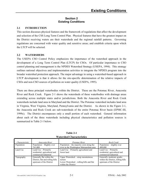
- Page 46: Existing Conditions Table 2-1 Water
- Page 49 and 50: Existing Conditions Table 2-3 Recei
- Page 51 and 52: Existing Conditions The policy is b
- Page 53 and 54: Existing Conditions during a single
- Page 55 and 56: Existing Conditions 2.4.3 Use Attai
- Page 57 and 58: Existing Conditions Government (not
- Page 59 and 60: Existing Conditions Table 2-7 Compa
- Page 61 and 62: Existing Conditions Anacostia River
- Page 63 and 64: Existing Conditions Rock Creek As
- Page 65: Existing Conditions be classified a
- Page 68 and 69: Existing Systems NPDES Outfall No.
- Page 70 and 71: Existing Systems Table 3-1 Summary
- Page 76 and 77: Existing Systems Under the Intermun
- Page 78: Existing Systems The capacities of
- Page 81 and 82: Existing Systems Table 3-3 Inflatab
- Page 84 and 85: Existing Systems 3.4.2 Existing Con
- Page 86 and 87: Existing Systems 3.4.2.5 Control Of
- Page 88 and 89: Sewer Systems Characterization Sect
- Page 90: Sewer Systems Characterization 4.3
- Page 93 and 94: Sewer Systems Characterization Tabl
- Page 95 and 96:
Sewer Systems Characterization At
- Page 97 and 98:
Sewer Systems Characterization Two
- Page 99 and 100:
Sewer Systems Characterization Para
- Page 101 and 102:
Sewer Systems Characterization Sinc
- Page 103 and 104:
Sewer Systems Characterization Wast
- Page 105 and 106:
Sewer Systems Characterization sele
- Page 107 and 108:
Sewer Systems Characterization Loca
- Page 109:
Receiving Waters Characterization S
- Page 112 and 113:
Receiving Waters Characterization 5
- Page 114 and 115:
Receiving Waters Characterization m
- Page 116 and 117:
Receiving Waters Characterization T
- Page 118 and 119:
Receiving Waters Characterization P
- Page 120 and 121:
Receiving Waters Characterization 5
- Page 122 and 123:
Pollutant Loads and Predicated Wate
- Page 124 and 125:
Pollutant Loads and Predicated Wate
- Page 126 and 127:
Pollutant Loads and Predicated Wate
- Page 128 and 129:
District of Columbia Water and Sewe
- Page 130 and 131:
District of Columbia Water and Sewe
- Page 132 and 133:
Screening of CSO Control Technologi
- Page 134 and 135:
Screening of CSO Control Technologi
- Page 136 and 137:
Screening of CSO Control Technologi
- Page 138 and 139:
Screening of CSO Control Technologi
- Page 140 and 141:
Screening of CSO Control Technologi
- Page 142 and 143:
Screening of CSO Control Technologi
- Page 144 and 145:
Screening of CSO Control Technologi
- Page 146 and 147:
Screening of CSO Control Technologi
- Page 148 and 149:
Screening of CSO Control Technologi
- Page 150 and 151:
Screening of CSO Control Technologi
- Page 152 and 153:
Screening of CSO Control Technologi
- Page 154 and 155:
Screening of CSO Control Technologi
- Page 156 and 157:
Screening of CSO Control Technologi
- Page 158 and 159:
Screening of CSO Control Technologi
- Page 160 and 161:
Preliminary Control Program Alterna
- Page 163:
Preliminary Control Program Alterna
- Page 166 and 167:
Preliminary Control Program Alterna
- Page 168:
Preliminary Control Program Alterna
- Page 172 and 173:
Preliminary Control Program Alterna
- Page 174 and 175:
Preliminary Control Program Alterna
- Page 176:
Preliminary Control Program Alterna
- Page 180:
Preliminary Control Program Alterna
- Page 183 and 184:
Preliminary Control Program Alterna
- Page 185 and 186:
Preliminary Control Program Alterna
- Page 187 and 188:
District of Columbia Water and Sewe
- Page 189 and 190:
Preliminary Control Program Alterna
- Page 191 and 192:
Selection of Draft LTCP Section 9 S
- Page 193 and 194:
Selection of Draft LTCP exceeding t
- Page 195 and 196:
Selection of Draft LTCP If LID-R is
- Page 197:
Selection of Draft LTCP 9.5 ANACOST
- Page 200:
Selection of Draft LTCP Alternativ
- Page 203 and 204:
Selection of Draft LTCP Table 9-2 F
- Page 205 and 206:
Selection of Draft LTCP # CSO Overf
- Page 207 and 208:
Selection of Draft LTCP Note that,
- Page 209 and 210:
Selection of Draft LTCP High le
- Page 211 and 212:
Selection of Draft LTCP The e. coli
- Page 213 and 214:
Selection of Draft LTCP The followi
- Page 215 and 216:
Selection of Draft LTCP Northeast N
- Page 217 and 218:
Selection of Draft LTCP Table 9-9 C
- Page 219 and 220:
Selection of Draft LTCP RTC does re
- Page 221:
Selection of Draft LTCP 9.6 ROCK CR
- Page 224 and 225:
Selection of Draft LTCP capital co
- Page 227 and 228:
Selection of Draft LTCP Alternativ
- Page 229 and 230:
Selection of Draft LTCP The effect
- Page 231 and 232:
Table 9-15 Effect of CSO Control On
- Page 233 and 234:
Selection of Draft LTCP Ease of
- Page 235 and 236:
District of Columbia Water and Sewe
- Page 238 and 239:
Selection of Draft LTCP Table 9-18
- Page 240 and 241:
Selection of Draft LTCP Table 9-20
- Page 242 and 243:
Selection of Draft LTCP Table 9-21
- Page 244 and 245:
Selection of Draft LTCP For zero
- Page 246 and 247:
Selection of Draft LTCP Alternative
- Page 248 and 249:
Selection of Draft LTCP 9.8 DESCRIP
- Page 250 and 251:
Selection of Draft LTCP The major e
- Page 253 and 254:
Public Participation Section 10 Pub
- Page 255 and 256:
Public Participation Public Meeting
- Page 257 and 258:
Public Participation Panel Meeting
- Page 259 and 260:
Public Participation Panel Meeting
- Page 261 and 262:
Public Participation CSO Newslette
- Page 263 and 264:
Public Participation Abbreviated S
- Page 265 and 266:
Public Participation Briefing at N
- Page 267 and 268:
Public Participation and subject ma
- Page 269 and 270:
Selection of Final LTCP Table 11-1
- Page 271 and 272:
Selection of Final LTCP the model i
- Page 273 and 274:
Selection of Final LTCP No. CSO NPD
- Page 277 and 278:
Selection of Final LTCP Table 11-4
- Page 279 and 280:
Selection of Final LTCP Table 11-5
- Page 281 and 282:
Selection of Final LTCP % Imperviou
- Page 283 and 284:
Selection of Final LTCP Cost-benefi
- Page 285 and 286:
Selection of Final LTCP Table 11-10
- Page 287 and 288:
Selection of Final LTCP Washington
- Page 289:
Selection of Final LTCP Rate) treat
- Page 294 and 295:
Selection of Final LTCP Alternative
- Page 296 and 297:
Parameter Table 11-13 (continued) F
- Page 298 and 299:
Parameter Table 11-13 (continued) F
- Page 300 and 301:
Selection of Final LTCP Table 11-14
- Page 302 and 303:
Selection of Final LTCP Pump Statio
- Page 304 and 305:
Selection of Final LTCP CSO NPDES N
- Page 306 and 307:
Financial Capability Section 12 Fin
- Page 308 and 309:
Financial Capability controls. Next
- Page 310 and 311:
Financial Capability Percent of Hou
- Page 312 and 313:
Financial Capability of the financi
- Page 314 and 315:
Financial Capability Table 12-6 Sum
- Page 316 and 317:
Financial Capability Over half of
- Page 318 and 319:
Financial Capability The 15 and 20-
- Page 320 and 321:
$35 Financial Capability Figure 12-
- Page 322 and 323:
Financial Capability behavior. Alth
- Page 324 and 325:
Recommended Control Plan Section 13
- Page 327 and 328:
Recommended Control Plan 13.2.1 Sys
- Page 329 and 330:
Recommended Control Plan Regulator
- Page 331 and 332:
Recommended Control Plan Descriptio
- Page 333 and 334:
Recommended Control Plan 13.2.3 Roc
- Page 335 and 336:
Recommended Control Plan the case w
- Page 337 and 338:
Recommended Control Plan 13.2.8 Oth
- Page 339 and 340:
Recommended Control Plan weather, m
- Page 341 and 342:
Recommended Control Plan Table 13-6
- Page 343 and 344:
Recommended Control Plan While othe
- Page 345 and 346:
Recommended Control Plan Location T
- Page 347 and 348:
Recommended Control Plan Item Draft
- Page 349 and 350:
Recommended Control Plan 18% Figure
- Page 351 and 352:
Recommended Control Plan 13.6 SCHED
- Page 353 and 354:
District Columbia Water and Sewer A
- Page 355 and 356:
District Columbia Water and Sewer A
- Page 357 and 358:
Recommended Control Plan 3. The BOD
- Page 359 and 360:
Recommended Control Plan Figure 13-
- Page 361 and 362:
Water Quality Standards Review Thes
- Page 363 and 364:
Water Quality Standards Review Crit
- Page 365 and 366:
Water Quality Standards Review CSO
- Page 367 and 368:
Water Quality Standards Review CSO
- Page 369 and 370:
Water Quality Standards Review two
- Page 371 and 372:
Water Quality Standards Review prop
- Page 373 and 374:
Section 15 Post Construction Monito
- Page 375 and 376:
Post Construction Monitoring disbur
- Page 377 and 378:
Post Construction Monitoring Rainfa
- Page 379 and 380:
Table 15-3 Phase 3 Monitoring Post
- Page 381 and 382:
Post Construction Monitoring CSO Ou
- Page 383 and 384:
Post Construction Monitoring CSO ou
- Page 385 and 386:
References Engineering Program Mana
- Page 387 and 388:
References Limno-Tech, Inc (LTI), 1
- Page 389 and 390:
References U.S. Environmental Prote
- Page 391 and 392:
Glossary Glossary A Activated Sludg
- Page 393 and 394:
Glossary DOH: District of Columbia
- Page 395 and 396:
Glossary O Operation and Maintenanc
- Page 397 and 398:
Glossary T TDS: Total Dissolved Sol
- Page 399 and 400:
District of Columbia Water and Sewe
- Page 401 and 402:
41. Study Memorandum LTCP-8-5: Fina
- Page 403 and 404:
District of Columbia Water and Sewe
- Page 405 and 406:
District of Columbia Water and Sewe
- Page 407 and 408:
District of Columbia Water and Sewe
- Page 409 and 410:
District of Columbia Water and Sewe
- Page 411 and 412:
District of Columbia Water and Sewe
- Page 413 and 414:
District of Columbia Water and Sewe
- Page 415 and 416:
District of Columbia Water and Sewe
- Page 417 and 418:
District of Columbia Water and Sewe
- Page 419 and 420:
District of Columbia Water and Sewe
- Page 421 and 422:
District of Columbia Water and Sewe
- Page 423 and 424:
District of Columbia Water and Sewe
- Page 425 and 426:
District of Columbia Water and Sewe
- Page 427 and 428:
District of Columbia Water and Sewe
- Page 429 and 430:
District of Columbia Water and Sewe
- Page 431 and 432:
District of Columbia Water and Sewe
- Page 433 and 434:
District of Columbia Water and Sewe
- Page 435 and 436:
District of Columbia Water and Sewe
- Page 437 and 438:
District of Columbia Water and Sewe
- Page 439 and 440:
District of Columbia Water and Sewe
- Page 441 and 442:
District of Columbia Water and Sewe
- Page 443 and 444:
District of Columbia Water and Sewe
- Page 445 and 446:
District of Columbia Water and Sewe
- Page 447 and 448:
District of Columbia Water and Sewe
- Page 449 and 450:
District of Columbia Water and Sewe
- Page 451 and 452:
District of Columbia Water and Sewe
- Page 453 and 454:
District of Columbia Water and Sewe
- Page 455 and 456:
District of Columbia Water and Sewe
- Page 457 and 458:
District of Columbia Water and Sewe
- Page 459 and 460:
District of Columbia Water and Sewe
- Page 461 and 462:
District of Columbia Water and Sewe
- Page 463 and 464:
District of Columbia Water and Sewe
- Page 465 and 466:
District of Columbia Water and Sewe
- Page 467 and 468:
District of Columbia Water and Sewe
- Page 469 and 470:
District of Columbia Water and Sewe
- Page 471 and 472:
District of Columbia Water and Sewe
- Page 473 and 474:
District of Columbia Water and Sewe
- Page 475 and 476:
District of Columbia Water and Sewe
- Page 477 and 478:
Appendix E - Basis for Cost Opinion
- Page 479 and 480:
Appendix E - Basis for Cost Opinion
- Page 481 and 482:
Appendix E - Basis for Cost Opinion
- Page 483 and 484:
Appendix E - Basis for Cost Opinion
- Page 485 and 486:
Appendix E - Basis for Cost Opinion
- Page 487 and 488:
Appendix E - Basis for Cost Opinion
- Page 489 and 490:
Appendix E - Basis for Cost Opinion
- Page 491 and 492:
Appendix E - Basis for Cost Opinion
- Page 493 and 494:
Appendix E - Basis for Cost Opinion
- Page 495 and 496:
Appendix E - Basis for Cost Opinion
- Page 497 and 498:
District of Columbia Water and Sewe
- Page 499 and 500:
District of Columbia Water and Sewe
- Page 501 and 502:
District of Columbia Water and Sewe
- Page 503 and 504:
Responses to Comments Appendix F Re
- Page 505 and 506:
Responses to Comments In the Draft
- Page 507 and 508:
Responses to Comments Separate pu
- Page 509 and 510:
Responses to Comments benefits of t
- Page 511 and 512:
Responses to Comments 3.9 Several c
- Page 513 and 514:
Responses to Comments 3.13 The Draf
- Page 515 and 516:
Responses to Comments capacity befo
- Page 517 and 518:
Responses to Comments 4.5.1.9. One
- Page 519 and 520:
Responses to Comments indicated tha
- Page 521 and 522:
Responses to Comments 5.2 Two comme
- Page 523 and 524:
Responses to Comments Cost - compl
- Page 525 and 526:
Responses to Comments Institutiona
- Page 527 and 528:
Responses to Comments incentives to
- Page 529 and 530:
Responses to Comments 7.5 A comment
- Page 531 and 532:
Responses to Comments The flooding
- Page 533 and 534:
Responses to Comments significantly
- Page 535 and 536:
Responses to Comments without the r
- Page 537 and 538:
Responses to Comments construction
- Page 539 and 540:
Responses to Comments predicted tha
- Page 541 and 542:
Responses to Comments Regarding the
- Page 543 and 544:
Responses to Comments comment was p
- Page 545 and 546:
Responses to Comments structure sho
- Page 547 and 548:
Responses to Comments The estimated
- Page 549 and 550:
Responses to Comments Tunnel fro
- Page 551 and 552:
Responses to Comments The District
- Page 553 and 554:
Responses to Comments 17.4 Commente
- Page 555 and 556:
Responses to Comments guidance docu
- Page 557 and 558:
No. Last Name First name Affiliatio
- Page 559 and 560:
No. Last Name First name Affiliatio
- Page 561 and 562:
No. Last Name First name Affiliatio
- Page 563 and 564:
No. Last Name First name Affiliatio
- Page 565 and 566:
No. Last Name First name Affiliatio
- Page 567 and 568:
No. Last Name First name Affiliatio
- Page 569 and 570:
No. Last Name First name Affiliatio
- Page 571 and 572:
No. Last Name First name Affiliatio
- Page 573 and 574:
No. Last Name First name Affiliatio
- Page 575 and 576:
No. Last Name First name Affiliatio
- Page 577 and 578:
No. Last Name First name Affiliatio
- Page 579:
District of Columbia Water and Sewe