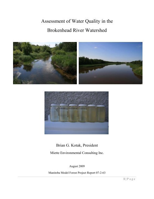
Assessment of Water Quality in the Brokenhead River Watershed
Assessment of Water Quality in the Brokenhead River Watershed
Assessment of Water Quality in the Brokenhead River Watershed

You also want an ePaper? Increase the reach of your titles
YUMPU automatically turns print PDFs into web optimized ePapers that Google loves.
<strong>Assessment</strong> <strong>of</strong> <strong>Water</strong> <strong>Quality</strong> <strong>in</strong> <strong>the</strong><br />
<strong>Brokenhead</strong> <strong>River</strong> <strong>Water</strong>shed<br />
Brian G. Kotak, President<br />
Miette Environmental Consult<strong>in</strong>g Inc.<br />
August 2009<br />
Manitoba Model Forest Project Report 07-2-63<br />
1 | P age
Table <strong>of</strong> Contents<br />
Executive Summary ................................................................................................... 3<br />
Acknowledgements .................................................................................................. 4<br />
Introduction .............................................................................................................. 4<br />
Methods .............................................................................................................. 6<br />
Results and Discussion ..................................................................................... 10<br />
Overview <strong>of</strong> <strong>the</strong> <strong>Brokenhead</strong> <strong>River</strong> <strong>Water</strong>shed .................................................. 10<br />
General .............................................................................................................. 10<br />
Land Cover .............................................................................................................. 13<br />
General Soil Characteristics ....................................................................................... 17<br />
Agricultural Activities ....................................................................................... 25<br />
Historical <strong>Water</strong> <strong>Quality</strong> ...................................................................................... 25<br />
<strong>Water</strong> <strong>Quality</strong> <strong>in</strong> 2007 and <strong>the</strong> Relationships Between <strong>Water</strong>shed Attributes and<br />
Recent <strong>Water</strong> <strong>Quality</strong> .................................................................................................. 28<br />
Tra<strong>in</strong><strong>in</strong>g <strong>of</strong> Youth ................................................................................................. 37<br />
Involvement <strong>of</strong> <strong>Brokenhead</strong> Ojibway Nation Students ...................................... 37<br />
Involvement <strong>of</strong> Students from Spr<strong>in</strong>gfield Collegiate ...................................... 38<br />
Recommendations .................................................................................................. 41<br />
Literature Cited .................................................................................................. 41<br />
Appendix A <strong>Water</strong> <strong>Quality</strong> Data for <strong>the</strong> <strong>Brokenhead</strong> <strong>River</strong>, 2007 .......................... 43<br />
Appendix B Photos <strong>of</strong> Sampl<strong>in</strong>g Stations <strong>in</strong> <strong>the</strong> 2007 Study ...................................... 47<br />
2 | P age
Executive Summary<br />
A pilot project was <strong>in</strong>itiated by <strong>the</strong> Manitoba Model Forest <strong>in</strong> 2007 to exam<strong>in</strong>e water quality <strong>in</strong><br />
<strong>the</strong> <strong>Brokenhead</strong> <strong>River</strong> from its headwaters south <strong>of</strong> <strong>the</strong> Trans Canada Highway to its term<strong>in</strong>us at<br />
Lake W<strong>in</strong>nipeg. The project was a jo<strong>in</strong>t <strong>in</strong>itiative between <strong>the</strong> Manitoba Model Forest,<br />
<strong>Brokenhead</strong> Ojibway Nation and <strong>the</strong> <strong>Brokenhead</strong> <strong>River</strong> Restoration Committee (and its many<br />
partners, <strong>in</strong>clud<strong>in</strong>g Manitoba <strong>Water</strong> Stewardship and Fisheries and Oceans Canada). <strong>Water</strong><br />
quality was studied at 6 sites along <strong>the</strong> length <strong>of</strong> <strong>the</strong> <strong>Brokenhead</strong> <strong>River</strong> <strong>in</strong> <strong>the</strong> summer and fall <strong>of</strong><br />
2007. <strong>Water</strong> quality at sites located <strong>in</strong> <strong>the</strong> sou<strong>the</strong>rn 1/3 <strong>of</strong> <strong>the</strong> watershed was significantly<br />
different from those sites located <strong>in</strong> <strong>the</strong> nor<strong>the</strong>rn 1/3 <strong>of</strong> <strong>the</strong> watershed. The central part <strong>of</strong> <strong>the</strong><br />
watershed represented a transition zone. Nutrients such as total phosphorus and forms <strong>of</strong><br />
nitrogen, as well as turbidity were much higher <strong>in</strong> <strong>the</strong> nor<strong>the</strong>rn part <strong>of</strong> <strong>the</strong> watershed compared to<br />
<strong>the</strong> south. In addition, <strong>the</strong> proportion <strong>of</strong> particulate phosphorus (compared to dissolved<br />
phosphorus) was higher <strong>in</strong> <strong>the</strong> north part <strong>of</strong> <strong>the</strong> watershed. <strong>Water</strong> quality parameters such as<br />
color, conductivity, pH, sulphate and ions such as calcium, magnesium, potassium and sodium<br />
had similar concentrations throughout <strong>the</strong> watershed. Levels <strong>of</strong> E. coli were quite variable<br />
throughout <strong>the</strong> entire watershed, but were high at <strong>the</strong> most sou<strong>the</strong>rn sampl<strong>in</strong>g site (south <strong>of</strong> <strong>the</strong><br />
Trans Canada Highway), suggest<strong>in</strong>g <strong>the</strong> <strong>in</strong>fluence <strong>of</strong> beaver populations.<br />
A Geographic Information System (GIS) analysis was conducted to exam<strong>in</strong>e soil characteristics<br />
and land cover / land use <strong>in</strong>formation throughout <strong>the</strong> watershed. This analysis was used to help<br />
expla<strong>in</strong> <strong>the</strong> patterns observed <strong>in</strong> water quality throughout <strong>the</strong> watershed. The higher<br />
concentrations <strong>of</strong> nutrients (phosphorus and nitrogen) as well as turbidity <strong>in</strong> <strong>the</strong> sampl<strong>in</strong>g sites<br />
located <strong>in</strong> <strong>the</strong> nor<strong>the</strong>rn 1/3 <strong>of</strong> <strong>the</strong> <strong>Brokenhead</strong> <strong>River</strong> watershed was likely related to a<br />
comb<strong>in</strong>ation <strong>of</strong> soil characteristics as well as agricultural land use. The nor<strong>the</strong>rn 1/3 <strong>of</strong> <strong>the</strong><br />
watershed has much more fertile soils than <strong>the</strong> sou<strong>the</strong>rn part <strong>of</strong> <strong>the</strong> watershed (e.g., soil orders <strong>of</strong><br />
black chernozens compared to orgranic and luvisol soils), clayey and loamy texture (compared to<br />
organic and sand textures) and <strong>the</strong> soils <strong>in</strong> <strong>the</strong> nor<strong>the</strong>rn 1/3 <strong>of</strong> <strong>the</strong> watershed had much higher<br />
agricultural capability (class I and II soils compared to soils with little to no agricultural<br />
capability <strong>in</strong> <strong>the</strong> sou<strong>the</strong>rn 1/3 <strong>of</strong> <strong>the</strong> watershed). Not surpris<strong>in</strong>g, <strong>the</strong> majority <strong>of</strong> agricultural<br />
activities also was located <strong>in</strong> <strong>the</strong> nor<strong>the</strong>rn 1/3 <strong>of</strong> <strong>the</strong> watershed. In addition, an extensive surface<br />
and tile dra<strong>in</strong>age network (over 700 km) <strong>in</strong> <strong>the</strong> nor<strong>the</strong>rn portion <strong>of</strong> <strong>the</strong> watershed likely also<br />
contributed to higher concentrations <strong>of</strong> phosphorus and nitrogen, higher levels <strong>of</strong> turbidity and a<br />
higher proportion <strong>of</strong> particulate compared to dissolved phosphorus.<br />
F<strong>in</strong>ally, <strong>the</strong> project <strong>in</strong>volved <strong>the</strong> tra<strong>in</strong><strong>in</strong>g and participation <strong>of</strong> youth from <strong>Brokenhead</strong> Ojibway<br />
Nation and Grade 12 students from Spr<strong>in</strong>gfield Collegiate (Oakbank). Six youth from<br />
<strong>Brokenhead</strong> Ojibway Nation assisted with <strong>the</strong> water quality sampl<strong>in</strong>g at <strong>the</strong> various sampl<strong>in</strong>g<br />
sites <strong>in</strong> July and August. Students from Spr<strong>in</strong>gfield Collegiate participated <strong>in</strong> a one-day field trip<br />
to <strong>the</strong> <strong>Brokenhead</strong> <strong>River</strong> Ecological Reserve, <strong>in</strong> which <strong>the</strong>y received tra<strong>in</strong><strong>in</strong>g <strong>in</strong> water quality and<br />
3 | P age
flow data collection. They also learned how to conduct riparian health assessments and<br />
undertook such an assessment <strong>in</strong> <strong>the</strong> Ecological Reserve.<br />
Acknowledgements<br />
This study would not have been possible without <strong>the</strong> <strong>in</strong>volvement and support <strong>of</strong> many<br />
organizations and <strong>in</strong>dividuals. The idea for <strong>the</strong> pilot project was developed by <strong>Brokenhead</strong><br />
Ojibway Nation (BON) and we gratefully acknowledge <strong>the</strong> assistance <strong>of</strong> Debbie Smith, Carl<br />
Smith and Paul Chief <strong>of</strong> BON, as well as <strong>the</strong> six youth who participated <strong>in</strong> <strong>the</strong> water quality<br />
sampl<strong>in</strong>g: Buffy Pr<strong>in</strong>ce, Britteney Drisdale, Ogimaa S<strong>in</strong>clair, Jasm<strong>in</strong>e Benoit, Dyana Chief and<br />
Emily Ballantyne. Daniel Dupont (Manitoba Model Forest) also assisted with <strong>the</strong> water quality<br />
sampl<strong>in</strong>g). We also thank Al Tymko and <strong>the</strong> <strong>Brokenhead</strong> <strong>River</strong> Restoration Committee (which<br />
<strong>in</strong>cludes Manitoba <strong>Water</strong> Stewardship and Fisheries and Oceans Canada) for <strong>the</strong>ir <strong>in</strong>volvement<br />
and guidance on <strong>the</strong> design <strong>of</strong> <strong>the</strong> study. A special thank you to Bob Austman (Manitoba Model<br />
Forest), L<strong>in</strong>da McPhearson (teacher at Spr<strong>in</strong>gfield Collegiate) and <strong>the</strong> Grade 12 science class for<br />
<strong>the</strong>ir participation <strong>in</strong> <strong>the</strong> field trip to <strong>the</strong> Ecological Reserve. In particular, we thank Marilena<br />
Kowalchuk (Manitoba Habitat Stewardship Program) for provid<strong>in</strong>g <strong>the</strong> riparian health<br />
assessment tra<strong>in</strong><strong>in</strong>g dur<strong>in</strong>g <strong>the</strong> field trip.<br />
F<strong>in</strong>ally, we gratefully acknowledge <strong>the</strong> f<strong>in</strong>ancial support <strong>of</strong> <strong>the</strong> Manitoba <strong>Water</strong> Stewardship<br />
Fund and <strong>the</strong> Manitoba Model Forest.<br />
Introduction<br />
The <strong>Brokenhead</strong> <strong>River</strong> watershed is a large watershed (more than 260,000 hectares or 26,000<br />
km 2 <strong>in</strong> size) located <strong>in</strong> south eastern Manitoba. The river’s headwaters are located<br />
approximately 40 km south <strong>of</strong> <strong>the</strong> Trans Canada Highway, just east <strong>of</strong> <strong>the</strong> town <strong>of</strong> Richer, and<br />
<strong>the</strong> river flows north, empty<strong>in</strong>g <strong>in</strong>to <strong>the</strong> south bas<strong>in</strong> <strong>of</strong> Lake W<strong>in</strong>nipeg. Much <strong>of</strong> <strong>the</strong> sou<strong>the</strong>rn<br />
portion <strong>of</strong> <strong>the</strong> watershed is forested, also conta<strong>in</strong><strong>in</strong>g significant wetland complexes. The soils<br />
and dra<strong>in</strong>age characteristics <strong>of</strong> this part <strong>of</strong> <strong>the</strong> watershed are not conducive for agriculture. In<br />
contrast, <strong>the</strong> nor<strong>the</strong>rn 1/3 <strong>of</strong> <strong>the</strong> watershed conta<strong>in</strong>s more fertile soils, and as a result, much <strong>of</strong> <strong>the</strong><br />
orig<strong>in</strong>al forest and wetlands have been converted to agricultural lands. An extensive dra<strong>in</strong>age<br />
system has also been developed <strong>in</strong> <strong>the</strong> nor<strong>the</strong>rn part <strong>of</strong> <strong>the</strong> watershed, facilitat<strong>in</strong>g <strong>the</strong> rapid<br />
dra<strong>in</strong>age <strong>of</strong> water from agricultural land to <strong>the</strong> <strong>Brokenhead</strong> <strong>River</strong>.<br />
Few published studies have been conducted on <strong>the</strong> <strong>Brokenhead</strong> <strong>River</strong>. Donetz (2002) assessed<br />
<strong>the</strong> status <strong>of</strong> riparian health along <strong>the</strong> length <strong>of</strong> <strong>the</strong> river <strong>in</strong> order to develop a prioritized list <strong>of</strong><br />
potential riparian restoration projects for fish habitat, domestic use and recreational<br />
4 | P age
opportunities. Based on this assessment, 150 potential restoration sites were identified. This<br />
number was reduced to 56, based on criteria such as impacts on water quality, effects on fish<br />
habitat, effects on fish migration, potential for restoration and landowner participation.<br />
Agriculture and Agri-Food Canada – Prairie Farm Rehabilitation Adm<strong>in</strong>istration (AA-F and<br />
PFRA, 2004) compiled data and <strong>in</strong>formation on land use issues related to riparian areas <strong>in</strong> <strong>the</strong><br />
<strong>Brokenhead</strong> <strong>River</strong> watershed. Little <strong>in</strong>formation has been published regard<strong>in</strong>g <strong>the</strong> water quality<br />
<strong>of</strong> <strong>the</strong> <strong>Brokenhead</strong> <strong>River</strong>. The riparian assessment conducted by Donetz (2002) collected only<br />
very basic water quality <strong>in</strong>formation (e.g., pH, conductivity, total dissolved solids and dissolved<br />
oxygen), and <strong>the</strong> AA-F and PFRA (2004) study did not collect water quality data on <strong>the</strong> river.<br />
<strong>Water</strong> quality has been monitored periodically by Manitoba <strong>Water</strong> Stewardship at selected sites<br />
<strong>in</strong> <strong>the</strong> <strong>Brokenhead</strong> <strong>River</strong> from <strong>the</strong> early 1970s to 2005, although <strong>the</strong>re are many years dur<strong>in</strong>g that<br />
time period where monitor<strong>in</strong>g was not conducted. Significant differences likely exist <strong>in</strong> water<br />
quality along <strong>the</strong> length <strong>of</strong> <strong>the</strong> river, from its headwaters to where <strong>the</strong> river empties <strong>in</strong>to Lake<br />
W<strong>in</strong>nipeg. The effects <strong>of</strong> watershed characteristics (e.g., soils), land cover and land use on water<br />
quality <strong>in</strong> <strong>the</strong> <strong>Brokenhead</strong> <strong>River</strong> has received little attention.<br />
Over <strong>the</strong> last 17 years, <strong>the</strong> Manitoba Model Forest (MBMF), a not-for-pr<strong>of</strong>it organization located<br />
<strong>in</strong> eastern Manitoba, has brought toge<strong>the</strong>r local communities, First Nations, government<br />
agencies, and <strong>in</strong>dustries to improve our collective understand<strong>in</strong>g <strong>of</strong> <strong>the</strong> ecology <strong>of</strong> forested<br />
watersheds, and to improve community <strong>in</strong>put and policy development <strong>in</strong> natural resource<br />
management, particularly as it relates to susta<strong>in</strong>able forest management plann<strong>in</strong>g. The MBMF<br />
has significantly advanced <strong>the</strong> understand<strong>in</strong>g <strong>of</strong> <strong>the</strong> ecology <strong>of</strong> <strong>the</strong> boreal forest, and used this<br />
<strong>in</strong>formation to assist with <strong>the</strong> development <strong>of</strong> management strategies to better accommodate<br />
values such as wildlife (e.g., woodland caribou, moose) <strong>in</strong>to forest management plann<strong>in</strong>g. The<br />
MBMF has also taken a lead role <strong>in</strong> conduct<strong>in</strong>g research to monitor and understand water quality<br />
<strong>in</strong> eastern Manitoba. S<strong>in</strong>ce 2004, <strong>the</strong> MBMF has been collect<strong>in</strong>g basel<strong>in</strong>e water quality data on a<br />
number <strong>of</strong> rivers, <strong>in</strong> order to assess what watershed features (e.g., soils, forest cover type) may<br />
regulate water quality, and how natural and man-caused watershed disturbances and land use<br />
practices (forest fires, logg<strong>in</strong>g, agriculture, beaver activity) may affect water quality. This<br />
research will result <strong>in</strong> <strong>the</strong> development <strong>of</strong> watershed plann<strong>in</strong>g tools, which will allow forest<br />
product companies to better <strong>in</strong>tegrate water quality <strong>in</strong>to forest management plann<strong>in</strong>g.<br />
In 2006, <strong>Brokenhead</strong> Ojibway Nation, a member <strong>of</strong> <strong>the</strong> MBMF and located along <strong>the</strong><br />
<strong>Brokenhead</strong> <strong>River</strong> near Lake W<strong>in</strong>nipeg, requested that <strong>the</strong> MBMF <strong>in</strong>itiate a pilot project to<br />
<strong>in</strong>vestigate water quality <strong>in</strong> <strong>the</strong> <strong>Brokenhead</strong> <strong>River</strong>. The community also <strong>in</strong>dicated a desire to<br />
have youth <strong>in</strong>volved <strong>in</strong> <strong>the</strong> project. In 2007, with <strong>the</strong> f<strong>in</strong>ancial assistance <strong>of</strong> <strong>the</strong> Susta<strong>in</strong>able<br />
Development Innovations Fund (SDIF) and <strong>in</strong>-k<strong>in</strong>d contributions from <strong>Brokenhead</strong> Ojibway<br />
Nation, Manitoba <strong>Water</strong> Stewardship, Fisheries and Oceans Canada, <strong>the</strong> <strong>Brokenhead</strong> <strong>River</strong><br />
Restoration Committee and Sunrise School Division water quality <strong>in</strong>formation was collected on<br />
<strong>the</strong> river.<br />
5 | P age
The objectives <strong>of</strong> this project were:<br />
<br />
<br />
<br />
<br />
To document water quality <strong>in</strong> <strong>the</strong> <strong>Brokenhead</strong> <strong>River</strong> from its headwaters to <strong>the</strong><br />
community <strong>of</strong> <strong>Brokenhead</strong> Ojibway Nation,<br />
To assess <strong>the</strong> <strong>in</strong>fluence <strong>of</strong> natural watershed features and land use <strong>in</strong> <strong>the</strong> <strong>Brokenhead</strong><br />
<strong>River</strong> watershed on <strong>the</strong> water quality <strong>of</strong> <strong>the</strong> river,<br />
To provide education and tra<strong>in</strong><strong>in</strong>g opportunities for First Nation and non-Aborig<strong>in</strong>al<br />
youth <strong>in</strong> water quality monitor<strong>in</strong>g and riparian health assessment, and<br />
To provide <strong>in</strong>formation to <strong>the</strong> <strong>Brokenhead</strong> <strong>River</strong> Restoration Committee relevant to <strong>the</strong><br />
development <strong>of</strong> a future watershed management plan<br />
This study was designed as a pilot project and as such, certa<strong>in</strong> aspects such as water quality<br />
sampl<strong>in</strong>g were quite limited <strong>in</strong> scope.<br />
Methods<br />
<strong>Water</strong> <strong>Quality</strong> Sampl<strong>in</strong>g and <strong>Water</strong> Chemistry Analyses<br />
<strong>Water</strong> quality samples were collected on three occasions dur<strong>in</strong>g <strong>the</strong> summer and fall <strong>of</strong> 2007.<br />
On July 17, August 29 and October 16, 2007, water samples were collected at each <strong>of</strong> 6 sites<br />
along <strong>the</strong> <strong>Brokenhead</strong> <strong>River</strong> from near its headwaters at <strong>the</strong> Trans Canada Highway to <strong>the</strong><br />
community <strong>of</strong> <strong>Brokenhead</strong> Ojibway Nation (Figure 1). The sampl<strong>in</strong>g locations represent water<br />
quality stations periodically utilized by Manitoba <strong>Water</strong> Stewardship for <strong>the</strong>ir data collection,<br />
with <strong>the</strong> addition <strong>of</strong> one site (Hazel Creek, located along Highway 15, east <strong>of</strong> Ste. Rita). Some<br />
<strong>of</strong> <strong>the</strong> Manitoba <strong>Water</strong> Stewardship sites have been monitored periodically s<strong>in</strong>ce 1973, although<br />
<strong>the</strong>re are several years which monitor<strong>in</strong>g was not undertaken. Table 1 provides a list <strong>of</strong> <strong>the</strong><br />
sampl<strong>in</strong>g locations.<br />
6 | P age
Table 1. <strong>Water</strong> quality sampl<strong>in</strong>g locations (<strong>in</strong> order from fur<strong>the</strong>st south to fur<strong>the</strong>st north).<br />
MB <strong>Water</strong> General Description Latitude Longitude<br />
Stewardship EMS<br />
Data System #<br />
MB05SAS033 <strong>Brokenhead</strong> <strong>River</strong> at Trans N 49 39.423 W 96 16.471<br />
Canada Hwy<br />
- Hazel Creek at Hwy 15, east N 49 52.794 W 96 14.070<br />
<strong>of</strong> Ste. Rita<br />
MB05SAS037 <strong>Brokenhead</strong> <strong>River</strong> at Hwy 15, N 49 53.091 W 96 21.990<br />
east <strong>of</strong> Vivian<br />
MB05SAS041 <strong>Brokenhead</strong> <strong>River</strong> at Hwy 44, N 50 03.689 W 96 27.926<br />
east <strong>of</strong> Beausejour<br />
MB05SAS034 <strong>Brokenhead</strong> <strong>River</strong> at Hwy 12, N 50 17.444 W 96 29.303<br />
north <strong>of</strong> PR 317<br />
MB05SAS038 <strong>Brokenhead</strong> <strong>River</strong> at Hwy 59,<br />
sou<strong>the</strong>ast <strong>of</strong> Scanterbury<br />
N 50 22.197 W 96 36.464<br />
7 | P age
F<br />
E<br />
D<br />
C<br />
B<br />
A<br />
Figure 1. Subwatersheds <strong>of</strong> <strong>the</strong> <strong>Brokenhead</strong> <strong>River</strong> and water quality sampl<strong>in</strong>g locations (green<br />
circles) <strong>in</strong> 2007.<br />
On each sampl<strong>in</strong>g date, water samples were collected from <strong>the</strong> surface <strong>of</strong> <strong>the</strong> river us<strong>in</strong>g a van<br />
Dorn water sampler, tak<strong>in</strong>g care to avoid areas <strong>of</strong> dense macrophyte (aquatic plant) growth and<br />
to avoid stirr<strong>in</strong>g up bottom sediments. Samples were usually collected from bridges, at <strong>the</strong><br />
deepest part <strong>of</strong> <strong>the</strong> river. <strong>Water</strong> samples were kept chilled <strong>in</strong> a cooler and sent to ALS<br />
Laboratory Group (W<strong>in</strong>nipeg) for water chemistry analyses with<strong>in</strong> 24 hours <strong>of</strong> sample collection.<br />
<strong>Water</strong> chemistry analyses <strong>in</strong>clude: total dissolved phosphorus, total phosphorus, total Kjeldahl<br />
nitrogen, E. coli, ammonia, dissolved organic carbon, turbidity, pH, total dissolved solids,<br />
sulphate, nitrate, calcium, potassium, magnesium, sodium, hardness, conductivity, chloride,<br />
8 | P age
alkal<strong>in</strong>ity, bicarbonate, carbonate and hydroxide. All data is provided <strong>in</strong> Appendix A. Photos <strong>of</strong><br />
each sampl<strong>in</strong>g location is provided <strong>in</strong> Appendix B.<br />
GIS Analyses<br />
In order to exam<strong>in</strong>e <strong>the</strong> various watershed characteristics (e.g., soils, agricultural capability, land<br />
cover) <strong>in</strong> <strong>the</strong> <strong>Brokenhead</strong> <strong>River</strong> watershed, <strong>the</strong> whole watershed was divided <strong>in</strong>to 6 subwatersheds<br />
based on <strong>the</strong> water quality sampl<strong>in</strong>g locations used <strong>in</strong> this study (Figure 1).<br />
<strong>Water</strong>sheds were del<strong>in</strong>eated <strong>in</strong> ArcMap 8.3 utiliz<strong>in</strong>g topographic features, a digital elevation<br />
model (DEM) found <strong>in</strong> AA-F and PFRA (2004) and digital black and white ortho photos. Each<br />
sub-watershed represents <strong>the</strong> general area that dra<strong>in</strong>s <strong>in</strong>to <strong>the</strong> location from which each water<br />
quality sample was taken. Table 2 <strong>in</strong>dicates <strong>the</strong> size <strong>of</strong> each sub-watershed. Sub-watershed F, is<br />
<strong>the</strong> largest, and represents <strong>the</strong> area from <strong>the</strong> headwaters <strong>of</strong> <strong>the</strong> <strong>Brokenhead</strong> <strong>River</strong> south <strong>of</strong> <strong>the</strong><br />
Trans Canada Highway to <strong>the</strong> bridge over <strong>the</strong> <strong>Brokenhead</strong> <strong>River</strong> at Hwy 59 <strong>in</strong> <strong>the</strong> community <strong>of</strong><br />
<strong>Brokenhead</strong> Ojibway Nation.<br />
Table 2. Sub-watersheds <strong>in</strong> <strong>the</strong> <strong>Brokenhead</strong> <strong>River</strong> watershed used for GIS analysis<br />
Sub <strong>Water</strong>shed Area (hectares)<br />
A 24,493<br />
B 37,957<br />
C 77,936<br />
D 153,762<br />
E 240,458<br />
F 263,219<br />
To study <strong>the</strong> occurrence <strong>of</strong> various watershed features (e.g., soils, land cover) <strong>in</strong> each sub<br />
watershed, <strong>in</strong>tersects were made between various GIS data layers and each sub-watershed<br />
polygon. The GIS data layers <strong>in</strong>cluded 2001 land cover, soil surface texture, soil dra<strong>in</strong>age and<br />
agricultural capability. Each is described <strong>in</strong> more detail <strong>in</strong> <strong>the</strong> results and discussion section.<br />
GIS data sets were graciously provided by Agriculture and Agri-Food Canada.<br />
9 | P age
Results and Discussion<br />
Overview <strong>of</strong> <strong>the</strong> <strong>Brokenhead</strong> <strong>River</strong> <strong>Water</strong>shed<br />
General Characteristics<br />
The <strong>Brokenhead</strong> <strong>River</strong> watershed is located <strong>in</strong> sou<strong>the</strong>ast Manitoba, between <strong>the</strong> Red <strong>River</strong><br />
watershed to <strong>the</strong> west, and <strong>the</strong> W<strong>in</strong>nipeg <strong>River</strong> bas<strong>in</strong> to <strong>the</strong> east. The <strong>Brokenhead</strong> <strong>River</strong><br />
watershed is more than 260,000 hectares (26,000 km 2 ) <strong>in</strong> size and orig<strong>in</strong>ates approximately 40<br />
km south <strong>of</strong> <strong>the</strong> Trans Canada highway (Hwy 1) <strong>in</strong> sou<strong>the</strong>rn Manitoba. The river flows from<br />
south to north, empty<strong>in</strong>g <strong>in</strong>to Lake W<strong>in</strong>nipeg. Close to its orig<strong>in</strong> south <strong>of</strong> <strong>the</strong> Trans Canada<br />
Highway, <strong>the</strong> river is <strong>in</strong>dist<strong>in</strong>ct (i.e., has no dist<strong>in</strong>ct channel), apparently flow<strong>in</strong>g underground<br />
for several kilometres. There are no primary flow control structures on <strong>the</strong> river, although <strong>the</strong>re<br />
are several low head dams, <strong>in</strong>stalled primarily for provid<strong>in</strong>g recreational opportunities (Donetz,<br />
2002). The highest po<strong>in</strong>ts <strong>in</strong> <strong>the</strong> watershed occur <strong>in</strong> <strong>the</strong> sou<strong>the</strong>rn portion, at approximately<br />
373m, slop<strong>in</strong>g down to 216m near its term<strong>in</strong>us at Lake W<strong>in</strong>nipeg (AA-F and PFRA, 2004).<br />
Figure 2 shows a Digital Elevation Model (DEM) <strong>of</strong> <strong>the</strong> watershed. The watershed encompasses<br />
9 Rural Municipalities: Alexander, <strong>Brokenhead</strong>, Lac du Bonnet, Reynolds, Spr<strong>in</strong>gfield, Ste.<br />
Anne, St. Clements, Tache and Whitemouth. The population is ma<strong>in</strong>ly rural and farm-based.<br />
Beausejour is <strong>the</strong> largest town, with smaller communities <strong>in</strong>clud<strong>in</strong>g Ste. Rita, Ross, Vivian,<br />
Ladywood, <strong>Brokenhead</strong> Ojibway Naiton and Scanterbury.<br />
The <strong>Brokenhead</strong> <strong>River</strong> watershed is located <strong>in</strong> two Ecozones. The western portion <strong>of</strong> <strong>the</strong><br />
watershed is found <strong>in</strong> <strong>the</strong> Boreal Pla<strong>in</strong>s Ecozone while <strong>the</strong> eastern portion is located <strong>in</strong> <strong>the</strong> Boreal<br />
Shield Ecozone. Ecozones, which are fur<strong>the</strong>r divided <strong>in</strong>to Ecoregions and Ecodistricts, are a<br />
terrestrial classification system developed to classify landscapes by <strong>in</strong>tegrat<strong>in</strong>g vegetation cover,<br />
underly<strong>in</strong>g geology, physiography, soils and climate (Smith et al., 1998). Ecozones are <strong>the</strong><br />
broadest categories <strong>of</strong> this classification system. In a similar manner, <strong>the</strong> western portion <strong>of</strong> <strong>the</strong><br />
<strong>Brokenhead</strong> <strong>River</strong> watershed is located <strong>in</strong> <strong>the</strong> Interlake Pla<strong>in</strong> Ecoregion and <strong>the</strong> eastern portion<br />
<strong>of</strong> <strong>the</strong> watershed is located <strong>in</strong> <strong>the</strong> Lake <strong>of</strong> <strong>the</strong> Woods Ecoregion (Figure 3). The Interlake Pla<strong>in</strong><br />
Ecoregion is characterized by trees <strong>in</strong>clud<strong>in</strong>g trembl<strong>in</strong>g aspen and balsam poplar, with<br />
understory vegetation <strong>in</strong>clud<strong>in</strong>g willow and red osier dogwood. <strong>River</strong>side (riparian) areas<br />
conta<strong>in</strong> Manitoba maple, green ash, elm and cottonwood. Much <strong>of</strong> <strong>the</strong> forest cover <strong>in</strong> this<br />
Ecoregion has been significantly altered due to agriculture and urbanization. The Lake <strong>of</strong> <strong>the</strong><br />
Woods Ecoregion is characterized by extensive peatlands and associated organic soils, tree<br />
10 | P age
Figure 2. Digital elevation model <strong>of</strong> <strong>the</strong> <strong>Brokenhead</strong> <strong>River</strong> watershed (taken from AA-F and<br />
PFRA, 2004)<br />
11 | P age
Figure 3. Ecoregions and Ecodistricts found <strong>in</strong> <strong>the</strong> <strong>Brokenhead</strong> <strong>River</strong> watershed (from AA-F<br />
and PFRA, 2004)<br />
12 | P age
species such as black spruce, tamarack, jack p<strong>in</strong>e, trembl<strong>in</strong>g aspen and balsam fir. Much <strong>of</strong> <strong>the</strong><br />
area surround<strong>in</strong>g Hazel Creek, a major tributary <strong>of</strong> <strong>the</strong> <strong>Brokenhead</strong> <strong>River</strong> which orig<strong>in</strong>ates <strong>in</strong> <strong>the</strong><br />
Lewis Bog, and which flows through <strong>the</strong> Stead Ecodistrict (part <strong>of</strong> <strong>the</strong> Lake <strong>of</strong> <strong>the</strong> Woods<br />
Ecoregion – Figure 3), rema<strong>in</strong>s <strong>in</strong> an undisturbed condition. This is likely due to <strong>the</strong> marshy<br />
characteristics <strong>of</strong> <strong>the</strong> area and lack <strong>of</strong> land suitable for agricultural or settlement purposes.<br />
However, many <strong>of</strong> <strong>the</strong> orig<strong>in</strong>al peatlands <strong>in</strong> <strong>the</strong> nor<strong>the</strong>rn portion <strong>of</strong> <strong>the</strong> Stead Ecodistrict have<br />
been dra<strong>in</strong>ed and converted to commercial production <strong>of</strong> sod (AA-F and PFRA, 2004).<br />
The <strong>Brokenhead</strong> <strong>River</strong> watershed <strong>in</strong>cludes a variety <strong>of</strong> land uses. Much <strong>of</strong> <strong>the</strong> sou<strong>the</strong>rn twothirds<br />
<strong>of</strong> <strong>the</strong> watershed have experienced little development. This is likely due to <strong>the</strong> extensive<br />
areas <strong>of</strong> peatland and marsh. However, <strong>the</strong> nor<strong>the</strong>rn one-third <strong>of</strong> <strong>the</strong> watershed has experienced<br />
significant changes over <strong>the</strong> last 100 years or more. This portion <strong>of</strong> <strong>the</strong> watershed conta<strong>in</strong>s <strong>the</strong><br />
majority <strong>of</strong> agricultural activity (<strong>in</strong>clud<strong>in</strong>g livestock production, cereal and forage crops, sod<br />
production, etc.), an extensive network <strong>of</strong> surface and tile agricultural dra<strong>in</strong>s (more than 700 km<br />
– Donetz, 2002) and <strong>the</strong> existence <strong>of</strong> towns and small communities and association sewage<br />
lagoons. Two <strong>of</strong> <strong>the</strong> most significant farm dra<strong>in</strong>s are <strong>the</strong> Bachman and U dra<strong>in</strong>s, located north <strong>of</strong><br />
Beausejour.<br />
The climate <strong>in</strong> <strong>the</strong> <strong>Brokenhead</strong> <strong>River</strong> watershed can be described as cont<strong>in</strong>ental, although <strong>the</strong>re is<br />
much variation <strong>in</strong> temperature and precipitation across <strong>the</strong> watershed. Lake W<strong>in</strong>nipeg has an<br />
<strong>in</strong>fluence on both climate and river flow at <strong>the</strong> lower reach <strong>of</strong> <strong>the</strong> river, where it dra<strong>in</strong>s <strong>in</strong>to <strong>the</strong><br />
lake. Mean annual precipitation ranges from 510 to 590 mm, and mean annual temperature from<br />
1.6 to 2.4 o C. The mean annual moisture deficit ranges from 75 to 250 mm (AA-F and PFRA,<br />
2004). The average number <strong>of</strong> grow<strong>in</strong>g season days ranges from 176 to 184.<br />
<strong>Water</strong> flow <strong>in</strong> <strong>the</strong> <strong>Brokenhead</strong> <strong>River</strong> orig<strong>in</strong>ates from several sources, <strong>in</strong>clud<strong>in</strong>g Hazel and Bear<br />
Creeks, farm dra<strong>in</strong>s and <strong>the</strong> many wetlands (bogs, fens and marshes) found with<strong>in</strong> <strong>the</strong> watershed.<br />
Sixty year records (1942-2002) from <strong>the</strong> hydrometric gaug<strong>in</strong>g station near Beausejour <strong>in</strong>dicate<br />
that flows are lowest <strong>in</strong> <strong>the</strong> w<strong>in</strong>ter (0.09 to 0.42 m<br />
3 /s from December to February) and peak<br />
dur<strong>in</strong>g spr<strong>in</strong>g melt (11.3 to 12.4 m 3 /s <strong>in</strong> April and May). Spr<strong>in</strong>g run<strong>of</strong>f appears to be occurr<strong>in</strong>g<br />
almost 1 month earlier than it did <strong>in</strong> <strong>the</strong> early 1900s, likely due to land use changes and <strong>the</strong><br />
development <strong>of</strong> extensive farm dra<strong>in</strong> systems (Donetz, 2002). Summer ra<strong>in</strong> storms can quickly<br />
elevate flows as well. The long-term annual flow is 5.68 m 3 /s (AA-F and PFRA, 2004).<br />
Land Cover<br />
The most recent land cover data available for rural municipalities located <strong>in</strong> <strong>the</strong> <strong>Brokenhead</strong><br />
<strong>River</strong> watershed is for <strong>the</strong> year 2001. The GIS data was based on <strong>in</strong>terpretation from 2001<br />
LandSat imagery with a 30 m resolution (AA-F and PFRA, 2004). For <strong>the</strong> purposes <strong>of</strong> this study,<br />
<strong>the</strong> follow<strong>in</strong>g land cover classes were used: water, grassland, tree, wetland, agriculture, forestry<br />
cut block and o<strong>the</strong>r. The agriculture class <strong>in</strong>cluded annual and forage crops and land used for<br />
13 | P age
livestock production. The “o<strong>the</strong>r” land cover class <strong>in</strong>cluded bare rock, burns (forest fire areas),<br />
urban areas and transportation corridors. The tree class <strong>in</strong>cluded all deciduous, s<strong>of</strong>twood,<br />
mixedwood, open deciduous and treed rock areas. The wetland class <strong>in</strong>cluded peatlands (bogs,<br />
fens) and marsh areas.<br />
Figure 4 provides a graphic representation <strong>of</strong> <strong>the</strong> land cover classes found <strong>in</strong> <strong>the</strong> <strong>Brokenhead</strong><br />
<strong>River</strong> watershed <strong>in</strong> 2001. Approximately 70% <strong>of</strong> <strong>the</strong> entire watershed area existed <strong>in</strong> a relatively<br />
undisturbed state, as treed area (48%), grasslands (8.7%) and wetlands (15.5%) (Sub-watershed<br />
F <strong>in</strong> Table 3). The majority <strong>of</strong> <strong>the</strong>se land cover types were found <strong>in</strong> <strong>the</strong> sou<strong>the</strong>rn one-third <strong>of</strong> <strong>the</strong><br />
watershed. It was also evident that <strong>the</strong> majority <strong>of</strong> agricultural activities occur <strong>in</strong> <strong>the</strong> nor<strong>the</strong>rn<br />
one-third <strong>of</strong> <strong>the</strong> watershed (Figure 4).<br />
Figure 5 shows <strong>the</strong> percentage <strong>of</strong> land area <strong>in</strong> each sub-watershed accord<strong>in</strong>g to <strong>the</strong> land cover<br />
classes and Table 3 provides a breakdown <strong>of</strong> <strong>the</strong> area and percentage <strong>of</strong> area <strong>of</strong> each land cover<br />
category <strong>in</strong> each subwatershed. There was a higher percentage <strong>of</strong> land area <strong>in</strong> tree and wetland<br />
classes, and very little to no area <strong>in</strong> grasslands and agriculture <strong>in</strong> <strong>the</strong> sou<strong>the</strong>rn sub-watersheds<br />
(sub watersheds A&B). Forestry cut blocks were more common <strong>in</strong> <strong>the</strong> sou<strong>the</strong>rn sub-watersheds.<br />
In contrast, <strong>the</strong> majority <strong>of</strong> grassland and agriculture was found <strong>in</strong> <strong>the</strong> nor<strong>the</strong>rn sub-watersheds<br />
(<strong>in</strong> particular, <strong>in</strong> <strong>the</strong> nor<strong>the</strong>rn part <strong>of</strong> sub-watershed E&F). There was less area <strong>in</strong> tree and<br />
wetland classes <strong>in</strong> sub-watersheds E&F, reflect<strong>in</strong>g <strong>the</strong> lower amount <strong>of</strong> area <strong>in</strong> <strong>the</strong>se land cover<br />
classes <strong>in</strong> <strong>the</strong> north portions <strong>of</strong> <strong>the</strong> sub-watersheds. Note that <strong>the</strong> land area found <strong>in</strong> some<br />
watersheds is cumulative. For example, <strong>the</strong> land area <strong>in</strong> sub-watershed D <strong>in</strong>cludes all <strong>of</strong> A, B<br />
and C as well as land that is only found <strong>in</strong> sub-watershed D. Similarly, <strong>the</strong> land area <strong>in</strong> subwatershed<br />
E <strong>in</strong>cludes all <strong>of</strong> sub-watershed D (which also <strong>in</strong>cludes A, B and C) (Figure 1).<br />
14 | P age
Figure 4. Land cover <strong>in</strong> <strong>the</strong> <strong>Brokenhead</strong> <strong>River</strong> watershed <strong>in</strong> 2001.<br />
15 | P age
Figure 5. Percentage <strong>of</strong> land area <strong>in</strong> each land cover class <strong>in</strong> <strong>the</strong> 6 sub-watersheds <strong>of</strong> <strong>the</strong><br />
<strong>Brokenhead</strong> <strong>River</strong> watershed.<br />
The GIS assessment conducted by AA-F and PFRA (2004) found that between 1994 and 2001,<br />
tree cover <strong>in</strong> <strong>the</strong> entire <strong>Brokenhead</strong> <strong>River</strong> watershed <strong>in</strong>creased by 10%, grasslands <strong>in</strong>creased by<br />
9% and annual cropland decreased by 6%. This may suggest a small shift towards allow<strong>in</strong>g<br />
some agricultural lands to return to former forested or grassland habitat.<br />
16 | P age
Table 3. Land cover classes <strong>in</strong> <strong>the</strong> 6 <strong>Brokenhead</strong> <strong>River</strong> subwatersheds (values are area <strong>in</strong><br />
hectares and expressed as a percentage <strong>of</strong> <strong>the</strong> area <strong>of</strong> each subwatershed).<br />
Land Use<br />
Sub <strong>Water</strong>shed<br />
Category<br />
A B C D E F<br />
Treed 15,855<br />
(64.7%)<br />
28,132<br />
(74.1%)<br />
46,355<br />
(59.5%)<br />
93,709<br />
(60.9)<br />
120,997<br />
(50.3%)<br />
126,360<br />
(48.0%)<br />
Grassland 210<br />
(0.9%)<br />
614<br />
(1.6%)<br />
4,540<br />
(5.8%)<br />
19,541<br />
(6.7%)<br />
19,536<br />
(8.1%)<br />
22,859<br />
(8.7%)<br />
Wetland 5,898<br />
(24.1%)<br />
6,906<br />
(18.2)<br />
21,982<br />
(28.2%)<br />
33,594<br />
(21.8%)<br />
39,180<br />
(16.3%)<br />
40,878<br />
(15.5%)<br />
Agriculture 0<br />
(0.1%)<br />
188<br />
(0.5)<br />
871<br />
(1.1%)<br />
7,318<br />
(4.8%)<br />
46,813<br />
(19.5%)<br />
58,078<br />
(22.1%)<br />
Forestry<br />
Cut Block<br />
2,159<br />
(8.8%)<br />
1,678<br />
(4.4%)<br />
2,487<br />
(3.2%)<br />
5,609<br />
(3.6%)<br />
7,084<br />
(2.9%)<br />
7,396<br />
(2.8%)<br />
<strong>Water</strong> 99<br />
(0.4%)<br />
122<br />
(0.3%)<br />
420<br />
(0.5%)<br />
888<br />
(0/6%)<br />
1,182<br />
(0.5%)<br />
1,287<br />
(0.5%)<br />
O<strong>the</strong>r 271<br />
(1.1%)<br />
318<br />
(0.8%)<br />
1,280<br />
(1.6%)<br />
2,359<br />
(1.5%)<br />
5,666<br />
(2.4%)<br />
6,360<br />
(2.4%)<br />
Total 24,493<br />
(9.3%)<br />
37,957<br />
(14.4%)<br />
77,936<br />
(29.6%)<br />
153,762<br />
(58.4%)<br />
240,458<br />
(91.4%)<br />
263,219<br />
(100.0%)<br />
General Soil Characteristics<br />
The majority <strong>of</strong> <strong>the</strong> soils <strong>in</strong> <strong>the</strong> <strong>Brokenhead</strong> <strong>River</strong> watershed were deposited by glacial Lake<br />
Agassiz. The soils <strong>in</strong> <strong>the</strong> south and sou<strong>the</strong>ast portion <strong>of</strong> <strong>the</strong> watershed (e.g., subwatersheds<br />
A,B&C) are organic, and <strong>in</strong>terspersed with till deposits. In contrast, <strong>the</strong> north and northwest part<br />
<strong>of</strong> <strong>the</strong> watershed conta<strong>in</strong>s much more lacustr<strong>in</strong>e deposits. Soil orders such as black chernozens<br />
are found <strong>in</strong> <strong>the</strong> northwest, and contribute to more grassland habitat and are more agriculturallyfertile.<br />
Soil orders <strong>in</strong> <strong>the</strong> sou<strong>the</strong>rn part <strong>of</strong> <strong>the</strong> watershed <strong>in</strong>clude more organic and luvisols.<br />
Surface soil texture, a variable that strongly <strong>in</strong>fluences a soils ability to reta<strong>in</strong> moisture, as well<br />
as general level <strong>of</strong> fertility and ease/difficulty <strong>of</strong> cultivation, varies considerably across <strong>the</strong> entire<br />
<strong>Brokenhead</strong> <strong>River</strong> watershed. In general, <strong>the</strong> sou<strong>the</strong>rn 1/3 <strong>of</strong> <strong>the</strong> <strong>Brokenhead</strong> <strong>River</strong> watershed is<br />
dom<strong>in</strong>ated by poorly-dra<strong>in</strong>ed organic soils, <strong>in</strong>terspersed with sand (Figure 6). The nor<strong>the</strong>rn<br />
portion <strong>of</strong> <strong>the</strong> watershed conta<strong>in</strong>s coarse and f<strong>in</strong>e loams, as well as clayey soils, which are ei<strong>the</strong>r<br />
absent or found <strong>in</strong> much lower percentages <strong>in</strong> <strong>the</strong> sou<strong>the</strong>rn part <strong>of</strong> <strong>the</strong> watershed (Table 4).<br />
17 | P age
Figure 6. Surface soil texture <strong>in</strong> <strong>the</strong> <strong>Brokenhead</strong> <strong>River</strong> watershed (taken from AA-F and PFRA,<br />
2004).<br />
18 | P age
Table 4. Soil surface texture <strong>in</strong> <strong>the</strong> 6 <strong>Brokenhead</strong> <strong>River</strong> subwatersheds (values are area <strong>in</strong><br />
hectares and expressed as a percentage <strong>of</strong> <strong>the</strong> area <strong>of</strong> each subwatershed).<br />
Soil<br />
Sub <strong>Water</strong>shed<br />
Surface<br />
Texture<br />
A B C D E F<br />
Clayey 0<br />
(0.0)<br />
16<br />
(
dra<strong>in</strong>age class areas are <strong>in</strong> agriculturally-dom<strong>in</strong>ated soils, where both surface and tile dra<strong>in</strong>age is<br />
used to manage excess soil moisture on fields. Table 5 shows <strong>the</strong> breakdown <strong>of</strong> soil dra<strong>in</strong>age<br />
classes <strong>in</strong> each subwatershed.<br />
20 | P age
Figure 7. Soil dra<strong>in</strong>age class <strong>in</strong> <strong>the</strong> <strong>Brokenhead</strong> <strong>River</strong> watershed (from AA-F and PFRA, 2004).<br />
21 | P age
Table 5. Soil dra<strong>in</strong>age class <strong>in</strong> <strong>the</strong> 6 <strong>Brokenhead</strong> <strong>River</strong> subwatersheds (values are area <strong>in</strong><br />
hectares and expressed as a percentage <strong>of</strong> <strong>the</strong> area <strong>of</strong> each subwatershed).<br />
Dra<strong>in</strong>age<br />
Sub <strong>Water</strong>shed<br />
Class<br />
A B C D E F<br />
Rapid 4,813<br />
(19.6)<br />
1,413<br />
(3.8)<br />
8,063<br />
(10.8)<br />
11,328<br />
(7.4)<br />
16,171<br />
(6.7)<br />
16,452<br />
(6.3)<br />
Well 1,773<br />
(7.2)<br />
3,660<br />
(9.8)<br />
6,675<br />
(8.9)<br />
14,490<br />
(9.4)<br />
20,473<br />
(8.5)<br />
23,532<br />
(8.9)<br />
Imperfect 1,289<br />
(5.3)<br />
6,217<br />
(16.6)<br />
9,787<br />
(13.1)<br />
30,014<br />
(19.6)<br />
62,664<br />
(26.1)<br />
68,737<br />
(26.2)<br />
Poor 0<br />
(0.0)<br />
0<br />
(0.0)<br />
0<br />
(0.0)<br />
4,996<br />
(3.3)<br />
5,898<br />
(2.5)<br />
6,078<br />
(2.3)<br />
Very Poor 16,525<br />
(67.6)<br />
26,116<br />
(69.7)<br />
49,992<br />
(66.8)<br />
89,126<br />
(58.1)<br />
109,193<br />
(45.5)<br />
114,402<br />
(43.6)<br />
O<strong>the</strong>r 41<br />
(0.2)<br />
49<br />
(0.1)<br />
308<br />
(0.4)<br />
3,417<br />
(2.2)<br />
25,402<br />
(10.6)<br />
33,136<br />
(12.6)<br />
O<strong>the</strong>r <strong>in</strong>cludes: water, marsh, urban, rock and unknown<br />
All <strong>of</strong> <strong>the</strong> above-mentioned soil characteristics (and o<strong>the</strong>rs) have a significant <strong>in</strong>fluence on <strong>the</strong><br />
capability for agricultural activity, as well as <strong>the</strong> nature <strong>of</strong> agricultural activity. The term<br />
Agricultural Capability is a method <strong>of</strong> classify<strong>in</strong>g land based <strong>the</strong> ability for land to susta<strong>in</strong><br />
agriculture. It is a system <strong>of</strong> classification that is based on <strong>the</strong> Canada Land Inventory System<br />
and provides a basis for land use decision mak<strong>in</strong>g (AA-F and PFRA, 2004). The system has 7<br />
capability classes, with Class 1 hav<strong>in</strong>g <strong>the</strong> highest capability for agriculture (and <strong>the</strong> fewest<br />
limitations) and Class 7, <strong>the</strong> lowest capability. Sub-class descriptors can also be used to identify<br />
what <strong>the</strong> limit<strong>in</strong>g factors (e.g., excess moisture, low fertility, sal<strong>in</strong>ity, ston<strong>in</strong>ess, etc.). Figure 8<br />
provides a graphical representation <strong>of</strong> Agricultural Capability across <strong>the</strong> <strong>Brokenhead</strong> <strong>River</strong><br />
watershed.<br />
22 | P age
Figure 8. Agricultural capability <strong>in</strong> <strong>the</strong> <strong>Brokenhead</strong> <strong>River</strong> watershed (taken from AA-F and<br />
PFRA, 2004).<br />
23 | P age
Figure 8 clearly demonstrates that <strong>the</strong> most capable soils for agriculture (Classes 1&2) are found<br />
<strong>in</strong> <strong>the</strong> northwest portion <strong>of</strong> <strong>the</strong> watershed. Table 6 <strong>in</strong>dicates that <strong>the</strong> sou<strong>the</strong>rn 1/3 <strong>of</strong> <strong>the</strong><br />
<strong>Brokenhead</strong> <strong>River</strong> watershed (subwatersheds A, B & C) conta<strong>in</strong> no Class 1 soils, and very little<br />
Class 2 and 3 soils. Soils <strong>in</strong> <strong>the</strong>se watersheds are made up predom<strong>in</strong>antly <strong>of</strong> Classes 4, 5 and 6,<br />
mean<strong>in</strong>g that <strong>the</strong> soils have severe limitations that ei<strong>the</strong>r restrict <strong>the</strong> range <strong>of</strong> crops that can be<br />
grown, require special conservation practices, or represent areas where improvement practices<br />
are not feasible. In <strong>the</strong> <strong>Brokenhead</strong> <strong>River</strong> watershed, <strong>the</strong> most important limitation to agriculture<br />
is excess water, soil structure, and <strong>in</strong> some areas, moisture limitations (AA-F and PFRA, 2004).<br />
Table 6. Agricultural capability <strong>in</strong> <strong>the</strong> 6 <strong>Brokenhead</strong> <strong>River</strong> subwatersheds (values are area <strong>in</strong><br />
hectares and expressed as a percentage <strong>of</strong> <strong>the</strong> area <strong>of</strong> each subwatershed).<br />
Agricultural<br />
Sub <strong>Water</strong>shed<br />
Capability<br />
A B C D E F<br />
<strong>Water</strong> 41<br />
(0.2)<br />
13<br />
(0.0)<br />
250<br />
(0.3)<br />
506<br />
(0.3)<br />
616<br />
(0.3)<br />
685<br />
(0.3)<br />
Urban 0<br />
(0.0)<br />
0<br />
(0.0)<br />
54<br />
(
Agricultural Activities<br />
AA-F and PFRA (2004) compiled agricultural activity data from <strong>the</strong> 2001 Census <strong>of</strong> Agriculture.<br />
Their statistics represented agricultural activities occurr<strong>in</strong>g <strong>in</strong> <strong>the</strong> whole watershed. It was not<br />
possible to use this data to look at agricultural practices <strong>in</strong> each <strong>of</strong> our subwatersheds. In<br />
addition, <strong>the</strong> census data may not represent a true picture <strong>of</strong> activities, as <strong>the</strong> data is reported<br />
based on where a farm “headquarter” is located. A farm headquarters, or operator’s residence<br />
may be located <strong>in</strong> a separate watershed than <strong>the</strong> one where <strong>the</strong> actual farm<strong>in</strong>g operations occurs.<br />
However, <strong>the</strong> Census data provides <strong>the</strong> most comprehensive source <strong>of</strong> agricultural <strong>in</strong>formation.<br />
Based on <strong>the</strong> land cover data (Figure 4), it is evident that <strong>the</strong> majority <strong>of</strong> agricultural activities<br />
occur <strong>in</strong> <strong>the</strong> nor<strong>the</strong>rn part <strong>of</strong> <strong>the</strong> watershed, as <strong>in</strong>fluenced by soil characteristics. Accord<strong>in</strong>g to<br />
<strong>the</strong> 2001 Census, <strong>the</strong>re were 350 farms utiliz<strong>in</strong>g approximately 86,000 hectares (around 33%) <strong>of</strong><br />
<strong>the</strong> land area <strong>in</strong> <strong>the</strong> entire <strong>Brokenhead</strong> <strong>River</strong> watershed (AA-F and PFRA, 2004). Approximately<br />
70% <strong>of</strong> <strong>the</strong> farmed area was used for cropland. Accord<strong>in</strong>g to AA-F and PFRA (2004), 40% was<br />
used for cereal crops, 17% for forages, 14% for oil seeds and 2% for pulse crops. Cropland<br />
represented approximately 24% <strong>of</strong> <strong>the</strong> total <strong>Brokenhead</strong> <strong>River</strong> watershed. Livestock production<br />
was also common <strong>in</strong> <strong>the</strong> watershed, with beef production be<strong>in</strong>g <strong>the</strong> most common – roughly 35%<br />
<strong>of</strong> farms had cow/calf operations (AA-F and PFRA, 2004). Livestock production <strong>in</strong>tensity<br />
(expressed as animal units per hectare) was on <strong>the</strong> low end compared to o<strong>the</strong>r watersheds <strong>in</strong><br />
sou<strong>the</strong>rn and western Manitoba. Prov<strong>in</strong>cially, livestock product <strong>in</strong>tensity <strong>in</strong> 2001 was highest <strong>in</strong><br />
parts <strong>of</strong> <strong>the</strong> Upper Red <strong>River</strong>, Rat-Marsh <strong>River</strong> and Se<strong>in</strong>e <strong>River</strong> watersheds (AA-F and PFRA,<br />
2004), and livestock production <strong>in</strong>tensity <strong>in</strong> <strong>the</strong> <strong>Brokenhead</strong> <strong>River</strong> watershed was only about<br />
25% <strong>of</strong> <strong>the</strong> <strong>in</strong>tensity <strong>of</strong> areas such as Ste<strong>in</strong>bach (which had <strong>the</strong> highest <strong>in</strong>tensity <strong>in</strong> <strong>the</strong> prov<strong>in</strong>ce<br />
<strong>in</strong> 2001). Commercial fertilizer use <strong>in</strong> <strong>the</strong> <strong>Brokenhead</strong> <strong>River</strong> watershed was generally lower than<br />
many watersheds <strong>in</strong> Manitoba’s agricultural areas. Highest commercial fertilizer use was <strong>in</strong> <strong>the</strong><br />
Whitemud <strong>River</strong> watershed, nor<strong>the</strong>ast <strong>of</strong> Brandon (AA-F and PFRA, 2004). Commercial<br />
fertilizer use <strong>in</strong> <strong>the</strong> <strong>Brokenhead</strong> <strong>River</strong> watershed <strong>in</strong> 2001 was about one-half <strong>of</strong> that <strong>of</strong> <strong>the</strong><br />
Whitemud <strong>River</strong> watershed.<br />
Historic <strong>Water</strong> <strong>Quality</strong><br />
<strong>Water</strong> quality data <strong>in</strong> <strong>the</strong> <strong>Brokenhead</strong> <strong>River</strong> has been collected by <strong>the</strong> Prov<strong>in</strong>ce <strong>of</strong> Manitoba<br />
s<strong>in</strong>ce 1973. <strong>Water</strong> quality sampl<strong>in</strong>g locations with <strong>the</strong> longest data records <strong>in</strong>clude sites at <strong>the</strong><br />
Trans Canada Highway, on Highway 15 east <strong>of</strong> Vivian, on Highway 44 east <strong>of</strong> Beausejour, at<br />
Highway 12 north <strong>of</strong> <strong>the</strong> junction with Highway 317, and at Scanterbury (Highway 59). While<br />
data has been collected cont<strong>in</strong>uously at <strong>the</strong> Scanterbury location s<strong>in</strong>ce 1973, <strong>the</strong>re are large gaps<br />
<strong>in</strong> <strong>the</strong> data for o<strong>the</strong>r sites where sampl<strong>in</strong>g was not conducted for several years, or where<br />
sampl<strong>in</strong>g was stopped completely <strong>in</strong> <strong>the</strong> 1990s. Historically, water quality data was collected 2-<br />
25 | P age
4 times per year at sites, however, more <strong>in</strong>tensive sampl<strong>in</strong>g occurred (at selected sites only) <strong>in</strong><br />
1995 and 1998.<br />
While it is not possible to provide a comprehensive overview <strong>of</strong> <strong>the</strong> changes <strong>in</strong> water quality<br />
parameters throughout <strong>the</strong> <strong>Brokenhead</strong> <strong>River</strong> watershed s<strong>in</strong>ce data collection began <strong>in</strong> 1973, it is<br />
illustrative to summarize some <strong>of</strong> <strong>the</strong> changes (or lack-<strong>the</strong>re<strong>of</strong>) that have been observed. Figure<br />
9 provides data from Manitoba <strong>Water</strong> Stewardship that shows annual averages for total<br />
phosphorus (TP), total Kjeldahl nitrogen (TKN – a form <strong>of</strong> nitrogen) and total suspended solids<br />
(TSS) at three locations (Vivian, Beausejour and Scanterbury). The graphs are illustrative <strong>of</strong> <strong>the</strong><br />
differences that exist between sites for some <strong>of</strong> <strong>the</strong> water quality parameters and changes over<br />
time <strong>in</strong> some <strong>of</strong> <strong>the</strong> parameters.<br />
The top panel <strong>of</strong> Figure 9 (total phosphorus) shows clear differences between sites with respect<br />
to this important plant nutrient. The graph demonstrates that as <strong>the</strong> river passes near Vivian, it<br />
has a slightly lower phosphorus concentration than does <strong>the</strong> river near Beausejour (although <strong>the</strong><br />
difference is not likely ecologically significant). However, both sites have much lower<br />
phosphorus concentrations than <strong>the</strong> site at Scanterbury, which is located fur<strong>the</strong>r downstream and<br />
which <strong>the</strong> river passes through more fertile soil and substantially more agricultural areas than <strong>the</strong><br />
2 more sou<strong>the</strong>rn sites. The Scanterbury site would also be <strong>the</strong> recipient <strong>of</strong> any run<strong>of</strong>f from <strong>the</strong><br />
more than 700 km <strong>of</strong> farm dra<strong>in</strong>s located south <strong>of</strong> <strong>the</strong> sampl<strong>in</strong>g site. For this graph, it also<br />
appears that <strong>the</strong>re has been no appreciable change <strong>in</strong> phosphorus concentration <strong>in</strong> <strong>the</strong> river at<br />
both <strong>the</strong> Vivian and Beausejour sites (at least up until <strong>the</strong> mid to late 1990s, when sampl<strong>in</strong>g at<br />
<strong>the</strong>se stations was discont<strong>in</strong>ued). In contrast, phosphorus concentration <strong>in</strong> <strong>the</strong> river at <strong>the</strong><br />
Scanterbury site appears to have <strong>in</strong>creased substantially (roughly tripl<strong>in</strong>g) s<strong>in</strong>ce 1973. Jones and<br />
Armstrong (2001) did a statistical assessment <strong>of</strong> changes <strong>in</strong> both total phosphorus and total<br />
nitrogen from 1973 to 1999 and concluded that <strong>the</strong>re were no substantial changes or trends once<br />
differences <strong>in</strong> flow were taken <strong>in</strong>to account. However, <strong>the</strong>ir analysis did not <strong>in</strong>clude data from<br />
2000 to 2005, years which show significant <strong>in</strong>creases <strong>in</strong> total phosphorus concentration (Figure<br />
9). As can be seen <strong>in</strong> <strong>the</strong> total phosphorus graph <strong>in</strong> Figure 9, phosphorus <strong>in</strong>creased and <strong>the</strong>n<br />
decreased dur<strong>in</strong>g <strong>the</strong> period from 1973 to 1999, with a net statistical result <strong>of</strong> no net change over<br />
<strong>the</strong> period. However, <strong>the</strong>re is a clear trend <strong>of</strong> <strong>in</strong>creas<strong>in</strong>g total phosphorus after this period. This<br />
<strong>in</strong>crease could be related to changes <strong>in</strong> land use practices, but could also represent <strong>in</strong>creased<br />
phosphorus due to a period <strong>of</strong> higher precipitation and river flow (or both).<br />
26 | P age
Figure 9. Concentration <strong>of</strong> total phosphorus (TP), total Kjeldahl nitrogen (TKN) and total<br />
suspended solids (TSS) at three locations <strong>in</strong> <strong>the</strong> <strong>Brokenhead</strong> <strong>River</strong> watershed from 1973-2005.<br />
27 | P age
In contrast to differences observed between <strong>the</strong> two sou<strong>the</strong>rn sites (Vivian and Beausejour) and<br />
<strong>the</strong> Scanterbury site for total phosphorus, no substantial differences were observed between <strong>the</strong> 3<br />
sites with respect to total Kjeldahl nitrogen (Figure 9 middle panel). In addition, <strong>the</strong> clear trend<br />
<strong>of</strong> <strong>in</strong>creas<strong>in</strong>g phosphorus over time at <strong>the</strong> Scanterbury site is not as easily seen <strong>in</strong> <strong>the</strong> nitrogen<br />
data, particularly because <strong>of</strong> <strong>the</strong> large decrease <strong>in</strong> nitrogen dur<strong>in</strong>g <strong>the</strong> summer <strong>of</strong> 2002 (Figure 9<br />
middle panel).<br />
F<strong>in</strong>ally, total suspended solids (TSS), a measure <strong>of</strong> <strong>the</strong> amount <strong>of</strong> sediments <strong>in</strong> suspension <strong>in</strong> <strong>the</strong><br />
water (and a surrogate measurement for <strong>the</strong> amount <strong>of</strong> turbidity) showed a trend more similar to<br />
that observed for phosphorus (Figure 9 bottom panel). TSS was much higher (up to 13 times<br />
higher depend<strong>in</strong>g on <strong>the</strong> year) at <strong>the</strong> Scanterbury site compared to <strong>the</strong> Vivian and Beausejour<br />
sites. This demonstrates that <strong>the</strong> water is much more turbid (conta<strong>in</strong>s more suspended solids) at<br />
Scanterbury compared to upstream sites. An <strong>in</strong>crease <strong>in</strong> TSS over time at <strong>the</strong> Scanterbury site is<br />
evident, although <strong>the</strong>re is a substantial amount <strong>of</strong> variation between years. The high value <strong>in</strong><br />
1974 likely represents <strong>the</strong> <strong>in</strong>fluence <strong>of</strong> a spr<strong>in</strong>g flood event.<br />
<strong>Water</strong> <strong>Quality</strong> <strong>in</strong> 2007 and <strong>the</strong> Relationships Between <strong>Water</strong>shed Attributes and Recent <strong>Water</strong><br />
<strong>Quality</strong><br />
As mentioned previously, water quality samples for this project were collected <strong>in</strong> July, August<br />
and October at 6 sites <strong>in</strong> <strong>the</strong> watershed <strong>in</strong> 2007 (see Figure 1). Due to <strong>the</strong> limited sampl<strong>in</strong>g<br />
effort, it is not possible to exam<strong>in</strong>e seasonal trends <strong>in</strong> <strong>the</strong> data for 2007. However, seasonal<br />
averages for each water quality parameter were calculated and comparisons can be made<br />
between <strong>the</strong> various sampl<strong>in</strong>g locations studied.<br />
To put <strong>the</strong> water quality <strong>of</strong> <strong>the</strong> <strong>Brokenhead</strong> <strong>River</strong> <strong>in</strong>to perspective, Figure 10 provides a<br />
comparison <strong>of</strong> open water season (roughly May to October) total phosphorus concentrations <strong>of</strong><br />
three rivers (Red <strong>River</strong>, Ass<strong>in</strong>ibo<strong>in</strong>e <strong>River</strong>, Bloodve<strong>in</strong> <strong>River</strong>) to <strong>the</strong> <strong>Brokenhead</strong> <strong>River</strong>. It is<br />
evident from <strong>the</strong> figure that <strong>the</strong>re are substantial differences <strong>in</strong> total phosphorus (as well as many<br />
o<strong>the</strong>r water quality parameters not shown here) between <strong>the</strong> <strong>Brokenhead</strong> and <strong>the</strong> three o<strong>the</strong>r<br />
rivers. Part <strong>of</strong> <strong>the</strong>se differences can be expla<strong>in</strong>ed by a comb<strong>in</strong>ation <strong>of</strong> soils/bedrock geology and<br />
land use. For example, nutrient concentrations (such as phosphorus) are much lower <strong>in</strong> <strong>the</strong><br />
Bloodve<strong>in</strong> <strong>River</strong> (located on <strong>the</strong> east side <strong>of</strong> Lake W<strong>in</strong>nipeg) due to an underly<strong>in</strong>g geology <strong>of</strong><br />
Precambrian shield bedrock and th<strong>in</strong>, nutrient-poor soils. There is also a lack <strong>of</strong> human<br />
development and land use <strong>in</strong> <strong>the</strong> Bloodve<strong>in</strong> <strong>River</strong> watershed. In contrast, soils <strong>in</strong> <strong>the</strong> Ass<strong>in</strong>ibo<strong>in</strong>e<br />
<strong>River</strong> and Red <strong>River</strong> watersheds are fertile, and extensive human development (<strong>in</strong>clud<strong>in</strong>g<br />
agriculture, cities, and o<strong>the</strong>r <strong>in</strong>dustrial activities) are found throughout <strong>the</strong> watersheds. The<br />
naturally fertile soils contribute to higher nutrient levels <strong>in</strong> both rivers, and human development<br />
and land use changes s<strong>in</strong>ce <strong>the</strong> settlement <strong>of</strong> <strong>the</strong> prairies has undoubtedly impacted water quality<br />
28 | P age
<strong>in</strong> <strong>the</strong> rivers. Phosphorus concentration <strong>in</strong> <strong>the</strong> <strong>Brokenhead</strong> <strong>River</strong> falls between those <strong>of</strong> <strong>the</strong><br />
Red/Ass<strong>in</strong>ibo<strong>in</strong>e and <strong>the</strong> Bloodve<strong>in</strong>. While <strong>the</strong> years shown below are not <strong>the</strong> same between <strong>the</strong><br />
rivers (2001 was <strong>the</strong> last year <strong>of</strong> water quality data available for <strong>the</strong> Bloodve<strong>in</strong> <strong>River</strong>), <strong>the</strong><br />
differences between <strong>the</strong> rivers likely reflect differences <strong>in</strong> soils and land use than differences<br />
between years.<br />
Figure 10. Total phosphorus (TP) concentration <strong>in</strong> <strong>the</strong> Bloodve<strong>in</strong> (average for 1991-2001),<br />
<strong>Brokenhead</strong> (at Scanterbury <strong>in</strong> 2007 – this study), Red and Ass<strong>in</strong>ibo<strong>in</strong>e (at W<strong>in</strong>nipeg <strong>in</strong> 2004)<br />
rivers. Data for <strong>the</strong> Bloodve<strong>in</strong>, Red and Ass<strong>in</strong>ibo<strong>in</strong>e rivers are from Manitoba <strong>Water</strong><br />
Stewardship.<br />
29 | P age
Figure 11. Total phosphorus (TP- upper panel) and <strong>the</strong> percentage <strong>of</strong> TP <strong>in</strong> dissolved form<br />
(lower panel) <strong>in</strong> <strong>the</strong> 6 subwatersheds <strong>of</strong> <strong>the</strong> <strong>Brokenhead</strong> <strong>River</strong> <strong>in</strong> 2007 (vertical bars are <strong>the</strong><br />
standard deviation <strong>of</strong> <strong>the</strong> mean <strong>of</strong> three sampl<strong>in</strong>g periods).<br />
In 2007, <strong>the</strong>re was a general trend <strong>of</strong> <strong>in</strong>creas<strong>in</strong>g total phosphorus concentration from <strong>the</strong> site<br />
located close to <strong>the</strong> headwaters <strong>of</strong> <strong>the</strong> <strong>Brokenhead</strong> <strong>River</strong> (i.e., at <strong>the</strong> Trans Canada Highway) to<br />
<strong>the</strong> sampl<strong>in</strong>g site downstream at Scanterbury (Figure 11 top panel). The largest step-wise<br />
<strong>in</strong>crease <strong>in</strong> phosphorus concentration occurred <strong>in</strong> <strong>the</strong> nor<strong>the</strong>rn 1/3 third <strong>of</strong> <strong>the</strong> watershed. This is<br />
also represents a significant area <strong>of</strong> transition <strong>in</strong> <strong>the</strong> watershed to more fertile clayey and loamy<br />
soils (Figure 6), better agricultural capability (Figure 8), much more agricultural land use (Figure<br />
5) and an extensive system <strong>of</strong> agricultural dra<strong>in</strong>s. The phosphorus data can also be viewed <strong>in</strong><br />
terms <strong>of</strong> <strong>the</strong> proportion <strong>of</strong> phosphorus that is <strong>in</strong> a dissolved versus particulate form (Figure 11<br />
30 | Page
ottom panel). There is a higher percentage <strong>of</strong> <strong>the</strong> phosphorus <strong>in</strong> a particulate form (i.e., a lower<br />
percentage <strong>in</strong> a dissolved form) <strong>in</strong> subwatersheds E and F, which suggests <strong>the</strong> <strong>in</strong>fluence <strong>of</strong> farm<br />
dra<strong>in</strong>s on phosphorus export from agricultural areas. Farm dra<strong>in</strong>s facilitate <strong>the</strong> rapid movement<br />
<strong>of</strong> excess water from fields, which while provid<strong>in</strong>g clear benefits to farmers, can also <strong>in</strong>crease<br />
hydraulic load<strong>in</strong>g to <strong>the</strong> <strong>Brokenhead</strong> <strong>River</strong>, transport sediments (former field soils) through fastflow<strong>in</strong>g,<br />
channelized flow and cause bank destabilization (Donetz, 2002). Donetz (2002)<br />
suggests that movement <strong>of</strong> water from farm dra<strong>in</strong>s dur<strong>in</strong>g spr<strong>in</strong>g run<strong>of</strong>f and summer ra<strong>in</strong> storm<br />
events may keep <strong>the</strong> <strong>Brokenhead</strong> <strong>River</strong> at a near-flood stage level, fur<strong>the</strong>r contribut<strong>in</strong>g to bank<br />
erosion and <strong>in</strong>creased sediment <strong>in</strong>put. This can <strong>in</strong>crease erosion and thus, particulate forms <strong>of</strong><br />
phosphorus <strong>in</strong> <strong>the</strong> river.<br />
The potential <strong>in</strong>fluence <strong>of</strong> farm dra<strong>in</strong>s can also be seen <strong>in</strong> Figure 12. Concentrations <strong>of</strong> total<br />
phosphorus from late March to late September <strong>in</strong> 1995 were consistently higher upstream <strong>of</strong> <strong>the</strong><br />
Bachman dra<strong>in</strong>, compared to just downstream <strong>of</strong> <strong>the</strong> dra<strong>in</strong>.<br />
Figure 12. Comparison <strong>of</strong> total phosphorus (TP) concentration upstream and downstream <strong>of</strong><br />
<strong>the</strong> Bachman dra<strong>in</strong> <strong>in</strong> <strong>the</strong> <strong>Brokenhead</strong> <strong>River</strong> <strong>in</strong> 1995 (data from Manitoba <strong>Water</strong> Stewardship).<br />
Nitrogen data collected <strong>in</strong> 2007 from <strong>the</strong> 6 subwatersheds <strong>in</strong> <strong>the</strong> <strong>Brokenhead</strong> <strong>River</strong> show a<br />
similar (although not identical) trend to <strong>the</strong> phosphorus data (Figure 13). Highest concentrations<br />
<strong>of</strong> nitrate, ammonia and total nitrogen were found <strong>in</strong> subwatersheds E and F. The trend is most<br />
evident <strong>in</strong> <strong>the</strong> nitrate (NO 3 ) data, <strong>in</strong> which concentrations are low <strong>in</strong> <strong>the</strong> subwatersheds A to D,<br />
and much higher is subwatersheds E and F. As with <strong>the</strong> phosphorus data, <strong>the</strong> nitrate<br />
concentrations may be reflect<strong>in</strong>g <strong>the</strong> fact that subwatersheds E and F represent <strong>the</strong> parts <strong>of</strong> <strong>the</strong><br />
31 | P age
entire <strong>Brokenhead</strong> <strong>River</strong> watershed where agriculture is a dom<strong>in</strong>ant land use feature. While TN<br />
concentration is also highest <strong>in</strong> subwatersheds E and F, it is also fairly high <strong>in</strong> subwatershed B.<br />
This subwatershed represents Hazel Creek, which orig<strong>in</strong>ates <strong>in</strong> Lewis Bog, and which may<br />
contribute to <strong>the</strong> higher total nitrogen concentrations. Kotak et al. (2005) studied 22 rivers,<br />
streams and creeks <strong>in</strong> eastern Manitoba and found that <strong>the</strong> concentration <strong>of</strong> total nitrogen, total<br />
phosphorus and color (measured as dissolved organic carbon) <strong>in</strong> <strong>the</strong> water bodies were highly<br />
correlated to <strong>the</strong> proportion <strong>of</strong> peatland (<strong>in</strong>clud<strong>in</strong>g bogs and fens) area <strong>in</strong> <strong>the</strong> watersheds. It<br />
appears that organic soils found <strong>in</strong> bog areas can be significant sources <strong>of</strong> nutrients to water<br />
bodies. Dontez (2002) also <strong>in</strong>dicates that this reach <strong>of</strong> <strong>the</strong> <strong>Brokenhead</strong> <strong>River</strong> has experienced<br />
severe channelization and dra<strong>in</strong>age <strong>in</strong> <strong>the</strong> past, as well as a large loss <strong>of</strong> riparian vegetation along<br />
<strong>the</strong> banks due to unrestricted cattle graz<strong>in</strong>g. This may also help expla<strong>in</strong> higher total nitrogen<br />
concentrations observed <strong>in</strong> subwatershed B.<br />
32 | P age
Figure 13. Nitrate (NO 3 - upper panel), ammonia (NH4 – middle panel) and total nitrogen (TN -<br />
lower panel) <strong>in</strong> <strong>the</strong> 6 subwatersheds <strong>of</strong> <strong>the</strong> <strong>Brokenhead</strong> <strong>River</strong> <strong>in</strong> 2007 (vertical bars are <strong>the</strong><br />
standard deviation <strong>of</strong> <strong>the</strong> mean <strong>of</strong> three sampl<strong>in</strong>g periods).<br />
33 | P age
Figure 14. Color (top panel – measured as dissolved organic carbon –DOC) and conductivity <strong>in</strong><br />
<strong>the</strong> 6 subwatersheds <strong>of</strong> <strong>the</strong> <strong>Brokenhead</strong> <strong>River</strong> <strong>in</strong> 2007 (vertical bars are <strong>the</strong> standard deviation <strong>of</strong><br />
<strong>the</strong> mean <strong>of</strong> three sampl<strong>in</strong>g periods).<br />
In contrast to <strong>the</strong> differences noted above for phosphorus and nitrogen among <strong>the</strong> six<br />
subwatersheds, <strong>the</strong>re did not appear to be any appreciable differences <strong>in</strong> water color or<br />
conductivity between <strong>the</strong> sites <strong>in</strong> 2007 (Figure 14). Subwatershed A had slightly less color than<br />
<strong>the</strong> o<strong>the</strong>r subwatersheds, and B had slightly more color and less conductivity than <strong>the</strong> o<strong>the</strong>r<br />
watersheds. There were also no large differences between <strong>the</strong> six subwatersheds with respect to<br />
dom<strong>in</strong>ant ions (calcium, potassium, sodium, magnesium), sulphate and pH (data not shown).<br />
34 | P age
Figure 15. Turbidity <strong>in</strong> <strong>the</strong> 6 subwatersheds <strong>of</strong> <strong>the</strong> <strong>Brokenhead</strong> <strong>River</strong> <strong>in</strong> 2007 (vertical bars are<br />
<strong>the</strong> standard deviation <strong>of</strong> <strong>the</strong> mean <strong>of</strong> three sampl<strong>in</strong>g periods).<br />
There were marked diffenence <strong>in</strong> turbidity between <strong>the</strong> three sou<strong>the</strong>rn subwatersheds (A, B and<br />
C) and <strong>the</strong> 3 more nor<strong>the</strong>rn subwatersheds (Figure 15). In particular, <strong>the</strong>re was a marked<br />
stepwise <strong>in</strong>crease <strong>in</strong> turbidity between subwatersheds D and E. Both subwatersheds E and F had<br />
much higher levels <strong>of</strong> turbidity that <strong>the</strong> o<strong>the</strong>r subwatersheds. As with <strong>the</strong> phosphorus data, this<br />
may be due to <strong>the</strong> presence <strong>of</strong> agricultural land uses <strong>in</strong> <strong>the</strong> latter two subwatersheds, and to <strong>the</strong><br />
presence <strong>of</strong> an extensive network <strong>of</strong> farm dra<strong>in</strong>s. The higher turbidity levels <strong>in</strong> subwatersheds E<br />
and F are consistent with an <strong>in</strong>crease <strong>in</strong> <strong>the</strong> proportion <strong>of</strong> particulate phosphorus observered, and<br />
suggests <strong>in</strong>creased rates <strong>of</strong> erosion <strong>in</strong> <strong>the</strong>se watersheds compared to <strong>the</strong> more forested and<br />
undeveloped subwatersheds to <strong>the</strong> south (e.g., subwatersheds A, B and C).<br />
F<strong>in</strong>ally, samples were collected for E. coli <strong>in</strong> at each sampl<strong>in</strong>g site. E.coli is a pathogen that is<br />
found <strong>in</strong> animal waste (feces) and is commonly an <strong>in</strong>dicator <strong>of</strong> contam<strong>in</strong>aton from sewage or<br />
run<strong>of</strong>f from livestock operations. It is important to note however, that naturally high levels <strong>of</strong> E.<br />
coli can also occur as a result <strong>of</strong>, for example, high beaver populations.<br />
35 | P age
Figure 16. E. coli <strong>in</strong> <strong>the</strong> 6 subwatersheds <strong>of</strong> <strong>the</strong> <strong>Brokenhead</strong> <strong>River</strong> <strong>in</strong> 2007 (vertical bars are <strong>the</strong><br />
standard deviation <strong>of</strong> <strong>the</strong> mean <strong>of</strong> three sampl<strong>in</strong>g periods).<br />
There was no clear pattern <strong>of</strong> E. coli levels among <strong>the</strong> six subwatersheds. Subwatersheds A and<br />
D conta<strong>in</strong>ed <strong>the</strong> highest levels, although <strong>the</strong>re was a great deal <strong>of</strong> variation (particularly <strong>in</strong><br />
subwatershed A), and <strong>the</strong> differences <strong>in</strong> E. coli levels among <strong>the</strong> six subwatersheds was not very<br />
large. As <strong>the</strong>re is almost no human development <strong>in</strong> subwatershed A, one could assume that <strong>the</strong><br />
E. coli levels measured were a result <strong>of</strong> natural factors such as beaver. The land cover <strong>in</strong> this<br />
subwatershed is ma<strong>in</strong>ly trees and wetlands, conta<strong>in</strong><strong>in</strong>g a high proportion <strong>of</strong> organic soils. It is<br />
possible that <strong>the</strong> E. coli orig<strong>in</strong>ates from beaver activity.<br />
In conclusion, <strong>the</strong> data collected <strong>in</strong> 2007 <strong>in</strong>dicates that <strong>the</strong>re are significant differences water<br />
quality differences between <strong>the</strong> subwatersheds <strong>in</strong> <strong>the</strong> sou<strong>the</strong>rn 1/3 <strong>of</strong> <strong>the</strong> <strong>Brokenhead</strong> <strong>River</strong><br />
watershed compared to <strong>the</strong> nor<strong>the</strong>rn 1/3 <strong>of</strong> <strong>the</strong> watershed. The mid portion <strong>of</strong> <strong>the</strong> <strong>Brokenhead</strong><br />
<strong>River</strong> watershed appears to be a transition zone. The marked differences <strong>in</strong> water quality likely<br />
reflect two important factors. Firstly, <strong>the</strong> more fertile soils <strong>in</strong> <strong>the</strong> nor<strong>the</strong>rn portion <strong>of</strong> <strong>the</strong><br />
watershed naturally contribute to higher concentrations <strong>of</strong> nutrients such as phosphorus and<br />
nitrogen. Secondly, <strong>the</strong> majority <strong>of</strong> <strong>the</strong> agricultural practices occur <strong>in</strong> <strong>the</strong> nor<strong>the</strong>rn part <strong>of</strong> <strong>the</strong><br />
watershed. These activities likely elevate nutrient concentrations. In addition, <strong>the</strong> existence <strong>of</strong><br />
an extensive network <strong>of</strong> farm dra<strong>in</strong>s also likely contributes to <strong>in</strong>creased hydraulic load<strong>in</strong>g to <strong>the</strong><br />
<strong>Brokenhead</strong> <strong>River</strong>, as well as <strong>in</strong>creased nutrient load<strong>in</strong>g and turbidity.<br />
36 | P age
Tra<strong>in</strong><strong>in</strong>g <strong>of</strong> Youth<br />
An important component <strong>of</strong> this study was <strong>the</strong> <strong>in</strong>volvement <strong>of</strong> high school students. This<br />
<strong>in</strong>volvement took two forms. Youth from <strong>Brokenhead</strong> Ojibway Nation participated <strong>in</strong> <strong>the</strong> water<br />
quality sampl<strong>in</strong>g on <strong>the</strong> <strong>Brokenhead</strong> <strong>River</strong>, learn<strong>in</strong>g <strong>the</strong> skills necessary to take proper samples<br />
and how to avoid contam<strong>in</strong>ation <strong>of</strong> <strong>the</strong> samples (from <strong>the</strong> river sediments for example).<br />
Secondly, students from Spr<strong>in</strong>gfield Collegiate (and one student from Ecole Powerview)<br />
participated <strong>in</strong> a field trip to <strong>the</strong> <strong>Brokenhead</strong> <strong>River</strong> Ecological Reserve, where <strong>the</strong>y participated<br />
<strong>in</strong> sampl<strong>in</strong>g a farm dra<strong>in</strong> and conducted a riprarian forest health assessment. These activities are<br />
described <strong>in</strong> more detail below.<br />
Involvement <strong>of</strong> <strong>Brokenhead</strong> Ojibway Nation<br />
A total <strong>of</strong> 6 students from <strong>Brokenhead</strong> Ojibway Nation assisted with <strong>the</strong> water quality sampl<strong>in</strong>g<br />
on <strong>the</strong> <strong>Brokenhead</strong> <strong>River</strong> <strong>in</strong> July and August, 2007. They were Buffy Pr<strong>in</strong>ce, Britteney Drisdale,<br />
Ogimaa S<strong>in</strong>clair, Jasm<strong>in</strong>e Benoit, Dyana Chief and Emily Ballantyne. On each sampl<strong>in</strong>g date,<br />
<strong>the</strong> students visited all six site, were taught proper water quality sampl<strong>in</strong>g methods and helped<br />
collect <strong>the</strong> samples. The objectives <strong>of</strong> <strong>the</strong> study were also discussed with <strong>the</strong> students. The<br />
students greatly appreciated <strong>the</strong> opportunity to learn about <strong>the</strong> project, learn new skills and about<br />
career opportunities <strong>in</strong> environmental sciences. Figure 16 provides photos <strong>of</strong> <strong>the</strong> sampl<strong>in</strong>g days<br />
with <strong>the</strong> students.<br />
37 | P age
Figure 16. Involvement <strong>of</strong> <strong>Brokenhead</strong> Ojibway Nation students <strong>in</strong> collect<strong>in</strong>g water samples<br />
from <strong>the</strong> <strong>Brokenhead</strong> <strong>River</strong>, 2007. (Note: <strong>in</strong> <strong>the</strong> bottom picture, Daniel Dupont, MBMF research<br />
assistant is shown on <strong>the</strong> right).<br />
Involvement <strong>of</strong> Students from Spr<strong>in</strong>gfield Collegiate<br />
The Grade 12 class <strong>of</strong> teacher L<strong>in</strong>da McPhearson participated on a one-day field trip to <strong>the</strong><br />
<strong>Brokenhead</strong> <strong>River</strong> Ecological Reserve. Prior to <strong>the</strong> field trip, project leader, Dr. Brian Kotak,<br />
MBMF Education Coord<strong>in</strong>ator, Bob Austman and Marilena Kowalchuk (Manitoba Habitat<br />
Stewardship Program), met with <strong>the</strong> class and teacher. Presentations were made on <strong>the</strong> research<br />
projects <strong>of</strong> <strong>the</strong> MBMF, <strong>the</strong> <strong>Brokenhead</strong> <strong>River</strong> water quality project, <strong>the</strong> importance <strong>of</strong> healthy<br />
riparian areas, and how to conduct a riparian health assessment us<strong>in</strong>g <strong>the</strong> guide “Manag<strong>in</strong>g <strong>the</strong><br />
<strong>Water</strong>’s Edge – Riparian Health <strong>Assessment</strong> for Streams and Small <strong>River</strong>s.<br />
38 | P age
A field trip was held on May 28, 2007 to <strong>the</strong> <strong>Brokenhead</strong> <strong>River</strong> Ecological Reserve, located<br />
north <strong>of</strong> Beausejour. Approximately 20 students participated on <strong>the</strong> field trip. Prior to <strong>the</strong> field<br />
trip, a document describ<strong>in</strong>g an overview <strong>of</strong> water quality concepts, sampl<strong>in</strong>g protocols, historic<br />
water quality data for <strong>the</strong> <strong>Brokenhead</strong> <strong>River</strong>, and a list <strong>of</strong> questions to answer was developed and<br />
provided to <strong>the</strong> students. Dur<strong>in</strong>g <strong>the</strong> field trip, students were shown how to use various water<br />
quality sampl<strong>in</strong>g equipment (e.g., van Dorn water sampler, velocity meter, temperature/dissolved<br />
oxygen meter, Secchi disk). They <strong>the</strong>n made <strong>the</strong>ir own measurements and collected water<br />
samples from a farm dra<strong>in</strong> that flowed <strong>in</strong>to <strong>the</strong> <strong>Brokenhead</strong> <strong>River</strong> <strong>in</strong> <strong>the</strong> Ecological Reserve. As<br />
part <strong>of</strong> <strong>the</strong> field trip, <strong>the</strong> students also conducted forest health assessments <strong>of</strong> <strong>the</strong> riparian forest<br />
along <strong>the</strong> banks <strong>of</strong> <strong>the</strong> <strong>Brokenhead</strong> <strong>River</strong> <strong>in</strong> <strong>the</strong> ecological reserve. The students received handson<br />
tra<strong>in</strong><strong>in</strong>g from Marilena Kowalchuk on riparian forest health assessment us<strong>in</strong>g a standardized<br />
protocol. The one day field trip was very successful. Follow up discussions with <strong>the</strong> teacher<br />
<strong>in</strong>dicated that <strong>the</strong> students enjoyed <strong>the</strong> day <strong>in</strong> <strong>the</strong> field and appreciated a chance to become<br />
<strong>in</strong>volved <strong>in</strong> a research project that will contribute to <strong>the</strong> management and protection <strong>of</strong> <strong>the</strong><br />
<strong>Brokenhead</strong> <strong>River</strong>. Figure 17 provides photos <strong>of</strong> <strong>the</strong> field trip to <strong>the</strong> <strong>Brokenhead</strong> <strong>River</strong><br />
Ecological Reserve.<br />
Figure 17. <strong>Water</strong> quality sampl<strong>in</strong>g and riparian health assessments with Spr<strong>in</strong>gfield Collegiate<br />
Grade 12 class on May 28, 2007.<br />
39 | P age
Figure 17. Cont<strong>in</strong>ued.<br />
40 | P age
Recommendations<br />
This pilot study provided some <strong>in</strong>sight <strong>in</strong>to <strong>the</strong> differences <strong>in</strong> water quality along <strong>the</strong> length <strong>of</strong><br />
<strong>the</strong> <strong>Brokenhead</strong> <strong>River</strong> from close to its orig<strong>in</strong> <strong>in</strong> sou<strong>the</strong>ast Manitoba to near its term<strong>in</strong>us at Lake<br />
W<strong>in</strong>nipeg. The data suggest that land cover type, soils and agriculture have an <strong>in</strong>fluence on<br />
water quality and helped to expla<strong>in</strong> <strong>the</strong> patterns <strong>in</strong> water quality observed. However, this study<br />
was limited <strong>in</strong> its scope (number <strong>of</strong> sites) and duration (number <strong>of</strong> samples <strong>in</strong> one year, number<br />
<strong>of</strong> years). Several recommendations from this study are as follows:<br />
1. There is a lack <strong>of</strong> recent water quality data for <strong>the</strong> <strong>Brokenhead</strong> <strong>River</strong>. The long-term sites<br />
utilized <strong>in</strong> <strong>the</strong> past by Manitoba <strong>Water</strong> Stewardship, and perhaps new sites, should be<br />
monitored on a consistent basis (at least monthly) and for an extended period <strong>of</strong> time (5-<br />
10 years). A more recent basel<strong>in</strong>e <strong>of</strong> water quality <strong>in</strong>formation is needed.<br />
2. There is a lack <strong>of</strong> hydrometric (flow) stations on <strong>the</strong> <strong>Brokenhead</strong> <strong>River</strong>. In order to<br />
understand <strong>the</strong> contribution <strong>of</strong> various land use practices and climate to <strong>the</strong> overall<br />
hydrology <strong>of</strong> <strong>the</strong> river, additional stations are required.<br />
3. A more detailed, hypo<strong>the</strong>sis-driven research and monitor<strong>in</strong>g program should be designed<br />
and implemented to exam<strong>in</strong>e more closely <strong>the</strong> relationships between soils, agriculture<br />
(and o<strong>the</strong>r land uses) and water quality <strong>in</strong> <strong>the</strong> <strong>Brokenhead</strong> <strong>River</strong> watershed.<br />
4. The above <strong>in</strong>formation will be <strong>in</strong>valuable <strong>in</strong> <strong>the</strong> development <strong>of</strong> a watershed management<br />
plan for <strong>the</strong> <strong>Brokenhead</strong> <strong>River</strong>. A watershed management plan needs to be developed for<br />
<strong>the</strong> <strong>Brokenhead</strong> <strong>River</strong> watershed.<br />
5. The <strong>in</strong>volvement <strong>of</strong> students (both Aborig<strong>in</strong>al and non-Aborig<strong>in</strong>al) should cont<strong>in</strong>ue. The<br />
study provided a good opportunity for students to learn about environmental sciences <strong>in</strong> a<br />
very “hands-on” way. Direct <strong>in</strong>volvement <strong>of</strong> students <strong>in</strong> environmental monitor<strong>in</strong>g will<br />
produce <strong>the</strong> next generation <strong>of</strong> <strong>in</strong>formed decision-makers.<br />
Literature Cited<br />
Agriculture and Agri-Food Canada and Prairie Farm Rehabilitation Adm<strong>in</strong>istration (AA-F and<br />
PFRA). 2004 Summary <strong>of</strong> resources and land use issues related to riparian areas <strong>in</strong> <strong>the</strong><br />
<strong>Brokenhead</strong> <strong>River</strong> watershed study area. Agriculture and Agri-Food Canada – Prairie Farm<br />
Rehabilitation Adm<strong>in</strong>istration, W<strong>in</strong>nipeg. 64 pp.<br />
Dontez, J. 2002. <strong>Brokenhead</strong> <strong>River</strong> watershed study. Aquatic and Environmental Consultants<br />
Ltd. 43 pp plus appendices.<br />
41 | P age
Kotak, B.G., A. Sel<strong>in</strong>ger and B. Johnston. 2005. Influence <strong>of</strong> watershed features and disturbance<br />
history on water quality <strong>in</strong> Boreal Shield streams and rivers <strong>of</strong> eastern Manitoba. Manitoba<br />
Model Forest Report 04-2-63. 161 pp.<br />
Smith, R.E., G.F. Veldhuis, G.F. Mills, R.G. Eilers, W.R. Fraser and G.W. Lelyk. 1998.<br />
Terrestrial ecozones, ecoregions and ecodistricts: An ecological stratification <strong>of</strong> Manitoba’s<br />
natural landscapes. Technical Bullet<strong>in</strong> 98-9E. Land Resource Unit, Brandon Research Centre,<br />
Research Branch, Agriculture and Agri-Food Canada, W<strong>in</strong>nipeg, Manitoba.<br />
42 | P age
Appendix A. <strong>Water</strong> <strong>Quality</strong> Data <strong>in</strong> <strong>the</strong> <strong>Brokenhead</strong> <strong>River</strong> <strong>in</strong> 2007.<br />
43 | P age
MB05 SAS 033<br />
2007 Seasonal Variation<br />
Date E coli Ca Mg K Na SO4 TP TDP NO3<br />
CFU/100 mL mg/L mg/L mg/L mg/L mg/L ug/L ug/L ug/L<br />
17-Jul-07 63 65.1 14.2 1.1 1.9 12.0 29 19 22<br />
29-Aug-07 30 66.5 18.3 1.9 2.5 0.0 18 8 0<br />
16-Oct-07 6 55.2 13.0 1.9 2.2 10.0 10 8 0<br />
Date NH3 TKN DOC pH Alkal<strong>in</strong>ity Conductivity TDS Turbidity<br />
ug/L mg/L mg/L mg/L uS/cm mg/L NTU<br />
17-Jul-07 22 0.6 13 8.51 233 417 235 2.5<br />
29-Aug-07 3 0.5 11 8.44 242 432 234 2.3<br />
16-Oct-07 5 0.0 13 8.24 197 363 201 0.9<br />
MB05 SAS 034<br />
2007 Seasonal Variation<br />
Date E coli Ca Mg K Na SO4 TP TDP NO3<br />
CFU/100 mL mg/L mg/L mg/L mg/L ug/L ug/L ug/L ug/L<br />
17-Jul-07 21 51.4 16.1 1.0 3.1 15.0 48 29 40<br />
29-Aug-07 41 60.0 22.3 2.2 8.3 0.0 43 30 0<br />
16-Oct-07 34 42.6 15.3 2.6 4.8 14.0 42 34 89<br />
Date NH3 TKN DOC pH Alkal<strong>in</strong>ity Conductivity TDS Turbidity<br />
ug/L mg/L mg/L mg/L uS/cm mg/L NTU<br />
17-Jul-07 39 1.0 24 8.45 193 360 203 19.0<br />
29-Aug-07 13 1.1 18 8.57 226 445 228 4.7<br />
16-Oct-07 23 0.8 22 8.26 157 335 174 12.0<br />
44 | P age
MB05 SAS 037<br />
2007 Seasonal Variation<br />
Date E coli Ca Mg K Na SO4 TP TDP NO3<br />
CFU/100 mL mg/L mg/L mg/L mg/L ug/L ug/L ug/L ug/L<br />
17-Jul-07 19 58.8 17.6 0.3 2.8 13.0 19 10 20<br />
29-Aug-07 15 69.2 23.1 0.9 4.3 0.0 24 20 0<br />
16-Oct-07 24 54.4 17.0 2.5 4.3 12.0 14 11 6<br />
Date NH3 TKN DOC pH Alkal<strong>in</strong>ity Conductivity TDS Turbidity<br />
ug/L mg/L mg/L mg/L uS/cm mg/L NTU<br />
17-Jul-07 24 0.9 23 8.38 226 410 228 2.0<br />
29-Aug-07 7 1.1 23 8.54 250 447 248 2.4<br />
16-Oct-07 33 0.0 18 8.24 198 394 209 2.4<br />
MB05 SAS 038<br />
2007 Seasonal Variation<br />
Date E coli Ca Mg K Na SO4 TP TDP NO3<br />
CFU/100 mL mg/L mg/L mg/L mg/L ug/L ug/L ug/L ug/L<br />
17-Jul-07 22 51.2 16.6 1.1 3.4 15.0 59 40 59<br />
29-Aug-07 54 60.9 21.5 2.0 6.7 9.0 34 24 0<br />
16-Oct-07 52 45.4 17.0 3.3 5.9 15.0 64 17 315<br />
Date NH3 TKN DOC pH Alkal<strong>in</strong>ity Conductivity TDS Turbidity<br />
ug/L mg/L mg/L mg/L uS/cm mg/L NTU<br />
17-Jul-07 38 0.9 24 8.45 196 364 205 16.0<br />
29-Aug-07 11 1.0 21 8.52 222 434 233 7.1<br />
16-Oct-07 25 0.9 21 8.26 164 364 406 16.0<br />
45 | P age
MB05 SAS 041<br />
2007 Seasonal Variation<br />
Date E coli Ca Mg K Na SO4 TP TDP NO3<br />
CFU/100 mL mg/L mg/L mg/L mg/L ug/L ug/L ug/L ug/L<br />
17-Jul-07 58 48.8 15.1 0.8 2.7 14.0 29 22 25<br />
29-Aug-07 52 55.2 19.8 1.7 5.8 0.0 24 18 0<br />
16-Oct-07 54 42.7 14.3 2.3 3.4 32.0 18 14 0<br />
Date NH3 TKN DOC pH Alkal<strong>in</strong>ity Conductivity TDS Turbidity<br />
ug/L mg/L mg/L mg/L uS/cm mg/L NTU<br />
17-Jul-07 32 0.9 23 8.49 187 344 194 4.3<br />
29-Aug-07 7 1.1 22 8.55 213 395 210 1.6<br />
16-Oct-07 10 0.8 23 8.30 157 315 189 3.5<br />
Hazel<br />
Creek<br />
2007 Seasonal Variation<br />
Date E coli Ca Mg K Na SO4 TP TDP NO3<br />
CFU/100<br />
mL mg/L mg/L mg/L mg/L ug/L ug/L ug/L ug/L<br />
17-Jul-07 10 45.4 13.1 1.1 2.1 16.0 29 27 17<br />
29-Aug-07 4 51.8 17.5 2.2 3.3 10.0 36 24 0<br />
16-Oct-07 6 44.5 13.4 1.7 2.5 14.0 15 11 7<br />
Date NH3 TKN DOC pH Alkal<strong>in</strong>ity Conductivity TDS Turbidity<br />
ug/L mg/L mg/L mg/L uS/cm mg/L NTU<br />
17-Jul-07 32 1.0 29 8.36 167 311 178 1.2<br />
29-Aug-07 11 1.1 27 8.27 187 346 197 1.0<br />
16-Oct-07 9 0.6 26 8.16 160 317 172 1.6<br />
46 | P age
Appendix B. Photos <strong>of</strong> <strong>Water</strong> <strong>Quality</strong> Sampl<strong>in</strong>g Sites <strong>in</strong> August 2007<br />
MB05SAS033 (Trans Canada Highway) Look<strong>in</strong>g Upstream<br />
MB05SAS033 (Trans Canada Highway) Look<strong>in</strong>g Downstream<br />
47 | P age
Hazel Creek Look<strong>in</strong>g Upstream<br />
Hazel Creek Look<strong>in</strong>g Downstream<br />
48 | P age
MB05SAS037 (Highway 15 near Vivian) Look<strong>in</strong>g Upstream<br />
MB05SAS037 (Highway 15 near Vivian) Look<strong>in</strong>g Downstream<br />
49 | P age
MB05SAS041 (Highway 44 east <strong>of</strong> Beausejour)<br />
Look<strong>in</strong>g Upstream<br />
MB05SAS041 (Highway 44 east <strong>of</strong> Beausejour)<br />
Look<strong>in</strong>g Downstream<br />
50 | P age
MB05SAS0034 (Highway 12 north <strong>of</strong> Highway 317) MB05SAS034 (Highway 12 north <strong>of</strong> Highway 317<br />
Look<strong>in</strong>g Upstream<br />
Look<strong>in</strong>g Downstream<br />
51 | P age
MB05SAS038 (Highway 59) Look<strong>in</strong>g Upstream<br />
MB05SAS038 (Highway 59) Look<strong>in</strong>g Downstream<br />
52 | P age