PGCPB No. 11-29 File No. 4-09024 RESOLUTION WHEREAS, Jack ...
PGCPB No. 11-29 File No. 4-09024 RESOLUTION WHEREAS, Jack ...
PGCPB No. 11-29 File No. 4-09024 RESOLUTION WHEREAS, Jack ...
You also want an ePaper? Increase the reach of your titles
YUMPU automatically turns print PDFs into web optimized ePapers that Google loves.
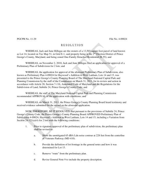
<strong>PGCPB</strong> <strong>No</strong>. <strong>11</strong>-<strong>29</strong> <strong>File</strong> <strong>No</strong>. 4-<strong>09024</strong><br />
R E S O L U T I O N<br />
<strong>WHEREAS</strong>, <strong>Jack</strong> and June Hillegas are the owners of a 13,503-square foot parcel of land known<br />
as Lot 14, located on Tax Map 51, in Grid E-1, said property being in the 2 nd Election District of Prince<br />
George's County, Maryland, and being zoned One-Family Detached Residential (R-55); and<br />
<strong>WHEREAS</strong>, on <strong>No</strong>vember 2, 2010, <strong>Jack</strong> and June Hillegas filed an application for approval of a<br />
Preliminary Plan of Subdivision for 2 lots; and<br />
<strong>WHEREAS</strong>, the application for approval of the aforesaid Preliminary Plan of Subdivision, also<br />
known as Preliminary Plan 4-<strong>09024</strong> for Haywood’s Addition to West Lanham, Lots 14 and 15, was<br />
presented to the Prince George's County Planning Board of The Maryland-National Capital Park and<br />
Planning Commission by the staff of the Commission on March 31, 20<strong>11</strong>, for its review and action in<br />
accordance with Article 28, Section 7-<strong>11</strong>6, Annotated Code of Maryland and the Regulations for the<br />
Subdivision of Land, Subtitle 24, Prince George's County Code; and<br />
<strong>WHEREAS</strong>, the staff of The Maryland-National Capital Park and Planning Commission<br />
recommended APPROVAL of the application with conditions; and<br />
<strong>WHEREAS</strong>, on March 31, 20<strong>11</strong>, the Prince George's County Planning Board heard testimony and<br />
received evidence submitted for the record on the aforesaid application.<br />
NOW, THEREFORE, BE IT RESOLVED, that pursuant to the provisions of Subtitle 24, Prince<br />
George's County Code, the Prince George's County Planning Board APPROVED Preliminary Plan of<br />
Subdivision 4-<strong>09024</strong>, Haywood’s Addition to West Lanham, Lots 14 and 15, including a Variation from<br />
Section 24-121(a)(4) for 2 lots with the following conditions:<br />
1. Prior to signature approval of the preliminary plan of subdivision, the preliminary plan<br />
shall be revised to:<br />
a. Show the unmitigated 65 dBA Ldn noise contour at 228 feet from the centerline<br />
of Veterans Parkway (MD 410).<br />
b. Provide the definition of lot frontage in the general notes and how it was<br />
determined for Lot 15.<br />
c. Remove “route” from the preliminary plan.<br />
d. Revise General <strong>No</strong>te 9 to include the property description.
<strong>PGCPB</strong> <strong>No</strong>. <strong>11</strong>-<strong>29</strong><br />
<strong>File</strong> <strong>No</strong>. 4-<strong>09024</strong><br />
Page 2<br />
e. Provide the stormwater management approval dates.<br />
f. Label denial of access to MD 410 from Lot 15.<br />
2. Development of this site shall be in conformance with Stormwater Management Concept<br />
Plans 24156-2008-00 and 28590-20080-00 and any subsequent revisions.<br />
3. At the time of final plat, the applicant shall dedicate a ten-foot public utility easement<br />
(PUE) along the public rights-of-way as delineated on the approved preliminary plan of<br />
subdivision. The PUE shall remain free and clear of site improvements unless express<br />
permission is granted by all of the affected utility companies.<br />
4. Prior to approval of building permits by The Maryland-National Capital Park and<br />
Planning Commission (M-NCPPC), the permit plans for each lot shall orient building<br />
structures to be parallel to MD 410, which shields the associated rear outdoor activity<br />
areas from traffic generated noise impacts associated with MD 410.<br />
5. Prior to the issuance of building permits for proposed residential structures, the applicant<br />
shall submit certification by a professional engineer with competency in acoustical<br />
analysis to the Environmental Planning Section (M-NCPPC) demonstrating that the design<br />
and construction of building shells within the noise corridor of MD 410 will attenuate<br />
noise to interior noise levels of 45 dBA Ldn or less.<br />
6. Prior to approval of the final plat, the applicant and the applicant’s heirs, successors,<br />
and/or assignees shall pay a fee-in-lieu of the mandatory dedication of parkland in<br />
accordance with the requirements of Section 24-135 of the Subdivision Regulations.<br />
7. The final plat shall reflect the denial of access from Lot 15 to MD 410.<br />
BE IT FURTHER RESOLVED, that the findings and reasons for the decision of the Prince<br />
George's County Planning Board are as follows:<br />
1. The subdivision, as modified, meets the legal requirements of Subtitles 24 and 27 of the<br />
Prince George's County Code and of Article 28, Annotated Code of Maryland.
<strong>PGCPB</strong> <strong>No</strong>. <strong>11</strong>-<strong>29</strong><br />
<strong>File</strong> <strong>No</strong>. 4-<strong>09024</strong><br />
Page 3<br />
2. Development Data Summary—The following information relates to the subject<br />
preliminary plan application and the proposed development.<br />
EXISTING<br />
APPROVED<br />
Zone R-55 R-55<br />
Use(s) Vacant Residential<br />
Acreage 13,503 sq. ft. 13,503 sq. ft.<br />
Lots 1 2<br />
Outlots 0 0<br />
Parcels 0 0<br />
Dwelling Units:<br />
Detached 0 2<br />
Public Safety Mitigation Fee <strong>No</strong> <strong>No</strong><br />
Variation <strong>No</strong> Yes (Section 24-121(a)(4))<br />
Variance <strong>No</strong> <strong>No</strong><br />
Pursuant to Section 24-<strong>11</strong>9(d)(2) of the Subdivision Regulations, this case was heard<br />
before the Subdivision and Development Review Committee (SDRC) on <strong>No</strong>vember <strong>29</strong>,<br />
2010. The requested variation to Section 24-121(a)(4) was accepted on <strong>No</strong>vember 2, 2010<br />
and was heard by the SDRC on <strong>No</strong>vember <strong>29</strong>, 2010.<br />
3. Environmental—A Natural Resources Inventory (NRI-005-08) was previously reviewed<br />
for the subject property. A review of the available information indicates that there are no<br />
streams, wetlands, 100-year floodplain, areas of severe slopes, nor areas of steep slopes on<br />
highly erodible soils on the site. There are no Marlboro clays found on the site. The site is<br />
adjacent to MD 410, a master-planned arterial roadway that generates sufficient traffic that<br />
results in noise levels that are above the residential standard of 65 dBA Ldn. The soils<br />
found to occur on the site, according to the Prince George’s County Soil Survey, are in the<br />
Sassafras series. According to information obtained from the Maryland Department of<br />
Natural Resources, Natural Heritage Program, there are no rare, threatened, or endangered<br />
species found to occur in the vicinity of this property. There are no designated scenic or<br />
historic roads adjacent to this property. The site is in the Brier Ditch watershed of the<br />
Anacostia River Basin. This property is located in the Developed Tier as delineated in the<br />
Prince George’s County Approved General Plan.<br />
Master Plan Conformance<br />
The subject property is located within the 1994 Approved Master Plan and Sectional Map<br />
Amendment for Bladensburg-New Carrollton and Vicinity (Planning Area 69). The plan<br />
contains specific environmental recommendations and design standards that require<br />
review for conformance. The environmental requirements for woodland conservation,<br />
stormwater management, and noise are addressed below.
<strong>PGCPB</strong> <strong>No</strong>. <strong>11</strong>-<strong>29</strong><br />
<strong>File</strong> <strong>No</strong>. 4-<strong>09024</strong><br />
Page 4<br />
Countywide Green Infrastructure Plan Conformance<br />
This does not contain any elements within the designated area of the Approved<br />
Countywide Green Infrastructure Plan.<br />
Environmental Review<br />
The preliminary plan application has a signed Natural Resources Inventory (NRI-005-08)<br />
dated October 8, 2008 that was included with the application package. The site does not<br />
contain any regulated features. The existing site information is correctly shown on the NRI<br />
and the associated plans.<br />
This property is exempt from the requirements of the Prince George’s County Woodland<br />
and Wildlife Habitat Conservation Ordinance because it is less than 40,000 square feet in<br />
size and has no previously approved tree conservation plans. A standard letter of<br />
exemption from the Woodland and Wildlife Habitat Conservation Ordinance for this site<br />
was issued <strong>No</strong>vember <strong>29</strong>, 2010. A Type 1 tree conservation plan is not required with this<br />
application.<br />
Subtitle 25, Division 3: Tree Canopy Coverage Ordinance requires a minimum percentage<br />
of tree canopy coverage (TCC) on projects that require a grading permit. Properties zoned<br />
R-55 are required to provide a minimum of 15 percent of the gross tract area in tree<br />
canopy. The gross tract area is 13,503 square feet resulting in a requirement for TCC of<br />
0.05 acre or 2,178 square feet, which will be required to be met at the time of review of<br />
permits.<br />
The NRI shows that several large trees exist on the site that, if properly preserved, could<br />
be counted toward meeting the TCC requirement. Additional landscaping will need to be<br />
added as necessary to provide conformance with the requirements. Prior to approval of<br />
building permits by The Maryland-National Capital Park and Planning Commission (M-<br />
NCPPC) for the subject site, a tree canopy coverage schedule will be required.<br />
The site is adjacent to MD 410, a designated arterial roadway. For residential uses, rear<br />
outdoor activity areas must have noise levels of 65 dBA Ldn or less in order to be in<br />
conformance with State of Maryland standards. Rear yards should be oriented away from<br />
MD 410. Front yards should be oriented in a parallel manner to MD 410. The interiors of<br />
all residential structures must have noise levels of 45 dBA Ldn or less to be in<br />
conformance with state standards, and is required.<br />
According to the Environmental Planning Section’s noise model, the unmitigated 65 dBA<br />
Ldn noise contour is approximately 228 feet from the centerline of MD 410. The<br />
unmitigated 65 dBA Ldn noise contour needs to be shown on the preliminary plan. Based<br />
on this measurement, the entire site will be impacted by noise above the state standard of<br />
65 dBA Ldn for rear outdoor activity areas and 45 dBA Ldn for interior areas.
<strong>PGCPB</strong> <strong>No</strong>. <strong>11</strong>-<strong>29</strong><br />
<strong>File</strong> <strong>No</strong>. 4-<strong>09024</strong><br />
Page 5<br />
However, The Maryland-National Capital Park and Planning Commission (M-NCPPC)<br />
noise model assumes flat surfaces without surface conditions that would elevate noise<br />
levels. The topography between MD 410 and the subject lots is not flat, with the lots being<br />
substantially lower in elevation than the road. This situation results in lower noise levels<br />
than those predicted in the model. The surface conditions between MD 410 and the<br />
proposed lots are vegetated and do not add to the existing noise levels. Therefore, the<br />
Planning Board supports the variation for lot depth with conditions related to dwelling<br />
unit orientation, and building shell construction.<br />
Based on the topography shown on the signed NRI and confirmed during a site visit,<br />
proposed Lot 15 is approximately 30 feet lower than MD 410 and proposed Lot 14 is<br />
approximately 20 feet lower than MD 410. Generally, when a site is topographically lower<br />
than the adjacent street, it is less impacted by traffic generated noise, particularly the lower<br />
levels of the proposed structures. Because the entire site is within the area impacted by<br />
noise above the state standard, mitigation will be required. Because a noise barrier would<br />
not be practical to address noise impacts to outdoor activity areas, the proposed front of<br />
the residential structures should be parallel to MD 410 such that the rear outdoor areas are<br />
shielded from traffic generated noise impacts. For interior areas, the first and second floor<br />
elevation of the proposed structures should be designed with materials that will mitigate<br />
the interior areas to 45 dBA Ldn or less. These standards will be required at the time of<br />
building permit approval by M-NCPPC.<br />
4. Variation—The subject property is adjacent to MD 410, an arterial roadway, and Section<br />
24-121(a)(4) of the Subdivision Regulations states:<br />
(a)<br />
The Planning Board shall require that proposed subdivisions conform to the<br />
following:<br />
(4) Residential lots adjacent to existing or planned roadways of arterial<br />
classification shall be platted with a minimum depth of one hundred<br />
and fifty (150) feet. Residential lots adjacent to an existing or<br />
planned roadway of freeway or higher classification, or an existing<br />
or planned transit right-of-way, shall be platted with a depth of three<br />
hundred (300) feet. Adequate protection and screening from traffic<br />
nuisances shall be provided by earthen berms, plant materials,<br />
fencing, and/or the establishment of a building restriction line, when<br />
appropriate.<br />
For this preliminary plan of subdivision, the application is subdividing an existing lot into<br />
two lots for the construction of single-family dwelling units. The proposed new dwellings<br />
will be consistent with adjacent development. Additionally, the proposed lots are further<br />
from the noise generator than lots that are located on the south side of Ingraham Street.
<strong>PGCPB</strong> <strong>No</strong>. <strong>11</strong>-<strong>29</strong><br />
<strong>File</strong> <strong>No</strong>. 4-<strong>09024</strong><br />
Page 6<br />
Veterans Parkway (MD 410) was constructed approximately 35 feet higher in elevation<br />
than the proposed lots and is buffered by existing established evergreen trees between<br />
Veterans Parkway and the subject site.<br />
Section 24-<strong>11</strong>3(a) of the Subdivision Regulations sets forth the required findings for<br />
approval of variation requests as follows:<br />
a. Where the Planning Board finds that extraordinary hardship or practical<br />
difficulties may result from strict compliance with this Subtitle and/or that<br />
the purposes of this Subtitle may be served to a greater extent by an<br />
alternative proposal, it may approve variations from these Subdivision<br />
Regulations so that substantial justice may be done and the public interest<br />
secured, provided that such variation shall not have the effect of nullifying<br />
the intent and purpose of this Subtitle; and further provided that the<br />
Planning Board shall not approve variations unless it shall make findings<br />
based upon evidence presented to it in each specific case that:<br />
(1) The granting of the variation request would not be detrimental to<br />
public safety, health or welfare and does not injure other property;<br />
The property is in the Developed Tier and is consistent with the goals of the sector<br />
plan; the applicant is proposing new single-family dwellings at the street end of an<br />
established block of dwelling units. The subdivision requirements for land<br />
adjacent to an arterial roadway is that they must be platted with a minimum lot<br />
depth of 150 feet and front on either an interior street or service road. This lot<br />
depth provides opportunities to place a dwelling where the impacts will be<br />
mitigated to the extent possible. Granting a variation would not be injurious to the<br />
public or adjoining properties in this case, with conditions which will mitigate the<br />
noise impacts.<br />
(2) The conditions on which the variation is based are unique to the<br />
property for which the variation is sought and are not applicable<br />
generally to other properties;<br />
The conditions on which the variation is based are unique to the property. This is<br />
the only property located on Ingraham Street that has frontage at the intersection<br />
of Ingraham Street and MD 410. At this location MD 410 is approximately 30 feet<br />
higher in elevation than the subject property. Generally, unusable rear yards are<br />
not supportable. In this instance this property is situated in such a manner that the<br />
rear yards can be shielded by a parallel orientation of the dwellings to MD 410.<br />
Other properties on Ingraham Street have rear yards that face MD 410, have steep<br />
grades and are entirely subject to noise of 65 dba and greater. The triangular shape
<strong>PGCPB</strong> <strong>No</strong>. <strong>11</strong>-<strong>29</strong><br />
<strong>File</strong> <strong>No</strong>. 4-<strong>09024</strong><br />
Page 7<br />
and size of the property, as well as its location in the established residential<br />
neighborhood, are unique to the property.<br />
(3) The variation does not constitute a violation of any other applicable<br />
law, ordinance or regulation; and<br />
Approval of this variation will not constitute a violation of other applicable laws<br />
because the applicant will have to obtain permits from other local, state, and<br />
federal agencies as required by their regulations.<br />
(4) Because of the peculiar physical surroundings, shape or<br />
topographical conditions of the specific property involved, a<br />
particular hardship to the owner would result, as distinguished from<br />
a mere inconvenience, if the strict letter of these regulation is carried<br />
out.<br />
The General Plan envisions a network of sustainable, transit-supporting, mixeduse,<br />
pedestrian-oriented, medium- to high-density neighborhoods. The medium<br />
density neighborhood where this property is located is existing and is not<br />
inconsistent with the General Plan. The property does have peculiar physical<br />
surroundings and shape. The property does not meet the minimum lot depth and is<br />
in fact the only property on Ingraham Street that has an intersection with Ingraham<br />
and Veterans Parkway (MD 410). The property is also approximately 30 feet<br />
lower than the noise generator (Veterans Parkway). With steep slopes and a<br />
peculiar triangular shape this property is unable to meet the lot depth requirement<br />
and would cause a particular hardship on the owner and result in the inability to<br />
develop the lot in keeping with other established dwellings on the same street.<br />
Some of the dwellings located on Ingraham Street have backyards that abut the<br />
noise generator.<br />
The Planning Board grants the request for a variation from Section 24-121(a)(4) of the<br />
Subdivision Regulations for Lots 14 and 15.<br />
5. Community Planning—The applicant proposes the construction of a two new singlefamily<br />
dwelling. In accordance with the General Plan, this application is located in the<br />
Developed Tier.<br />
The vision for the Developed Tier is a network of sustainable, transit-supporting, mixeduse,<br />
pedestrian-oriented, medium- to high-density neighborhoods. The preliminary plan of<br />
subdivision application is consistent with the General Plan Development Pattern policies<br />
for the Developed Tier. The approval of the variation from lot depth will not change the<br />
character of the lotting pattern and is not inconsistent with the General Plan of master<br />
plan.
<strong>PGCPB</strong> <strong>No</strong>. <strong>11</strong>-<strong>29</strong><br />
<strong>File</strong> <strong>No</strong>. 4-<strong>09024</strong><br />
Page 8<br />
The proposed land use is consistent with the 1994 Approved Master Plan and Sectional<br />
Map Amendment for Bladensburg-New Carrollton and Vicinity.<br />
6. The Department of Parks and Recreation (DPR)—In accordance with Section 24-<br />
134(a) of the Subdivision Regulations, the applicant should pay a fee-in-lieu of parkland<br />
dedication because the land available for dedication is unsuitable due to its size and<br />
location.<br />
7. Trails—The preliminary plan was reviewed for conformance with the Countywide Master<br />
plan of Transportation (MPOT) and the 1994 Approved Master Plan and Sectional Map<br />
Amendment for Bladensburg-New Carrollton and Vicinity.<br />
There are no non-vehicular and transportation-related issues identified. The subject lot has<br />
access to Ingraham Street, which does not contain sidewalks. The area master plan does<br />
not contain any trail recommendations that affect the subject property.<br />
Based on the preceding analysis, adequate bicycle and pedestrian transportation facilities<br />
will exist to serve the proposed use as required under Section 24-123 of the Subdivision<br />
Regulations from the standpoint of non-vehicular circulation and transportation. With the<br />
right-of-way dedication required DPW&T could install sidewalks if determined<br />
appropriate in the future.<br />
8. Transportation—The subject property consists of approximately 13,503 square feet of<br />
land in the R-55 Zone. The property is located on Ingraham Street at the terminus of<br />
Ingraham Street and (MD 410). The applicant proposes to subdivide the existing lot and<br />
construct two new single-family dwellings. Therefore, it is determined that the proposed<br />
subdivision would generate 2 AM and 2 PM weekday peak-hour vehicle trips.<br />
Both proposed lots have planned driveway access to Ingraham Street. This is a non<br />
master-planned roadway with a 50-foot right-of-way. The site plan shows approximately<br />
65 feet of additional pavement and an oblong-shaped dead end. Driveway access and<br />
planned pavement on Ingraham Street will be reviewed by the Prince George’s County<br />
Department of Public Works and Transportation (DPW&T). Access to Lot 15 from MD<br />
410 is denied.<br />
Lot 15 borders MD 410 (Veterans Parkway), is a master plan arterial facility with a<br />
120-foot-wide right-of-way. Adequate right-of-way in accordance with master plan<br />
requirements has already been dedicated or deeded. Therefore, no further right-of-way<br />
dedication is required of this plan.<br />
The traffic generated by the proposed preliminary plan would impact the intersection of<br />
76th Avenue and Ingraham Street. This intersection is unsignalized.
<strong>PGCPB</strong> <strong>No</strong>. <strong>11</strong>-<strong>29</strong><br />
<strong>File</strong> <strong>No</strong>. 4-<strong>09024</strong><br />
Page 9<br />
Analysis of Traffic Impacts<br />
The subject property is located within the Developed Tier, as defined in the Prince<br />
George’s County Approved General Plan. As such, the subject property is evaluated<br />
according to the following standards:<br />
• Links and signalized intersections: Level-of-service (LOS) E, with<br />
signalized intersections operating at a critical lane volume (CLV) of 1,600<br />
or better.<br />
• Unsignalized intersections: The Highway Capacity Manual<br />
(Transportation Research Board) procedure for unsignalized intersections<br />
is not a true test of adequacy, but rather an indicator that further<br />
operational studies need to be conducted. Vehicle delay in any movement<br />
exceeding 50.0 seconds is deemed to be an unacceptable operating<br />
condition at unsignalized intersections. In response to such a finding, the<br />
Planning Board has generally recommended that the applicant provide a<br />
traffic signal warrant study and install the signal (or other less costly<br />
warranted traffic controls) if deemed warranted by the appropriate<br />
operating agency.<br />
The critical intersection of 76th Avenue and Ingraham Street is not programmed for<br />
improvement with 100 percent construction funding within the next six years in the<br />
current Maryland Department of Transportation Consolidated Transportation Program or<br />
the Prince George’s County Capital Improvement Program.<br />
<strong>No</strong> recent turning movement counts are available at the critical intersection of 76th<br />
Avenue and Ingraham Street. Due to the limited trip generation of this site, the Prince<br />
George’s County Planning Board has deemed the site’s impact at this location to be<br />
de minimus, and found that 2 AM and 2 PM peak-hour trips will have a de minimus<br />
impact upon delay in the critical movements at the 76th Avenue and Ingraham Street<br />
intersection.<br />
The two lots being created would have direct driveway access to Ingraham Street.<br />
Ingraham Street will be extended by approximately 65 feet to accommodate two planned<br />
driveways. The proposed paving plan will require approval by DPW&T for street<br />
construction permits.<br />
Based on the preceding findings, adequate transportation facilities will exist to serve the<br />
proposed subdivision as required under Section 24-124 of the Prince George’s County<br />
Code.
<strong>PGCPB</strong> <strong>No</strong>. <strong>11</strong>-<strong>29</strong><br />
<strong>File</strong> <strong>No</strong>. 4-<strong>09024</strong><br />
Page 10<br />
9. Schools—The Special Projects Section has reviewed this preliminary plan for impact on<br />
school facilities in accordance with Section 24-122.02 of the Subdivision Regulations and<br />
County Council Resolution CR-23-2003 and concluded the following:<br />
Impact on Affected Public School Clusters<br />
Affected School<br />
Clusters #<br />
Elementary School<br />
Cluster 7<br />
Middle School<br />
Cluster 4<br />
High School<br />
Cluster 4<br />
Dwelling Units 2 DU 2 DU 2 DU<br />
Pupil Yield Factor .16 .13 .14<br />
Subdivision Enrollment 0.32 0.26 0.28<br />
Actual Enrollment 32,508 9,899 16,049<br />
Total Enrollment 32,508.32 9,899.26 16,049.28<br />
State Rated Capacity 39,039 <strong>11</strong>,571 16,314<br />
Percent Capacity 83% 85% 98%<br />
Source: Prince George’s County Planning Department, M-NCPPC, January 2007<br />
County Council Bill CB-31-2003 established a school facilities surcharge in the amounts<br />
of: $7,000 per dwelling if a building is located between I-95/495 (Capital Beltway) and<br />
the District of Columbia; $7,000 per dwelling if the building is included within a basic<br />
plan or conceptual site plan that abuts an existing or planned mass transit rail station site<br />
operated by the Washington Metropolitan Area Transit Authority (WMATA); or $12,000<br />
per dwelling for all other buildings. County Council Bill CB-31-2003 allows for these<br />
surcharges to be adjusted for inflation and the current amounts are $8,<strong>29</strong>9 and $14,227 to<br />
be paid at the time of the issuance of each building permit.<br />
The school facilities surcharge may be used for the construction of additional or expanded<br />
school facilities and renovations to existing school buildings or other systemic changes.<br />
10. Fire and Rescue—This preliminary plan of subdivision includes construction of two<br />
single-family dwellings.<br />
This preliminary plan is within the required seven-minute response time for the first due<br />
fire station, West Lanham Hills, Company 28, using the Seven-Minute Travel Times and<br />
Fire Station Locations Map provided by the Prince George’s County Fire/EMS<br />
Department.<br />
Pursuant to CR-69-2006, the Prince George’s County Council and the County Executive<br />
temporarily suspended the provisions of Section 24-122.01(e)(1)(A) and (B) of the<br />
Subdivision Regulations regarding sworn fire and rescue personnel staffing levels.<br />
The Fire/EMS Chief has reported that the Fire/EMS Department has adequate equipment<br />
to meet the standards stated in CB-56-2005.
<strong>PGCPB</strong> <strong>No</strong>. <strong>11</strong>-<strong>29</strong><br />
<strong>File</strong> <strong>No</strong>. 4-<strong>09024</strong><br />
Page <strong>11</strong><br />
Capital Improvement Program (CIP)<br />
The Prince George’s County Capital Budget and Program for Fiscal Years 20<strong>11</strong>–2016<br />
provides funding for a replacement Fire/EMS station at 6200 Belcrest Road.<br />
The above findings are in conformance with the 2008 Approved Public Safety Facilities<br />
Master Plan and the “Guidelines for the Analysis of Development Impact on Fire and<br />
Rescue Facilities.”<br />
<strong>11</strong>. Police Facilities—The subject property is located in Police District I, Hyattsville.<br />
The response time standard for emergency calls is ten minutes and the standard for<br />
nonemergency calls is 25 minutes. The times are based on a rolling average for the<br />
preceding 12 months. The preliminary plan was accepted for processing by the Planning<br />
Department on <strong>No</strong>vember 2, 2010.<br />
Reporting Cycle<br />
Previous 12 Month<br />
Cycle<br />
Emergency Calls <strong>No</strong>n-emergency Calls<br />
Cycle 1 <strong>11</strong>/2009–10/2010 9 minutes 7 minutes<br />
Cycle 2<br />
Cycle 3<br />
The response time standards of ten minutes for emergency calls and 25 minutes for<br />
nonemergency calls were met on <strong>No</strong>vember 8, 2010.<br />
The Police Chief has reported that the Police Department has adequate equipment to meet<br />
the standards stated in CB-56-2005.<br />
Pursuant to County Council Resolution CR-69-2006, the Prince George’s County Council<br />
and the County Executive temporarily suspended the provisions of Section 24-<br />
122.01(e)(1)(A) and (B) of the Subdivision Regulations regarding sworn police personnel<br />
staffing levels.<br />
12. Health Department—The Prince George’s County Health Department, Environmental<br />
Engineering Program, has reviewed the preliminary plan of subdivision and has no<br />
comments to offer.<br />
13. Stormwater Management—The Department of Public Works and Transportation<br />
(DPW&T), Office of Engineering, has determined that on-site stormwater management is<br />
not required. A Stormwater Management Concept Plan, 28590-2008-00, for proposed Lot<br />
15 has been approved with conditions. Copies of an approved Stormwater Management<br />
Concept Letter and Plan (24156-2008) were also submitted for Lot 14.
<strong>PGCPB</strong> <strong>No</strong>. <strong>11</strong>-<strong>29</strong><br />
<strong>File</strong> <strong>No</strong>. 4-<strong>09024</strong><br />
Page 12<br />
These approvals will ensure that development of this site does not result in on-site or<br />
downstream flooding. Development must be in accordance with the approved plans.<br />
14. Historic—A Phase I archeological survey is not recommended on the above-referenced<br />
13,503-square-foot property located at 7510 Ingraham Street in Landover Hills, Maryland.<br />
The probability of archeological sites within the subject property is low. However, the<br />
applicant should be aware that there is one previously identified archeological site, Cherry<br />
Hill Cemetery (18PR381), a late 19th to early 20th century African American family<br />
cemetery, located within one mile of the subject property. In addition, there are three<br />
county Historic Sites, #69-021 Cherry Hill Cemetery, #69-023-17 Wormley House, and<br />
#69-023-27 Thomas Hunster House, located within one mile of the subject property.<br />
Moreover, Section 106 review may require archeological survey for state or federal<br />
agencies. Section 106 of the National Historic Preservation Act requires federal agencies<br />
to take into account the effects of their undertakings on historic properties, to include<br />
archeological sites. This review is required when state or federal monies, or federal<br />
permits are required for a project.<br />
The subject property has no the effect on identified historic sites, resources, or districts.<br />
15. Public Utility Easement (PUE)—In accordance with Section 24-122(a) of the<br />
Subdivision Regulations, when utility easements are required by a public utility company,<br />
the subdivider must include the following statement in the dedication documents<br />
established on the final plat:<br />
“Utility easements are granted pursuant to the declaration recorded among the<br />
County Land Records in Liber 3703 at Folio 748.”<br />
The preliminary plan of subdivision correctly delineates a ten-foot public utility easement<br />
(PUE) along the public rights-of-way as requested by the utility companies. The PUE must<br />
remain free and clear from any site improvements including parking.<br />
16. Water and Sewer Categories—Section 24-122.01(b)(1) of the Subdivision Regulations<br />
states that “the location of the property within the appropriate service area of the Ten-Year<br />
Water and Sewerage Plan is deemed sufficient evidence of the immediate or planned<br />
availability of public water and sewerage for preliminary or final plat approval.”<br />
The 2008 Water and Sewer Plan placed this property in water and sewer Category 3,<br />
Community System, and will therefore be served by public systems.<br />
BE IT FURTHER RESOLVED, that an appeal of the Planning Board’s action must be filed with<br />
Circuit Court for Prince George’s County, Maryland within thirty (30) days following the date of notice of<br />
the adoption of this Resolution.
<strong>PGCPB</strong> <strong>No</strong>. <strong>11</strong>-<strong>29</strong><br />
<strong>File</strong> <strong>No</strong>. 4-<strong>09024</strong><br />
Page 13<br />
* * * * * * * * * * * * *<br />
This is to certify that the foregoing is a true and correct copy of the action taken by the Prince<br />
George's County Planning Board of The Maryland-National Capital Park and Planning Commission on the<br />
motion of Commissioner Squire, seconded by Commissioner Cavitt, with Commissioners Squire, Cavitt<br />
and Vaughns voting in favor of the motion, and with Commissioners Clark and Parker absent at its regular<br />
meeting held on Thursday, March 31, 20<strong>11</strong>, in Upper Marlboro, Maryland.<br />
Adopted by the Prince George's County Planning Board this 28 th day of April 20<strong>11</strong>.<br />
Patricia Colihan Barney<br />
Executive Director<br />
By<br />
Jessica Jones<br />
Acting Planning Board Administrator<br />
PCB:JJ:JT:arj


