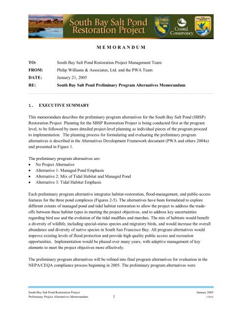
M E M O R A N D U M - South Bay Salt Pond Restoration Project
M E M O R A N D U M - South Bay Salt Pond Restoration Project
M E M O R A N D U M - South Bay Salt Pond Restoration Project

Create successful ePaper yourself
Turn your PDF publications into a flip-book with our unique Google optimized e-Paper software.
M E M O R A N D U M<br />
TO: <strong>South</strong> <strong>Bay</strong> <strong>Salt</strong> <strong>Pond</strong> <strong>Restoration</strong> <strong>Project</strong> Management Team<br />
FROM: Philip Williams & Associates, Ltd. and the PWA Team<br />
DATE: January 21, 2005<br />
RE: <strong>South</strong> <strong>Bay</strong> <strong>Salt</strong> <strong>Pond</strong> Preliminary Program Alternatives Memorandum<br />
1. EXECUTIVE SUMMARY<br />
This memorandum describes the preliminary program alternatives for the <strong>South</strong> <strong>Bay</strong> <strong>Salt</strong> <strong>Pond</strong> (SBSP)<br />
<strong>Restoration</strong> <strong>Project</strong>. Planning for the SBSP <strong>Restoration</strong> <strong>Project</strong> is being conducted first at the program<br />
level, to be followed by more detailed project-level planning as individual pieces of the program proceed<br />
to implementation. The planning process for formulating and evaluating the preliminary program<br />
alternatives is described in the Alternatives Development Framework document (PWA and others 2004a)<br />
and presented in Figure 1.<br />
The preliminary program alternatives are:<br />
• No <strong>Project</strong> Alternative<br />
• Alternative 1: Managed <strong>Pond</strong> Emphasis<br />
• Alternative 2: Mix of Tidal Habitat and Managed <strong>Pond</strong><br />
• Alternative 3: Tidal Habitat Emphasis<br />
Each preliminary program alternative integrates habitat-restoration, flood-management, and public-access<br />
features for the three pond complexes (Figures 2-5). The alternatives have been formulated to explore<br />
different extents of managed pond and tidal habitat restoration to allow the project to address the tradeoffs<br />
between these habitat types in meeting the project objectives, and to address key uncertainties<br />
regarding bird use and the evolution of the tidal mudflats and marshes. The mix of habitats would benefit<br />
a diversity of wildlife, including special-status species and migratory birds, and would increase the overall<br />
abundance and diversity of native species in <strong>South</strong> San Francisco <strong>Bay</strong>. All program alternatives would<br />
improve existing levels of flood protection and provide high quality public access and recreation<br />
opportunities. Implementation would be phased over many years, with adaptive management of key<br />
elements to meet the project objectives more effectively.<br />
The preliminary program alternatives will be refined into final program alternatives for evaluation in the<br />
NEPA/CEQA compliance process beginning in 2005. The preliminary program alternatives were<br />
<strong>South</strong> <strong>Bay</strong> <strong>Salt</strong> <strong>Pond</strong> <strong>Restoration</strong> <strong>Project</strong> January 2005<br />
Preliminary <strong>Project</strong> Alternatives Memorandum 1 1750.01
developed with input from the <strong>Project</strong> Management Team, Science Team, Regulatory and Trustee<br />
Agency Group, and the public through a series of workshops and meetings. 1<br />
2. INTRODUCTION<br />
The process for formulating and evaluating alternatives for the <strong>South</strong> <strong>Bay</strong> <strong>Salt</strong> <strong>Pond</strong> (SBSP) <strong>Restoration</strong><br />
<strong>Project</strong> is outlined in the Alternatives Development Framework (ADF) (PWA and others 2004a) and<br />
depicted graphically in Figure 1. Formulation of the preliminary program alternatives builds on previous<br />
steps in the alternatives development process: identification of project goals and objectives, opportunities<br />
and constraints assessment, and identification of initial options for restoration at each pond complex. The<br />
project goal and objectives are shown in Attachment 1.<br />
The immediate next steps will be to evaluate the preliminary program alternatives using a weighting and<br />
ranking process, and then to refine the preliminary program alternatives into final program alternatives for<br />
NEPA/CEQA assessment beginning in mid-2005. The landscape-scale assessment of tidal habitat<br />
evolution and bird use will inform the preliminary program alternatives evaluation. The landscape-scale<br />
assessment will provide estimates of the rates and patterns of tidal-habitat evolution in <strong>South</strong> San<br />
Francisco <strong>Bay</strong> following restoration, and predictions of bird use within the managed ponds and the<br />
evolving tidal landscape.<br />
This memorandum is organized into the following sections:<br />
Section 3. Definition of a Program Alternative<br />
Section 4. Planning Features and Considerations<br />
Section 5. Preliminary Program Alternatives<br />
Section 6. Phasing<br />
Section 7. Adaptive Management Decisions<br />
Section 8. Next Steps<br />
3. DEFINITION OF A PROGRAM ALTERNATIVE<br />
Planning for the SBSP <strong>Restoration</strong> <strong>Project</strong> is being conducted first at the program level, to be followed by<br />
more detailed project-level planning as individual pieces of the program proceed to implementation. A<br />
program alternative is an integrated plan for habitat restoration, flood protection, and public access. Each<br />
program alternative includes identification of the Phase 1 actions, a description of the overall phasing plan<br />
for full implementation, and a description of the key elements subject to adaptive management. The Phase<br />
1 actions, while identified and generally characterized in the program alternatives, will be detailed fully at<br />
the project level.<br />
At the program level the alternatives are defined broadly. Table 1 provides example levels of detail for<br />
program and project alternatives. It will be important to maintain some flexibility in the alternatives at the<br />
1 See the SBSP <strong>Restoration</strong> <strong>Project</strong> website (southbayrestoration.org) for a complete list of participants and<br />
workshop and meeting schedules<br />
<strong>South</strong> <strong>Bay</strong> <strong>Salt</strong> <strong>Pond</strong> <strong>Restoration</strong> <strong>Project</strong> January 2005<br />
Preliminary <strong>Project</strong> Alternatives Memorandum 2 1750.01
program level. For example, specific locations of managed pond vs. tidal habitat may need to be adjusted<br />
to provide for flood management based on detailed project-level flood studies.<br />
The preliminary program alternatives will continue to be refined in terms of features and phasing as they<br />
progress to final program alternatives for NEPA/CEQA assessment. For example, levee locations and<br />
public access/recreation alignments will continue to be refined in response to ongoing studies and<br />
discussions with stakeholders (e.g., PG&E, Alameda County Flood Control District, Santa Clara Valley<br />
Water District, San Francisco <strong>Bay</strong> Trail <strong>Project</strong>, etc.). Overall phasing will be refined and the Phase 1<br />
actions will be identified. The program alternatives are expected to be finalized by mid-2005, and the<br />
draft Environmental Impact Statement / Report (EIS/R) is expected to be released in mid-2006.<br />
Future phases of the SBSP <strong>Restoration</strong> <strong>Project</strong>, such as the Phase 2 actions and subsequent actions, will<br />
be generally specified based on the overall phasing plan for the preferred program alternative. Each phase<br />
will be accompanied by project-level planning efforts, and will be subject to modifications based on<br />
adaptive management and monitoring of previously implemented restoration actions. Ongoing monitoring<br />
efforts and management decisions may also lead to the recommendation of future project-level actions<br />
from multiple program-level alternatives.<br />
Table 1. Level of detail for Program versus <strong>Project</strong> Alternatives<br />
Program Alternative<br />
<strong>Project</strong> Alternative<br />
Habitat <strong>Restoration</strong> • Approx. locations & total extent of • Exact locations of habitat types<br />
habitat types<br />
• Types of habitat to be restored and<br />
conceptual schematic of design<br />
features to create each habitat type<br />
• <strong>Pond</strong>-specific layout of design<br />
features<br />
- e.g., exact breach locations<br />
• General operations and<br />
management regimes for the<br />
managed ponds<br />
• Specific operations and<br />
management regimes for the<br />
managed ponds<br />
Flood Management • Approaches, e.g., levees (approx.<br />
alignments)<br />
• Maintain flexibility pending<br />
detailed modeling & assessment<br />
• Specific levee alignments<br />
• Detailed flood modeling and<br />
assessment<br />
Public Access/<br />
Recreation<br />
• Types of access/ recreation, e.g.,<br />
trails, hunting, kayak launches<br />
• General trail alignments<br />
• Exact trail alignments, parking lot<br />
locations, etc.<br />
<strong>South</strong> <strong>Bay</strong> <strong>Salt</strong> <strong>Pond</strong> <strong>Restoration</strong> <strong>Project</strong> January 2005<br />
Preliminary <strong>Project</strong> Alternatives Memorandum 3 1750.01
4. PLANNING FEATURES AND CONSIDERATIONS<br />
This section describes the program-level approaches to habitat restoration, flood management, and public<br />
access/recreation, as well as more detailed considerations for determining where to locate specific design<br />
elements (e.g., tidal habitat, managed pond habitat, flood management, and public access/recreation)<br />
within the landscape.<br />
4.1 Habitat Types and <strong>Restoration</strong> Features<br />
The habitats to be created by the SBSP <strong>Restoration</strong> <strong>Project</strong> include a mix of managed pond habitats and<br />
restored tidal habitats. Multiple options for pond reconfiguration and water regime management will be<br />
used to enhance and create ponds with a variety of depths (including vegetated ponds, salt flats, very<br />
shallow ponded areas, and deep-water areas) and salinities (e.g., ponds with salinity close to bay water as<br />
well as higher salinity brine ponds), and associated levees and islands. Tidal habitat to be created by this<br />
project includes tidal brackish and salt marsh, tidal mudflat, subtidal flats and channels, marsh ecotones<br />
and upland transitional zones, salt pans and ponds.<br />
4.1.1 Managed <strong>Pond</strong>s<br />
The general categories of managed ponds consist of five specific managed pond types: enhanced ponds,<br />
seasonal ponds, high salinity ponds, reconfigured ponds, and vegetated ponds. These five managed pond<br />
types are being considered because they differ in terms of the type and quality of habitat provided for<br />
different suites of wildlife species, and to some extent in terms of up-front construction costs and longerterm<br />
operations and maintenance costs. The first four pond types listed above focus on project objective<br />
1b (maintaining current migratory bird species that utilize existing salt ponds and associated structures).<br />
The bird species utilizing these ponds, and the quality of habitat that may be achieved for various species,<br />
is expected to differ among these four pond alternatives, as discussed below under the description for<br />
each pond type. The fifth pond type, vegetated ponds, provides habitat both for migratory birds (project<br />
objective 1b) and for salt marsh harvest mice (project objective 1a); see Attachment 1 for the project<br />
objectives, and Attachment 4 for the glossary of managed pond type definitions.<br />
Enhanced ponds will be improved (relative to their existing condition) for use by nesting, roosting, and<br />
foraging birds, but are not expected to undergo extensive reconfiguration. Seasonal ponds and high<br />
salinity ponds will be managed as described in the Initial Stewardship Plan (ISP, Life Science 2003) and<br />
in Sections 4.1.1.2 and 4.1.1.3 below. Reconfigured ponds will be more extensively graded than<br />
enhanced ponds, and will be intensively managed to achieve a highly productive habitat for foraging,<br />
roosting and breeding. The fifth managed pond type consists of vegetated ponds with managed<br />
hydrology.<br />
To the extent practicable, active management of water levels is anticipated to occur via gravity flow (both<br />
intake and discharge) in all of the managed pond types to allow water levels to be controlled without the<br />
need for pumping. However, pumping may be required to manage water levels in ponds with bottom<br />
<strong>South</strong> <strong>Bay</strong> <strong>Salt</strong> <strong>Pond</strong> <strong>Restoration</strong> <strong>Project</strong> January 2005<br />
Preliminary <strong>Project</strong> Alternatives Memorandum 4 1750.01
elevations that are not conducive to the use of gravity flow (i.e., ponds that are deeply subsided and thus<br />
can not be easily drained or ponds that are elevated well above mean tide level and thus can not be easily<br />
flooded), or to manage water levels in extremely wet or dry years.<br />
Whether all, or just a subset, of these pond types will ultimately be incorporated into restoration planning<br />
will depend on the outcome of further design refinements. The benefit to cost trade-off of the various<br />
managed pond habitat types will be assessed during evaluation of the preliminary program alternatives in<br />
the spring of 2005 and the mix of managed pond types may be revised for the final program alternatives<br />
prior to NEPA/CEQA assessment.<br />
The use of recycled fresh water for flooding (i.e., to assist in the management of water levels) in at least<br />
some ponds was initially considered. However, control of tall, dense emergent vegetation such as cattails<br />
and bulrush (e.g., to maintain suitable shorebird foraging and habitat) would be more difficult in<br />
freshwater ponds than in higher-salinity ponds, and salt marsh vegetation that might be used by salt marsh<br />
harvest mice in vegetated ponds would not be supported by fresh water. Therefore, the use of recycled<br />
fresh water to maintain water levels in ponds would not address the project objectives as well as the use<br />
of bay water, and this option was not recommended for further consideration.<br />
4.1.1.1 Enhanced <strong>Pond</strong>s<br />
Enhanced ponds will not undergo extensive grading or reconfiguration, but will be improved (relative to<br />
their ISP condition) by management of water levels specifically for the purpose of providing suitable<br />
habitat for targeted species, and potentially by the limited creation of islands in some ponds. Creation of<br />
islands will provide habitat for nesting, roosting, and foraging birds. Water management regimes will be<br />
enhanced to provide improved mudflat and open-water foraging habitat for certain suites of species, to<br />
manage/limit vegetation, and/or to create nesting habitat for species such as the Snowy Plover via altered<br />
flooding and drying regimes. It is expected that the densities of targeted bird species (e.g., shorebirds in<br />
shallower ponds or portions of ponds, and waterfowl and piscivores in deeper ponds or areas) can be<br />
increased above current levels through enhanced water level management.<br />
Enhanced water level management will occur through operational changes (in response to lessons learned<br />
through the adaptive management process) and installation of additional water control structures as<br />
needed. Water levels would be monitored regularly and managed as needed via gravity-flow control<br />
structures, with pumping used only if necessary. Muted tidal exchange may be used in some situations to<br />
maintain appropriate habitat conditions. Salinity will be close to that of bay water in most enhanced<br />
ponds, providing suitable conditions for a variety of fish and benthic invertebrates, but may be elevated to<br />
some extent in “intermediate” ponds that transfer water between intake ponds and high-salinity ponds.<br />
Existing levees and water control structures will be maintained, and vegetation management (i.e., removal<br />
and/or inhibition of growth) on islands may be required.<br />
<strong>South</strong> <strong>Bay</strong> <strong>Salt</strong> <strong>Pond</strong> <strong>Restoration</strong> <strong>Project</strong> January 2005<br />
Preliminary <strong>Project</strong> Alternatives Memorandum 5 1750.01
4.1.1.2 Seasonal <strong>Pond</strong>s<br />
As described in the ISP, seasonal ponds will be flooded by precipitation, pumping, or gravity intake<br />
through existing water control structures in fall, but will be allowed to dry out via evaporation in spring<br />
(Life Science 2003). Such ponds are expected to provide open-water foraging and/or roosting habitat for<br />
waterfowl or shorebirds (depending on water depth and variability in the pond topography) from fall<br />
through early spring, moist mudflats in spring for foraging shorebirds, and dry-pond/salt flat nesting<br />
habitat for Snowy Plovers in late spring and summer. Although intake of water through control structures<br />
into these ponds will occur as necessary (e.g., to flood them in fall, possibly with additional intake during<br />
dry winters), water level management in seasonal ponds is expected to be limited in comparison to the<br />
other managed pond types, and no creation of nesting islands or other grading will occur. Although<br />
densities of waterbirds in seasonal ponds may be high when conditions are suitable for certain species,<br />
bird use is not expected to be as consistently high as in the more heavily managed enhanced ponds or<br />
reconfigured ponds. Existing levees, water control structures, and pumps will be maintained.<br />
4.1.1.3 High Salinity <strong>Pond</strong>s<br />
High salinity ponds, referred to in the ISP as “batch” ponds, will be managed as described in the ISP to<br />
provide shallow, high-salinity water; and the ISP pond management will be supplemented with the<br />
limited creation of islands for nesting birds. High salinities (e.g., 60-200 parts per thousand) are<br />
conducive to the maintenance of high populations of certain invertebrate prey species (e.g., brine flies,<br />
brine shrimp, and reticulated water boatmen) that are preyed upon heavily by Eared Grebes, phalaropes,<br />
and other waterbirds in some <strong>South</strong> <strong>Bay</strong> salt ponds. Shallow-water conditions increase the availability of<br />
these prey to birds.<br />
High salinity ponds will take advantage of existing gravity-flow water control structures to the extent<br />
possible to allow intake of water from adjacent ponds and discharge into small mixing basins, where the<br />
high salinity water will be mixed with bay water to reduce the salinity (for water quality control purposes)<br />
before discharge into the <strong>Bay</strong>. High salinities will be achieved primarily by increasing the residence time<br />
of water in the ponds, thus allowing salt to concentrate as water evaporates. However, water circulation<br />
will be important to prevent stagnation of the ponds, and pumping may be required to maintain this<br />
circulation by bringing water into higher-elevation ponds or discharging water from subsided ponds.<br />
Water levels would be monitored regularly to ensure that water depths are suitable for foraging birds.<br />
This level of water management is expected to result in higher densities of salt pond-dependent shorebirds<br />
than will be present in seasonal ponds.<br />
Limited creation of islands will enhance the use of high salinity ponds by nesting birds, such as Snowy<br />
Plovers, American Avocets, and Black-necked Stilts, that prey heavily on the abundant invertebrates in<br />
the high salinity ponds, and will provide foraging and roosting habitat for shorebirds as well. However,<br />
no extensive grading or pond reconfiguration is anticipated in the high salinity ponds. Existing levees,<br />
water control structures, and pumps will be maintained, and some vegetation management (i.e., removal)<br />
<strong>South</strong> <strong>Bay</strong> <strong>Salt</strong> <strong>Pond</strong> <strong>Restoration</strong> <strong>Project</strong> January 2005<br />
Preliminary <strong>Project</strong> Alternatives Memorandum 6 1750.01
may be needed on islands, although spray from highly saline pond water will help to inhibit the growth of<br />
vegetation in these ponds.<br />
4.1.1.4 Reconfigured <strong>Pond</strong>s<br />
Reconfigured ponds will undergo extensive grading to produce a heterogeneous mix of deep and shallowwater<br />
habitats, with numerous islands, that can be actively managed to provide nesting, brooding,<br />
roosting, and foraging habitat in order to support large and diverse populations of waterbirds. These<br />
ponds are expected to support significantly higher densities of birds than the average salt pond or any of<br />
the other managed pond types described herein. For example, given a certain level of water management,<br />
the value of enhanced ponds to birds (determined largely by water depth) is constrained by existing<br />
topography, whereas reconfigured ponds will be graded to help optimize topography so that more pond<br />
area will provide high-quality habitat for birds. Reconfigured ponds are thus expected to provide suitable<br />
habitat conditions more consistently over time (due to water level management) and space (due to grading<br />
for suitable elevations over large areas) than current ponds or other pond types. Adaptive management of<br />
these ponds, coupled with phasing of the SBSP <strong>Restoration</strong> <strong>Project</strong>, will allow for informed management<br />
of these ponds to optimize bird use.<br />
Reconfigured ponds may retain the footprint of existing smaller salt ponds, or may be created by the<br />
subdivision of larger salt ponds via the construction of small internal check berms. A series of small<br />
management units will be created by these berms. New water control structures within these berms will<br />
allow water levels and salinities in individual cells to be managed independently. Water levels would be<br />
monitored regularly, and control structures adjusted as needed to maintain optimal conditions for<br />
foraging, roosting, and nesting.<br />
Creation of the individual cells within a reconfigured pond will take advantage of natural contours to<br />
create a series of tiered cells connected by gravity flow. Check berms will be constructed along contours,<br />
using material from borrow ditches that will be flooded to inhibit access to nesting islands by mammalian<br />
predators. Islands will be graded, with some deeper water moats and some shallower slopes surrounding<br />
the islands. The higher portions of the cells will generally include very gradual slopes, so that<br />
manipulation of water depths by only a few centimeters can allow the flooding or uncovering of vast<br />
areas of managed mudflats. In cells or ponds with flatter bottoms, extensive shallow-water areas with<br />
numerous very small islands (e.g., water-filled furrows alternating with long, low, narrow islands) can be<br />
managed to provide both nesting and foraging habitat for shorebirds. Deep-water habitats will be created<br />
by excavation within the deeper portions of the cells, or by taking advantage of existing topographic<br />
heterogeneity, to provide habitat for diving birds. Desired grades within the managed ponds will be<br />
achieved with conventional grading equipment (if the substrate is firm enough), or with specialized softterrain,<br />
amphibious grading equipment on less consolidated substrates.<br />
The degree of modification (e.g., grading and water level adjustments) required for reconfigured ponds to<br />
achieve high bird use will vary depending on the current elevation, topographic variability, and other<br />
features of existing ponds. For example, some ponds currently support high shorebird densities when<br />
<strong>South</strong> <strong>Bay</strong> <strong>Salt</strong> <strong>Pond</strong> <strong>Restoration</strong> <strong>Project</strong> January 2005<br />
Preliminary <strong>Project</strong> Alternatives Memorandum 7 1750.01
water depths are suitable; such ponds would not require extensive grading, although enhanced water level<br />
management to target depths for specific species is expected to benefit waterbirds.<br />
Experimentation with island design and configuration via monitoring and adaptive management will<br />
allow the optimal design for use by nesting, brooding, roosting, and foraging birds to be refined. Initially,<br />
a variety of islands of different shapes will be provided, although long, narrow islands averaging 40 ft<br />
wide and 300 ft long have proven successful in providing roosting and nesting habitat in managed ponds<br />
in the San Joaquin Valley (Gordus and others 1996; H.T. Harvey & Associates 1996). Islands will be<br />
located away from levees and public access points to reduce disturbance, and will generally be located in<br />
the deeper portions of the cells (including areas along remnant channels). Islands will typically be<br />
oriented against the wind to provide sheltered lee-side areas, although irregular and zig-zagged islands<br />
will provide shelter from wind originating from virtually any direction. At least some islands will be high<br />
enough to prevent overwashing during high winds.<br />
Water control structures, remnant channels, and new excavated channels will allow water to be circulated<br />
through and among cells to meet target ponding depths, allow flooding and drawdown of cells to optimize<br />
prey availability, prevent stagnation, and deter vegetation establishment. Water levels will be managed<br />
through a combination of gravity drainage (preferred, to facilitate management and reduce long-term<br />
costs) and pumping (where required) to allow the maintenance of desired water depths. A flexible water<br />
circulation program with independently managed cells will allow for management of salinity within cells,<br />
allowing increased salinity in some cells and allowing salinity to be diluted in others prior to discharge<br />
into the <strong>Bay</strong>. Flexibility in the water circulation program would allow for seasonal and inter-annual<br />
variation in water depth within a given pond or cell.<br />
The level of active management of water levels expected (i.e., one person monitoring water depths and<br />
adjusting inlets and outlets every few days, with limited pumping as needed) is comparable to ongoing<br />
management levels at waterfowl refuges in the Central Valley. Ongoing water level management<br />
requirements to maintain certain conditions (e.g., specific water depths for foraging shorebirds) may be<br />
less intensive for reconfigured ponds than for enhanced ponds that lack suitable topography. The initial<br />
grading of reconfigured ponds can help ensure that at a given water level the desired conditions will be<br />
present somewhere within the pond, whereas for enhanced ponds with limited topographic variation, the<br />
desired condition would not be met if water levels became temporarily either too deep due to heavy<br />
rainfall or too shallow due to excessive evaporation.<br />
Compared to the other types of managed ponds, the reconfigured ponds are expected to create additional<br />
habitat benefits and entail additional costs. The reconfigured ponds will require more initial grading and a<br />
higher ongoing level of effort for operation and maintenance due to the greater number of islands and<br />
check berms (which will require control of vegetation) and water control structures.<br />
The concept behind reconfiguring ponds to maximize the availability of suitable habitat for target species<br />
is based on well established relationships between pond characteristics (such as water depth) and bird use<br />
and ample empirical evidence of the use of <strong>South</strong> <strong>Bay</strong> salt ponds and managed ponds (e.g., the Coyote<br />
<strong>South</strong> <strong>Bay</strong> <strong>Salt</strong> <strong>Pond</strong> <strong>Restoration</strong> <strong>Project</strong> January 2005<br />
Preliminary <strong>Project</strong> Alternatives Memorandum 8 1750.01
Creek Reach 1A pond) with certain characteristics by high numbers of birds. The ability of reconfigured<br />
ponds to attract and support high densities of migrant and breeding waterbirds has been well established<br />
based on 10 years of experimentation and management experience in the San Joaquin Valley, where the<br />
suite of species using these managed ponds is very similar to those currently using <strong>South</strong> <strong>Bay</strong> salt ponds<br />
(Gordus and others 1996; H.T. Harvey & Associates 1996). Given that such intensively reconfigured<br />
ponds have not yet been constructed in the immediate <strong>South</strong> <strong>Bay</strong> area, the use of reconfigured ponds by<br />
the SBSP <strong>Restoration</strong> <strong>Project</strong> is considered experimental. These ponds will not be implemented at a<br />
broad scale until construction and maintenance costs of the pilot reconfigured ponds are determined, the<br />
benefits of increased bird use have been determined by monitoring, and these costs and benefits can be<br />
adequately compared.<br />
4.1.1.5 Vegetated <strong>Pond</strong>s<br />
There are certain circumstances where it may be desirable to manage vegetated ponds, rather than allow<br />
such areas to be fully tidal. For example, managed, diked salt marsh, such as now exists in New Chicago<br />
Marsh in Alviso, may be created in some ponds by managing water levels and allowing (or promoting)<br />
vegetation establishment in order to provide protected reserves for the salt marsh harvest mouse while<br />
providing nesting, foraging, brooding, and roosting habitat for shorebirds and waterfowl as well.<br />
Vegetated ponds will require water management, either through controlled, muted tidal action, or via<br />
water control structures (gravity flow or pumping). They may require some initial grading, and/or<br />
internal water control structures, depending on the management goal. Full tidal action may eventually be<br />
restored to vegetated ponds to create tidal marsh, depending on the management goal and pond<br />
characteristics (e.g., degree of subsidence).<br />
4.1.2 Tidal Habitat<br />
Tidal habitat is a general term that refers to the range of habitats between subtidal bay and uplands. These<br />
primarily consist of unvegetated mudflats, emergent marsh, tidal channels, tidal ponds, salt pans, salt<br />
marsh, and upland transition zones. Each of these tidal habitats has unique functions and values that<br />
contribute to the health of the estuary. For example, salt marsh and upland transition zones are critical<br />
for the salt marsh harvest mouse, while emergent marshes comprised of pickleweed and cordgrass with<br />
complex dendritic tidal channel networks are important for the California Clapper Rail. Meanwhile,<br />
shorebirds, waterfowl, and other waterbirds will utilize the unvegetated mudflats, salt pans, tidal channels<br />
and associated tidal ponds. This mosaic of habitat types with a range of values for numerous species is<br />
referred to collectively as tidal habitat.<br />
Breaching and/or removing artificial outboard levees will restore the twice-a-day ebb and flow of the<br />
tides through the ponds. The bay waters bring with them sediments from the <strong>Bay</strong>, which will be<br />
deposited in the ponds. The sedimentation process can be accelerated in certain areas by preserving<br />
sections of levees as wave breaks to create sheltered areas. Emergent marsh vegetation will colonize in<br />
the higher elevation tidal areas. Some areas of the ponds are at elevations where vegetation such as<br />
cordgrass and pickleweed will colonize rapidly. Other areas will require the build up of mudflats through<br />
<strong>South</strong> <strong>Bay</strong> <strong>Salt</strong> <strong>Pond</strong> <strong>Restoration</strong> <strong>Project</strong> January 2005<br />
Preliminary <strong>Project</strong> Alternatives Memorandum 9 1750.01
sedimentation before vegetation will colonize. Planting of native marsh plant species can facilitate salt<br />
marsh establishment, if necessary.<br />
In large natural marsh systems, low natural levees along higher-order (i.e., 4 th and 5 th order) tidal channels<br />
provide nesting habitat for California Clapper Rails and serve as intra-marsh refugia for salt marsh<br />
harvest mice, rails, and other species during spring tides. <strong>Restoration</strong> of natural levees can be facilitated<br />
by sidecasting sediments from the channel onto the adjacent marsh. Placement of fill to block borrow<br />
ditches will prevent these artificial ditches from dominating the tide’s ebb and flow within a restored<br />
marsh, allowing for faster and more complete rejuvenation of remnant tidal channels.<br />
Upland transitional zone habitat areas can be created at the upper edge of marshes by importing fill to<br />
produce broad, gently sloping areas adjacent to flood control levees or adjoining upland habitat. These<br />
habitats can also be created passively in the long-term through natural marshplain evolution processes.<br />
These unique marsh-associated habitats, including the upland ecotone as well as natural salt pan areas<br />
within upper salt marshes, are critical components of bay wetlands and require thoughtful restoration<br />
design. Excavation of shallow depressions in the upper salt marsh will facilitate the formation of salt<br />
pans.<br />
If sediment deposition does not outpace sea level rise in a given area, then salt marsh will not be created.<br />
Some areas where tidal inundation has been restored may remain unvegetated mudflat. The landscapescale<br />
sediment analysis will inform predictions of how rapidly the ponds will fill in with sediments.<br />
4.2 Flood Management Features<br />
A key element of the restoration project is to ensure that flood hazards to adjacent communities and<br />
infrastructure are not increased as a result of the restoration. Therefore, the proposed restoration<br />
alternatives contain provisions to manage flood hazards from both fluvial (stream) and coastal flood<br />
sources. One feature consistent across restoration alternatives is an inboard levee to protect against<br />
coastal flooding. This proposed line of coastal flood protection would be comprised of existing levees,<br />
high ground, and new (engineered) flood protection levees. The existing inboard levees are<br />
predominantly interior salt pond levees that are typically smaller than the outboard levees. Some of the<br />
existing levees have been modified or raised to improve flood protection but most have not been<br />
constructed to standards that would make them acceptable as flood protection levees. Therefore, many of<br />
the berms and levees associated with the salt ponds will require improvement, or replacement, if they are<br />
to provide the level of flood protection required for FEMA flood standards. Flood protection provided by<br />
levees may be enhanced by maintenance and retrofitting of existing levees or the construction of new<br />
levees.<br />
Flooding is also possible from the major stream channels that flow from the surrounding watersheds<br />
through the salt ponds to the <strong>Bay</strong>. During large rainstorms, these channels convey flood flows to the <strong>Bay</strong>.<br />
Because the channels are constricted, these flood flows can produce high water levels upstream, resulting<br />
in levee overtopping and local flooding. If flood events occur concurrent with high tides, flood hazards<br />
are increased. From a fluvial flood-management perspective, there are two approaches to reducing flood<br />
<strong>South</strong> <strong>Bay</strong> <strong>Salt</strong> <strong>Pond</strong> <strong>Restoration</strong> <strong>Project</strong> January 2005<br />
Preliminary <strong>Project</strong> Alternatives Memorandum 10 1750.01
hazards: providing increased channel-flow conveyance or providing increased flood storage (detention).<br />
Both approaches are utilized within the project alternatives.<br />
Conveyance can be increased by removing, breaching, or setting back the existing channel levees,<br />
widening the channel and providing additional cross-sectional area for flow. Conveyance can also be<br />
increased using regular tidal scour to enlarge the channel cross-section. Breaching slough levees will<br />
route more tidal flow through the sloughs/channels, resulting in channel deepening and widening. The<br />
expansion of the cross-section will increase channel flood flow conveyance and thereby reduce upstream<br />
water levels and flood hazards without requiring repeated dredging.<br />
Flooding impacts may also be reduced by providing temporary storage of floodwater within the managed<br />
ponds. Conversion of ponds to muted tidal or seasonal wetland with flood-flow diversion will increase<br />
storage of fluvial flood waters, resulting in decreased water levels and reduced flood hazards in the<br />
tributary channels.<br />
4.3 Public Access/Recreation Features<br />
The integration of public access and recreation features into the project area addresses the objectives for<br />
public access and recreation as well as specific planning considerations for the development of<br />
preliminary options, as presented in three public workshops held in September and October 2004 and<br />
documented in Section 4.4. The public access and recreation features proposed as part of the program<br />
alternatives include an interrelated system of trails and viewing platforms, hunting, access to and<br />
interpretation of cultural resource features, opportunities for field education and interpretation, nonmotorized<br />
boat launching points and associated staging and parking areas.<br />
The trails component of the public access and recreation will be layered with certain segments linking the<br />
<strong>Bay</strong> Trail spine, some spur segments that will also be part of the <strong>Bay</strong> Trail regional system, and some<br />
local trail connectors that may be part of an existing local trail or part of the <strong>Bay</strong> Trail connector system.<br />
Trails form the network of interconnection between the project area and other recreation and public<br />
access features. Trail segments will vary in size, width, surfacing and the types of users they can<br />
accommodate and when visitors will have access.<br />
Trail location and type may suggest how cultural features are accessed and where interpretive signage and<br />
guided or self-guided walks can be accommodated. Trails may be designed to accommodate vehicular<br />
use in some locations to provide access to a staging area or launching point or for disabled access to<br />
certain locations within the SBSP <strong>Restoration</strong> <strong>Project</strong> area. Trails will also provide hunting and fishing<br />
access to areas that will accommodate these activities. These factors will be further developed for the<br />
project-level alternatives, however, they are relevant for the program level to ensure the trail system<br />
provides the ability to integrate all features in a comprehensive, interrelated system that responds to<br />
habitat and flood control features.<br />
<strong>South</strong> <strong>Bay</strong> <strong>Salt</strong> <strong>Pond</strong> <strong>Restoration</strong> <strong>Project</strong> January 2005<br />
Preliminary <strong>Project</strong> Alternatives Memorandum 11 1750.01
All public access and program features will be developed in concert with each other to maximize the<br />
ability to manage these resources over time and will be designed to withstand their location within the<br />
restoration area. Trails and other access features that are developed on existing or proposed levees will be<br />
designed to be integrated with the levee structure, without interrupting the flood control function. Tidal<br />
access and recreation areas will be designed to withstand inundation and may be in locations that will<br />
have more limited access or use, depending on tidal location and habitat requirements. Public access and<br />
recreation features will need to be designed to respect habitat requirements and therefore may be seasonal<br />
or limited in the number of visitors that can be accommodated.<br />
Public access and recreation features in all program alternatives will provide many different aesthetic<br />
experiences including access to the <strong>Bay</strong> and access in a natural setting, recreation for a variety of users<br />
including multi-use trail users, kayakers, hunters, anglers, school and other interested groups, and will<br />
close gaps in the <strong>Bay</strong> Trail spine for the <strong>South</strong> <strong>Bay</strong>. These can be accomplished in a variety of physical<br />
locations and alignments to be refined in the final program alternatives, using the metrics that were<br />
developed as part of the ADF as well as financial, managerial and environmental factors. Once refined,<br />
the final program alternatives will still allow for flexibility in future planning at the project level.<br />
4.4 Planning Considerations<br />
A set of Planning Considerations (considerations) was developed to help guide the location of specific<br />
design elements (e.g., tidal habitat, managed pond habitat, flood management, and public<br />
access/recreation) within the landscape and within each pond complex (PWA and others 2004b). The<br />
considerations are presented in Attachment 2. The considerations were guided by a draft set of sciencebased<br />
conceptual models that link project actions to achievement of the project objectives. The<br />
considerations were developed with input from the <strong>Project</strong> Management Team and the consultant team,<br />
and were refined with input from the public and the Science Team. Because trade-offs must often be<br />
made between desirable land uses, the considerations guide, but don’t dictate, a particular layout of the<br />
design features.<br />
The consideration “create broad upland transitional areas” (Attachment 2, Tidal Habitat Consideration<br />
#2), provides an example of how the project objectives, conceptual models of habitat restoration and<br />
opportunities and constraints (PWA and others 2004c) have been used in alternatives formulation. This<br />
consideration incorporates:<br />
• Two evaluation criteria under project objective 1a (PWA and others 2004a):<br />
- Contribute to the recovery of the salt marsh harvest mouse<br />
- Re-establish populations of special-status plants<br />
<strong>South</strong> <strong>Bay</strong> <strong>Salt</strong> <strong>Pond</strong> <strong>Restoration</strong> <strong>Project</strong> January 2005<br />
Preliminary <strong>Project</strong> Alternatives Memorandum 12 1750.01
• Consideration of how marsh/upland transition contributes to satisfying the evaluation criteria, as<br />
documented in the conceptual models for habitat restoration (in progress):<br />
- Transitional habitat provides high tide refuge for the mouse, contributing to survival<br />
- Transitional habitat is necessary for growth and survival of rare plants<br />
• Opportunities and Constraints (PWA and others 2004c)<br />
- Location of adjacent upland areas<br />
5. PRELIMINARY PROGRAM ALTERNATIVES<br />
The preliminary program alternatives are:<br />
• No Action Alternative<br />
• Alternative 1: Managed <strong>Pond</strong> Emphasis<br />
• Alternative 2: Mix of Managed <strong>Pond</strong> and Tidal Habitat<br />
• Alternative 3: Tidal Habitat Emphasis<br />
Each preliminary program alternative integrates habitat-restoration, flood-management, and public-access<br />
features for the three pond complexes, as shown in Figures 2 to 5. The No Action alternative is required<br />
for NEPA/CEQA compliance and represents the most likely condition in the absence of a long-term<br />
restoration plan. The three “action” alternatives provide for a mix of managed pond and tidal habitat, but<br />
vary in the relative extents of these habitats. The mix of habitats would benefit a variety of wildlife,<br />
including special-status species and migratory birds, and would increase the abundance and diversity of<br />
native species in the <strong>South</strong> <strong>Bay</strong>. Alternatives 1 through 3 all improve existing levels of flood protection<br />
and provide high quality public access and recreation opportunities.<br />
The variation in relative extents of tidal and managed pond habitat among the three project alternatives<br />
will allow the project to consider trade offs between project objectives that respond differently to one type<br />
of habitat versus another. The landscape-scale assessment, in progress and described in the ADF (PWA<br />
and others 2004a), will help inform this consideration of trade offs by increasing the level of<br />
understanding of sediment availability and bird use. Uncertainties about sediment availability affect our<br />
ability to know where and to what extent tidal marsh can be restored, as well as how much existing and<br />
created mudflats there will be following project implementation. Uncertainties about bird use affect our<br />
ability to know the extent of managed pond, mudflat, tidal marsh, and bay habitat required to maintain<br />
current migratory bird species that use the <strong>South</strong> <strong>Bay</strong>. The adaptive management program (Section 7)<br />
will be important in further improving understanding (and reducing uncertainty) as the project is<br />
implemented.<br />
Alternatives 1 to 3 all include at least 10% reconfigured pond habitat, with the exact locations within the<br />
designated managed pond areas to be determined during the planning process. To maintain current<br />
populations of bird species breeding in the ponds 2 , it is likely that at least 10% of the existing salt pond<br />
area (i.e., approximately 1,500 acres) will need to be managed as reconfigured ponds for nesting. This<br />
2 Evaluation criteria for project objective 1b, see the Alternatives Development Framework (PWA and others 2004a)<br />
<strong>South</strong> <strong>Bay</strong> <strong>Salt</strong> <strong>Pond</strong> <strong>Restoration</strong> <strong>Project</strong> January 2005<br />
Preliminary <strong>Project</strong> Alternatives Memorandum 13 1750.01
estimate is based on current breeding populations of shorebirds and terns in the <strong>South</strong> <strong>Bay</strong> salt ponds, and<br />
densities of nesting birds that may be achievable with intensive management. Landscape-scale modeling<br />
of bird populations under the preliminary alternatives will help to refine this percentage.<br />
Figures 2 to 5 show the alternatives for key times during the 50-year planning horizon. For the No Action<br />
alternative, the figure represents initial conditions (or baseline conditions), before deterioration of<br />
infrastructure. For Alternatives 1 to 3, the figures show conditions after complete implementation.<br />
Phasing of the alternatives (discussed in Sections 5.1 through 5.4 and Section 6) is not shown graphically.<br />
Phasing and evolution diagrams will be developed for the final program alternatives, including evolution<br />
of the No Action alternative.<br />
Because of the complexity of the program alternatives, it is difficult to graphically display the complete<br />
range of potential flood protection levee and trail alignments that are being considered within a given<br />
alternative. For simplicity, the alternative maps show only one of several potential alignments. The full<br />
range of alignments being considered for each alternative is presented in Attachment 3. For example,<br />
while three trail alignments are possible at the historic Oliver <strong>Salt</strong> Works at Eden Landing -- a loop trail,<br />
short-spur trail, or long-spur trial -- the map for Alternative 1 shows just one of these possibilities, the<br />
loop trail.<br />
5.1 No Action Alternative<br />
The No Action Alternative (Figure 2) assumes that the California Department of Fish and Game (CDFG)<br />
and the U.S. Fish and Wildlife Service (USFWS) will operate and maintain the ponds in a manner similar<br />
to the ISP (Life Science 2003), although ongoing operations and maintenance activities would be scaled<br />
back. The ISP is intended as an interim plan for the period while the long-term restoration plans are<br />
developed and implemented. In the absence of a long-term restoration plan, the ISP would be replaced by<br />
a smaller set of prioritized operations and maintenance actions. The No Action Alternative assumes that<br />
the CDFG and USFWS will not have funding to maintain full ISP operations.<br />
Under the No Action Alternative, pumping will be discontinued. <strong>Pond</strong>s that require pumping for water<br />
circulation in the ISP will be dewatered or allowed to evaporate. These ponds will fill with rainwater and<br />
dry through evaporation. The landowners will manage water circulation in some or all of the remaining<br />
ponds using gravity-flow control structures, with the extent of management depending on the funds<br />
available.<br />
Over time, operations will become more limited. Water management will be discontinued on a pond-bypond<br />
basis as hydraulic structures break. CDFG and USFWS will maintain, but not improve, the pond<br />
levees. With continued levee subsidence and sea level rise, the levees would be prone to failure. Stop gap<br />
measures such as sand bags and rock will be used to slow deterioration of key flood protection levees.<br />
Other levees will be allowed to erode and breach.<br />
<strong>South</strong> <strong>Bay</strong> <strong>Salt</strong> <strong>Pond</strong> <strong>Restoration</strong> <strong>Project</strong> January 2005<br />
Preliminary <strong>Project</strong> Alternatives Memorandum 14 1750.01
Compared to the ISP conditions, ecosystem value to migratory shorebirds and waterfowl would be<br />
drastically reduced due to the increasingly limited availability of managed pond habitat caused by<br />
dewatering of ponds and uncontrolled breaching. On the other hand, ecosystem value to species that use<br />
tidal habitats would improve due to the increased availability of tidally inundated areas and the eventual<br />
establishment of salt marsh within the breached ponds. However, the uncontrolled nature of the<br />
breaching could limit the habitat benefits. Early unintentional breaches would create expansive new<br />
mudflats for potential vegetation colonization, and if these early breaches occur near areas with Spartina<br />
alterniflora and its hybrids, this could inadvertently help spread this invasive species. In addition, the<br />
unplanned evolution of the landscape could further endanger salt marsh harvest mouse populations if<br />
existing fringe marsh is lost through tidal scour before new marsh is established.<br />
Flood risks and damages would increase over time due to deteriorating levee conditions and future sea<br />
level rise. Uncontrolled breaching under this alternative may lead to significant impacts to existing<br />
infrastructure, such as causing instability problems for the PG&E towers, as well as inland flooding where<br />
interior levees are not sufficient to keep out tidal and/or flood waters. Existing public access and<br />
recreational value will ultimately decrease due to the deteriorating condition of the levees.<br />
5.2 Alternative 1: Managed <strong>Pond</strong> Emphasis (50:50 Tidal Habitat to Managed <strong>Pond</strong>)<br />
Alternative 1 emphasizes managed pond habitat and provides an approximately 50:50 mix by area of tidal<br />
habitat and managed pond. Habitat-restoration, flood-management, and public-access features of<br />
Alternative 1 are shown on Figure 3 and listed in Attachment 3.<br />
Alternative 1 provides approximately 7,500 acres of managed ponds grouped for ease of management,<br />
with many of the pond groupings corresponding to those in the ISP. Approximately 20% of the managed<br />
ponds by area (10% of the project area) will be reconfigured to significantly enhance foraging, roosting,<br />
and nesting opportunities for shorebirds, waterfowl, and other waterbirds. The remainder will be a<br />
combination of enhanced ponds, seasonal ponds, high salinity ponds, and vegetated ponds.<br />
Alternative 1 also provides approximately 7,500 acres of tidal habitat and maintains continuous tidal<br />
marsh corridors from Greco Island (north of the Ravenswood ponds) to Alviso Slough and along most of<br />
the length of the Eden Landing shoreline. Because some reaches of this marsh corridor will require<br />
sheltered conditions to evolve from mudflat to vegetated marsh, the outboard levee will need to be<br />
maintained in these areas until tidal marsh develops. The entire area between Old Alameda Creek and the<br />
Alameda Creek Flood Control Channel will be tidal under this alternative.<br />
New or improved flood management levees would be located along the landward edge of the project site<br />
or, in a few locations, possibly bayward of the managed ponds. The levees would tie into existing high<br />
ground and levees along the major creeks. Public access and recreation would be provided in each of the<br />
pond complexes. Because public access trails are integrated with flood control and managed pond levees,<br />
Alternative 1, with its emphasis on managed ponds, offers trail access further bayward than is offered in<br />
the other alternatives.<br />
<strong>South</strong> <strong>Bay</strong> <strong>Salt</strong> <strong>Pond</strong> <strong>Restoration</strong> <strong>Project</strong> January 2005<br />
Preliminary <strong>Project</strong> Alternatives Memorandum 15 1750.01
5.3 Alternative 2: Mix of Tidal Habitat and Managed <strong>Pond</strong> (75:25 Tidal Habitat to Managed<br />
<strong>Pond</strong>)<br />
Relative to the other two action alternatives, Alternative 2 provides an intermediate mix of habitat types.<br />
It provides an approximately 75:25 ratio by area of tidal habitat (11,250 acres) to managed pond (3,750<br />
acres). Habitat-restoration, flood-management, and public-access features of Alternative 2 are shown on<br />
Figure 4 and listed in Attachment 3.<br />
As in Alternative 1, the managed ponds are grouped for ease of management, with many of the pond<br />
groups corresponding to those in the ISP, and reconfigured managed ponds making up approximately<br />
10% of the project area. The remainder of the managed ponds will be a combination of enhanced ponds,<br />
seasonal ponds, high salinity ponds, and vegetated ponds. Alternative 2 includes all the tidal areas of<br />
Alternative 1, plus additional areas. The tidal corridor in Alternative 2 is similar to that in Alternative 1.<br />
As in Alternative 1, new or improved flood protection levees would generally be located along the<br />
landward edge of the project site and would tie into existing high ground and levees along the major<br />
creeks. Public access and recreation would be provided within each of the pond complexes.<br />
5.4 Alternative 3: Tidal Habitat Emphasis (90:10 Tidal Habitat to Managed <strong>Pond</strong>)<br />
Alternative 3 emphasizes tidal restoration, relative to the other alternatives, and provides an<br />
approximately 90:10 ratio by area of tidal habitat to managed pond. Habitat-restoration, floodmanagement,<br />
and public-access features of Alternative 2 are shown on Figure 5 and listed in Attachment<br />
3.<br />
All the managed ponds in Alternative 3 would be reconfigured to significantly enhance foraging, roosting,<br />
and nesting opportunities for shorebirds, waterfowl, and other waterbirds. Reconfiguration is particularly<br />
important in Alternative 3 since it has the least area of managed pond of the three alternatives. Alternative<br />
3 will create the most extensive tidal marsh corridor of the three alternatives, allowing for a continuous<br />
corridor along the entire project area shoreline.<br />
New or improved flood protection levees would be located along the landward edge of the project site, on<br />
the inboard side of tidal restoration areas, and would tie into existing high ground and levees along the<br />
major creeks. Public access and recreation would be provided within each of the pond complexes.<br />
Compared to Alternatives 1 and 2, there would be fewer opportunities for direct bay access via the trails<br />
because there would be fewer maintained levees in this alternative.<br />
<strong>South</strong> <strong>Bay</strong> <strong>Salt</strong> <strong>Pond</strong> <strong>Restoration</strong> <strong>Project</strong> January 2005<br />
Preliminary <strong>Project</strong> Alternatives Memorandum 16 1750.01
5.5 Preliminary Alternatives Considered and Not Recommended<br />
Additional preliminary alternatives were considered but not recommended for further analysis based on<br />
the limited extent to which they satisfy the project objectives. These preliminary alternatives are briefly<br />
described below.<br />
5.5.1.1 ISP Management Alternative<br />
The ISP could be extended as a long-term management alternative. The main feature of the ISP includes<br />
circulating bay waters through small systems of ponds in order to prevent salt production and maintain<br />
water quality (Life Science 2003). In addition, some ponds would be dewatered and managed as seasonal<br />
wetlands, select ponds in the Alviso complex would be managed as high salinity ponds to support specific<br />
wildlife populations, and a limited number of ponds would be managed with different summer and winter<br />
water levels to optimize habitat for migratory shorebirds and waterfowl. Under the ISP, the only areas<br />
currently designated for tidal-habitat restoration are the Island <strong>Pond</strong>s (A19, 20, and 21) in the Alviso<br />
complex (Life Science 2003). The existing pond levees would be maintained to preserve existing levels of<br />
flood protection and public access afforded by the salt ponds. However, the pond levees, as well as much<br />
of the inboard ‘flood protection’ levee system, are not certified as flood protection by FEMA.<br />
The ISP Management alternative was eliminated from consideration because the quality of the managed<br />
pond habitat would not be as high with respect to bird use as the more intensively graded and managed<br />
ponds habitat included in the three recommended alternatives. Extending existing ISP operations<br />
indefinitely would not satisfy project objective 1a (promote restoration of native special-status plans and<br />
animals) or 1c (support increased abundance and diversity of native species) because no restoration<br />
activities to improve the existing habitats would be planned. It is also unlikely that a long-term funding<br />
source would be identified to maintain a levee system that is not adequately designed for flood control.<br />
5.5.1.2 All Tidal <strong>Restoration</strong> Alternative<br />
Restoring all the ponds to tidal habitat would support certain native special-status plants and animals,<br />
therefore meeting project objective 1a. However, this would not meet project objective 1b for<br />
maintaining migratory bird species that utilize the existing ponds, or project objective 1c for supporting<br />
increased abundance and diversity of the native species of the <strong>South</strong> <strong>Bay</strong> because all of the existing ponds<br />
within the project area would be eliminated. This alternative was not retained for further analysis because<br />
it does not meet project objectives 1b and c.<br />
5.5.1.3 All or Majority Managed <strong>Pond</strong> Alternative<br />
Retaining all ponds as managed ponds would not meet project objective 1a for promoting the restoration<br />
of special-status and native species as this objective requires at least some tidal restoration. In addition,<br />
this alternative would not satisfy project objective 4 because water quality in the <strong>South</strong> <strong>Bay</strong> would not be<br />
improved. These outcomes would conflict with Federal and State plans for endangered species recovery<br />
<strong>South</strong> <strong>Bay</strong> <strong>Salt</strong> <strong>Pond</strong> <strong>Restoration</strong> <strong>Project</strong> January 2005<br />
Preliminary <strong>Project</strong> Alternatives Memorandum 17 1750.01
and would be widely considered unacceptable to agencies and other stakeholders. This alternative was not<br />
recommended because it does not meet key project objectives.<br />
5.5.1.4 Large-scale Sediment Import Alternative<br />
The three preliminary alternatives include the potential for importing sediment to create upland transition<br />
zones, construct levees, and raise the bottom elevations in a small subset of the ponds. Certain benefits of<br />
using imported fill could be maximized with the import of larger quantities of sediment. Large-scale<br />
sediment import was eliminated from consideration because of limitations to the amount of clean fill that<br />
could feasibly be supplied to the <strong>South</strong> <strong>Bay</strong>, and because ecological benefits decrease as the use of fill<br />
increases, and adverse environmental impacts cumulatively increase, such as changes in water quality and<br />
temporary increases in turbidity. Sediment placement, while accelerating the establishment of vegetated<br />
tidal marsh, might result in fewer and less sinuous tidal channels and less heterogeneous pond<br />
topography.<br />
6. PHASING<br />
The plan will be implemented in a series of phases over many years, on the order of a couple decades.<br />
Each pond will be managed according to the ISP until its implementation phase. The initial phases will<br />
include a range of habitat types – tidal habitat, enhanced managed ponds, and reconfigured managed<br />
ponds – as early experiments for adaptive management (see Section 7). Each phase will have its own<br />
project-level NEPA/CEQA document.<br />
The final ratio of tidal habitat to managed pond acreage might change from what is specified in the<br />
program-level alternative selected for implementation as a result of adaptive management, therefore – in<br />
the absence of other considerations – the phasing of tidal and managed pond restoration will begin with<br />
areas that are most feasible and/or have the highest certainty of achieving the project objectives.<br />
Generally, these areas are those identified as tidal habitat or managed pond across all three action<br />
alternatives. For example, the area between Old Alameda Creek and Alameda Creek Flood Control<br />
Channel in the Eden Landing complex is recommended for tidal restoration in all three alternatives<br />
(Figures 3a, 4a, and 5a), therefore this area is considered one of the most feasible/highest certainty areas<br />
for tidal restoration. Similarly, ponds E11 – E14 are designated as managed pond across all three<br />
alternatives (Figures 3a, 4a, and 5a), therefore these ponds are considered some of the most<br />
feasible/highest certainty areas for managed pond habitat.<br />
The exact progression of restoration activities will need to consider many other factors. Implementation in<br />
particular locations may be delayed pending successful eradication or control of invasive Spartina in that<br />
area. Maintaining consistency with anticipated future phases is another factor. For example, it would not<br />
make sense to build a levee along one alignment for an early phase if a different levee alignment might be<br />
needed in a later phase. It will also be important to phase the project to mitigate for impacts as early as<br />
possible before they occur, for example creating the high marsh corridor before existing marsh is lost<br />
through tidal scour.<br />
<strong>South</strong> <strong>Bay</strong> <strong>Salt</strong> <strong>Pond</strong> <strong>Restoration</strong> <strong>Project</strong> January 2005<br />
Preliminary <strong>Project</strong> Alternatives Memorandum 18 1750.01
7. ADAPTIVE MANAGEMENT DECISIONS<br />
Implementation of the later phases of any given program alternative will be subject to adaptive<br />
management based on feedback from on-going monitoring efforts of the earlier phases. Adaptive<br />
management can be used to adjust previously implemented actions as well as future actions to better meet<br />
the project objectives. As a result of these manipulations, the final implemented restoration plan will<br />
likely look different from the selected program-level alternative, but the objectives will be achieved.<br />
In each alternative, there are three types of decisions with respect to adaptive management.<br />
• “Irreversible” decisions, not subject to adaptive management once implemented. For example, levee<br />
alignment, infrastructure, marsh/transitional habitat locations, most public access structures<br />
• “Implemented” decisions subject to adaptive management. Early restoration actions that can be<br />
modified and/or adjusted after implementation. For example, pond water management plans,<br />
breaching (possibly), minor modifications to managed pond cell grading and trail alignments, and<br />
non-structural public-access/ recreation features<br />
• “Future” decisions subject to adaptive management. <strong>Restoration</strong> actions that have not yet been<br />
implemented that can be modified and/or adjusted prior to implementation. For example, aerial extent<br />
of tidal versus managed pond habitats needed to achieve the objectives, modifications to which ponds<br />
may be managed or tidal, locations and types of public access/recreation based on how people are<br />
responding<br />
For the preliminary program alternatives, there are three key areas of uncertainty for particular attention<br />
in adaptive management. The predictions referred to below will be developed during subsequent<br />
alternatives development and referenced in the adaptive management plan.<br />
1. Are the rates and patterns of tidal-habitat conversion occurring as predicted If not, adjust the<br />
locations and extent of tidal restoration to meet the objectives.<br />
2. Is bird use occurring as predicted If not, adjust the locations, extent, and types of managed ponds to<br />
meet the objectives.<br />
3. Are the rates, patterns, and environmental impacts of human recreation use occurring as predicted or<br />
do they cause adverse environmental impacts If the results are not occurring as predicted, adjust the<br />
locations, extents, and types of public-access/recreation features to meet the objectives.<br />
8. NEXT STEPS<br />
The next steps through mid-2005 will be to complete the landscape assessment of tidal-habitat evolution<br />
and bird use, evaluate the preliminary program alternatives using weighting and ranking, then to refine<br />
the preliminary program alternatives into final program alternatives for NEPA/CEQA assessment. The<br />
landscape assessment of tidal-habitat evolution and bird use will inform the weighting and ranking<br />
<strong>South</strong> <strong>Bay</strong> <strong>Salt</strong> <strong>Pond</strong> <strong>Restoration</strong> <strong>Project</strong> January 2005<br />
Preliminary <strong>Project</strong> Alternatives Memorandum 19 1750.01
process by providing estimates of the rates and patterns of tidal-habitat evolution following restoration<br />
and estimates of bird use by alternative.<br />
As the preliminary program alternatives are developed into final program alternatives, they will be refined<br />
with respect to features and phasing. The features will be refined in response to detailed analyses,<br />
evaluation, and input from the regulatory and trustee agencies, the public, and the project science team.<br />
The final program alternatives will include phasing diagrams of the alternatives at approximately decadal<br />
intervals over 50 years, and will identify the Phase 1 project.<br />
<strong>South</strong> <strong>Bay</strong> <strong>Salt</strong> <strong>Pond</strong> <strong>Restoration</strong> <strong>Project</strong> January 2005<br />
Preliminary <strong>Project</strong> Alternatives Memorandum 20 1750.01
9. REFERENCES<br />
Gordus, A.G., J. Seay, and S.B. Terrill. 1996. Bird use of an evaporation basin and a mitigation wetland.<br />
North American Water and Environment Congress ’96 and Destructive Water. Sponsored by EE,<br />
WE, and WR Divisions/ASCE. Anaheim, California.<br />
H.T. Harvey & Associates. 1996. Westlake Farms, Inc. mitigation assessment report. <strong>Project</strong> No. 749-13.<br />
Prepared for Westlake Farms, Inc.<br />
Life Science. 2003. <strong>South</strong> <strong>Bay</strong> <strong>Salt</strong> <strong>Pond</strong>s Initial Stewardship Plan. Prepared for U.S. Fish and Wildlife<br />
Service and California Department of Fish and Game.<br />
PWA (Philip Williams & Associates Ltd.), H.T. Harvey & Associates, EDAW, Brown and Caldwell.<br />
2004a. Alternatives Development Framework, Public Draft, <strong>South</strong> <strong>Bay</strong> <strong>Salt</strong> <strong>Pond</strong> <strong>Restoration</strong><br />
<strong>Project</strong>. San Francisco, CA.: Prepared for: California State Coastal Conservancy, U.S. Fish and<br />
Wildlife Service, California Department of Fish and Game.<br />
PWA (Philip Williams & Associates Ltd.), H.T. Harvey & Associates, EDAW, Brown and Caldwell.<br />
2004b. Initial <strong>Restoration</strong> Options Memorandum. San Francisco, CA.: Prepared for: California<br />
State Coastal Conservancy, U.S. Fish and Wildlife Service, California Department of Fish and<br />
Game.<br />
PWA (Philip Williams & Associates Ltd.), H.T. Harvey & Associates, EDAW, Brown and Caldwell.<br />
2004c. Initial Opportunities and Constraints Summary Report, <strong>South</strong> <strong>Bay</strong> <strong>Salt</strong> <strong>Pond</strong> <strong>Restoration</strong><br />
<strong>Project</strong>. San Francisco, CA.: Prepared for: California State Coastal Conservancy, U.S. Fish and<br />
Wildlife Service, California Department of Fish and Game.<br />
10. LIST OF PREPARERS<br />
Michelle Orr, PWA<br />
Kris May, PWA<br />
Ron Duke, H.T. Harvey & Associates<br />
Steve Rottenborn, H.T. Harvey & Associates<br />
David Blau, EDAW<br />
Marie Galvin, EDAW<br />
Donna Plunkett, EDAW<br />
Jeff Haltiner, PWA<br />
Nick Garrity, PWA<br />
Amy Stewart, PWA<br />
John Bourgeois, H.T. Harvey & Associates<br />
Dan Stephens, H.T. Harvey & Associates<br />
We wish to acknowledge significant and helpful input from Steve Ritchie, <strong>South</strong> <strong>Bay</strong> <strong>Salt</strong> <strong>Pond</strong>s <strong>Restoration</strong><br />
<strong>Project</strong>.<br />
Source files for this report are located at PWA:<br />
P:\<strong>Project</strong>s\1720_<strong>South</strong><strong>Bay</strong>-<br />
Stage1\Task01_Alts_Devt\Prelim_Alts_Memo\Final_Draft_1.21.05\Prelim_Alts_Memo_Final_v1.8-final.doc<br />
<strong>South</strong> <strong>Bay</strong> <strong>Salt</strong> <strong>Pond</strong> <strong>Restoration</strong> <strong>Project</strong> January 2005<br />
Preliminary <strong>Project</strong> Alternatives Memorandum 21 1750.01
11. LIST OF ATTACHMENTS<br />
Figures<br />
Figure 1. Alternatives Development Framework Process Diagram<br />
Figure 2a. No Action Alternative Eden Landing<br />
Figure 2b. No Action Alternative Alviso<br />
Figure 2c. No Action Alternative Ravenswood<br />
Figure 3a. Alternative 1: Managed <strong>Pond</strong> Emphasis Eden Landing<br />
Figure 3b. Alternative 1: Managed <strong>Pond</strong> Emphasis Alviso<br />
Figure 3c. Alternative 1: Managed <strong>Pond</strong> Emphasis Ravenswood<br />
Figure 4a. Alternative 2: Mix of Tidal and Managed <strong>Pond</strong> Eden Landing<br />
Figure 4b. Alternative 2: Mix of Tidal and Managed <strong>Pond</strong> Alviso<br />
Figure 4c. Alternative 2: Mix of Tidal and Managed <strong>Pond</strong> Ravenswood<br />
Figure 5a. Alternative 3: Tidal Habitat Emphasis Eden Landing<br />
Figure 5b. Alternative 3: Tidal Habitat Emphasis Alviso<br />
Figure 5c. Alternative 3: Tidal Habitat Emphasis Ravenswood<br />
Attachments<br />
Attachment 1. <strong>Project</strong> Goals and Objectives<br />
Attachment 2. Planning Considerations<br />
Attachment 3. Features of Preliminary Program Alternatives<br />
Attachment 4. Glossary<br />
<strong>South</strong> <strong>Bay</strong> <strong>Salt</strong> <strong>Pond</strong> <strong>Restoration</strong> <strong>Project</strong> January 2005<br />
Preliminary <strong>Project</strong> Alternatives Memorandum 22 1750.01
ATTACHMENT 1. PROJECT GOALS AND OBJECTIVES<br />
The project objectives were developed by the <strong>Project</strong> Management Team (PMT) with input from the<br />
Stakeholder Forum, Science Team, and Regulatory and Trustee Agency Group (PWA and others, 2004a).<br />
The overarching project goal and six project objectives, as adopted by the Stakeholder Forum on February<br />
18, 2004, are as follows:<br />
Overarching project goal:<br />
<strong>Restoration</strong> and enhancement of wetlands in the <strong>South</strong> San Francisco <strong>Bay</strong> while providing for flood<br />
management and wildlife-oriented public access and recreation.<br />
Objectives:<br />
1. Create, restore, or enhance habitats of sufficient size, function, and appropriate structure to:<br />
a. Promote restoration of native special-status plants and animals that depend on <strong>South</strong> San<br />
Francisco <strong>Bay</strong> habitat for all or part of their life cycles.<br />
b. Maintain current migratory bird species that utilize existing salt ponds and associated<br />
structures such as levees.<br />
c. Support increased abundance and diversity of native species in various <strong>South</strong> San<br />
Francisco <strong>Bay</strong> aquatic and terrestrial ecosystem components, including plants,<br />
invertebrates, fish, mammals, birds, reptiles and amphibians.<br />
2. Maintain or improve existing levels of flood protection in the <strong>South</strong> <strong>Bay</strong> area.<br />
3. Provide public access and recreational opportunities compatible with wildlife and habitat goals.<br />
4. Protect or improve existing levels of water and sediment quality in the <strong>South</strong> <strong>Bay</strong>, and take into<br />
account ecological risks caused by restoration.<br />
5. Implement design and management measures to maintain or improve current levels of vector<br />
management, control predation on special-status species, and manage the spread of non-native<br />
species.<br />
6. Protect the services provided by existing infrastructure (e.g., power lines, railroads).<br />
The Alternatives Development Framework methodology includes two additional evaluation factors in<br />
order to provide a complete basis for alternatives formulation and evaluation:<br />
7. Cost Effectiveness: Consider costs of implementation, management, and monitoring so that<br />
planned activities can be effectively executed with available funding.<br />
8. Environmental Impact: Promote environmental benefit and reduce impact in topics other than<br />
biology.<br />
<strong>South</strong> <strong>Bay</strong> <strong>Salt</strong> <strong>Pond</strong> <strong>Restoration</strong> <strong>Project</strong> January 2005<br />
Preliminary <strong>Project</strong> Alternatives Memorandum 36 1750.01
ATTACHMENT 2. PLANNING CONSIDERATIONS<br />
Table A1. Planning Considerations (PWA and others, 2004b)<br />
Tidal Habitat<br />
Consideration Purpose / Rationale How and Where to Achieve<br />
within the <strong>Project</strong> Area<br />
Create a tidal marsh<br />
corridor<br />
Create broad upland<br />
transitional areas<br />
Restore tidal action to high<br />
elevation ponds<br />
Restore tidal marshes<br />
adjacent to anadromous<br />
fish migration corridors<br />
Reconnect historic tidal<br />
channels with extensive<br />
intact drainage systems<br />
Create large marsh systems<br />
where possible<br />
Incorporate unmanaged<br />
ponds and salt pans into<br />
salt marsh areas<br />
Provide connectivity of habitat<br />
for salt marsh dependent species,<br />
particularly the salt marsh<br />
harvest mouse (high marsh<br />
habitat).<br />
Provide high tide refuge for the<br />
salt marsh harvest mouse, and<br />
provide necessary habitat for the<br />
growth and survival of specialstatus<br />
plants.<br />
Provide habitat quickly for<br />
marsh dependent species. This<br />
does not mean that only high<br />
elevation are appropriate for<br />
tidal restoration, but that<br />
relatively quick restoration of<br />
tidal marsh in some areas may<br />
be important on the landscapescale,<br />
and for protection of<br />
existing populations.<br />
Provide habitat for anadromous<br />
fish; provide benefits for harbor<br />
seals by enlarging and deepening<br />
the major sloughs; complements<br />
the flood management planning<br />
considerations<br />
Rapidly establish multi-order<br />
channel systems.<br />
Provide opportunity for<br />
establishment of complex/highorder<br />
drainages; isolates broad<br />
areas from human disturbance<br />
and predator access; and<br />
provided habitat to support<br />
larger populations of salt marsh<br />
harvest mice in case connectivity<br />
is interrupted by future marsh<br />
loss due to sediment deficits or<br />
sea level rise.<br />
Provides benefits waterbirds and<br />
mimics historical marsh<br />
conditions.<br />
Create a continuous band of tidal marsh<br />
along the <strong>Bay</strong>.<br />
Conduct tidal restoration in areas where<br />
there are opportunities to create a<br />
natural transition from marsh to upland<br />
habitat. Upland transition can also be<br />
created along levees by constructing<br />
broad, gently sloping outboard levee<br />
sides.<br />
Conduct tidal restoration in ponds that<br />
are only slightly subsided – with pond<br />
bottoms above approximately mean<br />
tide level<br />
Conduct tidal restoration in ponds<br />
adjacent to major sloughs that serve as<br />
fish migration corridors<br />
Conduct tidal restoration in areas with<br />
intact relic drainage systems.<br />
Conduct tidal restoration in large<br />
contiguous areas<br />
Although the majority of these features<br />
will evolve gradually through natural<br />
processes, their development may be<br />
expedited by excavation of shallow<br />
basins in the upper marsh and/or along<br />
drainage divides.<br />
<strong>South</strong> <strong>Bay</strong> <strong>Salt</strong> <strong>Pond</strong> <strong>Restoration</strong> <strong>Project</strong> January 2005<br />
Preliminary <strong>Project</strong> Alternatives Memorandum 37 1750.01
Table A1. Planning Considerations (continued) (PWA and others, 2004b)<br />
Managed <strong>Pond</strong> Habitat<br />
Consideration Purpose / Rationale How and Where to Achieve within<br />
the <strong>Project</strong> Area<br />
Preserve and enhance<br />
managed ponds near<br />
interpretive opportunities<br />
Consider moderately<br />
subsided ponds with<br />
bottoms near mean tide<br />
elevations as candidates for<br />
managed ponds<br />
Create managed pond<br />
habitat in accessible areas<br />
Avoid grouping managed<br />
pond habitat in only one<br />
part of the project area<br />
Widely disperse ponds that<br />
are to be managed for<br />
breeding habitat<br />
Restore managed ponds in<br />
areas with relatively less<br />
adjacent managed pond<br />
habitat<br />
Protect cultural resources and<br />
provide public access routes on<br />
maintained pond levees<br />
Moderately subsided ponds are<br />
the least expensive to manage<br />
because flow in and out of the<br />
ponds can be accomplished by<br />
gravity drainage. No/minimal<br />
pumping is required.<br />
Provides the easiest operations<br />
and maintenance access.<br />
Reduces the travel distance by<br />
waterbirds that use both pond<br />
and tidal habitats.<br />
Reduces predation and<br />
competition between colonies.<br />
Provides a more even<br />
distribution of pond habitat<br />
For example, locate manages ponds near<br />
historic salt works (e.g. ponds E12 and<br />
E13)<br />
Locate ponds with bottoms near mean<br />
tide elevations<br />
Locate managed ponds landward of the<br />
restored tidal habitat and generally group<br />
managed ponds together<br />
Locate managed ponds throughout the<br />
project area, considering the distance<br />
between managed ponds<br />
Locate ponds designated for breeding<br />
habitat throughout the project area,<br />
considering the distance between<br />
similarly managed ponds<br />
Locate managed ponds in areas with less<br />
adjacent (outside the project area)<br />
managed pond habitat<br />
<strong>South</strong> <strong>Bay</strong> <strong>Salt</strong> <strong>Pond</strong> <strong>Restoration</strong> <strong>Project</strong> January 2005<br />
Preliminary <strong>Project</strong> Alternatives Memorandum 38 1750.01
Table A1. Planning Considerations (continued) (PWA and others, 2004b)<br />
Flood Management<br />
Consideration Purpose / Rationale How and Where to Achieve within<br />
the <strong>Project</strong> Area<br />
Improve flood management<br />
at the mouths of major<br />
creeks that currently<br />
experience flooding or are<br />
otherwise undersized<br />
Integrate with existing<br />
flood protection<br />
Locate levees for improved<br />
coastal flood protection<br />
Improve flood management and<br />
lessen flooding risks upstream<br />
Planning and placement of the<br />
flood protection levees will take<br />
into consideration existing lines<br />
of flood protection.<br />
At this time, it is assumed that<br />
the flood control levee<br />
alignments will be decided<br />
largely through engineering<br />
feasibility assessment rather than<br />
through the alternatives<br />
development process.<br />
Conduct tidal restoration adjacent to the<br />
following major sloughs and channels in<br />
order to encourage channel scour and<br />
enlargement to increase conveyance:<br />
Alameda Flood Control Channel, Old<br />
Alameda Creek, Stevens Creek,<br />
Permanente Creek, Sunnyvale West and<br />
East Channels, Guadalupe Slough, and<br />
Alviso Slough (Guadalupe River). It is<br />
assumed that Coyote Creek has adequate<br />
flood protection above the creek mouth.<br />
Although Alviso Slough also has<br />
adequate flood protection, it is<br />
considered advantageous to encourage<br />
channel scour and enlargement to<br />
increase conveyance.<br />
Where feasible, proposed levees will be<br />
integrated into the existing levee<br />
alignment.<br />
Coastal flood control levees may be<br />
located along the landward edge of the<br />
project site or bayward of managed<br />
ponds. Levees may consist of one large<br />
levee or two moderately-sized levees in<br />
parallel, allowing for controlled<br />
overtopping of the bayward levee. At<br />
some locations the levee alignment is<br />
likely to be outside the SBSP boundary.<br />
At the program level, alternatives<br />
include the potential for variations in<br />
levee alignments to protect a given reach<br />
of shoreline.<br />
<strong>South</strong> <strong>Bay</strong> <strong>Salt</strong> <strong>Pond</strong> <strong>Restoration</strong> <strong>Project</strong> January 2005<br />
Preliminary <strong>Project</strong> Alternatives Memorandum 39 1750.01
Table A1. Planning Considerations (continued) (PWA and others, 2004b)<br />
Public Access and<br />
Recreation<br />
Consideration Purpose / Rationale How and Where to Achieve within<br />
the <strong>Project</strong> Area<br />
Provide options to cluster<br />
access and associated<br />
facilities<br />
Allow for a range of<br />
options to complete the<br />
<strong>Bay</strong> Trail<br />
Provide public access such<br />
as trails and staging areas<br />
that can be integrated with<br />
historic and cultural<br />
features<br />
Integrate public access<br />
(trails) with flood control<br />
structures (levees) where<br />
appropriate<br />
Allow for a variety of<br />
different and high quality<br />
user experiences<br />
Integrate public access and<br />
recreation with existing<br />
access opportunities<br />
Reduce habitat encroachment<br />
and associated human<br />
disturbance to wildlife<br />
Completion of the <strong>Bay</strong> Trail<br />
Allows for interpretive and<br />
educational components<br />
associated with points of interest.<br />
Simultaneously satisfies multiple<br />
objectives, reduces the creation<br />
of separate trail corridors and<br />
reduces infrastructure costs.<br />
Provides a mixture of access<br />
possibilities.<br />
Expand and enhance existing<br />
public access and recreation<br />
opportunities<br />
Locate opportunities to cluster access<br />
For example, use inboard levees and/or<br />
rail corridor right of way<br />
Locate historic and cultural features<br />
Locate flood control levees relative to<br />
desirable access points and trail<br />
locations<br />
For example, access at different<br />
locations, trails with varying lengths,<br />
and access to the <strong>Bay</strong>.<br />
For example, integrate with existing trail<br />
segments and other recreational facilities<br />
on adjacent parks and open space<br />
parcels.<br />
<strong>South</strong> <strong>Bay</strong> <strong>Salt</strong> <strong>Pond</strong> <strong>Restoration</strong> <strong>Project</strong> January 2005<br />
Preliminary <strong>Project</strong> Alternatives Memorandum 40 1750.01
ATTACHMENT 3. FEATURES OF PRELIMINARY PROGRAM ALTERNATIVES<br />
Table A2. Features of Preliminary Program Alternatives<br />
Note: Each bullet item represents a possible feature for the particular program alternative. Features shown<br />
on the maps are identified with an asterisk (*).<br />
FEATURE ALTERNATIVE 1 ALTERNATIVE 2 ALTERNATIVE 3<br />
Habitat <strong>Restoration</strong><br />
Ratio tidal: managed pond<br />
habitat<br />
50:50 75:25 90:10<br />
Flood Protection Levee<br />
Alviso<br />
Stevens Creek to<br />
Sunnyvale Treatment<br />
Plant<br />
Ravenswood<br />
<strong>Pond</strong>s R3, R4 (part), R5,<br />
and S5<br />
• Inboard<br />
• Through A2E, AB2<br />
and A3W*<br />
• Inboard<br />
• Outboard through<br />
R4*<br />
• Outboard of R5/S5<br />
All other areas • See alignment on<br />
maps<br />
Public Access / Recreation Trails<br />
Eden Landing<br />
<strong>Bay</strong> Trail spine • Along flood<br />
protection levee for<br />
entire length*<br />
• <strong>Bay</strong>ward south of<br />
E6<br />
Oliver <strong>Salt</strong> Works • Loop*<br />
• Spur(s), various<br />
alignments<br />
Union City <strong>Salt</strong> Works • Spur to salt works<br />
• No access*<br />
Old Alameda Creek bay<br />
access<br />
Alviso<br />
<strong>Bay</strong> Trail spine:<br />
Charleston Slough to<br />
Alviso Slough<br />
<strong>Bay</strong> Trail spine: Alviso<br />
Slough to <strong>Pond</strong> A22<br />
• Spur*<br />
• No access<br />
• Dependent on flood<br />
protection levee<br />
location<br />
• Through<br />
Drawbridge*<br />
• Through San Jose<br />
• Inboard<br />
• Through AB2 and<br />
A3W*<br />
• Inboard<br />
• Outboard of<br />
R5/S5*<br />
• See alignment on<br />
maps<br />
• Along flood<br />
protection levee for<br />
entire length*<br />
• <strong>Bay</strong>ward south of<br />
E6<br />
• Loop<br />
• Spur(s), various<br />
alignments*<br />
• Spur to salt works*<br />
• No access<br />
• Spur<br />
• No access*<br />
• Dependent on flood<br />
protection levee<br />
location<br />
• Through<br />
Drawbridge<br />
• Through San Jose*<br />
• Inboard*<br />
• Through A2E, AB2<br />
and A3W<br />
• Inboard<br />
• Outboard of<br />
R5/S5*<br />
• See alignment on<br />
maps<br />
• Along flood<br />
protection levee for<br />
entire length<br />
• <strong>Bay</strong>ward south of<br />
E6*<br />
• Loop<br />
• Spur(s), various<br />
alignments*<br />
• Spur to salt works*<br />
• No access<br />
• Spur<br />
• No access*<br />
• Dependent on flood<br />
protection levee<br />
location<br />
• Through<br />
Drawbridge*<br />
• Through San Jose<br />
<strong>South</strong> <strong>Bay</strong> <strong>Salt</strong> <strong>Pond</strong> <strong>Restoration</strong> <strong>Project</strong> January 2005<br />
Preliminary <strong>Project</strong> Alternatives Memorandum 41 1750.01
Table A2. Features of Preliminary Program Alternatives<br />
Note: Each bullet item represents a possible feature for the particular program alternative. Features shown<br />
on the maps are identified with an asterisk (*).<br />
Steven Creek bay access • Spur, various<br />
alignments*<br />
• No access<br />
Stevens Creek to • Depends on flood<br />
Sunnyvale Treatment protection levee<br />
Plant<br />
location<br />
<strong>Pond</strong> A3N • No access<br />
• Spur*<br />
<strong>Pond</strong> A4 • Spur<br />
• No access*<br />
• Spur, various<br />
alignments *<br />
• No access<br />
• Depends on flood<br />
protection levee<br />
location<br />
• No access<br />
• Spur*<br />
• Spur*<br />
• No access<br />
• Spur, various<br />
alignments *<br />
• No access<br />
• Depends on flood<br />
protection levee<br />
location<br />
• No access*<br />
• Spur<br />
• Spur<br />
• No access*<br />
<strong>Pond</strong> A9 loop • Large loop • Medium loop • Tidal trail spur<br />
<strong>Pond</strong> A16/17 • Loop • Loop • Loop<br />
Ravenswood<br />
<strong>Pond</strong> R2 • No access*<br />
• Spur<br />
<strong>Pond</strong>s R3 and R4 • Along flood<br />
protection levee*<br />
• R4 bay spur<br />
<strong>Bay</strong> Trail spine: <strong>Pond</strong><br />
SF2<br />
• Inboard<br />
• Outboard*<br />
• No access*<br />
• Spur<br />
• No access<br />
• Spur*<br />
• R4 bay spur* • R4 bay spur*<br />
• Inboard*<br />
• Outboard<br />
• Inboard*<br />
• Outboard<br />
Other (non-trail) Public Access and Recreation<br />
Hunting/Fishing • DFG lands: will continue to be permitted on certain ponds on a lottery<br />
basis per DFG regulations<br />
• USFWS lands: will be permitted as per the ISP and on additional ponds<br />
depending on habitat features<br />
Non-motorized (kayak and<br />
canoe) boat launch**<br />
• Eden Creek depending on trail alignment<br />
• Guadalupe Slough<br />
• Ravenswood Slough<br />
Education + Guided Walks • Signage and trails exist in all options<br />
Viewing Platforms • Opportunities exist in each option and in more than one location<br />
Cultural Resource<br />
Interpretation<br />
• Oliver <strong>Salt</strong> Works, Union City <strong>Salt</strong> Works, Drawbridge, Alviso<br />
Port/Cannery, Historic red barn<br />
Note: Inboard levee location refers to along the pond/upland edge.<br />
** Does not include windsurfers. Windsurfers will probably not be permitted because of incompatibilities<br />
with wildlife habitat per USFWS, and due to potential hazards with respect to overhead PG&E power<br />
lines<br />
<strong>South</strong> <strong>Bay</strong> <strong>Salt</strong> <strong>Pond</strong> <strong>Restoration</strong> <strong>Project</strong> January 2005<br />
Preliminary <strong>Project</strong> Alternatives Memorandum 42 1750.01
ATTACHMENT 4. GLOSSARY<br />
Enhanced pond – a managed pond that will be improved (relative to its ISP condition) by management<br />
of water levels specifically for the purpose of providing suitable habitat for targeted species, and<br />
(potentially in some ponds) by the limited creation of islands. Enhanced ponds will not undergo<br />
extensive grading or reconfiguration. Measures to control vegetation growth will be implemented as<br />
needed.<br />
Channel Order – channel order designates the relative position of a channel within a channel system or<br />
network. A channel without a tributary is a first-order channel. The convergence of two first-order<br />
channels produces a second-order channel; the convergence of two second-order channels produces a<br />
third-order channel, and so on.<br />
High salinity pond – a pond that will managed to provide shallow, high-salinity (e.g., 60-200 parts per<br />
thousand) water conducive to the maintenance of high densities of specific invertebrate prey used by<br />
some salt pond-dependent bird species. High salinity ponds will be maintained in concert with mediumsalinity<br />
enhanced ponds and small mixing basins, and will not undergo extensive grading or<br />
reconfiguration (although limited creation of nesting islands may occur). Due to high salinities (which<br />
will limit plant growth), the need for vegetation control will likely be limited.<br />
Reconfigured pond – a managed pond that will undergo grading to produce a heterogeneous mix of deep<br />
and shallow-water habitats, with islands, that can be carefully managed to provide nesting, brooding,<br />
roosting, and foraging habitat for high numbers and diversity of waterbirds. Measures to control<br />
vegetation growth will be implemented as needed.<br />
Seasonal pond – a managed pond that will be flooded by precipitation, pumping, or gravity intake<br />
through existing water control structures in fall but will be allowed to dry out via evaporation in spring.<br />
Seasonal ponds will not undergo grading or reconfiguration, and will have more limited water level<br />
management than other pond types. Measures to control vegetation growth will be implemented as<br />
needed.<br />
Vegetated pond – a pond in which broad-scale vegetation growth will be allowed, and possibly even<br />
promoted, but in which hydrology will be actively managed, either through controlled, muted tidal action,<br />
or via water control structures (i.e., gravity flow or pumping). In contrast, other managed pond types<br />
entail measures to control vegetation growth.<br />
<strong>South</strong> <strong>Bay</strong> <strong>Salt</strong> <strong>Pond</strong> <strong>Restoration</strong> <strong>Project</strong> January 2005<br />
Preliminary <strong>Project</strong> Alternatives Memorandum 43 1750.01