Tentative Order Pond A16-A17 - South Bay Salt Pond Restoration ...
Tentative Order Pond A16-A17 - South Bay Salt Pond Restoration ...
Tentative Order Pond A16-A17 - South Bay Salt Pond Restoration ...

Create successful ePaper yourself
Turn your PDF publications into a flip-book with our unique Google optimized e-Paper software.
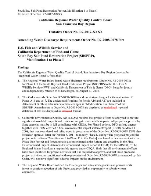
<strong>South</strong> <strong>Bay</strong> <strong>Salt</strong> <strong>Pond</strong> <strong>Restoration</strong> Project, Modification 1 to Phase I<strong>Tentative</strong> <strong>Order</strong> No. R2-2012-XXXXCalifornia Regional Water Quality Control BoardSan Francisco <strong>Bay</strong> Region<strong>Tentative</strong> <strong>Order</strong> No. R2-2012-XXXXAmending Waste Discharge Requirements <strong>Order</strong> No. R2-2008-0078 for:U.S. Fish and Wildlife Service andCalifornia Department of Fish and Game<strong>South</strong> <strong>Bay</strong> <strong>Salt</strong> <strong>Pond</strong> <strong>Restoration</strong> Project (SBSPRP),Modification 1 to Phase IFindingsThe California Regional Water Quality Control Board, San Francisco <strong>Bay</strong> Region (hereinafter“Regional Water Board”), finds that:1. The Regional Water Board issued waste discharge requirements (<strong>Order</strong> No. R2-2008-0078)for Phase I of the <strong>South</strong> <strong>Bay</strong> <strong>Salt</strong> <strong>Pond</strong> <strong>Restoration</strong> Project (SBSPRP) to the U.S. Fish &Wildlife Service (FWS) and California Department of Fish & Game (DFG), hereafter jointlyand independently referred to as Discharger, on August 13, 2008.2. This <strong>Order</strong> amends <strong>Order</strong> No. R2-2008-0078 to address design changes for the restoration of<strong>Pond</strong>s <strong>A16</strong> and <strong>A17</strong>. The design modifications for <strong>Pond</strong>s <strong>A16</strong> and <strong>A17</strong> are included inAttachment G. This <strong>Order</strong> refers to these changes as “Modification 1 to Phase I” of theSBSPRP. Amendments to <strong>Order</strong> No. R2-2008-0078 are displayed as underlined type anddeletions of text are displayed as strikeout format.3. California Environmental Quality Act (CEQA) requires that project effects be analyzed to preventsignificant avoidable impacts and reduce or mitigate unavoidable impacts. All projects approved byState agencies must be in full compliance with CEQA. For Phase I actions, DFG, as lead agencytogether with FWS, certified a final environmental impact statement/report (EIS/R) on March 11,2008, that was considered and relied upon in preparation of the <strong>Order</strong> No. R2-2008-0078. DFG alsoissued an approval letter on October 6, 2011, to modify Phase I, stating “The proposed project [theproject referred to as “Modification 1 to Phase I” in this <strong>Order</strong>] was found to be consistent with thePhase One Project and Programmatic actions planned at the Refuge and described in the FinalEnvironmental Impact Statement/Environmental Impact Report (FEIS/R) for the SBSPRQ.” TheRegional Water Board, as a responsible agency under CEQA, finds that all environmental effectshave been identified for project activities that it is required to approve, and that those proposedproject activities, as conditioned with requirements of <strong>Order</strong> No. R2-2008-0078, as amended by this<strong>Order</strong>, will not have significant adverse impacts on the environment.4. The Regional Water Board notified the Discharger and interested agencies and persons of itsintent to consider adoption of this <strong>Order</strong>, and provided an opportunity to submit writtencomments.1
<strong>South</strong> <strong>Bay</strong> <strong>Salt</strong> <strong>Pond</strong> <strong>Restoration</strong> Project, Modification 1 to Phase I<strong>Tentative</strong> <strong>Order</strong> No. R2-2012-XXXX5. In a public meeting, the Regional Water Board heard and considered all comments pertainingto this <strong>Order</strong>.IT IS HEREBY ORDERED, pursuant to the provisions of California Water Code Division 7and regulations and guidelines adopted thereunder, that the Discharger, its agents, successors,and assigns shall comply with <strong>Order</strong> No. R2-2008-0078, as amended by this <strong>Order</strong>, as follows:1. Revise Finding Nos. 1, 3, and 9 to state that Phase I actions will cover 3,270 acres of formersalt ponds instead of 3,069 acres; this corrects two mistakes in the pond dimensionspresented in <strong>Order</strong> No. R2-2008-0078. For <strong>Pond</strong> A6, the surface area was given as 330acres, instead of the correct 360 acres. For <strong>Pond</strong> A8, the surface area was given as 1,400acres, instead of the correct 1,440 acres.2. Revise Finding No. 4 as follows:The future ratio of tidal marsh to managed ponds will be between 50:50 and 90:10. Thesetwo endpoints represent the two alternatives that were evaluated for this project under theCalifornia Environmental Quality Act (CEQA). The variability between projected ratios oftidal marsh to managed ponds is significant because it is uncertain what percentage ofmanaged ponds is necessary to provide habitat for shorebirds and waterfowl, and whethermanaged ponds can be reconfigured to protect water quality. The amount of tidal marshrestoration approved under <strong>Order</strong> Nos. R2-2008-0078 and R2-2004-0018 was 9.7% of the15,100 project area. This included 480 acres to restore the Island <strong>Pond</strong>s to tidal marsh under<strong>Order</strong> No. R2-2004-0018. <strong>Order</strong> No. R2-2008-0078 included ponds A6 (360 acres) andE8A/E8X/E9 (630 acres) as tidal marsh. The redesign of <strong>Pond</strong> <strong>A16</strong>/<strong>A17</strong> will increase theamount of tidal restoration from 9.7% to 10.5 %. This increase remains well below theapproved 50% endpoint analyzed for the SBSPRP. The above tidal marsh restorationpercentages do not include <strong>Pond</strong> A8 (1,440 acres), which is being operated as reversiblemuted tidal habitat and may eventually be restored to tidal marsh.3. Revise Finding No. 8 as follows:This <strong>Order</strong> is organized into three sections: Phase I Marsh <strong>Restoration</strong> and <strong>Pond</strong>Management; Management of <strong>Pond</strong>s Under the Initial Stewardship Plan; and OngoingOperation and Maintenance. The Findings are followed by Prohibitions, Specifications,Receiving Water Limitations, and Provisions. Attachments include Figures, SupplementalTables, the Adaptive Management Plan, the Water Quality Self Monitoring Plan, theLandscape and Habitat Monitoring Plan, and Standard Provisions and ReportingRequirements. This <strong>Order</strong> constitutes revisions to the <strong>Pond</strong> <strong>A16</strong>/<strong>A17</strong> restoration project, forModification 1 to Phase I, and amends <strong>Order</strong> No. R2-2008-0078 accordingly. In addition,this <strong>Order</strong> updates some anticipated start and completion dates for activities that have eitherbeen completed or modified since the adoption of <strong>Order</strong> No. R2-2008-0078.2
<strong>South</strong> <strong>Bay</strong> <strong>Salt</strong> <strong>Pond</strong> <strong>Restoration</strong> Project, Modification 1 to Phase I<strong>Tentative</strong> <strong>Order</strong> No. R2-2012-XXXX4. Revise Table 1 of Finding No. 10 as follows:PHASE IRESTORATIONACTIONAlviso <strong>Pond</strong> Complex (FWS)Table 1. Proposed Phase I <strong>Restoration</strong> ActionsANTICIPATED STARTOF CONSTRUCTIONTYPE OFRESTORATIONACREAGE<strong>Pond</strong> A6 Summer 2010 Tidal habitat 330360 3 2010<strong>Pond</strong> A8 Summer 2009 Reversible mutedtidal habitat<strong>Pond</strong> <strong>A16</strong> and <strong>A17</strong> Summer 2009Fall 2011 Reconfiguredmanaged pond andtidal habitatRavenswood <strong>Pond</strong> Complex (FWS)<strong>Pond</strong> SF2 Fall 2008 Reconfiguredmanaged pondEden Landing <strong>Pond</strong> Complex (DFG)<strong>Pond</strong> E8A, E9, andE8XANTICIPATEDCONSTRUCTIONCOMPLETION1,4001,440 1 2009 2011242373 2 2011-20122013237 2010Summer 2009 Tidal habitat 630 2011<strong>Pond</strong>s E12 and E13 Summer 2009 2012 Reconfigured230 2012 2013managed pondTotal Acreage 3,0693,2701 This acreage includes <strong>Pond</strong>s A5, A7, and A8S, which would be affected by tidal inundation over the low internal leveesthat separate these ponds from <strong>Pond</strong> A8. The total acreage for <strong>Pond</strong> A8 was incorrect in the <strong>Order</strong> No. R2-2008-0078.The correct acreage is 1,440 acres, instead of 1,400 acres.2 This acreage does not includes both <strong>Pond</strong> <strong>A16</strong> (242 acres) which will be a reconfigured managed pond and <strong>Pond</strong> <strong>A17</strong>(131 acres) which will be operated jointly with <strong>Pond</strong> <strong>A16</strong> to manage water levels within <strong>Pond</strong> <strong>A16</strong>breached to createtidal habitat; species supported in <strong>Pond</strong> <strong>A17</strong> are not expected to change.3Acreage for <strong>Pond</strong> A6 was incorrect in <strong>Order</strong> No. R2-2008-0078. The correct acreage is 360 acres, instead of 330.Note 1: Recreational facilities include: Alviso <strong>Pond</strong> Complex improvements to the <strong>Bay</strong> Trail; Ravenswood <strong>Pond</strong> Compleximprovements to <strong>Bay</strong> Front Park and <strong>Pond</strong> SF2; and Eden Landing Complex trail construction, kayak launch, andviewing platforms.Note 2: Not shown in Table 1 is the 480-acre Island <strong>Pond</strong> tidal marsh restoration already approved by the Regional WaterBoard under the ISP, <strong>Order</strong> No. R2-2004-0018.5. Revise Finding 15 as follows:The SBSPRP area is divided into four general habitat types (tidal habitat, reversible mutedtidal habitat, managed pond, and reconfigured managed pond) covering a total of 15,100acres. The habitat types in Table 2 presents the resulting acres of each habitat type afterimplementation of the proposed Phase I actions in 3,0693,270 acres of salt ponds. The netbenefit is an increase in tidal marsh, muted tidal, and reconfigured managed pond habitats,and a corresponding decrease in salt ponds. The Phase I restoration actions will provideapproximately 2,3601,121 acres of tidal habitat including approximately 1,4001,440 acres ofreversible muted tidal habitat, and 709 acres of reconfigured managed ponds (not includingthe 480 acres restored at the Island <strong>Pond</strong>s, approved under <strong>Order</strong> No. R2-2004-0018).3
<strong>South</strong> <strong>Bay</strong> <strong>Salt</strong> <strong>Pond</strong> <strong>Restoration</strong> Project, Modification 1 to Phase I<strong>Tentative</strong> <strong>Order</strong> No. R2-2012-XXXXTable 2. Existing Habitats in the SBSPRP Area and Proposed Habitat Changes fromPhase IHabitat Type <strong>Pond</strong> Complex Existing Habitats Phase 1 Future Habitats Net Changes as aResult of Phase IFormer <strong>Salt</strong> <strong>Pond</strong>sTidal MarshHabitatReversible MutedTidal HabitatReconfiguredManaged <strong>Pond</strong>sAlviso 7,360 5,3885,187Ravenswood 1,440 1,203Eden Landing 4,420 3,560Subtotal: 13,220 10,1519,950 -3,0693,270Alviso 1,230 1,5601,721Ravenswood 50 50Eden Landing 600 1,230Subtotal: 1,880 2,8403,001 +9601,121Alviso 0 1,4001,440Ravenswood 0 0Eden Landing 0 0Subtotal: 0 1,4001,440 +1,4001,440Alviso 0 242Ravenswood 0 237Eden Landing 0 230Subtotal: 0 709 +709TOTAL 15,100 15,100 06. Revise Finding No. 16 as follows:Existing wetlands and other waters of the State will be impacted by Phase I dredge and fillactivities. Table 3 below summarizes the Phase I impacts to existing wetlands in the sixPhase I action ponds. Since temporary disturbances will not last more than a few months,only 256153 acres of permanent impacts are counted in the total 3,0693,270-acre area,leaving an estimated 3,117 acres restored or managed for wildlife after Phase I is completedin 50 years. No compensatory mitigation is required for impacts to existing wetlands andwaters of the State, since this restoration project will result in many more acres of restoredand enhanced habitats than the acres of habitat that are impacted.4
<strong>South</strong> <strong>Bay</strong> <strong>Salt</strong> <strong>Pond</strong> <strong>Restoration</strong> Project, Modification 1 to Phase I<strong>Tentative</strong> <strong>Order</strong> No. R2-2012-XXXXPOND/PONDSYSTEMTable 3. Summary of Dredge and Fill Information for Phase I of the SBSPRPTEMPORARYDISTURBANCEAREA (ACRES)(EXCLUDEDFROM TOTAL)DREDGEAREA(ACRES)FILLAREA(ACRES)PERMANENTIMPACTS(= DREDGE +FILL ACRES)POND SIZE(ACRES)ACRESRESTOREDORIMPROVEDFORWILDLIFEA6 1.74 1.98 3.21 5.2 330360 325355A8 0.15 0.81 0.11 0.92 1,4001,440 1,3991,439<strong>A16</strong>/<strong>A17</strong> 22.210.0 11035.81 35.26.74 145.242.59 242373 97330SF2 18.2 55.7 21.4 77.1 237 160E8A/E8X/E9 242 2.88 5.49 8.37 630 622E12/E13 4.72 9.92 8.98 18.9 230 211Total 289277 181107 7446 256153 3,0693,270 2,8143,117Note: Permanent impacts are calculated as dredge plus fill acres. Temporary disturbance is not counted as apermanent impact. The fill area for <strong>Pond</strong>s <strong>A16</strong>/<strong>A17</strong> and SF2 includes areas where fill will be used for theconstruction of nesting islands.7. Revise Finding No. 18 as follows:The San Francisco <strong>Bay</strong> Conservation and Development Commission (BCDC), a state regulatoryagency, is responsible for issuing a consistency determination (CD) and a permit to the Discharger.The CD is for actions on federal lands, and the permit is for actions on lands owned by the State.BCDC also has an active role in the planning and design of the Project. One element of BCDC’sCD/permit will addresses public access via the <strong>Bay</strong> Trail. BCDC has approved Phase I of theProject and is expected to take an action on the revised <strong>Pond</strong> <strong>A16</strong>/<strong>A17</strong> design after adoption of thisAmendment<strong>Order</strong>.8. Revise Finding No. 27 as follows:POND <strong>A16</strong>/<strong>A17</strong> RECONFIGURATION, VIEWING PLATFORM, AND INTERPRETIVE DISPLAYThe <strong>Pond</strong> <strong>A16</strong> managed pond will be reconfigured to create islands for nesting birds and shallowwater habitat for shorebird foraging (Figure 5 and Attachment B, Table B-Attachment G, whichamends descriptions of <strong>Pond</strong> <strong>A16</strong> and <strong>Pond</strong> <strong>A17</strong> in Figure 5 in Attachment A to <strong>Order</strong> No. R2-2008-0078 and in Table B-4 in Attachment B to <strong>Order</strong> No. R2-2008-0078). <strong>Pond</strong> <strong>A17</strong> tidal habitatrestoration (131 acres) will breach the existing levees and allow full tidal inundation within <strong>Pond</strong><strong>A17</strong>. The <strong>Pond</strong> <strong>A16</strong> Phase I action will create 242 acres of high quality nesting and shallow waterforaging habitat for shorebirds. It is important to note that the reconfigured, managed pond habitat ofthe type proposed for <strong>Pond</strong> <strong>A16</strong> restoration, a high density of bird nesting islands interspersed withshallow water foraging habitat, is a large-scale experiment. The Alviso <strong>Pond</strong> <strong>A16</strong> managed pondwill be reconfigured to create 5016 islands for nesting birds and shallow water habitat for shorebirdforaging via the installation of 32 new water control structures (inlet and outlet), excavation of apilot channels to Coyote Creek and Artesian Slough, development of an internal water circulationsystem using a series of berms and water control structures such as flashboard weirs, and theconstruction of the nesting islands. Water will be introduced into <strong>Pond</strong> <strong>A16</strong> from restored tidalhabitat in <strong>Pond</strong> <strong>A17</strong>. The intakes into <strong>Pond</strong> <strong>A17</strong><strong>A16</strong> from Coyote Creek<strong>Pond</strong> <strong>A17</strong> will be screened5
<strong>South</strong> <strong>Bay</strong> <strong>Salt</strong> <strong>Pond</strong> <strong>Restoration</strong> Project, Modification 1 to Phase I<strong>Tentative</strong> <strong>Order</strong> No. R2-2012-XXXXto exclude anadromous fish. In addition, a viewing platform and interpretive station will beconstructed at <strong>Pond</strong> <strong>A16</strong> and a fishing platform and interpretive station will be constructed at thenorthwestern end of <strong>Pond</strong> <strong>A17</strong> in Coyote Creek. <strong>Restoration</strong> construction is expected to occur over2 seasons within a 24 month period.9. Revise Finding No. 29 as follows:Ravenswood <strong>Pond</strong> SF2 will be reconfigured to create 237 acres of high quality nesting and shallowwater foraging habitat for shorebirds. It is a large-scale experiment similar to <strong>Pond</strong> <strong>A16</strong>/<strong>A17</strong>. Waterlevels will be managed via the installation of 2 new water control structures, excavation of pilotchannels through the fringe marsh outboard of the new water control structures, development of aninternal water circulation system using a series of berms and water control structures such asflashboard weirs, and the construction of 36 nesting islands (Figure 6 and Attachment B, Table B-5).Three cells would be created; the two eastern cells would be reconfigured to create nesting islandsfor birds and shallow water habitat for shorebird foraging. The third, western cell would bemanaged to provide snowy plover habitat similar to existing conditions. In addition, 2 viewingplatforms and interpretive stations will be constructed, and portions of the existing trail along <strong>Pond</strong>SF2 will be upgraded. <strong>Restoration</strong> construction is expected to occur over 2 seasons within a 24month period. As <strong>Pond</strong> SF2 is dry, <strong>Bay</strong> waters will flow into this pond when the Dischargerreconnects it to the <strong>Bay</strong>, and, therefore, there will not be a discharge of highly saline waters fromthis pond.10. Revise Finding No. 37 as follows:Modification 1 to Phase I restoration actions will directly impact the design and management of<strong>Pond</strong>s A6, A8, <strong>A16</strong>, <strong>A17</strong>, SF2, E8A, E8X, E9, E12, and E13. This <strong>Order</strong> also continues to permitthe Discharger to operate the remaining ponds under the management protocols that were authorizedunder the ISP. Most of the remaining ponds are managed to maintain open water conditions.Without the introduction of <strong>Bay</strong> water, these ponds would dry down during the summer and becomeseasonal ponds in the winter, which would significantly reduce open water habitat. Operatingformer salt ponds as managed ponds is considered by the Board to be a transitional phase betweensalt-making and restoration. This transitional lagoon management phase for most of the former saltponds benefits the environment in the near term by providing shallow open water habitat forshorebirds, thus avoiding the consequences of operating them as seasonal ponds (See Finding 88).11. Revise Finding No. 45 as follows:Alviso System <strong>A16</strong>/<strong>A17</strong>. This consists of two ponds (<strong>A17</strong> and <strong>A16</strong>). As explained in anearlier finding, <strong>Pond</strong> <strong>A16</strong> will be a reconfigured managed pond and <strong>Pond</strong> <strong>A17</strong> will berestored to tidal habitataffected by Phase I restoration actions. Discharger implements PhaseI actions, <strong>Pond</strong> <strong>A17</strong> will be operated under muted tidal conditions. Until Modification 1 toPhase I actions are implemented, this system will continue to operate as it was under the ISP.Under this scenario, <strong>A17</strong> intakes water from Coyote Creek through a 48-inch gate. From <strong>A17</strong>a 50-foot levee gap transfers water to <strong>A16</strong>. From <strong>A16</strong> a 48-inch gate structure dischargesinto Artesian Slough (Discharge Point A-<strong>A16</strong>-1). In this system, both intake and dischargestructures include operable gates to close off all flow, allow inflow only, or outflow only.The table below shows the expected hydraulic residence times for this system in the summer.6
<strong>South</strong> <strong>Bay</strong> <strong>Salt</strong> <strong>Pond</strong> <strong>Restoration</strong> Project, Modification 1 to Phase I<strong>Tentative</strong> <strong>Order</strong> No. R2-2012-XXXXBecause the Discharger needs to close the intake structure at pond <strong>A17</strong> in the winter (toavoid entraining migrating salmonids) and may use it as an alternative discharge point, onlysmall flows will discharge from this system during these months, under the operatingprotocols of the ISP. Table 8 also describes the revised <strong>Pond</strong> <strong>A16</strong>/<strong>A17</strong> design hydraulicresidence time as outlined under the management scenario described in the revised Finding27 for Modification 1 to Phase 1 noted above. <strong>Pond</strong> <strong>A17</strong> will be restored to tidal habitat andtherefore revised numbers for <strong>Pond</strong> <strong>A17</strong> are not listed in the table.Table 8: Summer Hydraulic Residence Times for <strong>Pond</strong> System <strong>A16</strong><strong>Pond</strong> Area(acres)Depth(ft)Volume(acre-ft)Outlet Flow(ft 3 /s)<strong>A17</strong> 131 1.2 157.2 24 3.3<strong>A16</strong> 243 1.7 413.1 2 8.7Total 374 12Revised<strong>Pond</strong> <strong>A16</strong>242 1.68 408 60 3.4Residence Time(days)12. Revise Finding No. 59 as follows:Migration of Salmonids. Steelhead trout and Chinook salmon migrate in <strong>South</strong> <strong>Bay</strong>sloughs, or slough channels that receive pond discharges. During certain times of theyear, Coyote Creek and Alviso Slough may contain steelhead trout and Chinook salmon.The table below describes the upstream and downstream migration periods when formersalt ponds have the potential to affect migrating salmonids.Table 16: Migration Periods for SalmonidsSpecies Upstream Migration Downstream MigrationSteelhead Trout January-March March-AprilChinook Salmon September-November March-AprilWhile Steelhead Trout and Chinook Salmon migrate primarily downstream in March and April,storm induced migrations can begin as early as December. For this reason, NMFS recommendsthat the Discharger close intakes on all salmonids creeks and sloughs from December throughApril. Therefore, this <strong>Order</strong> as amended requires that, during this period, the Discharger closeintake structures at <strong>Pond</strong>s A9 and <strong>A17</strong> unless it installs fish screens, or the pond <strong>A17</strong> levees arebreached and <strong>Pond</strong> <strong>A17</strong> is exposed to full tidal inundation. As part of the Modification 1 toPhase I action for <strong>Pond</strong> <strong>A16</strong>, the Discharger indicates that it plans to install fish screens at the<strong>Pond</strong> <strong>A17</strong><strong>A16</strong> intake from <strong>Pond</strong> <strong>A17</strong>.13. Revise Finding No. 67 as follows:Applied Studies. To address how the Discharger needs to adaptively manage ponds in the longterm, this <strong>Order</strong> as amended requires that the Discharger continue to implement applied studies.These studies will focus on ponds that may be operated as managed ponds in the long term (e.g.,7
<strong>South</strong> <strong>Bay</strong> <strong>Salt</strong> <strong>Pond</strong> <strong>Restoration</strong> Project, Modification 1 to Phase I<strong>Tentative</strong> <strong>Order</strong> No. R2-2012-XXXXA3W, A14, and E10) and ponds that will be reconfigured (SF2 and <strong>A16</strong>/<strong>A17</strong>) under Phase Irestoration actions. The purpose of these applied studies is to guide long-term restoration effortsto determine (a) how pond geometry (surface area, depth, filling borrow ditches) should bealtered to make managed ponds ecologically sustainable, (b) if the Discharger should movetowards a restoration effort that will involve fewer managed ponds and more tidal marsh(especially if managed ponds cannot be reconfigured to become ecologically sustainable), and(c) how to develop a site-specific objective for dissolved oxygen in managed ponds.14. Revise Prohibition A.4 as follows:Intake from waters of the State into <strong>Pond</strong>s A9 and <strong>A17</strong> between December 1 through April 30 isprohibited. For <strong>Pond</strong> <strong>A17</strong>, this prohibition will cease to apply once the <strong>Pond</strong> <strong>A17</strong> levee isbreached and the <strong>Pond</strong> <strong>A16</strong> intake is properly screened to exclude anadromous fish.15. Revise Provisions 11 and 12 to include <strong>Pond</strong> <strong>A17</strong>.I, Bruce H. Wolfe, Executive Officer, do hereby certify that the foregoing is a full, true, and correct copyof an order adopted by the California Regional Water Quality Control Board, San Francisco <strong>Bay</strong>Region, on ___________________________.________________________Bruce H. WolfeExecutive OfficerAttachmentsAttachment G: Alviso <strong>Pond</strong> <strong>A16</strong>-<strong>A17</strong> <strong>Restoration</strong> Design Modifications to ExistingEnvironmental Permits Memorandum8