

Port Campbell National Park and Bay of Islands ... - Parks Victoria
Port Campbell National Park and Bay of Islands ... - Parks Victoria
Port Campbell National Park and Bay of Islands ... - Parks Victoria

You also want an ePaper? Increase the reach of your titles
YUMPU automatically turns print PDFs into web optimized ePapers that Google loves.
<strong>Port</strong> <strong>Campbell</strong> <strong>National</strong> <strong>Park</strong><br />
<strong>and</strong> <strong>Bay</strong> <strong>of</strong> Isl<strong>and</strong>s Coastal <strong>Park</strong><br />
September 1998<br />
Management Plan
This Management Plan for <strong>Port</strong> <strong>Campbell</strong> <strong>National</strong> <strong>Park</strong> <strong>and</strong> <strong>Bay</strong> <strong>of</strong> Isl<strong>and</strong>s Coastal <strong>Park</strong> is approved<br />
for implementation. Its purpose is to direct all aspects <strong>of</strong> management in the <strong>Park</strong>s until the Plan is<br />
reviewed. A Draft Management Plan was released for public comment in September 1997. Altogether<br />
164 submissions were received.<br />
Copies <strong>of</strong> this Plan can be obtained from:<br />
<strong>Park</strong>s <strong>Victoria</strong><br />
<strong>Park</strong>s <strong>Victoria</strong><br />
378 Cotham Road Warrnambool Office<br />
KEW VIC 3101<br />
78 Henna Street<br />
WARRNAMBOOL VIC 3280<br />
<strong>Park</strong>s <strong>Victoria</strong> Information Centre<br />
<strong>Park</strong>s <strong>Victoria</strong><br />
35 Whitehorse Road Colac Office<br />
DEEPDENE VIC 3103<br />
83 Gellibr<strong>and</strong> Street<br />
COLAC VIC 3250<br />
NRE Information Centre<br />
<strong>Park</strong>s <strong>Victoria</strong><br />
8 Nicholson Street <strong>Port</strong> <strong>Campbell</strong> Information Centre<br />
EAST MELBOURNE VIC 3002<br />
Morris Street<br />
PORT CAMPBELL VIC 3269<br />
Information <strong>Victoria</strong><br />
356 Collins Street<br />
MELBOURNE VIC 3000<br />
For further information on the Plan, please contact:<br />
Peter Mackay<br />
Chief Ranger, <strong>Park</strong> Management, West Coast<br />
<strong>Park</strong>s <strong>Victoria</strong><br />
78 Henna Street<br />
WARRNAMBOOL VIC 3280<br />
( 5561 9966<br />
John Amor<br />
Ranger in Charge, <strong>Bay</strong> <strong>of</strong> Isl<strong>and</strong>s Coastal <strong>Park</strong><br />
<strong>Park</strong>s <strong>Victoria</strong><br />
( 5561 9966<br />
John McInerney<br />
Ranger in Charge, <strong>Port</strong> <strong>Campbell</strong> <strong>National</strong> <strong>Park</strong><br />
Morris Street<br />
PORT CAMPBELL VIC 3269<br />
( 5598 6382
PORT CAMPBELL NATIONAL PARK<br />
AND BAY OF ISLANDS COASTAL PARK<br />
MANAGEMENT PLAN<br />
SEPTEMBER 1998
Published in September 1998 by <strong>Park</strong>s <strong>Victoria</strong><br />
378 Cotham Road, Kew, <strong>Victoria</strong>, 3101<br />
<strong>National</strong> Library <strong>of</strong> Australia<br />
Cataloguing-in-Publication entry<br />
<strong>Park</strong>s <strong>Victoria</strong>.<br />
<strong>Port</strong> <strong>Campbell</strong> <strong>National</strong> <strong>Park</strong> <strong>and</strong> <strong>Bay</strong> <strong>of</strong> Isl<strong>and</strong>s Coastal <strong>Park</strong> Management Plan.<br />
Bibliography.<br />
ISBN 0 7311 3133 9.<br />
1. <strong>National</strong> parks <strong>and</strong> reserves - <strong>Victoria</strong> - Management.<br />
2. <strong>Port</strong> <strong>Campbell</strong> <strong>National</strong> <strong>Park</strong> (Vic.) - Management.<br />
3. <strong>Bay</strong> <strong>of</strong> Isl<strong>and</strong>s Coastal Reserve (Vic.) - Management. I. Title<br />
333.783099457<br />
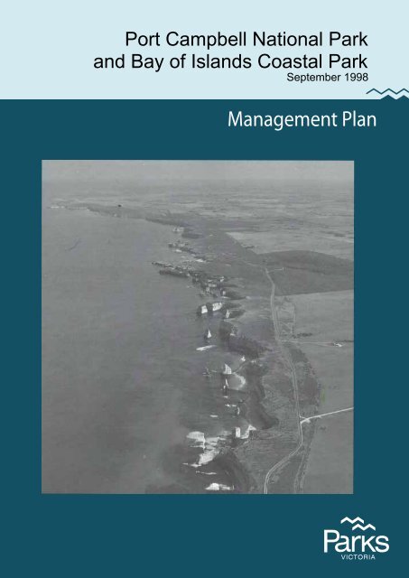
Cover: Loch Ard Gorge to beyond <strong>Port</strong> <strong>Campbell</strong> Township, <strong>Port</strong> <strong>Campbell</strong> <strong>National</strong> <strong>Park</strong><br />
(Photo: Qasco Australia).<br />
Printed on recycled paper to help save our natural environment<br />
ii<br />
<strong>Port</strong> <strong>Campbell</strong> <strong>National</strong> <strong>Park</strong> <strong>and</strong> <strong>Bay</strong> <strong>of</strong> Isl<strong>and</strong>s Coastal <strong>Park</strong>
FOREWORD<br />
The spectacular rock stacks <strong>and</strong> other coastal<br />
formations <strong>of</strong> <strong>Port</strong> <strong>Campbell</strong> <strong>National</strong> <strong>Park</strong> <strong>and</strong><br />
<strong>Bay</strong> <strong>of</strong> Isl<strong>and</strong>s Coastal <strong>Park</strong> are among<br />
Australia’s best-known natural icons. The<br />
<strong>Park</strong>s have many important natural values -<br />
such as habitat for the rare Rufous Bristle-bird<br />
- in addition to their geological importance, <strong>and</strong><br />
they also contain sites <strong>of</strong> great cultural<br />
significance, both Aboriginal <strong>and</strong> European.<br />
They are attracting increasing numbers <strong>of</strong><br />
tourists from within <strong>Victoria</strong>, from interstate<br />
<strong>and</strong> from overseas, <strong>and</strong> hence have major<br />
importance in the local <strong>and</strong> State economies.<br />
The Government aims to manage <strong>and</strong> protect<br />
national <strong>and</strong> other parks so that their natural,<br />
cultural, social <strong>and</strong> economic values are<br />
safeguarded now <strong>and</strong> in the future. This Plan<br />
sets out how, with community support <strong>and</strong><br />
involvement, the Government intends to achieve<br />
this aim, <strong>and</strong> to enhance the experiences <strong>of</strong><br />
visitors to the <strong>Park</strong>s.<br />
The over-riding aim <strong>of</strong> the Plan is the<br />
protection <strong>of</strong> the <strong>Park</strong>s’ natural features by<br />
appropriate management <strong>of</strong> fire, weeds <strong>and</strong><br />
human disturbance. The Plan will ensure that<br />
all improvements to visitor support facilities are<br />
sensitively integrated into the natural<br />
environment, by careful design <strong>and</strong> siting well<br />
away from the cliff edge, so that the coastal<br />
l<strong>and</strong>scape remains unimpaired.<br />
Improved orientation <strong>and</strong> interpretation<br />
facilities, <strong>and</strong> support facilities such as car<br />
parks <strong>and</strong> toilets, will be provided for visitors at<br />
key sites such as the Twelve Apostles <strong>and</strong> Loch<br />
Ard Gorge. Private sector investment for a<br />
major new tourist attraction <strong>and</strong> visitor centre<br />
in <strong>Port</strong> <strong>Campbell</strong> will be encouraged. Such a<br />
Centre would attract both international <strong>and</strong><br />
other tourists, <strong>of</strong>fering them a range <strong>of</strong><br />
information <strong>and</strong> services <strong>and</strong> showing them that<br />
to appreciate the area fully they need an<br />
extended stay or a return visit.<br />
A Draft Management Plan for <strong>Port</strong> <strong>Campbell</strong><br />
<strong>National</strong> <strong>Park</strong> <strong>and</strong> <strong>Bay</strong> <strong>of</strong> Isl<strong>and</strong>s Coastal <strong>Park</strong><br />
was released for public comment in September<br />
1997. More than 160 submissions on the Draft<br />
Plan were received in the following months, a<br />
level <strong>of</strong> public involvement which I<br />
acknowledge <strong>and</strong> welcome. All these<br />
submissions were carefully considered in the<br />
preparation <strong>of</strong> this Plan, which replaces the<br />
existing 1990 Management Plan.<br />
I commend the Plan to you, <strong>and</strong> look forward to<br />
continuing community involvement <strong>and</strong> support<br />
in managing these <strong>Park</strong>s that are so highly<br />
valued <strong>and</strong> loved by so many <strong>Victoria</strong>ns <strong>and</strong><br />
visitors.<br />
Marie Tehan MP<br />
Minister for Conservation<br />
<strong>and</strong> L<strong>and</strong> Management<br />
<strong>Port</strong> <strong>Campbell</strong> <strong>National</strong> <strong>Park</strong> <strong>and</strong> <strong>Bay</strong> <strong>of</strong> Isl<strong>and</strong>s Coastal <strong>Park</strong><br />
iii
APPROVED MANAGEMENT PLAN<br />
This Approved Management Plan has been<br />
prepared under the provisions <strong>of</strong> section 17 <strong>of</strong><br />
the <strong>National</strong> <strong>Park</strong>s Act 1975 (Vic.) <strong>and</strong> is<br />
approved for implementation.<br />
The Plan provides the basis for future<br />
management <strong>of</strong> <strong>Port</strong> <strong>Campbell</strong> <strong>National</strong> <strong>Park</strong><br />
<strong>and</strong> <strong>Bay</strong> <strong>of</strong> Isl<strong>and</strong>s Coastal <strong>Park</strong>. It was<br />
finalised following consideration <strong>of</strong> 164<br />
submissions received on the Draft Plan.<br />
Rod Gowans<br />
A/Director<br />
<strong>National</strong> <strong>Park</strong>s<br />
Mark Stone<br />
Chief Executive<br />
<strong>Park</strong>s <strong>Victoria</strong><br />
iv<br />
<strong>Port</strong> <strong>Campbell</strong> <strong>National</strong> <strong>Park</strong> <strong>and</strong> <strong>Bay</strong> <strong>of</strong> Isl<strong>and</strong>s Coastal <strong>Park</strong>
SUMMARY<br />
<strong>Port</strong> <strong>Campbell</strong> <strong>National</strong> <strong>Park</strong> <strong>and</strong> <strong>Bay</strong> <strong>of</strong><br />
Isl<strong>and</strong>s Coastal <strong>Park</strong> combine to form a linear<br />
reserve along 65 km <strong>of</strong> <strong>Victoria</strong>’s southern<br />
ocean coastline. The <strong>Park</strong>s’ sheer cliffs <strong>and</strong><br />
gorges, the arches <strong>and</strong> the <strong>of</strong>f-shore stacks form<br />
one <strong>of</strong> the most scenic <strong>and</strong> best known coasts in<br />
Australia. The <strong>Park</strong>s contain significant<br />
examples <strong>of</strong> coastal environments, including<br />
diverse heathl<strong>and</strong>s, which are a refuge for a<br />
wide range <strong>of</strong> plants <strong>and</strong> animals. Wetl<strong>and</strong>s,<br />
coastal cliffs, <strong>of</strong>fshore isl<strong>and</strong>s <strong>and</strong> rock stacks<br />
provide habitat for many bird species. The<br />
<strong>Park</strong>s’ diversity <strong>of</strong> natural values, outst<strong>and</strong>ing<br />
coastal scenery <strong>and</strong> accessibility along the<br />
Great Ocean Road make them attractive for<br />
sightseeing, nature observation, fishing, surfing<br />
<strong>and</strong> walking.<br />
<strong>Port</strong> <strong>Campbell</strong> <strong>National</strong> <strong>Park</strong> <strong>and</strong> the eastern<br />
end <strong>of</strong> the <strong>Bay</strong> <strong>of</strong> Isl<strong>and</strong>s Coastal <strong>Park</strong> contain<br />
a number <strong>of</strong> major tourist attractions, including<br />
the ‘Twelve Apostles’. The rapidly growing<br />
pr<strong>of</strong>ile <strong>of</strong> these tourist icons <strong>and</strong> the resultant<br />
significant rise in visitation poses major<br />
challenges to park planning <strong>and</strong> management.<br />
The <strong>Park</strong>s will be managed as world-class<br />
protected areas for conservation, recreation <strong>and</strong><br />
education. Protecting <strong>and</strong> enhancing the <strong>Park</strong>s’<br />
significant natural environments will be<br />
important management goals. The <strong>Park</strong>s’<br />
distinctive characters will be maintained <strong>and</strong><br />
they will continue to provide a refuge for<br />
visitors from the pressures <strong>of</strong> urban life.<br />
Visitors will be able to enjoy the <strong>Park</strong>s’ diverse<br />
attractions through quality visitor facilities at<br />
major features. The <strong>Park</strong>s will continue to<br />
make an important contribution to tourism<br />
along the Great Ocean Road corridor.<br />
Major management directions for the <strong>Park</strong>s are<br />
summarised below.<br />
• Significant flora, fauna, <strong>and</strong> other natural<br />
<strong>and</strong> cultural features will be protected.<br />
• A comprehensive visitor orientation,<br />
interpretation <strong>and</strong> facilities strategy will be<br />
progressively implemented.<br />
• Pest plants <strong>and</strong> animals will be controlled<br />
or, where possible, eradicated, with cooperation<br />
from local l<strong>and</strong> owners <strong>and</strong><br />
community groups.<br />
• An integrated fire management program<br />
that incorporates fire protection <strong>and</strong><br />
ecological management requirements will<br />
be developed.<br />
• The <strong>Park</strong>s will be marketed as important<br />
coastal conservation reserves with<br />
outst<strong>and</strong>ing scenery, natural <strong>and</strong> cultural<br />
values, <strong>and</strong> recreational opportunities.<br />
• Visitor numbers <strong>and</strong> movements will be<br />
carefully managed to reduce impacts on<br />
natural values.<br />
• Walking opportunities will be increased.<br />
The section <strong>of</strong> the Great Ocean Walk<br />
between Princetown <strong>and</strong> <strong>Port</strong> <strong>Campbell</strong><br />
will be constructed <strong>and</strong> the Clifftop Walk<br />
in the <strong>Bay</strong> <strong>of</strong> Isl<strong>and</strong>s Coastal <strong>Park</strong> will be<br />
completed.<br />
• <strong>Bay</strong> <strong>of</strong> Isl<strong>and</strong>s Coastal <strong>Park</strong> west <strong>of</strong> Boat<br />
<strong>Bay</strong> will be managed primarily for the<br />
protection <strong>of</strong> its natural values <strong>and</strong> to<br />
provide experiences <strong>of</strong> a semi-remote<br />
coastal setting.<br />
• Quality visitor facilities will be provided at<br />
key sites, including the Twelve Apostles<br />
<strong>and</strong> Loch Ard Gorge.<br />
• Private sector investment will be sought to<br />
establish a major Tourist Centre on a site<br />
in or near the <strong>Port</strong> <strong>Campbell</strong> Township, to<br />
be a major attraction in its own right <strong>and</strong> a<br />
key support for the orientation <strong>and</strong><br />
education <strong>of</strong> visitors to the region.<br />
<strong>Port</strong> <strong>Campbell</strong> <strong>National</strong> <strong>Park</strong> <strong>and</strong> <strong>Bay</strong> <strong>of</strong> Isl<strong>and</strong>s Coastal <strong>Park</strong><br />
v
CONTENTS<br />
FOREWORD<br />
SUMMARY<br />
iii<br />
v<br />
1 INTRODUCTION 1<br />
1.1 Development <strong>of</strong> the Management Plan 1<br />
1.2 Major challenges for park management 1<br />
1.3 <strong>Park</strong> management aims 1<br />
2 BACKGROUND 3<br />
2.1 Location <strong>and</strong> planning area 3<br />
2.2 Regional context 3<br />
2.3 Significance <strong>of</strong> the <strong>Park</strong>s 3<br />
2.4 Creation <strong>of</strong> the <strong>Park</strong>s 5<br />
2.5 Legislation <strong>and</strong> guidelines 5<br />
3 STRATEGIC DIRECTIONS 6<br />
3.1 <strong>Park</strong> vision 6<br />
3.2 Management directions 6<br />
3.3 Zoning 7<br />
4 RESOURCE CONSERVATION 11<br />
4.1 Geological <strong>and</strong> l<strong>and</strong>form features 11<br />
4.2 Vegetation 12<br />
4.3 Fauna 14<br />
4.4 L<strong>and</strong>scape 16<br />
4.5 Cultural heritage 17<br />
4.6 Conservation management 18<br />
5 PARK PROTECTION 20<br />
5.1 Fire management 20<br />
5.2 Pest plants <strong>and</strong> animals, <strong>and</strong> diseases 22<br />
5.3 Soil conservation 25<br />
6 THE PARK VISIT 26<br />
6.1 The <strong>Park</strong> visitor 26<br />
6.2 Marketing 29<br />
6.3 Visitor recreation 31<br />
6.3.1 Orientation 31<br />
6.3.2 Interpretation <strong>and</strong> education 32<br />
vi<br />
<strong>Port</strong> <strong>Campbell</strong> <strong>National</strong> <strong>Park</strong> <strong>and</strong> <strong>Bay</strong> <strong>of</strong> Isl<strong>and</strong>s Coastal <strong>Park</strong>
6.3.3 Day visits 34<br />
6.3.4 Tourist Centre at <strong>Port</strong> <strong>Campbell</strong> 36<br />
6.3.5 Key attractions 41<br />
6.3.6 Camping <strong>and</strong> caravanning 43<br />
6.3.7 Vehicle access 43<br />
6.3.8 Walking 45<br />
6.3.9 Horse riding 51<br />
6.3.10 Cycling 52<br />
6.3.11 Dogs 52<br />
6.3.12 Boating 54<br />
6.3.13 Fishing <strong>and</strong> diving 54<br />
6.3.14 Swimming <strong>and</strong> surfing 55<br />
6.3.15 Hang gliding 56<br />
6.4 Private tourism operations 56<br />
6.5 Public safety 57<br />
7 COMMUNITY AWARENESS AND INVOLVEMENT 59<br />
7.1 Friends <strong>and</strong> volunteers 59<br />
7.2 Community awareness <strong>and</strong> <strong>Park</strong> neighbours 59<br />
7.3 Schools <strong>and</strong> other education 61<br />
8 OTHER ISSUES 63<br />
8.1 Authorised uses 63<br />
8.2 Boundaries <strong>and</strong> adjacent uses 65<br />
9 IMPLEMENTATION 72<br />
REFERENCES 74<br />
TABLES<br />
1 Management zones <strong>and</strong> overlays 9<br />
2 Summary <strong>of</strong> recreation activities 30<br />
3 Proposed visitor orientation facilities 33<br />
4 Proposed visitor interpretative facilities 35<br />
5 Existing <strong>and</strong> proposed recreation facilities 37<br />
6 Management <strong>of</strong> vehicle roads <strong>and</strong> tracks 44<br />
7 Management <strong>of</strong> walking tracks 47<br />
8 Management <strong>of</strong> horse riding 53<br />
9 Priority management strategies 72<br />
APPENDICES<br />
I Sites <strong>of</strong> geological <strong>and</strong> geomorphological significance 76<br />
II Threatened flora species 78<br />
III Threatened fauna species 79<br />
IV Major environmental weeds 80<br />
<strong>Port</strong> <strong>Campbell</strong> <strong>National</strong> <strong>Park</strong> <strong>and</strong> <strong>Bay</strong> <strong>of</strong> Isl<strong>and</strong>s Coastal <strong>Park</strong><br />
vii
FIGURES<br />
1 Locality map End <strong>of</strong> plan<br />
2 Management zoning "<br />
3 Public l<strong>and</strong> use "<br />
4 Visitor information facilities <strong>and</strong> access management "<br />
5 Recreation management "<br />
6 Tourist Centre site options - <strong>Port</strong> <strong>Campbell</strong> area "<br />
viii<br />
<strong>Port</strong> <strong>Campbell</strong> <strong>National</strong> <strong>Park</strong> <strong>and</strong> <strong>Bay</strong> <strong>of</strong> Isl<strong>and</strong>s Coastal <strong>Park</strong>
Introduction<br />
1 INTRODUCTION<br />
1.1 Development <strong>of</strong> the<br />
Management Plan<br />
A Draft Management Plan for <strong>Port</strong> <strong>Campbell</strong><br />
<strong>National</strong> <strong>Park</strong> <strong>and</strong> <strong>Bay</strong> <strong>of</strong> Isl<strong>and</strong>s Coastal <strong>Park</strong><br />
was prepared in consultation with key<br />
stakeholders. It incorporated relevant aspects<br />
<strong>of</strong> the Great Ocean Road/<strong>Bay</strong> <strong>of</strong> Isl<strong>and</strong>s<br />
Coastal <strong>Park</strong> Development Plan (NPS 1994).<br />
Stakeholders, organisations, groups <strong>and</strong><br />
individuals were <strong>of</strong>fered a major opportunity<br />
for further involvement in planning the future<br />
management <strong>of</strong> these important <strong>Park</strong>s.<br />
The 164 submissions received on the Draft Plan<br />
were carefully considered <strong>and</strong> taken into<br />
account in preparing this Approved Plan,<br />
which replaces the existing <strong>Port</strong> <strong>Campbell</strong><br />
<strong>National</strong> <strong>Park</strong> Management Plan (DCE 1990a).<br />
1.2 Major challenges for park<br />
management<br />
The major challenges for management in<br />
implementing the <strong>Port</strong> <strong>Campbell</strong> <strong>National</strong> <strong>Park</strong><br />
<strong>and</strong> <strong>Bay</strong> <strong>of</strong> Isl<strong>and</strong>s Coastal <strong>Park</strong> Management<br />
Plan will be:<br />
• to preserve <strong>and</strong> conserve the rich<br />
biodiversity, varied ecosystems, highly<br />
significant geological features <strong>and</strong> cultural<br />
values, sense <strong>of</strong> remoteness <strong>and</strong> outst<strong>and</strong>ing<br />
scenic features <strong>of</strong> a long narrow coastal<br />
strip threatened by intense visitor pressures,<br />
the powerful forces <strong>of</strong> the Southern Ocean<br />
<strong>and</strong> inl<strong>and</strong> development;<br />
• to develop <strong>and</strong> implement sophisticated<br />
visitor management infrastructure <strong>and</strong><br />
systems which ensure that <strong>Park</strong> visitors gain<br />
access to the outst<strong>and</strong>ing scenery <strong>and</strong> wide<br />
range <strong>of</strong> other recreation opportunities, <strong>and</strong><br />
receive the services <strong>and</strong> facilities that<br />
enhance their experience <strong>of</strong> the <strong>Park</strong>s, while<br />
ensuring minimal impact on the natural<br />
values <strong>of</strong> the <strong>Park</strong>s;<br />
• to further develop the contribution <strong>of</strong> the<br />
<strong>Park</strong>s to the local <strong>and</strong> regional economies;<br />
• to involve Friends groups, neighbours, <strong>and</strong><br />
the local <strong>and</strong> wider communities in<br />
supporting sound management <strong>and</strong><br />
promoting the outst<strong>and</strong>ing values <strong>of</strong> the<br />
<strong>Park</strong>s.<br />
1.3 <strong>Park</strong> management aims<br />
Sections 4 (Objects) <strong>and</strong> 17 <strong>of</strong> the <strong>National</strong><br />
<strong>Park</strong>s Act provide the basis for management <strong>of</strong><br />
the <strong>Park</strong>s. The following management aims are<br />
derived from these sections <strong>and</strong>, as such,<br />
broadly govern all aspects <strong>of</strong> park management.<br />
Resource conservation<br />
• Preserve <strong>and</strong> protect the natural<br />
environment.<br />
• Allow natural environmental processes to<br />
continue with the minimum <strong>of</strong> interference.<br />
• Maintain biodiversity.<br />
• Conserve features <strong>of</strong> archaeological,<br />
historical <strong>and</strong> cultural significance.<br />
<strong>Park</strong> protection<br />
• Protect human life, the <strong>Park</strong>s <strong>and</strong> adjacent<br />
l<strong>and</strong>s from injury by fire.<br />
• Eradicate, or otherwise control, introduced<br />
plants, animals <strong>and</strong> diseases.<br />
The <strong>Park</strong> visit<br />
• Provide opportunities for appropriate<br />
recreation <strong>and</strong> tourism.<br />
• Promote <strong>and</strong> encourage an appreciation,<br />
underst<strong>and</strong>ing <strong>and</strong> enjoyment <strong>of</strong> the <strong>Park</strong>s’<br />
natural <strong>and</strong> cultural values <strong>and</strong> their<br />
recreational opportunities.<br />
• Encourage appropriate park use <strong>and</strong><br />
visitor behaviour; foster a conservation<br />
ethic in visitors <strong>and</strong> an underst<strong>and</strong>ing <strong>of</strong><br />
minimal impact behaviour.<br />
• Take reasonable steps to ensure the safety<br />
<strong>of</strong> visitors.<br />
<strong>Port</strong> <strong>Campbell</strong> <strong>National</strong> <strong>Park</strong> <strong>and</strong> <strong>Bay</strong> <strong>of</strong> Isl<strong>and</strong>s Coastal <strong>Park</strong> 1
Introduction<br />
Other<br />
• Provide for <strong>and</strong> encourage scientific<br />
research, surveys <strong>and</strong> monitoring that will<br />
contribute to a better underst<strong>and</strong>ing <strong>and</strong><br />
management <strong>of</strong> the <strong>Park</strong>s.<br />
• Co-operate with local, State <strong>and</strong> interstate<br />
government authorities, the community<br />
<strong>and</strong> other interested organisations, to assist<br />
in the management <strong>of</strong> the <strong>Park</strong>s.<br />
2 <strong>Port</strong> <strong>Campbell</strong> <strong>National</strong> <strong>Park</strong> <strong>and</strong> <strong>Bay</strong> <strong>of</strong> Isl<strong>and</strong>s Coastal <strong>Park</strong>
Background<br />
2 BACKGROUND<br />
2.1 Location <strong>and</strong> planning area<br />
<strong>Port</strong> <strong>Campbell</strong> <strong>National</strong> <strong>Park</strong> <strong>and</strong> <strong>Bay</strong> <strong>of</strong><br />
Isl<strong>and</strong>s Coastal <strong>Park</strong> are on the Great Ocean<br />
Road in south-west <strong>Victoria</strong>, about<br />
250 km west <strong>of</strong> Melbourne via Colac (figure 1).<br />
The <strong>Park</strong>s extend some 17 km eastwards <strong>and</strong><br />
48 km westwards along the coast from the<br />
Township <strong>of</strong> <strong>Port</strong> <strong>Campbell</strong>. The worldrenowned<br />
Great Ocean Road runs through, or<br />
adjacent to, <strong>Port</strong> <strong>Campbell</strong> <strong>National</strong> <strong>Park</strong> <strong>and</strong><br />
the easternmost 6 km <strong>of</strong> the <strong>Bay</strong> <strong>of</strong> Isl<strong>and</strong>s<br />
Coastal <strong>Park</strong>.<br />
The planning area includes the following<br />
components (figure 2) which, throughout this<br />
Plan, are referred to as ‘the <strong>Park</strong>s’:<br />
• <strong>Port</strong> <strong>Campbell</strong> <strong>National</strong> <strong>Park</strong> (1750 ha),<br />
including Sherbrook Education Area<br />
(395 ha);<br />
• <strong>Bay</strong> <strong>of</strong> Isl<strong>and</strong>s Coastal <strong>Park</strong> (950 ha)<br />
incorporating areas above low water mark<br />
<strong>of</strong> the former <strong>Bay</strong> <strong>of</strong> Isl<strong>and</strong>s Coastal<br />
Reserve, the former Childers Cove<br />
Foreshore Reserve <strong>and</strong> Crown l<strong>and</strong> abutting<br />
the former <strong>Bay</strong> <strong>of</strong> Isl<strong>and</strong>s Coastal Reserve<br />
east <strong>of</strong> Killeens Road.<br />
The planning area also includes:<br />
• Glenample Homestead (8 ha), a nearby<br />
historic site leased to the State Government<br />
<strong>and</strong> managed under Section 32AA <strong>of</strong> the<br />
<strong>National</strong> <strong>Park</strong>s Act;<br />
• Loch Ard Public Cemetery, an inlier in <strong>Port</strong><br />
<strong>Campbell</strong> <strong>National</strong> <strong>Park</strong> for which the<br />
Director <strong>of</strong> <strong>National</strong> <strong>Park</strong>s is the sole<br />
Trustee;<br />
• sites under consideration for the proposed<br />
Tourist Centre at <strong>Port</strong> <strong>Campbell</strong>.<br />
2.2 Regional context<br />
<strong>Port</strong> <strong>Campbell</strong> <strong>National</strong> <strong>Park</strong> <strong>and</strong> <strong>Bay</strong> <strong>of</strong><br />
Isl<strong>and</strong>s Coastal <strong>Park</strong> form a narrow coastal<br />
strip between Lake Gillear, 10 km east <strong>of</strong><br />
Warrnambool, <strong>and</strong> Princetown, where <strong>Port</strong><br />
<strong>Campbell</strong> <strong>National</strong> <strong>Park</strong> adjoins Otway<br />
<strong>National</strong> <strong>Park</strong>. The widths <strong>of</strong> the <strong>Park</strong>s vary<br />
from a few metres within <strong>Bay</strong> <strong>of</strong> Isl<strong>and</strong>s<br />
Coastal <strong>Park</strong> to 2 km in the lower Sherbrook<br />
River Valley in <strong>Port</strong> <strong>Campbell</strong> <strong>National</strong> <strong>Park</strong>.<br />
The <strong>Park</strong>s lie along the world-famous Great<br />
Ocean Road <strong>and</strong> are important components <strong>of</strong><br />
one <strong>of</strong> <strong>Victoria</strong>’s highest pr<strong>of</strong>ile tourism<br />
regions.<br />
Other popular destinations on a visitor’s<br />
itinerary along the Great Ocean Road may<br />
include:<br />
• Angahook–Lorne State <strong>Park</strong><br />
• Otway <strong>National</strong> <strong>Park</strong><br />
• Otway State Forest<br />
• Cape Otway Lighthouse<br />
• Carlisle State <strong>Park</strong><br />
• Melba Gully State <strong>Park</strong><br />
• Tower Hill State Game Reserve<br />
• the historic towns <strong>of</strong> Warrnambool <strong>and</strong> <strong>Port</strong><br />
Fairy<br />
• other inl<strong>and</strong> areas such as features on the<br />
volcanic Western Plains.<br />
For visitors, the Great Ocean Road region is<br />
best known for its spectacular coastline, natural<br />
beauty, beaches, maritime history <strong>and</strong> pastoral<br />
heritage. Tourism is vital to the economy <strong>of</strong> the<br />
region.<br />
Several reserves exist within or adjacent to the<br />
boundaries <strong>of</strong> the <strong>Park</strong>s (figure 3). These<br />
include Curdies Inlet <strong>and</strong> the Peterborough<br />
Foreshore Reserve, a range <strong>of</strong> reserves within<br />
<strong>Port</strong> <strong>Campbell</strong> Township, a flora reserve <strong>and</strong><br />
recreation reserve at Princetown, two water<br />
reserves, a quarry reserve (now rehabilitated)<br />
east <strong>of</strong> <strong>Port</strong> <strong>Campbell</strong> <strong>and</strong> a rifle range at Two<br />
Mile <strong>Bay</strong>. The historic, conservation <strong>and</strong><br />
recreational values <strong>of</strong> many <strong>of</strong> these public<br />
l<strong>and</strong>s complement those <strong>of</strong> the <strong>Park</strong>s.<br />
2.3 Significance <strong>of</strong> the <strong>Park</strong>s<br />
<strong>Port</strong> <strong>Campbell</strong> <strong>National</strong> <strong>Park</strong> <strong>and</strong> the <strong>Bay</strong> <strong>of</strong><br />
Isl<strong>and</strong>s Coastal <strong>Park</strong> make a valuable<br />
contribution to <strong>Victoria</strong>’s parks system, which<br />
aims to protect viable representative samples <strong>of</strong><br />
the State’s natural environments occurring on<br />
<strong>Port</strong> <strong>Campbell</strong> <strong>National</strong> <strong>Park</strong> <strong>and</strong> <strong>Bay</strong> <strong>of</strong> Isl<strong>and</strong>s Coastal <strong>Park</strong> 3
Background<br />
public l<strong>and</strong>. <strong>Park</strong>s also provide opportunities<br />
for visitors to enjoy <strong>and</strong> appreciate natural <strong>and</strong><br />
cultural values <strong>and</strong> many make important<br />
contributions to tourism.<br />
<strong>Port</strong> <strong>Campbell</strong> <strong>National</strong> <strong>Park</strong> is assigned the<br />
IUCN Category II (<strong>National</strong> <strong>Park</strong>s) <strong>of</strong> the<br />
United Nations’ List <strong>of</strong> <strong>National</strong> <strong>Park</strong>s <strong>and</strong><br />
Protected Areas. Category II areas are<br />
managed primarily for ecosystem conservation<br />
<strong>and</strong> appropriate recreation.<br />
The <strong>Bay</strong> <strong>of</strong> Isl<strong>and</strong>s Coastal <strong>Park</strong> is assigned the<br />
IUCN Category III (Natural Monuments)<br />
which are managed for the protection <strong>of</strong> the<br />
outst<strong>and</strong>ing natural features <strong>and</strong> appropriate<br />
recreation, education <strong>and</strong> research.<br />
Sections <strong>of</strong> <strong>Port</strong> <strong>Campbell</strong> <strong>National</strong> <strong>Park</strong> are<br />
also listed on the Register <strong>of</strong> the <strong>National</strong><br />
Estate, in recognition <strong>of</strong> the area’s outst<strong>and</strong>ing<br />
natural <strong>and</strong> cultural values, <strong>and</strong> its importance<br />
as part <strong>of</strong> our heritage.<br />
<strong>Port</strong> <strong>Campbell</strong> <strong>National</strong> <strong>Park</strong> <strong>and</strong> Glenample<br />
Homestead are classified by the <strong>National</strong> Trust<br />
<strong>of</strong> Australia (<strong>Victoria</strong>).<br />
Significant features <strong>of</strong> the <strong>Park</strong>s are listed<br />
below.<br />
Natural values<br />
• A stretch <strong>of</strong> coastline where the wild<br />
Southern Ocean meets rugged limestone<br />
cliffs, which are being rapidly <strong>and</strong><br />
spectacularly eroded.<br />
• Extraordinary geomorphological features,<br />
including cliffs, rock stacks, caves,<br />
headl<strong>and</strong>s <strong>and</strong> embayments.<br />
• A wide range <strong>of</strong> remnant coastal<br />
vegetation types, including important<br />
coastal heathl<strong>and</strong>s, which provide a<br />
valuable link between other patches <strong>of</strong><br />
remnant vegetation in the area.<br />
• High biodiversity, including a remarkable<br />
diversity <strong>of</strong> plants.<br />
• Significant flora species, including the<br />
Metallic Sun-orchid <strong>and</strong> Swamp<br />
Greenhood.<br />
• Significant fauna species, including the<br />
Hooded Plover, Rufous Bristlebird <strong>and</strong><br />
Swamp Antechinus.<br />
Cultural values<br />
• Evidence <strong>of</strong> Aboriginal activities,<br />
including shell middens, stone artefacts,<br />
<strong>and</strong> staircases cut into the coastal cliffs.<br />
• Shipwrecks <strong>of</strong>f the <strong>Park</strong>s’ coastline<br />
relating to important national historic<br />
themes, including shipping, navigation,<br />
immigration, trade <strong>and</strong> communication.<br />
• Glenample Homestead, with its pastoral<br />
history <strong>and</strong> its relationship to the Loch Ard<br />
shipwreck.<br />
• Spectacular coastal scenery which has<br />
been attracting tourists since the latter<br />
decades <strong>of</strong> the 19th century.<br />
Tourism <strong>and</strong> recreational values<br />
• World-renowned <strong>and</strong> highly-accessible<br />
coastal scenery, including the Twelve<br />
Apostles, one <strong>of</strong> Australia’s tourism icons.<br />
• Several <strong>of</strong> the major attractions <strong>of</strong> the<br />
Great Ocean Road touring route.<br />
• Extensive (though <strong>of</strong> varied quality) visitor<br />
facilities, including interpretation facilities,<br />
lookouts, board walks, car parks <strong>and</strong><br />
walking trails.<br />
• A wide variety <strong>of</strong> visitor experiences,<br />
ranging from quick views <strong>of</strong> outst<strong>and</strong>ing<br />
scenery at key visitor destinations to<br />
isolated, more remote <strong>and</strong> less-developed<br />
sections <strong>of</strong> the <strong>Park</strong>s.<br />
• Impressive natural forces observable in the<br />
dramatic scenery, changeable weather <strong>and</strong><br />
pounding seas.<br />
• A variety <strong>of</strong> recreational experiences,<br />
including walking, swimming, surfing,<br />
diving, fishing <strong>and</strong> sightseeing.<br />
4 <strong>Port</strong> <strong>Campbell</strong> <strong>National</strong> <strong>Park</strong> <strong>and</strong> <strong>Bay</strong> <strong>of</strong> Isl<strong>and</strong>s Coastal <strong>Park</strong>
Background<br />
Economic values<br />
• As a result <strong>of</strong> the high visitation<br />
experienced by both <strong>Park</strong>s, there is<br />
substantial economic input into the<br />
regional economy from the servicing <strong>of</strong><br />
tourists’ needs (e.g. accommodation, food<br />
<strong>and</strong> souvenirs).<br />
2.4 Creation <strong>of</strong> the <strong>Park</strong>s<br />
The coastal area now forming part <strong>of</strong> <strong>Port</strong><br />
<strong>Campbell</strong> <strong>National</strong> <strong>Park</strong> was first reserved late<br />
last century in recognition <strong>of</strong> the scenic<br />
attractions <strong>of</strong> the coastline. Much later, <strong>Port</strong><br />
<strong>Campbell</strong> <strong>National</strong> <strong>Park</strong> was proclaimed on<br />
5 May 1964, as a result <strong>of</strong> the <strong>National</strong> <strong>Park</strong>s<br />
Act 1964 (Vic.).<br />
<strong>Port</strong> <strong>Campbell</strong> <strong>National</strong> <strong>Park</strong> was extended in<br />
1981 to include a section <strong>of</strong> the former <strong>Port</strong><br />
<strong>Campbell</strong> Water Reserve, bushl<strong>and</strong> areas in the<br />
Sherbrook River Valley, s<strong>and</strong> dune systems<br />
between Castle Rock <strong>and</strong> Princetown, <strong>and</strong> part<br />
<strong>of</strong> the Sherbrook River Valley as an Education<br />
Area. A small house block in <strong>Port</strong> <strong>Campbell</strong><br />
Township was excised in 1997.<br />
Most <strong>of</strong> <strong>Bay</strong> <strong>of</strong> Isl<strong>and</strong>s Coastal <strong>Park</strong> was<br />
temporarily reserved for public purposes in<br />
1873.<br />
In 1978, the L<strong>and</strong> Conservation Council (LCC)<br />
recommended that the area be reserved as a<br />
coastal park (LCC 1978). It was permanently<br />
reserved in 1982 <strong>and</strong> 1984 under the Crown<br />
L<strong>and</strong> (Reserves) Act 1978 (Vic.) for the<br />
protection <strong>of</strong> the coastline <strong>and</strong> known as the<br />
<strong>Bay</strong> <strong>of</strong> Isl<strong>and</strong>s Coastal Reserve. As a result <strong>of</strong><br />
the <strong>National</strong> <strong>Park</strong>s (Amendment) Act 1997<br />
(Vic.), the <strong>Bay</strong> <strong>of</strong> Isl<strong>and</strong>s Coastal Reserve<br />
(above low water mark), Childers Cove<br />
Foreshore Reserve <strong>and</strong> some adjacent Crown<br />
l<strong>and</strong> were proclaimed as the <strong>Bay</strong> <strong>of</strong> Isl<strong>and</strong>s<br />
Coastal <strong>Park</strong> on 4 June 1997.<br />
2.5 Legislation <strong>and</strong> guidelines<br />
<strong>Port</strong> <strong>Campbell</strong> <strong>National</strong> <strong>Park</strong> <strong>and</strong> <strong>Bay</strong> <strong>of</strong><br />
Isl<strong>and</strong>s Coastal <strong>Park</strong> are reserved <strong>and</strong> managed<br />
under the provisions <strong>of</strong> the <strong>National</strong> <strong>Park</strong>s Act.<br />
The Act requires the Director <strong>of</strong> <strong>National</strong> <strong>Park</strong>s<br />
to preserve <strong>and</strong> protect the naturalcondition <strong>of</strong><br />
the <strong>Park</strong>s <strong>and</strong> their natural <strong>and</strong> other features<br />
<strong>and</strong>, subject to this, to provide for the use <strong>of</strong> the<br />
<strong>Park</strong>s by the public for enjoyment, recreation<br />
<strong>and</strong> education. The Act also provides for<br />
appropriate research.<br />
Although recommended by the LCC to be<br />
included within the new <strong>Park</strong> boundary, five<br />
reserves in or close to <strong>Port</strong> <strong>Campbell</strong><br />
Township, <strong>and</strong> the Sparkes Gully Gravel<br />
Reserve, were not included in the <strong>Port</strong><br />
<strong>Campbell</strong> <strong>National</strong> <strong>Park</strong> extension <strong>of</strong> 1981.<br />
This was due to uncertainty surrounding the<br />
selection <strong>of</strong> a future tip site <strong>and</strong> the future <strong>of</strong><br />
quarrying operations in the area.<br />
The <strong>Park</strong>s are managed in accordance with<br />
<strong>Park</strong>s <strong>Victoria</strong> guidelines for the management<br />
<strong>of</strong> parks, LCC recommendations, <strong>and</strong> other<br />
plans <strong>and</strong> guidelines, including:<br />
• Otway Fire Protection Plan (CNR 1995b);<br />
• <strong>Port</strong>l<strong>and</strong> Fire Protection Plan (DCE 1990b);<br />
• Code <strong>of</strong> Practice for Fire Management on<br />
Public L<strong>and</strong> (CNR 1995a);<br />
• Great Ocean Road <strong>Bay</strong> <strong>of</strong> Isl<strong>and</strong>s Coastal<br />
<strong>Park</strong> Development Plan (NPS 1994);<br />
• Moyne Shire Coastal Area Study – Final<br />
Draft Report (Moyne Shire 1996);<br />
• <strong>Victoria</strong>n Coastal Strategy (NRE 1997);<br />
• Corangamite Regional Catchment Strategy<br />
(Corangamite Catchment <strong>and</strong> L<strong>and</strong><br />
Protection Board 1997);<br />
• Glenelg Regional Catchment Strategy<br />
(Glenelg Catchment <strong>and</strong> L<strong>and</strong> Protection<br />
Board 1997).<br />
<strong>Port</strong> <strong>Campbell</strong> <strong>National</strong> <strong>Park</strong> <strong>and</strong> <strong>Bay</strong> <strong>of</strong> Isl<strong>and</strong>s Coastal <strong>Park</strong> 5
Strategic directions<br />
3 STRATEGIC DIRECTIONS<br />
3.1 <strong>Park</strong> vision<br />
A future visitor to <strong>Port</strong> <strong>Campbell</strong> <strong>National</strong> <strong>Park</strong><br />
<strong>and</strong> <strong>Bay</strong> <strong>of</strong> Isl<strong>and</strong>s Coastal <strong>Park</strong> thrills at the<br />
spectacle <strong>of</strong> the dramatic coastal setting, where<br />
the forces <strong>of</strong> the Southern Ocean meet the<br />
Australian continent. The two <strong>Park</strong>s are worldrenowned<br />
for their scenic gr<strong>and</strong>eur <strong>and</strong> widely<br />
appreciated for their rich endowment <strong>of</strong> flora,<br />
fauna, Aboriginal heritage <strong>and</strong> European<br />
historic sites <strong>of</strong> romance, tragedy <strong>and</strong> human<br />
endeavour.<br />
The <strong>Park</strong>s are recognised for the key role they<br />
play in the conservation <strong>of</strong> remnant coastal<br />
habitats. The protection <strong>of</strong> the <strong>Park</strong>s’ natural<br />
features, including the richly diverse<br />
heathl<strong>and</strong>s, is the cornerstone <strong>of</strong> park<br />
management. The many significant plant <strong>and</strong><br />
animal species are well protected by<br />
appropriate fire regimes <strong>and</strong> careful<br />
management <strong>of</strong> potential threats, such as weeds<br />
<strong>and</strong> human disturbance.<br />
Excellent visitor facilities are sensitively<br />
integrated into the natural environment,<br />
preserving the sense <strong>of</strong> isolation induced in<br />
visitors by the coastal l<strong>and</strong>scape. Facilities are<br />
provided for car <strong>and</strong> coach-based visitors at<br />
popular destinations, at a sufficient distance<br />
from the natural attractions <strong>and</strong> the coastline to<br />
avoid the intrusion <strong>of</strong> vehicles. Simpler<br />
facilities in many less developed areas allow the<br />
more adventurous to experience a greater<br />
feeling <strong>of</strong> remoteness <strong>and</strong> solitude. Walking<br />
tracks link the key sites in the eastern sections<br />
<strong>of</strong> both <strong>Park</strong>s. Excellent information <strong>and</strong><br />
interpretative services assist visitors to<br />
underst<strong>and</strong> <strong>and</strong> appreciate the <strong>Park</strong>s’ diverse<br />
values, particularly the rugged geological<br />
formations.<br />
The <strong>Park</strong>s are highly valued as significant<br />
components <strong>of</strong> the Great Ocean Road visitor<br />
experience <strong>and</strong> <strong>Victoria</strong>’s natural tourism<br />
attractions.<br />
Visitors at the new Tourist Centre at <strong>Port</strong><br />
<strong>Campbell</strong> enjoy major interpretation displays<br />
<strong>and</strong> shows highlighting the natural attractions<br />
<strong>of</strong> the area, local Aboriginal culture <strong>and</strong><br />
European history, particularly the shipwrecks,<br />
as well as being able to enjoy a meal or light<br />
refreshments.<br />
Careful <strong>and</strong> sensitive management, with<br />
invaluable assistance from Friends <strong>and</strong> other<br />
volunteer groups, <strong>and</strong> supportive local<br />
communities <strong>and</strong> municipalities, ensure that<br />
these popular <strong>Park</strong>s are being preserved for<br />
future generations.<br />
3.2 Management directions<br />
Major management directions for the <strong>Park</strong>s are<br />
outlined below.<br />
Resource conservation<br />
• A strong emphasis will be given to<br />
protecting <strong>and</strong> enhancing the <strong>Park</strong>s’<br />
biodiversity.<br />
• Significant flora <strong>and</strong> fauna species <strong>and</strong><br />
vegetation communities will be given<br />
special protection.<br />
• Ecological fire management will be<br />
undertaken on a basis <strong>of</strong> sound research to<br />
manage significant vegetation <strong>and</strong> fauna<br />
habitats.<br />
• Ongoing research <strong>and</strong> surveys to improve<br />
knowledge <strong>of</strong> the <strong>Park</strong>s’ flora <strong>and</strong> fauna<br />
<strong>and</strong> cultural resources will be encouraged.<br />
• Information from all surveys, research <strong>and</strong><br />
monitoring studies will be assessed <strong>and</strong>,<br />
where relevant, incorporated into park<br />
management.<br />
• Most <strong>of</strong> <strong>Bay</strong> <strong>of</strong> Isl<strong>and</strong>s Coastal <strong>Park</strong> west<br />
<strong>of</strong> Boat <strong>Bay</strong> will remain undeveloped to<br />
protect remnant vegetation <strong>and</strong> fauna, <strong>and</strong><br />
provide for semi-remote experiences.<br />
• Aboriginal sites <strong>and</strong> artefacts, <strong>and</strong> relics <strong>of</strong><br />
non-Aboriginal heritage, will be protected<br />
<strong>and</strong>, where appropriate, interpreted.<br />
• The geology <strong>and</strong> l<strong>and</strong>form <strong>of</strong> the <strong>Park</strong>s<br />
will be progressively surveyed <strong>and</strong><br />
mapped.<br />
6 <strong>Port</strong> <strong>Campbell</strong> <strong>National</strong> <strong>Park</strong> <strong>and</strong> <strong>Bay</strong> <strong>of</strong> Isl<strong>and</strong>s Coastal <strong>Park</strong>
Strategic directions<br />
<strong>Park</strong> protection<br />
• An integrated fire management plan that<br />
incorporates both ecological management<br />
<strong>and</strong> fire protection requirements will be<br />
developed.<br />
• A pest plant <strong>and</strong> animal control strategy<br />
will be developed that identifies priority<br />
weeds <strong>and</strong> pests, gives emphasis to the<br />
protection <strong>of</strong> significant sites <strong>and</strong><br />
vegetation communities, <strong>and</strong> encourages<br />
co-operation with <strong>Park</strong> neighbours.<br />
• Previously disturbed areas not required as<br />
sites for visitor facilities will be<br />
progressively rehabilitated.<br />
The <strong>Park</strong> visit<br />
• The <strong>Park</strong>s will be marketed for their<br />
significant natural, cultural, scenic <strong>and</strong><br />
recreational values, <strong>of</strong>fering a wide range<br />
<strong>of</strong> quality visitor experiences that require a<br />
stay <strong>of</strong> at least a day, <strong>and</strong> preferably<br />
longer, to appreciate.<br />
• Visitor monitoring <strong>and</strong> modelling will be<br />
exp<strong>and</strong>ed <strong>and</strong> improved to increase<br />
underst<strong>and</strong>ing <strong>of</strong> visitor movements, needs<br />
<strong>and</strong> satisfaction.<br />
• Pre-visit information services will be<br />
improved to enable visitors to appreciate<br />
park values, better plan their visit <strong>and</strong><br />
easily locate the <strong>Park</strong>s, their features,<br />
services <strong>and</strong> facilities.<br />
• Private sector investment for a major new<br />
Tourist Centre to be a major tourist<br />
attraction at or near <strong>Port</strong> <strong>Campbell</strong> will be<br />
encouraged.<br />
• Significant visitor information/orientation<br />
facilities will be provided at the eastern<br />
<strong>and</strong> western gateways to the <strong>Park</strong>s to give<br />
an overview <strong>of</strong> the <strong>Park</strong>s’ attractions <strong>and</strong><br />
allow visitors to orientate themselves<br />
before visiting individual attractions.<br />
Other orientation facilities will be provided<br />
at Princetown <strong>and</strong> all key attractions.<br />
• Visitor enjoyment <strong>and</strong> underst<strong>and</strong>ing <strong>of</strong> the<br />
<strong>Park</strong>s will be enhanced by improved<br />
interpretation at all attractions.<br />
• Visitor access to the <strong>Park</strong>s’ major scenic<br />
features will be carefully managed to<br />
control impacts on park values, ensure<br />
access to a wide range <strong>of</strong> sites <strong>and</strong> to<br />
ensure high quality visitor experiences.<br />
• The <strong>Park</strong>s’ significant natural, scenic <strong>and</strong><br />
cultural values will be protected at sites<br />
where visitor facilities are upgraded or<br />
developed.<br />
• Visitor safety will be pursued through<br />
regular monitoring <strong>of</strong> cliff stability <strong>and</strong><br />
provision <strong>of</strong> safety information.<br />
• Visitor parking will be kept at a distance<br />
from sensitive sites <strong>and</strong> the coastline.<br />
Community awareness <strong>and</strong> involvement<br />
• <strong>Park</strong> neighbours, volunteers <strong>and</strong> Friends<br />
groups will be encouraged to assist in the<br />
protection <strong>of</strong> the <strong>Park</strong>s.<br />
• Co-operation will be fostered with<br />
community groups <strong>and</strong> adjacent l<strong>and</strong><br />
owners to conserve <strong>and</strong> enhance native<br />
vegetation adjacent to the <strong>Park</strong>s <strong>and</strong><br />
promote links between the <strong>Park</strong>s <strong>and</strong> other<br />
areas <strong>of</strong> remnant vegetation.<br />
Other<br />
• Liaison with State, local Government <strong>and</strong><br />
other tourism bodies will be maintained<br />
<strong>and</strong> improved to promote ecologically<br />
sustainable tourism development <strong>and</strong><br />
management.<br />
• Liaison with VicRoads <strong>and</strong> local Shires<br />
will be improved to co-ordinate all aspects<br />
<strong>of</strong> management <strong>of</strong> the Great Ocean Road<br />
<strong>and</strong> other access roads with park<br />
management.<br />
3.3 Zoning<br />
A park management zoning scheme has been<br />
developed to:<br />
• provide a geographic framework in which to<br />
manage the <strong>Park</strong>s;<br />
• indicate which management directions have<br />
priority in different parts <strong>of</strong> the <strong>Park</strong>s;<br />
• indicate the types <strong>and</strong> levels <strong>of</strong> use<br />
appropriate throughout the <strong>Park</strong>s;<br />
<strong>Port</strong> <strong>Campbell</strong> <strong>National</strong> <strong>Park</strong> <strong>and</strong> <strong>Bay</strong> <strong>of</strong> Isl<strong>and</strong>s Coastal <strong>Park</strong> 7
Strategic directions<br />
• assist in minimising existing <strong>and</strong> potential<br />
conflicts between park uses <strong>and</strong> activities, or<br />
between these <strong>and</strong> the protection <strong>of</strong> park<br />
values;<br />
• provide a basis for assessing the suitability<br />
<strong>of</strong> future activities <strong>and</strong> development<br />
proposals.<br />
Four management zones apply to the <strong>Park</strong>s:<br />
Conservation; Conservation <strong>and</strong> Recreation;<br />
Recreation Development, <strong>and</strong> Education.<br />
Also, eight Special Protection Areas have been<br />
delineated to provide additional protection for<br />
particularly significant <strong>and</strong> sensitive values.<br />
The seven Special Protection Areas <strong>and</strong> their<br />
significant values are listed below:<br />
• Two Mile <strong>Bay</strong> – geology, wetl<strong>and</strong>s, small<br />
mammal diversity including Swamp<br />
Antechinus, White-footed Dunnart <strong>and</strong><br />
Swamp Skink, <strong>and</strong> Aboriginal middens;<br />
• Twelve Apostles beach – Little Penguins;<br />
• London Bridge beach <strong>and</strong> adjacent<br />
heathl<strong>and</strong>s – Little Penguins <strong>and</strong> small<br />
mammal diversity (including White-footed<br />
Dunnart);<br />
• Flaxmans Hill – Metallic Sun-orchid,<br />
Clover Glycine, Little Penguin, <strong>and</strong> small<br />
mammal diversity (including White-footed<br />
Dunnart);<br />
• an area to the east <strong>of</strong> <strong>Port</strong> <strong>Campbell</strong><br />
between the coast <strong>and</strong> the East – West<br />
Fireline Track – Metallic Sun-orchid;<br />
• an area extending from Bakers Oven to the<br />
east <strong>of</strong> Loch Ard Gorge including the areas<br />
zoned Conservation, <strong>and</strong> Conservation <strong>and</strong><br />
Recreation – historic Cemetery, small<br />
mammal diversity including Swamp<br />
Antechinus, <strong>and</strong> Rufous Bristlebird habitat;<br />
• Point Ronald to Clifton Beach (between cliff<br />
edge <strong>and</strong> high tide level) – intact dune<br />
limestone vegetation, Peregrine Falcon;<br />
• Site <strong>of</strong> Glenample Homestead buildings –<br />
historic buildings.<br />
Two Special Management Areas are also<br />
delineated:<br />
• the old pine plantation in the Sherbrook<br />
River Valley <strong>of</strong> <strong>Port</strong> <strong>Campbell</strong> <strong>National</strong><br />
<strong>Park</strong>;<br />
• a section <strong>of</strong> <strong>Port</strong> <strong>Campbell</strong> <strong>National</strong> <strong>Park</strong><br />
within <strong>Port</strong> <strong>Campbell</strong> Township, for the<br />
management <strong>of</strong> public utilities <strong>and</strong> facilities<br />
(e.g. water <strong>and</strong> telecommunications<br />
facilities).<br />
Table 1 specifies the management zone <strong>and</strong><br />
overlay area characteristics, <strong>and</strong> locations are<br />
shown in figure 2.<br />
8 <strong>Port</strong> <strong>Campbell</strong> <strong>National</strong> <strong>Park</strong> <strong>and</strong> <strong>Bay</strong> <strong>of</strong> Isl<strong>and</strong>s Coastal <strong>Park</strong>
TABLE 1<br />
MANAGEMENT ZONES AND OVERLAYS<br />
Strategic directions<br />
ZONES<br />
CONSERVATION CONSERVATION & RECREATION RECREATION DEVELOPMENT EDUCATION<br />
AREA/LOCATION<br />
<strong>Port</strong> <strong>Campbell</strong> <strong>National</strong> <strong>Park</strong>,<br />
1156 ha, 66% <strong>of</strong> <strong>Park</strong>.<br />
<strong>Bay</strong> <strong>of</strong> Isl<strong>and</strong>s Coastal <strong>Park</strong><br />
840 ha, 88% <strong>of</strong> <strong>Park</strong>.<br />
Semi-remote areas <strong>of</strong> <strong>Port</strong><br />
<strong>Campbell</strong> <strong>National</strong> <strong>Park</strong>; semiremote<br />
areas <strong>of</strong> <strong>Bay</strong> <strong>of</strong> Isl<strong>and</strong>s<br />
Coastal <strong>Park</strong>.<br />
<strong>Port</strong> <strong>Campbell</strong> <strong>National</strong> <strong>Park</strong>,<br />
193 ha, 11% <strong>of</strong> <strong>Park</strong>.<br />
<strong>Bay</strong> <strong>of</strong> Isl<strong>and</strong>s Coastal <strong>Park</strong><br />
110 ha, 12% <strong>of</strong> <strong>Park</strong>.<br />
Glenample Homestead (8 ha).<br />
Loch Ard Public Cemetery.<br />
Childers Cove, <strong>and</strong> area south <strong>of</strong> the<br />
Great Ocean Road from Boat <strong>Bay</strong> to<br />
Peterborough, within <strong>Bay</strong> <strong>of</strong> Isl<strong>and</strong>s<br />
Coastal <strong>Park</strong>; London Bridge, Loch<br />
Ard Gorge area including Sherbrook<br />
Camp, <strong>and</strong> Twelve Apostles Visitor<br />
areas within <strong>Port</strong> <strong>Campbell</strong> <strong>National</strong><br />
<strong>Park</strong>.<br />
<strong>Port</strong> <strong>Campbell</strong> <strong>National</strong> <strong>Park</strong>,<br />
6 ha,
Strategic directions<br />
Table 1 (cont.)<br />
OVERLAYS<br />
SPECIAL PROTECTION AREA SPECIAL MANAGEMENT AREA - PINES SPECIAL MANAGEMENT AREA - UTILITY<br />
MANAGEMENT<br />
AREA/LOCATION<br />
<strong>Port</strong> <strong>Campbell</strong> <strong>National</strong> <strong>Park</strong>, 62 ha,<br />
3.5% <strong>of</strong> <strong>Park</strong>.<br />
<strong>Bay</strong> <strong>of</strong> Isl<strong>and</strong>s Coastal <strong>Park</strong>, 142 ha,<br />
15% <strong>of</strong> <strong>Park</strong>.<br />
Comprises areas at Flaxmans Hill,<br />
London Bridge, Twelve Apostles, Two<br />
Mile <strong>Bay</strong>, an area to the east <strong>of</strong> <strong>Port</strong><br />
<strong>Campbell</strong> Township, Loch Ard Gorge<br />
area, coast linking Ronald <strong>and</strong> Clifton<br />
Beach, the site <strong>of</strong> Glenample<br />
Homestead buildings <strong>and</strong> the Loch Ard<br />
Public Cemetery.<br />
<strong>Port</strong> <strong>Campbell</strong> <strong>National</strong> <strong>Park</strong>, 83 ha,<br />
4.7% <strong>of</strong> <strong>Park</strong>. Comprises part <strong>of</strong><br />
Sherbrook River Valley.<br />
<strong>Port</strong> <strong>Campbell</strong> <strong>National</strong> <strong>Park</strong>, 3 ha,<br />
Resource conservation<br />
4 RESOURCE CONSERVATION<br />
4.1 Geological <strong>and</strong> l<strong>and</strong>form<br />
features<br />
<strong>Port</strong> <strong>Campbell</strong> <strong>National</strong> <strong>Park</strong> <strong>and</strong> <strong>Bay</strong> <strong>of</strong><br />
Isl<strong>and</strong>s Coastal <strong>Park</strong> are within an area <strong>of</strong> high<br />
geological <strong>and</strong> geomorphological significance.<br />
Collectively, the geological exposures <strong>and</strong><br />
l<strong>and</strong>forms within the <strong>Park</strong>s form an area <strong>of</strong><br />
national significance. Individual significant<br />
sites have been identified that illustrate either<br />
contemporary or past geological <strong>and</strong> l<strong>and</strong><br />
forming processes. The high significance rating<br />
is based on the excellent displays <strong>of</strong><br />
sedimentary rocks in the coastal cliffs <strong>and</strong> the<br />
variety <strong>of</strong> coastal <strong>and</strong> karst l<strong>and</strong>forms related to<br />
both past <strong>and</strong> present geomorphological<br />
processes (appendix I).<br />
The geology <strong>of</strong> the <strong>Park</strong>s comprises marine<br />
limestones <strong>and</strong> marls (calcareous silts) <strong>of</strong> the<br />
Tertiary (Oligocene to Miocene) age overlain<br />
by Pleistocene dune limestones. The exposures<br />
in the coastal cliffs include the type sections <strong>of</strong><br />
three major geological units <strong>of</strong> the Heytesbury<br />
Group (Clifton Formation, Gellibr<strong>and</strong> Marl <strong>and</strong><br />
<strong>Port</strong> <strong>Campbell</strong> Limestone). Some <strong>of</strong> the Tertiary<br />
beds are richly fossiliferous, <strong>and</strong> fossil soils are<br />
preserved in the Pleistocene dune limestones.<br />
Precipitous or undercut cliffs up to 60 m high<br />
are the dominant coastal l<strong>and</strong>form <strong>and</strong> create<br />
some <strong>of</strong> the most spectacular coastal scenery in<br />
Australia. Strong wave action is very effective<br />
in eroding these relatively s<strong>of</strong>t, horizontallybedded<br />
rocks, which are fractured along<br />
intersecting joint planes. Where the joints are<br />
closely spaced, a deeply indented coastline with<br />
narrow, elongated bays <strong>and</strong> headl<strong>and</strong>s has<br />
developed, as at Loch Ard Gorge, The Grotto<br />
<strong>and</strong> the <strong>Bay</strong> <strong>of</strong> Martyrs. Between the <strong>Bay</strong> <strong>of</strong><br />
Isl<strong>and</strong>s <strong>and</strong> Childers Cove, semi-circular bayheads<br />
have developed where eroding cliffs have<br />
intersected sinkholes or caves in the limestone.<br />
Where there is a thick capping <strong>of</strong> dune<br />
limestone at the cliff top the coastline is<br />
straighter, such as north-west <strong>of</strong> Flaxmans Hill<br />
<strong>and</strong> south-east <strong>of</strong> Gibson Steps.<br />
Outst<strong>and</strong>ing examples <strong>of</strong> arches, rock stacks,<br />
blowholes <strong>and</strong> coastal gorges include London<br />
Bridge, The Arch, the Twelve Apostles, The<br />
Grotto <strong>and</strong> Loch Ard Gorge. Shore platforms<br />
are poorly developed. Beaches are generally<br />
narrow <strong>and</strong> in many places the cliffs are awash<br />
at high tide. There are active backshore coastal<br />
s<strong>and</strong> dunes where the cliffs are low, such as at<br />
Newfield <strong>Bay</strong> <strong>and</strong> the Sherbrook River mouth.<br />
Climbing dunes (dunes being blown up cliff<br />
faces) have developed near Flaxmans Hill.<br />
Older cliff top dunes stabilised by vegetation<br />
occur at the <strong>Bay</strong> <strong>of</strong> Martyrs, <strong>and</strong> between Point<br />
Ronald <strong>and</strong> Gibson Beach.<br />
Former cliffs developed at higher sea levels or<br />
now isolated from wave action by beaches,<br />
dunes or rock debris have declined in slope to<br />
become vegetated bluffs with a mantle <strong>of</strong><br />
weathering debris <strong>and</strong> soil, <strong>and</strong> are subject to<br />
less frequent or catastrophic change. The<br />
eastern ends <strong>of</strong> Three Mile Beach <strong>and</strong> Two<br />
Mile <strong>Bay</strong> are examples.<br />
Many <strong>of</strong> the significant geoscience features are<br />
a direct consequence <strong>of</strong> erosion from high wave<br />
energy, strong winds, <strong>and</strong> intense rainfall <strong>and</strong><br />
run<strong>of</strong>f events. This process exposes the<br />
Tertiary rock formations <strong>and</strong> produces the<br />
various cliff <strong>and</strong> shoreline features.<br />
If sea level remains constant or there is a sea<br />
level rise, continued cliff erosion will cause the<br />
coastline to retreat, <strong>and</strong> the area <strong>of</strong> the present<br />
<strong>Park</strong>s will be reduced. Coastal features will<br />
change, especially those with arches,<br />
overhanging cliffs or caves. A collapse <strong>of</strong> the<br />
remaining span <strong>of</strong> London Bridge is to be<br />
anticipated. If sea level falls or there is a<br />
marked reduction in wave energy along this<br />
coastline (e.g. due to climatic change) the rate<br />
<strong>of</strong> coastal recession will reduce <strong>and</strong> presently<br />
active cliffs will degrade into more stable<br />
coastal bluffs.<br />
Fragments, slabs or blocks <strong>of</strong> rock occasionally<br />
detach from the cliff face, <strong>and</strong> linear segments<br />
<strong>of</strong> the cliff fail by falling, sliding or slumping.<br />
The joint fracture planes <strong>and</strong> the weak<br />
consolidation <strong>of</strong> many rocks determine the rate<br />
<strong>and</strong> direction <strong>of</strong> erosion <strong>and</strong> the location <strong>of</strong> cliff<br />
failures.<br />
The rate <strong>of</strong> coastal retreat is uneven. Persistent<br />
small-scale erosion is general, but several<br />
<strong>Port</strong> <strong>Campbell</strong> <strong>National</strong> <strong>Park</strong> <strong>and</strong> <strong>Bay</strong> <strong>of</strong> Isl<strong>and</strong>s Coastal <strong>Park</strong> 11
Resource conservation<br />
specific catastrophic events involving metres <strong>of</strong><br />
l<strong>and</strong>ward retreat have occurred this century.<br />
Recorded cliff failures include the steps behind<br />
Bakers Oven Rock (1932), the ‘trunk’ <strong>of</strong><br />
Elephant Rock (1935), a 70 m long cliff section<br />
near Sentinel Rock (1939), a sector at The<br />
Amphitheatre (1970) <strong>and</strong> the arch <strong>of</strong> London<br />
Bridge (1990) (section 6.5).<br />
Natural changes in rainfall, <strong>and</strong> the impact <strong>of</strong><br />
road works, paving, buildings <strong>and</strong> foot traffic<br />
on vegetation, soils <strong>and</strong> l<strong>and</strong> surfaces, can alter<br />
run<strong>of</strong>f, infiltration rates <strong>and</strong> water tables.<br />
There could be adverse effects on l<strong>and</strong>forms,<br />
particularly cave <strong>and</strong> other karst formations,<br />
<strong>and</strong> stream channel development. S<strong>of</strong>t rock<br />
formations, limestone pinnacles <strong>and</strong> fossil<br />
locations are sensitive to trampling <strong>and</strong><br />
v<strong>and</strong>alism. The integrity <strong>and</strong> dynamics <strong>of</strong> the<br />
active cliffs could be adversely affected by<br />
coastal protection or other coastal engineering<br />
works.<br />
Aims<br />
• Protect significant <strong>and</strong> sensitive geological<br />
<strong>and</strong> geomorphological features <strong>and</strong> l<strong>and</strong>forming<br />
processes.<br />
• Minimise impacts <strong>of</strong> visitors <strong>and</strong> other<br />
activities on the significant geological <strong>and</strong><br />
geomorphological features.<br />
• Provide opportunities for visitors to observe<br />
<strong>and</strong> experience the features <strong>and</strong> processes <strong>of</strong><br />
the <strong>Park</strong>s.<br />
• Improve underst<strong>and</strong>ing <strong>of</strong> the nature, origin<br />
<strong>and</strong> dynamics <strong>of</strong> the l<strong>and</strong>form <strong>and</strong><br />
geological features <strong>of</strong> the <strong>Park</strong>s.<br />
Management strategies<br />
• Develop an inventory <strong>of</strong> geological <strong>and</strong><br />
geomorphological sites, <strong>and</strong> their<br />
sensitivity to disturbance, to assist in<br />
planning visitor facilities including roads,<br />
tracks <strong>and</strong> viewing platforms.<br />
• Determine the impact <strong>of</strong> l<strong>and</strong> uses, both<br />
inside <strong>and</strong> outside the <strong>Park</strong>s, on their<br />
significant geological <strong>and</strong><br />
geomorphological features <strong>and</strong> l<strong>and</strong>forming<br />
processes.<br />
• Ensure that future developments <strong>and</strong><br />
facilities do not impact adversely on the<br />
<strong>Park</strong>s’ significant geological <strong>and</strong><br />
geomorphological features <strong>and</strong> l<strong>and</strong>forming<br />
processes.<br />
• Encourage scientific study <strong>and</strong> research<br />
into the nature, origin <strong>and</strong> dynamics <strong>of</strong> the<br />
l<strong>and</strong>form <strong>and</strong> geological features <strong>of</strong> the<br />
<strong>Park</strong>s.<br />
4.2 Vegetation<br />
<strong>Port</strong> <strong>Campbell</strong> <strong>National</strong> <strong>Park</strong> <strong>and</strong> <strong>Bay</strong> <strong>of</strong><br />
Isl<strong>and</strong>s Coastal <strong>Park</strong> contain some <strong>of</strong> the<br />
largest <strong>and</strong> most important areas <strong>of</strong> native<br />
vegetation remaining between <strong>Port</strong>l<strong>and</strong> <strong>and</strong> the<br />
Otways.<br />
The flora <strong>of</strong> <strong>Port</strong> <strong>Campbell</strong> <strong>National</strong> <strong>Park</strong> has<br />
been surveyed <strong>and</strong> vegetation types mapped<br />
(Grant 1987), as has the easternmost 5 km <strong>of</strong><br />
the <strong>Bay</strong> <strong>of</strong> Isl<strong>and</strong>s Coastal <strong>Park</strong> (Westbrooke et<br />
al. 1996). There have been other vegetation<br />
surveys mostly related to impact assessment<br />
(e.g. Duncan et al. 1991; Meredith et al. 1996)<br />
or specific research projects. <strong>Port</strong> <strong>Campbell</strong><br />
<strong>National</strong> <strong>Park</strong> <strong>and</strong> parts <strong>of</strong> <strong>Bay</strong> <strong>of</strong> Isl<strong>and</strong>s<br />
Coastal <strong>Park</strong> are regularly visited by local<br />
conservation groups <strong>and</strong> field naturalists, who<br />
have considerable knowledge <strong>of</strong> the <strong>Park</strong>s’<br />
flora. The flora <strong>of</strong> the <strong>Park</strong>s is therefore well<br />
documented, although the sections <strong>of</strong> <strong>Bay</strong> <strong>of</strong><br />
Isl<strong>and</strong>s Coastal <strong>Park</strong> west <strong>of</strong> Boat <strong>Bay</strong> require<br />
further vegetation survey <strong>and</strong> mapping. The<br />
coastal rock stacks also have not been<br />
surveyed. Sites <strong>of</strong> botanical significance have<br />
been identified in <strong>Port</strong> <strong>Campbell</strong> <strong>National</strong> <strong>Park</strong><br />
(Grant 1987), but no assessment <strong>of</strong> sites <strong>of</strong><br />
significance has been undertaken for the <strong>Bay</strong> <strong>of</strong><br />
Isl<strong>and</strong>s Coastal <strong>Park</strong>.<br />
Six species <strong>of</strong> national significance (Scented<br />
Spider-orchid, Swamp Greenhood, Clover<br />
Glycine, Square Raspwort, Lime Fern, <strong>and</strong><br />
Metallic Sun-orchid) occur in <strong>Port</strong> <strong>Campbell</strong><br />
<strong>National</strong> <strong>Park</strong>, along with eight species <strong>of</strong> State<br />
significance (appendix II).<br />
Two species <strong>of</strong> national significance (Metallic<br />
Sun-orchid <strong>and</strong> Clover Glycine) occur in <strong>Bay</strong><br />
<strong>of</strong> Isl<strong>and</strong>s Coastal <strong>Park</strong>, together with three<br />
species <strong>of</strong> State significance (appendix II).<br />
12 <strong>Port</strong> <strong>Campbell</strong> <strong>National</strong> <strong>Park</strong> <strong>and</strong> <strong>Bay</strong> <strong>of</strong> Isl<strong>and</strong>s Coastal <strong>Park</strong>
Resource conservation<br />
Metallic Sun-orchid <strong>and</strong> Clover Glycine are<br />
listed under the Flora <strong>and</strong> Fauna Guarantee<br />
Act 1988 (Vic.).<br />
Specimens <strong>of</strong> the plants are occasionally taken<br />
by orchid fanciers. The most important areas<br />
for the conservation <strong>of</strong> Metallic Sun-orchid <strong>and</strong><br />
Clover Clycine are included within Special<br />
Protection Areas (section 3.3).<br />
Because <strong>of</strong> the extensive depletion <strong>of</strong> native<br />
vegetation in the surrounding region, many<br />
plant species in both <strong>Park</strong>s are <strong>of</strong> regional<br />
significance.<br />
The broad native vegetation communities found<br />
within <strong>Port</strong> <strong>Campbell</strong> <strong>National</strong> <strong>Park</strong> include<br />
(after Grant 1987):<br />
• estuarine swamp sedgel<strong>and</strong><br />
• cliff top grassl<strong>and</strong>/shrubl<strong>and</strong><br />
• s<strong>and</strong> dune shrubl<strong>and</strong><br />
• heathl<strong>and</strong><br />
• open forest<br />
• riparian open forest<br />
• dune-swale community<br />
• swamp communities.<br />
Although Meredith et al. (1996) described a<br />
range <strong>of</strong> communities from the Two Mile <strong>Bay</strong><br />
area at a finer scale, <strong>and</strong> Duncan et al. (1991)<br />
described a range <strong>of</strong> communities from the<br />
Loch Ard Gorge area, also at a finer scale,<br />
Grant’s community descriptions <strong>and</strong> mapping<br />
remain a useful <strong>and</strong> relevant management tool.<br />
Westbrooke et al. (1996) defined five<br />
communities within the eastern part <strong>of</strong> <strong>Bay</strong> <strong>of</strong><br />
Isl<strong>and</strong>s Coastal <strong>Park</strong>:<br />
• eucalyptus low woodl<strong>and</strong><br />
• low heath<br />
• coastal heath<br />
• dune complex<br />
• wetl<strong>and</strong>.<br />
Both <strong>Park</strong>s have had a complex l<strong>and</strong> use<br />
history with vegetation having been affected in<br />
the past by various combinations <strong>of</strong> grazing,<br />
clearing <strong>and</strong> altered burning regimes. The open<br />
grassl<strong>and</strong>, cliff top grassl<strong>and</strong>/shrubl<strong>and</strong>, s<strong>and</strong>dune<br />
shrubl<strong>and</strong> <strong>and</strong> open forest communities in<br />
particular have been severely affected by past<br />
disturbance. Such disturbances were<br />
significantly reduced after <strong>Port</strong> <strong>Campbell</strong><br />
<strong>National</strong> <strong>Park</strong> was declared, but have continued<br />
until recently in parts <strong>of</strong> <strong>Bay</strong> <strong>of</strong> Isl<strong>and</strong>s Coastal<br />
<strong>Park</strong>. Off-road vehicle activity continues to<br />
affect the vegetation in some parts <strong>of</strong> <strong>Bay</strong> <strong>of</strong><br />
Isl<strong>and</strong>s Coastal <strong>Park</strong>.<br />
The dune limestone vegetation between the cliff<br />
line <strong>and</strong> high water mark in the area between<br />
Point Ronald <strong>and</strong> Clifton Beach has been<br />
largely inaccessible to grazing <strong>and</strong> recreational<br />
access <strong>and</strong> remains in good condition. This<br />
area is included within a Special Protection<br />
Area.<br />
The major potential threats to the vegetation in<br />
the <strong>Park</strong>s are inappropriate fire regimes <strong>and</strong><br />
invasion by weeds. Additionally, some areas <strong>of</strong><br />
native vegetation have been lost through<br />
realignments <strong>of</strong> the Great Ocean Road (section<br />
8.2.1) <strong>and</strong> the development <strong>of</strong> access roads, car<br />
parks <strong>and</strong> other facilities. In the long-term,<br />
coastal erosion will also gradually reduce the<br />
size <strong>of</strong> the <strong>Park</strong>s <strong>and</strong> the area <strong>of</strong> vegetation<br />
(section 4.1). The <strong>Park</strong>s are a naturally<br />
dynamic environment, <strong>and</strong> bare or poorly<br />
vegetated areas <strong>and</strong> mobile dunes are likely to<br />
have occurred naturally in some places.<br />
Aims<br />
• Conserve native plant communities in their<br />
natural condition <strong>and</strong> maintain <strong>and</strong> enhance<br />
habitat diversity while allowing natural<br />
environmental processes to continue.<br />
• Maintain genetic diversity.<br />
• Provide special protection for significant<br />
plant species <strong>and</strong> communities, <strong>and</strong> sites <strong>of</strong><br />
botanical significance.<br />
Management strategies<br />
• Manage Flora <strong>and</strong> Fauna Guarantee<br />
(FFG) listed plant species <strong>and</strong> communities<br />
according to Approved Action Statements,<br />
when prepared.<br />
• Monitor threatened plant populations <strong>and</strong><br />
significant sites using the monitoring<br />
system VrotPop, in conjunction with NRE,<br />
<strong>Port</strong> <strong>Campbell</strong> <strong>National</strong> <strong>Park</strong> <strong>and</strong> <strong>Bay</strong> <strong>of</strong> Isl<strong>and</strong>s Coastal <strong>Park</strong> 13
Resource conservation<br />
Friends groups <strong>and</strong> naturalists (section<br />
7.1).<br />
• Manage <strong>and</strong> monitor Metallic Sun-orchid<br />
with an adaptive approach, using either<br />
fire (where appropriate <strong>and</strong> achievable<br />
without significant weed invasion) or<br />
slashing <strong>of</strong> vegetation, combined with soil<br />
disturbance (Cropper 1993) until the<br />
Action Statement is prepared.<br />
• Protect Clover Glycine populations from<br />
grazing by rabbits. Manage the<br />
populations with an adaptive approach,<br />
using either fire (where appropriate <strong>and</strong><br />
achievable without significant weed<br />
invasion) or slashing <strong>of</strong> vegetation until the<br />
Action Statement is prepared.<br />
• Monitor populations <strong>of</strong> plants susceptible<br />
to collecting by fanciers, <strong>and</strong> in<br />
conjunction with NRE take necessary steps<br />
to prevent collecting.<br />
• Survey <strong>and</strong> map the vegetation <strong>of</strong> the<br />
western section <strong>of</strong> <strong>Bay</strong> <strong>of</strong> Isl<strong>and</strong>s Coastal<br />
<strong>Park</strong>, the sections <strong>of</strong> <strong>Port</strong> <strong>Campbell</strong><br />
<strong>National</strong> <strong>Park</strong> undersampled by Grant<br />
(1987) <strong>and</strong> the larger coastal rock stacks in<br />
both <strong>Park</strong>s.<br />
• Encourage research on significant plant<br />
species <strong>and</strong> communities.<br />
• Identify, map <strong>and</strong> protect as necessary,<br />
sites <strong>of</strong> botanical significance in the <strong>Park</strong>s,<br />
including those identified by Grant (1987).<br />
• Actively manage vegetation communities to<br />
retain habitat <strong>and</strong> community diversity by<br />
giving priority to the control <strong>of</strong> pest plants<br />
<strong>and</strong> the implementation <strong>of</strong> ecologically<br />
appropriate fire regimes (sections 5.1 <strong>and</strong><br />
5.2).<br />
• Ensure that records <strong>of</strong> all significant<br />
species in the <strong>Park</strong>s, including those<br />
obtained by conservation groups <strong>and</strong> field<br />
naturalists, are incorporated into the Flora<br />
Information System (NRE 1998) (section<br />
7.1).<br />
• Ensure that the potential impacts on flora<br />
<strong>of</strong> any future developments in the <strong>Park</strong>s are<br />
fully assessed in the planning phase, <strong>and</strong><br />
are avoided or minimised by appropriate<br />
siting <strong>and</strong> design. Undertake necessary<br />
surveys at appropriate times <strong>of</strong> the year to<br />
ensure that seasonal species (e.g. orchids)<br />
are identified.<br />
• Survey areas degraded through past l<strong>and</strong><br />
use or development, <strong>and</strong>, as appropriate,<br />
prioritise for rehabilitation <strong>and</strong> implement<br />
revegetation programs.<br />
• Encourage adjacent l<strong>and</strong> owners to develop<br />
native vegetation buffers alongside the<br />
<strong>Park</strong>s, particularly where the <strong>Park</strong>s are<br />
critically narrow (section 7.2).<br />
4.3 Fauna<br />
The <strong>Park</strong>s play a vital role in fauna<br />
conservation in the region. They support small<br />
populations <strong>of</strong> one nationally threatened species<br />
(Hooded Plover, also FFG listed), <strong>and</strong> 12<br />
species <strong>of</strong> State significance, including<br />
important populations <strong>of</strong> Rufous Bristlebird<br />
(also FFG listed), Swamp Antechinus, Swamp<br />
Skink <strong>and</strong> Glossy Grass Skink (appendix III).<br />
As well as these threatened species (appendix<br />
III), the <strong>Park</strong>s support a fauna that is regionally<br />
important as a major contributor to the<br />
conservation <strong>of</strong> biodiversity in south-west<br />
<strong>Victoria</strong>. Although relatively small, the <strong>Park</strong>s<br />
represent a major area <strong>of</strong> remnant habitat<br />
within a region that has been largely cleared <strong>of</strong><br />
native vegetation. Avoidance <strong>of</strong> further loss <strong>of</strong><br />
habitat is important to species such as Rufous<br />
Bristlebird. Retention <strong>of</strong> the contiguous nature<br />
<strong>of</strong> the vegetation within the <strong>Park</strong>s is important<br />
in ensuring that sub-populations <strong>of</strong> species do<br />
not become internally isolated. The program <strong>of</strong><br />
developing <strong>and</strong> enhancing habitat links for<br />
Rufous Bristlebirds between the <strong>Park</strong>s <strong>and</strong><br />
other nearby areas is important for maintaining<br />
the long-term viability <strong>of</strong> the species in the<br />
<strong>Park</strong>s.<br />
Most <strong>of</strong> the <strong>Park</strong>s’ significant fauna species do<br />
not require special management other than<br />
habitat management through the application <strong>of</strong><br />
appropriate fire regimes <strong>and</strong> control <strong>of</strong> pest<br />
14 <strong>Port</strong> <strong>Campbell</strong> <strong>National</strong> <strong>Park</strong> <strong>and</strong> <strong>Bay</strong> <strong>of</strong> Isl<strong>and</strong>s Coastal <strong>Park</strong>
Resource conservation<br />
plants <strong>and</strong> animals (sections 5.1 <strong>and</strong> 5.2).<br />
Significant fauna species occur in a wide range<br />
<strong>of</strong> habitats within the <strong>Park</strong>s, but key habitat<br />
areas are:<br />
• high energy beaches <strong>and</strong> unvegetated cliff<br />
top areas or scalds (Hooded Plover);<br />
• s<strong>and</strong> dune areas on beaches backed by cliffs<br />
(Little Penguin rookeries);<br />
• s<strong>and</strong> dunes <strong>and</strong> lower talus slopes at Two<br />
Mile <strong>Bay</strong> (Broad-toothed Rat, Rufous<br />
Bristlebird);<br />
• mature Leptospermum scoparium–Baumea<br />
juncea heathl<strong>and</strong> <strong>and</strong> moist gully areas<br />
(Rufous Bristlebird);<br />
• other heathl<strong>and</strong> areas that are in good<br />
condition (Swamp Antechinus, White-footed<br />
Dunnart, Glossy Grass Skink);<br />
• creeks <strong>and</strong> wetl<strong>and</strong> areas at <strong>Port</strong> <strong>Campbell</strong><br />
Creek, Sherbrook River <strong>and</strong> Two Mile <strong>Bay</strong><br />
(Australasian Bittern, Lewins Rail, Swamp<br />
Skink).<br />
An important maternity cave for the threatened<br />
Common Bent-wing Bat occurs just west <strong>of</strong><br />
<strong>Bay</strong> <strong>of</strong> Isl<strong>and</strong>s Coastal <strong>Park</strong> near Lake Gillear<br />
(section 8.2.2).<br />
The fauna <strong>of</strong> parts <strong>of</strong> <strong>Port</strong> <strong>Campbell</strong> <strong>National</strong><br />
<strong>Park</strong> (e.g. Two Mile <strong>Bay</strong> <strong>and</strong> Loch Ard Gorge<br />
areas) has been surveyed (Twyford 1986, 1997;<br />
Duncan et al. 1991; Belcher 1992; Meredith et<br />
al. 1996), but there has not been a complete<br />
survey <strong>of</strong> the <strong>Park</strong>, <strong>and</strong> some groups (notably<br />
freshwater fish, reptiles <strong>and</strong> amphibians) are<br />
poorly documented. Sherbrook River is most<br />
likely to contain the most diverse native<br />
freshwater fish population in the <strong>Park</strong>s (I.<br />
Smith, pers. comm.). Westbrooke et al. (1996)<br />
surveyed the fauna <strong>of</strong> the easternmost 5 km <strong>of</strong><br />
the <strong>Bay</strong> <strong>of</strong> Isl<strong>and</strong>s Coastal <strong>Park</strong> but the<br />
remainder <strong>of</strong> the <strong>Park</strong> has not been surveyed.<br />
Eastern Grey Kangaroos occur in both <strong>Park</strong>s.<br />
In <strong>Port</strong> <strong>Campbell</strong> <strong>National</strong> <strong>Park</strong>, kangaroos<br />
shelter in the dense vegetation but frequently<br />
move out to adjacent farml<strong>and</strong> to feed. This<br />
also occurs at <strong>Bay</strong> <strong>of</strong> Isl<strong>and</strong>s Coastal <strong>Park</strong> but<br />
is less <strong>of</strong> an issue because <strong>of</strong> the lower numbers<br />
<strong>of</strong> kangaroos. Overall, kangaroo numbers<br />
within <strong>Port</strong> <strong>Campbell</strong> <strong>National</strong> <strong>Park</strong> are not<br />
high in comparison with many other parts <strong>of</strong> the<br />
State, although they appear to have increased in<br />
recent years <strong>and</strong> they are <strong>of</strong> some concern for<br />
some neighbours. The density <strong>of</strong> the vegetation<br />
within the <strong>Park</strong> makes population assessment<br />
very difficult. Destruction permits are<br />
available to adjacent l<strong>and</strong>holders from NRE.<br />
Control programs need to ensure that Rednecked<br />
Wallabies, similar in appearance to<br />
small kangaroos but locally uncommon, are not<br />
inadvertently killed.<br />
Aims<br />
• Protect native fauna <strong>and</strong> maintain genetic<br />
diversity.<br />
• Provide special protection for significant<br />
fauna.<br />
• Maintain fauna habitat diversity <strong>and</strong><br />
integrity.<br />
Management strategies<br />
• Manage Flora <strong>and</strong> Fauna Guarantee listed<br />
species according to Approved Action<br />
Statements.<br />
• If necessary to conserve populations in the<br />
<strong>Park</strong>, on the basis <strong>of</strong> sound research,<br />
protect or actively manage key habitat<br />
areas for significant species.<br />
• Encourage <strong>and</strong> support fauna surveys,<br />
giving priority to reptiles <strong>and</strong> amphibians<br />
throughout the <strong>Park</strong>s, Broad-toothed Rat<br />
<strong>and</strong> freshwater fish in areas <strong>of</strong> appropriate<br />
habitat, <strong>and</strong> fauna in areas not previously<br />
surveyed, such as <strong>Bay</strong> <strong>of</strong> Isl<strong>and</strong>s Coastal<br />
<strong>Park</strong> west <strong>of</strong> Boat <strong>Bay</strong>, <strong>Port</strong> <strong>Campbell</strong><br />
Creek, coastal rock stacks, <strong>and</strong> the eastern<br />
<strong>and</strong> western ends <strong>of</strong> <strong>Port</strong> <strong>Campbell</strong><br />
<strong>National</strong> <strong>Park</strong>.<br />
• Encourage <strong>and</strong> support research <strong>and</strong><br />
monitoring <strong>of</strong> significant fauna in the <strong>Park</strong>s<br />
to identify their distribution <strong>and</strong> ecological<br />
requirements, <strong>and</strong> manage accordingly.<br />
• Encourage <strong>and</strong> support surveys <strong>and</strong><br />
research on invertebrate communities in<br />
the <strong>Park</strong>s to identify significant species <strong>and</strong><br />
<strong>Port</strong> <strong>Campbell</strong> <strong>National</strong> <strong>Park</strong> <strong>and</strong> <strong>Bay</strong> <strong>of</strong> Isl<strong>and</strong>s Coastal <strong>Park</strong> 15
Resource conservation<br />
important sites for invertebrate<br />
conservation.<br />
• Maintain <strong>and</strong> enhance habitat quality <strong>and</strong><br />
diversity for the range <strong>of</strong> fauna species in<br />
the <strong>Park</strong>s, through the control <strong>of</strong> pest<br />
plants <strong>and</strong> animals <strong>and</strong> the maintenance <strong>of</strong><br />
appropriate fire regimes (sections 5.1 <strong>and</strong><br />
5.2).<br />
• Minimise removal <strong>of</strong> native vegetation <strong>and</strong><br />
avoid the creation <strong>of</strong> barriers to wildlife<br />
movements in planning <strong>and</strong> developing<br />
visitor facilities.<br />
• Control introduced predators in areas<br />
where dense vegetation has been opened up<br />
by fire or slashing, or where significant<br />
fauna are threatened by predation.<br />
• Continue to liaise with neighbouring<br />
l<strong>and</strong>holders, l<strong>and</strong>care groups, local<br />
municipalities <strong>and</strong> others as appropriate to<br />
encourage the maintenance, enhancement<br />
<strong>and</strong> addition <strong>of</strong> ecological corridors<br />
(including roadsides) that connect the<br />
<strong>Park</strong>s with remnant habitats in the<br />
hinterl<strong>and</strong>; <strong>and</strong> the protection <strong>of</strong> Sherbrook<br />
River <strong>and</strong> its tributaries upstream <strong>of</strong> <strong>Port</strong><br />
<strong>Campbell</strong> <strong>National</strong> <strong>Park</strong>.<br />
• Where required, assist adjacent<br />
l<strong>and</strong>holders with kangaroo management<br />
through a monitoring program.<br />
• Liaise with NRE <strong>and</strong> support the issuing <strong>of</strong><br />
destruction permits where appropriate.<br />
Seek to ensure that kangaroo control does<br />
not impact on Red-necked Wallaby<br />
populations.<br />
4.4 L<strong>and</strong>scape<br />
The l<strong>and</strong>scape <strong>of</strong> the <strong>Park</strong>s is extraordinary.<br />
Weather, sea <strong>and</strong> light <strong>of</strong>ten create remarkable<br />
visual effects which can have a tremendous<br />
impact on visitors. The terrain induces a sense<br />
<strong>of</strong> isolation, which is a vital ingredient <strong>of</strong> the<br />
attractiveness <strong>of</strong> the area.<br />
The <strong>Park</strong>s’ coastline is one <strong>of</strong> the most<br />
spectacular <strong>and</strong> unusual in Australia. The<br />
section within <strong>Port</strong> <strong>Campbell</strong> <strong>National</strong> <strong>Park</strong><br />
contains many <strong>of</strong> the most outst<strong>and</strong>ing features<br />
<strong>and</strong> has been classified by the <strong>National</strong> Trust <strong>of</strong><br />
Australia (<strong>Victoria</strong>). Details <strong>of</strong> the l<strong>and</strong>scape<br />
<strong>and</strong> visual qualities have been described in a<br />
number <strong>of</strong> studies including the Town <strong>and</strong><br />
Country Planning Board (TCPB 1977) <strong>and</strong><br />
Moss (1985).<br />
The l<strong>and</strong>scape is characterised by a broad flat<br />
to gently undulating plain with low windswept<br />
heathl<strong>and</strong> vegetation, contrasting dramatically<br />
with high vertical <strong>and</strong> rugged cliffs. The<br />
elevation <strong>of</strong> the plain decreases from east to<br />
west, rising again west <strong>of</strong> Boat <strong>Bay</strong> in the <strong>Bay</strong><br />
<strong>of</strong> Isl<strong>and</strong>s Coastal <strong>Park</strong>. Features such as<br />
sinkholes occur, particularly west <strong>of</strong> <strong>Port</strong><br />
<strong>Campbell</strong> Township.<br />
There are attractive wetl<strong>and</strong>s within the valleys<br />
<strong>of</strong> <strong>Port</strong> <strong>Campbell</strong> Creek <strong>and</strong> Sherbrook River.<br />
The narrow width <strong>of</strong> the <strong>Park</strong>s affects their<br />
visual integrity. Visitors are continually<br />
reminded <strong>of</strong> the <strong>Park</strong>s’ narrowness as views are<br />
afforded from the <strong>Park</strong>s to adjacent farml<strong>and</strong>.<br />
Some inappropriate developments on adjacent<br />
l<strong>and</strong> have occurred which, because <strong>of</strong> the low<br />
stature <strong>of</strong> the coastal heathl<strong>and</strong>, cause visual<br />
impacts on the viewscape from within the <strong>Park</strong>s<br />
(section 8.2.3).<br />
Most works disturbing the natural environment<br />
are all too obvious to visitors. The open rolling<br />
character <strong>of</strong> the l<strong>and</strong>scape, the low heathl<strong>and</strong><br />
vegetation, <strong>and</strong> accessibility from the Great<br />
Ocean Road <strong>and</strong> access tracks, all ensure a<br />
high level <strong>of</strong> visibility throughout the <strong>Park</strong>s.<br />
Access routes <strong>and</strong> recreational facilities are<br />
essential for the welfare <strong>and</strong> enjoyment <strong>of</strong><br />
visitors, <strong>and</strong> to minimise visitor impacts.<br />
However, much can be done to minimise the<br />
visual impact <strong>of</strong> facilities by their careful<br />
selection, siting <strong>and</strong> design.<br />
BHP Petroleum is investigating development <strong>of</strong><br />
the Minerva gas field 12 km <strong>of</strong>fshore from <strong>Port</strong><br />
<strong>Campbell</strong>, <strong>and</strong> options for piping the gas ashore<br />
(section 8.1.1). Both the <strong>of</strong>fshore well head<br />
<strong>and</strong> pipeline could have a significant impact on<br />
the l<strong>and</strong>scape values <strong>of</strong> the <strong>Park</strong>s.<br />
Powerlines in some sections <strong>of</strong> the <strong>Park</strong>s<br />
protrude high above the surrounding l<strong>and</strong>scape<br />
<strong>and</strong> are a significant visual intrusion along<br />
16 <strong>Port</strong> <strong>Campbell</strong> <strong>National</strong> <strong>Park</strong> <strong>and</strong> <strong>Bay</strong> <strong>of</strong> Isl<strong>and</strong>s Coastal <strong>Park</strong>
Resource conservation<br />
some sections <strong>of</strong> the Great Ocean Road (section<br />
8.1.1.).<br />
Aims<br />
• Minimise visual impacts on the natural<br />
l<strong>and</strong>scape, especially as seen from the Great<br />
Ocean Road <strong>and</strong> other access routes <strong>and</strong><br />
viewing points.<br />
• Rehabilitate, remove or ameliorate<br />
undesirable visual intrusions, including<br />
inappropriate car parks.<br />
Management strategies<br />
• Develop guidelines for monitoring <strong>and</strong><br />
managing the l<strong>and</strong>scape values <strong>of</strong> the<br />
<strong>Park</strong>s <strong>and</strong> abutting areas in accordance<br />
with <strong>Park</strong>s <strong>Victoria</strong> guidelines.<br />
• Minimise the impact <strong>of</strong> signs <strong>and</strong> visitor<br />
facilities in the <strong>Park</strong>s on the natural<br />
l<strong>and</strong>scape <strong>of</strong> the <strong>Park</strong>s.<br />
• Liaise with shires, utility managers <strong>and</strong><br />
<strong>Park</strong> neighbours to minimise the impact <strong>of</strong><br />
existing <strong>and</strong> new signs <strong>and</strong> developments<br />
on views from the Great Ocean Road <strong>and</strong><br />
vantage points in the <strong>Park</strong>s.<br />
4.5 Cultural heritage<br />
Relatively large numbers <strong>of</strong> Aborigines<br />
populated the plains <strong>and</strong> coast <strong>of</strong> the region<br />
from the Otway Ranges to <strong>Port</strong> Fairy. The<br />
Girai Wurrung tribe, <strong>and</strong> its 21 associated<br />
clans, was located between Princetown <strong>and</strong><br />
Warrnambool <strong>and</strong> extended inl<strong>and</strong> to Lake<br />
Bolac.<br />
Aborigines concentrated at sites where plentiful<br />
supplies <strong>of</strong> food <strong>and</strong> fresh water were found,<br />
mostly at inl<strong>and</strong> marshes, lakes <strong>and</strong> river<br />
mouths. Dispersed nomadic groups occupied<br />
the plains <strong>and</strong> wooded areas. Only dense<br />
forests were unoccupied. The littoral zone in<br />
the <strong>Port</strong> <strong>Campbell</strong> area, especially about the<br />
mouths <strong>of</strong> watercourses, probably provided<br />
supplies for Aboriginal groups visiting the area.<br />
Although no systematic archaeological surveys<br />
have been undertaken, a variety <strong>of</strong> evidence <strong>of</strong><br />
Aboriginal activities has been found in the<br />
<strong>Park</strong>s, mostly shell middens, some stone<br />
artefacts, a few staircases cut into the coastal<br />
cliffs, <strong>and</strong> at least one burial site. The various<br />
shell middens in the <strong>Park</strong>s are close to coastal<br />
access points that are, in some cases, now<br />
visitor access points. Some middens are being<br />
damaged by visitor access at Childers Cove <strong>and</strong><br />
Massacre <strong>Bay</strong>. A midden near Flaxmans Hill<br />
in <strong>Bay</strong> <strong>of</strong> Isl<strong>and</strong>s Coastal <strong>Park</strong> contains<br />
remains <strong>of</strong> a wide range <strong>of</strong> small mammals,<br />
including species no longer present in the area<br />
(J. Seebeck pers. comm.).<br />
Historical records indicate that Aborigines<br />
constructed the first steps cut into the s<strong>of</strong>t<br />
limestone cliffs to gain access to the shoreline<br />
for harvesting shellfish <strong>and</strong> other foods.<br />
European settlers significantly upgraded the<br />
steps <strong>and</strong> developed new steps to improve<br />
access to fishing sites.<br />
The archaeological significance <strong>of</strong> the step sites<br />
has not yet been assessed.<br />
All Aboriginal sites are protected under the<br />
provisions <strong>of</strong> the Archaeological <strong>and</strong><br />
Aboriginal Relics Protection Act 1972 (Vic.),<br />
<strong>and</strong> the Aboriginal <strong>and</strong> Torres Strait Isl<strong>and</strong>er<br />
Heritage Protection Act 1984 (Cwlth).<br />
There are many historic places within <strong>and</strong><br />
adjacent to <strong>Port</strong> <strong>Campbell</strong> <strong>National</strong> <strong>Park</strong> <strong>and</strong><br />
<strong>Bay</strong> <strong>of</strong> Isl<strong>and</strong>s Coastal <strong>Park</strong>.<br />
Glenample Homestead, which is adjacent to<br />
<strong>Port</strong> <strong>Campbell</strong> <strong>National</strong> <strong>Park</strong> <strong>and</strong> managed by<br />
<strong>Park</strong>s <strong>Victoria</strong>, has considerable historic<br />
interest for its role in the early pastoral<br />
settlement <strong>of</strong> this remote coastal location, <strong>and</strong><br />
particularly for its relationship with the wreck<br />
<strong>of</strong> the Loch Ard. Glenample Homestead is<br />
historically important <strong>and</strong> is listed on the<br />
Historic Buildings Register.<br />
All that remains <strong>of</strong> the foundations <strong>of</strong> Clifton<br />
Holiday House is situated in the s<strong>and</strong> dunes<br />
near Clifton Beach, close to but outside the<br />
boundary <strong>of</strong> <strong>Port</strong> <strong>Campbell</strong> <strong>National</strong> <strong>Park</strong>.<br />
Loch Ard Public Cemetery, near the Loch Ard<br />
Gorge, contains the remains <strong>of</strong> a number <strong>of</strong><br />
victims <strong>of</strong> the Loch Ard disaster, as well as<br />
those <strong>of</strong> early settlers. The Cemetery is not<br />
part <strong>of</strong> the <strong>Port</strong> <strong>Campbell</strong> <strong>National</strong> <strong>Park</strong>.<br />
The Point Ronald Tunnel <strong>and</strong> Breakwater flood<br />
control works on the Gellibr<strong>and</strong> River are<br />
<strong>Port</strong> <strong>Campbell</strong> <strong>National</strong> <strong>Park</strong> <strong>and</strong> <strong>Bay</strong> <strong>of</strong> Isl<strong>and</strong>s Coastal <strong>Park</strong> 17
Resource conservation<br />
located within the <strong>Port</strong> <strong>Campbell</strong> <strong>National</strong><br />
<strong>Park</strong>.<br />
The <strong>Park</strong>s’ coastline is part <strong>of</strong> the ‘Shipwreck<br />
Coast’. Notable wrecks in waters adjacent to<br />
the <strong>Park</strong>s include the Antares, Newfield, Falls<br />
<strong>of</strong> Halladale, Loch Ard <strong>and</strong> Schomberg.<br />
Aims<br />
• Protect archaeological <strong>and</strong> historic sites.<br />
• Provide access to, <strong>and</strong> interpret, selected<br />
archaeological <strong>and</strong> historic sites, consistent<br />
with the protection <strong>of</strong> the historical values<br />
<strong>and</strong> safety <strong>of</strong> visitors.<br />
• Develop the tourism potential <strong>of</strong> the<br />
Glenample Homestead complex, consistent<br />
with protecting historical values <strong>and</strong><br />
complementing the development <strong>of</strong> tourism<br />
along the Great Ocean Road.<br />
Management strategies<br />
• Encourage <strong>and</strong> support further<br />
archaeological studies to identify<br />
additional sites requiring management <strong>and</strong><br />
protection in accordance with <strong>Park</strong>s<br />
<strong>Victoria</strong> guidelines. Involve local<br />
Aboriginal communities <strong>and</strong> Aboriginal<br />
Affairs <strong>Victoria</strong> (AAV) in identifying,<br />
managing <strong>and</strong> protecting Aboriginal sites.<br />
• Liaise with local Aboriginal communities<br />
<strong>and</strong> AAV before commencing works which<br />
may cause earth disturbance in the vicinity<br />
<strong>of</strong> archaeological sites, or in areas likely to<br />
contain sites.<br />
• Undertake archaeological surveys, in cooperation<br />
with AAV, before the<br />
commencement <strong>of</strong> track works along the<br />
alignments <strong>of</strong> proposed new or upgraded<br />
walking <strong>and</strong> vehicle tracks,<br />
• Develop interpretation for sites <strong>of</strong><br />
Aboriginal significance, in consultation<br />
with local Aboriginal communities <strong>and</strong><br />
AAV.<br />
• Take necessary action to protect Aboriginal<br />
middens that are being damaged by visitor<br />
access.<br />
• Enhance the <strong>Park</strong>s’ historical material with<br />
assistance from local historical<br />
associations <strong>and</strong> individuals.<br />
• Ensure that any developments at historic<br />
places are compatible with, <strong>and</strong> enhance,<br />
the significance <strong>of</strong> those places.<br />
• Ensure that conservation work is<br />
supervised <strong>and</strong> undertaken by properly<br />
qualified heritage conservation<br />
practitioners.<br />
• Manage or conserve significant historic<br />
places in accordance with <strong>Park</strong>s <strong>Victoria</strong><br />
guidelines including the Burra Charter<br />
(ICOMOS 1988).<br />
• Develop a master plan (including a<br />
conservation management plan) for<br />
Glenample Homestead to conserve its<br />
fabric <strong>and</strong> provide for its use as a tourist<br />
facility (section 6.3.2) in accordance with<br />
<strong>Park</strong>s <strong>Victoria</strong> guidelines <strong>and</strong> Heritage<br />
Council approvals.<br />
• Ensure that Glenample Homestead is run<br />
as a viable operation, thereby ensuring its<br />
ongoing maintenance <strong>and</strong> value.<br />
• Liaise with the Maritime Heritage Unit,<br />
Heritage <strong>Victoria</strong>, in relation to promotion,<br />
interpretation, protection <strong>and</strong> management<br />
<strong>of</strong> shipwreck sites.<br />
4.6 Conservation management<br />
As a result <strong>of</strong> the <strong>Park</strong>s’ small sizes, narrow<br />
linear shapes, histories <strong>of</strong> disturbance, <strong>and</strong> high<br />
visitor pressures, many <strong>of</strong> their natural values<br />
face ongoing threats.<br />
The natural environment is extremely complex<br />
<strong>and</strong> dynamic. A conservation management<br />
framework is needed to support management<br />
decision making for protecting <strong>and</strong> enhancing<br />
the natural environment, including biodiversity,<br />
l<strong>and</strong>scape <strong>and</strong> biological, ecological <strong>and</strong><br />
physical processes. Such a framework will<br />
provide for the collection <strong>of</strong> reliable<br />
environmental data, including historical records<br />
<strong>of</strong> past management <strong>and</strong> l<strong>and</strong> use activities, the<br />
identification indicators <strong>of</strong> the health <strong>of</strong> broad<br />
18 <strong>Port</strong> <strong>Campbell</strong> <strong>National</strong> <strong>Park</strong> <strong>and</strong> <strong>Bay</strong> <strong>of</strong> Isl<strong>and</strong>s Coastal <strong>Park</strong>
Resource conservation<br />
elements <strong>of</strong> the natural environment, the<br />
establishment <strong>of</strong> benchmarks <strong>and</strong> the<br />
monitoring <strong>and</strong> assessment <strong>of</strong> change against<br />
the benchmarks.<br />
Research <strong>and</strong> modelling will be needed to<br />
identify suitable indicators, measure change <strong>and</strong><br />
identify cause <strong>and</strong> effect relationships.<br />
The potential impacts on natural values on<br />
increasing visitor use <strong>of</strong> sites in the <strong>Park</strong>s are<br />
addressed in chapter 6 <strong>of</strong> this Plan.<br />
Aim<br />
• Develop <strong>and</strong> apply systems which ensure<br />
change is managed to protect <strong>and</strong> enhance<br />
the natural environment.<br />
Management strategy<br />
• Develop <strong>and</strong> implement an integrated<br />
environmental management plan as part <strong>of</strong><br />
<strong>Park</strong> <strong>Victoria</strong>’s Environmental<br />
Management System that:<br />
• establishes appropriate benchmarks for<br />
current environmental conditions;<br />
• monitors critical changes to the natural<br />
environment through measuring <strong>of</strong><br />
indicators which effectively represent<br />
the critical elements <strong>of</strong> the natural<br />
environment;<br />
• identifies thresholds for acceptable<br />
environmental change;<br />
• provides predictive models to support<br />
sound <strong>and</strong> integrated environmental <strong>and</strong><br />
visitor management decision making<br />
<strong>and</strong> incorporates decision support<br />
models to improve environmental<br />
management;<br />
• triggers appropriate <strong>and</strong> effective<br />
management action to protect <strong>and</strong><br />
enhance environmental quality.<br />
<strong>Port</strong> <strong>Campbell</strong> <strong>National</strong> <strong>Park</strong> <strong>and</strong> <strong>Bay</strong> <strong>of</strong> Isl<strong>and</strong>s Coastal <strong>Park</strong> 19
<strong>Park</strong> protection<br />
5 PARK PROTECTION<br />
5.1 Fire management<br />
The <strong>National</strong> <strong>Park</strong>s Act requires the Director <strong>of</strong><br />
<strong>National</strong> <strong>Park</strong>s to ensure that appropriate <strong>and</strong><br />
sufficient measures are taken to protect parks<br />
<strong>and</strong> humans from injury by fire. Current fire<br />
protection measures are in accordance with the<br />
Code <strong>of</strong> Practice for Fire Management on<br />
Public L<strong>and</strong> (CNR 1995a) <strong>and</strong> with the Otway<br />
Fire Protection Plan (CNR 1995b) for <strong>Port</strong><br />
<strong>Campbell</strong> <strong>National</strong> <strong>Park</strong> <strong>and</strong> with the <strong>Port</strong>l<strong>and</strong><br />
Regional Fire Protection Plan (DCE 1990b) for<br />
<strong>Bay</strong> <strong>of</strong> Isl<strong>and</strong>s Coastal <strong>Park</strong>. These plans were<br />
prepared by NRE in consultation with the CFA,<br />
other relevant agencies <strong>and</strong> the public. They<br />
include provision for the maintenance <strong>of</strong> the<br />
<strong>Park</strong>s’ system <strong>of</strong> fire protection tracks <strong>and</strong><br />
liaison with neighbouring l<strong>and</strong>holders for the<br />
common purpose <strong>of</strong> fire management within the<br />
<strong>Park</strong>s <strong>and</strong> on adjacent l<strong>and</strong>.<br />
Over the last two decades, fire has become<br />
relatively infrequent in <strong>Port</strong> <strong>Campbell</strong> <strong>National</strong><br />
<strong>Park</strong> but is more frequent in parts <strong>of</strong> <strong>Bay</strong> <strong>of</strong><br />
Isl<strong>and</strong>s Coastal <strong>Park</strong>, mostly in the form <strong>of</strong><br />
illegal deliberately lit fires or escapes from<br />
illegal camp fires. Wood barbecues at<br />
Murnanes <strong>Bay</strong> <strong>and</strong> in the VicRoads picnic area<br />
opposite Cr<strong>of</strong>ts <strong>Bay</strong> in <strong>Bay</strong> <strong>of</strong> Isl<strong>and</strong>s Coastal<br />
<strong>Park</strong> constitute a fire risk (section 8.2.1). A<br />
slashed firebreak has been constructed around<br />
the picnic area opposite Cr<strong>of</strong>ts <strong>Bay</strong>. There are<br />
no wood barbecues in <strong>Port</strong> <strong>Campbell</strong> <strong>National</strong><br />
<strong>Park</strong>.<br />
A reasonably reliable fire history has been<br />
documented for <strong>Port</strong> <strong>Campbell</strong> <strong>National</strong> <strong>Park</strong><br />
for the period since its declaration in 1964. All<br />
recorded fires have been small <strong>and</strong> most were<br />
fuel reduction burns (mostly close to <strong>Port</strong><br />
<strong>Campbell</strong> Township <strong>and</strong> in the Sherbrook River<br />
area), with a few wildfires at scattered localities<br />
that were rapidly controlled. There was a<br />
period <strong>of</strong> management burning in 1968–73 <strong>and</strong><br />
another in 1990–91, but most <strong>of</strong> the vegetation<br />
in the <strong>Park</strong> has been unburnt for at least 20 to<br />
over 32 years. According to the Otway Fire<br />
Protection Plan, most <strong>of</strong> the <strong>Park</strong> is not planned<br />
to be burnt for fire protection purposes, but<br />
there are small areas <strong>of</strong> Priority 2 burning zone<br />
at Sherbrook River. In addition, a very small<br />
area near the lookout opposite <strong>Port</strong> <strong>Campbell</strong><br />
Township was burnt to reduce fuel in April<br />
1997.<br />
The fire history for <strong>Bay</strong> <strong>of</strong> Isl<strong>and</strong>s Coastal <strong>Park</strong><br />
has not been documented. In general, there has<br />
been little recent burning at the eastern or<br />
western ends but a relatively high number <strong>of</strong><br />
illegal burns in the section between Radfords<br />
<strong>and</strong> Killeens roads. The impacts <strong>of</strong> frequent<br />
fire on the significant flora <strong>and</strong> fauna that occur<br />
in these areas are not known.<br />
The <strong>Port</strong>l<strong>and</strong> Regional Fire Protection Plan<br />
does not require any fuel reduction burning for<br />
fire protection in <strong>Bay</strong> <strong>of</strong> Isl<strong>and</strong>s Coastal <strong>Park</strong>.<br />
The low fire incidence at <strong>Port</strong> <strong>Campbell</strong><br />
<strong>National</strong> <strong>Park</strong> since 1964 has resulted in a<br />
change from more open <strong>and</strong> grassy vegetation<br />
to denser heaths <strong>and</strong> shrubl<strong>and</strong>s in the 1960s<br />
many areas. Similar changes can be seen in<br />
areas <strong>of</strong> <strong>Bay</strong> <strong>of</strong> Isl<strong>and</strong>s Coastal <strong>Park</strong>. There<br />
are still considerable areas <strong>of</strong> grassy, open<br />
vegetation in that <strong>Park</strong> due to the greater<br />
incidence <strong>of</strong> fire in recent times <strong>and</strong> the<br />
presence <strong>of</strong> grazing until 1985.<br />
Slashing <strong>of</strong> fire breaks has minimal long-term<br />
impacts on heathy vegetation (especially if<br />
slashed areas are rotated or allowed to regrow<br />
every so <strong>of</strong>ten) <strong>and</strong> can create beneficial<br />
conditions for some rare plants. Slashed breaks<br />
are preferable to mineral earth breaks. The<br />
regional Fire Protection Plans set out the<br />
firebreak network for each <strong>Park</strong>.<br />
The slashed area at the <strong>Port</strong> <strong>Campbell</strong> Rifle<br />
Range also functions as a firebreak. It is larger<br />
than any slashed area in either <strong>Park</strong>, although it<br />
is not shown as a break in the Otway Fire<br />
Protection Plan.<br />
Ecologically appropriate fire regimes are<br />
needed to maintain flora <strong>and</strong> fauna species <strong>and</strong><br />
communities. Regimes which maintain areas at<br />
a range <strong>of</strong> successional stages to provide<br />
habitat for both early (e.g. many orchids) <strong>and</strong><br />
late (e.g. Rufous Bristle bird <strong>and</strong> Swamp<br />
Antechinus) post-fire successional specialists<br />
are required. Some areas <strong>of</strong> the <strong>Park</strong>s that have<br />
been regularly burnt <strong>and</strong> grazed in the past (e.g.<br />
many open grassy <strong>and</strong> grassl<strong>and</strong>/shrubl<strong>and</strong><br />
20 <strong>Port</strong> <strong>Campbell</strong> <strong>National</strong> <strong>Park</strong> <strong>and</strong> <strong>Bay</strong> <strong>of</strong> Isl<strong>and</strong>s Coastal <strong>Park</strong>
<strong>Park</strong> protection<br />
areas) may require a long period without fire to<br />
allow their vegetation structure <strong>and</strong> floristics to<br />
return to a more natural state.<br />
To the best <strong>of</strong> current knowledge the fire regime<br />
proposed in this Plan will not have a long-term<br />
negative impact on any species <strong>of</strong> flora or<br />
fauna, <strong>and</strong> can be expected to impact positively<br />
on a range <strong>of</strong> ‘post-fire increasers’ which are<br />
now uncommon in the <strong>Park</strong>s. This fire regime<br />
is suitable for all heathl<strong>and</strong> <strong>and</strong> woodl<strong>and</strong> areas<br />
<strong>of</strong> the <strong>Park</strong>s except for some areas west <strong>of</strong><br />
Childers Cove in <strong>Bay</strong> <strong>of</strong> Isl<strong>and</strong>s Coastal <strong>Park</strong>.<br />
These areas have little plant cover where<br />
vegetation is regenerating on areas <strong>of</strong> extensive<br />
wind erosion. The impact <strong>of</strong> fire at such sites is<br />
not known.<br />
Burning is not recommended for dune areas,<br />
open grassl<strong>and</strong>s or cliff top<br />
grassl<strong>and</strong>/shrubl<strong>and</strong>s at present; sufficient<br />
infrequent burning <strong>of</strong> these areas for ecological<br />
purposes is likely to occur from wildfires. If<br />
such fires do not occur, this may need to be<br />
reviewed in the future. Burning is not<br />
appropriate in riparian open forest.<br />
Autumn burns will usually lead to more rapid<br />
regeneration (because they avoid the summer<br />
dry period) <strong>and</strong> are safer in terms <strong>of</strong> risk <strong>of</strong> relights.<br />
Late summer-early autumn burns are<br />
most appropriate for the management <strong>of</strong><br />
Metallic Sun-orchid (Cropper 1993).<br />
Aims<br />
• Protect human life, property <strong>and</strong> park values<br />
from injury by fire.<br />
• Maintain fire regimes appropriate to the<br />
conservation <strong>of</strong> native flora <strong>and</strong> fauna.<br />
• Minimise the adverse effects <strong>of</strong> all fires <strong>and</strong><br />
fire suppression methods on park values.<br />
Management strategies<br />
• Develop integrated fire management<br />
programs for the <strong>Park</strong>s that will protect<br />
human life <strong>and</strong> property from injury by fire<br />
while enhancing ecological values in<br />
accordance with established guidelines<br />
based on sound research.<br />
• In heathl<strong>and</strong> <strong>and</strong> woodl<strong>and</strong> areas, fire<br />
frequency should not be less than 8 years<br />
(<strong>and</strong> then only when required for special<br />
management reasons); in most areas, the<br />
fire frequency should be 15–20 years.<br />
• In optimum Rufous Bristlebird habitat <strong>and</strong><br />
wet gullies, the fire frequency should be<br />
either 25 years or no planned burning.<br />
• In areas west <strong>of</strong> Childers Cove in the <strong>Bay</strong><br />
<strong>of</strong> Isl<strong>and</strong>s Coastal <strong>Park</strong>, that have low<br />
vegetation cover, limit burning to<br />
experimental burns in small areas <strong>of</strong> dense<br />
vegetation. Monitor post-fire soil stability<br />
<strong>and</strong> vegetation recovery.<br />
• Investigate appropriate burning<br />
requirements for non-riparian open forest<br />
areas within the Sherbrook River Valley.<br />
Aim to establish a mosaic <strong>of</strong> age classes<br />
<strong>and</strong> control pine wildings (Grant 1987).<br />
• Do not burn dune areas or grassl<strong>and</strong> areas<br />
at present, but review burning requirements<br />
every 10 years.<br />
• Where possible, conduct burning in late<br />
summer-autumn in preference to spring.<br />
• Minimise the adverse effects <strong>of</strong> wildfires<br />
<strong>and</strong> fire suppression methods on park<br />
values through appropriate presuppression<br />
planning <strong>and</strong> training.<br />
• Continue to provide information on fire<br />
regulations <strong>and</strong> enforce the regulations to<br />
minimise illegal burning.<br />
• Monitor burn areas <strong>and</strong> breaks for<br />
adequacy <strong>of</strong> regeneration, post-fire weed<br />
invasion, <strong>and</strong> visitor access <strong>and</strong> trampling,<br />
<strong>and</strong> take remedial management actions as<br />
necessary.<br />
• Monitor burn areas <strong>and</strong> document the<br />
effects <strong>of</strong> burns to assist future fire<br />
planning. For planned burns, undertake<br />
pre-fire monitoring to facilitate a more<br />
detailed assessment <strong>of</strong> fire effects.<br />
• Develop <strong>and</strong> implement programs to<br />
promote the habitat <strong>of</strong> threatened flora or<br />
fauna species or communities using fire, or<br />
<strong>Port</strong> <strong>Campbell</strong> <strong>National</strong> <strong>Park</strong> <strong>and</strong> <strong>Bay</strong> <strong>of</strong> Isl<strong>and</strong>s Coastal <strong>Park</strong> 21
<strong>Park</strong> protection<br />
slashing if appropriate, when a<br />
requirement has been identified <strong>and</strong> it does<br />
not threaten other significant flora or<br />
fauna (sections 4.2 <strong>and</strong> 4.3).<br />
• Encourage research into the use <strong>of</strong> fire for<br />
ecological purposes, <strong>and</strong> the effects <strong>of</strong> fuel<br />
reduction burning on vegetation<br />
communities <strong>and</strong> associated fauna, in the<br />
<strong>Park</strong>s.<br />
• Monitor the findings <strong>of</strong> fire research <strong>and</strong><br />
review park fire management strategies<br />
where appropriate.<br />
• Promote public awareness <strong>of</strong> fire<br />
management within the <strong>Park</strong>s by providing<br />
interpretative material <strong>and</strong> liaising with<br />
adjacent l<strong>and</strong>holders.<br />
• Remove wood fires at Murnanes <strong>Bay</strong> to<br />
minimise fire risk (section 6.3.3).<br />
• Use, where possible, the following leastdisturbance<br />
strategies for wildfire<br />
suppression in the <strong>Park</strong>s:<br />
• fireline construction using h<strong>and</strong> crews;<br />
• air attack to drop fire retardant, water<br />
or foam;<br />
• back burning from existing roads <strong>and</strong><br />
tracks;<br />
• using existing roads <strong>and</strong> tracks or<br />
topographic features as control lines.<br />
• Avoid, as far as possible, using bulldozers,<br />
particularly in the Special Protection Area,<br />
in heathl<strong>and</strong>s, on dunes, <strong>and</strong> on the banks<br />
<strong>of</strong> rivers or estuaries.<br />
• Where appropriate, seek to incorporate the<br />
above strategies in the regional Fire<br />
Protection Plans.<br />
5.2 Pest plants <strong>and</strong> animals, <strong>and</strong><br />
diseases<br />
A total <strong>of</strong> 174 introduced plant species are<br />
recorded from both <strong>Park</strong>s. Of these 166 occur<br />
in <strong>Port</strong> <strong>Campbell</strong> <strong>National</strong> <strong>Park</strong> <strong>and</strong> 74 in <strong>Bay</strong><br />
<strong>of</strong> Isl<strong>and</strong>s Coastal <strong>Park</strong> (Grant 1987; NRE<br />
database 1997b; Westbrooke et al. 1996;<br />
C. Meredith pers. comm.). A total <strong>of</strong> 45<br />
species occurs in both <strong>Park</strong>s. Twelve species<br />
are regionally controlled weeds in the<br />
Corangamite or Glenelg Catchment<br />
Management Regions (appendix 4). The<br />
differences between the two <strong>Park</strong>s in part<br />
reflect the lack <strong>of</strong> botanical survey <strong>of</strong> most <strong>of</strong><br />
<strong>Bay</strong> <strong>of</strong> Isl<strong>and</strong>s Coastal <strong>Park</strong> (only the<br />
easternmost 5 km has been surveyed<br />
intensively) but several other factors are<br />
apparent. Many <strong>of</strong> the weeds only recorded for<br />
<strong>Bay</strong> <strong>of</strong> Isl<strong>and</strong>s Coastal <strong>Park</strong> are garden<br />
escapes, reflecting the proximity <strong>of</strong> the eastern<br />
end <strong>of</strong> the <strong>Park</strong> to Peterborough <strong>and</strong> the legacy<br />
<strong>of</strong> former shacks <strong>and</strong> associated gardens.<br />
Many <strong>of</strong> the agricultural weeds, especially<br />
grasses <strong>and</strong> herbs identified for <strong>Port</strong> <strong>Campbell</strong><br />
<strong>National</strong> <strong>Park</strong>, are not recorded for <strong>Bay</strong> <strong>of</strong><br />
Isl<strong>and</strong>s Coastal <strong>Park</strong> but are likely to be<br />
present.<br />
Few <strong>of</strong> the major environmental weeds are so<br />
widespread as to be virtually impossible to<br />
control, but the large areas <strong>of</strong> Buffalo Grass at<br />
the eastern end <strong>of</strong> <strong>Port</strong> <strong>Campbell</strong> <strong>National</strong> <strong>Park</strong><br />
may have reached this stage. Over time, others<br />
(e.g. Coast Wattle, Coast Tea-tree, Boneseed,<br />
Common Dolichus, Kikuyu Grass <strong>and</strong> African<br />
Box-thorn) may also become uncontrollable if<br />
appropriate management is not implemented.<br />
In some areas, populations adjacent to the<br />
<strong>Park</strong>s provide a constant source <strong>of</strong> weed<br />
propagules (e.g. gardens, pasture areas,<br />
pampas grass <strong>and</strong> wind breaks). Other weed<br />
species are localised infestations that could be<br />
effectively removed (e.g. Coast Wattle, pines,<br />
Cordyline).<br />
Problem pest plants are those with the potential<br />
to spread rapidly (<strong>of</strong>ten after fire) <strong>and</strong> to<br />
become too difficult to control. These include<br />
Boneseed, Gazania, Coast Tea-tree, Ragwort,<br />
Coast Wattle, Golden Wreath Wattle, Common<br />
Dolichus <strong>and</strong> Bulbil Watsonia (appendix IV).<br />
22 <strong>Port</strong> <strong>Campbell</strong> <strong>National</strong> <strong>Park</strong> <strong>and</strong> <strong>Bay</strong> <strong>of</strong> Isl<strong>and</strong>s Coastal <strong>Park</strong>
<strong>Park</strong> protection<br />
Key factors in weed invasion in the <strong>Park</strong>s<br />
appear to be:<br />
• soil disturbance (e.g. tracks, clearing,<br />
erosion);<br />
• time since grazing ceased (fewer weeds are<br />
present the longer it is since grazing);<br />
• presence <strong>of</strong> large source populations on<br />
adjacent l<strong>and</strong> (e.g. many agricultural<br />
weeds);<br />
• too-frequent fire.<br />
Although it appears that many weed seeds are<br />
brought into the <strong>Park</strong>s on vehicles, <strong>and</strong> Kikuyu,<br />
Pampas <strong>and</strong> Couch Grasses are present on road<br />
verges, there is generally very little spread from<br />
road <strong>and</strong> track edges unless some <strong>of</strong> the above<br />
factors are also present.<br />
A pine plantation is located in <strong>Port</strong> <strong>Campbell</strong><br />
<strong>National</strong> <strong>Park</strong> approximately 2 km inl<strong>and</strong> in the<br />
vicinity <strong>of</strong> Sherbrook River. Thought to have<br />
been planted in the 1920s, it is all that remains<br />
<strong>of</strong> a larger plantation <strong>of</strong> pines that was<br />
previously logged.<br />
The trees are starting to senesce <strong>and</strong> will<br />
continue to decline in health, appearance <strong>and</strong><br />
commercial value. The trees will become a<br />
safety concern with branches increasingly dying<br />
back, <strong>and</strong> the occasional tree will blow over.<br />
Pines seeding into surrounding heathl<strong>and</strong> are<br />
increasing the pest plant management problem.<br />
A range <strong>of</strong> pest animals occurs in the <strong>Park</strong>s.<br />
Cats <strong>and</strong> foxes are widespread, <strong>and</strong> dogs occur<br />
in lower numbers. In general, foxes <strong>and</strong> cats<br />
are more significant predators <strong>of</strong> native fauna<br />
than dogs, but dogs in packs can be a problem<br />
near <strong>Port</strong> <strong>Campbell</strong> <strong>and</strong> Peterborough <strong>and</strong> are<br />
likely to be roaming pets. Roaming pet cats<br />
may be a problem near townships but there are<br />
no data to confirm this. <strong>Park</strong>s <strong>Victoria</strong> is<br />
currently undertaking a cat control program in<br />
<strong>Port</strong> <strong>Campbell</strong> <strong>National</strong> <strong>Park</strong>, <strong>and</strong> fox control<br />
is undertaken on a regular basis in the <strong>Park</strong>.<br />
Feral predator control activities in <strong>Bay</strong> <strong>of</strong><br />
Isl<strong>and</strong>s Coastal <strong>Park</strong> are now a major focus <strong>of</strong><br />
the Friends group.<br />
The density <strong>of</strong> the heathl<strong>and</strong> vegetation may act<br />
to reduce the impacts <strong>of</strong> introduced predators,<br />
which mainly hunt along tracks <strong>and</strong> in open<br />
areas. In some areas, the mosaic <strong>of</strong> existing<br />
<strong>and</strong> disused tracks, including vehicle <strong>and</strong><br />
walking tracks <strong>and</strong> informal foot-pads, provides<br />
an extensive network <strong>of</strong> pathways for<br />
predators. Predators can have significant<br />
impacts in recently burnt areas because <strong>of</strong> the<br />
ease <strong>of</strong> access.<br />
Rabbits are widespread <strong>and</strong> common, <strong>and</strong><br />
affect both the <strong>Park</strong>s <strong>and</strong> adjacent properties.<br />
Current planning to control rabbits will need to<br />
take into account the potential effects <strong>of</strong> rabbit<br />
calicivirus. Rabbits <strong>and</strong> Foxes are targeted<br />
species for control programs in both the<br />
Corangamite <strong>and</strong> Glenelg Catchment<br />
Management Regions (Corangamite Catchment<br />
<strong>and</strong> L<strong>and</strong> Protection Board 1997; Glenelg<br />
Catchment <strong>and</strong> L<strong>and</strong> Protection Board 1997).<br />
Cattle <strong>and</strong> sheep stray into the <strong>Park</strong>s<br />
occasionally, usually through poorly maintained<br />
fences.<br />
Six species <strong>of</strong> introduced birds regularly occur<br />
within the <strong>Park</strong>s (Common Blackbird, Skylark,<br />
House Sparrow, European Goldfinch,<br />
European Greenfinch, Common Starling). The<br />
large numbers <strong>of</strong> starlings that occur in summer<br />
(apparently feeding on the fruits <strong>of</strong> Coast<br />
Beard-heath) can significantly reduce the<br />
feeling <strong>of</strong> ‘naturalness’ for some visitors, <strong>and</strong><br />
may compete for nest hollows <strong>and</strong> cliff habitat<br />
with native fauna. There are currently no<br />
feasible control methods for these birds.<br />
Cinnamon Fungus is not known in either <strong>Park</strong>,<br />
but is a potential threat.<br />
Dieback caused by Armillaria infection is<br />
suspected <strong>of</strong> being present in <strong>Port</strong> <strong>Campbell</strong><br />
<strong>National</strong> <strong>Park</strong>, but little is known about its<br />
occurrence.<br />
Aims<br />
• Control, <strong>and</strong> where possible eradicate, pest<br />
plants <strong>and</strong> animals in the <strong>Park</strong>s.<br />
• Protect the <strong>Park</strong>s from other threats <strong>and</strong><br />
diseases, in particular Cinnamon Fungus<br />
<strong>and</strong> new infestations <strong>of</strong> non-indigenous<br />
species.<br />
• Minimise the impact <strong>of</strong> control programs on<br />
native flora <strong>and</strong> fauna.<br />
<strong>Port</strong> <strong>Campbell</strong> <strong>National</strong> <strong>Park</strong> <strong>and</strong> <strong>Bay</strong> <strong>of</strong> Isl<strong>and</strong>s Coastal <strong>Park</strong> 23
<strong>Park</strong> protection<br />
• Control, <strong>and</strong> where possible eradicate, nonindigenous<br />
plants <strong>and</strong> animals.<br />
• Restore native vegetation to areas previously<br />
infested by introduced plants.<br />
Management strategies<br />
• Develop <strong>and</strong> implement a pest plant<br />
management strategy, incorporating the<br />
following principles:<br />
• prioritise weed species for different<br />
areas <strong>of</strong> the <strong>Park</strong>s (Westbrooke et al.<br />
1996 have done this for the easternmost<br />
5 km <strong>of</strong> <strong>Bay</strong> <strong>of</strong> Isl<strong>and</strong>s Coastal <strong>Park</strong>);<br />
• control weeds with a high potential to<br />
spread <strong>and</strong> become uncontrollable;<br />
• identify <strong>and</strong> control isolated infestations<br />
before they spread;<br />
• identify weed-free areas;<br />
• minimise the spread <strong>of</strong> weeds into weedfree<br />
areas <strong>and</strong> reduce the risk <strong>of</strong><br />
infestation;<br />
• implement a weed mapping <strong>and</strong><br />
monitoring program based on a<br />
Geographic Information System<br />
approach;<br />
• develop control strategies in<br />
accordance with <strong>Park</strong>s <strong>Victoria</strong><br />
guidelines;<br />
• continue to control regionally<br />
controlled weeds (appendix 4).<br />
• Monitor infestations <strong>and</strong> the effectiveness<br />
<strong>of</strong> all pest control programs.<br />
• Prior to a pest plant management strategy<br />
being developed:<br />
• remove Coast Tea-tree as a priority;<br />
• continue to manage pest plants by<br />
minimising the spread <strong>of</strong> weeds into<br />
known weed-free area;<br />
• conduct control works outwards from<br />
weed-free areas, identifying <strong>and</strong><br />
controlling isolated infestations before<br />
they spread;<br />
• control invasive species (appendix 4),<br />
including Coast Wattle, Kikuyu Grass<br />
<strong>and</strong> Buffalo Grass west <strong>of</strong> Gibsons<br />
Steps.<br />
• Liaise with the managers <strong>of</strong> <strong>Port</strong> <strong>Campbell</strong><br />
Rifle Range to control Kikuyu Grass, <strong>and</strong><br />
control several infestations within <strong>Bay</strong> <strong>of</strong><br />
Isl<strong>and</strong>s Coastal <strong>Park</strong> <strong>and</strong> prevent further<br />
spread.<br />
• In co-operation with the Glenelg <strong>and</strong><br />
Corangamite Catchment Management<br />
Authorities <strong>and</strong> adjacent l<strong>and</strong>holders, coordinate<br />
pest plant <strong>and</strong> animal control<br />
efforts, through the Good Neighbour<br />
Program, to complement those on adjacent<br />
l<strong>and</strong>. Undertake co-operative programs<br />
with neighbours to control rabbits, foxes,<br />
ragwort, boxthorn, blackberries <strong>and</strong> other<br />
invasive <strong>and</strong> regionally controlled weeds.<br />
• Encourage research on control methods for<br />
Buffalo Grass. Permit experimental<br />
control trials to be undertaken in areas<br />
east <strong>of</strong> Gibsons Steps.<br />
• Liaise with <strong>Park</strong> neighbours <strong>and</strong> the Shires<br />
to seek to reduce the planting <strong>of</strong> invasive<br />
species in adjacent areas.<br />
• Remove the Sherbrook pine plantation <strong>and</strong><br />
rehabilitate the area with indigenous<br />
vegetation. Control pine wildings.<br />
• Maintain cat <strong>and</strong> fox control programs <strong>and</strong><br />
concentrate control in areas where<br />
predators have good access, including<br />
recently burnt areas <strong>and</strong> along roads <strong>and</strong><br />
tracks. Continue to encourage community<br />
participation in control measures.<br />
• Monitor <strong>and</strong> control feral <strong>and</strong> w<strong>and</strong>ering<br />
dogs in the <strong>Park</strong>s.<br />
• Liaise with neighbours, local communities<br />
<strong>and</strong> Shires to reduce, through education<br />
<strong>and</strong> awareness, the impacts <strong>of</strong> escaped<br />
garden plants <strong>and</strong> roaming pet cats <strong>and</strong><br />
dogs.<br />
• Control w<strong>and</strong>ering cattle <strong>and</strong> sheep by<br />
liaising with <strong>Park</strong> neighbours to ensure<br />
that fencing is maintained.<br />
• Co-ordinate pest plant <strong>and</strong> animal control<br />
efforts through the Good Neighbour<br />
Program <strong>and</strong> with l<strong>and</strong>care groups to<br />
complement those on adjacent l<strong>and</strong>.<br />
24 <strong>Port</strong> <strong>Campbell</strong> <strong>National</strong> <strong>Park</strong> <strong>and</strong> <strong>Bay</strong> <strong>of</strong> Isl<strong>and</strong>s Coastal <strong>Park</strong>
<strong>Park</strong> protection<br />
• Minimise or avoid the introduction <strong>and</strong><br />
spread <strong>of</strong> introduced plants <strong>and</strong> diseases<br />
by:<br />
• ensuring appropriate st<strong>and</strong>ards <strong>of</strong><br />
hygiene for vehicles <strong>and</strong> machinery<br />
working within the <strong>Park</strong>s;<br />
• minimising soil disturbance during<br />
wildfire suppression, road maintenance<br />
<strong>and</strong> facility development works.<br />
• Continue to control rabbits in the <strong>Park</strong> in<br />
accordance with <strong>Park</strong>s <strong>Victoria</strong> guidelines<br />
<strong>and</strong> policy on managing the impacts <strong>of</strong> the<br />
rabbit calicivirus.<br />
• Monitor occurrences <strong>of</strong> fungal infection in<br />
the <strong>Park</strong>s, <strong>and</strong> take appropriate remedial<br />
action where necessary.<br />
5.3 Soil conservation<br />
A variety <strong>of</strong> soil types occurs in the <strong>Park</strong>s,<br />
varying mainly with parent material. Some<br />
soils are on parent materials that are inherently<br />
unstable, such as the coastal dunes or<br />
weathered dune calcarenites. These soils are<br />
predominantly calcareous, highly alkaline <strong>and</strong><br />
permeable, <strong>and</strong> drain readily, thus providing<br />
difficult conditions for many plants. Although<br />
soils are deeper on the older, more weathered<br />
dunes, they are still vulnerable to wind erosion<br />
when vegetation cover is disturbed. This leads<br />
to rapid loss <strong>of</strong> the A horizon <strong>and</strong> removal <strong>of</strong><br />
surface s<strong>and</strong>s. Adjacent sites may then be<br />
buried by s<strong>and</strong> deposition. The s<strong>and</strong>y soils are<br />
vulnerable to physical disturbance by natural<br />
processes <strong>and</strong> human impact that breaks down<br />
the soil structure. In areas <strong>of</strong> dune calcarenite,<br />
the surface is underlain by an impermeable<br />
horizon, <strong>of</strong>ten at shallow depth. Stripping <strong>of</strong><br />
the surface by either wind or water erosion<br />
exposes this hard horizon.<br />
Soils developed on the Tertiary limestones have<br />
gradational pr<strong>of</strong>iles <strong>of</strong> clay <strong>and</strong> clay loam with<br />
variable amounts <strong>of</strong> s<strong>and</strong>. Along many <strong>of</strong> the<br />
cliff tops are thicker clay-rich soils. Clay <strong>and</strong><br />
loam soils are prone to compaction <strong>and</strong><br />
dispersion. A combination <strong>of</strong> human activities<br />
<strong>and</strong> occasional salt spray wetting has damaged<br />
or destroyed the vegetation <strong>of</strong> many cliff top<br />
zones, exposing the soil to wind <strong>and</strong> sheet<br />
run<strong>of</strong>f erosion. These areas are vulnerable to<br />
further stormwater erosion from paved surfaces<br />
or other stripped areas.<br />
Aims<br />
• Minimise direct disturbance to soils.<br />
• Minimise damage to vegetation <strong>and</strong> maintain<br />
vegetation cover.<br />
Management strategies<br />
• Identify <strong>and</strong> map the types <strong>of</strong> soils, soil<br />
deterioration <strong>and</strong> localities in the <strong>Park</strong>s.<br />
• Develop a classification <strong>of</strong> soil sensitivity<br />
to disturbance in accordance with the<br />
strategies above.<br />
• Plan visitor movements <strong>and</strong> other facilities<br />
to minimise direct <strong>and</strong> secondary impacts<br />
on soils.<br />
• Undertake soil rehabilitation works in<br />
accordance with planned rehabilitation<br />
programs (section 4.2).<br />
<strong>Port</strong> <strong>Campbell</strong> <strong>National</strong> <strong>Park</strong> <strong>and</strong> <strong>Bay</strong> <strong>of</strong> Isl<strong>and</strong>s Coastal <strong>Park</strong> 25
The <strong>Park</strong> visit<br />
6 THE PARK VISIT<br />
<strong>Port</strong> <strong>Campbell</strong> <strong>National</strong> <strong>Park</strong> is one <strong>of</strong><br />
<strong>Victoria</strong>’s most important tourist destinations<br />
attracting large numbers <strong>of</strong> <strong>Victoria</strong>n, interstate<br />
<strong>and</strong> overseas visitors. The eastern section <strong>of</strong><br />
<strong>Bay</strong> <strong>of</strong> Isl<strong>and</strong>s Coastal <strong>Park</strong> also attracts<br />
significant numbers <strong>of</strong> visitors. The western<br />
section <strong>of</strong> <strong>Bay</strong> <strong>of</strong> Isl<strong>and</strong>s Coastal <strong>Park</strong>, more<br />
remote from passing traffic, attracts mostly<br />
local <strong>and</strong> regional visitors.<br />
The Twelve Apostles <strong>and</strong> the Loch Ard Gorge<br />
are the ‘jewels in the crown’ <strong>of</strong> the region <strong>and</strong><br />
are outst<strong>and</strong>ing attractions. The Great Ocean<br />
Road region is the most visited tourist region in<br />
<strong>Victoria</strong> after Melbourne. The Great Ocean<br />
Road Tourism Development Plan (CVTC<br />
1996) identified <strong>Port</strong> <strong>Campbell</strong> <strong>National</strong> <strong>Park</strong><br />
as one <strong>of</strong> the key tourist attractions for the<br />
region.<br />
6.1 The <strong>Park</strong> visitor<br />
The <strong>Park</strong>s attract large <strong>and</strong> steadily increasing<br />
numbers <strong>of</strong> visitors. <strong>Park</strong>s <strong>Victoria</strong> has<br />
prepared estimates <strong>of</strong> current <strong>and</strong> future use <strong>of</strong><br />
the <strong>Park</strong>s <strong>and</strong> identified some <strong>of</strong> the<br />
implications for park management.<br />
Annual rate <strong>of</strong> growth in the numbers <strong>of</strong> visits<br />
to sites within the two <strong>Park</strong>s is an estimated<br />
5.7%, although growth rates are higher at key<br />
sites. Current <strong>and</strong> forecast estimates for the<br />
numbers <strong>of</strong> individual visits to sites within the<br />
<strong>Port</strong> <strong>Campbell</strong> <strong>National</strong> <strong>Park</strong> <strong>and</strong> <strong>Bay</strong> <strong>of</strong><br />
Isl<strong>and</strong>s Coastal <strong>Park</strong>, based on <strong>Park</strong>s <strong>Victoria</strong><br />
traffic count <strong>and</strong> survey data, are as follows:<br />
<strong>Port</strong> <strong>Campbell</strong><br />
<strong>National</strong> <strong>Park</strong><br />
<strong>Bay</strong> <strong>of</strong> Isl<strong>and</strong>s<br />
Coastal <strong>Park</strong><br />
1996-97 1 600 000 500 000<br />
2001-2 2 100 000 650 000<br />
2006-7 2 800 000 900 000<br />
Visitors usually visit two or three sites in each<br />
<strong>Park</strong>. The total number <strong>of</strong> visitors to the <strong>Park</strong>s<br />
is not available.<br />
About 65% <strong>of</strong> visitors enter <strong>Port</strong> <strong>Campbell</strong><br />
<strong>National</strong> <strong>Park</strong> along the Great Ocean Road<br />
from the east (including those entering from the<br />
Old Princetown Road) <strong>and</strong> 35% enter from the<br />
west (including those joining the Great Ocean<br />
Road from the Cobden–<strong>Port</strong> <strong>Campbell</strong> Road).<br />
In contrast about 80% <strong>of</strong> visitors enter <strong>Bay</strong> <strong>of</strong><br />
Isl<strong>and</strong>s Coastal <strong>Park</strong> along the Great Ocean<br />
Road from the west, <strong>and</strong> 20% enter from the<br />
east.<br />
<strong>Port</strong> <strong>Campbell</strong> <strong>National</strong> <strong>Park</strong> east <strong>of</strong> <strong>Port</strong><br />
<strong>Campbell</strong> Township, <strong>and</strong> <strong>Bay</strong> <strong>of</strong> Isl<strong>and</strong>s<br />
Coastal <strong>Park</strong> <strong>and</strong> <strong>Port</strong> <strong>Campbell</strong> <strong>National</strong> <strong>Park</strong><br />
west <strong>of</strong> <strong>Port</strong> <strong>Campbell</strong> Township, currently<br />
function as separate destinations for high<br />
proportions <strong>of</strong> visitors.<br />
Most visitors travelling from the east to the<br />
Twelve Apostles <strong>and</strong> Loch Ard Gorge sites<br />
return by the same route after leaving the sites;<br />
only about 20% <strong>of</strong> these visitors currently<br />
continue to <strong>Port</strong> <strong>Campbell</strong> Township. A<br />
slightly greater proportion <strong>of</strong> visitors travelling<br />
from the west to sites in the western section <strong>of</strong><br />
the <strong>Port</strong> <strong>Campbell</strong> <strong>National</strong> <strong>Park</strong> continue to<br />
<strong>Port</strong> <strong>Campbell</strong> Township. A substantial<br />
proportion <strong>of</strong> visitors reaching <strong>Port</strong> <strong>Campbell</strong><br />
continue beyond the township.<br />
<strong>Port</strong> <strong>Campbell</strong> <strong>National</strong> <strong>Park</strong> receives a<br />
relatively high proportion <strong>of</strong> international <strong>and</strong><br />
interstate visitors. An Easter 1994 visitor<br />
survey indicated that 35% <strong>of</strong> visitors were from<br />
interstate <strong>and</strong> 10% from overseas. Most <strong>of</strong> the<br />
interstate visitors were from NSW <strong>and</strong> South<br />
Australia, <strong>and</strong> the majority <strong>of</strong> overseas visitors<br />
were from Europe, North America <strong>and</strong> Asia.<br />
<strong>Park</strong> visits are concentrated at a few sites in the<br />
<strong>Park</strong>s, particularly Twelve Apostles, Loch Ard<br />
Gorge, the <strong>Port</strong> <strong>Campbell</strong> foreshore <strong>and</strong><br />
London Bridge in <strong>Port</strong> <strong>Campbell</strong> <strong>National</strong> <strong>Park</strong>,<br />
<strong>and</strong> <strong>Bay</strong> <strong>of</strong> Martyrs, the <strong>Bay</strong> <strong>of</strong> Isl<strong>and</strong>s <strong>and</strong> the<br />
Childers Cove area in <strong>Bay</strong> <strong>of</strong> Isl<strong>and</strong>s Coastal<br />
<strong>Park</strong>. During summer <strong>and</strong> autumn, visitor<br />
numbers at Twelve Apostles <strong>and</strong> Loch Ard<br />
Gorge <strong>of</strong>ten exceed the capacity <strong>of</strong> the car<br />
parking facilities, walking tracks <strong>and</strong> lookouts,<br />
reducing the quality <strong>of</strong> the visitor experience<br />
<strong>and</strong> creating traffic <strong>and</strong> park management<br />
problems.<br />
26 <strong>Port</strong> <strong>Campbell</strong> <strong>National</strong> <strong>Park</strong> <strong>and</strong> <strong>Bay</strong> <strong>of</strong> Isl<strong>and</strong>s Coastal <strong>Park</strong>
The <strong>Park</strong> visit<br />
Currently orientation information <strong>and</strong><br />
interpretative facilities in or about the <strong>Park</strong>s is<br />
limited. Less than 5% <strong>of</strong> <strong>Park</strong> visitors enter the<br />
existing <strong>Port</strong> <strong>Campbell</strong> <strong>National</strong> <strong>Park</strong><br />
Information Centre.<br />
The economies <strong>of</strong> <strong>Port</strong> <strong>Campbell</strong>, Peterborough<br />
<strong>and</strong> Princetown <strong>and</strong> surrounding districts are<br />
heavily dependent on tourism, <strong>and</strong> particularly<br />
on visitors to the <strong>Park</strong>s.<br />
Recognising these factors, it is important to set<br />
a clear context for the development <strong>of</strong> visitor<br />
facilities which will guide implementation <strong>and</strong><br />
detailed planning over the next decade <strong>and</strong><br />
beyond.<br />
Providing for the visitor<br />
<strong>Park</strong>s <strong>Victoria</strong> uses an integrated approach to<br />
park management to ensure the balance is<br />
maintained between protecting the natural <strong>and</strong><br />
cultural assets <strong>of</strong> the <strong>Park</strong>s <strong>and</strong> enhancing the<br />
visitor experience. The planning <strong>of</strong> visitor<br />
facilities takes account <strong>of</strong> factors such as travel<br />
patterns <strong>and</strong> visitor needs relating to<br />
information required before <strong>and</strong> during a visit,<br />
parking, toilets <strong>and</strong> transport.<br />
Planning also considers likely future changes to<br />
visitation, <strong>and</strong> to the <strong>Park</strong>s’ environment (e.g.<br />
re-alignments to the Great Ocean Road) to<br />
avoid or limit the need for the future relocation<br />
<strong>of</strong> facilities.<br />
Based on current data, <strong>and</strong> recognising the<br />
significant projected growth in visitor numbers,<br />
it is likely that over time the two <strong>Park</strong>s will<br />
increasingly be perceived <strong>and</strong> visited as a single<br />
destination experience, putting pressure on<br />
additional areas <strong>of</strong> the <strong>Park</strong>s <strong>and</strong> requiring a<br />
sophisticated overall visitor management<br />
strategy.<br />
Site capacity analyses <strong>and</strong> visitor growth<br />
forecasts need to be undertaken for all key sites<br />
in the <strong>Park</strong>s. Such analyses <strong>and</strong> forecasts, in<br />
combination with models that predict potential<br />
impacts on natural values <strong>and</strong> visitor<br />
satisfaction as a result <strong>of</strong> increases in visitation<br />
at particular sites, will assist detailed planning<br />
<strong>and</strong> the development <strong>of</strong> management techniques<br />
appropriate to the needs <strong>of</strong> each site (section<br />
4.6). Site capacity analyses will also facilitate<br />
the identification <strong>of</strong> sites most capable <strong>of</strong><br />
accommodating visitor growth. Due to current<br />
pressures at the Twelve Apostles, this site<br />
should be used to pilot methodologies for<br />
capacity analyses <strong>and</strong> visitor growth<br />
forecasting for other sites within the <strong>Park</strong>s<br />
(section 6.3.5).<br />
Future visitor management will address the<br />
following considerations.<br />
• Information provided through promotional<br />
campaigns to encourage visitors to the<br />
Great Ocean Road will need to be<br />
carefully tailored to support in-park visitor<br />
management strategies. In particular any<br />
future marketing strategies should<br />
emphasise that the parks experience<br />
cannot be fully appreciated in one day <strong>and</strong><br />
encourage visitors to stay at <strong>Port</strong><br />
<strong>Campbell</strong> (section 6.2).<br />
• Major orientation <strong>and</strong> information<br />
facilities for the medium-term future<br />
should be established at key ‘entry points’<br />
to the <strong>Park</strong>s – Boat <strong>Bay</strong> in the west, the<br />
Twelve Apostles in the east, <strong>and</strong> in the<br />
proposed new tourist facility at <strong>Port</strong><br />
<strong>Campbell</strong>. Given the linear nature <strong>of</strong> the<br />
<strong>Park</strong>s, however, <strong>and</strong> the multiple points <strong>of</strong><br />
entry, quality orientation <strong>and</strong> directional<br />
signage should also be established at<br />
Peterborough <strong>and</strong> at all other key<br />
destinations within the <strong>Park</strong>s, particularly<br />
Loch Ard Gorge (section 6.3.1).<br />
• Additional interpretation information<br />
should be located at the key viewing sites,<br />
particularly at the Twelve Apostles <strong>and</strong><br />
Loch Ard Gorge.<br />
• The development <strong>of</strong> a major tourist visitor<br />
facility primarily using private sector<br />
investment at or near <strong>Port</strong> <strong>Campbell</strong><br />
Township should be actively encouraged<br />
to provide a base for visitors to the region.<br />
In addition to complementary orientation<br />
<strong>and</strong> interpretation facilities this centre<br />
should provide a range <strong>of</strong> other tourist<br />
services. The centre would not be an<br />
adjunct to a specific natural ‘icon’<br />
attraction but a support facility to the <strong>Park</strong><br />
as a whole <strong>and</strong> a major regional attraction<br />
in its own right (section 6.3.4).<br />
<strong>Port</strong> <strong>Campbell</strong> <strong>National</strong> <strong>Park</strong> <strong>and</strong> <strong>Bay</strong> <strong>of</strong> Isl<strong>and</strong>s Coastal <strong>Park</strong> 27
The <strong>Park</strong> visit<br />
• The current visitor facilities in the <strong>Park</strong>s<br />
should be improved. Visitor car park<br />
facilities are inadequate <strong>and</strong>, in some<br />
cases, environmentally inappropriate.<br />
There is a clear need to provide toilet<br />
facilities <strong>and</strong> shelters.<br />
Site plans will be prepared for key visitor areas<br />
including the Twelve Apostles, Loch Ard Gorge<br />
<strong>and</strong> the proposed major Tourist Centre. A fully<br />
integrated approach will take account <strong>of</strong>:<br />
• visitor needs at the particular area;<br />
• research into likely future visitation<br />
including traffic circulation patterns, visitor<br />
numbers <strong>and</strong> visitor segments;<br />
• overall needs <strong>of</strong> visitors for basic facilities<br />
including site orientation, interpretation,<br />
toilets <strong>and</strong> transport;<br />
• thresholds <strong>of</strong> acceptable changes to natural<br />
values <strong>and</strong> visitor experiences (section 4.6);<br />
• other potential long-term changes to the<br />
environment <strong>of</strong> areas (e.g. re-alignments <strong>of</strong><br />
the Great Ocean Road);<br />
• current <strong>and</strong> proposed marketing strategies.<br />
Detailed strategies will be developed for all<br />
other major attractions, centred on moving car<br />
parking away from sensitive coastal areas as<br />
well as improving visitor amenity.<br />
Further research will be undertaken in the<br />
medium term to establish the means for<br />
containing visitor pressures on viewing areas.<br />
This will include the building <strong>of</strong> a sophisticated<br />
visitor management model to better predict<br />
visitor growth <strong>and</strong> impact trends (PV has<br />
received Federal funding for this work). The<br />
section <strong>of</strong> <strong>Bay</strong> <strong>of</strong> Isl<strong>and</strong>s Coastal <strong>Park</strong> west <strong>of</strong><br />
Boat <strong>Bay</strong>, which currently has only limited<br />
visitor facilities, will remain largely<br />
undeveloped to provide for semi-remote<br />
experiences.<br />
In the longer term it will be essential in the<br />
interests <strong>of</strong> the <strong>Park</strong>s <strong>and</strong> visitor satisfaction to<br />
adopt strategies that contain pressures on the<br />
sites <strong>of</strong> major attractions by means such as<br />
distributing visitation among a number <strong>of</strong> key<br />
sites <strong>and</strong> outside peak times, relocating car<br />
parking, <strong>and</strong> considering alternative<br />
transportation, as well as strategic marketing.<br />
Aims<br />
• Provide facilities <strong>and</strong> services that cater for<br />
visitors in accordance with the above<br />
overview <strong>of</strong> future management for visitors.<br />
• Provide a hierarchy <strong>of</strong> orientation,<br />
interpretation <strong>and</strong> tourist facilities across the<br />
<strong>Park</strong>s.<br />
• Monitor <strong>and</strong> investigate growing pressures<br />
on the <strong>Park</strong>s <strong>and</strong> develop strategies to<br />
contain these pressures so that natural<br />
values are protected <strong>and</strong> visitor experiences<br />
are enhanced.<br />
• Co-operate with other Government agencies<br />
<strong>and</strong> stakeholders in the <strong>Park</strong>s to conserve the<br />
local environment <strong>and</strong> facilitate development<br />
<strong>of</strong> the local economy.<br />
Management strategies<br />
• Provide <strong>and</strong> maintain facilities <strong>and</strong><br />
services that cater for visitor needs within<br />
the capacity <strong>of</strong> sites <strong>and</strong> in keeping with the<br />
area’s distinctive character (section 6.3).<br />
• Establish programs to:<br />
• monitor visitor numbers, visitor<br />
satisfaction <strong>and</strong> traffic circulation as a<br />
basis for future research <strong>and</strong> planning<br />
<strong>of</strong> visitor facilities;<br />
• periodically monitor low-use sites to<br />
ensure adequate provision <strong>of</strong> facilities<br />
<strong>and</strong> environmental protection.<br />
• Undertake further research into visitor<br />
growth for all major visitor attractions in<br />
the <strong>Park</strong>s.<br />
• Develop models to predict the likely<br />
impacts on visitor satisfaction <strong>and</strong> the<br />
natural environment <strong>of</strong> alternative visitor<br />
management strategies. Give priority to<br />
assessing the impacts <strong>of</strong> potential changes<br />
on:<br />
• access arrangements at particular sites;<br />
• site <strong>and</strong> park marketing;<br />
• the provision <strong>of</strong> visitor services.<br />
• Monitor changes in environmental<br />
conditions caused by visitor impacts.<br />
Where necessary, take appropriate<br />
28 <strong>Port</strong> <strong>Campbell</strong> <strong>National</strong> <strong>Park</strong> <strong>and</strong> <strong>Bay</strong> <strong>of</strong> Isl<strong>and</strong>s Coastal <strong>Park</strong>
The <strong>Park</strong> visit<br />
remedial action to control or remedy<br />
impacts.<br />
• Develop Area Site Plans for each key<br />
visitor area, including a site capacity<br />
analysis, visitor growth forecast <strong>and</strong><br />
identification <strong>of</strong> site-specific issues relating<br />
to visitor use, such as visitation patterns,<br />
circulation <strong>and</strong> environmental impacts.<br />
• Identify management strategies, including<br />
relocation <strong>and</strong> additions to existing<br />
facilities where appropriate, to cater for<br />
medium-term visitor growth at major sites<br />
within the <strong>Park</strong>s. Ensure that management<br />
systems are easily transferable.<br />
• Progressively implement priority<br />
orientation <strong>and</strong> interpretation services <strong>and</strong><br />
tourist facilities in co-operation with the<br />
private sector where appropriate (sections<br />
6.3.1, 6.3.2 <strong>and</strong> 6.3.4).<br />
• Permit recreational activities in<br />
accordance with table 2.<br />
• Encourage visitors to adopt minimal<br />
impact techniques <strong>and</strong> to adhere to codes<br />
<strong>of</strong> conduct appropriate to their activity.<br />
6.2 Marketing<br />
Marketing has considerable potential to raise<br />
interest in the attractions <strong>of</strong> the <strong>Park</strong>s, <strong>and</strong> to<br />
increase visitation by <strong>Victoria</strong>n, interstate <strong>and</strong><br />
overseas visitors to a broader range <strong>of</strong><br />
attractions within the <strong>Park</strong>s.<br />
Currently, pre-visit information for <strong>Port</strong><br />
<strong>Campbell</strong> <strong>National</strong> <strong>Park</strong> <strong>and</strong> <strong>Bay</strong> <strong>of</strong> Isl<strong>and</strong>s<br />
Coastal <strong>Park</strong> is in the South-West <strong>National</strong><br />
<strong>Park</strong>s map guide brochure, available at major<br />
towns along the access routes to the <strong>Park</strong>s, such<br />
as Warrnambool, Apollo <strong>Bay</strong>, Colac <strong>and</strong><br />
Geelong. The brochure helps visitors plan their<br />
travel route <strong>and</strong> priority attractions to visit. A<br />
<strong>Park</strong>s <strong>Victoria</strong> promotional brochure for <strong>Port</strong><br />
<strong>Campbell</strong> <strong>National</strong> <strong>Park</strong> has also been<br />
produced recently.<br />
Future marketing <strong>of</strong> the <strong>National</strong> <strong>Park</strong> will be<br />
as a part <strong>of</strong> a package including the nearby <strong>Bay</strong><br />
<strong>of</strong> Isl<strong>and</strong>s Coastal <strong>Park</strong>, <strong>and</strong>, when established,<br />
the Tourist Centre at <strong>Port</strong> <strong>Campbell</strong>. The<br />
package will include opportunities to attract a<br />
diverse range <strong>of</strong> visitors to the area.<br />
It is proposed that the marketing strategy for<br />
the <strong>Park</strong>s <strong>and</strong> related attractions gives emphasis<br />
to:<br />
• promoting the <strong>Park</strong>s as a unique visitor<br />
experience;<br />
• developing br<strong>and</strong> imaging for four or five<br />
key attractions including any new tourist<br />
attraction at <strong>Port</strong> <strong>Campbell</strong>;<br />
• increasing the pr<strong>of</strong>ile <strong>of</strong> the <strong>Park</strong>s’ natural<br />
<strong>and</strong> cultural attractions;<br />
• balancing the attraction <strong>of</strong> the Twelve<br />
Apostles <strong>and</strong> Loch Ard Gorge with other<br />
key destinations in the area;<br />
• highlighting related attractions such as the<br />
Glenample Homestead, the major visitor<br />
attractions in <strong>Bay</strong> <strong>of</strong> Isl<strong>and</strong>s Coastal <strong>Park</strong><br />
<strong>and</strong> the major Tourist Centre at <strong>Port</strong><br />
<strong>Campbell</strong>, when established;<br />
• encouraging more visitors to stay longer<br />
with an overnight stay in the area;<br />
• supporting in-parks visitor management<br />
strategies to control visitor pressures on key<br />
visitor sites (section 6.1).<br />
To optimise the experience <strong>of</strong> <strong>Park</strong> visitors <strong>and</strong><br />
enhance the regional <strong>and</strong> State economies, it<br />
will be essential to ensure that the emphases in<br />
the <strong>Park</strong>s <strong>Victoria</strong> marketing program for the<br />
<strong>Park</strong>s are integrated with the marketing<br />
programs <strong>of</strong> Regional, State <strong>and</strong> <strong>National</strong><br />
Tourism agencies.<br />
Aims<br />
• Ensure that <strong>Port</strong> <strong>Campbell</strong> <strong>National</strong> <strong>Park</strong>,<br />
<strong>Bay</strong> <strong>of</strong> Isl<strong>and</strong>s Coastal <strong>Park</strong>, Glenample<br />
Homestead <strong>and</strong> the Tourism Centre (when<br />
established at <strong>Port</strong> <strong>Campbell</strong>) are marketed<br />
as one <strong>of</strong> <strong>Victoria</strong>’s key tourist destinations.<br />
<strong>Port</strong> <strong>Campbell</strong> <strong>National</strong> <strong>Park</strong> <strong>and</strong> <strong>Bay</strong> <strong>of</strong> Isl<strong>and</strong>s Coastal <strong>Park</strong> 29
The <strong>Park</strong> visit<br />
TABLE 2<br />
SUMMARY OF RECREATION ACTIVITIES<br />
MANAGEMENT ZONES<br />
OVERLAYS<br />
ACTIVITY CZ CRZ RDZ EZ SPA SMA-P SMA-UM<br />
Bicycle riding YC YC YC YC No YC No<br />
Boating Yes Yes Yes N/A No N/A N/A<br />
Slipping <strong>of</strong> boats down dunes No No No N/A No No No<br />
<strong>and</strong> cliffs<br />
Camping (designated areas) No No Yes No No No No<br />
<strong>and</strong> caravanning<br />
Camping - dispersed No No No No No No No<br />
Dogs* No YC YC No No No No<br />
Fires No No No No No No No<br />
Gas BBQ No Yes YC No No No No<br />
Fishing Yes Yes Yes N/A YC N/A N/A<br />
Firewood collecting No No No No No No No<br />
Hang gliding/paragliding YC No No No No No No<br />
Horse riding YC No No YC No YC No<br />
Hunting No No No No No No No<br />
Intertidal collecting YC Yes Yes N/A No N/A N/A<br />
Jet-skiing No No No N/A No N/A N/A<br />
Orienteering/rogaining No No No No No No No<br />
Picnicking Yes Yes Yes Yes YC Yes Yes<br />
Rock climbing/abseiling No No No No No No No<br />
Spear fishing Yes Yes Yes N/A Yes N/A N/A<br />
Swimming, surfing, diving Yes Yes Yes N/A YC N/A N/A<br />
<strong>and</strong> snorkelling<br />
Walking – on formal tracks Yes Yes Yes Yes Yes Yes Yes<br />
Walking – <strong>of</strong>f formal tracks No No No No No No No<br />
Zones <strong>and</strong> overlays:<br />
CZ Conservation SPA Special Protection Area<br />
CRZ Conservation <strong>and</strong> Recreation SMA-P Special Management Area – Pines<br />
RDZ Recreation Development SMA-UM Special Management Area – Utility Management<br />
EZ Education<br />
Yes Appropriate No Not appropriate<br />
N/A Not applicable YC Yes (conditional) – refer to relevant section for details<br />
* Only in <strong>Bay</strong> <strong>of</strong> Isl<strong>and</strong>s Coastal <strong>Park</strong> on leashes<br />
• Provide appropriate motivational <strong>and</strong> tour<br />
planning information to visitors before they<br />
undertake their <strong>Park</strong> visit.<br />
Management strategies<br />
• Implement a marketing strategy for the<br />
<strong>Park</strong>s in accordance with the above.<br />
• Promote, in partnership with Tourism<br />
<strong>Victoria</strong>, <strong>Port</strong> <strong>Campbell</strong> <strong>National</strong> <strong>Park</strong> as a<br />
tourism icon <strong>and</strong> an essential destination<br />
for visitors to <strong>Victoria</strong>.<br />
• Ensure that <strong>Port</strong> <strong>Campbell</strong> <strong>National</strong> <strong>Park</strong>,<br />
<strong>Bay</strong> <strong>of</strong> Isl<strong>and</strong>s Coastal <strong>Park</strong>, Glenample<br />
Homestead <strong>and</strong> the Tourism Centre when<br />
established at <strong>Port</strong> <strong>Campbell</strong>, are<br />
promoted as a single package.<br />
• Increase promotion <strong>of</strong> related attractions<br />
such as certain visitor sites in the eastern<br />
30 <strong>Port</strong> <strong>Campbell</strong> <strong>National</strong> <strong>Park</strong> <strong>and</strong> <strong>Bay</strong> <strong>of</strong> Isl<strong>and</strong>s Coastal <strong>Park</strong>
The <strong>Park</strong> visit<br />
section <strong>of</strong> <strong>Bay</strong> <strong>of</strong> Isl<strong>and</strong>s Coastal <strong>Park</strong> to<br />
distribute visitation across all destinations,<br />
rather than concentrate solely on key sites<br />
such as the Twelve Apostles <strong>and</strong> Loch Ard<br />
Gorge.<br />
• Strongly promote the need for visitors to<br />
stay overnight in the area to fully<br />
appreciate the <strong>Park</strong>s <strong>and</strong> related<br />
attractions.<br />
• Develop <strong>and</strong> distribute pre-visit<br />
information <strong>and</strong> information designed<br />
specifically for key target groups. Include<br />
information on appropriate vehicular <strong>and</strong><br />
pedestrian access, favoured sites, codes <strong>of</strong><br />
behaviour, fire regulations <strong>and</strong> safety<br />
issues.<br />
• Continue visitor monitoring <strong>and</strong> customer<br />
satisfaction monitoring to provide a basis<br />
for the development <strong>of</strong> future marketing <strong>of</strong><br />
the <strong>Park</strong>s <strong>and</strong> related attractions.<br />
• Integrate the marketing <strong>of</strong> Glenample<br />
Homestead with that <strong>of</strong> the <strong>Park</strong>s (sections<br />
4.5 <strong>and</strong> 6.3.2).<br />
6.3 Visitor recreation<br />
6.3.1 Orientation<br />
The provision <strong>of</strong> orientation services is<br />
important to facilitate enjoyment <strong>of</strong> the <strong>Park</strong>s,<br />
particularly for independent car-based<br />
travellers. Orientation involves outlining where<br />
visitors are located within the <strong>Park</strong>s, what sites<br />
are available to visit, <strong>and</strong> the features <strong>of</strong> these<br />
sites.<br />
Orientation boards are installed only at the<br />
eastern <strong>and</strong> western entry points to <strong>Port</strong><br />
<strong>Campbell</strong> <strong>National</strong> <strong>Park</strong>. In <strong>Bay</strong> <strong>of</strong> Isl<strong>and</strong>s<br />
Coastal <strong>Park</strong>, orientation signage is only<br />
available at the car park at the <strong>Bay</strong> <strong>of</strong> Isl<strong>and</strong>s<br />
site.<br />
Tourist radio on the FM b<strong>and</strong> at the eastern <strong>and</strong><br />
western ends <strong>of</strong> the <strong>Port</strong> <strong>Campbell</strong> <strong>National</strong><br />
<strong>Park</strong> advises visitors <strong>of</strong> park activities, facilities<br />
<strong>and</strong> sites to visit.<br />
Some orientation for both <strong>Park</strong>s is also in the<br />
existing <strong>Port</strong> <strong>Campbell</strong> <strong>National</strong> <strong>Park</strong> Visitor<br />
Information Centre, located between the<br />
camping park <strong>and</strong> the Great Ocean Road in<br />
<strong>Port</strong> <strong>Campbell</strong>.<br />
There are four major access routes into the<br />
<strong>Park</strong>s: east <strong>and</strong> west along the Great Ocean<br />
Road, <strong>and</strong> via the Cobden-<strong>Port</strong> <strong>Campbell</strong> Road<br />
<strong>and</strong> Old Princetown Road.<br />
It is important that visitors experience a sense<br />
<strong>of</strong> arrival <strong>and</strong> that orientation information is<br />
provided to visitors entering the <strong>Park</strong>s along<br />
each route before the <strong>Park</strong> visit is undertaken.<br />
This will maximise visitor use <strong>and</strong> enjoyment <strong>of</strong><br />
the <strong>Park</strong>s, <strong>and</strong> help inform visitors <strong>of</strong> an<br />
appropriate code <strong>of</strong> behaviour before their <strong>Park</strong><br />
visit to minimise environmental impacts.<br />
Proposed key locations for visitor orientation<br />
are as follows:<br />
• in the Township <strong>of</strong> Princetown at the eastern<br />
entry to <strong>Port</strong> <strong>Campbell</strong> <strong>National</strong> <strong>Park</strong>: an<br />
orientation display. <strong>Park</strong>s <strong>Victoria</strong> will<br />
encourage a private operator to establish the<br />
facility <strong>and</strong> will supply brochures <strong>and</strong> other<br />
information;<br />
• at Boat <strong>Bay</strong> at the western entry to the <strong>Bay</strong><br />
<strong>of</strong> Isl<strong>and</strong>s Coastal <strong>Park</strong>: as stage 1, a<br />
substantial park entry sign on the western<br />
approach <strong>and</strong> a major orientation <strong>and</strong><br />
information shelter for visitors at the <strong>Bay</strong> <strong>of</strong><br />
Isl<strong>and</strong>s car park;<br />
• at the proposed relocated Twelve Apostles<br />
car park (section 6.3.5) for tourists<br />
travelling along the Great Ocean Road <strong>and</strong><br />
from the old Princetown Road: significant<br />
signage <strong>and</strong> a major sheltered orientation<br />
display <strong>and</strong> information service will be<br />
established;<br />
• in the proposed major Tourist Centre at <strong>Port</strong><br />
<strong>Campbell</strong> (section 6.3.4) – for traffic<br />
entering <strong>Port</strong> <strong>Campbell</strong> on the Cobden- <strong>Port</strong><br />
<strong>Campbell</strong> Road: significant orientation <strong>and</strong><br />
display. This facility will also service<br />
visitors in transit from one <strong>Park</strong> to the other;<br />
• in Glenample Homestead (section 4.5) – for<br />
traffic entering the Homestead site before<br />
the <strong>National</strong> <strong>Park</strong>: significant signage <strong>and</strong><br />
indoor display;<br />
<strong>Port</strong> <strong>Campbell</strong> <strong>National</strong> <strong>Park</strong> <strong>and</strong> <strong>Bay</strong> <strong>of</strong> Isl<strong>and</strong>s Coastal <strong>Park</strong> 31
The <strong>Park</strong> visit<br />
• at other attractions <strong>and</strong> at Peterborough:<br />
st<strong>and</strong>ard quality orientation map <strong>of</strong> the<br />
<strong>Park</strong>s.<br />
Aims<br />
• To orient the independent car-based traveller<br />
to the <strong>Park</strong>s in relation to park features.<br />
• To inform visitors <strong>of</strong> appropriate codes <strong>of</strong><br />
behaviour before <strong>and</strong> during their <strong>Park</strong> visit.<br />
Management strategies<br />
• Implement an Orientation Strategy for the<br />
<strong>Park</strong>s in a consistent, co-ordinated format<br />
at:<br />
• major road entry points to the <strong>Park</strong>s (as<br />
outlined above), subject to negotiations<br />
with VicRoads <strong>and</strong> private l<strong>and</strong>holders as<br />
appropriate;<br />
• key visitor attractions;<br />
• other attractions (table 3).<br />
• Develop, distribute <strong>and</strong> promote quality<br />
information materials related to the <strong>Park</strong>s.<br />
• Exp<strong>and</strong> the Tourist Radio to encompass<br />
<strong>Bay</strong> <strong>of</strong> Isl<strong>and</strong>s Coastal <strong>Park</strong>.<br />
• Actively promote visitor use <strong>of</strong> the <strong>Park</strong>s<br />
<strong>Victoria</strong> Information Service (13 1963) as a<br />
key source <strong>of</strong> detailed information.<br />
6.3.2 Interpretation <strong>and</strong> education<br />
The <strong>Park</strong>s’ diverse natural environment <strong>and</strong><br />
cultural history provide excellent opportunities for<br />
interpretation to enhance visitors’ appreciation <strong>of</strong><br />
the <strong>Park</strong>s.<br />
In addition, visitors must be informed about:<br />
• recreation activity codes <strong>of</strong> conduct to<br />
minimise environmental impacts;<br />
• suitable access locations to minimise<br />
environmental impacts;<br />
• park management strategies, especially<br />
when the strategies have high visual impact;<br />
• fire regulations <strong>and</strong> safety issues;<br />
• the role <strong>of</strong> <strong>Park</strong>s <strong>Victoria</strong> as the <strong>Park</strong>s’<br />
custodian.<br />
Currently, for <strong>Port</strong> <strong>Campbell</strong> <strong>National</strong> <strong>Park</strong>,<br />
interpretation about the key visitor sites, such as<br />
Loch Ard Gorge <strong>and</strong> the Twelve Apostles, is<br />
available in tourist brochures, but little is included<br />
about other sites.<br />
Within <strong>Port</strong> <strong>Campbell</strong> <strong>National</strong> <strong>Park</strong>, basic<br />
interpretation is located on the orientation <strong>and</strong><br />
information boards at the eastern <strong>and</strong> western<br />
entries to the <strong>Park</strong> <strong>and</strong> key visitor sites. Some<br />
on-site interpretation facilities are also provided<br />
at key visitor sites in <strong>Bay</strong> <strong>of</strong> Isl<strong>and</strong>s Coastal<br />
<strong>Park</strong>.<br />
For <strong>Bay</strong> <strong>of</strong> Isl<strong>and</strong>s Coastal <strong>Park</strong>, tourist<br />
brochures contain very little interpretative<br />
material on the <strong>Park</strong>. This will be addressed in<br />
the future.<br />
Interpretation on both <strong>Park</strong>s is also available at<br />
the existing <strong>Port</strong> <strong>Campbell</strong> <strong>National</strong> <strong>Park</strong><br />
Visitor Information Centre in <strong>Port</strong> <strong>Campbell</strong>.<br />
Visitation to this centre is low due to its low<br />
visibility. Most visitors undertake the majority<br />
<strong>of</strong> their <strong>Park</strong> visit before visiting the Centre, as<br />
they leave the coast or turn back at the<br />
township. The interpretative displays are no<br />
longer adequate to effectively enhance the<br />
visitor experience.<br />
The restored Glenample Homestead was opened<br />
to the public in 1989 as an historic building <strong>and</strong><br />
as a museum, housing a series <strong>of</strong> interpretative<br />
displays. The building in itself is marvellous,<br />
<strong>and</strong> contains a range <strong>of</strong> interpretative material,<br />
with a particular focus on historic themes<br />
(section 4.5).<br />
Glenample Homestead does not have a<br />
significant presence, attracting only about 1%<br />
<strong>of</strong> total Great Ocean Road traffic. Its future<br />
visitor <strong>and</strong> tourism role requires careful review<br />
in the light <strong>of</strong> the overall needs <strong>of</strong> visitors to the<br />
<strong>Park</strong>.<br />
Interpretative walks in the <strong>Park</strong>s (table 7)<br />
include the Discovery Walk between <strong>Port</strong><br />
<strong>Campbell</strong> <strong>and</strong> Two Mile <strong>Bay</strong>, the section <strong>of</strong> the<br />
Cliff Top Walk between Halladale Point walk<br />
<strong>and</strong> <strong>Bay</strong> <strong>of</strong> Martyrs, <strong>and</strong> at Loch Ard Gorge,<br />
where three separate walks focus on<br />
32 <strong>Port</strong> <strong>Campbell</strong> <strong>National</strong> <strong>Park</strong> <strong>and</strong> <strong>Bay</strong> <strong>of</strong> Isl<strong>and</strong>s Coastal <strong>Park</strong>
The <strong>Park</strong> visit<br />
TABLE 3<br />
PROPOSED VISITOR ORIENTATION FACILITIES<br />
CATEGORY<br />
Major indoor display<br />
Indoor display<br />
PORT CAMPBELL NATIONAL PARK<br />
Proposed major Tourist Centre<br />
at <strong>Port</strong> <strong>Campbell</strong><br />
Princetown<br />
Glenample Homestead<br />
SITE<br />
BAY OF ISLANDS COASTAL PARK<br />
Major sheltered display Twelve Apostles car park Boat <strong>Bay</strong><br />
Information shelter<br />
Eastern entrance<br />
Western entrance<br />
Signage map* Glenample Homestead Cr<strong>of</strong>ts <strong>Bay</strong><br />
Gibsons Steps<br />
<strong>Bay</strong> <strong>of</strong> Martyrs<br />
Twelve Apostles<br />
the <strong>Bay</strong> <strong>of</strong> Isl<strong>and</strong>s<br />
Loch Ard Gorge<br />
Radfords Road<br />
Beacon Steps<br />
Mathiesons Road<br />
Discovery Walk car park Childers Cove area (S<strong>and</strong>y <strong>Bay</strong>)<br />
Two Mile <strong>Bay</strong><br />
The Arch<br />
London Bridge<br />
The Grotto<br />
Crown <strong>of</strong> Thorns<br />
Curdies Inlet<br />
* Provide also at the foreshore in Peterborough Township.<br />
individual themes (geology, the Shipwreck, <strong>and</strong><br />
flora <strong>and</strong> fauna).<br />
An historic shipwreck trail has been developed<br />
along the coastline between <strong>Port</strong> Fairy <strong>and</strong><br />
Moonlight Head. Brochures <strong>and</strong> signage direct<br />
visitors to a number <strong>of</strong> coastal locations in the<br />
<strong>Park</strong>s near the sites <strong>of</strong> shipwrecks, including<br />
the Falls <strong>of</strong> Halladale (1908) <strong>and</strong> the Loch Ard<br />
(1878). There are interpretative plaques at<br />
these coastal locations to commemorate the<br />
wrecks. Guided interpretative tours by private<br />
operators were trialled in <strong>Port</strong> <strong>Campbell</strong><br />
<strong>National</strong> <strong>Park</strong> during the 1996–97 summer<br />
holidays. Interpretative talks <strong>and</strong> presentations<br />
to organised groups are also occasionally<br />
conducted by rangers. Coast Action programs<br />
are conducted at Peterborough, but to date have<br />
not been held within the <strong>Park</strong>s.<br />
<strong>Park</strong> education for school <strong>and</strong> other interested<br />
groups is considered in section 7.3.<br />
Aims<br />
• Enhance visitor underst<strong>and</strong>ing <strong>and</strong><br />
appreciation <strong>of</strong> the <strong>Park</strong>s through provision<br />
<strong>of</strong> interpretative information.<br />
• Provide varying levels <strong>of</strong> park educational<br />
information to meet a variety <strong>of</strong> visitor<br />
dem<strong>and</strong>s.<br />
• Cater to the expectations <strong>of</strong> both domestic<br />
<strong>and</strong> international independent travellers <strong>and</strong><br />
coach visitors.<br />
<strong>Port</strong> <strong>Campbell</strong> <strong>National</strong> <strong>Park</strong> <strong>and</strong> <strong>Bay</strong> <strong>of</strong> Isl<strong>and</strong>s Coastal <strong>Park</strong> 33
The <strong>Park</strong> visit<br />
Management strategies<br />
• Develop a comprehensive <strong>and</strong> co-ordinated<br />
Interpretation <strong>and</strong> Education Plan for the<br />
<strong>Park</strong>s that:<br />
• promotes visitor underst<strong>and</strong>ing <strong>and</strong><br />
appreciation <strong>of</strong> park values;<br />
• enhances the visitor experience;<br />
• provides differing levels <strong>and</strong> styles <strong>of</strong><br />
interpretation at primary, secondary<br />
<strong>and</strong> other visitor sites (table 4);<br />
• includes a primary interpretative<br />
facility at the proposed major Tourist<br />
Centre at <strong>Port</strong> <strong>Campbell</strong>;<br />
• ensures that interpretative material is<br />
diverse, site-specific, imaginative <strong>and</strong><br />
relevant to the overall park context;<br />
• includes monitoring <strong>and</strong> maintenance<br />
schedules for all interpretative <strong>and</strong><br />
information facilities;<br />
• provides for the development <strong>of</strong> specific<br />
information for key user <strong>and</strong> interest<br />
groups;<br />
• increases underst<strong>and</strong>ing <strong>of</strong> high<br />
visibility management strategies (e.g.<br />
fire protection <strong>and</strong> ecological burning<br />
programs);<br />
• informs about, <strong>and</strong> encourages visitors<br />
to follow, codes <strong>of</strong> conduct <strong>and</strong> <strong>Park</strong><br />
Regulations;<br />
• provides information on hazards <strong>and</strong><br />
safety warnings;<br />
• uses the proposed major Tourist Centre<br />
at <strong>Port</strong> <strong>Campbell</strong> to assist with park<br />
visitor research.<br />
• Review the future role <strong>of</strong> Glenample<br />
Homestead in the light <strong>of</strong> overall visitor<br />
needs <strong>and</strong> movements in the <strong>Park</strong>s.<br />
• Develop informative <strong>Park</strong> Notes dealing<br />
with the Loch Ard wreck <strong>and</strong> Glenample<br />
Homestead stories (liaise with the Maritime<br />
Heritage Unit <strong>of</strong> Heritage <strong>Victoria</strong><br />
regarding the loan <strong>and</strong> display <strong>of</strong> Loch Ard<br />
wreck artefacts).<br />
• Integrate the interpretation <strong>of</strong> Glenample<br />
Homestead with that <strong>of</strong> the <strong>Park</strong>s (sections<br />
4.5 <strong>and</strong> 6.2).<br />
• Explain the importance to visitors <strong>of</strong> high<br />
visibility management strategies, such as<br />
fire protection <strong>and</strong> pest control.<br />
• Liaise with <strong>and</strong> educate commercial tour<br />
operators to ensure provision <strong>of</strong> accurate,<br />
consistent <strong>and</strong> quality interpretative<br />
information (section 6.4).<br />
6.3.3 Day visits<br />
Of the total visits to the <strong>Park</strong>s, the vast<br />
majority are day visits. Additional research is<br />
required to identify length <strong>of</strong> stay in the <strong>Park</strong>s<br />
<strong>and</strong> at key sites (sections 6.1 <strong>and</strong> 6.2).<br />
According to ranger observation, the average<br />
length <strong>of</strong> stay at park sites such as at the<br />
Twelve Apostles is approximately 15 minutes.<br />
It is estimated that, at Loch Ard Gorge, the<br />
length <strong>of</strong> stay is approximately 45 minutes,<br />
because <strong>of</strong> the larger area to explore.<br />
Longer experiences are generally confined to<br />
local users frequenting beaches, surf breaks <strong>and</strong><br />
fishing locations at Bowkers <strong>and</strong> Clifton Beach<br />
in <strong>Port</strong> <strong>Campbell</strong> <strong>National</strong> <strong>Park</strong>, <strong>and</strong> Childers<br />
Cove <strong>and</strong> other local destinations within <strong>Bay</strong> <strong>of</strong><br />
Isl<strong>and</strong>s Coastal <strong>Park</strong>.<br />
The Twelve Apostles, Loch Ard Gorge <strong>and</strong><br />
London Bridge are the key visitor destinations<br />
within <strong>Port</strong> <strong>Campbell</strong> <strong>National</strong> <strong>Park</strong>, although<br />
none <strong>of</strong> these <strong>of</strong>fers picnic facilities (table 5).<br />
<strong>Port</strong> <strong>Campbell</strong> Township is currently the focus<br />
<strong>of</strong> visitors within <strong>Port</strong> <strong>Campbell</strong> <strong>National</strong> <strong>Park</strong><br />
seeking park information, picnicking <strong>and</strong> toilet<br />
facilities, as well as food, drink <strong>and</strong> souvenir<br />
outlets. A former VicRoads picnic area near<br />
the Sherbrook River which was inappropriately<br />
located has been closed (section 8.2.1).<br />
The Great Ocean Road <strong>Bay</strong> <strong>of</strong> Isl<strong>and</strong>s<br />
Development Plan (NPS 1994) proposed the<br />
development <strong>of</strong> a major tourist precinct in the<br />
eastern 5 km section <strong>of</strong> the <strong>Bay</strong> <strong>of</strong> Isl<strong>and</strong>s<br />
Coastal <strong>Park</strong> adjacent to Peterborough.<br />
Developments proposed include:<br />
• construction <strong>of</strong> a Clifftop Walk,<br />
commencing in Peterborough <strong>and</strong> extending<br />
westward to Boat <strong>Bay</strong>;<br />
34 <strong>Port</strong> <strong>Campbell</strong> <strong>National</strong> <strong>Park</strong> <strong>and</strong> <strong>Bay</strong> <strong>of</strong> Isl<strong>and</strong>s Coastal <strong>Park</strong>
The <strong>Park</strong> visit<br />
TABLE 4<br />
PROPOSED VISITOR INTERPRETATIVE FACILITIES<br />
CATEGORY SITE FORM AND THEMES<br />
Primary<br />
Secondary<br />
Tertiary<br />
• New major Tourist Centre at <strong>Port</strong><br />
<strong>Campbell</strong><br />
• Twelve Apostles<br />
• Loch Ard Gorge (main lookouts)<br />
• London Bridge<br />
• The Arch<br />
• <strong>Bay</strong> <strong>of</strong> Martyrs<br />
• <strong>Bay</strong> <strong>of</strong> Isl<strong>and</strong>s<br />
• Glenample Homestead<br />
Sites that are <strong>of</strong>f the main tourist<br />
itinerary, <strong>and</strong> will attract proportionally<br />
fewer visitors. They include:<br />
• Gibson Steps<br />
• Loch Ard Gorge (beach <strong>and</strong> walks)<br />
• Sherbrook Estuary<br />
• Broken Head<br />
• <strong>Port</strong> <strong>Campbell</strong> Discovery Walk<br />
• The Grotto<br />
• Massacre <strong>Bay</strong><br />
Interpretation to be tailored to specific visitor<br />
experiences that highlight the diversity <strong>of</strong> the<br />
environment, history <strong>and</strong> people <strong>of</strong> the region.<br />
The proposed major Tourist Centre to include<br />
a comprehensive overview <strong>of</strong> the Aboriginal<br />
people <strong>of</strong> the region, <strong>and</strong> a history <strong>of</strong> post–<br />
European activity.<br />
Interpretation to be related to the human<br />
experience <strong>of</strong> nature, including:<br />
• the immense power <strong>of</strong> the sea<br />
• how long the formations have taken to form<br />
• how much is eroded each day/year<br />
• what the area was like in the past <strong>and</strong> what it<br />
may be like in the future<br />
• human interest stories such as the personal<br />
experience <strong>of</strong> being shipwrecked<br />
• flora or fauna that visitors may see (e.g.<br />
shearwaters, bristlebirds).<br />
• the custodial role <strong>of</strong> <strong>Park</strong>s <strong>Victoria</strong>.<br />
Interpretation to be site specific. Interpretation<br />
<strong>of</strong> all sites should include opportunities to<br />
educate visitors on:<br />
• basic ecology<br />
• human history<br />
• fire management<br />
• vegetation<br />
• wildlife.<br />
Note: At other sites interpretative material, if provided, will be extremely low-key, touching on-site<br />
specific features that cannot be interpreted elsewhere, such as local shipwrecks, bird colonies <strong>and</strong><br />
specific visitor management issues. Necessary safety <strong>and</strong> other important information will also be<br />
provided (section 6.5).<br />
• development <strong>of</strong> a series <strong>of</strong> seven high quality<br />
car parks along the Great Ocean Road,<br />
providing access to viewing platforms,<br />
sections <strong>of</strong> the Clifftop Walk, <strong>and</strong> beach<br />
access;<br />
• tourist coach parking, toilets <strong>and</strong> improved<br />
beach access at Cr<strong>of</strong>ts <strong>Bay</strong>;<br />
• improvements to the degraded boat<br />
launching facilities at Boat <strong>Bay</strong>;<br />
• development <strong>of</strong> a western entrance at Boat<br />
<strong>Bay</strong>.<br />
A three-year program to implement the <strong>Bay</strong> <strong>of</strong><br />
Isl<strong>and</strong>s Development Plan commenced in 1996.<br />
Proposals yet to be implemented were reviewed<br />
<strong>Port</strong> <strong>Campbell</strong> <strong>National</strong> <strong>Park</strong> <strong>and</strong> <strong>Bay</strong> <strong>of</strong> Isl<strong>and</strong>s Coastal <strong>Park</strong> 35
The <strong>Park</strong> visit<br />
<strong>and</strong>, as appropriate, are incorporated in this<br />
Plan (section 6.3, <strong>and</strong> tables 3, 4, 5, 7, <strong>and</strong> 8).<br />
Within <strong>Bay</strong> <strong>of</strong> Isl<strong>and</strong>s Coastal <strong>Park</strong>, the <strong>Bay</strong><br />
<strong>of</strong> Isl<strong>and</strong>s <strong>and</strong> <strong>Bay</strong> <strong>of</strong> Martyrs are attractions.<br />
Murnanes <strong>Bay</strong>, near Childers Cove, has the<br />
only toilets <strong>and</strong> picnic facilities in the <strong>Park</strong>.<br />
These facilities are also available outside the<br />
<strong>Park</strong> at Peterborough. A VicRoads picnic<br />
area is poorly located on a road reserve near<br />
Cr<strong>of</strong>ts <strong>Bay</strong> (section 8.2.1).<br />
Increasing the marketing pr<strong>of</strong>ile <strong>of</strong>, <strong>and</strong><br />
improving the facilities in, locations currently<br />
not experiencing high visitation but with the<br />
capacity to cater for increased visitor<br />
numbers, will help increase duration <strong>of</strong> stay at<br />
such sites, releasing the pressure from key<br />
sites such as Twelve Apostles <strong>and</strong> Loch Ard<br />
Gorge. Longer walks leading to the<br />
attractions at the Grotto <strong>and</strong> the Arch in <strong>Port</strong><br />
<strong>Campbell</strong> <strong>National</strong> <strong>Park</strong> are currently being<br />
planned.<br />
Aims<br />
• Establish <strong>and</strong> maintain day visitor facilities<br />
which enhance visitor enjoyment <strong>of</strong> the<br />
<strong>Park</strong>s <strong>and</strong> are consistent with protecting<br />
park values.<br />
• Provide facilities suitable for visitors with<br />
limited mobility.<br />
Management strategies<br />
• Develop <strong>and</strong> maintain recreation facilities<br />
in accordance with table 5 <strong>and</strong> figure 5.<br />
• Ensure that effluent disposal systems for<br />
toilets at Twelve Apostles, Loch Ard Gorge<br />
<strong>and</strong> Cr<strong>of</strong>ts <strong>Bay</strong> do not have a detrimental<br />
impact on park values.<br />
• Provide gas barbecues at Childers Cove to<br />
replace wood fires removed from Murnanes<br />
<strong>Bay</strong> (section 5.1).<br />
6.3.4 Tourist Centre at <strong>Port</strong> <strong>Campbell</strong><br />
The existing <strong>Port</strong> <strong>Campbell</strong> <strong>National</strong> <strong>Park</strong><br />
Visitor Information Centre, located between the<br />
camping park <strong>and</strong> the Great Ocean Road in<br />
<strong>Port</strong> <strong>Campbell</strong> Township, comprises the <strong>Park</strong><br />
Headquarters, Information Desk, theatrette <strong>and</strong><br />
display area. The Centre has poor visibility<br />
resulting in a low level <strong>of</strong> visitation compared<br />
with general visitation to the <strong>Park</strong>s. It lacks a<br />
wide range <strong>of</strong> tourist features <strong>and</strong> is not<br />
marketed to encourage people to visit it before<br />
visiting the <strong>Park</strong>. Most visitors undertake their<br />
<strong>Park</strong> visit without visiting the Centre.<br />
<strong>Park</strong>s <strong>Victoria</strong> considers that there is a clear<br />
need for a major tourist visitor facility in or<br />
close to <strong>Port</strong> <strong>Campbell</strong> <strong>National</strong> <strong>Park</strong> which<br />
will provide tourists with a range <strong>of</strong> visitor<br />
experiences, facilities <strong>and</strong> information about the<br />
<strong>Park</strong>s <strong>and</strong> the region, <strong>and</strong> be an attraction in its<br />
own right to encourage longer visitor stays.<br />
There is also a clear need for better visitor<br />
management facilities at the Twelve Apostles,<br />
<strong>and</strong> Loch Ard Gorge, <strong>and</strong> at other key<br />
attractions.<br />
The major facility building at <strong>Port</strong> <strong>Campbell</strong><br />
should be <strong>of</strong> the highest architectural st<strong>and</strong>ard<br />
<strong>and</strong> be recognised in its own right as a regional<br />
attraction serving a wide range <strong>of</strong> tourist needs<br />
including:<br />
• cultural experiences, including local<br />
Aboriginal cultural experiences;<br />
• significant regional orientation/interpretative<br />
displays;<br />
• restaurant <strong>and</strong> casual dining facilities;<br />
• tourist information (<strong>Park</strong>s <strong>Victoria</strong> would<br />
move its existing park information centre<br />
function into this complex);<br />
• indoor <strong>and</strong> sheltered outdoor viewing areas.<br />
This new Tourist Centre should primarily be<br />
established through a private development<br />
based on a thorough dem<strong>and</strong> assessment. <strong>Park</strong>s<br />
<strong>Victoria</strong> would be prepared to provide funds for<br />
park information displays in the Centre.<br />
Federal funds for tourist services <strong>and</strong><br />
Aboriginal interpretation would also be sought.<br />
Five alternative Government-owned sites for<br />
this development in <strong>Port</strong> <strong>Campbell</strong> have been<br />
identified (figure 6):<br />
• <strong>Port</strong> <strong>Campbell</strong> Point (Public Purposes<br />
Reserve, Public <strong>Park</strong> Reserve <strong>and</strong> Road<br />
Reserve) (Site A);<br />
36 <strong>Port</strong> <strong>Campbell</strong> <strong>National</strong> <strong>Park</strong> <strong>and</strong> <strong>Bay</strong> <strong>of</strong> Isl<strong>and</strong>s Coastal <strong>Park</strong>
TABLE 5<br />
EXISTING AND PROPOSED RECREATION FACILITIES<br />
The <strong>Park</strong> visit<br />
SITE<br />
DISABLED<br />
ACCESS<br />
CAR PARK<br />
(SPACES)<br />
WALK<br />
TRACK<br />
LOOK OUT<br />
BEACH OR<br />
SURF<br />
ACCESS<br />
<strong>Port</strong> <strong>Campbell</strong> <strong>National</strong> <strong>Park</strong><br />
Gellibr<strong>and</strong> River E E(~8) E Retain boat launching ramp.<br />
Bowkers Beach E(~5) E Retain beach access through dunes.<br />
Clifton Beach E(~6) E Retain beach access through dunes.<br />
Eastern entrance E E(2)<br />
Glenample Homestead E E(40) E E Provide kiosk.<br />
Gibsons Steps E E(14) E E Disabled access to lookout only. Beach access<br />
via steps (except during heavy seas).<br />
Twelve Apostles E E(36)<br />
P(~200)<br />
Loch Ard Gorge<br />
Sherbrook Plantation<br />
E<br />
E(~125)<br />
P(55-75)<br />
P(185-165)<br />
TOILETS<br />
PICNIC<br />
TABLE<br />
OTHER<br />
E E P Remove cliff-edge car parking <strong>and</strong><br />
rehabilitate site. Construct new visitor<br />
amenity facility at car park, <strong>and</strong> construct<br />
walking track/boardwalk from car park to<br />
lookouts with underpass under the Great<br />
Ocean Road.<br />
E E E P No disabled access to beaches. Retain 5 bus<br />
<strong>and</strong> 6 car <strong>and</strong> caravan parks. Overflow car<br />
park north <strong>of</strong> Great Ocean Road. Remove car<br />
parking from road fingers (subject to detailed<br />
design).<br />
Sherbrook camp<br />
Existing group camp.<br />
Sherbrook River (west<br />
bank)<br />
E(~5) E Walking access from Loch Ard Gorge car<br />
park.<br />
Goudies Lookout E(~6) P I Convert vehicle track west <strong>of</strong> lookout to<br />
walking track.<br />
<strong>Port</strong> <strong>Campbell</strong> <strong>National</strong> <strong>Park</strong> <strong>and</strong> <strong>Bay</strong> <strong>of</strong> Isl<strong>and</strong>s Coastal <strong>Park</strong> 37
The <strong>Park</strong> visit<br />
Table 5 (cont.)<br />
SITE<br />
DISABLED<br />
ACCESS<br />
CAR PARK<br />
(SPACES)<br />
WALK<br />
TRACK<br />
LOOK OUT<br />
BEACH OR<br />
SURF<br />
ACCESS<br />
TOILETS<br />
PICNIC<br />
TABLE<br />
OTHER<br />
<strong>Port</strong> <strong>Campbell</strong> Township E E(12) E E E E E Proposed major Tourist Centre <strong>and</strong><br />
information facilities, camping/caravanning<br />
facilities, SLSC facilities, toilet facilities,<br />
foreshore picnic tables, drinking water, jetty<br />
(not in <strong>Park</strong>) boat launching (<strong>of</strong>f jetty). Retain<br />
car parking at Beacon Lookout. If Great<br />
Ocean Road is realigned, close car park <strong>and</strong><br />
investigate possible coastal walk along former<br />
road alignment. Napier wreck.<br />
Discovery Walk car park E(6) E E Retain walking track to <strong>Port</strong> <strong>Campbell</strong> or Two<br />
Mile <strong>Bay</strong>.<br />
Two Mile <strong>Bay</strong> E(~8) E E Retain Discovery Walk to <strong>Port</strong> <strong>Campbell</strong>. Car<br />
parking along side <strong>of</strong> road.<br />
Two Mile <strong>Bay</strong> (west) E(~8) P I/P Formalise beach access.<br />
The Arch E(~10) E E<br />
London Bridge E E(29) E E<br />
The Sweephole P(~2) P Convert existing vehicle track to walking<br />
track. Construct car park near Great Ocean<br />
Road.<br />
The Grotto E(37) E E Construct new walking track <strong>and</strong> viewing<br />
platforms.<br />
Crown <strong>of</strong> Thorns E(~4) P I E Construct new car park near Great Ocean<br />
Road (4 spaces). Formalise walking track<br />
along existing vehicle track alignment to<br />
maintain access to beach.<br />
Western entrance E E(2)<br />
Curdies Inlet <strong>and</strong><br />
Newfield <strong>Bay</strong><br />
E(12) E E Schomberg <strong>and</strong> Young Australia wrecks.<br />
Retain walking track to The Spit.<br />
38 <strong>Port</strong> <strong>Campbell</strong> <strong>National</strong> <strong>Park</strong> <strong>and</strong> <strong>Bay</strong> <strong>of</strong> Isl<strong>and</strong>s Coastal <strong>Park</strong>
The <strong>Park</strong> visit<br />
Table 5 (cont.)<br />
SITE<br />
DISABLED<br />
ACCESS<br />
CAR PARK<br />
(SPACES)<br />
WALK<br />
TRACK<br />
LOOK OUT<br />
BEACH OR<br />
SURF<br />
ACCESS<br />
<strong>Bay</strong> <strong>of</strong> Isl<strong>and</strong>s Coastal <strong>Park</strong><br />
Wild Dog Cove East E(~15) E E Retain beach access via steps. Upgrade car<br />
park.<br />
Wild Dog Cove West E(~20) E P Upgrade car park. Construct beach access<br />
steps.<br />
The Wells E(~12) E E I Upgrade surf access.<br />
Halladale Point E E E Access to surf via steps east <strong>of</strong> point.<br />
Construct walkers’ shelter. Falls <strong>of</strong> Halladale<br />
wreck.<br />
Worm <strong>Bay</strong> E(10) E E E Upgrade steps providing beach access.<br />
<strong>Bay</strong> <strong>of</strong> Martyrs E E(30) E E E Existing beach access via steps.<br />
Massacre <strong>Bay</strong> (east)<br />
E(~5) E E Upgrade car park. Beach access via steps.<br />
P(10)<br />
Massacre <strong>Bay</strong> E(~5) E I Upgrade car park <strong>and</strong> walking track (board<br />
walk over Aboriginal middens).<br />
Cr<strong>of</strong>ts <strong>Bay</strong> East<br />
E(~10)<br />
P(~30)<br />
E E I P Upgrade car parking, lookout <strong>and</strong> walking<br />
tracks. Formalise beach access.<br />
Cr<strong>of</strong>ts <strong>Bay</strong> West E(~8) E E E Upgrade car park <strong>and</strong> beach access.<br />
<strong>Bay</strong> <strong>of</strong> Isl<strong>and</strong>s E E(27) E E<br />
Boat <strong>Bay</strong> E(~6) E E E Existing boat launching. Beach access via<br />
boat ramp. Lookout. <strong>Park</strong>ing for cars <strong>and</strong> boat<br />
trailors only. Upgrade car park <strong>and</strong> boat<br />
ramp. Review <strong>and</strong> develop site <strong>and</strong> facilities as<br />
western entry to <strong>Park</strong>s (sections 6.3.1, 6.3.12<br />
<strong>and</strong> 8.2.1).<br />
Dynons Road E(~10) I Slashed vehicle turn-around area north <strong>of</strong><br />
cliffs. Allow car parking in turn-around area.<br />
Antares (Radfords Road) E E(~6) I/P Antares wreck viewing site. Formalise<br />
lookout. Continue revegetation works.<br />
TOILETS<br />
PICNIC<br />
TABLE<br />
OTHER<br />
<strong>Port</strong> <strong>Campbell</strong> <strong>National</strong> <strong>Park</strong> <strong>and</strong> <strong>Bay</strong> <strong>of</strong> Isl<strong>and</strong>s Coastal <strong>Park</strong> 39
The <strong>Park</strong> visit<br />
Table 5 (cont.)<br />
SITE<br />
DISABLED<br />
ACCESS<br />
CAR PARK<br />
(SPACES)<br />
WALK<br />
TRACK<br />
LOOK OUT<br />
BEACH OR<br />
SURF<br />
ACCESS<br />
Mathiesons Road E(~8) P I Formalise car park to protect Clover Glycine<br />
<strong>and</strong> Metallic Sun-Orchid. Maintain beach<br />
access via informal track. Designate hang<br />
glider launch site on cliff (section 6.3.15).<br />
West <strong>of</strong> Mathiesons Road I/P(~8) I Formalise car park. Maintain beach access<br />
via informal track.<br />
Stanhopes <strong>Bay</strong> E(~12) E E Beach access via steps.<br />
Dog Trap <strong>Bay</strong> I/P(~8) P I/P Close track to west <strong>of</strong> bay to vehicles.<br />
Develop walking track along vehicle track <strong>and</strong><br />
lookout. Formalise beach access.<br />
Childers Cove area:<br />
S<strong>and</strong>y <strong>Bay</strong> (SB)<br />
Murmanes <strong>Bay</strong> (MB)<br />
Childers Cove (CC).<br />
E(~30)/<br />
P(~40)<br />
I(~5)/P(5)<br />
E(~25):<br />
E(15)/<br />
P(~10)<br />
TOILETS<br />
PICNIC<br />
TABLE<br />
OTHER<br />
E E E E E Children wreck. Existing toilets <strong>and</strong> water at<br />
MB. Beach access via steps <strong>and</strong> track (MB &<br />
CC); informal accesses at SB. Beach accesses<br />
to be upgraded (table 7). Formalise lookouts;<br />
rationalise track network; develop car parks;<br />
maintain existing car park at MB. Retain<br />
picnic tables donated by Murnane family at<br />
MB. Provide gas barbecue <strong>and</strong> picnic tables at<br />
CC. Remove weeds <strong>and</strong> revegetate degraded<br />
areas, including the re-establishment <strong>of</strong><br />
Sheoaks to provide shade near picnic<br />
facilities. Replace ‘Danger’ signboard with a<br />
more aesthetic sign.<br />
Lake Gillear I Liaise with Warrnambool Rifle Club to<br />
provide car park <strong>and</strong> walking track if the<br />
proposed rifle range at Lake Gillear is<br />
constructed (section 8.2.2).<br />
E = existing facility; I = informal facility; P= proposed facility<br />
40 <strong>Port</strong> <strong>Campbell</strong> <strong>National</strong> <strong>Park</strong> <strong>and</strong> <strong>Bay</strong> <strong>of</strong> Isl<strong>and</strong>s Coastal <strong>Park</strong>
The <strong>Park</strong> visit<br />
• Old Water Tower Site (<strong>National</strong> <strong>Park</strong>) (Site<br />
B);<br />
• New Water Tower Site (Crown l<strong>and</strong> <strong>and</strong><br />
Road Reserve) (Site C);<br />
• <strong>Port</strong> <strong>Campbell</strong> Central, in the vicinity <strong>of</strong> the<br />
existing <strong>Port</strong> <strong>Campbell</strong> <strong>National</strong> <strong>Park</strong><br />
Visitor Information Centre (<strong>National</strong> <strong>Park</strong>)<br />
(Site D);<br />
• <strong>Port</strong> <strong>Campbell</strong> Central in the vicinity <strong>of</strong> the<br />
caravan park <strong>and</strong> Surf Life Saving Club<br />
clubhouse (Site E).<br />
The Government will consider quality<br />
proposals from the private sector to develop<br />
one <strong>of</strong> these sites.<br />
Aims<br />
• Develop a world class Tourist Centre<br />
attraction highly attractive to all visitor<br />
segments, especially international tourists.<br />
• Ensure that the Tourist Centre augments <strong>and</strong><br />
stimulates visitors’ experience <strong>of</strong> the <strong>Park</strong>s.<br />
Management strategies<br />
• Carefully consider any private sector<br />
proposals for a major Tourist Centre<br />
(figure 6), on one <strong>of</strong> the following sites,<br />
taking into account all relevant factors<br />
including maintaining existing uses (table<br />
5), appeal to visitors, impact on the<br />
immediate environment, physical suitability<br />
<strong>of</strong> the site for such a development,<br />
integration with the township <strong>and</strong> potential<br />
commercial viability:<br />
• <strong>Port</strong> <strong>Campbell</strong> Point (<strong>Port</strong> <strong>Campbell</strong><br />
foreshore) including a section <strong>of</strong> the<br />
alignment <strong>of</strong> the Great Ocean Road <strong>and</strong><br />
a Public <strong>Park</strong> Reserve <strong>and</strong> Public<br />
Purposes Reserve (Site A);<br />
• site <strong>of</strong> the old water tower located close<br />
to the coast in the section <strong>of</strong> the <strong>Port</strong><br />
<strong>Campbell</strong> <strong>National</strong> <strong>Park</strong> within the <strong>Port</strong><br />
<strong>Campbell</strong> Township which is to be<br />
removed soon (Site B);<br />
• new water tower site on Crown l<strong>and</strong> <strong>and</strong><br />
old coastal road reserve north <strong>of</strong> the<br />
Great Ocean Road east <strong>of</strong> the <strong>Port</strong><br />
<strong>Campbell</strong> Township (Site C);<br />
• area within <strong>Port</strong> <strong>Campbell</strong> <strong>National</strong><br />
<strong>Park</strong> with frontage to the <strong>Port</strong> <strong>Campbell</strong><br />
Creek <strong>and</strong> to the Great Ocean Road in<br />
the centre <strong>of</strong> <strong>Port</strong> <strong>Campbell</strong> Township,<br />
partly occupied by the existing <strong>Port</strong><br />
<strong>Campbell</strong> Visitor Information Centre<br />
(Site D);<br />
• area within <strong>Port</strong> <strong>Campbell</strong> <strong>National</strong><br />
<strong>Park</strong> with frontage to the <strong>Port</strong> <strong>Campbell</strong><br />
Creek, Tregea Street <strong>and</strong> <strong>Port</strong> <strong>Campbell</strong><br />
<strong>Bay</strong>, occupied by the southern section <strong>of</strong><br />
the <strong>Port</strong> <strong>Campbell</strong> Caravan <strong>Park</strong>, <strong>and</strong><br />
the <strong>Port</strong> <strong>Campbell</strong> Surf Life Saving<br />
Club (Site E). The development <strong>and</strong><br />
implementation <strong>of</strong> any proposal will be<br />
done in conjunction with the Shire, the<br />
community <strong>and</strong> the directly affected<br />
parties including the <strong>Port</strong> <strong>Campbell</strong><br />
Surf Life Saving Club <strong>and</strong> the <strong>Port</strong><br />
<strong>Campbell</strong> caravan park operator.<br />
6.3.5 Key attractions<br />
Twelve Apostles Area<br />
The Twelve Apostles site currently experiences<br />
the highest visitor pressure <strong>of</strong> any site in the<br />
<strong>Park</strong>s <strong>and</strong> trends in visitor numbers suggest that<br />
this is likely to continue. Present levels <strong>of</strong><br />
visitation <strong>and</strong> the way that these are being<br />
managed are having negative impacts on the<br />
environment <strong>and</strong> visitor enjoyment.<br />
To address the current problem <strong>of</strong> inadequate<br />
car parking <strong>and</strong> basic facilities at the Twelve<br />
Apostles, to enhance the visitor experience <strong>and</strong><br />
to protect the natural values <strong>and</strong> visual amenity,<br />
the following developments are proposed,<br />
subject to necessary planning approvals:<br />
• relocate the existing car park <strong>and</strong> access<br />
roads away from the fragile coastal<br />
location to a site on private l<strong>and</strong> north <strong>of</strong><br />
the Great Ocean Road, <strong>and</strong> extend the size<br />
<strong>of</strong> the car park, subject to negotiation with<br />
private l<strong>and</strong>holders. This will alleviate the<br />
immediate inadequacies <strong>of</strong> car parking,<br />
significantly improve site safety <strong>and</strong><br />
provide the option to further extend car<br />
parking to cater for some <strong>of</strong> the growth in<br />
future dem<strong>and</strong>. Visual <strong>and</strong> environmental<br />
considerations <strong>and</strong> visitor capacity at the<br />
Twelve Apostles limit the continued<br />
extension <strong>of</strong> car parking, <strong>and</strong> in the<br />
<strong>Port</strong> <strong>Campbell</strong> <strong>National</strong> <strong>Park</strong> <strong>and</strong> <strong>Bay</strong> <strong>of</strong> Isl<strong>and</strong>s Coastal <strong>Park</strong> 41
The <strong>Park</strong> visit<br />
medium-term a visitor number cap will<br />
probably be required;<br />
• establish a visitor amenity facility at the<br />
car park integrating toilet facilities with a<br />
major sheltered orientation display <strong>and</strong><br />
signage, information service <strong>and</strong><br />
interpretation facilities.<br />
Access to the viewing area for the Twelve<br />
Apostles from the car park will be via a<br />
continuous, sensitively designed <strong>and</strong> sited<br />
walking track <strong>and</strong> boardwalk, with a level<br />
surface for wheelchair access <strong>and</strong> for the aged<br />
<strong>and</strong> infirm, passing under the Great Ocean<br />
Road. The walk will incorporate high quality<br />
interpretation, making the trip from the car park<br />
a key part <strong>of</strong> the visitor experience.<br />
The ‘people mover’ concept to link the car park<br />
<strong>and</strong> viewing areas at Twelve Apostles, using<br />
the walk or a separate trail will be investigated.<br />
The people mover would comprise a small<br />
powered vehicle with a number <strong>of</strong> small<br />
carriages.<br />
Detailed site capacity analyses <strong>and</strong> visitor<br />
growth forecasts will be undertaken to guide<br />
future management <strong>of</strong> the site (section 6.1).<br />
Loch Ard Gorge Area<br />
Loch Ard Gorge is also experiencing visitation<br />
levels which regularly exceed car parking<br />
capacity. Toilets are needed to accommodate<br />
high <strong>and</strong> increasing numbers <strong>of</strong> visitors <strong>and</strong><br />
increased lengths <strong>of</strong> stay.<br />
To address the immediate problem <strong>of</strong><br />
inadequate car parking, <strong>and</strong> reduce<br />
environmental <strong>and</strong> visual impacts, the following<br />
steps are proposed:<br />
• maintain the existing car park at its<br />
current location <strong>and</strong> establish a over-flow<br />
car park on a currently degraded site,<br />
north <strong>of</strong> the Great Ocean Road;<br />
• remove all car parking from the road<br />
‘fingers’ (e.g. the road to Isl<strong>and</strong> Archway)<br />
<strong>and</strong> revegetate these fingers, except for a<br />
narrower track for pedestrians <strong>and</strong> a<br />
possible ‘people-mover’ service;<br />
• establish a people mover/pedestrian track,<br />
passing under the Great Ocean Road <strong>and</strong><br />
linking the car park <strong>and</strong> overflow car park<br />
<strong>and</strong> main lookouts;<br />
• establish toilet facilities at a suitable<br />
location;<br />
• investigate a walking circuit that would<br />
include new track linking the proposed car<br />
park located north <strong>of</strong> the Great Ocean<br />
Road to the interpretative walk leading to<br />
the Sherbrook River via the lower<br />
Sherbrook River valley.<br />
A visitor cap at Loch Ard Gorge is also<br />
considered a likely longer term requirement.<br />
Aims<br />
• Given the increasing visitor pressures on<br />
park attractions, develop improved<br />
facilities to reduce environmental impacts<br />
<strong>and</strong> to enhance the visitor experience.<br />
• To ensure that environmental values are<br />
not compromised, introduce maximum<br />
visitor caps at key sites in the medium-<strong>and</strong><br />
longer term, if necessary.<br />
Management strategies<br />
• Develop the detailed proposal to relocate<br />
the existing car park <strong>and</strong> access roads at<br />
the Twelve Apostles to a site on private<br />
l<strong>and</strong> north <strong>of</strong> the Great Ocean Road, <strong>and</strong> to<br />
develop the accompanying facilities (as<br />
outlined above), subject to necessary<br />
planning approvals.<br />
• Develop a detailed proposal to establish an<br />
over-flow car park for Loch Ard Gorge at a<br />
degraded site north <strong>of</strong> the Great Ocean<br />
Road, pull back parking away from the cliff<br />
edge <strong>and</strong> develop associated facilities as<br />
outlined above.<br />
• Encourage walking or cycling between<br />
Glenample Homestead <strong>and</strong> the new Twelve<br />
Apostles car park when the Great Ocean<br />
Walk is established (section 6.3.8).<br />
• Investigate the provision <strong>of</strong> people mover<br />
services at Twelve Apostles, Loch Ard area<br />
<strong>and</strong> Glenample Homestead <strong>and</strong>, in the<br />
medium-term, the linking <strong>of</strong> those facilities.<br />
6.3.6 Camping <strong>and</strong> caravanning<br />
42 <strong>Port</strong> <strong>Campbell</strong> <strong>National</strong> <strong>Park</strong> <strong>and</strong> <strong>Bay</strong> <strong>of</strong> Isl<strong>and</strong>s Coastal <strong>Park</strong>
The <strong>Park</strong> visit<br />
The <strong>Port</strong> <strong>Campbell</strong>, Princetown <strong>and</strong><br />
Peterborough caravan parks, <strong>and</strong> the<br />
Princetown Recreation Reserve, are the most<br />
important caravanning <strong>and</strong> camping sites in<br />
the section <strong>of</strong> coast encompassing the <strong>Park</strong>s.<br />
The <strong>Port</strong> <strong>Campbell</strong> Cabin <strong>and</strong> Camping <strong>Park</strong><br />
is valuable to the township economy <strong>and</strong> is an<br />
important facility for <strong>Park</strong> visitors. It is<br />
located close to the eastern bank <strong>of</strong> <strong>Port</strong><br />
<strong>Campbell</strong> Creek, in <strong>Port</strong> <strong>Campbell</strong> <strong>National</strong><br />
<strong>Park</strong> <strong>and</strong> within the boundaries <strong>of</strong> the <strong>Port</strong><br />
<strong>Campbell</strong> Township.<br />
The <strong>Port</strong> <strong>Campbell</strong> Cabin <strong>and</strong> Camping <strong>Park</strong><br />
is leased to a private operator. Conditions in<br />
the lease ensure that existing levels <strong>of</strong> service<br />
are maintained <strong>and</strong> that surrounding areas in<br />
<strong>Port</strong> <strong>Campbell</strong> <strong>National</strong> <strong>Park</strong> are not affected.<br />
Facilities include 15 on-site cabins, powered<br />
<strong>and</strong> non-powered sites, toilets, hot showers<br />
<strong>and</strong> washing facilities. The facilities require<br />
continual upgrading to maintain the Cabin<br />
<strong>and</strong> Camping <strong>Park</strong> to a st<strong>and</strong>ard appropriate<br />
to such an important tourist facility.<br />
The Cabin <strong>and</strong> Camping <strong>Park</strong> is usually full<br />
during the Christmas <strong>and</strong> Easter school<br />
holidays. Outside these periods occupancy<br />
rates are generally at a moderate level. There<br />
is no space available to provide additional<br />
sites.<br />
There is a large group campsite in the lower<br />
Sherbrook River valley. It is managed for<br />
camping associated with adventure <strong>and</strong><br />
educational activities.<br />
The <strong>Park</strong>s are generally too narrow, <strong>and</strong> their<br />
natural values too significant, to allow<br />
camping in other areas within the <strong>Park</strong>s<br />
although there is potential for camping to be<br />
developed on private property adjacent to the<br />
proposed Great Ocean Walk. The risk <strong>of</strong><br />
bush fires in the <strong>Park</strong>s caused by camp fires<br />
is also high (sections 5.1 <strong>and</strong> 6.3.3).<br />
Aim<br />
• Maintain existing opportunities for camping<br />
with minimum impacts on park values.<br />
Management strategies<br />
• Ensure that existing services in the <strong>Port</strong><br />
<strong>Campbell</strong> Cabin <strong>and</strong> Camping <strong>Park</strong> are<br />
maintained, <strong>and</strong> that st<strong>and</strong>ards are<br />
improved.<br />
• Continue to permit group camping at the<br />
Sherbrook Camp <strong>and</strong> monitor its impacts<br />
on the park environment.<br />
• Do not permit camping elsewhere in the<br />
<strong>Park</strong>s.<br />
6.3.7 Vehicle access<br />
Most key visitor destinations within the <strong>Port</strong><br />
<strong>Campbell</strong> <strong>National</strong> <strong>Park</strong> <strong>and</strong> the <strong>Bay</strong> <strong>of</strong> Isl<strong>and</strong>s<br />
Coastal <strong>Park</strong> are accessed via the Great Ocean<br />
Road <strong>and</strong> a (usually) short sealed access road<br />
within the <strong>Park</strong>s. A number <strong>of</strong> formed <strong>and</strong><br />
unformed tracks lead from the Great Ocean<br />
Road to other sites used for fishing <strong>and</strong> surfing.<br />
Vehicular access to the coast to the west <strong>of</strong><br />
Boat <strong>Bay</strong> is limited to local roads (figure 4).<br />
Aims<br />
• Provide <strong>and</strong> maintain appropriate roads <strong>and</strong><br />
tracks for visitor use <strong>and</strong> management<br />
purposes.<br />
• Increase awareness <strong>of</strong> the <strong>Park</strong>s’ identity by<br />
improving the roadside directional signage.<br />
• Minimise the impact <strong>of</strong> vehicle use on the<br />
<strong>Park</strong>s’ values.<br />
Management strategies<br />
• Manage <strong>and</strong> permit use <strong>of</strong> vehicle roads<br />
<strong>and</strong> tracks in accordance with table 6 <strong>and</strong><br />
figure 4.<br />
• Redirect 4WD track car parks <strong>and</strong> turning<br />
circles away from the coastal edge at the<br />
end <strong>of</strong> the Two Mile <strong>Bay</strong> West Track to<br />
formalise <strong>and</strong> contain the extent <strong>of</strong><br />
movement.<br />
• Upgrade road <strong>and</strong> track signage<br />
throughout the <strong>Park</strong>s.<br />
<strong>Port</strong> <strong>Campbell</strong> <strong>National</strong> <strong>Park</strong> <strong>and</strong> <strong>Bay</strong> <strong>of</strong> Isl<strong>and</strong>s Coastal <strong>Park</strong> 43
The <strong>Park</strong> visit<br />
TABLE 6<br />
MANAGEMENT OF VEHICLE ROADS AND TRACKS<br />
TRACK CURRENT FUTURE MANAGEMENT/COMMENT<br />
CLASS<br />
STATUS<br />
<strong>Port</strong> <strong>Campbell</strong> <strong>National</strong> <strong>Park</strong><br />
Access roads at Loch Ard<br />
Gorge, Twelve Apostles, The<br />
Arch, London Bridge <strong>and</strong> The<br />
Grotto<br />
1(s) O No change.<br />
Clifton Beach Track 1(u) O Resurface track. Close <strong>and</strong> rehabilitate informal<br />
side tracks.<br />
Sherbrook Hill Track 1(u) O No change.<br />
No. 1 Road 3 O No through road. Make MVO.<br />
Locks Road 3 SC Maintain seasonal closure.<br />
Plantation Road 1(u) O No change.<br />
Bakers Oven Track 1(u) O Close <strong>and</strong> rehabilitate informal side tracks.<br />
Goudies Lookout Track:<br />
- north <strong>of</strong> Goudies Lookout<br />
- west <strong>of</strong> Goudies Lookout<br />
1(u)<br />
3<br />
O<br />
SC<br />
No change.<br />
Close to vehicles. Unsuitable for vehicles in wet<br />
weather. Likely to be part <strong>of</strong> the Great Ocean<br />
Walk.<br />
Sparkes Gully Track 1(u) O No change.<br />
North – South Fireline Track 3 SC Make MVO. Not required for public access.<br />
East – West Fireline Track 3 O No change.<br />
Water tower access track 1(u) MVO No change.<br />
Two Mile <strong>Bay</strong> Road 1(s) O No change.<br />
Two Mile <strong>Bay</strong> West Track 1(u) O No change, unless Great Ocean Road is<br />
realigned.<br />
Point Hesse Track 1(u) O Upgrade start <strong>of</strong> track.<br />
Sweephole Track 3 O Close <strong>and</strong> convert to walking track. Provide car<br />
parking near Great Ocean Road.<br />
10 Chain Reef Track 1(u) O No change<br />
Crown <strong>of</strong> Thorns Track 1(s) O Road surface badly degraded. Close to vehicles.<br />
Move car park to northern end. Convert to a<br />
walking track to provide coastal access.<br />
<strong>Bay</strong> <strong>of</strong> Isl<strong>and</strong>s Coastal <strong>Park</strong><br />
Firebreak around VicRoads<br />
picnic area opposite Cr<strong>of</strong>ts<br />
<strong>Bay</strong><br />
3 MVO Close <strong>and</strong> rehabilitate following removal <strong>of</strong><br />
picnic area.<br />
Table 6 (cont.)<br />
44 <strong>Port</strong> <strong>Campbell</strong> <strong>National</strong> <strong>Park</strong> <strong>and</strong> <strong>Bay</strong> <strong>of</strong> Isl<strong>and</strong>s Coastal <strong>Park</strong>
The <strong>Park</strong> visit<br />
TRACK CURRENT FUTURE MANAGEMENT/COMMENT<br />
CLASS<br />
STATUS<br />
Dynons Road 3 SC Section north <strong>of</strong> <strong>Park</strong> unsuitable for winter use.<br />
Maintain track as a slashed break.<br />
Radfords Road 1(u) O No change.<br />
Baileys Road 3 MVO Maintain track as a slashed break.<br />
Mathiesons Road 1(u) O Road upgraded within <strong>Park</strong> <strong>and</strong> car park<br />
constructed March 1998.<br />
Firebreak track along <strong>Park</strong><br />
boundary: west <strong>of</strong> Mathiesons<br />
Road<br />
Stanhopes <strong>Bay</strong> to Dog Trap<br />
<strong>Bay</strong><br />
Access track to S<strong>and</strong>y <strong>Bay</strong><br />
(east)<br />
Access track to S<strong>and</strong>y <strong>Bay</strong><br />
(west)<br />
3 O Formalise access for 500 m west <strong>of</strong> Mathiesons<br />
Road. Do not permit vehicle access more than<br />
500 m west <strong>of</strong> Mathiesons Road.<br />
3 O Upgrade to 1(u) st<strong>and</strong>ard for 300 m west <strong>of</strong><br />
Stanhopes <strong>Bay</strong> Track. Formalise car park. Do<br />
not permit vehicle access more than 300 m west<br />
<strong>of</strong> Stanhopes <strong>Bay</strong> Track.<br />
3 O Informal access track. Close to vehicle traffic.<br />
Provide car parking at junction <strong>of</strong> Childers Cove<br />
Road. Allow walk-in access.<br />
3 O Close informal access track leading to old shack<br />
site to vehicles <strong>and</strong> use as part <strong>of</strong> Murnanes<br />
<strong>Bay</strong>/S<strong>and</strong>y <strong>Bay</strong> Walking Track. Provide<br />
roadside parking near the existing track entrance.<br />
Childers Cove Road 1(s) O Maintain car park at Murnanes <strong>Bay</strong>. Rationalise<br />
vehicular access in consultation with local users,<br />
taking into account geological risk issues.<br />
Killeens Road 3 MVO Maintain track as a slashed break.<br />
Other sections 1(u) 3 MVO Primary purpose is as a fire break. St<strong>and</strong>ard<br />
varies from a slashed break to a rough track.<br />
Class:<br />
Status:<br />
1 - All weather; (s) - sealed, (u) - unsealed O - Open to the public<br />
2 - Dry weather only SC - Seasonally closed<br />
3 - 4WD - all weather MVO - Management Vehicles Only<br />
Tracks less than 100 m long that give access to car parks are not included in this table, but figure 4 shows<br />
existing, <strong>and</strong> proposed future use.<br />
• Liaise with Vic Roads to improve roadside<br />
signage to visitor attractions in accordance<br />
with directions in the Plan.<br />
6.3.8 Walking<br />
Walking within <strong>Port</strong> <strong>Campbell</strong> <strong>National</strong> <strong>Park</strong><br />
<strong>and</strong> the <strong>Bay</strong> <strong>of</strong> Isl<strong>and</strong>s Coastal <strong>Park</strong> is<br />
predominantly confined to vehicle tracks in<br />
the Sherbrook River Valley, short coastal<br />
access tracks around visitor nodes, <strong>and</strong> the<br />
Discovery Walk between Two Mile <strong>Bay</strong> <strong>and</strong><br />
<strong>Port</strong> <strong>Campbell</strong>. There are also a number <strong>of</strong><br />
<strong>Port</strong> <strong>Campbell</strong> <strong>National</strong> <strong>Park</strong> <strong>and</strong> <strong>Bay</strong> <strong>of</strong> Isl<strong>and</strong>s Coastal <strong>Park</strong> 45
The <strong>Park</strong> visit<br />
short walking tracks giving coastal access<br />
from car parks (table 7). Two major new<br />
walks are proposed for the <strong>Park</strong>s; the Clifftop<br />
Walk in <strong>Bay</strong> <strong>of</strong> Isl<strong>and</strong>s Coastal <strong>Park</strong><br />
(between Peterborough <strong>and</strong> Boat <strong>Bay</strong>) <strong>and</strong> a<br />
section <strong>of</strong> the Great Ocean Walk (between<br />
Princetown <strong>and</strong> <strong>Port</strong> <strong>Campbell</strong>).<br />
The Clifftop Walk was proposed in the <strong>Bay</strong><br />
<strong>of</strong> Isl<strong>and</strong>s Coastal <strong>Park</strong> Development Plan<br />
(NPS 1994). A flora <strong>and</strong> fauna assessment <strong>of</strong><br />
the areas to be traversed by the walk was<br />
undertaken (Westbrook et al. 1996).<br />
Archaeological assessments <strong>of</strong> the sections<br />
already constructed were undertaken in<br />
conjunction with Framlingham Aboriginal<br />
Trust. The walk will <strong>of</strong>fer a variety <strong>of</strong><br />
coastal experiences, including views <strong>of</strong><br />
outst<strong>and</strong>ing scenery, enhanced access to<br />
beaches <strong>and</strong> viewing platforms, <strong>and</strong> a<br />
diversity <strong>of</strong> educational <strong>and</strong> interpretative<br />
information.<br />
The Clifftop Walk will be promoted as both a<br />
medium length walk <strong>of</strong> approximately 5 km<br />
<strong>and</strong> as an easy walk between existing visitor<br />
destinations. Uncontrolled foot access by<br />
sightseers, <strong>and</strong> particularly by anglers <strong>and</strong><br />
surfers who park along the Great Ocean Road<br />
<strong>and</strong> walk into frequented locations at cliff<br />
tops, over heathl<strong>and</strong>, <strong>and</strong> to beaches over<br />
dunes, contributes to vegetation degradation,<br />
erosion, <strong>and</strong> occasional littering. These<br />
visitors are also placing themselves at risk in<br />
areas <strong>of</strong> high cliffs with sheer drops <strong>and</strong><br />
inherent instability.<br />
A study to assess the possibilities <strong>of</strong> a long<br />
distance coastal walking track between<br />
Anglesea <strong>and</strong> <strong>Port</strong>l<strong>and</strong> (O’Shea & Byrne<br />
1989) recommended that a track be developed<br />
to take in the area’s natural attractions,<br />
remoteness, coastal views <strong>and</strong> maritime<br />
history. The section <strong>of</strong> the walk between<br />
Apollo <strong>Bay</strong> <strong>and</strong> <strong>Port</strong> <strong>Campbell</strong> will be known<br />
as the ‘Great Ocean Walk’. The Cape Otway<br />
to Princetown component <strong>of</strong> the walking track<br />
is currently under construction, using, where<br />
possible, beaches <strong>and</strong> existing walking, horse<br />
riding <strong>and</strong> vehicle tracks.<br />
The section <strong>of</strong> the Great Ocean Walk from<br />
Princetown to <strong>Port</strong> <strong>Campbell</strong> will use existing<br />
roads <strong>and</strong> tracks where possible. Minimal<br />
impact construction <strong>and</strong> maintenance<br />
techniques will be used, including<br />
construction <strong>of</strong> sections as a slashed track.<br />
Careful planning is needed to ensure minimal<br />
impacts on environmental <strong>and</strong> cultural values<br />
<strong>and</strong> to avoid geologically unstable areas.<br />
The Princetown to <strong>Port</strong> <strong>Campbell</strong> section <strong>of</strong> the<br />
Great Ocean Walk will be a one-day walk <strong>and</strong><br />
will not require overnight camping or<br />
accommodation.<br />
Construction <strong>of</strong> the Great Ocean Walk with<br />
clearly visible <strong>and</strong> posted entrances to direct<br />
walkers onto the track, <strong>and</strong> constructed<br />
branch tracks to the more regularly used<br />
informal attractions, will help to control<br />
undesirable <strong>of</strong>f-track access.<br />
The Great Ocean Walk will link existing visitor<br />
destinations, providing a range <strong>of</strong> day walks<br />
between sites for groups <strong>and</strong> individuals<br />
wishing to see sections <strong>of</strong> the coastline. A link<br />
will be provided to Glenample Homestead.<br />
There is no immediate proposal to continue the<br />
Great Ocean Walk west <strong>of</strong> <strong>Port</strong> <strong>Campbell</strong>.<br />
However, if it were to be extended in the future,<br />
the existing Discovery Walk between <strong>Port</strong><br />
<strong>Campbell</strong> <strong>and</strong> Two Mile <strong>Bay</strong> could be used for<br />
a short section. Between Two Mile <strong>Bay</strong> <strong>and</strong><br />
Peterborough there are no existing or disused<br />
tracks which the route could follow. If the walk<br />
were to extend through the western section <strong>of</strong><br />
<strong>Port</strong> <strong>Campbell</strong> <strong>National</strong> <strong>Park</strong>, possible routes<br />
outside the <strong>Park</strong>, such as road reserves, would<br />
need to be considered, in consultation with<br />
Corangamite Shire <strong>and</strong> adjacent l<strong>and</strong>holders.<br />
West <strong>of</strong> Peterborough, a coastal walk could<br />
combine the Clifftop Walk to Boat <strong>Bay</strong> with<br />
sections <strong>of</strong> the existing boundary firebreak<br />
between Boat <strong>Bay</strong> <strong>and</strong> Lake Gillear. Where<br />
there are no existing tracks, a minimal impact<br />
track could be provided, such as a slashed<br />
break. Bridges would be required to traverse<br />
46 <strong>Port</strong> <strong>Campbell</strong> <strong>National</strong> <strong>Park</strong> <strong>and</strong> <strong>Bay</strong> <strong>of</strong> Isl<strong>and</strong>s Coastal <strong>Park</strong>
The <strong>Park</strong> visit<br />
TABLE 7<br />
MANAGEMENT OF WALKING TRACKS<br />
TRACK LENGTH CURRENT<br />
STANDARD<br />
(GRADE)<br />
ADDITIONAL WORK<br />
REQUIREMENTS<br />
FUTURE<br />
STANDARD<br />
<strong>Port</strong> <strong>Campbell</strong> <strong>National</strong> <strong>Park</strong><br />
Great Ocean Walk (Princetown to <strong>Port</strong> <strong>Campbell</strong>)<br />
• Princetown to Clifton Beach 2.9 km existing<br />
shire road<br />
• Clifton Beach to Gibsons<br />
Steps<br />
• Gibsons Steps to Twelve<br />
Apostles<br />
• Twelve Apostles to Isl<strong>and</strong><br />
Archway (Loch Ard Gorge)<br />
• Isl<strong>and</strong> Archway to Sherbrook<br />
River<br />
• Sherbrook River to Sparks<br />
Gully Track<br />
• Sparks Gully Track to <strong>Port</strong><br />
<strong>Campbell</strong><br />
Glenample Homestead Historic<br />
Walk<br />
Twelve Apostles/Glenample/<br />
Gibsons Steps loop<br />
Signage.<br />
2.2 km proposed Construct track. Give<br />
consideration to dune<br />
stability.<br />
~1 km proposed Construct track. Construct<br />
new track south <strong>of</strong> the<br />
Great Ocean Road. Give<br />
consideration to cliff<br />
stability.<br />
3.3 km proposed Construct as a slashed<br />
track. Construct new track<br />
south <strong>of</strong> the Great Ocean<br />
Road. Give consideration<br />
to cliff stability.<br />
1.5 km A1 <strong>and</strong><br />
A2<br />
Use existing coastal<br />
walking tracks. Provide<br />
signage.<br />
3.0 km proposed Where possible, construct<br />
track on disused vehicle<br />
tracks. Construct<br />
remainder as a slashed<br />
track.<br />
4.0 km proposed Use disused track west <strong>of</strong><br />
Sparks Gully; cross Great<br />
Ocean Road, North –<br />
South Fireline <strong>and</strong> East –<br />
West Fireline tracks.<br />
300 m B B<br />
~2 km proposed Construct track from<br />
across Great Ocean Road<br />
to link with the Great<br />
Ocean Walk east <strong>of</strong><br />
Gibsons Steps.<br />
As is<br />
C<br />
B<br />
B<br />
A1 <strong>and</strong> A2<br />
C<br />
C<br />
B<br />
<strong>Port</strong> <strong>Campbell</strong> <strong>National</strong> <strong>Park</strong> <strong>and</strong> <strong>Bay</strong> <strong>of</strong> Isl<strong>and</strong>s Coastal <strong>Park</strong> 47
The <strong>Park</strong> visit<br />
Table 7 (cont.)<br />
TRACK LENGTH CURRENT<br />
STANDARD<br />
(GRADE)<br />
ADDITIONAL WORK<br />
REQUIREMENTS<br />
FUTURE<br />
STANDARD<br />
Loch Ard Gorge interpretative<br />
walks - Geology<br />
- Shipwreck<br />
- Living on the edge<br />
Goudies Lookout Track (west <strong>of</strong><br />
lookout)<br />
Discovery Walk (<strong>Port</strong> <strong>Campbell</strong><br />
to Two Mile <strong>Bay</strong>)<br />
450 m<br />
700 m<br />
1.6 km<br />
A2<br />
~1 km 4WD<br />
track<br />
Close to vehicles.<br />
Construct drainage.<br />
Rehabilitate wide sections.<br />
1.9 km A2 <strong>and</strong> B Upgrade entrance from<br />
Great Ocean Road car<br />
park west <strong>of</strong> <strong>Port</strong><br />
<strong>Campbell</strong>. Upgrade<br />
signage.<br />
A2<br />
C<br />
A2<br />
The Arch 200 m A1 Provide interpretative<br />
material.<br />
London Bridge 300 m A1 A1<br />
The Grotto 300 m B Upgrade. A2<br />
Beach Access Tracks<br />
Bowkers Beach 500 m D Monitor dune erosion. C<br />
Clifton Beach 300 m D Monitor dune erosion. C<br />
Gibsons Steps 100 m A1 Monitor cliff stability. A1<br />
Sherbrook River (east bank) 200 m B Monitor condition <strong>of</strong> track<br />
<strong>and</strong> steps.<br />
Sherbrook River (west bank) 400 m D Monitor dune erosion. C<br />
Rutledge Creek 100 m C Rationalise track network. B<br />
Two Mile <strong>Bay</strong> 300 m D Monitor dune erosion. C<br />
Two Mile <strong>Bay</strong> West 300 m D Control erosion along<br />
upper section.<br />
Sweephole Track 150 m 4WD<br />
track<br />
Crown <strong>of</strong> Thorns Track 200 m vehicle<br />
track<br />
Close to vehicles <strong>and</strong><br />
convert to walking track.<br />
Close to vehicles <strong>and</strong><br />
convert to walking track.<br />
The Spit 400 m D Monitor dune erosion. C<br />
A1<br />
B<br />
C<br />
C<br />
C<br />
48 <strong>Port</strong> <strong>Campbell</strong> <strong>National</strong> <strong>Park</strong> <strong>and</strong> <strong>Bay</strong> <strong>of</strong> Isl<strong>and</strong>s Coastal <strong>Park</strong>
The <strong>Park</strong> visit<br />
Table 7 (cont.)<br />
TRACK LENGTH CURRENT<br />
STANDARD<br />
(GRADE)<br />
ADDITIONAL WORK<br />
REQUIREMENTS<br />
FUTURE<br />
STANDARD<br />
<strong>Bay</strong> <strong>of</strong> Isl<strong>and</strong>s Coastal <strong>Park</strong><br />
Clifftop Walk (Peterborough to Boat <strong>Bay</strong>)<br />
• Peterborough to Halladale<br />
Point<br />
1.5 km C Upgrade between Wild<br />
Dog Cove <strong>and</strong> Halladale<br />
Point. Provide<br />
interpretation.<br />
• Halladale Point to <strong>Bay</strong> <strong>of</strong><br />
Martyrs<br />
• <strong>Bay</strong> <strong>of</strong> Martyrs to Massacre<br />
<strong>Bay</strong> (west)<br />
500 m A2 A2<br />
1.7 km proposed Construct track. B<br />
• Midden Walk 200 m D Construct boardwalk<br />
across Aboriginal midden.<br />
• Massacre <strong>Bay</strong> (west) to<br />
Cr<strong>of</strong>ts <strong>Bay</strong> (east)<br />
• Cr<strong>of</strong>ts <strong>Bay</strong> (east) to Cr<strong>of</strong>ts<br />
<strong>Bay</strong> (west)<br />
• Cr<strong>of</strong>ts <strong>Bay</strong> (west) to <strong>Bay</strong> <strong>of</strong><br />
Isl<strong>and</strong>s<br />
• <strong>Bay</strong> <strong>of</strong> Isl<strong>and</strong>s (car park -<br />
lookout)<br />
• <strong>Bay</strong> <strong>of</strong> Isl<strong>and</strong>s to Boat <strong>Bay</strong><br />
(Wetl<strong>and</strong>s Walk)<br />
• Boat <strong>Bay</strong> (car park –<br />
lookout)<br />
Radfords Road – track to<br />
lookout<br />
Mathiesons Road - beach access<br />
track<br />
Stanhopes <strong>Bay</strong> - beach access<br />
track<br />
Dogtrap <strong>Bay</strong> - beach access<br />
track<br />
600 m proposed Construct track. B<br />
900 m proposed Most <strong>of</strong> route along beach.<br />
Construct beach access<br />
points.<br />
600 m proposed Construct track. B<br />
B<br />
A2<br />
150 m A2 A2<br />
500 m B Constructed January 1998. B<br />
150 m B Constructed January 1998. B<br />
20 m B Upgrade. B<br />
100 m C<br />
20 m C<br />
Access track to S<strong>and</strong>y <strong>Bay</strong> (east) 150 m 4WD<br />
track<br />
200 m D Formalise track.<br />
Close to vehicles <strong>and</strong><br />
signpost.<br />
B<br />
D<br />
<strong>Port</strong> <strong>Campbell</strong> <strong>National</strong> <strong>Park</strong> <strong>and</strong> <strong>Bay</strong> <strong>of</strong> Isl<strong>and</strong>s Coastal <strong>Park</strong> 49
The <strong>Park</strong> visit<br />
Table 7 (cont.)<br />
TRACK LENGTH CURRENT<br />
STANDARD<br />
(GRADE)<br />
ADDITIONAL WORK<br />
REQUIREMENTS<br />
FUTURE<br />
STANDARD<br />
S<strong>and</strong>y <strong>Bay</strong> (west) - beach access<br />
track<br />
Murnanes <strong>Bay</strong> to S<strong>and</strong>y <strong>Bay</strong><br />
Cove (west)<br />
200 m part<br />
4WD<br />
track,<br />
part new<br />
track<br />
700 m 4WD<br />
track<br />
Close existing section to<br />
vehicles. Construct new<br />
section to provide beach<br />
access.<br />
Close access to vehicles.<br />
Clear overgrown<br />
vegetation.<br />
Murnanes <strong>Bay</strong> beach access 50 m C Upgrade to improve safety.<br />
Headl<strong>and</strong> walk between<br />
Murnanes <strong>Bay</strong> <strong>and</strong> Childers<br />
Cove<br />
Murnanes <strong>Bay</strong> to Childers Cove 150 m vehicle<br />
track<br />
500 m D Close access to vehicles. B<br />
Maintain access for<br />
walkers to Childers Cove.<br />
(For vehicle access see<br />
table 6.)<br />
Lake Gillear area 400 m proposed Maintain informal walking<br />
access, unless rifle range is<br />
constructed, in which case<br />
a walkers access track<br />
around the safety cone will<br />
be constructed (section<br />
8.2.2). Do not permit<br />
access near Bat Cave<br />
(section 8.2.2).<br />
Tracks less than 100 m long are generally not included in the table.<br />
Track st<strong>and</strong>ards:<br />
A1 Fully sealed surface or boardwalk, width 1.5 – 2 m.<br />
A2 Track well drained with a good surface, up to 1.5 m wide.<br />
B Track well defined, <strong>and</strong> benched <strong>and</strong> drained, up to 1 m wide.<br />
C Track defined through use, may be benched, drained <strong>and</strong> cleared in sections.<br />
D Track or footpath defined through use but with no basic construction.<br />
C<br />
B<br />
D<br />
two creeks <strong>and</strong> an erosion gully at Stanhopes<br />
<strong>Bay</strong>.<br />
Camping <strong>and</strong> other walkers’ accommodation is<br />
available in Peterborough <strong>and</strong> Warrnambool,<br />
but overnight accommodation <strong>and</strong> camping<br />
would need to be developed on private property<br />
adjacent to the <strong>Park</strong> on at least one site between<br />
these towns. <strong>Bay</strong> <strong>of</strong> Isl<strong>and</strong>s Coastal <strong>Park</strong> is too<br />
narrow to allow camping or other<br />
accommodation.<br />
Aims<br />
• Continue the development <strong>of</strong> the Great<br />
Ocean Walk.<br />
• Provide a range <strong>of</strong> opportunities for walking<br />
within the <strong>Park</strong>s.<br />
50 <strong>Port</strong> <strong>Campbell</strong> <strong>National</strong> <strong>Park</strong> <strong>and</strong> <strong>Bay</strong> <strong>of</strong> Isl<strong>and</strong>s Coastal <strong>Park</strong>
The <strong>Park</strong> visit<br />
• Maintain an appropriate network <strong>of</strong> coast<br />
access tracks.<br />
Management strategies<br />
• Develop <strong>and</strong> maintain walking <strong>and</strong> coast<br />
access tracks in accordance with table 7<br />
<strong>and</strong> allow walking only on tracks provided<br />
(other than beach areas).<br />
• Develop the Princetown to <strong>Port</strong> <strong>Campbell</strong><br />
section <strong>of</strong> the Great Ocean Walk in<br />
accordance with table 7. Where possible,<br />
construct the track along existing or<br />
disused tracks. Identify routes <strong>and</strong><br />
construct new tracks, where required,<br />
subject to environmental <strong>and</strong> geological<br />
assessment <strong>and</strong> approval.<br />
• Develop the Clifftop Walk from<br />
Peterborough to Boat <strong>Bay</strong> in accordance<br />
with the <strong>Bay</strong> <strong>of</strong> Isl<strong>and</strong>s Coastal <strong>Park</strong><br />
Development Plan (NPS 1994), subject to<br />
archaeological <strong>and</strong> geological assessments.<br />
• Determine the level <strong>of</strong> dem<strong>and</strong> for an<br />
extension <strong>of</strong> the Great Ocean Walk from<br />
<strong>Port</strong> <strong>Campbell</strong> to Warrnambool. If it is<br />
proposed to extend the Great Ocean Walk<br />
west <strong>of</strong> <strong>Port</strong> <strong>Campbell</strong>, identify possible<br />
routes in conjunction with Corangamite<br />
<strong>and</strong> Moyne Shires <strong>and</strong> adjacent<br />
l<strong>and</strong>holders.<br />
• Develop a loop walking track linking the<br />
new Twelve Apostles car park with<br />
Glenample Homestead <strong>and</strong> Gibsons<br />
Steps, returning to the Twelve Apostles,<br />
using a section <strong>of</strong> the Great Ocean Walk.<br />
• Identify commonly-used locations in <strong>Port</strong><br />
<strong>Campbell</strong> <strong>National</strong> <strong>Park</strong> that are<br />
accessed <strong>of</strong>f-track, <strong>and</strong> consider the<br />
construction <strong>of</strong> formalised access tracks.<br />
Provide parking along the Great Ocean<br />
Road <strong>and</strong> clear directional signage.<br />
• Upgrade signposting <strong>of</strong> walking tracks<br />
<strong>and</strong> control <strong>of</strong>f-track access in the <strong>Park</strong>s.<br />
6.3.9 Horse riding<br />
Dem<strong>and</strong> for horse riding in <strong>Port</strong> <strong>Campbell</strong><br />
<strong>National</strong> <strong>Park</strong> is currently low <strong>and</strong> is largely<br />
confined to riders from adjacent properties<br />
using designated public roads, particularly in<br />
the Sherbrook River Valley. A tour operator<br />
currently has a permit to undertake one tour a<br />
year through the eastern section <strong>of</strong> the <strong>Park</strong>.<br />
Horse riding occurs in <strong>Port</strong> <strong>Campbell</strong> <strong>National</strong><br />
<strong>Park</strong> near Peterborough where Hooded Plovers<br />
nest. In some instances beach access is gained<br />
through highly sensitive areas, such as the<br />
Crown <strong>of</strong> Thorns, causing damage to sensitive<br />
vegetation. Horse riding also occurs in areas<br />
now included within <strong>Bay</strong> <strong>of</strong> Isl<strong>and</strong> Coastal<br />
<strong>Park</strong>, on beaches <strong>and</strong> designated vehicle tracks.<br />
Horse riding has traditionally been permitted in<br />
<strong>Bay</strong> <strong>of</strong> Isl<strong>and</strong>s Coastal <strong>Park</strong>. Many riders ride<br />
<strong>of</strong>f tracks, causing damage to sensitive<br />
vegetation, <strong>and</strong> on beaches. The most regularly<br />
used beach is at the <strong>Bay</strong> <strong>of</strong> Martyrs, where<br />
horses access the beach down a steep bank.<br />
The surface <strong>of</strong> <strong>Bay</strong> <strong>of</strong> Martyrs beach is solid<br />
<strong>and</strong> is therefore used throughout the year for<br />
racehorse training <strong>and</strong> swimming in the early<br />
mornings. The eastern end <strong>of</strong> the beach<br />
provides breeding habitat for Hooded Plovers.<br />
Horses are generally confined to public vehicle<br />
roads <strong>and</strong> tracks because <strong>of</strong>f-track riding can<br />
damage vegetation <strong>and</strong> horses’ hooves can<br />
degrade s<strong>of</strong>t or water-logged ground or track<br />
surfaces. Horses can also spread weeds <strong>and</strong><br />
cause conflicts with other park users. Due to<br />
the small size <strong>of</strong> the <strong>Park</strong>s, the paucity <strong>of</strong><br />
suitable horse riding tracks <strong>and</strong> the sensitivity<br />
to damage <strong>of</strong> vegetation, ground surfaces <strong>and</strong><br />
archaeological sites, opportunities for horse<br />
riding are necessarily restricted.<br />
Aims<br />
• Provide opportunities for both commercial<br />
<strong>and</strong> recreational horse riding, consistent with<br />
maintaining park values.<br />
• Minimise environmental impacts caused by<br />
horse riding.<br />
• Minimise conflict between horse riders <strong>and</strong><br />
other park users.<br />
Management strategies<br />
<strong>Port</strong> <strong>Campbell</strong> <strong>National</strong> <strong>Park</strong> <strong>and</strong> <strong>Bay</strong> <strong>of</strong> Isl<strong>and</strong>s Coastal <strong>Park</strong> 51
The <strong>Park</strong> visit<br />
• Allow horse riding in accordance with<br />
table 8.<br />
• At <strong>Bay</strong> <strong>of</strong> Martyrs, require horse riders to<br />
walk horses when on the beach access<br />
track <strong>and</strong> in the area delineated by signs<br />
at the eastern end <strong>of</strong> the beach to protect<br />
other visitors <strong>and</strong> Hooded Plovers.<br />
• Introduce a permit system for recreational<br />
riders to:<br />
• improve the level <strong>of</strong> communication<br />
between riders <strong>and</strong> rangers;<br />
• provide riders with information<br />
(including a map, <strong>Park</strong> horse riding<br />
regulations, track conditions, <strong>and</strong> the<br />
restrictions on riding locations);<br />
• provide advice on feed types that will<br />
minimise the risk <strong>of</strong> spreading weeds in<br />
the <strong>Park</strong> (section 4.2);<br />
• facilitate monitoring <strong>of</strong> recreational<br />
rider use <strong>of</strong> the <strong>Park</strong>.<br />
• Make permits available to registered horse<br />
riding clubs covering their members, <strong>and</strong> to<br />
individual riders.<br />
• Monitor the impacts <strong>of</strong> horse riding on<br />
environmental values (including the<br />
Hooded Plover), other users <strong>and</strong> track<br />
conditions. On the basis <strong>of</strong> this<br />
information, determine or adjust<br />
appropriate levels <strong>and</strong> periods <strong>of</strong> use for<br />
specific tracks <strong>and</strong> areas.<br />
• Liaise with horse riding groups using the<br />
<strong>Park</strong> to promote safe, environmentally<br />
responsible horse riding practices, <strong>and</strong> an<br />
awareness <strong>of</strong> other park users.<br />
• Encourage use <strong>of</strong> minimal impact horse<br />
riding techniques <strong>and</strong> adherence to the<br />
‘Horse Riding Code’ (CNR 1994).<br />
6.3.10 Cycling<br />
Bicycle riding currently occurs through the<br />
<strong>Park</strong>s, primarily by touring riders using the<br />
Great Ocean Road <strong>and</strong> other public roads.<br />
There is the potential for an increase in<br />
dem<strong>and</strong> for bicycle touring away from the<br />
Great Ocean Road as the area increases in<br />
popularity with touring cyclists. VicRoads is<br />
currently studying the level <strong>of</strong> dem<strong>and</strong> for<br />
infrastructure for bicycle touring along the<br />
Great Ocean Road, <strong>and</strong> is assessing the<br />
appropriateness <strong>of</strong> creating a separate bicycle<br />
track following the Great Ocean Road.<br />
The ‘Mountain Bike Code’ (CNR 1993)<br />
provides guidelines for safe cycling <strong>and</strong> for<br />
minimising impacts <strong>of</strong> cycling on park<br />
environments.<br />
Aim<br />
• Provide opportunities for cycling while<br />
minimising environmental damage <strong>and</strong><br />
conflicts with other recreation activities.<br />
Management strategies<br />
• Allow cycling on a multi-purpose track<br />
between the Twelve Apostles <strong>and</strong> Loch Ard<br />
Gorge if one is developed.<br />
• Permit cycling on all vehicle roads <strong>and</strong><br />
tracks in the <strong>Park</strong>s, including management<br />
vehicle only tracks. Apply seasonal <strong>and</strong><br />
temporary closures <strong>of</strong> vehicle tracks to<br />
cycling.<br />
• Prohibit cycling on walking tracks.<br />
• Liaise with VicRoads regarding the<br />
planning <strong>and</strong> location <strong>of</strong> a Great Ocean<br />
Road bicycle route. Any alignment should<br />
be along existing disturbed areas. Ensure<br />
that a review <strong>of</strong> environmental factors is<br />
undertaken prior to any work commencing<br />
in the <strong>Park</strong>s.<br />
• Encourage use <strong>of</strong> the ‘Mountain Bike<br />
Code’.<br />
6.3.11 Dogs<br />
Dogs are not permitted in <strong>Port</strong> <strong>Campbell</strong><br />
<strong>National</strong> <strong>Park</strong> unless confined to a vehicle<br />
that is in transit through the <strong>Park</strong>.<br />
Domestic dogs outside cars in <strong>Port</strong> <strong>Campbell</strong><br />
<strong>National</strong> <strong>Park</strong> <strong>and</strong> on <strong>Port</strong> <strong>Campbell</strong><br />
foreshore, usually dogs with surfers, pose a<br />
problem for management.<br />
52 <strong>Port</strong> <strong>Campbell</strong> <strong>National</strong> <strong>Park</strong> <strong>and</strong> <strong>Bay</strong> <strong>of</strong> Isl<strong>and</strong>s Coastal <strong>Park</strong>
The <strong>Park</strong> visit<br />
TABLE 8<br />
MANAGEMENT OF HORSE RIDING<br />
PERMITTED LOCATIONS ACCESS NOTES AND CONDITIONS<br />
<strong>Port</strong> <strong>Campbell</strong> <strong>National</strong> <strong>Park</strong><br />
All public vehicle roads <strong>and</strong><br />
tracks<br />
No 1 Road (Sherbrook River<br />
Valley)<br />
<strong>Bay</strong> <strong>of</strong> Isl<strong>and</strong>s Coastal <strong>Park</strong><br />
<strong>Bay</strong> <strong>of</strong> Martyrs beach<br />
Boundary firebreak track<br />
(between Radfords Road <strong>and</strong><br />
the creek situated 1.7 km east<br />
<strong>of</strong> Dynons Road)<br />
via Booringa Road<br />
From the <strong>Bay</strong> <strong>of</strong> Martyrs car<br />
park, along the Clifftop Walk to<br />
the designated s<strong>and</strong>y track down<br />
the dunes to the beach.<br />
via Radfords Road or Dynons<br />
Road. The seasonal closure on<br />
the southern end <strong>of</strong> Dynons<br />
Road will apply to horses.<br />
Seasonal closures may apply.<br />
May be closed during wet<br />
conditions.<br />
Access permitted between dawn <strong>and</strong><br />
9AM daily.<br />
Access down dunes is steep <strong>and</strong><br />
suitable for experienced horses <strong>and</strong><br />
riders only.<br />
Sections <strong>of</strong> the beach may be<br />
temporarily closed to horse riding<br />
during the Hooded Plover breeding<br />
season to protect breeding birds.<br />
Track provides excellent coastal<br />
views.<br />
Horses are not permitted to leave the<br />
slashed track.<br />
The creek east <strong>of</strong> Dynons Road is<br />
impassable to horses.<br />
Notes:<br />
Recreational horse riding will be allowed from the south end <strong>of</strong> Blakes Road along existing track <strong>and</strong><br />
firebreak, <strong>and</strong> the track along the old creek bed north-west <strong>of</strong> Flaxmans Hill, to Three Mile Beach,<br />
subject to a permit including conditions.<br />
Horse riding is prohibited on all other beaches, management vehicle only tracks <strong>and</strong> non-vehicular<br />
tracks. Horses are only permitted in the <strong>Park</strong>s during daylight hours.<br />
Dogs are allowed on leashes in parts <strong>of</strong> <strong>Bay</strong><br />
<strong>of</strong> Isl<strong>and</strong>s Coastal <strong>Park</strong>. Dogs are not<br />
permitted on <strong>Bay</strong> <strong>of</strong> Martyrs beach because<br />
<strong>of</strong> the presence <strong>of</strong> Hooded Plovers.<br />
Aims<br />
• Permit dogs in <strong>Bay</strong> <strong>of</strong> Isl<strong>and</strong>s Coastal <strong>Park</strong><br />
consistent with protecting park values.<br />
• Continue to prohibit dogs in <strong>Port</strong> <strong>Campbell</strong><br />
<strong>National</strong> <strong>Park</strong>.<br />
Management strategies<br />
• Continue to prohibit domestic dogs in <strong>Port</strong><br />
<strong>Campbell</strong> <strong>National</strong> <strong>Park</strong>, except where<br />
confined to cars in transit or in car parks.<br />
• Allow dogs on leashes in <strong>Bay</strong> <strong>of</strong> Isl<strong>and</strong>s<br />
Coastal <strong>Park</strong> only:<br />
• in <strong>Bay</strong> <strong>of</strong> Martys car park <strong>and</strong> areas<br />
east <strong>of</strong> <strong>Bay</strong> <strong>of</strong> Martys;<br />
• at S<strong>and</strong>y <strong>Bay</strong>.<br />
• Implement an education program for dog<br />
owners <strong>and</strong> visitors to <strong>Port</strong> <strong>Campbell</strong><br />
foreshore to ensure that dogs are not taken<br />
into the <strong>National</strong> <strong>Park</strong>.<br />
• Monitor the impact <strong>of</strong> dogs in <strong>Bay</strong> <strong>of</strong><br />
Isl<strong>and</strong>s Coastal <strong>Park</strong> on wildlife <strong>and</strong> other<br />
visitors. Take appropriate management<br />
action to control any impacts.<br />
<strong>Port</strong> <strong>Campbell</strong> <strong>National</strong> <strong>Park</strong> <strong>and</strong> <strong>Bay</strong> <strong>of</strong> Isl<strong>and</strong>s Coastal Reserve 53
The <strong>Park</strong> visit<br />
6.3.12 Boating<br />
The use <strong>of</strong> small boats <strong>of</strong>f the <strong>Park</strong>s’ coast is<br />
hazardous, because <strong>of</strong> highly changeable<br />
weather conditions <strong>and</strong> frequent heavy seas.<br />
Boat launching facilities <strong>of</strong> various types are<br />
located within or adjacent to the <strong>Park</strong>s at <strong>Port</strong><br />
<strong>Campbell</strong>, Boat <strong>Bay</strong>, Peterborough <strong>and</strong><br />
Princetown. Boating is also popular on Curdies<br />
Inlet, which is outside the planning area.<br />
<strong>Port</strong> <strong>Campbell</strong> <strong>Bay</strong> is a minor port for small<br />
boats. The port, jetty <strong>and</strong> other facilities are<br />
not within the <strong>Park</strong>. Small boats are launched<br />
by crane <strong>of</strong>f the jetty. Boat launching from<br />
<strong>Port</strong> <strong>Campbell</strong> beach (which is within the <strong>Park</strong>)<br />
is restricted to craft operated by the <strong>Port</strong><br />
<strong>Campbell</strong> Surf Life Saving Club <strong>and</strong> other<br />
emergency services.<br />
The boat ramp at Boat <strong>Bay</strong>, in <strong>Bay</strong> <strong>of</strong> Isl<strong>and</strong>s<br />
Coastal <strong>Park</strong>, is very steep <strong>and</strong> narrow <strong>and</strong><br />
difficult to use, <strong>and</strong> the top <strong>of</strong> the ramp is close<br />
to the Great Ocean Road. Car parking is not<br />
permitted on the beach <strong>and</strong> there is at present<br />
only sufficient parking in the <strong>Park</strong> <strong>and</strong> on the<br />
adjacent road reserve at Boat <strong>Bay</strong> for a small<br />
number <strong>of</strong> vehicles with trailers.<br />
Moyne Shire manages the boat launching<br />
facility on the foreshore reserve at the mouth <strong>of</strong><br />
the Curdies River at Peterborough. This<br />
facility is frequently unusable as a result <strong>of</strong><br />
s<strong>and</strong> build-up.<br />
The boat ramp on the Gellibr<strong>and</strong> River at<br />
Princetown is within <strong>Port</strong> <strong>Campbell</strong> <strong>National</strong><br />
<strong>Park</strong>, although the river itself is outside the<br />
<strong>Park</strong>.<br />
Boats are sometimes slipped down the cliffs or<br />
dunes onto beaches in <strong>Bay</strong> <strong>of</strong> Isl<strong>and</strong>s Coastal<br />
<strong>Park</strong>, resulting in erosion <strong>and</strong> damage to<br />
vegetation. Boats are also sometimes stored in<br />
dune areas, damaging fragile vegetation.<br />
Important Little Penguin rookeries in the<br />
Special Protection Areas at Flaxmans Hill,<br />
London Bridge <strong>and</strong> Twelve Apostles could be<br />
threatened if disturbed by visitors in boats.<br />
Aim<br />
• Provide opportunities for boating in the<br />
<strong>Park</strong>s while minimising environmental<br />
impacts <strong>and</strong> conflicts with other <strong>Park</strong><br />
visitors.<br />
Management strategies<br />
• Continue to permit the launching <strong>of</strong> boats<br />
by the <strong>Port</strong> <strong>Campbell</strong> Surf Life Saving Club<br />
<strong>and</strong> other emergency services from <strong>Port</strong><br />
<strong>Campbell</strong> beach.<br />
• Retain the boat ramp at Boat <strong>Bay</strong>. In<br />
consultation with VicRoads, modify the<br />
boat ramp <strong>and</strong> car <strong>and</strong> boat trailer parking<br />
facilities to provide for safe use by boat<br />
users <strong>and</strong> walkers.<br />
• Continue to prohibit parking on the beach<br />
at Boat <strong>Bay</strong>.<br />
• Do not permit slipping or dragging <strong>of</strong><br />
boats down dunes or cliffs. Permit storage<br />
<strong>of</strong> boats only in unvegetated areas.<br />
• Prohibit the l<strong>and</strong>ing <strong>of</strong> boats in the Special<br />
Protection Areas at Flaxmans Hill, London<br />
Bridge <strong>and</strong> Twelve Apostles.<br />
6.3.13 Fishing <strong>and</strong> diving<br />
Rock, beach <strong>and</strong> estuary fishing are popular<br />
recreation activities in the <strong>Park</strong>s, particularly<br />
for residents <strong>of</strong> the surrounding districts. A<br />
range <strong>of</strong> cliff tops, beaches, rockshelves <strong>and</strong><br />
streambanks are used as fishing sites. In calm<br />
conditions, fishing also occurs from boats,<br />
mostly <strong>of</strong>f <strong>Port</strong> <strong>Campbell</strong> <strong>and</strong> Newfield <strong>Bay</strong>s<br />
<strong>and</strong> the <strong>Bay</strong> <strong>of</strong> Isl<strong>and</strong>s. The <strong>Park</strong>s’ streams are<br />
generally not suitable for fishing.<br />
Intertidal collecting occurs on exposed intertidal<br />
reefs in the <strong>Park</strong>s. The intensity <strong>of</strong> collecting<br />
<strong>and</strong> its impact on the <strong>Park</strong>s’ intertidal ecology<br />
are unknown. Given the impact that intertidal<br />
collecting has had on the intertidal ecology<br />
along other sections <strong>of</strong> the Great Ocean Road<br />
coastline, it would be prudent to set aside some<br />
no-take areas within the <strong>Park</strong>s <strong>and</strong> to monitor<br />
impacts in other areas.<br />
Diving, snorkelling <strong>and</strong> spear fishing are<br />
undertaken in intertidal areas in the <strong>Park</strong>s <strong>and</strong><br />
in reef areas adjacent to the <strong>Park</strong>s. The shore<br />
platforms, reefs <strong>and</strong> shipwrecks <strong>of</strong>f the<br />
coastline are <strong>of</strong> considerable interest to divers.<br />
54 <strong>Port</strong> <strong>Campbell</strong> <strong>National</strong> <strong>Park</strong> <strong>and</strong> <strong>Bay</strong> <strong>of</strong> Isl<strong>and</strong>s Coastal <strong>Park</strong>
The <strong>Park</strong> visit<br />
However, the very dangerous seas <strong>and</strong><br />
uncertain weather greatly restrict periods <strong>of</strong><br />
diving. Most scuba diving is done from the<br />
shoreline in <strong>Port</strong> <strong>Campbell</strong> <strong>Bay</strong> <strong>and</strong> Loch Ard<br />
Gorge. In calm weather other accessible sites<br />
close to <strong>of</strong>fshore reefs are used, particularly<br />
Two Mile <strong>Bay</strong>, Ten Chain Reef <strong>and</strong> the <strong>Bay</strong> <strong>of</strong><br />
Isl<strong>and</strong>s.<br />
The activities <strong>of</strong> some divers <strong>and</strong> anglers<br />
contribute to park management problems such<br />
as cliff erosion <strong>and</strong> the formation <strong>of</strong> informal<br />
access paths through fragile coastal vegetation.<br />
The impact <strong>of</strong> divers on the marine life <strong>and</strong><br />
historic wrecks has not been assessed.<br />
However, it is known that a substantial number<br />
<strong>of</strong> items has been illegally removed from<br />
wrecks in the past, <strong>and</strong> that removals still<br />
occasionally occur (section 4.5). Spear fishing<br />
is having a substantial impact on the fish<br />
populations in <strong>Port</strong> <strong>Campbell</strong> <strong>Bay</strong> <strong>and</strong> concerns<br />
have been raised regarding the impacts on this<br />
activity (I. Smith pers. comm.). The impacts <strong>of</strong><br />
spear fishing in other areas abutting the <strong>Park</strong>s<br />
are not known.<br />
The existing network <strong>of</strong> roads <strong>and</strong> tracks gives<br />
access to many sections <strong>of</strong> the coastline (tables<br />
6 <strong>and</strong> 7).<br />
Aim<br />
• Provide opportunities for fishing <strong>and</strong><br />
diving in the <strong>Park</strong>s where it is consistent<br />
with the protection <strong>of</strong> park values.<br />
Management strategies<br />
• Allow recreational fishing <strong>and</strong> diving in all<br />
areas <strong>of</strong> the <strong>Park</strong>s, except Special<br />
Protection Areas. Provide access for<br />
recreational fishing <strong>and</strong> diving in<br />
accordance with tables 6 <strong>and</strong> 7.<br />
• Liaise with recreational fishing <strong>and</strong> diving<br />
groups to facilitate minimal impacts <strong>and</strong><br />
promote an underst<strong>and</strong>ing <strong>of</strong> park values.<br />
• Liaise with NRE to monitor the impacts <strong>of</strong><br />
fishing on the ecology <strong>of</strong> the <strong>Park</strong>s, <strong>and</strong><br />
take necessary action to ensure<br />
sustainability.<br />
• Support programs to manage fish <strong>and</strong><br />
shellfish populations in a sustainable<br />
manner in waters adjacent to the <strong>Park</strong>s.<br />
• Promote the use <strong>of</strong> responsible methods <strong>of</strong><br />
rubbish disposal, particularly among the<br />
angling community.<br />
• Permit intertidal collecting in accordance<br />
with <strong>Park</strong>s <strong>Victoria</strong> guidelines, except in<br />
Special Protection Areas, where intertidal<br />
collecting is prohibited.<br />
• Monitor levels <strong>of</strong> intertidal collecting <strong>and</strong><br />
impacts on intertidal ecology. If necessary,<br />
prohibit intertidal collecting in other<br />
sections <strong>of</strong> the <strong>Park</strong>s.<br />
• Prohibit spearfishing in <strong>of</strong>fshore waters<br />
within 300 m <strong>of</strong> the 400 m section <strong>of</strong> <strong>Port</strong><br />
<strong>Campbell</strong> <strong>National</strong> <strong>Park</strong> boundary west<br />
from Sturgess Point.<br />
• Monitor locations <strong>and</strong> levels <strong>of</strong> spear<br />
fishing, <strong>and</strong> liaise with NRE on appropriate<br />
controls.<br />
6.3.14 Swimming <strong>and</strong> surfing<br />
Most <strong>of</strong> the beaches in the <strong>Park</strong>s are unsuitable<br />
for swimming. However, people swim at a few<br />
sheltered locations such as Loch Ard Gorge,<br />
<strong>Port</strong> <strong>Campbell</strong> <strong>Bay</strong>, Peterborough, <strong>Bay</strong> <strong>of</strong><br />
Martyrs <strong>and</strong> Childers Cove, <strong>and</strong> the estuaries <strong>of</strong><br />
the Gellibr<strong>and</strong> River <strong>and</strong> Curdies Inlet adjacent<br />
to the <strong>Park</strong>s.<br />
Surfing is popular at many locations, but<br />
particularly at Clifton Beach, Gibsons Steps,<br />
‘The Point’ (Point Sturgess), Halladale Point<br />
<strong>and</strong> Two Mile <strong>Bay</strong>. In some locations, in both<br />
<strong>Park</strong>s, surfers contribute to management<br />
problems associated with dogs <strong>and</strong> informal<br />
coastal access tracks (sections 6.3.8 <strong>and</strong><br />
6.3.12).<br />
Surfers <strong>and</strong> spectators accessing cliff tops <strong>and</strong><br />
other vantage points to assess surf conditions or<br />
watch surfers have damaged vegetation <strong>and</strong><br />
Aboriginal sites <strong>and</strong> caused erosion at a number<br />
<strong>of</strong> locations, including Two Mile <strong>Bay</strong> <strong>and</strong><br />
Flaxmans Hill. Surfers <strong>and</strong> the Friends <strong>of</strong> the<br />
<strong>Bay</strong> <strong>of</strong> Isl<strong>and</strong>s are assisting <strong>Park</strong> staff to<br />
construct viewing areas <strong>and</strong> other visitor<br />
<strong>Port</strong> <strong>Campbell</strong> <strong>National</strong> <strong>Park</strong> <strong>and</strong> <strong>Bay</strong> <strong>of</strong> Isl<strong>and</strong>s Coastal <strong>Park</strong> 55
The <strong>Park</strong> visit<br />
facilities near Halladale Point <strong>and</strong> Flaxmans<br />
Hill to reduce these impacts.<br />
Organised surfing events have been held at<br />
‘The Point’ <strong>and</strong> Gibsons Steps but difficult<br />
access <strong>and</strong> confined parking make management<br />
<strong>of</strong> spectators difficult. Other sites where<br />
competitions have been proposed include Two<br />
Mile <strong>Bay</strong> <strong>and</strong> Halladale Point. At both<br />
locations sensitive natural values <strong>and</strong><br />
archaeological sites within the <strong>Park</strong>s could<br />
easily be damaged by spectators.<br />
Aim<br />
• Provide access for swimming <strong>and</strong> surfing<br />
in the <strong>Park</strong>s consistent with protecting<br />
park values.<br />
Management strategies<br />
• Continue to permit <strong>and</strong> maintain access for<br />
swimming <strong>and</strong> surfing in accordance with<br />
tables 7 <strong>and</strong> 8.<br />
• Provide access <strong>and</strong> viewing facilities for<br />
surfers <strong>and</strong> small numbers <strong>of</strong> spectators at<br />
suitable vantage points at popular surfing<br />
locations. Ensure that access within the<br />
Special Protection Areas is closely<br />
monitored <strong>and</strong> managed.<br />
• Educate <strong>and</strong> encourage surfers <strong>and</strong><br />
spectators to protect sensitive park values<br />
by remaining on formal access tracks <strong>and</strong><br />
within viewing areas.<br />
• Permit organised surfing events to be held<br />
where they comply with <strong>Park</strong>s <strong>Victoria</strong><br />
guidelines <strong>and</strong> do not threaten the <strong>Park</strong>s’<br />
natural values. Do not permit events at<br />
sites where crowds could have a<br />
detrimental impact on park values <strong>and</strong> the<br />
safety <strong>of</strong> visitors <strong>and</strong> other users <strong>of</strong> the<br />
Great Ocean Road.<br />
6.3.15 Hang gliding<br />
Hang gliders launch from the cliff at the end <strong>of</strong><br />
Mathiesons Road in <strong>Bay</strong> <strong>of</strong> Isl<strong>and</strong>s Coastal<br />
<strong>Park</strong>, <strong>and</strong> l<strong>and</strong> on private property abutting the<br />
<strong>Park</strong>. Because <strong>of</strong> the narrowness <strong>of</strong> the <strong>Park</strong><br />
<strong>and</strong> the nature <strong>of</strong> its terrain <strong>and</strong> vegetation,<br />
there are no suitable l<strong>and</strong>ing sites that are safe<br />
for both fliers <strong>and</strong> other <strong>Park</strong> visitors. Hang<br />
gliding is an infrequent activity <strong>and</strong> the impact<br />
on the area is presently low.<br />
There are no sites suitable for launching or<br />
l<strong>and</strong>ing hang gliders in <strong>Port</strong> <strong>Campbell</strong> <strong>National</strong><br />
<strong>Park</strong>.<br />
Aim<br />
• Provide an opportunity for hang gliding in<br />
<strong>Bay</strong> <strong>of</strong> Isl<strong>and</strong>s Coastal <strong>Park</strong> while<br />
minimising environmental impact <strong>and</strong><br />
conflict with other <strong>Park</strong> visitors.<br />
Management strategies<br />
• Set aside an area at the end <strong>of</strong> Mathiesons<br />
Road for launching hang gliders, subject to<br />
the <strong>Victoria</strong>n Hang Gliding <strong>and</strong><br />
Paragliding Association arranging l<strong>and</strong>ing<br />
rights on adjacent or nearby l<strong>and</strong>s.<br />
• In conjunction with the <strong>Victoria</strong>n Hang<br />
Gliding <strong>and</strong> Paragliding Association,<br />
monitor the safety <strong>of</strong> hang gliding activities<br />
in <strong>Bay</strong> <strong>of</strong> Isl<strong>and</strong>s Coastal <strong>Park</strong>.<br />
• Monitor hang glider <strong>and</strong> other visitor use<br />
in the Mathiesons Road area. If necessary,<br />
permit hang gliding only outside peak<br />
visitor periods.<br />
• Monitor hang gliding to ensure that there<br />
are no adverse impacts on the natural<br />
values <strong>of</strong> the launch area or the adjacent<br />
Special Protection Area.<br />
• Do not permit hang gliders to l<strong>and</strong> in the<br />
<strong>Park</strong>s, except in emergency situations.<br />
6.4 Private tourism operations<br />
The <strong>Park</strong>s have an important role to play in the<br />
provision <strong>of</strong> commercial tourism opportunities<br />
for the region <strong>and</strong> for Great Ocean Road tours.<br />
In particular, the <strong>Park</strong>s <strong>of</strong>fer prime<br />
opportunities for nature-based <strong>and</strong> cultural<br />
tourism.<br />
The visitors attracted to the <strong>Park</strong>s benefit<br />
accommodation, restaurant, take-away food,<br />
h<strong>and</strong>icraft <strong>and</strong> souvenir businesses at <strong>Port</strong><br />
<strong>Campbell</strong>, Princetown <strong>and</strong> Peterborough. Four<br />
wheel drive, boat <strong>and</strong> helicopter operators in<br />
56 <strong>Port</strong> <strong>Campbell</strong> <strong>National</strong> <strong>Park</strong> <strong>and</strong> <strong>Bay</strong> <strong>of</strong> Isl<strong>and</strong>s Coastal <strong>Park</strong>
The <strong>Park</strong> visit<br />
the area also benefit from the visitors attracted<br />
to the <strong>Park</strong>s.<br />
Activities currently <strong>of</strong>fered by commercial<br />
operators mainly focus on vehicle tours, sight<br />
seeing <strong>and</strong> short walks. The provision <strong>of</strong> the<br />
summer interpretation program by private<br />
operators warrants further investigation<br />
(section 6.3.2).<br />
A wider diversity <strong>of</strong> experiences will increase<br />
the duration <strong>of</strong> visits to the area, thereby<br />
increasing opportunities for businesses in the<br />
surrounding area.<br />
Well-organised tour groups can help interpret<br />
park values <strong>and</strong> minimise impacts. A coordinated<br />
effort between tour operators <strong>and</strong><br />
park management can result in the provision <strong>of</strong><br />
high quality services <strong>and</strong> ensure that park<br />
values are protected.<br />
Often the car parks at key visitor sites in the<br />
<strong>Park</strong>s, such as Twelve Apostles <strong>and</strong> Loch Ard<br />
Gorge, are full <strong>of</strong> cars <strong>and</strong> there is nowhere to<br />
park buses.<br />
The development <strong>of</strong> sensitively designed <strong>and</strong><br />
located additional accommodation on private<br />
property adjacent to the <strong>Park</strong>s to cater for<br />
walkers on the Great Ocean Walk would create<br />
an opportunity to further integrate recreation in<br />
the <strong>Park</strong>s with regional tourism (section 6.3.8).<br />
Aims<br />
• Provide opportunities for commercial<br />
tourism operations, where consistent with<br />
protecting park values <strong>and</strong> improving the<br />
quality <strong>and</strong> range <strong>of</strong> recreational experiences<br />
in the <strong>Park</strong>s.<br />
• Ensure that private users are not<br />
disadvantaged, by establishing a balance<br />
between private <strong>and</strong> commercial use <strong>of</strong> the<br />
<strong>Park</strong>s.<br />
Management strategies<br />
• Liaise with local tourism bodies to increase<br />
awareness <strong>of</strong> the <strong>Park</strong>s <strong>and</strong> to co-ordinate<br />
use by touring groups.<br />
• Extend the range <strong>of</strong> guided activities to be<br />
<strong>of</strong>fered to visitors.<br />
• Require commercial permit holders to<br />
record <strong>and</strong> present sufficient information<br />
about their operations to allow monitoring<br />
<strong>of</strong> the activity.<br />
• Encourage commercial operators to<br />
assist in the protection <strong>of</strong> park values <strong>and</strong><br />
provide appropriate, accurate <strong>and</strong> quality<br />
interpretative information.<br />
• Ensure that all commercial tour operators<br />
working in the <strong>Park</strong> are licensed in<br />
accordance with the <strong>National</strong> <strong>Park</strong>s Act,<br />
<strong>and</strong> trained in nature-based <strong>and</strong>/or cultural<br />
interpretation.<br />
• Encourage coach tour operators to visit<br />
the <strong>Park</strong>s at times <strong>of</strong> low use by other<br />
visitors.<br />
6.5 Public safety<br />
The climate, geomorphology <strong>and</strong> coastline <strong>of</strong><br />
the <strong>Park</strong>s present inherent dangers <strong>and</strong> risks to<br />
<strong>Park</strong> visitors. Areas <strong>of</strong> greater remoteness <strong>and</strong><br />
limited access, such as various locations within<br />
<strong>Bay</strong> <strong>of</strong> Isl<strong>and</strong>s Coastal <strong>Park</strong>, can increase<br />
visitors’ vulnerability.<br />
The rough seas <strong>of</strong> the coastline are hazardous,<br />
<strong>and</strong> the high, steep <strong>and</strong> active cliff structures<br />
are inherently unstable <strong>and</strong> subject to collapse<br />
(section 4.1). The possibility <strong>of</strong> surface<br />
subsidence into limestone caves poses a similar<br />
risk.<br />
Visitors risk slipping near cliffs with an abrupt<br />
edge or with a convex upper slope over a<br />
vertical face. A clay layer that becomes slick<br />
when wet occurs at the cliff top in many places,<br />
<strong>and</strong> small ironstone pellets contained in the clay<br />
form slippery, gravelly pavements when<br />
exposed by surface erosion.<br />
At places where a low water level exposes a<br />
narrow beach, there is the risk <strong>of</strong> visitors<br />
becoming isolated by an approaching tide or by<br />
strong waves. The cliffs are very difficult to<br />
scale because <strong>of</strong> their steep pr<strong>of</strong>ile, <strong>and</strong> they<br />
<strong>of</strong>ten have an undercut base. The SES uses the<br />
<strong>Park</strong>s to undertake cliff top training exercises<br />
(section 8.1.3).<br />
<strong>Port</strong> <strong>Campbell</strong> <strong>National</strong> <strong>Park</strong> <strong>and</strong> <strong>Bay</strong> <strong>of</strong> Isl<strong>and</strong>s Coastal <strong>Park</strong> 57
The <strong>Park</strong> visit<br />
Most <strong>of</strong> the historic steps in the <strong>Park</strong>s (with the<br />
exception <strong>of</strong> Gibsons Steps) are severely<br />
eroded. As they are <strong>of</strong>ten slippery <strong>and</strong><br />
dangerous after rain, they have been closed to<br />
the public. Some steps lead to rock platforms<br />
by the sea where high waves are a hazard for<br />
the unwary. Steps at some major visitor sites<br />
have been rebuilt since the <strong>Park</strong>s were first<br />
proclaimed.<br />
Vehicular traffic can pose a threat to visitor<br />
safety at times <strong>and</strong> sites where vehicular<br />
movements <strong>and</strong> visitors concentrate (section<br />
8.2.1).<br />
Wildfire is a potential hazard during drier times<br />
<strong>of</strong> the year.<br />
Aims<br />
• Promote public safety in the use <strong>of</strong> the<br />
<strong>Park</strong>s.<br />
• Minimise exposure <strong>of</strong> visitors to the hazards<br />
associated with cliff failure or l<strong>and</strong><br />
subsidence.<br />
• Minimise the possibility <strong>of</strong> visitors<br />
becoming isolated at the cliff base as a<br />
result <strong>of</strong> rising tides or increase in wave<br />
action.<br />
• Ensure that natural hazards are not<br />
increased by built or other artificial<br />
structures.<br />
Management strategies<br />
• Manage the <strong>Park</strong>s in accordance with<br />
<strong>Park</strong>s <strong>Victoria</strong> risk mitigation <strong>and</strong><br />
emergency management guidelines.<br />
• Devise strategies to increase visitor<br />
awareness <strong>of</strong> public safety through the<br />
Interpretation <strong>and</strong> Education Plan (section<br />
6.3.2).<br />
• Ensure that <strong>Park</strong> staff are trained in, <strong>and</strong><br />
have the ability to assist in, emergency<br />
situations.<br />
• Examine the sites <strong>of</strong> cliff-based visitor<br />
facilities each spring. Close, <strong>and</strong> arrange<br />
for a geotechnical examination <strong>of</strong>, any site<br />
showing evidence <strong>of</strong> instability.<br />
• Systematically record observations <strong>of</strong><br />
instability, subsidence, the results <strong>of</strong><br />
geotechnical examinations, cliff failures<br />
<strong>and</strong> surface subsidences.<br />
• Regularly review the locations <strong>of</strong> all visitor<br />
management facilities, including roads <strong>and</strong><br />
tracks, in the context <strong>of</strong> coastal dynamics<br />
<strong>and</strong> hazards.<br />
• Determine appropriate setbacks from cliff<br />
edges for all future coastal facilities.<br />
58 <strong>Port</strong> <strong>Campbell</strong> <strong>National</strong> <strong>Park</strong> <strong>and</strong> <strong>Bay</strong> <strong>of</strong> Isl<strong>and</strong>s Coastal <strong>Park</strong>
Community awareness <strong>and</strong> involvement<br />
7 COMMUNITY AWARENESS AND INVOLVEMENT<br />
7.1 Friends <strong>and</strong> volunteers<br />
Friends <strong>and</strong> volunteers are very important<br />
assets, fostering community support for the<br />
<strong>Park</strong>s. Through their long-term interest, many<br />
friends <strong>and</strong> volunteers are able to provide<br />
important information on past uses <strong>and</strong> change<br />
in the <strong>Park</strong>s.<br />
<strong>Bay</strong> <strong>of</strong> Isl<strong>and</strong>s Coastal <strong>Park</strong> is supported by the<br />
Friends <strong>of</strong> the <strong>Bay</strong> <strong>of</strong> Isl<strong>and</strong>s, <strong>and</strong> <strong>Port</strong><br />
<strong>Campbell</strong> <strong>National</strong> <strong>Park</strong> by a Consultative<br />
Group. Both groups make valuable<br />
contributions towards protection, conservation,<br />
maintenance <strong>and</strong> development <strong>of</strong> the <strong>Park</strong>s.<br />
<strong>Port</strong> <strong>Campbell</strong> <strong>National</strong> <strong>Park</strong> has received some<br />
assistance with revegetation works from the<br />
Australian Trust for Conservation Volunteers<br />
<strong>and</strong> other local environmental groups. Other<br />
interested groups, such as Warrnambool Field<br />
Naturalists Club, <strong>Port</strong> <strong>Campbell</strong> Environment<br />
Group <strong>and</strong> Timboon Field Naturalists Club,<br />
have had a long history <strong>of</strong> involvement with the<br />
<strong>Park</strong>s, <strong>and</strong> make valuable contributions to park<br />
management projects. Interested volunteers can<br />
make valuable contributions to park<br />
management activities, <strong>and</strong> their assistance is<br />
encouraged.<br />
Aim<br />
• Actively encourage volunteer involvement in<br />
managing the <strong>Park</strong>s.<br />
Management strategies<br />
• Continue to support the Friends <strong>of</strong> the <strong>Bay</strong><br />
<strong>of</strong> Isl<strong>and</strong>s.<br />
• Encourage the formation <strong>of</strong>, <strong>and</strong> support, a<br />
Friends group for <strong>Port</strong> <strong>Campbell</strong> <strong>National</strong><br />
<strong>Park</strong>.<br />
• Develop <strong>and</strong> evaluate a long-term strategy<br />
which incorporates the skills <strong>and</strong> the<br />
interests <strong>of</strong> volunteer groups in park<br />
management activities (e.g. conservation<br />
<strong>and</strong> rehabilitation activities). Ensure that<br />
groups have input into the strategy.<br />
• Encourage volunteer groups to assist in<br />
weed management, regeneration,<br />
monitoring <strong>and</strong> conservation programs.<br />
• Encourage volunteer groups, in cooperation<br />
with <strong>Park</strong>s staff, to actively<br />
pursue alternative sources <strong>of</strong> funding for<br />
park projects, including sponsorship <strong>and</strong><br />
Government grants.<br />
• Liaise with local interest groups to collate<br />
<strong>and</strong> document their knowledge <strong>of</strong><br />
significant species, communities <strong>and</strong> other<br />
features in the <strong>Park</strong>s.<br />
7.2 Community awareness <strong>and</strong><br />
<strong>Park</strong> neighbours<br />
Private property abuts the <strong>Park</strong>s along most <strong>of</strong><br />
the inl<strong>and</strong> boundaries. The <strong>Park</strong>s’ neighbours<br />
are primarily involved in agriculture <strong>and</strong> some<br />
grazing. The properties adjoining the <strong>Park</strong>s are<br />
mostly large; smaller properties are<br />
concentrated around <strong>Port</strong> <strong>Campbell</strong> <strong>and</strong><br />
Peterborough Townships.<br />
The adjoining communities’ main interests in<br />
the <strong>Park</strong>s relate to the management <strong>of</strong> fire <strong>and</strong><br />
pest plants <strong>and</strong> animals, <strong>and</strong> the role <strong>of</strong> the<br />
<strong>Park</strong>s in attracting tourists into the area. The<br />
income <strong>of</strong> many local businesses depends to a<br />
greater or lesser extent on tourism in the area.<br />
Many local families also have strong historical<br />
<strong>and</strong> cultural links with the <strong>Park</strong>s. <strong>Park</strong><br />
neighbours attracted by the natural coastal<br />
bush setting are interested in maintaining the<br />
<strong>Park</strong>s’ undeveloped character. Many <strong>Park</strong><br />
neighbours also have a keen interest in the<br />
long-term ecological integrity <strong>of</strong> the <strong>Park</strong>s.<br />
The way in which neighbouring l<strong>and</strong> is<br />
managed can have implications for the <strong>Park</strong>s,<br />
particularly in relation to the control <strong>of</strong> weeds<br />
(section 5.2), drainage <strong>and</strong> nutrient run<strong>of</strong>f.<br />
Likewise, sound management <strong>of</strong> fire <strong>and</strong> pest<br />
plants <strong>and</strong> animals within the <strong>Park</strong>s can help to<br />
minimise potential impacts on <strong>Park</strong> neighbours<br />
(sections 5.1 <strong>and</strong> 5.2). The Good Neighbour<br />
program, which is overseen by Catchment<br />
Management Authorities, is the basis for a<br />
<strong>Port</strong> <strong>Campbell</strong> <strong>National</strong> <strong>Park</strong> <strong>and</strong> <strong>Bay</strong> <strong>of</strong> Isl<strong>and</strong>s Coastal <strong>Park</strong> 59
Community awareness <strong>and</strong> involvement<br />
productive, co-operative relationship between<br />
<strong>Park</strong>s <strong>Victoria</strong> <strong>and</strong> <strong>Park</strong> neighbours.<br />
In a number <strong>of</strong> areas adjacent to <strong>Bay</strong> <strong>of</strong> Isl<strong>and</strong>s<br />
Coastal <strong>Park</strong>, particularly in the Flaxmans Hill<br />
area, the natural occurrence <strong>of</strong> coastal dunes<br />
within the <strong>Park</strong>, combined with an increase <strong>and</strong><br />
redirection <strong>of</strong> overl<strong>and</strong> drainage in upstream<br />
catchments, has led to the formation <strong>of</strong> areas <strong>of</strong><br />
inundation at the interface between <strong>Park</strong> <strong>and</strong><br />
farml<strong>and</strong>. Cutting drainage lines through the<br />
<strong>Park</strong>’s dune system to reduce the level <strong>of</strong><br />
inundation would impact on the natural <strong>and</strong><br />
scenic values <strong>of</strong> the <strong>Park</strong>.<br />
The protection <strong>and</strong> enhancement <strong>of</strong> native<br />
vegetation by private l<strong>and</strong>holders outside the<br />
<strong>Park</strong>s contributes to the maintenance <strong>of</strong> the<br />
<strong>Park</strong>s’ natural <strong>and</strong> l<strong>and</strong>scape values (sections<br />
4.3, 4.4 <strong>and</strong> 8.2.3). Remnant vegetation<br />
adjacent to the <strong>Park</strong>s augments the habitat<br />
available for flora <strong>and</strong> fauna within the <strong>Park</strong>s.<br />
Habitat linkages, on private property <strong>and</strong><br />
roadsides, to other areas <strong>of</strong> native vegetation in<br />
the <strong>Park</strong>s’ hinterl<strong>and</strong> also help ensure the longterm<br />
survival <strong>of</strong> the <strong>Park</strong>s’ fauna species<br />
(section 4.3).<br />
The <strong>Park</strong>s are thin lineal strips, threatened by<br />
the erosive forces <strong>of</strong> the sea on one side (section<br />
4.1) <strong>and</strong> impacts from activities on adjacent<br />
l<strong>and</strong> on the other. Almost all native vegetation<br />
in areas bordering the <strong>Park</strong>s has long been<br />
cleared <strong>and</strong> few linkages remain to other areas<br />
<strong>of</strong> indigenous vegetation in the region.<br />
In co-operation with adjacent l<strong>and</strong>holders, the<br />
<strong>Park</strong>s’ widths could be effectively increased<br />
through the establishment <strong>of</strong> native vegetation<br />
adjacent to the <strong>Park</strong>s. The development <strong>of</strong><br />
native vegetation buffers could be promoted<br />
through a variety <strong>of</strong> incentives <strong>and</strong> partnership<br />
arrangements with individual l<strong>and</strong>holders.<br />
Aims<br />
• Increase public awareness <strong>of</strong> management<br />
activities undertaken in the <strong>Park</strong>s.<br />
• Encourage conservation <strong>and</strong> sound l<strong>and</strong><br />
management practices on private l<strong>and</strong><br />
adjoining the <strong>Park</strong>s.<br />
• Promote a positive image <strong>of</strong> the <strong>Park</strong>s which<br />
enhances appreciation <strong>of</strong> their contribution<br />
to the community.<br />
• Maintain the long-term integrity <strong>of</strong> the <strong>Park</strong>s<br />
by exp<strong>and</strong>ing their effective widths in<br />
strategically important areas.<br />
• Promote co-operation <strong>and</strong> good working<br />
relations with <strong>Park</strong> neighbours.<br />
Management strategies<br />
• Maintain <strong>and</strong> improve liaison with local<br />
community groups <strong>and</strong> l<strong>and</strong> owners <strong>and</strong>, as<br />
appropriate, involve them in co-operative<br />
programs in the <strong>Park</strong>s.<br />
• Apply, <strong>and</strong> encourage the application <strong>of</strong>,<br />
the Good Neighbour Policy to management<br />
issues on or near the boundaries <strong>of</strong> the<br />
<strong>Park</strong>s.<br />
• Encourage adjacent <strong>and</strong> nearby l<strong>and</strong><br />
owners to re-establish <strong>and</strong> protect remnant<br />
native vegetation (e.g. by the application <strong>of</strong><br />
voluntary conservation covenants <strong>and</strong><br />
involvement in the L<strong>and</strong> for Wildlife<br />
scheme).<br />
• Promote the establishment <strong>and</strong><br />
maintenance <strong>of</strong> habitat linkages to other<br />
areas <strong>of</strong> remnant vegetation in the <strong>Park</strong>s’<br />
hinterl<strong>and</strong>.<br />
• Liaise with local communities to promote<br />
an underst<strong>and</strong>ing <strong>of</strong> park values <strong>and</strong><br />
resolve conflicts with adjacent l<strong>and</strong>holders,<br />
particularly regarding threats to the <strong>Park</strong>s<br />
from adjacent l<strong>and</strong> management practices.<br />
• Identify areas where nutrient run<strong>of</strong>f from<br />
adjacent properties may be entering the<br />
<strong>Park</strong>s, <strong>and</strong> liaise with relevant l<strong>and</strong>holders<br />
to reduce.<br />
• Do not permit drainage lines to be cut<br />
through the <strong>Park</strong>s to drain inundation<br />
areas on adjacent properties. Liaise with<br />
affected l<strong>and</strong>holders to identify alternative<br />
solutions.<br />
• Liaise with <strong>Park</strong> neighbours to seek cooperative<br />
arrangements to establish <strong>and</strong><br />
60 <strong>Port</strong> <strong>Campbell</strong> <strong>National</strong> <strong>Park</strong> <strong>and</strong> <strong>Bay</strong> <strong>of</strong> Isl<strong>and</strong>s Coastal <strong>Park</strong>
Community awareness <strong>and</strong> involvement<br />
maintain native vegetation buffers adjacent<br />
to the <strong>Park</strong>s to increase the effective widths<br />
<strong>of</strong> the <strong>Park</strong>s.<br />
• Work co-operatively with <strong>Park</strong> neighbours<br />
to co-ordinate management <strong>of</strong> crossboundary<br />
issues.<br />
7.3 Schools <strong>and</strong> other education<br />
The <strong>Park</strong>s are an excellent resource for schools,<br />
youth <strong>and</strong> other groups. The entire coastline<br />
illustrates dynamic natural processes <strong>and</strong><br />
constitutes an extensive outdoor classroom.<br />
Glenample Homestead, Loch Ard Gorge <strong>and</strong><br />
other sites bring vividly to life aspects <strong>of</strong> the<br />
European history <strong>of</strong> the area. Ranger talks <strong>and</strong><br />
audio visual presentations are <strong>of</strong>fered to<br />
schools <strong>and</strong> other groups at <strong>Port</strong> <strong>Campbell</strong><br />
<strong>National</strong> <strong>Park</strong> Visitor Information Centre.<br />
The Education Zone in <strong>Port</strong> <strong>Campbell</strong> <strong>National</strong><br />
<strong>Park</strong> comprises the Education Area<br />
recommended by the LCC (1978) (figure 2).<br />
The area <strong>of</strong>fers opportunities for school <strong>and</strong><br />
other groups to undertake natural history<br />
studies. It will be used to highlight<br />
management issues <strong>and</strong> practices, give access<br />
to a range <strong>of</strong> habitats within a relatively small<br />
area, <strong>and</strong> provide an area for certain activities<br />
such as the marking <strong>of</strong> plots that would not<br />
normally be allowed without a permit.<br />
Approximately 50 school groups visit the <strong>Park</strong>s<br />
each year, but this number could be<br />
significantly increased with better educational<br />
material.<br />
A large campsite, occupying approximately 5.3<br />
ha, abuts the Sherbrook River, about<br />
100 m north <strong>of</strong> the Great Ocean Road, in <strong>Port</strong><br />
<strong>Campbell</strong> <strong>National</strong> <strong>Park</strong>. The site is leased to<br />
the Girl Guides Association <strong>of</strong> <strong>Victoria</strong><br />
(GGAV), which has right <strong>of</strong> removal <strong>of</strong> the<br />
buildings on the site. A house <strong>and</strong> bungalow<br />
can provide accommodation for 22 visitors <strong>and</strong><br />
a further 60 visitors can camp in the clearing<br />
surrounding the buildings. The camp is<br />
occupied about one-third <strong>of</strong> the time, mostly by<br />
Guide groups.<br />
The camp is well located as a base for<br />
environmental, educational <strong>and</strong> recreational<br />
activities, as it is close to the Education Zone in<br />
<strong>Port</strong> <strong>Campbell</strong> <strong>National</strong> <strong>Park</strong>. It is used by<br />
other organisations including school, church<br />
<strong>and</strong> sporting groups from widely scattered<br />
locations in <strong>Victoria</strong>. All groups are charged a<br />
small hire fee by the GGAV. More groups<br />
might use the camp if they knew <strong>of</strong> its<br />
existence, as it provides inexpensive<br />
accommodation in a relatively natural setting, is<br />
easily accessible <strong>and</strong> is safe for young people.<br />
Other accommodation facilities suitable for<br />
educational groups in the vicinity <strong>of</strong> the <strong>Park</strong>s<br />
include Cooriemungle Camp <strong>and</strong> Kangaroobie<br />
at Princetown, <strong>and</strong> the Brucknell Scout Camp<br />
north <strong>of</strong> <strong>Bay</strong> <strong>of</strong> Isl<strong>and</strong>s Coastal <strong>Park</strong>.<br />
Aims<br />
• Increase use <strong>of</strong> the <strong>Park</strong>s as an educational<br />
resource for schools <strong>and</strong> other groups.<br />
• Increase use <strong>of</strong> the <strong>Park</strong>s’ existing facilities<br />
by educational groups.<br />
Management strategies<br />
• Maintain <strong>and</strong> promote use <strong>of</strong> the Education<br />
Zone by educational groups in <strong>Port</strong><br />
<strong>Campbell</strong> <strong>National</strong> <strong>Park</strong>.<br />
• Widely promote the <strong>Park</strong>s as an<br />
environmental education resource.<br />
• Prepare a comprehensive Education Kit for<br />
the <strong>Park</strong>s.<br />
• Foster links with educational<br />
establishments <strong>and</strong> providers <strong>of</strong> group<br />
accommodation in the adjacent area.<br />
• Continue to facilitate the provision <strong>of</strong><br />
interpretative talks to organised groups.<br />
• Liaise with the GGAV to:<br />
• increase use <strong>of</strong> the Sherbrook River<br />
camp by both guides <strong>and</strong> other groups;<br />
• maintain the camp to an adequate<br />
st<strong>and</strong>ard;<br />
• maintain adequate fire prevention <strong>and</strong><br />
protection measures;<br />
• control weeds within the leased area;<br />
• ensure that run<strong>of</strong>f <strong>and</strong> effluents from the<br />
camp do not affect water quality in the<br />
Sherbrook River;<br />
<strong>Port</strong> <strong>Campbell</strong> <strong>National</strong> <strong>Park</strong> <strong>and</strong> <strong>Bay</strong> <strong>of</strong> Isl<strong>and</strong>s Coastal <strong>Park</strong> 61
Community awareness <strong>and</strong> involvement<br />
• ensure that riparian <strong>and</strong> aquatic<br />
vegetation along the Sherbrook River,<br />
adjacent to the camp, is protected.<br />
62 <strong>Port</strong> <strong>Campbell</strong> <strong>National</strong> <strong>Park</strong> <strong>and</strong> <strong>Bay</strong> <strong>of</strong> Isl<strong>and</strong>s Coastal <strong>Park</strong>
Other issues<br />
8 OTHER ISSUES<br />
8.1 Authorised uses<br />
8.1.1 Public utilities<br />
Along the Great Ocean Road, several sections<br />
<strong>of</strong> overhead powerlines owned by Powercor are<br />
situated within the <strong>Park</strong>s. These have a<br />
considerable impact on the gently rolling<br />
l<strong>and</strong>scape <strong>of</strong> the <strong>Park</strong>s (section 4.4).<br />
Within <strong>Port</strong> <strong>Campbell</strong> <strong>National</strong> <strong>Park</strong>, South<br />
West Water maintains a bore, pump <strong>and</strong><br />
cooling facility north <strong>of</strong> the <strong>Port</strong> <strong>Campbell</strong><br />
<strong>National</strong> <strong>Park</strong> Visitor Information Centre, a<br />
water tower east <strong>of</strong> <strong>Port</strong> <strong>Campbell</strong> Township<br />
<strong>and</strong> pipelines in various sections <strong>of</strong> the <strong>Park</strong>.<br />
South West Water periodically clears<br />
vegetation from above sections <strong>of</strong> pipelines.<br />
A new <strong>Port</strong> <strong>Campbell</strong> water storage facility is<br />
under construction on a knoll on Crown l<strong>and</strong><br />
east <strong>of</strong> the <strong>Port</strong> <strong>Campbell</strong> Township <strong>and</strong> north<br />
<strong>of</strong> the Great Ocean Road. The existing <strong>Port</strong><br />
<strong>Campbell</strong> water tower, located in <strong>National</strong> <strong>Park</strong><br />
to the south, will be demolished soon <strong>and</strong> the<br />
site restored. The Peterborough Tower located<br />
adjacent to <strong>Bay</strong> <strong>of</strong> Isl<strong>and</strong>s Coastal <strong>Park</strong>s is to<br />
be demolished in the near future.<br />
An underground fibre optic cable owned by<br />
Telstra runs parallel with the Great Ocean<br />
Road within <strong>Port</strong> <strong>Campbell</strong> <strong>National</strong> <strong>Park</strong>, in<br />
<strong>Port</strong> <strong>Campbell</strong> Township.<br />
A police station garage <strong>and</strong> driveway <strong>and</strong> a<br />
police residence are situated in <strong>Port</strong> <strong>Campbell</strong><br />
<strong>National</strong> <strong>Park</strong> abutting the Great Ocean Road<br />
in <strong>Port</strong> <strong>Campbell</strong> Township. In 1983, the<br />
Governor-in-Council approved an Order under<br />
Section 27(2) <strong>of</strong> the <strong>National</strong> <strong>Park</strong>s Act<br />
consenting to the then Department <strong>of</strong> Property<br />
<strong>and</strong> Services constructing the police residence<br />
on l<strong>and</strong> in the <strong>Park</strong> abutting the existing Police<br />
Purposes Reserve, <strong>and</strong> to the then Department<br />
<strong>of</strong> Police <strong>and</strong> Emergency Services occupying<br />
<strong>and</strong> using the block for police purposes. The<br />
house was built in 1984.<br />
In 1983, the then Minister for Conservation<br />
agreed to seek legislation to enable excision <strong>of</strong><br />
the l<strong>and</strong> subject to the Order from the <strong>National</strong><br />
<strong>Park</strong>, <strong>and</strong> the Department <strong>of</strong> Property <strong>and</strong><br />
Services agreed to revoke the reservation <strong>of</strong> the<br />
rear portion <strong>of</strong> the existing Police Purposes<br />
Reserve for inclusion in the <strong>Park</strong>.<br />
Implementation <strong>of</strong> these actions awaits survey,<br />
to be carried by the Department <strong>of</strong><br />
Infrastructure. Amendment <strong>of</strong> the <strong>Park</strong><br />
boundary would be included in amending<br />
legislation to be prepared after approval <strong>of</strong> this<br />
Plan.<br />
Aims<br />
• Minimise the impact <strong>of</strong> public utilities on<br />
park values.<br />
• Ensure appropriate use <strong>and</strong> licensing <strong>of</strong> all<br />
existing <strong>and</strong> future public utilities.<br />
Management strategies<br />
• In accordance with <strong>Park</strong>s <strong>Victoria</strong><br />
guidelines, ensure that new <strong>and</strong> existing<br />
public utilities <strong>and</strong> associated maintenance<br />
works are covered by a Section 27 consent<br />
which:<br />
• authorises access as necessary;<br />
• includes conditions necessary to protect<br />
park values.<br />
• Liaise with utility owners to ensure that<br />
management <strong>and</strong> maintenance activities<br />
have minimal impact on park values.<br />
• Seek excision from the <strong>Park</strong> <strong>of</strong> the l<strong>and</strong><br />
referred to in the Order-in-Council <strong>of</strong> 12<br />
July 1983 <strong>and</strong> used for police purposes,<br />
<strong>and</strong> addition to the <strong>Park</strong> <strong>of</strong> the rear portion<br />
<strong>of</strong> the Police Purposes Reserve, which is<br />
not required for police purposes.<br />
• Liaise with Powercor to minimise the visual<br />
impact <strong>of</strong> powerlines on the l<strong>and</strong>scape <strong>of</strong><br />
the <strong>Park</strong>s <strong>and</strong> the Great Ocean Road by<br />
undergrounding the most visually intrusive<br />
sections as practicable.<br />
8.1.2 Other occupancies<br />
The <strong>Port</strong> <strong>Campbell</strong> Surf Life Saving Club<br />
(SLSC) occupies a clubhouse on the <strong>Port</strong><br />
<strong>Campbell</strong> foreshore, within <strong>Port</strong> <strong>Campbell</strong><br />
<strong>Port</strong> <strong>Campbell</strong> <strong>National</strong> <strong>Park</strong> <strong>and</strong> <strong>Bay</strong> <strong>of</strong> Isl<strong>and</strong>s Coastal <strong>Park</strong> 63
Other issues<br />
<strong>National</strong> <strong>Park</strong>, under a tenancy granted under<br />
Section 32A <strong>of</strong> the <strong>National</strong> <strong>Park</strong>s Act. The<br />
SLSC wishes to extend the existing clubhouse<br />
to provide improved facilities.<br />
The SLSC also retains radio communication<br />
aerials on the South West Water water tower<br />
located in the <strong>National</strong> <strong>Park</strong> east <strong>of</strong> <strong>Port</strong><br />
<strong>Campbell</strong> which is to be demolished soon<br />
(section 8.1.1). The SLSC will need to re-erect<br />
the aerials at approximately the same height<br />
<strong>and</strong> position to maintain essential<br />
communications when the water tower is<br />
removed. Effective alternative communication<br />
technology is not reasonably available at<br />
present.<br />
The Girl Guides Association <strong>of</strong> <strong>Victoria</strong> leases<br />
a campsite adjacent to the Sherbrook River,<br />
north <strong>of</strong> the Great Ocean Road (section 7.3).<br />
A number <strong>of</strong> properties adjoining the <strong>Park</strong>s<br />
gain access along tracks through the <strong>Park</strong>s.<br />
These include:<br />
• properties north <strong>of</strong> Sparks Gully Gravel<br />
Reserve <strong>and</strong> east <strong>of</strong> Sharps Road;<br />
• C/A 117a, Parish <strong>of</strong> Narrawaturk (near<br />
Cr<strong>of</strong>ts <strong>Bay</strong>);<br />
• properties opposite Cr<strong>of</strong>ts <strong>Bay</strong> (east);<br />
• properties opposite Cr<strong>of</strong>ts <strong>Bay</strong> (west);<br />
• properties opposite Childers Cove <strong>and</strong><br />
Murnanes <strong>Bay</strong>;<br />
• holiday shacks near Childers Cove.<br />
BHP Petroleum is investigating development <strong>of</strong><br />
the Minerva gas field 12 km <strong>of</strong>fshore from<br />
<strong>Port</strong> <strong>Campbell</strong>. Two well-head options are<br />
being considered: a sea floor option <strong>and</strong> a<br />
mono-tower option. A sea floor well-head<br />
would be entirely beneath the surface <strong>and</strong><br />
invisible from the <strong>Park</strong>s. A mono-tower would<br />
protrude 30 m above the sea surface <strong>and</strong> be<br />
visible from most parts <strong>of</strong> <strong>Port</strong> <strong>Campbell</strong><br />
<strong>National</strong> <strong>Park</strong> (including key visitor<br />
destinations such as the Twelve Apostles) <strong>and</strong><br />
many areas <strong>of</strong> <strong>Bay</strong> <strong>of</strong> Isl<strong>and</strong>s Coastal <strong>Park</strong>.<br />
Three routes are being considered for a pipeline<br />
to bring the gas ashore. All these routes pass<br />
through <strong>Port</strong> <strong>Campbell</strong> <strong>National</strong> <strong>Park</strong> <strong>and</strong><br />
would have varying degrees <strong>of</strong> impact on the<br />
<strong>Park</strong>s. BHP activities in the <strong>Park</strong> associated<br />
with the Minerva gas field will be subject to the<br />
Pipelines Act 1967 (Vic.) <strong>and</strong> not a Section 27<br />
consent.<br />
Aims<br />
• Ensure appropriate use <strong>and</strong> licensing <strong>of</strong><br />
facilities occupying parts <strong>of</strong> the <strong>Park</strong>s.<br />
• Minimise the impacts <strong>of</strong> these occupations<br />
on park values.<br />
• Minimise use <strong>of</strong> the <strong>Park</strong>s for private<br />
access.<br />
• Minimise impacts <strong>of</strong> the proposed<br />
development <strong>of</strong> the Minerva gas field on<br />
park values.<br />
Management strategies<br />
• Allow a <strong>Port</strong> <strong>Campbell</strong> SLSC clubhouse<br />
occupancy to continue. If relocation or<br />
extension is proposed, investigate options<br />
which include public toilets within the<br />
clubhouse building.<br />
• Liaise with Corangamite Shire to provide<br />
an easement for private access east <strong>of</strong><br />
Sharps Road if the Great Ocean Road is<br />
realigned away from the coast near Lace<br />
Curtains (section 8.2.1).<br />
• Opposite Cr<strong>of</strong>ts <strong>Bay</strong> (east), liaise with<br />
Moyne Shire <strong>and</strong> the affected l<strong>and</strong>holder to<br />
seek to relocate the private property access<br />
road to the existing easement.<br />
• Liaise with Moyne Shire to provide an<br />
easement, if the Great Ocean Road is<br />
realigned away from the coast, to give<br />
private property access opposite Cr<strong>of</strong>ts <strong>Bay</strong><br />
(west).<br />
• Continue to allow other existing practical<br />
access to abutting freehold l<strong>and</strong>, unless<br />
there is alternative access outside the <strong>Park</strong>s<br />
or until the Shire provides legal access.<br />
Ensure that l<strong>and</strong> owners maintain tracks at<br />
a st<strong>and</strong>ard consistent with park values.<br />
Assist with maintenance only where<br />
necessary for park management.<br />
• If development <strong>of</strong> the Minerva gas field<br />
proceeds, liaise with BHP Petroleum <strong>and</strong><br />
64 <strong>Port</strong> <strong>Campbell</strong> <strong>National</strong> <strong>Park</strong> <strong>and</strong> <strong>Bay</strong> <strong>of</strong> Isl<strong>and</strong>s Coastal <strong>Park</strong>
Other issues<br />
relevant statutory authorities, as part <strong>of</strong> the<br />
joint State <strong>and</strong> Commonwealth<br />
Environmental Impact Assessment, to<br />
ensure minimum impact upon park values.<br />
8.1.3 Other uses<br />
The <strong>Park</strong>s are used extensively for commercial<br />
filming <strong>and</strong> photography, applications ranging<br />
from use <strong>of</strong> sites as settings for feature films to<br />
still photography. The dem<strong>and</strong>s <strong>of</strong> individual<br />
photographers <strong>and</strong> producers vary greatly.<br />
Some photographers <strong>and</strong> film teams arrive in<br />
the <strong>Park</strong>s with little or no notice <strong>and</strong> unrealistic<br />
expectations <strong>of</strong> access to sites.<br />
Given the high level <strong>of</strong> visitor use <strong>and</strong> sensitive<br />
conservation values <strong>of</strong> the <strong>Park</strong>s, not all<br />
requirements <strong>of</strong> some commercial<br />
photographers can be met.<br />
Considerable time is spent by <strong>Park</strong> staff in<br />
supervising commercial photographers to<br />
protect park values <strong>and</strong> the experiences <strong>of</strong><br />
visitors. Both site <strong>and</strong> supervision fees are<br />
charged in accordance with <strong>Park</strong>s <strong>Victoria</strong><br />
guidelines.<br />
State Emergency Service (SES) personnel<br />
undertake cliff top training exercises in the<br />
<strong>Park</strong>s at locations selected to ensure that<br />
impacts on park values <strong>and</strong> visitors are<br />
minimal.<br />
There are currently no gravel extraction pits in<br />
the <strong>Park</strong>s, although gravel has been extracted at<br />
a number <strong>of</strong> sites in the past. Bee hives are<br />
kept close to the <strong>Park</strong> boundaries on several<br />
adjacent properties, but there are no apiary sites<br />
in the <strong>Park</strong>s. The <strong>Park</strong>s are not used for<br />
Defence Force training. Because <strong>of</strong> the <strong>Park</strong>s’<br />
narrow widths, intensive recreational use <strong>and</strong><br />
high conservation values, the above activities<br />
are not considered appropriate.<br />
Aim<br />
• Minimise the impact <strong>of</strong> other uses on park<br />
values.<br />
Management strategies<br />
• Continue to permit commercial<br />
photography <strong>and</strong> filming in the <strong>Park</strong>s in<br />
accordance with <strong>Park</strong>s <strong>Victoria</strong> guidelines.<br />
• Widely distribute guidelines for<br />
commercial photographers <strong>and</strong> film<br />
producers to advise them <strong>of</strong> park values<br />
<strong>and</strong> restrictions on filming.<br />
• Continue to permit SES personnel to<br />
undertake cliff top training exercises in the<br />
<strong>Park</strong>s, in accordance with <strong>Park</strong>s <strong>Victoria</strong><br />
guidelines <strong>and</strong> the directions <strong>of</strong> <strong>Park</strong><br />
managers.<br />
• Do not permit the establishment <strong>of</strong> apiary<br />
sites or gravel extraction pits in the <strong>Park</strong>s.<br />
• Do not permit Defence Force training in<br />
the <strong>Park</strong>s.<br />
8.2 Boundaries <strong>and</strong> adjacent uses<br />
8.2.1 Great Ocean Road <strong>and</strong> other<br />
roads<br />
VicRoads is responsible for the Great Ocean<br />
Road. Moyne Shire is responsible for<br />
managing <strong>of</strong> the majority <strong>of</strong> roads <strong>and</strong> tracks<br />
that provide public access to <strong>Bay</strong> <strong>of</strong> Isl<strong>and</strong>s<br />
Coastal <strong>Park</strong>, west <strong>of</strong> Boat <strong>Bay</strong>. Corangamite<br />
Shire manages roads providing public access to<br />
sections <strong>of</strong> <strong>Port</strong> <strong>Campbell</strong> <strong>National</strong> <strong>Park</strong> away<br />
from the Great Ocean Road. Some sections <strong>of</strong><br />
the Great Ocean Road <strong>and</strong> other roads are not<br />
located on the gazetted easements. VicRoads<br />
has prepared a Draft Roadside Management<br />
Plan for the Great Ocean Road, including the<br />
sections through the <strong>Park</strong>s, to assist with<br />
environmental aspects <strong>of</strong> management <strong>of</strong> the<br />
road (VicRoads, undated).<br />
The Great Ocean Road traverses <strong>Port</strong> <strong>Campbell</strong><br />
<strong>National</strong> <strong>Park</strong> <strong>and</strong> the eastern section <strong>of</strong> <strong>Bay</strong> <strong>of</strong><br />
Isl<strong>and</strong>s Coastal <strong>Park</strong>, giving excellent access to<br />
extensive sections <strong>of</strong> the <strong>Park</strong>s for visitors.<br />
However, the Road also has diverse <strong>and</strong><br />
widespread negative impacts on the <strong>Park</strong>s <strong>and</strong><br />
the park experience. These impacts include:<br />
• incremental disturbance <strong>and</strong> attrition <strong>of</strong><br />
natural values from realignments <strong>and</strong> gravel<br />
stock sites;<br />
• traffic hazards for fauna <strong>and</strong> pedestrians;<br />
• hazards for turning vehicles entering <strong>and</strong><br />
leaving the <strong>Park</strong>s;<br />
<strong>Port</strong> <strong>Campbell</strong> <strong>National</strong> <strong>Park</strong> <strong>and</strong> <strong>Bay</strong> <strong>of</strong> Isl<strong>and</strong>s Coastal <strong>Park</strong> 65
Other issues<br />
• reduction in visual amenity resulting from<br />
road works, litter, stone storages, disused<br />
alignments <strong>and</strong> gravel pits.<br />
Sections <strong>of</strong> the Great Ocean Road have been<br />
relocated on many occasions to avoid<br />
undercutting by the ocean. VicRoads currently<br />
has proposals for relocation <strong>of</strong> the Great Ocean<br />
Road at the Lace Curtains <strong>and</strong> the eastern entry<br />
to <strong>Port</strong> <strong>Campbell</strong> Township. VicRoads<br />
continually reviews the sub-surface conditions<br />
along this section <strong>of</strong> coastline in order to reduce<br />
the risk <strong>of</strong> a major slip or subsidence occurring,<br />
although they do not anticipate any further<br />
requirements for realignments in the foreseeable<br />
future.<br />
Over time, the gradual movement <strong>of</strong> the Great<br />
Ocean Road inl<strong>and</strong> will provide opportunities<br />
to acquire l<strong>and</strong> cut <strong>of</strong>f between <strong>Port</strong> <strong>Campbell</strong><br />
<strong>National</strong> <strong>Park</strong> <strong>and</strong> the Great Ocean Road.<br />
Some tourism organisations are concerned that<br />
the distance <strong>of</strong> the Great Ocean Road from the<br />
coast between the <strong>Bay</strong> <strong>of</strong> Isl<strong>and</strong>s <strong>and</strong><br />
Warrnambool detracts from the tourist<br />
experience <strong>and</strong> reduces visitation to the <strong>Park</strong>s.<br />
Proposals have been put forward over the years<br />
for the Great Ocean Road to be extended along<br />
an alignment that more closely follows the<br />
coastline in this area. Such a development<br />
could detrimentally impact on the natural<br />
values <strong>of</strong> <strong>Bay</strong> <strong>of</strong> Isl<strong>and</strong>s Coastal <strong>Park</strong>,<br />
inappropriately increase visitation in sensitive<br />
<strong>and</strong> semi-remote areas, <strong>and</strong> reduce the sense <strong>of</strong><br />
isolation which characterises the section <strong>of</strong> the<br />
<strong>Bay</strong> <strong>of</strong> Isl<strong>and</strong>s Coastal <strong>Park</strong> west <strong>of</strong> Boat <strong>Bay</strong>.<br />
The <strong>Victoria</strong>n Coastal Strategy (NRE 1997)<br />
states that it is not desirable to create new roads<br />
along cliff tops or primary s<strong>and</strong> dunes.<br />
There are relatively high numbers <strong>of</strong> kangaroos<br />
in the Murphies area at night, which pose risks<br />
to vehicles <strong>and</strong> their occupants <strong>and</strong> significant<br />
potential impacts on local kangaroo<br />
populations. VicRoads, in consultation with<br />
<strong>Park</strong>s staff, has placed special reflectors on the<br />
guide posts along the road edge that reflect the<br />
light <strong>of</strong> oncoming cars through 90 o so that it<br />
shines into the adjacent habitat, thus alerting<br />
fauna to the presence <strong>of</strong> vehicles. No<br />
monitoring <strong>of</strong> the program has been carried out,<br />
but anecdotal evidence suggests that it has been<br />
effective.<br />
A VicRoads picnic site located north <strong>of</strong> the<br />
Great Ocean Road alignment at Cr<strong>of</strong>ts <strong>Bay</strong> is<br />
poorly located <strong>and</strong> presents a fire risk to the<br />
<strong>Park</strong> (section 5.1). A second VicRoads picnic<br />
area, located on an old alignment <strong>of</strong> the Great<br />
Ocean Road, on the western side <strong>of</strong> the<br />
Sherbrook River in <strong>Port</strong> <strong>Campbell</strong> <strong>National</strong><br />
<strong>Park</strong>, was recently closed because <strong>of</strong> its<br />
inappropriate location. The site is still<br />
accessible via the former Great Ocean Road<br />
alignment. Fire lighting <strong>and</strong> weeds on the site<br />
threaten the <strong>Park</strong>.<br />
Aims<br />
• Minimise the impacts <strong>of</strong> the Great Ocean<br />
Road on the <strong>Park</strong>s.<br />
• Ensure that future realignment <strong>and</strong><br />
relocation <strong>of</strong> the Great Ocean Road are<br />
compatible with park objectives.<br />
Management strategies<br />
• Liaise with VicRoads, <strong>and</strong> Moyne <strong>and</strong><br />
Corangamite Shires, to develop protocols<br />
on issues <strong>of</strong> joint concern regarding all<br />
aspects <strong>of</strong> management <strong>of</strong> roads <strong>and</strong> road<br />
reserves encompassed within the <strong>Park</strong>s,<br />
including traffic <strong>and</strong> pedestrian<br />
management, weed <strong>and</strong> litter control,<br />
signage, roadside vegetation <strong>and</strong> road<br />
maintenance material storage sites.<br />
• Liaise with Moyne <strong>and</strong> Corangamite Shires<br />
to ensure a co-operative approach to<br />
maintenance <strong>of</strong> park access roads to<br />
minimise impacts <strong>of</strong> road maintenance.<br />
• Maintain the roadside reflector program at<br />
the Murphies in conjunction with VicRoads,<br />
<strong>and</strong> encourage its expansion to the<br />
Sherbrook area <strong>and</strong> any other areas where<br />
road kills are assessed to be high. If<br />
installed at other sites, conduct before <strong>and</strong><br />
after studies to monitor success.<br />
• Liaise with VicRoads to:<br />
• close <strong>and</strong> rehabilitate the Cr<strong>of</strong>ts <strong>Bay</strong><br />
picnic area;<br />
• rehabilitate the former Sherbrook River<br />
picnic area <strong>and</strong> access road.<br />
66 <strong>Port</strong> <strong>Campbell</strong> <strong>National</strong> <strong>Park</strong> <strong>and</strong> <strong>Bay</strong> <strong>of</strong> Isl<strong>and</strong>s Coastal <strong>Park</strong>
Other issues<br />
• Seek rehabilitation <strong>and</strong> incorporation into<br />
the <strong>Park</strong>s <strong>of</strong> sections <strong>of</strong> gazetted road<br />
easements that are no longer required for<br />
roads, in consultation with VicRoads <strong>and</strong><br />
Moyne <strong>and</strong> Corangamite Shires.<br />
• Liaise with VicRoads, the Moyne <strong>and</strong><br />
Corangamite Shires <strong>and</strong> appropriate<br />
stakeholders in relation to proposals to<br />
realign the Great Ocean Road, to ensure<br />
that park values are protected.<br />
• Seek the co-operation <strong>of</strong> VicRoads in<br />
ensuring that future realignments <strong>of</strong> the<br />
Great Ocean Road are located north <strong>of</strong> the<br />
<strong>Park</strong>s’ boundaries where practicable.<br />
• Represent the need to protect the natural<br />
<strong>and</strong> cultural values <strong>of</strong> <strong>Bay</strong> <strong>of</strong> Isl<strong>and</strong>s<br />
Coastal <strong>Park</strong>, particularly the<br />
opportunities to experience a remote<br />
coastal setting, in forums considering<br />
proposals for extension <strong>of</strong> the Great Ocean<br />
Road along the coast west <strong>of</strong> Boat <strong>Bay</strong>.<br />
• Reactivate the Great Ocean Road<br />
Princetown–Peterborough Joint VicRoads–<br />
NRE Working Party as a VicRoads–PV<br />
Working Party for the Princetown to Boat<br />
<strong>Bay</strong> section <strong>of</strong> the Great Ocean Road.<br />
• Liaise with VicRoads to finalise the<br />
VicRoads Great Ocean Road Management<br />
Plan, <strong>and</strong> seek to ensure that it<br />
appropriately addresses issues relevant to<br />
the <strong>Park</strong>s.<br />
8.2.2 Boundaries<br />
The incremental threats from both the sea<br />
(section 4.1) <strong>and</strong> adjacent l<strong>and</strong> (sections 8.2<br />
<strong>and</strong> 8.2.3) threaten the long-term integrity <strong>and</strong><br />
viability <strong>of</strong> these narrow lineal <strong>Park</strong>s.<br />
Areas where the <strong>Park</strong>s are already critically<br />
narrow include much <strong>of</strong> <strong>Bay</strong> <strong>of</strong> Isl<strong>and</strong>s Coastal<br />
<strong>Park</strong>, especially Boat <strong>Bay</strong> <strong>and</strong> Stanhopes <strong>Bay</strong>,<br />
<strong>and</strong> the Clifton Beach <strong>and</strong> Gibsons Steps<br />
sections <strong>of</strong> <strong>Port</strong> <strong>Campbell</strong> <strong>National</strong> <strong>Park</strong>.<br />
In the long-term it will be necessary to counter<br />
these threats by encouraging the establishment<br />
<strong>of</strong> native vegetation buffers alongside certain<br />
sections <strong>of</strong> the <strong>Park</strong>s’ inl<strong>and</strong> boundaries.<br />
Opportunities that arise to acquire l<strong>and</strong> <strong>of</strong><br />
strategic importance to the <strong>Park</strong>s should be<br />
taken for revegetation or for visitor facilities<br />
that would require the clearing <strong>of</strong> highly<br />
valuable native vegetation if constructed in the<br />
<strong>Park</strong>s.<br />
Some sections <strong>of</strong> the <strong>Park</strong> boundary abutting<br />
private property are poorly fenced, allowing<br />
stock to enter the <strong>Park</strong>s.<br />
Fences along the boundary <strong>of</strong> <strong>Port</strong> <strong>Campbell</strong><br />
<strong>National</strong> <strong>Park</strong> adjacent to allotments 6 –10 in<br />
the Township <strong>of</strong> Princetown appear to be<br />
incorrectly located. The <strong>Park</strong> boundary in this<br />
area needs to be surveyed.<br />
Various parcels <strong>of</strong> Crown l<strong>and</strong> <strong>and</strong> reserves<br />
exist within or adjacent to the boundaries <strong>of</strong> the<br />
<strong>Park</strong>s. These include Curdies Inlet, the<br />
Peterborough Foreshore Reserve, a Cemetery<br />
Reserve at Loch Ard Gorge, a Scenic Reserve<br />
overlooking <strong>Port</strong> <strong>Campbell</strong> <strong>Bay</strong>, a Public <strong>Park</strong><br />
Reserve <strong>and</strong> Public Purposes Reserve on <strong>Port</strong><br />
<strong>Campbell</strong> Point, a Water Reserve (<strong>and</strong> Crown<br />
l<strong>and</strong>) east <strong>of</strong> <strong>Port</strong> <strong>Campbell</strong> north <strong>of</strong> the Great<br />
Ocean Road alignment, a Quarry Reserve (now<br />
rehabilitated) east <strong>of</strong> <strong>Port</strong> <strong>Campbell</strong>, a rifle<br />
range at Two Mile <strong>Bay</strong>, a Flora Reserve <strong>and</strong><br />
Recreation Reserve at Princetown, <strong>and</strong><br />
numerous sections <strong>of</strong> road reserves. The<br />
historic, conservation <strong>and</strong> recreational values <strong>of</strong><br />
many <strong>of</strong> these public l<strong>and</strong>s complement those <strong>of</strong><br />
the <strong>Park</strong>s.<br />
The L<strong>and</strong> Conservation Council Final<br />
Recommendations for the Corangamite Study<br />
Area (LCC 1978) indicated that the Water<br />
Reserve, the old coastal road reserve,<br />
unoccupied Crown l<strong>and</strong> between the old coastal<br />
road reserve <strong>and</strong> the Great Ocean Road<br />
Reserve, <strong>and</strong> the Public <strong>Park</strong> Reserve <strong>and</strong><br />
Public Purposes Reserve, should all be added to<br />
the <strong>Park</strong>.<br />
The Loch Ard Public Cemetery Reserve<br />
(1.75 ha), surrounded by <strong>Port</strong> <strong>Campbell</strong><br />
<strong>National</strong> <strong>Park</strong> <strong>and</strong> close to Loch Ard Gorge, is<br />
managed by <strong>Park</strong>s <strong>Victoria</strong>. The cemetery<br />
contains a small number <strong>of</strong> graves, mostly <strong>of</strong><br />
former residents <strong>of</strong> the Princetown area.<br />
Although the cemetery was first reserved in<br />
1889, it also contains graves <strong>of</strong> a number <strong>of</strong><br />
victims <strong>of</strong> the Loch Ard disaster, which<br />
<strong>Port</strong> <strong>Campbell</strong> <strong>National</strong> <strong>Park</strong> <strong>and</strong> <strong>Bay</strong> <strong>of</strong> Isl<strong>and</strong>s Coastal <strong>Park</strong> 67
Other issues<br />
occurred 11 years earlier in 1878. A number <strong>of</strong><br />
the graves are marked <strong>and</strong> most are located<br />
along the reserve’s eastern boundary.<br />
The cemetery has considerable historic value.<br />
The reserve is generally covered in open<br />
heathl<strong>and</strong> <strong>and</strong> supports a diverse small mammal<br />
population including Swamp Antechinus<br />
(section 4.3).<br />
The site <strong>of</strong> Clifton Holiday House, built in<br />
1869 shortly after Glenample Homestead for<br />
Dr Curdie <strong>and</strong> his family, the first permanent<br />
settlers in the Shire, is in the s<strong>and</strong> dunes east <strong>of</strong><br />
Gibsons Steps on private l<strong>and</strong> that is cleared<br />
<strong>and</strong> grazed.<br />
Clifton quarry is to the north-west <strong>of</strong> the house,<br />
on the north side <strong>of</strong> the track which was once<br />
the old Princetown Road. Now closed, the<br />
quarry was the source <strong>of</strong> stone supplied for<br />
construction <strong>of</strong> Glenample <strong>and</strong> Clifton. The<br />
sites have historic value because <strong>of</strong> their<br />
association with Dr Curdie <strong>and</strong> Glenample.<br />
The Sparkes Gully Gravel Reserve (13 ha),<br />
almost surrounded by <strong>Port</strong> <strong>Campbell</strong> <strong>National</strong><br />
<strong>Park</strong>, is no longer used <strong>and</strong> the site has been<br />
rehabilitated with indigenous vegetation by<br />
<strong>Park</strong> staff. Some further rehabilitation <strong>and</strong><br />
weed control are needed.<br />
<strong>Port</strong> <strong>Campbell</strong> Rifle Range, an occupancy on a<br />
strip <strong>of</strong> Crown l<strong>and</strong> adjacent to the Great<br />
Ocean Road less than 2 km west <strong>of</strong> <strong>Port</strong><br />
<strong>Campbell</strong> Township, is also almost surrounded<br />
by <strong>Port</strong> <strong>Campbell</strong> <strong>National</strong> <strong>Park</strong>. The rifle club<br />
was established in the mid 1880s during a<br />
period <strong>of</strong> Russian invasion paranoia. The<br />
range contains a number <strong>of</strong> significant flora<br />
species.<br />
A proposed amendment L19 to the City <strong>of</strong><br />
Warrnambool Planning Scheme seeks to locate<br />
a rifle range, including rifle abutments, on<br />
freehold l<strong>and</strong> immediately adjacent to the<br />
western end <strong>of</strong> <strong>Bay</strong> <strong>of</strong> Isl<strong>and</strong>s Coastal <strong>Park</strong>,<br />
near Lake Gillear. The proposal involves<br />
relocating the existing <strong>Port</strong> <strong>Campbell</strong> Rifle<br />
Range. Although the impacts <strong>of</strong> the<br />
development <strong>of</strong> a single rifle range at the Lake<br />
Gillear site are <strong>of</strong> concern, <strong>Park</strong>s <strong>Victoria</strong><br />
recognises an overall benefit in the closure <strong>of</strong><br />
the <strong>Port</strong> <strong>Campbell</strong> range.<br />
One <strong>of</strong> only two Common Bent-wing Bat<br />
maternity caves in <strong>Victoria</strong> is near Lake Gillear<br />
on private l<strong>and</strong> adjacent to the western end <strong>of</strong><br />
<strong>Bay</strong> <strong>of</strong> Isl<strong>and</strong>s Coastal <strong>Park</strong>. The cave is<br />
considered by many bat biologists to be critical<br />
to the conservation <strong>of</strong> the species in <strong>Victoria</strong><br />
<strong>and</strong> it is a site <strong>of</strong> State biological significance<br />
(LCC 1993).<br />
The bats are sensitive to disturbance by people,<br />
especially during the summer breeding period.<br />
The cave is regularly accessed by people.<br />
Protection <strong>and</strong> management <strong>of</strong> the site would be<br />
facilitated, <strong>and</strong> park biodiversity increased, by<br />
incorporating the site into <strong>Bay</strong> <strong>of</strong> Isl<strong>and</strong>s<br />
Coastal <strong>Park</strong>.<br />
The <strong>Port</strong> <strong>Campbell</strong> Township has an urbanised<br />
character. Certain sections <strong>of</strong> <strong>Port</strong> <strong>Campbell</strong><br />
<strong>National</strong> <strong>Park</strong> within the township, including<br />
the foreshore, caravan park <strong>and</strong> a site occupied<br />
by a police station <strong>and</strong> garage (section 8.1.1),<br />
are used <strong>and</strong> managed very differently from<br />
other parts <strong>of</strong> the <strong>National</strong> <strong>Park</strong>. The foreshore<br />
includes the surf life saving clubhouse, <strong>and</strong><br />
facilities such as the toilet block which are<br />
maintained by <strong>Park</strong>s <strong>Victoria</strong> although<br />
traditionally the responsibility <strong>of</strong> the local<br />
council. <strong>Park</strong>s <strong>Victoria</strong> considers retention <strong>of</strong><br />
the foreshore <strong>and</strong> caravan park within the<br />
<strong>National</strong> <strong>Park</strong> is inappropriate, <strong>and</strong> the<br />
<strong>National</strong> <strong>Park</strong>s Advisory Council supports the<br />
excision <strong>of</strong> these areas from the <strong>National</strong> <strong>Park</strong>.<br />
Aims<br />
• Manage <strong>Park</strong> boundaries to protect park<br />
values.<br />
• Give due consideration to opportunities that<br />
arise to improve the integrity <strong>of</strong> the <strong>Park</strong>s<br />
<strong>and</strong> their boundaries through acquisition <strong>and</strong><br />
addition <strong>of</strong> l<strong>and</strong> to the <strong>Park</strong>s, <strong>and</strong> <strong>Park</strong><br />
boundary adjustments.<br />
• Seek the excision <strong>of</strong> areas within or adjacent<br />
to <strong>Port</strong> <strong>Campbell</strong> Township which have<br />
little or no natural or cultural value <strong>and</strong> are<br />
for a use that is more appropriately<br />
managed under legislation other than the<br />
<strong>National</strong> <strong>Park</strong>s Act.<br />
Management strategies<br />
• Identify areas <strong>of</strong> adjacent l<strong>and</strong> which are<br />
important to the long-term integrity <strong>of</strong> the<br />
68 <strong>Port</strong> <strong>Campbell</strong> <strong>National</strong> <strong>Park</strong> <strong>and</strong> <strong>Bay</strong> <strong>of</strong> Isl<strong>and</strong>s Coastal <strong>Park</strong>
Other issues<br />
<strong>Park</strong>s <strong>and</strong> seek their acquisition (if they<br />
become available) <strong>and</strong> incorporation into<br />
the <strong>Park</strong>s.<br />
• Recognise l<strong>and</strong> isolated south <strong>of</strong> the Great<br />
Ocean Road by realignments, including old<br />
alignments, other road easements <strong>and</strong> any<br />
private l<strong>and</strong>, as important to the long-term<br />
integrity <strong>of</strong> the <strong>Park</strong>s, <strong>and</strong> seek its<br />
revegetation, acquisition <strong>and</strong> incorporation<br />
into the <strong>Park</strong>s as opportunities arise.<br />
• Liaise with adjoining l<strong>and</strong> owners to ensure<br />
that boundary fencing is well maintained in<br />
order to exclude stock.<br />
• Seek co-operation <strong>of</strong> the l<strong>and</strong> owners in the<br />
survey <strong>of</strong> the joint boundary <strong>of</strong> allotments<br />
6 – 10 in the Township <strong>of</strong> Princetown <strong>and</strong><br />
<strong>Port</strong> <strong>Campbell</strong> <strong>National</strong> <strong>Park</strong>, <strong>and</strong> if<br />
necessary move the existing boundary<br />
fences.<br />
• If the <strong>Port</strong> <strong>Campbell</strong> Rifle Range is closed,<br />
seek to incorporate the area into <strong>Port</strong><br />
<strong>Campbell</strong> <strong>National</strong> <strong>Park</strong>. Seek to ensure<br />
that populations <strong>of</strong> significant species are<br />
maintained through appropriate<br />
management.<br />
• Encourage the establishment <strong>of</strong> a rifle<br />
range at the Lake Gillear site, subject to:<br />
• closure <strong>of</strong> the <strong>Port</strong> <strong>Campbell</strong> Rifle<br />
Range;<br />
• undertakings from the proponents to<br />
construct walking tracks to, <strong>and</strong> along,<br />
coastal locations in <strong>Bay</strong> <strong>of</strong> Isl<strong>and</strong>s<br />
Coastal <strong>Park</strong>;<br />
• an assessment <strong>of</strong> the impacts <strong>of</strong> the<br />
development on environmental values,<br />
particularly the continued suitability <strong>of</strong><br />
the bat cave as a maternity site.<br />
• Manage the area containing identifiable<br />
graves within Loch Ard Public Cemetery as<br />
a historic site in accordance with<br />
guidelines as agreed with the Department<br />
<strong>of</strong> Human Services <strong>and</strong> the Burra Charter<br />
<strong>of</strong> Australia ICOMOS.<br />
Gillear bat cave. If the site is<br />
incorporated:<br />
• implement necessary management to<br />
protect the bats;<br />
• do not construct walking tracks in the<br />
vicinity <strong>of</strong> the cave.<br />
• Seek to excise from <strong>Port</strong> <strong>Campbell</strong><br />
<strong>National</strong> <strong>Park</strong>:<br />
• the <strong>Port</strong> <strong>Campbell</strong> foreshore;<br />
• the <strong>Port</strong> <strong>Campbell</strong> caravan park.<br />
• Identify, prioritise <strong>and</strong> consider for action<br />
possible public l<strong>and</strong> additions <strong>and</strong><br />
boundary adjustments that would improve<br />
the integrity <strong>of</strong> <strong>Port</strong> <strong>Campbell</strong> <strong>National</strong><br />
<strong>Park</strong>, including,:<br />
• Public Purposes Reserve <strong>and</strong> Public<br />
<strong>Park</strong> Reserve on <strong>Port</strong> <strong>Campbell</strong> Point;<br />
• Water Reserve (<strong>and</strong> Crown l<strong>and</strong>) east <strong>of</strong><br />
<strong>Port</strong> <strong>Campbell</strong> north <strong>of</strong> the Great Ocean<br />
Road alignment;<br />
• Gravel Reserve at Sparkes Gully;<br />
• the small, undeveloped areas <strong>of</strong> public<br />
l<strong>and</strong> between the Great Ocean Road <strong>and</strong><br />
the <strong>Park</strong> within the Township <strong>of</strong> <strong>Port</strong><br />
<strong>Campbell</strong>, west <strong>of</strong> the <strong>Port</strong> <strong>Campbell</strong><br />
Creek, including allotments 2 <strong>and</strong> 3;<br />
• Loch Ard Public Cemetery.<br />
• Request assessment <strong>of</strong> the significance <strong>of</strong><br />
the Clifton Holiday House Site <strong>and</strong> Clifton<br />
Quarry. On the basis <strong>of</strong> this assessment,<br />
their potential for interpretation <strong>and</strong> the<br />
best method for conserving these sites,<br />
determine whether to seek acquisition <strong>of</strong><br />
the property for inclusion in the <strong>Park</strong>.<br />
• If acquired, prepare a strategy for the<br />
management, interpretation <strong>and</strong><br />
monitoring <strong>of</strong> the Clifton Holiday House<br />
<strong>and</strong> Quarry sites.<br />
• Seek to acquire <strong>and</strong> incorporate into <strong>Bay</strong> <strong>of</strong><br />
Isl<strong>and</strong>s Coastal <strong>Park</strong> the site <strong>of</strong> the Lake<br />
<strong>Port</strong> <strong>Campbell</strong> <strong>National</strong> <strong>Park</strong> <strong>and</strong> <strong>Bay</strong> <strong>of</strong> Isl<strong>and</strong>s Coastal <strong>Park</strong> 69
Other issues<br />
8.2.3 Adjacent l<strong>and</strong> use<br />
The majority <strong>of</strong> the private l<strong>and</strong> adjacent to the<br />
<strong>Park</strong>s is cleared for grazing <strong>and</strong> dairy<br />
production. There is very little remnant<br />
vegetation on adjacent private property which<br />
complements that in the <strong>Park</strong>. Inappropriate<br />
development <strong>of</strong> the l<strong>and</strong> has the potential to<br />
impact on the <strong>Park</strong>s’ ecological processes <strong>and</strong><br />
l<strong>and</strong>scape (section 4.4).<br />
Residential development around the <strong>Park</strong>s is<br />
concentrated in <strong>Port</strong> <strong>Campbell</strong> <strong>and</strong><br />
Peterborough, although the Township <strong>of</strong><br />
Princetown has considerable potential for future<br />
expansion. A number <strong>of</strong> residences <strong>and</strong><br />
tourism businesses occur on blocks along the<br />
Great Ocean Road boundary, some <strong>of</strong> which<br />
impinge on the visual amenity <strong>of</strong> the <strong>Park</strong><br />
(section 4.4).<br />
The Corangamite Shire <strong>and</strong> Moyne Shire<br />
planning schemes are currently being reformed<br />
to accord with the new <strong>Victoria</strong> Planning<br />
Provisions.<br />
The <strong>Victoria</strong>n Coastal Strategy guides<br />
protection <strong>and</strong> development <strong>of</strong> the State’s<br />
coastal areas, including the <strong>Park</strong>s <strong>and</strong> adjacent<br />
l<strong>and</strong>s (NRE 1997). The strategy will be<br />
incorporated into shire planning schemes.<br />
Aims<br />
• Minimise conflicts between park values <strong>and</strong><br />
surrounding l<strong>and</strong> use.<br />
• Co-operate with l<strong>and</strong>holders adjacent to the<br />
<strong>Park</strong>s in the protection <strong>of</strong> both private<br />
property <strong>and</strong> public l<strong>and</strong> from fire, pests,<br />
visual threats, erosion <strong>and</strong> other hazards.<br />
• Encourage, <strong>and</strong> assist as appropriate, l<strong>and</strong><br />
owners to develop <strong>and</strong> protect natural <strong>and</strong><br />
cultural values in the vicinity <strong>of</strong> <strong>Park</strong><br />
boundaries.<br />
Management strategies<br />
• Liaise with the Moyne <strong>and</strong> Corangamite<br />
Shires to minimise impacts on the <strong>Park</strong>s<br />
from developments on adjacent l<strong>and</strong>.<br />
• Liaise with Moyne <strong>and</strong> Corangamite Shires<br />
in the preparation <strong>of</strong> new planning schemes<br />
<strong>and</strong> amendments to minimise adverse<br />
impacts <strong>of</strong> developments on park values.<br />
Seek to incorporate the following aims into<br />
planning schemes for areas adjacent to the<br />
<strong>Park</strong>s:<br />
• protect <strong>and</strong> conserve the natural <strong>and</strong><br />
cultural values <strong>of</strong> the <strong>Park</strong>s;<br />
• protect <strong>and</strong> enhance the tourism values<br />
<strong>of</strong> the area, particularly those <strong>of</strong> the<br />
<strong>Park</strong>s.<br />
• Develop <strong>and</strong> maintain contact details <strong>of</strong><br />
l<strong>and</strong>holders adjacent to the <strong>Park</strong>s <strong>and</strong><br />
ensure that they are kept aware <strong>of</strong> park<br />
management issues relevant to their<br />
l<strong>and</strong>holding.<br />
• Liaise with adjacent l<strong>and</strong> managers to<br />
address issues that may affect the <strong>Park</strong>s or<br />
adjoining l<strong>and</strong>.<br />
8.2.4 Aircraft overflying<br />
There has been a steady increase in the number<br />
<strong>of</strong> low-flying sight-seeing helicopter flights over<br />
the <strong>Park</strong>s over recent years. Three commercial<br />
operators presently provide flights originating<br />
outside the <strong>Park</strong>s: two helicopter operators in<br />
the Loch Ard Gorge/Twelve Apostles precinct,<br />
<strong>and</strong> a fixed-wing operator at Peterborough.<br />
These flights are not subject to direct control by<br />
<strong>Park</strong>s <strong>Victoria</strong>, but Fly Neighbourly<br />
agreements have been negotiated with the two<br />
helicopter operators. Both helicopter operators<br />
also require a planning permit, which<br />
incorporates conditions to protect park values.<br />
Many scenic flights operate from other<br />
locations along the Great Ocean Road,<br />
including Apollo <strong>Bay</strong> <strong>and</strong> Warrnambool. Lowlevel<br />
military training flights are also conducted<br />
along the <strong>Park</strong>s’ coastline.<br />
The noise <strong>and</strong> visual intrusion <strong>of</strong> aircraft flights<br />
can be significant, reducing the quality <strong>of</strong> other<br />
visitors’ experiences <strong>and</strong> potentially adversely<br />
affecting wildlife. Many complaints have been<br />
received from neighbours <strong>and</strong> other<br />
stakeholders at the intrusion <strong>of</strong> aircraft noise in<br />
the vicinity <strong>of</strong> the <strong>Park</strong>s. Given the linear<br />
character <strong>and</strong> high visual appeal <strong>of</strong> the <strong>Park</strong>s,<br />
the number <strong>of</strong> flights could increase in the<br />
future. Airservices Australia (the Federal body<br />
responsible for the control <strong>of</strong> air space) can<br />
designate a Fly Neighbourly Advice Area<br />
70 <strong>Port</strong> <strong>Campbell</strong> <strong>National</strong> <strong>Park</strong> <strong>and</strong> <strong>Bay</strong> <strong>of</strong> Isl<strong>and</strong>s Coastal <strong>Park</strong>
Other issues<br />
within which flying restrictions may be<br />
determined. Adherence to the restrictions by<br />
pilots is voluntary, but compliance is generally<br />
good.<br />
Aim<br />
• Minimise the noise <strong>and</strong> visual impacts <strong>of</strong><br />
aircraft on visitors <strong>and</strong> wildlife.<br />
Management strategies<br />
• Negotiate Fly Neighbourly agreements with<br />
aircraft operators who regularly conduct<br />
flights over the <strong>Park</strong>.<br />
• Liaise with Airservices Australia to seek to<br />
have a Fly Neighbourly Advice Area<br />
introduced, including restrictions on flight<br />
altitudes near key visitor destinations <strong>and</strong><br />
other sensitive sites.<br />
• Monitor the frequency <strong>of</strong> flights, noise<br />
levels, <strong>and</strong> impacts <strong>of</strong> aircraft flying over<br />
the <strong>Park</strong>s on the experiences <strong>of</strong> other<br />
visitors <strong>and</strong> <strong>of</strong> fauna considered likely to be<br />
affected by aircraft noise.<br />
<strong>Port</strong> <strong>Campbell</strong> <strong>National</strong> <strong>Park</strong> <strong>and</strong> <strong>Bay</strong> <strong>of</strong> Isl<strong>and</strong>s Coastal <strong>Park</strong> 71
Implementation<br />
9 IMPLEMENTATION<br />
A three-year rolling implementation program will be prepared for the <strong>Park</strong>s to ensure efficient<br />
implementation <strong>of</strong> this Plan. Priorities for management are identified in table 9 as an initial step in this<br />
process.<br />
MANAGEMENT STRATEGY<br />
TABLE 9<br />
PRIORITY MANAGEMENT STRATEGIES<br />
SECTION IN PLAN<br />
Resource conservation<br />
Protect significant sites <strong>and</strong> species; undertake or encourage additional<br />
surveys where required. 4.1, 4.2, 4.3, 4.5<br />
Map the vegetation <strong>of</strong> the western section <strong>of</strong> <strong>Bay</strong> <strong>of</strong> Isl<strong>and</strong>s Coastal <strong>Park</strong>.<br />
4.2<br />
Protect Clover Glycine, Metallic Sun-orchid <strong>and</strong> Little Penguin colonies.<br />
4.2, 4.3<br />
Control introduced predators in strategically important areas. 4.3, 5.2<br />
Encourage fauna surveys. 4.3<br />
Rehabilitate disturbed sites. 4.2, 5.3<br />
Reduce adverse visual impacts <strong>and</strong> protect the <strong>Park</strong>s’ natural l<strong>and</strong>scapes.<br />
4.4<br />
Involve local Aboriginal communities in managing Aboriginal sites. 4.5<br />
Develop a master plan for Glenample Homestead. 4.5<br />
<strong>Park</strong> protection<br />
Develop integrated fire management programs for the <strong>Park</strong>s. 5.1<br />
Develop <strong>and</strong> implement a pest management strategy. 5.2<br />
Remove Coast Tea-tree <strong>and</strong> control other major invasive weed species. 5.2<br />
Co-ordinate pest plant <strong>and</strong> animal control measures with those <strong>of</strong><br />
adjoining l<strong>and</strong>holders. 5.2, 7.2<br />
Develop <strong>and</strong> implement an integrated environmental management plan. 4.6<br />
The <strong>Park</strong> visit<br />
Promote the <strong>Park</strong>s’ identity <strong>and</strong> tourism values. 6.2<br />
Promote a spectrum <strong>of</strong> sites within the <strong>Park</strong>s. 6.2<br />
Implement an Orientation Strategy <strong>and</strong> develop a detailed Interpretation<br />
<strong>and</strong> Education Plan. 6.3.1, 6.3.2<br />
Encourage development <strong>of</strong> a major tourist centre. 6.3.4<br />
Provide improved visitor facilities at key attractions. 6.3.5<br />
Develop <strong>and</strong> maintain walking tracks. 6.3.8<br />
Community awareness <strong>and</strong> involvement<br />
Support the Friends <strong>of</strong> <strong>Bay</strong> <strong>of</strong> Isl<strong>and</strong>s <strong>and</strong> encourage the formation <strong>of</strong> a<br />
Friends group for <strong>Port</strong> <strong>Campbell</strong> <strong>National</strong> <strong>Park</strong>. 7.1<br />
Encourage adjacent <strong>and</strong> nearby l<strong>and</strong> owners to re-establish <strong>and</strong> protect<br />
remnant native vegetation. 4.2, 4.3, 7.2<br />
Maintain <strong>and</strong> improve liaison with the shires, local l<strong>and</strong> owners <strong>and</strong><br />
community groups. 7.2, 8.2.3<br />
72 <strong>Port</strong> <strong>Campbell</strong> <strong>National</strong> <strong>Park</strong> <strong>and</strong> <strong>Bay</strong> <strong>of</strong> Isl<strong>and</strong>s Coastal <strong>Park</strong>
Implementation<br />
Table 9 (cont.)<br />
MANAGEMENT STRATEGY<br />
SECTION IN PLAN<br />
Other issues<br />
Liaise with VicRoads to develop protocols regarding management <strong>of</strong> the<br />
Great Ocean Road. 8.2.1<br />
Monitoring <strong>and</strong> research<br />
Monitor significant species <strong>and</strong> communities. 4.2, 4.3<br />
Encourage research on the use <strong>of</strong> fire for ecological management, <strong>and</strong> the<br />
effects <strong>of</strong> fuel reduction burning. 5.1<br />
Monitor critical changes to the natural environment <strong>and</strong> identify<br />
thresholds <strong>of</strong> acceptable environmental change. 4.6<br />
Monitor visitor numbers <strong>and</strong> use. 6.1<br />
Monitor, <strong>and</strong> if necessary control, the impacts <strong>of</strong> intertidal harvesting. 6.3.13<br />
Monitor geological stability <strong>of</strong> coastal visitor sites. 6.5<br />
<strong>Port</strong> <strong>Campbell</strong> <strong>National</strong> <strong>Park</strong> <strong>and</strong> <strong>Bay</strong> <strong>of</strong> Isl<strong>and</strong>s Coastal <strong>Park</strong> 73
References<br />
REFERENCES<br />
Belcher, C. 1992 Rufous Bristlebird Survey<br />
<strong>and</strong> Habitat Analysis, <strong>Port</strong> <strong>Campbell</strong><br />
<strong>National</strong> <strong>Park</strong> 1992, Consultant’s report,<br />
(unpub.).<br />
CNR 1993 Mountain Bike Code, Department<br />
<strong>of</strong> Conservation <strong>and</strong> Natural Resources,<br />
<strong>Victoria</strong>.<br />
CNR 1994, Horse Riding Code, Department <strong>of</strong><br />
Conservation <strong>and</strong> Natural Resources,<br />
<strong>Victoria</strong>.<br />
CNR 1995a Code <strong>of</strong> Practice for Fire<br />
Management on Public L<strong>and</strong>, Department<br />
<strong>of</strong> Conservation <strong>and</strong> Natural Resources,<br />
<strong>Victoria</strong>.<br />
CNR 1995b Otway Fire Protection Plan,<br />
Department <strong>of</strong> Conservation <strong>and</strong> Natural<br />
Resources, <strong>Victoria</strong>.<br />
Corangamite Catchment <strong>and</strong> L<strong>and</strong> Protection<br />
Board 1997 Corangamite Regional<br />
Catchment Strategy. Corangamite<br />
Catchment <strong>and</strong> L<strong>and</strong> Protection Board,<br />
<strong>Victoria</strong>.<br />
Cropper, S. 1993 Management <strong>of</strong> Endangered<br />
Plants, CSIRO, Melbourne.<br />
CVTC 1996 Great Ocean Road Tourism<br />
Development Plan, Country <strong>Victoria</strong><br />
Tourism Council Inc., <strong>Victoria</strong>.<br />
DCE 1990a <strong>Port</strong> <strong>Campbell</strong> <strong>National</strong> <strong>Park</strong>,<br />
Management Plan, Department <strong>of</strong><br />
Conservation <strong>and</strong> Environment, <strong>Victoria</strong>.<br />
DCE 1990b <strong>Port</strong>l<strong>and</strong> Region Fire Protection<br />
Plan, Department <strong>of</strong> Conservation <strong>and</strong><br />
Environment, <strong>Victoria</strong>.<br />
Duncan, S., McLaughlin, J. & Peel, B. 1991<br />
Flora <strong>and</strong> Fauna <strong>of</strong> the Loch Ard Gorge <strong>and</strong><br />
Lower Sherbrook River Area <strong>and</strong> the<br />
Effects <strong>of</strong> Proposed Developments, Flora<br />
Branch, Department <strong>of</strong> Conservation <strong>and</strong><br />
Environment (unpub.).<br />
Glenelg Catchment <strong>and</strong> L<strong>and</strong> Protection Board<br />
1997 Glenelg Regional Catchment<br />
Strategy. Glenelg Catchment <strong>and</strong> L<strong>and</strong><br />
Protection Board, <strong>Victoria</strong>.<br />
Grant, A.W.T. 1987 The Vegetation <strong>of</strong> <strong>Port</strong><br />
<strong>Campbell</strong> <strong>National</strong> <strong>Park</strong>, Department <strong>of</strong><br />
Conservation Forests <strong>and</strong> L<strong>and</strong>s, <strong>Victoria</strong>.<br />
Gullen, P.K., Cheal, D.C. <strong>and</strong> Walsh, N.G.<br />
1990 Rare or Threatened Plants in<br />
<strong>Victoria</strong>, Flora Survey Group, Department<br />
<strong>of</strong> Conservation <strong>and</strong> Environment, <strong>Victoria</strong>.<br />
ICOMOS 1988 Charter for the conservation<br />
<strong>of</strong> places <strong>of</strong> cultural significance (Burra<br />
Charter). Australian International Council<br />
<strong>of</strong> Monuments <strong>and</strong> Sites (unpub.).<br />
LCC 1978 Corangamite Study Area Final<br />
Recommendations, L<strong>and</strong> Conservation<br />
Council, <strong>Victoria</strong>.<br />
LCC 1993 Marine <strong>and</strong> Coastal Special<br />
Investigation Descriptive Report, L<strong>and</strong><br />
Conservation Council, <strong>Victoria</strong>.<br />
Meredith, C., Yugovic, J., Larwill, S.,<br />
Rosengren, N. & Costello, C. 1996 Minerva<br />
Gas Field Development EIA Natural<br />
Environment Studies (Phase 2). Coastal<br />
Geomorphology, L<strong>and</strong> Capability <strong>and</strong><br />
Flora <strong>and</strong> Fauna. Biosis Research Pty.<br />
Ltd., Melbourne.<br />
Moss, S. 1985 <strong>Port</strong> <strong>Campbell</strong> <strong>National</strong> <strong>Park</strong> –<br />
Visual Assessment, Report prepared for the<br />
Department <strong>of</strong> Conservation, Forests <strong>and</strong><br />
L<strong>and</strong>s, <strong>Victoria</strong> (unpub.).<br />
Moyne Shire 1996 Coastal Area Study - Final<br />
Draft Report, Moyne Shire (unpub.)<br />
NPS 1994 Great Ocean Road <strong>Bay</strong> <strong>of</strong> Isl<strong>and</strong>s<br />
Coastal <strong>Park</strong>, Development Plan,<br />
Department <strong>of</strong> Natural Resources <strong>and</strong><br />
Environment, <strong>Victoria</strong> (unpub.).<br />
NRE 1997 <strong>Victoria</strong>n Coastal Strategy,<br />
Department <strong>of</strong> Natural Resources <strong>and</strong><br />
Environment, <strong>Victoria</strong>.<br />
NRE 1998 Threatened Vertebrate Fauna in<br />
<strong>Victoria</strong> - 1998, Department <strong>of</strong><br />
Conservation <strong>and</strong> Natural Resources,<br />
<strong>Victoria</strong>.<br />
NRE (database) 1998a Atlas <strong>of</strong> <strong>Victoria</strong>n<br />
Wildlife, Department <strong>of</strong> Natural Resources<br />
<strong>and</strong> Environment, <strong>Victoria</strong>.<br />
74 <strong>Port</strong> <strong>Campbell</strong> <strong>National</strong> <strong>Park</strong> <strong>and</strong> <strong>Bay</strong> <strong>of</strong> Isl<strong>and</strong>s Coastal <strong>Park</strong>
References<br />
NRE (database) 1998b Flora Information<br />
System, Department <strong>of</strong> Natural Resources<br />
<strong>and</strong> Environment, <strong>Victoria</strong>.<br />
TCPB 1977 Coastal Appraisal: South-West<br />
Coastal Planning Scheme (prepared by<br />
Tract Consultants Australia Pty Ltd), Town<br />
<strong>and</strong> Country Planning Board, Melbourne.<br />
Twyford, K. 1986 Habitat preferences <strong>of</strong> small<br />
mammals at <strong>Port</strong> <strong>Campbell</strong> <strong>National</strong> <strong>Park</strong><br />
<strong>and</strong> implications for management, Research<br />
report for Department <strong>of</strong> Applied Biology<br />
<strong>and</strong> Environmental Science, Ballarat C.A.E,<br />
(unpub).<br />
Twyford, K.L. 1997 Habitat relationships <strong>of</strong><br />
small mammals at <strong>Port</strong> <strong>Campbell</strong> <strong>National</strong><br />
<strong>Park</strong>, <strong>Victoria</strong>. Australian Mammalogy 20:<br />
89-98.<br />
O’Shea, B. & Byrne, N. 1989 South coast<br />
track - feasibility study <strong>of</strong> a long distance<br />
walking track between Anglesea <strong>and</strong><br />
<strong>Port</strong>l<strong>and</strong>. Occasional Paper Series NPW<br />
No.1, Department <strong>of</strong> Conservation, Forests<br />
<strong>and</strong> L<strong>and</strong>s, <strong>Victoria</strong>.<br />
VicRoads (undated) The Great Ocean Road<br />
Roadside Management Plan, VicRoads,<br />
South Western Region (unpub.)<br />
Westbrooke, M., Gibson, M., Kerr, M.,<br />
Kambouris, P. & Prevett, P. 1996 The<br />
Flora <strong>and</strong> Fauna <strong>of</strong> <strong>Bay</strong> <strong>of</strong> Isl<strong>and</strong>s Coastal<br />
<strong>Park</strong>. Centre for Environmental<br />
Management, University <strong>of</strong> Ballarat.<br />
Personal communications<br />
Lumsden, L, Zoologist, NRE Heidelberg<br />
Meredith, C, Consultant, Biosis Research Pty<br />
Ltd.<br />
<strong>Port</strong> <strong>Campbell</strong> <strong>National</strong> <strong>Park</strong> <strong>and</strong> <strong>Bay</strong> <strong>of</strong> Isl<strong>and</strong>s Coastal <strong>Park</strong> 75
Appendices<br />
APPENDIX I SITES OF GEOLOGICAL AND GEOMORPHOLOGICAL SIGNIFICANCE<br />
SITE<br />
Childers Cove to<br />
Stanhope <strong>Bay</strong><br />
Three Mile Beach<br />
Armstrong Creek to<br />
Flaxmans Hill<br />
Coast between Baileys<br />
Road <strong>and</strong> Dynons Road<br />
<strong>Bay</strong> <strong>of</strong> Isl<strong>and</strong>s<br />
*Massacre <strong>Bay</strong><br />
*Peterborough Point<br />
(including Curdies River<br />
mouth, dunes east <strong>of</strong><br />
mouth <strong>and</strong> <strong>of</strong>fshore to<br />
Schomberg Rock)<br />
FEATURES<br />
Excellent <strong>and</strong> accessible exposures <strong>of</strong> <strong>Port</strong> <strong>Campbell</strong> Limestone <strong>and</strong><br />
Bridgewater Formation dune calcarenite. At Stanhope <strong>Bay</strong> there is a 5 m<br />
thick bed <strong>of</strong> quartz s<strong>and</strong> below the calcarenite. The <strong>Bay</strong> heads are shaped by<br />
marine erosion <strong>of</strong> collapse depressions in the limestone, <strong>and</strong> small sinkholes<br />
<strong>and</strong> other karst weathering features occur. Small sea cave. Cliff stacks <strong>and</strong><br />
reefs.<br />
Long straight coastal sector where a thick capping <strong>of</strong> Bridgewater Formation<br />
overlies <strong>Port</strong> <strong>Campbell</strong> Limestone. A continuous beach <strong>and</strong> a backshore<br />
dune system with dunes extending part <strong>of</strong> the way up the cliff face. Str<strong>and</strong>ed<br />
parabolic cliff top dunes. An emerged marine platform 3 to 4 m above<br />
present sea level at the eastern end.<br />
Former embayed sector now filled with an unusually wide zone <strong>of</strong> beach<br />
ridges. Transgressive dunes have been blown inl<strong>and</strong> along the gullied mouth<br />
<strong>of</strong> Armstrong Creek. Good exposure <strong>of</strong> the unconformity between the <strong>Port</strong><br />
<strong>Campbell</strong> Limestone <strong>and</strong> Bridgwater Formation.<br />
Good examples <strong>of</strong> karst topography <strong>and</strong> its influence on coastline<br />
development. Along this sector there are a number <strong>of</strong> sinkholes containing<br />
lakes <strong>and</strong> the coast is crenulate with rounded embayment heads occupying<br />
former sinkholes. In many places there is a wide stripped zone at the cliff top<br />
exposing ironstone gravels.<br />
Cuspate embayments, complex cliff pr<strong>of</strong>iles <strong>and</strong> numerous rock stacks are<br />
excellent examples <strong>of</strong> cliffed coastline development <strong>and</strong> karst processes.<br />
High level Pleistocene s<strong>and</strong> deposits <strong>and</strong> abrasion platform are evidence <strong>of</strong><br />
uplift.<br />
Good example <strong>of</strong> karst topography <strong>and</strong> its influence on coastline<br />
development.<br />
Former outlet <strong>of</strong> Curdies River. Estuarine clays occur beneath dunes.<br />
Crown <strong>of</strong> Thorns<br />
The Grotto<br />
<strong>Port</strong> <strong>Campbell</strong> Limestone is capped by red-brown clay <strong>and</strong> dune limestone.<br />
Large blocks <strong>of</strong> dune limestone show intricate weathering features.<br />
Excellent example <strong>of</strong> cliff retreat intersecting several sinkholes leaving a<br />
deeply indented coastline. An arch has formed where coastal erosion has<br />
formed a cavern. This cave contains boulders apparently deposited at a<br />
higher sea level.<br />
London Bridge Former promontory with double arch. Inner span collapsed in 1990<br />
providing an outst<strong>and</strong>ing <strong>and</strong> well-documented example <strong>of</strong> a type <strong>of</strong> rapid<br />
coastal change. Adjacent coastline has large, intact columnar subsided<br />
blocks <strong>of</strong> limestone.<br />
The Arch<br />
Natural arch with a floor about 8 m above sea level resulting from exposure<br />
<strong>of</strong> a sinkhole by coastal erosion. Prominent exposure <strong>of</strong> red-brown clay<br />
overlying <strong>Port</strong> <strong>Campbell</strong> Limestone.<br />
76 <strong>Port</strong> <strong>Campbell</strong> <strong>National</strong> <strong>Park</strong> <strong>and</strong> <strong>Bay</strong> <strong>of</strong> Isl<strong>and</strong>s Coastal <strong>Park</strong>
Appendices<br />
Appendix 1 (cont.)<br />
SITE<br />
Two Mile <strong>Bay</strong><br />
*Beacon Steps<br />
Sentinel Rock <strong>and</strong><br />
adjacent coast<br />
Goudies Lookout<br />
Bakers Oven Rock<br />
Sherbrook River mouth<br />
FEATURES<br />
A line <strong>of</strong> bluffs 250 m inl<strong>and</strong> are remnants <strong>of</strong> a cliffed coastline developed<br />
during a higher sea level about 100 000 years ago. Between the bluffs <strong>and</strong><br />
the shoreline is a swampy lowl<strong>and</strong>, a long s<strong>and</strong> ridge <strong>and</strong> an older high-level<br />
(emerged) shore platform. A modern shore platform, only partly exposed at<br />
low tide, extends seaward for over 400 m to water depths <strong>of</strong> 12 m. The<br />
geomorphology <strong>and</strong> the sediments at Two Mile <strong>Bay</strong> preserve evidence <strong>of</strong><br />
longer term coastal evolution in a region where contemporary high energy<br />
processes has removed that evidence from most other places. This is the<br />
most extensively preserved assemblage <strong>of</strong> such features in the <strong>Park</strong>s.<br />
Exposure <strong>of</strong> <strong>Port</strong> <strong>Campbell</strong> Limestone containing harder nodular layers.<br />
Wide stripped cliff top zone.<br />
Good example <strong>of</strong> a large cliff stack. Coast to the west was the site <strong>of</strong> a<br />
major slope failure in 1939.<br />
Twin long, narrow promontories <strong>of</strong> vertical cliffs with prominent ledges <strong>and</strong><br />
undercut at the base. Very active marine erosion site.<br />
Site <strong>of</strong> cliff failure in storm in 1932. Small creek crosses cliff edge in<br />
hanging valley.<br />
Stream valley cut to sea level with dunefield at the mouth.<br />
Rutledge Creek<br />
Broken Head to Loch<br />
Ard Gorge<br />
The Twelve Apostles<br />
Gibson Steps <strong>and</strong><br />
Gibson Beach<br />
Clifton Beach to Point<br />
Ronald<br />
Well-preserved fossil specimens <strong>of</strong> the crab Ommatocarcinus corioensis are<br />
found in the <strong>Port</strong> <strong>Campbell</strong> Limestone at this site.<br />
Deeply indented coastline with vertical cliffs, narrow promontories, gorges,<br />
elongated stacks, blowhole <strong>and</strong> sea caves with stalactites <strong>and</strong> stalagmites.<br />
Outst<strong>and</strong>ing site with good examples <strong>of</strong> Tertiary geology <strong>and</strong> a variety <strong>of</strong><br />
active coastal processes.<br />
Series <strong>of</strong> high cliff stacks with vertical to overhanging cliffs. An outst<strong>and</strong>ing<br />
<strong>and</strong> spectacular example <strong>of</strong> the processes <strong>of</strong> development <strong>of</strong> a high, active<br />
cliffed coastline in relatively s<strong>of</strong>t rocks.<br />
Cliff section shows contact between the Gellibr<strong>and</strong> Marl <strong>and</strong> the overlying<br />
<strong>Port</strong> <strong>Campbell</strong> Limestone. This is the type section locality <strong>of</strong> Gellibr<strong>and</strong><br />
Marl. Several small faults occur in the rocks. Pleistocene dune limestone<br />
occurs at the top <strong>of</strong> the cliffs <strong>and</strong> water seeping through this limestone has<br />
deposited calcium carbonate flowstone curtains over the lower sectors <strong>of</strong> the<br />
cliff.<br />
Exposures <strong>of</strong> the gradational contact between the Clifton Formation <strong>and</strong> the<br />
overlying richly fossiliferous Gellibr<strong>and</strong> Marl. This is the type locality <strong>of</strong> the<br />
Clifton Formation <strong>and</strong> includes a clear exposure <strong>of</strong> a prominent nodule bed.<br />
Overlying the Gellibr<strong>and</strong> Marl are Pleistocene dune calcarenites with fossil<br />
soil horizons that are particularly well exposed at Point Ronald.<br />
* Site may not be in, or may only partly be in, the <strong>Park</strong>s.<br />
<strong>Port</strong> <strong>Campbell</strong> <strong>National</strong> <strong>Park</strong> <strong>and</strong> <strong>Bay</strong> <strong>of</strong> Isl<strong>and</strong>s Coastal <strong>Park</strong> 77
Appendices<br />
APPENDIX II THREATENED FLORA SPECIES<br />
SCIENTIFIC NAME COMMON NAME STATUS PCNP BICP<br />
Baumea laxa Lax Twig-sedge r Y<br />
Caladenia fragrantissima ssp.<br />
fragrantissima<br />
Scented Spider-orchid Re Y<br />
Diuris palustris Swamp Diuris v Y<br />
Exocarpus syrticola Coast Ballart r Y Y<br />
Glycine latrobeana Clover Glycine V v (FFG) Y Y<br />
Haloragis exalata Square Raspwort V v Y<br />
Lasiopetalum schulzenii Drooping Velvet-bush r Y<br />
Logania ovata Oval-leaf Logania r Y<br />
Orthrosanthus multiflorus Morning Flag r Y<br />
Pneumatopteris pennigera Lime Fern V v Y<br />
Pterostylis tenuissima Swamp Greenhood V v Y<br />
Sarcocornia quinqueflora ssp.<br />
tasmanica<br />
Stipa hemipogen<br />
Beaded Glasswort e Y<br />
Half-bearded Speargrass<br />
Thelymitra benthamiana Blotched Sun-orchid r Y<br />
Thelymitra epipactoides Metallic Sun-orchid E e (FFG) Y Y<br />
Triglochin minutissimum Tiny Arrow-grass r Y<br />
r<br />
Y<br />
Status categories from Gullan et al. (1990):<br />
E - endangered in Australia<br />
V - vulnerable in Australia<br />
R - rare in Australia<br />
e - endangered in <strong>Victoria</strong><br />
v - vulnerable in <strong>Victoria</strong><br />
r - rare in <strong>Victoria</strong><br />
Y - species occurs in this <strong>Park</strong><br />
(FFG) listed under the Flora <strong>and</strong> Fauna Guarantee Act 1988<br />
PCNP<br />
BICP<br />
<strong>Port</strong> <strong>Campbell</strong> <strong>National</strong> <strong>Park</strong><br />
<strong>Bay</strong> <strong>of</strong> Isl<strong>and</strong>s Coastal <strong>Park</strong><br />
78 <strong>Port</strong> <strong>Campbell</strong> <strong>National</strong> <strong>Park</strong> <strong>and</strong> <strong>Bay</strong> <strong>of</strong> Isl<strong>and</strong>s Coastal <strong>Park</strong>
Appendices<br />
APPENDIX III THREATENED FAUNA SPECIES<br />
SCIENTIFIC NAME COMMON NAME STATUS PCNP BICP<br />
Mammals<br />
Antechinus minimus Swamp Antechinus LR Y Y<br />
Mastacomys fuscus Broad-toothed Rat LR Y<br />
Miniopteris schreibersii Common Bent-wing Bat Vul, (L) Y*<br />
Potorous tridactylus Long-nosed Potoroo LR Y<br />
Birds<br />
Accipiter novaeholl<strong>and</strong>iae Grey Goshawk LR Y<br />
Ardea alba Great Egret End, (L) Y Y<br />
Botaurus poiciloptilus Australasian Bittern End, (N) Y<br />
Dasyornis broadbenti Rufous Bristlebird LR, (L) Y Y<br />
Haliaeetus leucogaster White-bellied Sea-Eagle End, (L) Y<br />
Pezoporus wallicus Ground Parrot Vul, (L) Y<br />
Rallus pectoralis Lewin’s Rail End, (N) Y Y<br />
Thinornis rubricollis Hooded Plover V, End, (L) Y Y<br />
Reptiles<br />
Egernia coventryi Swamp Skink Vul Y<br />
Pseudemoia rawlinsoni Glossy Grass Skink LR Y<br />
Source: NRE (database) 1998<br />
Status (NRE 1998):<br />
End endangered in <strong>Victoria</strong><br />
V vulnerable in Australia<br />
Vul vulnerable in <strong>Victoria</strong><br />
LR lower risk — near threatened in <strong>Victoria</strong><br />
(L) listed under the Flora <strong>and</strong> Fauna Guarantee Act<br />
(N) nominated for listing under the Flora <strong>and</strong> Fauna Guarantee Act<br />
Y - species occurs in this <strong>Park</strong><br />
PCNP <strong>Port</strong> <strong>Campbell</strong> <strong>National</strong> <strong>Park</strong><br />
BICP <strong>Bay</strong> <strong>of</strong> Isl<strong>and</strong>s Coastal <strong>Park</strong><br />
* Lake Gillear bat cave immediately west <strong>of</strong> BICP<br />
<strong>Port</strong> <strong>Campbell</strong> <strong>National</strong> <strong>Park</strong> <strong>and</strong> <strong>Bay</strong> <strong>of</strong> Isl<strong>and</strong>s Coastal <strong>Park</strong> 79
Appendices<br />
APPENDIX IV MAJOR ENVIRONMENTAL WEEDS<br />
SCIENTIFIC NAME COMMON NAME THREAT STATUS DISTRIBUTION ABUNDANCE<br />
PCNP BICP PCNP BICP<br />
Acacia longifolia var. sophorae Coast Wattle S P PCNP: Sherbrooke River, Sparkes Gully Spasmodic,<br />
mainly roadsides,<br />
BICP: Wild Dog-Cr<strong>of</strong>ts <strong>Bay</strong><br />
Acacia saligna Golden Wreath Wattle S P PCNP: Princetown area<br />
BICP: Opposite Wild Dog/<strong>Bay</strong> <strong>of</strong> Martyrs - seedlings<br />
actively controlled; used as windbreaks in adjacent l<strong>and</strong><br />
Agapanthus praecox Agapanthus S S Localised around old residences (Peterborough-Boat<br />
<strong>Bay</strong>-Cr<strong>of</strong>ts <strong>Bay</strong>)<br />
Agrostis capillaris Brown-top Bent S S PCNP: Widespread,<br />
BICP: Widespread Baileys-Dynons Rds<br />
Aira caryophyllea Silvery Hair-grass S S Widespread, BICP: western areas M<br />
Aira praecox Early Hair-grass P P Western areas M<br />
Allium triquetrum * Three-cornered Garlic P P Dog Trap <strong>Bay</strong> F<br />
Aloe coccina Century Plant P Childers Cove; ongoing control <strong>of</strong> suckers F<br />
Ammophila arenaria Marram Grass M S PCNP: eastern <strong>and</strong> western ends <strong>of</strong> park on dunes,<br />
BICP: Throughout on well-drained dunes<br />
M<br />
Anagallis arvensis Pimpernel M S PCNP: Widespread but sparse,<br />
U<br />
BICP: Widespread<br />
Arctotheca calendula Cape Weed N Widespread in disturbed areas M<br />
Arum italicum Arum P P Western end <strong>of</strong> Peterborough around wetl<strong>and</strong>s;<br />
spreading; control underway<br />
F<br />
C<br />
C<br />
U<br />
U<br />
M (locally<br />
C)<br />
Aster subulatus Aster-weed P P Peterborough-Childers Cove in wet areas C(locally)<br />
Avena fatua Wild Oat N N Flaxmans Hill (after fire) U<br />
Avena sativa Oat N N Flaxmans Hill (after fire) U<br />
Briza maxima Large Quaking-grass P Widespread C<br />
M<br />
C<br />
C<br />
C(locally)<br />
80 <strong>Port</strong> <strong>Campbell</strong> <strong>National</strong> <strong>Park</strong> <strong>and</strong> <strong>Bay</strong> <strong>of</strong> Isl<strong>and</strong>s oastal <strong>Park</strong>
Appendix IV (cont.)<br />
Appendices<br />
SCIENTIFIC NAME COMMON NAME THREAT STATUS DISTRIBUTION ABUNDANCE<br />
PCNP BICP PCNP BICP<br />
Briza minor Lesser Quaking-grass P P PCNP: Widespread, BICP: Childers Cove C U<br />
Bromus catharticus Prairie Grass P P Childers Cove-Lake Gillear U<br />
Bromus di<strong>and</strong>rus Great Brome N Adjoining <strong>Port</strong> <strong>Campbell</strong> Township F<br />
Cakile edentula Sea Rocket N N Widespread on foredunes M<br />
Cakile maritima Beach Rocket N N PCNP: Western fore dunes,<br />
M M<br />
BICP: Widespread on foredunes<br />
(locally)<br />
Carduus pycnocephalus ^* Slender Thistle N N PCNP: Widespread but sparse,<br />
U M<br />
BICP: Walking tracks, some sink holes<br />
Carduus tenuiflorus Thistle P N PCNP: Great Ocean Road C M<br />
Centaurium erythraea Common Centaury N N PCNP: Widespread but sparse,<br />
U C<br />
BICP: Widespread<br />
Cerastium glomeratum<br />
Common Mouse-ear S S Widespread in disturbed areas U<br />
Chickweed<br />
Chenopodium murale Sowbane P P Widespread in disturbed areas U<br />
Chrysanthemoides monilifera ^* Bonseseed S Cr<strong>of</strong>ts <strong>and</strong> Boat <strong>Bay</strong>, mainly disturbed areas, active<br />
U<br />
control program<br />
Cirsium vulgare ^* Spear Thistle P P PCNP: Great Ocean Road,<br />
C M<br />
BICP: Walking tracks, some drained sinkholes;<br />
associated with rabbits<br />
Convolvulus arvensis * Common Bindweed P P PCNP: 1 km east <strong>of</strong> Peterborough,<br />
M M<br />
BICP: Roads, tracks, disturbed area; mainly eastern end (locally)<br />
Conyza bonariensis Tall Fleabane N N PCNP: Roadsides, disturbed areas,<br />
U F<br />
BICP: Patchy<br />
Conyza canadensis Canadian Fleabane N N PCNP: Roadsides, disturbed areas,<br />
BICP: Patchy<br />
U F<br />
<strong>Port</strong> <strong>Campbell</strong> <strong>National</strong> <strong>Park</strong> <strong>and</strong> <strong>Bay</strong> <strong>of</strong> Isl<strong>and</strong>s Coastal Reserve 81
Appendices<br />
Appendix IV (cont.)<br />
SCIENTIFIC NAME COMMON NAME THREAT STATUS DISTRIBUTION ABUNDANCE<br />
PCNP BICP PCNP BICP<br />
Coprosma repens Taupata (Mirror Bush) S S PCNP: Sparse throughout <strong>Park</strong> but common on <strong>Port</strong><br />
<strong>Campbell</strong> forsehore,<br />
BICP: Garden escape at Peterborough, Shack Road, etc;<br />
active control<br />
Cortaderia selloana Pampas Grass S S PCNP: Entire <strong>Park</strong>, particularly close to GOR,<br />
C F<br />
BICP: Apparently eradicated<br />
Cotoneaster sp. Cotoneaster S S F<br />
Cotula coronopifolia Water Buttons S S PCNP: Wet areas,<br />
U M<br />
BICP: Wetl<strong>and</strong>s, low lying areas<br />
Critesion murinum Barley-grass P Gibson Steps/12 Apostles M<br />
Cupressus macrocarpa Monterey Cypress S S Between Kineens Rd <strong>and</strong> Lake Gillear; active control U<br />
Cynodon dactylon Couch M S PCNP: Disturbed areas adjacent to roads <strong>and</strong> car parks, M M<br />
BICP: Shack sites at Cr<strong>of</strong>ts <strong>and</strong> Boat <strong>Bay</strong><br />
Cyperus eragrostis Drain Flat-sedge P P Drains near Peterborough U<br />
Dactylis glomerata Cocksfoot S S Wetl<strong>and</strong>s near Peterborough M<br />
Daucus carota Carrot N Clifton Beach U<br />
Delairea odorata Cape Ivy S S Only known from Boat <strong>Bay</strong>; active suppression F<br />
Diplotaxis tenuifolia ^* S<strong>and</strong> Rocket M Great Ocean Road M<br />
Dipogon lignosus Common Dolichus M Tip site F<br />
Ehrharta erecta Panic Veldt Grass P N<br />
Erica lusitanica Spanish Heath S Sherbrook plantation C<br />
Erica quadrangularis Angled Heath P N<br />
Euphorbia paralias Sea Spurge S S Common on foredunes C<br />
C<br />
U<br />
82 <strong>Port</strong> <strong>Campbell</strong> <strong>National</strong> <strong>Park</strong> <strong>and</strong> <strong>Bay</strong> <strong>of</strong> Isl<strong>and</strong>s oastal <strong>Park</strong>
Appendix IV (cont.)<br />
Appendices<br />
SCIENTIFIC NAME COMMON NAME THREAT STATUS DISTRIBUTION ABUNDANCE<br />
PCNP BICP PCNP BICP<br />
Gazania linearis Gazania P P PCNP: 1 km east <strong>of</strong> <strong>Port</strong> <strong>Campbell</strong>,<br />
BICP: Garden escapes, car parks; Peterborough-Childers<br />
Cove<br />
Genista monspessulana ^* Montpellier Broom P N<br />
Hainardia cylindrica Common Barb-grass P P N N<br />
Helminthotheca echioides Ox-tongue S S Patchy on road sides <strong>and</strong> disturbed areas U<br />
Holcus lanatus Yorkshire Fog S S Patchy except for larger population at de Littles<br />
where it is moderately common<br />
Hypochoeris glabra Smooth Cat-ear N S PCNP: Widespread, BICP: Widespread C C<br />
Hypochoeris radicata Cat-ear N N PCNP: Widespread, BICP: Widespread C C<br />
Kniph<strong>of</strong>ia uvaria Red Hot Pokers P P Wild Dog Cove, Childers Cove; active suppression U<br />
Lagurus ovatus Hare-tail S S PCNP: Widespread in s<strong>and</strong>y areas,<br />
M U<br />
BICP: Irvines Corner-Boat <strong>Bay</strong> on road sides<br />
Lavatera arborea Tree Mallow - N<br />
Leontodon taraxacoides Hairy Hawkbit N Disturbed areas U<br />
Leptospermum laevigatum Coast Tea-tree P S PCNP: <strong>Port</strong> <strong>Campbell</strong> Beach <strong>and</strong> the Arch/Lace<br />
Curtains,<br />
BICP: Scarce in east <strong>and</strong> actively controlled; heavy<br />
infestation in west, including on adjacent private l<strong>and</strong><br />
(where planted as wind break); not considered<br />
controllable at present<br />
C<br />
Leucanthemum maximum Shasta Daisy S Most sinkholes; active control C<br />
(locally)<br />
C F<br />
Lycium ferocissimum ^* African Box-thorn P S PCNP: Princetown,<br />
BICP: Patchy - Dogtrap <strong>Bay</strong>, Lake Gillear, east <strong>of</strong><br />
Stanhopes <strong>Bay</strong>; active control<br />
Marrubium vulgare ^* Horehound P Point Hesse area F<br />
F<br />
C<br />
(locally)<br />
U<br />
F (east),<br />
C (west)<br />
<strong>Port</strong> <strong>Campbell</strong> <strong>National</strong> <strong>Park</strong> <strong>and</strong> <strong>Bay</strong> <strong>of</strong> Isl<strong>and</strong>s Coastal Reserve 83
Appendices<br />
Appendix IV (cont.)<br />
SCIENTIFIC NAME COMMON NAME THREAT STATUS DISTRIBUTION ABUNDANCE<br />
PCNP BICP PCNP BICP<br />
Myosotis sylvatica Wood Forget-me-not S Cr<strong>of</strong>ts <strong>Bay</strong>-Wild Dog Cove, Childers Cove (shack<br />
U<br />
sites)<br />
Oxalis articulata Bent Wood-sorrel P walking tracks, disturbed sites U<br />
Papaver somniferum Opium Poppy N Cr<strong>of</strong>ts <strong>Bay</strong> (shack site) F<br />
Paraserianthes lophantha Cape Wattle S S U<br />
Paspalum dilatatum Paspalum N Widespread F<br />
Paspalum distichum Water Couch S Peterborough in wet areas M<br />
(locally)<br />
Pennisetum cl<strong>and</strong>estinum Kikuyu Grass S Widespread, particularly along GOR C<br />
Phalaris aquatica Toowoomba Canary-grass S Some road sides, Radfords-Baileys Rds; active<br />
U<br />
control<br />
Pinus pinaster Cluster Pine S Pine plantation M<br />
Pinus radiata Monterey Pine S S PCNP: Pine plantation,<br />
M F<br />
BICP: Lake Gillear & Killeens Rd; controlled<br />
Pittosporum undulatum Sweet Pittosporum M Boorunga Road F<br />
Plantago coronopus Buck-horn Plantain P S PCNP: Widespread,<br />
M F<br />
BICP: Cr<strong>of</strong>ts <strong>Bay</strong>; controlled<br />
Plantago lanceolata Ribwort S S N N<br />
Plantago major Greater Plantain N Widespread M<br />
Populus alba White Poplar M Pine plantation F<br />
Reseda luteola * Wild Mignonette M Point Hesse F<br />
Romulea rosea Common Onion-grass S S Flaxmans Hill & western areas in heavy soils U<br />
Rorippa nasturtium-aquaticum Two-row Water-cress S S Creek west <strong>of</strong> Boat <strong>Bay</strong> U<br />
Rubus discolor Blackberry M S PCNP: Isolated occurrence,<br />
BICP: Childers Cove & Dog Trap <strong>Bay</strong>; active control<br />
F F<br />
84 <strong>Port</strong> <strong>Campbell</strong> <strong>National</strong> <strong>Park</strong> <strong>and</strong> <strong>Bay</strong> <strong>of</strong> Isl<strong>and</strong>s oastal <strong>Park</strong>
Appendix IV (cont.)<br />
Appendices<br />
SCIENTIFIC NAME COMMON NAME THREAT STATUS DISTRIBUTION ABUNDANCE<br />
PCNP BICP PCNP BICP<br />
Rumex crispus Curled Dock N N Flaxmans Hill U<br />
Senecio elegans Purple Groundsel S S Most dunes C<br />
Senecio jacobea ^* Ragwort S P PCNP: Widespread, with heavy infestation at<br />
C F<br />
Sherbrooke,<br />
BICP: Cr<strong>of</strong>ts <strong>Bay</strong>-Boat <strong>Bay</strong>; active control<br />
Senecio vulgaris Common Groundsel N Road sides, mainly in east U<br />
Solanum nigrum Black Nightshade N (s) S PCNP: Widespread,<br />
F U<br />
BICP: Disturbed area<br />
Sonchus asper Rough Sow Thistle S S Disturbed areas U<br />
Sonchus oleraceus Sow Thistle S S Disturbed areas U<br />
Sporobolus indicus Indian Rat-tail Grass S N<br />
Stenotaphrum secundatum Buffalo Grass S S PCNP: Princetown-Gibson Steps,<br />
BICP: Cr<strong>of</strong>ts <strong>Bay</strong>, Boat <strong>Bay</strong>, Childers Cove, Wild Dog<br />
Cove (old shack sites)<br />
Taraxacum <strong>of</strong>ficinale spp. agg. D<strong>and</strong>elion P P Baileys Road-Flaxmans Hill M<br />
Trifolium campestre Hop Clover S S Walking tracks U<br />
Trifolium dubium Suckling Clover S S Walking tracks U<br />
Trifolium fragiferum Strawberry Clover P P Walking tracks U<br />
Trifolium repens White Clover S S Walking tracks U<br />
Trifolium resupinatum Shafted Clover P Walking tracks U<br />
Verbascum verbatum Twiggy Mullein S S Cr<strong>of</strong>ts <strong>Bay</strong>-Curdies River, on graded roadsides M<br />
Vicia sativa Common Vetch S S Flaxmans Hill dunes <strong>and</strong> previously cultivated areas U<br />
Vinca major Blue Periwinkle S <strong>Port</strong> <strong>Campbell</strong> tip <strong>and</strong> south <strong>of</strong> bridge on <strong>Port</strong> <strong>Campbell</strong><br />
Creek<br />
Vulpia bromoides Squirrel-tail Fescue M N<br />
C<br />
C<br />
(locally)<br />
M<br />
(locally)<br />
<strong>Port</strong> <strong>Campbell</strong> <strong>National</strong> <strong>Park</strong> <strong>and</strong> <strong>Bay</strong> <strong>of</strong> Isl<strong>and</strong>s Coastal Reserve 85
Appendices<br />
Appendix IV (cont.)<br />
SCIENTIFIC NAME COMMON NAME THREAT STATUS DISTRIBUTION ABUNDANCE<br />
PCNP BICP PCNP BICP<br />
Watsonia meriana ^* Bulbil Watsonia S P PCNP: <strong>Port</strong> <strong>Campbell</strong> Township, Locks Road,<br />
BICP: Flaxmans Hill-Childers Cove<br />
Zantedeschia aethiopica White Arum Lily P P PCNP: Western dunes,<br />
BICP: Wetl<strong>and</strong>s in eastern areas; active control<br />
C<br />
M<br />
F<br />
U<br />
PCNP = <strong>Port</strong> <strong>Campbell</strong> <strong>National</strong> <strong>Park</strong>;<br />
^ = Regionally controlled weed in Glenelg Region;<br />
Threat status:<br />
S = currently a serious threat to park values;<br />
P = potential future threat to park values;<br />
BICP = <strong>Bay</strong> <strong>of</strong> Isl<strong>and</strong>s Coastal <strong>Park</strong><br />
* = Regionally controlled weed in Cornagamite Region<br />
M = currently a moderate threat to park values;<br />
N = not considered a threat to park values.<br />
Abundance:<br />
C = common; M = moderately common; U = uncommon; F = a few individuals; N = unknown.<br />
86 <strong>Port</strong> <strong>Campbell</strong> <strong>National</strong> <strong>Park</strong> <strong>and</strong> <strong>Bay</strong> <strong>of</strong> Isl<strong>and</strong>s oastal <strong>Park</strong>


