Guideline - Department of Housing and Public Works - Queensland ...
Guideline - Department of Housing and Public Works - Queensland ...
Guideline - Department of Housing and Public Works - Queensland ...

Create successful ePaper yourself
Turn your PDF publications into a flip-book with our unique Google optimized e-Paper software.
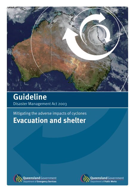
<strong>Guideline</strong><br />
Disaster Management Act 2003<br />
Mitigating the adverse impacts <strong>of</strong> cyclones<br />
Evacuation <strong>and</strong> shelter
<strong>Guideline</strong><br />
Disaster Management Act 2003<br />
April 2008<br />
Mitigating the Adverse Impacts <strong>of</strong> Cyclones - Evacuation <strong>and</strong> Shelter<br />
The purpose <strong>of</strong> this <strong>Guideline</strong> is to provide advice <strong>and</strong> information to Local Governments on planning for<br />
evacuation <strong>and</strong> shelter to reduce the impacts <strong>of</strong> tropical cyclones <strong>and</strong> lows on existing <strong>and</strong> developing<br />
communities.<br />
This <strong>Guideline</strong> has been developed jointly by:<br />
<strong>Department</strong> <strong>of</strong> <strong>Public</strong> <strong>Works</strong><br />
<strong>Department</strong> <strong>of</strong> Emergency Services<br />
Environmental Protection Agency<br />
<strong>Department</strong> <strong>of</strong> Local Government, Sport <strong>and</strong> Recreation<br />
<strong>Department</strong> <strong>of</strong> Natural Resources <strong>and</strong> Water<br />
Queensl<strong>and</strong> Transport<br />
<strong>Department</strong> <strong>of</strong> Main Roads<br />
Local Government Association <strong>of</strong> Queensl<strong>and</strong><br />
Cairns Regional Council<br />
Australian Bureau <strong>of</strong> Meteorology<br />
Geoscience Australia<br />
Emergency Management Australia<br />
Mullins Consulting<br />
Copyright:<br />
<strong>Department</strong> <strong>of</strong> Emergency Services (DES) materials are protected by copyright law. Copyright <strong>of</strong> DES<br />
materials resides with the State <strong>of</strong> Queensl<strong>and</strong>. Apart from any fair dealing for the purpose <strong>of</strong> private<br />
study, research, criticism or review, as permitted under copyright legislation, no part may be reproduced<br />
or re-used for any commercial purposes whatsoever without written permission <strong>of</strong> the DES Copyright<br />
Administrator, <strong>Department</strong> <strong>of</strong> Emergency Services.<br />
Limitations <strong>of</strong> the <strong>Guideline</strong>:<br />
These materials have been prepared as a guide only. All reasonable steps <strong>and</strong> due care have been taken<br />
to ensure the information contained herein is correct at the time <strong>of</strong> publication. The State <strong>of</strong> Queensl<strong>and</strong><br />
<strong>and</strong> its agents expressly exclude all liability for errors or omissions whether made negligently or<br />
otherwise for loss, damage or other consequences that may result from this guideline.
Foreword<br />
Recent experience has demonstrated that major tropical cyclones <strong>and</strong> east coast lows have significant<br />
<strong>and</strong> far reaching impacts on the resilience <strong>and</strong> sustainability <strong>of</strong> Queensl<strong>and</strong>’s communities. With the<br />
intensity <strong>and</strong> frequency <strong>of</strong> cyclone <strong>and</strong> east coast low activity in Queensl<strong>and</strong> expected to increase, it is<br />
essential that communities can safely evacuate <strong>and</strong> shelter during times <strong>of</strong> disaster.<br />
The Queensl<strong>and</strong> Disaster Management System demonstrates the ability <strong>of</strong> a large number <strong>of</strong> Local<br />
<strong>and</strong> State government organisations to work collaboratively to achieve the common goal <strong>of</strong> providing<br />
a framework for state-wide mitigation, preparedness, response <strong>and</strong> recovery activities.<br />
Mitigating the adverse impacts <strong>of</strong> cyclones - evacuation <strong>and</strong> shelter guideline, is the result <strong>of</strong> collaboration<br />
between the Queensl<strong>and</strong> <strong>Department</strong> <strong>of</strong> Emergency Services, the <strong>Department</strong> <strong>of</strong> <strong>Public</strong> <strong>Works</strong> <strong>and</strong> the<br />
Queensl<strong>and</strong> Tropical Cyclone Consultative Committee. This guideline defines a step-by-step process local<br />
government can use to reduce community vulnerability to cyclones <strong>and</strong> inform functional operational <strong>and</strong><br />
disaster mitigation planning. Local governments will be able to examine potential storm tide inundation,<br />
identify the structures that comply with cyclone building st<strong>and</strong>ards <strong>and</strong> put strategies into place to ensure<br />
that the community can evacuate <strong>and</strong> shelter safely.<br />
We are proud to present the Disaster Management Act 2003 guideline Mitigating the adverse impacts<br />
<strong>of</strong> cyclones – evacuation <strong>and</strong> shelter. This publication serves as an excellent guide for Queensl<strong>and</strong> local<br />
governments in their preparation for <strong>and</strong> response to tropical cyclones <strong>and</strong> east coast lows.<br />
Jim McGowan<br />
Director-General<br />
<strong>Department</strong> <strong>of</strong> Emergency Services<br />
Mal Grieson<br />
Director-General<br />
<strong>Department</strong> <strong>of</strong> <strong>Public</strong> <strong>Works</strong><br />
Disaster Management Planning <strong>Guideline</strong><br />
Mitigating the Adverse Impacts <strong>of</strong> Cyclone – Evacuation <strong>and</strong> Shelter<br />
|
Cyclone damage in Innisfail - March 1918<br />
|<br />
Disaster Management Planning <strong>Guideline</strong><br />
Mitigating the Adverse Impacts <strong>of</strong> Cyclone – Evacuation <strong>and</strong> Shelter
Table <strong>of</strong> contents<br />
1. Purpose <strong>of</strong> the guideline 4<br />
2. Scope <strong>of</strong> the guideline 4<br />
3. Application <strong>of</strong> disaster management guidelines 4<br />
4. The need to mitigate the adverse impacts <strong>of</strong> cyclones 5<br />
5. Risk study – evacuation <strong>and</strong> shelter 6<br />
5.1 Communicate <strong>and</strong> consult 8<br />
5.2 Establish the context 8<br />
5.3 Identify risks 8<br />
5.4 Analyse risks 10<br />
Storm tide inundation 12<br />
Ability to evacuate 22<br />
Wind resistance <strong>of</strong> housing 30<br />
Ability to shelter 32<br />
5.5 Evaluate risks 36<br />
Storm tide inundation 36<br />
Ability to evacuate 36<br />
Wind resistance <strong>of</strong> housing 37<br />
Ability to shelter 37<br />
5.6 Treat risks – mitigation 40<br />
Preparedness 40<br />
Infrastructure planning 40<br />
5.7 Monitor <strong>and</strong> review 42<br />
Appendix A<br />
Glossary 44<br />
Appendix B<br />
Cyclone categories <strong>and</strong> building st<strong>and</strong>ards 46<br />
Appendix C<br />
Storm tide inundation 50<br />
Appendix D<br />
References 52<br />
Appendix E<br />
Local governments 54<br />
Disaster Management Planning <strong>Guideline</strong><br />
Mitigating the Adverse Impacts <strong>of</strong> Cyclone – Evacuation <strong>and</strong> Shelter<br />
|
1. Purpose <strong>of</strong> the guideline<br />
The objective <strong>of</strong> this document is to reduce the impacts <strong>of</strong> tropical cyclones on Queensl<strong>and</strong> communities by<br />
identifying, analysing, evaluating <strong>and</strong> treating risks associated with evacuation prior to, <strong>and</strong> shelter during, a<br />
tropical cyclone.<br />
It aims to provide Local Governments with detailed guidance on a risk management study for evacuation <strong>and</strong><br />
shelter which:<br />
• evaluates community risk<br />
• substantiates infrastructure development to mitigate the risk<br />
• informs functional operational planning.<br />
2. Scope <strong>of</strong> the guideline<br />
This guideline applies to existing <strong>and</strong> developing communities <strong>and</strong> defines a process to reduce community<br />
vulnerability to cyclones by:<br />
• analysing risks to a community from storm tide inundation, wind, <strong>and</strong> its ability to evacuate <strong>and</strong> shelter<br />
• quantifying the community risk<br />
• identifying, prioritising <strong>and</strong> implementing strategies including infrastructure development to reduce<br />
community risk.<br />
It is not intended to address riverine flooding due to cyclonic rainfall.<br />
3. Application <strong>of</strong> disaster management guidelines<br />
The authority for this guideline is obtained from Clause 63 <strong>of</strong> the Disaster Management Act 2003 (13) which states that<br />
guidelines may be prepared to inform the State group, district groups <strong>and</strong> local governments about matters relating<br />
to the preparation <strong>of</strong> disaster management plans, matters to be included in a disaster management plan <strong>and</strong> other<br />
matters about the operation <strong>of</strong> a district or local group that the chief executive considers appropriate having regard<br />
to disaster management for the State.<br />
One <strong>of</strong> the main objectives <strong>of</strong> the Act is to ‘mitigate the potential adverse effects <strong>of</strong> an event’. Clause 57 <strong>of</strong> the Act<br />
requires Local Governments to prepare disaster management plans <strong>and</strong> to include in the plan matters stated in<br />
disaster management guidelines. Section 58 requires local disaster management plans to be consistent with the<br />
disaster management guidelines.<br />
Planning <strong>Guideline</strong>s (14) (27) that are in place under the Act provide a comprehensive approach to disaster<br />
management by considering prevention <strong>of</strong>, preparedness for, response to <strong>and</strong> recovery from all hazard events.<br />
This guideline complements these Planning <strong>Guideline</strong>s with a systematic analysis <strong>of</strong> a community’s risk, in evacuating<br />
prior to, <strong>and</strong> sheltering during, a tropical cyclone. The analysis provides information to support operational <strong>and</strong><br />
disaster mitigation planning.<br />
Local Governments listed in Appendix E shall undertake the risk study described in this guideline. Studies should<br />
be undertaken by other coastal communities with a storm surge risk.<br />
|<br />
Disaster Management Planning <strong>Guideline</strong><br />
Mitigating the Adverse Impacts <strong>of</strong> Cyclone – Evacuation <strong>and</strong> Shelter
4. The need to mitigate the adverse impacts <strong>of</strong> cyclones<br />
Many <strong>of</strong> Queensl<strong>and</strong>’s coastal communities have a vulnerability to tropical cyclones. Severe tropical cyclones are<br />
capable <strong>of</strong> causing a catastrophic disaster. The vulnerability <strong>of</strong> these communities can be reduced by a number <strong>of</strong><br />
measures including operational planning <strong>and</strong> development <strong>of</strong> infrastructure to mitigate the adverse impacts <strong>of</strong><br />
cyclones.<br />
New developments need to mitigate the adverse impacts <strong>of</strong> cyclones <strong>and</strong> other natural hazards. State Planning<br />
Policy <strong>Guideline</strong> (34) – Mitigating the Adverse Impacts <strong>of</strong> Flood, Bushfire <strong>and</strong> L<strong>and</strong>slide <strong>and</strong> the State Coastal<br />
Management Plan <strong>Guideline</strong> (33) – Mitigating the Adverse Impacts <strong>of</strong> Storm Tide Inundation provide guidance<br />
for new developments.<br />
Scenario A<br />
A beachside community is vulnerable to storm tide inundation. A category 3 cyclone is forecast to cross the<br />
coastline just north <strong>of</strong> the community. If the cyclone makes l<strong>and</strong>fall on high tide, the community will be inundated<br />
by a storm surge, <strong>and</strong> waves will destroy many homes on the beachfront. The community is evacuated <strong>and</strong> many<br />
shelter from the cyclone in a hall in the neighbouring town. The cyclone slows, strengthens <strong>and</strong> then crosses the<br />
coast on low tide. The community is not inundated. The hall built in the 1960s is destroyed. Many <strong>of</strong> the people<br />
who were sheltering within the hall are injured, some seriously. Many <strong>of</strong> the beachside houses survive as they<br />
were constructed to current cyclone building st<strong>and</strong>ards.<br />
Mitigation solutions:<br />
• develop an evacuation plan<br />
• direct people to shelter in homes constructed to current building st<strong>and</strong>ard above the storm tide<br />
evacuation zone <strong>and</strong><br />
• construct suitable new buildings to public cyclone shelter st<strong>and</strong>ard.<br />
Scenario B<br />
Heavy rain fall precedes a cyclone. A beachside community is isolated, as the only access road is flooded.<br />
A category 4 cyclone is predicted to cross the coastline just north <strong>of</strong> the community. The community is vulnerable<br />
to storm tide inundation. An evacuation <strong>of</strong> the community by boats is attempted. Torrential rain <strong>and</strong> gale force<br />
winds prevent the evacuation. The cyclone crosses the coastline on the high tide <strong>and</strong> the community is inundated<br />
by the surge. Many <strong>of</strong> the beachside houses are destroyed. Several people’s lives are lost.<br />
Mitigation solutions:<br />
• raise the road access<br />
• construct a pedestrian/bike path access with adequate flood immunity to permit evacuation to cyclone<br />
shelters located on high ground in a suburb nearby<br />
• construct suitable new buildings to cyclone shelter st<strong>and</strong>ard on l<strong>and</strong> within the community filled to create a<br />
building site that is above shelter storm tide height.<br />
Disaster Management Planning <strong>Guideline</strong><br />
Mitigating the Adverse Impacts <strong>of</strong> Cyclone – Evacuation <strong>and</strong> Shelter<br />
|
5. Risk study - evacuation <strong>and</strong> shelter<br />
This study evaluates the vulnerability <strong>of</strong> communities based upon their exposure to risks <strong>of</strong> storm tide<br />
inundation, building failure, <strong>and</strong> their ability to evacuate <strong>and</strong> shelter within a limited time period prior to the<br />
impact <strong>of</strong> a tropical cyclone.<br />
The study process <strong>and</strong> goals <strong>of</strong> each stage is summarised below <strong>and</strong> is based on AS/NZS4360 (4) .<br />
Stage<br />
5.1 Communicate <strong>and</strong> consult<br />
5.2 Establish the context<br />
Goal<br />
Communicate <strong>and</strong> engage with all stakeholders at all stages.<br />
Reduce community vulnerability, in evacuating prior to, <strong>and</strong><br />
sheltering during, a tropical cyclone.<br />
5.3 Identify risks Identify risks to the community, in evacuating prior to, <strong>and</strong><br />
sheltering during, a tropical cyclone.<br />
5.4 Analyse risks Identify areas at risk <strong>of</strong> storm tide inundation.<br />
Identify the number <strong>of</strong> people, reliable routes <strong>and</strong> time to<br />
move from evacuation zones to shelter.<br />
Identify housing complying with cyclone building st<strong>and</strong>ards<br />
<strong>and</strong> the population evacuating from housing above the storm<br />
tide evacuation zone.<br />
Identify areas to shelter <strong>and</strong> estimate the population seeking<br />
shelter.<br />
5.5 Evaluate risks Evaluate the risk to Queensl<strong>and</strong> communities in evacuation<br />
<strong>and</strong> shelter from severe tropical cyclones.<br />
5.6 Treat risks - mitigation Identify schemes to reduce community vulnerability.<br />
5.7 Monitor <strong>and</strong> review Ensure information remains relevant.<br />
Building damage by cyclone Larry - March 2006<br />
|<br />
Disaster Management Planning <strong>Guideline</strong><br />
Mitigating the Adverse Impacts <strong>of</strong> Cyclone – Evacuation <strong>and</strong> Shelter
The community’s demographics, experience from previous events, as well as cultural, socio-economic <strong>and</strong> physical<br />
aspects, will influence its perception <strong>of</strong> the need <strong>and</strong> its ability to evacuate <strong>and</strong> shelter. While no specific guidance<br />
on evaluating these issues is given in this guideline they should be considered in the study <strong>and</strong> incorporated in<br />
operational planning.<br />
Community surveys (23) may be used to determine community behavioural aspects which impact on this study.<br />
These include determining the number <strong>of</strong> people who will:<br />
• evacuate from potential storm tide inundated areas<br />
• evacuate from areas not at risk <strong>of</strong> inundation<br />
• seek shelter with family <strong>and</strong> friends in the community<br />
• evacuate the area <strong>and</strong> travel beyond the cyclone warning zone<br />
• require assistance to evacuate <strong>and</strong> the extent <strong>of</strong> assistance required.<br />
Other information that can be obtained from such surveys that will impact on the study include:<br />
• at what time before predicted l<strong>and</strong>fall would people evacuate<br />
• the likely number <strong>of</strong> people in each vehicle.<br />
Innisfail State High School built in 1968. Damaged by cyclone Larry - March 2006<br />
Disaster Management Planning <strong>Guideline</strong><br />
Mitigating the Adverse Impacts <strong>of</strong> Cyclone – Evacuation <strong>and</strong> Shelter<br />
|
5.1 Communicate <strong>and</strong> consult<br />
Study Goal 5.1: Communicate <strong>and</strong> engage with all stakeholders at all stages.<br />
Consult with technical experts, disaster management specialists <strong>and</strong> community members at all stages<br />
The Study requires that stakeholders <strong>and</strong> communities are identified, <strong>and</strong> paths <strong>of</strong> communication are established.<br />
Communication <strong>and</strong> consultation should then occur at all stages <strong>of</strong> the study.<br />
Where stakeholders <strong>and</strong> communities contribute to the decision making process there is a much larger pool <strong>of</strong><br />
information <strong>and</strong> expertise to enable appropriate solutions to be developed.<br />
For risk events which have a high level <strong>of</strong> uncertainty, such as cyclones <strong>and</strong> associated storm surge, communication<br />
<strong>and</strong> consultation during the risk assessment phase are considered extremely important.<br />
Communication <strong>and</strong> consultation will:<br />
• help develop resilience amongst stakeholders <strong>and</strong> community members<br />
• ensure commitment <strong>of</strong> stakeholders <strong>and</strong> promote shared underst<strong>and</strong>ings <strong>of</strong> the risks <strong>and</strong> the mitigation activities<br />
• reflect the interests <strong>of</strong> the community.<br />
5.2 Establish the context<br />
Study Goal 5.2: Reduce community vulnerability, in evacuating prior to, <strong>and</strong> sheltering during,<br />
a tropical cyclone.<br />
Provide information specific to the community to effectively incorporate evacuation <strong>and</strong> sheltering into<br />
the local disaster management planning. Identify the need <strong>and</strong> provide justification for infrastructure<br />
development which mitigates the risk.<br />
The study shall determine the:<br />
• zones to be evacuated for six different storm tide events<br />
• number <strong>of</strong> people to be evacuated for each event<br />
• designated evacuation routes<br />
• evacuation timelines for each storm tide event with varying evacuation route conditions<br />
• areas where housing complies with current wind resistant building st<strong>and</strong>ards<br />
• ability to shelter.<br />
Local governments should undertake studies for each community. A community is a group <strong>of</strong> people which may be<br />
isolated from adjoining communities.<br />
The study area should be bounded by topographic features such as rivers, creeks or steep slopes which form natural<br />
boundaries to the community. Rivers <strong>and</strong> creeks may flood <strong>and</strong> hill slopes may slip during an event to form physical<br />
boundaries to the evacuation. The area should include a zone in which people may seek shelter.<br />
The study provides information for operational planning. It does not purport to be a disaster management operational<br />
plan. The study does not address the decision process to evacuate, the management <strong>of</strong> the evacuation <strong>and</strong> shelter, or<br />
the return phase <strong>of</strong> the evacuation.<br />
5.3 Identify risks<br />
Study Goal 5.3: Identify risks to the community, in evacuating prior to, <strong>and</strong> sheltering during,<br />
a tropical cyclone.<br />
Determine the risk to the community by examining:<br />
a) Storm tide inundation b) Ability to evacuate c) Wind resistance <strong>of</strong> housing d) Ability to shelter.<br />
Identify other risks to which the community may be exposed while evacuating prior to, <strong>and</strong>/or sheltering during,<br />
a severe tropical cyclone.<br />
|<br />
Disaster Management Planning <strong>Guideline</strong><br />
Mitigating the Adverse Impacts <strong>of</strong> Cyclone – Evacuation <strong>and</strong> Shelter
Example<br />
Communicate <strong>and</strong> consult<br />
Communication <strong>and</strong> consultation with the community, disaster managers <strong>and</strong> technical specialist have been<br />
undertaken at all stages <strong>of</strong> this study.<br />
Establish the context<br />
The scope<br />
The purpose <strong>of</strong> this study is to reduce the impacts <strong>of</strong> cyclones on communities within the shire by planning for<br />
orderly evacuation <strong>and</strong> shelter. This study is based upon the Disaster Management <strong>Guideline</strong> – Mitigating the<br />
Adverse Impacts <strong>of</strong> Cyclones – Evacuation <strong>and</strong> Shelter 2008.<br />
This study:<br />
• details the zones to be evacuated for six different storm tide events<br />
• determines the number <strong>of</strong> people to be evacuated for each event<br />
• designates evacuation routes<br />
• determines the evacuation timelines for each storm tide event with varying evacuation route conditions<br />
• determines the areas where housing complies with current wind resistant building st<strong>and</strong>ards<br />
• determines the ability for people to shelter.<br />
No buildings have been identified in this community as complying with the Design <strong>Guideline</strong>s for Queensl<strong>and</strong><br />
<strong>Public</strong> Cyclone Shelters. (12)<br />
The study also identifies mitigation strategies <strong>and</strong> provides a rational basis for infrastructure planning to mitigate<br />
the adverse impacts <strong>of</strong> cyclones in the shire.<br />
This study is not intended as an operational plan. It does not include the decision process to evacuate, the<br />
management <strong>of</strong> the evacuation <strong>and</strong> shelter, or the return phase <strong>of</strong> the evacuation.<br />
Study area<br />
This study examines the evacuation <strong>and</strong> sheltering<br />
<strong>of</strong> the communities <strong>of</strong> Coconut Beach, Coconut<br />
Grove, Seaview <strong>and</strong> adjoining areas located<br />
between Coconut Grove Creek <strong>and</strong> Jetty Inlet.<br />
Figure 1: Geographical extent <strong>of</strong> study<br />
This example is for demonstration purposes only<br />
<strong>and</strong> resemblance to any community, location or<br />
actual or potential event is purely coincidental.<br />
Identify risks<br />
Risks to the communities within the shire, in evacuating prior to, <strong>and</strong> sheltering during, a tropical cyclone are<br />
identified by examining:<br />
a) Storm tide inundation b) Ability to evacuate c) Wind resistance <strong>of</strong> housing d) Ability to shelter.<br />
Disaster Management Planning <strong>Guideline</strong><br />
Mitigating the Adverse Impacts <strong>of</strong> Cyclone – Evacuation <strong>and</strong> Shelter<br />
|
5.4 Analyse risks<br />
Analyse all identified risks. In the following step-by-step procedure this section <strong>of</strong> the guideline describes the analysis<br />
<strong>of</strong> risks to a community from storm tide inundation, the ability to evacuate, the vulnerability <strong>of</strong> housing to wind <strong>and</strong><br />
the ability for people to shelter.<br />
Storm tide inundation<br />
Study Goal 5.4.1: Identify areas at risk <strong>of</strong> storm tide inundation.<br />
Step 1 - Determine the levels <strong>and</strong> inundation areas for six storm tide events<br />
Step 2 - Estimate the likelihood <strong>of</strong> inundation<br />
Step 3 - Estimate the likelihood <strong>of</strong> evacuation <strong>and</strong> shelter for each storm tide event<br />
Step 4 - Map the storm tide evacuation zones.<br />
Ability to evacuate<br />
Study Goal 5.4.2: Identify the number <strong>of</strong> people, reliable routes <strong>and</strong> time to move from<br />
evacuation zones to shelter.<br />
Step 5 - Determine the evacuation population<br />
Step 6 - Designate evacuation routes<br />
Step 7 - Estimate the capacity <strong>of</strong> evacuation routes under differing conditions<br />
Step 8 - Quantify the vulnerability <strong>of</strong> the evacuation routes<br />
Step 9 - Estimate evacuation timelines under differing conditions.<br />
Wind resistance <strong>of</strong> housing<br />
Study Goal 5.4.3: Identify housing complying with cyclone building st<strong>and</strong>ards <strong>and</strong> the population<br />
evacuating from housing above the storm tide evacuation zone.<br />
Step 10 - Map suburbs/developments with housing complying with cyclone building st<strong>and</strong>ards<br />
Step 11 - Estimate the population in housing vulnerable to wind<br />
Step 12 - Estimate the population evacuating housing not at threat from storm tide inundation.<br />
Ability to shelter<br />
Study Goal 5.4.4: Identify areas to shelter <strong>and</strong> estimate the population seeking shelter.<br />
Step 13 - Identify <strong>and</strong> map the shelter catchment<br />
Step 14 - Map the shelter zone<br />
Step 15 - Map the public cyclone shelter zone<br />
Step 16 - Estimate the evacuation population<br />
Step 17 - Estimate the population leaving<br />
Step 18 - Estimate the population seeking shelter<br />
Step 19 - Estimate the population sheltering within the community<br />
10 |<br />
Step 20 - Estimate the population seeking shelter in public cyclone shelters <strong>and</strong> the available shelter capacity.<br />
Disaster Management Planning <strong>Guideline</strong><br />
Mitigating the Adverse Impacts <strong>of</strong> Cyclone – Evacuation <strong>and</strong> Shelter
Example<br />
Analyse risks<br />
Risks to the community are analysed in this study by:<br />
• identifying areas at risk <strong>of</strong> storm tide inundation<br />
• identifying the number <strong>of</strong> people, reliable routes <strong>and</strong> time to move from evacuation zones to shelter<br />
• identifying housing complying with cyclone building st<strong>and</strong>ards <strong>and</strong> the population evacuating from housing<br />
beyond the storm tide evacuation zone<br />
• identifying areas to locate shelters <strong>and</strong> estimating the population seeking shelter.<br />
Tropical cyclone Ingrid - March 2005<br />
Photograph courtesy <strong>of</strong> the Australian Bureau <strong>of</strong> Meteorology<br />
Disaster Management Planning <strong>Guideline</strong><br />
Mitigating the Adverse Impacts <strong>of</strong> Cyclone – Evacuation <strong>and</strong> Shelter<br />
| 11
Storm tide inundation<br />
Study Goal 5.4.1: Identify areas at risk <strong>of</strong> storm tide inundation<br />
Step 1: Storm tide events<br />
Determine the storm tide events <strong>and</strong> inundation areas consistent with the National Storm Tide Mapping Model<br />
for emergency response.<br />
The National Storm Tide Mapping Model (24) for emergency response defines zones which extend above Highest<br />
Astronomical Tide (HAT) <strong>and</strong> are referenced to the Australian Height Datum (AHD). The first zone or Zone 1 extends<br />
from HAT up to the next metre or half metre AHD level. The subsequent five zones are then 0.5m increments in AHD.<br />
Each zone is colour coded as shown in the storm tide graphic.<br />
Evacuation planning is to be based upon six storm tide events corresponding with the six storm tide zones. The storm<br />
tide level for each event is the highest level in the corresponding storm tide zone.<br />
Storm Tide Graphic<br />
The Bureau <strong>of</strong> Meteorology storm tide warning<br />
graphic for emergency managers shows the colour<br />
coded emergency management zones with the<br />
predicted storm tide height shown in red.<br />
Levels referenced to Australian Height Datum<br />
(AHD) are shown on the right <strong>and</strong> the Lowest<br />
Astronomical Tide datum (LAT) is shown on the<br />
left. The high tide level <strong>and</strong> predicted time on<br />
the day <strong>of</strong> crossing are also shown.<br />
The graphic shows seven zones. Zones 1 to 6 are<br />
coloured <strong>and</strong> Zone 7 is white. Zone 7 extends from<br />
Zone 6 up to the theoretical maximum possible<br />
storm tide level. At the time <strong>of</strong> publication <strong>of</strong> this<br />
guideline the theoretical maximum level had not<br />
been defined for many communities. Where this<br />
level has been defined a storm tide Event 7 shall<br />
be included in the analysis.<br />
12 |<br />
Disaster Management Planning <strong>Guideline</strong><br />
Mitigating the Adverse Impacts <strong>of</strong> Cyclone – Evacuation <strong>and</strong> Shelter
Example<br />
Storm tide inundation<br />
Storm tide events<br />
Step 1<br />
Storm tide events <strong>and</strong> inundation areas<br />
The storm tide heights for each <strong>of</strong> the storm tide events are shown in Figure 2. For example, if the storm tide height<br />
is between 3m <strong>and</strong> 3.5m AHD the storm tide is an Event 4 storm tide.<br />
The composite storm tide inundation map for the six inundation zones is shown in Figure 3. This map is essentially<br />
a 0.5m contour map in AHD, coloured to correspond to the storm tide zones.<br />
Figure 2: Storm tide events<br />
Figure 3: Storm tide zones for emergency response<br />
Event<br />
7<br />
6<br />
5<br />
4<br />
3<br />
2<br />
1<br />
Levels<br />
4.5m AHD<br />
4m AHD<br />
3.5m AHD<br />
3m AHD<br />
2.5m AHD<br />
2m AHD<br />
HAT<br />
Storm tide mapping <strong>of</strong> the community is a pre-requisite to undertaking this study.<br />
The map above is similar to maps provided to emergency managers as part <strong>of</strong> the National Storm Tide Mapping<br />
Model for emergency managers.<br />
This figure shows complexities which may occur in the planning where small areas may be isolated from the<br />
remainder <strong>of</strong> the community.<br />
Disaster Management Planning <strong>Guideline</strong><br />
Mitigating the Adverse Impacts <strong>of</strong> Cyclone – Evacuation <strong>and</strong> Shelter<br />
| 13
Step 2: Likelihood <strong>of</strong> inundation<br />
Estimate the storm tide level for events with annual exceedance probabilities <strong>of</strong>:<br />
1/50, 1/100, 1/500, 1/1,000, 1/5,000 <strong>and</strong> 1/10,000<br />
The relationship between storm tide height <strong>and</strong> probability <strong>of</strong> occurrence is determined by detailed numerical<br />
modelling <strong>of</strong> coastal bathymetry <strong>and</strong> cyclone characteristics.<br />
The results <strong>of</strong> various studies were summarised by Harper (35) in 1998 for 82 locations along Queensl<strong>and</strong>’s east coast.<br />
In 2003 Harper et al (29) revised the estimates for 50 locations <strong>and</strong> investigated the effects <strong>of</strong> various Greenhouse<br />
scenarios on the storm tide height. The results <strong>of</strong> the most recent study, based upon current climate should be used in<br />
this study.<br />
For the purpose <strong>of</strong> this study storm tide height predictions may be interpolated from a smooth curve <strong>of</strong> storm tide<br />
height plotted against the logarithm <strong>of</strong> the annual exceedance probability.<br />
Storm surge model - Hervey Bay<br />
Photograph courtesy <strong>of</strong> the Queensl<strong>and</strong> Government, Environmental Protection Agency<br />
14 |<br />
Disaster Management Planning <strong>Guideline</strong><br />
Mitigating the Adverse Impacts <strong>of</strong> Cyclone – Evacuation <strong>and</strong> Shelter
Example<br />
Storm tide inundation<br />
Likelihood <strong>of</strong> inundation<br />
Step 2<br />
Table 1: Likelihood <strong>of</strong> inundation<br />
Annual exceedance<br />
probability<br />
Storm tide height<br />
(m AHD)<br />
1/10,000 4.7<br />
1/5,000 4.5<br />
1/1,000 3.7<br />
1/500 3.3<br />
1/100 2.6<br />
1/50 2.2<br />
Estimated storm tide probabilities <strong>and</strong> levels<br />
are based on studies reported by Harper (35)<br />
<strong>and</strong> updated by Harper et al (29) .<br />
Figure 4: Storm tide inundation<br />
Event Levels Probability<br />
7<br />
6<br />
5<br />
4<br />
3<br />
2<br />
1<br />
4.5m AHD<br />
4m AHD<br />
3.5m AHD<br />
3m AHD<br />
2.5m AHD<br />
2m AHD<br />
HAT<br />
1/10,000 4.7m AHD<br />
1/5,000 4.5m AHD<br />
1/1,000 3.7m AHD<br />
1/500 3.3m AHD<br />
1/100 2.6m AHD<br />
1/50 2.2m AHD<br />
This figure shows that inundation to 2.6m AHD, an Event 3,<br />
has a probability <strong>of</strong> occurring once in 100 years.<br />
Storm tide damage in Mackay - January 1918<br />
Disaster Management Planning <strong>Guideline</strong><br />
Mitigating the Adverse Impacts <strong>of</strong> Cyclone – Evacuation <strong>and</strong> Shelter<br />
| 15
Step 3: Likelihood <strong>of</strong> evacuation <strong>and</strong> shelter<br />
Estimate the evacuation <strong>and</strong> shelter probability for each <strong>of</strong> the storm tide events.<br />
This analysis establishes an important point - that evacuation <strong>and</strong> the need for shelter due to a potential storm tide<br />
will occur more frequently than actual inundation.<br />
The likelihood <strong>of</strong> evacuation can be approximated by dividing the probability <strong>of</strong> inundation by the average ratio <strong>of</strong> the<br />
length <strong>of</strong> coastline evacuated to the actual length inundated. An allowance should be added to the storm tide height<br />
for the difference between the tide height at the actual peak storm tide <strong>and</strong> the highest tide height upon which the<br />
forecast is based.<br />
The annual probability <strong>of</strong> exceedance <strong>of</strong> the storm tide height for each storm tide event can be estimated from a plot <strong>of</strong><br />
the storm tide height versus the logarithm <strong>of</strong> probability.<br />
Forecast uncertainty at time <strong>of</strong> evacuation<br />
The evacuation <strong>of</strong> the potential storm tide inundation area has to be completed prior to the cyclone impacts being<br />
experienced. This is to ensure all people can be evacuated <strong>and</strong> sheltered prior to wind gusts reaching 100km/hr, when<br />
it becomes difficult for people to walk outdoors. To achieve this, evacuation must be commenced when there is still<br />
uncertainty about the cyclone’s location <strong>and</strong> time <strong>of</strong> l<strong>and</strong>fall.<br />
This uncertainty <strong>of</strong> predicted cyclone movement <strong>and</strong> crossing location is shown in the Bureau <strong>of</strong> Meteorology’s<br />
cyclone forecast graphic. The degree <strong>of</strong> uncertainty will vary depending on the characteristics <strong>and</strong> behaviour <strong>of</strong> a<br />
particular cyclone <strong>and</strong> is reflected by the coastal extent <strong>of</strong> the Warning <strong>and</strong> Watch zones (orange/warning <strong>and</strong> yellow/<br />
watch). The grey area on this graphic represents the uncertainty in the forecast position <strong>of</strong> the cyclone’s centre 48<br />
hours prior to l<strong>and</strong>fall.<br />
Sample cyclone forecast graphic<br />
Due to the uncertainty in the time <strong>and</strong><br />
position <strong>of</strong> l<strong>and</strong>fall <strong>and</strong> to provide a<br />
realistic safety margin the Bureau <strong>of</strong><br />
Meteorology bases the early storm<br />
tide predictions on the “worst case”<br />
scenario <strong>of</strong> the peak storm surge<br />
occurring at the time <strong>of</strong> the high tide.<br />
While the forecast storm tide height<br />
may be refined in the three hourly<br />
forecasts leading up to l<strong>and</strong>fall - the<br />
evacuation, based upon the worst case<br />
storm tide height, must be commenced<br />
before this more accurate information<br />
becomes available.<br />
Therefore an evacuation <strong>and</strong> the need to shelter people will occur more frequently than the actual storm tide<br />
inundation <strong>of</strong> an area because:<br />
a) There is an inherent forecast uncertainty in the cyclone’s l<strong>and</strong>fall location at the time <strong>of</strong> commencement <strong>of</strong><br />
evacuation;<br />
b) Due to the uncertainty in the time <strong>of</strong> l<strong>and</strong>fall at the commencement <strong>of</strong> evacuation the forecast storm tide height is<br />
based on the worst case tide where the peak storm surge coincides with the highest tide <strong>of</strong> the day.<br />
The Bureau <strong>of</strong> Meteorology’s advice, based upon analysis <strong>of</strong> previous events, is that on average the length <strong>of</strong> coastline<br />
in the warning zone at the time <strong>of</strong> the qualitative storm tide warning will typically be about 3 times the actual length<br />
<strong>of</strong> coastline inundated if the cyclone makes l<strong>and</strong>fall on the high tide. The ratio reduces to about 2 at the time <strong>of</strong> the<br />
quantitative warning.<br />
Detailed analysis <strong>of</strong> storm tide characteristics is required to determine the difference between tide height at time <strong>of</strong><br />
peak storm tide <strong>and</strong> the high tide. An approximation acceptable in this study is the difference between the mean high<br />
water <strong>and</strong> mean sea level.<br />
16 |<br />
Disaster Management Planning <strong>Guideline</strong><br />
Mitigating the Adverse Impacts <strong>of</strong> Cyclone – Evacuation <strong>and</strong> Shelter
Example<br />
Storm tide inundation<br />
Likelihood <strong>of</strong> evacuation <strong>and</strong> shelter<br />
Step 3<br />
For the purpose <strong>of</strong> disaster response <strong>and</strong> mitigation planning, it is more relevant to estimate the likelihood <strong>of</strong> the<br />
need to effect an evacuation based on emergency management zones. The likelihood to undertake an evacuation,<br />
<strong>and</strong> requirement for shelter is not the same as the probability <strong>of</strong> the storm tide inundation.<br />
Because <strong>of</strong> the inherent uncertainty in the location <strong>of</strong> a cyclone’s l<strong>and</strong>fall <strong>and</strong> the time <strong>of</strong> l<strong>and</strong>fall, good response<br />
planning <strong>and</strong> operations will require evacuation <strong>of</strong> a greater area <strong>of</strong> the coast than may actually be inundated<br />
during the cyclone’s passage. This planning <strong>and</strong> response is based on the worst case storm tide height where the<br />
peak storm tide occurs on a high tide.<br />
Table 2: Likelihood <strong>of</strong> evacuation<br />
Annual exceedance<br />
probability<br />
Forecast / evacuation<br />
storm tide height (m AHD)<br />
1/5,000 5.2<br />
1/2,500 5.0<br />
1/500 4.2<br />
1/250 3.8<br />
1/50 3.1<br />
1/25 2.7<br />
The likelihood <strong>of</strong> an evacuation shown in Table 2 is<br />
calculated from Table 1 (Likelihood <strong>of</strong> inundation)<br />
based upon the following assumptions:<br />
1. The length <strong>of</strong> coastline evacuated is on average<br />
two times the actual length <strong>of</strong> coastline inundated.<br />
Therefore the probability is halved.<br />
2. An allowance <strong>of</strong> 0.5m has been added to the<br />
inundation height to estimate the forecast height for<br />
evacuation. This allowance for the highest tide <strong>of</strong> the<br />
day is consistent with the Bureau <strong>of</strong> Meteorology’s<br />
worst case scenario forecasts. This allowance for the<br />
highest tide <strong>of</strong> the day is estimated by the difference<br />
between the mean high tide <strong>and</strong> mean sea level.<br />
Figure 5: Plot <strong>of</strong> likelihood <strong>of</strong> evacuation<br />
Forecast / evacuation storm tide height<br />
(m AHD)<br />
1/10 1/100 1/1,000 1/10,000<br />
Annual exceedance probability<br />
The probabilities for each storm tide event are<br />
estimated from a linear interpolation <strong>of</strong> a plot <strong>of</strong><br />
the storm tide heights shown in Table 2 versus the<br />
logarithm <strong>of</strong> annual exceedance probability.<br />
The likelihood <strong>of</strong> each evacuation event is<br />
determined from the plot <strong>and</strong> is shown in Figure 6.<br />
Figure 6: Evacuation <strong>and</strong> shelter<br />
Event Levels Probability<br />
7 4.5m AHD 1/1,000<br />
6 4m AHD 1/350<br />
5 3.5m AHD 1/120<br />
4 3m AHD 1/45<br />
Figure 6 shows that the probability <strong>of</strong> evacuation in<br />
response to a predicted storm tide Event 3 is once in<br />
15 years, <strong>and</strong> that Events 1 <strong>and</strong> 2 are more frequent.<br />
This analysis has shown that the likelihood <strong>of</strong><br />
evacuation will be more frequent than the likelihood<br />
<strong>of</strong> inundation.<br />
3 2.5m AHD 1/15<br />
2 2m AHD < 1/15<br />
1 HAT < 1/15<br />
Disaster Management Planning <strong>Guideline</strong><br />
Mitigating the Adverse Impacts <strong>of</strong> Cyclone – Evacuation <strong>and</strong> Shelter<br />
| 17
Step 4: Storm tide evacuation zones<br />
Map the storm tide evacuation zones for each <strong>of</strong> the six storm tide events.<br />
A property should be included in the evacuation zone when the storm tide event extends to the building on the<br />
property or the inundation isolates the property from the community.<br />
The storm tide event inundation levels shown on the map on the opposite page are essentially colour coded contour<br />
levels. Some properties are shown with two or more coloured zones. To avoid confusion the zones can be extended<br />
to the property boundary, so that a residential property is shown to be in a single zone. The exceptions are large<br />
properties with more than one residential building.<br />
The level <strong>of</strong> sea water inundation is neither uniform nor horizontal. The level will vary along the coastline depending<br />
upon the cyclone <strong>and</strong> its location along with the coastal bathymetry. On the east coast <strong>of</strong> Queensl<strong>and</strong> the storm tide is<br />
greatest south <strong>of</strong> the eye where the wind is blowing towards the shore. On the west coast <strong>of</strong> Cape York it is greatest to<br />
the north <strong>of</strong> the eye.<br />
In the beach front area, breaking ocean waves will run-up the beach <strong>and</strong> foreshore to levels above the predicted storm<br />
tide level. Waves will attack fore dunes or near shore structures <strong>and</strong> can cause considerable damage.<br />
Behind the beach front area, where the effect <strong>of</strong> ocean waves has decayed, the inundation level will depend upon:<br />
• the water depth<br />
• the duration <strong>of</strong> the peak storm tide<br />
• the obstruction to water flow by buildings, vegetation <strong>and</strong> topography.<br />
If there is sufficient time for the water to flow inl<strong>and</strong>, the inundation level inl<strong>and</strong> would eventually be the same as the<br />
water level at the coastline.<br />
Detailed engineering modelling can be used to determine the time-dependent inundation levels within the community<br />
for the various storm tide levels.<br />
Where such analysis has not been undertaken it is proposed that two evacuation levels are adopted for each storm<br />
tide event:<br />
• a level equal to the forecast storm tide height in the inl<strong>and</strong> area where the effect <strong>of</strong> ocean waves has decayed.<br />
• a higher level in the frontal area to allow for the effects <strong>of</strong> breaking ocean waves <strong>and</strong> run-up.<br />
The extent <strong>and</strong> increased level <strong>of</strong> the evacuation zone in the frontal area is dependent upon the storm tide event as<br />
the potential height <strong>of</strong> ocean waves depends on the water depth. Informed advice should be sought <strong>and</strong> realistic yet<br />
conservative estimates adopted for the width <strong>and</strong> increased level in the frontal area.<br />
Evacuation levels<br />
Area<br />
Level<br />
Inl<strong>and</strong><br />
Forecast storm tide height zone<br />
Frontal Forecast storm tide height zone + n x 0.5m<br />
Note: n =1, 2, 3, 4 etc<br />
The forecast storm tide height is the water level when the storm surge is combined with the astronomical tide <strong>and</strong><br />
wave setup. Wave runup can increase water levels above the forecast storm tide height.<br />
Wave setup is the increase in the mean water level at the shoreline caused by wave action. The maximum height <strong>of</strong><br />
the setup on a beach is dependent upon the size <strong>of</strong> the ocean waves. When the storm tide is higher than the top <strong>of</strong><br />
the beach <strong>and</strong> the storm tide inundates inl<strong>and</strong>, then the wave setup reduces as the depth <strong>of</strong> water over the foreshore<br />
increases.<br />
The inl<strong>and</strong> evacuation levels assume a forecast storm tide height with a wave setup allowance consistent with inl<strong>and</strong><br />
inundation.<br />
Evacuation zones, mapped with a single colour for each storm tide event, which extent to property boundaries <strong>and</strong><br />
include an increased inundation level in the frontal area are shown in the example - Figure 7.<br />
18 |<br />
Disaster Management Planning <strong>Guideline</strong><br />
Mitigating the Adverse Impacts <strong>of</strong> Cyclone – Evacuation <strong>and</strong> Shelter
Storm tide event inundation areas<br />
Section A-A<br />
Section B-B<br />
Evacuation zones<br />
Section A-A<br />
zone 4<br />
zone 3<br />
zone 2<br />
zone 1<br />
zone 6<br />
zone 5<br />
zone 4<br />
zone 3<br />
zone 2<br />
zone 1<br />
Evacuation zones<br />
Section B-B<br />
zone 4<br />
zone 3<br />
zone 2<br />
zone 1<br />
zone 6<br />
zone 5<br />
zone 4<br />
zone 3<br />
zone 2<br />
zone 1<br />
Disaster Management Planning <strong>Guideline</strong><br />
Mitigating the Adverse Impacts <strong>of</strong> Cyclone – Evacuation <strong>and</strong> Shelter<br />
| 19
Example<br />
Storm tide inundation<br />
Figure 7: Storm tide evacuation zones<br />
Step 4<br />
Storm tide event 1<br />
Storm tide event 2<br />
Storm tide event 3<br />
Storm tide event 4 Storm tide event 5<br />
Storm tide event 6<br />
20 |<br />
Disaster Management Planning <strong>Guideline</strong><br />
Mitigating the Adverse Impacts <strong>of</strong> Cyclone – Evacuation <strong>and</strong> Shelter
Cyclone damage in Innisfail - March 1918<br />
Disaster Management Planning <strong>Guideline</strong><br />
Mitigating the Adverse Impacts <strong>of</strong> Cyclone – Evacuation <strong>and</strong> Shelter<br />
| 21
Ability to evacuate<br />
Study goal 5.4.2: Identify the number <strong>of</strong> people, reliable routes <strong>and</strong> time to move from evacuation<br />
zones to shelter.<br />
Step 5 - Evacuation population<br />
Estimate the population in the evacuation zone for each <strong>of</strong> the storm tide events.<br />
Tabulate populations for each suburb or area.<br />
Evacuation populations can be determined for each evacuation zone from the <strong>of</strong>ficial estimated resident population<br />
figures used in the local authority’s priority infrastructure planning (23) . Allowance should be made for transient<br />
populations normally resident in the community during the cyclone season. Indicate the assumed population on<br />
which the estimates are based.<br />
The evacuation zone is the area inundated by the potential storm tide.<br />
Step 6 - Designated evacuation routes<br />
Identify evacuation routes <strong>and</strong> modes <strong>of</strong> travel for all areas to be evacuated.<br />
Map the designated evacuation routes.<br />
A designated evacuation route is a route along which people may travel from the evacuation zone to the shelter zone.<br />
The designated evacuation route would typically be the major road linking the areas. It should extend from an<br />
intersection with collector streets in the centre <strong>of</strong> the evacuation area to an intersection with other roads in the public<br />
cyclone shelter zone.<br />
Photograph courtesy <strong>of</strong> the Australian Bureau <strong>of</strong> Meteorology<br />
22 |<br />
Disaster Management Planning <strong>Guideline</strong><br />
Mitigating the Adverse Impacts <strong>of</strong> Cyclone – Evacuation <strong>and</strong> Shelter
Example<br />
Ability to evacuate<br />
Evacuation population<br />
Step 5<br />
Table 3: Evacuation population due to inundation<br />
Event Levels Suburb Total<br />
6<br />
5<br />
4<br />
3<br />
4.5m AHD<br />
4m AHD<br />
3.5m AHD<br />
3m AHD<br />
2.5m AHD<br />
Coconut<br />
Beach<br />
Coconut<br />
Grove<br />
Seaview<br />
Mountain<br />
View<br />
800 450 500 550 2300<br />
800 450 490 210 1950<br />
800 380 450 30 1660<br />
800 210 350 nil 1360<br />
2 2m AHD 800 90 nil nil 890<br />
1 HAT 500 10 nil nil 510<br />
Total population 800 450 500 650 2400<br />
Based upon an average <strong>of</strong> 2.5 people per residential property <strong>and</strong> 1.5 people per unit or flat<br />
Designated evacuation routes<br />
Step 6<br />
Figure 8: Designated evacuation routes<br />
Legend:<br />
Designated evacuation route<br />
Designated Evacuation Routes:<br />
Beach Rd. from Coconut Beach to Jetty Rd.<br />
Jetty Rd from Middle Rd to Hill Rd.<br />
Seaview Drive from Coral Street to Jetty Rd.<br />
Middle Rd from Mist Street to Jetty Rd.<br />
Disaster Management Planning <strong>Guideline</strong><br />
Mitigating the Adverse Impacts <strong>of</strong> Cyclone – Evacuation <strong>and</strong> Shelter<br />
| 23
Step 7: Route capacity<br />
Determine the capacity <strong>of</strong>, <strong>and</strong> travel time along, the evacuation routes.<br />
The capacity (people/hr) <strong>of</strong> the evacuation routes will vary depending upon route conditions. A range <strong>of</strong> route<br />
conditions, normal <strong>and</strong> disrupted <strong>and</strong>, if appropriate, enhanced <strong>and</strong> blocked should be examined.<br />
Where the time necessary for evacuating the community is greater than six hours, for the normal route condition,<br />
determine the appropriate level <strong>of</strong> emergency management intervention to achieve an evacuation within<br />
six hours. Determine the enhanced capacity <strong>of</strong> the evacuation routes.<br />
Identify hazards which may block the evacuation route. Determine an alternate means <strong>and</strong> the rate <strong>of</strong> evacuation.<br />
Route capacity should be assessed individually for each community. The capacity is <strong>of</strong>ten controlled by the capacity<br />
<strong>of</strong> the intersection.<br />
Step 8: Route vulnerability<br />
Quantify the vulnerability to hazards which may block the evacuation route.<br />
The route vulnerability can be quantified in terms <strong>of</strong> the likelihood <strong>of</strong> occurrence, for example, a road flooded at a<br />
creek by a Q20 flood.<br />
Route conditions<br />
‘Normal’ - Fine weather with normal traffic control.<br />
‘Enhanced’ - Emergency agencies intervene to increase the route capacity. Several options are available. These<br />
include: ensuring a minimum number <strong>of</strong> people per vehicle; banning vehicles towing caravans <strong>and</strong> trailers; traffic<br />
control at intersections; both lanes in one direction.<br />
‘Disrupted’ - Heavy rain with possible vehicle break-downs <strong>and</strong> traffic accidents. Other disruptions may occur<br />
depending upon location. These include: traffic light failure; fallen trees; <strong>and</strong> localised l<strong>and</strong> slips or flood water over<br />
road but still trafficable with care. In this condition the route capacity is reduced <strong>and</strong> possibly blocked until emergency<br />
personnel clear the obstruction. In this case the capacity may be described as people/hour plus a delay period in<br />
hours to remove the hazard.<br />
‘Blocked’ - Route is closed by flood waters or large scale l<strong>and</strong>-slip <strong>and</strong> cannot be cleared in the evacuation period.<br />
An alternate route or means <strong>of</strong> transport needs to be identified <strong>and</strong> the route capacity determined.<br />
24 |<br />
Disaster Management Planning <strong>Guideline</strong><br />
Mitigating the Adverse Impacts <strong>of</strong> Cyclone – Evacuation <strong>and</strong> Shelter
Example<br />
Ability to evacuate<br />
Table 4: Route capacity <strong>and</strong> travel time<br />
Route Length<br />
(Km)<br />
Beach Rd from<br />
Coconut Beach<br />
Beach Rd from<br />
Coconut Grove<br />
6 km<br />
+ 4 km<br />
4.4 km<br />
+ 4 km<br />
Seaview Drive 5.4 km<br />
+ 4 km<br />
Jetty Rd 3 km<br />
+ 4 km<br />
Condition Travel Time<br />
(hrs)<br />
Disruption Time<br />
(hrs)<br />
Capacity<br />
(Vehicles/hr)<br />
Capacity<br />
(People/hr)<br />
Comment<br />
Normal 0.3 300 600 Controlled by intersection at Jetty Rd<br />
Disrupted 0.5 1 120 240 Traffic accident at Jetty Rd<br />
Enhanced 0.2 450 900 Traffic control at Jetty Rd with Jetty Rd one way to Hill Rd<br />
Flooded 0.7 Blocked 4 boats 3 trips 48 Flooded at culvert. Evacuation by boat for 500m to buses<br />
Normal 0.2 300 600 Controlled by intersection at Jetty Rd<br />
Disrupted 0.4 1 120 240 Traffic accident at Jetty Rd<br />
Enhanced 0.2 450 900 Traffic control at Jetty Rd with Jetty Rd one way to Hill Rd<br />
Normal 0.2 300 600 Controlled by intersection at Jetty Rd<br />
Disrupted 0.5 1.5 120 240 Fallen trees<br />
Enhanced 0.2 450 900 Traffic control at Jetty Rd with Jetty Rd one way to Hill Rd<br />
Normal 0.2 300 600 Controlled by intersection at Jetty Rd<br />
Disrupted 0.4 1 120 240 Traffic accident at Jetty Rd<br />
Enhanced 0.1 450 900 Traffic control at Jetty Rd with Jetty Rd one way to Hill Rd<br />
Step 7<br />
Notes<br />
1. A distance <strong>of</strong> 4km is added to the journey length to shelters within the public cyclone shelter zone.<br />
2. If people are to self-evacuate to outside the warning zone then additional travel time will be required.<br />
3. Assumes average travel speed <strong>of</strong> 40 km/hr normal, 20 km/hr disrupted <strong>and</strong> 50 km/hr enhanced.<br />
4. Assume average vehicle occupancy <strong>of</strong> 2 people per vehicle.<br />
5. Four people per boat plus driver <strong>and</strong> 20 minutes per trip.<br />
Route vulnerability<br />
Step 8<br />
Beach Rd at the culvert between Coconut Beach <strong>and</strong> Coconut Grove is subject to flooding from the creek.<br />
The section <strong>of</strong> road has a Q5 flood immunity (i.e. annual probability <strong>of</strong> flooding <strong>of</strong> 1 in 5).<br />
There are numerous trees in the suburb <strong>of</strong> Seaview which could cause road blockages.<br />
Disaster Management Planning <strong>Guideline</strong><br />
Mitigating the Adverse Impacts <strong>of</strong> Cyclone – Evacuation <strong>and</strong> Shelter<br />
| 25
Step 9: Evacuation timeline<br />
Determine the evacuation timelines for each storm tide evacuation event <strong>and</strong> present the timelines<br />
graphically.<br />
Determine the evacuation timelines for the evacuation route under normal conditions in fair weather. Also estimate<br />
timelines assuming the route is disrupted, for example by temporary blockages such as break-downs, fallen trees or<br />
localised l<strong>and</strong>slip. If the evacuation time under these conditions is unacceptable estimate the timeline with enhanced<br />
traffic flow. Where the route may be blocked, for example by flooding or large l<strong>and</strong>slips, determine the evacuation time<br />
for an alternate route or means <strong>of</strong> evacuation.<br />
Socio-economic factors should be considered in determining the total evacuation time, including for example the<br />
number <strong>of</strong> people:<br />
a) without access to private transport<br />
b) who are disabled <strong>and</strong> require assistance.<br />
The evacuation timelines show the decision time interval available to commence evacuation.<br />
The Bureau <strong>of</strong> Meteorology’s Tropical Cyclone Warning Centre commences qualitative warnings 24 hours before the<br />
forecast arrival time <strong>of</strong> 100 km/hr wind gusts (37) . Qualitative warnings indicate that the forecast storm tide is greater<br />
than or equal to the highest astronomical tide (HAT) <strong>and</strong> are updated at least every 6 hrs. Quantitative warnings, with<br />
estimates <strong>of</strong> storm tide heights, commence 12 hours before the onset <strong>of</strong> 100 km/hr winds. Quantitative warnings are<br />
updated every 3 hours.<br />
The Tropical Cyclone Storm Tide Warning-Response System (37) proposes that the earliest likely evacuation<br />
authorisation for a m<strong>and</strong>atory evacuation is 9 hours before the onset <strong>of</strong> 100 km/hr winds. Voluntary evacuations<br />
may occur before this time.<br />
Highly vulnerable communities with evacuation timelines greater than 6 to 9hrs need to commence voluntary<br />
evacuations prior to the authorisation <strong>of</strong> m<strong>and</strong>atory evacuations. The decision to evacuate may need to be made<br />
prior to the Bureau <strong>of</strong> Meteorology’s first quantitative warning at 12hrs before onset <strong>of</strong> 100 km/hr winds.<br />
Total evacuation time<br />
The evacuation timelines provide a measure <strong>of</strong> the community’s vulnerability.<br />
The time required to evacuate a community (18) can be divided into:<br />
• Decision - Time to make an informed decision to evacuate.<br />
• Warning - Time to advise the community <strong>of</strong> the evacuation.<br />
• Withdrawal – Time for the community to travel to the shelter zone.<br />
• Sheltering – Time for people to take shelter in the shelter zone.<br />
The withdrawal time is equal to the sum <strong>of</strong> the leave time, the travel time <strong>and</strong> the time past-a-point.<br />
• The leave time is the time people take to secure the home <strong>and</strong> prepare to leave.<br />
• The travel time is the time taken by a person or vehicle to travel from the evacuation zone to the shelter zone.<br />
• The time past-a-point is the time taken for all people being evacuated to pass a point on the evacuation route. The<br />
time past-a-point can be calculated in hours by dividing the number <strong>of</strong> people to be evacuated by the route capacity<br />
in people per hour.<br />
Storm tide warning<br />
Decision (D)<br />
Evacuation commenced<br />
Warning (W)<br />
Withdrawal (T)<br />
Leave Travel Time past-a-point<br />
Total evacuation time required for the community<br />
Sheltering (S)<br />
Completion deadline<br />
Onset <strong>of</strong> 100 km/hr wind gust<br />
26 |<br />
Disaster Management Planning <strong>Guideline</strong><br />
Mitigating the Adverse Impacts <strong>of</strong> Cyclone – Evacuation <strong>and</strong> Shelter
Example<br />
Ability to evacuate<br />
Figure 9: Evacuation timelines– Storm Tide Events 6, 5<br />
Evacuation Timelines (hrs)<br />
Route<br />
Condition<br />
Voluntary evacuation<br />
M<strong>and</strong>atory evacuation<br />
Authorisation Implementation<br />
Step 9<br />
Evacuation<br />
Route<br />
Evacuation<br />
Population<br />
Suburb Storm<br />
Tide<br />
Event<br />
72 hrs<br />
48 hrs<br />
42 hrs<br />
36 hrs<br />
30 hrs<br />
Preliminary Warning<br />
24 hrs<br />
Preliminary Warning<br />
18 hrs<br />
Storm Tide Warning<br />
12 hrs Estimates height<br />
11 hrs<br />
Storm Tide Warning<br />
9 hrs Revises estimate<br />
8 hrs<br />
Storm Tide Warning<br />
6 hrs Revises estimate<br />
5 hrs<br />
Storm Tide Warning<br />
3 hrs Revises estimate<br />
2 hrs<br />
1 hr<br />
100 km/hr Winds<br />
D W T T T T T S S Normal<br />
D W T T T S S Enhanced<br />
D W T T T T T T T T T T T S S Disrupted<br />
D W T T T T T T T T T T T T T T T T T S Flooded<br />
D W T T T T T S S Normal<br />
D W T T T S S Enhanced<br />
D W T T T T T T T T T T T S S Disrupted<br />
D W T T T T T S S Normal<br />
D W T T T S S Enhanced<br />
D W T T T T T T T T T T T T S S Disrupted<br />
D W T T T T T S S Normal<br />
D W T T T S S Enhanced<br />
D W T T T T T T T T T T T S S Disrupted<br />
D W T T T T S S Normal<br />
D W T T T S S Enhanced<br />
D W T T T T T T T T T T S S Disrupted<br />
D W T T T T T T T T T T T T T T T T T S Flooded<br />
D W T T T T S S Normal<br />
D W T T T S S Enhanced<br />
D W T T T T T T T T T T S S Disrupted<br />
D W T T T T S S Normal<br />
D W T T T S S Enhanced<br />
D W T T T T T T T T T T S S Disrupted<br />
D W T T T T S S Normal<br />
D W T T T S S Enhanced<br />
D W T T T T T T T T T T S S Disrupted<br />
Legend: D – Decision Time; W – Warning Time; T – Withdrawal Time; S – Sheltering Time<br />
Beach Rd/ Jetty<br />
Rd<br />
800 Coconut Beach<br />
Beach Rd/ Jetty<br />
Rd<br />
Seaview Dr/<br />
Jetty Rd<br />
450 Coconut Grove<br />
500 Seaview<br />
6<br />
Jetty Rd 550<br />
Mountain<br />
View<br />
Beach Rd/ Jetty<br />
Rd<br />
800 Coconut Beach<br />
Beach Rd/ Jetty<br />
Rd<br />
Seaview Dr/<br />
Jetty Rd<br />
450 Coconut Grove<br />
490 Seaview<br />
5<br />
Jetty Rd 210<br />
Mountain<br />
View<br />
Disaster Management Planning <strong>Guideline</strong><br />
Mitigating the Adverse Impacts <strong>of</strong> Cyclone – Evacuation <strong>and</strong> Shelter<br />
| 27
Example<br />
Ability to evacuate<br />
Figure 10: Evacuation timelines– Storm Tide Events 4, 3 Step 9<br />
Voluntary evacuation<br />
Evacuation Timelines (hrs) Route<br />
Condition<br />
M<strong>and</strong>atory evacuation<br />
Authorisation Implementation<br />
Evacuation<br />
Route<br />
Evacuation<br />
Population<br />
Suburb Storm<br />
Tide<br />
Event<br />
72 hrs<br />
48 hrs<br />
42 hrs<br />
36 hrs<br />
30 hrs<br />
Preliminary Warning<br />
24 hrs<br />
Preliminary Warning<br />
18 hrs<br />
Storm Tide Warning<br />
12 hrs Estimates height<br />
11 hrs<br />
Storm Tide Warning<br />
9 hrs Revises estimate<br />
8 hrs<br />
Storm Tide Warning<br />
6 hrs Revises estimate<br />
5 hrs<br />
Storm Tide Warning<br />
3 hrs Revises estimate<br />
2 hrs<br />
1 hr<br />
100 km/hr Winds<br />
D W T T T T S S Normal<br />
D W T T T S S Enhanced<br />
D W T T T T T T T T T S S Disrupted<br />
D W T T T T T T T T T T T T T T T T T S Flooded<br />
Beach Rd/ Jetty<br />
Rd<br />
D W T T T S S Normal Beach Rd/ Jetty<br />
D W T T T T T T T T T S S Disrupted<br />
Rd<br />
D W T T T S S Normal Seaview Dr/<br />
D W T T T T T T T T T S S Disrupted Jetty Rd<br />
D W T T T S S Normal<br />
D W T T T T T T T T T S S Disrupted<br />
D W T T T S S Normal<br />
D W T T T T T T T S S Disrupted<br />
D W T T T T T T T T T T T T T T T T T S Flooded<br />
800<br />
380<br />
Jetty Rd 30<br />
Beach Rd/ Jetty<br />
Rd<br />
Coconut<br />
Beach<br />
Coconut<br />
Grove<br />
450 Seaview<br />
800<br />
Mountain<br />
View<br />
Coconut<br />
Beach<br />
4<br />
Legend: D – Decision Time; W – Warning Time; T – Withdrawal Time; S – Sheltering Time<br />
D W T T T S S Normal Beach Rd/ Jetty<br />
D W T T T T T T T S S Disrupted<br />
Rd<br />
D W T T T S S Normal Seaview Dr/<br />
D W T T T T T T T T S S Disrupted Jetty Rd<br />
Normal<br />
Disrupted<br />
210<br />
Jetty Rd nil<br />
Coconut<br />
Grove<br />
350 Seaview<br />
Mountain<br />
View<br />
3<br />
28 |<br />
Disaster Management Planning <strong>Guideline</strong><br />
Mitigating the Adverse Impacts <strong>of</strong> Cyclone – Evacuation <strong>and</strong> Shelter
Example<br />
Ability to evacuate<br />
Figure 11: Evacuation timelines – Storm Tide Events 2, 1<br />
Step 9<br />
Voluntary evacuation<br />
Evacuation Timeline (hrs) Route<br />
Condition<br />
M<strong>and</strong>atory evacuation<br />
Authorisation Implementation<br />
Evacuation<br />
Route<br />
Evacuation<br />
Population<br />
Suburb Storm<br />
Tide<br />
Event<br />
72 hrs<br />
48 hrs<br />
42 hrs<br />
36 hrs<br />
30 hrs<br />
Preliminary Warning<br />
24 hrs<br />
Preliminary Warning<br />
18 hrs<br />
Storm Tide Warning<br />
12 hrs Estimates height<br />
11 hrs<br />
Storm Tide Warning<br />
9 hrs Revises estimate<br />
8 hrs<br />
Storm Tide Warning<br />
6 hrs Revises estimate<br />
5 hrs<br />
Storm Tide Warning<br />
3 hrs Revises estimate<br />
2 hrs<br />
1 hr<br />
100 km/hr Winds<br />
Legend: D – Decision Time; W – Warning Time; T – Withdrawal Time; S – Sheltering Time<br />
D W T T S Normal<br />
D W T T T T T T S Disrupted<br />
D W T T T T T T T T T T T T T T T T T S Flooded<br />
Beach Rd/ Jetty<br />
Rd<br />
D W T S Normal Beach Rd/ Jetty<br />
D W T T T T T S Disrupted<br />
Rd<br />
Disrupted<br />
D W T T S Normal<br />
D W T T T T S Disrupted<br />
D W T T T T T T T T T T T S Flooded<br />
800<br />
90<br />
Coconut<br />
Beach<br />
Coconut<br />
Grove<br />
Normal Seaview Dr/<br />
Nil Seaview<br />
Disrupted Jetty Rd<br />
Normal<br />
Jetty Rd Nil<br />
Beach Rd/ Jetty<br />
Rd<br />
D W T S Normal Beach Rd/ Jetty<br />
D W T T T T S Disrupted<br />
Rd<br />
500<br />
10<br />
Mountain<br />
View<br />
Coconut<br />
Beach<br />
Coconut<br />
Grove<br />
Normal Seaview Dr/<br />
Disrupted<br />
Nil Seaview<br />
Jetty Rd<br />
Normal<br />
Mountain<br />
Disrupted<br />
Jetty Rd Nil<br />
View<br />
2<br />
1<br />
Disaster Management Planning <strong>Guideline</strong><br />
Mitigating the Adverse Impacts <strong>of</strong> Cyclone – Evacuation <strong>and</strong> Shelter<br />
| 29
Wind resistance <strong>of</strong> housing<br />
Study goal 5.4.3: Identify housing complying with cyclone building st<strong>and</strong>ards <strong>and</strong> the population<br />
evacuating from housing above the storm tide evacuation zone.<br />
Step 10 - Map complying housing<br />
Map suburbs <strong>and</strong> developments which are built to cyclone building st<strong>and</strong>ards.<br />
<strong>Housing</strong> in suburbs constructed after 1982 should be built to cyclone building st<strong>and</strong>ards.<br />
Where public shelters are not available, these suburbs <strong>and</strong> developments provide the best option for shelter for<br />
people evacuated from potential storm tide inundation areas.<br />
Where public shelters are available these suburbs <strong>and</strong> developments provide an alternative shelter option provided<br />
the houses are well maintained.<br />
Step 11 - <strong>Housing</strong> vulnerable to wind<br />
Estimate the population in structural vulnerable accommodation, such as caravans <strong>and</strong> temporary buildings,<br />
<strong>and</strong> the population housed in accommodation which does not comply with current building codes.<br />
In suburbs developed prior to 1982 some houses/accommodation will have been re-developed or upgraded to comply<br />
with cyclone building st<strong>and</strong>ards.<br />
Step 12 – Population evacuating housing<br />
Estimate the number <strong>of</strong> people housed above the storm tide evacuation zone who may evacuate.<br />
Tabulate this evacuation population for each storm tide event.<br />
A number <strong>of</strong> people with accommodation located above the storm tide evacuation zones may evacuate.<br />
The proportion <strong>of</strong> people evacuating may be greater for vulnerable construction than for complying construction.<br />
Some people may shelter in complying accommodation or public shelters <strong>and</strong> others may travel to be out <strong>of</strong> the<br />
cyclone’s path.<br />
This evacuation population may be greater for more intense cyclones which have greater potential for damage.<br />
Community surveys can provide a basis upon which to estimate this population.<br />
Structural Vulnerability<br />
In 1975, following Cyclone Tracy, wind loads specified in the Australian Wind Loading st<strong>and</strong>ard were increased<br />
substantially for cyclonic areas.<br />
Consequently, typically buildings constructed in Queensl<strong>and</strong>’s cyclone region prior to 1975 do not comply with current<br />
wind loading st<strong>and</strong>ards.<br />
With the introduction <strong>of</strong> Appendix IV to the Qld Building Act (7) in 1982 it became m<strong>and</strong>atory for houses to be<br />
constructed to resist cyclonic wind loads similar to current st<strong>and</strong>ards.<br />
Typically housing constructed prior to 1975 does not comply with current st<strong>and</strong>ards. <strong>Housing</strong> constructed between<br />
1975 <strong>and</strong> 1982 may comply. <strong>Housing</strong> constructed after 1982 should comply.<br />
Construction Description Comment<br />
Non-complying Non Permanent Construction Caravans etc<br />
<strong>Housing</strong> Pre 1982 (incl 1982)<br />
Complying <strong>Housing</strong> Post 1982<br />
Appendix IV to the Qld Building Act<br />
was introduced in 1982.<br />
<strong>Housing</strong> in Queensl<strong>and</strong>’s cyclonic region complying with current building st<strong>and</strong>ards has a low risk <strong>of</strong> failure at the<br />
design wind speed <strong>of</strong> 248 km/hr. This corresponds to the mid range <strong>of</strong> a category 4 cyclone. (Refer Appendix B)<br />
30 |<br />
Disaster Management Planning <strong>Guideline</strong><br />
Mitigating the Adverse Impacts <strong>of</strong> Cyclone – Evacuation <strong>and</strong> Shelter
Example<br />
Wind resistance <strong>of</strong> housing<br />
Figure 12: Suburbs <strong>and</strong> developments complying with building st<strong>and</strong>ards<br />
Step 10<br />
Legend:<br />
Constructed to current building st<strong>and</strong>ards<br />
Table 5: Total populations in housing vulnerable to wind<br />
Step 11<br />
<strong>Housing</strong> st<strong>and</strong>ard<br />
Suburb<br />
Coconut Beach Coconut Grove Seaview Mountain View<br />
Total<br />
Total 800 450 500 650 2400<br />
Complying 0 150 300 250 700<br />
Vulnerable 800 300 200 400 1700<br />
Table 6: Estimated population in housing vulnerable to wind (V) <strong>and</strong> complying with cyclone building st<strong>and</strong>ards (C)<br />
Event Levels Suburb<br />
Coconut Beach Coconut Grove Seaview Mountain View<br />
Total<br />
4.5m AHD V C V C V C V C V C<br />
6 4m AHD na 0 na 0 na 0 50 50 50 50<br />
5 3.5m AHD na 0 na 0 10 0 190 250 200 250<br />
4 3m AHD na 0 na 70 50 0 370 250 420 350<br />
3 2.5m AHD na 0 90 150 150 0 400 250 640 400<br />
2 2m AHD na 0 210 150 200 300 400 250 810 700<br />
1 HAT 300 0 290 150 200 300 400 250 1190 700<br />
Table 7: Estimated population evacuating housing located above storm tide<br />
Step 12<br />
Event Levels Suburb<br />
4.5m AHD Coconut Beach Coconut Grove Seaview Mountain View<br />
Total<br />
6 4m AHD na na na 20 20<br />
5 3.5m AHD na na na 25 25<br />
4 3m AHD na na 10 30 40<br />
3 2.5m AHD na 15 20 30 65<br />
2 2m AHD na 25 20 25 70<br />
1 HAT 90 30 15 20 155<br />
Disaster Management Planning <strong>Guideline</strong><br />
Mitigating the Adverse Impacts <strong>of</strong> Cyclone – Evacuation <strong>and</strong> Shelter<br />
| 31
Ability to shelter<br />
Study goal 5.4.4: Identify areas to shelter <strong>and</strong> estimate the population seeking shelter.<br />
Step 13 - Shelter catchment<br />
Map the shelter catchment.<br />
The shelter catchment (32) is an area isolated by river or creek flooding, including the storm tide inundated area.<br />
The shelter catchment map defines the area being examined in the evacuation <strong>and</strong> shelter study.<br />
Step 14 - Shelter zone<br />
Map the shelter zone <strong>and</strong> suburbs or developments constructed to current building st<strong>and</strong>ards.<br />
The shelter zone is the area beyond the evacuation zone which is not vulnerable to creek or river flooding (Q100),<br />
l<strong>and</strong>slip or other hazard. Shelter zones must be able to be reached within the evacuation time period.<br />
Step 15 - <strong>Public</strong> cyclone shelter zone<br />
Map the public cyclone shelter zone <strong>and</strong> the location <strong>of</strong> designated public cyclone shelters.<br />
The public cyclone shelter zone (33) is the zone above the shelter design storm tide height. This is the maximum<br />
probable evacuation height. This zone is not vulnerable to severe creek or river flooding (Q500), l<strong>and</strong>slip or other<br />
hazards. <strong>Public</strong> cyclone shelters with the shelter floor above these storm tide <strong>and</strong> flood levels may be located outside<br />
<strong>of</strong> this zone provided the building is constructed to resist the effects <strong>of</strong> these events.<br />
Step 16 - Evacuation population<br />
Determine the population evacuating their homes.<br />
The population evacuating is equal to the storm tide evacuation population plus the population evacuating housing<br />
vulnerable to cyclonic wind <strong>and</strong> wind borne debris.<br />
Step 17 - Population leaving<br />
Determine the population evacuating to beyond the cyclone warning zone.<br />
Community surveys can be used to obtain an estimate <strong>of</strong> the number <strong>of</strong> people who may evacuate beyond the path <strong>of</strong><br />
the cyclone.<br />
Step 18 - Population seeking shelter<br />
Determine the population seeking shelter.<br />
The population seeking shelter is equal to the storm tide evacuation population plus the population evacuating from<br />
structurally vulnerable accommodation, less the population evacuating to beyond the cyclone warning zone.<br />
Step 19 - Sheltering within the community<br />
Determine the population sheltering within the community <strong>and</strong> the capacity <strong>of</strong> the community to provide<br />
shelter.<br />
People may obtain shelter with family or friends or seek shelter in public building. To reduce risk, people seeking<br />
shelter within the community should shelter in complying construction. Analysis <strong>of</strong> the location <strong>and</strong> extent <strong>of</strong><br />
complying accommodation along with community surveys can be used to obtain an estimate <strong>of</strong> the population which<br />
may shelter within the community.<br />
Step 20 - <strong>Public</strong> cyclone shelters<br />
Determine the population seeking shelter, <strong>and</strong> the capacity to shelter, in public cyclone shelters for each<br />
storm tide evacuation event.<br />
The population seeking shelter in public cyclone shelters equals the population seeking shelter less the population<br />
sheltering within the community.<br />
<strong>Public</strong> shelters are to comply with the Design <strong>Guideline</strong>s for Queensl<strong>and</strong> <strong>Public</strong> Cyclone Shelters (12) .<br />
Evacuation population = Storm tide evacuation population + Population evacuating wind vulnerable housing<br />
Population seeking shelter = Evacuation population – Population leaving<br />
<strong>Public</strong> Cyclone Shelter population = Population seeking shelter – Population sheltering within the community<br />
32 |<br />
Disaster Management Planning <strong>Guideline</strong><br />
Mitigating the Adverse Impacts <strong>of</strong> Cyclone – Evacuation <strong>and</strong> Shelter
Example<br />
Ability to shelter<br />
Shelter zone<br />
People may seek shelter in houses or buildings complying with current building st<strong>and</strong>ards in suburbs located:<br />
• above the storm tide inundation level for the storm tide event<br />
• above the Q100 flood line<br />
• below the maximum hill slope.<br />
The public cyclone shelter zone is the area located:<br />
• above the maximum shelter storm tide level<br />
• above the Q500 flood line<br />
• below the maximum hill slope.<br />
Figure 13: Shelter zones<br />
Steps 13, 14 <strong>and</strong> 15<br />
Legend:<br />
Shelter storm tide level<br />
Maximum hill slope<br />
Q500 flood line<br />
Q100 flood line<br />
<strong>Public</strong> cyclone shelter zone<br />
Constructed to current<br />
building st<strong>and</strong>ards<br />
Designated evacuation route<br />
Disaster Management Planning <strong>Guideline</strong><br />
Mitigating the Adverse Impacts <strong>of</strong> Cyclone – Evacuation <strong>and</strong> Shelter<br />
| 33
Example<br />
Ability to shelter<br />
Figure 14: Evacuation zones, evacuation routes <strong>and</strong> shelter zones Steps 13, 14 <strong>and</strong> 15<br />
Storm tide event 1<br />
Storm tide event 2<br />
Storm tide event 3<br />
Storm tide event 4 Storm tide event 5<br />
Storm tide event 6<br />
34 |<br />
Disaster Management Planning <strong>Guideline</strong><br />
Mitigating the Adverse Impacts <strong>of</strong> Cyclone – Evacuation <strong>and</strong> Shelter
Example<br />
Ability to shelter<br />
Table 8: Evacuation population<br />
Step 16<br />
Event Levels Evacuating from<br />
4.5 m AHD<br />
storm-tide inundation<br />
+<br />
Evacuating from housing<br />
vulnerable to wind<br />
= Evacuation population<br />
6 4m AHD 2300 20 2320<br />
5 3.5m AHD 1950 25 1975<br />
4 3m AHD 1660 40 1700<br />
3 2.5m AHD 1360 65 1425<br />
2 2m AHD 890 70 960<br />
1 HAT 510 155 665<br />
Table 9: Population seeking shelter<br />
Steps 17 <strong>and</strong> 18<br />
Event Levels<br />
Population seeking<br />
Evacuation population – Population leaving =<br />
4.5 m AHD<br />
shelter<br />
6 4m AHD 2320 80 2240<br />
5 3.5m AHD 1975 65 1910<br />
4 3m AHD 1700 45 1655<br />
3 2.5m AHD 1425 30 1395<br />
2 2m AHD 960 20 940<br />
1 HAT 665 15 650<br />
Table 10: <strong>Public</strong> cyclone shelter population<br />
Steps 19 <strong>and</strong> 20<br />
Event Levels Population seeking<br />
shelter<br />
4.5 m AHD<br />
–<br />
Sheltering within<br />
the community<br />
=<br />
<strong>Public</strong> cyclone shelters<br />
Population<br />
seeking<br />
shelter<br />
Population<br />
able to be<br />
sheltered<br />
6 4m AHD 2240 70 2170 nil<br />
5 3.5m AHD 1910 170 1740 nil<br />
4 3m AHD 1655 230 1425 nil<br />
3 2.5m AHD 1395 270 1125 nil<br />
2 2m AHD 940 450 490 nil<br />
1 HAT 650 100 550 nil<br />
Disaster Management Planning <strong>Guideline</strong><br />
Mitigating the Adverse Impacts <strong>of</strong> Cyclone – Evacuation <strong>and</strong> Shelter<br />
| 35
5.5 Evaluate risks<br />
Study goal 5.5: Evaluate the risk to Queensl<strong>and</strong> communities in evacuation <strong>and</strong> shelter from<br />
severe tropical cyclones.<br />
Prepare risk statements for each <strong>of</strong> the risks analysed.<br />
Storm tide inundation<br />
The community’s vulnerability to storm tide inundation is dependent upon the proportion <strong>of</strong> the community inundated<br />
<strong>and</strong> the number <strong>of</strong> people to be evacuated.<br />
Risk statement:<br />
‘For each storm tide event there is a specific probability that a certain number <strong>of</strong> people will need to evacuate <strong>and</strong> seek<br />
shelter’.<br />
Event Evacuation probability Number <strong>of</strong> people evacuating <strong>and</strong> sheltering<br />
Repeat for all six storm tide events<br />
Ability to evacuate<br />
The community’s ability to evacuate is dependent upon the time to evacuate.<br />
Communities which require several days warning to evacuate are extremely vulnerable as the path <strong>of</strong> cyclones can<br />
change erratically. Several timelines may apply to each community.<br />
Risk statement:<br />
‘There are events where people will not be able to evacuate to a shelter zone in less than 6 hours’.<br />
Event Route condition Number <strong>of</strong> people evacuating Estimated evacuation time<br />
Normal<br />
Disrupted<br />
Flooded<br />
Repeat for all six storm tide events<br />
Storm surge at Kurumba during cyclone Harvey – April 2005<br />
Photographs courtesy <strong>of</strong> Cr. N. Emery, Carpentaria Shire Council<br />
36 |<br />
Disaster Management Planning <strong>Guideline</strong><br />
Mitigating the Adverse Impacts <strong>of</strong> Cyclone – Evacuation <strong>and</strong> Shelter
Wind resistance <strong>of</strong> housing<br />
The structural vulnerability <strong>of</strong> a community is dependent upon the proportion <strong>of</strong> housing which does not comply with<br />
cyclone building st<strong>and</strong>ards.<br />
Risk statement:<br />
‘# people live in dwellings which do not comply with cyclone building st<strong>and</strong>ards. This represents # percentage<br />
<strong>of</strong> the population.’<br />
Ability to shelter<br />
The community’s vulnerability to lack <strong>of</strong> shelter is dependent upon the proportion <strong>of</strong> the evacuation population which<br />
can shelter privately in buildings complying with current building st<strong>and</strong>ards or in public cyclone shelters.<br />
Risk statement:<br />
‘There are events where more people are seeking shelter than are housed in dwellings complying with cyclone building<br />
st<strong>and</strong>ards.’<br />
Event<br />
Population in housing complying<br />
with cyclone building st<strong>and</strong>ards<br />
Population seeking shelter<br />
Repeat for all six storm tide events<br />
Risk statement:<br />
‘There are events where people who have evacuated <strong>and</strong> are seeking shelter will not be able to shelter in complying<br />
buildings.’<br />
Event<br />
Number <strong>of</strong> people seeking shelter<br />
in public cyclone shelters<br />
<strong>Public</strong> cyclone shelter capacity<br />
Repeat for all six storm tide events<br />
Building damage by cyclone Larry - March 2006<br />
Disaster Management Planning <strong>Guideline</strong><br />
Mitigating the Adverse Impacts <strong>of</strong> Cyclone – Evacuation <strong>and</strong> Shelter<br />
| 37
Example<br />
Evaluate risks<br />
Risk statements<br />
Storm tide inundation<br />
For each storm tide event there is a specific probability that a certain number <strong>of</strong> people will need to evacuate<br />
<strong>and</strong> seek shelter.<br />
Event Evacuation probability Number <strong>of</strong> people evacuating <strong>and</strong> sheltering<br />
6 1 in 350 2300<br />
5 1 in 120 1950<br />
4 1 in 45 1660<br />
3 1 in 15 1360<br />
2<br />
890<br />
More frequently than 1 in 15<br />
1 510<br />
Ability to evacuate<br />
There are events where people will not be able to evacuate to a shelter zone in less than 6 hours.<br />
Event Route condition Number <strong>of</strong> people evacuating Estimated evacuation time<br />
6<br />
5<br />
4<br />
3<br />
2<br />
Normal 2300 8 hrs<br />
Disrupted 2300 14 hrs<br />
Flooded 800 19 hrs<br />
Normal 1950 7 hrs<br />
Disrupted 1950 13 hrs<br />
Flooded 800 19 hrs<br />
Disrupted 1660 12 hrs<br />
Flooded 800 19 hrs<br />
Disrupted 1360 11 hrs<br />
Flooded 800 19 hrs<br />
Disrupted 890 7 hrs<br />
Flooded 800 19 hrs<br />
1 Flooded 500 13 hrs<br />
Beach Rd at the culvert between Coconut Beach <strong>and</strong> Coconut Grove is subject to flooding from the creek.<br />
This section <strong>of</strong> road has a Q5 flood immunity (i.e annual probability <strong>of</strong> flooding <strong>of</strong> 1 in 5).<br />
38 |<br />
Disaster Management Planning <strong>Guideline</strong><br />
Mitigating the Adverse Impacts <strong>of</strong> Cyclone – Evacuation <strong>and</strong> Shelter
Example<br />
Evaluate risks<br />
Wind resistance <strong>of</strong> housing<br />
1700 people live in dwellings which do not comply with cyclone building st<strong>and</strong>ards. This represents 71%<br />
<strong>of</strong> the population.<br />
Ability to shelter<br />
There are events where more people are seeking shelter than are housed in dwelling complying with cyclone<br />
building st<strong>and</strong>ards.<br />
Event<br />
Population in housing complying<br />
with cyclone building st<strong>and</strong>ards<br />
Population seeking shelter<br />
6 50 2240<br />
5 250 1910<br />
4 350 1655<br />
3 400 1395<br />
2 700 940<br />
There are events where people who have evacuated <strong>and</strong> are seeking shelter will not be able to shelter in<br />
complying buildings.<br />
Event<br />
Number <strong>of</strong> people seeking shelter<br />
in public cyclone shelters<br />
<strong>Public</strong> cyclone shelter capacity<br />
6 2170 nil<br />
5 1740 nil<br />
4 1255 nil<br />
3 1125 nil<br />
2 490 nil<br />
1 550 nil<br />
Building damage by cyclone Larry - March 2006<br />
Disaster Management Planning <strong>Guideline</strong><br />
Mitigating the Adverse Impacts <strong>of</strong> Cyclone – Evacuation <strong>and</strong> Shelter<br />
| 39
5.6 Treat risks – mitigation<br />
Study goal 5.6: Identify schemes to reduce community vulnerability.<br />
Preparedness<br />
Plan for the evacuation <strong>and</strong> shelter <strong>of</strong> communities based upon current infrastructure<br />
• Update operational plans for evacuation <strong>and</strong> shelter based upon this analysis <strong>and</strong> evaluation <strong>of</strong> risks<br />
• Inform communities <strong>of</strong> their vulnerability <strong>and</strong> educate people on strategies which they may undertake to<br />
reduce their risk<br />
• Undertake traffic control planning to define the extent <strong>of</strong> traffic control measures required for each route condition<br />
• Tabulate the traffic control measures required for each evacuation route for each storm tide evacuation event.<br />
For example:<br />
• Update the operational plan with evacuation zones, evacuation populations, evacuation routes, evacuation<br />
timelines <strong>and</strong> shelter zones for each <strong>of</strong> the storm tide events.<br />
• Educate the community <strong>of</strong> risks from tropical cyclones with a brochure, distributed with the rates notice, which<br />
explains cyclone category, storm tide events, evacuation zones, evacuation populations, evacuation routes,<br />
evacuation timelines <strong>and</strong> shelter zones for each <strong>of</strong> the storm tide events.<br />
• Inform people <strong>of</strong> their evacuation zone, by showing the evacuation zone for the property on the rates notice <strong>and</strong><br />
providing an evacuation zone sticker to be mounted in the electrical metre box.<br />
• Inform people <strong>of</strong> their evacuation route <strong>and</strong> shelter zone for their area, in a brochure included with the rates<br />
notice, distributed prior to the cyclone season.<br />
• Avoid disruption <strong>of</strong> designated evacuation routes with roadwork during the cyclone season.<br />
Infrastructure planning<br />
Identify infrastructure solutions to safeguard vulnerable communities<br />
• Develop solutions for the community which may involve adjacent communities <strong>and</strong> local authorities<br />
• Estimate the cost <strong>of</strong> implementing the mitigation strategy <strong>and</strong> the reduction in risk<br />
• Prioritise the mitigation strategies<br />
• Inform the Roads Alliance - Regional Roads Group <strong>of</strong> all designated evacuation routes.<br />
For example:<br />
• Construct flood mitigation options to reduce the vulnerability <strong>of</strong> the evacuation route<br />
• Construct levees to reduce a community’s vulnerability to storm tide inundation<br />
• Construct public cyclone shelters to provide shelter for people during a severe tropical cyclone.<br />
40 |<br />
Disaster Management Planning <strong>Guideline</strong><br />
Mitigating the Adverse Impacts <strong>of</strong> Cyclone – Evacuation <strong>and</strong> Shelter
Example<br />
Treat Risks - mitigation<br />
The following have been identified to reduce community vulnerability.<br />
Preparedness<br />
The operational plan has been updated with evacuation zones, evacuation populations, evacuation routes,<br />
evacuation timelines <strong>and</strong> shelter zones for each <strong>of</strong> the storm tide events.<br />
Cyclone season brochures have been developed to be included with the rates notice <strong>and</strong> circulated at shopping<br />
centres <strong>and</strong> schools prior to the cyclone season. The brochures explain cyclone categories, storm tide events,<br />
evacuation zones, evacuation routes, cyclone building st<strong>and</strong>ards, home maintenance <strong>and</strong> the need for each<br />
family to develop a cyclone plan.<br />
For properties in the storm tide evacuation zone, the rates notices have been amended to show the storm tide<br />
events which may inundate the property.<br />
Disaster managers are informed <strong>of</strong> the evacuation timelines for each community <strong>and</strong> that evacuation <strong>of</strong> some<br />
communities is required prior to the authorisation <strong>of</strong> m<strong>and</strong>atory evacuation.<br />
Evacuation route traffic control planning has been undertaken for each <strong>of</strong> the storm tide events.<br />
The roads capital works program has been arranged so that designated evacuation routes are not disrupted<br />
during the cyclone season.<br />
As there is currently insufficient public cyclone shelter capacity a ‘friend-in-high-places’ program has been<br />
instigated to encourage people in the shelter zone with houses complying with cyclone building st<strong>and</strong>ards to<br />
<strong>of</strong>fer their home as a private shelter to a family they know living in an evacuation zone. A brochure has been<br />
prepared as part <strong>of</strong> the program to explain the storm tide event levels. It explains that as the event becomes more<br />
severe a house in the shelter zone for one storm tide event may be in the evacuation zone for a more severe<br />
storm tide event. The brochure also describes which houses should comply with cyclone building st<strong>and</strong>ards <strong>and</strong><br />
the importance <strong>of</strong> regular maintenance. It also discusses the need to shelter in a room within the house which<br />
provides the best protection from wind-borne debris. Disaster managers are aware that even with this program<br />
there is insufficient shelter capacity within the community <strong>and</strong> have submitted to council a report requesting<br />
development <strong>of</strong> public cyclone shelters.<br />
Infrastructure planning<br />
Development <strong>of</strong> the following infrastructure has been identified to reduce the community vulnerability.<br />
The projects are listed in priority:<br />
Shelter Capacity<br />
Construct a multi-purpose centre to provide a community facility for indoor sports, performing arts <strong>and</strong> community<br />
events. The building is to be constructed as a public cyclone shelter <strong>and</strong> would provide shelter accommodation<br />
for 1,200 people. Estimated cost <strong>of</strong> $.... includes $.... to comply with Queensl<strong>and</strong> public cyclone shelter building<br />
guidelines.<br />
Evacuation Route Vulnerability<br />
Re-construct the culvert on Beach Rd between Coconut Beach <strong>and</strong> Coconut Grove <strong>and</strong> raise the road for 0.5km<br />
each side <strong>of</strong> the culvert to achieve Q100 flood immunity along Beach Rd. Estimated cost $....<br />
Evacuation Route Capacity<br />
Increase the capacity <strong>of</strong> the Beach Rd <strong>and</strong> Jetty Rd intersection <strong>and</strong> construct a second northern bound lane from<br />
this intersection to the Hill Rd intersection. Estimated cost $....<br />
Disaster Management Planning <strong>Guideline</strong><br />
Mitigating the Adverse Impacts <strong>of</strong> Cyclone – Evacuation <strong>and</strong> Shelter<br />
| 41
5.7 Monitor <strong>and</strong> review<br />
Study goal 5.7: Ensure information remains relevant.<br />
Review the effectiveness <strong>of</strong> the study annually.<br />
Renew the study when appropriate, but not less frequently than every four years.<br />
The purpose <strong>of</strong> reviewing <strong>and</strong> renewing the study is to ensure it remains relevant. It also helps to recognise <strong>and</strong> exploit<br />
opportunities to improve risk treatments. Review <strong>of</strong> the study may be based on monitoring changes to:<br />
• context<br />
• sources <strong>of</strong> risk<br />
• critical infrastructure<br />
• stakeholders<br />
• communities<br />
• environment<br />
• events.<br />
Risks, <strong>and</strong> the effectiveness <strong>of</strong> the risk treatments, need to be monitored to ensure changing circumstances do not<br />
alter priorities.<br />
Ongoing review <strong>of</strong> the effects <strong>of</strong> climate change on the risk to the community is essential to maintain the currency<br />
<strong>of</strong> the information used in the decision making process, be it operational planning or development <strong>of</strong> mitigation<br />
infrastructure.<br />
New data may be produced either following incidents or through an increase in knowledge or experience elsewhere.<br />
This needs to be fed back into the risk identification <strong>and</strong> risk assessment processes.<br />
Once risk treatments have been recommended or implemented the new level <strong>of</strong> risk needs to be analysed <strong>and</strong><br />
evaluated to see whether it is now acceptable or more needs to be done. Residual risks need to be monitored to<br />
ensure they remain acceptable.<br />
The Disaster Management Act, Clause 59 states ‘A local government may review, or renew, its local disaster<br />
management plan when the local government considers it appropriate. However, the local government must review<br />
the effectiveness <strong>of</strong> the plan at least once a year’. The information contained in the study is used to inform the local<br />
disaster management plan <strong>and</strong> therefore the effectiveness <strong>of</strong> the study needs to be reviewed annually.<br />
Local governments must prepare priority infrastructure plans for the planning scheme which has a life <strong>of</strong> eight years.<br />
The four yearly renewal cycle <strong>of</strong> the study is intended to mesh with the planning scheme cycle.<br />
Cyclone damage in Innisfail - March 1918<br />
42 |<br />
Disaster Management Planning <strong>Guideline</strong><br />
Mitigating the Adverse Impacts <strong>of</strong> Cyclone – Evacuation <strong>and</strong> Shelter
Innisfail State High School built in 1968. Damaged by cyclone Larry - March 2006<br />
Disaster Management Planning <strong>Guideline</strong><br />
Mitigating the Adverse Impacts <strong>of</strong> Cyclone – Evacuation <strong>and</strong> Shelter<br />
| 43
Appendix A<br />
Glossary<br />
Annual Exceedance Probability (AEP): A measure <strong>of</strong> the likelihood (expressed as a probability) <strong>of</strong> an event<br />
reaching or exceeding a particular magnitude. A 1% (AEP) storm tide has a 1% (or 1 in 100) chance <strong>of</strong> occurring<br />
or being exceeded at a location in any year. (5)<br />
Assembly Point: A designated location used prior to the event for the assembly <strong>of</strong> people evacuated from a hazard<br />
area, or support personnel to await direction to a rescue area, cyclone shelter, evacuation centre, recovery centre<br />
or other appropriate facility.<br />
Australian Height Datum (AHD): A common national surface level datum approximately corresponding to mean<br />
sea level. (5) The datum (adopted by the National Mapping Council <strong>of</strong> Australia) to which all vertical control for<br />
mapping is to be referred. (19, 33)<br />
Defined Storm Tide Event (DSTE): The storm tide level adopted by a local authority for the management <strong>of</strong> a<br />
particular locality. (33) The default level is HAT + 1.5m.<br />
Disaster Coordination Centre: A building which is designated as an emergency centre from which disaster<br />
operations can be effectively coordinated in the lead up to, during <strong>and</strong> following a disaster.<br />
Designated Evacuation Route: The route nominated, along which people may travel from the storm tide<br />
evacuation zone to the public cyclone shelter zone.<br />
Evacuation: The planned relocation <strong>of</strong> persons from dangerous or potentially dangerous areas to safer areas<br />
<strong>and</strong> eventual return. (5)<br />
Evacuation Centre: A building or facility which is located beyond the natural hazard which provides people with<br />
basic human needs including temporary accommodation, food <strong>and</strong> water during the event. (32)<br />
Evacuation Zone: Area from which people are evacuated. (32)<br />
Harm: A physical injury or damage to health, property or the environment. (5)<br />
Hazard: A source <strong>of</strong> potential harm or a situation with a potential to cause loss. (5)<br />
Highest Astronomical Tide (HAT): The highest level <strong>of</strong> water which can be predicted to occur under any<br />
combination <strong>of</strong> astronomical conditions. This level may not be reached every year. (19)<br />
Likelihood: A qualitative description <strong>of</strong> probability <strong>and</strong> frequency. (5)<br />
Lowest Astronomical Tide (LAT): The lowest tide level, which can be predicted to occur under average<br />
meteorological conditions <strong>and</strong> any combination <strong>of</strong> astronomical conditions. This level may not be reached<br />
every year. (19)<br />
Mean High Water Spring Tide (MHWS): The long term average <strong>of</strong> the heights <strong>of</strong> two successive high waters<br />
during those periods <strong>of</strong> 24hrs (approximately once a fortnight) when the range <strong>of</strong> tide is greatest, at full<br />
<strong>and</strong> new moon. (19)<br />
Post Disaster Recovery Centre: A building or facility to provide longer-term accommodation <strong>and</strong> services for<br />
people whose usual place <strong>of</strong> residence has been destroyed or rendered unusable by a disaster. (32)<br />
<strong>Public</strong> Cyclone Shelter: A building or part <strong>of</strong> a building that is designed <strong>and</strong> constructed to protect a group <strong>of</strong><br />
people from high winds <strong>and</strong> windborne debris during a severe tropical cyclone. (32)<br />
Q2, Q5, Q20, Q50, Q100 etc: A term used to express the annual exceedance probability (AEP) <strong>of</strong> a flood event. A<br />
Q50 flood has a 1 in 50 chance <strong>of</strong> occurring or being exceeded at a location in any year. That is, an AEP <strong>of</strong> 2%.<br />
44 |<br />
Disaster Management Planning <strong>Guideline</strong><br />
Mitigating the Adverse Impacts <strong>of</strong> Cyclone – Evacuation <strong>and</strong> Shelter
Rescue Area: A location from which people can be safely rescued. (33)<br />
Residential Cyclone Shelter: A room within a dwelling located outside <strong>of</strong> the storm surge zone, constructed to<br />
comply with acceptable building st<strong>and</strong>ards to resist wind <strong>and</strong> wind-borne debris, which can provide shelter for<br />
its occupants during a tropical cyclone. (32)<br />
Risk: A concept used to describe the likelihood <strong>of</strong> harmful consequences, arising from the interaction <strong>of</strong> hazards,<br />
community <strong>and</strong> the environment. A measure <strong>of</strong> harm, taking into account the consequences <strong>of</strong> an event <strong>and</strong> its<br />
likelihood. The product <strong>of</strong> hazard <strong>and</strong> vulnerability. (5)<br />
Shelter Zone: The area which is above the storm tide evacuation zone <strong>and</strong> which is not vulnerable to creek or river<br />
flooding, l<strong>and</strong>slip or other hazard.<br />
Storm Surge: A storm surge is an increase (or decrease) in water level associated with some significant<br />
meteorological event, e.g. persistent strong winds <strong>and</strong> change in atmospheric pressure, or tropical cyclone. Its<br />
typical effect is to raise the level <strong>of</strong> the tide above the predicted level. In some situations, e.g. when winds blow<br />
<strong>of</strong>fshore, the actual tide level can be lower than that predicted. The magnitude <strong>of</strong> the storm surge is dependent on<br />
the severity <strong>and</strong> duration <strong>of</strong> the event <strong>and</strong> the seabed topography at the site. In Queensl<strong>and</strong>, most large surges<br />
are caused by tropical cyclones. (19)<br />
Storm Tide: A storm tide is the combination <strong>of</strong> a storm surge, the normal astronomical tide, <strong>and</strong> wave setup.<br />
If the storm surge arrives at the same time as the high tide, the potential risk <strong>of</strong> flooding will be even greater.<br />
An additional threat at this time could come from the presence <strong>of</strong> very high waves. (19)<br />
Storm Tide Evacuation Event: A storm tide event which corresponds with the National Storm Tide Mapping Model’s<br />
storm tide evacuation zones.<br />
Time<br />
Decision Time: Time taken in making the decision to evacuate.<br />
Evacuation Time: Total time taken: to make the decision to evacuate; to advise people to evacuate; for all<br />
people to withdraw; for all people to be sheltered.<br />
Leaving Time: Time taken in leaving the home. This includes collecting personal effects, enquiring regarding<br />
neighbours <strong>and</strong> friends <strong>and</strong> securing the premises.<br />
Shelter Time: Time taken for people to shelter in a building prior to winds exceeding 100km/hr.<br />
Time Past-a-Point: Time taken for all people to pass a point on the evacuation route.<br />
Travel Time: Time taken for a person to travel the evacuation route.<br />
Warning Time: Time taken to advise people in the evacuation zone to evacuate.<br />
Withdrawal Time: Time taken to withdraw people from the evacuation zone. The withdrawal time is the sum<br />
<strong>of</strong> the time taken preparing to leave, the travel time <strong>and</strong> the time past-a-point.<br />
Vulnerability: The degree <strong>of</strong> susceptibility <strong>and</strong> resilience <strong>of</strong> the community <strong>and</strong> environment to hazards. (5)<br />
Wave Setup: An increase in the mean water level towards the shoreline caused by wave action. It can be very<br />
important during storm events as it results in a further increase in water level above the tide <strong>and</strong> surge levels. (19)<br />
Wave Runup: The rush <strong>of</strong> water up a beach after a wave reaches the shoreline. The amount <strong>of</strong> wave runup is<br />
the vertical distance between the maximum height on the beach the rush <strong>of</strong> water reaches <strong>and</strong> the still water<br />
level. Wave runup is dependent on a number <strong>of</strong> factors including wave height <strong>and</strong> period, <strong>and</strong> the slope <strong>and</strong><br />
composition <strong>of</strong> the beach. (19) | 45<br />
Disaster Management Planning <strong>Guideline</strong><br />
Mitigating the Adverse Impacts <strong>of</strong> Cyclone – Evacuation <strong>and</strong> Shelter
Appendix B<br />
Cyclone categories <strong>and</strong> building st<strong>and</strong>ards<br />
Cyclone categories<br />
In Australia the severity <strong>of</strong> cyclones is categorized based upon the maximum wind gusts <strong>of</strong> 3 second duration<br />
measured at a height <strong>of</strong> 10m above the ground in open flat terrain (e.g. aerodrome). The categories are presented<br />
in Table B1. Category 1 is the weakest <strong>and</strong> Category 5 is the strongest.<br />
Table B1: Cyclone category<br />
Tropical cyclone category Strongest gust ( V ) Typical effects (Indicative only)<br />
1 V < 125 km/hr<br />
Negligible house damage. Damage to some crops, trees<br />
<strong>and</strong> caravans. Craft may drag moorings<br />
2 125 ≤ V
Table B2: Importance levels <strong>of</strong> buildings <strong>and</strong> structures<br />
Importance level Building types Examples<br />
1<br />
Buildings or structures presenting a low<br />
degree <strong>of</strong> hazard to life <strong>and</strong> other property in<br />
the case <strong>of</strong> failure<br />
Farm buildings<br />
Minor temporary facilities<br />
2<br />
Buildings or structures not included in<br />
Importance Levels 1, 3 <strong>and</strong> 4<br />
Low rise residential construction<br />
3<br />
4<br />
Buildings or structures that are designed to<br />
contain a large number <strong>of</strong> people.<br />
Buildings or structures which are essential<br />
to post-disaster recovery or associated with<br />
hazardous facilities<br />
Buildings <strong>and</strong> facilities with primary school,<br />
secondary school or day care facilities with<br />
capacity greater than 250 occupants.<br />
Emergency service facilities: fire, rescue,<br />
police station <strong>and</strong> emergency vehicle<br />
garages.<br />
Medical emergency or surgery facilities<br />
Designated emergency shelters<br />
Table B3 shows that the annual probability <strong>of</strong> exceedance defined in the BCA increases as the risk to life<br />
increases. The annual probability <strong>of</strong> exceedance is the same for cyclonic <strong>and</strong> non-cyclonic regions except<br />
for Importance Level 1 buildings.<br />
Table B3: Design wind events for safety<br />
Importance level<br />
Annual probability <strong>of</strong> exceedance<br />
Non-cyclonic region<br />
Cyclonic region<br />
1 1:100 1:200<br />
2 1:500<br />
3 1:1,000<br />
4 1:2,000<br />
The BCA states that the building must resist the wind loads determined in accordance with the Australian/New<br />
Zeal<strong>and</strong> St<strong>and</strong>ard AS/NZS1170.2 (2) . The st<strong>and</strong>ard defines the cyclonic region (Region C) in Queensl<strong>and</strong> to be a<br />
coastal strip 50km wide north <strong>of</strong> latitude 25 as shown in Figure B1. The 50km wide region inl<strong>and</strong> <strong>of</strong> the cyclonic<br />
region is the intermediate cyclonic region (Region B). This region along with the area to the west (Region A) is a<br />
non-cyclonic region. The regional gust wind speed is defined in the st<strong>and</strong>ard for each region for various annual<br />
probability <strong>of</strong> exceedence.<br />
In Queensl<strong>and</strong>, public cyclone shelters (12) are designed with an annual probability <strong>of</strong> exceedance <strong>of</strong> 1:10,000.<br />
Disaster Management Planning <strong>Guideline</strong><br />
Mitigating the Adverse Impacts <strong>of</strong> Cyclone – Evacuation <strong>and</strong> Shelter<br />
| 47
Figure B1: Cyclone region <strong>of</strong> Queensl<strong>and</strong><br />
Legend:<br />
- Tropical cyclone region<br />
Current ultimate limit state design wind speeds for each <strong>of</strong> the building Importance Levels is shown in Table B4.<br />
Table B4: Regional wind speeds<br />
Importance level<br />
Regional gust wind speed<br />
Non-cyclonic<br />
Cyclonic<br />
Region A Region B Region C<br />
1 148 km/hr 173 km/hr 230 km/hr<br />
2 162 km/hr 205 km/hr 248 km/hr<br />
3 166 km/hr 216 km/hr 266 km/hr<br />
4 173 km/hr 227 km/hr 277 km/hr<br />
Note: Regional 3 second gust wind speed at 10m height in Terrain Category 2<br />
The regional wind speed for public cyclone shelters in Queensl<strong>and</strong> is 306 km/hr.<br />
The gust wind speed at a site increases with height above the ground <strong>and</strong> the exposure <strong>of</strong> the site. The regional<br />
wind speed is the gust wind speed <strong>of</strong> 3 second duration measured at 10m above the ground in flat open terrain.<br />
It is the gust wind speed referred to by the Bureau <strong>of</strong> Meteorology.<br />
48 |<br />
Disaster Management Planning <strong>Guideline</strong><br />
Mitigating the Adverse Impacts <strong>of</strong> Cyclone – Evacuation <strong>and</strong> Shelter
The design gust wind speed for an individual building is determined from the applicable regional wind speed<br />
modified for site exposure. Site exposure factors <strong>of</strong> building height, terrain roughness, shielding by other<br />
buildings <strong>and</strong> topography are defined in the ‘Wind actions’ st<strong>and</strong>ard for Australia <strong>and</strong> New Zeal<strong>and</strong> (2) .<br />
The cyclonic wind classes C1, C2, C3 <strong>and</strong> C4 currently used in house design are defined in the ‘Wind loads for<br />
housing’ st<strong>and</strong>ard (3) . The design wind speeds were determined for an importance level 2 building, 6.5m high,<br />
located in cyclonic region C. Class C1 sites have the greatest protection from the wind, while Class C4 sites have<br />
least protection <strong>of</strong> the four classes. Class C1 is applicable to a house on flat terrain in a suburb surrounded by<br />
other houses, while Class C4 is applicable to a house on sloping terrain, with an average slope <strong>of</strong> less than 1:3,<br />
in a rural setting. The design wind speed for a building on a Class C1 site is 50m/s (180km/hr), while a building<br />
on a Class C4 site has a design wind speed <strong>of</strong> 86m/s (310km/hr). Both buildings are designed for a regional<br />
wind speed <strong>of</strong> 248 km/hr.<br />
Building vulnerability<br />
A comparison <strong>of</strong> regional wind speeds <strong>and</strong> cyclone category for each <strong>of</strong> the building importance levels is shown<br />
in Table B5.<br />
Table B5: Building design wind speed <strong>and</strong> cyclone category.<br />
Importance level Building Regional gust wind speed Cyclone<br />
1 Farm Shed 230 km/hr Low Category 4<br />
2 House 248 km/hr Mid Category 4<br />
3 School, Office Building 266 km/hr Mid to High Category 4<br />
4 Medical Emergency Centre 277 km/hr High Category 4<br />
Queensl<strong>and</strong> <strong>Public</strong> Cyclone Shelters 306 km/hr Low Category 5<br />
Note: Regional wind speeds – Region C<br />
The probability <strong>of</strong> failure <strong>of</strong> a building designed <strong>and</strong> constructed to resist a wind event is low if the building<br />
is subjected to that event, provided the building is well maintained. However, the probability <strong>of</strong> failure <strong>of</strong> the<br />
building increases as the wind speed exceeds the design event.<br />
In 1975 the Queensl<strong>and</strong> Building Act (7) was introduced <strong>and</strong> the cyclone region was also introduced into the<br />
Australian St<strong>and</strong>ard following cyclone Tracy the previous year. Typically, buildings constructed in Queensl<strong>and</strong>’s<br />
cyclone region prior to 1975 do not comply with current wind loading st<strong>and</strong>ards. The resistance <strong>of</strong> housing<br />
construction to winds was improved in Queensl<strong>and</strong> in 1982 with the introduction <strong>of</strong> Appendix IV to the then<br />
St<strong>and</strong>ard Building By-Laws.<br />
Buildings in Queensl<strong>and</strong>’s cyclone region constructed to current building st<strong>and</strong>ards are likely to survive in<br />
Category 3 or less severe cyclones. However, failure <strong>of</strong> some buildings is expected during a Category 4 cyclone.<br />
Typically buildings constructed in Queensl<strong>and</strong>’s cyclone region prior to 1976 <strong>and</strong> houses prior to 1982 are more<br />
vulnerable to wind damage than buildings built to current st<strong>and</strong>ards.<br />
Current building st<strong>and</strong>ards do not require the external fabric <strong>of</strong> the building to be resistant to wind borne debris.<br />
Further, current st<strong>and</strong>ards do not require internal walls to be designed for cyclonic wind loads. Consequently,<br />
a house or accommodation unit may have external walls with large areas <strong>of</strong> glazing <strong>and</strong> internal masonry walls<br />
which are not reinforced or internal walls <strong>of</strong> plasterboard. During a cyclone the external glazing may be broken by<br />
wind-borne debris, exposing the internal walls to: winds which may cause unreinforced masonry to collapse <strong>and</strong><br />
wind-borne debris which may penetrate plasterboard walls.<br />
The vulnerability <strong>of</strong> people sheltering within their homes, located outside the storm tide evacuation zone, would<br />
be reduced if they have a room within the dwelling constructed to resist cyclonic winds <strong>and</strong> wind borne debris.<br />
This room for example the bath room, store room or pantry could have sufficient space to accommodate all<br />
people living in the dwelling. These residential cyclone shelters reduce the likelihood <strong>of</strong> people evacuating to a<br />
public cyclone shelter.<br />
Disaster Management Planning <strong>Guideline</strong><br />
Mitigating the Adverse Impacts <strong>of</strong> Cyclone – Evacuation <strong>and</strong> Shelter<br />
| 49
Appendix C<br />
Storm tide inundation<br />
Extracts from Queensl<strong>and</strong> Climate Change <strong>and</strong> Community Vulnerability to Tropical Cyclones, Ocean Hazards<br />
Assessment – Stage 1 – Review <strong>of</strong> Technical Requirements - March 2001. (30)<br />
Storm surge<br />
‘All tropical cyclones on or near the coast are capable <strong>of</strong> producing a storm surge, which can increase coastal<br />
water levels for periods <strong>of</strong> several hours <strong>and</strong> significantly affect over 100km <strong>of</strong> coastline (Harper 1998). (38)<br />
The potential magnitude <strong>of</strong> the surge is affected by many factors – principally the intensity <strong>of</strong> the tropical<br />
cyclone, its size <strong>and</strong> forward speed.’<br />
Storm tide<br />
‘When the storm surge is combined with the astronomical tide variation <strong>and</strong> the wave setup contribution at the<br />
coast the absolute combined mean water level (MWL) reached is called the storm tide level.’<br />
‘Figure C1 summaries the various components which work together to produce an extreme storm tide. Firstly,<br />
the storm surge, mainly caused by the interaction <strong>of</strong> the extreme wind-driven currents <strong>and</strong> the coastline, raises<br />
coastal water levels above the normally expected tide at the time – producing the so-called stillwater level (SWL).<br />
Meanwhile, extreme wind-generated ocean waves, combinations <strong>of</strong> swell <strong>and</strong> local sea, are also driven before<br />
the strong winds <strong>and</strong> ride upon the SWL. As part <strong>of</strong> the process <strong>of</strong> wave breaking, a portion <strong>of</strong> their energy is<br />
transferred to vertical wave setup, yielding a slightly higher mean water level (MWL). Additionally, individual<br />
waves will run up sloping beaches to finally expend their forward energy <strong>and</strong>, when combined with the elevated<br />
SWL, this allows them to attack foredunes or nearshore structures to cause considerable erosion or destruction <strong>of</strong><br />
property.’<br />
Figure C1: Water level components <strong>of</strong> a storm tide<br />
‘The first critical phase <strong>of</strong> a storm tide is when the MWL commences to exceed the local Highest Astronomical<br />
Tide (HAT), which represents the normal l<strong>and</strong>ward extent <strong>of</strong> the sea at any coastal location (Queensl<strong>and</strong><br />
Transport 1999). By this time, depending on the coastal features, it is likely that extensive beach <strong>and</strong> dune<br />
erosion will have occurred due to wave run-up effects alone. If the water level rises further, inundation <strong>of</strong><br />
normally dry l<strong>and</strong> will commence <strong>and</strong> the storm tide will be capable <strong>of</strong> causing loss <strong>of</strong> life through drowning <strong>and</strong><br />
significant destruction <strong>of</strong> nearshore buildings <strong>and</strong> facilities if large ocean swell penetrate the foreshore regions.’<br />
50 |<br />
Disaster Management Planning <strong>Guideline</strong><br />
Mitigating the Adverse Impacts <strong>of</strong> Cyclone – Evacuation <strong>and</strong> Shelter
Extracts from South Carolina Hurricane Study 2000 – Chapter 2 – Hazards (23)<br />
Total flood elevation<br />
‘Waves breaking near the shore cause a transport <strong>of</strong> water shoreward. When there is an increase in wave height<br />
water cannot flow back to the sea as rapidly as it came in. This phenomenon, known as “wave setup”, increases<br />
the water level along the beachfront. Waves will break <strong>and</strong> dissipate their energy in shallow water. Therefore,<br />
a relatively steep <strong>of</strong>fshore beach slope allows large ocean waves to get closer to the shore before breaking<br />
<strong>and</strong> usually promotes larger waves. Wave setup is primarily a concern near the beachfront because waves are<br />
generally not transmitted inl<strong>and</strong> <strong>of</strong> the coastline even if the beach has been overtopped.’<br />
Wave effect<br />
‘Generally, waves do not add significantly to the area flooded <strong>and</strong> have little effect on the number <strong>of</strong> people<br />
that will be required to evacuate. Since near-shore wave phenomena under hurricane conditions are not well<br />
understood, it is assumed that for the open coast, maximum theoretical wave heights based upon relationships<br />
<strong>of</strong> fetch length to water depth occur near the time <strong>of</strong> l<strong>and</strong>fall. Immediately along the coastline or the shorelines<br />
<strong>of</strong> very large sounds <strong>and</strong> estuaries, wave crests can increase the expected still-water depth above the terrain<br />
by one-third, thus greatly increasing the hazard. Due to the presence <strong>of</strong> barriers such as structures, dunes, or<br />
vegetation, the waves break <strong>and</strong> dissipate a tremendous amount <strong>of</strong> energy within a few hundred yards <strong>of</strong> the<br />
coastline. Buildings within that zone that are not specifically designed to withst<strong>and</strong> the forces <strong>of</strong> wave action are<br />
<strong>of</strong>ten heavily damaged or destroyed.<br />
For evacuation planning purposes, it is perhaps more important to consider potential wave effects for less than<br />
sustained tropical storm winds. If wave heights above theoretical still-water levels exceed the elevations <strong>of</strong><br />
roads, bridges, or other critical areas near the coastline, evacuation could be curtailed sooner than expected,<br />
increasing the pre-l<strong>and</strong>fall hazards distance. Evacuation planners should be aware that low-lying sections <strong>of</strong><br />
highway could be subject to some wave action <strong>and</strong> over wash prior to the arrival <strong>of</strong> sustained tropical storm<br />
winds, especially with the coincidental occurrence <strong>of</strong> astronomical high tide.’<br />
Disaster Management Planning <strong>Guideline</strong><br />
Mitigating the Adverse Impacts <strong>of</strong> Cyclone – Evacuation <strong>and</strong> Shelter<br />
| 51
Appendix D<br />
References<br />
(1) AS/NZS 1170.0 Structural design actions – General principles, St<strong>and</strong>ards Australia/St<strong>and</strong>ards New Zeal<strong>and</strong>,<br />
2002<br />
(2) AS/NZS 1170.2 Structural design actions – Part 2: Wind actions, St<strong>and</strong>ards Australian/St<strong>and</strong>ards New<br />
Zeal<strong>and</strong>, 2002<br />
(3) AS 4055 – Wind loads for housing; St<strong>and</strong>ards Australia, 2006<br />
(4) AS/NZS 4360 Risk Management, St<strong>and</strong>ards Australia/St<strong>and</strong>ards New Zeal<strong>and</strong>, 2004<br />
(5) Australian Emergency Management Glossary, Australian Emergency Manual Series, Manual 3, www.ema.gov.au<br />
(6) BCA 2007 - Building Code <strong>of</strong> Australia - Class 2 to Class 9 Buildings - Volume One, Class 1 <strong>and</strong> Class 10<br />
Buildings - Volume Two, Australian Building Codes Board 2007<br />
(7) Building Act 1975, Queensl<strong>and</strong> Government, November 2006<br />
(8) Coastal Protection <strong>and</strong> Management Act 1995, Queensl<strong>and</strong> Government, August 2006<br />
(9) Coastal Technical Series 4 - Storm tide statistics, Queensl<strong>and</strong> Government Environmental Protection Agency,<br />
July 1999<br />
(10) Community Risk in Cairns - A Multi-Hazard Risk Assessment, Australian Geological Survey Organisation, 1999<br />
(11) Design <strong>Guideline</strong>s for Australian <strong>Public</strong> Cyclone Shelters - Report for submission to Emergency Management<br />
Australia, Mullins Consulting, Queensl<strong>and</strong> <strong>Department</strong> <strong>of</strong> <strong>Public</strong> <strong>Works</strong>, August 2002<br />
(12) Design <strong>Guideline</strong>s for Queensl<strong>and</strong> <strong>Public</strong> Cyclone Shelters, Mullins Consulting, Queensl<strong>and</strong> <strong>Department</strong> <strong>of</strong><br />
<strong>Public</strong> <strong>Works</strong>, September 2006<br />
(13) Disaster Management Act 2003, Queensl<strong>and</strong> Government, April 2005<br />
(14) Disaster Management Planning <strong>Guideline</strong>s 2005 for Local Government, Queensl<strong>and</strong> Government, <strong>Department</strong><br />
<strong>of</strong> Emergency Services, 2005<br />
(15) Disaster Risk Management Guide - A How-to Manual for Local Government, Counter Disaster <strong>and</strong> Rescue<br />
Services, Queensl<strong>and</strong> <strong>Department</strong> <strong>of</strong> Emergency Services, January 2000<br />
(16) Disasters Database, Emergency Management Australia, www.ema.gov.au<br />
(17) Evacuation Planning, Australian Emergency Manual Series, Manual 11, Emergency Management Australia,<br />
www.ema.gov.au<br />
(18) Guide to the BCA, Australian Building Codes Board, 2006<br />
(19) Glossary – Waves <strong>and</strong> Storm Tides, Environmental Protection Agency, Queensl<strong>and</strong> Government,<br />
www.epa.qld.gov.au<br />
(20) Hurricane Climatological Potential Intensity Maps <strong>and</strong> Tables, Bister M <strong>and</strong> Emanuel K,<br />
http://wind.mit.edu/~emanuel/pcmin/climo.html<br />
(21) Integrated Planning Act 1997, Queensl<strong>and</strong> Government, October 2006<br />
(22) IPA Infrastructure <strong>Guideline</strong> 1/04 - Priority Infrastructure Plans, Incorporating PIP Template 1, Queensl<strong>and</strong><br />
Government, <strong>Department</strong> <strong>of</strong> Local Government, Planning, Sport <strong>and</strong> Recreation, October 2004<br />
52 |<br />
Disaster Management Planning <strong>Guideline</strong><br />
Mitigating the Adverse Impacts <strong>of</strong> Cyclone – Evacuation <strong>and</strong> Shelter
(23) National Hurricane Preparedness Study Program, Federal Emergency Management Agency (FEMA)<br />
<strong>and</strong> US Army Corp <strong>of</strong> Engineers, Comprehensive Hurricane Data Preparedness Study Website<br />
http://chps.sam.usace.army.mil/<br />
(24) National Storm Tide Mapping Model for Emergency Response, <strong>Department</strong> <strong>of</strong> Emergency Services Queensl<strong>and</strong>,<br />
Emergency Management Australia, 2002<br />
(25) Natural Hazards in Australia, Identifying Risk Analysis Requirements, Middelmann M, Geoscience Australia,<br />
Canberra, 2007<br />
(26) Official Tide Tables <strong>and</strong> Boating Safety Guide, Queensl<strong>and</strong> <strong>Department</strong> <strong>of</strong> Transport, 2008<br />
(27) Operational Planning <strong>Guideline</strong>s for Local Disaster Management Groups, <strong>Department</strong> <strong>of</strong> Emergency Services<br />
Queensl<strong>and</strong>, Emergency Management Queensl<strong>and</strong>, 2006<br />
(28) Queensl<strong>and</strong> Climate Change <strong>and</strong> Community Vulnerability to Tropical Cyclones – Ocean Hazards Assessment<br />
Stage 1 Report- Review <strong>of</strong> Technical Requirements, Australian Government Bureau <strong>of</strong> Meteorology <strong>and</strong> James<br />
Cook University Marine Modelling Unit, March 2001<br />
(29) Queensl<strong>and</strong> Climate Change <strong>and</strong> Community Vulnerability to Tropical Cyclones - Ocean Hazards Assessment<br />
Stage 3 Report - Surge Plus Tide Statistics for Selected Open Coast Locations along the Queensl<strong>and</strong> East Coast,<br />
Australian Government Bureau <strong>of</strong> Meteorology <strong>and</strong> James Cook University Marine Modelling Unit, July 2004<br />
(30) Queensl<strong>and</strong> Climate Change <strong>and</strong> Community Vulnerability to Tropical Cyclones - Ocean Hazards Assessment<br />
Synthesis Report - An Overview <strong>and</strong> Discussion <strong>of</strong> Results from Project Stages 2, 3 <strong>and</strong> 4, Australian<br />
Government Bureau <strong>of</strong> Meteorology <strong>and</strong> James Cook University Marine Modelling Unit, August 2004<br />
(31) Queensl<strong>and</strong> Climate Change <strong>and</strong> Community Vulnerability to Tropical Cyclones - Ocean Hazards Assessment<br />
Stage 4 Report – Development <strong>of</strong> a Cyclone Wind Damage Model for use in Cairns, Townsville <strong>and</strong> Mackay,<br />
James Cook Cyclone Testing Station <strong>and</strong> Systems Engineering Australia, September 2003<br />
(32) Scoping Study for the Provision <strong>of</strong> <strong>Public</strong> Cyclone Shelters in Queensl<strong>and</strong>, Mullins Consulting, Queensl<strong>and</strong><br />
Government <strong>Department</strong> <strong>of</strong> <strong>Public</strong> <strong>Works</strong>, November 2006<br />
(33) State Coastal Management Plan <strong>Guideline</strong> - Mitigating the Adverse Impacts <strong>of</strong> Storm Tide Inundation,<br />
Queensl<strong>and</strong> Government Environmental Protection Agency, Version 12, November 2005<br />
(34) State Planning Policy <strong>Guideline</strong> - Mitigating the Adverse Impacts <strong>of</strong> Flood, Bushfire <strong>and</strong> L<strong>and</strong>slide, Queensl<strong>and</strong><br />
Government, <strong>Department</strong> <strong>of</strong> Local Government <strong>and</strong> Planning, <strong>Department</strong> <strong>of</strong> Emergency Services, June 2003<br />
(35) Storm Tide Threat in Queensl<strong>and</strong>: History, Prediction <strong>and</strong> Relative Risks - Conservation technical report No 10,<br />
Queensl<strong>and</strong> Government, <strong>Department</strong> <strong>of</strong> Environment <strong>and</strong> Heritage, August 1998<br />
(36) Surviving Cyclones, Australian Government, Bureau <strong>of</strong> Meteorology. http://www.bom.gov.au/info/cyclone/<br />
(37) Tropical Cyclone Storm Tide Warning – Response System, Issued by the State Disaster Management Group <strong>and</strong><br />
the Australian Bureau <strong>of</strong> Meteorology, Seventh Edition, October 2006.<br />
Disaster Management Planning <strong>Guideline</strong><br />
Mitigating the Adverse Impacts <strong>of</strong> Cyclone – Evacuation <strong>and</strong> Shelter<br />
| 53
Appendix E<br />
Local governments<br />
Disaster district<br />
Mt Isa<br />
Cairns<br />
Mareeba<br />
Innisfail<br />
Townsville<br />
Mackay<br />
Rockhampton<br />
Gladstone<br />
Bundaberg<br />
Maryborough<br />
Local government<br />
Burke Shire Council<br />
Doomadgee Aboriginal Shire Council<br />
Mornington Shire Council<br />
Carpentaria Shire Council<br />
Kowanyama Aboriginal Shire Council<br />
Pormpuraaw Aboriginal Shire Council<br />
Aurukun Shire Council<br />
Cook Shire Council<br />
Napranum Aboriginal Shire Council<br />
Mapoon Aboriginal Shire Council<br />
Northern Peninsula Regional Council<br />
Torres Shire Council<br />
Torres Strait Regional Council<br />
Lockhart River Aboriginal Shire<br />
Hope Vale Aboriginal Shire Council<br />
Wujal Wujal Aboriginal Shire Council<br />
Cairns Regional Council<br />
Yarrabah Aboriginal Shire Council<br />
Tablel<strong>and</strong>s Regional Council<br />
Cassowary Coast Regional Council<br />
Hinchinbrook Shire Council<br />
Townsville City Council<br />
Palm Isl<strong>and</strong> Aboriginal Shire Council<br />
Burdekin Shire Council<br />
Whitsunday Regional Council<br />
Mackay Regional Council<br />
Isaac Regional Council<br />
Rockhampton Regional Council<br />
Gladstone Regional Council<br />
Bundaberg Regional Council<br />
Fraser Coast Regional Council<br />
Local governments to which this guideline<br />
applies are listed. These local governments<br />
are located in the Queensl<strong>and</strong>’s cyclonic<br />
region (AS/NZS 1170.2 -Region C) or are<br />
located near this region <strong>and</strong> may have a<br />
vulnerability to storm tide inundation. Other<br />
local governments may undertake the study<br />
detailed in this guideline.<br />
54 |<br />
Disaster Management Planning <strong>Guideline</strong><br />
Mitigating the Adverse Impacts <strong>of</strong> Cyclone – Evacuation <strong>and</strong> Shelter
Notes<br />
Disaster Management Planning <strong>Guideline</strong><br />
Mitigating the Adverse Impacts <strong>of</strong> Cyclone – Evacuation <strong>and</strong> Shelter<br />
| 55
Notes<br />
56 |<br />
Disaster Management Planning <strong>Guideline</strong><br />
Mitigating the Adverse Impacts <strong>of</strong> Cyclone – Evacuation <strong>and</strong> Shelter