teaching - Earth Science Teachers' Association
teaching - Earth Science Teachers' Association
teaching - Earth Science Teachers' Association
- No tags were found...

Create successful ePaper yourself
Turn your PDF publications into a flip-book with our unique Google optimized e-Paper software.
<strong>teaching</strong><br />
EARTH<br />
SCIENCES<br />
National Museums of<br />
Scotland Visit<br />
A Presentation to<br />
David Thompson<br />
Geological re-assessment<br />
of the rocks at<br />
Mungrisdale/Raven<br />
Craggs (Lake District,<br />
Cumbria). Victoria Buck<br />
Receives P T Carr Award<br />
for her Research Proposal<br />
Cash for Research:<br />
The P T Carr Award<br />
(call for further<br />
applications)<br />
The Geology Map of<br />
Scotland Project –<br />
Bringing Geology into<br />
Scottish Primary Schools<br />
Bowen’s Reaction Series<br />
should not be Taught to<br />
Introductory Geology<br />
Students<br />
Visiting Abandoned Mines<br />
A High Performance<br />
Seismic Amplifier<br />
Massive Sea Surges<br />
Triggered by the<br />
Strongest <strong>Earth</strong>quake in<br />
the World for 40 Years<br />
Reliving Montserrat 1996<br />
Volcanic Eruption and<br />
Hurricane Disaster<br />
A Field Trip to Ogmore by<br />
Sea led by Geraint Owen<br />
7th November 2004-11-18<br />
News and Views<br />
Reviews<br />
Who were they The lives<br />
of geologists<br />
PEST 49<br />
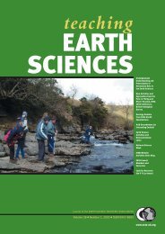
Magazine of the EARTH SCIENCE TEACHERS’ ASSOCIATION<br />
Volume 30 ● Number 1, 2005 ● ISSN 0957-8005<br />
www.esta-uk.org
<strong>Earth</strong> <strong>Science</strong><br />
Activities and<br />
<strong>Earth</strong>quakes<br />
Response to the<br />
<strong>Science</strong> and<br />
inquiry into the<br />
14 - 19 year olds<br />
Kingston 2001<br />
Book Reviews<br />
Websearch<br />
ach<br />
Mike Tuke<br />
Browne<br />
Teaching <strong>Earth</strong> <strong>Science</strong>s: Guide for Authors<br />
The Editor welcomes articles of any length and nature and on any topic related to<br />
<strong>Earth</strong> science education from cradle to grave. Please inspect back copies of TES,<br />
from Issue 26(3) onwards, to become familiar with the magazine house-style.<br />
Three paper copies of major articles are requested. Please use double line spacing<br />
and A4 paper and please use SI units throughout, except where this is inappropriate<br />
(in which case please include a conversion table). The first paragraph of each<br />
major article should not have a subheading but should either introduce the reader<br />
to the context of the article or should provide an overview to stimulate interest. This<br />
is not an abstract in the formal sense. Subsequent paragraphs should be grouped<br />
under sub-headings.<br />
Text<br />
Please also supply the full text on disk or as an email attachment: Microsoft Word<br />
is the most convenient, but any widely-used wordprocessor is acceptable.<br />
Figures, tables and photographs must be referenced in the text, but sent as<br />
separate jpeg or tiff files (see below).<br />
To Advertise in<br />
<strong>teaching</strong><br />
EARTH<br />
SCIENCES<br />
<strong>teaching</strong><br />
EARTH<br />
SCIENCES<br />
Your President<br />
Introduced<br />
Martin Whiteley<br />
Thinking Geology:<br />
Activities to Develop<br />
Thinking Ski ls in<br />
Geology Teaching<br />
Recovering the<br />
Leaning Tower of Pisa<br />
Demonstrations:<br />
House of Commons<br />
Technology Commi tee<br />
<strong>Science</strong> Cu riculum for<br />
Se ting up a local<br />
group - West Wales<br />
Geology Teachers’<br />
Network<br />
Highlights from the<br />
post-16 ‘bring and<br />
share’ session a the<br />
ESTA Conference,<br />
ESTA Conference<br />
update<br />
News and Resources<br />
<strong>teaching</strong><br />
EARTH<br />
SCIENCES<br />
Creationism and<br />
Evolution:<br />
Questions in the<br />
Classroom<br />
Institute of Biology<br />
Chemistry on the<br />
High Street<br />
Peter Kennett<br />
<strong>Earth</strong> <strong>Science</strong><br />
Activities and<br />
Demonstrations:<br />
Fossils and Time<br />
References<br />
Please use the following examples as models<br />
Journal of the EARTH SCIENCE TEACHERS’ ASSOCIATION<br />
Volume 26 ● Number 4, 2001 ● ISSN 0957-8005<br />
arth <strong>Science</strong><br />
www.esta-uk.org<br />
Beyond Petroleum:<br />
Business and<br />
The Environment in<br />
the 21st Century John<br />
Using Foam Rubber in<br />
an Aquarium To<br />
Simulate Plate-<br />
Tectonic And Glacial<br />
Phenomena<br />
John Wheeler<br />
Dorset and East<br />
Devon Coast:<br />
World Heritage Site<br />
ESTA Conference<br />
Update<br />
New ESTA Members<br />
Websearch<br />
News and Resources<br />
(including ESTA AGM)<br />
(1) Articles<br />
Mayer, V. (1995) Using the <strong>Earth</strong> system for integrating the science curriculum.<br />
<strong>Science</strong> Education, 79(4), pp. 375-391.<br />
(2) Books<br />
McPhee, J. (1986 ) Rising from the Plains. New York: Fraux, Giroux & Strauss.<br />
Journal of the EARTH SCIENCE TEACHERS’ ASSOCIATION<br />
Volume 27 ● Number 1, 2002 ● ISSN 0957-8005<br />
Telephone<br />
Ian Ray<br />
0161 486 0326<br />
arth <strong>Science</strong><br />
achers’ Asso<br />
www.esta-uk.org<br />
(3) Chapters in books<br />
Duschl, R.A. & Smith, M.J. (2001) <strong>Earth</strong> <strong>Science</strong>. In Jere Brophy (ed), Subject-<br />
Specific Instructional Methods and Activities, Advances in Research on Teaching. Volume 8,<br />
pp. 269-290. Amsterdam: Elsevier <strong>Science</strong>.<br />
Figures<br />
Prepared artwork must be of high quality and submitted on paper and disk. Handdrawn<br />
and hand-labelled diagrams are not normally acceptable, although in some<br />
circumstances this is appropriate. Each figure must be submitted as a separate file.<br />
(not embedded in a Word file) Each figure must have a caption.<br />
Photographs<br />
Please submit colour or black-and-white photographs as originals. They are also<br />
welcomed in digital form on disk or as email attachments: .jpeg format is to be preferred.<br />
Please use one file for each photograph, to be at 300dpi. Each photograph<br />
must have a caption.<br />
Copyright<br />
There are no copyright restrictions on original material published in Teaching <strong>Earth</strong><br />
<strong>Science</strong>s if it is required for use in the classroom or lecture room. Copyright material<br />
reproduced in TES by permission of other publications rests with the original<br />
publisher. Permission must be sought from the Editor to reproduce original material<br />
from Teaching <strong>Earth</strong> <strong>Science</strong>s in other publications and appropriate acknowledgement<br />
must be given.<br />
All articles submitted should be original unless indicted otherwise and should<br />
contain the author’s full name, title and address (and email address where relevant).<br />
They should be sent to the Editor,<br />
Cally Oldershaw<br />
Email: cally.oldershaw@btopenworld.com<br />
Tel: 07796 942361<br />
WHERE IS PEST<br />
PEST is printed as the<br />
centre 4 pages in<br />
Teaching <strong>Earth</strong> <strong>Science</strong>s.
Magazine of the EARTH SCIENCE TEACHERS’ ASSOCIATION<br />
Editorial<br />
A Presentation to David<br />
Thompson<br />
National Museums of<br />
Scotland Visit<br />
Victoria Buck Receives<br />
P T Carr Award<br />
The Geology Map of<br />
Scotland Project –<br />
Bringing Geology into<br />
Scottish Primary Schools<br />
Bowen’s Reaction Series<br />
should not be Taught to<br />
Introductory Geology<br />
Students<br />
Visiting Abandoned<br />
Mines<br />
A high performance<br />
seismic amplifier<br />
Useful Websites<br />
Reliving Montserrat<br />
1996 Volcanic Eruption<br />
and Hurricane Disaster<br />
GA Field Trip to Ogmore<br />
by Sea led by Geraint<br />
Owen 7th November<br />
2004-11-18<br />
News and Views<br />
ESTA Diary<br />
Reviews<br />
Who were they The<br />
lives of geologists<br />
Cash For Research:<br />
The P. T. Carr Award<br />
(call for applications<br />
PEST 49<br />
Volume 30 ● Number 1, 2005 ● ISSN 0957-8005<br />
www.esta-uk.org<br />
TEACHING EARTH SCIENCES ● Volume 30 ● Number 1, 2005<br />
<strong>teaching</strong><br />
EARTH<br />
SCIENCES<br />
Teaching <strong>Earth</strong> <strong>Science</strong>s is published quarterly by<br />
the <strong>Earth</strong> <strong>Science</strong> Teachers’ <strong>Association</strong>. ESTA<br />
aims to encourage and support the <strong>teaching</strong> of<br />
<strong>Earth</strong> sciences, whether as a single subject or as<br />
part of science or geography courses.<br />
Full membership is £25.00; student and retired<br />
membership £12.50.<br />
Registered Charity No. 1005331<br />
Editor<br />
Cally Oldershaw<br />
Tel: 07796 942361<br />
Email: cally.oldershaw@btopenworld.com<br />
Advertising<br />
Ian Ray<br />
5 Gathill Close<br />
Cheadle Hulme<br />
Cheadle<br />
Cheshire SK8 6SJ<br />
Tel: 0161 486 0326<br />
Email: ianray@ray2003.fsworld.co.uk<br />
Reviews Editor<br />
Dr. Denis Bates<br />
Institute of Geography and <strong>Earth</strong> <strong>Science</strong>s<br />
University of Wales<br />
Aberystwyth<br />
Dyfed SY23 3DB<br />
Tel: 01970 617667<br />
Email: deb@aber.ac.uk<br />
Council Officers<br />
Chairman<br />
Martin Whiteley<br />
Tel: 01234 354859<br />
Email: mjwhiteley@yahoo.co.uk<br />
Secretary<br />
Susan Beale<br />
Low Row, Hesket Newmarket,<br />
Wigton, Cumbria CA7 8JU<br />
Email: beales.lowrow@virgin.net<br />
Membership Secretary<br />
Hamish Ross<br />
PO BOX 23672<br />
Edinburgh EH3 9XQ<br />
Tel: 0131 651 6410<br />
Email: hamish.ross@education.ed.ac.uk<br />
Treasurer<br />
Maggie Williams<br />
Email: maggiee.williams@tiscali.co.uk<br />
Contributions to future issues of Teaching <strong>Earth</strong><br />
<strong>Science</strong>s will be welcomed and should be<br />
addressed to the Editor.<br />
Opinions and comments in this issue are the<br />
personal views of the authors and do not<br />
necessarily represent the views of the <strong>Association</strong>.<br />
Designed by Character Design<br />
Highridge, Wrigglebrook Lane, Kingsthorne<br />
Hereford HR2 8AW<br />
CONTENTS<br />
4 Editorial<br />
7 National Museums of Scotland Visit<br />
Peter Kennett<br />
6 A Presentation to David Thompson<br />
Chris King<br />
8 Geological re-assessment of the rocks at<br />
Mungrisdale/Raven Craggs (Lake District,<br />
Cumbria). Victoria Buck Receives P T Carr Award<br />
for her Research Proposal<br />
Victoria Buck<br />
9 Cash for Research: The P T Carr Award<br />
10 The Geology Map of Scotland Project – Bringing<br />
Geology into Scottish Primary Schools<br />
Diane Mitchell<br />
12 Bowen’s Reaction Series should not be Taught<br />
to Introductory Geology Students<br />
Colin H Donaldson<br />
14 Visiting Abandoned Mines<br />
John Moseley<br />
18 A High Performance Seismic Amplifier<br />
Bernd Ulmann<br />
21 Massive Sea Surges triggered by the Strongest<br />
<strong>Earth</strong>quake in the World for 40 Years<br />
Cally Oldershaw<br />
23 Reliving Montserrat 1996 Volcanic Eruption and<br />
Hurricane Disaster<br />
Dr Tina Jarvis<br />
25 A Field Trip to Ogmore by Sea<br />
led by Geraint Owen<br />
Susan Beale<br />
26 News and Views<br />
28 ESTA Diary<br />
29 Reviews<br />
32 Who were they The lives of geologists<br />
By Cynthia Burek<br />
<strong>teaching</strong><br />
EARTH<br />
SCIENCES<br />
Visit our website at www.esta-uk.org<br />
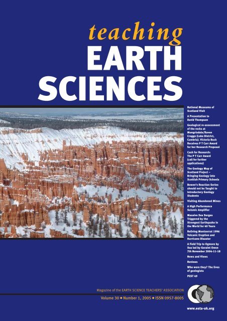
Front cover<br />
Bryce Canyon, US<br />
©<br />
Dr Stephen Laurence<br />
Back cover<br />
Trees and Hoodoos in Bryce Canyon, US<br />
©<br />
Dr Stephen Laurence<br />
3 www.esta-uk.org
TEACHING EARTH SCIENCES ● Volume 30 ● Number 1, 2005<br />
Raising awareness<br />
In November I attended the Geologists’ <strong>Association</strong><br />
Local Groups and Affilitated Groups meeting<br />
at the National Museum of Wales in Cardiff on<br />
behalf of ESTA, as ESTA is an affiliated group of the<br />
<strong>Association</strong>. The Geologists’ <strong>Association</strong> (GA) has<br />
almost 100 local and affiliated groups in total, of which<br />
more than half were represented at the meeting,<br />
including representatives from North Staffs, South<br />
Wales, NW Wales, Somerset, Dorset, Devon, Bath,<br />
Farnham, Hertfordshire, Chester, and Kent also<br />
UKRIGS, Geology Trusts, and Rockwatch.<br />
The Geologists’ <strong>Association</strong> (GA) was my neighbour<br />
for nearly four years, in an office next to the office I had<br />
in the basement of Burlington House (when I was the<br />
Education and Parliamentary Liaison Officer for the<br />
Geological Society). The GA has about 2,000 members<br />
and publications include the Proceedings of the Geologists’<br />
<strong>Association</strong>, field guides in the UK, Europe and<br />
further afield, the GA Magazine and the Rockwatch Magazine.<br />
Rockwatch is the geology club for children,<br />
which is run under the auspices of the GA. You can find<br />
out more about the GA and Rockwatch by checking out<br />
their websites www.geologist.demon.co.uk and<br />
www.rockwatch.org.uk<br />
Back to the meeting – Robin Cocks (Geologists’<br />
<strong>Association</strong> President) gave a welcome and introduced<br />
the meeting. A number of issues had been raised in GA<br />
Council and the GA sought the opinion of local groups<br />
and affiliated groups. Local groups and affiliated groups<br />
were also invited to suggest topics for discussion.<br />
You may be interested to know that David Bone and<br />
Geoff Swan are putting together an A4 guidance sheet<br />
to raise awareness of the benefits of documenting temporary<br />
exposures and the importance of doing so.<br />
Although guidelines have already been published by<br />
BGS and others, the GA guidelines will be aimed at the<br />
amateur rather than professional and will include guidance<br />
in how to write up information for publication e.g.<br />
in GA proceedings, magazine, newsletter etc. Keep a<br />
check in TES and the GA website for further details.<br />
Another key concern that ESTA members share, is<br />
that of health and safety on fieldtrips. I wasn’t aware<br />
that ESTA, as an affiliated group, benefits from the GA<br />
insurance package that covers fieldtrips and site visits.<br />
Prior to visits, letters etc. can be provided which name<br />
the individual group covered. ESTA members who are<br />
involved with the GA, UKRIGS etc. are already working<br />
in conjunction with QPA (Quarry Products <strong>Association</strong>),<br />
English Nature and CCW (Countryside<br />
Council for Wales) preparing guidelines for quarry<br />
managers. I hope we will be able to publish an article on<br />
this in a future issue of TES.<br />
It seems that Bill French, who edits the GA magazine,<br />
has the same editorial problems with articles<br />
received, as I do with TES – particularly as a result of<br />
the increased used of digital cameras. Points that were<br />
raised and which I would like to reiterate are:<br />
● Publishers cannot use emailed photos taken using<br />
digital cameras, unless they are of the highest resolution.<br />
Re-saving emailed photographs can also diminish<br />
the resolution of the pictures. Photos must be<br />
minimum 300 dpi and sent as jpg or tiff files only.<br />
● Photographs and diagrams must be sent separately.<br />
The publishers cannot deal with photos of diagrams<br />
embedded in the text of a word document. It is best<br />
to send one file with text and photos and diagrams<br />
(to show placing of figs) and others with text and figs<br />
as separate files.<br />
● The best way to submit photos is to send negatives,<br />
slides or prints, which can be scanned by the publishers<br />
to retain resolution.<br />
● Photos must be submitted well before the copy<br />
deadline, as poor photo quality etc. noticed by publishers,<br />
often causes delay and results in re-sending<br />
or even re-photographing images in order that they<br />
are suitable for publication.<br />
Please don’t let this put you off submitting articles,<br />
news or views – the magazine is for you and should<br />
include your contributions as well as my own!<br />
Looking to the future, several <strong>Earth</strong> science groups,<br />
including the Geological Society, British Geological<br />
Survey and Geologists’ <strong>Association</strong> are already planning<br />
events as far ahead as 2007 and 2008. The Geological<br />
Society will be celebrating its 200th year in 2007, and<br />
the GA will be celebrating its 150th “birthday” in 2008.<br />
It has been suggested that the GA have some “<strong>Earth</strong><br />
Alert” type event (<strong>Earth</strong> Alert 2000 Brighton, <strong>Earth</strong><br />
Alert 2002 Scarborough were both very successful, with<br />
thousands of attendees including the general public).<br />
Get your thinking hats on and get in touch if you have<br />
any good ideas for events in your area.<br />
The meeting I have mentioned, was a precursor to<br />
the main events of the weekend – the GA and National<br />
Museums and Galleries Wales GA Reunion and Cardiff<br />
GeoFest. Susan Beale (ESTA Secretary) and I, manned<br />
the ESTA stand throughout Saturday and then joined in<br />
on the fieldtrips on the Sunday. I visited the Penarth<br />
sands and collected a fabulous specimen showing ripples<br />
and filled-in mudcracks, which I then used with a<br />
group of teachers at a <strong>Science</strong> Learning Centre East of<br />
England event – it proved a superb specimen to initiate<br />
debate about “the order of events” and scientific evidence.<br />
They were quite jealous and the Director of the<br />
<strong>Science</strong> Learning Centre asked if they could keep it. I<br />
thought it was too good a <strong>teaching</strong> piece to part with.<br />
www.esta-uk.org<br />
4
TEACHING EARTH SCIENCES ● Volume 30 ● Number 1, 2005<br />
Susan visited Ogmore-by-Sea and has written this up<br />
for TES (see page 25).<br />
The ESTA stand was looking good with its new<br />
brightly coloured banners and some new publications,<br />
including the PEST resources “Working with Soil” and<br />
“Working with Rocks”. Although these are aimed at KS2,<br />
they are a useful resource for KS3. I also took along several<br />
copies of TES to show the visitors.<br />
Susan and I also tried our hands at introducing some<br />
practical activities to the stand. We managed to involve<br />
quite a number of the visitors in ‘making mountains out<br />
of sand and flour’ (an ESEU practical based on an idea by<br />
Duncan Hawley – who was there) and an occasional<br />
‘brass rubbing’ of a fossil. The practical activities were a<br />
great success and served to grab the attention of passersby<br />
and involve them for several minutes, while they<br />
asked questions and we talked geology – most then left<br />
with an ESTA or ESEU leaflet to give to their schools.<br />
Our main objective was to raise the profile of ESTA<br />
in Wales, our second was to increase ESTA membership.<br />
With this in mind – do please remember to keep a<br />
look out in your area for prospective ESTA members<br />
and keep a few membership forms at the ready, you<br />
never know when you might have a chance to sign up a<br />
new member. You can now download membership<br />
forms from the website www.esta-org.uk<br />
There were a number of Cardiff GeoFest activities in<br />
addition to the GA meeting, but as both Susan and I<br />
were busy doing our bit for ESTA, we didn’t have a<br />
chance to sign up to the demonstrations, talks and<br />
walks. Eric Robinson gave a Cardiff building stone<br />
walk, which was highly praised by those who attended.<br />
Stephen Edwards (who provided TES 29.3/4 ‘useful<br />
websites’ see page 48) mentioned that he was asked to<br />
give a keynote presentation as a result of the talk he gave<br />
to the ESTA 2003 Annual Conference. Though we<br />
missed some of the events, the weekend was a great<br />
success and it was great to be able to represent ESTA.<br />
If you are going on any fieldtrips (UK or abroad),<br />
attending an <strong>Earth</strong> science meeting or another educational<br />
event that might be of interest to our readers,<br />
do please consider writing something for TES<br />
(with photos if possible). If you have to write it up or<br />
write a report for work anyway, how about amending<br />
it for publication If you are not sure, or are concerned<br />
that it won’t be long enough for an article,<br />
then how about sending in a paragraph for the ‘news<br />
and views’ section<br />
Cally Oldershaw<br />
Editor<br />
National Museums of Scotland Visit<br />
The ESTA visit to the Royal Museum/Museum<br />
of Scotland began at the impressive Geological<br />
Map of Scotland, constructed from<br />
rock specimens sent in by schools all over the<br />
country, to mark the Millennium. From then<br />
on, two parties toured behind the scenes,<br />
meeting briefly in the basement (mind your<br />
head!). It was a privilege to handle meteorites;<br />
to understand why a beautiful blue barite specimen<br />
had to be taken out of the light to prevent<br />
it fading any more, and to see the serried ranks<br />
of the fossil cabinets. The temperature was so<br />
high in the fossil store that the eurypterids<br />
probably felt at home, but several ESTA members<br />
visibly began to wilt!<br />
The Museum is taking the bold step of shutting<br />
its Geology section completely for several<br />
years for a major revamp, involving shifting<br />
hundreds of thousands of specimens to safe<br />
storage. A bad enough job in itself, but the<br />
Museum is subject to Government auditors,<br />
who can descend at a moment’s notice and<br />
demand to see any particular specimen. It’s a good job Ofsted haven’t thought of that one yet with regard to school pupils!<br />
All in all, it was a most interesting trip, and thanks are due to Suzanne Miller and Diane Mitchell and colleagues.<br />
Peter Kennett<br />
PHOTO BY PETER KENNETT<br />
5 www.esta-uk.org
TEACHING EARTH SCIENCES ● Volume 30 ● Number 1, 2005<br />
A Presentation to David Thompson<br />
From Ian Ray, a local geology teacher:<br />
‘David has been an enormous<br />
influence on so many teachers in the<br />
Midlands and north west and so it is<br />
difficult to do full justice to so great a<br />
contribution to geological education in<br />
the region as David’s.’<br />
From Professor Mike Brooks, Ex-<br />
Chair of ESTA, and Cathie Brooks,<br />
ex-Professional Officer for Geology<br />
at WJEC:<br />
‘We both acknowledge the huge debt<br />
of gratitude we all owe to David for<br />
his immense contribution to<br />
geological education.’<br />
From Alan Morgan, Secretary and<br />
Treasurer of the International<br />
Geoscience Education Organisation:<br />
‘There are small groups of geoscience<br />
educators in every country who<br />
believe that our future lies in better<br />
education of students, greater<br />
communication to the public at large<br />
through outreach activities and better<br />
communication with politicians.<br />
Our subject area is vitally important<br />
for the well-being of society on the<br />
world stage. David Thompson has<br />
been one such leader.’<br />
After thirty seven years as a Council member, first of the <strong>Association</strong> of Teachers<br />
of Geology and later of the <strong>Earth</strong> <strong>Science</strong> Teachers’ <strong>Association</strong>, David Thompson<br />
has decided to step down. During his time on ESTA Council, David has made a<br />
fantastic contribution to ESTA and to the cause of <strong>Earth</strong> science education in the<br />
UK and across the world, and so ESTA decided that this moment should be<br />
recognised formally. Thus, at the recent Christmas Social event of the North<br />
Staffordshire Group of the Geologists’ <strong>Association</strong> (NSGGA), held in the<br />
Department of <strong>Earth</strong> <strong>Science</strong>s and Geography at Keele University on 9th<br />
December 2004, David was presented with a geological map of part of the North<br />
Stafford area dating from 1864, together with a folder of letters from people in<br />
this country and overseas who wanted to celebrate the occasion.<br />
Dr Peter Floyd, Chair of the (NSGGA),<br />
first welcomed all visitors to the event,<br />
who included a wide range of David’s<br />
colleagues from the University Geology and<br />
Education Departments, Professor Luis Marques<br />
from Aviero University in Portugal,<br />
Susan Brown from the Geologists’ <strong>Association</strong><br />
and Members of ESTA.<br />
Then Chris King gave a brief summary of<br />
David’s contribution to <strong>Earth</strong> <strong>Science</strong> education<br />
over many years, as follows. Much of<br />
David’s background was taken from a piece<br />
published in Teaching <strong>Earth</strong> <strong>Science</strong>s in 1989<br />
by Mike Collins, John Reynolds and Alastair<br />
Fleming to mark the end of his Presidency of<br />
ESTA in that year, before he became an Honorary<br />
Life member of ESTA in 1990.<br />
● David came to Keele as an undergraduate<br />
from Manchester Central Boys’ High<br />
School<br />
● He graduated and spent two years as a<br />
meteorologist in the RAF<br />
● He began <strong>teaching</strong> at North Manchester<br />
High School for Boys<br />
● While <strong>teaching</strong>, he undertook a research<br />
MSc into the Triassic rocks of the Cheshire<br />
Basin<br />
● He was a founder member the <strong>Association</strong><br />
From Shankar, a leading light of<br />
geoscience education in India:<br />
‘You richly deserve this honour and<br />
recognition for all that you had done<br />
to the cause of <strong>Earth</strong> <strong>Science</strong><br />
Education.’<br />
From John Macadam, ESTA member<br />
and freelance consultant:<br />
‘So many of us are in your debt. I feel<br />
privileged to have been one of your<br />
missionaries – or was it mafia – sent<br />
out to spread geology as a science –<br />
or was it the science – in schools.’<br />
Sheet 72 NW – Stafford<br />
Solid edition, hand coloured, one inch to one mile, Old Series Geological Map published by the Geological<br />
Survey of Great Britain. The base map is a quarter sheet of the Ordnance Survey first edition topographic map<br />
issued in 1837, with railways inserted to May 1890. The Geological edition was first published in January 1857,<br />
with additional information added in March 1864. After further revisions, the Old Series Sheet 72 NW was<br />
replaced by the colour-printed New Series Sheet 123, Stoke-upon-Trent, in two editions: 1902 [Drift] and 1906<br />
[Solid]. The Cheadle Coalfield had its own Special Sheet, published in 1903 [Solid].<br />
www.esta-uk.org<br />
6
TEACHING EARTH SCIENCES ● Volume 30 ● Number 1, 2005<br />
of Teachers of Geology (ATG) at Keele in<br />
1967. ATG later became ESTA and David<br />
has been a Council member of ATG and<br />
ESTA until now – 37 years<br />
● David had moved to the Education<br />
Department in Keele in 1972 – succeeding<br />
one of the founding fathers of the NSGGA<br />
– John Myers.<br />
● He became assistant Editor and then Editor<br />
of the ATG Journal – then virtually single<br />
handed he edited and produced the<br />
Journal, 4 issues per year, for 8 years.<br />
● He was ESTA President between 1987 and<br />
1989 at the same time as he was Chair of<br />
the NSGGA (having previously been<br />
NSGGA Secretary for 11 years).<br />
● He was a member of the Geological Society<br />
Education Committee, and served as<br />
Chairman between 1980 and 1982.<br />
● He was involved with A-level Examination<br />
Boards, first with the Joint Matriculation<br />
Board (JMB), later to become the Northern<br />
Examination and Assessment Board<br />
(NEAB). Later, he became reviser for the<br />
Welsh Joint Education Committee Board<br />
(WJEC) which he continues to this day.<br />
● At GCSE level, he also served on Associated<br />
Examinations Board (AEB) Advisory<br />
Committee and on the West Midlands<br />
Examinations Board Examinations<br />
Council.<br />
● He has been Associate Editor of Geology<br />
Today and Chair of the Committee.<br />
● He was convenor of the schools section of<br />
the first International Geoscience Education<br />
Conference (GeoSciEdI) in Southampton<br />
1993, that has since been followed<br />
by three more successful international<br />
conferences.<br />
● He retired from Keele in 1996 and handed<br />
over his work in training science and geology<br />
teachers to Chris King.<br />
● David is a keen cricketer and footballer.<br />
● He is a keen geologist and expert on the<br />
local Triassic rocks.<br />
● He is a keen historian of geology and geology<br />
education.<br />
● But above all – he is a keen educator –<br />
handing on the wealth of his educational<br />
experience to many trainee teachers and<br />
colleagues in this country and abroad over<br />
many years.<br />
Friends and colleagues who were unable to<br />
attend the presentation sent letters of congratulation<br />
and highlights from some of these<br />
appear below. There is still room in the folder<br />
for more letters, so if you would like to<br />
The map carries the following inscription:<br />
Presented to David Thompson.<br />
For his enormous contribution to the <strong>Earth</strong> <strong>Science</strong><br />
Teachers’ <strong>Association</strong> and to <strong>Earth</strong> <strong>Science</strong> education<br />
in the UK and abroad over several decades.<br />
From all his colleagues and friends in ESTA.<br />
December 2004.<br />
write or email a letter or note to Chris, he will<br />
ensure that it finds its way into David’s folder<br />
(Education Department, Keele University,<br />
ST5 5BG, eseu@keele.ac.uk).<br />
John Reynolds read highlights of letters<br />
from ESTA and Geologists’ <strong>Association</strong><br />
members (Peter Kennett, Ian Ray, Graham<br />
Worton, Roger Trend, Mike Brooks, Chris<br />
Wilson, John Macadam, Eric Robinson) and<br />
Chris read highlights of letters from other<br />
colleagues of David (Peter Warren, Vic Mayer,<br />
Alan Morgan, John Carpenter, Shankar,<br />
Glenn Vallender, Nir Orion).<br />
The map was presented to David by Professor<br />
Peter Styles, President of the Geological<br />
Society.<br />
David responded with a short speech<br />
thanking everyone for their kindness.<br />
Thanks to Martin Whiteley, Dave Williams,<br />
John Reynolds and Bernadette Callan for their<br />
work behind the scenes and to NSGGA for<br />
hosting ESTA’s event.<br />
Reference<br />
Collins, M., Fleming, A. & Reynolds, J.<br />
(1989) David Thompson – an appreciation.<br />
Teaching <strong>Earth</strong> <strong>Science</strong>s, 14.2, 42.<br />
From John Carpenter, Distinguished<br />
Professor Emeritus of Geological<br />
<strong>Science</strong>s of the University of South<br />
Carolina:<br />
‘I have always had the greatest respect<br />
for your contributions to<br />
geoscience/<strong>Earth</strong> science education,<br />
not just in the UK, but world-wide.’<br />
‘But beyond your work, I respect you<br />
also as a person. You have always<br />
shown me the greatest kindness and<br />
for that I am certainly appreciative.’<br />
From Vic Mayer, Professor Emeritus<br />
at the Ohio State University:<br />
‘He is richly deserving of this award<br />
for his service to <strong>Earth</strong> science<br />
<strong>teaching</strong>, not only in England but<br />
worldwide. He has had a tremendous<br />
influence on <strong>Earth</strong> science <strong>teaching</strong><br />
through his professional<br />
contributions but especially through<br />
the professional friends that he has<br />
made in many nations and the effect<br />
that he has had on these people.’<br />
From Glenn Vallender, a teacher in<br />
New Zealand:<br />
‘It was in November 1985 that I first<br />
met you although your reputation<br />
had gone well before you as the<br />
foremost educationalist in teacher<br />
training for the <strong>Earth</strong> <strong>Science</strong>s.’<br />
From Professor Nir Orion of the<br />
Weizmann Institute of <strong>Science</strong> in<br />
Israel:<br />
‘For more than two decades people<br />
have come to you from all over the<br />
world, like pilgrims, to learn from<br />
you about <strong>Earth</strong> science education.’<br />
‘You succeeded not only in<br />
influencing my mind, but many<br />
others worldwide too. Your<br />
kindness, warmth and unique<br />
personality are imprinted in our<br />
hearts. You touched us all David and<br />
we love you.’<br />
From Dr. Roger Trend, ex-Editor of<br />
Teaching <strong>Earth</strong> <strong>Science</strong>s:<br />
‘Thank you for your total dedication<br />
and your unstinting and scholarly<br />
commitment to geoscience education<br />
in all its facets, especially research,<br />
and for continuing to be such an<br />
inspiring mentor.’<br />
7 www.esta-uk.org
TEACHING EARTH SCIENCES ● Volume 30 ● Number 1, 2005<br />
Geological re-assessment of the rocks at Mungrisdale/<br />
Raven Craggs (Lake District, Cumbria). Victoria Buck<br />
Receives P T Carr Award for her Research Proposal<br />
BY VICTORIA BUCK, YORK COLLEGE<br />
Congratulations<br />
to Vicky on<br />
receiving an<br />
award from the<br />
Peter Towsley<br />
Carr bequest<br />
(the P T Carr<br />
Award). Vicky’s<br />
final report will<br />
be published in<br />
a later issue of<br />
Teaching <strong>Earth</strong><br />
<strong>Science</strong>s.<br />
Ed.<br />
In October 2004 field week we experienced weather<br />
conditions that required the use of our ‘emergency’<br />
field day. This day, although operable, has not been<br />
used before and was to a certain extent unproven as an<br />
enquiry driven investigation for students. Nevertheless,<br />
the students worked well and came up with some excellent<br />
and surprising observations which led me to reconsider<br />
my understanding of the outcrop within the broader<br />
context of Ordovician/Silurian Lakeland geology. Subsequent<br />
reading of published materials and discussions with<br />
fellow geologists has not resolved the issues raised from<br />
the students’ observations in the field. It is on this basis I<br />
would like to carry out a detailed re-investigation of the<br />
Mungrisdale/Raven Craggs outcrop, and subsequently<br />
develop the findings into an enquiry based learning<br />
resource that can be used for A Level students.<br />
1.1 Context and Contribution<br />
This work falls into two clear elements: the first is the<br />
field and literature based study to try and resolve the<br />
issues highlighted by preliminary observations in the<br />
field. The second, the development of the site as an<br />
enquiry based learning resource that requires students<br />
to integrate basic geological field observations with<br />
underlying principles to determine the geological history<br />
of the outcrop (i.e. ordering geological phenomena).<br />
Funding is requested primarily to facilitate the field<br />
and literature based re-assessment of the outcrop within<br />
a broader context of Lakeland Geology. However, as<br />
the site lends itself well to the integration and development<br />
of field based <strong>teaching</strong> and learning strategies, it is<br />
this aspect that will form the basis of an ESTA publication<br />
and presentation.<br />
1.2 Primary Objectives<br />
1. Re-assessment of the available published material.<br />
2. Field Mapping of Mungrisdale and Raven Craggs.<br />
3. Development of the outcrop as an enquiry based<br />
learning field site.<br />
1.3 Methodology<br />
● Literature search of previous published material.<br />
● Building on existing data sets acquire the field data at<br />
a 1:5000 and 1:2500 scale (mapping) and produce fair<br />
copy geological maps and cross sections based on the<br />
Ordnance Survey digital data set.<br />
● Acquire Geographical Positioning System (GPS)<br />
data as necessary.<br />
● Develop the enquiry driven field day and student<br />
materials (focus on A Level initially).<br />
● Trial the field day in the 2006 A2 residential fieldwork.<br />
1.4 Approximate Schedule<br />
The schedule is based on the projected available time<br />
outside the contracted <strong>teaching</strong> hours of 2/3 hrs per<br />
week plus alternate weekends. It is anticipated that the<br />
majority of the field work will be carried out during the<br />
academic holidays (half terms and summer vacations)<br />
of 2005/6.<br />
1.5 Expenditure<br />
● Purchase of Ordnance survey digital data set for field<br />
area (to be used with GIS packages Arc View and<br />
IDRISI which I already own/hold licence for).<br />
● Purchase of a hand held armoured Global Positioning<br />
System (GPS) for field mapping.<br />
● Assistance with travelling and subsistence (camp site<br />
fees) to and from Lake District.<br />
1.6 Dissemination of findings<br />
Given the nature of the investigation, it is anticipated<br />
that an interim report of the re-investigation will be forwarded<br />
to the committee and, should it warrant, subsequent<br />
publication in an appropriate journal. The<br />
enquiry based field investigation and accompanying<br />
student materials to be submitted to Teaching <strong>Earth</strong><br />
<strong>Science</strong>s for publication and acceptance for presentation<br />
at the Annual Conference 2006/7.<br />
Continued on page 13<br />
Month/Year<br />
O N D J F M A M J J A S<br />
2004/5 Literature search Field Mapping of the investigation area<br />
2005/6 Development of enquiry driven investigative field day and student materials<br />
Field trial of day and materials York College A2 Geology residential 2006<br />
Additional field trial in partnership with Blencathra Field Centre, Lakes District.<br />
2006/7 Report writing, publication and presentation to ESTA conference 2007<br />
www.esta-uk.org<br />
8
TEACHING EARTH SCIENCES ● Volume 30 ● Number 1, 2005<br />
Cash For Research: The P. T. Carr Award<br />
(call for further applications)<br />
In 1996 the late Peter Towsley Carr left a bequest of £3,000 to create an award to be administered by the <strong>Earth</strong><br />
<strong>Science</strong> Teachers <strong>Association</strong> (ESTA). The purpose was to fund geological research by practising schoolteachers.<br />
Peter Carr was born in 1925, and began his working career<br />
at High Duty Alloys in Slough. While working he studied<br />
part-time at Chelsea Polytechnic for a geology degree<br />
(with subsidiary maths) which he obtained around 1950. He<br />
joined the staff of what eventually became Herschel School,<br />
Slough, a technical high school, and remained there for the rest<br />
of his career. Initially he taught both subjects to A-level, but with<br />
only a small number of A-level geology students and an increasing<br />
shortage of qualified maths teachers, the school eventually<br />
decided that he was better() employed as a full-time mathematician.<br />
His brother Alan thinks he understood their logic in<br />
this, even if he was reluctant to agree with it.<br />
Peter himself struggled to do a research project on the Lizard<br />
in Cornwall, and was anxious that others might be funded in<br />
such a project to enable a successful outcome without undue<br />
financial difficulties. He died in February 1996.<br />
Aim of the award<br />
The aim of the award is to help to fund a practising schoolteacher<br />
wishing to undertake geological research, or to enable<br />
such a person to complete research already begun.<br />
‘Geological research’ is here interpreted in a wide sense, to<br />
include research into:<br />
● an aspect of the geology of an area, particularly one local to<br />
the teacher’s school;<br />
● geological and <strong>Earth</strong> science education at all levels;<br />
● the role of conservation in geology and <strong>Earth</strong> science;<br />
● improving the use of geological collections in education;<br />
● improving the public understanding of geology and<br />
<strong>Earth</strong> science;<br />
● the use of Information Technology in any of the above.<br />
Finance<br />
The legacy of £3000 has been invested to produce an income.<br />
This income will be used to fund an award every THREE years.<br />
It is anticipated that the award will usually be of the order of<br />
£500, but this cannot be guaranteed.<br />
Procedure for making the award<br />
ESTA Council will delegate responsibility for administering the<br />
award to a sub-committee which must include at least one from<br />
the Chairman, Secretary or Treasurer of the <strong>Association</strong>.<br />
Notice of the award will be publicised by the sub-committee<br />
in Teaching <strong>Earth</strong> <strong>Science</strong>s (or its successor journals) and by<br />
other appropriate methods as decided by the sub-committee to<br />
try to maximise the number of potential applicants. A deadline<br />
for the receipt of applications will be set.<br />
The sub-committee, with the approval of ESTA Council,<br />
may suggest a specific area of geological research for which the<br />
award might be made on a particular occasion. This discretion is<br />
intended to allow the sub-committee to encourage research that<br />
may be of particular value to geological education at a given time.<br />
Applicants will be required to supply sufficient personal<br />
details of their qualifications and experience, including previous<br />
research if any, at least two referees who can attest to their<br />
suitability to undertake research and receive the award, and an<br />
outline of the research proposal in such format as the subcommittee<br />
may from time to time determine. Applicants will<br />
also be required to outline how the award will be used to<br />
enable the research to proceed. The sub-committee will scrutinise<br />
and evaluate the applications, and may ask to interview<br />
applicants if it is felt to be necessary. The sub-committee’s<br />
decision will be ratified by Council, and that decision will<br />
then be final.<br />
Wherever possible, the selection procedure will be timed to<br />
enable an announcement and presentation of the award at the<br />
Annual Conference of the <strong>Association</strong>, usually held in September.<br />
No serving member of ESTA Council will be eligible for the<br />
award, although an award-holder may later be elected or coopted<br />
to Council without prejudice.<br />
Expectations of the award-holder<br />
The award-holder will be expected to...<br />
1. undertake and complete the planned research project within<br />
an agreed timescale, in general before the next award is due to<br />
be made (normally three years);<br />
2. keep the sub-committee informed of the progress of the<br />
research by means of a brief annual report in a form specified<br />
by the sub-committee;<br />
3. inform the sub-committee without delay if a change in circumstances<br />
may lead to a delay in completing the research<br />
project within the agreed timescale, or to abandonment of the<br />
project;<br />
4. return such part of the monies awarded as the sub-committee<br />
may determine to be reasonable should he or she fail to complete<br />
the research project within the agreed timescale, or<br />
within such extended timescale as the sub-committee may<br />
grant at their complete discretion;<br />
5. publish his or her work as a paper in Teaching <strong>Earth</strong> <strong>Science</strong>s,<br />
and present his or her work to members as a talk at an Annual<br />
Conference of the <strong>Association</strong>.<br />
Further details and application forms can be obtained<br />
from Susan Beale, ESTA Secretary,<br />
Email: beales.lowrow@virgin.net<br />
9 www.esta-uk.org
TEACHING EARTH SCIENCES ● Volume 30 ● Number 1, 2005<br />
The Geology Map of Scotland Project<br />
Bringing Geology into Scottish Primary Schools<br />
The Geology Map of Scotland Project was run by the National Museums of Scotland between<br />
2000 and 2002. It was born from the desire to create a new display for the museum, and evolved<br />
into the project it became from the equal desire to involve schools in <strong>Earth</strong> science.<br />
DIANE MITCHELL<br />
The display in a nutshell was to build a real-life<br />
geological map of Scotland, using local rock from<br />
across the country. Some preliminary discussions<br />
with primary teachers and countryside rangers showed<br />
that there was scope for a project that would help bring<br />
the <strong>teaching</strong> of geology into Primary 6/7 level classrooms.<br />
But beyond this, and thanks to the rangers, it<br />
became clear that we could also get the pupils out on<br />
fieldwork to collect rock for the map.<br />
We publicised the project nationally by piggybacking<br />
on the museum’s schools programme. This<br />
is sent to local authorities and then onto every primary<br />
school so we had no control over who the flyers<br />
went to. We were however overwhelmed with the<br />
interest. In the end, we had 128 schools sign up,<br />
which included 8 high schools. In some cases it was<br />
the head who signed up the school and in other cases<br />
it was the class teacher.<br />
We also had about 70 rangers sign up as being willing<br />
to help. This was about 50% of those we contacted. In<br />
Scotland, we have several organisations with rangers<br />
and tracking down individual rangers to contact took<br />
time as there was no comprehensive list. They were<br />
very enthusiastic about the project, with one ranger saying<br />
that it “made a great change from pond-life and<br />
trees”. Not all the rangers were geology-minded, which<br />
is why we gave the rangers the same information that<br />
we gave the teachers. And armed with this information,<br />
it seems that they did a great job and that the schools<br />
really appreciated their help.<br />
So with around 200 teachers and rangers involved,<br />
we took a very big breath and set off. Resource packs<br />
were produced which taught four independent<br />
lessons: rocks, crystals, fossils and natural resources.<br />
They were targeted specifically at the Scottish 5-14<br />
Environmental Studies Guidelines Level D. This<br />
meant that we could introduce the topics of <strong>Earth</strong><br />
structure and rock types etc. At this time fossilisation<br />
was still in the curriculum, though sadly this has now<br />
been removed. The packs also contained 9 rocks, a few<br />
fossils & minerals and 250g of alum powder for a crystal<br />
growing experiment. A mini-production line was<br />
set up in the labs to compile the folders, assemble the<br />
boxes and pack them up. They were then posted off<br />
around October 2000, one to each school and ranger,<br />
much to the dismay of the museum messengers who<br />
had to process around 200 heavy-ish boxes!<br />
Later, we sent an evaluation questionnaire to each of<br />
the schools though only received a 20% response.<br />
However, of those who responded, it appears that the<br />
resource packs were used from Primary 4 though to<br />
Secondary 2, and the majority of teachers had taught<br />
most or all of the four units in the two terms remaining<br />
in that academic year. We were pleasantly surprised at<br />
this as we had expected there to be much less flexibility<br />
in how the packs were used. Many of the comments we<br />
received were very encouraging:<br />
“Very enjoyable – having the ranger was the essential<br />
ingredient.”<br />
TEACHER, BRAEMAR PRIMARY<br />
“It was most useful having the rock samples.”<br />
TEACHER, STRATHDON PRIMARY<br />
“Thoroughly enjoyed helping the pupils to learn and<br />
learning myself something of an unknown topic. Userfriendly<br />
pack made this possible even for me.”<br />
TEACHER, ST. LUKES PRIMARY, KILWINNING<br />
It would of course have been beneficial to have chased<br />
up further evaluation. However, this was a one-off pro-<br />
www.esta-uk.org<br />
10
TEACHING EARTH SCIENCES ● Volume 30 ● Number 1, 2005<br />
Scotland P1 P2 P3 P4 P5 P6 P7<br />
Primary<br />
S1<br />
Secondary<br />
S2<br />
Age (years) 5 6 7 8 9 10 11 12 13<br />
England and Wales 1 2 3 4 5 6<br />
Primary<br />
Year 7<br />
Secondary<br />
Year 8 Year 9<br />
ject and our direct involvement with schools is otherwise<br />
fairly limited. The usual lack of time and resources<br />
was a negative factor and so at the time, it was not really<br />
feasible to follow this up for more feedback.<br />
The next step was to arrange the fieldwork, and I<br />
cannot stress enough just how much help the rangers<br />
were. In fact, without them, it would have been nearly<br />
impossible to do this stage of the project. We linked<br />
each school up with a local ranger and in most cases<br />
were able to do this. Some rangers ended up with no<br />
schools, whilst others had several. Overall though we<br />
had a good geographical spread across the country.<br />
The ranger liaised with the school to arrange the fieldwork<br />
and then went along on the day generally to lead<br />
the trip. Each ranger and teacher was sent details of the<br />
rock type(s) we wanted from their area – restricted to<br />
the basics – along with some details of their local geology<br />
and a rock identification guide. Some rangers also<br />
did fieldwork with their own children’s clubs for additional<br />
rock contributions.<br />
The size of group and length of time for fieldwork<br />
varied greatly. This variety on the whole seemed to<br />
depend somewhat on the enthusiasm of the ranger and<br />
the locality of the school, i.e. rural schools had more<br />
scope. We ended up with a 50% return rate of rocks.<br />
The main reasons for schools not conducting the fieldwork<br />
were changing teachers, lack of money for transport<br />
and the coinciding outbreak of the Foot and<br />
Mouth crisis. Nevertheless, we were yet again pleased<br />
at what we feel was a healthy response for getting the<br />
pupils out of the classroom.<br />
In essence, the map is built mosaic-like and is based<br />
on a simplified version of the BGS north sheet. The<br />
classes had done exceptionally well in identifying the<br />
correct rock types, although not all the pieces were suitable.<br />
We did however make absolutely sure that at least<br />
one rock was used from every school. We filled in the<br />
gaps with rocks from our own collecting trips.<br />
I’m going to gloss over the actual construction of the<br />
map, partly because I’d run out of space, and partly<br />
because the memories are still painful! Of course I joke,<br />
but it was a major undertaking as we did not know of<br />
any similar display that we could refer to. It was a steep<br />
learning curve; we hit and overcame several obstacles<br />
on route, but seeing the end result more than made up<br />
for the long hours (and months).<br />
The ‘map’ was launched by Prof. Aubrey Manning in<br />
June 2002 and we were pleased that several classes and a<br />
number of rangers who had taken part were able to<br />
come along and join in the celebration. It’s 4m x 2.5m<br />
and stands only 45cm high. It’s also tactile which means<br />
that everyone, from adults and children, to wheelchair<br />
users and the visually impaired can view it and feel the<br />
differences in texture between the rock types. Each<br />
school and ranger club who contributed rock is listed on<br />
an adjacent acknowledgement panel. Since being<br />
launched, it has become a popular exhibit with visitors<br />
and has been a starting point for education facilitators<br />
when taking school groups around the adjacent geology<br />
gallery. It’s even been to the Scottish Parliament for a<br />
two day <strong>Earth</strong> science education awareness event where<br />
it was admired by passing MSPs.<br />
It was a fantastic project to work on and proved to us<br />
that primary schools can still take such projects to heart,<br />
despite the gloomy stories we’re used to hearing in the<br />
media. In all, in one academic year, around 2,800 pupils<br />
were taught lessons from the resource packs and took<br />
part in the project in one way or another. And as most<br />
of the teachers who responded with feedback said<br />
they’d use the packs in the future, we’re pleased that<br />
we’ve been able to help promote <strong>Earth</strong> science in Scottish<br />
schools.<br />
For those of you who are interested in know more,<br />
contact Diane Mitchell on (0131) 225 7534 or<br />
d.mitchell@nms.ac.uk.<br />
Diane Mitchell, National Museums of Scotland<br />
It was a<br />
fantastic<br />
project to<br />
work on and<br />
proved to us<br />
that primary<br />
schools can<br />
still take<br />
such projects<br />
to heart,<br />
despite the<br />
gloomy<br />
stories we’re<br />
used to<br />
hearing in<br />
the media.<br />
11 www.esta-uk.org
TEACHING EARTH SCIENCES ● Volume 30 ● Number 1, 2005<br />
Bowen’s Reaction Series should not be<br />
Taught to Introductory Geology Students<br />
COLIN H DONALDSON<br />
It is over 80 years since Bowen introduced the reaction principle to igneous petrology, emphasising<br />
the role of various concurrently operating crystal-liquid reaction series during magma<br />
crystallization. From the principle he argued that fractional crystallization caused by the prevention<br />
of reactions, e.g. by settling of crystals to isolate them from melt, is the main reason why suites of<br />
volcanic rocks commonly show a variety of related compositions, i.e. are differentiated.<br />
Colin H Donaldson<br />
These are key ideas in igneous petrology. Generations<br />
of students have usually been taught them<br />
with reference to the reaction series diagram that<br />
Bowen published in 1922 and which is re-examined in<br />
his 1928 book, The Evolution of the Igneous Rocks.<br />
For a variety of reasons it will be argued that beginning<br />
students of geology should not be introduced to<br />
Bowen’s reaction series diagram. These include:<br />
● Weakness in or fear of chemistry means that many<br />
students do not understand the concept of reaction;<br />
these students cheerfully accept that olivine changes<br />
to pyroxene but cannot grasp why this happens, and<br />
they are puzzled as to why quartz does not react.<br />
● Magma is not a familiar substance and hence its<br />
chemical behaviour on cooling is not intuitive –<br />
that means students readily erect false impressions/understanding<br />
of how crystallization influences<br />
magma composition.<br />
● Language problems complicate understanding (such<br />
as the confusion wrought by the terms continuous<br />
reaction and continuous zoning).<br />
● While some can grasp the meaning of a continuous<br />
reaction, most students are especially puzzled by<br />
‘discontinuous reaction’.<br />
● The Bowen diagram is a simple representation of<br />
what happens in nature and readily leads to misunderstanding,<br />
such as the common student suggestion<br />
that “all magmas initially crystallize olivine”.<br />
● These days just providing a survey of geology leads<br />
to a very full syllabus in introductory courses – the<br />
time does not exist at this stage to develop descriptions<br />
and explanations of crystal-liquid reaction and<br />
of why the prevention of reaction by fractional crystallization<br />
causes differentiation.<br />
It is proposed that detailed explanation of how magma<br />
composition evolves by fractional crystallization should<br />
be delayed until second year of an undergraduate degree<br />
when magma is a more familiar geological material and<br />
chemical confidence has been developed.<br />
On the other hand, new students should be introduced<br />
to the concept that a suite of lavas does normally<br />
vary in composition according to a pattern, and to the<br />
idea that this is due to differentiation involving extraction<br />
of crystals from a magma. They should be persuaded<br />
that crystal extraction will do this. A means of<br />
convincing a class is take an analogue which students<br />
can relate to. A solution of common salt in water works<br />
well as a ‘mind experiment’. Students can represent for<br />
themselves on a scale from 100% NaCl to 100% H2O<br />
how the composition of the remaining solution evolves<br />
www.esta-uk.org<br />
12
TEACHING EARTH SCIENCES ● Volume 30 ● Number 1, 2005<br />
during cooling as salt crystals grow and settle. They can<br />
also grasp the important distinction between a ‘magma’<br />
consisting entirely of liquid and one consisting of liquid<br />
+ crystals; that should lead to an understanding of why<br />
removal of crystals from contact with liquid changes<br />
the composition of the remaining ‘magma’.<br />
A solution of copper sulphate and magnesium sulphate<br />
in water provides a more advanced example. The<br />
influence on residual composition of the solution by successive<br />
crystallization of, say, copper sulphate followed by<br />
copper sulphate and magnesium sulphate can be represented<br />
on a triangular plot (CuSO 4 – MgSO 4 – H 2 O). By<br />
analogy, this reveals how residual magma can be expected<br />
to evolve in composition as a result of progressive<br />
solidification and isolation of crystals, even re-producing<br />
the kinks in chemical plots of lava suites arising when a<br />
second mineral joins in the solidification.<br />
From that base of understanding, in the following<br />
year the concepts of crystal-liquid reaction and the<br />
effects of their prevention during fractional crystallization<br />
on residual melt composition can be added.<br />
In summary, instruction in the theory of magma<br />
evolution by fractional crystallization requires a stepby-step<br />
approach over at least 2 years to the crystallization<br />
of magma. At the end of instruction, the Bowen<br />
Reaction Series diagram might be shown. Ideally, that<br />
would follow consideration of a few simple phase diagrams.<br />
Introduction of the reaction diagram must be<br />
accompanied by Bowen’s own strong warnings that it is<br />
‘oversimplified’ and does not have ‘rigid accuracy’.<br />
Colin H Donaldson,<br />
School of Geography-Geoscience,<br />
University of St Andrews, Fife KY16 8AL<br />
Email: chd@st-andrews.ac.uk<br />
Request for copies of Powerpoint presentations given at<br />
the ESTA conference by Colin Donaldson (TES 30.1)<br />
Tony Prave (TES 29.3/4) and Ed Stephens (TES<br />
29.3/4), should be addressed to Mrs Debbie Thompson,<br />
School of Geography and Geosiences, University of St.<br />
Andrews, Irvine Building, North Street, St. Andrews,<br />
Fife, KY16 9AL. Email: dmt4@st-andrews.ac.uk<br />
Geological re-assessment of the rocks at Mungrisdale/Raven Craggs (Lake District,<br />
Cumbria). Victoria Buck Receives P T Carr Award for her Research Proposal Cont.<br />
1.7 References<br />
Buck, V. A. (2003) Review of some theories of field based<br />
learning in geography and geology. (Unpublished PGCE<br />
report, Greenwich, London)<br />
Groves, B (1989) A survey of GCSE geology teachers<br />
and their attitudes to fieldwork Teaching <strong>Earth</strong> <strong>Science</strong>s;<br />
Journal of the <strong>Earth</strong> <strong>Science</strong> Teachers <strong>Association</strong> 14.2: 46- 50<br />
Hawley, D. (1996) Changing Approaches to <strong>teaching</strong><br />
<strong>Earth</strong>-science fieldwork: pp 243-253 in Stow, D. A. V &<br />
McCall, G. H. J (eds) Geoscience Education and training<br />
in Schools, Universities, for industry and Public Awareness<br />
Rotterdam: A.A Balkema<br />
King, H (2001) ed. UK Geosciences Fieldwork<br />
Symposium: Proceedings<br />
Lakeland Rocks and Landscapes: A field Guide,<br />
The Cumberland Geological Society<br />
Moseley, F (1990) Geology of the Lake District,<br />
The Geologists <strong>Association</strong>, London.<br />
Victoria Buck – York College<br />
Vbuck@yorkcollege.ac.uk<br />
For further details about the P T Carr Award and<br />
how you can apply for some cash for your research<br />
see page 9 Ed<br />
13 www.esta-uk.org
TEACHING EARTH SCIENCES ● Volume 30 ● Number 1, 2005<br />
Visiting Abandoned Mines<br />
Old mine workings are a common feature in parts of upland Britain. Some, such as those deep in the<br />
Aran Mountains of north Wales, are in very remote places, and sometimes only traces of workings<br />
remain. Other disused mines, for instance Snailbeach in the Ordovician Shelve Inlier and Llangynog<br />
on the southern edge of the Berwyn Mountains are far more accessible. Care should always be taken<br />
when visiting these abandoned industrial locations, although many sites have been made safe by<br />
local county councils, Forest Enterprise and private owners. Some mines are open to the public, and<br />
Clearwell Caves, a source of iron ore in the Forest of Dean, the Llywernog silver – lead mine, near<br />
Aberystwyth, and the Sygun copper mine at Beddgelert are some examples of those worthy of a<br />
visit. These fascinating locations are a valuable educational facility for all academic levels, providing<br />
rich geological material and items of archaeological interest.<br />
JOHN MOSELEY<br />
Left:<br />
Model of<br />
Snailbeach Mine<br />
in the<br />
interpretation<br />
centre.<br />
Right:<br />
The entry to<br />
Snailbeach Mine<br />
Why visit old mines<br />
Mineral veins are rarely well exposed in the field and<br />
not usually accessible for examination in working<br />
mines, or derelict mines sealed for safety. Spoil tips provide<br />
this vein material for examination. The enjoyment<br />
of searching out good mineral samples is an occupation<br />
that appeals to most ages. For primary age children<br />
especially the fun of collecting good specimens of<br />
attractive minerals in an organised way can be the trigger<br />
for a life long interest in earth sciences. An ideal safe<br />
site to search for minerals is the reclaimed Snailbeach<br />
Mine (Figure 1, SJ373022) 17 kilometres southwest of<br />
Shrewsbury on the eastern section of the Shelve baritesulphide<br />
orefield (Figure 2). For many years I used the<br />
Snailbeach, and adjacent Pennerley (SO353988) and<br />
Myttonsbeach mine (SJ368000) sites, as part of A-level<br />
residential fieldwork in south Shropshire. Rather than<br />
allowing visits to mine sites simply to become a hunt<br />
for minerals, I developed the following observation and<br />
discussion pathway. This can be applied to any safe site<br />
with accessible spoil material.<br />
1 Collection and identification of economic and<br />
gangue minerals and the host rock<br />
The Snailbeach spoil tip yields excellent specimens of<br />
quartz, barite, calcite, sphalerite and galena, as well as<br />
small amounts of pyrite, chalcopyrite and malachite,<br />
while cerrusite, calamine and pyromorphite have also<br />
been reported (Toghill 1990). A-level or undergraduate<br />
students collect and identify minerals utilising the diagnostic<br />
criteria of cleavage, streak, density and crystal<br />
form. Sphalerite, galena and barite were the main economic<br />
minerals. The host or country rock for the<br />
Shelve barite-sulphide orefield is the Ordovician Mytton<br />
Flags Formation, that comprises shales, mudstones,<br />
siltstones and greywacke sandstones. The Snailbeach<br />
www.esta-uk.org<br />
14
TEACHING EARTH SCIENCES ● Volume 30 ● Number 1, 2005<br />
vein material reveals angular fragments of host rock<br />
strongly cemented by the main minerals listed above.<br />
This suggests mineralized fault breccia. The structural<br />
control of mineralization is discussed later.<br />
2 Crystallography<br />
The Snailbeach spoil tip provides mineral specimens<br />
that show good crystal development, especially cubic<br />
galena and hexagonal quartz crystals, the latter displaying<br />
hexagonal columns and pyramids. These are an<br />
excellent aid to enhance the understanding of crystallographic<br />
principles. A good crystal specimen collected in<br />
the field is a far more stimulating way of investigating<br />
interfacial angles and crystallographic axes than examining<br />
plastic models in the laboratory. Maybe crystallography<br />
isn’t so bad after all!<br />
3 Abundance of essential metallic elements<br />
After students have collected specimens of economic<br />
minerals emphasise how many important metals make<br />
up only a trace (
TEACHING EARTH SCIENCES ● Volume 30 ● Number 1, 2005<br />
Collecting minerals<br />
Headgear above<br />
George’s shaft<br />
clearly fault breccia, the angular fragments of the host<br />
Mytton Flags Formation are cemented by the minerals<br />
.Students should recognise a structural control of the<br />
mineralization with faults acting as lines of weakness,<br />
and channels along which mineralizing solutions<br />
migrate. The intensity of faulting of the Shelve Inlier is<br />
considerable. The inlier is bounded to the east by the<br />
Pontesford Lineament (Woodcock 1984) and is dominated<br />
by strike-slip duplex systems associated with the<br />
Welsh Borderland Fault System (Lynas 1988). The discussion<br />
on controls of mineralization could be extended<br />
by visiting the well-known Stiperstones ridge, 4<br />
kilometres south of Snailbeach. Parking is available at<br />
the site of the Bog mine (SO357978) or next to the<br />
minor road (SO369976) to Bridges (Allbutt, Moseley,<br />
Rayner and Toghill 2002). The Stiperstones Quartzite<br />
Formation intriguingly doubles up as a barrier to the<br />
mineralizing fluids that precipitated the primary baritesulphide<br />
deposits, but also acts as a recipient to very<br />
small scale secondary deposits.Underground workings,<br />
now inaccessible, show that the barite-sulphide veins<br />
die out at the top of the Stiperstones Quartzite (Dines<br />
1958), while traces of hematite, malachite, azurite and<br />
bornite have been found staining fractures in this unit<br />
100 metres south (SO367985) of Manstone Rock<br />
(Moseley 1994).<br />
Students reasonably suggest that the secondary copper<br />
minerals were most probably derived from the<br />
weathering of the small amounts of chalcopyrite in the<br />
overlying barite-sulphide deposits. The origin of the<br />
hematite may be quite different. Silica rich rocks in<br />
south Shropshire show evidence of hematization. This<br />
is possibly attributable to a former Permo-Triassic redbed<br />
cover. The susceptibility of limestones to mineralization<br />
is mentioned above, but with the tendency of<br />
some sandstones to be mineralised, this raises the possibility<br />
in certain areas of mineralogically more simple<br />
rocks being preferentially mineralised. Are there other<br />
examples of this trend In Charnwood Forest, Leicestershire<br />
the Precambrian Charnian Supergroup is overlain<br />
by red Triassic breccias and sandstones The more<br />
silicic Charnian rocks, quartz-arenite sandstones and<br />
rhyolitic volcanics are hematised, less acidic volcanics,<br />
pelites and immature sandstones are not.<br />
6 Mining and mineral processing<br />
At Snailbeach levels were driven from a main shaft.<br />
Winzes, which are underground shafts, were developed<br />
from the levels. Ore, won from stopes, was carried<br />
along the levels in wagons, and winched to the surface<br />
in large wrought iron barrels called kibbles. Drainage<br />
problems in the Shelve mines were overcome by digging<br />
horizontal adits.<br />
Having recognised earlier the contrasting densities<br />
of gangue and economic minerals students should<br />
appreciate the significance of this property in the separation<br />
processes. After fine crushing separation utilised<br />
buddles and jiggers to wash away less dense gangue<br />
material. This left the more dense galena as the concentrate<br />
ready for smelting.<br />
7 History<br />
Providing time is available a look at the historical development<br />
of a mine is always worthwhile. Snailbeach mine<br />
boasts a fascinating history (Brook and Allbutt 1973)<br />
Lead mining started in Roman times, peaked in the<br />
1850’s and finally ceased in 1911. Barite extraction con-<br />
www.esta-uk.org<br />
16
TEACHING EARTH SCIENCES ● Volume 30 ● Number 1, 2005<br />
tinued until 1955. From 1863-1895 a smelt mill operated<br />
at Snailbeach, and a narrow gauge railway ran from<br />
the mine, to transport smelted lead, and after 1895 lead<br />
ore to the railhead at Minsterley. The Snailbeach site was<br />
reclaimed by Wardell Armstrong Ltd. during 1993 and<br />
1994 which included disposal of tips of white smelt<br />
waste. Although this and other sites are now safe visitors<br />
to the area should be aware that shafts and open adits still<br />
exist and appropriate care should always be taken.<br />
8 Further details of the Snailbeach Mine site<br />
The Snailbeach Mine site is managed by Shropshire<br />
Mines Trust on behalf of Shropshire County Councils<br />
Countryside Services, and has an Interpretation Centre,<br />
which gives an excellent insight into the lead mining<br />
industry in south Shropshire. For more<br />
information,including booking parties for surface and<br />
underground tours visit the Snailbeach website on<br />
www.ap.pwp.blueyonder.co.uk/sbeach/sbeach.htm.<br />
John Moseley<br />
Dingle Nook, Shirley Lane<br />
Longton, Preston PR4 5NJ<br />
john@dinglenook.freeserve.co.uk<br />
References<br />
Allbutt, M., Moseley, J., Rayner, C.& Toghill, P. (2002)<br />
The Geology of South Shropshire. Geologist’s <strong>Association</strong><br />
Guide. 27, pp. 116.<br />
Brook, F.& Allbutt, M. (1973) The Shropshire Lead<br />
Mines. pp. 92. Moorland Pub., Staffs.<br />
Dines, G. G. (1958) The West Shropshire Mining Region Bulletin<br />
of the Geological Survey of Great Britain. 14, pp. 1-43.<br />
Lynas, B.D.T. (1988) Evidence for dextral oblique-slip<br />
faulting in the Shelve Ordovician Inlier, Welsh Borderland:<br />
implications for the south British Caledonides.<br />
Geological Journal, 23, pp.39-57.<br />
Moseley, J. (1994) The Origin and Significance of the<br />
Hematisation of Silicic Rocks of Precambrian and<br />
Ordovician age in South Shropshire. Mercian Geologist.<br />
13(3), pp. 111-115.<br />
Pattrick, R.A.D.& Bowell, J.R.(1991). The genesis of<br />
the West Shropshire Orefield: evidence from fluid<br />
inclusions, sphalerite chemistry, and sulphur isotope<br />
ratios. Geological Journal. 26, pp.101-115.<br />
Toghill, P. (1990) Geology in Shropshire. Swan Hill Press,<br />
Airlife Publishing, Shrewsbury. pp. 188.<br />
Woodcock, N.H. (1984) The Pontesford Lineament,<br />
Welsh Borderland. Quarterly Journal of the Geological Society<br />
of London. 141, pp. 1001-1014.<br />
Top:<br />
Locomotive shed<br />
Bottom:<br />
Compression<br />
engine House<br />
17 www.esta-uk.org
TEACHING EARTH SCIENCES ● Volume 30 ● Number 1, 2005<br />
A high performance seismic amplifier<br />
BERND ULMANN<br />
The purpose of this article is to describe a simple but powerful amplifier with remarkably low drift<br />
to be used in conjunction with electromagnetic seismometers. Due to its reliability and ease of<br />
construction the amplifier is especially well suited for educational purposes.<br />
Figure 1<br />
A simple Lehman<br />
type seismometer<br />
One of the first seismometers nearly every amateur<br />
will build is one which is frequently used<br />
in schools, universities, etc., for geophysics<br />
seismology instruction. It is a device that consists of a<br />
horizontal pendulum, like the Lehman type seismometer<br />
shown in figure 1 (cf. [2 ]). Typically these devices<br />
use a magnet moving in a coil as the pickup mechanism.<br />
Whenever the pendulum detects a seismic wave its<br />
tip will move relative to the coil mounted on the pendulum<br />
base plate. Thus the magnet will move inside<br />
the coil and induce a voltage proportional to the relative<br />
speed of the moving magnet with respect to the coil:<br />
U ind ~ x (x denotes the position of the magnet).<br />
Since the induced voltage U ind is proportional to the<br />
speed of the magnet it tends to become minuscle for<br />
very low frequency waves, as they are the result of teleseismic<br />
events. So it is necessary to employ a very high<br />
gain amplifier to amplify U ind to values which can be<br />
post-processed with a computer based AD-converter<br />
system or a simple x/t-recorder.<br />
Since it is possible and quite common to build horizontal<br />
seismometers with eigenperiods of as low as 15<br />
seconds and less, the amplifier should be a DC coupled<br />
device, as high pass filters with a roll off of 15 or 20 seconds<br />
tend to be very bulky due to the necessary large<br />
capacities. As high gain is necessary it is important to<br />
use an amplifier design with very low drift. This is<br />
because changes in ambient temperature and component<br />
aging will drive the amplifier into saturation, making<br />
accurate measurements impossible.<br />
Another point worth consideration is amplifier noise<br />
– the self noise of the seismometer is negligible since, as<br />
a purely passive device, such noise is completely of ther-<br />
mal origin, meaning that the noise generated by the pickup<br />
system does not increase with lower frequencies. The<br />
amplifier as an active system does indeed generate<br />
increasing noise at lower frequencies, therefore it is crucial<br />
to use very low noise components in its design.<br />
The author has used an amplifier such as the one<br />
described below, and found it to function properly for<br />
the past two years, in spite of its being in an adverse<br />
environment with wide temperature variations. Only<br />
once during this period has an offset adjustment been<br />
required. Even with a selected amplification of 70000<br />
the drift has been negligible.<br />
The cost to build this amplifier is well below 50 USD.<br />
The labour involved is approximately six to eight hours,<br />
depending on one’s expertise with a soldering iron.<br />
2 The amplifier<br />
The amplifier is composed of four building blocks,<br />
which are described in detail in the following sections.<br />
2.1 The input stage<br />
The first stage the signal to be amplified reaches is the<br />
input stage, which is shown in figure 2. The large 10M<br />
resistor ensures that the high impedance input of the<br />
operational amplifier is not saturated by stray currents if<br />
the input is left open.<br />
The switch S1 can short circuit the input of the<br />
amplifier to ease the offset adjustment procedure while<br />
the two antiparallel silicon diodes 1N4148 provide – in<br />
conjunction with the 47k resistor of the input network<br />
– some additional over voltage protection.<br />
The operational amplifier is connected in a noninverting<br />
configuration with an overall amplification of<br />
approximately 100. Since the amplifier employs a completely<br />
DC coupled design, it is crucial that drift is kept<br />
at a minimum at the input stage requiring the use of a<br />
chopper stabilized amplifier like the MAX430 (cf. [1 ])<br />
shown in figure 2. This integrated circuit has a remarkably<br />
high stability but at the cost of some very low frequency<br />
noise being generated. This noise is inversely<br />
proportional to the chopping frequency of the operational<br />
amplifier and thus lies in the range of some 10 -2<br />
to10 -3 Hertz. This is negligible considering the eigenfrequency<br />
of the seismometer itself. If necessary this<br />
very low frequency noise may be filtered out digitally in<br />
a later processing stage.<br />
2.2 The low pass filter<br />
After passing the input stage with its amplification fac-<br />
www.esta-uk.org<br />
18
TEACHING EARTH SCIENCES ● Volume 30 ● Number 1, 2005<br />
Figure 2<br />
The input stage<br />
Figure 3<br />
The four pole<br />
Butterworth low<br />
pass filter<br />
tor of about 100, the signal is filtered by a Butterworth<br />
low pass filter of order four with a cut off frequency of<br />
10Hz. This is necessary to eliminate noise from power<br />
lines and other sources. Such noise is unavoidable<br />
when using electrodynamic sensors.<br />
This low pass filter is shown in figure 3 – essentially<br />
consisting of two double pole filters connected in series<br />
but with slightly different passive component dimensions.<br />
2.3 The main amplifier<br />
After being amplified by a factor of 100 and low pass filtered<br />
the signal reaches the main amplifier shown in<br />
figure 4. Amplification may be selected by means of a<br />
twelve position rotary switch, from factors of one<br />
through 700. This results in a total amplification range<br />
of from 100 to 70,000.<br />
Since the signal fed into this stage is very drift free<br />
and has already been amplified by a factor of 100 it is not<br />
necessary to use an expensive MAX430. Here again.<br />
experimentation has revealed that a cheap TL061 performs<br />
very well at this stage of signal processing.<br />
When the amplifier is switched on it should be<br />
allowed to adapt to its environment for at least half an<br />
hour before the necessary offset adjustment is performed.<br />
This is especially important if the device is to<br />
be used for something more than simple demonstrations.<br />
To accomplish this input is shorted by switching<br />
on S1. Then the output is adjusted to as close to 0V as<br />
possible via the offset potentiometer shown in figure 4.<br />
This adjustment should be made with the maximum<br />
amplification selected.<br />
The output stage consists of a single operational<br />
amplifier used as an impedance converter, which is protected<br />
by a 33 Ohm series resistor.<br />
2.4 The power supply<br />
Although the power supply shown in figure 5 is simple,<br />
it is important to adequately satisfy the requirements of<br />
the amplifier. Since the circuit needs dual supply voltages<br />
of +5V and -5V the power supply consists of two<br />
monolithic voltage regulators 7805 resp. 7905. These<br />
regulators are protected by reversed diodes, which<br />
allow no back currents in case of shorting the inputs.<br />
It is crucial to feed the seismic amplifier from a stabilized<br />
voltage source! Using a simple transformer with<br />
Figure 4<br />
The main amplifier<br />
19 www.esta-uk.org
TEACHING EARTH SCIENCES ● Volume 30 ● Number 1, 2005<br />
Figure 5<br />
The power supply<br />
Figure 6<br />
The interior of the<br />
completed seismic<br />
amplifier<br />
rectifier bridge and filtering capacitors will not work<br />
well since the amplifier will amplify the ripple of the<br />
input voltage fed to the 5V regulators which will be<br />
very visible in the output signal1.<br />
Even using shielded power cabling will not result in<br />
a clean output signal so it is very important to feed the<br />
5V regulators with a prestabilized voltage of 12V<br />
for example. If this is not possible a battery supply<br />
should be used as the power source. For the same reasons<br />
it is not possible to install a transformer in the<br />
same enclosing as the amplifier.<br />
3 Construction<br />
Construction of the amplifier is not difficult. The most<br />
important consideration is good shielding of the device.<br />
The amplifier should be mounted inside a metal case<br />
with good grounding. Picture 6 shows the prototype<br />
implementation of the device.<br />
At the lower edge of the picture the voltage stabilizers<br />
can be seen. The input stage is on the upper left, the<br />
Butterworth low pass filter on the upper right. The<br />
main amplifier with its resistor networks and the output<br />
impedance converter are located in the middle of<br />
the circuit board.<br />
4 Conclusion<br />
This amplifier has proven to be simple in construction<br />
and reliable in operation.With it, along with a very simple<br />
oil damped Lehman seismometer, numerous teleseismic<br />
events have been successfully recorded – the<br />
last one being an earthquake of magnitude 5.5 near the<br />
east coast of Honshu, Japan, on April 3rd 2004,<br />
23:02:05. This is even more impressive since the seismometer<br />
is located in Germany – quite far away from<br />
Japan. In most cases, earthquakes of magnitude six and<br />
larger can be recorded.<br />
The amplifier has shown no noteworthy drift during<br />
the last two years of its usage and another device of the<br />
same design has been used very successfully in demonstration<br />
setups involving geophones and other electrodynamic<br />
sensors.<br />
Bernd Ulmann (Germany)<br />
ulmann@vaxman.de<br />
Aknowledgements<br />
The author would like to thank Karen and Scott Kelbell<br />
for proofreading this paper and for many invaluable<br />
suggestions and corrections. He also would like to<br />
thank Rikka Mitsam for drawing figure 1.<br />
References<br />
[1]<br />
MAXIM, “MAX430 – 15V Chopper-Stabilized<br />
Operational Amplifier”, 19-0904, Rev. 2, 8/98.<br />
[2]<br />
Jearl Walker, “How to build a simple seismograph to<br />
record earthquake waves at home”, in Scientific American<br />
Magazine, July 1979.<br />
www.esta-uk.org<br />
20
TEACHING EARTH SCIENCES ● Volume 30 ● Number 1, 2005<br />
Massive Sea Surges Triggered by the Strongest<br />
<strong>Earth</strong>quake in the World for 40 Years<br />
CALLY OLDERSHAW<br />
This is just one of the many headlines that covered papers and magazines recently. Christmas and New Year<br />
was over-shadowed by the terrible disaster in Asia in which hundreds of thousands people lost their lives and<br />
many more were injured or made homeless. Exact numbers of people killed, injured or missing in the countries<br />
hit, are impossible to confirm. Websites are a useful resource for finding more about the science of tsunamis.<br />
Natural disasters are part of the <strong>Earth</strong> sciences, but<br />
whether you are discussing tsunamis as part of<br />
the geology syllabus, science, geography, citizenship,<br />
religious studies or any other part of the curriculum,<br />
the following websites may be helpful to give<br />
an insight into the science of these underwater earthquakes<br />
and the resulting tsunamis.<br />
Whether you planned to cover natural disasters or<br />
even tsunamis in your classroom this month, it may be<br />
just the right time to cover not only the science, but<br />
other issues such as risk and hazard, trauma, policies<br />
and strategies to cope with disasters, moral and ethical<br />
issues and global responsibilities – class projects, discussions<br />
and debates can be built around the <strong>Earth</strong> science<br />
phenomenon which is usually restricted to just a<br />
small part of the curriculum.<br />
Newspaper articles, television programmes and<br />
news items, books and personal experiences can be<br />
used to enhance the learning experience, while research<br />
using websites can give up to the moment news, views<br />
and more:<br />
The main television channels have websites with<br />
news pages and related links in the UK and worldwide:<br />
www.bbc.co.uk<br />
www.itv.com<br />
www.channel4.com<br />
www.bbc.co.uk/science/hottopics/naturaldisasters is a<br />
related site, which gives background information on various<br />
natural disasters, including tsunamis (incorrectly<br />
referred to as tidal waves). The quiz and vote are an interesting<br />
addition and can be useful to initiate classroom<br />
discussion on issues such as risk and hazard as well as<br />
one’s feelings of safety at home or on holiday etc.<br />
Natural Disasters<br />
● Keypoints<br />
● <strong>Earth</strong>quakes<br />
● Volcanoes<br />
● Tornadoes and hurricanes<br />
● Floods and storms<br />
● Tidal waves and droughts<br />
● Could natural disasters devastate Britain<br />
● Quiz: What do you know about disasters<br />
● Vote: Do you feel at risk<br />
● Timeline of events<br />
Links from this page include pages on the Horizon<br />
programme of October 2000 called ‘Mega-tsunamis’,<br />
where the question ‘Could a huge landslide in the<br />
Canaries cause a tsunami big enough to wipe out New<br />
York’ was explored. A summary, photographs and a full<br />
transcript of the programme can be viewed.<br />
For an information sheet that can be downloaded<br />
for use in classrooms at all levels, download the<br />
Tsunamis title in the <strong>Earth</strong> in Our Hands series written<br />
by Cally Oldershaw www.geolsoc.org.uk, then<br />
type EIOH in the search box. Hard copies can be<br />
requested from the Geological Society on telephone<br />
020 7434 9944. The information sheet introduces the<br />
topic in clear, easy to understand language, gives clear<br />
definitions, facts and figures and lists useful contacts<br />
and websites for further research.<br />
You may have seen Bill McGuire giving live interviews<br />
on the television and commenting on the science<br />
of tsunamis. Bill McGuire, Simon Day and others at<br />
the Benfield Hazard Research Centre (based in University<br />
College, London) research natural hazards<br />
including tsunamis. The website www.benfieldhrc.org/<br />
SiteRoot/tsunamis defines tsunamis as:<br />
● Large, potentially destructive sea waves, most of<br />
which are formed as a result of submarine earthquakes,<br />
but which may also result from the eruption<br />
or collapse of island or coastal volcanoes and the formation<br />
of giant landslides on marine margins.<br />
BHRC research focuses on:<br />
There are sections on:<br />
● Assessment of global tsunami hazard and risk<br />
● Tsunami hazard and risk in the North Atlantic Basin<br />
● Mega-tsunami formation due to the lateral collapse<br />
of ocean island volcanoes<br />
Roger Musson (British Geological Survey, Murchison<br />
House, Edinburgh) has also been called upon by the<br />
media to give his views on earthquakes and tsunamis.<br />
See www.earthquakes.bgs.ac.uk/ for information on<br />
the recent magnitude 9.0 earthquake of 26 December<br />
2004 near Northern Sumatra. There is also information<br />
about UK earthquakes, hazards and facts and figures<br />
worldwide.<br />
21 www.esta-uk.org
TEACHING EARTH SCIENCES ● Volume 30 ● Number 1, 2005<br />
To find out more about what the Government is<br />
doing, check out the Department for International<br />
Development site on www.dfid.gov.uk/news/files/emergencies/asian-earthquake-help.asp.<br />
UK taxpayers are<br />
already contributing through the £50 million that DFID<br />
has pledged to help the victims of the earthquake. The site<br />
links to organisations such as charities and other aid<br />
groups, working in the international development field<br />
and gives information about the Disasters and Emergencies<br />
Committee.<br />
There are a number of useful links from the Education<br />
Guardian site http://education.guardian.co.uk/netclass/schools/geography/0,5607,97536,00.html<br />
also<br />
see http://news.scotsman.com/latest.cfmid=3928254<br />
for a printer friendly article ‘Deadly Waves with A History<br />
of Destruction’ in the News Scotsman which gives<br />
some background information about tsunamis and lists<br />
some of the most destructive tsunamis. References to<br />
tsunamis (or tidal waves as they were known) go as far<br />
back as ancient Greece and Rome, including a wave that<br />
shook the Eastern Mediterranean on July 21, 365, killing<br />
thousands of residents of Alexandria, Egypt.<br />
Other notable tsunami this century include:<br />
● July 17, 1998, an offshore quake triggers a wave that<br />
strikes the north coast of Papua-New Guinea killing<br />
some 2,000 people and leaving thousands more<br />
homeless.<br />
● Aug. 16, 1976, a tsunami kills more than 5,000 people<br />
in the Moro Gulf region of the Philippines.<br />
● March 28, 1964, Good Friday earthquake in Alaska<br />
sends out a wave swamping much of the Alaskan<br />
coast and destroying three villages. The wave kills<br />
107 people in Alaska, four in Oregon and 11 in California<br />
as it sweeps down the West Coast.<br />
● May 22, 1960, a wave reported as up to 35 feet high<br />
kills 1,000 in Chile and causes damage in Hawaii,<br />
where 61 die, and in the Philippines, Okinawa and<br />
Japan as it sweeps across the Pacific.<br />
When looking to websites further afield, try<br />
www.geophys.washington.edu/tsunami/intro.html<br />
The site includes general tsunami information:<br />
● Alaska Tsunami Warning Center: Near real-time<br />
tsunami informational bulletins.<br />
● The Physics of Tsunamis: How is a tsunami generated<br />
and how does it propagate<br />
● A Survey of Great Tsunamis: How have tsunamis<br />
affected humans<br />
● The Tsunami Warning System: How are people in<br />
coastal areas warned about tsunamis<br />
● Tsunami Hazard Mitigation: How can you protect<br />
yourself from a tsunami<br />
Tsunami survey and research information:<br />
● Recent Tsunami Events: Multimedia documentation<br />
of recent, significant tsunamis.<br />
● Tsunami Research: Information about ongoing<br />
tsunami research.<br />
There are also links to related websites that deserve a<br />
visit. They include:<br />
● Tsunami Data Resources: Including the <strong>Science</strong> of<br />
Tsunami Hazards, which includes over 15 links to<br />
tsunami related websites, plenty of information and<br />
is maintained by the International Journal of the<br />
Tsunami Society.<br />
● Tsunami Hazard Mitigation and Emergency<br />
Resources: Including hazard mitigation plans for<br />
Hawaii and the fact sheet on tsunamis, provided by<br />
the US Federal Emergency Management Agency.<br />
● Miscellaneous website tsunami-related resources:<br />
Including ‘Killer Waves’, Dr Bob’s Interesting <strong>Science</strong><br />
Stuff – content aimed mainly for a young audience<br />
and also the Pacific Tsunami Museum, which is<br />
devoted to education for the people of Hawaii and<br />
the Pacific Region and is intended to serve as a living<br />
memorial to those who lost their lives in past tsunami<br />
events. There is also a site with information about<br />
tsunamis caused by asteroid impacts.<br />
The US Geological Survey (USGS) website<br />
http://quake.usgs.gov/tsunami has general information<br />
on how local tsunamis are generated by earthquakes as<br />
well as animations, virtual reality models of tsunamis,<br />
and summaries of past research studies. The USGS collaborates<br />
with the tsunami research group at the<br />
National Oceanic and Atmospheric Administration<br />
(NOAA) – The Tsunami Research Programme of the<br />
Pacific Marine Environmental Laboratory (PMEL)<br />
www.pmel.noaa.gov/tsunami/home.html. The PMEL<br />
seeks to mitigate tsunami hazards to Hawaii, California,<br />
Oregon, Washington and Alaska. Research and development<br />
activities focus on an integrated approach to<br />
improving tsunami warning and mitigation. As part of<br />
this effort under the National Tsunami Hazard Mitigation<br />
Program, the USGS has upgraded the seismograph<br />
network and communication functions of the west<br />
coast tsunami warning system (termed CREST – Consolidated<br />
Reporting of <strong>Earth</strong>quakeS and Tsunamis).<br />
So, whether you are <strong>teaching</strong> geology, geography,<br />
science or another subject and whether you are <strong>teaching</strong><br />
at primary, secondary or tertiary – natural disasters,<br />
and tsunamis in particular, can be part of your <strong>teaching</strong><br />
repertoire.<br />
Cally Oldershaw<br />
cally.oldershaw@btopenworld.com<br />
www.esta-uk.org<br />
22
TEACHING EARTH SCIENCES ● Volume 30 ● Number 1, 2005<br />
Reliving Montserrat 1996 Volcanic<br />
Eruption and Hurricane Disaster<br />
In June and July 2003 pupils from secondary schools in the East Midlands participated in a<br />
simulation based on the Montserrat volcanic eruption and hurricane disaster of 1996. The<br />
E-Mission was run from Wheeling Jesuit University in USA in conjunction with the National Space<br />
Centre in Leicester. As the simulation uses video conferencing, it was hoped that pupils<br />
throughout the UK, including those in remote areas, would be enabled to have better access to<br />
activities provided by the National Space Centre.<br />
DR TINA JARVIS<br />
This E-Mission is based on the actual data of the<br />
1996 Montserrat volcanic eruption. Many of the<br />
people who were evacuated at that time eventually<br />
came to live in the East Midlands where this project<br />
was carried out. As the eruption took place during the<br />
hurricane season, the simulation adds the challenge of a<br />
potential hurricane disaster and uses the actual data of<br />
Hurricane ‘Bob’ which occurred two years earlier. In<br />
this simulation the people of Montserrat cannot be<br />
evacuated by air or sea to escape the volcanic eruption<br />
because of the threat of the imminent hurricane. They<br />
have to be moved to what is thought to be the safest part<br />
of the island away from the volcanic lava and explosive<br />
material as well as the hurricane.<br />
The simulation is intended for groups of approximately<br />
20-25 pupils in their first three years of secondary<br />
school. They work in three main groups. One<br />
team of pupils is expected to analyse the volcano data<br />
and another group analyses the hurricane data. These<br />
groups get raw data that they have to process and make<br />
predictions about how and where their phenomena will<br />
affect the island. They pass their information to an<br />
evacuation team. The evaluation team has population<br />
and relief maps of the island and have to recommend<br />
which villages and towns should be evacuated first and<br />
where they should go. They make their recommendations<br />
through two pupils who act as ‘Communicator’<br />
and ‘Data Officer’ (See photo). During the pilot project<br />
in 2003, these two pupils communicated via a video<br />
conferencing link to an American Mission Control in<br />
USA, who in the scenario passed this information on to<br />
the Montserrat people. Mission Control prompted and<br />
guided the groups with questions to ensure that the<br />
evacuation was successful. Following this pilot, the<br />
E-Missions are now run directly from the National<br />
Space Centre in Leicester www.spacecentre.co.uk/<br />
e-mission. The final activity for the pupils is a debriefing<br />
to consider the effectiveness of the evacuation and<br />
casualties and study the long term effects on the island.<br />
In 2003, pupils carried out the missions at the National<br />
Space Centre or at local E-Learning centres attached to<br />
secondary schools. The videoconference link was set up<br />
so that it was visible to all pupils. The Data Officer also<br />
had a separate computer link via a ‘chat room’ so that<br />
he/she could see and transmit numerical and written<br />
information back to the distant mission control. The<br />
groups of pupils handling hurricane and volcanic data<br />
also had laptop computers that received their constantly<br />
updated information from the Internet. Pupils transferred<br />
this data onto hard copy maps and charts as well as<br />
to computer spreadsheets. Other computers were available<br />
so that pupils could research information about the<br />
Island of Montserrat as required.<br />
During the pilot phase in June and July 2003, a sample<br />
of five city schools were monitored to evaluate the<br />
experience. The schools’ participation in the E-Missions<br />
was funded from two different sources. One funding<br />
source was limited to gifted and talented pupils and the<br />
other specified that only less able pupils were to be<br />
included. All five schools were located in inner ring city<br />
areas in the East Midlands. Two of these groups included<br />
pupils with learning and behavioural special educational<br />
needs who were expected not to be able to work<br />
co-operatively. One of their teachers said he hoped that<br />
the novel environment of the E-Mission would ‘appease<br />
them and reduce behavioural problems’.<br />
Design of the evaluation<br />
Six out of the eight missions were observed. Detailed<br />
notes were taken of pupils’ action and behaviour. Com-<br />
23 www.esta-uk.org
TEACHING EARTH SCIENCES ● Volume 30 ● Number 1, 2005<br />
ments from teachers and E-Learning Centre managers<br />
were also noted. An attitude test was given to the pupils<br />
before and after the mission. This test had 56 Likert<br />
statements (Strongly agree to strongly disagree) which<br />
asked pupils to indicate how they felt about science, ICT<br />
and geography in school; the importance of science in<br />
the world; as well as their views about working cooperatively.<br />
The statements in the test were based on previously<br />
developed research (Pell and Jarvis 2001, Jarvis and<br />
Pell 2002, Pell 2000). The post-test had the same questions<br />
except for a few additional open-ended questions<br />
asking for the pupils’ views of doing the Mission.<br />
The pupils were also asked to give definitions of the<br />
technical vocabulary to be used in the Mission such as<br />
‘magma’, ‘pyroclastic flow’ and ‘seismic data’. Finally they<br />
were asked to complete open-ended questions about their<br />
knowledge of volcanoes and hurricanes and what happens<br />
to humans and the environment during and after<br />
these events; and aspects of the geography of Montserrat.<br />
Preparation for the Mission<br />
Interviews of the teachers and E-Learning Centre staff<br />
gave information about the preparation. This varied<br />
considerably. This was partly because the pressures of<br />
the curriculum did not allow the luxury of several<br />
lessons on one project that had not been previously<br />
timetabled for the year. In addition, groups attending<br />
these missions were rarely natural class groups. Preparation<br />
for some pupils was also difficult because they<br />
did not the access to computers at home or the selfmotivation<br />
to do on-line work as self-study.<br />
Two schools did provide good preparation and one<br />
gave minimal time to the project before the mission.<br />
The range of pre-mission activities included:<br />
● Plotting sample data of hurricanes, learning to use a<br />
compasses and practising predicting where the hurricane<br />
would go using different data to that used in<br />
the Mission;<br />
● Using volcano data, again making predictions and<br />
putting the information in a spreadsheet;<br />
● Finding out about Montserrat to give a group PowerPoint<br />
presentation to the whole class;<br />
● Making posters and using the Internet to find out<br />
about the potential environmental impacts of volcanoes<br />
and hurricanes;<br />
● Watching a non-fiction video about volcanoes and a<br />
fictional film about a town being effected by a volcanic<br />
eruption; and<br />
● Listening to a short talk from students who had evacuated<br />
from Montserrat to the East Midlands. For<br />
example, two girls told one group about seeing the<br />
eruption and talked about seeing rocks dropping and<br />
hot lava which smelt like rotting eggs.<br />
The Mission experience<br />
The preparation appeared to have had an important<br />
effect on the quality of the pupils’ experience. One<br />
group of able pupils had had little preparation. They<br />
needed a lot of support from all the available adults during<br />
the two missions that were observed. This<br />
appeared, at least partly, due to the fact that they had little<br />
understanding of what their roles were when they<br />
arrived. It took over half an hour before the pupils<br />
realised that the scenario was about evacuating people<br />
from Montserrat. They did not work well in teams with<br />
the effect that some pupils withdrew and passively<br />
watched or even wandered off. Some of those who were<br />
engaged carried out the tasks without understanding.<br />
In contrast, the able boys from another school were<br />
clearly well prepared and arrived wearing with coloured<br />
vests with their team groups indicated. They understood<br />
the scenario from the start and generally worked<br />
well in their groups. The less able pupils from another<br />
school where a lot of preparation had been provided<br />
also started the mission quickly and understood the<br />
whole scenario from the beginning. Being low ability<br />
appeared less inhibiting than might have been expected.<br />
However, the mission went on too long for this less<br />
able group as some pupils could not keep up with the<br />
changes and went off task towards the end of the mission.<br />
Teachers of the less able groups commented that a<br />
number of their pupils, although not all, performed at a<br />
higher level than normal with unusual commitment.<br />
As part of the questionnaire, pupils were asked about<br />
the experience. The vast majority were very positive<br />
about it and wanted to repeat it. Typical comments from<br />
pupils include:<br />
It was fun and very interesting. Getting in touch with<br />
America was weird but really good.<br />
I enjoyed the jobs I did. It was an exciting challenge it<br />
seemed dead real.<br />
It was fun and you expand your knowledge... It was<br />
brilliant.<br />
I would like to do it for two days instead of one. It was<br />
interesting and I would like a job handling data... Its an<br />
experience what you’ll never get to do again.<br />
In response to the things the pupils felt people learnt<br />
during the Mission, some pupils commented about<br />
communicating and learning to work together in lifelike<br />
situations such as the pupil who wrote that they<br />
would ‘Learn to communicate with other people and<br />
focus on important issues.’ The cooperative nature of<br />
the Mission was also something that the pupils picked<br />
out as an element they liked about the Mission. A typical<br />
comment was ‘I liked the fact that everybody joined<br />
in.’ Many pupils felt the E-Mission would teach others<br />
about hurricanes and volcanoes.<br />
Changes in attitudes and knowledge<br />
There were no overall statistical changes in attitudes to<br />
science, geography or ICT after the Mission. However,<br />
it appears that other factors came into play with the<br />
effect that subgroups of pupils were influenced in different<br />
ways. In this project the most noticeable factors<br />
were ability and preparation before the mission. Gen-<br />
www.esta-uk.org<br />
24
TEACHING EARTH SCIENCES ● Volume 30 ● Number 1, 2005<br />
der did not appear to be significant.<br />
While the able pupils had similar levels of attitudes<br />
with regard to science and geography, the less able<br />
pupils had the lowest attitudes towards science. The latter<br />
also considered that science is more difficult than<br />
their able peers. Indeed their level of knowledge of the<br />
science language, volcanoes and hurricanes was lower<br />
before the mission. However, they showed improvement<br />
following the mission.<br />
Before the mission, there was no significant difference<br />
between able and less able pupils with regard to<br />
working in teams but the less able pupils had statistically<br />
lower levels of self-esteem and confidence that they<br />
could make decisions for themselves and be able to take<br />
leadership roles in a group. After the mission, this statistical<br />
difference was lost indicating that the successful<br />
experience of carrying out a mission requiring teamwork<br />
and decision-making had had a positive effect.<br />
While the overall pattern of lower attitudes and<br />
progress of the low ability group compared to the high<br />
ability group remained the same after the mission, closer<br />
examination of individual school scores indicates a<br />
more complex situation. Able pupils in one school did<br />
not make good progress, while less able pupils in other<br />
schools almost reached the attitude and knowledge levels<br />
of this school. Preparation before the mission could<br />
account for this anomaly. The able pupils who did not<br />
progress well had had little preparation. Their teachers<br />
may have considered that being able they would be able<br />
to learn without support and made the assumption that<br />
an experience like this would automatically lead to<br />
improved learning and attitudes. This does not appear<br />
to have been the case. Good preparation appeared to<br />
enhance the attitudes and learning in schools where it<br />
was provided. The able pupils who had good preparation<br />
showed good improvements from an already high<br />
level of knowledge and good attitudes towards science.<br />
As importantly, the improvements of the less able<br />
groups where pre-mission activities had been provided<br />
indicates that less able pupils with good preparation can<br />
made good gains through these high tech simulations.<br />
Conclusion<br />
This high-tech computer assisted cooperative simulation<br />
of a real life situation helped to improve pupils’ attitudes<br />
and knowledge. However, the potential gain is very<br />
dependent on the quality of the teacher preparation.<br />
Dr Tina Jarvis,<br />
East Midlands <strong>Science</strong> Learning Centre,<br />
School of Education, University of Leicester,<br />
21 University Road, Leicester LE1 7RF<br />
Email: jar@le.ac.uk<br />
References<br />
Jarvis, T. & Pell, A. (2002) The effect of the Challenger<br />
experience on elementary children’s attitudes to<br />
science. Journal of Research in <strong>Science</strong> Teaching, 39(10),<br />
pp. 979-1000.<br />
Pell, A. W. (2000) Measuring self-esteem. Unpublished<br />
paper, Homerton College, Cambridge University,<br />
England.<br />
Pell, T. & Jarvis, T. (2001) Developing attitude to science<br />
scales for use with children of ages from five to<br />
eleven years. International Journal in <strong>Science</strong> Education,<br />
23(8), pp. 847-862.<br />
ESTA Secretary on Geologist’s <strong>Association</strong> Field<br />
Trip to Ogmore by Sea<br />
LED BY GERAINT OWEN<br />
About 20 members, including three enthusiastic children, had<br />
a splendid day in south Glamorgan. Because of the constraints<br />
of the tides, Geraint took us first to Seamouth. The coach had<br />
to park on the top of the cliff and as we walked down a magnificent<br />
cliff section came into view. The party, as one, stopped<br />
to admire and take photos. Once on the beach, after negotiating<br />
particularly treacherous boulders, Geraint indicated the<br />
view across the bay of Lower Lias unconformably overlying<br />
the Carboniferous limestone. The Carboniferous Limestone,<br />
he suggested, had been eroded to form an island in the Lower<br />
Jurassic sea. From a distance it looked plausible! Closer to<br />
hand the cliffs formed a spectacular section of limestone alternating<br />
with either shale or mudstone. Probably both were present<br />
but the cliffs are too unstable to permit close<br />
examination. Considerable discussion ensued as to whether<br />
this alternation was a primary or secondary phenomenon. It<br />
was difficult to imagine conditions yo-yoing sufficiently<br />
rapidly and repeatedly to deposit first limestone and then silts<br />
or muds but none of the party were able to convey a convincing<br />
method for the secondary alteration to occur. On balance<br />
the latter was favoured but we remained undecided – like<br />
many an academic we understand.<br />
Meanwhile the fossil collectors had had a rewarding time.<br />
Geraint identified large Pinna valves and some small bivalves.<br />
These were mostly visible as cross sections in large rocks but the<br />
children managed to find smaller pebbles with good specimens.<br />
The incoming tide drove us back to the coach and the party<br />
travelled back to the cliffs at Ogmore and enjoyed a picnic<br />
lunch on the grassy clifftop with lovely views of the bay. However<br />
there was so much to see that soon members were scattered<br />
over the large limestone bedding planes photographing<br />
the huge colonial corals.<br />
Susan Beale,<br />
Email: beales.lowrow@virgin.net<br />
25 www.esta-uk.org
TEACHING EARTH SCIENCES ● Volume 30 ● Number 1, 2005<br />
News and Views<br />
A Passion for <strong>Earth</strong> <strong>Science</strong> in a school in Slough<br />
Module 11 of Edexcel’s GCSE science<br />
specification is on “movement and<br />
change” in the <strong>Earth</strong>. With help from the<br />
Creative Partnerships and a group of 15-<br />
year olds, Francesca Tekarian and Michael<br />
Condron, showed how a model can be<br />
used to enthuse the class with a passion in<br />
<strong>Earth</strong> science. The simulator (which<br />
demonstrates the effect of converging<br />
tectonic plates on the landscape at the<br />
<strong>Earth</strong>’s surface) is made of coloured sand<br />
layers, plastic shelves, a geared wheel, a<br />
handle and a fish tank. In developing the<br />
simulator, the team wanted to ask “for<br />
what reason and at what moment did you<br />
fall in love with <strong>Earth</strong> science”, and then<br />
try to help teachers create such moments<br />
for their students. Teachers noted that for<br />
children, who are used to computer<br />
games and special effects, the slow<br />
moving of the layers of sand was<br />
“absolutely gripping”.<br />
From “Putting the passion Back” by<br />
Victoria Neumark,<br />
Times Educational Supplement,<br />
TES Teacher, page 14, November 26, 2004<br />
Is Geography the worst-taught subject<br />
According to inspectors in an Office for<br />
Standards in Education, geography is<br />
the worst-taught subject in primary<br />
schools. The subject is in decline and<br />
“has become neglected and<br />
marginalised” in primary schools. In<br />
secondary schools, pupils are turned off<br />
by a curriculum crammed with content<br />
rather than designed to stimulate their<br />
interest in the world around them.<br />
David Bell, Chief Inspector, said “Water<br />
shortages, famine, migrations of people,<br />
disputes over oil, globalisation and debt<br />
are all major issues with which our<br />
Chemistry in Crisis<br />
With university departments closing and fewer students taking the subject at A-<br />
level, chemistry is in turmoil. Since 1996, 28 universities have stopped offering<br />
chemistry degrees. When it comes to <strong>teaching</strong>, chemistry is unavoidably expensive.<br />
Numbers doing A-level chemistry since 2001 have dropped (although AS-levels<br />
are holding up). “It is not a problem confined to chemistry or to Britain” says<br />
Professor Holman. Numbers doing physical sciences are falling across Europe, the<br />
US and Japan. Only in China and India is there healthy competition for places.<br />
From ‘Acid Test’ by Donald MacLeod and Polly Curtis, Education Guardian, pages 2-3,<br />
December 7, 2004. <strong>Earth</strong> sciences have similar problems. Ed<br />
Miniature Men<br />
world is grappling and this is the<br />
geography of today. A Department for<br />
Education and Skills (DfES) spokesman<br />
siad the Government is determined to<br />
revive the subject and will appoint a<br />
chief adviser for it in March. Dr David<br />
Lambert, Geography <strong>Association</strong> chief<br />
executive, said “the Government is<br />
providing £100,000 next year to develop<br />
the subject in primary schools”.<br />
From ‘Geography all at Sea in Primaries’<br />
by Jon Slater, Times Educational<br />
Supplement, page 14,<br />
November 26, 2004<br />
Skeletons of humans only 3-foot tall have been found in limestone caves on the<br />
island of Flores, several hundred miles east of Bali. The new species, named Homo<br />
floresiensis are related to the Neanderthals and lived about 18,000 years ago.<br />
From article by Brown et al, Nature, October 28, 2004<br />
The Isle of Wight –<br />
Dinosaur Isle<br />
This year Dinosaur Isle will be<br />
celebrating the 100th Anniversary of<br />
the naming of Tyrannosaurus rex. There<br />
will be special events during February<br />
half-term. Life-size reconstructions and<br />
moving dinosaurs, interactive displays<br />
including rubbings, sand pits and<br />
dinosaur smells.<br />
For more details contact Dinosaur Isle,<br />
Sandown, Isle of Wight on 01983 404344<br />
or www.dinosaur-isle.uk.com<br />
A G&T helps your pupils<br />
get to University<br />
From next year, pupils applying to<br />
university will now be required to<br />
confirm whether or not they are<br />
members of the National Academy<br />
for Gifted and Talented Youth when<br />
filling in their UCAS university<br />
application forms. More than 37,000<br />
pupils are registered with the academy,<br />
based at Warwick University.<br />
From ‘Gifted club eases path to university’<br />
by Adi Bloom, Times Educational<br />
Supplement, page 3, December 3, 2004<br />
Russia ratifies the Kyoto treaty<br />
President Vladimir Putin, of Russia,<br />
signed legislation approving the<br />
ratification of the Kyoto Protocol, an<br />
international accord to control global<br />
emissions of greenhouse gases such as<br />
carbon dioxide. Neither the United<br />
States nor Australia has signed the treaty.<br />
From Reuters, November 5, 2004<br />
Strong tides and earthquakes<br />
Seismologist have correlated shallow<br />
earthquakes with the occurrence of the<br />
strongest tides, exerted by the pull of<br />
<strong>Earth</strong>’s moon. Researchers say that the<br />
results are key to understanding how<br />
earthquakes might be triggered by small<br />
increases of stress from outside forces.<br />
From <strong>Science</strong> Express, October 22, 2004<br />
by Cochran et al.<br />
www.esta-uk.org<br />
26
TEACHING EARTH SCIENCES ● Volume 30 ● Number 1, 2005<br />
The Irish Elk lived on<br />
The now-extinct Irish elk, which lived at the same time as the sabre-toothed tigers and<br />
mastodons, generally stood over 10 feet tall. Previous dates from European Irish elk<br />
fossils indicated that they became extinct as a result of the most recent ice age. However,<br />
new evidence shows that although they may have disappeared from Britain by 20,000<br />
years ago, they returned during the Pleistocene, about 12,000 years ago. Dates published<br />
in Nature (Oct 7, 2004), show they lived in forests that remained in the Ural Mountains<br />
after the onset of the last big ice age and at least until 7,700 years ago.<br />
From ‘New Dates for Old Deer Bones’, Geotimes, pages 8 - 9, December 2004, by Naomi Lubick<br />
Volcanoes could solve fuel crisis<br />
Vast reserves of oil and gas could be<br />
bottled up deep below the <strong>Earth</strong>’s<br />
surface, which could keep the world<br />
supplied with energy long after the<br />
conventional oil and gas fields have been<br />
exhausted. US scientists simulated<br />
conditions that exist down to 45 km<br />
under the <strong>Earth</strong>’s surface and found that<br />
methane formed. Dr Russell Hemley<br />
from the Carnegie Institution of<br />
Washington said “These experiments<br />
point to the possibility of an inorganic<br />
source of hydrocarbons at great depth in<br />
the <strong>Earth</strong> – hydrocarbons that come from<br />
reactions between water and rock and not<br />
the decomposition of living organisms”<br />
From article by Sabi Phagura, Metro,<br />
September 14, 2004<br />
New Curriculum for<br />
citizens and scientists<br />
Twenty First Century <strong>Science</strong> is<br />
currently being piloted in over 70<br />
schools, one of the most popular<br />
pilot studies into educational<br />
resources ever carried out.<br />
Oxford University Press is<br />
producing the resources for this<br />
new GCSE, which has been<br />
developed by the University of<br />
York <strong>Science</strong> Education Group,<br />
the Nuffield Curriculum Centre<br />
and OCR. There is an <strong>Earth</strong><br />
science component, which helps<br />
to make it relevant to the pupils<br />
and to their future.<br />
For more information see<br />
www.21stcenturyscience.org<br />
Ed<br />
Technicians make school science work<br />
Technicians form a valuable part of the partnership in delivering science in schools.<br />
ASE (The <strong>Association</strong> for <strong>Science</strong> Education) has an active technicians’ membership.<br />
With funding from the DfES, ASE, in close cooperation with the Royal Society and<br />
CLEAPSS, have set out a career structure for Technicians. A leaflet explaining the<br />
structure has been sent to all maintained secondary schools.<br />
The leaflet is available from ASE Headquarters (tel 01707 283000) or on the website<br />
www.ase.org.uk/careerstructure.php.<br />
From ASE Home Counties Region November 2004 Newsletter<br />
<strong>Science</strong> UPD8 (<strong>Science</strong> Update)<br />
<strong>Science</strong> UPD8 is a joint initiative from ASE and the Centre for <strong>Science</strong> Education,<br />
Sheffield Hallam University, with core support from NESTA and GlaxoSmithKline.<br />
Initial support was from Planet <strong>Science</strong> and IBM, with other organisations supporting<br />
the development of specific resources. Keep in touch with what is happening in the<br />
media, use it as a <strong>teaching</strong> tool, a resource for science in the school. See www.ase.org.uk<br />
<strong>Science</strong>onestop<br />
On 1st September, the first day<br />
that the site went live, over 47,000<br />
pages were downloaded. The site<br />
has four areas, for the four age<br />
groups: 3-7, 7-11, 11-14 and 14-<br />
19 with resources, ideas and<br />
contact details for <strong>teaching</strong><br />
science. Other areas covered<br />
include: special needs, gifted and<br />
talented, CPD courses and<br />
revision and course guides.<br />
The <strong>Earth</strong> science feature aims<br />
to give confidence to those who<br />
struggle with ‘the rocks bit’. Many<br />
science teachers are aware that<br />
they lack the background to feel<br />
confident in their delivery of this<br />
subject. This is particularly<br />
apparent at key stage 4, where<br />
concepts such as plate tectonics<br />
are taught. These features include<br />
the contact details of the relevant<br />
organisations and associations, or<br />
no-fee workshops, ideas for<br />
lessons and lesson plans along<br />
with all sorts of useful resources<br />
explaining this subject in<br />
straightforward jargon-free terms.<br />
See www.scienceonestop.com<br />
From ‘scienceonestop’ by Rebecca<br />
Dixon-Watmough, Education in<br />
<strong>Science</strong>, pages 25-26, Number 210,<br />
November 2004 (ASE)<br />
The <strong>Earth</strong> science section, written by<br />
Peter Kennett (ESTA and ESEU)<br />
gives clear links to ESTA, ESEU,<br />
JESEIand other <strong>Earth</strong> science<br />
resources, courses and websites.<br />
Well done, Peter.<br />
Ed<br />
27 www.esta-uk.org
TEACHING EARTH SCIENCES ● Volume 30 ● Number 1, 2005<br />
News and Views<br />
Free soil poster for schools<br />
The National Soil Resources Institute<br />
(NSRI) in association with the<br />
Environment Agency (EA) have<br />
developed a poster for schools to<br />
increase awareness about the key role<br />
that soil plays in our lives.<br />
The poster describes soil as ‘the<br />
fragile living skin of our planet’ and<br />
stresses the need to protect and manage<br />
this resource. The full colour A2 poster<br />
features a map, developed using unique<br />
datasets from NSRI, showing the<br />
distribution of nearly 30 soil types across<br />
England and Wales. Various facts and<br />
associated images about soils and the impact<br />
they have on our lives and the environment<br />
around us are also featured.<br />
The poster is available free to schools, so<br />
to obtain a copy for your school, please<br />
contact Sara Larman, Business Development<br />
Administrator on 01525 863272 or s.j.larman@cranfield.ac.uk<br />
Fiona Siebrits, f.c.siebrits@cranfield.ac.uk<br />
Newly Qualified <strong>Science</strong> Teacher’s Induction Handbook<br />
ASE (<strong>Association</strong> for <strong>Science</strong> Education) and SEP (<strong>Science</strong> Enhancement Project) are<br />
collaborating to produce a suite of resources for science teachers. Included in this<br />
project will be a handbook for use during the induction year. The primary audiences<br />
are newly qualified secondary science teachers and their mentors. The objectives are<br />
to produce a handbook that provides advice and guidance and a set of induction<br />
activities. The product will be a CD-ROM. The materials are being written, trialled<br />
and evaluated during this academic year and will be distributed free to all secondary<br />
science NQTs in September 2005.<br />
For regular updates see www.sep.org.uk or contact Sally Johnson at<br />
sally.johnson@kcl.ac.uk for further information.<br />
From ‘New resources from ASE and SEP’, Education in <strong>Science</strong>, page 27, Number 210,<br />
November 2004 (ASE)<br />
Energy in the <strong>Science</strong> Museum<br />
The London <strong>Science</strong> Museum has just opened a new exhibition gallery called<br />
Energy – fuelling the future. Visitors encounter a range of thought-provoking<br />
exhibits to stimulate their exploration of energy concepts – discovering where in<br />
the natural world energy is stored as fuels like uranium and oil, learning about<br />
energy and how our use of energy has an impact on the environment.<br />
From ‘Energy – fuelling the future’, PSR (Primary <strong>Science</strong> Review, the Primary<br />
<strong>Science</strong> Journal of the ASE), page 29, Sept/Oct 2004.<br />
ESTA Diary<br />
FEBRUARY<br />
11 February - 8 May<br />
‘Dinosaur Alive’ Special Museum Exhibition<br />
Royal Museum, Chambers Street,<br />
Edinburgh<br />
Contact: Royal Museum<br />
Tel: 0131 247 4422<br />
www.nms.ac.uk<br />
MARCH<br />
31st March - 1st April<br />
Geographical <strong>Association</strong> Conference<br />
University of Derby<br />
Contact: loxley@geography.org.uk<br />
Tel: 0114 296 0088<br />
www.geography.org.uk<br />
18 March<br />
‘Mary Anning Day’<br />
Lyme Regis Museum,<br />
Bridge Street,<br />
Lyme Regis<br />
Contact: Lyme Regis Museum<br />
(Open: weekends only October - March)<br />
Tel: 01297 443370<br />
MAY<br />
7th May<br />
‘Low Tidy Day’ Free walk and Fossil Hunting<br />
Exhibition<br />
Contact: Dinosaur Isle<br />
Tel: 01983 404344<br />
www.dinosaur-isle.uk.com<br />
SEPTEMBER<br />
16th - 18th September<br />
ESTA Annual Conference<br />
University of Derby<br />
Contact: p.f.jones@derby.ac.uk<br />
Tel: 01332 591724 (direct)<br />
Tel: 01332 622221 (switchboard)<br />
www.esta-org.uk<br />
www.esta-uk.org<br />
28
TEACHING EARTH SCIENCES ● Volume 30 ● Number 1, 2005<br />
Reviews<br />
Classic Landforms of the Coast of the East Riding of Yorkshire<br />
Ada W. Pringle. Classic Landform Guides. Published by the Geographical <strong>Association</strong> in conjunction with the<br />
British Geomorphological Research Group, 2003. (Series editors: Christopher Green, Michael Naish and Sally Naish).<br />
£9.99 (sale price August 2004 £5.99). 64pp. ISBN 1-84377-071-7.<br />
This attractively produced booklet is one<br />
of a series on classic landforms in the<br />
British landscape, the aim of which is to<br />
provide concise, informative guides to<br />
parts of the country that are frequently<br />
visited by students and the general populace.<br />
Previously published titles include<br />
the Brecon Beacons, the Lake District,<br />
Morecambe Bay and Skye. All of the authors<br />
involved in their production have extensive<br />
knowledge of the areas concerned.<br />
The informative text of this guide is<br />
accompanied by several tables, 13 photographs<br />
of coastal scenery and 16 figures<br />
that consist of maps, stratigraphic<br />
sections and interpretative diagrams, all<br />
of which are in colour. Some of the<br />
maps have been specially drafted for the<br />
guide; others are extracts from Ordnance<br />
Survey maps.<br />
For those who worry about rising sea<br />
levels and the erosion of our coasts, the<br />
contents of this guide will not do anything<br />
to allay fears that large parts of lowland<br />
Britain may eventually be drowned<br />
beneath the waves, as has happened on<br />
many occasions in the geological past.<br />
Erosion of the Holderness cliffs to the<br />
south of prominent Flamborough Head is<br />
particularly rapid, with numerous<br />
settlements along the coast having been<br />
lost since Roman times.<br />
The guide begins logically with a<br />
chapter on the sedimentary and structural<br />
geology of Flamborough Head. The<br />
recently revised stratigraphy of the<br />
succession (formation and member<br />
subdivisions) is used, and compared on a<br />
figure with the former breakdown of<br />
Lower, Middle and Upper Chalk. It<br />
closes with a paragraph on the glacial<br />
deposits that serves as a lead into the next<br />
chapter, which considers the glaciation of<br />
Holderness and the various deposits of<br />
till, sand, silt, silty clay and chalky gravel<br />
that form the undulating topography of<br />
the region. An interesting chapter follows<br />
on the wave, tidal and storm-surge<br />
influences on the coast. The remaining<br />
seven chapters deal with sections of the<br />
coast in more detail, beginning with the<br />
vertical Bempton Cliffs of Flamborough<br />
Head and followed by the Flamborough<br />
Lighthouse area, Selwicks Bay and High<br />
Stacks, the buried cliff at Sewerby, the<br />
Barmston, Mappleton and Withernsea<br />
stretches of coast in North, Central and<br />
South Holderness respectively, and the<br />
sand and shingle spit of Spurn Head.<br />
Each considers the local geology and its<br />
considerable influence on topography and<br />
coastal configuration, and discusses the<br />
present-day processes that are causing the<br />
coastline to retreat. The problems<br />
associated with the erosion and attempts<br />
at reducing it dominate the chapters on<br />
Central and South Holderness.<br />
The shifting position of Spurn Head<br />
from 1066 onwards has been determined<br />
from old maps, charts and other<br />
historical documents, and more recently<br />
(from 1851 onwards) via Ordnance<br />
Survey mapping. Discussion of this and<br />
the various works that have been carried<br />
out when necessary to protect the spit,<br />
close breaches, and repair and replace the<br />
road along its length (originally<br />
constructed during the Second World<br />
War), make for interesting reading.<br />
The chapter on Spurn Head closes<br />
with a section on the beaches on the<br />
North Sea side of the spit, around the<br />
point, and in the Humber Estuary<br />
where, in the quieter conditions that<br />
prevail, the sandy strand is much<br />
narrower and mudflats dominate the<br />
scene. Further up the estuary, former<br />
upper beach and adjacent mudflats are<br />
covered with saltmarsh. The booklet is<br />
rounded of with a glossary and a list of<br />
references, its goals achieved.<br />
David J. Batten<br />
Institute of Geography and <strong>Earth</strong> <strong>Science</strong>s<br />
University of Wales, Aberystwyth,<br />
and Department of <strong>Earth</strong> <strong>Science</strong>s<br />
Manchester University<br />
Geological Map of Land and Sea Areas of Northern Europe.<br />
Norges Geologiske Undersokelse (NGU). N-7491 Trondheim, Norway. distribusjon@ngu.no www.ngu.no Printed map $32; digital version $125.<br />
This new geological map of northern<br />
Europe, on a scale of 1:4 million, is<br />
published under the aegis of the<br />
Commission for the Geological Map of<br />
the World. For the first time, it displays<br />
the geology of both land and sea areas of<br />
this large region, from Greenland and<br />
Svalbard in the north, to the northern<br />
coast of France and parts of Russia. The<br />
geology shown excludes Quaternary<br />
sediments, though it includes recent<br />
basalts, i.e. it is the bedrock geology<br />
which is featured. The map also shows<br />
fault zones, escarpments, spreading axes,<br />
magnetic reversals, and the boundary<br />
between continental and oceanic crust.<br />
Cross-sections are included, with special<br />
sections through all the deep-sea drilling<br />
sites in the oceanic areas. It is hoped that<br />
the map will be useful for all geologists,<br />
whatever their speciality, and should also<br />
prove instructive for students getting to<br />
grips with the geology of Europe and the<br />
North Atlantic. It is printed in both a<br />
Norwegian and English version.<br />
29 www.esta-uk.org
TEACHING EARTH SCIENCES ● Volume 30 ● Number 1, 2005<br />
Reviews<br />
Volcanoes and the Making of Scotland.<br />
Brian Upton. Dunedin Academic Press 2004. ISBN 1-903765-40-4. £16.95 hardback. viii+247pp.<br />
Described in its introduction as ‘neither<br />
an academic treatise nor as a field guide’,<br />
this book will nevertheless be a valuable<br />
source of background information for<br />
anyone planning a fieldtrip encompassing<br />
anything volcanic in Scotland. Since in<br />
Scotland one is never very far away from<br />
volcanic rocks or their feeder zones, that<br />
means pretty much any field trip in<br />
Scotland. The book is liberally illustrated<br />
in colour, and enough general<br />
information about locations is given to<br />
direct the prospective visitor to the right<br />
areas, even though they would benefit<br />
from a more specific guide upon arrival.<br />
A retired emeritus professor with forty<br />
years experience at the University of<br />
Edinburgh, Brian Upton was wellqualified<br />
to tackle this undertaking. The<br />
first 46 pages are occupied by four<br />
preliminary chapters introducing <strong>Earth</strong><br />
structure and geological time for those<br />
who know nothing already (though such<br />
readers would surely struggle later in the<br />
book anyway) and describing<br />
magmagenesis, lava flows and pyroclastic<br />
deposits (a useful memory jogger for<br />
those with some geological knowledge,<br />
who will surely be the vast majority of<br />
the readership). The nearly two hundred<br />
remaining pages of text tell the story of<br />
Scotland’s volcanoes, in the context of<br />
what was happening to Scotland as a<br />
whole at each time.<br />
Because for younger events the<br />
evidence is clearer and the interpretation<br />
more straightforward, Upton has chosen<br />
to describe the main volcanic phases of<br />
Scottish history beginning with the<br />
youngest first. Thus he begins with the<br />
British Tertiary Volcanic Province of the<br />
Inner Hebrides, and progresses<br />
backwards in time via the<br />
Permocarbonferous volcanics and so back<br />
in several stages that end up with<br />
speculations (‘seen through a glass<br />
darkly’) about the early Proterozoic<br />
events associated with the Lewisian.<br />
However, and for equally good reasons,<br />
each chapter (or section of a chapter)<br />
describes events progressing forwards in<br />
time. Each significant volcanic edifice is<br />
described in a useful degree of detail, and<br />
where possible in its environmental<br />
context. Present-day analogues are<br />
described, and usually illustrated, thus<br />
helping the reader imagine the scene<br />
while the volcano was active. For me the<br />
repeated alternations of ‘fast rewind’ and<br />
‘forward play’ did not really work, and I<br />
found it very difficult to keep track of<br />
‘what happened next’. The book does a<br />
better job of the ‘volcanoes’ part of its<br />
title than it does of the ‘making of<br />
Scotland’ part.<br />
While I was reading this book, the<br />
news came through that Edinburgh had<br />
been selected as UNESCO’s first ever<br />
‘City of Literature’. While he won’t have<br />
done the city’s literary reputation any<br />
harm, Upton has not enhanced it with<br />
this book. Apart from mis-spellings (such<br />
as Tamboro for Tambora, Pinatobu for<br />
Pinatubo, Soloman Islands for Solomon<br />
Islands), there is a cringe-making<br />
malapropism in the description of<br />
conditions in the East Kirkton volcanic<br />
lake as ‘inimitable to fish’, and I was<br />
intrigued to learn that the exposed rim of<br />
the Midland Valley Sill is ‘studied with<br />
quarries’. So that’s why all those quarries<br />
were put there! I did however enjoy<br />
Upton’s comment about fieldworkers<br />
enduring ‘the wind, rain, bogs, midges<br />
and other mortifications of the flesh to<br />
unravel the geological secrets’ of Arran,<br />
Mull and so on.<br />
Upton is a petrologist and geochemist,<br />
which may excuse the few errors, or at<br />
least misleading statements, that I noted<br />
concerning physical volcanology. We are<br />
told on page 41 that pahoehoe lavas are<br />
faster flowing than a’a lavas. While this is<br />
generally true of the tube-fed interiors of<br />
pahoehoe flows, it does not apply to the<br />
sluggish material that forms the<br />
characteristic toes and ropes on pahoehoe<br />
surfaces, and most of what is preserved is<br />
created on the tops of flows (via<br />
breakouts through the roof) rather than<br />
at the advancing flow front as implied in<br />
the text. Upton misleads about pahoehoe<br />
again on page 207 where he attributes the<br />
rounded form of pahoehoe toes and<br />
pillow lavas to surface tension, whereas<br />
in fact the explanation is simply that the<br />
surface is rapidly chilled to form a<br />
flexible rind that encloses the molten<br />
interior (think of molasses in a bin bag).<br />
It is good to see a book of such<br />
reasonable price illustrated in colour.<br />
Almost all of the photographs appear to<br />
be Upton’s own. The quality either of<br />
the photos or the printing sometimes<br />
disappoints, neither Figure 6.15 nor 6.23<br />
meriting its double page spread. Only<br />
one of the photos (Figure 8.18) is in<br />
black and white, and unless my eyes<br />
deceive me the coin used for scale is a<br />
farthing. The maps and line drawings are<br />
of good quality, and many of the<br />
coloured ones appear to be the result of<br />
Upton’s own sufficiently neat handcrayoning<br />
of black-and-white line<br />
linework. This is a cost-effective and not<br />
unappealing trick that should be more<br />
widely emulated.<br />
Now I have read this book I’ll take the<br />
first chance I get to see for myself the<br />
well-preserved flow-tops of early<br />
Carboniferous basalts on the East<br />
Lothian coastline. If other readers have<br />
their appetites similarly whetted, then<br />
Upton has done a good job.<br />
David A Rothery<br />
Department of <strong>Earth</strong> <strong>Science</strong>s<br />
The Open University<br />
www.esta-uk.org<br />
30
TEACHING EARTH SCIENCES ● Volume 30 ● Number 1, 2005<br />
Classic Landforms of the Loch Lomond Area.<br />
D.J.A. Evans and J. Rose. Geographical <strong>Association</strong>, 160 Solly Street, Sheffield S1 4BF. 56pp, ISBN 1-84377-072-5. £9.99.<br />
For many years, the Classic Landforms<br />
series has provided attractive and<br />
accessible guides to the landscapes of<br />
England and Wales. The Geographical<br />
<strong>Association</strong> is now extending coverage<br />
north of the border, and in this third<br />
Scottish title in the series, Dave Evans<br />
and Jim Rose have given us an excellent<br />
tour of one of Britain’s best loved<br />
landscapes, the area around Loch<br />
Lomond. The format follows that of<br />
earlier guides, with a general overview of<br />
the region followed by more detailed<br />
looks at specific localities, richly<br />
illustrated with full colour maps,<br />
diagrams and photographs throughout.<br />
Evans and Rose have fully exploited the<br />
potential of this format to produce a<br />
highly informative and readable guide,<br />
pitched at just the right level for A-Level<br />
students, junior undergraduates, and<br />
interested lay people. The book opens<br />
with a discussion of the geological<br />
evolution of the western Highland<br />
boundary, then moves on to drainage<br />
development and the impact of<br />
Quaternary glaciations on the gross form<br />
of the landscape, and concludes with a<br />
lucid overview of the environmental<br />
changes recorded by glacial, marine,<br />
lacustrine and fluvial sediments and<br />
landforms. The themes introduced in<br />
this section are then elaborated in a series<br />
of chapters focusing on areas of<br />
particular interest. Some of these are<br />
well-known local beauty spots, such as<br />
the shores (or should that be “Bonnie<br />
Banks”) of Loch Lomond, and the<br />
weird rock pinnacles of the Whangie, and<br />
visitors will find their experience of these<br />
places enriched by the readable and<br />
informative descriptions of their origin.<br />
Other areas covered in the guide are less<br />
well known but no less interesting.<br />
Hidden among the rolling farmland<br />
around the southern end of Loch<br />
Lomond are the beds of former estuaries<br />
and ice-dammed lakes, swarms of<br />
drumlins and great belts of ice-thrust<br />
moraines, recording the waxing and<br />
waning of ice sheets and glaciers and the<br />
rising and falling of the sea. Readers are<br />
given the benefit of the authors’ intimate<br />
knowledge of the area, who clearly<br />
explain the salient features, significance<br />
and context of sites hitherto known only<br />
to a few specialists. A particularly<br />
welcome feature of these case studies is<br />
that local detail is frequently used to<br />
introduce general principles, such as<br />
stratigraphy, mass movement processes,<br />
and glacitectonic deformation. Thus,<br />
readers learn not only about the<br />
specifics of one place, but also acquire a<br />
broader understanding that they can<br />
then apply in other areas. Evans and<br />
Rose have thus done a double service,<br />
not only providing welcome<br />
information about a popular and richly<br />
varied area, but also showing how<br />
landscapes provide windows into<br />
environmental change, past and<br />
present. So whether you travel north by<br />
the low road or the high, be sure to<br />
pack a copy of this great little book.<br />
Douglas Benn<br />
School of Geography and Geosciences<br />
University of St. Andrews<br />
Higher Education Seminar on 1st March<br />
‘The Changing Face of Higher Education’ seminar is the first in a series of three seminars, the second<br />
will take place on 13 April entitled ŒThe Changing Face of 14-19 Education‚. The third will take<br />
place late June early July bringing the two sectors together.<br />
The first seminar is aimed at those working in/with the schools sector especially 14-19 needing to<br />
know about Higher Education and Widening Participation and will take place at the Midland Hotel,<br />
Derby from 10.00 a.m. until 3.30 p.m. on Tuesday 1st March. Further details will be sent to registered<br />
participants nearer the date. See www.actiononaccess.org for further details.<br />
Contact:<br />
Chris Kelly, Promotion & Dissemination Officer, Action on Access, c/o SLED<br />
University of Bradford, Richmond Road, Bradford BD7 1DP<br />
Tel: 01274 233215 Fax: 01274 235360 Email: c.kelly@actiononaccess.org www.actiononaccess.org<br />
31 www.esta-uk.org
TEACHING EARTH SCIENCES ● Volume 30 ● Number 1, 2005<br />
Who were they The lives of geologists<br />
BY CYNTHIA BUREK<br />
Nicholaus Steno – the blessed (1638-1686)<br />
The Danish “Founder of modern geology” is riddled with<br />
mystery – his name, his date of birth, his religion, his science,<br />
his family, his home. Niels Stensen was born in<br />
Copenhagen in January 1638 to Anne Nielsdatter and her<br />
husband Sten Pedersen a successful goldsmith.<br />
The actual day of Niel’s birth depends on whether you<br />
were Catholic or Protestant and thus whether you followed<br />
the revised Gregorian calendar or not. Today the majority<br />
of the world uses the Gregorian calendar. This discrepancy<br />
between the two major religions of Europe while the 30<br />
years war raged across Europe, dominated Steno’s life. He<br />
was born a Protestant, indeed a Lutheran, in Denmark on<br />
1st January (if you were Catholic it was 11th January). He<br />
was the second child and appeared to be ill<br />
much of his early life forfeiting play with<br />
other children. Thus he relied on books<br />
and himself for entertainment. When he<br />
went to the University of Copenhagen he<br />
adopted the custom of latinising his name<br />
so he became Nicholai Stenonis, which<br />
today has been abbreviated to Nicholaus<br />
Steno. To complicate matters further, Steno<br />
altered his name to suit the language he was<br />
using e.g. in French he signed documents<br />
Nicholas Sténon.<br />
At university he wished to study mathematics<br />
but career prospects determined that<br />
he study medicine. By then his father had<br />
died and his mother had remarried twice<br />
more. However, his studies were constantly<br />
interrupted by war and in 1659 he found himself defending<br />
Copenhagen against the Swedish army. Lectures were<br />
cancelled and to keep himself occupied he drew snowflake<br />
shapes some of which have survived in his notebooks.<br />
Steno had been taught at his university to trust his own<br />
observations rather than books, which were in short supply<br />
in a university and country battered by a cruel and harsh<br />
war. This was contrary to most of Europe who did not<br />
regard knowledge as new but derived from books, which<br />
were the authority! Experimentation and personal observations<br />
were deemed unacceptable.<br />
Denmark had produced Tycho Brahe (1546-1601), a<br />
nobleman, who was inspired by the stars and trusted his<br />
own observations and judgements. He significantly influenced<br />
education in his country, paving the way for scientific<br />
genii further afield such as Galileo (1564-1642) and<br />
Kepler (1571-1630). Thus Denmark was a small enclave<br />
of empirical science. This gave Steno an unusual education<br />
and gave rise to his interpretation of the landscape,<br />
minerals and rocks around him and gave us the first principles<br />
of geology.<br />
Throughout his life Steno was torn between science and<br />
religion, but at university the first dominated. At Copenhagen<br />
University his tutor in medicine was the famous<br />
anatomist Bartholin who taught him dissection but also<br />
introduced him to the whole area of fossils. At that time<br />
questions on fossil origin were being debated and whether<br />
they grew in the earth or not. “Fossil” then meant anything<br />
that had been dug up from the <strong>Earth</strong>, thus today we use the<br />
term “fossil fuels” from that original meaning.<br />
It was common for Gentlemen on finishing<br />
their formal training at university to go on a<br />
Grand Tour around Europe. Bartholin<br />
encouraged Steno to do this and go to Italy<br />
to see the fossils in the rocks of the mountain<br />
tops. Denmark is notoriously flat and it<br />
is difficult to imagine a Dane coming up<br />
with commonly accepted principles regarding<br />
stratigraphy in a country, which has very<br />
little outcrop, without foreign travel.<br />
Steno left the Protestant Copenhagen in<br />
1659 and travelled first to Amsterdam, Leiden,<br />
Montpellier and then onto Paris. He<br />
was becoming a skilled anatomist dissecting<br />
organisms particularly brains, glands and<br />
muscles at a time when many academics<br />
chose not do so. He had received a doctorate<br />
in absentia from Leiden University having discovered<br />
the parotid gland. In 1665 he was travelling again over the<br />
Alps, this time through quarries and gorges, something he<br />
did for much of his life.<br />
He seems a restless soul but spent a fair amount of time<br />
in Florence at the invitation of the Grand Duke at the court<br />
of the Medici. Here Ferdinando II had set up an academy<br />
dedicated to experimentation, the first of its kind in<br />
Europe. Both he and his brother Leopold had studied<br />
under Galileo and were committed to the scientific method<br />
and experimentation. Steno fitted in very well. He was<br />
invited to dissect a large shark’s head that had been washed<br />
up near Livorno and saw for himself the similarity between<br />
the shark’s teeth and the so called glossopetrae or ‘tonguestones’<br />
which were flattish roughly triangular objects<br />
found embedded in rock. He wrote a report Canis carchariae<br />
dissectum caput ‘A shark’s head dissected’ in 1667,<br />
www.esta-uk.org<br />
32
TEACHING EARTH SCIENCES ● Volume 30 ● Number 1, 2005<br />
for the Grand Duke concentrating on muscles but also<br />
added his own observations on fossils and sediments.<br />
This led to an interesting year for Steno who had decided<br />
to see for himself the relationship between seashells and<br />
rocks. He spent two years travelling around Tuscany with<br />
the Grand Duke’s blessing, looking at strata and fossils and<br />
even travelled to Elba to see the famous pyrite mines. He<br />
concluded that ‘the fossils shells found in rocks in many<br />
places are the remains of animals that once lived there’.<br />
However two monumental events happened to him. He<br />
became Catholic and he was summoned back to Denmark<br />
by his King Frederick III.<br />
He realised that the research opportunities he had access<br />
to were about to end and so he returned to Florence and in<br />
1667-9, he wrote his famous geological text De solid Intra<br />
Solidum Nauraliter Contento Dissertationis Prodramus<br />
(Forerunner of a dissertation of a solid naturally contained<br />
within a solid). This basically asked the geological question<br />
‘how can a solid like a shell or crystal become enclosed by<br />
another solid’ In his publication Steno recognised:<br />
● The enclosed body had to be solid before the enclosing<br />
rock solidified.<br />
● Rock strata below in a cliff had to be complete by the<br />
time the layer above was deposited.<br />
● Metalliferous veins were younger that the rock which<br />
encloses them.<br />
● Crystals can grow in fluid filled cavities and thus crystal<br />
faces retain their angularity despite their distorted symmetry.<br />
All of these were based on observations that were his own,<br />
and caused conflict with accepted religious beliefs at the time.<br />
After problems with one of the censors before publication,<br />
Steno spent more time upon religious matters and<br />
after Ferdinando’s death in 1670 he came under the influence<br />
of Cosimo III who had little of his father’s intellectual<br />
flare. After 2 years he was summoned back to<br />
Copenhagen again by his king, this time with the promise<br />
of religious freedom. He was still a Danish subject. In 1673<br />
Steno gave his last public appearance as a scientist in<br />
Copenhagen and he decided to abandon his life in science<br />
and concentrate on religion.<br />
He returned to Florence and in 1675 became a priest and<br />
then in 1677 he walked from Florence to Rome to become<br />
a bishop. Steno was then sent to Germany to convert the<br />
Lutherans to Catholicism. His area was northern and western<br />
Germany, Denmark and Norway. He had a difficult job<br />
and fasted and lived simply without home, clothes or<br />
money. He dedicated himself to his religion. He died on<br />
November 21, 1686 from starvation, poverty and self<br />
inflicted austerity. He had no worldly possessions except<br />
some books and religious goods. When Cosimo heard of<br />
his death he sent money to have his body returned to Florence<br />
for a decent burial. However because of nautical<br />
superstitions about transporting dead bodies he returned as<br />
a box of books – a suitable ending for an academic!<br />
Steno’s contribution to geology from De Solido was<br />
fundamental to the growth of our science. Today every student<br />
of geology learns Steno’s 3 basic Principles:<br />
● Principle of Superposition, which forms the basis of<br />
stratigraphy and allows us to ask – What came first<br />
rather than – How old is it We had to wait a further two<br />
and a half centuries before we could answer this.<br />
● Principle of Original Horizontality i.e. If the present<br />
strata has an angle of dip, if that sediment was deposited<br />
from water it would have originally been horizontal.<br />
● Principle of Lateral continuity i.e. water lays down sediments<br />
as laterally continuous sheets ending only at the<br />
edge of the basin.<br />
These three principles were the contribution of a bishop<br />
who like many famous geologists died in poverty. However<br />
Steno must surely be unique having been beatified by<br />
Pope John Paul II in 1988.<br />
Nicholaus Steno led a life of conflicts and contradictions<br />
but he had the courage to give us the Principles to carry on.<br />
Refs:<br />
Cutler A, 2003,<br />
The Seashell on the Mountaintop,<br />
Heinemann, London. ISBN0434008575<br />
Faul H & Faul C, 1983,<br />
It began with a stone, Wiley Interscience.<br />
ISBN 0471896055<br />
Dr Cynthia Burek<br />
University College Chester<br />
c.burek@chester.ac.uk<br />
33 www.esta-uk.org
Journal of the EARTH SCIENCE TEACHERS’ ASSOCIATION<br />
Volume 26 ● Number 4, 2001 ● ISSN 0957-8005<br />
arth <strong>Science</strong><br />
ache<br />
<strong>Earth</strong> <strong>Science</strong><br />
Activities and<br />
<strong>Earth</strong>quakes<br />
Response to the<br />
<strong>Science</strong> and<br />
inquiry into the<br />
14 - 19 year olds<br />
Network<br />
post-16 ‘bring and<br />
share’ session a the<br />
ESTA Conference,<br />
Kingston 2001<br />
update<br />
Book Reviews<br />
Websearch<br />
www.esta-uk.org<br />
Institute of Biology<br />
Chemistry on the<br />
High Street<br />
Peter Kenne t<br />
<strong>Earth</strong> <strong>Science</strong><br />
Activities and<br />
Demonstrations:<br />
Fossils and Time<br />
Mike Tuke<br />
Beyond Petroleum:<br />
Business and<br />
The Environment in<br />
the 21st Century John<br />
Browne<br />
Using Foam Rubber in<br />
an Aquarium To<br />
Phenomena<br />
John Wheeler<br />
Dorset and East<br />
Devon Coast:<br />
World Heritage Site<br />
ESTA Conference<br />
Update<br />
New ESTA Members<br />
Websearch<br />
News and Resources<br />
(including ESTA AGM)<br />
TEACHING EARTH SCIENCES ● Volume 30 ● Number 1, 2005<br />
Leeson House<br />
Field Studies Centre<br />
Swanage, Dorset<br />
Leeson House Field Studies Centre near Swanage, Dorset is within easy walking<br />
distance of the Jurassic Coast, England’s only natural World Heritage site.<br />
This 60-bed Field Studies Centre is based in a Grade II listed house set in 3 hectares of<br />
ecologically managed grounds. The Centre has a national reputation for excellence and<br />
offers extremely competitive rates. All courses are tailored to the needs of the group<br />
and can cater for all ages in <strong>Earth</strong> <strong>Science</strong>s as well as many other subjects.<br />
For further information please call us.<br />
Telephone 01929 422126<br />
www.dorsetcc.gov.uk/outdoored<br />
New Posting Retiring Stay in touch with<br />
Teaching <strong>Earth</strong> <strong>Science</strong>s News and Activities<br />
Subscribe to<br />
Teaching <strong>Earth</strong> <strong>Science</strong>s<br />
Subscription rates<br />
Full membership<br />
Student and retired membership<br />
£25.00 to UK addresses £12.50 to UK addresses<br />
Subscriber Details<br />
TITLE<br />
NAME<br />
<strong>teaching</strong><br />
EARTH<br />
SCIENCES<br />
Your President<br />
Introduced<br />
Martin Whiteley<br />
Thinking Geology:<br />
Activities to Develop<br />
Thinking Ski ls in<br />
Geology Teaching<br />
Recovering the<br />
Leaning Tower of Pisa<br />
Demonstrations:<br />
House of Commons<br />
Technology Commi tee<br />
<strong>Science</strong> Cu riculum for<br />
Se ting up a local<br />
group - West Wales<br />
Geology Teachers’<br />
Highlights from the<br />
<strong>teaching</strong><br />
EARTH<br />
SCIENCES<br />
ADDRESS<br />
ESTA Conference<br />
News and Resources<br />
Creationism and<br />
Evolution:<br />
Questions in the<br />
Classroom<br />
Simulate Plate-<br />
Tectonic And Glacial<br />
Journal of the EARTH SCIENCE TEACHERS’ ASSOCIATION<br />
TOWN/CITY<br />
COUNTRY<br />
E-MAIL ADDRESS<br />
POST CODE/ZIP<br />
Teaching <strong>Earth</strong> <strong>Science</strong>s - serving the <strong>Earth</strong> <strong>Science</strong> Education Community<br />
Volume 27 ● Number 1, 2002 ● ISSN 0957-8005<br />
Membership Secretary<br />
Hamish Ross<br />
PO Box 23672<br />
Edinburgh<br />
EH3 9XQ<br />
Tel: 0131 651 6410<br />
Email: hamish.ross@education.ed.ac.uk<br />
arth <strong>Science</strong><br />
achers’ Asso<br />
www.esta-uk.org<br />
www.esta-uk.org<br />
34
TEACHING EARTH SCIENCES ● Volume 30 ● Number 1, 2005<br />
Volcanic Experiences<br />
Small group tours to areas of superb geological interest<br />
The Big Island of Hawaii: Kilauea, Mauna Loa & Mauna Kea (March)<br />
Santorini, Greece with its spectacular caldera (May)<br />
Iceland: The active north, Myvatn, Krafla & Askja (July)<br />
Sicily & the Aeolian Islands: Etna, Vulcano & Stromboli (October)<br />
All tours fully escorted and led by experienced geologist.<br />
Special tours for school & college groups also arranged.<br />
For further details contact Alan Clewlow on 01527-832578<br />
Volcanic Experiences Ltd. 19 Manor Court road, Bromsgrove, Worcs. B60 3NW<br />
www.volcanic-experiences.co.uk<br />
GOWER HOLIDAY VILLAGE<br />
www.gowerholidayvillagewales.co.uk<br />
Set in the beautiful Gower peninsula (A.O.N.B), Gower Holiday Village<br />
is an ideal base for schools and Universities on field study trips.<br />
Our specially constructed sixty-seater conference hall is easily<br />
converted from dining room to study centre. The building also<br />
incorporates a launderette, kitchen which provides breakfast, packedlunch<br />
and evening meal at very reasonable rate (optional) and drying<br />
facilities after those ‘wet excursions’.<br />
After a days hard study students have high quality accommodation in<br />
sleep 4, sleep 6 and sleep 8 fully equipped, spacious bungalows.<br />
Contact Cathy Harris for presentation pack.<br />
GOWER HOLIDAY VILLAGE, Scurlage, Nr. Port Eynon, Swansea SA3 1AY<br />
Tel:- 01792 390431 Fax:- 01792 390644<br />
35 www.esta-uk.org
THEMATIC TRAILS<br />
These guides are full of serious explanation, yet challenge us to question and interpret what we see.<br />
The reader is encouraged to observe, enquire and participate in a trail of discovery – Each trail is an<br />
information resource suitable for teachers to translate into field tasks appropriate to a wide range of ages.<br />
LANDSCAPES<br />
GEOLOGY AT HARTLAND QUAY<br />
Alan Childs & Chris Cornford<br />
In a short cliff-foot walk, along the beach at Hartland Quay, visitors are provided with a<br />
straightforward explanation of the dramatically folded local rocks and their history.<br />
Alternate pages provide a deeper commentary on aspects of the geology and in<br />
particular provide reference notes for students examining the variety of structures<br />
exhibited in this exceptionally clear location. A5. 40 pages. 47 figs.<br />
ISBN 0-948444-12-6 Thematic Trails 1989. £2.40<br />
THE CLIFFS OF HARTLAND QUAY<br />
Peter Keene<br />
On a cliff-top walk following the Heritage Coast footpath to the south from Hartland<br />
Quay, coastal waterfalls, valley shapes and the form of the cliffs are all used to<br />
reconstruct a sequence of events related to spectacular coastal erosion along this coast.<br />
A5. 40 pages. 24 figs.<br />
ISBN 0-948444-05-3 Thematic Trails 1990. £2.40<br />
LYN IN FLOOD, Watersmeet to Lynmouth<br />
P. Keene & D. Elsom<br />
A riverside walk from Watersmeet on Exmoor, follows the East Lyn downstream to<br />
Lynmouth and the sea. The variety of physical states of the East Lyn river is explained<br />
including spate and the catastrophic floods of 1952. A5. 48 pages. 36 figs.<br />
ISBN 0-948444-20-7 Thematic Trails 1990. £2.40<br />
THE CLIFFS OF SAUNTON<br />
Peter Keene and Chris Cornford<br />
“If you really want explanations served up to you... then go elsewhere, but if you want<br />
to learn, by self-assessment if you like, start here. Ideally you should go there, to<br />
Saunton Sands, but it’s not absolutely necessary. The booklet is so cleverly done that<br />
you can learn much without leaving your armchair. Not that we are encouraging such<br />
sloth, you understand.” (Geology Today). A5. 44 pages. 30 figs.<br />
ISBN 0-048444-24-X Thematic Trails 1995. £2.40<br />
SNOWDON IN THE ICE AGE<br />
Kenneth Addison<br />
Ken Addison interprets the evidence left by successive glaciers around Snowdon<br />
(the last of which melted only 10,000 years ago) in a way which brings together the<br />
serious student of the Quaternary Ice Age and the interested inquisitive visitor.<br />
A5. 30 pages. 18 figs.<br />
ISBN 0-9511175-4-8 Addison Landscape Publications. 1988. £3.60<br />
THE ICE AGE IN CWM IDWAL<br />
Kenneth Addison<br />
The Ice Age invested Cwm Idwal with a landscape whose combination of glaciological,<br />
geological and floristic elements is unsurpassed in mountain Britain. Cwm Idwal is<br />
readily accessible on good paths within a few minutes walk of the A5 route through<br />
Snowdonia. A5. 21pages. 16 figs.<br />
ISBN 0-9511175-4-8 A. L. P. 1988. £3.60<br />
THE ICE AGE IN Y GLYDERAU AND NANT FFRANCON<br />
Ice, in the last main glaciation, carved a glacial highway through the heart of Snowdonia<br />
so boldly as to ensure that Nant Ffrancon is amongst the best known natural landmarks<br />
in Britain. The phenomenon is explained in a way that is understandable to both<br />
specialist and visitor. A5. 30 pages. 21 figs.<br />
ISBN 0-9511175-3-X A.L.P. 1988. £3.60<br />
ROCKS & LANDSCAPE OF ALSTON MOOR<br />
geological walks in the Nent Valley. Barry Webb & Brian Young (Ed. Eric Skipsey). On<br />
two walks in the North Pennines landscape, the authors unravel clues about how<br />
today’s rocks, fossils and landscape were formed and how men have exploited the<br />
geological riches of Alston Moor.’<br />
A5. 28 pages, 40 figs. Cumbria Riggs 2002. £2.00<br />
CITYSCAPES<br />
BRISTOL, HERITAGE IN STONE<br />
Eileen Stonebridge<br />
The walk explores the rich diversity of stones that make up the fabric of the City of<br />
Bristol. The expectation is that as the building stones become familiar, so comes the<br />
satisfaction of being able to identify common stones and their origin, perhaps before<br />
turning to the text for reassurance. A5. 40 pages. 60 figs.<br />
ISBN 0948444-36-3 Thematic Trails 1999. £2.40<br />
BATH IN STONE a guide to the city’s building stones<br />
Elizabeth Devon, John Parkins, David Workman<br />
Compiled by the Bath Geological Society, the architectural heritage of Bath is explored,<br />
blending the recognition of building stones and the history of the city. A very useful<br />
walking guide both for visiting school parties, geologists and the interested nonspecialist<br />
visitor. A5. 48 pages. 36 illustrations.<br />
ISBN 0948444-38-X Thematic Trails 2001. £2.40<br />
GLOUCESTER IN STONE, a city walk – Joe McCall<br />
This booklet was compiled by the Gloucestershire RIGS Group as an introduction to<br />
the geology of the city. Four compass-point streets radiate from Gloucester city centre.<br />
The first short walk, Eastgate Street, is, in essence a mental tool-kit for identifying<br />
some local common building stones and their history - a skill which can then be applied<br />
to any of the three following compass direction walks.<br />
A5. 40 pages. 39 illustrations.<br />
ISBN 0948444-37-1 Thematic Trails 1999. £2.40<br />
GEOLOGY AND THE BUILDINGS OF OXFORD<br />
Paul Jenkins<br />
The walk is likened to a visit to an open air museum. Attention is drawn to the variety<br />
of building materials used in the fabric of the city. Their suitability, durability,<br />
susceptibility to pollution and weathering, maintenance and replacement is discussed.<br />
A5. 44 pages. 22 illustrations.<br />
ISBN 0-948444-09-6 Thematic Trails 1988. £2.40<br />
EXETER IN STONE, AN URBAN GEOLOGY<br />
Jane Dove<br />
“Directed at ‘the curious visitor and interested non-specialists’, Thematic Trails Trust<br />
publications incorporate and translate professional knowledge from the academic<br />
literature to which members of the general public don’t have ready access....Exeter in<br />
Stone is a fine addition to the ever-expanding list of booklets on the building stones of<br />
British towns and cities.” (Geology Today). A5. 44 pages. 24 illustrations.<br />
ISBN 0-948444-27-4 Thematic Trails 1994. £2.40<br />
GUIDE TO THE BUILDING STONES OF HUDDERSFIELD<br />
Two walks in central Huddersfield examine decorative polished building stones that<br />
have been brought into Huddersfield from many parts of the world to enhance the<br />
commercial and public buildings of the city. Huddersfield Geology Group.<br />
A5. 12 pages. 23 illustrations. £2.00<br />
COASTAL EROSION AND MANAGEMENT<br />
WESTWARD HO! AGAINST THE SEA<br />
Peter Keene<br />
This ‘case study’ examines the history of coastal erosion at Westward Ho! and the<br />
many strategies for coastal defence adopted and discarded over the last 150 years.<br />
A5. 44 pages. 24 illustrations.<br />
ISBN 0-948444-34-7 Thematic Trails 1997. £2.40<br />
DAWLISH WARREN AND THE SEA<br />
Peter Sims<br />
Within living memory Dawlish Warren in South Devon has dramatically changed its<br />
shape several times. A shoreline walk explains the nature and history of dynamic coastal<br />
change and its implications for both short-term and long-term coastal management.<br />
A5. 48 pages. 44 figs.<br />
ISBN 0-948444-13-4 Thematic Trails 1988-98 £2.40<br />
These titles are selected from over 100 guides published or marketed by the educational charity Thematic Trails.<br />
For a free catalogue e-mail keene@thematic-trails.org<br />
(Tel:01865-820522 Fax: 01865-820522) or visit our web site: www. thematic-trails.org<br />
Address ORDERS to THEMATIC TRAILS, 7 Norwood Avenue, Kingston Bagpuize, Oxon OX13 5AD.<br />
Use an educational address and quote your ESTA membership number to qualify for a 15% educational discount.<br />
Orders for five or more items are post free. Thematic Trails is registered charity No. 801188.<br />
www.esta-uk.org<br />
36
School of <strong>Earth</strong> <strong>Science</strong>s<br />
University of Leeds<br />
If you have a field trip in the north of England, why not visit us<br />
en route for a day of geological activities<br />
Schools Liaison Activities<br />
<br />
<br />
<br />
Why not bring your class for a visit on<br />
one of the University Open Days <br />
If you pre-book we will provide<br />
a buffet lunch.<br />
Contact us if you would like students<br />
or staff to visit your school, either to<br />
give a presentation about <strong>Earth</strong><br />
<strong>Science</strong>s or to help deliver a<br />
particular topic.<br />
Why not visit as a school group and<br />
use our facilities We can give<br />
tours, talks, demonstrations<br />
(flume tank & seismics) and<br />
petrology practical classes.<br />
If you would like to learn about a new field<br />
area, teachers are welcome to join us on<br />
undergraduate field courses.<br />
Contact us if you would like any of the<br />
following resources:<br />
KS3/4 & A-level lesson packs<br />
Field trip packs<br />
Surplus maps/specimens<br />
Course information and brochures<br />
Video about us made by a local school<br />
Contact: Undergraduate Admissions Secretary, School of <strong>Earth</strong> <strong>Science</strong>s,<br />
University of Leeds, Leeds LS2 9JT. Tel: 0113 343 6673.<br />
Email: applyUG@earth.leeds.ac.uk. Website: www.earth.leeds.ac.uk<br />
37 www.esta-uk.org
ADVERTISING IN “TEACHING EARTH SCIENCES”<br />
THE MAGAZINE OF THE EARTH SCIENCE<br />
TEACHERS’ ASSOCIATION<br />
The magazine has a circulation of<br />
approximately 800 (and rising) and its<br />
readership consists of dedicated <strong>Earth</strong><br />
science teachers in:-<br />
● Primary schools<br />
● Secondary schools<br />
● Departments of <strong>Earth</strong> sciences,<br />
geography and geology in colleges<br />
and universities.<br />
<strong>teaching</strong><br />
EARTH<br />
SCIENCES<br />
Journal of the EARTH SCIENCE TEACHERS’ ASSOCIATION<br />
Volume 26 ● Number 4, 2001 ● ISSN 0957-8005<br />
arth <strong>Science</strong><br />
ach<br />
Your President<br />
Introduced<br />
Martin Whiteley<br />
Thinking Geology:<br />
Activities to Develop<br />
Thinking Ski ls in<br />
Geology Teaching<br />
Recovering the<br />
Leaning Tower of Pisa<br />
<strong>Earth</strong> <strong>Science</strong><br />
Activities and<br />
Demonstrations:<br />
<strong>Earth</strong>quakes<br />
Response to the<br />
House of Commons<br />
<strong>Science</strong> and<br />
Technology Committee<br />
inquiry into the<br />
<strong>Science</strong> Curriculum for<br />
14 - 19 year olds<br />
Setting up a local<br />
group - West Wales<br />
Geology Teachers’<br />
Network<br />
Highlights from the<br />
post-16 ‘bring and<br />
share’ session a the<br />
ESTA Conference,<br />
Kingston 2001<br />
ESTA Conference<br />
update<br />
Book Reviews<br />
Websearch<br />
News and Resources<br />
www.esta-uk.org<br />
Journal ofthe EARTH SCIENCE TEACHERS’ ASSOCIATION<br />
Volume 27 ● Number 1, 2002 ● ISSN 0957-8005<br />
<strong>teaching</strong><br />
EARTH<br />
SCIENCES<br />
arth <strong>Science</strong><br />
achers’ Asso<br />
www.esta-uk.org<br />
Creationism and<br />
Evolution:<br />
Questions in the<br />
Classroom<br />
Institute of Biology<br />
Chemistry on the<br />
High Street<br />
Peter Kennett<br />
<strong>Earth</strong> <strong>Science</strong><br />
Activities and<br />
Demonstrations:<br />
Fossils and Time<br />
Mike Tuke<br />
Beyond Petroleum:<br />
Business and<br />
The Environment in<br />
the 21st Century John<br />
Browne<br />
Using Foam Rubber in<br />
an Aquarium To<br />
Simulate Plate-<br />
Tectonic And Glacial<br />
Phenomena<br />
John Wheeler<br />
Dorset and East<br />
Devon Coast:<br />
World Heritage Site<br />
ESTA Conference<br />
Update<br />
New ESTA Members<br />
Websearch<br />
News and Resources<br />
(including ESTA AGM)<br />
Teaching <strong>Earth</strong> <strong>Science</strong>s is the only UK magazine that<br />
specialises in the <strong>teaching</strong> of <strong>Earth</strong> <strong>Science</strong>s. It is published quarterly.<br />
Advertising in the magazine is offered at competitive rates as follows.<br />
1. PAGE ADVERTISING<br />
1 ISSUE 2 ISSUES 3 ISSUES 4 ISSUES<br />
Full A4 Page £120 £200 £275 £340<br />
Half page £75 £140 £180 £210<br />
The price to include type setting if necessary<br />
2. INSERTS<br />
These are charged at £100 per issue for sheets up to A4 size. For inserts more than<br />
A4 please contact the Advertising Officer (see p3 for details). Upon confirmation,<br />
please send inserts to:-<br />
Character Design, Highridge, Wrigglebrook Lane, Kingsthorne, Hereford HR2 8AW<br />
3. ESTA SMALL ADS<br />
Rates are 20p. per word with a minimum of £5. Adverts should be sent with<br />
payment to the Advertising Officer. Cheques should be made payable to the<br />
EARTH SCIENCE TEACHERS’ ASSOCIATION.<br />
REQUESTS TO ADVERTISE<br />
Your request for advertising space should be sent to the Advertising Officer at the<br />
address on p3. Your request should indicate the volume(s) and issues in which you<br />
wish to advertise. (The next available issue is volume TES 30.2 Summer 2005)<br />
You should include your advertisement copy (or copy of insert) and state any<br />
additional requirements.<br />
An invoice and voucher copy will be sent to you upon publication.<br />
www.esta-uk.org<br />
38
Contents<br />
Authors<br />
ESTA TEACHING MATERIALS<br />
These materials include teacher notes and worksheets and they are copyright free for classroom use.<br />
Enquiries and orders to earthscience@macunlimited.net<br />
PRIMARY<br />
Useful as part of Literacy and Numeracy Hour, with themes that can be developed further in KS2 <strong>Science</strong><br />
Working with Soil<br />
This new resource includes a booklet, Waldorf the Worm, relating the story<br />
of a family of worms, together with supporting activities and worksheets.<br />
Working with Rocks<br />
This pack contains Christina’s Story, which tells the tale of a marble gravestone,<br />
together with supporting activities and worksheets. Sixteen full colour postcards<br />
depicting common building and ornamental stones are also included.<br />
Hidden changes in the <strong>Earth</strong>: an introduction to metamorphism (2001)<br />
Magma: an introduction to igneous processes (2002)<br />
£6.00 + p&p<br />
£6.00 + p&p<br />
£2.00 + p&p<br />
£2.00 + p&p<br />
The Dynamic Rock Cycle is a comprehensive <strong>teaching</strong> pack, full of interesting activities and experiments. It<br />
addresses weathering, erosion, transportation, deposition, compaction and cementation, plus selected igneous<br />
and metamorphic processes. The pack forms the basis of the workshops offered by the <strong>Earth</strong> <strong>Science</strong> Education<br />
Unit. It is freely downloadable from their website (www.earthscienceeducation.com)<br />
SoE1: Changes to the atmosphere (1995)<br />
SoE2: <strong>Earth</strong>’s structure and plate tectonics (1996)<br />
SoE3: Rock formation and deformation (1998)<br />
● The Map . .inside cover<br />
● Information . . . . . . . . . . . . .pages 1 - 3<br />
● How to Use the Work Sh ets . . . . .page 4 - 6<br />
● <strong>Science</strong> Activities and Work Sh ets .pages 7 - 16<br />
● Literacy Activities and Work Sh ets . .pages 17 - 26<br />
● Numeracy Activities and Work Sh ets . . . . . . .pages 27 - 30<br />
KEY STAGE 3<br />
Devised to introduce <strong>Earth</strong> science to pupils as part of the <strong>Science</strong> & Geography Curriculum<br />
KEY STAGE 4<br />
Investigating the <strong>Science</strong> of the <strong>Earth</strong>: practical activities for KS4 and beyond<br />
£2.50 + p&p<br />
£2.50 + p&p<br />
£2.50 + p&p<br />
The Plate Tectonics Interactive and Investigating the Changing <strong>Earth</strong> and Atmosphere focus on GCSE<br />
<strong>Science</strong> syllabuses. These packs underpin the <strong>Earth</strong> <strong>Science</strong> Education Unit workshops and are freely<br />
downloadable from their website (www.earthscienceeducation.com)<br />
PRACTICAL KITS<br />
High quality specimens representing real value-for-money. For further details contact jr.reynolds@virgin.net<br />
Fossils: Twelve representative replica fossils and data sheet in boxed set £17.00 + p&p<br />
Rocks: Reference Kit comprising 15 large samples, with worksheets and notes £15.00 + p&p<br />
Class Kit with 6 sets of 15 medium-size samples, worksheets and notes<br />
£45.00 + p&p<br />
WALL MAPS<br />
Geological maps of the UK and the World. For further details contact earthscience@macunlimited.net<br />
Working<br />
With<br />
Soil<br />
This pack was wri ten and developed by members of the ESTA Primary Commi t e.<br />
Waldorf the Worm<br />
NEW<br />
Ordnance Survey United Kingdom Geology Wall Map (1:1million, flat or folded)<br />
Open University/Esso World Geology Map (1:30million, flat or folded)<br />
£4.00 + p&p<br />
£6.50 + p&p<br />
All kits supplied plus postage at cost. Enquiries to earthscience@macunlimited.net<br />
39 www.esta-uk.org