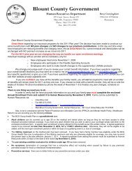
Conceptual Land Use Plan for Blount County March 23, 2000
Conceptual Land Use Plan for Blount County March 23, 2000
Conceptual Land Use Plan for Blount County March 23, 2000

You also want an ePaper? Increase the reach of your titles
YUMPU automatically turns print PDFs into web optimized ePapers that Google loves.
<strong>Blount</strong> <strong>County</strong> <strong>Land</strong> <strong>Use</strong> <strong>Plan</strong><br />
<strong>Conceptual</strong> <strong>Land</strong> <strong>Use</strong> <strong>Plan</strong> <strong>for</strong> <strong>Blount</strong> <strong>County</strong><br />
<strong>Blount</strong> <strong>County</strong> <strong>Plan</strong>ning Commission<br />
<strong>March</strong> <strong>23</strong>, <strong>2000</strong><br />
Introduction.<br />
The <strong>Blount</strong> <strong>County</strong> <strong>Plan</strong>ning Commission has responsibility in state statutes to<br />
<strong>for</strong>mulate a plan <strong>for</strong> the physical development of the county (Tennessee Code<br />
Annotated 13-3-301). The <strong>Plan</strong>ning Commission approved the <strong>Blount</strong> <strong>County</strong><br />
Policies <strong>Plan</strong> on June 24, 1999. The Policies <strong>Plan</strong> addressed many issues of<br />
physical development.<br />
The <strong>Plan</strong>ning Commission began to address implementation of the plan in July<br />
1999, culminating in a recommended Zoning <strong>Plan</strong> on February 24, <strong>2000</strong>.<br />
During the discussions on the Zoning <strong>Plan</strong>, a conceptual land use map was<br />
created to guide discussion, and many issues of physical development were<br />
discussed in detail.<br />
Physical aspects of development were also discussed in the context of the<br />
Public Chapter 1101 Growth <strong>Plan</strong> <strong>for</strong> the county from about January to<br />
December of 1999. In that plan, the <strong>County</strong> recommended <strong>Plan</strong>ned Growth<br />
Areas and Rural Areas, and also provided guidance on identifying Urban<br />
Growth Boundaries. The discussions on the Growth <strong>Plan</strong> were also<br />
incorporated in discussions of the Zoning <strong>Plan</strong>.<br />
The purpose of this <strong>Conceptual</strong> <strong>Land</strong> <strong>Use</strong> <strong>Plan</strong> is to document and consolidate<br />
the discussions of land use issues by the <strong>Plan</strong>ning Commission from July 1999<br />
to February <strong>2000</strong>, and also discussions relating to the <strong>County</strong> recommendation<br />
<strong>for</strong> the Growth <strong>Plan</strong>. The documentation will provide a further supporting basis<br />
<strong>for</strong> the zoning plan. This <strong>Plan</strong> should be considered as a companion to the<br />
<strong>Blount</strong> <strong>County</strong> Policies <strong>Plan</strong> <strong>for</strong> guidance in future discussions of land use<br />
issues. The time horizon <strong>for</strong> this <strong>Plan</strong> is 20 years, to the year 2020.<br />
This <strong>Plan</strong> includes both a map and written text. The map included in this<br />
document is a general portrayal of a larger scale map adopted with the <strong>Plan</strong>.<br />
The original larger scale map is maintained in the offices of the <strong>Blount</strong> <strong>County</strong><br />
<strong>Plan</strong>ning Department.<br />
Adopted <strong>March</strong> <strong>23</strong>, <strong>2000</strong> Page 1 of 6
<strong>Blount</strong> <strong>County</strong> <strong>Land</strong> <strong>Use</strong> <strong>Plan</strong><br />
Adopted <strong>March</strong> <strong>23</strong>, <strong>2000</strong> Page 2 of 6
<strong>Blount</strong> <strong>County</strong> <strong>Land</strong> <strong>Use</strong> <strong>Plan</strong><br />
The <strong>Conceptual</strong> <strong>Land</strong> <strong>Use</strong> Map.<br />
The previous page provides a representation of the <strong>Conceptual</strong> <strong>Land</strong> <strong>Use</strong> Map<br />
<strong>for</strong> the county. The map identifies the physical extent of the land use categories<br />
that will be the subjects of further discussion in this <strong>Plan</strong>. Note that the<br />
categories of Commercial, Industrial, Airport and Suburbanizing are generally<br />
consistent with the <strong>Plan</strong>ned Growth Area identified by the <strong>County</strong>. The<br />
remaining categories of Rural 1, Rural 2, and National Park are generally<br />
consistent with the Rural Area identified by the <strong>County</strong>. This makes the overall<br />
plan consistent with the <strong>County</strong> recommendation <strong>for</strong> the Public Chapter 1101<br />
Growth <strong>Plan</strong>.<br />
Commercial <strong>Land</strong> <strong>Use</strong>.<br />
Commercial land use is expected to be concentrated in and around the two<br />
larger cities of Alcoa and Maryville, particularly along the major road corridors<br />
of Highway 321 east and west, Alcoa Highway, Old Knoxville Highway,<br />
Highway 411 south, and William <strong>Blount</strong> Drive. The corridor of Highway 321<br />
in the area around Townsend is expected to develop in tourist related<br />
commercial uses. There is also a small portion of Chapman Highway in the<br />
Seymour area which shows a concentration of commercial use. Two future<br />
concentrations of commercial land use are indicated along Highway 411 north<br />
just past the Maryville city limits, and on Montvale Road near intersection with<br />
Raulston Road. Both of these future concentrations will be dependent on<br />
extension of a major southern loop connector that will define intersections at<br />
these locations.<br />
Although the cities are expected to contain the major concentration of high<br />
density commercial land use and activity in the county, other commercial<br />
activity already exists outside the cities and outside the area identified <strong>for</strong> the<br />
high density commercial land use category. This type of commercial use is<br />
expected to grow in the future. The <strong>Plan</strong> projects that medium to low density<br />
commercial activities will establish in other areas of the county along arterial<br />
roads and collector roads. The <strong>Plan</strong> further projects that home occupations and<br />
family commercial enterprises will establish as low density commercial<br />
activities throughout the county in relation to individual homes and home sites.<br />
Existing commercial uses outside of specifically designated commercial areas<br />
will be allowed to expand as needed and as appropriate to the surrounding<br />
development context.<br />
Adopted <strong>March</strong> <strong>23</strong>, <strong>2000</strong> Page 3 of 6
<strong>Blount</strong> <strong>County</strong> <strong>Land</strong> <strong>Use</strong> <strong>Plan</strong><br />
Industrial <strong>Land</strong> <strong>Use</strong>.<br />
Industrial land use is expected to be concentrated in and around the two larger<br />
cities of Alcoa and Maryville, confined mainly to industrial parks and larger,<br />
well established sites. One main concentration of new industrial land use is<br />
projected to be in the area with high impact from airport operations, particularly<br />
to the southwest of the airport. Other existing industrial sites are scattered<br />
throughout the county and are accepted as part of the existing, historical<br />
framework of development. Such existing uses will be allowed to expand as<br />
needed and appropriate to the surrounding development context.<br />
Airport <strong>Land</strong> <strong>Use</strong>.<br />
The McGhee-Tyson Airport is recognized as a unique regional transportation<br />
resource. Airport operations are an integration of air traffic, governmental,<br />
military, commercial, and industrial uses. The area is there<strong>for</strong>e given a separate<br />
land use category apart from the commercial and industrial categories. It is<br />
expected that the area of airport operations, including all uses directly<br />
connected to the runways and terminal, will develop as an integrated whole<br />
under semi-autonomous direction of the Airport Authority.<br />
Suburbanizing <strong>Land</strong> <strong>Use</strong>.<br />
The suburbanizing land use category identifies areas within the county where<br />
high to medium density development is expected to occur within the time<br />
horizon of 20 years. Part of this area is expected to be annexed by the cities as<br />
high density growth occurs.<br />
The majority of development in the area is expected to be residential. High<br />
density residential development is expected to occur on public sewer, which<br />
allows gross densities of greater than 1.5 units per acre. Medium density<br />
residential development is expected to occur on land suitable <strong>for</strong> septic fields,<br />
which allows gross densities of 1.5 units per acre or less. The lower limit on<br />
the medium density scale is expected to be .33 units per acre, or one unit per<br />
three acres on average.<br />
In deference to the predominantly residential nature of the area, only limited<br />
commercial activity is expected, particularly of medium to low density along<br />
arterial and collector status roads. Low density commercial activities related to<br />
the home or home site are also expected. Existing commercial uses are<br />
Adopted <strong>March</strong> <strong>23</strong>, <strong>2000</strong> Page 4 of 6
<strong>Blount</strong> <strong>County</strong> <strong>Land</strong> <strong>Use</strong> <strong>Plan</strong><br />
accepted as part of the development pattern of the county, and will be allowed<br />
to expand as needed and as appropriate to the surrounding development context.<br />
See also discussion under commercial land use above.<br />
Rural 1 <strong>Land</strong> <strong>Use</strong>.<br />
The rural 1 land use category identifies areas in the county where medium to<br />
low density development is expected to occur. The two larger cities will<br />
probably not annex into this area, and the smaller towns will probably have<br />
only limited annexations in the 20-year time horizon.<br />
The majority of development in the area is expected to be residential. Medium<br />
density residential development is expected to occur on land suitable <strong>for</strong> septic<br />
fields, which allows gross densities of 1.5 units per acre or less. The lower<br />
limit on the medium density scale is expected to be .33 units per acre, or one<br />
unit per three acres on average. Low density residential development is<br />
expected to occur on land with greater constraints to development, at densities<br />
less than .33 units per acre.<br />
In deference to the predominantly residential nature of the area, only limited<br />
commercial activity is expected, particularly of medium to low density along<br />
arterial and collector status roads. Low density commercial activities related to<br />
the home or home site are also expected. Existing commercial uses are<br />
accepted as part of the development pattern of the county, and will be allowed<br />
to expand as needed and as appropriate to the surrounding development context.<br />
See also discussion under commercial land use above.<br />
Rural 2 <strong>Land</strong> <strong>Use</strong>.<br />
The rural 2 land use category identifies areas in the county where land<br />
development is highly constrained by natural factors and infrastructure, and<br />
where low density development is expected. The majority of development in<br />
the area is expected to be residential at densities less than .33 units per acre, or<br />
one unit per three acres on average.<br />
In deference to the predominantly residential nature of the area, only limited,<br />
low density commercial activity is expected, particularly related to tourism and<br />
recreation. Low density commercial activities related to the home or home site<br />
are also expected. Existing commercial uses are accepted as part of the<br />
development pattern of the county, and will be allowed to expand as needed and<br />
Adopted <strong>March</strong> <strong>23</strong>, <strong>2000</strong> Page 5 of 6
<strong>Blount</strong> <strong>County</strong> <strong>Land</strong> <strong>Use</strong> <strong>Plan</strong><br />
as appropriate to the surrounding development context. See also discussion<br />
under commercial land use above.<br />
National Park <strong>Land</strong> <strong>Use</strong>.<br />
The Great Smoky Mountains National Park and the Foothills Parkway are<br />
unique regional resources under control of the National Park Service. It is<br />
expected that there will be no development in the usual sense of the term, and<br />
that the areas will be conserved or open <strong>for</strong> limited recreational purposes.<br />
Other <strong>Land</strong> <strong>Use</strong> Considerations.<br />
Not shown on the map are land use constraints associated with flooding and the<br />
off-site impacts of airport operations. Special land use considerations will need<br />
to be addressed to mitigate flood hazard near rivers and streams in the county.<br />
Special land use considerations also will need to be addressed <strong>for</strong> height of<br />
buildings and the effects of noise in the area affected by air traffic.<br />
Mixed use and flexible clustering of development is accepted as a valid land use<br />
concept if planned <strong>for</strong> appropriately. Thus, planned unit developments will be<br />
an accepted type of development.<br />
Signs and telecommunication towers can have adverse effects on the landscape.<br />
These uses will need to be addressed to mitigate or limit their impact.<br />
Manufactured homes and multi-family residential developments are accepted<br />
types of uses in the county. However, such uses can have adverse impacts on<br />
surrounding uses if not planned properly. These uses will need to be addressed<br />
to mitigate or limit their impact.<br />
Note on Road Status.<br />
The designation of Arterial and Collector status of roads will be dependent on<br />
the Major Road <strong>Plan</strong>s of the <strong>Blount</strong> <strong>County</strong> <strong>Plan</strong>ning Commission, the<br />
Maryville Regional <strong>Plan</strong>ning Commission, and the Alcoa Regional <strong>Plan</strong>ning<br />
Commission. All three Major Road <strong>Plan</strong>s are required to be registered in the<br />
office of the Register of Deeds. The roads shown on the <strong>Conceptual</strong> <strong>Land</strong> <strong>Use</strong><br />
Map are not necessarily the final official representations of road status.<br />
Adopted <strong>March</strong> <strong>23</strong>, <strong>2000</strong> Page 6 of 6