Subdivision Regulations - Blount County Government
Subdivision Regulations - Blount County Government
Subdivision Regulations - Blount County Government

You also want an ePaper? Increase the reach of your titles
YUMPU automatically turns print PDFs into web optimized ePapers that Google loves.
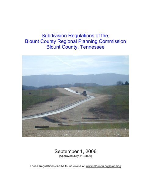
<strong>Subdivision</strong> <strong>Regulations</strong> of the,<br />
<strong>Blount</strong> <strong>County</strong> Regional Planning Commission<br />
<strong>Blount</strong> <strong>County</strong>, Tennessee<br />
September 1, 2006<br />
(Approved July 31, 2006)<br />
These <strong>Regulations</strong> can be found online at: www.blounttn.org/planning
9-01-06<br />
CERTIFICATION<br />
These <strong>Subdivision</strong> <strong>Regulations</strong> of the <strong>Blount</strong> <strong>County</strong> Regional Planning<br />
Commission were adopted pursuant to the provisions of TCA 13-3-101 through<br />
13-3-105 and TCA 13-3-401 through 13-3-412 and subsequent amendments<br />
thereto.<br />
The Major Road Classification Plan – <strong>Blount</strong> <strong>County</strong> Planning Region, was<br />
adopted on December 9, 1993 and was filed with the <strong>Blount</strong> <strong>County</strong> Register of<br />
Deeds on July 8, 1994.<br />
The public hearing for citizen input concerning these regulations was held on July<br />
31, 2006 after 30 days notice in the newspaper.<br />
These regulations were adopted on July 31, 2006 by the <strong>Blount</strong> <strong>County</strong> Regional<br />
Planning Commission and became effective on September 1, 2006.<br />
These regulations were adopted in whole to replace the previous <strong>Subdivision</strong><br />
<strong>Regulations</strong>, as amended previous to the effective date of these regulations<br />
herein.<br />
________________<br />
Ed Stucky<br />
Chairman<br />
________________<br />
John Lamb<br />
Secretary<br />
<strong>Blount</strong> <strong>County</strong> Regional Planning Commission<br />
i
9-01-06<br />
BLOUNT COUNTY REGIONAL PLANNING COMMISSION<br />
and Review Committees<br />
These <strong>Subdivision</strong> <strong>Regulations</strong> were reviewed and recommended after an<br />
extensive review period. The process was assisted by two <strong>Subdivision</strong> Review<br />
Committees. Members of the 2002/3 committee were: J.C. Franklin, Charles<br />
Caldwell, Jim Gregory, Tom Howard, Mike Ross, and Mike Treadway. The<br />
2005/6 committee consisted of Carl McDonald, Rick Brownlie, Ed Stucky, Jim<br />
Scully, and Tom Hodge. Support provided by John Lamb, Director of Planning,<br />
Douglas Hancock, Planner, Gary Ferguson, Director of Environmental Health, Bill<br />
Dunlap, Highway Superintendent, Tony Abbott and Ron Sharp of the Engineering<br />
Department, and Justin Teague Storm Water Coordinator.<br />
BLOUNT COUNTY REGIONAL PLANNING COMMISSION<br />
Ed Stucky, Chairman<br />
Kenneth Melton, Vice-Chairman<br />
Rick Brownlie<br />
Joe Everett<br />
Gary Farmer<br />
Steve Gray<br />
Tom Hodge<br />
Bob Kidd<br />
Bruce McClellan<br />
Carl McDonald<br />
Bill Proffitt<br />
Jim Scully<br />
BLOUNT COUNTY PLANNING DEPARTMENT<br />
John Lamb, Director of Planning and Planning Commission Secretary<br />
Douglas Hancock, Planner-Principal Author<br />
Gaye Hasty, Assistant Planner<br />
ii
9-01-06<br />
TABLE OF CONTENTS<br />
SECTION/ARTICLE<br />
PAGE<br />
SECTION 1: General Provisions - - - - - 1<br />
1.01. Title - - - - - - - - - 1<br />
1.02. Authority - - - - - - - - 1<br />
1.03. Policy - - - - - - - - - 1<br />
1.04. Purposes - - - - - - - - 2<br />
1.05. Jurisdiction - - - - - - - - 3<br />
1.06. Enactment - - - - - - - - 3<br />
1.07. Interpretation, Conflict and Separability - - - - 4<br />
1.08. Saving Provision - - - - - - - 4<br />
1.09. Reservations - - - - - - - 5<br />
1.10. Amendments - - - - - - - 5<br />
1.11. Exercise of Police Power - - - - - - 5<br />
1.12. Re-subdivision of Land - - - - - - 5<br />
1.13. Variances - - - - - - - - 6<br />
1.14. Enforcement - - - - - - - 6<br />
SECTION 2: Definitions - - - - - - - 8<br />
2.01. Usage - - - - - - - - 8<br />
2.02. Words and Terms Defined - - - - - 8<br />
Road Types - - - - - - - 16<br />
Types of <strong>Subdivision</strong>s - - - - - - 18<br />
2.03. Commonly Used Acronyms - - - - - 21<br />
SECTION 3: Assurance for Completion<br />
and Maintenance of Improvements - - - 22<br />
3.01. Improvements and Performance Security - - - 22<br />
3.02. Inspection of Improvements - - - - - 24<br />
3.03. Maintenance of Improvements - - - - - 25<br />
3.04. Results of Required Submission Items and Improvements - 26<br />
3.05. Other Methods of Assurance for Completion and<br />
Maintenance of Improvements - - - - - 26<br />
3.06. Road Maintenance and Drainage Assurance After Final Plat - 27<br />
SECTION 4: <strong>Subdivision</strong> Application Procedure<br />
and Approval Process - - - - - 28<br />
4.01. General Purpose - - - - - - - 28<br />
4.02. General Procedure - - - - - - - 28<br />
iii
9-01-06<br />
SECTION/ARTICLE<br />
PAGE<br />
4.03. Classification of <strong>Subdivision</strong>s - - - - - 30<br />
4.03.1 Major <strong>Subdivision</strong>s - - - - - - 30<br />
4.03.2 Minor <strong>Subdivision</strong> - - - - - - 30<br />
4.03.3 One-Lot <strong>Subdivision</strong> - - - - - 31<br />
4.03.4 One-Lot <strong>Subdivision</strong> served by a permanent easement 31<br />
4.03.5 Order of Standardization (Reserved) - - - 32<br />
4.04. Specific Procedures for the Classifications of <strong>Subdivision</strong>s - 32<br />
4.04.1 Policy Regarding All <strong>Subdivision</strong>s - - - 32<br />
4.04.1(a) Initial Consultation - - - - 32<br />
4.04.1(e) Preliminary Plat Meeting - - - 32<br />
4.04.1(f) Pre-Construction Conference - - - 33<br />
4.04.2 Minimum Road Width Standards for Division - - 33<br />
4.04.3 Procedure for Major <strong>Subdivision</strong>s; (Steps 1-14) - 34<br />
4.04.4 Procedure for Minor <strong>Subdivision</strong>s (Steps A through E) - 37<br />
4.04.5 Procedure for one-lot subdivisions (One lot into two) - 38<br />
4.05. Submission Dates - - - - - - - 39<br />
4.06. Notice of Review - - - - - - - 39<br />
4.07. Action by the Planning Commission - - - - 39<br />
4.07.1 Preliminary Plat Review - - - - - 39<br />
4.07.2 Final Plat Review - - - - - - 40<br />
SECTION 5 Specifications For Documents To Be Submitted - 41<br />
5.01. Preliminary Plat - - - - - - - 41<br />
5.01.1 Name - - - - - - - 41<br />
5.01.2 Ownership - - - - - - - 41<br />
5.01.3 Description - - - - - - - 41<br />
5.01.4 Features - - - - - - - 42<br />
5.01.5 Impact Assessment (Reserved) - - - -<br />
5.02. Supporting Items to be Submitted with Preliminary Plat - 43<br />
5.02.1 General - - - - - - - 43<br />
5.02.2 Features - - - - - - - 43<br />
5.01.2(a) Preliminary Soil Map/Soil Letter - - 43<br />
5.01.2(b) High-Intensity Soil Map - - - - 43<br />
5.01.2(c) Road Plan, Construction Work Plan - - 44<br />
5.01.2(d) Road Profiles - - - - - 44<br />
5.01.2(e) Cross-Sections - - - - - 44<br />
5.01.2(f) Topographic Map - - - - 44<br />
5.01.2(g) Drainage Plan, Calculations - - - 44<br />
5.01.2(h) Erosion Control Plan - - - - 45<br />
iv
9-01-06<br />
5.01.2(i) Proposed Utility Layouts - - - - 46<br />
SECTION/ARTICLE<br />
PAGE<br />
5.02.3 Relation to Preliminary Plat - - - - - 46<br />
5.02.4 As-Built Plans/Certifying Letters Prior to Final - - 46<br />
5.03. Final <strong>Subdivision</strong> Plat - - - - - - 47<br />
5.03.1 General - - - - - - - 47<br />
5.03.2 Features - - - - - - - 47<br />
5.03.3 Private Roads/Property Owners Association - - 49<br />
SECTION 6: General Requirements And Minimum Standards For<br />
Improvements, Reservations, and Design - - 50<br />
6.01. Suitability of the Land - - - - - - 50<br />
6.01.1 Land Physically Unsuitable for <strong>Subdivision</strong> - - 50<br />
6.01.2 Land Unsuitably Located for <strong>Subdivision</strong> - - 51<br />
(b) Minimum off-site Road Standards - - - 52<br />
(c) Standard of School Capacity - - - - 53<br />
6.01.3 Land Subject to Flood - - - - - 54<br />
6.01.4 Water Hazard Areas - - - - - 55<br />
6.02. Streets - - - - - - - - 56<br />
6.02.1 Classification - - - - - - 56<br />
6.02.2 Relation to Present, Proposed and Future Street System 57<br />
6.02.3 Design Standards for Streets - - - - 58<br />
6.02.4 Intersections - - - - - - 63<br />
6.02.5 Private Streets and Reserve Strips - - - 63<br />
6.02.5(a) Type 1 - Common Driveway Development - 63<br />
6.02.5(a) Type 2 - Low Density Development - - 64<br />
6.02.5(a) Type 3 – Preserved Open Space (Cluster) Dev. 65<br />
6.02.5(a) Type 4 – Standard Density Private Development 66<br />
6.02.5(b) Reserve Strips - - - - - 66<br />
6.02.6 Additional Street Information - - - - 66<br />
6.03. Blocks - - - - - - - - 67<br />
6.03.1 Length - - - - - - - 67<br />
6.03.2 Width - - - - - - - - 67<br />
6.04. Lots - - - - - - - - - 67<br />
6.04.1(a) Minimum Lot Requirements - - - 69<br />
6.04.1(a)(1) Corner Lots - - - - 70<br />
6.04.1(a)(2) Chapter 301 - - - - 70<br />
6.04.1(a)(3) Fill Areas and Floodway Areas - 70<br />
6.04.1(a)(4) Well Lot Sizes - - - - 70<br />
6.04.1(a)(7) Soil Ratings/Reserve Area Requirements 71<br />
v
9-01-06<br />
6.04.1(a)(9) Plat Soil Notification - - - 72<br />
SECTION/ARTICLE<br />
PAGE<br />
6.04.1(b) Minimum Depths of Building Setbacks - 72<br />
6.04.1(c) Commercial and Industrial Divisions - - 73<br />
6.04.1(d) Group Housing, Clustered, or Planned Dev. - 74<br />
6.05. Public Use and Service Areas - - - - - 74<br />
6.05.1 Public Open Spaces - - - - - 74<br />
6.05.2 Easements - - - - - - - 74<br />
6.05.3 Community Assets - - - - - - 75<br />
6.06. Zoning and/or Other <strong>Regulations</strong> - - - - - 75<br />
SECTION 7: Development Prerequisite To Final Approval - 76<br />
7.01. Required Improvements - - - - - - 76<br />
7.01.1 Monuments and Lot Markers - - - - 76<br />
7.01.2 Street Development - - - - - 76<br />
7.01.3 Storm Drainage - - - - - - 77<br />
7.01.4 Sanitary Sewers - - - - - - 80<br />
7.01.5 Water Supply System - - - - - 81<br />
7.01.6 Installation of Utilities including Electric, Water, Sewer,<br />
Storm Drainage, Natural Gas, Cable and Telephone - 82<br />
7.01.7 Sidewalks - - - - - - - 83<br />
7.01.8 Street Name Signs - - - - - - 84<br />
7.01.9 Site Improvements - - - - - - 84<br />
7.01.9(a) Seeding/Vegetative Cover - - - 84<br />
7.01.9(b) Drainage Ditch Treatments - - - 85<br />
7.01.10 Guarantee in Lieu of Completed Improvements - 86<br />
SECTION 8: Procedure and Standards for Road Construction - 87<br />
8.01. Clearing - - - - - - - - 87<br />
8.01.1 Right-of-ways - - - - - - 87<br />
8.01.2 Debris Removal - - - - - - 87<br />
8.02. Construction - - - - - - - - 87<br />
8.02.1 Preliminary Soil Information, Site Preparation - - 87<br />
8.02.1(a) Preliminary Plat Information - - - 87<br />
8.02.1(b) Pre-Construction Meeting - - - 87<br />
8.02.1(c) Erosion Control and Removal of Topsoil - 88<br />
8.02.1(d) Unsatisfactory Soils - - - - 88<br />
8.02.2 Fill - - - - - - - - 88<br />
8.02.3 Drainage - - - - - - - 89<br />
vi
9-01-06<br />
8.02.4 Stone Base - - - - - - - 89<br />
SECTION/ARTICLE<br />
PAGE<br />
8.03. Paving - - - - - - - - 90<br />
8.03.1 Prime Coat Application - - - - - 90<br />
8.03.2 Asphaltic Concrete Binder Course (Plant Mixed) - 90<br />
8.03.3 Asphaltic Topping Course/Wearing Surface (Plant Mixed) 90<br />
8.04. Materials - - - - - - - - 90<br />
8.05. Construction Methods - - - - - - 91<br />
8.05.1 Applying Tack Coat - - - - - 91<br />
8.05.2 Spreading and Finishing - - - - - 91<br />
8.05.3 Seasonal Limits - - - - - - 92<br />
8.06. Curbing - - - - - - - - 92<br />
8.06.1 Curbs - - - - - - - 92<br />
8.06.2 Shoulders - - - - - - - 93<br />
8.07. Backfilling - - - - - - - - 93<br />
8.08. Cross Section - - - - - - - 93<br />
Section 9: Special Development Standards - - - 95<br />
9.01. Hillside Development - - - - - - 95<br />
9.02. Suitability of Land - - - - - - - 95<br />
9.03. Procedure for Preliminary and Final Plat Approval - - 96<br />
9.04. General Requirements and Minimum Standards of Design<br />
for Hillside <strong>Subdivision</strong>s - - - - - - 96<br />
9.04.1 Road Design - - - - - - 96<br />
9.04.1(a) Road Grades - - - - - 96<br />
9.04.1(b) Minimum Right-of-Way - - - - 96<br />
9.04.1(c) Minimum Pavement Width - - - 96<br />
9.04.1(d) Severe Topographical Constraints - - 96<br />
9.04.1(e) Road Design - - - - - 97<br />
9.04.1(f) Lots Allowable - - - - - 97<br />
9.04.1(g) Parking - - - - - - 97<br />
9.04.1(h) Guardrails - - - - - - 97<br />
9.05. Campground Developments - - - - - 97<br />
9.06. Manufactured Home Developments - - - - 97<br />
9.07. Planned Unit Developments - - - - - 98<br />
9.07.1 Design Standards; Common Open Space - - 98<br />
9.07.2 Minimum Size - - - - - - 99<br />
9.07.3 Additional Required Information - - - - 99<br />
9.08 Condominium Developments - - - - - 100<br />
vii
9-01-06<br />
SECTION/ARTICLE<br />
PAGE<br />
Section 10: Certifications - - - - - - 101<br />
10.01. Certification of Ownership and Dedication - - - 101<br />
10.02. Certificate of Private Streets - - - - - 101<br />
10.03. Certificate of Accuracy - - - - - - 101<br />
10.04. Certificate for Private Subsurface Septic Disposal Systems - 101<br />
10.05. Certification of the Approval of Streets - - - - 102<br />
10.06. Certification of the Approval of Utilities (Water) - - - 102<br />
10.07. Certification of the Approval of Utilities (Municipal Sewer) - 103<br />
10.08. Certification of Electrical Utility Service - - - - 103<br />
10.09. Certificate of Approval of Road Names/Numbers (E-911) - 103<br />
10.10. Certification of Approval of On-Site Public Utility Sewer System 104<br />
10.11. Certification of Land-Line Telephone Service - - - 104<br />
10.12. Certification of Cable/Multi-Media Service - - - 105<br />
10.13. Certificate of Approval for Recording - - - - 105<br />
Appendix I Planning Department Design Checklist - - - 106<br />
Appendix II <strong>County</strong> Engineering Department S/D Checklist - - 107<br />
Appendix III Developer’s Construction Checklist (BCED) - - 108<br />
viii
9-01-06<br />
SECTION 1. General Provisions<br />
1.01. Title:<br />
These regulations shall hereafter be known, cited, and referred to as the<br />
<strong>Subdivision</strong> <strong>Regulations</strong> of the <strong>Blount</strong> <strong>County</strong> Regional Planning<br />
Commission.<br />
1.02. Authority:<br />
These regulations are adopted under authority of the TENNESSEE CODE<br />
ANNOTATED, Section 13-3-101, and Sections 13-3-103 through 13-3-105<br />
and Section 13-3-401 through Section 13-3-412 and other applicable laws,<br />
statutes, ordinances, and regulations of the State of Tennessee. The<br />
<strong>Blount</strong> <strong>County</strong> Regional Planning Commission does hereby exercise the<br />
powers and authority to review, approve, and disapprove plats for the<br />
subdivision of land with the designated <strong>Blount</strong> <strong>County</strong> Planning Region,<br />
which show lots, blocks or sites with or without new streets or highways.<br />
1.03. Policy:<br />
1. It is hereby declared to be the policy of the Planning Commission to<br />
consider the subdivision of land and the development of the subdivided<br />
platted land as subject to conformity with the <strong>Blount</strong> <strong>County</strong> Regional<br />
Planning Commission's most recent adopted land use plan and other<br />
plans for <strong>Blount</strong> <strong>County</strong> for the orderly, planned, efficient, and economical<br />
development of the <strong>County</strong>. Such plans are, but are not limited to: the<br />
Conceptual Land Use Plan for <strong>Blount</strong> <strong>County</strong>, adopted March 23, 2000<br />
by the <strong>Blount</strong> <strong>County</strong> Planning Commission, <strong>Blount</strong> <strong>County</strong> Zoning<br />
<strong>Regulations</strong> adopted June 15, 2000 by the <strong>Blount</strong> <strong>County</strong> Commission<br />
and any amendments to such regulations and plans; and the <strong>Blount</strong><br />
<strong>County</strong> Policies Plan (Adopted June 24, 1999). In addition, the<br />
subdivision and development of land shall be consistent with all<br />
applicable rules and regulations of Tennessee Code Annotated;<br />
Comprehensive Growth Plan - Section 6.58.101; The 1101 Growth Plan<br />
for <strong>Blount</strong> <strong>County</strong>; the Water Quality Plan for <strong>Blount</strong> <strong>County</strong>, Tennessee,<br />
adopted in April of 2003.<br />
2. Land to be subdivided shall be of such character that it can be used<br />
safely for building purposes without danger to health or peril from flood,<br />
fire, lack of water supply or other menace, and land shall not be<br />
subdivided until available public facilities and improvements exist and<br />
proper provision has been made for drainage, water, sewerage, and<br />
capital improvements such as schools, parks, recreation facilities,<br />
transportation facilities, roads and other improvements.<br />
1
9-01-06<br />
3. The subdivision and development of land shall be consistent with all<br />
applicable rules and regulations of the Zoning Resolution of <strong>Blount</strong><br />
<strong>County</strong>, Tennessee (#00-06-101), adopted June 15, 2000; and the <strong>Blount</strong><br />
<strong>County</strong> Floodplain Zoning Resolution (#00-06-011), adopted on June 15,<br />
2000. And the Resolution to Protect Water Quality in the Unincorporated<br />
Areas of <strong>Blount</strong> <strong>County</strong> by Prohibiting, Suppressing, and Preventing the<br />
Contamination of Storm Water by Grading, Erosion, and Sedimentation,<br />
adopted December 16 th , 2004.<br />
1.04. Purposes:<br />
These subdivision regulations are adopted for the following purposes:<br />
1. To protect and provide for the public health, safety, and general welfare of the<br />
<strong>County</strong>.<br />
2. To guide the future growth and development of the <strong>County</strong>, in accordance<br />
with TCA; Comprehensive Growth Plan - Section 6-58-101; The 1101 Growth<br />
Plan for <strong>Blount</strong> <strong>County</strong>, the <strong>Blount</strong> <strong>County</strong> Policies Plan, the Zoning<br />
Resolution of <strong>Blount</strong> <strong>County</strong>, Tennessee, the <strong>Blount</strong> <strong>County</strong> Floodplain<br />
Zoning Resolution, and the Conceptual Land Use Plan for <strong>Blount</strong> <strong>County</strong>,<br />
2000, the Water Quality Plan for <strong>Blount</strong> <strong>County</strong> and other plans for the<br />
physical development of land in <strong>Blount</strong> <strong>County</strong>.<br />
3. To provide for adequate light, air, privacy, to secure safety from fire, flood,<br />
and other danger and to prevent overcrowding of the land and undue<br />
congestion of population.<br />
4. To protect the character and the social and economic stability of all parts of<br />
the <strong>County</strong> and to encourage the orderly and beneficial development of all<br />
parts of the <strong>County</strong>.<br />
5. To protect and conserve the value of land throughout the <strong>County</strong> and the<br />
value of buildings and improvements upon the land, and to minimize the<br />
conflicts among the uses of land and buildings.<br />
6. To guide public and private policy and action in order to provide adequate and<br />
efficient transportation, water, sewerage facilities, schools, parks,<br />
playgrounds, recreation, and other public requirements and facilities.<br />
7. To provide the most beneficial relationship between the uses of land and<br />
buildings and the circulation of traffic throughout the <strong>County</strong>, having particular<br />
regard to the avoidance of congestion in the streets and highways, and the<br />
pedestrian traffic movements appropriate to the various uses of land and<br />
buildings, and to provide for the proper location and width of streets and<br />
building lines.<br />
8. To establish reasonable standards of design and procedures for subdivisions<br />
and resubdivision, in order to further the orderly subdivision and use of land;<br />
and to insure proper legal descriptions and monumenting of subdivided land.<br />
9. To insure that public facilities are available and will have a sufficient capacity<br />
to serve the proposed subdivision.<br />
2
9-01-06<br />
10. To prevent the pollution of air, lakes, rivers, streams, and ponds; to assure<br />
the adequacy of drainage facilities; to safeguard the water table; and to<br />
encourage the wise use and management of natural resources throughout the<br />
<strong>County</strong> in order to preserve the integrity, stability, and beauty of the<br />
community and the value of the land.<br />
11. To preserve the natural beauty and topography of the <strong>County</strong> and to insure<br />
appropriate development with regard to these natural features.<br />
1.05. Jurisdiction:<br />
1. These subdivision regulations shall apply to all subdivisions of land as<br />
defined herein located within the planning region of the <strong>Blount</strong> <strong>County</strong><br />
Regional Planning Commission.<br />
2. No plat of a subdivision shall be used in the transfer of land within the<br />
planning region until:<br />
a) The subdivider or his agent shall submit a preliminary plat of the<br />
parcel to the Planning Commission through its administrative staff.<br />
b) Obtain preliminary and final approval of the plat by the Planning<br />
Commission.<br />
c) The approved plat is filed with the <strong>Blount</strong> <strong>County</strong> Register of<br />
Deeds.<br />
3. From and after the time when the platting jurisdiction of any regional planning<br />
commission of any region has attached by virtue of the making and adoption<br />
of a major road plan as provided in TCA 13-3-402, no county or court or<br />
board or officer thereof or any other public officer or authority shall accept, lay<br />
out, open, improve, grade, pave or light any road or lay or authorize water<br />
mains or sewers or connections or other facilities or utilities to be laid in any<br />
road located within such region and outside of the boundaries of municipal<br />
corporations, unless such road has been accepted or opened or has<br />
otherwise received the legal status of a public road by the process stated in<br />
TENNESSEE CODE ANNOTATED, § 13-3-406.<br />
1.06. Enactment:<br />
In pursuance to authority set forth in section 13-3-401 et seq., Tennessee<br />
Code Annotated, in order that land may be subdivided in accordance with<br />
these purposes and policy, these subdivision regulations are hereby<br />
adopted.<br />
3
9-01-06<br />
1.07. Interpretation, Conflict and Separability:<br />
1 Interpretation: In their interpretation and application, the provisions<br />
of these regulations shall be held to be minimum requirements for the<br />
promotion of the public health, safety, and general welfare.<br />
Conflict with Public and Private Provisions:<br />
(a) Public Provisions. The regulations are not intended to interfere with,<br />
abrogate, or annul any other provision of law. Where these regulations<br />
impose restrictions different from those imposed by any other provision of<br />
these regulations or any other applicable ordinance, rule or regulation, or<br />
other provision of law, whichever provisions are more restrictive or impose<br />
higher standards shall control.<br />
(b) Private Provisions. These regulations are not intended to abrogate any<br />
easement, covenant or any other private agreement or restriction,<br />
provided that where the provisions of these regulations are more<br />
restrictive or impose higher standards or regulations than such easement,<br />
covenant, or other private agreement or restriction, the requirements of<br />
these regulations shall govern. Where the provisions of the easement,<br />
covenant, or private agreement or restriction impose duties and<br />
obligations more restrictive than in these regulations, enforcement of such<br />
shall be the responsibility of the private property owner concerned.<br />
2. Separability: If any part or provision of these regulations or application<br />
thereof to any person or circumstances is adjudged invalid by any court of<br />
competent jurisdiction, such judgment shall be confined in its operation to<br />
the part, provision, or application directly involved in all controversy in<br />
which such judgment shall have been rendered and shall not affect or<br />
impair the validity of the remainder of these regulations or the application<br />
thereof to other persons or circumstances. The Planning Commission<br />
hereby declares that it would have enacted the remainder of these<br />
regulations even without any such part, provision, or application.<br />
1.08. Saving Provision:<br />
These regulations shall not be construed as abating any action now<br />
pending under, or by virtue of, prior existing subdivision regulations, or as<br />
discontinuing, abating, modifying, or altering any penalty accruing or about<br />
to accrue, or as affecting the liability of any person, firm, or corporation, or<br />
as waiving any right of the <strong>County</strong> under any section or provision existing<br />
at the time of adoption of these regulations, or as vacating or annulling<br />
any rights obtained by any person, firm, or corporation, by lawful action of<br />
the <strong>County</strong> except as shall be expressly provided for in these regulations.<br />
4
9-01-06<br />
1.09. Reservations:<br />
Upon the adoption of these regulations according to law, the <strong>Subdivision</strong><br />
Standards for the <strong>Blount</strong> <strong>County</strong>, Tennessee Planning Region adopted<br />
March 30, 1978, as amended, are hereby repealed, except as to such<br />
sections expressly retained herein.<br />
1.10. Amendments:<br />
For the purpose of providing the public health, safety, and general welfare,<br />
the Planning Commission may from time to time amend the provisions of<br />
these subdivision regulations. The Planning Commission in the manner<br />
prescribed by TENNESSEE CODE ANNOTATED Title 13-3-403 shall hold<br />
public hearings on all proposed amendments.<br />
1.11. Exercise of Police Power.<br />
Conditions of regulations of the subdivision of land and the attachment of<br />
reasonable conditions to land subdivision are an exercise of valid police<br />
power delegated by the State to this <strong>County</strong>. The developer or subdivider<br />
has the duty of compliance with reasonable conditions laid down by the<br />
Planning Commission for design, dedication, improvement, and use of the<br />
land so as to conform to the physical and economical development of the<br />
<strong>County</strong> and to the safety and general welfare of the future property owners<br />
in the subdivision and of the community at large.<br />
1.12. Re-subdivision of Land:<br />
1. Procedure for Re-subdivision: For any change in a map of an approved or<br />
recorded subdivision plat, if such change affects any street layout shown<br />
on such map, or area reserved thereon for public use, or any lot line, or if<br />
it affects any map or plat legally recorded prior to the adoption of any<br />
regulations controlling subdivisions, such parcel shall be approved by the<br />
Planning Commission by the same procedure, rules and regulations as for<br />
a subdivision.<br />
2 Procedure for <strong>Subdivision</strong>s--Where Future Re-subdivision Is Indicated:<br />
The Planning Commission may require a Concept Plan be submitted in<br />
such cases where future re-subdivision is indicated. The Planning<br />
Commission may require that such parcel of land allow for the future<br />
opening of streets and the ultimate extension of adjacent streets.<br />
Easements providing for the future opening and extension of such streets<br />
may be a requirement of any plat.<br />
5
9-01-06<br />
1.13. Variances:<br />
1 General: Where the Planning Commission finds that extraordinary<br />
hardships or practical difficulties may result from strict compliance with<br />
these regulations and/or the purposes of these regulations may be served<br />
to a greater extent by an alternative proposal, it may approve variances to<br />
these subdivision regulations, provided that such variance shall not have<br />
the effect of nullifying the intent and purpose of these regulations; and<br />
further provided the Planning Commission shall not approve variances<br />
unless it shall make findings based upon the evidence presented to it in<br />
each specific case that:<br />
(a) The granting of the variance will not be detrimental to the public safety,<br />
health, or welfare or injurious to other property; and,<br />
(b) The conditions upon which the request for a variance is based are<br />
unique to the property for which the variance is sought and are not<br />
applicable generally to other property; and,<br />
(c) Because of the particular physical surroundings, shape or<br />
topographical conditions of the specific property involved, a particular<br />
hardship to the owner would result, as distinguished from a mere<br />
inconvenience, if the strict letter of these regulations are carried out.<br />
(d) Economic considerations are not justification for a variance.<br />
2. Conditions: In approving variances, the Planning Commission may<br />
require such conditions as will, in its judgment, secure substantially the<br />
objectives of the standards or requirements of these regulations.<br />
3. Procedures: A petition for any such variance shall be submitted in writing<br />
by the subdivider at the time the preliminary plat is filed for the<br />
consideration of the Planning Commission. The petition shall state fully the<br />
grounds for the application and all of the facts relied upon by the<br />
petitioner.<br />
1.14. Enforcement:<br />
1 General:<br />
(a) It shall be the duty of the Administrative Staff of the Planning<br />
Commission to enforce these regulations and to bring to the attention<br />
of the Planning Commission and the Attorney for the <strong>County</strong> Mayor<br />
any violations or lack of compliance herewith.<br />
(b) No owner, or agent of the owner, of any parcel of land located in a<br />
proposed subdivision shall transfer, sell or negotiate to sell by<br />
reference to or exhibition of, or by other use of a plat of subdivision<br />
before the plat of such subdivision has received final approval in<br />
writing by the Planning Commission, in accordance with the provisions<br />
6
9-01-06<br />
of these regulations and state statutes, and the plat filed with the<br />
<strong>County</strong> Register of Deeds.<br />
(c) Civil Enforcement. Appropriate actions and proceedings may be taken<br />
by law or in equity to prevent any violations of these regulations, to<br />
prevent unlawful construction, to recover damages, to restrain, correct<br />
or abate a violation, to prevent illegal occupancy of a building structure<br />
or premises, and these remedies shall be in addition to the penalties<br />
described above. These actions are specified in TENNESSEE CODE<br />
ANNOTATED 13-3-410 and 13-3-412.<br />
7
9-01-06<br />
SECTION 2:<br />
Definitions<br />
2.01. Usage<br />
1. For the purpose of these regulations, certain numbers, abbreviations,<br />
terms, and words used herein shall be used, interpreted, and defined as<br />
set forth in this section.<br />
2. Unless the context clearly indicates to the contrary, words used in the<br />
present tense include the future tense; words used in the plural number<br />
include the singular; the word "herein" means "these regulations".<br />
3. A "person" includes an individual, corporation, a partnership, and an<br />
incorporated association of persons such as a club; "shall" is always<br />
mandatory; a "building" or "structure" includes any part thereof; "used" or<br />
"occupied" as applied to any land or building shall be construed to include<br />
the words "intended, arranged, or designed to be used or occupied".<br />
2.02. Words and Terms Defined.<br />
Applicant: The owner of land proposed to be subdivided or his representative.<br />
Consent shall be required from the legal owner of the premises prior to the<br />
Planning Commission granting final approval of a subdivision plat.<br />
Access: The right to cross between public and private property, thereby<br />
permitting pedestrians and vehicles to enter and leave property.<br />
As-Built Plans and Certifications Letters: As-Built Plans refers to engineered<br />
drawings or plans that indicate the actual physical construction of a road, road<br />
grade, utility, or drainage facility or other improvement, and are substantially in<br />
conformance with any of the previously approved plans. Certification Letters shall<br />
be required to accompany as-built plans, to be supplied by surveyors, engineers,<br />
and contractors that the physical improvements are in conformance with plans<br />
and specifications approved under these regulations.<br />
AASHTO: Association of American State Highway and Transportation Officials.<br />
All AASHTO standards herein referred to shall be from AASHTO’s latest edition<br />
of A Policy On Geometric Design of Highways and Streets.<br />
Attorney for the <strong>County</strong> Mayor: Person (firm) authorized to act as attorney for<br />
the county by the <strong>Blount</strong> <strong>County</strong> Commission, or the person (firm) designated by<br />
the <strong>Blount</strong> <strong>County</strong> Mayor, or working` for the <strong>Blount</strong> <strong>County</strong> Mayor.<br />
Building: Any structure built for the support, shelter, or enclosure or persons,<br />
animals, chattels, or moveable property of any kind, and including any structure,<br />
but excluding fences.<br />
8
9-01-06<br />
Building Setback Line: A line in the interior of a lot, which is generally parallel to,<br />
and a specified distance from, the street right-of-way lines or lines; which<br />
creates a space between such lines in which no building shall be placed.<br />
<strong>County</strong>: <strong>Blount</strong> <strong>County</strong>, Tennessee or the governing body of <strong>Blount</strong> <strong>County</strong>.<br />
<strong>County</strong> Engineer: Person holding said office of the Engineering Department of<br />
the <strong>Blount</strong> <strong>County</strong> Highway Department; usually the head of that department.<br />
Cul-de-sac: A street with only one outlet and having an appropriate terminal for<br />
the safe and convenient reversal of traffic movement. Length is measured<br />
from the center point of the turn around to the centerline of the adjoining street<br />
along the centerline of the street..<br />
Deed Restrictions: A private covenant among the owners of the lots of a<br />
subdivision or development limiting uses or setting conditions within the<br />
subdivision or development.<br />
Developer: The owner of land proposed to be subdivided or his representative.<br />
Consent shall be required from the legal owner of the premises if the developer<br />
is someone different from the owner. The term subdivider and developer may be<br />
used interchangeably.<br />
Drainage Structure: A device composed of a virtually non-erodible material such<br />
as concrete, steel, plastic, or other such material that conveys water from one<br />
place to another by intercepting the flow and carrying it to a release point of<br />
storm water management drainage control, or flood control purposes.<br />
Easement: The right to use another person's property, but only for a limited and<br />
specifically named purpose, where the owner generally continues to make use of<br />
such land since he has given up only certain, and not all, ownership rights.<br />
Drainage Easement: A perpetual, unobstructed easement across<br />
property reserved to carry surface water or storm water drainage along<br />
specified routes to natural watercourses. Drainage easements shall not be<br />
filled or built upon in any way that will impede the flow of surface water.<br />
Sight Distance Easement: An unobstructed easement for the purpose of<br />
the preservation of sight distance to promote safe vehicular and<br />
pedestrian travel. Areas identified as Sight Distance Easement shall be<br />
free from any permanent vegetation other then grass or sod (to be mowed<br />
regularly). No other planted materials or any permanent or temporary<br />
structures or signs above ground of any kind are permitted in the sight<br />
distance easement.<br />
9
9-01-06<br />
Utility Easement: An easement for the installation, operation, inspection,<br />
maintenance, repair, or replacement of public utility lines, cables, poles,<br />
ditches, pipes, manholes, etc. and the appurtenances belonging thereto.<br />
Vehicular Easement: The right granted by the owner of land to another<br />
party by deed or prescription, to allow vehicular access across one parcel<br />
of land to another.<br />
Environmental Health Department: The agency and person designated to<br />
administer the local health regulations and permits for septic disposal: the <strong>Blount</strong><br />
<strong>County</strong> Environmental Health Department.<br />
Erosion: The wearing away of land by action of wind, water, ice and gravity;<br />
intensified by land-clearing practices related to farming, development, road<br />
building and logging.<br />
Erosion Control: Environmental management practices for the mitigation and<br />
control of the short and long term effects of erosion in a particular area.<br />
Flag Lot: An interior lot located to the rear of another lot or within a larger parcel,<br />
connected to a road by a strip of land called the flag stem that provides access to<br />
the greater portion of the lot. See Interior One-Lot <strong>Subdivision</strong> as well. The flag<br />
stem of the lot area is for the purpose of permanent access and utilities. The area<br />
contained in the flag stem shall be in addition to the minimum lots size<br />
requirements. The flag stem shall be calculated in the total lot area however that<br />
area of the stem cannot be counted toward the minimum lot size for a buildable<br />
lot. Setbacks on flag lots shall be determined by the Building Commissioner. The<br />
minimum width of a flag stem shall be 25 feet.<br />
Flood: A temporary rise or overflow of a body of water onto adjacent lands not<br />
normally covered by water.<br />
Flood Hazard Area: The minimum area of the flood plain that, on the average, is<br />
likely to be flooded once every one hundred years (i.e., that has a one percent<br />
chance of being flooded each year).<br />
Other Flood-Related Terms are defined as follows: (Also see the <strong>Blount</strong><br />
<strong>County</strong> Floodplain Zoning Resolution)<br />
Channel: A natural or artificial watercourse with definite bed and banks to<br />
confine and conduct continuously or periodically flowing water. The top of<br />
the banks form the dividing lines between the channel and the floodplain.<br />
Floodplain: The relatively flat area or lowlands adjoining a watercourse or<br />
other body of water that has been or may be covered by water.<br />
10
9-01-06<br />
Floodway: The channel of the watercourse and those portions of the<br />
adjoining floodplain which are reasonably required to provide for the<br />
passage of flow from the regulatory flood (the 100-year Flood). This area<br />
must be left unobstructed in order to preserve the flood- carrying capacity<br />
of the stream and its floodplain without appreciably increasing the height<br />
of the floodwaters.<br />
Floodway Fringe: That part of the floodplain located between the<br />
floodway and the designated outline of the 100-year Flood, which would<br />
be covered by floodwaters of the 100-year Flood.<br />
National Flood Insurance Program (NFIP) Certification: The standards,<br />
rules and regulations governing the construction and development within a<br />
flood zone as identified on Flood Insurance Rate Maps for <strong>Blount</strong> <strong>County</strong>,<br />
Tennessee unincorporated. Specific regulations apply to all structures<br />
built within a floodplain when a county is participating in the National<br />
Flood Insurance Program by adopting a local Floodplain Zoning<br />
Ordinance. Compliance with the <strong>Blount</strong> <strong>County</strong> Floodplain Zoning<br />
Resolution, as adopted September 1 st , 2000 is administered by the <strong>Blount</strong><br />
<strong>County</strong> Building Commissioner. Certification that a particular structure is<br />
located outside or elevated above the floodplain is required for a building<br />
permit in areas identified on the Flood Rate Insurance Maps for <strong>Blount</strong><br />
<strong>County</strong>. Certification is the responsibility of the owner to hire a qualified<br />
independent professional engineer to determine the minimum floor<br />
elevation to be above the floodplain as specified in the <strong>Blount</strong> <strong>County</strong><br />
Floodplain Zoning Resolution. Any alteration of the floodplain itself,<br />
including cutting, filling, grading or other activities must be in compliance<br />
with the NFIP and the <strong>Blount</strong> <strong>County</strong> Floodplain Zoning Resolution. (see<br />
the <strong>Blount</strong> <strong>County</strong> Floodplain Zoning Resolution).<br />
Regulatory Flood: A large flood selected for regulatory purposes and a<br />
basis for floodplain management. The 100-year Flood is the regulatory<br />
flood or base flood and there are no flood restrictions outside its limit. The<br />
10-year Flood statistically has a one-percent chance of occurring each<br />
year.<br />
Frontage: That line of a lot abutting on a road, street or lane that is ordinarily<br />
regarded as the front of the lot, but it shall not be considered as the ordinary side<br />
of a corner lot. A corner lot shall have frontage on both intersecting roads with no<br />
reserve strips.<br />
Grade: Grade is the slope of a road, street, or other way (or ground),<br />
specified in percentage terms (%). Grade is calculated by the percentage that<br />
the horizontal distance is to the vertical rise that occurs within the horizontal<br />
distance; the rise (height) divided by the run (length) in percentage terms.<br />
11
9-01-06<br />
Highway Department: The <strong>Blount</strong> <strong>County</strong> Highway Department.<br />
Hillside Development: Those subdivisions in mountainous areas that fall within<br />
the Hillside Development Standards of these regulations. While the bulk of the<br />
mountainous terrain is in the Rural-2 Zone, several mountainous areas exist<br />
elsewhere. Hillside Development standards shall be applied based on an<br />
evaluation of the physical characteristics of the tract, including grade of roads<br />
and steepness or slope of land.<br />
Improvements, <strong>Subdivision</strong>: Road pavement or resurfacing, road widening,<br />
curbs, gutters, sidewalks, water lines, sewer lines, storm drains, street lights,<br />
flood control and drainage facilities, utility lines, landscaping, and other related<br />
facilities normally associated with the development of raw land into building sites<br />
and which may be required by subdivision regulations either directly or as<br />
condition precedent to subdivision development.<br />
Individual Sewage Treatment Facility: A sewage disposal system developed to<br />
function on an individual lot basis. A septic tank, seepage tile sewage disposal<br />
system, or any other approved sewage treatment device.<br />
Interior One-Lot <strong>Subdivision</strong>: A one-lot subdivision which creates a lot having<br />
more than 25 feet and less than 50 feet of road frontage. A flag lot is an example<br />
of an interior one-lot subdivision. The minimum width of the access strip shall be<br />
no less than 25 feet.<br />
Lot: A tract, plot, or portion of a subdivision or other parcel of land intended as a<br />
unit for the purpose, whether immediate or future, of transfer of ownership or for<br />
building development.<br />
Lot Area: Lot area is that portion of the lot that is deemed suitable for septic<br />
fields. This area does not include areas which have been filled, areas within TVA<br />
flowage easement(s), lands which lie within flood hazard areas. For purposes of<br />
subdividing individual lots in the <strong>Blount</strong> <strong>County</strong> Planning Region; proposed lots<br />
that have buildable areas for the structure with slopes greater than 25%, or<br />
proposed lots where the slopes are greater than 50% for the purpose approval<br />
by the Environmental Health Department, or areas where the soil is designated<br />
unsatisfactory by the Soil Conservation Service's or private soil scientist are<br />
considered unusable.<br />
Lot Improvement: Physical changes made to raw land and structures on or<br />
under the land surface in order to make the land more usable for human<br />
activities. Typical improvements in these regulations would include but not be<br />
limited to grading, street pavement, curbs, gutters, drainage ditches, and street<br />
name signs. Certain lot improvements may be properly secured as provided in<br />
these regulations.<br />
12
9-01-06<br />
Lot, Non-residential: A lot intended to be used for purposes other than<br />
residential structures and their accessory uses; such as for commercial or<br />
industrial development.<br />
Lot of Record: A designated tract of land as shown on a plat or other document<br />
properly executed and recorded in the <strong>County</strong> Register’s Office or the <strong>County</strong><br />
Assessor of Property’s Office.<br />
Major <strong>Subdivision</strong>: All subdivisions not classified as minor subdivisions,<br />
including but not limited to subdivision of five (5) or more lots, or any size<br />
subdivision requiring any new road, or extension, or the installation of any public<br />
improvements.<br />
Minor <strong>Subdivision</strong>: Any subdivision containing not more than four (4) lots<br />
fronting on an existing road, not involving any new , or the extension of utilities,<br />
or the creation of any public improvements, and not adversely affecting the<br />
remainder of the property or adjoining property. Flag-lots with appropriate “feesimple”<br />
flag-stems to the existing county road (minimum of 25’ feet in width,<br />
capable of constructing a driveway upon) may be considered in a minor-division.<br />
The use of a common driveway easement to serve lots off of the roadway is not<br />
a minor-division no matter if there are less than 4 lots.<br />
Monuments: Markers used to establish definitely all lines on the plat of a<br />
subdivision, including all lot corners, boundary lines, and points of change in<br />
road alignment. Concrete monuments or steel pins not less than three-fourth<br />
(3/4) inches in diameter and two (2) feet long.<br />
Nonresidential <strong>Subdivision</strong>: A subdivision whose intended use is other than<br />
residential, such as commercial or industrial.<br />
Offer of Dedication: The act of granting land or roads to an entity, such as the<br />
government, association, person, etc. The offer of dedication shall not constitute<br />
the acceptance of such land or roads by the local government, association or<br />
person.<br />
Off-Site: Any premises not located within the area of the property to be<br />
subdivided, whether or not in the same ownership of the applicant requesting<br />
subdivision plat approval.<br />
One-Lot <strong>Subdivision</strong>: The subdivision of a larger tract, parcel, or lots into two<br />
lots, in which only one additional lot is created. Both lots may be platted. The<br />
combining of two or more existing lots which creates a single lot. (This type<br />
subdivision must adhere to the definition of a minor subdivision and the<br />
requirements specified in these regulations).<br />
13
9-01-06<br />
Owner: Any person, group of persons, firm or firms, corporation or corporation<br />
or any other legal entity having legal title to or sufficient proprietary interest in<br />
the land sought to be subdivided under the regulations.<br />
Percolation Test: An examination of subsoil used in determining the<br />
acceptability of the site and the design of the subsurface disposal field. The<br />
procedure of administering the test is set forth in TCA 68-221-403. The<br />
Environmental Health Department may require preliminary and final soil<br />
mapping, in lieu of, or in addition to other soil testing.<br />
Planning Commission: The <strong>Blount</strong> <strong>County</strong> Regional Planning Commission.<br />
Planning Region: The land within the <strong>Blount</strong> <strong>County</strong> Planning Region. More<br />
specifically, all land in <strong>Blount</strong> <strong>County</strong> that is outside the incorporated<br />
municipalities and their planning regions, as applicable.<br />
Planning Staff: The planners and/or engineers in the <strong>Blount</strong> <strong>County</strong> Planning<br />
Department and other <strong>Blount</strong> <strong>County</strong> <strong>Government</strong> staff utilized to review plats.<br />
Plat: The scale drawing or map of a subdivision including plat, plan, plot, map or<br />
re-plat.<br />
Preliminary Plat: A subdivision plat showing the proposed lot<br />
arrangement and with provisions contained in Section 5.02 (including,<br />
road profiles, road cross sections, drainage calculations, drainage plan,<br />
soils information, etc.). The preliminary plat is generally submitted to the<br />
planning commission for approval prior to preparation of the final plat.<br />
Final Plat: The plat or record of a subdivision and any accompanying<br />
material in accordance with these regulations. The final plat is designed to<br />
be placed on record with the <strong>County</strong> Register of Deeds after approval by<br />
the planning commission.<br />
Public Improvement: Any drainage ditch, roadway, sidewalk, lot improvement or<br />
other facility for which the local government may ultimately assume the<br />
responsibility for maintenance and operation, or which may affect an<br />
improvement for which local government responsibility is established.<br />
Public Utility: A public utility is a business, organization, or government entity<br />
which is regularly supplying the public with some commodity or service to<br />
include, but not limited to, natural gas, electricity, water, telephone, off-site<br />
sewage collection, on-site sewage collection, cable television, etc., which<br />
requires the extension and/or construction of lines, poles, cables, wires, pipes,<br />
field lines, and appurtenances belonging thereto; to individual buildings and<br />
which is being regulated for the public convenience and necessity by the<br />
appropriate state agency (Tennessee Regulatory Authority), and other federal,<br />
14
9-01-06<br />
state, and local government authorities.<br />
Register of Deeds: <strong>Blount</strong> <strong>County</strong> Register of Deeds.<br />
Resubdivision: A change in a map of an approved or recorded subdivision plat if<br />
such change affects any road/street layout on such map or area reserved<br />
thereon for public use, or any lot line; or if it affects any map or plan legally<br />
recorded prior to the adoption of any regulations controlling subdivisions.<br />
Right-of-Way: A strip of land occupied or intended to be occupied by a<br />
road/street, crosswalk, railroad, electric transmission line, oil or gas pipeline,<br />
water main, sanitary or storm sewer main, or for another special use. The usage<br />
of the term "right-of-way" for land platting purposes shall mean that every<br />
right-of-way hereafter established and shown on a final plat is to be separate<br />
and distinct from the lots or parcels adjoining such right-of-way and not included<br />
within the dimensions or areas of such lots or parcels. Rights-of-way intended<br />
for roads/streets, crosswalks, water mains, sanitary sewers, storm drains, or any<br />
other use involving maintenance by a public agency shall be dedicated to public<br />
use by the owner of the property on which such right-of-way is established.<br />
Sidewalks and other special features such as outdoor lighting, drainage areas,<br />
shall be contained out of any public right-of-way, as plated, and shall be<br />
contained in an easement with maintenance by a property owners association.<br />
Such rights-of way shall not become a government responsibility until accepted,<br />
however.<br />
Road: Any right-of-way designed for vehicular movement. “Road” includes the<br />
full width of the right-of-way between property lines as well as the traveled<br />
portion thereof. “Road” includes “street”, “highway”, or any other designation of a<br />
right-of-way designed for vehicular movement.<br />
Roadway: The actual road surface which is utilized to transport motor vehicles<br />
including necessary road shoulders and drainage facilities including ditches and<br />
curbing and guttering.<br />
Road Paving Material Class: “Class” refers to the type and cleanliness of the<br />
paving material.<br />
Road Paving Material Grade: “Grade” refers to the size of the aggregate in the<br />
paving material.<br />
Road Bed: The graded portion of a highway within top and side slopes, prepared<br />
as a foundation for the pavement structure and shoulders.<br />
15
9-01-06<br />
Road Classifications: (See Section 6.02.1)<br />
Road Types: For the purpose of these regulations, the following road types are<br />
defined and shall fall into one (or more) of the above referenced road<br />
classifications:<br />
1. Interstate: Limited access highway designated as such on the <strong>Blount</strong><br />
<strong>County</strong>, Tennessee, Major Road Map.<br />
2. Arterial: A major or minor arterial road designated as such on the <strong>Blount</strong><br />
<strong>County</strong>, Tennessee, Major Road Map. Arterials are the principal traffic<br />
carriers.<br />
3. Collector: A road which primarily carries traffic from local roads to<br />
arterials. Collector roads include those designated as such on the<br />
<strong>County</strong>’s Major Road Map. Some large subdivisions may require a<br />
collector road.<br />
4. Land Service Street: A minor road or street primarily for providing access<br />
to residential, commercial, or other abutting property.<br />
5. Access Road: A minor road parallel and adjacent to an arterial road which<br />
offers access to abutting properties and is used to limit access points on<br />
an arterial.<br />
6. Cul-de-sac: A local road with only one outlet, sometimes called a “deadend”<br />
road. A cul-de-sac is measured from its ingress to the dead-end.<br />
7. Loop Road: A local road which has its only ingress and egress at two<br />
points on the same local or collector road.<br />
8. Private Road: A privately maintained road constructed on a recorded<br />
permanent easement (minimum 50’ wide) and built according to the<br />
standards set forth in these regulations based on the size and number of<br />
lots (less than four-lots exclusively served by the easement may be<br />
classified as a common drive-way). Minimum lot size for non-paved roads<br />
shall be greater than five acres each. A property owner’s association must<br />
be established for the maintenance of a private road, with the appropriate<br />
legal instruments and recorded in the Register’s Office along with final<br />
plat.<br />
9. Common Driveway: A privately-maintained drive constructed on a<br />
recorded permanent easement (minimum 25’ wide) and built according to<br />
the standards set forth in these regulations based on the number of lots<br />
(maximum of four-lots exclusively served by the easement may be<br />
classified as a common drive-way). A maintenance agreement between all<br />
exclusive lots served by the common driveway easement must be<br />
established for the maintenance of the common driveway; with the<br />
appropriate legal instruments and recorded in the Register of Deeds Office<br />
along with the final plat.<br />
16
9-01-06<br />
Road Right-of-Way Width: The distance between property lines measured at<br />
right angles to the centerline of the street.<br />
Sanitary Sewer System: A municipal, state chartered, public utility or state<br />
approved on-site sewage collection, treatment, and disposal system of a type<br />
approved by the Environmental Health Department.<br />
Service Provider: Provider of Telephone, High Speed Internet, Cable Television,<br />
and/or Natural Gas.<br />
Security: A form of surety including a cashiers check or a cash escrow in an<br />
amount and form satisfactory to the planning commission for the amount of the<br />
estimated construction cost guaranteeing the completion of physical<br />
improvements according to plans and specifications within the time prescribed by<br />
the subdivider’s agreement with the planning commission. A three-party<br />
agreement shall accompany any security, between the developer, guarantor, and<br />
<strong>Blount</strong> <strong>County</strong>. (See Section 3.05).<br />
Setback Line: A line established by the subdivision regulations (and Zoning),<br />
generally parallel with and measured from the lot lines, delineating the minimum<br />
allowable distance between the property line and a building on a lot within which<br />
no building or other structure shall be placed except as otherwise noted.<br />
Sight Triangle (Distance): A triangular shaped portion of land established at road<br />
intersections or driveway locations in which nothing is placed, erected, planted,<br />
or allowed to grow in such a manner as to limit or obstruct the sight distance by<br />
motorists, entering or leaving the roadway (or drive).<br />
Sight Distance Easement: The area identified on the final plat for the purpose of<br />
maintaining sight distance from any permanent vegetation other then grass or<br />
sod (to be mowed regularly). No other planted materials or any permanent or<br />
temporary structures or signs above ground of any kind are permitted in the sight<br />
distance easement. A Property Owner’s Association shall maintain the area<br />
identified as “Sight Distance Easement”<br />
Street Line: The legal line between street right-of-way and abutting property.<br />
Subdivider: Any person who (1) having an interest in land, causes it, directly or<br />
indirectly, to be divided into a subdivision or who (2) directly or indirectly, sells,<br />
leases, or develops, or offers to sell, lease, or develop, or advertises for sale,<br />
lease, or development, any interest, lot parcel site, unit, or plat in a subdivision,<br />
or who (3) engages directly or through an agent in the business of selling,<br />
leasing, developing, or offering for sale, lease, or development a subdivision or<br />
any interest, lot, parcel site, unit, or plat in a subdivision, and who (4) is directly or<br />
indirectly controlled by, or under direct, or indirect common control with any of the<br />
foregoing. (see also: developer)<br />
17
9-01-06<br />
<strong>Subdivision</strong>: The definition in these regulations shall conform to the meaning set<br />
forth TCA 13-3-401 and any amendments or revisions thereto. The term<br />
“subdivision” means the division of a tract or parcel of land into two or more lots,<br />
sites, or other divisions for the purpose whether immediate or future, of sale, or<br />
building development, and includes resubdivision.<br />
There are two types of “subdivision” development or division as listed:<br />
All such divisions where one or more of the resulting tracts is less than<br />
five acres in size.<br />
All such divisions where a new road or public utility installation (water or<br />
sewer) is required, regardless of the size of any or all the parcels.<br />
The following type of division is not “subdivision”:<br />
1. Divisions where the resulting tracts are all five (5) acres or more, all have<br />
frontage on an existing road and where no extension of utility lines are<br />
required, other than direct utility connections to individual lots.<br />
2. Divisions and plats partitioned by owners exempted as per TCA 13-3-408.<br />
18
9-01-06<br />
What is a <strong>Subdivision</strong><br />
19
9-01-06<br />
<strong>Subdivision</strong> Agent: Any person who represents, or acts for or on behalf of a<br />
subdivider or developer, in selling, leasing, or developing, or offering to sell,<br />
lease, or develop any interest, lot parcel, unit, site or plat in a subdivision, except<br />
an attorney-at-law whose representation of another person consists solely of<br />
rendering legal services.<br />
<strong>Subdivision</strong> Plat: The final map of drawing, described in these regulations, on<br />
which the subdivider's plan of subdivision is presented to the Planning<br />
Commission for approval and which, if approved, may be submitted to the<br />
Register of Deeds for recording.<br />
<strong>Subdivision</strong> Restrictions: A set of private restrictive covenants among the<br />
residents of a subdivision or development limiting uses or setting conditions<br />
within the subdivision or development. These covenants may include the<br />
responsibilities of the Property Owners Association. The <strong>Subdivision</strong> Restrictions<br />
may also include additional covenants pertaining to the individual lots, The<br />
<strong>Subdivision</strong> Restrictions are a separately recorded legal instrument and are not<br />
governed by these <strong>Subdivision</strong> <strong>Regulations</strong><br />
Surveyor: A qualified person registered and currently licensed to practice<br />
surveying in the State of Tennessee.<br />
Temporary Improvement: Improvements built and maintained by a subdivider<br />
during construction of the subdivision and prior to release of any security.<br />
Variance: See Section 1.13.<br />
Water Hazard Area: The area adjacent to continuously flowing waterways which<br />
due to its proximity to the waterway, soils and/or other topographic information is<br />
deemed not suitable for residential structures or septic fields due to potential<br />
water pollution.<br />
20
9-01-06<br />
2.03. Commonly Used Acronyms<br />
AASHTO<br />
ADT<br />
ARAP<br />
BCED<br />
BCHD<br />
BCRPC<br />
EPA<br />
FEMA<br />
FIRM<br />
kV<br />
NFIP<br />
NPDES<br />
PC<br />
POA<br />
PUD<br />
ROW<br />
SWPPP<br />
TCA<br />
TDEC<br />
TDOT<br />
TRA<br />
TVA<br />
Association of American Highway and Transportation<br />
Officials<br />
Average Daily Traffic<br />
Aquatic Resources Alteration Permit (by TDEC)<br />
<strong>Blount</strong> <strong>County</strong> Engineering Department<br />
<strong>Blount</strong> <strong>County</strong> Highway Department<br />
<strong>Blount</strong> <strong>County</strong> Regional Planning Commission<br />
United States Environmental Protection Agency<br />
United States Federal Emergency Management Agency<br />
Flood Insurance Rate Map<br />
kiloVolt<br />
National Flood Insurance Program<br />
National Pollutant Discharge Elimination System (by TDEC)<br />
Planning Commission (Referring to the BCRPC)<br />
Property Owner’s Association<br />
Planned Unit Development<br />
Right-of-way<br />
Strom Water Pollution Prevention Plan<br />
Tennessee Code Annotated<br />
Tennessee Department of Environment and Conservation<br />
Tennessee Department of Transportation<br />
Tennessee Regulatory Authority (or current state authority)<br />
Tennessee Valley Authority<br />
21
9-01-06<br />
SECTION 3. Assurance for Completion and Maintenance of Improvements<br />
3.01. Improvements and Performance Security<br />
3.01.1 Completion of Improvements: Before the final plat is signed by the<br />
Secretary of the Planning Commission, all applicants shall be required to<br />
complete, in accordance with an approved preliminary plat by the Planning<br />
Commission, all the road, drainage, sanitary sewer, water, electric and<br />
other improvements including lot improvements on the individual lots of<br />
the subdivision as required in these regulations, specified in the final<br />
subdivision plat, and as approved by the Planning Commission, and to<br />
dedicate those road and drainage improvements in the (dedicated) rightof-way<br />
to the <strong>County</strong>, free and clear of all liens and encumbrances on the<br />
property and public improvements thus dedicated. All other improvements,<br />
sanitary sewer, water, electric and other improvements must be certified<br />
by the respective public utility on the plat to be recorded.<br />
3.01.2 Performance Security for Required Improvements:<br />
Security: Reflect all bonds as security/assurance. <strong>County</strong> to accept Cash<br />
Escrow only and only after Binder course and curbs in place, otherwise<br />
project is not close enough for final plat consideration. Temporary cul-desacs<br />
are allowable. A three party agreement must be approved by the<br />
Planning Commission for any “security” situation.<br />
The developer shall be responsible for all collateral damage to existing<br />
infrastructure. Estimates shall be coordinated with the <strong>Blount</strong> <strong>County</strong><br />
Highway Department. All haul routes during any and all phases of<br />
construction including delivery or equipment on site shall also be<br />
coordinated with the <strong>Blount</strong> <strong>County</strong> Highway Department.<br />
(a) The Planning Commission in its discretion may waive the requirement<br />
that the applicant complete all public improvements prior to the signing of<br />
the subdivision plat, and that, as an alternative, the applicant post a<br />
performance security, including labor and material payments, at the time<br />
of application for final subdivision approval in an amount 1.5 times the<br />
estimated cost as established by the <strong>County</strong> Engineer as sufficient to<br />
secure to the <strong>County</strong> the satisfactory construction, installation, and<br />
dedication of the incompleted portion of required improvements.<br />
(b) Such performance security shall comply with all statutory requirements<br />
and shall be satisfactory to the Attorney for the <strong>County</strong> Mayor as to form,<br />
sufficiency (i.e., inflation or rising construction costs shall be taken into<br />
account of the security amount), and manner of execution as set forth in<br />
these regulations. A copy of the three-party agreement or other legal<br />
instrument approved by the Attorney for the <strong>County</strong> Mayor shall be<br />
22
9-01-06<br />
attached. The period within which required improvements must be<br />
completed shall be specified by the Planning Commission in the resolution<br />
approving the final subdivision plat and shall be incorporated in the<br />
security and shall not in any event exceed one (1) year from date of final<br />
approval. See Section 3.5 for types of securities that may be accepted by<br />
the Planning Commission.<br />
(c) Such security shall be approved by the Planning Commission as to<br />
amount and security and conditions satisfactory to the Planning<br />
Commission. The Planning Commission may, upon proof of difficulty,<br />
grant extension of the completion date set forth in such security for a<br />
maximum period of one (1) additional year. The Planning Commission<br />
may at any time during the period of such security accept a substitution of<br />
principal or sureties on the security. As work progresses on<br />
improvements, the planning commission may reduce the amount of<br />
security and release part(s) of the amount of security equivalent to<br />
improvements completed.<br />
3.01.3 Temporary Improvement: The applicant shall build and pay for all costs of<br />
temporary improvements required by the Planning Commission and shall<br />
maintain same for the period specified by the Planning Commission. Prior<br />
to construction of any temporary facility or improvement, the developer<br />
may be required to file with the Planning Commission a separate suitable<br />
security for temporary facilities, which security shall insure that the<br />
temporary facilities will be properly constructed, maintained and removed<br />
(e.g. temporary cul-de sac), or converted to permanent improvements.<br />
3.01.4 Costs of Improvements: All required improvements shall be made by the<br />
applicant, at his expense, without reimbursement by the local government.<br />
3.01.5 <strong>Government</strong>al Units and Utilities: <strong>Government</strong>al units and utilities to<br />
which these securities and contract provisions apply may file in lieu of said<br />
contract or security a certified resolution or ordinance or certificate from<br />
officers or agencies authorized to act in their behalf, agreeing to comply<br />
with the provisions of this Section.<br />
3.01.6 Failure to Complete Improvements: In those cases where a performance<br />
security has been posted and required improvements have not been<br />
installed within the terms of such performance security, the Planning<br />
Commission thereupon shall declare the security to be in default and<br />
require that all the improvements be installed regardless of the extent of<br />
the building development at the time the security is declared to be in<br />
default. The procedure of this foreclosure is specified in TCA 13-3-403(b)<br />
Enforcement.<br />
23
9-01-06<br />
3.01.7 Acceptance of Dedication Offers: Acceptance of formal offers of<br />
dedication of streets, public areas, easements, and parks shall be by<br />
resolution of the <strong>Blount</strong> <strong>County</strong> Commission. The approval by the<br />
Planning Commission of a subdivision plat shall not be deemed to<br />
constitute or imply the acceptance by the <strong>County</strong> of any street, easement,<br />
park, or other public area shown on said plat.<br />
3.02. Inspection of Improvements<br />
3.02.1 General Procedure: The Planning Commission shall provide for inspection<br />
of required improvements during construction and insure their satisfactory<br />
completion. If the Planning Staff or <strong>County</strong> Engineer finds upon inspection<br />
that any of the required improvements have not been constructed in<br />
accordance with the construction standards and specifications of the<br />
Planning Commission's or agencies involved, the applicant shall be<br />
responsible for completing the improvements. Wherever the costs of any<br />
improvements are covered by a performance security, the applicant still<br />
shall be responsible for completing the improvements according to<br />
specifications.<br />
3.02.2 Release or Reduction of Performance Security:<br />
(a) Certificate of Satisfactory Completion: The Planning Commission will<br />
not release nor reduce a performance security, and the governing body<br />
will not accept dedication of required improvements (including all road<br />
and drainage improvements within the public right-of way to be<br />
dedicated), until the Planning Staff and <strong>County</strong> Engineer concur that<br />
improvements have been completed and the <strong>County</strong> Engineer has<br />
submitted a letter or memo certifying that all required improvements<br />
have been satisfactorily completed and until the applicant's engineer<br />
has certified to the <strong>County</strong> Engineer, through submission of "as-built"<br />
information of the subdivision, indicating location, dimensions,<br />
materials, road grades, drainage details, state permits (as necessary)<br />
and other information required by the Planning Commission or <strong>County</strong><br />
Engineer, that the layout of the line and grade and final construction of<br />
all public improvements is in accordance with construction plans for the<br />
subdivision. Upon such approval and recommendation, the governing<br />
body may thereafter accept the improvements for dedication in<br />
accordance with the established procedure. Any utilities must be<br />
secured through the appropriate public utility company including<br />
sanitary sewer, water, electric, and other improvements.<br />
(b) Partial Releases of Performance Security: A performance security<br />
shall not be reduced, rather it may be released back to the developer,<br />
in part or in whole, upon actual dedication of public improvements<br />
within the right-of-way to be dedicated, including the road and drainage<br />
24
9-01-06<br />
facilities and any other improvements required (other then utilities)<br />
after final plat approval.<br />
3.03. Maintenance of Improvements.<br />
3.03.1 Maintaining Improvements: The applicant shall be required to maintain all<br />
improvements on any and all land or parcels specified on the final plat,<br />
including the individual subdivided lots, roads, drainage areas, common<br />
areas, and proposed right-of-ways (to be dedicated) until acceptance of<br />
said improvements by the <strong>County</strong>.<br />
3.03.2 Maintenance Security: The applicant/developer shall be required to file a<br />
maintenance security including labor and material payments with the<br />
Planning Commission, prior to dedication. The security shall be an amount<br />
considered adequate by the Highway Department, upon recommendation<br />
by the Director of <strong>County</strong> Engineering, and in order to assure the<br />
satisfactory condition and maintenance of the required improvements,<br />
including all lot improvements on the individual subdivided lots, drainage<br />
facilities, and roads (and all improvements in the dedicated right-of ways)<br />
for a period of one (1) year after the date of their acceptance by the<br />
governing body and dedication of same to the <strong>County</strong>. The maintenance<br />
security shall be accompanied by a three-party agreement between the<br />
developer, guarantor, and county highway department; or other legal<br />
instrument approved by the Attorney for the <strong>County</strong> Mayor along with the<br />
actual security. The maintenance security shall include all of the<br />
improvements made on private easements, individual lots, roads and<br />
those right-of-ways dedicated to the county, and all drainage<br />
improvements and facilities. In lieu of a maintenance security the Planning<br />
Commission may accept a certificate of Road Guarantee from the road,<br />
drainage, grading or other contractor (for the road and/or drainage portion<br />
only that they have constructed). The maintenance security shall meet the<br />
security terms specified above and shall specify the developer as<br />
responsible should the contractor(s) default. A maintenance security shall<br />
include money to insure collateral damage to existing roadways outside of<br />
the new development, which may be damaged during construction of<br />
improvements, or during the first year of construction (building homes)<br />
within the new subdivision.<br />
3.03.3 Property Owners’ Association (POA): A POA shall be established and<br />
shall be charged with the responsibility to insure future maintenance for all<br />
common area(s), including but not limited to all private roads, common<br />
driveway easements, and drainage facilities in all subdivisions of two or<br />
more lots that exist outside of the publicly dedicated right-of-way. The<br />
POA documentation shall be submitted for review prior to final plat, and a<br />
final executed version shall be recorded in the Register of Deeds office<br />
along with the Final plat. In cases where more than two lots within a<br />
25
9-01-06<br />
proposed development are to be served by private road(s), the applicant<br />
shall be required to establish a POA charged with the responsibility to<br />
insure the future maintenance of all roads, common driveways, common<br />
areas, and drainage facilities. The <strong>Blount</strong> <strong>County</strong> Regional Planning<br />
Commission has no role in this process beyond requiring the<br />
establishment of such a system and reviewing the POA documentation for<br />
completeness.<br />
3.03.4 Maintenance Agreement For Common Driveways: A maintenance<br />
agreement between all exclusive lots served by the common driveway<br />
easement must be established for the maintenance of the common<br />
driveway; with the appropriate legal instruments so recorded in the<br />
Register’s Office along with the final plat. The agreement should specify<br />
all property owners responsible for the perpetual maintenance of the<br />
driveway and any drainage facilities, and such driveway shall be<br />
maintained as built according to the standards set forth in these<br />
regulations.<br />
3.04. Results of Required Submission Items and Improvements.<br />
3.04.1 Any plat submission items identified in Section 5 - Specifications For<br />
Documents To Be Submitted, or any studies or reports as identified in<br />
Section 6 - General Requirements And Minimum Standards For<br />
Improvements, Reservations, and Design shall be prepared by<br />
appropriate qualified, licensed or certified persons, businesses or<br />
agencies. The results, recommendations and/or findings of such studies or<br />
reports may produce information that the Planning Commission, in its<br />
judgment, may use to determine appropriate mitigation, modifications,<br />
approval, or denial of any proposed subdivision in the <strong>Blount</strong> <strong>County</strong><br />
Planning Region in the interests of the public health, safety, and general<br />
welfare, or which are inappropriate because of inadequacy or lack of<br />
public facilities.<br />
3.04.2 Whenever it is deemed necessary by the Planning Commission to defer<br />
the construction of any improvements required herein because of<br />
incompatible grades, future planning, inadequate or lack of connecting<br />
facilities, or for other reasons, the applicant may be required to pay his<br />
share of the costs of the future improvements to the <strong>County</strong> prior to<br />
signing of the final subdivision plat, or the applicant may post a security<br />
insuring completing of said improvements upon demand of the <strong>County</strong>.<br />
3.05. Other Methods of Assurance for Completion and Maintenance of<br />
Improvements.<br />
The Planning Commission may accept an assurance in the form of<br />
Security that is adequate to insure completion and maintenance of<br />
26
9-01-06<br />
improvements. A Cash Escrow may be considered for acceptance of said<br />
security; no other forms of security shall be accepted. The exact terms of<br />
this alternative shall be satisfactory to the Attorney for the <strong>County</strong> Mayor<br />
and Planning Commission. A three-party agreement must be presented<br />
with the security (Cash Escrow), between the developer, guarantor, and<br />
the <strong>County</strong>. In addition, these alternatives shall be written so that they are<br />
collectable by the <strong>County</strong> upon presentation with a letter from the Director<br />
of Engineering of the <strong>Blount</strong> <strong>County</strong> Highway Department verifying that<br />
the proposed improvements are not completed as scheduled for a<br />
performance security. The same shall apply for a Maintenance Security for<br />
the improvements if said improvements fail to withstand the first year of<br />
use without damage.<br />
Any off-site improvements, including but not limited to road width<br />
improvements along existing county roads, acquisition of right-of-ways,<br />
easements and other properties are the responsibility of the developer to<br />
negotiate with the Highway Department. A condition precedent to develop<br />
a major subdivision is that the existing county roadway must have a paved<br />
surface a minimum of 18 feet wide with two foot shoulders on both sides.<br />
When a major subdivision is proposed along a county roadway that is less<br />
than 18 feet wide of existing paved surface with two foot wide shoulders<br />
on both sides, the developer must make the necessary improvements to<br />
bring the existing roadway up to the minimum of 18 feet wide of pavement<br />
with two foot wide shoulders on both sides including necessary ditching<br />
and right-of-way acquisition to the next county roadway that meets the<br />
minimum road width requirement. Any agreements between the developer<br />
and the Highway department must be in writing and supplied to the<br />
Planning Staff along with preliminary plat requirements. All off-site<br />
improvements must be agreed to in writing prior to any on-site<br />
construction. All off-site improvements must be complete prior to any final<br />
plats are signed by the secretary of the planning commission, including<br />
any [phased developments as well as existing road frontage lots.<br />
3.06 Road Maintenance and Drainage Assurance After Final Plat:<br />
A maintenance security (letter-of credit) for the maintenance and repair of<br />
any new public road and all drainage facilities located within the dedicated<br />
right-of-way (as shown on the final plat) is required. This maintenance<br />
security is separate from the construction security for required<br />
improvements. The maintenance security shall be a three-party<br />
agreement executed by the developer (and guarantor) to the county for a<br />
period of one-year from the date the final plat is recorded. The amount of<br />
the maintenance security will be determined by the county engineer based<br />
on the particulars of the road and drainage facilities.<br />
27
9-01-06<br />
SECTION 4: <strong>Subdivision</strong> Application Procedure and Approval Process<br />
4.01. General Purpose<br />
The purpose of this section is to establish the step-by-step procedures that shall<br />
be followed by the developer in submitting plats to the Planning Commission for<br />
review.<br />
4.01.1 The procedure shall consist of three main steps: (a) Informal consultation,<br />
(b) submission of the preliminary plat, and (c) submission of the final plat.<br />
4.01.2 The purpose in having a three-step procedure is to assure that<br />
subdivisions develop soundly. Other objectives are as follows:<br />
(a) To assist the developer in the environmentally sound and economical<br />
development of his property through the examination of the suitability of<br />
the property for subdivision development before surveying expenses and<br />
improvement costs are incurred.<br />
(b) In order that administrative and utility agencies may aid in the design of<br />
proposed subdivisions so that improvements, including roads and utilities,<br />
may be installed appropriately with minimal impacts.<br />
4.02. General Procedure<br />
The developer shall follow four (4) general steps when subdividing land within the<br />
<strong>Blount</strong> <strong>County</strong> Planning Region<br />
4.02.1 Informal Consultation: The developer shall consult early and informally<br />
with the Planning Commission and/or its technical staff for advice and<br />
assistance prior to submitting any plat. This will enable the applicant to<br />
become thoroughly familiar with these regulations, the major street and<br />
road plan, and other official plans or public improvements that affect the<br />
area. Such informal consultation should prevent unnecessary and costly<br />
revisions. This consultation is not the same as either the Preliminary Plat<br />
Conference or the Pre-Construction Meeting specified in Section 4.04.<br />
4.02.2 Concept Plan: A concept plan may be required by the Planning<br />
Commission when future re-subdivision is indicated. The Planning<br />
Commission recommends that any major subdivision plats consider<br />
supplying a Concept Plan whenever design or development issues are<br />
critical to the overall development. A Concept Plan shall be a scaled<br />
drawing indicating the intent of the overall design for a particular parcel.<br />
No other formal information is required and no formal action shall be taken<br />
by the PC in regards to Concept Plan submission.<br />
28
9-01-06<br />
4.02.3 Submission of Preliminary Plat:<br />
(a) Purpose. The preliminary plat is the first of two plats required by these<br />
regulations. The preliminary plat is required in order to properly identify the<br />
property being subdivided, to insure the adherence to required design<br />
standards, to determine improvement proposals, and to guide construction<br />
of the required improvements.<br />
(b) Preparation of Preliminary Plat. Prior to making any street<br />
improvements or installing any utilities, the applicant shall submit to the<br />
Planning Commission a preliminary plat as provided in Section 5.01 and<br />
5.02 of these regulations. Note that the specific information required varies<br />
depending on the subdivision's classification.<br />
4.02.4 Submission of Final Plat:<br />
(a) Purpose. The approved final plat, filed with the Register of Deeds, is<br />
the permanent record of the subdivision as constructed. It shows all<br />
property lines, rights-of-way, easements, notes, certifications, other<br />
dimensions, and other matters pertaining to the land that are important for<br />
the accurate and legal transfer of property, and records the location of<br />
road lines, easements, utilities and improvements as they exist upon the<br />
ground and anything else pertaining to the land as required by planning<br />
staff or the county engineer.<br />
(b) Preparation of Final Plat. After the preliminary plat has been approved<br />
by the Planning Commission and the required improvements have been<br />
installed or appropriate assurance for completion and maintenance of<br />
improvements has been filed, the final plat shall be prepared in<br />
conformance with Section 5.03 of these regulations by a surveyor licensed<br />
in the State of Tennessee.<br />
(c) Submission Within Period of Currency of Preliminary Plat. Approval of<br />
a preliminary plat shall be valid only for a period of twenty-four (24)<br />
months following date of preliminary approval by the Planning<br />
Commission unless a request for an extension has been received and<br />
approved by the Planning Commission prior to expiration of preliminary<br />
approval. Upon expiration of preliminary approval, a final plat of the same<br />
subdivision shall not be considered by the Planning Commission unless<br />
said preliminary plat is submitted for preliminary approval based on<br />
standards in effect at the time of resubmission. For preliminary plats<br />
approved with conditions restricting the number of final lots to four or less<br />
in a 12 month time period; the addition of a fifth or more lot from the same<br />
parent tract shall constitute a Major <strong>Subdivision</strong>.<br />
29
9-01-06<br />
(d) Extension of Period of Currency of Preliminary Plat. If the developer is<br />
unable to complete subdivision improvements required for final approval<br />
within the original currency of preliminary plat, he may present in writing to<br />
the Planning Commission a request for an extension of time setting forth<br />
the reasons for the extension, and submit any changes to any of the<br />
proposed plans. The developer shall submit his request to the Planning<br />
Commission no later than 30 days prior to the preliminary plat expiration<br />
date. In the event such an extension is granted, the Planning Commission<br />
shall state the time limit of the extension which shall be recorded in the<br />
minutes of the Planning Commission. The maximum extension of<br />
preliminary plat approval shall be twelve (12) months. As stated above, if<br />
the developer is unable to complete subdivision improvements within the<br />
original currency of preliminary plat, he may present, in writing, a request<br />
for an extension of time. Once the preliminary plat has expired (including<br />
any extension), or if no substantial development or progress has occurred<br />
then any further action towards subdivision shall require the preliminary<br />
plat and all required plans to be submitted and reviewed under all of the<br />
“current” regulations.<br />
4.03. Classification of <strong>Subdivision</strong>s.<br />
For the purposes of these regulations, subdivisions shall be classified into<br />
three (3) types. The specific review procedure the subdivision plat follows:<br />
4.03.1 Major <strong>Subdivision</strong>s: All subdivisions not classified as minor subdivisions,<br />
including but not limited to subdivisions of five (5) or more lots, or any size<br />
subdivision requiring any new road or extension of the local governmental<br />
facilities, or the creation of any public improvements. The use of a<br />
common driveway easement shall classify a plat with three or more lots as<br />
a major subdivision. One-lot subdivisions, as defined below, where one of<br />
the lots is served by a common driveway easement is not considered a<br />
major plat and the physical construction of the drive is not required for the<br />
lot served by the easement, beyond assuring that an actual drive can be<br />
constructed within the easement.<br />
4.03.2 Minor <strong>Subdivision</strong>: Any subdivision containing not more than four (4) lots<br />
fronting on an existing street, not involving any new street or road, or the<br />
extension of local government facilities, or the creation of any public<br />
improvements, and not adversely affecting the remainder of the property<br />
or adjoining property. Flag-lots with appropriate “fee-simple” flagstems to<br />
the existing county road (minimum of 25’ feet in width, must be capable of<br />
constructing a driveway within) may be considered in a minor-division. The<br />
use of a common driveway easement to serve lots off of the roadway is<br />
not a minor-division no matter if there are less than 4 lots.<br />
30
9-01-06<br />
4.03.3 One-Lot <strong>Subdivision</strong>: This is a Two-lot plat, not two lots with a remainder:<br />
(a) A One-Lot subdivision plat is the subdivision of a larger tract, parcel, or<br />
lot into two lots, in which only one additional lot is created. Both lots<br />
shall be platted for a One-lot subdivision when both lots are individually<br />
less than five acres in size. One-lot subdivisions where one of the lots<br />
is served by a common driveway easement is not considered a major<br />
plat and the physical construction of the drive is not required for the lot<br />
served by the easement, beyond assuring that an actual drive can be<br />
constructed within the easement.<br />
(b) The combining of two or more existing lots, which creates a single lot<br />
or a re-plat of two adjacent lots into one-lot is also defined as a One-<br />
Lot subdivision. When lot lines are removed, a dashed line indicating<br />
the old line to be removed per the new plat must be shown and a note<br />
added to the plat that the lot line and easements are to be abandoned<br />
per the new plat.<br />
(c) When the remainder is greater than five acres, the remaining tract<br />
(greater than 5 acres) can be so noted on plat without the actual<br />
boundary being shown on the final plat to be recorded.<br />
(d) Staff may approve a one-lot subdivision plat administratively, after<br />
review and all required certifications without placing the plat on the<br />
planning commission agenda or being approved at a regularly<br />
scheduled meeting of the Planning Commission provided there are no<br />
variances to these regulations (Section 4.04.4).<br />
(e) All One-Lot subdivisions must have all the same certifications as any<br />
other final subdivision plat. Only the electric certification can be waived<br />
when only a service connection by the electric utility is necessary to<br />
serve both lots.<br />
4.03.4 One-lot subdivisions served by a permanent easement: An interior lot<br />
located to the rear of another lot or within a larger parcel, connected to a<br />
road by a permanent easement that provides access to the greater portion<br />
of the lot. See Interior One-Lot <strong>Subdivision</strong> as well. The easement serving<br />
the lot is for the purpose of permanent access and utilities. The area<br />
contained in the easement is not calculated in the minimum lots size<br />
requirements. Setbacks on such lots shall be determined by the Building<br />
Commissioner. The minimum width of an access easement serving one lot<br />
shall be 25 feet.<br />
All flag lots, lots served by a permanent easement, and all one-lot<br />
subdivisions shall meet the same lot size requirements, design criteria,<br />
buildable area requirement, usability criteria and meet the same sight<br />
31
9-01-06<br />
distance safety requirements as all other lots. All interior one lot<br />
subdivisions, flag lots and lots served by a permanent easement shall<br />
contain a usable area for access to the lot area. All flag lot areas and<br />
access easements to be platted shall allow for the construction of a<br />
driveway and utilities to be contained completely within the flag stem or<br />
easement area.<br />
The flag stem or access easement shall not be greater than 20% grade,<br />
shall not be inaccessible from the physical construction of a driveway and<br />
utilities due to such things as topography, a flood plain or floodway,<br />
sinkhole, gas line easement, or other development hindrance. That area of<br />
the flag stem or access easement shall also contain adequate room and<br />
access for all utility service lines to the buildable lot area.<br />
4.03.5 Order of Standardization: (This Section Reserved)<br />
4.04. Specific Procedures for Each of the Three Classifications of <strong>Subdivision</strong>s.<br />
A general overview of the review process is provided herein. Although the<br />
standards and design criteria are the same for all subdivisions, the specific<br />
review procedure varies significantly depending on the classification of the<br />
subdivision as described in Section 4.03. The following is an explanation<br />
of each of the steps:<br />
4.04.1 Policy Regarding All <strong>Subdivision</strong>s:<br />
(a) It is strongly recommended that an Initial Consultation with the<br />
Planning Commission and/or its technical staff occur prior to any platting<br />
process, even prior to a conceptual plan. This should enable the<br />
developer to become familiar with these regulations and should prevent<br />
unnecessary and costly plan revisions at a later date. The owner and/or<br />
representative of any Concept Plan, Preliminary Plat or Final Plat<br />
submission is encouraged to attend any official meeting when their item is<br />
on the agenda.<br />
(b) As a general rule an attorney should be helpful in answering questions<br />
regarding legal matters of land subdivision and private restrictions.<br />
(c) The surveyor who prepares the subdivision plats must be licensed to<br />
practice in the State of Tennessee. It is recommended that the surveyor<br />
participate in the initial consultation with the Planning Commission and/or<br />
its technical staff prior to making any survey or drawing a plat. All<br />
submitted plats must be certified by the surveyor with the surveyor’s<br />
stamp, license number, date and original signature.<br />
32
9-01-06<br />
(d) All engineering plans submitted along with any plat; including drainage<br />
plans, calculations, road plans, road profiles, construction specifications,<br />
water and utility plans must be prepared by a Tennessee Certified<br />
engineer with the engineer’s stamp, license number, date and original<br />
signature.<br />
(e) A Preliminary Plat Conference may be called by planning, engineering,<br />
or environmental health department staff with the submittal of a<br />
preliminary plat for any major subdivision (See Section 4.04.2, Step 2).<br />
This is not the same as the informal consultation noted in Section 4.01.<br />
(f) A Pre-Construction Meeting shall be mandatory for all major<br />
subdivisions prior to any construction as part of any preliminary plat<br />
approval, unless waived by staff in cases where a new road, driveway,<br />
drainage area, or extension of utilities is not being proposed. This<br />
conference shall be scheduled by developer and staff following the<br />
preliminary plat approval of a major subdivision prior to any on-site<br />
construction, grading, earth moving, or clearing activities. This meeting<br />
shall include some or all of the following: planning staff, environmental<br />
health staff, engineering department staff; as well as the developer,<br />
project developer, surveyor, and project engineers (employed by<br />
developer), clearing and grading contractors, utility contractors, road<br />
contractors, drainage contractors, and any other contractors to be<br />
employed by the developer for the express purpose of making any and all<br />
improvements necessary to meet these regulations. This meeting may<br />
occur on-site of the proposed development, when feasible, and shall be<br />
coordinated by the developer and planning staff (see Section 4.04. Step<br />
6). All Major subdivisions shall require that the developer submits any and<br />
all necessary permits at the time of the Pre-Construction Meeting.<br />
Including, but not limited to: <strong>Blount</strong> <strong>County</strong> Grading Permit, State SWPPP,<br />
ARAP, NPDES, TDOT Driveway Connection Permits, In addition to<br />
notification by the developer to Tennessee One Call, and the Utility<br />
Inspector for the <strong>Blount</strong> <strong>County</strong> Highway Department for any proposed<br />
work in the <strong>County</strong> ROW.<br />
4.04.2 Minimum Road Width Standards for Division:<br />
(a) One-lot subdivisions may occur along any paved surface county road,<br />
regardless of road pavement width, provided that there are no future<br />
divisions within ninety (90) days.<br />
(b) Minor subdivisions of four (4) lots or less may occur on roads with<br />
pavements less than 18’ wide with 2’ shoulders on either side, provided<br />
that no future divisions are proposed from the parent tract.<br />
33
9-01-06<br />
(c) Major <strong>Subdivision</strong>s of five (5) or more lots. Minimum off-site Road<br />
Standards as Criteria Precedent to Platting. Except upon<br />
recommendation of the <strong>County</strong> Road Superintendent, a minimum off-site<br />
road of eighteen (18) feet of paved width with two (2) foot shoulders on<br />
either side shall be present from entrance to any subdivision or<br />
development to intersection with any road with same standard or better,<br />
for consideration of any major plat of five (5) lots or greater. In<br />
determining the status of a proposed subdivision as a major plat, this<br />
section shall apply also to any combined division of the same property<br />
within one year of consideration of any plat involving that property, and to<br />
overall platting of any land in phases. (See section 6.01.2 (b))<br />
4.04.3 Procedure for Major <strong>Subdivision</strong>s; Preliminary through Final (Steps 1-14):<br />
(a) Step 1. The information required on the preliminary plat is described in<br />
Section 5 of these regulations. Fifteen (15) copies of the information<br />
described in Section 5.01. (preliminary plat) and three (3) copies of the<br />
information described in Section 5.02. (construction plans) shall be<br />
submitted to the Planning Commission staff. In addition, three (3) copies<br />
of a Preliminary Soil Map, prepared by a state licensed soil scientist, shall<br />
be supplied with the preliminary plat (when lots are smaller than five (5)<br />
acres). The standards and design requirements for subdivision plats are<br />
specified in Section 6 of these regulations. The deadline for submission of<br />
a preliminary plat, final plat, variance request, road plat, and<br />
miscellaneous requests to the Planning Commission staff shall be the first<br />
(1st) calendar day of the month in which approval is requested, provided<br />
that if the first calendar day falls on a holiday or weekend, the deadline<br />
shall be the next regular working day. The Agenda is prepared and sent to<br />
the newspaper for publication 8 days prior to the meeting (to allow for five<br />
days public notice). The Planning Commission Memorandum containing<br />
all recommendations is prepared seven (7) days prior to the regular<br />
meeting. The Regular Meeting of the Planning Commission is held on the<br />
fourth Thursday of every month (unless otherwise scheduled for holidays).<br />
The Planning Commission staff will review the plat and construction plans<br />
to be sure they meet the specifications of these regulations. On-site<br />
inspection(s) shall be made of the subdivision by the Planning<br />
Commission staff. Preliminary Plats for major subdivisions must be<br />
accompanied by all documentation, as required for preliminary submittal<br />
as described in Section 5.<br />
(b) Step 2. Planning, engineering, or environmental health department<br />
staff shall (at staff discretion) schedule a Preliminary Plat Conference<br />
[4.04.1(e)] with the developer and surveyor after a preliminary plat has<br />
been submitted to the planning commission (at staff discretion for<br />
particular concerns or regulatory requirements that have not been covered<br />
in the Initial Consultation [4.04.1(a)]. Planning Commission staff may<br />
34
9-01-06<br />
request utility providers as well as project engineers to engage in this<br />
meeting. This is not the pre-construction meeting (Step 6).<br />
(c) Step 3. The subdivider/developer is responsible for having the<br />
preliminary plat reviewed by the <strong>Blount</strong> <strong>County</strong> Environmental Health<br />
Department and the <strong>Blount</strong> <strong>County</strong> Highway Department.<br />
(d) Step 4. Although no signature of approval is required by the water,<br />
electric, sewer utility boards, or other certifying providers or departments<br />
at this point; it is required that these agencies review the preliminary plat<br />
so the developer may be assured that the subdivision can be adequately<br />
and economically serviced by utilities and services.<br />
(e) Step 5. The Planning Commission staff shall present the plat along<br />
with its recommendation to the Commission for formal action. Staff will<br />
advise the subdivider of the recommendation prior to the meeting. The<br />
developer or a representative of the developer is strongly recommended<br />
to be present at the Planning Commission meeting when any of their plats<br />
are being considered in order to answer any potential questions from staff<br />
of Planning Commission members. After the Commission meeting, staff<br />
will supply a copy of the action taken on any given plat in writing to the<br />
developer for any major subdivision in a timely fashion.<br />
(f) Step 6. A Pre-Construction Meeting shall occur prior to any on-site<br />
development as part of any preliminary plat approval for a major<br />
subdivision or any subdivision requiring the construction of any common<br />
facilities including a common driveway or drainage. This meeting shall<br />
occur at the <strong>Blount</strong> <strong>County</strong> Highway Department or on-site when deemed<br />
necessary by Planning staff [See Section 4.04.1(f), above]. Any<br />
construction activities, clearing, grading or earth moving prior to this<br />
conference is solely at the risk of the developer. Prior to any on-site<br />
construction activities, all erosion control measures must be in place<br />
according to the developer’s project engineer’s plan. A county grading<br />
permit and any other permits for clearing, grading, earth moving, or<br />
highway connections from TDEC or TDOT must be supplied to planning<br />
staff prior to any on-site construction activities and shall be submitted prior<br />
to the Pre-Construction Meeting. It shall be the developer’s responsibility<br />
to contact the Engineering Department to schedule the Pre-Construction<br />
Meeting. The developer shall be familiar with and comply with the<br />
Developer’s Construction Checklist and policies of the Highway<br />
Department (Appendix III) for all road and drainage improvements and<br />
installation.<br />
(g) Step 7. In this step the developer makes site improvements such as<br />
grading and street construction in accordance with the design and<br />
specifications of the preliminary plat. Any unforeseen difficulties in site<br />
35
9-01-06<br />
development shall be reported to the Planning Commission staff. The<br />
preliminary plat may need to be modified in such circumstances but this<br />
may be done only with approval by the Planning Commission. Assurance<br />
for completion of improvements such as construction securities are<br />
permitted in lieu of improvements as specified in Sections 3.01.2. and 3.05<br />
and only with the recommendation of staff. A maintenance security shall<br />
also be supplied as specified in Sections 3.03.2. and 3.06 when deemed<br />
necessary by the <strong>Blount</strong> <strong>County</strong> Highway Superintendent..<br />
(h) Step 8. The final plat shall conform substantially to the preliminary plat<br />
and shall meet all requirements specified in these regulations. Major<br />
design changes may act to make an approved preliminary plat null and<br />
void and thus staff may not make a favorable recommendation for any<br />
final plats to the Planning Commission, pending modification to the design<br />
plans or resubmission of the preliminary plat to the Planning Commission.<br />
The information required on the final plat is described in Section 5.03. Ten<br />
(10) copies of this information shall be submitted to the Planning<br />
Commission staff on the plat submission date [1st calendar day of the<br />
month].<br />
(i) Step 9. It is the developer's responsibility to have each of the listed<br />
appropriate agencies review the final plat and sign the agency's stamp of<br />
certification. These certifications include water (if available), sewer,<br />
electric, environmental health department, emergency/911, highway<br />
department, surveyor’s accuracy certificate, all owners, and the planning<br />
commission (last). The Environmental Health Department shall certify all<br />
plats under the rules and regulations governing that office.<br />
(j) Step 10. After all certification stamps are signed the developer shall<br />
submit five (5) copies of the final plat to the Planning Commission staff for<br />
their final review. [All documentation, engineering plans and plats shall<br />
contain certifications]<br />
(k) Step 11. The Planning Commission staff shall submit the final plat<br />
along with its recommendation to the Commission for formal action. Staff<br />
shall inform the developer of their recommendation prior to the Planning<br />
Commission meeting. The Planning Commission Secretary shall sign only<br />
prints of the final plat that exhibit original signatures of certification, and<br />
only after the plat is certified by planning staff signature to the Secretary.<br />
(l) Step 12. Any security must be completely submitted. All<br />
documentation, agreements, certifying letters, as built plans and/or<br />
security instruments shall be in the possession of the <strong>Blount</strong> <strong>County</strong><br />
Planning Commission and fully executed for the designated time period<br />
prior to releasing the final plat. In addition all platting fees and/or attorney<br />
36
9-01-06<br />
fees shall be paid in full prior to the final plat being released from the<br />
planning department.<br />
(m) Step 13. The Property Owner’s Association (POA) documentation for<br />
all drainage facilities, common areas, private roads, common driveways<br />
and other improvements located outside of the public right-of-way(s) shall<br />
be submitted prior to final plat submission to be reviewed and approved by<br />
staff. An executed original (signed by owner and notarized) shall be<br />
prepared to be recorded with the final plat in the Register of Deeds Office<br />
along with the final plat. A copy of the original shall be supplied to the<br />
Planning Office.<br />
(n) Step 14. The developer shall submit the approved final plat to the<br />
<strong>Blount</strong> <strong>County</strong> Register of Deeds for recording in the official plat file. A plat<br />
cannot legally be recorded unless it has been approved by the Planning<br />
Commission. Also, lots cannot legally be sold using an approved plat<br />
unless said plat is recorded in the office of the <strong>Blount</strong> <strong>County</strong> Register of<br />
Deeds, along with any necessary POA documentation (as required<br />
herein). Any final plats that have a common driveway(s) easement serving<br />
two or more lots shall have a Maintenance Agreement to be registered<br />
along with the final plat.<br />
4.04.4 Procedure for Minor <strong>Subdivision</strong>s (Steps A through E):<br />
(a) Step A. Minor subdivisions may be submitted to the Planning<br />
Commission for both preliminary and final approval simultaneously since<br />
there are no public improvements involved. The developer shall submit ten<br />
(10) copies of all pertinent preliminary and final plat information described<br />
in Sections 5.01. - 5.03. to the Planning Commission staff<br />
no later than the first (1st) calendar day of the month in which approval is<br />
requested, provided that if the first calendar day falls on a holiday or<br />
weekend, the deadline shall be the next regular working day of the month<br />
in which Commission approval is requested. Staff shall make an on-site<br />
review of the subdivision.<br />
(b) Step B. The developer shall be responsible for having the listed<br />
appropriate agencies review the preliminary and final plats and sign the<br />
certification stamps attached to the final plat, three (3) originals with all<br />
signatures is required. These certifications include water (if available),<br />
sewer, electric, environmental health department, emergency/911,<br />
highway department, surveyor’s accuracy certificate, all owners, and the<br />
planning commission (last).<br />
(c) Step C. After all certification stamps are signed, the developer shall<br />
submit the final plat to the Planning Commission staff for their final review.<br />
(d) Step D. Planning staff may approve a one-lot subdivision plat<br />
37
9-01-06<br />
administratively, after review and all required certifications without placing<br />
the plat on the planning commission agenda or being approved at a<br />
regularly scheduled meeting of the Planning Commission provided there<br />
are no variances to these regulations. If a variance request is required, the<br />
Planning Commission staff shall submit the final plat along with its<br />
recommendation to the Commission for formal action. Staff shall inform<br />
the developer/owner of the recommendation prior to the Planning<br />
Commission meeting. The Planning Commission Secretary shall sign only<br />
prints of the final plat, which exhibit original signatures of certification and<br />
only after the plat is certified by staff signature to the Secretary. In<br />
addition, all platting fees and/or attorney fees must be paid in full prior to<br />
the final plat being released from the planning department.<br />
(e) Step E. The developer shall submit the approved final plat to the<br />
<strong>Blount</strong> <strong>County</strong> Register of Deeds for recording in the official plat file. A plat<br />
cannot legally be recorded unless it has been approved by the Planning<br />
Commission. Also, lots cannot legally be sold using an approved plat<br />
unless said plat is recorded in the office of the <strong>Blount</strong> <strong>County</strong> Register of<br />
Deeds, along with any necessary POA documentation (as required<br />
herein). Any final plats that have a common driveway(s) easement serving<br />
two or more lots also require a Maintenance Agreement to be registered<br />
along with the final plat.<br />
4.04.5 Procedure for one-lot subdivisions (one lot into two):<br />
a) One lot subdivisions shall follow the same procedure as minor<br />
subdivisions except for three (3) variations.<br />
(1) The electric utility board need not sign the final plat.<br />
(2) The deadline for submittal of the plat stated in Step A is waived.<br />
Since one-lot subdivisions are easily reviewed, they may be<br />
submitted to the Planning Commission staff at any time.<br />
(3) The time schedule for review of one-lot subdivisions may be<br />
accelerated compared to the review schedule of major and minor<br />
subdivisions. The Planning Commission staff may approve a onelot<br />
subdivision final plat in Steps A-D and the Planning Commission<br />
Secretary may certify said plat for recording prior to the regularly<br />
scheduled monthly Planning Commission meeting.<br />
b) Before a one-lot subdivision may follow the one-lot subdivision<br />
procedure the following requirements must be met.<br />
(1) The subdivision must meet the requirements of the one-lot<br />
subdivision definition (as defined in Section 2.02.).<br />
(2) The plat must meet all requirements and standards of the<br />
Planning Commission without exception.<br />
38
9-01-06<br />
(3) There can be no variances requested from the subdivision<br />
regulations.<br />
(4) There cannot be, as a result of such subdivision, a creation of<br />
any lot, which fails to meet all requirements of the subdivision<br />
regulations.<br />
(5) Each subdivider may have only one single lot subdivision using<br />
the one-lot procedure per month.<br />
(6) Additional street right-of-way dedication shall be given in cases<br />
where the existing right-of-way does not meet the present minimum<br />
right-of-way width.<br />
(7) Further, each subdivider shall be limited to only one interior onelot<br />
subdivision approval.<br />
c) Subsequent to meeting all requirements, the favorable review of the<br />
Planning Commission staff, and signature of certification of the Planning<br />
Commission secretary with staff certification. In addition all platting fees<br />
and/or attorney fees must be paid in full prior to the final plat being<br />
released from the planning department.<br />
4.05. Submission Dates:<br />
The official submission date shall be considered the date of the Commission<br />
meeting at which a plat is considered for approval. This is not the date upon<br />
which the plat is submitted to the Planning Commission staff for review. Plats<br />
shall be submitted to the Planning Commission staff on or before the first (1st)<br />
calendar day of the month in which approval is requested.<br />
4.06. Notice of review:<br />
The Planning Commission or its technical staff shall mail notice of the time and<br />
place of the plat review meeting five (5) days prior to the date of the meeting. The<br />
notice shall be mailed to the address specified on the plat.<br />
4.07. Action by the Planning Commission:<br />
4.07.1 Preliminary Plat Review:<br />
(a) Within sixty (60) days after the official submission date of the<br />
preliminary plat, the Planning Commission will review the plat and indicate<br />
its approval, disapproval, or approval subject to modifications. Failure of<br />
the Planning Commission to act on the preliminary plat only within this<br />
sixty (60) days will be deemed approval of the preliminary plat only. The<br />
Planning Commission will review the plat and indicate its approval,<br />
disapproval or approval subject to modifications, specifically stating any<br />
modifications required in the minutes of the meeting.<br />
39
9-01-06<br />
(b) The approval of the preliminary plat by the Planning Commission<br />
serves as a basis for preparation of the final plat but does not constitute<br />
acceptance of the final plat, and preliminary approval will not be indicated<br />
on the preliminary plat.<br />
4.07.2 Final Plat Review:<br />
(a) Within sixty days after the official submission date of the final plat, the<br />
Planning Commission will review it and indicate its approval or<br />
disapproval. Grounds for disapproval shall be stated upon the records<br />
of the Planning Commission.<br />
(b) The Planning Commission Secretary shall sign only prints of the final<br />
plat, which exhibit original signatures of certification.<br />
(c) After approval of the final plat, one print shall be returned to the<br />
subdivider for his records and one print shall be returned by the<br />
subdivider duly certified for filing to the <strong>County</strong> Register of Deeds as<br />
the official plat of record. One copy shall be retained by the Planning<br />
Commission for its records.<br />
(d) Approval of the final plat shall not constitute acceptance by the public<br />
of the dedication of any improvements, roads, way, or ground;<br />
however, upon satisfactory completion of all required improvements,<br />
and the recording of the approved plat in the Office of the <strong>Blount</strong><br />
<strong>County</strong> Register of Deeds. The Highway Department’s<br />
recommendations for such acceptance to the <strong>Blount</strong> <strong>County</strong><br />
Commission are solely at the discretion of the <strong>Blount</strong> <strong>County</strong> Highway<br />
Superintendent.<br />
40
9-01-06<br />
SECTION 5 Specifications For Documents To Be Submitted<br />
In addition to the specifications set forth in this Section, all documents<br />
submitted for review must meet the minimum standards as set forth in the<br />
Rules of Department of Insurance Division of Regulatory Boards, Board of<br />
Examiners for Land Surveyors Chapter 0820-3 ”Standards of Practice”<br />
and any amendments thereto.<br />
5.01. Preliminary Plat:<br />
Preliminary plats submitted to the Planning Commission, prepared in pen<br />
or pencil, shall be drawn to a convenient scale of not more than one<br />
hundred (100) feet to an inch and shall show the following information:<br />
5.01.1 Name:<br />
(a) Name of subdivision if property is within an existing subdivision.<br />
(b) Proposed name if not within a previously platted subdivision. The<br />
proposed name shall not duplicate the name of any plat previously<br />
recorded.<br />
(c) Name of property if no subdivision name has been chosen. (This is<br />
commonly the name by which the property is locally known.)<br />
5.01.2 Ownership:<br />
(a) Name and address, including telephone number of developer and the<br />
name and address of the current property owner as recorded or otherwise<br />
documented if different than the developer.<br />
(b) All plats shall show the name of the current legal owner(s) if different<br />
than the person(s) developing the property; at listed By Tax Assessor for<br />
<strong>Blount</strong> <strong>County</strong>.<br />
(c) Citation of any existing legal rights-of-way or easements affecting the<br />
property.<br />
(d) Reference to existing covenants on the property, if any.<br />
(e) Name and address, including telephone number, of the professional<br />
person(s) responsible for subdivision design, for the design of public<br />
improvements (engineers) and for surveys.<br />
5.01.3 Description: Location of property by tax map and parcel number.<br />
5.01.4 Features: The preliminary plat shall show the following:<br />
(a) Location sketch map showing the relationship of the subdivision site to<br />
the surrounding area.<br />
(b) The location of property with respect to the surrounding property and<br />
streets, the names of all adjoining property and streets, the names of all<br />
41
9-01-06<br />
adjoining property owners of record, or the names of adjoining<br />
developments; the names of adjoining streets.<br />
(c) The approximate location of all boundary lines of the property. Total<br />
acreage of land to be subdivided in <strong>Blount</strong> <strong>County</strong>: and other county(s) if<br />
applicable.<br />
(d) The location of existing and platted streets, easements, water bodies,<br />
water courses (including sinkholes, dry stream beds, and pond overflow<br />
streams), drainage basins and facilities, buildings (including mobile<br />
homes), railroads, parks, cemeteries, bridges, sewers, water mains,<br />
culverts, wells, lands subject to flood (with flood map number) and other<br />
pertinent features.<br />
(e) The location and dimensions of all proposed or existing lots.<br />
(f) The location and dimensions of all property proposed to be set aside for<br />
open space, park or playground use, or other public or private reservation,<br />
with designation of the purpose thereof, and conditions, if any, of the<br />
dedication or reservation.<br />
(g) Names of all new streets and their classification.<br />
(h) Indication of the use of any lot (single-family, two family, multi-family)<br />
and all uses other than residential proposed by the subdivider.<br />
(i) All lots in each subdivision shall be consecutively numbered.<br />
(j) If applicable, a notation specifying the subdivision lies within the AIR<br />
Zone (Airport Semi-Autonomous Planned Area), as specified in the Zoning<br />
<strong>Regulations</strong>: <strong>Blount</strong> <strong>County</strong>, Tennessee, and the implication of its location<br />
relative to airport induced impacts on land use. Notification to the Airport<br />
Authority for potential impact is required.<br />
(k) If applicable, a notation specifying that utility water is not presently<br />
available to the subdivision.<br />
(l) The preliminary plat shall be accompanied by a "Preliminary Soil Map”<br />
to be supplied to the <strong>Blount</strong> <strong>County</strong> Health Department along with all other<br />
preliminary plat documents as specified in Section 5.02.2.<br />
5.01.5 Impact Assessment: (This Section Reserved)<br />
42
9-01-06<br />
5.02. Supporting Items to be submitted with Preliminary Plat:<br />
5.02.1 General: Construction plans shall be prepared for all required<br />
improvements. Plans shall be drawn at a scale of no less than one (1) inch<br />
equals one hundred (100) feet, and map sheets shall be of the same size<br />
as the preliminary plat. A title block shall appear on (a)-(f) below and shall<br />
contain the name of the subdivision, name, address and telephone<br />
number of the professional person responsible for the subdivision design.<br />
5.02.2 Features: The following shall be submitted:<br />
(a) A Preliminary Soil Map: A Preliminary Soil Map shall be supplied to the<br />
Planning Commission, Highway Department, and the Environmental<br />
Health Department for all major subdivisions. The Preliminary Soil Map<br />
must be prepared by a state licensed Soil Scientist. The soil map shall be<br />
on the topographic map described above and shall show proposed lots,<br />
streets, and other pertinent information. If required by the regulating<br />
agencies, percolation tests performed by a licensed surveyor or registered<br />
engineer shall be supplied. A list of approved soil scientists may be<br />
acquired from the Environmental Health Department. For proposed tracts<br />
over 5-acres each; A Soil Letter from a state licensed soil scientist may be<br />
substituted for the preliminary soil map, provided that sufficient soils<br />
information is submitted for Highway Department review of road plans.<br />
The Soil Letter must indicate that each proposed tract has adequate soil<br />
and area to accommodate a three-bedroom home, including septic tank,<br />
field lines and all reserve area required by the Environmental Health<br />
Department.<br />
A High-Intensity Soil Map is required by the Planning Commission to be<br />
submitted to the Environmental Health Department prior to final plat<br />
approval. This map does not have to be submitted at the time of the<br />
preliminary plat submission, unless preliminary and final plats are sought<br />
at same meeting date.<br />
This map must be prepared by a state licensed Soil Scientist. The soil<br />
map shall be on the topographic map described above and shall show<br />
proposed lots, streets, and other pertinent information.<br />
(b) A High-Intensity Soil Map is required by the Planning Commission to<br />
be submitted to the Environmental Health Department prior to final plat<br />
approval. (This map does not have to be submitted at the time of the<br />
preliminary plat submission, unless preliminary and final plats are sought<br />
at same meeting date). This map must be prepared by a state licensed<br />
Soil Scientist. The soil map shall be on the topographic map described<br />
below and shall show lots, streets, and other pertinent information.<br />
43
9-01-06<br />
(c) Road Plan showing the location of all roads and right-of-ways, as well<br />
as tiles, culverts, basins, and other features associated with the<br />
construction of the road. Prior to any construction of any roads or utilities<br />
along any existing county road, a Construction Work Plan should be<br />
submitted to the county engineer and all traffic warning signs should be<br />
installed prior to any on-site work, this plan should also specify, in writing,<br />
that no heavy equipment will be used on or driven across existing county<br />
roads without prior permission of the Highway Department.<br />
(d) Road Profiles showing existing and proposed elevations along center<br />
lines of all roads at a scale not less than one inch equals one hundred<br />
(100) feet horizontally and one inch equals ten (10) feet vertically. Where<br />
a proposed road intersects an existing road or roads, the elevation along<br />
the centerline of the existing road or roads within one hundred (l00) feet of<br />
the intersection, shall be shown, along with the approximate radii of all<br />
curves, lengths of tangents and central angles on all streets. Stations shall<br />
be shown on profiles as well as plans at intervals not greater than one<br />
hundred (100) feet. As-built profiles will be required for any roads<br />
approaching maximum or minimum grades (see Section 5.02.4).<br />
(e) The Planning Commission shall require, where steep slopes exist or<br />
where cut or fills are anticipated to be six (6) feet or greater, that<br />
Cross-Sections be prepared at one hundred (100) foot stations throughout<br />
the area of concern. The cross sections shall be on standard cross-section<br />
paper at a scale not less than one (1) inch equals ten (10) feet<br />
(horizontally and vertically). Cross-sections shall be drawn perpendicular<br />
to the proposed centerline of the road and extend a minimum of<br />
twenty-five (25) feet on each side of the street line. Additional cross<br />
section information may be required by county agencies if deemed<br />
necessary for adequate review.<br />
(f) A Topographic Map with contours at vertical intervals of not more than<br />
five (5) feet, at the same scale as the preliminary plat, for all major<br />
subdivisions. The date and method of preparing the topographic survey<br />
shall be stated. Interpolation of Tennessee Valley Authority Quadrangle<br />
Maps will be accepted only through prior approval of the <strong>County</strong> Engineer<br />
and only for plats with lots of 5-acres or greater. Staff may make an<br />
exception for excessively large tracts or severely mountainous terrain.<br />
(g) A proposed Drainage Plan (prepared on a topographic map for the<br />
proposed subdivision) for any major subdivision showing the locations,<br />
types and sizes of drainage structures, tiles, culverts, swales, control<br />
structures, catch basins, spillways, drainage basins, ponds, rivers,<br />
streams, creeks, or branches and any other pertinent information. In<br />
addition, the Calculations used in devising the plan shall be submitted as<br />
well as the method of calculation used to devise the drainage plan.<br />
44
9-01-06<br />
Calculations for the drainage plan shall use procedures found in the U.S.<br />
Soils Conversation Service, Urban Hydrology for Small Watersheds,<br />
Technical Release No. 55. The drainage plan and calculations shall be<br />
prepared by a Tennessee licensed engineer. Alternative methods of<br />
calculations may be used with prior approval of the <strong>County</strong> Engineer. The<br />
Drainage Plan shall accommodate at a minimum the 5, 10 and 25 year, 24<br />
hour storm event. Where detention or retention facilities are required, the<br />
plan shall accommodate site runoff generated from the 5, 10, 25 and 100<br />
year, 24 hour storm events considered individually. For the purposes of<br />
computing runoff, lands in the site shall be assumed, prior to development,<br />
to be in good condition (if the lands are lawns, pastures, or parks), with<br />
good cover (if lands are wooded), or with conservative treatment (if the<br />
land is cultivated) regardless of conditions existing at the time of<br />
computation. (See section 7.01.3 for further design criteria)<br />
(h) Four (4) copies of the Erosion Control Plan shall be submitted to the<br />
Planning Commission with the preliminary plat for any major subdivision<br />
The Erosion Control Plan should be prepared on a topographic map for all<br />
major subdivisions, this plan should incorporate the erosion control<br />
practices as specified in the Tennessee Erosion and Sediment Control<br />
Handbook, 2 nd Edition (available from the <strong>Blount</strong> <strong>County</strong> Soil Conservation<br />
Service or on-line from the State of Tennessee, Department of<br />
Environment and Conservation). The Erosion Control Plan must also be in<br />
compliance with the <strong>Blount</strong> <strong>County</strong> Soil Erosion and Sediment Control<br />
Resolution, 2004. The owner/developer shall secure a <strong>Blount</strong> <strong>County</strong><br />
Grading Permit when disturbing at least 1/10 th of an acre, unless the<br />
project meets the exemption of the above referenced resolution.<br />
All Major subdivisions shall require that the developer submit any and all<br />
necessary permits at the time of the Pre-Construction Meeting. Including,<br />
but not limited to: <strong>Blount</strong> <strong>County</strong> Grading Permit, State SWPPP, ARAP,<br />
NPDES, TDOT Driveway Connection Permits, In addition to notification by<br />
the developer to Tennessee One Call, and the Utility Inspector for the<br />
<strong>Blount</strong> <strong>County</strong> Highway Department for any proposed work in the <strong>County</strong><br />
ROW.<br />
The subdivider shall comply with all State and <strong>County</strong> erosion control<br />
permitting requirements prior to any on-site construction in addition to the<br />
requirements of the Planning Commission. The erosion control plan shall<br />
be supplied with the preliminary plat, reviewed by staff and the <strong>Blount</strong><br />
<strong>County</strong> Stormwater Coordinator and approved prior to construction. All<br />
required state and county permits shall be supplied at the time of the<br />
preconstruction conference. All applicable control measures shall be in<br />
place prior to any construction on-site.<br />
Whenever a Storm Water Pollution Prevention Plan (SWPPP) permit is<br />
required, as per the Tennessee Department of Environment and<br />
45
9-01-06<br />
Conservation (TDEC) for site preparation or other activities; or any other<br />
permits for site preparation or stream crossings are necessary (NPDES,<br />
ARAP or other permits), it is the responsibility of the developer to comply<br />
with the State of Tennessee regulations and all permits and application<br />
documents shall be submitted to planning staff prior to any on-site<br />
construction activities.<br />
(i) Plans of Proposed Utility Layouts (sewer, electric, telephone, cable<br />
television, natural gas, water and fire hydrants) showing feasible<br />
connections to the existing utility system, or any proposed utility system.<br />
The name of each utility supplier, address, and phone number must also<br />
accompany the utility layout. These plans may be submitted on the<br />
preliminary plat showing the proposed locations of said utilities. Detailed<br />
utility plans shall be submitted to the appropriate utilities, as per their<br />
requirements. Planning Staff may require copies of the detailed utility<br />
plans if adequate information is not presented on the preliminary plat. In<br />
the case where on-site sewer systems are employed, staff shall require<br />
detailed plans as well as certification for the appropriate state agency that<br />
the utility provider is state chartered and licensed to operate as a public<br />
utility.<br />
5.02.3 Relation to Preliminary Plat: The construction plans listed above are part<br />
of the preliminary plat information and shall be submitted for staff review at<br />
the time the preliminary plat is submitted and prior to any onsite<br />
construction activities.<br />
5.02.4 As-Built Plans/Certifying Letters Prior to Final:<br />
a) As-Built Plans (as-builts) are required for all roads, drainage, utilities,<br />
and other facilities, unless waived by planning and engineering staff. The<br />
as-builts should be supplied upon completion of the improvements, prior to<br />
final plat request. Additional as-builts (during) particular construction may<br />
be requested by staff. As-builts include engineered drawings or plans that<br />
indicate the actual physical construction of a road, road grade, utility, or<br />
drainage facility or other improvement, and are substantially in<br />
conformance with any of the previously approved plans.<br />
b) Certifying Letters shall accompany as-builts, to be supplied by<br />
surveyors, engineers, and contractors that all physical improvements are<br />
in conformance with approved plans and the specifications of these<br />
regulations. This may be waived by staff upon adequate field inspection.<br />
46
9-01-06<br />
5.03. Final <strong>Subdivision</strong> Plat:<br />
5.03.1 General: The final plat shall conform substantially to the preliminary plat<br />
as approved, and, if desired by the subdivider, it may constitute only that<br />
portion of the approved preliminary plat which he proposes to record and<br />
develop to all requirements of these standards.<br />
5.03.2 Features: The final plat shall show the following information:<br />
a) The final plat shall be drawn to a scale of one inch equals one hundred<br />
(100) feet on sheets eighteen (18) by twenty-four (24) inches (or larger if<br />
acceptable to the Register of Deeds). When more than one sheet is<br />
required, an index sheet of the same size shall be filed showing the entire<br />
subdivision with the sheets lettered in alphabetical order as a key, or the<br />
location sketch map shall show the relationship of the separate sheets. A<br />
One-lot subdivision plat and replats may be on paper size eight and<br />
one-half (8 1/2) inches by fourteen (14) inches.<br />
b) Location sketch map showing relationship of the subdivision site to the<br />
surrounding area.<br />
c) The location of the property with respect to surrounding property and<br />
streets, the names of all adjoining property owners of record, or the names<br />
of adjoining developments; the names of adjoining streets.<br />
d) Graphic scale, date, north point, name of the subdivision, name,<br />
address and phone number of legal owner or agent of property.<br />
e) The dimensions of all boundary lines of the property and lot lines<br />
expressed in feet and hundredths of a foot and bearings and angles to the<br />
nearest minute. This same information shall be shown for the <strong>County</strong><br />
boundary lines and National Park boundary lines where applicable.<br />
f) The total acreage of land to be subdivided in <strong>Blount</strong> <strong>County</strong>. If less than<br />
one (1) acre, the square footage of each lot and if one (1) acre or greater<br />
the acreage of each lot. If the amount of land remaining from a land<br />
subdivision is less than five (5) acres, all of such remaining land shall be<br />
shown on the plat.<br />
g) The location, width and classification of all existing and proposed<br />
streets and easements, alleys, and other public ways, and easement and<br />
proposed street rights-of-ways and building setback lines.<br />
h) Sufficient data acceptable to the <strong>County</strong> Engineer to determine readily<br />
the location, bearing, and length of all lines, and to reproduce such lines<br />
upon the ground; the location of all proposed monuments. This shall<br />
47
9-01-06<br />
include the radius, the central angle and the tangent distance for the<br />
centerline of curved streets and curved lines.<br />
i) All lots in each subdivision shall be consecutively numbered through the<br />
several additions if there exists more than one.<br />
j) The location and dimension of all property proposed to be set aside for<br />
park or playground use, or other public or private reservation, with<br />
designation of the purpose thereof and conditions, if any, of the dedication<br />
or reservation.<br />
k) Delineation of the flood hazard area and floodway if applicable. Based<br />
on data provided in the FEMA Flood Insurance Rate Maps, <strong>Blount</strong> <strong>County</strong>,<br />
Tennessee, Unincorporated Areas.<br />
l) If applicable, a notation that utility water is not presently available to the<br />
subdivision and individual private water supplies shall be located by the<br />
<strong>County</strong> Health Department prior to construction (see Appendix VII).<br />
m) If applicable, a notation of the subdivision lying within the Airport<br />
Hazard Area Boundary as delineated in the McGhee Tyson Off-Airport<br />
Land Use Study and Zoning Ordinance by the <strong>Blount</strong> <strong>County</strong> Planning<br />
Commission and the implication of the subdivision's location relative to<br />
airport induced impacts on land use.<br />
n) Certification showing the applicant is the land owner and dedicates<br />
streets, rights-of-way and any sites for public use.<br />
o) Certification by a licensed surveyor to accuracy of survey and plat and<br />
placement of monuments. In cases where the owner or developer divides<br />
only a portion of an entire tract, the surveyor shall certify that the<br />
remaining lands are not of substandard size.<br />
p) Certification by <strong>County</strong> Road Superintendent or an authorized<br />
representative that the subdivider has installed street improvements,<br />
according to county specifications and these subdivision regulations or<br />
proper provisions have been made for their installation.<br />
q) Certification by the local utilities board, if applicable, that public utility<br />
facilities have been provided or proper provisions have been made for<br />
their installation.<br />
r) Certification of approval to be signed by the Secretary of the Planning<br />
Commission.<br />
s) Certificate of Approval of Road Names and Property Numbers (E-911) .<br />
48
9-01-06<br />
t) Notes shall also be affixed to the plat indicating the setbacks (front, rear<br />
and side, in accordance with the Zoning Resolution of <strong>Blount</strong> <strong>County</strong>,<br />
Tennessee the Zone in which the property is located, Tax Map and Parcel<br />
Number, Flood Map Number, Developers name and address (and owner’s<br />
if different). Explanation of all easements on plat; including drainage<br />
areas, drainage facilities, open space, and other applicable easements.<br />
Reference to Property Owner’s Association or Maintenance Agreement if<br />
applicable. Planning staff may require or affix additional notes as<br />
necessary prior to releasing final plat.<br />
5.03.3 Private Roads/Property Owner’s Association:<br />
In cases where more than two lots within a proposed development are to<br />
be served by private road(s), the final plat shall be accompanied by the<br />
necessary legal documents to establish a property owners' association to<br />
insure the future maintenance of said road(s). The association shall have<br />
the authority to levy assessments for road maintenance, and the power to<br />
impose liens, if necessary, to enforce such action. All private<br />
improvements and easements must be noted on the final plat. All drainage<br />
improvements, common areas, private road easements and common<br />
driveway easements and the physical improvements on the land must be<br />
specified in the property owner’s association documentation. The POA<br />
documentation must be submitted to staff for review and consistency with<br />
the final plat. Once the final plat is approved, the final POA documentation<br />
must be recorded along with the final plat for any subdivision requiring the<br />
creation of a Property Owner’s Association.<br />
49
9-01-06<br />
SECTION 6:<br />
General Requirements And Minimum Standards<br />
For Improvements, Reservations, and Design<br />
6.01. Suitability of the Land:<br />
6.01.1 Land Physically Unsuitable for <strong>Subdivision</strong>;<br />
Land which the Planning Commission has found to be unsuitable<br />
for development<br />
a) because of flooding, bad drainage, steep slopes, rock formations, and<br />
other such features which may endanger health, life, or property,<br />
aggravate erosion, increase flood hazard, or necessitate excessive<br />
expenditure of public funds for supply and maintenance of services, or<br />
b) when other public agencies concerned have investigated and found in the<br />
best interest of the public a situation not suitable for the type, scale, or<br />
location of platting and development proposed,<br />
shall not be approved for subdivision unless adequate methods are<br />
formulated by the developer for overcoming or mitigating the problems<br />
created by subdivision of such land. Such land within any plat shall be set<br />
aside for such uses as shall not produce unsatisfactory living conditions.<br />
c) The developer/subdivider is responsible for acquiring any necessary<br />
Permits and/or Certification Letters from the appropriate department of the<br />
State of Tennessee, or other regulating agency (.i.e. EPA, Army Corps of<br />
Engineers. TVA, etc.), as may be required, regarding any special natural<br />
features, physical limitations, roadway connections, or other<br />
considerations. Permits, and/or certification letters shall be required, when<br />
applicable, and copies submitted by the developer along with all other<br />
preliminary and/or final plat information. The planning commission and<br />
planning staff may require studies and mitigation plans, engineering<br />
reports, or other pertinent information it deems necessary when one or<br />
more of the following is present and/or affected by the development of a<br />
proposed subdivision:<br />
(1) Geological studies for sinkholes, or other geological and manmade<br />
features; including old quarries and/or mines.<br />
(2) Flood study for proposed developments in proximity to rivers, streams,<br />
creeks, and branches or for any proposed construction in a flood hazard<br />
area.<br />
(3) Drainage studies for drainage facilities utilizing ponds, creeks, streams,<br />
branches, or rivers, and/or geological features such as depressions or<br />
sinkholes.<br />
50
9-01-06<br />
(4) Construction plans and permits for the construction of ponds, lakes,<br />
and/or dams, and any proposed construction of roads across dam<br />
sections.<br />
(5) Additional erosion control plans along creeks, streams, branches,<br />
rivers, or state roads.<br />
(7) Construction plans in a Well-Head Protection area.<br />
(8) Driveway permits and roadway connections to state and/or county<br />
roads.<br />
(9) Well or ground water studies when deemed necessary.<br />
(10) Traffic studies for potentially excessive new traffic on local roadways<br />
or collector roads or near or at intersections or areas that might create<br />
undue congestion or and unsafe traffic patterns.<br />
(11) Construction plans, permits and state service area authorization for<br />
public or private utilities, including private water supply, shared wells,<br />
private sewer, and or on-site public sewer.<br />
(12) Additional permits may be required from a variety of sources, not<br />
considered in the above list, the Planning Commission may require the<br />
developer to apply for any necessary permit(s), and/or certify such permits<br />
or other permissions back to planning staff.<br />
The results of any or the above studies or reports must be prepared by<br />
appropriate qualified, licensed or certified persons, businesses or<br />
agencies. The results, recommendations and/or findings of such studies or<br />
reports may produce information that the Planning Commission may use<br />
to determine appropriate mitigation, modifications, approval, or denial of<br />
any proposed subdivision in the <strong>Blount</strong> <strong>County</strong> Planning Region.<br />
6.01.2 Land Unsuitably Located for <strong>Subdivision</strong>:<br />
The Planning Commission shall not approve what it considers to be<br />
scattered or premature subdivision of land which would endanger health,<br />
safety or property because of lack of or adverse effect on water supply,<br />
schools, proper drainage, good transportation, other public services or<br />
public funds for the supply or maintenance of such services.<br />
(a) In establishing the impacts of subdivision of land on public<br />
infrastructure or the public health, safety and welfare, the Planning<br />
Commission shall require studies of such potential impact to establish a<br />
factual basis for decision, shall refer to expert opinion and professional<br />
standards for infrastructure service, shall require cost estimates for any<br />
needed improvements to overcome deficiencies, and shall establish a<br />
record for each decision under this section. The Planning Commission<br />
may require the developer or subdivider to provide such studies and other<br />
information as part of subdivision plat consideration. The following<br />
subsection(s) present specific criteria and procedures for land suitability or<br />
infrastructure of concern, but shall not limit consideration of other issues of<br />
land suitability under this section.<br />
51
9-01-06<br />
(b) Minimum off-site Road Standards as Criteria Precedent to Platting.<br />
Except upon recommendation of the <strong>County</strong> Road Superintendent, a<br />
minimum off-site road of eighteen (18) feet of paved width with two (2) foot<br />
shoulders on either side shall be present from entrance to any subdivision<br />
or development to intersection with any road with same standard or better,<br />
for consideration of any major plat of five (5) lots or greater. In<br />
determining the status of a proposed subdivision as a major plat, this<br />
section shall apply also to any combined division of the same property<br />
within one year of consideration of any plat involving that property, and to<br />
overall platting of any land in phases.<br />
For the purpose of determining paved width of roads, the roads list<br />
maintained by the <strong>Blount</strong> <strong>County</strong> Highway Department showing road<br />
pavement width shall be the basis for determination, provided that direct<br />
measurement showing roads of greater width than listed may be<br />
considered.<br />
For the purpose of this section, shoulder shall mean an area outside of<br />
two nine (9) foot paved travel lanes (18 foot total travel surface) with the<br />
following characteristics:<br />
i) two feet of unobstructed and well drained width at outside of<br />
travel lanes,<br />
ii) no more than eight (8) percent slope from outside edge of travel<br />
lanes, and in no instance more than seven (7) percent maximum<br />
algebraic difference in slope between travel lane and shoulder<br />
grades, and<br />
iii) surface treatment of hard pavement, gravel or compacted earth,<br />
flush with the surface of travel lanes.<br />
The traffic and roads condition study shall be done by a qualified engineer<br />
licensed in the State of Tennessee and acceptable to the <strong>County</strong> Road<br />
Superintendent.<br />
The traffic and roads condition study shall at a minimum contain present<br />
road and shoulder width of off-site roads measured at intervals of no<br />
greater than one-tenth (0.1) miles, present and expected future ADT<br />
(average daily traffic), and specific impact of the proposed subdivision or<br />
development on the safety of traffic on off-site roads. Upon determination<br />
and recommendation by the <strong>County</strong> Road Superintendent or his designee,<br />
the study shall also assess road geometry (vertical and horizontal curves,<br />
etc), sight distances, bridges, and roadside hazards as part of determining<br />
safe and acceptable road conditions. The study shall also include<br />
52
9-01-06<br />
estimates of cost to improve the existing roads to safe and acceptable<br />
conditions.<br />
The traffic and roads condition study shall assess whether or not existing<br />
road width and shoulder width and other design factors of off-site roads<br />
would be sufficient to protect the public health, safety and welfare of<br />
existing and future county residents in relation to additional traffic<br />
generated by a proposed subdivision or development. Engineering<br />
standards and practices acceptable to the <strong>County</strong> Road Superintendent or<br />
his designee shall be the basis for determining traffic generation from the<br />
proposed subdivision or development and assessing traffic impact and<br />
acceptable road conditions, such standards and practices to include: A<br />
Policy on Geometric Design of Highways and Streets, published by<br />
American Association of State Highway and Transportation Officials<br />
(AASHTO), 2001; and Designing Safer Roads: Practices for Resurfacing,<br />
Restoration, and Rehabilitation, Special Report 214, by Transportation<br />
Research Board of the National Research Council, 1987.<br />
In considering lesser pavement width and shoulder width under this<br />
subsection, the Planning Commission shall not approve a major<br />
subdivision which has ingress and egress on off-site road(s) with<br />
pavement width less than sixteen (16) feet; provided that any such off-site<br />
road(s) with less than two hundred (200) ADT (average daily traffic) may<br />
have distances of fifty (50) feet or less with pavement width between<br />
fourteen (14) and sixteen (16) feet if there are warning signs and adequate<br />
approach sight distances as approved by the <strong>County</strong> Road<br />
Superintendent or his designee. The <strong>Blount</strong> <strong>County</strong> Highway<br />
Superintendent can increase minimum standards based on posted speed<br />
limits, ADT, usage, road characteristics, or reports as necessary.<br />
(c) Standard of School Capacity as Criteria Precedent to Platting. Except<br />
in accordance with provisions below, no major plat of five (5) lots or<br />
greater shall be approved for subdivision if the school capacity of the<br />
elementary school, middle school or high school serving a proposed<br />
subdivision is classified “intolerable”. Such classification “intolerable” shall<br />
be based on yearly November study and report from the <strong>Blount</strong> <strong>County</strong><br />
Board of Education, initial report for the purposes of this Section being<br />
dated November 5, 2004 and received at the November 23, 2004 regular<br />
meeting of the <strong>Blount</strong> <strong>County</strong> Planning Commission, in files of the <strong>Blount</strong><br />
<strong>County</strong> Planning Department. In determining the status of a proposed<br />
subdivision as a major plat, this section shall apply also to any combined<br />
division of the same property within one year of consideration of any plat<br />
involving that property, and to overall platting of any land in phases.<br />
The Planning Commission may consider a plat of five or more lots under<br />
this Section under the following conditions:<br />
53
9-01-06<br />
i. The <strong>Blount</strong> <strong>County</strong> Board of Education certifies that classification<br />
of “intolerable” for affected schools will be reasonably changed in<br />
the future based upon redistricting of school district areas; or<br />
ii. The <strong>Blount</strong> <strong>County</strong> Board of Education certifies that classification<br />
of “intolerable” for affected schools will be reasonably changed in<br />
the future based upon assured funding, design, siting and contract<br />
approval of new or expanded school facilities affecting subject<br />
schools; or<br />
iii. The <strong>Blount</strong> <strong>County</strong> Board of Education submits an amendment<br />
to its yearly report changing the classification of an “intolerable”<br />
school to a lesser classification; or<br />
iv. The subdivider or developer agrees to limit final plating of lots to<br />
no more than four (4) lots per twelve (12) month period; or<br />
v. The subdivider or developer submits compelling evidence<br />
accepted by the Planning Commission, that the proposed<br />
subdivision will not generate substantial school aged children that<br />
would impact capacity of schools affected by the proposal.<br />
The provisions of this Section shall not apply if the plat under<br />
consideration is in part or in whole a final plat of a current preliminary plat<br />
approved on or prior to January 27, 2005 for Subsection (b) and March 24,<br />
2005 for Subsection (c).<br />
6.01.3 Land Subject to Flood:<br />
Land within any floodway shall not be platted for residential occupancy or<br />
other building site and shall not be raised by fill. Other land subject to flood<br />
may be platted for residential use only if filled to such height as will secure<br />
a flood-free site based on data submitted by the subdivider and prepared<br />
by competent engineers, provided such use or fill does not endanger<br />
health, life, or property or restrict the flow of water or increase flood<br />
heights. To prevent such hazards, fill material should be taken from<br />
between the stream bank and the area to be filled. In applying these<br />
provisions, land subject to flood shall be defined as follows: land lying<br />
within the Special Flood Hazard Area including any Flood Way as<br />
indicated on the Flood Insurance Rate Map, <strong>Blount</strong> <strong>County</strong>, Tennessee,<br />
Unincorporated Areas. The areas shown in the floodway shall not be<br />
included when calculating required lot area. All lots shall have a buildable<br />
area of at lest 7,500 square feet exclusive of area within required<br />
setbacks, or more based on findings of the <strong>Blount</strong> <strong>County</strong> Environmental<br />
Health Department, outside of any flood hazard area. Any application for<br />
development/subdivision on land subject to flooding must be in<br />
54
9-01-06<br />
conformance with these regulations and the <strong>Blount</strong> <strong>County</strong> Floodplain<br />
Zoning Resolution.<br />
6.01.4 Water Hazard Areas:<br />
To help lessen the potential of water pollution, the following areas shall be<br />
considered within the water hazard area, where both residences and private<br />
septic systems shall not be situated.<br />
a) Along Fort Loudoun Reservoir: No portion of a subsurface sewage<br />
disposal system shall be installed below the elevation of 815 feet nor<br />
closer than fifty (50) horizontal feet from the 813-foot contour elevation.<br />
This is considered a minimum standard in all cases and shall not be varied<br />
below the minimum. The Planning Commission shall require the<br />
application of a higher standard of setback from the 813-foot elevation<br />
upon recommendation by the <strong>Blount</strong> <strong>County</strong> Environmental Health<br />
Department. The required setback from the 813-foot elevation contour<br />
shall be shown on the final plat with notation of restriction for private septic<br />
systems and residence location.<br />
b) No portion of any subsurface sewage system shall be closer than 25 feet<br />
from any well-head (water), spring, closed depression, cave, sinkhole, or<br />
natural or constructed swale or drainage facility, including natural or manmade<br />
lakes, ponds, retention and detention facilities and other geological<br />
formations such as rock outcroppings.<br />
c) No portion of a subsurface sewage disposal system shall be installed<br />
closer than 50 feet from the bank of the Little River, nor along all other<br />
constantly flowing rivers, “blue-line” streams and creeks or commonly<br />
shared bodies of water, to include, but not limited to all tributaries of the<br />
Little River, and including Four Mile Creek, Nine Mile Creek, Baker Creek,<br />
Lackey Creek, Taylor Branch, and Gallagher Creek. This is the minimum<br />
standard in all cases. The Planning Commission shall require the<br />
application of a higher standard of setback upon recommendation by the<br />
<strong>Blount</strong> <strong>County</strong> Environmental Health Department. The bank of such river,<br />
stream, creek or commonly shared body of water, and required setback<br />
shall be shown on the final plat with notation of restriction for private septic<br />
systems and residence location.<br />
55
9-01-06<br />
6.02. Streets<br />
6.02.1 Classification:<br />
Streets and roads are classified according to Major Road Classification<br />
Plan for the <strong>Blount</strong> <strong>County</strong> Planning Region as adopted December 9,<br />
1993. Streets and roads are hereby classified by the function that they are<br />
to serve, the type, speed, and volume they will carry, and the required<br />
standards of design. The broad categories shall be (a) arterials, (b)<br />
collectors, and (c) land service streets. The designation in the major road<br />
classification plan of arterials and collectors does not prevent other streets<br />
proposed in or adjoining subdivisions from being similarly classified.<br />
Classifications are defined as follows:<br />
a) Arterials – (A).<br />
(1) Principal Arterials - (A-1). Those major streets used for high<br />
speed and high volume traffic between Maryville, Alcoa and other<br />
urban centers and regions; access at intersections with other<br />
arterials and at major local centers.<br />
(2) Major Arterials - (A-2). Those major streets used for traffic of<br />
moderate to fast speeds and high volumes between major local<br />
centers of employment, recreation, and shopping and suburban<br />
centers; access at intersections with other arterials, collector streets<br />
and major local centers.<br />
(3) Minor Arterials - (A-3). Those other arterials used for traffic of<br />
moderate speeds and high volumes which connect the higher<br />
classified arterials with each other and with local centers and public<br />
facilities; access with other arterials, collector streets, and some<br />
minor streets.<br />
b) Collectors - (C).<br />
(1) Those major streets used for traffic of moderate speeds and<br />
high peak volumes between minor streets and the system of<br />
arterials or serving as principal entrance streets or primary<br />
circulation routes within a neighborhood or other limited area;<br />
access at all other streets and some private ways.<br />
c) Land Service Streets (R).<br />
(1) Residential streets: Those minor streets used for traffic of low<br />
volumes situated predominantly within a neighborhood or other<br />
56
9-01-06<br />
limited area; access with higher classified streets and private<br />
property.<br />
(2) Minor Industrial or Commercial Streets: Those minor streets<br />
designed to provide access to abutting commercial or industrial<br />
property and to discourage their use by through traffic. Industrial or<br />
commercial streets may include marginal access streets,<br />
cul-de-sacs, and service drives.<br />
6.02.2 Relation to Present, Proposed and Future Street System:<br />
a) The location and width of all streets and roads shall not be in conflict<br />
with the Major Road Classification Plan; <strong>Blount</strong> <strong>County</strong> Planning Region<br />
currently filed with the Register of Deeds and the <strong>County</strong> Highway<br />
Department and any amendments thereto.<br />
b) For the purpose of these design standards, existing streets which<br />
terminate at or adjoin a subdivision boundary shall be deemed a part of<br />
the subdivision. The proposed street system shall extend the right-of-way<br />
of existing streets at no less width than the required minimum width.<br />
<strong>Subdivision</strong>s that adjoin only one side of existing streets shall dedicate<br />
one-half of the additional right-of-way needed to meet minimum width<br />
requirements. If any part of the subdivision includes both sides of an<br />
existing street all the required additional right-of-way needed to meet<br />
minimum width requirements. Dedication of right-of-way shall be to the<br />
<strong>Blount</strong> <strong>County</strong> Commission by plat reference.<br />
c) Where, in the opinion of the Planning Commission, it is necessary to<br />
provide for street access to adjoining property, proposed streets shall be<br />
extended by dedication of right-of-way to the boundary of such property.<br />
A temporary turn-around having a roadway diameter at least eight (80)<br />
feet shall be provided or a permanent T-turnaround with a permanently<br />
dedicated right-of way. Platted stub-outs with dedicated right-of-way may<br />
also be required, road and drainage improvements on stub-outs may be<br />
required prior to final plat approval should the planning commission deem<br />
them necessary.<br />
d) When an arterial street adjoins or is included in a subdivision, lots<br />
therein which abut the arterial shall be provided with another means of<br />
access, e.g. -- (1) platting a single tier of lots which back to the arterial and<br />
front on a minor street, or (2) other method approved by the Planning<br />
Commission. <strong>Subdivision</strong> streets which intersect the arterial shall do so at<br />
intervals not less than as follows: Principal arterial (A-1) 1,200 feet; major<br />
arterial (A-2) 800 feet; minor arterial (A-3) 600 feet.<br />
57
9-01-06<br />
e) When land is subdivided into larger parcels than ordinary building lots,<br />
such parcels shall be arranged so as to allow for the opening of streets in<br />
the future and for logical further re-subdivision.<br />
6.02.3 Design Standards for Streets:<br />
a) Width of street rights-of-way: The minimum width of right-of-way<br />
measured from lot line to lot line shall be as follows:<br />
Classification<br />
Width of ROW<br />
Arterials:<br />
Principal Arterial (A-1) 120'<br />
Major Arterial (A-2) 80'<br />
Minor Arterial (A-3) 60'<br />
Collectors:<br />
Collector (C) 60’<br />
Land Service Streets:<br />
Major Residential (R-2) 50'<br />
Minor Residential (R-1) 50'<br />
Other:<br />
Marginal Access 50'<br />
One-Way Street (Public) 50’<br />
Boulevard (Minimum) 80’<br />
Note: A turn-around of at least one hundred (100) feet in diameter<br />
or an approved alternate design shall be required for all dead-end<br />
streets, cul-de-sac roads, or closed-end streets. Only a temporary<br />
turn-around or stub-out for future development may utilize an eighty<br />
(80) foot diameter turn-around. A boulevard shall be contained<br />
within an 80’ or greater right-of-way.<br />
When approved by the planning commission, one-way streets may be<br />
paved no less than 14’ wide and prepared in accordance with these<br />
regulations including grading, paving, and drainage standards. Such oneway<br />
streets shall be platted on a minimum of a 50’ wide right-of-way, to be<br />
dedicated if applicable. (Private one-way streets shall be contained on a<br />
minimum of a forty (40) foot wide easement. In the case where Hillside<br />
development standards are applicable for private developments, a forty<br />
(40) foot right-of-way easement may be used in cases where topography<br />
is a constraint to a wider right-of-way. When the developer proposes<br />
sidewalks for a major subdivision along proposed minor residential streets,<br />
the Planning Commission my vary the right-of way to be dedicated to a<br />
minimum of forty (40) feet wide for roadways that serve no more than 20<br />
lots total (not through streets). The sidewalk must be platted in an<br />
easement outside of the right-of way to be dedicated and the easement<br />
58
9-01-06<br />
and sidewalk must be maintained by the property owner’s association and<br />
shall be so noted on the final pat to be recorded.<br />
b) Minimum Width of Pavement: Measured between curbs, required for<br />
surface treatment of arterials and residential streets shall be as follows:<br />
Classification<br />
Width of Pavement (Feet)<br />
Primary Arterials As Negotiated, Not less than 36’<br />
Major Arterials Not less than 36'<br />
Minor Arterials Not less than 36'<br />
Collectors Not less than 26'<br />
Residential Streets:<br />
Width of Pavement Density<br />
(not less than)<br />
A B<br />
18' 22' 1--30<br />
22' 22' 31—50*<br />
24' 24' 51-above*<br />
Width of Pavement A: Width of pavement required on streets with<br />
compacted stone shoulders up to the height of the wearing surface<br />
at least three feet wide on each side and ditches outside of required<br />
shoulders, as necessary.<br />
Width of Pavement B: Width of pavement on streets with curbs,<br />
pavement width to be measured between the curbs.<br />
*In order to develop land that may otherwise be difficult to access<br />
there is not a maximum road length for roads that terminate with a<br />
cul-de-sac.<br />
The total number of lots to be served by a street shall be used to<br />
determine the required width of pavement.<br />
c) Density: Maximum number of lots permitted on cul-de-sac or streets<br />
that connect with two different external streets (i.e., through streets), or<br />
roads with internal looping. The minimum width of pavement for through<br />
streets shall be no less than 24 feet. The maximum number of lots off of a<br />
single entrance shall be 120 lots (total) provided that internal looping shall<br />
59
9-01-06<br />
be incorporated. Without internal looping 40 lots shall be the maximum,<br />
internal loops may be incorporated up to the maximum of 120 lots. A<br />
maximum of 20 lots may be gained with each (consecutive) internal loop<br />
up to the 120-lot total (4 internal loops).<br />
d) A boulevard or dual roadway may be incorporated into the design of<br />
subdivision in order to meet the criteria for multiple access points and<br />
provide for alternative access in the event of an emergency and to allow<br />
for access to the subdivision should one of the roads be under repair in<br />
the future. The internal road plan for a split boulevard entrance shall be to<br />
the point of looping roads serving the internal lots. The internal lots will<br />
thus be served by a higher order road, and then internally by looping<br />
roads. This is an acceptable design with provision that no more than 120<br />
lots be off of any set of loops extending from the end of the boulevard (80<br />
lots maximum off of one point of access, plus 20 lots extra per internal<br />
loop to a maximum of 120 lots off of one dual access.<br />
A boulevard may be incorporated into a proposed development provided<br />
traffic safety and ease of use be accommodated in the design and on the<br />
ground. This alternative road design should provide for fewer disturbances<br />
to the natural area in addition to allowing for dual access to parcels that do<br />
not have road frontage for more than one access road.<br />
The entire boulevard shall be contained within a widened right-of-way (80<br />
feet wide or greater) to be dedicated to the county. The inside medium<br />
sections from back of curb to back of curb between the roadways shall<br />
remain private property and shall be maintained by the property owners<br />
association. Each road will be a two-lane (one-way road) on either side of<br />
a medium strip - a minimum of 20 feet wide between the curbs to allow for<br />
10 foot wide travel lanes (20 foot wide road between curbs allowable for<br />
one-way, directional two-lane road only). Painted driving lanes shall be<br />
required for the length of each road. The medium shall be 20 feet wide<br />
from back of curb to back of curb. Both roads shall be curbed with<br />
mountable curbing for emergency access and to allow all maintenance<br />
equipment and vehicles to maneuver completely off the roadway to<br />
maintain the mediums. The paved turn sections between the roadways will<br />
be built to county standards and be contained in the public right-of-way.<br />
The boulevard entrance at the county road shall be widened to avoid any<br />
confusion of turning movements into the development (as per the<br />
recommendation of the Highway Department). The widening of the county<br />
road section shall require additional dedication and a painted turning lane<br />
into the development, thus allowing for a through lane in both directions on<br />
either side of a defined left hand turn lane within the county road. A<br />
deceleration lane and widened right-of-way shall also be incorporated into<br />
60
9-01-06<br />
the road design. Road signage and lane painting will be required by the<br />
Highway Department as necessary to promote traffic safety.<br />
Any private subdivision signs for the development will be on either side of<br />
the widened entrance roads outside of the public right of way only and not<br />
contained in the medium to allow for the greatest sight distance. There<br />
shall be no underground utilities installed bellow the paved surface. All<br />
underground utilities shall be installed completely outside of the graded<br />
road surfaces of both roads and paved turn areas; with the exception of<br />
conduit, pipes, and culverts that are designed to cross beneath the road<br />
and completed prior to the binder course application.<br />
e) Vertical alignment of streets. Grades on arterials, collectors, and minor<br />
industrial streets shall not exceed seven (7) percent; grades on major<br />
residential (R-2) and minor commercial streets shall not exceed ten (10)<br />
percent; grades on all other roads shall not exceed thirteen (13) percent.<br />
Minimum road grades shall not be less than 2% to promote positive<br />
drainage on all proposed road sections. All roads shall be constructed with<br />
a crown with a minimum of 2% fall from the center crown to the curb or<br />
edge of pavement. Road grades at intersections shall not exceed 4% for<br />
the first 50 feet from intersection of centerlines. Variances shall only be<br />
considered to road grade for physical limitations and only for short<br />
sections, less than 200 feet (total), and only to a maximum grade of 15%<br />
only when hillside development standards for mountain developments<br />
apply.<br />
f) All changes in grade shall be connected by a vertical curve so<br />
constructed as to afford a minimum sight distance, said sight distance<br />
being measured from the driver's eyes, which are assumed to be three<br />
and three-fourths (3 3/4) feet above the pavement surface, to an object six<br />
(6) inches high on the pavement.<br />
The minimum sight distance shall be the minimum stopping sight distance<br />
for wet pavement for the design speed of streets as follows:<br />
Design Speed of Street (MPH) Minimum Stopping Sight Distance<br />
50 400'-475'<br />
45 325'-400'<br />
35 225'-250'<br />
Stopping Sight Distances from AASHTO, A Policy on Geometric Design of<br />
Highways and Streets, 1990.<br />
g) A Sight Distance Easement shall be required upon staff review. Said<br />
easement shall be an unobstructed easement for the purpose of the<br />
61
9-01-06<br />
preservation of sight distance to promote safe vehicular and pedestrian<br />
travel. Areas identified as Sight Distance Easement shall be free from any<br />
permanent vegetation other then grass or sod (to be mowed regularly). No<br />
other planted materials or any permanent or temporary structures or signs<br />
above ground of any kind are permitted in the sight distance easement.<br />
The Maintenance of said easement shall become the responsibility of the<br />
Property Owner’s Association and noted in the POA documentation and<br />
on the final plat.<br />
h) Vertical curves shall be constructed in accordance with the following<br />
design controls. The design of all streets shall provide adequately for the<br />
discharge of surface water from the right-of-way. Roads subject to<br />
inundation by floodwater shall be approved in accordance with the<br />
Floodplain Zoning Resolution for <strong>Blount</strong> <strong>County</strong>, Tennessee. Fill may be<br />
used for streets if fill, drainage, and openings provided do not unduly<br />
increase flood heights.<br />
i) Horizontal Alignment of Streets. Where a deflection angle of more than<br />
ten (10) degrees in the alignment of a street occurs, the radius of<br />
curvature of the center line of said street shall be not less than as follows:<br />
Minimum Radius of Curvature of<br />
CENTERLINE (WITHOUT SUPER<br />
Classification of Street<br />
ELEVATION)<br />
Principal Arterial (A-1) 690’<br />
Major Arterial (A-2) 430’<br />
Minor Arterial (A-3) 310’<br />
Collector (C) 230’<br />
Major Residential (R-2) 150’ (or 90’*)<br />
Minor Residential (R-1) 90’ (or 50’*)<br />
*Where approved, to make efficient use of land, a tangent of at least one<br />
hundred (100) feet in length shall be introduced between reverse curves<br />
on arterial and collector streets.<br />
i) Street jogs with centerline offsets of less than the minimum stopping<br />
sight distance (in accordance with Section 6.02.3.f.) of the street<br />
intersected shall not be allowed.<br />
j) Turing radii for all local public roads shall be a minimum of 50’ on either<br />
side of the road at the Entrance to the subdivision; the same shall apply<br />
for Private roads whether paved or gravel surfaced. Common Driveways<br />
shall have Turning Radii of 40’ on either side.<br />
62
9-01-06<br />
6.02.4 Intersections:<br />
a) All streets shall intersect at right angles where possible; such<br />
intersecting streets shall continue as perpendicular from the center point<br />
of the intersection for not less than the minimum stopping sight distance<br />
for their respective rated speeds in accordance with Section 6.02.3.b of<br />
this article. No intersection shall be at an angle of less than sixty (60)<br />
degrees.<br />
b) Right-of-way lanes at street intersections shall have a radius of<br />
curvature of not less than fifty (50) feet along county roads that are paved<br />
and to be dedicated to the county. When deemed appropriate by the<br />
engineering department, the radius may be reduced to forty (40) feet<br />
provided that adequate turning radius does not allow vehicles to cross the<br />
centerline of the roadway they are entering. Wherever necessary to permit<br />
the construction of a curb having a desirable radius without curtailing the<br />
sidewalk at a street corner to less than normal width, the street<br />
right-of-way line at such street corner shall be rounded or otherwise<br />
setback to permit such construction.<br />
c) Grades at intersections shall not be greater than four (4) percent for a<br />
distance of not less than fifty (50) feet measured from the intersection of<br />
centerlines.<br />
d) Deceleration lanes and turning lanes along existing county roads may<br />
be required when deemed necessary by the county engineer for safety<br />
purposes (See Section 6.02.6.c). As much as possible, acceleration lanes<br />
should be avoided and not planned for new roads entering onto existing<br />
county roads unless such design is approved by the county engineer or<br />
required by TDOT along state roadways.<br />
6.02.5 Private Streets and Reserve Strips: Private streets may be platted in a<br />
subdivision in accordance with the provisions of this section. In general,<br />
the design and improvement standards set forth within these <strong>Subdivision</strong><br />
<strong>Regulations</strong> shall apply to both public and private streets, except as<br />
specifically modified below.<br />
a) Developments using private streets for access are classified into<br />
various types, and the streets within these developments will vary based<br />
upon the size and density of the projects:<br />
1) Type 1 - Common Driveway Development: A Type 1 development<br />
consists of no more than four lots served exclusively by the<br />
common driveway easement. The lot sizes are restricted only by<br />
the minimum area standards established by the <strong>Subdivision</strong><br />
<strong>Regulations</strong> and the Health Department. Access may be provided<br />
63
9-01-06<br />
by a private easement or right-of-way twenty-five feet in width.<br />
Access shall be for vehicles as well as utilities to be contained<br />
within this easement. Drainage improvements shall be required, as<br />
necessary, and the driveway itself shall consist of compacted<br />
gravel 4” deep of rolled “pug-mix” gravel, at least ten (10) feet in<br />
width, upon a prepared subgrade with a crown. Compacted<br />
shoulders three (3) feet wide on both sides shall be slightly lower<br />
than the road surface. These shoulders shall be sown in grass and<br />
covered in straw to facilitate germination and to stabilize the<br />
shoulders. Ditches on both sides (outside the shoulders) shall run<br />
the length of the common driveway (when applicable) and rip-rap or<br />
other energy dissipaters may be required. Turnouts may be<br />
required by the Planning Commission depending upon the length<br />
and alignment of the drive. A T- or Y - turnaround shall be<br />
contained within the easement at the end of the common drive. The<br />
common driveway shall be constructed to the last (furthest) lot to be<br />
served. All common driveways entrances located on collector<br />
streets or greater shall be paved from the edge of the existing<br />
pavement to the edge of the right-of way to promote safety and<br />
keep loose gravel off of the county road. The paved entrance shall<br />
contain 50 foot turning radiuses and the paved surface shall be on<br />
a prepared gravel surface and built to the same specifications as a<br />
county road. Common driveways serving more than one parcel<br />
must be maintained by a maintenance agreement for all lots served<br />
by the common driveway. The maintenance agreement must<br />
accompany the final plat and be recorded in the Register of Deeds<br />
Office along with the final plat and referenced in the deeds for<br />
separate lots. The plat and deed(s) shall note the restriction that no<br />
more than four lots may be served by a Type 1 drive. The<br />
maximum grade for a common driveway shall not exceed fifteen<br />
(15) percent. Preliminary Plats of 3 or more lots served by a<br />
Common Driveway shall be submitted as a Major Plat and shall be<br />
submitted first as a Preliminary Plat with at least One Month before<br />
submission of a Final Plat. Any construction prior to pre<br />
construction meeting with staff and any required permits is at the<br />
sole risk of the developer.<br />
2) Type 2 - Low Density Development: A Type 2 development<br />
consists of tracts at least five acres in size. Access shall be<br />
provided by a private easement or right-of-way fifty (50) feet in<br />
width. Access shall be for vehicles as well as utilities to be<br />
contained within this easement. Drainage improvements shall be<br />
required, as necessary, and the private road itself shall consist of 6”<br />
deep rolled “pug-mix” gravel, at least eighteen (18) feet in width,<br />
upon a prepared subgrade with a crown. Compacted shoulders<br />
three (3) feet wide on both sides shall be slightly lower than the<br />
64
9-01-06<br />
road surface. These shoulders shall be sown in grass and covered<br />
in straw to facilitate germination and to stabilize the shoulders.<br />
Ditches on both sides (outside the shoulders) shall run the length of<br />
the road (when applicable) and rip-rap or other energy dissipaters<br />
may be required. A cul-de-sac turnaround shall be contained within<br />
the easement at the ends of the private road, the easement shall be<br />
increased in size to incorporate a minimum of a forty (40) foot<br />
radius cul-de-sac. All private road entrances must be paved from<br />
the edge of the existing pavement to the edge of the right-of way to<br />
promote safety and keep loose gravel off of the county road. The<br />
paved entrance shall contain 50 foot turning radiuses and the<br />
paved surface shall be on a prepared gravel surface and built to the<br />
same specifications as a county road. The width of the roadway(s)<br />
shall be in accordance with the <strong>Subdivision</strong> <strong>Regulations</strong> (Section<br />
6), based upon its design. A preliminary plat containing all<br />
information for preliminary plat submittal is required (See Section<br />
5). A Property Owner’s Association (POA) must be established to<br />
insure continuing maintenance of the road(s), drainage and other<br />
improvements. The POA documentation must accompany the final<br />
plat and be recorded in the Register of Deeds Office along with the<br />
final plat and referenced in the deeds for separate lots. The<br />
maximum grade for a private road shall not exceed fifteen (15)<br />
percent. The final plat shall contain a note concerning the restriction<br />
against resubdivision of a Type 2 development if the lot sizes would<br />
be less than five acres.<br />
3) Type 3 – Preserved Open Space (Cluster) Development: A Type 3<br />
subdivision may be developed at an overall density of three acres<br />
per dwelling unit, with the stipulation that at least one-half of the<br />
gross land area be preserved as open space. The restriction<br />
governing the open space shall be appropriate for each specific<br />
development and must be approved by the planning commission<br />
and referenced on the plat. A preliminary plat containing all<br />
information for preliminary plat submittal is required (See Section<br />
5). A Property Owner’s Association (POA) must be established to<br />
insure continuing maintenance of the road(s), drainage and other<br />
improvements. The POA documentation must accompany the final<br />
plat and be recorded in the Register of Deeds Office along with the<br />
final plat and referenced in the deeds for separate lots. The<br />
minimum road standards are the same for Type 2 (Low Density)<br />
developments. All road standards and maximum road grades and<br />
POA requirements are the same as above for Type 2<br />
developments.<br />
65
9-01-06<br />
4) Type 4 – Standard Density Private Development: A Type 4<br />
development is comparable to a conventional subdivision in terms<br />
of minimum lot size, layout, road improvements and approval<br />
process except that the developer chooses for the roads to be<br />
private. A preliminary plat containing all information for preliminary<br />
plat submittal is required (See Section 5). A Property Owner’s<br />
Association (POA) must be established to insure continuing<br />
maintenance of the road(s), drainage and other improvements. The<br />
POA documentation must accompany the final plat and be<br />
recorded in the Register of Deeds Office along with the final plat<br />
and referenced in the deeds for separate lots.<br />
6.02.5 (b) Reserve Strips - there shall be no reserve strips controlling access to<br />
streets (public or private) except where the control of such strips is<br />
definitively placed with the Planning Commission.<br />
6.02.6 Additional Street Information:<br />
(a) Street Names: All streets, whether public or private, shall be named.<br />
Proposed streets that are obviously in alignment with; and a continuation<br />
of others already existing and named streets shall bear the names of<br />
existing streets. In no case shall the name for a proposed street duplicate<br />
existing street names, irrespective of the use of the suffix street, avenue,<br />
boulevard, road, pike, drive, way, place, court, or other derivatives. The<br />
developer shall coordinate with E-911 in naming streets for proposed<br />
developments, E-911 shall be responsible for addressing all new lots.<br />
(b) Service Drives: Service drives may be provided to the rear of all lots<br />
used for business purposes, but shall not be provided in residential blocks<br />
except were the subdivider produces evidence satisfactory to the Planning<br />
Commission of the need for alleys, such as subdividing adjacent to an<br />
arterial road. Any alleys to be dedicated must contain roads built in<br />
accordance with these regulations and meet all the same standards for<br />
road and drainage improvements. Alleys shall be built to the same<br />
standards and specifications as to the number of lots served according to<br />
these regulations.<br />
(c) Deceleration Lanes: Deceleration, acceleration and turning lanes<br />
within existing county roads may be required on <strong>County</strong> roads when<br />
deemed necessary by the Planning Commission or the <strong>Blount</strong> <strong>County</strong><br />
Highway or Engineering Departments and shall meet the specification of<br />
standard engineering practice (See section 6.02.4 (d)).<br />
66
9-01-06<br />
6.03. Blocks<br />
6.03.1 Length: Blocks shall be neither less than four hundred (400) feet nor more<br />
than twelve hundred (1,200) feet in length, except as the Planning<br />
Commission considers necessary to secure efficient use of land or desired<br />
features of street pattern.<br />
(a) There shall be no maximum allowable length of a road with a<br />
cul-de-sac at the end when the length of the road is affected by<br />
physical limitations of the land or parcel. Whenever possible, roads<br />
shall be looped back into themselves. In addition, the planning<br />
commission may require additional roads to be designed for multiple<br />
access into or out of a new subdivision, these may include alternate<br />
roads, one-way streets, and/or emergency exits. The planning<br />
commission, at its discretion, may require turn-outs (T - turns, halfcircles,<br />
or hammer heads) as it deems necessary for safety and<br />
conveniences purposes for both public and private roadways.<br />
(b) In blocks greater than eight hundred (800) feet in length (or at the ends<br />
of cul-de-sacs) the Planning Commission may require at locations it<br />
deems necessary one (1) or more public cross walks of not less than<br />
ten (10) feet in width to extend entirely across the block, or pedestrian<br />
easements in lieu thereof.<br />
6.03.2 Width: Blocks shall be wide enough to allow two (2) rows of lots, except<br />
where reverse frontage on major streets is provided or where prevented<br />
by topographic conditions or size of the property or location next to an<br />
arterial, in which case the Planning Commission may approve a single row<br />
of lots. Screening, berming, or a vegetative buffer shall be required and<br />
employed along the back of the lots along an arterial, both lot frontages<br />
shall contain the appropriate front setback for each street the lot abuts. All<br />
new lots should be accessed from within the subdivision on the new roads<br />
proposed in order to lessen the traffic impacts on existing streets and for<br />
safety purposes.<br />
6.04. Lots<br />
1. Adequate Building Sites: Each lot shall contain a building site not subject<br />
to flood as defined in Section 6.01.3 of this article and outside the limits of<br />
any building setback lines required by Subsection 6.04.3.b of this section<br />
and any easements required by Section 6.05 of this article.<br />
2. Arrangement: Insofar as practical, side lot lines shall be at right angles to<br />
street lines or radial to curved street lines.<br />
67
9-01-06<br />
3. Minimum Lot Dimensions and Areas:<br />
The size, shape and orientation of lots shall be such as the Planning<br />
Commission deems appropriate for the use contemplated, type of water<br />
supply and sewage disposal services, soil characteristics, improvements,<br />
and relation to the street system.<br />
Typical Lot Layout and Setbacks<br />
68
9-01-06<br />
6.04.1 (a) Minimum lot requirements: Depending on the location and zoning<br />
regulations the actual size of lot may be required to be greater than the<br />
minimums specified as per the chart below:<br />
Classification of<br />
Street of Access<br />
Frontage on Street<br />
of Access<br />
Lot Width at<br />
Building Line<br />
Lot Area w/Public<br />
Water and Sewer<br />
(sf)<br />
Lot Area w/o Public<br />
Sewer (sf)<br />
[See Note 1]<br />
Lot Area w/o Public<br />
Water and with or<br />
w/o Sewer (Note 2)<br />
Principal Arterial (A-1) 400'* 100' 43,000 43,000 43,000<br />
Major Arterial (A-2) 200'* 100' 43,000 43,000 43,000<br />
Minor Arterial (A-3) 150'* 100' 30,000 30,000 35,000<br />
Collector (C) 100' 75' 12,500 30,000 35,000<br />
Residential and Other 50' 75' 7,500 30,000 35,000<br />
Interior One Lot 25' 75' 7,500 30,000 35,000<br />
Note 1:<br />
Note 2:<br />
Direct access off of Arterial roads is not recommended. If feasible,<br />
developers shall provide frontage roads or common easements<br />
serving multiple lots with limited points of access along arterial<br />
roads. Frontage along road of access for Primary, Major Arterials,<br />
and Minor Arterials may be reduced to 100 feet, provided that<br />
points of direct access are no less than 400 feet apart for Primary<br />
Arterials, and no less than 200 feet apart for Major arterials, and<br />
lots are served by common easements or frontage roads.<br />
In all land not requiring greater area through zoning or otherwise,<br />
the following minimum lot size shall apply: Minimum lot size for any<br />
lot served by private septic shall be 30,000 square feet outside of<br />
any area of development hindrance (see definition below under<br />
Note 4).<br />
No residential lot on a private septic system shall be approved for<br />
less than a three-bedroom house design, unless there are severe<br />
constraints in the undivided land itself that would warrant an<br />
approval and restriction to a lesser number of bedrooms. For lots<br />
not served by public sewer and/or public water, the Planning<br />
Commission may require greater lot width and lot area upon<br />
69
9-01-06<br />
findings of the <strong>Blount</strong> <strong>County</strong> Environmental Department on<br />
suitability of the lots for private septic systems and/or private water<br />
sources.<br />
Note 3:<br />
Note 4:<br />
Interior One-Lot divisions (flag lots) shall not be approved along<br />
Arterial roads. Interior One-Lot divisions shall not be located with<br />
adjacent twenty-five (25) foot frontages, and multiple 25-foot<br />
frontages within any one development shall be separated by at<br />
least 150 feet. The portion of the lot acting as a 25-foot corridor<br />
(flag stem) to a building site shall not be used to meet minimum lot<br />
area requirements. Only a single One-Lot division may be<br />
submitted by an individual subdivider within a 90 day period.<br />
For the purposes of this section, area of development hindrance<br />
shall be defined as any area within a sink hole, flood way,<br />
easement of access, set back required from water well, setback<br />
required from water body, area within the 25 foot “flag stem” of an<br />
interior one-lot flag lot, area geologically constrained by rock<br />
outcrop, or any area deemed as a development hindrance in<br />
assessing lot area required for septic capability by the Director of<br />
the <strong>Blount</strong> <strong>County</strong> Environmental Department based upon field<br />
inspection.<br />
The following shall also apply as minimum lot requirements:<br />
(1) Corner lots shall be required to have greater area, and a minimum lot<br />
width at building line greater by two-thirds (2/3) the amount of the<br />
minimum building setback, to allow for minimum building setback lines as<br />
provided below or in the <strong>Blount</strong> <strong>County</strong> zoning regulations.<br />
(2) Due to the permissive nature of Public Acts 1975, Chapter 301 as it<br />
applies to <strong>Blount</strong> <strong>County</strong>, any proposed lot that requires percolation soils<br />
test(s) to receive Environmental Health Department approval shall be<br />
required to have a minimum lot area of 2.5 acres.<br />
(3) Areas which have been filled, or which are within floodways cannot be<br />
used for septic fields and shall not be counted towards any lot area<br />
requirement where septic fields are used. The minimum lot area<br />
requirements specified in this section shall be outside such areas, and in<br />
addition to such areas.<br />
(4) The minimum size of residential lots to be served by a private source<br />
of water supply may be required to be larger as determined by the<br />
Planning Commission after an investigation of the soil type, proposed<br />
sewerage system, depth of ground water, topography, proximity to<br />
streams or other water sources, and other pertinent water related factors.<br />
70
9-01-06<br />
However, for lots with individual private sources of water (wells), lot area<br />
shall not be less than 35,000 square feet outside of any area of<br />
development hindrance (see definition above under Note 4), the lot width<br />
at the building setback line shall not be less than one hundred and fifty<br />
(150) feet, and the minimum building setback from any private sources of<br />
water shall be fifty (50) feet.<br />
(5) In all land not requiring greater area through zoning or otherwise, the<br />
following minimum lot size shall apply: Minimum lot size for any lot utilizing<br />
private septic shall be 30,000 square feet outside of any area of<br />
development hindrance (see definition above under Note4).<br />
(6) For lots located on slopes predominantly over 30% but less than 50%<br />
slope the minimum lot size shall include one-acre of useable area for<br />
septic system and reserve. For land with a majority of the area in slopes<br />
greater than 50%, sufficient contiguous area of two acres of useable area<br />
for septic system and reserve with slope less than 50% shall be required<br />
for any new lot. Both of the above shall require certification of slope by a<br />
civil engineer to be supplied to the Environmental Health Department.<br />
(7) The following reserve areas shall be required for all lots based on the<br />
type of soil and soil ratings:<br />
Soil Rating of:<br />
Reserve Area Required<br />
45 mpi–60 mpi (min. per inch) Duplicate reserve area<br />
75 mpi 1acre minimum with triplicate reserve<br />
area<br />
75+ mpi 2.5 acre minimum (w/ triplicate reserve)<br />
(8) Along Fort Loudoun Reservoir: No portion of a subsurface sewage<br />
disposal system shall be installed below the elevation of 815 feet nor<br />
closer than fifty (50) horizontal feet from the 813-foot contour elevation; No<br />
portion of a subsurface sewage disposal system shall be installed closer<br />
than 50 feet from the bank of the Little River. Along all other constantly<br />
flowing rivers; including but not limited to, “blue-line” streams and creeks<br />
or commonly shared bodies of water, to include all tributaries of the Little<br />
River, including Four Mile Creek, Nine Mile Creek, Baker Creek, Lackey<br />
Creek, Taylor Branch, and Gallagher Creek, no portion of a subsurface<br />
sewage disposal system shall be installed closer than 50 feet from the<br />
bank of any constantly flowing river, stream or creek, or commonly shared<br />
body of water. This is considered a minimum standard in all cases and<br />
shall not be varied below the minimum. The river, stream or creek bank, or<br />
bank of commonly shared body of water, and required setback shall be<br />
shown on the final plat with notation of restriction for private septic<br />
systems and residence location. No portion of any subsurface sewage<br />
71
9-01-06<br />
system shall be closer than 50 feet from any well- head (water), spring,<br />
closed depression, cave, sinkhole, or natural or constructed swale or<br />
drainage facility, including natural or man-made lakes a, ponds, retention<br />
and detention facilities and other geological formations such as rock<br />
outcroppings.<br />
(9) On all plats, the following notation shall be placed “The owner and/or<br />
developer of any lot, in developing the lot into building, whether primary<br />
structure or accessory structure, or conducting any development or use<br />
that will disturb soils on the lot, shall reserve and maintain area sufficient<br />
for primary, secondary (and tertiary when applicable) septic field lines<br />
appropriate to the size and use of buildings and other development or<br />
activities. The <strong>Blount</strong> <strong>County</strong> Environmental Health Department should be<br />
consulted prior to any construction to determine appropriate area to be<br />
reserved undisturbed for septic field use.”<br />
10) Interior One-Lot subdivisions shall have at least 25 feet of frontage on<br />
a private or public road.<br />
6.04.1 (b) The minimum depths of building setback lines for lots platted for all<br />
purposes shall be as follows:<br />
1) Subject to the additional requirements for corner lots in Subsection 4<br />
below, the setback distance from each adjoining street to the building<br />
setback line shall be as follows:<br />
CLASSIFICATION OF ADJOINING<br />
STREET (MAJOR ROAD PLAN)<br />
PROPERTY<br />
Principal Arterial<br />
Major Arterial<br />
Other minor roads<br />
MINIMUM DEPTH OF BUILDING<br />
SETBACK LINE FROM<br />
LINE OF THAT STREET<br />
60 feet<br />
40 feet<br />
30 feet<br />
The Planning Commission may approve a lesser distance where a wall,<br />
high fence, or other substantial separation is included in the platted<br />
improvements to the subdivision adjoining an arterial or collector street,<br />
provided that no infringement is made upon sight lines at intersections<br />
established by Subsection 4 below.<br />
2) Where easement widths are not definitely established the setback<br />
distance from electric transmission lines shall be as follows:<br />
72
9-01-06<br />
MINIMUM DEPTH<br />
BUILDING SETBACK LINE<br />
FROM CENTER OF<br />
VOLTAGE<br />
OF LINE<br />
TRANSMISSION<br />
LINE<br />
46 kV 37.5'<br />
69 kV 50.0'<br />
161 kV AND OVER 75.0'<br />
3) Stream and fill setbacks. In areas subject to flood where no fill is<br />
proposed, the building setback line shall be located no closer to the<br />
stream than the edge of such area along small streams as defined in<br />
Section 6.01. Wherever fill is proposed to raise land, the building setback<br />
line shall be located not less than twenty-five (25) feet interior to the outer<br />
edge of the fill.<br />
4) To prevent infringement of sight lines at intersections, the setback<br />
distances for corner lots shall be based on the minimum stopping sight<br />
distances for automobiles approaching the intersection as cited in Section<br />
6.02 of this article. The building setback line for the corner lot shall be no<br />
nearer the street right-of-way line than that line which connects the two<br />
points located on the center lines of the two streets the prescribed<br />
minimum stopping sight distance from the center of the intersection.<br />
5) In order for planning staff to determine whether a lot has an adequate<br />
building site, setbacks shall conform to the appropriate zone as specified<br />
in the Zoning Resolution for <strong>Blount</strong> <strong>County</strong>, Tennessee. Setbacks shall be<br />
so noted on the final plat.<br />
6.04.1 (c) Properties reserved or platted for commercial or industrial purposes<br />
shall be adequate in size to provide for the off-street service and parking<br />
facilities required by the type of use and development contemplated as<br />
required by the <strong>Blount</strong> <strong>County</strong> Zoning <strong>Regulations</strong>. Platting of individual<br />
lots should be avoided in favor of an overall design of the land to be used<br />
for such purposes. Land shall not be platted for commercial or industrial<br />
purposes unless the sub-divider can demonstrate to the Planning<br />
Commission:<br />
1) A site arrangement that prevents undue interference with through<br />
traffic. (Each industrial subdivision or area shall utilize a single collector for<br />
all heavy traffic between the area and the general system of streets and<br />
roads. Minor industrial streets and individual industrial parcels shall be<br />
oriented at right angles with the collector and with adjacent railroads.)<br />
2) An integrated parking area.<br />
73
9-01-06<br />
3) Buffer against any adverse effect on any, present or future adjacent<br />
residences.<br />
4) A parcel size sufficient in area to allow future expansion.<br />
6.04.1 (d) A comprehensive multi-family, group housing, clustered, or other<br />
unified and planned development, including unified design and<br />
construction of units together with necessary driveways and ways of<br />
access, may be approved by the Planning Commission although the<br />
design of the project does not include standard streets, lots, and<br />
subdivison arrangements, if departure from the foregoing standards can<br />
be made without destroying their intent. Planned Unit Developments are<br />
subject to the standards set forth in the <strong>Blount</strong> <strong>County</strong> Zoning <strong>Regulations</strong>.<br />
6.05. Public Use and Service Areas:<br />
6.05.1 Public Open Spaces: Where a school, neighborhood park or recreation<br />
area, or public access to water frontage, shown in a plan made and<br />
adopted by the Planning Commission, is located in whole or in part in the<br />
applicant's subdivision, the Planning Commission shall require the<br />
dedication or reservation of such open space within the subdivision up to a<br />
total of ten (10) percent of the gross area of the parcel, including water<br />
frontage, for park, school or recreational purposes. Prior to requiring such<br />
open space, the Planning Commission staff shall consult with the <strong>Blount</strong><br />
<strong>County</strong> Commission and the <strong>Blount</strong> <strong>County</strong> Parks and Recreation<br />
Commission to insure that they respectively are willing to accept and<br />
maintain any such area dedicated.<br />
6.05.2 Easements:<br />
a) Utility Easements: Easements of five (5) feet in width, situated along<br />
both sides of all boundary lines of each lot in a subdivision, shall be<br />
dedicated to the public and to appropriate utility agencies. This required<br />
easement shall be ten (10) feet in width along all exterior lots lines where<br />
the adjoining lot or property is not subject to a similar easement at least<br />
five (5) feet in width. In the case of developments containing private<br />
streets, said private rights-of-way shall also be designated as easements<br />
for current or future utilities usage, unless adequate alternative utilities<br />
easements are dedicated. All easement shall be noted on the final plat of<br />
a subdivision.<br />
b) Pedestrian Easements: In such cases and at such locations as the<br />
Planning Commission deems advisable, easements along side or rear lot<br />
lines not exceeding twelve (12) feet in width may be required for<br />
pedestrian or bicycle traffic to and from schools, neighborhood parks, and<br />
other public places.<br />
74
9-01-06<br />
c) Drainage Easements: In cases in which a subdivision is traversed by a<br />
stream or drainage channel, or constructed drainage facility (out of a<br />
dedicated right-of-way) there shall be provided a storm water easement of<br />
such width along each side of the stream as the Planning Commission<br />
deems necessary for the purpose of widening, deepening, protecting,<br />
relocating, or otherwise improving such drainage easement.<br />
d) No detention or retention facilities to be placed within ten feet of any<br />
property line nor within and public right-of-way this includes the toe of the<br />
slope for any existing or constructed drainage detention or retention<br />
facilities. All Drainage facilities not contained within the dedicated right-ofway<br />
(or Private Road Easement shall be contained in easements<br />
designated on final plats and on private property; there shall be no stand<br />
alone drainage lots.<br />
6.05.3 Community Assets:<br />
In all subdivisions due regard shall be shown for all natural features such<br />
as large trees and water courses and for historic sites, cemeteries, and<br />
similar sites valuable to community history and character which shall be<br />
preserved and will add attractiveness and value to the property.<br />
6.06. Zoning or Other <strong>Regulations</strong>:<br />
No final plat of land within the force and effect of the <strong>Blount</strong> <strong>County</strong> Zoning<br />
<strong>Regulations</strong> or the <strong>Blount</strong> <strong>County</strong> Floodplain Zoning <strong>Regulations</strong> shall be<br />
approved unless it conforms to such resolutions.<br />
Where there is a discrepancy between minimum standards or dimensions<br />
noted herein and those contained in Zoning Resolution of <strong>Blount</strong> <strong>County</strong>,<br />
Tennessee or the Floodplain Zoning Resolution of <strong>Blount</strong> <strong>County</strong>,<br />
Tennessee, the more stringent standard shall apply.<br />
75
9-01-06<br />
SECTION 7: Development Prerequisite To Final Approval<br />
A perfectly prepared and recorded subdivision plat means little to<br />
prospective lot buyers until they can see raw acreage physically<br />
transformed into lots suitable for building and human habitation.<br />
Improvements by the subdivider spare the community from a potential tax<br />
liability. The following tangible improvements are required before final plat<br />
approval in order to assure the physical reality of a subdivision for which<br />
recordation will establish a legal reality. Wherever in these regulations<br />
standards of construction and specifications for materials are provided,<br />
equivalent standards and specifications contained in the Tennessee<br />
Department of Transportation's Standard Specifications for Road and<br />
Bridge Construction, as amended, will be accepted. In addition the<br />
standards for erosion control measures must comply with the Erosion and<br />
Sedimentation Control Handbook, from the Tennessee Department of<br />
Environment and Conservation. And any other necessary permits from the<br />
<strong>County</strong>, State, or Federal <strong>Government</strong>.<br />
7.01. Required Improvements:<br />
Every subdivision developer shall be required to grade and improve<br />
streets (except those streets that have been accepted by the <strong>Blount</strong><br />
<strong>County</strong> Commission prior to the adoption of these subdivision standards),<br />
install monuments, sanitary sewers, storm drainage, water mains and<br />
other utilities, and make other onsite and offsite improvements in<br />
accordance with the following specifications:<br />
7.01.1 Monuments and Lot Markers: Iron pins not less than three-fourths (3/4)<br />
inches in diameter and twenty-four (24) inches long shall be set at all<br />
street corners, at points where the street lines intersect the exterior<br />
boundaries of the subdivision, at the intersection of curves and tangents<br />
along street lines, at all lot corners, and at all corners of the plat. These<br />
pins shall be driven so as to be approximately flush with the finished<br />
grade. The location of these pins shall be identified with wooden stakes or<br />
other suitable markers at the time the plat is submitted for final approval<br />
so that all necessary inspections may be made by the various agencies<br />
involved in the review of the subdivision.<br />
7.01.2 Street Development: Every subdivision developer shall be required to<br />
grade and improve new streets. These improvements shall be in<br />
accordance with the minimum standards for design specified in Section 6<br />
and with the procedure and standards for road construction specified in<br />
Section 8. Every developer shall obtain a copy of the Construction<br />
Checklist (See Appendix) and shall be responsible for constructing road<br />
and drainage improvements according to said checklist including timing of<br />
required inspections. All streets shall be built with a crown to promote<br />
76
9-01-06<br />
positive drainage and prevent standing water (See Road Cross-Section).<br />
The crown of the road shall be constructed during the preparation of the<br />
graded road surface and shall be inspected by the BCHD prior to the<br />
stone base application (blue-topping) of the road. All preliminary plats and<br />
road plans must contain a road cross-section indicating the base and<br />
crown, stone, binder, topping, and curbing or shoulders and ditches.<br />
7.01.3 Storm Drainage: Water falling on a given site should be absorbed or<br />
retained on site to the extent that after development, the quantity and rate<br />
of water leaving the site would not be significantly different than if it had<br />
remained undeveloped. Storm water management systems, street layout,<br />
lotting patterns, and the location of curbs and gutters and ditches should<br />
be planned simultaneously.<br />
The design of the detention and retention storage should be an integral<br />
part of the overall development plan for the subdivision. To the extent<br />
practicable, all development shall conform to the natural contours of the<br />
land and natural and pre-existing man-made drainage ways shall remain<br />
undisturbed or improved. As practicable, lot boundaries shall be made to<br />
coincide with natural and pre-existing man-made drainage ways. In<br />
addition, the proposed drainage system of a development shall coordinate<br />
with and connect to the drainage systems or drainage ways on<br />
surrounding properties (when that system is functioning properly), or<br />
roads. All retention and detention facilities that incorporate a dam or berm<br />
in the design must be compacted to a minimum of 95% standard proctor<br />
by the use of compaction equipment that will produce the required result.<br />
No detention or retention facilities to be placed within ten feet of any<br />
property line nor within and public right-of-way this includes the toe of the<br />
slope for any existing or constructed drainage detention or retention<br />
facilities. All Drainage facilities not contained within the dedicated right-ofway<br />
(or Private Road Easement shall be contained in easements<br />
designated on final plats and on private property; there shall be no stand<br />
alone drainage lots.<br />
All developments shall be constructed and maintained so that adjacent<br />
properties, both upstream and downstream, are not unreasonably<br />
burdened with surface waters as a result of such developments. No<br />
surface water may be channeled or directed into a sanitary sewer.<br />
All drainage facilities outside of the public right-of-ways shall have an<br />
easement identified on the final plat of a minimum of five feet of width on<br />
either side of the facility, or greater width as required by the Director of<br />
Engineering for the county. The BCED shall have responsibility for review<br />
and recommendation on any drainage plan. If any detention or retention<br />
facilities are required, a POA must be established to provide for the<br />
77
9-01-06<br />
perpetual maintenance of all drainage areas, facilities, as well as all pipes,<br />
culverts, ditches, swales, control structures, etc, as called for in the<br />
recommended drainage plan. All constructed berms or dams in any<br />
retention or detention facility must be compacted and meet a standard<br />
compaction rate of 95%. The property owner’s association documentation<br />
must be submitted with preliminary plat, reviewed by staff and the Attorney<br />
for the <strong>County</strong> Mayor, and the approved legal instrument, will be so noted<br />
on the final plat, and must be recorded along with the approved final plat<br />
in the Register of Deeds Office. All drainage facilities must be certified as<br />
being built in accordance with the recommend drainage plan by the<br />
developer’s engineer. These certifications may include testing by the<br />
project engineer of the compaction rates of constructed berms and dams.<br />
The property owner’s association shall be responsible for the maintenance<br />
of all detention and/or retention facilities included as parts of subdivided<br />
lots, including but not limited to, all constructed facilities, berms, dams,<br />
ponds, control structures, pipes, ditches, swales, check dams and any<br />
other facilities or apparatus contained outside a public right-of way. In<br />
additions the property owner’s association must be responsible for the<br />
mowing, weeding, and periodic removal and disposal of accumulated<br />
particulate material and debris. It shall be the responsibility of the owner or<br />
owners of such lots and noted on the plat that is recorded and any deed(s)<br />
of transfer, so that permanent arrangements of this responsibility shall<br />
pass to any successive owner. The individual lot owner(s) may be<br />
responsible for the mowing, etc, and the property owner’s association<br />
maintains the operation and function of the drainage facilities. The Director<br />
of <strong>County</strong> Engineering shall have the right, at his discretion, to enter any<br />
detention or retention facility for periodic inspection, and to report any<br />
deficiencies to appropriate officers of the property owners association by<br />
written notification. The property owner’s association is ultimately<br />
responsible for maintaining all drainage facilities in the same operable<br />
condition as when they were originally built and certified by the project<br />
engineer.<br />
An adequate drainage system, including necessary open ditches, pipes,<br />
culverts, intersectional drains, drop inlets, bridges, etc., shall be provided<br />
for the proper drainage of all surface water and shall conform to the<br />
specifications of these regulations, including erosion control standards and<br />
the Construction Checklist as mentioned above.<br />
a) Cross drains shall be provided to accommodate all water flow, and shall<br />
be of sufficient length to permit the full width of roadway and the required<br />
slopes. The size openings to be provided shall be determined by methods<br />
specified in the Tennessee Erosion and Sediment Control Handbook or<br />
other method accepted by the <strong>Blount</strong> <strong>County</strong> Engineering Department or<br />
the Planning Commission. In no case shall the pipe diameter be less than<br />
78
9-01-06<br />
twelve (12) inches. Cross drains shall be built on straight line and grade,<br />
and shall be laid on a firm base. Pipes shall be laid with the spigot end<br />
pointing in the direction of the flow and with the ends fitted and matched to<br />
provide tight joints and a smooth uniform invert. They shall be placed at a<br />
sufficient depth below the roadbed to avoid dangerous pressure of impact,<br />
and in no case shall the top of the pipe be less than one (1) foot below the<br />
roadbed. All pipes and conduit shall be set and backfilled in stone up to<br />
the graded road surface.<br />
b) In residential and commercial subdivisions, the developer shall provide<br />
curbs where they are deemed necessary by the <strong>County</strong> Engineer to insure<br />
surface drainage without erosion, or damage to the pavement edge. All<br />
curbs shall be Mountable Curbs (See Appendix for Mountable Curb<br />
specifications) to avoid cutting of curbs for driveway connections which<br />
would disturb the planned flow of drainage. Non-mountable curbs shall be<br />
used, when approved by the county engineer, for steep sections of<br />
roadways, or curved sections of roads in order to keep the drainage<br />
against the curb. All curbed streets stall be backfilled immediately after<br />
construction and the exposed soil shall be seeded and covered with straw<br />
immediately to prevent erosion.<br />
c) Where curbs are not required, shoulders at least three (3) feet in width<br />
shall be compacted stone up to the surface of the pavement and<br />
constructed on each side on the paved surface. Shoulders shall be<br />
constructed in accordance with the requirements of the <strong>Blount</strong> <strong>County</strong><br />
Highway Department. Ditches shall be constructed adjacent to the<br />
compacted stone shoulders, running the length of the roadway where<br />
applicable. Non-curbed streets stall be immediately seeded and covered<br />
with straw upon grading beyond the compacted shoulders, including the<br />
ditches to prevent erosion. Riprap and other energy dissipaters may be<br />
required to slow the flow of surface drainage when deemed necessary by<br />
the <strong>County</strong> Engineer. Riprap and check dams shall be built below the<br />
surface of the compacted gravel shoulders.<br />
d) In industrial subdivisions if curbs are not provided, swale ditches shall<br />
be required. They shall be constructed so that the valley line of the ditch<br />
shall be at least six (6) feet from the edge of the roadway surface. The<br />
side slopes of the ditch shall be no smaller ratio than a 3:1. Banks of<br />
ditches shall be immediately seeded and covered in straw upon grading<br />
and installation of utilities, and the ditch itself shall be sodden (use of geotextiles<br />
may be substituted) with appropriate vegetative cover to retard<br />
erosion.<br />
79
9-01-06<br />
7.01.4 Sanitary Sewers: When located within the feasible service area of a public<br />
sewerage system, sanitary sewers shall be installed in such a manner as<br />
to adequately serve all lots with connection to the public system. The<br />
maximum distance required for any extension of sewer lines to a public<br />
system shall be based on the following progressive scale:<br />
NUMBER OF LOTS*<br />
EXTENSION<br />
At least...But less than<br />
1…..5 50'+ 50' for each lot over 1<br />
5.....20 250'+ 75' for each lot over 5<br />
20.....50 1,375'+ 100' for each lot over 20<br />
50 4,375'+ 125' for each lot over 50<br />
* Consideration shall be given to the acreage of an entire tract and the<br />
number of potential lots therein, taking into account topography, feasibility<br />
of the land for further subdivision development and other factors including<br />
subsurface conditions.<br />
Sewer lines shall be installed according to the standards and regulations<br />
of the Tennessee Regulatory Authority or generally accepted practice.<br />
When an On-Site central sewerage system or a community sewer system<br />
including collection and treatment facilities is established by the developer<br />
to serve a new subdivision in an outlying area, the sewerage system shall<br />
be maintained and operated by a state approved public utility.<br />
The On-Site sewer utility shall supply a letter to the PC confirming their<br />
status as a public utility. The sewer utility shall confirm in writing that a<br />
contract is in place between the utility and developer for the construction<br />
of the entire on-site sanitary sewer system including a copy of the<br />
contract. The State of Tennessee is the approving authority for all on-site<br />
systems. The developer shall supply a letter confirming the ownership and<br />
operation of the sewer system from the utility, in addition the utility shall<br />
supply a copy of their “Approval For A Certificate of Public Convenience<br />
and Necessity” to operate the proposed system as a public sewer<br />
Where, in the opinion of the Planning Commission and utility company,<br />
lots cannot be economically connected to a public sewerage system, such<br />
lots shall contain adequate area (based on a soil survey, percolation tests,<br />
source of water supply, etc.) for the installation of approved septic tanks<br />
and disposal fields, and must be approved in writing by the <strong>Blount</strong> <strong>County</strong><br />
Health Department, if it qualifies as a subdivision under its regulations. If<br />
the subdivision is not under the jurisdiction of the <strong>Blount</strong> <strong>County</strong><br />
Department of Environmental Health; it must meet one of the following<br />
standards:<br />
80
9-01-06<br />
a) Hold a valid construction permit from the Health Department for the<br />
installation of an approved sewage disposal system for each lot in the<br />
subdivision, or<br />
b) Submit a report from a qualified soil scientist stating that there is an<br />
adequate area and location for a sewage disposal system on each lot for a<br />
three-bedroom dwelling, including reserve, or<br />
c) If a proposed lot(s) is already developed (i.e., has an existing sewage<br />
disposal system) and the Health Department does not re-inspect the<br />
system, that fact shall be noted on the plat.<br />
d) In the case where a proposed lot will be limited to not have any<br />
habitable use (e.g., a utility installation), the above requirement may be<br />
waived by the Planning Commission, so long as an adequate disclosure<br />
note is included on the plat.<br />
7.01.5 Water Supply System: When a public or an approved private water supply<br />
system is available, water mains shall be properly connected in such a<br />
manner as to adequately serve all lots shown on the subdivision plat for<br />
both domestic use and fire protection. The maximum distance required for<br />
any extension of water lines to a public system shall be based on the<br />
following progressive scale:<br />
NUMBER OF LOTS*<br />
EXTENSION<br />
At least...But less than<br />
1…..5 50'+ 50' for each lot over 1<br />
5.....20 250'+ 75' for each lot over 5<br />
20....50 1,375'+ 100' for each lot over 20<br />
50 4,375'+ 125' for each lot over 50<br />
* Consideration shall be given to the acreage of an entire tract and the<br />
number of potential lots therein, taking into account topography, feasibility<br />
of the land for further subdivision development, and other factors.<br />
The water lines shall conform with accepted standards of good practice for<br />
public water systems. Lines installed in major subdivisions with new roads<br />
shall not be less than six (6) inches in diameter.<br />
Where in the opinion of the Planning Commission and utility company, lots<br />
cannot be economically connected with a water system they must contain<br />
adequate area (based on information concerning the soil survey, water<br />
table, type of sewage disposal, etc.) for the installation of private water<br />
supply, and must be approved in writing by the Environmental Health<br />
Department. When an On-Site water supply system or a community water<br />
delivery system is established by the developer to serve a new subdivision<br />
81
9-01-06<br />
in an outlying area the water system shall be maintained and operated by<br />
a state approved public utility.<br />
In major and minor subdivisions, anyone who is buying a lot from a<br />
recorded plat should know whether or not public water is available. In<br />
cases where there is no public utility water to a subdivision, that fact shall<br />
be noted upon the face of the plat that is recorded in the Register of<br />
Deeds Office.<br />
In major subdivisions with new roads where a public or an approved<br />
private water supply system is available, the developer shall install<br />
equipment necessary for the future installation of fire hydrants, such as a<br />
tee and plug. Such connecting points shall be located close to property<br />
lines to prevent structures being situated over them, and shall be clearly<br />
noted on the utility plan and supplied to the appropriate utility for their<br />
records. Connecting points shall be located in a manner so that no<br />
individual dwelling shall be more than eight hundred (800) feet from the<br />
proposed hydrant. All fire hydrant locations shall be shown on the<br />
preliminary plat.<br />
7.01.6 Installation of Utilities including Electric, Water, Sewer,<br />
Storm Drainage, Natural Gas, Cable and Telephone:<br />
All utility services and service providers shall be so designed to conform to<br />
all appropriate state, local and utility agency requirements.<br />
a) All utilities shall be installed in the following manner prior to final road<br />
grading and stone base application. After grading is completed and<br />
approved and before any base is applied, all of the underground work<br />
(mains and service connections) shall be installed completely and<br />
approved throughout the length of the road and across the flat section.<br />
After utilities are installed, trenches shall be backfilled with crushed stone<br />
and compacted with mechanical or hand tamps to a density comparable to<br />
the roadbed.<br />
b) All underground utilities shall be installed within the proposed right-ofway<br />
or private road easement and outside of the graded road surface. All<br />
underground utilities shall be installed beyond the edge of the stone<br />
surface application behind the curbs (and stone shoulders and drainage<br />
swales when applicable for a non curbed road). There shall be no<br />
underground utilities placed under any paved surface of roadway or curbs,<br />
other than for road crossings. All utility conduit, pipes, or culverts shall be<br />
placed across all graded road surfaces, prior to base stone application for<br />
all utilities that are to be installed. This includes any and all electric, water,<br />
sewer, storm drainage, natural gas, cable television, and telephone. There<br />
shall be no boring or jacking of roadways once the binder course is<br />
82
9-01-06<br />
applied to the base stone in order to avoid breaking or weakening the<br />
existing pavement. Where rock is known to exist beneath the pavement at<br />
such a depth as to interfere with the jacking of service connections, the<br />
developer shall be required to completely install all service connections<br />
before any base is applied. Under no circumstances shall the compacted<br />
base stone, binder, or topping asphalt or curbs be cut by any utility<br />
installer once road is installed and inspected for approval.<br />
c) In the event that a particular utility is not completely installed prior to<br />
final plat submission or completion of road construction (base stone<br />
application and beyond), or the developer has paid in full for the utility<br />
installation: Utility conduit, pipes, or culverts shall be placed across all<br />
graded road surfaces, prior to base stone application for all utilities that<br />
are to be installed. This includes any and all electric, water, sewer, storm<br />
drainage, natural gas, cable television, and telephone. There shall be no<br />
boring or jacking of roadways once the binder course is applied to the<br />
base stone in order to avoid breaking or weakening the existing pavement.<br />
Where rock is known to exist beneath the pavement at such a depth as to<br />
interfere with the jacking of service connections, the developer shall be<br />
required to completely install all service connections before any base is<br />
applied. Under no circumstances shall the compacted base stone, binder,<br />
or topping asphalt be cut or bored by any utility installer once road is<br />
installed and inspected for approval.<br />
d) All electric utilities, cable, and telephone for major subdivisions are<br />
required to be under ground, this includes all mains and service lines<br />
within any and all major subdivision. The planning commission will not<br />
approve plats with overhead lines or poles for major subdivisions as<br />
defined in these regulations. This does not include service lines for<br />
individual tracts or lots that may be installed after the final plat has been<br />
released and recorded. When electric, cable or telephone service lines are<br />
not installed prior to final plat submission with an assurance for their<br />
completion to the respective utility, such assurance must be for<br />
underground utilities with the assurance that no road cutting, boring, or<br />
jacking will occur and be verified in writing from the utility or service<br />
provider to planning staff.<br />
7.01.7 Sidewalks: Sidewalks may be required where deemed necessary by the<br />
Planning Commission as an integral part of a pedestrian traffic system<br />
within a one (1) mile radius of existing or planned schools, neighborhood<br />
recreation or commercial areas, or other public place. They shall be<br />
installed to meet the requirements of the <strong>Blount</strong> <strong>County</strong> Engineering or<br />
Highway Department and AASHTO standards. Where provided, sidewalks<br />
shall be located not less than one (1) foot from the property line to prevent<br />
interference or encroachment by fencing, walls, hedges or other planting<br />
or structures placed on property line at a later date. When the developer<br />
83
9-01-06<br />
proposes sidewalks for a major subdivision along proposed minor<br />
residential streets, the Planning Commission my vary the right-of way to<br />
be dedicated to a minimum of forty (40) feet wide for roadways that serve<br />
no more than 20 lots total (not through streets). The sidewalk must be<br />
platted in an easement outside of the right-of way to be dedicated and the<br />
easement and sidewalk must be maintained by the property owner’s<br />
association and shall be so noted on the final pat to be recorded.<br />
7.01.8 Street Name Signs: The <strong>Blount</strong> <strong>County</strong> Highway Department will advise<br />
the developer as to the installation of all public road signs. Appropriate<br />
street signs add sales value to land subdivisions and enable emergency<br />
vehicles, visitors, delivery concerns, and even potential lot buyers to find<br />
their way. Street name signs of a type approved by the <strong>Blount</strong> <strong>County</strong><br />
Highway Department shall be the responsibility of the developer and<br />
installed at the intersections of all streets, whether public or private. For<br />
private roads all road signs shall be purchased and placed by the<br />
developer. <strong>Subdivision</strong> Entrance Signage shall comply with the signage<br />
requirements of the <strong>Blount</strong> <strong>County</strong> Zoning Resolution for size, setbacks,<br />
and be contained in an Easement and shall be maintained entirely by the<br />
Property Owner’s Association. No Signage shall be placed within the Sight<br />
Triangle, A Sight Distance Easement, Or within an island or Medium Strip<br />
whatsoever.<br />
7.01.9 Site Improvements: All site improvements must employ erosion control<br />
measures to the standards specified in the Erosion and Sedimentation<br />
Control Handbook from the Tennessee Department of Environment and<br />
Conservation. Banks that infringe on sight lines at intersections (See<br />
Section 6.02) shall be cut and graded to correct the deficiency. Wherever<br />
grading or filling occurs on lots within the subdivision, the subdivider shall<br />
first stockpile the topsoil from the affected areas. Immediately after<br />
grading and filling he shall redistribute to disturbed areas sufficient topsoil<br />
to support growth of lawn grass, and other vegetation, and shall<br />
immediately seed (and cover in straw) such areas with appropriate<br />
vegetative cover, as shown in the following table, to prevent erosion,<br />
silting of streams, and other damage. All pre-cast curb drains shall contain<br />
a notice that runoff “drains to stream” in accordance with the Water<br />
Quality Plan for <strong>Blount</strong> <strong>County</strong>, Tennessee.<br />
a) Vegetative cover shall be established in bare soil areas prior to final plat<br />
approval by the Planning Commission and in accordance with the Water<br />
Quality Plan for <strong>Blount</strong> <strong>County</strong>, Tennessee.<br />
84
9-01-06<br />
Rates Per Seeding: (Straw must be applied to all seeded areas)<br />
Seeding Rates per 1000 sf Per Acre Seeding Dates<br />
Annual Ryegrass 1 lb. 45 lbs. 2/15-4/15, 8/1-11/1<br />
Balboa Rye 3 lbs. 130 lbs. 8/1-12/1<br />
Brown top-Millet 1 lb. 40 lbs. 5/1-8/1<br />
Spring Oats 2.5 lbs. 100 lbs. 2/15-6/15<br />
Wheat 2.5 lbs. 100 lbs. 9/1-12/15<br />
b) All drainage ditches within the subdivision shall be treated for erosion<br />
control. The following minimum treatment shall be made for ditches with<br />
respective grades:<br />
Drainage Ditch Treatments:<br />
Grade<br />
Treatment<br />
0%-2% Seeding<br />
2%-5% Grass Sodding or Geo-textile Matting<br />
5%-7% Hand-Placed Riprap<br />
Above 7%<br />
Concrete or Asphalt Treatment<br />
c) Due regard shall be shown for such desirable trees as are already on<br />
the site, and grading and filing should be planned to preserve as many as<br />
possible; however, no retained planting shall infringe on sightlines at<br />
intersections. If trees are planted by the subdivider, they shall be located<br />
five (5) feet inside or behind property lines where they are less subject to<br />
injury, decrease the chances for motor accidents and enjoy more<br />
favorable conditions for growth. If trees are to be planted within a planting<br />
strip in the right-of-way, their proposed locations and species to be used<br />
must be submitted for the Highway Department’s approval since the public<br />
inherits the care and maintenance of such trees. The Highway Department<br />
shall assist the subdivider in the location of trees and species to use under<br />
varying conditions.<br />
d) Where land is platted or reserved for commercial or industrial use<br />
bordering and across minor streets from residential lots, a suitable buffer<br />
planting of trees and shrubs (not infringing on sight lines at intersections)<br />
approved by the Planning Commission shall be required.<br />
85
9-01-06<br />
7.01.10 Guarantee in Lieu of Completed Improvements:<br />
No final subdivision plat shall be approved by the Planning Commission or<br />
accepted for recording by the <strong>County</strong> Register of Deeds until one of the<br />
following conditions has been met:<br />
a) All required improvements have been constructed in a satisfactory<br />
manner and approved by the Planning Commission, or<br />
b)The Planning Commission and/or any of the certifying agencies have<br />
accepted an assurance for completion and maintenance of improvements<br />
as established in Section 3 of these regulations, whereby improvements<br />
may be made and utilities installed without cost to public bodies in the<br />
event of default of the subdivider. This also assures the prospective<br />
purchaser that improvements shall be installed as stated on the final plat.<br />
86
9-01-06<br />
SECTION 8. Procedure and Standards for Road Construction<br />
8.01. Clearing:<br />
8.01.1 Right-of-ways: The proposed right-of-way(s) shall be cleared of all dead<br />
trees, stumps, brush, logs and other objectionable material. All trees,<br />
stumps, roots, logs and other objectionable material within the area of<br />
construction and areas up to five feet outside the limits of construction,<br />
shall be completely grubbed. Trees more than five feet outside<br />
construction lines may be left undisturbed unless marked by the <strong>County</strong><br />
Engineer for removal. The <strong>County</strong> Highway Department shall be notified<br />
prior to any work in the right-of-way. The <strong>County</strong> Storm Water Coordinator<br />
shall be contacted for compliance with the Water Quality Plan for <strong>Blount</strong><br />
<strong>County</strong>, Tennessee.<br />
8.01.2 Debris Removal: All tree stumps, boulders and other obstruction shall be<br />
removed to a depth of two (2) feet below the subgrade. Rock, when<br />
encountered, shall be scarified or removed to a depth of twelve (l2) inches<br />
below the subgrade. Depressions made by removal of stumps and rocks<br />
that are below finished subgrade of roadbed will be backfilled with suitable<br />
material and compacted to finish grade. Any other debris, including<br />
dilapidated structures and miscellaneous “junk” shall be removed<br />
completely from the site prior to final plat approval. At no time shall<br />
objectionable material removed from road rights-of-way be buried in fill<br />
area of roadbed.<br />
8.02. Construction:<br />
All road standards are the same for both public and private paved<br />
roadways. Road Standards and Specifications from the American<br />
Association of State and Highway Transportation Officials (AASHTO); A<br />
Policy on Geometric Design of Highways and Streets, 2001; or newer<br />
edition shall apply as so noted, and when specific roadway standards are<br />
not expressly addressed in these regulations.<br />
8.02.1 Preliminary Soil Information, Site Preparation:<br />
a) A Preliminary Soil Map shall be supplied along with the preliminary plat to<br />
the <strong>Blount</strong> <strong>County</strong> Highway Department (<strong>County</strong> Engineer), along with the<br />
Road Plan, Road Profile, Drainage Plan, Erosion Control Plan, and any<br />
other information pertaining to the land that the planning commission<br />
deems necessary for the safe and orderly subdivision of land.<br />
b) Upon review of the preliminary plat and additional information listed<br />
above; a Pre-Construction Meeting shall be mandatory for all major<br />
subdivisions prior to any construction as a condition of preliminary plat<br />
87
9-01-06<br />
approval, unless waived by staff (in cases where a new road or drainage<br />
area is not being proposed, all proposed public and private roads shall<br />
require this meeting). This mandatory meeting shall be scheduled by the<br />
developer and staff following preliminary plat approval of any major<br />
subdivision prior to any on-site construction, grading, earth moving, or<br />
clearing activities. This meeting shall include planning and engineering<br />
staff as well as the project developer, surveyor, and project engineers,<br />
clearing and grading contractors, utility contractors, road contractors,<br />
drainage contractors, and any other contractors to be employed by the<br />
developer for the express purpose of making any and all improvements<br />
necessary to meet these regulations. This meeting may occur on-site of<br />
the proposed development, when feasible, and shall be coordinated by the<br />
developer and planning staff (see Section 4.04).<br />
c) All erosion control measures must be in place prior to any on-site<br />
construction. An erosion control plan shall be submitted to the Storm<br />
Water Coordinator and Grading Permit shall be required prior to any onsite<br />
construction of any and all Major <strong>Subdivision</strong>s in accordance with the<br />
Water Quality Plan for <strong>Blount</strong> <strong>County</strong>, Tennessee. In addition all erosion<br />
control measures shall be in accordance with the standards and practices<br />
in the Tennessee Erosion and Sedimentation Control Handbook by the<br />
Tennessee Department of Environment and Conservation. All Storm<br />
Water Pollution Prevention Plans and permits must be supplied to<br />
planning staff prior to any onsite construction, As well as any NPDES or<br />
ARAP permits from the State of Tennessee Department of Environment<br />
and Conservation. All topsoil shall be removed from area of roadbed and<br />
stockpiled along roadway. Stockpiles will be placed so that water will drain<br />
freely. Stockpiles will be placed outside areas of construction, including<br />
areas of cuts and fills. Erosion control measures, as approved, shall be<br />
employed immediately to mitigate impacts of erosion.<br />
d) After preliminary soil review, areas containing soil unsatisfactory for road<br />
construction as determined by the <strong>County</strong> Engineer, soil scientist or<br />
District Conservationist from Soil Samples or Soil Survey <strong>Blount</strong> <strong>County</strong>,<br />
Tennessee, will be undercut. The Engineer may decrease or increase the<br />
area to be undercut during construction, since some areas in the field may<br />
differ from what is shown by the soil survey. Undercut areas will be<br />
backfilled with suitable material and compacted to subgrade.<br />
8.02.2 Fill: All fill material used in roadbeds will be placed in layers of twelve (12)<br />
inches maximum depth and compacted to a minimum of 95% standard<br />
proctor by the use of compaction equipment that will produce the required<br />
result. A self-propelled, or towed “sheeps-foot” shall be used to achieve<br />
compaction on all proposed public roads. All other equipment used for<br />
compaction or grading shall be approved by the <strong>County</strong> Engineer before<br />
being used on-site. If deemed necessary by the <strong>County</strong> Engineer,<br />
88
9-01-06<br />
compaction tests will be conducted by the Engineering Department or a<br />
private firm chosen by the developer or contractor and approved by the<br />
Engineer. The test results will be submitted to the <strong>County</strong> Engineer. The<br />
Engineering Department will not conduct compaction tests for developers.<br />
The crown of the road shall be established in the graded road surface,<br />
prior to stone base application. All cut and fill shall have a smooth<br />
transition back to natural grades; no slopes shall be in excess of 3:1 or<br />
(2:1 with highway department approval for hillside roads only).<br />
8.02.3 Drainage: The roadbed will be built in such a manner that water will not<br />
accumulate at any time under the stone base or along side of the road.<br />
Roadbed shall be built to have crown in center, and slope from center to<br />
outsides will have a minimum one fourth (1/4) inch per foot fall. Roadbeds<br />
built on hillsides that run parallel with the hill will drain to the outside with a<br />
minimum of one eight (1/8) inch per foot fall. Roadbeds built perpendicular<br />
with hills will be built with crown so water will brake to both sides and will<br />
drain to the outside at the bottom of hill.<br />
Any culverts, pipes or tiles that are buried deeper than 10 feet below<br />
grade or in a road section with 10 feet of greater fill material shall be<br />
constructed of concrete reinforced pipe (CRP).<br />
8.02.4 Stone Base: The roadbed will be clipped with a Motor Grader and rolled,<br />
before placing of the stone base. Stone for base shall be Pug Mix spread<br />
with a Dozer mounted spreader-box or a Motor Grader. The pug mix shall<br />
contain no stones larger than two and one-half (1/2) inches and shall be<br />
delivered from the plant with water mixed the stones and finer crushed<br />
material. Stone will be compacted using a Pneumatic-Tire Roller or Steel<br />
roller. (Tandem Trucks loaded with stone shall not be used in place of a<br />
standard roller design for this use.)<br />
The thickness of the completed base shall be as follows:<br />
Classification<br />
Thickness of Base (Inches)<br />
Principal Arterial (A-l) 12’<br />
Major Arterial (A-2) 12’<br />
Minor Arterial(A-3) 10’<br />
Collector(C) 8’<br />
Major Residential (R-2) 6’<br />
Minor Residential (R-1) 6’<br />
Minor Commercial 8’<br />
Minor Industrial 10’<br />
Industrial Collector 10’<br />
89
9-01-06<br />
8.03. Paving:<br />
8.03.1 Prime Coat Application: A prime coat may be required at the discretion of<br />
the Engineering or Highway Department based on the quality of the<br />
applied stone base. Liquid asphalt for the prime coat shall meet the<br />
specifications of RC-2 or AEP Emulsion (AASHTO). The surface to<br />
receive the binder material shall be cleaned thoroughly with a mechanical<br />
sweeper, hand brooms or shovels. This surface shall be thoroughly dry<br />
before applying the prime coat.<br />
When the receiving surface has achieved the pre-application condition<br />
described above, the prime coat shall be applied to the surface at the rate<br />
of 0.3 gallons per square yard by a power distributor, having a pressure of<br />
not less than forty (40) pounds per square inch. Binder material shall not<br />
be applied to the primed base until the bitumen has penetrated, dried and<br />
will not pick up under the paving machine and trucks.<br />
8.03.2 Asphaltic Concrete Binder Course (Plant Mixed): The binder course shall<br />
be composed of a well graded mixture of broken stone, sand and<br />
bituminous cement mixed in a central plant, constructed on the prepared<br />
base in accordance with these specifications and in conformity with the<br />
lines, grades and typical cross sections as shown on the Road Plan. The<br />
compacted thickness of the binder course shall not be less than two (2)<br />
inches for residential subdivisions and not less than three (3) inches for<br />
industrial streets.<br />
8.03.3 Asphaltic Topping Course/Wearing Surface (Plant Mixed): The topping<br />
course (wearing surface) shall be applied to seal and strengthen the<br />
binder course. The topping course shall be plant mixed in a central plant,<br />
constructed on the prepared binder in accordance with these<br />
specifications and in conformity with the lines, grades and typical cross<br />
sections as shown on the Road Plan drawings submitted with the<br />
preliminary plat. The compacted thickness of the topping course shall not<br />
be less than one (1) inch for residential streets. The county engineer shall<br />
specify the thickness for all other commercial and industrial road<br />
applications.<br />
8.04. Materials:<br />
1. Liquid asphalt for the tack coat, where required, shall be a minimum grade<br />
of RC-2-AEP Emulsion (American Association of State Highway and<br />
Transportation Officials.)<br />
2. Asphalt cement to be used in the binder course shall meet specifications<br />
of AC-20 (AASHTO). No mineral matter other than that naturally contained<br />
in the asphalt shall be present.<br />
90
9-01-06<br />
3. Aggregate shall consist of fine gravel and sand, disintegrated granite,<br />
limestone, or similar granular materials.<br />
4. The materials shall produce a mixture conforming to the following<br />
composition limits, by weight:<br />
Percent By Weight<br />
Sieve Designation Passing Square Mesh Sieve<br />
1-inch mesh sieve 100%<br />
¾ -inch 85-100%<br />
No. 4 60-95%<br />
No. 10 45-80%<br />
No. 200 5-15%<br />
Asphalt by Weight 4-8%<br />
5. Spreading and finishing will be the same as those listed below under<br />
Construction Methods (Section 8.05).<br />
6. Seasonal limits are the same as those listed below under Construction<br />
Methods (Section 8.05).<br />
8.05. Construction Methods:<br />
8.05.1 Applying Tack Coat: A tack coat may be required at the discretion of the<br />
Engineering Department based on the quality of the applied binder course.<br />
Immediately before placing the bituminous mixture, the existing surface<br />
shall be cleaned of loose or deleterious material by sweeping with a power<br />
broom or hand broom. The surface shall be thoroughly dry before applying<br />
the tack coat. When the existing surface at a rate of 0.05 gallons per<br />
square yard by a power distributor, having a pressure of not less than forty<br />
(40) pounds per square inch. The bituminous mixture shall be spread and<br />
finished immediately after the tack coat has been applied.<br />
8.05.2 Spreading and Finishing: The bituminous mixture shall be delivered on the<br />
job at a temperature of not less than 250 degrees Fahrenheit. The mixture<br />
will be spread by means of a mechanical self-powered paver, capable of<br />
spreading the mixture true to the line and grade and crown as shown on<br />
the Road Plan and Cross Sections. Placing of the mixture shall be<br />
continuous as possible and the roller shall pass over the unprotected edge<br />
of the freshly laid mixture only when the laying of the course is to be<br />
discontinued for such length of time as to permit the mixture to become<br />
chilled.<br />
Longitudinal and transverse joints shall be well bonded and sealed. If<br />
necessary to obtain this result, the joints shall be cut back to the full depth<br />
of the previously laid course, painted with hot asphalt and heated. Before<br />
91
9-01-06<br />
placing the mixture against them, all contact surfaces of curbs, gutters,<br />
headers, manholes, etc., shall be painted with a thin uniform coating of hot<br />
asphalt cement or asphalt cement dissolved in naptha.<br />
After spreading, the mixture shall be thoroughly compacted by a<br />
three-wheel or tandem power-driven roller, weighing not less than ten (10)<br />
tons, as soon after being spread as it will bear the roller without undue<br />
displacement. Rolling shall start longitudinally at the sides and proceed<br />
toward the center approximately one-half the width of the rear wheel.<br />
The pavement shall then be rolled diagonally in two directions with a<br />
tandem roller weighing not less than ten tons; the second diagonal rolling<br />
shall cross the lines of the first. Along curbs, headers, manholes and<br />
similar structures and at all contacts of this character the joints between<br />
these structures and the surface mixture must be effectively sealed.<br />
8.05.3 Seasonal Limits: No asphalt material shall be laid when the temperature<br />
of the air is at forty (40) degrees Fahrenheit and falling or during<br />
unfavorable weather conditions which cause a receiving surface to be wet.<br />
8.06. Curbing:<br />
The <strong>County</strong> Engineer, in consultation with the developer, shall make<br />
determinations regarding the placement of curbs and/or shoulders along<br />
streets.<br />
8.06.1 Curbs: Where curbing is required; mountable concrete curbs (as shown<br />
below) shall be constructed before application of surface materials, or<br />
formed and poured on stone base. (See Curb details for specifications and<br />
dimensions). Concrete will be mixed so curb will be smooth. Holes or pits<br />
will be filled and troweled. Barrier curbs will only be approved by the<br />
county engineer for steep or curvy sections of road and shall be placed on<br />
binder course before application of surface materials. All other curbing<br />
shall be mountable curbs to avoid any cutting of curbs. Suitable score<br />
joints will be provided at appropriate intervals.<br />
92
9-01-06<br />
8.06.2 Shoulders: In cases where curbing is not required, shoulders at least three<br />
(3) feet wide shall be constructed on each side of the paved surface.<br />
Shoulders shall be constructed (of compacted gravel) in accordance with<br />
the requirements of the <strong>Blount</strong> <strong>County</strong> Highway Department and be<br />
compacted to the height of the wearing surface of the road.<br />
8.07. Backfilling:<br />
Backfilling of curbs will be completed as soon as possible, or as weather<br />
permits. Backfill will be on a 4:1 maximum slope up or down, depending<br />
on terrain, a minimum of four (4) feet from back of curb. At this point the<br />
maximum slope will be 2:1 up or down. Slopes steeper than 2:1 will not be<br />
accepted. Immediately after backfilling, the developer shall redistribute<br />
sufficient topsoil to support growth of lawn grass, and other vegetation,<br />
and shall immediately seed (and cover in straw) such areas with<br />
appropriate vegetative cover, as shown in Section 7.01.9.<br />
8.08. Cross Section:<br />
The road Cross Section should be supplied with the road plan for each<br />
type, size, and classification of road proposed. The following typical cross<br />
section is an example of a cross section to be supplied with Preliminary<br />
Plat.<br />
93
9-01-06<br />
Typical Road Cross Section<br />
94
9-01-06<br />
Section 9:<br />
Special Development Standards<br />
9.01. Hillside Development:<br />
For the purpose of these guidelines, “hillside land” shall be defined as land<br />
which is proposed for development, having and average slope of greater<br />
than 15%, and consisting of more than fifteen (15) acres. This definition of<br />
“hillside land” shall not be applicable to land divided into lots of five acres<br />
or greater under Type II (“Low Density “ Development) and land of<br />
clustered subdivision under Type III (“Cluster” Development) where no lot<br />
is less than three acres in area (Section 6). Sections 6, 7, and 8 of these<br />
regulations shall still apply except when specifically varied herein.<br />
9.02. Suitability of Land:<br />
In order to determine whether or not the land in question is suitable for<br />
development on hillside land, the Planning Commission shall require the<br />
following information to be submitted before any preliminary plat will be<br />
considered:<br />
9.02.1 A topographical map of the entire proposed subdivision with topographical<br />
intervals of not less than five feet.<br />
9.02.2 A map of slope analysis showing land categorized into slopes of 0-10%,<br />
>10-20%, >20-30%, >30-40%, and greater than 40%. Land with slopes<br />
greater than 40% shall be considered as undevelopable and shall not be<br />
counted in any minimum lot area requirements.<br />
9.02.3 A detailed (high-intensity) soils map by a Tennessee registered soils<br />
scientist showing specific areas with soils suitable or not suitable for<br />
private septic systems for each proposed lot.<br />
9.02.4 A map of any other physical features such as unstable soils or rock<br />
formations, natural rivers, streams or drainage ways, which would place<br />
limits on the development of the land.<br />
9.02.5 A geological study may be required at the discretion of the <strong>County</strong><br />
Engineer to determine suitability of road design. If the geologic study<br />
indicates that the land is suitable for development, the developer can<br />
proceed with a preliminary plat using the geological information to guide<br />
him in designing the subdivision.<br />
9.02.6 All other Preliminary Plat documentation as specified in Sections 5.01 and<br />
5.02; Final Plat documentation as specified in Section 5.03, and<br />
preliminary and final plat procedures are the same as defined in theses<br />
regulations. Only upon the discretion of staff shall any of the required<br />
95
9-01-06<br />
information for preliminary plat approval be waived or limited, such as<br />
increased intervals for the topographic map, or drainage calculations only.<br />
9.03. Procedure for Preliminary and Final Plat Approval:<br />
All of the procedural aspects of the plat approval process shall be the<br />
same as for any other subdivision under the jurisdiction of the <strong>Blount</strong><br />
<strong>County</strong> Regional Planning Commission.<br />
9.04. General Requirements and Minimum Standards of Design for Hillside<br />
<strong>Subdivision</strong>s:<br />
The following standards are to be considered as minimum requirements,<br />
and may be upgraded by the Planning Commission in those cases when it<br />
is deemed necessary, based on the findings of the required studies or<br />
because of the proposed density of the subdivision, etc.<br />
9.04.1 Road Design:<br />
a) Road Grades shall not exceed 13% slope, and road intersection grades<br />
shall not exceed 4% slope within 50 feet of any road intersection, provided<br />
that the Planning Commission may vary the 13% slope requirement up to<br />
15 % over limited segments of road, of no greater than 200 linear feet,<br />
where severe topographical constraints exist.<br />
b) The minimum right-of-way or private easement way shall be 50 feet,<br />
provided that the Planning Commission may vary such width to 40 feet for<br />
road segments serving no more than 20 lots where topography constraints<br />
to lot design warrant.<br />
c) The minimum pavement width for hillside roads, either public or private,<br />
shall be the following:<br />
(1) 18 feet for roads serving no more than 20 lots.<br />
(2) 20 feet for roads serving no more than 80 lots.<br />
(3) 24 feet for any major roads to subdivisions serving more<br />
than 80 lots.<br />
(4) 14 feet for appropriately designed one-way roads serving no<br />
more than 20 lots, provided that clear signage of one-way<br />
status is provided as part of the road improvement.<br />
d) Upon finding of severe topographical constraints, the Planning<br />
Commission may vary the road pavement width requirement for limited<br />
segments of road down to 18-feet for two-way traffic situations.<br />
96
9-01-06<br />
e) All roads shall be designed with either concrete curb and gutter, or a<br />
three foot shoulder on each side of the road along with a drainage ditch<br />
system outside the shoulder, provided that the Planning Commission may<br />
vary the shoulder requirement down to 18 inches upon finding of severe<br />
topographical constraints.<br />
f) A road of sufficient length to allow reasonable development of up to 40<br />
lots to occur on one entrance to the subdivision shall be permitted without<br />
the requirement of external looping of the road. A single entrance and<br />
dead end road with terminal turn-around may serve up to 40 lots without<br />
requiring any internal looping of roads. Up to 20 additional lots per internal<br />
loop of road may be permitted up to a maximum of 120 lots (four individual<br />
internal loops maximum) for any subdivision on a single external entrance.<br />
In determining the maximum number of lots in a subdivision, the Planning<br />
Commission shall consider the potential of all developable land along any<br />
proposed new road, whether within the proposed subdivision or not.<br />
g) Parking shall be prohibited within the right-of-way or easement way on<br />
all hillside roads with a pavement width of less than 26 feet. The Planning<br />
Commission may require parking bays at locations where the topography<br />
permits, when deemed necessary.<br />
h) The Planning Commission shall formally consider and may require<br />
guardrails at its discretion in any situation where any road way<br />
improvements are varied due to severe topographical constraints, and<br />
where needed to protect traffic from steep downhill drop-offs at curves and<br />
other potentially hazardous areas.<br />
9.05. Campground Developments:<br />
Renting or leasing spaces (non-divided parcel) for overnight camping shall<br />
comply with the <strong>Blount</strong> <strong>County</strong> Zoning <strong>Regulations</strong> for such a<br />
development, including applicable standards, density requirements, site<br />
plan, and application procedures. All subdivided lots, shall comply with<br />
these regulations and standards for minimum lot sizes based upon<br />
availability of sewer and water, as well as density requirements of the<br />
<strong>Blount</strong> <strong>County</strong> Zoning <strong>Regulations</strong>.<br />
9.06. Manufactured Home Developments:<br />
Renting or leasing spaces (non-divided parcel) for manufactured homes<br />
shall comply with the <strong>Blount</strong> <strong>County</strong> Zoning <strong>Regulations</strong> for such a<br />
development, including applicable standards, density requirements, site<br />
plan, and application procedures. All subdivided lots, shall comply with<br />
these regulations and standards for minimum lot sizes based upon<br />
97
9-01-06<br />
availability of sewer and water, as well as density requirements of the<br />
<strong>Blount</strong> <strong>County</strong> Zoning <strong>Regulations</strong>.<br />
9.07. Planned Unit Developments:<br />
In accordance with TCA 66-27-121, all master plans for planned unit<br />
developments shall be reviewed and granted final approval by the<br />
Planning Commission prior to recordation. Planned Unit Developments<br />
must also comply with the standards set forth in the <strong>Blount</strong> <strong>County</strong> Zoning<br />
<strong>Regulations</strong>.<br />
9.07.1 Design Standards; Common Open Space:<br />
a) The location, shape, size, and character of the common open space<br />
shall be reviewed in detail.<br />
b) Common open space must be used for amenity or recreational<br />
purposes. The uses authorized for the common open space must be<br />
appropriate to the scale and character of the planned development<br />
considering its size, density, expected population, topography, and the<br />
number and type of dwellings to be provided.<br />
c) Common open space must be suitably improved for its intended use but<br />
common open space containing natural features worthy of preservation<br />
must be left unimproved. The buildings, structures, and improvements<br />
which are permitted in the common open space must be appropriate to the<br />
uses which were authorized for the common open space and must<br />
conserve and enhance the amenities of the common open space with<br />
regard to its topography and unimproved condition.<br />
d) The use and improvements of common open space must be planned in<br />
relation to any existing or proposed public or semi-public open space<br />
which adjoins or which is within close proximity to the perimeter of the<br />
planned development.<br />
e) All land shown on the final master plan, as common open space must<br />
be conveyed under one of the following options:<br />
(1) It may be conveyed to a public agency which will agree to<br />
maintain the common open space and any building, structure, or<br />
improvements which have been placed on it; or<br />
(2) It may be conveyed to a trustee(s) provided in a deed of record<br />
which establishes an association or similar organization for the<br />
maintenance of the planned development. The common open<br />
space may be conveyed to the trustee subject to the approval of<br />
98
9-01-06<br />
the Planning Commission which will result in the restriction of the<br />
common open space to the uses specified on the final plan, and<br />
which will provide for the maintenance of common open space in a<br />
manner which assures its continuing use for its intended purpose.<br />
f) No common open space may be put to any use not specified on the final<br />
master plan unless the final master plan has been amended to permit that<br />
use.<br />
9.07.2 Minimum Size: The minimum size of a planned unit development shall be<br />
five (5) acres.<br />
9.07.3 Additional Required Information for Preliminary Master Plan Approval:<br />
The Developer must provide to the Planning Department prior to<br />
Preliminary Master Plan the following:<br />
a) Existing and proposed land uses and the approximate density of the<br />
proposed dwellings.<br />
b) The approximate location of any new road shown on the major<br />
thoroughfare plan.<br />
c) Public uses, including schools, parks, play areas, and other open<br />
spaces, both existing and proposed.<br />
d) Areas proposed to be conveyed, dedicated, or reserved for parks,<br />
playgrounds, swimming pools, recreation buildings, supporting commercial<br />
areas, similar public and semi-public uses.<br />
e) A site plan for each building site and common open area, showing the<br />
approximate location and dimensions of all buildings, structures, and<br />
improvements and indicating the open spaces around buildings and<br />
structures.<br />
f) Elevation and perspective drawings of all proposed structures and<br />
improvements. The drawings need not be the results of final architectural<br />
decisions and need not be in detail.<br />
g) A development schedule indicating (1) the approximate date when<br />
construction of the project can be expected to begin; (2) the stages in<br />
which the project will be built and the approximate date when construction<br />
of each stage can be expected to begin; (3) the anticipated rate of<br />
development; (4) the approximate dates when the development of each of<br />
the stages in the development will be completed; and (5) the area and<br />
location of common open space that will be provided at each stage.<br />
h) An estimate of population and density and extent of activities to be<br />
allocated to parts of the project.<br />
i) A tabulation of the land area to be devoted to various uses and activities<br />
and overall densities.<br />
j) Agreements, provisions, or covenants which govern the use,<br />
maintenance, and continued protection of the planned development and<br />
any of its common open areas.<br />
99
9-01-06<br />
Failure to provide this information will result in the rejection of the<br />
Preliminary Master Plan approval.<br />
9.08 Condominium Developments:<br />
Condominium Project Developments shall comply with the Definitions from<br />
T.C.A. 66-27-102, and shall be planned and developed in accordance with<br />
T.C.A. 66-27-121, as well as all applicable requirements of the <strong>Blount</strong><br />
<strong>County</strong> Zoning <strong>Regulations</strong> for such development, including applicable<br />
standards, density requirements, site plan, and application procedures.<br />
100
9-01-06<br />
Section 10: Certifications:<br />
10.01. Certification of Ownership and Dedication<br />
I (we) hereby certify that I am (we are) the owner(s) of the property shown<br />
and described hereon and that I we) hereby adopt this plan of subdivision<br />
with my (our) free consent, establish the minimum building restriction<br />
lines, and dedicate all rights-of-way, streets, alleys, walks, easements,<br />
parks, and other open spaces to public or private use as noted.<br />
________________20____<br />
Date<br />
____________________<br />
Owner(s)<br />
10.02 Certificate of Private Streets<br />
Roads within and leading to this subdivision are designated as private<br />
roads. Private road maintenance is the joint responsibility of property<br />
owners within the subdivision, and such maintenance responsibility shall<br />
be designated as part of separately registered documents specifying<br />
organization, responsibilities, and enforcement of maintenance by<br />
property owners involved. Such status of the private roads and private<br />
maintenance responsibility shall also be noted in each deed of property<br />
affected. <strong>Blount</strong> <strong>County</strong> does not accept the private roads as public ways,<br />
and assumes no maintenance responsibility for the private roads.<br />
10.03. Certificate of Accuracy<br />
I hereby certify that the plan shown and described hereon is a true and<br />
correct survey to the accuracy required by the <strong>Blount</strong> <strong>County</strong> Planning<br />
Commission and that the monuments have been placed as shown hereon<br />
to the specifications of the <strong>Blount</strong> <strong>County</strong> <strong>Subdivision</strong> <strong>Regulations</strong>.<br />
________________20____<br />
Date<br />
______________________<br />
Registered Surveyor<br />
10.04. Certificates for Private Subsurface Septic Disposal Systems<br />
(Contact the <strong>Blount</strong> <strong>County</strong> Environmental Department for appropriate<br />
certificates.)<br />
101
9-01-06<br />
10.05. Certification of the Approval of Streets<br />
I hereby certify that the streets and other related improvements shown<br />
have been installed according to county specifications; and according to<br />
the specifications of the <strong>Blount</strong> <strong>County</strong> Planning Commission's<br />
<strong>Subdivision</strong> <strong>Regulations</strong>, except as noted hereon or proper provisions<br />
have been made for their installation.<br />
________________20____<br />
Date<br />
_____________________________<br />
<strong>County</strong> Highway Superintendent<br />
This subdivision lies along an existing public <strong>County</strong> road. The<br />
improvements related to streets have been installed according to <strong>County</strong><br />
specifications; and according to the specifications of the <strong>Blount</strong> <strong>County</strong><br />
Planning Commission's <strong>Subdivision</strong> <strong>Regulations</strong>, except as noted hereon;<br />
or proper provisions have been made for their installation.<br />
________________20___<br />
Date<br />
_____________________________<br />
<strong>County</strong> Highway Superintendent<br />
(NOTE: Contact the <strong>Blount</strong> <strong>County</strong> Highway Department for appropriate<br />
certificate.)<br />
10.06. Certification of the Approval of Utilities (Water)<br />
I hereby certify that the water improvements have been installed in an<br />
acceptable manner and according to the specifications of the <strong>Blount</strong><br />
<strong>County</strong> <strong>Subdivision</strong> <strong>Regulations</strong>, except as noted hereon; or proper<br />
provisions have been made for their installation.<br />
________________20____<br />
Date<br />
___________________________<br />
Signature<br />
___________________________<br />
Position<br />
102
9-01-06<br />
10.07. Certification of the Approval of Utilities (Municipal Sewer)<br />
I hereby certify that the sewer improvements have been installed in an<br />
acceptable manner and according to the specifications of the <strong>Blount</strong><br />
<strong>County</strong> <strong>Subdivision</strong> <strong>Regulations</strong>, except as noted hereon; or proper<br />
provisions have been made for their installation.<br />
________________20____<br />
Date<br />
___________________________<br />
Signature<br />
___________________________ (position)<br />
10.08. Certification of Electrical Utility Service<br />
The property shown on this subdivision plat is within the service area of<br />
the ___________________________<br />
The following condition(s) apply:<br />
Lots __________-_________ are served by existing powerlines; or<br />
Lots __________-_________ are/will be served by new powerlines as per<br />
agreement between owner of subdivision property and utility.<br />
NOTE: In any of the above instances, extension of the service connection<br />
is the responsibility of the individual lot owner, in accordance with the<br />
established policies of the utility company.<br />
_____________________________<br />
Date<br />
_____________________________<br />
Signature<br />
______________________________<br />
Title<br />
10.09. Certificate of Approval of Road Names and Property Numbers (E-911)<br />
I hereby certify that (1) the names of existing public roads shown on this<br />
subdivision plat are correct, (2) the names of any new roads, whether<br />
public or private, do not duplicate any existing names and said names are<br />
approved, and (3) the property numbers of the lots shown on this plat are<br />
in conformance with the E-911 System.<br />
________________20____<br />
Date<br />
___________________________<br />
E-911 Authority<br />
103
9-01-06<br />
10.10. Certification for the Approval of On-site Public Utility Sewer System:<br />
I hereby certify that the on-site sewerage disposal system meets the<br />
design requirements of and has been approved by the State of<br />
Tennessee, Department of Environment and Conservation. I further certify<br />
that the on-site sewerage system has been completely installed in<br />
accordance with the specifications of the <strong>Blount</strong> <strong>County</strong> <strong>Subdivision</strong><br />
<strong>Regulations</strong>; or that proper provisions have been made by contract<br />
between the developer and __________________________Public Utility<br />
for their installation. Furthermore, the utility insures the completion of<br />
construction of the entire sewer system to serve all lots with all required<br />
permits and shall own and operate the on-site system with all restrictions<br />
and conditions as noted upon recording of the final plat with the <strong>Blount</strong><br />
<strong>County</strong> Register of Deeds.<br />
________<br />
Date<br />
________________________________________<br />
Public Utility Manager (and Name of Utility)<br />
10.11. Certification of Land-Line Telephone Service<br />
The property shown on this subdivision plat is within the service area of<br />
the ___________________________ Telephone Provider<br />
The following condition(s) apply:<br />
Lots __________-_________ are served by existing telephone lines; or<br />
Lots __________-_________ are/will be served by new telephone lines as<br />
per agreement between owner of subdivision property and this provider.<br />
NOTE: In any of the above instances, extension of the service connection<br />
is the responsibility of the individual lot owner, in accordance with the<br />
established policies of this Land-Line Telephone Provider.<br />
_____________________________<br />
Date<br />
_____________________________<br />
Signature<br />
______________________________<br />
Title/Name of Company<br />
104
9-01-06<br />
10.12. Certification of Cable/Multi-Media Service<br />
The property shown on this subdivision plat is within the service area of<br />
the ___________________________ (Cable Provider)<br />
The following condition(s) apply:<br />
Lots __________-_________ are served by existing cable lines; or<br />
Lots __________-_________ are/will be served by new cable lines as per<br />
agreement between owner of subdivision property and this cable provider.<br />
NOTE: In any of the above instances, extension of the service connection<br />
is the responsibility of the individual lot owner, in accordance with the<br />
established policies of this provider.<br />
_____________________________<br />
Date<br />
_____________________________<br />
Signature<br />
______________________________<br />
Title/Name of Cable/Multi-Media Provider<br />
10.13. Certificate of Approval for Recording<br />
I hereby certify that the subdivision plat hereon has been found to comply<br />
with the <strong>Subdivision</strong> <strong>Regulations</strong> for the <strong>Blount</strong> <strong>County</strong> Planning Region,<br />
with the exception of such variances, if any, as noted in the minutes of the<br />
Planning Commission, and that it has been approved by that body for<br />
recording in the office of the county register.<br />
_________________20____<br />
Date<br />
______________________________<br />
Secretary, Planning Commission<br />
105
9-01-06<br />
Appendix I<br />
Planning Department Design Checklist<br />
General:<br />
____ All required title block and other plat information as per published<br />
regulations on all pages (including profile sheets as appropriate)<br />
____ Graphic scale<br />
____ North Arrow<br />
____ Topographic map included (with appropriate contour interval)<br />
with elevation datum (benchmarks, etc.)<br />
____ All professional certifications with signatures and seals<br />
Drainage:<br />
____ Narrative regarding methodology used for rainfall and storm-water runoff<br />
including source of information and assumptions.<br />
____ Runoff calculations: basin size, landform type, cover, times of<br />
concentration, pre-development and post-development flows, proposed<br />
detention/retention volumes and locations, metering device(s) and<br />
locations/elevations<br />
____ Storm-water flow routes, special easements if required, locations of<br />
streams and natural drainage courses, locations of outflows from property<br />
and storm-water destination (adjacent property, streams, other drainage<br />
facilities)<br />
____ Locations and types and sizes of storm-water pipes, catch basins,<br />
junctions boxes, spillways, side-drains, cross-drains, rip-rapping, etc.<br />
Street Design: [<strong>County</strong> Maintained] [Private] (Circle One)<br />
____ All parameters as per regulations<br />
____ Length, width, curve radii and other information sufficient for layout of<br />
horizontal and vertical alignment with reference points<br />
____ Curbs/shoulders<br />
____ Profile with points of curvature, low points and crests, storm-water<br />
discharge locations and appurtenances, intersection design, stations at<br />
intervals no greater than 100 feet and at critical points shown on both<br />
horizontal layout and profile (preliminary plats)<br />
____ Sight distance, turn-out radii<br />
____ Street name(s) and classification<br />
____ Typical cross-section, rights-of-way widths,<br />
____ Construction traffic control<br />
____ Surface type and thicknesses:<br />
____ Other pertinent information vital to review and construction of<br />
development.<br />
Utilities:<br />
____ Names of all utility providers<br />
____ Layout information for all utilities above ground and subsurface<br />
installations, street crossings<br />
106
9-01-06<br />
Appendix II<br />
<strong>County</strong> Engineering Department <strong>Subdivision</strong> Checklist<br />
<strong>Subdivision</strong> Name:<br />
Location (w/location sketch):<br />
Owner's Name, address, phone numbers, contact person(s):<br />
Surveyor and design engineer with name, address, phone number:<br />
(All the above should be on the preliminary and final plats)<br />
Utilities providers (list):<br />
Preliminary Layout<br />
Profile/Road Plan<br />
Preliminary Drainage<br />
Erosion Control<br />
Date Received_________ Date Checked _________<br />
Date Received_________ Date Checked _________<br />
Date Received_________ Date Checked _________<br />
Date Received_________ Date Checked _________<br />
Project Engineer(s):<br />
Initial Field Inspection<br />
Preliminary observations:<br />
Date Visited ___________<br />
Predevelopment Conference:<br />
Date ___________<br />
Those Present (list):<br />
Photos, Video: (Yes--No)<br />
Final design for roads, drainage, and utilities (comments):<br />
List of contractors with addresses, phone #'s, contact persons<br />
Grading:<br />
Utilities:<br />
Paving:<br />
Backfilling/Other:<br />
107
9-01-06<br />
Startup/Mobilization:<br />
Appendix III<br />
Developer’s Construction Checklist<br />
(<strong>Blount</strong> <strong>County</strong> Engineering Department)<br />
____ Establish/reference horizontal and vertical control points (benchmarks)<br />
____ Install traffic warning signs<br />
____ Install access (and control of access) to property<br />
____ Install erosion/sedimentation control devices<br />
____ Provide soil density (Proctor) and other soil mechanics and fill<br />
____ Geologic survey and submission of data if required<br />
____ <strong>Blount</strong> <strong>County</strong> Highway Department shall be consulted regarding<br />
movement of equipment and/or material onto site in order to<br />
minimize detrimental impacts to existing <strong>County</strong> roads; any<br />
required permits shall be obtained<br />
Clearing:<br />
____ Rights-of-way of all streets cleared of undesired vegetation, fences,<br />
buildings, foundations, disposal fields, or any other obstructions to sight<br />
distance and the proper layout and construction of the streets<br />
____ Erosion/sedimentation control measures as required in place prior to<br />
construction around perimeter of property, particularly along existing<br />
roads, streams, and drainage ways<br />
Drainage:<br />
____ All pipes of proper diameter and length, of approved material, installed at<br />
designed elevations according the manufacturer's recommendations and<br />
design specifications<br />
____ Catch basins properly located with approved grates and at proper<br />
elevations (grate and invert)<br />
____ Cleanouts and junction boxes (if required) at approved locations with<br />
proper spacing<br />
____ Pipes, catch basins, junction boxes, etc. backfilled to proper compaction<br />
with approved materials<br />
____ Approved wing-walls/headwalls properly installed<br />
____ Riprap installed properly where required<br />
____ Spillways of approved design and adequately sized installed in place at<br />
proper locations<br />
____ Swales and/or other channels in place with proper stabilization provisions<br />
(riprap, seeding, straw, sod, etc)<br />
108
9-01-06<br />
____ Detention/retention dams/ponds installed according to conventional<br />
construction standards (proper soil and other materials, embankments and<br />
berms of controlled fill with proper compaction, etc.) to designed capacity<br />
with approved metering device(s) and overflow protection provisions in<br />
place. Proper erosion and sedimentation control features in place and<br />
stabilized in and around outflow areas.<br />
____ Appropriate erosion/sedimentation control in place and functioning with<br />
adequate energy dissipation provisions as required<br />
____ Spillways shall have proper cross-section with well-defined channel and<br />
shall tie-in properly to curbs<br />
____ Spillways shall have thickened section at each end to insure immobility<br />
and to provide adequate re-enforcement of terminals.<br />
Contractor/developer shall consult section drawings for compliance with<br />
typical design features<br />
____ Concrete shall be finished to aesthetically pleasing appearance.<br />
Conventional practices to eliminate voids, segregation, flaking, etc. shall<br />
be adhered to<br />
____ Rip-rap or other channel liners shall be installed in such manner as to<br />
preserve the design cross-sectional dimensions<br />
____ Storm-water outflow provisions at conduit termini to achieve desired<br />
erosion and sedimentation control are required<br />
Streets:<br />
____ Street subgrades clear of any topsoil, vegetation, organic matter, or other<br />
objectionable materials<br />
____ Undercutting and backfill as required<br />
____ Subgrade finished to required dimensions along centerline as per<br />
approved horizontal layout, cross-section, and profile. Horizontal tolerance<br />
within 0.5 feet and vertical tolerance within 0.2 feet maximum required<br />
____ Side slopes of cuts and fills as per regulations<br />
____ No rock outcroppings within 0.5 feet of finished subgrade<br />
____ Subgrade soil compaction in fills to 95% Standard Proctor or better at<br />
optimum soil moisture conditions using approved compaction equipment<br />
and techniques; verification and certification of same.<br />
____ Adequate provisions to remedy any problems posed by any subsurface<br />
water sources encountered or anticipated in the future (including but not<br />
limited to the use of plastics, geo-textile fabrics, stone blankets, gabions,<br />
soil admixtures, etc.)<br />
____ No standing water on subgrade at any time<br />
____ Adequate erosion/sedimentation controls in place to protect subgrade<br />
____ Timely cleanup of subgrade during and after utility installation required to<br />
preserve integrity of subgrade; subgrade must be returned to condition<br />
present prior to installation of utilities.<br />
____ Mud and/or other debris tracked onto adjacent <strong>County</strong> roads by<br />
construction equipment shall be removed immediately (same day)<br />
109
9-01-06<br />
Utilities:<br />
____ Utility lines installed as per design at proper depth and with approved side<br />
clearance from finished street surface<br />
____ Proper citing of fire hydrants, blow-offs, clean-outs, air and vacuum<br />
release valves, distribution boxes, shut-off valves, junction boxes, control<br />
panels, etc. required to minimize interference with future maintenance<br />
activities<br />
____ All road crossings backfilled to proper compaction with approved backfill<br />
materials<br />
____ Construction critical path programmed to complete all underground<br />
installations within streets prior to installation of stone base<br />
____ Timely cleanup of waste from utility installation<br />
____ Restoration of subgrade (and subgrade cross-section) to required<br />
tolerances and conditions existent prior to utility work<br />
Base Stone:<br />
____ Subgrade proofed to verify proper dimensions, profile, and cross-section<br />
as per design<br />
____ Survey haul route<br />
____ Install base stone of approved design (pug-mill mixed) to proper depth,<br />
width, moisture content, and compacted density using approved<br />
compaction equipment, and maintaining approved horizontal, vertical, and<br />
cross-sectional design (including crown) specifications<br />
____ Make minor adjustments to base stone to fit catch basins, turnouts, etc.<br />
____ Protect finished base stone until application of binder course.<br />
Binder Course:<br />
____ Install binder mix of approved design to specified dimensions and density<br />
using approved placing and compaction equipment<br />
____ Make proper field adjustments to insure proper functioning of drainage<br />
devices and other provisions<br />
____ Verify dimensions for proper installation of curbs<br />
____ Protect binder course until application of topping course.<br />
____ Maintain required crown<br />
Curbing:<br />
____ Install curbing to proper dimensions with Portland concrete mix of<br />
approved design with aesthetically pleasing finish and an adequate<br />
number of properly spaced expansion joints<br />
____ Proper location and tie-ins to catch basins, spillways, and other<br />
appurtenances is required<br />
____ Sufficient care shall be taken to insure that curve sections are even and<br />
straight sections are straight<br />
____ Protect curbs until concrete is properly cured and stabilized by backfill.<br />
110
9-01-06<br />
Wearing Surface (topping course):<br />
____ Install topping mix of approved design to specified dimensions and density<br />
using approved compaction equipment<br />
____ Maintain proper cross-section<br />
____ Verify "fit" to catch basins, curb drains, and otherwise insure adherence to<br />
approved drainage routes and storm-water discharge points<br />
____ Insure proper adhesion to curbs and binder course<br />
____ Insure proper "tie-in" to existing pavements<br />
____ Provide for aesthetically pleasing finish to topping course<br />
____ Protect topping course from damage until asphalt has sufficiently cured.<br />
Backfilling:<br />
____ Backfilling shall be accomplished thoroughly using proper material for the<br />
purpose intended to a finish suitable for seeding<br />
____ Backfill shall be reasonably free of clods, stones, and non-fertile material<br />
____ Backfill material shall not be allowed to accumulate on street surfaces or<br />
in drainage channels or other appurtenances<br />
____ Sufficient provision of erosion/sedimentation control shall be installed and<br />
maintained in place adequately to protect streets and drainage channels<br />
and devices until vegetation cover is established<br />
Seeding:<br />
____ Timely application (and re-application) of seed, fertilizer, straw, etc. shall<br />
be required to such extent that sufficient vegetation is established to<br />
accomplish the control of erosion and sedimentation<br />
____ The developer shall be responsible for the clean-up of or the repair of<br />
damage to streets and drainage appurtenances consequential to the<br />
failure of or the inadequacy of erosion and sedimentation control<br />
measures until, in the judgment of proper authority, vegetation is<br />
established<br />
____ The developer shall continue to maintain vegetation and erosion and<br />
sedimentation control until such vegetation is established to the extent that<br />
it is self perpetuating (normally a period of at least one year)<br />
GENERAL<br />
It shall be the responsibility of the developer to provide for the timely temporary<br />
and permanent repair of any damage to existing <strong>County</strong> roads or public utilities<br />
resulting from activities related to the construction of the subdivision. The<br />
developer shall provide for the resolution of any problems related to damage or<br />
impacts to adjacent private property resulting from construction activities or for<br />
failure to adhere to regulations or sound construction practices.<br />
111
9-01-06<br />
Noncompliance with regulations shall be grounds for non-approval of any or all<br />
phases of the development. Any reviewing agency shall be authorized to halt the<br />
development and stop work at any time when any noncompliance is observed.<br />
Developer shall warranty the development for a minimum of one-year after final<br />
approval of the plat, A maintenance security shall be required as necessary by<br />
the <strong>Blount</strong> <strong>County</strong> Highway Superintendent.<br />
FINAL<br />
______<br />
______<br />
______<br />
______<br />
______<br />
______<br />
______<br />
______<br />
______<br />
______<br />
Final review by required agencies<br />
Checklist(s)<br />
Completion of final plat<br />
Certification by design engineer(s)<br />
Acquisition of required signatures<br />
Property owners' agreement(s)<br />
Other plat features (special easements, special notices, setbacks,<br />
limitations, exceptions, special conditions, etc.)<br />
Sureties (if required)<br />
"As-builts" showing locations of all underground utilities, street<br />
lengths and widths, storm-water drainage routes, horizontal<br />
coordinates of all street pertinent points (property corners on rightsof-way,<br />
PI's PC's, PT's, radius points, and associated references,<br />
etc.)<br />
Names of utility providers (if not previously stated)<br />
The above is not intended precisely to be a checklist for the development/<br />
construction of a residential subdivision in <strong>Blount</strong> <strong>County</strong> for final plat approval,<br />
nor is it altogether inclusive as a listing of the required tasks involved. It is<br />
intended merely to aid a developer or contractor engaged in such development<br />
or construction in performing the various required improvements in a manner<br />
consistent with the requirements of the <strong>Blount</strong> <strong>County</strong> Highway Department and<br />
the <strong>County</strong> Engineering Department as reviewing agencies. There is no intention<br />
to supplant the published regulations of the <strong>Blount</strong> <strong>County</strong> Planning Commission<br />
or the requirements of any other reviewing agency. It is intended, however, to<br />
express more clearly the specific improvements and the quality of workmanship<br />
presumptive to a positive review of a development by the <strong>Blount</strong> <strong>County</strong> Highway<br />
Department and its engineering staff. It is hoped, therefore, that although there<br />
are some threshold requirements that establish certain minimum criteria of<br />
acceptable improvements, the character of the development can be enhanced by<br />
adherence to the spirit of the regulation in addition to the letter of the regulation.<br />
112