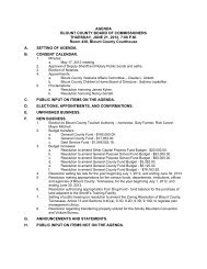
Subdivision Regulations - Blount County Government
Subdivision Regulations - Blount County Government
Subdivision Regulations - Blount County Government

Create successful ePaper yourself
Turn your PDF publications into a flip-book with our unique Google optimized e-Paper software.
9-01-06<br />
Floodway: The channel of the watercourse and those portions of the<br />
adjoining floodplain which are reasonably required to provide for the<br />
passage of flow from the regulatory flood (the 100-year Flood). This area<br />
must be left unobstructed in order to preserve the flood- carrying capacity<br />
of the stream and its floodplain without appreciably increasing the height<br />
of the floodwaters.<br />
Floodway Fringe: That part of the floodplain located between the<br />
floodway and the designated outline of the 100-year Flood, which would<br />
be covered by floodwaters of the 100-year Flood.<br />
National Flood Insurance Program (NFIP) Certification: The standards,<br />
rules and regulations governing the construction and development within a<br />
flood zone as identified on Flood Insurance Rate Maps for <strong>Blount</strong> <strong>County</strong>,<br />
Tennessee unincorporated. Specific regulations apply to all structures<br />
built within a floodplain when a county is participating in the National<br />
Flood Insurance Program by adopting a local Floodplain Zoning<br />
Ordinance. Compliance with the <strong>Blount</strong> <strong>County</strong> Floodplain Zoning<br />
Resolution, as adopted September 1 st , 2000 is administered by the <strong>Blount</strong><br />
<strong>County</strong> Building Commissioner. Certification that a particular structure is<br />
located outside or elevated above the floodplain is required for a building<br />
permit in areas identified on the Flood Rate Insurance Maps for <strong>Blount</strong><br />
<strong>County</strong>. Certification is the responsibility of the owner to hire a qualified<br />
independent professional engineer to determine the minimum floor<br />
elevation to be above the floodplain as specified in the <strong>Blount</strong> <strong>County</strong><br />
Floodplain Zoning Resolution. Any alteration of the floodplain itself,<br />
including cutting, filling, grading or other activities must be in compliance<br />
with the NFIP and the <strong>Blount</strong> <strong>County</strong> Floodplain Zoning Resolution. (see<br />
the <strong>Blount</strong> <strong>County</strong> Floodplain Zoning Resolution).<br />
Regulatory Flood: A large flood selected for regulatory purposes and a<br />
basis for floodplain management. The 100-year Flood is the regulatory<br />
flood or base flood and there are no flood restrictions outside its limit. The<br />
10-year Flood statistically has a one-percent chance of occurring each<br />
year.<br />
Frontage: That line of a lot abutting on a road, street or lane that is ordinarily<br />
regarded as the front of the lot, but it shall not be considered as the ordinary side<br />
of a corner lot. A corner lot shall have frontage on both intersecting roads with no<br />
reserve strips.<br />
Grade: Grade is the slope of a road, street, or other way (or ground),<br />
specified in percentage terms (%). Grade is calculated by the percentage that<br />
the horizontal distance is to the vertical rise that occurs within the horizontal<br />
distance; the rise (height) divided by the run (length) in percentage terms.<br />
11