

Mangrove biodiversity survey south of the Onilahy River - Frontier ...
Mangrove biodiversity survey south of the Onilahy River - Frontier ...
Mangrove biodiversity survey south of the Onilahy River - Frontier ...

Create successful ePaper yourself
Turn your PDF publications into a flip-book with our unique Google optimized e-Paper software.
CHAPTER FOUR: THE MANGORO<br />
Introduction<br />
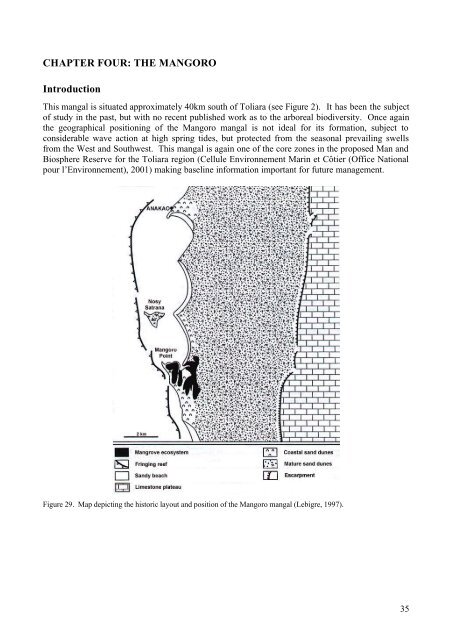
This mangal is situated approximately 40km <strong>south</strong> <strong>of</strong> Toliara (see Figure 2). It has been <strong>the</strong> subject<br />
<strong>of</strong> study in <strong>the</strong> past, but with no recent published work as to <strong>the</strong> arboreal <strong>biodiversity</strong>. Once again<br />
<strong>the</strong> geographical positioning <strong>of</strong> <strong>the</strong> Mangoro mangal is not ideal for its formation, subject to<br />
considerable wave action at high spring tides, but protected from <strong>the</strong> seasonal prevailing swells<br />
from <strong>the</strong> West and Southwest. This mangal is again one <strong>of</strong> <strong>the</strong> core zones in <strong>the</strong> proposed Man and<br />
Biosphere Reserve for <strong>the</strong> Toliara region (Cellule Environnement Marin et Côtier (Office National<br />
pour l’Environnement), 2001) making baseline information important for future management.<br />
Figure 29. Map depicting <strong>the</strong> historic layout and position <strong>of</strong> <strong>the</strong> Mangoro mangal (Lebigre, 1997).<br />
35


