San Juan Islands, WA - Puget Sound Lidar Consortium
San Juan Islands, WA - Puget Sound Lidar Consortium
San Juan Islands, WA - Puget Sound Lidar Consortium

You also want an ePaper? Increase the reach of your titles
YUMPU automatically turns print PDFs into web optimized ePapers that Google loves.
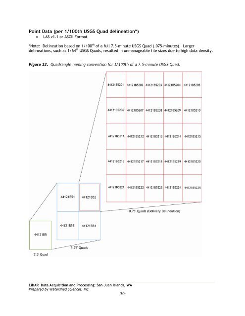
Point Data (per 1/100th USGS Quad delineation*)<br />
• LAS v1.1 or ASCII Format<br />
*Note: Delineation based on 1/100 th of a full 7.5-minute USGS Quad (.075-minutes). Larger<br />
delineations, such as 1/64 th USGS Quads, resulted in unmanageable file sizes due to high data density.<br />
Figure 12. Quadrangle naming convention for 1/100th of a 7.5-minute USGS Quad.<br />
LiDAR Data Acquisition and Processing: <strong>San</strong> <strong>Juan</strong> <strong>Islands</strong>, <strong>WA</strong><br />
Prepared by Watershed Sciences, Inc.<br />
-20-