Langham Park Developments Proposed Residential Development ...
Langham Park Developments Proposed Residential Development ...
Langham Park Developments Proposed Residential Development ...

Create successful ePaper yourself
Turn your PDF publications into a flip-book with our unique Google optimized e-Paper software.
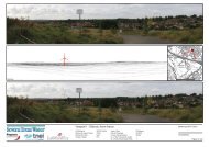
<strong>Proposed</strong> <strong>Development</strong> off Low Wood Road, Nottingham<br />
9 Sustainability<br />
9.1 Pedestrian Access<br />
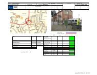
The proposed site is ideally located to take advantage of the excellent pedestrian links onto<br />
Low Wood Road, Apollo Drive and Nuthall Road. The existing connectivity between the<br />
areas north of the site, local to the Blenheim Industrial Estate, and south of the A610 is<br />
excellent and will be improved following the introduction of the new residential development<br />
The footway links along Low Wood Road vary in width between 2.6 metres and 3.4 metres<br />
and have dropped crossing points and tactile paving at strategic locations to maintain the<br />
accessibility to all areas north of Nottingham. The good quality, tar macadam shared<br />
footway/cycleways are provided on both sides of Low Wood Road and are illuminated to a<br />
good standard to ensure the pedestrian/cyclist route is safe and secure at all times.<br />
The proposed internal site footway link that will run from the site in an easterly direction, to<br />
the edge of the Phoenix <strong>Park</strong> site, will encourage residents to walk to Phoenix <strong>Park</strong> and<br />
catch a tram to most areas of Nottingham. As the crow flies, from the proposed site to<br />
Phoenix <strong>Park</strong> is only 300 metres and it is easily accessible and a sustainable way to travel<br />
for the residents and visitors.<br />
The Nuthall Railway Multi User Route runs the from the north west kerbline of the A6002 in<br />
a westerly direction to Kimberley, via Swingate. The route crosses the M1 Motorway via a<br />
footbridge with the Nottingham Business <strong>Park</strong> located to the east.<br />
The pedestrian linkages and connectivity into the Nuthall Route is excellent from the<br />
proposed site location with an excellent shared use footway/cycle link available along the<br />
west side of Low Wood Road (A6602) to the Hempshill Lane residential access and further<br />
north. The connectivity between the large areas of residential development to the<br />
immediate south of the Nuthall roundabout, the proposed site and the Nuthall Route is<br />
excellent with good, clear signage, markings and visibility. Pedestrian crossing islands and<br />
dropped crossing points along Low Wood Road have been strategically positioned to<br />
maximise pedestrian/cycle visibility when crossing that will potentially eliminate any risk of<br />
crossing and the possibility of pedestrian/car conflict.<br />
For further information on the local walking routes that are available to potential users of the<br />
mixed use development facility refer to the websites shown below;<br />
www.mapmywalk.com/find-walk/united+kingdom/nottinhghamuk<br />
http://walkit.com/cities/nottingham/<br />
9.2 Cycling Information<br />
From the Nottingham City Centre Cycle Map it is evident that a traffic-free cycle path runs<br />
from the north east corner of Camberley Road in a southern direction to the Nuthall Road<br />
Roundabout. A recommended cycling route also currently runs from the western corner of<br />
35