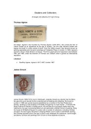
Wirral Part 4 - National Museums Liverpool
Wirral Part 4 - National Museums Liverpool
Wirral Part 4 - National Museums Liverpool

Create successful ePaper yourself
Turn your PDF publications into a flip-book with our unique Google optimized e-Paper software.
Table 57 Current Sub Type polygon count for each district (number)<br />
Sub Type Knowsley <strong>Liverpool</strong> St Helens Sefton <strong>Wirral</strong><br />
Airfield 0 18 0 5 0<br />
Allotment Gardens 3 30 23 15 37<br />
Ancient Woodland 0 2 4 0 5<br />
Artificial Water Body 13 8 84 15 16<br />
Barracks 0 2 0 0 1<br />
Business Park 21 6 16 19 10<br />
Camp 0 0 1 1 0<br />
Canal 1 4 0 7 1<br />
Cemetery 11 23 10 17 9<br />
Chemical Industry 0 0 0 1 16<br />
College/University Area 3 34 5 16 29<br />
Commercial Core 9 25 35 21 14<br />
Commercial Core (Office) 3 13 5 1 39<br />
Commercial Core (Retail) 108 153 232 398 321<br />
Council Housing 8 31 0 0 3<br />
Crematorium 0 0 0 1 0<br />
Cultural 17 39 37 39 72<br />
Curved Edged Woodland 0 0 3 0 1<br />
Deer Park 0 0 0 0 0<br />
Designed Parkland 0 2 0 0 0<br />
Detached Housing 363 144 836 1370 1368<br />
Disused Industry 4 2 20 3 3<br />
Dock and Port Related<br />
Industry 0 16 0 31 38<br />
Dunes 0 0 0 34 2<br />
Extraction Industry 1 0 5 1 1<br />
Farmhouse 89 7 187 138 20<br />
Forestry and Plantation 1 0 43 1 1<br />
Glass Industry 0 0 21 0 0<br />
Highrise Development 17 50 4 22 41<br />
Historic Route 0 0 0 2 2<br />
Hospital 10 28 15 34 44<br />
Industrial 98 154 189 269 53<br />
Institution 8 13 13 16 21<br />
327

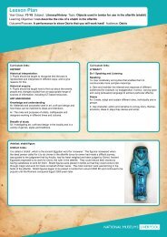
![Ancient Egypt trail [227kb .pdf] - National Museums Liverpool](https://img.yumpu.com/48998817/1/184x260/ancient-egypt-trail-227kb-pdf-national-museums-liverpool.jpg?quality=85)