
You also want an ePaper? Increase the reach of your titles
YUMPU automatically turns print PDFs into web optimized ePapers that Google loves.
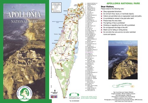
<strong>APOLLONIA</strong><br />
NATIONAL PARK<br />
03.08<br />
NATIONAL PARKS<br />
& NATURE RESERVES<br />
IN ISRAEL<br />
Legend<br />
INPA Site<br />
Nature Reserve &<br />
National Park Areas<br />
KM<br />
N<br />
INFORMATION SERVICE<br />
www.parks.org.il<br />
Tel: 09-9550929<br />
1. NIMROD'S FORTRESS N.P.<br />
2. HERMON STREAM N.R.<br />
(BANIAS)<br />
3. TEL DAN N.R.<br />
4. SENIR STREAM N.R.<br />
5. HORESHAT TAL N.P.<br />
6. IYYON STREAM N.R.<br />
7. HULA N.R.<br />
8. TEL HAZOR N.P.<br />
9. AKHZIV N.P.<br />
10. YEHI'AM FORTRESS N.P.<br />
11. BAR'AM N.P.<br />
12. AMUD STREAM N.R.<br />
13. KORAZIM N.P.<br />
14. CAPERNAUM N.P.<br />
15. BETIHA - BET ZAYDA N.R.<br />
16. YEHUDIYA N.R.<br />
17. GAMLA N.R.<br />
18. KURSI N.P.<br />
19. HAMAT TEVERYA N.P.<br />
20. ARBEL N.P.<br />
21. EN AFEQ N.R.<br />
22. ZIPPORI N.P.<br />
23. HAI-BAR CARMEL N.R.<br />
24. MT. CARMEL N.P.<br />
25. BET SHE'ARIM N.P.<br />
26. NAHAL ME'AROT N.R.<br />
27. DOR HABONIM N.R.<br />
28. TEL MEGIDDO N.P.<br />
(ARMAGEDDON)<br />
29. KOKHAV HAYARDEN N.P<br />
(BELVOIR) .<br />
30. MA'AYAN HAROD N.P.<br />
31. BET ALFA N.P.<br />
32. GAN HASHELOSHA N.P.<br />
(SAKHNE)<br />
33. BET SHE'AN N.P.<br />
34. TANINIM STREAM N.R.<br />
35. CAESAREA N.P.<br />
36. ALEXANDER STREAM N.P.<br />
37. SEBASTIA N.P.<br />
38. <strong>APOLLONIA</strong> N.P.<br />
39. YARQON N.P.<br />
40. EN PERAT N.R.<br />
41. JERUSALEM WALLS N.P.<br />
42. CASTEL N.P.<br />
43. AQUA BELLA N.P.<br />
(EN HEMED)<br />
44. SOREQ CAVE N.R.<br />
(STALACTITE CAVE)<br />
45. ASHQELON N.P.<br />
46. BET GUVRIN N.P.<br />
(MARESHA)<br />
47. QUMRAN N.P.<br />
48. ENOT ZUKIM N.R.<br />
(EN FASHKHA)<br />
49. HERODYON N.P.<br />
50. EN GEDI N.R.<br />
51. EN GEDI ANTIQUITIES N.P.<br />
52. MASADA N.P.<br />
53. TEL ARAD N.P.<br />
54. TEL BE'ER SHEVA N.P.<br />
55. ESHKOL N.P. (BESOR)<br />
56. MAMSHIT N.P. (KURNUB)<br />
57. SHIVTA N.P.<br />
58. BEN GURION'S<br />
BURIAL PLACE N.P.<br />
59. EN AVEDAT N.P.<br />
60. AVEDAT N.P.<br />
61. RAMON VISITOR CENTRE<br />
& BIO RAMON<br />
62. HAI-BAR YOTVATA N.R.<br />
(DESERT WILDLIFE)<br />
63. CORAL BEACH N.R.<br />
All proceeds will be used to<br />
protect nature and heritage<br />
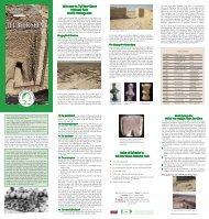
<strong>APOLLONIA</strong> NATIONAL PARK<br />
Dear Visitors,<br />
Please observe the following rules:<br />
Obey signposted directions.<br />
Do not harm flora, fauna, or inanimate objects.<br />
Visitors are permitted only on signposted roads and paths..<br />
It is prohibited to remain in the park after dark!<br />
Please keep the area clean.<br />
The lighting of fires is prohibited!<br />
Climbing or rappelling from the cliff is prohibited.<br />
Do not approach the edge of the cliff.<br />
Watch out for falling or rolling stones.<br />
Do not climb the ruins and do not enter restricted<br />
rooms and spaces.<br />
Havea plesentvisit<br />
Text: Avivit Gera and Yaakov Shkolnik<br />
English translation: Miriam Feinberg Vamosh<br />
Aerial photography: Albatross<br />
Photograph of Crusader bowl: Pavel Shergo<br />
Artist's rendering: Yura Duchovny<br />
Photographs of evening primrose and Crusader Fortress: INPA Archives<br />
Israel Nature and Parks Authority
WELCOME TO<br />
<strong>APOLLONIA</strong> NATIONAL PARK<br />
Apollonia is located on a cliff that stretches the length of the Sharon<br />
coast. The cliff is composed of kurkar (calcareous sandstone), red<br />
loam, and sand. At the top of the cliff, high above a small natural<br />
anchorage, people first settled some 2500 years ago. Thus began<br />
the fascinating history of Apollonia.<br />
Remains of settlements that existed here for 1800 years were uncovered<br />
by an expedition of the Tel Aviv Institute of Archaeology, headed<br />
by Israel Roll.<br />
The site is located in the within a national park, which the Israel Nature<br />
and Parks Authority has prepared for visitors.<br />
During the Roman period, from the first to the third centuries CE,<br />
Apollonia flourished and became a real city. A Samaritan community,<br />
and perhaps a Jewish community as well, lived in Apollonia during<br />
the Roman and Byzantine periods. During the fifth and sixth centuries<br />
of the Byzantine period, the city - at that time known as Suzussa<br />
- reached the height of its development, and became the main port<br />
city for the southern Sharon Plain. Its area covered 70 acres and it<br />
possessed wine and oil presses and a well-developed glass industry.<br />
A magnificent church stood in the southwestern part of the city at this<br />
time. The town was unfortified, and boasted a sophisticated water<br />
system based on collection of surface runoff in cisterns. During the<br />
Early Islamic period, from the seventh to the eleventh centuries CE, the<br />
city was ruled by the Muslims, who renamed it Arsuf and surrounded<br />
it with a wall in order to protect it from attack by the Byzantine fleet.<br />
At this time, the city was densely populated, but it shrank to 22 acres<br />
in size.<br />
Muslim attacks. He therefore transferred control of his Southern<br />
Sharon fiefdom, including Arsour, to the Hospitaller Knights, and a<br />
few hundred soldiers of this order took up residence in the fortress.<br />
In the spring of 1265 CE, Arsour was attacked by the Mameluke Sultan<br />
Bibars, at the head of a large and powerful army.<br />
The ensuing battle lasted for forty days until the city fell. When the<br />
Crusader soldiers holding out within the fortress saw that there was<br />
no hope, they agreed to surrender on condition that they be allowed<br />
to leave the city. Baibars agreed, however after entering the fortress,<br />
he forced its defenders to destroy and burn it, and took them prisoner.<br />
Thus the end came to the city of Arsour and its fortress, which had<br />
only stood for 24 years! The Mamelukes established a military outpost<br />
here that was eventually abandoned. The fortress was never again<br />
inhabited.<br />
Plant Life at Apollonia<br />
On the kurkar (calcareous sandstone) ridge near the sea on which<br />
Apollonia is perched, the main factors influencing the flora in this<br />
vicinity are strong winds bearing salt spray from the sea, the brittle<br />
nature of the limestone, and the sandy covering. The plants growing<br />
on the ridge are highly resistant to both the salt spray and sandy<br />
cover. Plants like the shrubby saltbush (Atriplex halimus), the lavender<br />
(Limonium virgatum), prickly drop-seed grass (Sporobolus virginicus),<br />
and the evening primrose (Oenothera drummondii) flourish here.<br />
A remnant of the outer fortifications of the Crusader Fortress<br />
The History of Apollonia<br />
The first settlement on this site was founded by the Phoenicians at<br />
the end of the sixth century BCE (the Persian period). The Phoenicians<br />
called the place Arsuf after one of their deities, Reshef, god of<br />
war and storms. The Phoenicians took advantage of the sea, fishing<br />
for snails from which they produced purple dye. They also used the<br />
natural cove as an anchorage for the ships that linked them to the<br />
world of the Greeks.<br />
During the Hellenistic period, between the fourth to the first centuries<br />
BCE, the residents of Arsuf identified Reshef with the god Apollo, and<br />
therefore renamed their city Apollonia. Later, the Coastal Plain, including<br />
Apollonia, was captured by the Hasmoneans. The historian Josephus<br />
Flavius mentions Apollonia as one of the coastal cities ruled by Hasmonean<br />
King Alexander Janneus (Antiquities of the Jews 13:4:395).<br />
A suggested reconstruction of the Crusader Fortress<br />
In 1099 CE, after the fall of Jerusalem to the Crusaders, they turned<br />
their attention to Arsuf but failed to conquer it. In the spring of 1101<br />
CE, Crusader King Baldwin I conquered the city with the aid of the<br />
Genoan fleet. The Crusaders renamed the city Arsour.<br />
In the mid-twelfth century CE, the entire area of the southern Sharon<br />
Plain was awarded to a noble Crusader family and Arsour became the<br />
regional capital. The Crusaders strengthened the walls of the former<br />
Muslim city, digging a dry moat around them for additional protection.<br />
In the wake of the Crusader defeat at the Battle of Hittin in 1187 CE,<br />
the city came under control of the Muslims for four years. The Crusader<br />
victory at the Battle of Arsur 1191 CE was to determine control of the<br />
Land of Israel for an additional one hundred years.<br />
In 1241 CE, the Crusaders, led by Jean d'Ibelin d'Arsour, began<br />
construction of a fortress in the northern part of the town. With his<br />
death in1258 CE, control of the city passed to his son, Belian the I st .<br />
Belian was unable to withstand the continuous pressure of Mameluke<br />
The evening primrose<br />
A forest of Mt. Tabor Oak (Quercus ithaburensis) once existed east of<br />
Apollonia. The destruction of the forests of the Sharon began in the<br />
Crusader period, when the wood was harvested for construction and<br />
fuel, and continued through the Ottoman period. Today, no vestige of<br />
the oak forest remains in the vicinity of Apollonia.