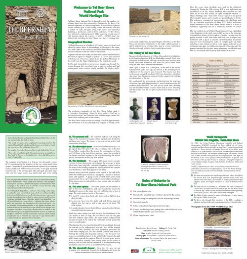
Tel Beer Sheva National Park
Tel Beer Sheva National Park
Tel Beer Sheva National Park

You also want an ePaper? Increase the reach of your titles
YUMPU automatically turns print PDFs into web optimized ePapers that Google loves.
TEL BEER SHEVA<br />
<strong>National</strong> <strong>Park</strong><br />
Welcome to <strong>Tel</strong> <strong>Beer</strong> <strong>Sheva</strong><br />
<strong>National</strong> <strong>Park</strong><br />
World Heritage Site<br />
<strong>Tel</strong> <strong>Beer</strong> <strong>Sheva</strong> <strong>National</strong> <strong>Park</strong> is located east of the modern city<br />
of <strong>Beer</strong> <strong>Sheva</strong> near the communities of Omer and <strong>Tel</strong> <strong>Sheva</strong>. The<br />
mound represents an urban ruling center from the biblical period<br />
in the southern part of the country, where excavations revealed<br />
a system of walls and gates along with public and residential<br />
buildings, a storehouse, water systems and more. <strong>Tel</strong> <strong>Beer</strong> <strong>Sheva</strong><br />
was declared a national park in 1986, covering a total area of<br />
180 dunams (about 44.5 acres). In 2005, UNESCO listed the<br />
biblical tels, including <strong>Tel</strong> <strong>Beer</strong> <strong>Sheva</strong>, as a World Heritage Site.<br />
Geographical Structure<br />
<strong>Tel</strong> <strong>Beer</strong> <strong>Sheva</strong> rises to a height of 307 meters above sea level, and<br />
about 20 meters above its surroundings. It is located in the center<br />
of a wide valley on the northern bank of the <strong>Beer</strong> <strong>Sheva</strong> streambed<br />
near its confluence with the Hebron streambed.<br />
Together with the Arad Valley, the <strong>Beer</strong> <strong>Sheva</strong> Valley, identified with<br />
the biblical region of “Negeb of Judah,” is a wide plain covered<br />
with loess soil. These two valleys divide the Judean Mountains in<br />
the north from the Negev Highlands and the Sinai in the south.<br />
In the past, streambeds served as main passageways through the<br />
region, because they were both easy to traverse on foot and had<br />
underground water sources readily available (by digging wells).<br />
A general view of <strong>Tel</strong> <strong>Beer</strong> <strong>Sheva</strong> from the observation tower<br />
The outer city gate (strata 5-4)<br />
to the south and the east, the desert begins. The history of <strong>Tel</strong> <strong>Beer</strong><br />
<strong>Sheva</strong> and the other settlements in the valley reflects periods in<br />
which settlement was possible either due to a more comfortable<br />
climate or through initiative by the central government.<br />
The History of <strong>Tel</strong> <strong>Beer</strong> <strong>Sheva</strong><br />
Remains of early settlement at <strong>Tel</strong> <strong>Beer</strong> <strong>Sheva</strong> attest to its habitation<br />
in the fourth millennium BCE (the Chalcolithic period). Finds from<br />
this period include sherds, although no architectural remains were<br />
found. Numerous settlement sites from this period were found<br />
along the <strong>Beer</strong> <strong>Sheva</strong> and Besor streambeds.<br />
After a gap of more than 2,000 years, at the end of the second<br />
millennium BCE (the Iron Age, also known as the Israelite period),<br />
settlement on the mound was renewed. The mound was then<br />
continuously occupied for about 500 years. Excavators identified<br />
nine strata from this period, representing the stages in the building<br />
and destruction of the site.<br />
Pits, used mainly for grain storage and dating from the beginning<br />
of the Iron Age settlement (Stratum 9), were found hewn into the<br />
southern slope of the hill. One such pit was made into a dwelling<br />
and was found to contain ceramic vessels and an oven. The deep<br />
well discovered near the city gate may have been hewn as early as<br />
this time.<br />
Over the years, stone dwellings were built in the settlement<br />
(Stratum 8). During the 10th century BCE, a new settlement was<br />
established at the site, whose dwellings were set close to each<br />
other in an oval belt around an open courtyard (Stratum 7).<br />
These dwellings were “four-room houses” typical of the period<br />
(three parallel spaces and a fourth one perpendicular to them).<br />
The settlement consisted of approximately 20 dwellings, and<br />
had an estimated population of about 100. Similar settlements<br />
found elsewhere in the <strong>Beer</strong> <strong>Sheva</strong> Valley attest to a wave of<br />
habitation, apparently due to a temporary increase in rainfall.<br />
The first fortified city at <strong>Tel</strong> <strong>Beer</strong> <strong>Sheva</strong> (Stratum 5) was established<br />
at the beginning of the ninth century BCE as one of the important<br />
administrative centers of the Kingdom of Judah. The city from this<br />
period featured a solid, four-meter-wide wall, and its slopes were<br />
reinforced with a glacis (a smooth, slanted structure to prevent<br />
attackers from mounting the walls). A complex gate was built,<br />
including a main entrance with an outer square protected by an<br />
additional outer gate. In addition to segments of the city-wall, this<br />
stratum revealed the city gate, water system and a residential area.<br />
The city was rebuilt after its partial destruction (Stratum 4).<br />
Table of Strata<br />
Period/Stratum Date Type of settlement<br />
Early Arab 7th-8th centuries CE Fortress<br />
Roman 2nd-3rd centuries CE Fortress<br />
Herodian<br />
1st century BCE -1st<br />
century CE<br />
Fortress<br />
Hellenistic 3rd -2nd centuries BCE Temple<br />
Persian 5th-4th centuries BCE Fortress and storage pits<br />
Iron Age –<br />
Stratum 1<br />
Iron Age –<br />
Stratum 2<br />
Iron Age –<br />
Stratum 3<br />
Iron Age –<br />
Stratum 4<br />
Iron Age –<br />
Stratum 5<br />
Iron Age –<br />
Stratum 6<br />
Iron Age –<br />
Stratum 7<br />
Iron Age –<br />
Stratum 8<br />
Iron Age –<br />
Stratum 9<br />
Beginning of 7th century<br />
BCE<br />
8th century BCE<br />
8th century BCE<br />
9th century BCE<br />
9th century BCE<br />
9th century BCE<br />
Aborted attempt at<br />
reestablishment<br />
Administrative city<br />
– casemate wall<br />
Administrative city<br />
– casemate wall<br />
Administrative city<br />
– solid wall<br />
Administrative city<br />
– solid wall<br />
Work camp of<br />
Stratum 5 city<br />
The moderate topography of the <strong>Beer</strong> <strong>Sheva</strong> Valley made it<br />
a convenient throughway – from the Arava and the Dead Sea to<br />
the Mediterranean, and from the Sinai and the Negev toward the<br />
central and northern parts of the country.<br />
The <strong>Beer</strong> <strong>Sheva</strong> Valley receives an average rainfall of approximately<br />
200 millimeters. In it are cultivated areas irrigated by rainfall, while<br />
A pillar figurine with<br />
a stylized face, Stratum 2<br />
A female figurine,<br />
Stratum 2<br />
A stone incense altar<br />
from the Iron Age<br />
10th century BCE<br />
12th-11th centuries BCE<br />
12th century BCE<br />
Enclosed settlement<br />
Pits and first dwellings<br />
Settlement of pits and<br />
huts<br />
Chalcolithic 4th millennium BCE Sherds, settlement<br />
Some scholars link the earthquake that destroyed <strong>Beer</strong> <strong>Sheva</strong> to the<br />
one mentioned in the Book of Amos:<br />
“The words of Amos...who prophesied concerning Israel in the<br />
reigns of Kings Uzziah of Judah and Jeroboam son of Joash of Israel,<br />
two years before the earthquake (Amos 1:1)<br />
The prophet Amos also denounced the temple built at <strong>Beer</strong> <strong>Sheva</strong>:<br />
“Those who swear by the guilt of Samaria, saying ‘as your god lives,<br />
Dan,’ and ‘as the way to <strong>Beer</strong>sheba lives’ – they shall fall to rise no<br />
more” (Amos 8:14).<br />
The transition from Stratum 4 to Stratum 3 in the eighth century<br />
BCE is manifested by the alteration of the city’s entire fortification<br />
system: The solid wall was dismantled and replaced by a casemate<br />
wall (a double wall within which are rooms). A new gate was built<br />
over the ruins of the previous gate. The outer gate was done away<br />
with, and the water system was rebuilt after part of its ceiling<br />
The campaign of Sennacherib, king of Assyria, is mentioned in 2 Kings<br />
and in Sennacherib’s Prism, dating from 689 BCE. The inscription<br />
on the prism includes a detailed description of Sennacherib’s third<br />
campaign to the land of Israel in 701 BCE. It also describes King<br />
Hezekiah’s surrender to Sennacherib:<br />
“As for Hezekiah the Judahite,... forty-six of his strong, walled cities,<br />
as well as the small towns in their area, which were without number,<br />
by leveling with battering-rams and by bringing up siege-engines, and<br />
by attacking and storming on foot, by mines, tunnels, and breeches,<br />
I besieged and took them... His cities, which I had despoiled, I cut<br />
off from his land, and...I gave (them)... I added to the former tribute,<br />
and I laid upon him the surrender of their land and impost... As<br />
for Hezekiah, the terrifying splendor of my majesty overcame him,<br />
and the Arabs and his mercenary troops which he had brought in to<br />
strengthen Jerusalem, his royal city, deserted him. In addition to the<br />
thirty talents of gold and eight hundred talents of silver, as well as his<br />
daughters, his harem, his male and female musicians, which he had<br />
brought after me to Nineveh, my royal city. To pay tribute and to<br />
accept servitude, he dispatched his messengers...”<br />
12. The casemate wall – The casemate wall was built along the<br />
edge of the mound. It consisted of two parallel walls divided by<br />
partitions into rooms. The rooms in the wall served as the back<br />
rooms of the dwellings.<br />
13. The observation tower – From the top of the tower you can<br />
get a good idea of the plan of the city, as well as a view of the <strong>Beer</strong><br />
<strong>Sheva</strong> Valley, modern <strong>Beer</strong> <strong>Sheva</strong>, and the communities of Omer<br />
and <strong>Tel</strong> <strong>Sheva</strong>. At the foot of the tower you can see the remains of<br />
the fortress (outlined in green on the map) built during the Roman<br />
period and restored in the Early Arab period.<br />
14. The storehouse – This roughly 600-square-meter complex<br />
consists of three storerooms, each divided by two rows of stone<br />
pillars into three long halls. Hundreds of pottery vessels found in<br />
the ruins of the building support the identification of the complex<br />
as a storehouse, a term that appears in the Bible.<br />
Various items and food products were stored in the side halls,<br />
while the middle space served as a passage for caravans of donkeys<br />
laden with supplies. A group of well-dressed stones were found<br />
incorporated into a wall of the northern corner of the storehouse.<br />
These stones were reconstructed as a four-horned altar (see station<br />
1 – the altar).<br />
15. The water system – The water system was established as<br />
part of the city’s fortifications, and was intended to ensure the<br />
inhabitants’ access to the water reservoir within the city in time of<br />
siege. The water system consists of three parts:<br />
1) A shaft 17 meters deep lined with stones with a flight of steps<br />
along its sides.<br />
2) A reservoir, hewn into the chalk rock and thickly plastered,<br />
divided into five spaces, with a total capacity of about 700<br />
cubic meters.<br />
3) A winding feeder channel that led flood waters from the Hebron<br />
streambed into the reservoir.<br />
While the water system was built to serve the inhabitants of the<br />
city mainly in time of siege, the well hewn near the city gate<br />
met their ordinary daily needs. The water system collapsed and<br />
became blocked at the end of the Hellenistic period, apparently<br />
due to an earthquake.<br />
After taking in the view from the top of the stepped shaft, descend<br />
the stairway to the underground reservoir. You will be amazed<br />
at the size of the chambers, the thick plaster that prevented the<br />
water from seeping out, and the ancient support walls built to<br />
hold up the ceiling after its partial collapse. Take the stairs over<br />
a narrow and sliding channel to the wide feeder channel, through<br />
which water entered the reservoir. The exit from the water system<br />
is via a secondary opening hewn during work on the system in<br />
antiquity and blocked after its completion. It was reopened during<br />
excavations and now serves as an exit from the mound.<br />
16. The stone-built channel – Near the exit, you can see<br />
a portion of a stone-built channel that led flood water from the<br />
Hebron streambed to the reservoir feeder channel.<br />
<br />
<br />
<br />
<br />
<br />
<br />
<br />
A seal with a Southern Arabian inscription,<br />
attesting to <strong>Beer</strong> <strong>Sheva</strong>’s function as an<br />
international commercial way station during<br />
the Iron Age<br />
Rules of Behavior in<br />
<strong>Tel</strong> <strong>Beer</strong> <strong>Sheva</strong> <strong>National</strong> <strong>Park</strong><br />
Use marked paths only.<br />
Do not enter areas that have not been opened to the public.<br />
Do not damage the antiquities and the archaeological finds.<br />
Do not climb walls.<br />
Follow instructions of park personnel and signs.<br />
Faucets for drinking water, garbage bins and toilets have been<br />
installed at the site for your convenience.<br />
Please keep the area clean.<br />
Text: Professor Ze’ev Herzog Editing: Dr. Tsvika Tsuk<br />
Translation: Miriam Feinberg Vamosh<br />
Map: Avigdor Orgad and Yura Smertenko<br />
Photographs: <strong>Tel</strong> <strong>Beer</strong> <strong>Sheva</strong> Expedition; INPA Archive<br />
Cover photograph: The entrance shaft to the water system<br />
January 2008<br />
World Heritage Site<br />
Biblical <strong>Tel</strong>s: Megiddo, Hazor, <strong>Beer</strong> <strong>Sheva</strong><br />
IIn 2005, the United Nations Educational Scientific and Cultural<br />
Organization (UNESCO) inscribed the three biblical tels of Hazor,<br />
Megiddo and <strong>Beer</strong> <strong>Sheva</strong> as World Heritage Sites of outstanding universal<br />
significance. These mounds, mentioned frequently in the Bible, were<br />
chosen out of approximately 200 tels as the best examples of cities from<br />
the time of the Bible. The intensive archaeological excavations carried<br />
out at these mounds have produced exciting finds that shed light on<br />
the history of the various peoples of the land of Israel in general, and<br />
the history of the people of Israel in particular. Among the impressive<br />
archaeological vestiges are gates, walls, temples, storehouses, stables and<br />
water systems.<br />
UNESCO determined six criteria for inscription, even one of which<br />
(other than Criterion 6) is enough to place a site on the World Heritage<br />
List. The biblical mounds were inscribed after having met four criteria,<br />
as follows:<br />
2 The three tels represent an interchange of human values throughout<br />
the ancient Near East, forged through extensive trade routes and<br />
alliances with other states, and manifest in building styles that merged<br />
Egyptian, Syrian and Aegean influences to create a distinctive local<br />
style.<br />
3 The three tels are a testimony to civilizations that have disappeared<br />
– that of the Canaanite cities of the Bronze Age and the biblical cities<br />
of the Iron Age. These cultures manifest themselves in town planning,<br />
fortifications, palaces, and water-collection technologies.<br />
4 The biblical cities exerted a powerful influence on later history<br />
through the biblical narrative.<br />
6 The three tels, through their mentions in the Bible, constitute a<br />
religious and spiritual testimony of outstanding universal value.<br />
Photographs from other INPA World Heritage Sites:<br />
<strong>Tel</strong> Megiddo - the Canaanite cultic site<br />
Ceramic vessels found in the storehouses<br />
*3639<br />
INFORMATION SERVICE<br />
All proceeds will be used to<br />
protect nature and heritage<br />
<strong>Tel</strong> Hazor - buildings from the Israelite period<br />
<strong>Tel</strong> <strong>Beer</strong> <strong>Sheva</strong> <strong>National</strong> <strong>Park</strong> <strong>Tel</strong>. 08-6467286
The head of a figurine, Stratum 2<br />
collapsed. Extensive storehouses were built near the gate and next<br />
to the water system. Such drastic changes may be interpreted as the<br />
result of the destruction of the Stratum 4 city in an earthquake.<br />
The Stratum 3 city was restored in Stratum 2. A governor’s palace was<br />
built at this time, the city’s temple was dismantled and the stones of its<br />
altar were buried in one of the storehouse walls. A unique large house<br />
with deep cellars dubbed the “Basement House” was also erected at<br />
this stage. The destruction of the Stratum 2 city in a great conflagration<br />
has been dated to the end of the eighth century BCE, and was<br />
apparently connected to ruination by King Sennacherib of Assyria in<br />
701 BCE. The exposed remains of Stratum 2 were preserved at the<br />
site and comprise the major sites along the touring route.<br />
After the destruction, a partial and unsuccessful attempt was made<br />
to rebuild the city (Stratum 1). However it was soon abandoned and<br />
remained in ruin until the beginning of the Persian period.<br />
During the Persian period (fifth to fourth centuries BCE), a small<br />
fortress was built at the site. Alongside it, dozens of pits were dug to<br />
store wheat supplies for soldiers and mainly fodder for horses.<br />
During the Hellenistic period (third to second centuries BCE), a<br />
temple was built here. The stone base of its altar can be seen next<br />
to the Basement House.<br />
During the time of Herod the Great and his successors (first century<br />
BCE to the first century CE), a large fortress containing a bathhouse<br />
was built on the mound. Two plastered pools belonging to this<br />
fortress can still be seen.<br />
The last structure to be built on the mound was a diamond-shaped<br />
fortress built during the Roman period (second to third centuries<br />
CE). It was restored during the Early Arab period (seventh to eighth<br />
centuries CE).<br />
During the Roman and Byzantine periods the main settlement<br />
moved westward and a large city was established in the area of<br />
modern <strong>Beer</strong> <strong>Sheva</strong>. That city was later abandoned, and rebuilt<br />
around 1900 by the Turks as an administrative center, where the<br />
present-day old city (the old <strong>Beer</strong> <strong>Sheva</strong> town center) now stands.<br />
During World War I, <strong>Beer</strong> <strong>Sheva</strong> served as a staging ground for<br />
the Ottoman Turkish army, which was preparing to attack the<br />
Suez Canal. When the British Army advanced from Egypt<br />
to Palestine, the Turks fortified <strong>Tel</strong> <strong>Beer</strong> <strong>Sheva</strong> and placed a<br />
cannon position on it. An infantry unit of the Australian and<br />
New Zealand Army Corps (ANZAC) conquered the site on<br />
October 31, 1917.<br />
The History of Research<br />
Excavations at <strong>Tel</strong> <strong>Beer</strong> <strong>Sheva</strong> were carried out from 1969 to 1976 by<br />
the <strong>Tel</strong> Aviv University Institute of Archaeology, under the direction of<br />
Professor Yohanan Aharoni, and in its last season under the direction<br />
of Professor Ze’ev Herzog. After the continuity and character of<br />
the strata were clarified, the expedition set the goal of uncovering<br />
large segments of the last city on the mound (Stratum 2). Remains<br />
Artist’s rendering of the Stratum 2 city<br />
from this<br />
stratum serve as a prime source for studying and analyzing the plan<br />
of the Israelite city.<br />
From the moment excavation began, conservation of the remains<br />
was taken into consideration and many activities were undertaken<br />
to preserve the vestiges of the mud-brick walls uncovered. This<br />
work was funded mainly by the <strong>Beer</strong> <strong>Sheva</strong> Municipality.<br />
In 1990, extensive restoration was carried out at <strong>Tel</strong> <strong>Beer</strong> <strong>Sheva</strong><br />
by the <strong>National</strong> <strong>Park</strong>s Authority, now the Israel Nature and<br />
<strong>Park</strong>s Authority (INPA), with the assistance of the Negev Tourism<br />
Development Administration. The work was done under the<br />
supervision of site director Eliyahu Even Haim.<br />
The walls beneath the line appearing on many of the structures<br />
are original, and were found in their entirety during the<br />
excavation. Everything above the line was reconstructed from<br />
stones found in the rubble, or was rebuilt out of mud-brick.<br />
The reconstruction plan and the lookout tower were designed<br />
by the architect Lawrence A. Belkin with the assistance of Ze’ev<br />
Herzog as archaeological consultant.<br />
Excavation on the mound was renewed from 1993 to 1995 by<br />
Professor Ze’ev Herzog in order to complete the uncovering of the<br />
water systems. During the first stage, directed by Dr. Tsvika Tsuk,<br />
the well near the city gate was excavated. It was hewn to a great<br />
depth; the water level was found 69 meters below the surface.<br />
During the second stage, directed by Ido Ginaton, the water system<br />
in the northeastern part of the city was revealed in its entirety. An<br />
impressive, stepped shaft some 17 meters deep was preserved<br />
almost to the top, and a plastered water system was uncovered<br />
intact as it was abandoned over 2,000 years ago. Following the<br />
completion of extensive conservation work together with experts<br />
from the Israel Antiquities Authority, the INPA opened the water<br />
system to the public in 2003.<br />
The Tour of the Site<br />
The visit begins at the altar square, continues in a loop route up to<br />
the city gate and the adjacent well and passes through the gate. It<br />
takes in interesting sites on the way to the observation tower, and<br />
ends at the exit from the water system. The visit takes about one<br />
hour. A complex of mud-brick rooms has been built at the base<br />
of the mound where groups can enjoy experiential activities by<br />
reservation and at an additional charge.<br />
The main gate leads to the city, where most of the structures you can<br />
see belong to Stratum 2 (see the table), which extended across the<br />
top of the mound over an area of about 11 dunams (2.7 acres). The<br />
city’s oval shape, suited to the contour of the hill, was expanded<br />
eastward to include the entrance shaft of the water system.<br />
Adjacent to the casemate wall enclosing the city are dwellings<br />
and a peripheral street. The dwellings were made out of sun-dried<br />
mud-bricks that were laid on a foundation of field stones. Urban<br />
planning reveals a combination of homes and administrative<br />
structures that attest to the city’s use by administrative officials<br />
of the Negev region during the period of the Judean monarchy.<br />
Approximately 300 people lived in 70 dwellings, including the<br />
families of military commanders, tax-collectors, commerce officials<br />
and priests.<br />
1. The altar – In one corner of the square stands a reconstructed<br />
replica of the large, sacrificial four-horned altar whose stones were<br />
discovered incorporated into a storehouse wall. The original altar is<br />
on display at the Israel Museum in Jerusalem.<br />
King Hezekiah’s reform is documented, among other places, in<br />
2 Kings:<br />
“In the third year of King Hoshea son of Elah of Israel,<br />
Hezekiah son of King Ahaz of Judah became king... He did<br />
what was pleasing to the Lord, just as his father David had<br />
done. He abolished the shrines and smashed the pillars and<br />
cut down the sacred post” (2 Kings 18:1-4)<br />
The altar shows that the city had a cultic structure, built in the<br />
framework of the religious administration of the Judean monarchy.<br />
Its dismantling and burial attest to a change in the kingdom’s ritual<br />
customs. Based on the dating of Stratum 2 at the end of the eighth<br />
century BCE, the abolishment of the cultic site was connected to<br />
the religious reform initiated by King Hezekiah of Judah according<br />
to the Bible. (The temple discovered at <strong>Tel</strong> Arad was also done<br />
away with in this reform.)<br />
2. The outer gate – The outer gate, in use in strata 5 and 4,<br />
consisted of a stone foundation topped with mud-bricks. The<br />
reconstruction line is clearly marked.<br />
3. The well – The well is located to the left of and outside the<br />
gate. Hewn to a great depth, its water served the inhabitants of<br />
the city as well as commercial and military caravans that passed<br />
this way.<br />
Some scholars suggest that the well at the gate is connected to the<br />
one mentioned in Genesis in the story of the alliance of Abraham<br />
and Isaac with the Philistines at <strong>Beer</strong> <strong>Sheva</strong>. The oath sworn at the<br />
well gave the city its name (sheva means “seven” and “oath” in<br />
Hebrew):<br />
“Abraham took sheep and oxen and gave them to Abimelech,<br />
and the two of them made a pact... He replied, ‘You are to<br />
accept these seven ewes from me as proof that I dug this<br />
well. Hence the place was called <strong>Beer</strong>sheba, for there the two<br />
of them swore an oath. When they had concluded the pact at<br />
<strong>Beer</strong>sheba, Abimelech and Phicol, chief of his troops, departed<br />
and returned to the land of the Philistines” (Gen. 21:27-32).<br />
4. Drainage channel – This is marked by stone coverings<br />
incorporated into the pavement that leads from the main gate to<br />
the outer gate. The channel led surplus rain water away from the<br />
city to prevent damage to the walls. The channel exited via the<br />
outer gate, and apparently led to the water reservoir on the slope.<br />
5. The main gate – Two high, thick-walled towers protected<br />
the front of the gate. On either side of the gate were chambers.<br />
Plastered benches found in one of these chambers served<br />
as seats for merchants or royal representatives. Currently the<br />
remains consist of two different gate structures: To the left of the<br />
passageway, you can see the left side of the strata 3-2 gate, while<br />
on the right side and at a lower level, is the right side of the earlier<br />
gate (strata 5-4). Benches erected in one of the gate rooms served<br />
the elders, merchants, judges or prophets while conducting their<br />
activities in the gate.<br />
6. The city square – This was the only open space within the city.<br />
All streets led to this central plaza, where the local market could be<br />
held or the inhabitants could gather. In the Bible, such an entrance<br />
square is called a “square of the city gate.”<br />
7. The peripheral street – The peripheral street surrounded<br />
the oval outline of the city and was parallel to the wall. It was<br />
approximately two meters wide. Additional streets were also found,<br />
which crossed the city in a straight line through the center.<br />
8. “The governor’s palace” – This structure is outstanding in<br />
its size and plan, and is identified with the biblical house of the<br />
“city prefect” or the governor. It featured an entrance corridor and<br />
two paved halls which comprised the ceremonial wing, as well as<br />
residential units, a kitchen and a storeroom.<br />
9. The early street – In the center of the peripheral street, you will<br />
notice an area dug to a depth of about three meters, in which the<br />
route of the earlier street was found. This find shows that the plan<br />
of the city was maintained from its beginnings in Stratum 5 until the<br />
end of Stratum 2. Further on, to the left you will see the remains of<br />
a plastered pool from the Herodian period.<br />
10. The Basement House – Further along, you will see a building<br />
on the right whose foundations are four meters below the surface,<br />
two of whose rooms apparently served as cellars. Professor Aharoni<br />
believed that the unusual depth of the foundations was created<br />
during the cultic reform by the dismantling of the temple that stood<br />
here.<br />
11. The residential quarter – To the left of the street you will<br />
see the residential area. The dwellings in this part of the city are<br />
integrated into the casemate city wall and were built in a uniform<br />
fashion. They included three or four rooms: an anteroom that<br />
apparently served as a courtyard and a cooking area and had steps<br />
leading to the roof; two storage rooms (one of which was apparently<br />
used for animals) divided by a row of columns; and a back room<br />
that was part of the casemate wall and served as a bedroom.<br />
Artist’s rendering of the enclosed settlement of Stratum 7<br />
The four-horned altar, reconstructed from stones found buried<br />
in the storehouse<br />
The storehouse