Geodetic education in Albania.pdf - BALGEOS
Geodetic education in Albania.pdf - BALGEOS
Geodetic education in Albania.pdf - BALGEOS

You also want an ePaper? Increase the reach of your titles
YUMPU automatically turns print PDFs into web optimized ePapers that Google loves.
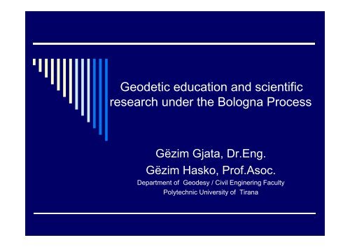
<strong>Geodetic</strong> <strong>education</strong> and scientific<br />
research under the Bologna Process<br />
Gëzim Gjata, Dr.Eng.<br />
Gëzim Hasko, Prof.Asoc.<br />
Department of Geodesy / Civil Eng<strong>in</strong>er<strong>in</strong>g Faculty<br />
Polytechnic University it of Tirana
Introduction<br />
♣ Why this presentation<br />
ti - One of Balgeos II Project objectives devoted<br />
new researchers <strong>in</strong> Balcan Countries.<br />
- Developments <strong>in</strong> Geodesy and an optimal<br />
geodetic <strong>education</strong><br />
– key role for prepar<strong>in</strong>g and<br />
progress of new researchers<br />
- What offers the Bologna System for new<br />
researchers <strong>in</strong> geodesy
Application of Bologna System and its qualities<br />
BS actually is applied <strong>in</strong> all our universities<br />
BS seems to be very important <strong>in</strong> the high <strong>education</strong> even <strong>in</strong> Geodesy<br />
BS give possibility to:<br />
- Cooperation<br />
- Integration of “ National programme and politics’ with those of regional and <strong>in</strong>ternational <strong>in</strong>stitutions.<br />
- Mobility of students and researchers;<br />
- International advanced study programme:<br />
- Cooperation, Exchang<strong>in</strong>g and Mobility of academic Staff;<br />
Bologna Process is seen as a tool to face up:<br />
GLOBALISATION<br />
INTERNATIONALISATION<br />
EUROPIANISATION<br />
Conclusion: Qualities as well as the Model Bologna System almost applied <strong>in</strong> our country seems to be very<br />
important for balcanic country <strong>in</strong> order to achive above mention objectives;<br />
In this context Bologna Process dictate <strong>in</strong> obligatory way that high <strong>education</strong> Programme dur<strong>in</strong>g the<br />
designation to take <strong>in</strong>to account the unification not only at the national level, but more wide at regional as<br />
well as <strong>in</strong> european. Also this model is structured <strong>in</strong> three levels, which are foreseen to realise the<br />
<strong>education</strong> at any disipl<strong>in</strong>e (even geodesy and survey<strong>in</strong>g) at three level where scientific knowledge and<br />
developments come to <strong>in</strong>crease from level to level.<br />
So, <strong>in</strong> the case of geodesy and survey<strong>in</strong>g:<br />
At the first level (3-year) : Survey<strong>in</strong>g and Eng<strong>in</strong>eer<strong>in</strong>g (BSc<br />
At the second Level (2 year): Scientific Subjects and special eng<strong>in</strong>eer<strong>in</strong>g g (Msc)<br />
At the third Level (Doctorate): Oriented Scientific Multisubjects, latest scientific developments<br />
as well as <strong>in</strong>dipendent scientific research;
Developments <strong>in</strong> Geodesy<br />
<br />
<br />
<br />
High Education <strong>in</strong> geodesy and survey<strong>in</strong>g is realized now under the<br />
conditions of Bologna Systems.<br />
Actually the compilation and build<strong>in</strong>g the Teach<strong>in</strong>g Programmes based <strong>in</strong><br />
the Bologna Model, need to take <strong>in</strong>to account the developments <strong>in</strong> the<br />
various displ<strong>in</strong>es of geodesy and survey<strong>in</strong>g.<br />
S<strong>in</strong>ce more 20 years geodesy, survey<strong>in</strong>g, etc. have realized a high and a<br />
modern developments than ever due to the <strong>in</strong>fluence of :<br />
1. Developments <strong>in</strong> technology (From opto mechanical to<br />
electronic and digital <strong>in</strong>struments);<br />
2. Space Age ( GPS technology and needs of space disipl<strong>in</strong>es);<br />
3. Digital Age (Digital Satellite and Photogrammetric scann<strong>in</strong>g);<br />
4. Technology of Information (GIS and geo<strong>in</strong>formation systems);<br />
All this modern developments are now a reality <strong>in</strong> the <strong>education</strong> of surveyors<br />
and geodesists;
Developments <strong>in</strong> geodesy<br />
Task of build<strong>in</strong>g of a geodetic and survey<strong>in</strong>g Currucula seems to be very important process<br />
and ask for care. This ask for f<strong>in</strong>d<strong>in</strong>ig the right ratios beetwen e Basics, traditional t a geodesy<br />
, modern Geodesy, Eng<strong>in</strong>eer<strong>in</strong>g, g Technology of Information and other displ<strong>in</strong>es.<br />
Why<br />
<strong>Geodetic</strong> Education Currucula seems to be a complicated model due to the fact:<br />
-It should be taken <strong>in</strong>to account Bologna systems with its characteristics (three levels).<br />
- that geodesy has a very strong scientific frame and basics;<br />
- that eng<strong>in</strong>eer<strong>in</strong>g geodesy, urban and cadastral geodesy are becom<strong>in</strong>g very neccesary, to<br />
map, to build geometry where through its qulitatve measurments and equpiments makes<br />
possible the construction with very high technical qualities.<br />
- that developments of Technology of <strong>in</strong>formation and Space Age and their impacts <strong>in</strong><br />
geodetic and survey developments ask for taken <strong>in</strong>to account the teach<strong>in</strong>g fast of<br />
traditional of geodesy and survey<strong>in</strong>g. This due to fact that t <strong>in</strong>to those are the geometric<br />
model as well as pr<strong>in</strong>ciple, which are <strong>in</strong>corporated <strong>in</strong> the equipments and hardware,<br />
through the modules, programmes and sofware, which to be understand<strong>in</strong>g needs the<br />
mentioned geometric model, geodetic pr<strong>in</strong>ciple, geodetic and survey<strong>in</strong>g methods to be<br />
know manually.<br />
- that the ma<strong>in</strong> scientific objectives of geodesy rema<strong>in</strong> aga<strong>in</strong> and they are a very real field<br />
for scientific research by us<strong>in</strong>g the new technolgies as well the the achivements of the<br />
various methods applied by the modern geodesy; (e.g. geoid, geod<strong>in</strong>amic stady of<br />
surface of earth, study of seal<strong>in</strong>e, stady of satelite reference network, deformations,<br />
accurasy and quality of measurments and models ,etc,) Of course those subjects should<br />
be <strong>in</strong>cluded <strong>in</strong>to high levels of geodetic currucula.
Technology<br />
1. Global Position<strong>in</strong>g System
Technology<br />
2. Optomechanical
Bologna Model- Education- Research<br />
A qualitative ti high h <strong>education</strong> is a prelem<strong>in</strong>ary condition for<br />
prepar<strong>in</strong>g p the specialist with high expertize as well as to<br />
develop the scientfic research.<br />
How is this <strong>education</strong> <strong>in</strong> <strong>Albania</strong>, what the Bologna System<br />
offer for the research and new reserchers<br />
In order to answer those queston, the applied Bologna System<br />
<strong>in</strong> our Department its characteristics and chellenges are<br />
given <strong>in</strong> follow<strong>in</strong>g:<br />
Bologna system was applied for the first time even <strong>education</strong> <strong>in</strong><br />
geodesy at 2005.<br />
Actually Department t of Geodesy is the only <strong>in</strong>stitution, which h is<br />
responsible for <strong>education</strong> <strong>in</strong> Geodesy and Survey<strong>in</strong>g <strong>in</strong><br />
<strong>Albania</strong>.
Bologna Model- Education- Research<br />
Department have n<strong>in</strong>e members, which teach various geodetic subjects <strong>in</strong> the branch of Geodesy<br />
as well as cover the topography, geomatics, eng<strong>in</strong>eer<strong>in</strong>g geodesy <strong>in</strong> the other branches of<br />
faculty as <strong>in</strong>: Archicture, Construction, Hidrotechnic, etc.<br />
The currucula is adopted accord<strong>in</strong>g to Bologna System Structure organised <strong>in</strong> three Levels:<br />
First Level - 3- years - Bechelor (DNP)<br />
Second Level - 2-years -<br />
Master (DND)<br />
Third Level - 3-year -<br />
Doctorate (PhD)<br />
This model (structure) <strong>in</strong> terms of <strong>education</strong> and science can be <strong>in</strong>terprete as:<br />
- First level of BM give the possibilty for <strong>education</strong> of the Surveyor Eng<strong>in</strong>eer;<br />
- Second level of BM aims to educate geodetic and surveyors eng<strong>in</strong>eers <strong>in</strong> high<br />
level by enter<strong>in</strong>g subjects with scientific elements as well as with the scientific<br />
developments <strong>in</strong> geodesy;<br />
- The third level of BM (doctorate) is forenseen that by pass<strong>in</strong>g one year deep<br />
and advanced <strong>education</strong> course to realise the produce of new researcher with<br />
the <strong>in</strong>dividual ability for scientific research.
Bologna Model- Education- Research
Bologna Model- Education- Research<br />
Information on Teach<strong>in</strong>g Program of Geodesy and Survey<strong>in</strong>g <strong>in</strong> UPT<br />
First Level Currucula Education was build up at 2005.<br />
Due to this first experience as well as the aims and objective of Bologna<br />
System, this currucula was improved last year (2008) with 22 subjects.<br />
Also the Second Level Currucula was built at 2008 with 14 Subjects<br />
This year (2009) the proposal for a doctorate programme with 10 subjects<br />
was build and is under the process of approval <strong>in</strong> the M<strong>in</strong>istry of Education .<br />
In follow<strong>in</strong>g the First and Second Teach<strong>in</strong>g programme are given:
Bologna Model- Education- Research
Bologna Model- Education- Research
Bologna Model- Education- Research<br />
Pr<strong>in</strong>ciples of build<strong>in</strong>g up Curruculas<br />
Two Teach<strong>in</strong>g gprogrammes presented are designed by taken <strong>in</strong>to account a model by 22<br />
subjects for First Level and 14 subjects for the Second Level. Dur<strong>in</strong>g designed by<br />
taken <strong>in</strong>to account the experience, expertize <strong>in</strong> Department as well as to realize<br />
the programmes with <strong>in</strong>ternal and solid l<strong>in</strong>ks, subjects were put <strong>in</strong>to by the follow<strong>in</strong>g<br />
logic:<br />
1. Mathematics I, II with various moduls to support: Mathematical geodesy, Last<br />
Square Theory, Cartography, Computer Programm<strong>in</strong>g, Photogrammetry.<br />
2. Physics with special chapters to support Satellite Geodesy (GPS), Sallite Image<br />
(RS), Modern geodetic technolgy.<br />
3. Programm<strong>in</strong>g of Geo –mathematical & graphical to support Geomatics, survey<strong>in</strong>g<br />
subjects, RS, photogrammetry, GIS and understand<strong>in</strong>g of all prefesional softwares<br />
<strong>in</strong> survey<strong>in</strong>g and Geodesy.<br />
4. Special attention was for eng<strong>in</strong>eer<strong>in</strong>g Geodesy, Cadaster and Evalutation of<br />
Immovable Property.<br />
5. Subjects <strong>in</strong> the second level to be at the level advanced with the scientific and<br />
j<br />
research elements.
Bologna Model- Education- Research<br />
Credits (ECTS) – an important standarts of evaluation <strong>in</strong> Bologna systems<br />
ECTS are an important standart <strong>in</strong> the Bologna systems, maybe the ma<strong>in</strong> standart which allowed to<br />
measure, evaluate and to realize the mobilty of students and staff..<br />
Ratio of destribution of them for each subjects <strong>in</strong>to parts of CSRT for Lesson, Sem<strong>in</strong>ar, Home Exercises,<br />
Projects, Field work is flexible.<br />
They together with programmes allowed to consider and to reflect <strong>in</strong> the expertize of lecturers and staff,<br />
qualification, situation of laboratories, eficiency for students, and optimisation of the activity of<br />
Department.<br />
In our case this was analyse carefully. What was f<strong>in</strong>d<strong>in</strong>g out <br />
- Need for qualification for new and modern subjects.<br />
- Lack of Laboratories (Only a small Laboratoiries i with 11 computers, some manuale photogrammetric<br />
t equipments, as well as a set of theodolites and levels equipments are available). No any TS! No Any<br />
GPS recivers! Less standart profesional software!<br />
- Privat sector (survey<strong>in</strong>g and GIS companies) should and were call to support teach<strong>in</strong>g.<br />
- Need for those technologies are becom<strong>in</strong>g very imperative.<br />
- Need for exchang<strong>in</strong>g experience, teach<strong>in</strong>g programmes <strong>in</strong> the level l regional and european.
Bologna Model- Education- Research<br />
Scientifc research and resercher<br />
Space from the Second Level to Doctorate Level under the Bologna process<br />
is the space for develop<strong>in</strong>g scientific research and produce the new<br />
researchers.<br />
Diploma of the second level is consider to have elements of the scientific<br />
researcher, which h will ask for a serious <strong>in</strong>volvement of qualified<br />
Lecturers.<br />
Scientific activities iti like Simposium, i Scientific meet<strong>in</strong>gs (almost now are<br />
applied) at level of Department and University and more wide <strong>in</strong> regional<br />
and european seems to be a very good way to <strong>in</strong>volve the new<br />
researcher.<br />
Developments of Modern Geodesy at all, geodetic studies problems at<br />
national and regional and more wide, <strong>in</strong>creas<strong>in</strong>g the quality of <strong>education</strong>,<br />
requare <strong>in</strong>creas<strong>in</strong>g the attention for a fast and a dynamic process of<br />
preparation p of the new researchers.
Bologna Model- Education- Research<br />
Researchers and Sourses for the scientic research<br />
As Bologna System (Doctorate Level) gives the new researchers the possibility for a modern<br />
theoretical <strong>education</strong>, it is of a very important po<strong>in</strong>t that theoretical achivement to be applied<br />
to solve the geodetic problems <strong>in</strong> all dimentions: <strong>in</strong> scientific part, eng<strong>in</strong>eer<strong>in</strong>g geodesy, <strong>in</strong><br />
apply<strong>in</strong>g of the various products which come from RS, GPS, Phoogrammetry,etc <strong>in</strong>to GIS,<br />
Geo<strong>in</strong>formation, study of geod<strong>in</strong>amics, the movements of seal<strong>in</strong>e, etc.<br />
Actually all these problematics are present even <strong>in</strong> <strong>Albania</strong>.<br />
- Developments of eng<strong>in</strong>eer<strong>in</strong>g <strong>in</strong>frastructure (Roads, transport, Urban Plann<strong>in</strong>g,<br />
Tourism, etc)<br />
E.G. Maunt<strong>in</strong>ous Highway Durres-Mor<strong>in</strong>a- Prisht<strong>in</strong>a, 4 l<strong>in</strong>es, two Tunels (5 km each).<br />
- Developments <strong>in</strong> documentation of Property and the property Marcet (Cadaster &<br />
Immovable Property) as well as legalisation of <strong>in</strong>formal constructions.<br />
E.G. Applied GPS Techniques, Orthophotos from Aeral Photograps; etc<br />
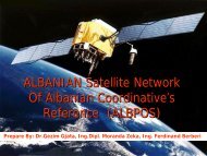
- Establish<strong>in</strong>d of the Satellite Reference System (ALBPOS);<br />
E.G. National Satellite reference and permanent stations are establishted; Center of the<br />
system is established also. At november System will be functional.<br />
- Needs for treatments of spatial and geo data under the GIS systems and others form.<br />
- Needs for establish<strong>in</strong>g specifications, standarts and <strong>in</strong>stitutions.<br />
All this problematics and others seems to be a very good base or sourse for scientifc research<br />
and formation of the new researchers.
Conclusions<br />
Bologna System structured at three levels gives possibility for eng<strong>in</strong>eer<strong>in</strong>g and scientific <strong>education</strong>.<br />
It allows the mobility of the students and researchers through the standart credits system (CSRT) <strong>in</strong><br />
the function of their qualitative a <strong>education</strong> <strong>in</strong> the others universities.<br />
es<br />
Unification of teach<strong>in</strong>g Programmes and exchanged the experience between Balcanic Universities<br />
gives and support mobility and cooperation between students,reseachers and academic staff of<br />
them.<br />
Developments <strong>in</strong> Geodesy, Survey<strong>in</strong>g, mapp<strong>in</strong>g, Eng<strong>in</strong>eer<strong>in</strong>g, Technology, etc. ask for establish<strong>in</strong>g<br />
modern geodetic laboratories, and for new Technologies to support the teach<strong>in</strong>g process.<br />
Establish<strong>in</strong>g of the Satellite refernce systems at national level <strong>in</strong> our countries is a basic po<strong>in</strong>t for<br />
unification, exchanged experience, <strong>in</strong>tegration ti of them <strong>in</strong> Europian level, l and cooperation for<br />
support<strong>in</strong>g the developments <strong>in</strong> various fields of <strong>in</strong>frstructure,eng<strong>in</strong>eer<strong>in</strong>g eng<strong>in</strong>eer<strong>in</strong>g and science.<br />
Bologna Systems with its qualities promote the developments elopments of variuos <strong>in</strong>stitutions tions to support<br />
studies, projects, standarts and also to be as <strong>in</strong>stitions for scientific and profesional carier.<br />
Scientific simposiums, Meet<strong>in</strong>gs, workshop play very important role <strong>in</strong> procees of coperation and<br />
qualification of the new researcher and academic staff.
Thank You for Your Attention!<br />
FALEMINDERIT!<br />
Skopje, 28092009<br />
28.09.2009