11_Mulic - WGS84 in BiH Civil aviation.pdf - BALGEOS
11_Mulic - WGS84 in BiH Civil aviation.pdf - BALGEOS
11_Mulic - WGS84 in BiH Civil aviation.pdf - BALGEOS
Create successful ePaper yourself
Turn your PDF publications into a flip-book with our unique Google optimized e-Paper software.
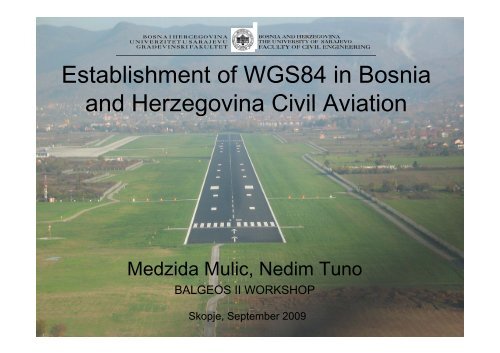
Establishment t of <strong>WGS84</strong> <strong>in</strong> Bosnia<br />
and Herzegov<strong>in</strong>a <strong>Civil</strong> Aviation<br />
Medzida <strong>Mulic</strong>, Nedim Tuno<br />
<strong>BALGEOS</strong> II WORKSHOP<br />
Skopje, September 2009
Why implement<strong>in</strong>g <strong>WGS84</strong> <strong>in</strong> BH civil <strong>aviation</strong><br />
The International <strong>Civil</strong> Aviation Organization Council (ICAO Council) <strong>in</strong> 1989<br />
accepted the recommendation thatt all coord<strong>in</strong>ates <strong>in</strong> <strong>aviation</strong> be founded d upon<br />
common reference system World Geodetic System 84 (WGS 84).<br />
All navigation data <strong>in</strong> Bosnia and Herzegov<strong>in</strong>a were based on the Gauss-Kruger<br />
rectangular coord<strong>in</strong>ates system, transformed <strong>in</strong>to geographic coord<strong>in</strong>ates based on<br />
Bessel’s ellipsoid, id before 2009.<br />
Positional discerpancy between <strong>WGS84</strong> and Bosnian geodetic system~550m
Project “Establishment of <strong>WGS84</strong> <strong>in</strong> BH civil<br />
<strong>aviation</strong>”<br />
Bosnia and Herzegov<strong>in</strong>a has received f<strong>in</strong>anc<strong>in</strong>g from the European Bank for<br />
Reconstruction and Development (EBRD) toward the cost of the “Establishment of<br />
World Geodetic System 84 <strong>in</strong> the Bosnia and Herzegov<strong>in</strong>a <strong>Civil</strong> Aviation” as a<br />
component of the Bosnia and Herzegov<strong>in</strong>a Air Traffic Management Project.<br />
Institute t of Geodesy and Geo<strong>in</strong>formatics of Faculty of <strong>Civil</strong>il Eng<strong>in</strong>eer<strong>in</strong>g i Sarajevo<br />
awarded the Contract for Establishment of <strong>WGS84</strong> <strong>in</strong> BH civil <strong>aviation</strong> and started to<br />
work <strong>in</strong> the spr<strong>in</strong>g of 2008.<br />
The objective of the project was to establish a WGS-84 coord<strong>in</strong>ate system and<br />
create a database on aids, po<strong>in</strong>ts, facilities and obstacles, as surveyed <strong>in</strong> the WGS-84<br />
system by methods of satellite and classical geodesy.<br />
Project was divided <strong>in</strong>to follow<strong>in</strong>g parts:<br />
• International airports: Sarajevo, Banjaluka, Mostar and Tuzla.<br />
• Sports airports: Zalu ani, Prijedor, Tuzla (Jeg<strong>in</strong> Lug), Visoko, Biha and Livno.<br />
• En route navigational aids.<br />
• Po<strong>in</strong>ts to be mathematically calculated.
Locations of airports<br />
and navigational aids<br />
International airports<br />
Sports airports<br />
Navigational aids
Aerodrome reference network<br />
SV cover<br />
Marker protection - molten sta<strong>in</strong>less s<br />
Exist<strong>in</strong>g earth fill<br />
Marker re<strong>in</strong>forc<strong>in</strong>g i bars<br />
(4 items. 0,65 m x 10 mm<br />
2it items. anchors 0,50 050 m x 10 mm)<br />
MB 20 Concrete<br />
marker body (truncated concrete pyramid<br />
basis 0,24 x 0,24 m, at top 0,12 x 0,12 m, height 0,50 m)<br />
Tumped ground<br />
Body of underground part of marker<br />
For each airport, design<strong>in</strong>g and stabilization of 3-5 aerodrome reference network po<strong>in</strong>ts was stabilised tak<strong>in</strong>g<br />
<strong>in</strong>to account the necessity of provid<strong>in</strong>g durability of markers as to destruction, as well as their suitability for<br />
measurement of lengths, angles, GPS vectors, and detail survey<strong>in</strong>g.<br />
GPS observations of an aerodrome reference network were performed by apply<strong>in</strong>g the static method. Due to<br />
very frequent traffic at Sarajevo International Airport, GPS measurements at day were almost impossible. That<br />
is why most of the GPS measurements were made dur<strong>in</strong>g the night.
Aeroport reference network<br />
SRJV<br />
NVT 171/285<br />
T1395<br />
S001<br />
S001<br />
S002<br />
S002<br />
S003<br />
NVT 166/285<br />
GN 1081<br />
S004<br />
S003<br />
S005<br />
S004<br />
T1362<br />
1 km<br />
S005<br />
For the purpose p of l<strong>in</strong>k<strong>in</strong>g an aeroport reference network to the national geodetic datum and ETRF89, GPS<br />
observations at the po<strong>in</strong>ts of the exist<strong>in</strong>g trigonometric network and po<strong>in</strong>ts observed <strong>in</strong> earlier GPS<br />
campaigns were performed.<br />
For improvement of the transformation, all aerodrome reference network po<strong>in</strong>ts were l<strong>in</strong>ked by precise<br />
geometric levell<strong>in</strong>g method to the nearest benchmarks of the high-precision levell<strong>in</strong>g network.<br />
• At Banja Luka airport 4 po<strong>in</strong>ts were determ<strong>in</strong>ed d (mX =6 mm, mY =6 mm, mZ =5 mm)*.<br />
• At Tuzla airport 3 po<strong>in</strong>ts were determ<strong>in</strong>ed (mX =6 mm, mY Y =6 mm, mZ Z =15 mm) )*.<br />
• At Mostar airport 4 po<strong>in</strong>ts were determ<strong>in</strong>ed (mX =10 mm, mY =10 mm, mZ =10 mm)*.<br />
• At Sarajevo airport 5 po<strong>in</strong>ts were determ<strong>in</strong>ed (mX =18 mm, mY =18 mm, mZ =18 mm)*. )*<br />
* Average values
Aeroport navigational aids, facilities and po<strong>in</strong>ts<br />
(aeroport detail po<strong>in</strong>ts)<br />
Survey of detail po<strong>in</strong>ts was performed by the tacheometry t and the GPS RTK method.<br />
• At Banja Luka airport 55 po<strong>in</strong>ts were surveyed.<br />
• At Tuzla airport 62 po<strong>in</strong>ts were surveyed.<br />
• At Mostar airport 38 po<strong>in</strong>ts were surveyed.<br />
• At Sarajevo airport 50 po<strong>in</strong>ts were surveyed.
Obstacles<br />
For different categories of aircrafts, it was required to identify and survey all crucial<br />
obstacles that penetrate safeguarded surfaces, visual manoeuver<strong>in</strong>g areas and basic<br />
<strong>in</strong>strument t land<strong>in</strong>g system surfaces around <strong>in</strong>ternational ti airports.<br />
SLOPE 2%<br />
6 obstacles h > 591<br />
SLOPE 2%<br />
OUTER<br />
HORIZONTAL SURFACE: a l obstacles s h > 645.95<br />
6 obstacles h > 561<br />
slope 5%<br />
6 obstacles h > 531<br />
slope 1.2%<br />
slope 2.5%<br />
a l obstacles<br />
h > 545.95<br />
6 obstacles h > 531<br />
slope 2.0%<br />
slope 14.3% slope 1.43%<br />
slope 14.3%<br />
all obstacles h> 5 0m<br />
slope 14.3%<br />
SLOPE 3. 3%<br />
slope 1.43%<br />
slope 5%<br />
slope 2.5% SLOPE 2.0%<br />
a l obstacles h > 645.95<br />
Different aeronautical surfaces arround<br />
First step <strong>in</strong> obstacle identification ifi i was terra<strong>in</strong><br />
Sarajevo airport analyse us<strong>in</strong>g GIS software and DTM.
Obstacles<br />
Obstacles were determ<strong>in</strong>ed by methods of track <strong>in</strong>tersection (horizontally and<br />
vertically) and us<strong>in</strong>g reflectorless total stations.<br />
• 136 obstacles were determ<strong>in</strong>ed around Banja Luka airport<br />
• 94 obstacles were determ<strong>in</strong>ed around Tuzla airport<br />
• 634 obstacles were determ<strong>in</strong>ed d around Mostar airport<br />
• 598 obstacles were determ<strong>in</strong>ed around Sarajevo airport
Equipment used for measurements<br />
• GPS static observations: dual-frequency GPS <strong>in</strong>struments (Trimble 4000<br />
ssi, 5700 and R8, Leica GPS1200, Topcon Legacy-H)<br />
• GPS k<strong>in</strong>ematic observations: Magellan ProMark 3<br />
• Levell<strong>in</strong>g: precise levels (Leica DNA03 and NA3003, Zeiss Kony 007).<br />
• Tacheometry and resections: total stations (Leica TCR1205,TC600, TC600 and<br />
T1800+DI2002, SOUTH NTS-662R and NTS-352R)
Example of risks dur<strong>in</strong>g work <strong>in</strong> field:<br />
M<strong>in</strong>efields around Sarajevo
Example of risks dur<strong>in</strong>g work <strong>in</strong> field :<br />
Area contam<strong>in</strong>ed by radioactive material<br />
ETRS 89 po<strong>in</strong>t Stolice <strong>in</strong> north-eastern<br />
Bosnia, used as reference po<strong>in</strong>t for Tuzla<br />
airport.<br />
Po<strong>in</strong>t is located near military<br />
comunication tower destroyed by NATO<br />
airforces and near radioactive waste<br />
dump.
Mathematically calculated po<strong>in</strong>ts<br />
Coord<strong>in</strong>ates of 69 po<strong>in</strong>ts with<strong>in</strong> the<br />
airspace of Bosnia and Herzegov<strong>in</strong>a<br />
were mathematically calculated.<br />
These po<strong>in</strong>ts are def<strong>in</strong>ed as the<br />
<strong>in</strong>tersections of air ways or as the<br />
<strong>in</strong>tersections of air ways and border of<br />
Bosnia and Herzegov<strong>in</strong>a.<br />
All calculations l were made us<strong>in</strong>g direct<br />
and <strong>in</strong>verse solutions of geodesics on<br />
the ellipsoid and by solv<strong>in</strong>g spherical<br />
triangles.
Results of the project<br />
PRINTED AND DIGITAL RECORD OF DATA:<br />
Example<br />
1 TECHNICAL REPORT<br />
2 AERODROME CONTROL NETWORK LAYOUT<br />
3 DESCRIPTION OF SURVEY STATIONS<br />
4 TRANSPORMATION PARAMETERS<br />
5 A COMPLETE REPORT ON SURVEYS AND DATA PROCESSING RESULTS<br />
6 LIST OF AERODROME POINTS AND NAVIGATION AIDS<br />
7 OBSTACLE LISTING<br />
8 EN-ROUTE NAVAIDS LISTING<br />
9 CALCULATED POINTS LISTING<br />
10 LIST OF AIRFIELD POINTS<br />
DIGITAL DATABASE
7 aeronautical charts<br />
for Tuzla aerodrome<br />
were produced <strong>in</strong><br />
2009. Charts were<br />
published by the<br />
Bosnia and<br />
Herzegov<strong>in</strong>a<br />
Directorate of <strong>Civil</strong><br />
Aviation as the<br />
Aeronautical<br />
Information<br />
Publication (AIP).<br />
Charts were created<br />
us<strong>in</strong>g data obta<strong>in</strong>ed <strong>in</strong><br />
Project<br />
“Establishment of<br />
<strong>WGS84</strong> <strong>in</strong> BH civil<br />
<strong>aviation</strong>”<br />
.
Thank you for your attention!


