Geodetic education in Albania.pdf - BALGEOS
Geodetic education in Albania.pdf - BALGEOS
Geodetic education in Albania.pdf - BALGEOS

You also want an ePaper? Increase the reach of your titles
YUMPU automatically turns print PDFs into web optimized ePapers that Google loves.
Bologna Model- Education- Research<br />
Researchers and Sourses for the scientic research<br />
As Bologna System (Doctorate Level) gives the new researchers the possibility for a modern<br />
theoretical <strong>education</strong>, it is of a very important po<strong>in</strong>t that theoretical achivement to be applied<br />
to solve the geodetic problems <strong>in</strong> all dimentions: <strong>in</strong> scientific part, eng<strong>in</strong>eer<strong>in</strong>g geodesy, <strong>in</strong><br />
apply<strong>in</strong>g of the various products which come from RS, GPS, Phoogrammetry,etc <strong>in</strong>to GIS,<br />
Geo<strong>in</strong>formation, study of geod<strong>in</strong>amics, the movements of seal<strong>in</strong>e, etc.<br />
Actually all these problematics are present even <strong>in</strong> <strong>Albania</strong>.<br />
- Developments of eng<strong>in</strong>eer<strong>in</strong>g <strong>in</strong>frastructure (Roads, transport, Urban Plann<strong>in</strong>g,<br />
Tourism, etc)<br />
E.G. Maunt<strong>in</strong>ous Highway Durres-Mor<strong>in</strong>a- Prisht<strong>in</strong>a, 4 l<strong>in</strong>es, two Tunels (5 km each).<br />
- Developments <strong>in</strong> documentation of Property and the property Marcet (Cadaster &<br />
Immovable Property) as well as legalisation of <strong>in</strong>formal constructions.<br />
E.G. Applied GPS Techniques, Orthophotos from Aeral Photograps; etc<br />
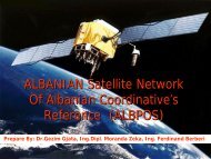
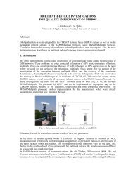
- Establish<strong>in</strong>d of the Satellite Reference System (ALBPOS);<br />
E.G. National Satellite reference and permanent stations are establishted; Center of the<br />
system is established also. At november System will be functional.<br />
- Needs for treatments of spatial and geo data under the GIS systems and others form.<br />
- Needs for establish<strong>in</strong>g specifications, standarts and <strong>in</strong>stitutions.<br />
All this problematics and others seems to be a very good base or sourse for scientifc research<br />
and formation of the new researchers.