City of Pontiac Parks and Recreation Master Plan
City of Pontiac Parks and Recreation Master Plan
City of Pontiac Parks and Recreation Master Plan

You also want an ePaper? Increase the reach of your titles
YUMPU automatically turns print PDFs into web optimized ePapers that Google loves.
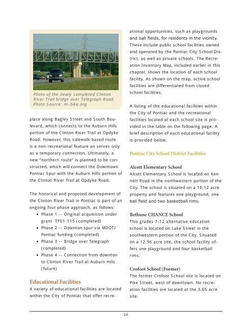
Photo <strong>of</strong> the newly completed Clinton<br />
River Trail bridge over Telegraph Road.<br />
Photo Source: m-bike.org<br />
place along Bagley Street <strong>and</strong> South Boulevard,<br />
which connects to the Auburn Hills<br />
portion <strong>of</strong> the Clinton River Trail at Opdyke<br />
Road. However, this sidewalk-based route<br />
is a non-recreational feature an serves only<br />
as a temporary connection. Ultimately, a<br />
new “northern route” is planned to be constructed,<br />
which will connect the Downtown<br />
<strong>Pontiac</strong> Spur with the Auburn Hills portion <strong>of</strong><br />
the Clinton River Trail at Opdyke Road.<br />
The historical <strong>and</strong> proposed development <strong>of</strong><br />
the Clinton River Trail in <strong>Pontiac</strong> is part <strong>of</strong> an<br />
ongoing four phase approach, as follows:<br />
• Phase 1 -- Original acquisition under<br />
grant TF01-115 (completed)<br />
• Phase 2 -- Downton spur via MDOT/<br />
<strong>Pontiac</strong> funding (completed)<br />
• Phase 3 -- Bridge over Telegraph<br />
(completed)<br />
• Phase 4 -- Connection from downton<br />
to Clinton River Trail at Auburn Hills<br />
(future)<br />
Educational Facilities<br />
A variety <strong>of</strong> educational facilities are located<br />
within the <strong>City</strong> <strong>of</strong> <strong>Pontiac</strong> that <strong>of</strong>fer recreational<br />
opportunities, such as playgrounds<br />
<strong>and</strong> ball fields, for residents in the vicinity.<br />
These include public school facilities owned<br />
<strong>and</strong> operated by the <strong>Pontiac</strong> <strong>City</strong> School District,<br />
as well as private schools. The <strong>Recreation</strong><br />
Inventory Map, included earlier in this<br />
chapter, shows the location <strong>of</strong> each school<br />
facility. As shown on the map, active school<br />
facilities are differentiated from closed<br />
school facilities.<br />
A listing <strong>of</strong> the educational facilities within<br />
the <strong>City</strong> <strong>of</strong> <strong>Pontiac</strong> <strong>and</strong> the recreational<br />
facilities located at each school site is provided<br />
in the table on the following page. A<br />
brief description <strong>of</strong> each educational facility<br />
is provided below.<br />
<strong>Pontiac</strong> <strong>City</strong> School District Facilities<br />
Alcott Elementary School<br />
Alcott Elementary School is located on Kennett<br />
Road in the northwestern portion <strong>of</strong> the<br />
<strong>City</strong>. The school is situated on a 10.12 acre<br />
property <strong>and</strong> features one playground, one<br />
ball field <strong>and</strong> two basketball rims.<br />
Bethune CHANCE School<br />
This grades 7-12 alternative education<br />
school is located on Lake Street in the<br />
southwestern portion <strong>of</strong> the <strong>City</strong>. Situated<br />
on a 12.96 acre site, the school facility <strong>of</strong>fers<br />
one playground <strong>and</strong> four basketball<br />
rims.<br />
Cr<strong>of</strong>oot School (Former)<br />
The former Cr<strong>of</strong>oot School site is located on<br />
Pike Street, west <strong>of</strong> downtown. No recreation<br />
facilities are located at the 3.05 acre<br />
site.<br />
24