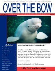
Sector New York Operations Supplement to the Auxiliary - US Coast ...
Sector New York Operations Supplement to the Auxiliary - US Coast ...
Sector New York Operations Supplement to the Auxiliary - US Coast ...

Create successful ePaper yourself
Turn your PDF publications into a flip-book with our unique Google optimized e-Paper software.
STATION NEW YORK AOR<br />
HUDSON RIVER/LAKES/HAKENSAK & PASSAIC RIVERS<br />
NEWARK BAY/NEW YORK HARBOR:<br />
This area is comprised of all Divisions 20, 10, 14, 6 and part of Division 5 activities. <strong>Sec<strong>to</strong>r</strong><br />
<strong>New</strong> <strong>York</strong> will also control any special activities in <strong>the</strong> Port of Albany. Note that Patrol Areas<br />
were numbered consecutively starting with Areas 1-4 in <strong>the</strong> Station Burling<strong>to</strong>n, VT AOR. When STA<br />
Burling<strong>to</strong>n was transferred out of <strong>Sec<strong>to</strong>r</strong> NY’s AOR those patrol areas transferred with <strong>the</strong> station.<br />
Patrol Area<br />
Defined Area<br />
5. Whitehall <strong>to</strong> Troy Lock including <strong>the</strong> Mohawk River <strong>to</strong> Lock 14<br />
6. Hudson River/Troy Lock <strong>to</strong> Roach Hook: The Nor<strong>the</strong>rn Boundary is at Troy<br />
Locks, <strong>the</strong> Sou<strong>the</strong>rn Boundary is a line drawn across <strong>the</strong> Hudson at Roach Hook<br />
7. Hudson River/Roach Hook <strong>to</strong> Fourmile Point: The Nor<strong>the</strong>rn Boundary is a line<br />
drawn across <strong>the</strong> Hudson at Roach Hook, <strong>the</strong> Sou<strong>the</strong>rn Boundary is a line drawn<br />
across <strong>the</strong> Hudson at Fourmile Point<br />
8. Hudson River/Fourmile Point <strong>to</strong> Saugerties: The Nor<strong>the</strong>rn Boundary is a line<br />
drawn across <strong>the</strong> Hudson at Fourmile Point, <strong>the</strong> Sou<strong>the</strong>rn Boundary is a line<br />
drawn from <strong>the</strong> north shore, Esopus Creek entrance, east across <strong>the</strong> Hudson<br />
River.<br />
9. Hudson River / Whitehall <strong>to</strong> Kings<strong>to</strong>n: The Nor<strong>the</strong>rn Boundary is a line drawn<br />
from <strong>the</strong> north shore, Esopus Creek entrance east across <strong>the</strong> Hudson River. The<br />
sou<strong>the</strong>rn boundary is a line drawn from Kings<strong>to</strong>n Point, east across <strong>the</strong> Hudson<br />
River which will include Roundout Creek.<br />
10. Hudson River Hudson River / Kings<strong>to</strong>n <strong>to</strong> Poughkeepsie: The Nor<strong>the</strong>rn<br />
Boundary is a line draw from Kings<strong>to</strong>n Point, east across <strong>the</strong> Hudson River. The<br />
Sou<strong>the</strong>rn Boundary is <strong>the</strong> Mid-Hudson Suspension Bridge across <strong>the</strong> Hudson<br />
River.<br />
11. Hudson River / Poughkeepsie <strong>to</strong> <strong>New</strong>burgh-Beacon: The Nor<strong>the</strong>rn Boundary is<br />
<strong>the</strong> Mid-Hudson Suspension Bridge across <strong>the</strong> Hudson River. The Sou<strong>the</strong>rn<br />
Boundary is <strong>the</strong> <strong>New</strong>burgh-Beacon Bridge across <strong>the</strong> Hudson River.<br />
12. Hudson River / <strong>New</strong>burgh-Beacon Bridge <strong>to</strong> Bear Mountain Bridge: The<br />
Nor<strong>the</strong>rn Boundary is <strong>the</strong> <strong>New</strong>burgh-Beacon Bridge across <strong>the</strong> Hudson River.<br />
The Sou<strong>the</strong>rn Boundary is <strong>the</strong> Bear Mountain Bridge across <strong>the</strong> Hudson River.<br />
13. Hudson River / Bear Mountain Bridge <strong>to</strong> Tellers Point: The Nor<strong>the</strong>rn Boundary<br />
is <strong>the</strong> Bear Mountain Bridge. The Sou<strong>the</strong>rn Boundary is a line drawn from<br />
Tellers Point across <strong>the</strong> Hudson River.<br />
14. Hudson River/ Tellers Point <strong>to</strong> Tappan Zee Bridge: The Nor<strong>the</strong>rn boundary is a<br />
line drawn from Tellers Pt. Across <strong>the</strong> Hudson River. The Sou<strong>the</strong>rn Boundary is<br />
<strong>the</strong> Tappan Zee Bridge.<br />
15. Greenwood Lake<br />
15a. Lake Hopatcong<br />
15b. Lake Mahopac<br />
16. Hudson River- Tappan Zee Bridge <strong>to</strong> Spuyten Duyvil Bridge: The Nor<strong>the</strong>rn<br />
Boundary is <strong>the</strong> Tappan Zee Bridge. The Sou<strong>the</strong>rn Boundary is a line drawn<br />
from <strong>the</strong> Spuyten Duyvil Bridge across Hudson River<br />
17. Hudson Riv./ Spuyten Duyvil Bridge <strong>to</strong> Intrepid: The Nor<strong>the</strong>rn Boundary is a<br />
4-4