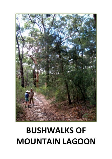
BUSHWALKS OF MOUNTAIN LAGOON - Blue Mountains Australia
BUSHWALKS OF MOUNTAIN LAGOON - Blue Mountains Australia
BUSHWALKS OF MOUNTAIN LAGOON - Blue Mountains Australia

Create successful ePaper yourself
Turn your PDF publications into a flip-book with our unique Google optimized e-Paper software.
<strong>BUSHWALKS</strong> <strong>OF</strong><br />
<strong>MOUNTAIN</strong> <strong>LAGOON</strong>
<strong>BUSHWALKS</strong> <strong>OF</strong><br />
<strong>MOUNTAIN</strong> <strong>LAGOON</strong><br />
Earth has not anything to show more fair:<br />
Dull would he be of soul who could pass by<br />
A sight so touching in its majesty:<br />
William Wordsworth<br />
This booklet has been prepared by Mill Paddock Cottage B&B<br />
www.millpaddock.com.au
A Cautionary word …<br />
The booklet is intended for your general information only and is NOT a<br />
definitive walking guide. While some of the walks listed here are readily<br />
accessible to casual rambling, others are only suitable for experienced<br />
bushwalkers and require appropriate, adequate preparation. The Wollemi<br />
National Park is a vast, uninhabited wilderness area of dense bushland, rugged<br />
terrain and deep canyons with difficult access. It is not a place to be spending a<br />
night unprepared, regardless of the season. For all the walks, sensible footwear<br />
and clothing are recommended, as well as hats, sunscreen, insect repellent and<br />
a water bottle. A few moments’ preparation before setting out for the day will<br />
help to ensure that you have a safe and enjoyable walk.<br />
Copyright Mill Paddock Cottage<br />
Mountain Lagoon 2012<br />
Design & Layout – J Murray<br />
Water Colour Drawing – Paul Bramble
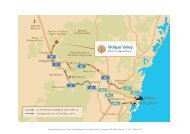
Mountain Lagoon<br />
Fourteen kilometres off The Bells Line of Road from Bilpin, the village of<br />
Mountain Lagoon is scarcely large enough to make a dot on the map; some<br />
twenty properties scattered along the ridge beside Mountain Lagoon Road and<br />
another twenty or so around the lagoon itself comprise the entire settlement.<br />
There are no public buildings other than the NSW Rural Fire Brigade Shed, no<br />
shops, no post office, no petrol station – but what the village lacks in services, it<br />
more than makes up for in the beauty of its surroundings.<br />
Mountain Lagoon<br />
The lagoon, some 12 acres in area, is situated along the Kurrajong Fault Line,<br />
which runs through Mountain Lagoon. Drilling by Geoscience <strong>Australia</strong> in 2008<br />
confirmed that the fault line crosses the south-eastern corner of Mountain<br />
Lagoon, closely following the road line of the lower end of Sams Way. It also<br />
identified evidence of a bedrock uplift of some 20 metres, similar to that found in<br />
the Wheeney Creek area, in land to the east of the road. Water levels in the<br />
lagoon rise and fall in conjunction with the level of the water table and at the<br />
time of publication, after several excessively wet years, the lagoon is full to over-
flowing, with<br />
extensive reed<br />
beds and a<br />
varied bird life.<br />
During the long<br />
drought years<br />
that preceded<br />
this latest wet<br />
spell, the water<br />
disappeared<br />
completely, but<br />
for the most<br />
part, somewhere between these two extremes is the norm.<br />
Tucked into the very bottom of the vast Wollemi National Park, European<br />
settlement in Mountain Lagoon predates the establishment of the national park<br />
in December 1979 by over 100 years. The original land grants in the area were<br />
offered in 1868. Prior to that date early settlers came here to log the forests,<br />
attracted by the giant eucalyptus trees. A second generation of great trees has<br />
been allowed to re-establish since the decline of the logging industry and in the<br />
cleared paddocks near the lagoon, as well as these giant trees, you can also see<br />
the 2m high stumps of trees hand-logged a century and more ago, the notches<br />
into which the loggers wedged the planks they stood on still clearly visible. A<br />
number of saw mills were established in the area during the 1830s and 1840s;<br />
one was located where the modern day Mill Paddock Cottage and garden now<br />
stands. Logging continued in the area in a small way up until the 1930s. After the<br />
logging came land clearing and farming; the rich soil attracted orchardists and a<br />
number of orchards were established in the area. Few of these orchards remain<br />
today as commercial enterprises, but those that do produce high quality apples,<br />
plums, peaches, figs, raspberries and blueberries.<br />
There are a number of walks to be taken around the Mountain Lagoon area. The<br />
first six on the list are suitable for all ages with good general fitness levels; the<br />
last two are longer, considerably more demanding and should only be attempted<br />
by experienced walkers with appropriate walking gear.
Mountain Lagoon’s “magnificent trees”
The Walks<br />
Sams Way<br />
(The Lagoon Loop)<br />
More in the nature of a gentle country<br />
ramble than a serious bushwalk, a<br />
stroll around the Sams Way Loop is a<br />
lovely one in any season. Named after<br />
Sam Boughton, one of the area’s<br />
original residents, Sams Way branches<br />
off Mountain Lagoon Road just<br />
beyond Dutch’s Nursery, skirting the<br />
lagoon on its eastern side and rejoining<br />
the main road just before it<br />
becomes a fire trail. The lagoon loop is<br />
approximately 3.2km.<br />
You can walk the loop in either direction; a left turn into Sams Way just beyond<br />
the nursery provides a gentle downhill walk to where the lagoon meets the<br />
road and a sharp climb back up the hill on the other side.<br />
Those of a less energetic inclination should continue along Mountain Lagoon<br />
Road, down the steep hill to the second entrance to Sams Way and follow this<br />
road back up to the junction near the nursery.<br />
The spectacular 3km long avenue of trees on Sams Way was planted some<br />
sixty years ago by Sam Boughton and his son Buck, using a variety of<br />
alternating deciduous trees and conifers to line each side of the road. Sam died<br />
in 1961 and never saw the trees reach their magnificent maturity, but he and<br />
his son were truly men of vision and their legacy remains today for all to enjoy,<br />
as the seasons change throughout the year. There is brilliant new lime green<br />
foliage in spring, dense, cool shade where the trees form a complete canopy<br />
over Sams Way in summer and a magnificent display of red and gold and<br />
purple in autumn. Even the stark, bare branches etched against a pale blue<br />
winter sky have a special beauty.
On your walk around the lagoon, look out for –<br />
Sam’s monument, approximately 100m down from the first entrance to<br />
Sams Way on the left.<br />
If you are walking in spring, the beautiful azalea hedge, planted at the<br />
same time as the trees, along the old farmhouse boundary.<br />
Some huge eucalyptus deanii beside the road as you go down (or up) the<br />
steep hill.<br />
Little Lagoon, where the lagoon comes close to the road, and beyond<br />
the paddocks between Little Lagoon and the original Boughton<br />
farmhouse, Cooramill, extensive views across the water.<br />
The stump of a hand-logged tree in the big paddock beside the lagoon.<br />
Wood ducks and swamphens on the lagoon, and occasionally a grey<br />
heron.<br />
Eastern and crimson rosellas all through the year, white tailed black<br />
cockatoos in summer and gang-gang cockatoos from late summer<br />
through till winter, as they feed on the seeds of the Liquid Amber trees.<br />
Female satin bower birds (and if you are especially lucky, a male one,<br />
too), lots of little birds in the shrubbery along the roadside - fairy wrens,<br />
yellow breasted robins, red backed finches, silver eyes, grey and<br />
occasionally rufous fantails, as well as all the usual suspects such as<br />
kookaburras, plovers, noisy minors and bell minors, a wide variety of<br />
honey eaters, magpies, butcher birds and currawongs.<br />
Early morning and late afternoon walkers might be lucky enough to spot<br />
the occasional wallaby down for a drink and there could even be a prize<br />
for the person who actually manages to photograph the resident<br />
wombat who lives across from Little Lagoon! Look very closely and you<br />
might spot a koala or two in one of the smooth-barked eucalypts<br />
growing in the lagoon paddock.
Changing seasons<br />
on Sams way
Tootie Creek Track<br />
By the channels of coolness the echoes are calling,<br />
And down the dim gorges I hear the creek falling;<br />
It lives in the mountain where moss and the sedges<br />
Touch with their beauty the banks and the ledges.<br />
Through breaks of the cedar and sycamore bowers<br />
Struggles the light that is love to the flowers;<br />
And softer than slumber, and sweeter than singing,<br />
The notes of the bell-birds are running and ringing<br />
Henry Kendall<br />
The Tootie Creek track begins just 50m beyond the end of the bitumen road,<br />
along the western boundary of the first property on the left. The track follows<br />
the fence line around behind this property, before heading off into the bush in<br />
a northerly direction. It then leaves the ridge and descends along the side of a<br />
fairly steep gully where there are some splendid, large grey gums growing.<br />
Watch out for koalas here; in this area the grey gum is the koala’s preferred<br />
food.<br />
Beyond the gully the track passes through a cutting of rare pink shale and<br />
shortly afterwards, is crossed by a wet creek (2.1km from Mountain Lagoon<br />
Road) lined by many tall, straight blue gum and grey myrtle trees. It then<br />
enters a small rainforest where sassafras, coachwood, tree ferns and soft<br />
bracken abound, before reaching a beautiful open section of Tootie Creek<br />
(3.6km from Mountain Lagoon Road).<br />
Tootie Creek
The summer walker will be tempted to strip down and plunge into this pristine<br />
water hole, just as the timber getters did in days of yore. Platypuses have been<br />
seen in this part of the creek, but this shy creature is not easy to find, so there<br />
are no guarantees that you will be lucky enough to catch sight of one!<br />
Of course, what goes up must come down again and he who walks down this<br />
hill must walk back up it. The ascent of some 300m can be a bit of a slog, but<br />
the return walk is made easier by the good condition of the track.<br />
The round trip is a walk of just over 7km and it is recommended that at least 4<br />
hours be allowed for the walk – and some R&R while out at the creek.<br />
The beautiful Telopea speciosissima – Waratah – is endemic to the Mountain Lagoon area
Cabbage Tree Creek Track<br />
Cabbage Tree Creek, T3 and Colo Meroo walking tracks all have a common<br />
start, about 1.2km down Sams Way from the first entrance to the loop road<br />
close to Dutch’s Nursery. Some 800m out the track from Sams Way, this<br />
signposted walk veers to the left off the main track, where walkers can go<br />
around a locked gate designed to prevent vehicle but not pedestrian access.<br />
The track continues to descend for about 1km to a cleared area. Be warned, in<br />
wet conditions (and not so wet ones) this area is infamous for its leeches – stay<br />
on the move!<br />
From the clearing a short rough walking track continues in a south-westerly<br />
direction along a tributary running down into Cabbage tree creek. Halfway<br />
down this track if you drop over the side into the tributary you will find a<br />
beautiful waterfall, and<br />
adventurous hikers might<br />
like to go up the tributary<br />
above the waterfall in<br />
search of what is reputed to<br />
be Mountain Lagoon’s<br />
biggest tree – a gigantic<br />
turpentine.<br />
Umbrella fern<br />
As with the Tootie Creek<br />
Track, the only way out is to<br />
retrace one’s steps up the<br />
same track. On the way<br />
back, look out for a grove of<br />
casuarina trees whose fruit<br />
is the favourite food of the<br />
rare glossy black cockatoo.<br />
Thick socks and sturdy boots provide some protection from leeches; a can of<br />
Bushman Heavy Duty Personal Insect Repellent (for sand flies, mosquitoes,<br />
tick, leeches and march flies) might also be a useful thing to carry with you!<br />
Allow 3 hours to walk this track.
Cabbage Tree Creek Waterfall
Long Ridge Track<br />
The entrance to the Long Ridge Track is on the left along Mountain Lagoon<br />
Road, 1.5km after the bitumen ends as you come from Bilpin. This track skirts<br />
the western edge of the property Mill Paddock, and then meanders for 6km<br />
through the wet and dry sclerophyll forests typical of the area, featuring a<br />
good variety of local tree species such as grey gum (Eucalyptus punctata),<br />
stringybark (Eucalyptus globoidea), bloodwood (Eucalyptus eximia) and<br />
turpentine (Syncarpia glomulifera).<br />
Like the majority of tracks in the Mountain Lagoon area that are now used by<br />
bushwalkers, Long Ridge was originally put in by loggers to gain access to the<br />
forest and haul out the timber. With the commercial timber industry long<br />
gone, the track today is maintained as a fire trail. While there is no spectacular<br />
view at the end of the walk, Long Ridge offers a pleasant, relatively easy 5.5km<br />
hike through some typical east coast <strong>Australia</strong>n bushland and, as is the case<br />
with several other tracks in the area, you stand a good chance of having it all to<br />
yourself! 2km along the trail, a short side track leads to an abandoned shale<br />
quarry.<br />
Sclerophyl forest typical of the Mountain Lagoon area
Sunset Rock<br />
A short loop off Long Ridge Track, at the rear of the property Mill Paddock,<br />
leads to a rustic bench with an extensive view to the northwest over the<br />
Wollemi Wilderness, a perfect spot for sitting and watching the sun go down<br />
after another day in Paradise.<br />
This very easy ramble of 500m will take you past many of the plant species<br />
typical of the area, including Acacia parramatensis (the local wattle), Lambertia<br />
formosa (the Mountain Devil), Persoonia pinifolia (Geebung), Pultenaea flexilis<br />
(Bacon and Eggs), and many more.<br />
Take a picnic basket and someone special with you on this walk; as the poet<br />
said<br />
Here with a Loaf of Bread beneath the Bough,<br />
A Flask of Wine, a Book of Verse - and Thou<br />
Beside me singing in the Wilderness -<br />
And Wilderness is Paradise enow.<br />
The Rubaiyat of Omar Khayyam<br />
Acacia parramentensis
T3 Track to “The End of the Earth”<br />
The T3 Track (as do Colo Meroo and Cabbage Tree Creek Tracks) starts on Sams<br />
Way 1.2km from the western entrance to this loop road. A National Parks and<br />
Wildlife sign saying “Walking Tracks, Tootie Creek - Colo Meroo” clearly marks<br />
the beginning of the track, which is in fact a graded fire trail. The walk to the<br />
end of the track, avoiding the two side trails with locked gates, is 5.5km and<br />
after some initial “ups and downs” is a relatively flat walk through beautiful<br />
wet scerophyll eucalyptus woodland, finishing on a rise with spectacular views<br />
over the Wollemi Wilderness.<br />
From the circular clearing at the end of the track, walk across the rocky<br />
outcrop to the edge of the escarpment and be amazed at the vast expanse of<br />
the Wollemi Wilderness, viewed from a special spot that the locals call<br />
“The End of the Earth”.<br />
Although there are no facilities here, this is a lovely place to have a picnic while<br />
enjoying the scenery. As you walk, keep an eye open for wallabies, goannas<br />
and other lizards, lyrebirds and a host of other smaller birds, and wildflowers in<br />
season.
The return walk of 11km is a comfortable day’s outing, allowing time to picnic<br />
and enjoy the panoramic view. Take water with you (there are no accessible<br />
creeks along this track) and keep to the track – and remember; the hilliest part<br />
of the walk is the last kilometre on the way home, so allow plenty of time to<br />
complete the return journey in daylight.<br />
The beautiful Angophora costata with its new, tanny-pink bark
Colo Meroo - Gosper’s Ridge Track<br />
Colo Meroo begins at the NPW signpost on Sams Way, branching off to the<br />
right at a locked gate 400m along the main track. The track climbs a steep but<br />
short hill then continues into a lovely damp glade (renowned for its funnel web<br />
spiders – don’t worry, you won’t see them on the track!). From the gate to the<br />
end of the wide track is 4.4km of easy, very pleasant walking. Beyond this<br />
point, however, the track narrows, continuing for a further 3km until it reaches<br />
the cliffs, with stunning views over the Colo River. Walkers should allow at<br />
least 6 hours for a return journey to this point.<br />
From this viewing point the walk continues as more of a rough scramble along<br />
Maille’s Ridge for a further 2km to the Meroo Trig Station, before descending<br />
to the Colo River.<br />
While this last section is roughly signposted, it is for serious, experienced<br />
walkers only and usually includes camping overnight at the river before<br />
walking out the following day. Those intending to go right through to the river<br />
should be well prepared with the appropriate equipment.<br />
Colo River from Maille’s Ridge
T3 Track<br />
“The End of the Earth” to the Colo River<br />
This walking “track” is for fit and experienced bushwalkers only. Walk – or<br />
preferably drive, to save time and energy – to the end of the driveable T3<br />
Track. The track down to the river begins from the rocky outcrop at “The End<br />
of the Earth”, where you might just see a wedge-tailed eagle soaring in the<br />
thermals off the cliff edge. It descends 500m to the confluence of the Colo<br />
River and Tootie Creek, with brilliant views along the way of the Colo River<br />
gorge, Mt Townsend and Mount Morgan.<br />
The return walk is 6km and you should allow 6 hours to complete the trip –<br />
this is not country to be out in at night without adequate preparation!<br />
Although the track basically follows the descending ridge, it is poorly<br />
signposted and in some spots not at all obvious. Walkers have become lost on<br />
this track, especially on the return journey! The Mountain Lagoon Topographic<br />
map (9031-3-S) and a compass should be at hand.<br />
Nevertheless, it is a rewarding walk for serious bushwalkers. The river is truly<br />
beautiful with sandy beaches, waterholes and rapids.<br />
Colo River near Tootie Creek