archaeological site examination north yard of the ... - Fiske Center
archaeological site examination north yard of the ... - Fiske Center
archaeological site examination north yard of the ... - Fiske Center

Create successful ePaper yourself
Turn your PDF publications into a flip-book with our unique Google optimized e-Paper software.
VI. INTERPRETATIONS AND DISCUSSION<br />
A. Garden Walk and Parallel Beds<br />
The location <strong>of</strong> garden paths is one <strong>of</strong> <strong>the</strong><br />
most common <strong>archaeological</strong> contributions<br />
to garden investigations. Not only <strong>the</strong><br />
placement, but also changes in location and<br />
in construction materials <strong>of</strong>ten promote<br />
diachronic inperpretations <strong>of</strong> garden development.<br />
Major alterations have been found<br />
to be closely linked to changes in household<br />
composition and familial events.<br />
The walkway located between <strong>the</strong> parallel<br />
beds (Fig. VI-1) was clearly defined by a<br />
series <strong>of</strong> superimposed lenses <strong>of</strong> bedding.<br />
The original walk was demarcated by a<br />
medium- brown coarse sand and gravel that<br />
was laid down on <strong>the</strong> original <strong>yard</strong> surface<br />
(buried A-horizon). The presence <strong>of</strong> a fragment<br />
<strong>of</strong> transfer printed whiteware in <strong>the</strong><br />
upper portion <strong>of</strong> <strong>the</strong> buried A-horizon and<br />
whiteware, yellow ware and ironstone in<br />
<strong>the</strong> overlying fill suggests <strong>the</strong> walk was<br />
first created in <strong>the</strong> early nineteenth century.<br />
Natural erosion <strong>of</strong> <strong>the</strong> walk and trampling<br />
resulted in <strong>the</strong> formation <strong>of</strong> a hard-packed<br />
lens <strong>of</strong> sandy loam over <strong>the</strong> original sand<br />
layer. The walk was redefined by a new,<br />
thick layer <strong>of</strong> coarse sand and gravel, possibly<br />
between <strong>the</strong> 1840s and 1860s, and it<br />
may have been at this time that <strong>the</strong> planting<br />
bed borders were added. Fill associated<br />
with bed creation abutted <strong>the</strong> walk, and as<br />
before, slowly mixed with <strong>the</strong> surface <strong>of</strong><br />
<strong>the</strong> walk to form a hard-packed sandy loam.<br />
The walk was redefined a final time by <strong>the</strong><br />
spreading <strong>of</strong> a layer <strong>of</strong> coal ash down its<br />
length. The laying down <strong>of</strong> this ash layer<br />
very likely corresponded with a period <strong>of</strong><br />
repair to <strong>the</strong> house since mixed in <strong>the</strong> coal<br />
ash were modern wire nails as well as cut<br />
and wrought examples. This assortment<br />
that included cut lath nails likely resulted<br />
from <strong>the</strong> burning <strong>of</strong> construction/demolition<br />
debris on <strong>site</strong> or from <strong>the</strong> accidental burning<br />
<strong>of</strong> an outbuilding. This latter interpretation<br />
is supported by three fragments <strong>of</strong> a<br />
badly burned whiteware bowl, <strong>the</strong> only<br />
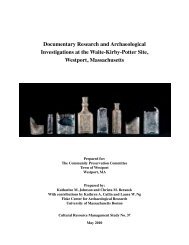
Figure V-1: North walkway as it appeared in 1937. View facing <strong>north</strong> from <strong>the</strong> house<br />
(HABS) (Detwiller 1998).<br />
26